THEN: Redmond reaped its first bank in 1911 at the pioneer corner of Cleveland Avenue and Leary Way. (Courtesy, Kirkland Historical Society)NOW: The bank building survives as part of Redmond’s historic core. Homegrown, the present tenant, is an enriched sandwich shop that uses local produce and breads for its savory creations.
With help from Tom Hitzroth, Chair of Redmond’s City Landmark Commission, I can construct a thumbnail history of the Redmond State Bank, one of that community’s designated landmarks. The comely brick structure survives at the northwest corner of Leary Way and Cleveland Street. Somewhat typical for many community banks, this one has lent its front door a grandeur by cutting the bank’s footprint at the southeast corner of the chosen lot. This allows the bank to continue with a bold angle its distinguished ways both north up Leary Way, here to the right, and west on Cleveland. Clearly from this town center in 1912, by walking or riding two blocks or three west on Cleveland, one was soon out of town.
The date I chose for this postcard snap shot is mildly arbitrary. That is, I intuit the date from experience. A half-dozen locals of some means and/or muscle incorporated the Redmond State Bank on July 28, 1911. Much of the muscle was provided by Clayton Shinstrom and Fred Roberts, who scouted the town’s surrounds for likely customers. Clayton, according to his son Dick Shinstrom, whom Hitzroth interviewed in 2009, spent a lot of time on his bicycle and row boat canvassing the area and earnestly convincing the potential, but often skeptical, customers, that putting their money in his planned bank was safer than secreting it in the attic or barn.
Given the widespread pioneer distrust of bankers, the father must have been convincing, for on September 11, 1911, less than two months since the bank’s incorporation, it guarded – and we imagine carefully invested – $10,012 in deposits. By December the sum had reached over $32,000. When Seattle Trust and Savings purchased the renamed First National Bank of Redmond in 1976, it held $13 million in deposits and certainly a sentimental corner in the hearts of many of its surviving depositors.
An early look, ca. 1888, at Redmond’s lasting railroad depot built by the Seattle Lake Shore and Eastern Railroad.Redmond’s Post Office and first brick building.
Long before Redmond got its bank, it landed a federal post office and in 1888 its own station on the Seattle Lake Shore and Eastern Railroad, the line that opened the King County hinterland to more forestry, mining and settlement. The town was named by and for, sort of, its second postmaster, Luke McRedmond. Although Luke dropped the “Mc”, his neighbor, Warren Perrigo, equally a community founder, was not pleased, and apparently the two pioneer families thereafter were at odds.
In identifying the town’s founder as Luke Redmond, the pioneer’s “Mc” was also dropped by the editors of Washington, a Guild to the Evergreen State, the now out-of-print but still popular depression-era big book of state motor tours. On page 321 Redmond was included on an alternative route to Seattle from Fall City. Nearly half of the book’s brief description of Redmond concludes with a fine example of silly human interest. “Excitement ran high in 1935, when a black bear strayed into town, was treed, and, despite efforts of townspeople and police, sheriff and deputies, remained in the tree three days.” (We will print directly below the Redmond page from the Washington, a Guide to the Evergreen State. This is a repeat from last week, because it fits best here. This big book was written in the late depression, supported by New Deal public works funding, and published in the early 1940s.)
WEB EXTRAS
Something to add, boys? Yes Jean, Ron Edge has put up a half-dozen former east side features, and below those a sample of Redmond Aerials from his collection of prints and/or scans. These will be dated with a challenge to the readers. All of aerials include-to-find the Redmond Bank (from this week), Brown’s Garage (from last week) and the two story brick Brown Building. This little hide-and-seek will be followed by another Edge addition, a verdant panorama of Willowmoor, aka Marymoor.
=======
THE REDMOND AERIALS – BEGINNING with the OLDEST from 1934
[CLICK-CLICK to ENLARGE]
A Laidlaw Aerial of Redmond from April 6, 1934. It looks south. (Courtesy, Museum of History and Industry)
===
June 14, 1939, looking northeast.
===
Also from June 14, 1939 and looking north.
===
May 26, 1946 – looking southeast
===
Redmond, 1950 – looking east.
=====
MORE WILLOWMOOR aka MARYMOOR
First appeared in Pacific Sept. 21, 1986. First appears here last week.
===
A 1921 panorama of WILLOWMOOR. Courtesy of Ron Edge and first published in The Seattle Times. CLICK to ENLARGE
THEN: From studying both aerial and tax photos, Redmond historian Tom Hitzroth figures that the bell tower on the roof of Brown’s Garage was removed between 1936 and 1938. (Most likely it was used to alert the town’s volunteer fire department.) By then Mayor Bill Brown had sold his garage while keeping his mayoral chair. (Courtesy, Redmond Historical Society)NOW: Redmond’s brick landmark that began as its mayor’s auto repair garage has been used through its first ninety-five years variously as a furniture store, a sports store, and more recently a liquor store. In his 1998 historylink history of this now ‘high technology town,’ historian Alan J. Stein concludes, “Chances are, if you own or use a computer anywhere in the world, you’ve heard of Redmond.” Microsoft began developing its Redmond campus in 1985.
I confess that I know neither who took this photo nor when, nor do I know whose fleet of trucks this is, nor the names of any of the, I presume, drivers posing with them. (Hopefully, a Times reader will know and enlighten us all with a letter to the editor.) With the combined help of Sherry Stilin, heritage activist, Tom Hitzroth, the Chair of Redmond’s City Landmark Commission, and Nancy Way, the author of Our Town, Redmond, I do know who built this sturdy brick business and when. Bill Brown was serving his first term as Redmond’s mayor when he began construction on what is now an official landmark, located in what high-tech Redmond is calling its Old Town Historic Core. Both the date, 1920, and the name, Brown’s Garage, are posted above the front door, and another sign swinging above the sidewalk, lets one know that Good Year tires are included among the motorcar services that Brown is selling.
Earlier, before building his garage here at the southwest corner of Redmond Way and 164th Ave NE., Brown had operated a popular saloon in the neighborhood. It survives as another Redmond landmark: the Brown Building. When new in 1913, the two-story brick bar was the tallest commercial structure in town. It may have also been the most companionable. There was drinking on the main floor, while upstairs there was dancing in the big room, and, it seems, some hooking in the smaller ones. With national prohibition closing the legal taps in 1919, Brown turned his saloon into a drug store. He then jumped from fixing sorrow through alcohol to mending motorcars in his garage with twenty mechanics’ stalls – plus a gas station. Sherry Stilin explains that Brown’s motto was “All Roads Lead to Redmond.”
Looking east on Cleveland Street toward Redmond’s historic crossroads of Leary Way and Cleveland. We’ll print a now-then of this – with text – below.
Conveniently, Snoqualmie Pass opened to adventurous motorists in 1915. The improved Yellowstone Trail (aka the Sunset Highway) reached the pass through Redmond, but not yet as easily through Renton or the strawberry fields of bridgeless Bellevue. Also a
The Snoqualmie pass “highway” in 1914/15.Early road work on Snoqualmie Pass.We propose or suspect that this is an early record of the Kirkland-Redmond highway. Wrong or right, we will probably know which by next week when we put up another Redmond feature.
graded road between Kirkland and Redmond had been completed in 1911. The astute Brown purchased an open omnibus to carry passengers between them. By author Way’s reckoning, Mayor Brown’s “biggest accomplishment” was the building and paving of the West Lake Sammamish Parkway between Redmond and Issaquah. That Brown then also developed commercial home sites along the way would not be considered cricket today, although he was surely industrious. This convivial and boomer mayor was widely appreciated and kept his title for three decades, until beat in the 1949 election in which 332 Redmond citizens cast their votes. Now, a mere sixty-sixty years later, Redmond employs around six-hundred workers to serve its citizens.
WEB EXTRAS
Anything to add, fellahs? Just a few relevant links from the east side. On the whole, however, for the now 34 yeasrs of this SundayTimes feature we have not ventured across the lake that much. We had a few eastern county runs when we were preparing the book “Washington Then and Now” – it was published in 2007 – but since then not so much. Next week when we feature Redmond’s pioneer bank, we will pull up a few more, including some aerials from Ron Edge’s scans.
=======
AS FROM ABOVE
First appeared in Pacific March 19, 2006.
=====
First appeared in Pacific Sept. 20, 1998.
=====
First appeared in Pacific, Sept. 21, 1986.
=====
First appeared in Pacific November 19, 1995.
=====
The Sammamish Slough steamer City of Bothell with its stack still folded having passed below the bridge showing behind it.First appeared in Pacific July 14, 1985.
=====
First appeared in Pacific, Feb. 19, 1989.
=====
First appeared in Pacific December 13, 2007. CLICK to ENLARGE
=====
LONG BEFORE THE GILDED AGE
Title page from THE NEW WASHINGTON, a guide thru highway tours of the state originally published in 1941 when, you will find below, the biggest news from Redmond was a bear stuck in a tree.Redmond slipped onto page 321, about half way down.. Tour 1 reached Seattle from Spokane via the north route through Wenatchee and from there over Blewett and Snoqaulmie passes.
=====
KNOWN AND YET UNKNOWN
The pastoral and picturesque scene below I identifies itself as on Squak – aka Sammamish – Slough. But where? The bridge on the far right is surely a clew. Again, we hope for readers’ help.
The most important restoration of an historical monument has just ended last December.
At the top of the mountain Sainte Genevieve, the Pantheon culminates at 82 meters high.
Pantheon built between 1764 and 1790 by the architect Jacques Germain Soufflot at the request of King Louis XV.
The religious building dedicated to St Genevieve was immediately transformed during the Revolution into a temple dedicated to the Great Men.
In the spirit of Paul Dorpat and Jean Sherrard, here is a Then and Now of the restoration of Pantheon which lasted two and a half years.
Since 15 years the Pantheon showed disorders due to a lack of impermeability of the dome cover, metal frames connecting the stones together had rusted and caused them to break. The work of restoration has focused on the stabilization of the dome and its drum.
La plus importante restauration d’un monument historique vient de s’achever en Décembre dernier.
Au sommet de la montagne Sainte Geneviève culmine à 82 mètres, le Panthéon construit entre 1764 et 1790 par l’architecte Jacques Germain Soufflot, sur la demande du roi Louis XV. L’édifice religieux dédié à Sainte Geneviève a été aussitôt transformé à la Révolution en un temple consacré aux Grands Hommes.
Dans l’esprit Now and Then de Paul Dorpat et Jean Sherrard, voici l’évolution de la restauration qui a duré 2 ans et demi.
En effet, depuis 15 ans le Panthéon montrait des désordres dus à un manque d’étanchéité de la couverture du dôme, les armatures métalliques reliant les pierres entre elles avaient rouillé et provoquaient l’éclatement de celles-ci.
Le chantier a donc porté sur la stabilisation du dôme et de son tambour.
Un gigantesque échafaudage autoportant, ne prenant pas appui sur la structure du Panthéon, a été mis en place. Des micropieux profonds de 17 mètres installés aux quatre coins de l’édifice ont servi de support à un échafaudage de 315 tonnes et 37 mètres de hauteur.
A huge freestanding scaffolding, not taking support on the Pantheon structure, was set up. The deep micropiles of 17 meters installed around the building were used as support for the scaffolding of 315 tons and 37 meters high.
Un gigantesque échafaudage autoportant, ne prenant pas appui sur la structure du Panthéon, a été mis en place. Des micropieux profonds de 17 mètres installés aux quatre coins de l’édifice ont servi de support à un échafaudage de 315 tonnes et 37 mètres de hauteur.
In February 2014 a white tarp is installed on the scaffolding. The artist JR will cover the tarp with portraits of unknown Parisians.
En février 2014 une bâche blanche est installée sur les échafaudages. L’artiste JR recouvrira la bâche avec des portraits de Parisiens inconnus.
Behind the tarp, all damaged stones were replaced, the lantern was removed and built again, the cover of the dome is also deposited and new tables of lead were set to cover 1500 m2 of a new stone surface.
Toutes les pierres dégradées ont été remplacées, le lanternon a été déposé et remonté entièrement, la couverture du dôme est a son tour déposée et de nouvelles tables de plomb recouvrent les pierres neuves sur une surface de 1500 m2.
[No video this week as Jean is off visiting Juneau. He will, however, return with visual treasures for a future blog post!]
(click to enlarge photos)
THEN: Built quickly in the winter of 1906-07, the Prince Rupert Hotel faced Boren Avenue from the third lot north of Pike Street. About fifty-five years later it was razed for the I-5 Freeway. (Courtesy Lawton Gowey)NOW: With no hotel-apartment to block his view, Jean Sherrard shows us some of the new construction in the neighborhood that was first called North Seattle when the growing city reached it in the 1870s
Most likely the name for this classical structure, the Prince Rupert Hotel, was chosen as an allusion either to then proposed British Columbia port city, about six-hundred miles north of Seattle, or to that city’s namesake Prince Rupert of the Rhine (1619-1682), the first Governor of the Hudson’s Bay Company. A contest, for a prize of $250, was held to name the town. The naming match was held by
Seattle Times clip from February 25, 1906.Seattle Times clip, June 3, 1906Seattle Times clip from June 6, 1906.Seattle Times clip, October 3, 1906
the Grand Trunk Pacific, the Canadian railway that built its West Coast terminus at Prince Rupert, and, constructed the Grand Trunk Pacific Wharf on Elliott Bay as a link to Seattle’s booming commerce. When completed in 1910 on our waterfront between Madison and Marion Streets, it was the largest wooden pier on the Pacific Coast. Prince Rupert was increasingly in the news.
The Grand Trunk Pacific pier ca. 1909 looking north from the Marion Street pedestrian overpass to Colman Dock.A “now” for the above “then,” also from the Marion overpass, taken about ten years ago.The 1914 fate of the Grand Trunk pier to burn to its pilings. Note the Smith Tower on the left, which was dedication this year. Colman Dock on the right was saved by the fire boats that were normally stationed at Fire Station No. 5, directly north (to the left) of the Grand Trunk pier. The Canadian railroad got lower insurance rates because of them.
When the hotel was first noticed in this newspaper it was named the Hotel Prince Rupert. Sometimes it took new hotel builders or managers time to decide between introducing their newest gift to local hostelries with the generic ‘hotel’ at the front or the rear of their chosen name. The Prince Rupert was built during the winter of
An early Prince Rupert Seattle Times classified from May 16, 1907.Meanwhile, or about that time . . . A Seattle Times clip from April, 11, 1907.
1906-07 and opened at 1515 Boren Avenue in May of 1907. Listed in classifieds, the attractions of this five-story fireproof hotel with 115 rooms included “strictly modern, outside windows in every room, short walking distance of business center, within a half-block of four car lines, first-class dining room in connection.” In an August 4, 1907, short report on the hotel, the Seattle Times noted that it “at once became extremely popular, and although it was opened less than three months ago, it is impossible to accommodate all who apply.”
A Seattle Times clip from August 4, 1907.This Feb. 25, 1906 clip is pulled from a special Seattle Times section illustrating the splendors of Seattle in 1906. And it was then still a remarkable boom town, although the “typical” part of this page’s title is a bit self-assured. Yet, it is remarkable that all of this and much more had been constructed after the city’s Great Fire of 1889. These are the Prince Rupert’s downtown competitors, most of them with many more rooms. You might wish to count the survivors among them. [Click to Enlarge]
While exploring the former location of the Prince Rupert Hotel’s front door and its four classical columns that faced Boren Street, one will be careful not to fall into the I-5 ditch that took with its cutting this hotel and many others along the western slope of the First Hill/Capitol Hill ridge in the early 1960s. The ever-alert Jean
Climbing First Hill in 1914 with Rod Edge for a visit with Rich Berner at Skyline, I snapped this from the passenger’s side while crossing above the I-5 ditch. This is near (or at) the Prince Rupert’s front door. Note the landscaped roof of the Convention Center just above the railing. The tree on the far left is part of the landscape of Plymouth Pillars Park at the northwest corner of Pike and Boren.
Sherrard has widened the frame for this week’s ‘repeat,’ second from the top, to include the most western corner of Plymouth Pillars Park. There, although still off-frame to the left, the rescued columns of Plymouth Congregational Church, which formerly faced Sixth Avenue between Seneca and University Streets, are nicely blended within a copse of deciduous trees in their own triangular park at the northwest corner of Pike Street and Boren Avenue.
Two years earlier, again riding with Ron on one of our lunchtime visits with Rich Berner, I snapped this autumnal record of Plymouth PIllars Park from the window on Oct. 29, 2012.An early full-face frontal of the Plymouth Sanctuary at the southwest corner of 6th Avenue and University Street.First appeared in Pacific November 2, 1997. Photographed by Lawton Gowey on March 21, 1966.
It is a satisfying coincidence that both the four surviving Plymouth Pillars and those that supported the top floor portico of the Prince Rupert were of the Ionic order, although in their 1966 removal from the demolished church, the Plymouth pillars lost their scrolled capitals. Still we permit ourselves to fashion an Ionic irony that the church’s pillars were saved and moved to Boren Street to replace those of the razed hotel.
By Lawton GoweyBorrowed from wikipedia or somewhere near it in the cloud.Our week’s feature superimposed on a detail from the 1912 Baist real estate map. The lower-left corner of the photo-insert nearly touches the intersection of Pike and Boren. You will find the footprint for the Prince Rupert above the intersection on the west side (right) of Boren. Avenue, which runs here towards the upper-left corner of the map.A detail of Prince Rupert, British Columbia today, used courtesy of Google Earth.
WEB EXTRAS
Anything to add, lads? Not at this moment. It is early Saturday morning. Soon Jean and Karen will be flying to Juneau for two days with friends there, their first Alaska visit. Also sometime later today Ron will put up about fifteen links to this week’s feature about a hotel and-or apartment, and a swath of its neighborhood lost to the I-5. Late today, in the evening and on into Sunday, I’ll add a few things more that are relevant either to the subject or the neighborhood. For the lead-off video we thought or had hoped to interview Dianna James, author of “Shared Walls,” and local apartment house historian whom we have often featured here. We could not squeeze it in, but will the next time we feature some shared walls, and that’s inevitable. Bon Voyage to Jean and Karen.
++++++
Jean and Karen have arrived in Juneau and right-off visited the Mendenhall Glacier, which is practically in town. He sends this picture, which I have joined to a Google Earth detail of downtown Juneau (lower-right) and the Mendenhall (upper-middle). Jean explains his position as “South of the glacier and north of the visitor’s center. Taken on my cell phone. Sent from my iPhone.” Jean and Karen are both well-equipped and clothed for the elements. [Click to Enlarge]
===========+++++++++—–+++++++++============
======
UP THE HILL on BOREN, TWO MORE NEIGHBORS
Above: The Ward tower, Dec. 30, 1977.
The move, the last part of it, up Denny Way.The Ward home now – photographed, again, on one of Ron and my lunch excursions to visit Rich Berner.
=====
First appeared in Pacific, August 10, 2003.
======
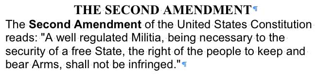
Like the rest of us, covered by the Second Amendment, the injured history of Grace Torlicher, once a resident of the Prince Rupert, can be followed, in part, with the few Seattle Times’ clips that track her between 1917 and 1935. May we assume that Grace and her John continued to practice till death did them part for the “regulated Militia” and the security of our somewhat free state? A Times clip from Sept. 16, 1917.A Times clip from Sept. 21, 1917.A Seattle Times clip from July 8, 1921.Clip from the Seattle Times for May 28, 1935.Continued Times clip form May 28, 1935.
THEN: William O. McKay opened show rooms on Westlake in July of 1923. After fifty-seven years of selling Fords, the dealership turned to the cheaper and more efficient Subaru. Now reconstructed, the old Ford showroom awaits a new tenant.NOW: The practice of preserving cherished facades – like that which fronted McKay’s terra-cotta landmark on Western, which was saved tile-by-tile – by incorporating them into new and larger buildings is controversial: embraced by some and loathed by others. The reconstructed McKay showrooms now front the Allen Institute.
If we were to build a local pantheon to the memory of Puget Sound’s greatest pitchpersons, it would certainly include two or three car dealers, and the record-breaking Ford salesman William O. McKay would be among them. As a teen at Broadway High, the spirited McKay might have easily become a cheerleader, except that he could play. Wee Coyle, the future UW all-star quarterback, was a friend and teammate; and both were members of First Hill’s Terry Street Gang, an athletic but generally benign cadre of teen urban explorers. The 1908 graduate became a leader in Broadway High’s alumni association while still a student at the UW. Surely William O. later traded many Fords to former classmates. Overall, by 1935 he had sold 22,000 of them.
The three assertive sides of McKay – athletics, military, and Ford sales – are given parts in this caricature.
His life with cars began in the pit beneath them. Soon, however, the young McKay explained to his boss, “I’ve got my mind set on becoming the leading automobile dealer in the Northwest,” and his boss moved him up to the show room. In the March 19, 1916, issue of the Seattle Times there’s a picture of McKay, then manager of the local Saxon dealership, posing in a six-cylinder Saxon Touring Car. This was short-lived. McKay was soon off to France and the First World War. He enlisted as a private and came home a captain. One world war later, when Fords were turned into bombers and tanks, the by then Major McKay was put in charge of Marine Corp recruitment for the area. The major announced his new vocation – “for the duration” – with a banquet for 100 associates and VIPs held within the splendor of his admired Ford showroom on Westlake at Roy Street.
McKay, on the left, completes a deal.By the late 1940s, McKay was characterizing his dealing in used cars – including Fords – as guided with applications of McKayized care.
McKay had built his terra cotta-clad palace for Fords (and soon Lincolns and Mercurys) in 1922-23. Following McKay’s lead, Westlake quickly became one of Seattle’s greater auto-rows. He also kept showrooms on both Pike Street and on the ground floor of the Washington Athletic Club where he was an active member. He promoted the latter as “Seattle’s first Automobile Salon.” But it was from this gleaming Ford fort on Westlake that the Major strategized his many sales promotions, radio broadcasts, and public services, such as acting as campaign chairman for the Seattle Community Fund and prexy for the Seattle Dealers Association.
McKay Ford from a tax photo.From The Seattle Times for Feb. 10, 1952.
The light show of McKay’s Westlake showroom, printed at the top, is from 1949. By then the Ford dealer was an America Legion leader. William O’s wife Gloria was also an outgoing community leader and performer. In 1949 she had recently retired from her presidency of the Women’s University Club. When requested, she would bravely sing show tunes before the annual members-only Stunt Night.
A December 15, 1943 Seattle Times notice of a joined memorial for Lieut Theo McKay, the dealer’s son, and the christening of his son’s son.
One of the few ironies of William O. McKay’s in-line life was his death, which recalled a rare family tragedy. He died in the Fiji Islands while on cruise with his wife in 1956. Thirteen years earlier, Lt. Theodore McKay, their only son, was killed by a broken propeller while standing on the deck of an aircraft carrier, also in the South Seas. The December 1943 memorial for Theodore Sr. followed the baptism of Theodore Jr., his three-month old son whom he had never seen.
A Seattle Times homage from Dec. 19, 1956.Clip from The Seattle Times for Dec. 21, 1956.
WEB EXTRAS
Anything to add, boys? Surely Jean but first let us admire you and your reading of this week’s video at the top, of the 1923 McKay Ford contest winner’s 250-word essay on the glories of the new terracotta dealership on Westlake. Your well-wrought parody of a huckster’s tone was at once loving and almost embarrassingly baroque. I watched it four times practicing an admiring accompaniment.
Meanwhile, here’s some more of our weekly practice – more features and asides that relate to the subject or neighborhood of this week’s concern for William O. McKay, a UW letterman (in track) who sold Fords very well at the southwest corner of Lake Union.
=======
NEARBY
Sometime early in this millenium, I wrote a now-then on this look east to the Western Mill and across Westlake Avenue. Mercer Street would be on the far right and Valley on the far left, although the su subject reaches neither of them. I have lost this feature but will surely find it on some disk or pile. The “now” I took to repeat it has surfaced and it follows. It was taken from the second floor of the McKay dealership, and it does reach wide to Mercer and Valley. The third view the follows it is probably the second oldest detail of the neighborhood. It too looks east across the southern end of Lake Union, and when the lake reached a block or more south beyond Valley Street. We will included the oldest look tin the south end next – a feature on the narrow-gauged coal train that began running from here to the Pike Street Wharf in 1872.Photographed ca. 2003 from the second floor of the terracotta palace the McKay built for his Ford dealership in 1923. The view looks east across Western Avenue and very close to LaRoche’s prospect for the view above it. For the video interview at the top, Jean parked his Nissan on the sidewalk seen here across Westlake. I think to the left of the tree, which is now most likely trimmed to death.Probably the second oldest intimate look over the south end of Lake Union. The Western Mill is new and crude, and so from the early-mid 1880s. But with the Seattle boom beginning it grew quickly.This Western Mill scene is built up some but also undated. Here the mill is most likely still extending on a dock south of Valley Street but attached to it too – where MOHAI is now. The trestle in the foreground may be Westlake as it prepared to head south on a trestle along the western shore of the lake in 1890-1. To this side of the trestle, on the left beyond the stump, is a native home made of cedar planks and mats and such. On the horizon the crown of Capitol Hill has been harvested first for its best timber. (Courtesy, University of Washington, Northwest Collection part of its Special Collections.)
TWO LAIDLAW AERIAL from the 1930s. Both look east over the roof of McKay Ford. The neighborhood’s six or seven story Horluch Brewery towers a block east of McKay’s.
(Both Laidlaws are used courtesy of The Museum of History and Industry)You might consider clicking all these to enlarge them and make a proper study.The Horluck Brewery at the northeast corner of Mercer Street and Terry Avenue.
=====
First appeared in Pacific, March 32, 1996.
=====
I used this Brown family photo on the cover of Seattle Now and Then, and the Brown kids were very very good to me.Circa 1903, Mother Brown playing in the lake at its southwest corner of with the Westlake Trestle nearly reaching the shore.The protected retreat for swimmers became a landfill in the teens. Note Western Mill on the far right.. The wagons are line-up on Eighth Avenue more likely than Ninth. The photographer stands near Aloha Street and Dexter Avenue.First appeared in Pacific, April 23, 2000. This “now” has changed considerably since I took the above in 2000.
=========
That’s all for now. We climb the steps, but hope to return tomorrow afternoon for a few more subjects from the neighborhood and maybe even a proofreading. Maybe.


![THEN: Looking north-northeast from a low knoll at the southwest corner of Seneca Street and Seventh Avenue, circa 1916. By 1925, a commercial automobile garage filled the vacant lot in the foreground. [Courtesy, Ron Edge]](https://i0.wp.com/pauldorpat.com/wp-content/uploads/2014/11/seneca-7th-mr-then.jpg?resize=474%2C353&ssl=1)