

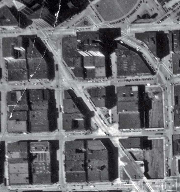
A detail from the 1936 aerial map-survey of Seattle. Yesler Way is at the top, Jackson St. at the bottom, and the Second Avenue Extension clearly cuts between them. The two triangles – east and west – are found just below the middle of the subject. (Courtesy, Seattle Municipal Archive)