THEN: During the Gold Cup on Aug. 7, 1954, onlookers surround the Detroit-based Gale IV hydroplane after driver “Wild Bill” Cantrell beached it in the lakeside garden of Dr. Forest Black six houses south of the Mercer Island floating bridge. This is a composite of screen shots taken from color film at hydroplanehistory.com. (Courtesy of Leslie Field)NOW: Brad Haskin, director of the Hydroplane and Raceboat Museum in Kent, stands on the lakefront six houses south of the Mercer Island floating bridge where, during the 1954 Gold Cup, the Detroit-based Gale IV hydroplane landed in the lakefront garden of Dr. Forest Black. Black died in 1960. In later decades until 2024, the property and its home were owned by the Oberto family. The site will be featured Dec. 5 at the 39th Mount Baker Home Tour. (Clay Eals)
Published in The Seattle Times online on July 30, 2026
and in Pacific NW Magazine of the printed Times on Aug. 2, 2026
Can a hydroplane crash a lakeside garden party? It did in 1954
By Clay Eals
Race day at Seafair. The year’s biggest event. No Mariners, Seahawks or Sonics yet.
THEN: During the Gold Cup on Aug. 7, 1954, onlookers surround the Detroit-based Gale IV hydroplane after driver “Wild Bill” Cantrell beached it in the lakeside garden of Dr. Forest Black six houses south of the Mercer Island floating bridge. This is a composite of screen shots taken from color film at hydroplanehistory.com. (Courtesy of Leslie Field)
Lining Lake Washington’s southwestern shore and the Mercer Island floating bridge are (no typo) 375,000 hydroplane fans. A motorized thrum pierces the air. The second heat of the Gold Cup opens. At a lakefront garden party only six houses south of the bridge, guests mingle, when …
THEN: During the Gold Cup on Aug. 7, 1954, onlookers surround the Detroit-based Gale IV hydroplane after driver “Wild Bill” Cantrell beached it in the lakeside garden of Dr. Forest Black six houses south of the Mercer Island floating bridge. This is a composite of screen shots taken from color film at hydroplanehistory.com. (Courtesy of Leslie Field)
A 2.4-ton, 29-foot-long mahogany-and-yellow hydroplane roars off course, leaps from the water, jumps a bulkhead, brushes through roses and lands just shy of a lily pond and table of snacks.
It actually happened, shortly after 3 p.m. on Saturday, Aug. 7, 1954.
THEN: During the Gold Cup on Aug. 7, 1954, onlookers surround the Detroit-based Gale IV hydroplane as driver “Wild Bill” Cantrell climbs out after he beached the boat in the lakeside garden of Dr. Forest Black six houses south of the Mercer Island floating bridge. This is a composite of screen shots taken from color film at hydroplanehistory.com. (Courtesy of Leslie Field)
No one was hurt. The petal-draped, Detroit-based Gale IV suffered an eight-inch hull puncture. Its helmeted driver gingerly climbed out. Onlookers gawked. Two police officers arrived. Cameras clicked and whirred. On the lake, other boats’ roostertails kept rising. The race persisted.
From such front-page incidents legends arise.
THEN4: Driver “Wild Bill” Cantrell atop the Gale IV hydroplane in 1954 in Detroit. (Sandy Ross Collection, courtesy of Hydroplane and Raceboat Museum)
Champion boat and auto racer Bill Cantrell (1908-1996) had earned a nickname in 1927 when an outboard owner saw him driving full throttle and shouted, “Look at Wild Bill go!” But his 1954 mishap came to both fit and haunt him. For years, Cantrell’s answer to “why” was that his steering mechanism had jammed.
Today, Brad Haskin, director of the Hydroplane and Raceboat Museum in Kent, reveals a different angle, rooted in rivalry “every bit as hateful as Lakers-Celtics or Yankees-Red Sox.”
THEN: The famous “flying” start of Seattle-based Slo-Mo-Shun hydroplanes. (Screen shot courtesy of Leslie Field)
Automotive Detroit and aerospace Seattle dueled fiercely, through each year’s race outcome, to host the following year’s Gold Cup. Seattle’s Slo-Mo-Shun hydros, based at Stan Sayres’ home at Hunts Point on the northeastern lakeshore, typically zoomed south at up to 130 mph beneath the bridge for the races’ famous “flying” starts. Course-bound Detroit boats could muster only 80-90 mph before the starting line, Haskin says. “The Detroit guys felt that was unfair.”
So Cantrell “rooted around the north turn, trying to create waves” to slow the Slo-Mos. “I have a feeling that while roughing up the water, he got distracted and wasn’t looking where he was going … then boom — he went up and over the rocks and into the garden.”
In one yarn, the homeowner, Dr. Forest Black, asked Cantrell if he had an invitation. In another, the doc offered him a cocktail.
THEN: Navy barge picks up Gale IV. (Courtesy of Leslie Fields)
Seattle’s Slo-Mo-Shun V won that Gold Cup. A Navy barge picked up Gale IV for repairs. The Coast Guard later tightened course boundaries. A beached hydroplane is no longer likely.
But we can delight in Cantrell’s sheepish shrug: “First time I ever walked away from a boat crackup.”
The legend lives.
WEB EXTRAS
Big thanks to Scott Lindsay, Casey McNerthney, Brad Haskin, Betsy Kerlin Pyun and Leslie Field for their invaluable help with this installment!
To see Clay Eals‘ 360-degree video of the “Now” prospect and compare it with the “Then” photos while hearing this column read aloud by Clay, check out our Seattle Now & Then 360 version of the column.
THEN: The Gale hydroplane team is shown in 1960: from left, driver “Wild Bill” Cantrell, owner Joe Schoenith and son/driver Lee Schoenith. Joe wears a jacket embroidered with the cartoon Reddy Kilowatt, symbol of the Detroit-based W.D. Gale Electric Co. A stick figure of lightning bolts and a lightbulb nose, the mascot also was painted on the tailfins of the firm’s Gale IV and Gale V hydroplanes. (Courtesy of Detroit Historical Society)THEN: A Navy blimp flies overhead during the 1954 Gold Cup race, while in the foreground two police officers preside as a camera crew documents the beached Gale IV hydroplane. (Courtesy of Hydroplane and Raceboat Museum)THEN6: An aerial view of the beached Gale IV hydroplane in the lakefront garden of Dr. Forest Black. (Courtesy of Hydroplane and Raceboat Museum)THEN7: Petal-draped Gale IV rests in Dr. Forest Black’s lakefront rose garden six houses south of the Mercer Island floating bridge. (Courtesy of Hydroplane and Raceboat Museum)Nov. 30, 1914, Seattle Times, p1.Sept. 2, 1915, Seattle Times, p2.June 25, 1933, Seattle Times, p1.Jan. 18, 1936, Seattle Times, p2.April 26, 1942, Seattle Times, p25.Aug. 5, 1954, Seattle Post-Intelligencer, p24.Aug. 8, 1954, Seattle Post-Intelligencer, p58.Aug. 8, 1954, Seattle Post-Intelligencer, p93.Aug. 8, 1954, Seattle Times, p1.Aug. 8, 1954, Seattle Times, p1.Aug. 8, 1954, Seattle Times, p15.Aug. 8, 1954, Seattle Times, p38.Aug. 3, 1956, Seattle Post-Intelligencer, p11.June 6, 1960, Seattle Post-Intelligencer, p10.June 24, 1960, Seattle Times, p23.Jan. 25, 1996, Louisville Courier-Journal.July 4, 1999, Seattle Times, p126, Don Duncan.Aug. 7, 1999, Seattle Post-Intelligencer, p50.July 23, 2000, Seattle Post-Intelligencer, p217.Aug. 4, 2001, Seattle Post-Intelligencer, p2.Aug. 6, 2005, Seattle Post-Intelligencer, p27.Just for fun: Aug. 8, 1954, Seattle Times, p11. Never knew there was a Gold Cup mattress!Another fun clip: Aug. 12, 1957, Seattle Times, Western Gear ad, contributed by Robert Mayer.
THEN: A UFO hoax was revealed days after this faked image appeared on the July 30, 1948, front page of the North Central Outlook, a respected weekly newspaper serving north Seattle neighborhoods. Publisher Stan Stapp fielded dozens of phone calls from alarmed residents. (Courtesy Jean Sherrard)NOW: On a summer afternoon, two generations of Randal descendants gather on a Green Lake dock, scanning skies where fact and fiction once collided. From left: Julie Kempton, Ethan Sherrard, Kalan Sherrard (kneeling), Scott Randal, Kael Sherrard and Anne Kiemle. Kalan holds the Outlook clipping passed down through the family for decades as proof that the truth is out there somewhere. (Jean Sherrard)
Published in The Seattle Times online on July 23, 2026
and in Pacific NW Magazine of the printed Times on July 26, 2026
Seattle family witnesses – and believes – a hoax encounter of the 1948 kind
By Jean Sherrard
On a midsummer evening in 1948, the Rev. Lewis Randal drove north with his family along Highway 99 after Sunday church
An early view of the Aurora Bridge
services. While they crossed the Aurora Bridge, 14-year-old Leta Rae and her mother, Dorothy, witnessed something that left them astonished and terrified.
Hovering in mid-air was a cigar-shaped object.
Mother and daughter screamed and pointed. But before the younger children, Edith and Edwin, and their father caught a glimpse, the object had zipped off.
The shaken family took the first bridge exit and pulled in front of their Wallingford bungalow to compare notes.
A year earlier, the nation had become transfixed by reports of flying discs circling Mount Rainier. The reserved Randals, however, scarcely could have imagined that they, too, would be swept into such hysteria.
Within days, their neighborhood weekly newspaper — the North Central Outlook, published four blocks away in the basement of a Woodlawn Avenue Craftsman — splashed a photo on the front page: a wingless, double-decked craft, windows ablaze, hovering over Green Lake at midnight.
At left, Stan Stapp (1918-2006) in the basement pressroom of the North Central Outlook on Woodlawn Avenue. Here, one of Seattle’s good-natured UFO hoaxes was assembled, published, and — two days later — retracted. The Stapp family owned and operated the paper from 1922 to 1974. (Paul Dorpat collection)
It had been snapped, the paper claimed, by an Outlook staff photographer. Any doubts the Randals harbored were erased by this evidence in black and white.
Years later, after writing a commemorative “Now & Then” column about the Outlook’s beloved editor and publisher Stan Stapp, Paul Dorpat recalled the UFO story to me with a chuckle.
“Stan told me it was a complete hoax,” he said. “He even confessed it to The Times.”
Indeed, two days after the Outlook coverage, a sheepish Stapp told The Seattle Times: “It seemed so fantastic I didn’t dream anyone would believe the story. Had I realized, I probably wouldn’t have done it.”
The photograph, he admitted, was a homemade composite — an airship drawn onto a Fourth of July fireworks photo taken at Green Lake.
The Randals in front of their home at Woodlawn Avenue and 38th Street, four blocks south of Stan Stapp’s basement pressroom: Lewis and Dorothy with their offspring Leta Rae, left, Edwin and Edith. Randal had served Presbyterian parishes from Kettle Falls to Port Angeles before returning home to Seattle, where a brush with the unexplained would become family legend. (Courtesy Jean Sherrard)
The Randals missed the public confession. They kept the yellowed clipping for decades, proof positive of what had become a family legend and repeated to succeeding generations, including me.
Dorothy was my grandmother. Edith was my mother.
Today, UFO fever is spiking again with the new Steven Spielberg film “Disclosure Day,” declassified government archives and authenticated Navy footage that even congressional hearings cannot explain.
Unlike Stapp’s homemade composite, this evidence resists debunking. The confession never comes. We stand at the intersection of fact and fiction, confirmation bias and genuine mystery. Add AI into the mix, and the paths between them grow harder to navigate. At least in 1948, the truth got its boots on within two days.
Meanwhile, the Randal descendants occasionally gather at Green Lake, point skyward and wonder. Some things are inherited.
THEN: In 1956, Ivar Haglund’s inland eatery anchors the corner of South Washington Street and Occidental Avenue South. In 1891-93, on an upper floor lost in a 1949 earthquake, lived Fred Trump, paternal grandfather of today’s president, Donald Trump. The elder Trump operated The Dairy restaurant at the site of the Lucky Tavern, shown at right. (Seattle Municipal Archives, courtesy Michael Ostrogorsky)NOW: At the same vantage as our 1956 “Then,” historian Michael Ostrogorsky holds his new book “Seattle Pioneer Square History Walk: Dzidzilalich Little Crossing Over Place.” The parking lot where Fred Trump’s restaurant The Dairy stood in 1891-93 is out of frame at right. On July 25, Ostrogorsky plans an Alliance for Pioneer Square-sponsored history walk, followed by a signing event at Arundel Books. For more info, visit his substack “Beach Ramblings.” (Clay Eals)
Published in The Seattle Times online on July 16, 2026
and in Pacific NW Magazine of the printed Times on July 19, 2026
Historian locates Ivar and Trump’s grandfather in Pioneer Square
By Clay Eals
A Seattle historian holds forth:
THEN: Circa 1875, this is the earliest known photo looking up Mill Street (Yesler Way today) from Commercial Street (First Avenue South). Books and other accounts cite Mill Street as Seattle’s Skid Road, a claim challenged by Pioneer Square historian and tour guide Michael Ostrogorsky. (Courtesy Michael Ostrogorsky)
The original name for Seattle’s revered Pioneer Square was Pioneer Place. And Skid Road, the vaunted sobriquet for Yesler Way, is an entire misnomer.
“As far as I can tell, not one log was ever skidded down any street in Seattle,” he says. “It blows people’s minds when I tell them that. I don’t know if Seattle’s ready to hear that.”
The historian, Michael Ostrogorsky, relishes debunking published and oft-repeated legends. He leads tours of his favorite district, Pioneer Square, for which he just self-published a guidebook.
The 208-page volume bursts with 140 photos and maps. Its conversational text reveals startling details. Case in point: our main “Then” from 1956, which looks west along South Washington Street as it intersects with Occidental Avenue South.
Bold capitals indicate an Ivar Haglund café two blocks east of the waterfront and five blocks south of Pier 54, where the restaurateur-promoter opened an aquarium in 1938 and in 1946 expanded it to his enduring and renowned Acres of Clams restaurant. His lesser-known inland Ivar’s, depicted here (dubbed Chowder Corner), began in late 1955, lasting just four years under his helm. Today it’s Baba Yaga, a rock club.
THEN: Undated portrait of Fred Trump (1869-1918), whose family’s original German surname was Drumpf, also spelled as Trumpf or Drumpft. In 1891-93, the paternal grandfather of today’s president lived on South Washington Street in Pioneer Square. He later joined the Klondike Gold Rush. (Courtesy Michael Ostrogorsky)
Equally surprising, one-half block east (on the right in the photo) is the Lucky Tavern. At that storefront in 1891, an eatery called the Poodle Dog was purchased, renamed and operated for two years as The Dairy by none other than Fred Trump, paternal grandfather of our current president.
Ostrogorsky asserts that a 2000 biography, “The Trumps: Three Generations That Built an Empire” by Gwenda Blair, “simplistically paints Fred Trump’s The Dairy restaurant as a den of iniquity and Fred Trump as a pimp and criminal.” But he adds that “there is simply no historical evidence of any criming that occurred in association with Fred Trump” at The Dairy or at another restaurant he owned in 1897 at Second Avenue and Cherry Street.
The Dairy/Lucky Tavern building became a parking lot in 1969. When Fred Trump ran The Dairy, he lived in a hotel above the storefront that became Ivar’s Chowder Corner. That building’s upper three floors fell victim to the Seattle earthquake of 1949.
“We live in a fact-free world, where people get to choose the reality that they want to experience,” he says. “As a historian, I’m here to say the facts matter. Even if people choose not to believe it, there are still facts out there, things that happen. It’s the job of us historians to present those facts, however many heads may explode in the process.”
WEB EXTRAS
Big thanks to Michael Ostrogorsky for his invaluable help with this installment!
To see Clay Eals‘ 360-degree video of the “Now” prospect and compare it with the “Then” photos while hearing this column read aloud by Clay, check out our Seattle Now & Then 360 version of the column.
NOW: Steel I-beams, visible on the James Street side of the Pioneer Building, were placed between new structures after the 1889 Great Seattle Fire. The photographer, Michael Ostrogorsky of West Seattle, secured a dual doctorate in history of the American West and historical archaeology from the University of Idaho. (Michael Ostrogorsky)Oct. 8, 2006, Seattle Times, p213.July 17, 1946, Seattle Times, p13.June 23, 1947, Seattle Post-Intelligencer, p11.Dec. 29, 1948, Seattle Post-Intelligencer, p24.Sept. 7, 1949, Seattle Times, p2.Sept. 2, 1949, Seattle Times, p28.Sept. 11, 1952, Seattle Post-Intelligencer, p17.March 13, 1955, Seattle Post-Intelligencer, p8.Dec. 22, 1956, Seattle Post-Intelligencer, p13.Oct. 21, 1959, Seattle Post-Intelligencer, p48.June 15, 1964, Seattle Post-Intelligencer, p19.
THEN: Brian Finney, left, and Paul Giamatti in “Some Things You Need to Know Before the World Ends: A Final Evening with the Illuminati” by Eddie Lee at Annex Theatre in Seattle’s Belltown neighborhood, circa 1990. Giamatti considers Finney “one of the greatest actors I’ve ever known.” (Courtesy Annex Theatre)NOW: On the set of “Disappearance at the Rocky Mountain Leatherdyke Snowpicnic,” a recent show at Annex Theatre, are founders and current stewards. From left: Justin Lauer, Chris Jeffries, Allison Narver, Lucien Oberleitner and Stephen McCandless. (Jean Sherrard)
Published in The Seattle Times online on July 9, 2026
and in Pacific NW Magazine of the printed Times on July 12, 2026
Annex Theatre collective digs up onstage treasure for 40-plus years
By Jean Sherrard
When actor Paul Giamatti was working with film director Paul Mazursky — on the 1998 HBO biopic “Winchell” — he mentioned his formative years in Seattle. Mazursky stopped him.
Every artist, Mazursky said, has a Seattle in their past — that singular place where everything came together, pure and unfettered, before the world got complicated.
The Annex logo, designed by future Town Hall Artistic Director Wier Harmon, who also acted with the company
For Giamatti, it was literally Seattle, more specifically, a second-floor walk-up on Fourth Avenue in Belltown, where an adventurous collective called Annex Theatre was doing things no one else dared to do.
“It gave me everything,” he says. “I’m not a guy who uses the word ‘magical’ a lot. But it really was.”
He wasn’t alone. Starting in 1986, the boards at Annex boasted an
The Annex Theatre marquee at 1916 Fourth Ave., Seattle, in the early 1990s. For 14 years, the second-floor former Fred Astaire Dance Studio hosted dozens of world premieres and post-show rock concerts.
improbable roster: playwrights whose words later helped bring to life the Netflix series “Stranger Things” (Karl Gajdusek) and the musical “Spider-Man: Turn Off the Dark” (Glen Berger); Wier Harman, who went on to lead Town Hall Seattle; and Allison Narver, who continues to direct plays in major theaters across the country. As Annex’s artistic director from 1989 to 1995, she habitually booked bands nobody had heard of.
“We told audiences they had to watch the play first,” Narver says. “Then they could stay for the music.”
The bands included Nirvana.
It was, as celebrated composer and musician Chris Jeffries puts it, “a pirate ship.” Everyone divvied up equal shares of buried treasure — and the risk.
In the 1980s and ’90s, Seattle was less expensive, failure meant setback rather than ruin, and the city was alive with scrappy little black-box theaters in garages, walkups and former funeral homes.
From a pact made by Bainbridge Island high school students who scattered to colleges with a promise to return with recruits, Annex was born.
Somehow, the pact endured. Recently, founders and current stewards gathered on the Annex stage to compare notes across 40
Chris Jeffries and Allison Narver, who is pointing toward Annex’s former second-floor Belltown location. Narver went on to serve as resident director of “The Lion King” on Broadway and in London, then as artistic director of the Empty Space Theatre, and recently directed “Mary Jane” at Seattle Rep. (Jean Sherrard)
years. Their spirit, remarkably, is unbroken. The collective, on Capitol Hill since 2007, the model endures. New plays are still chosen by company vote. The artistic director, managing director and marketing director are still volunteers, each holding down a full-time job elsewhere while running Annex.
Question is, does Seattle still have a “Seattle?”
The troupe remains passionate about presenting new plays on a shoestring, but funding sources have dried up, audiences are smaller since COVID, and live theater everywhere is under siege. As managing director Stephen McCandless puts it, it’s easier to stay home and watch a rerun of “The Office.”
Lucien Oberleitner, Justin Lauer and Stephen McCandless onstage
Going forward, Narver says, takes bravery. The same bravery that built something worth inheriting.
“If this is a pirate ship,” says Artistic Director Lucien Oberleitner, “there’s a lot of mercy on the high seas.”
THEN: Topped and backed by 48-star U.S. flags, seven women display messaged pennants during a Pageant of Democracy staged on July 4, 1920, for 50,000 people on Woodland Park’s Great Lawn, part of a 1908 design by the Massachusetts-based Olmsted Brothers. In another tableau, women spelled out “For All Humanity.” “We are dramatizing the ideals for which we are suffering,” said the sponsoring Central Labor Council. Today, the site is part of Woodland Park Zoo’s African Savanna and North Meadow. See a detailed description below of the precise location. (Courtesy of Museum of History & Industry)NOW: In West Woodland Park, near the 1920 pageant site, are Mikala Woodward, MOHAI curator of exhibits and engagement, displaying the current 50-star American flag, with seven volunteers for Seattle’s Lady Liberty Project, from left, Kate Smith, Judith Pile, Shira Brewer, Ariel Rathbun, Karen Schneider, Shan Cretin and D’vorah Kost, holding up signs and fists. For more info on the project, visit ladylibertyproject.com. (Clay Eals)
Published in The Seattle Times online on July 2, 2026
and in Pacific NW Magazine of the printed Times on July 5, 2026
Exhibit reveals sweeping swath of roles, purposes for U.S. flag
By Clay Eals
What events today bring out more than 50,000 people in our city? Certainly Seafair parades and hydro races. Pro football and soccer, too.
On Independence Day 1920, a Central Labor Council-sponsored Pageant of Democracy at Woodland Park hit that mark.
From downtown, celebrants paraded to today’s north Seattle zoo site, where patriotic reenactments featured actors from 19 cultures, from Indigenous to Greek, with nighttime fireworks at nearby Green Lake.
The afternoon spectacle was intentionally over the top, given the recent flu epidemic and end of World War I, plus tensions lingering from the 1919 Seattle General Strike. One element was ubiquitous — the U.S. flag.
“From downtown buildings, myriad American flags fluttered in the breeze while the crowds that lined the streets and parks wore knots and ribbons of the national colors,” reported the Seattle Post-Intelligencer.
THEN: Herman K. Johns Jr., left, and Billy Frank Jr. raise a 50-star U.S. flag on Jan. 21, 1964, to symbolize treaty rights promised in 1854 for the Nisqually Tribe, at Frank’s Landing on the Nisqually River. A court order had banned the tribe’s fishing. The flag was the burial flag of Johns’ father, a paratrooper who died in Belgium during World War II. “Fish-ins” continued through the 1960s and 1970s. (Courtesy of Museum of History & Industry)
This weekend, as the country reaches 250 years since the Declaration of Independence, the Museum of History & Industry opens an ambitious, layered, flag-focused exhibit, “For Which It Stands,” aptly referencing the Pledge of Allegiance.
“There’s pride, and there’s protest, and there’s reverence, and there’s belonging, and honoring sacrifice, and carrying forward America’s ideals, all these different ways that people have used the flag,” says Mikala Woodward, the museum’s curator of exhibits and engagement. “We want to give people that range to think about and put themselves into it.”
THEN: Following the June 6, 1889, Great Seattle Fire, the tented Jewel Saloon, below a 38-star U.S. flag, rises from ashes along Yesler Way between today’s First and Occidental avenues. The revival was short-lived, as the business sought a new owner in December. (Courtesy of Museum of History & Industry)
Examples in the exhibit abound:
A flag from “The Boys in the Boat” U.S. men’s crew that triumphed at the 1936 Summer Olympics in Berlin.
A photo of a mother holding the burial flag of her son, a Japanese American Nisei soldier who died in Europe during World War II while relatives were incarcerated in America. “It’s about expressing loyalty and sacrifice to the nation,” Woodward says, “even when it’s mistreating you and your family.”
A flag borrowed from the volunteer Oso Fire Department uncovered in the town’s catastrophic 2014 mudslide. “It became this symbol of hope and the community coming together to keep looking and finding people and heal and carry on.”
A flag flown upside down in the Capitol Hill Occupied Protest (CHOP) zone in 2020, with spray-painted words “love” and “rage.”
THEN: In “For Which It Stands,” which runs through Nov. 16, among flags on display is this 50-star miniature carried by mountaineer Jim Whittaker on May 1, 1963, when he became the first American to summit Mount Everest. The exhibit is part of MOHAI’s America 250 observance, including a Freedom Plane document display from July 30 to Aug. 16. For more info, visit mohai.org. (Courtesy of Museum of History & Industry)
The exhibit includes places for reflection and interaction. It asks visitors to finish the sentence: “I pledge allegiance to …” The hope is to spur universal introspection.
“It makes you feel different if you’re carrying a flag,” Woodward says. “You think about how you’re representing something, you’re expressing something, you’re connecting yourself to a place or a group or a statement and what it really means to you.”
WEB EXTRAS
Big thanks to Mikala Woodward , Wendy Malloy, Allie Delyanis, Gigi Allianic and Ariel Rathbun for their invaluable help with this installment!
To see Clay Eals‘ 360-degree video of the “Now” prospect and compare it with the “Then” photos while hearing this column read aloud by Clay, check out our Seattle Now & Then 360 version of the column.
Also, here is a detailed description of the precise location of the 1920 Pageant of Democracy, as outlined by Ken Kroeger, Woodland Park Zoo project manager:
The exact location where the 1920 “Pageant of Democracy” was performed is a historic area of the park that has completely transformed over the last century.
The stage was built on what was then known as the Great Lawn, which served as the majestic, wide-open focal point of the original 1908 Olmsted Brothers design for Woodland Park. According to historic records of the event and park layout, the specific spot sat directly north of the park’s early tennis courts and wading pool, giving a massive crowd of spectators plenty of room to sit on the grass before the stage.
If you were to stand in that exact spot today, you would find yourself right in the heart of the modern Woodland Park Zoo exhibits.
Where it sits on the modern map
Over the decades, the Great Lawn was steadily enclosed as the zoo expanded its habitats and the city bisected the park to build Aurora Avenue (Highway 99) in 1932. The specific footprint where the pageant’s temporary stage, the costumed labor union performers, and the horses stood is now split across two primary areas of the zoo:
The African Savanna Exhibit: The southern expanse of the historic Great Lawn—where the crowd sat and looked northward toward the stage—is the exact landscape footprint occupied by the giraffes, zebras, and gazelles today.
The North Meadow: The northernmost remnant of that original lawn is still a wide-open grassy space. It is the area used today for summer evening concerts, community events, and picnics.
The tennis courts mentioned in the 1920 event accounts (where the revelers danced later that evening into the night) were located near the southern boundary of the lawn, roughly where the South Entrance and the Rose Garden (established just two years later in 1922) sit along N. 50th Street.
Because the entire central swath of the park was a unified open meadow in 1920, the performers had the expansive, sweeping backdrop needed to assemble all 56 signers of the Declaration of Independence and an entire cavalry of historical figures before thousands of gathered Seattleites.
To visualize where the photographer stood to capture this historic moment at the Woodland Park Zoo, you have to look at how the stage and audience were oriented on the old Great Lawn.
Because the temporary wooden stage was constructed with its back to the north (near the modern-day North Meadow area), the performers on stage were looking directly south across the expansive grass. The massive crowd of spectators sat on the sloping lawn south of the stage, facing north.
The camera’s position
The photographer capturing Joan of Arc on her horse with the stage directly behind her was positioned just south of the stage, facing slightly north/northwest.
On a modern map of the zoo, this precise vantage point places the camera at the northern edge of the African Savanna exhibit, right on the boundary line where it transitions toward the central paths and the North Meadow. The camera was aimed northward, capturing the performers elevated on the stage with the natural tree line of the park’s western ridge framing the background.
Dec. 7, 1889, Seattle Post Intelligencer.June 10, 1920 Seattle Union Record, p2.July 3, 1920, Seattle Union Record, p1.July 6, 1920, Seattle Union Record, p9.July 6, 1920, Seattle Post-Intelligencer, p1&2.July 8, 1920, Seattle Union Record, p2.
THEN: Acting Mayor Charles Carroll addresses 10,000 protesters on May 6 , 1970, outside City Hall on Fourth Avenue, following President Richard Nixon’s announcement that U.S. forces in Vietnam would pursue enemy troops into Cambodia. The largely nonviolent demonstration began the previous day with a march on Interstate 5 from the University of Washington to the U.S. Courthouse. Carroll, substituting for Mayor Wes Uhlman who was in Japan, told protesters May 8 would be a “day of reflection” in Seattle. A University of Washington student strike continued throughout the month. (Courtesy of Museum of History & Industry)
Published in The Seattle Times online on June 25, 2026
and in Pacific NW Magazine of the printed Times on June 28, 2026
Throughout history, Seattle voices rise in protest
By Jean Sherrard and Clay Eals
America began in protest. A tea party, a declaration of grievances, a war — and then, improbably, a nation.
Seattle arrived late to the country but early to the argument. For a century and a half, the city has lifted its voices in protest for better — and occasionally worse.
Few American cities have matched Seattle’s range and reach. From the waterfront strikes of 1919 to the WTO protests of 1999, what begins here has a way of reverberating far beyond the city limits.
Ahead of America’s 250th anniversary observance, this week we glimpse several “Then” protests, selected for what they reveal and what still resonates. For our “Now,” we chose recent No Kings marches and rallies, reminding us that the impulse lives today.
We also provide a timeline and invite you to leave a comment to share Seattle protest memories that matter to you.
THEN: Workers at the Skinner & Eddy Corporation shipyard between Dearborn Street and Connecticut Street (now Royal Brougham Way) were among more than 65,000 Seattle workers who walked off the job as part of the 1919 Seattle General Strike. Most of the city’s 110 local unions, including members of the American Federation of Labor and the Industrial Workers of the World joined the walkout in solidarity with shipyard workers. Employing 13,500 people, Skinner & Eddy had built more ships during World War I than any other American shipyard. (Courtesy Museum of History & Industry. Photo shows damage due to age of negative.)
Seattle stops work for six days that shook the nation
For six days in 1919, Feb. 6-11, Seattle simply stopped.
Some 65,000 people — laundry workers, hotel maids, streetcar operators, building laborers — walked out in solidarity, in the first general strike ever called in a major American city.
No streetcars ran. No restaurants opened. Workers struck, and the city held its breath.
It had begun with frozen wartime wages in the shipyards. But a call from the Central Labor Council transformed a labor dispute into something larger: a demonstration of what organized workers could do. They ran the Seattle General Strike like a city within a city. Twelve labor kitchens fed thousands of people a day. Workers’ patrols kept order without incident.
Mayor Ole Hanson termed it a Bolshevik Revolution. Federal troops arrived from Fort Lewis.
THEN: An anti-strike editorial from The Seattle Star of Feb. 4, 1919. It concludes, “This country is America — not Russia.” (Courtesy of Museum of History & Industry)
The strike ended Feb. 11, the workers having lost their demands. But the loss was complicated.
Two days before the walkout, activist and journalist Anna Louise Strong had cheered on workers, writing in the Union Record that the strike would lead “NO ONE KNOWS WHERE!“ She was right. The phrase reverberated far beyond Seattle, helping ignite the first Red Scare and reshaping the national debate about labor, capital and the limits of solidarity.
Seattle’s workers didn’t win. But they changed what was thinkable.
* * * * *
THEN: Charles Rouse, assistant Seattle police chief, talks on July 25, 1963, with some of the 22 young sit-in participants at City Hall, attempting to convince them to leave and avoid arrest: “You can accomplish your purpose in a better manner. Please reconsider.” (Courtesy of Museum of History & Industry)
Sitting in for Black representation
and to persuade ‘the power group’
Sometimes protests in Seattle wielded influence from smaller groups with close-to-home targets.
In July 1963, 22 young people — nine adults and 13 juveniles — staged a sit-in at City Hall. They complained that of 12 citizens appointed by Mayor Gordon Clinton to Seattle’s fledgling Human Rights Commission, only two were Black. They sought five, wanting to “keep pressure on the power group.”
THEN: Officers prepare to arrest the supine protesters, as shown in the July 26, 1963, Seattle Post-Intelligencer. (Seattle Post-Intelligencer online archive)
After four days, police arrested the demonstrators for creating a disturbance, loitering and resisting arrest. Cameras rolled as the youths, lying on their backs, were picked up and carried away.
Charges were dropped a month later. But the front-page ruckus elevated and helped galvanize the eventual work of the new commission, which drafted a Seattle open-housing ordinance to outlaw discrimination in real estate sales and rentals, known as racial redlining.
Oct. 23, 1963, Seattle Times, p26.
Enacting it took time. By a resounding margin of 112,448 to 53,453, with opponents decrying “forced housing,” the ordinance fell to voter defeat by referendum in March 1964. Four years later, the City Council finally enacted it without voter challenge.
Before the council vote, outspoken real-estate agent and human rights commissioner Elliott Couden captured the issue: “The right to discriminate in the rental and sale of housing because of the color of a man’s skin is not a precious American heritage.”
* * * * *
NOW: Protesters dressed as a monarch and a jester front thousands of “No Kings” marchers March 28 at Seattle Center. (Jean Sherrard)
Clever signs of today’s Seattle: ‘No Kings but Salmon’
Of course, Seattle protests have never required solemnity. The city has long understood that showing up — with wit, neighbors, even a vuvuzela horn — is itself the argument. To protest is to love an imperfect union enough to disagree with it.
The city’s answer to a national call reappeared March 28 with characteristic elan. In the “No Kings” crowd of 75,000, a sign read “No Kings but Salmon,” a reminder that our city has sorted its allegiances.
At Seattle Center, a mock court made the point. An ersatz President Donald Trump, with orange wig and enormous red tie, bellowed while jesters capered and a placard presented the verdict: “The Emperor Has No Brains.”
No surprise: Smaller “No Kings” rallies have multiplied throughout Seattle’s neighborhoods. Their clever homemade signs (a shared coping mechanism?) bespeak laughter through tears.
A West Seattle sampling:
“We’ve Seen Better Cabinets at IKEA ‘As-Is’ ”
“Small Hands, Small Dictator”
“Faux-King Traitor”
“U Know It’s Bad if the Introverts Showed Up”
A favorite: “Sometimes You Have to Flush Twice”
Imaginative ire also has arisen in mime. Two enormous puppets jousted at this year’s Northwest Folklife Festival, an orange-haired monarch taking gentle bops in the head from the boxing gloves of — who else? — the Statue of Liberty.
NOW: Puppeteers depict Lady Liberty bopping a crowned President Trump on May 23 during Northwest Folklife Festival at Seattle Center. Click photo to see 30-second video. (Clay Eals)
WEB EXTRAS
No 360-degree video this time, but click here to see a 30-second video of roving puppeteers at 2026 Northwest Folklife Festival depicting Lady Liberty bopping a crowned Donald Trump.
And check out a few more videos from the March 28, 2026, No Kings March:
THEN: Several blocks from Alki Point on Nov. 13, 1905, Lenora Denny, from left, Carson Boren, Mary A. Denny, Rolland Denny and Mary Low Sinclair, members of the original Alki Landing Party, dedicate a granite obelisk marking their 1851 arrival. Twenty-four settler names are carved into the stone. No Duwamish names appeared at the time. (Paul Dorpat collection)NOW: Ken Workman, tribal elder and descendant of Chief Seattle, stands at the Alki monument in 2026, 175 years after his ancestor welcomed settlers ashore and 25 years after the federal government briefly recognized the Duwamish before withdrawing that recognition within 48 hours. In 2001, the Southwest Seattle Historical Society affixed a plaque to the monument to honor the chief, his tribes and his 1851 welcome. (Jean Sherrard)
Published in The Seattle Times online on June 18, 2026
and in Pacific NW Magazine of the printed Times on June 21, 2026
Chinatown ‘Unrecognized’ documentary maps Duwamish ‘archeology of memory’
By Jean Sherrard
“How am I supposed to acknowledge I’m on my own land?”
Ken Workman, Duwamish tribal elder and direct descendant of Chief Seattle, lets the question hang in the salt air above Alki Beach. He stands at the monument erected in 1905 to mark the arrival of the first white settlers of what would become Seattle.
“Three years, two months and nine days,” he says, his voice steady and matter-of-fact, noting the passage of time like a tolling bell.
“Three years, two months and nine days,” Workman repeats. “That’s how long it took from the moment my great-great-great-great-grandfather, Chief Seattle, said, ‘Come ashore, my friends, onto this ancient land of the Duwamish. You are welcome here,’ to the signing of
The signature page of the Point Elliott Treaty, signed Jan. 22, 1855. Territorial Gov. Isaac Stevens signed above. Chief Seattle’s mark — an X — appears below, identifying him as chief of the Duwamish and Suquamish tribes. (National Archives)
the Point Elliott Treaty, removing the Duwamish from their land forever.”
This year marks the 175th anniversary of that landing.
West Seattle filmmaker B.J. Bullert’s new documentary, “Unrecognized,” traces the removal of the Duwamish from their home and its long aftermath. She says, “There were only three ways for Indigenous people to survive: to move to a reservation set aside by the federal government, to intermarry and collaborate with the newcomers, or to retreat to remote areas and remain Duwamish.”
“Unrecognized” illuminates what Bullert, whose husband is
Indigenous workers gather outside Yesler’s cookhouse on Commercial Street (now First Avenue South), circa 1860. Built in 1852 by Dr. David Maynard, the cookhouse was the first public building in Seattle. Coast Salish peoples, here for millennia, found themselves laborers at the heart of a city built to replace them. (Paul Dorpat collection)
Workman, calls “an archaeology of memory” — the layered, largely invisible history of a people whose presence shaped this place for millennia before a single timber was felled for the Yesler Mill.
And this dispossession of a people — the loss of their land, the suppression of their sovereignty — is, says historian David Buerge, Seattle’s original sin. It continues today. The Duwamish remain unrecognized by the federal government, denied the healthcare, education and legal standing that recognition would confer.
The chief, of Duwamish and Suquamish lineage, was the first signer of the Point Elliott Treaty, and yet land was never set aside for his people in the city that bears his name.
In January 2001, a spark of hope briefly flared when the outgoing Clinton administration authorized federal recognition for the Duwamish on its last day in office. Less than 48 hours later, the incoming Bush administration withdrew it — and the legal struggle has continued ever since. Last year, U.S. District Court Judge Jamal Whitehead ruled the tribe’s petition must be reconsidered by the Bureau of Indian Affairs. It has not been resolved yet.
Workman delivers a land acknowledgment before a Dec. 21, 2023, Macklemore concert in Seattle, accompanied by Duwamish tribal member Maggie Cooper. As he has in many such invocations he’s given at gatherings across the city, he notes that the trees, hills and houses of Seattle contain the DNA of his ancestors. “Their voices,” he says, “might be heard in the windblown fir branches.” (B.J. Bullert)
For Workman, the welcome his ancestor extended to white settlers on the shores of a fertile bay is no less heartfelt today than it was 175 years ago. After all the long and painful years that followed the Point Elliott Treaty, perhaps the original invitation — so freely given, so incompletely returned — might yet be recognized.
WEB EXTRAS
“Unrecognized,” B.J. Bullert’s 30-minute documentary, screens at 6:30 p.m. on June 22 at Town Hall Seattle, 1119 Eighth Ave., followed by a discussion; $15. Doors open at 5:30 p.m. More info: townhallseattle.org.
For our narrated 360 degree video on location, click here.
THEN: Most of the 16-man Norge crew poses aboard the steamer Victoria June 27, 1926, when they reached then-Pier 2 on Seattle’s waterfront, welcomed by 5,000. The expedition’s principals, seated in chairs from left, were Roald Amundsen, Lincoln Ellsworth and Umberto Nobile, with his fox terrier Titina, who also made the Norge trip. The cross-polar journey is recognized as the first flight over the North Pole. Though airplane pilot Richard Byrd claimed to have reached the pole weeks earlier, his account became discredited. (Seattle Times, Courtesy of Museum of History & Industry)NOW: Seated at the state ferry terminal (former Pier 2) on the Seattle waterfront and representing the three Norge principals are, from right, historians Dan Kerlee of Magnolia and Knute Berger of Madison Park, who display a Norge poster and dirigible model, along with Cody Othoudt, lead exhibit developer for the Museum of Flight. At lower left is West Seattle historian Bob Carney. To mark the 1926 Norge expedition’s centennial, the museum will host a free presentation by Kerlee on July 2. (Clay Eals)
Published in The Seattle Times online on June 11, 2026
and in Pacific NW Magazine of the printed Times on June 14, 2026
Seattle celebrated dirigible’s first flight over North Pole in 1926
By Clay Eals
The ice-laden North Pole bespeaks mystery. How much more unfathomable must it have seemed a century ago, when no human eye had seen it from above?
While ground explorers reportedly reached the pole in 1909, a collective desire to see it from the air intensified in the Roaring Twenties, when hazardous, barrier-breaking aviation captured imaginations and created instant heroes. Examples included the first flight to circle the world, a five-month group effort based in Seattle in 1924, and Charles Lindbergh’s famous solo journey across the Atlantic in 1927.
THEN: The polar dirigible (airship) Norge. (Courtesy of Dan Kerlee)
In-between, on May 12, 1926, came an aerial accomplishment celebrated here but little known today — the first undisputed human flight over the North Pole. Notably, the vehicle was not a conventional airplane but instead a dirigible, a form of passenger and military air transit much more common and familiar at the time than now.
THEN: This composite photo produced by the New York photographic firm of Underwood and Underwood on May 12, 1926, shows the Norge airship flying over a vast ice-scape on its way to the North Pole. Upon reaching the pole, the crew dropped Norwegian, American and Italian flags. (Courtesy of Dan Kerlee)
In 71 hours, the hydrogen-filled Norge airship and its 16-man crew crossed the pole while traveling 3,400 miles.
The expedition began from the high-Arctic Norwegian island of Spitsbergen and ended with the dirigible’s deflation at the town of Teller, Alaska, then a U.S. territory.
The principals represented a trio of countries:
Norwegian Capt. Roald Amundsen (1872-1928), flight organizer renowned for having led the first ground trek to the South Pole in 1911. The dirigible’s name saluted his homeland.
U.S.-based Lincoln Ellsworth (1880-1951), a wealthy explorer and engineer who financed the flight.
Italian Col. Umberto Nobile (1885-1978), a prominent aviator and the airship’s commander and designer. The Norge’s construction was backed by his country’s notorious dictator Benito Mussolini.
THEN: A Ukrainian souvenir postal sheet honors Italian Gen. Umberto Nobile, one of three principals for the 1926 flight across the North Pole. During the Norge crew’s Seattle visit, Nobile was honored at an Italian Commercial Club banquet. (Courtesy of Dan Kerlee)
The only joint public appearance of the three in the United States post-flight came weeks later in Seattle. On June 27, 1926, traveling aboard the steamer Victoria and escorted in Elliott Bay by yachts and military planes, they arrived at then-Pier 2, site of today’s state ferry terminal.
June 27, 1926, Seattle Post-Intelligencer, p25.
Mayor Bertha Landes and 5,000 others welcomed the three, who paraded to the Olympic Hotel. They spoke the next day at a Seattle Chamber of Commerce banquet broadcast live on KFOA radio. The mustachioed Amundsen, widely viewed as the flight’s spokesman, told the crowd of 700 that the crew’s lighter-than-air odyssey had legitimized future cross-polar commercial aviation.
Other polar journeys followed, producing success and tragedy, including, ironically, given their intermittent friction, Amundsen’s death two years later in an airplane search for Nobile, who was on a second Arctic expedition when his dirigible, the Italia, crashed.
Still, the Norge’s 1926 extraordinary achievement endured. The Seattle Post-Intelligencer called it “one of the world’s greatest adventures.”
At the Seattle banquet, Amundsen seemed to sense its finality. “I’ve fulfilled my every ambition,” he said. “My work is ended. What more could I ask?”
THEN: The Norge airship at anchor, 1926. (Courtesy of Dan Kerlee)
WEB EXTRAS
Big thanks to Knute Berger, Bob Mayer, Bob Carney, the Museum of Flight‘s Peder Nelson and Cody Othoudt and especially Dan Kerlee for their invaluable help with this installment!
To see Clay Eals‘ 360-degree video of the “Now” prospect and compare it with the “Then” photos while hearing this column read aloud by Clay, check out our Seattle Now & Then 360 version of the column.
The news clips include a reflective 13-part series under the joint byline of Amundsen and Ellsworth, written for the New York Times and exclusively published locally in the Seattle Times.
Internet links:
HistoryLink essay by Robert Mayer: “Roald Amundsen and crew of the airship Norge visit Seattle after their historic North Pole flight on June 27, 1926″
Facebook group: “Zeppelin & Airship Collectors: Stamps, Mail & Ephemera”
Book: “Umberto Nobile and the Arctic Search for the Airship Italia”
Article from 1999: “Roald Amundsen’s bust turning heads in Gjoa Haven”
Click the image of Knute Berger above to see his seven-minute video essay from Oct. 7 2022, “Seattle’s role in polar exploration.”
THEN1: In this damaged but evocative photo, assembled workers pose on the Duwamish East Waterway docks of the San Juan Fishing and Packing Company, captured in 1935, four years after Ruby’s father, Jim Mar, fled to China. Though many company employees were Chinese immigrants, none is shown here. (Ron Edge)NOW: Today, Terminal 30 on East Marginal Way blocks south of Holgate Street, occupies the site where the San Juan Fishing and Packing Company once stood – and where Ruby Chow was born on June 6, 1920. Marking the spot are sons Mark Chow, left, and Brien Chow, flanking community activist Betty Lau. (Jean Sherrard)
Published in The Seattle Times online on June 4, 2026
and in Pacific NW Magazine of the printed Times on June 7, 2026
Chinatown found a fiery defender in Ruby Chow
By Jean Sherrard
Born 31 years to the day after the June 6, 1889, Great Seattle Fire, Ruby Chow was another formidable force. While the blaze converted more than 30 blocks of downtown to cinders, Chow erected powerful bulwarks to shield her beloved Chinatown.
A steely resolve and fierce intelligence ensured that she commandeered every room. The two sacred hours she took each
Ruby Chow in the early years of her restaurant: ambitious, poised, and already defining her public presence with an elaborate upswept hairstyle.
morning to assemble her signature towering beehive doubled as thinking time.
“She was ready,” says her son Mark, a retired King County district judge, “for the opera of life.”
Her father, Jim Mar, was a dock foreman at the San Juan Fishing and Packing Company on the Duwamish East Waterway. On that dock, Ruby was born. She was the first daughter among 10 children. Mar later fled to China after an assassination attempt and never returned.
Husband Ping Chow in full costume
Without a provider, the children knocked on restaurant back doors begging for scraps. At 12, Ruby made a promise to herself: If she ever had the means to help others, she would.
She moved to New York in her teens, meeting Cantonese opera star Ping Chow. With him, she came back to Seattle and in 1948, at Broadway and Jefferson Street, opened Ruby Chow’s, Seattle’s first Chinese restaurant outside Chinatown. From the first night, the place was packed.
In a treasured Chow family photo from 1959, future action star Bruce Lee stands, center, in the back banquet room at Ruby Chow’s restaurant. He taught kung fu there on Saturday mornings. Front row, center: Brien Chow; far right: Mark Chow; just over Brien’s shoulder, their sister Cheryl Chow (who served on both the Seattle City Council and the Seattle School Board). Lee, Brien says, “wanted us to call him ‘master.’ ” Lee lived in Seattle for more than four years.
The eatery became a political salon. It also was where Bruce Lee, son of one of Ping’s former opera colleagues, arrived from Hong Kong in 1959. Ruby gave the future action star a room and a job.
Her growing influence employed sharp elbows. When health officials ordered Chinese restaurants to discard bamboo chopsticks after a single use, Ruby walked into the director’s office, recalls community historian Betty Lau. We’ll comply gladly, she said, if every non-Asian restaurant also tossed once-used wooden salad bowls and serving implements. The health department caved.
That instinct drove her to politics. When police raided a Chinatown family association on Chinese New Year 1973, hauling grandparents and children to jail for playing Mah Jong, Ruby called Mayor Wes Uhlman: “What the hell do you think you’re doing?” Within hours, the detainees were freed.
She won a King County Council seat — becoming the first Asian
Ruby Chow (1920–2008) and husband Ping Chow at their 50th wedding anniversary celebration.
American elected to that body — and served three terms. She died in 2008 at 87, her heart finally failing her.
By 1994, Seattle Times columnist Emmett Watson visited her at her Seward Park home. Five notebooks of history filled the table. Ping looked down from opera portraits on the wall. Watson mentioned the International District, as Seattle then called the neighborhood.
Ping and Ruby Chow, in her favorite portrait of the two of themA photo snapped after their return to Seattle from New YorkDec. 9, 1984, Pacific magazine, Seattle Times.
THEN: Constructed for a movie remake, the Bounty replica drew tens of thousands of visitors to its berth at the Port of Seattle’s Shilshole Bay Marina June 23-28, 1962, during the Seattle World’s Fair. The original Bounty, built in 1784, was destroyed some six years later by fire and sank in the South Seas. (Courtesy Port of Seattle)NOW: The 85-foot Bay Lady, center right, stands (sails!) in for the Bounty replica, close to the same spot it occupied June 23-28, 1962, at the Port of Seattle’s Shilshole Bay Marina. More info: seattlesailingship.com. (Devlin Donnelly, Port of Seattle)
Published in The Seattle Times online on May 28, 2026
and in Pacific NW Magazine of the printed Times on May 31, 2026
World’s Fair welcomed the majesty of ill-fated Bounty in 1962
By Clay Eals
A futuristic Century 21 theme famously fueled the Seattle World’s Fair in 1962. But a fleeting, off-site attraction paid homage to Century 18.
THEN: A tug nudges the Bounty replica to then-Pier 51, near the just-opened Polynesia restaurant on June 22, 1962. Dave Cohn, restaurant owner, offered MGM $800,000 to $1 million to buy and retain it as a waterfront attraction, but MGM declined. The Polynesia closed in 1981, making way for a state ferry terminal expansion. (Courtesy Port of Seattle)
Greeted by rocket salvos, fireboat spray and the cheers of thousands, a majestic blue-and-gold sailing ship emblematic of Great Britain in 1789 plied Elliott Bay beneath a gleaming sun. The floating storybook nestled at then-Pier 51 (site of today’s state ferry terminal), alongside the just-opened Polynesia restaurant.
It was the HMS Bounty. Not the original, but a largely true-to-life replica built in 1960 for use in a cinematic remake of “Mutiny on the Bounty,” the saga of a high-profile shipboard revolt.
THEN: Bob Bunch, with dad Bob, circa 1962. (Courtesy Bob Bunch)
The 118-foot clone, made 33 feet longer than its namesake to accommodate bulky cameras, docked June 22 at the Polynesia, where 10-year-old Bob Bunch and his parents from the Three Tree Point peninsula of Burien climbed aboard.
“The lashings, the masts and what seemed like miles of rope going up and down, all of it was terribly impressive,” Bunch says. “I was always reading stories of pirates and the Navy. I remember thinking it would be a total adventure to go for a sail on that thing in the ocean. The images never left me.”
THEN: The Bounty replica eases through the Ballard locks in 1962 on its way to Lake Washington. The photographer’s son, Bill Whitbeck, 9 at the time and from Connecticut, was visiting family with his parents. Two years later, he saw the same replica at the New York World’s Fair. (Bill Whitbeck Sr.)
The next five-and-a-half days, the replica welcomed visitors at the Port of Seattle’s Shilshole Bay Marina, interrupted only by a June 27 excursion through the Ballard locks to Lake Washington. On its opening weekend, the vessel took on a staggering 38,871 people.
Though linked to the fair, the ship’s Seattle stop was literally a Hollywood promotional vehicle. The 1935 Oscar best-picture winner “Mutiny on the Bounty,” starring Clark Gable and Charles Laughton, had been a TV perennial since 1956.
Poster for 1935 “Mutiny on the Bounty.” (MGM)Poster for 1962 “Mutiny on the Bounty.” (MGM)
But its three-hour MGM remake with Marlon Brando and Trevor Howard, a notoriously bloated production partly filmed in Tahiti, wouldn’t open until six months after the vessel’s Seattle visit.
The newer movie cost $20 million ($215 million today), of which $750,000 ($8 million) financed the replica. However, the clone’s sojourn to Seattle and around North America didn’t right the cinematic ship. The remake’s winter holiday run tanked, losing $6 million ($65 million).
The replica, for decades an East Coast mainstay, expired in 2012, swallowed by Hurricane Sandy, just as the original Bounty perished in a South Seas fire some 220 years earlier. Nevertheless, the allure endures.
“The power and romance of these ships is timeless,” says Noah Waldman, owner and captain of the Seattle waterfront-based tour vessel Bay Lady. “They always activate our imaginations. You can feel what it was like to be a sailor in the age of sail.”
WEB EXTRAS
Big thanks to Devlin Donnelly for his invaluable help with this installment! Be sure to visit his Port of Seattle blog post for more details about the replica visit in 1962. And don’t miss this 8-minute video backgrounder shared by Devlin: “HMS Bounty Sails Again.”
To see Clay Eals‘ 360-degree video of the “Now” prospect and compare it with the “Then” photos while hearing this column read aloud by Clay, check out our Seattle Now & Then 360 version of the column.
And scroll to the bottom for a special addition from the former mayor of Des Moines and the president of the Des Moines Historical Society, Richard Kennedy!
THEN: A girl tries the wheel of the replica as a crowd tours it in June 1962 at Shilshole Bay Marina. (Courtesy Robin Adams)THEN: Sailors on the replica relax during its June 1962 Seattle visit. A 10-year-old at the time, Bob Bunch, today of Roslyn, recalls their “correct” garb: “They looked like they were islanders.” (Courtesy Bill Cotter)THEN: The stern of the replica in June 1962 at Shilshole Bay Marina. The original Bounty was named for the plentiful South Seas breadfruit plants it sought for enslaved people on British plantations in the Caribbean. (Courtesy Robin Adams)THEN: A sign posted aboard the replica at Shilshole in June 1962 explains its background. (Courtesy Bill Cotter)THEN: Welcomed by the Seattle fireboat Duwamish in June 1962, the Bounty replica crosses Elliott Bay. That week, tall ships from Japan (Nippon Maru and Kaiwo Maru) and Chile (Esmeralda) also visited Seattle. (Courtesy Port of Seattle)THEN: Visitors prepare to board the Bounty replica June 23-28, 1962, at Shilshole Bay Marina. No Seattle-based photos show the replica in full sail, likely because while its 10,000 square feet of hand-sewn canvas could harness wind power, it was propelled by two 375-horsepower John Deere diesel engines. (Courtesy Robin Adams)THEN: A tug nudges the Bounty replica to then-Pier 51 (today’s state ferry terminal), near the just-opened Polynesia restaurant on June 22, 1962. (Courtesy Port of Seattle)
THEN: The Chase sisters Jenny, 3, and Katy, 2, then of Bellevue pose on the deck of the Bounty replica June 23-27 at Shilshole Bay Marina. (Tom Chase)
Click here to listen to Feliks Banel‘s one-hour “Cascade of History” focus on Paul, aired Sunday night, May 31, 2026. Guests were Heather McAuliffe, Alan Stein and, yours truly, Jean Sherrard and Clay Eals.
Paul Dorpat, Seattle historian and counterculture chronicler, 87
By Jean Sherrard and Clay Eals
Seattle’s leading public historian has officially joined his city’s past.
Paul Dorpat, who helped shape Seattle’s countercultural moment in the 1960s before spending four decades excavating its history for anyone willing to look, died in his sleep Wednesday (May 27). He was 87.
Paul, May 2, 2018, in Pioneer Square. (Clay Eals)
His route to establishing himself as the city’s reliable weekly photo-historian in the “Now & Then” column in the Sunday magazine of The Seattle Times meandered first through alternative media and theatrics.
Paul at 4 in North Platte – “Saving the world for democracy!”
Born Oct. 28, 1938, in Grand Forks, N.D., Dorpat came west as a child when his father, the Rev. Theodore Erdman Dorpat, accepted the pastorate of Spokane’s First Lutheran Church. He came of age in that city before enrolling at Whitworth College, where his intellectual restlessness found early footing — and where his resonant basso voice earned him a choir scholarship.
Graduate school took him first to Claremont College in California, “the Oxford of the West,” where he pursued philosophy until illness intervened. He recovered, regrouped and continued his studies at the University of Washington — though he would never complete his doctorate. He didn’t need it.
He moved to Seattle to become an artist but became something larger.
A Helix logo
In Seattle, Dorpat fell in with the ferment of the University District, teaching at the Free University and absorbing the energies of a city in the middle of remaking itself.
In 1967, he co-founded The Helix, Seattle’s landmark underground newspaper. The first 1,500 copies rolled off the press on March 23 of that year, selling for 15 cents. The paper billed itself as “a community newspaper in the human sense.”
With Dorpat as its self-described “benevolent sheriff,” The Helix survived war protests, police crackdowns and wiretaps before publishing its final issue on June 11, 1970, with this valediction: “It is time. We are tired. Three years is a long time for an experiment to last.”
Tom Robbins with Paul at Sky River
The late Tom Robbins, Northwest novelist who ran in the same circles, observed that Dorpat was never quite like the others around him.
“Even in the ’60s, Paul may have had the point of view of a sociologist or historian,” Robbins said. “He was most interested in observing and reporting the phenomenon. He participated, but more at a planning level, bringing people together to make things happen.”
He was, Robbins noted, neither a doper nor a drinker — and consequently less obtuse. His Helix co-founder Walt Crowley observed that Paul preferred writing love poems to Tina Turner over slugging out essays condemning the Vietnam War.
Artist Paul Heald with his piano drop poster
Along the way, Dorpat produced one of the era’s more memorable acts of civic theater: the Piano Drop, a fundraiser for The Helix and KRAB radio in which a piano was released from a helicopter over a field outside Duvall. The piano missed its target — a woodpile — and landed in the soft grass just beyond the crowd. “A piano flop,” Dorpat called it.
Among those who donated their services to the drop was the rock band Country Joe and the Fish, fronted by Country Joe McDonald — who became one of Dorpat’s closest friends from early days, and who died just two-and-a-half months before him.
Mud river at Sky River
The same spirit animated the Sky River Rock Festival and Lighter Than Air Fair, which he helped produce in rural Sultan in 1968 — a year before Woodstock and in many ways its spiritual precursor: a multi-day gathering on a farm, drawing many of the same artists, and the same restless crowds and conviction that music could be a form of community.
But his most enduring act was more extended.
Three early Paul Dorpat booklets. (Clay Eals)
It started with a detailed examination of the early 20th-century Denny Hill Regrade for the weekly Seattle Sun in 1978, followed by his popular sepia-toned “294 Glimpses” booklet for the Mayor’s Small Business Task Force in 1981.
Paul near Occidental Park, 2013
“Each of these images is in some way quite precious,” Dorpat said at the time. “Sometimes you see values that have been lost. But, happily, you see examples of things improved. It makes you respect the human effort that went into this city.”
Priced at $2.94 (“a penny per glimpse”), the publication eventually sold 40,000 copies, leading directly to the brand for which he is best known.
On Jan. 17, 1982, Dorpat launched the “Now & Then” column in The Seattle Times, a feature that ran under his stewardship for 37 years — concluding in 2019, after more than 1,800 installments — and reframed how this city understood itself.
“Without story,” he once said, “history is a recluse refusing to invite you in.”
The column’s method was elegant in its simplicity: pair a historical photograph with a contemporary one taken from the same vantage, and let the comparison do the talking. Change, loss and survival, visible all at once.
At one of his favorite haunts, Ivar’s Salmon House, Paul offers gratitude for all the fish! (Jean Sherrard)
“It’s like hide and seek,” he said. “That’s a really deep motive in all of us, to figure out how things are hidden, where things have changed, what things are revealed.”
He also was the author or co-author of a shelf’s worth of Seattle books, among them the three-volume “Seattle Now & Then” series, “Building Washington” — co-written with his wife, historian Genevieve McCoy (who survives him), and recipient of the 1999 Washington State Book Award — and “Washington Then & Now.”
Paul Dorpat’s three “Now & Then” compilations. (Clay Eals)
He received the Lifetime Achievement Award from the Pacific Northwest Historians Guild in 2001 and the Golden Umbrella Award at Bumbershoot that same year.
Marie McCaffrey, Paul and Walt Crowley, founders of HistoryLink, April 2006, University Bookstore. (David Jensen)
Dorpat also was one of three co-founders of HistoryLink, the online encyclopedia of Washington state history — alongside Marie McCaffrey and the late Walt Crowley — a fitting institutional expression of his belief that history belonged to everyone, not just to scholars behind closed doors.
McCaffrey once observed of her co-founder: “Paul floats in and out of time, past and present. When he is around, his presence actively slows one’s metabolism. He imparts a calmness, a sense of serenity.”
Paul visits the Murray Morgan room at the Tacoma Public Library and poses with Murray’s bust
That belief was itself a kind of mentorship. Dorpat had been shaped by the great Murray Morgan — historian, storyteller, and the writer who gave “Skid Road” and a dozen other Seattle books their lasting voice — and he passed that formation on generously.
In his later years, with the passing of Morgan and Times columnist Emmett Watson, Dorpat had graduated to elder among Seattle historians. When a colleague suggested the role carried new responsibilities — that he was no longer the hippie — he was characteristically undeterred.
“Responsibility is more the language of obligation,” he said. “I think we’re more enthusiasts. The language of joy is more appropriate to what we do.”
Pre-COVID, Dorpat donated his formidable collection of more than 309,000 historical photos, negatives, videos and other items to Seattle Public Library, whose free public access, he noted, emulates his vision of “vox populi” (the voice of the people).
Paul at the British Museum in 2005, standing among Roman philosophers
Knute Berger, Feliks Banel, David Williams and a long roster of other historians, journalists and curious citizens found in Dorpat an ally who took their questions seriously, offered what he knew and pushed them to go further.
With beloved Berangere Lomont in Paris, 2005. (Jean Sherrard)
He was, his colleagues said, constitutionally allergic to a certain word. Paul Dorpat bridled at “iconic” — a term he watched inflate and hollow out over the decades until it meant almost nothing, applied equally to sandwiches and symphonies, storefronts and statesmen. If something had to be called iconic, he reasoned, it probably wasn’t. The word had been cheapened beyond rescue.
Yet, if the word is to be reserved for lives of uncommon breadth, curiosity and consequence, then Dorpat is the human for whom it was made — even though he would have sloughed it off to focus on the substance of his quest.
“History is delightful,” he said. “It’s understanding. It’s actually the truth if you do it right, and the truth is progressive. It always is.”
More demurely, he often intoned, “I am like an enchanted tourist in my own city.”
Jean Sherrard and Clay Eals are contributing writers for the “Now & Then” column of Pacific NW magazine.
Paul with Clay Eals (left) and Jean Sherrard, Sept. 23, 2018, Salty’s on Alki, Harbor Avenue in West Seattle. (Patrick Sand)
THINGS TO COME
A memorial gathering to celebrate Paul’s life and legacy is being planned. Details will be announced as arrangements take shape.
Bonus article
Enjoy this Seattle Times article by Joe Guppy featuring Paul from Sept. 17, 1977:
THEN1: Built in 1898 and long known by its neighborhood nickname “the castle,” the turreted house at 605 Jefferson St. stood on a rocky, overgrown slope between Harborview Medical Center and the downtown skyline. This photo was taken from the roof of the nearby Hotel Kalmar in 1956. The freeway reached the block seven years later. (SPL)NOW1: Architecture graduate Rebecca Schaffer stands at the approximate site of the entrance to “the castle,” today buried under Interstate 5. Two years of archival research made the vanished building feel, she says, like a place she has visited. (Jean Sherrard)
Published in The Seattle Times online on May 21, 2026
and in Pacific NW Magazine of the printed Times on May 24, 2026
UW students resurrect Seattle cityscape that I-5 erased
By Jean Sherrard
Buried ghosts beckon from beneath the concrete of the Interstate 5 corridor. The homes and businesses it displaced in the early 1960s contained the stories of all who lived there — families, laborers and shopkeepers, yes, along with rogues, miscreants and scofflaws.
In its third year, the “City Erased” project has mapped the I-5 corridor from Roanoke Street south to Dearborn — reconstructing, block by block, the neighborhoods that Seattle’s freeway erased. Each year’s students add new buildings, stories and ghosts. (Jean Sherrard)
For the past three years, Elisa Renouard, a lecturer in the University of Washington Department of Architecture, has led her students on a remarkable adventure. Called “City Erased,” the project maps lost neighborhoods plowed under by the great freeway.
“For architecture students,” she says, “this is a surprisingly rare opportunity to dig into old maps,
“City Erased” students work with Sanborn fire insurance maps. The hand-drawn records of every building, block by block were one of their primary tools for reconstructing Seattle’s lost I-5 corridor. From left: McNeille Galindo, Leslie Diaz de Leon Flores, Elisa Renouard, Eljin Gacud, Marcus Estacio, Nalin Chahal, Fernando Herrerias-Reyes. (Jean Sherrard)
photos and city records. For me, it’s a real treat to spend time down the rabbit hole with them.”
Renouard’s students build faithful, 3D digital and physical models, reconstructing streets that no longer exist along with prominent lost structures like the Hotel Kalmar at Sixth Avenue and James Street, a favorite of architect Victor Steinbrueck.
Also included are what Renouard calls “quieter stories” that reveal the ordinary fabric of a city that progress chose to pave. In Seattle and other cities across America, that path fell disproportionately on immigrant neighborhoods and communities of color.
Case in point: “the castle,” a boardinghouse at Sixth and Jefferson whose records drew architecture
Models of buildings lost to I-5 include the Russian Orthodox Church (1895), the Zoe Dusanne Gallery (1948) and the Reynolds House (1890). The models were created by students Skylar Lin, Michelle Vu and Vincent Ragojos respectively. (Skylar Lin)
graduate Rebecca Schaffer into archives and yielded what many old buildings contain — the comedy and pathos of everyday life. Weddings. Burglaries. Speeding tickets. Edward Harris, a “castle” resident facing 29 traffic violations in 1951, admitted to the judge, “I guess my foot’s a little heavy on the accelerator.”
One family gave the building its soul. Tolia “Tony” Tolias, a Greek immigrant and sea captain, arrived in
Looking north from Denny Way, this circa 1960–61 aerial shows the dense Eastlake neighborhood — homes, apartments, and small businesses — just before Interstate 5 carved a corridor through its heart. The highlighted overlay marks the freeway’s projected path. Lake Union is visible at upper left. (Courtesy Ron Edge)
Seattle in 1918 and stayed for more than 30 years. Schaffer says she imagines him in retirement watching the boats come into harbor while the city slowly filled in, views narrowing. Tolias died in 1956, two years before the freeway demolished his block.
“It’s bittersweet,” Schaffer says. “It’s made me feel a sort of grief over a loss that I never knew.”
Student Leslie Diaz de Leon Flores puts it another way. The old records, she says, “provide a treasure hunt to
Models of buildings lost to I-5 include the Russian Orthodox Church (1895), the Zoe Dusanne Gallery (1948) and the Reynolds House (1890). The models were created by students Skylar Lin, Michelle Vu and Vincent Ragojos respectively. (Skylar Lin)
understand the secret lives of buildings — to start to imagine what it was like to live in this city, in this particular year, and to walk down those streets.”
“City Erased” is on display at the UW’s Gould Hall, across from the College Inn. The exhibit runs through May 29 and is free and open to the public.
WEB EXTRAS
To see our narrated 360 degree video, click right here.
Also, here are six vintage Interstate 5-related “Now & Then” columns by our founder, Paul Dorpat:
THEN: Workers unload upright Philco radios in 1935, in back of newly opened Ted Brown Music, 1121 Broadway in downtown Tacoma, where it operated until 2001. From 1931 to 1934, the firm operated four blocks north at 755-757 Broadway. (Courtesy Ted Brown Music)NOW: Matching the 1935 photo today with a Ted Brown Music van at the same location are family owners, from left, Whitney Grisaffi and her sons, Garrison and Carson Grisaffi. (Clay Eals)
Published in The Seattle Times online on May 14, 2026
and in Pacific NW Magazine of the printed Times on May 17, 2026
For 95 years, one family has played the tune at Ted Brown Music
By Clay Eals
Glenn Miller (The Vintage News)
Joining my school’s new concert band made me a fortunate fifth-grader in 1961. Which instrument would I learn? My mom loved the upbeat big-band sound of Glenn Miller, so the choice was easy: a brassy slide trombone. At the Sherman Clay music store in downtown Seattle, a student horn was a big purchase at $175, but my commitment endured for decades.
Ted Brown, 1931. (Courtesy Ted Brown Music)
Thirty miles south in Tacoma, Ted Brown (1901-1971) made his own musical commitment during the Depression. His decision has enveloped his family for an astounding 95 years — and counting.
A clarinetist, Brown had worked for Sherman Clay in Tacoma, Spokane and Portland for eight years when, at age 30 in 1931, the West Coast retailer asked him to close its troubled downtown Tacoma branch. Instead, he lured investors and, for $50,000, bought it and began a brand.
“He was a natural salesperson — a connector in a business that works so much on relationships,” says Brown’s granddaughter Whitney Grisaffi, who runs South Tacoma-based Ted Brown Music, with 150 employees at stores in six Washington cities.
Warren Brown, late 1960s. (Courtesy Ted Brown Music)
The company’s latter-day logo, designed by Grisaffi’s dad, Warren Brown (1934-2004), tells the founder’s story in miniature: a French horn whose bell forms a “T” and whose swirl suggests a “b.”
But what exactly is a music store? Over time, the definition has twisted more than the tubing of a tuba.
Early sales products were pianos and sheet music. Close behind came radios, phonographs, records and televisions. After those items spun to specialized stores, electronics emerged: guitars, synthesizers, digital keyboards, public-address systems and home studios.
NOW: The Ted Brown Music Outreach nonprofit recently purchased the former Clinton’s Music House building, complete with rooftop piano, at 2301 Tacoma Ave. S., using it for rehearsal rooms and music-therapy sessions. (Clay Eals)
Dominant through it all has been music education, providing band and orchestra instruments and lessons for students. Since 2007, that has included a nonprofit for music therapy and used instrument giveaways.
NOW: Outside the 25-year-old, 35,000-square foot South Tacoma headquarters of Ted Brown Music at 6228 Tacoma Mall Blvd., are family owners, from left, Garrison, Whitney and Carson Grisaffi. Branches operate in Richland (opened in 1987), Yakima (1992), Silverdale (1996), Puyallup (2008) and Seattle’s University District (2014). To mark its 95th anniversary, on June 27 the firm will host parties at each site — with live music, of course! (Clay Eals)
“For us to enjoy music as humans, somebody’s got to learn how to play an instrument in the first place,” Grisaffi notes. “In the United States, that takes place in the schools. We’re so lucky because that’s a unique situation worldwide. You start on an instrument in school and figure out, ‘Wow, this is me.’ All the retail, whether you walk into the store or find us online, is supporting those people once they’ve become musicians.”
Supporting Grisaffi is the fourth generation, her adult sons Garrison and Carson Grisaffi. Both aim to sustain the enterprise. In Garrison’s two tots is the glimmer of Generation Five.
Ted Brown Music 95th anniversary logo.
“I get to wake up every day and work in the music industry,” Garrison says. “I can help run the legacy, I can help people make music, and who the heck doesn’t listen to music?”
NOW: A panoramic interior view of Ted Brown Music’s 32,000-square-foot South Tacoma headquarters reveals an array of musical products and services. (Clay Eals)
WEB EXTRAS
Big thanks to Whitney, Garrison and Carson Grisaffi and David Meredithfor their invaluable help with this installment!
To see Clay Eals‘ 360-degree video of the “Now” prospect and compare it with the “Then” photos while hearing this column read aloud by Clay, check out our Seattle Now & Then 360 version of the column.
NOW: The first home of Ted Brown Music, in 1931-1934, still stands at 755-757 Broadway in downtown Tacoma’s Antiques Row. (Clay Eals)THEN: In late 1934, Ted Brown Music stands ready to open at 1121 Broadway. Descendants think Brown may be the blurry figure at lower right. Built in 1906 and 1913, the decorative building is on the Tacoma Register of Historic Places. (Courtesy Ted Brown Music)NOW: In front of the former 66-year downtown Tacoma location of Ted Brown Music are, from left, family owners Whitney, Garrison and Carson Grisaffi. The firm now has six sites and formerly operated at Tacoma Mall (1968-1989) and in Spokane (2001-2004). (Clay Eals)THEN: In 1964 in downtown Tacoma, Ted Brown Music sports a Hohner harmonica-themed, summer-travel window display, including promo materials for the Beatles, “Hootenanny Time,” entertainer Steve Allen playing a piano-style melodica and the 1963 feature film “The Hook” starring Kirk Douglas. (Richards Studio, courtesy Ted Brown Music)THEN: In 1961, the record section of Ted Brown Music in downtown Tacoma displays an LP titled “Do the Twist! With Ray Charles.” (Courtesy Ted Brown Music)THEN: A 1938 window display for “No Squat, No Stoop, No Squint” Philco upright radios fills the front window of Ted Brown Music in downtown Tacoma. (Courtesy Ted Brown Music)THEN: Ted Brown stands at his store circa 1956. The window display features guitars, a portable record player, transistor radio, bongo drums and the Chico Arnez book “Bongo Made Easy.” (Richards Studio, courtesy Ted Brown Music)THEN: A revamped exterior showcases Ted Brown Music’s new logo, created by Brown’s son Warren Brown, in downtown Tacoma in the mid-1960s. (Courtesy Ted Brown Music)THEN: Ted Brown Music is shown in 1970 at Tacoma Mall, where the branch operated from 1968 to 1989. (Courtesy Ted Brown Music)March 25, 1931, Tacoma News Tribune, p7.March 26, 1931, Tacoma Daily Ledger, p4.April 2, 1931, Seattle Post-Intelligencer, p18.May 15, 1931, Tacoma News Tribune, p14.May 22, 1932, Seattle Times, p31.Dec. 30, 1934, Tacoma Daily Ledger, p2.April 12, 1940, Tacoma Times, p9.April 10, 1941, Tacoma News Tribune, p5.April 10, 1941, Tacoma Times, p6.April 6, 1947, Seattle Times, p38.Aug. 28, 1955, Seattle Times, p16.Jan. 30, 1963, Seattle Times, p23.Feb. 12, 1965, Seattle Post-Intelligencer, p22.Dec. 17, 1965, Seattle Post-Intelligencer, p58.June 30, 1969, Seattle Times, p42.Sept. 27, 1971, Seattle Post-Intelligencer, p36.Sept. 30, 1971, Seattle Post-Intelligencer, p65.Jan. 12, 1973, Seattle Post-Intelligencer, p47.Feb. 28, 1974, Seattle Post-Intelligencer, p42.March 15, 1974, Seattle Post-Intelligencer, p63 .April 29, 1981, Seattle Times, p90.Oct. 23, 2000, Seattle Post-Intelligencer, p35.Dec. 14, 2004, Tacoma News Tribune, p9.Aug. 5, 2014, Tacoma News Tribune, pA9.June 7, 2019, Tacoma News Tribune, pA7.Feb. 12, 2025, Tacoma News Tribune, pA2.March 7, 2025, Tacoma News Tribune, p85.Aug. 24, 2025, Tacoma News Tribune, pA2.
THEN (Horace Sykes): In this south-facing view, members of the Seattle Camera Club stroll an empty Alaskan Way Viaduct just before it opened to traffic on April 4, 1953, the sign bridge arching overhead.NOW (Jean Sherrard): Some 200 Belltown neighbors gather beneath the freshly painted sign bridge at Bell Street and Western Avenue to celebrate the completion of the 15-year Waterfront Seattle program. “The people of Belltown love it,” says Guy Michaelsen.
In 2012, landscape architect Guy Michaelsen found himself strolling the Alaskan Way Viaduct as part of a Seattle Department of Transportation team inspecting the roadway’s structural integrity. Just below Pike Place Market, he fell in love.
A gray-green sign bridge — beneath which he had driven hundreds “if not thousands” of times — stopped him cold. “It was a treasure hiding in plain sight,” he says. “Once I got to see it at walking speed, I realized it was remarkable.”
On Feb. 2, 2019, the then-staff of HistoryLink gather for the Viaduct’s last hurrah.
The curving steel legs, 33 feet tall yet showing only 16 above the deck, bore art deco ornamentation and oval cutouts — infrastructure from another era, made, as Michaelsen puts it, “with a sense of design, not just utilitarianism.”
The viaduct itself long divided Seattle. Opened in 1953, the double-decker highway offered automotive commuters a free, front-row view of Elliott Bay. But concerns about seismic safety — and the noisy barrier separating downtown from its waterfront — eventually won the day. The viaduct came down, replaced by a 2-mile tunnel that opened in 2019.
For Michaelsen, the sign bridge’s curves were an argument for preservation. By 2014 he was making slideshow presentations to anyone who would listen, lobbying to save at least one piece when demolition came. “Dreams don’t die,” he says. “They’re just deferred.”
Fourteen years after that first walk under the market, his vision was realized on March 30 when the salvaged structure was rededicated as a neighborhood gateway.
NOW (Jean Sherrard): Inaugurating the restored sign bridge on Bell Street on March 30 are, from left: Cascade Bicycle Club Executive Director Lee Lambert, Belltown Art Walk coordinator Amy Tipton, Belltown United board member Jon Kiehnau, Mayor Katie Wilson; acting SDOT Director Angela Brady; and City Council member Bob Kettle.
For Angela Brady, acting SDOT director who spent 15 years with the city’s Waterfront Seattle program, the ribbon-cutting was a charged moment. The sign bridge is, she said, “the sole and only reflection of the Alaskan Way Viaduct” that exists today.
Barbara Lee, project manager for the Waterfront Seattle program, has watched with satisfaction as the sign bridge draws curious eyes. “As I give tours,” she says, “there are fewer and fewer people who remember the viaduct. The sign bridge will bring curiosity. It’s a little piece of history that isn’t going to be erased or forgotten.”
Michaelsen, however, resists nostalgia. “It’s a portal,” he says, “but not one about passing through spatially. It connects you back to a different time and a different place — while also getting new life as a sign of Belltown without having to be a sign for Belltown.”
He does harbor one small, whimsical wish: a push-button, somewhere on the structure, that triggers the sound of tires thumping over the old expansion joints.
NOW (Jean Sherrard): Landscape architect Michaelsen, whose close encounter with the sign bridge in 2012 led to its preservation, presses an ear to its restored steel on Bell Street. Waterfront Seattle’s Barbara Lee bemusedly observes.
“Ba-bump, ba-bump, ba-bump,” he beatboxes, drumming out the viaduct’s vanquished rhythm. “It was loud and terrible, but I miss that. If you know it, you know it. And if you don’t, you’ll never get it.”
WEB EXTRAS
To see our on-site 360 degree narrated video, click here!
For more photos of the sign bridge in situ on its last go-round in 2019, see below.
This first set is from Clay Eals:
A few more of the last day wandering the Viaduct in 2019.
June 6, 1993, “Now & Then” on the viaduct.June 18, 1995, “Now & Then” on the viaduct.March 11, 2007, “Now & Then” on the viaduct.
BONUS: Below, under Web Extras, see a newly posted history of the house at 6315 22nd Ave NE, by its owner Bruce Finlayson.
=====
(Click and click again to enlarge photos)
THEN: What later became the Schrier home at 1917 46th Ave. S.W. is shown circa 1937. The property, sloping to its back (west) side, is 50 feet wide by 100 feet deep. (Puget Sound Regional Branch, Washington State Archives)NOW: Clockwise from left, Bill and Kathy Schrier stand with grandson Jack Parr, daughter Lara Parr and son-in-law Ryan Parr. The home “is a member of the family,” says Lara, who grew up there. “There’s a life this house had before we lived in it, and it’s meaningful.” (Clay Eals)
Published in The Seattle Times online on April 30, 2026
and in Pacific NW Magazine of the printed Times on May 3, 2026
Whose feet have walked your floors? Bill Schrier can supply clues
By Clay Eals
It’s easy to imagine that where we live begins and ends with us. Bill Schrier is proving otherwise.
By assembling an illustrated history of his house in West Seattle’s north Admiral neighborhood, he’s setting a potent and universal example.
THEN: Rerouted westbound traffic clogs the 1930 Spokane Street drawbridge during the afternoon rush hour of Monday, June 12, 1978, some 36 hours after the freighter Antonio Chavez rammed its companion 1924 span (right) and stuck it upward and beyond repair. (Greg Carter, West Seattle Herald, courtesy Robinson Newspapers)
For nearly a half-century, Schrier and his family have lived there. He easily places their $65,500 purchase to November 1978 because it came just six months after a gypsum freighter infamously rammed the low-level Spokane Street Bridge, prompting construction of today’s high-level West Seattle Bridge.
But the house was hardly new. It had been built to its present size between 1908 and 1910, just after West Seattle’s 1907 annexation to Seattle. It stands on a typically quiet, wooded street so narrow that when cars line both sides, drivers from opposite ends take turns squeezing through.
Though appearing smaller, the “Plain Early”-style structure has three floors, including a daylight basement, encompassing six bedrooms, two kitchens and two dining rooms. Over the years, the house was remodeled inside and out.
What intrigues Schrier more is whose feet once walked its floors. A sampling of inhabitants:
THEN: Engineer-surveyor Richard Stretch, who laid out the street grid for northern West Seattle, is shown in an 80th-birthday Seattle Times profile June 30, 1918. Schrier’s research indicates that Stretch owned the property from 1890 until 1908 and may have built a portion of the house during that time. (Webster & Stevens, Seattle Times online archive)
Millard F. Mitchell, a self-described farmer, bought the in-progress home from noted engineer-surveyor Richard Stretch and lived there through 1914, with his wife, Jennie, and five children.
Stanton Patton, second director of the U.S. Coast and Geodetic Survey in the 1930s, was married there in 1914.
Edmund Bourdage Sr. and Jr. lived there in the 1930s, both later serving in law enforcement, the dad as a county sheriff’s deputy and the son as police chief in Longview.
Ray Gerring, regional artist and community-college teacher whose paintings can still be found online, rented the house’s basement unit in the 1950s.
These particulars and countless others derive from city, county and state records, newspaper archives and genealogical data uncovered by Schrier, a former police officer and retired government official who for nine years directed 200 staff as Seattle’s chief technology officer. Aiding his eye for detail is his wife, Kathy, a longtime public high-school journalism teacher who directs the Washington Journalism Education Association.
NOW: Bill Schrier shows grandson, Jack Parr, 10, a box holding a Seattle Times front page from July 24, 1941. While remodeling the home, Schrier discovered that the newspaper was used as wall insulation. (Clay Eals)
“I’ve always been curious and fascinated by what things must have been like,” he says. “There’s satisfaction in understanding our place in history. Scratching that itch of fascination gives me pleasure.”
So far, Schrier’s project, which still awaits his family’s own saga, tops 40 pages. The book’s specifics provide a roadmap for tapping readily available information that is normally invisible.
Though he allows that his book might hold wider interest, Schrier mainly wants to pass it to whoever owns the house next.
And who knows? The next owner may add another chapter.
WEB EXTRAS
Big thanks to Bill Schrier and his familyfor their invaluable help with this installment!
To see Clay Eals‘ 360-degree video of the “Now” prospect and compare it with the “Then” photos while hearing this column read aloud by Clay, check out our Seattle Now & Then 360 version of the column.
After seeing this column installment in print, Bruce attended a recent “Now & Then” talk and gave Clay a copy of his history, which he completed in 2019.
And here are the Web Extras related to Bill Schrier’s house:
Click the cover above to download a pdf of Bill Schrier’s book!THEN: With an exterior significantly altered since 1937, the home is shown Feb. 9, 1951. (Puget Sound Regional Branch, Washington State Archives)NOW: An alternate view to match the 1951 photo’s angle: clockwise from left, Bill and Kathy Schrier stand with grandson Jack Parr, daughter Lara Parr and son-in-law Ryan Parr. (Clay Eals)THEN: With what would become the Schrier house at right, neighbor children Alice and Mark Morrison pose on the sidewalk, December 1972. (Courtesy Schrier family)Sept. 30, 1885, Seattle Post-Intelligencer.Oct. 17, 1915, Seattle Times, p36.June 30, 1918, Seattle Times, p15.June 24, 1919, Seattle Times, p18.March 6, 1921, Seattle Times, p14.March 28, 1923, Seattle Times, p5.March 23, 1926, Seattle Post-Intelligencer, p12.March 23, 1926, Seattle Times, p14.June 2, 1934, Seattle Times, p1.Dec. 21, 1944, Seattle Star, p8.Nov. 29, 1977, The Daily News, Longview, WA, p8.
THEN 1: The Oslo, named after the capital of Norway, under sail at Cowes, Isle of Wight, 1926, the year of her launch, with Crown Prince Olav at the helm. With his royal hand on the tiller, she won the Cowes regatta. (Beken of Cowes, Courtesy Giese family)NOW 1: The Oslo under sail off Leschi on Lake Washington earlier this year. After a century, sail number N-22 is unchanged. Peter Giese is at the tiller. The boat is spartan by design with battery-operated running lights, an enamel chamber pot and provisions stowed in the bilge. (Jean Sherrard)
Published in The Seattle Times online on April 23, 2026
and in Pacific NW Magazine of the printed Times on April 26, 2026
Seattle family sails Norwegian racer through its 100th year
By Jean Sherrard
[For a late breaking update on the Oslo story, head down to the bottom of the column for Peter Giese’s spellbinding account – which includes news from the Norwegian royal family!]
Is there anything more graceful than a wind-filled sail — half an angel’s wing, completed in reflection?
For nearly 90 years, the Giese family has piloted that grace across Northwest inland waters aboard the Oslo, a 36-foot classic sailboat of the Six Metre racing class once sailed by Norway’s Crown Prince Olav, later King Olav V.
Hans Otto and Borghild Giese on the Atlantic crossing of their 1936 honeymoon, bound for the Berlin Olympics and a fateful encounter with a 10-year-old sailboat in Trondheim.
In the politically turbulent summer of 1936, German-born Hans Otto Giese (known by his middle name) and his Norwegian American wife, Borghild (“Borgy” to friends and family) crossed the Atlantic by steamship on their honeymoon, visiting relatives in Germany and Norway.
Convinced that a sleek sailboat’s elegant lines were perfectly suited to Puget Sound’s light air, Otto went shopping in Norway. In Trondheim he found the Oslo — 10 years old, built for the crown prince by designer Johan Anker and boatbuilder Christian Jensen. Otto bought her on the spot for $1,650, delivered to Seattle.
When the Oslo arrived in 1937, her mahogany planks had shrunk so badly they showed daylight. She was met at the dock by Anchor Jensen of Jensen Motor Boat — coincidentally sharing the same name as the Oslo’s Norwegian builders, who later built Seattle’s renowned Slo-Mo-Shun hydroplanes. For 50-plus years, Jensen cared for the Oslo: Mast down each fall, into the shed. Mast up each spring.
Each season, the Oslo proved herself, winning races across the region. So infectious was Otto’s enthusiasm that by the 1960s
In 1958, Otto Giese, in his Oslo captain’s whites, hands a rope up to his children in the Jensen Motor Boat shed on Portage Bay. Anchor Jensen’s yard was the Oslo’s winter home for more than 50 years. From left, mother Borghild, Isa, Erik, Gretl, Peter (with rope), Stephen and Emil.
Seattle boasted one of the largest Six Metre fleets in the world — 18 boats on the starting line each Wednesday night off Leschi. As Otto and Borgy raised their six children, the boat became part racer, part floating campground.
“We were potty-trained and Oslo-trained,” says son Peter Giese, youngest of the siblings. “With Captain Otto,” his brother Emil says, “we were racing competitively and cruising for discovery.” Their brother Stephen recalls the boat as “a member of the family, getting us through wonderful and sometimes hair-raising situations.”
After the war, Otto helped establish Seattle’s Corinthian Yacht Club, where, in his words, members were “athletes, not society people.” He remained at the Oslo’s helm well into his 80s, racing her for the last time at the 1985 Shaw Island Classic. He died the next year.
Aboard the Oslo at Leschi Marina, the surviving Giese siblings, Gretl, 80; Peter, 73; Stephen, 78; and Emil Giese, 76, comprise the last generation to call her their own.
Today, the siblings who grew up on the sailboat boast other passions and with Otto’s unsentimental clarity have decided to sell. On May 2, the Oslo will make her final Opening Day parade under Giese family colors.
A boat built for a prince became, in time, a vessel of family memory, its seraph’s wing still catching the wind.
WEB EXTRAS
For our narrated 360 video, captured off of Leschi on Lake Washington, head over here.
And a huge thank you is owed to Howard Lev who, once again,
Howard Lev & Skipper Rob Wilkinson
loaned us his sturdy cabin cruiser to travel from Lake Union to Leschi, where the Oslo is berthed. Also, gratitude in spades to Rob Wilkinson, who piloted Howard’s boat through the treacherous shoals of the Leschi Marina.
Below see more photos of the Giese family, including the magical Oslo under sail, even if on a near windless March day.
Peter Giese’s update – THE REST OF THE STORY
“Several years ago I thought it was time to sell Oslo. My brothers and I were becoming less physically capable of maintaining her, and we each had our own obligations. While my two children were raised aboard Oslo and cruised with us into B.C., their interests lay elsewhere. Our brother Emil convinced me it was time—let’s see her to 100! I placed ads with the Norwegian, Finnish, Swedish, Swiss, and Canadian national Six Meter associations, as well as the North American Six Meter Association (NASMA), the Royal Vancouver Yacht Club, the Victoria Yacht Club, a local boat magazine, and on the International Six Meter Association (ISMA) website.
“NASMA had interest but could not afford trucking Oslo across the country to the East Coast. We received many inquiries. A sailor from Portland made a date to meet me at Leschi to see Oslo, but never showed—later claiming an ER visit. I never heard from them again. Another person demanded a clean history report of any liens, liabilities, and accidents, for which I lost $55; after sending the spotless report, I received no response. The only accidents Oslo had ever been in were touching soft mud or sand while adventuring throughout Puget Sound. There was another sailor in Boston who called several times but bowed out after learning the cost of transportation.
“Early in the advertising blitz, I contacted the Norwegian Consul for this area, inquiring whether the Royal Family was interested in reacquiring Oslo. I actually got a response: they would communicate with the Royal Family about Oslo’s history and availability. The Consul soon reported that the Family was not interested.
“We also got an email from a European company in the midst of rebranding, relishing the opportunity to showcase their new focus with Oslo as the prime example—of what, exactly, I did not know. They promised to maintain her in partnership with the Royal Norwegian Yacht Club, then gift Oslo to the Crown Prince when he became King. But what if he wasn’t a sailor?
“We received many offers that were all very similar: I agree with your price; send me your name and address and I will send you a cashier’s check to pay yourself and the shipper, which I will arrange. The vocabulary and sentence structure were always just a little off-kilter. When I wrote back asking about their sailing history and location, I got no answer.
“There were a few well-wishers who commented, and some mild inquiries, until late January, when I got a call from Brian. He had found our ad on the ISMA website. My first question: what is your sailing experience? Brian had competed in the 2024 and 2025 Six Meter World Championships, and had trailered a Six Meter from Vancouver to New York by himself in three days—sending me a photo of the Six on its trailer behind his beefy truck.
“We spoke at length, and by the end of the conversation we were both giddy and laughing: each of us was exactly what the other had been looking for. Brian wanted a project Six Meter he could maintain and race. He has a shop, is a woodworker, owns a sewing machine for the sails, and can machine parts in both wood and metal. He is an industrial designer. As our ad had made clear, the price for Oslo was secondary to finding her a proper home. We both scored.
“Brian came down to Seattle last weekend to see Oslo on the water—and I met him to confirm he actually existed. We went for a sail that started with just a few airs but freshened into a beautiful reach, where we saw 6 knots. Brian immediately felt the balance of Oslo under sail. He was born to tinker and truly appreciated her hundred-year-old fittings and the several unique procedures they require. The final proof: Brian was on the tiller as we sailed out from the berth into the lake.
“When the sail was over and we headed back into the slip—rounding the big turn, coasting in, not breaking an egg as we came alongside—we were still giddy.”
THEN: Seattle-area residents queue up to board the “Spirit of 1776” Freedom Train and see more than 125 artifacts of “Americanism” on April 9-10, 1948, at King Street Station, where attendance exceeded 15,000. The train’s 16-month journey featured stops in 329 cities in all of the country’s then-48 states, drawing 3.5 million visitors. The scene is flanked by the Smith Tower, left, and Harborview Hospital. (Seattle Post-Intelligencer, courtesy Museum of History & Industry)NOW: On the Weller Street overpass near the King Street Station site of the Freedom Train’s 1948 stop in Seattle are, from left, Leonard Garfield, Museum of History & Industry executive director, with staff Joy Guo, graphic designer; Michelle Acuna, development and membership coordinator; and Allie Delyanis, digital media specialist. MOHAI will host one of eight national visits of the Boeing 737 “Freedom Plane” July 30-Aug. 16 as part of a slate of “America 250” events this summer. (Clay Eals)
Published in The Seattle Times online on April 16, 2026
and in Pacific NW Magazine of the printed Times on April 19, 2026
Artifacts of ‘Americanism’ drew 15,000
to Freedom Train here April 9-10, 1948
By Clay Eals
Was it really such a different time? We’re talking 1947: post-World War II, the baby boom, new prosperity, nuclear anxiety, the Red Scare and a just-minted United Nations peace mission.
The Freedom Train website: history, timeline and much more.
That year, with President Harry Truman’s “strongest endorsement,” a National Archives brainchild became reality. A traveling museum called the Freedom Train began a $10-million, 37,000-mile trek to 329 cities, including seven in our state. Its purpose: to display, behind half-inch glass, the Bill of Rights, a Declaration of Independence draft in Thomas Jefferson’s hand, the UN charter and 125 other artifacts of “Americanism.”
Sept. 23, 1947, Seattle Post-Intelligencer, p3.
The red-and-blue-striped, seven-coach train welcomed people age 12 and older at its send-off Sept. 17 (Constitution Day) in Philadelphia. The following April 9, it reached Seattle’s King Street Station, where 15,000-plus boarded to see the Marine-guarded exhibit over two days.
“In these hardened days when too many feel that it’s sissified to give way to sentiment and emotions,” wrote Seattle Times columnist Carl E. Brazier, ”the actual sight of these original documents will do more to instill a personal sense of pride in this country of ours than all the soap-boxers, microphone-ranters and dime-a-word writers we’ve had in years.”
The train encountered bumps. The Communist Party — “Commies” in a Seattle Times headline — attacked its “Wall Street imperialism.” In Philadelphia, 30 picketers sought amnesty for conscientious objectors imprisoned during the war. And the train’s sponsoring American Heritage Foundation bypassed Memphis and Birmingham altogether when their officials threatened to segregate visitor lines.
THEN: During the Freedom Train’s March 31, 1948, stop in Yakima, Kiutus Jim, center, Yakama Nation member who received a Distinguished Service Cross and Purple Heart during World War I, shows a document to his sons, from left, Ralph, Russell and Robert Jim. They are viewing the 1787 Northwest Ordinance, which charted how to govern land north of the Ohio River and east of the Mississippi and create a path to statehood. Besides Seattle and Yakima, the train visited Walla Walla, Olympia, Tacoma, Wenatchee and Spokane. (Seattle Post-Intelligencer, courtesy Museum of History & Industry)
Here, crowds were reverent. Billy Johnson, 12, of Broadview Elementary, praised a “Star-Spangled Banner” draft (“We sing that in school all the time”). Col. Desmond Canavan of Lake City savored a sooty U.S. flag from Iwo Jima (“That flag means a lot to us who came back”).
A city judge let Ike McCoy, 38, serving an 80-day sentence for drunkenness, tour the train unsupervised. After a five-hour wait in line, McCoy visited, then walked back to jail. “It was very inspirational,” he said. “I tried to explain to a couple next to me that I was in jail. I figure they thought I was nuts.”
THEN: As part of a local American Heritage Week starting April 3, 1948, prior to the April 9-10 Seattle stop of the Freedom Train, Jessie Oflock, left, and Ora Jean Green hang a welcome banner over the entrance to Seattle’s County-City Building. (Seattle Post-Intelligencer, courtesy Museum of History & Industry)
Seattle’s embrace of mobile heritage lingered in late 1975 when a Bicentennial train rolled through town. It continues this summer when the Museum of History & Industry hosts a “Freedom Plane” exhibit as part of “America 250” events.
President Harry S Truman, 1947. (Politico)
But Truman’s message at the first train’s launch remains timeless — and, some would say, especially so today:
“I pray that each individual citizen everywhere will determine in his heart to continue to fight against bigotry and intolerance and will determine to do all in his power to assure the blessings of liberty in full measure for every American and for mankind.”
WEB EXTRAS
Big thanks to Leonard Garfield, Joy Guo, Michelle Acuna and especially Allie Delyanisfor their invaluable help with this installment!
To see Clay Eals‘ 360-degree video of the “Now” prospect and compare it with the “Then” photos while hearing this column read aloud by Clay, check out our Seattle Now & Then 360 version of the column.
Virginia V America 250 Tour: Mosquito Fleet — July 8 and Aug. 26, 2026: A unique, on-the-water experience connecting regional maritime history to national narratives.
Power of the Press — July 18, 2026: A program examining journalism’s role in shaping democracy — past and present.
There is No Single American Story: Clint Smith — July 22, 2026: A major keynote address from acclaimed author and historian Clint Smith, exploring how history is remembered and interpreted.
THEN: In the section of the Freedom Train on colonial rights, from left, Bill Hettick, Mary Moyle and Evonne Hanson view documents March 30, 1948, when the train stopped in Walla Walla. (Seattle Post-Intelligencer, courtesy Museum of History & Industry)
THEN: In 1906, workers on the Wilson family’s Elliott Bay waterfront property frame the hull of a vessel believed to be the Yankee Clipper. The site stood a few hundred feet north of today’s machine shop. Behind them rises the Dynamos & Motors building, reflecting the family’s early shift from brickmaking into marine engineering. (Courtesy Wilson Family)NOW: Three generations of Wilsons stand outside the 1926 machine shop at 1038 Elliott Ave. W. in Seattle. From left: Cory Wilson with daughter Annie and son Hunter Applegate; Keegan Carriveau; Jen and Max Wilson with son William; Dave and Doreen Wilson; and Robert Goodloe. Though the shoreline has shifted hundreds of feet west, the enterprise remains rooted in the same place. (Jean Sherrard)
Published in The Seattle Times online on April 9, 2026
and in Pacific NW Magazine of the printed Times on April 12, 2025
For 140 years, Wilson Machine Works has made bricks, boats, inventions
By Jean Sherrard
What inspires a family for nearly 140 years? At Wilson Machine Works on Elliott Avenue just south of the Magnolia Bridge, the answer lies in sparks, steel and a stubborn love for problem-solving.
THEN: Robert Niedergesaess (1846–1930), the German-born brickmaker, inventor and patriarch of the family enterprise that became Wilson Machine Works.
The Wilsons trace their Seattle roots to German immigrant Robert Niedergesaess, a master brickmaker who had lived in New Zealand for 12 years, arrived alone in Seattle in 1887 and two years later brought his family north. In Seattle they found both a home and a vocation. His son, Robert John Niedergesaess, later changed the family name to the easier to spell and pronounce Wilson.
Today, Wilson Machine Works remains a family enterprise, housed in a 1926 shop constructed with
THEN: In 1984, inside the Elliott Avenue shop, Dave Wilson holds his infant son, Max, while Dave’s father, Robert Wilson Jr., looks on. At the time, Dave was beginning to helm the family enterprise. (Wilson Family)
the very bricks the family once manufactured. Built during Seattle’s industrial expansion and run by its founder’s descendants, the shop reflects a family business that evolved from brickmaking to boat building and eventually to elevator repair. Along the way, generations of Wilsons have patented inventions such as high-efficiency brick-pressing dies and specialized marine propellers, many of whose basic ideas remain in use
NOW: In the same spot 42 years later, Max Wilson holds his son, William, while Dave watches. The family believes William might become the sixth generation to follow the family vocation. (Jean Sherrard)
today.
“It’s about using your brain,” says Dave Wilson, the 82-year-old great-grandson of founder Robert Niedergesaess. “We get to figure things out that nobody else can.”
His son and business partner Max Wilson agrees. “We get to play with metal and fire,” he adds with a grin.
Max coined a family motto, what Dave calls a “Maxism”: “At Wilson Machine Works, the impossible takes just a little longer.”
Niedergesaess founded Seattle Brick and Tile Company using a patented brick-pressing method that dramatically increased production. His timing proved fortuitous. When the city rebuilt its downtown with brick and stone after the Great Seattle Fire of 1889, demand for fireproof materials surged.
Within a decade, the company was producing 6 million bricks annually from rich clay deposits in Interbay and South Seattle.
Three-year-old Robert Wilson Jr. on his “first day” at the family shop. The scowl reportedly followed his mother’s warning not to get his clothes dirty — a difficult rule to follow around sparks and steel.
Prosperity encouraged experimentation. The family expanded into marine engineering, building boats and engines for Puget Sound’s mosquito fleet — the swarm of private steamboats that served as the region’s primary highway system before roads and bridges. They launched more than a dozen vessels — all bearing “Yankee” in their name — on Elliott Bay. Later generations moved into propeller manufacturing and other mechanical innovations.
Dave Wilson sits at the rolltop desk that has anchored the Wilson enterprise for nearly 140 years. The desk originally belonged to founder Robert Niedergesaess, the German-born brickmaker whose innovations helped launch the family’s Seattle business. (Jean Sherrard)
As a boy, Dave Wilson remembers stepping outside the family shop and fishing from nearby docks. “I pulled salmon right out of the bay,” he says. Since then decades of fill have pushed the shoreline several hundred feet west, transforming Elliott Bay into Elliott Avenue.
As the geography shifted, so did the vocation. Since the mid-1960s, Wilsons have specialized in repairing the complex gears of elevators, beginning with Smith Tower.
Like his father, grandfather and great-grandfather, 3-year-old William Wilson already delights in exploring the century-old shop, roaming its maze of machines and metal and flipping switches that bring the old motors humming to life.
Dave watches with quiet pride: “I think we’re looking at the sixth generation here.”
WEB EXTRAS
To watch our onsite narrated 360 degree video, click here.
Also, see Paul Dorpat’s Jan. 12, 1992, “Now & Then” on the same subject below.
THEN: Along the west side of Harbor Island, the Fisher Flouring Mill silos loom large behind the company’s office on Jan. 24, 1938. The mill opened in 1911. Two years prior, while looking at Elliott Bay from downtown, founder Oliver Williams Fisher is said to have told his son, Oliver David, “Look at the ships in the harbor. This is the place for a flour mill. We would have a free right of way to the world!” (Puget Sound Regional Branch, Washington State Archives)NOW: Cari Simson, in top hat, and Elke Hautala of Invisible Histories flank Kate Becker, King County creative economy director, in this wider shot outside the former office of Fisher Flouring Mill. Next door, from 6 to 10 p.m. Thursday and Friday, April 23 and 24, at Harbor Island Studios, Simson and Hautala will present “History Comes Alive at Harbor Island.” For info and tickets, visit Invisible-Histories.com. (Clay Eals)
Published in The Seattle Times online on April 2, 2026
and in Pacific NW Magazine of the printed Times on April 5, 2026
‘Invisible’ stories of century-old Harbor Island come alive in April
By Clay Eals
Harbor Island could be the most visible invisible place in Seattle.
Noticeable to anyone viewing the waterfront from any angle, it’s a busy south-end industrial center and catalyst for international commerce. Yet for most, it’s off the beaten path. Unless you’re among the 2,000 who make a daily living there or you pilot trucks, trains and ships to and from, it can be a mysterious place.
Elke Hautala of Seattle’s Greenwood neighborhood and Cari Simson of Edmonds aim to change that. The friends operate Lake City-based Invisible Histories, an educational enterprise supported by a nonprofit fiscal sponsorship. Their playful logo cleverly combines a shovel and microphone.
The initial foray of these pop historians came five years ago when they forged the Halloween season’s popular Georgetown Haunted History Tours. They have branched into monthly podcasts and live shows that seek to entertain while they inform. In that vein, their next retro extravaganza on Thursday and Friday, April 23 and 24, focuses on Harbor Island.
The fundamental fact about the 397-acre island is that before 1909, it simply didn’t exist.
Trade ambitions sparked by imminent completion of the 1914 Panama Canal triggered a multi-decade transformation of Seattle’s only riverbed. Mudflats and shifting channels at the Duwamish River’s mouth thus became an artificial land bar, composed of 24 million cubic yards of dirt dredged from the straightened, widened and deepened waterway and sliced from the city’s regraded Denny and Beacon hills.
Seen from the air as roughly a trapezoid, Harbor Island boasts an equally irregular past — perfect grist for theatrics planned by Hautala and Simson.
THEN: In this postcard circa 1911-1913, Fisher Flouring Mill presides along the Duwamish River’s West Waterway. (University of Washington Special Collections)
For their April shows, home base will be the ground-level soundstages of King County’s Harbor Island Studios, part of the island’s massive former Fisher Flouring Mill. From its opening in 1911, Fisher’s towering silos and a pervasive retail presence (including Fisher Scones, a staple of Northwest fairs) made the mill the island’s most eye-catching business until its 2002 closure.
Beyond the island’s evolution, the presentations will examine the site’s geologic and indigenous pre-history. It also will explore the waterway explosion of Russia-bound munitions pre-World War I, the Prohibition reign of Fisher family-connected bootleggers Roy and Elise Olmstead and a segregated Black soldier base nearby during World War II. Another topic: the infamous 1978 ramming of the low-level Spokane Street Bridge, which instigated the 140-foot-high West Seattle Bridge that soars above the island today.
The goal, Hautala and Simson say, is to assemble “artists, performers, filmmakers, storytellers, musicians and more to share diverse cultural and creative perspectives as we peel back the layers of Harbor Island history.”
In short, to make the invisible visible.
WEB EXTRAS
Big thanks to Elki Hautala and Cari Simsonfor their invaluable help with this installment!
To see Clay Eals‘ 360-degree video of the “Now” prospect and compare it with the “Then” photos while hearing this column read aloud by Clay, check out our Seattle Now & Then 360 version of the column.
THEN: Queen Anne Hill looms in the distance of this north-looking view along the west side of Fisher Flouring and the West Waterway of the Duwamish River on Jan. 25, 1938. (Puget Sound Regional Branch, Washington State Archives)NOW: From right, Cari Simson and Elke Hautala show the exterior of Harbor Island Studios (formerly Fisher Flouring Mill) to several presenters in preparation for the April 23-24 event.THEN: This northwest-facing Seattle Water Department view of the East Waterway of the Duwamish River on June 3, 1913, illustrates dredging that continued to build up Harbor Island. (Seattle Municipal Archives)THEN: The north end of Harbor Island appears at left in this panorama looking northwest from Hanford Street on May 5, 1915. Fisher Flouring Mill is out of frame at left. (Seattle Municipal Archives)THEN: At Seattle City Light’s University District office on May 15, 1962, a Fisher Flouring display features company products including Scone Mix, Golden 27 flour and Instant Zoom whole-wheat cereal. (Seattle Municipal Archives)THEN: Harbor Island tops this aerial of the mouth of the dredged Duwamish River about 1920. (Paul Dorpat Collection)As described by West Seattle’s Ron Tjerandsen: “I came across this painting by Jacob Elshin done in the 1930s, which is in the Seattle Art Museum. His viewpoint must have been from the old bascule bridge over the Duwamish River. The background is Fisher Mill, and the shipyard in the foreground was my grandfather’s Maritime Boat Works. Nice happenstance.” (Courtesy Ron Tjerandsen)April 24, 1907, Seattle Times, p10.Jan. 10, 1910, Seattle Post-Intelligencer, p3.June 27, 1910, Seattle Times, p9.July 3, 1910, Seattle Post-Intelligencer, p42.Jan. 15, 1911, Seattle Post-Intelligencer, p7.Jan. 22, 1911, Seattle Post-Intelligencer, p58.May 6, 1911, Seattle Post-Intelligencer, p15.May 18, 1911, Seattle Post-Intelligencer, p5.
THEN: Rising above the Champ de Mars in 1888, the Eiffel Tower’s iron lattice begins to dominate the Parisian skyline. Its completion provided a staggering exclamation point for the Exposition Universelle in 1889 — the same year Washington, thousands of miles west, joined the Union as the 42nd state. (Public Domain)NOW: The Eiffel Tower stands 1,083 feet tall (including antennas). Despite its massive scale, it remains a masterpiece of airy efficiency: the iron framework weighs approximately 7,300 tons, for a total weight of roughly 10,100 tons. Beneath it, Olaf and Laura (who declined to offer their last names for privacy reasons) demonstrate that even in Paris, the lightest structures may be matters of the heart. (Bérangère Lomont)THEN: Construction crews work at a fever pitch on the Space Needle’s core, racing toward the 1962 opening of the Century 21 Exposition. This utilitarian lot at 400 Broad Street — once a municipal fire-alarm center — became the most recognizable 120-by-120-foot patch of land in the Pacific Northwest. (Victor Lydgate / Paul Dorpat Collection)NOW: Standing 605 feet tall, the Needle is a structural iceberg built to withstand extreme wind. Though only 60% the height of its Parisian cousin, it weighs nearly as much — 9,550 tons — anchored by a 5,850-ton foundation buried 30 feet deep, heavier than the steel tower above. Beneath it, Katie Phelps and Ethan Sherrard lean into the promise of an April kiss. (Jean Sherrard)
Published in The Seattle Times online on March 26, 2026
and in Pacific NW Magazine of the printed Times on March 29, 2026
April Foolery Quiz: Think you know the towers of Seattle and Paris?
By Jean Sherrard
Springtime in Paris brings “poisson d’avril” — literally “April Fish.” On the first of the month, children across France tape paper fish to the backs of unsuspecting people in a ritual of gentle mischief dating back to the 16th century. While some link the tradition to the lean meals of Lent, it primarily celebrates the “catch” of a good-natured prank.
For several years, we at “Now & Then” have marked the arrival of cherry blossoms and the promise of warmer weather with our own brand of civic April Foolery. With the help of noted Parisian photographer Bérangère Lomont, a longtime collaborator of our column, we offer an exercise featuring two great structures: the Eiffel Tower and the Space Needle. Each is shorthand for its city. But which is which — and which is not?
Space Needle or Eiffel Tower?
Choose one answer per question:
The Space Needle
The Eiffel Tower
Both
Neither
1. Which tower was built for a world’s fair celebrating technological progress?
2. Which one was conceived as a dining destination as much as an observation platform?
3. Plans for this one were first sketched on a napkin (or serviette, in French).
4. Which was primarily financed with significant government funding?
5. Financed largely with private capital, this structure generated enough revenue in its first year to repay its principal investor.
6. This one debuted in varied shades of red.
7. It was attacked by prominent artists as a monstrous eyesore.
8. Its official height increased after antennas were added.
9. Originally, it was intended to stand for only 20 years.
10. Which one was famously climbed by a reigning British monarch during its inaugural year?
The Answers (No Peeking!)
1: Both. The Eiffel Tower (1889) marked the centennial of the French Revolution. The Space Needle (1962) celebrated the Space Age.
2: Space Needle. Its revolving restaurant was central to the Century 21 vision.
3: Space Needle. Edward E. Carlson sketched his early concept after visiting Stuttgart’s TV tower.
4: Neither. Both relied primarily on private financing.
5: Eiffel Tower. Gustave Eiffel’s personal underwriting reportedly paid off during the first year of operation.
6: Both. The Eiffel began “Venetian Red.” The Needle’s “Galaxy Gold” was more orange than gold.
7: Eiffel Tower. A “Committee of Three Hundred” artists protested it in 1887.
8: Both. Each gained height through later antenna additions.
9: Eiffel Tower. Its permit ran 20 years. Radio transmission saved it.
10: Neither. Queen Victoria never climbed the Eiffel (she died in 1901). Queen Elizabeth II visited Seattle in 1983, long after the Needle’s debut.
Scoring Your ‘Catch’
Master angler, 7–10 correct: You know your statehood and your steel. You’ve navigated the currents of history without getting snagged.
Expert troller, 4–6 correct: Deepwater understanding, though on technical details you may have swallowed a bit of bait.
Nibbler, 1–3 correct: You’ve got a taste for history, but big truths slipped the line.
The poisson d’avril, 0 correct: You are the catch of the day — hooked, lined, and sinkered by our historical lures. Wear your paper fish with pride. And if you’ve discovered that one of these towers has been quietly affixed to your back, consider yourself properly celebrated. After all, April belongs to the fish.
WEB EXTRAS
For a narrated 360 video of this quiz on location at the Seattle Center, click right here!
THEN: Sir Wedgwood Broiler stands at 8230 35th Ave. N.E. on July 30, 1969, the year it was remodeled. (Puget Sound Regional Branch, Washington State Archives)NOW: Alycien and Derek Cockbain stand outside the Wedgwood Broiler. The two met at The Shanty, the legendary roadhouse on Lake City Way that recently closed. (Clay Eals)
Published in The Seattle Times online on March 19, 2026
and in Pacific NW Magazine of the printed Times on March 22, 2026
Mixed feelings vex mainstay owner of beloved Wedgwood Broiler
By Clay Eals
What can you say about a guy who never left his childhood neighborhood?
NOW: Derek Cockbain displays a 1969-era menu for the Sir Wedgwood Broiler. Prime rib cost $4.95, a roast-beef dinner or beef kabob were $4.60,and an 18 oz. steak for two was $11.45. (Clay Eals)
In 1981 at age 19, he became a dishwasher at a restaurant 10 blocks from home. Over 15 years, he worked his way up. In 1996 he bought the business, helming it for three decades, to the present day.
“I don’t know too many people who have done that,” Wedgwood native Derek Cockbain says with understatement. “The day I started, it wasn’t my plan. It just sort of fell into place.”
Cockbain, 64, stands on the cusp of giving up arguably the district’s best-known diner, bar and community hub — the beloved Wedgwood Broiler.
NOW: The development plan that fizzled.
This classic steakhouse anchors a two-acre, 1960s-era shopping center on 35th Avenue Northeast. In recent years, the three-block-long property faced a high-profile proposal for a six-floor retail-residential development. It fizzled, but while no new project has been announced, such a plan could return.
Will the Broiler survive? Will its building be razed? The questions haunt its modest, strip-mall exterior and warm, dark interior whose layout, décor and furnishings have stayed largely the same for 50-plus years.
THEN: In summer 1969, Sir Wedgwood Broiler holds an outdoor community barbeque. (Courtesy Derek Cockbain)
A tiny eatery began onsite in 1965. With a remodel in 1969, it became Sir Wedgwood Broiler. “Sir” fell off the name in 1973, but the initials, “SW,” carved big in north entry doors, remain.
“We try to stay consistent,” Cockbain says. “People who came in 20 years ago to have a teriyaki steak will come in today and have it, so it should be exactly the same. That’s one of the things we pride ourselves on.”
Another constant, however, is uncertainty. He’s had to rent month-to-month since COVID. Will he give up the ghost? His feelings are deeply mixed.
April 3, 1979, Seattle Post-Intelligencer, p26.
On one hand, a lifelong ethic prods Cockbain to make things work. That grit surfaced during a soccer stint at Nathan Hale High School, where he topped the Metro League in scoring. After he recovered from a broken ankle, his coach Joel Waters told the Seattle Post-Intelligencer in 1979, “Derek can score with either foot. In fact, he scores more with his off foot than his right foot.”
But with dreams of traveling with his wife, Alycien, and other properties to tend, Cockbain also feels “done,” ready to retire. “I don’t want to work until I can’t enjoy it.”
Still, tenacity and heart come to the fore.
“The neighborhood doesn’t want us to go,” he says. “The problem for me is that I grew up here. I know everybody. I’ve got the kids I went to school with, I see my old friends, their parents still come in, and I don’t want to close the doors.”
THEN: The Broiler’s backroom booths, 1989. (Courtesy Derek Cockbain)NOW: Wedgwood Broiler’s backroom booths today. (Clay Eals)THEN: The Broiler’s bar and TV, 1989. (Courtesy Derek Cockbain)NOW: Wedgwood Broiler’s bar and TV (Clay Eals)THEN: The Broiler’s bar tables, 1989. (Courtesy Derek Cockbain)NOW: Wedgwood Broiler’s bar tables today. (Clay Eals)
WEB EXTRAS
Big thanks to Valarie Bunn of the Wedgwood in Seattle History blog well as Derek and Alycien Cockbainfor their invaluable help with this installment!
To see Clay Eals‘ 360-degree video of the “Now” prospect and compare it with the “Then” photos while hearing this column read aloud by Clay, check out our Seattle Now & Then 360 version of the column.
NOW: A city land-use notice stands at the Wedgwood Broiler site last October, announcing a huge three-block development that later fizzled. (Clay Eals)NOW: Carved “SW” door handles at the north entry to Wedgwood Broiler, circa 1969, remind customers of the restaurant’s original name, Sir Wedgwood Broiler. (Clay Eals)NOW: Wedgwood Broiler‘s 60th anniversary logo, displayed on a hoodie. (Clay Eals)The Wedgwood Broiler’s traditional but long-ago discarded steak-dinner challenge. (Courtesy Derek Cockbain)July 22, 2000, Seattle Post-Intelligencer, p32.July 13, 2005, Seattle Weekly.
THEN: The Weyerhaeuser Lumber Company office in its original 1920s location. Designed as a shrine to wood, the building’s portability was a built-in feature of its foundation.NOW: The restored landmark at Boxcar Park on the Everett waterfront. Standing out front are Joseph Mottola, general manager of The Muse Whiskey and Coffee, and Rachel Escalle, vice president of operations for the NGMA Group. The project received the Valerie Sivinski Award for Outstanding Rehabilitation from the Washington State Department of Archaeology and Historic Preservation in 2025. (Jean Sherrard)
Published in The Seattle Times online on March 12, 2026
and in Pacific NW Magazine of the printed Times on March 15, 2025
Weyerhaeuser’s shrine to wood was built to move as waterfront changed
By Jean Sherrard
Meant as a grand showcase for the Weyerhaeuser Lumber Company, the building in our “Then” photo provided an administrative headquarters in 1923 while offering a structural ode to timber itself. Weyerhaeuser’s timber-trade dominance at the time was legendary, rooted in the 1900 “neighborly deal” in which Frederick Weyerhaeuser purchased 900,000 acres of Washington timberland from railroader James J. Hill for $5.4 million.
After the purchase, Everett quickly became the manufacturing heart of Weyerhaeuser’s empire, with waterfront mills producing wood products shipped globally. To manage this reach, the company commissioned a headquarters that doubled as architectural persuasion. Designed by the firm Bebb and Gould, its stylized English Gothic structure was built not only to impress but also to move—literally. Architect Carl F. Gould anticipated future evolutions on the waterfront and engineered the building onto four giant crossbeams, making portability a feature, not a bug.
THEN: History on the move. The tug Swinomish muscles the historic sawmill office down the Snohomish River in 1938.
The structure was relocated at least three times. First, in 1938, it was barged along the Snohomish River to accommodate expanding mills. It moved again in March 1984, when the tug Whidbey towed the office from its base at
Another move in 1983
Preston Point to the new Everett Marina Village. Finally, in 2016, it traveled nearly a mile by land to its present home at Boxcar Park on the Everett waterfront.
Towed a mile to Boxcar Park
Today, the Port of Everett owns the landmark, which was restored at the behest of NGMA Group CEO Kwok “Jack” Yang Ng to house The Muse Whiskey & Coffee, which serves as a coffee shop by day, speakeasy-inspired whiskey bar by night. During a recent visit, general manager Joseph Mottola and NGMA VP Rachel Escalle led a tour through the historic space. Mottola pointed out that the building was designed as a physical “demo”—each room features different trim work to showcase the versatility of Douglas fir, western red cedar and western hemlock.
At the building’s heart remains an original 160-ton
NOW: The 160-ton, concrete-and-steel vault. During its 2023 centennial restoration, the vintage tear-gas security system accidentally deployed, briefly halting progress. Today, the vault houses the Muse’s collection of fine wines. (Jean Sherrard)
vault, its thick concrete walls now sheltering wine rather than payroll. The vault held a sharp surprise for restorers from Grant Construction: Designed to release tear gas if tampered with, one canister remained charged after a century. When disturbed during the 2023 renovation, it “popped”—a stinging reminder that some early security systems never lose their bite.
NOW: Mottola at the desk once favored by John P. Weyerhaeuser, who reportedly returned to this corner office in the years after his 1942 retirement. Mottola examines an original Weyerhaeuser accounts ledger. (Jean Sherrard)
Mottola is particularly fond of the corner office associated with the Weyerhaeuser family. As the story goes, after his retirement in 1942, company President John P. Weyerhaeuser would occasionally return to “boot out” the current manager, reclaiming his former desk for a day or two. From there, he could look out over the docks, where log-laden ships still departed to fuel his family’s empire.
WEB EXTRAS
For a narrated 360 degree video created on the Everett waterfront at Boxcar Park, click here.
THEN: Mayor Bertha Knight Landes talks by phone at her desk in 1927. On March 9, 1926, when Seattle’s population was roughly 340,000, she won election over incumbent Edwin Brown by 48,700 to 42,802 votes. (Webster & Stevens Collection, Museum of History & Industry)NOW: Elected last November, Seattle Mayor Katie Wilson, the third woman to hold the city’s top job, stands next to a restored, early-20th-century Queen Anne-style reception chair from Landes’ office that was donated to the city in 2006 by Landes’ grandniece, Neva Gurb. It was dedicated in the first-floor Bertha Knight Landes Room at City Hall in February 2007. (Clay Eals)
Published in The Seattle Times online on March 5, 2026
and in Pacific NW Magazine of the printed Times on March 8, 2026
Seattle chose its first woman as mayor 100 years ago
By Clay Eals
In 1981, as newspapers struggled to employ non-sexist terms and I was in Oregon covering education for the Corvallis daily, the woman heading the school board pulled me aside.
THEN: The cover of the 1994 biography of Bertha Landes, by the late Sandra Haarsager. (University of Oklahoma Press)
“Please don’t write that I’m the chairperson,” she said. ”It sounds like I’m the one who sets up the chairs!”
In that vignette’s spirit of gender equality, this week we celebrate a centennial. Monday, March 9, marks the 100th anniversary of the 1926 election of the first woman as Seattle mayor — and the first woman to helm any major U.S. city.
She was Bertha Knight Landes, serving just one term, when mayoral terms were only two years, unlike today’s four.
THEN: Henry & Bertha Landes, traveling late in life. (Find a Grave)
With her husband, HenryLandes, whom she later labeled her “tower of strength,” she moved in 1896 from Massachusetts to Seattle, where he became science dean at the University of Washington. Gradually she attained leadership in local women’s clubs whose influence swelled with passage of statewide women’s suffrage in 1910. She won election to the City Council in 1922 and 1925, serving two years as its president.
As acting mayor in 1924 while Mayor Edwin Brown attended the Democratic National Convention, Landes fired the police chief, whom she said was lax about bootlegging and gambling.
THEN: A flier for Landes’ mayoral campaign in early 1926. (Museum of History & Industry)
Two years later, seeking the city’s top job, she invoked domestic wordplay — “municipal housecleaning” — while promoting a pushback on vice.
Landes, just over 5-feet tall, was reserved and plain-spoken, choosing to neither accentuate nor duck her gender. “If the men will not show enough interest in their city government to get the right kind of candidates in the field, the women must,” the 57-year-old said the night before defeating the incumbent by 48,700 to 42,802 votes.
THEN: Landes, who lost her bid for a second term in 1928, watches as her winning opponent, businessman Frank Edwards, proverbially “cleans house.” Three years later, Edwards was recalled. (Webster& Stevens Collection, Museum of History & Industry)
Ironically, her novelty in 1926 became a liability in 1928. “Her sex is against her,” read a New York Times subhead in capital letters. An elusive, wealthy businessman, Frank Edwards, whom Landes labeled “a name, a photograph and a rumor,” ran against her with the slogan “the man you would be proud to call mayor.” Though endorsed by newspapers and labor, Landes lost re-election, 39,819 to 58,873.
THEN: In November 2017, Jenny Durkan, the second woman elected Seattle mayor, exults after her swearing-in. (Erika Schultz, Seattle Times)
Landes died in 1943. After her mayoral term, it took 91 years for Seattle to elect a second woman to the post. Jenny Durkan served from November 2017 through 2021.
In our “Now” photo, we place new Mayor Katie Wilson, the third woman voted into the office, next to a Landes reception chair gifted to the city in 2006. It stands behind glass in a vast, first-floor City Hall meeting room named for Landes. In its honorary promontory, this chair is unlikely to be set up or taken down again.
NOW: New Mayor Katie Wilson stands at the entrance of City Hall’s first-floor Bertha Knight Landes Room, in which the glass-enclosed Landes reception chair is displayed. (Clay Eals)
WEB EXTRAS
Big thanks to Thuch Mam and Sage Wilson for their invaluable help with this installment!
To see Clay Eals‘ 360-degree video of the “Now” prospect and compare it with the “Then” photos while hearing this column read aloud by Clay, check out our Seattle Now & Then 360 version of the column.
Friends from Greenwood Senior Center — from left, Diane Clifford, Susan Burnett, RaTerra RaShana and Tomoko Joichi– gather at Bertha Landes’ gravesite on March 9, 2026, the exact centennial of the election of Landes as the first woman as mayor of Seattle and of any major U.S. city. The gravesite is at Evergreen-Washelli Cemetery. In the foreground is a print copy of this column on Landes. Clifford is flashing a “W” to reference that she is a graduate of the University of Washinton and that Landes’ husband Henry was a science dean there. (Ariel Burnett)THEN: A year and a half into her mayoral term on Nov. 7, 1927, Seattle’s Bertha Knight Landes ceremonially breaks ground for Civic Auditorium, built on the site of today’s McCaw Hall at Mercer Street. (Museum of History & Industry)THEN: In 1927, Landes, center, presents a radio to children at the Theodora Home, a refuge for homeless women and their children in northeast Seattle. (Webster & Stevens Collection, Museum of History & Industry)THEN: Backed by a U.S. flag, Landes presides at a hearing desk in 1927. (Webster & Stevens Collection, Museum of History & Industry)Click this title page for Mayor Bertha K. Landes’ Annual Report for 1928 to download the full report. (Courtesy Greg Nickels)March 10, 1926, Seattle Times, p1.March 11, 1926, New York Times.March 28, 1926, New York Times.March 25, 1927, Seattle Post-Intelligencer, p3.May 1, 1927, New York Times.May 27, 1927, Seattle Times, p1.March 11, 1928, New York Times.March 14, 1928, New York Times.Jan. 30, 1943, New York Times.July 14, 1974, Seattle Times, p152.July 14, 1974, Seattle Times, p153.Dec. 9, 1979, Seattle Post-Intelligencer, p144.Dec. 9, 1979, Seattle Post-Intelligencer, p145.
THEN: Details crowd Irwin Caplan’s absorbing 1968 cartoon poster of Seattle’s downtown and West Seattle shore. One version (this one) was in metallic green with a mustard background, the other in mustard with a light-blue background. Frederick & Nelson sold them for $1.95. Preserved copies today sell on the internet for much higher prices. (Clay Eals collection)NOW: Emulating the 1968 Seattle poster’s view of downtown from West Seattle, the offspring of the late Irwin and Madeline Caplan, all in their early 70s, stand at Hamilton Viewpoint, from left: Joan Clarke of North Bend, Steve Caplan of downtown Seattle, and Robert Caplan of Peoria, Arizona. (Clay Eals)
Published in The Seattle Times online on Feb. 26, 2026
and in Pacific NW Magazine of the printed Times on March 1, 2026
Whimsical details from 1968 Seattle enliven classic Caplan poster
By Clay Eals
Eye-level, it’s push-pinned to my hallway wall. If I’m not in a hurry, one of its details arrests and rivets me, always inducing a grin. I imagine the same experience for countless others over the past nearly 60 years.
Here’s an alternate version, in mustard with a light-blue background. (Clay Eals collection)
Our “Then” image is a 30-by-40-inch poster, a fanciful take on downtown Seattle and the West Seattle shore in 1968.
It looks like a cockeyed cross between a bird’s-eye map and “Where’s Waldo?”
As period caricature, it emphasizes some aspects and conflates others, but that’s part of its charm, invoking memories and inviting comparisons to today.
THEN: Irwin “Cap” Caplan works in his Laurelhurst home studio, circa 1968. (Courtesy Robert Caplan)
Commissioned by the revered but long-gone Frederick & Nelson department store (now, there’s a memory), the poster was the vision of Seattle artist Irwin Caplan (1919-2007).
Throughout his life, from his upbringing in Madison Park to Garfield High, the University of Washington and beyond, Caplan created images in plentiful styles and forms. But he made his fame after World War II as a premier magazine cartoonist.
THEN: From 1955, a Caplan cartoon for Collier’s makes its point with no need for a gag line. (Courtesy Steve Caplan)
His panels graced an astonishing array of mid-century periodicals: Look, Time, Liberty, True, Holiday, This Week, Argosy, Esquire, Ladies Home Journal, the New Yorker and, in syndication, from Collier’s and the Saturday Evening Post. Later, he created commercial art and Seattle Times Sunday magazine covers, also teaching drawing and painting at the UW.
THEN: Caplan’s self-caricature, mid-1950s. (Courtesy Steve Caplan)
It was as if a pencil, pen or brush never left his hand. “If he was awake,” says RobertCaplan, oldest of three offspring, “he was doing art.”
Caplan’s dizzying Seattle poster became a career highlight. Priced at $1.95 (mailing tube 10 cents extra), it sold enough to go into second printing. “The longer you look,” the Frederick’s ads aptly strutted, “the more familiar names and landmarks you see!”
THEN: Along with the Chief Seattle statue, Seattle Post-Intelligencer globe and Monorail (all at left), this detail from Caplan’s 1968 Seattle poster shows the now-defunct Frederick & Nelson department store with its signature doorman. Frederick’s commissioned Caplan to create the poster. (Clay Eals collection)
Therein, the Space Needle whirls, while downtown’s soon-to-open Seafirst Building (now Safeco Plaza) —then the city’s highest high-rise, nicknamed “the box the Space Needle came in” — sports a “Big Daddy” pennant.
THEN: This detail from Caplan’s 1968 Seattle poster shows five Boeing mechanics dangling from a jet above the Smith Tower. (Clay Eals collection)
Flying past the Smith Tower is a plump jet from which five mechanics dangle. A trailing banner, oblivious to imminent corporate calamity, proclaims, “Boeing Job No. 50327.”
Six superimposed ovals spotlight districts like Seattle Center, in which Caplan asks “Where’s Zollie?” — a salute to Zalman Volchok, who booked the Beatles’ first Seattle concert in 1964, at the Coliseum (now Climate Pledge Arena), and later general-managed the city’s then-new, now-departed basketball SuperSonics.
THEN: This oval detail from Caplan’s 1968 Seattle poster depicts the University of Washington. (Clay Eals collection)
Another oval highlights the UW, framed by the motto “Lux Sit” (“Let there be light”) alongside a “Love” picket sign and a nod to the Helix underground paper.
Hydros, Chief Seattle, the ferry Kalakala, Pacific Science Center and future Rainier Tower architect Minoru Yamasaki — the references seem delightfully endless.
The scene is jam-packed, busy, vibrant. Also, some would say, prescient.
THEN: On top of the Alaskan Way Viaduct and First Avenue businesses, this oval detail depicts the Pike Place Market and efforts to save it. (Clay Eals collection)
WEB EXTRAS
Big thanks to Joan Clarke, Steve Caplan, Robert Caplan and especially Raulin Sterne for their invaluable help with this installment!
To see Clay Eals‘ 360-degree video of the “Now” prospect and compare it with the “Then” photos while hearing this column read aloud by Clay, check out our Seattle Now & Then 360 version of the column.
We’ll begin this array of extras with several rarities submitted by readers in response to this post:
This cartoon poster of San Francisco — created by Jim Michaelson and copyrighted by San Jose’s Dave Schiller for Sparta Graphics — has format, colors and style eerily identical to that of the Irwin Caplan’s 1968 Seattle poster. Did this poster inspire Frederick & Nelson, Irwin Caplan or both one year later? We may never know. (Courtesy Glen Beebe)Here is the signature of artist Jim Michaelson from the from the right side of the poster, below the light-colored cityscape. (Courtesy Glen Beebe)Here is the Sparta Graphics credit from the lower right corner of the poster. (Courtesy Glen Beebe)This undated original Irwin Caplan painting hangs on the wall of reader Howard Droker. (Courtesy Howard Droker)This 1971 original Irwin Caplan painting hangs on the wall of reader Howard Droker. (Courtesy Howard Droker)Irwin Caplan was one of six artists who created designs for the Rainier Beer Cartoon Jubilee series of beer cans in 1956. His signature appears at the base of the green can at right. (Courtesy reader Carl Scheurman)In December 1968, West Seattle’s Mike Munson, then a Northwestern University journalism student, displays Christmas gifts with Caplan’s 1968 Seattle poster on the wall in his apartment in Evanston, Illinois.Caplan’s 1968 Seattle poster has “pride of place” over the fireplace of Seattle’s Susan Ehlers, who bought it in person in about 1969 at Frederick & Nelson. (Courtesy Susan Ehlers)Irwin Caplan draws while he was a student at Garfield High School or the University of Washington. (Courtesy Robert Caplan)THEN: Caplan’s 1935-36 interpretation of the Hooverville camp on the Seattle waterfront when he attended Garfield High School. (Courtesy Robert Caplan)1937 Irwin Caplan monkey mural at Garfield High School. (Courtesy Robert Caplan)1937 Irwin Caplan mural of Paul Bunyan and Babe the Blue Ox at Garfield High School. (Courtesy Robert Caplan)1937 Irwin Caplan report card from Garfield High School. Note circles over “i” letters in first name. (Courtesy Robert Caplan)November 1939 Irwin Caplan cover art for University of Washington Columns magazine. (Courtesy Steve Caplan)Charcoal drawing by Sgt. Irwin Caplan at Fort Knox, Kentucky, for Army manual or magazine during World War II. (Courtesy Robert Caplan)Irwin Caplan drawing of future United Nations site outside his New York apartment, March 1, 1948. (Courtesy Robert Caplan)Irwin Caplan painting of workers taking down building to make way for United Nations, New York City, circa 1949. (Courtesy Robert Caplan)Irwin Caplan cartoon for Collier’s, published in “1949 Best Cartoons of the Year.” (Courtesy Steve Caplan)Irwin Caplan cartoon for Saturday Evening Post. (Courtesy Steve Caplan)Irwin Caplan works at office desk, New York City, 1951. (Courtesy Steve Caplan)Irwin Caplan cartoon and mini-profile for the 1954 book “What’s Funny About That?” (Courtesy Steve Caplan)Irwin Caplan cartoon from book “1955 Best Cartoons of the Year.” (Courtesy Steve Caplan)Title page of “1955 Best Cartoons of the Year.” (Courtesy Steve Caplan)A Garfield High School mural commemorating Irwin Caplan and his 1962 Seattle World’s Fair poster. (Courtesy Steve Caplan)In this southwest-facing view, Caplan places the old Plymouth Congregational Church in context with its neighboring high-rise in 1966 when the church faced demolition from the April 29, 1965, earthquake. (Courtesy Robert Caplan)Feb. 23, 1936, Seattle Post-Intelligencer, p61.May 26, 1937, Seattle Times, p34.May 27, 1937, Seattle Post-Intelligencer, p15.April 28, 1963, Seattle Post-Intelligencer, p36.Sept. 15, 1968, Seattle Times, p16.Oct. 4, 1968, Seattle Post-Intelligencer, p15, Emmett Watson column.Oct. 16, 1968, Seattle Post-Intelligencer, p18.Dec. 10, 1968, Seattle Times, p16.March 9, 1969, Seattle Times, p119.March 23, 1969, Seattle Times, p154.March 23, 1969, Seattle Times, p155.June 24, 1969, Seattle Times, p13Jan. 17, 1971, Seattle Times, p130-131.May 5, 1974, Seattle Times, p146.May 5, 1974, Seattle Times, p150.Nov. 25, 1979, Seattle Times, p213.Aug. 31, 1980, Seattle Times, p168.Sept. 7, 1980, Seattle Times, p12.Sept. 14, 1980, Seattle Times, p14.Sept. 11, 2005, Seattle Times, p33.The first page of an undated, six-page RC Harvey magazine profile of Irwin Caplan. (Courtesy Robert Caplan)Feb. 25, 2007, Seattle Times, p19.Feb. 25, 2007, Seattle Times, p25.
THEN: Billy King stands with “Market Memories” when it was freshly painted in 2011 on Level 4 of Pike Place Market. At top, vendors tend fruits and vegetables. Below are what King cheerfully calls “the milieu of winos, dinos, dingbats and aristocrats,” characters observing, drifting or looking for “interaction.” King’s murals suffer little graffiti. He attributes that partly to inclusion. “I try to have a little bit of every racial, economic or cultural type,” he says, an approach he believes gives would-be vandals pause. (Courtesy, Billy King)NOW: Today, King joins the vibrant, larger-than-life characters featured in “Market Memories.” A narrow green border surrounds the painted mural, in King’s words, “drawing attention to the art itself.” The mural is dedicated to “GRB,” the initials of George Bartholick, an architect who contributed to restoration of the Market in the 1970s-80s. (Jean Sherrard)
Published in The Seattle Times online on Feb. 19, 2026
and in Pacific NW Magazine of the printed Times on Feb. 22, 2025
Border control: How muralist Billy King outlines the world
By Jean Sherrard
Billy King believes that borders define attention.
A longtime Seattle artist and muralist, King, 77, is best known for large-scale works in Pike Place Market and Pioneer Square — vibrant, colorful panels crowded
King sits in a market housing foyer, just before being chased from the premises.(Jean Sherrard)
with vendors, hustlers, passersby and dreamers. He also paints, sketches and makes prints, finding recurring cosmic and human patterns in any medium.
On a recent weekday afternoon, hunting down King’s murals is an adventure in occasional trespass. Some adorn well-traveled paths. Others are tucked into apartment foyers or half-forgotten corridors. At least
Two 8×8 plywood panels Billy King painted for the South Arcade of the Pike Place Market in 2003. Both works later disappeared following renovations and changes in ownership. King says he has never seen confirmation of their fate and invites readers to keep an eye out. This is one of the only known photographs of the artwork. (Courtesy, Billy King)
one, King says, has simply disappeared. Whenever he explores downtown, he brings along food for “the first homeless guy we see.”
Sure enough, outside a downtown doorway, King hands a small bag
King wanders his beloved Market (Jean Sherrard)
of snacks to a ragged man holding a cardboard sign. After a companionable howdy-do, King offers design advice he learned decades ago while working at Sean’s Produce in the Market.
“Have you got a magic marker?” he asks the man. “Draw a black border around the edge of your sign. That border means people have to look at it. If you leave the edges open, it’s optional.”
A sign in Post Alley for King’s long-defunct art studio. (Jean Sherrard)
Born in Coos Bay, Ore., King grew up in Spokane before arriving in Seattle in 1966 to study art at the University of Washington. Like many artist peers, he never graduated — “a badge of honor,” he calls it — and worked a succession of jobs: railroad yard checker, dishwasher, bartender and Market vendor. Art, however, remained the through line.
Hustle and timing eventually landed King in a 1974
King pauses in the mid-1970s in the Market with artist Gertrude Pacific. Unofficially proclaimed Mayor of the Market by denizens of local taverns and market vendors, King often officiated at marriages and funerals while continuing to produce art. (Paul Dorpat)
Smithsonian exhibition surveying Pacific Northwest art, a turn that “confounded and irritated” local critics because King was, in his words, “a nobody.”
Early on, he learned that declaring oneself an artist mattered as much as credentials, a lesson reinforced when, in 1977, King received his first major mural commission for the Fairmont Hotel Apartments on the First Avenue side of the Market.
Adapted from an early photo, this painting features farmers and vendors unloading wagons and preparing stalls in the Market Arcade. Commissioned in 1977, it hangs in the foyer of the Fairmount Hotel Apartments, now Pike Place Market housing. (Jean Sherrard)
Inspired by a classic, early 20th-century photo of Market farmers unloading wagons, he reinterpreted the scene. “When you make art, you have 10,000 elements,” he says. “The artist’s job is to winnow that down, first to 1,000, then maybe 100. Out of that, you paint the most important 30.”
Such distillation defines King’s best-known works. For his Market and Pioneer Square murals, he has painted primarily from memory. The result isn’t nostalgia. It’s taxonomy — a living catalog of urban roles still very much with us.
The Pioneer Square mural, installed in 2002, was originally a sliding blackout panel designed to conceal brightly lit downtown windows from passing Japanese submarines (!) during World War II. King dons a fedora to join the chapeau-sporting crowd of colorful hustlers. (Jean Sherrard)
On a return visit to the Market, we encounter the same homeless man. His cardboard sign now includes a neatly drawn black border. King notices immediately and gives a thumbs-up. Attention, after all, begins at the edges.
Billy King refreshes a café-and-bistro mural he painted in 2012 on an outdoor patio wall at Maximilien in the Market, The painted figures echo the life unfolding just steps away — a visual conversation between art and the café it overlooks. (Jean Sherrard)
THEN: The barbershop of Kashiro Kawakami is shown circa 1911-14 at 125 Prefontaine Place. S. One clue to the image’s location is a painted sign across the street reading “Grand Union Hotel” at upper left. Seattle Public Library’s Sean Lanksbury delved into this image during an October talk to the library’s foundation, which has funded archival work on the Dorpat collection. (Paul Dorpat Collection, Seattle Public Library)NOW: Standing in for barbers are the library’s Gergana Abernathy, archivist for the Dorpat collection, and Sean Lanksbury, Special Collections service manager. The storefront, recently a Caffe Vita branch, is to reopen soon as Saigon Drip coffee shop and event center. (Clay Eals)
Published in The Seattle Times online on Feb. 12, 2026
and in Pacific NW Magazine of the printed Times on Feb. 15, 2026
Early Japanese barbershop image reflects Seattle library’s care
By Clay Eals
By itself, our “Then” photo poses a multifaceted mystery. Not coincidentally, the story behind our “Now” photos — in which I’ve had a small hand — offers satisfying answers.
A nearly 115-year-old image reveals an immaculate barbershop, three workers, a customer and the view of a city streetscape through the front window. The scene abounds with signs and rich visuals. But who are these people? Where are they? Why?
This shot shows a storefront just off Yesler Way along a curved, diagonal side street near the brand-new Smith Tower. It’s little more than a stone’s throw from what was, and still is, known as Japantown (Nihonmachi), where immigrants began settling in the 1880s to work in fisheries, railroads and logging.
The barbershop owner, perhaps one of the depicted men, was Kashiro Kawakami. Born circa 1886 in Japan, he likely first came to the United States in 1902. A farmer, he returned to Japan in 1910, marrying and sailing back to Seattle with his wife. They had three children here while he worked as a barber at the photographed site in about 1911-14. Records go silent after 1916. Perhaps the family moved back to Japan.
NOW: Paul Dorpat at his 87th birthday party last October. (Clay Eals)
These details and many others about this photo emerged, starting in summer 2023, during detective-style research by Seattle Public Library’s Special Collections staff on a massive collection donated by historian and “Now & Then” column founder Paul Dorpat following his 2019 retirement.
Before his donation and at the library’s request, I was honored in early 2018 to spend 17 afternoons in Dorpat’s basement in Wallingford, logging negatives, prints, slides, discs, tapes, films and other media that he amassed for four decades to document a constellation of Seattle-area scenes. The total, covering a century and a half, exceeded 309,000 items. Many, including a glass-plate negative of the Kawakami image, were unlabeled.
NOW: Gergana Abernathy sifts large-format images from the Dorpat collection at rental space in the YMCA building near the central branch of Seattle Public Library. Access to materials will follow more work. “With a collection as huge and complex as this,” Lanksbury says, “we are still in process, and public release is still pending.” (Sean Lanksbury, Seattle Public Library)
Dorpat, 87, who now lives in a Shoreline care center, contributed his collection to the library because of its mission to provide free public access. But he also knew its staff would first marshal extensive tools — city directories, index files, databases and other collections — to give the materials meaning.
NOW: Working on the Dorpat collection at the YMCA building across from the central branch of Seattle Public Library, Gergana Abernathy pieces together a glass-plate negative depicting a store interior. (Sean Lanksbury, Seattle Public Library)
The barbershop photo is a telling example, says Sean Lanksbury, the library’s Special Collections service manager, who assumes that painstaking scrutiny of such images eventually pays off.
In this case, he says, the library contemplates a potentially wide-ranging impact down the road, “whether it be someone seeking images from that Seattle neighborhood, researchers on minority-operated businesses or, better yet, a relative of these particular Kawakamis.”
Work on the Dorpat collection continues. Public access — and posterity — await!
WEB EXTRAS
Big thanks to Knute Berger, Sean Lanksbury and Gergana Abernathy for their invaluable help with this installment!
To see Clay Eals‘ 360-degree video of the “Now” prospect and compare it with the “Then” photos while hearing this column read aloud by Clay, check out our Seattle Now & Then 360 version of the column. (Notice anything different in this week’s 360 audio? If so, email your hunch toClay EalsorJean Sherrard.)
Plus, you now can browse part of the Paul Dorpat Collection at Seattle Public Library.Click here!
NOW: On a computer at the central branch of Seattle Public Library, Jade D’Addario, digital projects librarian, tracks details of a glass negative showing the interior of a bar. (Sean Lanksbury, Seattle Public Library)NOW: Boxes housing glass-plate negatives from the Dorpat collection fill shelves at the Seattle Public Library central branch. (Sean Lanksbury, Seattle Public Library)Dec. 20, 1904, Seattle Times, p9.June 30, 1910, Seattle Times, p4.May 11, 1911, Seattle Times, p7.
THEN: The G.O. Guy Drugstore, shown in 1900, occupies the ground floor of the Metropole Building at Second and Yesler. One year after this photo was taken, the storefront was the site of an infamous shootout between Police Chief Meredith and theater owner John Considine. George Omar Guy’s flagship store eventually expanded throughout the region, second only to Bartell Drugs. (Wikimedia Public Domain)NOW: Representatives from the nonprofit tenants and project team gather in front of the restored Metropole and the adjacent Busy Bee building, which were joined during the renovation to form a single sustainable hub. Standing outside are, from left, Line Nya Ngatchou (Spark Northwest), Kendra Walker (Satterberg Foundation), Sophia Thomas (Living with Conviction), Matt Aalfs (BuildingWork), Valeriana C.B. Estes (Social Justice Fund), Ruby Love (Seattle Chapter Black Panther Party Legacy Group), Sarah Walczyk (Satterberg Foundation) and James Lovell (Chief Seattle Club). Today, the building houses multiple non-profit organizations, which lease space at below-market rents alongside shared offices, childcare and community spaces. (Jean Sherrard)
Published in The Seattle Times online on Feb. 5, 2026
and in Pacific NW Magazine of the printed Times on Feb. 8, 2025
How Seattle’s 1892 Metropole Building went from gunfight to the good fight
By Jean Sherrard
On June 25, 1901, a feud between former friends turned deadly at the Metropole Building. Armed with a sawed-off shotgun and a brace of revolvers, disgraced former Seattle police chief William Meredith ambushed theater owner John Considine outside G.O. Guy’s drugstore at Second Avenue and Yesler Way.
Once close allies, the two men had become bitter enemies after Considine’s accusations of corruption led to Meredith’s dismissal. Meredith fired first. His shotgun blast missed Considine, tearing through the store’s front doorway and lodging in the ceiling. Considine fled into the shop with Meredith close behind. The two wrestled until Considine drew his own .38 and shot and killed the former lawman, according to contemporaneous reporting in The Seattle Times and later historical accounts. (For an authoritative retelling of this story, visit HistoryLink, where historian Phil Dougherty masterfully lays out the fascinating, if sordid, details)
The encounter lasted less than 90 seconds. Seattle was transfixed. Though Considine was later acquitted, for years passersby stopped to peer at shotgun pellet holes still visible in the drugstore’s ceiling. The violence passed. The city moved on. The building survived—then slowly slipped into a long, silent decline.
Today, nothing remains of the drugstore or the damage. But the Metropole originally known as the H.K. Owens Building, financed by Henry Yesler in 1892 as a brick phoenix rising from the ashes of the Great Fire—still remains, across the street from the Smith Tower. A century after the shooting, it became the site of another fight. Not over vengeance, but purpose.
Following a damaging 2007 fire and more than a decade of vacancy and false starts, the building was purchased in 2019 by the Satterberg Foundation, a
Sarah Walczyk (left), Satterberg Foundation executive director, and Metropole Community Steward Kendra Walker sit at a conference table in the foundation offices. Like the stairwell, the furniture was custom-built with old-growth timber salvaged during the renovation. (Jean Sherrard)
Seattle philanthropic organization that experienced a seismic shift in 2014 when its endowment grew from $4 million to more than $400 million following a major gift. Instead of treating the Metropole as a conventional real estate investment, the foundation chose to make the building itself a tool of its mission, which centers on social justice, equity and community-based work.
Architect Matt Aalfs stands in a light-filled stairwell with the historic Smith Tower visible through the window above. The wooden steps were crafted from old-growth Douglas fir timber reclaimed from the building’s structural beams. (Jean Sherrard)
In 2018, it had architect Matt Aalfs and his firm, BuildingWork, transform the ruin into a hub for nonprofits with office, child care and community spaces while meeting the strictest possible environmental standards. The renovation achieved LEED Platinum certification, turning a 19th-century structure into a model of modern sustainability. The building is now fully electrified. Old-growth timbers milled in the 1890s have been salvaged and repurposed into stairs and furniture. Daylight reaches deep into the interior, and a structure once sealed and abandoned has been
Tenants and project managers gather on the brightly lit lobby stairwell. (Jean Sherrard)
reopened to the public.
If the shootout in 1901 reflected a young city struggling to establish order, the Metropole’s rebirth signals something quieter and harder: the work of sustaining a city over time. The shotgun pellet holes are gone. What remains is a foundation for the good fight.
WEB EXTRAS
For our narrated 360-degree video of this column, click here.
See below for a few more photos of the Metropole’s reconstructed interior:
Childcare for staffers of resident organizations is provided by Seed of Life. The facility features five light-filled classrooms that preserve the structure’s historic character, including exposed brick walls. (Matt Aalfs)Ruby Love (left) and Naudia Miller of the Seattle Chapter Black Panther Party Legacy Group stand in their first-floor space, which features a history of the organization. (Jean Sherrard)Valeriana C.B. Estes of the Social Justice Fund works in her office above Second Avenue.James Lovell in his Chief Seattle Club office, looking north along Second Avenue. (Jean Sherrard)A welcoming community space on the lower level reveals the building’s original brick walls. (Jean Sherrard)
To see answers to the three questions posed in the first paragraph of text, scroll down to “Web Extras.”
(Click and click again to enlarge photos)
THEN: Sixth-grader Norm Ahlquist of John Hay Elementary answers a “Quizdown” question on Feb. 1, 1958, about trade goods carried by immigrants. He later worked in computers and civil engineering. (Courtesy Joe Wren, KOMO-TV)THEN: Sixth-grader Cris Krisologo of Colman Elementary answers a “Quizdown” question on Feb. 1, 1958, about early transportation along Canadian rivers. As an adult, Krisologo worked in healthcare, nonprofits and workforce development. Later celebrities who appeared as student contestants on the show include KING-TV news anchor Jean Enersen, in 1956, and the late Brothers Four folksinger/KOMO-TV host Dick Foley, 1950. “Quizdown,” Enersen says, “was my start in TV!” (Courtesy Joe Wren, KOMO-TV)NOW: At Fourth and Broad, across from the Space Needle and in front of today’s KOMO Plaza, built on the station’s property in 2000-2003, Norm Ahlquist and Cris Krisologo chat about their Feb. 1, 1958, appearance on “Quizdown.” (Clay Eals)
Published in The Seattle Times online on Jan. 29, 2026
and in Pacific NW Magazine of the printed Times on Feb. 1, 2026
Pioneering ‘Quizdown’ showcased local students’ wisdom, futures
By Clay Eals
Quick quiz: When the Ice Age ended, was the terrain rocky and rough or flat and fertile? What type of engine burns oil, not gasoline? If you turn a quart of water into steam, would the steam be more or less than a quart?
For answers, many of us today would dive into Google. Not so, however, for children who starred in 366 episodes of Seattle’s first locally produced program, “Quizdown,” which featured 5,000 fourth- through sixth-graders from public and private schools across King County.
Broadcast on Saturdays, “Quizdown” began on KOMO radio on Jan. 8, 1949, converted to TV on KING on Nov. 1, 1952, and on Dec. 12, 1953, returned to KOMO, where it remained on TV for the rest of its 16-1/2-year run.
THEN: Longtime Ballard resident Millard Ireland (1913-1994) always wore a cap and gown as quizmaster. (Courtesy Lindsy Ireland)
From schools, KOMO and the co-sponsoring Seattle Post-Intelligencer solicited students’ questions, which numbered in the tens of thousands and probed topics in science, history, math and civics.
Longtime “quizmaster” Millard Ireland then interviewed and popped questions to pre-teens during the half-hour shows. Installments featured six students from each of two schools (plus alternates), competing for their schools to win encyclopedias, record players and other prizes.
Former longtime KING-TV news anchor Jean Enersen was a “Quizdown” participant in 1956. (Courtesy Jean Enersen)
“That it was on TV made it an example for countless kids that education is important, it can be fun, and it can lead to rewards,” reflects former longtime KING-TV anchor Jean Enersen, who helped represent Magnolia’s Our Lady of Fatima Parish School at age 11 in 1956.
The show’s name stemmed from “spelldown,” an event in which all contestants start standing, then sit as they’re eliminated. In “Quizdown,” though, students sat at school desks, facing cameras. Signs hung from their necks indicating their names and grade levels.
THEN3: On the KOMO-TV “Quizdown” set at the station’s complex built in 1948 at Fourth Avenue North and Denny Way, quizmaster Millard Ireland coaches Coe and Stevens Elementary students before their June 2, 1959, show. Cal Ernst, front row, second from left, though smiling in the photo, recalls that he was “so nervous I couldn’t think straight.” (Courtesy Lindsy Ireland)
The show’s peppy personality derived from Ireland, an early newscaster who later became a U.S. Civil Defense official. His encouraging, rapid-fire exchanges with kids hinted at their later lives. On Feb. 1, 1958, for example, he ferreted out the interests of John Hay Elementary sixth-grader Norm Ahlquist.
THEN: Norm Ahlquist answers a Quizdown question on Feb. 1, 1958. (Courtesy Joe Wren, KOMO-TV)
“I like to work with radio and television,” Ahlquist said. “When they don’t work, I like to find out what’s wrong with them. … One time there was just a raster [grid pattern] but no picture. There was only one video tube in there, so we checked it, and it turned out to be completely dead.”
“You know,” Ireland deadpanned, “you might be teaching our technicians something about how to fix their own sets.”
Today, Ahlquist, 79, of Capitol Hill, boasts a long career in computers and civil engineering.
THEN: Cris Krisologo answers a “Quizdown” question on Feb. 1, 1958. (Courtesy Joe Wren, KOMO-TV)
For another student from the same show, former Colman Elementary sixth-grader Cris Krisologo, (pronounced kris-OH-luh-go), 80, of Columbia City, “Quizdown” was consequential:
“It was like, ‘I can do that. I could probably answer those questions.’ Doing a show with younger kids really makes a difference. You start to get their juices going and thinking, ‘What do I want to really be?’ ”
WEB EXTRAS
Big thanks to Norm Ahlquist, Cris Krisologo, Darwin Mitchell, Cal Ernst, Jean Enersen and especially Lindsy Ireland and Joe Wren for their invaluable help with this installment!
To see Clay Eals‘ 360-degree video of the “Now” prospect and compare it with the “Then” photos while hearing this column read aloud by Clay, check out our Seattle Now & Then 360 version of the column.
Below, you will find answers to the quiz questions posed in the first paragraph above, a video of the Feb. 1, 1958, episode of “Quizdown”; a video interview with a participant in that show, Cris Krisologo; 2 additional photos and 42 historical clips from The Seattle Times and Seattle Post-Intelligencer online archive (available via Seattle Public Library), Newspapers.com, Washington Digital Newspapers and other sources that were helpful in the preparation of this column.
=====
Answers to quiz questions in the first paragraph above:
Rocky and rough.
Diesel.
More. (One quart equals 1,600 quarts of steam.)
NOW: Displaying the pin he has saved for 67 years from his Feb. 1, 1958, “Quizdown” appearance is Darwin Mitchell of Vancouver, Wash. The pin was given to all participants. A TV quiz-show fan today, Mitchell says, “I thought ‘Quizdown’ was cool at the time. Not everybody gets to do that.” (Ann Mitchell)NOW: The pin that each “Quizdown” student received showcased sponsors KOMO-TV and the Seattle Post-Intelligencer.. (Clay Eals)Nov. 28, 1948, Seattle Post-Intelligencer, p1.Nov. 28, 1948, Seattle Post-Intelligencer, p14.Dec. 9, 1948, Seattle Post-Intelligencer, p5.Dec. 12, 1948, Seattle Post-Intelligencer, p14.Jan. 8, 1949, Seattle Post-Intelligencer, p1.Jan. 8, 1949, Seattle Post-Intelligencer, p9.Jan. 9, 1949, Seattle Post-Intelligencer, p1.Jan. 9, 1949, Seattle Post-Intelligencer, p10.Jan. 9, 1949, Seattle Post-Intelligencer, p11.Jan. 9, 1949, Seattle Post-Intelligencer, p13.Nov. 28, 1949, Seattle Post-Intelligencer, p1.Feb. 4, 1950, Seattle Post-Intelligencer, p4. Notice Dick Foley’s name, mid-third column.June 2, 1952, Seattle Post-Intelligencer, p10.June 5, 1952, Seattle Post-Intelligencer, p9.Oct. 27, 1952, Seattle Post-Intelligencer, p1.Oct. 27, 1952, Seattle Post-Intelligencer, p8.Oct. 31, 1952, Seattle Post-Intelligencer, p16.Nov. 1, 1952, Seattle Post-Intelligencer, p8.June 4, 1953, Seattle Post-Intelligencer, p6.Nov. 22, 1953, Seattle Post-Intelligencer, p62.Nov. 22, 1953, Seattle Post-Intelligencer, p96.Dec. 10, 1953, Seattle Post-Intelligencer, p15.Dec. 12, 1953, Seattle Post-Intelligencer, p1.Feb. 2, 1956, Seattle Post-Intelligencer, p3. Look for Jean Enersen in photo.Jan. 9, 1958, Seattle Post-Intelligencer, p6.Jan. 28, 1968, Seattle Post-Intelligencer, p9. Look for Darwin Mitchell and Cris Krisologo.Jan. 28, 1958, Seattle Post-Intelligencer, p9. Look for Norm Ahlquist.Jan. 28, 1958, Seattle Post-Intelligencer, p9.Feb. 2, 1958, Seattle Post-Intelligencer, p8.April 30, 1959, Seattle Post-Intelligencer, p15.Feb. 23, 1964, Seattle Post-Intelligencer, p74.April 21, 1964, Seattle Post-Intelligencer, p2.Nov. 2, 1964, Seattle Post-Intelligencer, p15.Nov. 6, 1964, Seattle Post-Intelligencer, p38.Nov. 8, 1964, Seattle Post-Intelligencer, p15.May 2, 1965, Seattle Post-Intelligencer, p4.April 26, 1971, Seattle Post-Intelligencer, p32.Dec. 18, 1977, Seattle Post-Intelligencer, p2.July 15, 1994, Seattle Post-Intelligencer, p31.July 15, 1994, Seattle Post-Intelligencer, p31.July 18, 1994, Seattle Times.July 20, 1994, Ballard News Tribune.
UPDATE: We just received the following email from Eugenia Woo of Historic Seattle:
Historic Seattle decided to reschedule our HeartBomb at Gas Works Park because of the Seahawks parade on Wednesday, February 11.
The HeartBomb is now scheduled for Tuesday, February 17. Meet at NOON; photo around 12:10/12:15 pm.
On Jan. 21, 2026, the Seattle Landmarks Preservation Board voted 5-0 (with two recusals) to table Seattle Parks’ proposal for Gas Works Park, with conditions for Parks to address.
(click to enlarge photos)
NOW1: A west-facing conceptual rendering by artist John Fleming shows one possible approach to enclosing the Gas Works Park towers: a curving “art wall” to deter climbing while preserving views of the structures. (John Fleming)THEN1: Victor Steinbrueck sketches the Gas Works towers in a 1971 photo taken by his 13-year-old son, Peter. The site would soon become the focus of a preservation effort led by landscape architect Richard Haag, whom Steinbrueck had encouraged to come to Seattle. (Peter Steinbrueck)Architect and former Seattle Port Commissioner Peter Steinbrueck stands before the central Gas Works Park tower complex, sketchbook in hand. In 1971, his father, architect Victor Steinbrueck, sketched the same structures as young Peter photographed the scene. (Jean Sherrard)
Published in The Seattle Times online on Jan. 21, 2026
and in Pacific NW Magazine of the printed Times on Jan. 25, 2025
Past, present, future:
Balancing safety and art at Gas Works Park
By Jean Sherrard
(Reader’s Note: This column is being published a day early to coincide with today’s pivotal Seattle Landmarks Preservation Board meeting regarding the fate of the Gas Works towers.)
In February 1971, 13-year-old Peter Steinbrueck accompanied his father, architect Victor Steinbrueck,
Victor Steinbrueck, 1971 (Peter Steinbrueck)
to an abandoned industrial site on the north shore of Lake Union.
The coal-gas plant had been shuttered since 1956. Its towers, pipes, and vats were widely regarded as toxic leftovers — candidates for removal rather than reverence.
But camera in hand, Peter saw something else.
“I was just a kid exploring,” he told me recently. “But even then, you could feel the power of it.”
Victor Steinbrueck’s on-site sketch of the two primary gas-plant towers, which he drew while the future of the abandoned industrial site was undecided. (Courtesy Peter Steinbrueck)
While his dad sketched the two dominant towers from the ground, Peter photographed him at work, capturing a moment when the site’s fate hung between erasure and reinvention.
Even then, its uncertain future had drawn the attention of landscape architect Richard Haag. He had come to Seattle to help establish the University of Washington’s landscape architecture program at
Landscape architect Richard Haag and landscape architectural historian Thaisa Way stand at Gas Works Park in 2015. At the time, they were leading advocates for removing the fences to “free the towers” for public access — a vision later complicated by tragedy. (Jean Sherrard)
Victor Steinbrueck’s encouragement. Haag proposed transforming the abandoned gas plant into a public park — a radical idea at the time.
Haag never sugarcoated the site’s condition. “It was awful,” he recalled in a 2015 interview. “I just thought, ‘God, what a horrible place … What an ecological disaster.’”
But where others saw only blight, Haag saw possibility — and a design problem to solve.
With no forests or rock outcroppings to anchor a conventional park design, Haag camped on the site, sleeping beneath the towers, waiting for the place to declare itself.
It did, unmistakably.
Facing fierce public opposition — particularly from the
The Seattle Gas Lighting Company’s facility spews smoke and flames in a dramatic nighttime photo from 1947. For soot-covered Wallingford, it was a nightmare. (Paul Dorpat collection)
family of late City Council member Myrtle Edwards, who viewed the plant as an ugly stain on the lakefront — Haag defended the towers in public hearings by turning them into characters.
The largest became “Myrtle Edwards.” The one behind it, standing in her wake, became her husband.
“Wait a minute,” Haag realized. “Here’s a whole family.”
By anthropomorphizing what critics dismissed as junk, Haag reframed industrial debris as presence — what he later called “obdurate objects,” refusing to disappear. When Gas Works Park opened in 1975, the towers remained.
A half-century later, the skyline has risen around Gas Works Park, but the vision of open engagement has narrowed.
In 2015, Haag and historian Thaisa Way publicly argued to “Free the Towers” — remove the fencing around them and allow visitors to walk among the structures as sculptural ruins.
That hope has collapsed with tragedy. Since 2012, at least three people have died after falling from the park’s structures, most recently a 15-year-old boy in July. Eleven others have been injured in the past decade, some suffering broken bones or brain damage.
In the aftermath of those accidents, grieving parents called for the site to be declared a public hazard. The city, facing anguish and liability, confronts a painful question: Has preservation of the structures become untenable?
For now, Seattle Parks & Recreation has reinforced the fencing that encircles the central tower complex.
Artist John Fleming stands in front of the barbed-wire-topped chain-link fence surrounding the Gas Works tower complex — a barrier installed to prevent access and now at the center of debate. (Jean Sherrard)
Noted Seattle public artist John Fleming finds the fencing dispiriting — visually dominant, hostile in tone and, as the tragedies have made clear, no guarantee of safety. It leaves the city trapped in a seemingly impossible binary: leave the hazard as it is, or remove it entirely.
“Do we cut down our trees because someone might climb one and fall?” Fleming asked during a recent visit. “You can’t eliminate all risk from the public realm. We have to live with facts on the ground,” he continues. “But that doesn’t mean tearing everything down.”
Fleming — whose public art includes “Western Tapestry” along Western Avenue below Pike Place Market and “Grass Blades,” an installation at Seattle Center composed of 110 tall, brightly colored vertical metal pieces — has an idea for a third way: a protective wrapper encircling the tower complex.
In his concept, a smooth, serpentine wall of colorful panels weaves around the rusting Gas Works bones. It would be impossible to climb and could rest lightly atop the capped, toxic soil, avoiding deep foundations.
The proposal is practical and philosophical.
Fleming and Steinbrueck stand on Gas Works Park’s Kite Hill with the tower complex behind them, discussing how the site’s industrial core might be protected without being erased. (Jean Sherrard)
The towers would no longer beckon as a playground. But instead of a fence that shouts “keep out,” Fleming describes his proposed art wall as a tribute — both to the historic structures and to the imaginative impulse that first saved them.
WEB EXTRAS
Update: John Fleming’s “Third Way” Perspective
Following the publication of this column, artist John Fleming shared with us a letter he has drafted for the Seattle Times. Writing in response to a previous reader’s letter regarding safety at the park, Fleming argues that the current “middle path” offered by the city is actually a plan for erasure.
John describes the Parks Department’s December 2025 eighty-five page “Pedestrian Appurtenance Removal Report” as a failure of imagination, noting that if their plan is followed—removing every item rendered in red in their drawings—the historic character of the site will be lost.
Countering the “Red Zone”
In a follow-up exchange today, Fleming provided an illustration to counter the Parks Department’s proposal to strip the structures of their “danger.” By taking the city’s own drawings and adding an 11-foot high gray band at the base, he illustrates a simpler, more surgical alternative.
Fleming notes that since the city’s own reports state that 99% of people cannot scale an 11-foot barrier without assistance (like a ladder or rope), a targeted barrier in the 11-to-15-foot zone could effectively keep climbers out while saving the historic “red” elements above that line.
As John notes in his response to the Times:
“I am writing in response to Tim O’Connor’s letter claiming that Seattle Parks Department has presented a well thought out middle path… The report includes detailed drawings with items rendered in red for removal. If you take away everything marked in red, all that is left are nine or ten tall smooth cylinders, hardly what we think of as our historic Gas Works.
We’ve been stating that we don’t want to cut down our trees to prevent young people from falling out of them. SPD’s so called middle path is like cutting all the branches off so we’re left with telephone poles.”
His vision reminds us that treating these industrial relics with the same respect afforded to high art might finally shift public behavior from hazard-climbing to appreciation.
For our narrated 360-degree video of this column, head over here.
Also, Peter Steinbrueck shares his astonishing never-before-seen photos of Gas Works, snapped in February 1971 when he was just 13 years old.
THEN: Hooverville looms in the foreground of this Feb. 7, 1933, image, looking north along the waterfront to downtown and its tallest buildings, the Seattle Tower, center, and Smith Tower at right. (Seattle Municipal Archives)NOW: Standing atop a U.S. Coast Guard building, Bruce Ramsey holds his book “Seattle in the Great Depression” with the former Hooverville site, near now-empty Terminal 46, behind him. For more info on the book, visit BruceRamsey.net. (Clay Eals)
Published in The Seattle Times online on Jan. 15, 2026
and in Pacific NW Magazine of the printed Times on Jan. 18, 2026
Past is present: Immersion in the Depression’s day-to-day ordeal
By Clay Eals
When people picture the Great Depression in Seattle, one scene usually comes to mind. It’s depicted in in our “Then” shot looking north along the waterfront to downtown.
Even in bright sunlight, it’s a dark landscape. While smoky piers bespeak activity, the foreground paints a dispiriting amalgam of scattered, makeshift dwellings. This “town that forgot the straight line,” as dubbed by American Architect magazine in 1933, appears devoid of people. But contrary evidence abounds, including light-colored clothes flapping in the wind.
THEN: Hoover on the cover of the March 26, 1928, TIme magazine.
Overseen by the Seattle Tower (1929, center) and Smith Tower (1914, right), this formerly vacant acreage had been the site of World War I concrete machinery pits before it became known as Hooverville, a jab at Herbert Hoover, the new president when the stock market crashed in 1929, triggering the Depression.
The landscape portrait was taken early in Hooverville’s nine-year existence. What many don’t realize — and what may resonate in today’s homelessness debate — is that the city declared the Hooverville huts hazardous and twice used kerosene to burn them down before letting the 600 inhabitants, nearly all men, rebuild with a promise to keep order. The pact lasted until 1940, when the site was cleared for use by U.S armed forces as the country again mobilized for war.
Those are among countless details in the narrative carved by former Seattle Times editorial board member Bruce Ramsey in his book “Seattle in the Great Depression” (2025, WSU Press). Therein, the retired, longtime regional business reporter, a child of Depression parents, offers two noteworthy approaches to the topic.
First, Ramsey mines material straight from the city’s three daily newspapers and other period publications, including a master’s thesis by a University of Washington student who lived in Hooverville. Second, unusual for history books, Ramsey casts his tale entirely in the present tense.
THEN: Reflecting the Depression’s economic peril, this December 1936 photo depicts the closing sale of the Carl Schermer men’s apparel shop at 116 Pike St., one-half block east of Pike Place Market. (King County Archives)
The result is that, in 344 pages and with 120 photos, readers can experience how Seattle lived through the nationwide economic and social crisis day by grueling day. As Ramsey puts it, “Newspaper stories are first impressions, fresh takes. Because I wasn’t there, I want to listen to the people who were.”
Today, the Hooverville site is near the Port of Seattle’s Terminal 46, eerily empty since the 2017 collapse of cargo giant Hanjin Shipping Co. The governing Northwest Seaport Alliance is seeking a replacement.
Greg Nickels, July 20, 2023. (Clay Eals)
Meanwhile, Greg Nickels, tagged with his own Nickelsville jab for homeless villages arising late in his 2001-2009 Seattle mayoral term, argues in a recent Facebook post that the land should “come back in the heart of the city” as a vibrant urban center like Granville Island in Vancouver, B.C.
Whatever its future, the area’s haunting past persists in perspectives of the present.
WEB EXTRAS
Big thanks to Ensign Santiago Vazquez and Petty Officers Daylan Garlic and William Kirk of the U.S. Coast Guard for photo access to their building and especially Bruce and Anne Ramsey for their invaluable help with this installment!
To see Clay Eals‘ 360-degree video of the “Now” prospect and compare it with the “Then” photos while hearing this column read aloud by Clay, check out our Seattle Now & Then 360 version of the column.
NOW: Framed by a high-rise, the former Carl Schermer building today is vacant. (Clay Eals)SORTA NOW: A recent view of the building before it became vacant shows it to be home to an outlet of Hard Rock Cafe. (Google Earth)THEN: An alternate shot of Hooverville, taken Feb. 7, 1933. (Seattle Municipal Archives)THEN: An alternate photo from Feb. 7, 1933, of the waterfront below Elliott Avenue and near Denny Way. (Seattle Municipal Archives)THEN: Another alternate shot from Feb. 7, 1933, of Hooverville shanties, backed by Lighthouse Broom Co., 131 Elliott Ave. W., operated by Lighthouse for the Blind. (Seattle Municipal Archives)Paul Dorpat’s Nov. 21, 1982, “Now & Then” column on Hooverville, in the column’s first year!Hooverville as depicted by famed Seattle cartoonist Irwin Caplan at age 16 in 1935. (Courtesy Robert Caplan)NOW: A wider-angled view of Bruce Ramsey and his book, backed by the former Hooverville site, today’s Port of Seattle Terminal 46. (Clay Eals)NOW: Closer to the ground, this photo of Terminal 46 is taken from the South Atlantic Flyover. (Clay Eals)NOW: A wider-angled view of the same area. (Clay Eals)March 11, 1933, and July 12, 1934, first references to Hooverville in the Seattle Times. Other references to the area at the time used terms such as Shack Town and Shack Village.
THEN: Seen here in a 1937 tax photo, the building, erected in 1925, was originally named Wall Street Court. On Nov. 12, 1929, two weeks after the stock market crash, the name was quietly changed to Devonshire Apartments. (King County Archives)NOW: The team responsible for the Devonshire’s restoration assembles at the southeast corner of Fifth Avenue and Wall Street. From left: Julia Cepa, Johanne Kurfurst, Jordan Sullivan, resident Kat Metrovich, Lee Stanton, Colleen Echohawk, Joe Muller, Zac Daab and Sam Dearing. (Jean Sherrard)
Published in The Seattle Times online on Jan. 11, 2026
and in Pacific NW Magazine of the printed Times on Jan. 8, 2025
Built in 1925, restored Devonshire Apartments preserve affordable housing
By Jean Sherrard
FOR A CENTURY, the red brick Devonshire Apartments have anchored the northern edge of Seattle’s Belltown neighborhood. The Tudor flourishes of the handsome, U-shaped touchstone have greeted generations of clerks, shop workers and downtown strivers.
Yet this resilient 1925 structure has more than once come close to death, threatened by economic collapse, eyed by developers and nearly surrendered to decay.
A rare alignment of community will and financing has granted the Devonshire a new lease on life, securing the property’s 62 units as affordable housing for the next century.
Designed by locally prominent architect Henry
Henry Bittman in 1907. Though better known for grand structures like the Terminal Sales Building and Eagles Auditorium (currently the home of ACT Theatre), Bittman’s design for the Devonshire emphasized quality materials for working class residents. (Public Domain)
Bittman, the building rose during Belltown’s regrade-fueled boom as Wall Street Court — a name that reflected prestige until the 1929 stock market crash. Two weeks later, newspaper ads quietly reintroduced the property under a less toxic banner: the Devonshire.
For nearly a century, its design remained intact, including a basement garage tucked beneath its courtyard — a rare amenity in the early auto age. Discreet brick openings in the exterior masonry reveal vintage pie-safe vents, narrow enough to cool a pastry but too tight for anyone to pinch one. What’s more, the original terrazzo floors and mirror accents in the central stairwell were carefully preserved during the gut renovation.
Community Roots CEO Colleen Echohawk, right, holds an apple pie up to a pie-cooling vent in the Devonshire courtyard. Originally meant to cool pastry in kitchen cupboards, today they serve as fresh-air intakes for a modern ventilation system. With her, from left: project manager Zac Daab, architect Joe Muller, site superintendent Sam Dearing and design and construction manager Lee Stanton.
By 1979, developer Martin Selig, who later built the 76-story Columbia Center, proposed replacing the three-story walk-up with a 48-story tower. Tenants protested and prevailed, saving the bricks but not stopping time. In 2021, a plumbing failure signaled the structure’s pending demise.
Community Roots Housing, the Devonshire’s nonprofit owner since 1993, chose to preserve and modernize. Backed by $33 million from the city Office of Housing, Heritage Bank and federal tax credits, the organization completed a top-to-bottom restoration. “Every time we peeled back a layer, it was like playing back an idea from 100 years ago,” says Jordan Sullivan, real estate director.
Crews poured new concrete shear walls inside the masonry to meet seismic codes. They solved puzzles ranging from odd rooftop structures composed of stacked old-growth timbers to ancient ducts, nicknaming the new walls after cheeses — cheddar, never Swiss. (“No holes allowed,” Sullivan quips.)
The mysterious “S” molded into the terra-cotta facade. Records from 1925 suggest it honors original owner F.M. Stanley. (Jean Sherrard)
One facade detail puzzled the team: repeating terra-cotta shields bearing a large “S.” Did it stand for Seattle? Newly unearthed 1925 documents offer a clue:the letter likely honors F.M. Stanley, the original owner who abandoned the “Wall Street” branding after the crash.
For new tenant Kat Metrovich, the “S” means survival.
Colleen Echohawk, left, stands in the Devonshire foyer with resident Kat Metrovich. Curved banisters and unique stairways have been restored to their original luster. The building serves households that earn less than 60% of Seattle’s median income. Monthly rent for a studio starts at $1,345. (Jean Sherrard)
A former PCC cheesemonger priced out of Queen Anne, Metrovich says landing affordable digs feels life changing. “It’s challenging to locate housing in this town if you’re not right in the money,” she says. “This feels like home.”
According to Community Roots CEO Colleen Echohawk, that sentiment is the renovation’s true measure. “The goal is simple,” she says. “To keep people housed and happy for another 100 years.”
WEB EXTRAS
For a narrated street-side 360 degree video view of the Devonshire Apartments, click here.
The team gathers in the Devonshire courtyard on a winter’s day. (Jean Sherrard)
THEN: People ascend the steps to brand-new Meadowbrook Pool, 10515 35th Ave. N.E., in 1975. (Seattle Municipal Archives)NOW: Before its golden anniversary celebration last Oct. 17, Meadowbrook Pool staff and supporters showcase its exterior: from left, Mike Plympton, David Belanger, George Moffit, Leo Jaeger, Jenson Yuen, Casey Hinds, Tawny Tyau, Michael Wiles, Stacy Moe, Geno Rice, Jeannette Voiland and Jody Bartee. (Clay Eals)
Published in The Seattle Times online on Jan. 1, 2026
and in Pacific NW Magazine of the printed Times on Jan. 4, 2026
Meadowbrook Pool turns 50
‘A sense of belonging’ where there’s ‘nothing but water’
By Clay Eals
If you zip along busy 35th Avenue Northeast, Meadowbrook Pool is hard to miss, just as when it opened 50 years ago.
The building bears a distinctively broad and slanted roof. Up a wooded sweep of steps and inside the entry, its bustling lobby acts as a prelude to action in the pool itself. Swimmers dot the pool’s water beneath a wood-beamed vault ceiling that creates the aura of a mountain lodge.
Smiles are everywhere — exactly the point when the natatorium was dreamed up with six other city pools and voter-approved as part of the Forward Thrust campaign in 1968.
NOW: David Towne, former Seattle Parks superintendent. (Clay Eals)
“In a place like Seattle, there was really nowhere to learn to swim except the lakes,” recalls 94-year-old Green Lake resident David Towne, city Parks superintendent when Meadowbrook opened. “I think the idea was to teach everybody to swim and live in this part of the world where we have nothing but water.”
Designed by Seattle architects Calvin/Gorasht, the 44-by-75-foot pool was dedicated Oct. 28, 1975. It presides at the southeast corner of Meadowbrook Playfield, a site with deep roots. Formerly part of Meadowbrook Golf Course, established in the early 1930s, the complex abuts the 1963 Nathan Hale High School, mirroring school/pool placements elsewhere in Seattle.
Click this graphic to view a history of Meadowbrook Field. (Seattle Parks)
Though fueled by Forward Thrust money — bond measures that created the Kingdome, neighborhood improvements, arterial highways and other projects — Meadowbrook Pool’s construction was no easy endeavor.
Hindered by swampy land near Thornton Creek and bids more expensive than forecast, plus economic fallout from the notorious Boeing Bust in the early 1970s, the project took several years longer than anticipated to complete.
Today, however, the pool — with a newer community center built next door in the late 1990s — is a point of pride, what Towne calls a “mark of achievement” for a district tucked between Lake City Way and northern Lake Washington. Of course, he allows that not everyone is a swimmer, but the pool and community-center combo provides a sum greater than its parts, a place “to socialize, be involved. It adds a sense of belonging.”
NOW: Jenson Yuen, senior lifeguard and assistant coordinator, leads a Meadowbrook swim class. (Clay Eals)
Embodying that spirit is Jenson Yuen, who grew up in the neighborhood and began swimming at Meadowbrook at age 4.
He started volunteering at the pool in 2010, has been employed there for 11 years and is now senior lifeguard and assistant coordinator.
“Connecting with various generations” inspires him, he says. “In our recreation swim, we have grandmothers bringing their grandkids. We have parents who take the day off, who take their newborn babies here, and they swim. It’s truly a way for everyone to come together, and it’s a really great place to just have fun.”
WEB EXTRAS
Big thanks to Valarie Bunn, Jeanette Voiland, Dave Belanger, Stacy Moe, Jenson Yuen and especially David Towne for their invaluable help with this installment!
To see Clay Eals‘ 360-degree video of the “Now” prospect and compare it with the “Then” photos while hearing this column read aloud by Clay, check out our Seattle Now & Then 360 version of the column.
Click the cover above to download a pdf of the full dedication program from Oct. 28, 1975.A tribute to Jenson Yuen from Seattle Parks’ 2024 annual report.A north-facing look at Meadowbrook Pool under construction in 1974. Nathan Hale High School (left) and Jane Addams Middle School are in the background. (Seattle Municipal Archives)NOW: At Meadowbrook’s golden-anniversary celebration last Oct. 17 in the pool’s lobby, Jenson Yuen, standing at table at left, leads a quiz session about longtime staff members and swimmers. (Clay Eals)NOW: David Towne, former Seattle Parks superintendent, visits Meadowbrook Pool. (Clay Eals)At Meadowbrook’s 50th anniversary party on Oct. 17, 2025, historic documents were on display. (Clay Eals)This was among the historic documents on display. (Clay Eals)This was among the historic documents on display. (Clay Eals)This was among the historic documents on display. (Clay Eals)This was among the historic documents on display. (Clay Eals)This was among the historic documents on display. (Clay Eals)This was among the historic documents on display. (Clay Eals)This was among the historic documents on display. (Clay Eals)Meadowbrook swimmers posted their memories. (Clay Eals)May 5, 1972, Seattle Times, p15.Oct. 7, 1973, Seattle Times, p21.Nov. 8, 1973, Seattle Times, p10.Jan. 3, 1974, Seattle Times, p17.Jan. 4, 1974, Seattle Times, p7.Feb. 15, 1974, Seattle Times, p13.May 19, 1974, Seattle Times, p52.Aug. 31, 1975, Seattle Times, p19.
Click each headline or photo to see the complete Postscript!
NOW: Christine Elliott Morgan, granddaughter of artist John W. Elliott, eyes his panel #26 at City Light’s North Service Center, where it hangs in an employee-only, second-floor hallway next to a women’s restroom and across from a photocopier. (Clay Eals)NOW: Makah carver Greg Colfax stands beside the newly restored Farmer’s Pole, which soon will be headed for re-installation at Victor Steinbrueck Park at Pike Place Market. “It should last another 40 years,” he says. (Heather Pihl)
A 1998 University Village portrait features 3-month-old Isabel Brownlow, the first image in an 18-year family tradition. Her mother, Deirdre, says, “We loved our wonderful visits with Santa Russ each year — so fun and unique!” (Courtesy Brownlow Family)Santa Russ, 76, on the Space Needle observation deck this November. Donning his many-layered Santa suit takes nearly half an hour. The velvet blue robe alone weighs 10 pounds. He appears atop the Needle weekends through Christmas. Weekdays, he’s at Redmond Town Center. (Jean Sherrard)
Published in The Seattle Times online on Dec. 11, 2025
and in Pacific NW Magazine of the printed Times on Dec. 14, 2025
For Space Needle’s longtime Santa, Christmas is all about presence
By Jean Sherrard
Some things must be seen to be believed. The transformation of mild-mannered Russell Long into Santa Claus is one.
Emerging from a basement changing room beneath the Space Needle, snowy-bearded Santa Russ encounters wreaths of smiles and spontaneous delight.
“Santa, you’re back!” exclaim Needle staffers with childlike glee. In the gift shop, visitors clamor for ussies with Saint Nick as others point and wave.
While we ride the elevator to the observation deck for our photo shoot, I ask what draws people, young and old alike. He twinkles, then takes my breath away.
“Unconditional love,” he says gently but firmly.
Long’s metamorphosis began nearly 30 years ago when, facing early retirement from Microsoft, he felt adrift. A pastor at his church made an offhand suggestion: with his rotund figure, full beard, and kindly demeanor, why not play Santa for the season?
Santa Russ in red suit outside his Greenwood bungalow, painted red with white trim. Parked out back: a cherry Mini Cooper with the vanity plate “HOX3,” shorthand for “Ho Ho Ho!” (Jean Sherrard)
He joined Arthur & Associates, the Seattle company that has supplied Santas for many decades. In 1943, its founder, Seattle Post-Intelligencer photographer Art French, watched crowds visiting the Frederick & Nelson Santa through his office window and thought, “We should be taking pictures of that.” The following year, French opened a photo studio in the department store and began snapping shots of tots on Santa’s lap. He made over $10,000 in a single month, several times his annual P-I salary. His idea spread nationwide, becoming a holiday tradition that endures eight decades later.
Long dove in. Dyeing his blonde hair and beard white was, he recalls, torturous. “The bleach was so strong, I had to breathe through a hose for half an hour.” A local tailor hand-sewed his first velveteen red suit.
Eighteen-year-old Isabel Brownlow returns for a final portrait in 2015, home for Christmas break from Loyola University. (Courtesy Brownlow Family)
By 1998, Santa Russ was greeting families at Bellevue Square. Later generations followed him from mall to Needle, bringing children and grandchildren to perch on his lap.
The work isn’t without strain. “My cheeks hurt those first few days,” he says. “You don’t realize how much smiling it takes. And you have to train your mustache to curl up — it makes the smile bigger.”
Russ begins the transformation
Each appearance begins with a quiet ritual of transformation. “White gloves first, then gold spectacles, then the robe,” he says. “By the time I’ve finished dressing, Santa has arrived.”
The enduring moments aren’t about presents. “One boy, around nine, told me what he wanted most was for his dad to quit smoking,” Long says. “I turned to the father and said, ‘Did you hear that? He wants you to stick around.’ That’s when you realize Santa can touch a whole family.”
He also recalls parents arriving from Seattle Children’s Hospital, bringing fragile children for what might be final photos. “You never forget those visits,” he says softly.
Russell Long dresses as “Space Santa” for a future-themed Space Needle Christmas display in 2010. This year marks his 18th atop the Needle.
So what’s Santa’s secret? He sparkles. “We all need to give our gifts,” he says. “Everyone has something: time, kindness, love. It does us good when we give it.”
For Santa Russ, the gift is presence itself. “I know how to listen,” he says. “Being heard and accepted — that’s the true spirit of Christmas.”
WEB EXTRAS
First, a bit of shameless self-promotion. Join me for the 18th annual Rogue’s Christmas, this Sunday at Seattle’s Town Hall!
Now back to our regular programming! To watch a narrated 360 degree video of the Santa Russ column recorded atop the Space Needle, click right here.
Also, check out a few extras from Santa Russ himself beginning with 18 sequential annual photos of Isabel Brownlow.
Afterward, you’ll find a half-dozen Seattle Post-Intelligencer news clips detailing the origin of Santa photos here at Frederick & Nelson by P-I photographer Art French in the mid-1940s.
Plus, there’s video of a Dec. 20, 2017, “Eric’s Heroes” story from KOMO-TV, courtesy archivist Joe Wren, covering the Frederick & Nelson Santa-photo story.
In addition, here’s a column from four years ago about Seattle’s 1968-1976 giant Westlake Santa.
And from my column partner Clay Eals, scroll down further to see several more Santa-related extras!
Walking through the gift shop just before the fans arrive
Brothers Russell and Ken Long in Frederick & Nelson portraits taken from 1950 to 1952. Says Russ, “From sitting on Santa’s lap to being Santa – it still takes my breath away.” (Courtesy Russ Long)Santa Russ Long with his cherry-red 2004 PR Cruiser. Its license plate reads “HO X 3” (Jean Sherrard)Nov. 15, 1957, Seattle Post-Intelligencer, p22.Dec. 6, 1961, Seattle Post-Intelligencer, p9.May 30, 1962, Seattle Post-Intelligencer, p10.Nov. 29, 1964, Seattle Post-Intelligencer, p64.Dec. 21, 1975, Seattle Post-Intelligencer, p129.Nov. 19, 2004, Seattle Post-Intelligencer, p53.
Santa-related extras from Clay
By Clay Eals
First is a charming take-off on a classic holiday poem, “T’was the Plight Before Christmas,” by West Seattleite Sue Barry. It makes for a delightful, read-aloud piece, perhaps best-timed for Christmas Eve. You might call it a union tale, but the message goes much further. To download it, just click the Santa-hat image here:
Click the Santa hat above to download the pdf of “T’was the Plight Before Christmas.”
Next is a repeat from five years ago from this blog — but actually from 40 years ago when it first was published!
I offer this “Black Santa” story of mine that appeared Christmas Day 1985 on the front page of the West Seattle Herald, for which I served as editor. The fine photos were by Herald photographer Brad Garrison. This is posted with the permission of Robinson Newspapers.
I have tried searching online for Tracy Bennett, the subject of this story, who would be 62 today. Alas, I have turned up nothing.
Still, this story about Tracy and his view on the Santa milieu remains timely, powerful and inspiring — at least, that’s my hope.
At the time I wrote it, the story resonated quite personally, From 1985 to 1993, I volunteered more than 100 times to play Santa for children and adults at parties and in schools, community halls and private homes throughout Puget Sound as part of the American Heart Association’s “Santa with a Heart” fundraising program. As any Santa will tell you, it was a uniquely heartwarming and unforgettable experience. (See clippings at bottom.)
Please click any of the images once or twice to enlarge them for easy reading. And if you want to read the transcribed Black Santa text instead of reading directly from the images, scroll down.
Merry merry, and ho, ho, ho!
Dec. 25, 1985, West Seattle Herald, page one. (Posted with permission of Robinson Newspapers.)Dec. 25, 1985, West Seattle Herald, page two. (Posted with permission of Robinson Newspapers.)
West Seattle Herald, Dec. 25, 1985
‘Just for you’
Black Santa relishes children’s happiness
Santa Claus, known as Tracy Bennett in the “off”-season, walks into a class of busy fifth- and sixth-graders at Hughes Elementary School in West Seattle.
“Hi, boys and girls,” says Santa.
“Oh, hi Santa Claus!” the students respond, almost in unison.
“Howya doin’?”
“Fine.”
“That’s good. I thought I’d drop in and visit you for a minute.”
“Yeah,” say a couple of students. “You changed colors.”
“Yeah,” answers Santa, “I sure did, didn’t I?”
By CLAY EALS
When most of those who are opening packages under the Christmas tree this morning think about “the man with all the toys,” their vision probably doesn’t look like Tracy Bennett.
That’s because Bennett is Black, while nearly all of the Santas in the world — at least in the United States — seem to be as white as the North Pole’s year-round snow.
Bennett isn’t bothered, however. He keeps an upbeat, optimistic attitude about the seasonal craft he’s practiced for the past 12 years. He says he’s encountered subtle prejudice from adults and skepticism from kids, but he boasts of being able to win over most of the doubters.
Exposure is what Bennett says he needs most. And so do the other Black Santas in America, he says.
Bennett got some of the exposure he desired last week when he walked the halls of both Hughes and Van Asselt elementary schools, the latter of which is attended by some students who live in southern West Seattle and the city side of White Center.
He roamed the halls at Hughes and, with the assistance of teacher Willa Williams, peeked into classrooms and dropped off sacks of candy canes, occasionally stopping for a few minutes to talk to kids on his lap. Bearing a staccato, smile-inducing “ho, ho, ho,” he almost resembled a politician, repeatedly extending his hand for a shake and greeting children with a steady stream of “Howyadoin’? … Howyadoin’, guy? … Hiya guys. Workin’ hard?”
The racially mixed classes responded in a generally positive way. Although one sixth-grader was heard to say, “I thought Santa Claus was white, because I saw a white Santa Claus at The Bon,” for the most part any negative comments centered on whether he was “real,” not on his skin color.
“He’s nice, but his hair’s made out of cotton. Weird,” said fourth-grader Jessica Canfield. “And he has clothes under his other clothes.”
“He’s fine, and I like him,” said fellow fourth-grader Johnny Cassanova. “He said that he would visit me, and he would try to get everything that I want for Christmas and to get good grades.”
Was he the “real” Santa? “Yeah,” said Johnny, “to me he is.”
“It went real good,” Bennett said afterward. “They were very polite. They weren’t skeptical. Mostly loving, you can tell.”
Bennett, who at 22 is unemployed and intends to go to school so that he can get a job either as a police officer or working with handicapped kids, began his Santa “career” at the young age of 10. “I started as a little dwarf and moved my way up,” the Rainier Valley resident said with a laugh.
Over the years, Bennett said, he’s been Santa at private gatherings and community centers in Seattle’s south end, and he’s pieced together a costume he thinks is unimposing. The key part, he said, is his beard, which is a rather flat affair.
“The big Santa Claus beards and hairs are so flocky, so thick, that it scares some children,” Bennett said. “His color of his suit and his beard is so bright already, along with the brightness of his face.
“A Black Santa Claus with a white beard seems to bring out an older look, and the color of my skin makes it look like a normal Black man wearing a suit.”
Consequently, he said, kids warm up to him rather quickly. “Apparently I work out pretty good,” he said.
Children, both white and minority, raise the racial question fairly often, Bennett said. They usually just say, “Santa Claus is white,” expecting a response, he said.
“But I really don’t say nothing. I just look at ’em and smile, or I say ‘Ho, ho, ho,’ and they usually don’t ask anymore,” he said. “I’m used to it, so it’s no problem.”
Bennett does look forward to a day when more Black Santas are around to break the racial ice at Christmastime.
“I’m not the only one, but I never see ’em in stores,” he said. If just one major downtown store would feature a Black Santa, “that would mean the 12 years that I’ve been working on it has started to come through,” he said. “It would be a breakthrough. I want it to happen.”
He also would like to see children exposed to Santas of a variety of races. “If we bring the children Black Santa Clauses, Korean Santa Clauses, Japanese Santa Clauses, the kids will like it after a while,” he said.
For that to happen, however, some prejudices will have to be broken down gradually. “You can feel it’s there,” he said. “You try to believe it’s not there, but you can see it in people’s eyes.”
Like any Santa Claus, Bennett finds it a “thrill” to portray Saint Nick to children. “When kids are happy, I’m happy. When they’re sad, I feel for ’em. I’d like to give ’em more than I can.”
He insists, however, that it’s important not to insist that he’s the “real” Santa when kids challenge him. He tells children, “You don’t have to believe in me. But I’m doing this just for you.”
“Why ruin a kid’s mind and say, ‘I’m real, believe me’?” he said. “He (Santa) is a beautiful man, OK? No one can take that away from him. But we have to tell what’s real from not. We have to tell our kids we play Santa Claus because we love children.”
Bennett also said it’s important not to push the religious aspects of Christmas as Santa. “When we talk about religion, we have to let kids do what they want, do not force them.”
Williams, the teacher, took the same approach in deciding to invite Bennett, a friend of hers, to visit Hughes. While Christmas “is a fun time and should be a time for joy,” she said she’s well aware of the Seattle School District’s policy that’s intended to separate religion from school activity.
Bringing Santa to the classroom — and a Black Santa at that — was an attempt to get students to “understand each other’s differences,” she said.
“When I told them Santa Claus might visit, one student told me, ‘I don’t believe in Santa Claus.’ Another said, ‘Santa Claus is my mom and dad,’ and another said, ‘Santa Claus is Jesus’,” Williams said. “It was just the idea of general thought and letting them express themselves and learning to accept each and every person and their differences as long as there isn’t any harm.”
For Bennett, the delight of being Santa is that “guy is just a giving person, you know?
“He gives away things to make people happy. If a child’s sick in bed, he sees Santa Claus, he’s going to try to smile as much as he can because he’s happy. When they say, ‘Santa Claus, you didn’t give me so-and-so,’ I say, ‘Well, maybe next year, OK?’
“I don’t tell them I’m going to get this (particular item) for them and get their hopes up. I tell them that maybe somebody will get it for them very soon.
“One guy said he wanted to go to college, and I said, ‘Maybe next Christmas or a few Christmases from now, you’ll be going to college and be saying you got your wish.’ ”
Bennett clearly is hooked on his annual role: “As long as I live and as long as I stay healthy, I’ll always be Santa Claus.”
P.S. Clay as Santa
As promised above, here are tidbits from my eight-year volunteer Santa Claus “career” for the American Heart Association: two clippings in which I demonstrate for other Santas the best way to don the uniform, plus a sketch I created to provide step-by-step guidance. Click once or twice on the images to enlarge them. —Clay
Nov. 11, 1992, North Central Outlook.Dec. 16, 1992, West Seattle Herald.Clay’s sketched guide to the most efficient order for donning elements of a Santa Claus suit.
A bonus:
Just for fun and to keep with the theme, I also am including a Santa article I wrote that appeared on Christmas Eve 1980 in The Oregonian near the end of my eight-year stint as a reporter and photographer for that newspaper. Again, click once or twice on the image to enlarge it for easy readability. Enjoy! —Clay
THEN: Tugboats nudge a Foss barge carrying the Red Barn up the Duwamish River through the opened First Avenue South Bridge on Dec. 16 , 1975. Receiving wide coverage, the move was even showcased in National Geographic magazine as a bicentennial event. See below to view film footage of the move. (Courtesy Museum of Flight)NOW: Howard Lovering, who served for 15 years as the Museum of Flight’s first executive director, stands before the Red Barn. He credits the advocacy of then-King County Executive John Spellman among many others for making possible the Red Barn’s siting and later museum development. (Clay Eals)
Published in The Seattle Times online on Dec. 4, 2025
and in Pacific NW Magazine of the printed Times on Dec. 7, 2025
Rollin’ on the river: 1975 Red Barn move launched flight museum
By Clay Eals
To soar, sometimes you’ve first gotta float.
The 22.5-acre Museum of Flight near Boeing Field south of Seattle is no secret. The world’s largest independent, nonprofit aerospace museum — home to 175 aircraft and spacecraft, thousands of artifacts, millions of photos and dozens of exhibits — is bedrock here. But few know of the spectacle that set its course.
THEN: Officials eye the elevated Red Barn along the east bank of the Duwamish River after the building was floated upriver on Dec. 16, 1975. (Courtesy Museum of Flight)
Fifty years ago, on a foggy Tuesday, Dec. 16, 1975, a battered, two-story, 1909 building eased off Port of Seattle property along the Duwamish River in West Seattle. Once a boat shop and Boeing’s original airplane factory, the edifice had been long abandoned. That day, its 150-by-65-foot frame, weighing 325 tons, began a two-mile barge journey upriver, arriving at the Duwamish’s east bank. The next day, it rolled across East Marginal Way to its eventual home base.
Bright red, with distinctive white lettering, the building was Seattle’s beloved Red Barn.
On the eve of the nation’s bicentennial, the move became what the first executive director, Howard Lovering, calls the museum’s “fulcrum” — the pivotal moment turning civic nostalgia into collective action.
THEN: This map, showing the path of the Red Barn’s move, is from Howard Lovering’s 392-page, 6-pound, coffee-table history of the Museum of Flight, “For Future Generations,” published in 2016. One proposed museum name was Red Barn Air Park. (Courtesy Howard Lovering)
The move, following the shortest route from points A to B, was a nail-biter. “The industrial canal was a wonderful way to do it,” says Lovering, 88, “but it wasn’t easy. The structure was in such bad shape that it was going to fall apart if you tried to move it. It had to be secured.”
The bigger challenge was an electricians’ strike. “We had to cross East Marginal Way, and the high-tension wires there carried an awful lot of power,” Lovering says. “Facilities people said we needed a three- to four-foot rise, and there was no crew to do it. They said, ‘If you cross the street, this wood structure with its wrought-iron fire exits, you’d have the world’s largest toaster.’
“It scared the heck out of all of us. I ended up in the union hall saying, ‘Is there some way we can get those raised?’ They cared enough about this building to say, ‘No, we can’t do that, but we know a non-union firm that might.’ And those wires were raised just adequately for us to pass under. When we got across, everybody breathed a sigh of relief, and we headed for the taverns.”
NOW: Inside the Red Barn, Museum of Flight exhibit staff Cody Othoudt, left, and Peder Nelson kneel beside a scale model of the Red Barn and other buildings at their original site along the Duwamish River in West Seattle. In the display, they incorporated stop-motion animation, film of the Red Barn’s move and other interpretation. For more info, visit MuseumOfFlight.org. (Clay Eals)
And the museum’s new home began to soar.
A 1976 open house drew 20,000. The restored Red Barn opened in 1983. Then-Vice President George H.W. Bush headlined the 1987 opening of the next-door Great Gallery. Today, the much-expanded museum lures a half-million visitors and serves 140,000 students each year.
Lovering still marvels: “I’m not sure all of that would have happened without the move.”
WEB EXTRAS
Big thanks to Ted Huetter, Alison Bailey, Peder Nelson, Cody Othoudt, Jeff McCordand especially Howard Lovering for their invaluable help with this installment!
To see Clay Eals‘ 360-degree video of the “Now” prospect and compare it with the “Then” photos while hearing this column read aloud by Clay, check out our Seattle Now & Then 360 version of the column.
See this 2020 article on Howard Lovering at MarketingNW and listen to Lovering being interviewed earlier this fall by Feliks Banel on Cascade of History.
The cover of Howard Lovering’s 2016 coffee-table history of the Museum of Flight, “For Future Generations,” available at MuseumOfFlight.org.THEN: This 1962 drawing by Harl Brackin is likely the first vision for incorporating the Red Barn, left, in what would become the Museum of Flight. (Courtesy Howard Lovering)THEN: In the Red Barn’s original location along the Duwamish River at the southern end of West Seattle, soldiers patrol on June 8, 1917, two months after the United States entered World War I. (Courtesy Museum of Flight)THEN: The West Seattle-based Boeing Plant 1 is shown on Feb. 15, 1919, the backside of its Red Barn visible at center, behind the building labeled “Boeing Airplane Co.” (Courtesy Museum of Flight)THEN: In the early 1980s, Howard Lovering, left, stands with Bill Allen, former Boeing chair, in front of the moved Red Barn. (Courtesy Museum of Flight)THEN: At the restored Red Barn’s ribbon-cutting In September 1983 are, front from left, Emma Backin, William E. Boeing Jr. and then-Washington Gov. (and former King County Executive) John Spellman. (Courtesy Museum of Flight)THEN: In this undated photo, Museum of Flight founders Harl V. Brackin Jr., left, talks with Jack Leffler at the museum. (Courtesy Museum of Flight)Jan. 29, 1975, Seattle Post-Intelligencer, p3.March 30, 1975, Seattle Post-Intelligencer, p14.June 1, 1975, Seattle Post-Intelligencer, p1.June 1, 1975, Seattle Times, p15.Sept. 22, 1975, Seattle Times, p12.Dec. 11, 1975, Seattle Post-Intelligencer, p46.Dec. 16, 1975, Seattle Post-Intelligencer, p10.Dec. 17, 1978, Seattle Post-Intelligencer, p75.Sept. 9, 1979, Seattle Post-Intelligencer, p24.
THEN: A Seattle Post-Intelligencer portrait of 4-year-old Betty Lau (top row, second from left) and her mostly Chinese American nursery-school classmates on June 13, 1952. An annual graduation ceremony was held at the church from 1947 until 1965, thriftily recycling the miniature caps and gowns. Front row: (far left)Terry Mar, (far right) Rick Chinn. Top row, left to right: Donna Yip, Betty Lau, Carolyn Chinn; far right, Laurence Louie. (Courtesy Betty Lau)NOW: Six surviving classmates gather at the church’s front door: from left, Terry Mar, Donna Yip Lew, Betty Lau, Carolyn Chinn Loranger, Rick Chinn and Laurence Louie. The building now houses the Chinese Southern Baptist Church. (Jean Sherrard)
Published in The Seattle Times online on Nov. 27, 2025
and in Pacific NW Magazine of the printed Times on Nov. 30, 2025
Seattle’s Chinese Baptist Church has fostered community for more than 100 years
By Jean Sherrard
It was Friday, June 13, 1952. Fifteen 4- and 5-year-olds gathered for a graduation ceremony at Seattle’s Chinese Baptist Church nursery school, dressed in pint-sized mortarboards and black gowns. The school’s supervisor, Mrs. Harry Ruehlen, handed diplomas to each graduate.
Among them was Betty Lau, who still remembers the
The nursery school’s 1952 typewritten graduation ceremony program, saved by Laurence Louie’s father. The graduates were, Louie says, 4 and 5 years old. (Courtesy Laurence Louie)
musty basement classroom, the smell of chalk dust and the comfort of belonging.
Seven decades later, Lau stands before the same brick façade, joined by several former classmates. They reminisce about games, songs and afternoon naps, recalling how the church provided a place of warmth and community in post-war Seattle.
In the early 1970s, the Chinese Baptist Church stands at 925 South King St. Designed by Schack, Young and Meyers architects, it was built in 1922 and joined the National Register of Historic Places in 1986. (Werner Lenggenhager, SPL)
Founded in 1892, the Chinese Baptist Church served generations of families who made their homes and livelihoods in the surrounding neighborhood. Originally an outreach mission of Seattle First Baptist Church, it combined prayer services with English lessons for Chinese immigrants.
With no permanent home, early congregants first gathered in private homes and leased halls in old Chinatown. In 1902, they built a modest structure at Maynard Avenue South and South Washington Street. Two decades later, in 1922, the growing congregation purchased property at 10th Avenue South and South King Street.
By the early 1950s, Chinese Baptist served as a
After a funeral on Nov. 28, 1941, a procession of flower-bedecked cars and trucks drives down King Street, reflecting the church’s role as a hub of Chinatown life. A community brass band musters at left. (MOHAI)
spiritual center and anchor for young children whose parents worked long hours nearby. Its nursery school offered early education, socialization and — perhaps most important — a sense of place and welcome.
Lau recalls her teachers’ patient voices, one in English and one in Chinese, and the joy of receiving her diploma, which she kept for years. “I was very shy in public, but nursery school felt normal, like being in a bigger family,” she says with a smile. “I didn’t know the word ‘community’ yet, but that’s what it was.”
In the decades since, the church building has changed hands, and the neighborhood around it has evolved. Yet for Lau and her classmates, returning to that spot rekindles vivid memories of friendship, faith and beginnings.
Retired after 41 years as a secondary-school teacher, Lau sees clear lines between that early experience and her lifelong devotion to education and youth activities.
“Understanding where we come from,” she says, “gives students confidence and connection. Those who feel seen and supported thrive and carry that forward.”
The basement classroom may be long gone, but its lessons endure. Each reminiscence shared among Lau and her classmates summons cherished childhood scenes of caps and gowns — and parental pride — from a June day more than 70 years ago, when the future felt as bright as a diploma freshly handed to a 5-year-old.
WEB EXTRAS
For our narrated 360 degree video of this column, click through here.
Just to make trouble, I’m appending the initial draft of the column I submitted to The Times. In a Now & Then first, our editors summarily rejected it. It took a complete rewrite to ease it into print.
Here’s the original version that was, said the Times, not ready for prime time:
Chinatown longtimers shun ‘international’ label: ‘We are Americans’
THEN: A Seattle Post-Intelligencer portrait of 4-year-old Betty Lau (top row, second from left) and her mostly Chinese American nursery-school classmates on June 13, 1952. An annual graduation ceremony was held at the church from 1947 until 1965, thriftily recycling the miniature caps and gowns. For a complete list of names, visit pauldorpat.com. (Courtesy Betty Lau)
It was Friday, June 13, 1952. Fifteen 4 and 5-year-olds gathered for a graduation ceremony at Seattle’s Chinese Baptist Church nursery school, dressed in tiny mortarboards and black gowns. The school’s supervisor, Mrs. Harry Ruehlen, handed diplomas to each graduate.
Among them was Betty Lau, who still remembers the musty basement classroom, the smell of chalk dust and the thrill of belonging.
NOW: Six surviving classmates gather at the church’s front door: from left, Terry Mar, Donna Yip Lew, Betty Lau, Carolyn Chinn Loranger, Rick Chinn and Laurence Louie. The building now houses the Chinese Southern Baptist Church. (Jean Sherrard)
Seven decades later, Lau stands at that same brick façade, surrounded by former classmates and recalling with a smile how the church offered sanctuary in a city that had long drawn invisible lines denoting where Chinese families could and couldn’t live. Those borders, she says, still define a struggle for identity in Seattle’s Chinatown.
It was a pattern etched long before her time.
Throughout Chinatown, signage dilutes the neighborhood’s identity, say Betty Lau and Brien Chow. “By rights, Ballard should be called an International District,” Lau says, “but in Seattle it’s only attached to Chinatown and sometimes backwards.”
The Chinese Exclusion Act of 1882 made Chinese immigrants the first group in U.S. history barred by race and nationality. In Seattle, exclusion persisted through property covenants, housing codes and loan denials that confined Chinese, Japanese, Filipino and Black residents to a few downtown blocks.
Redlining maps from the 1930s shaded Chinatown bright pink — “hazardous”— a warning to banks not to invest.
This was coupled by what was labeled progress.
At the corner of 12th Avenue South and South Main, signs above Brien Chow and Betty Lau provide directions to Seattle University, Little Saigon and the International District. Chinatown, once again, has seemingly disappeared.
In 1928, the street called the Second Avenue Extension sliced through the second Chinatown, forcing re-location to King Street. The Interstate 5 corridor carved away another section in the 1960s. Construction of the Kingdome in the 1970s further impacted the neighborhood.
Each project promised renewal. Each time, Chinatown’s footprint shrank.
In 1951, a year before Lau’s nursery-school graduation, Mayor William Devin renamed Chinatown by proclamation, calling it the International Center. For the Chinese community, it felt like erasure.
Restaurateur Ruby Chow, who became the first Asian American elected to the King County Council — and become Lau’s mentor — bristled. The city of Seattle, she believed, had created a “reservation.”
“International,” son Brien Chow argues, implies Asian Americans are perpetual outsiders when they are Americans.
The linguistic sleight-of-hand eventually became civic policy, morphing into “International District,” then, as mandated by a 1999 city ordinance, “Chinatown International District” – the collective name of Chinatown, Japantown and Little Saigon.
Retired after 41 years as a secondary-school teacher, Lau says identity is essential to belonging.
“Understanding place and heritage,” she says, “gives students pride and connection. Those who are secure in their self-identity thrive and strengthen community.”
After a funeral on Nov. 28, 1941, a procession of flower-bedecked cars and trucks drives down King Street, reflecting the church’s role as a hub of Chinatown life. A community brass band musters at left. (MOHAI)
As former classmates gather with her at the church’s entrance, Lau eyes the neighborhood that raised them. Whatever any signs may read, for her it always will remain Chinatown.
So what do you think, gentle readers, on this rainy Thanksgiving? Interested to hear your opinions…
THEN: Nancy Knox sits near the northern edge of the new southern roof of University of Washington Stadium (later Husky Stadium) on Sept. 11, 1950, just 12 days before the start of the UW football season. Behind her are Union Bay, Laurelhurst, Lake Washington and the Eastside. (Charley Lennstrom)NOW: Dressed similarly to her 1950 duds, Nancy Knox Lennstrom exults while standing on an overpass west of Husky Stadium, whose southern roof is at upper right. Precisely matching the “Then” photos was impractical because today the roof can be accessed only via a 28-rung metal ladder affixed to an interior wall. (Clay Eals)
Published in The Seattle Times online on Nov. 20, 2025
and in Pacific NW Magazine of the printed Times on Nov. 23, 2025
‘No way’ to keep couple from UW stadium’s new roof in 1950
By Clay Eals
At age 19, many of us dream of rising above it all. In 1950, Nancy Knox did just that — literally — by climbing onto the brand-new southern roof of University of Washington Stadium.
This was no sanctioned visit. Nor was it entirely safe. Newspapers had reported two weeks earlier that a steelworker had fallen from the cantilevered construction site to his death.
THEN: Charley Lennstrom balances on girders on the way to the new southern roof of University of Washington Stadium (later Husky Stadium) on Sept. 11, 1950. (Nancy Knox Lennstrom)
But for Nancy, a Roosevelt High graduate and incoming freshman who aimed for a job in teaching or librarianship, it was merely a sneaky transgression with her new boyfriend and future husband Charley Lennstrom.
“There was no way I should have been up on the roof,” the 94-year-old Normandy Park resident says, “but there was no way to stop us. When stuff is under construction, sometimes they don’t have all the barriers in place. So it wasn’t hard to get up. There were stairs that took you to the upper level of the ceiling, right? And then we were on the back side, outside of it, and went on up.”
THEN: In this southwest view from the new southern roof of University of Washington Stadium, cars line up on Montlake Boulevard waiting for the Montlake Bridge to close. (Charley Lennstrom)
Proof lies in 11 black-and-white snapshots taken by the pair with Charley’s camera during a late-summer caper just 12 days before the expanded stadium opened Sept. 23, 1950, for UW Husky football.
THEN: This northwest view from the new southern roof of University of Washington Stadium shows Montlake Boulevard with the UW campus at rear. (Charley Lennstrom)
The images show the pair in various rooftop spots, along with impressive vistas. Long before drones and Google Earth, the soaring, 210-foot-tall roof — atop a distinctive zigzag grandstand and twin spiral walkways — provided glimpses never before seen from that vantage because until then, the 30-year-old stadium had resembled a flattened bowl.
Long known as Husky Stadium, the gridiron shrine in 1987 gained a twin north grandstand that famously collapsed during construction when support cables were prematurely removed. Repairs were completed in time for fall ball.
From Nancy’s and Charley’s trespass in 1950 grew a shared lifetime, which began at her family’s U District rooming house. The quieter Charley was a UW engineering student who later worked for Boeing. Outgoing Nancy, after they had four children, finished her degree in 1974 and worked at the Highline Community College library.
NOW: At her Normandy Park home, Nancy Knox Lennstrom, right, is joined by daughters Diane Lennstrom, left, and Kathleen Lennstrom Bogue. The pennant is from the 1964 Rose Bowl, which Nancy and husband Charley Lennstrom attended. (Clay Eals)
Over the years, they followed the Huskies, even attending the Rose Bowl in 1964. Charley died in 2007. Today, Nancy fondly recalls their rooftop rendezvous.
“It was an afternoon adventure, and there’s always the call to look at the view,” she says. “You could see all around to the north part of Lake Washington, around to the east and quite a bit to the south, the Montlake Bridge, all this stuff from above. You know how kids are. They like to explore. And it was our university.”
WEB EXTRAS
Big thanks to Kathleen Lennstrom Bogue, Diane Lennstrom and especially Nancy Knox Lennstrom, as well as UW information officers Victor Balta, Dan Erickson, Kurt SvobodaChip Lydum and Jeff Bechthold for their invaluable help with this installment!
To see Clay Eals‘ 360-degree video of the “Now” prospect and compare it with the “Then” photos, and to hear this column read aloud by Clay, check out our Seattle Now & Then 360 version of the column.
Also, click here to download the 2010 Seattle nomination report for Husky Stadium.
THEN: Standing atop the new southern roof of University of Washington Stadium (later Husky Stadium) and with Laurelhurst, Lake Washington and the Eastside behind her on Sept. 11, 1950, Nancy Knox smiles at her cameraman boyfriend and future husband Charley Lennstrom. (Charley Lennstrom)THEN: Charley Lennstrom squats at the southeastern corner of the new southern roof of University of Washington Stadium on Sept. 11, 1950. (Nancy Knox Lennstrom)NOW: At the overpass near Husky Stadium, Nancy Knox Lennstrom, center, is flanked by daughters Kathleen Lennstrom Bogue, left, and Diane Lennstrom. (Clay Eals)NOW: Here is the ladder to climb to reach the roof of Husky Stadium today, making it obviously impractical for 94-year-old Nancy Knox Lennstrom to reach the roof for a precise “Now” repeat photo. (University of Washington)Nancy Knox Lennstrom, center, is joined by daughters Kathleen Lennstrom Bogue, left, and Diane Lennstrom near the top of Husky Stadium, on a follow-up personal tour by the UW Athletic Department on Feb. 4, 2026. (Chip Lydum, courtesy Kathleen Bogue)Aug. 6, 1950, Seattle Times, p58.Aug. 28, 1950, Seattle Post-Intelligencer, p3.
The Café Allegro first opened on May 17, 1975, during the same weekend of that year’s University District Street Fair. Dave Olsen’s first customer was Tim Elliott, a well-known Seattle mime who became a close friend. (William Kuhns)Spring of this year marked the Allegro’s 50th anniversary. Gathering to celebrate are (from left) previous owners Dave Olsen, Nathaniel Jackson, current owner Chris Peterson, Kate Robinson and current partner Zaria Vetter. (Kim Anderson)
Published in The Seattle Times online on Nov. 13, 2025
and in Pacific NW Magazine of the printed Times on Nov. 16, 2025
Expresso insight 50 years ago still inspires Cafe Allegro
By Jean Sherrard
Blink and you might miss it. Nestled in a University District alley just off The Ave, Café Allegro is an unassuming temple to coffee — and community.
Allegro regular Nick Collecchi (right) and friend enjoy espresso in the alley
For the past 50 years, its caffeinated regulars, many from the UW campus one block east, have gathered to study, create, reflect and converse in a locale that seeded ideas and conventions that forever transformed how the world sees and drinks coffee.
Dave Olsen visits the cafe he built in 1975. Today, the Allegro is Seattle oldest expresso shop
The café’s first owner, Dave Olsen, had no grand ambitions when he first opened its doors. After serving as an Army air-defense officer in Seattle, followed by two years as a carpenter, he rode his bicycle to San Francisco in search of direction.
North Beach’s legendary Caffè Trieste, often cited as
San Francisco’s Caffe Trieste
the first espresso coffeehouse on the West Coast, offered a roadmap.
“I was completely smitten,” he says, “by the taste and aroma of coffee, the whole vibe of a café.”
Olsen returned to Seattle in pursuit of a dream. In December 1974, he signed the lease for an improbable location — the alley garage of a former U-District mortuary — and, with $17,000 in cash and buckets of sweat equity, he opened Café Allegro in May 1975. He had assembled all the essentials: an Italian espresso machine, fresh-roasted beans, recipes and techniques.
Then the first customer strolled in.
Seattle mime Tim Elliott
“He walks up to the counter and orders a cappuccino,” Olsen says. “I did the best I could, slid it across the counter, and took his money.”
They made eye contact, and Olsen had a lightbulb moment.
“I suddenly realized it’s all about connecting with people and taking care of them,” he says. “That has served me ever since.”
After 11 years at Allegro, Olsen accepted a job under a
Howard Schultz
rising young executive at Starbucks named Howard Schultz.
“We really hit it off,” Olsen says. “Howard was the creative force with business acumen and ambition. I was sleeves-rolled-up behind the counter, roasting coffee and training people.”
Schultz bought Starbucks’ original six Seattle storefronts and within a decade expanded to more than 1,000 shops. Olsen served as the chain’s first green-coffee buyer, scouring the world in search of beans.
Former manager and co-owner Nathaniel Jackson in 2010. In 1990, Dave Olsen sold the coffeehouse to Jackson and Chris Peterson, its current owner. “I surfed the Allegro’s wave of connection for 36 years,” recalls Jackson. “It was a safe place where everyone came to be themselves.” (Jean Sherrard)
In 1990, Olsen sold Café Allegro to then-managers Nathaniel Jackson and Chris Peterson, who continue the traditions Olsen established. Peterson juggles his day job as a lawyer with managing
Chris Peterson, roasting Sumatra beans upstairs (Jean Sherrard)
the café and takes pride in roasting Allegro’s signature coffees.
“Our focus has always been the coffee and the community,” Peterson says. “We encourage people to hang out all day — to socialize and connect. And we’ve always been that way.”
Chris Peterson serves up an espresso from the Allegro’s original counter. “Our essential mission,” he says, “is to make truly excellent coffee all the time.” (Jean Sherrard)
WEB EXTRAS
For our narrated 360-degree video featuring the Allegro and environs, click here.
THEN: Homes overlook the north end of Wright Park and its two statues of dancing maidens circa 1890s. Along the 100 block of South G Street and above the sculptures, gravel road and sparse vegetation are an 1890 double house built for Charles E. Clancey and an 1889 Queen Anne-styled home owned by John Holgate. (A.C. Carpenter, Tacoma Public Library)NOW: In front of the two statues of dancing maidens at the north entrance to Wright Park along Division Avenue, Chris Staudinger holds his book “Secret Tacoma: A Guide to the Weird, Wonderful and Obscure.” For info on book events, visit PrettyGrittyTours.com. (Clay Eals)
Published in The Seattle Times online on Oct. 30, 2025
and in Pacific NW Magazine of the printed Times on Nov. 2, 2025
In new ‘secret’ book, dancing maidens sweeten Tacoma’s stature
By Clay Eals
Modeled on Grecian nymphs, two French-cast statues of dancing maidens have welcomed visitors at downtown Tacoma’s showcase Wright Park for an astounding 133 years.
NOW: The maidens stand at the north end of Wright Park, off Division Avenue, as indicated at the top of this guide map displayed at the park. (Clay Eals)
Their pale patina glows against the rich green of the 27-acre park’s abundant woods. Yet the maidens also hide, says Chris Staudinger, within the persistent persona of a city of 228,000 that’s shadowed by its Space Needled northern neighbor.
Tacoma, dubbed the City of Destiny when it was named the Northern Pacific Railroad’s western terminus in 1873, is “close to my heart,” says the 40-year-old ex-journalist. In the past nine years, Staudinger’s guided-tour business, Pretty Gritty Tours, has grown to 26 employees who mount a busy slate of excursions around the state, especially in Tacoma.
“It is such an incredibly important and historically rich city that gets passed over by a modern lens all the time,” he says. “There’s so many firsts or huge achievements that took place here. But the City of Destiny is still better known as the ‘Tacoma aroma.’ And I aim to fix that.”
In his 190-page book, “Secret Tacoma: A Guide to the Weird, Wonderful, and Obscure” (2025, Reedy Press), Staudinger transforms the odiferous paper-mill/smelter reputation into a fragrant, fun collection of 94 unique, quirky spots that anyone would want to visit or revisit.
THEN: In this undated west-facing photo of the 1873 St. Peter’s Episcopal Church (aka Old St. Peter’s Church), a topped, ivy-covered 40-foot cedar stump serves as a bell tower. (Joseph Buchtel, Tacoma Public Library)NOW: Today, the differently adorned bell tower for Tacoma’s Old St. Peter’s Church, located at 2910 N. Starr St. in the city’s Old Town neighborhood, is held aloft by a still-ivy-covered steel pole. Services are at 10 a.m. and 5 p.m. Sundays. The pole rises straight up, although in this wide-angled view it appears titled. (Clay Eals)
Notably, they include Tacoma’s oldest existing building, the 1873 Old St. Peter’s Church, which still operates in the city’s Old Town, and, not far away, the 1907 Engine House No. 9, now a pub.
THEN: A team of horses and firefighters stands inside Engine House No. 9, built in 1907. The structure served as Tacoma’s firehouse for decades. (Tacoma Public Library)NOW: Today Engine House No. 9 at 611 Pine St. is the E9 Firehouse and Gastropub. The building still has a brass fire pole and other elements from its firehouse years. (Clay Eals)
Back at Wright Park, the maiden statues, like many of Staudinger’s entries, bear a colorful backstory. They arrived with Clinton P. Ferry (1830-1909), a booster known as the “Duke of Tacoma.” Ferry acquired them and other pieces, intending them for a new marital home, during a late-1880s European trip with his second wife.
One day on that trip, as recounted in Murray Morgan’s Tacoma-centered tome “Puget’s Sound,” Ferry returned early to their Parisian suite and caught his wife and her French tutor in flagrante delicto. Heartbroken, Ferry ended the marriage and gave his collected art to the city of Tacoma.
“Annie.” (Clay Eals)“Fannie.” (Clay Eals)
Over the years, the sculptures acquired nicknames — “Annie” (for her Annie Wright Seminary, now Schools, and for the wife of park donor Charles Wright) and “Fannie” (for nearby Fannie C. Paddock Memorial Hospital, now Tacoma General Hospital) — as well as a few bruises. Fannie’s right hand once reached her chin but now crosses her midsection. And today her right foot is missing.
Each mini-chapter in “Secret Tacoma” ends with a “Pro Tip.” The one for the maidens is “Be good to your loved ones.”
Short and, yes, sweet.
WEB EXTRAS
Big thanks to Boo Billstein and Chris Staudingerfor their invaluable help with this installment!
To see Clay Eals‘ 360-degree video of the “Now” prospect and compare it with the “Then” photos, and to hear this column read aloud by Clay, check out our Seattle Now & Then 360 version of the column.
Click cover above to download the 2005 master plan for Tacoma’s Wright Park.Click the document above to download a full document on the dancing-maiden statues in Tacoma’s Wright Park.THEN: An undated wintertime photo of an unnamed woman admiring the snow-capped Wright Park nymph nicknamed “Annie.” (Tacoma Public Library)NOW: Welcome sign at Old St. Peter’s Church. (Clay Eals)NOW: Commemorative plaque at Old St. Peter’s Church. (Clay Eals)“Puget’s Sound” by Murray Morgan, p353-354.Jan. 17, 1901, Seattle Post-Intelligencer, p8.Aug. 6, 1909, Clinton P. Ferry obituary, Washington Standard.Oct. 21, 1962, Tacoma News-Tribune, p10, courtesy Chris Staudinger.Sept. 25, 2007, Tacoma News-Tribune, pA8, courtesy Chris Staudinger.Dec. 28, 2007, Tacoma News-Tribune, p85, courtesy Chris Staudinger.
THEN1: The Nordland General Store, seen here in 1979, includes the Marrowstone Island post office. It stands on Flagler Road, fronting Mystery Bay. For more info, visit HistoryLink.org. (Courtesy Tom Rose)NOW1: More than 175 neighbors gather in front of the store on May 25, 2025 to celebrate the first anniversary of its reopening, which also marked this year’s Tractor Days. (Jon Buckland)
Published in The Seattle Times online on Oct. 23, 2025
and in Pacific NW Magazine of the printed Times on Oct. 26, 2025
‘Secret Sauce’ saves island’s special gathering place, the Nordland General Store
By Jean Sherrard
Just east of Port Townsend, Marrowstone Island — so dubbed by Capt. George Vancouver on May 8, 1792, the same day he affixed “Mount Rainier” to a conical volcano southeast — harbors a bucolic sanctuary.
With a population of just under 1,000 that swells with vacationers each summer, the island’s unincorporated town of Nordland was founded by Norwegian immigrant Peter Nordby (1862-1919) who bought and platted its 187 acres in 1892.
Four years later, in 1896, Congress approved construction of Fort Flagler, a U.S. Army coastal artillery post at the island’s north end.
For more than a century, the Nordland General Store, built circa 1922, has stood at the island’s heart, selling groceries and supplies to locals and visitors alike.
Early records also illustrate a flip side to the business — its centrality to the community as a gathering place. The annual Strawberry Festival, first held a century ago, continues to draw celebrants peninsula-wide.
On Halloween 2024, store cashier and stocker Cheryl Balster with two children attempt to gauge the weight of an enormous pumpkin. For this year’s contest, all are welcome to hazard a weight guess. The winner will receive a store gift certificate after Halloween. (Patti Buckland)
In recent decades, a lively Tractor Days parade has drawn farmers and lawn jockeys, rumbling their heavy machinery past the store every Memorial Day weekend. Other festivities include a pumpkin-weight guessing contest held before Halloween, a Christmas tree-lighting ceremony in which Santa arrives by boat, and a Polar Bear Dip at noon on New Year’s Day.
In the early hours of Nov. 5, 2020, the store was sustained major damage from an electrical fire. The building was declared a total loss. “A little piece of
Firefighters battle the Nov. 5, 2020, electrical fire that left the store a smoldering ruin. (Courtesy Leah Speser, Emily Stewart, East Jefferson Fire Rescue)
Marrowstone Island died when the Nordland Store was destroyed by fire,” reported the Peninsula Daily News.
Then-owners Tom and Sue Rose, nearing retirement, made the painful decision to put the business on hold. Townsfolk were unnerved, faced with the prospect of losing the island’s soul.
Longtime Marrowstoner Barcy Fisher and a more recent arrival, Patti Buckland, friends for more than 30
Barcy Fisher (left) and Patti Buckland stand in front of the rebuilt store, which they reimagined as a community-owned co-op. “We hope to build on that initial excitement,” Buckland says, “and support the ongoing magic of a community gathering place.”
years, collaborated on an audacious business plan. To save this touchstone, why not convert the store to community ownership?
Cue huzzahs and applause. Inspired investors stepped up with nearly $400,000. 592 neighbors and friends chipped in $250 each for lifetime memberships to the co-op. What’s more, dozens of volunteers stepped up to help rebuild. Within 10 months, on May 25, 2024, the Nordland General Store staged its grand reopening. Rain notwithstanding, Buckland says, the event was attended by hundreds of exuberant neighbors.
“At the end of the day,” she says, “what we’re all about is serving our community. It’s not just about groceries. It’s about connection. That’s our secret sauce.”
THEN: In 1911, haul and sort pyrotechnic materials near shed #17 (right) of then-six-year-old Hitt Fireworks Co. workers on the hill south of Columbia City, bordered by 37th Avenue South and South Brandon Street. (Museum of History & Industry)NOW: Katie McClure (front left), director of the Rainier Valley Historical Society, leads a tour through Hitt’s Hill Park on Aug. 22. Others are (from left) Tim Burdick, Renee McCarthy, Aurora Marsalis, Jennie Hubbard, Deb Barker, John Bennett, John Maynard and Scott Hubbard. For more info on Hitt Fireworks Co, visit RainierValleyHistoricalSociety.org. (Clay Eals)
Published in The Seattle Times online on Oct. 9, 2025
and in Pacific NW Magazine of the printed Times on Oct. 12, 2025
Explosive legacy underlies Rainier Valley’s serene hilltop park
By Clay Eals
In this age of political pyrotechnics, what could be more welcome than a compact, peaceful park with a trail that winds through tall trees and native plants?
Inside this blufftop preserve we find no evidence, other than its namesake, that it once hosted an anything-but-tranquil fireworks factory that produced flares and explosions seen, heard and renowned the world over.
THEN: Thomas Gabriel Hitt, known as T.G. His family says he was a quiet philanthropist, devoted to his Presbyterian church. (Rainier Valley Historical Society)
We are in the Columbia City neighborhood at Hitt’s Hill Park, named for Thomas Gabriel (T.G.) Hitt (1874-1958). An immigrant chemist from London by way of Victoria, B.C., he parlayed a childhood fascination for things that go boom into an international business based atop Rainier Valley’s highest slope.
In 1905, two years before Columbia City joined Seattle, Hitt Fireworks Co. took shape in what became 26 tarpapered shacks, each hand-numbered in red on galvanized grey signs, and spaced several yards from each other to prevent manufacturing accidents from obliterating the whole lot.
THEN08: As shown on this 1928 map, the tarpapered shacks of Hitt Fireworks Co. were spaced several yards from each other to prevent manufacturing accidents from consuming the whole lot. (Sanborn Map, Seattle Public Library)
A frequent overseas traveler to negotiate deals, Hitt employed up to 200 people on his hill.
THEN: Workers sort and package “Flashcracka” materials in this undated photo. T.G. Hitt developed the “Flashcracka,” an extra-loud firecracker, in 1916. During World War II, he also produced aerial smoke screens used to camouflage the Puget Sound Naval Shipyard in Bremerton. (Rainier Valley Historical Society)
Products ranged from panoramic set pieces for the 1909 Alaska-Yukon-Pacific Exposition and other prominent fetes around the country to extra-loud “Flashcrackas” and other novelties that fit in the palm of a hand.
THEN: The packaging for Hitt’s “Flashcracka.” Note the warning at bottom: “Do not hold in hand after lighting.” (Rainier Valley Historical Society)
His craftsmanship also bolstered Oscar-winning Hollywood films, in the war scenes of “All Quiet on the Western Front” (1930) and the burning-of-Atlanta sequence of “Gone with the Wind” (1939).
THEN: Filming of war scenes for “All Quiet on the Western Front” (left, 1930) and the burning-of-Atlanta sequence for “Gone with the Wind” (1939), both Oscar-winning best pictures, used Hitt Fireworks Co. set pieces. (Rainier Valley Historical Society)
Not all was safe and sane, however.
Fiery onsite calamities occasionally made banner news, especially when on May 8, 1922, exploding powder killed 17-year-old employee Nora Bailey. One day later, the suicide of a same-aged female friend was attributed to her demise. Angry locals demanded the plant be banned from the city, but the city resisted, providing that Hitt obey fire-marshal regulations.
May 9, 1922, Seattle Times, p22.
The heyday of Hitt, also a perfumer and inkmaker, started fading after his accidental arsenic poisoning in the 1930s, says great-grandson Ray Akers, but family continued the enterprise past his death into the 1970s. The company’s arc paralleled society’s love-hate relationship with fireworks, eventually resulting in Seattle banning their manufacture (and, later, their private use) and business moving abroad.
NOW: Visitors enter Hitt’s Hill Park from its entrance on 37th Avenue South. (Clay Eals)
By century’s end, invasive ivy, blackberries and rats flourished onsite. Locals including Akers fought back plans for dozens of houses to be built on the 3.2-acre parcel. Open-space advocates successfully lobbied the city to make it a park and volunteered muscle and money to transform it into a natural refuge.
Today, the only major noise in the sanctuary comes from periodic jet overflights. The uninitiated would never suspect it once had been home to big bangs and fabricated flash.
WEB EXTRAS
Big thanks to Katie McClure and John Bennettfor their invaluable help with this installment!
To see Clay Eals‘ 360-degree video of the “Now” prospect and compare it with the “Then” photos, and to hear this column read aloud by Clay, check out our Seattle Now & Then 360 version of the column.
THEN: Seattle lumberman Frederick Stimson’s home in 1914. The mansion, its carriage house and outbuildings presided over the sprawling Hollywood Farm, which boasted a prize-winning dairy as well as his wife Nellie Stimson’s flower greenhouses. (Courtesy Woodinville Heritage Society)NOW: Members of Woodinville Heritage Society gather at the Stimson mansion, now a treasured part of the Chateau Ste. Michelle estate. They are: (from left) Janet Grady, Cherry Jarvis, Tracy Heins, Phyllis Keller, Kevin Stadler, Maryann Feczko, Ruth Setzer, Judy Moore, Deanna Arnold-Frady, Tom Ormbrek and Lucy DeYoung. The winery is the largest in Washington state. Return to this page for answers to our riddles below after our Oct. 18 program! (Jean Sherrard)
Published in The Seattle Times online on Oct. 2, 2025
and in Pacific NW Magazine of the printed Times on Oct. 5, 2025
Ready for 50 years of riveting riddles? Game on in Woodinville!
By Jean Sherrard
Fans of J.R.R. Tolkien’s “The Hobbit” may recall a scene featuring youthful protagonist Bilbo Baggins exchanging riddles with the gruesome, elder Gollum who threatens to eat him if he fails to answer.
The historical questions we pose here may be playful and seemingly of local import only. But I would argue the stakes are high. Every place matters, every story counts, especially when history itself is on the line.
In its century and a half, Woodinville — just east of the north end of I-405 — contains more than a whiff of rural wizardry. Bounded by gentle rivers and lakes, and now a town known for dozens of picturesque wineries, its earliest brain-teasers are well worth exploring.
“Why was it named Woodinville?” asks a smiling Cherry Jarvis, co-founder of the Woodinville Heritage Society, celebrating its 50th anniversary.
“So much timber maybe?” co-founder Phyllis Keller answers with a chuckle.
For those who don’t know the forest from the trees, the giveaway: Ira and Susan Woodin fled “urban” Seattle in 1871 and rowed up Sammamish Slough in search of new beginnings.
OK, that was easy. But the next sticklers may require attending an event. For details, read on.
Those following the Woodins found work in the village’s surrounding forest and farmland. They included lumber magnate Frederick Stimson, who built a baronial mansion in 1911 and opened a prize-winning dairy. He named it Hollywood Farm. Why? Were holly bushes abundant? Did Charlie Chaplin pay a visit?
THEN: The anvil tombstone atop Johann Koch’s grave in the Woodinville Cemetery. With his blacksmith shop across the street, Koch also volunteered as a cemetery caretaker. (Courtesy Woodinville Heritage Society)
A Woodinville blacksmith, born Johann Koch in Germany’s Baden-Baden, set up shop near the town cemetery. Why did he change his name to John Cook?
Tools of Cook/Koch’s trade (anvil, forge, hammer and tongs) pose even more mysteries. Why does his anvil anchor his grave?
Popular Norm’s Resort on bucolic Cottage Lake became nationally famous. Was owner Norm Fragner an early PR genius?
When one of our state’s largest wineries, Chateau Ste. Michelle, sought land to fulfill world-class aspirations, why did Woodinville stand out?
Such queries are enough to create enduring ties that bind.
“When we founded the heritage society in 1975,” recalls co-founder Jarvis, “Woodinville was small enough that we all knew each other.” Today, the town population approaches 14,000. “Together, we can honor the past,” says Kevin Stadler, the society’s president, “while inspiring connections for generations to come.”
Want to catch the inspiration?
Join “Now & Then” co-columnist Clay Eals and me at 10:50 a.m. (doors open at 10:15 a.m.) Saturday, Oct. 18, 2025, at Brightwater Environmental Community Center, where Woodinville Heritage Society will host a gathering of passionate, crackerjack history buffs who will supply “pocketses” of answers to all these riddles, and much more.
THEN: The Hollywood School, opened in 1912, served Woodinville until 1922 when the district was folded into Bothell’s school district. (Courtesy Woodinville Heritage Society)NOW: Cherry Jarvis (left) and Phyllis Keller, founders of the Woodinville Heritage Society, stand on the steps of the Hollywood School. Due to their combined efforts, the school, the Stimson mansion and the DeYoung home (now the society’s headquarters) all have been granted King County landmark status. Today, the school building is home to the Maryhill Winery Tasting Room and Bistro. (Jean Sherrard)
WEB EXTRA
So we return after a delightful program featuring the Woodinville Heritage Society historians to answer a few of the questions posed in the column.
A video of the hour-long program should be forthcoming with further solutions – we’ll post it as soon as it becomes available.
Why did Frederick Stimson, lumberman, name his estate Hollywood? Most likely, says direct descendant MaryAnn Feczko, because of family connection to Southern California, specifically Los Angeles. Two Stimson brothers ended up living there and Frederick visited them often. So Charlie Chaplin never visited the farm, although President William Howard Taft put in an appearance!
Woodinville blacksmith Johann Koch changed his name to John Cook to avoid anti-German sentiment during World War I. In future decades, he reverted to Johann Koch, which appears on his unique anvil tombstone. He requested that the anvil be inscribed “The Woodinville Blacksmith” but as he was not the only smithy in town, the inscription was altered, depriving him of a solo act.
Norm Fragner of Norm’s Resort was, by all accounts, a genius of PR. His unique logo spread across the country on signs and post cards — bringing to mind the somewhat earlier Wall Drug marketing campaign in the 1930s promoting Wall, S.D., as a destination. Reportedly, signs for Norm’s Resort could be found from Alaska to the Mexican border.
Finally, the reasons Chateau Ste Michelle chose Woodinville were various, if somewhat obvious. The already bucolic setting of the the Stimson estate combined with proximity to a major urban center provided the ideal environment to replicate a traditional French winery. Over the decades, dozens of winemakers have followed suit.
When the video presentation is completed, we’ll post it here with some fanfare. Congrats again to the Heritage Society on its 50th anniversary!
THEN: In the Seattle City Light lobby at 1015 Third Ave. in 1960, women apprise “The Evolution of Lighting,” a 36-panel repoussé metal-art exhibition originally designed by Albert E. Booth and created by John W. Elliott. The panels fell into private hands after City Light moved in 1996 to the Seattle Municipal Tower. (Seattle Municipal Archives)NOW: As antique dealer Mike Shaughnessy examines the panel “Edison’s First Incandescent Lamp, Perfected 1879,” assistant Bradi Jones uses powered air and a brush to clean it in Shaughnessy’s workshop. The 32 panels he now owns are in storage. (Clay Eals)
Published in The Seattle Times online on Sept. 26, 2025
and in Pacific NW Magazine of the printed Times on Sept. 28, 2025
For 36 wayward metal-art panels, let there be (city) light!
By Clay Eals
An exquisite set of 36 long-unseen city art treasures has come to light, at least most of it. A few panels are still missing. Was the set misplaced, lost, stolen? As with previous mysteries, we at “Now & Then” ask you, dear readers, to be detectives.
NOW: Detail of the panel “Carbon Arc Lamp, 1870-1920.” (Clay Eals)
Ninety years ago, their owner, Seattle City Light, named the set “The Evolution of Lighting.” The silver-sheened panels trace an inspiring story, from ancient (“Primitive man’s first source of light, a forest fire caused by lightning”) to modern-day (“Edison’s First Incandescent Lamp, Perfected 1879”).
The wafer-thin panels are made of Britannia metal, a pewter alloy. Each 3-by-2-foot panel exemplifies a French relief art crafted by hammering the metal’s reverse side, a technique called repoussé (reh-poo-SAY), meaning “pushed back.”
THEN: Metal artist John W. Elliott hammers out a panel, in this image from a 1960 Seattle City Light booklet, “The Evolution of Lighting.” Jim Rupp, author of “Art in Seattle’s Public Spaces,” wrote in his 1991 edition, “Elliott created these panels using silversmithing techniques called chasing and repoussé. With the former, he inscribed the design into the thin metal sheet. With the latter, he pressed the design out from the back of the sheet.” (Clay Eals)
The first 34 panels were designed by Albert E. Booth and hammered out by John W. Elliott, both Seattleites, in 1935 for the just-opened City Light building at 1015 Third Ave., encircling the lobby from above. Elliott — whose elaborate art adorns three-dozen prominent Northwest edifices — added two panels to update the exhibition for the expanded and remodeled City Light building in 1958. The aggregation was rearranged into a 27-by-8-foot wall, nine panels wide by four panels high.
The mystery? When City Light moved to the Seattle Municipal Tower at Sixth & Cherry in 1996, the panels were to follow.
“That never happened,” says Tom Parks, a 1979-2015 City Light employee who heads the Retired City Light Employees Association. “I think it was a task that fell through the cracks.” He says it’s possible they were filched, that someone thought, “They’re pretty cool, they’re old, and we can get some money for them.”
NOW: Shaughnessy displays the panel “Carbon Arc Lamp, 1870-1920” in his shop. (Clay Eals)
The evidence? In May, West Seattle antique dealer Mike Shaughnessy purchased four of the panels, each in a wooden frame, from a fellow “picker.” In August, after seeing a 1960 City Light booklet depicting all 36 panels, he doubled down, discovered 28 more and snapped them up. He is four shy of the whole set.
Here, assembled from “The Evolution of Lighting” booklets, are the four metal-art panels that were missing at the time this “Now & Then” column was prepared. Since then, antique dealer Mike Shaughnessy says he has located the one at upper left, “Torch from a Burning Forest,” in a private collection but not acquired it yet. The other three remain missing. (Seattle City Light)
He envisions selling the set back to the city for the $12,000 he’s invested. But first he contemplates a downtown gallery display, including mockups of the missing panels, hoping to scare up the real ones.
THEN: In 1958, workers remove a “Pompeian Candelabrum 79 A.D.” panel, one of 34 that encircled the Seattle City Light lobby. That year, two more were added to the lobby, and the set was rearranged into a 27-by-8-foot wall. (Seattle Municipal Archives)
Parks applauds the quest. “They were unique,” he says. “It was a key feature in the old lobby. It was the first thing that people noticed when they came in.”
How did the panels get into private hands? Where are the outliers? Shaughnessy’s trail has run dry. Our own inquiries and dives into local archives turn up nothing.
To see Clay Eals‘ 360-degree video of the “Now” prospect and compare it with the “Then” photos, and to hear this column read aloud by Clay, check out our Seattle Now & Then 360 version of the column.
Here is other local coverage of this “history mystery”:
Below, you will find Seattle City Light’s two booklets that display “The Evolution of Light” panels. The 1935 booklet shows 34 panels, and the 1960 booklet shows 36. Also there is the Jan. 30, 1996, program for the ceremony noting closure of the City Light building at 1015 Third Ave.
Click the 1935 booklet cover above to download a pdf of the complete booklet. (Seattle Municipal Archives)Click the 1960 booklet cover above to download a pdf of the complete booklet. (Clay Eals collection)
Click the cover above to download a pdf of the complete program for the ceremony noting the closure of the Seattle City Light building at 1015 Third Ave. (Seattle Municipal Archives)THEN: The entrance to the Seattle City Light Building is shown in 1940. “The Evolution of Lighting” panels were on display, encircling the lobby, starting in 1935 when the building opened. (Seattle Municipal Archives)THEN: One of two panels added to “The Evolution of Lighting” in 1958. (Clay Eals collection)NOW: The 1935 Seattle City Light building is today the base of a private high-rise, shown here looking northwest at the corner of Third and Madison. (Clay Eals)A portion of page 45 of the 1991 edition of Jim Rupp’s “Art in Seattle’s Public Spaces” indicates the history of the metal-art panels. (Courtesy Jim Rupp)Feb. 1, 1959, Seattle Times, p94.July 3, 1959, eattle Times, p6.July 6, 1959, Seattle Times, p2.Dec. 27, 1964, Seattle Times, p26.July 8, 1967, Seattle Post-Intelligencer, p43.Feb. 18, 1971, Seattle Post-Intelligencer, p7.Sept. 18, 1997, Seattle Post-Intelligencer, p17.
The paper was written by Brady Judd, a master’s degree student in history at Western Washington University in Bellingham.
Judd, originally from Bothell, examines the successful grassroots campaign to save the West Seattle moviehouse in 1989 when it was threatened with demolition.
He asked that his essay be published on our blog, and we are happy to oblige. You can download a pdf of the paper by clicking here. And if you wish to contact Judd, please email him here.
THEN: In November 1915 and decked in patriotic bunting, the then-three-year-old Clemmer Theatre, 1414 Second Ave., boasts the silent film “Carmen,” starring “The Vamp” Theda Bara. Owner James Q. Clemmer sold the movie palace after World War I. Later renamed the Columbia Theatre, it operated through January 1932. (Courtesy Puget Sound Theatre Organ Society)NOW: Eric Flom, creator of the online “Northwest Picture Show,” holds a portrait of James Q. Clemmer in front of the former Clemmer Theatre site. Renamed the Columbia, the theater closed in 1932. Remodeled as the Boston Building, it later hosted apparel, linen and tailoring shops and a Democratic campaign office. Enlarged as a parking garage in 1969, it was anchored by the Snug Restaurant through the 1980s and today houses a Vietnamese eatery, “Hot as Pho!” (Clay Eals)
Published in The Seattle Times online on Sept. 18, 2025
and in Pacific NW Magazine of the printed Times on Sept. 21, 2025
Kirkland historian brings web close-ups to Seattle’s silent-film era
By Clay Eals
When was the last time you saw a movie in a theater? Today, many stream movies from anywhere but theaters. No surprise, given society’s embrace of the convenience and selectivity of the internet.
THEN: The banner for Eric Flom’s “Northwest Picture Show” website at NWPictureShow.com. (Courtesy Eric Flom)
So maybe it fits that a comprehensive new history of our region’s early movie exhibition is virtual, not physical. The fledgling but voluminous website “Northwest Picture Show” supplies chronologies and anecdotes aiming to lure movie-maven Alices into a rewarding rabbit hole.
Eric Flom (Clay Eals)
It’s the creation of Eric Flom, by day a benefits writer but at all other times a deep documenter of local theater lore. The 57-year-old Kirkland resident has devoured vintage trade magazines, newspapers and theater programs for the past 25 years.
With 236,000 words posted on his illustrated site (and 128,000 more coming this fall), Flom admits, “Brevity is not my strong suit.”
THEN: The cover of Eric Flom’s 2009 book “Silent Film Stars on the Stages of Seattle.” (McFarland & Co.)
A fan of the pre-sound era, Flom isn’t averse to the limiting yet tangible medium of books to tell its stories. His 300-page tome “Silent Film Stars on the Stages of Seattle” (2009, McFarland) appraised our city’s turn-of-the-20th-century stage performances by scores of future celluloid luminaries, from Theda Bara to Buster Keaton.
But today the internet is Flom’s vehicle. Arguably his most significant narrative examines the Clemmer Theatre, which opened April 10, 1912, at 1414 Second Ave. downtown.
Capitalizing on widespread film fervor, James Q. Clemmer, the theater’s dream-big owner, became the first to construct an enduring palace in Seattle expressly designed for movies, not stage shows. The $100,000 project featured interior Roman columns and murals, 1,200 seats and a $10,000 pipe organ.
The alternate claim to fame, or infamy, for Clemmer is that he outflanked other local operators to mount lavish screenings of “The Birth of a Nation,” D.W. Griffith’s cinematically innovative but racist 1915 epic about the Civil War and its aftermath.
Clemmer, who thrived in the Seattle theater business until his 1942 death at age 61, was a lifelong pitchman. In 1915 for Moving Picture World, a Seattle financier illuminated Clemmer’s aggressive approach:
“He came rushing into my office, pulled off his coat, unrolled a set of plans and started to talk. I excused myself, rushed into the next room and locked the safe. I was afraid he would grab my money, push me into the safe and run. Before he was through talking, I began to tremble in my boots for fear that I could not remember the combination to the safe in time to grab some of the stock of the Clemmer [Theatre] before it was all gone.”
Just one of myriad in-person, scene-stealing stories that Flom brings alive online.
To see Clay Eals‘ 360-degree video of the “Now” prospect and compare it with the “Then” photos, and to hear this column read aloud by Clay, check out our Seattle Now & Then 360 version of the column.
Free all-day history conference Saturday, Oct. 11, downtown
If you’re enjoying “Now & Then” every week, you may want to immerse yourself in local history for a full day — and for free, no less.
The Pacific Northwest Historian Guild ‘s 32nd regional history conference will take place all day on Saturday, Oct. 11, 2025, at the Seattle Public Library downtown.
Lorraine McConaghy
With the theme “Challenging History,” the conference features a keynote address by local historian Lorraine McConaghy, as well as sessions covering a wide range of topics, from research challenges and waterscapes to labor politics and historic preservation.
Jean Sherrard (left) and Clay Eals
The conference also includes a special lunch presentation by yours trulies Clay Eals and Jean Sherrard, and it will conclude with a wrap-up session.
In addition to the presentations, attendees can visit a book table with works by conference presenters and displays from sponsors.
Registration is required but is free. You can register and find the full schedule here. Day-of check-in begins at 8:15 a.m., and the program starts at 9 a.m. The wrap-up runs from 4:45 to 6 p.m.
In addition, a night-before reception and annual meeting will be held at 7 p.m. Friday, Oct. 10, 2025, at the Mountaineers Seattle Program Center. Admission is $15 for Guild members, $25 for others.
THEN: In this 1934 photo looking south from the Pike Street trestle, the rotting heart of Railroad Avenue has been uncovered in preparation for building a new seawall from Madison to Bay streets. (Paul Dorpat collection)NOW1: Standing atop the new Seattle Aquarium annex are HistoryLink staffers (from left) Nick Rousso and Elisa Law, with Jennifer Ott, executive director and author, hoisting a copy of her just-published book. The view looks south along Alaskan Way, whose honorary name is now Dzidzilalich, Lushootseed for “little crossing-over place.” (Jean Sherrard)
Published in The Seattle Times on-line on Sept. 11, 2025
and in PacificNW Magazine of the printed Times on Sept. 14, 2025
Seattle’s waterfront past can illuminate its future, new book says
By Jean Sherrard
“No light, but rather darkness visible
Serv’d only to discover sights of woe…”
— John Milton, “Paradise Lost“
Had English poet John Milton toured the shadowy underbelly of Seattle’s waterfront — as seen in our 1934 “Then” photo — he might have found his own words apt. Rotting pilings, crumbling fill and the stench of decaying waste lay mostly hidden from public view.
“Where the City Meets the Sound: The Story of Seattle’s Waterfront” boasts 208 pages and more than 290 images. For more info, visit HistoryLink.org.
In “Where the City Meets the Sound: The Story of Seattle’s Waterfront” (HistoryLink, 2025), author Jennifer Ott, HistoryLink’s executive director, traces this shifting edge between land and water.
HistoryLink’s 30th book charts the transformation from a Lushootseed crossing-over place, where a tidal lagoon met the Duwamish River’s mouth, to the parks, overlooks, boat tours and civic gathering spaces we know today. In the
At the foot of Washington Street in 1892, a mix of Native canoes and pleasure craft mingle on an early version of the waterfront. Nearby Ballast Island, an artificial island built from the dumping of ship ballast, was used as an encampment by Indigenous workers. (Paul Dorpat collection)
1850s, the lagoon’s disappearance, Ott notes, “made it harder for Native people to claim space. Effectively, they were made invisible — a tension that still goes on today.”
While celebrating the waterfront’s feats of engineering, Ott also recovers overlooked stories of marginalized people and events. “Seattle’s urban history,” she says, “is about how the city was built and the choices that were made involving massive transformations of the landscape.”
Dockworkers load ships in 1935. Their work continued as the seawall was installed beneath the waterfront. (Courtesy MOHAI)
She cites the many communities — from Native peoples, immigrants, dockworkers, fishers and more —without whom the waterfront would not exist and thrive.
In the late 19th and early 20th centuries, patchwork seawalls, pilings and landfills replaced tide flats with
Photographed by Anders Wilse, an 1899 view shows the waterfront from University Street. West Seattle presides across Elliott Bay. (Courtesy MOHAI)
solid industrial ground. South of Pioneer Square, more than 3,000 acres of tidal wetlands were filled, dramatically reshaping the Duwamish delta. Along the central waterfront, the plank-paved Railroad Avenue, built on pilings over Elliott Bay, became Seattle’s maritime front door, but also, in Mayor John Dore’s 1934 words, “a death trap” and “a menace to the life of all that use it.”
The waterfront’s Depression-era seawall, built from 1934 to 1936, secured the shoreline from Washington Street to Bay Street. Above it, Railroad Avenue was rebuilt as Alaskan Way. Two decades later, the 1953
The Alaskan Way Viaduct, 1953
Alaskan Way Viaduct loomed over the stretch — a postwar icon that Ott calls a “psychological and visual barrier” separating the city from its bay. “The waterfront became fly-over country,” she quips.
Today, with the viaduct gone and the seawall rebuilt
Jennifer Ott at Pier 69 celebrating a Sept. 9th book launch
for seismic safety, the waterfront once again is being reimagined. Ott shows that Elliott Bay’s edge is more than a physical boundary. It’s a mirror reflecting Seattle’s shifting priorities.
Documenting its past, she suggests, can illuminate a path forward, bringing long-buried layers into the light. What’s more, “in understanding these layers,” she says, “we are given a deeper connection to this special place.”
WEB EXTRAS
For a narrated 360 degree video on location at the waterfront, click right here.
Jennifer Ott tells stories of the waterfront on the waterfront (Jean Sherrard)
THEN1: The two-story white terra cotta Rhodes Mansion in 1916. It was designed by A. Warren Gould, also noted for his Arctic Building in downtown Seattle. (Courtesy Tom McQ)NOW1: A slightly nearer view of the mansion today, its lawns and gardens still carefully manicured. The Kentucky Bluestone walkway was installed in 1928 by Harriet Rhodes. After her death, subsequent notable residents included Capt. Alexander Peabody, owner of the Black Ball Line ferries, and the Callison family, whose company supplies most of the world’s mint products. (Jean Sherrard)
Published in The Seattle Times online on Sept. 4, 2025
and in PacificNW Magazine of the printed Times on Sept. 7, 2025
When Seattle department-store magnate Albert Rhodes died unexpectedly on a business trip in 1921, a
Harriet Rhodes, ca. 1916. (Paul Dorpat collection)
life’s work may have been interrupted, but his grieving widow, Harriet, took the helm, dauntlessly proving herself in an otherwise male domain.
Up to that point, their lives might accurately have been described as charmed.
The first of four Wisconsin-born Rhodes brothers to arrive in Puget Sound, Albert settled in Tacoma in 1889 and worked as a traveling salesman. He found a
Albert Rhodes, ca. 1920.
partner in love as well as in work and civic life when he married Harriet Williams from Dallas, Ore.
As the brothers’ Tacoma stores boomed, Albert opened his own Seattle branch, the Rhodes Company, in the Arcade Building at Second and Union in 1907. Its original 20-foot storefront rapidly expanded, cementing itself as a wildly successful retail force.
For their residence, Albert and Harriet enlisted noted Seattle architect Augustus Warren Gould to design a Mediterranean Revival showcase sporting spectacular
A view from the gardens looking northwest. Just beyond the statue of Cupid, is the Aurora Bridge. (Jean Sherrard)
Lake Union views from north Capitol Hill. In 1915, the couple moved in permanently. The Rhodes mansion — popularly dubbed “the castle on the hill” — immediately became celebrated as an architectural jewel.
Still standing on busy 10th Avenue East, the gleaming white terra cotta edifice hosted lively social and civic gatherings, while husband and wife were no less committed to their hundreds of employees.
Lauded for paying the highest department-store wages in the United States, Albert also served as wartime president of the Seattle Chamber of
The Rhodes Brothers 10-cent store on 4th Avenue, pictured here in 1924.
Commerce, promoting the city’s interests nationwide. He took pride in an unwavering commitment to civic duties. “Every man,” he insisted, “owes public service, without pay or reward, to his community.”
During a 1921 trip to New York City, he was stricken with the “Spanish flu,” which culminated in a fatal heart attack. “No death of recent years,” editorialized The Seattle Times, “has stirred the city so deeply as of this widely known merchant prince.”
Flags across town were lowered to half-mast to mark his passing. Dressed in black for years to come, Harriet
The mansion’s lavish sitting room in 1928. Its interiors had a Mediterranean motif, including black marble stairs and hallways, pink marble bathrooms, solid gold mirrors and a dining room imported from an eighteenth-century Italian villa. (Courtesy Tom McQ)
assumed the role of company president, and under her guidance the Rhodes department store expanded exponentially, filling an entire block with 10 floors of merchandising.
Significantly, the booming business remained
The sitting room today, visited by HistoryLink co-founder and executive director emeritus Marie McCaffrey. The Italianate influences can still be found throughout the mansion’s interior. (Jean Sherrard)
committed to the general welfare and equitable treatment of employees. With no children of her own, Harriet reportedly knew most of her staff by name. In return, they affectionately called her “Aunt Hattie.”
In 1944, she died after a trip to New York, staying at the Waldorf Astoria Hotel, where Albert had breathed his last. Her closest friends suggested that “knowing she was ill, [Harriet] made the journey out of sentiment.”
THEN: West Seattle’s Longfellow Creek, looking south from its culvert and trash-catcher north of West Seattle Golf Course on Feb. 9, 1938. (Seattle Municipal Archives)NOW: (From left) “The Freelance Beaver Detective” Pamela Adams, waterway documentarian Tom Reese and filmmaker Kay D. Ray stand next to Longfellow Creek’s northern culvert and its trash-catcher “Monstro.” (Clay Eals)
Published in The Seattle Times online on Aug. 28, 2025
and in Pacific NW Magazine of the printed Times on Aug. 31, 2025
A new West Seattle film encourages us to leave it to the beavers
By Clay Eals
We’re deep into a construction craze, the landscape changing overnight. Of course, this is hardly news anymore. Except this particular furor is fueled by … beavers.
Mr. Busy from “Lady in the Tramp.” Click image to see clip.
Yes, beavers, the sizeable waterborne rodents that many of us have encountered in copious cartoons, from Mr. Busy in “Lady and the Tramp” to the dam builders in “Curious George.” With exaggerated buck teeth and paddle tails as tools of their trade, these amiable avatars sport wide-eyed smiles and hardhats to convey a busy, zesty persona.
But few Seattleites have seen actual beavers. That’s because they surface primarily at night. So we aren’t aware of their existence here.
NOW: Pamela Adams’ beaver-advocacy T-shirt bears the pun “Thank Chew.” (Clay Eals)
Pamela Adams is out to change that. The one-time California fine-arts student and insurance broker moved to Alki three years ago and joined a wide if unheralded world of beaver advocates, morphing into what she calls “The Freelance Beaver Detective.”
That’s also the title of Fauntleroy filmmaker Kay D. Ray’s new 56-minute documentary, which, besides Adams, features other beaver promoters and city officials, along with waterway chronicler and former Seattle Times photographer Tom Reese.
Longfellow Creek (King County)
Adams’ passion to track beavers found a ready “lab” in one of Seattle’s 49 streams, West Seattle’s Longfellow Creek.
Stretching 4-1/2 miles, according to the documentary (nearly 3 miles in daylight), it runs south to north, from Roxhill Park and beneath Westwood Village mall to the creek’s buried endpoint, beneath Nucor Steel and the West Seattle Bridge, in Elliott Bay.
NOW: An adult beaver and kit (baby) communicate along Longfellow Creek near Yancy Street. “The Freelance Beaver Detective” will be shown Sept. 14 in the global Documentaries Without Borders International Film Festival. The film is competing for a prize in the category of “wildlife, nature, animals.” For more info, visit FreelanceBeaverDetective.com. (Pamela Adams)
Despite myriad human barriers, Adams says the creek boasts five beaver families that diligently chew trees and build dams and lodges, creating ponds that foster other wildlife — a far cry from the fur trade of centuries past when beavers were hunted to near-extinction for their pelts.
NOW: A beaver chews on a branch along Longfellow Creek. (Courtesy Kay D. Ray)
“The beavers are actually water keepers,” Adams says in the film. “They’re doing what they can, what they’ve always done for thousands of years, and they are part of our ecosystem. In this place that we have urbanized, we’ve channelized, we’ve paved over, they’re doing the natural process.”
NOW: An adult coho reaches fresh water while swimming from the creek’s northern culvert into a daylight section of Longfellow Creek to spawn. (Tom Reese)
A key example: Just north of West Seattle Golf Course, the creek’s culminating culvert and a trash-catcher that Reese nicknamed “Monstro” (for the vicious whale in “Pinocchio”) have existed for at least 87 years. Today, Reese says beavers’ tenacious ponding has helped adult coho salmon to spawn there.
Adams’ advocacy does require compromise. She works with Seattle Public Utilities to keep ponds from flooding footbridges and other property. She also buys and installs wire fencing to protect homeowners’ trees.
But it’s hard not to be captivated by the film’s industrious critters. In scores of sequences, many recorded with night-vision cameras, the real beavers are more compelling than any cartoon.
WEB EXTRAS
Big thanks to Pamela Adams, Tom Reese and Kay D. Ray for their invaluable help with this installment!
To see Clay Eals‘ 360-degree video of the “Now” prospect and compare it with the “Then” photos, and to hear this column read aloud by Clay, check out our Seattle Now & Then 360 version of the column.
THEN: West Seattle’s Longfellow Creek, looking north from its culvert and trash-catcher north of West Seattle Golf Course on Feb. 9, 1938. Above, a car points westbound on Andover Street. (Seattle Municipal Archives)NOW: (From left) “The Freelance Beaver Detective” Pamela Adams, waterway documentarian Tom Reese and filmmaker Kay D. Ray sit atop Longfellow Creek’s northern culvert and the trash-catcher “Monstro.” (Clay Eals)NOW: An adult beaver and kit (baby) chew on a branch and foliage along Longfellow Creek. (Courtesy Kay D. Ray)
THEN: Isaac Ebey’s original homestead, destroyed after he was killed in 1857, stood just below the line of forest at the far upper left. Captured by Asahel Curtis in the early 1900s, this photo shows Ebey’s Landing with remains of the original dock extending into Admiralty Inlet.NOW: Today, Ebey’s Landing is the only designated national historical reserve in the United States. The park provides access to miles of picturesque beach as well as a cliffside trail above. After Isaac Ebey’s death, his house was demolished. Its wood was repurposed to build the nearby Ferry House, a hotel, tavern and trading post.
Published in The Seattle Times online on Aug. 21, 2025
and in PacificNW Magazine of the printed Times on August 24, 2025
‘Almost a Paradise’ for settlers was
a paradise lost for Coast Salish
By Jean Sherrard
In times of anti-immigrant fervor, a gentle reminder seems pertinent that most of us are descended from recent arrivers.
Isaac Neff Ebey (1818-1857) circa 1850s. For more, please visit HistoryLink.org.
Col. Isaac N. Ebey, of Missouri, landed in the Pacific Northwest via San Francisco, seeking a home for his extended family. In the spring of 1850, he hired canoes to explore today’s Puget Sound — a reconnaissance that preceded Seattle’s Alki Landing Party by more than a year. Letters home describe a land of exceptional beauty, suitable for colonization.
Finally, Ebey chose to settle on Whidbey Island, taking full advantage of the Oregon (Territory) Donation Land Law, which granted married couples 320 acres each if they committed to working the land for four years.
Their square mile, Ebey wrote his brother Winfield,
A view of Ebey’s Prairie from the bluff. Coast Salish people harvested camas bulbs here for thousands of years before Isaac Ebey planted wheat, potatoes and onions on his Donation Land Claim.
was “almost a Paradise of Nature,” and he encouraged his extended family to follow him and his close friend Samuel Crockett to the island prairie. By 1854, they were joined by nearly 30 Ebeys and Crocketts, lured from across the United States.
While these pioneers quickly established profitable farms, the original Coast Salish inhabitants, living here for millennia, were displaced without compensation — a toxic model being repeated throughout the territory.
Isaac’s 61-year-old father, Jacob Ebey, took up
Jacob and Sarah Ebey’s farmhouse stood on the bluff directly above their son’s holdings. Following Isaac’s death, sons Ellison and Eason were brought up here by their grandfather. Their stepmother, Emily, fled Whidbey Island, never to return.
residence on his own 320-acre spread atop a bluff overlooking his son’s land. Soon, Jacob built an 18-by-40-foot, 1½ story home for eight family members and found success planting wheat, oats and potatoes while raising livestock, including a small herd of dairy cows.
Isaac’s fortunes also rose. Besides farming his land, he worked as a lawyer and customs official and served as a territorial legislator. Sadly, wife Rebecca Davis Ebey, who had joined him with their two sons in 1851, died in 1853 after a difficult childbirth. Ebey subsequently married young widow Emily Sconce.
In 1855, Territorial Gov. Isaac Stevens toured the region, insisting that tribes sign federal treaties to formalize the vast transfer of land from Indigenous to white hands.
Bitter disputes raged as Native populations already diminished by disease and displacement were corralled into reservations.
With tensions rising, the settlers built blockhouses — the mid-19th century equivalent of “safe rooms” — to protect themselves.
The Jacob Ebey-built structures remain on the bluff, now a museum operated by the National Park Service
Jacob Ebey erected a thick-timbered blockhouse a stone’s throw from his farmhouse, anticipating confrontation with local tribes. On Aug. 11, 1857, however, the family’s security measures were breached.
In retaliation for the killing of 28 tribal members by the U.S. warship Massachusetts, a raiding party, likely from the Kake nation of Tlingit from southeastern Alaska, killed and beheaded newcomer Isaac Ebey at his home, just above the beachfront landing that still bears his name.
WEB EXTRAS
More scenes from the bluff below Jacob Ebey’s cabin.
THEN: The Panama Hotel circa 1930-31, two decades after it was built, at the southeast corner of Sixth Avenue South and South Main Street. (Courtesy Jan Johnson)NOW: From the corner of Sixth and South Main, owner Jan Johnson salutes her Panama Hotel. At right is a green Japantown (Nihonmachi) sign she affixed to the building last year. (Clay Eals)
Published in The Seattle Times online on Aug. 14, 2025
and in Pacific NW Magazine of the printed Times on Aug. 17, 2025
Poignant past could guide the future of Japantown’s Panama Hotel
By Clay Eals
On the corner of Sixth and South Main, the brick building stands resolute. Its west face meets an angled sidewalk. At the corner, turning east, the sidewalk inclines further. Up close, the five-floor structure resembles a statuesque promontory.
THEN: “Hotel on the Corner of Bitter and Sweet.” (Ballantine Books)
Bypassed by busier traffic in the Japantown (Nihonmachi) sector of the Chinatown-International District west of Interstate 5, the edifice may appear obscure.
Its legacy, however, is not.
This is the 115-year-old Panama Hotel, the title setting for Jamie Ford’s best-selling 2009 historical novel of heartrending cross-cultural romance, “Hotel on the Corner of Bitter and Sweet.”
NOW: A still-intact (but unused today) Japanese sento, or communal bathhouse, remains in the hotel’s basement. (Courtesy Panama Hotel)
Designed by Sabro Ozasa, Seattle’s first Japanese architect, the Panama was built during construction of the famous canal thousands of miles south. From the outset, it was a single-room-occupancy (“workingman’s”) residence for immigrants. Its basement included what is described today as the last intact, albeit unused, Japanese-style communal bathhouse in North America.
NOW: Here is part of the hotel’s display of 8,500 household items left behind by 37 Japanese families who were removed from Seattle and incarcerated during World War II. (Courtesy Panama Hotel)
The hotel’s poignant fame, center stage in the novel, derives from a preserved cache of 8,500 items, from suitcases, baskets and trunks to books and myriad household items, all left behind by 37 Japanese families whom the U.S. government forced into incarceration during World War II. Their materials — “saved for a happier time that never came,” wrote Ford — make the place both a museum and a shrine.
At the vortex of this city-landmarked “treasure” (the term used by the National Trust for Historic Preservation) is its passionate owner, Jan Johnson.
She grew up in Olympia and West Seattle, studying art in Italy before becoming so inspired by the Panama’s saga and surviving original features in 1985 that she purchased it soon afterward.
NOW: In this west-facing view, a 2003 portrait of former owner Takashi Hori and his wife Lily is part of a front-wall entry display installed by owner Jan Johnson. (Clay Eals)
The seller was Takashi Hori, who was raised near Chehalis and in Seattle and secured a University of Washington business degree. He had bought the hotel in 1938 before being removed in March 1942 like the others whose belongings linger there.
Over the decades, Johnson’s motivation hasn’t varied: “It’s the history and the education and the knowledge and to save the building.”
Daily, she juggles renting rooms, supervising a tea-and-coffeehouse, handling maintenance, even trying to launch a Panama Hotel nonprofit, while touring streams of guests. During one hour in June, visitors included an Australian tourist and a curator for L.A.’s revered J. Paul Getty Museum.
It’s daunting work for someone well into retirement age. The situation cries out for sensitive benefactors, says Historic Seattle’s Eugenia Woo, a longtime Johnson champion. “The hotel has an authenticity you can’t re-create,” she says. “It needs people who appreciate history and can run it like a business.”
Which begs the question: Will the Panama’s future be bitter? Or sweet?
THEN: The Panama Hotel in 1937. (Puget Sound Regional Branch, Washington State Archives)THEN: The Panama Hotel in 1964. (Puget Sound Regional Branch, Washington State Archives)NOW: A rentable room at the Panama Hotel. (Courtesy Panama Hotel.)
WEB EXTRAS
Big thanks to Nancy Ishii, Reina Endo and especially Jan Johnson for invaluable help with this installment!
To see Clay Eals‘ 360-degree video of the “Now” prospect and compare it with the “Then” photos, and to hear this column read aloud by Clay, check out our Seattle Now & Then 360 version of the column.
Looking east on South Main Street next to the Panama Hote is a Japanese float for a Potlatch parade in 1941, shortly before World War II. (Courtesy Dan Kerlee, from Wing Luke Museum)Click above to download pdf of Oct. 5, 2021, Seattle landmark nomination for Panama Hotel.Click above to download pdf of Nov. 24, 2021, Seattle landmark staff recommendation for Panama Hotel.Click above to download pdf of Jan. 19, 2022, Panama Hotel landmark presentation.Click above to download pdf of Feb. 1, 2022, landmark designation report for Panama Hotel.Nov. 15, 1911, Seattle Times, p40. (There was no accompanying story.)Jan. 7, 1920, Seattle Post-Intelligencer, p168.March 12, 1925, Seattle Times, p16.Sept. 20, 1944, Seattle Times, p10.Sept. 22, 1944, Seattle Times, p13.Sept. 24, 1944, Seattle Times, p2.Sept. 15, 1954, Seattle Times, p45.Feb. 4, 1963, Seattle Times, p2.Aug. 19, 1964, Seattle Times, p1.Aug. 20, 1964, Seattle Post-Intelligencer, p1.Aug. 20, 1964, Seattle Post-Intelligencer, p6.Sept. 21, 1973, Seattle Times, p30.May 1, 1993, Seattle Post-Intelligencer, p9.July 23, 1999, Seattle Post-Intelligencer, p1.July 23, 1999, Seattle Post-Intelligencer, p11.Nov. 3, 2002, Seattle Times Pacific magazineNov. 3, 2002, Seattle Times Pacific magazineNov. 3, 2002, Seattle Times Pacific magazineNov. 3, 2002, Seattle Times Pacific magazineNov. 3, 2002, Seattle Times Pacific magazineNov. 3, 2002, Seattle Times Pacific magazineNov. 3, 2002, Seattle Times Pacific magazineNov. 3, 2002, Seattle Times Pacific magazineFeb. 28, 2005, Seattle Post-Intelligencer, p9.Feb. 28, 2005, Seattle Post-Intelligencer, p10.Oct. 7, 2005, Seattle Post-Intelligencer, p84.Feb. 10, 2009, Seattle Post-Intelligencer, p22.
THEN1: In May 1984, (from left) Steve Dunnington, Lee Lauckhart and Sebi Nahmias stand at the newly constructed metal grill featuring worldwide newspapers and magazines. (Courtesy Lee Lauckhart)NOW1: Artist Billy King (left) and Lee Lauckhart stand at the former site of the newsstand where “Read All About It” is inscribed on the pavement between their feet. “I chose Oct. 25 for our opening,” Lauckhart says with a chuckle, “because that was the only day a spotlight was available for rent.” (Jean Sherrard)
Published in The Seattle Times online on Aug. 7, 2025
and in PacificNW Magazine of the printed Times on August 10, 2025
For 40 years, Pike Place Market newsstand let us read all about it
By Jean Sherrard
We know of at least one canary that thrived in a coal mine against the odds. “From the start,” says Lee Lauckhart, now 84, “everyone tried to convince me print media was doomed.”
For 40 years, however, he ignored the naysayers, owning and operating “Read All About It,” his beloved newsstand in the Pike Place Market, beginning in 1979.
“Every day, we’d see dozens of regulars who became good friends,” he recalls warmly, singling out longtime
THEN2: This vibrant color portrait of a still-thriving “Read All About It” was crafted by Seattle artist Billy King in 2007. A longtime friend and customer, King gifted the original print to Lee Lauckhart. (Courtesy Billy King)
co-workers for special praise. “We were just like family.”
Born in Seattle, Lauckhart graduated from the University of Washington in 1968, signing on with Thurston County as a “registered sanitarian” before joining the “back to the land” movement: “I spent four years as a Snohomish dirt farmer.”
Stints selling newspapers in New York’s Gramercy Park then driving taxis in Seattle “were pretty nip and tuck,” he says. Then one of his cab fares offered him a job making “horseshoe nail” jewelry in the Pike Place Market. It felt like coming home.
Lauckhart sells Sunday papers from an older version of the booth in the summer of 1979. Six-year-old daughter Aana reads the comics section. (Courtesy Lee Lauckhart)
Just divorced, he found housing for himself and his young daughter in the Market’s newly renovated Leland Hotel, “the one with the ‘Meet the Producers’ sign on it,” Lauckhart recalls.
In 1979, after four years as a “crafty,” he had a lightbulb moment. Friend and longtime newspaper hawker Sebi Nahmias had a coveted license to sell local dailies from his stand at First and Pike.
Lauckhart, then in his late 30s, made Nahmias an offer:
A spread of the newsstand’s selection of international newspapers.
that together they open a general-interest newsstand in the Market offering publications from around the world. Soon joined by partner Steve Dunnington, they comprised an irrepressible entrepreneurial trio.
“Read All About It” opened Oct. 25, 1979, on a 10-by-30-foot pitch in the Market’s southeast corner.
Customers delighted in the sheer variety of magazines and newspapers.
The newsstand was an unqualified success — and its location didn’t disappoint. “First and Pike,” Lauckhart says, “was the busiest intersection in the Pacific Northwest.”
A slew of innovations followed. The partners arranged for daily New York Times deliveries (before dawn each
Sunday morning was a big day for newspaper sales.
morning via Flying Tiger Airlines) while negotiating contracts with newspaper and magazine publishers across the globe.
After four decades, however, the final curtain. Thousands of newspapers had been shuttered, writing the final epitaph for purveyors of print media.
A lost world of newspapers and print magazines – never to be seen again
Lauckhart, by then the sole owner, stubbornly held on as a matter of principle. For 10 years, he paid employees out of the newsstand’s dwindling profits while surviving solely on Social Security.
On Dec. 31, 2019, the “Read All About It” canary, one of the last of its kind, finally sang its swan song.
THEN4: Curtains for the newsstand, snapped on Jan. 23, 2021 more than a year after its closure. (Clay Eals)
Billy King, noted NW muralist — once voted Mayor of the Market– is a longtime pal of Lee Lauckhart’s. He created the print of “Read All About It” featured above.
When we prepared this column, Billy was hard at work restoring a mural painted years ago for Maximilien, a French restaurant in the Market. Check out a few pix of Billy at work:
Finally, Lee Lauckhart’s favorite photo of the newsstand in situ, taken for a now-defunct rag called Endless Vacation.
Lee Lauckhart’s favorite photo of the newsstand depicting its spot in the Market.
THEN: A stunning photo captures the Oct. 23, 1979, crash of Miss Budweiser during its attempt to break the world water speed record. Driver Dean Chenoweth, ejected from the cockpit, was injured but survived. The hydroplane itself was destroyed. (Cary Tolman, Seattle P-I)NOW: David D. Williams, executive director of the Kent-based Hydroplane and Raceboat Museum, Thunderboats.Maestroweb.com, hoists a display print of the 1979 crash, standing beside Miss Budweiser’s virtually identical replacement boat, which has been fully restored by the museum on site. (Jean Sherrard)
Published in The Seattle Times online on July 31, 2025
and in PacificNW Magazine of the printed Times on August 3, 2025
What’s the big deal? A longtime Seattleite finally catches Hydro Fever
By Jean Sherrard
After two hours this spring at Stan Sayres Pits on Lake Washington, I finally flipped for the hydros. The impossibly sleek, brightly colored, vintage unlimited hydroplanes streaking across blue-gray waters on a cloudy morning sent my aging heart all a-flutter.
Miss Bardahl streaks across Lake Washington in front of the Mercer Island floating bridge. (Jean Sherrard)
When I grew up in Seattle, the hydros’ throaty roar left me underwhelmed. I never leashed a plywood model
The 1958 Miss Bardahl, nicknamed the “Green Dragon,” was the first boat built by acclaimed designer Ron Jones. (Courtesy Hydroplane and Race Boat Museum)
of Miss Bardahl to my Stingray and raced through puddles trying for a roostertail. Crossing the Lacey V. Murrow floating bridge during the Seafair races was the closest I got to the action.
David D. Williams, executive director of the Hydroplane and Raceboat Museum in Kent, hooked and landed me during the museum’s spring testing event.
Lovingly restored Miss Bardahl and Miss Wahoo are displayed at Stan Sayres Pits during the Hydroplane Museum’s spring testing event. “The best way to explain their history,” Williams says, “is to watch these dynamic, beautiful machines in action.” (Jean Sherrard)
“Our mission is to honor, celebrate and preserve the legacy of hydroplane racing,” Williams says, and it’s only after seeing them “on the water bouncing around at 160 mph that you will truly understand how they captured the imagination of an entire city.”
With a lifelong passion for the sport and a breadth of knowledge of history, technology and the culture of speed, Williams is head torch carrier for a golden age of hydroplanes. “My childhood,” he says, “was a tent raised on two tent poles. There was Christmas and there was Seafair.”
The Notre Dame roars away from the pits.
After World War II, hydroplane racing scaled up exponentially, inspiring and transporting legions of fans. By 1955, Seattle’s population reached 457,000. That year, 500,000 people from across the state crowded the shores of Lake Washington to watch the races live.
In his seminal 2007 book, “Hydroplane Racing in Seattle,” Williams details what might be described as an inevitable arranged marriage. “We were the boating capital and the aviation capital of the country — and the best of both of those worlds coalesced into hydroplanes.”
Before Seafair and its “hydro fever,” there were only two games in town: Husky football and Pacific Coast League Seattle Rainiers baseball. Today’s deep civic pride in the city’s major sports franchises, Williams says, “was born and bred … when Seattle sports fans first found their collective voice cheering for the hometown’s Slo-Mo-Shuns.”
Today’s turbine-driven hydroplanes, while safer, quieter and faster, somehow sidestep the intimate if raucous sensory nostalgia — and admittedly lethal
Visitors tour the Hydroplane and Raceboat Museum in Kent. “There’s no one else in the world,” Williams says, “doing what we do on this scale.” (Jean Sherrard)
danger — of an earlier age, documented by the Hydroplane Museum and its dedicated volunteers.
“These [older] boats were the heart and soul of our community for the better part of 40 years,” Williams says. “In noise and spectacle and goosebumps, they win hands down.”
Seeing and hearing the vintage boats do their thing in person goosed my own bumps. Who knew a rooster tail could make this boomer crow with joy?
WEB EXTRAS
To check out our narrated 360 degree video shot in the Stan Sayres Pits, speed on over here.
More photos from the pits — plus some other extras!
And a few from the Hydro Museum:
Several contributions from Seattle historian Peter Blecha:
A homemade hydro from 60-70 years ago from the collection of historian Peter Blecha. (Courtesy Peter Blecha)A homemade hydro from 60-70 years ago from the collection of historian Peter Blecha. (Courtesy Peter Blecha)A homemade hydro from 60-70 years ago from the collection of historian Peter Blecha. (Courtesy Peter Blecha)A homemade hydro from 60-70 years ago from the collection of historian Peter Blecha. (Courtesy Peter Blecha)
Several contributions from Dina Skeels, Seattle Times designer:
Aug. 4, 1962, Seattle Post-Intelligencer, showing Bill Benshoof, a Boeing electrical engineer, as part of the crew atop Miss Bardahl. (Courtesy Dina Skeels)In 1968, Kevin (left) and Doug Benshoof pose with an in-construction limited hydroplane built by their dad, Bill Benshoof, in the Lake Hills neighborhood of Bellevue. (Courtesy Dina Skeels)In 1968, Doug Benshoof poses inside an in-construction limited hydroplane built by their dad, Bill Benshoof, in the Lake Hills neighborhood of Bellevue. (Courtesy Dina Skeels)
(Above) A friend of Dina Skeels pilots the same hydro in a canal at Ocean Shores in 2021 before the boat was restored.
THEN: Hoisted by a Seafair Pirate in 1956 is Seafair Queen Dixie Jo Thompson. (Courtesy Dixie Jo Thompson Porter)NOW: Wearing her 1956-57 Seafair robe, Dixie Jo Thompson Porter poses at Mirabella Seattle retirement community with a display of photos from her year in the queen’s role as an 18- and 19-year-old. (Clay Eals)
Published in The Seattle Times online on July 24, 2025
and in Pacific NW Magazine of the printed Times on July 27, 2025
Nearly 70 years later, Seafair queen
looks beyond ‘bubblehead’ image
By Clay Eals
THEN: Grace Kelly as she accepted the 1955 Academy Award for Best Actress for “The Country Girl.” (The Kobal Collection / Associated Press)
Seattleites could be forgiven in 1956 when they opened their newspapers and thought the new queen for the seventh year of the city’s Seafair celebration might be Grace Kelly.
While her resemblance to the previous year’s Oscar-winning best actress was uncanny, the regal honoree was 18-year-old Laurelhurst resident Dixie Jo Thompson.
NOW: Dixie Jo Thompson Porter stands with her daughter Kim Brillhart while modeling her 1956 Seafair gown following a June 10 “Resident Revelations” speech at Mirabella. (Clay Eals)
Today, when daughter Kim Brillhart says others likely compared her to the movie star, the nearly 88-year-old — who uses her married name, Porter — scoffs at references to her appearance. “Maybe I look more like Grace Kelly than their dog did,” Porter says. “Really, are you kidding me? Well, I was blonde and white-skinned.”
The animated resident of the Mirabella Seattle retirement community wields a tongue both thoughtful and tart, countering what she says could be seem as the “bubblehead” image for a festival queen. Her observations frequently turn to a cogent conclusion: “Seafair was something that happened to me rather than something that I chose to do.”
THEN: One of six chatty but feisty columns that Dixie Jo Thompson wrote for The Seattle Times soon after her crowning in August 1956. Here, she wrote that because of the difficult, exhausting job, all she wanted was “to sit down and have a good cry. But I couldn’t. I had to get dressed and go someplace else again. … You must do what the public wants you to do.” (Seattle Times online archive)
Her fate, she says, was dictated by her parents, who determined that the Utah native and only child attend the University of Washington and join the Kappa Kappa Gamma sorority, which, she says, “assigned” her to compete for Miss University District. Winning that title eventually led to her being named the city’s “Queen of the Seas.”
It was a time (and perhaps still is) when society’s view of women focused on looks. To a degree, Thompson confounded that. Her 3.4 freshman grade-point average triggered this Seattle Post-Intelligencer headline: “Beauty, Brains All In One Royal Package.” But the paper also thrice reported her body measurements, even in a headline. Said another P-I head: “She Dimples Her Way To City’s Heart.”
THEN: Waving from the Seattle City Light float in the Capitol Hill parade on Aug. 8, 1956, are (clockwise from upper left) Queen Dixie Jo Thompson, state Republican and Greater Seattle leader William Culliton as King, with saluting Rainier Brewery and chamber leader Alan Ferguson, “ladies in waiting” and a faux soldier. (Seattle Municipal Archives)
Even then, she saw herself as “part of a fake kingdom, like being in the theater,” and she played the part to full expectations. Her oft-reported quote was, “It’s like a fairy tale.” In this volunteer role, she donned a crown and gown to smile and preside at countless events. She also endured repeated waist clutches from countless older men whom she dutifully kissed on the cheek.
Gradually, she left the role behind. A YWCA leader starting at the UW in the 1950s, she married Tom Porter, raised three children and became a financial adviser.
NOW: Dixie Jo Thompson Porter consults with daughter Jaimee Mader prior to her June 10 “Resident Revelations” speech at Mirabella. (Clay Eals)
Last month, as requested by a Seafair fan at Mirabella, she delighted a crowd of 139 with her life story and details of Seafair’s evolution as part of a “Resident Revelations” series. She told of her “personal fear beyond belief” of the unrestrained Seafair Pirates. “Sorry, pirates,” she said, “you can trash me sometime.”
THEN: About to be smooched by celebrities Bing Crosby (left) and Phil Harris upon their arrival in Seattle on July 30, 1957, is reigning Seafair Queen Dixie Jo Thompson. (Courtesy Dixie Jo Thompson Porter)
She also said she tired of visits from celebrities like Bing Crosby and Phil Harris, who “pawed me like I was some kind of cat” during required photo ops that she thinks influenced later Seafair changes.
Indeed, titles and programs evolved at Seafair over the years. What started as Queen of the Seas (1950-71) became Miss Seafair (1972-2024) and was replaced this year by a Community Hero. From 1950 to 1999, a King and Prime Minister were selected, but in 2000 the King became King Neptune, the Prime Minister was dropped and Queen Alcyone was added.
She cheered this year’s Queen Alcyone selection of former Seattle police chief Carmen Best. And with a grin, she cracked that since her younger years, “I have lost 5 inches of height and 22 pounds of weight, so yeah, this is what you’ve got to deal with now.”
NOW: Dixie Jo Thompson Porter chats with well-wishers following her June 10 “Resident Revelations” speech at Mirabella. (Clay Eals)
WEB EXTRAS
Big thanks to Judy Waring, Kim Brillhart, and especially Dixie Jo Thompson Porter for invaluable help with this installment!
No 360-degree video this time, but below you will find video of Porter’s Mirabella talk, along with a transcript. You also will find 6 additional photos and, in chronological order, 68 historical clips from The Seattle Times and Seattle Post-Intelligencer online archive (available via Seattle Public Library), Newspapers.com, Washington Digital Newspapers and other sources that were helpful in the preparation of this column.
Click the above image to see Dixie Jo Thompson Porter’s one-hour talk on June 10, 2025, at Mirabella. The sound is a little murky, so click here to open a transcript of her remarks and use it to follow along.
THEN: Surrounded by civic leaders including Harry Strong, president of the University Commercial Club, left of her, and Mike Mitchell, Seattle City Council member, right of her, Seafair Queen Dixie Jo Thompson snips a ceremonial ribbon on March 29, 1957, to open a newly widened East 45th Street Viaduct to University Village. (Seattle Municipal Archives)THEN: Protected by an umbrella wielded by Harry Strong, president of the University Commercial Club, Seafair Queen Dixie Jo Thompson prepares on March 29, 1957, to cut a ceremonial ribbon to open a newly widened East 45th Street Viaduct to University Village. (Seattle Municipal Archives)THEN: Waving from the Seattle City Light float in the Capitol Hill parade on Aug. 8, 1956, are (above from left) Queen Dixie Jo Thompson and state Republican and Greater Seattle leader William Culliton as King. (Seattle Municipal Archives)NOW: In an alternate view, wearing her 1956-57 Seafair robe, Dixie Jo Thompson Porter poses at Mirabella Seattle retirement community with a display of photos from her year in the queen’s role as an 18- and 19-year-old. (Clay Eals)NOW: By request, Dixie Jo Thompson Porter models her 1956 Seafair gown following her June 10 “Resident Revelations” speech at Mirabella. (Clay Eals)NOW: Dixie Jo Thompson Porter holds up a photo display documenting her ungowned August 1956 visit while Seafair queen to the Yakima Firing Range. “Maybe I was the Hound Dog,” she says. The visit led to meeting her husband, Tom Porter, aide to the deputy commanding general of Fort Lewis. Tom Porter died in 2021.
THEN1: An Anders Wilse 1898 portrait of Seattle’s bustling waterfront depicts where many merchants sold supplies to eager Alaska-bound stampeders. Out of more than 100,000 treasure hunters, 30-40,000 reached the Yukon interior, of which an estimated 4,000 found gold. Only a few hundred became rich. (Paul Dorpat collection)NOW1: John (left) and Steve Lundin, co-authors of “From Cheechakos to Sourdoughs,” stand near Pier 58, near soon-to-be-completed Waterfront Park. Originally the site of Schwabacher’s Wharf, here was where the S.S. Portland docked on July 17, 1897. (Jean Sherrard)
Published in The Seattle Times online on July 17, 2025
and in PacificNW Magazine of the printed Times on July 20, 2025
In 1898, their grandfather and a school chum answered the cry of ‘GOLD!’
By Jean Sherrard
On July 17, 1897, after the steam ship Portland docked in Seattle bearing treasure from the Yukon, the Seattle Post-Intelligencer’s front-page-topping headline incanted, “GOLD! GOLD! GOLD! GOLD!”
A day later, the New York Times ran its own front-page article, “Wealth of the Klondike.”
With the rest of the country, two Cornell Law School students, Mark Odell and Ellis Aldrich, read these accounts of vast easily acquired wealth and tossed their hats in the ring.
By March 1898, the ambitious chums had secured funding from a syndicate of investors, likely including Syracuse’s Lyman C. Smith, after whom Seattle’s Smith Tower was named. They dropped out of school and boarded a train for the Northwest.
NOW2: Published by Last Word Press, “From Cheechakos to Sourdoughs” runs 340 pages, with 111 black-and-white photos.
In their just-released book, “From Cheechakos to Sourdoughs: Two Ivy Leaguers’ Quest for Yukon Gold,” Odell’s maternal grandsons Steve and John Lundin tell a compelling tale drawn from journal entries, letters and 12 rolls of photographs found in a shoebox.
Hot on their grandfather’s trail to the Yukon, the Lundins offer an indelible portrait of the young “stampeders” and their transformation from greenhorns (“cheechakos”) to veteran prospectors (“sourdoughs”).
Within a week of arriving in boomtown Seattle, the industrious Odell and Aldrich purchased more than a ton of supplies from local outfitters and booked passage on the S.S. Alki to Skagway. Throughout, Odell’s observant voice enlivens the narrative.
Steaming up the Inside Passage, he marvels at the “wonders of the sea” whose “delicate changing azure tints” seemed to conceal “mermaids [who] had just slipped off into the dark green waters.”
Arriving in lawless Skagway on April 3, the pair prepared for the first of their countless ordeals — many days of hauling their mass of supplies over
THEN2: Hundreds of would-be prospectors climb the “Golden Stairs” at Chilkoot Pass, each carrying loads weighing 50 to 100 pounds. Dozens of trips were required to transport each ton of supplies.
legendary Chilkoot Pass. “From a distance … it looks much like a string of ants creeping up a small mound,” Odell wrote. “Such scenes I never saw nor imagined.”
The snowbound cabin at Wolverine Creek
Over grueling months, the partners continued their northbound journey, often narrowly skirting disaster. Building a cabin near Wolverine Creek, a Yukon River tributary, they mined and prospected throughout a brutal winter, digging 30-foot deep
A placer mine in the snow
“placer” shafts through permafrost in forbidding temperatures. “Holy Smut!” Odell noted on Nov. 11. “It was 51 degrees below last night!!!!!”
Approaching mental and physical exhaustion, the two ended their quest for treasure, making a laborious
Inside the cabin
return from the Yukon February-March 1899, a full year after setting out.
After 126 years, the Lundins write, one mystery remains. Contemporary newspaper accounts suggested that Odell and Aldrich arrived in Seattle laden with gold. But both sourdoughs firmly denied it to the end of their lives.
THEN3: Mark Odell circa 1920. After his Yukon adventure, he made his home in Seattle. Formerly a celebrated Cornell rower, he helped start the first University of Washington crew program. (Courtesy Steve and John Lundin)
WEB EXTRAS
For a narrated 360 degree video of this week’s column, click right here.
For a fascinating 90-minute PNW Historians Guild lecture by the Lundins, head in this direction!
John Lundin holds his grandfather’s billfold which traveled to the Yukon and back. Steve holds up Mark Odell’s tiny diary.A close up of the Odell diary, with notes from April 1898, shortly after arriving in Skagway.
The cover of Pacific NW magazine of The Seattle Times for July 13, 2025: Seattle’s waterfront makes a vivid backdrop for this risky film shoot atop the Space Needle in “The Parallax View” (1974). Stuntman Chuck Waters, second from left, whose character has just shot the character of a U.S. senator inside the Needle’s observation deck, tries to elude three would-be captors before falling off the edge to his apparent demise. In reality, he fell to a plywood platform. (Chuck Waters Papers / Pepperdine University Special Collections and University Archives)
Cinema with a Splash
How to visually anchor a feature film in Seattle?
Just add … water!
We are delighted that PacificNW magazine of The Seattle Times granted Clay Ealsthe opportunity to prepare a cover story to complement the special waterfront section of The Seattle Times on the print date of Sunday, July 13, 2025. Clay’s story addresses the made-in-Seattle feature films over the years that have featured the waterfront. Below are links to:
This magnificent work of art by one of the northwest’s greatest indigenous artists is well worth a visit.
Oliver’s ‘Salish Welcome’ was first installed 15 years agoDuwamish Tribal Chair Cecile Hansen addresses the gatheringThe UW Shellhouse Canoe Family offered traditional songsJason Huff from the Seattle Office for Arts and CultureSeattle Public Utilities Landscape Restoration Manager Josh MeidavOwen Oliver, son of sculptor Marvin Oliver, shares recollection s of his late fatherMarylin Oliver Bard with Cecile HansenCecile Hansen, Lisa Steinbrueck and Brigette EllisThe UW Shellhouse Canoe Family gather at the base of the 16′ Salish Welcome sculpture
THEN: Ron and Marjan Petty stand at the base of Animal Storm in August 1985, shortly after its installation. (Courtesy Ron Petty)Ron and Marjan Petty repeat their pose, joined by 28 Wallingford residents, business owners and Historic Wallingford activists: (back, from left) Jason Gosthnian, John Adams, Larry Bush, Jack Martin, Timothy Radtke, Cheryl Waldman, Ron Waldman, Mike Ruby, Ryan Long, Trish Breekha, Eric Breekha, Kathy Boran, Lynne DeLano, Jay Jeffries, (middle, from left) Patrick Long, Rhonda Bush, Maile Sprinkle, Kelle Kleingartner, Steve Garmire, Melinda Hannah, Edith Ruby, Barb Bansenauer, Martha Hyde, Pauline Emerson, Kim Tassin, (front, from left) Blake Garfield, Sarah Martin and Tyson Baty with his dog, Short Rib. For the July 12 parade, the Pettys will be grand marshals. (Clay Eals)
Published in The Seattle Times online on July 3, 2025
and in Pacific NW Magazine of the printed Times on July 6, 2025
For 40 years, Wallingford’s critter column
has sensed the Animal Storm all around us
By Clay Eals
In a sense, it’s all about the senses.
THEN: A goose takes shape in Petty’s Wallingford home in February 1985. (Marjan Petty)
In 1975, sculptor Ron Petty, then 36, moved to the hillside neighborhood north of Lake Union and took note of “the tremendous amount of wildlife here.” Ten years later, thanks to $30,000 contributed by Wallingford residents and businesses, he shaped life-size versions of more than 60 critters from 32 species clambering around and peeking out from a monumental column of bronze and aluminum.
To great fanfare, he installed the 16-foot tower on July 27, 1985, across from the old Food Giant at the southeast corner of Wallingford Avenue and 45th Street. He named it Animal Storm.
NOW: Geese gather near the bottom of Animal Storm. The narrow bars represent rainfall. (Clay Eals)
“It was just kind of like a storm cloud raining animals,” he reflects today, summoning another palpable fact of local life, what some call Seattle sunshine. In fact, on the pillar Petty even represented our legendary showers as narrow, rectangular bars slipping angularly between the creatures.
July 12, 2025, Wallingford parade poster. (Cynthia Payne)
Rain or shine, the sculpture draws people who want to see, photograph and touch it close-up, especially kids. And at 11 a.m. Saturday, July 12, 2025, during the 2025 “Wild in Wallingford” parade, Petty’s first and best-loved major creation will get a 40th-anniversary salute. Amid drill teams and floats, inhabitants are encouraged to attend in animal garb.
NOW: The left hand of Historic Wallingford’s Sarah Martin points out the peace-sign pendant worn by a dog on Animal Storm. (Clay Eals)
That would please Petty, who relishes seeing newcomers and returnees examining the pole and finding its squirrels, birds, geese, slugs, bats, cats, fish (one is concave with eggs inside), raccoons, ducks and even a dog wearing a tiny peace-sign collar pendant. He delights in recalling a class of blind grade-schoolers who caressed and identified the critters.
THEN: The model for Petty’s pole-topping figure, “Mama Cat” rests at home in 1982. She lived 19 years. (Courtesy Ron Petty)
Capping the pedestal is a pounce-ready feline modeled after the artist’s “Mama Cat” at the time. “When I was doing the drawings for the piece, the cat kept walking across the drawing table,” he says. “One of the final times I kicked the cat off, I told her if she stayed off the table, I’d put her on top of the sculpture. And I did.”
A Seattle Public Schools history of the Interlake School building, today’s Wallingford Center, that stands southeast of Animal Storm.. (Courtesy Sarah Martin)
Circled by a base of engravings and a broad, curved bench and backed by courtyards of the landmarked Wallingford Center retail and service hub (formerly Interlake School, built in 1904-1908), Animal Storm quickly became the community’s most prominent visual and tactile showpiece.
Nov. 1, 1987, Seattle Times, p23.
Petty, also known for his similar but more somber 1988 memorial sculpture at Ballard’s Fishermen’s Terminal, remains grateful for the early faith that Wallingford placed in him to create an enduring tribute to the smaller breathing beings nearby us all.
It’s a profusion, he says. “We just don’t realize that until we actually look close to see what is here.”
THEN: Ron and Marjan Petty at the base of Animal Storm, August 1985. (Courtesy Ron Petty)NOW: Ron and Marjan in the same pose, May 29, 2025. (Clay Eals)
WEB EXTRAS
Big thanks to Ron and Marjan Petty and especially Sarah Martin of Historic Wallingford for invaluable help with this installment!
The Historic Wallingford page on Animal Storm has lots of background information, photos, news clips and videos, including the filmed 1985 dedication ceremony, thanks to Sarah Martin.
To see Clay Eals‘ 360-degree video of the “Now” prospect and compare it with the “Then” photos, and to hear this column read aloud by Clay, check out our Seattle Now & Then 360 version of the column.
THEN: Holding a sculpted raccoon, Petty assembles the bronze base of Animal Storm in February 1985. (Marjan Petty)THEN: A shopping bag available at Wallingford businesses in 1995 salutes the Animal Storm sculpture. (Courtesy Historic Wallingford)THEN: The back of the shopping bag. (Courtesy Historic Wallingford)NOW: A raccoon pokes out from Animal Storm. (Clay Eals)NOW: A concave fish on Animal Storm displays internal eggs. (Clay Eals)NOW: A gull swoops on Animal Storm. The narrow bars represent rainfall. (Clay Eals)NOW7: A squirrel from Animal Storm readies to spring away. (Clay Eals)NOW: The Animal Storm counterpart of the Pettys’ “Mama Cat” perches on the pole. (Clay Eals)THEN: At Ballard’s Fishermen’s Terminal, Ron Petty assembles his Fishermen’s Memorial, which was dedicated in 1988. (Kurt Smith, courtesy Ron Petty)Aug. 30, 1984, Seattle Post-Intelligencer, p30.Dec. 27, 1984, Seattle Post-Intelligencer, p25.Aug. 23, 1997, Seattle Post-Intelligencer, p22-23.Feb. 8, 2009, Seattle Times, Paul Dorpat’s “Now & Then” column.
THEN1: The Monohon depot, servicing the Northern Pacific Railroad, is shown circa 1909. This may be the stationmaster and his family in their gated garden, the railroad’s yin-yang logo hanging from a gazebo. (Paul Dorpat collection)NOW: Standing on the train-depot site on a rainy day in May are (from left) Issaquah Historical Museums Executive Director Paul Winterstein, Maynard Pilie, historian Phil Dougherty, Claradelle and Harry Shedd and David Bangs. They’re hoisting an original Monohon sign from the museums’ collection. An unidentified dog walker pauses on the former train tracks. (Jean Sherrard)
Published in The Seattle Times online on June 26, 2025
and in PacificNW Magazine of the printed Times on June 29, 2025
Lake Sammamish town’s fiery 1925 demise echoes today
By Jean Sherrard
History doesn’t repeat itself but it often rhymes. Accordingly, burning 100 years ago were conflagrations whose embers rekindle today with the threat of literal and figurative five-alarm fires.
On Thursday, June 25, 1925, the thermometer atop Seattle’s18-story Hoge Building recorded the then-warmest temperature in Northwest history. As the mercury climbed to 98 degrees, the city’s two major dailies sported banner weather headlines.
Although “numerous small fires” had broken out across Western Washington, the Seattle Times assured its readers that “they were reported under control.” Further, “fire wardens [will] exercise every precaution as long as the dry weather remains.”
The hamlet of Monohon, with dozens of millworkers’ houses overlooking Lake Sammamish, was home to the J.E. Bratnober sawmill, where a cast-off cigarette caused complete loss. (Courtesy Eastside Heritage Center)
The next day, however, hopes evaporated when the Lake Sammamish mill town of Monohon, four miles north of Issaquah, went up in smoke. The fire began just after noon, reported the Post-Intelligencer’s R.B. Bermann, when “a cigarette tossed aside in the [sawmill’s] washroom started a conflagration which raged unchecked until the whole settlement was virtually destroyed.”
Along with dozens of homes, Monohon’s railroad depot, hotel, general store and the J.E. Bratnober sawmill were “blotted from the earth,” Bermann said, “as though some gigantic monster had stepped on [them], crushing everything to the ground.”
The intense heat had shriveled vegetables on their vines and blackened trees within hundreds of yards. Young chickens in their coops were “baked to a crisp.”
Firefighting efforts were stymied when the road running through town was engulfed in flames. Inadequate hoses and pumps having failed, “attempts to check [the fire] with dynamite … blew blazing timbers all over town, starting dozens of new fires.”
Historian Phil Dougherty, whose HistoryLink essay offers a thorough and colorful account of the disaster and its aftermath, wrote, “The mill rebuilt and survived
After the June 26, 1925 fire, nothing remained but the mill’s conical incinerator. (Courtesy Issaquah History Museums)
in various incarnations until 1980, but Monohon itself was gone.” Though no deaths or injuries were reported, “everything that had made this little town of 300 souls almost the Valhalla of Lake Sammamish — gone.”
A century later, these events continue to send up smoke signals.
The National Forest Service, whose hotshot crews of firefighters have battled wilderness infernos for the past hundred years, has been decimated by workforce cuts from the Trump administration.
As recently detailed in The Seattle Times, significant personnel losses are reported by individual forests across Washington state.
Forest Service officials privately predict disaster for the upcoming fire season, one Washington manager saying that without experienced employees, “the West will burn.”
This is one rhyme we can only hope against hope not to repeat.
Part of a Post-Intelligencer photo pastiche published two days after the fire. At left, salvaged furniture sits in stacks just west of town. The inset photo records the June family with son Wesley, 2, after they lost their home and belongings. (Seattle P-I Archives)
WEB EXTRAS
Noting a compass correction: As several readers have commented, Monohon is not 4 miles west of Issaquah, but due north. I was misled by the P-I article printed the day after the fire, which sent me in the wrong direction!
A fascinating and somewhat alarming side note: only two weeks later, on July 10, 1925, the Scopes “monkey trial” was about to commence, in which the pugnacious perennial populist presidential candidate William Jennings Bryan prosecuted a science teacher who broke a Tennessee law forbidding mention of evolution in the classroom. On the Scopes trial centennial, a bell tolls for scientific inquiry and education, ringing out another rhyming echo.
UPDATE: Congrats to Sunset Hill Community Hall, which will receive Historic Seattle’s 2025 Community Advocacy Award at the organization’s annual Preservation Celebration on Sept. 25, 2025, at the Labour Temple downtown. For more info, click here.
(Click and click again to enlarge photos)
THEN: This 1929 photo of north-facing Sunset Hill Community Club, 3003 NW 66th St., was taken shortly after its construction. The entry to the main-floor hall is partly hidden by the front stairway. The club, founded in 1922, initially met at nearby Webster School. (Irene Somerville Durham, via Holly Taylor)NOW: Twenty-nine members, volunteers and performers stand at the first-floor entrance and on the second-floor balcony, reached via an expansive, circular ramp (off-camera) and interior stairway and elevator. They are (bottom, from left) Robert Loe, who led the landmark effort; John Munroe, president and 25-year board member; and Sue Drummond, Milo Anderson, Paula Prominski, Uncle Chester, Carmaig, Miro Jugum, Parker Gambino, Margaret Zarhorjan, Scott Leiter, Eileen Gambino, Jack Huchinson, Laura Cooper, Marylin Sizer, Myron Sizer, Ed Wachter, (behind umbrella) Peggy Sturdivant, (above, from left) Ryan Fenoli, Charles, Carol Fenoli, BubbleMan, Jeff Fenoli, John Zahorjan, Janis Levine, Violet, Olivia Markle, John Fenoli and Dean. The guitarists are among musicians who play at monthly open-mic sessions. (Clay Eals)
Published in The Seattle Times online on June 19, 2025
and in Pacific NW Magazine of the printed Times on June 22, 2025
For nearly a century, Sunset Hill clubhouse has built community
By Clay Eals
We all revere the concept of community, but how do we put it into practice? It boils down to joining forces for the common good — for desired improvements and mutual enjoyment. And as with many things, it can be as much about perception as reality.
In 1929, University of Washington master’s student Irene Somerville Durham documented Seattle’s then-108 community clubs, mostly in middle-class and working-class residential neighborhoods. She related the legend of two north-end gents repeatedly stumbling into puddles in the dark and failing to persuade the city to illuminate the area.
One “conceived the bold idea of getting out some letterheads with a community-club name, calling himself the president and his neighbor the secretary. On behalf of this mythical organization, the two demanded a street light in front of their houses. Within a week … the light was in the desired spot.” The letterhead originator “thought the secret too good to keep, and the community-club movement had its beginning.”
THEN: The east façade of Sunset Hill Community Club is prominent in this 1938 view. The current address is 3003 NW 66th St. (Puget Sound Regional Branch, Washington State Archives)
Within Ballard, annexed to Seattle in 1907, the western sub-neighborhood of Sunset Hill (from the Locks to the city’s then-northern border of 85th Street) spawned a club in 1922. Two years hence, it bought land at the southwest corner of 66th Street and 30th Avenue. By 1929, the club’s stately home — with two large meeting floors, the upper one with a stage — opened for meetings and parties alike.
THEN: The clubhouse, shown April 2, 1946, was leased in 1944 to the YMCA for part-time use that continued into the early 1960s. (Puget Sound Regional Branch, Washington State Archives)
It remains a happy survivor, along with similar neighborhood clubhouses in Mount Baker (1914), Lakewood-Seward Park (1920), Haller Lake (1922) and Rainier Beach (1923). A few other such structures also endure citywide but in other uses.
NOW: Those attending the April 26 party to celebrate the building’s landmark designation listen to a talk, co-sponsored by Ballard Historical Society, from Holly Taylor of Past Forward NW Cultural Services, who prepared the landmark nomination. (supported by 4Culture). The Stephanie Porter Jazz Band also performed. Recently renamed Sunset Hill Community Hall, with more than 135 members, is now a 501(c)nonprofit. For more info, visit SunsetHillCommunity.org. (Clay Eals)
With a succession of four names (Community Hall is the latest), the Sunset Hill club stated from the start that it welcomed all residents of the district, historically a Nordic American enclave that gradually has diversified. From securing street, water and transit improvements to presenting speeches, dances and performances, its leaders apprised members: “You are part of an organization that is getting results, and you would find great pleasure in doing your part.”
NOW: Vintage newspaper headlines about Sunset Hill Community Club were part of Taylor’s talk. (Clay Eals)
This rich mixture of the political and social over a near-century of service allowed the gleaming yellow hall to attain designation as a city landmark in March. The hall’s response was — what else? — to hold a party the following month, drawing a capacity crowd.
John Munroe, the club’s energetic president, acknowledges herculean efforts to keep intact both the building and its legacy.
“We’ve done tons of work on it over the years,” he says. “We will survive anything … We have all kinds of fun all the time because this is a community.”
WEB EXTRAS
Big thanks to Robert Loe, John Munroe and especially Holly Taylor and Peggy Sturdivant for their invaluable help with this installment!
To see Clay Eals‘ 360-degree video of the “Now” prospect and compare it with the “Then” photos, and to hear this column read aloud by Clay, check out our Seattle Now & Then 360 version of the column.
Click the image above to download a pdf of the Seattle landmark nomination document for Sunset Hill Community Hall.Click the image above to download the pdf of the Seattle landmark designation report for Sunset Hill Community Hall.Feb. 10, 1923, Seattle Times, p4.June 17, 1923, Seattle Times, p10.Feb. 24, 1923, Seattle Times, p4.March 25, 1931, Seattle Post-Intelligencer, p5.April 5, 1931, Seattle Times, p7.
THEN1: On Oct. 13, 1926, midway through construction of the Doric-colonnaded Capitol Building, its masonry dome peeks through scaffolding, one foot shorter than the iron dome atop the U.S. Capitol Building in Washington, D.C. (Paul Dorpat Collection)NOW1: A western view of the Capitol Building, taken from the roof of the Insurance Building. Sometime over the next two years, its Wilkeson-quarried sandstone exterior is scheduled for cleaning. (Jean Sherrard)
Published in The Seattle Times online on June 12, 2025
and in PacificNW Magazine of the printed Times on June 15, 2025
Tallest US Masonry Dome stands as our state’s homage to democracy
By Jean Sherrard
A visit to Olympia, which I highly recommend, is a tonic for what ails us. From the lofty architecture of the Legislative Building (aka the Capitol Building) to the generous, Olmsted Brothers-designed landscape, the sense of uplift is palpable.
As in our nation’s capital, the edifices of government were designed to reflect neo-classical themes of the Enlightenment, plus a shout-out to ancient Greece, the birthplace of democracy.
In an era when, increasingly, questions arise about the legitimacy and efficacy of our democratic republic, these soaring expressions of harmony, proportion and humanism offer enduring comfort.
First, a few pertinent facts:
Our state Capitol building, at 287 feet, is the tallest masonry dome in the United States and among the tallest in the world. The dome itself weighs 30.8 million pounds. The building’s exterior is made of warm-colored Wilkeson sandstone from Pierce County. Built to last, the structure has survived three major earthquakes, most recently the Nisqually Earthquake in 2001, followed by three years of seismic upgrades and structural rehabilitation.
In their authoritative overview, “Temples of Democracy: The State Capitols of the U.S.A.,” architectural historians Henry-Russell Hitchcock and William Seale suggest that in Olympia, “the American renaissance in state capitol building reached its climax.”
The long road to achieving this ideal began when Olympia founder Edmund Sylvester donated a 12-acre
This photo was taken Nov. 18, 1889. It shows what was then the state capitol with flags and banners for the delayed inauguration of Elisha P. Ferry, the state’s first governor. Washington had become the 42nd state the week before, but the new government couldn’t take over until a technicality had been cleared.
bluff as a site for the territorial Capitol. In 1856, the Legislature moved into a two-story wood-frame building on the site, which served first the territory and then the state until 1903.
Early plans for the capitol campus had been shelved following the 1893 financial Panic. The governor
The former Thurston County Courthouse, purchased by the Legislature in 1901, served as the state’s Capitol Building, housing both legislative and executive offices from 1905 to 1927. In 1928, fire gutted its central clock tower. (Paul Dorpat Collection)
authorized purchase of the Thurston County Courthouse, in whose cramped quarters the Legislature met beginning in 1905.
In 1911, a new State Capitol Commission held a nationwide design competition, enlisting Seattle architect Charles Bebb to serve as lead judge. Out of 30 mostly local submissions, two architects from New York City seized the prize.
For Walter Wilder and Harry White, junior architects in their mid-30s, designing the group of capitol buildings was their first and only major commission. Unexpectedly, their work stretched over the next 18 years.
When announcing the award, the commission also wired the Olmsted Brothers — the renowned Brookline, Mass., landscape firm already known for its many Washington state contributions — asking if they could “prepare plans for Capitol Building grounds.”
The Olmsted designs were adopted and installed by 1930. Their addition of verdant gardens, trees and wide boulevards completed our state’s graceful, human-scaled homage to nascent democracy in a city quite fittingly named Olympia.
WEB EXTRAS
Here’s a “now” of the Thurston County Courthouse, purchased for use by the legislature.
The former courthouse, familiarly called “Old Cap,” overlooks Sylvester Park in downtown Olympia. In the foreground stands a statue of our state’s third governor, John R. Rogers, who arranged for purchase of the building in 1901 for use as the state Capitol. (Jean Sherrard)
For our narrated 360 degree video of this column, click on through here, pardner!
A look across the campusView from the bluff looking towards downtown Olympia
THEN: A bouquet of AAA directional signs — to Tacoma, Bothell, “City Center,” “University,” “Stadium” and “AAA Club,” along with the AAA branding diamond — adorns the utility pole at the northeast corner of Eastlake Avenue, Galer Street and Fairview Avenue in the late 1930s. (Puget Sound Regional Branch, Washington State Archives)NOW: Pedestrians head north at the same intersection on May 6. (Clay Eals)
Published in The Seattle Times online on June 5, 2025
and in Pacific NW Magazine of the printed Times on June 8, 2025
Road trip! AAA’s early 20th century arrows showed us the way
By Clay Eals
THEN: September 1920 Western Washington Motorist.
Talk about signs of the times …
Most of us know that automobiles rumbled into general use roughly 120 years ago. However, we don’t think much about the roads on which they rolled. Initially, many were unmarked, and without GPS or phone apps, how did drivers know which path to choose? Printed maps helped. But what if you were mapless and came to a fork in the road? While governmental road signs guide us today, it was not always thus.
Enter the nation’s upstart auto clubs, some of which affiliated with the national American Automobile Association (AAA or Triple-A), founded in Chicago in 1902. Soon afterward in our state came the launch of what became the Auto Club of Western Washington, organizational ancestor of today’s AAA Washington.
THEN: At the “Important Junction” of the elbow Kitsap County community of Gorst, an unnamed mid-20th century bicyclist pauses at the AAA directional sign. (Clay Eals collection)
Over the years, the club advocated for quality byways and safety education and became known for emergency road service, maps and travel advice. But through the mid-1940s, it also built countless directional signs and installed them at key intersections.
The club installed its first signs in 1906, planning 500 pointers within 30 miles of Seattle. Twelve years later, the club reported that “at least” 1,500 signs had been placed on 3,200 miles of roads and streets in western Washington. “This, however, is just a start.”
THEN: This Fall City-based AAA sign features nine destinations. (Courtesy AAA Washington)
The white-painted signs were instantly visible and recognizable — a bouquet of arrows pointing every which-way, identifying places near and far, with numbers indicating mileage. An accompanying diamond-shaped sign identified the club, an ingenious brand for a captive driving audience.
In both urban and rural settings, the signs became ubiquitous. Guidance and safety were an obvious part of their motivation and appeal. But an equal factor, the club said in 1920, was aesthetics: “We want to rid our splendid scenic highways of the signs on trees and stumps and rocks along the right-of-way, which distract so seriously from their beauty.”
THEN: This Eastside AAA sign predates the 1940 Mercer Island floating bridge. (Courtesy AAA Washington)
Pointing out everything from telephone booths and scout camps to speed limits and speed traps (!), the signs drew “innumerable compliments” for “assisting the stranger.” The club spent $300,000 on sign installations from 1916 to 1945, when signage became the legal responsibility of cities, counties and the state.
THEN: A worker examines paperwork at a local AAA sign-making shop. (Courtesy AAA Washington)
The club maintained sign shops and took pride in photographing the signs when installing them. Many surviving prints, however, bear no dates or documentation of their locations.
Even so, it’s fun to view them today. Eyeing their posted place names and doing the mileage math, we can speculate about the intersections where they once stood sentinel to show us the way.
THEN Using its own sign model, the predecessor of AAA Washington does “A little Club Advertising” in the mid-1920s.
WEB EXTRAS
Big thanks to Bob Carney, Cindi Barker and especially Sam Murphy, Mellani McAleenan and Kelsey Bumsted of AAA Washington for their invaluable help with this installment!
To see Clay Eals‘ 360-degree video of the “Now” prospect and compare it with the “Then” photos, and to hear this column read aloud by Clay, check out our Seattle Now & Then 360 version of the column.
THEN: Marked with an AAA sign in 1954, this view shows the northern entrance of the Battery Street Tunnel, then called a subway, shortly after its opening. The route was closed in 2019 and the tunnel eventually demolished along with its connecting Alaskan Way Viaduct to make way for a new, deep-bore tunnel. (Courtesy AAA Washington)THEN: A Tukwila AAA sign warns drivers in the late 1910s of a 20-mph speed limit and “speed trap.” (Courtesy AAA Washington)THEN: In April 1924, an AAA sign a few miles east of the Snoqualmie Pass summit is engulfed in snow. (Courtesy AAA Washington)THEN: A worker prepares an AAA sign for installation in Tacoma. (Courtesy AAA Washington)Barbara Stanwyck and Robert Young ride in the back while Cliff Edwards drives the truck in the 1935 film “Red Salute.” In the distance (right) is a sign installed by California’s statewide auto club. (Screenshots by Clay Eals)NOW: Kelsey Bumsted, membership brand manager for AAA Washington, stands near a non-AAA directional sign in West Seattle’s Morgan Junction. Such wayfinding art emulating the old AAA signs has been installed at various sites in Seattle and beyond. (Clay Eals)May 2004 AAA Journeys magazine article by Paul Dorpat. (Courtesy AAA Washington)September 2004 AAA Journeys magazine article by Jean Sherrard. (Courtesy AAA Washington. Click image above to download the pdf.)Nov. 15, 1953, Seattle Times, p171.
THEN1: Dancers perform with veils in the newly opened Sylvan Theatre in 1922. Since that time, it has seen music and theatrical performances as well as hosting graduation ceremonies and other university events. (Courtesy UW Collections)NOW1 (for on-line use): Aspiring MFA candidates from the School of Drama improvise on the greensward in front of the 164-year-old columns. From left, standing: Sebastian Wang, Taylor McWilliams-Woods, Jerik Fernandez, Minki Bai, Yeonshin Kim, Marena Kleinpeter, and Betzabeth Gonzalez; on the ground, Adriana Gonzales. In an impromptu ad lib, each actor chose characters from Shakespeare’s “Midsummer Night’s Dream.” Can you guess who’s who? (Jean Sherrard)
Published in The Seattle Times online on May 29, 2025
and in PacificNW Magazine of the printed Times on June 1, 2025
Enduring from 1861, columns bring ‘LIFE’ to UW’s Sylvan Theater
By Jean Sherrard
This idyllic grove with four tall columns contains elements that might seem contradictory: youthful expectation and ambition framed by academic tradition and a whiff of mortality — in short, the stuff that educators’ dreams are made on.
The quartet is among Seattle’s oldest extant architectural artifacts. Originally old-growth cedar trees, toppled near Hood Canal and floated to Henry Yesler’s waterfront sawmill, the 24-foot-tall columns
The Territorial University Building at Fourth and University stood on the downtown site of today’s Fairmont Olympic Hotel. Designed in 1860 by John Pike, after whom Pike Street was named, the two-story structure was razed in 1910. (Courtesy UW Collections)
adorned the portico of the 1861 Territorial University building downtown.
Carved by early postmaster O.J. Carr and cabinet makers A.P. De Lin and O.C. Shorey, the sturdy, fluted columns, topped with scroll-shaped “volutes” in accordance with Ionic style, offered potent symbols of classical education. (Shorey and De Lin later applied their carpentry skills to casket-making in pioneer Seattle, founding the funeral home that became Bonney-Watson.)
Some called it hubris when a town with fewer than 200 mostly male inhabitants built a two-story white academy on an overlooking bluff. But it also indicated exuberant faith in the region’s future. For Arthur Denny, donor of much of the academic institution’s land, and Daniel Bagley, an influential Methodist preacher, a university was the tail that was to wag the dog of civic life.
As Seattle boomed and 1889 statehood loomed, the homegrown University of Washington abandoned the then-crowded business district for largely undeveloped holdings then-north of the city in 1895. The original building, though a sentimental favorite, was left to molder before being torn down in 1910.
In 1911, the columns were installed on the Quad in front of Savery Hall.
Its four columns were salvaged and added to the expanding campus in 1911.
Edmond S. Meany, head of the History Department, supplied each column with a name: Loyalty, Industry, Faith and Efficiency, adding up to “LIFE.”
After a decade of being stranded outside Savery Hall on the Quad, the university held a contest to determine their final placement.
Marshall Gill died following surgery on June 21, 1921, one year after submitting the prize-winning design for a setting to feature the UW columns.
The winner: 19-year-old Marshall Gill, architecture student and son of the late Mayor Hiram Gill, who had died a year earlier during the influenza pandemic. His design for an outdoor “Sylvan theatre setting” southeast of Drumheller Fountain was acclaimed as “an appropriate and fitting tribute to the … impressive solemnity” of the columns.
Young Gill, however, witnessed only the first fruits of his labor. Within weeks of the grove’s creation, he died of a brain embolism following a tonsillectomy at age 20.
The stone park bench memorializing Marshall Gill sits next to the columns. (Jean Sherrard)
Two years later, School of Architecture alumni installed a stone bench and commemorative plaque at one end of the grassy stage.
In this tranquil spot, treasured by generations of UW students, Marshall Gill created a lasting monument — his only surviving design — to youth, artistry and history.
Columns with homage to Isidora Duncan
WEB EXTRAS
For our narrated 360-degree video, captured on location, click right here.
Also, in a separate video, our MFA actors introduce themselves, reflecting on their hopes, dreams, and aspirations. Click on the photo below to see it.
In late-breaking news, here’s a pertinent photo and email just sent in by reader Roseanne Kimlinger:
I had kind of a “Wow!” moment of recognition reading Now and Then in today’s Pacific NW magazine. The Gill memorial bench in your photo looks an awful lot like the one these three UW students are sitting on in the photo I’ve attached! They are my aunt and two of her friends, the year was 1928.
I may have to head over to campus to check it out. Amazing that bench is still there.
Thank you for an unexpected Sunday morning delight!
THEN: Judging from the array of vehicles, this dramatic view of treeless Pioneer Square and its pergola, along with the imposing Mutual Life Building, was taken in 1956. The street section at lower right was pedestrianized in the early 1970s. It was paved first with cobblestones, later with bricks. (Bob Carney)NOW: Budding London Plane trees obscure the Pioneer Square pergola and the Mutual Life Building behind it. We could not access the roof of the three-floor Merchants Café to snap the repeat of our “Then,” so this photo, taken in mid-April, approaches that height, with the camera affixed to a 20-foot pole. (Jean Sherrard)
Published in The Seattle Times online on May 22, 2025
and in Pacific NW Magazine of the printed Times on May 25, 2025
Triangular Pioneer Square endures as Seattle’s historical heart
By Clay Eals
Upon us is Memorial Day weekend, the unofficial opening of good-weather jaunts and an infusion of tourists — a perfect time to highlight and reflect upon what we can see of Seattle’s soul.
THEN: In this photo looking north from Yesler Way in Pioneer Square (then Pioneer Place), thousands line First Avenue for the June 10, 1916, Great War-era (later World War I) defense Preparedness Parade. The clear portion of street in front of the Pioneer Building became part of Pioneer Square Park in the early 1970s. (Courtesy Ron Edge)
Other more recently developed sites may draw more traffic or attention, but the triangle with the geometrically odd name of Pioneer Square Park (historically Pioneer Place) evokes a turning point in the city’s early history.
It arose from ashes of the 1889 Great Seattle Fire with enduring masonry buildings, and erupted with entrepreneurs to feed the 1897 Alaska-Yukon Gold Rush.
Click the above image to download a pdf of the Pioneer Square tree walk. (City of Seattle)
It may seem counterproductive to use a “Now” photo in which a good part of the scene is obscured. The photo was taken in mid-April when the corner was blanketed with newly budded London Plane trees, first planted in 1958.
But it’s a nicely contrasting match for our rather naked “Then” photo, circa 1956, that reveals the Square’s classic cast-iron 1909-10 pergola (per-GO-luh here, PER-gu-luh in Britain) and the imposing 1897 Mutual Life Building to its rear across First Avenue.
Discovered years ago in an antique shop by historian Bob Carney, our battered “Then,” looking northwest, hints at the awkward jog of streets near Yesler Way (lower left) that derived from the conflicting desires of early landowners. Lumberman Henry Yesler platted a southside grid with strict compass points, whereas surveyor Arthur Denny lined up northside roads with the diagonal waterfront. The tricky intersection became — and has stayed — a busy traffic hub, first for horses, then public transit and other vehicles.
THEN: Bill Speidel, home office, 1980s. (HistoryLink)
Likely our “Then” was taken from the roof of the nearby Merchants Café. We can speculate that the unknown photographer sought to document the potential of a hub long “in decay,” as later described by promoter-author Bill Speidel.
Contributing to the Square’s revival was Speidel’s popular Underground Tour business, launched in 1964. Preservationists secured the area as an official city and national landmark district in the 1970s, inspired largely by the 1961 demolition of the eye-catching Seattle Hotel nearby and erection of its replacement, the less-than-classic “sinking ship” parking garage.
NOW: The seven-floor 1897 Mutual Life Building houses 48-year-old Magic Mouse Toys. (Clay Eals)
Still standing sentinel is the seven-floor Mutual Life Building, over the years housing retail shops and offices for everything from brokers and dentists to the Seattle Checker Club and the Gemeroy word-puzzle company. Present-day passers-by readily recognize its nearly half-century-old colorful corner tenant, Magic Mouse Toys.
The park’s I-shaped pergola (Latin and Italian for archway) originally was designed to protect a lavish, now-closed below-ground restroom. The pergola took a huge hit on Jan. 15, 2001, when an 18-wheel truck clipped it, reducing it to rubble. A much stronger, identical version was rebuilt there and opened in August 2002.
Today, the triangle survives in tree-covered shade, enticing us all to visit (or revisit) the city’s historical heart.
NOW: A bust of Chief Seattle, completed by sculptor James When in 1909, was installed in Pioneer Square Park at the same time as its pergola, designed by Julian Everett. The bust tops a once-functioning circular fountain. (Clay Eals)NOW: An intriguing element at the north end of Pioneer Square Park is a Tlingit totem pole installed in 1938 and restored in 1972. It is a replica of a stolen Tlingit pole that had been installed there in 1899 and was damaged by fire. (Clay Eals)THEN: In this view looking southeast, and with the original Pioneer Square totem pole standing sentinel, horses pulling wagons line up to drink from the Chief Seattle fountain-trough (left) on Sept. 16, 1909. (Courtesy Bob Carney)NOW: This street-level view, from mid-March before trees had budded, shows Pioneer Square Park, with its 1909-10 pergola, and, behind it, the 1897 Mutual Life Building. (Clay Eals)
WEB EXTRAS
Big thanks to Jamie Lim and especially Bob Carney for their invaluable help with this installment!
To see Clay Eals‘ 360-degree video of the “Now” prospect and compare it with the “Then” photos, and to hear this column read aloud by Clay, check out our Seattle Now & Then 360 version of the column.
Snapped in the mid-1950s from a nearby boy scout camp…Taken on 31 October, 2019, Spirit Lake remains, still choked with millions of logs from the erruption.
THEN: The 14-story Alaska Building, Seattle’s first steel-and-concrete skyscraper, captured in 1920. First constructed in 1905, it was home to the regional Social Security Administration’s 14th floor offices through World War II. Smith Tower stands one block south. (Courtesy MOHAI)NOW: At the corner of Second and Cherry, a baker’s dozen of Social Security supporters gather on a bright spring afternoon, hoisting placards: (from left) Yuki Kistler, Marcia Sanders, Gordon Smith, Lee Bruch, David Lee, David Jensen, Michael O’Grady, Karen Chartier, Steve Toomire, Jeanne Sales, unidentified, Kathie and Clare. The Alaska Building is home to Marriott’s Courtyard Hotel. (Jean Sherrard)
Published in The Seattle Times online on May 15, 2025
and in PacificNW Magazine of the printed Times on May 18, 2025
Social Security, recipients say, ‘makes America truly great’
By Jean Sherrard
When aptly named Frank Messenger arrived in Seattle in late 1936, appointed by President Franklin Roosevelt to direct the city’s first Social Security field office, on his shoulders may have rested the weight of history.
Frank Messenger, appointed by Roosevelt to direct the Seattle field office of the Social Security Administration, is seen here in Portland, Oregon in 1931.
A veteran of World War I, then called the Great War, Messenger had served abroad as a trade negotiator for the Department of Commerce before heading the Treasury Department’s procurement offices in 21 states.
But in helming the nascent effort to weave a safety net for those devastated by the Great Depression, Messenger hit his stride. By early 1937, the rapidly expanding Seattle bureau had moved from cramped Room 213 in the downtown Alaska Building to take over the entire 14th floor.
From that perch, Messenger delivered the New Deal’s signature message of hope and promise. In a 1942 Seattle Times interview, he endorsed his office’s mission.
President Franklin Roosevelt signed the Social Security Act on August 14, 1935, using taxation to provide a basic safeguard against “the hazards and vicissitudes of life.”
“If you like people,” he said, “this is an interesting spot.”
Nothing gave him greater job satisfaction, he said, than “telling a young widow [with small children] that she wouldn’t lose her home” or seeing “a trembling old hand sign a brand-new Social Security card” or witnessing “the smile of delight on a youngster’s face” when giving a first card to the child.
“This,” Messenger exulted, “is America!”
Eighty-three years later, the message is under siege. Though insisting Social Security benefits will be protected for nearly 69 million retirees, the current administration has upended the agency, promoting falsehoods about fraud while slashing its workforce by many thousands.
Online, we recently asked local recipients to sum up what Social Security means to them. Their responses:
Patricia Falsetto, retired therapist: “It’s not a giant Ponzi Scheme, but a guaranteed income after retirement, a fund which I personally have been paying into since I was 16 years old.”
John Rahn, retired professor: “An irreplaceable lifeline for retired people with little savings.”
Marcia Sanders, retired teacher: “Instead of exploding it, let’s look at ways to fix it. How about raising the Social Security wage limit above $176,000? Seems like a no-brainer. ”
Karen Kent, retired geriatric mental-health therapist: “I saw many elders whose only income was Social Security. [Without] that income, they would end up homeless or committing suicide to avoid homelessness.”
Linda Bevis, retired teacher: “With Social Security under threat, it makes it much more difficult to predict or plan what my future will look like.”
John Owen, retired City Light engineer: “Social Security is a manifestation of some of the most important values that we share as citizens. It is a fundamental example of what makes America truly great.”
I retired from teaching a little more than a year ago. I rely on a pension and Social Security to have a decent, dignified retirement. I paid into both of those funds over the years. Unlike the members of Howard Lutnick’s family, who wouldn’t complain if a Social Security check were late, I would complain, just as I would complain if a paycheck were late. I earned that money and I depend on it to pay my bills. I don’t have a billion dollar reserve that would cause my income from a Social Security check to be insignificant.
I know that as things stand currently, Social Security will eventually run out of money. I understand why people younger than me feel they won’t get any, and that every year people have to wait longer and longer before they are eligible for it. However, instead of exploding the system, let’s look at ways to fix it. How about continuing to take Social Security out of wages, beyond $176,000? That seems like a no-brainer.
Linda Bevis:
I just retired from teaching last month. In the Fall, when I sent my letter of retirement in to my college, I was factoring in Social Security payments to my monthly retirement income. Now, I don’t know if those payments will come through for me or anyone. It makes it much more difficult to predict or plan what my future will look like.
Francis Janes:
I believe that social security is foundational to our promise to seniors that they live their retirement years with dignity and security. Social security affords seniors peace of mind and a means to pay basic living expenses.
Social security payments affords me the flexibility of living in a way that allows me to explore new hobbies, volunteer with community groups, mentor young people, visit new lands and experience new cultures.
Ginny Weisse:
What does social security mean to me.
Just that Security!
One works and pays into the program and counts on the benefit to be there for you when you retire.
Social security provides essential help/support for the elderly, disabled and Social security may be the only income for some.
John Rahn:
I’ll just say, I have been paying social security tax since
I was 16, and I am still paying it at 81.
It’s an irreplaceable lifeline for retired people
with little savings.
Karen Kent:
As a geriatric mental health therapist who did home visits, I saw many elders whose only income was social security. Even living in low income senior housing, they wouldn’t survive with a cut in that income. They would end up homeless or committing suicide to avoid homelessness.”
Patricia Falsetto:
Social security is not an entitlement or a giant Ponzi scheme. It is supposed to be a guaranteed income after retirement, a fund which I personally have been paying into since I was 16 years old. I am now 74 and attempting to live on my social security. Most of my life I have worked in various places which were non-profit and served the greater social good. In later life I went to graduate school to become a mental health therapist and worked in community mental health for almost 20 years before my retirement 6 years ago. I chose these careers not because of the money I would make but because of the help that I could offer others. My parents both owned small businesses and retired with the confidence that their social security would see them through. And it did. Not because they felt they were getting a handout, but because that was the savings account created by the government to ensure they would have some kind of income besides what they could save. I understand that seriously wealthy people are exempt from paying into social security. I find it outrageous that people in our current government care so little and are so indifferent to the welfare of those with more age and less wealth than them. If they are not required to pay into the fund to help others perhaps they should check which way their moral compass is pointing and focus on that rather than judging and condemning people they don’t understand. I seem to hear the shade of Marie Antoinette whispering in their ears saying “why don’t they just eat cake”.
John Owen:
My parents lived through the Great Depression and paid into Social Security from it’s inception until the conclusion of their working days. Both of them worked very hard throughout their lives but, lacking any education beyond high school, their jobs were fairly low paying so they got by on a very modest income. Consequently, they were never able to accumulate much in the way of retirement savings.
My dad died when he was 71 so he never really got much retirement time in. We never did the math but I’m certain he paid much more into Social Security than he was able to withdraw.
My mom worked until, in her early 80’s, she was no longer able physically to make it up and down the stairs to the stock room in the Hallmark store where she was employed. At that point she finally had to retire and Social Security became her only source of income. It wasn’t much but she was very familiar with getting by on ‘not much’. Thanks to her monthly Social Security check she was able to live in dignity for the last decade of her life. Without it she would have been destitute.
In contrast to my parents, I’ve been lucky enough to have had a career which blessed me with a pension and enough financial headroom to enable me to put some money away for retirement. If my Social Security check stopped showing up, there would be some serious belt tightening required in our household but we would not lose our house or go hungry. My parents did not have that luxury and neither do millions of other Americans who are not as fortunate as I have been. One of those millions of Americans is my own brother. He, like many others who have little else besides Social Security to keep them afloat, lives in a legislative district that consistently favors the party that now plans to take those benefits away.
Francis Perkins, the Secretary of Labor under FDR, was the architect of the policies that became the Social Security Act, Medicare and Medicaid. She was also responsible for the creation of host of other things we now take for granted like the 40 hour work week, child labor laws, unemployment insurance, worker’s compensation and workplace safety just to name a few. When I think of what Social Security means to me, I think of what she had to say about it:
“The people are what matter to government…and a government should aim to give all the people under its jurisdiction the best possible life.”[1]
“It is up to you to contribute some small part to a program of human betterment for all time.”[2]
“…we will go forward into the future a stronger nation because of the fact that we have this basic rock of security under all of our people.”[3]
In other words, Social Security is a manifestation of some of the most important values that we share as citizens. It is a fundamental example of what makes America truly great.
BONUS: Links to obituaries for key figures in the Rainier Beer documentary: Gordon Bowker and Terry Heckler.
=====
(Click and click again to enlarge photos)
THEN: Near the end of the 30-second Rainier Beer motorcycle ad, filmed in 1978, motorcyclist Randy Chase is seen facing a glowing Mount Rainier, with a Rainier Cold Pack strapped behind him. In Brian Nyjordet’s and Jack Inglis’ original vision, the motorcycle would have been a giant beer bottle. (Courtesy Isaac Olsen, “Rainier: A Beer Odyssey”)NOW: In this wider view of a re-creation of the commercial, motorcyclist Dave Lamar of Tacoma heads toward Mount Rainier, surrounded by roadway improvements and a recent 350-house development. (Clay Eals)
Published in The Seattle Times online on May 8, 2025
and in Pacific NW Magazine of the printed Times on May 11, 2025
Site for 1979 Rainier ad, conceived by students, is rural no more
By Clay Eals
It’s what I call an all-too-common Northwest reality: One of our region’s best-remembered idyllic landscapes is now a vast housing development.
This rural Pierce County site, one hour’s drive southeast of Seattle, where 230th Avenue East becomes Buckley Tapps Highway, once was a narrow, two-lane curve flanked only by backwoods, meadows and aging wooden fence posts.
Long-timers know it as the setting for a 30-second commercial first aired in 1979, in which a solitary motorcycle sweeps by, heading in pre-sunset magic light toward a glowing Mount Rainier. Besides crickets, the ad’s only sound is the bike’s overdubbed, seemingly changing gears: “Raaaaiiiii-neeeerrrr-Beeeeerrrrrr.”
Longtime film actor Mickey Rooney starred in several Rainier Beer commercials. This is a poster from one of the ads.
It could be the most talked-about local TV spot ever. Its saga — and that of other hilarious Rainier commercials, including super-sized “wild” beer bottles “hunted” by actor Mickey Rooney — is told in an irresistible two-hour documentary, “Rainier: A Beer Odyssey.” It debuted at the 2024 Seattle International Film Festival and has had several later runs.
Isaac Olsen, director of “Rainier: A Beer Odyssey,” at the 2024 Seattle International Film Festival. (Courtesy Isaac Olsen)
Where did the motorcycle idea come from? Not Rainier or its ad agency. Many insisted to the documentary’s director, Isaac Olsen, that they knew someone who dreamed it up. But they offered no proof, so the doc skirted the question.
THEN: The May 13, 1979, Oregonian newspaper article that helped filmmaker Isaac Olsen locate the two originators of the idea behind the Rainier Beer motorcycle commercial, including Brian Nyjordet, who had saved the clip. The writer, Clay Eals, had lost the clip but not his photo negatives from the assignment. (Courtesy Brian Nyjordet)
After I saw the film last May, I informed Olsen that I happened to write a 1979 story for the Oregonian newspaper about two Eugene high-school students who sent in the idea in 1976 and were paid $500.
That evidence helped Olsen locate and verify the true originators: Brian Nyjordet, a Poulsbo carpenter, and Jack Inglis, a Portland coffee-wine bar proprietor. Olsen plans to feature them in a sequel focusing on the motorcycle spot.
THEN/NOW: Shown in 1978 (inset), one year after high school, is Brian Nyjordet, who first conceived of the Rainier Beer motorcycle commercial. (Courtesy Brian Nyjordet) Today, Nyjordet stands with Dave Lamar’s motorcycle at the Pierce County site of the 1978 shoot. Inspired by Rainier’s previous commercial in which frogs croaked “Rainier,” Nyjordet imagined “Rainier Beer” sounding like a gear-shifting motorcycle. (Clay Eals)
Nyjordet (who conceived the idea after seeing the sketch-parody movie “The Groove Tube”) and Inglis (who captured it in a storyboard and handled communication) remain thrilled that Rainier embraced their basic concept and executed it at a perfect location.
THEN/NOW: Jack Inglis, who refined and sent in his and Brian Nyjordet’s idea for the Rainier Beer motorcycle commercial in 1976, sits astride his Honda 250 motorcycle while being photographed on May 10, 1979, for an Oregonian story about the resulting TV spot. (Clay Eals) Inset is Inglis today. (Courtesy Jack Inglis)
Of course, the mountain’s still there. So are the two lanes, wider and still divided by a double-yellow line, but surrounded by (no typo) 350 one- and two-floor suburban homes built over the past 10 years, with high perimeter fences, gravel berms, tree saplings, trimmed grass and shrubs, tiny pink marker flags, speed-limit and street signs, fire hydrants, a stormwater facility and a streetlamp.
Typically whizzing along the gradual turn is a sporadic stream of sizable cars, trucks and the occasional motorcycle. Many flout the posted 35-mph limit, slowing only to turn onto side streets.
Posted blue and orange placards promote “Up to 6 Bedroom Homes,” “Up to 5 Car Garages” and, naturally, “Mountain Views.”
But during breaks in traffic, you can still hear an intermittent cricket.
NOW: A real-estate sign posted at the site of the 1978 commercial promotes “Mountain Views.” (Clay Eals)
WEB EXTRAS
Big thanks to Dave Lamar, Brian & Joele Nyjordet, Jack Inglis, Bobbi Lee Betschart (of the Elk Run development) and especially Isaac Olsen for their invaluable help with this installment!
To see Clay Eals‘ 360-degree video of the “Now” prospect and compare it with the “Then” photos, and to hear this column read aloud by Clay, check out our Seattle Now & Then 360 version of the column.
Here is a June 11, 2025 story on Brian Nyjordet and the famed motorcycle commercial, by Mike De Felice of the Kitsap Daily Sun. And click here and here to download pdf files of Mike’s story and photos as they appeared in the Port Orchard Independent and North Kitsap Sun.
(Above) The Rainier Beer motorcycle commercial filmed in 1978 is re-created April 5, 2025, at the same spot, with motorcyclist Dave Lamar of Tacoma doing the honors. The rural Pierce County site, one hour’s drive southeast of Seattle, is where 230th Avenue East becomes Buckley Tapps Highway. Here are three versions. (Clay Eals)
(Above) The classic Rainier Beer motorcycle commercial filmed in 1978 is re-created April 5, 2025, at the same spot, with three different nameless motorcyclists doing the honors. The rural Pierce County site, one hour’s drive southeast of Seattle, is where 230th Avenue East becomes Buckley Tapps Highway. Here are three versions. (Clay Eals)
(Above) Here is the original 1979 Rainier Beer motorcycle commercial, embedded in a trailer for the documentary “Rainier: A Beer Odyssey.” The trailer includes sound effects from a previous “frog” commercial.
(Above) Brian Nyjordet, of Poulsbo, reflects on how he came up with the idea for the classic Rainier Beer motorcycle commercial that was filmed in 1978 and first aired in 1979. He is standing on April 5, 2025, at the site the commercial was filmed. (Clay Eals)
NOW: At the site of the famous Rainier Beer motorcycle commercial, Dave Lamar (left) of Tacoma stands with his motorcycle and with Brian Nyjordet of Poulsbo, who originated the idea in 1976. On the back of Lamar’s cycle is a present-day Rainier cold pack, just as in the original 1978 spot. (Clay Eals)NOW: Brian Nyjordet holds up the 1979 Oregonian clipping that details his role in originating the classic Rainier Beer motorcycle commercial. (Clay Eals)A “wild” Rainier bottle captured in a collactor’s cache. (Ron Edge)May 31, 1974, The Herald, Everett.June 16, 1977, The Herald, Everett.Spring 1977, The Axe, South Eugene High School.Feb. 6, 1979, Tacoma News Tribune.March 23, 1986, Seattle Times, p55.March 23, 1986, Seattle Times, p57.March 23, 1986, Seattle Times, p60.
THEN: The sidewheeler Alida is shown in 1870 from the north end of Yesler’s Wharf. Logs in the foreground were destined for Yesler’s sawmill, only blocks away. This photo is the second earliest extant portrait of Seattle’s waterfront. (Courtesy Ron Edge)NOW: This view looks east along the recently opened Marion Street pedestrian overpass. The open water surrounding the Alida in our “then” photo has been filled in over much of the past century. Today’s seawall stands nearly 500 feet west of the original shoreline. (Jean Sherrard)
Published in The Seattle Times online on May 1, 2025
and in PacificNW Magazine of the printed Times on May 4, 2025
Before its fiery demise, the Alida sidewheeler briefly served 1870 elites
By Jean Sherrard
Some might call it a one-hit wonder, but for a few months in 1870, the Alida, the sidewheeler steamer in our main “Then” photo, reigned on Puget Sound. Uncrowded Seattle, fewer than 20 years old, had barely topped 1,100 in population. Ambitious, rough-hewn residents focused on laying foundations for the future.
In one of the earliest extant photos of the waterfront, snapped from the west end of Henry Yesler’s wharf, a log boom from Yesler’s mill seems dense enough almost to be walkable.
Just above the Alida’s sidewheel can be made out the dirt intersection of Marion Street and Front Street (now First Avenue). Center left, the steeple of Rev. Daniel Bagley’s five-year-old Methodist Protestant Church (popularly called “the Brown Church”) points heavenward.
An early photo of the Territorial University building, built in 1861 near the corner of Fifth and University. The ionic columns in its portico were made of cedar from Hood Canal and milled at Yesler’s mill. In 1910, the structure was razed. Its columns were moved north to the University of Washington campus, where they stand today. (Paul Dorpat collection)
Bagley was a prime mover behind the construction of the Territorial University (today’s University of Washington) whose dome-shaped cupola graces the center horizon.
Snapped by photographer George Moore, a west-facing view of the first Central School (upper center) near Third and Madison, the first schoolhouse erected by the Seattle School District. The new school had two classrooms for 120 students. When it opened Aug. 4, 1870, it was standing-room only. (Courtesy Ron Edge)
Keen eyes also will make out, at upper right, the original bell-towered Central School, Seattle’s first public schoolhouse nearing completion.
The Alida, commissioned by the entrepreneurial Starr brothers, eager to obtain a federal subsidy to deliver mail between Olympia and Victoria, was constructed in two locations. Its 115-foot hull was laid in Olympia in 1869, while its upper decks, luxuriously appointed with a dozen comfortable staterooms, were installed the following June at Hammond’s Boatyard near the foot of Columbia Street.
Capt. E.A. Starr, jockeying for influence, invited Seattle’s “it” crowd for an inaugural voyage on June 29, 1870, and it seems likely that the prominent citizens are those seen assembled on the upper deck for a round-trip trial run to Port Townsend. By all accounts, the four-hour, eight-minute trip delighted the passengers.
Reported the July 4 Daily Intelligencer, “During the passage down, the beautiful weather, the delightful scenery, the rapid and easy progress made, and, last though not least, the excellent instrumental and vocal music which was furnished by the ladies, all contributed to the enjoyment of the occasion.”
Within weeks, however, the Alida, intended to supplant older, slower steamers, proved too unstable for the daunting passage across the Strait of Juan de Fuca. The Starrs soon replaced it with the 168-foot North Pacific, a heavier, more powerful vessel that bested all comers.
The Alida was consigned to calmer waters, steaming among Olympia, Seattle and other Puget Sound ports until 1890 when the sidewheeler met a fiery end. Moored at Gig Harbor, the elegant flash in the pan burned to the waterline, set alight by embers from a raging brush fire.
WEB EXTRAS
As promised, here’s the oldest known photo of the waterfront, taken in 1869, one year before our “then”.
Most definitely click to enlarge for full effect. Maybe click again!
Taken by George Robinson of Seward’s departure for Alaska in 1869. This astonishing four-panel panorama was stitched together by the inimitable and mighty Ron Edge.
Also, for our usual narrated 360-degree video, captured on the waterfront from the Marion Street overpass, click here!
Every column featuring maritime topics enlists the finest historians who help ensure we use only the choicest ingredients! Michael Mjelde (former editor of ‘The Sea Chest’) and Stephen Edwin Lundgren are always fit for purpose.
Lundgren adds a few notes to the mix, starting with a fascinating reflection on the 1869 photo just above:
About the Robinson photograph of Seward sailing away to Alaska in July 1869. It’s the sidewheeler Wilson C. Hunt, identifiable by the unique steeple housing for the vertical piston engine.
Accounts of Seward’s trip say he arrived in Sitka on the steamer Active. Prior to that he arrived from SF in Victoria July 20.
Here Lundgren quotes from a lengthy Historylink article written by an authoritative Phil Dougherty:
“The next morning he left for a tour of Puget Sound on the steamer Wilson G. Hunt, accompanied by a party of more than a dozen men and women that included Thomas Somerville (d. 1915), a Scottish Presbyterian minister. Somerville later wrote a vivid narrative of the trip titled ‘The Mediterranean of the Pacific’ that appeared in the September 1870 edition of Harper’s magazine.”
… First stop Port Townsend, then Port Ludlow. Port Gamble, Port Madison, then Port Seattle (just kidding) for an evening visit, thence same evening past Tacoma to Steilacoom overnight, next day to Olympia. Returned “reaching Seattle about 9 p.m., where it was greeted with a 13-gun salute. After a brief stop at Yesler’s Wharf, the Hunt continued north, passing Whidbey Island the next day.” where he transferred to the Active. (https://www.historylink.org/File/9969)
So this Seattle photo – July 22, 1869 – shows the sidewheeler “Hunt” heading north to Nanaimo enroute to Alaska via a larger ship, the Active. (Wilson G. Hunt was larger than the Alida? 185.5×25.8×6.75 461 g.t. versus Alida’s 115 feet)
The Active was also a sidewheeler, 173 feet length, in commercial service 1849-1852 as the Gold Hunter (original name), then 1852-62 as the Coast Survey shp USSCS Active, including Puget Sound service in 1856 during the Indian war. One of few Union ships on West Coast during Civil Way (1861 US Navy service). Returned to commercial service, 7 years later in the summer of 1869 to Alaska with a government survey scientific team to observe a solar eclipse, with Seward aboard. Damaged, beached and wrecked near Humboldt, California June 6, 1870.
Another intriguing note from Lundgren:
This could be the Starr vessel Isabel, dates are inclusive, obviously adequate for open water. It resembles the Alida but longer, more cabin room, enclosed bow freight deck, engine & stack further forward.
The Isabel seems to have been mostly in Canadian service until it got damaged and repaired, at which time Ed Starr bought it probably on the cheap for the Straits of Juan de Fuca leg, which as those who read the sad tale of the Clallam know are very dangerous waters.
Michael Mjelde chimes in:
I got out my copy of Roland Carey’s The Steamboat Landing on Elliott Bay, published by the author in 1962, this evening and note how he specified the Alida being originally ‘partially’ built in Olympia as the Tacoma in 1869, and being completed at the Hammond yard in 1870.
The Alida eventually went beyond Port Townsend to Victoria as indicated by brief article in the Victoria Colonist in which they mention that they “sponsoned” her out in a Victoria shipyard because she tended to roll. I don’t know how long she was a ‘mail’ boat but she did serve in that capacity.
For your information, I have a copy of the index of certificates (NARA-Seattle) issued to vessels licensed to carry passengers by the Steamboat Inspection Service.which, at that time was in Port Townsend. Alidais listed twice in that volume. Unfortunately, the page showing how many passengers she was licensed to carry is missing but the reference to Alida starts in 1875.
You may recall she was quite narrow at 18 feet plus paddle boxes; by comparison, Virginia V was eight feet wider; whereas there was only a difference of six feet in their registered length.
Note that she didn’t ‘officially’ become Alida until she was issued that first register by US Customs. Although her initial construction was in Olympia in 1869, the incomplete hull was towed to Seattle (according to Carey, she received her engines in Seattle) and officially became Alida in Seattle.
THEN: Barricades surround the sidewalk on the north side of South Main Street in Pioneer Square where bricks had fallen from a building above during the April 29, 1965, earthquake. In the background are the Second Avenue Extension and Seattle Lighting. (Screen grab courtesy KOMO-TV)NOW: Disaster-preparedness coach Alice Kuder, featured recently on KING5’s “New Day Northwest,” stands along South Main Street near where bricks fell during the 1965 quake. Her website is JustInCasePlans.com. (Clay Eals)
Published in The Seattle Times online on April 24, 2025
and in Pacific NW Magazine of the printed Times on April 27, 2025
Deadly, damaging 1965 quake reminds us: Should we run?
By Clay Eals
The boy was maybe 8. He resembled TV’s Beaver Cleaver, but his smirk was more Eddie Haskell.
Interviewed briefly on a downtown Seattle sidewalk by KOMO-TV reporter Howard Shuman on April 29, 1965, about that morning’s 6.5-magnitude earthquake, the boy said he had been “in my house,” which “started to rumble.”
What did he do? “Ran outside. What else?”
THEN: Standing next to one of several cracks that opened in the earth on the west side of Green Lake near Highway 99 was KOMO-TV reporter Howard Shuman. A detailed account of the quake by historian Greg Lange appears at HistoryLink.org. (Screen grab courtesy of KOMO-TV)
Lasting 45 seconds at 8:29 a.m., the quake, centered in Northeast Tacoma, shook residents and structures over an area of 190,000 square miles. Three died from falling debris and four others from heart attacks.
NOW: In a corresponding image today, a man, child and dog walk south along Green Lake near Highway 99. (Clay Eals)
The temblor marked the memories of many Northwesterners still living today. With its 60th anniversary upon us, the boy’s cheeky response merits reflection.
Running outside may be a natural gut reaction. But it goes against longstanding advice, which is to stay inside, move away from objects that could fall and crouch under a table or near a wall.
The boy’s sentiment, of course, wasn’t unique. Shuman’s other unnamed interviewees provided chilling echoes.
THEN: KOMO-TV reporter Howard Shuman’s unnamed interviewees included (clockwise from bottom left) a boy (“Ran outside. What else?”), a middle-aged man (“I walked right out of the building.”), a Queen Anne High School student (“Everybody started running out.”) and a young Fisher Flour Mill worker (“I ran about a 5-second 100-yard dash in street shoes.”). (Screen grab courtesy KOMO-TV)
A Queen Anne High School girl, queried downtown, described a scene of panic before classes were to begin: “At first we saw someone running down the hall. There was a lot of noise, and the building started moving and the floor shaking up and down, and everybody started running out.”
A middle-aged man who had been in an elevator in the Great Northern Building at Fourth and Union said, “The elevator wouldn’t work, I pushed all the buttons, and it was shaking, and I didn’t know what to do. Finally the door opened, I looked down, and it was still shaking, and I walked right out of the building.”
At Harbor Island’s Fisher Flour Mill, a wooden tank fell seven stories, brick walls broke away from the sixth floor and two died. A jittery young worker said, “I didn’t have any control over my legs, so I dove underneath a post until I quit, and I ran out, and I ran about a 5-second 100-yard dash in street shoes.”
A summary of steps for earthquake preparedness. (Seattle Times)
Admonitions to the contrary abound for an in-the-moment response. So do longer-term tips, such as those provided by Seattle disaster-preparedness coach Alice Kuder. Her firm, Just in Case, outlines a comprehensive “Flee Bag” of key items needed when a quake knocks out basic services.
All of which is immediately relevant, as geologists repeatedly tell us the Big One is imminent. Not if but when, and it could happen tomorrow. Our region’s most recent major earthquakes warned us in 1949, 1965 and 2001. Logic points to getting educated and taking precautions.
Indeed, “What else?”
WEB EXTRAS
Big thanks to Alice Kuder and especially JoeWren, longtime KOMO-TV archivist, for their invaluable help with this installment!
To see Clay Eals‘ 360-degree video of the “Now” prospect and compare it with the “Then” photos, and to hear this column read aloud by Clay, check out our Seattle Now & Then 360 version of the column.
THENs: With a fallen 60-foot stack piercing its boiler room, shifting stairs and a north wall pulling away, Alki Elementary School sustained the most damage of any Seattle public school. A worker posts a warning sign nearby. (Screen grabs courtesy KOMO-TV)THEN: Ordered by Gov. Dan Evans, a “Danger Keep Out” sign hangs inside Olympia’s State Capitol dome, which endured cracking during the earthquake. (Screen grab courtesy KOMO-TV)THEN: Rubble covers a parking area next to a dry-cleaning business in West Seattle’s Admiral district. (Screen grab courtesy KOMO-TV)THEN: A Rainier Beer worker wades in brewing beer that spilled onto a floor from a 2,000-gallon tank knocked off its foundation by the quake. (Screen grab courtesy KOMO-TV)April 29, 1965, Seattle Times, p1.April 29, 1965, Seattle Times, p2.April 29, 1965, Seattle Times, p3.April 29, 1965, Seattle Times, p4.April 29, 1965, Seattle Times, p5.April 29, 1965, Seattle Times, p31.April 30 1965, Seattle Post-Intelligencer, p1.April 30 1965, Seattle Post-Intelligencer, p2.April 30 1965, Seattle Post-Intelligencer, p3.April 30 1965, Seattle Post-Intelligencer, p4.April 30 1965, Seattle Post-Intelligencer, p5.April 30 1965, Seattle Times, p3.April 30 1965, Seattle Times, p8.July 20, 1965, Seattle Times, p4.July 21, 1965, Seattle Post-Intelligencer, p16.
THEN: The Cadillac Hotel, built within six months of the 1889 Great Seattle Fire, provided 25-cent a night lodging for workers in boomtown Seattle. Seriously damaged during the 2001 Nisqually earthquake, the hotel was purchased and rescued from demolition and restored by Historic Seattle.NOW: The residential Cadillac Hotel leased its lower floors to the National Park Service and the Seattle unit of the Klondike Gold Rush Museum (its alternate is in Skagway) since 2005. The museum, a popular venue for school tours, first opened in 1979 near Occidental Square by order of Congress. (Jean Sherrard)
Published in The Seattle Times online on April 17, 2025
and in PacificNW Magazine of the printed Times on April 20, 2025
Should Seattle’s Klondike museum close? Just ask its visitors
By Jean Sherrard
On a blustery, mid-March weekend, at a beloved federal facility targeted for closure by the current administration, it was time to strike it rich with opinions.
The museum’s front desk
At Seattle’s Klondike Gold Rush National Historical Park, inside Pioneer Square’s restored Cadillac Hotel, I launched a poll.
My first prospect was a tall, bearded, mountain of a man. Formerly a Lake Tahoe-area ranger, he was touring the Northwest. He shook his head, declining to identify himself. But as he watched a Gold Rush video, he seethed.
“Nothing I say would be printable,” he said. “If I told you what I really felt, it would ruin my vacation.”
No less passionate, others eagerly went on the record.
Theresa Lacey and Tom Calder read books by lamplight in a Gold Rush cabin exhibit. Theresa feels the pull of history: her great-grandmother, a widow with six children, came west on the Oregon Trail.
Theresa Lacey and Tom Calder of Redmond had just heard of the potential shuttering and made a beeline downtown.
“It feels just like burning books,” Lacey said.
“If we don’t know about the past,” Calder added, “we don’t know where we’ve been or where we’re going.”
Jason Hein, with daughter Vivian, said the museum provides a parallel lesson for today. In a dig at AI and
Jason Hein stands in front of an exhibit featuring John Nordstrom, among the few “stampeders” who made a profit in the gold fields. “It worries me when government tries to remove places like these,” Hein said. “We shouldn’t be erasing stories that inform people about historical facts.”
its investors, he said of the Gold Rush, “For the vast majority seeking the mirage of promised wealth, it was a complete bust.”
The lessons also are generational, Vivian noted: “Kids can come here and see how their ancestors lived and see how the city they live in was built.”
Connie Wall and Dawn Walker, longtime Olympia pals and “national park geeks,” said between them they’ve visited 30-plus national parks. They took the possible closure personally.
“It threatens who we are as people,” Wall said.
“As Americans,” Walker chimed in.
Jenny Dyste and David Monroe stand near a display of packaged goods sold during the Gold Rush. For Dyste, the museum holds a family connection. “My great-grandfather was one of those people who tried to strike it rich by going to Alaska,” she said. “He never made it home, killed by an avalanche.”
Ex-rangers David Monroe and Jenny Dyste, who ferried across the Sound to visit, saluted the museum’s organizational context.
“The national parks,” Monroe said, “are the greatest thing America has done. It’s a gift to the people of the United States.”
Lifelong Northwesterners John and Sandi O’Donnell were making their first visit.
John and Sandi O’Donnell stand near the story of brave women who ventured to the Klondike.
“I’m celebrating my 63rd birthday by buying a National Parks Senior Pass today,” John said.
Sandi lamented the “heartbreaking” prospect of closure. “This place is a national monument.”
Could I find supporters of closure? Try as I might, it just didn’t pan out.
Theresa Werlech of Mercer Island has worked as a tour guide for 35 of her 88 years. Escorting dozens of student choir members from Arizona, she summoned a hopeful analogy.
Longtime tour guide Theresa Werlech stands on an electronic scale that estimates her weight in today’s gold value.
“This place is an absolute jewel,” she said. “I’d be devastated if it closed. Let’s hope that the Klondike continues to go in search of gold.”
WEB EXTRAS
A handful of photos show off the museum’s lovingly designed interior, upstairs and down.
Groups of local seniors are represented in the museum’s fan baseInteractive displays appeal to young and oldThe museum’s downstairs is filled with artifacts, installations and dioramas
For our narrated 360 video of this column, please head over here!
THEN: This northwest-facing aerial, circa 1930-32 according to our automotive informant Bob Carney, zeroes in on Lafayette Elementary School, built in 1893 along California Avenue in West Seattle and damaged beyond repair by a 1949 earthquake. As can be seen here, the dome of the school’s rounded bell tower was shaved flat in 1923. In the photo’s foreground is the northwestern tip of Hiawatha Playfield, opened in 1911. A clumsy, oval-shaped attempt at repair of this print appears at the upper right corner. (Clay Eals collection)NOW1: This modern aerial, with a wider purview to take in more of the Admiral district plus Puget Sound, shows several surviving city landmarks: the 1919/1942 Admiral Theatre (upper right-center), the 1929 former Sixth Church of Christ, Scientist (lower right-center) and the 1911 Hiawatha Playfield (bottom center). (Jean Sherrard)
Published in The Seattle Times online on April 10, 2025
and in Pacific NW Magazine of the printed Times on April 13, 2025
Neighborhood views from the air school us in new perspective
By Clay Eals
Throughout our lives, we often yearn to be close-up. But sometimes the farther away we get, the more we learn and appreciate. I’m speaking of distance — not only in physical space, but also in time.
Consider today’s pair of photos looking northwest at the West Seattle hub of Admiral Way and California Avenue. Taken from high up, they grant us perspective we rarely glean on the ground. They reveal how neighborhood icons can endure and how radically the rest of it can change.
THEN5: Students put on a Red Riding Hood play at West Seattle Central School, circa 1900. (Log House Museum / Southwest Seattle Historical Society)
Recently I received the main “Then” above — an oversized, mounted print — from a Fall City friend. Cars and other elements date it between 1930 and 1932. The photographer is unknown, but the image’s purpose is clearly to showcase its centered subject, Lafayette Elementary School.
THEN: A ground-level view of West Seattle Central School after its 1908 northern addition. (Log House Museum / Southwest Seattle Historical Society)
Built one-half block south of Admiral Way in 1893 before West Seattle became a city of its own (1902) and annexed to Seattle (1907), the schoolhouse was first called West Seattle Central, drawing students of all grades peninsula-wide. With a bell tower and spires, it took on the nickname of “The Castle.”
THEN: Large portions of Lafayette turned to rubble during an April 1949 earthquake. (Log House Museum / Southwest Seattle Historical Society)
Growth prompted an eight-room addition in 1908, and after West Seattle High School opened nearby in 1917, it focused on lower grades. In 1918, it was renamed for French Gen. Lafayette, who aided the Continental Army in the early 1780s during the U.S. Revolutionary War.
THEN: Earthquake-ravaged Lafayette Elementary was razed in August 1949. (Log House Museum / Southwest Seattle Historical Society)
An April 1949 earthquake, fortunately during spring vacation, reduced much of the edifice to rubble, so in 1950 a much flatter Lafayette opened on the same site, featuring nine rows of innovative brown “saw-toothed” rooftop skylights.
The school presides at the center of our “Now.” But both airborne views display much more that survives:
At upper right is the narrow 1919 Portola Theatre, predecessor of the expanded 1942 Admiral Theatre, today a beloved landmark moviehouse. At lower right is the 1929 former Sixth Church of Christ, Scientist, also a landmark and home of the newly opened Washington State Black Legacy Institute. And at bottom center is the northwest tip of 1911 Hiawatha Playfield, an Olmsted-designed landmark, with two lone tennis players on its courts in each photo.
NOW: Ron Edge has made and indexed high-res scans of hundreds of Seattle’s early aerial photos. To view a sampling of them, see below. (Clay Eals)
What’s changed in nearly 100 years? Oh, my. Lot sizes are far smaller. Houses and commercial buildings are more plentiful, many of them much taller.
The comparisons are seemingly endless, which is why drone shots and Google Earth are popular successors to the airplane- or even balloon-based photos of yesteryear, says Ron Edge, an expert on local aerial photography.
“The interest has always been there,” he says. “People have just loved to see what their towns looked like from the air.”
WEB EXTRAS
Big thanks to Ron Edge for his invaluable help with this installment!
To see Jean Sherrard’s aerial video of the “Now” prospect and compare it with the “Then” photos, and to hear this column read aloud by Clay, visit here.
You also will find 107 photos from the Laidlaw aerial negatives in the Webster & Stevens Collections at the Museum of History & Industry, along with an index, courtesy of Ron Edge‘s scanning.
Sept. 11, 1926, Seattle Times, p2.Aug. 13, 1929, Seattle Post-Intelligencer, p13.Dec. 24, 1930, Seattle Times, p4.June 8, 1933, Seattle Post-Intelligencer, p2.May 25, 1941, Seattle Post-Intelligencer, p32.May 25, 1941, Seattle Times, p34.July 23, 1949, Seattle Post-Intelligencer, p11.Jan. 28, 1950, Seattle Times, p11.Aug. 6, 1950, Seattle Times, p53.Click the page above to see the Laidlaw aerial index, with dates and subjects for the cornucopia of 107 Webster & Stevens images below and for many others, nearly all from the 1930s. (Ron Edge, Museum of History & Industry)
The Alaska Building in 1904 – Seattle’s first steel-framed skyscraper (courtesy Ron Edge)
Help create a fun and timely Now & Then column featuring the local history of Social Security!
The Alaska Building was home to the first Social Security Administration offices in Seattle in 1937. Its enthusiastic regional director was the aptly named Frank Messenger.
The corner of Second and Cherry. The first Social Security bureau was on the Alaska Building’s second floor. (courtesy Ron Edge)
Join us Sunday, April 13, at 2pm at the northeast corner of Second and Cherry in front of the Alaska Building to demonstrate your support for a strong and healthy social security system.
Bring your SSA cards (or facsimiles) to hoist in the air for the group photo. All are welcome!
Also, another opportunity to make your voice heard. Send us your succinct thoughts about Social security for possible use in the upcoming column. All comments will be posted here on the blog as well. Please email seattlenowandthen@gmail.com with the subject line “Social Security.”
THEN1: Bellingham photographer M.F. Jukes perched atop a 15-foot boulder over Chuckanut Drive circa 1920, looking south to Pigeon Point. The Everett-Bellingham Interurban trestle curves along Samish Bay. Unseen in this photo, Great Northern Railway tracks hug the shore.NOW1: The prospect from Jukes’ boulder is now obscured by fir trees, as is the view of Samish Bay. A single car speeds along the narrow lanes, paved with asphalt since 1960. (Jean Sherrard)
Published in The Seattle Times online on April 6, 2025
and in PacificNW Magazine of the printed Times on April 3, 2025
Cruise along Chuckanut Drive – ‘an incomparable panorama’ since 1916
By Jean Sherrard
For my Grandpa Jean, a truck driver originally from Stillwater, Oklahoma, the journey was the destination.
A view from Chuckanut of the Salish Sea
In the 1930s, he crisscrossed Washington state in his trucks and was eager to share his scenic discoveries with a growing young family.
Hugging the steep sides of Chuckanut Mountain south
An early, unpaved section of highway showcases the sandstone cliffs of Chuckanut Mountain. Sturdy concrete guardrails replaced wooden fences attached to stone bollards in the mid-1920s. Distinctive Chuckanut sandstone adorns many buildings throughout the Northwest.
of Bellingham, Chuckanut Drive offered breathtaking vistas across Samish Bay and must have attracted the ex-Okie flatlander like a bee to honey.
Parking along the two-lane road and scrambling down to a small Pigeon Point cove for picnics became a family tradition. Sandy beaches, busy crab pots and massive Burlington Northern trains (and the pennies they flattened) colored childhood memories.
Chuckanut Drive has always taken the “drive” part of its name seriously. It can be traversed by car,
Concrete guardrails above a 1925 Chuckanut Drive bridge reveal a road without shoulders or sidewalks, carved directly from the cliff-face. The Chuckanut Mountains are said by some to be “the only place where the Cascades come west down to meet the sea.”
motorcycle or a particularly intrepid bicycle, but its narrow curves chiseled into precipitous sandstone cliffs leave scant margins for error (or photographers!). Likewise, its creation story boasts twists and turns worthy of dime-store novellas.
Primitive and undependable, the earliest north-south passages along the west side of Chuckanut Mountain were subject to falling rocks and high tides.
The Salish Sea and several San Juan islands are seen from today’s Burlington Northern tracks, 200 feet below Chuckanut Drive. Chuckanut is an Indigenous word meaning “long beach far from a narrow entrance.”
After the Great Northern Railway bought the right-of-way along the shoreline in 1893, road improvements were stalled to prevent landslides that might impede rail traffic.
In 1910, a nascent state highway department took control, hiring inexperienced convict crews to carve out stone ledges watched over by guards with shotguns. After 5.5 grueling miles, money ran out, and labor ground to a halt. With a further injection of state funding, contractors finally completed the task.
Hailed upon its spring 1916 opening, the road boasted a slew of firsts. A glowing Seattle Times account proclaimed it “the first link of the Pacific Highway from Vancouver B.C. to San Francisco to parallel salt water.” The route also handily connected Skagit Valley farms to Whatcom County ports, “proving its utilitarian value” while providing “an incomparable panorama of Western Washington.”
An outdoor concert stage in Larrabee State Park
What’s more, Bellingham’s Charles Larrabee, encouraged by Gov. Ernest Lister, donated 20 acres of forested land along the road’s northern stretch, which became Washington’s first state park. Proclaimed the Times, “It will undoubtedly be appreciated by tourists desiring an ideal picnic spot.”
In 1919, Chuckanut Drive began to be paved and widened, attracting even more sightseers. By the mid-1920s, tourist-filled buses with observation windows shared the highway with Prohibition-skirting smugglers of liquor and drugs from Canada.
The Larrabee family gifted the state another 1,500 nearby acres in 1937. Today’s 2,683-acre Larrabee State Park is one of the state’s largest and most popular — and just one of the many hallmarks of spectacular Chuckanut Drive.
WEB EXTRAS
To view our narrated 360 degree video of this column, click right here.
And for ultimate enjoyment, check out this hand-tinted photo from the same prospect (but a different photog) supplied by the legendary Ron Edge.
This hand-tinted photo is more than worthy of its lovely frame!
Below, a few more photos of Larrabee State Park beach and environs.
With screen grabs of Mark Tyrrell’s 1973 film and “Now” photos from Feb. 26, 2025, here are four “Then” and “Now” comparisons as laid out for the Seattle Times print edition on March 30, 2025. To see larger representations of six “Then” and “Now” comparisons, scroll down!
Published in The Seattle Times online on March 27, 2025
and in Pacific NW Magazine of the printed Times on March 30, 2025
A 36-second thrill ride immerses us in a 1973 route to Seattle
By Clay Eals
THEN: Mark Tyrrell, with cat in July 1979. (Clay Eals)
Homemade time capsules can be uniquely evocative. This I know from the creativity of a long-ago best friend.
Seattle native Mark Tyrrell, a buddy starting when we both were 5 and growing up on Mercer Island, had an offbeat and entertaining affection for our regional milieu, revealing it in unexpected ways.
NOW: Mark Tyrrell’s dad, Frank, bought this Ampro Eight 350 camera in the early 1950s. Mark used it to create his 36-second mini-travelogue in 1973. (Clay Eals)
In the early 1950s, the vortex of the baby boom and long before seemingly everything was digital, our fathers purchased home-movie cameras, captured soundless 8mm vignettes of family events and regularly screened them for us.
At age 22, as shown in this video and in “then” screen grabs (below), Mark took this pastime to the next level.
With his dad’s two-lens Ampro Eight 350 camera — and its “Accurator” viewfinder, with adjustments for light and frames per second — he fashioned a fast-motion film in 1973 that documented the west end of U.S. Highway 10 before completion of its successor, Interstate 90.
In an impossibly swift 36 seconds for a real-time 9-minute journey, his rollicking, windshield’s-eye footage covered 7.2 miles, from Mercer Island’s forested Gallagher Hill Road to the James Street exit of Interstate 5. It’s a westbound thrill ride both startling and smile-inducing, especially for those of us who recall the route.
Therein, coming alive on grainy, color celluloid are many sights that evaporated decades ago, including:
The thoroughfare at ground level, instead of elevated, sunken in a trench or covered by a concrete “lid.”
The prominent TraveLodge motel in the Mercer Island business district. (During childhood, I’m embarrassed to say that I took its sign too literally and mistakenly called it the “Trave Lodge.”)
The Lacey V. Murrow floating bridge, just two lanes each way. Built in 1940 across Lake Washington with a 40 mph speed limit, it featured a midway water pocket for large-boat openings but also a dangerous “bulge” for cars and trucks to navigate.
The bridge’s equally perilous reversible lanes, with red “X” and green arrow markers that switched during rush hours. Unsafe as well: abrupt pre-tunnel entry and exit turns.
A pullout lane near Rainier Avenue for crossing against full-tilt traffic (!) to a ramped shortcut to Beacon Hill. (My brother, Doug, recalls a similarly dangerous cross-traffic turn opportunity to reach the upper Shorewood apartments on Mercer Island.)
A come-to-a-halt stoplight at Dearborn, near Goodwill, on the way to Interstate 5.
The isolation of downtown’s then-tallest tower, the 1969 Seafirst Building (now Safeco Plaza), “the box the Space Needle came in.”
Sadly, Mark died way too early, at age 46, of myelodysplasia after a dozen years of multiple sclerosis. But his breathtaking mini-travelogue and other filmed and written pieces survive for us to ponder and enjoy.
Today, what Seattle sites do our smartphones and dash-cams record that soon will vanish?
WEB EXTRAS
Big thanks to Howard Lev for his invaluable chauffeuring assistance with this installment!
To see Jean Sherrard’s 360-degree video of the “Now” prospect through an automotive sunroof and compare it with the “Then” photos, and to hear this column read aloud by Clay, check out our Seattle Now & Then 360 version of the column.
Below, you also will find 6 “Then” and “Now” comparisons from the route, a high-school paper on Interstate 90, and a children’s book illustration of the infamous floating-bridge “bulge.”
You can see many other vintage Washington state highway videos at this YouTube channel.
Also below, look for another fast-motion video by Mark Tyrrell from 1972 (of him changing the readerboard at Look’s Pharmacy on Mercer Island) and a booklet of Mark’s writings, prepared by Clay for a gathering of friends following Mark’s death in 1997.
COMPARISON 1
THEN: Cars head west across the north end of Mercer Island in 1973. At left in the low-rise business district is the TraveLodge motel. (Mark Tyrrell)NOW: The Mercer Island business district, out of frame at left, long ago outgrew its once-low-rise status. Even so, only a transit station is visible from the trenched Interstate 90. The TraveLodge motel closed after the turn of the millennium. (Clay Eals)
COMPARISON 2
THEN: The notorious reversible-lane markers (red “X” and green arrow) appear on an overpass (site of an early toll plaza) in 1973, just east of the floating bridge. (Mark Tyrrell)NOW: Where an overpass once crossed the bridge approach on northern Mercer Island is now the west end of a lidded tunnel. (Clay Eals)
COMPARISON 3
THEN: Mark Tyrrell’s car heads westbound beneath the east arch of the four-lane Lacey V. Murrow floating bridge crossing Lake Washington from Mercer Island. In the distance are the span’s large-boat opening and dangerous traffic “bulge.” (Mark Tyrrell)NOW: A portion of the east arch is visible at left while driving westbound on the once-solitary floating bridge. Today’s pair of Interstate 90 expanded spans formally opened in 1993 after a 1990 disaster sank the original bridge. Gone are the former mid-span large-boat crossing and dangerous traffic “bulge.” (Clay Eals)
COMPARISON 4
THEN: Cars tip slightly rightward as they speed around the bridge’s mid-span “bulge” in 1973. (Mark Tyrrell)NOW: The middle of the two-span bridge is a straight shot today, with no “bulge” for vehicles to negotiate. Visible are transit workers preparing a light-rail path between the spans. (Clay Eals)
COMPARISON 5
THEN: Near Rainier Avenue in 1973, an eastbound bus nears a pullout lane for westbound vehicles seeking to cross speedy eastbound traffic to a ramped shortcut to Beacon Hill. (Mark Tyrrell)NOW: Today there is no pullout lane to cross Interstate 90 to Beacon Hill. (Clay Eals)
COMPARISON 6
THEN: The 1969 Seafirst Building is the lone downtown high-rise in this 1973 view of northbound Interstate 5 approaching the Yesler Way overpass on the way to the James Street exit. (Mark Tyrrell)NOW: The Seafirst Building (today Safeco Plaza) is obscured by other skyscrapers in this view of the Yesler Way overpass from northbound Interstate 5. (Clay Eals)Click the above image to download a pdf of a paper on Interstate 90 by then-16-year-old Matt Masuoka.This two-page illustration of how the notorious “bulge” in the Mercer Island floating bridge worked comes from the 1961 children’s book “A Water Tour of Seattle” by Stan Styner and illustrated by Merill Grant.
AN APPRECIATION OF MARK TYRRELL:
Click the image above to download a 48-page booklet of Mark Tyrrell’s writings, prepared for the gathering of friends following Mark’s death in 1997. (Clay Eals)Mark Tyrrell and his beloved bicycle, 1970s. Together, he and Clay bicycled across the country, from Westport, WA, to Boston, MA, in the summer of 1980. The trip took 71 days and covered 4,500 miles. (Clay Eals collection)
THEN: A 1937 tax photo shows Jewel Grocery at 1516 N.E. 65th St., which served the thriving Roosevelt neighborhood. The 1912 structure served as a general store, grocery and residence. Other incarnations included Pingrey’s Grocery, Jensen’s Grocery and Thompson’s Antiques. (Courtesy Mroczek Family)NOW: Mroczek descendants (from left) Barbara and Ryan Anthony Donaldson, Lauren Amador, Katrina Alexander and Taylor Saxby hoist the original Silhouette Antiques sign. Ravenna Refills partner Robin Dreisbach stands beside owners Josh Frickberg, Jenny Gerstorff and neighbor Doug Honig.
Published in The Seattle Times online on March 20, 2025
and in PacificNW Magazine of the printed Times on March 23, 2025
113-year-old Roosevelt District jewel houses tiny shops ‘of hope’
By Jean Sherrard
What do storybook characters Ferdinand the Bull, the Little Engine That Could and the subject of today’s column have in common? All are plucky, dignified survivors in a seemingly indifferent universe.
An April 2021 aerial view of Silhouette Antiques shows adjacent land after being bulldozed. To date, the site is still undeveloped. (Courtesy Mroczek Family)
“It’s like a reverse ‘Up’ house,” says Ryan Donaldson, adding to the trope and referencing an unassuming two-story structure anchoring the corner of 65th and 16th in the Roosevelt district.
His grandmother, Lucille Moreau Mrozcek, lived and
Lucille Moreau Mroczek stands behind the counter of Silhouette Antiques on Nov. 30, 2016. She lived in the attached house until her death in September 2020. Lucille named the business after her own silhouette, created when she was 18, and featured on the shop’s signs. (Courtesy Mroczek Family)
worked here beginning in 1980. Built in 1912, the combined house and shop, once Jewel Grocery, today stands isolated in what resembles a war zone, strewn with graffiti-covered broken concrete foundations.
“For years, my grandmother refused to sell,” Donaldson says. “This place was her home, full of family history, and she wanted to preserve it.”
Barbara Donaldson stands at what was Lucille’s kitchen sink
“Mom’s my idol,” adds daughter Barbara Donaldson. “She never let up.”
In the early 1960s, Lucille and then-husband Conrad Mrozcek opened an artists’ supply shop on “The Ave,” serving university art students and professionals. Within several years, they opened a complementary business, Seattle Auction Palace, dealing largely in art and antiques.
Mroczek grandchildren gather in their former bedroom.
Following their divorce in 1968, Lucille continued working full time while raising seven children. Buying the corner house and shop near Roosevelt High School made juggling life as a working single mother tenable. For nearly 40 years, she helmed Silhouette Antiques downstairs while nurturing children and grandchildren above.
“She had a signature saying,” Barbara recalls. “ ‘You do what you’ve got to do.’ Simple as that.”
Even as investors snapped up nearby properties, Lucille was adamant, refusing to move out. “She was definitely a thorn in their side,” Ryan says.
After her death in 2020, hoping to preserve the
Customer Doug Honig (left) examines a crystal at Ravenna Rock. Proprietors Jenny Gerstorff (center) and Josh Frickberg work the counter. “Lucille’s spirit is alive in this place,” Gerstorff says.
existing structures, her family sought a sympathetic buyer. “We put up a for-sale sign,” Barbara says, “and in walked a young couple who lived just up the street.”
The two, Jenny Gerstorff and Josh Frickberg, were thrilled at the idea of opening a business in a location with neighborhood history. After many months of DIY renovation, repair and re-use, their shared vision bore fruit.
NOW2: Ravenna Refills partners Robin Dreisbach and Jenny Gerstorff pose next to a door repurposed as a display table. “We’re proud to be an environmentally sustainable — and plastic-free — general store in the neighborhood,” Dreisbach says. The shop’s formal grand opening will be March 29.
Ravenna Rocks, featuring crystals, gemstones and a host of geologic marvels, is housed in the Silhouette Antiques space, while just upstairs, Ravenna Refills offers organic shampoos, soaps and lotions in reusable containers.
For Lucille’s offspring, the preserved place provides the perfect coda. “We get to come and visit whenever we want,” Barbara says. “It’s like adding another branch to the family.”
“With so much bad news these days,” Gerstorff says, “we’re really happy to be good news for the community.”
Robin Dreisbach fills a reusable bottle at Ravenna Refills
Ravenna Refills partner Robin Dreisbach agrees: “We’re like a little shop of hope.”
WEB EXTRAS
Ravenna Refills will be having its official grand opening celebration on Saturday, March 29th, 3-6pm. We’ll be on hand to document the event!
Scroll down for more photos telling this fascinating story.
Lucille behind the counterSilhouette Antiques in its heydayTax photo through the yearsInteresting artifacts found during Josh Frickberg’s remodel of the home and shop, including mysterious portraits of, we assume, a daughter of a previous owner
And here’s an interesting coincidence, discovered by Josh Frickberg’s dad. The Pingreys – Albert and Kittie – (pictured below) who also once owned the structure and ran a grocery there, are Josh’s 7th cousins, 3 generations removed.
THEN: In September 1998 at the Lake City branch of Seattle Public Library, Laura Meyer gets kids on their feet with an interactive dance employing hands, head and shoulders. The daughter of a National Park Service naturalist whose job moved her family around the country, Meyer found childhood sustenance in books and knew at age 17 she wanted to be a librarian. (Casey McNerthney)NOW: Retired children’s librarian Laura Meyer, center with puppets, is surrounded by grown-up kids and some of their parents served by her during her Lake City Library career from 1970 to 2005. They are (from left) Ruth Holmquist, Jennifer Holmquist, Wendy McNerthney, Sarah Dickerson, Casey McNerthney, Jeanie Lee, Marita Meyerholtz, Peter Holmquist, Doug Nagle, Meyer, Eric Osgood, John Desgrosellier, Coleen Welt (in back), Gayle Richardson, Konnie Rincon, Cutty Welt, Mary Burrill, Nancy Garrett and Mary Welt. (Clay Eals)
Published in The Seattle Times online on March 13, 2025
and in Pacific NW Magazine of the printed Times on March 16, 2025
Librarian hears 20 years later how ‘her kids’ felt they belonged
By Clay Eals
In some pursuits, you have to trust that you’re having an effect that lasts. Teaching is like that. Journalism, too. So is being a children’s librarian. The kids you engage may never again pass your way.
THEN: In September 1998 at Lake City Library, children’s librarian Laura Meyer entertains kids with “Frog Medicine.” Casey McNerthney photographed her for a story he wrote for the free North Seattle newspaper Jet City Maven. (Casey McNerthney)
Not so, however, for Laura Meyer. An educator/entertainer of kids for Seattle Public Library for 35 years, mostly in Lake City, Meyer was known for puppet shows and employing X-ray vision (actually a keen memory) to tell stories while facing a book forward for all to see. She retired at age 58 in 2005. Two years later, she and her husband moved south to Vancouver.
She made periodic trips to Seattle to see relatives. But years passed, and the youths she captivated became adults. Do they remember her?
Casey McNerthney
Enter Casey McNerthney. An ex-newsie who is the spokesperson for the King County prosecutor, he recently pondered his mid-1980s affection for Meyer.
As a tot, he asked Meyer for the in-demand book “A Chair for My Mother.” When it came available, she telephoned him at home.
“A Chair for My Mother”
“I thought it was so cool that she called specifically for me,” he says. “She said she would save it for me. It was like having Taylor Swift play the song you requested.”
A father himself, McNerthney absorbed Meyer’s lesson: “She was the first person I remember meeting, outside of my family, who conveyed to children that they mattered.”
Wouldn’t it be great, he thought, if she could reconnect with “her kids,” whose ages would now be roughly 20 to 65?
He organized a Lake City reunion, spreading word via social media. On the day-of, two-dozen people streamed through the branch door. Scores more sent well-wishes from across the country, even Ireland.
NOW3: Her signature flower firmly in place, and from memory and without looking at text, Laura Meyer reads the 1928 classic “Millions of Cats” at the reunion. (Clay Eals)
The branch had been renovated twice since she last worked there, but Meyer, it seemed, was no different. Same broad, crinkly-eyed grin. Same bold, expressive voice. Same flower in her hair.
It was Story Time again. Only this time, the grown-ups told as many as did Meyer.
“The Box-Car Children” and “The Iron Giant”
“She was the kindest, most caring person you’d ever want to meet,” said John Desgrosellier. “I still remember a couple of books she shared with us when we were younger — ‘The Boxcar Children’ and ‘The Iron Giant’.”
NOW: Kristine dos Remedios Edens (left) and daughter Avery chat with Laura Meyer. (Clay Eals)
“She always made me feel like I belonged here,” said Kristine dos Remedios Edens, who brought her daughter Avery to meet Meyer and to convey thanks. “It’s important to tell people like that,” she added. “Usually, you don’t get to tell them the impact that they’ve made.”
Meyer’s response: Tears, smiles and, of course, more stories! Mission accomplished, Casey.
WEB EXTRAS
Big thanks to Laura Meyer, Casey McNerthney and “Mrs. Meyer’s kids” for their invaluable help with this installment!
No 360-degree video this time, but below you will find:
A half-hour video of the Laura Meyer reunion on Feb. 1, 2025.
A downloadable pdf of transcripts of 1998 and 2025 interviews of Meyer.
Click the image above to download a pdf of transcripts of interviews of Laura Meyer in 1998 by Casey McNerthney and in 2025 by Clay Eals.THEN: In September 1998 at Lake City Library, children’s librarian Laura Meyer entertains kids with “Frog Medicine.” Casey McNerthney photographed her for a story he wrote for the free North Seattle newspaper Jet City Maven. (Casey McNerthney)THEN: In September 1998 at Lake City Library, children’s librarian Laura Meyer entertains kids with “Frog Medicine.” Casey McNerthney photographed her for a story he wrote for the free North Seattle newspaper Jet City Maven. (Casey McNerthney)THEN: In September 1998 at Lake City Library, children’s librarian Laura Meyer entertains kids with “Frog Medicine.” Casey McNerthney photographed her for a story he wrote for the free North Seattle newspaper Jet City Maven. (Casey McNerthney)THEN: In September 1998 at Lake City Library, children’s librarian Laura Meyer entertains kids with “Frog Medicine.” Casey McNerthney photographed her for a story he wrote for the free North Seattle newspaper Jet City Maven. (Casey McNerthney)Laura Meyer displays two of her favorite children’s books — and their punch lines — during an interview in Vancouver, Wash. (Clay Eals)Casey McNerthney gets some one-on-one time with Laura Meyer during the reunion on Feb. 1, 2025. (Clay Eals)Casey McNerthney’s article on Laura Meyer is teased in the lead-in box of the front page of the October 1998 edition of Jet City Maven.… and here is Casey’s article and photo from page 4 of that edition.Nov. 24, 1968, Seattle Times, p15.Nov. 15, 1970, Seattle Times, p34.Nov. 11, 1973, Seattle Times, p161.Nov. 7, 1976, Seattle Times, p164.Nov. 6, 2005, Seattle Times, p31.
THEN1: St. Spiridon Orthodox Cathedral, circa 1950. Completed in 1938, dedicated as a cathedral in 1941, the structure was one of the tallest in South Lake Union’s Cascade neighborhood. Born in Cyprus, Saint Spiridon (270-348), after whom the church was named, was known as the Wonderworker. (photographer Werner Lenggenhager, Paul Dorpat Collection)NOW1: Rev. Yuri Maev (right) and bellringer John Cox stand below St. Spiridon’s main entrance in early February. The lively congregation counts 100-plus families in its rolls. (Jean Sherrard)
Published in The Seattle Times online on March 6, 2025
and in PacificNW Magazine of the printed Times on March 9, 2025
At this 1938 Seattle cathedral’s blue domes, ‘heaven and earth meet’
By Jean Sherrard
For a first-time visitor, Sunday services at St. Spiridon evoke elaborate ritual.
After the ringing of eight bells mounted on the church’s side porch and tower, worshipers of all ages assemble in the square nave, most standing throughout the hour-long liturgy.
The Sunday liturgy is conducted in both English and Slavonic. The square sanctuary is elaborately decorated with icons and paintings of religious figures and events. (Jean Sherrard)
Priests perform a complex choreography before the altar, featuring arrivals and departures through multiple doorways, curtains that open and close, and mesmerizing recitations accompanied by a choir. Throughout, the delicate musk of frankincense wafts through the cathedral.
“We believe in the literal power of the sacred,” says John Cox, the church’s official zvonar, or bellringer. Cox relinquished Episcopal roots to join the Russian orthodox congregation in 1998. “For us, faith is not just a metaphor.”
NOW2: Headphone-clad bellringers Steve Stachowiak (left) and John Cox pull ropes attached to clappers, ringing bells mounted in the church’s side porch. Cast in Russian foundries, these bells – unlike those in Western churches – are untuned. The result: “Each Russian orthodox church,” Cox says, “has a completely unique sound.” (Jean Sherrard)
This includes the physical church itself, which presides half-hidden amid high-rises on a slope just west of Interstate 5 in South Lake Union. For orthodox believers, Cox says, it is “a place where heaven and earth meet.”
St. Spiridon was founded in 1895 by Russian, Ukrainian, Greek and Serbian immigrants working in Seattle’s lumber and fishing industries. The congregation initially erected a wooden New England-style meeting house at the foot of Capitol Hill.
Following the 1917 Russian Revolution, great
Priests enter the nave while a choir sings in a balcony loft
numbers fled the new Soviet Union, and St. Spiridon’s congregation swelled to accommodate the new arrivals. The Bolshevik government, however, while shuttering churches across Russia, also sent out “church” representatives who attempted to seize ecclesiastical properties worldwide.
In 1924, ignoring the protests of church members, Seattle courts ordered that the building be ceded to the Soviet emissaries. In the dead of night, irate parishioners broke into their sanctuary and stripped it bare, removing icons, altars and religious art.
For 12 years, St. Spiridon met in rooms donated by the sympathetic Episcopalian archdiocese nearby. By 1936, members had raised enough capital to purchase another plot of land and erect a traditional Russian parish church.
THEN2: Standing at the northeast corner of Yale Avenue North and Harrison Street, the church, shown in 1953, looks west toward Queen Anne Hill. Today, office buildings and condominiums dwarf its blue domes. (courtesy St. Spiridon archives)
They hired Russian-born architect Ivan Palmaw (1896-1979), also noted for designing Capitol Hill’s St. Nicholas Cathedral and the art deco Renton Fire Hall (now the Renton History Museum). Palmaw had fled post-revolution Russia, eventually landing in Seattle to attend the University of Washington School of Architecture.
“Orthodox churches are not built this way just because it looks cool,” Cox says. “Every aspect holds meaning.”
St. Spiridon’s nine domes — all robin’s egg blue —
The cathedral ceiling is filled with paintings of saints
represent the nine orders of angels and archangels. Their onion-like design is significant. “They are shaped,” he says, “like the tongues of fire that appeared over the apostles’ heads on Pentecost.”
On a blustery Sunday, he adds a wryly practical, if secular note: “They also shed snow really easily.”
WEB EXTRAS
A cool photo collage from St. Spiridon’s basement foyer illustrating significant moments in construction.
And to view our 360 degree video of the column, please wander over here.
For a short video of the Sunday service complete with choir and bells, click on the YouTube below:
And here’s a video treasure bell ringer John Cox just alerted me to:
THEN: At dusk in 1994, Mike Foss, owner of Stepping Stone Recording, stands atop the two-floor studio at 228 Dexter Ave. N. looking southwest at the Fourth and Battery Building (black with green lights), behind which, out of view, is Elliott Bay. To the right, out of frame, stood the Space Needle. (Courtesy Mike Foss)NOW: From the rooftop of the 31-floor Skyglass luxury apartment complex, Mike Foss stands in roughly the same position as our main “Then” photo, only 29 floors higher. In this wider view to take in the Space Needle, the Fourth and Battery Building, seen in the “Then,” is center left. (Clay Eals)
Published in The Seattle Times online on Feb. 27, 2025
and in Pacific NW Magazine of the printed Times on March 2, 2025
Unassuming for generations, a Seattle site zigzags to the heavens
By Clay Eals
Each day is a steppingstone to something next. Take, for example, a corner just north of Denny Way at Dexter Avenue and Thomas Street. Circled by Seattle Center, today’s Amazonia and downtown, the parcel was rather unassuming for generations.
THEN: Shown in the late 1930s, the building at 228 Dexter Ave. N. houses Gene Campbell Automobile Repairing. (Puget Sound Regional Branch, Washington State Archives)
Two floors high with a brick façade, the structure was built in 1933. Over the decades, it housed a trade market, auto-repair and tire-retread shop, bus headquarters, plate-glass company, wallpaper store, rentable warehouse and storefronts ranging from computer to legal services.
A notable notch in its lineage arrived in the 1990s. Sleepy-looking on the outside, the building exploded on the inside with the chords of grunge and other contemporary sounds. Among Seattle’s 80-odd music studios, it became one of the city’s four largest as it morphed into a haven called Stepping Stone Recording.
THEN: On July 9, 1996, Mike Foss installs a prized Solid State Logic mixing console at Stepping Stone Recording. (Courtesy Mike Foss)
“The whole idea,” says founder Mike Foss, “was helping artists move their game up and get into the scene a little bit better by giving them better recordings, better productions.”
Key to that was advanced equipment and a supportive, hands-off approach. “It was about ‘Come and enjoy the studio, and if you want to talk to me, talk to me,’ but anytime you get involved and insert yourself in their creative process, it can usually be a negative. You want to let them walk in and own the place. I think that’s why we did so well, because I understood that.”
THEN: Among celebrities laying down tracks at Stepping Stone Recording in the 1990s was Nancy Wilson, of Seattle-based Heart. She left behind this affectionate handwritten message. (Courtesy Mike Foss)
Proof lies in the studio’s track record of luring prominent bands, including the Posies, Rockinghams, Presidents of the United States of America and Quiet Riot, and individuals Paul Rodgers (Bad Company), Chris Cornell (Soundgarden), Jeff Ament (Pearl Jam) and Ann and Nancy Wilson (Heart).
Working 12- to 18-hour days, Foss paid $3,000 monthly rent for 7,000 square feet, spending 10 years in the building, sometimes climbing to its roof. “I could see for a long ways,” he says. “We’d look at the Space Needle, watch the fireworks, see the water out there. It was amazing.”
NOW: Historian and building researcher Tom Heuser (left) joins Foss, founder of Stepping Stone Recording, at the northwest corner of Thomas Street and Dexter Avenue North, gesturing to the zigzag Skyglass apartment high-rise, completed in 2023. (Clay Eals)
In the building’s place today is Skyglass, a 31-floor complex finished in 2023. Its first six stories resemble the old brick façade, but the upper 25 shoot a reflective zigzag to the heavens. Its 388 luxury apartments rent for an astounding $3,700-$6,800 per month. Goldman Sachs recently bought it for $175 million from its Chinese developer.
Foss eye-rolls at the transformation. “It’s a bizarre feeling,” he says. “This used to be a quiet street. It felt like a little place. It had a really cool vibe to it.”
Change seems inexorable. What, we may wonder, will be the next steppingstone?
WEB EXTRAS
Big thanks to Mike Foss and especially Tom Heuser for their invaluable help with this installment!
To see Clay Eals‘ 360-degree video of the “Now” prospect and compare it with the “Then” photos, and to hear this column read aloud by Clay, check out our Seattle Now & Then 360 version of the column.
LATEST UPDATE: Minutes ago, the cedar was girdled and is now being cut down. Neighbors and police have squared off.
One 70-year-old protester lay down in front of a construction vehicle. Click for video.
EARLY THIS MORNING:
We are notified by column informants that a hundred-year-old cedar in Ravenna is about to be toppled by developers.
One protester climbed over the fence and spent the night
Named Grandma Brooks’ Cedar, the tree is a beloved feature of the neighborhood. Neighbors have gathered throughout the night to protest and keep vigil while this beautiful survivor is under threat.
Police on the scene
Located at 6514 23rd Ave NE.
I’m stopping by later this morning to check things out.
THEN1: The Seattle Ski Park’s dedication, Jan. 21, 1934. Hundreds of citizens took to the slopes, while a brass band played. For a more detailed account of opening day, ski historian John Lundin’s essays can be found at HistoryLink.org and at JohnWLundin.com. (Seattle Municipal Archives)NOW1: Guy Lawrence, today’s Snoqualmie Pass general manager, poses mid-January at the foot of Municipal Hill, now a part of Summit West. Like farms, Lawrence says, ski facilities are at the mercy of the weather. With luck, a ski season can last 120 days at the pass. (Jean Sherrard)
Published in The Seattle Times online on Feb.20, 2025
and in PacificNW Magazine of the printed Times on Feb. 23, 2025
Seattle Ski Park of 1934 (at Snoqualmie Pass) was ‘close to heaven’
By Jean Sherrard
Every Saturday morning during bleak winter months in the late 1960s, when weather cooperated, my parents would drop me off at the parking lot of Bellevue Junior High School to catch a yellow school bus bound for Snoqualmie Pass and a day of skiing.
In the mountains, I joined hundreds of other students, learning to negotiate rope tows, chair lifts and snowy slopes until some measure of prowess and confidence bloomed. Though not a natural athlete, I discovered I was a passable skier.
By late afternoon, aching and weary, all of us student skiers boarded the buses home. We could hardly wait for the next Saturday.
I only recently discovered the early origins of the exuberant civic spirit that championed school and community participation on the ski slopes.
“In 1934, the Seattle Parks Department opened the first municipally owned ski facility in the country,” says ski historian John Lundin, author of “Early Skiing on Snoqualmie Pass.”
“Efforts were led by Seattle Mayor John F. Dore, a skier who envisioned the project as one that could lift his city’s spirits during the midst of the Great Depression.”
John Dore, Seattle mayor 1932-34 and 1936-38.
Ten acres of forest were cleared of trees by laborers provided by the U.S. Civilian Conservation Corps, who also added a “warming hut” for chilled skiers.
To prepare Seattleites for this unfamiliar recreation, Parks offered lessons to neophytes in the old Westlake Ice Rink. “The indoor school,” reported The Seattle Times, “is an innovation in ski training.”
At the indoor ski school at Westlake Ice Rink, instructors provided would-be skiers with “actual practice on skis of walking, sliding and various turns.”
The Seattle Ski Park opened Jan. 21, 1934. Though it was a drizzly Sunday, newly minted skiers, however, were scarcely discouraged. More than 1,000 turned up
to celebrate opening day, which featured the North End Community Band and Dore himself, who awarded a prize for the day’s best skier.
Mayor Dore awarded a prize for best skier
“This park is yours,” the mayor proclaimed. “We hope to expand it … and give you a ski instructor so that your children may learn to ski.”
Ski Lift, Inc. founder Chauncey Griggs demonstrating a new-fangled rope tow at Mount Rainier in 1938. With co-owner Jim Parker, Griggs also installed rope tows at Mount Baker and Snoqualmie Pass, where they employed Webb Moffett as operator. Entrepreneurial Moffett soon purchased Ski Lifts, Inc. which operated all ski areas in Snoqualmie Pass until 1998.
Hardy enthusiasm saved the day. Because the park’s snowy incline had no rope tows or lifts (the first wouldn’t be installed until 1938), every skier made the long climb up Municipal Hill on foot, rewarded with thrilling if brief downhill glides.
Webb Moffett, first rope tow operator at Snoqualmie Pass, and future owner of Ski Lift, Inc.
City Council skeptics questioned creating a city-run park 60 miles from Seattle limits. Most councilors pronounced “ski” with a long “I.” Commented a wag, “ ‘Sky’ Park is rather descriptive when you consider how close Snoqualmie Pass is to heaven.”
Kathy Moffett McDonald, granddaughter of Webb Moffett, volunteers at the Washington State Ski and Snowboarding Museum at Snoqualmie Pass. Exhibits feature the history of regional snow sports, including displays of northwest Olympians and Paralympians. One of her grandfather’s rope tows is mounted below the ceiling and can be activated by the push of a button. (Jean Sherrard)
Parks relinquished the ski park in 1940, but not before instilling an enduring love of snow sports in Seattle devotees.
WEB EXTRAS
For a 360 degree narrated video of this column, please join us on the snowy slopes!
An early ski route map of Municipal HillA 1937 postcard featuring the ski parkKathy McDonald in the Washington State Ski and Snowboard MuseumKathy pushes a button to set the rope tow in motionAn exhibit of antique skis
Looking up Municipal Hill before the sun comes outWarming up at a fire pit
THEN: In a photo from David B. Williams’ new book, the Georgetown district’s slightly flatiron-shaped city hall at 13th and Stanley avenues south, its steeple intact, is shown in 1910, the year the city annexed to Seattle. (Seattle Municipal Archives)NOW: As a pedestrian walks toward the old Georgetown City Hall, Williams stands at the busy intersection of 13th and Stanley avenues south and South Bailey Street. He will speak about his new “Seattle Walks: Discovering History and Nature in the City” Feb. 19 at Elliott Bay Book Company. Info: GeologyWriter.com. (Clay Eals)
Published in The Seattle Times online on Feb. 13, 2025
and in Pacific NW Magazine of the printed Times on Feb. 16, 2025
Walks throughout Seattle can expand the mind and charm the soul
By Clay Eals
Mass transit always makes massive news. Well, what if the masses transported themselves more often by foot?
That’s a question implicitly raised by David B. Williams’ newly expanded second edition of “Seattle Walks: Discovering History and Nature in the City” (University of Washington Press).
Filled with colorful maps and photos, tips, trivia and bygone context, the 304-page pocket guide, revised since its original printing in 2017, reaches all corners of the city. The sequel allowed Williams “to rethink my interaction with the landscape” while providing updates and additional walks in three neighborhoods that he identifies as humming with historical diversity:
The Central District, with deep roots in the Black, Jewish, Asian and Catholic communities.
South Lake Union, with an archival mix of nationalities and industries.
And Georgetown, with working-class ambience based on the Rainier brewery that once dominated the district, paired with what Williams calls a “dark” vibe stemming from an infamous legacy of drinking, gambling and prostitution.
Viewing any neighborhood from a pedestrian’s eyes, of course, can reveal striking alterations. “Even if you’ve gone someplace over and over again, you always find something new,” says the author, best known for “Too High and Too Steep” (2015), about Seattle’s transformative regrades. “The city is always changing, whether it’s different weather, different people, different plant life or different animals you might encounter.”
Or different building uses. For instance, Georgetown, a city from 1904 until its 1910 annexation to Seattle, erected a stately, second city hall in 1909. Its classic clock tower presides in both our “Then” and “Now” photos. (The steeple was pruned by a storm and kept that way to avoid low-flying aircraft.) Today the landmark serves as a Neighborcare Health dental clinic for low-income and uninsured people.
Throughout Seattle, Williams has charted routes meant to expand the mind and charm the soul, not to mention bolster the body. They range from 1.3 to 7 miles, flat where possible, and mostly on pavement, enabling explorations via wheelchair.
Along each path, Williams repeatedly finds validation for his long-held love of walking.
“It puts you at that slow level that allows you to pay attention to what’s around you,” he says. “It also allows you to stop and actually look at things. We never stop in our cars, or when we’re biking. It lets you interact with people and with the place that’s around you. You never know who you’re going to meet. For me, it’s really the best way to get to know a city or a neighborhood.”
We all probably can agree to toe that line.
WEB EXTRAS
Big thanks to David Williams and Molly Woolbright for their invaluable help with this installment!
To see Clay Eals‘ 360-degree video of the “Now” prospect and compare it with the “Then” photos, and to hear this column read aloud by Clay, check out our Seattle Now & Then 360 version of the column.
THEN: On Williams’ South Lake Union walk is the C.B. Van Vorst Building at 426 Terry Ave. N. but actually along Boren Avenue, shown circa 1920-25. The brick structure was built in 1909 for the Club Stables, with a 250-horse capacity. Later it was a furniture outlet, transfer and storage company and mattress factory. (Museum of History & Industry)NOW: Cars replace horses at the Van Vorst building façade, fronting on Boren, which stands today in the middle of “Amazonia,” with an elaborate plaza on its back (west) side. (Clay Eals)THEN: On the north side of the 1700 block of Yesler Way are New York Restaurant, Lewis Hoffman Kosher Grocery and City Furniture in 1919. Williams’ Central District walk passes this point. (University of Washington)NOW: Today, the 1700 block of Yesler Way hosts True Hope Village, a tiny-house community of the Low Income Housing Institute. (Clay Eals)THEN: Williams’ South Lake Union walk passes the 600 block of Westlake Ave. N, the site of William O. McKay’s terra-cotta automotive showrooms. (Puget Sound Regional Branch, Washington State Archives)NOW: With the McKay façade 70 feet north as part of the Allen Institute, a pedestrian crosses Westlake Avenue at Mercer Street. (Clay Eals)Nov. 20, 1988, Seattle Times, p25.
THEN: A Sea-Tac Airport construction crew, (from left) Orville Gossage, Efeo Cecotti, Don Stites and Gordon Simmons, displays a 45-inch-wide sloth pelvis, more than 12,500 years old, for a Seattle Times photographer on Feb. 14, 1961. Simmons, originally from Ilwaco, had moved to bustling Seattle, which was preparing for its 1962 World’s Fair.NOW: At the north end of Sea-Tac Airport, four generations of the Simmons family gather at the concrete anchor of a runway lighting tower, holding a printed cut-out of the heart-shaped pelvis. Back, from left, are Steve Simmons, Doug Simmons, Shelly Russell, matriarch Irene Simmons, Dianna Johnson and Gordy Simmons, Jr. In front, from left, are Simmons grandchildren, great-grandchildren and spouses: Gabe, Cosmo, Jennica, Tully, Isaac and Paltiel Simmons; Monte and Megan Russell; Joel Johnson; Anna, Lily, Rob and James Hampton; and Mark Johnson.
Published in The Seattle Times online on Feb. 6, 2025
and in PacificNW Magazine of the printed Times on Feb. 9, 2025
This 12,500-year-old fossil found on Valentine’s Day 1961 got heart’s pounding
By Jean Sherrard
Without doubt, today’s “Then” photo is of the oldest — and largest — pelvis ever featured in this column.
Its original owner is a giant ground sloth that lived during the early Holocene era, soon after the retreat of the 3,000-foot-thick Cordilleran ice sheet. Its Puget Lobe, extending from Canada to just south of Olympia, left behind glacier-carved inland seas, lakes and rivers that still define this region’s topography.
As the ice melted, abundant life returned to the ’hood. Lowland bogs and swamps, including ample flora, supplied megafauna from mastodons to giant sloths with full larders.
Skip forward 12,500 years to Valentine’s Day 1961. Preparing to pour a concrete foundation for a Sea-Tac Airport expansion project, construction workers encountered an obstacle. Lean and compact, pile driver Gordon “Gordy” Simmons lowered himself into a 14-foot-deep hole to investigate.
“We were about 500 feet from the end of the runway,”
A wide-angle view of the lighting tower from below. The Simmons family gather at the concrete foundation as a jet passes overhead.
he recounted in a 2021 interview, “making these landing towers to guide planes in.”
At the bottom of the pit, Simmons saw what appeared to be a giant skunk cabbage, covered with rounded veins. But it crumbled away to the touch, exposing a huge hip bone. “I thought, ‘Gee, that must be an old cow or something.’ ” But it was buried too deep to be a cow.
In April 2014, Gordon Simmons visited the Burke Museum exhibit for the first time. The giant sloth originally was named Megalonyx jeffersonii, to honor President Thomas Jefferson, a passionate amateur paleontologist who documented an earlier discovery of the slow-moving mammal in 1799.
He shouted up to a co-worker. “I got a dinosaur down here. Better call the university!”
And the paleontologists came running.
Construction was suspended while University of Washington scientists from the Burke Museum sifted through mounds of wet, unstable soil. What they unearthed was astounding.
“The Sea-Tac sloth provided the first evidence of these animals in the state,” notes David B. Williams, co-author of “Spirit Whales and Sloth Tales: Fossils of Washington State.” Just as thrilling, “it illustrated that interesting stories of natural history are everywhere, even in the heart of cities.”
Gordon Simmons’ daughter Dianna Johnson and son Gordy Simmons Jr. visit the Burke Museum’s 3rd floor paleontology exhibit featuring a dramatically posed “Gordy”.
The determined team recovered nearly 60% of the fossil’s remains, transferring them to the Burke Museum for further evaluation, inspiring years of rewarding research.
For Simmons, who continued working in construction until his retirement in the mid-1990s, the story of his find became a well-burnished family chestnut. Not until 2014, however, did he re-unite with his prehistoric pal, by then a featured exhibit.
Irene Simmons, “Gordy” Simmons’ widow, holds a plaster cast of the sloth’s enormous claw, a perennially popular show-and-tell display for her children and grandchildren. Her husband always insisted that finding the sloth was his second most significant discovery. The first occurred on Valentine’s Day 1954, marking the first date with his future wife.
In February 2022, daughter Dianna Johnson contacted the Burke with a request. Would it consider naming the giant sloth after her ailing father, then in his final weeks? Museum staff enthusiastically agreed.
Today, 11-foot tall “Gordy” welcomes visitors to the Burke Museum’s third-floor paleontology exhibit, its nickname invoking a serendipitous discovery and its intrepid discoverer.
WEB EXTRAS
Port of Seattle van with Simmons family members
First off, thanks are in order. Devlin Donnelly of the Port of Seattle greased the skids – as well as transporting the entire Simmons clan in a Port van making multiple trips to the photo site.
For a superb Port of Seattle video featuring Gordon and the sloth story, follow this link.
Here are a few more of Devlin’s photos:
The Simmons family on siteAt the Port of Seattle site with Jean and the Simmons familyDianna Johnson, Gordon’s daughter at the BurkeDianna holds up the plaster cast of the sloth claw
Also deserving thanks and kudos, Patrick Webb, journalist for the Chinook Observer, who was first contacted by Dianna Johnson. Patrick wrote a moving account of Gordon’s fossil discovery, published shortly before his death in March, 2022.
THEN: At a 1989 Tengu Club weigh-in at West Seattle’s Seacrest Marina are (from left) Mas Tahara, Doug Hanada and Ron Hanada. A 30-minute documentary on the nine-decade history of Tengu Club, a project of club members including Tahara’s cousin Hilary Hutcheson, will be shown for free at 1 p.m. Sunday, Feb. 16, 2025, at Seattle University’s Pigott Auditorium as part of a Japanese Day of Remembrance observation. A 2025 derby also is in the works. (Courtesy Doug Hanada)NOW: At the same spot at the Seacrest Park dock are Tengu Club members (from left) former president and club historian Mas Tahara, longtime president Doug Hanada, Nelson Park, Linda Ishii, Rick Mamiya, Nancy Ishii, Oscar Hicks, Chris Peeler, Guy Mamiya, Dan Hicks, Shawn Herzog (orange shirt), Sammy Hicks, Sam Hicks, Lisa Hicks, Irene Kiga and Ed Toyoji. (Clay Eals)
Published in The Seattle Times online on Jan. 30, 2025
and in Pacific NW Magazine of the printed Times on Feb. 2, 2025
Compassion bolsters winter fishing for 90-year-old Tengu Club
By Clay Eals
NOW: A plaque mounted on a stone at West Seattle’s Seacrest Park honors the Tengu Club. (Clay Eals)
Up, down, up, down.
Over and over.
Perseverance, patience, peace.
This approach has buoyed a little-known organization that has plied the waters of Elliott Bay off West Seattle most every winter for nine decades.
The all-volunteer Tengu Club, an aggregation of Seattle-area Japanese Americans and others, has forged a hearty culture and tradition of yearly fishing derbies.
NOW: This Tengu creature, with elongated nose, is the cover image for Mas Tahara’s self-published book “Tales Told by Fishermen & Women of the Tengu Club of Seattle.” (Clay Eals)
Early on, Tengu became the club’s name based on reddish-faced supernatural beings in Japanese folklore with long noses that grow as they tell lie after lie — much as those who fish are prone to do.
Tengu Club’s durability, however, is no exaggeration. It stems partly from a fishing method members developed long ago called “mooching” — constantly moving a herring-baited line up and down, imitating the flutter of a wounded fish to entice bigger ones to bite.
NOW: Tengu Club historian Mas Tahara displays a 1969 derby poster. (Clay Eals)
The club’s venerated historian, Mas Tahara, 89, of northeast Seattle, also sees significance beyond its fishing. The underlying point, he says, is kizuna, a Japanese word that means enduring bonds.
“Tengu is people,” he says. “”It’s very, very important for anyone. It makes people alive.”
Summoning that spirit was a challenge when the club began in the mid-1930s. Though well-publicized spring and summer fishing derbies proliferated throughout Puget Sound, Japanese people weren’t invited to participate.
Sept. 6, 1940, Time magazine
Ostensibly this was due to the success of mooching, as noted in the Sept. 16, 1940, edition of Time magazine. Describing the Sound’s 25 established salmon derbies, the article stated, “Japanese are barred (because they are too skillful).” But Tahara and other Tengu Club members assert that discrimination also was a factor.
To provide an alternative, Tahara says, Tengu Club set its derbies in the winter, a relatively unpalatable time for local fishing. The weather is bracing, and the fish typically available then are juvenile blackmouth salmon, smaller than their fair-weather adult counterparts.
A screen shot from the Tengu Club documentary.
Tengu Club’s contests ceased after Japan’s Dec. 7, 1941, attack on Pearl Harbor and the U.S. relocation and incarceration of Japanese Americans during World War II. Post-war, in December 1946, Tengu derbies resumed, lasting days and even weeks, and continue today.
Click this image to download Doug Hanada’s Excel file going back to 1946.
Derby data starting in 1946, kept by Doug Hanada, longtime president, show 100-190 annual members through the mid-1990s, dropping to 20-35 in more recent years. Still, they’re a hardy crew.
Tahara emphasizes a pair of longtime Tengu Club philosophies: maintaining dignity and momentum in the face of unavoidable hardships, and extending goodwill by opening derbies to non-Japanese.
“We always try to see things with compassion,” Tahara says, “and we are always interdependent.”
The resulting camaraderie in the cold and wet, he says, is precious.
The Tengu Club documentary will be shown during this Feb. 16, 2025, commemoration.
WEB EXTRAS
Big thanks to Mas Tahara, Doug Tanada, Nancy Ishii and Linda Ishii for their invaluable help with this installment!
To see Clay Eals‘ 360-degree video of the “Now” prospect and compare it with the “Then” photos, and to hear this column read aloud by Clay, check out our Seattle Now & Then 360 version of the column.
Family and friends of Mas Tahara (center) gather Jan. 3, 2026, in Mill Creek to celebrate his 90th birthday. (Holli Margell)THEN: Kyle Hanada, 4, and father Ron exult in a bountiful catch in 1989. (Courtesy Doug Hanada)THEN: Displaying their Tengu derby catch in the late 1980s are (from left) Earl Welch, Mayor Charles Royer and John Jutte. (Courtesy Doug Hanada)THEN: At a Tengu dinner on Jan. 22, 1994, Doug Hanada (left), who had caught a 12-pound 10-ounce blackmouth salmon, receives a second-place trophy from Dean Olson. (Courtesy Doug Hanada)NOW: At his northeast Seattle home, Tengu Club historian Mas Tahara displays his gyotaku art. For this Japanese tradition, ink is applied to a fish that is pressed onto paper. (Clay Eals)NOW: At his northeast Seattle home, Tengu Club historian Mas Tahara points out a club painting. (Clay Eals)
Following are 40 historical thumbnail photos, courtesy Doug Hanada, of Tengu Club events (click once or twice to enlarge):
Following are 17 thumbnail photos, courtesy Doug Hanada, of the Jan. 8-9, 2022, Tengu Club Cracker Derby (click once or twice to enlarge):
Following are 20 thumbnail photos, courtesy Doug Hanada, of the March 25, 2022, Tengu Club Banquet (click once or twice to enlarge):
Following are 3 thumbnail photos, courtesy Doug Hanada, of the April 29, 2022, Tengu Club Fish Fry at the home of member Dan Hicks (click once or twice to enlarge):
Jan. 1, 1947, Northwest Times
Nov. 25, 1947, Northwest TimesOct. 25, 1948, Seattle Times, p19.Nov. 22, 1948, Seattle Times, p19.Dec. 23, 1957, Seattle Times, p18.Jan. 25, 1954, Seattle Times, p20.Dec. 22, 1958, Seattle Times, p13.Nov. 9, 1959, Seattle Times, p17.Nov. 10, 1959, Seattle Post-Intelligencer, p19.Dec. 8, 1959, Seattle Times, p41.Jan. 8, 1960, Seattle Times, p14.Jan. 6, 1974, Seattle Times, p169.Jan. 6, 1974, Seattle Times, p170.Jan. 6, 1974, Seattle Times, p172.Oct. 25, 1974, Seattle Post-Intelligencer, p23.March 9, 1983, West Seattle Herald.Sept. 29, 1983, Seattle Post-Intelligencer, p21.Oct. 16, 1997, Seattle Post-Intelligencer, p30.Dec. 27, 2002, Seattle Post-Intelligencer, p34.Feb. 26, 2008, Seattle Post-Intelligencer, p9 and 12.Click this image to download a pdf of a 2020 thesis by Gavin Aubrey Tiemeyer that mentions Tengu Club several times.
THEN1: A 1913 photo of Loch Kelden’s entry foyer. The fireplace welcomed visitors coming through the mansion’s front door, which looked east over Lake Washington. (courtesy MOHAI)NOW1: Minutes before demolition, Aaron Blanchard poses for the last photo of the mansion’s interior. “We have mixed feelings taking apart a historic place like this,” he says, “but anything we don’t rescue just ends up in a landfill.” EarthWise has reclaimed building materials for resale in its stores since 1991. (Jean Sherrard)
Published in The Seattle Times online on Jan. 23, 2025
and in PacificNW Magazine of the printed Times on Jan. 26, 2025
Lakeside Denny manor falls victim to religious landmark loophole
By Jean Sherrard
Turns out the mission was impossible.
Loch Kelden, ivy-covered in 1926. The three-story, 7,700 square foot mansion stood on a 50-acre waterfront estate, bordered by old growth forest. (Courtesy MOHAI)
Readers may recall our caper last March, attempting to visit Loch Kelden to capture one last photo before its approaching demolition. The three-story Spanish Mission Revival mansion overlooking Lake Washington had been completed in 1907 by Rolland Denny, the youngest member of the pioneer Denny Party.
We requested a final tour from the Unification Church, which had used the 1.7-acre property as a domicile and retreat since 1974. With its $6 million sale to developers still “pending,” the church turned us down.
So we took to the water. Accompanied by Rolland’s
Maria Denny poses on the bow of a cabin cruiser last spring.
great-grandniece Maria Denny, we boarded a cabin cruiser and, floating offshore, took “now” photos of the mansion gleaming over her shoulder.
Demolition was delayed, but sadly only by months.
A final view of Loch Kelden’s exterior, taken Dec. 18, 2024, moments before the walls came down.
Days before Christmas, we received news that the end was nigh. Mere minutes remained before the main structure of the house would be leveled. I grabbed a camera and made a bee line to Loch Kelden.
Unattended, I toured the denuded mansion, snapping photos. Soon I was joined by Aaron Blanchard, director of operations of EarthWise Architectural Salvage.
“We removed beautiful fir paneling, pocket doors,
The mansion’s front door and horsehair terra-cotta cornice was molded in the shape of a clamshell.
leaded glass and stained-glass windows,” he said, along with 8-10,000 board feet of old-growth wood. EarthWise also saved the mansion’s front door, rumored to contain wood from the original 1851 Denny cabin.
“Incredibly cool,” Blanchard said, “was the horse-hair terra-cotta cornice above the door in the shape of a clamshell.” (The clamshell could be a sly reference to infant Rolland Denny’s survival, credited to Duwamish-provided clam nectar.)
After our spring caper, readers expressed shock and dismay over the pending demolition. Many asked how such a historic structure could be torn down without public input. What about city landmark status?
Jeffrey Karl Ochsner, University of Washington professor of architecture.
University of Washington architecture professor Jeffrey Karl Ochsner notes that the state Supreme Court affirmed in 1990 a claim by Seattle’s First Covenant Church that landmark designation infringed on religious freedom.
“The First Covenant ruling created a loophole in landmarks law,” Ochsner says. “Now what happens is a consecrated church building owner reaches a deal with a developer while the church is still consecrated. Then they get a demolition permit. This bypasses the landmarks process. Next the church deconsecrates and sells to the developer. The demolition permit transfers along with the property.”
An excavator with a grapple bucket topples the south end of the mansion, turning structural timber into matchsticks.
For Maria Denny, the razing feels “like the loss of a family member, and it’s sad to think that a little piece of history is gone.”
Some may quarrel with “little” — in this specific case, and as an example for our city’s future.
THEN: This 1980 photo of a three-panel window was taken at downtown’s Frye apartment hotel by West Seattle’s Curt Green, a descendant of the Smiths of Seattle’s early-1900s Suess & Smith art-glass company. After “Now & Then” sought details about the massive piece in 2020, readers responded that its Bavarian scene depicted ruins of Heidelberg Castle in the background and, up front, the two lead characters from a 1901 play, “Old Heidelberg,” which became an operetta and feature film, “The Student Prince.” (Curt Green)NOW1: Here is a front view of the window’s middle panel, recently uncrated by Cathedral Glass in Portland after 26 years of storage in Skagway, Alaska. The firm’s owner, Nicholas Heinze, found that each of its three panels consists of about 190 pieces, 10 to 14 of which are cracked. He estimates needed repairs would cost $26,000. The notation “b. in” was added to the photo by Heinze. See all six Heinze photos below. (Nicholas Heinze, Cathedral Glass) If you have ideas for repairing and situating this piece, email Launi Treece.
Published in The Seattle Times online on Jan. 16, 2025
and in Pacific NW Magazine of the printed Times on Jan. 19, 2025
Bavarian art-glass window resurfaces, but where will it shine?
By Clay Eals
Long missing, a Northwest art-glass masterwork has re-emerged. But will the enormous window ever again gleam in public?
THEN: Suess Art Glass workers pose outside their store along Western Avenue circa 1906-09. The company’s name is fired onto a corner of the recently recovered Bavarian art-glass window. (Museum of History & Industry, Courtesy Deborah Suess Weaver)
The puzzle surfaced in 2020 when we profiled Seattle’s Suess & Smith Co., owned by German specialists in leaded, cut and stained glass who worked from 1901 to 1906 on Western Avenue in today’s Belltown. The firm morphed in into Suess Art Glass Co. and moved in 1909 to Virginia Street near Westlake Avenue, operating until at least 1951.
One of Suess’ distinctive creations — a 12-by-8-foot, three-panel landscape — depicted a verdant Bavarian scene and hung inside the Frye apartment hotel at Third and Yesler. There, in about 1980, Smith descendant Curt Green photographed it in hotel owner Abie Label’s office. Backlit, its rich hues glowed.
Later, the piece vanished. Since 2020, readers have filled out some details of its origin and whereabouts.
In 1967, Label first saw the window at the old Arlington Hotel at First and Spring, where a maintenance worker found it stored and damaged. “It had been there for decades,” says Label’s business partner Robert Roblee. Label made repairs and moved it to the Frye, where it hung for 30-plus years. Phyllis Lamphere, a former city council member, was a fan, often showing it to visitors.
Label’s friend, Robert White, a West Seattle dentist, bought the window from Label for $5,000 and crated and shipped it to Alaska in 1998 for display at a Skagway sculpture garden but died before that could happen.
NOW: After shipping the crate of three window panels to Seattle and storing it in Federal Way, Robert White’s daughter Launi Treece and her daughter Cassie (hidden) secure its triangularly stabilized crate to the bed of a family truck last August. The Heinzes then carefully drove it to Cathedral Glass in Portland. (David Treece)
When White’s widow, Diane, sold the garden to the Skagway Traditional Council in 2023, the stored crate emerged. Family shipped it to Seattle, stored it in Federal Way and last summer drove it to Cathedral Glass in Portland for evaluation.
NOW: For the first time since 1998, the window panels are exposed to light, at Cathedral Glass in Portland. After the firm’s owner, Nicholas Heinze, evaluated the piece, he re-crated it. Its future home is unknown. (Nicholas Heinze, Cathedral Glass)
When Cathedral owner Nicholas Heinze uncrated it, he found a mixed blessing. “It’s master-level stuff,” he says. “It blew us away. There’s magic in it. It was touched by hands that really knew what they were doing.” But he also spotted significant degradation.
Restored, it could be insurable for $144,000, but repairs would run $26,000 — sobering ballpark figures. The pressing question is: Where will it land? White family members speculate: a museum, train station, airport? A restaurant in Leavenworth?
“At first it was fun, as in ‘Wow, look at this amazing, historic thing,’ ” says White’s daughter, Launi Treece of Renton. “But the last few months, it’s been disheartening to learn how much damage there is, and it’s been hard to find a buyer. On one hand, it’s a treasure. On the other hand, we don’t know what to do with it.”
Who will supply the next piece of the puzzle?
WEB EXTRAS
Big thanks to Launi Treece, Diane White, Dakota White, Nicholas Heinze, Curt and Paula Green, David Label and Robert Roblee for their invaluable help with this installment!
And be sure to click here to see our May 2020 “Now & Then” column about this window for further details and a wealth of “web extras.”
NOW: After shipping the crate of three window panels to Seattle and storing it in Federal Way, Robert White’s daughter Launi Treece (left) and her daughter Cassie finish securing its triangularly stabilized crate to the bed of a family truck last August. The Heinzes then carefully drove it to Cathedral Glass in Portland. (David Treece)July 18, 2007, Seattle Post-Intelligencer, obituary of Frye apartment hotel owner Abie Label, who discovered the Suess window in 1967 at the old Arlington Hotel at First and Spring.A March 2, 1998, letter from Felix Sernius to Robert White. (Diane White)Nicholas Heinze’s evaluation of the Suess window panels in August 2024.
Click the thumbnails below to see the photos taken in August 2024 by Nicholas Heinze of Cathedral Glass of the three Suess window panels — two for (exterior and interior) for each panel:
THEN: A look south from the Pike Place Market’s western extension in snapped on January 11, 2019. The Alaskan Way Viaduct and its automobiles curve above the waterfront below. Permanently closed on Feb. 1, the Viaduct was replaced by the two-mile long State Route 99 tunnel. (Jean Sherrard)NOW1: From the same prospect, a photo taken in late November 2024 reveals the contours of the Overlook Walk, which opened Oct. 4. (Jean Sherrard)
Published in The Seattle Times online on Jan. 9, 2025
and in PacificNW Magazine of the printed Times on Jan. 12, 2025
Seattle’s new Overlook Walk conjures up a ‘people’s viaduct’
By Jean Sherrard
For those who recall magician David Copperfield’s temporary vanishing of the Statue of Liberty, I have another disappearing act up my photographic sleeve.
Our “Then” photo, snapped just west of the Pike Place Market, shows the Alaskan Way Viaduct, torn down beginning in 2019.
For the forgetful or those unacquainted with this simultaneously beloved and detested ribbon of elevated highway, the viaduct’s double decks provided commuters with incomparable two-minute vistas of the city and Elliott Bay. The sinuous concrete structure bisected the city for 66 years, its traffic-induced bang, clatter and roar, amplified by concrete, thwarting normal conversation on the waterfront.
But presto change-o!
In our “Now” photo, the vanished viaduct is replaced by the newly
A night time view…
inaugurated Overlook Walk, an elevated park redefining Seattle’s relationship to its waterfront. Generous curved walkways, wide staircases and ample terraces allow visitors to freely wander and appreciate the marvels. And the loudest sounds are the cries of gulls.
But don’t take this conjurer’s word for it.
Looking south from the roof of the new Aquarium annex
On a December visit to the Overlook, palming a copy of the 2019 photo, I polled locals and tourists alike, asking them to comment on the abracadabra. Many pulled insightful rabbits out of their lined winter hats.
Jenny and Peter Stuijk often have hiked the area from their Ballard home, but rarely made it past the Port of Seattle’s Centennial Park on the north waterfront. “For us, the Overlook is like a front door to the Pike Place Market,” Jenny says, and Peter finishes her sentence: “And the setting is breathtaking.”
“It opens up right in front of you,” says Seattleite Andrew Mosoreti, “and you can feel the living city on the Sound.” Workmate Gunnar Brent concurs. “For the first time in my life,” he says, “downtown and the waterfront are connected.”
Teresa (left) and Rosemary Koenig enjoy the variety of viewpoints. “I love the look of the city behind us,” says Rosemary, a recent Seattle transplant.
Rosemary Koenig and her visiting mom Teresa appreciate the Overlook’s gentle curves. “I prefer a meandering path to a straight shot,” Rosemary says. “Add in a cello,” Teresa says. “I’d love music to amble to.”
French-born Seattle resident Sandrine Morris would conjure up street artists and musicians “to fill the big open space.”
Paul and Judy Rietmann gaze across Elliott Bay from an Overlook Walk terrace. “Best of all,” says Paul, “it’s not in some expensive restaurant. The views are free all the way down to the water.”
Enchantment struck Tacomans Judy and Paul Rietmann. “This is a real gathering place,” Paul says. Judy slyly adds, “It’s a people viaduct.”
“I’m very impressed,” says Port Townsend’s Joe Breskin, comparing the Overlook to New York’s famed High Line park. “It’s the first investment in public space of this scale since Century 21’s World Fair campus.”
“It’s fabulous,” Leilani McCoy says, “with or without a kid.”
No mere sleight-of-hand here. To quote David Lee of Bellevue, “Quite magical!”
WEB EXTRAS
For a 360 degree narrated video of the column, click here!
More photos from the Overlook and environs:
A children’s play area just below the MarketA view south along the waterfront
THEN: During a weekend race, 11 members of the Washington Motorcycle Road Racing Association line up with eight bikes in 1979 at the northwest end of the pit wall at Seattle International Raceway in Kent. (Courtesy Bruce Scholten)NOW: At Pacific Raceways (formerly Seattle International Raceway), 25 WMRRA members with 13 motorcycles gather at roughly the same spot. They are (front, from left) Tim Fowler (#219, Group W Honda 160), Tico Sandoval (#213, WMRRA second vice-president, Group W Honda 160), Duncan Craig, Tim O’Mahoney (#220, Group W Honda), Bruce Scholten, Jeff Wieand (#228, Group W Honda 160), Kristie Tenneson (ex-president), Chris Loomis (ex-president); C.J. “Siege” Hobbs, Michael Meagher (#125, on wife Jane Steele’s Yamaha RZ350 Yamaha), Adam Faussett (#24, Tiger Tail Yamaha), Dan Zlock (#125, top hat), Kevin Pinkstaff (2024 champ, yellow ski hat), Garrett Visser (#284), Dale Zlock (crouching with trophy), Vance Visser, Steve Ishii (#141), unidentified, Martha Young-Scholten, unidentified, Brian Burchill (#48), Matt Staples (#17), unidentified, Marc Brown (#135) and Steve Delvechio. The association enjoyed a 50th anniversary banquet and award ceremony Dec. 14 at Green River Community College. For more info, visit WMRRA.com.
Published in The Seattle Times online on Jan. 2, 2025
and in Pacific NW Magazine of the printed Times on Jan. 5, 2025
For 50 years, racing motorcyclists have thrived on ‘need for speed’
By Clay Eals
I’d like to think I can write about anything, but some topics give me the willies. Such as motorcycles.
In 1972, a friend and I, both 21 and riding a Triumph 650, improbably survived an accident unscathed while cruising at 70 mph on Interstate 5 in Oregon. A novice biker, I’d foolishly forgotten a posted “abrupt edge” construction sign, so while crossing to the left lane while passing a truck, I dumped our bike. Astounded and aghast after we spun to a halt, I vowed never to ride a motorcycle again.
And I haven’t.
THEN: At Seattle International Raceway in 1979, sidecars (three-wheelers with driver and passenger) speed through a curve. Today called Pacific Raceways, the nine-turn course has a 125-foot elevation gain. (Courtesy Bruce Scholten)
So last fall when a colleague suggested I showcase the 50th anniversary of the all-volunteer Washington Motorcycle Road Racing Association (WMRRA), I gulped. Could I go there? Maybe I could explore the group’s longevity by uncovering the zeal of its members.
THEN: Bruce Scholten (center) and Chris Miyamoto confer as Jim Garrison refuels Team Holy Grail’s Honda during a six-hour endurance race in 1979 at SIR. (Courtesy Bruce Scholten)
When asked, they eagerly cite a “need for speed,” embodied by events where some exceed (no typo) 140 mph.
“You feel like you’re flying. It’s the most fun you can have outside your house, legally or illegally,” says club historian Bruce Scholten. “Unless you jump in now and then, you feel like your life is meaningless.”
Scholten, of Edmonds, entered sanctioned races in the mid-1970s at Seattle International Raceway, now Pacific Raceways, in Kent. There, on its 2.25-mile course, members seek high average lap-speeds in 10-minute races and hours-long “endurance” runs. They also vie regionally.
NOW: “Mr. WMRRA” is former racer and president Chris Loomis. “It’s been a wonderful 50 years. More exciting than being a Marine. Next to the Marines, it’s been my life.” (Clay Eals)
Such contests invigorate Shoreline’s Chris Loomis, an oft-president dubbed Mr. WMRRA (spoken as WOMM-ruh) for his half-century’s involvement. He calls the club’s 400 members “family.”
The sentiment also feeds ex-president Colt Bristow, of Auburn. “We all know how dangerous street riding can be between cars, trucks, speed limits and road conditions,” he says. “But this is the only environment of people who are vested in your family and well-being and want to see you have fun and be competitive and provide a prepared, groomed, custom experience at its absolute potential.”
NOW: Colt Bristow, former president: “Racing is focus. When you’re on the bike and you’re at that level of attention, you are solely focused on what you and the machine are doing at the given time.” (Clay Eals)
Some, Bristow admits, make “exceeding thresholds” the goal. “Unfortunately, they tend to get hurt more,” he says, but at least WMRRA provides nearby medical response.
Speed, says Dale Zlock of Spanaway, a veteran racer with his brother Dan, fuels success. He says he nearly died at an out-of-town race in 1987. “I broke multiple bones and ruptured some internal parts. I’m lucky to even be here, so yes, that does go through your mind,” he says. “But you put it aside. It goes into another compartment. You go out and do what you got to do.”
NOW: Veteran racers Dale (left) and Dan Zlock. Says Dan, “It’s not the work, it’s not the equipment. Winning is what drives you. The feeling of winning never goes bad, never gets old. And staying at the top of the game.” (Clay Eals)
Well, the gears may not lock into place for me, but these racers’ passion is palpable.
WEB EXTRAS
Big thanks to Bruce Scholten and Martha Young-Scholten for their invaluable help with this installment!
To see Clay Eals‘ 360-degree video of the “Now” prospect and compare it with the “Then” photos, and to hear this column read aloud by Clay, check out our Seattle Now & Then 360 version of the column.
THEN: In 1979 at SIR, nationally rated racer Diane Cox leans in. (Courtesy Bruce Scholten)THEN: In 1986, Craig Tinder (02) and Lars Gilmour (13) lean into Turn 10 at SIR. (Bruce Scholten)THEN: Ray Baker (66) races with a prototype Yamaha in 1987 at SIR. (Bruce Scholten)THEN: Steve Trinder (4) leads Shawn McDonald (28) and Doug Renfrow (2) past a tire wall circa 1989 at SIR. (Courtesy WMRRA)NOW: Former racer Christopher James “Siege” Hobbs displays his WMRRA artwork. “Once you start racing, you’re a racer,” he says. “There’s no backing out or retiring from it. You can sell your bikes, but you’ve still got that spark.” (Clay Eals)NOW: The 2.25-mile course at Pacific Raceways features nine turns and a 125-foot elevation gain. For more info, visit PacificRaceways.com. (Courtesy Pacific Raceways)June 1, 1975, Seattle Post-Intelligencer, p23.Nov. 14, 1975, Seattle Times, p21.June 9, 1978, Seattle Post-Intelligencer, p23.Sept. 8, 1982, Seattle Times, p98.June 6, 1986, Seattle Post-Intelligencer, p20.June 10, 1988, Seattle Post-Intelligencer, p24.Dec. 20, 1992, Seattle Times, p117.April 20, 2000, Seattle Post-Intelligencer, p39.July 20, 2004, Seattle Post-Intelligencer, p27.June 20, 2004, Seattle Post-Intelligencer, p32.
For your Christmas morning enjoyment, we present a history of the window-display Bon Marche electric trains, assembled by Seattle historian/writer Matt Masuoka. To download a pdf of Matt’s 19-page, photo-illustrated and footnoted essay, just click on the photo. Merry merry!
BONUS: Click here to hear an additional musical tribute to the Kalakala ferry from about 2015, by the late Mike Pryor with the Heartland Country Choir. (Courtesy Martin Westerman)
THEN: Promenading south along the Seattle waterfront circa late 1950s as it’s about to pass the Smith Tower is MV Kalakala. (Max R. Jensen, courtesy Dan Kerlee)NOW: From the same vantage but farther away along Harbor Avenue in West Seattle, maritime musician Jon Pontrello stands at Salty’s on Alki, where in 2015 restaurateur Gerry Kingen placed the wheelhouse, drive shaft and other salvaged parts of the Kalakala for public display. (The portholed wheelhouse more recently was encased in anchor fencing.) To see Pontrello perform “Roll On, Kalakala,” visit PaulDorpat.com. For info on his 3 p.m. Jan. 19 show with Seattle family folkie Al Hirsch, visit JonPontrello.com. (Clay Eals)
Published in The Seattle Times online on Dec. 21, 2024
and in Pacific NW Magazine of the printed Times on Dec. 22, 2024
The ferry Kalakala’s rise and demise roll on for maritime musician
By Clay Eals
He’s resurfaced. Still tunefully trolling the seas, Jon Pontrello again embraces a lament, this time for a more recent lost future.
THEN: The steamer Clallam was launched April 15, 1903, commissioned July 3, 1903, and sank the night of Jan. 8, 1904. For a thoroughly documented account of its demise, visit HistoryLink.org. (Courtesy Puget Sound Maritime Historical Society)
When “Now & Then” first encountered the acupuncturist and singer-songwriter, we showcased his epic ballad “The Bellwether Sheep of the Mosquito Fleet.” It told a heartbreaking story. In severe weather in 1904, a stubborn sheep refused to board the stately SS Clallam, which left Pier 1 downtown and sank in the Strait of Juan de Fuca, killing 56.
Today, Queen Anne-based Pontrello, 38, is musically resurrecting memories of a better-known nautical tragedy. It wasn’t fatal for any mortal, but it evoked neglect and destruction that broke the hearts of countless fans of arguably the most attention-getting vessel in Seattle history.
THEN: This brochure is just one of countless pieces of evidence of the Kalakala’s enduring appeal. (Courtesy Dan Kerlee)
We speak of MV Kalakala, the streamlined “silver swan” (or “slug”), whose unique Art Deco charm graced our waters from 1935 to 1967. Its Chinook jargon name meaning “flying bird,” the aircraft-inspired ferry was celebrated in spite of design flaws and spooky vibration. Our beloved column founder, Paul Dorpat, once labeled it “the most popular man-made creation on Puget Sound until the raising of the Space Needle in 1962.”
Also oft-recounted has been the Kalakala’s tortuous, extended demise. Pontrello, already having penned a musical obituary for the ship’s would-be savior, Peter Bevis, decided to memorialize the Kalakala itself this January, the 10th anniversary of its 2015 dismantling in Tacoma.
NOW: Jack Broom, author of “Roll On, Kalakala.” When first written in 1998, it could be heard by dialing a toll-free telephone number listed in The Seattle Times. Broom wrote a new final verse in 2015. (Judy Broom)
His research turned up melodic gold. He uncovered 1998 lyrics by 30-year Seattle Times journalist Jack Broom for “Roll On, Kalakala,” set to Woody Guthrie’s “Roll On, Columbia,” whose chorus echoed “Goodnight, Irene” by Huddie Ledbetter (“Leadbelly”).
The lyrics were upbeat because at the time there was great citywide hope for restoring the rotting ferry. What riveted Pontrello, however, and inspired him to record the song was that following the Kalakala’s demolition, Broom rewrote its final verse, injecting brutal poignancy:
Now you’re no longer guided by nautical charts
They’ve busted you up into 10 million parts
You’re gone from our waters, but never our hearts
So long, Kalakala, so long
Traditionally, sorrow and the sea are eternal musical partners. But Pontrello eyes the theme expansively. He says the Kalakala saga reflects universal truths “about accepting fate with grace and the way we carry loss inside us — a transcendent way to keep the dream alive even though it wasn’t realized this time.”
Poster for Jan. 19, 2025, show. (courtesy Jon Pontrello)
The sentiment can be all the more vivid and affecting when experienced in person. Accordingly, Pontrello will perform the Kalakala elegy during a 3 p.m. Jan. 19 matinee show at the Rabbit Box, 94 Pike St. in the Pike Place Market.
Roll on, Jon!
A view of the downtown skyline through the Kalakala wheelhouse windows, displayed in the Salty’s on Alki parking lot Feb. 23, 2015. (Clay Eals)
WEB EXTRAS
Big thanks to Jon Pontrello and Jack Broom for their invaluable help with this installment!
To see Clay Eals‘ 360-degree video of the “Now” prospect and compare it with the “Then” photos, and to hear this column read aloud by Clay, check out our Seattle Now & Then 360 version of the column.
Below, you also will find 27 additional photos, plus videos of Pontrello performing “Roll On, Kalakala” (1) at Salty’s on Alki on Harbor Avenue Southwest and (2) his own illustrated recording. Plus, there’s a KIRO-AM radio story on Pontrello, Broom and the song by Feliks Banel.
Also below is a 1999 Seattle Times story by Broom on the Kalakala in the Seattle Times. You can see his original 1998 Kalakala song lyrics here.
To see detailed histories of the Kalakala, click here and here.
NOW: An alternate view of Jon Pontrello at Salty’s on Alki, where he sits upon the Kalakala drive train, with the ferry’s wheelhouse behind him. (Clay Eals)NOW: An alternate view of Jon Pontrello at Salty’s on Alki, where he sits upon the Kalakala drive train. (Clay Eals)This image of a Kalakala cake, made by Mike’s Amazing Cakes, is from would-be Kalakala savior Peter Bevis’ memorial and would-be 70th birthday party on the evening of March 9, 2023, at Fremont Foundry. (Bevis died in 2022 at 69.) Jon Pontrello was commissioned to write “The Ballad of Peter Bevis” and sang it at this gathering. The Fremont Foundry, a hub of arts and Fremont culture, was built by Bevis. It is where the Fremont troll was made. (Dean Wenick, courtesy Jon Pontrello)Pamela Belyea, the legacy and memorial planner for Peter Bevis, lights a candle during would-be Kalakala would-be savior Bevis’ memorial and would-be 70th birthday on March 9, 2023. (Bevis died in 2022 at 69.) Belyea also is in charge of grants from Bevis’ estate to help young sculptors. For more info, click here. (Dean Wenick, courtesy Jon Pontrello)Holding the Kalakala cake at would-be Kalakala savior Peter Bevis’ memorial and would-be 70th birthday on March 9, 2023, are (from left) Phil Munger, Jay Gore, Don Carver, David Anderson, Paul Lukchs and Tom Putnam. (Jon Pontrello)One of many mages taken in 2000 of the interior and exterior of the deteriorated Kalakala after it returned to Seattle in 1998. (Richard Maryatt, courtesy Jon Pontrello)One of many mages taken in 2000 of the interior and exterior of the deteriorated Kalakala after it returned to Seattle in 1998. (Richard Maryatt, courtesy Jon Pontrello)One of many mages taken in 2000 of the interior and exterior of the deteriorated Kalakala after it returned to Seattle in 1998. (Richard Maryatt, courtesy Jon Pontrello)One of many mages taken in 2000 of the interior and exterior of the deteriorated Kalakala after it returned to Seattle in 1998. (Richard Maryatt, courtesy Jon Pontrello)One of many mages taken in 2000 of the interior and exterior of the deteriorated Kalakala after it returned to Seattle in 1998. (Richard Maryatt, courtesy Jon Pontrello)One of many mages taken in 2000 of the interior and exterior of the deteriorated Kalakala after it returned to Seattle in 1998. (Richard Maryatt, courtesy Jon Pontrello)One of many mages taken in 2000 of the interior and exterior of the deteriorated Kalakala after it returned to Seattle in 1998. (Richard Maryatt, courtesy Jon Pontrello)One of many mages taken in 2000 of the interior and exterior of the deteriorated Kalakala after it returned to Seattle in 1998. (Richard Maryatt, courtesy Jon Pontrello)One of many mages taken in 2000 of the interior and exterior of the deteriorated Kalakala after it returned to Seattle in 1998. (Richard Maryatt, courtesy Jon Pontrello)One of many mages taken in 2000 of the interior and exterior of the deteriorated Kalakala after it returned to Seattle in 1998. (Richard Maryatt, courtesy Jon Pontrello)One of many mages taken in 2000 of the interior and exterior of the deteriorated Kalakala after it returned to Seattle in 1998. (Richard Maryatt, courtesy Jon Pontrello)One of many mages taken in 2000 of the interior and exterior of the deteriorated Kalakala after it returned to Seattle in 1998. (Richard Maryatt, courtesy Jon Pontrello)One of many mages taken in 2000 of the interior and exterior of the deteriorated Kalakala after it returned to Seattle in 1998. (Richard Maryatt, courtesy Jon Pontrello)One of many mages taken in 2000 of the interior and exterior of the deteriorated Kalakala after it returned to Seattle in 1998. (Richard Maryatt, courtesy Jon Pontrello)One of many mages taken in 2000 of the interior and exterior of the deteriorated Kalakala after it returned to Seattle in 1998. (Richard Maryatt, courtesy Jon Pontrello)One of many mages taken in 2000 of the interior and exterior of the deteriorated Kalakala after it returned to Seattle in 1998. (Richard Maryatt, courtesy Jon Pontrello)One of many mages taken in 2000 of the interior and exterior of the deteriorated Kalakala after it returned to Seattle in 1998. (Richard Maryatt, courtesy Jon Pontrello)One of many mages of the deteriorated Kalakala after it returned to Seattle in 1998. (Richard Maryatt, courtesy Jon Pontrello)One of several images of the deteriorated Kalakala after it returned to Seattle in 1998. (Bill Whitbeck, courtesy Jon Pontrello)One of many images of the deteriorated Kalakala after it returned to Seattle in 1998. (Bill Whitbeck, courtesy Jon Pontrello)One of many images of the deteriorated Kalakala after it returned to Seattle in 1998. (Bill Whitbeck, courtesy Jon Pontrello)Would-be Kalakala savior Peter Bevis after the deteriorated ferry returned to Seattle in 1998. (Bill Whitbeck, courtesy Jon Pontrello)A Dennis Lockwood painting of the Kalakala, hanging in Port of Seattle officers on the fourth floor of Sea-Tac Airport (courtesy Devlin Donnelly, Port of Seattle)The battered Kalakala is shown at Pier 69 in November 1998. (courtesy Devlin Donnelly, Port of Seattle)A matching aerial view from 2021. (courtesy Devlin Donnelly, Port of Seattle)
NOW: Standing in front of newly remodeled Green Lake Library, abuzz with activity, are (from left) Tom Fay, chief librarian; Jessica Werner, children’s librarian; and Dawn Rutherford, Northwest regional manager. (Jean Sherrard)
Published in The Seattle Times online on Dec. 18, 2024
and in Pacific NW Magazine of the printed Times on Dec. 22, 2024
2 uplifting updates: Progress on Seattle library and totem poles
After a 20-month renovation, the library branch was reopened Oct. 28. Thanks to a 2019 levy approved by Seattle voters, this historic building is re-imagined for future generations.
Inaugurated in 1910, the landmarked Carnegie-built structure “had become obsolete,” says project architect Matt Aalfs. The necessary seismic retrofit incorporated an exposed structural steel frame, intended to “find visual composition with the existing historic elements.” And an electric HVAC system replaced a gas-fired boiler, saving an annual 30 tons of carbon emissions. The newly air-conditioned building also will provide refuge for patrons on hot days and fresh air during incursions of forest-fire smoke.
Access also has been improved with a new elevator
NOW: A welcoming, light-filled interior provides patrons with “a resilient community resource, even during difficult times,” says Tom Fay. (Jean Sherrard)
and an exterior ramp. Interior spaces have been decluttered to create a sense of airy light.
Patrons are delighted and relieved to have a community treasure available once more. “On reopening day,” says Elisa Murray, digital communication strategist, “people were just coming in and hugging staff.”
In January, the University Library, another Carnegie building, will close until late 2026 to begin a similar project. The citywide system aims to be “a safe space where all are welcome,” says Tom Fay, Seattle Public Library’s chief librarian. “One of our priorities in coming years will be connecting people and giving them a sense of belonging. There’s only so much you can do on social media.”
NOW: Grateful as Marvin Oliver’s totem poles are prepared for restoration are (from left) David Steinbrueck; Heather Pihl, president of Friends of the Market; Lisa Steinbrueck, and Marylin Oliver-Bard. (Jean Sherrard)
Meanwhile, at the north end of Pike Place Market, a sense of belonging still awaits after a two-year renovation at Steinbrueck Park. Two poles originally commissioned by the park’s namesake architect/activist and created and installed by Quinault/Isleta Pueblo carver Marvin Oliver in 1984 were “an homage to the Northwest Coast Indians who were here long before we were,” Steinbrueck said at the time.
In 2019, the Pike Place Market Historical Commission permitted Seattle Parks and Recreation to proceed with the much-needed restoration. The commission mandated that the poles, also needing repair, be reinstalled upon the park’s reopening.
Delayed by the pandemic, the project commenced in December 2022. Oliver’s totem poles were removed in April 2023 and delivered to Discovery Park, where they languished for 18 months.
NOW3: Reconstruction nearly complete, Victor Steinbrueck Park gleams on a recent fall day. At center left, empty plinths await the return of Marvin Oliver’s totem poles. (Jean Sherrard)
Throughout, Marylin Oliver-Bard, the carver’s sister, and members of the Steinbrueck family have sought the poles’ restoration and reinstallation over Parks’ resistance. But Parks reversed itself in October, committing to the poles’ return and assuring that repairs would be transparent and expeditious.
But patience is still required. Until Oliver’s totem poles are restored and reinstalled on their plinths, the park will remain closed until at least summer 2025.
WEB EXTRAS
A few more interiors of the remodeled library and the poles in Discovery Park.
A light filled adult reading room, now with seismic retrofitsGreenlake Library’s redesigned foyerIn the corner of the children’s section, structural steel serves its seismic purpose without calling attention to itself.
Workers prepare to hoist Marvin Oliver’s traditional poleA pole detailAfter 18 months, the poles are finally being moved for restoration
THEN1: At the University Unitarian Church’s kitchen in Wedgwood in 1992, Howard Lev (right) and Nick Stull prepare the first commercial batch of Mama Lil’s Peppers. (courtesy Howard Lev)NOW1: At the remodeled Unitarian Church’s kitchen facility, Howard Lev brandishes a jar of Mama Lil’s and a copy of his just-released memoir. Book launch party at OOLA Distillery on Dec. 19. Reading/signing at European Vine Selections on Dec. 20. More info: http://www.chinmusicpress.com. (Jean Sherrard)
Published in The Seattle Times online on Dec. 12, 2024
and in PacificNW Magazine of the printed Times on Dec. 15, 2024
The inside story of Seattle’s Mama Lil’s Peppers is spiced with grit and grins
By Jean Sherrard
If you live in the Northwest, chances are you’ve eaten Mama Lil’s Peppers whether you know it or not.
From pizza chains to fine restaurants, the spicy condiment has added its unique flavor to our regional fare. What’s more, Mama Lil’s
Lilian Lev AKA Mama Lil, ca. 1995 (courtesy Howard Lev)
peppers are not the creation of a corporate team, but the brainchild of one man who loved his mom and parlayed one of her recipes into a culinary sensation.
In a rollicking, tell-all book, owner Howard Lev unspools his roller-coaster ride to national acclaim and back again. In “A Pepper for your Thoughts: How NOT to Start a Gourmet Foods Business,” he combines local foodie history and personal episodes with a cautionary tale of narrow scrapes, near disasters and hardscrabble victories.
Born in Youngstown, Ohio, Lev headed west at age 16, hopping freight trains and hitching rides. The peripatetic youth found work as a laborer, carpenter and deckhand, occasionally stopping in at colleges and universities to study literature and film.
Howard Lev at his Fancy Food show booth
No matter where he found himself, his mother Lilian Lev’s homemade jars of hot peppers in oil followed. A regular side dish in Youngstown restaurants, the condiment was a savory reminder of her maternal affection.
Living in Seattle by the mid-1970s, working as a cab driver while writing spec screenplays, Lev began pickling small batches of Yakima-grown Hungarian goathorn peppers using his mother’s recipe. Every jar was eagerly snapped up by friends and family — and a nascent business was born. Soon followed a moment of truth.
From left, Jeffrey Barron, Elijah Lev and Howard Lev admire a pizza topped with goathorn peppers. Local chain Pagliacci’s Pizza has used Mama Lil’s since 2005. (Jean Sherrard)
Visiting a Hollywood film set, Lev distributed copies of his latest movie script along with jars of peppers to the A-list cast and crew. Within days, an eager studio boss called. Never mind the script, where could he get more of those pickled peppers?
Mama Lil’s vibrant labels were designed by noted Seattle artist and book illustrator Julie Paschkis. Early labels featured the buoyant slogan, The Peppatunities are Endless. “Julie’s iconic folk art style makes the jars pop on the shelves,” says Lev. (Jean Sherrard)
In his often rib-tickling if heartfelt memoir, Lev charts his decades-long attempt to establish Mama Lil’s first as a local, then a national brand, caroming among canneries, Yakima pepper fields, restaurants and national food shows. “And I could never have imagined,” he writes, “the heartbreak and joy of the wild rollercoaster ride this business took me on.”
A one-man band and self-described schlep, Lev finally scored a breakthrough contract with Panera Bread to supply 700 stores with product. The Food Network shot a segment about Mama Lil’s, and Newsweek magazine ranked it among the top five artisanal food products nationwide.
Lev’s book brims with wry business acumen as well as dozens of recipes from Mama Lil’s fans such as chefs Tom Douglas, Matt Janke, Mike Easton, Jim Watkins and Dylan Giordan.
Also, several from Mama Lil herself, seasoned with love.
WEB EXTRAS
Two book events coming up:
Dec. 19: Book launch/Cocktail party at OOLA Distillery in Georgetown (4755 Colorado S), 6-9PM.
Reading begins at 7.
Dec. 20: Reading at European Vine Selections on Capitol Hill (522 15th E). Event begins at 7PM.
Lillian Lev with Howard’s dad Harry, ca. mid-1980sStack and stack of pepper containersGary Stonemetz, a manager at Johnson Foods. He’s been making Mama Lil’s for 20 years.Lev in the pepper fields of the Yakima ValleyLev and cannery crew saluting a camera operator from the Food NetworkInspiration behind Mama Lil’s Peppers
THEN: Just three years old, Magnolia’s Fire Station No. 41 stands in 1937. (Puget Sound Regional Branch, Washington State Archives)NOW: Standing at Magnolia’s Fire Station No. 41 are (from right) Seattle’s first woman firefighter Bonnie Beers, who is profiled in “Magnolia: More Memories & Milestones,” and Magnolia Historical Society board members and project volunteers Monica Wooton, Emily Wooton, Mike Musselwhite, Greg Shaw, Sherrie Quinton, Melissa Islam, Claudia Lovgren, Carol Burton, Amy Plantenberg, Dee St. George, Brian Hogan, Kate Criss and Jon Wooton. For more info, visit MagnoliaHistoricalSociety.org. (Clay Eals)
Published in The Seattle Times online on Dec. 5, 2024
and in Pacific NW Magazine of the printed Times on Dec. 8, 2024
New Magnolia history project is fired up, ready to go — online
By Clay Eals
What defines a neighborhood, making it a place to call home? You might list grocery stores, restaurants, other businesses, a police precinct, a set of schools and worship spots, a park or two, a hub of transit stops … what else?
Ah, a fire station. It might not seem an active or flashy component, but when we need one, we’re grateful it’s there.
Strange as it may seem, Seattle’s expansive blufftop district of Magnolia, which the city annexed in 1891, didn’t have its own fire station until 1934. Until then, the largely rural peninsula was served by a 1908 station to the east, in valley-based Interbay.
Magnolia’s slow growth accelerated with the 1930 completion of the Garfield Street Bridge (dubbed the Magnolia Bridge 30 years later), so it made sense for the city to establish Fire Station No. 41 in Magnolia’s commercial center, which locals proudly call the Village.
THEN: With largely rural Magnolia as a backdrop, workers unload lumber at the 34th Avenue West site of to-be-built Fire Station No. 41 on July 26, 1934. (WERA scrapbook, Washington State Archives)
A product of the Great Depression, No. 41 took shape with the aid of federal programs providing jobs nationwide for the unemployed, channeled here through the Washington State Emergency Relief Program. Workers broke ground for the station in July 1934 along 34th Avenue West.
THEN: A photo from the Dec. 12, 1934, Seattle Post-Intelligencer reports the opening of Fire Station No. 41. (Seattle Post-Intelligencer online archive)
Its design reflected the era’s Streamline Moderne branch of Art Deco architecture. Its long horizontal lines, aerodynamic curves and nautical elements survive today and were recognized when the building became a formal city landmark in 2005. (Its attention-getting neighbor just north, the Magnolia Theatre, opened in 1948 and operated for 30 years before yielding to what is now Chase Bank.)
These details and myriad more are shared in a new project of what also could be labeled a defining neighborhood feature — the Magnolia Historical Society.
The project, “Magnolia: More Memories & Milestones,” is a sequel to the organization’s three previous coffee-table history books, except it is wholly online to save money and allow for unlimited images and the ongoing opportunity to make additions and modifications. It features eight detailed articles on subjects ranging from a giant pumpkin patch to the late Magnolian Ruth Prins (of KING-TV’s long-running “Wunda Wunda” show for preschoolers), all assembled by volunteers.
NOW: Bonnie Beers, Seattle’s first female firefighter, who grew up in Magnolia, displays a photo of herself from 1981, when she started work. She retired in 2008. (Clay Eals)
The story about Fire Station No. 41, written by series sparkplug Monica Wooton, includes a profile of Bonnie Beers, who grew up in Interbay and moved to Magnolia after becoming Seattle’s first woman firefighter in 1981. She retired in 2008 and lives in Edmonds. A former student athlete, Beers says she thought she “could do anything.”
So, apparently, does the historical society. Its October launch drew 40-plus attendees. Seeking new stories, writers and editors, the online project seems ablaze with energy.
NOW: A new garden bloomed at Fire Station No. 41 earlier this year. Cutting the ribbon on Sept. 26 to dedicate it are (from left) Mark Hauge, station firefighter; Aaron Williams of Rainbow of Magnolia Landscaping and Gretchen Taylor and Kathy Carr, co-presidents of Carleton Park Garden Club. (Monica Wooton)
WEB EXTRAS
Big thanks to Monica Wooton and Bonnie Beers for their invaluable help with this installment!
To see Clay Eals‘ 360-degree video of the “Now” prospect and compare it with the “Then” photos, and to hear this column read aloud by Clay, check out our Seattle Now & Then 360 version of the column.
Also, to see a recent Seattle Times story on Magnolia resident Greg Shaw‘s giant pumpkin patch, the subject of one of the new online articles in “Magnolia: More Memories & Milestones,” visit here.
Finally, to view the organization’s new website, order history books in print on via Kindle and view the latest (online) book, visit the Magnolia Historical Society website. For questions, to suggest new stories, contribute photos and memorability, write or volunteer, email info@magnoliahistoricalsociety.org.
THEN: Looking west circa 1908, this photo shows the first bridge to span the Columbia River south of Canada. Its 1,060-foot cantilevered steel structure extended the Highline Canal to parched East Wenatchee, while providing passage for pedestrians, horses and vehicles. (Courtesy Wenatchee Valley Museum)NOW1: Enthusiastic supporters of the newly-monikered W.T. Clark Pipeline Bridge gather at its east end: (from left) Waylon Marshall, Mike Abhold, Jan Romey, Linda Grandorff, Karen Mackey, instigator Teri St. Jean and Alice Meyer. (Joe St. Jean)
Published in The Seattle Times online on Nov. 28, 2024
and in Pacific NW Magazine of the printed Times on Dec. 1, 2024
After 115 years, Wenatchee names the first cross-Columbia bridge
By Jean Sherrard
Sometimes a rose by another name does smell sweeter, suggests Teri St. Jean, a retired elementary school teacher from Wenatchee. An amateur historian and preservationist, she has devoted considerable time and effort to restoring historic homes. She’s also served on local landmark boards.
Looking west, the W.T. Clark Bridge is inviting to pedestrians and bicyclists.
Like many Wenatchee-ites, St. Jean has enjoyed strolling across the 1908 pipeline bridge — the first to cross the Columbia River south of the Canadian border. But she’s lamented that it bore no official name.
“It was just called the Pedestrian Bridge,” she says, “or the Black Bridge, or the Old Bridge.”
St. Jean believed that the graceful, cantilevered structure, beloved by locals, might be even more appreciated if it bore a name reflecting its storied past.
With a group of like-minded history buffs, she turned
This view of the pedestrian bridge looks southwest on a balmy early October afternoon.
for advice to Waylon Marshall, manager of the Wenatchee Reclamation District and responsible for maintenance and upkeep of the span.
Perhaps the city’s iconic bridge could be named after its creator? Marshall enthusiastically agreed.
Thus, 115 years after it first opened to traffic, the W.T. Clark Pipeline Bridge was finally christened on Oct. 4, 2023.
Marking the bridge’s name change, this plaque was installed by the Wenatchee Reclamation District on Oct. 4, 2023. W.T. Clark is pictured at right. (Designed by Pat Mullady of Ridgeline Graphics, fabricated by Nate Kellogg of Graybeal Signs)
Originally from Ohio, William T. Clark arrived in Eastern Washington in 1893 and instantly understood the landscape and its limitations. The fertile soil, suitable for all manner of crops, was constrained only by lack of water.
After cutting his teeth on irrigation canals in the Yakima Valley, “Artesian” Clark (his popular nickname) spied opportunities further north.
The Highline Canal, his most extensive project, tapped the Wenatchee River at Dryden, running 16 miles through rough terrain southeast to Wenatchee. The gravity-powered canal opened in 1903, providing water to 7,000 acres and triggering a population and property boom. Parcels selling for less than $25 per acre climbed to $400 and more.
Just east, across the Columbia River, parched
Supporters gather around the plaque installed in 2023
scrubland stood tantalizingly close but mostly unirrigated. Clark’s solution: a bridge that could carry not only a pipeline extending the canal but also vehicle traffic.
He enlisted investors including James J. Hill, director of the Great Northern Railroad, and Seattle business leader Thomas Burke, both eager to further expand — and profit from — arable land.
Completed in 1908, the combined highway and pipeline bridge reclaimed 4,000 acres of East Wenatchee, luring another 6,000 settlers within months.
“The pipeline opened up development in Douglas County,” Marshall says, “and still serves water six dry months of the year, 24 hours a day, at 24,000 gallons per minute.”
Now part of Wenatchee’s 11-mile Apple Capital Loop trail, the W.T Clark Pipeline Bridge adds a name to a sweet bloom of regional history.
WEB EXTRAS
For our narrated 360 degree video of this column, click right here.
THEN: This 1895 scene from Tim Greyhavens’ book is of Ida B. Smith’s studio in Olympia at 520 Main St. (today’s Capitol Way). It reveals tools of the early photo trade, including a large view camera and tripod, real and painted curtains, angled skylight, circular sunscreen and props. In the center could be Smith, as this woman resembles other known portraits of her. The Washington Standard newspaper called her a “photographic artist” and cited her “excellent views of the interior of Olympia Theatre.” No such images have been found today. (Washington State Historical Society)NOW: Across Capitol Way from where Ida B. Smith’s studio operated from 1895 to about 1909, Tim Greyhavens displays his new book “Artistic and Life-Like: Photography in Washington, 1850-1900” (Grey Day Press, 2024). Greyhavens presents a talk on his book Thursday evening, Nov. 21, for the Pacific Northwest Historians Guild. For more info, visit TimGreyhavens.com. (Clay Eals)
Published in The Seattle Times online on Nov. 21, 2024
and in Pacific NW Magazine of the printed Times on Nov. 24, 2024
Book reveals novelty of our state’s 19th century photography
By Clay Eals
How many times have you aimed your smartphone to capture a face, a meal, a repair project, a pleasing scene? Every year, humans worldwide are said to take more than a trillion photos. Many of them graze our consciousness for mere seconds. They are seemingly lifeblood but also, strangely, a shrug.
More’s the pity. If we back up a century and a half, we reach a time when the concept of a photo, let alone a physical print, was novel, even revolutionary, especially in the rugged West.
NOW: At the Oct. 30 Seattle Antiquarian Book Fair, Phil Bevis, owner of Seattle’s Arundel Books, waves from his booth, at which Tim Greyhavens’ new book was prominently displayed at lower left. (Clay Eals)
That photographic era in our state, the latter 50 years of the 19th century, captivates Tim Greyhavens, who recently published “Artistic and Life-Like: Photography in Washington, 1850-1900.” With more than 200 carefully reproduced photos, his 262-page tome documents how and why the earliest image-makers toted heavy cameras, plates and chemicals far and wide to mine for true-to-life pictures.
THEN: Tim Greyhavens as a young teenager with dog Lady in Portsmouth, Ohio. (Courtesy Tim Greyhavens)
Greyhavens, 76, from Seattle’s West Woodland neighborhood, grew up in Portsmouth, Ohio. As a grade-schooler, he often visited a local photo studio, whose owner introduced him to his darkroom. “I was hooked as soon as I saw my first print develop in a tray of chemicals,” he says. Reaching college, he wanted to “be the next Ansel Adams.”
Life steered Greyhavens to a different career, directing the Wilburforce Foundation, a Ballard-based nonprofit that dispenses grants for conservation causes. But retirement prompted him to revisit and approximate childhood dreams.
THEN: An ad for Ida B. Smith’s studio, Dec. 2, 1898, Washington Standard. (Washington Digital Newspapers)
His encyclopedic chronicle of vintage images also profiles many of the state’s 500 earliest photographers. They include Ida Bell Mitchell Smith, who in 1895 took over the Olympia studio of A.D. Rogers and likely learned the trade from him. She offered holiday portraits of “all styles and grades” with “pastel and crayon enlargements.”
Greyhavens covers signature scenes, such as the 1860 Yesler house (considered Seattle’s first photo) and the 1889 Great Seattle Fire, leavening them with substantive and obscure excursions to logging and railroad sites and the portraiture of Native Americans, including Chief Seattle and his daughter, Kikisoblu.
THEN: From Greyhavens’ book, “Chen Chong and His Wife in Seattle,” 1866, photographer known only as “Simonds.” (Washington State Historical Society)
Throughout, Greyhavens supplies researched context while cautioning readers not to make faulty assumptions, such as trusting the words scrawled on the backsides of prints. An overarching theme is the profound importance that Washingtonians placed on such a personalized art form.
The “real meanings” of early photos emerge only “by understanding the culture and society in which they were created,” he writes.
“People soon recognized that having life-like and easily accessible depictions of loved ones was more important to their happiness than almost anything words might contribute.”
In today’s flood of taken-for-granted photos, dare we summon such deep appreciation?
THEN: From Greyhavens’ book, “James Offutt of Olympia with a bundle of hops,” 1860-1870, photographer unknown. (Courtesy Tim Greyhavens)THEN: This 1891 print from Greyhavens’ book, photographer unknown, shows a man, three boys and two dogs posing on a temporary rail line against a backdrop of burned stumps, smoke and buildings. Writing on the print’s back identifies the scene as “Kelly (sic) town,” a short-lived 1880s development started by Norman R. Kelley near what is now Sedro-Woolley. (Sedro-Woolley Museum)
WEB EXTRAS
Big thanks to Dan Kerlee and especially Tim Greyhavens for their invaluable help with this installment!
To see Clay Eals‘ 360-degree video of the “Now” prospect and compare it with the “Then” photos, and to hear this column read aloud by Clay, check out our Seattle Now & Then 360 version of the column.
A biographical outline of photographer Ida Bell Mitchell Smith. (Courtesy Tim Greyhavens)From the first sentence of this Jan. 18, 1867, ad in the Walla Walla Statesman for Shupe’s Photographic Gallery, Tim Greyhavens took the title for his book. (Courtesy Tim Greyhavens)From Greyhavens’ book, “Log huts, winter quarters,” two-part panorama, 1860-61, photographer Royal Engineers, British North American Boundary Commission. (Bancroft Library)From Greyhavens’ book, “Two Yakama girls,” 1892-1903, photographer Eli Emor James. (Ellensburg Public Library)From Greyhavens’ book, “Sleighing party at 7th and Howard streets, 1888-89, photographer Maxwell brothers. (Spokane Public Library)From Greyhavens’ book, “No 29 — In line waiting to board train,” July 1891, photographer Urban P. Hadley. (Washington State Historical Society)From Greyhavens’ book, “Insurance adjusters at work,” 1889, photographer unknown. (Spokane Public Library)From Greyhavens’ book, “Ignatius Calvin,” circa 1870, photographer Wilson Clark. (Jefferson County Historical Society)From Greyhavens’ book, “Peola School Girls’ Drill Team,” 1898, photographer unknown. (Denny Ashby Library)From Greyhavens’ book, “House destroyed by flood, Kalama,” circa 1885-1895, photographer unknown. (Kalama History House)
THEN1: In April 1966, Ivar Haglund (left) and realtor J.R. Nicholas admire the Lake Union view from Haglund’s newly purchased property. Behind them, the University Bridge spans Portage Bay. Girders of the four-year old Interstate 5 Ship Canal Bridge loom overhead. (courtesy Ivar’s Restaurants)NOW1: A salmon “swims” through the Ivar’s Salmon House parking lot. Git Hoan dancers include (from left) Nick James, Jeff Jainga, Darius Sanidad, Jeremiah Nathan and Dylan Sanidad. (Jean Sherrard)
Published in The Seattle Times online on Nov. 14, 2024
and in Pacific NW Magazine of the printed Times on Nov. 17, 2024
‘People of the Salmon’ totem pole celebrated at Lake Union Ivar’s
By Jean Sherrard
Seattle restaurateur Ivar Haglund heard that property he owned along the north edge of Lake Union had once been an Indigenous gathering place, an invigorating vision was born.
The seafood salesman scuttled plans for a Hong Kong-themed restaurant and — with a doff of his familiar captain’s cap — opted to honor those who had feasted on salmon and shellfish for millennia.
His vision took shape at a University of Washington institution. “I wanted to do something legitimate and different,” he recalled for friend and columnist Emmett Watson. “One day at the Burke Museum, there it was: a replica of an authentic Indian longhouse, big places where Indians met, lived and ate.”
By the late 1960s, the inspired Haglund launched plans to build his own longhouse, fill it with Northwest art and artifacts and serve customers salmon cooked over a huge fire pit. Built with split cedar logs and lodge poles, Ivar’s Salmon House became the third restaurant in what is today a legendary Puget Sound chain.
Tsimshian carver David Boxley
Continuing Haglund’s original vision, Ivar’s recently recruited Alaskan-born David Boxley to replace a deteriorating Northwest Coast-style totem pole in the restaurant’s entry courtyard.
Creativity caught Boxley early on. Raised in the Alaskan community of Metlakatla, on Annette Island near Ketchikan, he knew he wanted to be an artist in third grade. After minoring in art at college, he dedicated himself to re-discovering once forbidden Tsimshian traditions in art, dance and song.
Today, his 86 totem poles stand around the world, with one on
From left, Tsimshian carvers Dylan Sanidad and David Boxley stand at the base of Boxley’s 85th totem pole alongside John, Jennifer and Janet Creighton, who commissioned the pole in memory of their father and husband Jack Creighton. (Jean Sherrard)
permanent display at the Smithsonian National Museum of the American Indian in Washington D.C.
“I started carving to bring back a culture that was erased,” he says. “I’m proud to have been a part of its revitalization.”
Boxley’s celebrated carving gifts are amplified by his extended family, including children and grandchildren, who compose the Git Hoan (“People of the Salmon”) Dancers, who use movement and song to revive traditional stories.
In September, more than 100 spectators assembled at the Salmon House to mark installation of Boxley’s latest pole. By turns graceful, joyful and, yes, electrifying, the troupe showcased Boxley’s articulated masks, bringing artistic masterpieces to kinetic life.
Raven-masked dancers wove through the audience, playfully clacking wooden beaks. A heart-stoppingly graceful orca arrived to the crash of drums, its hinged mask swung open to reveal a second hidden face beneath. And a Tsimshian salmon, larger than life, circled the parking lot, flashing ornate fins and tail, while the youngest members of Git Hoan flowed in its wake.
Boxley’s grandson Sage Sanidad, carrying a spear, is trailed by Jeremiah Nathan. Two-year-old Nick James Jr. also joins in this entrance dance. (Jean Sherrard)
Throughout, Boxley’s red-cedar totem pole stood sentinel above this gathering place.
The purpose was dual and simultaneous: to bless and be blessed.
WEB EXTRAS
For our narrated 360 video of this column, click here.
One news clip:
May 14, 1969, Seattle Times, p83.
A selection of photos from the event are included below (click twice to enlarge):
THEN: This nighttime view of Andy’s Diner, from 1963, shows how the restaurant’s rail cars were highly visible to traffic along Fourth Avenue South. For detailed notes on the history of the restaurant by historian and author Chuck Flood, see below. (Seattle Municipal Archives)NOW: At the former Andy’s Diner (now the Orient Express), designer-publisher Tom Eykemans and Vanishing Seattle founder Cynthia Brothers display their book, “Signs of Vanishing Seattle,” while collector John Bennett holds aloft an original Andy’s Diner sign featured therein. The Museum of History & Industry will host an event for the book Nov. 21. More info: VanishingSeattle.org. (Jean Sherrard)
Published in The Seattle Times online on Oct. 31, 2024
and in Pacific NW Magazine of the printed Times on Nov. 3, 2024
‘Vanishing Seattle’ book trains our eyes on local signs of the past
By Clay Eals
Funny, the word “vanish.” In a magic trick, when something vanishes, it suddenly disappears. But is what we cannot see really gone? What if it lingers in our minds and hearts? Sometimes, collective memory can be as strong — or stronger — than real, physical life.
Cynthia Brothers embodied such thoughts eight years ago in launching a social-media movement to document and celebrate well-known local places that seemingly drop daily from our view. She named it Vanishing Seattle.
Brothers, 43, has grown her mostly volunteer and partly grant-funded following to 117,000. Last year, she mounted a flashy exhibit in Pioneer Square and this year published a book, “Signs of Vanishing Seattle,” which returns to our consciousness the eye-popping branding remnants of more than 75 lost treasures.
Such as Andy’s Diner! If you moved to Seattle since 2008, you may not recognize this unpretentious eatery on Fourth Avenue South, at least by that name. (For the past 16 years, it’s been a Chinese restaurant and karaoke bar, the Orient Express.)
Long before stadiums arose in industrial Sodo, Andy’s Diner embraced the area’s rail-track milieu and created a colorful identity, easily seen from its busy arterial, by piecing together a building made of decommissioned railroad cars.
THEN: On April 6, 1954, namesake Andy Nagy poses on the stairs of his Andy’s Diner at 2711 Fourth Ave. S. (Seattle Municipal Archives)
In 1949, Andy Nagy started with one car at 2711 Fourth Ave. S.. Joined by nephew Andy Yurkanin in 1955, he moved it two blocks south in 1956 and eventually expanded to seven cars. The pair built it into a steakhouse and banquet facility — the most visible element of what became a local food-service empire — revered by a broad swath of return customers, including hungry newswriters.
THEN: A Feb. 13, 1955, ad in the Sunday magazine of The Seattle Times claims that Andy’s Diner served more than 150,000 people in three months. (Seattle Times online archives)
It wasn’t that railcar eateries were unusual. Such diners have deep roots in the East. It was more the flair of a fun image. “We are after a tradition, an atmosphere,” Nagy told Seattle Post-Intelligencer columnist Emmett Watson in 1959. A Seattle Times headline in 1973 added a playful pun: “Choo Choo Chew Chew.”
Hence Brothers’ affection for the fanciful Andy’s Diner sign, which collector John Bennett loaned for last year’s exhibit and is included in the “Signs” book. Other Seattle touchstones range from music venues and LGBTQ+ bars to record stores and even shoe and antique shops.
Some signs still hang on. A few, as with Andy’s Diner, are modified. Most have … vanished. The book likens them all to rabbits out of the proverbial hat.
To Brothers, they’re “love letters to the sign artisans and social landmarks that brought soul to our city, and a testament to their ongoing impact and legacies, still being felt today.”
WEB EXTRAS
Big thanks to Cynthia Brothers, John Bennett and Chuck Flood for their invaluable help with this installment!
To see Jean Sherrard‘s 360-degree video of the “Now” prospect and compare it with the “Then” photos, and to hear this column read aloud by Clay, check out our Seattle Now & Then 360 version of the column.
Paul Dorpat thanks friends attending the Oct. 27, 2024, celebration of his 86th birthday (Oct. 28) at Avamere Shoreline — and tenders a wish!
With verve and song, Paul turns 86!
By Clay Eals
Big thanks to the two-dozen or so friends of “Now & Then” column founder and Seattle legend Paul Dorpat, who turned out at his Avamere Shoreline abode Sunday afternoon, Oct. 27, 2024, to celebrate his 86th birthday (which really was the next day).
Jean Sherrard and I organized the drop-in event and spread the invitation via Facebook. With familiar music led enthusiastically by Seattle family folksinger Al Hirsch, we all sang songs (see 6 video links below), ate chocolate cake and engaged in unfettered merriment. We also tried to get as many attendees as possible to pose with Paul (see 24 photos below, taken by me).
It’s never too late to visit the genial Paul. You can do so anytime. He’s at 1250 NE 145th St., Shoreline, just off Exit 175 from Interstate 5.
Here are the 6 video links:
And here are 24 photos from the big afternoon:
Paul with Sheila Farr.Paul with Rose Bushnell.Paul with Rose Bushnell and Pat Ford.Paul with Ron Edge.Paul with Rena Ilumin. At right are Jean Sherrard (standing) and Adam Woog.Paul with Rena Ilumin.Paul with Rena Ilumin, photographed by Tom Roth.Paul with Preston and Cathy Wadley. Paul is holding a framed Preston photo of Paul’s “forsaken art house” in Wallingford. It was taken one day before the house was razed.Paul with Nick Licata.Paul, again with Nick Licata.Paul with Maria Mackey and Joe Breskin.Paul with Kurt Armbruster. At rear is Art Hirsch with guitar.Paul, again with Kurt Armbruster. At rear is Art Hirsch with guitar.Paul with Jayne DeHaan.Paul, again with Jayne DeHaan.Paul with Heather Pihl.Paul with (from left) Elke Hautala, son Chance, Nancy Ishii and Cari Simson.Paul with Bob Carney.Paul with Phil Dougherty.Paul with a 2001 edition of The Seattle Times’ Pacific Northwest magazine, featuring Paul as the cover story. The magazine was brought to the party by Sheila Farr (right rear). At center rear is folksinger Al Hirsch.Paul peruses the cover story.The overall group, at its height of attendance.Paul enjoys the cake!
HEN/NOW1: In this composite portrait, Alfred’s Café owner Scott Wright stands on Puyallup Avenue in front of the now disused hotel. On the right, the three-story structure can be seen in a damaged but rare photograph circa 1910. The barely legible “Hotel Brunswick” sign can be seen at top. (Courtesy Tacoma Public Library, Northwest Room/ Jean Sherrard)Our original “then” photo, circa 1910The unblended “now”
Published in The Seattle Times online on Oct. 24, 2024
and in Pacific NW Magazine of the printed Times on Oct. 27, 2024
Tacoma’s Brunswick Hotel offers (goose) bumps in the night
By Jean Sherrard
We’ve all felt fear — of the dark, of the unknown, of those places where the thin veil between light and shadow seems particularly threadbare, where things may well go bump in the night.
Looking up the decrepit staircase to the Brunswick’s third floor. Plans to remodel the hotel are currently on hold. (Jean Sherrard)
In Tacoma’s Dome district, Alfred’s Café owner Scott Wright leads a tour of the historic Brunswick Hotel, its upper stories largely empty since the early 1960s. The ground floor houses Wright’s bustling tavern and eatery, which he purchased in early 2020 after 16 years as bartender. Once a skeptic, he has encountered spine-tingling thrills and chills.
“Sometimes when I’m alone upstairs at night,” he says, “I’ll hear something like a door banging shut and practically hit the floor — it’s pretty nerve-wracking.”
Wright insists it’s more than just goosebumps.
Ground-floor Alfred’s Café during the breakfast rush. The chandelier at upper left, says owner Scott Wright, occasionally shakes without being touched. The café is open to non-spectral customers 6am-4pm, Mon-Thurs; 6am-7pm, Fri-Sat; and 7am-2pm on Sundays. (Jean Sherrard)
“In the tavern downstairs, I’ve seen coffeepots fly off the shelves,” he says. “The chandeliers start to shake by themselves, each moving independently of the other.” Also par for the course, electronics, particularly tv and radio, turn off and return to life inexplicably.
An employee once complained about someone pulling her hair. “But there was no one anywhere close to her,” Wright says.
Scott Wright stands at a window in one of the hotel’s tiny rooms. He avoids the upper floors after dark.(Jean Sherrard)
In dark, winter months, the eerie events seem to multiply.
Built in 1888 in the Grit City’s rough-and-tumble downtown, the Brunswick was, noted Tacoma’s Daily Ledger, “a fine hotel … well-arranged and nicely furnished.”
While its 38 small rooms, many with adjoining doors, have inspired claims that the hotel operated as a bordello, cramped rooms also meant ready access for railroad and lumber workers and sailors in search of cheap digs.
Looking down from the third floor. (Jean Sherrard)
In 1907, the Chicago, St. Paul and Milwaukee Railroad bought the land out from under the Brunswick as a site for its new freight and passenger terminal. The three-story hotel was sold to new owners from Montana who hoisted the entire 46-by-90-foot structure onto a log “roller skidway” and towed it two blocks to its current location.
Over the years, home to pool halls, saloons and cigar shops, the
Wright uncovered stacks of newspapers under floorboards
hotel’s rough customers often made the local dailies. Stories of con artists, armed robberies and stick-ups proliferated.
In 1914, Harris Halbstein, a tailor, was arrested by the Secret Service for a crude counterfeiting operation in room 37. He spent 10 long years in the pokey for $1.03 in fake coins.
In 1918, Army Private James Carner attacked Annie O’Toole, the Brunswick’s proprietor, when she dumped him. Nabbed running onto the Milwaukee tracks, Carner told police that he had been “rejected in love” before being carted away.
Today’s clienteles are well behaved by comparison, except, Wright says, the occasional mischievous, if harmless, spooky visitor.
WEB EXTRAS
To view our spooky narrated 360 video of this column, click here!
A few more photos of the hotel and cafe:
The hotel’s first floor housed pool halls, saloons and eateries, including Bill and Ted’s Restaurant (excellent, by all accounts), seen here in 1949. Co-owner Alfred Perella went solo with Alfred’s Place in 1959, and the name stuck. (Courtesy Tacoma Public Library, Northwest Room)Peeling wallpaper gives off ghostly vibesWright reports doors that open and close of their own accordA view looking across Puyallup StreetRemodeling plans are often begun…then abandoned
For an hopeful update on Feb. 6, 2025, from Feliks Banel, click here.
=====
(Click and click again to enlarge photos)
THEN: This four-prop Northwest Airlines DC-7C crashed June 3, 1963 near Alaska. The schedule for Feliks Banel’s eight-part Flight 293 podcast calls for Tuesday posts from Oct. 1 through Nov. 12 at UnsolvedHistoriesPod.com. (Courtesy Feliks Banel)NOW: Greg Barrowman displays the Flight 293 monument that he and others funded and dedicated last year at Tahoma National Cemetery in Kent. He gestures to the biblical Ecclesiastes verse “To everything there is a season …” (Clay Eals)
Published in The Seattle Times online on Oct. 17, 2024
and in Pacific NW Magazine of the printed Times on Oct. 20, 2024
‘Life and survival’: Podcast probes 1963 air crash that killed 101
By Clay Eals
As we all know but rarely admit, death can arrive in unexpected and mysterious ways — and touch us for decades, perhaps forever.
THEN: A DC-7C stock photo published by Associated Press on June 3, 1963, the day of the Flight 293 crash. (Courtesy Feliks Banel)
Imagine you are 8-year-old Greg Barrowman on June 3, 1963, during the height of the Cold War. At Pierce County’s McChord Field, you wave goodbye to your 17-year-old brother, Bruce, who left high school for the Army and, with 100 others, boarded a four-prop Northwest Airlines DC-7C bound for a military fort in Anchorage.
Later, home from school in Renton, on KIRO-TV you watch “J.P. Patches.” Then you see the evening news’ lead story. It discloses that the DC-7C had crashed. All aboard, including Bruce, had perished.
It falls to you to alert your parents.
THEN: On the front page of the June 4, 1963, Seattle Times, the crash of Flight 293 was subordinate only to the death of Pope John XXIII. (Seattle Times online archive)
The next day, in The Seattle Times, the calamity is second only to banner treatment for the death of Pope John XXIII. No bodies were recovered from the crash, only scant remains, as Flight 293 had drilled 8,000 feet into the Gulf of Alaska.
The cause? No one knew then — or knows today, 61 years later.
THEN: At its Renton home, the Barrowman family holds a post-crash memorial for Greg’s older brother Bruce in 1963. (Courtesy Greg Barrowman)
Barrowman, now 69, lives in rural Kent. A father of four and grandfather of nine, the retired contractor and Puget Power manager has found a lifetime of solace in Christian faith and in engaging others who lost loved ones in the crash.
“It’s my human experience,” he says. “It’s kept me sensitive to the thoughts and lives of other people, and to be kind instead of aggressive or hateful. It’s taught me to love not only my family, but my neighbors and those around me. It’s important because right now there’s not a lot of that going around in the world.”
NOW: Feliks Banel displays a DC-7C stock photo distributed by Associated Press on June 3, 1963. The schedule for Feliks Banel’s eight-part Flight 293 podcast calls for Tuesday posts from Oct. 1 through Nov. 12 at UnsolvedHistoriesPod.com.
Barrowman’s complex personal story centers what longtime Seattle historian and broadcaster Feliks Banel considers his journalistic magnum opus. Far beyond his weekly eight-minute portraits for KIRO Newsradio, for eight years Banel has researched and assembled a thorough audio exploration of the crash. He’s unfurling it this month and next.
Featuring family and expert voices, his eight-part “Unsolved Histories” podcast totals eight hours. Pointedly, it examines how Flight 293, though primarily carrying defense personnel, has eluded latter-day military respect.
This epic tale connected Banel with “amazing, resilient” people such as Barrowman, who, with others, sought closure by installing a $10,000 monument to the flight at Tahoma National Cemetery.
A longtime Northwesterner, Banel has investigated many transportation disasters. But such focus is not “a ghoulish thing,” he says. “It’s the exact opposite. It’s about life and survival and how traumatic experiences shape our feelings about what we value most in the short time we have on Earth.”
NOW: The face of the Flight 293 monument at Tahoma National Cemetery. MATS stands for Military Air Transport Service. (Clay Eals)
WEB EXTRAS
Big thanks to Greg Barrowman and especially Feliks Banel for their invaluable help with this installment!
No 360-degree video this week, but below we feature a video interview of Barrowman at the Flight 293 monument at Tahoma National Cemetery.
An X inside a red circle marks the site of Greg Barrowman’s memorial plaque to Flight 293, on this map of Tahoma National Ceremony in Kent. (Courtesy Feliks Banel)June 3, 1963, Seattle Times, p1.June 4, 1963, Seattle Post-Intelligencer, p1.June 4, 1963, Seattle Times, p1.June 4, 1963, Seattle Times, p7.June 5, 1963, Seattle Post-Intelligencer, p1.June 5, 1963, Seattle Post-Intelligencer, p2.July 1, 1965, Seattle Post-Intelligencer, p11.June 9, 1963, Seattle Times, p2.
THEN1: The Fairway, circa late 1940s, was snapped from a no-longer-extant building. The wooden-trestle roller coaster was installed in 1935, companion to dozens of rides including Ferris wheels, merry-go-rounds and vertiginous thrill providers with names like the Waltzer and the Lindy Loop. (Courtesy Ron Edge)NOW1: Today’s Fairway is seen from a Sky Ride cabin originally built for the 1962 Seattle World’s Fair and moved to Puyallup in 1980. While the Fairway now boasts dozens of rides, its original roller coaster still provides classic thrills and chills. At upper left, Vertigo riders swing above the fairgrounds. (Jean Sherrard)
Published in The Seattle Times online on Oct. 10, 2024
and in Pacific NW Magazine of the printed Times on Oct. 13, 2024
The first Puyallup Valley fair in 1900 set the stage for today’s extravaganza
By Jean Sherrard
Irrepressible 66-year-old Lewis Alden Chamberlain barely slept a wink on Wednesday, Oct. 3, 1900. It was the eve of the first Puyallup Valley fair, which he’d been tirelessly promoting for months. All his efforts were on the line.
White-bearded fair founder Lewis Alden “Dad” Chamberlain sits at lower left with officers of the Valley Fair Association in 1900. Vice President W.H. Paulhamus is at lower right. (Tacoma Public Library)
Universally known as “Dad,” the Buckley farmer must have knocked on hundreds of doors throughout the valley, drumming up support for his dream of a harvest festival featuring regional agriculture and industry.
Chamberlain wouldn’t take no for an answer, suggested Puyallup grocer Ned Rogers. “He called on me six times,” Rogers said, “I finally gave him a dollar to get rid of him.”
At the turn of the century, Northwest cities boomed. Tacoma was a thriving lumber town of 37,000 and Seattle — where, in Chamberlain’s words, “miners were exchanging gold dust for mackinaws” — had expanded to 80,000. Puyallup Valley farming communities, with a population of 3,500, supplied Western Washington with agricultural bounty but received scant recognition.
Bob McPhail and Mary Hill welcome visitors to a Sky Ride cabin. The station, with its red fiberglass canopy, originally served the Seattle World’s Fair. (Jean Sherrard)
“Dad” and his Valley Fair Association hoped perceptions would change with its three-day fair.
Opening day dawned crisp and clear, but the two-acre fairground, originally donated by pioneer Ezra Meeker, was still nearly empty. Chamberlain paced the streets of Puyallup, sweating bullets. By late morning, a caravan of exhibitioners finally arrived. “Dad was so overjoyed,” reported fellow fair official W.H. Paulhamus, “that he shed a good many tears.”
Bill Nix sits astride a bull brought by his grandfather, Ronimous Nix, to provide rides to children at the first fair. (Tacoma Public Library)
Wagonloads of produce arrived, along with prize farm animals. Twins Bill and Ronnie Nix gave children “merry-go-round” rides on their tame de-horned bull. Several borrowed horses raced around a makeshift track. And the first of many Best Baby contests was held (although no blue ribbons were awarded).
The Tacoma Ledger proclaimed the fair “a veritable Garden of Eden”
Displays of produce
in which “the Puyallup Valley … blushingly made her debut in the exposition world.”
Turnout far exceeded expectations, drawing 3,000 people from across the region. The fair’s shoestring operation had netted $583 after bills were paid.
The first fair’s entry gate was a primitive affair
“Dad” predicted a bright future. “In 30 years,” Chamberlain said, “we will have a grandstand, a racetrack and a cow barn,” with other improvements.
Patrons’ backs press up against the spinning walls of a ride called Zero Gravity while a Sky Ride cabin passes overhead. (Jean Sherrard)
124 years later, the 20-day annual September event has surpassed Chamberlain’s wildest dreams. Since 2012, the now-renamed Washington State Fair has expanded to cover 165 acres, featuring hundreds of exhibits. With annual attendance nearing a million, it is the Northwest’s biggest fair and ranks among the largest in the world.
“Dad” would be mighty proud.
WEB EXTRAS
To begin, a huge thanks to the staff of the Tacoma Public Library’s Northwest Room. As always, their research work is incomparable and meticulous!
Bob McPhail and Mary Hill welcome visitors to a Sky Ride cabin. The station, with its red fiberglass canopy, originally served the Seattle World’s Fair. (Jean Sherrard)


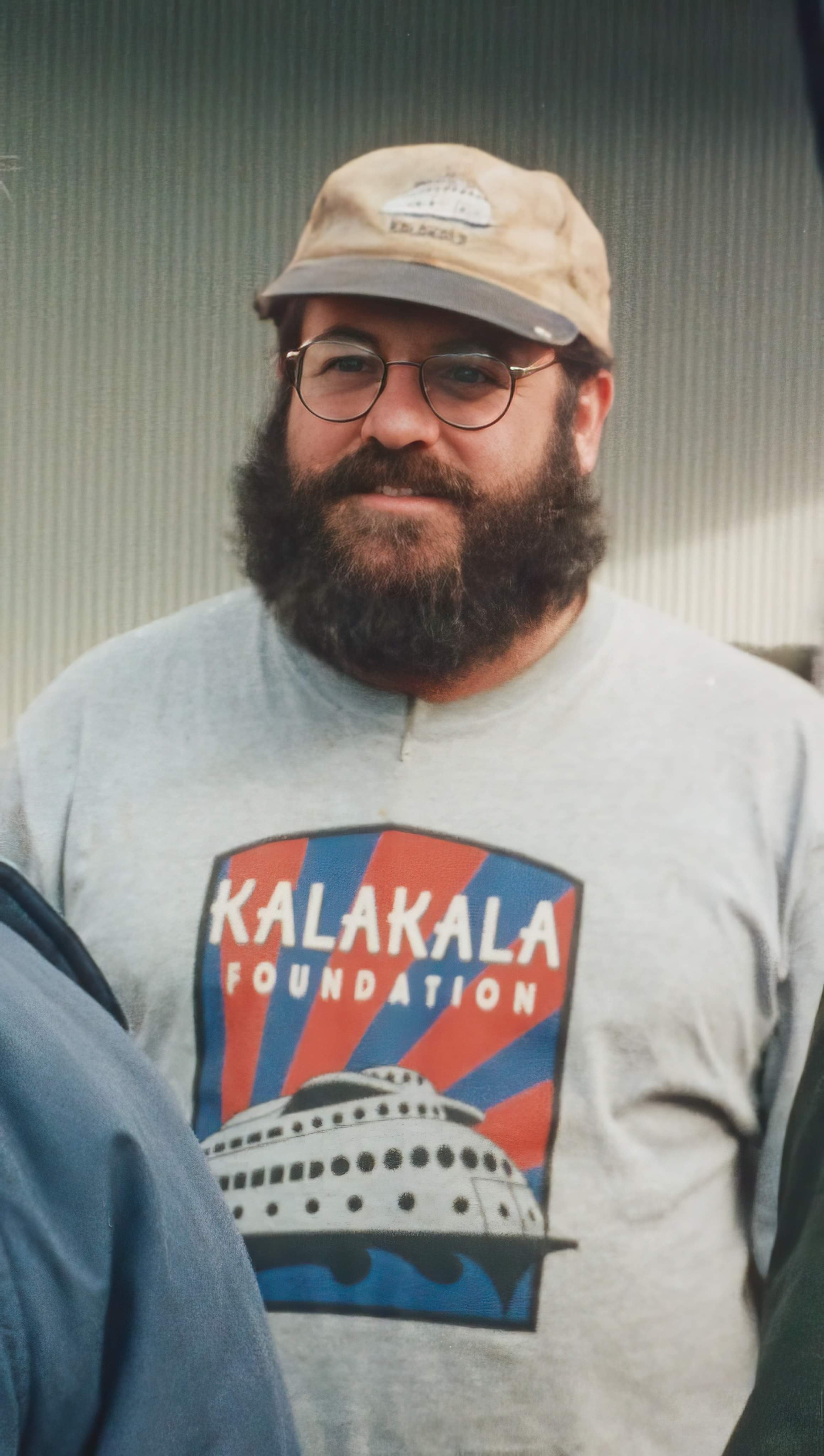


