

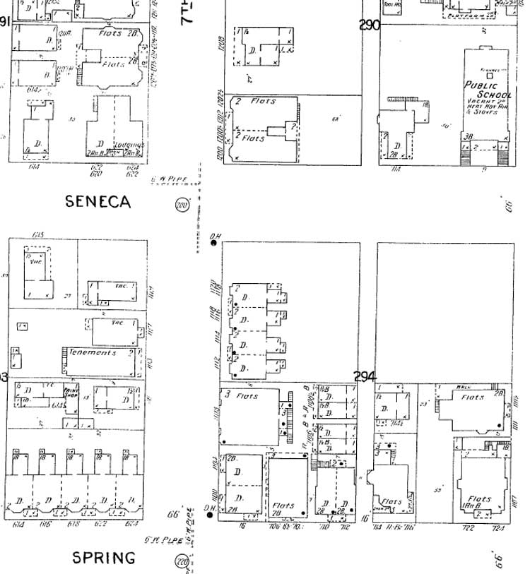
Sixteen years later in the 1904 Sanborn map, the Onarga footprint appears facing Seventh Avenue from its east side, and the second lot north of Spring Street. Now four-row of houses begins to fill the remaining north half of the west half of block 294.