

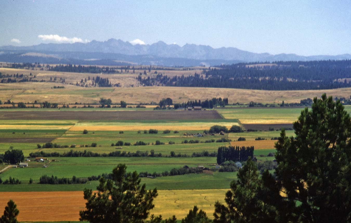
Here Horace Sykes is standing on or near the rim of the east moraine that helps hold Wallowa Lake like water in a feeding trough in Northeast Oregon. First in the middle ground is some farm land nearby the town of Joseph, which is at the north end of the lake, and so to the right and out of the frame. The horizon is broken by the several peaks of The Seven Devils Range. The ascend directly east of the Snake’s Hells Canyon. On their far side is the Salmon River which these mountains push to the north before the river can circle to the west where it joins the Snake River. Most of the Peaks in this range were named most likely in one sitting in symphony with the canyon that they fall into to the west. The slighty taller ones are left-of-center, and named the He Devil and the She Devil. The Ogre is another high point left of center, and the highest of them right of center is the Devil’s Throne. Other names in this range continue this somewhat silly landmarking. There is a Devil’s Tooth, a Mt. Belial, the Twin Imps, a Carbonate Hill (at 8,107-feet sort of high for a hill), a Purgatory Lake and somewhat off to the east a Horse Heaven. Also on the east side of these devils is the most enchanting Idaho Highway No. 95. It comes out of southern Idaho and winds for part of its climb to White Bird Pass, along the Little Salmon River. Like the highways of California, the best time to drive #95 is in April or May when the landscape is green.