Seattle Now & Then: The Ship Canal Bridge, 1960

(click and click again to enlarge photographs)

THEN: Looking northeast, Harvey Bernard’s cloud-strewn portrait of the incomplete Ship Canal Bridge in October 1960 captures Seattle mid-transformation. The Interstate 5 freeway through Seattle opened in December 1962, and the entire Washington state portion was completed in 1969. (Courtesy, Harvey & Leo Bernard)
NOW: Having helped triangulate Harvey Bernard’s original prospect on a hot, late summer day, Keenan Ingram (left) and Elijah Lev of Seattle anticipate diving into Lake Union to cool off. Seconds later, they did just that. (Jean Sherrard)

(Published in the Seattle Times online on Sept. 24, 2020
and in PacificNW Magazine of the print Times on Sept. 27, 2020)

A soaring salute to post-World War II car culture
By Jean Sherrard

World War II didn’t just beget a population boom. It also produced the throaty roar of automobile engines. Along with the proverbial chicken in every pot, a growing middle class aspired to afford a car in every garage.

To accommodate the soaring increase in traffic, the Federal Aid Highway Act of 1956 provided 90 percent funding for a nationwide network of controlled-access interstate highways. The proposed Interstate 5, crossing 1,381 miles between the Canadian and Mexican borders, became one of the jewels in its crown.

This week’s “Then” photo comes from Leo Bernard, whose father, Harvey, moved his young family to Seattle from Minnesota in 1954 to take a job with Boeing. “Photography and mountain climbing became his twin passions,” Leo says, “and we rarely saw him without a camera.”

From a boat deck near the north end of Lake Union, Harvey Bernard captured his Ektachrome transparency of the Lake Washington Ship Canal Bridge under construction in October 1960.

From his vantage, three of seven concrete piers tower above Lake Union, along with a diagonal hash of equilateral steel trusses, providing support for the imposing double-deck bridge. Within a year, its eight-lane wide upper deck and reversible four-lane lower deck would span the 4,429-foot gap between the University District and Capitol Hill. At the time, it was the longest bridge of its kind erected in the Pacific Northwest.

Just west of the piers, the Wayland Mill silo burner squats like an abandoned potbelly stove. The mill produced Bungalow brand cedar shingles for decades before closing after the war. Restaurateur Ivar Haglund purchased the property in 1966 and installed his Salmon House, which still stands today.

To the mill’s right, the nondescript, grey warehouse, built in 1954, was purchased in 1963 by George and Stan Pocock to construct their legendary racing shells. Pocock supplied shells for “The Boys in the Boat,” who rowed them to gold in the 1936 Berlin Olympics, a story featured last March in this column.

In 1989, Seattle-based glass artist Dale Chihuly bought the 11,352 square-foot building, converting it to a combined living space and glass-blowing studio.

For months, the span, when completed, was a bridge to nowhere. The southern reach of the Seattle freeway had become temporarily mired in controversies over labor and design. Thus, according to the encyclopedic tome “Building Washington” by Paul Dorpat and Genevieve McCoy, planners of the 1962 Seattle World’s Fair proposed using the bridge’s empty decks for overflow parking.

The scheme never materialized. But modern motorists are all too familiar with I-5 as a parking lot.

WEB EXTRAS

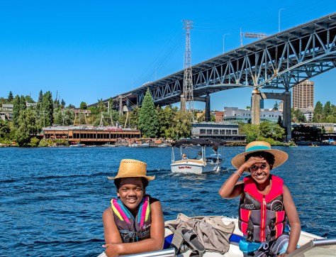
Check out Jean’s 360 degree video including a late summer boat ride – and featuring young Keenan and Elijah. To be posted soon.

Also, here are a few more lovely photos from Harvey Bernard, contributed by his son Leo.

Harvey Bernard with an early but beloved camera in the 1930s.
Harvey Bernard in 1965.

Taken in 1970, says Leo – looks like the Salmon House is still under construction.
From a West Seattle viewpoint, the Seafirst Tower (aka the box the Space Needle came in) under construction, 1968.
Seafirst Tower under construction, 1968.
Seattle skyline from North Beacon Hill.

Union Station after the 1965 earthquake.

More earthquake damage on Alki.
Richard Nixon visited Seattle during his 1968 campaign.
Washington state’s Gov. Dan Evans shaking Nixon’s hand.
Harvey Bernard loved Mount Rainier.
He visited the the mountain many times, says son Leo, who shared a favorite family photo on Rainier. Leo is second from the left, next to mom, with his two sisters and younger brother.

Seattle Now & Then: Miller Park neighborhood, 1955

(click and click again to enlarge photos)

THEN: This May 2, 1955, view, looking west from 21st Avenue East along the East John/Thomas street arterial, shows clearing to the right (north) for the expansion of Miller Playfield. A 1949 Buick anchors the left foreground. In the distance at center are the Coryell Court Apartments, featured in the 1992 film “Singles.” (Courtesy Seattle Municipal Archives)
NOW: Andrew Taylor, the informal Mayor of Miller Park for two decades, stands at the same intersection. (jean Sherrard)

(Published in the Seattle Times online on Sept. 17, 2020
and in PacificNW Magazine of the print Times on Sept. 20, 2020)

For an ever-changing neighborhood, we ‘single’ out Miller Park
By Clay Eals

These coronaviral days, when distant travel is discouraged, the elements defining our neighborhoods assume extra meaning. We more deeply value our collective, super-local identity even as it undergoes constant, if incremental change.

No exception is Miller Park.

The name may be unfamiliar to some. On the eastern side of Capitol Hill, the neighborhood embodies a trapezoid, bounded north-to-south by East Aloha and Madison streets and west-to-east by 19th and 23rd avenues. Its outskirts include business strips and high-profile hubs of health care (Kaiser Permanente, formerly Group Health), religion and education (St. Joseph Catholic Church and School, Holy Names Academy).

In the glen at its core lies a playground, the initial acreage for which came to the city in 1906 from namesake Mary M. Miller (see clarification below), whose descendants became major local landowners and conservation philanthropists. Next door is Edmund Meany Middle School, named for the University of Washington historian.

In our “Then,” taken May 2, 1955, looking west to the Capitol Hill crest, at right we see land recently cleared to augment the park prior to construction of a nearby community center. Sparse trees punctuate clusters of homes. In the distant center, the John/Thomas street arterial rises to pass a two-story brick building on 19th Avenue that nearly four decades later gained national fame.

Fronted by a communal courtyard, the Coryell Court Apartments, built in 1928, hosted Matt Dillon, Bridget Fonda and other actors playing 20-something love-seekers in Cameron Crowe’s 1992 film “Singles.” While the film widened Seattle’s reputation for grunge music, it also is known for a breathtaking visual finale. Shot from a helicopter, it starts tight on the Coryell building and pulls up to reveal the neighborhood and city.

Nearly 30 years hence, encased by the heavy foliage of mature trees, Miller Park is a mix of single- and multi-family housing. Its residents have reckoned with drug dealing, broadcast towers, affordable housing and today’s influx of transient tents in the park.

Such topics drew Andrew Taylor into the role of nerve center. The now-retired Fred Hutch scientist has lived in the house at the left edge of our “Then” since 1983. Known as the neighborhood’s informal mayor, he launched its newsletter (later a blog) in 1990.

For family reasons, he will move five miles north this fall, but despite the challenges of his “eclectic” soon-to-be former neighborhood, he cheerfully salutes it.

“It’s a quiet, modest oasis,” he says. “It’s ethnically and economically diverse, close to everything, with much activity but still peaceful enough for quiet contemplation.”

In other words, an apt model for our time.

WEB EXTRAS

To see Jean Sherrard‘s 360-degree video of the “Now” prospect and compare it with the “Then” photo, and to hear this column read aloud by Clay Eals, check out our Seattle Now & Then 360 version of the column!

Clarification: Jim Rupp of Seattle points out that while Mary Miller donated the initial land for Miller Playfield, the donation was made the family in the name of her son, Pendleton.

Below are two photos, a video link and a Seattle Parks historical illustration, as well as a clipping from The Seattle Times online archive (available via Seattle Public Library) or other online newspaper sources that were helpful in the preparation of this column.

For those interested in more details about Miller Park, the neighborhood association has a current website and a former website.

Here is an uncropped version of our “Then.” (Courtesy Seattle Municipal Archives)
Here is a reverse angle of our “Then” photo, looking east along the John/Thomas arterial. (Courtesy Seattle Municipal Archives)
CLICK PHOTO FOR VIDEO: Andrew Taylor, the informal mayor of Seattle’s Miller Park neighborhood, talks about its characteristics and issues. (14:50, Clay Eals)
The Miller Park page of Seattle Parks’ Don Sherwood illustrated historical files. (Seattle Municipal Archives)
Dec. 9, 1967, Seattle Post-Intelligencer, page 2.


Seattle Now & Then: The Central Terminal, 1928

(click to enlarge photos)

THEN 1: The spire of Gethsemane Lutheran Church peeks out above the new Central Terminal’s tiled roof. On the far right of Asahel Curtis’s 1928 photo, a sliver of a Seattle-Everett Interurban train car can be seen. (Paul Dorpat collection)
THEN 2: Jean’s 2010 repeat featured a still-thriving transit hub, surrounded by new construction.
NOW: The 45-story Hyatt Regency looms over a nearly deserted Eighth Avenue. Around the corner but unseen, the Lutherans remain faithful. For more of Jean’s photos of the Greyhound station, including its 2015 demolition, see below. (Jean Sherrard)

(Published in the Seattle Times online on Sept. 10, 2020
and in PacificNW Magazine of the print Times on Sept. 13, 2020)

Greetings, goodbyes, and the growl of Greyhounds no more

By Jean Sherrard

I left home for the first time in the mid-1970s, bound for college on a cross-state bus. My parents stood together at the gates of the bustling Greyhound depot at Eighth and Stewart, but only my mom waved goodbye as if wiping a fogged window.

Just another emotional departure – to be followed a few months later by a joyful reunion – enacted in the charmless station, witness to decades of greetings, farewells and brimming buckets of tears.

Known for the slender, mid-stride canine in its visual brand, Greyhound began with a single 7-seat bus in 1915. The ubiquitous fleet rolled across America’s heartland and into its hearts, mythologized in popular culture as the buzzing locus of accessible romance and adventure.

From the Oscar-bedecked Frank Capra comedy “It Happened One Night” to Paul Simon’s aural anthem “America,” boarding a bus suggested the promise of open roads, unknown vistas and cute meets. But we’re getting ahead of ourselves.

Twenty years before Greyhound acquired it, Seattle’s Central Terminal was erected in 1927 by the Stone and Webster Management Company, a nationwide utilities cartel with fingers in many pies. (Its complex genealogy can be traced directly to today’s Puget Sound Energy.)

While anti-monopoly laws eventually divided the pies into smaller slices, its three-story, brick-clad Seattle structure was an innovation, accommodating motorized cross-country buses and intercity electric trains within a single station.

Its lively inauguration on Sept. 12, 1927, included a parade of progress along Stewart Street, led by a primitive, hand-drawn sled and concluding with “the most modern motor coach.” Bertha Landes, Seattle’s first female mayor and the honorary conductor, rang a trolley bell to herald the Seattle-Everett Interurban car’s virgin trip from the sparkling station.

This confident investment in the future of mixed-use travel had a shelf life of only 11 years. By 1939, buses shouldered out trains and tracks were torn up and smelted down, replaced by gasoline engines and rubber tires.

In 2015, the terminal was demolished, giving way to high-rise development. I have visited the site several times to capture a photographic whiff of those heartfelt arrivals and departures where Greyhounds once growled. That aroma, however, has been dispelled by the winds of change.

The newly completed Hyatt Regency monolith – at 45 stories and 1,260 rooms, Seattle’s largest hotel – surely boasts luxurious interiors and spectacular views of the city. But its glossy, street-level exterior seems uninviting.

A passing mail carrier offers a trenchant critique: “Five years ago, Eighth Avenue was filled with little shops and businesses. Now it’s all glass walls. Did you know that over there was once a bus depot?”

WEB EXTRAS

As promised, a few photos from 2010, when the depot was still operating at 8th and Stewart:

Signage along Stewart, looking west.
The shit-colored floors were a distinctive feature
Departures and arrivals…
A bus departs from beneath the steel canopy

Then a melancholy few from 2015, nearing the end of demolition:

Seattle Now & Then: Native American camp, late 1890s, and Benson Waterfront Streetcars, 2005

(click and click again to enlarge photos)

THEN1: Pictured just north of today’s Broad Street on the Seattle waterfront by Norwegian photographer Anders Wilse in the late 1890s, Native Americans prepare dugout canoes for their waterborne trek to hop fields in the White and Puyallup river valleys. Queen Anne Hill peeks out at upper left. (Courtesy Museum of History & Industry)
THEN2: One of five George Benson Waterfront Streetcars leaves the Broad Street Station in 2005, just prior to the line’s demise. The 1962 Space Needle anchors the scene at top. (Eric Bell)
NOW: Straddling the two “Then” vantages, our contemporary view shows West Seattle bicyclist and photographer Eric Bell on Pier 70, before the seawall that fronts Seattle Art Museum’s Olympic Sculpture Park. To the right of the outsized human head of “Echo” by Jaume Plensa and below the vertical Pier 70 banner is the site of the former Broad Street station of the Benson streetcars. (Jean Sherrard)

(Published in the Seattle Times online on Sept. 3, 2020
and in PacificNW Magazine of the print Times on Sept. 6, 2020)

Waves of waterfront change: canoes to streetcars to sculpture
By Clay Eals

It’s natural to mourn the loss of things from younger days – old homes, favored stores – as if they had “always” been there. Self-centered sentiment can steal our sense that something else existed before we entered the arena.

Case in point: today’s pair of “Thens.”

If you lived here from 15 to 38 years ago, you may gravitate to the “Then” depicting the green-and-yellow glow of a George Benson Waterfront Streetcar leaving its Broad Street station and motoring south (right) to Pioneer Square and the Chinatown-International District.

The rickety streetcars – five total – were themselves nostalgia pieces, built in 1925-1930 in Australia and first operated there. Here, tourists loved them, and locals were proud, none more so than Benson, the pharmacist-turned-city councilman for whom they were named and who championed their transition to Seattle as an attraction for the masses. They were a direct nod to our city’s own streetcar heritage, which screeched to a halt by 1941, eventually overrun by petroleum-powered transit.

But what preceded the Benson streetcars? One answer lies in our earlier “Then,” from the late 1890s, angled more directly north and revealing a temporary Native American camp north of Broad (then Lake) Street, long before the city built a seawall there in the mid-1930s.

Pioneer journalist-historian Thomas Prosch labeled this a “common scene.” Via dugout canoes, Prosch said, Native Americans headed from Canada to the White and Puyallup river valleys, where up to 1,000 received low wages to pick hops, fueling a booming industry.

One century later, this waterfront stretch had evolved into pier-based offices and eateries and a breathtaking park named in 1976 for Myrtle Edwards, another city council member, fronting the northern terminus for the Benson streetcars and their maintenance barn when they commenced in 1982.

Having died in 2004, Benson didn’t witness the 2005 demise of his streetcars, whose barn was razed when Seattle Art Museum built its Olympic Sculpture Park, shown in our “Now.”

Some have strategized to revive the streetcars. But trackage and stations fell victim to the 2019 teardown of the nearby Alaskan Way Viaduct for its replacement by a tunnel. Today, a modern, light-rail connector to parallel the waterfront along First Avenue – which some would like to include two retrofitted Benson cars – is stalled by money woes.

Just as those who remembered the Native American canoes are gone, those of us who recall the Benson streetcars will vanish, and the collective memory of the area will default to Olympic Sculpture Park. For the attractive and lucrative waterfront, however, we surely can forecast relentless waves of change.

WEB EXTRAS

To see Jean Sherrard‘s 360-degree video of the “Now” prospect and compare it with the “Then” photo, and to hear this column read aloud by Clay Eals, check out our Seattle Now & Then 360 version of the column!

Below are eight clippings from The Seattle Times online archive (available via Seattle Public Library) and other online newspaper sources that were helpful in the preparation of this column.

Also, check out 18 additional photos, including 13 by West Seattle’s Eric Bell, that were helpful in the preparation of this column. Bell, who worked on the waterfront in 2005, says the failure to retain and incorporate the Benson streetcars was a huge missed opportunity for the city.

May 18, 1980, Seattle Times, page 124.
July 18, 1980, Seattle Times, page 16.
March 13, 1981, Seattle Post-Intelligencer, page 56.
April 4, 1981, The Oregonian, page 1.
June 16, 1981, Seattle Post-Intelligencer, page 1.
May 18, 1982, Seattle Times, page 67.
May 30, 1982, Seattle Post-Intelligencer, page 3.
June 24, 1982, Seattle Times, page 72.
Sanborn plate #62 from 1893, showing the location of our first “Then.” (Courtesy Ron Edge)
A 1935 aerial view of the waterfront from Laidlaw and the Museum of History & Industry. (Courtesy Ron Edge)
A 1935 view of the waterfront seawall under construction. (Courtesy Ron Edge)
Elliott Couden (left), further real-estate agent and civil-rights and heritage activist, stands in 1939 with George Benson, future Seattle City Council member, in front of their rooming house in the Green Lake neighborhood. (Elliott Couden collection)
An anachronistic George Benson Waterfront Streetcar crossing sign remains today along Alaskan Way. (Clay Eals)
A 2005 view of a northbound George Benson Waterfront Streetcar, W2-class car 512 leaving Vine Street. (Eric Bell)
A 2005 view of a southbound George Benson Waterfront Streetcar. “The writing is on the wall,” says Eric Bell. “The background beckons the end of the line for the streetcars.” (Eric Bell)
A 2005 view of a southbound George Benson Waterfront Streetcar and the maintenance barn. Seattle Art Museum’s Olympic Sculpture Park now sits on this site. (Eric Bell)
A 2005 view of a northbound George Benson Waterfront Streetcar. Eric Bell says, “The timber and windows of car 482 complement the glazing of the former Seattle Trade Center.” (Eric Bell)
A 2005 view of the interior of a George Benson Waterfront Streetcar. “It’s a non-seasonal day,” says Eric Bell. “Gone are the lunch crowd and tourists.” (Eric Bell)
A 2005 view of a southbound George Benson Waterfront Streetcar, W2-class car 512 in Pioneer Square, with the Alaskan Way Viaduct in the background. “To this day,” says Eric Bell, “I can still feel the car rumble by me.” (Eric Bell)
A 2005 view of a George Benson Waterfront Streetcar at Jackson Street, the southern terminus in the Chinatown-International District. (Eric Bell)
A November 2005 view of two disengaged George Benson Waterfront Streetcars ready for transport. “The advertising,” says Eric Bell, “mocks instead of entices.” (Eric Bell)
A 2005 view of a George Benson Waterfront Streetcar, W2-class car 605, zooming along at 25 mph along the waterfront. (Eric Bell)
A 2005 view inside a George Benson Waterfront Streetcar, indicating that the W2-class cars, produced in 1927 in Australia, largely retained their decor until service ended. (Eric Bell)
A 2005 view of the car number of a George Benson Waterfront Streetcar. The cars retained their original numbers and 1920s headlight design. (Eric Bell)
A 2005 view of a George Benson Waterfront Streetcar logo, originally from the Melbourne and Metropolitan Tramways Board. (Eric Bell)