
(click to enlarge photos)


Published in The Seattle Times online on Feb. 2, 2023
and in PacificNW Magazine of the printed Times on Feb. 5, 2023
Magnolia Beach offers proverbial wave of the future
By Jean Sherrard
In 1913, below Magnolia Bluff and today’s Discovery Park, a Webster & Stevens photographer captured this revealing pair of images of South Beach. In the northwesterly view, gleaming West Point Lighthouse anchors a sand spit, known to the Duwamish as Per-co-dus-chule or “thrusts far out.”
Early mariners knew the peninsula as Sandy Point and welcomed installation of the lighthouse in 1881, the first on Puget Sound, to warn of the hazardous shoal at the north end of Elliott Bay, site of many shipwrecks.
The lighthouse compound was accessible only by water until the arrival of the Army at nearby Fort Lawton in 1900, when a steep dirt road was cut from the top of the bluff down to the shoreline. Even then, lighthouse keepers and their assistants led an envied if isolated existence.
In 1984, West Point Lighthouse was one of the last stations on the West Coast to be automated. Owned and operated by Seattle Parks since 2004, its beacon continues to guide sailors safely home.
But what of nearby 300-foot Magnolia Bluff, lined with native madrona trees? Theories abound as to its misnaming. Most likely Navy Captain George Davidson erred during his 1856 survey of Puget Sound, confusing one broadleaved evergreen for another.
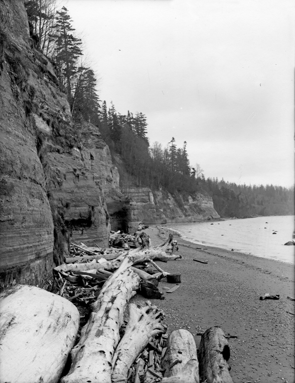
The beach itself also invites puzzlement. Aside from the absence of color, little seems to distinguish then from now. But Port Townsend oceanographer and coastal hazards specialist Ian Miller begs to differ.
“It’s hard to express how excited I [am] by these 110-year old photos,” he says. “We have so few historical images of these bluffs and shorelines, and I’ve never seen anything like them.”
For Miller, two elements warrant particularly close study: the size and quantity of logs on the beach and the coarsening of its sand and gravel, both of which provide vital environmental clues. Today, with much of Puget Sound “armored” by seawalls, riprap and hard surfaces, natural beach formation has been significantly disrupted.

South Beach, however, nourished by the gradual erosion of its towering bluffs, has maintained equilibrium, rebuilding itself through sedimentation over time. Its sands provide vital spawning grounds for smelt and other forage fish, prey for salmon. “From an ecological standpoint,” Miller says, “these are very important elements of the marine food web.”
What will the next 100 years bring? “As sea levels continue to rise,” Miller says, “this section of beach may provide a microcosm for Puget Sound restoration.”
In other words, reducing coastal “armor” and allowing resilient shorelines to erode and rebuild naturally may be the wave of the future.
WEB EXTRAS
For our 360 video version of the column, click here.

And here are four related “Now & Then” columns by Paul Dorpat, from 1984 through 1991: