THEN: It was surely a bright idea to use Golden Rule, the name for the central moral maxim of humankind “Do unto others as you would have them do unto you.” as also the banner for one’s emporium of often bargain-priced housewares. (Courtesy Michael Maslan)NOW: In the “mirror” of his repeat recording of what once was the 713 3rd Avenue address of the Imperial Studio, Jean Sherrard has without trying included himself.
For posing before the decorative backdrop in Rasmus Rothi’s Imperial Studio, why, we wonder, did this sturdy woman hang dolls low on her theatrical dress? We will call it our April’s Fool question for we have no bright answer on this first day of April. What’s more with Jean Sherrard’s repeat we were at first fooled and confused – until he explained it.
“Shooting west, I stood with my back to the bus stop near the southwest corner of Third Ave. and Columbia Street. While I was photographing the reflecting face on the Third Ave. side of the elegant Chamber of Commerce Building, a pedestrian crossed in front of me either mumbling to himself, I thought, or grumbling at me. The photograph, however, reveals that while thoughtfully stooping to avoid interrupting my shoot he was talking on his cel. Still I got the top of his head.”
Arriving from San Francisco in 1881, Julius and Louisa Bornstein, with help from sons and brothers, opened the Golden Rule Bazaar in 1882, and with good timing. One year more and the Northern Pacific Railroad reached Tacoma, the first transcontinental to Puget Sound. Both Tacoma and Seattle boomed, accompanied by an industrious symphony of dynamite, hammers, saws and cash registers. The Bornstein’s registers were especially musical for their prices were often low. They claimed to be the first store on the Pacific Coast to have 10, 15 & 25-cent counters.
Through its more than 20 years selling the essential stuff of home economics – like crockery, chambers, spectacles, nutmeg grinders, trunks, lamp chimneys, dollar watches, potato mashers, glassware, enamelware, and willow ware – the Golden Rule Bazaar prospered. It should be noted, apropos the hanging dolls, they also sold toys.
WEB EXTRAS
Considering that the actual location of 713 3rd Ave. was one of two bays in the side of a building, I shot, as you know, Paul, two possible ‘Nows’. The first was the mirrored window we chose to use. The second was the next bay south. Here it is:
Another interpretation. The closed door...
Anything to add, Paul?
We will not disappoint you Jean – yes we do! But not so much this time,
In part it is because of the April Fool’s “theme” – we are habitually so wise, seemingly, that this foolishness does stump us some. “I thank the lord for my humility.” said Richard III. The other part player in our paucity is Helix. We spent most of the day putting up the “Helix Returns” feature – with lots of help from Ron Edge – which starting tomorrow, will follow Seattle Now and Then as surely as Monday follows Sunday West of the Mississippi and, for that matter, as surely as Sunday comes before Monday East of the Mississippi. They are easy confused.
Now we will add three – only – more features that appeared first in Pacific, and the first of these is another on the Golden Rule, consequently, we do repeat some from the one to the other. Then we will go across the street – First Ave. aka Front Street – to the Southwest corner with Marion Street and study Seattle Hardware’s window decorations for some Christmas in the 1890s. We will also study the window, for the reflections are also revealing. And then, but not finally, we will reprint a feature from the last time April Fools sat hard on a Sunday, with a story about that one who was so talented in making us feel – ordinarily – happily fooled by his hoaxes. Ivar. We have one.
After a few foolish interludes we will conclude with an art quiz, which is, in its “art is anything you can get away with” way, quite appropriate for April Fools, like you and I and the readers, Jean. We will ask “How was this art made?” It is a question about artistic technique – sort of. We will wait first for readers to offer their conclusions on these aesthetics, and then next Sunday we will describe the technique in detail in case anyone would like to use it.
=====
Golden Rule Bazaar at the southeast corner of Front St. (First Ave.) and Marion Street in the late 1880s and before it was destroyed in the city's "great fire" of June 6, 1889.
THE GOLDEN RULE BAZAAR
( First appeared in Pacific, Aug. 11, 1991)
One of Seattle’s first department stores, the Golden Rule Bazaar, was founded by a man who failed in the gold fields. Down and out in Comstock, Nev., Julius Bornstein chose Seattle over Portland and Walla Walla to begin again. He brought his family here in 1882, and within three years the Bornsteins had their own storefront on First Avenue, at Marion Street. Eighty years later Julius and Louisa’s son, Sam, recited for Seattle Times writer Lucille McDonald some of the pioneer staples the Bornsteins sold here: “Lamp chimneys and wicks, dollar watches, chamber pots, spectacles, clothes hampers, market baskets, wooden potato smashers, . nutmeg grinders, luggage … telescopes and toys at Christmas.”
Sam Bornstein recalled a brisk business in baskets that his father purchased from the natives in exchange for cooking utensils. Sam also claimed that the Golden Rule Bazaar was the first store on the Pacific Coast to have counters devoted exclusively to cut-rate items priced at a nickel, a dime, 15 cents and a quarter.
The Golden Rule Bazaar - its sign - appears here just left of center. The Frye Opera House with its mansard roof is on the left, and below it, far left, is the dark rear facade of the Pontius row on Front's (First) west side south of Madison. It is there that the city's Great Fire of 1889 started. Top-center and on the horizon is Central School on the south side of Madison Street, between Sixth and Seventh Avenues, and now part of the I-5 freeway trench, or ditch, or drawn-out pit or concrete canyon. Columbia Street is on the right. A likely date is 1886.
Seattle’s “Great Fire” of June 6, 1889 was made considerably less spectacular by the 12-year-old Sam. News of the fire reached his school soon after it started about one block north of the family business. Sam bolted, commandeered an idle wagon and two horses, and hauled away three truckloads of fireworks that his father had recently purchased for a Fourth of July promotion. The fireworks and a few blackened pieces of china were all the Bornsteins saved from the flames, which soon overran’ the entire business district. They did, however, hold their Independence Day sale in a tent.
The family’s business prospered again. During the gold rush Sam recalled that “the miners were nuts. They just took the stuff away from us. We didn’t have to do any selling.” By 1910 the firm of J. Bornstein and Sons was operating exclusively wholesale, a business that in 1927 was favorably sold to the Dohrman Hotel Supply Company.
This feature, Seattle Now and Then, is now in its thirty-first year. This is, I believe a poor second place to the record for free lance publishing longevity set by C.T. Conover for his feature "Just Cogitating." Conover kept at it and at it - he is best remembered as the promoter to named Washington the "Evergreen State," and near the end frequently repeated himself. Perhaps no one would tell him, or perhaps no one was paying attention. Here Conover treats on a subject the includes the Golden Rule. Click to Enlarge
=====
The reader may wonder – with the writer – if the molding just above the sidewalk in the ca. 1900 record of the Seattle Hardware storefront at 823 First Avenue is – in spite of the obvious changes here – the same as that in front of Starbucks – this Starbucks – in the Colman Building at the southwest corner of Marion Street and First Avenue. (History photo courtesy of Lawton Gowey)
MERRY CHRISTMAS
(First appears in Pacific for Christmas, 2005)
Considering the mix of reflections and fancy stuff emitting from this elegant window the reader may miss the “Merry Christmas” that is written with fur sprigs. The letters are attached to a wide white ribbon that arches from two posts of presents, left and right. And in the center is a third pile of gifts including a few dolls and a cluster of oil lanterns just below the banner bearing the company name, Seattle Hardware Co.
Once a stalwart of local home improvements Seattle Hardware tempted shoppers through these plate glass windows at First and Marion beginning in 1890 when the Colman Building was new. Like the clapboard structure John Colman lost here to the “Great Fire” of 1889, he prudently kept his post-fire brick replacement at two stories until it proved itself. Eventually with both Seattle Hardware and the popular grocer Louch and Augustine (predecessor to Augustine and Kyer) at the street level this was one of the busiest sidewalks in town.
When Colman was preparing to crown the success of his two floors by adding four more to his namesake building Seattle Hardware built and moved to its own brick pile at King Street and First Ave. South in the fall of 1905. The elegant post-fire neighborhood you see reflected in Seattle Hardware’s big sidewalk windows, of course, stayed put. The Burke Building at Second and Marion and the Stevens Hotel – seen here back-to-back on the right – were razed in the early 1970s for the lifting of the Henry M. Jackson Federal Office Building. (The reader can get a correct reading of these reflections just below. We have flipped the picture.)
In the century since Seattle Hardware moved out and the building grew to six floors this storefront has been home for a parade of purveyors beginning with Wells Fargo. More recently Bartells Drugs, and Dalton Books held the corner and now Starbucks. In the “now” photograph a second promoter stands near the door to the coffee magnet and holds a sign that reads, “Disabled. Will Work. Navy Vet 78/82 Thanks.” This thankful modeling cost the photographer five dollars. Merry Christmas.
=====
Photo by Ivar Haglund, Courtesy of Ivar's Inc.
THE MADRONA SEA MONSTER
(A smaller version of this appeared in Pacific the last time April Fools fell on a Sunday – surely within the last ten years. This is a longer version – a rough draft for the part this story will play in “Keep Clam,” the book I am still writing about Ivar and Ivar’s. I certainly do hope to finish it this year!)
It was a late February afternoon, 1947, and Ivar was still riding the tail of international excitement over the spilled syrup. A gardener named Thomas (no first name given) saw it first. While trimming a hedge beside the A.B. Barrie home above Madrona Beach, Thomas looked out over a placid Lake Washington and saw “the hump.” Almost immediately his employer, Mrs. Barrie, saw it too, the “large crinkly-backed object” swimming south towards Leschi. “It was about 100 feet long but I could only see the middle which was about 25 feet . . . I thought its tail and head were submerged.” In the excitement both still reasonably assumed that the tale was probably forked and that the head resembled the face of a dragon. The experience shook Mrs. Barrie’s gardener. “He paled and left. I haven’t seen him since.”
The four-year-old Ivar already keeping an eye out over troubled waters.
What was needed to corroborate this first sighting of the Madrona Sea Monster was someone who could both get a picture of it and keep clam while doing it. Enter the historic opportunist Ivar Haglund, the steady owner then of two aquariums, one on Pier 54 beside his nearly new Acres of Clam seafood café and the other in Vancouver B.C. beside Lost Lagoon in Stanley Park.
To speed the capture Ivar offered a $5000 reward. “While the cost of building a tank for a hundred-foot long ferocious monster would be considerable I was willing to make the sacrifice.” Next Ivar got the picture, or a picture, which he claimed, “clearly shows an uncommon creature,” but also hid its forked tail and ferocious face. Ivar conceded that this first evidence of the Madrona Sea Monster might be interpreted as the rumps of several ducks swimming in a line. “Still I took a picture anyway. Five minutes later the thing submerged and didn’t come up again.”
Other sightings soon followed including confirmation from another landmark restaurateur, Ray Lichtenberger of Ray’s Boathouse in Ballard. Ray claimed to have seen it “heading out to sea.” A.T. Goodman, assistant lockmaster, agreed that a clever monster could have made it through the Chittenden locks by hiding beneath a vessel. Goodman also hinted that should the monster be caught in foreign waters it may be extradited to face charges on not paying for its flight through the locks at Ballard. Another authority confirmed that “sea monsters can survive on salt water, fresh water, or bourbon and water.”
In a relaxed interval from chasing monsters, Ivar Haglund keeps clam with something bigger than a clam but smaller than a monster.
While Ivar felt the monster hysteria rising around him he kept his wits. For instance, he instantly caught the failure of army barge skipper Sam Wiks’ report of seeing a snake-necked creature browsing on Kelp south of Dutch Harbor. “Sea monsters are carnivorous! What was this one doing munching on kelp?” Ivar was certain that they favored fresh tuna.”
With every failure to catch the monster Ivar’s confidence grew. “Madrona will probably be caught soon. It’s getting careless.” Confident that Madrona was headed for Vancouver, he equipped every aquarium attendant there with gill nets and sliced Tuna. The Vancouver Sun reported that Ivar had also parked purse seiners behind his aquarium “preparing to net Madrona, the Sea Monster, which he intends to place in the aquarium for the rest of eternity. ‘Sea monsters never die’ Ivar explained.”
In early March the United Press reported that Madrona had been sited heading for the open ocean. Dismayed that the monster might escape, Ivar exclaimed, “I’ve spent the past 24 hours scanning the waters of Puget Sound along with every fisherman I know. All we’ve seen is debris. I don’t know which I saw the most of — flotsam or jetsam.” In the end Haglund found consolation in philosophy. “Who are we to say that from the boundless depths of the ocean all the mysteries have been uncovered and brought to the surface?”
Ron Edge contributes this rendering of a certain serpent heading west past the Ediz Hook lighthouse at Port Angeles as encouraging evidence that, as the United Press noted above, that when feeling chased other Puget Sound monsters have headed for the open ocean years before Ivar's Madronna Monster made his or her run. There may well be other examples.
=====
The oldest and best known bazaar on the waterfront - here at Colman Dock.Ye Old Curiosity Shop founder Pop Stanley at the front door with one of his many admirers. (photo boy Link.)A curio competitor on the Marion Street overpass. And another - this time Ivar's own Trader Sravi (yes Ivar's spelled backward) at the front of Pier 54 in the early 1960, and designed, in part, to take advantage of Century 21 tourist trade.Carrying our theme from the top, more ladies on strange foundations.These dancers at Sunrise seem to have missed the mountain.Another EDGE CLIPPING from Ron Edge, and good advice as well. Here's a puzzle of motives. Was the figure cut from the group out of resentment or special admiration? Most likely the former, for both pictures here were taken from Stanwood native Mamie Staton's photo album. From the evidence of that album Mamie was a real player in Stanwood High Schools athletics. And there as a premonition in the juxtaposition we, alone, have wrought. Here she stands on the right with her own caption - not ours - "Missing Link." Mamie's standout quality was her height. She was tall and must have been a good rebounder, at least.
=====
A Blog Exclusive!!!
MORE EVIDENCE That DEMOCRATS HAVE MORE FUN – A WHITE HOUSE TOGA PARTY with Eleanor and Franklin.
=====
BLOG AESTHETICS – 4 PAINTINGS
It required three years – or more – to complete these four paintings and several others, if they are completed. But I like this quartet, and so will decide now to let them go. They are, again, part of a group that is distinguished by the technique I used to paint them. The medium was, fortunately, not expensive or I would not have developed its techniques. As noted above I’d like to “game” it, and ask readers – those who have got this far – to suggest what they imagine or know that the technique and media might be or are. I’ll report on the reports next week, and then reveal all, which will either confirm what is offered from others or prove to be unique. Frankly, it takes perhaps more than I have got to develop a new medium and/or technique, or are their new things under the sun that also continue into the dark and through it?
Edgar Allen Poe in ProfileLeda and the SwanStill Life by my WindowSunrise thru my Window
The HELIX cover printed just below appeared first on the 1st of December, 1967, which was still in the first year of the tabloid’s three year – and a few weeks – run. The cover was one of artist Jacques Moitoret’s many contributions to Helix. With age the pulp it was printed on has nurtured its color. Starting tomorrow, Monday April 2, 2012, we will feature it again on the front page of this blog as the front door – or button – to eventually all issues of Helix. We mean to put them up in the order they first appeared. Directly below Jacques’ butterfly is another and longer introduction to this project. You can read it and/or listen to it. The audio, which I recorded at my desk in one take!, runs about eight minutes. (When, in the context of revealing how Helix was conceived, I mention looking “down on 42nd Avenue,” please hear instead, “42nd Street.” It is correct in the copy, but wrong in the audio.)
By those who remember it, Helix may be described as “Seattle’s First Underground” newspaper. This, I think, is too romantic or glamorous. Rather, it was Helix candor – above ground – that was apt. It could be either disturbing or compelling – of course, depending.
Helix was conceived in a conversation with Paul Sawyer, a friend and Unitarian preacher, now deceased. I can recall the moment in color. We were alone in the Free University office (beige walls and gray ceiling), on the second floor above the Coffee Corral on University Way, aka “The Ave.” Under a blue winter sky and from the window I followed a couple walking hand in hand below me on 42nd St., when over my left shoulder Paul suggested, “What we need here is something like the Berkeley Barb.”
Paul Sawyer standing on the beach beside the park on the north shore of Lake Union, just west of Ivar's Salmon House. The photo is dated April 25, 2010. I took it during Paul's last visit to Seattle, a wind up, because he knew that he would not live out the year. He brought with him two boxes of his then new book "Untold Story," the cover's of which we will insert directly below this subject. Below the covers we include a page from Helix that features a poem of Paul's from the paper's first year, 1967.The covers of Paul Sawyers "Untold Story," 2010.
The Barb was one of the many weekly tabloids associated with the 1960s “counter culture” that were blooming then from Boston to L.A. and soon from Atlanta to – with Helix – Seattle. Most of these were loosely connected with university communities and the talents they offered. Here, for instance, Helix bundled Seattle’s University District and the University of Washington as part of a town and gown experiment. That was in the winter of 1966-67.
An early contribution of Walt Crowley's, an allegorical illustration of our struggle with City Council to hold light show dances. We won. Bitter Harvest, another example of the many covers Walt Crowley did for Helix.
Now thru the next nearly three years we will hang from this blog all manner of HELIX, which is every issue from Vol.1 No.1 to Vol. 11 No. 21. By posting one a week, and in the order they first appeared on the street, we expect, or hope, that the paper’s often illuminated pages will stimulate some responses and recollections – some current alternatives for drop out, turn on and tune in. Perhaps remember, reflect and rejoin.
A cover by Alaskan artist, Mary Hendrickson
The first issue of Helix is dated March 23, 1967, although it “hit the streets” a few days later. And then it popped! Pastor Paul was right – it was what we needed. It was our own news and opinion, often otherwise not reported. And it also yielded the small economics of street sales, which helped many get by. At 20-cents a copy our little pulp was enthusiastically consumed, sold by vendors whose enterprise was only limited by the number of copies they could carry and the charms at their corner. (The seller kept half the cover price.)
(Cartoons by Skagit Valley artist Larry Heald above, and below. All three of the artistic Heald brothers, Maury, Paul and Larry, were part of Helix.)
The first issue was late because Grange Press, the scheduled printer, on seeing the flats we delivered to their high-speed photo-offset webs, found the content somehow offensive. At the time this rejection mystified us, but if you choose to browse that same first issue – and it appears here first tomorrow – you may find something in it that hollers for more than editing, perhaps for censorship on the grounds of decency or national security. (And please point it out with a blog response.)
A back cover designed - and layout - by Paul Heald.
With help from some civil libertarians we found another printer, Ken Munson, a union man. Ken pulled good fortunes from the combination of our Grange rejection, and his Heidelberg flatbed press. This meant higher quality pressings and split-font color for the covers and centerfold on an array of colored newsprint. On the day of publication the flatbed also obliged a ritual for the staff that was at once bonding and blabbering. Every issue printed on Ken’s flatbed required hand folding and collating on the big tables in the Helix office.
Helping in the folding and collating line, Scott White turns to the camera. Scott was one of the younger staff members, and with the paper throughout. He was the first person I met in the University District, when we arrived at the same moment at the front door of the then still proposed Free University. He was then still in high school - a brilliant teen. The younger folder this side of Scott I recognize, although I cannot recall his name.Helix was part of the Underground Press Syndicate. We shared each others papers and could reprint content from them. This brought desirable contributions from great sources like cartoonist Art Crumb.
For the first few months Helix was published only every two weeks, but here from the start we intend to bring it back every week, ordinarily on those Mondays that aren’t busy with washing. We may treat Sunday’s Seattle Now & Then as a civic service, and Monday’s Helix as a humanist’s hippodrome. On the distinction of having first heard the voice of Pastor Paul over my shoulder in 1966, and having edited the paper for most of its life, I will introduced each issue with a commentary. Much of it will be new to me too, for although I was the editor through most of its life, I did not read it all. Editing the Helix was sometimes like being a coach, making certain that there were enough players were on the field.
Helix took part in the struggle to save the Pike Place Public Market. Here one of the paper's contributing photographers, Paul Temple, took the cover and centerfold for his study of "market faces."
For much of the staff, myself included, preparing and publishing a paper was like attending school, and many of us stayed involved in community life – even journalism – beyond owning a home and paying taxes. Throughout the weekly routine of publishing a newspaper we were more reporters than hippies, and much of the super sincerity often associated with those we primarily served – “the hips and the rads” – was wrapped by us in irony and the rules of evidence. Ours was a sort of liberal conspiracy of both self-taught and schooled intellectuals who might join a demonstration but when the nightsticks came out we might also think “My how ironic!” while running away.
The 1968 Sky River mud dance before being treated with color and the split-font feature of Ken Monson's flatbed Heidelberg press.The newspaper was the source or center for a variety of efforts off its pages, including be-ins in the parks, concerts at Eagles Auditorium, the Piano Drop and the multi-day music festivals that dropping a piano from the sky inspired - the Sky River Rock Festival in the late summer of 1968 and two more following. It rained that late summer weekend in '68 except for this moment when the sun splattered with the rain. From the stage, Sky River NO. 3, outside of Washougal, Washington.The paper's barely readable report on the Piano Drop, for which the Berkeley band County Joe and the Fish volunteered to play.Years later Country Joe admiring Paul Heald's poster for the Piano Drop. I remember Paul laying it out in the office, and I remember Joe taking it from me for his concert collection. For all the help he gave, Joe deserved a hundred posters.
After the next nearly three years of weekly postings, if we are then still able – I mean standing – with the readers’ help a book might be fashioned from all these reflections and reprints. Then certainly we would also have to edit. Thankfully, already one of our staff, Walt Crowley, wrote his book Rites of Passage which treats on the Helix and the events of that time and it can still be easily found in public libraries and perhaps your own. Add two years more to these about three of weekly offerings and we will be spot on for the paper’s Golden Anniversary. And then surely a few from the original staff will be lingering to lift a toast at the Blue Moon.
An example of an "illuminated page" in the paper. This one with part of a poem by Tom Parsons and a rapidiographed frame by Zac Reisner, another regular. The early romantic artist William Blake was an inspiration for such pages.
Above and below, two political cartoons by artist Mike Lawson.
Springtime is a good time to reminisce about our youthful enthusiasms, while also reflecting on some of our abiding concerns. We hope you respond. We will check for posts for one thousand days, should we survive them what with springtime allergies and day-in and day-out mortality.
Another illumination - this one with poet Gary Snyder and novelist Tom Robbins.The Great Clock was one of the "hoax reports" I created for the paper. It was believable enough to influence friend Tom Robbins' characters in his second novel, "Even Cowgirls Get the Blues." Another Larry Heald sketch, bottom-right, fits the story well. The cover - by Walt Crowley - for our issue closest to the 1969 moon landing.
*There was little that was “underground” about Helix. When the Yakima Eagle printed that they were determined to find out who was printing our paper and lead a boycott against them and us we published the details for them in Helix. Our only underground certainty we discovered after the paper passed away when we surveyed our stripped quarters on Harvard Ave. East. We found that our phone had been elaborately tapped, but then again almost certainly in the interests of decency and national security.
For may years after the paper folded in 1970, the front of our office on Harvard Ave. - just around the corner from what was then still a funky Red Robin Tavern - was plastered with concert fliers. Not so long ago - in 2008 - while driving by the old Helix office site, Jean Sherrard pulled over and posed me in its now tagged ruins for a panorama. The wire tap was far right.Renaissance Blues Man and Photographer Jeff Jaisun's capture of the eight who made it to the sidewalk from the party inside the Blue Moon Tavern celebrating the silver anniversary of the founding of Helix. Left to right are myself (Paul Dorpat), Maury Heald (with the great white beard), Paul Heald (with the lesser white beard), Alan Lande (shaved), Walt Crowley (having a good time), Tom Robbins (shaded), Jacques Moitoret (maybe stunned) and "Not So Straight" John Bixler, looking sort of straight. Except for Maury and Walt, we survive and hope to see each other and you as late as 2017.
This photo is taken from the terrace of the big store Galeries Lafayette located 40 boulevard Haussmann Paris 9th arrondissement, I enjoy the proximity of the Opéra Garnier, the viewers and the panorama of Paris…
Cette photo est prise de la terrasse des Galeries Lafayette situé 40 boulevard Haussmann Paris 9ème, j’aime beaucoup l’énorme présence de l’Opéra Garnier, les spectateurs et le panorama de Paris…
“Looking north from a railroad grade on Washington Street to Simmer's named subject, the corner of Third Ave. and Washington in Vancouver Washington on July 20, 1942. This apparently is Vancouver's auto row during the busy war years when that city was crowded with home front manufacturing, mostly of ships. Through his career Simmer did a lot of shooting for the Washington State Department of Highways. This is one of the subjects that Jean and I chose for our book "Washington Then and Now." We did not, however, use it. - Click TWICE to EnlargeOn a hot day in the summer of 2005 Jean lifted his camera with his 10-foot pole to a grade that approximated that of Simmer's shot from the elevated railroad grade. Jean, however, has moved directly into the once busy corner of 3rd and Washington to show its moribund condition in '05. The 1955 completion of the I-5 freeway thru Vancouver used these blocks for interchanges. They are hidden behind the screen of trees on the right.While visiting Portland to perform in a music and stage production there, Jean stopped by 3rd and Washington in Vancouver on March 16 to study the changes - whatever - that had come down in the nearly seven years since his first visit. The trees have been busy.
THEN: With his or her back to the then still future site of the Seattle Public Library, an unnamed photographer looks south on 5th Avenue thru its intersection with Madison Street. The piles of dirt and temporary small construction in the street may have something to do with building the Madison Street cable railway, which begin giving service in the summer of 1890. (Courtesy Lawton Gowey)NOW: The row houses at the southeast corner survived until replaced in 1934 by a Gilmore service station, which was razed for the 1966 construction of the College Club. The club had lost its old home on 7th Avenue to freeway construction in 1961.
I confess an attraction to “row houses,” and these at the southeast corner of 5th Avenue and Madison Street were one – or six – of Seattle’s best examples. While they depart from that domestic ideal (often put to rhyme) of a “stand alone home of one’s own,” together they share a cozy community, and show some architectural rhythm as well.
The likely date for this subject is sometime in the fall of 1889. The leaves have fallen from the tree on the far left but not on the saplings protected along the south side of Madison Street. Those young poplars survived to grow tall and once lined Madison thru its climb up First Hill. The year is chosen because the oversized Rainier Hotel, which here rises above the roof of the row, was quickly hammered together following the city’s “great fire” of June 6, 1889. It was meant to service a city that had lost most of its hostelries to the fire. Here, some of the Rainier’s construction scaffolding is still in place.
The row itself is nearly new. While the six homes do not appear in a city birdseye that was prepared in 1888 they do receive a careful rendering in one of the glories of Seattle cityscape, a 1891 colored lithograph birdseye. Also, with six addresses – 912 through 922 Fifth Avenue – it was easy enough to find some renters in this row with a little finger-browsing thru a city directory from 1892. For instance, insurance agent Frank Beach, his wife (not named) and two daughters, Annie and Nellie (both listed as artists) lived then at 916 Fifth, here the next to last flat at the far south end of the row.
On March 21, 1941 Nellie Beach was interviewed by this paper in anticipation of a performance by Polish piano virtuoso Artur Rubinstein for the Ladies Musical Club’s 50th anniversary celebration. We learn that Nellie Beach was not only one of the founders of this locally acclaimed club, but performed the first number in its first performance fifty years earlier when she was still living with her family here on 5th Avenue. Her mother was pleased, explaining in 1891, “I hope it will spur you on to keep practicing.” Nellie Beach taught piano in Seattle for forty years.
WEB EXTRAS
Anything to add, Paul?
Yes Jean – more Rows, Duplexes and other habitats. With the help of Ron Edge we will first link six previous front pages from our blog. We chose them because the are relevant, at least at the front or near it. Other associations will creep in that were apt for the story when it first ran, but may not be for these Rows, and Duplexes and such. We will also give a brief introduction to each of the six.
We begin with a feature that first appeared here on Dec. 4, 2010. It shares another boom-time example of a Seattle row house, one on Western Avenue in Belltown. I remember building this one around row houses – a few more of them.
The next link gets going with a wreck on the Madison Street cable railway. Its immediate relevance is the street.
The third link brings back – as introduction – a story done here about the view from Harborview Hospital to the Central Business District. It first appeared here (on the blog) on Jan 15, 2011.
The fourth link begins with the Sprague Hotel on Yesler Way, and appeared here first on Nov. 28, 2009.
Number Five – counting Links – takes a look into Belltown from Denny Hill, and was first published in the blog on May 3, 2009..
Finally – for this elaboration – our sixth link takes us again to the top of Queen Anne Hill for a feature that first appeared here on Oct. 9, 2010.
====
DUPLEX on COLUMBIA
(First appear in Pacific, Oct. 1, 1995)
Between Seattle’s “great fire” of 1889 and the First World War, the sparsely developed neighborhood between downtown and the top of First Hill was rapidly filled in. Rental homes, duplexes and wooden terraces or row houses accommodated the migration that swelled the city’s population sevenfold in 25 years.
As with these duplexes on Columbia Street just west of Fifth Avenue, there was great variety among them. Strip the Victorian rooming house in the center of this scene of its ornaments – the balusters, posts, extended eaves, trusses and the decorated terra-cotta tiles at the peak of its roofline – and a large shed would remain. But their owners seemed required to give their renters, however transitory, some touches of architectural grace. Here these concerns end at the roof, which is covered minimally with what appears to be unrolled tar-paper. To the right of the telephone pole a front porch sign reads “The Home Light Housekeeping Furnished Rooms.” The two white dots below it are milk bottles.
The duplex on the left is upscale from its neighbor, with a roof of cedar shingles and a brick foundation. (The center structure is most likely built on posts hidden behind wooden skirts.) All these residences use horizontal clapboards, but the house on the left frames its siding at other angles below and above the windows in the building’s front bays. The popular Victorian ornament of fish-scale shingles appears where the bay window swells between the first and second floors.
A glimpse of the brick south wall of the new First United Methodist Church is evident just above the gable, upper right, of the center duplex. The congregation still worships there. In 1951, they dedicated their new Parish House on the site of these old duplexes.
With a little searching the row on Columbia can be found in both the above photo from circa 1891-2 and the view below taken from the Hoge building at Second and Cherry when it was topped-off in 1911 or soon after. The landmarks on the horizon above are, to the left, the Central School on the south side of Madison between Sixth and Seventh Aves. (now the freeway) and, center, the Rainier Hotel between Columbia, the street that runs up through the scene, and Marion, 5th and 6th Avenue. It is seen also in the “featured” photo for today – the row on 5th and Madison. In the view below the hotel has been scraped away in preparation for a mess of smaller buildings. St. James has been added to the horizon (1907) and still with its dome, which it lost to the “Big Snow” of 1916. Also filling the bottom-left quarter of the format is the Central Building on the east side of Third between Columbia and Madison. If you are still searching for the row on Columbia’s north side and west of 5th Ave. you will find them in both images some distance above and to the right of the scene’s centers.
=====
The triplex at Spring and Boren is an example of the distinguished and yet affordable Victorian housing that was typical of Seattle during its boom decades between 1880 and 1910. Although both sturdy and stately many of these structures were short-lived, replaced with larger brick structures like the apartment house that took the place of 1017, 1019 and 1021 Spring Street. Historical photo courtesy of John E. Kelly III.
STAR-CROSSED ON SPRING STREET
Barely detectable, John E. Kelly Jr., the youngest of the then nine Kelly kids, here sits on the lowest of the steps that lead up to 1019 Spring Street, the center address for this triplex of Victorian row houses. It is a short row and compared to some it displays only a modest face of ornaments, latticework, shingle styles and recessed balconies. (However, it may have been quite colorful – a “painted lady.”)
Taking the Northern Pacific Route in only its tenth year as a transcontinental, the Kellys moved here from Waterford, New York in 1893 — just in time for the national depression beginning that year. Still the Kelly’s continued to prosper and multiply with John Senior opening a popular dry goods store downtown. And John Jr. soon rose from these steps on Spring Street to nurture a Seattle career as an architect.
Next the architect’s son John E. Kelly III continued the family’s talent for professional handiwork with a long career as a naval architect, and a valued activist for heritage with the Sea Scouts, the Puget Sound Maritime Historical Society, the Southwest Seattle Historical Society and, thankfully, Kelly-Gailey family history as well.
John “the third’s” mother Eileen, was the daughter of another First Hill household, the David and Elisabeth Gailey family. While Eileen was attending Broadway High School the Gailey’s bought a hotel, the Knickerbocker at 7th and Madison, and moved in. The maturing Eileen’s creative calendar included piano lessons with Nellie Cornish and courtship with John E. Kelly Jr. the lad on the steps.
It was during their dating that the couple shared a moment of unforeseen amusement – a brush of domestic kismet — when they determined that four years after the Kelly family moved out of 1019 Spring Street in 1896 the Gaileys moved in and kept it for eleven years before they left to care for their big hotel.
=====
“Bridal Row” at the northeast corner of Pike and 6th.
BRIDAL ROW, 6TH and PIKE
(Appeared first in Pacific, Feb. 23, 1983)
In 1888 young Dr. Frantz Coe came west from Michigan looking for a practice and found one in Seattle when ex-mayor Gideon Weed, who was also one of the oldest and most respected physicians in town, invited Coe to share his offices. So the 32-year-old doctor sent for his wife, Carrie, and soon they were settled into 606 Pike Street – one of the six newly built and joined abodes that together were called “Bridal Row.”
The Coes, however, were not on an extended honeymoon, for Carrie had brought with her their three children, Frantzel, Harry and their first-born Herbert. Within a year the Great Fire of 1889 would destroy the Weed and Coe medical offices but not the domestic peace along Bridal Row, which was described by Sophie Fry Bass in her book Pigtail Days in Old Seattle as “an attractive place with flowers in the garden and birds singing in the windows.”
Sophie also lived on Pike Street with her pioneer parents, George and Louisa Frye, just across Sixth Avenue from the Coes. The Fryes had moved there many years before when Pike was a path and their back door opened to the forest. In 1890 the corner of Sixth and Pike was no longer at the edge of town, but it was still largely residential. While the central city was loud with the noises escaping from its booming efforts to rebuild itself after the fire, the residents along Pike were still listening to birds sing, sniffing flowers, and some of them like the Fryes were even milking their own cows and gathering eggs.
Around 9:30 on the Saturday morning of September 20, this settled peace was interrupted by what the next day’s Post-Intelligencer called the “Panic on Pike Street.” Both Sophie Fry and young Herbert Coe were witnesses to a wild event that had “passers-by scattering in terror and women relieving themselves with piercing screams.” Sophie Fry Bass recalled how “I heard the chickens cackle loudly and . . . I shuddered when I saw the cougar cross Sixth A venue; I could hardly believe my eyes.” The cat had killed a chicken in the Kentucky stables a short distance from the Frye home. There it was also shot in its behind and, quoting the newspaper’s account, “enraged and uttering a terrific yell, it bounded the sidewalk and rushed down Sixth Avenue.” It turned up Pike Street and as “the panic spread to the thronged thoroughfare and all pedestrians made a rush for safety, with two great bounds the cougar landed in the yard of Dr. E.H. Coe’s residence.” Nine-year-old Herbert, who was playing on the porch, heard the warning shots and fled inside behind the fragile safety of the front room window. The big cat went to the window and looked back at him with his claws upon the pane. For one long transfixed moment they stared at one another until a man with a 44-caliber revolver emptied it into the cougar. Eight feet and 160 pounds of wild cat lay still in the flowers along Bridal Row.
In this view of the “Row,” Herbert sits atop the fence post. Behind him is the window that kept the cat from him. In front of him is the wooden planking across Pike Street, which Sophie Frye Bass remembered as at times “mighty smelly like a stable, owing to the horses . . . In summer the water wagon went down the dusty planks each day. There was a street sweeper too, and when it came, all would rush frantically to close the windows.”
By 1895 with the encouragement of a very good practice and the steady conversion of Pike Street into a commercial thoroughfare, Frantz Coe and his wife Carrie left Bridal Row and took their children up to a bigger home on First Hill. There an older Herbert recalled he no longer needed to check under his bed each night for the lurking cougar. By 1902 they moved again to Washington Park and into a new home with a view out over the lake.
Another row, this one at the southwest corner of Pine and Sixth. The rears of the Bridal Row parts are showing above left at the northeast corner of Sixth and Pike. They have been lifted above storefronts.
In 1903 Pike Street was regraded all the way to Broadway Avenue, and Bridal Row was put up on stilts and a new story of storefronts moved in beneath.
Dr. Frantz Coe died suddenly in 1904, two years before his son Herbert graduated from his father’s alma mater, the University of Michigan Medical School. On July 15, 1962 the Seattle Times published a feature article titled “Seattle’s Four Grand Old Men.” One of these was the “beloved” Dr. Herbert Coe who by then had for 54 years been an essential part of the Children’s Orthopedic Hospital, including 30 years as its chief of surgical services and ten years as chief of staff.
Herbert Coe died in 1968 at the age of 87. He is survived by his two sons and widow Lucy Campbell Coe, daughter of pioneer hardware man James Campbell. Mrs. Coe recalled for us the details of young Herbert’s confrontation with the cougar and supplied the photograph of Bridal Row. She was born here in 1887 or one year before her future husband’s family settled into Bridal Row. (Remembering that it is now nearly 30 years since this feature first appeared in Pacific.)
Lucy Campbell Coe at home in Washington Park. I am meeting with her here about 1983. I propped the camera on the fireplace mantle, if I remember correctly. This is one of those wonderfully frequent examples of a subject that is remembered so well - in spite of the camera's position - that it seems much more recent.
=====
Also at 6th and Pike, this time looking south on 6th from the Bridal Row corner and about 30 years later.
BROKEN HYDRANT AT PIKE AND SIXTH!
(First appeared in Pacific, Jan. 19 1997)
The occasion for this small disaster on Sixth Avenue has eluded me. Neither the records of the city’s engineering department (the photo is theirs), nor those of the fire or water department’s (a hydrant has been broken), nor a search of the daily papers for March 3, 1920 (the date captioned on the negative), has offered the slightest hint. Still, the event was significant enough to call out the city’s photographer to record it.
One flood at Sixth and Pike, however, gives me an excuse to refer to another.
In her delightful book “Pig-tail Days in Old Seattle” – a treasure of local pioneer reminiscences – Sophie Frye Bass, who grew up beside this intersection when Pike was still an ungraded wagon road, recalls how after a rain the streams that once ran across Pike “became torrents.” One stormy Christmas, Sophie took a “pretty mug” she had found in her stocking outside “to play in the water when the swift current caught it out of my hand and carried it away. Evidently it was not meant for me, for it said on it, in nice gold letters, ‘For a good girl.’ ”
Also in her book, Bass, granddaughter of Mary and Arthur Denny, recalls how on a Saturday morning in the late summer of 1890 the peace of this place was suddenly interrupted when a cougar raided a chicken coop and bounded through the intersection, scattering pedestrians along Pike. (The incident described in the feature directly above this one.) The puma’s Pike was already a mix of residences and storefronts, and Sophie Fry Bass’ streams had by then been diverted. Still, the difference between that Sixth and Pike and this one in 1920, 30 years later, is nearly as radical as that between 1920 and 1997. (This feature, of course, first appeared in 1997.)
=====
Looking east on Pike towards its intersection with 5th Avenue.
PIKE STREET “FRESHET”
(First appeared in Pacific, Jan 29, 1995)
This flash flood along Pike Street did not come from above, but from below. On the morning of May 3, 1911, a contractor’s steam shovel cutting a grade for Fifth Avenue through the old University of Washington campus sunk its steel teeth into a sizable city water main. In moments the pressure within tore the pipe like a cooked noodle, releasing a geyser at Fifth Avenue’s intersection with University Street. There the flood divided, one channel moving west along University toward First Avenue and the other north on Fifth Avenue, where it split twice more, first at Union and then Pike streets.
This view – complete with wading dog – looks east on Pike toward its intersection with Fifth Avenue. “For half an hour the district between Pike and Madison streets from Third to First avenue was flooded,” reported the next morning’s Post-Intelligencer. “Improvised bridges of planks served to carry pedestrians across the rivers, horses floundered along hock-deep in the yellow waters, street cars left a swell like motor boats and the appearance of things was generally demoralized.”
Damage from this man-made freshet was minimal – a few basements were puddled. The water rarely leaped the curbs, although this sidewalk along Pike seems an exception. At the alley behind the former Seattle Times plant on Union Street, a dike was quickly constructed from bundles of news•papers, preventing the tide from spilling onto the presses. The reporter for The Times was amused by the many “funny situations” created, including the scene “where a hurrying couple avoided delay and kept the feet of a least one dry by the man picking up his companion and carrying her across the small river.”
=====
The diverse row above was ultimately razed for the building of the Yesler Terrace Housing. The example of the new housing below is not, however, from the same corner at Jefferson and Eighth but from some distance to the south in the main body of the project. But it was recorded with the project was brand new and a national model..
FIRST HILL NEIGHBORS
(First appeared in Pacific, Aug. 5, 1990)
Working for the Seattle Housing Authority, the photographer of this historical view was gathering evidence of an aging neighborhood that soon would be razed for the modern public housing planned by the agency. Harborview Hospital’s bright Art Deco facade offers a contrast to the weathered clapboards of the old homes, and it was the houses, not the hospital, that interested the photographer of the older scene. The professional even has decapitated the hospital’s tower at the top of the view’s original 5-by-7 -inch negative.
The house with the hanging laundry was at the southwest corner of Eighth Avenue and Jefferson Street. The scene was recorded around 1939, the year the city directory lists Florence Pinkerton and Herbert Curtis living in the corner house. Rinosuke Hiroshige lived next door – the home in the middle – and Bernard Brereton lived in the house on the right.
In the window on the far left the afternoon sun reflects from the back of a chair and an elbow it supports. Perhaps either Herbert Curtis or Florence Pinkerton are keeping a watch on the photographer whose big camera is another indication that they will soon be moving.
Homes nearby between Jefferson and James, looking east. Another (un-joined) row with a glimpse of the Harborview tower upper-left. (Somewhere I have a wide shot from a central business district elevation that puts these in their place, and when I find it I will add it IN THIS SPACE. This view comes from a collection left with me by Lawton Gowey.
=====
BELLTOWN BEACH TOWN –
Two kinds of row / Above the bluff and down below.
(First appears in Pacific, July 12, 1998)
In the 1890s, the waterfront from Pike Street north to Broad Street was developed into a community of shacks made from scrounged materials, including those deposited by the tides. There was only one break in the bluff separating this squatters’ strip from the Denny Hill neighbors above them. The north entrance to this “Belltown ravine” shows at far left in this scene recorded from the Great Northern Railroad trestle in 1898 or ’99 by Norwegian photographer Anders Wilse. North of Bell Street, a lower bluff resumed and petered away by Broad Street.
Same row of improvised quarters and also taken from the railroad trestle although looking here to the north, and recorded three or four years after the Wilse shot at the top.A mid-1890s topo-map of the Belltown Ravine. East is at the top, with the row at the bottom.
Photographs of this same section of waterfront recorded in the late 1880s show a native camp of tents and lean-tos. Pioneer and Native American accounts tell of the Duwamish tribe using this spring-fed site as a traditional campground. Here (referring to the top picture of this small beach group) the entrance to the ravine is crowded with the waterfront’s most ambitious grouping of shacks, appointed with their own seawall and flagpole.
The earliest subject in this group, circa 1890. The Seattle Lake Shore and Eastern Trestle (1887) is on the left. The view looks north from near Bell Street.This "repeat" I took in the early 1980s for the subject directly above this one. Much has changed here since.
A Seattle Post-Intelligencer reporter who visited this “strange beachcombers’ village” in 1891 noted that “you can hear a dozen languages and dialects. Heavy-faced Indians, black-eyed Greeks, swarthy Italians, red-haired Irishmen and Danes, Swedes and Norwegians with flaxen locks are mingled in this cosmopolitan settlement. The men fish, do longshore jobs, pick up driftwood and lounge in the sun, while the women stand at their doors and gossip, and the children, too young to know social or race distinctions, dig holes in the cliff and the beach, make houses of pebbles and launch boats in the waves.” ,
Beginning in 1903, construction of the north approach to the Great Northern tunnel beneath the city uprooted this beach community, replacing it with more tracks and fill. Soon the ravine was also filled with Denny Hill dirt, which, included at least one native skeleton, discovered last February at this site during foundation work on the Port of Seattle’s World Trade Center. (This, as noted, was written in 1998.)
{Best to click this TWICE) Several "rows" below and on the Belltown bluff, as seen from Elliott Bay. The green Belltown Ravine is on the right, and above it the Belltown skyline with the Bell Hotel (with the central tower at the southeast corner of First and Battery) and the Austin Bell building next to it, to the right. The front facade of the A.Bell survives in a condo remake of the landmark about a dozen years ago. A glimpse of the "Belltown Row" feature far above with the first pdf link can be seen directly below the Austin Bell facade. And there are other rows to find in this panorama. The "skyline" of the beach community appears just above the railroad trestle. Elliott Ave. curves on a trestle into Bell Street at the scene's center. The Queen Anne horizon is on the left.
====
ODDS & END for OTHER ROWS & SUCH
Looking north on Third Ave. from Columbia Street. Here are at least two evidences of boomtown stresses, the regrade itself, and the juxtaposition – nearly – of the row houses facing Marion on the right and the new Stander Hotel across Marion, and the Martin Van Buren Stacy mansion at the northeast corner of Marion and Third. Eventually, the mansion would also be “stressed” by change, and turned 90 degrees to face Marion Street, where it served for decades as the home of one of Seattle’s better restaurants, the Maison Blanc.
Looking north on First Ave. from Pike Street, circa 1909.
=====
One of the grander early rows appears on the left of this snow scene from the 1890s with the familiar landmarks of Central School, on the right, and the Rainier Hotel, on the left. The row faces Columbia Street from its north side between Seventh and Sixth Avenues, now part of the I-5 trench. The same row appears below – its back side. This subject is shot from Sixth Avenue looking to the southeast. The age of it may be estimated by the models of the cars. It is a Standard station.
=====
Two unidentified rows – above and below – printed from nitrate negatives gone bad and long ago extracted from the Municipal Archive.
===
A mystery row - to me - but seems or feels like the Martin Luther King Jr. incline. It may also be Tacoma. Someone will know and share.
====
Fort Lawton Row - officers also need housing.A modern sort of row - this one near North Seattle Community College (on the byway - rather than the freeway - to Costco.)Early 1960s candidates for Urban Renewal. Here one of the facing houses has been "treated" earlier to a "war brick" facade, but both were later shaken by that blue-green trim.
=====
Somewhere on First Hill and from the Whittlesey collection of family snapshots.
THEN: With his or her back to the Elegant Seattle Hotel an unnamed photographer looks south across Yesler Way to the busy terminus of the Seattle Tacoma Interurban Railway. (Pix courtesy of Lawton Gowey)NOW: The contemporary “repeat” is printed somewhat wider in order to show off the red Colorado stand stone that architect John Parkinson imported to adorn the base of his 1890 creation, here on the left.
The intended Seattle terminus for the Tacoma Interurban was at Pike Street but that required a climb on First Avenue too steep for the line’s heavy three-car trains. Consequently, for the duration – the twenty-six years it served between 1902 and 1928 – the principal common carrier to Tacoma and thru the Green River valley paused here instead, on Occidental Ave. between Yesler Way and Washington Street. Soon the block was proliferated by “Interurbans” – a hotel, a grocer, a café, and perhaps inevitably the grandest structure on the block, the bank building on the left, became known as the Interurban Building, and still is.
It is a trailing dark green Parlor Car that is parked here just south of Yesler Way. One paid an extra quarter over the 60 cent fair to ride in it, but you got pillowed seats, a white-coated porter fussing after your comfort, and status. At one of the more vibrant corners in town, this terminus sidewalk was often crowded. Clearly hats were required – everyone seems to wear one. The man far left under the conductor’s hat has at his feet another commonplace of the time, packages bound with string sensibly in plain paper. At the center is another stock specialist for a busy corner – the newspaper “boy.”
We will figure the date here as sometime between or around the fall of 1906 and Nov. 28, 1908, when the Globe Medical Institute ran their first and last ads in the Seattle Times promising “quick cures, honest dealing, small fees, easy terms” from “Seattle’s most reliable specialists for all diseases of men.” There’s a Globe sign in the Korn Building window upper-right. Among other cheats, Dr. Lukens, the proprietor, gave perfunctory five-minute physicals for five dollars to unemployed men collard on the Skid Road sidewalks by “employment agents.” The men were always in perfect health. After directing the eager laborer’s to Lukens office for the required “exams”, the agent quickly and conveniently disappeared with the professed jobs, to return later, of course, for his cut.
A clipping from The Seattle Times, August 23, 1907. (click to enlarge)Seattle Times clip from Nov. 2, 1947 - A review of "Four White Horses." (click to enlarge - still)
At the Washington Street end of the block, in the Interurban Hotel, the teenage hustler Violet McNeal got rich working another health hoax, this one selling magic potions concocted of Oriental herbs and beeswax. She later confessed all in her book “Four White Horses and a Brass Band.”
It is often noted that it was in this block that Pioneer Square turned into Skid Road, a neighborhood attractive to quacks, hucksters, hustlers, suckers, and for a quarter-century passengers to Tacoma.
WEB EXTRAS
Anything to add, Paul?
Certainly but with some restraint compared to some of the previous hordes. These five or six or seven (depending upon finding the images) features are all pulled from past Pacifics. Mixed with them will be the supporting illustration that, of course, never made it into the newspaper where the space is a fraction of what this free media allows. We will begin with the first attention that the Tacoma Interurban got in this now thirty year series of repeats. It was first published on Nov. 6, 1983 and some of its “points” were used again, above.
=====
A PLUSH COMMUTE TO TACOMA & BACK
(First appeared in Pacific, Nov. 6, 1983)
Two commuters recline at the observation end of the plush parlor car, using the ornamental brass railing as a prop. Another passenger to the right exhales a puff of cigar smoke; yet another looks back into the mahogany interior of the car. Inside are 58 pillowy seats where the Seattle and Tacoma Interurban’s more affluent or exuberant riders are attended by a porter. Although these parlor cars were painted the same dark green color as the rest of the Puget Sound Electric Railway’s rolling stock, they were obviously something special. For the classy ride, complete with an enclosed view from the observation deck, passengers paid an extra quarter over the regular 60-cent fare. Using its corporate initials, the PSER advertised a ride resplendent with “Pleasure, Safety, Economy and Reliability.” The electrically propelled trip was free of cinders and smoke, smooth and fast: the trip included the thrill of “going like sixty. ”
Underway in the Green River Valley (Courtesy Lawton Gowey)
When the Interurban started service in 1902, the automobile was still a sporting novelty for a few of the well-to-do. The practical and preferred way of getting to and from Tacoma was via the Mosquito Fleet steamers that buzzed about Puget Sound. The second choice was via rail.
Heading either south or north, lnterurban passengers could glimpse the mountain Tacoma passengers called ” Tacoma” and Seattle riders called “Rainier.” The route passed through hop fields, dairy farms, truck gardens, coal fields, orchards, forests, one tunnel and an Indian reservation. It took an hour and 40 minutes to cover the line’s 32.2 miles. Some stops like Burts, Floraville and Mortimer are now as abandoned as the rail itself. Others like Georgetown, Allentown, Renton, Kent and Auburn are still familiar.
With the "Third Rail" on the right.
Within the city limits the Interurban ran over municipal rails and attached its trolley poles to electric lines overhead. But as soon as it crossed the city limits, a motorman would lower his pole and hook up with the mysterious third rail, or contact rail, that ran parallel to the other two.
This third rail was alive with electricity. School children were regularly warned not to touch it. Chickens, however, were sometimes encouraged to peck at the grain strategically sprinkled along its side. Interurban electrocution was a new way of preparing a fowl for plucking.
Running in Seattle with overhead electric power (Courtesy Lawton Gowey)
The Interurban hit its heyday in 1919 when more than 3 million passengers used the line. But within nine years the line’s haul dropped to less than a million. By 1917 highway 99 was finished and the Model T was commonplace. Service along the third rail was threatened.
The Tacoma Interurban heading north on First Ave. S. and approaching Yesler Way where it turned one block east to its terminus on Occidental.
At 11:30 Sunday evening on Dec. 30, 1928, the last Interurban cars pulled out from Tacoma and Seattle. The Tacoma bound car left from the intersection of Occidental Avenue and Yesler Way, for 26 years the location of the Interurban Depot.
Four interurbans parked at their Tacoma terminus (Courtesy Lawton Gowey)Tacoma City Hall on the left with the Northern Pacific Headquarters Building, bottom-center, and a neon sign, lower-right, advertising the way to the Interurban during a visit by the fleet.
=====
North on Occidental through its intersection with Washington Street. The southern facade of the Seattle Hotel on Yesler Way fills the center of this scene, which is included, in part, to show the original facade for the building in which the Star Theatre was fitted, and with a slicker modern facade. The building is the second from the left with the "J and H" sign. The one on the far left is the Interurban Hotel at its full height. The hotel was noted at the top. Not to confuse you but the Interurban Building (for the terminus) is on the far right. The Hoge and Alaska buildings peek over the top of the Seattle Hotel, left and right, respectively.
At 115 Occidental South Tats Deli now (2006) sells steaks and subs where the Star Theatre once offered “2 Big Features” for a dime. The theatre photo dates from 1937.
STAR THEATRE on OCCIDENTAL AVE.
(First appeared in Pacific, early 2006)
In 1937 John Danz was fifty years old and already in his 21st year of running the Star Theatre on Occidental Avenue a half block south of Yesler Way. Dance immigrated from Russian with his parents. Later he also migrated from running his Sterling Men’s Wear on 2nd Avenue South to building the largest independent theatre circuit in the Pacific Northwest. And he kept the name Sterling, ultimately calling it the Sterling Recreation Organization or SRO for short.
It was with his purchase of the Star in 1916 that Danz made the fateful switch from running – with his brothers – a haberdashery with the lure of a nickelodeon at the front door to building a chain of dedicated theatres. Since Danz was an independent he did not get first runs films, – at first – but drew his customers with low admission prices and double features. Here the Star is open during the Great Depression – the photograph dates from 1937 – and a small crowd of men is reading the theatre’s broadsides at the sidewalk. Above and behind them the cheap ten-cent admission is advertised famously in a big sign extending from the second floor over the sidewalk. Another sign of the depression-time economy of the Skid Road is posted one door south of the Star (to the left) where S. Miyato, the proprietor of the Interurban Hotel, is renting rooms for 25 cents a night.
A year earlier in 1936 Danz purchased the Pantages Theatre at Third Ave and University Street. Renaming it the Palomar the terra-cotta landmark added class to his chain of by then seven theatres. The Palomar was also a long-time home for his operations. By the 1950s SRO owned 25 theatres in or near Seattle.
In a 1922 Seattle Times nostalgia piece on “Old Time Buildings [that] Hold Realms (perhaps “reams” was meant) of Forgotten Stories, a Star Theatre is recalled. “The Star Theatre of today, [is] a two-story building whose exterior plainly speaks of better days. In 1897 it bore the same name but ‘Flaky’ Barnett ran there also a dance hall [where] in a railed-off center space, gaily dressed girls danced with their partners, earning besides their salary, a share of each drink purchased by their partner.” In that Star a dime might have got you a dance.
Another look north on Occidental from Washington Street with part of the future home for the Star Theatre, far left. Courtesy, Lawton Gowey
====
The print above of the by now familiar Interurban block on Occidental between Washington Street and Yesler Way is used as introduction to three Kodachrome slide taken by Lawton Gowey, an old friend whom I first met in the 1970s because we were both interested in local history, and especially in its illustrative side. Lawton was then still auditing the books for Seattle utilities with his office in the City Light Building on Third at Madison. We shared a lot of images, and he was especially astute in matters of transportation, the real authority with Leslie Blanchard, whom he helped with Blanchard's book on local trolley history. Lawton died of a heart attach not long after his retirement. He hoped to have a long one for pursuing his several zests for history, travel and making music. He was the organist for a Presbyterian church in the Queen Anne neighborhood. The following three repeats all look north on Occidental from Washington, and show the changes that followed the destruction of the Seattle Hotel (which is still intact in the first photo, but not for long) and the formation of the preservation movement and it neighborhood victories with the official forming of the Pioneer Square Historic District. Lawton Gowey recorded this on Feb. 7, 1961, in expectation of the destruction of the Seattle Hotel at the subject's center.Lawton Gowey dates this Fe. 20, 1967. Note that "Jesus Save" and so is the cost of parking in 1967.Gowey's slide from Nov. 14, 1972 shows some of the early appointments of the then nearly new Pioneer Square Historical District. Jesus still saves.Return to the Interurban. Courtesy Lawton Gowey - as was all the Kodachrome above it.
======
Occidental Ave. ca. 1972, looking north from near Main Street to the Occidental Hotel on the north side of Mill Street (Yesler Way).
OCCIDENTAL AVENUE, Ca. 1872
(First appeared in Pacific, Aug. 3, 1986)
The first thing to note about this early Occidental Avenue view is that it is one of a kind. For it was a rare moment when a photographer took the time to step one block away from all the commercial bustle on Commercial Street (First Avenue South) and shoot the idle irregularity of this tiny side street.
Both the original negative and prints for this scene are now long sing gone missing. However, the flip side of the second-generation copy print in the University of Washington’s Historical Photography Collection still carries a caption, which adds three details to this scene. The caption claims that the photo was taken in 1872, that the prominent white clapboard on the right is Mrs. Frances Guye’s boardinghouse and that the shed on the left is A. Slorak’s saloon. That’s it.
A Hand-colored slide ca.1950s by photographer and Jeweler Robert Bradley, a friend of Lawton Gowey's.
Photos, of course, also speak for themselves and this one tells us how in 1872 Occidental Avenue still dipped a bit at Washington Street – or halfway between the photographer and the Occidental hotel two blocks to the north. Actually, not too many years before this scene was shot, that intersection was part of a tide marsh. As Sophie Frye Bass recalls in her Pigtail Days in Old Seattle, “Occidental Avenue was almost Occidental waterway, a way of tides and logs and drift from Yesler’s Mill, a way where Indians beached their canoes and where crows dropped clams on the rocks to break the shells and swooped down in a rush before watchful gulls could gobble them.” So what we see here in 1872 is Seattle’s first reclamation project – a relatively dry and tide-free Occidental Avenue.
The people-less view of the street was somewhat prophetic: In 1872 Seattle had its first bank failure and, oddly, the deaths in town outnumbered the births 21 to 18. But there was a luster in the gray clouds. The little city also got its first brick building and there were 25 marriages, suggesting both a sturdier and statistically brighter future.
Another circa 1872 view, this time looking west on Mill Street (Yesler Way) with the Occidental Hotel on the right and the interruption of the boardwalk by Occidental Avenue on the left. The Wisconsin House, also on the left, was a hostelry favored by Scandinavian bachelors, and run by Amund Amunds, an uncle of Ivar "Keep Clam" Haglund. Twelve years later - 1884 - with the then new horse-drawn streetcar posing at Occidental and Mill (Yesler Way) with the new Occidental Hotel filling most of the frame behind it. An earlier look at the Sinking Ship Garage - it took the place of the Seattle Hotel - photographed by Robert Bradley, and from close to the prospect used in 1884 for the horse car photo.
=====
Courtesy Seattle Municipal Archive
OCCIDENTAL NORTH of MAIN STREET, 1911
(First appeared in Pacific, Aug. 9, 1992)
Even from two blocks to the south and looking north over Main Street the elegant conclusion of Occidental Avenue at Yesler Way is well-lit with the ornate facade of the Seattle Hotel. Behind it, the top floors of the Alaska Building top off the scene and the city. When it was built at Second Avenue and Cherry Street in 1904, the Alaska Building was Seattle’s first skyscraper, an elevation it maintained until the Hoge Building was put up in 1911, the likely year this scene was photographed. The primary subject is most likely the first ornamental street-lighting system by the Seattle Lighting Department (precursor to City Light). Designed by the department’s head, J.D. Ross, the five-ball clusters on ornamental iron poles were described in the department’s 1911 report as “generally admired by tourists and visitors from all parts of the country . . . This design gives a beautiful effect of festoons of decorative lights along the sidewalks, and at the same time secures a uniform illumination on all parts of the street.”
=====
Built in 1890 the often-notorious three-story brick block at the northwest corner of Second Avenue S. and Washington Street was prudently reduced to a single story following the 1949 earthquake. (Courtesy, Lawton Gowey.)
SIN SUDS & A FREE LUNCH
(Appeared in Pacific early in 2003)
In the mid-1990s frustrated by the chronic confusion over both the names and historic uses of the buildings of the Pioneer Square Historic District, Greg Lange and Tim O’Brian joined their years of research on the neighborhood and came up with an inventory. For most of District’s landmark structures they agreed — but not on this 3-story brick at the northwest corner of Second Avenue S. and Washington Street.
Tim O’Brian called it “The Schlesinger-Brodek Block.” John Schlesinger and Gustave Brodek built it in 1890 upon the ashes of the city’s “Great Fire” of 1889. Greg Lange chose the name Consodine as a kind of landmark reward for its most famous tenant, the impresario John Considine. The contrite and tea-totaling Considine operated the notoriously lewd and looped People’s Theater in the basement. His career there and elsewhere is skillfully portrayed in Murray Morgan’s classic of Seattle history: “Skid Road” with his own chapter, “John Considine and the Box-Houses, 1893-1910.”
In this view the open stairway to the basement theater is behind the horses and beneath the sign that reads “Free Lunch Down Stairs.” The two uniformed policemen standing in front of the mural-sized Rainier Beer sign mostly hide at knee-level the name “People’s Café.” By this time – early 20th Century – Considine has likely moved on and up to run his national vaudeville circuit and left his basement box-house to sell beer with the lure of free nuts and sandwiches sans sin.
Billy’s Mug was this building’s second famous tenant. His signs hang over the sidewalk both on the left and over the corner. In his book “Early Seattle Profiles” Henry Broderick, local real estate tycoon, remembers William “Billy” Belond’s tavern “where on a fifty foot long bar skillful bartenders would slide a filled beer mug along the sudsy bar ten or fifteen feet so it would come to stop in front of the customer.”
By the Lang-O’Brian inventory here are some other historic tenants. The Apollo Café, the Oregon Hotel (see the sign upper-left), Barney’s Jewelry and Loan, the Iron Kettle, the Union Gospel Mission Bargain House, and since the late 1930s the Double Header. The ambitiously named State Medical Institute, whose banner runs the length the building between its second and third floors, was a short-term tenant. Most likely this “institute” was a collection of doctor’s offices more than a school operated by a learned association of physicians.
=====
Besides the street trees and the historic three-ball light standard on the right the obvious difference in the “now” is the parking lot that in 1969 replaced the storefronts that held the northeast corner of Occidental Avenue and Washington Street when, toting his camera, Werner Langenhager visited the block now fifty-six years ago.
SKID ROAD IVAR – 1956
We may celebrate the photographer Werner Langenhager’s sizeable and sensitive record of Seattle with this “golden anniversary” example of his work. [2006] With his back to Second Avenue Langenhager looks west on Washington Street to its intersection with Occidental Avenue where, most obviously, the big block letters for Ivar’s fish bar hold the northwest corner.
Ivar was sentimental about these pioneer haunts. During his college years in the 1920s he wrote a paper on the Skid Road for his class in sociology. To get it right Ivar spend a week living in a neighborhood hotel, visiting the missions, and betting in the Chinese lotteries.
For his first try at returning to the neighborhood as a restaurateur Ivar bought the old popcorn wagon in Pioneer Place (then the more popular name than Pioneer Square) in the early 1950s. He planned to convert it into a chowder dispensary. And he proposed building a replica of Seattle’s original log cabin also, of course, for selling chowder. For different reasons both plots plopped and instead in 1954 he opened this corner fish house. He called it his “chowder corner.”
Consulting the Polk City Directory for 1956 we can easily build a statistical profile for Ivar’s neighbors through the four “running blocks” of Occidental between Yesler Way and Main and Washington between First and Second. Fifteen taverns are listed including the Lucky, the Loggers, the Oasis and the Silver Star. But there were also ten cafes (including Ivar’s), six hotels, four each of barbers and cobblers, three second-hand shops, two drug stores, one loan shop, one “Loggers Labor Agency” and five charities, including the Light House.
The 1956 statistic for these four blocks that best hints at how this historic neighborhood was then in peril of being razed for parking is the vacancies. There were twelve of them.
Photographed from Main Street with a telephoto setting looking north thru Occidental Park to a congregation of fraternal pedestrians standing across Washington Street from the former home of Ivar's Chowder House at the northwest corner with Occidental.At the same southwest corner of Washington and Occidental a demonstration from the late 40s or early 50s on several issues, including a "Six Hour Day" that "Frame-Up of the Communist Party" and the existence of Spain's dictatorship with Franco. The Community Party went underground in 1948. Perhaps this is before that. It is surely something to yet research. A Viet Nam War demo in Occidental Park - looking northeast thru the park to the northwest. I recognize a few of these folk.The fire fighters sculpture in Occidental ParkVictoria B. and Eric R. demonstrate some kind of joy as they scamper across Occidental Park, circa 1972, holding what appears to be a painting by the Irish-British artist, Francis Bacon - but probably isn't. (The truth is I no longer remember why I set up this shot. I don't recall doing fashions.) These two friends are in a space now occupied by the several serene totems shown below.
=====
After the Seattle National Bank Building at the southeast corner of Occidental Avenue and Yesler Way became the depot for the Seattle-Tacoma Interurban railway in 1903 it became popularly known as the Interurban Building. It is the name that is now preferred, although it has also been called both the Pacific block and the Smith Tower Annex.
THE INTERURBAN BUILDING
(Appeared in Pacific, March 2006)
Not yet 30 the English-born architect John Parkinson moved to Seattle with fateful good timing. He arrived in January 1889, a little less than a half-year before the business district was kindling for the “Great Fire” of June 6, 1889. In the post-fire reconstruction Parkinson’s talent for design was soon patronized and his surviving Seattle National Bank Building displays, to quote the modern expert Jeffrey Karl Ochsner, “a remarkable level of coherence and repose in contrast to the agitated work of so many of his contemporaries.”
The most striking feature of this Romanesque landmark is either the Lyon over the bank’s corner front door or the building’s color: a coherent red from sidewalk to cornice. At its base Parkinson used red sandstone shipped from Colorado rather than the commonplace gray stone quarried in the Northwest and used by most of the bank’s neighbors.
While Ochsner has the bank completed in 1892, that might have been the year for finishing touches. This view may date from the spring of 1891 when the Pioneer Place (Square) neighborhood was decorated with fir trees – like those on the right — for the May 6 visit of Benjamin Harrison. (The President rode a Yesler Way Cable Car – like Car #13 on the left – out to Leschi, boarded the lake steamer “Kirkland” to Madison Park, and returned to town on the Madison Cable Railway.)
In this view a book and stationary store, Union Hardware, and the Wilcox Grocery all face Occidental Ave. The Queen City Business College is on the second floor, while the Washington Temperance Magazine, and several lawyers have offices upstairs.
After a stint as the first official architect for Seattle schools, Parkinson left for Los Angeles where he had more than considerable success. Through his L.A. career the young architect grew old and counted both the city’s famed coliseum and city hall among his accomplishments.
A detail of the Interurban Building as seen over the top and open floor of the parking facility in the triangular block bordered by James Street, Second Avenue and Yesler Way, and popularly titled the "The Sinking Ship Garage." This juxtaposition was arranged to demonstrate the point made by the developers of the garage to soften those objecting to the destruction of the Seattle Hotel. The owners explained that the architectural details of the garage would repeat the fenestration (window design) of the historic buildings that surround it. They were, of course, referring to the arches in the bent pipe guardrail - a basket handle design - at the top of the sinking structure.Not the ruins of the Seattle Hotel but of its predecessor the Occidental Hotel gutted by Seattle's "Great Fire" of June 6, 1889. The point of view here is the same as that above it, the one of the sinking ship, although this one is taken from a few yards further north on First Avenue.
When its first ornate section was built in 1883 the Occidental hotel was perhaps the principal architectural sign of Seattle’s then recent ascendancy as the most populated community in Washington Territory. With its 1887 additions the hotel covered the entire flatiron block between Second, Yesler and James. Destroyed by the “Great Fire” of June 5,1889, the Occidental was replaced by the Seattle Hotel whose unfortunate destruction in 1961 by many reckonings mobilized Seattle’s “forces of preservation.” A small section of its dismal replacement, the “Sinking Ship Garage,” appears in the contemporary photograph right of center between the Pioneer Building and the trees of Pioneer Square.
‘HIDEOUS REMAINS”
(Appeared first in the Pacific, June 2004)
One hundred and sixteen years ago this morning on June 6, 1889 that part of Seattle’s excited population that tired of watching the flames through the night and had surviving beds to drop into awoke to these ruins and thirty-plus blocks of more ruins and ashes. The Occidental Hotel’s three-story monoliths — perhaps the grandest wreckage — held above the still smoking district like illustrations for the purple and red prose of that morning’s Seattle Daily Press.
“The forked tongues of a pierce pitiless holocaust have licked up with greedy rapacity the business portion of Seattle . . . It was a catastrophe sudden and terrific. Besides the smoking tomb like ruins of a few standing walls . . . people are left living to endure with sheer despair . . . blackness, gloom, bereavement, suffering, poverty, the hideous remains of a feast of fire.”
Predictably, the reporter’s hideous remains were also fantastic and the city’s photographers were soon making sidewalk sales of scenes like this one. If the best of these ruins had been allowed to stand it would have become both romantic and revered, but it was not. The Occidental’s “towers” were blown up on the evening of the eighth. (Most likely it was either on the 7th or 8th that this record of their silhouette was captured for the district was still generally hot and smoldering on the sixth.)
The fire started at about 2:30 in the afternoon of June 5 at the southwest corner of Front Street (First Ave.) and Madison. It took a little less than four hours for it to reach and jump James Street and ignite the north wall of the hotel. In another dozen minutes the fire passed through the distinguished landmark and jumped Yesler Way to spread through the firetrap frame structures between Yesler and the tideflats that were then still south of King Street.
=====
[If I have some luck in finding one or more other related features and soon, I’ll attach them later today – Sunday. If not they will show up later and fit somewhere then as well.]
THEN: Designed by the famous New York architect Stanford White, the Tacoma Hotel opened in 1884 one year after the transcontinental Northern Pacific Railroad first reached Tacoma, its Puget Sound terminus. The Mason Building on the right at the southeast corner of S. 10th St. and A St. was built in 1887 with its own namesake hotel. (Courtesy Tacoma Public Library)NOW: After the Tacoma Hotel was destroyed by fire in 1935 the site was paved for parking and served so until 1988 when the Frank Russell Co, then one of Tacoma’s biggest private employers, moved into its new building, shown here, with “a Mount Rainier view from every floor.” Twenty-one years later the company moved to Seattle.
In 1891 when Tacoma photographer Thomas Rutter recorded this sun-lighted portrait of it, the Tacoma Hotel was already six years old. Historian Murray Morgan, Tacoma’s favorite son, described the hotel as Tacoma’s “focal point of pride.” Morgan added, “Let a visitor question the likelihood of the city’s ascendancy and he was likely to be lectured on the grandeur of the hostelry under construction . . . on the edge of the downtown bluff.”
From its prospect on A Street the hotel looked over Commencement Bay and its tideflats to Mt. Tacoma, sometimes “mistakenly named” Mt. Rainier by visitors from out of town – like from Seattle. The battle over what to call “The Mountain that was God” was a long and recurring one between the two cities.
Seattle had its own grand hotel with turrets, overlooking its own Mt. Rainier and the city from Denny Hill. However, its career as an elegant hostelry was pathetic when compared to the Tacoma. Constructed as the Denny Hotel in 1890 the builders quarreled so that it didn’t open until 1903 when it was renamed the Washington. Three years later during the Denny Regrade it was razed with the hill.
With many additions and much polishing the Tacoma Hotel kept its place until 1935 when after 51 years of hosting it was destroyed by fire. Built in a variation of the Tudor style, the Tacoma Hotel was constructed of red brick, white stucco and white stone trim. Following the fire, bricks and stones salvaged from the ruins were prized and used in the building of new homes or proudly extending old ones.
During its half-century the Tacoma Hotel welcomed seven presidents and most famously one 800 lb. bear name Jack. Raised in the hotel since he was a cub, Jack was admired for drinking beer from a mug without spilling a drop on the hardwood floor of the hotel’s 80-foot long bar and billiards room. One afternoon after having his beer, and deciding to tour Tacoma, the friendly beast slipped his collar. Jack was soon shot twice on Tacoma’s “main street” Pacific Avenue by a policeman named Kenna. Carried back to the hotel Jack was attended by friends and doctors but could not be saved. For many days after, Officer Kenna was the most unpopular man in Tacoma. The newspapers called him “stupid.”
WEB EXTRAS
Anything to add, Paul?
Yup Jean, and in SIX parts.
First, Ron Edge in his crusade to find birdseyes, early aerials and early maps, will put up four birdseye views of Tacoma. The first one dates from 1878 and the last from 1890. One can find the hotel in all but the ’78 rendering. The 1884 sketch includes the hotel but without the turreted extension to the southeast – the addition seen in the “then” photo above. There are no doubt other evidences of the out-of-date qualities of all the birdseyes because throughout the 1880s Tacoma was growing with a frenzy about equal to that of Seattle. It was, after all, the company town for the Northern Pacific Railroad, an alliance that gave it frequent advantages until the financial panic of 1893, when Seattle’s more diverse wealth was better able to make it thru the depression that followed and even grow during it.
(Click TWICE to ENLARGE)
=====
Second, we will insert a few more photos of the Tacoma Hotel, including one (and possibly two) taken by F.J.Haynes the Northern Pacific photographer that shows it before the 1890 addition.
As just noted above, F.J.Haynes, the Northern Pacific Railroad's official photographer, recorded this portrait of the Tacoma Hotel before its 1890 extension. (Courtesy, Tacoma Public Library)
The Tacoma Hotel with the business district's fire station to the right.An 1894 look from the Tacoma City Hall tower to Mount Tacoma (aka Rainier) over the fire station and the hotel.Looking nearly in line with the abandoned main line N.P. trestle seen still in use in the 1884 and 1885 Tacoma Birdseyes printed above. The Tacoma Hotel is top-center and breaks the horizon. The photograph was recorded before the 1890 enlargement of the hotel, and may be another by Haynes.
=====
Third: Ron Edge will insert several “buttons” that when clicked will take the reader to previous features from this blog that have touched on Tacoma subjects, one of them as recent as Nov. 12, 2011 when we visited the Tacoma Public Library for the dedication of the Murray and Rosa Morgan Room.
[Click the above to call forth the recent feature from Nov. 12, 2011 that includes a variety of Tacoma subjects we have connected to the dedication of the Murray and Rosa Morgan Room in the Seattle Public Library.]
[Click the above for the Dec. 5, 2008 feature on Mt. Rainier – aka Mt. Tacoma – Five Times]
=====
F0urth: more buttons. These will take the reader to several illustrated texts on subjects out of Tacoma history that appeared first in the book, “Building Washington,” which can also be explored on this blog through its library. PLEASE note that all of these excerpts are dated no further than 1998 when the book was published.
The PORT of TACOMA
[Click to Enlarge — to read]
The TACOMA NARROWS BRIDGE
[Click to Enlarge – to read]
A CURVILINEAR TACOMA
TACOMA STREETS and BRIDGES
TACOMA’S BELT LINE
TACOMA CITY WATER
TACOMA CITY LIGHT
FIRE STATIONS
MUSEUMS
PARK STRUCTURES
AIRWAYS
Fifth: Next we hang a small gallery of Tacoma photographs, which we title “Seeing Tacoma” or alternatively “You’ll Like Tacoma.” We will explain those hanging, but only with mere captions, and only when we know something.
If memory services me, this is the oldest extant photograph of Tacoma - old Tacoma in 1871 and so before the Northern Pacific Railroad announced that it was going to build its own New Tacoma just north and west of the old one.Not as old as the Old Tacoma above it but still old. This may be compared to the birdseyes included above - especially the 1878 one.The 1913 lift bridge on 11th Street that replaced the 1893 swing bridge also on 11th. The lift survives as the Murray Morgan bridge, named for Tacoma's favorite son, and the dean of Northwest historians. If you wish visit the button a ways above that takes you to the blog's report on the dedication last summer of the Murray and Rosa Morgan Room in the Tacoma Public Library. The Tacoma Hotel as seen from the 11th Street Bridge and below it Tacoma's Municipal Dock with the steady "Mosquito Fleet" steamer The Flyer beneath it. The Flyer broke all records for number of trips between Seattle and Tacoma, and although I no longer remember how many I do recall that it was enough to steam to the moon. Also note the towers for the Fire Station and City Hall, both on the right.The Vashon at the Municipal Dock. Part of the 11th Street Bridge shows far left.The Northern Pacific's long line of pier sheds busy with freighters. The photo was taken, again, from the 11th Street bridge, and note, again, the City Hall tower, upper-left.The Northern Pacific Railroad wharf in, I believe, its company town, New Tacoma. Someone may correct me on this - or confirm. I copied this from an original that Murray Morgan (of the bridge) loaned to me many years ago. A copy - it seems - of the fateful 1873 telegraph received in Seattle by Arthur Denny informing him that the Northern Pacific had made up its mind to make its Puget Sound terminus on Commencement Bay rather than in Seattle, or Port Townsend or Olympia or Steilacoom or whatever else had hoped for it. An early Northern Pacific Depot in Tacoma.The Northern Pacific headquarters building near the northwest end of Pacific Street and across Pacific from the site of the then still future city hall. Another look at the Northern Pacific headquarters and before City Hall. The date and creator are written within the frame and directly above this jotting.Tacoman Paul Richards 1910 recording of both the N.P. headquarters and, upper-right, the Tacoma City Hall. The later was built in 1893. The other landmark, upper-left, was once regularly called Mt. Tacoma by those who saw it repeatedly from this prospect. Note the sign swinging above the roadway. It reads "You'll Like Tacoma," the slogan used repeatedly for a community promotion aimed at visitors to the 1909 Alaska Yukon and Pacific Exposition in Seattle, but kept warm at least into 1910. Jean and I included this view in our book "Washington Then and Now." (Courtesy, Tacoma Public Library)For - or in - its company town the Northern Pacific had is own eponymous hospital. Tacoma Masons - one way.. . . and the other.Tacoma Walkathon couple - 1936This Walkathon votary, the peppy Scotty Reed, looks like he could walk all the way to Vegas, or the construction then on Boulder Dam, if he could not find the town in 1936. The Tacoma Chamber of Commerce on its grandest commercial strip, Pacific Street in 1888. Parades on Pacific were almost routine.Construction work beside Pacific, circa 1890. Without motorcars as yet it was easier to gain use of the street for staging a construction beside it.Pacific from Ninth Ave., 1892.Pacific circa 1910 with City Hall down the way. Note the sign pointing to the Municipal Dock.Pacific by real photo postcard purveyor Ellis.Not Pacific, rather 9th and Broadway at St. Helens. The Tacoma Theatre is on the right.Somewhere in Tacoma McNulty is either delivering or picking up a piano and, eventually, a hernia. Tacoma's "Top of the Ocean" never docked at the Municipal Wharf nor buzzed to Seattle. It was, however, claimed to be the vessel that inspired Acres of Clams restaurateur Ivar Haglund to prepare for "Bottom of the Ocean" steamers serving clam chowder to passengers (commuters and tourists) crossing under Puget Sound in - actually - atomic-powered submarines equipped with windows for the study of what he called the "denizens of the deep," which he, personally, found very instructive and lucrative.Another of Tacoma's roadside attractions.Once Discovery Bay's latest discovery - the popular Harmony Girls.Industrial Tacoma, 1927, from the local photo studio of Chapin Bowen. Perhaps Chapin himself stepped to the roof the the nearly new 18-story Washington Building to record this pan. It includes, far left, our primary subject of the day, the Tacoma Hotel. The 11th Street lift bridge, now named the Murray Morgan Bridge, is near the center of the pan. Far right the dome top of the Northern Pacific Depot appears above the slender chimney and beyond the "Your Credit is Good" sign. Jean and I used this pan in our book "Washington Then and Now", where it and its repeat are spread across pages 54 and 55.
=====
Sixth: At last the last button and another return – this one for a “travels with Jean” feature I did in 2008 that describes what fun it is to, well, travel with Jean.
For nearly 30 years, Jean has taught drama at Hillside Student Community, a small private middle-through-high school on the Eastside.
Here are a few photos from his most recent production of ‘Twelfth Night’ performed by a cast of ten 5th and 6th graders. Jean set the play 400 years in the future – a future in which Viola and her brother Sebastian are shipwrecked on the planet, rather than the island, of Illyria. The use of video screens allowed several of these astonishing young actors to double their roles, and they would occasionally find themselves acting opposite….themselves!
(all of the following were taken by the amazing photog/designer Leslie Howells)
Toby, Feste, & Andrew Aguecheek in full cryDuke Orsino and Viola watch Feste perform 'Come away, Death' in triplicateIn her garden, Olivia declares her love for Viola, disguised as a manMalvolio in the madhouse, visited by Feste in disguiseThe video priest, played by the same actor who played SebastianDuke Orsino confronts Antonio, a pirate
For more about Hillside, please visit the website.
THEN: In 1916, the year of this “big snow,” the Bon Marche Department Store, on the right, was already 20 years at the southwest corner of Second Avenue and Pike Street. (Courtesy, Lawton Gowey)NOW: Last January's “nearly big snow” was, perhaps, as disruptive as our last sizeable snowfall – the one of 2008. But it was surely a kinder blizzard, one that did not upset the career of a two-term mayor.
On the third day of the four-day snowstorm that visited us last January – the one that kept schools closed, and had auto body shops polishing their tools for the expected parade of clanking fenders – Jean drove downtown, carefully.
His repeat of the historical snow scene that looks south on Second Avenue from Pike Street is relatively lean on snow but seems just as cold as the earlier snow – or colder. The psychological warmth of the older snow might have something to do with the glow reflecting from the 5-ball cluster light standards, Jeweler Benjamin Gates sidewalk clock and the many snuggling store fronts that once made this stretch of Second Avenue one of the city’s most sparkling commercial strips.
The Big Snow of 1916 still holds as the second deepest blizzard in the city’s history. “On Tuesday, the first of February, when the commuters began leaving work around 5pm the snow became devoted to falling. Twenty-four hours later 21.5 new inches were measured . . . This is still a record – our largest 24-hour pile.” There I have quoted from my own “History of Seattle Snow” which can be found in the blog Jean and I share with Beranger Lomont – the blog referenced every Sunday at the bottom of “now and then.”
We will start with the Clemmer Theatre for a short review of three of the well-lit businesses on the east – left – side of this block. Built in 1912 exclusively for photoplays, aka movies, with its 1200 seats the Clemmer won the distinction in 1915 to show “Birth of the Nation,” described at the time as “the most tremendous dramatic spectacle that the brain of man has yet produced.” Meanwhile, and nearby, Boston Dentists were already ten years into half-a-century on this corner promoting themselves as “The originator of low prices for first class dentistry.”
As for “shoes,” fourteen of the 34 Seattle shoe retailers listed in 1915 were located on 2nd or within a half block of it. Of the 34 one – or half of the Wallin and Nordstrom, far left – is still boosting shoes in Seattle, although not at this corner.
WEB EXTRAS
As you know, Paul, I wandered around downtown for a couple of hours. Here are a couple repeats and a playful angle for your amusement.
THEN: Carnegie Library, 1916NOW: An approximate repeat THEN: Trollies on 4th, 1916NOW: Metro bus on 4thMoore above the fray
Anything to add, Paul?
YES Jean, and with Ron Edge’s help we will first put up the fountainhead of Chief Seattle in Pioneer Place (square) under a frosting of the 1916 snow as a button to click, which will take the reader to that part of our History of Seattle Snows that treats on 1916. Following that there will certainly be some repetition in the few stories we include below. We may have even run one or more of them in a previous contribution (we don’t keep count), but we are always reminded and comforted then by my mother’s advise “Repetition is the mother of all learning.” When I asked her, “What then is the father of all learning.” She answered, “Memory does not need them.”
=====
Eight-seven Februaries separate these two views of First Avenue looking south from Virginia Street into Belltown. (2003) On the right side of both scenes the Hotel Preston, it seems, is the only survivor — at least in the foreground blocks and in 2003. (Historical view courtesy Seattle Municipal Archive)
BELLTOWN BLIZZARD
(First appeared in 2004)
The “Big Snow” of 1916 was a weeklong spectacle that may be the single most photographed event in the history of the city. (I’m referring to “unplanned events” here; world fairs and summer festivals don’t count in this calculation.) Probably everyone who owned a camera got it out between Sunday, Jan 30 when the snow began to fall and the following Sunday Feb. 6, when the first snow-stalled trains – 19 of them – reached Seattle. On Monday the 7th, city streets were sufficiently cleared so that all the streetcars lines were again in operation.
This view looks south on First Avenue from Virginia Street. In 1916 the street was lined mostly by one to three story structures – a mix of frame and brick – that would typically have “rooms” upstairs and businesses at the street level. Between Pine and Bell streets the structures on the west side of First Avenue (like those on the left side of this scene) were generally a few years older than those on the east side of First. The reason was regrades.
Between 1900 and 1903 the east side of First north of Pine Street was effectively a cliff until the Second Avenue Regrade of 1903-06 moved this steep bank one block east to the east side of Second. With its modern grade the buildings on the right of this scene, like the Hotel Preston, could be quickly built to prosper, it was hoped, in a brave, new and nearly level Belltown. Instead, the commonplace urban legend that attaches itself to many small old hotels that at some point they operated also as “harlot hotels” may actually be true here on First Avenue. Belltown never really recovered from the depression of 1907 until the 1970s when it began its transformation into a Seattle mini-version of Vancouver’s West End; a neighborhood of high-rises.
No enthused amateur recorded this snapshot. Rather, James Lee, for many years the official photographer for the city’s Department of Public Works, made it. Lee’s work has been shown many times in this weekly feature. I am thankful both to him and the 1916 Snow, which has also frequently fallen here.
=====
The Big Snow of early February 1916 may have been the city’s greatest photographic subject – of relatively short duration. Here Herbert R Harter who described himself as a photographer in the 1915 city directory pointed his camera north on Railroad Avenue from the Marion Street overpass. Photo courtesy, Dan Kerlee
In 1935 when motor vehicles already dominated the waterfront Railroad Avenue got its name changed to Alaskan Way.
SNOW on SNOW on SNOW
One of the marks for the community’s passage of time is our Big Snow of 1916. While still celebrated it is, of course, increasingly not remembered. A very small circle of Seattle “natives” now recalls events of 90 years ago vividly.
Not so long ago the 1916 blizzard was still remembered. Ten years ago during our latter day big snow of 1996, any born and bred local of, say, 90 would have remembered the snowfall that began in earnest on the late afternoon of Feb. 1, 1916. By 5 pm on Feb. 2 the Weather Bureau at the Hoge Building at Second Ave. and Cherry Street measured 26 inches. This is still our 24-hour record. Five hours later the depth reached 29 inches.
This view of the historic pile-up looks north up the waterfront from the Marion Street overpass. Here are the several “railroad piers” built early in the 20th Century with boom-time profits increased by the Yukon/Alaska gold rush of the late 1890s. Most survive. The smaller structure right of center is an earlier version of Fire Station No. 5
Canada’s Grand Trunk Pacific Railroad built the ornate pier filling the left foreground in 1914. Here passengers could board the railroad’s own “mosquito fleet’ of sleek steamers for a scenic ride north to the railroads west coast terminus at Prince Rupert and there make connections for “all points east.” The railroads first pier here was built in 1911 but destroyed by fire only three years later. This replacement was built in the style of the original designed by Seattle architect James Eustace Blackwell, and survived until 1964, when it was razed for the staging of vehicles waiting to board Washington State Ferries.
Another look north on Railroad Avenue from the Marion Street overpass. Fire Station No. 5 on the left, at the foot of Madison Street - still. East on Yesler Way from Railroad Ave. during the 1916 snow.
=====
A contemporary photograph of the Chittenden Locks taken from the same prospect as the historical would have required a roost in one of the upper limbs of the trees that landscape the terraced hill that ascends from the locks to the English Gardens. (Historical photo courtesy of the Army Corps of Engineers)
THE LOCKS “DEWATERED”
In the descriptive and yet homely parlance of hydraulics the historical photograph reveals what Army Corp of Engineers called the “dewatered pit” of the ship canal locks at Ballard. In the six years required to build the locks – from breaking the ground in 1911 to the dedication in 1917 – this photograph was taken near the end of the first year, in the fall of 1912.
That the historical photographer from the Curtis and Miller studio stood on higher ground than I did for the “now” is evident from the elevation of the Magnolia side on the right. The “then” looks both across and down on the locks, the “now” merely across it. Why?
The dry pit is considerably wider than the combined big and small locks because the excavation cut well into the bank on the north side of the locks. Much of the mechanicals for opening the big lock’s gates are hidden in the hill that was reconstituted and shaped with terraces in the summer of 1915 once the concrete forms for the locks took their now familiar shape at what is by someone’s calculation the second most popular tourist destination in Seattle. (What then is first?)
Most of the temporary dirt cofferdam, upper-right, that separated the construction site from the temporary channel was removed in the fall of 1915 after the greats gates to the locks were closed.
Earlier, the dredge, preparing the pit before the dewatering, sucked the floor of the channel for mud to both distribute by pipeline to the campus built on the north side of the locks and also to build the cofferdam, which is outlined here by the row of pilings positioned on the far side of the dredge. Again, this view looks east-southeast from the Ballard side of the locks.
Next, on the second of February 1916 the locks were deliberately flooded and the doors opened to permit commuters to make emergency commutes to downtown Seattle by boat when the “Big Snow” (the second deepest in the history of the city) shut down the trolleys.
The first flooding of the large lock during the Big Snow of 1916. (Courtesy, Army Corp)
The locks were left open for tides and traffic while the damn was constructed to join the locks to the Magnolia side. With the link completed the doors were again shut and Salmon Bay was allowed to fill with fresh water to the level of Lake Union in July 1916. The small lock began working later in the month and on Aug 3, 1916 the first vessels (both from the Army Corp fleet) were lifted in the big lock. The formal opening followed months later on July 4, 1917.
Dedication day, July 4, 1917A repeat of the "dewatered" shot from above and below it an early look at the canal from the Great Northern's Salmon Bay bridge. The smoking mill, top-center, is the Seattle Cedar Mill, which burned spectacularly to the ground in May 1958. Below is a record of some salmon heading for the lakes through the dam's fish-ladder, at its southern or Magnolia end.
=====
A team poses on 15th Avenue N. at the entrance to Lake View Cemetery. We wonder if white horses were gracefully picked for this 1916 snow portrait. (Courtesy: Lake View Cemetery)
CEMETERY SNOW – 1916
When the Big Snow of 1916 decorated the granite and iron gate at Lake View Cemetery, it was already forty-three years since the first graves were dug there. After pioneer Doc Maynard died in the spring of 1873 he cooled for a month while a road was built from the village to what was first called the Seattle Masonic Cemetery. By the early 20th Century when this ridge got its surviving name — Capitol Hill — the original Lake View was so crowded with headstones that the cemetery was doubled to the east as far as 15th Avenue E.
This snow-bound gate is on Fifteenth. But where? Entrances to the cemetery have moved about. Following the lead of a map a few years older than this scene (both map and photograph are in the Lake View archive) I recorded the “now” scene a half block north of the contemporary entrance near E. Garfield Street. (When I can uncover it, this “now” will also show Jean Sherrard across the way, a rare treat.) But I confess that the lay of the land behind this gate looks more like that inside the present gate than it does the steeper incline in my speculative “now” setting.
This snow scene is one of more than 100 illustrations in Jacqueline B. Williams’s new 200-page history of Capitol Hill. She lives a short walk from the gate. Williams has titled her well-wrought history “The Hill With A Future, Seattle’s Capitol Hill, 1900-1946.” Last spring we reported on it as a work-in-progress and invited readers to help the author with leads. Now they may help her and themselves with purchases. This is the energetic author’s tenth book. Among her other subjects are books on pioneer kitchens and cooking.
=====
OLMSTED CENTENNIAL
(2003)
Through the coming year (2003) we will have many reminders — attached to opportunities — that 2003 is the centennial for the arrival of the Olmsted Brothers. To celebrate the contributions of this pioneer landscape firm, the Seattle Parks Foundation will feature monthly walking tours consecutively through twelve Seattle Parks that were shaped by the Olmsteds, the most celebrated of national activists in the progressive “city beautiful” movement of the late 19th and early 20th centuries. The first tour begins here at Volunteer Park next Saturday, Jan 18 (2003) at 10am.
The Olmsted Bros. are still very much with us. In the more than 30 years that followed the 1903 introduction of their comprehensive plan for Seattle parks the Olmsteds were involved in 37 park projects. Their near omnipresence is increased if we add our boulevards, the firm’s designs for many private local gardens, and their master plans for the University of Washington campus as well as the 1909 Alaska Yukon Pacific Exposition.
Volunteer Park at the summit of Capitol Hill was included in the Olmsted’s 1903 report and these recommendations were elaborated the following year with a Preliminary Plan for the park. This view looks north through the park from the entrance to the water tower – another Olmsted proposal – during the snow of January 3, 1916 – a mere prelude to the “Big Snow” that began falling on the last day of what was then “the coldest month in Seattle history.”
The walkway that appears just above the three figures left of center runs between two lily pools that are planned for restoration during the Olmsted Centennial. In 1916 both the glass plant Conservatory (top center) and the charming lattice pavilion (right of center) were but four years old. The latter was replaced in 1932 by the Seattle Art Museum. The covered bandstand on the far side of the reservoir is the newest structure in this winter scene. It was completed in 1915 for Volunteer Park’s then frequent and popular concerts.
A Volunteer Park snow without a date.
[This may still work.] For more information on the Olmsted Centennial including a list of the other parks scheduled for tours you may contact the Friends of Seattle’s Olmsted Parks through their web page, http://www.seattle.gov/friendsofolmstedparks.
Looking back at the tower. An undated photo by Turner and so circa 1930 (or earlier). Courtesy Michael Fairley
=====
With its dome collapsed under the “Big Snow” of 1916 because of a flaw in its construction, St. James Cathedral has gone through four renovations and/or restorations, the most recent in 1994. Built in 1907 the cathedral is fast approaching its centennial.
“NOT A WORD OF THIS TO THE PRESS”
At 3:15 on the afternoon of February 2, the skylight dome of St. James Cathedral neatly folded like a house of cards and carrying the cross behind it fell to the transept floor 120 feet below. It was the most spectacular collapse of the several local roofs that were crushed under the wet snow dumped during the historic blizzard of the winter of 1916.
In the accompanying photo most of the ruins are hidden beyond and below the partially crushed altar rail that crosses the scene from the right just beyond the steps to the bishop’s chair. The sancturary was then still elevated four feet above the nave, and the high altar sheltered below its baldachin – a canopy supported by four ornate columns one of which shows in the foreground the historical view. The repaired cathedral was built at one level and the altar now rests directly below the “oculus Dei.” This “eye of God” first returned unfiltered light to the sanctuary a part of the cathedral’s most recent restoration in 1994.
The best way to compare the original sanctuary with its present setting is to examine the part that has changed the least — the nave that is capped at its western end with an organ that when it was installed was considered by many as “the best in the west.” Because of the length of the cathedral and the accompanying acoustic delay a second organ was installed at its eastern end, and the two can be played from one keyboard.
Thinking of the music, architect Lewis Beezer who helped plan the sanctuary’s reconstruction put the best construction the dome’s collapse when he predicted that the cathedral’s notoriously bad acoustics would be greatly benefited by the much lower and closed dome that was part of the new plans. And the new roof would also leave no anxious doubts among parishioners that it might fall in again. Still on the chance that a new, great and open dome might be installed four oversized piers were built at the corners of the transept. One of these shows left of center in the “now.”
We conclude by briefly recounting two clerical responses to the dome’s collapse as shared with us by the present Director of Cathedral Liturgy, Corinna Laughlin. When Father Noonan, the church’s pastor, first gazed upon the damage he instructed the editor of the Catholic Progress who was at his side, “Not a word of this to the press.” By contrast, Bishop O’Dea almost as quickly went to the press with promises that a ‘new and substantial temple will replace the old.”
The somewhat neat clutter of the dome following its collapse - seen from the open roof. St. James still with its dome, upper-left, and the original interior, upper-right. Bottom left, the interior after its latest changes. Still in the First Hill neighborhood, and during the 1916 snow, Trinity Episcopal at James Street and 8th Avenue, northwest corner.
=====
Resting as it does besides the “Mediterranean of the Pacific” Seattle, in its now 154 years, has had only six “big snows”—1861-62, 1880 (the deepest), 1893, 1916, 1950 and 1969. If we join snow-to-mud 1996 may also be added. (This was written before the 2008 snow – but was it big?) This campus scene is from 1916 – the second deepest of the seven. Historical photo by Werner Gaerisch courtesy of Doreen Delano. Contemporary photo by Jean Sherrard.
CHILLED CHIMES
Almost certainly Werner Gaerisch snapped this campus scene during the “Big Snow of 1916” – a February blanket that still measures as the second deepest in Seattle history. At the time the German immigrant was a 24-year old baker with – judging by about 200 negatives preserved by his granddaughter Doreen Delano – an extraordinarily sensitive eye.
While the snow itself is perhaps the general subject the Campus Chimes is its centerpiece. Built originally as a water tower for the new campus in the mid-1890s it was clothed and converted into a Gothic belfry in 1912 when Seattle Times publisher Colonel Alden Blethen donated the bells for it.
From 1917 to the tower’s destruction by fire in 1949 it was associated with George Bailey, the blind musician who three times a day played the 12 bells with heavy handles that required two seconds of delay in the keys mechanics between Bailey’s action and the bell’s peeling. Occasionally prankish students who required little ingenuity to break and enter the aging wooded structure also played the bells in the wee hours. Bailey made a practice of composing or arranging a new piece every week and by 1935 remembered many hundreds of them.
=====
BAILEY ON THE CHIMES
(First appeared in Pacific, July 31, 1988)
Almost all University of Washington alumni will recognize the observatory. Built from stone left over in the construction of Denny Hall, it is one of the two oldest structures on campus.
Those who remember the Campus Chimes will recall more the sound than the sight of them. Seattle Times publisher Col. Alden Blethen donated them to the university in 1912.
For 32 years, George Bailey made his way 10 blocks from his home to campus, and three times a day he would play the 12 bells. Bailey was blind, but he used neither cane nor guide dog. Rather, he whistled, bouncing his own sonar off the many shapes of the University District.
Bailey began playing the bells in 1917, the year he graduated from the University’s School of Music. His repertoire was alternately witty, sentimental and classical. He played love songs the week he got married and the day his child was born. Bailey’s celebrated wit included numbers that fit the school calendar. Freshman~ orientation day he would introduce, with “Fools rush in where angels fear to tread” and the conclusion of finals with “There’s going to be a hot time on the old town tonight.”
Another George Bailey tradition was sounding the football scores on Saturday afternoons. Using the biggest bell he would play the UW alma mater before peeling forth its points. For the opposition, he used the small bell.
Twice on Sundays, Bailey withdrew his playful wit for the more sublime repertoire of hymns and appropriate classics like the “Bells of St. Mary’s” and the “Lullabye of Bells.”
Aside from campus hooligans, who would sometimes work the bells at night, Bailey was the last to make music with them. On May 23, 1949, he played “Summertime.” At 7 o’clock the next morning, the tower caught fire. Within 10 minutes, the flames reached 200 feet, dropping burning embers on the roofs of fraternity row.
George Bailey was making ready for his walk to campus when he was told of the fire. As the tower burned, Bailey wondered what he would do.
He eventually took care of the new carillon chimes which he played from a keyboard in the music building sending the sounds amplified to speakers in the Denny Hall belfry. With 37 notes, Bailey made new arrangements for his old repertoire. He continued to take requests until his death in 1960.
The Blethen Chimes parodied by U.W. Students.
=====
Looking north on 4th from Madison Street during the 1916 blizzard. The McNaught mansion appears on the far side of Spring Street at the northeast corner of Spring and 4th, where it was moved from the library site for the latter's construction.
CARNEGIE SNOWBOUND
Nothing like a big snow to break the generally gray monotone of winters on Puget Sound. And dramatic winter storms offer meteorologists thankful relief from the need to devise new descriptions for a weather which ordinarily rolls from drizzle to drizzle. But most importantly photographers have a field day.
This view of the snowbound Carnegie library was photographed during the first week of February, 1916. Probably no other natural event has been so embraced by local photographers as the Big Snow of 1916. Of course in a city it is the artificial effects of a blizzard that make it such an entertainment. Here with three feet of snow in two days the town’s electric and cable railways were shut down for a week, the schools closed, and a number of roofs collapsed one of them a landmark — the octagonal copper-skinned dome of St. James Cathedral.
But here on Fourth Avenue the big snow’s effects are decorative not disastrous. The snow’s frosting, especially on the library’s grand front entry, is quite appealing. This stairway was not part of the library’s original design. Almost immediately after it opened in 1907 Fourth Avenue was regraded, lowering it here nearly to the level of the central libraries basement.
Both views look north across Madison Street. One block north, across Spring Street, the blizzard continues its display on the overhangs, reliefs and faceting of the McNaught mansion . Built in 1883 on the future site of the Library, James McNaught’s big home was moved across Spring Street in 1904 to make way for construction of the neo-classical granite and sandstone pile bankrolled with the help of steel capitalist Andrew Carnegie’s $220,000 donation.
The two landmarks stood across from one another on Spring Street until the late 1920s when the McNaught mansion was razed for the Kennedy Hotel. The library held on until 1956 when it was knocked down for the modern library recorded in the “now” view (not included here).
The Big Snow of 1916 melted quicker than it fell and with considerably more disastrous effects. The unseasonably warm and wet whether that followed loosened the many exposed home sites on Seattle’s hills crashing dozens of them to smithereens below and taking two lives.
Third, looking south thru MadisonThe alley sides and contrasting skins of the Burke Building, on the right, and the Hotel Stevens, on the left, looking north across Madison Street between Second and First Avenues.
=====
FOLLOWS NOW A 1916 SNOW MISCELLANY with SHORT CAPTIONS
THIRD AVE. north from Cherry Street, with the Central Building (still standing) on the right.
Looking north on Fremont Ave. thru 35th Street.The QUEEN ANNE COUNTERBALANCE looking north from Mercer Street.Green Lake from the east shore. Long ago we included a feature on this subject in this blog.The WALLINGFORD NEIGHBORHOOD looking from an upper floor - or roof - of Lincoln High School.Second Avenue looking north with the Savoy Hotel on the right.The 1400 block on 3rd Avenue, looking north. The brand new Coliseum Theatre at the northeast corner of 5th and Pike.Union Street, 300 block.Kinnear Park - somewhereUNION STREET STEPS, looking west from First HillWest Seattle Ferry Dock on the West Seattle side.Pantages Theatre looking south on Third from near Union St. The stained flip-side of this postcard and its personal message is printed directly below.Hard to read but not impossible. The message here is flip-side to the card above it.Leavenworth, and next its flip-side message.
The Parker Home, southeast corner of 14th Ave. (aka Millionaire's Row) and Prospect Street.Second Ave. from the Smith Tower, before Second was extended south to the railroad stations and directly in line with its path north of Yesler.Ballard Avenue, looking north towards the Ballard City Hall, with the tower.First Ave. south from Pine Street with the Liberty Theatre on the left and the Corner Market Building on the right.Cle ElumPort Townsend


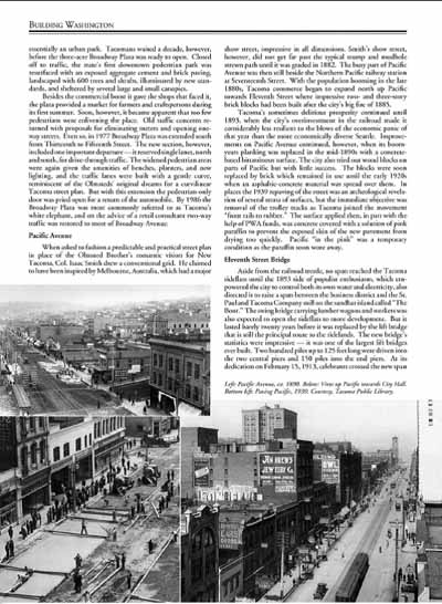