THEN: The Latona Bridge was constructed in 1891 along the future line of the Lake Washington Ship Canal Bridge. The photo was taken from the Seattle Lake Shore and Eastern Railway right-of-way, now the Burke Gilman Recreation Trail. The Northlake Apartment/Hotel on the right survived and struggled into the 1960s. (Courtesy, Ron Edge)NOW: Knowing the shared line-up of the two bridges, and the footprint of the Northlake Apartments on what is now the parking lot for Ivar’s Salmon House, it was easy for Jean to make his confident repeat from the old railroad bed at the top of the 5th Avenue N.E.steps. John Sundsten came along as beholder.
This, I believe, is the oldest surviving photograph of the Latona Bridge. For the 27 years following 1891 it was the only span where Lake Union conveniently channels into Portage Bay. The pile-driven bridge was constructed to carry David Denny’s electric trolley into the then new Latona and Brooklyn (University District) additions and to real estate as far north as Ravenna Park, the trolley terminus.
Another early look at the Latona Bridge – but not as early. This view from the cupola of Denny Hall dates from 1896 when the campus opened or soon after. Queen Anne Hill covers most of the horizon, although West Seattle takes some of it far left. The “Wallingford Peninsula” and future home of the Gas Works, holds above the bridge. The north end of Capitol Hill enters from the left to connect with the bridge. (Courtesy University of Washington Libraries, Special Collections)
The state legislature’s Feb. 23rd 1891 recommendation that this “Interlaken” neighborhood become the University of Washington’s new home was encouraging to all north end developers, Denny included. After the university’s 1895 move to the new campus most of the students rode the trolley to school. However, by then the earnest but in the end naïve younger of the pioneer Denny brothers, was bankrupt.
(Click to Enlarge) The nearly new Latona Bridge and much else can be found on this “Real Roads Map” from 1894. A rail head or spur off of the Seattle Lake Shore and Eastern RR line leads to what in 1894 was the new U.W. Interlaken Campus construction site for the Administration Building, aka Denny Hall. There is as yet no neighborhood named Wallingford, but Latona, its southeast corner, is there with its bridge. “Ross” and “Boulevard” are map names here of size – names hardly known now. And note, far right, how Foster Island is treated with bold type. The “Shingle Capitol of the World,” Ballard, is well lined and dotted.Five or six years later and the UW campus is dotted with its few first structures. The future University District is still Brooklyn, the name chosen by its developer. Latona abides, and its bridge too. And here is Edgewater claiming much of Wallingford, which is still not named. Fremont and Ross hold sides to a straightened Ross Creek, or Lake Union outlet. It is shown or imagined as a “regularized ” channel, but in 1899 that is still a few years away.
A combination of the nation’s 1893 financial panic and poor investments quickly led to what Seattle trolley historian Leslie Blanchard rates as “unquestionably the most disastrous venture of its kind in the city’s history.” Much of the route was “inhabited only by squirrels and gophers.” In 1890 David Denny, with Henry Fuhrman, opened the 160 acres of their namesake addition at the north end of Capitol Hill, here on the far south side of the Latona Bridge. But where are the homes? It is hard to find here any potential passengers or purchasers.
With meager evidence of the ambiguous captions in the Lowman family photo album, we will describe this view as looking south from north lake to the north end of Capitol Hill, which is the Denny Fuhrman addition in 1887, three years before it was opened, and four years before our “first photo” of the Latona Bridge.A kind of “now” from Ivar’s Salmon House and a few years ago.
But then where are the trolley wires on the Latona Bridge on our “first picture” of it? Perhaps the photo was taken before the poles, rails, wires and hopes were in place for the bridge’s July 1, 1891 dedication. Is that snow in the foreground or an extended spring puddle chilling enthusiasm? By 1913 the spot got hot. The Super of Public Utilities then counted an average of 23,058 passengers crossing the bridge every 24 hours, with the ironic result that in 1919 the at last bustling Latona would lose its bridge on 6th Avenue to the University District and its new and surviving cantilever span on 10th Avenue.
A Seattle Times clipping from Nov. 20, 1913. The clip’s band wagon claim that the canal is “within a twelve month of completion” exhibits industry about two years quicker than the canal’s builders.Getting more service from our oft-used Baist Real Estate Map of 1912. Note the yellow footprint for the hotel (right-of-center) on the north side of Northlake Ave. between 4th and 5th Avenues, on lots 8 and 9 of the Latona Addition’s 6th block. The north end of the Latona Bridge is illustrated, bottom-right.A detail of the Latona Hotel from an aerial of the early 1930s – it seems. 4th Ave on the left and 5th at the top enter Northlake to the sides – west and east – of the hotel. Across Westlake is the cedar mill that Ivar later purchased and razed for his Salmon House, which opened in 1969.Another aerial of the neighborhood – perhaps from the same flight as that penultimate to this. Note that the University Bridge at the bottom is two bridges. The small two lane span at the bottom was built for temporary service during the years – 1932-33 – when the wooden pilings of the original bridge’s approaches were replaced in with the concrete pilings that still support it – we believe.The Latona waterfront ca. 1952, with Green Lake on top.This for some agoraphobic look north through the construction line for the Lake Washington Ship Canal Bridge includes a late glimpse of the Latona Hotel, far-right, across Northlake from it the Wigwam Shingle Mill. This rare capture is shown again in one of the three linked photos featured below.Robert Bradley’s look over Grandma’s Cookies and the Latona waterfront on January 17, 1960, to construction on the Ship Canal aka Freeway bridge, the University District, the Laurelhurst ridge and a Cascade horizon.
WEB EXTRAS
Anything to add, Paul? Surely Jean – a few more pictures and stories from the neighborhood – my neighborhood too, now for more than 30 years. I was awakened by Mt. St. Helens in a Wallingford bed. We wlll begin again with Ron Edge’s enterprise. Ron shook this blog for past features that best fit this feature, which he introduced immediately below with three photo-links. Following those we will lay out more from North Lake.
=====
Latona Bridges, side by side, ca. 1918
BRIDGE to BRIDGE
(First appeared in Pacific, Jan. 13, 1991)
The Latona Bridge, in its 11th hour, was two bridges whose antipathetic designs were best detected when they were opened – a here – to permit passage of any vessel that required the bridge tender to plod through the steps required to one bridge(for trolleys) and swing the side (for everyone else).
The original Latona Bridge was simple, with a fixed span.The complicated mechanics shown here were required when the completion of the Ship Canal in 1916 opened Lake Washington to ocean-going ships. (The canal was dedication on July 4, 1917, but its use earlier, in the fall of 1916.)
The Latona Bridge was dedicated July 1, 1891 – 28 years to the day before the University Bridge, which replaced it, was opened with m8sic and speeches.University of Washington history professor Edmond Meany was at both dedications and was the principal speaker at the second.
The above view (with two bridges) was photographed from the University Bridge while it was under construction.(The accompanying photo directly below looks north through the line of the University Bridge during its construction.)The ridge lines of Wallingford and Queen Anne Hill are in the background.
Construction of the University Bridge, recorded on March 21, 1918 from the south – Capitol Hill – side. (Courtesy Seattle Municipal Archive)
Upper-left, Latona Bridge seen from the prospect of a steel tank at the Gas Works, ca. 1907.From Queen Anne Hill, ca. 1912, most of Wallingford with the temporary Stone Way Bridge (1911-1917) lower left, and the Latona Bridge (1891-1918) upper-right, in the distance beyond and above the Gas Works.
LATONA BRIDGE EDGE CLIPPINGS
A clipping from the very new Latona-Brooklyn news – Dec. 1, 1890.An advertisement from the 1890 Polk City Directory, page. 35
From The Seattle Times, June 11, 1901.[Click Twice to Enlarge] A clip from March 25, 1902The Seattle Times, June 10, 1902From The Seattle Times, January 17, 1914
THEN: Revelers pose on the Masonic Temple stage for “A Night in Old Alexandria,” the Seattle Fine Art Societies annual costume ball for 1921. (Pic courtesy of Arthur “Link” Lingenbrink)NOW: Built in 1914-16 to the designs of Seattle architect George Willis Lawton, the Masonic Temple was renovated as “The Egyptian” in the early 1980s. It is home for the Seattle International Film Festival. Here Jean has found some early birds waiting on a festival matinee.
Arthur “Link” Lingenbrink, Seattle’s long-lived commercial artist and show card instructor, is almost certainly posing here on the stage of the Masonic Temple – although, as yet, I have not found him among the about 200 costumed Egyptians.
At the top, Arthur “Link” Lingenbrink lectures other artists on the “high aims” of the Seattle Art Club at the club’s first exhibit in the summer of 1921.“Link” preparing to demonstrated and/or teach his show card talents.
BELOW: Art offers a lecture on “show card writing” through The Seattle Art Club School in 1921. Below that, he gives an illustrated lecture on his 1941 trip thru Mexico. He has named it, “Our Allies to the South.”
Link was one of the Seattle Fine Art Society’s more activist leaders in the 1920s. He had the knack for delivering inspirational messages about art and culture at club meetings while also organizing club events, like their popular costume balls. His illustrating hand was both fine and strong. For instance, for this Nov. 24, 1921 revelry titled A Night in Old Alexandria, Link decorated the Temple with its Egyptian figures and symbols. Arthur was also celebrated for his tableaus, a then popular art form that arranged actors and sets in recreations of famous paintings – with figures – on stage.
Arthur loaned me his cherished print of this ball during one of my many visits to the exotic environment of his Capitol Hill home in the mid 1980s. I managed then to fill up a small suitcase with cassette recordings of Links reminiscences. That the nonagenarian was an often ecstatic narrator was appreciated because Link repeated his best stories.
The Seattle Times splash on the Artist League’s A Night in Old Alexandria for Feb. 2, 1922.
It was only weeks before his death in 1987 at the age of 94 that Arthur stopped taking the bus to join his brother Paul in their storefront sign shop on the border of both Capitol and First Hills.
Brothers Paul and Arthur (left and right, ca. 1984) in front of their sign shop on the 7th Avenue side of the old Eagles Auditorium, now part of ACT Theatre and the Convention Center, and an example of their early-century work at window dressing.
For readers so interested, Jean and I will be giving an illustrated lecture on First Hill History at Town Hall at 8th & Seneca St. on Tuesday, June 25th at 7:30 pm. (There’s a $5 fee.) The Masonic Temple, aka The Egyptian, is nearby on Pine Street at Harvard Avenue and so is probably more often identified with Capitol Hill. However, for the sake of both art and culture, during our presentation we will temporarily move the Egyptian over to First Hill or the hill to it. Whatever, the lecture will still be at Town Hall and we plan to be there as well.
WEB EXTRAS
Anything to add, Paul? Yes Jean, and most of it holding on to Link, the record-setting sign painter (see the clips of his records far below) I met in the early 1980s and routinely visited until his passing in 1987. Link, aka Arthur Lingenbring, past along most of the film he shot – both films and stills – of the local arts and the “charmed land” that surrounds us. I pull a few examples, and also print a few clippings on Link and/or by him. Link wrote lots of rhyming poetry, but it was not his poems but his opinionated letters to editors that often enough got printed. First however, we will continue on with some more Alexandria and a “Miss Heywood” who judging by the attention he gave her – with his camera – was surely a good friend.
Copied from one of Art’s many arty albums.Miss Heywood supported by the “two roses.” Like many of his time, age and means, Arthur and his friends would rent beach cabins on Bainbridge Island most summers. I recall Link describing this as an island scene. Arthur is on the left in the cocky hat.Most likely another Bainbridge beach scene and certainly with Miss Heywood, although she has shed her white belt.
Link, sitting on the sidewalk, and Miss Heywood sitting on the steps, with others suited up.On the evidence of his albums, loose prints and negatives Link was well appointed with feminine friends. This one – if it is one – he captions, at the top, as merely “almost.” But almost what he does not let on.
Arthur Lingenbrink’s album readily reveal his interests not only in women but also in civic landmarks, visiting celebrities – he sometimes chased them with his movie camera – and examples of what was then advertised as the “charmed land” that surrounds Seattle. Curiously, while he enjoyed our splendors he was not so ready to share them with tourists, as is revealed in his letter to the Seattle Times editor printed four looks down – below Mt Index.
The 1925 staging of the Knights Templar convention was bound to excite Arthur. This view looks south to its grand arch spanning Second Avenue at Marion Street.Arthur was an easily excited patriot, and the visit of a battleship got his attention.Another proud page from a Lingenbrink album. How many blog readers remember that the “Emerald City” – if they are still calling it that – was once “the Queen City.” I remember it as the Queen as late as in the 1970s.From Link’s album but not apparently from his camera. The caption explains.Art’s peeved letter to the Times editor, printed on July 29, 1951. In a sour way – without the ironies or tongue-in-cheek – it is a prelude to Emmett Watson’s “Lesser Seattle” campaign.Another of Link’s more fertile subjects. I do not remember him sharing any interest in fishing.Ye Old Curiosity Shop’s Pop Stanley posing with Carinne, surely one of Link’s more intimate and mature paramours.Carinne’s hand-colored portrait, on the flip-side of which, she perhaps exaggerates her love – below.
Link owned a stereo camera. This is Carinne twice and nicely framed by the forest’s shadows, from behind.
LINK’s photography – both stills and film – features an abundance of arty figures, often with the subjects posing and acting in lavish sets. Although most of this art was done in the 1920s and perhaps early 30s, still he kept his props on display in the top floor of the Capitol Hill he shared with “ma” his mother. [He did marry – 0nce – briefly, and had a boy.] The Lingenbrink basement was outfitted both for making and showing films. This too was still in place a half-century after it was first regularly used. I visited it. Link led the tour. The subject included here three times as an example of his figure work is posed “tastefully” in front of a hanging that compliments Link’s talent for design. Some of his sets were considerably more lavish than this one. And Arthur also made films in outdoor settings, working, for instance with Cornish School dancers in Volunteer Park. Some day all will be revealed, but for now just this one fit but not named figure.
Arthur, the director.Link depicted as an auctioneer.
During the 1980s when Genny McCoy and I together regularly visited Arthur, Mrs. Perry was often there too. This witty widow was always “Mrs. Perry.” Arthur had first met her in the 1920s when she began her own career as the founder-director of a local Ballet school and company. Mrs. Perry is wrapped below in a Persian rug – on the right. Below the rug she poses with Link and I near the back porch of Link’s Capitol Hill home, ca. 1983.
Ms. McCoy took this photograph during one of our visits with Mrs. Perry, on the left, and Link at the latter’s Capitol Hill home, ca. 1985.
Below, Seattle’s OLDEST SIGN PAINTERS get pretty lavish treatment in the Times both in 1976 and in 1984.
A Seattle Times report from Jan. 18, 1976.December 1, 1984, The Seattle TimesIn his 90’s the urge to perform still often overtook Arthur – here with three costume changes.
Here – or below – thanks to RON EDGE’S snooping and engineering are links to two previous features that are relevant to this week’s Capitol Hill subject.
THEN: A speeding coupe convertible heads north on Beacon Hill’s 15th Ave. S. in 1937NOW: For his “now” Jean was careful to both align the decorative 1930s light standards along the east side of 15th Avenue S., – here right-of-center – with their similar but not duplicate contemporary “repeats,” and stand clear of the speeding cyclist
The sporty motorcar, here flying north thru Beacon Ave. on 15th Avenue S., is blurred by its speed. And so we cannot read the year on the license plate, but we don’t need to. The original negative has it “Sept. 16, 1937.” It was seven years into the Great Depression.”
That day The Seattle Times reported that the 2,000,000 W.P.A. check in Washington State had just been paid out. It was the fourth year for the “New Deal,” Pres. Roosevelt and the Democrats federal programs to spirit the economy and make work for the out-of-work. The Works Progress Administration (WPA) made the federal government by far the largest employer in the Union.
This Thursday in the late summer of ’37, the Times also reported that the fresh but already effective Congressman Warren G. Magnuson had coaxed WPA funds from Roosevelt for “beautification” of Seattle’s libraries and their grounds. The day’s issue also printed a photo of the newly elected Girls Club officers at Broadway High School. We learn in the caption that they too were committed to beautification. The new officers urged Broadway Co-eds, all 1595 of them, to wear “middy blouses and skirts to school for uniform attractiveness.”
By The SeattleTimes’ theatre listings this day we discover that the Beacon Theatre, here on the left, featured tough guy George Brent in Mountain Justice. Including the Beacon, eleven of King County’s sixteen Sterling Theatres were neighborhood venues, showing features second run.
The Piggly Wiggly, far right, was part of a market chain that flourished by promoting self-service in grocery shopping. By 1937 most of Seattle’s Piggly Wigglys had been converted into Safeway stores, a fate that soon fell on this little Beacon Hill Piggly Wiggly. Beacon Hardware, just beyond the grocery, opened in the mid 1920s, and stayed so though the Great Depression. It is last listed in this newspaper in 1965.
Proof that the towered manse seen in the feature photo survives on the east side of 15th Ave. South. (Courtesy of Google Earth)
WEB EXTRAS
Anything to add, Paul?
Yup Jean. First Ron Edge will again insert a feature – with its own additions – that we put up a few months past, which was for the most part about the Beacon Hill prospect of Seattle. Then from the Washington State Archive I’ll put up a few WPA Tax photos out of of the same Beacon Ave. intersection as our above feature. These additions will feel at home – and also in need – for our primary image has also been pulled from the shadows of the Great Depression. I’ll conclude with a key-word search for “Beacon” and see what might come forward from with tiring MAC worth mounting. No doubt, Ron will have already uncovered some of it in what follows.
====
TAX PHOTOS HIDE-&-SEEK
We hope – or imagine – that what follows might be treated by the reader as a hide-and-seek. Pull out your Google Earth or slippers and visit the north Beacon Hill intersection of Beacon Ave., 15th Ave. S. and Bayview Street. All of the tax photos that follow – from the Washington State Archive – are of structures at or near that corner, and most of them date from the late 1930s – like our primary feature at the top. And we will begin with two snippets for Beacon Ave. and 15th Ave. S. clipped from the continuous street listings of the 1938 Polk Business directory. [Click to Enlarge – Click Twice, perhaps]
1912 Baist Real Estate Map detail centered on Bayview, Beacon Ave. S. and 15th Ave. South. (15th climbs thru the center of the map detail.)As the tax caption notes this 2517-19 15th Ave. S. and so just west of Beacon Avenue, which is off-frame to the right.
Later but familiar – Petrams at 2517-19 15th Ave. S., 1958More of the west side of 15th Ave. S. and Beacon Ave. S. at 2515 Beacon Ave. Note the remodel of what appears to be a residence for incarnation as a shop, right-of-center.Same 2500 (even east side) block on Beacon Avenue, but now with the remodel work far left.1513-15 Beacon Ave. with remodeled storefront showing its years, right-of-center, in 1957. The faux stone asbestos above Petram’s 10-cent Store lends its effects as well.2502 – 2506 Beacon Ave, with early Safeway on far right – the southeast corner of 15th Ave. S. and Bayview Street.South on 15th Ave. S. thru Beacon Ave. S., 1924. [Not a tax photo]2510,-12,-14 Beacon Ave. with an early Safeway.A torn print for 1949 record of 2516-18-20 Beacon Ave.A newer Safeway at 2523 15th Ave. S. mid-block to Lander, 4-29-1938.One door south of Safeway (eventually) at 2533 15th Ave.South.2520 Beacon Ave. tax photoLater at 2524 Beacon Ave. S.And later yet – late enough for landscape at 2530 Beacon Ave S. and a distinguished City Light standard.2524 Beacon Ave. S. with Bug May 12, 1965.2538 Beacon Ave. S.
2538 Beacon Ave. S. Nov. 1, 19572538 Beacon Ave. S. Jan 12, 1960
2542 Beacon Ave. S.2544 Beacon Ave. S. with Ellis Repair Sign facing Beacon Ave. S.. There is also a shop in back facing 16th Ave. S. with the Beacon Hill Primary School (seen here in part) across 16th to the East.The 16th Ave. S. side of the Ellis Repair Shop.The Beacon Hill School Store, next door to Ellis and also on 16th Ave. S.The Shell Station at 2535 Beacon Ave. S., in the now lost triangle south of Bayview Street. The two-story brick apartment, right of center, is at the southwest corner of 15th Ave. S. and Lander Street.The station at 2531 Beacon in 1961 with a “Free Car-A-Month.” The house south of the station is still in place facing 15th Ave. South. (In this later tax print you can see the mutilations of scotch tape.)Shell no longer – but the home beyond abides.The “abiding” home at 2536 15th Ave. S.The neighbor to the south at 2538 15th Ave. S.The neighbor at the northeast corner of Lander St. and 15th Ave. N.. addressed 1502 Lander Street.2336 to 2344 Beacon Ave. S., the east side of Beacon north of alley north of Bayview.
THEN: The rear end of the derailed trolley on N. 35th Street appears right-of-center a few feet east of Albion Place N. and the curved track from which the unrestrained car jumped on the morning of August 21, 1903. (Courtesy, Fremont Historical Society)NOW: Heather McAuliffe of the Fremont Historical Society, notes that the house abutting the sidewalks on the far left corner of the “then” survives in the “now” with an added story. This, she explains, most likely came with the 1908 regrade of the intersection.
At about 10:20 on the Friday morning of August 21, 1903, a summer picnic in Woodland Park planned by the parishioners of Ballard’s Norwegian Danish Baptist Church was derailed by what that afternoon’s Seattle Time’s named “a boy’s meddlesomeness” without naming the boy.
Both of Seattle’s afternoon dailies, the Times and the Star, printed the story front page and with pictures. The Star’s two illustrations, of which this is one, were credited to the “well-known Fremont photographer, LeRoy Buck.” Buck lived on Aurora Ave, three blocks from the trolley mishap. The Star probably telephoned him. Their appellation of Buck as “well-known” is, perhaps, part of the Star’s payment to this freelancer. (I know of one other Buck photo, also from 1903, an oft-printed classic looking north through the then still low bridge into Fremont. I used it in these pages about a quarter-century ago.)
Front page for The Seattle Sun, Aug. 21, 1903 with news of the Edgewater/Fremont crash.
To “standing room only,” the special but fated trolley was packed in Ballard mostly with women, children and their picnic baskets. After crossing through downtown Fremont and climbing east up Blewett Street (now N. 35th) under full power, the car crossed thru Aurora Ave. and begin its unrestrained descent to what was ordinarily a sharp but negotiable left turn on to Albion Way. This time, however, the trolley’s “controller handle” had locked up with the brake handle, with which the “meddlesome boy” had been playing.
Our stock 1912 Baist Map is again helpful, but also 9 years later somewhat misleading. The unmarked street between Ewing (34th St.) and Kilbourne (36th St.) is the Blewett (35th St.) that figures in this feature. The Noble Hospital noted in the map between Albion and Woodland Park Ave is still a private mansion in 1903. We feature a sketch of it below, and a advertisement for it near the bottom, but with a different name: Keeley.The mansion at 3515 Woodland Park Ave., its south and east facades as seen from Woodland Park Ave.
ABOVE: Looking north up Albion from 36th in 1952. The competing power poles for Seattle City Light and Puget Power were still an ungainly feature of Seattle neighborhoods.
BELOW: The same but recent prospect on Albion north from 36th St. Note the surviving tower from the old City Light sub-station.
Well into the long block on Albion north of 36th a glimpse of Seattle City Lights substation at 3622 Albion Place.
Instead of turning at Albion, the speeding trolley then jumped the curving track seen at the center of Buck’s photo, and “plunged down an embankment” into an orchard. The about 62 passengers plunged as well to the buried front end of the car crying out like a broken accordion. Several were hurt badly. One, 80-year-old Maren Eggan, was still in the hospital in September.
The Star concluded its report with “an interesting side light on the character of the average small boy.” After the accident, they picked up the pies, sandwiches and cakes that had filled the picnic baskets and ran to and fro hawking refreshments, which they announced were “fresh from the street car accident.”
The Edgewater pharmacy and business center at 36th Street and Woodland Park Ave. then, ca. 1912.Same corner – Edgewater Hardware in 1950. Courtesy, Washington State Archive, regional branch – a Tax Photo.Edgewater business block “now” – really, recently.
Edgewater Addition map from the 1889 and signed by STONE of Stone Way.
WEB EXTRAS
Anything to add, Paul? Yes Jean, and we shall start with two Edge Links (attached by Ron Edge sometimes known here for his Edge Clippings) that are relevant to the Edgewater neighborhood and/or to trolley wrecks – lots of them. In this line I am also reminded of the Edgewater Eiffel Tour, a tragicomic episode in North End Life that naturally leads to Paris and the real thing. During our French visit you – Jean – will share some tour pictures with use and perhaps of our Blogbuddy Berangere as well. Closer to home, if I can find it I’ll attach a mid-1960s slide of parents Cherry and Ted Dorpat standing in profile with the famous French tower. I show devotion to my parents and put them up first. You follow with your own Eiffel Tour photos – and Berangere’s – and I’ll conclude the Tour part of this post with the short story – behaving like a fable – of La Tour Eiffel Edgewater. And we might find a few things more to add Jean, like other evidences of our city in 1903. But only a few for we are behind in our commitment to write an introductory essay for Historic Seattle’s up-coming book on First Hill. This Jean reminds me to remind our blog consumers that you and I will be giving a lecture on First Hill history at TOWN HALL late this month. Do you have the details, and will you share them?
I do indeed Paul. We will be lecturing at Town Hall on June 25th at 7:30 in the evening. Here’s the link!
Cherry and Ted Dorpat in Paris and in profile, ca. 1965.
Still Jean here. I’ll set and match with a photo of my own mother just a couple years prior.
Jean’s mother Edith and grandmother Marian atop the tower
I’m also reminded of our blog partner Berangere Lomont’s remarkable photo of the Eiffel Tower disappearing into the clouds, part of our MOHAI Now and Then exhibit from 2011.
Berangere’s magical mystery tour
And, just for fun, let me toss in a few thumbnails of my own views of and from that evocative edifice, each of which may be clicked to enlarge.
Un jour, l’histoire de la Tour Eiffel Edgewater sera recontee!
“Some day the story of the Edgewater Eiffel will be told.”
Introduction:
Now in a time when such muddles are often brought forward and trumpeted on television with the hope of shaming something or someone, this hidden story was also bound to rebound, and here you have it. We share it for we cannot imagine why anyone should now feel any shame. Still we can at least wonder if any members of the Fremont Historical Society may care to exploit this history.
Fremont’s own “tower” of European birth: Lenin.
The photograph below of the nearly near Aurora Bridge was sent along by a concerned person who, for reasons we will not question, wishes to be kept anonymous. They did indicate, however, that before sharing the lantern slide they had attempted to find any surviving members of the club introduced below but without success. They concluded, “Go ahead. I’m sure it will be alright.” Such confidence is comforting.
LA TOUR EIFFEL EDGEWATER
Long ago during an after school treat of cornbread and Ovaltine around the Cornbell family’s kitchen table, Fremont Chamber of Commerce Toastmaster Wally Cornbell’s mother told us, “Some day the story of the Edgewater Tower will be told.” Wally’s mother continue, “But never mind.” We were, she explained, just a few years too young to understand.
The Cornbell’s lived on Whitman Avenue in the Seattle neighborhood of Edgewater, although some now claim it all for Fremont, others divide it between Fremont and Wallingford.Like both Fremont and Wallingford the Edgewater community was never incorporated into or unto itself.
Edgewater got a lot of recognition on maps, and for a while had its own railroad station on the Seattle Lake Shore and Eastern line, still it never reached the reputation of its neighbors.By the time the Aurora Bridge was completed in 1932 any sense of a boundary between the east portion of Fremont and the west of Edgewater had blurred and the trend indicated that eventually Edgewater would either slip beneath the eastward tide of Fremont, or from the other direction, the somewhat later push of the Wallingford neighborhood west into Fremont would also overtake it.
This record of the new Aurora Bridge – with the wrought iron (really wood painted flat black) tower beyond – it is a treat. The rare lantern slide looks north from Queen Anne Hill over the nearly new Aurora Bridge to the north side neighborhoods of Edgewater on the left and Wallingford on the right. The building holding to the horizon on the right is the Good Shepherd Center. The short-lived de l’Edgewater Eiffel la Tour can be seen just breaking the horizon on the left. At some point this lantern slide was hand-colored, as was often the custom, but not with care. The blue area below the bridge while meant to depict the ship canal is actually still south of that waterway’s south shore. It should have been given an earth color. Otherwise we have been assured by our private donor that no retouching has been done to the antiquarian lantern slide. Fremont is out of frame to the left. Did you know that the Edgewater Eiffel Tour was built to one-tenth size of the original in Paris? It reached more than 106 feet high! By comparison this made it only ten feet shorter than the Sixth and Pine Building at Sixth and Pine. It was intended that from the top of la Tour Edgewater Eiffel you could see something in all directions including Ballard to the west in spite of Fremont being in the way.Berangere’s capture of these small towers plays with their shadows.
Since Stone Way, ran north and south along the trough of a small watershed that got contributions from both Wallingford and Fremont it seemed most likely that Stone Way would be eventually identified as the border between the two neighborhoods and that then Edgewater would be forgotten.The Stone Way division was, however, confused by the construction of the Pacific Coast Limited Access Speedway north from the new bridge on Aurora.It was an artificial border, but a handy one.The story of what followed had considerable effect on these questions of neighborhood identity and on the ultimate fate of Edgewater.
Another Seattle tower obscured by an atmosphere that mixed the mists of Elliott Bay with contributions from the great loads of coal warming its buildings and generating electricity. Here the First Hill tower of the King Count Courthouse is dimly seen from the roof garden of the Lincoln Hotel at the northwest corner of 4th Avenue and Madison Street. The hotel was destroyed by fire in 1920 and the court house razed by dynamite in 1930.
As you may know, in 1933, the Eiffel Tower celebrated its 50th anniversary for the 1889 Centennial of the French Revolution. It was a few years early. The early scheduling took advantage of the cheap construction costs of the Great Depression that touched the French economy as much as ours. Worldwide French Societies were encouraged to fall in line early and do something to celebrate the building of the Eiffel Tower, which was dedicated in 1889.
Here in Seattle the Edgewaterian Eiffelers were the only local group at all prepared and they were encouraged to take the lead by the local French consul. The club was originally formed and continued to take encouragement from the fact that like the Eiffel Tower in Paris rising high above fleuve de Seine, their neighborhood stood beside a great waterway, the Lake Washington Ship Canal.
The SeaFirst Tower under construction in 1967/68. Photo by Robert Bradley.
The French Clubs of the nearby Wallingford, and Green Lake neighborhoods were ready to help and happy to follow the Edgewater lead. Similarly, the French Department of the University of Washington was pleased to be included in this endeavor of mixed patriotism. They helped with translations. Only Fremont residents were cool to the idea, for they were generally not willing to recognize the legitimacy of Edgewater as a neighborhood not enfolded in their own, and with the 1933 construction of the Aurora Avenue north approach to the new bridge these anxious concerns were heightened for, as noted, the new highway effectively created a new border.
Unknown to most, Seattle has evocative rooftops that are not effecting from the street. Here two flatirons help “misshape” the Pioneer Square neighborhood. What are they?
It is safe to say that the Edgewater tower would have been celebrated from Seattle to the Seven Arrodissement were it not for an unfortunate turn in events. A combination of haste, cheap labor, and liters of drinkable free champagne contributed by the local French consulate resulted in shoddy work and la Tour started to collapse soon after it was topped off. Rather than risk dismantling its uncertain parts, de l’Edgewater Eiffel la Tour was torched after neighboring homes were first covered with wet sheets and traffic was stopped on the new Aurora Speedway for the duration. Understandably feelings for the French dipped some after the fire. It was also the end of the Edgewater club and perhaps of the identifiable neighborhood.Certainly, one did not hear much about Edgewater or Edgewaterians after this unfortunate turn of events.The fated memorial was an embarrassment and forgotten except for spontaneous although guarded references like that from Wallace’s mother, Mrs. Cornbell. But now is later and, at last, the story is told – a matter of record.
1929 – another Seattle tower willfully disposed for flat designs, here on Denny Hill – the Immaculate Catholics at 6th and Bell.
(With discipline, that is with frequent visits, one can still find an Edgewaterian Eiffelers Bowling Club shirt in a north end second-hand store.)
The north shore of Lake Union ca. 1899 with no note yet of Wallingford and the University District still named Brooklyn.
The next two photos are, again, Ron Edge links to first a variety of rail’s mayhem on Seattle’s streets, followed by a now-then tour of Edgewater’s Woodland Park Avenue, 1937/8 repeated in 1911. Both groupings, the trolleys and the homes, appeared earlier on this blog. We return then for “context.”
1903
The year of the Fremont derailing, and more.We have pulled a few photographs of events from 1903 for illustration here with short captions.
Green Lake panorama – and not complete. A third part, far left, of Wallingford is not included. This looks west across the lake to Phinney Ridge in 1903 and so a few years before the lake was lowered and this east bay largely filled in for a recreation field and field house. Today, Interstate-5 crosses directly across the front of this scene. The Olympic Mountains are on the center horizon. (Courtesy Washington State Museum, Tacoma. Photo by A. Curtis.) DOUBLE CLICK to enlarge.Pier 5 – now 56 – waits for the 1903 arrival of Theo Roosevelt on the waterfront.Not for Seattle alone, but perhaps for all their touring stops in 1903.A staged protest over street conditions at the intersection of Virginia Street and First Avenue in the spring of 1903. The imminent arrival of Pres.T. Roosevelt was part of the shaming pitch.1903 Birdseye of the Seattle Business District much of it still new after the city’s Great Fire of 1889. (Double Click to Enlarge)Eroding the waterfront bluff north of Virginia Street to begin work in 1903 on the railroad tunnel beneath the city, which was completed in 1905.Looking east across University Way on N.E. 41st Street in 1903 to a nearly new Science Hall (Parrington Hall) left-of-center, on campus. The frame building on the left was razed in memory, I mean I remember it from the late 60s as the home of a guitar shop, and not a chain but a storefront for a skilled guitar “doctor.” This is an Olmsted photo done by the firm for their visit here to design the city’s park system – and much else. This was used in Pacific, and following below is the text.The first appeared in Pacific on July 1, 2001.The Argus was a long-lived political/cultural journal that only stopped publishing “recently,” which means that I remember it and read it, although I never wrote for it.On top a panorama of Fremont and Phinney Ridge from Queen Anne, and at the bottom another looking northwest into Ballard. An advertisement for the Keeley Institute runs centered below the Fremont pan. The Instituted was on Woodland Park Avenue. The grand home it took over appears far above in the main photo – from the Star – and also in a sketch below it.
Scene from the 1903 trolley strike. The Bon Marche was then located at the southwest corner of Second Ave. and Pike Street. So this looks north on Second from near Union.Skating on Green Lake in 1903. The forest on the far shore is part of Woodland Park, the destination this year – in the summer – for the Baptists that were squeezed, and some of them mangled, in the run-away street car on 35th Street at Albion Pl.Looking north into Fremont across the Fremont “low-bridge” in 1903.A clippingThe Fremont dam broke in 1903. This view of work on the dam and flume is dated 1903, and so most likely after the break. In some chronologies 1903 is the year that work began – haltingly – on construction of the Lake Washington Ship Canal. Note there is as yet no Gasworks (1907) in the picture.A “now” for what is above it.Four years later, looking east from the Fremont (still) low bridge to the dam and flume in 1907. Here work has begun on the Gas Works, at the center.From the bridge over the dam-flume, looking west at the Fremont low bridge.A crumpled 1927 clip showing and explaining the planned-for corner-cutting bridge at the southeast corner of 34th Street and Fremont Ave., creating thereby a platform for the far future sculpture by Rich Beyers, “Waiting for the Interurban.”
The Seattle Times caption for this photo printed on Feb. 15, 1940 reads, in part “Once the pride of the Municipal Street Railway and the only one of its kind west of Chicago, the four-way street-car switch at North 34th Street and Fremont Avenue, at the north end of the Fremont Bridge, will be removed as part of the city’s change from street cars to buses and trackless trolleys. Called a “Grand Union track layout,” it coast $48,000 to build and install in 1923, a street car entering from any direction may turn either way or go straight ahead.”1996
The IVARY TOWER
& Underwater
The Tour Eiffel Edgewater reminds us of Ivar – twice.First, of course, his valiant attempts to prepare for Trans-Sound Submarine Commuting (TSSC) with underwater billboards promoting his ever-rejuvenating clam chowder, and second, of course, for his daring-do to fly a salmon-sock from the top of what he described as his “last toy,” the Smith Tower, aka the Ivary Tower.
The Foster & Kleiser billboard at the meeting of Westlake, Dexter and Fremont Avenues in August 1928, showing here art for Kristoferson’s Milk.Ivar’s – well not actually Ivar but something very much like him, Ivar Inc. – surfaced underwater billboard displayed, again, at the intersection of Fremont, Dexter and Westlake Avenues, nearly 85 years after the milk and with increased or advanced nutrition in 2012 – or was it 2011 – or 10?
Ivar and his tower, one against the other – or with the other and over or upon and sticking his foot against the Sinking Ship Garage.A fan’s insight.
THEN: Covered with cut stone the row house facing Marion Street on First Hill was intended to begin a local trend for elegant townhouse construction until such plans and much else were interrupted by the financial Panic of 1893. (Courtesy Washington State Archive, Bellevue Branch)NOW: The last Times report I could find for 1200 Marion before it joined the Swedish Hospital campus in the early 1970s, concerned a City Hall hearing set for its owner, A.M. Bernhard’s alleged violation of minimum housing codes. The announcement is dated Sept. 19, 1971.
The bold white writing on this stone-clad row house at the northeast corner of Marion Street and Minor Avenue confesses that this is a tax photo. As many Pacific readers no doubt know by now, during the Great Depression the Works Progress Administration (WPA) made work for photographers with its ambitious and ultimately completed project to strike a picture of every taxable structure in King County.
Open and voided the folder that once held – with tape – the printed inventory photo from 1937.A page (another) from the 1912 Baist Real Estate Map – this one mutilated by wear and tear – means other than the penmanship of the photographer. The Graystone’s block 121 can be found upper-right.
Even without the captioned address, 1200 Marion St., we could find these seven attached townhouses by their legal description, here also hand-written on the negative by, we presume, the unnamed photographer. Reading backwards this corner real estate is lot 8, of block 121 in A.A. Denny’s Broadway Addition. Jeffrey Karl Ochsner, U.W. professor of architecture, first shared this subject with me, hoping that I might know of an earlier intimate “portrait” of this The Stone Row, its name when Architect John Parkinson designed and developed it in the early 1890s. Alas, I didn’t.
Across Marion St. from the Graystone, another 1937 WPA snapshot, this of a residence that has been (I believe) converted into a nurses dorm. (Courtesy, Washington State Archive, Bellevue branch)A Times clip for the address 1205 Marion from April 3, 1947 suggest that the old dorm (?) is being liquidated. (True, the “lattice fence” cannot be found in the 1937 look at 1205 Marion above the clip.)
The WPA photo and the professor’s reflections on it are shared on page 243 of his and Dennis Andersen’s book, “Distant Corner, Seattle Architects and the Legacy of H.H. Richardson.” Published by the U.W. Press in 2003 it has not, of course, grown old, and deserves to be read by persons interested in those architecturally zestful years of recovery and mostly rampant growth following Seattle’s “Great Fire” of 1889.
A Seattle Times clip from Feb. 21, 1906.A Times classified from Oct. 15, 1906.The Graystone – one of its enchanted events. From the Seattle Times for Nov. 6, 1907.
In 1900 – or thereabouts – The Stone Row was named anew The Graystone, and promoted variously as a residential hotel (with waitresses and chambermaids and music room) and as an apartment house in the “choicest residence neighborhood, between the Madison and James St. car lines.” With the boisterous arrival of the Graystone Athletic Club on the scene in 1910 – the men’s club staged smokers with boxing – the name “Graystone” and its connotations fell from favor. Its elegant Tenino “bluestone” finish may have seemed tarnished, although it looks fine here in 1937.
Latter days for the Graystone.
WEB EXTRAS
Anything to add, Paul? Yes Jean, some ephemera from the Times and some photographs too.
We must, however, begin with a confessional response to Brandon and Steve, both of whom correctly instructed that I was wrong with last week’s feature on the Four Winds aka Surfside 9. Rather I should have “confused” the Golden Anchor, another and earlier dinner-boat, with both the Winds’ and the Surfside’. They are the same vessel – originally the City of Everett – although with elaborate changes for different services. Long ago I believed a much and only recently abandoned that Anchors part of it. The reason is Margaret Pitcairn Strachan’s 1946 feature that had the Golden Anchor converted out of the Lake Washington Ferry, Lincoln. I should have known better, and did. I’d written about the Lincoln often enough and knew that it’s last service continued after WW2 both on the big lake and on the Sound, and not as a restaurant. I supposed it was in part my haste but more my respect for the heritage writing of Pitcairn Strachan that fogged my watch. I’ve used the Marine Digest often enough but missed the contradicting history offered there. It is also curious that I found so little in my maritime library about the Golden Anchor. The Pitcairn Strachan history was found – you are correct to assume – with another key-word search of the Seattle Times through the Seattle Pubic Library. As many of you know the addition of this resource makes such a difference in doing/research on regional history – it is suddenly like taking a trip to Mars when earlier you were only carried to Ballard. But that comparison is misleading. I would always prefer a visit to Ballard over any of the known planets. Directly below is a cut from the Pitcairn Strachan feature of 1946. She is best known for a year-long weekly feature on Seattle’s grand homes and their families, which she researched and authored in 1944-45. That was earlier enough to involve direct contact with informants that were also pioneers – often the persons who built the homes.
Excerpt from Times feature, March 10, 1946.
Below and in order, the progression implied from the Times clips on the Anchor’s “experienced waitress” search in 1945, to attempts to sell the – get this – “Nationally known boat” early in 1947, do not bode well for the Anchor’s chances of staying golden. The crude illustration of the City of Everett aka Ferry Ballard aka diner-ship Golden Anchor tied to a bank on the Duwamish River near the old highway to SeaTac on the freezing afternoon of Jan. 15, 1950, reveal a moment in its new metamorphosis as quarters for the West Seattle Athletic Club. The Four Winds followed and the old mosquito fleet steamer turned ferry went terminal with the Surfside 9.
The converted Ferry Ballard, aka the Golden Anchor, parked on the Duwamish as home for the West Seattle Athletic Club in 1950.
========== RETURN to FIRST HILL
The PATHETIC or PITIFUL STORY of the German immigrant girl BERTHA HOPKINS
As told – nearly – by the CLIPS ALONE!
The Seattle Times April 23, 1905, Front PageSeattle Times, April 19, 1905The Seattle Times, May 23, 1905A Times clip from June 6, 1905. (Click once and then twice to enlarge)Six months for Bertha at Walla Walla. Times 12-2-1905 (Click TWICE to enlarge)Looking northwest thru the intersection of Summit and Marion. The Graystone appears, in part, on the far left, and the Adrian Court apartments (at the southwest corner of Madison and Summit) on the far right.Looking northeast from some prospect connected to the then nearly new St. James Cathedral. On the left is the Ranke home at the southeast corner of Terry and Madison. Far right is the west facade of the Adrian Court, and a high corner at the rear of the Graystone shows farther right. The horizon is Capitol Hill’s.A 1905 Aerial of much of the First Hill neighborhood south of Madison Street. Left of center is St. James Cathedral at the southeast corner of Marion and 9th Avenue. The Ranke mansion is still around, far left, a home for nurses at Cabrini/Columbia Hospital at the southwest corner of Madison and Boren. The white facades of Swedish Hospital in 1950 appear upper-left. Trinity Episcopal Church is bottom-right, at the northwest corner of 7th and James. There is, of course, much more to discover here – if you CLICK TWICE to “blow it up real good.” Can you, for instance, find the Graystone?An early 20th Century peek from, I believe, the south facade of the Hotel Stetson (see the 1912 Map) east along Marion Street to the Otis Hotel Row on Summit between Columbia and Marion. The question returns – can you find the Graystone – part of it?The Otis Hotel on the right – looking south on Summit. Dr. Rininger’s home on the left, the then future site for Rininger’s own hospital and then in 1913 Swedish Hospital. (see the clips soon below.)Part of the now-and-then feature from Pacific, March 28, 2001. For a “then” it used the photo printed above the map above.Another Tax photo, this one showing Swedish Hospital across the intersection of Summit and Columbia – looking northwest.The neighborhood, looking northwest from Harborview Hospital in 1956. James Street runs from lower left east to upper-right and Boren Ave. left-right thru the middle.
GIVE CLIPS for SWEDISH HOSPITAL
S.TIMES, March 2, 1913.The Seattle Times Feb. 16, 1913
Seattle Times clips from Nov. 1, 1937, above, and Dec. 26, 1937, below.
THEN: Photographed in the late 1950s, the floating restaurant’s huge on deck hooligan got no competition as yet from the Space Needle (1962) in breaking the horizon.NOW: With its 21st century improvements, the southwest corner of Lake Union has replaced its industrial charms with artful landscaping.
On the Friday morning of June 8 1956, the graduating seniors of Bellevue High School were served a “pirate breakfast” aboard the Four Winds floating restaurant at the southwest corner of Lake Union. By then many of the 194 seniors were surely nodding after an “All Night Party” of movies, dancing Dixieland, and a night club show at Seattle’s Town and Country Club. All was paid for by their parents who also selflessly served in two-hour relays of 25 as chaperones.
For the seniors the “pirate theme” was extended that morning with on board gifts of jewelry, aka booty. For the city the thieves’ theme was marked around the clock by what the eccentric restaurant’s management advertised as their “huge pirate atop the ship Four Winds, Headquarters for the Seattle Seafair Pirates.”
Ron Edge found a print for this subject years ago in Bernie’s antique shop on Bothell Way before Bernie closed the shop for good. Ron Jensen, the photographer, is listed in the 1956 City Directory as a City Light photographer, and this kindles an irony. On July 22, 1966, the Surfside 9 (its last name) sank at this southwest corner of Lake Union for want of paying City Light. When the bilge pumps failed the restaurant tipped and dropped to the shallow bottom while its piano floated around the cocktail lounge.
First built in Everett in 1900 as the City of Everett, the long-lived mosquito fleet steamer was later widened into the auto ferry Ballard for routine Puget Sound crossings to Port Ludlow.
The ferry Ballard leaving Ludlow for its crossing to Ballard. (Courtesy, Dan-E)Surely an early study of the City of Everett (Courtesy Michael Maslan)Courtesy, Michael Maslan
The Four Winds aka Surfside 9 will be remembered by many Pacific Readers, for the sunken vessel rested rusted and rotted until lifted ton by ton in 1972 by Mason Construction’s floating derrick, the Viking. In the environmental spirit then prevalent, Mason donated the Viking’s labor and the Army Corp contributed two haul-away barges. The pieces were buried by the Corp in a land fill near Everett, the vessel’s original home port.
Not to be mistaken with the San Mateo, the ferry that arrived to this little waterway at the southwest corner of Lake Union later and also left too soon for Canada and a slow collapse in its Fraser River slip.
ALSO – NOT TO BE MISTAKEN WITH THE GOLDEN ANCHOR
Three Seattle Times clips for the Golden Arches, another converted Mosquito Fleet steamer, and one easy to confuse with the Everett. Below, she is being towed thru the Montlake Cut on her way, most likely, to West Seattle.
WEB EXTRAS
Anything to add, Paul?
Surely Jean, beginning with links to four or five past blogs, each of which trails a variety of features with maritime subjects – including Lake Union. Ron Edge will put those up first. Later this evening I’ll add more pixs – those that I find by then.
A RANDOM SAMPLER of LAKE UNION SUBJECTS Briefly Noted
Probably the oldest photograph of any part of Lake Union, the south end a decade before the Western Mill opened there. Here locals await their inaugural day “free rides” for citizens on the railroad that ran from the here to the Pike Street dock and coal bunkers. The date is late 1871. By the end of the 70s the coal cars were rerouted on a new line from Newcastle, thru Renton and so directly around the south end of Lake Washington to a new coal wharf at the waterfront foot of King Street (seen many times in these now more than 400 pages) thereby avoiding barges altogether on both Lake Washington and here on Lake Union.
Dated 1887 it is also a very early record of the lake. (Courtesy Michael Maslan)Looking east across the south end of Lake Union to most of an early Western Mill, and perhaps the oldest photograph of it, ca. 1884. Capitol Hill is on the horizon. This most southern end of the lake has been long since filled in.These two tots in the tooleys are the Brown kids. The father was a plumber and played the clarinet in the popular Wagner’s Band. The live in the neighborhood on Dexter Ave. Western Mill is beyond and Capitol Hill on the horizon. The Westlake Trestle, before the landfill here, protected this southwest corner of the lake, which on the evidence of the Brown negatives – several – was a popular cove for summer sports. I used this image on the cover of my first “now and then” book. It has been very very good to me. (You can inspect/read it in this blog’s library or bookstore attached nearby with its own button. And you can do the same with Vols. 2 & 3 and several more books.
Jean, Berangere and I used the Brown classic for our “Repeat Photography” exhibit at Mohai in 2011. We recorded photos like this one of every framed part in the exhibit and also interpreted them all on video with a mind to making a documentary about it all. Perhaps. We got busy. If you double-click this you may be able to read the caption. Maybe.
Work in progress on the landfill that reclaimed the swimmer’s cove for commerce. The photo is from the Municipal Archive and is dated Oct. 28, 1915. Capitol hill is again on the horizon, and Western Mill may be glimpsed, far right.Before the fill and, most likely recorded from the Westlake trestle. Part of the cove is here used by Western Mill for its mill pond. The tank is on the west side of 9th Avenue near Republican Street. (Courtesy, Michael Maslan)The south end of Lake Union with a Queen Anne Hill horizon. The view dates from ca. 1902. Western Mill is, again, evident, and the Westlake Trestle with the temporary cove beyond it to the west.
Returning the above look, here from the Queen Anne side, although a few years earlier. The rough grades climbing capitol hill include Mercer, Republican, Harrison Street and Denny Way. A small glimpse of First Hill beyond Pike Street is on the far right.An early panorama of the lake most likely from the mid-late 1880s. Western Mill is there but not yet the Westlake viaduct. This was taken from near Boren Ave. and John Street.An early look to Lake Union and the milltown at its southern end, taken from Denny Hill. The view below approximates the historical photographer’s prospect. I recorded it about 30 years ago for a Pacific feature then. An approximate or circa date is 1885.A circa 1982 repeat of the woodsy scene above it.A look from above north thru the lake on March 20, 1949. The post-war lake was then mostly still a “working lake.” Courtesy Ron Edge.An early King County generated map of the first claims on the lake. The names and dates are recorded.Shoreline changes on Lake Union, from a geography project of the Fed. Commerce Dept. The project covered all the reclaimed shorelines hereabouts, and not just Lake Union’s. Note the fill to all sides of Westlake at the south end of the lake.A detail of that corner of the lake pulled from the 1912 Baist real estate map.An early 20th-century impression of the important of the neighborhood, and long before its recent and on-going “Allentown” make-over.
THEN: This row of homes, right to left, from 2104 to 2110 7th Ave. West were built in 1905-6, and so they are, by some calibrations, antiques. They are well cared for Queen Anne Hill pioneers. Public School teacher Lou R. Key lived for time at 2104 7th Ave. West, the second house from the right, if I have figured it correctly. For notes on these homes – and on Ms. Key too – see the bottom of this feature. (Courtesy, Lawton Gowey)NOW: Only the small home directly on the northeast corner of 7th Ave. West and Crockett Street has grown with impressive changes.
For those who pay attention to credits and have been following this feature for a few years, Lawton Gowey is a familiar name. This is another of the probably hundreds of historical subjects that Lawton has shared with Pacific readers because he shared them with me.
Here we look northeast through the Queen Anne intersection of Crockett Street, and 7th Ave W. The photo was recorded sometime before 1912, when these streets were paved, and after 1905-6 the years the houses were built facing Seventh. Archivist Phil Stairs at the Puget Sound Regional Archive checked their “tax cards” for remodels and concluded, “You could say that there was an enterprising asbestos salesman in the neighborhood in 1957.” That year two of the four were wrapped in that baleful blanket.
By then Lawton Gowey was in his third year as both organist and director of the senior choir at Bethany Presbyterian Church on the top of the hill. Lawton live all his life on Queen Anne, and he knew its history, especially that side of it having to do with, “From here to there – land transportation.” That’s the title Lawton used for a lecture on Seattle’s trollies he gave in 1962 at the Museum of History and Industry.
Lawton Gowey’s Water Dept Card (one of them – copied 1983)
Actually, this accountant for the Seattle Water Department also knew a lot about ships, churches, J.S. Bach, and English history, but it was trolleys that he chased as a boy with his father and a camera.
I met Lawton in 1981, but our friendship was a regrettably brief one. On a late Sunday morning in the winter of 1983 while preparing for church the 61-year-old organist’s heart stopped. He left Jean, his wife, daughters Linda and Marcia, his father Clarence, scores of rail fans and his collection of trolley photos and ephemera, which Jean directed to the University of Washington Library’s Special Collections.
A Seattle Times adver for the nearby Queen Anne Addition, Jan. 10, 1904
WEB EXTRAS
Anything to add, Paul?
Surely Jean – but merely what we can find in the time allowed by our shared rush to also assemble and massage our First Hill lectures. And so a few – only – more pixs of Queen Anne Hill – most of them in the vicinity of the feature above, and also three or four links to former related features, which Ron Edge will gather and apply. However, we will begin not with the links, but with Lawton’s own “now” for the above look north on 7th Ave. West. He dates it March 8, 1981. Then two more Gowey repeats from the same corner – one looking more directly north down Seventh and other other east on Crockett. We will then show a detail of the immediate neighborhood from the 1912 Baist Map followed by the FOUR CLIPS. Each of the pictures following the 1912 BAIST MAP, if clicked will take the reader into a many faceted exploration of a related subject. All, again, have something to do with Queen Anne Hill (and Magnolia too).
Lawton Gowey’s 1981 repeat of the feature subject on 7th West.Looking north on 7th West from near Crockett, ca. 1911.Lawton Gowey’s repeat Feb. 7, 1981610 West Crockett looking east from 7th Ave West, ca. 1911Lawton Gowey’s repeat from Feb. 7, 1981CROCKETT Street runs along the bottom of this detail from the 1912 Baist Real Estate Map. The corner homes featured at the top are at its northeast corner with 7th Ave. W. and in Block 1, left-of-center at the bottom of the map. (Click Twice to Enlarge)
FOUR QUEEN ANNE NEIGHBORHOOD LINKS FOLLOW
=====
SEATTLE CHILDREN’S HOME
(First appeared in Pacific April 15, 1984)
Seattle’s oldest charity is now one hundred (1984). On April 3, 1884, fifteen of the city’s “leading ladies” – Sarah Yesler, Babette Gatzert, Mercie Boone, and Mary Leary included – gathered in the large living room of the Leary mansion at Second and Madison. There they pledged themselves to “the systematic benevolent work of aiding and assisting the poor and destitute regardless of creed, nationality, or color.” Incorporating as the Ladies Relief Society, these women activists gave birth to “one of Seattle’s biggest families,” nurtured now for a century in the Seattle Children’s Home.
From the beginning the “quality of their mercy” focused on “orphans and friendless children,” those little Nels and Oliver Twists who had seemingly stepped out of Charles Dicken’s novels and onto the back streets of Seattle. 1884 was a depression year, and Seattle, then recently the largest town in the territory, had its depressing and even desperate parts. The women’s charity was needed.
Within a month, the group’s membership grew to more than 100. The women divided the city into districts and themselves into visiting committees responsible for searching out the “needs of the poor within their districts’ boundaries.” What they uncovered were new accounts of that old story of the runaway father and the distraught mother.
The Society’s first home in what is now the Seattle Center, near the southwest corner of Harrison St. and 4th Ave. West.
The Society needed a home, and in August of 1886 the first Seattle Children’s Home was opened to 30 children. The home’s site, donated by Louisa and David Denny, was at what is now [1984] another children’s gamboling ground, Seattle Center’s Fun Forest.
Pictured above is the charity’s second home and its first at the present location on Queen Anne Hill. “Here,” the Town Crier reported in 1912, “45 children, either orphans or fatherless are cared for. . . under the gentle guidance of Mrs. Anna Dow Urie and two assistants . . . 700 loaves of bread a month and a jolly old janitor who never lets the furnace die down.”
This was a kind of family, and the religious Mrs. Urie never had any doubt as to its head. She said, “I have never taught creeds in the home, but all these children have been told of God, and His love, and that He will be a father to them when earthly fathers forsake, as they so often do.”
Now in its fourth home and 100 years since its founding, this “family” enters its second century with the support of Society volunteers, donations, and the United Way. A professional staff of childcare specialists now adds its earthly skills to Mrs. Urie’s heavenly variety of “kindly custodial care to orphans and friendless children.”
=====
SEVENTH CHURCH of CHRIST SCIENTIST: Secreted and Saved Landmark
On the late morning of Tuesday, May 22nd last (2007), the Washington Trust for Historic Preservation held a press conference intended to turn the fate of one of Seattle’s most exquisite landmarks away from its planned destruction and towards something else – something “adaptive” like another church, a community center or even a home – a big home.
The Trust not only included the Seventh Church of Christ Scientist on its 2007 list of the Washington State’s “most endangered historic properties.” It then also used the front steps of this Queen Anne landmark as the place to circle the wagons for statewide preservation. It was an especially strong sign by the Trust and for its extended family of historians, architects, citizens – including sensitive neighbors of the church – of how cherished is the Seventh Church.
Seattle architect and painter Harlan Thomas (1870 – 1953) created the unique sanctuary for the then energetic congregation of Christ Scientists on Seattle’ Queen Ann Hill in 1926. It was the year he was also made head of the Architecture Department at the University of Washington, a position he held until 1940.
Although a local architectural marvel this sanctuary is not well know because of its almost secreted location. The address is 2555 8th Ave. W. — at the Avenue’s northwest corner with West Halladay Street. Except to live near it or to visit someone living near it there are few extraordinary reasons to visit this peaceful neighborhood, except to enjoy this fine melding of architectural features from the Byzantine, Mission, Spanish Colonial and other traditions.
Since the Trust created it in 1992 the “Endangered List” has not been an immoderate tool in the service of state heritage. Less than 100 sites have made this register, which is really the Trust’s emergency broadside for historic preservation. [This campaign from 2007 was successful. The sanctuary was saved.
The following seven records of architect Willcox’s imaginative Queen Anne Boulevard retaining walls were photographed by Frank Shaw in 1976,
=====
ANOTHER and TEMPORARILY UNIDENTIFIED Queen Anne “Now and Then” by LAWTON GOWEY
A fine example of “War Brick” that wonder-siding sold door-to-door in the early 1940s and later too.
PICTURE/CLIPPINGS from LAWTON GOWEY’S QUEEN ANNE ARCHIVE
The QUEEN ANNE COUNTERBALANCE
=====
RESEARCH NOTES for the FEATURE at the Top.
Most of these notes on the first four homes on the east side of 7th Ave. West north of Crockett Street were got from the Washington State Archive’s tax cards and key-word searches of The Seattle Times. Please forgive the typos. They are the sins of speed typing. Only one persons listed came forward with a picture – the public school teacher Lou R. Key. And she is shown with some uncertainty. The portraits as well as the group shot all come from the Seattle School District’s Archives – thanks to Archivists Aaren L. Purcell. That is Lou R. Key posing with her in the Campfire group shot, and surely one or more of those in the three remaining single shots are also of Ms. Key. But not all three. Nos. 2 & 4 appear in the same informal group photo of teachers.
Public school teacher Lou R. Key with her Campfire group. (Courtesy, Seattle School District Archive)
Again, teachers No. 2 and 4 are from the same group photograph, but does either of them look more like Lou R. Key in photo No. 1, far-left, than the other? To my eye No’s 2 and 3 look alike.
614 W. CROCKETT
The house on the east 1/2 of lot 20(614 W. Crockett) was built in 1914
as a one story house with 3 rooms in the attic. The first owner noted
is the Seattle Federal Saving and Loan Co., 11/10/1938. It was
subsequently purchased by Eunice C. Smith in 1941, George & Loa Gratias
in 1952, John H. Wadeson in April 1961 and the Ruth D. Coone (?) in June
1961. It missed having asbestos siding put on.
2102 7TH AVE. WEST
On the W 1/2 of lot 20 is the house at 2102 7th Ave. W. It was built in
1905 and apparently remodeled in 1919. It is a one story house with a
garage in the basement. The original siding was cedar but that was
crossed out and “Metal 8” was added, possibly in 1957. The first owner
noted was Elsie M. Schroeder as of 6/27/1922. Aurilla Doerner et al
bought the property in 1972.
* ST Dec. 19-1909 John Davis listing for Rent, Unfurnished houses”: 2102 7th Ave. W., 4-rm mod cost.16.00 (dollars a month I assume)
* ST July 30, 1978 Wallace & Wheeler, Inc. listingQUEEN ANNE 2102 7TH AVE. W. $46,500 AN ENCHANTING SMALL HOME, WITH PUGET SOUND view FOR THE SINGLE OR COUPLE WHO WANT a nice neighborhood – in the city, charming living room with fireplace, small dining, I bedroom, basement, garage.Seetoday with Marybelle Eggertsen or call 524-6210 or 325-9862 (eves)
* 1938 Polk: A.A.Schroeder(a.a.schroeder shows up as a realtor in 4-7-29)
2104 7th ave. W
Lot 19,2104 7th Ave. W., was a two story house built in 1905. The
first owner noted is Jessie Schwartz who bought it on 8/12/1936. Harold
F. Anderson bought the property in 1972. This house also had asbestos
siding put on in 1957.
2104 7th ave. W
* ST 5-7-1906 MB. CRANE & CO. List rentals with us we advertise – we rent. HOUSES $22.00 – 2104 7th Ave. W.6-room modern house; com. Fix
* ST 7-6-06CRANE & Co.2104 7th Ave W. 6-room modern hose; very fine view; on car line
* ST 4-15-56Rites for Miss Key ex-teacher.Christian Science funeral service for Miss Lou R. Key, a retire Seattle elementary school teach will be held at 2 in Johnson and Hamilton chapel. Cremation will follow.Miss Key died Friday at her home, 2104 Seventh Ave. S. She retired about five years ago after teaching in Seattle schools about 40 years.She taught many years at John Muir School and later at Leschi.Born in Missouri grad of Cottey Junior College Nevada, Mo.Member of 4th Church of Christ, Scientist.Survivors include three sisters and a brother in the East.
* ST Jan 29, 1920Lou R. Key mistaken for a man when Key is a candidate for a Times contest to send 6 teachers to Europe battlefields and 4 other teachers to Yellowstone park.Of the 191 candidates only 18 are men, Times makes the point “ONLY 18 MEN ON LIST OF HONOR – Women Instructors Not only One who Hope to Visit Battlefields of Europe.Votes are Pouring in . . . Eighteen forlorn gentlemen hemmed in by prejudice and necessity of hearing out their ‘ladies first’ principles, yet wanting to go to Europe as guests of The Times.That is the status of mere man in the teachers’ selection balloting being conducted by The Seattle Times.
* ST Feb. 28, 1926 Benefit for Orthopedic Hosp. March 15. North Queen Anne Guild to give Bridge and Mah Jong Tea at Olympia.Spanish Ballroom Among reservations are Mrs. Lou R. Key. (The school teacher Lou Key is mistaken for a man.)
* Lou R. Key listed at Muir school in 1921 and at Leschi school in 1942 & 1944 last times listing before funeral notice.
* Polke 1938 directory: 2104 7th Ave. W.Richard C. OutsenST 10-3-1951 Jesdame Richard C. Outsend listed as member of Dandleers Dancing Club executive committee, beginning its seventh year and will hold its first of six dances sat eve at 8:30 in Women’s Century club.
2108 7th Ave. W.
The house on lot 18,2108 7th Ave. W. was built in 1906. The first
owner shown is H. I. Pappe who bought it on 8/19/1926. It was a two
story building. It was purchased in 1941 by Frank M. Heyland. Asbestos
siding was added to the house in 1957.
* Only one listing that on Sept 22, 1946 Frank L. McGuire, Inc. Open for Inspection: 2 to 3 pm 2108 7th Ave. W. $7,000 Queen Anne 3-B R. Home. Full basement garage hdw floors, tiled kitchen, close to school, bus, shopping district. Call Mr. Neal Mitchell SE 1100
* 1938 Polk: Andrew Fyfe, landscape gardener.ST 2-7-1950 obit.65 years old died in home at 2138 4th ave w after a short illness. Born in Dundee Scotland, live in Seattle for 31 years. He was a landscape gardener. Survived by wife Elizabeth daughter Betty and Mrs Lillian Hansen, Son Andrew Fyfe Jr. and two grand children all of Seattle.
2110 7th Ave. W.
For the house on lot 17, 2110 7th Ave. W., it was built in 1905 as a one
family dwelling, one story with attic (two rooms in attic). There is a
note that a permit was taken out for a new garage. The only owner shown
is G. S. Hamman who bought the property 10/24/1958. Unfortunately the
name from c. 1937 was erased.
* ST 10-22-21Having to do with S.Times sport contest in Upper Woodland Park but with contestant from Q. Anne Hill connected with Coe School –Stuart Curtis 13 years old 2110 7th Ave. W. / David Curtis 11 years old 2110 7th Ave W.1921 POLK has a Gold N. Curtis living at 2110 7th Ave.W. and listed as a “driver”In Stimes for June 12, 1936 under Marriage licenses Gold M. Curtis, Legal , Wenatchee, and Almoa Porter, Legal, Wenatchee are listed.Don’t know what the “legal” means.It is commonplace in these listings but not in the majority of them.
* ST 8-16-73 Obit for Harry T. Sappenfield – 63 at 2110 7th Ave. ww2 vet. & retired longshoreman Local 19.Viola wife. Bleitz funeral home
THEN: Built in 1888-89 at the northeast corner of Fourth Avenue and Pine Street, the then named Norwegian-Danish Evangelical Lutheran Church marked the southeast corner of Denny Hill. Eventually the lower land to the east of the church (here behind it) would be filled, in part, with hill dirt scraped and eroded from North Seattle lots to the north and west of this corner. (Courtesy, Denny Park Lutheran Church)NOW: Looking northeast from 4th and Pine may we imagine the somewhat Gothic qualities of Westlake Center’s front door a fitting repeat for the Lutheran church that 125 years earlier first distinguished this corner with its grand steeple?
On April 28 Denny Park Lutheran Church celebrated its 125th Anniversary. Thru the years the parish has changed its name and affiliations a few times while building four sanctuaries on four different corners. All were sited near the business district – at the expanding northern end of it.
As an example, this, the first of the congregation’s homes, was built quickly at the northeast corner of Pine and 4th on a lot that cost $2,000 in 1888 and was sold for $19,000 a dozen years later. The congregation then soon moved seven blocks north to Fifth and Wall and built again on a cheaper lot. These adept economics were typical of many congregations sitting with their churches on Seattle lots made increasingly valuable during those most booming years of the city’s growth.
Looking south over Third Avenue from Denny Hill ca. 1885. The first Lutheran parish in Seattle, the Swedish Lutheran Church, rests bottom-left near the northeast corner of Third Avenue and Pike Street. Note the territorial university on Denny Knoll and behind it and to the left the first part of Providence Hospital at the southeast corner of 5th and Spring. On the horizon some of the first growth forest still holds on Beacon Hill. [Near the bottom of this week’s offering in the fourth subject up from the bottom, the same small frame church is seen ca. 1909 in a photo taken from an upper floor or roof of the Washington Hotel. The white church has dimmed considerably. The Swedes have long since moved on.]Named the Norwegian-Danish Evangelical Lutheran Church by its 16 founding members in 1888, services were first held nearby in the Swedish Lutheran Church and when ready in the basement of this their own first sanctuary. To build such a stately tower must have required the charitable labor of at least a few skilled Scandinavian carpenters. By 1890 there were twenty churches within six blocks of these Lutherans at 4th and Pine, and seven of these twenty were identified by their attachment to Sweden, Norway, and/or Denmark. And the Scandinavian migration to Puget Sound picked-up in the 1890s when thousands more moved here, for nearly everything was like the old country: the fish, the trees, the dirt, the snow-capped peaks but without a state religion.
The Lutheran’s second sanctuary also on the doomed Denny Hill.
Leaving this southeast slope of Denny Hill in 1904, the new parish – with less tower but more pews – was still located on the doomed Denny Hill. Then five years later the second sanctuary was razed with the hill and these Lutherans were forced to build sanctuary number three. Erected at Boren and Virginia, it was the congregation’s home from 1912 to 1939 when they moved again, this time to Eighth and John. The parish then changed its name to Denny Park Lutheran Church identifying with the “green pastures” of its neighbor, the city’s oldest public park.
News of Norwegian Lutheran’s 50th Anniversary printed on the religion page for the Nov. 26, 1938 Seattle Times.
WEB EXTRAS
Anything to add, Paul? Mostly photos Jean, although we will start with another feature, one that looks east on Pine Street from near 2nd Avenue in the early 1890s. It includes our Lutherans at the northeast corner of 4th and Pine, the Methodist Protestants at the southeast corner of 3rd and Pine. The feature first appeared in Pacific on March 2, 1986, and is almost entirely about the Methodists – bless them.
Looking east on Pine, ca. 1892, from near Second Avenue.
METHODIST PROTESTANTS at 3rd and PINE, ca. 1892
(First appeared in Pacific, March 2, 1986)
The first two churches in Seattle were both Methodist.One was Methodist Episcopalian and the other Methodist Protestant. Long before any Methodists settled in Seattle, their denomination split over how much power to give bishops.
In 1865, when the Methodist Protestants of Seattle built their church, the primary difference between it and the earlier Methodist Episcopal sanctuary was not doctrine but color. The first church was white and the new MP sanctuary was painted brown. From then on they were known simply as the white and brown churches.
Here the “Brown Church” has lightened up, with the third “permanent” home for the congregation. The original brown colored church at the northwest corner of Second Avenue and Madison Street was replaced in 1883 with an enlarged sanctuary. Its new stone veneer skin, however, did not save it from the “Great Fire” of 1889. This is the parish that the congregation, after worshiping for a year in tents, built in 1890 at the southeast corner of Pine Street and Third Avenue.
Clark Davis became pastor in 1885. He bought the lot and built this church for about $40,000. Next door he raised a comfortable parsonage for himself, his wife Cleo and their two sons. The Gothic Revival sanctuary could seat 1,000 and often did. Clark was ambitious and in 1896, after resigning his pastorate, he went for and won the jobs of registrar at the University of Washington and secretary to its Board of Regents.
Regrade work on Pine Street looking northeast into the front “hump” of Denny Hill with the hotel still on top. Note the tower for the fire station far right.
The Pine Street Regrade (1903-06) lowered this comer 10 feet and converted the church basement into its first floor. With regrades on Third Avenue and Denny Hill coming at them, the parishioners sold their comer for $100,000 and moved in 1906 to a new stone church on Capitol Hill. As soon as the Methodists moved out, the Third Avenue Theater moved in.
Dated 1904, the stereo looks south on Third Avenue from the Washington Hotel (built as the Denny Hotel). Note the fire station at the northeast corner of Pine and Third across Pine from the Methodists. Note also the one-block long counterbalance trolley either climbing the hill from Pine to the hotel’s front portico or the opposite.Pine Street Regrade looking west from 4th Avenue ca. 1906. Fire Station No. 2 is on the left. The Lutherans are behind the photographer off-frame to the right. The north facade of the Methodist-Protestant church stands on the left.A detail from the 1890s Sanborn real estate map includes the Norwegian Danish parish, the Methodists, the Fire Station No. 2 and next to the station the Pine Street School, one of the earliest of the community’s school structures and pictured below.
The Pine Street School, aka North School, on the north side of Pine between Third and Fourth Avenues.With the steeple of the new Norwegian Danish Lutheran sanctuary on the left, and construction still in progress on the Methodist Protestant Church, on the right, this F. Jay Haynes photo looks southeast from Denny Hill to First Hill. Note the greenbelt of the university campus at the scene’s center. The green reaches north as far as Union Street, the border there of the original campus.The Lutherans here hold the bottom-center of another recording of First Hill, or part of it, from Denny Hill. The barren or exposed patch is at one of hill’s steepest points, the intersection of University Street and 9th Avenue. Today Horizon House sits to the left of that patch and above it.Looking northwest from First Hill back towards Denny Hill with the Washington Hotel (first named the Denny Hotel) on top and a hazy Magnolia peninsula above it. Such a pan is, of course, well appointed with landmarks, and these include the Norwegian Danish Lutherans at 4th and Pine, although sans steeple. The spire has been removed. The Methodist Protestants are more easily found – the Gothic south facade is fairly obvious below the hotel and to the left. To find the Lutherans go to the right about 1/5th the width of the pan – or the one block between Third and Fourth Aves. on Pine St. Near the bottom of this feature is a triad of looks north on 4th from Pike that also shows the top-less Lutherans – a detail of them – as the temporary home for an undertaker. (A Reminder: DOUBLE-CLICK this pan for the full enlargement – at least it takes two clicks on my MAC to see it all.)Looking northeast at Denny Hill from First Hill. The Norwegian Danish Lutherans at the northeast corner of 4th and Pine appear here, from the rear, on the left. These Lutherans are sometimes mistaken for Baptists – the Swedish Baptists – that are nearby at the northeast corner of Olive and 5th Ave., and with their own slender steeple. They – or it – appear here on the far right. North on 4th or up the hill from the Lutherans much of the hill is yet to be developed with the row houses that are included in the next photo below.These row houses on the west side of Fourth Ave., south of Stewart Street nearly match another row built earlier on 2nd Avenue also south of Stewart. Like the hotel they were short-lived, razed with the hill. (Courtesy Louise Lovely)A few years before the Lutherans, looking south on 4th Ave. from between Stewart and Virginia Streets ca. 1886. This steep ascent is still evident in the two subjects that follow, which look thru the same blocks in the opposite direction, north from Pike Street, and about 20 years later.
Looking north up both the new Westlake Ave, at the center, and the old 4th Ave. still climbing Denny Hill on the left. The cross-street is Pike. Here, as in the recording that follows, the front of the Norwegian-Danish Lutheran parish can be seen to the left of the flatiron Plaza Hotel on the left. [We have visited this intersection, and Westlake too, many times and readers may wish to do a key word search for either or both.]NEXT we will ZOOM-IN on another look up 4th Ave from about the same time as the above classic. Both are from the Webster and Stevens Collection kept at the Museum of History and Industry.
Click TWICE to ENLARGE or wait for the increased sizes of the next two subjects. The old spire-less Lutherans to the rear of the Plaza Hotel, and across Pine Street, are briefly home here for brothers Joseph P. and Ambrose A. Collins’ Undertaking Parlor. You can read some of their signs painted to the side of the still not so old church.
The COLLINS BROS sign is seen, in part, right of center. Further up and north on 4th Ave, a three story apartment building – or rooming house – with open balconies facing 4th Ave. sits at the northeast corner of 4th Ave. and Steward Street. This structure appears as well in the subject printed first below this one.The shadow of Denny Hotel (aka Washington Hotel) darkens the bottom-left corner of this A. Curtis shot that looks east from Denny Hill to Capitol Hill. The structure noted in the 4th Ave. subject printed above this scene, appears here center-bottom at the northeast corner of 4th and Stewart. Five blocks to the west on Stewart, the bright white west facade of the Swedish Lutheran Church (Gethsemane Lutheran) shines from the southeast corner of 9th and Stewart. The climb east from 8th Ave. (home for Greyhound) is considerably steeper than it is now. Stewart was regraded through this block and its neighboring blocks too. At the bottom-right corner, Olive Way originates at 4th Ave. The steepel-less first home of St. Marks Episcopal is squeezed onto this flatiron block with the parsonage to this side of it. The slender steeple of the Swedish Baptist Church ascends above the Episcopalians. It sits at the northeast corner of Olive and 5th and so will be cut-through/eliminated with the creation Westlake Ave. in 1906. Work on the Seattle High School (Broadway Hi.) is reaching its top stories in 1900-1901, on the right horizon.To earlier views looking east from the top of Denny Hill – included for comparisons to Curtis’ ca. 1901 subject above it. Note that the Swedish Baptists at 5th and Olive appear in both, as does Seattle Electric on the south side of Olive and as far as Pine Street. They ran the trollies.The razing of the Methodist Protestant church ca. 1909. The congregation has moved to its new home on Capitol Hill’s 16th Ave. This church at the southeast corner of Pine and 3rd was last used by the 3rd Ave. Theatre, which was forced from its stage(s) at the northeast corner of Madison and Third with the 1906-7 regrade of Third Ave. Although the same regrade reached this intersection it did not destroy the church. Instead a new main floor at the old basement level was added, and that change is witnessed here by the brighter coloring of the hall’s west and south facades at the sidewalk/street level. The brightness is dappled by what are certainly also colorful advertising broadsides. Above the church/theatre the top floors are being added to architect Van Siclen’s Seaboard Building at the northeast corner of Pike and 4th Ave. St. James Cathedral, still with its dome, is on the horizon. St. James was dedicated in 1907. The King County Courthouse is also on the horizon, but far right at 7th and Terrace.The flatiron Plaza Hotel is left-of-center, and to this side of it at the northeast corner of 4th and Pine is the new masonry structure that replaced the Lutheran’s church and the Collins brothers’ funeral home. This dates from ca. 1909 near the end of the Denny Regrade, or that part of it that smoothed the old hill neighborhood as far east as Fifth Avenue.The same intersection of Pine and 4th – right-of-center – as that shown at street-level in the subject above this one. This was photographed from an upper floor (or roof) of the New Washington Hotel at 2nd and Stewart.A parade heads south on 4th in the block between Olive Way and Pine Street on May 30, 1953. The Lutheran corner is – or was – on the far right. Behind it the Hotel Ritz was home for the Carpenters Union. Beyond that the Mayflower Hotel and the Times Square Building sit respectively on the south and north sides of Olive Way and still do. Note the once popular Great Northern goat sign down the way. Closer at mid-block is the once popular Ben Paris.
=====
A few more photos will be added tomorrow after breakfast. For now it is “climb the stairway to nighty-bears.”
THEN: Three Echo Lake proprietors are signed in this ca. 1938 tax photo. On the right is Scotty’s hanging invitation to his Paradise. Eddie Erickson’s sign to his Echo Lake Camp appears, in part, far left. Between them is Aurora’s enduring landmark, Melby’s Echo Lake Tavern. (Courtesy Washington State Archive, Puget Sound Region.)NOW: At 19508 Aurora Ave., Melby’s Tavern survives as Woody’s. It has kept the distinguished roofline but neither the many-paned windows nor any reminder of the lake.
If for your next road trip north to Everett across our rolling “North Plateau” you should choose Aurora – and we recommend it – keep an eye out for this by now cherished landmark. You will find it a few blocks south of the county line. If you pay attention, the two-story flatiron Echo Lake Tavern, will seem to be pointing it’s narrowest end at you just above and west of its namesake lake.
The Tavern on Jan 7, 1970 and another tax photo courtesy of the Washington State Archive.A Seattle Times clip on Echo Lake opportunities from May 31, 1905
In the summer of 1905 construction on the Seattle-Everett approached what artful promoters called the Echo Lake Garden Tracks. For “$500 dollars, $50 dollars down and $10 a month” five acres parcels were plugged as “suitable for chicken duck and goose ranches.” Herman Butzke opened the Echo Lake Bathing Beach instead. Butzke had been admired as a singing bartender at Seattle’s famed “Billy the Mug” saloon. He was also a picture-framer, and finally before opening his resort, a plumber at the nearby Firlands Sanatorium. His first customers at the lake were nurses who paid a nickel to use his shelters for changing.
Herman Butzke’s Oct. 3, 1930 obit in the Seattle Times.
Click the Firland text below TWICE to enlarge.
The Firland feature first appeared in Pacific on Nov. 18, 1990.
This landmark tavern came later. After a new route for Aurora was graded here in the mid 1920s, Echo Lake resident Theodore Millan built the two-story roadhouse in 1928 on its triangular lot squeezed between the new Aurora and the old Echo Lake Pl. N. Here the latter leads to the canoes, tents and new beds of Scotty’s short-lived Paradise. With the uncorking of prohibition in late 1933, Millan rented his flatiron to Carl and Jane Melby, for their Tavern.
Vicki Stiles, the helpful and scholarly Executive Director of the Shoreline Historical Museum (nearby at 18501 Linden Ave. N.), had heard rumors that the florist Carl Melby had more than liked his booze during prohibition as well. The sleuthing Stiles discovered that Melby had been arrested at least three times transporting mostly illegal Canadian liquor. (We follow below with several Seattle Times clips on Melby’s career.) One night at Sunset beach near Anacortes he was chased into the Strait of Juan de Fuca up to his neck, collared and pulled ashore. In 1942 the then 56-year-old tavern owner was finally felled and also near Anacortes. While fishing off Sinclair Island, he was leveled by a heart attack. Considering Carl’s inclinations his death may have been mellowed by liquor – legal bonded liquor.
Seattle Times, Dec. 27, 1924 – “illegal search”?Seattle Times, Jan 15, 1928Seattle Times, Jan. 29, 1928.Seattle Times March 1, 1928Seattle Times, May 14, 1928Seattle Times, March-13-1932Seattle Times, March 21, 1932Carl Melby hooks his mortality. Seattle Times Dec. 8, 1942
Twenty-one years before his death notice Carl gets his first “personal notice” in The Seattle Times for April 7, 1921.Three years after his passing Melby’s popularity endures with his namesake tavern, which is busted for selling beer to minors. Seattle Times Oct. 8, 1945Four members of the Aurora Commercial Club posing – twice. No date.
WEB EXTRAS
Anything to add, Paul? Yes, and starting with more Aurora by returning with the “Edge Patch” below to the extended feature we ran here on March 16 last, which was, I think, shortly before we started having consistent inconsistency from both our blog’s server and it program. So touch Signal Gas immediately below and repeat a variety of what are mostly early speedway views on Aurora.
=====
A Seattle Everett Interurban trestle at the north end of Echo Lake (Courtesy, Washington State Museum, Tacoma)The “repeat” used in the 1985 Pacific. Genevieve McCoy reflecting on her studies at the U.W.. This crude copy was pulled from the Times clipping.
ECHO LAKE
(First appears in Pacific, July 7, 1985)
Almost half a century ago, it took a little over an hour to go from Seattle to Everett on the Interurban. The electric cars reached 60 mph on the straight stretches – an adventure still remembered by many. The Interurban stopped at North Park, Pershing, Foy, Richmond Highlands, A1derwood, Ronald – names still familiar. It also delivered passengers to several lakeside stations as well – including Martha, Silver, Ballinger, Bitter and Echo lakes. The name “Bitter” was misleading, however, because that lake was the spot for the decidedly sweet excitement of P1ayland, for many years the region’s largest amusement park. But few remember Echo Lake as it appears in this week’s historical setting.
Bitter Lake station beside PlaylandThe Giant Whirl at PlaylandPlayland’s miniature train with the Giant Whirl beyond
Construction began on the Interurban in 1902, in Ballard. By 1905 it reached 14 miles out to Lake Ballinger, just beyond Echo Lake. The line prospered, at first not so much from paying customers as by hauling lumber and its byproducts and accessories. It’s a fair speculation that Fred Sander, the Interurban’s builder, hired Asahel Curtis to photograph this morning view of the new-looking pile trestle that spanned the swampy northeast comer of Echo Lake.
The Interurban at Alderwood Manor.
Sander soon sold out the streetcar company to Stone and Webster. By 1910 they completed the line to Everett and replaced Sander’s little passenger cars (like the one posing in the photo) with 10 long and plush air-conditioned common carriers. In 1912 the company also buried its Echo Lake wood trestle beneath a landfill.
The next year, 1913, Herman Butzke, his wife and daughter, Florence, moved into a two-room cabin they built at the southwest comer –or opposite shore from the Curtis photo – of Echo Lake. They were the third family to move to the lake, and Florence Butzke Erickson still lives there. [In 1985]
The Everett Interurban about to take on a bundle of newspapers at the Seattle terminal for both buses and trolleys. (Courtesy Warren Wing)
During the summer of 1917, nurses and doctors from the new and nearby Firland Sanatorium periodically escaped from their care for tubercular patients to swim in the clear waters of Echo Lake. With their help, Butzke built a few lakeside dressing rooms, and thereby began the half-century of the Echo Lake Bathing Beach. (It closed in 1966 for the construction of condos.)
The Seattle-Everett Interurban did not last so long, but When it did quit, it was one of the last of the nation’s rapid-transit systems to surrender to the new taste in transport: the car. The modern pathway for the auto was the Pacific Coast Highway – or, in town, Aurora Avenue. It, like the Interurban, also passed by Echo Lake, and in the late 1920s when it was being built, property lots about the lake were being pushed as the “highlight of Plateau Norte, the most beautiful and attractive homesite addition ever offered … A heavily traveled highway such as the new Seattle-Everett 100-foot boulevard is like a gold-bearing stream.”
The Everett Interurban crossing the Pacific Coast Highway aka Aurora Ave near N. 157th Street (unless I am fooled.) Courtesy Warren WingAn alternative: the bus to Everett.
Within 30 years, this gold-bearing stream would be stripped of its glitter and give way to the freeway. Now [1985] Interstate 5 is in its third decade and looking, perhaps, for the relief of rapid transit. Much of the old Everett Interurban right-of-way is still intact: a grassy strip of power poles and little parks. It seems to be waiting for the Interurban.
A Standard Oil station near Echo Lake – another tax photo from the late 1930s. (Courtesy, Washington State Archive.)Somewhere on the road to Everett from Seattle in 1913.
THEN: The work of filling the tidelands south of King Street began in 1853 with the chips from Yesler’s sawmill. Here in the neighborhood of 9th Ave. S. (Airport Way) and Holgate Street, the tideland reclaiming and street regrading continue 70 years later in 1923. (Courtesy, Municipal Archive)NOW: Jean Sherrard stands snug to the freeway overpass on Holgate Street, named for the Seattle pioneer John C. Holgate who might have appreciated such a convenient ascent to his claim on Beacon Hill.
The “revelator” here is the hole on the right. From the guardrail on Holgate Street we get a somewhat rare look down into the old tideflats, or nearly so. A lot has already been dumped in that hole, but far from enough to yet fill it. In Jean’s “now” it is as high as Holgate and sturdy enough to support trucks. Buildings now stand on concrete foundations and not on driven pilings like those supporting, at the 1923 scene’s center, the 45 steam-heated rooms of the Holgate Hotel, and the Alaska Stables, far right.
Asahel Curtis (the more famous Edward’s younger brother) dated this negative May 22, 1923. It is one of Curtis’ many recordings of what was named the “Ninth Avenue Regrade.” (We will attach more of them below.) Ninth is now long since renamed Airport Way, and here at the end of Holgate, it can just be made out running north and south – left to right. On the far side of Ninth are joined-twin factories that were built like wharves early in the 20th Century above the highest tides that then still reached Beacon Hill behind them. In Jean’s repeat the
surviving “inland piers” are partially outlined in white. As the Seattle Times advertisement printed above reports, its Feb. 12, 1905 edition – and many more – were printed from plates using Great Western Smelting and Refining Co.’s metal. The Seattle branch of Great Western was housed here, one door south of the Salvation Army’s Industrial Department, in these wharf-like sheds.
Above: Looking east across 9th Ave. S. with the north facade of the Great Western factory on the right. The photo is date 1923. A year later the Salvation Army’s Industrial Dept. has moved to 914 Virginia Street and 406 12th Ave. S.. Possibly the reclamation work on 9th Ave. S. had something to do with the moves.
Below: Like the subject above, this was also recorded on May 22, 1923 and includes on the right the south facade of the Great Western factory. The largest structure on the left – on the west side of 9th Ave. S. south of Holgate Street – is the Holgate Hotel. The two story darker box to the south of the Holgate is the Bon Apartment House.
This Curtis was taken from the trestle that reached 9th Ave. S. from the Great Western factory and looks north with the Salvation Army on the right. it is not dated although surely sometime in 1923. I suspect that the reclamation is already underway here and that the tidelands showing are getting an early flooding of salt water enriched with mud blasted further north from the sides of Beacon Hill.
Above: Entrance to the Bon Apartments, on the right. The sign above the Bon’s open front door reads, “The Bon Apartments, 1915 Holgate, furnished, housekeeping and sleeping rooms. $1.25 a night and up. Free gas and lights.”
Airport Way’s first incarnation was in the early 1890s as a 24-foot wide plank trestle called Grant Street. Approaching the business district at its north end Grant was given the grander name, “Seattle Boulevard.” For the most part, it ran a few feet off shore from the often-sodden Beach Road that was first surveyed in 1862 at the base of Beacon Hill. (In the winter travelers took to the hill.) The trestle was soon joined in 1892 by the Grant Street Electric Railway that reached its power plant in Georgetown and beyond that South Park too.
Already in 1919, the Alaskan Stables, far right, began running in The Times classifieds under “Livestock” its horses, harnesses and saddles for sale. By then the sounds of trolleys, trucks, and motorcars were readily heard on Seattle Boulevard. Here the great sliding door into the stables is closed above the hole that was once no doubt covered with the stable’s own timber trestle.
WEB EXTRAS
As you know, Paul, the blog has been plagued with server problems which recently seemed to grow exponentially. We have, however, made alternate plans which we hope to put in place over the next week. There may be some downtime, but it should be temporary and certainly shouldn’t be any worse that the interruptions we’ve already encountered. So onwards and upwards! Anything to add, Paul?
Yes Jean. First and directly below Ron Edge (of the sometimes Edge Clippings Service on this blog) has put up three links to other features from this tidelands neighborhood, or nearby it. They may be familiar for two have appeared here recently. But, again, we treat these now-then repeats as themselves repeatable – like musical themes used in different contexts. Following these pictures-as-buttons I’ll put up a few more Asahel Curtis photos take for this project of raising the tidelands to the level of the streets, here on 9th Ave. S. (aka Airport Way) and connecting streets like Holgate.
And then I’ll reread the text at the top and revisit my notes to see if there may be something in the latter that will add to the former.
[CLICK the PICTURES Below]
FOLLOWS more photos by Asahel Curtis – or his studio – of the public works on 9th Ave. S. in 1923.
Another look north on 9th Ave.S. on May 22, 1923. The trolley line on the right and the “wagon road” on the left, between them a pipeline that is most likely installed to help in this tidelands reclamation – giving 9th Ave. S. a platform of high and dry dirt rather than a trestle over tides. The Great Western factory at the Beacon Hill foot of Holgate Street is right-of-center.
ABOVE AND BELOW: Two by Curtis looking north on July 19, 1923 from, the captions explain, from the southeast corner of Henry’s Cook House.
Dated Nov. 27, 1923, and so later than the rest, the fill seems to be here mostly in place both west and east of the trolley tracks now bedded in dirt. The pipes on the left may have done the work – in part. Both the Great Western factory and the Holgate Hotel appear about two block north on 9th. As the caption indicates, this view looks north from Walker Street, or near it.The neighborhood around 9th Ave. S. and Holgate Street, to the east of 9th, from the 1912 Baist Real Estate Map. This is a fine confession of the errant grandeur of real estate maps. Holgate in 1912, of course, did not climb Beacon Hill as shown here. It still doesn’t, but requires a curve.Holgate and the tidelands to the west of 9th, again or still in 1912.
A FEW THOUGHTS WHILE RE-READING MY NOTES for the FEATURE ABOVE
John C. Holgate
* John Holgate made the first potential settler’s footprint on future Seattle soil in 1850 when he visited that summer and built a lean-two somewhere near the future Pioneer Square – or Place. He explored the surrounds until October and then returned to Portland and beyond to promote Puget Sound to his family and look for a wife. When he returned the land he had chosen beside the Duwamish River and near its mouth had been taken in the interim and so Holgate substituted a claim on top of Beacon Hill and in line with his future namesake street. Holgate’s younger brother Milton also settled in Seattle, tragically. The teenager was one of two settlers who lost their lives during the Battle of Seattle on Jan 26, 1856.
* The Holgate Hotel, listed at 1901 9th Ave. S., was managed by John and Minnie Wildzumas, who lived in the hotel. In a 1917 classified ad is described as a workingman’s hotel with steam heated rooms, and restaurant “in connection.” The fees for this “modern” hotel were then $1.50 and up. The Holgate endured. A May 19,1960 classified lists it as “close to Boeing (with) reasonable, single, housekeeping rooms and parking.” The Holgate was put up for Public Auction on Dec. 1, 1968, listing “furnishings of 45 room hotel: Curved glass china cabinets, bookcase-secretary, bentwood chairs, brass beds, commodes, dressers, chests, gas and electric ranges, refrigerators, miscellaneous tables, chairs, wardrobes etc. Preview Sat. 11am to 4pm. United Auction Service, Bud Chapman., Auctioneer.”
* Great Western Smelting and Refining Co. came to Seattle in 1903, but not directly to this factory on 9th Ave. S., although nearby. The first factory was at First S. and Connecticut until a roof fire uprooted them. An adver. for March 3, 1912 puts them at 1924 9th Ae. S., The 1924 Polk Directory listing for Great Western makes note that the city directory was printed on metal GW metal. By 1928 the business has changed its name to Federate Metals Corp and continue to note that the printing of that year’s business directory was done with plates furnished by Federate.
THEN: Aiming north into Capitol Hill from the north end of First Hill, an as yet anonymous photographer made a rare record of the then new Seattle High School’s south façade. (Courtesy: Ron Edge)NOW: In the about 110 years between them, nothing, it seems, from the old survives unless it is hidden behind the new. Both views look north on Harvard Ave. from the block between Union and Pike Streets.
What, we wonder, motivated this photographer to move off the sidewalk and use these mid-block weeds in her or his composition. Was it, perhaps, to keep the brand new stone apartment on the left in the picture? The address is 1425 Harvard and the apartment is fittingly named the Boston Block. It opened its flats to renters in the summer of 1903. The location was certainly convenient but the monthly fee of $37.50 was not especially cheap for even the five room flats it was renting.
However, the primary subject here is probably the “vaguely Romanesque” but also new Seattle High School on the nearby horizon. It opened in 1902. On the evidence of a short stack of snapshots of which this is one, the likely year for this recording is 1903 or ’04. With the photographer’s back near Union Street, the prospect looks two blocks north to the school’s south façade on the north side of Pine Street.
That, of course, puts Pike Street at the bottom of the hill, less than a block away in the draw between First Hill – with the photographer – and Capitol Hill with the school. Soon motorcars and their servers would crowd the sides of Pike with show rooms and parts stores for Seattle’s first “auto row.” The domestic clutter here of what appear to be single family residences would for the greater part be either replaced with business blocks, converted into boarding houses or succeeded by substantial apartment houses like the one on the left.
Lincoln, Seattle’s second high school, opened in Wallingford in 1911 the year Seattle High Changed its name to Broadway and first opened night classes. This Broadway diversity was extended with skills schools like Edison Tech and “self-help” courses during the 1930s. In 1946 Broadway was given over entirely to adult education including classes for veterans returning from World War Two.
After pioneer architect William E. Boone’s grand stone pile was sold in 1966 to Seattle Community College, Dr. Ed Erickson, the school’s president, publically hoped that “nostalgia and emotions will not get in the way” of College plans to raze what some of the high school’s activist alums still lovingly called the Pine Street Prison. Alums and architects on both sides were enlisted for the battle that followed to preserve or pull down Broadway Hi. Second only then to the fight to save the Pike Place Market, the Broadway effort managed to keep only the school’s auditorium.
WEB EXTRAS
Anything to add, Paul?
Because of the lingering ghost or ghosts in our blog machine we will keep it short Jean. When these spirits are exorcized – or these problems answered – we can return to offering good-‘n-big additions to our features. We love this recycling of years of features written and old photos collected and interpreted. But for now we will wait, except we will also not wait. That is, I’ll attach a few other photographs of the new High School, understanding that at least a few of our readers will have discovered the temporary trick for reaching the latest offerings on this blog, which is to go fir to its archive, aka its past pages. There the ghost is temporarily restrained.
The Nelson - of Fredericks and Nelson - home behind Broadway High. Can you refine its place? It has not survived. On the evidence of those construction sheds this is from late in the school's construction.School is open and so is Warren Art Company across Broadway. Classes in the arts were nurtured by Seattle's then progressive public schools. An early look east from the roof to the neighborhood and the playfield part of - then - Lincoln Park.
THEN: For reasons not revealed, in the late winter of 1901 a photographer turned her or his camera on the soon to be cleared clutter at the northeast corner of Second Avenue and University Street. (Courtesy: University of Washington Libraries, Special Collections)NOW: In the late 1990s, The Seattle Symphony filled the corner and the entire block with Benaroya Hall.
The satisfactions of street photography include cluttered cityscapes like this one at the northeast corner of University Street and Second Avenue. The principal tenant was a lawyer named Joseph Jones, who also hustled here, “nice dry wood to burn.” The mostly hidden banner sign reads, we think, “Joe’s Wood Yard.” Even without a caption this subject is easily located with the grand contribution of Plymouth Congregational Church, the upstanding brick pile one block east on University at Third Avenue, far right.
Also on Third and made of brick, the backside of the Ethelton Hotel, far left, suggests a tenement except that the weekly rates of “$9 and up” were not cheap for the time. And we know the time within a few days.
The clue comes bottom-center with the 3rd Avenue Theatre’s sidewalk poster for the play “A Woman’s Power.” It opened at “Seattle’s only popular prices theatre” on Sunday March 10, 1901. This scene was recorded surely only a few days earlier. The repertoire players, led by Jessie Shirley, are trumpeted again far left with the larger and no doubt colorful billboard behind the horse. And The Seattle Times theatre reviewer was pleased. Shirley’s performance is described as “highly infectious to her audience.” The play is complimented for the “purity and excellence of the moral it teaches,” lessons we would more readily expect from the Congregationalists up the hill.
A few days later on the Times theatre page, Plymouth Church, with the Ladies Musical Club, did some of their own promoting of a strong woman, this time with a celebrated musical virtuosity. On Monday Evening, March 25, the “world-renowned pianist Teresa Correna” performed on a Steinway in its sanctuary. Tickets were one dollar. Meanwhile – and repeatedly – in a small movie theatre directly across 2nd Ave. from Jones’s wood yard, one could buy for one dime the cheap thrill of a “ride through the Great Northern Railroad’s Cascade Tunnel.”
After a good deal of delving with maps, directories, and photographs, we learn this northeast corner’s pioneer oddity. Beyond woodpiles it was never developed until 1903 when the brick and stone Walker Building was raised and stayed until the late 1980s. And Joe Jones was not the first fire wood salesman at the corner. In the 1892 Corbett Director John King is listed doing the same.
THEN: Some of the 1946 cast for Calico Cargo face-off at the Seattle Repertory Playhouse on University Way at N.E. 41st Street. (Courtesy, University of Washington Libraries, Special Collections Division, Neg. No. UW 30033)NOW: Kurt E. Armbruster dedicated his new book “to the actors of Seattle, who against all odds have kept theater alive.” This caption for Jean’s “repeat,” is also Kurt’s. “Today, the theater continues the grand tradition as the Floyd and Delores Jones Playhouse, presenting UW School of Drama plays – most recently, a superb and thought-provoking production of David Edgar’s Pentacost. Burton and Florence James would have been proud.”
Seattle is often admired for its live theatres and the many actors who walk their boards and perform for a city that is also known – we are not surprised – for its love of reading, besides listening. Now one of our more prolific historians, Kurt Einar Armbruster, comes with “Playing for Change.” Given its subject – and subtitle – “Burton and Florence James and the Seattle Repertory Playhouse,” we may expect that many of Pacific’s theatre-loving literati will be drawn to it.
In “Orphan Road: The Railroad Comes to Seattle,” (1999) this author untangled the complex early history of Puget Sound’s railroads. In 2011 the University of Washington Press published “Before Seattle Rocked” Armbruster’s early history of Seattle’s musical culture. And now comes his also dramatic history of our first “Rep” written this time with what was surely inspired speed. “Playing for Change” is also self-published, a practice that it getting more-and-more popular, possible, and fast.
Pictured here are some of the cast of Calico Cargo, local actor-playwright Albert Ottenheimer’s musical telling of the then already famous Seattle story of the “Mercer Girls:” the New England women, some of them Civil War widows, who followed Asa Mercer, the University of Washington’s first president, to Seattle to teach and/or have their pick of a well-stocked selection of industrious and lonely bachelors who eagerly awaited them on Yesler’s Wharf. That, it seems, is probably the scene depicted here.
Calico Cargo opened in September 1946, and played to great success, filling the 340-seat Repertory Playhouse at the southwest corner of 41st Street Northeast and University Way for fifteen weeks. George Frederick McKay, the University’s admired composer, was a contributor. (A good selection of his compositions can be found on the Naxos label.)
The Jameses started the Rep in 1928. Thru its long and vigorous life, it played both the classics and original plays, some local and some controversial. For the more than 20 years of the James direction it inspired imagination and reflection in its players and patrons. But that story is told best by Armbruster in his radically affordable book. “Playing for Change” can be had for small change – $13.99. It is found at the University Book Store, Elliott Bay Books and on line.
WEB EXTRAS
Anything to add, Paul?
Jean I’ll gather these “extras” as I may, but considering the recurring troubles we are having with this server or program or what? there is – it seems my now – a likelihood that the link will shut its door sometime before I can deliver. This inspired a new attitude that resembles patience on our parts, and we hope on our dear readers too. Someday we will have this sorted out or corrected. Then we will return to our full schedule and perhaps more.
=====
This group portrait also appears, p.259, in the second of Richard C. Berner's three volumes on "Seattle in the 20th Century." It is titled "Seattle 1921-1940" and is one of our preoccupations. Ron Edge and I are working to illustrate it with the same "splendor" that we contributed to Berner's Vol.1, which can be searched thru this blog. We hope you will. Rich Berner's caption for this photograph, used courtesy of the Special Collections Division, U.W. Libraries, (Neg. No. 14054) reads, ""The Washington State Theatre also was a spinoff of the SRP, once funding was received form the Rockefeller Foundation. That State Department of Public Instruction sponsored this traveling theater group's statewide tour. "No More Frontiers" was written by Idaho's Talbot Jennings."
THE STATE’S FIRST THEATER
(First appeared in Pacific, Oct. 4, 1992)
The scene above of the players preparing to take their Washington State Theater to schools across the state is one of the handful of photographs that illustrated former university archivist Richard Berner’s most recent book. “Seattle 1921 – 1940 From Boom To Bust” is volume two in Berner’s projected trilogy, “Seattle in the 20th Century.” Northwest historian Murray Morgan says the 556-page book, “is the best-organized more thoroughly researched, most useful book yet written about the city.”
As for the theater: After teaching drama at Cornish School in the mid-1920s, Florence and Burton James established Seattle Repertory Playhouse in 1928, renting stages around town. They moved out on their own in 1930. The brick playhouse here in the background, was designed for them by local architect Arthur Loveless.
The James persuaded the Rockefeller Foundation and the state’s Department of Public Instruction to sponsor the country’s first state theater. Scenery and costumes were moved about the state in this truck; the caravan of actors trailed in cars.
The theater’s first production, “No More Frontier,” was written by Idaho playwright Talbot Jennings. In their first season, the touring company played – astonishingly – before 70,000 students. After each show the players, in costume, took questions from the audience. They were paid a livable $75 a month. (Actor Howard Duff is third from the right, top row.)
The James were also responsible for securing Works Progress Administration funding for a local “Negro Repertory Theatre,’ which, for some productions, employed as many as 50 African-American actors.
Also printed in Rich Berner's Volumn 2, "Seattle 1921 - 1940 From Boom to Bust," appearing on page 258, and captioned . . . "Negro Repertory Theatre was inspired by Florence Bean James as an offspring of the Seattle Repertory Theatre productions, beginning with presentation of 'Uncle Tom's Cabin' in the 1931-32 season. The Jameses got WPA funding for the NRT in 1936. The scene above is from Paul Green's Pulitzer Prize winning play 'In Abraham's Bosom', 1937"Two of the many opportunities for entertainment advertised in The Seattle Times for Jan. 1, 1937, with the cost of The Natural Man four times that of . . . The Blushing Bride.Rich Berner at that time, serving with the Ski Patrol during WW2.
=====
The placid description below of Glenn Hughes and his Showboat Theatre should be supplemented/adjusted with a reading of Kurt Einar Armbruster’s, “Playing for Change.”
SHOWBOAT THEATRE
(First appeared in Pacific, May 4, 1986)
The old Showboat Theater on the University of Washington campus was recently called “a distant derivation of a derivation of a derivation of the riverboat.” That description was offered by Ellen Miller-Wolfe, coordinator of the local Landmarks Preservation Board [in 1986]. It may be that lack of architectural purity which will eventually doom the sagging Showboat. It is scheduled to be demolished soon.
When or if it bows out, the Showboat will leave a legacy of fine theater and personal stories. (It is said to be haunted by the ghost of its founder Glenn Hughes, a man once known on the English-speaking stage west of Broadway as “Mr. Theater. “)
The theater’s opening night, Sept. 22, 1938, was a banner-draped, lantern-lighted, elegant black-tie setting for the old farce, “Charlie’s Aunt.” One of the showboat’s best remembered offerings was the 1949 production of “Mrs. Carlyle, ” written by Hughes and starring Lillian Gish, the silent screen star and stage actress.
Opening night with Lillian Gish on the right.
The theatrical variety and often professional quality performances that six nights a week moved upon the Showboat’s stage were a far cry from the fare of the old ”’mellerdrammers” that played the real showboats of the Mississippi River days. Chekhov, Thurber, Sophocles and, of course, Shakespeare all made it onto Seattle’s revolving proscenium stage. And some of its players were Frances Farmer, Robert Culp and Chet Huntley (who later switched careers to the theater of national news).
The original design for the Works Progress Administration-built “boat” came from another member of the UW’s drama faculty, John Ashby Conway, who envisioned it being occasionally tugged about Lakes Washington and Union for off-shore performances. Instead, for its nearly 50 years [by 1986] it has been in permanent port on Portage Bay, supported, for the sake of illusion, a short ways off shore on concrete piling.
The Showboat seen across Portage Bay on the right ca, 1946. The fated Fantome on the left. (We’ll attach some of the Fantome’s story later – once we find it.)
[In 1the mid-1980s the destruction of the then unused but not sinking showboat was forestalled for a time by a group called SOS (Save Our Showboat). Many of its members once acted on its stage and have left their sentimental shadows there. As I recall it was long after an SOS denouement that, as if in the night, the Showboat was razed to below its waterline.]
The Showboat mid-1980s.
PREVIEWING A PREVIEW (Appeared in The Seattle Times, April 14, 1940) Prof. Glenn Hughes, executive director of the U.of W. Division of Drama, Mrs. Hughes and four enthusiastic playgoers stop by the Showboat Theatre on their way to a dinner engagement, to discuss "What a Lie," next Showboat production. Pictures on the top deck of this picturesque playhouse are, standing, Dean Judson Falknor, head of the University Law School, accepting a wafer from the plate offered by Mrs. Hughes; Dr. Charles E. Martin, head of the political science department at the University, and Professor Hughes. Seated are Mrs. Falknor, left and Mrs. Martin.
===
An earlier example of University drama, here in Meany Hall (the old one) in 1926. (Courtesy, The Seattle Times)
====
TRYOUT THEATRE
There are 300 clips in the Seattle Times archives with reference to the TRYOUT THEATRE, another theatre group associated with the University of Washington but not necessarily on it. A Dr. Savage in the school’s Department of English was one of the generous drivers of this nearly eight-year program to produce plays written for it – most of them from the region. The last clip is a chatty letter from Savage’s wife to the Times during their visit to the theatre scene in New York City, and after the couple and their family have moved on to California for a new appointment with the Drama Department of U.C.L.A. Printing such a chatty family letter as news would be unlikely these days. It is an old flower that is now refreshing.
The Times Aug. 8, 1943 of Tryout's first play, "Blue Alert," a wartime drama written by Zoe Schiller, a former U.W. Student, with some editing help from Prof. Savage.A fine review of Tryout's status with the production of its 40th play in the Spring of 1949. Mack Mathews, the author of the review, not the play, was an admired wit-polymath in the local culture-culture, but with a drinking problem. He wound up in the King County Jail at one point for an alcohol-inspired and botched robbery in a downtown hotel. This Times review dates from March 27, 1949.The headline reads "Tryout Joins Forces" when in fact it folded by being enfolded within the routines and priorities of the U.W. Drama Department. After this Oct. 29, 1950 clip beside Oscar Peterson at the Civic Auditorium, there was very little news of Tryout. Two clips at best, including the one that follows reporting on the Savage family's trip to New York.As the last paragraph of this Sept. 9, 1951 report indicates, while in New York George Savage visit an assortment of writers, actors and agents that had been involved in those apparently vibrant eight years of the Tryout Theatre in Seattle. We learn as well that the Savage's boys are having a swell time, we assume, that summer at the Little Meadows Camp for boys, we presume. Now 62 years later we may wonder what became of them, and with the web we might even find out, although not this evening.
====
A REP REVIVED
The Northwest corner of Republican Street and 2nd Avenue before Century 21. The slide was taken by Les Hamilton, one of the mainstays of the Queen Anne Historical Society for many years.
A clip from Pacific, ca. 2000 The Rep behind a recent Folklife scene.Folklife, Feb. 28, 2012May 12, 2012
=====
A Vietnam era example of nearly spontaneous campus theatre - Guerilla Theatre. Mrs. Hazel Huffman grabs a smoke before testifying before the house un-American Activities Committee in New York on Communist Party interests in the WPA Federal Theatre Project. The members of the committee were all ears as the smoking former Communist puffed thru her recollections of party propaganda. The AP Wirephoto dates from Aug. 19, 1938.
======
RETURN to AUTHOR KURT E. ARMBRUSTER and his Penultimate Book
Left to right, Alice Stuart, Bill Sheldon and Dallas Williams at the Pamir Folksingers cabaret on “the Ave” in 1962. (Courtesy Alice Stuart)Forty-nine years later Alice is still singing professionally, sometimes with the same Martin D-18 guitar she carried with her into the coffee houses of Seattle in the early 1960s. Beside her is Kurt Einar Armbruster holding a copy of his latest book, “Before Seattle Rocked.”
“BEFORE SEATTLE ROCKED”
(First appeared in Pacific, Dec. 10, 2011)
Jean and I recently met Alice Stuart and Kurt Einar Armbruster on the University District’s “Ave.” in front where the Pamir House – featuring “variety coffees” and folk singing – might have been had it not been replaced by a parking lot more than forty years ago.
Two lots north of 41st Street, Alice led us from the sidewalk thru the parked cars to the eloquent spot where she sang and played her resonant Martin D-18 guitar one year short of a half-century earlier. It was near the beginning of a remarkable singing career for the then 20-year old folk artist from Lake Chelan and blessed with a beautiful voice. She still uses it regularly. (This past year Stuart was on stage “gigging” an average of nearly three times a week – often with her band named Alice Stuart & The Formerlys.)
Alice Stuart is one of the many Seattle musicians that author-musician Kurt E. Armbruster splendidly treats in his new book “Before Seattle Rocked.” The index of this University of Washington Press publication runs 25 pages and covers most imaginable music-related subjects in our community’s past from Bach thru Be-bop to the Wang Doodle Orchestra. This author has a gift for interviewing his subjects. Stuart expressed amazement at his elegant edit of what she thought of as her “rambling on” about her long career.
Armbruster’s first book, “Whistle Down the Valley” (1991) was built on interviews with railroad workers in the Green River valley. His second book “The Orphan Road” took a difficult subject, Washington’s first railroads, and unraveled its tangles with wisdom and good wit. The “Orphan” is easily one of our classics. Now with “Before Seattle Rocked” Armbruster’s place is insured among those who chose important regional subjects that waited years for their devoted revelators.
Armbruster is a “proud member of Seattle Musicians’ Association, AFM Local 76-493.” Among other instruments, Kurt plays the bass for music of many kinds including rock and pop. The book’s dedication reads, “To Ed ‘Tuba Man’ McMichael (1955-2008), a working musician.”
Alice Stuart on stage at the 1969 Sky River Rock Festival & Lighter Than Air Fair near Tenino, Washington.
THEN: Looking east up Spring Street from 5th Ave. during its ca. 1909 regrade. (Courtesy Lawton Gowey)NOW: In 1922 the north side of this block on Spring was filled with the warm and complimenting bricks of the Women’s University Club, up at 6th Avenue, and the 11-story Spring Apartment Hotel at 5th. Through its now 90 years the hotel has also been named The Kennedy and most recently the Hotel Vintage.
In this disrupted street scene we get a fine lesson in how homes were propped while the ground below them was removed during street regrades – here on Spring Street east from Fifth Avenue. Near the end of the grading these two supported residences will either be lowered with a jack – one spacer at a time – or given a new first floor with a new foundation. (As it happened, they were lowered.)
St. Francis Hall, the institution up Spring St. at its northwest corner with Sixth Avenue, far right, was built in 1890-91 by Rev. F.X. Prefontaine. Seattle’s first Catholic priest was known as much for his street savvy as for his pulpit homilies. Prefontaine rented his new hall first to Jesuits for their original incarnation of Seattle Prep, but then also to many others, including the Knights of Columbus, the Catholic Foresters, dance instructor Professor Ourat (from Florence) and the Andante Non Troppo Club also for dancing. The hall was managed in the end by the Woodmen of the World and briefly named for them. The name change was testimony to the admired priest’s flexible disposition.
I’ve chosen “about 1909” as the year for this subject largely from past assumptions joined with some of these half-lighted evidences. For instance, by 1909 St. Francis Hall has passed from sight and citation – or nearly so.
With a little Ron Edge computer-aided sleuthing we were pleased to discover that in 1884 Matilda and Nelson Chilberg built the home standing here above the corner. Stocked by eight broad-shouldered brothers from Sweden – including Nelson – the industriously extended Chilberg family was famously diverse in its interests. For instance, Matilda and Nelson opened a grocery at the foot of Cherry Street, raised oats on the Swinomish Flats, ran a dairy in Chimacum (near Port Townsend) – selling the milk and cheese in the lumber camps – opened another grocery in Skagway while prospecting in Alaska. In Seattle the couple opened three new additions to the city.
In 1908 with their daughter Mabel, a teacher at Seattle High School, these Chilbergs left their pioneer corner and moved further up the hill. The prospect of this upheaval on Spring Street most likely spurred them.
WEB EXTRAS
Anything to add, Paul?
Yes and No. Jean asked this question – again – on the eve of one of this blog’s greater crashes. I had gathered the parts for a lengthy answer, but then the blog went down and stayed so for a days. Later – like now – when it would have been possible to return and assemble the “anything” I was busy with the next thing or “otherthing.” Surely sometimes down the way the anythings I would have put up will appear in other contexts.
THEN: Built of local Denny-Renton Brick in 1911, the Gables was one of the largest apartment houses then on Capitol Hill. (Courtesy, University of Washington Libraries, Special Collections, UW 29467z)NOW: While inside the apartment house turned co-op has undergone many refinements, thru its first century the “Old English” landmark has maintained its presentation to the street fine.
The now century old Gables on Capitol Hill is surely one of the most courtly of Seattle’s apartment houses. The landmark holds the northwest corner of 16th Avenue East and Harrison Street. Most of our apartments – what architectural historian Diana James calls our “shared walls,” the title of her recent history of them – were built in Seattle during the city’s years of exploding growth. Our population quadrupled between the mid 1890s when Seattle got very busy outfitting miners for the hardships of the Yukon and the First World War when different “traveling men” were sent off not to gold fields but to the muddy and bloody ones of France.
The Gables first opened to renters in 1911, although the shared observatory with billiard table, dance floor and attached roof garden on the fourth floor was a year late. It was one of the largest of the 61 apartment buildings managed by Seattle’s super-realtor then: John Davis & Co. The 24-unit apartment was built in two parts, the Annex on the southwest corner of the triple lot – here to the far left – and the much larger U-shaped expression of Tudor nostalgia. At the time it’s style was described as “Old English.”
“Thanks to Abba Solomon, a resident at the Gables, and to Anna Rudd, also attached to this landmark, for contacting Ron Edge about this write-up in the Pacific Builder and Engineer for Sept. 9, 1911. Click TWICE to enlarge.
Neither the Gables rent nor renters were cheap. This addresses’ highest call for 1912 was $45 for a 5-room apartment – about $1,000 today. While the kitchens were cramped, the living rooms were large enough to entertain. For what may be one of the earliest scheduled cultural moments there, Mrs. Harry Louis Likert opened her apartment’s door on the Tuesday afternoon of Nov. 12, 1911 to the Emerson Club. We assume it was for reading and discussing Ralph Waldo.
Readers interested in – or excited by – Diana James’ “living history” of the kind of Seattle’s digs in which residents often enjoy but sometimes endure “Shared Walls,” might want to mark their calendars for June 8th. On that Saturday at 10 am James will lead a Historic Seattle walking tour down and around 16th Avenue East while interpreting what is, she explains, “Probably Seattle’s most intense concentration of apartment buildings representing a wide variety of styles. Of course the Tudor Gables are included. For details and pre-registration best to call Historic Seattle at (206) 622-6952.
WEB EXTRAS
Anything to add, Paul?
Yes Jean, a few more old features from the neighborhood but beginning with another Old English apartment – a fresh one. But first a technical confession. We are, you know, in another wrestle with our server Luna Pages. So while we will try to join more features to the Gables story we suspect that we will be stopped along the way.
We begin with something, again, from Diana James, an identification of another Capitol Hill apartment, one that has been recently in the news and will continue to be watched with the construction of the big transit tunnel beneath Capitol Hill. The hill’s station and access to the tunnel service is being built on the site of the now, of course, raised Eileen Court at the southwest corner of 10th Ave. E. and E. John Street. Long before there was household or studio scanning I made inter-negatives from an album that include both the construction subject and the as-built record of the Court, which was first named the St. Albans, after an ancient English town that is now about 20 miles north of the center of London. (By a pleasant coincidence Diana and her family spent a year there many ears ago.) Diana give the Eileen Court photos a circa date of 1908, which fits well-eough the album from which they were copied.
The St. Albans under construction at the southwest corner of E. John Street and 10th Ave. E. circa 1908. The view looks to the southwest.The completed St. Albans aka Eileen Court, circa 1908.The Saint Albans renamed the Eileen Court, photographed by Diana James in 2009. The view looks southwest across the intersection of John St. and 10th Ave. E. The window wraps were not installed for a new paint job, but for the razing of the building. To catch glass, we imagine.The Eileen Court's last days, looking northwest on 10th Ave. E. towards John Street. Diana James dates this March 26, 2009.
=====
FIRE STATION NO. 7
Back-to-back with the Gables and facing the commercial 15th Avenue at its northeast corner with Harrison was Fire Station No. Seven, a tidy brick pile of which we have snapshots mixed here with “contemporary” subjects taken more than twenty years ago and posing person who were staffed in either the Environmental Works community design group or the Country Doctor health clinic – cleverly combined as Earth Station No. 7 – that replaced the fire prevention paraphernalia.
The west facade of the Gables separated part is seen here on the right behind Fire Station No. 7.
FIRE STATION NO. 7 at 15TH Ave. & HARRSON Street.
(First appeared in Pacific, May 4, 1989)
In 1924 the Seattle Fire Department got rid of the last of its horses. At the beginning of that year the city bought motorized fire apparatus #66 and at the end of year rig #82. Showing here is one of the city’s earliest fire engines, #7. According to fireman Galen Thomaier, the department’s official historian and also the proprietor of the Last Resort Fire Department, a fire fighting museum in Ballard, it is a coincidence that this rig was also assigned to Fire Station #7 at 15th Ave. E. and E. Harrison Street on Capitol Hill.
The red brick Station #7 opened in 1920, sans the poop-shoots and hayloft of the 27 year-old frame firehouse it replaced. The jewel-like station served for fifty years more, closing March 23, 1970. Apparatus #7, however, worked out of Fire Station #7 only until 1924 when it was moved to Station #16 near Green Lake. It survived in the system until 1937 when it was sold. The department’s first motorized apparatuses were displayed at the 1909 Alaska Yukon and Pacific Exposition before they were commissioned in 1910. Numbered consecutively the department’s most recent 1988 addition is apparatus #386. It cost $328,000 or $319,000 more than rig #7 (not figured for inflation).
Station 7?s survival was briefly threatened when the city surplussed it in 1970. QFC, its neighbor to the north, petitioned to purchase and raze the structure for parking; however, as many readers will remember, 1970 was a watershed year for preservation. On Earth Day of that year a number of community design activist at the UW School of Architecture formed Environmental Works. Then with the health clinic Country Doctor and a number of other then new social services they leased the old station from the city and so saved it. They also renamed it, Earthstation #7. In its now [1989] nearly two decades of community service, the interior of the old station has been renovated four times.
=====
THE BAPTISTS on HARRISON – One-half block west of the Gables and across Harrison Street stood the Capitol Hill Tabernacle. A glimpse of its position can be found far-left in the week’s primary subject at the top.
This view of the Capitol Hill sanctuary was photographed about 1914 when the parishioners briefly entertain relocating their church downtown. But they stayed on 15th and spread — adding first seating and then an educational wing to the 1903 sanctuary. Through its years on Capitol Hill the Tab called eleven pastors. Forest Johnson, the eighth of these, stayed the longest, from March 1944 to June 1969 when he resigned to become director of the church’s Camp Gilead on the Snoqualmie River.
CAPITOL HILL TABERNACLE
(First appeared in Pacific, June 9, 2002)
For its 1996 centennial celebration Tabernacle Baptist Church – or “TAB” as its member call it – published a church history replete with pictures, the line of pastoral succession, the statistics of worship service and Sunday School attendance, descriptions of its several moves, and the dramatic story of its origins.
The TAB began in conflict. A protesting minority of members left First Baptist Church after the freshly ordained young Bostonian Pastor S.C. Ohrum failed by a few votes to win 3/4ths approval to keep him beyond a six months trail at the central “mother” church. The dissenters formed Tabernacle Baptist in 1896 and hired Ohrum as its first pastor. Their formidable leader was a Ulysses Grant appointee who for many years was the chief judicial officer of Washington Territory. Judge Roger Sherman Green carried a pedigree to his protests; he was the grandson of Roger Sherman, a signer of the Declaration of Independence.
For a short while the new church hoped to challenge the old as Seattle’s, to quote Green, “but one central Baptist Church” however, the lure of affordable land on the top of the then booming residential Capitol Hill proved more attractive than old protests. On Sept 21, 1902 Sunday school children paraded from the TAB’s temporary barn-like hall at 11th Avenue and Jefferson Street to the southeast corner of 15th Avenue N.E. and Harrison Street where the congregation would stay for three-quarters of a century.
Soon after the TAB’s present senior pastor Thomas Ruhlman answered the call in 1980 his congregation moved from temporary quarters at 15th N.E. and 92nd Street to join with North Seattle Baptist in Lake City.
=====
Then caption: A procession led by Archbishop Tikhon of San Francisco prepares to carry the church’s relics to the altar during the Dec. 19, 1937 consecration of the then new and unfinished St. Nicolas sanctuary on Seattle’s Capitol Hill. (Courtesy Museum of History and Industry)Jean’s contemporary looks east across Thirteenth Avenue near mid-block between Howell and Olive Streets.
ST. NICHOLAS CATHEDRAL
(First appeared in Pacific, ca. Jan. 2008)
When the St. Nicholas congregation consecrated their new cathedral on December 19, 1937 it was not quite completed. The accompanying photograph of that day’s procession led by Archbishop Tikhon of San Francisco reveals the tarpaper that still wraps most of the sanctuary. Church historian Sergei Kalfov explains that the brick façade was added sometime later in 1938. The sprightly and surviving entryway was also constructed then.
The five cupolas springing from the roof symbolized Jesus Christ and the four evangelists. Kalfov notes that a church with seven cupolas might stand for the seven sacraments, and so on. Ivan Palmov, the architect, was also responsible for the St. Spiridon sanctuary in the Cascade Neighborhood.
Both congregations primarily served Russian immigrants, beginning with those that fled the 1917 revolution, when the church in Russian was persecuted and the Czar Nicholas II and his family assassinated. The Cathedral was dedicated to the memory of the Czar, but its name also refers to the fourth century “wonderworker” St. Nicholas the bishop of Myra in what is now Turkey.
What separated the members of St. Nicholas from those of St. Spiridon was, in part, the former’s continued devotion to the Russian monarchy. This past May 17th the Russian Orthodox Church Outside of Russian and the Russian Church, after nearly 90 years of separation reunited in Moscow. Kalfov explains “St. Nicholas was the first Cathedral to a host a pan Orthodox service shortly after the signing of the Act, where over 14 Orthodox clergy served for the fist time in such a service.”
The congregation’s 75-anniversary celebration continues until May 22, another St. Nicholas Day.
=====
Capitol Hill Methodists, southeast corner of 16th Ave. E. and John Street.
CAPITOL HILL METHODISTS
(First appeared in Pacific, 8-23-1993)
That there is very little to distinguish Capitol Hill Methodist church from its dedication in 1907 to its recent [1993] re-dedication as the offices of the architectural partnership Arai/Jackson is evidence of this landmark’s power to escape the crowbars and vinyl sidings of outrageous progress.
When we think church many of us — perhaps most — think Gothic. Since the Victorian revival of medieval style the popularity of this type of English Parish sanctuary spread speedily throughout Christendom including the southeast corner of 16th Avenue and John. The architect John Charles Fulton, a Pennsylvanian, was so good in designing popular parishes that in 30 years he sold the plans to nearly 600 of them.
This is the third sanctuary — all of them Gothic variations — built by the city’s second oldest congregation, the members of First Methodist Protestant Church. The first, the “Brown Church” at Second and Madison, was raised by Daniel Bagley the congregation’s founder and first minister. It was the second sanctuary built in Seattle and the first to be destroyed by the city’s Great Fire of 1889. The congregation fled its second edifice at Third and Pine when the 1906 regrade of Third Avenue put its front door more than ten feet above Third’s new grade.
When new, the Methodist’s Capitol Hill address was nearly in the suburbs, but briefly so. The neighborhood quickly grew and changed replacing its single-family residences with the culture of mixed uses that still distinguishes Capitol Hill. But with the steady loss of its families the congregation dwindled. The church’s successful application in 1976 for official landmark status for its sanctuary was done as much to help preserve the congregation as its building. But by 1991 when the costs of maintaining the old Gothic sandstone pile accelerated well beyond the small congregations powers they moved nearby to share the quarters of Capitol Hill Lutheran Church on 11th Avenue.
The church’s new residents have neither fiddled with its exterior nor made changes within which cannot be readily reversed should the church ever return to being a church. Actually Arai-Jackson’s work on the structure’s interior is nearly religious. Their conversion of the sanctuary’s dome room is uplifting. Its worth a visit.
And these particularly sensitive architects have other responsibilities besides caring for their office’s landmark status. It is essential that sanctuaries — especially Gothic ones — so evocative of the preternatural as this should have had at least one ghost sighting. For the Methodists on Capitol Hill, however, it required one of the building’s latter day users, a new age divine, to claim to have seen none other than old Daniel Bagley anxiously pacing the sacristy. Now partners Steve and Jerry Arai, Cliff Jackson and Tom Ryan must expect that not only architectural tourists will want to occasionally eavesdrop on their quarters but also an ancient cleric in a “diaphanous bluish light.”
=====
Both views look southeast at Holy Names Academy across the intersection of 21st Ave. E. and E. Aloha Street. Now [2007] at the threshold of its second century on Capitol Hill, Holy Names Academy opens each school day to about 650 students. (Historical photo courtesy of John Cooper)
HOLY NAMES ON CAPITOL HILL
(First appeared in Pacific, Jan. 2007)
A century of greening on the Holy Names Academy campus has half-draped the full figure of architects Breitung & Buchinger Capitol Hill landmark, with trees. However, if the landscape were stripped away we would discover from this angle (from the northwest) a Baroque Revival plant that has changed very little since the “ real photo postcard” photographer Otto Frasch recorded it almost certainly in 1908. The big exception is the tower at the north end of the school, on the left. While the earthquake of April 29,1965 did not collapse the tower it did weakened it so that it was removed.
The Sisters of Holy Names arrived in Seattle in 1880 and opened first their school for girls in an available home downtown. In 1884 the school moved to its own stately Gothic structure on Seventh Avenue near Jackson Street and remained there until the Jackson Street Regrade (1907-1909) made kindling of the school when the block was lowered about sixty feet.
Construction on this third campus began in 1906, the cornerstone was laid in 1907, and in the fall of 1908 the school was dedicated. Of the 282 students then attending the new facilities 127 of them boarded there. Many came from Alaska, some from “off the farm,” others from distant rural communities, and a few from nearby and yet still hard to reach contributors like Mercer Island. In 1908 Holy Names served all 12 grades plus a “Normal School” for the training of teachers. By 1930 the Normal School was no longer needed, and it closed, as did the grade school in 1963. By 1967 both convenient transportation and distant alternatives were sufficiently available to allow the school to discontinue boarding students.
Classes may already have begun when Frasch took his photo but certainly the structure’s north wing (the one closest to the photographer) with the schools chapel was not yet finished, and wouldn’t be until 1925. The chapel was included in the ongoing cycle of restoration that began for the school in 1990. Scaffolding for the grand structure’s exterior renewal has been a familiar feature for several years. The restoration has kept apace with the funding – not ahead of it.
=====
Although all of the structures here at the northeast corner of Roy Street and 19th Avenue survive the Roycroft Theater stopped showing films in 1959. Later it became the Russian Community Center (courtesy Museum of History and Industry.)
ROYCROFT CORNER
(First appeared in Pacific in 2005)
Almost certainly 1935 was the year this photograph of the Roycroft corner was recorded. The names of these businesses at the southeast corner of Roy Street and 19th Avenue E. all appear in the 1935 business directory, and business life expectancy at the hard heart of the Great Depression was poor.
We may note that neighborhood movie houses were one exception to this general attrition. At little palaces like the Roycroft for 15 cents – a price made more or less permanent here with neon – one could waste a shiftless afternoon sitting through three B movies. The “Great Hotel Murder”, listed here at the center of this triple feature, is described in the often grouchy Halliwell’s Film Guide as a “lively program filler of its day.”
“Air Hawks” the last film listed is good corroborating evidence for choosing 1935. Released that year by Columbia pictures this story of two aviation firms fighting over a U.S. airmail contract starred the pioneer pilot Wiley Post playing himself. It was one of the aviator’s last roles. Later that year Post visited Seattle with the comedian Will Rogers before the two flew off for Alaska and the crash that took both their lives.
The Roycroft was one of the many neighborhood theaters that was built around Seattle in the late 1920s to feature the then new pop culture miracle of talkies. Watson Ackles managed the Roycroft Theater in 1935, a year in which three other Ackles are listed in the city directory as working in some capacity with motion pictures.
By 1935 this largely Roman Catholic neighborhood was already quite seasoned. The 19th Avenue trolley line was laid through here as far north as Galer Street in 1907 – the same year that St. Joseph Parish was dedicated nearby at 18th and Aloha and that Bishop O’Dea laid the cornerstone of Holy Names Academy.
In the historical view the cross-topped Holy Names dome stands out. In the contemporary scene the recently restored cupola is hardly visible because the Capitol Hill urban landscape has grown up in the intervening 66 years.
=====
Most likely in 1902 Marcus M. Lyter either built or bought his box-style home at the northwest corner of 15th Avenue and Aloha Street. Like many other Capitol Hill addition residences, once the landscape was added, Lyter’s home was somewhat large for its lot. (Courtesy Washington State Archives, Bellevue Community College Branch.) What Jean found when he recently revisited the corner was . . . well what did he find?
15th & ALOHA CAPITOL HILL, ca. 1902
(First appeared in Pacific, late 2008)
Here we have that happy partnership of a new trolley and a new home. And the streets – Aloha on the left and 15th Avenue on the right – are paved as well.
The historical negative from which the print was cast is also signed and numbered, bottom-left, “135 W & S.” This makes it a very early offering of the Webster and Stevens studio. (Through many of its earliest years the studio was the principal provider of editorial photography for The Seattle Times.) This negative is so early that it did not make it to the Museum of History and Industry were the bulk of the studio’s work – more than 40,000 negatives – is protected and shared.
Rather, this print is kept in the much smaller “Metro Collection” at the Washington State Archive. A note on the back of the photograph reads, “James P. Henry motorman taken about 1897.” Hedging on the date was wise for Capitol Hill trolley car #127 was not delivered to Seattle until 1902.
A more likely date is 1903 when another W&S photo – number 130 – of the home, sans trolley, is featured in a spring issue of the Seattle Mail and Herald with several other homes as examples of residences built in the then new – since 1901 – Capitol Hill addition. The weekly tabloid identifies the home as belonging to Marcus M. Lyter, a lawyer. We may imagine – only – that this is Lyter peering through the window of car #127. But Lyter, it seems, soon vanishes from the Seattle scene. And did his home disappear as well?
If the reader visits the northwest corner of 15th and Aloha, as Jean Sherrard did recently, and locates one of the few openings, they will find within the semi-evergreen landscape that stuffs the lot, the same home.
NEARBY – 15TH & MERCER
Looking east on Mercer to 15th Ave. E. and part of the Canterbury across 15th. This is most likely one of the many photographs taken of the trolley system in 1940, the last years of its operation with tracks. (Courtesy, Lawton Gowey)I took this high resolution snapshot of the Canterbury most likely in the 1990s. I no longer remember the occasion. Perhaps I was heading for some of Vegetarian Lasagna they are promoting on the banner. I remember the baked potatoes. Like the photograph above this one, here we look east on Mercer to 15th Ave. East.Nearby on 15th Ave. E. in 1938.
What is now the southeast corner of Seattle University – it’s Championship Field – was for many years a transportation center for the south end where first the Seattle Electric Company’s street trolleys were sheltered and later the Seattle Transit System’s trackless trolleys, like these. Both views look northwest from 14th Avenue and E. Jefferson Street. Historical photo courtesy Warren Wing
THE TRACKLESS FLEET
(First appeared in Pacific, ca. Oct. 2005)
Around noon on the 15th of December 1940 when the winter sun cast long shadows over the Seattle Transit System’s new fleet of trackless trolleys the by then veteran commercial photographer Frank Jacobs took this and a second view of the Jefferson Street car barn and its new residents. Here Jacob looks northwest from the corner of 14th Avenue and Jefferson Street. (The second view looks northeast over the fleet from 13th Avenue.)
By a rough count – using the second photograph to look around the far corner of the barn – there are 114 carriers parked here outside for this fleet portrait. That is about half of the 235 Westinghouse trackless trolleys that were purchased by the city with a loan from the federal government. The first of them were delivered earlier in March of 1940, and only three years after Seattle voters by a large majority rejected them in favor of keeping the municipal railway’s old orange streetcars. But the transportation milieu of the late 1930s was even more volatile than it is now and the forces of both rubber and internal combustion – for the city also purchased a fleet of buses – won over rails and even sacrificed the cherished but impoverished cable cars.
When the Jefferson Car Barn was constructed in 1910 it was the last of the sprawling new garages built for the trolleys in the first and booming years of the 20th Century. The Seattle Electric Company also built barns in Fremont, lower Queen Anne, and Georgetown to augment its crowded facility at 6th and Pine. The Georgetown plant was also the company’s garage for repairing trolleys and, when it came time in 1940-41, also for scrapping them.
The finality of that conversion from tracks to rubber is written here in the yard of the car barn with black on black. Fresh asphalt has erased the once intricate tracery of the yard’s many shining rails.
=====
For the contemporary repeat I could not resist moving a bit closer to the two landmark brick apartments at Summit Ave. and Republican Street on the right. When constructed in 1909 and 1910, from right to left respectively, they were given the romantic names the Menlo and the El Mondo. The latter has kept its original moniker but the former (the one nearest the camera) has a new name: the Bernkastle. Between them they added 31 units to a neighborhood that was then only beginning its conversion from single-family residences to low-rise apartments like these.
THE WATER FAMINE of 1911
(First appeared in Pacific, summer of 2004)
After seven inches of rain in two days the pipeline that supplied Seattle its Cedar River water was undermined and broke near Renton on November 19, 1911. The week-long water famine that followed closed the schools for want of steam heat, sent whole families packing to downtown hotels where the water service was rationed but not cut off, and featured daily front page warnings to “Boil Your Water” – meaning the water one caught in a downspout or carted from one of the lakes.
There were alternatives. One could purchase water for 5 cents a gallon or wait in line to fill a bucket from one of the 24 water wagons – like this one — that the city dispatched to residential streets. Pioneer springs on the slopes of First Hill were also uncapped. Pioneer historian Thomas Prosch who lived near the spring at 7th Avenue and James Street told a Seattle Times reporter, “I went down and got a pail of it myself. I have drunk it for years and no better water exists.”
Finding the unidentified site of the historical scene with the city water wagon was mildly intuitive for I lived on Capitol Hill’s Summit Ave. for five years in the early 1970s. I quickly drove to the spot just south of the intersection of Summit and Republican Street.
In 1911 – the date of the photograph – brick apartments like those on the right were still rare in a neighborhood of mostly single-family homes. Eventually, however, much of this part of Capitol Hill was converted to higher densities because of its proximity to downtown and the convenient rail service. (Note the northbound rail on the right for the trolley loop that returned to downtown southbound on Bellevue Avenue one block to the west.)
When the Cedar River gravity system is whole and the water reaches first this "low reservoir" on Capitol Hill.
=====
Any winter parade on Capitol Hill’s Broadway Avenue in the early 1950s may have had something to do with what was then the national basketball celebrity of Seattle University and its two high-scoring guards Johnny and Eddie O’Brien. (Courtesy Ivar’s Seafoods Inc.) Jean, again with the help of his ten foot pole, gets the credit for a contemporary repeat of another historical scene taken from a prospect and elevation since lost.
Broadway Parade ca. 1951-52
(First appeared in Pacific summer of 2008)
A likely date for this noontime parade on Capitol Hill is late 1951 or early 52. If I have researched Studebaker convertibles correctly that is a 1951 Champion Regal model on the right crossing the Thomas Street intersection with Broadway Avenue. It may well be on loan from the neighborhood’s Belcourt dealership at 12th and Pine, which advertised itself then as “Seattle’s oldest and largest Studebaker dealer.”
The two convertibles – a Stude’ and a Chevy – carry in all five women sitting high in the cars’ backseats. I prefer to think these are honored coeds (rather than Seafair royalty) celebrating some part of the Seattle University’s 1951-52 basketball season when the records set by their O’Brien twins, Johnny and Eddie, brought national fame to the Catholic school in Seattle, which, like its phenomenal guards, was small.
The photograph was taken from Ivar’s on Broadway, which opened in 1951 in a gas station converted for serving an ambitious menu of fish and chips, Mexican and Chinese cuisine, and hamburgers because the students insisted on them. This original print for this scene also comes from Ivar’s – from its archive. It is grouped with other student rally subjects including one’s taken in Ivar’s parking lot appointed with a stage for dancing cheer leaders, the basketball stars and proud priests posing above a swarm of fans.
Seattle University basketball rally at Ivar's Capitol Hill Drive-in
Across the street at the northeast corner of Thomas and Broadway (upper-left) is the long-lived Checkerboard Café and Cocktail lounge. From my years on Capitol Hill in the early 1970s I remember it as Ernie Steel’s Restaurant, with its dark bar, sportsman’s murals stained by decades of nicotine and deep frying, and that special smell that such places share with each other and which no scented evergreen can cover with its small green branches. Now that red brick corner has been opened to sunlight, as Julia’s on Broadway.
THEN: Five blocks south of what was then still city limits along 85th Street, the landmark Signal Station at 80th & Aurora, with its own comely tower, added class to Seattle’s contribution to the Pacific Coast Highway. The modern ribbon of concrete was poured to both speed and service traffic between Mexico and Canada. NOW: The old service station retains much of its Art Moderne character and has in its now more than 80 years not only pumped gas but also fixed stereos and is now fitting cars with roof racks.
This Signal Station’s aging tax card has the Art Moderne landmark at the southeast corner of Aurora Ave and 80th Street built in 1929, the upsetting year that set loose the Great Depression. Still the businesses then along Aurora were excited by what was coming. The 1932 completion of their new highway’s great cantilever bridge over the Lake Washington Ship Canal, followed by the May 14, 1933 opening of Aurora directly through Woodland Park, poured onto Aurora’s long commercial strip north of the Green Lake a flood of commercial opportunities, but also speeding violations, and accidents.
1930-31 construction on the Aurora Bridge as seen from the Fremont Bridge.The Aurora Bridge deck from the south end. I can't tell if this is a record of its lighting done before the bridge was open, or simply an unusually slow moment in its use. Compliments Municipal Archive
“Cunningham Service” is signed on the station in this 1937 tax photo, and all the Cunninghams – Agnes, William and their then fifteen-year-old twins, Bob and Bill – worked the station together. Bob, now a resident of Horizon House on First Hill, recalls how his and Bill’s help washing windshields, inside and out, was a pleasing double-vision for patrons. Service stations were then still “full service”, although rarely by twins.
SIGNAL borrows on Tarzan's strength for this early adver printed in The Seattle Times for April 20, 1933.Twenty years later in another Times adver, this one for Jan. 15, 1953, SIGNAL OIL reviews its first two decades of serving the west with the promise that a user would "go farther with" Signal. But not for long. This was the last SIGNAL ad to appear in the Times.
The Cunninghams lived in the neighborhood. Bob and Bill’s mother took them to the grand Feb. 22, 1932 dedication of the Aurora Bridge and they walked with thousands across it. And the twins attended Bagley School, although in the brick plant behind the station on Stone Ave, not the 1907 frame schoolhouse seen, in part, here on the far right. From Bagley they graduated to and from Lincoln High School.
George Washington AKA Aurora Bridge dedication day, Feb 22, 1932.
Our William S. Cunningham - he is listed bottom-left - was active with the Independent Order of Foresters. This "notice" appeared in the Seattle Times for Feb. 8, 1937 another dipping year during the Great Depression.
After about twenty years pumping gas on the corner, Agnes and William Cunningham “retired” to developing apartment houses on the other – south – side of Woodland Park. By then the Signal Station had turned to Flying A.
On Feb. 3, 1965 traffic on Aurora suddenly slacked, when Miss Sno-King, Rose Clare Menalo of Meadowdale High School, opened the 19.7 mile section of Interstate-5 between Seattle and Everett.
In the 1912 Baist real estate map Aurora north of Green Lake is still named Woodland Park Ave. Bagley School is shown in yellow on green near the center of the detail, and Signal Gas is still many years from replacing the residence, and perhaps small store front, at the southeast corner of 80sth and "Aurora."This 1933 look south on Aurora sites thru 80th Street, but missed the Signal station at it concentrates on it intended subject, the Foster and Kleiser billboard on the southwest corner of Aurora and 80th. This is one of several hundred such street scene photographed by the sign company as examples of their services. Often in the 5x7" negatives for these prints the billboards have been painted over thereby making - or printing - a featureless wholly white billboard, a fresh canvas (again, in the print from the negative) upon which a prospective client may imagine their own product. A bit of Green Lake reflects ahead. Later and off camera to the left the Trolley Shop (next, below) opened with curb service.The TROLLEY STOP at 8018 Aurora and so only a few doors north of Cunningham's SIGNAL GAS and on the same side of the speed way. At the tax photo scrawl shows, this record was made on August 3, 1945, one day after the conclusion of the Potsdam Conference on what to do with the defeated Germans and three days before "Little Boy" the first atomic bomb, was dropped from the Enola Gay onto Hiroshima. Three days later "Fat Man" was dropped on Nagasaki. The tax photographer returned to 8018 Aurora in 1956 to witness the changes at what had by then become the Cafe Avel with bigger windows and cheap hamburgers at 20 cents each - but not the cheapest. Nearby and ten years later Zips at 8502 Aurora indicated the sincerity of their 19-cent Zips Burger by signing the price in neon. (Courtesy, Washington State Archive, the branch of it at Bellevue Community College.)Another SIGNAL service and near the Cunninghams but set at 8500 Aurora even nearer Zips although earlier, ca. 1937-38.
WEB EXTRAS
Anything to add, Paul?
Yup Jean and mostly photographs of the neighborhood and/or of other gas stations sampled from the same Tax photos as the Signal Station was above. First Ron Edge will set up a few “buttons” for links to past stories that relate to Aurora. They will be, in order, features on the Dog House, Dags Drive-in, The Seattle Speed Bowl, the Igloo Cafe (neighbor to the Dog House), an Igloo Menu from Ron’s menu collection, and a return to the Aurora Overpass on 41st – the one, Jean, your mother used to cross as a very young scholar living with her parents in Wallingford reach B.F. Day Primary School in Fremont.
Avoiding stairs the serpentine Aurora overpass to Oak Lake School at 10040 Aurora Ave. Mayor Clinton and Super of Schools, Ernest W. Campbell, helped dedicate it. Police Capt. George W. Kimball was also thanked during the inaugural. His service of running Oak Lake’s Junior Safety Patrol was, with the new overpass, no longer needed. For the junior patrol there would be no more wearing of badges and other official gear. The project was spurred by the school’s PTA, and the picture taken by The Seattle Times.
Aurora's overpasses in Woodland Park when new in the 1930s. Below is the swath clear-cut through the park for the speedway and below that the section when it was new and still reflecting light from its fresh concrete. (All of these are Courtesy Lawton Gowey and the Municipal Archive.)
=====
SERVICE STATIONS – A SELECTION (with few exceptions) from the late 1930’s KING COUNTY TAX PHOTOS in the keep of the WASHINGTON STATE ARCHIVE, at its Bellevue Community College branch. The architecture for these shrines to nearly everybody’s mobility is often rewarding – for sales too. For the most part we will adjourn from caption writing. The photograph’s have their own. The brands are easily noted, although many of them will be familiar only to students of petroleum or old pump-hands like these.
This SHELL station on Roosevelt has some of the Moderne touches about it given more lavish attention with Cunningham's SIGNAL Station.
This taco stand at 20 W. Denny Way - and so near the southern border of the Aurora Speedway - was lifted north from Arizona by a late summer tornado. The brand name, Texaco, does not contradict this story of its travels.
We may make this our last stop for gas, at 18445 Aurora, nearly to the county line. This Standard station's dainty architecture may be compared to the variations on the standard Standard stations included above.
======
MORE TAX PHOTOS on AURORA or Near It.
Ordinary in its plan but lavish with its eccentric brick, this residence faces Aurora at 6609, and so it looks west across the speedway to Green Lake. There is along this west side of Aurora a long line of residences, which, I assume, were zoned free from commerce in the interests of the park. The colored shot is used courtesy - we hope - of Google and its street views. Note that the porch posts have given up their bricks and the complexities of the front door have been discarded. Directly behind these homes on Linden Ave. commerce was allowed to pursue its ambitions in a zone of commercial anarchy - more or less. And yet the next photograph - again from the tax survey - shows a modest Depression-time example. We may wonder if they could afford the tax assessment. Courtesy - like most of these tax pics - of the Washington State Archive, the Bellevue Community College Branch.
This Shell Oil outlet was linked with the home fuel service - wood, kindling, coal, stove oil - directly north of it at the combined address of 8700 Aurora and so paying on the same tax bill.
Another home fuel dealer - this one at 8700 Aurora and later, in 1953 - has manure on its lot as well.
Above and below, the litter of 1956, later at 8700 Aurora.
Still part of the Pacific Coast Highway in 1953, Aurora, as it passed through Seattle also passed by many motels.
”]
Grand opening for a Cunningham neighbor, the new Tradewell at 7816 Aurora. (Again, as happens every Sunday morning around Two, we will close the book and climbs the basement stairs to nightybears. I once knew the date for this Tradewell opening, and will try to uncover it once I am rested. The "Now" below was, again, borrowed from the generous horde of the Google street mobile.
THEN: At 5th and Westlake, Seattle’s last of three Orpheum Theatres opened in 1927 and served up vaudeville, concerts and movies from its corner for 40 years. It has been observed that had the theatre made it for a half-century, the local forces of preservation would have never allowed its destruction. And the difficulties encountered wrecking it, suggested that this Orpheum could have stood 400 years. (Photo by Frank Shaw)NOW: In a Sept 8, 1967 letter to the Times editor, Carl W. Kraft offered “words of comfort” for those mourning the loss of “the beautiful Orpheum Theatre.” Karl suggested that “late in the 21st Century the old Washington Plaza Hotel will be demolished and it its place a beautiful new theater will be built. It could well be named the Orpheum.” But Karl was parodying the mourners. His letter concluded with a run-on. “Late in the first half of the 22nd Century . . .”
Seattle’s renowned theatre architect, B. Marcus (Benny) Priteca, sitting in the “Louis XIV majesty chair” he had appointed for it 40 years earlier, and holding a glass of champagne as high as his eye, gave a “farewell toast” to what many considered the greatest of the more than 150 theatres he had designed: Seattle’s own Orpheum. The champagne, it was explained, helped both the popcorn go down and the pain of losing the landmark. Seattle Times photographer Vic Condiotty’s recording of Priteca’s toast appeared in the paper’s issue for June 19, 1967.
Architect Priteca's bitter-sweet toast to the Orpheum on the advent of its destruction
One week later the “majestic chair” was sold in the anticipated two-day auction supervised by Greenfield Galleries. It’s proprietor, Lou Greenfield explained “everything will be sold that can be unscrewed, chiseled or blasted loose . . . You can buy a chunk of marble of the wall if you want, but the problem of removing it is yours.” Greenfield added, “The dismantling of much of the theatre’s majestic interior will be impractical. It will fall victim to the wrecking ball.” That last observation can serve as the caption for the colored slide printed here at the top that Frank Shaw took of the Orpheum’s battered proscenium arch on the 10th of September ‘67.
preview
The auction began on Monday June 26. A day earlier the then 74 year-old Priteca, “In a reminiscent mood” – and candid too – was again quoted in the Times, this time by John Hartl. “Priteca thought the ‘modernizing’ the Orpheum had undergone in recent years was unforgivably tasteless. ‘There’s some beautiful stuff behind that cheap cloth,’ he said pointing to the gaudy draperies that now cover the stage.”
Adver in the June 8, 1967 Seattle Times.
Orpheum marble had legs. Two weeks after the auction an ad in the Times read, in part, “Fine Imported Marble . . . All From the ORPHEUM. Bargain Prices.” This time there was no indication that a buyer would be required to not only pay for and pick up the marble at the theatre but remove it from the walls as well. Some of that polished rock made it to a Queen Anne yard sale years later. It now covers part of my desk.
Another Seattle Times look into the still lavish ruin.Frank Shaw, who took the kodachrome slide at the top, also stepped across Westlake Ave. to look at the same subject over the Tsutakawa fountain at the Westlake Ave. triangle bordered by Stewart Street, Westlake and Sixth Avenue.
WEB EXTRAS
What a poignant story of loss, beautifully told, Paul. I know you have much to add this week.
Rather Jean we will hold back and give less than we might have, for thru the years, you know, we have featured the Orpheum and/or its neighbors many times. For instance – and see below – three years ago this March we ran one on the Orpheum’s opening and, compliments of Ron Edge, also a copy of the elegant chapbook that tooted its production and anticipated opening in 1927. Now Ron has brought the booklet back below with a link to it thru its cover. Be patient for the download. It is followed by another link – one to the recent feature of March March 13, 2010. You may agree Jean that those three years have pass so impetuously that it feels like a punch in the body clock. But Jean, the title you have created “Orpheum Descending” for this feature as it appears here on top shows the edge of eternity like a good classic and so for the moment at least we are freed from time.
=====
Camera West photographer Bill Houlton engaged Seattle Rep. actress Pauline Flanagan to pose beneath the ruins of the Orpheum’s proscenium arch. Below her two poses is another clip from the Times, an especially nostalgic one for older locals easily evoked by memories of the Seattle’s early Rep. Our Jean who acted with the Rep as a talented and tall prospect long ago answered me “I did not know Flanagan, but I bet actors I acted with did.” Surely they did.
NOTE: At least on my MAC I need to click the clip below TWICE in order to enlarge it for reading!
Lou Guzzo, long The Seattle Times Arts and Entertainment Editor, gives a long announcement on the arrival of Pauline Flanagan into the Rep's players. The article is from June 30, 1963, a date with its own Golden Anniversary soon at hand.
======
Asahel Curtis' oft-used look into Times Square with the then new Orpheum.
TIMES SQUARE by A. Curtis
(First appeared in Pacific, Sept. 11, 1994)
This portrait of Times Square is almost a potboiler. Well-copied and well-studied, even the moment of the photographer Asahel Curtis’ recording is known: Oct. 11, 1927, and, judging by the long shadows, sometime around closing time.
It doesn’t require an honoree of the American Institute of Architects to figure out what is so appealing about this image. Start with its centerpiece, the Orpheum Theater. Most likely Curtis was preoccupied with this palace, which opened in 1927. As the multistoried sign on the roof proclaims, the Orpheum offered both vaudeville and films. But with the introduction of “talkies” that year, the future of stage acts here and at other venues was bleak. Reading the marquee, “Varness, the IT girl of Vaudeville” and “Beatrice Joy in Dances on Broadway” may never have returned here.
Two of Seattle’s terra-cotta landmarks enter from the sides: the Times Square Building on the left and the lower stories of the Medical-Dental Building on the right. The former was home for The Times from 1916 to 1931; the latter, built in 1925, is still the professional home of many physicians. (Far right is a sliver of the Frederick & Nelson Building, built in 1918.)
Photographed in June of 1927, the construction of the Orpheum is nearly completion. The Times Square building is on the left. (Courtesy Ron Edge)
It is the diagonal of Westlake Avenue that creates these opportunities for landmarks to greet each other across intersections made interesting by their irregularity. First proposed as early at the mid-1870s, Westlake was finally cut through in 1906. Here at Times Square the city’s layout was made doubly engaging by its shift at Stewart Street.
A Bradley slide looking north on 5th from near Pine with Frederick and Nelson's west facade on the left.A glimpse of the Orpheum from the Monorail's Westlake Mall terminal. Photo by Robert Bradley.Robert Bradley's late portrait of the Orpheum with the monorail on the far left.The hotel that replaced it with Gov. John Harte McGraw standing between it and the streaking yellow motorcar.
=====
An early Orpheum marquee records its mix of film and vaudeville. "The Young Bride" with Hellen Twelvetrees was released in 1932. All Hoffman was a popular tin pan alley composer responsible for hits like Allegheny Moon, and Papa Loves Mombo. Hoffman was also part of a jamming team that wrote a song that still disturbs me - or delights me: Mairzy Doats. The lyrics are few and repeated, but still hard to spell, although not hard to remember - obsessively and a little bit daffy and divey. Here on stage are the Donatella Bros. They were still doing their tricks on other stages a decade later, as evidenced in the adver below pulled from a 1942 Billboard Magazine.The Donatella Bros features with a small ad in the March 28, 1942 issue of Billboard Magazine.
====
ORPHEUM INTERIORS (Thanks to Ron Edge)
A Mighty Grand Lobby
Part of what surrounded and covered you once you took a seat.
====
DEMOLITION
[Click TWICE to ENLARGE]
This TIMES clip from August 15, 1967 reveals what a tough time the contractors had razing the not so old Orpheum. Early hammering at the front facade and so approaching the lobby or perhaps in it.Destructive entertainment across Westlake Ave.
WHERE WE ENTERED at THE TOP
The Seattle Times caption for this look into the exposed thorax of the Orpheum reads, in part "The Death of a Theatre' . . . A stage that had held entertainment for Seattle audiences since 1927 was nearly all that remained intact of the Orpheum Theater today. It is being demolished for the construction of the 38-story Washington Plaza Hotel. This view was from the 12th floor of the Medical and Dental Building. The Iversen Construction Co. has the demolition contract. Dick Iversen, project manager, said the stage will be gone in about two weeks. He estimated that it will take about a month more work to complete the project. Footings ... 25 feet below street level must be removed. Demolition began August 6." A last look for now. Looking north across Westlake Ave and up Fifth Avenue in 1939 with the Orpheum upper-right.
A NOT-VERY-TOUGH QUIZ CODA
Another stripped stage - where stripping was once routine.
THEN: Snapped from the Fire Station #5 tower in late 1901 (or early 1902) it nicely displays the then new Northern Pacific Piers facing a widened Railroad Ave. (Alaskan Way) north of Madison Street. In two years more and the trestle for wagons and rail spurs would be completed across the watery gap in the foreground. (Courtesy Larry Hoffman)NOW: With the latest fire station – and its tower – moved further into the Bay Jean Sherrard resorted, again, to his faithful ten foot extension pole to peek thru the sidewalk landscaping on Alaskan Way.
Lying here at low tide in the slip between waterfront Fire Station #5 and the nearly new Pier 3 (54), the little freighter T.W. Lake was built in 1896 by its namesake, Thomas Lake, a productive Ballard builder of “mosquito fleet” steamers for Puget Sound.
On Aug. 25, 1900, its holds stuffed with empty grain sacks, the T. W. Lake steamed north to the LaConner flats where fields of oats were in shock, ready for threshing and wanting sacks. The steamer may have also later helped carry the Skagit Valley’s sacked oats here to Pier 3 (54), and its principal tenants, Galbraith and Bacon. James Galbraith began selling hay and feed on the waterfront in 1891, and Cecil Bacon, Galbraith’s new partner, was a chemical engineer with extra cash to invest in expanding the partnership onto the new Pier 3.
Built in 1900-1901, and seen here all in a row, Piers 3, 4, and 5 were parts of the Northern Pacific Railroad’s contribution to then boom-town Seattle’s elaborate makeover of its waterfront. The Yukon gold rush first heated Seattle with “gold fever” and surplus wealth in 1897. That was also the year that Reginald Thomson and George Cotterill, the city’s brilliant and politically-adept engineers, convinced dock owners and the railroads to conform to the city’s state-sanctioned plans for a uniform waterfront.
At the scene's center, PIER 3, with its white walls and block-letter sign reading "Galbraith Bacon & Co." extends from Railroad Ave. west into Elliott Bay and at a slight slant. Pier 3 with the other new railroad piers join in a uniform row, built to conform with the waterfront's new plans as of 1897. The smaller and darker warehouse sheds this side of Pier 3/54 and Madison Street, crowd Railroad Ave. at the old eastern limits of it, which were chosen following the city's "Great Fire" of 1889. These little piers "address" the bay at a right angle to the railroad trestle, and they would soon be razed. Then the wagon right-of-way that extends between the Northern Pacific piers and the telephone/power poles would be extended south of Madison Street as well with new and longer piers - in time.
These abiding landmarks were part of waterfront changes that were later seriously threatened only once, and that following World War Two when the Port of Seattle considered replacing them with great longitudinal piers for the bigger ships then expected. Instead, the waterfront moved its trans-shipments to new longitudinal piers south on the tideflats. There they built parking lots for containers, with no pier warehouses needed.
A small but steady part of Puget Sound’s “Mosquito Fleet,” the T.W. Lake served well and long, but ended tragically on Dec. 5, 1923. Loaded with 300 barrels of lime and en route to Anacortes from Roche Harbor she ploughed into but not thru winds of 70 miles per hour plus. The T.W. Lake sank off Lopez Island taking with her all 18 men aboard in one of Puget Sound’s greatest maritime disasters.
With deep waters but not wide and with few shoals and the Olympics sheltering it, maritime tragedy is rare on Puget Sound. Among the early settlers and developers much of it was "man-made" - exploding steam engines, bad or foolhardy navigation. Obviously the captain of the T.W. Lake was over confident in the routine of making his deliveries. The freak storm and heavy load drowned him and his. Not far away, the Columbia Bar, the "Graveyard of the Pacific," is famous for consuming vessels of all sorts trying to make it into or out of the Columbia River. I recently found this hand-colored recording of its dangers buried with a deeply shelved collection at the University of Washington Library, Special Collections.
WEB EXTRAS
Anything to add, Paul?
Yes
Jean and a lesson in memory too. I began my search for other features
from the “same neighborhood,” in this case Pier 3/54, by a key-word
this blog to see whatwe might have already advanced here. With Ron Edge’s help, I found so many
examples that after seven features I restrained myself, and looked no further.
Here they are in a row – the same row used here first on October 30, 2010.
They are in order,
The Fireboat Duwamish, circa 1912
The sidewheeler Alida 1870 ro 71
The fireboat Snoqualmie
The Norther Pacific Piers on Railroad Avenue ca. 1902
The “Mosquito Fleet” steamer Kitsap, ca. 1910
The sternwheeler Capitol City
and the Gorst Air Taxi that began flying back and forth between Pier 3 and
Bremerton in 1929 – just in time for the Great Depression.
To see/read them all just click your mouse on the photo of the Duwamish Fireboat, directly below.
Beyond these seven features we will conclude with a few more illustrated “notes” on Pier 3/54. (The number was changed in 1944 by the military as an “act of war.” The army hoped to rationalize – put in order – the diverse numbers and letters then used for the piers on Elliott Bay.)
The FOUR (4) Subjects that follow relate to the features that are buried (or trapped) under the BUTTON Above – the button that is the fireboat Duwamish. (Free them – Touch it, tap it, press it)
A Wilse's portrait of the first Fire Station at the foot of Madison Street. Built after the Great Fire of 1889, to service the waterfront with the Fireboat Snoqualmie, which shows, in part, here down the ramp, far right, and also with its own story/feature that is reached by mousing the photo of the Fireboat Duwamish - above.
The Last of the seven features reached by pressing one’s mouse against the Duwamish Fireboat pix above, treats on the Gorst Air Taxi. Here follows are some related subjects.
An early 1930s aerial of the waterfront reveals the open hanger for the Gorst Air Taxi at the water end of Pier 3/54, left-of-center. The comparison that follows takes the detail of the open hanger pulled from this aerial and prints it side-by-side with the same hanger after it was moved to the southwest corner of Lake Union. I believe that steamer in the bay is the Alexander - or something close to it.
”]”]=====
IVAR at the FOOT OF MADISON
[Disclaimer: I am currently rushing to complete my now one dozen years in the making biography of Ivar Haglund titled – predictably – “KEEP CLAM”! Watch for it in Fish and Chips stands near you.]
Since he first opened his aquarium and fish-and-chips stand in 1938, Ivar Haglund has become first the talk of the pier and later after he opened his restaurant on the same Pier 3 at the foot of Madison Street in 1946, of the entire waterfront. You'll need to know your bodies by Fisher to date this set-up with Ivar strumming in front of his Acres. Or is that a Ford product?This early Acres of Clam advertisement is well supplied with warranted confidence and Ivar's sincere folksy copy. He alternated this with screwball comedy and often brilliant hoaxes. A broadside with music promoting his radio show "Around the Sound with Ivar Haglund"Some will still recall the excitement attendant to visiting the nautical decor of the Acres of Clams when it first opened in 1946 with a parrot acting as the receptionist. Here "Where Clams and Culture Meet,' one of Ivar's guiding truisms, hangs above the front door. In the late 1940s Ivar hired a trackless trolley to remind locals that the folk singer who had been entertaining them on radio was now also in the restaurant business. Ivar is in the dark outfit. He stands just to the right of his head chef, Claude Sedenquist. "Keep Clam" is signed near the rear of the trolley. (click to enlarge)Ivar standing at his own fish bar. For a while he named his sprawling sidewalk fish bar, the "Northern" and "Southern" bars. During Seattle's 1951-53 Centennial, Ivar promoted his own landing at Pier 54 as second only in historical importance to the settlers arrival at Alki Point in 1851. Before 1962 Century 21, Ivar opened a south seas trader gift shop next to this Acres of Clams, and named it exotically for himself - backwards. After the fair he sold out his entire stock in a benefit for the Seattle Symphony. Some of the decorations at Trader Sravi may survive at Ivar's Salmon House.
THEN: Back to back, the American Hotel on the left, and the first five floors of the Northern Bank and Trust building, fill the then new pie-shaped half-block east of Westlake between Pike and Pine Streets. A likely date is ca. 1908. (Courtesy: The Museum of History & Industry; aka MOHAI)NOW: For his repeat Jean, with his back to Pine Street, extended his big pole – more than ten feet long – to look south across Westlake Mall and over its small grove of eccentric trees, which architectural historian Diana James explains. “Those purple stockings seem to be a fad right now. They add some color to an otherwise gray landscape.”
Westlake Avenue was first surveyed in January 1905 – that part of it then first cut through the existing city grid between Pike Street and Denny Way. By November of 1906 the new thruway was paved and being developed to all sides. And the new sides were many. Thru the roughly seven blocks of cutting, nearly 30 odd-shaped building lots and flatiron blocks were exposed, adding imaginative opportunities for cityscape and developers. With its willful path to Lake Union and its eccentric new sides, Westlake was popularly, although not officially, called a boulevard.
A Times clip from Nov. 5, 1907, the day before the American Hotel Cafe - and perhaps the hotel too - opened to three entrances and the musical accompaniment of The American Orchestra.Northern Bank notes its move to 4th and Pike - A Seattle Times clip from Aug. 25, 1907.
Resembling most obviously a buoyant ship (one not sinking), here the American Hotel points its bow north between Westlake Avenue, (on your – the reader’s – right), and the alley between Fourth and Fifth Avenues. The photograph was recorded from the Hotel Plaza, built one floor higher than the American, and set snugly between Westlake, 4th Avenue and Pine Street above its own wedge-shaped footprint. From that foundation the Plaza looked south to the new five-star corner at Pike Street.
Hotel Plaza, the American's neighbor across what in this early postcard is identified as Westlake Boulevard. The view looks north from 4th and Pike.Les than two years after it first opened the American Hotel was offered up for sale. This "business chance" pulled from The Times for Feb. 18, 1909.
With its 70 “reasonably priced” rooms – $3.50 and up for a week – the American expected to service many transient salesmen. But this American had troubles, changing hands twice before it was renamed Hotel Central in 1914 – to make a clear point of its touted location in the “center of everything.” Frank Crampton, the new proprietor in 1910, was especially thorough with his renovations. The Times reported “twenty-three rooms were vacated by undesirable tenants within three days after he assumed charge.” Crampton hoped to fill his hotel with “permanent roomers for the winter.”
Seattle Times adver. fm Sept 11, 1910 brings Frank Crampton to the rescue.A classified from Nov. 11, 1912 announces a Mrs. N.L. Slocum's own announcement that she has purchased "an active interest in the American Hotel," and will apparently also be hanging out there waiting "to welcome all her numerous friends." Unfortunately, perhaps, most of them will probably be locals and so will not need to check in. Nowadays, of course, they might leave their efforts on Facebook.By the summer of 1919 Northern Bank is kaput but . . . (see below)
At its “stern” or far southern end, the American Hotel was attached to Northern Bank and Trust Company’s also new corner at 4th and Pike. The bank soon added another five stories to reach the height it still holds in Jean’s “repeat.” Late in 1916, the bank confidently advertised, “Eventually many of you will open banking relations with the Northern Bank and Trust Company. Why not now?” The prediction failed and so did the bank in 1919. Another bank, the Seaboard, took hold and named the ornate landmark “at the center of everything” for itself.
. . . but Seaboard Bank announces that it will take its place - by Nov. 11, 1919.
WEB EXTRAS
Anything to add, Paul? Yes Jean and first a fulfillment of the second “now” you recorded on Westlake that well-lighted day. Remember? you looked south on the sidewalk mid-block toward Pike. Jean have discovered that I wrote a Times feature a few years back that looks in the same direction but from the north side of Pine Street. I’ll include the clipping from that to cover your added now-then as well.
First your repeat - with hipsters.The construction scaffolding showing above the roof to Ford's corner photo lab is part of the late construction on the Federal Post Office at the southeast corner of Third Ave. and Union Street.
Frank Shaw's recording of the same block, taken from the Monorail terminal on Dec. 13, 1966.Three yules later Frank Shaw returns on Dec. 20, 1969.
=====
CHANGES ON FOURTH AVENUE NORTH OF PIKE
So far I have never come upon a photograph of the intersection of 4th and Pike taken at the intersection before Westlake Was cut through there to Denny Way in 1906. The Westlake cut is an accomplished feature in the photo below although the street is still a work in progress, and the Plaza Hotel is not completed. Note here the steep rise of Fourth Avenue, on the left, as it climbs the southeast corner of Denny Hill to a horizon this side of Virginia Street.
Fourth Ave. on the left and Westlake on the right, in late 1906 after Westlake was cut through the city grid as far as Denny Way. The Plaza Hotel - later the triangular block for a one-story Bartells - is center-left.About nineteen years earlier, looking south on 4th Avenue from between Steward and Virginia Streets into a north end neighborhood that is still years from being energized by the Westlake surgery. Pike Street runs left-right behind the two darker roofs and across the middle of the photograph. The Territorial University and its campus account for the greenbelt. Both the Providence Hospital's spire facing Fifth Ave at Spring Street and the bell tower or cupola of Central School on the far side of Madison between Sixth and Seventh Avenues transcend the horizon. (Compliments of Michael Maslan.)Another inspection of the neighborhood from Denny Hill, a year to two earlier, ca. 1885. The campus greenbelt shows and Pike Street makes it confident way across the way. The first Lutheran Church in Seattle, the Swedes, are far right at the northeast corner of 3rd and Pike. Providence Hospital and Central School also appear, although the central spire for the hospital has as yet not been raised. (Courtesy, University of Washington Libraries, Special Collections)The roof of the Plaza Hotel is bottom right in this look into the Denny Regrade from the roof of the bank building - the future Seaboard Building. The New Washington Hotel at the northeast corner of Stewart and Second Ave. is upper left. Fourth Avenue no longer climbs the hill. Magnolia is far off.The neighborhood - and the corner of 4th and Pike, lower-left - ca. 1905 and so shortly before Westlake was cut thru much of what shows in his detail from a Sanborn real estate map.The city takes a substantial loss in the sale of the homes on 4th between Pike and Pine that they purchased by condemnation for the laying out of Westlake. The Times clip dates from Jan 4, 1905.A more closely cropped detail of the same corner taken from the 1950 real estate map. (Thanks to Ron Edge for pulling the two maps - and more.)
======
MORE of FIVE-STAR WESTLAKE at PIKE
We might have simply linked much of what follows to other past features on this blog for we have surely visited this 5-Star corner often over the past few years. And we shall again. Now we will anchor some of these “classics” directly to this feature. Every time we use this old photo or ephemera or that one, we treat them within their new contexts as also somewhat renewed.
From Ford's second floor studio (see above) with the big window at the southwest corner of Pike and 4th - although signed bottom-left by the Webster and Stevens studio, not Ford, who may have moved on by the time this ca. 1908 recording was made. Note how Fourth Avenue, on the left, continues its steep climb up Denny Hill - and not now for long. (Courtesy MOHAI)Jean recorded this in the ca.2005 from the Joshua Green Building for inclusion in our book Washington Then and Now (2007).
WESTLAKE HISTORY
(First appeared in Pacific, Nov. 13, 1983)
Both this “now” and “then” look north up Westlake Ave. from the southwest corner of Fourth Ave. and Pike Street. Great things have been expected of this five-star hub since its creation in 1906 when the odd but bold intrusion of Westlake Ave. was at last cut through from Denny Way. (As of this writing [1983] the city is still waiting.)
Our historical setting (above) dates from 1909. All of the larger structures are new and seem to elegantly promise that this unique hub will develop into Seattle’s 20th-century civic center. On the right is the Seaboard Building, which now, with another five stories added, still fills that comer. Just beyond it is the American Hotel, and across Westlake, the Hotel Plaza. The flatiron Plaza stood there until 1931 when it was razed to the first floor level and rebuilt more modestly for Bartell Drugs, which remained a tenant for over 50 years. During the prohibition years a cabaret in the Plaza’s basement was one of the town’s more popular speakeasys.
The American Hotel is on the right, while on the far left 4th Avenue climbs Denny Hill for about one year more. (Courtesy MOHAI)
In our 1909 scene (two up) only a few horses, hacks, and three or four automobiles are at play. The streetcars and people actually own the street, and the former are outfitted with cowcatchers to mercifully ensnare the latter. In 1909 if you stayed off the tracks (and stepped about what the horses left) you were usually free to safely jaywalk or even stand about and converse in the street – like the two men on the right of our scene. (Again, the “scene” two-up.)
If Westlake were continued on south through the central business district (behind the photographer), it would at last meet First Ave. at Marion St. And that was the route for a Lake Union-bound boulevard proposed in 1876 by Seattle doctor and Mayor Gideon Weed. Although the citizens disagreed with Weed’s proposal, they were familiar with this part of the route north of Pike Street for in 1872 a narrow-gauge railroad was cut through the forest here to carry coal from scows on Lake Union to bunkers at the foot of Pike St. The coal cars ran up this draw until 1878 when the route was abandoned for a new coal road to Newcastle that went around the south end of Lake Washington. Then this old railway line, and future Westlake Ave., grew into a shrub-sided path popularly traveled for family picnics at Lake Union. It was called “Down the Grade.”
Pike Street - and part of the coal railroad - cuts across this 1878 look from the southern slope of Denny Hill to the Territorial University on Denny Knoll, and a still forested First Hill horizon.
In 1882 a narrow boardwalk to the lake was built along the old coal railroad line and David Denny’s Western Mill first started Lake Union “working” at its southern end. By the late 1880s the sides of the little valley between Denny and Capitol hills were cleared, and the streets which were laid out across this gentle ravine kept to the city grid. The neighborhood of clapboard apartments and working family homes which developed here was another of Seattle’s many examples of town plats that gave little mind to topography except to surmount it. In 1890 Luther Griffith, Seattle’s young wizard of electric trolleys, purchased 53 lots along the old coal road’s grade, and proposed to cut a multi-use boulevard through the city’s grid directly to Lake Union. The city council disagreed.
However, by the early 1900s the city’s businesses had begun to move north out of Pioneer Square in such numbers that a new city center was desired, and the city engineers went back to the old Westlake proposals. The old route was surveyed in January 1905, and by November of the next year the 90-ft-wide street was paved and completed. This was 30 years since Mayor Weed’s original 1876 proposal.
The March 6, 1901 Seattle Times report on plans for cutting Westlake directly through form Pike Street to Denny Way.Seattle's first monorail proposed was envisioned running snug to the sidewalks - and hotels - on Westlake.
If this Westlake precedent holds true, then the Westlake Mall, which was first proposed in 1958 and has since been a frustration for five mayors – Clinton, Braman, Miller, Uhlman, and Royer – should be completed in 1988 to the glory of the reelected fifth.
(As it developed Royer was reelected but the more splendid visions for this five-star corner and its “run” to the north were compromised to contingencies of the usual sort, like traffic on Pine Street and commercial urges that were difficult to distinguished from greed. The “invisible hand” acted with neither prudence nor providence.)
Our set ca. 1950.
Frank Shaw's April 29, 1962 record of the Monorail terminus from the mall.Another Shaw slide, this one marked for June 5, 1965.
======
THIS PUZZLING MALL
I confess (about nine years ago) to having featured this intersection four times – that I remember – in the last 23 years. So here’s the fifth, and I wonder what took me so long. There are so many delightful photographs taken from this five-star corner looking north on Westlake from Forth and Pike. But this scene with the officer probably counts as a “classic” for it has been published a number of times by other publications and he has not tired of it yet.
It is only recently that I looked closely at the policeman, and I think I have figured out what he is doing. He is scratching his head. Since this is a sign of deep thought – or at least puzzlement – I suggest that the officer here is wondering about the great changes have occurred in the only three or four years before he was sent this afternoon to help with the traffic. (I’m figuring that this is 191o or very near it.) Heading north for Fremont, trolley car number 578 – to the left of the officer – is only two or three years old and so is the Plaza Hotel to the left of it. If the officer returns to this beat in a few years more he’ll probably know that there is a speak-easy running it the hotel basement.
Westlake Avenue was cut through the neighborhood in 1906 along what its planners described as “a low-lying valley, fairly level, with just enough pitch to give it satisfactory drainage.” The plan was to connect it with “a magnificent driveway around the lake.” But then some readers will remember that there have been many magnificent plans for this part of Westlake as well. Beginning in 1960 with the opening of the Westlake Summer Mall — that quickly had its name changed to Seafair Mall — the blocks between Pike and Stewart streets were talked and dreamed over for a quarter century as the best available site for developing a civic center with a wide broad public place for a central business district that somehow wound up without one.
In 1960 one concerned person described the Seafair Mall as “This sorry little bit of pavement with a few planter boxes.” Forty-five years later there are at least more planter boxes.
[It is, again, nightybears time and I must climb the stairs. There remain all in a line a few more permutations on this Westlake theme and perhaps I will slip them in later this afternoon. If not they will keep for another Westlake visit.]
=====
The Westlake 5-Star on March 12, 1919. (Courtesy University of Washington Libraries, Special Collections)Surely not the most precise of "repeats" - perhaps avoiding the obstruction of the traffic sign with arrows. Still I should have stepped on to 4th Avenue when the traffic was clear. Regardless the late afternoon light pours down Pike on a September day in 1994. Sadly it brightens the modernized first floor corner of the Seaborne Building for Rifkin's Jewelers. Here it can easily be compared to what it covered.
WESTLAKE & FOURTH – March 12, 1919
(First appeared in Pacific, Jan. 17, 1982)
The day is Wednesday, March 12, 1919. The silent film “The Forbidden Room” is in the last day of a four-day run at the Colonial Theater on Fourth Avenue between Pike and Pine Streets. The film stars Gladys Brockwell who plays a “girl stenographer saving a big city from looters and plotters.” Brockwell’s performance, however, probably will be missed and the theater empty, for tonight the city itself will be the show as it celebrates the homecoming of “Seattle’s own regiment, the 63rd Coast Artillery.”
The photograph was taken in mid-afternoon and the parade of local heroes through downtown has just ended. Uniformed men and celebrating citizens are mingling in the streets and rehearsing, perhaps, for the night’s street dance in Times Square. At 8 p.m. fireworks will be set off from the roof of the Times Building and the newspaper’s next-day reporting of the celebration will continue these pyrotechnics: “Nothing in the successions of explosions that made the day the 63rd came home a day to be remembered with such historical red letter days as Armistice Day (and night), the Great Fire, the first Klondike gold ship, and the opening of the Exposition was more characteristic of the atmosphere of benevolent and jubilant dynamite than the merry street carnival and pavement dance last night that made Times Square a mass of swaying, noise-making, exuberant humanity . . . ”
Fireworks at the Times Building represented literally the figurative fireworks that found expression in every other event of the dizzy program which piled sensation on sensation until the city’s homecoming soldier sons admitted they scarcely knew whether they were coming or going . . . ”From the roof of the Times Building rockets soared screamingly upward and flared out in fantastic shapes and lights and showers of fire . . . Meanwhile bands – four of them – were making the night melodious with war tunes and the jazziest of jazz music – and throngs were dancing, looking skyward as they danced, and not bothering to apologize for bumps.” It is doubtful that even Gladys Brockwell’s melodramatic heroics could soar so high.
=====
This subject was pulled from a Municipal Archives Collection showing a variety of corner news stands in the Central Business District during the summer of 1938.1995 - probably Spring (the season not the street).
PIKE & FOURTH – JULY 25, 1938
(First appeared in Pacific, 1-8-1989)
Although the date for this Fourth and Pike scene is recorded on neither the original negative nor on its protective envelope, uncovering it was not difficult. The newsstand at the center of this view includes face-out copies of both The Seattle Times and The Post-Intelligencer. Although we can’t read the date, we can, with the aid of magnification, make out a few of the headlines in the original negative. With those generous clues and a little fast-forward searching through the Seattle Public Library’s microfilms, the date for this scene is soon discovered. It is Monday, July 25, 1938.
The P.I., just above the dealer’s head, announces “A New Forest Fire Rages at Sol Duc.” A week-and-a-half of record heat had not only encouraged fires but also filled the beaches. And this Monday, Seattle was even hotter with the anticipation of a Tuesday night fight. Jack Dempsy’s photograph is on the front page of the P.I. The “Mighty Manassa Mauler” was in town to referee one of the great sporting events in the history of the city: the Freddie Steele vs. Al Hostak fight for the middle-weight title.
About 30 hours after this photograph was taken, hometown-tough Hostak, in front of 35,000 sweating fans at Civic Field (now site of the Seattle Center stadium), made quick work of the champion Steele. The P.I.’s purple-penned sports reporter, Royal Brougham, reported “Four times the twenty-two-year-old Seattle boy’s steel-tempered knuckles sent the champion reeling into the rosin.” Hostak brought the belt to Seattle by a knockout in the first minute of the first round.
The day ‘s super-heated condition was also encouraged at the Colonial Theatre (one-half block up Fourth) where the Times reported that “an eternal triangle’ in the heart of the African jungle brings added thrills in “Tarzan’s Revenge.” The apeman’s affection for a Miss Holms, on safari with her father, fires the resentment of her jealous fiancee, George Meeker. However, we will not reveal the ending to this hot affair, although by Wednesday the 27, Seattle had cooled off.
=====
Dec. 22, 1949 - Looking north on 4th Avenue across Pike Street, by Robert D. Bradley.Jean's repeatMine of Jean preparing for his "repeat."
NEON IN 1949 by BRADLEY – Neither GOWEY nor SYKES
This week’s view north on Fourth Avenue from Pike Street shines with neon and those by now nostalgic flame-shape municipal light standards that once graced nearly all the streets in the business district and a few beyond it.
Written on the slide with a steady hand is its most important information – except the photographer’s name. “4th and Pike, Night, Kodak 35mm, Ansco Film, 8 f-stop, Dec 22, 1949.” The shutter was left open for 10 seconds, plenty of time for the passing cars to write illuminated lines along both 4th and Westlake with their headlights. With help from the Seattle Public Library’s Seattle Room I found the photographer: Robert D. Bradley.
I was given this slide and several thousand more in 1984 – a quarter century ago! – by my friend Jean Gowey, who was then recently widowed by her husband Lawton. With thanks Lawton’s name has often appeared here as responsible for providing many of the historical photographs I have used through the now 27 years of this feature. Beyond his professional life of keeping books for the Seattle Water Department, Lawton was very good at playing the organ for his Queen Anne neighborhood church and both studying and sharing his love for local history. Hoping that I would make good public use of Lawton’s own color photography tracking the changes in the business district, Jean included them in the gift.
Along with Gowey’s slides came Bradley’s, and like this night shot, most of them are examples of cityscape beginning in the late 1940s and ending with his death in 1973. The largest part of Jean’s gift, Horace Sykes’s thousands of Kodachrome landscapes of the west from the 1940s and early 1950s, have little to do with Seattle but much to do with the human heart. Until his death in 1956 at the age of 70, Sykes was a relentless explorer and a master of picturesque landscapes. Almost certainly, Sykes, Gowey and Bradley were also friends.
I have often used both Gowey and Bradley’s recordings to better understand the modern changes of Seattle. And now at last at 70 I am also exploring the west with the enchanted Horace. I include now directly below an example of a Horace Sykes Kodachrome landscape. Most of his slide are not identified, but that will make more the adventure of studying them – a Sykes Hide and Seek. (For instance I for now speculate that the below “burning bush” photo is of a scene on the Yakima River.) We intend to eventually give Horace and his art is own picturesque “button” here at dorpatsherrardlomont. (AND WE DID carry on with Sykes, although not yet with the button. We are not yet finished with Sykes. For about a year-and-a-half we ran “Our Daily Sykes” with Horace’s kodachromes of the American West. We reached 498 scenes, I believe. I left one or two off the end so that I might finish it later. It is, it seems, a neurotic inclination of mine. However incomplete one can keyword the 498 Daily Sykes that were shared with blog readers in a testimony to the Horace’s sensitive eye.)
Horace Sykes "Burning Bush" beside what is most likely the Yakima River ca. 1947. Horace rarely identified his subjects - the better for hide-and-seek. To illustrate the point above about Jean’s street lights reiterating the radiant Christmas star that once the Bon and now Macy’s hangs from its corner at 4th and Pine here’s two snapshots of it by an old friend, Lawton Gowey. (As with the survival of Bon-Macy’s Christmas Star above, I was wrong in this as well, first identifying the two Kodachromes as by Robert Bradley, a friend of Lawton’s too. ) The second also shows the Colonial. The oldish car in the foreground in both belies the year. The original Gowey slides are dated, Dec. 22, 1965. Note that except for the Great Northern RR’s neon goat the transportation being promoted here is by air not rail.1965
ANOTHER CORRECTION:
For those who can remember it, Jean Sherrard’s “now” with its starburst lights, repeats the illuminated Christmas star that the Bon Marche Department Store once hung from its nearby corner at 4th and Pine. [Correction! Thank goodness I was wrong – or rather very limited – and thanks to Kimberly M. Reason for her gentle correction. Many readers with Christmastime familiarity with these corners will know that the Bon star still shines, now as a local Macy’s tradition. My ignorance, I confess, is the result of living increasingly in the past and rarely going downtown – especially in December. Reason writes, “I would appreciate it if you would let your readers know that this 51-year-old Seattle holiday tradition is more popular than ever.” This year I hope to be there. And Reason recommends that you can find images of the star and parade on this link: http://www.macys.com/catalog/syndicated/remote/remotesyndication.ognc?Brand=PRESSRELEASE.
1965 - CIRCUS WORLD with John Wayne and Rita Hayworth was released in 1964. This is its "open all night" second run.DETAIL from Bradley's 1949 Kodachrome printed whole above.
Film and Music critic Bill White has kindly responded to our request that he write a review of the film showing at the Colonial Theatre in 1949, as revealed in the Kodachrome night slide feature Westlake Night Lights in the Seattle Now and Then published just below this insertion.
An historical romance set during the reign of Charles II, “Forever Amber,” directed by Otto Preminger in 1947, is as dark and claustrophobic a look at society in collapse as any of the underworld-themed B-movies released during the same time. Two years later, Anthony Mann would accomplish something similar with “Reign of Terror,” although his film of the French revolution was a modest black and white production running less than 90 minutes, while “Forever Amber” was shot in Technicolor and ran nearly 2 ½ hours.
It wasn’t until Francis Coppola’s “The Godfather” that the interiors on a major studio film were underlit to such infernal effect. Cinematographer Leon Shamroy, who took the opposite approach the year before in “Leave Her to Heaven,” in which he contrasted the dark story with a brilliantly vibrant visual palette, makes the royal court of Charles II as ghoulishly oppressive as the decaying chambers of Roderick Usher. Although Shamroy won four Oscars for his cinematography, including one for “Leave Her to Heaven,” and was nominated for another eleven, he is largely forgotten today.
The story of Amber begins in 1644, during Cromwell’s rebellion against King Charles I, when the baby girl is discovered and taken in by one of the Puritans who later stands against the restoration of the monarchy in 1660, when Amber resists her foster father’s decision to marry her off to a neighboring farmer. He responds to her refusal by telling her that “vanity is Satan at work in the female soul.” Paradoxically, it is the vanity of the male sex that makes Amber’s tale such a miserable one.
As Bruce Carlton, the callous privateer whose love Amber is obsessed with securing, Cornell Wilde walks atilt with surety of his superiority to every other living thing, including King Charles, who banishes him to the sea when threatened by his sexual rivalry.
George Sanders is suitably disdainful as the king who can stop the performance of a play by his appearance in the royal box, but relies on a revolving cast of compliant female subjects to maintain the illusion of being loved. In the end, when he leaves Amber’s quarters after her final rejection of him as a man, he calls “come, my children,” to a pack of faithful dogs.
It is Linda Darnell’s voluptuously cheap incarnation of Amber that gives the film its poverty row atmosphere. She lowers the bar, just as Jennifer Jones did the previous year for David O. Selznick in “Duel in the Sun,” on any grand aspirations producer Darryl Zanuck might have had for a prestige film. It is because she drags the story into the gutter that gives “Forever Amber” its scent of damnation, and lifts it above the conventional drivel of those romantic melodramas commandeered by the crippling competence of a Bette Davis, Vivian Leigh, or Katherine Hepburn. The screen would not again be endowed with such a fleshy heroine until Elizabeth Taylor embodied Cleopatra in 1963, a film that was also produced at 20th Century Fox by Darryl Zanuck,
“Forever Amber” was one of the few films director Preminger didn’t produce himself, and evidence of Zanuck’s interference is all over it. This is one of the factors that make the film such a fascinating artifact. Although Preminger remained under contract to Fox for another five years, the name of Zanuck never again appeared on one of his films.
At least for this parade on Independence Day, 1957, the traffic is heading south on Fourth Avenue. The view looks north to Pike Street with the Joshua Green Building on the left and the Colonial Theatre's sign showing its vibrant yellow. For the moment, I don't recall who took this shot. Was it Shaw? Was it Gowey or Bradley? It is - certainly - dated.
=====
AMERICAN HOTEL MISCELLANY
Another use for the 1912 Baist real estate map. Fourth Ave. is on the left and Pike Street at the bottom. Note the big Westlake Market at the northeast corner of Fifth and Pine. For fresh produce it was a competitor with the Pike Place Market.
Looking east on Pine Street from the then new Standard Furniture store at the northwest corner of Pine and Second. Far right is the familiar ranks of bay windows on the west facade of the American Hotel. Also showing here, left of center, is the long sign for the Westlake Market at the northeast corner of 5th and Pine. Ca. 1910
The Seaboard Building (Northern Bank) has reached its full height, far right. Most of the American Hotel is hidden here behind its neighbor across Westlake, the Plaza Hotel. The Westlake Market sign appears again, left-of-center. The photo was taken from the New Washington Hotel (now the Josephinum) at Second and Stewart.
Quiz: Another look southeast from the New Washington Hotel, but is it earlier or later than the one above it? Would you recommend this quiz to other teachers of Seattle History? You say, you don’t have any. Can you find the Wilkes Theatre in this subject, or for that matter in the one above? (Clue: It is at the southwest corner of 5th and Pine.)
THEN: Photographed in 1921 by the Webster and Stevens Studio for a Seattle Times report on the Wilkes Theatre’s imminent change from stage shows to motion pictures. (Courtesy of MOHAI)Jean's repeat is also used in the new MOHAI's exhibit on Seattle's historical theatres, for which he did all the repeats - I believe. He gets around. It was, however, soon after this effort that the engine in his car gave out. Should we compete with Channel 9 including a request for a replacement?
WILKES THEATRE (We prefer the continental spelling.)
I first learned of the Wilkes Theatre from Seattle’s silent film expert David Jeffers. Typical of David, his research on the Wilkes is thorough, and I was tempted to simply quote extensively from his recent letter. I will, however, dwell instead on some implications of this Webster and Stevens studio photograph that looks south over Pine Street at the Wilkes’ full-facade at the southwest corner with 5th Avenue. It was Jean Sherrard, my cohort in this feature, who first showed it to me.
This photograph is one of about forty of historic movie theatre locations that Jean has repeated this Spring for what will be the Museum of History and Industry’s first “temporary exhibit” when it opens later this year in the museum’s new home, the Naval Armory that is still being converted for MOHAI at the south end of Lake Union. The exhibit’s title will be “Celluloid Seattle – A City at the Movies.”
Let us remember that another collection of Jean’s photography of contemporary Seattle is still up as part of the last “temporary exhibit” at the now soon to be old MOHAI. In case you have forgotten – or not visited it yet – its name is “Repeat Photography” and it was first curated early last year by Jean, Beranger Lomont and myself. It will be waiting for your visit until the fifth of June.
Returning to the Wilkes, for such a grand presentation, it was relatively short-lived. Built of concrete as the Alhambra in 1909 with 1600 fireproof seats, it tried vaudeville, musical comedy, melodrama, and photoplays (films) sometimes mixed and other times as committed specialties. This view of it appeared in The Seattle Times on April 10, 1921 with an explanation that it was soon “to become a motion picture house.” That week was its last for scheduling still live acting on stage with the Wilkes Stock Company in a romantic comedy named “That Girl Patsy.”
In the summer of 1922 the Wilkes became a venue not for film or theater but for political rallies and other temporary uses like worship for the Fourth Church of Christ Scientist. Next, in 1923 the corner began its long history of selling women’s finery.
Our block recorded from the then new Medical Dental Bldg. The Wilkes Theatre, at the bottom, has fled stage and screen for retail. (Used courtesy of Ron Edge)Another Quiz: Similar but not the same as the above subject, is this sunlighted afternoon earlier or later? Would you recommend this exercize to your principal? An early record of both the American Hotel, with its bay windows and the Bank which also likes being identified with the nation - or perhaps western hemisphere - as signed on the roof. Compare this view with the few that follow, which show the hotel building after it was remodeled for offices with more windows but without its bays, which by the 1920s were falling from fashion. The new bayless facade on the right, and the new Medical Dental Building down Westlake right-of-center, in the mid-1920s. The Plaza has by now changed its name to the Hotel Georgian Annex. An interruption with another side look at the old bay windows on the American, right-of-center. An artist's rendering of the new west facade. (I have lost the citation and so the date, but it surely originates in the early 1920s.)The full west facade for the Seaboard with a sample of the forsaken hotel's new facade on the left. (Courtesy, Lawton Gowey)The block in color, ca. 1950. A postcard. Frank Shaw's record of work-in-progress on the "new business facade's" remodel to Century 21 "forward thrust" standards. The slide is date March 17, 1962. The Worlds Fair is a month from opening.Frank Shaw and his Hasselblad return - probably for Christmas of that year, 1962. The reader could compare the two Shaw recordings for changes. (Only a suggestion. Not a quiz.)
FINALLY, Our Block BEFORE the WAR, In (Some Kind of) TROUBLE, and AFTER.
We pulled this maxim from "Northern Light" the 16-page in-house Christmas 1934 publication for Northern Light Insurance. It is shared below in toto after this week's primary feature and a visit with Jean to the neighborhood around the Seattle Tower as revealed in his photographs taken from the roof of its neighbor to the northwest, Benaroya Hall.
THEN: In the mere nine months between the laying of its cornerstone on June 6, 1928 to the April 5, 1929 celebration of its completion, architect A.H Albertson’s Art Deco Northern Life Tower at the southeast corner of Third Ave. and University Street became what many locals consider still the finest structure in Seattle. (Courtesy, Mark Ambler)NOW: Jean explains. “Knowing that the vantage from which the 'Then" photo was taken no longer exists, I ventured by outside ladders onto the highest level of the Benaroya Hall rooftop. While my prospect is a hundred feet or so further northwest, my ‘repeat’ is still in line with the historical scene.”
In 1968 Seattle’s “black box” – aka the SeaFirst Tower – was topped off at 50 stories above Third Ave. and Madison Street. Locals, who were either born here or came here before that introduction of the modern American skyline, will remember that our Central Business District once wore two crowns only, and both were distinguished. Dedicated at an imagined 42 stories in 1914, the Smith Tower still reflects glowing sunsets from its skin of cream-colored terra-cotta tiles. The Northern Life Tower, featured here, embraces the same sunsets with its already warm skin of blended face bricks.
The Smith Tower tops the horizon on the right, and the skyline's elegant addition, the Northern Life Tower, fills the scene's center in this look south on Third Avenue from Pike Street. (Courtesy Mark Ambler)
Here – two photos up – we join Jean Sherrard on the highest roof of Benaroya Hall for a colorful point with his repeat of what is now called The Seattle Tower. During its construction in the late 1920s, Gladding McBean and Co., the local supplier of the tower’s face bricks, ran ads describing the “enthralling shaft of beauty” as a “monumental endorsement” of its factory’s work. And the manufacturer made a folksy point. The oft noted “graduated color” of Gladding’s contribution used bricks at the top of the tower that like snow on the nearby mountains were lighter than those used near the street. Jean’s repeat is wonderfully revealing of the tower’s graduated color and its other mountainous allusion: the five steps this Art Deco prize takes to its pyramidal crown.
[click the mouse twice for the fine print in the clips below]
Laying the cornerstone to the growing tower on August 11, 1928. (Seattle Times)Gladding and McBean's advert, here at the center, makes proud note of the part played by their "seeming millions of blended bricks" in the delicate coloring of the Northern Life Tower. (From the Seattle Times for Nov. 26, 1928.)The Times returns with a full-page feature on Sept. 2, 1929 extolling the work of Gladding/McBean and their bricks.April 4, 1929 - invitation to several weddings and a street party on Third Avenue in celebration of new pavement and a new and splendid landmark.
At home in its resplendent tower the insurance company advised, “Why not buy the best and at the same time build the West?” On April 5, 1929 the new landmark took center stage for the grand party and parade produced for the reopening of then freshly paved Third Avenue. From its open 4th floor plaza, “Seven marriages were performed simultaneously by Superior Court Judge Chester Batchelor . . . in full view of thousands.” A half year later Albert and Mae Cadle, the least lucky of the seven couples, sued each other for divorce, which was granted to Mae because of cab driver Albert’s “lack of support.” Their day of judgment was October 24, the day the crash began, and forever after known as Black Thursday.
Five days before Black Tuesday of Oct. 29, 1929, the young marrieds (top-left) might have asked for counseling from their broker and added to their streak of bad luck. (Seattle Times Oct. 24, 1929)From The Times, February 14, 1929.
WEB EXTRAS
I’ll add in a few more views from the Benaroya rooftop, Paul, before I pop the question.
(Fine Jean, but let’s hope the readers also “pop” your thumbnail photographs to enlarge them.
NorthNorthwestWestSouth
Also, let me add a photo of my able rooftop assistant – whose name, I’m ashamed to say, I’ve misplaced.
My nimble aide-de-toit from Benaroya
Anything to add, Paul?
Lovely impressions from Benaroya’s green roof Jean. Such a day! We have, you know, been at this weekly stacking since 2008 and by now have a small horde of feature’s up for our beloved readers. With the Northern Life Tower we return to a neighborhood that we have often visited before – for instance with the Pantages Theatre and Plymouth Congregational Church – and we will continue to exploit these links in these by now familiar surrounds. We also encourage readers who like the play of key word searches to do it here using the search box (on top) to pursue related subjects like the Hollywood Tavern, the Brooklyn Building (sw corner of 2nd and University), Hall Wills parade on 4th (between University and Union), Denny Knoll and so on. We’ll add now only three or four features and a few clippings (most of them from The Seattle Times) about the Northern Life Tower now known as The Seattle Tower. We will begin with a contribution again from Ron Edge – a in-house Christmas congratulations about the insurance company and its proud tower. Thanks again Ron.
=====
(Best to CLICK TWICE when coming upon big clippings like those below.)
At the top of its pictorial page for February 14, 1928, The Seattle Times puts side-by-side a rendering of the Northern Life's new tower, then beginning construction at the southeast corner of Third Avenue and University Street, and the Mackintosh mansion that formerly held the corner. The Mackintosh mansion during its few years as home for the Bonney-Watson funeral Home. University Street is on the left and the clear-cut old University campus on Denny Knoll is on the left horizon.
MACKINTOSH MANSE: THIRD & UNIVERSITY – Southeast Corner
(First appeared in Pacific, Jan. 24, 1988)
[As the first line hints, what follows below was first composed while Third Ave. was being tunneled for the transit in the late 1980s.] The current commotion along and below Third Avenue is a mere inconvenience compared with the upheavals that accompanied the 1906-07 regrading on the downtown street. Imagine having to live next door to such disarray. That was the fate Angus and Lizzie Mackintosh, who built the mansion on the right at the southeast comer of Third Avenue and University Street. Not only did the work disrupt their view and domestic quietude, it left their home perched more than twenty feet higher than the regarded street.
Third Avenue regrade 190607 looking northeast thru the southeast corner of Third and University. The Mackintosh mansion is center-right and the Plymouth Congregational Church on the left. (Courtesy, University of Washington Libraries, Special Collections.)
Angus, a native of Ontario, and Lizzie, one of the pioneering “Mercer Girls” who came here in 1866 when the male-female ratio was 9-to-l, met while Lizzie was working as the first woman enrolling clerk in the state’s House of Representatives in Olympia. Working to promote lumber mills, railroads and banks, the couple had built enough of a nest egg to finance construction of the mansion in 1887.
Judge and political candidate Kenneth Mackintosh helps with the tower's early construction - from the Times for June 6, 1928.
The stately home had seven rooms downstairs, five upstairs and three quarters for servants under the roof. In 1907, soon after the regrade was completed, Bonney-Watson funeral directors, moved into the mansion. As a sign that death has no end, the mortician was the second-longest continuously operating business in Seattle. The Seattle Post-Intelligencer was first until its own recent passing. In 1928 the Northern Life Tower (later renamed the Seattle Tower), which many still consider the most beautiful office building in Seattle, was erected at the site. Between the Mackintosh Manse and the insurance tower the corner was home for the two-story brick commercial structure shown below ca. 1918.
Third and University is lower-left, the Cobb Building at the northwest corner of 4th and University is upper-left and the Y.W.C.A. is upper-right at the southeast corner of 5th and Seneca. The Foster and Kleiser billboards at the lower-right corner were a recent subject with this feature.
=====
Looking south on Third Avenue from near Union Street with the U.W. Campus on the left. The parade of livestock is part of the local show for the visiting Villard entourage with the 1883 coming of the Northern Pacific Railroad to Puget Sound.
VILLARD’S 1883 WELCOME
This street scene and its lineup of livestock and citizens was photographed on Sept. 14 or 15, 1883. The long afternoon shadow across Third Avenue suggests the former. The sun may have also been shining on the 15th, but Henry Villard and his entourage of distinguished guests arrived in Seattle at about 4 in the afternoon on the 14th and left later than night. These cattle are probably waiting for Villard to enter the University of Washington campus through the ceremonial arch, right of center, erected for the occasion on University Street.
Villard saw many more celebrations between here and Minneapolis after he completed the Northern Pacific Railroad to Puget Sound. Six days earlier and 847 miles away in Montana, Villard drove the golden spike that bound the transcontinental link between New York and Tacoma. Beside him in an entourage of 300 were former President Grant, many senators and the governors of every state along the rail line. Seattle was represented by its mayor, Henry Struve, and its “father,” Arthur Denny.
Another look at the territorial university and its bunting celebrating the visit of Henry Villard and his transcontinental guests to Seattle on Sept. 14, 1883.
In these two photographs we get a sense of what prominence the territorial university held for the community atop Denny Knoll. The University Building is decked with garlands made from fir boughs – like the arch. For this day many of the city’s streets were, to quote Thomas Prosch’s “Chronological History of Seattle,” “thoroughly cleaned and adorned for miles with evergreen trees, arches, bunting and appropriate emblems and sentiments.”
Villard arrived in Seattle not by train from Tacoma but aboard the vessel Queen of the Pacific. Villard’s promise to bring the Northern Pacific directly to Seattle was not completed until the following year, and by then his railroad was in other hands whose interests in Tacoma economy meant poor and often no rail service to Seattle.
======
North on Third Avenue with the photographer LaRoche's back to University Street. The grand horizon of the generally ill-fortuned Denny Hotel (later renamed the Washington) looms over Third Ave. from its position 100 feet up on the south summit of Denny Hill.
DENNY HILL & HOTEL From Near 3rd & UNIVERSITY
(First appeared in Pacific, April 28, 1985.)
Luther Griffith is one of Seattle’s rarely remembered capitalists. In the 1890s he was out to sell street railways. For promotion purposes, Griffith put together a photo album featuring the work of pioneer photographer Frank LaRoche, a name that’s easy to remember because he wrote it on his negatives. It’s not clear whether LaRoche recorded the photos on assignment for Griffith, or if the entrepreneur focused on the photographer’s work because it served his purpose so well. Griffith’s album shows off a Seattle that’s progressive, forward thinking and up to date.
The subject here is one example from the album. Taken in 1891, it flaunts one of early Seattle’s main urban symbols. There looming above the city in the distant half-haze is the elegant bulk of the Denny Hotel atop Denny Hill. LaRoche must have set his tripod on the dirt of Third Avenue, one hundred yards of so south of Union Street, but he was safe. Compared to the modern race of internal combustion that is’ now Third, in 1891 it was a pleasantly relaxed but dusty grade where more than one horse and buggy (on the right) could casually park facing the wrong way on the two-way street.
The second tower in this scene (left of center) sits atop the brick Burke Block at the northwest corner of Third and Union. On the main floor the plumber and steam fitter A.F. Schlump did his business. Across Union is a mansion-sized home, a vestige of the old Single-family neighborhood. By 1891, this 1300 block of Third Avenue between University and Union streets was packed with diverse commerce. There was a dressmaker, a hairdresser, three rooming houses, a music teacher, a mustard manufacturer, a retail druggist, a wholesale confectioner, two tobacconists, a second-hand store, a restaurant, a sewing machine store and Mrs. Cox, who listed herself in the 1891 Polk Business Directory as simply, “artist.”
Also, at the Union Street end of this block was the Plummer Building, the two-story clapboard with the three gables on the photo’s right. This building housed more retailers plus a saloon and the Seattle Undertakers.
Ten years later, the progress on Third Avenue got so intense the Plummer Building was picked up and moved two blocks north to Pine Street to make way for the Federal Post Office. The post office is still on the Union Street side and pictured on the right of the “now” photo [when we once more bring it to light].
Beginning in 1906, Third Avenue’s forward-look started sighting through Denny Hill, which in the next four years would be nearly leveled as far east as 5th Avenue allowing the street to pass through the Denny Regrade with barely a rise. The grand hotel, LaRoche’s subject and Griffith’s symbol, was razed with the hill.
Plymouth Congregational Church on the northeast corner of Third Ave. and University Street. Behind it the federal post office is under construction.Plymouth Church still at is corner with the new Cobb Building behind it at the northwest corner of University and 4th Avenue. The south facade of the Post Office is seen left of the church, above and behind the piano sign.Theatre magnate Alexander Pantages purchased Plymouth Church in 1911, razed and replaced it with his own sanctuary of theatrical sensation and spectacle, the namesake Pantages Theatre.
=====
This first appeared in the Times as recently as the summer of 2011. Fourth Avenue north of Seneca Street is being graded through the old Territorial University campus. The Mackintosh home at the future Norther Life Tower's site at the southeast corner of the Third and University is on the left. Behind it is Plymouth Church and to the right of the Congregationalist is the Federal Post Office, still under construction.
DENNY KNOLL’S DEATH KNELL
(First appeared in Pacific, August 6, 2011)
For this subject a photographer from the Webster and Stevens studio stood near the center of the intersection of Fourth and Seneca and aimed north on Fourth into an intended mess made by teams of sturdy horses. Beginning in 1861 this was the original University of Washington Campus on Denny Knoll.
Note both the small bluff on the left side of Fourth Avenue, and other and higher vestiges of the knoll hinted on the far right. The subject most likely dates from late 1907. Had the photographer chosen this prospect a few months earlier, he or she would have looked across the green lawn of the campus to the tall fluted columns of the impressive portico to the university’s principal building used then as the city library.
At the scene’s center the light Chuckanut sandstone Federal Building, aka the Post Office, is getting a roof for its 1908 opening. To its left the impressive spire of Plymouth Congregation Church (1891) points to heaven above Third and University, although the congregation was then anticipating a sale and looking three blocks east to their current location.
Far left and nearing completion the eight-story Eilers Music Building became home for one of the region’s biggest retailers for pianos and organs that also promoted itself as “Seattle’s Talking Machine Headquarters” selling Victor’s Victrolas, and Columbia’s Graphonolas. To this side of both the music makers and the Congregationalists is the subject’s oldest structure, the big home of Angus and Lizzie Mackintosh. (Lizzie was one of the immigrant “Mercer Girls” of 1866.) The prosperous couple took residence there in 1887. By 1907 they had retired to California for the weather and sold their mansion to Bonney and Watson Funeral Directors.
Here the same block through the Knoll, 4th Avenue north from Seneca, appears on the right forming a border with what appears to be a graded footprint for the Olympic Hotel construction. The White-Henry-Stuart building is on the right directly across University Street from the hotel construction site. At the center is the Cobb Building at the northwest corner of 4th and University. The Bell Telephone building at the northeast corner of Seneca and 3rd Ave. is on the left and at its original height. The photograph was taken from the Elks Building at the southwest corner of Spring and 4th Ave. across 4th from the Carnegie Public Library. Another of the Fourth Ave. blocks between Seneca and Union as they a lower with the street's regrade. The mansion with a tower is the old and ornate McNaught home at the northeast corner of Spring and 4th. It was moved across Spring Street to that corner for the construction of the Carnegie Library. The towers of Providence Hospital show left-of-center, the home since 1940 of the Federal Court House.
====
We will conclude with a few more clips about the Norther Life Tower and thoughts at that time on towers and the ambitions of skylines and cityscapes.
From The Times, March 14, 1929.From The Times, January 7, 1929July 5, 1929, another clip from The Times.Seattle's Seven Wonders as of August 5, 1929 - figured by The Seattle Times editor and compared to Gotham.As witness to early construction on the Northern Life Tower and other local ambitions, The Times feature "Hits By Mrs." reflects on the vanities of progress and construction but also on the their gifts. At the age of nine, the Northern Life Tower is given the front cover of the July 1937 issue of Seattlife, a depression-time publication that was shortl-lived, when compared to the tower.Seattle in the early 1930s looking southeast to its hills over the Central Business District.Horace Sykes record of University Street as recorded in 1953 from the top level of the then new - but as yet not open to traffic - Alaskan Way Viaduct.
THEN: Both this “then” and Jean’s “now” were photographed looking southeast from Airport Way through South Stevens Street. The great brick pile of the Rainier Brewery is just out of frame to the right (south) in both views. (Courtesy Seattle Municipal Archives)NOW: Judging from the most northerly and lowest part of the brewery, which appears here, in small part, to the left of the power pole at the scene’s center, Stevens Street has been relocated a few feet to the south of its position in 1951. We conclude this merely from attempting to align the angle of the brewery’s north façade, which appears in both views.
At seconds shy of 2:17 on the Monday afternoon of Aug. 13, 1951, a struggling Boeing B-50, less than a minute after taking off from Boeing Field and heading north, with its nose pointing up but its tail falling, just missed slamming into the tall brick tower of the Sick’s Brewery on Airport Way. The shaking 99-foot long bomber next plunged to the roadway between the brewery and the Lester Apartments plowing into the north end of the three-story tenement and instantly torching it with about 3000 gallons of splashing aviation fuel.
[TO READ – CLICK TWICE]
The Seattle Times, Monday August 13, 1951. Not an aerial, rather a steady shot taken from the tower of the Rainier Brewery.
Along with the crew of six, five residents of the Lester perished. Many more were saved because of the adrenal-fired valor of Rainier Beer employees who rushed into the burning apartments helping pull many injured and/or panicked survivors to safety and the ambulances – and beer trucks – that rushed those that needed it to Harborview Hospital.
The next day’s Times, Tuesday Aug. 14. The subject looks south, southeast across the wreckage of the bomber and into the north end of the apartment, the part flattened by the plane.
At least two of the workers were saved by Rainier Beer itself. Brewery teamster Ira Scribner (a former pitcher for the Seattle Rainiers) explained for himself and Harold Anderson, “We just stayed at the brewery for three minutes between trips.” The pause was for an extra beer. “Otherwise the plane would have hit our truck as sure as shootin.”
A typical apartment ad for what was then called the Bay View Apartments, and nicely situation for WW1 shipyard workers. The ad dates from Jan. 28, 1918.
The destruction of the Lester revived its ignominious origins. In 1914 the national publication, Harper’s Weekly, pictured it with the caption “the largest brothel in the world.” The scandal connected with its permissive construction on the city’s vacated 10th Avenue South – behind the brewery – spelled the end, by recall, of the rambunctious “open town” mayor Hiram Gill’s first term.
Brand new and still, perhaps, as intended. (Courtesy, Murray Morgan)
Historian Murray Morgan, famous for his treatment of Gill and much else in his local classic “Skid Road,” recalled for me how one of Gill’s waggish contemporaries noted that the big brothel’s developer, the Rex Improvement Company, was misnamed – but barely. Without offering the correction, the party punster had noted that “Rex” was misspelled by one mere letter.
WEB EXTRAS
Anything to add, Paul? Yes Jean, a few features from the neighborhood beginning with the brewery and a feature written long before there was any inkling of Tulley’s rise or rumored fall.
=====
The Rainier Brewery in South Seattle, sometime in the 1890s.Jean’s recent repeat across Airport Way.
The RAINIER BREWERY – IN SOUTH SEATTLE
(First appeared in Pacific Jan.17, 1988.)
This historic view of Rainier Beer’s Bayview Brewery has been printed oft’ before. It is as easy to understand the scene’s popularity as it is to see that some of the brewery’s architectural features have survived into this century.
Researchers vary widely in giving the photo a date. It has been documented that at the time this photo was taken, the corporate name of the brewery was the Seattle Brewing & Malting Co., which dated to 1893. One of the brand names, of course, was Rainier.
Later than the top and with some additions and perhaps subtractions, like the Hemrich mansion behind the brewery. And it would seem that the southwest corner of the fated apartment house appears far-left. Finally, for now, note the sign peeking thru the railing, lower-right, on the east side of this Grant Street trestle. (Courtesy, Museum of History and Industry)
Accounts also vary as to when the founder, Andrew Hemrich, first came to Seattle. Some say 1878, others 1881, but most of the brewer’s biographers claim he arrived in 1883. Once in town, Hemrich joined with a John Kopp in building a brewery here at Bayview just above the tidewater that then still lapped against the western slope of Beacon Hill. Since there was then still no year-round waterfront road into Seattle, the first barrels were brought to town in a rowboat. On the scene’s far left is the mansion Hemrich built for his family in 1892, and on the far right are the narrow-gauge tracks of the Grant Street Electric Railway.
Hemrick next built himself another brewery down the viaduct in Georgetown. When Prohibition dried the state in 1916, the company’s Georgetown plant was claimed to be the sixth largest brewery in the world and the largest industrial establishment in the state.
Soon after the “noble experiment” was repealed in 1933, Canadian brewer Fritz Sick and his Tacoma-born son, Emil, purchased the original Bayview plant, renovated it and started brewing Rheinlander brand beer. Two years later the Sicks bought the Georgetown plant and the Northwest rights to the historic trade name “Rainier.”
The mainline track side of the Georgetown plant looking southwest into Georgetown.
It was not until 1957 that Emil Sick managed to purchased the nationwide rights to the Rainier label. By then the Sicks’ kingdom had grown into what the company claimed was the world’s largest brewery system. Five years later the Rainier label operations were consolidated into the Bayview plant.
ADDENDUM: A decade or so after my little essay above was published in 1988, the Rainier Brewery was sold first to Stroh’s and then by Stroh’s to Pabst – the beer “in the land of sky blue waters” – which closed and sold the brewery in 1999. The big R on the roof was replaced by a big T, to celebrate the plant’s conversion into Tully’s Coffee headquarters, and a few other stimulated enterprises like band practice rooms, a motorcycle fabricator, and a winery. About Tully’s recent difficulties I know too little to make any recommendations except to lower the prices on their drinks.
=====
Above: Asahel Curtis’s 1904 portrait of Seattle Malting and Brewing Company’s big plant in Georgetown. Below: Staying in the 20th Century my black-white copy of it from the late 1990s.
BREWERY IN GEORGETOWN – NO MEDICINE LIKE IT
(First appeared in Pacific, Aug. 15, 1999)
In 1903 photographer Asahel Curtis began photographing the Seattle Malting and Brewing Company’s new Georgetown plant. On Jan. 25, 1904, his first return of many, he struck this vertical “portrait” view of, from left, the Malt House (with-the Moorish-minaret chimney), Brew House (with its twin ornamental tops) and Stock House.
Out of frame the brewery continues far to the right, reaching a monumental length of 885 feet. By 1904, this was the largest brewery west of the Mississippi River. With additions, by 1912 it had become “world class” – the sixth-largest in the world. Before Washington introduced Prohibition in 1916, for a time the brewery was the largest industrial establishment in the state.
Here Jean and my portraits of the great brick wall may have got confused – mixed. Jean did take some striking shots of this plant about then years ago. This may be one of them. Or perhaps it is one I did in color on the same day as the prescribed black and white subject nearer the top. Jean will know. Since this was recorded by Jean or I, sections of this great landmark has been razed in spite of spirited local protests led by Georgetown heritage activists. The protests did not, however, have the help of Tim O’Brian who by then had passed on or away.)
In 1904 Georgetown incorporated – a “company town” safeguarding the business interests of its brewery. Company superintendent John Mueller was soon elected both mayor and fire chief. The number of taverns and roadhouses doubled, and by 1905 it required 25 horse teams to daily fill the Seattle appetite for Rainier Beer, the primary label of the brewery. That year the brewery employed more than 300 men. There was room to build worker homes beside the Duwamish River, which then still curved through Georgetown.
Tim O’Brian on the grand stairway of his Georgetown Home, ca. 1988.
I have pulled most of these details from an essay Georgetown activist, Tim O’Brian and architect Blair Pessemier wrote in 1989 as part of their successful application to have the brewery added to the official register of city landmarks. This Curtis print accompanied their application. It illustrates beautifully their point that the oversize brewery is comparable to a medieval cathedral both in form and function. When new and intact – as we see it here – it dominated Georgetown and its citizens as if to say, to quote O’Brian-Pessemier: “We come to work” instead of “We come to pray.” We might ad, “and we come to drink the new vigor and strength in very drop of Rainier Beer . . . to cultivate the habit that brings the glow of health and gives as well a new lease on life.”
=====
Reaching around the Rainier Brewery, Eugene Semple’s trestle begins its distribution of Beacon Hill onto the tideflats while beginning to also excavate for his proposed South Canal to Lake Washington – through Beacon Hill. It might have made Columbia City an ocean port.Not finding the original negative I scanned the print of the “now” of Seattle Now and Then Volume Two. The book is out of print, but can be read in-toto on this blog.
SEMPLE’S SOUTH CANAL
(First appeared in Pacific, Aug. 15, 1999)
Here’s one of Seattle’s historical believe-it-or-nots. When you ascend Beacon Hill from the Spokane St. interchange off 1-5, you are steaming up South Canal.
In 1895, an ex-governor of Washington, Eugene Semple, proposed taking on three herculean tasks at once: the straightening of the Duwamish River into waterways, the cutting of a canal through Beacon Hill from Elliott Bay to Lake Washington, and the reclaiming of 1,500 acres of tidelands with the dredging from the river and the droppings from the hill.
In July of that year, this ambitious work began with the dredging of the Duwamish River’s east waterway. Amid the ceremonial band music, speech making, and inaugural hoopla, the popular Semple promised the crowd that In about five years” his company would invite them all back “to witness the opening of the locks that will admit a great warship into Lake Washington.”
Yet, five years later, the only way to approach Beacon Hill by water was still in a row boat at high tide. By then Semple had reclaimed only 175 tideland acres. His detractors attacked this “specious and mischievous undertaking” to cut through the “quicksands and sliding clays” of Beacon Hill. Instead, they promoted a North Canal, the one that was eventually completed via Salmon Bay and Lake Union.
Mess in process (Courtesy, University of Washington Libraries, Special Collections.)
But Semple would not give up. In the fall of 190 I, he attacked Beacon Hill with 4-inch thick jets of water that reached 300 ft. into the air. On November 29 of that year, the Post-Intelligencer reported that when this hydraulic force was “turned onto the side of the hill, mud, sand, and gravel crumble away like ashes before a cyclone.”
The principal historical photograph featured here accompanied that article which also reported that this “halftone was taken for the P.I. by a staff artist who visited the scene of operations in company with Eugene Semple.” The photograph’s caption read, “End of waterway flume.”
You can see that flume running out of the bottom of the historical picture and into the high tide which twice a day covered Elliott Bay’s mudflats. The plan, of course, was to direct more mud through this flume and to cover the tidelands below with the hill above. And it worked – for awhile. Then the soft hill refused to be sculpted for ships and capriciously began to cave in.
This may be recorded during Semple’s grand undertaking or nearby a few year later during the Jackson Street Regrade.
Eugene Semple was forced to abandon his South Canal. Today, it has been reclaimed by a greenbelt and the more modest incisions of highway engineers. Their work was made easier thanks to Eugene Semple’s first cut into his South Canal.
=====
Looking west from Beacon Hill to Pigeon Point (the darker headland) and West Seattle, on the horizon. This is an early Webster Stevens print from the studio’s collection at the Museum of History and Industry.
SPOKANE STREET From BEACON HILL
(First appeared in Pacific, April 19, 1987.)
Taken around the turn of the century (1900), two timber-trestle streets intersect for a “crossing the T’s.” Looking west from Beacon Hill, we see the trestle built above the tide flats south of Pioneer Square on Grant Street, now called Airport Way. If you follow the second trestle, Spokane Street, it leads to the dark peninsula in West Seattle called Pigeon Point.
The first West Seattle bridge across the Duwamish River’s main channel is half hidden behind the screen of steam escaping the engine on the track parallel to Spokane Street. The original negative is part of the Webster & Steven Collection at the Museum of History and Industry. Perhaps the popular W & S studios photographed ” this scene for Emmett Nist. That’s his Seattle Tacoma Box Co. sitting on pilings in the center of the photo.
The Nist company moved to 401 Spokane St. from its Lake Union plant around 1900 and stayed until 1975, when its Seattle and Tacoma .divisions joined in Kent. The old tidelands site at Fourth Avenue South and Spokane Street is now a City Light lot.
Trolley on the Spokane Street elevated railway. Note the bridge to the right connecting with the West Seattle bridge. (Courtesy, Warren Wing)
=====
MUNICIPAL POWER on SPOKANE STREET
(First appeared in Pacific, March 30, 1997)
Seattle’s Municipal Power opened its South End Service Center on Spokane Street in 1926 – the year of this photograph – on land recently reclaimed from the tides. Seattle architect J.L. McCauley’s public building was not only functional but attractive. As the historical scene reveals, the restrained ornament used in the service center’s concrete forms has been enhanced with a skillful wrapping of the building in a skin of stucco and off-white plaster.
Signs for the structure’s principal roles – warehouse and shops – adorn its major division, to the sides of a slightly off-center tower where “City Light” is tastefully embossed on the arch just beneath its flag pole. The name is promoted twice on the roof, with block letters about nine feet high illuminated at night with about 400 bulbs for each spelling of CITY LIGHT.
The building survives, although its north wall facing Spokane Street was hidden in the 1960s by textured concrete panels. A new north wall is in the works (or was in the works in 1997. By now it must be done.) It will show off to visitors and Spokane Street traffic a curvilinear facade ornamented with public art made from recycled glass. Inside, a two-story skylight atrium will repeat the roof forms incorporated in the building’s original design. (We must get around there and record at least some of this for an addendum!)
This saw-tooth roof, which runs nearly the length of the center’s west (right) wall above the shops, is to these eyes the historical plant’s strongest architectural feature. Such tops were once commonplace in this industrial neighborhood.
NOT City Light’s sawtooth roof but another I recorded while having a studio in the neighborhood in the late 1970s. This roof may still be efficiently letting in the light, and the barbed wire keeping out the darker forces.
The twenties was a decade of endless tests for City Light, as it developed the first of the Skagit River’s generators, Gorge Dam, and fought a service war with Puget Power when lines for the public and private utilities were still duplicated throughout the city’s streets.
=====
Near the bottom of the Bradford Street steps up Beacon Hill from the old South Seattle neighborhood just south of Spokane Street. (Courtesy, Seattle Municipal Archive)Another scanned clip from the Pacific article, which we hope to replace with a “more perfect” scan from the negative itself – when it shows itself for, it seems, we will not make a great effort to find it. The reason for choosing this prospect is explained in the text below.
The BRADFORD STREET STAIRWAY in SOUTH SEATTLE – DEC. 15, 1916
(Appeared first in Pacific on Oct. 30, 1994.)
Ascending the Beacon Hill ridge was once an aerobic exercise. Most of these climbs from the tideflats were on timber trestles like this one. It meanders from the neighborhood of South Seattle to Seattle’s Beacon Hill reservoirs. This Bradford Street stairway was peculiarly precarious. Just to the south (right) of this scene the land falls away into a pit carved years earlier by the Seattle Brick and Tile Company, one of the many brick manufacturers that flourished with the rebuilding of Seattle after the “Great Fire” of 1889.
Still near the bottom of the climb.
Ken Manzo, who as halfback for Cleveland High School’s 1937 city-champion football team counts as one of South Seattle’s favorite sons, remembers these stairs -vividly. On his paper route he climbed them daily, carrying the Seattle Star to his subscribers on 13th Avenue South. Manzo’s three-block ascent from 10th Avenue South gained 250 feet.
Near the top and looking south over the top of the pit created years earlier by the Seattle Brick and Tile Company.
While fine for mining clay, the unstable glacial till of Beacon Hill was inclined to capriciously slip away. This public works scene was recorded as evidence that the Bradford Street foot walk and the houses on the left had neither fallen into the hole nor seemed likely to, following the latest cave-in at the pit.
These four photographs of the Bradford Street stairs were recorded for the city’s public-works department on Dec. 15, 1916. Since then all inherited streaks while waiting for light – or fresh air – in the public works archive. The photographer notes the precise location of each negative. With the photo at the top we are “at a point 4 feet south of the intersection of the east margin of 10th Ave. South and the north margin on Bradford Street.” Today that’s the middle of Interstate 5. In the contemporary scene (When we find it, it will taken the place of the clipping scan we use here.) the historical photographer’s roost was about midway between the overhanging highway sign above the freeway’s northbound lanes and “the concrete wall beyond it.
Near the top of the Bradford Street steps.
=====
Maple School before Boeing Field
MAPLE SCHOOL
(First appeared in Pacific, Sept. 22, 1991)
This fanciful structure was the second of four Maple schools. The first was sited on what is now Boeing Field, and when constructed in 1866 it was the first schoolhouse in King County intended specifically for instruction. John Wesley Maple, 30, son of one of Seattle’s original settlers, was the first teacher. It was a job the future King County treasurer, which he later described as “the hardest work that I ever had undertaken.” Maple had 20 students, all of them small children except for 15-year-old Eliza Snyder, whom he later married.
Maple’s one-room schoolhouse was replaced in 1900 by this framed creation. The tower, coped ornaments and wide front ‘steps are monumental in their rural solitude. In 1907, however, the Oregon and Washington Railroad purchased the land and the schoolhouse was soon thereafter destroyed for the railroad’s right-of-way.
The third Maple School was built up the Beacon Hill ridge on the future site of Cleveland High School, and when construction began on the high school in 1926, Maple primary was jacked up and moved two blocks to 17th Avenue and Lucile Street and there remodeled. The most recent and modern Maple Elementary School was constructed in 1972 at a fifth site, Corson Avenue South near Ferdinand Street.
=====
The “Oxbow” Bridge (Courtesy, Municipal Archive)
OXBOW BRIDGE on FIRST AVE. SOUTH: FEB. 24, 1916
(First appeared in Pacific, Sept. 23, 1900)
Serpentine was the most common description for the Duwamish River before it was channeled into a waterway. Within the 13 & 1/2 miles that were straightened and shortened to 4 & 1/2 miles was the Oxbow, the first large S-curve south of the river’s mouth.
In 1911, First Avenue South was extended over the Oxbow with a swing span bridge. Five years’ later, the river was straightened to bypass this Oxbow twist and the old channel was filled in. This scene, photographed Feb. 24, 1916, shows that work in progress. The photographer looks north from the bridge’s south approach.
By the end of year the river had abandoned its bridge, so the span was dissembled, moved about 300 yards south of its original site and rebuilt across the Duwamish’s straightened channel. In its second fitting, the Oxbow Bridge-was no longer in line with First Avenue South and the bridge’s curving approaches introduced a new oxbow onto the scene. Inevitably, this S-curve, combined with the narrow bridge’s two tight lanes, created one of the city’s worst traffic bottlenecks.
In 1955 the present bascule bridge was built midway between the ‘ old Oxbow Bridge’s two sites. The contemporary photo (when we uncover it) was recorded within a few yards of the spot on the old bridge picked by the historical photographer. The parked vehicles in the “now” sighting are grouped on a pie-shaped strip between the new bridge’s busy approach on the right and a quiet First Avenue South on the left.
The traffic relief brought by the new bridge was short-lived. Eventually it would earn the reputation as the city’s most dangerous span.
A 1909 clipping on the Duwamish Waterway project including the river’s Oxbow as one of its primary named features.First Ave. South moves down the center of this detail from the 1912 Baist Real Estate Map. It cuts through a diverse grid and – delivering a bridge a year earlier in 1911 – it reaches the Oxbow – still – of the Duwamish where the river turns to and through Georgetown. The red footprints, far right, are for the parts of the red brick brewery featured here near the top.B-50
THEN: Concerned more with the street clock than all else between the bundled pedestrians on the left and the taxi on the right, this satisfying composition of Pike Street east from First Avenue was photographed with an ulterior motive. (Courtesy, Seattle Municipal Archives)NOW: With the sidewalks on Pike Street widened in the early 1980s, Jean Sherrard could cross the old curb line for a more revealing angle on the surviving structures on the north side of Pike between First and Second Avenues.
Here an autumnal sun brightens the endearing clutter of Pike Street, on Friday Nov. 6, 1953. The date has been hand-printed on the negative, bottom-right, and the time – approaching 2:25pm – is marked on Dr. James Sender’s street clock standing tall above the old sidewalk.
By 1953 Sender, a past president of the Northwest College of Optometry, had been fitting glasses in this neighborhood for more than twenty years, although at 108 Pike he is here nearly brand new. Sender shared the address with the Mirror Tavern, where some customers surely found their future reflected in a glass of beer. You will find a large part of the bar’s mirror-shaped sign hanging above the sidewalk directly behind Sender’s clock.
A small advertisement from Nov. 3, 1953 for what it says. How can he do it for $6.50 – even in ’53?
Judging from the optometrist’s advertisements, with this move, Sender began turning his attention increasingly from eye care to selling jewelry and fixing time-pieces, including his big one out front. It was once nearly obligatory for jewelers in the business district to have a clock on the sidewalk, and to also care for it.
From the late 1920s – we presume – we see that a sidewalk clock is already in front of Sender’s Pike Street address years before me moved there. But is it the same clock or the foundation for a Sender variation?
The Curtis view below is number only a few more negatives beyond the one above, but still there are some big changes in this Pike Street block between First and Second Avenues. Readers are invited to get out their Polk directories and Seattle Times key word search tools to date them both. Remember please to let us know. (Courtesy, Museum of History and Industry)
I have learned from Anne Frantilla, Seattle’s Assistant Municipal Archivist, that the “purpose” of this public works recording was not to compose an engaging tableau of Pike Street culture, mid-20th Century – which it yet is – but rather to spy on Sender’s clock and with other snaps other big clocks in the business district. In 1953 a piqued Seattle city council was preparing to get rid of street clocks altogether. Too often, they chimed, these landmarks knocked pedestrians’ knees while keeping poor time. They did not succeed. In 1980 a different city council declared the then ten surviving street clocks historical landmarks.
The Seattle Times clip from Oct. 22, 1953 describing the resolve of some city council members to removed street clocks – for reasons described.
Archivist Frantilla also directed me to Rob Ketcherside, a Seattle historian with an enduring interest in Seattle’s street clocks. (We featured Rob in Pacific on Nov. 1, 2009 for a “now & then” subject on Green Lake history.) Ketcherside’s own “clock works” can be found on his website.
An adver from Feb. 19, 1937 noting James Sender’s new alliance with the MacDougall and Southwick Department store, which was then at the southeast corner of Second and Pike, the last location of a venerable retailer that began in 1870s on Commercial Street (First Ave. S.) as the San Francisco Store.In 1937, eight years into the Great Depression, Carl Schermer calls it quits. This, you will notice, is the elegant little terra-cotta on Pike east of the alley between First and Second on the north side of the street and so the structure that survives and shows in both our primary then and now. {Courtesy, Washington State Archive, Bellevue Community College branch.)
WEB EXTRAS
Anything to add, Paul?
Certainly Jean. We will start with two color slides by Lawton Gowey that look into this same block in 1963 and 1976 followed by five other features all of which are on subjects within a few feet the one above.
Looking west on Pike from the Public Market on April 2, 1963. The slide is by Lawton Gowey. Not the once-upon-a-time notorious donut shop on the far right. The mirror tavern is still in place, and so is the MacDougall and Southwick Department store in its aluminum skin, right-of-center, at the southeast corner of Second and Pike. Three years more and the store would announce on Feb. 6, 1966 its closure. A Seattle Times clipping from Jan. 14, 1966, with Time’s real-estate editor, Alice Staples, revealing the big department store’s intentions to quit.The Donut House seen in its own hole between shoulders, ca. 1962.April 21, 1976 looking east from the market. Pennys has a new corner sign and the aluminum beyond it is gone, replaced by a parking lot. Both sides of Pike in this block are appointed with nearly down-and-out retailers, including the donuts. The Mirror Tavern, once Dr. Sender’s neighbor, is still reflecting. Without donuts and fenced the Endicott Bldg at the southeast corner of Pike and First prepares for something. And someone has painted the bricks white, perhaps in atonement. (by Lawton Gowey)
FIVE FROM BEFORE (We’ve shown these Victor Lygdman shots at 2nd and Pike circa 1962 before but we include them again here – as Jean’s reminds – for “reference.” For all Five Victor is standing at the southwest corner of Pike and Second.
LOOKING north on 2nd across Pike with a sale sign up on the old Eitel Building, at the northwest corner of Pike and 2nd, on the left.Across Pike and up Second as well, but with the Eitel now off frame to the left.
Looking now east on Pike with the extreme corner of MacDougall and Southwick – and part of its aluminum skin – upper-right. Lygdman’s photos just shown are of an intersection still not “inflicted” with parking lots or garages at its northeast and southeast corners.
Victor Lygdman returned to the intersection a few years later for this study of the parking lot that had been the MacDougall and Southwick Department Store, recording perhaps a leftover from the big store’s home furnishings.Lygdman back at the southwest corner of 2nd and Pike, circa 1962, here looking south on Second.
======
Above and Below: More than a century separates these two looks east up Pike and across First Avenue. In the first block before Second Avenue among the shops on the left of the “then” are a tobacconist, a beer hall, a tailor, and two restaurants, the Boston Kitchen and the Junction Restaurant. On a sidewalk sign the latter offers “Mocha Java Coffee.” How hip! Historical photo courtesy Lawton Gowey. This one Lawton collected.
A “repeat” from Nov. 24, 2003 looking east on a Pike with wider sidewalks, planters and retro light standards, and also with its consummating arch at 7th Ave. a gateway to heaven and/or Capitol Hill. An earlier “now” from April Fools Day, 1992.
THE RUMBLE AT PIKE
(First appeared in Pacific, March 30, 2006)
The oldest recorded remembrance of Pike Street describes it as a blazed trail twisting between high stumps sided by violets, trilliums and wild currants, ending in a dense forest at about Eighth Avenue. Here, about 30 years later, is Pike at the tum of the century, in transition from its pioneer status as the community’s northern boundary to the retail district’s principal commercial strip. The bricks are in place – laid in 1895 – but a few of the pioneer frame business houses still shoulder the street.
Two different sets of streetcar tracks appear here. On the right the rails of the Front Street (First Avenue) Cable Railway tum up Pike from First. The slot for the cable, which is evident between the tracks, was removed in 1901 when this line was switched to electric power. The tracks on the left were laid for electric cars from their beginning in 1889. They follow the route of the old horse cars to Belltown originally laid here in 1884.
Standing at the entrance to the public market in the crosswalk on the west side of First Avenue and looking east up the centerline of Pike Street – like in this week’s “now” – you may imagine trains rolling directly through you and also under you. And while you may no longer see them they can still be felt. The once popular Seattle historian-journalist J. Willis Sayre explains why in “This City of Ours” his entertaining book of Seattle trivia that was published for Seattle Schools in 1936.
Part of Pike Street in 1878 near Second Ave. detailed from Peterson’s panorama of Seattle taken that year from a Denny Hill prospect. Note the coal road railroads tracks on Pike. They have been abandoned for the new coal railroad around the south end of Lake Washington to the the new coal bunkers off King Street.A remnant of the coal roads trestle – left-of-center – that lowered the coal cars along Pike Street to the long coal wharf off shore. This too is from an 1878 Peterson panorama – this one taken from the end of Yesler’s Wharf.
Describing a tour on First Avenue Sayers writes, “Now lets go down to Pike Street. Here you are directly above the Great Northern tunnel built under the city in 1904.” Today, if you are sensitive and wear wooden shoes (preferably) you can still feel the rumble below. However, the choo-choo-coming-at-you through most of the 1870s was Seattle’s first railroad, the narrow gauged train that carried coal cars transferred from scows on Lake Union to bunkers at the waterfront foot of Pike Street. Again, it was not passing beneath Pike but along it – between what would become Westlake in 1906 and the coal wharf. In “Pig-Tail Days in Old Seattle,” our oft-quoted 1930’s classic of local history, pioneer Sophie Frye Bass, David and Louisa Denny’s granddaughter, recalls jumping upon the coal cars as they rumble along Pike in the ’70s. The Bass family home was on Pike.
Pike Street was named by Arthur Denny for his friend John Pike, who in 1861 designed the old University Building on the UW’s first campus. Sophie Frye Bass remembered when Pike was graded by Chinese laborers and how wagons crossing its loose timber planks would, depending on the season, either slap great waves of muddy water on storefronts or pedestrians or stir clouds of dust derived in equal parts from horse droppings and ground splinters. Much later when Pike was planked Bass recalls how “when the street sweeper . . . came rumbling along, all would rush frantically to close the windows.”
When I find page two to this missive we will discover who originally sent it to me a quarter century ago.
The historical view east on Pike was recorded a few years before the tunnel was built beneath it – sometime between 1897 and 1900. One block away the trolley turning west off of Second Avenue onto Pike carries a roof banner advertising the sale of Gold Rush outfits at Cooper and Levi’s in Pioneer Square. That national fever began in ’97, and in 1901 – we repeat – the rails for the Front Street (First Ave.) Cable Cars were removed. Here on the right they still take a right turn to Pike from First Avenue.
The northern portal to the tunnel with the waterfront hidden on the right and the Hotel York on the right horizon at the northwest corner of First Ave. and Pike Street. The hotel was doomed by the tunneling and razed soon after the tunnel passed below it. Today – for a wile more – the Alaskan Way Viaduct crosses above this portal near Virginia Street. The subject dates from 1904 during the tunnel’s construction.Hotel York at the northwest corner of Pike and First before its foundation was compromised by construction on the railroad tunnel in 1904.
When the tunnel was being built the public works department made it’s by now oft-sited traffic count on Pike St. at Second Avenue. Of the 3,959 vehicles that used that intersection at Pike on Friday Dec. 23, 1904 more than three thirds were one or two horse express wagons. The buggy count reached 178, but only 14 were automobiles had used the intersection. Walking and public transportation – trolleys – were the way to get around.
======
Then and Now Captions together: The Pike Place Market started out in the summer of 1907 as a city-supported place where farmers could sell their produce directly to homemakers. Since then the Market culture has developed many more attractions including crafts, performers, restaurants, and the human delights that are only delivered by milling and moving crowds. Historic photo courtesy Old Seattle Paperworks, Pike Place Market.
FARMERS AND FAMILIES
(First appeared in Pacific, August 6, 2006)
A century ago Seattle, although barely over fifty, was already a metropolis with a population surging towards 200,000. Consequently, now our community’s centennials are multiplying. This view of boxes, sacks and rows of wagons and customers is offered as an early marker for the coming100th birthday of one of Seattle’s greatest institutions, the Pike Place Public Market.
Both the “then” and “now” look east from the inside angle of this L-shaped landmark. The contemporary view also looks over the rump of Rachel, (bottom-left) the Market’s famous brass piggy bank, which when empty is 200 pounds lighter than her namesake 750 pound Rachel, the 1985 winner of the Island County Fair. Since she was introduced to the Market in 1986 Rachel has contributed about $8,000 a year to its supporting Market Foundation. Most of this largess has been dropped through the slot in her back as small coins. It has amounted to heavy heaps of them.
RachelIn 1962 and near the future home of Rachel the charitable pig. Victor Lygdman shot this.
Next year – the Centennial Year 2007 – the Market Foundation, and the Friends of the Market, and many other vital players in the closely-packed universe that is the Market will be helping and coaxing us to celebrate what local architect Fred Bassetti famously describe in the mid-1960s as “An honest place in a phony time.” And while it may be argued that the times have gotten even phonier the market has held onto much of its candor.
The historical view may well date from the Market’s first year, 1907. If not, then the postcard photographer Otto Frasch recorded it soon after. It is a scene revealing the original purpose of the Public Market: “farmers and families” meeting directly and with no “middleman” between them. The subject directly below also looks east on Pike from its elbow into Pike Place. It is dated July 19, 1919 – and captioned too.
=====
LIBERTY LANDMARK
(First appeared in Pacific, Aug. 21, 1988)
First Avenue between Pine and Pike streets was a principal early-century trolley-turning stage for lines to Madison Park, Capitol Hill, Queen Anne and Ballard. Add to the crush of streetcars the crowds at the Pike Place Market and bumper-to-bumper motorcars and you have a World War I-era urban mess that was exciting and even a bit dangerous. Reigning over this congested scene was the Liberty Theatre’s monumental electric silhouette. The Liberty Theatre was built in 1914 to surround a 1,500-pipe Wurlitzer organ. Everyone agreed the theater’s acoustics were first-rate, and Oliver Wallace, the theater’s first organist, had a variety of animal and industrial sounds he could lend to the silent films he accompanied.
The Liberty’s Organ and for the moment an on stage act that requires no accompaniment.First Ave. north of Pike before the Liberty Theatre.
The Liberty was a wildly successful operation. One of the first local theaters dedicated to films, it could entertain ten thousand customers in a day. Sometimes the lines of patrons backed-up to Second Avenue.
A nearly new Liberty Theatre holding its pose during the city’s “Big Snow of 1916.” The view looks south on First from Pine.
In 1939, the Liberty celebrated its 25th anniversary with a complete remodeling including a new neon sign. It reopened to the world premier of “Only Angels Have Wings.” The Liberty was sold in 1950 to the John Hamrick chain of theaters. In 1953 it got a screen and equipment for CinemaScope and stereophonic sound. But the conversion almost certainly wasn’t worth it. One year later the Liberty closed, and on June 24, 1955, its razing began. The site now is a parking lot. The Wurlitzer organ was saved. First carted off to the Pacific Lutheran College memorial gymnasium, it now is in a church in Spokane.
A Frank Capra movie not to miss, Mr. Deeds Goes to Town, with Gary Cooper and the brilliant comedic ways of Jean Arthur. Mr. Deeds was released in 1936, and the Liberty was surely a first-run house. The hanging sign has change, but it is still not the lasts one. That one is up below.Four years later with the new Liberty sign for “Seattle’s Most Popular Theatre” and Jean Arthur again on the marquee this time in “Too Many Husbands.” Jean is married to Melvyn Douglas, but then husband No. 1, Fred MacMurray, thought dead, shows up. The comedy was pulled from W. Somerset Maugham’s play Home and Beauty. The release date was 1940, the year when most of Seattle’s track trolleys were also released – or let go and scrapped, kaput. This scene – from trolley fan Lawton Gowey or his dad – is probably about Car No. 2 waiting for passengers to come aboard before it returns to its run south down First Avenue. Note the bus – or perhaps trackless trolley – a block north on First. (Courtesy, Lawton Gowey)
MORE – and some of the same – ON THE LIBERTY
Above and Below: Between 1914 and 1955 the Liberty Theatre held the center of the First Avenue block between Pike and Pine Streets. Replaced by a parking lot in 1955 its neighbors survive. To the north (left) is the Gatewood, one of the 11 downtown buildings improved by the non-profit Plymouth Housing Group for low- income housing. To the right is one of the few survivors of the old “Flesh Avenue” that was once First Avenue. Historical photo courtesy Lawton Gowey. Jean, I think, shot the “now.”
LIBERTY THEATRE
(First appeared in Pacific July 30, 2006)
How many Times readers can still remember the ornamental Liberty Theatre on First Avenue across from the Market? On bright afternoons the light bounced off its terra-cotta façade illuminating the street.
It is now fifty-one years since Theatres Incorporated sent a letter to Ralph Stacy, then the King County Assessor, that the company had “demolished and removed the Liberty Theatre and accordingly request that you remove the building from your assessment rolls.” Their intention to open a parking lot to “relieve the congestion around the Pike Place Market” was a sudden one. Only months earlier the theatre’s managers had briefly closed the Liberty for a CinemaScope and stereophonic fitting – but for naught.
The Liberty first opened on Oct. 27, 1914, and it was built for movies. There were only two dressing rooms, and both were in the mezzanine. The theatre — with no pillars — was built around a 1500-pipe Wurlitzer organ that was famous in its time for special effects like birds cooing, crows cawing, and the surf pounding — an effect made within the organ by a rasping together of sandpaper blocks. The organist also kept ready in his pocket a pistol loaded with blanks for William S. Hart shoot-em-ups. The Organ’s largest part, a 32-foot bass pipe was removed when its soundings continued to knock plaster from the ceiling. Throughout its 41 years the Liberty was known for splendid acoustics.
Ever competitive many Theatre’s promotions often spilled into the streets of the central business district.
In “Household Magazine’s” review of “The Winning of Barbara Worth,” the 1926 silent film showing here at the Liberty, Gary Cooper is described as “the handsome young chap who stole the picture from Ronald Colman.” And that’s something. The movie was a hit and still being reviewed when the Liberty closed in December for new management and a new name. When it opened again on Jan 7, 1927 as the United Artists Theatre, Seattle Mayor Bertha Landes did the opening-honors standing beside a battery of U.S. Navy searchlights operated by uniformed sailors. They were recruiters, it was explained. Appropriately, the Wallace Beary vehicle “We’re in the Navy Now” was the film shown.
Two years and some bad debts later the theatre was again the Liberty and stayed so until replaced by the parking lot in 1955.
The Liberty Theatre’s tax assessment card revealing some of its appointments.
=====
Popularly named “Princess Angeline” Chief Seattle’s daughter rests on the boardwalk descending on the south side of Pike Street west of First Avenue in the early 1890s and years before there was any Pike Place.
ROYAL CANDOR
(First appeared in Pacific in 2005)
Called “Princess Angeline” by the settlers, Chief Seattle’s daughter lived in a small shed near the waterfront foot of Pike Street. She often reached the business district by climbing the steep path she lived beside until her death at 86 in 1896. Here the octogenarian rests beside Pike Street just west of First Avenue. Later Pike Street was regraded here and lifted to turn north onto Pike Place. The Post Avenue “alley” was also directed south from here. In Jean Sherrard’s repeat, Rick Williams – brother to slain native carver John Williams and a carver himself – stands at the point where Post drops from Pike. Williams holds a model for the totem pole to be erected in his brother’s memory. On seeing the portrait of Princess Angeline, Williams said, “She looks just like my grandmother.”
Angeline’s home near the waterfront foot of Pike Street.The two levels of Pike west of First – Pike Place on the left and the Post Alley on the right.The north wall of the Post Alley is an ever building collage of posters and broadsides.Before its brief nap between closing and the arrival of merchants in the morning, the Market’s donors tiles are dutifully polished.
THEN: Thanks to Seattle Public Library’s “Seattle Room” librarian Jeannette Voiland for encouraging me to treat this Pioneer Square parade as part of the 1912 Golden Potlatch Parade. I’m convinced.NOW: Both the elegant Maynard Building at the northwest Corner of Washington Street and First Ave. S., and Hotel Northern, its neighbor to the north, were built following the city’s “Great Fire” of 1889, and both survive in Jean Sherrard’s repeat.
This is one of three snapshots of a circus parade that Max Loudon, a sportsman-grocer with an adventurous camera, recorded at this pioneer corner and included in his photo album a century ago. The others are of horses and a camel, both with costumed riders. For this recording at First Ave. S. and Washington Street, Loudon did not need to travel far. He worked in the neighborhood. The horses follow.
With neither a clock nor shadows showing is it possible to determined which of the two subjects - that of the elephants and this with the horses - was recorded first? And the same for the camels below.
We are confident that there is more than one elephant rounding the corner here, for Loudon also photographed the parade nearer its origins in what was then just beyond booming Seattle’s freshly graded Denny Regrade neighborhood. One of those remaining parade subjects shows more pachyderms, six in a row – and there may have been more. All are crowned with tenders dressed like this one, and musically accompanied, we know from the news coverage, by a “steaming head-splitting calliope.” I’m pretty confident the subjects that follow with elephants and camels were photographed on 5th Avenue looking northwest from – or thru – Thomas Street, and so where today the monorail enters into the embracing bowels of the Emergency Music Project. For evidence, below the two photos we’ll attach a detail from our stalwart 1912 – the year of the parade – real estate map.
Block 56 at the center of the 1912 map detail above, shows a line-up of eight frame structures on the west side of 5th Avenue and just north of Thomas Street. (Two street cross the details, Thomas below its center and Harrison above it. Broad Street is named and a helpful clue for negotiating the detail.
Heading west on Republican for the circus grounds near 3rd Ave.. To take a "now" for this shot - which Jean and I have often discussed but not yet managed - would take a pole even longer than his big ten-footer. The photographer. Loudon, stands where now the grade of the Memorial Stadium's west end is sunk. Arranging the Big Top. The view looks north from near what is now the Center House. Nob Hill Ave. is on the right, and 3rd Ave on the left, leading up Queen Anne Hill to Queen Anne High on the horizon.
A century ago – and continuing long after – the Sells-Floto Circus was famous for its big top shows, menageries with scores of exotic animals, and its primary means of promotion – these parades. Out of Denver, Sells-Floto cut its ticket prices in half to a mere two bits (a quarter or 25-cents) in 1909, a move that filled it tents with joyful customers and its competitors with rage. (Click this TWICE, I believe.)
A page from The Seattle Times for July 7, 1912. Besides a list of Potlatch features the page includes an amusing introduction to dentist E. Brown's flamboyant self-promotions - the kind that would make him the city's major in the mid 1920s. He was especially good at playing the victim role during the scandals of prohibition.
This year, 1912, Sells-Floto was part of Seattle’s second annual Golden Potlatch celebration. The circus performed matinee and evening shows for two of the Potlatch’s eight days, and on the mornings of both it paraded down First Avenue from Belltown and back on Second Avenue. Loudon took his circus shots on either July 15 or 16, 1912, or perhaps on both.
A Sells-Floto advertisement from an earlier Seattle visit during May/June 1909.
Circus elephants were – as almost ever – our grandest earthbound visitors during the 1912 Potlatch, but they were not the celebration’s biggest attraction. Those were the aeroplanes: Jean Romano’s Skeeter and Walter Edwards’ Curtis. Twice daily they flew above the city and the bay.
Other Elephants have visited the old Potlatch Grounds – turned Seattle Center – since the early-century circus. Here are two instances both by Frank Shaw, who – if you have been paying attention – you know lived in the neighborhood.. First – above – Shaw’s July 22, 1965 recording of a pachyderm line-up beside one of the lesser remainders from Century 21, followed – below – by Phil Dickert looking possessive of another elephants on the grounds. Like Shaw – if I have read his caption correctly – Dickert was an abiding member of the Mountaineers.
May we then Jean be instructed by the watchful eye of the elephant.
And just for fun, let’s compare this Joshua Tree National Forest rock formation with the elephant’s eye above:
WEB EXTRAS
Anything to add, Paul (who, readers, is just now feeling lousy with flu or bad cold – send him good cheer)?
Jean, I enjoy your commiserations and also the change you made to our feature’s title – trading those elephants for the euphonious pachyderms. I was tempted to go on with an alliteration that was also truer to pioneer usage for they were more likely to call it Pioneer Place than Pioneer Square. We could have put our pachyderms in place, but will avoid it. I’ll now add a few features related to the neighborhood and/or to elephants. And if there is time yet tonight we will close asking, “When is it fair or proper to suggest that someone resembles an elephant? Earlier we discussed this matter, which I may need to still sleep on and return to in the morning, after a good nightybears, which we might just for tonight call nighty-elephants or nighty-pachyderms. Let the also silly readers decide.
=====
The Maynard Building (built as the Dexter Horton bank following the city's "Great Fire" of 1889,) at the northwest corner of Washington and First Ave. E., circa 1904.
DEXTER HORTON’S BANK
(First appeared in Pacific July 7, 1996)
Although not the earliest of the Pioneer Square Historic District’s many restorations, the revival of the Maynard Building was so faithful and full that this 1976 work won an Honor Award from the American Institute of Architects. The Maynard was an 1892 variation on the Romanesque-Revival style of most of the historic district buildings constructed immediately after the Great Fire of 1889.
This five-story home of the Dexter Horton Bank, Seattle’s first bank, was set at the site of the bank’s original home, a single-story building at the northwest corner of Commercial Street (First Avenue South) and Washington Street. Opened in 1870, it was one of the business district’s earliest brick-and-stone structures. (See feature following this one.) Enough of the earlier building survived the fire that Horton reused its frame for a temporary home until he could acquire the adjoining lot and built this comely creation of sandstone from Bellingham Bay and bricks from St. Louis.
This view was photographed about 1904, two years before the bank moved to a new home at Second and Cherry. The building’s new owners changed its name to honor Doc Maynard, the pioneer who platted the area in 1853 as part of his claim. In his elaborate research into Pioneer Square history, Tim O’Brian discovered that Maynard sold this corner lot to a Duwamish Indian named Miles Fowler, from whom Dexter Horton later acquired it. O’Brian and Pioneer Square Preservation Board member Greg Lang are preparing a virtual Walking Tour of Pioneer Square. When completed, it will be accessible through the World Wide Web, where users will be able to click their way to historical profiles of all the district’s blocks and buildings. The tour is being created with sponsorship of the Pioneer Square Community Council and a city neighborhood grant.
=====
Above: Following the city’s big fire of 1889, its first bank, Dexter Horton’s at First and Washington, although gutted was still secure in its back wall vault and so both used and guarded. (Courtesy, Seattle Public Library) Below. Jean’s repeat of the “basket handle” arching of the burned bank’s windows. The Maynard building replaced it in 1893.
DEXTER HORTON RUINS
(Appeared first in Pacific, August 6, 2010)
Sixty-three safes were counted in the ruins south of Yesler Way after the city’s “Great Fire” of June 6, 1889. Sixty-three plus one.
The Dexter Horton Bank, Seattle’s first bank, at the northwest corner of Commercial Street (First Ave. S.) and Washington Street, was still standing, although without a roof and gutted of its lacquered appointments, like tellers cages, furniture and window casements. But in the back was the vault, the bank’s own safe, seen here over the shoulder of a standing guard at the missing front door. There the valuables survived and the room and its locks were kept working and guarded for a few weeks following the fire.
Dexter Horton arrived in Seattle penniless but fortunate: he came early in 1853. By working hard in Yesler’s sawmill, and saving his pay Horton managed to first start a store and then in 1870 a real bank at this corner with a real safe, one he brought back with him from an extended visit to San Francisco to study banking. Five years later, in 1875, he replaced his timber quarters with this brick and stone creation, one of the first such in Seattle.
From West Shore Magazine, an artists birdseye of rebuilding following the "Great First." The sturdy ruins of the bank appear bottom-left at the northwest corner of Washington and First.
Before he was a banker with a safe, Horton got a reputation for honesty by taking care of working men’s savings as they were off exploring for whatever. He secreted their bundled wealth about his store in crannies and most famously at the bottom of a barrel filled with coffee beans.
A few days following the 1889 fire the Times suggested that “the fire has, perhaps, been more beneficial to that portion of the city around Washington Street so long inhabited by prostitutes . . . It may be well to notify the painted element here now that cribs will no longer be tolerated. In the future this district will not be given for such purposes but for legitimate business only.” In this case the paper was, of course, half wrong. Both the prostitutes and the bankers returned.
Standing near the front door of the Dexter Horton bank, the photographer shoots north on Commercial Street (First Ave. S.) to Yesler Way, where its continued way north was then still stopped by the Yesler Leary building, although merely the ruins. This was "Yesler's Corner" and it cost the city a good percentage of its fire restoration budget to buy it from him following the fire.
=====
Above: Seattle was first developed along the four blocks of Commercial Street decorated here with small fir trees for a parade in 1888. (Courtesy Lawton Gowey) Below: Following the city’s “great” 1889 fire, Pioneer Seattle’s two principal commercial streets, Commercial and Front (First Avenue) were joined directly here at Yesler Way and run through the site of the old Yesler-Leary building. Consequently, Jean needed his ten-foot extension pole to approach – but not reach – the prospect of the unnamed historical photographer.
COMMERCIAL STREET – INDEPENDENCE DAY, 1888
(First appeared in Pacific, April 28, 2008)
For looking south through the full four blocks of Seattle’s pioneer Commercial Street (First Ave. south from Yesler to King) an unnamed photographer carried his camera to the top floor of the Yesler-Leary Building. The occasion was a parade heading north towards the photographer and considering the array of small American Flags strung across Commercial this rare view was most likely recorded on the morning of July 4, 1888.
There was then both a physical and cultural jog here at ‘Yesler’s Corner” (later Pioneer Square). It required all traffic, (including marching bands), to go around the Yesler-Leary building in order to continue north on Front Street (First Avenue). Yesler Way was also the border or line between the grander, newer, and often brick-clad Seattle facing Front Street (behind the photographer) and the old pioneer Seattle seen here “below the line.” Generally Yesler was a gender divider too, for only women with business there ventured “below the line.”
An 1888 Commercial Street sampler includes seven of the city’s dozen hotels, three of its four pawnbrokers, and three of its four employment agencies, nine of its forty-one restaurants, four of seven wholesale liquor merchants. The tightest quarters were in the block on the left where fourteen storefronts crowded the east side of Commercial between Yesler and Washington Streets. Among those quartered were a cigar store, a barber, a hardware store (note the “Stoves and Tinware” sign), a “pork packer”, two “chop houses”, two saloons and the Druggist M.A. Kelly whose large and flamboyant sign shows bottom-left.
By contrast Front Street featured more of the finer values and “fancy goods”, like books & stationary, dry goods, confections, jewelers, photographers, physicians, tailors and an opera house. Of the thirty-seven grocers listed in the 1888 city directory, eighteen have Front Street addresses, while on Commercial there was apparently nowhere to buy an apple or a bucket of lard.
In another eleven months and two days everything on Commercial Street and most of Front Street would be destroyed by the city’s “Great Fire” of June 6, 1889.
=====
A CIRCUS PARADE – 2ND AVENUE CA. 1902-03.
(First appeared in Pacific, Dec 11, 1994)
Any circus parade was a great promotion, an anticipated spectacle, and sometimes also a way to move the circus from the railroad depot to the performance site. That may be what’s happening with this Ringling Bros. procession on Second Avenue, here looking north from Seneca Street around noon on a sunny summer day.
Local circus enthusiast Michael Sporrer describes this as “one of the few Seattle photographs that is really good on elephants.” In Sporrer’s cataloging of Northwest circus appearances (a decades-old unpublished work in progress) he has Ringling Bros. here for two-day stands in late August 1902, ’03 and ’04. Since the most popular early-century Seattle venue for circuses was the open swale on Fifth Avenue North at Republican Street (now High School Memorial · Stadium) these elephants may be en route from the waterfront train depot to those green fields of Lower Queen Anne.
First and Second avenues – thru Belltown – were then the preferred routes to Queen Anne and North Seattle. Third Avenue stopped at Pine Street, one block and 100 feet below the front portico to the Victorian Denny Hotel atop Denny Hill. Here, this looming landmark interrupts the left ·horizon. To the far left Second Avenue still climbs the western slope of Denny Hill, so this view probably dates from 1902 or even 1903, when the regrading of Second Avenue that brought it to modern grades began. By 1910 the regraders would raze Denny Hill as far east as Fifth Avenue, taking everything including the hotel.
George Bartholomew’s Great Western Circus was, according to Sporrer, the first real circus to visit Seattle. It came overland from Virginia City, Mont., in 1867-by wagon. The last real full-blown circus parade to trek through downtown Seattle probably was the Cole Bros. Circus procession in 1937. (The key here is “full-blown.” I remember watching contemporary colored news film in a KING TV editing room in the early 1970s that looked down from Yesler Way on a long line of elephants heading north on 4th Avenue, while with their talented trunks they pruned some of the lower branches on the street trees along the way.)
The last big tent show hereabouts was Circus Vargas’ 1988 performance in Renton.
=====
Then and Now Caps together: One hundred and four years separate these looks east on Union Street from 3rd avenue. In the historical scene Union Street has been closed and appointed for the 1902 Elk’s Carnival. The now scene dates from 2006, and I no longer remember who took it. The clever title “Fattest Babies” was, most likely, Pacific assistant editor, Kathy Triesch’s contribution. By then Kathy had been reading and passing on these features for, it seems, twenty years.
THE FATTEST BABIES
(First appeared in Pacific, Sept. 8, 2006)
For thirteen days, beginning Monday the 18th of August, 1902, the Elks Lodge managed to fence off a sizeable section of downtown Seattle and produce the city’s first multi-day summer festival, “The Elk’s Carnival.” We may compare this temporary gate to Bumbershoot, which cordons Seattle Center for a long weekend of ticketing and celebrating. And with the One Reel Vaudeville Show as its producer since the early 1980s Seattle’s annual arts festival also behaves in a few of its many corners like a carnival.
The Elks furnished its “center” with booths, circus tents, and rides on the then still open and green acres of the old University campus on Denny’s Knoll. From the northern border of the old campus the closed carnival grounds extended west on Union Street from Fifth Avenue to a grand entrance arch that spanned Union half way between Second and Third Avenue. A shorter arm of this enclosure also ran one block south on Third Avenue to University Street. This section was lined with booths offering, the Seattle Times reported, “the best products of the best city on earth.”
In this scene with his back to Third Avenue the photographer looks east on Union Street to the old Armory, which has been freshly painted “royal purple and purity white” for the carnival. The camera has also captured the rump of “Regina.” The carnival’s “Queen Elephant” is heading in the direction of what a Times reporter described as her own “corner of the campus [where] standing alone in her magnificence” she attracted “an ever increasing crowd of men and boys content . . . to worship humbly at the shrine of one of Africa’s greatest children.”
Meanwhile Seattle’s greatest babies were being judged in a “pretty booth” in the Armory. There were, of course, prizes for the “prettiest girl” and the “handsomest” boy, but there was also an award for the “largest and fattest baby sixteen months old.” A week “over or under sixteen months” was considered “no bar to entry.” After making the awards, the judge, a Dr. Newlands, confided to a reporter, “I have about concluded that it will be wise for me to disappear for a while.”
=====
Looking north on Front Street (First Ave) in 1878 from the front door to the Peterson & Bros photo studio at the foot of Cherry Street. (Courtesy, University Libraries, Special Collections aka Northwest Collection)
ELEPHANT STORE
(First appeared in Pacific, Dec.30, 1984)
Seattle folks shopping for bargains in 1878 headed down Front Street and into the Elephant Store. There, in what was called a general store, they found bargains and a BIG selection. The store itself was a standout, a retail house among other buildings that looked like homes. Not true.
Most of the clapboards along Front Street (now First Avenue) also had profit as a purpose. One was a foundry, another a cigar store, another a drugstore, and down the block was a brewery.
The Elephant Store was raised at the southeast corner of Front Street and Columbia. Moses Maddock’s drugstore is the dominant white structure two blocks north at Madison Street, just left of the photo’s center. Beyond that is where the more clearly residential part of Front Street began.
Also seen in the photo are Seattle’s first grand homes. The many-gabled home of Amos Brown at Spring Street is just above the drugstore and to right of the tall fir. Just to the left of the fir is the home of Arthur and Mary Denny, two of the city’s founders. When the Dennys moved into their fancy Victorian mansion in 1865, it was their third residence. Arthur lived there until his death in 1899. By then, the house was surrounded by multistory hotels and department stores.
In the photo, beyond the Denny home, Front Street jogs a little to the right and east at Pike Street, which was the northern end of Front Street’s 1876 improvement, by then the town’s greatest public work. Before that regrading, there was a hump at Cherry Street (the site of the photographer Peterson’s perch), another rise at Marion and a ravine at Seneca deep enough to require a bridge.
This week’s scene depicts yet another topic of historical Seattle, bigger than either a street or an elephant. It is the hill on the horizon: Denny Hill. Here, the top of it reaches about 100 feet above the present elevation of Third Avenue, between Stewart and Virginia streets. This is the best surviving early record of Denny Hill. (Or was when I first wrote this in 1984. Since then Robinson’s 1869 panorama of Seattle taken from the second floor of the Snoqualmie Hall then at the southwest corner of Commercial St. aka First Ave. S., and Main Street showed in great detail the entire southern exposure of Denny Hill still with most of it’s virgin forest.
======
MORE ELEPHANTS on PARADE
The caption at the top reads "Barnum & Bailey's Prade Aug. 1908. Everett Wash."
The caption above reads, in part "Seeing the elephants in Saskatoon."THE ELEPHANTS IN SASKATOON
For seeing the elephants in Saskatoon he took a room in the Windsor Hotel and was up well before noon awakened by the steam calliope hissing music that at night would have skeletons dancing behind the shaded windows above Main Street. On circus day afternoon they kept on dancing but were not seen – hidden in the sunlight and forgotten for the elephant parade. He heard one dancing in the room next to his. It was distracting.
=======
We shall return tomorrow with a few more Elephants or Pachyderms, including a searching consideration of our common enough practice of comparing others – and ourselves too – to animals with special consideration here to one of the species which likes showers – sometimes of water and others of dirt – but also has that endearing appendage to deliver them.
=====
(dateline: Sunday Morning, Jan 27, 2013 – Lesser Seattle)
With his back to 2nd Ave. S. Werner Langenhager looks west on Washington Street, Seattle's Skid Road, in 1956.
Besides the street trees and the historic three-ball light standard on the right the obvious difference in the “now” is the parking lot that in 1969 replaced the storefronts that held the northeast corner of Occidental Avenue and Washington Street when, toting his camera, Werner Langenhager visited the block fifty years ago. (Historical photo courtesy of Seattle Public Library.)
SKID ROAD – 1956
(First appeared in Pacific, summer of 2006)
We may celebrate the photographer Werner Langenhager’s sizeable and sensitive record of Seattle with this “golden anniversary” (2006) example of his work. With his back to Second Avenue Langenhager looks west on Washington Street to its intersection with Occidental Avenue where, most obviously, the big block letters for Ivar’s fish bar hold the northwest corner.
On May 5, 1958 Lengenhager returned for this look north on Occidental into its intersection with Washington Street. A glimpse of the Seattle Hotel can still be had, on the right and above the bus.
Ivar was sentimental about these pioneer haunts. During his college years in the 1920s he wrote a paper on the Skid Road for his class in sociology. To get it right Ivar spent a week living in a neighborhood hotel, visiting the missions, and betting in the Chinese lotteries.
A Skid Road demonstration or protest at the intersection of Washington Street and Occidental Ave. on March 6, 1930. The view looks to the northwest. Ivar's future clam chowder enterprise here was on the sidewalk facing Washington in the Interurban Hotel Building. In this view the business that held that corner advertizes a sale and announces its eviction. The building to upper floors were removed before Ivar moved in, probably in response to the region's 1949 quake, which was strong enough to put a crack in the capitol dome.
For his first try at returning to the neighborhood as a restaurateur Ivar bought the old popcorn wagon in Pioneer Place (then the more popular name than Pioneer Square) in the early 1950s. He planned to convert it into a chowder dispensary. And he proposed building a replica of Seattle’s original log cabin also, of course, for selling chowder. For different reasons both plots plopped and instead in 1954 he opened this corner fish house. He called it his “chowder corner.”
Consulting the Polk City Directory for 1956 we can easily build a statistical profile for Ivar’s neighbors through the four “running blocks” of Occidental between Yesler Way and Main and Washington between First and Second. Fifteen taverns are listed including the Lucky, the Loggers, the Oasis and the Silver Star. But there were also ten cafes (including Ivar’s), six hotels, four each of barbers and cobblers, three second-hand shops, two drug stores, one loan shop, one “Loggers Labor Agency” and five charities, including the Light House.
The 1956 statistic for these four blocks that best hints at how this historic neighborhood was then in peril of being razed for parking is the vacancies. There were twelve of them.
A Boyd & Braas recording on Washington St. also looking west from Second Avenue in the early 1890s - for comparison. (Courtesy, Rod Slemmons)
BOYD AND BRAAS – A LIMITED PARTNERSHIP
(First appeared in Pacific, March 14, 1993)
Some of the best and rarest views of Seattle’s reconstruction after the “Great Fire” of 1889 destroyed most of the city’s business district were photographed by William Boyd and/or Gene Braas. Boyd and Braas were partners for two years, 1891-1892. Their bug is printed here, lower right corner.
This view looks west on Washington Street, with the photographer’s back to Second Avenue. It may be the single look up Washington Street that survives form the early 1890s; it’s the only one I’ve uncovered – or been shown, in this case by Rod Slemmons – in 19 years of looking.
For topographic reasons there are, generally, many more historic photographs of downtown Seattle’s avenues than of its streets. (The obvious exceptions are Yesler Way, Madison Street and Pike Street.) Running north and south, it is the aveunes that are regularly appointed with landmarks and expensive commercial facades.
While not so architecturally distinguished, this lineup on Washington Street is culturally so, with loan offices, bars and bawdy stages. The Standard at the southeast corner of Washington and Occidental – left of center and above the more distant of the scene’s two wagons – was notorious for the peddling of flesh and booze to the accompaniment of profane ballads. In this neighborhood the rooms were cheap and lunches often free, but they were subsidized by liquor, gambling and expensive thrills.
=====
ELEPHANTS on PHINNEY RIDGE
Following a Greyhound tour of America, the zoo architect, Englishman David Hancocks, adopted Seattle as his home in 1975. Within a year he was named director of the Woodland Park Zoo. The zoo's African Savanna is the grandest example of his visionary intent to transform the zoo from a prison for animals to a natural habitat where they are freer to act at least more like themselves. Woodland Park Pachyderms from the 50's. Another Englishman - or Nova Scotian of English descent - Guy Phinney arrived in Seattle in 1881. Like Hancocks of the zoo, the Phinney family also stays, and the "Big Guy" - at six-foot-three and 275 pounds - quickly became a big local real estate boomer. He purchased the crown of Phinney Ridge for his country estate (like an Englishman) and gave it the name it kept even after the city purchased it in 1899. Phinney installed his namesake trolley for friends and family on Fremont Avenue. It ran from Fremont to the southern entrance of Woodland Park, just north of 50th Street and west of the Rose Garden. Partly in reference to his own ample physique, Phinney's electric trolley car, painted white, was popularly named the "White Elephant."
=====
PACHYDERMS on the HORIZON
Some of your dorpatsherrardlomont blog browsers may remember the extended attachment we had to daily insertions of the Kodachrome travels of Northern Life fire insurance instructor and salesman's Horace Sykes. Here's are repeat of one of those nearly 500 examples of his work. These rocks are in Utah's and the national Arches National Park. They are part of an "elephant parade." Or may be. The park's scene the follows, also by Skykes, has a more solid foundation in this Pachyderm claim. Another Arches National Park subject by Horace Sykes having to do with elephants.Another elephant by Horace Sykes, this one sleeping in the Northwest. Elephant kneeling in surf near Taholah, Washington. (Courtesy, Seattle Times)
=====
PACHYDERMSIAN PEOPLE
Visiting vaudevillians posing for Max Loudon in the alley behind some Seattle theatre, about the time Max was also taking his photos of the parading elephants.
Some in the exotic tableau above may be playing the role of a Pachyderm. For now that is as far as my thoughts about our common enough practice of finding similarities between human animals and the other animals has come. I’ll return to it later with an addendum. But as a guiding warning for the platonic dreamers among us we are hardly at the top in every quality. Even the best swimmers among us are pathetic when compared to the lesser swimmers in the Amazon. And who can have a nose that dances like an elephant’s nose and picks up things and sounds like a French Horn? If you want to help than find us some pictures of people that look like elephants. Any part or practice of them. Try this please. If you squint your eyes while looking a Loudon’s above group shot, do they as a whole they may resemble an elephant in profile?
THEN: Outside of the “fire district” where building in brick and stone was required following Seattle’s “Great Fire” of 1889, the rest of the central city was still built mostly of wood, often with lodgings above and retail at the sidewalk, like here at 7th Ave. and Pike Street.NOW: With its brilliant arch Pike Street now resembles a gate to paradise. Not so long ago when Seattle was occasionally featured as a “sin city,” one of the tainted corners picked on was here at 7th and Pike. Some readers will surely recall the Gay 90s Restaurant, Oaken Bucket Cocktails, the Golden Egg, the Caballero Dance Tavern, and many more bars including the Chi Chi, the Manhattan, the Circus, and the Lucky Boy.
We can tell from the printing on their helmets that these are the volunteers of the Georgetown fire department. And we can easily discover that all are posing at the southwest corner of Pike Street and 7th Avenue – the street names are signed on the power pole left-of-center. Pike, with its trolley tracks and still fresh bricks, is in the foreground while 7th is mostly hidden behind the force.
Very likely most of these men were also employee’s of Georgetown’s Rainier Brewery. Their leader is posing with two children at the corner. He is also distinguished by his white helmet on which is printed “captain.” Appearing again but alone, the captain was snapped a half block west on Pike Street posing in front of a sidewalk billboard promoting the two-day – Wednesday and Thursday – visit of the Ringling Brothers circus to Seattle on August 19 and 20.
The Georgetown fire brigade captain again but alone, posing in his buggy on Pike mid-block between 6th and 7th Avenues. The steeple mostly hidden behind the billboard scaffolding stands on the third lot north of Union Street on the east side of 7th Ave.. It was Seattle's first Unitarian Parish. The timing of the circus promoted on the billboard - or broadside - here, helped us date these two older photos from the Fickeisen photo album. Mostly likely these were done professionally. With help from Ron Edge and Margaret Fickeisen – checking calendars, directories and maps and such – we think we know the “when” for this well-wrought scene. It is 1903. By then Pike Street was already the north end’s “Main Street.” The “why” for this pause-to-pose is most likely a parade. Notice, far right, the bunting on the hose wagon’s big wheel.
A detail from the 1904 Sanborn real estate map shows the corner. It also names the Unitarian Church footprint, left of bottom-center.
Both subjects – the one shown and the other described – were copied from Henry J. Fickheisen’s revealing photo album, which was shared with us by his son Frank, whose grandfather, Carl W. Fickheisen opened a bakery in Georgetown in the 1890s. Both the baker and his son were members of the brewery town’s volunteer fire brigade, and at least young Henry has been identified posing here on Pike in 1903. The teenager is the second uniformed figure from the right. Both the trumpet* (a bugle actually) he holds in his right hand and his clean face distinguish him.
* Thanks to John Dunne we have changed “trumpet,” our first choice for the instrument in “young Henry’s” hand – the one printed on pulp with The Times Sunday edition – to “bugle.’ Here’s the whole of John’s kind correction. “Paul, I always enjoy reading your column, often the most interesting part of the Sunday supplement. I have a slight correction for your photo today. You identified the instrument carried by young Henry as a trumpet. What he is actually carrying is a bugle, used to alert the volunteers and residents to a fire. The bugle call is prosaically named “Fire Call”, which I recall playing during my time as a Boy Scout camp bugler and still fondly remember.”
With its fine-line gilded lettering, the cover to the Fickeisen album is typical for its time.
WEB EXTRAS
Anything to add, Paul? Jean, I am now searching for the parts to a feature I wrote on this block – Pike between 7th and 8th – a few years back. If found it will be part of a short list of items that, again, relate to this neighborhood. If I do not find it, I may still scan the clipping from the Times – when I find it. Beyond that we will include a few other photos from the Fickeisen photo album from which we copied this feature. (Thanks again to Ron Edge for scanning the entire album and to Ron’s standards, which are very steady and pixel-rich.) I’ll have it up before I climb the steps to nightybears (aka Nighty Bears) around 2:30 am. [Actually is now 3:00 am. We will return later this morning to do the proofing.]
The three-story frame structure on the southeast corner of 7th and Pike appears just above the center of this look east up Pike Street from a high prospect in or on top of the Eitel Building at the northwest corner of Pike Street and Second Ave. The new Broadway High School nearly fills the Capitol Hill horizon. Face with red bricks and terra cotta tiles, the McKay Apartment-Hotel replaced the frame building in 1913. The sturdy new building was given a foundation that would allow for more stories, but 1921 plans to add three more were not fulfilled. The namesake owners, D.R. and Mathilde McKay, retired instead and "devoted considerable of their time to traveling." This detail from a 1925 real estate map marks the McKay's place and its neighbors too including the Hotel Waldorf across Pike Street and the then new Eagles Auditorium behind it at the northeast corner of Union and 7th Ave. where it survives as home for ACT Theatre and as part of the state's convention center..
Above: A circa 1923 look south on 8th Avenue over Pike Street, bottom-left. (Courtesy Lawton Gowey) Below: Jean’s repeat took him high above the historical photographers prospect to the roof of Grand Hyatt Hotel’s parking garage stacked for about ten stories atop Ruth’s Chris Steak House at 8th and Pine. From that height the considerable bulk of the Convention Center screens most of the First Hill horizon. Jean thanks Darcy, Michelle, Steve and Lam, the helpful string of contacts, which guided him to the roof.
FIRST HILL HORIZON Ca. 1923
(First appeared in Pacific, Sept. 2008))
Throwing long shadows across 8th Avenue, a late winter sunset lights up a trolley heading south from Pike Street (bottom-left) to Union where it will turn right for its last leg into the business district.
The unnamed photographer stands on the roof, probably, of the Jackson Apartments at 1521 8th and records a neighborhood of hotels, apartments and furniture stores in the middle ground, below a First Hill horizon. We’ll name, left to right, the line-up of landmarks there.
Upper-left, the still plush Sorrento Hotel. Below it the dark brick mass of the since passed Normandie Apts. at 9th and University. Next are the twin towers of St. James Cathedral and to its right the Van Siclen Apartments which face 8th a half-block west of Seneca. Follows the nearly new Fourth Church of Christ, Scientist with its gleaming cream tiles and centered dome, since 1998 home of one of Seattle’s greatest cultural assets, Town Hall. To the right are the twin domes of the exciter-preacher Mark Matthew’s First Presbyterian Church – one dome for his office and the other for the radio station of what became, the congregation claims, “the largest Presbyterian church in the world.” Far right, the brick tower of Central School at 6th and Madison completes the horizon-line tour.
The likely date for this scene is 1922-23. The same photographer on the same visit to the roof turned around and recorded the Cascade Neighborhood to the north. We will study that next week.
=====
Above: Looking north through a skyline of steeples towards the Cascade neighborhood and Lake Union, ca. 1923. Courtesy, Lawton Gowey. Below: Like last week’s repeat, this “now” took Jean much higher than the unknown historical photographer to the top of a windowless garage. Here, on the far right, the landmark Camlin Hotel (1926), for decades home of the distinguished Cloud Room, is now dwarfed by new neighbors.
The CASCADE SKYLINE
(First appeared in Pacific, Sept. 2008)
If we recall last week’s selection, which looked south on 8th Avenue over Pike Street in the early 1920s, then we may here pivot with the unnamed photographer and look north on the same afternoon. Here on the distant horizon are parts of Queen Anne and Capitol Hills, left and right respectively, and between them Phinney Ridge and Wallingford beyond the hazy north shore of Lake Union.
Like last week’s subject this one also has landmarks on its horizon, although unlike those none of these are brick. Most are wooden churches serving the Cascade Neighborhood, which quickly filled with homes for working families, many of them Scandinavians, during the city’s booming years between 1890 and 1910. There are five steeples here. Farthest to the left is Gethsemane Lutheran church, which was dedicated in 1901. The congregation with Swedish roots still holds that southeast corner of 9th Avenue and Steward Street. Directly behind it facing Terry Avenue are the German Lutherans and their Zion parish, which dates from 1896. In 1951 the congregation moved to Wallingford.
Three more steeples, left to right, belong to the Norwegian-Danish Methodists at Stewart and Boren, next more Norwegians at Immanuel Lutheran (1912), kitty-corner to Cascade School (1894) at Thomas and Pontius, and last at Terry and Olive, the Reformed Presbyterian Church, with a tower that here crowds the smoke stack on the far right. Also on the horizon, and nearly at the scene’s center is the smaller stepped tower of Fire Station No 15 at Minor and Virginia.
The resident rooms in the Astoria Hotel, left foreground, at 8th and Pine, were brightened by bay windows that were then typical of hotels and apartments built beyond the central business district. Across 8th Avenue from the Astoria, Bernard Brin kept his Brin School for Popular Music for a few years. His rooftop sign reads, “Learn To Play in Ten to Twenty Lessons.” No instrument is named.
=====
On the northeast corner of Pike Street and Seventh Ave., and so directly across Pike from the McKay Apt-Hotel, the Waldorf was distinguished by its bays, a variety of banded windows and an imposing cornice. The Waldorf can be seen in the feature that follows, which looks west on Pike from near Eighth Ave.Since I failed - for now - to uncover the original scans for both the "now" and the "then" in this feature, I have scanned the Times clipping as a tolerable substitute.
=====
PIKE STREET FRESHET, May 3, 1911
(First appeared in Pacific, Jan 29, 1995)
This flash food along Pike Street came not from above, but below. On the morning of May 3, 1911, a contractor’s steam shovel cutting a grade for Fifth Avenue through the old University of Washington campus sunk its steel teeth into a sizable city water main. In moments the pressure within tore the pipe like a cooked noodle, releasing a geyser at Fifth Avenue’s intersection with University Street. There the flood divided, one channel moving west along University toward First Avenue and the other north on Fifth Avenue, where it split twice more, first at Union and then Pike streets. This is the last of those three floods.
This view – complete with wading dog – looks east on Pike toward its intersection with Fifth Avenue. “For half an hour the district between Pike and Madison streets from Third to First avenue was flooded,” said the next morning’s Post -Intelligencer; “Improvised bridges of planks served to carry pedestrians across the rivers, horses floundered along hock-deep in the yellow waters, street cars left a swell like motor boats and the appearance of things was generally demoralized.”
Damage from this man-made freshet was minimal – a few basements were puddled. The water rarely leaped the curbs, although this sidewalk along Pike seems an exception. At the alley behind the former Seattle Times plant on Union Street, a dike was quickly constructed from bundles of newspapers, preventing the tide from spilling onto the presses. The reporter for The Times was amused by the many “funny situations” created, including the scene “where a hurrying couple avoided delay and kept the feet of a least one dry by the man picking up his companion and carrying her across the small river.”
=====
A SMALL DISASTER at SIXTH & PIKE, March 3, 1920
(First appeared in Pacific, Jan 19, 1997)
The occasion for this small disaster on Sixth Avenue has eluded me. Neither the records of the city’s engineering department (the photo is theirs), nor those of the fire or water departments (a hydrant has been broken), nor a search of the daily papers for March 3, 1920 (the date captioned on the negative), has offered the slightest hint. Still, the event was significant enough to call out the city’s photographer to record it.
One flood at Sixth and Pike, however, gives me an excuse to refer to another.
In her delightful book “Pig-tail Days in Old Seattle” – a treasure of local pioneer reminiscences – Sophie Frye Bass, who grew up beside this intersection when Pike was still an ungraded wagon road, recalls how after a rain the streams that once ran across Pike “became torrents.” One stormy Christmas, Sophie took a “pretty mug” she had found in her stocking outside “to play in the water when the swift current caught it out of my hand and carried it away. Evidently it was not meant for me, for it said on it, in nice gold letters, ‘For a good girl.’ ”
Also in her book, Bass, granddaughter of Mary and Arthur Denny, recalls how on a Saturday morning in the late summer of 1890 the peace of this place was suddenly interrupted when a cougar raided a chicken coop and bounded through the intersection, scattering pedestrians along Pike. The puma’s Pike was already a mix of residences and storefronts, and Sophie Fry Bass’ streams had been diverted.
=====
BRIDAL ROW – 6TH & PIKE
(First appeared in Pacific, Feb. 20, 1983)
In 1888 young Dr. Frantz Coe came west from Michigan looking for a practice and found one in Seattle when ex-mayor Gideon Weed, then one of the oldest, best respected and established physicians in town, invited Coe to share his offices.
So the 32-year-old doctor sent for his wife, Carrie, and soon they were nestled into 606 Pike St., one of the six newly built and joined abodes that together were called “Bridal Row.”
The Coes, however, were not on a honeymoon, for they had three children, Frantzel, Harry and Herbert. Within a year, the city’s Great Fire of 1889 would destroy the Weed and Coe medical offices but not the domestic peace along Bridal Row, which was described by Sophie Frye Bass in her book, “Pigtail Days In Old Seattle,” as “an attractive place with flowers in the garden and birds singing in the windows.”
Sophie also lived on Pike Street with her pioneer parents, George and Louisa Frye, just across Sixth Avenue from the Coes. The Fryes had moved there many years before when Pike was a path and their back door opened to the forest.
Although no longer at the end of town, the corner of Sixth and Pike was still largely residential in 1890. While the central city was loud with the noises escaping from its booming efforts to rebuild itself after the Great Fire, the residents along Pike were still listening to birds Sing and sniffing flowers. Some of them, like the Frye family, continued rural routines of milking cows and gathering eggs.
6th and Pike southwest corner, kitty-corner from Bridal Row ca. 1918.
Around 9:30 on the Saturday morning of Sept. 20 this settled peace was interrupted by what the next day’s Intelligencer called the “Panic on Pike Street.” Both Sophie Frye and young Herbert Coe witnessed a wild event.
Sophie Frye Bass recalled how “I heard the chickens cackle loudly . . . and I shuddered when I saw a cougar cross Sixth Avenue; I could hardly believe my eyes.”
The cat had killed a chicken in the Kentucky Stables a short distance from the Frye home. There it also was shot in its behind and, quoting the newspaper’s account: “Enraged and uttering a terrific yell bounded the sidewalk and rushed down Sixth Avenue.” The cat turned up Pike Street and, as “the panic spread to the thronged thoroughfare and all pedestrians made a rush for safety, with two great bounds the cougar landed in the yard of Dr. F.H. Coe’s residence.”
Nine-year-old Herbert, who was playing on the porch, heard the warning shouts and fled inside behind the front-room window. The big cat went to the window and looked at him, with his claws on the pane. For one long transfixed moment, they stared at one another until a man with a 44-caliber revolver emptied it into the cougar. Eight feet and 160 pounds the wild cat stumbled, bloodied the flowers along Bridal Row, and then lay still.
In our view of the Row, Herbert sits atop a fence post. Behind him is the window that kept him from the cat. In front of him is the then conventional wooden planking for the sidewalk, and here for the street as well. With trolley service, Pike was the “main street” of the north end.
PP 70 and 71, the first two of four pages on Pike Street included in Pigtail Days.
By 1895, with the encouragement of a very good practice and the steady conversion of Pike Street into a commercial thoroughfare, Frantz Coe and his wife, Carrie, would leave Bridal Row and take their children up to a “better neighborhood” on First Hill. In 1902 they moved again, this time to Washington Park and into a new home with a view out over the lake. In 1903, Pike Street was regraded to Broadway Avenue and Bridal Row put on stilts with a new first floor of storefronts moved in beneath it.
Dr. -Frantz Coe died suddenly in 1904, two years before his son, Herbert, would graduate from his father’s alma mater, the University of Michigan Medical School. On July 15, 1962, The Seattle Times published a feature titled “Seattle’s Four Grand Old Men.” One of these was the “beloved” Dr. Herbert Coe who by then had for 54 years been an essential part of the Children’s Orthopedic’ Hospital, including 30 years as its chief of surgical services and ten years as chief of staff.
Herbert Coe died in 1968 at 87. He was survived by his two sons and widow, Lucy Campbell Coe, daughter of a pioneer hardwareman, James Campbell. Mrs. Coe recalled for us the details of young Herbert’s confrontation with the cougar and supplied the photograph of Bridal Row. This year (1983) Mrs. Coe will celebrate her 96th birthday.
Looking east on Pike thru Sixth Avenue with the Waldorf hotel sparkling at 7th Avenue in spite of this bruised negative. The shops on the left are the same addresses as those in the "now" photograph printed above. Note the light standards that date from the late 1920s. The McKay Apt-Hotel can be glimpsed thru and below them. The scene dates from 1939.
======
Now follow a few subjects from the Fickeisen album A fine variation on the once popular domestic subject of a family reading together. Another convention and still a popular gag. With so many witnesses it - something - must be there.The family's Georgetown BakeryAt the oven. Note the Fickeisen on the right whose profile is so perfect that he appears (to me) to be nearly a mannequin. Another well-wrought Fickeisen - we assume - doing some well-wrought work beside a well-lighted home (we continue to assume) laboratory table.The Georgetown Oregon and Washington Depot, circa 1912.Excluding the children, of course, workers at the brewery perhaps posing with part of factory to the rear. (This too is speculation.)This is surely part of the Georgetown brewery - the famous fountain part on a winter day. Recently Jean and I discovered this brew-mistress still holding her glass aloft but now at the old Rainier plant in South Seattle, or just north of Spokane Street and long the home of Tullies, which, it seems, will soon be in now need of a home. I might have include the snapshot I took of Jean taking a picture of the statues but, again, I could not find it in a timely fashion. We might return to this really sensational (very cold) subject for a now-then feature in the Times, later. Minerva, I suspect.All the young dudes, or some of them, well-hatted and posing with distinction.Here's Louis Hirsch leaving Seattle's main Carnegie Library on August 18, 1912. And here we may understand the once popular Seattle instruction between literate friends, "Meet me at the steps."A good part of the Fickeisen album is given to a grand trip east. This since roughly fated Atlantic City beach is the only east coast image we are including here.A rare scene from White City, Madison Park's short-lived amusement park. Another Madison Park attraction, this time on the race track that once attracted everything that could compete for speed and duration - horses, motorcycles, motorcars. Here two devilish fellows both stand on two horses, an attraction reported by the track promoters as an ancient Roman spectacle. At the northwest corner of Cherry Street and Second Avenue - still - the 1911 construction of the Hoge Building was at its completion claimed to have set a record for speed. From the rear of the Rainier-Grand hotel on First Ave. between Marion and Madison Streets, looking to the intersection of Madison and Western, where a Madison Street Cable Car makes its way, and above it the nearly new finger piers from No. 4 (now 55) on the left. Note the temporary trestle in Elliot Bay, pile-driven there to distribute Denny Hill into depths. Finally, for this small selection, a wonderfully composed and flowing portrait of Snoqualmie Falls beneath a sympathetic sky, but one also in need of some tender Photoshop polish.
THEN: Work on the Washington State Coliseum began early in 1960. For Frank Shaw it wasn’t until the early summer of ’61 that the Space Needle suddenly emerged from the Coliseum’s roof line and kept on ascending. From his apartment windows Shaw photographed the view of the superimposed and still growing landmarks on September 16, 1961NOW: On our early Sept. visit to Shaw’s corner we could not get into what was Frank’s Apartment 203, so Jean extended his oft-used ten-foot-pole and took this look kitty-corner at First Ave. N. and Republican. The Coliseum is hidden here behind the late summer landscape and the Queen Anne Post Office (1964).
From the roof, but more often from his second-floor window of Wedgewood Court, a comely lower Queen Anne apartment house, Frank Owen Shaw watched Seattle’s Century 21 take shape, especially the largest part of it: the Washington State Coliseum. It was directly kitty-corner from his flat.
In 1957 the life-long bachelor moved into one of what the Wedgwood Court appropriately advertised then as its “nicely furnished bachelor apartments.” From his privileged prospect, the Boeing quality control inspector, could also watch the Space Needle rise like a barometer of the fair’s heated construction, and he kept photographing this great pubic work both on site and from his window above the northwest corner of First Ave. N. and Republican Street.
Before Shaw moved out one month before the fair opened on April 21, 1962, he carefully framed his last 2×2” color slide from his second floor flat with his curtained window, and meticulously captioned it “Last shot from former Apt., March 20, 1962, 5:30 p.m.” It showed the shining Coliseum topped by what I remember a friend’s daughter – a 6-year-old promoter-poet – describing for me then as “our splendid Space Needle.”
Frank Shaw's snap of Bob Geigle, on the right, and Dave Clark atop the Space Needle on April 14, 1985.
On the evidence of his carefully ordered negatives, one of Frank Shaw’s last photographs is of Bob Geigle posing at the top of the Needle in April, 1985. For Geigle, a young employee then also at Boeing, Frank O. Shaw was “Frankoshaw” with the accent on the first syllable. Bob remembers Frank’s dry wit as “sort of English old school. And he was quite prim and proper too. He loved to travel and climb mountains. He took lots of pictures while climbing and some were published. As he explained it, when he got too old to climb he started walking the city with his camera taking picture of what he called ‘what is.’” Leaving lots of exquisitely real pictures, Frank died on Nov. 1, 1985, age 76.
Frank Shaw's self-portrait many times over from 1978. It would seem these multiplying mirrors are part of some "fun forest," perhaps that one at Seattle Center, which Shaw visited often.
WEB EXTRAS
Anything to add, Paul? Jean, we will begin with a short stack of other 2×2 colored reversals that Frank Shaw took from his apartment at the northwest corner of First N. and Republican Street of work-in-progress on the Coliseum. If there is time left we’ll pull a past feature or two from the neighborhood, as well – if time allows – some other fair photography by Shaw.
Most likely this is the first surviving recording Shaw took of early work on the Century 21 site. The scrubbing of the campus has begun. First Ave. N. is on the right. Shaw dates it Oct. 6, 1959.About a half year later than the view above, this snap from Shaw's window is dated May 12, 1960, a few weeks short of two years before the Century 21 opened in the Spring of 1962. Although work on the Coliseum is hardly evident, lots of razing and clearing has happened since the photo (above) from the fall of 1959. As yet nothing of the Needle can be found from this prospect - or any. For ready comparison to the next two views that follows this one, we return here to Oct. 6, 1959 for a look from Shaw's apartment across Republican to its southwest corner with First Ave. N., the future site of the neighborhood post office. July 19, 1960 and early structural work on the Coliseum takes shape. The cream colored car holding the corner space in the parking lot keeps it in the shot that follows, which dates from six days later.July 25, 1960.October 6, 1960 and a time for political campaigning. We cannot account - as yet - for the success of either Olsen or Mast in the upcoming election. A half-block south and across First North, the grand west footing for the Coliseum lends some confidence to the idea that it will be ready little more than a year hence. Later, below, Shaw approached the footing with an unsteady camera. Perhaps he was excited. The focus is soft. Nov. 1, 1960Feb. 9, 1961 and the Space Needle is still nearly a half year away from being apparent from Shaw's apartment. Work on the Coliseum's primary roof supports - that will meet center-top - are underway. One month later - March 8, 1961. Three weeks more and topped-off - March 29, 1961With but one year and one day to go before the opening of Century 21, there was a good deal of swingshift work on the fair, including this welding on the crown of the Coliseum, April 20, 1961. Frank Shaw took this one too. About this time, not Shaw's but young Victor Lygdman's visit with part of the "Lunchbox Crew" working on the Coliseum. Shaw visits the Coliseum construction site on May 6, 1961, and includes a glimpse - barely - of his Wedgewood Court Apartments hiding behind the far northwest corner of the Coliseum. Search directly below the summit of Queen Anne Hill that peeks above the same corner. Frank Shaw captures the fireworks on April 21, 1961, marking the beginning of a one-year count-down to the Century-21 opening. July 9, 1961. Work in progress for the structural "netting" of a roof that would later leak on the Sonics and begin a long routine of complaints by the dribblers to improve the Coliseum for an enlarged - and dry -place to be paid and play. Staging work for the structure on the fair's periphery has begun here at the southeast corner of First Ave. N. and Republican Street. The Space Needle will soon reveal.Victor Lygdman's - not Shaw's - same construction stage photograph of the Coliseum's roof. July 23, 1961 and the Space Needle shows itself to Frank Shaw. Sept. 16, 1961. Less than two months later and the Needle has grown to its waistline. October 1, 1961November 4, 1961 - What goes up will go 'round - or seem to.A splendid vase of mixed flowers has inspired Frank Shaw to step back and use his window - one of them - as a frame for the Space Needle, which is preparing to top-off. The date is Nov. 5, 1961. The glass is wobbly enough that we suspect that more often than not Shaw opened a window to make his recordings. Horace leaves his lower Queen Anne apartment and ventures up the hill for this Nov. 5, 1961 subject. December 10, 1961: Frank Shaw steps inside and catches work on the ramp being built for the Coliseum's planned futuristic attraction: World of Tomorrow. More of the ramp and supporting structure of what will be the "World of Tomorrow." From a Seattle Times press shot by Paul V. Thomas for Jan. 3, 1962. Thomas, most likely, returns on Jan 28 for a work-in-progress recording of the modular future world's "cubes." During his excursion to the grounds on Dec. 10, 1961 Shaw also visited the base of the Space Needle for this subject.On December 31, 1961 Shaw records what he captions as "The Space Needle with its torch on the first day it was tried!" A bright winter afternoon with both the Space Needle and the Coliseum looking whole - on the outside. Feb. 11, 1962 - two months and ten days before the fair opens.In part to point out Shaw's apartment house, we interrupt the flow of Shaw's recordings with this press shot taken for the Seattle Times from the Space Needle on Feb. 14, 1962. Clearly, from this perspective there remains lots of grooming for the fair's campus in the slightly more than two months remaining before Century 21 opened on April 21. For locating the Wedgewood Court Apartments use the brilliantly illuminated roof of the L-shaped (inverted) fair structure that borders the northwest part of Century 21 and turns at the apartment's corner: Republican Street and First Ave. North. The roof, we may imagine, points at the apartment at the center-top of this subject.Having practiced finding Frank's apartment, the Wedgewood Arms, above the above, now find it again here in color and during the worlds fair. And notice the changes since, like the conversion of a graded field of mud into the Flag Plaza.Surely one of the few times in the year when the sun lines up with the top of the Needle when viewed from Shaw's apartment - and he is soon to leave it. Feb. 25, 1962. On the well-lighted evening of March 16, 1962 Frank Shaw captures the spotlighted International Fountain.Shaw has captioned this, "Last shot from my former Apartment window." And so we wonder does the date he gives - March 20, 1962 - mark the day he took the photograph from his old haunts or the day he wrote on the cardboard frame of the developed slide in his new apartment less than three blocks to the south.
Leaving the ambiguity of the above slide’s caption, ordinarily Frank Shaw kept his slides and negatives in good order and well marked with captions that included place names and dates and sometimes even the hour of the day. These tidy habits are also evident in the two recordings that follow of the living room in his new apartment after nearly 15 years of use. They were photographed on June 10, 1977
DECATUR TERRACE: On May 31, 1961 Frank Shaw – still from his apartment window above Republican Street – turned his camera to the west and recorded the old David and Louisa Denny home, known as Decatur Terrace in its grander days, holding to its second footprint, the one at the southeast corner of Queen Anne Ave. and Republican. It was originally built on a terrace that was near the center of the Shaw’s block – the block between First Ave. N. and Queen Anne Ave., Mercer Street and Republican.
MAY 31, 1961 looking west on Republican from Frank Shaw's apartment. The view directly below was photographed in the late 1890s by Anders Wilse from a prospect near the corner of Mercer and Queen Anne, or Temperance Ave. as it was then still called. (There were no spirits even sipped in this home.)
Follows now a two-column copy of the text for this Pacific feature as it was printed in the second of the three “Seattle Now and Then” books. (All three can be called forth and read in Ron Edge’s scan of their every page. You will find them under the “history books” button on the front page of this blog.
“CLICK to ENLARGEThe Denny's big home soon after it was moved A long half-block to its new footprint at the southeast corner of Republican and Queen Anne Ave, where, as the banner indicates, it started advertising for lodgers.On may 24, 1971 Frank Shaw returned to the corner for this recording of the humbled Decatur Terrace. Shaw's caption reveals that he was aware of the big home's landmark status and most likely lamented its loss. He writes, "The Denny Mansion - a day before it was razed."
======
Smiling Paul Thiry, left, Century 21's "Official Architect" and the primary hand behind the Coliseum's design, is awarded "Flame," the sculpture on the right, in recognition of the fair's architecture. An equally smiling Norman Cahner, representing Building Construction magazine, presents the award equally to Century 21, Seattle, and by witness of those who work with him the often commanding Thiry. Appropriately - for this feature - part of the Coliseum is included in the photo.
====
The Warren Ave. School looking southeast from Warren and Republican.
WARREN AVENUE SCHOOL
In the mid-1880s, the patriarchs of North Seattle – David Denny and George Kinnear included – urged settlers aboard a horse-drawn railway to their relatively inexpensive lots north of Denny Way. Their efforts were rewarded as the flood of immigration, which increased steadily after the completion of the Northern Pacific Railroad in 1883, pushed settlement into the land between Denny and Queen Anne hills.
By the turn of the century, this crowd of newcomers had established a neighborhood full of large families. And beginning in 1902 more than 400 of the neighborhood children attended primary school on Block 35 of David and Louisa Denny’s Home Addition.
Warren Avenue School (on Warren Ave.) was built in 1902 and abandoned in 1959. This view of the school is an early one. The school’s demise came when the site was chosen first for an expanded civic center and soon after for a world’s fair: Century 21. By closing time, the neighborhood around the school had long since stopped swelling with families.
The siting of the contemporary photograph was adjusted to make a comparison of the Key Arena’s and the school’s west walls. The school’s fine-tuned position would put the children posing near its front door on the Key Arena’s floor beneath the rim of its north end backboard (if there is still a backboard around since the flight of the Sonics.)
The first Sonics, from 1967-68. (Al Bianci is the head coach, kneeling in black at the center. Can you name any of the others - players and coaches?)Frank Shaw's record of the Steven Pass sponsored summer snow jump using the Coliseum's roof and sturdy eastern foundation for support. The photo dates from Aug. 27, 1966 and so beats the Sonics' first play by a year. We return again to the 1912 Baist Map for some grounding. The Warren Ave. School appears in yellow on green above and to the left of the map detail's center. The Mercer Playfield, to the right (east) of the school, is the site of the International Fountain. The future site of Frank Shaw's home in the Wedgewood Apts. is part of the featureless block in light-blue, upper left. The future site of the Space Needle appears below and right of the map's center as the red brick fire station on 4th Ave.Recalling Ron Edge's superimposition of a (more-or-less) contemporary map of the Seattle Center with a indexed (for landmark and services locations) map of Century 21. (Click to Enlarge)Thoughts and some planning for Century 21 began with the state legislature's World Fair Commission in 1955. This 1956 birdseye imagined what the "Festival of the West," as it was then called, might involve in a remaking of Seattle's Civic Center. It retains much of the old center, however, all that it adds had no apparent effect on the eventual designs of a few years later. The 1957 birdseye also depicts a link between the fairgrounds and a monument on Duwamish Head, which would tower above and "amusement zone" built on the tidelands to the west. It was or would have been, no doubt, for some an intimation and possible revival of Luna Park, the amusement park built over the shallow tidelands at the Head in 1907. We return to Frank Shaw's kitty-corner glimpse from February 9, 1961 as his closest gateway to a Seattle Times clipping from 30 years earlier: Feb. 22, 1931. It is a lesson - although a simple one - in the changes wrought by a Great Depression, another World War, and a post-war courting of progress and development. The Times from Feb. 9, 1931 is abundantly dedicated to the powers of positive thinking and imagining relief from what was then growing into the Great Depression, which would require the grim relief (or false economics) of a world war for escape.
Paul and I visited the spanking new Museum of History and Industry a couple of days before its grand opening and explored this Northwest treasure. Photos follow from both of us, in no particular order:
(as always, click to enlarge photos)
The new museum gleams in the light of the setting sunPaul at the front deskDorpat gazes out from a sculpture carved from the WawonaInside, looking down toward the water of Lake UnionInside the sculpture looking upGenny McCoy with the WawonaHistorian Lorraine McConaghy lectures the assembledPhoto curator Howard Giske (R) with cycle collector and historian Thomas Samuelsen. Slo-Mo-Shun, of courseThe main floor from aboveExhibit DesignerLooking down on the main floor, Boeing's original mail plane in flightMOHAI's periscope relocated - in the Maritime Room. And the views are great!Looking north from the Maritime RoomCelluloid Seattle designer Julianne Kidder with Exhibits Manager Mark GleasonCelluloid Seattle remembers the drive-in, with a Mustang convertibleCelluloid Seattle's celebration of films made in Seattle - this one featuring Naomi WattsSherrard with now & then photos taken for Celluloid SeattleDorpat with palsMOHAI supporter Georgie Bright Kunkel stands next to the original sculpture she donatedAnother view from abovePaul with some MOHAI staff members outsidePaul with Argosy Captain Karen AllredMohai emerging from the clouds A MOHAI panorama
THEN: The 53-year-old Burnett home at the northeast corner of 4th Ave. and Columbia Street was completed nearly forty years before the Rainier Club was built at the north end of the block in 1904. In between them, and showing far left, the Burnett’s built a small apartment house. The family named it for itself, the Burnett Flats. (courtesy, Ron Edge)NOW: Since 1929 the pioneer Burnett home site and their flats beside it have been breached by the enlarged Rainier Club and its corner parking lot. The extended clubhouse now hides what, from this corner, the 1918 view reveals: the First Methodist Protestant Church behind it.
Early this autumn Jean Sherrard and I stood on the roof – as it were – of the home standing here at the northeast corner of 4th Avenue and Columbia Street.
We were presenting one of our “repeat photography” programs to the Seattle Surgical Society for its September meeting and banquet in the Rainier Club. Timing our show with the desert, we included this apt subject, which includes part of the clubhouse, as a sweet surprise. We were fortunate that the banquet’s location – the large dining hall at the south end of the club’s second floor – hit the spot. While projecting this subject on the screen, we explained, “Here we stand above – or very near – this pioneer home site, which later the Rainier Club first razed and then built upon with its 1929 enlargement.
While neither Jean nor I took a photograph of our dinner with the doctors, I did take several in the same room four years earlier for what I believe was historylink's first fundraising lunch at the Rainier Club.
During our time with the surgeons we could not reveal the history of this modest home. We didn’t know. But now with the help of our frequent contributor Ron Edge we discover that three generations of Burnetts lived there. The subject appeared in the Seattle Times for June 2, 1918 and was headlined “It’s Seattle’s Oldest Home Built 53 years ago.”
[Best to click the below TWICE! At least that makes a difference on this MAC.]
A page from The Seattle Times for June 2, 1918.
After Port Ludlow mill man Hiram Burnett built this six-room home during the winter of 1865, he and his wife Elizabeth moved to Seattle that spring so that their two children would be near the University. When their son Charles graduated from the University and married, “he took his bride to live in the little house.” The couple’s own son, Charles Jr. served a term on the Seattle City Council, and recalled his grandfather Hiram explaining that all the wood for the Seattle home – including the spruce siding – was first cut at his Port Ludlow mill and that he then “sent the pieces up here and merely put them together.”
[BEST TO CLICK twice.]
Hiram and his grandson, April 12, 1906Another portrait of Hiram and grandson, but this time also for his death notice, April 25, 1906.Already one of the oldest on June 6, 1900.
During his visit to the “oldest home” in 1918, the unnamed Times reporter was pleased to note that for a rental of $12.50 a month it “houses a force of industrious Italians who turn out plaster of paris reproductions of the famous art works of their native land.”
An early ca. 1912 look into the neighborhood during construction of the Smith Tower - and from it. The Rainier Club is easily found at the southeast corner of Marion and 4th. Behind it is First Methodist Church and beside it the Burnett Family home and namesake three-story apartment/hotel. The three structures facing Columbia Street at its northwest corner with Fifth Avenue are treated with their own feature a few presentations below, as is the Colman mansion across Columbia Street at its southeast corner with Fourth Avenue. The cleared block between 5th and 6th Avenues and Columbia and Marion Streets was home for the Rainier Hotel, about which something will be added in the next feature below.
WEB EXTRAS
Anything to add, Paul? Surely Jean. First congratulations to MOHAI with the opening of its newly fitted home in the old Naval Armory at the south end of Lake Union. As you know while we attended the new MOHAI for the opening arranged for members, a winter sunset broke through the clouds in the west and bathed the south Lake Union campus in a most auspicious golden light. Here’s a merge of six snaps, and thanks to Ron Edge for fitting the pieces together. [Click it TWICE to enlarge]
And praise be to thee Jean and your part in the array of new exhibits. Here’s a snap of you in front of the montage of “repeats” you did covering the curators chosen collection of historic – what else? – Seattle Theatres. Visitors will find it and film clips galore on the first mezzanine.
As is our practice by now, we will add a few more features from the neighborhood, but first introduce them with a few aerials of the neighborhood. Most – maybe all – come courtesy of Ron Edge.
A circa 1923 look north from the Smith Tower with a pan which includes Burnett corner and its neighbor the club. While the northeast corner of Columbia and 4th is fronted by Billboards where once the family has a front yard - although a steep one, the Burnett Flats are still in place. With Burnett Arms razed and the corner briefly exploited with billboards, the northeast corner of Columbia and Fourth "prepares" for the club's addition. The Rainier Club is set at the center of this detail pulled from a ca. 1929 aerial. Scaffolding for the club's 1929 addition appears to the right (south) of the club. With the club set at the center, this recording from the Smith Tower finds the old Burnett corner now comely and free of billboards. Without much study, my circa date is 1946.
=====
Looking east up Columbia Street from a prospect above Second Avenue. (Courtesy, Special Collections, University of Washington Libraries.)
COLUMBIA STREET West from Second Avenue
(First appeared in Pacific, May 15, 1983)
The Great Fire of 1889 encouraged the city to rebuild bigger and in brick. But its first response was a huge hotel which was constructed quick and cheap, and entirely of wood. The Rainier was ready for occupancy only 80 days after the first lumber was unloaded at the building site. This effort was the kind of manic community labor we associate with instant barn raisings. The result was the somewhat barn-like fortress we see filling the center horizon of our historical scene and the entire block between Columbia and Marion Streets, and Fifth and Sixth Avenues.
While flattening the city’s business district, the June 6 fire also consumed most of its halls and hotels. The thousands of “floating strangers” who began flooding these “ashes of opportunity” to help rebuild the city and themselves often had to sleep in tents or under trees. Since the grand brick hotels of the 1890s, including the Denny, Seattle, and Butler, took time to build, the Rainier was put up in a flash by a collection of the “moneymen of Seattle” led by Judge “He Built Seattle” Thomas Burke. The Seattle Press-Times reported that “its construction was made possible by public spirited capitalists stepping forward regardless of whether it would be a paying institution or not.” It wasn’t.
In its five years as a showy hotel with a breezy view of the bay from a wrap-around veranda, the Rainier lost $100,000. The Great Crash of 1893 had its sad effect. On August 16, 1894 the Press-Times reported “In all probability the handsome Rainier Hotel will be closed in the near future . . . What will be done with the Rainier Building is not known.” The gold rush of 1897 came too late to save the Rainier. Then the miners, coming and going, dropped their tired bodies into the beds of hotels down by the waterfront. These included the Rainier Grand Hotel at First and Madison, whose furnishings – included – were moved in from the abandoned and bankrupt Rainier up on the hill.
The scene (on top) was photographed not in the hard times of 1893-94 but in 1891-92: good times still for both the Rainier and the Seattle-Press Times. The newspaper was published in its offices at 214 Columbia Street, mid-block between 2nd and 3rd Avenues. (The top of the newspaper’s sign can be seen at the lower left-hand corner of the photograph.)
Arthur Churchill Warner took this photograph, which includes other landmarks as well. The James Colman mansion survived at the southeast corner of Fourth and Columbia for the 55 years between 1883 and 1939. Its boxish cupola just barely breaks the horizon line on the far right. (There’s more on the Colman home below.)
Another tower is seen just above and to the left of the Colmans. Standing six stories at the corner of Ninth and Columbia, Coppin’s Water Works supported a holding tank for water drawn by an adjoining windmill from springs beneath Charles Coppin’s combined home and business. Throughout the 1880s his water works supplied users down the hill, the Colman’s included. The water was delivered through bored logs, some of which were uncovered during the early 1960s excavation of Interstate-5.
Coppins water tower on the south side of Columbia Street between 9th and Terry Avenues.
Eisenhower’s Seattle Freeway also cut through the site which for 59 years supported the brick towers of Central School. Kitty-corner across Sixth and Marion from the Rainier, the school was also completed in 1889. However, it was made of brick, more than two million of them. Central School was Seattle’s only high school until 1902 when Broadway High was built “way out on Capitol Hill.” The Central’s weakened towers were prudently razed after the 1949 earthquake. The rest of the main building was leveled in 1953. Alumni – or by now their children – still display their souvenir bricks atop fireplace mantels.
Central School, looking southwest from 7th Avenue across Madison Street.
The Warner photograph is dappled with many other lesser landmarks. The Eureka Bakery, just left of center, was for years run by the pioneer Meydenbauer family. They are remembered by their namesake bay on Lake Washington and their creek which runs under Bellevue. Today, the Meydenbauer property on Columbia Street is filled by the old Central Building. Kitty-corner across Third Avenue, the Seattle Chamber of Commerce occupies the spot that in 1892 housed Bonney and Watson, the city’s oldest mortuary.
The Rainier Hotel was converted into apartments and survived until 1910. In 1896 the Seattle Press-Times became the Seattle Times and has – still as of this re-writing – survived.
=====
Perhaps the earliest portrait of the Rainier Club, looking southeast across the intersection of Marion Street and Fourth Avenue.
The RAINIER CLUB
(First appeared in Pacific, April 17, 1988)
In 1988 the Rainier Club celebrated its own centennial, one year before the state’s. Appropriately, it memorialized its century with a book history of the club. The author, Walter Crowley, concludes ” … as the wheel turns and future generations regard this curious mansion nestled at the feet of skyscrapers, the Rainier Club will still serve as a reminder of the remarkable individuals who shaped Seattle out of forests and mudflats . . .”It was only in 1986 that this “curious mansion” was officially recognized for what it has been since it was first constructed in 1904: a historical landmark. Wishing to keep its options, the club itself resisted the description for a time because the landmark designation restricts a structure’s future to those that preserve its historical integrity.
A Seattle Times report on the Rainier Club's plans to replace its brick club house with a new decoesque skyscraper. The clip dates from April 25, 1928, and is used courtesy of the Seattle Public Library's subscription to the Times archive dating from 1900 to 1985. (If you have a library card try it out. If you don't consider getting one. This is great fun.)
However, Seattle’s central business district would surely be more severe than it already is, were it not for the gracious relief of this well-wrought clubhouse. Modeled after the English example, this men’s club held its first meeting on Feb.23, 1888. The next day’s Seattle Daily Press reported that “the object of the club is like that of a hundred other kindred bands scattered over the face of the civilized world, the pursuit of pleasure among congenial conductors.” These convivial male circuits were lubricated by coffee, “freshened” with tobacco, and, no doubt, loosened some by spirits – very good spirits.
The local Force passes of the Rainier Club, part of a parade with no name.
Of course, the Rainier is no longer a men ‘ s club. In 1977 the club’s bylaws were amended to admit women, and by 1988, as Crowley’s history records, over 40 of the 1200 resident members were women. The former entrance for women “guests” shows on the left of the historical photograph at the rear of the Marion Street side of the club.
This top view of the club (their third home) looks across Fourth Avenue and dates from about 1909 or soon after the 1908 regrading of Fourth Avenue. Of the Rainier Club’s Jacobean style, the work of Spokane-based architect Kirtland K. Cutter, Crowley notes, “However antiquated the Club was designed to appear on the outside, the trustees spared no expense for modem luxuries on the inside, including telephones in every room.” The club’s style was preserved when its size was nearly doubled in 1929 with the south extension, the work of Seattle architects Charles Bebb and Carl Gould.
The Times early witness of first work on the Club's addition shows the razing of Burnett Flats. The clip is dated January 6, 1929.
Within these landmark walls many a landmark project has been planned, including Metro, Forward Thrust and both of Seattle’s world’s fairs – the 1909 Alaska Yukon and Pacific Exposition and the 1962 Century 2l. This meritocracy of, in the beginning, men included familiar names like Thomas Burke, Horace McCurdy, William Allen, Clarence Blethen, Emil Sick and Ed Carlson.
Walt and Marie at the signing reception for their then new book history of the Rainier Club.
Crowley quotes Carlson, “It used to be that if you had an important civic or political issue, you could get 25 or so people in a room at the Rainier Club and get a go or no-go decision.” Walter Crowley adds, “Those days are gone, for the leadership of Seattle has not merely shifted, it has fragmented, and with it the consensus from which the community’s establishment drew its tacit authority.”
Robert Bradley's Nov. 1, 1958 Kodachrome record of the Rainier Club.
=====
A detail of these corners from our ever faithful 1912 Baist real estate map. The Rainier Club with First Methodist combine for the largest red footprint at the center. The Burnett's property is still distinguished with footprints for the family home, its hotel-apartments, and an shed on the corner used sometimes for light manufacturing. The two brick structures across Marion Street - on its north side - show, in part, in the photograph that follows this one, which was taken from the Y.M.C.A. .Looking east from the Y.M.C.A. Dormitory over the roof of the Colman Court to part of the Seattle General Hospital on the left, and a large part of First Methodist near the scene's center, and the Rainier Club's north facade, bottom-right.The Seattle General Hospital at the northwest corner of 5th and Marion. The view looks to the northwest.
=====
The Meydenbauer home at the northeast corner of Columbia and Third Ave.
The MEYDENBAUER HOME – 3rd & Columbia
(First appeared in Pacific, Feb. 1, 1987)
Before the rapid redevelopment of Third Avenue following its regrade of 1906-7, its sides were graced with old homes and churches. One home – the one shown here – belonged to William Meydenbauer, the town confectioner.
Meydenbauer was 18 when he headed for the United States in 1850 after an apprenticeship with a candy maker in Prussia. He made his way to San Francisco bu 1854, where after a nearly ruinous try at gold mining, and a short experiment with teamstering, he returned to the small but sweet rewards of confections.
The Meydenbauers, William and Thelka, moved to the Northwest in 1868 when Seattle had less than 1,000 cash-poor residents expecting growth for their 16-year-old village, but mostly waiting for it. Those post-civil-war years were sour, so the confectioner was welcome. The candy man built a home on Third Avenue at Columbia Street around 1880. Before that there may have been a crude shack on the property but little else. At the time, Seattle’s idea of refreshments for fancy public receptions was sliced apples and gingerbread.
The Meydenbauers bought the Eureka Bakery on Commercial Street (now
First Avenue South) and soon added to the town’s sweet offerings with a selection of well-dressed candies and sweets, including celebrated Yule cakes. Soon enough they and the town prospered and in the mid-188Os, the couple moved their business into a bigger bakery they had built behind the family home. The rear of that plant is pictured behind the tree and to the left of their home in this week’s “Then” photo.
By employing several helping hands and running two delivery wagons, Meydenbauer was efficient enough to sell wholesale. No doubt it helped that they raised eight children. A son, Albert, continued in his father’s profession after the latter’s death in 19O6. After the 1007 regrading of Third Avenue, the Meydenbauer home, and much else on the block, was replaced by the Central Building, which is still , standing.
The Central Building, far left, facing Third Avenue on its east side between Columbia and Marion Streets.The Burnett home site is intact one block east on Columbia. To its left is the Rainier Club, and across Columbia Street to its right is the Colman home. St. James Cathedral on the east side of 9th Avenue between Columbia and Marion still shows its dome, so Otto Frasch recorded this view before the cupola's collapse under the Big Snow of 1916 - actually well before.
Long since this family is not remembered for its sweets but rather its waterway. In 1868 Meydenbauer rowed across Lake Washington and set a claim beside the Bellevue bay which still bears the family name.
Recorded from the Alaska Building, ca. 1905, the rare snap includes the Meydenbauer home and the Burnetts as well. Second Ave. is on the left.
=====
North on Fourth Avenue from Cherry Street. The Colman home is on the right.
The FOUR FORMS of FOURTH
(First appeared in Pacific, May 8, 1983)
Every few decades with the help of earthquakes, fires, nervous engineers, and metropolitan dreamers, west coast cities like San Francisco, Vancouver, and Seattle are “made over.” Seattle’s Fourth Avenue – the one in its Central Business District – has had four transformations.
Our historical photograph shows it passing into its third form, as Fourth Avenue is losing its residential emphasis. The sides of the street are being furnished with institutions, like the Carnegie Library and Rainier Club in the scene’s center, and hotels, like the Stander and Lincoln on the left. This avenue have become Seattle’s deepest urban canyon with its sides of glass and polished metal.
A detail of the photograph above it.
The historical photograph was taken about 1905 by Arthur Warner a short time after the library, club, and hotels were built. By then the street had already lived through its first two forms. In the early 1860s Fourth Avenue was cut out of the virgin forest, some of which returned from Yes1er’s mill as planks for building the few modest homes that soon irregularly lined the sides of this stump-strewn path. Fourth ran from the tideflats on the south to as far north as Denny’s Knoll (not Hill) as Seneca Street. There it stopped at a white picket fence – a small swinging gate counterbalanced by horseshoes opened to the grounds of Washington Territory’s university, for years the city’s and Fourth Avenue’s most distinguished landmark.
Fourth Avenue looking south over Seneca Street from the Territorial University in 1874, the inscribed caption claims.
Fourth Avenue’s second form was also residential, but with more lavish homes that faced a street which although unpaved was given a regular width, curbed against sidewalks, lined with utility poles, and lit at the intersections. The duplex on the right of the view above counts as one of these classier second-stage residences. The tower behind it is attached to one of this street’s distinguished mansions, the home of pioneers Agnes and James Colman. Like the McNaught mansion, whose tower is seen in the distance beyond the library, the Colmans’ spacious Latinate-Victorian showpiece was built in 1883 and remained through the turn of the century, a symbol of Fourth Avenue’s domestic elegance.
Already on entering their third decade these grand homes became vestiges of an earlier urbanity. In 1903 the imposing McNaught mansion was moved across Spring Street to make room for the Carnegie Library. And in 1907-08 a metamorphosis occurred to the street itself which dramatically fashioned it into its third form. The Fourth Avenue regrade resulted in some casualties and many alterations. Denny’s Knoll was cut through and the old landmark university first moved and then leveled. Practically every structure along the new grade required either new steps to the old front doors, as with the library, or new front doors into their old basements, as with the hotels.
The Fourth Avenue regrade looking south from Madison Street. The Stander Hotel at the northwest corner of Marion is on the right showing a new colonnaded main floor, a "gift" and necessity of the 1907-08 regrade. A trestle crosses 4th at Columbia Street and the front facade of the Burnett Flats can be found to the left of it.
The city engineer’s longing to make “the crooked straight and the rough places plane” resulted in some very deep cuts. For instance, a contemporary photograph at Cherry Street (We truly have more than one but cannot at this alarming moment find them.) would be taken some two stories below Arthur Warner’s location in the historical view. The 4th Ave. cut at this intersection was 24 feet. By 1911 a bricked-over avenue showed the same unruffled grade that made it the preferred course for the bed races of the 1970s.
Agnes Colman continued to live in her towering home until her death in 1934. By then her mansion, the last sign of the elegant eighties and alternately depressed and roaring nineties, was thoroughly surrounded by retailers and restaurants. Today that era of conservative cosmopolitan taste is recalled only by the Rainier Club, the single structure which survives from the “then.” The five-story Rainier Club houses 57,000 square feet of plush sitting rooms, coat-and-tie dining rooms, and other elite areas only its restricted membership – and their guests – know.
When the Columbia Center was completed as the crowning touch to Fourth Avenue’s fourth form, it filled the old Colman mansion site with more than a million and and a half square feet of office space stacked 76 stories high. In some future decade or century when the Columbia Center’s 954 feet are dismantled – or imploded – by God, man, or nature, Fourth Avenue Will be passing into its fifth form.
=====
The Stander Hotel opened in 1905. Only six years later it was sold to its neighbor the YMCA and converted into that service organization’s Army and Navy Branch. In 1930 the not-so-old hotel was razed and replaced with the YMCA’s then new South Building. Although the elegant Collegiate Gothic exterior design of the building survives the interior was elaborately renovated, enlarged and stabilized during its 1999-2000 upgrade. Most likely this Potlatch Parade scene is from that summer festival's first 1911 parade, the last full year for the Standard before it became part of the enlarge Y.M.C.A.
THE HOTEL STANDER
(First appeared in Pacific, May 29, 2001)
[BEST to click the below TWICE]
This feature's clip cut from the Pacific for April 29, 2001.
=====
Photographed when the building was new, the Hotel Pennington Apartments facing Marion Street west of 4th Avenue promoted itself as “a home away from home. (Courtesy Lawton Gowey) Little – if anything? – has changed on the south side of Marion Street between 3rd and 4th Avenues in the about 80 years between this “now and then.” [I have a feeling that we included this feature with an earlier assembly of past essays.]
A LANDMARK ROW
(First appeared in Pacific, Nov. 29, 2006)
Set aside for the moment the looming skyscrapers and note how little has changed between this “then” and “now.” For ambitious Seattle this is rare, especially outside the city’s designated historic districts, like Pioneer Square.
The centerpiece here is the Pacific hotel, facing Marion Street between the alley and east to 4th Avenue. The work of architect W. R. B. Willcox, it was completed in 1916 – or may have been. Both the county tax records and U.W. architect Norman J. Johnston’s chapter on Willcox in the UW Press’ ever revealing book “Shaping Seattle Architecture” give the 1916 date.
However, in the 1918 Polk City Directory a full-page advertisement (facing Page 2004) for the “Hotel Pennington Apartments” as it was then called, includes an etching of the same front façade seen here but with the terra cotta tile work of the right (south) half continued to the corner of 4th Avenue as one consistent presentation. Was the less ornate half of mostly burlap bricks at the corner a late compromise for time and/or economy? Or was the “half-truth” of the elegant etching too appealing to either correct or leave out of the advertisement?
The other surviving landmarks here include, far right, a corner of the Central Building (1907) and far left, the familiar Jacobean grace of the Rainier Club (1904) across 4th Avenue. And above the club is the current celebrity among landmarks – or the dome of it: the First Methodist Church at 5th and Marion (1907) which now seems saved for its second century.
When the non-profit Plymouth group purchased the Pacific Hotel – its name since the 1930s – for low-income housing it took care to preserve the building’s heritage and in 1996 was awarded the state’s Annual Award for Outstanding Achievement in Historic Rehabilitation. Tom English, Plymouth’s facilities director, is fond of revealing that although hidden from Marion Street the hotel is U-shaped, and so embraces its own “beautifully landscaped courtyard and Kol-Pond.” The 1918 advertisement also makes note of it as the hotel’s “spacious court garden.”
=====
Recorded from the then new Central Building on Third Avenue, the Colman Home stands in the embrace of the Oakland Inn at the southeast corner of 4th Ave. and Columbia Street. Trinity Episcopalian Church at 7th and James is on the left horizon and the Snoqualmie Power transfer station near 7th and Jefferson appears, in part, far right.
COLMAN MANSION
(First appeared in Pacific, August,28, 1994)
In 1915 a photographer from the Curtis and Miller studio recorded this view of the nearly new Oakland Inn from a rear window of the Central Building at Third and Marion. The scene may have been shot speculatively or at the request of the Oakland’s owners. Whichever, as seen from this prospect the Oakland appears as a platform or stage for the performance of the ornate Colman mansion. Agnes and James Colman built their Italianate Victorian home in 1883. They moved in soon after returning from a tour of Europe. This long vacation was the reward for years of prodigious pioneer labor. By then, the Colmans had created sawmills, machine shops, railroads, sailing vessels, coal mines and many buildings, including their stylish new mansion. The Colmans themselves, however, were never very stylish. When they returned, James Colman went back to work. As their granddaughter Isobel would recall, the Colmans were “never a society family. My father was too busy to become involved in leisure life.”
James Colman died in 1906. Five years later the wide front lawn in front of the family home was excavated for the Oakland Inn. Its sidewalk businesses here include, right to left, Imperial Coffee; Benjamin Rosenthal, tailor; the Cash Grocery (vacant); and, at the comer, the offices of the Pyreen Manufacturing Company. The entrance to the Oakland Inn was up Columbia Street.
Agnes Colman lived in her mansion behind the Oakland until 1936. As an elderly woman -she lived to be 94 – Agnes would come down from her home to hand out meal tickets to the audience of homeless or out-of-work indigents waiting for her on Fourth Avenue. There were, of course, many drunks among them and all were first required to listen to her familiar brief lecture on temperance.
A scene from one of the early Potlatch parades - 1911 thru 1913 - which looks southeast through the intersection of Fourth Ave. and Columbia Street. On the far left is the short cliff on the Burnett property, the gift of the 1907-08 regrade. The exposure can be judged by the size of the youths - teens it seems - sitting on the ledge. And note the broadside or post leaning again the cut bank, which appears to be rather sturdy. The Oakland Hotel appears behind the decorated teamster and a slice of the Colman Home too.
=====
Duplexes on the north side of Columbia west of 5th Avenue. These structures appear often in the panoramas printed above.
======
Two more scenes from HISTORYLINK’S 2008 fund raiser lunch at the Rainier Club. I recently had lunch with a precocious social media programmer who suggested that for the entertainment of this blog’s readers we should offer some prizes. He mentioned leaving “blanks to be filled.” So be it. The first two readers who can identify the characters depicted in these two snaps will win . . . something. “We will make it worth your while.” Jean especially is a fine gift-giver.
The speaker of the day is ______________.These three Democratic pols are, left to right ________, ________, and ________.
THEN: Ballard’s Railroad Depot and the Great Northern Railroad’s landmark lift bridge just west of the ship canal’s Chittenden Locks. (Courtesy, Warren Wing)NOW: Ballard no longer has need of a railroad depot, but the Great Northern main line still passes here through the old mill town.
Hopefully a few trainloads of Pacific readers will remember Warren Wing, our recently deceased rail fan extraordinaire who after retiring as a postman started chasing trains and the pictorial history of Northwest rails full time. Long ago Warren shared with the Ballard News Tribune this prized photo of a Great Northern passenger train nearly completing its crossing of the GN’s bascule bridge over the tidewater western end of Chittenden Locks. The subject appears on page 82 the Tribute’s 1988 centennial history of their community, “Passport to Ballard.” Warren Wing has captioned it, “Great Northern Morning train to Vancouver B.C. passing Ballard Station.” This carrier would have also stopped in Everett, Mt. Vernon, Bellingham and at the border but not, apparently, at the little Ballard Station obscured here in the shadow of the engine’s exhaust.
An early look to the northwest from Queen Anne across Salmon Bay into Ballard. The trestle showing is either for the first trolleys or the Great Northern's first bridge to Interbay. Some reader, surely, will know and make her or his point about it. Looking north from interbay into Ballard - later. The sprawling bridge that runs through the center of the scene is roughly in line with 14th Avenue (not 15th) and services the street cars and wagons. The bridge on the left is for the Great Northern Railroad.
Rails first reach Ballard in 1890 with West Street Electric Company’s trolley service from downtown Seattle. Three years later the Great Northern completed its transcontinental service to Seattle directly along the Ballard waterfront and beside the many mills that made it then the “shingle capitol of the world.” This new route over the GN’s lift bridge was made necessary by the construction of the Lake Washington Ship Canal and the flooding of Salmon Bay behind its locks. On June 29, 1913 this paper reported on the progress of the canal and the “spectacular form” of this “mammoth bridge,” which it measured at 1,140 long and 26 feet wide “to accommodate a double-track system.”
A profile of mid-term construction on the Great Northern bridge looking northeast from the Magnolia side.Nearly the same point of view as the recording above it, but later.
In the pursuit of his “repeat” Jean Sherrard was soon inhibited by decades of changes. He recounts, “The overpass on 57th Street that we had hopes for was too distant from our subject, and the corrected prospect was both too steep and covered with foliage. This left me in the rail bed just left of the tracks. To approximate the elevation of the original photographer, I hoisted my camera atop my ten-foot pole. Walking back to my car, however, I did make one discovery. The original depot had been moved a hundred feet or so west, providing a spectacular view of the water – it had also been converted into a home, while retaining its distinctive gables. A neighbor confirmed that the former depot was now a residence.” It would have been ideal Ballard home for Warren Wing.
WEB EXTRAS
Paul, I’m adding a couple of thumbnails of the old Ballard depot in its new location, transformed into a home:
Anything else to add, Paul?
A few related features Jean, beginning with two details of the once charming Ballard station followed by an early look north through the bridge from the Magnolia side..
=====
SALMON BAY BRIDGE
(First appeared in Pacific, Oct. 26, 1986)
James A. Turner, who shot these pleasing views of the Salmon Bay Bridge, was one amateur who managed to put his photographic passion – railroads – on track with his vocation. During the 1930s, before the city got rid of its trolleys, Turner was a motorman on the Ballard line of the city’s transit system. During the weekdays he rode above the municipal rails, and then, judging from the size of his production, James Turner spent a good many evenings and weekends chasing trains or waiting for them.
For these subjects, Turner set himself off-shore on a Shilshole Bay dock below the Great Northern’s Salmon Bay Bascule Bridge, and so just west of the Chittenden Locks.
The Great Northern’s popularity among rail fans is a combination of its magnificent mainline through the Cascades and the Rockies, its safe and sturdy construction, its long Cascade tunnel, and the dashing green and black color scheme of its locomotives. And, perhaps, most of all the line is respected for its symbol, the mountain goat. Its dignity was totemic. A monumental rendering of this goat logo was painted on the Ballard end of the bridge’s massive counterweight.
As noted above with illustrations illustrating this week’s primary feature, the old mainline of the G.N. used to cross from Interbay into Ballard on a long curving bridge which spanned Salmon Bay near where the 15th Avenue auto bridge now crosses the ship canal. The bascule bridge was built in 1913-14 in part to avoid that trip along the shingle mill-congested Ballard waterfront. But it was also constructed to meet the inevitable demands of the Hiram S. Chittenden Government Locks. This was a bridge you could quickly open to let the big ships in and out of the new, in 1916, fresh water harbor behind the locks. The bridge was left open for the convenience of shipping, for it could be quickly closed for any train.
Turner’s photographs are but two of his many picturesque records of this Salmon Bay passage. He lived in Ballard nearby the locks on 24th Avenue NW. If I remember correctly (close enough) these and three other James A. Turner perspectives on the Salmon Bay bridge appeared originally in Warren Wing’s book, A Northwest Rail Pictorial.
=====
A contemporary photograph of the Chittenden Locks taken from the same prospect as the historical would have required a roost in one of the upper limbs of the trees that landscape the terraced hill that ascends from the locks to the English Gardens. (Historical photo courtesy of the Army Corps of Engineers)
“DEWATERED”
(First appeared in Pacific, June 27, 2004))
In the descriptive and yet homely parlance of hydraulics the historical photograph reveals what Army Corp of Engineers called the “dewatered pit” of the ship canal locks at Ballard. In the six years required to build the locks – from breaking the ground in 1911 to the dedication in 1917 – this photograph was taken near the end of the first year, in the fall of 1912.
That the historical photographer from the Curtis and Miller studio stood on higher ground than I did for the “now” is evident from the elevation of the Magnolia side on the right. The “then” looks both across and down on the locks, the “now” merely across it. Why?
The dry pit is considerably wider than the combined big and small locks because the excavation cut well into the bank on the north side of the locks. Much of the mechanicals for opening the big lock’s gates are hidden in the hill that was reconstituted and shaped with terraces in the summer of 1915 once the concrete forms for the locks took their now familiar shape at what is by someone’s calculation the second most popular tourist destination in Seattle. (What then is first?)
Looking south from the English Gardens to, from bottom to top, the western entrance to the big lock, the end of the same for the small lock and the waters stirred from the nine foot drop over the Lock's dam. The terraced grass covers much of the dam's mechanicals - its hydraulics.
Most of the temporary dirt cofferdam, upper-right, that separated the construction site from the temporary channel was removed in the fall of 1915 after the greats gates to the locks were closed. Next, on the second of February 1916 the locks were deliberately flooded and the doors opened to permit commuters to make emergency commutes to downtown Seattle by boat when the “Big Snow” (the second deepest in the history of the city) shut down the trolleys.
Three of the big lock - left-to-right, as dewatered pit, on the "Big Snow" day the big lock was first flooded in Feb. 1916, and sometime later with the Army Corps snag boat.
The locks were left open for tides and traffic while the damn was constructed to join the locks to the Magnolia side. With the link completed the doors were again shut and Salmon Bay was allowed to fill with fresh water to the level of Lake Union in July 1916. The small lock began working later in the month and on Aug 3, 1916 the first vessels (both from the Army Corp fleet) were lifted in the big lock. The formal opening followed months later on July 4, 1917.
Asahel Curtis' early look west from the open locks to the raised Great Northern bridge.
In preparation for the 1916 flooding of Salmon Bay behind the locks Ballard’s waterfront of mostly mills and boat works was measured for the changes.
=====
Above and below: After considering Shilsholia, which sounds similar to the native name for this waterway and means “threading the bead,” Lawtonwood got its name by vote of its residents in 1925. (Historical view courtesy of the Museum of History and Industry) In order to see over the well-packed “East Lawtonwood” Jean Sherrard took his “now” from near the north end of 42nd Ave. Northwest, about 100 feet above the waterway. Behind him in “West Lawtonwood” the homes are often much larger and the lawns too.
“Threading the Bead” Between Magnolia and Ballard
(First appeared in Pacific, Dec.19, 2010)
Carolyn Marr, the librarian at the Museum of History and Industry (MOHAI) and an authority of the photographer Anders Wilse’s years in Seattle, thinks that this his look east through the entrance to Salmon Bay – from Shilshole Bay – was probably taken in 1900. That was Wilse’s last busy year in Seattle before he returned to Norway. During his few years here Wilse received many commissions from businesses and the City of Seattle to do photographic surveys. But why did he record this bucolic view over a Lawtonwood pasture with seven cows?
It was not long after Wilse recorded this view of the channel that the Army Corps started dredging it in preparation for the ship canal. Throughout the 1890s smaller “lightening ships” hauled cut lumber from the many Ballard mills on Salmon Bay to the schooners anchored in deep water off of Shilshole Bay. No vessels here, however. The channel is near low tide. You can make out the sand bars.
The home of Salmon Bay Charlie, a half-century resident here, can be found to the far right. With irregular roof boards it may be mistaken for part of the shoreline. Charley was one of the principal suppliers of salmon and clams to the resident pioneers on both sides of this channel. Wilse gives us a good look across the tidewaters into a west Ballard that while clear-cut is still sparsely developed. The Bryggers settled and developed that part of Ballard, and the few structures seen there may belong to them.
Librarian Marr finds two other related views in MOHAI’s Wilse collection. One looks in the opposite direction across the channel from Ballard, and the other is a close-up of Salmon Bay Charlie’s cedar-plank home. Marr adds, “Wilse was interested in boats and waterways, as well as Indians.”
One last note: those may be Scheuerman cows. The German immigrant Christian Scheuerman and his native wife Rebecca were Lawtonwood pioneers. Settling here in 1870 they multiplied with 10 children.
Whether or not you attended our (Another) Rogues’ Christmas show, there’s still time to grab a wonderful stocking stuffer for the music lover in your life.
Yep, it’s Pineola’s latest CD, The Elephant and the Owl, comprised of songs written for and inspired by the stories told at Short Stories Live at Town Hall this past Sunday. A truly remarkable collection we most highly recommend. Available for purchase or download at the Pineola website.
THEN: During the Spring or Summer of 1923, an unnamed photographer, visited Virginia Mason Hospital at the northwest corner of Terry Avenue and Spring Street to record this panorama of the newest landmarks in the Central Business District above also a few from First Hill, including the Fourth Church Christ Scientist, far left. (Courtesy Ron Edge)NOW: Although mostly hidden behind the 21 floors of the Royal Manor Condos (1970), center-left, a small corner of the Fourth Church – aka Town Hall - can still be found.
The 1922-23 construction of the Olympic Hotel lured photographers to First Hill to record its grand dimensions while also capturing the central business district’s north end. By then it had assembled an impressive jumble of brick and terra cotta clad business blocks, much of it retail. (There was no Smith Tower and no need for one.)
On the far right, at the northeast corner of Second Ave. and Stewart Street, the darker bricks of the New Washington Hotel (1908), top the cluster of business blocks at the southern border of the Denny Regrade. Far left, the Olympic, “Seattle’s first elegant hotel” is getting topped-off sometime in the more verdant months of 1923.
Preparing for the Olympic Hotel's foundation and its wrap-around the Metropolitan Theatre. The view looks east with Seneca Street on the right, and the west facade of the Fourth Church (aka Town Hall) upper-right. (Courtesy Ron Edge)Construction progressing on the Olympic. Note the terra cotta facade of Fourth Church Christ Scientist, upper-left, and the University Street facade of the Metropolitan Theatre, lower left.
Seattle’s “grand hotel” opened on Dec. 7th of that year, a Christmas gift to the city, and only a few weeks following the dedication on Sunday Sept. 23, of the glimmering terra cotta tiled Fourth Church of Christian Science. That classic sanctuary shows here far left – directly below the Olympic. It was built one hundred and ten feet square, with 1300 seats in curving mahogany pews, and topped by a copper-covered dome, which helped with its great acoustics.
Seattle Times special on the Olympic's grand opening. Dec. 7, 1923. (Courtesy, Seattle Times)
For his or her recording the historical photographer visited an upper floor of the then nearly new Virginia Mason Hospital (1920). For his “now,” Jean Sherrard went to the hospital’s roof and discovered that the church could be found – a mere corner of its dome. (We encourage you to keep looking for it.)
The extended red box marks what we determined was the point of view and so the line or prospect for the historical photographer. It took Jean to the top of the Virginia Mason hospital with good help from the hospital staff.
In 1999 Fourth Church received its new calling as Town Hall, which returns us to Jean Sherrard, our weekly “repeater.”
Virginia Mason Hosp. when it was nearly new. The view looks northwest on Spring to Terry. Painted white (for hospital) and with Terry Avenue long ago vacated for Virginia Mason's use.The Four Church Christ Scientist neighborhood in 1924.
For seven years Jean has been hosting Act Theatre and Town Hall’s Christmas edition of the by now honored series titled Short Stories Live. The Hall started Jean out in the slightly smaller lower level hall, but his productions became so popular that he and his players were moved upstairs into Town Hall’s Great Hall, beneath the high dome. And on this very Sunday afternoon beginning at 4pm, Jean and three others (including myself invited to represent amateurs) will be reading with a little ham, humbug and Ho-ho-ho, the program of short stories and music that Jean has titled (Another) Rogue’s Christmas.
WEB EXTRAS
A couple of years ago, in preparation for another of our Town Hall Christmas Follies, we took the following photo:
Jean on Paul's lap with Frank Corrado
Before I ask Paul our ritual WebExtras question, let me hasten to invite one and all to join us for what promises to be a delightful afternoon. The Seattle actress (and legend) Megan Cole will be joining us; along with our musical guests, the amazing Pineola (Leslie Braly, John Owen, and Josh Woods). For more info, please visit Town Hall’s own website.
And now, Paul, back to blogland with my perennial question – anything to add?
Yes Jean, a few more attractions/features from the neighborhood beginning with one put up on this blog in 2009 and now repeated with some additions.
THEN: Art Critic Sheila Farr describes George Tsutakawa’s fountain at 6th and Seneca as showing a “style that lends modernism with philosophical and formal elements of traditional Asian art, a combination that became emblematic of the Northwest school.” (Photo by Frank Shaw)
NOW: The original hope that the Naramore Fountain would soften the environment of the Interstate-5 Freeway was later greatly extended with the construction of its neighbor, Freeway Park. For reference, the Exeter Apartments at 8th and Seneca can be seen upper-right in both the “now and then.” (Photo by Jean Sherrard)
The “Fountain of Wisdom” is the name for the first fountain that Japanese-American sculptor George Tsutakawa built a half-century ago. The name was and still is appropriate for the fountain was sited beside swinging doors into Seattle Public Library’s main downtown branch. In 1959 it was on the 5th Avenue side of the modern public library that replaced a half-century old stone Carnegie Library on the same block. Five years ago this “first fountain” was moved one block to the new 4th Avenue entrance of the even “more modern” Koolhouse Library.
As the sculptor’s fortunes developed after 1959 his work at the library door might have also been called “ Tsutakawa’s fountain of fountains” for in the following 40 years he built about 70 more of them including the one shown here at the southeast corner of 6th Avenue and Seneca Street. Named for Floyd Naramore, the architect who commissioned it, this fountain site was picked in part to soften the “edge of the freeway” especially here at Seneca where northbound traffic spilled into the Central Business District.
Photographer Frank Shaw was very good about dating his slides, and this record of late installation on the fountain, was snapped on June 10, 1967. Tsutakawa is easily identified as the man steadying the ladder on the right. Not knowing the others, I showed the slide to sculptor and friend Gerard Tsutakawa, George’s son, who identified the man on the ladder as Jack Uchida, the mechanical engineer “who did the hydraulics and structural engineering for every one of my fathers’ fountains.”
Gerard could not name the younger man with the hush puppies standing on one of the fountain’s petal-like pieces made sturdy from silicon bronze. However, now after this “story” has been “up” for two days, Pat Lind has written to identify the slender helper on the left. Lind writes, “The young man in the ‘then’ photo is Neil Lind, a UW student of Professor George Tsutakawa at the time, who helped install the fountain. Neil Lind graduated from the UW and taught art for 32 years at Mercer Island Junior High and Mercer Island Hight School until his retirement. His favorite professor was George Tsutakawa.”
When shown Jean Sherrard’s contemporary recording of the working fountain Gerard smiled but then looked to the top and frowned. He discovered that the tallest points of its sculptured crown had been bent down. A vandal had climbed the fountain. Gerard noted, “That’s got to be corrected.”
WEB EXTRAS
Jean writes: It is nigh impossible to capture the visual effects of a fountain in a photograph. I took the THEN photo used by The Times with a nearly two-second shutter speed to approximate the creamy flow of white water over the black metal of the sculpture. But there’s another view, shot at 1/300s of a second, that freezes the individual drips and drops.
More particles than waves
The actual fountain must lie somewhere between the two.
A wider view with on-ramp and red umbrella
A FEW FRANK SHAW COLOR SLIDES – SEATTLE ART
We have made a quick search of the Frank Shaw collection – staying for now with the color – and come up with a few transparencies that record local “art in public places” most of it intended, but some of it found. Most of these are early recordings of subjects that we suspect most readers know. We will keep almost entirely to Shaw’s own terse captions written on the sides of these slides. He wrote these for himself and consequently often he did not make note of the obvious. He also typically wrote on the side of his Hasselblad slides the time of day, and both the F-stop and shutter speed he used in making the transparency. He was disciplined in recording all this in the first moment after he snapped his shot. Anything that we add to his notes we will “isolate” with brackets. The first is Shaw’s own repeat of the Naramore fountain at 6th and Seneca.
6th & Seneca Fountain, June 11, 1967
The nearly new Naramore Fountain by George Tsutakawa, with construction on the SeaFirst tower behind it.
The Tsutakawa Fountain from on high. Seneca Street, on the left, runs from 6th Avenue, near the bottom, to 7th. (Courtesy, Seattle Times.)
The look into this neighborhood printed directly below looks northwest from a vacant lot in the block bounded by 6th and 7th Avenues and bordered on the north by Seneca Street. That put the photographer somewhere near the center of the block seen above, from above.
Looking northeast to the intersection of Seventh Avenue and Seneca Street in 1925. The Van Siclen Apartment house's west facade shows above and to the right of the subject's center holding above 8th Avenue on its steep grade from Seneca to University Streets. (Courtesy, Ron Edge)The vacant lot shown above this one is recorded in part here by Lawton Gowey on March 13, 1963, during the site's preparations for construction of the Seattle Freeway. Note the Fourth Church Christ Scientist at the center climbing above the apartment house below it to the west.Topped by a roof-garden, the Van Siclen Apartments when new - on the east side of 8th Avenue mid-block between Seneca and University Streets. The record of it - and the 8th Avenue freeway overpass (and Convention Center "thrupass") - recorded for the 1999 publication of this feature in Pacific.
THE VAN SICLEN APARTMENTS
(First appeared in Pacific, March 7, 1999)
Since the construction of Interstate 5 in the mid-1960s, the Van Siclen aka Jensonia Apartment House has been hidden behind the Eighth Avenue overpass. North of Seneca Street there are now two Eighth Avenues: the overpass and a portion of the original lower Eighth Avenue that still descends sharply to the front entrance of the Jensonia Apartments. That building’s name was changed in 1931. In the older view, the original name, Van Siclen Apartments, is signed across the top of its otherwise featureless south wall.
Architect William Doty Van Siclen left his practice in San Jose, Calif., in 1901 for a 10-year career in Seattle. Working both for others and on his own, he left a variety of structures that have survived. These include two prominent office buildings on Pike Street: the Seaboard Building at Fourth Avenue and the Eitel Building at the northwest corner of Second Avenue. Van Siclen also designed the San Remo apartments on Capitol Hill and the Paul C. Murphy residence in Laurelhurst.
Although Van Siden was also the developer, his apartment complex may have been his last Seattle undertaking. The Van Siclen first appears in the 1911 city directory, the year William, his wife Ida and their daughter Rena moved north again, this time to Vancouver, B.C.
In the 10 years that Van Siclen worked here, the city’s population more than doubled, making the construction of apartment houses a prudent thing to do. The 1911 city directory lists more than 350 apartment buildings; six years earlier it had listed only eight. Of the 70 names in the 1939 Jensonian directory, only three – the stenographer Elise Thornton; Mary Crager, a department manager for the Creditors Association; and Daisy Brunt, listed as a “singer” – lived there 10 years earlier. Only two of the 70 from 1938 (and none of the three from 1929) lived there in 1949.
I snapped this while heading north on the 8th Ave. overpass on Nov. 19, 2012. The Van Siclen aka Jensonian was raced "about" three years ago. As yet nothing has filled the hole. Before turning the corner off of Seneca I took a moving snap of the Alfaretta Apts front door, another ruin kitty-korner from Town Hall. The Alfaretta's ruins at the northeast corner of Seneca and 8th and also on Nov. 19, 2012. Returning from a visit with Rich Berner at Skyline, Ron Edge was driving, and I shot thru the open window and the rain. Compare the above to Jean's own record, below, of the Alfaretta made a while back when we visited the block for another story - one not repeated here. Jean's splendid portrait of the Alfaretta's elegant ruins two years ago - or so. Note the Exeter at the northwest corner of 8th and Seneca survives. It - the Exeter, that is - survives on was earlier the corner of Ohaveth Sholem, Seattle's first synagogue.A glimpse of pieces of both the Exeter, on the right, and Town Hall, on the left, when it was still the Fourth Church. As some point I dated this 1990 although I no longer remember taking it. Fourth Church with one of First Presbyterian's two domes behind it. I do not know the date.Town Hall recorded like those above on Nov. 19, 2012 as we took our turn right off Seneca heading for the 8th Avenue overpass. Not Jean on any Christmas past, but the Baltimore Consort at Town Hall for a concert past.For want of finding the original negative we substitute this clipping from the Seattle Times Pacific Magazine for November 15, 1987 - a quarter-century ago! The view is easily our earliest and looks west on Seneca from near 8th Avenue. For the now, note a portion of the Exeter's south facade. This was where the footprint was set also for the synagogue, which we will get to next.
OHAVETH SHOLEM SYNAGOGUE
(First appeared in Pacific, March 1, 1992)
Sometime in the Winter of 1906 an photographer visited the construction site of St. James Cathedral and recorded this rare panorama of the modest swell of Denny Hill. From this point the doomed hill seems to be intact, but actually its western slope, hidden here, has already been cut away to the east side of Second Avenue. Within a year the landmark Washington Hotel, which here dominates the horizon, upper left, will be razed, and this pleasing variation in the city’s topography will be much further along on its transformation from hill to regrade.
Of the scattering of turn-of-the-century landmarks seen in this wide-angle record, the onion-shaped tops of the two towers of Seattle’s first synagogue appear near the scene’s center. At the northwest corner of Eighth Avenue and Seneca Street, Ohaveth Sholem, or Lovers of Peace, is only three blocks from the photographer’s roost at Ninth and Marion.
Ohaveth Sholem Synagogue at the northwest corner of Seneca Street and 8th Avenue. (Courtesy, University of Washington Libraries, Special Collections.)
Ohaveth Sholem’s new sanctuary was dedicated Sept. 18, 1892. Bach’s preludes, played on the synagogue’s new organ, accompanied the ceremony. It was a sign of the congregation’s reformed tendencies – Orthodoxy would no have allowed the organ.
Although several of Seattle’s most capable citizens, including the banker Jacob Furth and once Seattle Mayor Bailey Gatzert, were members, the congregation was short-lived. The combination of economic difficulties lingering after the market crash of 1893 and the friction between newly arrived immigrants, who were often considerably more traditional than the more well-to-do and established members, spurred the congregation’s first rabbi, Aaron “Brown, to leave in 1896. Two weeks later the synagogue closed for good. Soon after, however, in 1899, many of the more liberal Ohaveth Sholem members formed Temple De Hirsch.
First Hill from Denny Hill. Ohaveth Sholem can be found above and to the right of the subject's center. The graded scar on the hill to the left is the eccentric corner of University Street and 9th Avenue. A wee bit of the U.W. first campus appears as greenbelt on the far right. The dark structure on the left is "Bridal Row," the row houses at the northeast corner of Pike Street and 6th AvenueAgain, First Hill from Denny Hill - or the Denny Regrade - but pivoted to the right and much later. St. James dome has been built and lost - the casualty of the 1916 Big Snow. The white facade far left is Eagles Auditorium at the northeast corner of 7th and Union, and now part of the Convention Center. Fourth Church stands out left of center.Looking south on 8th from Pine Street with several landmarks, including Four Church, on the horizon. (We featured this with a story earlier on this blog - and in Pacific.) Jean's repeat is below.
We will now conclude – nearly – with two more panoramas from First Hill that include within glimpses of Four Church aka Town Hall. We leave it to you to figure out from what prospect they were recorded. (Well . . . which one was shot from the Sorrento?)
We conclude - really - with a 1963 mess of blocks cleared for freeway construction. (We have probably used this earlier.) That's the Exeter and so says the sign on the roof. On the far right still in the shadow of morning light, is part of First Presbyterian at the 7th and Spring. Lawton Gowey took this and much else.
On Friday afternoon, as the sun set through dark clouds, the commute was abysmal. I pulled off at Lakeview Boulevard and shot in both directions (click on photo to enlarge):
THEN: This subject of a drum major leading the funeral parade for Dong On Long through Seattle’s Chinatown was photographed by The Seattle Times but not used in its May 12, 1941 report on the parade. We revive it now. (Ron Edge)NOW: The low-rise Atlas Theatre mid-block on the east side of Maynard Ave. between Jackson and King Streets has been redeveloped with a bright multi-story structure. Much else survives including, on the right, the brick Atlas Hotel building at the northeast corner with King Street.
On Monday May 12, 1941 a brass band leading at least three floats moved from Jackson Street south on Maynard Avenue into Chinatown with a parade that trumpeted the life of Dong On Long, the then recently deceased president of the Chinese Benevolent Association. Dong, who had lived and worked in the neighborhood for more than a half-century, was famed for his wisdom as an arbitrator in what the Times called “the Chinese colony.”
A May 1, 1941 S. Times clips describing the “Chinese Colony’s” plans for Dong’s funeral.
Here the first float in Dong’s parade, with the beloved citizen’s portrait framed by a memorial wreath and inscribed, “Father” in flowers, passes in front of the Atlas Theatre. Running inside are either “Men Without Souls,” a prison movie with a young Glenn Ford, or “Ebb Tide,” a south-seas adventure staring Seattle’s Francis Farmer. The welcoming marquee allows that smoking is permitted and that the Atlas never closes. When it first opened in 1918, Seisabura Mukai, advertised his Atlas as “the finest in the south district . . .Large Capacity, Clean and Cozy, catering a First-Class patronage.” By the year of Dong on Long’s parade it was as likely used as a dark retreat.
Early in 1942 S. Mukai learned that he would be interned with other Japanese Aliens, and so soon leased his Atlas to Burrell C. Johnson, who with second-run double features, kept the Atlas running and warm. That December Johnson was booked for operating a crowded fire hazard. On, we assume, a cold Jan 3, 1944, the police routed “scores” of sleepers from the Atlas at 5 in the morning. The Times reported, “twenty were held for investigation of their draft status.”
James Matsuoka, president of the neighborhood’s community council, advised the city in 1950 that the Atlas created as “atmosphere” that promoted crime, and that its license should not be renewed. The police described “trouble with pickpockets, some strong arm robberies . . . and prostitutes.” Johnson pleaded that “It’s a difficult theatre to run – perhaps the hardest in the whole city . . . I’ve been trying to do the best I can.” He then promptly remodeled the Atlas with new seats, lighting, and candy bar and painted it in mulberry and chartreuse. That summer the theatre continued its atonement during the International District’s Seafair Carnival. For the citywide celebration the Atlas showed films with all Filipino and Chinese casts.
WEB EXTRAS
Anything to add, Paul?
Some and not none – but not much. Sometimes – like this time – our weekend efforts will run out of time. We will plop in only a few additions, some clippings, and some photographs but neither, I think, supported with former features – merely with whatever captions we can string from them now. [It is almost one in the morning and we mean to be to bed by 3am.]
OTHER CLIPS
Another early clipping for the Atlas, inserted March 8, 1919 in The Seattle Times.An odd and early example of "adult films" is listed here on Nov. 21, 1919 for the Atlas, but not in a advertisement but rather in a news clip on the Seattle Times film page. (See and you will find it - below the center of the page.) The Atlas is described as showing "Wild Oats" in 1919. We have found some "Wild Oats" on line for 1919, a film that "according to reviews . . .was made under auspices of the New York City Dept of Health and the US. Navy and was 'approved' by the 'surgeon generals." Special screenings were arranged for Pres. Woodrow Wilson and members of the U.S. Senate and House of Reps. In early 1920, the film was re-copyrighted twice and re-released as a seven-reeler under the new title Some Wild Oats . . . " What kind of film was Wild Oats? A story of prurient pedagogy. The plot is summarized, "Motivated by his affliction with syphilis, a wealthy young man schemes to prevent a young country boy from making the same mistake as he. At the afflicted man's request, a reputable physician arranges for some hospital nurses to impersonate prostitutes and thus convince the boy that a visit to the brothel can result in his contraction of the dread disease." Here S. Mukai, the founder of the Atlas, is in early trouble with "he built Seattle" Judge Thomas Burke, for running a player piano on Second Avenue in connection there with his Circuit Theatre and so annoying the tenants in the Burke Building at Second's northwest corner with Madison Street, then. The Times clip dates from Sept. 8, 1916.Another risk while running a theatre - some spilled lattice. (You will need to search for this one.) This Times clip dates from Sept. 15th, 1932. Perhaps the Great Depression has also depressed building maintenance.Knife in the back - another incident of "bad news" for the Atlas during the depression. The Times clip is from 1932. Local theatre scion John Dans is rumored - only - to be interested in buying the Atlas. The Times clip is dated Jan. 11, 1940, and the news appears in the feature "Amusements, Along Film Row."The popular "Amusements Along Film Row" feature on the Times film page for Wednesday Feb. 25, 1942, notes that the Atlas Owner S. Mukai, after thirty-one years of operating theatres in Seattle, has been caught in the dragnet for "foreign aliens in restricted areas" i.e. the Japanese. The part on Mukai appears near the end of the feature. A sampler of other Atlas leads, which you can pursue through the Seattle Times key-word search service - or opportunity - for the years 1900 to 1984 and available on line with your Seattle Public Library Card. Call the library and ask how. For any local researcher it is a great resource and great fun too!
A FEW NEW OLD STREETSCAPES FROM THE NEIGHBORHOOD
[The location and date are ordinarily typed and attached – with tape – along the bottom of the negative. CLICK TWICE to enlarge.]
THEN: Both this service station on 6th Avenue and the nearly ancient tenement apartments beside it and facing Columbia Street, survived into the late 1950s, the years of planning for the Seattle Freeway that replace both.NOW: Jean Sherrard stepped back from 6th Avenue to repeat the site once home for the Central Seattle Service Station in order to catch the speeding motorcycle rather than be run over by it.
My hunch is that this smartly named Central Seattle Service Station opened in 1925. It does not appear in the 1924 Polk City Directory – not as a garage or service station, both of which it was a year later.
One lot south of Marion Street on the east side of 6th Avenue – and now part of the I-5 pit – the station appears in a promotional photograph taken in the spring of 1925. The unidentified photographer aimed east from 5th Avenue through a block empty except for at a covey – or perhaps bevy – of white-uniformed nurses pointing at a big billboard that makes the hopeful, but as it turned out mistaken, claim that “On this Site will be Built Seattle General Hospital.”
The above looks east from 5th Ave. a full empty block to the new service station on the far side of 6th. How it sparkles? Note the row houses - aka tenements - on Columbia, far right. The nurses promotions of the empty block (this side of Sixth Avenue - with a billboard) as the planned acres for a new Seattle General Hospital is elaborated in the S.Times feature from May 15, 1925 printed directly below. The hospital would, however, not be built here. Instead this block like many others near downtown was used in large part for parking.
Directly above the billboard the gleaming white service station appears at 812 Sixth Avenue, one lot south of Marion Street. Its own covey of signs offer Associated Oil Products, Motormates Official Brake Service, Cycol products, parking, storage, repairs, cars washed and polished and free crank case service. Located on the side of First Hill the incline was handy for coasting and starting cars with bad starters – a common problem then – on compression.)
My second hunch is that the close-up of the by then Standard Oil station printed here – and beside it the Crescent Apartments, a tenement row facing Columbia Street – was recorded sometime during the 1930s. Cars were in need of more service then because so few new ones were being bought during the Great Depression.
Three adverts for "expert mechanic" J.H. Budsey run in S.Times 1935 classifieds.
Still there were lots of cars. While the population of the previously booming Seattle slowed to a mere 22 percent in the 15 years between 1922 and 1937, the number of motor vehicle increased then by 211 percent. Then in 1941 more than 50,000 new residents migrated to Seattle’s busy home front for the USA’s first official year in the Second World War. Boeing built a parking lot near its new Flying Fortress Plant 2 for 5,000 cars. By then and back here in Central Seattle – and as just noted – the block once hoping for a hospital had been parking cars for years.
Dated "1950" on the back in pencil, this print shows near bottom-left the mid-block service station in the block bounded by Marion Street, on the left; Columbia Street, left of center; Sixth Ave., running above the bottom border, and, of course, Seventh Avenue too. Note the tenement row houses on the north (left) side of Columbia, running the full block from 6th to 7th. Directly up First Hill on the east side of 9th Avenue are the twin towers of St. James Cathedral. Bottom left, is the Central School Annex at the northwest corner of Marion and 7th. It was the last remnant of the nearly pioneer school, and survived to be razed in the late 1950s for the Seattle Freeway that in this run took out everything between 6th and 7th Avenues, replacing them with either its concrete trestle or its concrete ditch. There is much else to discover in this aerial - including the gas bump seen above half-hiding in the shadow of a power pole - if you click it twice. Central School remainders - the annex - photographed by Lawton Gowey on March 30, 1962, looking northwest across Marion Street from 7th Avenue.The west facade of the Central School annex photographed by Lawton Gowey on June 4, 1961. Central School, nearly new - circa 1893 - and with its full tower, looking southeast across Madison Street from Sixth Avenue. Note, far right the tower of the King County Courthouse at 8th & Terrace.Later - Central School sans tower and Madison Street without its cable car tracks.
WEB EXTRAS
Anything to add, Paul?
We shall try Jean, again with a few past features from the neighborhood. And we will lead with a detail from our helpful Baist Real Estate Map of 1912.
Not named in this detail, 6th Avenue runs along the left side of what is included here, and a snip of 9th Avenue is at the upper-right corner in front of St James Cathedral. The Central School foot-printed here, upper-left, is the one shown above several times. The annex gets its footprint as well. This campus took the place of an earlier frame Central School that was lost on this block to fire in 1888. We follow this map with a picture or two of the earlier Central. Block 48 includes at its upper-left northwest corner the footprint for the McNaught's big home and next to it the even bigger apartment. To the south of McNaught is another larger structure, which was razed in the mid-1920s for the gas station. Running along the north side of Columbia Street are the row houses seen in several of the photographs featured here. Also note the brick apartments on the north side of Madison Street, upper-left. They appear again below in several photos that look east on Madison from 6th Avenue. The horizon shows both the first Central School at 6th and Madison, at the center of the horizon, and to its right the upstanding McNaught home at the southeast corner of 6th and Marion. Columbia Street climbs First Hill on the right. Frye's Opera House, far-left, filled the northeast corner of Front Street (First Ave.) and Madison Street. The subject was photographed by Moore, circa 1886.The still forthright if lonely McNaught mansion, at the southeast corner of 6th and Marion appears here upper right. Central School is somewhat hidden behind the raising of First Methodist's new sanctuary at the southeast corner of 3rd and Marion. The Gold Rule Bazaar at the southeast corner of Front (First Ave. ) and Marion St. is on the far left. A passenger car of the Seattle's own Seattle Lake Shore and Eastern Railway sits on Railroad Avenue. Opening some of King County's hinterlands to Seattle, the trains started running north along the waterfront to Interbay and from there to the north shore of Lake Union and onward to Bothell in 1887. With his back to Mill Street (Yesler Way) the photographer - Moore most likely - looks north to Central School, circa 1887. Seventh Avenue, on the right, is being graded with the help of narrow-gauged rails. Cherry Street, bottom-left, is carried in part on a trestle. This is where First Hill took a dip interrupting its ascension. The McNaught home at the southeast corner of Marion and 6th seems to nestle near the southwest corner of Central School. There are as yet no row houses on the north side of Columbia Street between Sixth and Seventh Avenues. The full tower of Providence Hospital on 5th Ave., centered between Spring and Madison Streets, is on the left horizon. The hospital's tower breaks the clear-cut but scarcely developed horizon of Denny Hill.An illustration from West Shore magazine - from the early 1880s - includes the McNaught home, bottom-left, as one of Seattle's landmarks. Although the rendering of the "new city hall" at the center nicely cleaves the quarters for two of Seattle's best hotels then, the Arlington and the New England (they rested kitty-corner from each other at Commercial Street - First Ave. S. - and Main Street), when completed in 1882 City Hall never got its tower.
Then above: The city’s regarding forces reached 6th and Marion in 1914. A municipal photographer recorded this view on June 24. Soon after, the two structures left high here were lowered to the street. (courtesy, Seattle Municipal Archive) Now below: The corner’s final “humiliation” came as a ditch dug and concrete-lined in the early 1960s for the Seattle Freeway section of Interstate-5. (Photo by Jean Sherrard)
JAMES & VIRGINIA McNAUGHT’S PROMINENCE
(First appeared recently in Pacific and here too, May 2, 2010)
In 1880 or 81 Joseph and Virginia McNaught began building their home at the southeast corner of Marion Street and Sixth Avenue. It sat on a high point – a knoll – that made it stand alone against the sky when viewed from the waterfront. The couple took some kidding about having moved so far east of town.
Soon after following his brother James to Seattle in 1875, Joseph drove a herd of cattle from the Willamette Valley to a beef-poor Seattle. With the profits he then returned east for a law degree and marriage to the good-humored Virginia. She was known for her wit. Returning to Seattle the McNaughts became one the city’s most entrepreneurial couples with investments in transportation, mining, shipbuilding, Palouse homesteads, and stockyards.
For much of the two square blocks between 6th and 7th, and Marion and Cherry – all of it part of the I-5 ditch now – First Hill was mostly no hill. Parts of it even lost altitude before joining again the often steep climb east of 7th Avenue. With the grading of 6th Avenue, first in 1890, the home was lowered a few feet. That year it was also pivoted 90 degrees clockwise. So what is seen here facing north at 603 Marion previously was facing west at 818 Sixth Ave. The regrade of 1914, seen here, lowered the sites old prominence about two stories to the grade of this freshly bricked intersection.
By then the McNaughts were off in Oregon raising alfalfa hay and living in Hermiston, one of the two town sites they developed. The other was Anacortes. Virginia named Hermiston, and it includes a Joseph Avenue.
Following this 1914 regrade the old McNaught mansion was modified and expanded into the porches for eight apartments. All the Victorian trim was either removed or lost behind new siding. Through its last years it was joined with its big box neighbor on Marion as part of a sprawling Marion Hotel until sacrificed for the freeway.
Snow - from sometime in the 1890s - captures the rooftops of all structures on the block bounded by Marion, Columbia, Sixth and Seventh - and much else. On the left, the first half of the row houses line up on the north side of Columbia, in its half block west of 7th to the alley - if there was one. The others that complete the block to 6th (their backsides appear in the primary photo at the very top) are yet to be built. The Rainier Hotel is far left on the west side of Sixth Avenue. It was built of wood and with speed following the city's Great Fire of 1889, which consumed most of Seattle's hotels. The here noble bulk of Central School stands on the right. Between the hotel and the school stand the McNaught home, somewhat behind the "bare ruined choirs" of a tree standing near the center of the block. The shot was taken from 9th Avenue and looks over Columbia Street. The block in the foreground is now home for the recently constructed senior living facility named Skyline, and one of its residents - on the 16th floor with a splendid view of Mt. Rainier, the circumference of which he has hiked more than once - is our contributor and the now long-retired University of Washington archivist, Richard Berner. Here too, and very near the scene's center, can be found Central School, its annex on Marion, the McNaught home, and the row houses on Columbia, although the service station is hidden behind them. The view was taken from the new Harborview Hospital in 1930-31. Jefferson Street is at the bottom and below it, but parallel with it, is James Street with its corner at 8th Ave. and there also the Trinity Episcopal Church, which Rich Berner can see from his high Skyline flat as well.
=====
Madison Street, ca. 1910, looking east from 6th Avenue. (Courtesy, Museum of History and Industry)
MADISON POPLARS – LOOKING EAST from SIXTH Ave.
(First appeared in Pacific, Feb. 17, 1985)
In 1910, Madison Street, where it climbs First Hill, was a fashionable strip bordered by better brick apartments and hotels. This stretch of Madison was also lined by what Sophie Frye Bass described as “the pride of Madison Street . . . the stately poplar trees made it the most attractive place in town.” She wrote this in her still engaging book “Pig-Tail Days in Old Seattle.”
The strip was not only popular but populated. Madison was evolving into a vital city link. The two cable cars pictured in this early-century view up Madison from Sixth Avenue started running there in 1890 when the Madison Street Cable Railway first opened service up First Hill and Second Hill and through the forest to Madison Park on Lake Washington. The white sign hanging from the front of the closest car reads, “White City, Madison Park, Cool Place, Refreshments, Amusements.” White City was a short-lived promotion designed by the cable railway’s owners to attract riders onto the cars and out to the lake. White City failed in 1912, but by then the top attraction at the lake end of the line was not the park but the ferry slip and the ferry named after the 16th president of the United States: Lincoln.
While the hotels are still in place along the north side of Madison St. east of 6th Avenue, the Poplars are long gone in this Lawton Gowey recording from June 19, 1961. Lawton understood that the buildings would also soon be bricks of the past.
Madison’s popular poplars did not survive into the 1930s, according to author Bass. The granddaughter of pioneer Arthur Denny lamented in her book that by then, the endearing trees “had given way protestingly to business.”
The same block and the same Lawton. He shot this on March 21, 1966, with the Freeway nearly complete here with its downtown ditch, but not quite dedicated as yet. Classical First Presbyterian is on the left. The main entrance faced Spring Street - and still does but through modern doors.
In 1940, Madison lamented another loss when its cable cars gave way to gasoline-powered buses. Then, 20 years later, the entire block pictured in the foreground of the historical scene gave way to the interstate freeway built in the early 1960s.
The Presbyterian's new sanctuary was up-to-date and most likely not predestined, but chosen by committee. Lawton Gowey took this one too. He was also a Presbyterian, and played the organ on Sunday's for his Queen Anne congregation for many decades.
Madison Street was named for the county’s fifth president. Arthur Denny, while platting Seattle’s streets in alliterative pairs, named the street one block south of Madison “Marion” after a young brother, James Marion Denny. Arthur needed another “M.”
More poplars - well the same ones - here looking east on Madison from Seventh. The Knickerbocker Hotel is on the right and Central School on the left. (Courtesy, Washington State Museum, Tacoma)Still move poplars, these seen looking west from Minor Avenue. If the trees were felled and the view wider, the Carkeek home would be on the left and the University Club on the right.
=====
Then Caption above: Looking northwest across a bench in the rise of First Hill, ca. 1887. The photographer was probably one of three. George Moore, David Judkins or Theodore Peiser, were the local professionals then most likely to leave their studios and portrait work to point a camera northwest from near the corner of Seventh Avenue and Jefferson Street. (Courtesy Lawton Gowey) Jean’s repeat, below, looks from the western border of the Harborview Hospital campus near what was once the steep intersection of Seventh Avenue and Jefferson Street.
THE BENCH ON FIRST HILL
(First appeared in Pacific, Independence Day, July 4th 2010)
Long ago when first I studied this look northwest across First Hill I was startled by its revelations of the hill’s topography. The hill does not – or did not – as we imagine steadily climb from the waterfront to the east. For instance, here Cherry Street between Fifth and Sixth Avenues – the white picket fence that runs across the scene’s center marks the north side of that block – keeps a fairly flat grade and then where it intersects with Sixth Ave. defies all our modern expectations and dips to the east.
James Street, on the left, climbs First Hill between 5th and 6th Streets on an exposed timber trestle. To the lower other (north) side of that bridge there was an about four-block pause between James and Columbia, Fifth and Seventh, in (or from) the steady climbing we expect of First Hill. Now in these blocks the flat Seattle Freeway repeats this feature ironically.
There are enough clews here to pull an approximate date for this unsigned cityscape, which looks northwest from near Seventh Avenue and Jefferson Street. It is most likely sometime during the winter of 1887-88. The best clew is the Gothic spire atop the Methodist Episcopal Church far left of center. There is still construction scaffolding on the south side of the sanctuary, which was completed at the southeast corner of Marion and Third Ave. early in 1888. On the far right horizon is the big box of Central School – it burned down in the Spring of 1888 – and to this side of it the McNaught big home sits at its original grade on the southeast corner of Marion and Sixth.
In its details this panorama is strewn with other pioneer landmarks including the Western House (the name is on the roof – see the market detail below) at the southeast corner of 6th and James. It is the large L-shaped box below the scene’s center. Built in 1881, it was finally named the Kalmar House after a new owner’s hometown in Sweden. It survived until 1962 when, in what architect-preservationist Victor Steinbrueck called “an act of esthetic idiocy on the part of the city,” it was razed for the Freeway.
The above detail shows the roof crest sign reading “Western House” marked in red. The view below, while similar to the one above is later – ca. 1890. It is also photographed from a distance further south on Seventh Avenue. The Western House, however, has stayed place, holding to its same footprint at the southeast corner of 6th and James, and it has added a new top story. It appears right-of-center. Above the Kalmar is the grand bulk of the Rainier Hotel, which is directly across 6th Avenue from the McNaught home. It appears far right. The photographer here was F.J. Haynes, the Northern Pacific Railroad’s official photographer (he had his own RR-car) during his first visit to Seattle following its “Great Fire of 1889.”
=====
KALMAR INN – Southeast Corner of JAMES & 6th Avenue.
(First appeared in Pacific, April 13, 1986)
In 1962, when Seattle showed the world Century 21, the fair with a “forward thrust,” the late Victor Steinbrueck first published “Seattle Cityscape,” the sketchbook that was to become a local classic. One of Its most lovingly rendered pen-and-ink drawings was of the Hotel Kalmar. In the caption, Steinbrueck wrote: “The only remaining example of an early pioneer hotel is the old Kalmar Hotel at Sixth Avenue and James Street. With Its pumpkin· colored wooden siding end hand-sawn details, It has been e picturesque pert of Seattle’s personality. Built In 1881, much of Seattle’s history has been viewed from Its wide veranda, but now It is being destroyed to make room for the freeway.”
And destroyed It was, in April of 1962, despite efforts of local preservationists. It was razed “In a rumble of wreckers, derricks end c1amshell loaders,” The Seattle Times reported. For more then 70 years the Kalmar had lived intimately next to a different rumble, one that was regular – the c1anglng struggle of the James Street cable cars as they gripped their way up and down the steep side of First Hill.
Leonard Brand, who with his sister Viola were the last managers and residents of the Kalmar, grew up with the constant noise. In fact, the cable cars had rocked young Leonard to sleep. He was only three months old when his parents moved into the old Michigan Hotel after purchasing and renaming it after his mother s hometown In Sweden.
This week’s scene was probably photographed for the Brands, who are seen posing on the veranda. Leonard is in his mother’s arms and Viola stands by. The Kalmar was the only home these children knew until they were forced by the Freeway to retire to West Seattle.
All attempts failed to save the landmark. Steinbrueck lamented in an article at the time: “When I go back now to many of these places, nothing is left . . . I have only my pictures.” And for now, all attempts to find Victor’s sketch of the Kalmar, have failed. We will either insert it or add an addendum later. We have promised a few of those in the past – promises we may still keep when the objects of our desire fall into our laps. Meanwhile, here follows Lawton Gowey’s 11th hour record of the Kalmar, photographed on Jan. 17, 1961.
======
NOW and THEN Captions together. The obvious continuities between this week’s photographs are the monumental twin towers of St. James Cathedral, upper right, at 9th and Marion and far left the unadorned rear west wall and south sidewall of the Lee Hotel that faces 8th Avenue. Judging from the cars, the older scene dates from near the end of World War Two. The weathered two-story frame building at the scene’s center also marks time. It was torn down in 1950 and replaced with the parking lot seen in the “now.” Historical photo by Werner Lenggenhager, courtesy of Seattle Public Library.
NOSTALGIC RECORDER
(First featured in Pacific, Dec. 5, 2004)
In 1949 architects Naramore, Bain and Brady began construction on new offices for themselves at the northeast corner of 7th Avenue and Marion Street. Their new two-story building filled the vacant lot that shows here, in part, in the foreground of the older scene. Consequently if I had returned to the precise prospect from which Werner Lenggenhager (the historical photographer) recorded his view ca. 1947 I would have faced the interior wall of an office that was likely large enough to have once held several draughting tables. Instead I went to the alley between 7th and 8th and took the “now” scene about eight feet to the left of where the little boy stands near the bottom of the older view.
That little boy is still younger than many of us – myself included – and he helps me make a point about nostalgia. The less ancient is the historical photograph used here the more likely am I to receive responses (and corrections) from readers. Clearly for identifying photographs like the thousands that Lenggenhager recorded around Seattle there are many surviving “experts.” And more often than not they are familiar not only with his “middle-aged” subjects but also with the feelings that may hold tight to them like hosiery – Rayon hosiery.
Swiss by birth Lenggenhager arrived in Seattle in 1939, went to work for Boeing and soon started taking his pictures. He never stopped. Several books – including two in collaboration with long-time Seattle Times reporter Lucile McDonald – resulted and honors as well like the Seattle Historical Society’s Certificate of Merit in 1959 for building a photographic record of Seattle’s past. The greater part of his collection is held at the Seattle Public Library. For a few years more at least Lenggenhager will be Seattle’s principle recorder of nostalgia.
=====
A RON EDGE CODA
This from Ron, and most fitting. Another aerial that looks directly onto the block and showing most of the landmarks of concern this week, including a still spiffy service station on 6th, the McNaught home, Central School and its annex and part of the row homes on Columbia too – those that anchor at its northeast corner with Sixth Ave.
We may use it again when we soon respond with “extras” to our Town Hall feature – on the 16th of this month – where, among other uses, we give a last minute reminder that that Sunday Jean’s Town Hall Christmas Stories are being produced – by Jean as “A Rogue’s Christmas” – its his seven year. Now you know two weeks in advance – thanks to Ron and his aerial. The show begins at 4pm Dec. the 16th – yes that Sunday!
We might also use Ron’s aerial again for our feature on the Rainier Club’s expansion, for there it is – the club – near the lower left corner. And so on and thanks to Ron. (Really click this one to enlarge.)
THEN: Foster and Kleiser, the outdoor advertising monopoly, in 920 claimed that it did more than 90 percent of billboards in the Northwest. Here two years earlier, at the northeast corner of Seneca St. and Third Avenue, it poses some of its most ornate work like posh picture frames on a fireplace mantle.NOW: Since 1920-21 the corner has been held by substantial elegance of the Telephone Building.
In the winter of 1920 Foster and Kleiser trumpeted the great success of their outdoor advertising business – aka billboards – by offering preferred stock in their company at $100 a share. Soon after, they ran a three column ad on the Times “finance and markets” page strengthening their offering with a capitalized boast: “The Power of Art Has Produced This Great Business.”
The Power and the Pride of building a near monopoly. This appeared in The Times for March 10, 1920.
The printed slogan was framed in a pen and ink rendering of one the wonderfully pretentious billboard frames Foster and Kleiser had raised on a favorite few of the many local corners and rooftops for which they had leaseholds for their billboards. They adorned this double-lot at the northeast corner of Third Ave. and Seneca Street four times with the “power of art.”
Same power, same art, but a different as yet unidentified corner. Far right a glimpse of the tower of Gethsemane Lutheran Church at the corner of 9th and Stewart is a clue, although I do not have the answer.
The years that billboards cloaked the clutter of this corner at 3rd and Seneca were few. Their life of advertising began after the ca. 1907 destruction of the big home that Dexter Horton, Seattle’s first banker, built here in the 1870s. (See below for a brief feature on that home.) The art-deco mounts were removed for the construction of the brick pile the telephone company started lifting here in 1920. This sturdy survivor was engineered to hold the company’s heavy equipment. For the foundation the builders also prudently wrapped in concrete the Great Northern Railroad tunnel that runs directly beneath the northeast corner of their skyscraper.
Another detail from the 1912 Baist Real Estate Map, this one showing the neighborhood. The block defined by Seneca and University Streets and Third and Fourth Avenues is right of center and towards the top. The block is crossed by two broken lines, the larger one represents/follows the 1905 railroad tunnel. The birdseye view, which is four photos down, was recorded from the Hotel Savoy, which can be found in this Baist detail to the left and so west of our subject's block.
Only one of the structures recorded in this 1918 look east across Third Avenue survives: the then four-year old Y.W.C.A. building at the southeast corner of 5th Avenue and Seneca. The Y’s ornate upper floors hold the horizon. They are topped by a wire fence raised high for games on the roof.
Groundbreaking for the new YWCA at the southeast corner of 5th and Seneca.Up on the roof in 1923 for the Girl Reserve Conference. The roof and dome of 4th Church Christ Scientist at 8th and Seneca appears upper-right. (Courtesy, Y.W.C.A.)Playtime on the roof with the towers of Central School (at 6th and Madison) on the left and Providence Hospital at 5th and Madison just breaking the horizon on the right and above the watchful playground proctors. (Courtesy, Y.W.C.A.)
Back on Third, Foster and Kleiser’s peacocky billboards were also security against a recurring public resentment for outdoor advertising that was led by local improvement clubs. The boards were variously described as “blots on beauty,” “commercialism gone mad,” and “glaring and unsightly structures that lift their flaming fronts and tell their own story of aggressive insolence.”
The once very popular hereabouts Society Chocolates that are embraced above by corner's far left billboard.Far right, a birdseye look at the same corner, about the same time. The new Y.W.C.A. appears upper right, and the Pantages Theatre far left. (Click twice to study enlarged)
WEB EXTRAS
Anything to add, Paul? Surely Jean, as is our way. First here’s Walter F. Foster, in a cartoon ca. 1909. Perhaps he was the art director at the time and almost surely had a good hand – and head – for figures. We will follow his portrait with three other examples of his firm’s upscale billboards set on Central Business District corners.
More grandeur, here at the northwest corner of Pine and Third Avenue. Four big boards embraced by their plaster-cast votaries in an otherwise vacant lot mid-block on Second Ave. just north of the St. Regis Hotel, at the northwest corner of Second and Stewart. Set in City Hall Park to service "food programs" during the First World War. (We included this earlier in the blog, along with its feature as part of a narrative about briefly squatting protestors during the Great Depression.)
======
And yet m0re to share Jean.
First three related features that appeared in by-gone Pacifics, and perhaps even here in some other context. These will be followed by fifteen examples of Fowler and Kleister research/sales photos showing a few of their big boards on local arterials.
The Dexter Horton Home at the northeast corner of Third and Seneca with the Territorial University behind it and one block east at Seneca and what would be Fourth Avenue had it been carried through the original U.W. campus - which is was not. The telephone building that eventually replaced it.
CAROLINE & DEXTER HORTON’S BIG HOME
(First appeared in Pacific, May 23, 2004.)
Sometime in the 1870s, Dexter Horton moved with his second wife, Caroline Parsons, (his first wife had died) into their new home at the northeast corner of Third Avenue and Seneca Street. From their back porch they could look up at the classical cupola of Territorial University’s main building less than a block away. Except for the low fence that enclosed the campus, the landscape was continuous because Fourth Avenue was then still undeveloped between Seneca and Union streets.
Horton arrived in Seattle in 1853 with little more than the clothes he wore. Like many others, he eventually worked in Henry Yesler’s sawmill. His first wife, Hannah, worked for Yesler as well, managing the cookhouse attached to the mill. With their combined incomes, the couple opened a general store near the mill and even ventured to San Francisco to try their hand in the brokerage business. When they returned to Seattle in 1869 or ’70 (sources disagree), they brought with them a big steel safe and the official papers to start Seattle’s first bank.
The popular story that Horton’s first safe was secured with the trust his customers had with him – that is that it had no back on it – was discounted much later by his daughter, Caroline, who told off Seattle Times reporter Margaret Pitcairn Strachan: “You don’t think my father was that stupid do you?” The daughter speculated that the backless safe was one of her father’s jokes, since he was well known “for telling stories and laughing heartily at them.”
For all its loft and ornament, the banker’s distinguished home was the scene of a constant battle to stay warm in the colder months. Three fireplaces were the entire source of heat. The home’s many high windows admitted drafts at all hours. But when Dexter Horton died in 1904, a few months short of 80, he was still living here.
=====
The TERRITORIAL UNIVERSITY from the HORTON HOME
(First appears in Pacific, Dec. 13, 1992)
This view of the old Territorial University was photographed from the back of the Horton home at the northeast corner of Third Avenue and Seneca Street. (Horton was the founder of Seafirst Bank.) The university’s main classical building stood one block east at the northeast corner of Fourth Avenue and Seneca Street, or would have, for Fourth then stopped at Seneca and would stay so until its regrade through the campus in 1907. The university’s south wall, far right, was about 80 feet north of Seneca.
The campus is only about 35 years old here. If the view was recorded in the fall of 1895 or after, it is no longer the home of the university, which that year moved into Denny Hall on its new campus north of Lake Union. After that, the old campus and its main building were used for a variety of meetings and assemblies and for a time served as home of the Seattle Public Library.
The main building measured 50 feet by 80 feet and was constructed in a hurry during the summer of 1861. Clearing of the ten-acre campus from gigantic first-growth forest began on March 1 and the school opened Nov. 4. Only one of its students, Clarence Bagley, was of college age. Rebecca Horton was one of the other 29 scholars – all of them taught by Asa Mercer, 22, who was faculty, principal and janitor.
The details of the campus’s construction are included in a Dec. 4 report to the Territorial Legislature by Daniel Bagley, Clarence’s father. Yesler’s mill provided the rough lumber, and the finished pieces came from Port Madison or Seabeck on Hood Canal. The stone for the foundations was quarried near Port Orchard and the sand was extracted from a bank nearby the site at Third Avenue and Marion Street. The bricks were hauled in from Whatcom (Bellingham), and all the glass, hardware and other finished items were imported from Victoria. The capitols above the fluted columns were carved by AP. DeLin, who had learned his woodworking as a craftsman for Chickering Piano Works.
=====
Elks Lodge at the southwest corner of Spring Street and Fourth Avenue. A glimpse of the Lodge's north facade on Spring Street can be found in the primary subject, far above. (Courtesy, Lawton Gowey)
ELKS LODGE – Southwest Corner of 4th Ave. and Spring Street.
(First appeared in Pacific, August 27, 1995 on the eve of Elk’s then Grand Exalted Ruler, Edward J. Mahan, for the dedication of the Lodge’s then nearly new Lower Queen Anne quarters.)
Seattle Elks took three days in 1914 to dedicate their lodge at the southwest comer of Fourth and Spring. There was plenty to do – the basement and sub-basement had a Turkish bath, bowling alleys and a big swimming pool. The Lodge Room on the top floor had a pipe organ and also was used for social events. Three floors were reserved for members’ living quarters and, aside from rented shops on the street, the rest of this nine-story landmark was used for lodge activities.
The Seattle lodge was the third largest in the order and, when counted with the Ballard Elks, made Seattle the only community outside of-New York with two lodges. Within two years of taking possession of their new lodge, membership swelled to more than 2,000, four times the number that met 10 years earlier in temporary quarters on the top floors of the Alaska Building.
The Elks welcome a parade of Tillikums (many of them Elks) at the lodge during one of the earliest Potlatch Celebrations - either 1911 or 1912. The Lincoln Hotel is far left. (Courtesy, Michael Maslan)
Seattle Lodge 92 of the Benevolent and Protective Order of Elks was instituted in 1888 with eight members. (Its records were destroyed in the city’s “Great Fire” of June 6, 1889. The Frye Opera House, the Lodge’s home, was one of the first structures consumed.
The lodge sold its Fourth Avenue quarters in 1958. Nine years later, in preparation for the building’s razing for the construction of the Seafirst Bank tower, bank publicist Jim Faber staged one of great conceptual-arts moments in Seattle history. In monumental block-cartoon letters he wrote “POW” on the brick south wall of the old lodge, a target for the wrecker’s ball.
Not able at the moment to uncover my photo of Jim Fabor's POW on the south facade of the doomed Elks Lodge, I attach instead a portrait of Jim posing for me at the Indian Salmon House, during one of our lunches there in the 1980s. And also and perhaps for titillation we included Lawton Gowey's 11th hour look at the west facade of the Elks Lodge hours before the work of knocking it down commenced. The pop art was on the here hidden south facade - on the right. Please Imagine it until we can find it and offer it as an addendum..Again from his office in the Seattle Light Building, Lawton Gowey took this record of the Elks' half-destruction on July 5, 1966. The two towers are at work battering the Elks away.
Since leaving Fourth and Spring the Seattle Elks have had two homes: first on the west shore of Lake Union and now in lower Queen Anne. Lodge members have been meeting at Queen Anne Avenue and Thomas Street for a year and half, but withheld the dedication until tomorrow’s visit [in 1995] of Grand Exalted Ruler Edward J. Mahan. ~
=====
A FOSTER & KLEISER SAMPLER
The fifteen subjects that follow are pulled from two collections of hundreds of mostly Seattle street scenes that included within them one billboard or more. The great majority of these scenes photographed by – or for – the Foster and Kleister firm, are not portraits of billboards, but of the settings in which they are placed. The negatives were used to show the firm’s clients the many opportunities open to them for advertising to the sides of our arterials. In this line, many of the 5×7 negatives included in the collections have been retouched – the boards have been wiped clean of any adverts on them not by erasing the emulsion from the negative but rather by covering it most often with an opague watercolor. Fortunately it can be removed – carefully. The collections also have a minority of negatives that are straight on depictions of billboards with fresh signage on them – fresh, no doubt, as proof of work for the firm’s clients.
Alaskan Way aka Railroad Ave. looking South from Yesler Way, Sept. 29, 1939.I confess that preparing and polishing these negatives has been a delightful routine for me. They are hard to leave along, for when handling them I am often stirred by uncanny feelings of my youth – full bore nostalgia. The subjects date from about 1928 to 1942. Remembering that the two collections came to us coincidentally, we have hopes that there are third and fourth parts left to be revealed.
40th Street looking east from 11th Ave. N.E. March 14, 1940.
The typed negatives were routinely captioned by the firm with strips of paper taped to their bottoms. The directions in these captions require careful interpretation for they are not about the photographer’s prospect, but about the position of what the firm considers the primary billboard of interest in the photograph. An example: “Aurora, wl, 220 ft s of Howe.” This means that the billboard of interest is on the west line – or side – of Aurora 220 feet south of Howe Street. That may as far a two blocks from the photographer. We have tried to extend the captions with explicit mention of the photographer’s prospect of point of view.
Third Ave. looking south through Virginia Street, Dec. 11, 1936.Third Avenue looking south thru Cherry Street, Nov. 1, 1936. Second Ave. looking north thru Broad Street, March 14, 1940.Fifth Ave. looking north into Denny, April 18, 1939.Fifth Ave. looking north from Olive Street, 1939.Seventh Ave, Denny Way & Battery Street, Dec. 30, 1936.12th Ave. looking south to Alder, March 14, 1940.15th Ave. S. looking north thru Beacon, Sept. 16, 1937.15th Ave. NW looking north thru 64th Street, Nov. 12, 1936.Aurora looking north to Valley, August 26, 1940.California Ave. looking north to Alaska, Sept 23, 1941.Westlake looking north thru Pine, (no date)Broadway Ave. looking south thru John Street, 1933.
THEN: The ca. 1935 view looks northwest towards West Seattle from the Ishii family farm. The west pier of the 14th Ave S. bascule bridge over the Duwamish Waterway to South Park can be found between what Nancy Ishii identifies as the farm house topped by a giant cedar stump, center, and the barn, far left. Posing, R-L, are Nancy’s grandfather Tadaichi Ishii, her aunts, Sally (Ishii) Tsuboi and Michi (Ishii) Hirata, her father, Nobi Ishii; grandmother, Hatsumi Ishii; uncle, Masao Ishii; and Hatsumi’s dapper older son, Seichi Takeuchi. (Courtesy of the Wing Luke Museum)NOW: Under construction, the new bridge to South Park tops more Ishii’s collected for Jean’s “repeat.” They are, standing in back: Brian Ishii, Miyoko Ishii, Masao Ishii, Linda Ishii, Hajime Hirata, Michi Hirata (in printed blouse), Marji Mar (in rear), Cathy Skinner, Sally Tsuboi; and front row: Kelly Liu, Nancy Ishii Martos, Joanne Ishii-Chan, Nobi Ishii, Natalie Chan
Nancy Ishii (bottom row second from the left in Jean’s “now”) figures that this portrait of her family’s farm beside the Duwamish River dates from 1934 or ’35. Appearing in both the “now” and “then” are one uncle, Masao, two aunts, Michi and Sally, and her father, Nobi Ishii. In cap and tie, the about twelve-year-old Nobi stands at the center of the group of seven in the “then.” About seventy-two years later he gets to sit – again at the center – in Jean’s repeat. (We position them all in the captions.)
What seems like magic is what does NOT appear in either subject – the sprawling 1,776,000 square feet of Boeing Plant 2, nor any sign of the nearly 7000 B-17 bombers that were built there. The Flying Fortress factory’s first 60,000 feet were covered in 1936, a year or so after the Japanese American farmers were posed standing in their carrot patch by Henry Miyake of the International District’s Takano Studio. Recently, the Wing Luke Museum called on the community to help identify the subjects in their Miyake collection, and many startling discoveries, like this one, followed.
Nancy, a friend, called for some help in “refining” the location of the farm. With the help of aerial photographs (see below), the Duwamish Waterway bridge to South Park – seen in both subjects – and some fine tuning from Boeing historian Michael Lombardi, Boeing site server, Mike Prittie and Boeing communicator, Kathleen Spicer, we managed to confidently return some of the extended Ishii family to their farm for Jean’s repeat. Imagine, if you will, Michael, Mike, Kathleen and I, all huddled behind Jean and his camera on the asphalt tarmac that was once Boeing Plant 2, near its southwest corner, and in the Ishii carrot patch.
The Ishii’s rented their acres from Joe Desimone, the South Park Neapolitan immigrant farmer who was also the Pike Place Public Market’s benevolent landlord. In 1940 with the Boeing factory sprawling towards the farm, Desimone helped the family keep their planted rows beside the Duwamish River, although relocated about one mile upstream. However, their kindly landlord could not, we know, keep them farming after the shock of Pearl Harbor.
The fate of the Ishii family and their farm during World War Two and after is an often distressing story, but still one with many happy moments and helpful lessons. If you like, you may follow more of this on dorpatsherrardlomont, the blog noted each week at the bottom of this feature. This week both Nancy Ishii and I will elaborate. Just as likely, we will add an addendum later following more gathering of family photos.
The other - west - side of the farm also reveals its vestige of what was once part of a different Duwamish habitat - the stump. Nancy Ishii also thanks the stump, which was "big enough to crawl into," for helping us locate the farm in other photographs. She notes, "The building on the right is where they washed the produce and bunched the onions." That's the family's Model T Ford - it is sometime in the 1930s.
BLOG EXTRAS
Below, a few more photos of the Ishii family at Boeing field; the first being a portrait of the Ishii elders who appeared in the original THEN:
Ishiis who appeared in the original 'THEN' photo (L-R): Masao Ishii, Nobi Ishii, Michi (Ishii) Hirata, and Sally (Ishii) TsuboiA detail of the 'Then' photo. Masao, his mother Hatsumi Ishii, Nobi, Michi and Sally
Ishiis gatherConsidering the evidenceMemoriesPaul with NobiNancy & Paul
Hey Paul, I hear that you and Nancy have a lot to add – tell me it’s so!
Jean, I think so – ultimately. While I’m adding a few related features from nearly ancient Pacifics, Nancy is also pulling and scanning a few photos of her dad mostly from the 40s and 50s. They will be the last items I’ll add to this blog, although they will be placed here when we get them.
Nancy's grandparents, Hatsumi and Tadaichi Ishii posing in front of the original "I-90 Lake Washington Floating Bridge" soon after its was built in 1940.The handsome young Nobi was drafted into the army while his family was still incarcerated. Here is the buck private at Fort Snelling, in Minnesota.Nancy Ishii writes, "My parents' Kimi and Nobi Ishii were married in the 1950's. My mother was an accomplished seamstress, and sewed her own wedding dress. She grew up in the International District on South Jackson Street behind her family's flower shop. Look for her in the Cherry Land Florist story that follows."In 1949, Nobi opened H & I Auto Repair at 1209 E Fir in Seattle. I still remember the sweet smell of auto paint and Bondo dust, whenever I'd visit him at work. There was a constant stream of customers and friends to chat with and visit when he worked there. He retired in 1987.As a boy, Nobi first learned car repair from Mr. Kobayashi - whenever he came to visit and fix their garden truck.
Nancy suggests that we also show some of the research photos that we arranged in our earliest attempts to place the farm. She knew that it was somewhere south of – but near – Boeing Plant #2, the one at the east side of the bridge over the Duwamish River to South Park. Since the farm came first, the plant was a surprise to the family. As noted above, it was “near” indeed, for the B17 factory eventually took over their garden, farm house, and barn. Here then are a few of the photos that helped us fine-tune the farm.
The first and very helpful clue was in the selected farm photo itself. The bridge to South Park appears in the gap between the farm house, on the right, and the barn, far left. This we noted. Although a small part of the farm portrait, the bridge was in good focus and so we could "read" how its piers were sitting. The red arrow leading to the bridge in the farm photo approximates the line of the red arrow drawn onto the satellite aerial above it grabbed from Good Earth. Picking from the horde of airways photographs I gathered for the writing of the big book Building Washington (which can be found and read on this blog) I easily found an early aerial of Boeing's Plant No.2, along side the river, the bridge and what was almost certainly the Ishii farm - and one other. I called Nancy and risked that victory was nearly ours.A detail from the same aerial with the farm marked in red - and more. The "X" is near the spot where the photographer stood and the dotted approximates - within a few feet - what was his line-of-sight to the farm house. Next we returned to space and marked our estimate of where the farm stood in how ever many years ago the current Google Earth snapshot was made of the site. At this point we began courting Boeing and they, as noted on top, first helped fine-tune our conclusions, and then led us ultimately to the vast and empty reaches of blacktop that replaced the plant and are, it seems, waiting for some industrious inspiration. Looking north and down river over a factory that has expanded and covers the old farm. Here the factory - the first part of it nearest the bridge - has also been covered with the by now famous faux neighborhood made of burlap lawns, squat houses and parked cars the size of family refrigerators. We may wonder if such camouflage would have been more alluring than distracting to a hostile bomber approaching low over West SeattleWhere the erzats landscape falls over the western facade of the Flying Fortress factory and into the Duwamish River. Looking east the scene was photographed from the South Park side.Boeing's "Our Town."Meanwhile - and below - the 5000 B-17.
=====
(Remembering now that this was composed in 1992.) Six of the surviving seven of Tameno Habu Kobata’s children revisited the site of the family’s flower shop, now spanned by the Interstate 5 freeway. They are, below and from the left, Kimi Ishii, Louise Sakuma, Mary Shinbo, Rose Harrell, Jack Nabu and John Habu. Two of the Tameno’s 22 grandchildren are also included – Linda Ishii, far left, and Nancy Ishii, kneeling. Nancy Ishii is responsible for researching the family history.
CHERRY LAND FLORISTS
(First appeared in Pacific, Feb. 2, 1992)
In the 1930s, the decade of the Great Depression, Cherry Land Florists grew from a small grocery store into one of the largest retail flower shops in the International District. These views were photographed in 1941.
Ten years earlier Tameno Kobata, her husband John, and their eight children – six from her first and deceased husband, Teiji Habu – moved into the storefront at 905 Jackson St. The flowers, which at first were kept behind the fruits and vegetables, eventually took over, and the Kobatas’ little food store became their Cherry Land.
The business was mostly the mother’s doing – the father helped support the enterprise by working a second job as a waiter at the Seattle Tennis Club. The family lived in cramped and often chaotic quarters behind a partition in the rear of the store. A barrel with water heated on a wood stove by fuel scrounged from the neighborhood was the family bath, and the living quarters’ few beds were shared with privacy provided only by blankets hung for partitions.
The oldest girls, Kako and Mary, soon became skilled flower arrangers, and the younger children helped de-thorn roses, fold corsage boxes and prepare ferns for wreaths – after they had completed their homework.
In the sidewalk scene (on top) Tameno Habu Kobata and her second son, John Habu, pose between the flower boxes. John, who left home in 1935 at the age of 14 to make his own way in Chicago, returned “amazed” in 1940 to find his family’s flower shop flourishing. Within a year, with his help knocking away walls, Cherry Land expanded to the entire building.
After Pearl Harbor, the business instantly withered. The fear and hysteria of the early days of World War II brought internment for the Habu-Kobata family and 125,000 other Japanese Americans.
At war’s end most of the family was back in Seattle. When their industrious mother, Tameno, died unexpectedly in 1948, sons John and Jack returned to Seattle for her funeral and stayed. In the years after her death Tameno’s many children started a variety of local businesses, including three flower shops – among them a Cherry Land Two.
=====
Above: The Japanese Buddhist Temple on the north side of Main Street east of 10th Ave. The “now” scene below was scanned from the clipping used in Pacific when the feature was first published in 1992. Like many other “now” scenes not shown with these repeats, it is somewhere nearby in “stacks of decades” but not near enough to be easily found. The temple site, like much of this Profanity Hill neighborhood was developed into Yesler Terrace in 1940. Although now 20-years past I remember well the anticipation of the children as they waited for me to shoot the picture. Although Jean Sherrard was not there in 1992, he was many years earlier a resident of Yesler Terrace when he was a tot. Many doctors-in-training, like Jean’s dad Don, moved with their families into Yesler Terrace during, at least, part of medical school. For teaching purposes it was close to King County(now Harborview) Hospital.
JAPANESE BUDDHIST TEMPLE on MAIN STREET
(First appeared in Pacific, July 12, 1992)
When the Japanese Buddhists dedicated their first Seattle temple in 1908, the congregation was seven years old and yet there were nearly 500 members. Meeting at first in a rented house on Main Street, east of Sixth Avenue, the congregation built their temple four blocks east, on Main just east of Tenth.
The title for the property and the charter for the church were signed by two trusted Caucasian citizens because racist federal laws then prohibited citizenship and ownership of real property by Asian immigrants. This discrimination was compounded by the Alien Exclusion Act of 1924, which barred Japanese immigration to this country. The congregation continued to grow, however, with the families that were its members.
Women of the temple post in traditional dress in front of the temple. (like most of the photographs used in this feature, this one comes courtesy of the Temple.)
The temple was included in the old Profanity Hill neighborhood that was ultimately condemned to enable the construction of Yesler Terrace. The congregation then again built on Main Street – further east. In its last years, the wood-frame temple was regularly vandalized by patriots who mistook a Buddhist symbol over the temple’s front porch for the Nazi swastika. (You can find the ancient design in the top photo used for this feature. It is above the Temple front door.)
Traditional theatre.Slapstick, screwball, and/or melodrama
The congregation dedicated its present temple at 1427 S. Main on Oct. 4, 1941. The attack on Pearl Harbor came two months later. Within hours, the congregation’s leaders were detained and the church plunged into turmoil. With the infamous Executive Order 9066, the temple was shut down as the West Coast Japanese nationals and Americans of Japanese ancestry were interned. During the war, the temple basement was used for storage of the interns’ belongings; after the war, the church helped to resettle its members.
One temple event well-known to the greater community is the ·Bon Odori Festival. Printed directly above, the night scene of the costumed celebrants in front of the temple is from the 1932 Bon Odori, the first held at the temple. Since 1955 the community event has been included in Seafair. The public is invited to this year’s [1992] Bon Odori at the temple next weekend, July 18 and 19.
=====
COLLINS PLAYGROUND – 1909
(First appeared in Pacific, May 31, 1992)
The American playground movement reached Seattle in 1907 with the development of a three-acre site between Washington and Main streets and 14th and 16th avenues. It was named Collins Playground, after John Collins, a former city mayor who died in 1903.
The site was chosen because of its surrounding rainbow of races, nationalities, and religions. Progressives of the time believed supervised play in well-appointed playgrounds would encourage creative and peaceful recreation among the races and sexes. The movement’s advocates were assertive about providing girls equal opportunities for physical culture.
The sloping Collins site was divided into three terraces. The lower level was dedicated to field athletics such as baseball, and the upper to basketball, tennis, handball and gymnastics. The middle level was reserved for younger children, and had a wading pool, swings, teeter-totters and sand boxes .
For nine days in the month of August 1909, Collins Playground was made a deposit station for the Seattle Public Library. Of the 465 books involved, 1,409 loans were made and the librarian, Gertrude Andrus, made sure that the children read them. She also read stories to a total of 340 children – in the sandbox. This, most likely, is Andrus with her back to the camera. The experiment was a success and the service continued.
In 1976 the Seattle Buddhist Church, which since 1941 has been directly across Main Street from this sandbox, purchased the playground and developed its middle level into Wisteria Plaza. The elegantly landscaped terrace features an arching bridge above a rock garden and, shown here at the sandbox site, a Tsurigane Doh or, roughly translated, a bell pergola. [If I am not able to readably find my negative for this repeat from 1992, I will, again, scan the Pacific clipping and insert it.]
If memory serves this is a meeting of the Japanese-American Citizen's League before the backdrop of the Collins Playground Field house in the 1930s..
=====
With the construction of Interstate 5, Maynard Avenue north of Main Street was abandoned. Kobe Terrace Park, named for Seattle’s Japanese sister city, and the Danny Woo Community Garden have since been developed on the site. In the contemporary photo (copied, again, from the Times clipping), the athletic 82-year-old Lulu Kashiwagi has climbed upon the park’s gazebo or observation tower, which looks down the center of Maynard Street into the International District.
JAPANESE BAPTISTS
(First appeared in Pacific, May 24, 1992)
The Wing Luke Museum, 25 years old this year [1992], has mounted its most ambitious exhibit ever. Named for the decree that interned 120,000 mostly West Coast Japanese and Japanese Americans during World War II, Executive Order 9066 is an eloquent survey of a century of Japanese settlement on Puget Sound.
The view printed here of the Japanese Baptist Sunday School appears near the beginning of the museum’s fluently ordered space. Most of these children are Nisei (second-generation Japanese), U.S. citizens born here to immigrants. Many, perhaps most, of them will have had their own families when they were forced into internment 32 years after this scene was photographed.
This is the Sunday school class of 1910, or so speculates Lulu Kashiwagi, historian for the Japanese Baptist Church. Lulu’s mother, Misa Sakura, sits at far left. The baby propped on her lap is most likely Lulu – born that year. Lulu’s older sister Ruth is behind her, held in the arms of a family friend, Mrs. Mimbu. Three of Lulu’s brothers are also in the scene.
Seattle’s Japanese Baptists trace their origins to a night school conducted by their first pastor, Fukumatsu Okazaki, in the community’s first Japanese lodging house, and then in the basement of its first restaurant. This industry soon developed into a Japanese YMCA and in 1899 incorporated as a church. The Rev. Okazaki is pictured here, top center, holding the “J” card.
Churches were the most effective hosts for Japanese workers fresh off the boats. They helped the understandably anxious sojourners find lodging, steered them to suitable employment, conducted English-language classes and offered both the warmth and security of a caring group for immigrants who had left their traditionally strong family support behind them.
Here the Baptist’s Sunday School is posed on Maynard Street. The tower of the King County Courthouse on First Hill tops the Scene. In 1908 the Baptists were forced from their sanctuary at Jackson and Maynard Avenue by the Jackson Street regrade. Within two years they” moved into a second home, again off Maynard at 661 Washington St. This part of the International District is still predominantly Japanese.
=====
Looking north on Railroad Ave. (Alaskan Way) towards the Marion Street Overpass on March 30, 1942.A repeat from 1999. Colman Dock is on the left. And here - also - Nancy Ishii returns, appearing at the scene's center in the white T-Shirt.
EVACUATION – MARCH 30, 1942
(First appeared in Pacific Sept. 5, 1999)
On Dec. 10, 1942 the Associated Press released a story headlined “Arrows of Fires Point to Seattle.” Later reports, either buried or not printed, noted that white farmers clearing land near Port Angeles started the fires. The result of this and other hysterical news stories following the bombing of Pearl Harbor was an incendiary to the imaginations of West Coast locals, many of whom fully expected Japanese planes to appear suddenly over Duwamish Head.
The bombs were dropped instead on the families of Japanese Americans, both aliens living here (Issei), often for decades, and their children born into American citizenship (Nisei). In “Seattle Transformed,” Richard Berner’s recently published history of Seattle in the 1940s, the author’s unadorned telling of these routinely tragic stories reveals their exceptionally personal dimension. Berner also details the “administrative” side of this moral collapse: the general abdication of democratic courage by public leaders in the name of “military necessity.”
Because of their proximity to the Bremerton Naval Yard, the 54 Japanese-American families farming on Bainbridge Island were the first local group uprooted. Here on March 30, 1942, their guarded line is led across Railroad Avenue (Alaskan Way) to the train waiting to carry them to the arid isolation of Manzanar, Calif. (Camp Minidoka in southern Idaho – the eventual destination for the majority of the interned families from the Seattle area – was not yet ready.) Of course, neither the Italian nor German populations living along the Atlantic seaboard were evacuated en masse to whatever deserts might have been prepared for them in Ohio or Indiana.
THEN: Third from the right, Grace Loudon McAdams steadies her brother Max’s motorcycle for his recording of this fashionably snug line-up. Grace and her friends pose on a Third Avenue sidewalk about one-half block south of Washington Street, ca.1919. NOW: About 90 years later, and following the close of the exhibit “Feast” at the Grover Thurston Gallery, the show’s artists – holding examples of their art – pose with friends on the same sidewalk. They are, left to right, Howard Lev, Nancy Harriss, Karel Bauer, Julie Paschkis, Joe Max Emminger, Dan Miles, Mimi Miles, Margaret Chodos-Irvine, and Margaret Bovingdon.
For this week’s especially convivial “repeat” Jean Sherrard and I persuaded our friends, artists Joe Max Emminger and Julie Paschkis, to walk a block. In what Jean described then as the “pearl-like light” of that late September Sunday, the married couple, with a few friends, stand side-by-side on 3rd Ave. S. holding examples of their art taken moments earlier from the walls of the nearby Grover Thurston Gallery. Julie and Joe had just concluded their joint show at the gallery with a potluck. Appropriately, the month-long exhibit was named “Feast.”
Same day, same sidewalk, and some of the same women and named - including Grace, third from the right.
About 93 years earlier Grace Loudon McAdams posed with a few happy friends on the same 3rd Ave sidewalk mid-block between Washington and Main Streets. The storefronts are the same. Her older brother Max took the photo, and Grace, third from the right, steadies Max’s cycle with her hand on its seat. While that ca.1919 day was equally sunny it was surely not as warm as our recent Indian summer – although the motorcycle is an Indian.
Still that day and curb and Indian but here Max poses his sister on her own while looking north on 3rd Ave south from between Main (behind him) and Washington Streets.
I first met Grace about thirty years ago. She shared with me her brother’s albums, and the sportsman Max took lots of revealing photographs. His camera recorded some of the best snapshots of his hometown’s sporting life: park visits, horse racing, circus parades, beach-life, back stage vaudeville and the semi-pro baseball team he managed. (If you care to visit, we have posted more of Max’s subjects on our blog, dorpatsherrardlomont.)
Some time later, Grace, on the right, and her best friend Elliott with their children.
Returning to our friends on the sidewalk. Everyone attending the Feast’s last day potluck choose their own piece of “Salty Dough Sculpture” hung from one of the gallery’s walls. Two examples can be found in Jean’s “repeat.” Jean and I also picked our pieces of artful hardtack for we have long been delighted by the imaginative adventures shared in both Joe’s and Julie’s art. You can read about the show and see all the work – including the wall of “salty dough” – and even get a recipe for making the bread pieces on the show’s own blog.
Artist Margaret Bovingdon stands before what it left of Salty Dough Wall. It is at the end of the show, moments before we adjourned with Jean to take the "repeat" shot above on the Third Ave. S. sidewalk. Margaret appears there, far right.
WEB EXTRAS
Anything to add, Paul?
Yes, again, Jean. But may your first find some snaps of Joe and Julie’s show, or in that line of any show of theirs you have in your art horde (or mine). Then I’ll pick up with three or four additional features from the neighborhood or to the “theme.”
Jean here again. I’ll add in a few thumbnails from several of Julie and Joe’s previous gallery shows starting in 2006.
Julie in 2006Lev with PaprikashPaul in Julie's lionJean with salmonJoe, Dorpat, Dempsters Joe and friendJoe's show from above Nuclear JoeA processional to the 'Now' photo site, led by JuliePaul compares Loudon's original to the current location
=====
On the same sidewalk - on the east side of Third Ave. S. between Main and Washington Streets - some of the clerical staff of Stewart and Holmes poses both with and without their flu masks. The first floors of the City-County Building appear two blocks north on 3rd. After I showed them the flu photos during the summer of 198, these two traveling men agreed to pose with their bedrolls near were Grace and her friends stood with the Indian for Max Loudon 63 years earlier.
THE FLU – 1918
(First appeared in Pacific, Nov. 18, 1984)
During the last month of World War I, Seattle was under siege by a global force more deadly than bombers and tanks. The city was in the grip of la Grippe, or Spanish Flu. The 1918 global pandemic took twice as many lives as the Great War.
In Seattle, a young man at the University of Washington’s naval training station was the first to die. That was Wednesday, Oct. 2. By Saturday, Oct. 5 the alarming rise of disease and death prompted the city’s sometimes hysterical mayor, Ole Hanson, to react. According to a daily newspaper, the mayor “placed in effect the most drastic regulations to which the city has ever been subjected . . . the city forbids every form of public assemblage.”
On Saturday night the dance halls were closed, the theaters dark. On Sunday morning, church services were suspended and on Monday the school bells were silent. The front page of the Monday Post-Intelligencer announced, “Gloomy Sunday is Result of the Influenza Ban.” The law against assembling had had its ironic reversals. “There were aimless, peevish crowds that strolled up and down Second and Third avenues Sunday afternoon, sat in hotel lobbies and collected in doorways and on street comers. They talked about the war . . . but mostly they lambasted the mayor.”
A tent city somewhere in Seattle for the quarantine of the coughing.
Sunday’s toll was four dead; Monday’s eight. On Tuesday 401 new cases were reported; on Wednesday that tally climbed to 424. The siege continued and citizens were ordered to wear masks. Newspapers reported on a possible connection between the war and the disease: “Mrs. A.B. Priest says that the pandemic is the result of a wicked suggestion sent out by the Kaiser’s psychologists . . . it is German propaganda in its most subtle form.” On Oct. 21, 30 deaths were reported. The toll had peaked, the grip loosened.
On Armistice Day, Nov. 11, the ban of public gatherings and the order to wear masks were lifted. “Seattle need be masked no longer,” the P-I reported and added that “the order has been more or less of a farce as far as the masks are concerned.” That afternoon and evening, Seattle was one parading public assemblage of unmasked revelers celebrating the double victory over death by war and death by disease. Mrs. A.B. Priest no doubt noted the connection and felt confirmed.
=====
Above: Neighbors pose on the front steps of photographer Lawrence Lindsley’s Wallingford home sometime in October 1918 when the city was “dark” and closed-down during the Spanish Flu’s Seattle visit. The masks were required although the law was rarely enforced. (Picture courtesy of Dan Eskenazi)
Below: Wallingford neighbor’s repeat the 1918 flu shot behind masks pulled from one of the group’s mask collection. Only one among the seven is neither hidden nor unnamed: the Chihuahua Sparky. Here Jean has handed the camera to me and taken one of the seven places on the porch. At the bottom, all is revealed.
LAGRIPPE in WALLINGFORD
(First appeared in Pacific during the spring of 2007)
Dan Eskenazi, Seattle photo collector and old friend of mine, first shared with me these masked ladies posing with masked cats on the unlikely chance that I might know the porch. Had the snapshot revealed a street number the choices would have been narrowed city-wide to a few hundred front steps. But Dan’s little 3×4 inch print does better. The names of the women are penciled on the back. The flipside caption reads, “Top row, Anna Kilgore, E. K. Barr, Ms Anna S. Shaw. Lower row, Penelope and Tommy, Mrs Shaw and Golly.”
So seven creatures including the cats Tommy and Golly and all of them wearing masks by order of the mayor. By the time the 1918 flu epidemic reached Seattle at the end of September la Grippe had caused more deaths world-wide than the First World War. When the rule about masks was lifted for good on Armistice Day, Nov. 11 the streets were quickly filled with bare-faced revelers. Still Dr. T. D. Tuttle, the state’s commissioner of health, warned that “people who have influenza are in the crowds that are celebrating victory. They will be in the street cars, in the theaters, in the stores.” Tuttle also confessed, “the order had been more or less a farce as far as the masks are concerned.” (This explains, perhaps, why there are so few mask photos extant.)
Returning to the snapshot’s penciled caption, four of the five women are listed in the 1918 city directory living at 108 E. 43rd Street, in Wallingford. Since that address is about 100 steps from my own I was soon face to face with Dan’s unidentified porch, except that it was one house west of 108. But this slight move presented an opportunity. It hints, at least, of the photographer.
104 E. 43rd Street was built in 1918, the year that the photographer Lawrence Denny Lindsley, the grandson of city founders David and Louisa Denny, moved in. Perhaps Lindsley took the snapshot of his neighbors sitting on his new front steps soon after he took possession with his bride Pearl. Married on September 20, 1918, tragedy soon followed. Both Pearl and their only child Abbie died in 1920. Lindsley married again in 1944 and continue to live at 104 into the 1970s. When he died in 1974, this son of the pioneers was in his 90s and still taking photographs.
=====
The two workers posing in the back of delivery van most likely worked either for Steward and Holmes Drug Co. or Grocetaria, a long time employer for Max Loudon, the photographer. As the text notes below, these were two of his favorite subjects, perhaps for the big hair. The truck they pose in is parked in the alley between Main and Washington Streets where it overlooks the train tracks that lead to and from the south portal of the railroad tunnel that runs between here and Virginia Street nearby the Pike Place Public Market. The part of the elevated alley that supported Max Loudon's subjects, circa 1919, was gone by the time I reach it - or tried to - in 1997. This scene looks north from Main Street.
THE BACHELOR LIFE
(First appeared in Pacific, Oct. 19, 1997)
The bachelor life of Max Loudon is revealed in the albums he carefully filled with snapshots he took of his many adventures. Included are records of joyful events: the spontaneous November 1918 Armistice Day celebrations on the streets of downtown, the arrival of the circus to the lower Queen Anne fields (now Seattle Center), and skating on Green Lake during the long freeze of 1916.
A Grocetaria van converted into a joyous float for the spontenous Armistice Day Parade.
Born in Nebraska in 1881, Loudon dropped out of Omaha High School at the age of 15 and headed west to Seattle. Here his personable intelligence (aka charm) carried him through an assortment of vocational adventures including manager of a semi-professional baseball team, traveling superintendent for a grocery wholesaler in Montana, manager of the general store for a logging company in Yacolt, Wash., and a trip north to Nome, Alaska, seeking – what else? – gold. As revealed in his letters home, this last adventure soon turned hellishly cold when his steamer stuck in the ice for two weeks.
A few Yacolt sawyersMax Loudon's baseball team - perhaps
Here in Seattle, the young Loudon cut his commercial teeth working nine years for Schwabacher Bros. Wholesale Grocers. He became warehouse superintendent for the Grocetaria Stores, in charge of all departments. His salary – whopping for the time – was $150 a month. Enough, perhaps, to support his sporting life as an amateur boxer for the Seattle Athletic Club, an expert fencer, a medalist marksman and – at least from the evidence of his albums – a womanizer.
Another favorite subject and friend at Luna Park Trading shots
Loudon’s subjects here are two of a dozen or more Stewart and Holmes Drugstore employees he posed on the alley trestle that runs above the railroad tracks entering the southern end of the city’s railroad tunnel, below Fourth Avenue and Washington Street. Of all the distaff subjects gathered for his alley shoot, these were most preferred; he took several snapshots of both, together and separate. Loudon did not, unfortunately, identify either of them.
Trusting each other and the guardrail above the railroad tracks. The view looks east to 4th Avenue.
backstage alley
=====
The primary block treated above, that on Third Ave. S. between Washington and Main streets, takes the center of this look north across Main St. ca. 1913. (Courtesy, Municipal Archives)
5-CLUSTER STANDARDS
(First appeared in Pacific, Oct. 9, 1994)
The most likely subject for this official photograph of the city’s Public Works Department is the street light. “Seattle’s cluster lighting system is one of the finest in existence,” the lighting department’s 1911 report said. “This design gives a beautiful effect of festoons of decorative lights along the sidewalks . . . The illumination, which is ample, is produced by using 50-watt tungsten lamps fed from a small transformer in the pole base.”
This pole transformer, a Seattle City Light innovation, was quickly adopted nationwide. It allowed use of low-voltage lamps that gave over 2,000 hours’ life. At the time of the 1911 report there were 1,631 poles lighting 25 miles of city streets; more than two-thirds were five-ball clusters like this one.
This view along Third Avenue South looks north across Main Street. The Seattle Fire Department’s headquarters is at the northwest corner, far left. The station’s third story was added in 1912, dating this photograph between that year and 1914, when construction began on the here not yet apparent City County building at Third and Jefferson. (You will find it in many of the posing shots on third, at and near the top.)
The slice of the five-story sign just beyond the fire station is painted on the brick south wall of Stewart and Holmes Drug Company’s manufacturing headquarters, advertising its products and services, which roamed well beyond drugs to laundry and cannery supplies.
One block north on Third, on the southeast corner of its intersection with Washington Street, is the Union Hotel. This four-story structure has been recently renovated by the Downtown Emergency Service Center.
In 1928 the Third Avenue sidewalk south of Main Street was replaced by the pavement of Second Avenue, which was extended then to connect with the train depots on Jackson Street. (An displace of those changes recorded from the Smith Tower follows below.) The regrade also destroyed the fire department’s headquarters, which that year moved to its present location one block west on Main Street.
TWO VIEWS LOOKING SOUTH FROM THE SMITH TOWER – SHOWING THE CHANGES MADE FOR THE SECOND AVENUE EXTENSION, 1928-29.
[NOTE: Both views include – by arrangement – far left a glimpse of our sidewalk on the east side of 3rd Ave. S. between Washington and Main streets. CLICK to ENLARGE!]
Dated March 14, 1928 soon after work on the Second Avenue Extension began. Not the razed corner at the southeast corner of the old intersection at Second Ave. S. and Washington Street. (Courtesy, Municipal Archive)Dated June 11, 1929 with the Second Avenue Extension handling traffic.Looking back and north from the Great Northern Tower ca. 1929-30. Our block of primary interest appears here right-of-center. (Courtesy: Municipal Archive)For comparison another and earlier look north from the Great Northern tower, ca. 1906. The corner of 4th and Jackson Street is on the right. Third Ave. extends north up the center of the panorama. The railroad tunnel is nearly new - and the GN station too. Seattle Gas is completing its last year on the right to either side of Jackson Street between 4th and 5th Avenues. At this point they are building their new gas plant on the Wallingford peninsula on the north shore of Lake Union. Grace, now half-sitting on the Indian and holding it with both hands, poses with most of the same friends in the snapshot at the top, but this time with masks. Again, like most of the others, this one was by Max Loudon.
THEN: For most of the last century this quaint Inn nestled mid-block on the north side of University Street between Second and Third Avenues. (Courtesy, Washington State Archive.)NOW: Benaroya Hall, the Seattle Symphony’s home since 1998, was built downtown, rather than at Seattle Center, to help revive a moribund central business district.
Ten years before its speedy 1924 conversion into the Hollywood Tavern, this “English chateau restaurant and apartment hotel” opened in as the Northold Inn. Sitting before their $1.00 table d’hote (a set menu with a fixed price) dinners, the guests attending its 1914 opening New Years Eve party were serenaded by George Hagstrom’s orchestra, and fussed over by the Inn’s gregarious manager, C.S. Colegrove.
Lifted from The Seattle Times for August 8, 1914.Pulled from The Times for Sept. 13, 1914.First advert for the Northold Inn appeared in the Dec. 29, 1914 Seattle Times.
The Northold and its English teatime environment was Colegrove’s inspiration. He was also the manager of the Fraser-Paterson Department Store’s Tea Room. (It was next door, to the right, at the corner of University and Second Ave.) Judging by its own promotions, the new department store’s “refined luncheon resort” quickly became the favorite of Seattle women.” Encouraged by the popularity of his tearoom, and with the “mind of an idealist,” Colegrove built this deceptively big English ringer in an “early craftsman style” and then “flooded it with good cheer, the warmth of a massive fireplace, big black leather settees and deep carpets.” And more tea.
From The Times Sept. 25, 1924With an illustration of its sidewalk sign, the Oct. 13, 1924 announcement of the Hollywood's opening. From The Times.
The quick change of ‘24 from Northold to Hollywood was done with the founder Colegrove’s blessings. “It will be continued along exactly the same lines.” (Curiously, the tavern was but one part of a “greater Hollywood” that included Hollywood Farm, which claimed “one of the greatest herds of pure-bred Holstein cows in the country.”) The tavern’s advertised prices crashed with the Great Depression. A 1932 ad promises “Talk of the town full course dinners served every day – for 50 cents.” Neil McMillan, the tavern’s owner, died early in 1937, the year of our W.P.A. tax photo. A “for rent” sign is posted above the scrawl of the photograph’s tax information. Hollywood Tavern has gone dark.
A Metro Bus stopping near the front door to what was then the American Legion's 40 et 8 Club headquarters.
During WW2 the persevering landmark was mobilized first as a U.S.O. girls dormitory and then after the war as the American Legion’s 40 et 8 Club headquarters. As such it served the Legion for more years than it was an Inn and Tavern combined. In 1975 food service returned with a feudal plan. In an unwitting parody of founder C.S. Colegrove’s English tea-room, the new Mediaeval Inn resembled a feudal banqueting hall in which costumed “wenches” served mead (honey wine), Cornish game hens, potatoes and crusty bread while minstrels sang ballads and told bawdy jokes. The presiding Lord allowed customers to eat with a knife only, unless they sang for a fork.
Pulled from The Times of Feb. 7, 1975.
WEB EXTRAS
Anything to add, Paul? Yes Jean, beside the few clips and adverts sprinkled about the main text above, a few neighborly subjects used in past Pacific features. First the Walker Building, which was on the same block as the Northold Inn, at Second Ave., its west end.
The streaked lights from the headlights of passing cars in the exquisite night shot of Benaroya Hall by photographer James Fred Housel seem to repeat the trolley tracks in the 1904 photograph of the Walker Building at the northeast corner of Second Avenue and University Street. (Historical photo courtesy of MUSEUM of HISTORY and INDUSTRY / Contemporary photo by James Fred Housel, Courtesy of Seattle Symphony Orchestra.)
MUSICAL CORNER
(Appears in Pacific in 2004)
When it was razed in the late 1980s the brick and stone Walker Building at the northeast corner of University Street and 2nd Avenue was nearly as old as the 20th Century. Named for Cyrus Walker, the famed lumberman, it was completed in 1903 so the construction noise most likely did not interrupted the first performance of the Seattle Symphony Orchestra which was late in the same year, the 29th of December. The performance space was itself new: Christiansen Hall in the then nearly new Arcade Building directly across Second Avenue.
The first Seattle Symphony Orchestra (SSO) was a 24-instrument ensemble led by the violinist/conductor Harry West. Probably most of the players also taught their instruments to enthused youth – and students were often excited to learn given the great importance then of live music. Most likely many of the players also performed in one or more of the theatre and restaurant orchestras that then stocked the energetic Seattle music scene. So there were certainly many good players among the first twenty-four under West and the SSO must of sounded quite fine its first night.
I don't know if this is the "first" Seattle Symphony, but it is what I have got and it is early. Note the harp is the only instrument handled by a woman - strange but typical.
It is one of those most common of ironies – those of place – that the orchestra would eventually wind up in Benaroya Hall, its first permanent home directly across Second Avenue , 95 years after West first raised his baton. This season, of course, the SSO celebrated its centennial at Benaroya Hall, but also at New York City’s Carnegie Hall, during its four-city East coast Centennial Tour this past spring.
Lawton Gowey took this Walker Building slide on Jan. 28, 1976. The removal of the building's cornace was probably a precaution following either the 1949 earthquake.
Readers who known their downtown will remember what a strange corner this was in the few years between the razing of the Walker and the raising of Benaroya. Plans for a 60-floor scraper as part of a proposed Marathon Block were abandoned because of the massive overbuilding of office space at the time. In its place a wide sward was planted, and near its green center a temporary entrance to the bus tunnel resembled an opening to a civil defense bunker. (Buried in my daily snaps are more than one recording of this – somewhere.)
Before the Walker - at the northeast corner of 2nd and University - there was this collection of commercial sheds and homes. Note the Plymouth Congregational sanctuary at the northeast corner of University with 3rd Avenue. Not seen here but revealed soon below is the Brooklyn Building across University Street at its southeast corner with Second Avenue.
=====
Looking west on University Street through its intersection with Third Ave.
UNIVERSITY STREET – LOOKING WEST from 3rd AVE.
(First appeared in Pacific, June 2, 1991)
There’s nothing cosmetic about this cityscape. The·photographer has recorded a candid capture of what University·Street west from Third Avenue looked like at the turn of the century. Less regard is given the architecture. (The modest homes on the north side of the street – to the right – where the Northold Inn was later raised appear in the early – penultimate – look up University Street across Second Avenue.)
While not dominating the scene, the Hotel Brooklyn, on the left, may look familiar. It is one of the few uptown (that is, north of Pioneer Square) 19th-century brick piles that survive. The hotel was completed in 1889, the year of the city’s “Great Fire.”
The Brooklyn Building at the southeast corner of Second Ave. and University Street. Lawton Gowey snapped snapped the corner in the warmth of an afternoon sun on August 25, 1976.
Construction on the Arlington Hotel also began before the tower, and its foundation helped stop the northerly spread of the flames along the waterfront. The Arlington tower shows here just to the right of the Brooklyn and at the southwest corner of First Avenue and University Street, the site now for Harbor Steps.
=====
Above: Author-editor Hall Will photographed this parade scene looking south on Third Avenue from Union Street sometime between the Spring of 1947 and mid-1949 when the onset of polio forced him to put aside his photography. (Photo courtesy of Hal and Shirley Will) Below: The relatively recent construction of Benaroya Hall replaced a full block of mostly brick low and mid-rise commercial buildings, which in the early 20th century had taken the places of pioneer structures, including a few clapboard homes like the Charles Denny Home at the southwest corner of Third and Union, printer here at the bottom of this “now-then.”
HAL WILL’S PARADE
(Appeared in Pacific in 2008)
In February 1947, only a few months after Hal Will returned from his WW2 duty as a 20 year old army tug boat captain in the Philippines, he enrolled in the charter classes of the Northwest Institute of Photography. The new school’s labs and classrooms were in the University Building, seen here in the “then” at the northwest corner of 3rd Avenue and University Street, left of center.
Hal took this photograph of American Legion members parading on Third Avenue sometime after enrolling and before he was inflicted in 1949 at the age of 23 with a life-long crippling case of polio.
Will’s photograph is spread over two pages in the Magnolia Historical Society’s most recent production, “Magnolia, Making More Memories.” Hall is one of the about forty authors that were involved in the creation of this hefty nearly 400-page book. His essay “Early Railroad Days: Interbay” shines with both his wit and his own photographs. And his second contribution, “Bad Judgment in Cebu”, is a wise and droll recounting of his army life in the Philippines.
In the maritime and heritage communities Hal Will is famous hereabouts as the founder and editor of the Sea Chest, a well-wrought periodical associated with the Puget Sound Maritime Historical Society. (The PSMHS was founded in 1948, or about the time Hal recorded this view with his 4×5 inch view camera.) In the week before this last Christmas and after a short illness the erudite 81-year-old died. Many others and I will miss his good wit, and frequent contributions to community history.
Fortunately, his fine writing – and he wrote a lot – can still be repeatedly enjoyed. And so can our memory of him.
About 44 years before Hal took his parade photo looking south on 3rd with his back to Union Street, a photogrpaher named Brown took this morning snap of the temporary booths set up in that block for the Elks Lodge's 1902 Seattle Fair and Carnival. Note the gate at the University Street end of the block. One paid to attend. The tower of Plymouth Church crowds the upper-left corner. Perhaps the parishioners had passes. Charles Denny's home at the southwest corner of Union and 3rd Ave. Architectural historian - and Lutheran minister - Dennis Andersen gave me a copy-negative of this subject while he was using it for his and Katheryn Hills Krafft's chapter on "Pattern Books, Plan Books, Periodicals" in "Shaping Seattle Architecture" the ever helpful book on our built history, edited by Jeffrey Karl Ochsner, and published by the University of Washington Press. Charles was one of the founding father's clan: a son of Arthur and Mary Denny, and his large home was but one and one-half blocks east of the the parents' home. The Charles Denny home also shows in the next photo, on the left.
=====
Looking through the same block on Third between Union and University Streets, but this time north towards Denny Hotel on top of Denny Hill. As noted, the Charles Denny home appears here as well on the left. (Courtesy, Special Collections, University of Washington Libraries.)
DENNY HILL & HOTEL From Near 3rd & UNIVERSITY
(First appeared in Pacific, April 28, 1985.)
Luther Griffith is one of Seattle’s rarely remembered capitalists. In the 1890s he was out to sell street railways. For promotion purposes, Griffith put together a photo album featuring the work of pioneer photographer Frank LaRoche, a name that’s easy to remember because he wrote it on his negatives. It’s not clear whether LaRoche recorded the photos on assignment for Griffith, or if the entrepreneur focused on the photographer’s work because it served his purpose so well. Griffith’s album shows off a Seattle that’s progressive, forward thinking and up to date.
The subject here is one example from the album. Taken in 1891, it flaunts one of early Seattle’s main urban symbols. There looming above the city in the distant half-haze is the elegant bulk of the Denny Hotel atop Denny Hill. LaRoche must have set his tripod on the dirt of Third Avenue, one hundred yards of so south of Union Street, but he was safe. Compared to the modern race of internal combustion that is’ now Third, in 1891 it was a pleasantly relaxed but dusty grade where more than one horse and buggy (on the right) could casually park facing the wrong way on the two-way street.
The second tower in this scene (left of center) sits atop the brick Burke Block at the northwest corner of Third and Union. On the main floor the plumber and steam fitter A.F. Schlump did his business. Across Union is a mansion-sized home, a vestige of the old Single-family neighborhood. By 1891, this 1300 block of Third Avenue between University and Union streets was packed with diverse commerce. There was a dressmaker, a hairdresser, three rooming houses, a music teacher, a mustard manufacturer, a retail druggist, a wholesale confectioner, two tobacconists, a second-hand store, a restaurant, a sewing machine store and Mrs. Cox, who listed herself in the 1891 Polk Business Directory as simply, “artist.”
Also, at the Union Street end of this block was the Plummer Building, the two-story clapboard with the three gables on the photo’s right. This building housed more retailers plus a saloon and the Seattle Undertakers.
Ten years later, the progress on Third Avenue got so intense the Plummer Building was picked up and moved two blocks north to Pine Street to make way for the Federal Post Office. The post office is still on the Union Street side and pictured on the right of the “now” photo [when we once more bring it to light].
Beginning in 1906, Third Avenue’s forward-look started sighting through Denny Hill, which in the next four years would be nearly leveled as far east as 5th Avenue allowing the street to pass through the Denny Regrade with barely a rise. The grand hotel, LaRoche’s subject and Griffith’s symbol, was razed with the hill.
=====
The Mackintosh mansion at the southeast corner of Third Ave. and University Street, during the 1906-7 regrade.
MACKINTOSH MANSE: THIRD & UNIVERSITY – Southeast Corner
(First appeared in Pacific, Jan. 24, 1988)
[As the first line hints, the below was first composed while Third Ave. was being tunneled for the transit.] The current commotion along and below Third Avenue is a mere inconvenience compared with the upheavals that accompanied the 1906-07 regrading on the downtown street. Imagine having to live next door to such disarray. That was the fate Angus and Lizzie Mackintosh, who built the mansion on the right at the southeast comer of Third Avenue and University Street. Not only did the work disrupt their view and domestic quietude, it left their home perched more than twenty feet higher than the regarded street.
Angus, a native of Ontario, and Lizzie, one of the pioneering “Mercer Girls” who came here in 1866 when the male-female ratio was 9-to-l, met while Lizzie was working as the first woman enrolling clerk in the state’s House of Representatives in Olympia. Working to promote lumber mills, railroads and banks, the couple had built enough of a nest egg to finance construction of the mansion in 1887.
The stately home had seven rooms downstairs, five upstairs and three quarters for servants under the roof. In 1907, soon after the regrade was completed, Bonney-Watson funeral directors, moved into the mansion. As a sign that death has no end, the mortician was the second-longest continuously operating business in Seattle. The Seattle Post-Intelligencer was first until its own recent passing. In 1928 the Northern Life Tower (later renamed the Seattle Tower), which many still consider the most beautiful office building in Seattle, was erected at the site.
The Northern Life Tower under construction circa 1927 and photographed from the roof of the University Building at the northwest corner of 3rd and University.
THEN: The Arabian Theatre opened in 1925 with the Daniel Bagley Primary School two blocks north (the towers are showing, left of center) and its thruway, Aurora Ave., preparing for four decades of service to the Pacific Coast Highway. With its exotic tower and stain glass the theatre was designed to lure motorists and shoppers on would develop into an almost endless strip of small businesses. (Courtesy Museum of History and Industry)NOW: The Arabian Theatre survives although without the films and secular stage acts. Since 1969 it has been home for a non-profit with religious tax exemptions.
The Arabian, at 7610 Aurora Ave. N., opened in 1925, with still some silent films and sometimes on stage eccentric uses that were a vestige of vaudeville. When those performing live were also north end neighbors they could fill the seats. For instance . . .
On October 21, 1926 W. O. Hammer, accompanied by a brass band and a motorcar parade, pushed Tom Egan, secretary of the West Green Lake Commercial Club, in a wheelbarrow up Aurora Ave to the stage of the Arabian Theatre. Hammer had bet Egan that Jack Dempsey would keep his heavy weight crown. He was wrong. Gene Tunney won and Hammer paid before his neighbors.
The city’s new light standards were installed on Aurora in the spring of 1927 and celebrated with a “Light-Bearers Parade” to the Arabian Theatre. Our subject from 1925 or ‘26 is too early to include them, and Jean’s “now” too late as well. The Seattle Times clip, below, however shows one. (Click it TWICE, to enlarge.)
From The Seattle Times, April 13, 1927.
On Jan. 15, 1928 while the Hungarian composer Bela Bartok was performing on the piano for members of the Pro Music Society at the Olympic Hotel, the Patricia Perry School of the Dance was on the Arabian stage with a variety of dances as prologue to the motion picture “The Fair Co-ed.” (I knew Patricia Perry, but not Bela Bartok.)
During the fall of 1928 the Arabian Theatre ran “beside” Clara Bow’s picture “Ladies of the Mob” an on-stage contest in the art of dancing the then popular Varsity Drag. “Here is the drag, see how it goes, Down on the heels, up on the toes. That’s the way to do the Varsity Drag.” For another kind of “drag,” the following April 9 and 10, sixty “substantial business and professional men” – Masons all – dressed and deported like Broadway chorus girls on the Arabian stage for a benefit show they named “Vampin Babies Frolic.”
Mabel Randall, the Arabian’s last manager, also gave its stage to neighborhood extras, like the theatre parties and benefit style shows that were matched with appropriate films. The Arabian screen went dark in 1954, but its stagecraft was resurrected late in 1955 when evangelist John H. Will’s Northwest Salvation and Healing Campaign, advertised its opening services for Dec. 11 at the “Old Arabian Theatre.”
Twenty-nine years and a few days separate the two Arabian stage productions promoted above in The Times on Nov. 11, 1925 and below on Dec. 11, 1954 also in The Times. Above, the nearly new Arabian showcases the Seattle tenor Magnus Peterson with a Moorish program to compliment its exotic setting.Darkened to all uses but Evangelism, the Arabian gave its last service to John H. Will, a young preacher expecting to both save and heal from its Old Arabian stage before Christmas, 1954.
WEB EXTRAS
Anything to add, Paul? Yes Jean as is our way a few more photos and features from the neighborhood. First a look north thru the same scene as at the top but more than a quarter century later – early in the silent 1950s – and shot from on high by a photographer from the city’s public works department. He or she was probably perched in a cherry picker or platform made for checking utilities rather than from a big ten-footer pole, like your own.
Looking north on Aurora from its intersection with N. 76th Street on Oct. 6, 1953. (Courtesy, Municipal Archive)
=====
Looking south on Aurora from 84th Street, 1931.
PAVED SPEEDWAY – AURORA at 84th (Looking South) 1931
(First appeared in Pacific, March 31, 1991)
In 1931, Aurora Avenue was a calm thoroughfare, where cars could safely
park along its border and bakeries were more common than cut-rate motels. But the billboards (then promoting sliced bread) were a premonition of things to come for the North End street.
When state officials decided to direct a high bridge over the Lake Washington Ship Canal north toward Aurora Avenue, the byway would begin its transformation into a primary strip of highway. Its metamorphosis was assured in 1933, when the new speedway was cut through Woodland Park, despite spirited protests led by The Times.
Albert and Birdie Collier witnessed the change. They operated the Delicious Bakery at 8320 Aurora Ave. N., left of center, and lived just across Aurora at 938 83rd St. Each year, they saw more passing cars and had to Increase their caution crossing the street.
Quickly, Aurora was becoming the busiest North End arterial. In a two-month period in 1937, more than 400 people were arrested for traffic violations on the speedway. When a meeting was called to discuss the problem, Harry Sutton, chief of the Police Department’s Traffic Violations Bureau, lamented, “Give a man a chance to drive 35 miles an hour under the law and he will drive 55 miles an hour.”
Looking north - and back - thru 84th Street on April 18, 1939.
Looking north on Aurora to the Arabian and its neighbors on Sept. 16, 1937.=====
WOODLAND STUMPS
(First appeared in Pacific, Oct. 31, 1993)
Looking north through the center of Woodland Park across a-field of stumps on May 17, 1932, by a photographer from the Seattle Engineering Department. Three days shy of one year later, the first traffic rolled on what its enthusiasts called the “Great Aurora Highway.”
When an ordinance permitting the park’s bifurcation was passed by the Seattle City Council over the objections of the city’s park board, a front-page battle to save the park ensued. The leading advocate of this preservation and opponent of “park vandalism” was The Seattle Times.
“It is proposed,'” The Times editors wrote, “to build an 8,800-foot speedway 106 feet wide over a hill 293 feet high, and through 2,400 feet of the central portion of Woodland Park to save 25 seconds of time required to drive the 9,850 feet by way of Stone Way.” The Times figured the difference was ‘ about the length of three city blocks, and also noted that 107 homes would be sacrificed to the thruway.
Much earlier, When the Olmstead brothers were designing the city’s boulevards and parks, they included West Green Lake Way, connected with Stone Way, as the principal route for north-south traffic to circumvent Woodland Park. The landscapers proposed that the undeveloped center of Woodland Park be saved for, among other things, the expansion of the park’s zoological garden. In the meantime the Olmsteads recommended the old-growth forest in the park’s undeveloped interior be preserved.
Here are the stumps. Obviously, the campaign to save the park failed. The highway was approved by public vote. Answering an imaginary commuter’s question, “What will I get out of the Aurora thruway?” The Times answered, “A reminder at least twice a day that you sacrificed Woodland Park.”
=====
Another WPA tax survey photo from 1937, this one looking east across Aurora from 76th Street. (Courtesy Washington State Archive, Bellevue Community College branch)
=====
An early 1937 portrait of the Twin T-P’s restaurant when the Aurora Speedway was new. Although fixable after it suffered smoke damage from a fire in 2000 the roadside attraction was without warning bulldozed early in the morning of July 31, 2001. What remained was the parking lot show here. It was nestled in a landscape of healthy weeds and a surrounding steel fence, until cleared for the construction that now fills the odd-shaped block. (Courtesy MOHAI)
TWIN T-P’s 70th
[The feature that follows were first published in 2007 and made note then of its 70th birthday]
In the spring of 1937 the shining steel towers of the Twin T-Ps were lifted above Aurora Avenue. They were strategically set across this speedway section of Highway 99 from the east shore of Green Lake. The Teepee, of course, is a form etched in the imagination of every American child and so this fanciful architectural corn (or maize) could be expected to lure a few matured kids called motorists off the highway.
Once inside the shiny example of Native American housing – the pointed and portable type used by the plains Indians – visitors were suddenly transported to the Northwest coast, for the decorations were done not on plains motifs but rather on designs like those we associate with totem poles, long houses, masks and spirit boxes.
Let’s imagine that almost everyone has eaten some of the regular American food at the T-Ps. I did once and ran into my old friends Walt Crowley and Marie McGaffrey who live nearby. If memory serves, they were enjoying prime rib. Walt would later write twice about the Twin T-P’s for historylink.org, the web site of state history he directs. The first essay (#2890) is a good summary of the exceptional story of this symmetrical piece of nutritious kitsch. Walt’s second essay (#3719) is a lament following the July 31, 2001 early morning bulldozing of the landmark. (If you so use the computer do it now – please.)
Jean has a more recent recording of this corner fill with what seems to be a new Condo. I’ll urge him to find and insert it. My black-white look dates from 2007.
======
The Aurora Bridge deck in 1932, its first year, looking north to Wallingford and, some claim, the eastern section of Fremont.. This may be a check of its night illumination, for the speedway is without traffic, and traffic it had traffic from the beginning.
=====
GREEN LAKE’S NORTHWEST SWIMMING BEACH
In 1921, Seattle’s health department closed Green Lake to swimmers. The seven-foot lowering of the lake 10 years earlier had accelerated its natural tendency to become a swamp. In 1922, runoff from the nearby Green Lake and Maple Leaf reservoirs was diverted into the lake to freshen it. The south end of the lake became especially stagnant with aromatic algae. So, also in 1922, the Seattle Parks Department carefully disassembled its bathhouse and moved it from the southwest (Woodland Park) corner of the lake one mile north to the crowded beach scene recorded here by Asahel Curtis.
The new beach was sanded and made sporting with a couple of large off-shore rafts, one with a high-dive platform. With this, the park department created a decent beach for swimmers. The more-or-less unisex swim gear of the time did not encourage sunbathing and, anyway, a “good tan” was a carcinogenic desire not yet widely cultivated.
Soon after the swimmers moved north, however, their end of the lake developed the same algae soup that gave the lake its name. By 1925 the beach was closed again, and Dr. E.T. Hanley of the city’s health department made the radical proposal that Green Lake be drained so that the muck on its 20,000-year-old bottom might be scraped away. After three years of tests and debates, Hanley’s plan was abandoned, as well as another drastic proposal that would have transformed Green Lake into a salt lake, with water pumped in from Elliott Bay.
Rather, in 1928, temporary relief was engineered by a combination of chlorinating the Licton Springs water that fed the lake; sprinkling the lake’s surface with copper sulfate, an algae retardant, and increasing the feed of fresh water from the Green Lake reservoir’s runoff.
At this beach, 1928 was also a big year for changes ashore. With the 1927-to-1928 construction of the brick bathhouse the shoreline was terraced with a long line of gracefully curving concrete steps. The same modern mores that exposed the skin disposed of the need for bathhouses. The bathhouse, which in its first year, 1928, serviced 53,000 people, was converted in 1970 into a 130-seat theater. Now bathers come to the beach in their swim suits. Given the recurring restraint of the “Green Lake Itch,” many of them stay on the beach.
Above: a look at the beach showing raft with diving tower and Green Lake Primary School on the far shore. Below: a look back to shore from the diving tower.
We include this Green Lake subject taken by Price (the founder of Price Photo on Roosevelt) in the 20s (or thereabouts) as a challenge. We may know where it is but leave it to you to figure it out.
The view looks south from near the northwest “corner” of the lake. The still impressive timber of Woodland Park marks most of the horizon. On the far left is the profile of Lincoln High School and its tall chimney. This is another Price photo.
======
Green Lake based photographer LaVanway’s post-war studio at Winona and 73rd. In 2001 I wrote a now-then feature about this ornate clapboard when it was new and the home of Maust Transfer. It follows here.
MAUST TRANSFER at WINONA & 73RD
(First appeared in Pacific, July 22, 2001)
From a life of raising chickens and saving souls, Charles Maust, a Baptist minister who ran a poultry farm on the shores of Green Lake in 1902, took to hauling coal that year. Maust trucks are still hauling as the company climbs the driveway to its centennial. [Again, this dates from 2001.]
Maust built his namesake block at the flatiron corner of 73rd Street and Winona Avenue in 1906. He rented the upstairs comer office to a physician and the center storefront to a cobbler, and he attached a gaudy second structure at the north end on which he marketed the range of his service: coal, wood, sand, gravel, flour, spuds, brick, lime, cement, plaster.
Although the company home and stables were beside the lake, much of the hauling was done on the central waterfront. One of the earliest contracts was with Black Diamond coal. Loaded at the pier, Maust wagons carried the coal to commercial and residential customers all over town.
Eventually, Maust rolling stock was active from Blaine to Olympia. The company was also handling fish, and it was as a mover of fish – canned, fresh and frozen – that Maust got its reputation. For years it was headquartered at Pier 54, sharing space with Ivar’s Acres of Clams and the Washington Fish and Oyster Co. Three Maust generations -Charles, Harold and Norman – ran the company until 1996, when Gary Dennis, a longtime employee and friend of Norman’s, took over. Included in the company lore is a recollection by Charles’ son Harold how during the Great Depression his dad laid him off in favor of a married man who had a family. Evidently, the Baptist preacher turned trucker kept his interest not only in souls, but in bodies as well.
The clapboard Maust Block lasted until the late 1960s, when it was replaced by a four-story apartment house distinguished by its rough exterior siding made of Marblecrete.
Same flatiron, same post-war years, ca. 1949.
Nearby, Jim the barber – and his dog – at 73rd and Linden
McAllister’s Bikes where Wiwona meets Aurora.
=====
In the 1935 romantic comedy "Hands Across the Table" Carole Lombard, a manicurist, applied a different kind of hands-on improvement than that of Evangelist John N. Hill 19 years later from the then "Old Arabian" stage. (See Hill's advert near the top.)What post-modern mysteries move within the old Arabian now?
THEN: For Jean and I it is a delightful irony that The Century 21 Master Plan for Seattle Center describes razing the High School Stadium part of the Center for a green “open space” like - and also on! - these grassy blocks that pioneer’s David and Louise Denny long withheld from development. (Courtesy Museum of History and Industry)NOW: Lifting his camera with an extension pole long enough, if needed, to wash a third floor window, Jean later discovered “on the ground” that his elevated but still cramped prospect included the surprise of a few pine boughs.
The intended subject here is almost surely the obvious one: two blocks of grass. From the intersection of 4th Avenue, on the right, and Harrison Street (its sidewalk) on the left, the view looks north-northwest to a Queen Anne Hill horizon.
One long block away, and near the scene’s center, rests the Troy Laundry, a two-story factory of suds at the northeast corner of Nob Hill Avenue and Republican Street. For Pacific readers who remember last week’s Belgian Waffles, the laundry is only one block east (here to the right) of where that Century 21 confectionary was built in 1962. (In the now shot the laundry would be in the high seats of the High School Stadium’s north side seating)
Fred Cruger, our reliable motorcar collector-historian, has helped us date this scene. With the aid of a blow-up, Fred studied the Fords parked near the laundry, and recommends “1925 or 26.” With those years in hand we imagine that the historical photographer understood that her or his record might well prove to be the last unobstructed look thru David and Louisa Denny’s swale. It was here that those first pioneers cultivated their garden, one large enough to help feed the few hundred citizens living nearby in a village – Seattle – distinguished by Puget Sound’s first steam sawmill.
Bertha Landes, Seattle’s first and so far only women mayor, was a powerful booster of what our unnamed photographer surely knew was coming: a Civic Field, Auditorium and Arena. Elected in 1926 before the construction started, Her Honor was out of office in 1928 weeks before her civic center was dedicated. (Without reelection, Mayoral terms then ran a mere two years.)
In altered forms Seattle’s cultural center of 1928 survives. Civic Field got the first revision, a 1947-48 remodel into the concrete stadium for mostly high school football and soccer Jean has “peeked into” with his repeat. Recruiting his trusty ten-foot-pole Jean shot blind over a stadium wall.
WEB EXTRAS
Anything to add, Paul? Yup Jean we will take a few looks into the pasture-potlatch acres and their transformations. We may note as well that we have visited Seattle Center in past blog contributions, and hope that readers will use the keyword search available to call them back. For starters try “auditorium,” “Seattle Center,” “Century 21,” “Bumbershoot,” “David Denny,” “Food Circus,” “Space Needle,” “Coliseum,” and, we expect, many other keys.
We’ll next sample three looks south from the southern slope of Queen Anne Hill to the subject. The first is dated loosely “in the 1890s,” and next with certainty 1900, and the last from late in 1960.
Ron Edge found this rare look over the Denny's pasture land defined under a light snow. The Avenue right-of-center is Second, which was still named Poplar for about half of the 1890s. The larger structure with a tower at the far end of Second/Poplar is the power house for the cable railway that started on Front Street (First Avenue) and moved to Second Ave. at Pike Street. The cars can be made out on the Avenue, as can the pyramid tower of Clarence and Susannah Bagley's home much closer at the northeast corner of Second/Poplar and Aloha/High Street. Another helpful landmark is the Presbyterian Church at the southwest corner of Third and Harrison. That puts it today just West of the northwest corner of the Center House aka Food Circus. It poses very near the center of this subject. Nob Hill is the avenue one block to the east (right). With nearly nothing to its sides, Republican Street cuts through the cleared acres, left-to-right. (Courtesy Ron Edge - again)We wrote about this 1900 mule corral a few weeks past. Please us "army" or "mule" for a keyword search. This subject also looks south from Queen Anne Hill although somewhat lower. And it barely reach Second Avenue on the far right. Harrison Street is still the northern border of housing. Nob Hill and 4th Avenues lead into and out of the left border. Mercer Street is in the foreground scrub. (Courtesy, University of Washington Libraries, Special Collections)Seattle Times long-time photographer - since deceased - Roy Scully's record of these acres on Nov. 20, 1960. Work on the Coliseum is underway on the right. The avenues here go, right-to-left: Warren, Second, Third, Nob Hill behind the southern stands of Memorial Stadium and just to the left of the Armory, aka Food Circus and Center House; a hint of 4th and more of 5th, far left.
Next, for comparison, a 1928 look from northwest from the south stands to the west end of Civic Field as a large crew was preparing its turf, followed by a Century 21 shot by Frank Shaw, which looks in the same direction, but not from the Civic Field stands but from the south stands of Memorial Stadium during Century 21. For Shaw the scheduled event is a high wire act.
From the brand new Civic Field bleachers in 1928 - looking northwest. Courtesy Ron EdgeCentury 21 tight-rope Act recorded by Frank Shaw.Construction work on Memorial Stadium. This subject first appeared in the Seattle Times on April 6, 1947. The caption then reads, in part "Here's a ground view of one of the two huge seat sections being built in Seattle's new High School Memorial Stadium. The two sections will seat nearly 11,000 persons. If the seats were built clear around one end of the stadium, as many persons are urging, the bowl would seat more than 25,000." For some years the Memorial Stadium was used as part of the Seafair Parade - usually the end of it. Perhaps it still is. I took a 16mm camera to this return of the floats after the 1971 - probably - Torchlight Parade. With the camera on a tripod I did a time-lapse of their parade around the oval and then their parking at the center I would prove it if I had an easy means of transferring film to video here in the basement. And now I remember that Jean, Cathy Wadley and I used some of that footage in our 2000 documentary on the history of Bumbershoot. Perhaps we can find it and mount if for YouTube and you dear readers with an addendum to this feature! Century 21 was anticipated by the “Festival of the West.” This sketch below appeared in The Times for Dec. 16, 1956 with a generous foot of copy beside it. The short caption explained that the “World Fair Commission recommend (that is) be held in Seattle in 1960 and 1961. Festival buildings would be grouped at Seattle’s Civic Center. In addition, a monument symbolic of the festival would be erected on Duwamish Head. Also planned is an amusement zone on tidelands west of Duwamish Head.” Rather than a Space Needle, the lights of Alki Point will do, and they are turned on at the top of this festive fantasy. It is curious and pleasing how often the city’s enthusiasts for festivals & fun have turned their longing eyes to Duwamish Head and the tidelands beneath it. “] Here we look east through the Gayway with our backs close to the Food Circus. The south wall of the Memorial Stadium is on the left, and that will figure again in the "Fair and Festival" repeat that we put up later this afternoon. Please return of it - if you want.
We conclude with a piece of ephemera from Ron Edge’s collection. It is a lovely green booklet celebrating Seattle’s then new civic center – the one built on David and Louisa Denny’s pasture in 1927-28 – and so the foundation for both Century 21 in 1962 and the Seattle Center campus that followed it.
(Mouse the Green Cover to call forth the full booklet.)
THEN: Somewhat like an oversized doll-house the faux Flemish facades of the Belgian Waffle confectionary were not examples of the “forward thrust” normally expected of Century 21’s architecture. Both views look east on Republican Street. (courtesy Ron Edge)NOW: For his repeat and with his back to the Seattle Center intersection of Republican Street and Second Avenue, Jean Sherrard welcomes the antics of, left-to-right, Mustard Julia Ervin; Bacon Charli Schmit and Ketchup Mary Morrison, who identified themselves as the “street team” for Lunchbox Laboratory, a café in the nearly nearby Cascade Neighborhood.
Last Labor Day Jean and I did some exploring at Seattle Center for a repeat photography project we named “Fair and Festival.” Through that three day weekend during Bumbershoot we hoped to match about 100 historical photographs, most of them from the 1962 Century 21 World’s Fair, with scenes from the 41-year old arts festival that has by now, it seems, gone largely pop.
With a half-century of changes at the Center we soon discovered that our project could be bewildering. Lucky for us collector Ron Edge joined us for two of those balmy afternoons, and with the help of Ron’s historical photographs and overlaid-maps we managed to line up – or correspond – a small horde of fair and festival subjects.
Still the featured photo, but not cropped.
The one we chose for this feature reveals neither the futuristic nor monumental preoccupations of Century 21. We chose the waffles – the popular Belgian ones. When Paula Becker and Alan Stein hit the lecture circuit for “The Future Remembered, the 1962 Worlds’ Fair & it’s Legacy,” their Historylink book history of the fair, they confessed a small irritation over how many of their Century-21 “informants” wound up with the waffles – as did I.
My only visit to the worlds fair was from Spokane in the spring of 1962 as a member of the Whitworth College Choir. That our performance was rained out injured our artist status but we got a free day at the fair. I headed first for the dazzling Fine Arts Exhibit in Exhibition Hall, and followed it nearby to the short row of faux Flemish storefronts seen near the center of our “then.” It sat beside the fair’s Boulevards of the World, on the part named Freedom Way (Republican Street). It was there that my and perhaps your still fond waffle memories were sweetened with strawberries and whipped cream. And the secret we learn – again from Becker and Stein – was in the foundation: the big waffles themselves. The batter was yeast-leavened.
WEB EXTRAS
A snapshot of Paul and Ron, assiduously plotting our next photo opportunity next to the pool:
Paul and Ron Edge
I know you must have something to add, eh, Paul?
Yes Jean I must – you surely do know. One of the embarrassments of our weekly catechism is not merely that I always do have “more” but that you may also often name it, but never do. And here you have put up Ron Edge and me sitting side-by-side and plotting our next repeat, or better your next repeat, which – do you remember? – put you in that pool up to your knees. Still we cannot show that until we can find it. As you also know the time spent at the last Bumbershoot pursuing our hide-and-seek for repeats of mostly shots taken at Century 21 fifty years earlier, we were often enough confounded by it all – even with our aids. Most import was Ron’s map, attached next, that superimposes an aerial of Seattle Center over a simple map of Century 21, which outlines it principal features and numbers and names them too. [Click TWICE] to enlarge.
A 2007 aerial, (which does not include the most recent changes near the Space Needle, those of pricey glass,) over a helpful 1962 outline of Century 21 - its named structures and ways. (Constructed by Ron Edge.)
And then Paula’s and Alan’s “The Future Remembered” – their historylink/Seattle Center Foundation golden anniversary book on the Fair and the Center was certainly helpful as well.
We also studied the several “aerials” of the Century 21 grounds taken from the Space Needle. Those, and much else, were found by Ron and allowed us to march on the Seattle Center campus with more locations than we could repeat. I think we managed to fulfill forty of these – perhaps – and none of the forty included those from the Needle. You – Jean – never made it up there, for we and our three afternoons were spent.
Looking down and west from the Needle in the summer of 1962. Looking north over the "breezeway" and Memorial Stadium from the Needle in 1962. Century 21 was characterized by eccentric roofs.
We added, you remember, to our horde several photographs that are older that Century 21. For instance, there’s one from the mid 1950s that looks west on Thomas Street to the Armory when it still was an armory. We will present or put that up tomorrow. One a day, we mean to put up as many of these 40-or-so as we can figure out with out revisiting the scene. Those that we cannot match for now we will, surely, later – perhaps much later. It was an invigorating three afternoons at Bumbershoot, and it was all made possible compliments of our press passes.
And so fairwell to Century 21 – its 50th. Today, the 14th of October 2012, is but one week from the 21st, the final day of this Golden Anniversary. Many of us will wonder that the half-century has passed so – with such “forward thrust” to quote the slogan of our municipal betterment campaign that soon followed Seattle’s 1962 World’s Fair. By now we, at least, are slowing down and enjoying fond memories.
Detail of the neighborhood from the 1912 Baist Real Estate Map, which can be studied in-toto on this blog. Above and below - 1962 and 2012 in order - looking south on Third Avenue towards its Seattle Center intersection with Harrison Street. (You may with to consult the detail of the neighborhood from the 1912 Baist Real Estate Map included just above.)Bumbershoot 2012 - still looking south on 3rd Ave. towards Harrison.The same site but looking from the eastern rim of the International Fountain, 1962.1972, 10th year anniversary fireworks for Century 21. by Frank ShawJean's catches more sky effects with this look from the northeast rim of the International Fountain southeast towards the Space Needle and through - or over - the intersection of 3rd Ave. and Harrison Street.
=====
We will have another fair-festival repeat up tomorrow and so on day in and day out until we run out. Tomorrow’s will look west on Thomas Street from near 4th Ave. circa 1955, and so since 1962 near the on-ramp for Seattle’s Monorail.
THEN: While completing the Pontius Court Apartments at 502 Eastlake Ave. John Creutzer, its architect-developer, began his designs for the city’s Medical and Dental Building (1927). The apartments were promoted as conveniently close to nearly everything, often by foot, or rapidly by the dependable trolley service on Eastlake. The Court’s construction site is adorned, far right, with promotions for a few of the firms that helped build it. (Courtesy: Museum of History and Industry)NOW: Through by now nearly half-century of landscaping the Seattle Freeway is half-hidden.
Opened in 1925 with 42 units – a mix of two and three room apartments, all of them appointed with Murphy In-A-Dor Beds – the Pontius Court Apartments were named for the pioneer family that first platted and sold most of the land that ascends from the lowlands of the Cascade neighborhood to the highlands of Capitol Hill.
Built with six floors on the side of the hill, the Eastlake Improvement Company noted that most of the 98 rooms in its new brick apartment building came with views. Besides the sunsets over the Olympic Mountains, the renters looked down upon a blue-collar neighborhood accompanied by the recurring chorus of children at play. Of its many churches at least three were Lutheran, and these steeples were mixed with laundries around the neighborhood’s one big primary school after which it was somewhat puzzlingly named. With Capitol Hill in the way, even from the top floor of the Cascade School, one could not see its eponymous mountains to the east.
A nearly full-page paid advertisement announcing the new Pontius Court Apartments, with a variety of accompanying ads placed by companies that took part in its construction. It dates from the Seattle Times for August 30, 1925.Surely a sign of the speculating 1920s, the Pontius Court's owner T.H. Vanasse is ready to sell this apartment for the bigger apartment houses in his plans. The date for this Seattle Times ad is Feb. 20, 1927.Promoted as one of Seattle's "rental opportunities" in the first year of the Great Depression. The Times ad ran on May 14, 1930.
The grandest and most invigorating way to move between these contrasting neighborhoods was by way of the Republican Hill Climb, showing itself here on the right. Built in 1910, the climb went through three artfully designed half-block sections that complimented the distinguished homes to its sides. A half-century later two-thirds of the stairway – the part between Eastlake and Melrose Avenues – was demolished for the Seattle Freeway, effectively breaking in two the greater Pontius neighborhood.
Of course the freeway took the Pontius Court too. For its last listing in the Times classifieds, the apartment repeated some of its old sales song about a brick building with an elevator and “nicely furnished 2 room apartments” with views for – at the end – $65 a month.
A look north on Eastlake from near Thomas Street. The Pontius Court is seen right-of-center. Sept. 15, 1927 (Courtesy of the Municipal Archive)
WEB EXTRAS
Anything to add, Paul?
Yes JEAN, beginning with the first three photos directly below. Each is a link to former stories printed here that include subjects related to the Cascade neighborhood. Ron Edge did the linking and he also pulled for us the most relevant of the several ca. 1960-61 aerials he has of the future path of the Seattle I-5 Freeway. The part included here – after the three links – centers on the future freeway route north of Denny Way, which is at the bottom of the aerial. Ron’s aerial presents a challenge to the reader to find – save for one – ALL of the “extra” features we will put up below it. (Actually, some of these features also show up in the links above the aerial.) We have limited our extra subjects to the eight number next. See if you can find seven of them in the aerial. Again, they are all there except for one which just barely misses being included! Remember to double-click the aerial to search it in detail.
1. The charmed alley named Melrose Place North
2. The Republic Hill Climb
3. The Victorian vestige at the northwest corner of Republican and Eastlake.
4. The Moscow Restaurant
5. St. Demetrios Parish
6. St. Spiridon Parish
7. Immanuel Lutheran Church
8. Cascade School
(We might have put up a score more, except that we anticipate those “nightybears.” But these eight we may get up by 3 A.M.)
Remember to double or triple click RON’S AERIAL for your search.
DIVE INTO the Aerial below by CLICKING it TWICE
TAKE the CASCADE CHALLENGE!!!
Fine the Subjects Featured Above and Below.
=====
When Werner Lenggenhager recorded the above view of Melrose Place North in 1955 he, no doubt, knew of its then likely fate – witnessed below. (Historical pix courtesy of Seattle Public Library and the “now” recorded by our Jean.)
“COUNTRY ROAD”
The naturalists among you may be able to figure whether these are the leaves of summer or fall. The photographer, Werner Lenggenhager, made his print in October 1955. It is so stamped. However, he may have recorded the photograph weeks or even months earlier.
On the back Lenggenhager has also titled his print “County Road.” It was this photographer’s calling to record the doomed present, that is the old parts of the cityscape that were equally dilapidated and cherished. It was that poignant combination that got his attention. Almost certainly Lenggenhager understood the irony of his title.
By 1955 this “County Road” was already marked for the preferred path of the Seattle Freeway. That year the state passed a toll road act intending to have drivers pay directly for the expressways for which they were increasingly clamoring. One year later Dwight D. Eisenhower made every driver nation-wide pay for it. For the new highway system Ike committed the federal government to paying a whopping 90 percent with an increase in gas taxes — not piecemeal penny-a-mile tolls.
This is Melrose Place North, the charming alley that ran north from Denny Way two blocks to Thomas Street between Melrose and Eastlake Avenues. After an admittedly quick inquiry at the municipal records “morgue” I was able to find for this street only a 1910 plan for a proposed sewer that was evidently installed, for it is recorded in the 1912 Baist’s Real Estate Atlas for Seattle. The 1910 plan indicates that grade changes to the alley as deep as 12 feet would be required for the laying of the sewer. So this “Country Road” has been “improved.”
By my thinking Werner Lenggenhager gave our community one of its greatest gifts. He gave his photographs to the libraries. Examples of his work are collected at the University of Washington Northwest Collection, the Museum of History and Industry Library, and the central branch of the Seattle Public Library. This last – the SPL – has thousands of examples of his sensitive exploration of this city from the early 1950s into the 1980s. They are all prints – so far as I have been able to determine no one seems to know what happened to the negatives.
Let Werner Lenggenhager be an example to other intrepid recorders. Before your relatives sell your work – whether it is ten examples or ten thousand – in a yard sale get it into an archive or library. It is time we started collecting images like this one for public use.
Looking north thru the Seattle Freeway construction from near the Melrose Way overpass. That, I believe (or have always believed) is the temporary Denny Way span with the white guardrails. This is yet another slide by Lawton Gowey.
=====
Remembering that the Republican Street Hill Climb left Eastlake directly south of the Pontius Court Apartments, Jean's "now" for the apartment's story at the top will do for this subject as well. (Historical photo courtesy of University of Washington Libraries, Special Collections.)
REPUBLICAN HILL CLIMB
(First appeared in Pacific on Oct. 14, 1984.)
Included on our imagined list of lost places is the Republican Hill Climb. This elegant stairway was designed to reach higher than the hill. Its grand qualities were meant to be enjoyed for their own sake. And for half-a-century they were. The climb’s design involved three half-block sections. Each was comprised of two single stairways and one double, or branching staircase that circumvented a curving wall.
This view looks east from Eastlake Ave. N. The two men in the scene have apparently chosen to take the northern side of the hill climb’s first set of branching stairs. They might then have continued on another half block to Melrose Ave., which is just beyond the second curving wall. The very top of the steps is a half block beyond that, and, on the horizon, a third wall that marks it can be seen, barely, just above the second wall. (This top one-third of the Republican Hill Climb is still intact and in use.)
The Republican Hill Climb was approved “as built” by the Board of Public Works on February 25, 1910. This photograph was probably taken soon after that. The landscaping here is still nascent. Fifty years later, the Times published a different photo (not included here). It reveals that in its last days this Republican Hill Climb was pleasantly crowded by tall trees and bushes. The Times caption stated simply, “This stairway will be torn out when the freeway grading begins.”
Frank Shaw's look southwest to the business district over the early construction on the Seattle Freeway. He dated his slide May 30, 1962. Part of the stone work of the Republican Hill Climb can be found lower-left.
Of course, that “dream road” not only ended the steps from Eastlake but also sacrificed a very invigorating connection between two neighborhoods, Cascade below and Capitol Hill above. But, as City Engineer R. W. Finke explained in 1952, soon after this freeway route was proposed, “Freeway traffic moves at relatively high speed without interference from cross-movements…Pedestrians, who are a constant hazard to city driving, are entirely removed.” Pedestrians and much else.
=====
At the northwest corner of Eastlake Ave. and Republican Street this delightful but mildly anachronistic residence survived until 1961 when big changes across Eastlake – the construction of the Seattle Freeway – razed it for a three story commercial structure that was for years home to the Fishing and Hunting News.
VICTORIAN VESTIGE
When it was built in 1890 this steep-roofed Victorian was but one of the 2160 structures raised in Seattle during that first full boom year following the city’s “Great Fire” of 1889. Far to the north of the burned business district the Cascade Neighborhood home was “already somewhat retardataire for its time.” That description is from Dennis Andersen, one of Seattle’s more productive architectural historians.
Andersen first discovered this photograph in the 1970s when the then still young scholar took care of the University of Washington Library’s collections of historical photography and architectural ephemera. It is one of several photographs held there that were recorded (ca.1911) along Eastlake Avenue by James P. Lee — for many years the Seattle Department of Public Works photographer of choice.
The historian’s “retardataire” remark refers principally to the ornamental parts of the structure, it fanciful roof crest and the beautified bargeboards of its steep corner gable. (We see from the photo below taken of its rear façade as late as the 1950s that those wheels with spokes were attached there as well.)
Andersen both reflects and laments. “It looks like a pattern book house to me and really more at home in the 1870s or early 1880s. Also the protruding corner bay is an unusual feature that may have been added to enliven the design a bit. It’s a great photograph of a house that we are sorry to see is gone.”
=====
Werner Leggenhager took his photograph of the Moscow Restaurant at 7365 Lakeview Blvd. E. in the mid-1950s. He looks to the west. With the construction of the Seattle Freeway (I-5) here in the early 1960s, Lakeview Blvd was routed on a high bridge that crosses above I-5 and offers one of the few accesses to Capitol Hill.
The MOSCOW RESTAURANT on LAKEVIEW
For more than 35 years the Moscow Restaurant was a fixture for the Russian-American community that settled in the Cascade and Eastlake corridor on the western slope of Capitol Hill. In 1923 it opened to the aromas of borsht, beef stroganoff, jellied pigs’ feet, Turkish coffee and Russian pancakes.
In 1923 and 1924 a tide of White Russians who had fought the Bolsheviks after the 1917 Russian revolution landed on the West Coast of the United States. Among them was Prince Riza Kuli Mirza, who painted a fresco of a Russian winter on a wall in the restaurant. Jacob Elshin, another soldier artist connected with the Imperial Russian Guard, designed the fanciful exterior as a candy house from a popular Russian fairy tale. Elshin soon opened a studio by producing hand-painted greeting cards, stage scenery, religious icons and an occasional oil painting. In the late 1930s while Elshin was painting murals commissioned by the Works Progress Administration for libraries in Renton and the University District, the original owners of the restaurant sold it to Nicholas and Marie Gorn.
In 1958 Seattle Times columnist John Reddin visited the restaurant to share in the Gorns’ plight: the coming Seattle freeway. Nicholas Gorn asked, “How can we ever replace this atmosphere which is so vital to our business?” Of course, they could not. By the time Gorn and Elshin lost their candy house to the freeway, the artist was one of the better known painters in Seattle.
=====
now Looking north on Yale Ave. from John Street. REI, the Recreation Equipment Coop, now fills the block on this its east side.
SAINT DEMETRIOS
(First appeared in Pacific, Oct. 12, 1986)
The Cascade neighborhood, squeezed in between Fairview Avenue North and -Interstate 5, is not the quiet, working-class district it once was. Neither is one of its most distinctive landmarks – the St. Demetrios Greek Orthodox Church at the southeast corner of Yale Avenue and Thomas Street – the stately structure it used to be.
Dedicated on Nov. 21, 1921, around the time the historic photo was taken, St. Demetrios was built partly with donations by communicants who worked in nearby Greek restaurants. The sanctuary cost around $50,000 – about the same amount the Overall Laundry Service paid for the building in 1963 when the congregation moved to its dazzlingly modern Byzantine house of worship on Boyer Street. The Cascade neighborhood’s fortunes have fared little better. Light industry and businesses have encroached on the community, filling it with warehouses, parking lots and truck traffic.
Although the church survives today, it has long since been stripped of its twin octagonal cupolas, and its stained glass has been boarded up. The building is now used as a warehouse. There is growing interest within the Greek community to retrieve St. Demetrios for renovation and use as a Greek museum.
[Written in 1988, the above text’s hopes for preservation was trumped by R.E.I. Recreation Equipment Coop purchased most of the block and the southeast corner of Thomas and Yale is now fit with its parking lot. The structure should not be confused with the Russian Orthodox St. Spiridon Cathedral, still used for worship just one block north on Yale Avenue, and next in line for its own feature.]
A vacated St. Demetrios seen in the reflection of a bottling plant window across Yale Ave. from the sanctuary. I photographed this sometime in the late 1970s when I lived nearby.
=====
Saint Spiridon dedication
SAINT SPIRIDON
(First appeared in Pacific, May 286, 1991)
The nine crosses of St. Spiridon were ritually raised to the church’s now-familiar nine domes in the summer of 1938. A few weeks later the new Orthodox sanctuary was dedicated. Each member – nearly all were Russians – rang the new church’s bell.
The first St. Spiridon sanctuary, nearby on Lakeview.
Today, as in 1895 when the St. Spiridon parishioners moved into their first church on Lakeview Boulevard, the congregation is more ethnically diverse. Then the congregation included Greeks, Russians, Serbians, Syrians, Bulgarians and Gypsies. Now, by way of marriage and conversion, more than a handful of Anglo-Saxons worship at the church on 400Yale Avenue North.
Original construction ca. 1938.Dome restoration sometime in the 1980s - at least that is my imperfect memory of when I snapped this. I remember that it was a hot week day and very quiet in the neighborhood.Bill Burden, my Cascade housemate in 1978, posed on the front lawn of St. Spiridon. This fair-haired Northern European gets a temporary tan with the setting sun.
In 1916 the Greek community. Departed to found Saint Demetrios, also on Yale Avenue, one block south of St. Spiridon. [See the feature directly above this one.] In the years following this friendly separation, St. Spiridon became a magnet for immigrants fleeing the Russian Revolution. In 1923 as many as 6,000 immigrants passed through this parish, most intending to settle in America.
A montage of Spiridon church history.
Ivan M. Palmov, architect for the new St. Spiridon, was a Russian immigrant who graduated from the University of Washington’s School of Ardiitecture. This view of the work-in-progress on Palmov’s design is one snapshot among many included in a montage constructed by Isabel and John Kovtunovich, the latter a St. Spiridon member since his migration from Manchuria as a teenager in 1923. The montage is on display in artist Elizabeth Conner’s window installation at 911 Media Arts Center, three blocks south of St. Spiridon on 117 Yale Ave. North. Conner’s work, titled “Cascade: Elusive Neighborhood,” will be on display until June 3. [A reminder that this was true only in 1991 when this feature first appeared.]
Frank Shaw's earlier Kodachrome record of a very blue St. Spiridon.
=====
Immanuel Lutheran Church on the southwest corner of Thomas Street and Pontius Avenue and so kitty-korner from Cascade School. (Courtesy, Old Seattle Paperworks, Pike Place Market, Lower Level)
IMMANUEL LUTHERAN
(First appeared in Pacific, Sept. 11, 1988)
Unlike most of Seattle’s first churches, Immanuel Lutheran did not follow its parishioners out to the neighborhoods as the inner city turned to business. This sanctuary survives and still serves the Cascade neighborhood, which transformed from a community of modest homes to a neighborhood of warehouses, light industry, and small businesses.
Immanuel was founded in the early 1890s by Norwegian immigrants who remained faithful to their .Lutheran traditions. When the present sanctuary was· dedicated in 1912, prominent clergy from Norway participated in the ceremony. Since then this church has been the site for thousands of baptisms, weddings and funerals. And most of them were officiated by the Pastor Hans Andreas Stub. Stub arrived in 1903 and stayed until 1957. The pastor and his wife, the church organist, were so bound to their church that ultimately they moved into it. When the gymnasium was added to the rear of the sanctuary in the early 1930s, the Stubs took an apartment above it.
Contemporary architectural historian, Dennis Andersen (himself a Lutheran minister) speculates that Stub probably had the church’s architect, Watson Vernon, prescribe wood rather than stone for the sanctuary to make it easier to attach future additions. As Stub joined his evangelistic urge to “preach the Gospel as wide as all outdoors” with a community activism, (during World War I, Immanuel Lutheran was a factory for both souls and bandages) his congregation grew to 2,000 by the late 1920s.
By then many of Stub’s parishioners, who were strung out between Richmond Beach and Federal Way, began turning to churches nearer home. That, combined with the steady conversion of the Cascade community into a business district, initiated Immanuel’s decline as the regional center of ministerial acts for orthodox Norwegian Lutherans.
Now [in 1988] the Immanuel congregation numbers about 200. Their work focuses on helping the inner-city hungry and homeless.
Looking southeast from the Cascade P-Patch to the north facade of Immanuel Lutheran, across Thomas Street. I photographed this composite ca. 2003. Bill Burden - pictured above on the front lawn of St. Spiridon - and I (and before me Beranger Lomont of this blog too) lived in this garden in the late 1970s when it was still taken by four war-brick clad rentals. There is more about this "occupancy" in the THIRD link near the top.
=====
Cascade School, looking northeast from near the intersection of Pontius and Thomas.
CASCADE SCHOOL
(First printed in Pacific January 28, 1990)
Cascade School rarely looked like this. The absence of children would have seemed strange to anyone living in the hubbub of the early-century Cascade neighborhood.
The school’s first classes began on Jan. 6, 1894, with 200 students, and Cascade School soon spread like the neighborhood. In 1898 the center section of 10 rooms was opened and in 1904 the north wing, here on the left, was added, bringing the number of the landmark’s spacious high-ceiling rooms to 24. It still was not enough, so portables were added. By 1908, 26 teachers were busy instructing the neighborhood’s scholars.
Apparently the school’s most beloved instructor was its third principal, Charles Fagan. As described in the school district’s 1950 history, Fagan approached the ideal type of teacher. “A man of sterling character, a keen sense of humor and an understanding of children, beloved by pupils and associates . . . led the school for 33 years . . . ever searching for and adopting that which was good in the new, yet cherishing and holding to that which was good in the old.”
Fagan died in 1932. By then the school’s – and neighborhood’s – decline already had begun, as occupant-owned working-family homes gave way to warehouses, factories and apartment houses serving the nearby central business district.
Looking east to the school across the Cascade Playfield.
Cascade School was closed in the spring of 1949, before the end of the school year. The earthquake that year struck on April 13, thankfully during spring vacation. The school was so weakened by the quake that its students were not allowed to re-enter the building. By then only seven rooms were in use, anyway. Eventually, the old school was tom down and replaced by a school-district warehouse.
And early look west to Cascade School from the climb to Capitol Hill. Queen Anne Hill is on the right.
======
CONCLUDING with the puzzling pioneer PONTIUS RESIDENCE – before the mansion.
For me the mysterious Pontius home, and so the pioneer headquarters for the family's management of their sprawling claim. Consulting only other photographs I have not, as yet, located it. That's a Capitol Hill horizon. Someday - or someone - I or we will peg it through tax or real estate records. - I suspect.
The future Federal Courthouse site packed with ice in 1937. (Courtesy, Ron Edge)
THEN: Show here in late 1939, across the intersection of Spring Street and 5th Avenue, the building site chosen for the Federal Courthouse, was surrounded for the most part by hotels, apartments, schools, churches, and, to the west across 5th Avenue, the lush landscape of the Carnegie-built Seattle Public Library, here lower-right. (Courtesy, Museum of History and Industry)
NOW: Jean Sherrard set his “repeat” wider in order to better show the courthouse’s position in the neighborhood.
For its April 22, 1940 edition, the Seattle Times perambulating wit responsible for this paper’s once popular feature “Strolling Around the Town” visited the work on Seattle’s new Federal Courthouse. The writer described the workmen pouring concrete for the “elevator’s penthouse twelve stores above the street.” There they “paused, mopped their brows and surveyed the flag they had hoisted on a temporary pole.” It was the informal “topping off” of the U.S. Justice Department’s modern addition to Seattle.
Like the Smith Tower, which it otherwise does not resemble, the Fed’s modern box glows in proper light. It too is covered for the most part with terra cotta tiles with a reflecting color that the contractor N.P. Severin – of Chicago – described as light peach-bloom. The austere structure’s few ornaments and color choices were, of course, its architect’s, Louis A. Simon, who like the $3 million that paid for this our first modern box, came to us from the other Washington.
Naturally, local architects and contractors could have used such a federal plum during the depression. Soon after the federal funding was announced in the summer of 1936, James A. Wood, Seattle Times Associate Editor, lamented that once again, it seemed, the city would miss the opportunity to build a needed civic center around the new courthouse. Instead, the fed’s purchased the Standard Station and its sprawling parking lot across 5th Ave. from the Carnegie Library, which a half-century earlier was the first site for Providence Hospital.
Pulled from The Seattle Times for Sept. 37, 1937.Groundbreaking news in the Times for June 17, 1939.From The Seattle Times, Jan. 14, 1940
The work went fast, beginning with the groundbreaking in the summer of 1939 when Federal Judge John C. Bowen, shovel in hand, decided to “start the dirt flying.” By late October of 1940, the F.B.I. and many other federal enforcers were ready to move in. City Light was soon shamed into clearing the block of its weathered utility poles, which were described as “a ‘disgrace’ to the sightlines of the new building.” The imperial fuss over the earnest new courthouse was also “expressed” on the front lawn. The Times Stroller returned in the summer of 1941 and described what is still seventy years later an inviting green expanse as “stuffed with red-white-and-blue shields upon which appeared the words: ‘U.S. PROPERTY KEEP OFF THE GRASS’.”
August 7, 1941, from the Times.Almost complete the Federal Courthouse poses still surrounded by the city's offensive poles. (The link directly below will open the Times page that uses the above photo and much more.)
The courthouse front lawn looking north to the Olympic Hotel on March 13, 1963. Another photo by Lawton Gowey.Lawton Gowey photographed this from the 8th floor of the City Light Building (on Third Ave.) on June 7, 1960. He recorded two of Seattle's then best examples of modern architecture, the relatively new Seattle Public Library on 4th Ave. with the Federal Courthouse behind it on 5th. There is as yet no SeaFirst tower to get in the way of Lawton's vision from his office at City Light.After its 1967/8 construction, Lawton Gowey look east into the curtain of the SeaFirst Tower. Here he has visited a friend's office on the 33rd floor of the tower, and from there looks down - and east - to the courthouse and a front lawn only mildly tinted by the summer of 1981. Lawton dates his slide that year on July 15.
WEB EXTRAS
The top of the parking garage offered several unique perspectives of the city – here’s a few taken on the fly:
Anything to add, Paul?
Surely Jean, although only a few from the site. By introduction a slide I took on May 19, 1997 of the plaque set at the front stairs to the courthouse. It commemorates Providence Hospital, the former occupant of this block borders by 5th and 6th Avenues, and Madison and Spring Streets.
THE BUILDERS HOSPITAL
(First appeared in Pacific, August 24, 1986)
This wonderfully detailed historical view (above) looks southwest from the old metropolitan campus of the University of Washington. The photographer (probably Charles Morford) carried his camera to the cupola (most likely) of the Territorial University building for an elevated sighting of his primary subject, Providence Hospital.
The scene is relatively easy to date. The hospital’s central tower on Fifth Avenue and its south wing at Madison Street (here on the right) were completed in 1887. Central School, behind the hospital, left-center, burned to the ground in April, 1888. Since the leaves on some of these trees and bushes seem to be just beyond budding, and there is no wind-stacked mulch of autumn collecting in the gutter along Seneca Street below, we can say, almost confidently, that this scene was shot in the early spring of 1888. It may have been but a few days before that unnaturally hot bright April night when men armed with brooms and pails of water darted across the Providence roof dowsing and sweeping aside the embers falling from the flaming school and sky.
An earlier look at the same neighborhood recorded from the Territorial University's main building. Note that the hospital's central tower on 5th Avenue is not as yet in place.
But in the Spring of 1888, the sisters were less worried by physical fires than by Protestant ones. A century ago the religious temper was somewhat less ecumenical than it is now, and the quality of care given by the strange-to-Protestants, black-habited Sisters of Providence was chronically embattled by anti-Catholic resentment and rumors. When the Episcopalians opened Grace Hospital in 1886, the open competition for patients resulted in the area’s first health insurance plan. The Grace administrators offered, for five and ten dollars, yearly health bonds to the Catholic sisters’ “bread & butter” clients, the working class.
The Protestant's Grace Hospital was too costly to keep open.
The sisters responded with their own plan. After eight months the Sister Chronicler wrote, “Our tickets are doing well, even in the territory of our adversary . . . A good number of patients left his hospital dissatisfied, while ours leave happy. His hospital is luxuriously furnished with Turkish carpets, furniture with marble tops, and so forth. Ours is simply furnished, but our Sisters are so devoted that they aptly compensate for the lack of wealth.”
In 1893, the overextended Grace Hospital failed following the economic panic of that year. But Providence survived and kept enlarging. When the last addition along Madison Street was ready in 1901, Providence Hospital was the largest in the Northwest.
Looking northeast across Madison Street and 4th Avenue to the block-long Providence.
The sisters survived in a hospital of their own making. The restrained but satisfying symmetry of the completed plant was designed by artist-architect Mother Joseph, who was also the founder of the Sisters of Providence in the Northwest. Self-taught, she was known as “The Builder,” and was ultimately honored by the American Institute of Architects as the first architect in the Northwest.
The sisters arrived in Seattle in 1877, accepting a contract to care for the county’s poor house in Georgetown. The next year, they bought the John Moss residence at Fifth and Madison, and under Mother Joseph’s supervision, converted it into their first hospital. Seventy-five beds were added to those in the Moss home when the first wing (at Spring Street) of Mother Joseph’s structure was dedicated on Ground Hog Day, 1883.
After 28 years at Fifth Avenue and Madison Street, the sisters moved in 1911 to their present site at 17th Avenue and Jefferson Street. The central tower of that surviving hospital is a brick variation on Mother Joseph’s frame tower along Fifth Avenue and so may remind us of “the builder.”
The "new" Providence Hospital on Second Hill.
Recently, the hospital’s tower part of what is now called the 1910 Building was threatened when its original construction was found wanting by modem earthquake standards. [A reminder: this feature first appeared in 1986.] However, the tower escaped the wrecker’s ball (or imploder’s charge) when the neighborhood’s Squire Park Community Council successfully campaigned to save it. This preservationist’s success included a reciprocity. For its part Providence Hospital agreed to restore and reinforce the 1910 tower, and the council agreed to not stand in the way of the hospital’s plans to add a modem wing (construction began in 1989) to their old hospital.
=====
Both views, above and below, look west through the intersection of Spring Street and Sixth Avenue.
SIXTH & SPRING – 1909
(First appeared in Pacific, June 18, 2006)
When its last of several additions was attached along Madison Street in 1901, Providence Hospital became the largest hospital in the Pacific Northwest. Mother Joseph, “The Builder,” – as she was called – of this and many more structures for the Sisters of Providence, died the following year in Vancouver, Wash., where she first “answered the call” with her Bible in 1856.
This rear view of the hospital looks west across the intersection of Sixth Avenue and Spring Street, most likely in the spring of 1909 when the Dept. of Public Works was regrading Spring and Seneca streets east of Fourth Avenue. The cut here at Sixth, as revealed to the left of the steam shovel, is at least 20 feet.
Aside from its central tower facing Fifth Avenue, the part of the hospital most evident here is the first wing that was dedicated on Feb. 2, 1883. With architect Donald McKay, Mother Joseph designed a three-story frame hospital with a brick foundation, large basement, open porches and the first elevator in town. Mother Joseph also supervised the construction.
Despite the Protestant town’s general prejudice toward Catholics, the hospital was busy. Epidemics of many sorts and accidents at work were commonplace. The work day did not shrink from 12 hours to 10 until 1886.
In 1911, Providence moved to its new plant at 17th Avenue and East Jefferson Street. Two years later, Seattle’s progressive mayor George Cotterill temporarily converted this old Providence – then vacant – into the Hotel Liberty for homeless and unemployed men. However, as Richard Berner explains in his book, “Seattle 1900-1920: From Boomtown, Urban Turbulence, to Restoration,”* there were no sisters of any sort at the hotel. “Women were not allowed . . .and had to shift for themselves.”
(*Berner’s illustrated history can be studied on this blog.)
Two looks, above and below, north from the Smith Tower were photographed respectively, 1913/14 and ca. 1946. The first show Providence about the time that Mayor Cotterill used it to shelter homeless men. The second subject records the luminous aspect of the nearly new courthouse on the right.
=====
The "new" brick Central School at the southeast corner of Sixth Avenue and Madison Street.
CENTRAL SCHOOL
(First appeared in Pacific June 17, 1990)
Among the distinct pleasures of doing this work are the discoveries shared by readers. One uncovered this view of Central School, among a handful of glass negatives forgotten but snugly preserved in a small wooden box.
When fire destroyed the city’s first high school, the Seattle School District took the opportunity to raise this heroic Gothic building in its place. Central School was built on the ledge of First Hill, where the pitch of Madison Street’s steepest part Relaxes for its less strenuous climb east of Interstate 5. Now part of the 1-5 ditch, it was once a commanding setting filling the block bounded by Marion and Madison streets and Sixth and Seventh avenues.
Central High was razed by a sensitive wrecker named Henry Bacon. “I’m far-from a new hand in this game, but this is the strangest job I’ve ever worked on,” Bacon said. Even the building’s interior walls were 2 feet thick, and all of Seattle-baked brick. The wrecker estimated that there were 2 million bricks.
Central School circa 1945 without its towers.
The envelope protecting the glass negative for this view was dated 1902 – the year Central’s ascendancy as a high school was considerably diminished with the construction of Broadway High School on Capitol Hill. Central served as a primary school only until 1938; for a time, it was used as a vocational school, but after the 1949 earthquake the towers were dismantled and the big brick pile closed for good. Henry Bacon finished this work in 1953.
=====
In 1883 the largest school in Washington Territory opened on the south side of Madison Street between 6th and 7th Avenue. This wooden Central School survived only five years before it burned to the ground in 1888. A larger Brick Central School followed and the last parts of it survived until razed in the early 1960s for the pit that would become the Seattle Freeway.
OLD CENTRAL’S FACULTY in 1883
(First appeared in Pacific, Jan. 15, 2006)
Thanks to Gilbert Costello and his namesake collection at the Seattle Public Library this portrait of the Central School faculty not only survives but also is carefully annotated on its flip side. There at the center is the official stamp of the “photographic artist” Theo E. Peiser who arrived in Seattle, by most descriptions, in 1883, which is also the year that this view was most likely recorded. The hand-written notes explain that here are the “Old Central Teachers” at the “opening of Central.” Actually, this is the second “Old Central” and it is brand new.
The statuesque long coat on the left is Professor Edward Sturgis Ingraham, who arrived in Seattle in 1875 and ten days later became the head of the community’s schools. In 1883 he completed his first year as the first Superintendent of Seattle Public Schools and got married. The 31-year old professor (taught for the most part in the “school of experience”) and Myra Carr, 24, chose the eighth of April for their wedding because it was for both of them also their birthdays. One month later on the seventh of May Ingraham marched his students and faculty three blocks east up Madison Street from the really old Central School on 3rd Avenue to this new and then largest school in Washington Territory. Behind that front door are twelve classrooms and every one of them measures 28 by 35 feet.
Aside from Ingraham and the Janitor on the far right the scene shows ten teachers, but only eight are named: Pearce, Nichols, Penfield, Condon, Piper, Kenyon, Vroman, and Jones. This last, O.S. Jones is the “other man” on the right. (If he looks like a younger version of the man with the brooms it is because the janitor is his father.) In 1884 Jones would pose on different steps when he became the principal of the then new Denny School at 5th and Battery. Only bad health in 1913 stopped him from teaching.
Another of Ingraham at Central Schools steps, this time with some of his scholars divided by sex in an "A Class."
Follow another lift from the Seattle Public Libraries Costello scrapbook on the early history of Seattle Public Schools. First the pictures of five Central School teachers, followed by his description.
=====
Construction on the Seattle Freeway, Jan. 26, 1963, looking north from Jefferson Street. Photo by Frank Shaw.Another Frank Shaw recording, looking north from near Jefferson on August 15, 1964. Included in the changes is the IBM Building, It rises in the later photo directly behind and above the Federal Courthouse.
Jean it is once more time for “nighty bears,” the silly but endearing expression for “good night” first taught by Bill Burden, my old housemate from 1978-79. A few weeks past Bill was in town and Jean you remember that we attended the party that Michael DeCourcey gave for Bill and his friends hereabouts at Michael’s new home near Granite Falls. Jean did you make any snapshots of it all?
Later this morning after breakfast – and a few hours sleep – I’ll go searching for some TDA protest photographs taken at the front door to the Federal Courthouse now long ago.
====
TDA aka “THE DAY AFTER”
Among the many protests staged at or near the front door of the Federal Courthouse, the most frenzied one was on Feb. 17, 1970 for a demo named TDA for “The Day After.” Even without digital equipment it was well recorded by participants, media and surveyors for the local police and other authorities. The few shots below come from a collection of surveillance photos shot by a stringer for a local TV station. I purchased them in a garage sale many years ago. The bottom photo is from a different and unidentified protest at the courthouse. It is probably from an early assembly protesting the war in Vietnam. Walt Crowley, the figure in profile bottom right, looks to be still in high school. Walt was the primary founder of historylink.org, and his historylink description of the TDA protest can be reached by clicking the photo that includes him.
Well! There is Walt Crowley at the bottom-right corner of this early anti-war protest at the Fed. Courthouse. At the time, Walt was most likely still in high school. Click the picture and it will bring up Walt's historylink essay on TDA, for which a few pictures follows. Some of those other figures are also familiar to me, although I no longer remember their names.TDA troopers at the damaged door to the Fed. Courthouse.Earlier - protestors at the door. Jeff Dowd - one of the Seattle Seven - is center-right.A detail of Jeff appearing as an avenging angel while facing the protestors at the Fed.Courthouse doors. Jeff would later "cool it" as "The Dude" - an L.A. model for living-in-ones-pajamas cool celebrated in the by now cult film the Big Lebowski. Doing it in the road: 5th Avenue in front of the Fed. Courhouse. "Those times." It is probably not Feb. 17. Too balmy. Seeing the phalanx of uniforms up the block we suspect that many of those sitting here would soon be running. They are young - or were.
THEN: The Schmitz Park arch straddled 59th Avenue Southwest facing Alki Beach from 1913 to 1953. (Courtesy Seattle Municipal Archive)NOW: Players in the annual “Old Ball Game” at Alki Field break from the diamond to pose for Jean Sherrard at the corner now nearly 60 years without its rustic arch.
In a Seattle Times Classified Ad for August 1913, C.W. Latham, a dealer of West Seattle real estate, asks “Don’t you think it is a good time to come over and select that home site by the seaside?” Latham’s list of reasons for moving to Alki was its new “$200,000 bathing beach, $60,000 lighthouse, and $75,000 new school.” And it was easy to reach the beach. Direct 5-cent trolley service from Seattle began in 1908. The dealer gave no address for his office. His instruction that it was “near the Schmitz Park Arch” was good enough.
Prolific postcard artist Frasch's 1910 glimpse into Schmitz Park. (Courtesy, Michael Maslan)
The arch may have been better named the Schmitz Boulevard Arch for it was not in the park but rather faced the beach. In 1908, one year after West Seattle was incorporated into Seattle, the 2,700 foot long boulevard was graded to the park proper, which was then first described as a 40 acre “cathedral” of old growth forest. In 1908 the German immigrant-philanthropists Emma and Henry Schmitz donated both the park and the boulevard to the city.
Looking down from the back of some higher structure along Alki Ave, this public works photo looks east-southeast over the arch (with urns to its sides) and the tennis courts of the Alki Playfield to the West Seattle horizon. (Courtesy Seattle Municipal Archive)
A stripped log spans the arch’s columns made rustic with a facing of river rocks. The construction is here still a work in progress, for the two additional posts to the sides have not yet been topped with their keg-sized stone flowerpots. The new Alki School, seen here far left across Alki Field, is partially hidden behind one of these incomplete shorter columns. The school’s primary classes opened in 1913, also the likely year for this pubic works photograph, which we first discovered in “West Side Story,” the 1987 history of West Seattle edited by author Clay Eals.
Another roadside attraction on Alki made of river rocks (or rounded rocks rolled from somewhere.) Courtesy, John Cooper.
Clay, by now an old friend, along with David Eskenazi, Seattle’s baseball historian, lured Jean Sherrard and I to their annual summer softball game at Alki Field. Jean and I, in turn, lured their players off the baseball field and onto 59th Avenue West. Jean explains.
“Herding the two dozen or so cool cats that comprised Clay and David’s annual baseball game/gathering was an amiable chore. We ambled from the diamond to 59th and SW Lander during the seventh-inning stretch, following rousing choruses of “Take me out to the ballgame,” the National Anthem and unanimous sighs of regret at Ichiro’s loss. On this glorious July day, the amenable players, on command and between passing cars, spread themselves across the avenue with one caveat from the photographer: ‘If you can’t see me, I can’t see you’.” Both David and Clay can be seen. (They can be seen again below in a manly embrace in the 11th of Jean’s snapshots of the Alki Players.)
WEB EXTRAS
I’m posting a few thumbnails of the annual game, Paul. These include Lil Eskenazi, the team mascot, the oldest and youngest players, mighty Clay Eals at bat, pitcher Dave Eskenazi, T-shirt prizes, and a few more highlights.
And here’s the group portrait – enough players for two teams with more than three outfielders for each:
Anything to add, Paul?
Yes Jean – a few related features from the past, and we may be repeating some of them – even from this blog. Remember, rather than check we promote a policy of benign redundancy in which every story or feature or photo is made fresh by context. We use the musical analogy of a leitmotif. First, here’s another “artist’s league” group portrait from long ago – ca. 1976 – in Cascade Park or playfield, about two blocks east of The Seattle Times. Remarkably, one of the players in this group has made it – with a borrowed glove – into Jean’s 2012 portrait straddling 59th Ave. SW at Lander Street. (Possibly this fond bit of local softball ephemera has also appeared here earlier.)
Cascade Players off Pontius Ave. N. A Google-Earth inspection of our play field, Alki Beach, Schmitz Park, and Alki Elementary too. (The U-Shaped school is directly below the ball diamond.) Compared this to the two maps directly below. The one grabbed from the real estate plat for Alki Point and the other from our 1912 scan of the Baist Real Estate Map.Curiously the two maps do not agree on the location for the school. You can determine which is the closer by comparing the maps with the satellite photo.
=====
Spud began on Alki Beach in 1935 as a seasonal sidewalk service in a clapboard shack. Here in the late fall of 1938 it is boarded up until spring. Now Spud is a year-round two-floored emporium that seats 80-plus lovers of deep-fried fish served with both tradition and a view of Puget Sound. [Historical view courtesy Washington State Archive, Bellevue Community College branch.]
SPUD on ALKI
(First appeared in Pacific, Feb. 16, 2003)
Brothers Jack and Frank Alger opened The SPUD on Alki Beach in June of 1935. It was the beginning of summer but also the dead of the depression. At 10 Cent for a cardboard boat stuffed with fries and two big pieces of breaded ling cod the English-born Alger’s fish and chips serving was affordable, delicious and filling – but only in the warmer months. In late fall the stand was closed and looked as it does here in this Works Progress Administration tax inventory photo recorded on Oct. 14, 1938.
To either side of SPUD in 1938 was a line of small beach homes, a few small apartments, Turner’s Shell station, Sea Home Grocery, Seaside Pharmacy, Alki Bakery, two groceries, a barber, a cobbler, a plumber, a tailor and four other eateries — two serving hamburgers and hot dogs and the other two fish and chips. Most commonly on Alki Ave. s.w. were the vacancies but most importantly for the life of the beach was the Alki Natatorium Swimming Pool built across from Spud on pilings over the tides.
Following the war the shanty seen here was replaced with a nifty modern plant featuring portholes, and SPUD written in big bas-relief block letters over the front door. Sheltered inside was a counter with four stools. By then there were Spuds at Green Lake and Juanita as well. The family continued to run the Alki Spud until Frank’s son Rick decided prudently at the age of 55 that he needed “to slow down and enjoy life more.” Recently retiring to build their “dream home” on Hood Canal Rick and Terry Alger sold Spud to Ivar’s.
SPUD in the dark, ca.1945SPUD - 1948SPUD - 1961
It was a both sensitive and poetic choice for also in 1938 when Ivar Haglund opened his first café – a fish and chips stand at the entrance to his aquarium on Pier 54 — the Alger brothers helped him. Roy Buckley, Ivar’s first employee, learned his fish and chips while working at Spud. All of them, Frank, Jack, Ivar and Roy were West Seattle lads.
Roy Buckley when still working for the Algers.
While both Spud and Ivar’s survive in 2003, we may conclude by listing a few popular restaurants of 1938 that do not. All are still savored in memory only. Manca’s and the swank Maison Blanc; The Green Apple (home of the Green Apple Pie); The Jolly Rogers, The Dolly Madison Dining Room, and Mannings Coffee (several of them); the Moscow Restaurant and the Russian Samovar; Ben Paris downtown and Jules Maes in Georgetown; the Mystic Tea Cup, and the Twin T-P’s, Seattle’s Aurora strip landmark most recently lost to a (w)reckless midnight wrecker.
A visit to SPUD on ALKI offers more than breaded fish. Here ca. 2003 an exhibit of Alki Beach now-and-thens is being hung on the south wall of the fish-and-chips second floor dining room. The stairway to this exhibit of Alki repeats is also replete with other historical photographs of the neighborhood.
Two Examples of the Alki Ave now-then repeats, follow.
=====
In 1910 the city purchased much of the Alki Beach waterfront for the development of a groomed park and the seawall showing on the far right of the “now” scene. Both views look east on Alki Beach from near 64th Avenue SW. About one century separates them. (Historical photo courtesy of Lawton Gowey – Contemporary photo by Jean, now nearly eight years past.)
ALKI BEACH BATHING
(First appeared in Pacific, Nov. 10, 2004)
This beach party scene comes from that most popular and yet unknown source: somewhere. The beach is familiar enough – at the scene’s center is Duwamish Head marking the entrance to Elliott Bay – but neither the year nor the group nor the photographer whose back is to Alki Point are identified.
Depending upon who is throwing it this scene is a stone throw or two from the site where the Denny Party landed on Nov. 13, 1851. Judging from the costumes and the development (or rather lack of it) on the beach it was photographed about a half century later. Most likely then if this is not a group from the neighborhood its members came to their picnic by boat for the electric trolley did not reach the beach until 1907, the year that West Seattle incorporated into Seattle.
By the time this driftwood tableau was photographed the attraction of Alki Beach as a summer retreat was already commonplace. After regular steamer service was launched across Elliott Bay in 1877 the Daily Intelligencer advised “Now is a good time for picnics on the beach at Alki Point, so it will pay some of our new settlers to go over and see the spot where Messrs. Denny, Maynard and others lived during the ‘times that tried men’s souls.’” (I found this reference in “The West Side Story”, the big book of West Seattle history.) We can only imagine what pains those we see frolicking and lounging here gave to the hardships of the founders.
There is a revealing similarity between the beach visitors in the “now” and the “then” scene: how few of them there are. Alki Beach was frequented by throngs after the arrival of the trolley and the 1911 opening of Alki Beach Park with its oversized bathing and recreation pavilion – 73,000 of them in 1913. By comparison Jean Sherrard took this week’s “now” photograph last July 24, one of the hottest days of the summer. While there are surely many more offshore attractions in 2004 then in 1913 when it comes to chilling dips we may also have become less robust.
=====
About 80 years separate the two later afternoon views on Alki Beach Park. Both look to the southwest from near the foot of 61st Avenue Southwest. (Historical photo courtesy of Washington State Historical Society, Tacoma, and, again, the contemporary one by Jean.)
ALKI BEACH PARK MAKE OVER
(First appeared in Pacific, Nov. 17, 2004)
Last week’s “then” looked northeast on Alki Beach. This week’s record surveys the same stretch of sand but in the opposite direction. Why spend two weeks on one beach? Because about a quarter century separates the two historical photographs – last week’s and this one – and the changes are revealing.
As shown seven days ago a picturesque litter of driftwood distinguished the ca. 1900 West Seattle waterfront. Here a quarter-century later the same waterfront is littered instead with bathers in wool suits and separated from a wide planked promenade by a seawall. Actually the change from the irregular strand landed on by the founding settlers of 1851 to a groomed shoreline occurred very rapidly after the city condemned and purchased in 1910 the nearly 2500 feet of this shoreline between 57th and 65th Avenues Southwest.
In quick order the city built a large bathing pavilion (the historical photo is photographed from its roof) and the wide walk protected by the sturdy wall. This radical makeover was dedicated on Independence Day 1911 and the following year the covered bandstand was extended over the tides. That first year the city’s Parks Department estimated that 103,000 persons were attracted to the 75 concerts performed from its octagonal stage.
A 1912 off-shore look at the Alki Beach facilities. This was taken from a Fickeisen family album, and used courtesy of Margaret & Frank Fickeisen.Another early off-shore look at the big bath house. Looking northeast from the bath house portico to Duwamish Head with Luna Park, far right, and a temporary Alki Beach pier that once serviced whaling ships. Magnolia is far left.
In 1925 the wooden seawall was replaced with a concrete one that was designed to protect the beach with a concave profile that inhibited the undertow of high tides. In five years more the seawall was extended in the other direction (to the northeast) to within 150 feet of Duwamish Head. At last in 1945 this gap was also acquired and improved to make a continuous recreational shore between the Head and the string of homes that lie between the public park and the closed – since 911 – Alki Point lighthouse (1913).
This chronology was gleaned from the book “West Side Story” and Don Sherwood’s unpublished (but often photocopied) manuscript history on local parks. (You can find it all on the Seattle Park Department’s web page – the history part of it.) Much on Alki Beach history is featured in the exhibits and publications of the Log House Museum (one block from the beach at the corner of Stevens St. and 61st Avenue) and – as noted and shown above – also in permanent display on the walls of the by now venerable SPUDS fish and chips on Alki Avenue.
Ivar "Keep Clam" Haglund's aunt and uncle, Rena and Al Smith, once owned a good part of Alki Point - as did Ivar - inherited from Ivar's grandparents who settled on the point in 1868 after purchasing it from pioneer Doc' David Maynard. (That story will soon be told in detail in "Keep Clam.") The Smiths built this bath house to service their Alki Point restaurant, the Stockade. (Courtesy, Bob Bowerman)Another changing house of similar construction as the Smiths but only perhaps on Alki Point.
=====
For the 19 years that the Alki Natatorium covered the beach it was closed and or in disrepair about as much as it was open to plungers and other recreations. The sprawling facility was camped on the tides side of Alki Avenue between 58th and Marine Avenues Southwest. Historical Pix courtesy of Don Myers.
ALKI “NAT”
(First appeared in Pacific, Feb. 6, 2005)
If we could but read the license plate on the bumper of the car (that looks very much like the one my dad drove the family west in from North Dakota in 1946) we could date this stark portrait of the Alki Natatorium. Since much of the glass along the Alki Avenue façade is busted out we know that this scene was photographed sometime when the fitful entertainment center was not serving.
But when jumping there was more than swimming here. For instance, the neon sign with the diving swimmer also advertises dining and dancing at the Shore Café. And at least during the late 1930s when the Premier Amusement Company was running it, the “Nat” was also a skating rink.
This natatorium was the last of three built along the beach. The first opened near Alki Point in 1905, but quietly closed while planning an “Oriental-styled” enlargement complete with “real Geisha Girls” serving tea and the “world’s largest swimming pool.” The second opened in 1907 with Luna Park at Duwamish Head. And although the amusement park was soon closed for introducing “lewd and disorderly behavior” the big indoor natatorium stayed open until 1931 when it was one of many targets torched by an arsonist that year.
Perhaps the short-lived natatorium at Alki Point before the light house - photographed - perhaps - from the Alki Point Wharf included in the map below.The Alki Point natatorium is marked in this real estate promotion of May 20, 1905.
Three years later this “Nat” opened a short distance up the beach from the Municipal Bath House towards the Head not the Point. The “Nat” managed to survive the Great Depression but not a lawsuit by an injured swimmer in 1939. In 1942 the Seattle Park’s Department renovated and reopened it in time for the preoccupations and parsimony of the war, and the place again closed. Especially when dark, its great expanse of roof glass was pelted by naughty children (read boys) with rocks borrowed from the beach. Several moves by the Parks Department and City Council to restore it following the war turned out to be good intentions only and in 1953 the Alki Natatorium was razed to the beach.
THEN: With their windows open, joyful Seattle University co-eds greet Spring and a Seattle Times photographer from their First Hill mansion-dormitory in April 1959. (Picture courtesy, Lois Crow)NOW: 53 years later co-eds Frances Farrell and Lois Crow, left and right, return to 718 Minor Avenue and different steps. Jean Sherrard has also posed me “hiding my shame” – for past mistakes - in the tree behind them.
Looking up the front steps of Seattle University’s McHugh Hall (the name and address are painted on the steps) we count nine coeds waving to a Seattle Times photographer. The subject was first published in this paper on April 12, 1959, along side a second photo of the dorm’s oversized bathtub, both used to illustrate a feature written by Frances “Fran” Farrell and titled “It’s HOME to Seattle U. Co Ed’s” Fran’s SU instructor in journalism advised her to write something for publication and the Times liked her story on McHugh Hall – her school dorm converted from the Anderson Mansion on First Hill – so well that they gave it a full page.
In Jean Sherrard’s “repeat,” Fran, on the left, stands on newer Swedish Hospital steps beside Lois Crow. With two others they shared a dorm room on the top floor – here upper right in the “then.” Barbara Owen, one their upper-class quartet, waves from the open window. Fran Farrell chose her subject with enthusiasm. “Living in McHugh was a complete delight! As upper classmen we wanted someplace with more independence and camaraderie and we got it at McHugh.” Freshmen and sophomores were housed in Marycrest, a new six-story dormitory. It held none of the ornate charms of a lumber baron’s mansion.
Jean suggests that I ask readers if this week’s “now” is familiar. He knows that it is. As the “repeat” for a different story, we used this location recently – last May 19th. And there I – but not Jean – made a big mistake. What I had learned years earlier – and earnestly believed until the Saturday before the Sunday publication – was that our May subject was Mrs. Anderson posing in her celebrated coach in front of her mansion here near the southeast corner of Minor and Columbia. But – and alas – it was instead Mrs. Burke posing in her coach in front of her First Hill Manse, but three blocks away. (If it helps, they remain short blocks.) When Lois Crow, already an acquaintance of mine, discovered my mistake and shared it with me that Sunday morning, I was at least able to tell her that I too had discovered it a day earlier, but that it was too late to stop the presses.
We encourage you to read Fran Farrell Vitulli’s Times feature on the Anderson manse. You can access it readily through the Time’s older archive (1900 to 1984) serviced on the Seattle Public Library web page. It is a service that also offers what we may call the “joys of the key word search.” You can also find a facsimile of Fran’s feature printed in Jean and my blog noted at the base of this writing. And there, if you will, you may study my full confession, at once contrite and illustrated.
WEB EXTRAS
Anything to add to this moving mea culpa, Paul?
Yes indeed, Jean!
As explained in this week’s feature, but more elaborately last May in this blog’s 11th hour anticipation or “catch” for the mistaken feature published in Pacific then – the one proposing to be about Mrs. Anderson and her famous First Hill carriage but actually showing Mrs. Burke and her’s, also on First Hill – here is the link to that May 17th feature. It repeats, again, my full confession. It also includes – perhaps as compensation Ron Edge suggests – a long list of other features having to do with First Hill and a few other large Seattle homes. Thanks for your compassion. To get to this replete repeat either CLICK THIS LINK or the picture below. The picture is of another Anderson: Anderson Hall on the U.W. Campus. After her lumberman husband’s death, Mrs. Anderson paid for its construction as a warm and useful tribute to him. It was appropriately built for the school’s Dept of Forestry.
THEN: Photographed on April 30th, 1921, the Palace Hip at the southeast corner of Spring Street and Second Avenue mostly prospered until it closed in the Spring of 1929, still months before the crashing start of the Great Depression. The Seattle Times explained, “The heyday of vaudeville is over and with it into history fades one of its former strongholds.” (Courtesy Museum of History and Industry. A Webster and Stevens studio photo.)NOW: In 1930 the Palace Hip was converted into a parking garage and remained so until an office building in 1986 replaced it.
Dazzled – we hope – last week by a musical pig dancing above the sidewalk on Second Avenue north of Madison Street, we made promises to visit this week another attraction on that block. By the time the Pig ‘N Whistle opened in 1919, its neighbor the Palace Hip Theatre, across Second at its southeast corner with Spring, had been showing animal acts and much more on stage for ten years.
The name blazoned here on and above the theatre’s boisterous corner marquee was its third. The theatre opened as the Majestic on August 30, 1909, changed to Empress less than two years later and in 1916 with a remodel turned over again into the Palace Hip (short for Hippodrome.)
Soon after the summer opening this newspaper surveyed its wonderful construction. “The entire designing and constructing of the Majestic Theatre in somewhat over five months from the date of John W. Considine’s order is an apt illustration of the Seattle Spirit.” Considine was the super-impresario and Edwin W. Houghton the happy if frantic architect, who proudly revealed to the Times reporter, “I was fortunate enough to have a client that had good enough judgment to select an architect whom he thought was capable and then leave him to do it.”
While the theatre’s dog acts were often splendid, they were but one of ordinarily six or seven acts that took the stage twice a day. By some accounts it was Seattle’s “greatest house of vaudeville.” Of the hundreds upon hundreds of acts – comedy, song & dance, animal – that landed here for a run of a week or two, Charlie Chaplin and Stan Laurel (later of Laurel and Hardy) are the most abiding names. David Jeffers, Seattle’s historian of silent film, confesses, “I dream about this place. A Greco-Byzantine interior of ivory and gold and 1500 seats!”
Thru its two decades the Palace Hip ran vaudeville, showed films, and staged plays. For all of these a theatre-goer’s visit to the confectionary across Second was often a capper to any show.
WEB EXTRAS
Anything to add, Paul?
Yes Jean – a few past features from the neighborhood, some of which has already appeared here, still we put them forward again following thereby a kind of Wagnerian formula of motifs repeated in new settings. Since five of these features include theatres we have a second motif. We’ll begin though with BUCK JONES in the BIG PUNCH, the Fox film advertized on the marquee and in broadsides pasted to the Palace Hip’s exposed walls at the corner and near the ticket window.
From mid-block between Seneca and Spring looking south on Second Ave. ca. 1908. Frederick and Nelson Department Store is still in the Rialto Building right of center, and Considine will soon take the southeast corner across Spring Street on the left and replace it with his and architect Houghton's Majestic. By some agency when the Palace Hip was still the Majestic the name and even the style of its signage was repeated for the second floor cavity carver name the Majestic Dentists. The corner's oddly consistent promotions were topped by a tooth outlined with electric lights. From a similar point-of-view as that above, Lawton Gowey recorded this look south on Second and thru Spring Street on April 6, 1967. Another Gowey recording of the block, this time on July 26, 1972 when the theatre's corner was taken by a Donut shop. Back again with Lawton and the donuts on July 26, 1981. Here on May 23, 1981 Lawton Gowey concentrated on the old theatre's Spring Street facade. The August 22, 1930 Times clipping that follows announces the plans to convert the old vaudevillian into a parking garage that would endure decades longer than the theatre..The Seattle Times, August 22, 1930.Showing the neighborhood, grabbed from the 1912 Baist Seattle map of footprints.
Still on Second Ave. at Spring Street but this time looking north thru the latter to the Lois and Pantages Theatres one block along and to either side of Seneca Street on the east side of Second. (Courtesy, Museum of History and Industry)
The Pantages Theatre at the northeast corner of Second Ave. and Seneca Street.
PANTAGES VAUDEVILLE
(First appeared in Pacific, May 20, 1990)
Alexander Pantages built his namesake vaudeville house at the northeast corner of Second Avenue and Seneca Street in 1904. It was “the little Greek’s” second theater. The first, “The Crystal,” also on Second Avenue, was a converted storefront that Pantages opened when he landed in Seattle with a small fortune finagled in the Alaska gold rush. As Murray Morgan describes Pantages’ gold-field strategy in his Seattle history “Skid Road”: “He abandoned his dream of finding gold in the creek beds and concentrated on removing it from the men who had already found it.”
Pantages sold the sourdoughs vaudeville, at $25 a seat in his Orpheum theater in Nome. The price of admission to his first Seattle shows was a dime for a mixture of stage acts and short, jerky films. Pantages (or his legend) was illiterate, but having roamed the world before landing here he could converse in several languages. His English, it was said, was as bad as any. But he knew what the public wanted.
Pantages built a vaudeville empire that ultimately surpassed all others. Somewhat like royalty, his daughter Carmen married John Considine Jr., son of his chief competitor. At its peak the Pantages circuit included 30 playhouses he owned outright and 42 others he controlled. To an act he liked, he could offer more than a year of steady employment. Pantages sold his kingdom for $24 million in 1929 – before the crash.
Considine and Pantages, left and right.
To Pantages the best act he ever booked was the violinist he married. Lois Pantages always played the first act whenever her husband opened a new house. The first of these was across Seneca Street from the Pantages. He named it after his wife, and until it was destroyed by fire in 1911, the Lois was a successful theater. Also in 1911 Pantages purchased Plymouth Congregational’s old church grounds at the northeast corner of Third Avenue and University Street, and built his New Pantages Theatre, designed by architect B. Marcus Priteca, between 1915 and 1918. Later renamed the Palomar, it was a showplace many Seattleites will remember. (This Pantages/Palomar is a subject that has been treated on this blog. Please try the search box for it – if you will.)
Another Webster and Stevens Studio look up Second Across Spring Street with both the Lois and Pantages theatres up-the-block and the Savoy Hotel too.And more with the Baillargeon Building on the right at the northeast corner of Spring and Second. This enchanting tableau looks across Spring Street to the early construction scene for the Baillargeon Building at the northeast corner of Spring with Second. Note at the top the Savoy Hotel is getting some added stories. The date, 1907, is evident at the bottom-right corner. This is pulled from an album having mostly to do with the construction of the Seattle Gas Company’s facilities at what is now Gas Works Park. (Courtesy Michael Maslan)
NEXT a look west on Seneca across Second Ave. to a pioneer home.
Above: The scene looks west on Seneca to its northwest corner with Second Avenue, where, depending upon the date stands either the Suffern residence or Holy Names Academy, the city’s first sectarian school. (Pix courtesy of Michael Cirelli). Below: With the economic confidence gained by the Yukon and Alaska gold rushes of the late 1890s, most of Seattle pioneer residences then still surviving in the central business district were replaced with brick commercial blocks.
The SUFFERN HOME
(First appeared in Pacific, June 17, 2007)
Sometime in the 1870s John Suffern built a sizeable home at the northwest corner of Second Avenue and Seneca Street. We see it here but not knowing the date of the photograph cannot say if the Sufferns are still living there or if it is in the learned hands of the Roman Catholic Sisterhood of the Holy Names.
Suffern is first known hereabouts for his iron works and second for both building and captaining steamboats on Puget Sound. After Issaquah pioneer Lyman Andrews stumbled upon some exposed coal on his claim in 1863 he carried a few lumps of it in a sack to Seattle where Sufferen tested it in his kiln and found the Issaquah coal excellent for firing. In another ten years east side coal became Seattle’s principal export – most of it to California railroads. By 1879 Suffern had turned to drugs. That year’s directory adds an “e” to him name and lists him simply, “Sufferen, J. A. druggist, cor. Second and Seneca.”
The following year, 1880, the Sisters of Holy Names bought his property for $6,800 and arranged the home for their first Seattle school. The Holy Names official history explains, “The building consists of two stories and a basement. In the latter are the kitchen, cellar and pantry. The parlor, music room, office and Sister’s refectory are on the first floor, the chapel, community room and a small apartment for the Superioress are on the second floor.”
Also in 1880 the Sisters of Holy Names built a second and larger structure on their property to the north of this white (we assume) house. The addition included two large classrooms and a second floor dormitory for the city’s first sectarian school. It opened in January 1881 with 25 pupils, and grew so rapidly with the community that in 1884 the sisters built another and grander plant with a landmark spire at 7th and Jackson Street. The not so old Suffern home survived the city’s “great fire” of 1889, but was replaced in the late 1890s with the surviving brick structure, now (in 2007) the comely home for a Washington Liquor Store, and a custom tailor.
=====
Above: Looking north on an unpaved Second Avenue in July 1889. The nearly new tracks on the left served the first electric trolley on the Pacific Coast when the conversion was made from horses to dynamos earlier in March. Second was paved in the mid-1890s and thereafter quickly became Seattle’s “Bicycle Row” with many brands to choose from sold mostly out of small one story storefronts, especially in this block between Spring and Seneca Streets. (Pix courtesy of Michael Maslan) Below: The widened Second north of Spring Street was half quiet when photographed on a late Sunday afternoon.
THE CANVAS RECOVERY
(First appeared in Pacific, Oct. 7, 2007)
The city’s “great fire” of June 6, 1889 consumed most of the business district – more than 30 blocks – but not this block, the first part of Second Avenue that was not in some part scorched. After the disaster it quickly served in the rebuilding that turned practically every available lot and lawn on Second into a sewn strip of temporary tents. The Times for June 10 reported that while “the slabs and sawdust piles are still burning and sending clouds of smoke back over the town” over 100 permits had been issued to put up tents.
Judging by the canvas signs, the large tent on the far left, at the southwest corner of Second and Seneca Street, is shared by two firms: Doheny and Marum Dry Goods and the “manufacturers agents”, Avery, Kirk and Lansing. Before they were for the most part wiped out by the fire the two businesses were already neighbors at the northwest corner of Columbia and Front (First Avenue).
Around two o’clock on the afternoon of June 6, or bout a half-hour before the fire started, Avery and his partners were suddenly $2,500 richer, when W.A. Gordon, a young man recently arrived from Maine, invested that amount, “everything he had” the papers reported, in the business. The sudden cash most likely helped with the construction of the big tent. Still we do not see Gordon’s name stitched to it.
We know from a Times article of August 2, titled “A Tent Occupant’s News” that a firm doing business on Second just north of Seneca had paid $2 a month per running foot for space to construct the framework for a tent and cover it with canvas “at the expense of several hundred dollars.” Now less than two months later the landlord was asking the city to remove the tent for the construction of a building. The threatened residents appealed, “We do not want to be thrown into the street.”
A few tents did business for a year before the city council decided there were “buildings enough for all” and ordered the last of them removed.
=====
Above: The post-1889-fire story directly above this one looked north on Second Avenue from Spring Street through a block of temporary tents and small frame structures in the summer of the city’s June 6,1889 fire. This view reveals part of the same block 32 years later in 1921. Below: A part of the Baillargeon/Pacific Security Building, far right, survives into the “now” scene. Built in 1907, it is, for Seattle, an early example of a steel-frame structure covered with terra-cotta tiles and ornaments.
THE ELEGANT STRAND THEATRE
(First appeared in Pacific, Oct. 14, 2007)
Here the gleaming symmetry of the Strand Theatre rises above the confused queue of a sidewalk crowd jostling for tickets to Wet Gold. The elegant Strand opened as the Alaska Theatre in 1914. Two years later this then overworked name was dropped for the London sophistication implied in the new name “Strand.”
Most likely this is a first run showing of J. Ernest Williamson’s 1921 hit Wet Gold, the story of a sunken ship, its gilded treasure and the passions released in finding it. Resting nicely on the theatre’s terra-cotta skin, the film’s sensational banners are nestled between the Strand’s classical stain glass windows. Williamson became a pioneer of undersea photoplays by attaching an observation chamber to an expandable deep-sea tube invented by his sea captain father. The younger Williamson called it his “Photosphere”.
I’ve learned from Eric Flom’s historylink.org essay on the Alaska/Strand that Frederick & Nelson Department Store was contracted to furnish and decorate the interior and that the elegance begun on the street was continued in the theatre’s lobby with onyx and marble. Before the 1927 introduction of synchronized sound the silent films shown at the Strand were generally accompanied by its Skinner Opus No. 217 pipe organ, which later wound up in St. Paul’s Episcopal Church in Bellingham.
Flom also notes that this 1114 address on 2nd Avenue (the east side between Spring and Seneca Streets) was showing films years before it’s terra-cotta makeover. The Ideal Theatre opened there in 1909 and in 1911 it too was renamed The Black Cat, which, as noted, was elegantly overhauled three years later into the Alaska/Strand. Flom has tracked the 1,110-seat Strand “well into the 1930s.”
=====
Above: Publisher William Randolph Hearst paid $200,000 for exclusive reporting rights of the Graf Zeppelin’s 21-day trip around the world in Sept. 1929. The big blimp neither stopped in nor flew over Seattle; still a world map (without poles) was painted by the Foley Sign Company and attached to the front of the Coliseum Theatre as part of the promotion. So that the pedestrians at 5th Avenue and Pike Street might be reminded of their place in the world, the lettering for “Seattle” was made larger than for any other city on the map. (Photo courtesy G. Sales) Below: Jean took the “now” from the third floor of the Washington Federal Savings Bank, kitty-corner to the Banana Republic, which in a local example of “adaptive reuse” arranged the landmark Coliseum Theatre for selling clothes and such in 1994, four years after the theatre went dark.
COLISEUM THEATRE – ADAPTIVE REUSE
(First appeared in Pacific – and here too – Aug 17, 2008)
Seattle architect B. Marcus Priteca designed the Coliseum Theatre, Fifth Avenue and Pike Street, for owners C. D. Stimson and Joe Gottstein. The theater opened on January 8, 1916 under the management of John von Herberg and Claude Jensen. The Coliseum was one of the first large theaters in the country to be designed specifically for showing motion pictures. That the stage was a bit small for the largest of vaudeville acts did not matter for it was claimed to be the largest and most lavish of theatres built not for stage acts but for films. As the legend matured it was also the first.
Pantages concocted a neo-classical temple of such flash that the facets of its glazed white terra cotta façade were designed with the help of sciography: the study of sun angles. At night inset electric bulbs threw their own shadows. The lavish appointments continued inside with, by one report, “a symphony of upholstering,” which did not, however, dampen acoustics that were considered the best in Seattle – perhaps in the world! The theatre orchestra of eight players – plus a “giant Moller Pipe Organ”- were all Russians, again, the “highest paid in the U.S.” Fountains framed the orchestra pit and songbirds in wicker cages accompanied the players. By one count there were thirty canaries — probably the best fed in the nation. High above, the Big Dipper twinkled from the ceiling.
Released in 1929, “Tide of Empire” is the western melodrama advertised on the marquee. By the close of 1930, the star, Renee Adoree (meaning “reborn and adored”) had appeared in 45 films, the last four talkies, but not “Tide of Empire.” It was produced in the transition to sound and had only a sound tract for effects and music. Adoree’s role is reborn with a Google search for “youtube tide of empire, 1929.” From the Coliseum’s big screen it’s a bittersweet reincarnation as a low-resolution postcard-sized rendering on a computer screen, but the French-born star still dazzles.
=====
Above: The Metropolitan Track’s Hippodrome was nearly new when it hosted the A.F. of L. annual convention in 1913. (Courtesy Old Seattle Paperworks) Below: Without a phalanx of posing delegates to protect him Jean wisely stayed away from the center of the intersection at 5th Avenue and University Street for his repeat.
POSING Beside The HIPPODROME – AFL CONVENTION, 1913
(First appeared in Pacific, Dec. 7, 2008)
The by then venerable American Federation of Labor, the A.F. of L., held its 33rd annual convention in Seattle in the fall of 1913. Some of the convention’s grander events, like it’s Nov. 11 opening ceremonies, were held in the then nearly new Hippodrome at the northeast corner of 5th Avenue and University Street. About 3000 attended to hear the region’s star politicians, like Seattle’s progressive (although sometimes also puritanical) Mayor George Cotterill and the state’s governor Earnest Lister, shout their speech across the great new hall.
The Hippodrome’s promised construction may have been one reason that the union felt it could meet in Seattle. And yet the new hall was kept to only one story and designed as a temporary structure. The build-up of the ambitious Metropolitan Tract, the “city within the city” on the leased land of the original University of Washington campus, would take time and so was in need of some inexpensive fillers like the Hippodrome until grander structures could replace them. The Skinner Building (seen in the “now”) took the corner – and the rest of the block to Union Street – in 1925-26.
At some point during the convention its 327 delegates poured out of the Hippodrome to pose for a panoramic camera. We have cropped the picture. When tightly packed, the posers extended from the southeast to the northwest corners of the intersection in an arch that centered at the entrance to the hall, as seen here.
Readers who know their Greek will have figured that the name “Hippodrome” was chosen by the Metropolitan Building Company not in reference to its original use for an open Greek racecourse. Rather, it was for association with the name-familiar Hippodrome Theatre in New York, which when it was built in 1905 was called “the world’s largest theatre.” Houdini made a 10,000-pound elephant named Jennie disappear from its stage with the mere firing of one blank from a pistol. Would that it had been a hippopotamus.
=====
Above: Looking south across Spring Street and into the pit along Third Avenue for its 1906-7 regrade. Courtesy Lawton Gowey Below: Jean used his ten-foot extension pole again to reach an altitude more in line with the old grade of Third Avenue before its reduction.
THIRD Ave. REGRADE south from SPRING STREET
(First appeared in Pacific, Sept. 18, 2011)
The steam shovel at the intersection of Third Avenue and Spring Street works on making one of the deepest cuts during the Third Avenue Regrade, which extended the eight blocks between Cherry and Pike Streets. Like Biblical signs, the shovel spews the good and the bad – steam and smoke – from its roof. An empty wagon waits for the shovel to pivot with its first contribution.
Behind the rising effluvium are a row first of storefronts holding a laundry, a plumber and an undertaker. Beyond them is the popular Third Avenue Theatre with the open tower at the northeast corner of Third and Madison. Its 16-year run is about to end a victim of grade changes on Third. Across Madison are two more towers, both churches. First, the First Presbyterians at the southeast corner with Madison and one block south the second sanctuary for the first congregation organized in Seattle, the Methodist Episcopal Church at Marion Street. Both parishes moved to new sites because of the regrade.
Upper left is the west façade of the Lincoln Hotel at the northwest corner of Madison Street and 4th Avenue. The regrading on both Fourth Avenue and here on Third were temporarily stopped in the summer of 1906 by an injunction brought by the hotel charging “damaged property” – indeed. More than damaged the hotel was destroyed by fire in 1920. The regrading of both Third and Fourth Avenues was necessary, it was explained, if the retail district was to spread east. First and Second were both filled and the steep climb to Third and Fourth needed to be eased.
Frank Carpenter, a visiting journalist featured in the Post-Intelligencer under the head “Ourselves As Others See Us,” described 1906 Seattle as a “city of ups and downs. It has more hills than Rome . . . The climate here gives the women cheeks like roses . . . I am told that men measure more around the calf and chest than anywhere outside the Swiss Mountains. The perpetual climbing develops the muscles and at the same time fills the lungs with the pure ozone from the Pacific.”
=====
NEXT a few items pertaining to the regrading on Spring Street, most of it east of Second Avenue as Spring it brought down to the new and lower grades on Third, Fourth and Fifth Avenues. We’ll get oriented, again, with the detail from the 1912 Baist map.
Note please the position of the Lincoln Hotel at the northwest corner of 4th Avenue and Madison Street, here far right in the second block up from the Marion Streete bottom of the detail. The Lincoln was used as a prospect for the early-century look - below - over our neighborhood before the regrading of Spring and, for that matter, Second and Third as well.Circa 1900-01, looking northwest from the Lincoln Hotel - at 4th and Madison - over Third Avenue to Spring Street where it drops steeply still to Second Avenue. Note the small and ornate Boaz Hotel mid-block on the north side of Spring between Third and Fourth. (The waterfront is in transition, with the long Northern Pacific finger pier No. 4/55 on the far left built at an angle and still at a right-angle to the waterfront the smaller post '89 Fire Arlington Docks to the right - north - of the new pier. You may wish to consult the blog's pictorial history of the Seattle waterfront for more on these changes.)Using Google Earth, the Baist Map and a free hand to mark that frame the Boaz Hotel - or its place - in both the Google view and the historical view printed just above. The Spring Street regrade east of Third Avenue. The grade at Third was hardly changed but that extended climb between it and Sixth Avenue was "significantly lowered." Note that some of the Boaz Hotel can be seen on the left, mid-block between Third and Fourth. The west and north facades of the Lincoln Hotel show above-right.During the regrade west on Spring from the alley between 3rd and 4th Avenues. Note that the Boaz Hotel is almost hiding one block distant on the right.
CONTRIBUTIONS from 2 ANDERSONS – Rick & Lenny – at the TIMES
The July 23, 1981 dating of this feature by Rick Anderson helps explain historian Lawton Gowey's visit (see above) to the corner three days later on July 26. Lawton was reading Anderson, and his office in the City Light Building was nearby.
NEXT & LAST – 1960 NOSTALGIA
(double-click to enlarge)
HUGH PARADISE's sort-of-familiar Seattle skyline recorded from Latona (Wallingford) in 1960. There is here as yet no Space Needle and no SeaFirst tower, but the pyramid top of the Smith Tower breaks the horizon. There is as yet no Ivar's Salmon House promoting a view in 1969 that includes the modern additions. At the very bottom is Lawton Gowey's June 1, 1960 portrait of the then new modern Seattle Public Library on the same block where the post-modern library now unfolds. What a lovely gilded bug is that heading north on 4th! Can you still hear it? In between is Lenny Anderson's Feb. 1, 1960 Times feature on a by-gone Seattle inspired in part by a faded sign on the Palace Hip, which then still had more than two decades left for service to mostly Central Business District workers with cars. How man of these commuters could manage a confident definition of "Vaudeville?" How many could spell it?
(Double Click to Enlarge)
Quiz: How many of Anderson's choices do you recall?North on 4th from Madison, June 1, 1960. Lawton Gowey
THEN: Perhaps as much as any tower, the Pig’N Whistles moving sign beside Second Avenue was one of Seattle’s more alluring landmarks in the 1920s. This view looks south towards Madison Street and beyond it the Smith Tower. (Courtesy: the Pemco Collection, Museum of History and Industry)
NOW: The Rialto Building, the Pig's home from 1919 to 1932, was razed in 1949 for the building of the Federal Reserve Bank.
In 1919, the California candy maker Pig’N Whistle opened in Seattle what it advertised in the Times as “the largest investment in a confectionary business which has ever been made anywhere in the world.” A year after Frederick and Nelson moved out, the block-long Rialto Building was ready for its new tenants, and the Pig got what had been the department store’s grand entrance on the west side of Second Avenue, centered between Madison and Spring Streets.
Pig' n Whistle's hurrah after a week of work, Seattle Times Aug. 24, 1919.
The elegant pig above the sidewalk was surely both big and dear. And it moved. Outlined in lights, two of its three hind legs were alternately lit to keep the animated leg kicking to the whistling flute the musical swine held to its snout with its hoofs. For thirteen years, and through the full length of Seattle’s “urban canyon” from the Smith Tower to the Washington Hotel, the dancing pig could be seen kicking time to its music.
A Times report on the revived Rialto. Aug. 31, 1919
The Pig N’ Whistle was packed from the start. Many of the stores nearby, like Meves Cafeteria, Rochester’s Men’s store, and Millers Luggage, promoted the pig as the landmark to find for their own services as well. Repeated society and club reports of lunch and dinner meetings at the Pig’N Whistle gave this maker of Viennese candies and “dainty sandwiches” frequent and free promotions in the local dailies.
Days after the California confectionary opened, King Bros. Co., another men’s store nearby, described the pig as “a thing of beauty, and we trust will be a joy forever to the people of our growing city.” Many years after it closed, Margaret Young, in a 1966 Times feature on the nostalgic lure of old Post Cards, professed to loving neon and wishing there were more of it, “but even more we miss something we never saw.” She meant this dancing pig. A victim of the Great Depression, the last listings for the Pig’N Whistle are from 1932.
Next week we will cross Second Avenue to the Palace Hip Theatre a half block north at Spring Street. The theatre, of course, treated the pig well, with many among it’s audiences consuming the Pig’N Whistle’s confections and dancing to its live music before and after the Hip’s shows.
Evidence of some Candy Wars around Christmas 1920. Pulled from the Dec. 22, Times.By the Pig's own recommendation, "Seattle's ideal place to dance and dine." Times, Nov. 5, 1922Purchased in Vienna, Nov. 9, 1922Too hot to dance beside HITT's deals on fireworks packages for the 4th. The Times, June 30, 1923Dancing and free deliveries within the city, Times Nov.10, 1928.
WEB EXTRAS
Anything to add, Paul?
Merely two related features Jean – one from long ago, 1986, and the other nearly new from 2009 and so here its encore.
Looking northwest through the intersection of Madison Street (left to right) and Second Avenue to the Frederick and Nelson Department Store filling the half block on the west side of Second between Madison and Spring. Note above the cable car heading for the waterfront on the far left.
Worn with wear - or mascara-stained around its windows from crying - the Federal Trust Bank Building that replaced the Rialto.
FREDERICK & NELSON DEPARTMENT STORE
(First appeared in Pacific, Oct. 28, 1986)
D. E. Frederick and Nels Nelson opened a second-hand store in Seattle in 1890. Soon they found it easier to buy unused merchandise than ferret out the old. So they discarded the nearly new trade, and in time their store became the largest and finest department store west of the Mississippi and north of San Francisco.
The Rialto facade draped with bunting for the 1908 visit of Teddy Roosevelt's Pacific Fleet. (Courtesy, Michael Maslan)
In 1897, in the first flush of the Klondike gold rush, the store was moved into the two center storefronts of the new Rialto building at Second Avenue and Madison streets. In 1906 the partners bought out the block, and Frederick & Nelson stretched their name the length of an entire city block – the Rialto block. This week’s historical scene shows Seattle’s first grand emporium during, or some time after, 1906.
Another Oakes real photo postcard, this one looking north on Second Ave. with the Rialto on the left.
Shopping at Frederick & Nelson was a different experience from today’s sometimes mad-rush shopping. At Frederick’s, you were invited to take classes, visit an art gallery, chat with friends over tea or just ride the hydraulic elevator. A big center room with a high ceiling for hanging tapestries and Persian rugs was a kind of sanctuary for consumption. Years later, you might not remember what was purchased but you would recall the experience of having really bought something significant – its aura.
Above and below, scenes from a Golden Potlatch summer celebration (1911-1914).
This touch of class also was found in the elaborately decorated show windows along Second Avenue, and even in the street itself. Every morning, Frederick and Nelson’s 16 heavy teams of horses paraded from their stables down the length of Second Avenue.
A Times clipping from Jan. 31, 1943 recalls the Pig'n Whistle but gets it timed wrong in "the last war" while also noting the Rialto Building's partial use during the Second World War as a volunteer-run book repository for war-time reading.
Nelson died in 1906, but Frederick continued to make the right moves, including the one in 1918 that took him “out of town” – all the way north to Sixth Avenue and Pine Street. In 1929, Frederick retired to his home in the Highlands and sold his grand emporium to Marshall Field & Co. of Chicago. After his death 20 years later, his old golfing crony, 95-year-old Seattle Times columnist C.T. Conover, recalled Frederick as a kind of heroic capitalist saint who “left a record of straight shooting, fair play, honorable dealing, enlightened vision, common sense, civic enterprise, noble spirit and generous support of every worthy cause.”
From the Times picture bank the "future bank" imagined in the wreckage of the Rialto Building, May 30, 1949. Lawton Gowey's look up Second Avenue from a window of the Exchange Building at the southwest corner of Second and Marion. Lawton dates this Jan.14, 1982. The off-set reserve bank is across Madison Street, on the left.
=====
Above: A century ago – roughly – Engineer Leo Snow took this candid photograph of a single Native vendor set up at the northwest corner of Second Avenue and Madison Street. Thanks much to Dale and Eric Cooley for sharing this view. Below: Appropriately, for the contemporary repeat Jean Sherrard recorded Cassie Phillips, a Real Change salesperson, showing her fare at the same corner.
SIDEWALK SALES
(First appeared in Pacific, June 21, 2009)
Clearly the northwest corner of Second Avenue and Madison Street was good for sales both inside an out. In 1906 Frederick and Nelson’s expanded from its mid-block quarters in the block-long Rialto building to both corners, at Madison and Spring Streets. While the corner sign does not promote baskets it does list carpets and its sidewalk “competitor,” the basket vendor recorded here by amateur Leo Snow, also offers mats. Snow’s snapshot is wonderfully unique for its bright-eyed candor.
As confirmed by many other less lively photographs, including a 1911 postcard printed in “Native Seattle,” historian Col Thrush’s nearly new book from U.W. Press, this was a popular corner for both selling Native crafts and recording them doing it. Thrush’s postcard shows not one but three of what the postcard’s printed caption calls “Indian Basket Sellers” huddled at this corner.
When I began giving illustrated talks on Seattle history long ago I often included a native vendor slide in my show. Many were the times seniors in the audience would recall having been with their mother while buying a basket from Chief Seattle’s daughter, and often off this very sidewalk. Since the 86 year-old Princess Angeline died in 1896, this “princess claim” was more than unlikely, it was impossible – I gently explained. Still, however slanted, the memory of sidewalk meetings with Native Americans was still cherished in 1975. Do any readers still retain such memories in 2009?
Sometime after the farm boy Leo Snow got an engineering degree from Ohio University in 1902, he carefully folded a 3-piece suit in his duffle bag and hopped a freight train to Seattle. Scrubbed, adorned and qualified he was soon on the streets of this city looking for a job. In 1945 Leo D. Snow retired after working 37 years for Puget Power, and along the way took many more sparkling snapshots with his foldout Kodak.
THEN: After 40 years at the busy center of Granite Falls in Snohomish County, the Cascade Hotel was cut down by fire in1933 but not razed. (Courtesy, Granite Falls Historical Society)NOW: Although a story shorter the pioneer building survives. In Jean’s repeat the corner is being fitted for a new front door.
Surely we know what every one is up to in this Granite Falls tableau. They are thinking about the fire and what to do. Four men have carried a glass showcase from the drugstore to East Stanley Street and while the other men at the corner seem to be standing idle most likely they are not. The commotion inside the drug store’s open door must be both frantic and dreadful – grabbing and hauling the drugs and sundries while knowing that the roof overhead is on fire. As yet there seems to be no relief although we see that the volunteer fire brigade has unrolled a hose along S. Granite Avenue and may soon be shooting it’s April shower at the roof.
Another look at the hotel ablaze and this too used courtesy of the Granite Falls Museum
Judging by the shadows and the smoke the fire started in the morning and in the roof of the Cascade Hotel. The hotel sign on the crest is engulfed. Fred Cruger of the Granite Falls Historical Museum suggests that the town’s weekly, the Snohomish County Forum for April 27, 1933, most likely gave detailed front page coverage of the fire. Unfortunately what was probably the report has long since been clipped away from the otherwise surviving issue. You can examine this unfortunate “mutilation” in the Granite Falls Historical Society’s Newspaper archive at http://gfp.stparchive.com. You can also explore the society’s thousands of pictures and documents online at www.gfhistory.org . This society is a recognized model of effective heritage care and activism.
The Granite Falls Snohomish County Forum for April 27, 1932 (sic) with its missing clip.May 4, 1933 news - marked here with "X" - on plans for the half-burned hotel.
Granite Falls was first platted in 1891 in anticipation of the 1892 arrival of the Everett to Monte Cristo Railroad. One year more, in 1893, this 22-room hostelry over a restaurant opened as the Mountain View Hotel. The name kept to mountaineering when it was later changed to Cascade by a new owner. By 1933 Granite Falls was an important destination in what was promoted especially during “the touring season” as our “Charmed land.” The Big Four Inn and the Canyon Creek Lodge were both nearby, the latter with a six hole golf course that featured flowing water hazards. [This coming week we hope to enter here a short addendum on the both the Big Four Inn and the Canyon Creek Lodge.]
An early view of the hotel when it was still the Mountain View.
A week after the fire we are heartened to learn from the Forum’s May 4th issue that the destruction was kept to the hotel. “The second story will be cut off and the lower floor will be repaired.” Depression-time concerns were also addressed. “Only Granite Falls labor is being used on the repair work, and all materials are being purchased locally.” Cascade Drugs survived, and this sturdy pioneer of 1893 continues to serve mixed uses and hold to its footprint on the northeast corner of Granite and Stanley.
On the evidence of the traditional interpretation of the photo that follows - another scene crowded with men - Fred Cruger thinks it perhaps likely that the men milling here are waiting for the baseball game to begin.The other record of a hotel decorate with men, this time described directly as waiting for baseball. (Courtesy, Granite Falls Historical Museum)
WEB EXTRAS
Anything to add, Paul?
Yes Jean beginning with the several other photographs of the fated hotel that we have inserted in the text above. These too are among the special gifts we give to the text as originally composed and illustrated for Pacific – bless them.
Below we will add this time as “straight” extras (not half-hidden behind a link) the few more now-then comparisons that you visited and recorded recently with the guidance of Fred Cruger, a Granite Fall historian/archivist who often appears in this blog as our primary vintage auto expert. Fred has also composed several interpretations/captions for the photo you repeated while in Granite Falls as well as short descriptions of the several records you made of the Grant Falls Historical Museum, for whose appointments, and interpretations he is also an admirable steward. So here follows you and Fred.
The earliest photo, taken in the 1911-12 Winter, shows a large one-cylinder engine being hauled into town to provide electricity in place of the washed-out Pilchuck River dam. The warning tower that once held the fire bell is still in place, since the building itself had just been moved 2 1/2 blocks from its original location (as the first downtown school, built in 1893) to the location still occupied by CIty Hall today. The photo taken in Mar 1941 shows the building with significant deterioration. The picture with the fire truck shows Fire Chief Hiram Jewell (also the local photographer) at the front of the engine, just a month before the combination City Hall & Firehouse was razed, preparing for the City Hall still standing today (erected by the WPA in 1941-2).
=====
The Granite Falls Cooperative Union was built in 1905 by Fred Anderson, but it operated for many years as the Granite Falls Creamery under John Curtis, who also happened to be the back president. It was only three years ago that the original 1904 bank safe was recovered from the Creamery building and placed in the Granite Falls Historical Museum. The building is owned by the local Masonic Lodge, which has an impressive meeting area upstairs, and the lower floor has always housed a grocery or retail merchandise business. The building just beyond the creamery building in the modern photo was built in the 1920s by Oscar Wicklund, a local blacksmith, and served in that role through the 1950s. The two-story Mountain View Hotel (later the Cascade Hotel) can be seen just a short distance past the Co-op Union in the original photo, and also in the modern photo (albeit as a one-story building, having lost its top story to fire in 1933).
=====
Taken prior to 1910, the old photo shows the bell tower of the first downtown school on the left, 3 blocks distant. The local fire warning tower is on the right just 1/2 block from the photographer, and marks the soon-to-be place to which the school would be moved to become City Hall. The warning tower was located about 30 feet beyond (south) of where today’s town clock sits in front of City Hall. The old school served as combination CIty Hall & Firehouse for 30 years, until it was razed in 1941 and replaced by the current building (built by the WPA). The dark building at the far right was the photo studio of Hiram Jewell, Granite Falls’ local photographer for decades. The large two story building on the left in the original photo was built as Woodmen’s Hall, and continues to serve today as the American Legion Hall, although the trees block it from view.
=====
If you look carefully, you can see the top of a barber pole just above the Model T Ford (car at left) and a “BATHS” sign, which was present at both Granite Falls barber shops (the other shop was directly across the street). The large building at the right started life ca. 1900 as The Lumberman (purveyor of fine wine and cigars), but by 1918, when this picture was taken, had become Klaus Bros. market. Unfortunately, it burned down in 1920, but Henry and William Klaus rebuilt it as the brick Klaus Bldg that still stands today on the southwest corner of Stanley St, and Granite Ave.
=====
This looks east on Stanley St., and Granite Ave is the next cross street. You can see the Cascade Hotel sign at its rooftop, which – as the reader will know by now – the hotel lost along with its second floor to the 1933 fire featured at the top.
=====
The Falls at GRANITE FALLS
FRED sends, as well, several photographs of the falls, which Jean also visited and repeated.
Here follows two by Jean
====
GRANITE FALL HISTORICAL MUSEUM
Here we join Jean as he visits the museum with Fred. It is Fred who supplies the terse captions for each of the nine subjects.
Jean here. Spending the afternoon with Fred Cruger as my guide to Granite Falls and the many wonders of his museum was a real kick. Fred has an artist’s passion and inspiration, a historian’s curiosity, and the meticulous nature of an engineer – in short, he’s a force of nature. His focus and energy have brought the Granite Falls community together to create one of the finest small town historical museums in the country.
The shot of the front of the museum shows the porch of the 1905 house originally owned by Hugh and Mina Sharp. He owned the Depot Bar, while she was the first milliner in Granite Falls. The Granite Falls Historical Society had only the house for display space, until building the new building in 2007, adding over 3200 sq ft of display space, with enough vertical space to include a fully-rigged spar tree.The log cabin was actually built for the Carpenter kids ca 1941, but is used for storage at the Museum. Sitting outside are some recent acquisitions, including a horse-drawn potato digger, a saw sharpening machine (with virtually every mechanical motion know to Man), a railcar wheelset, some rail signal lights, and large hauling block.The garage display includes a lot of vintage automotive equipment, not the least of which is a 1904 Curved Dash Oldsmobile, used as Frank Ashe's advertising vehicle (he sold Olds in Granite Falls) and donated to the Museum by his daughter, Lois Jorgenson. The signs were copied from the original Granite Falls Cyclery opened by Frank ca. 1910.Displays also include the typical contents of a hardware store (everything from wallpaper, to washing machines, hand tools, and kitchen utensils) and a combination doctor's office/ drug store. Some of the early medical equipment may make a visitor a little queasy, and the labels on some of the old medicines makes you wonder how anyone survived!Close up of the hardware store shows a great collection of hand tools, an early all-copper electric washing machine, a very early electric radio and beneath it a hand-cranked food processor with rotating cutting board and lethal guillotine blade, a large book press, and assorted items.Hair art was a turn of the century hobby. The older lady in the picture was the caretaker at Outlook School (now the Granite Falls Grange Hall), and a male friend of hers created the art from the hair of her daughter and son-in-law (also shown in the picture).The original Granite Falls State Bank safe had dual combinations and dual time locks that could be set for up to 72 hours - in 1904!Granite Falls was large enough to support two blacksmith shops, and the collection of tools comes from both. The Ashe brothers opened the first blacksmith shop on the northwest corner of Granite Ave and Stanley St, while the second one was opened ca 1922 by Oscar Wicklund (a big man famous for his big white bulldog).Dr. Chappell's original medical diploma was indeed a "sheepskin"! Dated 1881, University of Michigan was Latinized to "Universitatis Michiganensium" and Frank Chappell's name scrolled as "Franciscum Chappell". No matter how much it's flattened, the wrinkle patterns it had on the sheep return over time. But he was a true Renaissance man - a medical doctor, he opened the first medical practice, first drug store, first hardware store in Granite Falls, was partners in a shingle mill, a published poet, and never learned to drive a car before his death in the late 1920s.
=====
We will conclude – for now – with another Granite Falls feature that appeared in Pacific last year, and for which Fred Cruger took the “repeat” besides providing the historical subject, again out of the Granite Falls Historical Museum’s store of local heritage.
The stately Granite Falls Railroad Station was built for both the Everett & Monte Cristo Railway Line, and a political payoff. (Courtesy, Granite Falls Historical Society.) From the prospect of the unnamed historical photographer, the site of the now long gone Granite Falls station has been returned to nature. (Now photo by Fred Cruger)
THE GRANITE FALLS RAILROAD STATION
For itinerants and pioneer town photographers there were perhaps two subjects most often used to represent an entire community: “Main Street” and the local railroad station. Here, as an example, the Granite Falls station is part of a prosperous tableau that includes Northern Pacific engine #366, and the sweetener of a pressing crowd on the station platform.
Fred Cruger, the current vice-president of the Granite Falls Historical Society, dates this real photo postcard 1909. Fred adds, “there was quite a political battle going on between Snohomish (the County Seat) and Everett (increasingly the County economic center), about where the County seat should actually be. Granite Falls was told that if they voted for Everett, they’d get a really nice railroad depot. It may be difficult now to find the actual vote count, but we did get a great railroad depot!”
This political maneuvering dates from the mid-1890s when the original use of this railroad was to carry minerals from the mountains around Monte Cristo to smelters in Everett. This enterprise was floated by J.D. Rockefeller and eventually so was the railroad by the autumn floods of 1896 and 1897, which damaged or destroyed tunnels and large sections of track. Ten years more and most of the mining activity was over. Hauling lumber and later tourists kept the line going until the early 1930s when tearing out the tracks was among the few new jobs open in Snohomish County during the Great Depression. The Mountain Loop Highway – for which Granite Falls is the “gateway” – was graded in places over the abandoned railroad bed.
Fred Cruger, also an antique car collector, has often helped us in this column with the naming and dating of old motorcars. Now we wish to make note that he and the Granite Falls Historical Society have created “then and now” cyber tours for both their community and the Mountain Loop tour. They are, respectively, http://www.myoncell.mobi/13606544362 and http://www.myoncell.mobi/13603553170.
Two timely opportunities to try the tours and visit Granite Falls are for Show N’ Shine, the town’s classic and antique car show and parade, held this year on Sat. August 6, and for the Railroad Days Festival and Parade, this year on Oct. 1, another Saturday. Not surprisingly the Granite Falls Historical Museum will also be open.
(The CM railroad’s logo below is used courtesy – again – of the Granite Falls Historical Society and Museum)
(click to enlarge photos. At least on this MAC I click TWICE to enlarge the enlargement.)
THEN: Eight blocks up Second Hill the twin towers of Immaculate Conception Parish at 18th Avenue and E. Marion Street own the horizon in 1905 and still do. (Courtesy Ron Edge)NOW: To avoid trees on the Seattle University’s Campus Walk that was once 10th Avenue east, Jean went forward (east) with his ten-foot pole into the campus Green to a position that is about ten yards beyond the young tree that decorates the center of the “then” photograph.
This look east to Second Hill from the eastern slope of First Hill is both rare and puzzling. The original was shared with us by Ron Edge, a frequent help to this feature, who acquired it as part of a small collection of early 20th Century Seattle subjects originally recorded or collected by a company that produced Magic Lantern shows. We reckon, however, that the status of Second Hill development in 1905 – our speculated year for this cityscape – is an unlikely lantern subject, except, perhaps, by special order from either the Immaculate Conception parish, or Seattle College (Seattle University since 1948), for this view looks east from the campus of the latter to the new sanctuary of the former on the horizon at the southeast corner of E. Marion St. and 18th Avenue.
Forgetting for the moment the leaves on the trees, we may imagine here the Dec. 4, 1904 procession of parishioners and priests that climbed from First Hill up Second for the dedication of those two cross-topped towers and the nearly 1000 seats beneath them. That’s enough pews for everyone that followed Wagner’s marching band.
For ten years previous to their joyful procession these Catholics had been teaching and worshiping in what still survives as the original building on the Seattle University Campus, the Garrant Building, named for the school’s founder. It was built in 1894 by the Jesuit order for its ministry at Immaculate Conception.
If, like our study of the cleared but scarcely developed foreground, yours counts two blocks between the boardwalk near the bottom and the first street developed with houses, then this is 10th Avenue East at our toes. We know that those homes face 12th Avenue. We figured that out with help from eight houses on Second Hill, easily tracing them from Ron’s “then.” In Jean’s repeat they are hidden behind the imaginative mass of the campus’ somewhat new Chapel of St. Ignatius. For our survivors we only looked on 13th and 14th Avenues between Spring Street on the far left and Marion, but there are, no doubt, many others on the hill.
Some time near its dedication on April 6, 1997, I visited the new Chapel of St. Ignatius with other members then of Allied Arts. I recorded then the two exterior views below, but the interior record – a merge from two subjects – I took when Jean and I visited the campus recently to search and repeat the “then” at the top. Hopefully Jean will add some of his own extras in the morning, then refreshed after his own nightybears – the soft coven to which I will soon reach at the top of my own steps. There is, you know, much more on the neighborhood reached below with a click.
THEN: The ocean liner Dominion Monarch arrived in Seattle from Southampton, England on May 29, 1962 to a noisy Worlds’ Fair public relations greeting while it was carefully slipped between pilings especially driven beside Pier 50, where it was moored as a “botel” for the duration of its service thru the duration of Century 21. It was a brief reprieve for following the fair the liner sailed for Japan where she was broken up. (Photo by Lawton Gowey) NOW: Thanks to the Seattle Police Department for including Jean Sherrard in their waterfront patrol last June 29. Jean got a wake-up call at 6:30 a.m. from patrol vessel No. 9 as it passed through the Chittenden Locks. Told he had 30 minutes to make it to the pergola at the foot of Washington Street for his “repeat,” Jean made a big exception. He skipped his home-roasted morning coffee.
Lawton Gowey, a friend now long departed, is still a frequent contributor to this feature. Ordinarily it has been with historical photographs from his collection but this time it is with one of his own Kodachromes, and as was his considerate habit, it is dated. On the late morning of June 20, 1962, with his back to the landmark steel pergola (1920) at the waterfront foot of Washington Street, Lawton recorded a harbor patrol boat carefully jockeying between its float and the 27,000 tons of the Dominion Monarch.
The 682-foot-long Dominion M. was the largest of three ships parked on the Seattle waterfront during Century 21 to serve as hotel ships, aka “botels,” during the worlds fair. With the hindsight of the “Marine History of the Pacific Northwest,” which he authored, Port Commissioner and maritime historian Gordon Newell admitted that the fair’s “predicted major housing shortage failed to develop.” The botels were not much needed, and yet the shapely English vessel was for many a sensational attraction and during the fair Newell won the concession for leading tours aboard it. Standing on its flying bridge, ten stories high, one looked down on the Alaskan Way Viaduct.
It is possible that Gowey also toured this big botel on the day he photographed it, for on that same June 6 Wednesday morning The Seattle Times humorist John Reddin wrote about taking the tour. Reddin imagined or mistook his guide, Commissioner Newell, in his “white, tropical uniform,” as “Noel Coward playing the lead role in ‘In Which We Serve’” Reddin concluded that Newell “easily could play Lieut. Pinkerton in ‘Madame Butterfly’.”
Almost certainly it was another waterfront regular E. A. “Eddie” Black who favored Newell with his tour leader’s role, for it was Black who intercepted the Dominion Monarch, then on its way to Japan for scrapping, to come to the fair first. Black was a seasoned and savvy operator on the waterfront who escaped official leans on vessels tied to docks by making his rented cruiser a “permanent installation.” He simply drove pilings to both the port and starboard sides of the Dominion Monarch. This made the gangway to the ship’s lodgings and/or Newel’s dapper tours somewhat longer than if the Dominion Monarch had been tied snuggly to Pier 50.
One correction, Paul, to your otherwise excellent column – I was up before 6 AM to meet the SPD boat at the foot of Washington Street at 6:30 – a real sign of dedication on an early but lovely summer’s morning.
THEN: Built in about 1907, the Wilhemina if not the first apartment house on Queen Anne Hill was surely one of the earliest. (Courtesy, Ron Edge)NOW: The worn clapboards of the by then nameless old apartment at 1413 Queen Anne Ave. were redressed with stucco in the early 1980s.
This shapely subject was uncovered long ago in a collection of unidentified negatives. Only recently I discovered that finding its place was easy for the name of this apartment house is signed on the glass front door. This is – or was in this early 20th century record of it – the Wilhemina Apartments at 1413 Queen Anne Avenue. It was then the tallest structure this high on the avenue with views to the city and the bay. And it was conveniently set at the top of the “Queen Anne Counterbalance,” that exceptional tunnel machinery that helped pull trollies up the steep avenue and also safely govern their descent.
Historic preservationist Diana James, with her recent book “Shared Walls” our local authority on apartment houses, thinks it likely that the Wilhemina first took in renters in 1908, the first year classified ads appear in The Times describing its attractions. “Very choice 2-room apartment, nice, view, modern, high class, no children.” In a dozen years or so more the name was changed to Winona. Rhyming with Wilhemina it was equally euphonious. Able by now to intuit the origins of place names, the scholar James jests, “Perhaps it was renamed for the wife of a new owner.”
The Winona first indicates “no objection to children” in the 1920s. A Times classified for 1928 reads “Clean and cozy 2-room completely furnished apartments, situated in good district at the very low rental of $37.50.” Following the market crash of 1929, the monthly rate was soon lowered to $25. By 1955 it had doubled to a mere $52, but by then it had no musical name, only an address.
While Diana James doubts one published claim for the Wilhemina/Winona, that it was the first apartment on the hill, she admits that she has as yet found no older flat that has kept its footprint on the hill. She adds, “I like it because it is what it is – its elegant symmetry with bay windows for light and centered balconies for fresh air visits. I could tell you that it is 12 units, with four to a floor, and probably two more in the daylight basement.” What James could not surmise from the street, the present owner – since the mid 1970s – reveals. There’s a detached 15th unit in the rear. Most likely, it was once a garage.
THEN: Between 1919 and 1934 the northwest corner of Phinney Avenue and N.E. 55th Street was home to an amusement center that was a city-wide attraction. (Courtesy, Museum of History and Industry, from the Pemco Webster and Stevens Collection)NOW: Lora Hansen moved in 1936 with her parents to a home on Greenwood Ave., across the street from where the Ferris Wheel had stood. She recalls that a children’s playground merry-go-round was set on the concrete slab that once supported the amusement center, until St. John United Lutheran church built their new sanctuary there in 1954-5.
Recently while retired U.W. Archivist Rich Berner and I sat side-by-side looking at old photos together in the now old Museum of History and Industry Library, Rich pulled from an archival box this week’s subject and turned it to me. Instantly I felt that happy “Eureka” rush, for here, I was confident, was the Phinney Ridge Ferris wheel described to me long ago by a ridge partisan, who claimed that the big wheel stood across Phinney Ave. from the entrance to Woodland Park.
While thanking my informant for her memory, I continued to wonder if she wasn’t remembering instead the kiddie Ferris wheel and merry-go-round that were both once in the park, and not out of it. How, I thought, could I have missed a Ferris wheel on top of that familiar ridge? But I had, and so with Rich’s discovery I silently confessed – or thought, “Oh you of little faith.”
In the spring and early summer of 1925 George and Lucy Vincent installed first the “New Carousselle,” here generously signed above patriotic bunting at the front of their amusement center, and then “the Aristocrat,” which they described as “one of six giant Ferris Wheels on the North American Continent.” Both were, apparently, replacements for the smaller wheels they opened with in 1919 over considerable neighborhood resistance. George’s father Robert C. Vincent, age 76, died after a short illness early in 1920, not knowing if his top of the ridge amusements would survive.
The son and executor, George, using then a mix of licenses and zoning, the sympathy of friendly neighbors who liked living near these revolving excitements, the clout of free enterprise, the favors of club life, and one restraining order kept the Vincent business in place until the night of August 26-27, 1934 when it caught fire. Consumed was the Carousselle, the 62 hand-carved animals, the one thousand electric lights and the reflecting mirrors. Gone were the skating rink, two lunch rooms, and the transcendent Aristocrat. A few of the neighbors nearest to the ashes of the Carousselle’s mighty Wurlitzer Organ may have given thanks.
THEN: “Scientific muralist” Ruddy Zallinger works on his depiction of the Great Seattle Fire of June 6, 1889 from a prospect that looks east on Yesler Way (Mill Street then) to its old pre-fire intersection with First Avenue (Front Street then). (Courtesy Ron Edge)NOW: Jean Sherrard made a slight adjustment for his “repeat” of Zallinger’s art to better show the musical accompaniment to the Museum of History and Industry’s “last day” party last June 6, which was also the 123rd anniversary of Seattle’s Great Fire. MOHAI will open again later this year at its new Museum in its new old home - the reconfigured armory at the south end of Lake Union.
Imagine asking the famous – and stuffed – gorilla named Bobo what were the two most popular artifacts on show at what since early June of this year has been the old Museum of History and Industry in Montlake. Bobo – being a modest gorilla who thru many years kept a steady eye on the museum’s exhibits from his own glass case – would, I think, choose the “Founding of Seattle” diorama with its puppet pioneers and the Great Seattle Fire mural. I would agree with the western lowland primate.
The mural is shown here with its artist, Ruddy Zallinger, in a press photo that was first published in this newspaper on Dec. 5, 1952. The then 34-year old Zallinger explained that he’d been working on the 10-by-24-foot mural for four months and hoped to complete it by Christmas. For rendering the pioneer buildings the “scientific muralist” studied old photographs kept by the Seattle Historical Society. For the flames he studied fires nearby at the Montlake landfill.
Raised in Seattle and taught at Cornish School, Zallinger was still fresh from winning a 1949 Pulitzer Prize for a much larger mural “The Age of Reptiles” that took five years to complete for the Peabody Museum of Natural History on the Yale University Campus, where Zalinger was also an instructor.
Zallinger’s Great Seattle Fire mural was dedicated on Feb. 15, 1953, the first anniversary of the museum’s opening. A band playing “There’ll be a hot time in the old town tonight” accompanied the unveiling. Those attending included at least fifty persons who were surviving eye-witnesses of the Great Fire of June 6, 1889, and some of their stories were told in a recorded program that followed the unveiling. For the occasion of the mural’s 50th anniversary rededication on Feb. 15, 2003, there were, of course, no first hand witnesses attending. Bobo, however, was there.
THEN: Pioneer photographer Theodore Peiser’s record of the U.S. Army corral in the future Seattle Center dates from the summer of 1900. The tower of the old Mercer School at Valley Street and 4th Avenue can be found above the hat of the cowboy nearest the scene’s center. (Photo courtesy University of Washington Libraries, Special Collections.)NOW: On the Memorial Day afternoon of this year’s Folklife Festival, Jean Sherrard looks north and a little east with his back to Seattle Center’s International Fountain. It is a prospect close to the one Peiser took 112 years earlier.
The lawn just north of Seattle Center’s International Fountain has a sundry history that is unlike your own neighborhood. David and Louisa Denny, the youngest of Seattle’s first pioneers who were not children, picked their claim here in the early 1850s, and “proved” it, in part, with a “North Seattle” garden that became an important source of produce for Seattle.
The Denny farmhouse was at 3rd and Republican which is about one long horseshoe’s throw to the north from where respectively in this “then” and “now” government horses are corralled and youth mingle. The land east from here to the south end of Lake Union was mostly open, and so helpful for farming. It was also dotted by willows, had some swampy edges and thereby provided both water for cabbages and beets and attracted ducks for hunting.
After the growing family built a larger home, also on Republican but nearer Lake Union, their farm was tended by Chinese immigrants and was then popularly known as China Gardens. The army took possession in 1898 with a short-lived corral meant to supply horses and mules to the then glorified wars with Spain first and then the Philippine Insurrection.
In 1903 the Denny claim was outfitted with Recreation Park, the first stadium for the Pacific Coast Baseball League’s Seattle Siwashes, a name meaning Indians that was lifted from the Chinook trade jargon. Most likely the Siwashes did not know that they were playing ball on grounds that long before bats swung at balls were used by the local Duwamish Indians for potlatches, their gregarious ritual for gaining prestige by giving gifts.
Somewhat similarly, Civic Auditorium, the first modern addition to the Potlatch Meadows and the Denny garden, was born of Pioneer Square saloon-keeper James Osborne’s $20,000 gift to the city in 1881. Osborne stipulated a “civic hall” and with 50 years interest, his bequest both gave him posthumous prestige and Seattle its Civic Auditorium. It was Seattle’s 1930 start on both Century 21 and a City Center on a unique neighborhood now long given to planting, performing and play.
NOTE PLEASE: You may wish to check the comments (at the very bottom) for the growing list of names and ruminations connected with this picture. Some others were sent to me directly, and I have encouraged those correspondents to also return to the blog and post them here. I hope that is easy to do.
THEN: I have held this subject back for probably twenty years waiting for KRAB radio’s golden anniversary. I confess that I can no longer remember where I got it, but hope that with the wide circulation of the Times the photographer will come forward and be thanked again.THEN: KRAB had four studios before it close down somewhat “accidentally’ in 1984. With the sale of its valued position at the commercial end of the FM dial (to the right), KRAB hoped to find another spot on the dial’s educational end (to the left.) And it did – but in Everett and with the new call letters KSER. Now you can stream it worldwide, which, of course, includes Seattle – still.
In the spring of 1962 Lorenzo Milam first visited this 32×20 foot hut at the southwest corner of 91st Street and Roosevelt Way. When the real estate agent asked $7,500 for what, he explained, was suitable for a barbershop but formerly a donut shop, Milam, envisioning a broadcasting tower, bought the corner for KRAB. By late December his shed was a FM radio station with a studio, which I remember – perhaps too ideally – was fitted with a single microphone at the center of a round table.
The listener-supported station’s creatively improvised transmitter both heated the place and excited listeners with diverse and “freeform” programing. Some of those tuned in were quite young, like this feature’s weekly “repeater” Jean Sherrard. Jean recalls, “I was nine or ten when I first listened to KRAB and it opened to me a world of art and music that I was eager to join. KRAB was programed with great storytellers, and what was then called ethnic music but now more often world music. KRAB was a marvel, an education in and of itself.”
Of the mix of twenty-three KRAB engineers, programmers and volunteers draping the station here, I recognize six including two one-time candidates for state offices as Republicans. While both Tiny Freeman with the bowler hat and waving behind the fence, far right, and Richard Green also behind the fence, far left, and standing on an unseen dumpster, made it on the ballot, both were caricatural candidates running for the laughs. And both were wonderfully funny.
The giant Tiny, with his weekly show of Bluegrass music, also refined the art of “pledge night” so well that many listeners looked forward to those chances to support Tiny and the station. With Bluegrass musicians crowding the KRAB table Tiny auctioned tunes to be played live for the highest bidders.
From the seed Lorenzo Milam planted with KRAB he ultimately earned the rubric “Johnny Appleseed for freeform radio.” Milam had a prolific part in starting about forty noncommercial community radio stations across America.
WEB EXTRAS
Anything to add, Paul?
[Here’s an addendum received on May Day, 1914. Virginia Magboo writes, “I was an announcer on KRAB in the summer of 1968. It was great. I was allowed to do anything I wanted, including stories that I especially liked. . . .And in the photo, I can identify the man on the right behind the fence – busy hair, a beard and glasses. His name is Andras Furesz. I don’t know what he did at KRAB since I was there briefly.” Thanks Virginia, and now I remember Adras too, although I would not have without your help. I wonder if you have the correct spelling. I did a Google-search but found nothing. Paul]
THEN: Through the late 1870s the Starr Mill at the waterfront foot of Seneca Street was the primary provider of flour and feed to locals. The unnamed photographer’s back is to a log seawall (1876) that held Front Street (First Avenue) above the waterfront. The mill was supported on some combination of rubble and pilings. (Photo courtesy of Ron Edge)NOW: On a field trip, Jean Sherrard poses his Hillside School 5th and 6th graders at the intersection of Seneca Street and Post Ave. aka Alley.
In 1875 Isaac and James Buzby opened the Starr Mills at the waterfront foot of Seneca Street. The city’s 1876 directory compliments the mill for supplying a “need long felt.” Here we see – we presume – five employees posing for a typical business portrait. Four are neatly posed in the mill’s two stories of open doorways and the fifth one is riding the wagon with the team on the left.
The 1879 directory notes the Starr Mills “Extra Family Flour” – a surely comforting brand name – and describes the mill as also offering “constantly for sale, and at liberal rates, feed, cracked wheat, corn meal bran, shorts, middlings and chicken feed.” In a 1950 feature from his long-lived “Just Cogitating” column, C.T. Conover, the Times pioneer reporter with the “heritage beat,” notes that “after a few years” of trying the Buzbys dropped their Family Flour and kept to milling “only feed for stock as Puget Sound wheat was too soft for successful flour making.”
Page 34, The Seattle Sunday Times, March 11, 1934
This subject was grouped with several other historical Seattle scenes in a March 11, 1934 Times feature titled “WAY BACK – When Seattle Was But Youngster.” The caption identified C. M. McComb as the man riding the wagon. He was also the Times reader who loaned the paper the original photograph for inclusion in its popular “Way Back” series. Along with all else on the waterfront south of University Street, the Starr Mill was consumed by the city’s Great Fire of June 6, 1889.
Jean Sherrard used the occasion of his contemporary “repeat” to explore Seattle history with his class of 5th and 6th graders from Hillside School. Jean recalls, “Pouring over the old photographs, and maps, we walked the footprint of the mill and imagined the waters of Elliott Bay lapping at our feet. After posing for a “now” photo beneath the viaduct’s looming exit ramp at Seneca we climbed the steps to First Ave., a site where a ravine once harbored a scatter of graves – a native cemetery. When one of the students was convinced he could sense unhappy spirits, we headed for the Pike Place Market where we divvied up a pound of Turkish delight in Victor Steinbrueck Park.”
WEB EXTRAS
Anything to add, Paul?
Jean, when you arise on Sunday morning will you iunsert the first addition by returning and repeating your “now and then” that features another Hillside class, the one visiting Snoqualmie Falls with you two or three years past? Following that I’ll find a few more features and photos touching on Busby’s Mill and the neighborhood near Seneca at the waterfront, or near it.
Here it is, Paul:
SNOQUALMIE FALLS – Seattle Now & Then, July 13th, 2008
Whidbey Island resident Teresa Pate sent this abundant view of Snoqualmie Falls to Jean Sherrard in response to Jean’s handling of other photos of this 270-foot cataract that appear in Sherrard’s and my book, “Washington Then and Now.” Pate explains, “The picture has probably been in the family 75 to 100 years.” Embossed directly on the photograph is the name “Evans,” perhaps the studio signature of David and Francis Evans who, in the early 20th century, ran Evans Photo and Art Shop in downtown Seattle.
Of the falls’ many thousand recordings this view is wonderfully appealing for putting the cascade “in full force” behind the delicate profiles of a fallen forest snag and two men, we imagine, in the grip of the sublime. To repeat this mildly telescopic effect, Jean used his 80mm lens for the “now.”
Above the roar of the falls Jean got the attention of his subjects by waving his arms. (His subjects, by the way, are also his students at Bellevue’s Hillside Student Community, a private school founded by Sherrard’s parents in 1969.
Readers will note that on the right of both views the same rock shows in the pool below the falls. Sherrard explains: “After triangulating the iron-shaped boulder evident in both photos, I surmised that the original photographer was standing well out into the river, probably on a log, as there’s no structure today that would bring me near that perspective. Usually the rocks below the falls are slick from the misting water, but on this day the wind blew up the canyon toward the falls, leaving the approach safe and dry.”
THEN: Snoqualmie Falls appears in full force, probably during a spring runoff.NOW: From the north side of the river it takes about 15 minutes to reach the pool below the falls. With this year's late runoff, Snoqualmie Falls was still in full force in early June.
Several more remarkable older photos from the archive:
An early view of the falls with "Seattle Rock" at the top between the falls and the fallen tree caught behind the rock. The rock was blasted away in order to create the pool behind the falls for development of the power plant above and beneath it. Photo by Davidson from the 1890s.An example of the signature side of F. La Roche's typical commercial print has him promoting his studio as "Rainier Photographic and Art Studios." On the flip side is what was then considered the other principal natural wonder of Puget Sound: Snoqualmie Falls. One of Seattle's more active photographers in the late 1880s and early 1890s, LaRoche records the Falls with Seattle Rock still in place. Photo dates from ca. 1889.Hand-colored print of Snoqualmie Falls by Price.
And a few more NOW pix to illustrate our trip down to the river:
Students peer down from the platform at the raging fallsThe view from the platformAfter taking the photo, a bit of a clamber up from the beachAt the river end of the trail. What a great bunch of kids!
Four years ago – how time flies….
=====
The Times clipping and the credit for the person, C. M. McComb, who "owns" the picture and answered the citizen call for historical pictures to share with their readers.The Buzby Mill is partially showing left-of-center in this detail from a 1878 Peterson & Bros photo looking north from the outer end of Yesler's Wharf. The west (waterside) end of its distinguished roof is evident. Denny Hill is on the horizon. About three years later Peterson looks north again this time from near King Street. This detail is helpfully marked (or scrawled). A red X points at Buzby's Mill. Before vehicles were admitted to the viaduct camera club members were given an afernoon in early 1953 to stroll the distance of both decks. This Horace Sykes (or Bob Bradley) slide looks east on Seneca before the off-ramp to First Avenue was built here.Looking north from the Marion Street overpass on June 30, 1965. The Seneca Street off-ramp is seen three blocks beyond. (Lawton Gowey)Looking north thru First Avenue's intersection with Seneca. The off-ramp is on the left. Recorded on Oct. 25, 1974 by Lawton Gowey, the three hotels on the west side of First between Seneca and University streets are still intact, although barely.Less than two years later - April 19, 1976 - the three hotels are replaced by a pit to the west of First Avenue. The Seneca off-ramp is still on the left, and Lawton Gowey is responsible for this as well.Another vehicle-free view from the viaduct, this time looking south along the lower deck and near Seneca Street. Photographed by Horace Sykes, or perhaps Bob Bradely. (Their slides are mixed.)
=====
Above: Looking north in the mid-1880s from the Frye Opera House (1885) at First and Marion. From an upper story the view looks over Madison Street. (Courtesy Lawton Gowey.) Below; With the help of a long (but not long enough) pole the “now” scene was recorded from an exterior stairway at the northwest corner of the Jackson Federal Building.
FRONT STREET NORTH OVER MADISON, ca. 1886
(First appeared in Pacific, Sept. 30, 2007)
More than a few publishers and local historians have silently thanked Fred Dorsaz and/or Edward Schwerin for carrying their studio’s camera to the top floor of the nearly new Frye Opera House to record this local classic, a birdseye into North Seattle. The scene looks over Madison Street, up Front Street (First Avenue), across the distant rooftops of Belltown and far beyond to the still hardly marked Magnolia Peninsula.
There was a touch of opportunism and pride in the partner’s climb and recording. The original photo card has “Souvenir Art Studio” printed across the bottom, and if one looks hard, their business name is written again on the banner, which stands-out against the dark trees near the center of their photograph.
The Souvenir banner is strung over Front Street between the Pacific Drug Store building, bottom right, and the Kenyon Block, bottom left. The Souvenir Art Studio rent quarters in “capitalist J. Gardner Kenyon’s” namesake commercial building. Taking clues from the few signs attached to its sides so was the Globe Printing Company (one of the then only four job printers listed in the 1885-86 City Directory), William P. Stanley’s books, stationary, and wall paper store, and Robert Aberenethy’s “boots and shoes” store. Like its owner Kenyon, Abernethy, it seems, also conveniently lived in the Kenyon Block.
On page 431 of the first volume of the three volume King County History by Clarence Bagley, the pioneer historian dates this view “about 1887.” Given the absence in this scene of important 1887 additions and the presence of structures not around in 1885, the likely date is 1886 — although I’ll hedge with my own “about 1886.” The small flags and bunting strung across Front Street, and the temporary fir trees decorating the sidewalks hint that this may be Independence Day, 1886.
The western end of the Buzby Mill appears here left of the two-story white commercial structure near the subject's center. At Spring Street the building on Front (First) shows it balcony above the sidewalk from where several photos were taken of the advancing 1889 Fire. One of these was printed in last weeks "now-and-then" feature's additions. Directly above the Buzby Mill detail are two Pike Street docks on the waterside of the "Ram's Horn" railroad, which curves towards it. When the Seattle Lake Shore and Eastern Railroad and its trestle were built here in 1887, the Pike Street docks (used variously for Salmon canning and furniture manufacture) were cut in two allowing the new track to pass thru. This separation is evident in the photo that follows, which looks north along the trestle sometime soon after it was completed in 1887. Let of center where the tracks turn slightly to the northwest but cut through the old Pike Street docks. Denny Hill is on the right, and so is the "Ram's Horn" Railroad almost touching the SLSER tracks this side of University Street. It was on the trestle there where the northern advance of the 1889 fire was stopped by a bucket brigade.
=====
NORTH WATERFRONT 1889 FIRE RUINS
(First appeared in Pacific, 8-30-1998)
In this comparison the historical photographer’s back is to University Street, a little more than one week after Seattle’s Great Fire of June 6, 1889. A contemporary repeat would have put my back to the Alaskan Way Viaduct for an blocked view against the northwest corner of the Immunex headquarters. (By now in 2012 they may have moved away or mutated.)
The larger ruin here is the dark brick skeleton of the Northwestern Cracker factory, center-right, one lot south of the southwest corner of Front (First Avenue) and Seneca streets. To its left and across First Avenue is the pointed facade of Annie and Amos Brown’s Carpenter Gothic home. It was one of the fire’s “heroic structures,” for the bucket brigade that saved it from all but blistered paint and burst windows also saved the neighborhood behind it, including the big-roofed skating rink, top center, and Plymouth Congregational Church, facing Second Avenue above the temporary white tents at far right.
On this west side of First Avenue the fire destroyed some of the 1876 retaining wall that held this bluff. Below the church and the tents, First Avenue is suspended above a ravine that once cut through the bluff at Seneca Street.
The wall below the bluff at far left is another savior. The brickwork on the foundation of the Arlington Hotel (Bay Building), begun before the fire, stopped the fire’s advance north. Behind the historical photographer was another impediment: a section of open water not covered with the timber trestle work we see in the foreground. Only the tracks of the Lake Shore and Eastern Railroad crossed this waterfront gap. There, at about 8:30 in the evening, another bucket line stopped the advance of a fire that had begun three blocks south around 3 p.m. that day.
The question mark in the photo above sows the southwest corner of the Arlington Hotel's foundation, the foundation that helped stop the northerly advance of the 1889 "great fire" along the waterfront. The ruins of the electric plant are marked with a "4." The cracker factory, the second lot south of Seneca, is marked with a "3." A peek of what is left of the trestle on Front Street that was built across the Seneca Street Ravine is marked with "5." Number "2" marks the Amos Brown home. Much of the same wreckage seen from First Avenue. Lower right is the Arlington Hotel foundation, which was, again, responsible in larger part for stopping the northerly advance of the '89 fire. The wreckage of the electric plant is to the other side of the foundation and the north brick wall of the biscuit bakery stands left-of-center. The Buzby Mill location was very near the center of this scene to this side of the cracker wall and somewhat to the right of it too.Looking south from an elevated prospect between Pike and Union Streets, the pre-fire Buzby Mill - its peaked roof - it evident here near the scene's center. Both the SLSER and "Ram's Horne" tracks can be found far right at they approach the point where they nearly touch out of frame. The King Street Coal Wharf is far right, and on the horizon is Beacon Hill. The brick mass of the cracker factory is mostly hidden behind the frame structure this side of University Street. The date for this cityscape is certainly close to the moment of most of its destruction in 1889.
Some of the structures on the left of the top of the two scenes above can be found also on the right of the scene directly above it. The subject just above this caption shows, far left, the Arlington Hotel foundation at the southwest corner of First Ave. and University Street. The full pan of this destruction is next – below. There Beacon Hill spans much of the horizon and part of the Arthur and Mary Denny home at the southeast corner of Union Street and First Avenue is on the far left. Note how the lines of both the “Rams Horne” track and the Seattle Lake Shore and Eastern Track move across the rubble and rebuilding efforts on the off-shore “trestle-town.” Here, however, it is obvious that they will not longer “nearly” meet – as they do in photos shown above – because a new warehouse (far right) has been built directly over the “Rams Horne” right-of-way or, rather, lack of right-of-way. That waterfront railroad was exceedingly resented by the locals and once destroyed by the fire had little chance of being fully restored.
=====
Above: The scene looks west on Seneca to its northwest corner with Second Avenue, where, depending upon the date stands either the Suffern residence or Holy Names Academy, the city’s first sectarian school. (Pix courtesy of Michael Cirelli) Below: With the economic confidence gained by the Yukon and Alaska gold rushes of the late 1890s, most of Seattle pioneer residences then still surviving in the central business district were replaced with brick commercial blocks.
HOLY NAMES ACADEMY – FIRST HOME
(First appeared in Pacific, June 17, 2007)
Sometime in the 1870s John Suffern built a sizeable home at the northwest corner of Second Avenue and Seneca Street. We see it here but not knowing the date of the photograph cannot say if the Sufferens are still living there or if it is in the learned hands of the Roman Catholic Sisterhood of the Holy Names.
Suffern is first known hereabouts for his iron works and second for both building and captaining steamboats on Puget Sound. After Issaquah pioneer Lyman Andrews stumbled upon some exposed coal on his claim in 1863 he carried a few lumps of it in a sack to Seattle where Sufferen tested it in his kiln and found the Issaquah coal excellent for firing. In another ten years east side coal became Seattle’s principal export – most of it to California railroads. By 1879 Suffern had turned to drugs. That year’s directory adds an “e” to him name and lists him simply, “Sufferen, J. A. druggist, cor. Second and Seneca.”
The following year, 1880, the Sisters of Holy Names bought his property for $6,800 and arranged the home for their first Seattle school. The Holy Names official history explains, “The building consists of two stories and a basement. In the latter are the kitchen, cellar and pantry. The parlor, music room, office and Sister’s refectory are on the first floor, the chapel, community room and a small apartment for the Superioress are on the second floor.”
Also in 1880 the Sisters of Holy Names built a second and larger structure on their property to the north of this white (we assume) house. The addition included two large classrooms and a second floor dormitory for the city’s first sectarian school. It opened in January 1881 with 25 pupils, and grew so rapidly with the community that in 1884 the sisters built another and grander plant with a landmark spire at 7th and Jackson Street. The not so old Suffern home survived the city’s “great fire” of 1889, but was replaced in the late 1890s with the surviving brick structure, now the comely home for a Washington Liquor Store, and a custom tailor.
=====
This Colonial Block at the southwest corner of Seneca and First Ave. should not be confused with "that" Colonial Block built at the northeast corner of 2nd Ave. and Columbia before the "Great Fire of 1889" and featured on this blog in more than one past "now-and-then."
The COLONIAL BLOCK
(First appeared in Pacific, Feb. 21, 1999)
The COLONIAL BLOCK, or building, at the southwest comer of First Avenue and Seneca Street is a local gem whose architectural shine saved it from destruction. “Colonial” is written in stone relief at the center of the building’s balustrade. It’s just below the colonial ornament of facing scrolls that hold between them the platform for a ball that crests the building.
The Colonial was designed in 1901-02 by the New York architect Max Umbrecht soon after he was transplanted to Seattle by the industrialist Lyman C. Smith of Syracuse – the Smith of typewriters, guns and, later, Seattle’s Smith Tower. With the commercial street level given to glass for light and window display, Umbrecht was left to arrange his restrained art through the upper three floors. A few of its pleasures are the second-floor doors, which open to wrought-iron mini-balconies, and the central arched window, with bas-relief of garlands, torches and horns that fall from the windowsill like a banner.
The Colonial was one of several structures restored in the early 1980s for Waterfront Place, a mixed-use development directed by Mayor Paul Schell [Remembering here that Schell was still His Honor in 1999.] It was Schell’s rebound from losing his first mayoral race against television pundit Charles Royer in 1978. As past dean of the University of Washington’s School of Architecture, Hizzoner knows his architecture.
When pioneer Arthur Denny and friends first extended First Avenue north from Pioneer Square, they were stopped at Seneca Street by a ravine too deep to fill, so they bridged it here at this intersection. Later, Denny’s granddaughter, Sophie Frye Bass, identified the “high bluff on the south side” of this ravine – later the site of the Colonial -as “an Indian burial ground.”
Sept. 24, 1981, looking east from below the viaduct to the rear facades of the buildings facing First Avenue from its west side between Spring (right) and Seneca (left) streets. The rear of the Colonial Building is far left. (photo by Lawton Gowey)The Cornerstone project as inspected from the SeaFirst tower on December, 10, 1982. The Colonial building is far right at Seneca, where the viaduct off ramp is also evident. Colman dock is upper-left and Pier 56, upper-right. Madison Street, right and Spring Street, right-of-center. (Photo by Lawton Gowey)Across Seneca Street from the Colonial a block of hotels (the Seneca, Victoria and Arlington) reaching to University Street, all part of the future Harbor Steps project, but here preparing for destruction on Oct. 25, 1974. This is another Kodachrome from Lawton Gowey who worked nearby as the auditor for Seattle City Light.We repeat this view - from above - to make a point - or several. A sliver of the Colonial Block appears far left in this look north up First thru Seneca to the block of hotels south of University Street. Lawton Gowey dates this Oct. 25,1974.Still with a Colonial slice on the far left, and also another Gowey recording, this one looks north thru its intersection with Seneca on April 19, 1976. The hole left by the destruction of the three hotels became a increasingly arcane space through its extended life with no use except a patch of willows planted between the exposed foundation - with strange windows and closets - below First Avenue and Post Alley (or Street or Avenue). At the bottom of this insertion the abiding pit is revealed three times from below with images recorded by Frank Shaw on March 11, 1975, when the pit was still fresh.Two days later on April 21 1976 Lawton Gowey returned to record the swept avenue again.From mid-block between University and Union streets looking south to the same group of three hotels shown in the Gowey slide above this one, which dates from Oct.25, 1974, which must have been about the time I was invited to haul away some barn-door studio lights from an abandoned warehouse in the basement of what was then called the Bay Building, and which started in 1889 as the Gilmore Building (name for its builder-owner) but soon after the Arlington Hotel. It is - to be sure - the same building whose foundation work helped stopped the northerly advance of the 1889 fire. (But what, I now wonder, became of those barn doors?) The Arlington Hotel still with its tower circa 1902. The University Street ramp to the waterfront began on the far right. The Colonial Block can be seen far left.The still fresh pit surmounted by the then eight year old SeaFirst tower. By Frank Shaw, March 11, 1975. The sidewalk on the west side of First Avenue between Seneca Street on the right, and University Street, out of frame on the left, runs at the top of the ruined basement or foundation walls of the, left to right, Arlington (Bay), Victoria and Seneca Hotels. Note the steps and ramp on Seneca, far right. The ramp to the A-Viaduct would, of course, survive, but not those steps. Same day, March 11, 1975 and same photographer, Frank Shaw, this time looking north from Seneca - or below the ramp. Excavation of the rubble and direct would continue.Another March 11, 1975 look north from below the Seneca ramp and into the pit. This Frank Shaw recording also reveals more of the University Street trestle, and some of Post Alley on the left.
Frank Shaw continues – Nine months later, and a few days, Shaw returns to the pit and records the work-in-progress of filling it with trees. The date for the first two photos below is Nov. 21, 1975.
The cut-off University Street ramp looking east from Western Ave., 1982. The greenery at the north margin of the "pit park" is seen on the right two short blocks to the east. Photo by Lawton Gowey.
A couple of night ago, I was walking around the lake and saw a young eagle (I’m assuming it was an eagle) perched in a tree just east of the Bathhouse.
I shot the following at high speed, and have blown them up considerably to give a sense of what happened next. Click to enlarge the thumbnails for greater detail.
Here the eagle disappeared behind the trees, but dove directly into the lake and emerged with a fish.
It flew off, fish in talons, half circling the lake – then returned to its original perch for a leisurely meal.
THEN: After Seattle's Great Fire of June 6, 1889, temporary lodgings for burned-out businesses were hastily assembled, some above the ashes and others, like these sheds facing Third Avenue south of James Street, nearby.NOW: After the Yesler mansion burned down on New Year's Day 1901, the block was fitted with the 2,600-seat Coliseum Theatre, which in turn was razed for the first four floors of the new King County Courthouse, dedicated on May 4, 1916.
As far as I can figure from studying many photographs of Seattle’s Great Fire of June 6, 1889, this line of commercial sheds was a unique response to the conflagration. Tents, not sheds, were the primary answer to the needs of a community that lost practically its entire business district.
The inferno ignited about 2 p.m. at the southwest corner of Madison Street and Front Street (First Avenue) and by sunrise the next morning, the flames had consumed about 32 blocks — but not this one.
In 1883, Seattle’s first pioneer industrialists, Henry and Sara Yesler, began building their mansion on this block. Here, they had nurtured an orchard, the village’s largest. Even with the new big home (part of it shows upper-left) the couple kept a few fruit trees on the side lawns. However, if there were any trees left on the mansion’s front lawn, they were removed after the big fire.
Along the Third Avenue side of the Yesler block, between James and Jefferson streets, Yesler and James Lowman, his manager and relative, nailed together temporary quarters for a few of the businesses that were flattened. For his burned-out stationary and printing company, the venerable Lowman and Hanford, Lowman picked the corner shed here at James and Third.
King County’s courthouse (its tower appears here far right at Third and Jefferson) is now City Hall Park. The 1882 courthouse was saved when soaked blankets were applied to the roof, and bureaucrats, litigants, judges and prisoners repeatedly splashed buckets of water against its clapboard walls.
Sara Yesler had died in 1887. Henry and his second cousin, Minnie Gagle, were living in the mansion at the time of the fire. Five months later they were married; she was 54 years his junior.
WEB EXTRAS
Anything to add, Paul? Yes Jean – more features related to the “Great Fire” and in the neighborhood. We should note that some of the stories may have been used previously in other equally apt contexts. They perform like leitmotifs in this 0n-going Seattle Symph0ny.
FIRST, the ill-fated Seattle birdseye prepared shortly before the June 6 fire and then made mostly irrelevant except as a detailed memory of a business district that was lost to the fire. I know of no other copy than this one – sometimes hand-colored – in which the burned area has been given a border crude enough, perhaps, to suggest destruction or even a struggling sign for smoke.
Best to CLICK TWICE. With careful inspection you can find both the Yesler mansion and the Katzenjammer Kastle. (For a description of this birdseye read the text above it.)
NEXT black and white and color variations of the periodical Western Shore’s Sept. 21, 1889 coverage of the rebuilding underway following the June 6 fire. (Click TWICE to enlarge)
The West Shore birdseyes look northeast from an imagined position mid-block between First Avenue (It reaches the lower-right corner), the waterfront (off-frame to the left), Washington Street (it runs across the bottom of the sketch) and Main Street (behind the artist). The structure left of center on the north side of Washington is the Dexter Horton bank. With some mending it managed to reuse the burned-out shell of its quarters for a few months following the fire. On the center-horizon are the Central School at 6th and Madison (with the t0wers) and to the right of the school the Rainier Hotel on 5th between Marion and Columbia. This big hotel was rushed together – of timber – to serve a city that lost most of its hostelries to the fire. On the far right City Hall – aka the Katzenjammer Kastle – here still the County Courthouse – with its central tower faces the artist over Third Avenue between Jefferson and Terrace Streets. The Katzenjammer appears in the principal feature (on top) one block south of the photographer. To the left of the City Hall/ Court House we discover the Yesler Mansion and even a few of the temporary units built on its front lawn. In the second photograph below the colored rendering of the West Shore birdseye we get a look back through this scene from the front porch of the Katzenjammer, but at an earlier date, sometime perhaps in July, or a few weeks after the fire.
A similar point of view - although lower and earlier - to that taken by the birdseye artist. The bank holds the center at the northwest corner of Main and Commercial (First Ave. South.)Looking back and west-southwest across Third Avenue from the front porch or steps of the City Hall (Katzenjammer Kastle) at the southeast corner of Jefferson and Third. The tents, of course, are temporary. The King Street Coal Wharf, left-of-center, seems to be restored. The Dexter Horton bank can be found right of center with a banner hanging from it. Workers on the left are preparing another temporary structure facing Yesler Way from its south side. Duwamish head it across the bay, on the far right. A few of the fire's survivors take the opportunity to advertise togetherThe day following the fire the Seattle Morning Journal managed to report on it. (Click TWICE to hopefully read.)
=====
The Yesler Mansion between Jefferson and James Streets seen from Third Avenue. That's a library sign hanging above the front steps. Photo by Wilse. Courtesy Lawton Gowey
YESLER MANSION & PUBLIC LIBRARY
(First appeared in Pacific, August 22, 1982)
In 1882, Seattle pioneer Henry Yesler made the national news. The Harper’s Weekly story was about the mob lynching of three accused but untried murderers. The hanging was done from a stanchion braced between the forks of two maple trees on the James Street side of Yesler’s backyard. The Harper’s reporter either interviewed Henry or overheard him say, “that was the first fruit them trees ever bore, but it was the finest.” The artist’s sketch accompanying the article shows the outlaws hanging between Yesler’s maples, and beneath them in the crowd stands Henry Yesler busy at his favorite avocation: whittling.
Henry Yesler is found whittling at the bottom margin right-of-center. His home at the northeast corner of James and First (Front St.) is behind and to the left of the hanging maples. Henry and Sarah Yesler standing in front of their home at the northeast corner of James Street (on the right) and Front Street (First Ave.) on the left. The decorative fir trees and Chinese lanterns (seen full record below) appoint Pioneer Square for the Fourth of July, 1883.
Yesler continues to whittle in this week’s smaller historical photograph (above). His wife Sara poses with him in front of their home at First Avenue and James Street, the present site of the Pioneer Building. To their left (our right) are the hanging maples. Although hidden by the leaves, the stanchion is still in the picture, left as a morbid warning to visiting hoodlums. The year is 1883, and the street is decked out in lanterns, bunting and bordered with evergreens. Whatever the festive occasion, the Yeslers were also celebrating their good fortune of being the largest taxpayers in King County, and having survived in prosperity nearly 30 years in their little home in the center of town. The $92,000 assessment of Yesler’s King County properties in 1881, had risen to $318,000 by 1883.
So Henry and Sara Yesler decided on a larger extravagance, and hired an architect named Bowman to design it. In place of their modest one-story, five-room corner home they would have a three story, 40-room mansion which with its surrounding grounds would fill an entire city block between Third Avenue and Fourth Avenue at James Street.
Construction began on the Yesler Mansion in 1883, but later that year so did the Depression. Both Henry’s prosperity and his home building faltered. By 1885 the Yeslers were nearly bankrupt. When, at last, in July 1886 they moved into their showpiece, it was still not finished. The planned ornate white oak, ash and redwood paneling was missing. Most of the rooms were-empty, so Henry promptly leased many of them as unfurnished office spaces.
By accounts Sara and Henry were a robust couple, with an exuberant habit of dancing into the late hours at public balls. When Sara died suddenly on Aug. 28, 1887, of a “gastric fever” she was only 65. Flags in the city and on ships in the sound were hung at half-mast, many businesses closed and the great house could not hold all the mourners. When the funeral services were over Henry was alone in his home with 40 rooms and a few renters.
Soon, and wisely, Henry decided to leave town. Ten days after his wife’s death, in company with James Lowman, his nephew who since 1886 had been managing Yesler’s business affairs, Henry headed east on the Northern Pacific. He carried two lists: one of friends and relatives to visit, and the other a shopping list of furnishings for his mansion. The 77-year-old Yesler was an intrepid traveler, and soon exhausted his 33-year-old nephew who returned home in October. Yesler kept going until Nov. 26 when he returned to his mansion with the flu and a badly sprained ankle. The injury, illness and memory of his whirlwind tour were, perhaps, enough stimulation to fill the void in his big house left by Sara.
It is also possible that Henry’s mourning was diverted by his second cousin, Minnie Gagle, a “good-looking girl with expressive gray eyes” and 56 years Henry’s junior. Minnie lived in Leitersburg, Maryland, Henry’s birthplace and one of the spots on his tour. In 1888 the Gagles moved to Seattle, by 1889 Minnie was living in the Yesler mansion, and on Sept. 29, 1889 she and Henry were married in Philadelphia, while on another trip east. Returning home, Henry now more than ever stayed in his mansion. But, his marriage seemed either so scandalous or bizarre to his old cronies “that many were alienated and stayed away.”
In 1892, at the age of 82, Henry Yesler, accompanied by Minnie, left his mansion for the last time on a tour to both Alaska and Yellowstone Park. Soon after his return his robust health slipped away. In the early Friday morning of Dec. 16, in the company of two doctors, two nurses, his nephew, his wife and the entire family, the bedridden Yesler wondered aloud if he was about to die. Millie answered, “Are you afraid of dying?” He replied, “No, I don’t care anything about it. The mere dying I don’t like, but the rest I don’t care anything about.” Then, after some nourishment, he added, “That’s all I care for.”
More than 3,000 mourners crowded the Yesler mansion and its grounds for the largest funeral the city had ever been part of. A scandal as big as his estate ensued. Henry’s young nephew accused his young wife of destroying the will. And the city was involved because it was claimed that this “father of Seattle,” who had built the Puget Sound’s first steam sawmill, been mayor twice, paid the most taxes, had left the bulk of his estate, including the $100,000 mansion, to his city. Now the citizen’s repressed resentment for the scandalously young interloping Minnie broke loose. However, neither this prejudice nor the charges were supported by evidence sufficient to convict her.
In seclusion and guarded by her family, Minnie continued to live in the mansion until 1899 when the Seattle Public Library moved in. Sara Yesler, as the library’s first librarian in 1868, would have approved the change. Now it was librarian Smith who had his office in one of the bedrooms, the bindery in the kitchen, another room for periodicals, which left more than 30 rooms for stacks and storage. Our view of the Yesler Mansion as Public Library was taken in either 1899 or 1900. On New Year’s Day, 1901, it burned down taking 25,000 volumes with it.
In 1903, the Coliseum, a barn-sized theater “the largest west of Chicago seating 2,600” was built on the ruins. Then on May 4, 1916, an “immense pile of granite and terra cotta” was dedicated. Our view of the King County Courthouse, as of the library, is from Third Avenue. A plaque honoring Henry Vesler is at the entrance.
Looking north across City Hall park to the south facade of the Coliseum Theatre during an unidentified event that features, no doubt, some entertainment or instruction (or both) from the platform on the right.
=====
In 1883 the city’s first industrialists Henry and Sarah Yesler rewarded themselves by building a 40-room mansion in their orchard facing Third Avenue between Jefferson and James Streets. After its destruction by fire in 1901, the site was temporarily filled with the Coliseum Theatre (“The largest west of Chicago, seating 2600.”) until the first floors of the King County Courthouse – aka the City-County Building – replaced it in 1916. This comparison looks east across Third Avenue. Historical photo courtesy Plymouth Congregational Church.
UNRED RUINS
(Most of this feature is a reworking of what appears in the earlier feature directly above this one. The clever “Unred Ruins” title is courtesy of a Times editor. As a rule none of the titles we submit with our stories are used by the Times. This is an old pulp tradition – there are headline specialists. Sometimes – like this one – they come forward with pretty good headers.)
Henry and Sarah Yesler’s mansion was not yet twenty when it burned down early in the morning of New Years Day, 1901. Actually, from this view of the ruins it is clear that while the big home was gutted by fire neither the corner tower (facing 3rd and Jefferson) nor the front porch – including the library sign over the front stairs – were more than blistered by it.
The Yesler landmark had a somewhat smoky history. Although completed in 1883 Sara and Henry did not move in, and instead continued to live in their little home facing Pioneer Place for three years more. When Sarah died in the late summer of 1887 it was in the mansion, which was then opened for the viewing of both Sarah – she was “resting” in its north parlor – and the big home too.
Soon after Sarah’s death Henry and James Lowman, Yesler’s younger nephew who was by then managing his affairs, took a long trip east to visit relatives, buy furnishings for the still largely empty mansion and, as it turned out, find a second wife for Henry. It was a local sensation when next the not-long-for-this-world octogenarian married in his 20-year-old (she may have been 19) cousin Minnie Gagler. (I have neither found nor made any special search for a portrait of Minnie.)
After Henry died in the master bedroom in1892 no will could be found. While Minnie was suspected of having destroyed it this could not be proved. Consequently, the home was not — as Lowman and others expected — given to the city for use as a city hall. Instead Minnie stayed on secluded in it until 1899 when she moved out and the Seattle Public Library moved in.
Instead of partying on New Years Eve 1900 Librarian Charles Wesley Smith worked until midnight completing the annual inventory of books that only hours later would make an impressive fire. Except for the books that were checked out, the Seattle Public Library lost about 25 thousand volumes to the pyre. (The charge that Smith had started the fire was never proven.)
=====
Facing Third Avenue, the Yesler Mansion and City Hall were photographed together in 1900, the last year they would stand side by side. In 1903, the over-sized but short-lived Coliseum Theater was built in the place o/the mansion. In 1916, the lower floors o/the surviving City County Building were dedicated there. Across Jefferson Street, the site 0/the rambling clapboard City Hall that was destroyed in 1909 was ultimately developed into City Hall Park.
This "repeat" from the street may also serve the feature that follows this one.
PIONEER PAIR
(First appeared in Pacific, March 24, 2002)
So far as I can recall, this is the only photograph that shows, side by side, two of the more significant structures in our pioneer history. On the left facing Third Avenue is the Yesler Mansion; on the right, Seattle City Hall. From this look at City Hall you cannot tell it, but in its lifetime the hall grew into such a heterodox structure that it was popularly called “the Katzenjammer Castle.” (We will include a wider and later shot below that makes the point.) The nickname was drawn from a comic strip featuring the two mischievous Katzenjammer Kids, whose adventures took place in a cityscape stuffed with clumsy structures resembling Rube Goldberg inventions.
In its own, ornate way, the 40-room Yesler Mansion was also clumsy. In “Shaping Seattle Architecture,” Jeffrey Karl Ochsner of the University of Washington Department of Architecture notes its “highly agitated forms . . . irregular bays, picturesque profile and varied details . . . are typical of American High Victorian architecture.” I, for one, fall for this kind of clumsiness.
When construction began on the mansion in 1883 in time for the depression or “Panic of 1883,” its municipal neighbor was already standing for two years as the King County Courthouse. When, in 1886, Henry and Sara Yesler moved two blocks from their home in Pioneer Place (Square) to their big home, it was barely furnished. After Sara died the following year, Henry and his nephew James Lowman went east to visit relatives and buy furniture. Henry died in late 1892.
Seven years later, the Seattle Public Library moved in. The stay was short. On New Year’s Day 1901, fire destroyed the Yesler Mansion and 25,000 books. Twelve years earlier both buildings just escaped the city’s “Great Fire.”
=====
What we now refer to as the King County Courthouse was first known as the City-County Building when Seattle’s mayor George Cotterill and the King County Commissioners agreed to build and share the new building both needed. Construction began in June 1914. This view looks east across 3rd Avenue to where the building’s south side faces what is now called City Hall Park.
CITY-COUNTY BUILDING
(First appeared in Pacific, Sept. 2006)
For fifteen tiring years litigants negotiated First Hill to meet with bureaucrats at the King County Courthouse at 7th Avenue and Alder Street. Consequently, that part of the hill overlooking Pioneer Square was often called “Profanity Hill.” But on May 4, 1916 the new courthouse was dedicated, and it suited the Central Business District well, for it looked more like an office building than a courthouse.
The architect of its first five floors, the commandingly named Augustus Warren Gould, was censured by his peers and kicked out of the American Institute of Architects. In the book “Shaping Seattle Architect,” Dennis Anderson explains with his essay on Gould that the architect “violated professional ethics to secure this commission siding with Pioneer Square property holders who fought relocation of city-county offices to the [Denny] regrade area.” Still Gould kept the commission and this is the result.
Six more sympathetic stories were added in 1929-31. Unfortunately in the early 1960s, as Lawrence Kreisman (a familiar name to Pacific Northwest readers) notes in “Made to Last” his book on historic preservation, “A major remodeling [that] was intended to capture the spirit of urban renewal and cosmetically disguise the building’s true age destroyed many original features of the elegant marble-clad lobbies, windows and entrance portals.”
The U.S. Food Administration’s sign “Food Will Win the War” certainly dates this view from sometime during the First World War. In addition to soldiers and munitions the nation was also sending food to Europe and homemakers were signed up as “kitchen soldiers.” School children recited this rhyming pledge. “At table I’ll not leave a scrap of food upon my plate. And I’ll not eat between meals but for supper time I’ll wait.” These were the years when horse steaks were sold at the Pike Place Market, President Wilson turned the white house law into a pasture for sheep, and the country’s 20th century long march to obesity was temporarily impeded.
=====
Both the unattributed historical recording, above, and Jean Sherrard's repeat, below, look south on First over Spring Street - the former from a balcony above the sidewalk and the latter from Jean's ten-foot pole.
The “GREAT FIRE” of JUNE 6, 1889
(First appeared in Pacific, March 14, 1982)
The Wednesday, June 5, edition of The Times ran beneath its masthead an enthusiastic advertisement for a sale on summer parasols. It had been an unseasonably hot spring and the sun that lay on the city also fanned forest fires in the Cascades. Burning unchecked, they glowed by night and sprinkled ash on Seattle by day. The Times also reported front page that across the continent wetter weather continued on the ruins of Johnstown, Pa., where cold and heavy rains helped spread diphtheria. Six days earlier, May 31, a dam that spanned the Conemaugh River burst and in the time it takes a wall of water to rush 12 miles downstream devastated Johnstown, killing 2,200.
The Wednesday Times also printed an ad for Frye’s Opera House, and its “coming Friday night only appearance of the Cecilian Opera Co. . . .” also would feature “. . . new scenery and magnificent stage effects.”
The Frye Opera House ca. 1887, at the northeast corner of Marion (on the right) and Front (First Ave.).
A story inside continued the compliments. “Theater-goers during the past few weeks have observed a wonderful change in the stage settings at Frye’s Opera House . . . Since the first of the year Frye has put in ten new sets, including one fancy Gothic city, one chamber, a very elegant garden setting, a woods scene.” Frye’s theater (at the present site of the Federal Building) was when built in 1883 the grandest local landmark with its mansard roof, 1,400 seats and a stage with seven trapdoors. The feature article concluded with assurances that “there are five large exits which provide against any danger of a panic in case of fire or an accident.”
Soon enough the fire came. There would be no Thursday Tunes, no summer parasols, no “elegant garden setting,” no “fancy Gothic city” and no Seattle business district.
The principal photograph looks south down Front Street (First Avenue) from Spring St. towards Madison and the intersection where the “Great Fire of June 6, 1889,” first ignited in a basement wood shop across the street from the Opera House. The crowd stands well back from the heat. There was no defending the theater, which although brick, is still ablaze and would soon be consumed. The scene was shot around 3 o’clock in the afternoon shortly after the fire began. It is one of the few images of the fire itself. Most local photographers were busy saving their equipment. We may imagine that many thousands of prints and negatives of the pre-fire city were lost to the flames. Within two hours the fire reached Pioneer Place (or Square) and by 7 o’clock the fire had eaten ‘its way to Main Street and would continue on through the evening past King Street to a wet death in the tideftats where the Kingdome now stands (once stood).
Near the fire's origins at the southwest corner of Madison Street and Front (First Ave) this view was recorded from another balcony above a Front Street sidewalk, this time closer to the fire on the east side of Front about 100 feet north of Madison. With perhaps an hour and a half all this wood would be ablaze.
The Great Fire moved north as well. By sunset the spot from which the photograph was taken, near Spring, and all of the picture’s subjects, including the Minneapolis Art Studio, would be consumed. And in that direction another casualty is noted in Murray Morgan’s classic of local history, Skid Road.
“It climbed east up the hill toward Second Avenue from the Opera House. So great was the heat that the fire pushed backward against the wind across Madison Street and into the Kenyon block which housed, in addition to stores, the press of The Seattle Times.”
And The Times was stunned until Monday, the 10th, when its first post-fire edition would announce: “The Times is still on earth. It is slightly disfigured but still in the ring . . .The Times office went up in flames . . . nothing being saved except the reporters, the files and a few other implements of the trade.” This dauntless report was preceded by a rhyming headline which read: “SEATTLE DISFIGURED, but still in the ring” this is the song Seattle will sing, New buildings, New hopes, New streets, New town, there’s nothing that can throw Seattle down. She goes thru adversity, fire and flame but the Queen City gets there just the same.”
The Frye Opera House ruins at the center, looking north across Marion Street.
This Queen City – named so earlier by a Portland developer – also got a lot of press attention nationally. But it wasn’t the leveling of 30 central city blocks that was news as much as the human interest it discovered in this frontier town’s steadfast generosity. Before the fire, citizens had pledged $576 in relief to the Johnstown disaster. After their own catastrophe, they decided still to keep the faith and send that pledge along to the flood Victims_
The Monday Times reported: “Everywhere confidence in the future of this city is maintained . . . The heaviest losers are the most cheerful.” This booming optimism was encouraged in the eventual finding that no human lives were lost. However, thousands of rats and at least one horse died that day. As the Monday Times reported: “The men who left a head horse in a vacant lot off Madison near Broadway on the day of the Fire: If they do not removed the carcass, they will be reported to the police as the stench arising from the animal is sickening.”
=====
The off-shore reach of Yesler’s Wharf is impressive even after it was destroyed during the city’s “Great Fire” of June 6, 1889. The contemporary scene steps back perhaps two hundred feet to catch the ramps that serve the passenger ferries at the foot of Yesler Way.
YESLER WHARF RUINS – 1889
(First appeared in Pacific, Nov. 2003)
By a contemporary’s description Yesler’s Wharf and the rest of the waterfront was “transformed to charcoal” by the city’s Great Fire of June 6, 1889. The fire began around 2:45 in the afternoon at Front Street (First Avenue) and Madison Street. Pushed by an unseasonably hot wind out of the north it skittered south along the waterfront reaching and engulfing Yesler Wharf by 5:30.
Stripped by the fire of its structures and planking the wharf revealed a substantial foundation of fill and debris gathered through nearly a half-century of serving as the community’s industrial center at the foot of Mill Street (Yesler Way). This view looks east from near the wharf’s outer end to the still standing ruins of the ornate brick buildings that formed a show-strip along the west side of First Avenue for the two blocks between Columbia Street, on the far left and Yesler Way, on the far right.
Here perhaps three or four days after the fire (parts of the rubble are still smoldering) the wharf is already being rebuilt. The new beams at the bottom of the scene have been attached to what is left of the pilings at the southern edge of the fill. The fire obviously could not burn below the water line, and at low tide the best of the surviving stubs were capped and extended. The fire has surely contributed to some of the fill showing between the beams. The size of this scene can be gauged by the single worker standing on a beam right of center.
Barely visible left of center is a Lilliputian party of citizens in suits and dresses visiting the site. They are probably carrying the passes that were required until the eleventh of June. That day a local daily reported that the “district was opened to the public and immediately invaded by a heterogeneous crowd of the curious, relic hunters, vagrants and thieves . . . Riff raff and land pirates set about digging . . . All articles of value that could be found in the ruins were seized upon and many disgraceful scenes enacted . . . The military returned and drove the vagrants out.”
Seattle Rifles show a line of disciplined force and present a chance to use them again this week - as we did last. Here they stand - still - on Front Street (First Ave.) near the foot of Columbia Street with the photographer looking south along the west side of Front thru what was the city's 1880's show-strip of elegant brick structures - until June 6, 1889.
By the end of June nearly all the ruins had been razed, the debris removed and the fire district dappled with temporary tents for businesses. At summer’s end the waterfront was almost entirely planked over, extended, and rebuilt with many more piers and warehouses larger than those destroyed by the fire.
=====
When its first ornate section was built in 1883 the Occidental hotel was perhaps the principal architectural sign of Seattle’s then recent ascendancy as the most populated community in Washington Territory. With its 1887 additions the hotel covered the entire flatiron block between Second, Yesler and James. Destroyed by the “Great Fire” of June 5,1889, the Occidental was replaced by the Seattle Hotel whose unfortunate destruction in 1961 by many reckonings mobilized Seattle’s “forces of preservation.” A small section of its dismal replacement, the “Sinking Ship Garage,” appears in the contemporary photograph right of center between the Pioneer Building and the trees of Pioneer Square.
A portion of the "Sinking Ship" appears right-of-center. The photograph that follows looks east from this position after the fire and before any of the burned out block between Cherry, James, First and Second was rebuilt. Looking east from Pioneer Square (or place) mid-block to the surviving structures on the east side of Second Avenue between James, on the right, and Cherry, on the left. The Yesler mansion peeks above the surviving tree on the right, and to the right of the tree is the Normandie Hotel at the southwest corner of Third and James. It is now the only pre-fire structure that survives in the business district. On the far left horizon is the home with its central tower of James Colman at the southeast corner of Fourth and Columbia. On the right, Guy Phinney's real estate sales tent is the only structure seen on the block. He would build the Butler hotel at that corner. Some of these structures on Second can be seen in the next scene below, from the perspective of the Boston Block at the southeast corner of Second and Columbia. It was the largest surviving structure in town suitable for mostly displaced merchants and professionals - including the post office - and was soon stuffed with them.As just noted above, looking south from the Boston Block across Cherry Street into part of the burned district. Note - and compared with the photograph above this one - the Phinney tent on the right near the northwest corner of James and Second. Upper-left is the rear of the Normandie, also found and described in the photo caption above this one.
“HIDEOUS REMAINS”
(First appeared in Pacific, June 6, 2004)
One hundred and sixteen years ago this morning on June 6, 1889 that part of Seattle’s excited population that tired of watching the flames through the night and had surviving beds to drop into awoke to these ruins and thirty-plus blocks of more ruins and ashes. The Occidental Hotel’s three-story monoliths — perhaps the grandest wreckage — held above the still smoking district like illustrations for the purple and red prose of that morning’s Seattle Daily Press. (It is printed above.)
“The forked tongues of a pierce pitiless holocaust have licked up with greedy rapacity the business portion of Seattle . . . It was a catastrophe sudden and terrific. Besides the smoking tomb-like ruins of a few standing walls . . . people are left living to endure with sheer despair . . . blackness, gloom, bereavement, suffering, poverty, the hideous remains of a feast of fire.”
More temporary tents to the sides of Yesler Way. The ruins of the Occidental Hotel appear here on the right across Second Ave, which is unseen below the bottom border. Duwamish Head is across the Bay and the King Street Coal Wharf, far left, is still not serving any vessels.
Predictably, the reporter’s hideous remains were also fantastic and the city’s photographers were soon making sidewalk sales of scenes like this one. If the best of these ruins had been allowed to stand it would have become both romantic and revered, but it was not. The Occidental’s “towers” were blown up on the evening of the eighth. (Most likely it was either late on the 7th or 8th that this record of their silhouette was captured for the district was still generally ablaze on the sixth.)
Above and below, an Occidental Hotel menu from 1887.
The fire started at about 2:30 in the afternoon of June 5 at the southwest corner of Front Street (First Ave.) and Madison. It took a little less than four hours for it to reach and jump James Street and ignite the north wall of the hotel. In another dozen minutes the fire passed through the distinguished landmark and jumped Yesler Way to spread through the firetrap frame structures between Yesler and the tideflats that were then still south of King Street.
The Occidental Hotel looking east on Mill Street (Yesler Way) from Commercial Street (First Ave. S.). The date is most likely sometime in 1887 for that year's extension of the hotel to the east is underway. Note the scaffolding. James Street is on the left. The tracks are for the horse-hauled "bob tail" common carrier that ran up Second Avenue to Pike and from there west to First (Front) where it continued north in the Belltown and eventually to the foot of Queen Anne Hill. Another look at the Occidental ruins, this time with a few of the manly fireman posing below them. (Courtesy, University of Washington Libraries, Special Collections)
=====
Then caption: Looking north on an unpaved Second Avenue in July 1889. The nearly new tracks on the left served the first electric trolley on the Pacific Coast when the conversion was made from horses to dynamos earlier in March. Second was paved in the mid-1890s and thereafter quickly became Seattle’s “Bicycle Row” with many brands to choose from sold mostly out of small one story storefronts, especially in this block between Spring and Seneca Streets. (Pix courtesy of Michael Maslan) Now caption: The widened Second north of Spring Street was half quiet when photographed on a late Sunday afternoon.
THE CANVAS RECOVERY
The city’s “great fire” of June 6, 1889 consumed most of the business district – more than 30 blocks – but not this block, the first part of Second Avenue that was not in some part scorched. After the disaster it quickly served in the rebuilding that turned practically every available lot and lawn on Second into a sewn strip of temporary tents. The Times for June 10 reported that while “the slabs and sawdust piles are still burning and sending clouds of smoke back over the town” over 100 permits had been issued to put up tents.
Judging by the canvas signs, the large tent on the far left, at the southwest corner of Second and Seneca Street, is shared by two firms: Doheny and Marum Dry Goods and the “manufacturers agents”, Avery, Kirk and Lansing. Before they were for the most part wiped out by the fire the two businesses were already neighbors at the northwest corner of Columbia and Front (First Avenue).
Around two o’clock on the afternoon of June 6, or bout a half-hour before the fire started, Avery and his partners were suddenly $2,500 richer, when W.A. Gordon, a young man recently arrived from Maine, invested that amount, “everything he had” the papers reported, in the business. The sudden cash most likely helped with the construction of the big tent. Still we do not see Gordon’s name stitched to it.
We know from a Times article of August 2, titled “A Tent Occupant’s News” that a firm doing business on Second just north of Seneca had paid $2 a month per running foot for space to construct the framework for a tent and cover it with canvas “at the expense of several hundred dollars.” Now less than two months later the landlord was asking the city to remove the tent for the construction of a building. The threatened residents appealed, “We do not want to be thrown into the street.”
A few tents did business for a year before the city council decided there were “buildings enough for all” and ordered the last of them removed.
=====
Then Caption: Looking west on Cherry Street from Third Avenue into part of the “brand new” Seattle built after the “Great Fire” of 1889. (photo courtesy Lawton Gowey) Now Caption: Within twenty years of the ’89 fire much of the new city was being rebuilt bigger. Here the Dexter Horton Building on the right, the Hoge building, left-of-center and across 2nd Ave, and the Alaska Building, at the southeast corner also of Second and Cherry are surviving landmarks of that enlargement. (by Jean Sherrard)
A STURDY CHERRY
(First published in Pacific March, 2008)
In 1890 the photographers William Boyd and George Braas formed a partnership seeing, perhaps, in the new city being built above the ashes of the old one destroyed in the “great fire’ of 1889 an opportunity to put their “mirror” to the great changes and prosper with them. The partnership lasted barely two years and this example of their work most likely dates from 1892, although without a blade or leaf of landscaping we get no hints of the season.
The partners have titled it, lower-left, “Cherry St. Seattle” and given it the number “141.” The view looks west on Cherry through its intersection with Third Avenue, and everything within their frame, excepting the old clapboards on the far left, is nearly new. One can sense in this sturdy cityscape of brick, sandstone, and fine lines what an elegant city Seattle was after the fire — and almost instantly.
Right of center are the New York Block at Second Avenue and, far right, the Occidental Building, then home for the Albemarle Hotel. Both structures were designed by the by then already venerable Seattle architect William E. Boone who sometimes topped his sensitive posture with a skull cap. On the smoldering heels of the fire the Occidental Building was built quickly in three months and a few days. The New York block was the opposite. First designs were ready in 1889 but the building was not completed until 1892. Both structures were later sacrificed for the grand terra cotta tiled Dexter Horton building, which occupies most of the “now” scene.
The Bailey Block at the southwest corner of Second and Cherry, far left, survives although most of its stone clad skin is hidden in the “now” behind the Alaska Building, which when it was added in 1904 was the Seattle’s first “absolutely fireproof all steel frame” skyscraper.
=====
Then Caption: Looking west down a planked Columbia Street to the waterfront from Third Avenue, circa 1900. [Photo courtesy Larry Hamilton] Now Caption: The Colman Building is the only survivor from the “then” but it can barely be detected, right-of-center, with added stories at the northwest corner of First Ave. and Columbia Street. It is directly across First from the Norton Building, in 1959 one of Seattle’s first glass curtain wall skyscrapers. [Now by Jean Sherrard]
COLUMBIA STREET WEST of THIRD AVE. Ca. 1900
Last week we looked west on Cherry Street from Third Ave. in 1892 and here a few years later we move one block north and look west again on Columbia to Elliot Bay. In the foreground worn planking gives a texture to Columbia but at Second Avenue it runs into brick.
Behind the pole on the right, stands the stately little classic that was Seattle’s post office for most of the 1890s. When it moved to new quarters in 1899, the sidewalk news depot and stationary store survived. A few of the periodicals offered are hung in display beneath the large sidewalk awning.
At the corner with 2nd Avenue, the ornate two story Colonial Building was built by Harvard graduate Herman Chapin who also raised the plain four-story brick Boston Block directly across Columbia at its southeast corner with Second. Constructed in 1887-88, their timing and locations were most fortunate for both buildings just escaped the city’s Great Fire of 1889 (although it cracked their windows) and following the fire they were temporarily stuffed with businesses displaced by it.
The broad-shoulder Haller Building holds the northwest corner of Second and Columbia, right of center. Built directly after the fire from a design by the prolific architect Elmer Fisher, its principal tenant here is the Seattle National Bank, one of whose directors was the “capitalist” Theodore Haller.
Just by the signs evident here in this first block on Columbia one can buy a sewing machine, photograph supplies, a haircut, a Turkish bath, a newspaper, and a meal at the Alley Restaurant, sensibly in the alley north of Columbia. At the waterfront it is still a tall ship with two masts that rests in the slip between the Yesler and Colman docks.
=====
Historical Caption: In the shadow of the Haller Building at Columbia Street an unnamed photographer looks south on Second and into what was then still the city’s primary financial district. (Courtesy Michael Cirelli.) Now Caption; Second Avenue has been elaborately altered in the century between this now and then. Still the Alaska building can be detected in both. (Jean Sherrard)
FINANCIAL DISTRICT CA. 1908
This is the third week in a row that we have featured looks into Second Avenue’s financial district or here down it during Seattle’s greatest boom years, the two decades following the “Great Fire” of 1889 when the City grew from about 40 thousand to almost that many more than 200 thousand.
Two weeks ago we looked west on Cherry toward Second from Third, ca. 1892. Last week Columbia Street was the subject, again looking west from Third to Second, ca. 1900. And here about another eight years later an unnamed photographer records Second Avenue looking south from mid-block between Marion and Columbia, which is being crossed by a lonely motorcar and an electric trolley on the Lake Union line.
What stands out and up in this view is at is center: the Alaska Building (1904) at the southeast corner of Cherry, Seattle’s first skyscraper.
The banner strung across Second Avenue mid-block above the trolley reads, in part, “Old Time 4th at Pleasant Beach (on Bainbridge Island), Boats Leave on the Hour, 50 cents. Including Dancing and Sports.” So the photograph was recorded early in the summer. Since there is no evidence of the citywide promotions connected with the 1909 Alaska Yukon Pacific Expo, we choose 1908 – a century ago – as a likely date.
The Hinkley Block, far right, dates from 1892 and here it is filled with lawyers, dentists, and even some artists. The brick paving on Second is about 12 years old. The oldest structures in this scene are the two on the left: the Colonial or Chapin Block on the northeast corner of Columbia and the Boston Block south across Columbia. As noted last week both were built before the fire of 1889 and provided great service to businesses following it. Post-fire photographs from 1889 show these two buildings standing along above the burned-out business district.
The surviving Boston Block, center, and the smaller Chapin Block across Columbia Street, to the left, seen over the smoldering rubble of the Great Fire of June 6, 1889.
=====
The three blocks between Cherry and Madison Street have almost completely changed in the century since the historical photo was recorded looking north on First Avenue from Cherry Street. The Colman Building (beyond the trees in the “now”) is the big exception. If the year of the historical scene is not 1907, it is close to it. HISTORICAL PHOTO courtesy of Greg Lange
FIRST AVENUE NORTH of CHERRY STREET
(First appeared in Pacific Sept. 2006)
Somehow the historical photographer managed to carry his or her camera to a temporary perch and look north on First Avenue and above the Kenneth Hotel sign at the foot of Cherry Street. With a bustling sidewalk and street scene – including seven trolleys – this elevated portrait of First was favored with its own colorized post card.
In the 1850s this was still the site of a knoll on which the locals built the North Block House that protected them during the one-day “Battle of Seattle’ of Jan 26. 1856. The Indians small arms fire from the woods beyond Third Avenue barely penetrated the logs of the fort although one local was hit and killed while peeking out the temporarily open door. That casualty stood close to our photographer’s mysterious prospect.
James Clemmer, a young theatre man from Spokane, first managed the Kenneth Hotel in 1907, and lived there too. Within a year he converted the hotel lobby into the Dream Theatre, the first Seattle theatre to treat films “seriously” by regularly mixing “one-reelers” with vaudeville acts. The theatre was deep but narrow, for although seven stories high the Kenneth was built on one lot. As such it was Seattle’s best reminder of Amsterdam. From this prospect we cannot tell if the theatre is as yet below the hotel sign.
I raised my camera with a pole (or monopod). Directly behind me is Pioneer Square and its official historic district most of which was built soon after the city’s “Great Fire” of 1889. Of course, most of the buildings showing north of Cherry Street in the older view were also built in the first decade following the fire but with few exceptions that they have been razed and replaced – in a few instances (like across First at its southeast corner with Columbia Street) with stock parking lots.
Looking north through Front Street's (First Ave.) show-strip block and from nearly the same prospect as the above now-then comparison. Again this view was recorded with a camera that was elevated most likely on a ladder leaning against one of the ruined brick monoliths. Denny Hill is on the horizon.
=====
Above, pioneer photographer LaRoche’s circa 1892 panorama of the restored business district looks down from the front lawn of the then new King County Courthouse over 7th Avenue. The Yesler mansion appears far left. Jean’s approximate repeat was taken recently from the roof of Harborview Hospital. (Click these TWICE – please)
THEN: A company of state militia pose on what is now Issaquah’s E. Sunset Way. The Bellevue Hotel is in the background of what was then still called Gilman after Daniel Gilman, one of the promoters who opened King County’s resource-rich hinterlands to industrial development in the late 1880s with the construction of the Seattle Lake Shore and Eastern Railroad. Courtesy, Issaquah Historical Museum.NOW: To repeat the U.P. Hadley’s historical record, Jean Sherrard has “leaned” his look west on Sunset Way a little to the southwest.
During the summer of 1891, a Tacoma photographer name U.P. Hadley, boarded a fast train there with a company of state militia mustered to secure peace in Gilman (Issaquah), a coal town then on strike – or trying to be. The Oregon Improvement Company (OIC), undermined by strikes in Franklin, Newcastle and Black Diamond as well, described the miners – many of then members of the early union, Knights of Labor – as “unreasonable in their demands, unruly and above discipline.”
A few weeks earlier the OIC had devised a kind of “southern strategy” when it sent an agent named T.B. Corey to Missouri with ten railroad cars. Corey filled them with Negro miners he lured with the promise of assured opportunity in the West. The company kept the move so under wraps that both the striking miners and their unwitting “scabs” were surprised when the train arrived. The black southerners discovered that they had been tricked into breaking a strike. It was a strategy so successful that the organized miners either picked up and left town or answered the company’s racism with some of their own. As expected by the OIC, with the import of black replacements, the miners’ actions addressing working conditions were overwhelmed by a single – that of race.
In his “Chronological History of Seattle” Thomas Prosch, a publishing historian at the time, noted for 1891 that “The coming of the negroes caused a tremendous sensation all over the county, was hotly discussed in every quarter, and was approved by some people but disapproved by more.” Erica Maniez, director of the Issaquah Historical Museum, adds that the militia was called, in part, because “Issaquah was considered then to be very pro labor.”
Director Maniez also has a date – July 18, 1891 – for the Hadley portrait of the riflemen presenting before their canvas billets. Most of the 29 photographs that Hadley took during his days in Gilman are of the troops hanging out, doing canteen, playing cards and visiting Snoqualmie Falls. After about two weeks the Tacomans went home.
=====
Here ordinarily Jean asks “Anything to add, Paul?” I answer with some variation on “Yes.” This time, however, the Word Press program that runs the blog is not allowing me to go forward with more photos. We are stopped, and just when we had so much to give – including a few more of Hadley’s photos of the Tacoma rifles at Issaquah, and also other past features covering Issaquah, and North Bend and much else. When this injury is healed we will put it up as an addendum.
At ease with, it seems, a table borrowed from the hotel for playing cards.
THEN: This right half of a Carleton Watkins’ Stereopticon card titled “suburban residence, Seattle W.T.” includes several clues for its location. NOW: While looking south on 10th Avenue South to Dearborn Street and it’s egress to the Seattle Freeway, Jean Sherrard had no 80-foot long pole to make up for the drop in his position from the Beacon Hill position where Watkins stood 130 years ago. One of Seattle’s grander regrades, the Dearborn Cut, had intervened.The Dearborn Cut when fresh, circa 1913, looking east from Rainier Avenue.
California’s intrepid and prolific pioneer photographer, Carleton Watkins, titled this subject “Suburban Residence, Seattle W.T.” Watkins visited Seattle late in the summer of 1882 while adding Puget Sound subjects to his eponymous “New Series” of marketable views he recorded from Alaska to Mexico. He numbered this one 5230. It was Ron Edge, a frequent help in this feature, who first directed me to Watkins’ suburban home posing with its unidentified family. We wondered together “But where near Seattle?”
The answer came quickly when intuition led us to another Seattle view from 1882, one that I used for this column on Oct. 3rd 1982. An exquisite and revealing panorama of Seattle from Beacon Hill, it too was photographed by Watkins during his ’82 visit, although I did not know it a century later when I used it during my first year between Pacific’s covers.
My intuition, I speculated with Ron, put the home “somewhere on Beacon Hill” because of the site’s slope to a waterway crossed by a line of pilings (above the roof far right), and a distant horizon suggestive of West Seattle across Elliott Bay. Ron soon answered with Watkins’ panorama revealing that our suburban home was in it as well – and the abandoned pilings too. We figured that it may have taken Watkins three minutes to get from one prospect to the other. *
Finally, nearly, Ron remembered journalist-historian Thomas Prosch’s early caption for the Watkins’ pan, which the pioneer included in one of his helpful albums about Seattle history. Prosch writes, in part, “Seattle in 1882 from Dearborn Street and 12th Avenue south looking northwest.” His siting is supported by other recordings of the home and its neighborhood, included in photographs that look back from the waterfront and First Hill to Beacon Hill in the 1880s and 90s.
The relevant page from Prosch's album - Courtesy U.W. Libraries, Special Collections
We have placed the home near what was once the elevated intersection of 10th Avenue South and Dearborn Street, but now – since the Dearborn Cut of 1909-1912 – a paved ditch through Beacon Hill. So far we have not determined who lives in this tidy home, but we have hope.
WEB EXTRAS
Anything to add, Paul?
Yup, including more on the labors – joyful ones – of identifying and locating the Watkins views, a selection of a few other looks into “Gas Cove” and the city from Beacon Hill, and a few looks back at it and up the waterfront from the King Street Wharf, which Watkins also visited during his 1882 tour of Puget Sound.
(Double Click this to enlarge)
If one - you - were to study the shadows of this Watkins with the one taken the same afternoon in Sept. 1882 of the "suburban home" above, one - you - might figure out from the shadows which view was photographed first. Then one might also imagine a conversation with the families appearing in the top photo especially. Did the Californian, for instance, ask them if they would like to be in the picture(s). Don't know, but I think he probably did.
Thanks again to Ron Edge for helping search out the answers for the “suburban” Seattle subject on the top and to Jean for reflecting on our reflections and testing them again our evidences. We will continue with another Edge discovery, one of the first that he introduced to us, now already years ago. This panorama, and the detail from it above it, were photographed from the King Street Coal Wharf looking east towards Beacon Hill. The original print has been dated Oct. 15, 1880 – almost two years before Watkins’ visit. Note the ragged condition of the forest in the vicinity of the “Suburban” home (marked with the red arrow in the detail). The panorama – below the detail – shows two curving trestles heading east and south from the King Street Wharf. The one that heads more-or-less directly for the shore is the newer one, built to replace the one that heads out on its curve across the tideflats. Soon after it was built the wood-boring worms – about which Ivar Haglund sung so eloquently – began to ruin it. (We will include the lyrics at the bottom.) So the trestle on the left was constructed to replace it and at least some of its difficulties with worms and their appetite for wood by reaching land above the tides sooner. The curving and abandoned trestle on the right is already beginning to lose sections. Can you find the gap(s)? It is that broken trestle that was our first clue for where the “suburban” photo was taken. The trestle appears in that view on its right side. (Click to Enlarge)
The suburban home - Oct. 15, 1880 - is indicated with a red arrow.
Dated July 4, 1887, this subject looks east towards Beacon Hill over a log train probably headed for the Stetson Post Mill. The suburban home and its neighbors can be found just below the low butte that once adorned the north "end" of Beacon Hill, which before the Jackson Street Regrade (1907-09) and the Dearborn Cut (1912) was part of a continuous rolling ridge that ran from Portage Bay to Renton. The home is right-of-center. This view can be compared for its deforestation with the 1880 subject above. The position of the "suburban" home is also indicated in a marked detail below. Courtesy, Ron EdgeLooking east, again, from the Moran factory - mostly for building ships - to the ridge line of Beacon Hill and a glimpse, center-left, of the "suburban" home. This view and the one above it can be compared in the marked detail printed next. Courtesy, Hal Will.The promised detail, which marks - with "1." and "A." - the "suburban" home in both the Moran scene ca. 1898 and the log train subject. The other structures mark have not been "identified" by their owners or renters - yet. Another glimpse of the "suburban" homes, this time from the south. But can you find them dear reader? The date for this is 1884 on the evidence that construction work is still underway on the Holy Names steeple at 7th and Jackson and here half way between the subject's center and the far right border. (Have you found the homes yet?) The ID for Holy Names, and the homes plus two more towers is included in the detail directly below. (Courtesy Lawton Gowey)Holy Names on the east side of 7th Ave. between King and Jackson Streets is marked "1." Central School on the south side of Madison Street between 6th and 7th Avenues is marked "2." The Haller Mansion aka "Castlemount" on James Street with its back to Broadway is marked "3." The suburban homes - a mere glimpse - is indicated with the red arrow, far right. An early but still pretty close approximation of the streets super'd on a ca.1884 view of "Gas Cove" from Beacon Hill. (Jackson and King Streets with trestles are certainties.) A few of the piles of the old and abandoned (to the worms) trestle noted above can still be detected curving left-of-center. The other rectilinear pilings are most likely put there by speculators, hoping that this precedent will give them rights to these tidelands later when the state takes them from the feds with statehood. It was in many places a good hunch, for ultimately precedent - whether by squatters or jumpers - paid off when the land was preferentially sold or leased - and very favorably - with statehood.
Here follows a few more aids – constructions – used by Ron, Jean and I for identifying the location of Watkin’s “suburbs.”
This construction includes a glimpse of the California State Libraries website offerings for Watkins' views of which they have many, although not all. Ours of "suburbia" came from them. In a photograph taken from First Hill we have circles the homes in red. A section of Holy Names appears far right. Here, on the right, we have circled what, we believe, is close to the proper street location for the homes, which are also identified by "1." in the photographs accompanying the map. The other numbers - 7 thru 10 - are the names of the avenues. Note the location of South School - if you will.South SchoolWhat every researcher of unidentified fields of subjects hopes for, universal knowledge revealed by some more ancient wit. Looks promising, except that the key to identifying the numbers on the photograph did not come with this page of introduction, we presume. Might "106" and/or "107" be our suburbia? I think that Washington State Archivist Greg Lange first showed this to me. I'll need to find Greg! If we can find the list we may learn the name of our suburbanites. There are others ways, but none so easy as this failed - so far - ready-made. The photo is credited to Asahel Curtis, but he did not take it, only copied it. It dates from the early-mid-1880s, but was not taken by Watkins.
Here we return to Watkins more familiar view – the one from Beacon Hill over “suburbia” to the city, and also from his visit in Sept. 1882. The feature that follows it was first printed in Pacific Magazine now thirty years ago! It makes not of several landmarks that appear in the pan, and we will insert close-ups of a few of them, although for the most part from later years and so not 1882. (Please Click TWICE to ENLARGE)
1882 VIEW FROM BEACON HILL
(First appeared in Pacific, Oct 3, 1982)
Early in the 20th Century, Thomas Prosch, a retired newspaper publisher, assembled and captioned three photo albums now preserved in the University of Washington Special Collections. The Prosch volumes are, of course, helpful for identifying the earliest pictorial records of Seattle. For instance, Prosch’s caption for the accompanying panorama from Beacon Hill reads, “Seattle in 1882 from Dearborn Street and Twelfth Avenue South looking northwest. Among the buildings are the Stetson and Post Sawmill, County Courthouse, Catholic, Episcopal and Methodist churches, Squire’s Opera House, Post Building and Yesler’s Mill Co.”
The city’s “Great Fire” of 1889 destroyed almost all the landmarks included in this panorama. And since Prosch’s caption means little to all but a few 21st Century viewers – you perhaps included – readers will need to take a careful look to see what is there to see.
Easiest to locate is the Stetson and Post Sawmill – the daring intrusion onto the tideflats at the far left. The mill was built in 1882 at the present location of First Ave. South, between King and Weller Streets. During the next year its crew of 117 men would cut some 14 million feet of lumber. The city’s pioneer Yesler Mill was left in its scattered chips.
Stetson and Post mill with Beacon Hill beyond it seen from the King Street wharf. This may date from the 1880s snow, but more likely the 1884 snow, given the want of forest on Beacon Hill.The Stetson and Post Mill, again from the King Street wharf, and earlier. The mill is smaller here and Beacon Hill is greener. This is also by Watkins and can be compared to the panorama assembled of several of his shots from the King St. Pier. It is the same and yet also different. The tides have moved the floating log booms shown here just above and below the trestle. In the pan they have drifted south and closer to the logs corralled on the north side of the mill.A rapidiograph outline for several landmarks included in the Watkins pan, which are noted next in the text.
Next, look for the Catholic Church, Our Lady of Good Help. It’s the large white Gothic structure on the right. Like the mill the church was also new in 1882. Its new pipe organ was the second in town. The first pipe organ was installed in Trinity Episcopal Church in July of the same year. A visiting organist from New York christened it with a well-attended grand opening. Trinity is the white sanctuary with tower just to the right and a little above the Catholics. Dedicated in 1871, Trinity stood at the northwest corner of Third Ave. and Jefferson Street, and was the only major structure on Third Avenue north of Yesler Way (Mill Street then) destroyed by the 1889 fire.
Our Lady of Good Help's first location at the northeast corner of 3rd ave. and Washington Street. This view looks to the southeast.
To the right of Trinity Church is the County Courthouse Prosch noted. Also new in 1882, the large white and boxish structure (with a box-tower too), shows seven windows on its south façade at the southeast corner of Jefferson and Third Ave., now the site of City Hall Park. Unlike the nearby church, the Courthouse survived the fire as jurors and witnesses anxiously adjourned from a murder trail to spread wet blankets across the roof. In 1891 after the county moved to a new home on top of First Hill, the city moved in and through its seventeen-year residency kept enlarging the frame structure in a floundering attempt to keep up with the growing boomtown it tried to govern. The odd additions soon gave city hall a new name in allusion to a then popular screw-ball comic strip. It was called Seattle’s Katzenjammer Kastle.
The "Katzenjammer" County Court House (first) and then the Seattle City Hall looking east across Third Avenue. Jefferson Street is on the left. Courtesy, Seattle Public Library.
The slender pointed spire of the Methodist Church is just to the left of the Courthouse. When it was built in 1855 at Second Ave. and Columbia Street, it was the town’s first church.
Squire's Opera House is on the right, mid-block, and the New England Hotel on the left, at the northwest corner of Commercial Street (First Ave. S.) and Main Street. This too is taken from one of the Prosch albums and he dates it 1881. (Courtesy University of Washington Libraries, Special Collections.)
Squire’s Opera House is the dominant dark structure near the center of the photograph. It stood on the east side of Commercial Street (First Ave. S.) closer to Main Street than to Washington Street. In 1882 it was still the largest auditorium in town.
The Brunswick Hotel - aka Squire's Opera House - left-of-center and somewhat later.
In 1880 the view from Beacon Hill was still obscured by old growth forest in places. But by 1882 it had been clear-cut and at night the city glowed (in places) with 30 gas lamps lining the busiest streets. The Gas Company building can be seen in the crook of the bay, which may also be called “Gas Cove.”
The Gas Plant at the southwest corner of Jackson (on a trestle still) and Fifth Avenue, ca. 1883.
1882 was a boom years for Seattle. In the Nov. election 1,274 votes were cast, the most for any community in the territory, and for the first time more than were counted in Walla Walla – sixty more. New buildings with stone and iron facades were on the drawing boards, many modeled after the Post Building on Mill Street between Pioneer Place and Yesler’s Wharf and mill.
The Post Building on Mill Street (Yesler Way) mid block between First Ave. and the waterfront. T. Prosch stands - with his beard - at the base of the steps.
In the photo directly above Prosch is the bearded figure standing at the base of the steps of the Post Building at Yesler Way and Post Street. In 1882 he was editor and part owner of the Post-Intelligencer, which had been formed the year before by merging his Daily Intelligencer with the Daily Post. Thomas Prosch died on March 30, 1915, while crossing the Duwamish River in a chauffer-driven motorcar. He was returning from a meeting of the Tacoma Historical Society. (For now 97-years – in 2012 – the industrious editor has been resting in peace, and if memory serves within a few headstones from Walt Crowley’s place in Capitol Hill’s Lakeview Cemetery. Walt, along with his wife Marie McCaffrey, and myself, helped found historylink.org. where more can be read about Thomas Prosch and much else.)
Certainly one of the earliest records of the King Street Coal Wharf taken, perhaps, in 1878 the year it was completed. Here four years or so before Watkins visited Seattle, Beacon Hill, beyond, is still crowded with first growth timber. Watkin's stereo of the King Street Coal Wharf most likely taken from the Stetson and Post Mill, seen a few shots earlier. (Courtesy, Dan Kerlee)
=====
Although both the “now and then” views look east at the waterfront towards King Street the historical scene was photographed many yards further to the west from the top of the King Street Coal Wharf. The adjustment allows the “now” to avoid the obstruction of a building and get closer to the site of the “native land” that still shows in the “then” scene. The site of that historic shoreline with the little bluff is now a few feet east of the Alaska Way Viaduct on the north side of King. Historical photo courtesy Seattle Public Library.
NATIVE LAND & URBAN LEGENDS
(First appeared in Pacific, May 29, 2005)
Between 1877 and 1903 the King Street Coal wharf was probably the most popular platform from which to study the city. Fortunately a few photographers took the opportunity to record panoramas stitched from several shots. This view is one of several stitched together (below). It was photographed in Sept. 1882 by the itinerant Californian named Carleton Watkins.
The featured subject two pixs up is taken from this panorama. It's joining is crude because some of its parts came from different sources. And it is still not the full Watkins pan - but nearly. It seems that he had perhaps two cameras out on the King Street Wharf, for the Watkins shot printed next below is obviously taken the same day but from a slightly different position. The difference may be inches. Also for the shot below he has framed his subject differently. The uneven alignment above of the floating logs on the right, which are cut off while joining the far right part of this pan to the next part (including those logs) to the left of it here and so to the north, can be compared to the stereo of the shot of the Stetson Post mill featured a dozen subjects above this one. That view would have splice cleanly with its neighbor to the left (north) in this pan. (Click this TWICE to enlarge)Again, this Watkins stereo may be compared with the shots above it. Those are also from Watkins walk far out on the King Street pier. Incidentally, the Arlington Hotel - once the largest in Washington Territory - at the southeast corner of Commercial (First Ave. S.) and Main Street is far left. (Courtesy, Dan Kerleee)
The scene (two and three subjects above) looks east towards the block between Jackson Street on the far left and King Street on the right. King was then still a railroad trestle built above the tides and all the structures that appear on the right side of this view – the railroad shops and a lumber mill – are also set above the tideflats. The white hotel on the far left with the wrapping porch, shutters, and shade trees is the Felker House, the first Seattle structure built of finished lumber. (In the stereo above, the Felker House is on the far right.)
An earlier look at the Felker House looking southwest across Jackson Street from Commercial Street (First Ave. S.).
Two of what we may kindly call the hotel’s “urban legends” survive its destruction in the “Great Fire” of 1889. First, that it was the town’s first whorehouse. Second, that its overseer Mary Ann Conklin — aka “Mother Damnable” — turned to solid stone sometimes between her death in 1873 and difficult resurrection in 1884 when her body was hauled to a second grave. Believe it or not, her features we in tact.
The rear of the Felker House appears right-of-center, and the south side of the Arlington House to the right of it. The Squire Opera House appears between them. The view was taken by Peterson & Bros from the King Street wharf and shows that not much else escapes the waterfront between it and Yesler Wharf. This view dates from ca. 1881 and can be compared with the broad multi-part panorama that Watkins made and is printed here above. In Watkins view(s) work is well along in filling the waterfront with new piers for the Oregon Improvement Company between the King St and Yesler docks. (Click TWICE to enlarge)
Two more solid points – both about the “native land” shown here (“Here” and in the photos now a few above.) First, it is still a quarter-century before the ridge on the horizon would be lowered 90 feet with the Jackson Street regrade. Second, the tide is out and the small bluff above the beach is the same on which the Duwamish built their longhouse. There from its comfort they looked out on the bay probably for centuries before Captain Felker substituted whitewashed clapboard for cedar slabs.
A "missing link" to the Watkins pan printed above. This "attaches" to it but is again degraded in its sharpness. Somewhere an original almost surely survives. That's Denny Hill on the far left, a summit to which Watkins also took his camera(s) for panoramic shots during his Sept. 1882 visit here. We will save those for later - coincident with another story about the hill or regrade.
For linking to the pix above we will provide-print again the Watkins pan already offered five images up. There may well be another Watkins part to this pan – one that looks left to the northwest. The stereo of Jackson Street, four photos up, identifies it as “No. 7.” Watkins recorded many more than seven images in Seattle, so does the “7” refer to his sequence from the King Street pier? Counting all we have here (but not that the stereo is framed differently) we have, it seems, five parts to the pan.
Later, about 1888, another photographer, perhaps Moore, went nearly to the end of the King Street Wharf and took this view of the waterfront.
Follows several looks down upon the city from Beacon Hill from different – slightly – prospects.
From about 1887. Note, again, the pilings sectioning the tideflats. Jackson Street is still on a trestle between Occidental Ave. and Fifth Avenue. A forested Magnolia is top center.Circa 1891. "Suburbia" is getting crowded. Courtesy Washington State University Library.Ca. 1900. Gas Cove is a mess of flotsam and fill. The gas plant at 5th and Jackson is far right.Ca. 1945.Ca. 1963, Freeway construction, and the Space Needle is on the horizon - literally. Another look at I-5 construction, here across the viaducts many of which would remain unused until the 1-90 hook-up was made many years later. Only now have I noticed that this shot was taken on the same day as the one above it, although with its "snarling" serpentine ramps this one is the more gratifying. Also this one was used in the book "Building Washington." It appears on page 94 in the chapter on Roads and Highways. The entire book - did you know? - can be consultant on this blog. Just visit the front page bug for history books. (Courtesy, Museum of History and Industry, the P-I Collection)Joined slides by Lawton Gowey, 1968. Note that the First National Bank building is under construction, far right.Also by Lawton Gowey and also in '68. 1996 - taken - if memory serves - while helping illustrate Walt Crowley's National Trust guide book to Seattle.
We will conclude this week’s now-then contribution – nearly – with a visit to a later Beacon Hill home up on the hill that is – or was – no longer part of suburbia.
The Spencer Home on Beacon Hill - a W.P.A. tax inventory photo from the late 1930s. Courtesy Washington State Archive, Bellevue branch.
BEACON HILL VICTORIAN
(First appeared in Pacific, Feb. 19, 1995)
The Beacon Hill home that Gertrude and George Spencer built soon after their wedding in 1901 is one of those Victorian fancies that divide tastes. Some love these ornate testaments to the woodworking arts; others regard all this craft as functionless clutter. I like it.
George Spencer was a Pennsylvania-trained teacher who arrived in Washington in 1890 and was hired by Lewis County to teach and later serve as superintendent of its public schools. With his marriage, George moved to Gertrude’s hometown and, after a stint as deputy superintendent of King County schools, became principal of lower Queen Anne’s Mercer School. In 1907 Spencer left teaching for real estate but remained active in education as a member of the Seattle School Board.
In the mid-’20s George was chairman of the Seattle Real Estate Association. Gertrude kept up the business after his death, and for the 1946-’47 term was president of the Women’s Council of the Seattle Real Estate Board. For seven years she also chaired the Seattle Federation of Women’s Clubs.
Both Spencers were members of the Beacon Hill and Jefferson Park Improvement Clubs. They had one office downtown and another on Beacon Avenue, just two blocks from their home. The Spencers could look across their backyard fence to the rear door of the Beacon Hill Bakery on Beacon Avenue. Soon after their post-World War II arrival in Seattle from Anchorage, Eugene and Theresa Odermat bought the bakery and then the Spencer home.
Their son · Victor Odermat (later “king” of Seattle’s car washes) has warm memories of the home’s large rooms, high ceilings, ornate staircase, elegant hardwood wainscoting and clawfoot cast-iron tub. But soon after the widowed Theresa moved out in 1966, the Spencer-Odermat home was razed and replaced by the modern apartment house showing here in the “now.”
======
As advised, we conclude with a printing of one of the waterfront shanties that Ivar Haglund, the aquarist, wrote in order to serenade his customers at the front door to his Pier 3 (later Pier 54 after the WW2 renumbering) Aquarium from 1938 to 1956. His book of ballads was first published in 1953. So far as I know Ivar never lived on Beacon Hill nor below it.
FOOTNOTES:
*(Judging from the shadows Watkins took the panorama first.)
THEN: In January of 1902, the probable year for this cityscape on Westlake, City Council decided to connect this oldest part of Westlake between Lake Union and Denny Way with the central business district by extending it directly through and upsetting the city grid as far south as 4th and Pike. A Seattle Times clipping from the time and describing this decision is printed below. (Courtesy Ron Edge)NOW: An early arm of the Denny Regrade reached this corner of Thomas Street and Westlake in 1911 when north of Denny Way 9th Avenue was lowered to nearly conform to the grade of Westlake. The change can easily be detected by comparing the grades of Thomas west of Westlake (to the right) between this week’s “now and then.” (Included below is a feature on the 9th Ave. Regrade of 1911.)Seattle Times clip from April 9, 1934
This look south on Westlake through its intersection with Thomas Street first appeared in The Seattle Times on Monday April 9th, 1934. It was used by the paper for it’s then popular feature based on historical photographs and titled “Way Back.”
Except for the location and the date – 1902 – the photo was apparently not “explained” by Roy Chambers, the reader who loaned it to the Times. So the newspaper’s caption writer gave it some text, which we pass along. “. . . no motor cars, please note that fine span o’ grays hitched to a load of lumber in front of the drug store. Across the street was the W.D. Graves grocery store.”
I knew Nellie and William Graves daughter Katherine Graves Carlson, and wrote about her family’s grocery in Pacific in 1988, now nearly a quarter of century ago. Her parents opened the store in 1902 and lived conveniently in the apartment above their groceries. The frame storefront was then nearly new, built late in 1901 by F. Haydlauff who lived on Thomas in a home behind the grocery.
In the 1902 photograph there is so much of Westlake’s planked pavement showing that we may wonder if it was not the street itself that motivated the unnamed photographer. On Jan. 17, 1902 the street department’s crew of seventeen men and eight teams began scraping an “average of 150 loads” of mud a day off of Westlake’s planks. This, I think, is newer mud. Later that fall City Council committed to replanking Westlake as far north as Lake Union. We learn from a Times report of Sept. 3, 1902 that “new planking would only last about two years.”
WEB EXTRAS
Anything to add, Paul? Yes – a selection of past features and photos from the neighborhood as time allows, beginning with the earlier feature showing the Graves grocery at the southwest corner of Thomas and Westlake.
.
GRAVES GROCERY – SOUTHWEST CORNER, WESTLAKE & THOMAS
(First appeared in Pacific March 23, 1988)
Often the subject for this column is the result of readers sharing a picture from their past. This week Katherine Graves Carlson, daughter of the late grocer William Dwight Graves, loaned us a view of her parents’ store at Westlake Avenue North and Thomas Street. The year is 1903 and shows Carlson’s parents, William and Nellie Graves, standing just to the left of the grocery’s front door. The family lived in an apartment above the store but in 1905 moved to a new home on Minor Avenue.
Owning a grocery store in this working-class Cascade neighborhood was a struggle. Credited home deliveries were a common feature of the competitive retail-grocery business then, and Carlson remembers the family giving up the store because her father “was too generous” to those unable to pay for groceries. (It seems that “Cascade” is a name now rarely used for this strip along Westlake, although one still hears and uses it two blocks east on the plateau or bench of higher land that once was home to the Cascade Primary School – at Pontius and Thomas – that gave its name to the neighborhood.)
Cascade School looking northeast from Pontius and Thomas.
The Graves family lived in the neighborhood until young Katherine reached the sixth grade in Cascade School. They moved to the Green Lake area, where her father went to work for another grocer, Charles Gerrish.
One's shopping list
In the “now” photo (when we find it), Carlson stands to the left of the telephone pole in what she believes is her first visit to the site since the family left the neighborhood in 1914. The clapboard store with its wood-frame windows, sun awning and second-floor front bays, has been replaced by a nondescript commercial property, typical of today’s Cascade neighborhood. A comparison of the two views also shows the radical effects of the Ninth Avenue Regrade project. In 1903, the grade on Thomas Street between Westlake and Ninth Avenue North (to the right of the store) was quite steep. Now the climb is barely an incline.
Not as satisfying a finding the original photograph of Katherina and Lois posing at the corner.
=====
Before laying out a few more past Pacific features, we will put up a potpourri of maps, photos, and such with captions. (For these maps and clippings it is best to CLICK them TWICE.)
This may be the earliest map of pioneer claims stacking from about Yesler Way (Mill Street) at the bottom nearly to the north end of Lake Union. The stack goes so: Boren, Arthur Denny, William Bell, David Denny and Mercer. In the early 1980s I had a studio in the ABC Coop at the southwest corner of Bell Street and First Ave. Consulting a claims map then I remember that the line dividing A.Denny's claim on the south from William Bell's on the north ran through that corner. I'll be safe if I date this hand-drawn artifact from the 1850s. It was "found" and copied in the Map Department (or division) of the U.W library. In the mid-1850's - before the mostly anxious war between some of the settlers and some of the Indians ignited late in 1854 and inhibited bushwhacking surveys in the forests hereabouts - it was our earliest turn for federal surveys to start measuring the natural features hereabouts. This map dating from about 1855 is typical. It is accompanied by journals or field books which include detailed descriptions of what the surveys came upon while dragging their chains along their chosen meridian lines. (Including Meridian Ave. north of Lake Union.) The known claims are marked - this aspect can be compared to the map above it - and features like platted blocks, Indian trails, including those between Portage Bay and Union Bay, upper-right, and the revealing road that leads from the village to the south end of Lake Union by keeping to the waterfront - or just above it - and circling around the north end of Denny Hill rather than heading directly to the lake through the forest and to the east side of Denny Hill. We suspect that the road kept to the beach and turned from it at what we call the Belltown Ravine*, a break in the bluff that allowed one to reach Bell's claim above the waterfront. This was also just north of Denny Hill. These maps can be found at the Federal Archives out on Sandpoint Way. (Call first.) *Beginning in 1883 and continuing slowly into the teens, this ravine was filled in so thoroughly that there is no longer any sense of it. I discovered it while doing research for the Port of Seattle. The problem then was some bones that were discovered during the construction of the Port's new facilities at the foot of Bell Street. Searching old maps first - including topo maps - and photographs too I found the ravine that reached all the way from the beach to First Avenue. By some variation of the right of discovery, I named it.
An early 20th Century adver promoting investment in Graves Grocery neighborhood. The "Big Funnel" to Lake Union seen from the eastern slop of Denny Hill and recorded by Arthur Churchill Warner in 1888, the year he also climbed another "hill" - Mt. Rainier - and was the first one to carry a camera to the top and expose it. I think that is Seventh Ave. in the foreground, although it might be Sixth. Beginning in 1882 with the Californian Watkins, there are a dozen or so photographs taken from the hill to the lake through what remained of the 19th Century. It would be a swell adventure for someone to compare them all for precise calls on the several photographer's prospects or positions. The big factory shed marks Western Mill. Westlake passes through the greater collection of structures on the right. The intersection with Thomas is right-of-center - somewhere.
We look next into the Big Funnel from the side and about forty years later – in the late 1920s. A photographer – probably James Lee – from the Seattle Department of Public Works took this panorama of the Westlake Valley with his back to Boren Avenue near John Street. The pan was taken in preparation for the last of the Denny Regrades, the excavation between 1929 and 1931 that continued razing the hill to the east of 5th Avenue and also at lower grades to the north of Denny Way. In that last effort, for instance, it lowered Denny Park, which appears on the far side of Westlake and 9th Avenues at its original grade. (click this pan twice.)
Terry Avenue reaches Denny Way far right. A cliff on the far (west) side of 9th Avenue separates it from Denny Park. The southern slope of Queen Anne Hill is far right. The street, right-of-center, reaching 9th Avenue from Westlake is John Street. The west side of the 200 block on Westlake extends to the right (north) but does not quite reach Thomas Street and so misses including the structure at its southwest corner, the old Graves Grocery, once-upon-a-time. Here we will introduced a now-then feature about the earlier 9th Avenue regrade but without the "now" photo until, again, it is found. By now the truth of these missing "nows" makes a nearly obvious point that after 40-plus years of shooting local streets, structures and some of the people that have used them I have taken little time to organize my own recordings, and concentrated instead on understanding and finding older ones.The 9th Avenue Regrade looking north from near Denny Way. Denny Park is on the left. Note the structure with the fanciful tower on the right. It is near Thomas Street.
NINTH AVENUE REGRADE
(First appeared in Pacific, July 20, 2003)
This is a rare look into the regrade upheaval at the northeast corner of the by now long lost Denny Hill. To either side of the digging on 9th Avenue the slope of the doomed hill can be followed as it descends to Westlake Avenue off the photograph on the right. Denny Park is at the top of the bluff on the left.
Part of the technique for this street work is revealed in the picture itself. While the workers, bottom-right, extend the rails for the narrow gauged train on a new bed, the dark steam shovel is removing dirt from the elevated old rail bed. The old line of railroad ties runs up from near the center of the bottom border of the photograph where seven or eight of the timbers have not yet been moved to the new bed.
This circa 1911 public work was done for territory and from momentum. First the momentum. One of a few odd jobs done in the general neighborhood of the hill, this 9th Avenue Regrade was separated by several blocks from the Denny Regrade’s grander reductions. In 1911 a dozen years of cutting away Denny Hill came to a stop on the east side of 5th Avenue, and left a cliff there that was considerably higher than the one seen forming here on the left or west side of 9th Avenue. The territorial motive here was to widen the Westlake Business Strip to a width of at least two relatively flat blocks between 9th and Terry Avenues.
Like the cliff along 5th Avenue this one survived until the rest of hill was scraped away between 1929 and 1931 when the Denny Hill neighborhood from Pine Street north past Thomas Street was at last set at the present elevations of the extended Denny Regrade. But for twenty years between 1911 and 1931 the cliff on the left separated 9th Avenue from the grass of Denny Park above it and closed off Denny Way at 9th Avenue as well.
Looking north over the 9th Ave. Regrade from Denny Park at its original grade. Note, again, the fanciful tower.
Short of hiring a cherry picker or climbing a light pole there was no way to faithfully repeat this historical scene with the contemporary photograph (as will be evident after we find and attached it.) Although both views looks south on 9th Avenue from Denny Way – or near it — the “now” shot looks north across Denny Way while the historical photographer is either standing on Denny Way or has his or her back to it. (Historical Photo courtesy Municipal Archives.)
Looking north on Westlake and thru John Street and rather early. The tower is on the left and still near - very - Thomas Street. Its position is "refined" in the panorama three images up. It sits oddly somewhat near the center of the block bounded by Westlake, 9th, John and Thomas. The commercial structures on the west side of the 200 block on Westlake begin with the billboards and end, again, with what was not so long before this image was recorded still the home of the Graves Grocery at the southwest corner of Thomas and Westlake. Not counting now the Graves corner, the two two-story structures showing here on the two hundred block's west side can be found as well in the panorama - three pixs up - from the late 1920s. This street study may have been captured as evidence for good public works. We will next put up two Seattle Times early 20th Century clippings that concern public works on Westlake, including the big project that in 1906 would link this part of it north of Denny Way with a new cut south of Denny leading directly to 4th Ave. and Pike Street. A Seattle Times clip from Jan. 12, 1900.Another Westlake-relevant Times clip, this one from March 6, 1901.
Next, for the most part in the interests of street work, we will take a few looks into the three Westlake Blocks south from Denny Way thru John and Thomas to Harrison Street.
This looks north to and thru the intersection of Westlake and Thomas. The Graves Grocery structure - but no longer the grocery - would be just out of frame on the left. The top of the gas company's tanks on Republican Street peek above the center of the scene. The gaudily-framed billboard right-of-center is one of a few such that were put up in the late teens, a safe and speculative date for this scene as well. (Courtesy Lawton Gowey)Looking north from Thomas Street, circa 1936 with the pavement looking rough. The old Graves structure would be just out of frame to the left. The style of the car approaching Thomas reminds me, at least, of Bat Man. Does any reader know its name? (click to enlarge)Looking north thru Westlake's intersection with Denny Way a few years following the last of the Denny Hill regrades and so also the lowering of Denny Park to its surviving grade. The park is just out of frame to the left.Westlake looking south from Harrison St. in 1932. The date is figured by the adver on the rear bumper of the car on the right. It recommends voting for Vic Meyers, the Jazz Orchestra leader, for Mayor. Meyer's highjink-soaked political career is nicely summarized by Historylink.org. The former Graves Grocery can be found left-of-center. Ernst Hardware is far right, and next to the Washington State Patrol. The pavement looks good here and so the street may have been, again, recorded as a show-off. Not the arrangement of traffic bumps near the bottom-center marking the space "reserved" for passengers boarding trolleys. (Courtesy Lawton Gowey)Westlake looking south, again, from Harrison, this time showing off the east side of the avenue. Here Vic Meyers is still standing for mayor on the bummer of the car parked on the right in front of Ernst Hardware.A WPA tax photo from the late 1930s shows 225 Westlake - mid-block between Thomas and Harrison - playing a part in the avenue's service as one of Seattle's auto rows. Another tax photo, this one from 1958 with 225 now the home for Scientology and covered with a new siding - perhaps asbestos. Another late-30s tax photo this down (south) the block a few lots to 215 Westlake and more services for motorists.
=====
A nearby Graves competitor on Dexter.
HOME BAKING at DEXTER & HARRISON, 1911
(First appeared in Pacific, 3-16, 1986)
In the early part of the 20th-century, city government hired free-lance photographers to document local streets. From 1909 to 1911, a professional named Lee shot an impressive series on small businesses including pharmacies, car dealers, grocers and bakers. All of Lee’s storefronts had one thing in common: He shot them from across the street, revealing the sorry state of repairs of early roadways as well as detail of the storefronts. In the above early photo, for example, he turned his camera on its side so that he could include the full height of this clapboard grocery at the northwest corner of Dexter Avenue and Harrison Street. This was dated April 12, 1911.
The store went through a series of owners. At the time the photo was taken, Charles and Martha Snyder owned the store and lived upstairs. Martha continued to live there even after her husband died, and the store was operated by a brother-in-law.
The store might have stayed in business had the highly publicized Plan of Seattle been approved by voters. It called for Dexter to become a widened, tree-lined boulevard anchored on the south by a new Civic Center and on the north by a monumental train depot at the southwest shore of Lake Union. The plan failed at the polls, but one legacy was left. Dexter is still one of the wider streets in Seattle.
=====
The two Seattle Gas tanks behind the Pioneer Denny home were constructed in 1907 when some of the Denny’s fruit trees were still producing. Built in 1871, the here, in 1911, abandoned and soon to be razed home faced Republican Street, on its north side between Dexter and Eighth Avenues. Courtesy, Lawton Gowey. Now Caption: Looking northeast across to a Republican Street between Dexter and 8th Avenues that was lowered considerably during the 1911 regrade.
A DRY REPUBLICAN HOME
(First appeared in Pacific, early 2007)
I first stumbled upon the accompanying photograph of David and Louisa Denny’s home in a Seattle Times clipping dated Sept 7, 1911. The typical stack of headlines to the story is instructive but also melodramatic, and their bark is mildly silly. They read . . . “Pioneer Home Makes Way to Onward Rush of Busy Metropolis. Ruthless Steam Shovel Encroaches on Site of Old House Built by Late David T. Denny in 1871. Dwelling was pride of Little Village. Landmark, Which Falls Latest Victim to Progress, Was Scene of Many Social Gatherings in Days Long Past.”
Louise and David Denny’s home faced Republican Street at the north end of Denny Hill. The pioneer couple, of course, named it “Republican” for obvious reasons. Here the street is being lowered about twenty feet below its old grade. This was their first big home and with its extensive garden both were typically described as “overlooking Lake Union.” The front door, however, looks south in the direction of the city, although in 1871 it was still far from town and nearly surrounded by a forest that this original pioneer family continued to harvest for many years more. After 1882 the family could see the largest lumber mill in King County at the south end of Lake Union, and they owned it.
The Denny’s lived here until 1890 when they moved a few blocks west to an ornate pattern-book mansion at Mercer Street and Temperance Street, another Denny street name. The Republican Denny was also a tea-totaler and by the time of his death in 1903 his political preoccupations were better served, he explained, by the Prohibition Party. Certainly, the “many social gatherings” in all their homes – beginning with the log cabin near the waterfront foot of the Denny Way – were consistently dry. (click the below – twice)
=====
CLUB STABLES on BOREN
(First appeared in Pacific, Feb. 17, 2002)
In 1909, when Alfred W. Clark moved his Club Stables from 2109 Western Ave. to this brick building at 415 Boren Ave. N., he brought his best client with him: Frederick & Nelson. The now failed department store’s own history, “More Than A Store,” describes “a fleet of 28 shiny delivery wagons and 61 prize-wining horses” needed in the early 1900s. Here are most of them.
When it was built, the Club Stables was one of the very few brick buildings north of Denny Way. The Seattle Times reported in a large headline over a picture, “Club Stables Now In Finest Quarters in West.” The Sept. 26,1909, article describes it as standing “in the very heart of the city . . .These up-to-date stables contain ample accommodations for 250 horses, with every safeguard and comfort in the way of ventilation, cleanliness etc. that modern sanitary science can provide . . . An elaborate sprinkler system of the most approved and efficient type . . . is practically an absolute guarantee against serious-damage by fire. The management solicits an inspection at any time.”
I answered the solicitation 93 years later and found the sturdy brick shell tightly closed except for the many broken windows at the rear. A faded sign on the front of the building reads “C.B. Van Vorst Co.” The name has been associated with the structure since at least the late 1930s. Actually, the building’s role as a livery stable cannot have lasted very long after it was built. By 1909 trucks were beginning to take the place of wagons, especially on the increasingly paved city streets. For a time, teams were left to the tougher deliveries over rutted dirt streets and outlying roads.
The Club Stables earlier home on Western Ave. north of Lenora Street.
= = = = =
Western Mill, early 1890s, at the south end of Lake Union and the principal employer for the greater Cascade neighborhood. (Courtesy University of Washington Libraries, Special Collections. Photo by LaRoche.)Another LaRoche of Western Mill and another courtesy to the U.W. Library. The picture dates from the early 1890s -probably the same occasion as the LaRoche above it - but the map below it is from 1912. It is the same map you can consult for the entire city (in 1912) thru its button on the front page of this blog. We pulled this part to show the point-of-view of the photographer some 20 years earlier.
Finally – for it closing fast again on “Nightybears Time,” – a 1944 full-page printing by The Seattle Times of Seattle’s annexation history, and some good intentions to proof this tomorrow. (Click TWICE to enlarge)
From the Sunday Times, Oct. 15, 1944.
LATER IN THE EARLY AFTERNOON of SUNDAY JUNE 3, 2012
Follows four Kodachrome slides that search the “Big Funnel” aka Great Cascade neighborhood over Aurora from the Tropics Motel balcony, May 1967. The likely photographer was Robert Bradley.
The neighborhood (of our concern) from the Space Needle on May 17, 1968. Photo by Lawton Gowey.
THEN: Photographed in 1921 by the Webster and Stevens Studio for a Seattle Times report on the Wilkes Theatre’s imminent change from stage shows to motion pictures. (Courtesy of MOHAI)NOW: Jean Sherrard’s repeat is part of a collection of other contemporary views of historical theatre sites he has recently recorded for what will be the first temporary exhibit of the new MOHAI when it opens later this year.
I first learned of the Wilkes Theatre from Seattle’s silent film expert David Jeffers. Typical of David, his research on the Wilkes is thorough, and I was tempted to simply quote extensively from his recent letter. I will, however, dwell instead on some implications of this Webster and Stevens studio photograph that looks south over Pine Street at the Wilkes’ full-facade at the southwest corner with 5th Avenue. It was Jean Sherrard, my cohort in this feature, who first showed it to me.
This photograph is one of about forty of historic movie theatre locations that Jean has repeated this Spring for what will be the Museum of History and Industry’s first “temporary exhibit” when it opens later this year in the museum’s new home, the Naval Armory that is still being converted for MOHAI at the south end of Lake Union. The exhibit’s title will be “Celluloid Seattle – A City at the Movies.”
Let us remember that another collection of Jean’s photography of contemporary Seattle is still up as part of the last “temporary exhibit” at the now soon to be old MOHAI. In case you have forgotten – or not visited it yet – its name is “Repeat Photography” and it was first curated early last year by Jean, Beranger Lomont and myself. It will be waiting for your visit until the fifth of June.
Returning to the Wilkes, for such a grand presentation, it was relatively short-lived. Built of concrete as the Alhambra in 1909 with 1600 fireproof seats, it tried vaudeville, musical comedy, melodrama, and photoplays (films) sometimes mixed and other times as committed specialties. This view of it appeared in The Seattle Times on April 10, 1921 with an explanation that it was soon “to become a motion picture house.” That week was its last for scheduling still live acting on stage with the Wilkes Stock Company in a romantic comedy named “That Girl Patsy.”
In the summer of 1922 the Wilkes became a venue not for film or theater but for political rallies and other temporary uses like worship for the Fourth Church of Christ Scientist. Next, in 1923 the corner began its long history of selling women’s finery.
WEB EXTRAS
Anything to add, Paul?
Yes Jean and most of it nearby, beginning with a feature on Westlake’s 5-star corner that was the first now-then feature I wrote – and assembled – for Pacific. It appeared first on January 17, 1982. Frankly, it seems like that long ago too.
Looking north from the southeast corner of 4th Avenue and Pike Street. (Courtesy, U.W. Libraries, Special Collections)
WESTLAKE & FOURTH – March 12 1919
(First appeared in Pacific, Jan. 17, 1982)
The day is Wednesday, March 12, 1919. The silent film “The Forbidden Room” is in the last day of a four-day run at the Colonial Theater on Fourth Avenue between Pike and Pine Streets. The film stars Gladys Brockwell who plays a “girl stenographer saving a big city from looters and plotters.” Brockwell’s performance, however, probably will be missed and the theater empty for tonight the city itself will be the show as it celebrates the homecoming of “Seattle’s own regiment, the 63rd Coast Artillery.”
The photograph was taken in mid-afternoon and the parade of local heroes through downtown has just ended. Uniformed men and celebrating citizens are mingling in the streets and rehearsing, perhaps, for the night’s street dance in Times Square. At 8 p.m. fireworks will be set off from the roof of the Times Building and the newspaper’s next-day reporting of the celebration will continue these pyrotechnics: “Nothing in the successions of explosions that made the day the 63rd came home a day to be remembered with such historical red letter days as Armistice Day (and night), the Great Fire, the first Klondike gold ship, and the opening of the Exposition was more characteristic of the atmosphere of benevolent and jubilant dynamite than the merry street carnival and pavement dance last night that made Times Square a mass of swaying, noisemaking, exuberant humanity . . . ”
Fireworks at the Times Building represented literally the figurative fireworks that found expression in every other event of the dizzy program which piled sensation on sensation until the city’s homecoming soldier sons admitted they scarcely knew whether they were coming or going . . . “From the roof of the Times Building rockets soared screamingly upward and flared out in fantastic shapes and lights and showers of fire . . . Meanwhile bands – four of them – were making the night melodious with war tunes and the jazziest of jazz music – and throngs were dancing, looking skyward as they danced, and not bothering to apologize for bumps.” It is doubtful that even Gladys Brockwell’s melodramatic heroics could soar so high.
The Spring Festival of Fun was designed to bring shoppers into the central business district.. Frank Shaw snapped this on May 14, 1964 at the Westlake end of the Monorail.Two springs later Frank Shaw returns to record a Vietnam protest on May 16, 1966, also near the Westlake terminus for the monorail.
=====
WESTLAKE HISTORY
(First appeared in Pacific, Nov. 13, 1983)
Both this “now” and “then” look north up Westlake Ave. from the southwest corner of Fourth Ave. and Pike Street. Great things have been expected of this five-star hub since its creation in 1906 when the odd but bold intrusion of Westlake Ave. was at last cut through from Denny Way. (As of this writing [1983] the city is still waiting.)
Our historical setting dates from 1909. All of the larger structures are new and seem to elegantly promise that this unique hub will develop into Seattle’s 20th-century civic center. On the right is the Seaboard Building, which now, with another five stories added, still fills that comer. Just beyond it is the American Hotel, and across Westlake, the Hotel Plaza. The flatiron Plaza stood there until 1931 when it was razed to the first floor level and rebuilt more modestly for Bartell Drugs, which remained a tenant for over 50 years. During the prohibition years a cabaret in the Plaza’s basement was one of the town’s more popular speakeasys.
In our 1909 scene (on top) only a few horses, hacks, and three or four automobiles are at play. The streetcars and people actually own the street, and the former are outfitted with cowcatchers to mercifully ensnare the latter. In 1909 if you stayed off the tracks (and stepped about what the horses left) you were usually free to safely jaywalk or even stand about and converse in the street – like the two men on the right of our scene.
To contemporary eyes the oddest feature of this cityscape is surely Fourth Ave.’s ascent up the southeast flank of Denny Hill. There is a grade difference of 85 feet between our “now” and “then” at Fourth’s intersection with Virginia St. – point we almost see on the photograph’s far left. Within a year and a half this hill would be leveled to the non-descript elevation we are now used to.
But it is Westlake that is the centerpiece of this scene. If its sweeping line were continued on south through the central business district (behind the photographer), it would at last meet First Ave. at Marion St. And that was the route for a Lake Union-bound boulevard proposed in 1876 by Seattle doctor and Mayor Gideon Weed. Although the citizens disagreed with Weed’s proposal, they were familiar with this part of the route north of Pike Street for in 1872 a narrow-gauge railroad was cut through the forest here to carry coal from scows on Lake Union to bunkers at the foot of Pike St. The coal cars ran up this draw until 1878 when the route was abandoned for a new coal road to Newcastle that went around the south end of Lake Washington. Then this old railway line, and future Westlake Ave., grew into a shrub-sided path popularly travelled for family picnics at Lake Union. It was called “Down the Grade.”
The Pike Street part of the narrow-gauged coal railroad runs, left-right, thru the center of this ca. 1873 look from Denny Hill towards the territorial university on Denny's Knoll and First Hill beyond it. The intersection of Third Ave. and Pike Street is far left - some of it.
In 1882 a narrow boardwalk to the lake was built along the old line and David Denny’s Western Mill first started Lake Union “working.” By the late 1880s the sides of this little valley between Denny and Capitol hills were cleared; however, the streets which were cut across this gentle ravine did not conform to the lay of the land. The district of clapboard apartments and working men’s homes which developed here was one of Seattle’s more obvious examples of the tendency of promoters’ town plats to disregard the real topography. In 1890 Luther Griffith, Seattle’s young wizard of electric trolleys, realized this mistake in city planning. After buying up 53 lots along the old coal road’s grade, he proposed to cut a multi-use boulevard through to Lake Union. The city council disagreed.
March 6, 1901 Seattle Times report on the plans for cutting Westlake directly thru from Pike Street to Denny Way.
By the early 1900s the city’s businesses had begun to move north out of Pioneer Square. A new city center was desired, and the city engineers went back to the old Westlake proposals. The old route was surveyed in January 1905, and by November of the next year the 90-ft-wide street was paved and completed. This was 30 years since Mayor Weed’s original 1876 proposal.
An early imagined monorail at Westlake. The monorail terminus to the side of Bartells.
If this Westlake precedent holds true, then the Westlake Mall, which was first proposed in 1958 and has since been a frustration for five mayors – Clinton, Braman, Miller, Uhlman, and Royer – should be completed in 1988 to the glory of the reelected fifth.
(As it developed Royer was reelected but the more splendid visions for this five-star corner and its “run” to the north were compromised to contingencies of the usual sort, like traffic on Pine Street and commercial urges.)
=====
A "found" (unintended) near "repeat" from 1995.
PIKE & FOURTH – JULY 25, 1938
(First appeared in Pacific, 1-8-1989)
Although the date for this Fourth and Pike scene is recorded on neither the original negative nor on its protective envelope, uncovering it was not difficult. The newsstand at the center of this view includes face-out copies of both The Seattle Times and The Post-Intelligencer. Although we can’t read the date, we can, with the aid of magnification, make out a few of the headlines in the original negative. With those generous clues and a little fast-forward searching through the Seattle Public Library’s microfilms, the date for this scene is soon discovered. It is Monday, July 25, 1938.
The P.I., just above the dealer’s head, announces “A New Forest Fire Rages at Sol Duc.” A week-and-a-half of record heat had not only encouraged fires but also filled the beaches. And this Monday, Seattle was even hotter with the anticipation of a Tuesday night fight. Jack Dempsy’s photograph is on the front page of the P.I. The “Mighty Manassa Mauler” was in town to referee one of the great sporting events in the history of the city: the Freddie Steele vs. Al Hostak fight for the middle-weight title.
About 30 hours after this photograph was taken, hometown-tough Hostak, in front of 35,000 sweating fans at Civic Field (now site of the Seattle Center stadium), made quick work of the champion Steele. The P.I.’s purple-penned sports reporter, Royal Brougham, reported “Four times the twenty-two-year-old Seattle boy’s steel-tempered knuckles sent the champion reeling into the rosin.” Hostak brought the belt to Seattle by a knockout in the first minute of the first round.
The day ‘s super-heated condition was also encouraged at the Colonial Theatre (one-half block up Fourth) where the Times reported that “an eternal triangle’ in the heart of the African jungle brings added thrills in “Tarzan’s Revenge.” The apeman’s affection for a Miss Holms, on safari with her father, fires the resentment of her jealous fiancee, George Meeker. However, we will not reveal the ending to this hot affair, although by Wednesday the 27, Seattle had cooled off.
=====
Both views look north on Westlake from its origin at the corner of Fourth Avenue and Pike Street. The Seaboard building, on the far right, has survived the about 95 years between them.
THIS PUZZLING MALL
I confess to having featured this intersection four times – that I remember – in the last 23 years. So here’s the fifth, and I wonder what took me so long. There are so many delightful photographs taken from this five-star corner looking north on Westlake from Forth and Pike. But this scene with the officer probably counts as a “classic” for it has been published a number of times and he has not tired.
It is only recently that I looked closely at the policeman, and I think I have figured out what he is doing. He is scratching his head. Since this is a sign of deep thought – or at least puzzlement – I suggest that the officer here is wondering about the great changes have occurred in the only three years before he was sent this afternoon to help with the traffic. (I’m figuring that this is 1909 or very near it.) Heading north for Fremont, trolley car number 578 – to the left of the officer – is only two years old and so is the Plaza Hotel to the left of it. If the officer returns to this beat in a few years more he’ll probably know that there is a speak-easy running it the hotel basement.
Westlake Avenue was cut through the neighborhood in 1906 along what its planners described as “a low-lying valley, fairly level, with just enough pitch to give it satisfactory drainage.” The plan was to connect it with “a magnificent driveway around the lake.”
But then some readers will remember that there have been many magnificent plans for this part of Westlake as well. Beginning in 1960 with the opening of the Westlake Summer Mall — that quickly had its name changed to Seafair Mall — the blocks between Pike and Stewart streets were talked and dreamed over for a quarter century as the best available site for developing a civic center with a wide broad public place for a central business district that somehow wound up without one.
In 1960 one concerned person described the Seafair Mall as “This sorry little bit of pavement with a few planter boxes.” Forty-five years later there are many more planter boxes.
=====
A part of the Baillaergeon-Pacific Security Building, far right, survives into the “now” scene. Built in 1907, it is, for Seattle, an early example of a steel-frame structure covered with terra-cotta tiles and ornaments.
THE ELEGANT STRAND THEATRE
(First appeared in Pacific Oct. 14, 2007)
Here the gleaming symmetry of the Strand Theatre rises above the confused queue of a sidewalk crowd jostling for tickets to Wet Gold. The elegant Strand opened as the Alaska Theatre in 1914. Two years later this then overworked name was dropped for the London sophistication implied in the new name “Strand.”
Most likely this is a first run showing of J. Ernest Williamson’s 1921 hit Wet Gold, the story of a sunken ship, its gilded treasure and the passions released in finding it. Resting nicely on the theatre’s terra-cotta skin, the film’s sensational banners are nestled between the Strand’s classical stain glass windows. Williamson became a pioneer of undersea photoplays by attaching an observation chamber to an expandable deep-sea tube invented by his sea captain father. The younger Williamson called it his “Photosphere”.
I’ve learned from Eric Flom’s historylink.org essay on the Alaska/Strand that Frederick & Nelson Department Store was contracted to furnish and decorate the interior and that the elegance begun on the street was continued in the theatre’s lobby with onyx and marble. Before the 1927 introduction of synchronized sound the silent films shown at the Strand were generally accompanied by its Skinner Opus No. 217 pipe organ, which later wound up in St. Paul’s Episcopal Church in Bellingham.
Flom also notes that this 1114 address on 2nd Avenue (the east side between Spring and Seneca Streets) was showing films years before it’s terra-cotta makeover. The Ideal Theatre opened there in 1909 and in 1911 it too was renamed The Black Cat, which, as noted, was elegantly overhauled three years later into the Alaska/Strand. Flom has tracked the 1,110-seat Strand “well into the 1930s.”
=====
More than a century separates these two looks east up Pike and across First Avenue. In the first block before Second Avenue among the shops on the left are a tobacconist, a beer hall, a tailor, and two restaurants, the Boston Kitchen and the Junction Restaurant. On a sidewalk sign the latter offers “Mocha Java Coffee.” Historical photo courtesy Lawton Gowey.
THE RUMBLE ON PIKE
Standing at the entrance to the public market in the crosswalk on the west side of First Avenue and looking east up the centerline of Pike Street – like in this week’s “now and then” — you may imagine trains rolling directly through you and also under you. And while you may no longer see them they can still be felt.
The once popular Seattle historian-journalist J. Willis Sayre explains why in “This City of Ours” his entertaining book of Seattle trivia that was published for Seattle Schools in 1936. Describing a tour on First Avenue he writes, “Now lets go down to Pike Street. Here you are directly above the Great Northern tunnel built under the city in 1904.” Today, if you are sensitive and wear wooden shoes (preferably) you can still feel the rumble below. The choo-choo-coming-at-you through most of the 1870s was Seattle’s first railroad, the narrow gauged train that carried coal cars transferred from scows on Lake Union to bunkers at the waterfront foot of Pike Street.
This historical view east on Pike was recorded a few years before the tunnel was built beneath it – sometime between 1897 and 1900. One block away the trolley turning west off of Second Avenue onto Pike carries a roof banner advertising the sale of Gold Rush outfits at Cooper and Levi’s in Pioneer Square. That national hysteria began in ’97, and in 1901 the rails for the Front Street (First Ave.) Cable Cars were removed. Here on the right they still take a right turn to Pike from First Avenue.
In “Pig-Tail Days in Old Seattle,” another 1930’s classic of local history, pioneer Sophie Frye Bass recalls jumping upon the coal cars as they rumble along Pike in the ‘70s. The Bass family home was on Pike. She also remembers Pike before the train when it was “a blazed trail that became a road which dodged between stumps as best it could.” Much later when Pike was planked Bass recalls how “when the street sweeper . . . came rumbling along, all would rush frantically to close the windows.”
But here in the late 1890s a momentarily silent Pike is paved with bricks, although First Avenue is still planked. One block away when the tunnel was being built the public works department made it’s by now oft-sited traffic count at Second Avenue. Of the 3,959 vehicles that used that intersection at Pike on Friday Dec. 23, 1904 only 14 were automobiles and 178 buggies. More than three thirds were one or two horse express wagons. Walking and public transportation – trolleys — were the way to get around.
April 21, 1976. Photo by Lawton Gowey.
=====
SEATTLE SYMPHONY’S GOLDEN ANNIVERSARY
(First published in Pacific, Dec. 5, 1993)
In the late summer of 1953 the officers of the Seattle Symphony began the promotion of the orchestra’s golden anniversary with a public campaign to discover “Where were you on the night of December 28, 1903?” The night Harvey West directed the Seattle Symphony’s first concert in the ballroom of the Arcade Building at Second and Seneca.
West got his start playing second violin in pit orchestras for local theaters. His widow was invited to the 50th anniversary concert but could not attend because of illness. But others who were there in 1903 either as players or payers did answer the call, and were delivered beside the neon lit marquees of the Orpheum Theatre aboard the vintage autos of the local Horseless Carraige Club. Boston Pops’ Arthur Fiedler guest conducted the Seattle Symphony for this November 3rd concert, and local virtuoso violinist Byrd Elliott was featured with Prokofieff’s Second Violin Concerto. Fiedler’s program also included Beethoven’s First Symphony, Handel’s Royal Fireworks Music and an encore of The Stars and Stripes Forever. Fiedler explained that he rode this old horse “for fun” because of the 50th-anniversary celebration. Of course the Orpheum was filled to its 2600 seat capacity.
Earlier, in January of 1953, Arturo Tosconini’s assistant, the violist Milton Katims, made his first appearance as guest conductor here. The Seattle symphony was then still playing in the Civic Auditorium, an acoustic hole which violinist Jasha Heifetz called the “barn”. Heifetz opinion was shared by Sir Thomas Beecham — and extended. The already famous English maestro conducted the Seattle Symphony during most of World War Two, and before leaving dropped his own bomb here remarking that Seattle was a “cultural dustbin.”
The caption for the trio above is printed below.
As an antidote, perhaps, the Symphony’s first post-war conductor Carl Bricken found cultural encouragement in the doomsday peace that followed Hiroshima. Perhaps, he mused, “a new era is beginning…that people the world over…dazed by the known element of complete annihilation, are ready for a millenium of the peaceful pursuit of the sciences, arts, literatures and music.” However, after Bricken resigned in 1948 the Symphony’s musicians soon abandoned its officers, formed their own Washington Symphony League and scheduled a season of 16 concerts at the Moore Theater with a conductor of their own choosing, Eugene Linden of the Tacoma Symphony. This rebellion was short-lived and the following year the organization was peacefully reunited under Milton Katims the Seattle Symphony Orchestra’s new resident conductor, a position he held for twenty two years.
It requires no money to love a symphony, some money to hear one live, and lots of money to make one. In its 90th season the Seattle Symphony is quietly campaigning for a new auditorium. You do not have to be Heifetz to figure out that a culture which although it may resent paying athletes millions to play minutes in a big barn like the Kingdome will still do it and even scream for it, may not want to pay for a new concert hall where they will be expected to shut up and listen to a sound more profound than an electric organ. This symphony may have to resort to a technique used here during the Great Depression. Symphony Sunday: a fund raising technique used nearly 60 years ago, was proclaimed from the pulpits of the cathedrals, synagogues and chapel city-wide. The recording successes of the 1993 Seattle Symphony under Gerard Schwartz should also help.
=====
Between 1914 and 1955 the Liberty Theatre held the center of the First Avenue block between Pike and Pine Streets. Replaced by a parking lot in 1955 its neighbors survive. To the north (left) is the Gatewood, one of the 11 downtown buildings improved by the non-profit Plymouth Housing Group for low- income housing. To the right is one of the few survivors of the old “Flesh Avenue” that was once First Avenue. (Historical photo courtesy Lawton Gowey)
LIBERTY THEATRE
How many Times readers can still remember the ornamental Liberty Theatre on First Avenue across from the Market? On bright afternoons the light bounced off its terra-cotta façade illuminating the street.
It is now fifty-one years since Theatres Incorporated sent a letter to Ralph Stacy, then the King County Assessor, that the company had “demolished and removed the Liberty Theatre and accordingly request that you remove the building from your assessment rolls.” Their intention to open a parking lot to “relieve the congestion around the Pike Place Market” was a sudden one. Only months earlier the theatre’s managers had briefly closed the Liberty for a CinemaScope and stereophonic fitting – but for naught.
The Liberty first opened on Oct. 27, 1914, and it was built for movies. There were only two dressing rooms, and both were in the mezzanine. The theatre — with no pillars — was built around a 1500-pipe Wurlitzer organ that was famous in its time for special effects like birds cooing, crows cawing, and the surf pounding — an effect made within the organ by a rasping together of sandpaper blocks. The organist also kept ready in his pocket a pistol loaded with blanks for William S. Hart shoot-em-ups. The Organ’s largest part, a 32-foot bass pipe was removed when its soundings continued to knock plaster from the ceiling. Throughout its 41 years the Liberty was known for splendid acoustics.
In “Household Magazine’s” review of “The Winning of Barbara Worth,” the 1926 silent film showing here at the Liberty, Gary Cooper is described as “the handsome young chap who stole the picture from Ronald Colman.” And that’s something. The movie was a hit and still being reviewed when the Liberty closed in December for new management and a new name. When it opened again on Jan 7, 1927 as the United Artists Theatre, Seattle Mayor Bertha Landes did the opening-honors standing beside a battery of U.S. Navy searchlights operated by uniformed sailors. They were recruiters, it was explained. Appropriately, the Wallace Beary vehicle “We’re in the Navy Now” was the film shown.
Two years and some bad debts later the theatre was again the Liberty and stayed so until replaced by the parking lot in 1955.
THEN: Mason County “lumberpersons” Agnes and Alfred Anderson built this big home at the southeast corner of Minor Avenue and Columbia Street, appropriately in the First Hill neighborhood of mansions. Here’s Agnes poses in her carriage, before taking her daily ride. (Courtesy Lawton Gowey)NOW: The Anderson mansion was purchased by Seattle University and used first as a residence hall for men and then women. In 1968 Swedish Hospital bought and converted it into a clinic, which was more recently replaced by the high-rise escaping Jean Sherrard’s repeat.
It was around 1906 that Agnes Healy Anderson started taking a carriage ride every morning around 10 o’clock and kept at it for nearly thirty years. As motorcars took over she remained faithful to her covered brougham in the cooler months and her open carriage in the warmer ones, and also to her coachman who in full livery drove her horses.
All grew old together in their routine – with side trips for shopping downtown – until 1935 when the last of the teams – by then their names, Lord and Lady, were known in the community – was retired, and Agnes switched to a chauffeur-driven limousine. William Gyldenfeldt, the coachman, had been given his own home next door, and in ’35 a pension, and the retired brougham too.
Agnes’ husband, Alfred H. Anderson, was a lumber baron of such size that in 1897 he raised this home with seven bedrooms lined in Honduran mahogany, rosewood and Siberian Oak, 4 onyx fireplaces and five marble toilets. One of the five thrones was fitted with a copy of the oversized President William Howard Tafts’ bathtub, eight feet long and 40 inches wide. A hole was cut in the side of their mansion to install the tub. Alfred needed it; he was six feet six inches tall and weight many stones. The couple had left Shelton, Washington and their mills there in the mid 1890s to invest in the opportunities of many sorts found then in booming Seattle.
When Alfred died in 1914 in the Waldorf hotel while visiting New York, Agnes was left with one of the great fortunes of the city. At her own passing in 1940 she was described as “the largest individual stockholder of the Seattle First National Bank.” She gave generously to many charities, and always had. Anderson Hall, home for the U.W.’s Department of Forestry, was a gift from her in 1925. Still it is for her eccentric rides and her husband’s bathtub that journalists, like me, still primarily exploit the couple. (In that line, the Kaiser of Germany ordered a second copy of Taft’s tub.)
WEB EXTRAS
Anything to add, Paul, heh heh?
MRS. ANDERSON MEET MRS BURKE
Yes Jean, and additions of such radical reach that I have renamed it all “Mrs. Anderson Please Meet Mrs. Burke.” Before joining older features to this week’s new one – as is our custom – I need to make both a correction and confession. I was wrong! But you know that, for earlier this day you have returned to the soiled spot of my sins of omission and recorded it as Payday Loans – Indeed!
That is not Mrs. Anderson posing in her open carriage before her First Hill Home, although I first believed it was she and her famous team well back into the last millennium. I have had this photograph in the wide pool of possible subjects to treat with an extended caption and your repeat Jean. Then six weeks ago (our lead time) I was thumbing thru a file of “candidates” and came upon her again. I then embraced the patient Mrs. Anderson with my foolish confidence born of habit and some success that I knew something that I, in fact, did not know.
(Click to Enlarge)
My ignorance was first suggested when I went searching yesterday for other looks at the Anderson home to share today. The big home behind the posing carriage and its rider were otherwise not familiar to me, but I was confident that I could probably find some distant look at it for, as indicated in the feature above, the Anderson home was both large and long-lived. Then Ron Edge came forward with his 1950 aerial (above to the right) and it was unsettling. Although its detail is not as sharp as desired, it is clear enough to show that the home it shows at the southeast corner of Minor and Columbia is not the same home as that one in the picture with the posing carriage. It is, however, the same home that appears in the 1957 Seattle Times clipping from a story about the old home’s use as a women’s dormitory for Seattle University. We have put them together side-by-side. (Click to Enlarge)
The Anderson footprint appears her right of center and a short ways down; that is the first lot of block 101.
Next, with these unsettling doubts I rushed to find a solution – to save face. First I checked the 1912 Baist Real Estate map’s footprint for the Anderson home, and it remained faithful to me, showing an overall shape that feature symmetrical swelling at both the northwest and southwest corners of the structure. But this was small consolation, for both homes – the one in the photo with the carriage and the one from space – had such extended corner features.
Agnes Anderson portrait in her short obit, Seattle Times April 6, 1940.
I next compared a newsprint portrait of Agnes Anderson copied from her obituary (above) with a magnification of the Agnes – I still hoped – in the carriage. Although the age difference was a generation – or even two – that boxish anatomy they shared – in the face – meant that they still might be the same Agnes.
Agnes or Not Agnes and still in the carriage.
Following that slight encouragement I made a mostly fruitless try at finding the three other photographs of Mrs. Anderson and/or her carriage that I knew were in my collection. I found only one of the three. In that one Agnes was out shopping with her livery at Frederick and Nelson Dept. Store. Here there was some encouragement because although as Agnes begins to step into her coach she is seen mostly from the rear and in shadows the features of her driver seem similar to those in the featured photo with the posing mansion.
Agnes and her Livery preparing to leave Frederick and Nelson Dept. Store.Popular Times humorist John Reddin's treatment of Agnes and her habits - Times 9-21-1969 (Click to Enlarge - to read.)1927 Times coverage of Agnes Anderson and her by then nearly singular routines.Another nostalgic carriage clipping, this one also from the Times, August 6, 1961.
Still I knew my chances for redemption were slim and figured that it was time to imagine that the home with the carriage was not Mrs. Anderson’s, but another home, most likely also on First Hill, perhaps with Agnes posing during a visit. But I was clueless as to where such a big home with towers and a metal roof might be found in the neighborhood – a neighborhood I had visited for stories many times in the past. As is sometimes my habit, I then contrived to daydream, this time about First Hill and its appointments as I imagined floating above it. It was when so “transcended” that I remembered that the Thomas and Caroline Burke home had a tower at last at one of its corners although not one that was, I thought, so impressive as the one with my younger Agnes and her Carriage. After fumbling – again – this time to successfully find the photograph of the Burke’s home at the northeast corner of Madison and Boylston, all – or nearly all – was revealed. This, indeed, was the Burke’s home and much more majestic than I remembered it from having written about it years ago. (I include that feature below.)
[The original feature that interpreted the above now-then is printed directly below the conclusion of this confession-correction and the several poses by Caroline Burke.]
Even after this discovery I still had two strings to my old belief. This, I put it with whatever remaining salt of self-deception I could muster, was Agnes Anderson visiting Carolyn Burke; after all they lived only four short blocks apart. This hope was abused by comparing my Agnes in the carriage with several photographs of Carolyn. With this I was sentenced. The person in the carriage was surely Mrs. Carolyn Burke, wife of “He Built Seattle” Judge Thomas Burke. But still I sputtered. Was it possible that Agnes had brought her carriage around to take Carolyn for a ride and to also pose for her Tom in it? Whichever – Mrs. Anderson please meet Mrs. Burke.
One consolation – it is, I think, the first such resolute mistake I have made – if we don’t count errors of direction like left-right – in the now 30 years that I have pulled these repeats from a wonderful variety of sources.
And once more MRS. ANDERSON Please Meet MRS BURKE
THE BURKES AT HOME
In the half century – from 1875 to 1925 -that Thomas Burke made Seattle his home, he managed to so insert himself into its politics and development that the historian Robert Nesbit would stretch the truth of Burke’s effects only a little when he titled his biography of the attorney and judge, “He Built Seattle.”
The judge and his world-hopping wife Caroline moved into their First Hill home at the northeast comer of Boylston and Madison Street in 1903, a year after he retired from his legal practice. The Burkes were childless and since his wife was as fond of Paris as she was of First Hill society, he was often left alone in this big home with his library. He was an avid reader and was generally considered the town’s chief orator.
The young Thomas Burke
The Burkes purchased an Italianate mansion built about 10 years earlier by another judge, Julius A. Stratton. They made one substantial addition: While on an around-the-world tour their “Indian Room” was attached to the north wall.
(The south and west facades appear here.) Designed by Spokane’s society architect, Kirtland K. Cutter, and completed in 1908, the new addition was 25 feet high with a surrounding interior balcony. The addition was really an exhibition hall for the Burkes’ collection of Native American artifacts, a collection that later became the ethnographic foundation for the University of Washington’s Burke Museum.
The "exhibition hall" attached to the Burke home's north side.
Besides the museum, a monument in Volunteer Park and a street in Wallingford, Burke is also remembered in the Burke Gilman bike trail, which follows the line of one of the judge’s industrial efforts, The Seattle Lake Shore and Eastern Railroad. The S.L.S.E.R.R., financed largely by Easterners, was also an example of what Nesbit so thoroughly elaborates as Burke’s principal historical role in the building of Seattle; that is, as “representative for ‘pioneer’ absentee capital.”
(Click TWICE to Enlarge)
=====
The Carkeek home at the southeast corner of Boren and Madison.
Early members of the Seattle Historical Society pose on the front stairway to the Carkeek mansion at the southwest corner of Boren Avenue and Madison Street. The group portrait reminds us that it was once the practice for almost any group interested in culture – the arts, heritage, and philanthropy – to have been founded, attended, and run by women. Historical photo courtesy Lawton Gowey.
A more satisfying "repeat" than the Bartell plastic is this reunion of the Morningtown Coop, but not at the site of the Carkeek manse, but at Carkeek Park. Morningtown was a chummy small restaurant built into a two car garage near the north end of the University Bridge. I ate there often in the 1970s and sometimes tossed pizza too.
CARKEEK COSTUME PARTY
(First appeared in Pacific, Aug/Sept 2005)
Except for one man – and can you find him? (click to enlarge) – none of the costumed members of the Seattle Historical Society posing here (above) is wearing pants. (That little man in the upper-right corner seems to have snuck into the scene.) The front porch of the Emily and Morgan Carkeek First Hill home at Boren and Madison was used more than once for such a group portrait.
Another costume occasion for the founder's of the Seattle Historical Society on the front steps of the Carkeek home.
The Carkeeks where English immigrants and their children Guendolen and Vivian kept the family’s Anglo-Saxon flame lit. More than a student of the King Arthur legend, the lawyer Vivian Carkeek was a true believer and for years the national president of the Knights of the Round Table. The daughter Guendolen was packed off to England as a teenager for an English education, although she wound up living in Paris and marrying a Russian count. Later she returned to Seattle to help revive the historical society that her mother founded in 1911.
A Carkeek family exhibit inside the commercial building that replaced the service station that replaced the mansion. A cut-out of Guendolen stands on the floor.
A few of these period costumes are very likely still part of the Society’s collection at the Museum of History and Industry. Although early, this is not the first costume party. That was held on Founders Day, Nov. 13, 1914 and there survives a different group portrait from that occasion. This is probably soon after.
But who are these early leaders in the celebration and study of local heritage? The only face familiar to me here (from other photographs) is that of Emily Carkeek herself. She looks straight into the camera at the center of the fourth row down from the top. Two rows behind her and also at the center, the woman with the large while plume in her hat resembles the artist Harriet Foster Beecher, but it is almost certainly not she.
An early panorama of part of the First Hill neighborhood seen from the Coppins water tower on Columbia Street east of 9th Ave. The Carkeek home is seen above the scene's center and to the left. On the far left is the Ranke home, which is visited in detail below. (Courtesy Special Collections, University of Washington Libraries)
On March 30, 1915, Harriet Beecher along with the historian-journalist Thomas W. Prosch, pioneer Margaret Lenora (Lenora Street) Denny and Virginia McCarver Prosch all drowned when the Carkeek’s Pierce-Arrow touring car crashed off the Riverton Bridge into the Duwamish River. Only the chauffeur and Emily Carkeek survived.
Both Virginia Prosch and Margaret Denny were involved either as officers or trustees of the historical society and neither of them appears in the cheerful group portrait at the top.
Emily Carkeek, the hostess, is second from the right.
=====
Built in 1883, the Haller Mansion filled the block on the north side of James Street between Minor and Broadway Avenues. The homes was replaced with federally leased housing during the Second World War, and was later developed with the modest glass curtain Swedish Hospital Annex showing in the “now.”
A WARRIOR’S REWARD – Castlemount
(First appeared in Pacific, Oct. 2005)
To a retirement of writing memories about his battles, Col. Granville O. Haller blazed his last trail. With wife Henrietta and their four children the five Hallers built the first mansion on First Hill. There were as yet no streets so the home, at the future northeast corner of Minor and James, was approached by path.
“Castlemount” – their name for it – stood so high that at night the light in its tower could be seen from the end of Yesler’s wharf. It helped that by then Yesler had clear-cut First Hill and also that no exotic urban landscape had yet taken its place to shroud the new mansion’s singularity on the Seattle horizon. Still Henrietta soon went to work draping this naked landscape with flowers. Known for her gardening she was also generous with her bulbs helping neighbors – all of them, of course, new – plant their own flower beds. Behind the home – although not seen here – was a barn and on the far (north) side an orchard.
Henrietta’s talents were also applied inside. At night by candle light she made the hooked rugs that helped warm the high-ceilinged rooms that were often in the cold months penetrated by drafts. Some, no doubt, came from the crawl space below the first floor where in shallow ground Indian sculls had been found when the foundation for the big home was being prepared.
These bleached body parts were on permanent exhibition at Castlemount beside the oil portraits of several of Henrietta’s distinguished 17th century English ancestors. The Colonel who had fought in several Indian wars — besides the war with Mexico, the Civil War and the exceptionally bloodless “Pig War” in the San Juans – may have found inspiration in them for his writing.
Lifted from the Beau Arts book on Seattle big homes published in the early 20th Century.
(Most of these tidbits of Haller history were recycled from Margaret Pitcairn Strachan’s always-helpful series on Seattle Mansions published weekly in the Seattle Times in 1944-45.)
=====
When Norval Latimer (in the front seat) married Margaret Moore (in the back seat) in 1890 he was the manager of the pioneer Dexter Horton bank. When they posed with three of their children for this 1907 view on Terry Street with the family home behind them, Norval was still managing the bank and would soon be made both president and director as well.
THE LATIMERS of First Hill
(First appeared in Pacific, 2006)
There are certainly two artifacts that have survived the 99 years since the historical view was recorded of the Latimer family – or part of it – posing in the family car and in front of the family home on First Hill.
The scene was almost certainly recorded in 1907 because a slightly wider version of the same photograph shows construction scaffolding still attached to the north side of St. James Cathedral’s south tower, far right. The Cathedral is the most obvious survivor. By the time of the church’s dedication on Dec. 22, 1907 the scaffolding was removed. The second artifact is the stonewall that once restrained the Latimer lawn and now separates the Blood Bank parking lot from the sidewalks that meet at the southwest corner of Terry and Columbia.
In the “now” Margaret Latimer Callahan stands about two feet into Terry Street and near where her banker father Norval sits behind the wheel in the family Locomobile. Born on July 22, 1906, Margaret is the youngest of Norval and Margaret Latimer’s children.
For a while, Margaret, it was thought, might be a third visible link between the then and now — although certainly no artifact. The evidentiary question is this. Who is sitting on papa Norval’s lap? Is it his only daughter or his youngest son Vernon? After polling about – yes – 100 discerning friends and Latimer descendents the great consensus is that this is Vernon under the white bonnet. And Margaret agrees. “I was probably inside with a nurse while three of my brothers posed with my parents.”
Margaret also notes that her father is truly a poser behind the wheel, for he was never a driver. Sitting next to him is Gus the family’s chauffeur with whom he has traded seats for the moment. (See Margaret’s explanation at the bottom of this feature.)
The clever reader has already concluded that Margaret Latimer Callahan will be celebrating her centennial in a few days. Happy 100th Margaret. [This, of course, was first published in 2006.]
A ca. 1930 look north from the then brand new Harborview Hospital. The south facade and roofline of the Latimer can be searched for - and much else.
[Margaret suggests, “The Locomobile used the English configuration for the driver’s position (to the right) until about 1912. Gus (I think his name was Gus.) the normal driver or (that French word) Chauffeur is closest to the camera. He is a big guy with either a lantern jaw or a weak jaw as I remember. On the other side of Gus is Norval. He is all suited up with gloves and riding gear and behind the wheel with his child on his lap. Yes this is Norval and so father is further from the camera than is the big-guy-gus-that-is-not-behind-the-wheel but would normally be because Norval was not a driver and he is only posing like one here.”]
=====
The Ranke home at the southeast corner of Terry Avenue and Madison Street was once one of the great mansions of First Hill. Built in 1890-91 it was razed in 1957 for an extension of the Columbus Hospital. Presently [in 2004] the home and hospital site are owned by the Cabrini Sisters and are being prepared by the Low Income Housing Institute in two stages for a mix-use development that will feature for the most part low income housing. (Historical view courtesy Lawton Gowey)
RANKE HOME
(First appeared in Pacific, 2004)
When new in 1891 Dora and Otto Ranke’s First Hill home was appropriately baronial for a family of six and one of the Seattle’s most prosperous pioneer contractors. The mansion was lavishly appointed with carved hardwoods, painted tiles, stained glass, and deep Persian rugs. On the first landing of the grand stairway was a conservatory of exotic plants including oversize palms that grew to envelope the place.
Also inside were the family’s famous traditions of performance and fun. The Rankes were married in Germany and immigrated together. Dora was a dancer and Otto a tenor. Together they supported and performed in the local productions of Gilbert and Sullivan’s comic operas. The couple also helped found the Seattle Juvenile Opera Company giving it rehearsal space in their home and instructions from an imported coach.
Perhaps the most surprising moment of Ranke family theatre was the informal one noted by Margaret Pitcairn Strachan in her 1944-45 Seattle Times series on Seattle Mansions. After Dora confounded Otto by declining to accompany him to a masquerade ball at Yesler’s Hall, she sneaked down in a baby costume with baby mask, and baby bottle. Dora danced with many men and sat on the laps of many more – including her husband’s although he did not know it was she – offering them a drink. Near the end of the evening with the judging of the costumes, Otto, who was one of the judges, “was chagrined to find he had awarded a prize to his wife.”
Most of the Ranke’s playful life was centered in their home at Fifth and Pike. Otto had little time to enjoy this their third Seattle home. He died in 1892. The family stayed on until1901 when the house was sold to Moritz Thomsen. The last occupants were student nurses training at Columbus Hospital that much earlier had been converted from what was originally the Perry Apartments, the large structure seen here directly behind the Ranke Mansion.
=====
The Furth family followed the procession of the Seattle’s movers and shakers to First Hill in the late 1880s and built this mansion at the northeast corner of 9th Avenue and Terrace Street. By the early 1900s they had move again, a few blocks to Summit Avenue, and for a few years thereafter their first mansion was home for the Seattle Boys Club. With the building of Harborview Hospital in 1930 Terrace at Ninth was vacated and bricked over as part of the hospital campus. (Historical View courtesy Museum of History and Industry.)
CITIZEN FURTH
(First appeared in Pacific, 2006)
When the Furths moved to Seattle in 1882 their new hometown was enjoying its first buoyant year as the largest community in Washington Territory. (It stepped ahead of Walla Walla in 1881.) In the next 30 years Seattle would roar, its population expanding from about five thousand to nearly 240 thousand, and much of this prosperous noise was Furth’s contribution, the ringing of his wealth and the rattle of his trolleys.
Born in Bohemia in 1840 – the eighth of twelve children – at the age of 16 Jacob immigrated to San Francisco, and managed during his quarter-century in California to express his turns as both a brilliant manager and caring citizen. In 1865 Jacob married Lucy Dunton, a Californian, and with her had three daughters. Once in Seattle with the help of San Francisco friends he founded the Puget Sound National Bank, and was in the beginning its only employee. After Furth built this substantial family home on First Hill he continued to list himself as the “cashier” for the bank. But he was effectively the bank’s president long before he was named such in 1893.
After the city’s “Great Fire” of 1889 Furth is quoted as cautioning his own board of directors to restrain their urge to take advantage of the ruined by calling in their loans. “Gentleman . . . what you propose may be good banking, but it is not human.”
When the 74-year-old capitalist died in 1914 he was probably Seattle’s most influential citizen, president of its big bank, its private power and streetcar company, a large iron works – fittingly named Vulcan – and much else. But it was his thoughtful kindnesses that were memorialized. His First Hill neighbor Thomas Burke noted how Jacob Furth’s “faculty for placing himself in another’s situation gave him insight . . . [and] he always found time to express understanding of and sympathy for the motives of even those who were against him.” (Click to Enlarge)
(Jacob Furth would have surely have had his life story told in detail had Seattle historian Bill Speidel managed to live a year to two more than his seventy-six. With his death in 1988 the creator of the Seattle Underground Tours was not able to complete the biography of Furth he was then preparing.)
=====
The obvious continuities between this week’s photographs are the monumental twin towers of St. James Cathedral, upper right, at 9th and Marion and far left the unadorned rear west wall and south sidewall of the Lee Hotel that faces 8th Avenue. Judging from the cars, the older scene dates from near the end of World War Two. The weathered two-story frame building at the scene’s center also marks time. It was torn down in 1950 and replaced with the parking lot seen in the “now.” (Historical photo by Werner Lenggenhager, courtesy of Seattle Public Library.)
LENGGENHAGER – NOSTALGIC RECORDER
(First appeared in Pacific, 2004)
In 1949 architects Naramore, Bain and Brady began construction on new offices for themselves at the northeast corner of 7th Avenue and Marion Street. Their new two-story building filled the vacant lot that shows here, in part, in the foreground of the older scene. Consequently if I had returned to the precise prospect from which Werner Lenggenhager (the historical photographer) recorded his view ca. 1947 I would have faced the interior wall of an office that was likely large enough to have once held several draughting tables. Instead I went to the alley between 7th and 8th and took the “now” scene about eight feet to the left of where the little boy stands near the bottom of the older view.
That little boy is still younger than many of us – myself included – and he helps me make a point about nostalgia. The less ancient is the historical photograph used here the more likely am I to receive responses (and corrections) from readers. Clearly for identifying photographs like the thousands that Lenggenhager recorded around Seattle there are many surviving “experts.” And more often than not they are familiar not only with his “middle-aged” subjects but also with the feelings that may hold tight to them like hosiery – Rayon hosiery.
Swiss by birth Lenggenhager arrived in Seattle in 1939, went to work for Boeing and soon started taking his pictures. He never stopped. Several books – including two in collaboration with long-time Seattle Times reporter Lucile McDonald – resulted and honors as well like the Seattle Historical Society’s Certificate of Merit in 1959 for building a photographic record of Seattle’s past. The greater part of his collection is held at the Seattle Public Library. For a few years more at least Lenggenhager will be Seattle’s principle recorder of nostalgia.
=====
From 1894 to their deaths in 1928 Henry and Kate Holmes raised their family in the ornate Victorian mansion seen here in part at the center of the historical scene. The residence in the foreground that survives in the “now” view was for many years the home of one of the Holmes daughters; Ruth Huntoon and her lawyer husband Richard. The historical photo is used courtesy of their grandson, also an attorney, Peter Buck.
THE HOLMES HOMES
(First appeared in Pacific, 2005)
In 1894 the retail-wholesale druggist Henry and his wife Kate Holmes followed the increasingly fashionable move to the ridge overlooking Lake Washington. Their grand home was three houses north of Jackson Street on 30th Avenue S and consequently conveniently close to the Yesler Way Cable Railway. When the Holmes moved in the Leschi neighborhood was already clear-cut and the view east unimpeded. Now the lofty greenbelt of Frink Park partially obscures it.
From whomever the couple bought the well detailed and mansion-sized Victorian – (the tower rises here at the center of the scene) they may have got it at a good price from an owner injured by the nation-wide financial crash of the year before. And the purchase may have also been speculative for it was expected by many of their neighbors that one day the ridge would be lined with hotels and apartments.
But the Holmes stayed put and raised a family of daughters. As each grew to maturity they stayed on the block building homes beside their parents and creating thereby a kind of Holmes family compound. The larger modern bungalow in the foreground was built in 1910 (if you believe the tax records) for Ruth Holmes Huntoon and her lawyer husband Richard W. Huntoon, and they lived there for many decades. After the druggist and his wife both died in 1928 none of their children wanted to live in the ornate mansion of high ceilings and winter drafts. So it was razed in 1929.
A stand alone showing of the old Holmes home is featured on page 116 of “Leschi Snaps”, the third of Wade Vaughn’s books on the neighborhood. Of the three, this photo essay is the best evocation of Vaughn’s sensitive eye for his surrounds and like the first two it can only be purchased at the Leschi Food Mart. The proceeds all go to the Leschi Public Grade School Children’s Choir.
=====
This two-story office building with the First Hill address, 613 Ninth Avenue, is one of the oldest and also distinguished structures in Seattle. The “Victorian” was built in 1886 by the hard-working historian-journalist Thomas Prosch with an inclination here also for dalliance. He included a ballroom. In 1898 the feds took control of it for the U.S. Assay Office and stayed until they moved in 1932 to a government building. The landmark next returned to play when it became the German House in 1935. The building is still owned by the German Heritage Society.
ASSAY OFFICE
(First appeared in Pacific, 2006)
If I have counted correctly there are here nineteen men posing before the U.S. Assay Office. Most likely they are all federal employees. Those in aprons had the direct and semi-sacred duty of testing the gold and silver brought then to this First Hill address from all directions. Of course, in 1898 the year the office opened, most of it came across the waterfront.
After the Yukon-Alaska gold rush erupted in the summer of 1897 Seattle quickly established itself as the “outfitter” of choice. Most of the “traveling men” bought their gear here before heading north aboard one or another vessel in the flotilla of steamers that went back and forth between Seattle and Alaska. The importance of the Assay Office was to make sure that when the few of these “latter-day Argonauts” who returned actually burdened with gold that they would be able to readily convert it to cash here in Seattle, for by far the biggest purchaser of these minerals was the U.S. Treasury.
In the competition with its northwest neighbors by 1898 Seattle was getting pretty much anything it wanted it and so it also got this office and these “alchemists.” Still the anxious Seattle lobby worked especially hard on this for locals understood that having the assayers here considerably improved the chances that the lucky few might well spend their winnings here as well.
=====
In 1883 the city’s first industrialists Henry and Sarah Yesler rewarded themselves by building a 40-room mansion in their orchard facing Third Avenue between Jefferson and James Streets. After its destruction by fire in 1901, the site was temporarily filled with the Coliseum Theatre (“The largest west of Chicago, seating 2600.”) until the first floors of the King County Courthouse – aka the City-County Building – replaced it in 1916. This comparison looks east across Third Avenue. (Historical photo courtesy Plymouth Congregational Church.)
Henry and Sarah Yesler’s mansion was not yet twenty when it burned down early in the morning of New Years Day, 1901. Actually, from this view of the ruins it is clear that while the big home was gutted by fire neither the corner tower (facing 3rd and Jefferson) nor the front porch – including the library sign over the front stairs – were more than blistered by it.
The Yesler landmark had a somewhat smoky history. Although completed in 1883 Sara and Henry did not move in, and instead continued to live in their little home facing Pioneer Place for three years more. When Sarah died in the late summer of 1887 it was in the mansion, which was then opened for the viewing of both Sarah – she was “resting” in its north parlor – and the big home too.
Soon after Sarah’s death Henry and James Lowman, Yesler’s younger nephew who was by then managing his affairs, took a long trip east to visit relatives, buy furnishings for the still largely empty mansion and, as it turned out, find a second wife for Henry. It was a local sensation when next the not-long-for-this-world octogenarian married in his 20-year-old (she may have been 19) cousin Minnie Gagler.
After Henry died in the master bedroom in1892 no will could be found. While Minnie was suspected of having destroyed it this could not be proved. Consequently, the home was not — as Lowman and others expected — given to the city for use as a city hall. Instead Minnie stayed on secluded in it until 1899 when she moved out and the Seattle Public Library moved in.
Instead of partying on New Years Eve 1900 Librarian Charles Wesley Smith worked until midnight completing the annual inventory of books that only hours later would make an impressive fire. Except for the books that were checked out, the Seattle Public Library lost about 25 thousand volumes to the pyre. (The charge that Smith had started the fire was never proven.)
THEN: One hundred and seventy-seven feet long, and twenty-nine feet wide, the Emma Hayward had a hold seven feet deep. It rests here on the Seattle Waterfront ca. 1885 at the foot of Main Street. (Courtesy Michael Maslan)NOW: After Seattle’s “Great Fire of 1889” consumed all the waterfront south of University Street, this part of it south of Yesler Way was reconfigured with larger docks and warehouses including Pier 48, which covered the waterway at Main Street. With the recent razing of Pier 48 the site has added more sprawling paving.
Launched in Portland in 1871, the slender sternwheeler Emma Hayward gave her first eleven years on the lower Columbia River dashing between Portland and Astoria. She was, the McCurdy Marine history claims, the favorite passenger boat on that packet.
Anticipating the 1883 completion of the Northern Pacific Railroad’s transcontinental to Puget Sound, the sternwheeler’s owner, the Oregon Railroad and Navigation Company, sent her across the Columbia Bar en route to her new Puget Sound service. She reached Seattle on Oct. 24, 1882, and soon after began her daily round trips between Seattle and Olympia, with the most important stop at Tacoma for connecting passengers with the Puget Sound terminus there of the Northern Pacific.
Here she rests in the slip between Seattle’s Ocean dock on the right, for the larger ocean-going vessels, and its City Dock on the left, for the Puget Sound “mosquito fleet” of buzzing smaller steamers. Most of the latter were home ported in Seattle in spite of Tacoma’s alluring railroad.
These Oregon Improvement Co. docks were added to the waterfront in 1882-83. Taking notice of the dainty tower on the Ocean Dock, here to the far right, the Seattle Post-Intelligencer, for Dec. 9, 1883, included it in its list of then recent waterfront improvements. “Not the least of these is the placing of the fog bell above the Ocean Dock warehouse. The neat little cupola erected for this bell enhances the fine appearance of the building considerably.
The Emma Hayward returned to the Columbia in 1891 where she was repaired a year later to serve as a river towboat until 1900 when – quoting McCurdy once more – she was abandoned.
WEB EXTRAS
Anything to add, Paul?
Certainly Jean. Anyone who is especially keen on this subject of waterfront history might like to browse our Illustrated History of the Seattle Waterfront. It can be found with its own cover (for clicking) here on the far right. Next we will include a few waterfront features from past printings in Pacific-plus. But first we will begin with another recording of the Emma Haywood, this time after the 1889 fire destroyed most of the waterfront, and now bobbinh between the post-fire Pier A and the much larger side-wheeler, the T.J. Potter.
Looking north from the King Street wharf. LaRoche has dated this June 6, 1891, the second anniversary of Seattle's "great fire." The Emma Haywood bobs at the center. Note the as yet unopened Denny Hotel on the horizon. It straddled 3rd Ave. between Stewart and Virginian Streets on the southern summit of Denny Hill. The North Pacific, on the left, and the T.J. Potter, again looking north from the King Street wharf.
NORTH PACIFIC & The T.J. POTTER
(First appeared in Pacific, April 23, 1989)
If Puget Sound organized a maritime hall of fame, the sidewheelers North Pacific and T.J. Potter would be promptly included. They won most of their races and made their fortunes. In today’s historical photo they are moored beside the Oregon Improvement Company’s “B” dock at the foot of Main/Jackson Street.
The North Pacific resting in Elliott Bay.
The smaller North Pacific was built in San Francisco in 1871 to battle the steamer Olympia for supremacy on Puget Sound. Beating the Olympia by three minutes in a mightily wagered and still famous race from Victoria to Port Townsend, the North Pacific effectively kicked its competitor off the Sound – but only after Olympia’s owners received an $18,OOO-a-year subsidy to stay away. For 32 years, the North Pacific worked Puget Sound until striking a rock in a summer fog off Marrowstone Point and sinking in the deep waters of Admiralty Inlet.
T.J.Potter underway - most likely on the Columbia River.
The lush sidewheeler T.J. Potter arrived on Puget Sound in 1890, and during her short time here was probably the classiest and fastest ship on these waters. But it had competition. In her first race from Tacoma with the Ballard-built Bailey Gatzert, the T.J. Potter reached Seattle first but only after the Gatzert blew the nozzle from her
Stack. Soon after, on April 27, 1891, the Bailey Gatzert returned the favor, and after victory, flaunted it with a whistle-tooting trip around Elliott Bay. Two months later, the T.J. Potter set a record on the Tacoma run of 82&1/2 minutes.
T.J. Potter at Ilwaco near the mouth of the Columbia River.
The 230-foot T.J. Potter was built on the Columbia River in 1888. Designed for the relatively smooth waters of the Columbia, she was also good on Puget Sound when it was calm. But when the waves kicked up, the rocking Potter’s sidewheels would alternately flap in the air and dig into the saltwater, and her passengers – sometimes even her crew – would get seasick. Consequently, the Potter was sent back to the river, where she worked the Portland-Ilwaco and Astoria runs with distinction until being abandoned on the beach near Astoria 10 1921, where the remnants of her stout timbers rest still (Or at least did in 1989.)
A different photo studio, Boyd and Braas, but still the early-1890s, and also recorded from the King Street Coal Wharf - its outer end. The sidewheeler here is the Olympia, and the steel-hulled steamer on the left, the Queen of the Pacific and the Walla Walla. A Similar point-of-view by Frank Shaw on Nov 9, 1968, and during late construction of the Seafirst tower.
====
KING STREET TRESTLE
(First appeared in Pacific, May 29, 2005)
Between 1877 and 1903 the King Street coal wharf was probably the most popular prospect from which to study the city. Fortunately, a few photographers took the opportunity to record panoramas stitched from several shots. This view is the most southerly of four photographs that probably date from the spring or early summer of 1882. The photographer was the prolific “anonymous.”
The scene looks east toward the block between Jackson Street on the far left and King Street on the right. King was then still a railroad trestle built above the tides, and all the structures that appear on the right side of this view – the railroad shops and a lumber mill – are also set above the tideflats. The white hotel on the far left with the wrapping porch, shutters and shade trees is the Felker House, the first Seattle structure built of finished lumber.
Two of what we may kindly call the hotel’s “urban legends” survive its destruction in the “Great Fire” of 1889: First, that it was the town’s original whorehouse. Second, that its overseer – Mary Ann Conklin, aka “Mother Damnable” – turned to solid stone sometime between her death in 1873 and difficult resurrection in 1884 when her body was hauled to a second grave. Believe it or not, her features were intact.
Two more semi-solid points – both about the “native land” shown here: First, it is still a quarter-century before the ridge on the horizon would be lowered 90 feet with the Jackson Street regrade. Second, the tide is out and the small bluff above the beach is the same on which the Duwamish tribe built its longhouse. There, the Indians looked out on the bay probably for centuries before Captain Felker substituted whitewashed clapboard for cedar slabs.
A montage of scenes photographed by LaRoche in the early 1890s, with the exception of the Chief Seattle portrait, which he copied from the Sammis photo of 1864 or '65. Princess Angeline - the Chief's daughter - is at the center. At the bottom is another example of a waterfront panorama taken from the King Street dock.
=====
(Courtesy Seattle Public Library)
The S.S. DAKOTA
(First appeared in Pacific, Oct. 15, 1989)
If the present Washington Street Public Boat Landing were plopped down into this week’s historical scene, the ornate shelter would straddle the Crawford & Harrington Wharf just beyond the pile of stacked planks – about halfway between the shore and the shed at the end of the pier. This view was copied from the best of the few surviving prints of what is one of the city’s photographic classics. On a different and inferior print, photographer Theodore Peiser has inscribed his name and this caption, “Crawford & Harrington and Yesler’s Wharves with S.S. Dakota 1881.” (The absence of Peiser’s signature and caption on this clearer print suggests that he might have later added his mark to a scene left behind by another photographer, for which he had a poorer copy -a common practice among pioneer photographers.)
One year earlier when the side-wheeler Dakota was awarded the mail contract between San Francisco and Victoria, it added Seattle, Tacoma and Olympia to a West Coast packet it’d been running since 1875. Here the side-wheeler pauses at the end of Yesler’s Wharf which, until the fire of 1889 destroyed it and every other dock south of Union Street, was the principal pier on the waterfront.
Just right of center arid also tied to Yesler’s Wharf is a smaller side-wheeler, the J.B. Libby. The Libby was launched at Utsaladdy on Camano Island in 1862, and in its quarter-century of working Puget Sound, became the best known small steamer on these waterways. In November 1889 while en route from Roche Harbor to Port Townsend carrying 500 barrels of lime, the Libby lost its rudder in a storm and caught fire. It carried seven crew and seven passengers, the latter escaping on the steamer’s lifeboat and the former on rafts. All survived.
At the outer end of the Crawford & Harrington Wharf sits the pier shed for the Talbot Coal Yard, named for a San Francisco capitalist who bankrolled early mining of the Renton coal fields. The greatest coal exporter from this waterfront was the Oregon Improvement Company’s big coal wharf and bunkers at the foot of King Street. The company’s coal exports then to San Francisco were many times greater than its imports to Puget Sound. Especially from 1878 to 1881 the OIC’s greatest import was ballast that it would dump in the bay before loading up on coal. These contributions constructed our “Ballast Island” off of Washington and Main Streets.
=====
Recorded at the end of Yesler’s Wharf in 1875 by an unnamed photographer, this is one of the earliest photographs of any part of Seattle. It may also be the last surviving record of the side-wheeler Pacific, on the left. Now the historic site of Yesler’s Wharf is part of the staging grounds for Washington State Ferries. (Historical Photo courtesy Puget Sound Maritime Society.)
FATED VESSELS at YESLER WHARF – 1875
(First appeared in Pacific, May 15, 2005)
On what is perhaps the earliest (and only) surviving print of this maritime scene an inked caption is scribble along the right border. It reads, “Steamships Salvador [middle] and Pacific [left] and bark Harvest Home [right] at Yesler Wharf in 1875.” The bible on the subject, “Lewis and Dryden’s marine History of the Pacific Northwest” (published in 1895) describes 1875 as “The Disastrous Year.” And of all the ill-fated vessels of that year the Pacific’s ending was by far the worst .
Here the side-wheeler leans against the outer end of a Yesler Wharf that had been lengthened considerably in the preceding year with a dogleg. Perhaps this is her last visit. The Pacific was then involved in a rate war and the passengers who boarded her considered themselves extremely lucky to be paying a fraction of the normal thirty dollar fair to San Francisco.
After steaming from Victoria at 9:30 A. M. November 4th, and rounding Tatoosh at about 4:00 P.M. the Pacific then met stiff winds and hard going but would have easily survived the weather except that when fifteen miles off-shore she improbably collided around 10:00 P.M. with the collier Orpheus that was headed north to Nanaimo for coal. Of the about 240 passengers on the Pacific only one survived by clinging to some wreckage. It is still a grim regional record.
Seven years later the Harvest Home was wrecked about eight miles north of Cape Disappointment but with different results. With its chronometer broken the barkentine went aground, to quote again from Lewis and Dryden, “in thick weather . . . and the first intimation the man on watch had of danger was when he heard a rooster crowing in an adjoining barnyard . . . When day dawned all hands walked ashore without dampening their feet.” The wreck was for years after a Long Beach attraction.
=====
BALLAST ISLAND by Arthur Warner
(First appeared in Pacific, April 24, 1983)
On Jan. 5,1865, the Territorial Legislature granted Seattle incorporation, and the small town of about 300 responded by quickly electing a board of trustees. The new council answered its citizens’ urge for municipal order by giving them 12 laws. The first, of course, was for taxation. There followed ordinances for promoting the public peace by prohibiting drunks, restraining swine (the 4-legged kind) and setting a speed limit against reckless horse racing on the city’s stumpy streets.
The fifth ordinance was titled, “The Removal of Indians,” and read in part: “Be it ordained that no Indian or Indians shall be permitted to reside or locate their residence on any street, highway, lane or alley or any vacant lot in the town of Seattle.” For the Indians’ hospitality and help in teaching the settlers the ancient techniques of nurturing the abundant life on Puget Sound they were given reservations, smallpox, firewater, blankets, a kind of Christian education for their segregated young and the ” security” of the white man’s laws. In Seattle of 1865, this included that ordinance to keep them out of town.
Actually, the citizens both wanted the natives out of town and in it, and often both at the same time. For many years a kind of solution for this ambivalence was a rocky man-made peninsula called Ballast Island. At the foot of Washington Street the natives would set up camp in their canvas and mat-covered dugout canoes and sell clams and curios. From there they would venture into town to sell baskets and other artifacts on street comers, and meet employers offering odd jobs. (The locals ambivalence towards and treatment of the natives may be compared to the contemporary treatment of Mexicans.)
A detail from the city's 1884 birdseye shows the "captive" condition of Ballast Island set behind the pier, bottom-right. Compare this to the 1888 real estate footprint of the same site that follows.A waterfront footprint at the foot or feet of Washington and Main Streets in 1888. This, of course, was all flattened by the '89 fire, excepting Ballast Island.A post-fire 1893 footprint of the same neighborhood with the surviving ballast.
Ironically, Ballast Island was made from the hills of Australia, the Sandwich Islands (Hawaii) and, in largest bulk, San Francisco. Ballast was the stabilizing deadweight of rocks and rubble that the many-masted ships would carry here and simply dump into the bay. They then would fill their empty holds with coal or lumber.
Sometime in the late1870s the captains were persuaded to unload ballast in one place: alongside the short wharf at the foot of Washington Street. The site was good, for it was between the city’s two busiest piers: Yesler’s wharf (1853) and the Oregon Improvement Co’s King Street coal bunkers (1877). The site was also bad – at least it was so decreed by the Seattle City Council on May 7, 1880, as revealed in the accompanying clipping from the Intelligencer. By then, however, the ballast at the foot of Madison was formidable enough to be serve as the foundation for the island, and most likely the dumping was eventually resumed for the purpose not of giving refuge and accommodations to visiting Indians, but rather to give more secure foundations to the network of wharfs that would be built there in the early 1880s.
(click TWICE to enlarge – and thanks to Ron Edge for the “Edge Clipping”)
Our look into of Ballast Island was photographed by Arthur Warner sometime in the early 1890s. After the 1889 fire destroyed the entire waterfront south of Union Street, property owners usually rebuilt, three and . four times grander than before the destruction.
The Oregon Improvement Co. filled the waterfront between its coal docks off King Street and Yesler’s wharf with two large pier sheds it designated simply as A and .B. The area between these sheds and the business district along First Avenue was neither entirely filled with ballast and rubble nor was it in every place covered with piers. Thus until the mid-1890s it still was possible for native dugouts to make their way between the Oregon piers and up under the overhead quay to Ballast Island.
Another June 6, 1891 recording by LaRoche from the King Street Wharf. In the foreground is the waterfront neighborhood whose footprint of 1893 was include above. A glimpse of Ballast Island can be found above the stern of the Sehome, the larger side-wheeler resting in the slip between Piers A and B. I have not as yet identified the side-wheeler seen in part far right on the outside of Pier B. Central School is the largest building on the horizon. It set in the block between Madison and Marion Streets and Sixth and Seventh Avenues - now part of the Seattle Freeway trench.
During the winter of 1891 the Oregon Improvement Co., seeking to improve itself, pressured local officials to remove the “some 40 clam-selling, garbage-raking remnants of a great people” who then were living on the island. But the eviction was only temporary, and especially ineffective every fall when the island was the jumping-off spot for natives from as far north as Upper British Columbia who gathered to pick hops in the White and Snoqualmie River Valleys.
In 1895, the Oregon Improvement Co. went bankrupt. By then the native encampment had moved south toward Utah Avenue and Massachusetts Street. The ambiguous area between the waterfront and the wharves was increasingly filled in not with ballast but the city’s construction waste and Railroad Avenue was planked over all these contributions to Ballast Island.
=====
Dugouts at the foot of Washington Street.
DUGOUT FLEET at the FOOT of WASHINGTON STREET
(First appeared in Pacific, May 20 1984)
Today is Waterfront Day in Seattle. (To clarify: on May 20, 1984) At Pier #55, the Virginia V will toot its steam whistle at one o’clock to begin the festivities, including rowboat races, a parade of working boats off shore and a casual procession of waterfront walkers on shore. Many of the vessels in the slips between piers will be open for tours. And on the Virginia V, the last of Seattle’s century old Mosquito Fleet, there will be a photography exhibit of maritime Seattle.
Today’s historical photo is one included in the show. The view is east from the foot of Washington Street to a scene from the early 1890s. But the occasion is not known. Why should the wooden quay on the right be topped with a row of gawkers? It seems to big a line for that popular post-pioneer pastime of Indian watching.
Below them are a dozen dugout canoes. Behind’ them, and out of the picture to the other side of the pile trestle, is Ballast Island, then a frequent camping ground for natives on their way to hop picking in the fall or canoe races in the summer.
Only on the left are the races mixing. Judging from the postures (the natives are sitting) and the costumes (the suits are standing) it is possible that some bartering for curios or clams is transpiring there.
My hunch is that this scene is somewhere on the beach below Denny Way - before the regrading - or north from there, although I have not been able to confirm it - as yet. This speculation makes the horizon line part of Queen Anne Hill.Another Elliott Bay waterfront, again with the most likely part of it that is north of Denny Way.Another unidentified camp.
By the 1890s, the Indians were mass-producing the items of their ritual culture – masks, totems, baskets – for sale to the white man. The Indians themselves often preferred the manufactured products of the white man’s world, with one notable exception – the ·dugouts. Myron Eels, a missionary/anthropologist, explained the enduring success of the cedar canoes. “The canoe is light, and one person often travels as fast in one with one paddle, as the white man does with two oars. He looks forward and sees where he is going . . . True we think the boat is safer, but the Indian, accustomed to his canoe from infancy, meets with far less accidents than the white man.”
Work on a dugout on some Alaska waterfront.
Today at 2 p.m., folks will be racing – backwards – in rowboats with two oars here at the foot of Washington Street. There may be some accidents.
Races off the Belltown waterfront. The highrise left-of-center is the New Washington Hotel at the northeast corner of Second Ave. and Stewart Street - since renamed the Josephinum.
=====
While the contemporary “repeat” photograph was recorded from within feet of where the historical photographer’s site, it pivots about 45 degrees to the left (or north). The change was made to show both the historical plaque for Ballast Island and beyond it the Pergola at the foot of Washington Street in the “now.” The “then” scene shows part of “Ballast Island”, a pile of rubble built for the most part during the early 1880s from the contributions of ships’ ballast. (Historical PHOTO courtesy: Lawton Gowey)
BALLAST ISLAND (again)
(First appeared in Pacific, Jan. 16 2005)
The historical view looks to the northeast from a timber trestle that following the “Great Fire of 1889”was built into the bay along the south margin of Washington Street. The site is identified by the line of minimal white posts in upper left corner of the photograph. They are supports for the short-lived Harrington and Smith warehouse that was constructed to the west of the railroad track (upper-right) that linked this south end of the central waterfront with the Yesler’s wharf (one pier to the north) and beyond it the great swath of tracks and piers along Railroad Avenue that was then under construction following the fire. The Great Fire had destroyed everything on the waterfront south of University Street to the waterline. Everything, of course, except Ballast Island.
The neighborhood in 1893 looking north from the then recently elevated King Street trestle. Note the white pillars or posts of the Harrington and Smith warehouse - identified above - on the north side of Washington Street. A glimpse of Ballast Island evident this side of the warehouse and to the other side of the little steamer Mabel, which rests in the hidden slip to the other side of the sheds that are prominent near the center of the scene.
There are conflicting stories of the “island’s” origins. By one telling captains were ordered to unload here the broken rocks and bricks they carried to give stability to otherwise empty ships. By another friendlier account pioneer wharf owners John Webster and Robert Knipe asked that the ballast be dropped to the side of their Washington Street pier to protect the piles from wood-eating worms. Whichever, a modern core sample taken near the plaque would bring up a cosmopolitan mix of rubble from San Francisco, Hawaii Islands, Australia and many other far-flung ports.
Another post-89' fire Ballast Island scene near the boot of Main Street.
The “foreign land” of Ballast Island, of course, is most famous as the strange terra infirma on which the region’s displaced indigene camped during hop-picking time in September. This “foreign-native” irony seems to have been totally missed by the “Indian-watchers” of the time. They crowded the perimeter of the imported dirt pile in the early 1890s for close-up looks (like this one) of the “exotic” Indians who came prepared to skillfully barter to the locals the baskets and other curious with which they loaded extra dugouts to the brim.
Some of the construction work in this scene can be found in the subject directly above it.
=====
Pre-'89 fire Langston Stables on the south side of Washington Street mid-block between Commercial Street (First Ave. S.) and the waterfront. (Courtesy, MOHAI)
The Langston’s Livery Stable was a busy waterfront enterprise through most of the 1880s, Seattle’s first booming decade. After it was destroyed during the Seattle fire of 1889, the St. Charles Hotel, seen in the “now,” was quickly erected in its place facing Washington Street, and was one of the first “fireproof” brick buildings built after the “Great Fire.”
LANGSTON’S LIVERY
(First published in Pacific, July 9, 2006)
Helen and John Langston moved to Seattle from Kent in 1882 and soon opened their namesake livery stables on the waterfront at Washington Street. Like all else in the neighborhood it was, of course, destroyed in the city’s Great Fire of 1889. Sometime in the few years it served those who wished to park or rent a horse or buggy downtown a photographer recorded this portrait of a busy Langston’s Livery from the back of the roof of the Dexter Horton Bank at the northwest corner of Washington and Commercial Street (First Ave. S.).
In Helen’s 1937 obituary we learn from her daughter Nellie that Helen was “known for her pen and ink sketches of horses and other animals and scenic views.” Perhaps the livery stable sign, far right, showing the dashing horse with buggy and rider is also her work. It was Helen who saved the family’s business records from the fire and was for this heroic effort, again as recalled by her daughters, “severely burned before she left the livery stable.” After the fire the couple quickly put up the St. Charles hotel, seen in the “now.”
Helen married the 38-year-old John in 1870, the same year he began providing ferry service across the White River at Kent and three years after he is credited with opening also in Kent “the first store in King County outside Seattle.” During these pre-livery years in the valley the Langstons also managed to carve a model farm out of the “deep forest.” Before they sold it in 1882 their farm was known county-wide for dairy products produced by its “75 excellent milch cows.”
The Langston Livery appears far left in this birdseye prospect, probably taken from the top floor or roof of the Occidental Hotel on Mill Street (Yesler Way). Note how Ballast Island is here nestled within the trestles and warehouses of the Oregon Improvement Co. This scene may also be compared to the first one on top - the one showing the Emma Haywood resting in that slip at the top. Here we also see the King Street Coal Wharf (top-left), from which so many photographers took panoramic views of the city.
After the fire the Langston’s soon opened another Livery Stable uptown beside their home at 8th and Union. In the 1903 collection of biographies titled “Representative Citizens of Seattle and King County” John Langston is described both as “now living practically retired” and also busy “in the operation of his magnificent funeral coach, which is one of the finest in the northwest and which is drawn by a team of the best horses.” Three local undertakers kept him busy. For the moment we may wonder – only – if when he died in 1910 the then 68-year-old pioneer took his last ride in his own coach.
=====
WINDJAMMERS
(First appeared in Pacific, Feb. 13, 2005)
Frank LaRoche was born in Philadelphia in 1853, the year that Henry Yesler got the first steam sawmill on Puget Sound operating at the foot of Mill Street (Yesler Way) in Seattle. Thirty-seven years later LaRoche made this record of Yesler’s Wharf when the city was still rebuilding from its “Great Fire” of 1889.
Even before the fire Yesler moved his mill to Union Bay on Lake Washington. The wharf was too valuable a commercial space to be wasted on processing logs. The corralled timber floating here in the foreground may be logs picked for piles in the rebuilding of the waterfront. Or this may be merely the log pond for the Stetson and Post mill that was then just off the tideflats south of King Street.
LaRoche had worked as a professional since his late teens, taking assignments from railroads and publishers (Harpers’s Bros sent him to Australia) opening studios in Salt Lake and Des Moines and teaching photography in New Orleans. As might be expected after he arrived on Puget Sound in 1889 his work hereabouts is some of the best extant. The University of Washington Northwest Collection has about 400 Puget Sound examples but he shot many more including several thousand as he followed the Alaska gold rush of the late 1890s.
The professional has numbered this view1080, and thankfully also dated it December 1890. Here the LaRoche oeuvre included many of what were then our “obligatory” subjects like Chief Seattle’s daughter Princess Angeline and Mt. Rainier from several prospects. But he also left us cityscapes of every sort – buildings, parks, streets, mills, trolleys and scenes along the waterfront like this one.
After he moved to Arlington a popular trick was cramming Snohomish County lumberjacks together atop huge cedar stumps for company portraits. LaRoche continue to act the pro until the mid-1920s and lived until 1936.
Perhaps some member in good standing with the Puget Sound Maritime Historic Society can come up with the names of those windjammers.
=====
Steamer CITY OF SEATTLE
(First appeared in Pacific, Nov. 2, 1986)
During the thick of the Alaska gold rush, Seattle controlled more than 90 percent of shipping to and from the territory. In 1890, there were 40 steamships commuting, the fastest of which was the ship shown here, the City of Seattle. It was 244 feet long, and plush. Built in Philadelphia in 1890, it sailed through the Strait of Magellan to Puget Sound in time for its most prestigious moment. On May 6,1891, leading an armada of the Puget Sound “Mosquito fleet” of small steamers, the City of Seattle carried President Benjamin Harrison from Tacoma to Seattle.
The City of Seattle, with Pres. Harrison aboard, reaches Yesler Wharf (left-of-center) with a flotilla of Puget Sound steamers following and tooting.
The steamer was so well-appointed that when the crash of 1893 hit, she was too expensive to run and was laid up until the gold rush of 1897 got the economy under way again. In 1900 the fast and reliable City of Seattle returned from Alaska with real booty -three tons of gold, two tons more than the steamer Portland’s sensational 1897 haul that – at least in mind of a hysterical public – started the gold rush.
A first class passenger enjoys the elevated view of Alaska from the top deck.
The steamer lost its crown for speed in 1902 when it raced the steamer Dolphin the 800 miles from Vancouver, B.C., to Skagway. The two were often abreast and seldom out of sight of each other. In the end the Dolphin won by a half-mile.
The City of Seattle pausing for a stretch at a small Alaskan port in 1919.
Seattle’s namesake worked Northwestern waters until 1921, when it returned to the East coast, this time through the Panama Canal, for a new career of hauling passengers for the Miami Steamship Co. In 1937, it was sold for scrap. But the steamer is still in fine form in the accompanying photo, which was taken about 1897. The City of Seattle leans slightly to her port side loading or unloading in a slip alongside old Pier near the foot of Washington Street.
Happy Passenger types aboard the City of Seattle.
=====
Then Caption: The Victoria pulls away from the slip between Pier 2 (51) and Colman Dock sometime in the early teens. (Courtesy, Lawton Gowey) Now Caption: The modern Colman Dock from the 1960s is without tower – except for the advertising spire near the sidewalk – and the open water slip along its south side has long since been covered for vehicular access to the Washington State Ferries.
The VENERABLE VICTORIA
(First published in Pacific, March 18, 2007)
With “clues” from the tower, upper-right, and a scribbled negative number, lower-left, it is possible to, at least, compose a general description of this crowded scene. The clock turret, here partially shrouded in the exhaust of the disembarking steamer S. S. Victoria, replaced the Colman Dock’s original tower in late 1912. That spring the first tower was knocked into Elliott Bay by the steel-hulled steamship Alameda during a very bad landing. The second clue, the number “30339” penned on the original negative by the Curtis and Miller studio, dates the scene – still roughly – from 1914 or 1915.
In 1908 the by then already venerable Victoria was put to work on the Alaska Steamship Company’s San Francisco-Seattle-Nome route. Considering how packed are both the ship and the north apron of the Northern Pacific’s Pier 2 (at the foot of Yesler way) it is more likely that the Victoria is heading out for the golden shores of Nome rather than the Golden Gate.
The 360-foot-long Victoria was built in England as the Parthia in 1870 and made her maiden voyage that year to New York as the finest ship of the British Cunnard Line, for many years the dominant North Atlantic shipper. With compound engines she required half the coal of her sister ships, and with the gained room was the first Cunnard ship to have, among other niceties, bathrooms. Eighty-six years later the Victoria (She was renamed with a 1892 overhaul, again in England.) was sold to Japanese shipbreakers and in 1956 her still sturdy hand-wrought iron hull was salvaged for scrap in Osaka, Japan.
Most likely a few Pacific readers will still remember the Victoria from the depression years of 1936 to 1939 when she was laid up in Lake Union unable to meet the cost of U.S. fire and safety regulations. A least a few eastside readers will recall the steamer from the summer of 1952 and following. On Aug. 23rd of that year the then oldest steamer in the U.S.A. was tied to the old shipyard dock at Houghton (Kirkland) on Lake Washington where she waited first for an ignoble 1955 conversion into a log-carrying barge, and briefly renamed the Straits, before taking the last of her many trans-Pacific trips. That most fateful of journeys was her first trip under tow.
=====
BALLAST – Yet Again
(First appeared in Pacific, Oct. 25, 1992)
Identifying the landmarks – including a few churches – in this 1880 view of Seattle requires a print considerably larger than that provided here. (Originally, that is, in the relatively small Pacific printing from 1992.) So, like the print, we are reduced to making some generalities regarding the scene’s features.
First, this record is but one section of a five-part panorama of the city. It was recorded from the railroad coal wharf that, beginning in 1878, extended into the bay from the foot of King Street. The panorama extended north from Beacon Hill along the waterfront to Queen Anne Hill.
This is the third section of that wide-angle cityscape and extends from Washington Street on the right to Columbia Street on the far left. On the far right, Jefferson Street climbs First Hill. To the left of Jefferson, the fruit trees in Henry and Sarah Yesler’s orchard darken the block between Third and Fourth avenues and Jefferson and James streets, since 1914 the site of the King County courthouse. The Yeslers’ orchard also silhouettes the white facade and tower of Trinity Episcopal Church at Third and Jefferson.
Pioneer Square (or Place), in the scene’s center, is as-yet undistinguished by the three-story brick-and-cast-iron landmarks that in 1883 began to surmount this cityscape.
Asserting a kind of independence from the scene is the pile of rubble in the foreground. This, I believe, is the beginning of Ballast Island, (or nearly) the mound of imported earth that was dropped here by coal colliers visiting the King Street bunkers for coal in exchange for the ballast rubble contributed here between Washington and Main streets. The ballast was need to steady the otherwise mostly empty ships as they sailed north from San Francisco – mostly – to pick up Seattle’s coal, and/or sometimes lumber too. This “foreign” pile developed into a favorite camping ground for Native Americans – as already noted twice earlier or above.
THEN: On the hot and quiet Sunday afternoon of June 4, 1961 Frank Shaw stepped onto the short pedestrian bridge that once extended from the Normandie Apartments, here far right, over the lower intersection of 9th and University. The intersection was divided in half - a high part and a low part - because this was one of the very few precipitous parts of First Hill. (Historical photo by Frank Shaw)NOW: Jean used his long pole to reach an elevation approaching that of the lost bridge. His “repeat” is also wider in order to include more of Freeway Park and the Horizon House’s North Tower on the far right. The Exeter, the Tudor-Gothic hotel-apartments on the left of Shaw’s view, can also be glimpsed just above the park trees in Jean’s repeat.
An active member of the Mountaineers, the photographer Frank Shaw also liked to hike Seattle with his Hasselblad camera, especially in pursuit of cityscapes and public art. Building the Seattle Freeway was one of the subjects he followed, and at the center of this elevated look west from University Street and 9th Ave. into the Central Business District he has recorded a surreal swath of cleared lots prepared for digging the I-5 ditch.
A closer look at what Plymouth Church faced - a parking lot to the east - before the freeway construction. University Street is on the right.Looking south from the Washington Athletic Club sometimes soon after its completion in 1930. Sixth Avenue is on the right, with Plymouth Congregational Church at the center with the neighborhood that surrounded it not yet interrupted by parking lots. (Courtesy Ron Edge.)
Almost certainly Shaw followed the freeway news, which this June of 1961 was enlivened by protests against the freeway’s design. They were led by the First Hill Improvement Club and Century 21 architect Paul Thiry. Shaw recorded this on Sunday June 4, 1961, one day before the club’s Monday protest march thru these same blocks. With practically every public official against them, the club’s proposal to cap or lid the ditch with a green parkway was doomed. In a city then ambitiously building a world’s fair, the political and technical tasks required to study the lid proposal were described as annoying by those charged to do them.
The April 11, 1961 Seattle Times coverage of the proposed covered freeway plan.
Once the ditch was dedicated in 1967 the artful urge to cap it was revived with some of the same public officials in line to, perhaps, atone. The results were Freeway Park dedicated on July 4, 1976, and seen, in part, in the “now.” The sprawling Washington State Convention Center followed in the eighties.
Most likely Frank Shaw read his Sunday Times that June morning. Front page was news of Soviet Premier Khrushchev’s enchantment “like a smitten schoolboy when the ice thaws along the Volga in the springtime” with Jacqueline Kennedy at a Vienna banquet. There was also news of “freedom riders” in the Jackson Miss. Jail, the decision to also name Century 21 as the Seattle World’s Fair, and arguments over Castro’s proposal to exchange 500 American tractors for 1,200 Cubans captured in that April’s failed invasion of the biggest island in the Caribbean.
More June 4, 1961 Seattle Times coverage on Jacqueline and Nikita's affair.
WEB EXTRAS
Anything to add, Paul?
A few more features past from the neighborhood, and other to some sides of University Street Jean, and beginning with a repeat of the feature we put up in 2009, which looks back up the steep University Street clime from eighth Avenue.
FIRST HILL EXCEPTIONS
(First appeared in this blog on Aug. 15,2009)
There were only two precipitous places along the west side of what the pioneers soon learned to call First Hill where an imprudent trailblazer might have fallen to injury or worse. These steep exceptions would be obvious once the forest was reduced to stumps. But when the old growth was intact it was best to stay on native paths or stray with caution, especially to two future prospects on 9th Avenue – the one near Jefferson St. and the other here on University Street.
Exploring the hillside behind Jefferson Terrace at 8th one can still intimate the cliff, which Seattle Housing’s largest and probably also highest low-income facility nestles. Eighth Ave. stops just south of James Street at that high-rise, because the cliff behind it never would allow the avenue to continue south.
The other steep exception was here on University Street where it climbed – or tried to climb – east up First Hill between 8th and 9th Avenues. The goal is half made. On University, 9th has two levels and only pedestrians – like the gent here descending the steps – could and can still climb between them. All others had to approach the lower of the two intersections from below. They could throttle their motorcar into the photographer’s point-of-view west up University from 8th Avenue, or they could make another steep climb from the north, up from Hubble Place.
The bridge is another exception. It reached from the upper intersection of 9th and University to the top floor of the Normandie Apartments, whose south façade we see here covered in Ivy. Thanks to Jacqueline Williams and Diana James for a helpful peek into their work-in-progress “Shared Walls: Seattle Apartments 1900-1939.” We learn that when it was built a century ago James Schack, the Normandie’s architect, included the bridge as a convenience to the big apartment’s residents who rented 84 units, and all of them with disappearing beds.
For another view of the same location prior to Freeway Park, check out this post at Vintage Seattle.
The view looks northwest from the upper level of the “intersection” of University Street and 9th Avenue, ca. 1912, to the Normandie Apartments when the ivy that covers the south facade (on the left) has reached the band between the first and second floors, went counted up from 9th Avenue. In the principal photograph used above, that south wall is covered with that creeper, and probably the east wall too. Here we may note the planters on the roof and on the far left the canvas shelter open for studying the skyline in any weather without high winds.
Perhaps the earliest look at the creeper-free south facade of the Normandie.Another early view and from a position near that taken by the photograph directly above. This one, however, looks northwest to the intersection of 8th Avenue and University Street, bottom-left, where one of the city's solid waste wagons is beginning to climb University Street to the east - it seems.
====
Plymouth dressed in green for Lawton Gowey's recording from Aug. 5, 1964.Plymouth's contribution to the small park at the northwest corner of Pike and Boren. The view looks to the northwest, and was recorded for the 1997 feature below.
PLYMOUTH COLUMNS
(First appears in Pacific, Nov. 2, 1997)
One of our more curious local landmarks is the arrangement of four fluted columns and their surrounding screen of trees that look over Interstate 5 from a triangular patch of park at the northwest corner of Boren Avenue and Pike Street. This week’s “repeat” has followed these now-headless shafts from their original location near the northwest corner of Sixth Avenue and Seneca Street, where they were formerly united for 44 years with their classical capitals above the grand front door to Plymouth Congregational Church.
The mother church of local Congregationalists had its cornerstone laid at this location in July 1911 (the next feature below), and 10 months later opened all 136 doors of its new sanctuary to the admiring community. The architecture was sober and demure and, except for the classical portico and belfry, showed little ornament. As explained in “The Congregational Washington,” it was a “plain, chaste example of classic architecture . . . peculiarly characteristic of New England.” As noted by Mildred Tanner Andrews in “Seeking To Serve,” her history of Plymouth, plans for this church were influenced by the “practical reformist and democratic positions of many of its members.” The architect was John Graham Sr.
The sanctuary ca. 1963 during the construction of the IBM building, here behind it.March 21, 1966, the chancel exposed. Photo by Lawton Gowey.Robert Bradley's record of the pillars to be saved.
Demolition began the first week of March 1966. By the 20th, all that remained were the columns, and on the 29th, these were pushed and pulled down by a tractor and crane. Meanwhile, the congregation worshiped nearby at the 5th Avenue Theatre.
The four stone columns were reconstituted largely by local builder and art collector John Hauberg, influenced, perhaps, by the example of his wife, art activist Anne Gould Hauberg, and the then relatively new enthusiasm for preservation.
Plymouth’s pillars – each of their seven four-ton segments in place – were dedicated at their new location on Oct. 24, 1967. Thirty years later, their austere formation has been considerably softened by the park’s trees.
At the column’s “new” site overlooking Interstate 5, the common misconception endures that these classical pillars were saved not from Plymouth Church but from the University of Washington’s first building on the original campus in downtown Seattle.
The Territorial University's main hall stripped of its columns, the only substantial part of the U.W.'s first home for the state's own higher education that was saved and moved to the new Interlake campus.The Columns on campus, 1993.
=====
Above: Mark Matthews, the pastor for First Presbyterian Church, welcomes the parishioners of Plymouth Congregational Church to the neighborhood during the 1911 cornerstone laying ceremonies. Both views look from University Street south to the block between 5th and 6th Avenues; also the contemporary repeat has been adjusted to show both the street and a portion of the neighboring IBM Building on the far right. (Historical view courtesy of Plymouth Congregational Church.)
PLYMOUTH CORNERSTONE
(First appeared in Pacific, Spring of 2005)
Here on the Sunday afternoon of July 30, 1911 at the southwest corner of University Street and Sixth Avenue the members of Plymouth Congregational Church are laying the cornerstone for their third sanctuary. A mere three blocks from their second home at the northeast corner of Third and University, Plymouth picked up after Alexander Pantages, the great theatre impresario, made them an offer that the congregation could not refuse.
In a passage from the 1937 parish history “The Path We Came By” this scene is described. “The shabby old frame tenements of the neighborhood, gray with dust from regrade steam shovels, must have looked down in amazement at the crowd gathered there that Sunday afternoon, women in silks and enormous beflowered hats, men in their sober best.” From the scene’s evidence, bottom-center, we may add one barefoot boy with his pants rolled up.
While the surrounding tenements were really not so old they were certainly dusty for the lots and streets of this Denny Knoll (not hill) neighborhood were still being scraped and reshaped with regrades. Less than ten months following this ceremony the completed church was dedicated on Sunday May 12,1912. On Monday an open house featured “music, refreshments and athletics” and also “130 doors – all open.”
Fifty years later Plymouth’s interim senior minister, Dr. Vere Loper, described another dusty scene. “Wrecking equipment has leveled off buildings by the wholesale around us. The new freeway under construction is tearing up the earth in front of us, and the half bock behind us is being cleared for the beautiful IBM Building.” Plymouth’s answer was to stay put and rebuild. Opened in 1967, the new sanctuary was white and gleaming like its neighbor the IBM tower and seemed like a set with it, in part, because the same architectural firm, NBBJ, was involved in the design of both.
=====
RAILROAD AVE., 1908: LOOKING EAST to UNIVERSITY STREET
(First appeared in Pacific, Feb. 28,1982)
With his back against Elliott Bay the photographer shoots across the entire width of Railroad Avenue. The view looks east to the ramp that extended University Street from First Ave. to what was then still the extended timber quay of the waterfront. A seawall with a fill behind it was still several years in the future in this scene from 1908. This is one of about 60,000 subjects in the Asahel Curtis collection preserved, but
rarely seen, in the photo archives of the Washington State Historical Society in Tacoma. The subject is oddly empty of the carriages, wagons, cautiously crossing pedestrians and plethora of boxcars that ordinarily congested Railroad Avenue.
While his older brother Edward was roaming the west and photographically chronicling the vestiges of native America, Asahel, “the Curtis brother with the hard-to-pronounce first name,” after a gold rush reconnoitering to Alaska, kept closer to his many favored subjects hereabouts, including the Cascades.
Born in Minnesota in 1874 but reared in Port Orchard, Asahel moved to Seattle in his late teens. His photographic career ‘began in 1894, and after a few years of his wanderings first about Alaska and the Yukon and then testing his ambitions in San Francisco, tie returned to Seattle and, by the century’s turn, was owner of one of the city’s largest commercial studios.
Unlike his brother Edward, whose steadfast urge to record the “noble savage” required the patronage of Theodore Roosevelt and J. Pierpont Morgan, Asahel paid his own way. Always the businessman and only incidentally the artist – with the exception of his cherished mountainscapes – Asahel would photograph most anything as long as it paid. Like this oddly sedate View of the normally hazardous Railroad Avenue. It was surely a job done for hire or on speculation for future sale, but for or to whom?
Asahel sitting at the cluttered table most likely in his own studio, and cutting cake for the happy fellows behind him. Note the vertically lodged negative holders in the protected shelves behind those celebrants on the right. Most of these negatives wound up in the keep of the Washington Historical Society (and Museum and Research Library) in Tacoma. (Courtesy Bob Monroe)
Perhaps It was the city that hired Asahel to take a photograph showing that waterfront conditions were not as filthy, congested and dangerous as the local press kept harping they were. A weekly, The Commonwealth, summarized these charges this way: “That name, ‘Railroad Avenue,’ is a grim and ghastly joke. Four counts, four charges of negligence have been established – negligence in the matter of policing, lighting, maintenance of sanitary conditions and the enforcement of municipal ordinances regulating the blockade of streets by railway cars.” This picture is virtually clean of everything except for that lone boxcar, a few pedestrians, and that silhouetted figure at the left. That figure’s presence seems to suggest two contradicting readings of this photograph. Either the photographer did not care what moved in the way of his shot or this was the one brief instance that was free of the crowded intrusion of railroad cars and carriages that were coming in fast from all sides and would soon fill the photographic frame and so confirm popular opinions toward this boardwalk – that it was too congested to travel and too dangerous to cross.
Or was this rarely peaceful instance used to reveal the dangerously rough condition of the sea of planking over which boxcars and crowds would normally be jockeying for right-of-way? These boards were forever corning undone, stubbing the toes of commerce and revealing the rat-infested mess of refuse, driftwood and broken concrete below that put up a flimsy wall against a tide range of 16 feet. Here, in an unguarded stumble, one could run a splinter through the foot, and catch the plague to boot! (Or through it.) But it always was routinely claimed that the planking was only temporary – temporary in some places for a half a century.
Looking west down the University Street trestle ca. 1899 with the Snug Harbor Saloon on the right. (Courtesy, U.W. Libraries Special Collections.)
Perhaps it was the proprietor of the Snug Harbor Saloon who called on Curtis to photograph his cozy drinking establishment. The flags and bunting suggest, perhaps, that the grand opening is in progress and the beer and Polish sausages are cheap. What remained of the Snug’s picturesque life on the waterfront was, however, brief. By 1910 the saloon had moved on up to First and Union, where it was not so snug with the harbor.
In 1911 the Port of Seattle was formed in part as a response to the mess on Railroad Avenue. But it was not until 1934 that an impervious seawall was constructed and that Railroad Avenue – now Alaskan Way – was given relief from the tides in this section north of Madison Street. The older part, south of Madison, got its own and earlier seawall in the teens.
By 1934, Asahel Curtis was a celebrated 60-year-old, and he was still photographing this city and the “charmed land” that surrounded it. Ever the promoter of local development, he died in 1941 and left thousands of images which still are testimony to the making of this modem American city.
East on University Street from the Alaskan Way viaduct before it was opened to traffic in 1953. Photo by Horace Sykes.Lawton Gowey's recording of the Cornerstone project looking south from the University Street Trestle on Sept 22, 1982. Lawton looks through the block that was filled with hotels - including the Arlington - in the 1890s. The excavation sat undeveloped for many years before Harbor Steps started to fill it.Construction of Harbor Steps, photographed in the spring of 1994.A circa 1980 before to the above construction scene's 1994 after. This stub of the viaduct had been long-lived.Some changes including the building on the left and the symbol for Pi. The date may be guessed on the evidence of the cars and the price of parking.
=====
Looking south above and on Western from the University Street timber trestle to the waterfront. Asahel Curtis is, again, the photographer, and the picture is used courtesy of Clarence Brannman.
WESTERN AVE. South From the UNIVERSITY STREET TRESTLE
(First appeared in Pacific, April 28, 1996)
From above the center line of Western Avenue, this week’s historical scene looks south into the Commission District. The photograph was taken from the University Street timber trestle, which once spanned from First Avenue to Railroad Avenue (Alaskan Way). Judging from its number, this view from the studio of Asahel Curtis was photographed near April Fools’ Day 1904, days before the planks were pulled up and the pilings below them buried in fill.
These street planks are five years old, about as long as they could be expected to survive the pounding of loaded wagons. In 1899 Western had been repaved when the rotting parts of the supporting piles were cut away and recapped.
The 1904 filling of Western represented the public-works commitment to solidify a waterfront that had been quickly rebuilt above the lapping tides after the Great Fire of 1889, which destroyed everything along the waterfront as far north as University Street. The row of makeshift tin shacks on the left was another post-fire commercial improvisation, meant to get the offshore neighborhood quickly back to work. Three horse stables separate the two-story hotel at the far (Seneca) end of the block from Compton Lumber Co. at this end. This last is still in business, although not at this corner. These shacks survived for five more years before they were removed, their tideland basements filled to grade and new brick warehouses eventually built in their place.
Looking back and north on Western - here on the left - from the roof of the steam plant south of Columbia Street ca. 1903. The Denny Hotel is evident on the Denny Hill horizon, on the right. The name was changed to Washington Hotel in 1903 for the visit of its first guest, Theo. Roosevelt that spring. The University Street trestle cuts through, right-left, near the center of the scene.
The contemporary photo steps back to show off Harbor Steps Park and its monumental staircase, which repeats with ornamental relish the funky old timber trestle along University Street. The park is part of the Harbor Steps project, a work in progress (in 1996), the 17-story residential-commercial building glimpsed here on the right takes the place of the old tin shacks and more.
The red brick Diller Hotel shows here left-of-center across First Avenue at the top of the steps.
=====
THE DILLER HOTEL
(First appeared in Pacific, March 20, 1994)
Edward Diller opened his hotel on the southeast comer of Front Street (First Avenue) and University on June 6,1890. As the first anniversary of Seattle’s “Great Fire” of 1889, the day was a celebration of renewal – and a good way to get attention.
Scores of new buildings were being built side by side above the ashes of the fire district, more than 30 blocks of the city’s business center. The demand for brick was so great after the fire that Puget Sound brick yards could not keep up with it. A number of local commercial buildings, including Diller’s, were built with brick imported from Japan.
Diller built his new hotel in front of the family home and later extended it to alley lots originally saved for the family. This is that full hotel as it was photographed about 1909. The differences between the two bricks is quite obvious if you stand below the hotel’s facade on University Street. These views look cater-cornered across First and University. .
With the 1897 beginning of the Klondike gold rush, the Diller Hotel got busy. The following spring Diller was elected to the City Council. Especially in those years, First Avenue north of Yesler Way was crowded with hotels, mostly for men working on or near the waterfront or traveling to or from the gold fields. No block was as packed as this one, with seven hostelries between Seneca and University.
SAM, on the left, and the Diller on the right in April 1992 and with no Hammering Man.
The Diller is one of the last landmarks surviving from those energetic years. The hotel’s decorative cornice was judiciously removed after the area’s 1949 earthquake. Now (in 1994, that is) within the old hotel’s walls are Asian importers and galleries, professional fashion designers and photographers, a shop specializing in fine papers, the antique store on the comer and several artists in the upper floors. The building, which is still owned by the Diller family, stands directly across University Street from the new art museum. [Perhaps someone who knows the Diller’s recent past will help us learn of it with a written comment.]
=====
South on First through its intersection with University Street. The Arlington Hotel - last known as the Bay Building - in on the right and part of the Diller, far left. Photo courtesy Lawton Gowey.Lawton Gowey's early "now " from May 23, 1969. Four or five loans sharks on the left and one music store, Myers. I bought a used keyboard there long ago. Far right is the Diller hotel during its "white period." Far right is the Arlington Hotel by then long since known as the Bay Building.
MAIL CAR A
(First appeared in Pacific, May 1, 1997)
The centerpiece of this early-century look down First Avenue from University Street is the bright white trolley on the southbound tracks. That is Mail Car A, the first of the Seattle Electric Company’s 400-series freight cars, signed on its side, “United States Railway Post Office.”
Standing mail cars were commonplace at First and University; the city’s main post office was in the Arlington Hotel, far right, for a few years while the new Federal Building was completed at Third and Union. After sorting, the mail was distributed by the white cars to several branch post offices.
The Arlington, still with its tower, at the southwest corner of First Ave. and University Street. The work-in-progress on its concrete foundation in 1889 helped stop the northward movement of the city's "Great Fire of 1889."
The opening of the new post office in 1908 – a short while after this photograph was made – was no doubt a relief to the seven hotels that crowded First Avenue between University and Seneca streets. The Diller Hotel, far left, is the only one that survives (in 1997, at least). Built in the first year after the “Great Fire” of June 6, 1889, in this view it is only the second-oldest building on the block. Construction on the Arlington Hotel began before the fire, and the brick work of its foundation is credited with stopping the fire’s northerly advance.
With the Arlington Hotel on the left - home then for the Fed. Post Office - looking west on the University Street Trestle from First Ave.
Among the Arlington’s other occupants were the city’s first tour service, “Seeing Seattle” (far right), and United Parcel Service, which in 1918 moved into the post office’s old sorting room.
Looking back - north - through the same block on First, this time with the photographers back to Seneca Street. The Diller hotel is on the right and across University Street is the Arcade Building, now the site of the Seattle Art Museum. The name and date of this parade are marked upon it.My repeat from about 12 years ago. The feature essay that accompanied this has not reveal itself as yet, but will. plcdAnother parade on First into the first block south of University Street.
By the depressed ’30s, First Avenue had become a relatively low-rent strip for people on fixed or no income. The 1974 razing of the Arlington was seen by some as a kickoff for the avenue’s gentrification. Only now (1997), however, is that hole being topped with the 31 stories of Harbor Steps East. When completed, the entire Harbor Steps project will have added 750 new apartments (plus a 20-unit bed and breakfast) to the harbor side of First Avenue, a development that cannot help but swell the old avenue’s street life.
THEN: Like Smith Cove’s own slim version of the Colossus of Rhodes, a yellow brick chimney – the remains of a glass factory - stood for about forty years at the “gate” to the mud flats of Interbay. (Courtesy Florence Drummond)NOW: Most likely the chimney was destroyed in the early 1940s when “Finntown” and all else near it was removed by the navy for its Smith Cove supply base. The Admiral’s House, seen here perched on the graded bluff, was built in 1944. Jean Sherrard has kept his “repeat” wide enough to include the west end of the Garfield Street Bridge, better known as the Magnolia Bridge.
PIONEER GLASS at SMITH COVE
Long ago a Californian named Florence Drummond, once a “child of Finntown”, sent a friend a handful of small captioned snapshots of that “Mud Bay” community on the shores of Smith Cove, and her friend shared them with me. Many of its floating homes, and beach cottages were concentrated below the Magnolia and Queen Anne bluffs that marked, respectively, the west and east openings to what were once the tideflats of Interbay.
This 1922 Drummond print is also the most intimate record I’ve seen of the glass works impressive landmark chimney, which here rises high above the squatting neighborhood clinging with it close to the then still exposed cliff at the southeast corner of Magnolia. The wood frame factory once attached to the tower is gone, unless it hung around reconstituted in these salvaged quarters.
The glass works had a fitful history. Researcher Ron Edge found perhaps its earliest footprint on an 1899 U.S. Coast and Geodetic Survey map, where for the benefit of surveyors and navigators is it captioned “yellow chimney.” Edge notes, “At least we know its color.”
The 1899 NOAA map shared by Ron Edge. The sand bar steaming from the Magnolia point can be found in several Smith Cove maps including the one that follows directly below: the 1894 "real roads" map, which Ron expresses a special affection for, as do I. McKee's "Real Roads" map shuns real estate boasting and features only what he found on the ground. Here there is as yet no glass factory. The map does include the sand bar, the Seattle Lake Shore and Eastern spur to the point and a sample of the land around, reaching from Salmon Bay, top center, to Fremont top right, and Mercer Street on the bottom. "Boulevard" was then the name for the neighborhood build around Dravus Street. Here the Seattle Lake Shore and Eastern spur is shown concluding at the railroad's coal bunkers, which probably did not amount to as much as the map suggests. There is as yet no glass factory. Later the factory's builders no doubt chose the site not only for the sand they believe was suitable for making glass but also for the railroad spur that made building the plant much easier and also promised to be ready to help deliver their dreamed of bottles and such. This early-to-mid 1890s map shows a delicate rendering of the sand spit, no glass factory, no coal bunkers, but does show the S.L.S.E. spur.While concentrating on real estate this 1899 Polk Map includes the by now Seattle and International spur and marks the glass factory - identified on the full map with a legend - as No. 16. Thanks to Ron Edge for all of them.
The works may have had more names – including Northwest, Puget Sound, and Pioneer – than glassware. Whatever the moniker, the factory rarely appeared in the press, except for litigation among a string of owners, and one sizable 1903 story in which Seattle’s then super-developer James Moore (of the theatre) trumpeted his plans to get it going with new equipment. It seems that the works were one of Moore’s few fizzle s, but still the yellow chimney survived as a helpful marker.
(Click to Enlarge)
Trouble at the Glass Factory. A clip from the Seattle Times.
In her letter Florence Drummond makes note of a Finnish necessity: the sauna or steam bath. John Reddin, the Seattle Times humorist from the 50s and 60s, remembered several of them in Finntown, frequented mostly by Finnish bachelors, whom he described as thereby “neat and clean.” He also lists “boisterous speakeasies” and “bootleg joints all around the Smith Cove area . . .That’s where the action was.” By a curious contrast, included among Drummonds snapshots is one of her posing grandmother, another of a line-up of no less than thirty-one children attending five-year-old Wanda Corbett’s birthday party on a Finntown boardwalk, and a helpfully captioned snap of courting Elma Jakkaneu and Charles Ivana on a Mud Bay footbridge. She explains, “later they married.”
PAGE ONE of Drummond's letter
WEB EXTRAS
I’ve included a few other glimpses of Smith Cove – from further south, looking towards the yacht club, and through the chain link fence of the Port of Seattle storage yard.
Anything to add, Paul?
Certainly Jean. We will start by continuing with some other examples of Florence Drummond’s snapshots in Finn Town’s 1920s. A string of 10 related features will follow concluding with another look into Finn Town – the part of it on the Queen Anne side of Smith Cove.
This is an example of how Jean and I sometimes communicate in searching for the proper prospect for his "repeats." It is a combination of our subject - the glass factory - and in this example a space shot captured from Google Earth, and a detail from the 1912 Baist Real Estate Map which we feature in toto on this site.1912 Baist
=====
This detail pulled from the A. Curtis Smith Cove "classic" discussed below shows - and fairly clearly - the glass factory at the point, but no smoke is rolling from its landmark chimney like the white puffings trailing a Great Northern Railway passenger train heading south to its waterfront Seattle terminus. Having momentarily lost the black-&-white original for the A. Curtis subject we substitute this colored postcard.The "now" I found - sort of. The print is not marked for a date, and I have visited that Kinnear Park prospect more than twice. I will speculate and propose a mid-1990s date for this, which would make it latter-day for me.
SMITH COVE & HILL’S TOO
(First appeared in Pacific 4-17-1983)
Photograph number 6577 is one of the some 30,000 negatives included in the Asahel Curtis collection at the Washington State Museum and/or Historical Society in Tacoma. Asahel was the younger brother of the celebrated Edward Curtis whose romantic posed photographs of American natives will currently cost you a pretty sum. However, number 6577 cost me only a little more than four dollars (in the early 1980s) paid to the Washington Historical Society, and it is easily one of the most popular images in the history of local photography.
Asahel’s photograph, actually, has its own variety of staged romance. Besides its pleasing composition, this scene resonates with a local industrial drama, which was staged here on Smith’s Cove in 1905, the year the younger Curtis recorded this view from Queen Anne Hill. In the foreground is the Oriental Limited rushing its passengers from St. Paul and all points west over the last few miles of trestle into Seattle. In a few months it will be trailing its white ribbon of steam under Seattle while passing through the Great Northern’s new tunnel. And soon it will exhale its last transcontinental gasps alongside the new King Street Station, which in 1905 was still under construction.
Another detail from the Asahel Curtis subject.
Beyond are the Great Northern docks and between them the largest steamers in the world, the railroad’s Minnesota and Dakota. They are being prepared for their trans-Pacific routine of delivering raw cotton to the orient and returning with raw silk.
The director for this industrial drama was James Jerome Hill, the Great Northern’s “empire builder.” Years before, Hill discovered that “one acre of Washington timber will furnish as many carloads of freight as 120 years of wheat from a Dakota farm.” So when the first Great Northern freight train rolled into Seattle in 1893, Hill was anxious to tum it right around and head east with carloads of lumber. This was a turn-around from the old notion that railroads to the West were built to carry people and cargo in that direction and then return east almost empty.
Another prospect on the Great Northern pier and its oversize Pacific steamers.
In 1905 J. J. Hill was moving his show onto the biggest stage. Acting like Atlas, Hill developed his double docks at Smith Cove to be the shoulders upon which the world would turn. Having moved the country around, Hill was here attempting to revolutionize international trade. For 300 years most trade with the orient had passed India and Africa. Now with the encouragement of Great Northern steam on both land and sea, the empire builder taught some of it to follow the shorter great circle route past Alaska. Here the perishable silk was unloaded from the jumbo steamers Minnesota and Dakota and sent rushing east on trains that had priority over all other service including mail, passenger, and that mainstay, lumber.
James Hill
In 1853 Dr. Henry A. Smith built a log cabin at his namesake cove. Smith’s arrival was less mighty than the Minnesota’s but he stayed longer. For 63 years, Smith was easily one of the most remarkable characters on Puget Sound. Most of that time he spent at Smith Cove. Today he is best remembered as an ethnologist and linguist who “composed” Chief Seattle’s prophetic treaty speech. But Smith was also a surgeon who successfully used hypnotism as anesthesia, a psychotherapist who encouraged dream analysis for solving personal problems, a poet who published in Sunset Magazine under the pen name Paul Garland, a botanist who grafted the area’s first fruit trees, and a universally-loved gentleman farmer of whom one of his seven daughters, lone, wrote: “Papa had a passionate love for the beauties of nature, was kind to all the farm animals and they, in turn, seemed to understand and love him.”
Henry Smith
Henry Smith was King County’s first school superintendent and a very rare statesman who seemed to inspire absolutely no resentment. As a territorial legislator for several terms, he still “never sought office, never asked for a vote and was never defeated in an election.”
When the 22-year-old Smith first arrived at Smith Cove, the highest tides filled potholes for sun-warmed swimming farther north than today’s Galer Street. When he died here at his Interbay home in 1915 at the age of 85, it was from a chill caught while setting out tomato plants in his garden. At that time the tide flats of Smith Cove were being filled in by the cove’s new owner, the Port of Seattle. The consequences were the half-mile long piers 90 and 91 which were the longest earth-filled piers in the world. The lucrative silk trade, which J. J. Hill had originally channeled through Smith Cove, was severely torn in 1940 by a filament made from coal with characteristics of strength and elasticity called nylon.
Years later the Navy took Smith Cove from the Port of Seattle for a condemnation fee of 3 million dollars. The Port bought it back in the mid-1970s for about 15 million and added another four million in improvements, including Smith Cove Park. There in the spring of 1978 a plaque was placed honoring the remarkable Dr. Henry A. Smith.
=====
The DAKOTA and the OREGON
(First appeared in Pacific June 4, 2000)
This maritime scene is both delicate – afternoon light shapes the vessels and scatters upon the water – and monumental by reason of its largest subject, the steamship Dakota.
On the heels of its sister ship, the Minnesota, the Dakota was built in 1903 in Connecticut for the steamship arm of the Great Northern Railway and brought around the horn to its home port between the railroad’s long piers at Smith Cove in Elliott Bay. It began its first trip to Yokohama, Japan, in September 1905.
The steel-hulled cargo-passenger steamers were by far the largest vessels on the Pacific Ocean. Eleven decks high, they could hold the equivalent of 107 freight trains of 35 cars each. In fact, on its first voyage, the Dakota delivered more than one locomotive to Japan.
Clarence R. Langstaff, a carpenter and longtime resident of Magnolia, recorded this exquisite view in late 1905 or 1906. On the right is the 283-footsteel-hulled Oregon, oldest passenger vessel on the West Coast, built in Chester, Pa., in 1878.
Something beside this Smith Cove slip and the trail of smoke ties thes vessels. At midnight on Sept. 13,1906, while heading for Nome, Capt. Horace E. Soule ran the Oregon onto an uncharted rock near the entrance to Prince William Sound. On the clear afternoon of March 3 the next year, Capt. Emil Francke drove the Dakota onto a well-charted reef about 40 miles south Yokohama. Although the big ship was running at only 14 knots, its inertia was considerable, and the reef sliced through about a third of the Dakota’s 622 feet.
All the passengers were saved – but not the ships, most of their cargo and Francke’s job. While Soule was not held at fault, Francke lost his license and wound up working as a watchman on the San Francisco waterfront.
(Click to Enlarge)
Smith Cove Fill Quartet from the 1960s. Reading left-to-right top row first, the years are 1962, 1964, 1967, and 1969. (All photographed by Lawton Gowey)
=====
Ascending from Citizens Light & Power and beyond the Great Northern dock a glimpse may be had of the glass factory below the Magnolia bluff.
CITIZENS LIGHT & POWER CO.
(First appeared in Pacific, April 7, 1996)
The quality of life for the hill folk living along the sides and summit of Queen Anne Hill has periodically been threatened from below. The recent hubbub over unloading acres of foreign automobiles onto Interbay’s parking lots was preceded by more than a century of railroad racket climbing the western slope of the hill. The Great Northern laid its Seattle yard down below in 1903.
The peace, quiet and clean air were peculiarly threatened at the beginning of this century, when the Citizens Light and Power Company began to drive piles for a gas plant just offshore in Smith Cove. Since the manufacture of gas from burning coal was a notoriously foul process, the residents of Queen Anne Hill had a right to be wary. They also had the political clout to win.
The gas plant was eventually built – it appears in the “then” view – but only after the company installed the first downdraft smokeless boiler furnaces used on the West Coast. With this innovation the plant spewed neither smoke nor smell, and since its height didn’t intrude on Queen Anne’s view of the Olympics, the gas plant was a good neighbor. (Nearby, years later, the Port of Seattle’s much taller grain elevator did screen this view in spite of objections by Queen Anne residents.)
Looking north along the trolley trestle paralleling Elliott Avenue.
The plant’s innovations were cited by Citizens’ business rival, the Seattle Gas and Electric Company, in its attempt to stop its new competitors from laying pipe into the older company’s preserve: the Central Business District. The SGEC claimed that the new gas from Smith Cove was more lethal and thus responsible for the slew of gas suicides reported in the newspapers. In fact, investigators determined that the victims did not discriminate in their choice of gas and were taking it from both pipes.
=====
The Magnolia Bridge, brand new and still rising above the wreckage of the timber trestle is replaced. The Glass Factory chimney can be found. (Courtesy of the Seattle Municipal Archive.)
MAGNOLIA BRIDGE aka GARFIELD
(First appeared in Pacific, March 24, 1991)
When it was completed in 1930, the. sweep of the Magnolia Bridge as it ascends west of Pier 91 was considered a modern engineering wonder: At nearly 4,000 feet, it was the largest of only three reinforced concrete spans built anywhere. .
The big bridge was first proposed six years earlier when the West Wheeler Street Bridge was set on fire by a spark from a Great Northern locomotive passing beneath it. At first, the Seattle city council refused to build a high ridge to the bluff, since, it reasoned, only 4,000 people lived west of Interbay and south of Ballard. The city chose a humbler alternative by extending the West Garfield Street Bridge with a timber trestle that reached Magnolia at an elevation just a few feet above high tide.
Recorded in 1929 - its last year - the Garfield Street bridge, seen here from Queen Anne Hill, headed west from 15th Ave. N.W. across the Smith Cove entrance to Interbay before turning abruptly north to reach upland Magnolia at a low elevation.Looking northeast from Magnolia into the snarl of trestles that negotiated the threshold between Smith Cove and Interbay before the 1930 concrete span surmounted it. Bottom-right are vestiges of Finn Town, aka Finntown, aka Mudtown. Dedication Day freedomsSeattle Times clip from Oct. 20, 1925.
Magnolians, however, organized the Garfield Bridge Club and eventually persuaded the city to replace the trestle with the soaring trusses shown here. The strewn timbers of the temporary low bridge, cluttering the base of the new span, are also evident.
The topmost view of the bridge was photographed Dec. 22, 1930, two weeks after the high bridge was dedicated with band music, the usual speeches and a procession of motorists and pedestrians. Then the tidelands of Interbay still reached far north of Garfield Street, requiring the bridge to be built above piles driven 20 to 40 feet into the ground. Now the tide basin has been reclaimed and blacktopped as a parking lot – most often for Japanese imports.
[Note: The public works destroyer earthquake of a few years back damaged the Magnolia Bridge so that it was closed for repairs, and locals had to abide the long detour over the Dravus Street viaduct several blocks to the north.]
Looking over Finn Town to the Port of Seattle piers and beyond. This was recorded from the nearly-new Magnolia Bridge. The dark outline of the Glass Factory appears far-right, and part of the new bridge, far-left. Courtesy Ron Edge.The new bridge seen from Queen Anne Hill. (Courtesy, Municipal Archive)Frank Shaw's Dec. 22, 1979 record of the Port of Seattle's parking for imports.
=====
In the Lowman family album of Victorian-era snapshots from which this subject was copied it is captioned "1887, Interbay."The Interbay P-Patch a few years past.
(click to enlarge)
=====
The Henry Smith home at Interbay
(Click to Enlarge)
Emily Inez Denny's painting of the Smith home and its setting on Interbay. Magnolia is on the right, Elliott Bay beyond, and the Seattle Lake Shore and Eastern Railroad is heading north before he turns east for Lake Washington and reaching what is now the Burke Gilman Recreation Trail. Note the sand spit seen in the maps near the top. (Courtesy of MOHAI)
=====
Looking south toward Smith Cove from the long-since destroyed Wheeler Street trestle for motorcars, the old Garfield Street trestle can be faintly detected on the horizon. Left of center is the sign of the Portland Cordage Company written on the west side of the long factory designed to make rope from hemp. (Historical picture courtesy of John Cox) With neither bridge nor tower to lift him as high as the plank floor of the timber trestle that once ran in line with Wheeler Street, Jean Sherrard substituted a stepladder and a ten-foot extension pole held by him high above his 6’7” frame. He nearly made it while looking directly into the sun.
INTERBAY RAILROAD
In “Magnolia, Making More Memories,” the second volume on Magnolia history published recently by that neighborhood’s historical society, Hal Will returns to the rich story of transportation along and across the Interbay valley that separates the hills of Magnolia from those of Queen Anne. (Note the clay cliffs on the left.) In the first volume, “Magnolia, Memories and Milestones” Will wrote about “Magnolia’s Wooden Trestles.” Now in the second volume he goes after its “early railroad days.”
The first railroad here was the Seattle Lake Shore and Eastern whose rails first crossed the soggy length of this valley in 1887 heading north on the bed that here supports a coupled string of tank cars. The SLSER originated on the Seattle waterfront and hoped to continue as far as both Spokane and British Columbia. Railroad history is well stocked with ironies, and here’s one. The SLSER was Seattle’s robust answer to the neglect of the Tacoma-oriented Northern Pacific Railroad. According to Will’s caption, “at the time of this photo, the track [with the posing train] was owned and used by Northern Pacific Railroad.” The Great Northern used the tracks on the right.
At first I imagined that this photo was recorded looking south from a water tower. The truth I discovered in Hal Will’s essay on trestles noted above. Here the unnamed photographer stood on the Wheeler Street timber trestle that ran the width of the valley, east-west from 15th Ave. west to Thorndyke Ave. West. The trestles one big span crossed the tracks here. Will gives this picture a ca. 1918 date. The trestle was a total loss to fire in 1924.
A photographer from the city's public works department took this view on May 17, 1914 and labeled it for the Wheeler Street bridge that was planned for the Interbay tidelands that then still reached far north of Smith Cove. This view looks northeast from Magnolia.An early 1920s aerial of the developing Port of Seattle facilities at Smith Cove also shows, at the top, the Wheeler Street trestle. The Wheeler Street Bridge from the Magnolia side.
=====
Looking south on Elliott with West Mercer Place on the left and tidelands still on the right.Jean and I used this subject in our - and Berangere's - "Repeat Photography" exhibit that is now entering its last month at MOHAI. We did not use this "now" but rather one that Jean took recently. This I have dated 1996 and I recorded it with my arm out the window of whatever car I was driving then. Jean, I think, actually got out of his car..
WEST MERCER PLACE
(First appeared in Pacific, Jan. 6, 1985)
It was a Wednesday afternoon late in the summer of 1921 when a photographer from the Seattle Engineering Department drove out to where West Mercer Place descends from Queen Anne Hill’s Kinnear Park to the waterfront and shot this week’s historical scene.
The Mercer Place opening to the waterfront was cut through in 1890 when Thomas Burke and Daniel Gilman (remembered now in the Burke-Gilman Trail) started their ambitious service on the West Street and North End Electric Railway. It was built to move workers and settlers between downtown Seattle and their new manufacturing town, Ballard. It was one of the first interurban trolley lines in America.
The historical photograph looks south from where the timber trestle, called Water Street, turned with the municipal trolley lines for its climb to the Lower Queen Anne neighborhood. For more than 30 years the six-mile trolley line ran from downtown Seattle through Belltown and Lower Queen Anne, returned to the waterfront at this Mercer Place intersection and continued on to Ballard. For much of its two mile run between this Mercer Place intersection and Salmon Bay – part of it thru the Interbay wetland – the trolleys ran atop a low trestle from 20 to 60 feet off shore. For the entire distance between Interbay and Pike Street the waterfront was often home to squatters shacks and a scatter of sawmills and boat builders. In places, like that seen here, the waterfront was separated from the city by a dense greenbelt.
The BURKE BLDG northwest corner of Marion St. and Second Ave.
The trolley cars were powered by electricity generated in the basement of Burke’s namesake building at Second Avenue and Marion Street (now the site of the Federal Building). But the power was insufficient, and as the cars approached Ballard, their speed would decrease steadily, the lights in the Burke Building would dim and its elevators would slow to a crawl. One account of this slow ride to Ballard claims that the passengers took to carrying guns for protection against muggers who would crash from the forest along Queen Anne Hill to jump aboard the poking trolley for a stickup.
A different kind of danger and speed characterized the one hilly part of this nickel trip to Ballard. At West Mercer Place, after a speedy descent, cars occasionally would jump the track at the curve onto Water Street and, at high tide, take a bath in the bay.
By 1940, the rails had been pulled up and trackless trolleys were gliding on pneumatic tires along a concrete paved Elliott Avenue and a long way from sand, sawmills and shacks. Now only the greenbelt remains.
Looking north (towards Ballard) along the Elliott Ave. trestle. The streetcar trestle is to the left, and Magnolia on the horizon. The glass works tower is there. (Courtesy, Municipal Archive)
=====
Another tax photo from the WPA survey of the late 1930s of all taxable structures in King County. (Courtesy, Washington State Archive, Bellelvue Branch - for all of these.)Jessica Dodge washing dishes in her studio home at the Full Circle Artists Coop in 1998.
FULL CIRCLE ARTISTS COOP
(First appeared in Pacific, Oct. 4, 1998)
You may recall writer David Berger’s feature “Site as Folk Art,” which appeared Dec. 7 in this magazine. As fate would have it, two days after we first followed Berger’s reconnoiter through the charmed land of the Full Circle Artists Coop, his subjects got their eviction notice.
The city of Seattle plans to route Elliott Avenue traffic destined for the proposed Immunex plant at Interbay up and over Elliott and the Burlington Northern railroad tracks that run between that thoroughfare and the Smith Cove piers. This overpass – called a “flyover” in the plans – would cut directly through the artists’ homes, studios and gardens now nestled against the Queen Anne Hill greenbelt.
Another Tax photo from the 1930s.
The cottage in the foreground (on the top) of this week’s comparison is the most northerly of the structures at the site. Its materials and houseboat design suggest it may have been dragged ashore during the reclamation of Smith Cove. The legal description defacing the older view was scrawled by a Works Progress Administration photographer during the WPA’s late-1930s inventory of every taxable structure in King County. “Little Finland” was then a popular name for this tidelands neighborhood. The larger structure on the right is still home to a sauna that for many pre-Full Circle years was a commercial operation.
Jessica Dodge - a friend of mine since the 1970s - in her studio when it was still in Finn Town.
The real splendor of this site – the folk art – is on the far, hidden side of this scene. Gardens for flowers , vegetables, sculpture and found objects meander between studios and greenbelt. This growing collage of plants and artifacts was included last spring in the Pacific Northwest Art Council’s Artist Garden Tour.
This site has also been reviewed favorably by a number of City Council members, nourishing a hope that at least part of this charmed land will be saved by turning the flyover into a “fly-nearby.”
Jessica with two other members of the Full Circle Artists Coop - one of them named Walt - when it was still below the Queen Anne Hill greenbelt.
=====
FOUNDRY on ELLIOTT
(First appeared in Pacific Jan 12, 1992)
The brick shell of the N & S Foundry is one of the few early-century constructions that survives on the waterfront at the base of Queen Anne Hill. The two-story brick construction that appears on the left of the “then” scene, although similar, is not the foundry but the N ‘& S Machine Works, built in 1902. The foundry was added in 1906 on the lot to the south, or to the right and behind the construction site for the wooden boat. That means this picture was made between 1902 and 1906. (Remembering that this was all composed first 20 years ago, I now imagine that none of this survives, but would be pleased to learn otherwise.)
The Machine Works, left, and the Foundry side by side ca. 1910.
After 12 years of manufacturing bricks in New Zealand, the German immigrant Robert Niedergesaess moved to Seattle in 1887 to continue making bricks at his Seattle Brick and Tile Co. His three sons, Otto, Wilhelm and Wilson, soon moved up the industrial ladder to electrical engineering. With financial help from their father, they formed the Niedergesaess and Sons Electric Co.
The Niedergesaess boys took advantage of their waterfront site to build boats. There was, as yet, no off-shore landfill – Elliott Avenue -separating them from Elliott Bay. (The historical photographer is on the Niedergesaess dock with his back to the bay,)
The sons separated their business in the early 1920s, with Otto moving to New York to manufacture propellers, Wilhelm staying put with the dynamos, and Wilson moving two blocks south on Elliott to open the Wilson Machine Works, a business now run by Wilson’s grandson, Robert D. Wilson. (Much earlier, Wilson Robert John Niedergesaess, tired of pronouncing and spelling out his last name for the tongue-tied, dropped the Niedergesaess and swung his first name, Wilson, to last.)
=====
A last glimpse of the Glass Factory chimney and the saltwater flood into Interbay as seen from Queen Anne Hill circa 1914. Smith Cove aerial Oct. 14, 1970 (Courtesy Port of Seattle)
THEN: The Beaumont, upper-left at 1512 Summit Ave. in 1920, was one of hundreds of apartment houses built on First and Capitol Hills in the early 20th Century. Typical of many were two bays that like these on the Beaumont climbed to the roof. The Beaumont’s bays are also given ornamental crowns beyond the roof. Between the bays and framed at the center, open balconies lead to the hallways on the apartment’s top four floors, offering breezeways in the summer. (Courtesy University of Washington Libraries, Special Collections, SMR 149)NOW: In the 1950s the Beaumont was renamed the Summit Arms. While in Jean Sherrard’s repeat a street sign, upper right, conveniently orients us, most of the Beaumont/Summit Arms is hidden behind the non-descript structure that takes the place of the elegant Union Gasoline Service Station that once held the northwest corner of Summit and Pike.
This week’s Capitol Hill subject is an apt example of how Diana James in choosing the one hundred local apartment buildings to feature in her book “Shared Walls” could sometimes be influenced by an illustration. James explains,
“Everything has a context but you cannot always find it in a photograph. Here you can. My choice, the Beaumont Apartments hovers above the appealing Pike Street Gas Station and, in the photo’s composition, between the Ford Dealer on the northeast corner of Summit and Pike and the porch of the large dark home on the left. I was intrigued that the building has stood there forever preserved.”
In her essay on the Beaumont Apartments she reveals that after the contractor F.G. Winquist built it in 1909 he moved in with his wife, five children and three servants. Of their apartment building’s twenty-seven three- and four-room units, the Winquists may have needed several.
The Beaumont’s architects, Elmer Ellsworth Green and William C. Aiken, are mentioned in the book “Shaping Seattle Architecture.” Aiken later helped with the design of the Yesler Terrace Housing Project, while “Green designed dozens of houses and apartment houses in Seattle neighborhoods including Capitol Hill, the Central Area, and Mount Baker.”
Two weeks ago we featured the Hermosa Apartments in Belltown (on the edge of it), another of Diana James’ 100 choices. Overlooking Tilikum Place it also had “context.” The Beaumont is part of the city’s most generous swath of apartments that were built conveniently along the western slopes of First and Capitol Hills, a quick trolley ride to downtown. The Beaumont was advertised in The Seattle Times for July 28, 1913 as featuring “Close-in choice apartments, 10 minutes walk to 4th and Pike . . . strictly modern, rent reasonable.”
WEB EXTRAS
Seeing that so much of the Beaumont was obscured in the ‘Now’ photo, I walked around the corner and snapped a couple extra shots.
Looking at the Beaumont from Pike. The eagle-eyed (click to enhance vision) may note that Theater Schmeater is just next door to the south.The Full Beaumont(y)
Anything to add, Paul?
Yes Jean.
First four links – the four next photos below – to other past blog features on related subjects, most having to do with First and Capitol Hills. For instance, the first of these – directly below – was featured Feb. 11 this year. It begins with a description of the First Church Christ Scientist and strings below it several other features. Here’s the list, and in order.
– Queen Anne 7th Church Christian Science
– Methodists at 16th and John
– Tabernacle Baptist 15th N.E. and Harrison
– Unitarians on Capitol Hill at Boylston
– Nels & Tekla Nelson’s home on Boylston & Olive
– Broadway H.S.
– Fire station NO. 7 15th and Harrison
– Broadway Coach Madison and Harvard 1887
– Burke Mansion
– Cornish & Buses at Broadway and Pine
– Fire Hill Fire house No. 3 at Alder St. and Terry Ave.
– Roycroft Theatre 9th Ave E. and Roy St.
– Garbage Collection 1918 at Belmont Ave.
– Bagley Family promenade on 12th at Thomas, 1905
– Pike Apartments, Pike and 12th
(Again, the four photos below may be moused or clicked as links to their stories – and others.)
Jean has learned that Phil Smart’s Mercedes Dealership has been sold, and will be moved to an Airport Way location. And so the last stalwart of the car culture on Seattle’s Auto Row (The Pike Street part of it) will be gone.
=====
Looking west on Pike through its intersection with Summit. This view can be compared to the primary feature look (above) into the same intersection but from its southwest side.A repeat of the scene above it and not so old – about six or seven years.
AUTO ROW West on PIKE Thru SUMMIT
Looking west on Pike Street through its intersection with Summit Avenue we get a glimpse of what this street became once the motorcar began to reshape just about every part of our culture. On the far right is a small sign attached to a corner brick column that reads “The Ford Corner,” and across the street is a Union brand service station. The red tile roof of this fanciful Spanish-styled gas station is a sign of the prestige connected with owning a car in 1919 – the likely date of this photograph – although automobiles were then quickly becoming commonplace, especially the Model T Ford. (Note the black sedan on the right.)
In 1915, automobile licenses were issued to 6,979 people in Seattle. Five years later the number had multiplied more than six times to 44,046. By then the greatest variety of servers and sellers that supported the auto trade chose to park themselves on Seattle’s “Auto Row” along Pike Street and the connecting Broadway Avenue.
This photograph, however, was most likely recorded not to advertise Fords but to show off the Romanesque stone mass of First Covenant Church that was dedicated in 1911 at the northeast corner of Pike and Bellevue. The congregation first built a frame sanctuary there in 1901 that was soon jacked up when Pike Street was regraded in 1905 and squeezed when the street was widened two years later.
The ornate home between the church and the gas station was the residence of William and lona Maud, and their daughters, Ann and Vales. The English-born Maud moved to Seattle in 1885 and did well here in real estate. For instance, he built the surviving Maud Building at 311 First Ave. S. in 1889 over the ashes of the city’s “Great Fire” of that year.
Not long after this photograph was recorded, the Mauds moved to Los Angeles. After William’s death there in 1931, his body was shipped back to Seattle for burial. By then his distinguished Victorian home at 416 E. Pike St. had been replaced by Mill Motors, the used-car lot that grabbed motorists’ attention with a fanciful windmill tower facing Pike Street.
Mills Motor Co. with the Covenant Church on the left, ca. 1938 – a tax photo courtesy of the Washington State Archive.
Lewis Whittelsey took this photo of his wife Delia in the back seat of an unidentified motorcar posing on Pike Street and looking east to the Covenant Church at Pike and Bellevue. The photograph, from a family album, is date June 15, 1916. For comparison – or lack of it – with the next subject note the structures facing Pike here on the left or north side of the street. The grocery subject below is also sited on Pike at its northwest corner with Bellevue, and yet it is quite a different construction than those seen above, unless it can be squeezed in but not seen behind the motorcar.The McRae and Branigan Grocery at the northwest corner of Pike and Bellevue – or is it?
=====
TWO LANDMARKS ON SUMMIT
(First appeared in Pacific, May 10, 1987)
It was the Episcopalians of Trinity Parish who started Grace Hospital and first administered it, but most of the established Protestant power in town gathered October 18, 1885, at a stumpy slope on the edge of town, at the present comer of Summit Avenue and Union Street, for the ceremonial laying of the cornerstone.
Grace was Seattle’s second dedicated hospital (not counting a variety of doctor’s backrooms that preceded it). By comparison, Seattle’s first, the Catholic Providence, was less lavishly appointed, without the comforts that can come with capital. Actually, in this business Grace was in direct competition with Providence for local bodies more than souls. Grace Hospital was built with Protestant lumber, on Protestant ground, and endowed with Protestant beds. When it opened February 21, 1887 over 300 persons attended and were entertained with music, card playing and dancing.
This church hospital, however, did not survive the crash of 1893. The operation of Grace was then passed on to a group of doctors, but in 1899 they too abandoned it. The building stood vacant for a time, and then operated as a boarding house and hotel. In 1905 the 20-year-old Grace was demolished to make room for the site’s second landmark, Summit School.
Built in 1905 the still-standing Summit School at first served a neighborhood of large families, many of them living in homes that were nearly mansions. When the grade school closed in the mid-1960s the community around it had been transformed into a neighborhood of apartment buildings, small businesses, and – once again – hospitals.
For a brief while Summit School served as a satellite to Seattle Community College until an alternative high school took over the building and the name as well.
When Summit Alternative High School moved on in 1977 the building was sold to developers who planned to refurbish the old landmark with offices. The plan failed, and in the fall of 1980 the present occupant, Northwest School, moved in. With a faculty of nearly 40 full-and part-time instructors serving a student body of about 200, Northwest School is truly an alternative. (Remembering that this was written a quarter-century ago, Northwest School still thrives and at the same location.)
=====
For the contemporary repeat I could not resist moving a bit closer to the two landmark brick apartments at Summit Ave. and Republican Street on the right. When constructed in 1909 and 1910, from right to left respectively, they were given the romantic names the Menlo and the El Mondo. The latter has kept its original moniker but the former (the one nearest the camera) has a new name: the Bernkastle. Between them they added 31 units to a neighborhood that was then only beginning its conversion from single-family residences to low-rise apartments like these. (Historical Photo courtesy, Museum of History and Industry.)
THE WATER FAMINE of 1911
After seven inches of rain in two days the pipeline that supplied Seattle its Cedar River water was undermined and broke near Renton on November 19, 1911. The week-long water famine that followed closed the schools for want of steam heat, sent whole families packing to downtown hotels where the water service was rationed but not cut off, and featured daily front page warnings to “Boil Your Water” – meaning the water one caught in a downspout or carted from one of the lakes.
There were alternatives. One could purchase water for 5 cents a gallon or wait in line to fill a bucket from one of the 24 water wagons – like this one — that the city dispatched to residential streets. Pioneer springs on the slopes of First Hill were also uncapped. Pioneer historian Thomas Prosch who lived near the spring at 7th Avenue and James Street told a Seattle Times reporter, “I went down and got a pail of it myself. I have drunk it for years and no better water exists.”
Finding the unidentified site of the historical scene with the city water wagon was mildly intuitive for I lived on Capitol Hill’s Summit Ave. for five years in the early 1970s. I quickly drove to the spot just south of the intersection of Summit and Republican Street.
In 1911 – the date of the photograph – brick apartments like those on the right were still rare in a neighborhood of mostly single-family homes. Eventually, however, much of this part of Capitol Hill was converted to higher densities because of its proximity to downtown and the convenient rail service. (Note the northbound rail on the right for the trolley loop that returned to downtown southbound on Bellevue Avenue one block to the west.)
The 1911 break in the Cedar River line and the resulting flooding in Renton.
NOVEMBER 19, 1911 – FLOOD & FAMINE
At 8:30 on the Sunday morning of November 19, 1911, the church bells of Renton began to peal too early for a call to worship. Earlier that morning church services had been called off, for during the night the Cedar River that normally ran through the town began to run over it.
The bells were joined by the Renton coal mine’s siren whose shriek, as one old Rentonite remembered, “could run up and down five octaves and raise the hair on the back of your neck.” This was the signal that 28 miles upstream the Cedar River dam had burst, releasing eleven square miles of fresh mountain water impounded behind it in the City of Seattle’s reservoir.
Cedar River Dam
The Monday morning Post-Intelligencer reported that “extraordinary sights ensued” as Renton “fled pell mell to the hills . . .Stampeding horses galloped along the streets, barely held in control by their struggling drivers . . . Sons carrying their old mothers on their shoulders . . . Women with bundles on their heads, dragging their children behind . . . while baggage-laden fathers followed.”
From the Renton Hills they looked back at their deserted town and waited for the disaster to suddenly drown it. It was a false alarm. The dam had not burst, and there was no wall of water. By noon many of those who fled in the morning waded back to their homes to peer into flooded basements or to gather floating woodpiles – until 3:30 that afternoon when the siren wailed again and the scene of flight was repeated.
This time the dam did break, but those who felt its main effects were in Seattle not Renton. Only the dam’s top timbers gave way but the ensuing erosion undermined the bridge at Landsburg, a short way down stream from the dam, and with it the pipelines that fed Seattle its water. Thus, the Renton flood was followed by the Seattle water famine. Soon the warm Chinook winds that had brought seven inches of rain in two days and melted the early snows turned cold. The waters receded; but while Renton was shoveling mud from its basements, Seattle was filling its bathtubs with lake, spring and rain water-or any kind of water it could get. Private water merchants sold it for 5 cents a gallon. The mayor encouraged citizens to put washtubs under their downspouts, and when the city dispatched 24 water wagons into the streets, “they were besieged by hundreds of men and women armed with receptacles of every sort.”
It took a week to repair the pipes, and every dry day the warnings of the city’s health commissioner were quoted on front pages, “BOIL YOUR WATER!” Seattle’s schools were closed for want of steam heat, and on Wednesday 2,000 bundles of Seattle’s dirty laundry were shipped to Tacoma.
The limited supply of fresh water in the city’s reservoirs on Beacon and Capitol hills was directed to the business district. The P.I. reported, “Entire families in the dry districts have deserted their homes.” Seattle’s hotels were filled with visitors from Seattle. “Downtown cafes are feeding capacity crowds.”
At week’s end the Saturday P.I. reported, “Cedar River Pipe Ready To Shoot Water to City.” It was the last front-page story on the event. By then Renton’s flood was almost dried up, and on Sunday its citizens could, if they wanted, respond to a regular call to worship without running for the hills.
=====
Looking east from 8th Ave. with Howell on the Left and Olive on the right.
FLATIRON at OLIVE & EIGHTH
(First appeared in Pacific, JUNE 23, 1996)
Block 28 of Sara Bell’s Second Addition is one of those pie-shaped lots that are a relief from the predictable space of the American urban grid. The buildings on them seem to put on a show – pushing their faces into the flow of traffic.
Like others of this flatiron class, what this three-story clapboard gives up in space it makes up in facades. Surely every room within is well-lit. Photographed here Nov. 18, 1910, this building also shows up in a panorama recorded from the summit of Denny Hill 20 years earlier.
This mixed-class (retail and apartment) structure sticks its forehead into the five-star comer of Olive Square. Here Howell Street, on the right, originates from the intersection of Eighth Avenue and Olive Way. After Yesler Way west of Broadway, Olive is the second odd tangent that enlivens the otherwise monotonous street configuration of Seattle’s central business district.
The scene was probably recorded by the Public Works Department’s photographer, James Lee, which may explain the photograph’s enigmatic purpose: It is a record of something having to do with public use rather than private glory or mere architectural pleasure.
Still, this vain little clapboard is a pleasure – although it may be an idle one. The bright sign taped to the front door is a real-estate broker’s inquiry card. The only other sign showing is on the left. It is for the Angelo, the residential rooms upstairs.
The flatiron block (circa 1908) is marked upper-left with a red arrow. The subject looks east over 5th Avenue with Pine Street on the right and Olive on the left. (Courtesy Lawton Gowey)The pie-shaped block is marked again with a red arrow. The subject from the early 1890s, I believe, looks east up Olive Street from Denny Hill before its regrade.Looking north and west towards Queen Anne Hill from First Hill. The photographer stands somewhere between Terry, Boren, Union and University. Pine street crosses the scene – some of its built on a trestle. Pike street is the next paralleling street beyond it. 9th Avenue is on the left and Terry far right. The triangular subject is marked with another red arrow. Although I have charted the grid and am confident that it is properly placed it is yet troubling. The windows on the south facade bear some resemblance in their order to those seen in the top photo of this subject, but there are not enough of them. Nor does the cornice of his earlier record – from the early 1890s – have the gravitas of that in the top photo, but here there seems to be but two stories whereas above there are three. I am assuming that the building was at some point enlarged above and to the rear – but I may be wrong.Meanwhile and nearby, El Goucho at 7th and Oliver in 1961. Red meat anyone? (Courtesy, Seattle Public Library)
THEN: Construction work begins on the top three floors of the Hermosa Apartments, on the left, at the northeast corner of 4th Avenue and Cedar Street. The view looks over Denny Way to Tilikum Place and west on Cedar Street. (Courtesy Seattle Municipal Archives, negative 30409.)NOW: In Jean Sherrard’s “repeat,” Seattle sculptor James Wren’s statue of Chief Seattle stands atop its pedestal. On this year’s Founders Day, Nov. 13, the statue and a few others will celebrate the centennial of its 1912 unveiling at the place named for the Chinook trade talk expression that translates “greetings.”
Diana James’ new history of Seattle apartment houses has a confident clarity that shares the author’s delight in her subject. Her scholarly results also create a template for following the developing patterns of apartment house choices – for both builders and renters – that may be applied, we suspect, everywhere.
“Shared Walls,” the inspired title for James’ book, was the gift from her friend, the Capitol Hill historian, Jacqueline Williams, who like James lives on the hill, which is well appointed with landmark apartments. (I too lived with shared walls for several years in the 1970s on the Summit Ave. trackless trolley line.)
As one of the American West’s greatest boomtowns, Seattle was soon in need of shared walls. Not yet thirty years old in 1880, the federal census confirmed that the Queen City – its nickname then – was the largest community in the territory and still with only 3553 counted citizens. Twenty years later, at the turn of the century when the enumeration had swelled to 80,871, James found the first listings for apartments in the city’s 1900 Polk Directory. There were four of them. Forty years more and the number reached about 1400, and nearly one-fifth of all Seattle households lived in them.
A nearly new Hermosa Apartments before both adding stories and Tilikum Place.
From these hundreds of apartments, the trained preservationist chose 100 – including the Hermosa Apartments shown here – to explore both by records and on foot. The choices are illustrated with a mix of archival photos and the author’s own. Dated 1911, the historical photo shows the Hermosa beginning to add three stories.
Too prudently, perhaps, the McFarland Publisher chose to print only a few hundred copies of Shared Walls, which they were confident would appeal to libraries. You have the choice of checking Seattle libraries for shared copies of Shared Walls or calling bookstores first. Yes, it is an enduring delight to visit a bookstore.
WEB EXTRAS
Of course, I had to grab a shot of Chief Seattle, framed by naked branches on a late winter day.
Anything to add, Paul?
Yes Jean – a few more Apartment Houses – following or heading a feature on Tilikum Place done a few years past – when I find it.
=====
ANHALT APARTMENTS – 750 Bellmont Ave.
(First appeared in Pacific March 3, 1991)
Beginning in 1926, Frederick William Anhalt spent three years building apartment buildings in Seattle – nearly 30 of them. A half-century later, many remain among Seattle’s most cherished architectural treasures.
The building at 750 Belmont Ave., shown here, was Anhalt’s first luxury apartment. How he chose its agreeable style is a story told in “Built by Anhalt,” a biography by Steve Lambert.
When a young bookseller, whom Anhalt had hired to search for books on beautiful apartments, returned instead with one on English castles, Anhalt recalled, “Well, I took one look at that book and I knew I’d found my style of building. I went through that book and picked a window I liked here, a door there, and something else over there.”
With 750 Belmont, Anhalt created a unity diverse enough to give its residents “the feeling that they were living in a house of their own.” Built on a triangular lot, the structure also showed Anhalt’s knack for using leftover building lots.
In 1929 Anhalt was planning a 150-unit luxury construction across the street from 750 Belmont when the October crash bankrupted him. It was a temporary reversal, and he was soon back constructing affordable Depression-era housing and manufacturing cedar siding .
After World War II, Anhalt went into the nursery business and prospered by raising more rhododendron varieties than anyone else west of the Mississippi. When he sold his property to the University of Washington, it made him a millionaire.
=====
HARDING’S LATE PARADE
(First appeared in Pacific, April 24, 1994)
In retrospect, Warren Harding’s late arrival in Seattle was ominous. The president’s naval transport, Henderson, returning from Harding’s visit to Alaska, rammed and nearly sank the destroyer Zeilin at the entrance to Puget Sound. The slowed Henderson came around West Point at 12:40 on the afternoon of July 27, 1923. Let off at the Port of Seattle’s Bell Street Terminal, the president’s motorcade took a right tum off Bell at First Avenue and promenaded south on First.
Here waving his bowler, Harding salutes the crowd a half-block south of Blanchard Street. Counting the crowds lining the motorcade, the students packed into’ Volunteer and Woodland parks to hear his brief patriotic homilies and the 40,000 enduring his nearly hour-long address about Alaska at the UW Stadium, Harding, 58, performed for more than 100,000 witnesses in his six hours here.
Yet Harding left Seattle sick. His train sped to San Francisco, where he died six days later of what his physician first diagnosed as poisoning from tainted crab and later as apoplexy (bleeding/stroke) of the brain .
In Seattle, the Harding motorcade was solemnly repeated with the same presidential vehicle, this second time empty. Proposals to rename Rainier to Mount Harding were dropped in favor of erecting a monumental speakers platform at Woodland Park. (The monument was later lost to the zoo’s African Savanna.)
Soon after Harding’s demise the rumored aspersions – including the Teapot Dome scandal – of his administration unfolded. Four years after his death, so did the confessions of Nan Britton. Her book on her long affair with Harding was convincing enough to inspire a national rumor that Harding had been poisoned not by crab but by a jealous Mrs. Harding, perhaps, it was rumored, in a sympathy twisted with apoplectic rage..
=====
In the roughly 93 years (dated back from 2006) that divide this now and then look up First Avenue north from Wall Street not much survives of the old “North Seattle” AKA Belltown. The trees on the right of the contemporary view hide the New Pacific Apartments, a rare survivor. (Historical photo compliments of Seattle Municipal Archive.)
FIRST NORTH – Loose Bricks and Billboards
(First appeared in Pacific, Jan. 29, 2006)
For those among you who imagine that the bending bricklayer is the intended subject in this look north on First Avenue from Wall Street, bravo. The chronically deteriorating condition of the special paving that bordered the trolley tracks at the center of Seattle’s arterials was an enduring sore point between the city and the Seattle Electric Company. For their franchise the trolley company was obliged to maintain both the tracks and the paving. So a photographer from Seattle Public Works recorded this photo — probably as damning evidence.
A second civic sore point is also exposed here – the billboards. Protests against street advertising were part of the same early 20th Century liberal temper that pushed for parks, clean water (and milk), and beautiful streets. A 1906 campaign against the many billboards in Belltown described them as “glaring and unsightly structures” that “lift their flaming fronts and tell their own story of aggressive insolence.” A stacking of boards at 2nd and Cedar was described as “three tiers of commercialism gone mad.”
Here, on the right behind an example of City Light Director James Delmage Ross’s nearly new (and ornate) five-ball light standard is a two-tier board. There is coffee “upstairs” and Fatima Cigarettes at the sidewalk. At this time – about 1913 – Fatima smokers found wrapped in their packs in addition to the rewards of their sin tax sports cards of popular players and teams.
Among the products using the line of boards on the west side of First are Sunny Monday “Washday Soap”, Budweiser Beer and Adams Black Jack Chewing Gum. By some accounts Black Jack was the first flavored gum. (I once loved both it and the gift of a black tongue.)
Selz Chicago Shoes and Seattle’s own Burnside hats must be prospering for they are promoted with oversize murals on the first building north of Vince Street on the west side of First. Although probably not discernible in this printing, Con Collier’s “Saloon and Family Liquor Store” is also promoted. Perhaps the “family” part of Constant Collier’s sign is warranted because with his family he lives just above his liquor store.
Finally on the right at the northeast corner of Vine and First are the New Pacific Apartments. Built in 1903 this neighborhood survivor is curiously marked in the 1912 real estate map as the Pacific Hospital.
=====
Then Caption. “While the picture isn’t too clear” Fred Cruger, Granite Falls historian and vintage auto expert, gives his “best guess” that that is a “new Dodge coming around the corner . . . ca. 1915.” The corner is where Warren Place, on the right, begins its one short block between First Avenue, which crosses the bottom of the photograph, and Denny Way. (Historical Photo courtesy Lawton Gowey) Now Caption: The substantial apartment house behind the Dodge opened in March of 1910. Built as the Raymond Apartments of brick and concrete is survives as the Daniel Apartments, an “icon” of this Belltown neighborhood.
A BELLTOWN APARTMENT
(First appeared in Pacific, July 29, 2007)
When it first opened its 37 two-room units to renters in 1910 the Raymond Apartments were touted as “the only apartment house in the cluster light district.” The historical scene printed here includes an example of Seattle’s first ornamental street lights, the six-globe “cluster light standard” to the left of the pie-shaped Raymond’s arching front door at the corner of First Avenue and Warren Place.
The cluster lights were installed in 1909-10 and for its 1911 annual report City Light counted 1116 of them lighting 13.5 miles of the city’s busiest streets, most of them downtown. If the new Raymond was the only apartment house on these same streets that distinction could not have lasted but a few weeks or even days. It was this boom town’s boom time for apartment house construction.
Workers increasingly wanted their own baths, which meant for many a move from a lodging house into a private apartment. The 1903 city directory for a Seattle of about 100,000 citizens lists only 8 apartment buildings, but more than 150 lodging houses. Eight year later in a city of about 230,000 citizens, the 1911 directory lists over 300 apartment buildings and a mere 23 lodging houses.
Designed by the architects Thompson and Thompson, a father-son partnership, for the Monmouth Building Company, J.H. Raymond secretary, The Raymond Apartments were later sold and renamed for their new owner the William Daniels Apartments. The name has held. When the city’s Department of Planning and Development published its 2004 “Design Guidelines for the Belltown Urban Center Village” it listed the Daniels as one of the district’s 61 “Icon Buildings” and complimented it for its flatiron shape, and “unified design” featuring “active” and not “blank facades.”
=====
When it was brand new in 1910 the Ben Lomond Apartments looked down on Lake Union from the steep and clear-cut western side of Capitol Hill. A “second growth” urban landscape now often hides the apartment so the “now” view was photographed from the closest available opening. (Historical view courtesy of Lawton Gowey)
BEN LOMOND – A Fertile Prospect
(First appeared in Pacific April 11, 2004)
From its clinging prospect on the western slope of Capitol Hill the Ben Lomond Apartments look down on what its first residents may have comfortably called Lock Union for their new home was named after a 3,330 ft mountain in Scotland. While the name does not fit the five-story brick block’s architecture, which is more Mediterranean, it does resonate with the names of the nearby streets. For that matter it might have been named Ben Belmont or Ben Bellevue.
As built in 1910 the high west wall of the Ben Lomond faced Lakeview Ave (seen here at the bottom left corner). During the winter of 1961-62 the 1-5 Freeway replaced that eccentric street with an overpass and a ditch leaving the apartment house propped so precariously over the Interstate that a special cylinder retaining wall of concrete and steel was required to hold up the hill beneath it. (In the fall of 1962 a slide cracked several structures a short ways north of the Ben Lomond, so the special wall was extended.)
Slide precautions on the freeway near the Ben Lomond. Note the steam plant on the left.
The Ben Lomond was distinguished enough to get its own announcement in the real estate section of the Aug 22, 1909 edition of The Seattle Times. Architect Elmer Ellsworth Green’s rendering of the structure was headlined, “Ben Lomond Apartments to Be Built for Benefit of Families With Children.” A subhead explained, “None but couples with children may enter this $75,000 New Apartment House.” The attached story made the 21 apartments with “disappearing beds” sound like a play land. One of the residents, it was announced, would be a matron employed to care for the children who would be encouraged to play on the roof and enjoy its covered sun rooms.
There was, however, a eugenics hysteria attached to this utopia. Remembering Roosevelt’s famous remarks of 1903 regarding “racial suicide”, the “couples with children only” rule was code to encourage Anglo-Saxon protestants to have more children as an answer to the greater fertility of catholic immigrants from the warm and prolific bottom of Europe.
=====
Werner Lenggenhager, the Swiss-born photographer of this rare look to Capitol Hill along Melrose Place, moved to Seattle in 1939 and soon got a job at Boeing. He continued his decades-long photographic quest of a great variety of subjects all over Washington State even after he retired from Boeing in 1966. With the construction of the Seattle Freeway in the 1960s practically everything in Lenggenhager’s 1959 photograph was erased.
A LOST PLACE
(First appeared in Pacific, Dec. 31, 2006)
In 1953 Byron Fish, one of my all-time favorite Seattle Times columnists, wrote a feature on Werner Lenggenhager, then still a Boeing employee who spent his weekends combining, as Fish summarized it, a “hobby of photography and an interest in history.” Many Times readers will still remember “By Fish” and how he signed his contributions with a primitive cartoon of a smiling fish placed directly above the phrase “his mark.” Fish’s angle was often about the extraordinary in the ordinary, and Lenggenhager fit that.
Through many years of long walks with his camera – he did not drive – Lenggenhager photographed landmarks, many of them doomed, but also “ordinary” scenes like this one. That is Melrose Place cutting through the city grid on its climb from Howell Street, in the foreground, to both Melrose Avenue proper (on the far side of apartment buildings showing top-center) and further on to Olive Street. Like Olive, Melrose Place allowed a motorist, or walker like Werner, to avoid the steeper grade of Denny Way while climbing Capitol Hill.
Of course, practically everything here was “terminal” when Lenggenhager recorded it in 1959. Perhaps, the coming construction of the Seattle Freeway moved him to take this photograph as an act of, at least, pictorial preservation. He might have also been going home or coming from it for the photographer lived at the corner of Belmont Avenue and E. Olive Street, or three short blocks beyond those apartments, top-center. (With the building of the freeway the assessor’s tax records – including the photographs – for these structures were foolishly purged. Some readers, surely, will remember Melrose Place and/or have known Werner Lenggenhager. If either, I would surely like to hear about it.)
In the roughly 40 years he was exploring with his camera Werner Lenggenhager gave prints to the University of Washington, the Museum of History and Industry and the Seattle Public Library. This scene was copied from the library’s collection where it is but one of more than 23,000 examples of the Swiss immigrant’s contribution to our community’s memory.
=====
Above: Perry Apartments is nearly new in “postcard artist” M. L. Oakes look at them south on Boren to where it intersects with Madison Street. (Courtesy John Cooper) Below: In a humble irony, the southeast corner of Madison Street and Boren Avenue which was first developed as a lordly home site for Federal Judge Cornelius Hanford, his wife Clara and their eight children is since 2006 home for 50 units of affordable senior housing developed by the Cabrini Sisters. The Perry/Cabini structure was torn down in 1996. (now pix by Jean Sherrard)
PERRY APARTMENTS – BOREN & MADISON
(First appears in Pacific May 31, 2009)
While supervising the construction of the prestigious St. James Cathedral, architects Marbury Somervell and Joseph S. Cote, both new to Seattle, became inevitably known to new clients. Their two largest “spin-off” commissions were for Providence Hospital and these Perry Apartments. The Perry was built on the old Judge Hanford family home site while the Cathedral was still a work-in-progress two blocks away. St. James was dedicated in 1907 and the ornate seven-story apartment was also completed that year for its “first life” at the southwest corner of Madison and Boren.
What the partners could not have known was that they were actually building two hospitals. The Perry was purchased in 1916/17 by Sister Frances Xavier Cabrini – not then yet a saint – and converted into the Columbus Sanatorium and later the Cabrini Hospital, and thereby became the Catholic contributor to the make-over of First Hill – or much of it – into Seattle’s preferred “Pill Hill.”
In this view the new Perry is still eight floors of distinguished flats for high-end renters who expect to be part of the more-or-less exclusive neighborhood. Neighbors close enough to ask for a cup of sugar include many second generation Dennys, the Lowmans, Hallers, Minors, Dearborns, Burkes, Stimsons, Rankes, and many more of Seattle’s nabobs.
Most importantly class-wise were the Carkeeks. In the mid 1880s the English couple, Morgan and Emily Carkeek, built their mansion directly across Boren Avenue from the future Perry when the neighborhood was still fresh stumps and a few paths winding between them. The Carkeek home became the clubhouse for First Hill culture and no doubt a few Perry residents were welcomed to its card and masquerade parties.
=====
Above: The Gainsborough at 1017 Minor Avenue was one of large handful of distinguished apartment buildings built or planned in the late 1920s. (Courtesy, Michael Maslan) Below: Well preserved the elegant Gainsborough continues to distinguish the First Hill neighborhood. (photo by Jean Sherrard)
The GAINSBOROUGH
(First appeared in Pacific June 22, 2008)
Built for class the high-rise apartment at 1017 Minor Avenue on First Hill was named after the English King George III’s favorite painter, Thomas Gainsborough. As a witness to the place’s status, Colin Radford, president of the Gainsborough Investment Co. that built it, was also the new apartments’ first live-in manager. And the apartments were large, four to a floor, fifty in all including Radford’s (if I have counted correctly). What the developer-manager could not see coming when his distinguished apartment house was being built and taking applications was the “Great Depression.”
The Gainsborough was completed in 1930 a few months after the economic crash of late 1929. This timing was almost commonplace for the building boom of the late 1920s continued well into the early 1930s. The quality of these apartments meant that the Gainsborough’s affluent residents were not going to wind up in any 1930s “alternative housing” like the shacks of “Hooverville” although the “up and in” residents in the new apartment’s highest floors could probably see some of those improvised homes “down and out” on the tideflats south of King Street.
For comparison a look into Hooverville. The First Hill skyline is on the far right, its most apparent part the two towers of St. James Cathedral.
Through its first 78 years the Gainsborough has been home to members of Seattle families whom might well have lived earlier in one of the many mansions on First Hill. Two examples. Ethel Hoge moved from Sunnycrest, her home in the Highlands, to the Gainsborough after her husband, the banker James Doster Hoge died in 1929. Before their marriage in 1894 Ethel lived with her parents on the hill near Terry and Marion. Ten years ago the philanthropist-activist Patsy Collins summoned Walt Crowley and I to the Gainsborough. After explaining to her our hopes for historylink.org she gave us the seed money to launch the site that year. Patsy was instrumental in preserving the Stimson-Green mansion, also on Minor Avenue, a home that her grandparents, the C.D. Stimsons, built in 1900.
=====
The CAMBRIDGE
(First appeared in Pacific, August 6, 1995)
Union Street is interrupted at the front door of The Cambridge, the first of the soaring brick apartment houses built along the steep bank of First Hill. When the 10-story Cambridge opened in 1923, its restrained brick facade dominated the northwest corner of the hill, and the majority of its more than 150 studio-apartments looked down on the city or Lake Union. The rear units shared a backyard grotto set between the apartment building and the greenbelt behind it. Residents still wake to bird songs.
The Cambridge is glimpsed in this look east on Union Street from Seventh Avenue. Off-camera to the right is the Eagles Auditorium, which survives. All else in this scene is now either filled with or blocked by the Convention Center.First Hill seen from Denny Hill (before the regrade) with the dark green belt on the far left marking the steep acre where the Cambridge Apts. were constructed about 15 years later.
The Cambridge was a model of practical living, with a mix of modern space-savers (such as Murphy beds and breakfast nooks) and elegant touches (hardwood and tiled floors, a lavish lobby, full laundry, 24-hour switchboard). The Cambridge also had neighborhood identity. Three nearby businesses – a grocery, a garage and a cleaners -borrowed the name. Many of its residents walked to work downtown.
A tax photo ca. 1937 catches a glimpse, far-right, of the stairway to First Hill.Looking west on Union and down its stairway from First Hill, most likely during the 1916 snow, and so seven years before the Cambridge was constructed in the copse at the bottom of the steps to the left.Another look west from First Hill along Union Street before the Cambridge's construction.
In the early 1960s Interstate 5 cut off the Cambridge -and much else. Buffeted by. the roar of the freeway, the popular apartment was neglected but not dilapidated.
The Cambridge was saved indirectly by the institution that now threatens it. Part of the $2.3 million used by the City of Seattle for the apartment’s purchase in 1987 allowed for its recent renovation into affordable housing. The resources were drawn from mitigating funds paid by the Washington State Convention Center for its effects on the neighborhood. Built atop the freeway, the landscaped convention center also dampens its noise.
Now (in the Spring of 1995) however, this big neighbor wants to expand to the north or east. If the former, it will build primarily on parking lots; if the latter, it will destroy four buildings – including the Cambridge – and nearly 400 apartments. (It seems to have done the latter.)
=====
Above: Photographed when the building was new, the Hotel Pennington Apartments, facing Marion Street west of 4th Avenue, promoted itself as “a home away from home. (Courtesy Lawton Gowey) Below: Little has changed on the south side of Marion Street between 3rd and 4th Avenues in the about 80 years between this “now and then.” (Remembering that this first appears in Pacific on Nov. 29, 2006 – not so long ago.)
LANDMARK ROW on MARION STREET
(First appeared in Pacific, Nov. 29, 2006)
Set aside for the moment the looming skyscrapers and note how little has changed between this “then” and “now.” For ambitious Seattle this is rare, especially outside the city’s designated historic districts, like Pioneer Square.
The centerpiece here is the Pacific hotel, facing Marion Street between the alley and east to 4th Avenue. The work of architect W. R. B. Willcox, it was completed in 1916 – or may have been. Both the county tax records and U.W. architect Norman J. Johnston’s chapter on Willcox in the UW Press’ ever revealing book “Shaping Seattle Architecture” give the 1916 date.
However, in the 1918 Polk City Directory a full-page advertisement (facing Page 2004) for the “Hotel Pennington Apartments” as it was then called, includes an etching of the same front façade seen here but with the terra cotta tile work of the right (south) half continued to the corner of 4th Avenue as one consistent presentation. Was the less ornate half of mostly burlap bricks at the corner a late compromise for time and/or economy? Or was the “half-truth” of the elegant etching too appealing to either correct or leave out of the advertisement?
The other surviving landmarks here include, far right, a corner of the Central Building (1907) and far left, the familiar Jacobean grace of the Rainier Club (1904) across 4th Avenue. And above the club is the current celebrity among landmarks – or the dome of it: the First Methodist Church at 5th and Marion (1907) which now seems saved for its second century.
When the non-profit Plymouth group purchased the Pacific Hotel – its name since the 1930s – for low-income housing it took care to preserve the building’s heritage and in 1996 was awarded the state’s Annual Award for Outstanding Achievement in Historic Rehabilitation. Tom English, Plymouth’s facilities director, is fond of revealing that although hidden from Marion Street the hotel is U-shaped, and so embraces its own “beautifully landscaped courtyard and Kol-Pond.” The 1918 advertisement also makes note of it as the hotel’s “spacious court garden.”
THEN: With her sister Nancy and her dad Harold standing behind her and her mom Laura, here on the left, Paula Dahl (Jones) has just learned that she alone is Century 21’s “goal marker,” the world fair’s 9 millionth visitor. She recalls, “Once I realized I hadn’t done anything wrong I started to feel pretty excited.” (Museum of History and Industry)NOW: Holding the sign that was suddenly hung around her neck in 1962, a half-century later the teacher at Issaquah’s Sunset Elementary, poses with her 5th grade class.
Six-year-old Paula Dahl was rather ready and very lucky for the excitement attendant on her second visit to Century 21. It was in October, the last month of the 1962 world fair’s sixth month run, and the fair’s publicists had managed to inspire locals with the likelihood that the goal of having 9 million visitors would almost certainly be reached. Paula remembers her parents making this point after the Dahl family’s most exciting day at the fair.
While her 9-year old sister Nancy waited at the turnstile with their mom, Paula stayed with her dad to buy the tickets, including the fated one. Soon after the family was reunited at the turnstile surprises wondrously “fell” upon Paula. First a bouquet of roses, an oversized stuffed dog and the glowing yellow sign that numbered her distinction. City councilman, fair booster, and gregarious Democratic pol, Al Rochester, hung the sign around her neck, a neck that was no doubt smaller than expected.
For the rest of their lucky day the Dahl family rode the fair’s rides without fee, and toured the grounds like royalty always going to the head of the line. Their guide, a European named Erika, made such an impression on Paula that she named her stuffed purple dog after her. At the fair’s Plaza of States, Paula was asked to give a speech. She recalls, “I really was very unsure about what I should say to this very large crowd of people; but somehow I managed the courage to say very meekly, ‘Hello.’ The crowd followed my ‘mini’ speech with the song, ‘For she’s a jolly good fellow!’”
While Paula wore out her purple Erika – “I rode it pretty hard.” – she saved her necklace sign with such care that it seems brand new in Jean Sherrard’s repeat. There, Paula Dahl Jones, a fifth grade teacher at Sunset Elementary in Issaquah, poses with her class. Also appearing behind her students are two special teachers for the day. One is another Paula, Paula Becker, and the other Alan J. Stein, both lecturers on all things Century 21, and authors for the Seattle Center Foundation’s illustrated history of the fair, aptly named “The Future Remembered, the 1962 Worlds’ Fair & it’s Legacy.”
Authors Becker and Stein will be on hand this coming Saturday, April 21, for the beginning of the Center’s six month Golden Anniversary celebration of Century 21. The opening ceremony begins at 10:30 am on the Center House Stage.
WEB EXTRAS
Anything to add, Paul?
Certainly Jean, and I may I also hope that you will reflect some on your visit to Paula’s classroom at Sunset Elementary in Issaquah? Here we will start with Ron Edge’s attachment of two links to former blog features that deal with Seattle Center and also to some extent with Century 21. Following that we will attached three or four fresh – if retreaded – features as well as an ensemble of other appropriate subjects, most of the photos with short captions.
===
Frank Shaw captured the fireworks of April 21, 1961, which began a year-long countdown to the Century 21 opening. The Coliseum is certainly roofless. Frank Shaw returns for the 10th anniversary on April 21, 1972. It was not a long walk for Frank, who lived four blocks from the Needle.
”]====
One month separates the subject above, dated Dec. 8, 1927, and the one below, dated Jan. 9, 1928. Construction of the Civic Auditorium is progressing on the right.
CIVIC CONSTRUCTION
(First appeared – in part – in Pacific on Nov. 7, 1993)
In its transformation from swale to Seattle Center, David and Louisa Denny’s donation claim never developed into a typical residential neighborhood. Rather, its uses were mixed – from the Dennys’ large garden (one of the principal sources of Seattle’s produce through the 1870s) to circuses, auto races, baseball, opera and Bumbershoots. The contemporary photo (which I have as yet not uncovered) was recorded on Labor Day during Bumbershoot 1993. (I’ll substitute another Bumbershoot – a later one – and described within it the spot – once the intersection of Third Ave. and Harrison Street – from which this “then” was taken in 1928.)
On the right of the historical scene the city’s new auditorium is a work in progress. Built in great haste, it was dedicated Nov. 12, 1928, less than a year after this scene was photographed. The auditorium (which was later given
a new Opera House skin for the Century 21 fair in 1962) was part of a civic complex designed, as promotional material of the time put it, as the “most multipurpose auditorium group in the world,” lifting Seattle to the status of “Convention City of the Charmed Land.” Also included on the eleven-acre site were the surviving Ice Arena and Civic Field, which was replaced in the late 1950s by the Memorial Stadium.
In the distance, north of Mercer Street, Queen Anne Hill climbs to a 400-foot-plus horizon. Straight up Third, the roof line of Queen Anne High School is detectable at the center of the subject’s horizon. Many of these residences survive in part because of the successful zoning struggle this community waged in the early 1970s to restrict the proliferation of high rises on the south slope of the hill.
The historical views were taken from positions a few yards to the right of these Bumbershoot visitors in 2007. This view also looks north from the east side of the International Fountain. Bumbershoot 2006 seen from the roof of the Fisher Pavilion. The Civic Auditorium construction photos were taken in line with the trees on the right - just to the far (right) side of them. Queen Anne Hill is on the horizon. The next subject below looks south from Queen Anne Hill to the David and Louisa Denny claim in 1899 when it was used as a corral for mules headed for the Spanish-American war and any island insurrections that might spring from it. Trading mules for Bumbershooters - or vice versa - and looking south in 1899 from near Warren Ave. and Aloha Street. (Courtesy University of Washington Libraries, Special Collections.)
=====
CIVIC CENTER
(First appeared in Pacific, Nov. 14, 1993)
This rear view of Seattle’s Civic Auditorium was photographed two short blocks from the scene shared directly above it. In the earlier scene, construction was beginning; here, nine or 10 months later, it is complete. At the time such speed was heralded as record-breaking.
The photographer looks across the freshly paved intersection of Fourth Avenue North and Harrison Street to the principal components of the new civic center: the Ice Arena, center right; the Civic Auditorium, center, and the Civic Field. The east end of its covered grandstand shows on the left. The sign above the Arena’s wide back door reads “Ice Skating Opens November 7th.” The 1928 dedication ceremonies featured an ice carnival presented by the Seattle Ice Skating and Hockey Association in benefit for Children’s Orthopedic Hospital.
The 6,500-seat auditorium had opened earlier for a Kiwanis convention. On June 20 the Kiwanis witnessed the auditorium’s first musical event, “Oriental,” with exotic dances, sets, soloists and a 50-piece orchestra. Civic Field was used for professional, amateur and high school sports. Seats (9,000) were covered, and the low “peekaboo fence” along Fourth and Harrison opened the contests to freeloaders – the “knothole gang on Deadbeat Hill.”
Included among the complex’s 655 events in 1935 were auto and dog shows, dances, operas, wrestling and boxing smokers, banquets, lectures, donkey baseball, soccer, hockey and lacrosse. But not Rita Rio and her all-girl orchestra. They were banned in 1939 by Mayor Arthur Langlie for “activities objectionable to a substantial portion of our citizens.” The Communist Party and the Jehovah Witnesses also were banned repeatedly by officials anxious to protect the public from controversial or eccentric ideas – material and spiritual.
If I have read this correctly, here Frank Shaw looks east from near the same corner on Harrison where the municipal photographer took the 1928 photo above Shaw's.
=====
Seattle in 1896 from Queen Anne Hill. This view can be compared with the 1899 look at mules printed above. From his apartment near by Frank Shaw walked up the southern slope of Queen Anne Hill to photograph Century 21 on its April 21, 1962. Space Needle construction on Nov. 5, 1961 - only five months-plus left to get the revolving restaurant attached. Another photo by Frank Shaw.The scale of things on Sept. 16, 1961. By Frank ShawA leg of the Coliseum, the west facade of the Flag Plaza Pavilion, and beyond it a stub of a needle.An aerial of the future Seattle Center grounds, ca. 1959. Some of the clearing has already begun, for instance the Warren Ave. School - future site of the Coliseum - cannot be found. The view look east and a little north.
=====
The memorial aka Seattle High School stadium became a destination for the floats of Seafair's parades years before Century 21. Warren Ave. School shows far right, and the armory on peeks around the cover of the stadium.During the fair the stadium's tight running track was converted for a motorboat and water skiing show. Another Shaw subject.Walking a rope high above the stadium floor and without - it seems - a net.Long before a stadium was built the site of David and Louisa's pioneer garden was sometimes carpeted with sawdust and canvas for circuses.And more mules - actually the same heroic ones of 1899 as those above. This view looks northeast. Fifth Avenue borders the scene to the east, crossing the wet acres on a very short trestle.A Century 21 faux bush that prefigures artist Fred Bauer's Seattle Center landscape below, ca. 1970.
===
SEATTLE WORLD’S FAIR – 1942
First a draining and enduring Great Depression and then a world war broke the gears of these civic dreams that were first proposed in 1937.
The pamphlet above is used courtesy of Michael Maslan, and the “grabbed” Seattle Times clipping below compliments of the Times and the Seattle Public Library, and its subscription to the “key word search” service of the Times. [Click the clip twice for reading. Titled “Realtor Scoffs at ‘Long Faces'” it is an invigorating read.] By good luck the March 6, 1938 clipping also includes most of C.T. Conover’s first feature for the Times that he wound up writing for the paper well into the 1950s.
THEN: It was surely a bright idea to use Golden Rule, the name for the central moral maxim of humankind “Do unto others as you would have them do unto you.” as also the banner for one’s emporium of often bargain-priced housewares. (Courtesy Michael Maslan)NOW: In the “mirror” of his repeat recording of what once was the 713 3rd Avenue address of the Imperial Studio, Jean Sherrard has without trying included himself.
For posing before the decorative backdrop in Rasmus Rothi’s Imperial Studio, why, we wonder, did this sturdy woman hang dolls low on her theatrical dress? We will call it our April’s Fool question for we have no bright answer on this first day of April. What’s more with Jean Sherrard’s repeat we were at first fooled and confused – until he explained it.
“Shooting west, I stood with my back to the bus stop near the southwest corner of Third Ave. and Columbia Street. While I was photographing the reflecting face on the Third Ave. side of the elegant Chamber of Commerce Building, a pedestrian crossed in front of me either mumbling to himself, I thought, or grumbling at me. The photograph, however, reveals that while thoughtfully stooping to avoid interrupting my shoot he was talking on his cel. Still I got the top of his head.”
Arriving from San Francisco in 1881, Julius and Louisa Bornstein, with help from sons and brothers, opened the Golden Rule Bazaar in 1882, and with good timing. One year more and the Northern Pacific Railroad reached Tacoma, the first transcontinental to Puget Sound. Both Tacoma and Seattle boomed, accompanied by an industrious symphony of dynamite, hammers, saws and cash registers. The Bornstein’s registers were especially musical for their prices were often low. They claimed to be the first store on the Pacific Coast to have 10, 15 & 25-cent counters.
Through its more than 20 years selling the essential stuff of home economics – like crockery, chambers, spectacles, nutmeg grinders, trunks, lamp chimneys, dollar watches, potato mashers, glassware, enamelware, and willow ware – the Golden Rule Bazaar prospered. It should be noted, apropos the hanging dolls, they also sold toys.
WEB EXTRAS
Considering that the actual location of 713 3rd Ave. was one of two bays in the side of a building, I shot, as you know, Paul, two possible ‘Nows’. The first was the mirrored window we chose to use. The second was the next bay south. Here it is:
Another interpretation. The closed door...
Anything to add, Paul?
We will not disappoint you Jean – yes we do! But not so much this time,
In part it is because of the April Fool’s “theme” – we are habitually so wise, seemingly, that this foolishness does stump us some. “I thank the lord for my humility.” said Richard III. The other part player in our paucity is Helix. We spent most of the day putting up the “Helix Returns” feature – with lots of help from Ron Edge – which starting tomorrow, will follow Seattle Now and Then as surely as Monday follows Sunday West of the Mississippi and, for that matter, as surely as Sunday comes before Monday East of the Mississippi. They are easy confused.
Now we will add three – only – more features that appeared first in Pacific, and the first of these is another on the Golden Rule, consequently, we do repeat some from the one to the other. Then we will go across the street – First Ave. aka Front Street – to the Southwest corner with Marion Street and study Seattle Hardware’s window decorations for some Christmas in the 1890s. We will also study the window, for the reflections are also revealing. And then, but not finally, we will reprint a feature from the last time April Fools sat hard on a Sunday, with a story about that one who was so talented in making us feel – ordinarily – happily fooled by his hoaxes. Ivar. We have one.
After a few foolish interludes we will conclude with an art quiz, which is, in its “art is anything you can get away with” way, quite appropriate for April Fools, like you and I and the readers, Jean. We will ask “How was this art made?” It is a question about artistic technique – sort of. We will wait first for readers to offer their conclusions on these aesthetics, and then next Sunday we will describe the technique in detail in case anyone would like to use it.
=====
Golden Rule Bazaar at the southeast corner of Front St. (First Ave.) and Marion Street in the late 1880s and before it was destroyed in the city's "great fire" of June 6, 1889.
THE GOLDEN RULE BAZAAR
( First appeared in Pacific, Aug. 11, 1991)
One of Seattle’s first department stores, the Golden Rule Bazaar, was founded by a man who failed in the gold fields. Down and out in Comstock, Nev., Julius Bornstein chose Seattle over Portland and Walla Walla to begin again. He brought his family here in 1882, and within three years the Bornsteins had their own storefront on First Avenue, at Marion Street. Eighty years later Julius and Louisa’s son, Sam, recited for Seattle Times writer Lucille McDonald some of the pioneer staples the Bornsteins sold here: “Lamp chimneys and wicks, dollar watches, chamber pots, spectacles, clothes hampers, market baskets, wooden potato smashers, . nutmeg grinders, luggage … telescopes and toys at Christmas.”
Sam Bornstein recalled a brisk business in baskets that his father purchased from the natives in exchange for cooking utensils. Sam also claimed that the Golden Rule Bazaar was the first store on the Pacific Coast to have counters devoted exclusively to cut-rate items priced at a nickel, a dime, 15 cents and a quarter.
The Golden Rule Bazaar - its sign - appears here just left of center. The Frye Opera House with its mansard roof is on the left, and below it, far left, is the dark rear facade of the Pontius row on Front's (First) west side south of Madison. It is there that the city's Great Fire of 1889 started. Top-center and on the horizon is Central School on the south side of Madison Street, between Sixth and Seventh Avenues, and now part of the I-5 freeway trench, or ditch, or drawn-out pit or concrete canyon. Columbia Street is on the right. A likely date is 1886.
Seattle’s “Great Fire” of June 6, 1889 was made considerably less spectacular by the 12-year-old Sam. News of the fire reached his school soon after it started about one block north of the family business. Sam bolted, commandeered an idle wagon and two horses, and hauled away three truckloads of fireworks that his father had recently purchased for a Fourth of July promotion. The fireworks and a few blackened pieces of china were all the Bornsteins saved from the flames, which soon overran’ the entire business district. They did, however, hold their Independence Day sale in a tent.
The family’s business prospered again. During the gold rush Sam recalled that “the miners were nuts. They just took the stuff away from us. We didn’t have to do any selling.” By 1910 the firm of J. Bornstein and Sons was operating exclusively wholesale, a business that in 1927 was favorably sold to the Dohrman Hotel Supply Company.
This feature, Seattle Now and Then, is now in its thirty-first year. This is, I believe a poor second place to the record for free lance publishing longevity set by C.T. Conover for his feature "Just Cogitating." Conover kept at it and at it - he is best remembered as the promoter to named Washington the "Evergreen State," and near the end frequently repeated himself. Perhaps no one would tell him, or perhaps no one was paying attention. Here Conover treats on a subject the includes the Golden Rule. Click to Enlarge
=====
The reader may wonder – with the writer – if the molding just above the sidewalk in the ca. 1900 record of the Seattle Hardware storefront at 823 First Avenue is – in spite of the obvious changes here – the same as that in front of Starbucks – this Starbucks – in the Colman Building at the southwest corner of Marion Street and First Avenue. (History photo courtesy of Lawton Gowey)
MERRY CHRISTMAS
(First appears in Pacific for Christmas, 2005)
Considering the mix of reflections and fancy stuff emitting from this elegant window the reader may miss the “Merry Christmas” that is written with fur sprigs. The letters are attached to a wide white ribbon that arches from two posts of presents, left and right. And in the center is a third pile of gifts including a few dolls and a cluster of oil lanterns just below the banner bearing the company name, Seattle Hardware Co.
Once a stalwart of local home improvements Seattle Hardware tempted shoppers through these plate glass windows at First and Marion beginning in 1890 when the Colman Building was new. Like the clapboard structure John Colman lost here to the “Great Fire” of 1889, he prudently kept his post-fire brick replacement at two stories until it proved itself. Eventually with both Seattle Hardware and the popular grocer Louch and Augustine (predecessor to Augustine and Kyer) at the street level this was one of the busiest sidewalks in town.
When Colman was preparing to crown the success of his two floors by adding four more to his namesake building Seattle Hardware built and moved to its own brick pile at King Street and First Ave. South in the fall of 1905. The elegant post-fire neighborhood you see reflected in Seattle Hardware’s big sidewalk windows, of course, stayed put. The Burke Building at Second and Marion and the Stevens Hotel – seen here back-to-back on the right – were razed in the early 1970s for the lifting of the Henry M. Jackson Federal Office Building. (The reader can get a correct reading of these reflections just below. We have flipped the picture.)
In the century since Seattle Hardware moved out and the building grew to six floors this storefront has been home for a parade of purveyors beginning with Wells Fargo. More recently Bartells Drugs, and Dalton Books held the corner and now Starbucks. In the “now” photograph a second promoter stands near the door to the coffee magnet and holds a sign that reads, “Disabled. Will Work. Navy Vet 78/82 Thanks.” This thankful modeling cost the photographer five dollars. Merry Christmas.
=====
Photo by Ivar Haglund, Courtesy of Ivar's Inc.
THE MADRONA SEA MONSTER
(A smaller version of this appeared in Pacific the last time April Fools fell on a Sunday – surely within the last ten years. This is a longer version – a rough draft for the part this story will play in “Keep Clam,” the book I am still writing about Ivar and Ivar’s. I certainly do hope to finish it this year!)
It was a late February afternoon, 1947, and Ivar was still riding the tail of international excitement over the spilled syrup. A gardener named Thomas (no first name given) saw it first. While trimming a hedge beside the A.B. Barrie home above Madrona Beach, Thomas looked out over a placid Lake Washington and saw “the hump.” Almost immediately his employer, Mrs. Barrie, saw it too, the “large crinkly-backed object” swimming south towards Leschi. “It was about 100 feet long but I could only see the middle which was about 25 feet . . . I thought its tail and head were submerged.” In the excitement both still reasonably assumed that the tale was probably forked and that the head resembled the face of a dragon. The experience shook Mrs. Barrie’s gardener. “He paled and left. I haven’t seen him since.”
The four-year-old Ivar already keeping an eye out over troubled waters.
What was needed to corroborate this first sighting of the Madrona Sea Monster was someone who could both get a picture of it and keep clam while doing it. Enter the historic opportunist Ivar Haglund, the steady owner then of two aquariums, one on Pier 54 beside his nearly new Acres of Clam seafood café and the other in Vancouver B.C. beside Lost Lagoon in Stanley Park.
To speed the capture Ivar offered a $5000 reward. “While the cost of building a tank for a hundred-foot long ferocious monster would be considerable I was willing to make the sacrifice.” Next Ivar got the picture, or a picture, which he claimed, “clearly shows an uncommon creature,” but also hid its forked tail and ferocious face. Ivar conceded that this first evidence of the Madrona Sea Monster might be interpreted as the rumps of several ducks swimming in a line. “Still I took a picture anyway. Five minutes later the thing submerged and didn’t come up again.”
Other sightings soon followed including confirmation from another landmark restaurateur, Ray Lichtenberger of Ray’s Boathouse in Ballard. Ray claimed to have seen it “heading out to sea.” A.T. Goodman, assistant lockmaster, agreed that a clever monster could have made it through the Chittenden locks by hiding beneath a vessel. Goodman also hinted that should the monster be caught in foreign waters it may be extradited to face charges on not paying for its flight through the locks at Ballard. Another authority confirmed that “sea monsters can survive on salt water, fresh water, or bourbon and water.”
In a relaxed interval from chasing monsters, Ivar Haglund keeps clam with something bigger than a clam but smaller than a monster.
While Ivar felt the monster hysteria rising around him he kept his wits. For instance, he instantly caught the failure of army barge skipper Sam Wiks’ report of seeing a snake-necked creature browsing on Kelp south of Dutch Harbor. “Sea monsters are carnivorous! What was this one doing munching on kelp?” Ivar was certain that they favored fresh tuna.”
With every failure to catch the monster Ivar’s confidence grew. “Madrona will probably be caught soon. It’s getting careless.” Confident that Madrona was headed for Vancouver, he equipped every aquarium attendant there with gill nets and sliced Tuna. The Vancouver Sun reported that Ivar had also parked purse seiners behind his aquarium “preparing to net Madrona, the Sea Monster, which he intends to place in the aquarium for the rest of eternity. ‘Sea monsters never die’ Ivar explained.”
In early March the United Press reported that Madrona had been sited heading for the open ocean. Dismayed that the monster might escape, Ivar exclaimed, “I’ve spent the past 24 hours scanning the waters of Puget Sound along with every fisherman I know. All we’ve seen is debris. I don’t know which I saw the most of — flotsam or jetsam.” In the end Haglund found consolation in philosophy. “Who are we to say that from the boundless depths of the ocean all the mysteries have been uncovered and brought to the surface?”
Ron Edge contributes this rendering of a certain serpent heading west past the Ediz Hook lighthouse at Port Angeles as encouraging evidence that, as the United Press noted above, that when feeling chased other Puget Sound monsters have headed for the open ocean years before Ivar's Madronna Monster made his or her run. There may well be other examples.
=====
The oldest and best known bazaar on the waterfront - here at Colman Dock.Ye Old Curiosity Shop founder Pop Stanley at the front door with one of his many admirers. (photo boy Link.)A curio competitor on the Marion Street overpass. And another - this time Ivar's own Trader Sravi (yes Ivar's spelled backward) at the front of Pier 54 in the early 1960, and designed, in part, to take advantage of Century 21 tourist trade.Carrying our theme from the top, more ladies on strange foundations.These dancers at Sunrise seem to have missed the mountain.Another EDGE CLIPPING from Ron Edge, and good advice as well. Here's a puzzle of motives. Was the figure cut from the group out of resentment or special admiration? Most likely the former, for both pictures here were taken from Stanwood native Mamie Staton's photo album. From the evidence of that album Mamie was a real player in Stanwood High Schools athletics. And there as a premonition in the juxtaposition we, alone, have wrought. Here she stands on the right with her own caption - not ours - "Missing Link." Mamie's standout quality was her height. She was tall and must have been a good rebounder, at least.
=====
A Blog Exclusive!!!
MORE EVIDENCE That DEMOCRATS HAVE MORE FUN – A WHITE HOUSE TOGA PARTY with Eleanor and Franklin.
=====
BLOG AESTHETICS – 4 PAINTINGS
It required three years – or more – to complete these four paintings and several others, if they are completed. But I like this quartet, and so will decide now to let them go. They are, again, part of a group that is distinguished by the technique I used to paint them. The medium was, fortunately, not expensive or I would not have developed its techniques. As noted above I’d like to “game” it, and ask readers – those who have got this far – to suggest what they imagine or know that the technique and media might be or are. I’ll report on the reports next week, and then reveal all, which will either confirm what is offered from others or prove to be unique. Frankly, it takes perhaps more than I have got to develop a new medium and/or technique, or are their new things under the sun that also continue into the dark and through it?
Edgar Allen Poe in ProfileLeda and the SwanStill Life by my WindowSunrise thru my Window
THEN: With his or her back to the then still future site of the Seattle Public Library, an unnamed photographer looks south on 5th Avenue thru its intersection with Madison Street. The piles of dirt and temporary small construction in the street may have something to do with building the Madison Street cable railway, which begin giving service in the summer of 1890. (Courtesy Lawton Gowey)NOW: The row houses at the southeast corner survived until replaced in 1934 by a Gilmore service station, which was razed for the 1966 construction of the College Club. The club had lost its old home on 7th Avenue to freeway construction in 1961.
I confess an attraction to “row houses,” and these at the southeast corner of 5th Avenue and Madison Street were one – or six – of Seattle’s best examples. While they depart from that domestic ideal (often put to rhyme) of a “stand alone home of one’s own,” together they share a cozy community, and show some architectural rhythm as well.
The likely date for this subject is sometime in the fall of 1889. The leaves have fallen from the tree on the far left but not on the saplings protected along the south side of Madison Street. Those young poplars survived to grow tall and once lined Madison thru its climb up First Hill. The year is chosen because the oversized Rainier Hotel, which here rises above the roof of the row, was quickly hammered together following the city’s “great fire” of June 6, 1889. It was meant to service a city that had lost most of its hostelries to the fire. Here, some of the Rainier’s construction scaffolding is still in place.
The row itself is nearly new. While the six homes do not appear in a city birdseye that was prepared in 1888 they do receive a careful rendering in one of the glories of Seattle cityscape, a 1891 colored lithograph birdseye. Also, with six addresses – 912 through 922 Fifth Avenue – it was easy enough to find some renters in this row with a little finger-browsing thru a city directory from 1892. For instance, insurance agent Frank Beach, his wife (not named) and two daughters, Annie and Nellie (both listed as artists) lived then at 916 Fifth, here the next to last flat at the far south end of the row.
On March 21, 1941 Nellie Beach was interviewed by this paper in anticipation of a performance by Polish piano virtuoso Artur Rubinstein for the Ladies Musical Club’s 50th anniversary celebration. We learn that Nellie Beach was not only one of the founders of this locally acclaimed club, but performed the first number in its first performance fifty years earlier when she was still living with her family here on 5th Avenue. Her mother was pleased, explaining in 1891, “I hope it will spur you on to keep practicing.” Nellie Beach taught piano in Seattle for forty years.
WEB EXTRAS
Anything to add, Paul?
Yes Jean – more Rows, Duplexes and other habitats. With the help of Ron Edge we will first link six previous front pages from our blog. We chose them because the are relevant, at least at the front or near it. Other associations will creep in that were apt for the story when it first ran, but may not be for these Rows, and Duplexes and such. We will also give a brief introduction to each of the six.
We begin with a feature that first appeared here on Dec. 4, 2010. It shares another boom-time example of a Seattle row house, one on Western Avenue in Belltown. I remember building this one around row houses – a few more of them.
The next link gets going with a wreck on the Madison Street cable railway. Its immediate relevance is the street.
The third link brings back – as introduction – a story done here about the view from Harborview Hospital to the Central Business District. It first appeared here (on the blog) on Jan 15, 2011.
The fourth link begins with the Sprague Hotel on Yesler Way, and appeared here first on Nov. 28, 2009.
Number Five – counting Links – takes a look into Belltown from Denny Hill, and was first published in the blog on May 3, 2009..
Finally – for this elaboration – our sixth link takes us again to the top of Queen Anne Hill for a feature that first appeared here on Oct. 9, 2010.
====
DUPLEX on COLUMBIA
(First appear in Pacific, Oct. 1, 1995)
Between Seattle’s “great fire” of 1889 and the First World War, the sparsely developed neighborhood between downtown and the top of First Hill was rapidly filled in. Rental homes, duplexes and wooden terraces or row houses accommodated the migration that swelled the city’s population sevenfold in 25 years.
As with these duplexes on Columbia Street just west of Fifth Avenue, there was great variety among them. Strip the Victorian rooming house in the center of this scene of its ornaments – the balusters, posts, extended eaves, trusses and the decorated terra-cotta tiles at the peak of its roofline – and a large shed would remain. But their owners seemed required to give their renters, however transitory, some touches of architectural grace. Here these concerns end at the roof, which is covered minimally with what appears to be unrolled tar-paper. To the right of the telephone pole a front porch sign reads “The Home Light Housekeeping Furnished Rooms.” The two white dots below it are milk bottles.
The duplex on the left is upscale from its neighbor, with a roof of cedar shingles and a brick foundation. (The center structure is most likely built on posts hidden behind wooden skirts.) All these residences use horizontal clapboards, but the house on the left frames its siding at other angles below and above the windows in the building’s front bays. The popular Victorian ornament of fish-scale shingles appears where the bay window swells between the first and second floors.
A glimpse of the brick south wall of the new First United Methodist Church is evident just above the gable, upper right, of the center duplex. The congregation still worships there. In 1951, they dedicated their new Parish House on the site of these old duplexes.
With a little searching the row on Columbia can be found in both the above photo from circa 1891-2 and the view below taken from the Hoge building at Second and Cherry when it was topped-off in 1911 or soon after. The landmarks on the horizon above are, to the left, the Central School on the south side of Madison between Sixth and Seventh Aves. (now the freeway) and, center, the Rainier Hotel between Columbia, the street that runs up through the scene, and Marion, 5th and 6th Avenue. It is seen also in the “featured” photo for today – the row on 5th and Madison. In the view below the hotel has been scraped away in preparation for a mess of smaller buildings. St. James has been added to the horizon (1907) and still with its dome, which it lost to the “Big Snow” of 1916. Also filling the bottom-left quarter of the format is the Central Building on the east side of Third between Columbia and Madison. If you are still searching for the row on Columbia’s north side and west of 5th Ave. you will find them in both images some distance above and to the right of the scene’s centers.
=====
The triplex at Spring and Boren is an example of the distinguished and yet affordable Victorian housing that was typical of Seattle during its boom decades between 1880 and 1910. Although both sturdy and stately many of these structures were short-lived, replaced with larger brick structures like the apartment house that took the place of 1017, 1019 and 1021 Spring Street. Historical photo courtesy of John E. Kelly III.
STAR-CROSSED ON SPRING STREET
Barely detectable, John E. Kelly Jr., the youngest of the then nine Kelly kids, here sits on the lowest of the steps that lead up to 1019 Spring Street, the center address for this triplex of Victorian row houses. It is a short row and compared to some it displays only a modest face of ornaments, latticework, shingle styles and recessed balconies. (However, it may have been quite colorful – a “painted lady.”)
Taking the Northern Pacific Route in only its tenth year as a transcontinental, the Kellys moved here from Waterford, New York in 1893 — just in time for the national depression beginning that year. Still the Kelly’s continued to prosper and multiply with John Senior opening a popular dry goods store downtown. And John Jr. soon rose from these steps on Spring Street to nurture a Seattle career as an architect.
Next the architect’s son John E. Kelly III continued the family’s talent for professional handiwork with a long career as a naval architect, and a valued activist for heritage with the Sea Scouts, the Puget Sound Maritime Historical Society, the Southwest Seattle Historical Society and, thankfully, Kelly-Gailey family history as well.
John “the third’s” mother Eileen, was the daughter of another First Hill household, the David and Elisabeth Gailey family. While Eileen was attending Broadway High School the Gailey’s bought a hotel, the Knickerbocker at 7th and Madison, and moved in. The maturing Eileen’s creative calendar included piano lessons with Nellie Cornish and courtship with John E. Kelly Jr. the lad on the steps.
It was during their dating that the couple shared a moment of unforeseen amusement – a brush of domestic kismet — when they determined that four years after the Kelly family moved out of 1019 Spring Street in 1896 the Gaileys moved in and kept it for eleven years before they left to care for their big hotel.
=====
“Bridal Row” at the northeast corner of Pike and 6th.
BRIDAL ROW, 6TH and PIKE
(Appeared first in Pacific, Feb. 23, 1983)
In 1888 young Dr. Frantz Coe came west from Michigan looking for a practice and found one in Seattle when ex-mayor Gideon Weed, who was also one of the oldest and most respected physicians in town, invited Coe to share his offices. So the 32-year-old doctor sent for his wife, Carrie, and soon they were settled into 606 Pike Street – one of the six newly built and joined abodes that together were called “Bridal Row.”
The Coes, however, were not on an extended honeymoon, for Carrie had brought with her their three children, Frantzel, Harry and their first-born Herbert. Within a year the Great Fire of 1889 would destroy the Weed and Coe medical offices but not the domestic peace along Bridal Row, which was described by Sophie Fry Bass in her book Pigtail Days in Old Seattle as “an attractive place with flowers in the garden and birds singing in the windows.”
Sophie also lived on Pike Street with her pioneer parents, George and Louisa Frye, just across Sixth Avenue from the Coes. The Fryes had moved there many years before when Pike was a path and their back door opened to the forest. In 1890 the corner of Sixth and Pike was no longer at the edge of town, but it was still largely residential. While the central city was loud with the noises escaping from its booming efforts to rebuild itself after the fire, the residents along Pike were still listening to birds sing, sniffing flowers, and some of them like the Fryes were even milking their own cows and gathering eggs.
Around 9:30 on the Saturday morning of September 20, this settled peace was interrupted by what the next day’s Post-Intelligencer called the “Panic on Pike Street.” Both Sophie Fry and young Herbert Coe were witnesses to a wild event that had “passers-by scattering in terror and women relieving themselves with piercing screams.” Sophie Fry Bass recalled how “I heard the chickens cackle loudly and . . . I shuddered when I saw the cougar cross Sixth A venue; I could hardly believe my eyes.” The cat had killed a chicken in the Kentucky stables a short distance from the Frye home. There it was also shot in its behind and, quoting the newspaper’s account, “enraged and uttering a terrific yell, it bounded the sidewalk and rushed down Sixth Avenue.” It turned up Pike Street and as “the panic spread to the thronged thoroughfare and all pedestrians made a rush for safety, with two great bounds the cougar landed in the yard of Dr. E.H. Coe’s residence.” Nine-year-old Herbert, who was playing on the porch, heard the warning shots and fled inside behind the fragile safety of the front room window. The big cat went to the window and looked back at him with his claws upon the pane. For one long transfixed moment they stared at one another until a man with a 44-caliber revolver emptied it into the cougar. Eight feet and 160 pounds of wild cat lay still in the flowers along Bridal Row.
In this view of the “Row,” Herbert sits atop the fence post. Behind him is the window that kept the cat from him. In front of him is the wooden planking across Pike Street, which Sophie Frye Bass remembered as at times “mighty smelly like a stable, owing to the horses . . . In summer the water wagon went down the dusty planks each day. There was a street sweeper too, and when it came, all would rush frantically to close the windows.”
By 1895 with the encouragement of a very good practice and the steady conversion of Pike Street into a commercial thoroughfare, Frantz Coe and his wife Carrie left Bridal Row and took their children up to a bigger home on First Hill. There an older Herbert recalled he no longer needed to check under his bed each night for the lurking cougar. By 1902 they moved again to Washington Park and into a new home with a view out over the lake.
Another row, this one at the southwest corner of Pine and Sixth. The rears of the Bridal Row parts are showing above left at the northeast corner of Sixth and Pike. They have been lifted above storefronts.
In 1903 Pike Street was regraded all the way to Broadway Avenue, and Bridal Row was put up on stilts and a new story of storefronts moved in beneath.
Dr. Frantz Coe died suddenly in 1904, two years before his son Herbert graduated from his father’s alma mater, the University of Michigan Medical School. On July 15, 1962 the Seattle Times published a feature article titled “Seattle’s Four Grand Old Men.” One of these was the “beloved” Dr. Herbert Coe who by then had for 54 years been an essential part of the Children’s Orthopedic Hospital, including 30 years as its chief of surgical services and ten years as chief of staff.
Herbert Coe died in 1968 at the age of 87. He is survived by his two sons and widow Lucy Campbell Coe, daughter of pioneer hardware man James Campbell. Mrs. Coe recalled for us the details of young Herbert’s confrontation with the cougar and supplied the photograph of Bridal Row. She was born here in 1887 or one year before her future husband’s family settled into Bridal Row. (Remembering that it is now nearly 30 years since this feature first appeared in Pacific.)
Lucy Campbell Coe at home in Washington Park. I am meeting with her here about 1983. I propped the camera on the fireplace mantle, if I remember correctly. This is one of those wonderfully frequent examples of a subject that is remembered so well - in spite of the camera's position - that it seems much more recent.
=====
Also at 6th and Pike, this time looking south on 6th from the Bridal Row corner and about 30 years later.
BROKEN HYDRANT AT PIKE AND SIXTH!
(First appeared in Pacific, Jan. 19 1997)
The occasion for this small disaster on Sixth Avenue has eluded me. Neither the records of the city’s engineering department (the photo is theirs), nor those of the fire or water department’s (a hydrant has been broken), nor a search of the daily papers for March 3, 1920 (the date captioned on the negative), has offered the slightest hint. Still, the event was significant enough to call out the city’s photographer to record it.
One flood at Sixth and Pike, however, gives me an excuse to refer to another.
In her delightful book “Pig-tail Days in Old Seattle” – a treasure of local pioneer reminiscences – Sophie Frye Bass, who grew up beside this intersection when Pike was still an ungraded wagon road, recalls how after a rain the streams that once ran across Pike “became torrents.” One stormy Christmas, Sophie took a “pretty mug” she had found in her stocking outside “to play in the water when the swift current caught it out of my hand and carried it away. Evidently it was not meant for me, for it said on it, in nice gold letters, ‘For a good girl.’ ”
Also in her book, Bass, granddaughter of Mary and Arthur Denny, recalls how on a Saturday morning in the late summer of 1890 the peace of this place was suddenly interrupted when a cougar raided a chicken coop and bounded through the intersection, scattering pedestrians along Pike. (The incident described in the feature directly above this one.) The puma’s Pike was already a mix of residences and storefronts, and Sophie Fry Bass’ streams had by then been diverted. Still, the difference between that Sixth and Pike and this one in 1920, 30 years later, is nearly as radical as that between 1920 and 1997. (This feature, of course, first appeared in 1997.)
=====
Looking east on Pike towards its intersection with 5th Avenue.
PIKE STREET “FRESHET”
(First appeared in Pacific, Jan 29, 1995)
This flash flood along Pike Street did not come from above, but from below. On the morning of May 3, 1911, a contractor’s steam shovel cutting a grade for Fifth Avenue through the old University of Washington campus sunk its steel teeth into a sizable city water main. In moments the pressure within tore the pipe like a cooked noodle, releasing a geyser at Fifth Avenue’s intersection with University Street. There the flood divided, one channel moving west along University toward First Avenue and the other north on Fifth Avenue, where it split twice more, first at Union and then Pike streets.
This view – complete with wading dog – looks east on Pike toward its intersection with Fifth Avenue. “For half an hour the district between Pike and Madison streets from Third to First avenue was flooded,” reported the next morning’s Post-Intelligencer. “Improvised bridges of planks served to carry pedestrians across the rivers, horses floundered along hock-deep in the yellow waters, street cars left a swell like motor boats and the appearance of things was generally demoralized.”
Damage from this man-made freshet was minimal – a few basements were puddled. The water rarely leaped the curbs, although this sidewalk along Pike seems an exception. At the alley behind the former Seattle Times plant on Union Street, a dike was quickly constructed from bundles of news•papers, preventing the tide from spilling onto the presses. The reporter for The Times was amused by the many “funny situations” created, including the scene “where a hurrying couple avoided delay and kept the feet of a least one dry by the man picking up his companion and carrying her across the small river.”
=====
The diverse row above was ultimately razed for the building of the Yesler Terrace Housing. The example of the new housing below is not, however, from the same corner at Jefferson and Eighth but from some distance to the south in the main body of the project. But it was recorded with the project was brand new and a national model..
FIRST HILL NEIGHBORS
(First appeared in Pacific, Aug. 5, 1990)
Working for the Seattle Housing Authority, the photographer of this historical view was gathering evidence of an aging neighborhood that soon would be razed for the modern public housing planned by the agency. Harborview Hospital’s bright Art Deco facade offers a contrast to the weathered clapboards of the old homes, and it was the houses, not the hospital, that interested the photographer of the older scene. The professional even has decapitated the hospital’s tower at the top of the view’s original 5-by-7 -inch negative.
The house with the hanging laundry was at the southwest corner of Eighth Avenue and Jefferson Street. The scene was recorded around 1939, the year the city directory lists Florence Pinkerton and Herbert Curtis living in the corner house. Rinosuke Hiroshige lived next door – the home in the middle – and Bernard Brereton lived in the house on the right.
In the window on the far left the afternoon sun reflects from the back of a chair and an elbow it supports. Perhaps either Herbert Curtis or Florence Pinkerton are keeping a watch on the photographer whose big camera is another indication that they will soon be moving.
Homes nearby between Jefferson and James, looking east. Another (un-joined) row with a glimpse of the Harborview tower upper-left. (Somewhere I have a wide shot from a central business district elevation that puts these in their place, and when I find it I will add it IN THIS SPACE. This view comes from a collection left with me by Lawton Gowey.
=====
BELLTOWN BEACH TOWN –
Two kinds of row / Above the bluff and down below.
(First appears in Pacific, July 12, 1998)
In the 1890s, the waterfront from Pike Street north to Broad Street was developed into a community of shacks made from scrounged materials, including those deposited by the tides. There was only one break in the bluff separating this squatters’ strip from the Denny Hill neighbors above them. The north entrance to this “Belltown ravine” shows at far left in this scene recorded from the Great Northern Railroad trestle in 1898 or ’99 by Norwegian photographer Anders Wilse. North of Bell Street, a lower bluff resumed and petered away by Broad Street.
Same row of improvised quarters and also taken from the railroad trestle although looking here to the north, and recorded three or four years after the Wilse shot at the top.A mid-1890s topo-map of the Belltown Ravine. East is at the top, with the row at the bottom.
Photographs of this same section of waterfront recorded in the late 1880s show a native camp of tents and lean-tos. Pioneer and Native American accounts tell of the Duwamish tribe using this spring-fed site as a traditional campground. Here (referring to the top picture of this small beach group) the entrance to the ravine is crowded with the waterfront’s most ambitious grouping of shacks, appointed with their own seawall and flagpole.
The earliest subject in this group, circa 1890. The Seattle Lake Shore and Eastern Trestle (1887) is on the left. The view looks north from near Bell Street.This "repeat" I took in the early 1980s for the subject directly above this one. Much has changed here since.
A Seattle Post-Intelligencer reporter who visited this “strange beachcombers’ village” in 1891 noted that “you can hear a dozen languages and dialects. Heavy-faced Indians, black-eyed Greeks, swarthy Italians, red-haired Irishmen and Danes, Swedes and Norwegians with flaxen locks are mingled in this cosmopolitan settlement. The men fish, do longshore jobs, pick up driftwood and lounge in the sun, while the women stand at their doors and gossip, and the children, too young to know social or race distinctions, dig holes in the cliff and the beach, make houses of pebbles and launch boats in the waves.” ,
Beginning in 1903, construction of the north approach to the Great Northern tunnel beneath the city uprooted this beach community, replacing it with more tracks and fill. Soon the ravine was also filled with Denny Hill dirt, which, included at least one native skeleton, discovered last February at this site during foundation work on the Port of Seattle’s World Trade Center. (This, as noted, was written in 1998.)
{Best to click this TWICE) Several "rows" below and on the Belltown bluff, as seen from Elliott Bay. The green Belltown Ravine is on the right, and above it the Belltown skyline with the Bell Hotel (with the central tower at the southeast corner of First and Battery) and the Austin Bell building next to it, to the right. The front facade of the A.Bell survives in a condo remake of the landmark about a dozen years ago. A glimpse of the "Belltown Row" feature far above with the first pdf link can be seen directly below the Austin Bell facade. And there are other rows to find in this panorama. The "skyline" of the beach community appears just above the railroad trestle. Elliott Ave. curves on a trestle into Bell Street at the scene's center. The Queen Anne horizon is on the left.
====
ODDS & END for OTHER ROWS & SUCH
Looking north on Third Ave. from Columbia Street. Here are at least two evidences of boomtown stresses, the regrade itself, and the juxtaposition – nearly – of the row houses facing Marion on the right and the new Stander Hotel across Marion, and the Martin Van Buren Stacy mansion at the northeast corner of Marion and Third. Eventually, the mansion would also be “stressed” by change, and turned 90 degrees to face Marion Street, where it served for decades as the home of one of Seattle’s better restaurants, the Maison Blanc.
Looking north on First Ave. from Pike Street, circa 1909.
=====
One of the grander early rows appears on the left of this snow scene from the 1890s with the familiar landmarks of Central School, on the right, and the Rainier Hotel, on the left. The row faces Columbia Street from its north side between Seventh and Sixth Avenues, now part of the I-5 trench. The same row appears below – its back side. This subject is shot from Sixth Avenue looking to the southeast. The age of it may be estimated by the models of the cars. It is a Standard station.
=====
Two unidentified rows – above and below – printed from nitrate negatives gone bad and long ago extracted from the Municipal Archive.
===
A mystery row - to me - but seems or feels like the Martin Luther King Jr. incline. It may also be Tacoma. Someone will know and share.
====
Fort Lawton Row - officers also need housing.A modern sort of row - this one near North Seattle Community College (on the byway - rather than the freeway - to Costco.)Early 1960s candidates for Urban Renewal. Here one of the facing houses has been "treated" earlier to a "war brick" facade, but both were later shaken by that blue-green trim.
=====
Somewhere on First Hill and from the Whittlesey collection of family snapshots.
THEN: With his or her back to the Elegant Seattle Hotel an unnamed photographer looks south across Yesler Way to the busy terminus of the Seattle Tacoma Interurban Railway. (Pix courtesy of Lawton Gowey)NOW: The contemporary “repeat” is printed somewhat wider in order to show off the red Colorado stand stone that architect John Parkinson imported to adorn the base of his 1890 creation, here on the left.
The intended Seattle terminus for the Tacoma Interurban was at Pike Street but that required a climb on First Avenue too steep for the line’s heavy three-car trains. Consequently, for the duration – the twenty-six years it served between 1902 and 1928 – the principal common carrier to Tacoma and thru the Green River valley paused here instead, on Occidental Ave. between Yesler Way and Washington Street. Soon the block was proliferated by “Interurbans” – a hotel, a grocer, a café, and perhaps inevitably the grandest structure on the block, the bank building on the left, became known as the Interurban Building, and still is.
It is a trailing dark green Parlor Car that is parked here just south of Yesler Way. One paid an extra quarter over the 60 cent fair to ride in it, but you got pillowed seats, a white-coated porter fussing after your comfort, and status. At one of the more vibrant corners in town, this terminus sidewalk was often crowded. Clearly hats were required – everyone seems to wear one. The man far left under the conductor’s hat has at his feet another commonplace of the time, packages bound with string sensibly in plain paper. At the center is another stock specialist for a busy corner – the newspaper “boy.”
We will figure the date here as sometime between or around the fall of 1906 and Nov. 28, 1908, when the Globe Medical Institute ran their first and last ads in the Seattle Times promising “quick cures, honest dealing, small fees, easy terms” from “Seattle’s most reliable specialists for all diseases of men.” There’s a Globe sign in the Korn Building window upper-right. Among other cheats, Dr. Lukens, the proprietor, gave perfunctory five-minute physicals for five dollars to unemployed men collard on the Skid Road sidewalks by “employment agents.” The men were always in perfect health. After directing the eager laborer’s to Lukens office for the required “exams”, the agent quickly and conveniently disappeared with the professed jobs, to return later, of course, for his cut.
A clipping from The Seattle Times, August 23, 1907. (click to enlarge)Seattle Times clip from Nov. 2, 1947 - A review of "Four White Horses." (click to enlarge - still)
At the Washington Street end of the block, in the Interurban Hotel, the teenage hustler Violet McNeal got rich working another health hoax, this one selling magic potions concocted of Oriental herbs and beeswax. She later confessed all in her book “Four White Horses and a Brass Band.”
It is often noted that it was in this block that Pioneer Square turned into Skid Road, a neighborhood attractive to quacks, hucksters, hustlers, suckers, and for a quarter-century passengers to Tacoma.
WEB EXTRAS
Anything to add, Paul?
Certainly but with some restraint compared to some of the previous hordes. These five or six or seven (depending upon finding the images) features are all pulled from past Pacifics. Mixed with them will be the supporting illustration that, of course, never made it into the newspaper where the space is a fraction of what this free media allows. We will begin with the first attention that the Tacoma Interurban got in this now thirty year series of repeats. It was first published on Nov. 6, 1983 and some of its “points” were used again, above.
=====
A PLUSH COMMUTE TO TACOMA & BACK
(First appeared in Pacific, Nov. 6, 1983)
Two commuters recline at the observation end of the plush parlor car, using the ornamental brass railing as a prop. Another passenger to the right exhales a puff of cigar smoke; yet another looks back into the mahogany interior of the car. Inside are 58 pillowy seats where the Seattle and Tacoma Interurban’s more affluent or exuberant riders are attended by a porter. Although these parlor cars were painted the same dark green color as the rest of the Puget Sound Electric Railway’s rolling stock, they were obviously something special. For the classy ride, complete with an enclosed view from the observation deck, passengers paid an extra quarter over the regular 60-cent fare. Using its corporate initials, the PSER advertised a ride resplendent with “Pleasure, Safety, Economy and Reliability.” The electrically propelled trip was free of cinders and smoke, smooth and fast: the trip included the thrill of “going like sixty. ”
Underway in the Green River Valley (Courtesy Lawton Gowey)
When the Interurban started service in 1902, the automobile was still a sporting novelty for a few of the well-to-do. The practical and preferred way of getting to and from Tacoma was via the Mosquito Fleet steamers that buzzed about Puget Sound. The second choice was via rail.
Heading either south or north, lnterurban passengers could glimpse the mountain Tacoma passengers called ” Tacoma” and Seattle riders called “Rainier.” The route passed through hop fields, dairy farms, truck gardens, coal fields, orchards, forests, one tunnel and an Indian reservation. It took an hour and 40 minutes to cover the line’s 32.2 miles. Some stops like Burts, Floraville and Mortimer are now as abandoned as the rail itself. Others like Georgetown, Allentown, Renton, Kent and Auburn are still familiar.
With the "Third Rail" on the right.
Within the city limits the Interurban ran over municipal rails and attached its trolley poles to electric lines overhead. But as soon as it crossed the city limits, a motorman would lower his pole and hook up with the mysterious third rail, or contact rail, that ran parallel to the other two.
This third rail was alive with electricity. School children were regularly warned not to touch it. Chickens, however, were sometimes encouraged to peck at the grain strategically sprinkled along its side. Interurban electrocution was a new way of preparing a fowl for plucking.
Running in Seattle with overhead electric power (Courtesy Lawton Gowey)
The Interurban hit its heyday in 1919 when more than 3 million passengers used the line. But within nine years the line’s haul dropped to less than a million. By 1917 highway 99 was finished and the Model T was commonplace. Service along the third rail was threatened.
The Tacoma Interurban heading north on First Ave. S. and approaching Yesler Way where it turned one block east to its terminus on Occidental.
At 11:30 Sunday evening on Dec. 30, 1928, the last Interurban cars pulled out from Tacoma and Seattle. The Tacoma bound car left from the intersection of Occidental Avenue and Yesler Way, for 26 years the location of the Interurban Depot.
Four interurbans parked at their Tacoma terminus (Courtesy Lawton Gowey)Tacoma City Hall on the left with the Northern Pacific Headquarters Building, bottom-center, and a neon sign, lower-right, advertising the way to the Interurban during a visit by the fleet.
=====
North on Occidental through its intersection with Washington Street. The southern facade of the Seattle Hotel on Yesler Way fills the center of this scene, which is included, in part, to show the original facade for the building in which the Star Theatre was fitted, and with a slicker modern facade. The building is the second from the left with the "J and H" sign. The one on the far left is the Interurban Hotel at its full height. The hotel was noted at the top. Not to confuse you but the Interurban Building (for the terminus) is on the far right. The Hoge and Alaska buildings peek over the top of the Seattle Hotel, left and right, respectively.
At 115 Occidental South Tats Deli now (2006) sells steaks and subs where the Star Theatre once offered “2 Big Features” for a dime. The theatre photo dates from 1937.
STAR THEATRE on OCCIDENTAL AVE.
(First appeared in Pacific, early 2006)
In 1937 John Danz was fifty years old and already in his 21st year of running the Star Theatre on Occidental Avenue a half block south of Yesler Way. Dance immigrated from Russian with his parents. Later he also migrated from running his Sterling Men’s Wear on 2nd Avenue South to building the largest independent theatre circuit in the Pacific Northwest. And he kept the name Sterling, ultimately calling it the Sterling Recreation Organization or SRO for short.
It was with his purchase of the Star in 1916 that Danz made the fateful switch from running – with his brothers – a haberdashery with the lure of a nickelodeon at the front door to building a chain of dedicated theatres. Since Danz was an independent he did not get first runs films, – at first – but drew his customers with low admission prices and double features. Here the Star is open during the Great Depression – the photograph dates from 1937 – and a small crowd of men is reading the theatre’s broadsides at the sidewalk. Above and behind them the cheap ten-cent admission is advertised famously in a big sign extending from the second floor over the sidewalk. Another sign of the depression-time economy of the Skid Road is posted one door south of the Star (to the left) where S. Miyato, the proprietor of the Interurban Hotel, is renting rooms for 25 cents a night.
A year earlier in 1936 Danz purchased the Pantages Theatre at Third Ave and University Street. Renaming it the Palomar the terra-cotta landmark added class to his chain of by then seven theatres. The Palomar was also a long-time home for his operations. By the 1950s SRO owned 25 theatres in or near Seattle.
In a 1922 Seattle Times nostalgia piece on “Old Time Buildings [that] Hold Realms (perhaps “reams” was meant) of Forgotten Stories, a Star Theatre is recalled. “The Star Theatre of today, [is] a two-story building whose exterior plainly speaks of better days. In 1897 it bore the same name but ‘Flaky’ Barnett ran there also a dance hall [where] in a railed-off center space, gaily dressed girls danced with their partners, earning besides their salary, a share of each drink purchased by their partner.” In that Star a dime might have got you a dance.
Another look north on Occidental from Washington Street with part of the future home for the Star Theatre, far left. Courtesy, Lawton Gowey
====
The print above of the by now familiar Interurban block on Occidental between Washington Street and Yesler Way is used as introduction to three Kodachrome slide taken by Lawton Gowey, an old friend whom I first met in the 1970s because we were both interested in local history, and especially in its illustrative side. Lawton was then still auditing the books for Seattle utilities with his office in the City Light Building on Third at Madison. We shared a lot of images, and he was especially astute in matters of transportation, the real authority with Leslie Blanchard, whom he helped with Blanchard's book on local trolley history. Lawton died of a heart attach not long after his retirement. He hoped to have a long one for pursuing his several zests for history, travel and making music. He was the organist for a Presbyterian church in the Queen Anne neighborhood. The following three repeats all look north on Occidental from Washington, and show the changes that followed the destruction of the Seattle Hotel (which is still intact in the first photo, but not for long) and the formation of the preservation movement and it neighborhood victories with the official forming of the Pioneer Square Historic District. Lawton Gowey recorded this on Feb. 7, 1961, in expectation of the destruction of the Seattle Hotel at the subject's center.Lawton Gowey dates this Fe. 20, 1967. Note that "Jesus Save" and so is the cost of parking in 1967.Gowey's slide from Nov. 14, 1972 shows some of the early appointments of the then nearly new Pioneer Square Historical District. Jesus still saves.Return to the Interurban. Courtesy Lawton Gowey - as was all the Kodachrome above it.
======
Occidental Ave. ca. 1972, looking north from near Main Street to the Occidental Hotel on the north side of Mill Street (Yesler Way).
OCCIDENTAL AVENUE, Ca. 1872
(First appeared in Pacific, Aug. 3, 1986)
The first thing to note about this early Occidental Avenue view is that it is one of a kind. For it was a rare moment when a photographer took the time to step one block away from all the commercial bustle on Commercial Street (First Avenue South) and shoot the idle irregularity of this tiny side street.
Both the original negative and prints for this scene are now long sing gone missing. However, the flip side of the second-generation copy print in the University of Washington’s Historical Photography Collection still carries a caption, which adds three details to this scene. The caption claims that the photo was taken in 1872, that the prominent white clapboard on the right is Mrs. Frances Guye’s boardinghouse and that the shed on the left is A. Slorak’s saloon. That’s it.
A Hand-colored slide ca.1950s by photographer and Jeweler Robert Bradley, a friend of Lawton Gowey's.
Photos, of course, also speak for themselves and this one tells us how in 1872 Occidental Avenue still dipped a bit at Washington Street – or halfway between the photographer and the Occidental hotel two blocks to the north. Actually, not too many years before this scene was shot, that intersection was part of a tide marsh. As Sophie Frye Bass recalls in her Pigtail Days in Old Seattle, “Occidental Avenue was almost Occidental waterway, a way of tides and logs and drift from Yesler’s Mill, a way where Indians beached their canoes and where crows dropped clams on the rocks to break the shells and swooped down in a rush before watchful gulls could gobble them.” So what we see here in 1872 is Seattle’s first reclamation project – a relatively dry and tide-free Occidental Avenue.
The people-less view of the street was somewhat prophetic: In 1872 Seattle had its first bank failure and, oddly, the deaths in town outnumbered the births 21 to 18. But there was a luster in the gray clouds. The little city also got its first brick building and there were 25 marriages, suggesting both a sturdier and statistically brighter future.
Another circa 1872 view, this time looking west on Mill Street (Yesler Way) with the Occidental Hotel on the right and the interruption of the boardwalk by Occidental Avenue on the left. The Wisconsin House, also on the left, was a hostelry favored by Scandinavian bachelors, and run by Amund Amunds, an uncle of Ivar "Keep Clam" Haglund. Twelve years later - 1884 - with the then new horse-drawn streetcar posing at Occidental and Mill (Yesler Way) with the new Occidental Hotel filling most of the frame behind it. An earlier look at the Sinking Ship Garage - it took the place of the Seattle Hotel - photographed by Robert Bradley, and from close to the prospect used in 1884 for the horse car photo.
=====
Courtesy Seattle Municipal Archive
OCCIDENTAL NORTH of MAIN STREET, 1911
(First appeared in Pacific, Aug. 9, 1992)
Even from two blocks to the south and looking north over Main Street the elegant conclusion of Occidental Avenue at Yesler Way is well-lit with the ornate facade of the Seattle Hotel. Behind it, the top floors of the Alaska Building top off the scene and the city. When it was built at Second Avenue and Cherry Street in 1904, the Alaska Building was Seattle’s first skyscraper, an elevation it maintained until the Hoge Building was put up in 1911, the likely year this scene was photographed. The primary subject is most likely the first ornamental street-lighting system by the Seattle Lighting Department (precursor to City Light). Designed by the department’s head, J.D. Ross, the five-ball clusters on ornamental iron poles were described in the department’s 1911 report as “generally admired by tourists and visitors from all parts of the country . . . This design gives a beautiful effect of festoons of decorative lights along the sidewalks, and at the same time secures a uniform illumination on all parts of the street.”
=====
Built in 1890 the often-notorious three-story brick block at the northwest corner of Second Avenue S. and Washington Street was prudently reduced to a single story following the 1949 earthquake. (Courtesy, Lawton Gowey.)
SIN SUDS & A FREE LUNCH
(Appeared in Pacific early in 2003)
In the mid-1990s frustrated by the chronic confusion over both the names and historic uses of the buildings of the Pioneer Square Historic District, Greg Lange and Tim O’Brian joined their years of research on the neighborhood and came up with an inventory. For most of District’s landmark structures they agreed — but not on this 3-story brick at the northwest corner of Second Avenue S. and Washington Street.
Tim O’Brian called it “The Schlesinger-Brodek Block.” John Schlesinger and Gustave Brodek built it in 1890 upon the ashes of the city’s “Great Fire” of 1889. Greg Lange chose the name Consodine as a kind of landmark reward for its most famous tenant, the impresario John Considine. The contrite and tea-totaling Considine operated the notoriously lewd and looped People’s Theater in the basement. His career there and elsewhere is skillfully portrayed in Murray Morgan’s classic of Seattle history: “Skid Road” with his own chapter, “John Considine and the Box-Houses, 1893-1910.”
In this view the open stairway to the basement theater is behind the horses and beneath the sign that reads “Free Lunch Down Stairs.” The two uniformed policemen standing in front of the mural-sized Rainier Beer sign mostly hide at knee-level the name “People’s Café.” By this time – early 20th Century – Considine has likely moved on and up to run his national vaudeville circuit and left his basement box-house to sell beer with the lure of free nuts and sandwiches sans sin.
Billy’s Mug was this building’s second famous tenant. His signs hang over the sidewalk both on the left and over the corner. In his book “Early Seattle Profiles” Henry Broderick, local real estate tycoon, remembers William “Billy” Belond’s tavern “where on a fifty foot long bar skillful bartenders would slide a filled beer mug along the sudsy bar ten or fifteen feet so it would come to stop in front of the customer.”
By the Lang-O’Brian inventory here are some other historic tenants. The Apollo Café, the Oregon Hotel (see the sign upper-left), Barney’s Jewelry and Loan, the Iron Kettle, the Union Gospel Mission Bargain House, and since the late 1930s the Double Header. The ambitiously named State Medical Institute, whose banner runs the length the building between its second and third floors, was a short-term tenant. Most likely this “institute” was a collection of doctor’s offices more than a school operated by a learned association of physicians.
=====
Besides the street trees and the historic three-ball light standard on the right the obvious difference in the “now” is the parking lot that in 1969 replaced the storefronts that held the northeast corner of Occidental Avenue and Washington Street when, toting his camera, Werner Langenhager visited the block now fifty-six years ago.
SKID ROAD IVAR – 1956
We may celebrate the photographer Werner Langenhager’s sizeable and sensitive record of Seattle with this “golden anniversary” example of his work. [2006] With his back to Second Avenue Langenhager looks west on Washington Street to its intersection with Occidental Avenue where, most obviously, the big block letters for Ivar’s fish bar hold the northwest corner.
Ivar was sentimental about these pioneer haunts. During his college years in the 1920s he wrote a paper on the Skid Road for his class in sociology. To get it right Ivar spend a week living in a neighborhood hotel, visiting the missions, and betting in the Chinese lotteries.
For his first try at returning to the neighborhood as a restaurateur Ivar bought the old popcorn wagon in Pioneer Place (then the more popular name than Pioneer Square) in the early 1950s. He planned to convert it into a chowder dispensary. And he proposed building a replica of Seattle’s original log cabin also, of course, for selling chowder. For different reasons both plots plopped and instead in 1954 he opened this corner fish house. He called it his “chowder corner.”
Consulting the Polk City Directory for 1956 we can easily build a statistical profile for Ivar’s neighbors through the four “running blocks” of Occidental between Yesler Way and Main and Washington between First and Second. Fifteen taverns are listed including the Lucky, the Loggers, the Oasis and the Silver Star. But there were also ten cafes (including Ivar’s), six hotels, four each of barbers and cobblers, three second-hand shops, two drug stores, one loan shop, one “Loggers Labor Agency” and five charities, including the Light House.
The 1956 statistic for these four blocks that best hints at how this historic neighborhood was then in peril of being razed for parking is the vacancies. There were twelve of them.
Photographed from Main Street with a telephoto setting looking north thru Occidental Park to a congregation of fraternal pedestrians standing across Washington Street from the former home of Ivar's Chowder House at the northwest corner with Occidental.At the same southwest corner of Washington and Occidental a demonstration from the late 40s or early 50s on several issues, including a "Six Hour Day" that "Frame-Up of the Communist Party" and the existence of Spain's dictatorship with Franco. The Community Party went underground in 1948. Perhaps this is before that. It is surely something to yet research. A Viet Nam War demo in Occidental Park - looking northeast thru the park to the northwest. I recognize a few of these folk.The fire fighters sculpture in Occidental ParkVictoria B. and Eric R. demonstrate some kind of joy as they scamper across Occidental Park, circa 1972, holding what appears to be a painting by the Irish-British artist, Francis Bacon - but probably isn't. (The truth is I no longer remember why I set up this shot. I don't recall doing fashions.) These two friends are in a space now occupied by the several serene totems shown below.
=====
After the Seattle National Bank Building at the southeast corner of Occidental Avenue and Yesler Way became the depot for the Seattle-Tacoma Interurban railway in 1903 it became popularly known as the Interurban Building. It is the name that is now preferred, although it has also been called both the Pacific block and the Smith Tower Annex.
THE INTERURBAN BUILDING
(Appeared in Pacific, March 2006)
Not yet 30 the English-born architect John Parkinson moved to Seattle with fateful good timing. He arrived in January 1889, a little less than a half-year before the business district was kindling for the “Great Fire” of June 6, 1889. In the post-fire reconstruction Parkinson’s talent for design was soon patronized and his surviving Seattle National Bank Building displays, to quote the modern expert Jeffrey Karl Ochsner, “a remarkable level of coherence and repose in contrast to the agitated work of so many of his contemporaries.”
The most striking feature of this Romanesque landmark is either the Lyon over the bank’s corner front door or the building’s color: a coherent red from sidewalk to cornice. At its base Parkinson used red sandstone shipped from Colorado rather than the commonplace gray stone quarried in the Northwest and used by most of the bank’s neighbors.
While Ochsner has the bank completed in 1892, that might have been the year for finishing touches. This view may date from the spring of 1891 when the Pioneer Place (Square) neighborhood was decorated with fir trees – like those on the right — for the May 6 visit of Benjamin Harrison. (The President rode a Yesler Way Cable Car – like Car #13 on the left – out to Leschi, boarded the lake steamer “Kirkland” to Madison Park, and returned to town on the Madison Cable Railway.)
In this view a book and stationary store, Union Hardware, and the Wilcox Grocery all face Occidental Ave. The Queen City Business College is on the second floor, while the Washington Temperance Magazine, and several lawyers have offices upstairs.
After a stint as the first official architect for Seattle schools, Parkinson left for Los Angeles where he had more than considerable success. Through his L.A. career the young architect grew old and counted both the city’s famed coliseum and city hall among his accomplishments.
A detail of the Interurban Building as seen over the top and open floor of the parking facility in the triangular block bordered by James Street, Second Avenue and Yesler Way, and popularly titled the "The Sinking Ship Garage." This juxtaposition was arranged to demonstrate the point made by the developers of the garage to soften those objecting to the destruction of the Seattle Hotel. The owners explained that the architectural details of the garage would repeat the fenestration (window design) of the historic buildings that surround it. They were, of course, referring to the arches in the bent pipe guardrail - a basket handle design - at the top of the sinking structure.Not the ruins of the Seattle Hotel but of its predecessor the Occidental Hotel gutted by Seattle's "Great Fire" of June 6, 1889. The point of view here is the same as that above it, the one of the sinking ship, although this one is taken from a few yards further north on First Avenue.
When its first ornate section was built in 1883 the Occidental hotel was perhaps the principal architectural sign of Seattle’s then recent ascendancy as the most populated community in Washington Territory. With its 1887 additions the hotel covered the entire flatiron block between Second, Yesler and James. Destroyed by the “Great Fire” of June 5,1889, the Occidental was replaced by the Seattle Hotel whose unfortunate destruction in 1961 by many reckonings mobilized Seattle’s “forces of preservation.” A small section of its dismal replacement, the “Sinking Ship Garage,” appears in the contemporary photograph right of center between the Pioneer Building and the trees of Pioneer Square.
‘HIDEOUS REMAINS”
(Appeared first in the Pacific, June 2004)
One hundred and sixteen years ago this morning on June 6, 1889 that part of Seattle’s excited population that tired of watching the flames through the night and had surviving beds to drop into awoke to these ruins and thirty-plus blocks of more ruins and ashes. The Occidental Hotel’s three-story monoliths — perhaps the grandest wreckage — held above the still smoking district like illustrations for the purple and red prose of that morning’s Seattle Daily Press.
“The forked tongues of a pierce pitiless holocaust have licked up with greedy rapacity the business portion of Seattle . . . It was a catastrophe sudden and terrific. Besides the smoking tomb like ruins of a few standing walls . . . people are left living to endure with sheer despair . . . blackness, gloom, bereavement, suffering, poverty, the hideous remains of a feast of fire.”
Predictably, the reporter’s hideous remains were also fantastic and the city’s photographers were soon making sidewalk sales of scenes like this one. If the best of these ruins had been allowed to stand it would have become both romantic and revered, but it was not. The Occidental’s “towers” were blown up on the evening of the eighth. (Most likely it was either on the 7th or 8th that this record of their silhouette was captured for the district was still generally hot and smoldering on the sixth.)
The fire started at about 2:30 in the afternoon of June 5 at the southwest corner of Front Street (First Ave.) and Madison. It took a little less than four hours for it to reach and jump James Street and ignite the north wall of the hotel. In another dozen minutes the fire passed through the distinguished landmark and jumped Yesler Way to spread through the firetrap frame structures between Yesler and the tideflats that were then still south of King Street.
=====
[If I have some luck in finding one or more other related features and soon, I’ll attach them later today – Sunday. If not they will show up later and fit somewhere then as well.]
THEN: Designed by the famous New York architect Stanford White, the Tacoma Hotel opened in 1884 one year after the transcontinental Northern Pacific Railroad first reached Tacoma, its Puget Sound terminus. The Mason Building on the right at the southeast corner of S. 10th St. and A St. was built in 1887 with its own namesake hotel. (Courtesy Tacoma Public Library)NOW: After the Tacoma Hotel was destroyed by fire in 1935 the site was paved for parking and served so until 1988 when the Frank Russell Co, then one of Tacoma’s biggest private employers, moved into its new building, shown here, with “a Mount Rainier view from every floor.” Twenty-one years later the company moved to Seattle.
In 1891 when Tacoma photographer Thomas Rutter recorded this sun-lighted portrait of it, the Tacoma Hotel was already six years old. Historian Murray Morgan, Tacoma’s favorite son, described the hotel as Tacoma’s “focal point of pride.” Morgan added, “Let a visitor question the likelihood of the city’s ascendancy and he was likely to be lectured on the grandeur of the hostelry under construction . . . on the edge of the downtown bluff.”
From its prospect on A Street the hotel looked over Commencement Bay and its tideflats to Mt. Tacoma, sometimes “mistakenly named” Mt. Rainier by visitors from out of town – like from Seattle. The battle over what to call “The Mountain that was God” was a long and recurring one between the two cities.
Seattle had its own grand hotel with turrets, overlooking its own Mt. Rainier and the city from Denny Hill. However, its career as an elegant hostelry was pathetic when compared to the Tacoma. Constructed as the Denny Hotel in 1890 the builders quarreled so that it didn’t open until 1903 when it was renamed the Washington. Three years later during the Denny Regrade it was razed with the hill.
With many additions and much polishing the Tacoma Hotel kept its place until 1935 when after 51 years of hosting it was destroyed by fire. Built in a variation of the Tudor style, the Tacoma Hotel was constructed of red brick, white stucco and white stone trim. Following the fire, bricks and stones salvaged from the ruins were prized and used in the building of new homes or proudly extending old ones.
During its half-century the Tacoma Hotel welcomed seven presidents and most famously one 800 lb. bear name Jack. Raised in the hotel since he was a cub, Jack was admired for drinking beer from a mug without spilling a drop on the hardwood floor of the hotel’s 80-foot long bar and billiards room. One afternoon after having his beer, and deciding to tour Tacoma, the friendly beast slipped his collar. Jack was soon shot twice on Tacoma’s “main street” Pacific Avenue by a policeman named Kenna. Carried back to the hotel Jack was attended by friends and doctors but could not be saved. For many days after, Officer Kenna was the most unpopular man in Tacoma. The newspapers called him “stupid.”
WEB EXTRAS
Anything to add, Paul?
Yup Jean, and in SIX parts.
First, Ron Edge in his crusade to find birdseyes, early aerials and early maps, will put up four birdseye views of Tacoma. The first one dates from 1878 and the last from 1890. One can find the hotel in all but the ’78 rendering. The 1884 sketch includes the hotel but without the turreted extension to the southeast – the addition seen in the “then” photo above. There are no doubt other evidences of the out-of-date qualities of all the birdseyes because throughout the 1880s Tacoma was growing with a frenzy about equal to that of Seattle. It was, after all, the company town for the Northern Pacific Railroad, an alliance that gave it frequent advantages until the financial panic of 1893, when Seattle’s more diverse wealth was better able to make it thru the depression that followed and even grow during it.
(Click TWICE to ENLARGE)
=====
Second, we will insert a few more photos of the Tacoma Hotel, including one (and possibly two) taken by F.J.Haynes the Northern Pacific photographer that shows it before the 1890 addition.
As just noted above, F.J.Haynes, the Northern Pacific Railroad's official photographer, recorded this portrait of the Tacoma Hotel before its 1890 extension. (Courtesy, Tacoma Public Library)
The Tacoma Hotel with the business district's fire station to the right.An 1894 look from the Tacoma City Hall tower to Mount Tacoma (aka Rainier) over the fire station and the hotel.Looking nearly in line with the abandoned main line N.P. trestle seen still in use in the 1884 and 1885 Tacoma Birdseyes printed above. The Tacoma Hotel is top-center and breaks the horizon. The photograph was recorded before the 1890 enlargement of the hotel, and may be another by Haynes.
=====
Third: Ron Edge will insert several “buttons” that when clicked will take the reader to previous features from this blog that have touched on Tacoma subjects, one of them as recent as Nov. 12, 2011 when we visited the Tacoma Public Library for the dedication of the Murray and Rosa Morgan Room.
[Click the above to call forth the recent feature from Nov. 12, 2011 that includes a variety of Tacoma subjects we have connected to the dedication of the Murray and Rosa Morgan Room in the Seattle Public Library.]
[Click the above for the Dec. 5, 2008 feature on Mt. Rainier – aka Mt. Tacoma – Five Times]
=====
F0urth: more buttons. These will take the reader to several illustrated texts on subjects out of Tacoma history that appeared first in the book, “Building Washington,” which can also be explored on this blog through its library. PLEASE note that all of these excerpts are dated no further than 1998 when the book was published.
The PORT of TACOMA
[Click to Enlarge — to read]
The TACOMA NARROWS BRIDGE
[Click to Enlarge – to read]
A CURVILINEAR TACOMA
TACOMA STREETS and BRIDGES
TACOMA’S BELT LINE
TACOMA CITY WATER
TACOMA CITY LIGHT
FIRE STATIONS
MUSEUMS
PARK STRUCTURES
AIRWAYS
Fifth: Next we hang a small gallery of Tacoma photographs, which we title “Seeing Tacoma” or alternatively “You’ll Like Tacoma.” We will explain those hanging, but only with mere captions, and only when we know something.
If memory services me, this is the oldest extant photograph of Tacoma - old Tacoma in 1871 and so before the Northern Pacific Railroad announced that it was going to build its own New Tacoma just north and west of the old one.Not as old as the Old Tacoma above it but still old. This may be compared to the birdseyes included above - especially the 1878 one.The 1913 lift bridge on 11th Street that replaced the 1893 swing bridge also on 11th. The lift survives as the Murray Morgan bridge, named for Tacoma's favorite son, and the dean of Northwest historians. If you wish visit the button a ways above that takes you to the blog's report on the dedication last summer of the Murray and Rosa Morgan Room in the Tacoma Public Library. The Tacoma Hotel as seen from the 11th Street Bridge and below it Tacoma's Municipal Dock with the steady "Mosquito Fleet" steamer The Flyer beneath it. The Flyer broke all records for number of trips between Seattle and Tacoma, and although I no longer remember how many I do recall that it was enough to steam to the moon. Also note the towers for the Fire Station and City Hall, both on the right.The Vashon at the Municipal Dock. Part of the 11th Street Bridge shows far left.The Northern Pacific's long line of pier sheds busy with freighters. The photo was taken, again, from the 11th Street bridge, and note, again, the City Hall tower, upper-left.The Northern Pacific Railroad wharf in, I believe, its company town, New Tacoma. Someone may correct me on this - or confirm. I copied this from an original that Murray Morgan (of the bridge) loaned to me many years ago. A copy - it seems - of the fateful 1873 telegraph received in Seattle by Arthur Denny informing him that the Northern Pacific had made up its mind to make its Puget Sound terminus on Commencement Bay rather than in Seattle, or Port Townsend or Olympia or Steilacoom or whatever else had hoped for it. An early Northern Pacific Depot in Tacoma.The Northern Pacific headquarters building near the northwest end of Pacific Street and across Pacific from the site of the then still future city hall. Another look at the Northern Pacific headquarters and before City Hall. The date and creator are written within the frame and directly above this jotting.Tacoman Paul Richards 1910 recording of both the N.P. headquarters and, upper-right, the Tacoma City Hall. The later was built in 1893. The other landmark, upper-left, was once regularly called Mt. Tacoma by those who saw it repeatedly from this prospect. Note the sign swinging above the roadway. It reads "You'll Like Tacoma," the slogan used repeatedly for a community promotion aimed at visitors to the 1909 Alaska Yukon and Pacific Exposition in Seattle, but kept warm at least into 1910. Jean and I included this view in our book "Washington Then and Now." (Courtesy, Tacoma Public Library)For - or in - its company town the Northern Pacific had is own eponymous hospital. Tacoma Masons - one way.. . . and the other.Tacoma Walkathon couple - 1936This Walkathon votary, the peppy Scotty Reed, looks like he could walk all the way to Vegas, or the construction then on Boulder Dam, if he could not find the town in 1936. The Tacoma Chamber of Commerce on its grandest commercial strip, Pacific Street in 1888. Parades on Pacific were almost routine.Construction work beside Pacific, circa 1890. Without motorcars as yet it was easier to gain use of the street for staging a construction beside it.Pacific from Ninth Ave., 1892.Pacific circa 1910 with City Hall down the way. Note the sign pointing to the Municipal Dock.Pacific by real photo postcard purveyor Ellis.Not Pacific, rather 9th and Broadway at St. Helens. The Tacoma Theatre is on the right.Somewhere in Tacoma McNulty is either delivering or picking up a piano and, eventually, a hernia. Tacoma's "Top of the Ocean" never docked at the Municipal Wharf nor buzzed to Seattle. It was, however, claimed to be the vessel that inspired Acres of Clams restaurateur Ivar Haglund to prepare for "Bottom of the Ocean" steamers serving clam chowder to passengers (commuters and tourists) crossing under Puget Sound in - actually - atomic-powered submarines equipped with windows for the study of what he called the "denizens of the deep," which he, personally, found very instructive and lucrative.Another of Tacoma's roadside attractions.Once Discovery Bay's latest discovery - the popular Harmony Girls.Industrial Tacoma, 1927, from the local photo studio of Chapin Bowen. Perhaps Chapin himself stepped to the roof the the nearly new 18-story Washington Building to record this pan. It includes, far left, our primary subject of the day, the Tacoma Hotel. The 11th Street lift bridge, now named the Murray Morgan Bridge, is near the center of the pan. Far right the dome top of the Northern Pacific Depot appears above the slender chimney and beyond the "Your Credit is Good" sign. Jean and I used this pan in our book "Washington Then and Now", where it and its repeat are spread across pages 54 and 55.
=====
Sixth: At last the last button and another return – this one for a “travels with Jean” feature I did in 2008 that describes what fun it is to, well, travel with Jean.
For nearly 30 years, Jean has taught drama at Hillside Student Community, a small private middle-through-high school on the Eastside.
Here are a few photos from his most recent production of ‘Twelfth Night’ performed by a cast of ten 5th and 6th graders. Jean set the play 400 years in the future – a future in which Viola and her brother Sebastian are shipwrecked on the planet, rather than the island, of Illyria. The use of video screens allowed several of these astonishing young actors to double their roles, and they would occasionally find themselves acting opposite….themselves!
(all of the following were taken by the amazing photog/designer Leslie Howells)
Toby, Feste, & Andrew Aguecheek in full cryDuke Orsino and Viola watch Feste perform 'Come away, Death' in triplicateIn her garden, Olivia declares her love for Viola, disguised as a manMalvolio in the madhouse, visited by Feste in disguiseThe video priest, played by the same actor who played SebastianDuke Orsino confronts Antonio, a pirate
For more about Hillside, please visit the website.
THEN: In 1916, the year of this “big snow,” the Bon Marche Department Store, on the right, was already 20 years at the southwest corner of Second Avenue and Pike Street. (Courtesy, Lawton Gowey)NOW: Last January's “nearly big snow” was, perhaps, as disruptive as our last sizeable snowfall – the one of 2008. But it was surely a kinder blizzard, one that did not upset the career of a two-term mayor.
On the third day of the four-day snowstorm that visited us last January – the one that kept schools closed, and had auto body shops polishing their tools for the expected parade of clanking fenders – Jean drove downtown, carefully.
His repeat of the historical snow scene that looks south on Second Avenue from Pike Street is relatively lean on snow but seems just as cold as the earlier snow – or colder. The psychological warmth of the older snow might have something to do with the glow reflecting from the 5-ball cluster light standards, Jeweler Benjamin Gates sidewalk clock and the many snuggling store fronts that once made this stretch of Second Avenue one of the city’s most sparkling commercial strips.
The Big Snow of 1916 still holds as the second deepest blizzard in the city’s history. “On Tuesday, the first of February, when the commuters began leaving work around 5pm the snow became devoted to falling. Twenty-four hours later 21.5 new inches were measured . . . This is still a record – our largest 24-hour pile.” There I have quoted from my own “History of Seattle Snow” which can be found in the blog Jean and I share with Beranger Lomont – the blog referenced every Sunday at the bottom of “now and then.”
We will start with the Clemmer Theatre for a short review of three of the well-lit businesses on the east – left – side of this block. Built in 1912 exclusively for photoplays, aka movies, with its 1200 seats the Clemmer won the distinction in 1915 to show “Birth of the Nation,” described at the time as “the most tremendous dramatic spectacle that the brain of man has yet produced.” Meanwhile, and nearby, Boston Dentists were already ten years into half-a-century on this corner promoting themselves as “The originator of low prices for first class dentistry.”
As for “shoes,” fourteen of the 34 Seattle shoe retailers listed in 1915 were located on 2nd or within a half block of it. Of the 34 one – or half of the Wallin and Nordstrom, far left – is still boosting shoes in Seattle, although not at this corner.
WEB EXTRAS
As you know, Paul, I wandered around downtown for a couple of hours. Here are a couple repeats and a playful angle for your amusement.
THEN: Carnegie Library, 1916NOW: An approximate repeat THEN: Trollies on 4th, 1916NOW: Metro bus on 4thMoore above the fray
Anything to add, Paul?
YES Jean, and with Ron Edge’s help we will first put up the fountainhead of Chief Seattle in Pioneer Place (square) under a frosting of the 1916 snow as a button to click, which will take the reader to that part of our History of Seattle Snows that treats on 1916. Following that there will certainly be some repetition in the few stories we include below. We may have even run one or more of them in a previous contribution (we don’t keep count), but we are always reminded and comforted then by my mother’s advise “Repetition is the mother of all learning.” When I asked her, “What then is the father of all learning.” She answered, “Memory does not need them.”
=====
Eight-seven Februaries separate these two views of First Avenue looking south from Virginia Street into Belltown. (2003) On the right side of both scenes the Hotel Preston, it seems, is the only survivor — at least in the foreground blocks and in 2003. (Historical view courtesy Seattle Municipal Archive)
BELLTOWN BLIZZARD
(First appeared in 2004)
The “Big Snow” of 1916 was a weeklong spectacle that may be the single most photographed event in the history of the city. (I’m referring to “unplanned events” here; world fairs and summer festivals don’t count in this calculation.) Probably everyone who owned a camera got it out between Sunday, Jan 30 when the snow began to fall and the following Sunday Feb. 6, when the first snow-stalled trains – 19 of them – reached Seattle. On Monday the 7th, city streets were sufficiently cleared so that all the streetcars lines were again in operation.
This view looks south on First Avenue from Virginia Street. In 1916 the street was lined mostly by one to three story structures – a mix of frame and brick – that would typically have “rooms” upstairs and businesses at the street level. Between Pine and Bell streets the structures on the west side of First Avenue (like those on the left side of this scene) were generally a few years older than those on the east side of First. The reason was regrades.
Between 1900 and 1903 the east side of First north of Pine Street was effectively a cliff until the Second Avenue Regrade of 1903-06 moved this steep bank one block east to the east side of Second. With its modern grade the buildings on the right of this scene, like the Hotel Preston, could be quickly built to prosper, it was hoped, in a brave, new and nearly level Belltown. Instead, the commonplace urban legend that attaches itself to many small old hotels that at some point they operated also as “harlot hotels” may actually be true here on First Avenue. Belltown never really recovered from the depression of 1907 until the 1970s when it began its transformation into a Seattle mini-version of Vancouver’s West End; a neighborhood of high-rises.
No enthused amateur recorded this snapshot. Rather, James Lee, for many years the official photographer for the city’s Department of Public Works, made it. Lee’s work has been shown many times in this weekly feature. I am thankful both to him and the 1916 Snow, which has also frequently fallen here.
=====
The Big Snow of early February 1916 may have been the city’s greatest photographic subject – of relatively short duration. Here Herbert R Harter who described himself as a photographer in the 1915 city directory pointed his camera north on Railroad Avenue from the Marion Street overpass. Photo courtesy, Dan Kerlee
In 1935 when motor vehicles already dominated the waterfront Railroad Avenue got its name changed to Alaskan Way.
SNOW on SNOW on SNOW
One of the marks for the community’s passage of time is our Big Snow of 1916. While still celebrated it is, of course, increasingly not remembered. A very small circle of Seattle “natives” now recalls events of 90 years ago vividly.
Not so long ago the 1916 blizzard was still remembered. Ten years ago during our latter day big snow of 1996, any born and bred local of, say, 90 would have remembered the snowfall that began in earnest on the late afternoon of Feb. 1, 1916. By 5 pm on Feb. 2 the Weather Bureau at the Hoge Building at Second Ave. and Cherry Street measured 26 inches. This is still our 24-hour record. Five hours later the depth reached 29 inches.
This view of the historic pile-up looks north up the waterfront from the Marion Street overpass. Here are the several “railroad piers” built early in the 20th Century with boom-time profits increased by the Yukon/Alaska gold rush of the late 1890s. Most survive. The smaller structure right of center is an earlier version of Fire Station No. 5
Canada’s Grand Trunk Pacific Railroad built the ornate pier filling the left foreground in 1914. Here passengers could board the railroad’s own “mosquito fleet’ of sleek steamers for a scenic ride north to the railroads west coast terminus at Prince Rupert and there make connections for “all points east.” The railroads first pier here was built in 1911 but destroyed by fire only three years later. This replacement was built in the style of the original designed by Seattle architect James Eustace Blackwell, and survived until 1964, when it was razed for the staging of vehicles waiting to board Washington State Ferries.
Another look north on Railroad Avenue from the Marion Street overpass. Fire Station No. 5 on the left, at the foot of Madison Street - still. East on Yesler Way from Railroad Ave. during the 1916 snow.
=====
A contemporary photograph of the Chittenden Locks taken from the same prospect as the historical would have required a roost in one of the upper limbs of the trees that landscape the terraced hill that ascends from the locks to the English Gardens. (Historical photo courtesy of the Army Corps of Engineers)
THE LOCKS “DEWATERED”
In the descriptive and yet homely parlance of hydraulics the historical photograph reveals what Army Corp of Engineers called the “dewatered pit” of the ship canal locks at Ballard. In the six years required to build the locks – from breaking the ground in 1911 to the dedication in 1917 – this photograph was taken near the end of the first year, in the fall of 1912.
That the historical photographer from the Curtis and Miller studio stood on higher ground than I did for the “now” is evident from the elevation of the Magnolia side on the right. The “then” looks both across and down on the locks, the “now” merely across it. Why?
The dry pit is considerably wider than the combined big and small locks because the excavation cut well into the bank on the north side of the locks. Much of the mechanicals for opening the big lock’s gates are hidden in the hill that was reconstituted and shaped with terraces in the summer of 1915 once the concrete forms for the locks took their now familiar shape at what is by someone’s calculation the second most popular tourist destination in Seattle. (What then is first?)
Most of the temporary dirt cofferdam, upper-right, that separated the construction site from the temporary channel was removed in the fall of 1915 after the greats gates to the locks were closed.
Earlier, the dredge, preparing the pit before the dewatering, sucked the floor of the channel for mud to both distribute by pipeline to the campus built on the north side of the locks and also to build the cofferdam, which is outlined here by the row of pilings positioned on the far side of the dredge. Again, this view looks east-southeast from the Ballard side of the locks.
Next, on the second of February 1916 the locks were deliberately flooded and the doors opened to permit commuters to make emergency commutes to downtown Seattle by boat when the “Big Snow” (the second deepest in the history of the city) shut down the trolleys.
The first flooding of the large lock during the Big Snow of 1916. (Courtesy, Army Corp)
The locks were left open for tides and traffic while the damn was constructed to join the locks to the Magnolia side. With the link completed the doors were again shut and Salmon Bay was allowed to fill with fresh water to the level of Lake Union in July 1916. The small lock began working later in the month and on Aug 3, 1916 the first vessels (both from the Army Corp fleet) were lifted in the big lock. The formal opening followed months later on July 4, 1917.
Dedication day, July 4, 1917A repeat of the "dewatered" shot from above and below it an early look at the canal from the Great Northern's Salmon Bay bridge. The smoking mill, top-center, is the Seattle Cedar Mill, which burned spectacularly to the ground in May 1958. Below is a record of some salmon heading for the lakes through the dam's fish-ladder, at its southern or Magnolia end.
=====
A team poses on 15th Avenue N. at the entrance to Lake View Cemetery. We wonder if white horses were gracefully picked for this 1916 snow portrait. (Courtesy: Lake View Cemetery)
CEMETERY SNOW – 1916
When the Big Snow of 1916 decorated the granite and iron gate at Lake View Cemetery, it was already forty-three years since the first graves were dug there. After pioneer Doc Maynard died in the spring of 1873 he cooled for a month while a road was built from the village to what was first called the Seattle Masonic Cemetery. By the early 20th Century when this ridge got its surviving name — Capitol Hill — the original Lake View was so crowded with headstones that the cemetery was doubled to the east as far as 15th Avenue E.
This snow-bound gate is on Fifteenth. But where? Entrances to the cemetery have moved about. Following the lead of a map a few years older than this scene (both map and photograph are in the Lake View archive) I recorded the “now” scene a half block north of the contemporary entrance near E. Garfield Street. (When I can uncover it, this “now” will also show Jean Sherrard across the way, a rare treat.) But I confess that the lay of the land behind this gate looks more like that inside the present gate than it does the steeper incline in my speculative “now” setting.
This snow scene is one of more than 100 illustrations in Jacqueline B. Williams’s new 200-page history of Capitol Hill. She lives a short walk from the gate. Williams has titled her well-wrought history “The Hill With A Future, Seattle’s Capitol Hill, 1900-1946.” Last spring we reported on it as a work-in-progress and invited readers to help the author with leads. Now they may help her and themselves with purchases. This is the energetic author’s tenth book. Among her other subjects are books on pioneer kitchens and cooking.
=====
OLMSTED CENTENNIAL
(2003)
Through the coming year (2003) we will have many reminders — attached to opportunities — that 2003 is the centennial for the arrival of the Olmsted Brothers. To celebrate the contributions of this pioneer landscape firm, the Seattle Parks Foundation will feature monthly walking tours consecutively through twelve Seattle Parks that were shaped by the Olmsteds, the most celebrated of national activists in the progressive “city beautiful” movement of the late 19th and early 20th centuries. The first tour begins here at Volunteer Park next Saturday, Jan 18 (2003) at 10am.
The Olmsted Bros. are still very much with us. In the more than 30 years that followed the 1903 introduction of their comprehensive plan for Seattle parks the Olmsteds were involved in 37 park projects. Their near omnipresence is increased if we add our boulevards, the firm’s designs for many private local gardens, and their master plans for the University of Washington campus as well as the 1909 Alaska Yukon Pacific Exposition.
Volunteer Park at the summit of Capitol Hill was included in the Olmsted’s 1903 report and these recommendations were elaborated the following year with a Preliminary Plan for the park. This view looks north through the park from the entrance to the water tower – another Olmsted proposal – during the snow of January 3, 1916 – a mere prelude to the “Big Snow” that began falling on the last day of what was then “the coldest month in Seattle history.”
The walkway that appears just above the three figures left of center runs between two lily pools that are planned for restoration during the Olmsted Centennial. In 1916 both the glass plant Conservatory (top center) and the charming lattice pavilion (right of center) were but four years old. The latter was replaced in 1932 by the Seattle Art Museum. The covered bandstand on the far side of the reservoir is the newest structure in this winter scene. It was completed in 1915 for Volunteer Park’s then frequent and popular concerts.
A Volunteer Park snow without a date.
[This may still work.] For more information on the Olmsted Centennial including a list of the other parks scheduled for tours you may contact the Friends of Seattle’s Olmsted Parks through their web page, http://www.seattle.gov/friendsofolmstedparks.
Looking back at the tower. An undated photo by Turner and so circa 1930 (or earlier). Courtesy Michael Fairley
=====
With its dome collapsed under the “Big Snow” of 1916 because of a flaw in its construction, St. James Cathedral has gone through four renovations and/or restorations, the most recent in 1994. Built in 1907 the cathedral is fast approaching its centennial.
“NOT A WORD OF THIS TO THE PRESS”
At 3:15 on the afternoon of February 2, the skylight dome of St. James Cathedral neatly folded like a house of cards and carrying the cross behind it fell to the transept floor 120 feet below. It was the most spectacular collapse of the several local roofs that were crushed under the wet snow dumped during the historic blizzard of the winter of 1916.
In the accompanying photo most of the ruins are hidden beyond and below the partially crushed altar rail that crosses the scene from the right just beyond the steps to the bishop’s chair. The sancturary was then still elevated four feet above the nave, and the high altar sheltered below its baldachin – a canopy supported by four ornate columns one of which shows in the foreground the historical view. The repaired cathedral was built at one level and the altar now rests directly below the “oculus Dei.” This “eye of God” first returned unfiltered light to the sanctuary a part of the cathedral’s most recent restoration in 1994.
The best way to compare the original sanctuary with its present setting is to examine the part that has changed the least — the nave that is capped at its western end with an organ that when it was installed was considered by many as “the best in the west.” Because of the length of the cathedral and the accompanying acoustic delay a second organ was installed at its eastern end, and the two can be played from one keyboard.
Thinking of the music, architect Lewis Beezer who helped plan the sanctuary’s reconstruction put the best construction the dome’s collapse when he predicted that the cathedral’s notoriously bad acoustics would be greatly benefited by the much lower and closed dome that was part of the new plans. And the new roof would also leave no anxious doubts among parishioners that it might fall in again. Still on the chance that a new, great and open dome might be installed four oversized piers were built at the corners of the transept. One of these shows left of center in the “now.”
We conclude by briefly recounting two clerical responses to the dome’s collapse as shared with us by the present Director of Cathedral Liturgy, Corinna Laughlin. When Father Noonan, the church’s pastor, first gazed upon the damage he instructed the editor of the Catholic Progress who was at his side, “Not a word of this to the press.” By contrast, Bishop O’Dea almost as quickly went to the press with promises that a ‘new and substantial temple will replace the old.”
The somewhat neat clutter of the dome following its collapse - seen from the open roof. St. James still with its dome, upper-left, and the original interior, upper-right. Bottom left, the interior after its latest changes. Still in the First Hill neighborhood, and during the 1916 snow, Trinity Episcopal at James Street and 8th Avenue, northwest corner.
=====
Resting as it does besides the “Mediterranean of the Pacific” Seattle, in its now 154 years, has had only six “big snows”—1861-62, 1880 (the deepest), 1893, 1916, 1950 and 1969. If we join snow-to-mud 1996 may also be added. (This was written before the 2008 snow – but was it big?) This campus scene is from 1916 – the second deepest of the seven. Historical photo by Werner Gaerisch courtesy of Doreen Delano. Contemporary photo by Jean Sherrard.
CHILLED CHIMES
Almost certainly Werner Gaerisch snapped this campus scene during the “Big Snow of 1916” – a February blanket that still measures as the second deepest in Seattle history. At the time the German immigrant was a 24-year old baker with – judging by about 200 negatives preserved by his granddaughter Doreen Delano – an extraordinarily sensitive eye.
While the snow itself is perhaps the general subject the Campus Chimes is its centerpiece. Built originally as a water tower for the new campus in the mid-1890s it was clothed and converted into a Gothic belfry in 1912 when Seattle Times publisher Colonel Alden Blethen donated the bells for it.
From 1917 to the tower’s destruction by fire in 1949 it was associated with George Bailey, the blind musician who three times a day played the 12 bells with heavy handles that required two seconds of delay in the keys mechanics between Bailey’s action and the bell’s peeling. Occasionally prankish students who required little ingenuity to break and enter the aging wooded structure also played the bells in the wee hours. Bailey made a practice of composing or arranging a new piece every week and by 1935 remembered many hundreds of them.
=====
BAILEY ON THE CHIMES
(First appeared in Pacific, July 31, 1988)
Almost all University of Washington alumni will recognize the observatory. Built from stone left over in the construction of Denny Hall, it is one of the two oldest structures on campus.
Those who remember the Campus Chimes will recall more the sound than the sight of them. Seattle Times publisher Col. Alden Blethen donated them to the university in 1912.
For 32 years, George Bailey made his way 10 blocks from his home to campus, and three times a day he would play the 12 bells. Bailey was blind, but he used neither cane nor guide dog. Rather, he whistled, bouncing his own sonar off the many shapes of the University District.
Bailey began playing the bells in 1917, the year he graduated from the University’s School of Music. His repertoire was alternately witty, sentimental and classical. He played love songs the week he got married and the day his child was born. Bailey’s celebrated wit included numbers that fit the school calendar. Freshman~ orientation day he would introduce, with “Fools rush in where angels fear to tread” and the conclusion of finals with “There’s going to be a hot time on the old town tonight.”
Another George Bailey tradition was sounding the football scores on Saturday afternoons. Using the biggest bell he would play the UW alma mater before peeling forth its points. For the opposition, he used the small bell.
Twice on Sundays, Bailey withdrew his playful wit for the more sublime repertoire of hymns and appropriate classics like the “Bells of St. Mary’s” and the “Lullabye of Bells.”
Aside from campus hooligans, who would sometimes work the bells at night, Bailey was the last to make music with them. On May 23, 1949, he played “Summertime.” At 7 o’clock the next morning, the tower caught fire. Within 10 minutes, the flames reached 200 feet, dropping burning embers on the roofs of fraternity row.
George Bailey was making ready for his walk to campus when he was told of the fire. As the tower burned, Bailey wondered what he would do.
He eventually took care of the new carillon chimes which he played from a keyboard in the music building sending the sounds amplified to speakers in the Denny Hall belfry. With 37 notes, Bailey made new arrangements for his old repertoire. He continued to take requests until his death in 1960.
The Blethen Chimes parodied by U.W. Students.
=====
Looking north on 4th from Madison Street during the 1916 blizzard. The McNaught mansion appears on the far side of Spring Street at the northeast corner of Spring and 4th, where it was moved from the library site for the latter's construction.
CARNEGIE SNOWBOUND
Nothing like a big snow to break the generally gray monotone of winters on Puget Sound. And dramatic winter storms offer meteorologists thankful relief from the need to devise new descriptions for a weather which ordinarily rolls from drizzle to drizzle. But most importantly photographers have a field day.
This view of the snowbound Carnegie library was photographed during the first week of February, 1916. Probably no other natural event has been so embraced by local photographers as the Big Snow of 1916. Of course in a city it is the artificial effects of a blizzard that make it such an entertainment. Here with three feet of snow in two days the town’s electric and cable railways were shut down for a week, the schools closed, and a number of roofs collapsed one of them a landmark — the octagonal copper-skinned dome of St. James Cathedral.
But here on Fourth Avenue the big snow’s effects are decorative not disastrous. The snow’s frosting, especially on the library’s grand front entry, is quite appealing. This stairway was not part of the library’s original design. Almost immediately after it opened in 1907 Fourth Avenue was regraded, lowering it here nearly to the level of the central libraries basement.
Both views look north across Madison Street. One block north, across Spring Street, the blizzard continues its display on the overhangs, reliefs and faceting of the McNaught mansion . Built in 1883 on the future site of the Library, James McNaught’s big home was moved across Spring Street in 1904 to make way for construction of the neo-classical granite and sandstone pile bankrolled with the help of steel capitalist Andrew Carnegie’s $220,000 donation.
The two landmarks stood across from one another on Spring Street until the late 1920s when the McNaught mansion was razed for the Kennedy Hotel. The library held on until 1956 when it was knocked down for the modern library recorded in the “now” view (not included here).
The Big Snow of 1916 melted quicker than it fell and with considerably more disastrous effects. The unseasonably warm and wet whether that followed loosened the many exposed home sites on Seattle’s hills crashing dozens of them to smithereens below and taking two lives.
Third, looking south thru MadisonThe alley sides and contrasting skins of the Burke Building, on the right, and the Hotel Stevens, on the left, looking north across Madison Street between Second and First Avenues.
=====
FOLLOWS NOW A 1916 SNOW MISCELLANY with SHORT CAPTIONS
THIRD AVE. north from Cherry Street, with the Central Building (still standing) on the right.
Looking north on Fremont Ave. thru 35th Street.The QUEEN ANNE COUNTERBALANCE looking north from Mercer Street.Green Lake from the east shore. Long ago we included a feature on this subject in this blog.The WALLINGFORD NEIGHBORHOOD looking from an upper floor - or roof - of Lincoln High School.Second Avenue looking north with the Savoy Hotel on the right.The 1400 block on 3rd Avenue, looking north. The brand new Coliseum Theatre at the northeast corner of 5th and Pike.Union Street, 300 block.Kinnear Park - somewhereUNION STREET STEPS, looking west from First HillWest Seattle Ferry Dock on the West Seattle side.Pantages Theatre looking south on Third from near Union St. The stained flip-side of this postcard and its personal message is printed directly below.Hard to read but not impossible. The message here is flip-side to the card above it.Leavenworth, and next its flip-side message.
The Parker Home, southeast corner of 14th Ave. (aka Millionaire's Row) and Prospect Street.Second Ave. from the Smith Tower, before Second was extended south to the railroad stations and directly in line with its path north of Yesler.Ballard Avenue, looking north towards the Ballard City Hall, with the tower.First Ave. south from Pine Street with the Liberty Theatre on the left and the Corner Market Building on the right.Cle ElumPort Townsend
Well, despite our best efforts, it was too little too late for this little gem of a restaurant.
Tonight’s the final night for Cioppino, about which we wrote a glowing review a few weeks ago. Last night, a small group of friends blissed out one last time, and afterwards Riccardo and his staff joined us for a photo.
L-R, 2 wait staff members, then Riccardo, Jean, Mary Hubbard, & Michael DeCourcey. Frank Corrado took the photo
I’ll be dreaming of that short rib gnocchi for years to come….
THEN: Included in a box of Chinese Castle and Jolly Roger ephemera – menus, fliers, ledgers, and photographs – that collector Ron Edge uncovered were three photos of the roadhouse bedded in snow – three different snows. We chose “the middle one” from the 1940s. (Courtesy: Ron Edge)NOW: Jean Sherrard lives in the Jolly Roger neighborhood and so without too much sliding he found the site during a recent snow. Although the Jolly Roger was given Seattle landmark status in 1979, it burned to the ground ten years later.
The Jolly Roger will still be remembered by many Pacific readers either for its landmark qualities – a pink stucco Art Deco tower set neatly at 8720 Lake City Way, the southern gateway to “Victory Way” – or for its rumored reputation: shady. However, in spite of the skull and cross-bones flag “flying’ from the tower, this “pure as fresh snow” setting for the café is almost certainly closer to the truth for these pirates.
Jolly Roger routines were generally happy ones thru the more than forty years of serving specials and often with live music beside its dance floor. In its Great Depression beginnings, this roadhouse served full-course meals for as little as 50 cents from soup to nuts, thru meat and potatoes.
On the well-wrought authority of Vicki Stiles, Executive Director of the Shoreline Historical Museum, the plans for the Jolly Roger were first shared by Seattle architect, Gerald Field, with its builder Ernest B. Fromm on Dec. 15, 1933 – just 10 days after the repeal of prohibition. Fromm, who signed his name “doctor,” apparently liked to practice a procedure called Electro-Hydro Blood Wash more than run a roadhouse, and so he soon welcomed Huey Wong to transform the café into the “dine and dance in Chinese atmosphere” Chinese Castle. On May 28, 1935 Wong had his liquor license suspended for forty-five days. With no spirits it was death to the Castle. Within a year Nellie and Oroville Cleveland purchased the roadhouse and kept it open for 40 years.
Next, but probably not finally, we expose the persistent rumor – an urban legend – that a secret tunnel for escaping prohibition agents extended from the Jolly Roger basement under Lake City Way. I first heard it in the early 1980s, and almost believed it, or hoped for it. Vicki Styles research into Victory Way history puts it to rest. Or does it? With sensationally good stories, hope springs eternal. Perhaps some Pacific reader has some scoop on this tunneling and will share the dirt.
WEB EXTRAS
Anything to add, Paul?
YES JEAN – quite a few EDGE CLIPPINGS . As you know our JOLLY ROGER snow shot came from RON EDGE, who is sometimes featured here with his “Edge Clippings.” Years ago Ron took into his collection of ephemera, and artifacts a good selection of images revealing the run of the Jolly Roger, and for a brief stint at the same Bothell Highway address the Chinese Castle. Included are at least two more snow shots equally not dated. Some showtime scenes – perhaps in the basement and very family oriented. Some looks at the bar, and in the kitchen. Following Ron’s contributions I’ll insert a dozen features that appeared years past in Pacific and that hold hands in a penumbra of relevance to the Jolly Rogers location, its style or its service. We start then with Ron’s EDGE CLIPPINGS.
The only evidence that Ron Edge has found – so far – of the exterior appointments during the Chinese Castle’s brief stay at the address. The ink marks are easily explained. The original – in Ron’s hands – is an ink blotter.The original Jolly Rogers menu from the first months its was open and before the Chinese Castle briefly moved in and out.The Jolly Roger returns for this Dec. 20, 1935 “formal opening.”
Before the remodel.
Two more snows.
Family entertainment, probably in the basement.The Cleveland’s daughter and a friend performing in front of a pirate painting.Meanwhile in the bar above. with Nellie Cleveland tending.
Nellie mixingNellie Cleveland at the porthole in the swinging door that leads to the kitchen from the bar. The waitperson in the foreground is not named.Oroville and Nellie in the kitchen
Neon inside, above, and out, below.
Nellie and Oroville’s reward, their yacht, the Jolly Roger.A clipping from the Seattle Times for August 21, 1950 reports the Cleveland’s Jolly Roger winning second place in the category of “original entry” for “decorated cruisers” (if I have read the clip properly) in that year’s Seafair Marine Parade.
HERE Ron extends the reach of EDGE CLIPPINGS with a link – touch it here – to the collection from which the images above were selected.
====
PACIFIC HIGHWAY to LAKE FOREST PARK
(First appeared in Pacific, July 21, 1985)
The contemporary scene – from 1985 and when we can uncover it – was photographed from the southern corner of the Lake Forest Park Shopping Center. The “now” view looks across Bothell Way to the north entrance of Sheridan Beach. Bicycles along the Burke Gilman Trail may outnumber the autos that cross this intersection. The historical photo was taken just south and up the hill. In the distance are the still-wild ridges of Sheridan Heights, Cedar Park, Chelsea and View Ridge, and the Sandpoint flats. On the left, the poles closest to the water mark the right of way of the Seattle Lake -Snore & Eastern Railroad, now the line of the bike trail. The railroad was cut through here in late 1887.
The historic photo is but one of a set taken by the photographers Webster & Stevens in late 1912 or early 1913 to show off the improved “highway.” Called the Pacific Highway, it was the project of Gerhard Ericksen, the “good roads politician” from Bothell. He persuaded the state to pay for such roads.
For those who could afford an auto, the weekend excursion to Bothell was a favorite recreation, though tire blowouts often slowed travelers.
The photos were probably used by future Seattle Mayor Ole Hanson who in 1912 was just beginning to promote his Lake Forest Park addition. Hanson proclaimed that his new community was the “only large subdivision in the Northwest that has been platted entirely to contour.” Unlike Seattle, which Hanson said “was never built, it just grew,” Lake Forest Park was laid out with boulevards that followed the contour of the ground before a home was built. “No straight lines are tolerated,” said his promotion ads, “knolls and hills will not be ruthlessly destroyed by the Seattle leveling madness.”
Developments like Lake Forest Park, and the roads to them like the Bothell Highway, were more than the escapes to suburbia. They were advertised as returns to nature.
A look into early Kenmore along the “Pacific Highway” to Bothell.Home here to Kenmore Realty in the 1930s this charming office survived on Bothell Way two lots north of 63rd Ave. NE until it was recently replaced by the Chinese cuisine restaurant. Photo Courtesy of Doris Clements
KENMORE VIEW LOTS
The photograph of Kenmore Reality Company cabin office is one of about 130 illustrations included in “Kenmore by the Lake” the appealing community history published recently by the Kenmore Heritage Society and its principal historian Priscilla Droge. The scene was recorded in 1934 and not long after the cabin was moved to the north side of Bothell Way as it was being widened on its south side to four lanes.
John McMaster, its first mill owner, named Kenmore 1901 for his former home in Kenmore Ontario, but the ultimate source was the picturesque Scottish village of Kenmore on Lock Tay. Each year our Kenmore embraces this nominal Scottish connection on its January 10th Founder’s Day and also in the summer during the “Good Ol’ Days Festival.” In 2002 the Kenmore District Pipe Band played for the festival parade and, fittingly, historian Droge was Grand Marshall.
Although incorporated as recently as 1998 Kenmore first really opened-up in 1913 when the famously slippery red brick road was laid through it from Lake Forest Park to Bothell. More recent motorists from the 30s and 40s will remember roadside attractions like Henry’s Hamburgers, My Old Southern Home, the Cat’s Whiskers and Bob’s Place. All are pictured in the book. After Kenmore real estate move away this cabin was home to its own parade of Bothell Way enterprise including the Violet Shop, Kikuya a Japanese gift shop, the Aquarium and Tai Ho the Chinese Restaurant that recently replaced the cabin with the modern facility shown in the “now’ view.
When Priscilla and Leonard Droge built their home in Kenmore’s Uplake Neighborhood in 1956 they paid $5,500 for a lot with a view of Lake Washington. This may be compared to the 200 dollars “and Up” prices registered on the sign to the far left of the historical photo. As the sign claims those were also upland “lake view lots” but at Depression-time prices.
This coming Sunday Nov. 30 2003 [the year it was first published] at 5pm Priscilla Droge will be signing her book nearby at Third Place Books in Lake Forest Park. “Kenmore by the Lake” has been so well received that the Heritage Society is thinking about a second tome – one principally of photographs.
======
The older view is one of many panoramas of Bothell photographed from Norway Hill after the trees were cleared away. The contemporary “repeat” also looks north into Bothell along the line of the 102 Avenue Bridge, however, a second deciduous forest at Sammamish River Park has long ago interrupted any clear-cut view into Bothell. (Add this if you like) In the foreground of the “now” scene newly weds Leslie Strickland and Michael Dorpat pose in their elegant and respective white and plaid wedding dresses. The reception was held – coincidentally – in the retirement center just off camera to the right. (Historical photo courtesy of Pat Kelsey)
CLEARCUT BOTHELL
(First published in Pacific in 2003)
As stump farms (note the cows in the foreground) replaced the forests that once elbowed Squak (AKA Sammamish) Slough the towns along it, like Kenmore, Woodinville and Bothell, gave up their lumber and shingle mills. The meandering waterway was widely useful for the settlers – first for exploration but soon after for moving coal, lumber, produce and people between Lakes Sammamish and Washington.
This view looks due north into Bothell nearly in line with the timber bridge that was built to link the town to its railroad depot seen here lower right. The Seattle Lake and Eastern Railroad arrived from the Seattle waterfront early in 1888 a year before David Bothell filed a plat for his namesake town and twenty-one years before his son George Bothell became its first mayor in 1909, about the time this scene was recorded.
David Bothell was a logger, and so was Alfred Pearson his neighbor across the slough. Bothell first cut timber to the sides of Lake Union in 1883 before purchasing the land that is now Bothell. Pearson had already settled here in 1883 after a year of working at Yesler’s Mill in Seattle. Eventually he built the big box of a home center-left. Henning Pearson, his stepson, was for many years stationmaster at the train depot that was kitty-corner across the tracks from the Pearson family home. In 1905 the elder Pearson tapped the springs on Norway Hill for a gravity water system that eventually served more than 200 families. The pipeline crossed the slough beneath the wooden bridge that was replaced by the surviving 102nd Avenue bridge built in its place in 1949.
[The following news is now nearly eight years old.] This look into Bothell – or one similar – will almost certainly be part of “Bothell Then and Now” the Bothell Landmarks Preservation Board’s new book project. Readers with historical photographs of Bothell – or leads to them – can help by calling Rob Garwood, the enthused and learned city official who is helping with the project. He’d love to scan a copy. His number at city hall is 425 486 2768 ext. 4474
=====
=====
MARINES ON BEACON HILL
(First appeared in Pacific, Nov. 13, 1994)
No Seattle tower commands its setting with such singularity as the hospital at the head of Beacon Hill. The hill, its greenbelt and the Dearborn Cut in effect magnify the Pacific Medical Center’s tower far beyond its 16 floors. Although the hospital seems to lord it over the central business district, the prospect local architects Bebb and Gould emphasized was away from the city where, for most of the day, the sun could throw vitamins to the patients through the southern windows.
It was first called the Marine Hospital. On Feb. 1, 1933, the first 84 patients were ferried here by Coast Guard cutter from the old Marine Hospital in Port Townsend. Eventually patients were admitted from all over the Northwest, including Alaska, and in the beginning most of them had something to do with the federal government’s variety of marine services.
This view looks from the west to the hospital’s southern face and its main entrance. The “now” is offset some to look through the landscape. A Seattle Times reporter made a visit before patients were yet admitted, and the resulting headline announced that “Illness Would Be Almost A Joy In Marine Hospital.” The warm-toned deco tower is an exquisite construction.
The Marine Hospital had private radio sets for every one of its 300-plus beds, solariums furnished like “a piazza of a summer hotel with wicker and gaily striped deck chairs,” a motion-picture theater, a library and electric dishwashers “polished to blinding brilliance. “
[Note, like the above what follows was first written nearly 18 years ago.] Having survived the efforts of several U.S. presidents (Nixon, Ford, Reagan) to close it, the Pacific Medical Center prospers, in part because of its symbiosis with the University of Washington Medical School, which still uses the facility for research and training. It has even expanded, with a new northern wing built in harmony with the structure’s already well-wrought bricks, stone, glass and terra cotta. [I believe that the tower has more recently been used by a growing on-line retail monopoly.]
=====
ROYAL CROWN COLA MODERNE
(First appeared in Pacific, May 18, 2003)
Put a thumb over the tower of this building and it may look faintly familiar. For many years, beginning around 1950, the structure, sans tower, was the home of Moose Lodge No. 21L Here, however, in 1939 it is new and showing the superstructure that would soon announce the new home of Par-T-Pack beverages.
In the eternal competition for even a small sip of the giant cola drink that is Coke and Pepsi, Royal Crowne hired Seattle architect William J. Bain Sr. to design this “Streamline Moderne”-style bottling plant at 222 Mercer St., kitty-corner from the Civic Auditorium. When the plant opened, management lined its new fleet of GMC trucks along Mercer for the photograph reprinted here.
Perhaps most spectacular was the state-of-the-art bottling line that was exposed to pedestrians and traffic on Mercer through the corner windows. When the levered windows were opened the clatter of the bottles moving along the assembly line added to the effect of industry on parade. The Mooses replaced the bottling line with a lounge and dance floor.
In the mid-1980s the Kreielsheimer Foundation began buying up this “K-Block” with the intention of giving it to the city for a new art museum. When the Seattle Art Museum moved downtown instead, a new home here was proposed for the Seattle Symphony. But the symphony, too, relocated downtown.
For 14 months, including all of 2001, this corner was the first home for One Reel’s still popular dinner tent show Teatro Zinzanni. Permission to use the comer came from Kreielsheimer trustee Don Johnson nearly at the moment the charitable foundation completed its quarter-century run of giving $100 million, mostly to regional arts groups. [Later One Reel moved its dinner show off of the corner to a Belltown site, but then moved back again to the K-Block]
=====
In the historical scene, above, a photographer from the Asahel Curtis studio takes a picture of the new Seattle Armory in 1939. His shadow, bottom right, reveals that he was using a large box camera on a tall tripod. In the contemporary view, below, photographed from one of the food-concession rows at the 2003 Bumbershoot Festival, the old Armory/Center House is effectively hidden behind the landscaping of Seattle Center. Both views look north on Third Avenue North toward its intersection with Thomas Street.
ARMORY aka FOOD CIRCUS aka CENTER HOUSE – SEATTLE CENTER
For anyone whose physical impressions of the city were first etched in the 1960s (Having moved here from Spokane in 1966, I include myself.) the big Moderne structure shown here is the Food Circus at Seattle Center. That was the name given to the 146th Field Artillery Armory when it was surrendered to Century 21 for the World’s Fair in 1962.
When the armory was built on the future Seattle Center site in 1939 it had, of course, military functions such as a firing range and a garage for tanks. But like the two other armories Seattle has had, it ultimately was used more by citizens than soldiers. The first armory was built in 1888 on Union Street between Third and Fourth avenues. When much of the city, including City Hall, burned down in 1889, the National Guard Armory was headquarters for city government. The old brick battlement at Virginia Street and Western Avenue that replaced it (1909-1968) was used for dances, car shows and conventions. During the Great Depression it became a food-distribution center. This, the last of our three community-defense centers (built before the atom bomb), was used regularly for events driven more by the pleasure principle. Duke Ellington, for instance, played in this armory for the 1941 University of Washington Junior Prom.
The name Food Circus was pronounced stale in the early 1970s when the big building got a low-budget makeover and was renamed the Center House. A greater renovation came in the mid-1990s when the Children’s Museum, a primary resident since 1985, built its own space. In 2000, the Center House Stage became only the fifth place to be designated an Imagination Celebration National Site by the Kennedy Center. Now the old armory is busy with more than 3,000 free public performances each year.
=====
This is Ellis scene No. 1011; Cooper has more than 3,000 Ellis cards. For the collector Ellis is a great confounder, for he used some numbers more than once. Ellis’ son Clifford carried on his father’s recording into the 1970s. Cooper suggests that their most popular card shows a young Clifford riding a geoduck. While that card is still for sale, still we do not have a copy. (photo courtesy of John Cooper)
ELLIS ON THIRD AVENUE
Perhaps Washington State’s most prolific postcard photographer was a Marysville schoolteacher who was persuaded in 1926 to stop preparing for classes and instead purchase a photography studio in Arlington. J. Boyd Ellis might have dedicated himself to wedding work were he not convinced by an itinerate stationery salesman to make real photo postcards of streets, landmarks and picturesque scenes that the salesman would peddle statewide. Postcard collectors such as John Cooper, from whom this’ week’s scene was borrowed, have been thankful ever since.
It’s fairly easy to date this home front street scene, which looks south on Seattle’s Third Avenue from Pine Street. Across the street and just beyond the very swank Grayson women’s apparel is Telenews, a World War II entertainment oddity that showed only newsreels. The marquee promises “50 World Events.” We can figure the date from the headline emblazoned there: “YANKS TAKE BIZERTE!” On May 7, 1943, the North Africa campaign was all but over when Allied forces marched into Bizerte on the north coast of Tunisia. Five days later about a quarter million Axis soldiers capitulated.
Across Third Avenue at the Winter Garden – most of the marquee is visible at far right – James Cagney’s “Yankee Doodle Dandy” is playing. The vaudevillian George M. Cohan’s life story was one of the period’s great patriotic hits. It is likely that both the newsreels and the song-and-dance biography were well-attended. With war work running around the clock, many theaters, including the W-inter Garden, never closed.
=====
In 1979 the 59-year-old Winter Garden theater on the west side of Third Avenue mid-block between Pike and Pine Streets was closed and remodeled for a Lerner’s store. A downtown branch of Aaron Bros., an arts supply chain, is the most recent proprietor. [First published in 2003 – Historical photo courtesy of Museum of History and Industry.]
WINTER GARDEN
In the summer of 1920 one of last remaining pioneer homes on Third Avenue was razed for construction of The Winter Garden. This mid-sided theater of 749 cushioned seats was made exclusively for movies – not vaudeville. It opened early in December and the proprietor, James Q. Clemmer, was Seattle’s first big purveyor of Motion Pictures. Clemmer got his start in 1907 with the Dream Theater where he mixed one-reelers with stage acts. Eventually he either owned or managed many if not most of the big motion picture theaters downtown.
Except for a few weeks in 1973 when the IRS closed it for non-payment of payroll taxes the Winter Garden stayed opened at 1515 Third Avenue until 1979. In the end it was known simply as the Garden, a home for x-rated films where the house lights were never turned up. Here it is in 1932 showing the remake of The Miracle Man. The original silent version of 1919 was a huge hit that earned $3 million on an investment of $120,000. The movie was taken from a play by George M. Cohan and starred Long Chaney as Frog, a contortionist who was partner in a religious con game. No print of the 1919 film survives.
In the late 1950s when television cut into theater attendance many of the downtown theaters, the Garden included, played B-movies in double and triple features. In 1962 an eleven year old Bill White would walk downtown from his home on Queen Anne Hill and spend the quarter his mother gave him for bus fair to watch movies in what he describes as “the dark comfort” of the Embassy, the Colonial and the Garden. White, whose mom thought he was at the Y.M.C.A., grew up to be an expert on films and a movie reviewer.
The name “Winter Garden” was taken from a famous New York theater of the same name on Broadway. In 1864 Abraham Lincoln’s assassin John Wilkes Booth performed there as Anthony in a performance of Shakespeare’s Julius Caesar when the play was interrupted by a fire set by confederate saboteurs in the LaFarge House hotel next door. A second Winter Garden on Broadway opened in 1910 as a venue for musical comedies. In 1982 the musical Cats began its record 18-year run there.
=====
The northeast corner of Madison Street and 42nd Avenue has been held by at least one curiosity: a castle. The Castle Dye Works is featured in “Madison Park Remembered.” The author Jane Powell Thomas’ grandparents move to Madison Park in 1900. In her turn Thomas raised three children in the neighborhood and dedicated her history of it to her seven grandchildren. (Historical photo courtesy of Washington State Archive – Puget Sound Regional Branch.)
MADISON PARK ECCENTRIC – REMEMBERED
(First published in Pacific, in 2005)
It is pleasure to have stumbled upon another neighborhood eccentric. This one appears on page 99 of “Madison Park Remembered”, the new and good natured history of this neighborhood by one of it residents, Jane Powell Thomas.
Much of the author’s narrative is built on the reminiscences of her neighbors. For instance, George Powell is quoted as recalling that the popular name for this dye works when it still showed its turrets was the “Katzenjammer Castle.” Seattle’s city hall between 1890 and 1909 was also named for the fanciful structures in the popular comic strip “The Katzenjammer Kids” and George Wiseman, the Castle Dye Works proprietor in 1938 (when this tax photo of it was recorded) may have also traded on this association.
The vitality of this business district was then still tied to the Kirkland Ferry. Wiseman’s castle introduced the last full block before the ferry dock. Besides his castle there was a drug store, two bakeries, a thrift store, a meat market, two restaurants, a tavern, a gas station, a combined barber and beauty shop, and a Safeway. And all of them were on Wiseman’s side of the street for across Madison was, and still is, the park itself.
Studying local history is an often serendipitous undertaking charmed by surprises like Dorothy P. Frick’s photo album filled with her candid snapshots of district regulars and merchants standing besides their storefronts in the 1960s. Introduced to this visual catalogue of neighborhood characters by Lola McKee, the “Mayor of Madison Park” and long-time manager of Madison Park Hardware, Thomas has made good use of Frick’s photos.
“Madison Park Remembered” is now in its second printing, and although it can be found almost anywhere Jane Thomas was recently [2005] told that her book had set a record by outselling Harry Potter — at Madison Park Books.
=====
Werner Leggenhager took his photograph of the Moscow Restaurant at 7365 Lakeview Blvd. E. in the mid-1950s. He looks to the west. With the construction of the Seattle Freeway (I-5) here in the early 1960s, Lakeview Blvd was routed on a high bridge that crosses above I-5 and offers one of the few accesses to Capitol Hill. Across Lake Union part of Queen Anne Hill appears far left.
MOSCOW RESTAURANT
For more than 35 years the Moscow Restaurant was a fixture for the Russian-American community that settled in the Cascade and Eastlake corridor on the western slope of Capitol Hill. In 1923 it opened to the aromas of borsht, beef stroganoff, jellied pigs’ feet, Turkish coffee and Russian pancakes.
In 1923 and 1924 a tide of White Russians who had fought the Bolsheviks after the 1917 Russian revolution landed on the West Coast of the United States. Among them was Prince Riza Kuli Mirza, who painted a fresco of a Russian winter on a wall in the restaurant. Jacob Elshin, another soldier artist connected with the Imperial Russian Guard, designed the fanciful exterior as a candy house from a popular Russian fairy tale. Elshin soon opened a studio by producing hand-painted greeting cards, stage scenery, religious icons and an occasional oil painting. In the late 1930s while Elshin was painting murals commissioned by the Works Progress Administration for libraries in Renton and the University District, the original owners of the restaurant sold it to Nicholas and Marie Gorn.
In 1958 Seattle Times columnist John Reddin visited the restaurant to share in the Gorns’ plight: the coming Seattle freeway. Nicholas Gorn asked, “How can we ever replace this atmosphere which is so vital to our business?” Of course, they could not. By the time Gorn and Elshin lost their candy house to the freeway, the artist was one of the better known painters in Seattle.
=====
Above: In 1940, two years after the “tax man” photographed this Bellevue barn, the federal census counted only 1,114 citizens living in a Bellevue that was then best known for its strawberries. (Photo courtesy, Washington State Archive, Bellevue Branch) Below: Jean Sherrard’s wide panorama (from late 2007) looks north at the modern Bellevue skyline and over the parking lot of the bank that now holds the northwest corner of NE 4th Street and 106th Avenue NE.
BELLEVUE BARN – 1938
(First appeared in Pacific, Jan 20, 2008)
When the Works Progress Administration (WPA) photographers reach Bellevue in 1938 for their countywide inventory of taxable structures they found this barn at the northwest corner of NE 4th Street and 106th Avenue NE. Par for the Great Depression the barn was then in the hands of a lender, the Home Owners Loan Corporation. Previous owners included Hugh Martin, Bellevue’s first mail carrier, and Joseph Kardong, fruit farmer, land-clearer, and feed store manager.
While the July 4, 1940 opening of the Lacey V. Murrow (AKA Mercer Island) Floating Bridge insured that Bellevue would be citified and turn from what another WPA functionary described in 1941 as “a trading center for the berry farmers and vineyardists in the rich lowlands” these changes were stalled by World War Two.
By a vote of 885 to 461 Bellevue incorporated in 1953 as a conservative car-oriented community with a decidedly low-rise profile. Building heights were generally restricted to forty feet. In less than 30 years following incorporation Bellevue added more than sixty separate annexations. A fateful rezoning of 1981 broke the forty-foot ceiling and Bellevue got muscular, pumping itself into “Bellevue big and tall.” It is now the third largest business district in the northwest United States, after Seattle and Portland.
Jean Sherrard’s contemporary repeat looks north from the former site of the barn. His panoramic lens reveals part of the “Bellevue Miracle” that has the former low-rise car town now reaching for the sky On the left is the Lincoln Tower. At 42 stories it is Bellevue’s new skyline topper, towering high above what were not so long ago strawberry fields.
THEN: Up for less than one week in the Spring of 1939, the jobless and hungry protest signed “Gov. Martin’s Starvation Camp No. 2” was one of City Hall Park’s many depression-time uses for public protests and mass meetings during the Great Depression. (Courtesy, Lawton Gowey)NOW: Fabric artist Suzanne Tidwell prefers to call them Tree Wraps, although she good-naturedly agrees that Tree Socks is their popular name. And popular they are, appearing not only here but also in Occidental Park and Westlake Mall. Made from water-resistant and durable acrylic yarn, the park’s biggest tree required, she estimates, about 40 hours of knitting and wrapping to install. Next stop for these “wraps” or “socks” will be Redmond. Jean, who again took the repeat photograph, loves them.
On Tuesday afternoon April 4, 1939 in Olympia Washington State Governor Martin inaugurated his “economy program.” Also that afternoon in Seattle about 400 jobless persons were assembled in the County-City Building to promote their own “program” for jobs and food. From these a few volunteers adjourned to the nearby City Hall Park to help construct “Starvation Camp No. 2” in a canvas parody of Martin’s “austerity plan.” (Camp No.1 was already up on the Spokane County Courthouse lawn.)
In 1939 the Great Depression was grinding on thru its eleventh year. On Thursday April 6, Seattle Mayor Arthur B. Langlie ordered the protestors to remove their tent from the city-owned park by nightfall. It wound up only a few feet away pitched on an asphalt courthouse courtyard. County commissioners were more sympathetic than the mayor or the governor. That day the county’s Welfare Department, which had its funding reduced by 45 percent in March, released the latest figures on the number of King County citizens dropped from relief rolls because of the cut backs in state funding. It was 13,214.
The grim irony was that the grand solution to the loss of jobs and lack of food was being prepared far off in Europe. That April the Pope was testing a Vatican bomb shelter, the Nazis were marching into Czechoslovakia, and soon after into Poland. It was World War Two that brought jobs to Seattle (and nearly everywhere) and food too – rationed – while also killing millions and flattening cities.
A very good – and perhaps best – guide to studying Seattle during these years is Rich Berner’s book “Seattle 1921-1940 From Boom to Bust.” In his concluding chapter Berner elaborates on the parallels between then and now. “In the 1930s, a permanent underclass was in the making. Now it has been made and its being extended internally within the United States, though its composition differs from the one taking shape before the second war threw it a lifeline.”
WEB EXTRAS
I thought I’d include a couple of pix of those wrapped trees, Paul. Welcome splashes of color to offset the dreary days to come.
Anything to add, Paul?
Certainly, Jean – but first bon voyage on your week off to southern California, and if you get into the desert we will be watching the blog back here in the gray and green Northwest hope you will send along some warming burnt umber pictures. And blue too. I’ve picked a few features from past Pacifics – mostly – that have to do with the neighborhood, and one that shows something of Hooverville, also during the Great Depression. We will start with a detail from the 1878 Birdseye of Seattle, and note there the clutter of small buildings that are depicted as holding the small triangular block (now City Hall Park) south across Jefferson Street from, in 1878, the Yesler’s orchard.
The block with Yesler's orchard appears far-left in this detail from the city's 1878 birdseye. The street marked "Mill" was renamed Yesler Way. Our Lady of Good Help Catholic church is low in the subject and a little left. It sat at the northeast corner of Washington (which is named) and 3rd Ave.. To the left of the church (with a steeple) and across Mill Street is the triangular block, the site now of City Hall Park. And, again, to the left of that flatiron block and across Jefferson is the Yesler orchard, and in another six years after this sketch was published the construction site for the Yesler Mansion. Next we will include a late 1890s look across Jefferson to both the orchard - what is left of it - and the mansion. Yesler Mansion and Orchard as seen from City Hall across Jefferson Street, ca. 1897.City Hall (aka the Katzenjammer Kastle), right, and the Yesler Mansion, to either side of Jefferson Street and facing Third Avenue, ca. 1899.
=====
Late construction work on architect Augustus Warren Gould's King County Courthouse. These first four floors were constructed between 1914 and 1917, you may estimate the year from that. City Hall Park is between Fourth Avenue, bottom-right, and Third.
CITY HALL PARK
(First appeared in Pacific, March 6, 1994)
The odd-shaped block of grass shown here was called City Hall Park. The Seattle City Council’s first recommended name, Oratory Park, was rejected by progressives who claimed it was a political ploy to limit free speech to this open plot between Yesler Way (on the left), Jefferson Street, Fourth Avenue (bottom) and Third Avenue. The year the park opened was 1913, when radicals – ”Wobblies” among them – used much of the business district, especially the Skid Road section south of Yesler Way, for soap-box oratory.
This top view was photographed around 1916, the year the ·first six stories of the City-County Building, far right, were completed across Jefferson Street from the park. Somewhat hidden in this view, Jefferson street may still be block by tunnel construction. The tunnel, from its entrance off Fourth Avenue just north of Yesler Way, curved beneath the street and park en route to parking in the new building’s basement. The entrance to the tunnel can be seen in the contemporary view photographed from the roof of the 400 Yesler Building, itself once a Seattle City Hall. The contemporary view is paired with another early look at the park and County-City building also from the roof of the 1908-09 flatiron construction, between Terrace and Yesler and east of 4th. It was renamed for its address, the 400 Yesler Building with its restoration in the 1970s.
City Hall Park fro the roof of the 400 Yesler Building, Jan. 1994. The tunnel entrance is bottom-left.Same January '94 shoot, but from the ground.Back on the roof of City Hall - the 1908-09 Municipal Building taken by city offices, police, and health with the abandonment of the "Katzenjamer City Hall" name after the comic strip drawn with eccentric architecture.. City Hall Park is here first called Court House Square.Photographer Asahel Curtis' 1930s record of the enlarged City-County Bldg beyond City Hall Park.Mayor Dore addressing a depression-time protest in City Hall Park. The photo was taken from an upper floor of the County Court House. The banner lifted over the crowd reads, "National Unemployment Council."
City Hall Park was used during the Depression for mass meetings of the unemployed and during World War II as drill grounds for the Seattle Air Defense Wing (housed across Yesler Way in the Frye Hotel, far left). In the mid-1950s it was redesigned with new walkways, trees and plastic game tables. In the late ’60s the City-County Building was remodeled and its entrance moved to Third Avenue. Now (in 1994) the county is studying plans to return a restored grand entrance to Jefferson Street.
City Hall Park itself was closed, landscaped and rededicated in 1993, in part as an attempt to retard its common-use then as a “Muscatel Meadows” by the down-and-out.
Above: For a few years after the 1909 razing of the old Katzenjammer City Hall, the future City Hall Park was used for a variety of public gatherings and carnivals. Here a crowd is – or may be – listening to a speech delivered from the covered platform on the right. It sits at the southwest corner of Jefferson and Fourth Ave. The super-sized Coliseum Theatre took the place of the Yesler Mansion and orchard until it too was razed for the building of the City-County Building, aka the County Court House.
=========
Following the "Great Fire" of June 6, 1889, the front lawn of Yesler's Mansion was given over to temporary quarters for a few of the businesses that loss their quarters to the fire. This view looks south on Third Ave. from James Street. The Katzenjammer City Hall appears, with its tower, on the right.Another County Court House was built on First Hill soon after the 1889 fire. It is seen here on the horizon. Below it is, again, the Katzenjammer Kastle - of a City Hall. Yesler way is on the right. The subject was recorded late in the life of the Kastle. The Katzenjammer face-to-face, across Third Ave. Jefferson St. is on the left.Before City Hall began to extend to Yesler Way, the northeast corner of 3rd and Yesler was taken by a real estate agency pushing the York Addition, which was on the Rainier Valley trolley line to Columbia City. The Kastle is on the left.
Municipal surveyors posing on 3rd at the front stairs to city hall.
SEATTLE’S FIRST HORSELESS BLACK MARIA
(First appears in Pacific, Sept. 30, 1984)
Seattle’s first horseless carriage came to town in 1900. Four years later, the city took an offical count. For one day in December 1904, the Seattle Street Department counted and typed every vehicle that passed through the busy intersection of Second Avenue and Pike Street. The tally came to 3,959, but only 14 of them were automobiles. But by 1907 America and Seattle were automobile crazy. Every issue of the daily newspapers featured something about them. And although most American families could not afford to “get the motorcar habit,” there were, in Seattle at least, three chances to ride in one.
The favored choice was to take the Seeing Seattle tour bus. Or, for a little more trouble, an early Seattleite could get a ride in the Seattle Police Patrol’s brand new Black Maria. The last choice was indeed a final option: a ride in Seattle’s first motorized hearse. But it was the city’s patrolling Black Maria that seemed to get the most attention. In today’s historical photo, the new paddy wagon was being shown off in front of the old Katzenjamer city hall and had no problem luring a crowd. The year was almost certainly 1907. On May 13 of that year the Post -Intelligencer ran another photo of the police wagon with a caption that read, “The new automobile police patrol is ready to be formally delivered to the police department, provided it measures up . . . Chief Wappenstein and others made several trips in the wagon. On level streets, the machine moves along at the rate of 15 mph. It was built by the Knox Company of Springfield, Mass., and is for durability rather than speed.”
And it measured up. The earliest record that contemporary police historian Capt. Mike Brasfield could find for the paddy wagon’s performance is from 1909. That year it made 7,637 calls, an average of almost 21 calls a day. But since it traveled an inner-city beat, its seemingly low 8,547-mile total included a lot of short trips to the jail.
Pictured in today’s contemporary photo is one of the department’s four modem vans. [In 1984] This one’s radio call name is David-Ten. It’s parked in the same spot as old Black Maria (actually about 20 feet to the north of the “then”, but today the site of the old City Hall is called City Hall Park.
======
The LONDON GHOST SHOW
(First appeared in Pacific, July 6, 1986)
This rare circus scene was copied from an old family album compiled early in the century by a Capitol Hill couple, Delia and Lewis Whittelsey. Though the couple had no children, they left plenty of photographs. This scene was pasted into the album without a caption, but its location and approximate time are easy to track. The circus was set up on what was called the “old Yesler site,” a full city block between Third and Fourth avenues and Jefferson and James streets, often used for such occasions after 1901 when the Yesler Mansion was destroyed by fire.
The camera was aimed to the northeast across the block where Sara and Henry Yesler began to build their 40-room mansion in 1883. The block is now completely filled with the bulk of the King County Courthouse. The landmark that gives the site away is the old First Baptist Church on Fourth Avenue, a short distance south of Cherry Street. Here its steep roof rises above the big top. Between the destruction by fire of Yes!er’s mansion and the 1906 construction of the Coliseum Theater in its place, the old Yesler site was used for mass meetings or amusements like the London Ghost Show. In the second subject above the vortex ramp has nearly been surmounted by the climbing ball man.
According to Michael Sporrer, Seattle’s resident circus expert, the London attraction was one of many sideshows attached to the La Fiesta and Alfresco Society Circus that performed here for two weeks in July 1904. It was the main attraction for the Seattle Mardi Gras’ and Midsummer Festival. Sporrer describes this production as an outstandingly unusual mix of circus and carnival acts. It included Fraviola, “the only woman in the world who loops the loop twice,” but who apparently missed a loop in Seattle and was badly injured. In the “now” photo, Sporrer stands well below the circus elevation but just a few feet from where the London Ghost Show once haunted the old Yesler site.
=====
HOOVERVILLE BURNING
(First appeared in Pacific, 2-23-1997)
The fires in the fall of 1940 at “Hooverville” and other shack communities spread along the beaches and tideflats of Elliott Bay were a squatters’ Armageddon – with a posted warning. The mostly single men who lived in these well-packed, rent-free communities were told the day of the coming conflagration, so there was time for some of the shacks to be carefully trucked away to other sites not marked for wartime manufacturing.
Packing it up before the immolation.
This was quite different from the old Hooverville ritual of farewell. That was a kind of potlatch. When a resident found a job (a rare event), he was expected to ceremoniously give his house, bed and stove to others still out of work. In 1939 this gift-giving became commonplace; the war in Europe had begun to create jobs here, and among the residents of Hooverville were many skilled hands.
Squatters’ shacks had been common in Seattle since at least the Panic of 1893. Miles of waterfront were dappled with minimal houses constructed mostly of whatever building materials the tides or junk heaps of nearby industries offered. For the most part, these free-landers were not bothered by officials or their more conventional neighbors. Swelling during the ’30s into communities sometimes of 1,000 or more residents, these self-policing enclaves were an obvious and creative solution to some of the worst effects of the Great Depression.
Winter in Hooverville. (Courtesy, Special Collection, University of Washington Libraries.)
In Seattle Hooverville was the biggest of them. It sprawled along the waterfront west of Marginal Way South, roughly between Dearborn Street and Royal Brougham Way. The scene of prodigious shipbuilding during World War I, the site had been increasingly neglected and then abandoned after the war. Now these acres are crowded with Port of Seattle containers – or were, at least, in 1997.)
Looking north over Hooverville from the B.F. Goodrich building on East Marginal Way. The coal bunkers at the waterfront foot of Dearborn Street appear on the left, and the Smith Tower on the right. A "now" (from, perhaps, fifteen years ago) below was taken from near the roof of the weighing station, a prospect that was close to the historical point-of-view.
=====
Like a medieval theme park or a child’s castle fantasy the City of Seattle allowed the Masonic Knights Templar to build their headquarters in City Hall Park for the order’s Grand Encampment of 1925. The City-County Building (1914) behind it had not yet reached its full height with the addition of five more stories in 1930 including the “penthouse prison”– the kind of castle designed to keep knights-in-error within.
SIR KNIGHTS’ CASTLE
With more than thirty thousand Sir Knights and many of their dependents expected in Seattle for — to give the full title — the Conclave of the Grand Encampment of the United States of America for the Thirty-Sixth Triennial of the Knights Templar, a headquarters was needed which was both central and symbolic. This ersatz castle is it.
Filling most of Seattle’s City Hall Park the Knights Templar headquarters was designed for the conclave by local Sir Knight architects including the Headquarters Committee’s Vice-Chairman Henry Bittman. But it was the Chair, John C. Slater, who envisioned the feudal castle.
A castle-headquarters was appropriate, for this rite of Free Masonry was named for the medieval crusaders who, with Pope Honorius III’s imprimatur, were warriors for the faith, battling the Moors and protecting pilgrims in the Holy Land. So for the last five days of July, 1925 Seattle was overrun by plumed “Soldiers of the Cross Carrying the Banner of Christ” and erecting crosses everywhere, on light poles and roof tops. It was also projected by local Sir Knights that the visiting Christian Soldiers would drop between eight and ten million dollars into the Seattle economy.
Each morning the castle’s drawbridge was lowered in ceremonies led by Boy Scouts. The walls of the interior courtyard were decorated with the seals of the Northwest states. Also inside were accommodations for the Conclave’s many committees including that which arranged the more than 2000 volunteer automobile tours of Seattle for the visiting Sir Knights and Ye Ladies. In a sign of the times, however, the Horse Committee could find only 210 good saddle horses — some shipped from Eastern Washington — for the event’s Grand Parade, not the 500 promised.
The Knights Templar castle-headquarters was another quixotic fit for a site with a history of warriors and even one other “castle.” Here during the Jan. 26, 1856 battle of Seattle the Navy’s howitzer balls splintered the forest hiding the Indians firing their small arms at the village. The Daughters of the American Revolution (DAR) commemorating that battle erected here in 1914 a surviving monument holding three canon balls. And it was here that King County built a frame courthouse in 1882 which was later enlarged as Seattle’s City Hall with such a topsy-turvy of additions that it was popularly called the Katzenjammer Castle: an allusion to the architecture included in a then poplar comic strip, the Katzenjammer Kids. More recently, it was here during World War Two that Seattle’s Air Defense Wing, housed in the Frye Hotel across Yesler Way, practiced its daily drills.
The Knights parading on Second Avenue. The two recordings looking north on Second to the temporary cross-topped arch built at Marion Street, are copied from Pathe news photographer Will Hudson's 16mm footage of the parade.
=====
YESLER WAY LOOKING WEST from 5TH AVENUE
(First appeared in Pacific, March 17, 1991)
Photographed in 1911 or 1912, this view down Yesler Way from the Fifth Avenue overpass is dominated by two land-marks that still grace the neighborhood: the Public Safety Building, nearby on the right, and the ornate Frye Hotel, left of center. When it was completed in 1912, the Frye’s 11-story lift was second only to the 18 floors of the Hoge Building. (One year later, across Yesler Way, the city’s skyscraping ambitions reached further toward the heavens with the 40-plus stories of the Smith Tower.) In 1972 the 375-room hotel was converted into 234 apartments.
Nearly new and nestled between Yesler Way on the right and Terrace Street on the left.The old city hall and the new - the Katzenjammer, on the left, in its last days, and the new Pubic Safety Building, far right, that replaced it.
The Public Safety Building was nearly lost. The City Council’s 1970 ordinance to destroy what was then an eyesore parking garage was stopped in the courts by local preservationists. Built in 1909, the Public Safety Building was the first substantial structure planned exclusively for city use since Seattle’s clapboard central business district was destroyed in the fire of 1889. After its last municipal user, the Police Department, moved out in 1951 the city had difficulty finding a buyer until an auto body shop moved in and stayed 19 years.
In 1977 the structure was beautifully restored as one of Seattle’s first renovation projects motivated by tax breaks for the owners. Then its newest occupant was its oldest, only the city was renting.
=====
The Louisa C. Frye Hotel at the southwest corner of Third Avenue and Yesler Way was the last – and highest – joint production of Seattle pioneers George and Louisa Frye. Now retrofitted and restored the Frye Hotel is home for 234 low-income renters. It is (in 2000) the largest structure owned by the charitable non-profit Low Income Housing Institute that owns about 1500 affordable units countywide. The Archdiocesan Housing Authority manages the hotel.
FRYE HOTEL
(First appeared in Pacific, July 2, 2000.)
When it was new in1911 the Frye Hotel was described by consensus as simply the finest hotel in Seattle. It was also one of the highest of the city’s new steel-frame brick and terra-cotta tile skyscrapers. Here the construction continues at the retail level facing the sidewalk on Yesler Way. Eleven stories up the grandly ornamented cornice nearly overflows like a fountain at the cap of this elegant Italian Renaissance landmark.
The Frye Hotel was the last of Seattle pioneer George F. Frye’s many accomplishments. Arriving in Seattle in 1853, the twenty-year-old German immigrant helped Henry Yesler assemble his steam sawmill and quickly became a favorite of Arthur and Mary Denny and later also of their daughter. Louisa just turned 17 when George married her in 1860. Together they had six children and many businesses, and Louisa was very much a partner in both. The children recalled how their father would never make a major business decision without the review and approval of their mother.
These partners ran the first meat market in Seattle, opened a bakery, raised the city’s first distinguished stage, the Frye Opera House (Frye also organized the community’s first brass band.), built and managed at least three hotels, and invested in real estate with great success. For four years beginning in 1870 George Frye was also first purser and then captain of the Puget Sound steamer J.B. Libby when it had the federal contract to deliver mail to Whidbey Island and other points north.
Typically, the Fryes formed their own contracting company to build their grandest hotel and George, entering his late 70s managed the construction. A little more than a year after the hotel’s grand spring opening in 1911, George F. Frye died. His widow, of course, continued to manage the Louisa C. Frye Hotel. George had named it for her.
The Frye's lobbyAlthough built near the train depots to the south the commercial heart of the city was already moving north from Pioneer Square when the Frye Hotel was opened. In the early seventies the hotel was converted into low-income apartments. Most recently the Low Income Housing Institute (LIHI) has purchased the hotel, restored the marble grandeur of its main floor, strengthened it against earthquakes, and repainted and appointed its 234 units.
The Frye Hotel from City Hall Park
=====
KLONDIKE OUTFITS
(First appeared in Pacific, Jan. 22, 1989)
This Klondike Gold Rush-era view was uncovered by Mary Marx from a miscellany of family mementos. Her father, William Michel, is second from the left below the Frasch’s Cigars sign. Born in 1873, he is in his mid-20s here. The photograph is the conventional one of a proprietor and his store – assuming the owner is at the door or perhaps on the right. The man on the left, clutching the sack, is possibly a customer.
Determining the exact corner of this photo was easy because of landmark steps to Our Lady Of Good Help on the far left. Seattle’s first Catholic Church was at the northeast corner of Third Avenue and Washington Street. Thus, this store is at the southwest corner of Third Avenue and Yesler Way, the present site of the Frye Hotel.
And what kind of a store is this? During the late 1890s the sign “Klondike Outfits” was almost as common as the sign “Lotto” today. And the buyer’s odds were about the same. Some of the items on sale here are homemade bread, slabs of bacon, blood sausages, imported Swiss cheese, all sorts of fruits and vegetables, and inside the paraphernalia for traveling men on their way to the Klondike gold fields.
=====
This 1870s record of Trinity Episcopal Parish’s first home at Third Avenue and Jefferson Street is also one of Seattle’s earliest photographic records. After the destruction of their clapboard sanctuary in the city’s Great Fire of 1889, Trinity built the stone church they still worship in on the James Street climb to First Hill. In 1910 the old church site was taken for the home of the Arctic Club, since converted to the Morrison Hotel. Beside it to the south is the Third Avenue and Yesler Way entrance to the bus tunnel.
TRINITY PARISH – FIRST HOME
(First appeared in Pacific, April 26, 1998)
When measured by its seating, Trinity Parish’s church — with a footprint of only 24 by 48 feet – was, when new in 1870, the largest sanctuary in Seattle. Still its simple unadorned style made it seem smaller than its neighbors, the Roman Catholic and two Methodist churches. They had towers.
This scene may well date from the early 1870s when the building still faced north and south at the northwest corner of Third Avenue and Jefferson Street. The view looks west toward Elliott Bay where the masts of a tall ship moored beside Yesler Wharf can be seen faintly on the far left. In 1880 the building was turned 90 degrees and a tower added for what was then claimed to be the largest bell in Washington Territory. The church was also lengthened for a chancel and the territory’s first pipe organ.
Much of Trinity’s materials were donated, but not the Gothic windows which were purchased in San Francisco. Typically with pioneer congregations it was the women who were most responsible for raising the funds to build, adorn and run their churches. In a recollection on church history pioneer Trinity parishioner Mrs. E.E. Heg recalled how the town’s industrialist Henry Yesler also once helped spank some coin for the building fund.
At a benefit held in his namesake hall, Yesler announced to the women “Now, I will help you make some money. I will go and get a crowd of the boys and get sticks for them to whittle, and bring them in here, and we will whittle all over the floor, and you must make them all pay something for the muss they make.” Yesler soon returned with an entourage of the village’s leading capitalists. In order, he made them buy and put on the women’s aprons, whittle on the floor, and pay to have it cleaned up.
While the popular standing room only parish was raising funds to build a bigger sanctuary on First Hill it lost its original sanctuary to the city’s “Great Fire” of 1889. It was the only structure destroyed on Third Avenue north of Yesler Way.
=====
Teetering above the James Street regrade, the old Normandy Hotel, center right, will soon have the exposed earth beneath it removed for the construction of a new ground floor. The scene dates from 1906. (Courtesy, Museum of History and Industry)
THE OLDEST
(First appeared in Pacific, Nov. 14, 1999)
Neither commonplace nor rare, all early-century views of the James Street regrade also show tampering with its cable railway. The regrading on James Street was episodic, contingent on the north-south upheavals of Seattle avenues, first on Third in 1906, next on Fourth in 1908 and so on to Fifth and Sixth. This view looks east up James from Second Avenue. The temporary holding of the cable railway on blocks at its original grade continues as far as Fourth Avenue. The date is early in 1906. In an October view from the same year, the structure with the tower, upper left has been removed and a block-long vaudeville theater is under construction at the southeast corner of Third and James, just to the right of the cable car.
The considerably rarer subject here is the old frame structure, center right, at the southwest corner of Third Avenue and James. The sign protruding from its west wall reads “Normandy Furnished Rooms,” but not for long. The name was soon changed to The Drexel, and a brick floor added to the hotel with the lowering of both James and Third. The ladder leaning beneath the Normandy is a kind of caliber of both the cut and the space available for the eventual excavation of a new ground floor.
What is totally unique about this building is that it survives as the oldest structure in the Central Business District. Built as the Ingels Block shortly before the city’s “Great Fire” of June 6, 1889 it barely escaped it. The Collins family home to this side of it on Second Avenue (a portion of the replacement Collins Building appears far right) as well as Trinity Episcopalian Church, south of the Ingels on Third Avenue, were both destroyed. Soon after the fire the name of the hotel was changed to Normandy. Surviving with it were the homes of Henry Yesler and Bailey Gatzert, neighbors across Third Avenue and James Street respectively.
The Ingels-Normandy-Drexel was already treated as “historic and old” in 1944 when Seattle Times reporter Bob Burandt noted that “the upper two stories are now getting a ‘beauty treatment’ rather than be torn down, and workmen have been at the ‘covering up’ process for some time.” The new cement-asbestos board covering was required by a then new fire code. Beneath it is the clapboard of the original Ingels as well as the ground floor Drexel brick addition.
A Drexel montage found in a turn-of-the-century vanity publication filled with pictures and short captions about local businesses. (Click to Enlarge)
In 2000, or thereabouts, this oldest of structures downtown got a facial by the Samis Land Company, its present owner. There were plans, at least, to steam-clean the exterior, and the original Drexel first floor facing Third Avenue was to be restored. In 200 when this was first written, a corner tenant to replace the half-century old Spin Tavern had not been identified.
Another regrade - on Third - and another look at the Drexel, (at the center, below the Opera House sign), at the southwest corner of Third Ave. and James Street. This look was recorded from the old Katzenjammer Kastle City Hall in 1906. The back walls of the Alaska Building surmount the scene left-of-center at Second and Cherry.
=====
=====
What we now refer to as the King County Courthouse was first known as the City-County Building when Seattle’s mayor George Cotterill and the King County Commissioners agreed to build and share the new building both needed. Construction began in June 1914. This view looks east across 3rd Avenue to where the building’s south side faces what is now called City Hall Park.
CITY-COUNTY BUILDING
For fifteen tiring years litigants negotiated First Hill to meet with bureaucrats at the King County Courthouse at 7th Avenue and Alder Street. Consequently, that part of the hill overlooking Pioneer Square was often called “Profanity Hill.” But on May 4, 1916 the new courthouse was dedicated, and it suited the Central Business District well, for it looked more like an office building than a courthouse.
The architect of its first five floors, the commandingly named Augustus Warren Gould, was censured by his peers and kicked out of the American Institute of Architects. In the book “Shaping Seattle Architect,” Dennis Anderson explains with his essay on Gould that the architect “violated professional ethics to secure this commission siding with Pioneer Square property holders who fought relocation of city-county offices to the [Denny] regrade area.” Still Gould kept the commission and this is the result.
Six more sympathetic stories were added in 1929-31. Unfortunately in the early 1960s, as Lawrence Kreisman (a familiar name to Pacific Northwest readers) notes in “Made to Last” his book on historic preservation, “A major remodeling [that] was intended to capture the spirit of urban renewal and cosmetically disguise the building’s true age destroyed many original features of the elegant marble-clad lobbies, windows and entrance portals.”
The U.S. Food Administration’s sign “Food Will Win the War” certainly dates this view from sometime during the First World War. In addition to soldiers and munitions the nation was also sending food to Europe and homemakers were signed up as “kitchen soldiers.” School children recited this rhyming pledge. “At table I’ll not leave a scrap of food upon my plate. And I’ll not eat between meals but for supper time I’ll wait.” These were the years when horse steaks were sold at the Pike Place Market, President Wilson turned the white house law into a pasture for sheep, and the country’s 20th century long march to obesity was temporarily impeded.
Gould's first and grander plans for developing the neighborhood into a civic campus..
Oct. 1, 1958, by Robert BradleyAnother by Robert BradleyCity Hill Park from the Smith Tower. On the left horizon, construction work is progressing on Harborview Hospital. The condemned Court House to this side of it will soon be razed, 1930.
=====
BATTLE OF SEATTLE
(First appeared in Pacific, Dec. 6, 1992)
In the first 11 years of “now and then” this was the first painting selected. It is a bird’s eye view of the village of Seattle on Jan. 26, 1856, the day of the Battle of Seattle. The painting is long familiar to me but in photographic copies only. If the original oil survives, I’ve not found it. Until now, all the copies I’d come upon had part of their center obliterated by the reflecting glare of the photographer’s lights (see below). Now Michael Maslan, a local dealer of historical ephemera, has uncovered this print without the glare. It was part of a montage of early 1890s scenes photographed then by local professional William Boyd.
Participants’ reminiscences of this battle are varied and often conflicting. Estimates of how many Native Americans were in the woods vary from a few hundred to several thousand. Many, perhaps most, were Klickitats and Yakimas who had come across Snoqualmie Pass. The range of their trade rifles was generally too limited to rain accurate mayhem on the village. So, by some reports, they had planned to storm the community while the sailors breakfasted aboard the sloop-of-war Decatur. Their intentions (or, possibly, merely their presence) was betrayed by an informer, and the battle was begun not by the natives but by the Decatur’s cannon.
The howitzer’s report was so loud it could be heard across Puget Sound. The Native Americans answered with small-arms fire; the startled settlers rushed in a general panic from their cabins to the blockhouse they had built weeks earlier on a knoll at the foot of Cherry Street.
The battle began at 8 in the morning and continued with some lulls until dark, when the Native Americans burned many of the pioneers’ homes before retreating to Lake Washington. Two settlers and, most likely, many more Native Americans were killed.
The painting depicts the Decatur firing from offshore, a shell exploding in the air, the puffs from the settlers’ and sailors’ rifles. But in the painting the Indians are too far from the blockhouse. Most reminiscences of the battle put them in the thick forest that still bordered the community at Third and Fourth avenues. So the painter’s imagined prospect is too high above the Methodist Church included at lower right. The White Church, as it was called, was at Second and Columbia.
Most likely the painter put the Indians high on First Hill because he or she wanted to look down on Seattle, not across to it. And his birdseye view not only adds to the event’s drama but also shows well how in 1856 most of Seattle was set upon a peninsula – named Piners Point by the Wilkes Expedition in 1841 – which extended into the tide flats south of YeslerWay.
[It is time to climb the steps – and not to proof. That in the morning – late morning.]
THEN: Made of Bedford Limestone, the First Church of Christ Scientist at the southwest corner of 16th Avenue and E.Denny Way on Capitol Hill, took five years to complete. (Courtesy John Cooper)NOW: The landmarks exterior has been protected during its conversion inside into living spaces. While it cannot be seen from the street, the sanctuary’s stained glass atrium with its 40-foot ceiling has also been save as a public space.
First Church of Christ Scientist on Seattle’s Capitol Hill needed three services to celebration the completion of their sanctuary on Sunday June 7, 1914. The Seattle Times reported that “following the unostentatious custom of the Scientists, there will be no joy-making.” There would, however, be music from the church’s new three rank organ, but it would not, the Times assured, be “blaring music” nor would there be any “speech-making.” (Still, we suspect that often it was joyful.)
The services featured the regular Christian Science practice of two readings, one from the Bible – ordinarily the King James version – followed by “correlative passages” from “Science and Health with Key to the Scriptures,” the denomination’s “textbook on Christian healing” written by its founder Mary Baker Eddy. Christian Science was so popular in the early 20th Century that within a few years several Seattle congregations were formed, all of them in distinguished sanctuaries, many of which survive. There are local examples in the University District, on Queen Anne Hill, and downtown.
Many of these sanctuaries have been saved by conversion to other uses. A vibrant example is the Fourth Church of Christ Scientist, at 8th Ave. and Seneca Street, which has since 1999 been home for Town Hall, a local cultural venue that I have often heard blare joyfully. (A very good example was the trombone choir playing in 2006 during Town Hall’s 70th birthday celebration for U.W. professor trombonist Stewart Dempster.)
The Fourth Church of Christ Scientist, now the home to Town Hall, gleaming with its creme-colored tiles on the left, in the mid 1920s. Above it construction on the Olympic Hotel is in progress. (Courtesy of Ron Edge)
Architects Charles Bebb and L.L. Mendel designed the First Church sanctuary when they were probably the paramount architectural firm in Seattle, busy with a great variety of building types. Surviving examples of their diverse designs include the Hogue Building (1911), the Ballard Fire Station No. 18 (1911), University Heights School (1902) and the Walker-Ames house (1907), home for the president of the University of Washington.
First Church (1914) also survives by dint of conversion. It has been artfully adapted into a dozen condominiums. The congregation continues to meet at its Christian Science Reading Room quarters on Thomas Street near Denny Park.
WEB EXTRAS
Anything to add, Paul?
Yes Jean, and all from the neighborhood, except for the first feature, which is another Christian Scientist sanctuary that has been saved for other uses: the one on Queen Anne Hill.
Above: Dedicated in 1926 the Seventh Church of Christ Scientists has survived on the roof of Queen Anne Hill as one of Seattle’s finest creations. Below: Sturdy, intact and wrapped in its own landscape the landmark is yet threatened with destruction for the building of three or four more homes in a neighborhood primarily of homes. Many of the sanctuary’s neighbors are fighting alongside the Queen Anne Historical Society to keep their unique landmark. (Historic photo Courtesy Special Collections Division, U. W. Libraries. Negative no: 26935)
SEVENTH CHURCH of CHRIST SCIENTIST
Secreted and Saved Landmark
On the late morning of Tuesday, May 22nd last (2007), the Washington Trust for Historic Preservation held a press conference intended to turn the fate of one of Seattle’s most exquisite landmarks away from its planned destruction and towards something else – something “adaptive” like another church, a community center or even a home – a big home.
The Trust not only included the Seventh Church of Christ Scientist on its 2007 list of the Washington State’s “most endangered historic properties.” It then also used the front steps of this Queen Anne landmark as the place to circle the wagons for statewide preservation. It was an especially strong sign by the Trust and for its extended family of historians, architects, citizens – including sensitive neighbors of the church – of how cherished is the Seventh Church.
Seattle architect and painter Harlan Thomas (1870 – 1953) created the unique sanctuary for the then energetic congregation of Christ Scientists on Seattle’ Queen Ann Hill in 1926. It was the year he was also made head of the Architecture Department at the University of Washington, a position he held until 1940.
Although a local architectural marvel this sanctuary is not well know because of its almost secreted location. The address is 2555 8th Ave. W. — at the Avenue’s northwest corner with West Halladay Street. Except to live near it or to visit someone living near it there are few extraordinary reasons to visit this peaceful neighborhood, except to enjoy this fine melding of architectural features from the Byzantine, Mission, Spanish Colonial and other traditions.
Since the Trust created it in 1992 the “Endangered List” has not been an immoderate tool in the service of state heritage. Less than 100 sites have made this register, which is really the Trust’s emergency broadside for historic preservation. [This campaign from 2007 was successful. The sanctuary was saved.]
=====
Through eighty-six years (in 1993) of dramatic changes on Capitol Hill and Methodist sanctuary at Sixteenth Avenue and John Street has kept its Gothic character intact. (Historical view courtesy of Museum of History and Industry)
CAPITOL HILL METHODISTS
(First appeared in Pacific, 8-23-1993)
That there is very little to distinguish Capitol Hill Methodist church from its dedication in 1907 to its recent [1993] re-dedication as the offices of the architectural partnership Arai/Jackson is evidence of this landmark’s power to escape the crowbars and vinyl sidings of outrageous progress.
When we think church many of us — perhaps most — think Gothic. Since the Victorian revival of medieval style the popularity of this type of English Parish sanctuary spread speedily throughout Christendom including the southeast corner of 16th Avenue and John. The architect John Charles Fulton, a Pennsylvanian, was so good in designing popular parishes that in 30 years he sold the plans to nearly 600 of them.
This is the third sanctuary — all of them Gothic variations — built by the city’s second oldest congregation, the members of First Methodist Protestant Church. The first, the “Brown Church” at Second and Madison, was raised by Daniel Bagley the congregation’s founder and first minister. It was the second sanctuary built in Seattle and the first to be destroyed by the city’s Great Fire of 1889. The congregation fled its second edifice at Third and Pine when the 1906 regrade of Third Avenue put its front door more than ten feet above Third’s new grade.
When new, the Methodist’s Capitol Hill address was nearly in the suburbs, but briefly so. The neighborhood quickly grew and changed replacing its single-family residences with the culture of mixed uses that still distinguishes Capitol Hill. But with the steady loss of its families the congregation dwindled. The church’s successful application in 1976 for official landmark status for its sanctuary was done as much to help preserve the congregation as its building. But by 1991 when the costs of maintaining the old Gothic sandstone pile accelerated well beyond the small congregations powers they moved nearby to share the quarters of Capitol Hill Lutheran Church on 11th Avenue.
The church’s new residents have neither fiddled with its exterior nor made changes within which cannot be readily reversed should the church ever return to being a church. Actually Arai-Jackson’s work on the structure’s interior is nearly religious. Their conversion of the sanctuary’s dome room is uplifting. Its worth a visit.
And these particularly sensitive architects have other responsibilities besides caring for their office’s landmark status. It is essential that sanctuaries — especially Gothic ones — so evocative of the preternatural as this should have had at least one ghost sighting. For the Methodists on Capitol Hill, however, it required one of the building’s latter day users, a new age divine, to claim to have seen none other than old Daniel Bagley anxiously pacing the sacristy. Now partners Steve and Jerry Arai, Cliff Jackson and Tom Ryan must expect that not only architectural tourists will want to occasionally eavesdrop on their quarters but also an ancient cleric in a “diaphanous bluish light.”
=====
Tabernacle Baptist held its last service in their old 1903 Capitol Hill sanctuary in 1974. This view of it looks east on Harrison Street across 15th Avenue N.E. The modern structures that replaced the church include a bagel shop where Thomas Ruhlman, the TAB’s pastor since 1980, often meets with parishioners who retain connection with Capitol Hill. (Historical photo courtesy Lawton Gowey)
CAPITOL HILL TABERNACLE
(First appeared in Pacific, June 9, 2002)
For its 1996 centennial celebration Tabernacle Baptist Church – or “TAB” as its member call it – published a church history replete with pictures, the line of pastoral succession, the statistics of worship service and Sunday School attendance, descriptions of its several moves, and the dramatic story of its origins.
The TAB began in conflict. A protesting minority of members left First Baptist Church after the freshly ordained young Bostonian Pastor S.C. Ohrum failed by a few votes to win 3/4ths approval to keep him beyond a six months trail at the central “mother” church. The dissenters formed Tabernacle Baptist in 1896 and hired Ohrum as its first pastor. Their formidable leader was a Ulysses Grant appointee who for many years was the chief judicial officer of Washington Territory. Judge Roger Sherman Green carried a pedigree to his protests; he was the grandson of Roger Sherman, a signer of the Declaration of Independence.
For a short while the new church hoped to challenge the old as Seattle’s, to quote Green, “but one central Baptist Church” however, the lure of affordable land on the top of the then booming residential Capitol Hill proved more attractive than old protests. On Sept 21, 1902 Sunday school children paraded from the TAB’s temporary barn-like hall at 11th Avenue and Jefferson Street to the southeast corner of 15th Avenue N.E. and Harrison Street where the congregation would stay for three-quarters of a century. Soon after the TAB’s present senior pastor Thomas Ruhlman answered the call in 1980 his congregation moved from temporary quarters at 15th N.E. and 92nd Street to join with North Seattle Baptist in Lake City.
This view of the Capitol Hill sanctuary was photographed about 1914 when the parishioners briefly entertain relocating their church downtown. But they stayed on 15th and spread — adding first seating and then an educational wing to the 1903 sanctuary. Through its years on Capitol Hill the Tab called eleven pastors. Forest Johnson, the eighth of these, stayed the longest, from March 1944 to June 1969 when he resigned to become director of the church’s Camp Gilead on the Snoqualmie River.
=====
UNITARIANS on CAPITOL HILL
(First appeared in Pacific, March 29, 1992.)
Seattle’s first Unitarians dedicated their second sanctuary March 11,1906. The Boylston Church, as it was called, seated 800 and had a hand-pumped pipe organ. It also had excellent acoustics.
At the time of the church’s move to Capitol Hill, the liberal Dr. William Simonds was its minister. Defending Socialists’ right to hold public street meetings in 1906, Simonds told the local press, “The Salvation Army is allowed to preach hell and fire, which no one believes in. I am not a Socialist, but I believe in freedom of speech and will protect its rights.”
Also an advocate of women’s suffrage, Simonds held a public debate on the subject with First Presbyterian’s charismatic Mark Mathews, a suffrage opponent. The press declared Simonds the winner. Simonds’ successor, Dr. Jesse Daniel Orlando Powers, gave monthly book reviews to his congregation. Classes in drama and psychology were also popular, and the church’s adult Sunday school was led by University of Washington professors. However, Powers’ drift toward “psychic science and self-expression” eventually led to his resignation in 1919. Thereafter First Unitarian’s fortunes floundered. The sanctuary was sold to Seventh Day Adventists in 1920, and the Adventists worshiped there until the structure was ruined by fire in 1963.
Without a sanctuary, several attempts to unite First Unitarian with University Unitarian failed. For years the small congregation met in homes and rented halls. In 1945 the church’s surviving assets, $11,500 from the sale of the Boylston property a quarter-century earlier, was sent to the American Unitarian Association in trust. Twelve years later the sum was returned – with interest – when First Unitarian Church of Seattle re-formed in Des Moines where it still thrives and you will see – if you click this Youtube link – dances. [We will propose that the Unitarian-Universalist community in Des Moines, Washington feels some unity with the same in Des Moines, Iowa. In finding the above Youtube link, we missed the mid-western point of it. That fellowship of dancers is dancing in Iowa. The locals – here in Washington – do, however, also dance. as Saltwater Church at 2507 14th Place S., Des Moines, Washington. The sanctuary is nestled in a greenbelt, and describes itself as “a Unitarian Universalist congregation serving South King County since 1954. Our members come from Burien, Normandy Park, Des Moines, Federal Way, SeaTac, Tukwila, Renton, Kent, Auburn and other South King County communities.” (For our accidental purposes only we will add Des Moines, Iowa.) ” Join us for services at 9:30 a.m. or 11 a.m. on any Sunday morning. Programming for children and youth as well as childcare for crawlers and toddlers is also available at this time.”
=====
Nels and Tekla Nelson’s residence was in the Capitol Hill neighborhood best known by its “granite pile,” Broadway High School, seen here behind and to the right of the Nelson home. Most of the residences in this part of Capitol Hill have been replaced by apartments, and Broadway High (most of it) was razed for Seattle Community College.
NELSON HOME on BOYLSTON
(First appeared in Pacific, March 15, 1992)
Standing on his front lawn, Charles Whittelsey aimed his camera across Boylston Avenue toward Nels and Tekla Nelson’s home at the northeast comer of Olive and Boylston. The Nelsons’ was the most lavish residence on the block. Nels was C.D. Frederick’s partner in what was one of the Northwest’s largest mercantile establishments: Frederick and Nelson. Whittelsey, an accountant for the city’s water department, photographed this view in 1906.
The city directory lists the Nelsons at their new home at 1704 Boylston in 1901, the year construction began on Seattle High School (Broadway High). Whittelsey’s snapshot includes, behind and right of the Nelson home, a good glimpse of Broadway High’s western stone facade.
Born in’ Sweden in 1856, Nels Nelson crossed the Atlantic as a teenager. In the years before his arrival in Seattle, he farmed in Illinois, mined for gold and raised livestock in Colorado, and there met C.D. Frederick. In 1891 Nelson visited Frederick in Seattle and stayed as his partner. The following year Nelson helped found the local Swedish Club and in 1895 he married Tekla, another Swedish immigrant.
Nelson was C.D. Frederick’s second partner. J.G. Mecham, his first, left their then still-mostly-used-furniture store soon after Nelson arrived with his $5,000 raised in Colorado on cattle. The three, however, remained friends. After Nelson died in 1907 on the Atlantic returning from an unsuccessful attempt to renew his health at a Bavarian spa, Mecham remembered him as “Truly one of God’s noblemen. With his passing I lost a valued friend.”
The Nelsons had three sons, but no grandchildren by them. In 1913 Tekla married Daniel Johanson, another Swedish immigrant, a mining engineer, fish wholesaler and ship builder. They lived in the Boylston home until Daniel died in 1919. Daniel and Tekla had two children of their own, Sylvia and Tekla Linnea, and ultimately one grandchild, Marilyn DeWitte, a Kirkland resident.
[Note, if you like, how the Nelson home above appears in part in the feature above it, the one on the Unitarians, also at Olive and Boylston.]
=====
BROADWAY HIGH SCHOOL
(First appeared in Pacific, April 17, 1994)
Only seven years after it opened in 1902, Seattle High School, the city’s first structure dedicated exclusively to secondary classes, was renamed Broadway High for the busy street that passed its front door. It was also in 1909 that Asahel Curtis took this view of Broadway High from the rear of the Oddfellows Hall on Pine Street.
At first, students came from everywhere – from Bothell to Broadway – and the mix of races and classes received not only a progressive education but a fund of loving memories to cherish as alumni. It was a remarkably busy place. The addition of night classes in 1907 swelled enrollment by nearly a thousand. During the 1930s the school became a self-help center for learning skills to negotiate the depression. During World War II, Broadway High and its neighbor, Edison Technical School, instituted classes to help run the home front.
In the fall of 1946 students were directed to other secondary schools and Broadway High was rededicated to completing the education of returning veterans. In the Broadway-Edison Evening School anyone – in 1945 the oldest student was 66 – could follow a hobby, take a class in making clothes, painting or cooking, or complete high-school credits. Adult education enrollment in 1949 was 9,645.
Seattle Community College acquired the plant in 1966 for its central branch and in the summer of 1974 wreckers razed most of Broadway High School. The school’s auditorium was saved and given a new facade made from large stones salvaged from the school’s front entrance.
(When this was first written in 1994, the school’s large and energetic alumni association was anticipating the 1996 golden anniversary of Broadway High’s closure.)
Earliest record of the Broadway High Schools shown here.
The merging of Capitol Hill and First Hill (and Second Hill), on the right, seen from the roof of Broadway High School. The view looks east over the Broadway Playfield. The Oddfellows Hall is right-of-center facing Pine Street.
=====
FIRESTATION NO. 7 at 15TH Ave. & HARRSON Street.
(First appeared in Pacific, May 4, 1989)
In 1924 the Seattle Fire Department got rid of the last of its horses. At the beginning of that year the city bought motorized fire apparatus #66 and at the end of year rig #82. Showing here is one of the city’s earliest fire engines, #7. According to fireman Galen Thomaier, the department’s official historian and also the proprietor of the Last Resort Fire Department, a fire fighting museum in Ballard, it is a coincidence that this rig was also assigned to Firestation #7 at 15th Ave. E. and E. Harrison Street on Capitol Hill.
The red brick Station #7 opened in 1920, sans the poop-shoots and hayloft of the 27 year-old frame firehouse it replaced. The jewel-like station served for fifty years more, closing March 23, 1970. Apparatus #7, however, worked out of Firestation #7 only until 1924 when it was moved to Station #16 near Green Lake. It survived in the system until 1937 when it was sold. The department’s first motorized apparatae were displayed at the 1909 Alaska Yukon and Pacific Exposition before they were commissioned in 1910. Numbered consecutively the department’s most recent 1988 addition is apparatus #386. It cost $328,000 or $319,000 more than rig #7 (not figured for inflation).
Station 7’s survival was briefly threatened when the city surplused it in 1970. QFC, its neighbor to the north, petitioned to purchase and raze the structure for parking; however, as many readers will remember, 1970 was a watershed year for preservation. On Earth Day of that year a number of community design activist at the UW School of Architecture formed Environmental Works. Then with the health clinic Country Doctor and a number of other then new social services they leased the old station from the city and so saved it. They also renamed it, Earthstation # 7. In its now [1989] nearly two decades of community service, the interior of the old station has been rennovated four times.
=====
Jessie Parker remembered taking her 1887 snapshot of the Broadway Coach near the present intersection of Madison St. and Harvard Avenue. Judging from the horizon line, the likely position was one block west of Harvard, where Madison begins its short descent to Broadway at its intersection with Boylston Avenue: the subject of the “now” photo that accompanies the next feature – the one about the Burke residence.
BROADWAY COACH
(First appeared in Pacific, June 1, 1997)
Recently, Pacific reader Linda Hand shared this print of the Broadway Coach – although difficult to make out, the name is written along the side of the stage, above the windows. A typewritten caption on the back of the snapshot reads in part, “Stagecoach line operating on Madison from First Avenue to about Harvard . . . taken in 1886 by Mrs. Jessie Parker.” If the reporter who interviewed Jessie Parker on March 18, 1940, got it right, the year she made this rare snapshot of the coach to First Hill was 1887, not 1886, two years before the cable street railways on Yesler Way and on Madison.
Jessie and her husband, Charles, were reportedly the city’s first amateur photographers, exploring the pioneer community with their bull’s-eye camera. In the late 1880s Charles worked as a clerk for First Hill druggist W.A. Hasbrouch, possibly there learning about the latest photographic devices while selling chemicals to photographers. By 1892 Parker was a professional, opening a photographic supply business in the Scheuerman Building at the First Avenue foot of Cherry Street.
Jessie long outlived Charles, and at the time of her interview – 50 years to the day after the opening of a Madison Street cable line that was to be dismantled only days later – she still lived on First Hill. Jessie described Madison Street as a wagon road that “wound crookedly through stumps and clumps of trees. It was dusty in summer, and the mud was almost bottomless in winter. But no one complained. Even when the stagecoach had an unexpected spurt of business … the men gallantly took seats on the careening roof, attempting to look as dignified as possible.”
How Hand’s grandmother, Marcia Helthorpe, came by this photograph she has yet to discover, but the possibility of other Parker snapshots has encouraged her to explore further the boxes of photographs and ephemera collected by her grandparents.
=====
The Burke Mansion, above, at Boylston Avenue and Madison Street (northeast corner) survived for a half century until razed for the Opticians Building, below, another part of the conversion of First Hill to “Pill Hill.” This “now” will also do for the Broadway Coach feature, the subject which preceded this feature. [In fact, I put it in there to make the point twice.]
The BURKES on BOYLSTON (First appeared in Pacific, Oct. 8, 1995)
In the half century – from 1875 to 1925 – that Thomas Burke made Seattle his home, he managed to so insert himself into its politics and development that the historian Robert Nesbit would stretch the truth of Burke’s effects only a little when he titled his biography of the attorney and judge, “He Built Seattle.”
The judge and his world-hopping wife Caroline moved into their First Hill home at the northeast comer of Boylston and Madison Street in 1903, a year after he retired from his legal practice. The Burkes were childless and since his wife was as fond of Paris as she was of First Hill society, he was often left alone in this big home with his library. He was an avid reader and was generally considered the town’s chief orator.
The Burkes purchased an Italianate mansion built about 10 years earlier by another judge, Julius A. Stratton. They made one substantial addition: While on an around-the-world tour their “Indian Room” was attached to the north wall.
(The south wall shows here.) Designed by Spokane’s society architect, Kirtland K. Cutter, and completed in 1908, it was 25 feet high with a surrounding interior balcony. It was really an exhibition hall for the Burkes’ collection of Native American artifacts, a collection that later became the ethnographic foundation for the University of Washington’s Burke Museum.
Besides the museum, a monument in Volunteer Park and a street in Wallingford, Burke is also remembered in the Burke Gilman bike trail, which follows the line of one of the judge’s industrial efforts, The Seattle Lake Shore and Eastern Railroad. The S.L.S.E.R.R., financed largely by Easterners, was also an example of what Nesbit so thoroughly elaborates as Burke’s principal historical role in the building of Seattle; that is, as “representative for ‘pioneer’ absentee capital.”
=====
Two new Seattle Municipal Railway buses are posed for photographer Asahel Curtis along the west curb of Broadway Avenue between Pike (behind the photographer) and Pine Streets in 1919. The Booth Building appears above the buses in both the “now” and “then” views, although in the intervening years some of the ornate Spanish roofline has been removed. (historical view courtesy Lawton Gowey)
THE ART OF BUSES
While the subject here is evidently the two new White Motor Company (WMC) buses in the foreground we also catch above them, center left, a glimpse of Cornish School. Below the eaves the sign “Cornish School of the Arts” is blazoned and to either side of it are printed in block letters the skills that one can expect to learn in its studios: “Art, Dancing Expression, Language.” From its beginning in 1914 Cornish meant to teach all the arts and the whole artist.
The official Curtis number (38871) for this image indicates that it was probably photographed late in 1919, or two years before Cornish moved from the Booth Building here at the southeast corner of Broadway Avenue and Pine Street north a few blocks on Capitol Hill to another Spanish-styled structure, the school’s then new and still used home at Roy Street and Harvard Avenue.
When the city took public control of all the streetcars in the spring of 1919 they purchased a dangerously dilapidated system at a price so dear it precluded most improvements. The few exceptions included these buses that were purchased to reach parts of the city that the old private trolley system did not service. These buses are signed for Magnolia where most of the developing neighborhoods were not reached by the street railway line that ran to the front gate of Fort Lawton.
Thomas White began making sewing machines in Massachusettes in 1859. He was still around in 1901 when his company made its first steam-powered automobile in Cleveland. Gas powered trucks were added in 1910; buses followed. Vancouver B.C. also purchased WMC buses to service the Grandview area to the east of that city. The best-known and longest-lived White buses were the red ones used for narrated tours at Glacier National Park. They were a park fixture (moving ones) until retired with “metal fatique” in 1999 after 64 years of continuous service.
=====
Built in 1903 to serve the generally oversized homes in its First Hill neighborhood Firehouse No. 3 survives nearly a century later. Since 1932 Harborview hospital has been the big non-residential neighbor for No. 3, and the firehouse has for many years been used by the hospital. It is now home for the departments of Engineering, Environmental Services and Planning. (Historical photo courtesy of Peter Rackers. Contemporary photo by Tobi Solvang.)
FIRST HILL FIREHOUSE No. 3
(First appeared in Pacific, June 23, 2002)
The most gilded of curiosities connected with this fire station is a combination of its age and style. Built in 1903 it is the oldest surviving firehouse in the city although it has long since left the service of extinguishing blazes. The Seattle Fire Department abandoned this three-bay Tudor jewel in 1921.
Except for the loss of its hose drying tower it looks much the same today as it did the day that Engine Company # 3 moved over in April 1904 from the old Station #3 on Main Street between 7th and 8th Avenues. A ladder company was soon added to the services kept in this First Hill firehouse, and both the engine and ladder companies were horse-drawn. In fact this station at the Northwest corner of Alder Street and Terry Avenue was never motorized.
Jim Stevenson’s book “Seattle Firehouses of the Horse Drawn and Early Motor Era” published in 1972 seems to be the first printed source for the commonplaces of Firehouse No. 3: it status as oldest survivor, brief in service and only for horses. Practically every description since Stevenson published his sketchbook in 1972 repeats them, as have I.
On pages facing ink sketches drawn by his own hand Stevenson has written lovingly detailed captions to his subjects. About Firehouse No. 3 he writes in part “Today, one can go inside and see the old stall doors and stables where the horses were kept. Also remaining are the steel rails embedded in the brick floor of each bay on which the apparatus were parked. The firemen kept these rails well greased, allowing the horse an easier and faster start when the bell hit. When the firemen returned to the house the rails acted as guides for backing in the apparatus.”
The artist-author Stevenson concludes his description by noting that No. 3 “was recently placed on the National Register of Historic sites.” Larry Kreisman, Pacific Northwest’s – and Historic Seattle’s – own preservationist, concludes his description of Firehouse No. 3 in his book “Made to Last” by noting how well it originally fit First Hill. “Set back from the street and with its landscaped lawn, the building respected it residential neighbors with an appropriately residential character.”
=====
The ROYCROFT CORNER
Almost certainly 1935 was the year this photograph of the Roycroft corner was recorded. The names of these businesses at the southeast corner of Roy Street and 19th Avenue E. all appear in the 1935 business directory, and business life expectancy at the hard heart of the Great Depression was poor.
We may note that neighborhood movie houses were one exception to this general attrition. At little palaces like the Roycroft for 15 cents – a price made more or less permanent here with neon – one could waste a shiftless afternoon sitting through three B movies. The “Great Hotel Murder”, listed here at the center of this triple feature, is described in the often grouchy Halliwell’s Film Guide as a “lively program filler of its day.”
“Air Hawks” the last film listed is good corroborating evidence for choosing 1935. Released that year by Columbia pictures this story of two aviation firms fighting over a U.S. airmail contract starred the pioneer pilot Wiley Post playing himself. It was one of the aviator’s last roles. Later that year Post visited Seattle with the comedian Will Rogers before the two flew off for Alaska and the crash that took both their lives.
The Roycroft was one of the many neighborhood theaters that was built around Seattle in the late 1920s to feature the then new pop culture miracle of talkies. Watson Ackles managed the Roycroft Theater in 1935, a year in which three other Ackles are listed in the city directory as working in some capacity with motion pictures.
By 1935 this largely Roman Catholic neighborhood was already quite seasoned. The 19th Avenue trolley line was laid through here as far north as Galer Street in 1907 – the same year that St. Joseph Parish was dedicated nearby at 18th and Aloha and that Bishop O’Dea laid the cornerstone of Holy Names Academy.
In the historical view the cross-topped Holy Names dome stands out. In the contemporary scene [if I could have found it] the recently restored cupola is hardly visible because the Capitol Hill urban landscape has grown up in the intervening 66 years. Although all of the structures here at the northeast corner of Roy Street and 19th Avenue survive the Roycroft Theater stopped showing films in 1959. Later it became the Russian Community Center (courtesy Museum of History and Industry.)
=====
GARBAGE
(First appeared in Pacific, August 7, 1988.)
Like most other booming young cities in the American West, garbage took Seattle by surprise. In the habit of distributing the waste in ravines or dropping it from timber trestles onto tideflats the stuff seemed to take care of itself. Until, that is, the ravines filled up and the great waste bucket of Elliott Bay returned some of this rubbish to the beaches.
By the time a city photographer recorded this scene of garbage men at work in the early afternoon of October 28th, l915, Capitol Hill, the scene, was crowding with apartments filled with materialists ready to buy their way through the coming century of consumption and waste. And here wagon number 71 of the city’s Health and Sanitation Garbage Department is gathering the early consequences.
1915 is the year the Health Department took control of garbage collection and disposal from the Street Department. Whereas the latter had contracted private haulers, the former used its own equipment, and introduced the technique of sanitary fill by daily covering some of its dumps with dirt. This waste from Capitol Hill’s Belmont Avenue might have wound up in the landfill on Smith Cove, or Union Bay, or East Green Lake, or at the foot of Wallingford Ave. at the north end of Lake Union. All were active dumps in 1915.
One year later the nine-foot lowering of Lake Washington for the ship canal opened a volume of potential new landfills in the exposed sloughs.
One of the reasons for the transfer of waste duties from the street people to the health experts was the steadily diminishing mass of street dirt that accompanied the retirement of horses from the scene. Animal droppings were for centuries one of the more substantial facts of street life, a fading reality the Health Department’s horse-drawn rigs helped keep alive for a few years more. Notice the scoop attached to the wagon’s side.
Another development that changed the quality of a wagon’s average load was the introduction of oil burners. Homes with this modern convenience no longer had coal clinkers to put out with the garbage. (As a child “working for the family” I was pulling clinkers from the basement furnace in the late 1940s.) The health department kept tabs on the city’s solid waste until 1939, when it was transferred to the engineering department.
=====
Unable to find the “now” or repeat of the “then,” I have scanned the clip and include it below. The story mentions Mary Randlett, who shares the family with those in the “then,” but not the father and son walking on the sidewalk behind her. They are Dan (the father) and Dylan (the son) Patterson. As noted above, the clipping dates from 1993. The son is by now a man. A question comes forward. Can he shoot baskets as well as his dad once did?
=====
THE PIKE APARTMENTS
(First appeared in Pacific, March 19, 1995)
When first constructed – the tax records indicate 1898 – this frame apartment house featured many endearing architectural touches: gables, bay windows, balconies, a tower and its row of brick chimneys. Although now deprived of some character, it is a survivor at the northeast corner of 12th Avenue and Pike Street.
Photographed in 1908 for the city’s engineering department, the intended subject of this view may have been the intersection, not the building, since the photographer has cut away the tower. The condition of Pike Street, on the right, is quite rough; the year was on the cusp of street transportation, between a past dominated by horses and a future given to internal combustion. Eventually Pike Avenue became “Auto Row” and this apartment house was jacked up and moved back to accommodate a new first floor of storefronts.
The corner restaurant is easily its oldest occupant. Agnes Hansen and Bonnie McBride opened their café in 1929. The A&B – from their first names – survived until 1968, when purchased by Norm Brekke and renamed the Emile for his uncle, the building’s owner. Emile Gaupholm was a Norwegian immigrant who, after studying engineering at the University of Washington, ran a service station with his wife on the old road between Renton and Bellevue. The station was sold in 1945 soon after the Gaupholms bought this building.
The building’s present owner and resident [in 1995], Frederick Braymer, can survey the intersection from the bench of his grand piano. The antique décor of Braymer’s corner apartment (above Emile, which is still open although under new management) includes a large blow-up of the subject featured here.
=====
Concludng with another Christian Science sanctuary with classic features – this one in Tacoma.
THEN: Seattle’s Fire Station #9 in Fremont replaced a volunteer force in 1901 with this stately box. Built on the west side of Linden Ave. N. just south of N. 39th Street, the wood frame station was replaced by a new station in the early 1950s. NOW: With no need to house horses, the new station, at the same address, was kept to one-story and so in this “now” it is mostly hidden behind Station No.9’s new red rig. North of N. 39th Street the roofline of the B.F.Day school appears in both the “then” and “now,” as does the home directly north of the station.:
Apparatus No. 63, a White City Service Ladder, was delivered to Fremont’s Fire Station No. 9 in 1923. In his “Seattle Firehouses,” Jim Stevenson’s 1972 sketchbook of about 40 Seattle stations, the author considers station No. 9 (1901) as “standing out from many other wood frame stations built after the turn of the century because of its excellent treatment of detail along the eaves and above the doors.”
Most of Stevenson’s chosen stations were designed for horses. Here at 3829 Linden Ave. N. the five or six horses got the main floor, while above them the firemen shared the second floor with the horses’ hayloft. An early alarm for this station came in the spring of 1902 when the nearby Fremont home of R.G. Kilbourne caught fire. The firemen and their horse-drawn rig failed to reach the fire because the streets were impassable. On August 16, 1904 the “timely and efficient work” of the Fremont station was haled for speeding in twenty-two minutes to the home of the Gamma Phi Beta sorority in University Heights and thereby saving “what remained of the building.”
The heroic age of galloping horse-drawn hose wagons answering fire calls ended for good in 1924 when the department retired its remaining horses, citywide. At the Fremont station, as it developed, the replacement, Apparatus #63, was not so terrific. At a mere 29.8 horse-power, department historian Galen Thomaier described it as “one of those rigs that kids used run after and keep up with when it was climbing a hill.” In 1930 No.63 was withdrawn into “reserve status” until sold in 1955 for $75. Thomaier “stumbled” upon it in 1994, while visiting his daughter at Washington State University in Pullman. He found old No.63 parked on the front lawn of a fraternity house. House members had replaced the original gas tank with a beer keg.
Galen Thomaier collects retired fire engines, and has several of them in his Ballard “workplace” also known as the Last Resort Fire Department. You can visit it thru www.lastresortfd.org. And on Wednesdays from 11-to-3, you can also visit the Last Resort’s exhibit at the Seattle Fire Dept. Headquarters, at Second Ave. S. and Main Street. Until his recent passing, the artist Jim Stevenson was a steadfast volunteer there. Now you will often find Thomaier doing the tending.
WEB EXTRAS
Just a few shots of the lads at No. 9.
The crew of Station No. 9Their mascot: the Eveready Cat, borrowed with permission from the battery maker. The '9' through which the cat is jumping represents the Eveready nine-volt battery; nine (long) lives; and for Station No. 9, preparedness, courage, and endurance.Eveready insignia
Anything to add, Paul?
As time permits a few more related features and circling illustrations, beginning with another look at the same station and engine and shoot. Here again, B.F. Day school appears upper-right. Like the other this comes on a string of “courtesies,” which goes like this. Elizabeth Prescott showed these engines to Mike Shaughnessy who shared them with Ron Edge. It is Ron that put them here.
Next we will insert a few “Edge Clippings” from the Seattle Times that help construct our short history of the station – and much more for which there was no room in the paper. I’ll intersperse that with other early or general illustrations of Fremont.
An early clip from the Times for June 14, 1902, describes the first false alarm.The oldest extant pan of Fremont, taken from Queen Anne Hill sometime in the 1890s.Two early clips - 1902 and 1904 - with new about Fremont fire prevention.Fremont sometime in the 1890s as seen far across Lake Union from Capitol Hill (before it was named that.) Queen Anne Hill is far left.This Edge Clipping described the heroic efforts of the Fremont Station apparatus to reach the University District and help extinguish a Greek fire.Side-by-side a detail from the 1912 Baist Real Estate map and another from Google Earth showing the location of the Fremont Station. Top-center the location of the Fremont station is indicated with an arrow. The aerial dates from some few years after the new station was built in the 1950s.
Two more clips – both from the 1950s and having to do with the construction of the new station.
======
B.F.DAY PRIMARY
While the north end annexations of 1891 nearly doubled the size of Seattle, the increase in population was paltry. Since Ballard was not yet included in this expansion, the barely 4-year-old mill town of Fremont was the most populated neighborhood added.
B.F. and Francis Day treated the enlargement as an opportunity. The couple offered the Seattle School District 20 lots of the·Fremont farmland they had recently platted into city blocks and streets. Their one condition was that a brick schoolhouse be built there at a cost of not less than $25,000. The district obliged and indicated its gratitude by naming the new school after the developer-farmer.
The school stood out on the clear-cut ridge above Fremont, and in the quarter century needed to complete its campus, B.F. Day performed as a barometer of the explosive growth in Seattle population. In 1892 it opened with only four of its first eight classrooms ready. English-born architect John Parkinson designed the brick box so a second eight-room section could be added later. The accompanying “then” view is an early•20th-century record of the H -shaped fulfillment of the Parkinson plan. The north wing was added in 1901.
When the Ballard Locks were completed in 1916, it was generally expected that Fremont would continue to multiply its number of both families and board feet produced at the mill. Nearly 700 students were then attending B.F. Day, some in temporary structures. School district architect Edgar Blair extended Parkinson’s symmetry with four-room wings, added in 1916. While massive, the results were elegant and restrained. The restoration of the school in the 1990s is a testimony in red brick to the virtues of preservation.
======
Greenwood Firehouse No 21 at Greenwood Ave. N. and N. 73rd Street is an example of the several box facilities that were built for the fire department in the early 1900s. While the modern facility that replaced it in the early 1950s was more efficient it lent the Phinney neighborhood none of the elegant gravitas of the old wooden box. Historical photo courtesy Phinney Neighborhood Association.
GREENWOOD BOX
(First Appeared in Pacific, Oct. 14, 2005)
After the Seattle Fire Department’s unfortunate response to the city’s “Great Fire” of 1889 the city learned a lesson and immediately set about building a handful of new firehouses. The first of these were up already in 1890 and all of them showed considerable architectural flare, with curving towers, grand gables and meandering rooflines, fanciful doors and several different sidings in the same structure.
Then in the early 20th century came what Jim Stevenson in his book “Seattle Firehouses” describes as the “standard style.” With an ever-growing need for fire protection in a booming city the additions were “plain, boxy houses . . . uniform in size, materials and plan and usually without decoration.” Greenwood’s Firehouse No. 21 is an example in which the standard big box has had a wing – one the right – added to it. There is also considerable variation in the windows, and siding with this box.
Firehouse No. 21 opened here at the northeast corner of 73rd Street and Greenwood Avenue in 1908 and for 14 years bedded six horses until a tractorized steamer and a motor hose wagon replaced them in 1922. While the new apparatus could respond more quickly to neighborhood emergencies the old ways were not without their ingenuity. When the horses were still galloping from these big doors they were first speedily hooked to their wagons with harnesses hung from pulleys on the ceiling.
This view appears in this year’s Greenwood-Piney Calendar, a production of the ever-vital Phinney Neighborhood Center. Purchase a calendar (at $10 each they are available at several Greenwood neighborhood businesses, as well at the Center itself at 6532 Phinney Ave. N.) and see the other eleven photos plus a 1912 map of the Greenwood-Phinney neighborhood. Some people roll them up and put them in sox. (PERHAPS, only, the Center is still making a fresh calendar every year. The above was first written in 2005.)
======
PROTECTING HOMES & HERITAGE
(First appeared in Pacific, Oct. 8, 2003)
Like road work and jury duty fire fighting was a community obligation for every able bodied male before professional skills and standards were embraced often after a large portion of a firetrap pioneer city burned down – like thirty-plus blocks of Seattle in 1889. In Renton the prudent reason for opening its Moderne fire station and staffing it with professionals was the wartime boom that accompanied the manufacture there of Boeing’s B-29 bomber.
The population of Renton in 1942, the year the station opened, was roughly 4000. In three years more it quadrupled to 16,000. This view of the station at 235 Mill Avenue South dates from about 1945. The station was a late project of the depression-time Works Progress Administration (WPA) and the Russian-born architect Ivan Palmaw, had already both St. Nicholas and St Spiridon parishes in Seattle to his credit before he took it on.
Boeing's B-29 factory in Renton. The aerial looks south, with the channeled Cedar River diverted to Lake Washington since the Black River, which it once joined in a flow to Elliott Bay, went dry with the 1916 nine-foot lowering of Lake Washington for the construction of the Lake Washington Ship Canal.
In 1978 the firemen moved out and soon the historians moved in, converting the 6000 square feet for the uses of heritage. One save in this shift from machines to artifacts is the smallest of the three engines posing in the bays. The 1927 Howard-Cooper pumper on the far left is now parked permanently within the museum – directly behind where it is seen here.
The first of the Renton Museum’s many blessing was the political and fund raising work of fireman Ernie Tonda who began his career in this station when it opened in 1942 and retired as a captain from here as well before guiding the building through its conversion. And the blessings continue with the City of Renton’s commitment. Steve Anderson the museum’s director is a city employee and the city also owns the building and the grounds and pays for the utilities.
Museum archivist Stan Green has lived in and studied Renton since the 1950s when he recalls the siren at the top of the timber tower that surmounts the roof of the station sounded its Cold War test every Wednesday at noon. The combination bell and siren tower was removed from the Renton Fire Station for its 1979 conversion into the city’s museum. The oak tree on the right, however, has both stayed rooted and flourished behind the station/museum through the roughly 58 years between this week’s then and now.
=====
The 1903 record of the Fremont Dam was photographed from the old low bridge to Fremont. It, like the contemporary bascule bridge, was in line with Fremont Avenue. The contemporary view looks at the old dam site framed by the Fremont Bridge. Historical view courtesy Army Corps of Engineers.
DAM PUZZLE
Here’s a dam puzzle for the recently revived Fremont Historical Society. The original photograph for this scene comes from an Army Corps collection and is dated 1903. That year the Fremont dam broke in October lowering Lake Union about two feet and sending a torrent of fresh water into Salmon Bay.
The question is this; is this that dam before the break or after it? Another way of putting it is this. Was this photo taken in connection with the 1903 break or as evidence of the work the Army Corp had done on the outlet the year before?
This is, at least, conventionally dated 1903 as well. The subject looks east to the bridge in line with Fremont Ave. and the mill to the east of it The old Ross Creek has got a lot of "regularization" in the first steps toward making a canal. (Pix courtesy Army Corps) .
1902 was an ambivalent year for both Lake Washington Ship Canal advocates and those who opposed the canal. The Army Corp that year straightened and widened the outlet between Fremont and Salmon Bay enlarging the capacity of the old meandering stream by three times. But while seeming with this work to encourage construction of the canal the Corps that year also dampened those hopes with its 1903 report that while favoring the route through Shilshole Bay over all others still concluded that there was no urgency to build the canal – that the locals had exaggerated the need for a fresh water harbor.
Another early look at the Fremont Dam. The Gasworks are up on the Wallingford Peninsula so this will date from between 1907 and 1911 when the first "High Bridge" was built across the outlet and into Fremont - as will be shown with the next feature to follow.
In the accompanying dam scene (at the top of this feature), the stone-lined outlet directly below it would be bone dry except for what appears to be a leak – or two of them. The dam is spouting a small stream from the left (north side) and another, perhaps, from the right side although lower down. Perhaps then this photograph is evidence both of the Corps 1902 work on the canal and also of a dam that is about to break. Perhaps.
Looking west from the bridge connected to the dam to the low bridge in line with Fremont Ave. that carried Trolleys and all else into and out of Fremont. This view dates from about 1907.
At the close of 1903, or about two months after the break in the dam, the Corps appropriated funds for “enlarging the gates of the Lake Union outlet.” This new and bigger Fremont dam lasted ten years until it too broke with bigger results. The rupture lowered Lake Union seven feet. Two years later when the new locks at Ballard were first closed and the Lake Union outlet allowed to fill Salmon Bay with fresh water the old Fremont dam site was inundated.
1914 High Bridge washout with the Fremont dam break. A peek at the Stone Way Bridge is available below the two counter-phobic fellows standing on the bridge.
======
The historical view looks north into Fremont on June 21, 1911 from a new grade on Westlake Avenue set to ultimately serve the steel bascule bridge shown in the “now” view. The timber trestle bridge under construction in the historical scene was a temporary structure until work began on the bascule bridge in 1915. Then all traffic was diverted to the Stone Way Bridge, which was used until 1917 when the bascule of opened to traffic. The contemporary view shows only part of a long line of cars waiting for what is one of the busiest bascule bridges in the world. The Fremont Bridge is scheduled for upgrade in 2005. The lines will be longer. (Historical view compliments of Seattle Municipal Archive)
The HIGH BRIDGE to FREMONT
(First appeared in Pacific, Nov. 28, 1002)
This 1911 record of the construction on Fremont’s first “high bridge” looks north from the Queen Anne side. The old grade is below to the right – a grade picked in 1890 when the first trolley line was constructed to Fremont along the eastern shore of Lake Union.
Two years earlier in 1888 Isaac Burlingame, whose lumber mill at Fremont was then new, built the first dam between the Lake and its outlet Ross Creek, named for a pioneer family that settled beside it. Burlingame’s dam controlled the level of the lake and so secured his millpond behind it. Twice the dam broke. First in 1903, when the lake lowered about three feet, and in 1914 when it suddenly dropped nearly 10 feet, stranding houseboats on the lake bed and washing out the center supports of this trestle.
On June 23rd, two days after this photograph was snapped, the supporters of the Lake Washington Ship Canal learned from the “Other Washington” that their nearly 15 year struggle was about over. Construction was about to begin. Many of the improvements along the route of the canal, including the building of this high bridge and the new grades approaching it, were done in faith that the canal would ultimately be dug.
This high wooden trestle was meant to be temporary. In the late summer of 1915 it was scrapped and the building of the steel bascule bridge begun. Traffic was then shunted to the temporary trestle that crossed the lake between Westlake Avenue and Stone Way. It too was a temporary structure built in 1911 in preparation for the canal and razed in 1917 following the opening of the bascule.
Another look at the "high" bridge, this one in 1915 before the bridge was closed for construction of the bascule bridge. Unless my eyes deceive me, part of the south facade of Fire Station #9 appears below B.F. Day school, seen center-right on the horizon, and just above and to the right of the top of the Fremont Baptist church steeple on 36th Street. (Click TWICE)1911 construction - it seems - on the "High" bridge seen from further up Queen Anne Hill.The busy postcard real photo "artist" Oakes look due north across the Fremont Bridge from Queen Anne Hill. This is the "Low" bridge before the 1911 changes. Note B.F. Day school near the horizon center-right. And there also just below it and wee bit to the right is Station #9 with three second story windows showing on its south facade. (click TWICE)
=====
The “then” photo from Dec. 11, 1914 shows Fremont canal under construction and still at a narrower channel than it would soon be in late 1917 when it was opened to ships. The “High” bridge is still in use. The unnamed photographer of the “then” view was standing on the bank at a spot that is somewhere to the right of the man rowing his kayak west along the north bank of the canal in the “now” photo. The similar photo that follows the “repeat” was photographed by the same hand on the same day. It retains the superimposed white line that indicates how high the waters of the canal will reach. Historical Photo: Courtesy Army Corps of Engineers.
FREMONT SPILLWAY – 1914
(First appeared in Pacific, July 16, 2006)
By its own caption (neatly hand-printed at the bottom left corner) this is the “Lake Washington Canal Dam and Spillway at Fremont Avenue looking east.” The scene is one of many captioned photographs produced for or by the Army Corps of Engineers during the construction of the ship canal.
This caption, however, is mildly misleading. More properly this is the dam and spillway not “at Fremont Ave.” but rather as seen roughly from the line of Evanston Avenue N., or one block west of Fremont Ave. The distant trestle, left of center, is the Fremont Bridge as it was rebuilt after the center support collapsed and was washed away when the Fremont Dam broke open earlier in 1914.
This Corp’s study is dated Dec. 11, 1914. The dam broke on the previous March 13. It was, perhaps, a not-so-unlucky 13th because the damage and the scouring allowed the Army Corps to build a new dam to this side, the west side, of the reassembled Fremont Bridge, and to also construct this spillway. With the new dam and spillway the government engineers could prepare the Fremont site for the construction of the bascule bridge that is now being renovated.
In this view the spillway looks as if it is about to overflow. Perhaps that is the point of the photograph – to show it stressed. In fact it was effective and essential to building the bridge. The bridges two concrete piers were kept dry by this wide flume during their construction in 1915-16. The flume was then extended east between the two sides – north and south – of the bridge work. When the piers were completed the flume was removed and the channel dredged. In the late summer and early fall of 1916 the canal from Lake Washington to the Ballard Locks slowly settled to its navigable level. The dedication waited until the following Independence Day, July 4, 1917.
Testing the new bridge in 1917. Part of the Stone Way bridge appears beyond the opening. The view looks east toward Capitol Hill, similar to the point of view of the first photos of this feature on the spillway.
=====
The nearly two year construction on the Fremont Bridge began in the late summer of 1915. It first opened to traffic on June 15 1917 in time for the July 4th dedication of the Lake Washington Ship Canal. This construction scene was photographed in the summer of 1916 soon after the canal was flooded behind Chittenden Locks to the level of Lake Union. Both views look east across the canal to the north pier of the bridge. (Historical view courtesy of Margaret Wilhemi)
FREMONT BRIDGE CONSTRUCTION or Busy Bascule
This record in the construction on the north pier of the Fremont Bascule (French for teeter-totter) Bridge was taken soon after the Lake Union outlet was transformed into one of the more picturesque sections of the slack water Lake Washington Ship Canal. It required 13 days to fill the waterway between Fremont and Ballard to the level of Lake Union. The flooding began at low tide on July 12, 1916 when the gates of the big and small locks at Ballard were closed.
Here, probably in late July or August 1916 a dredger scoops up submerged pieces dropped during the construction while it carves the channel to the fairly deep standard required for the regular visit of over-sized ocean-going ships. Soon, however, it became apparent that it was not dreadnaughts but mostly recreational vessels, both sail and power, which were answering the call to this new fresh-water harbor.
In 1991 after embracing a rough estimate of a half a million openings, the Fremont Chamber of Commerce proclaimed its bridge the “busiest bascule on planet earth.” The Chamber ran a boat parade through its open bridge for their celebration. While they expected the lights they had strung across the bridge to be permanent they were not.
Although it may have yet to register to motorist who regularly use it, the incidence of the ordinarily three minute long openings at Fremont has begun to slack. In 1998 the bridge opened about 7200 times. Last year there were about 900 fewer interruptions. The explanation for the decline is probably some combination of the recession and an increase in moorings at salt-water marinas. It is also possible in this muscular age powerboats are gaining in popularity over sail boats. Even big crafts without sails, like the Goodtime III seen cruising under the bridge in the “now” scene, are still in no danger of scraping the bottom of the bridge which at only 30 feet above the channel makes it the lowest bascule on the canal.
Looking north in line with Fremont and across the old "High" bridge on May 10, 1915, and so near the beginning of work on the Bascule Bridge. Note B.F. Day school on the horizon.
If the most ambitious projections of the Seattle Engineering Department are realized starting early in 2005 openings at the Fremont Bridge will take a sudden – although temporary – drop when the long expected work of reviving the old bascule is begun. With much urging and thanks from the Fremont community the bridge most likely will not be closed down completely for a year and a half while the approaches are rebuilt and the mechanicals restored. Instead traffic will be limited to single lanes either way except for a half dozen or so week ends when all traffic on the bridge will be stopped through an extended construction project of approximately two years.
=====
The Fremont Draw Bridge – or bascule bridge – opened in 1917, and this “then” scene is from its first day, June 15. The cozy traffic in the “now” is exceptional. Although with about 35 openings each day the Fremont Bridge is one of the busiest bascules in the world it is now also under repair, and it lanes reduced from four to two. Both views look north toward Fremont.
FIRST DAY (or) PREPARE TO BE DELAYED
(First appeared in Pacific, August 13, 2006)
Judging from the lean shadows it was about lunchtime when a photographer from the city’s department of streets recorded this look north towards Fremont and thru the new Fremont Bridge. It may be the by now venerable draw bridge’s first portrait – formal or informal – for the beautiful bascule opened that day, July 15, 1917, at a little after midnight.
At first it was only the “Owl Cars” or last street cars of the night that were permitted to cross the span, and City Engineer A.H. Dimock stayed up to catch the excitement. But at five in the morning of its first day, a little after sunrise, the bridge was opened also to pedestrians and vehicles of all sorts. No doubt the drivers and riders of all those shown here – including the Seattle-Everett Interurban car – understood the significance of this day’s passage. Mayor Hi Gill also showed up in the afternoon for a little ceremony.
The truth is that the bridge inaugural – like practically anything else that did not have something to do with the First World War – got less attention than deserved. Woodrow Wilson – formerly the president who “kept us out of war” – spent much of the first half of 1917 promoting entering it. At last on May 6th Wilson declared war against the “Huns” and suddenly Americans of German decent were either suspicious or downright suspect.
In the days to either side of the bridge’s opening the Red Cross drive to raise 300 thousand dollars in Seattle was given several front pages in the local dailies while the Fremont Bridge got only a few inches of copy.
At a construction price of about $400,000 the bridge cost only a hundred thousand more than the Red Cross kitty, which was promoted as needed for “ministering” to the potential front-line needs of Seattle recruits.
(If I have followed the inflation charts correctly the bridge’s cost would be about $5 million today. Curiously that is only about one-eighth of the projected $41.9 million that it will be expended to complete the current [in 2006] bridge repair. Go ye and figure.)
=====
Both views look east on North 34th Street through its intersection with Fremont Avenue at the north end of the Fremont Bridge. Both scenes are exceptional. In one the intersection is being replenished with a new brick paving between the trolley tracks and in the other N. 34th Street is temporarily give over to this year’s [2006] Fremont Fair.
The GRAND UNION
(First appeared in Pacific, July 23, 2006)
Barely hidden below the intersection of 34th St. and Fremont Avenue – at the north end of the Fremont Bridge – rests an iron cross of intersecting rails appropriately called the Grand Union. We see here the most western part of this steel matrix on June 29, 1923 at 6:30 in the morning. This is number ten in a series of thirty photographs that record the steps of replacing the plank paving framing the rails with bricks.
The artful work of laying the original Grand Union was guided by plans drawn in 1916 by Seattle Electric Company. It was timed of necessity with the building of Fremont’s bascule bridge that opened in 1917. Although this Fremont route was the major trolley feed to the north end the elaborate rail crossing at 34th would not have been needed except that it was also the way for trolleys to reach the Fremont Car Barn a few blocks west. (In 1905 when the barn was completed 34th St. was still called Ewing Street.)
The last photograph – number thirty – of this repaving dates from the third of March the following year. Titled “Completed Layout” it looks west on 34th St. from the east side of the intersection and reveals a very spiffy Grand Union indeed. It was then as much a piece of public art as a public work. And as noted above this landmark survives below the veneer of blacktop that was first applied during the Second World War after locals complained about the slipper bricks on Fremont Avenue. One day, perhaps, the Grand Union will be revealed again, but beneath a transparent street surface – one that is not slipper – that we can now but imagine.
Times readers in the “groove” or romance of rails have an opportunity this coming Thursday July 27 to join a Fremont Historical Society sponsored, guided, and illustrated walking tour of a street car line that once passed through this junction. The tour begins promptly at 7:00 p.m. at the South side of the Fremont Car Bar (at N. 34th and Phinney Avenue) and winds up at N. 45th Street and Woodland Park Ave. N. an estimated one and one-half hours later. It will be a good exercise for body and soul.
Seattle sculptor Mark Stevens hovers in his work above the northwest corner of Fremont Ave. and 34th Street.
=====
A circa 1937 W.P.A. survey photo of the Fremont Library.
After years of meeting in “reading rooms” the Fremont Public Library moved into its new “Italian farmhouse” at 731 N. 35th Street in 1921. From the street the landmark structure is deceptively small. Inside are 6,840 useful square-feet that were recently [2005] reopened after renovation. Historical View Courtesy of Seattle Public Library.
“ITALIAN FARMHOUSE”
(First appeared in Pacific, May 5, 2005)
In the late 1970s – surprisingly long ago – I spent many delightful afternoons in the basement of the Fremont Library paging through the dry and often chipped pages of The Seattle Times. The Seattle Public Library’s early bound copies were then stored in that Fremont sanctum when it had a musty charm that complimented the venerable ink that was inevitably transferred to my fingers.
Now this still charming place is so fresh and clean that I feel that I must wash my hands before visiting it, for in recent years the Fremont Library has been scrubbed and scrubbed again. In 1987 it got an eight-month makeover after a bond issue to renovate the city’s Carnegie branch libraries succeeded. And as witness that we are still a “reading city” the Fremont Library reopened at noon this past April 16th after another upgrade. This one a gift from voters in the 1998 “Libraries for All” bond issue.
Although Fremont got Seattle’s first branch library in1903 it did not move into this “Italian Farmhouse” – as Donald Huntington, its architect, liked to call it — until it opened in the summer of 1921. Since Huntington was then the city’s official architect they saved money using him, and it’s a good thing for this national landmark is admired by practically everyone – even other architects and they easily classify Huntington’s farmhouse as in the “Mission Style.”
As most of Seattle has learned Fremont is the unique “center of the universe.” Inevitably, it is Fremont history that has brought it this distinction, and this coming Saturday May 7 from 2 to 5 p.m. [2005] the clean and fresh Fremont Library will celebrate it. At 3 o’clock the newly formed Fremont Historical Society, will give a mildly eccentric slide show on Fremont History interpreted by a panel comprised of three kernels (nuts, that is) of the Fremont cognoscenti, Carol Tobin, Roger Wheeler, and Heather McAuliffe and one outsider – although only five minutes away – yours truly.
McAuliffe, the new society’s founder, encourages anyone with Fremontian interests – even if they live in Wallingford – to attend, tour the Library and join the show and or the Society.
Some of those attending the "kickoff" of the Fremont Historical Society in the auditorium of the Fremont Public Library on May 7, 2005.
=====
With this week’s comparison many may be reminded of how the skies above Seattle were once considerably more confused with poles and wires than they are now. Both views look north on Albion Place North from North 36th Street. (Historical photo courtesy City of Seattle Municipal Archives.)
ALBION TOWERS
(First appeared in Pacific, 9-11-2005)
As the photographer from Seattle City Light intended the principal subject here is the power pole. Unusually thick, tall, and well-stocked with its own “limbs” the pole is both curious and grotesque, qualities that result from its proximity to the electric substation behind it, a half block north on Albion Place North. The station is also topped by its own tower.
Seattle Electric Co., Puget Power’s predecessor, built the substation in 1902, for the several lines of electric trolleys it was then laying into the north end. This was the company’s first north end substation. More than a century later it may be the oldest surviving industrial structure in Fremont. Also in 1902 voters approved the founding of Seattle City Light with many effects including the lowering of Seattle Electric’s rates and the growth of an overhead mess with “duplication.” Much of the city was wired twice when City Light strung its own wires from its own poles beside Puget Power’s.
In 1919 Seattle purchased Seattle Electric’s dilapidated trolleys and five years later the city also bought the substation on Albion. A wing was added and both the red brick tower and front brick façade along Albion were given a fresh stucco skin. The city continued to transform power here for the north end.
While the parked cars on Albion suggest an earlier date, the original photographic print is captioned on its flip side “Before duplication lines were removed . . . April 1952.” So the photograph is only 53 years old, and the given date is already two years after the citizens of Seattle, by a mere majority of 754 votes, agreed to push Puget Power into the suburbs and give City Light exclusive Seattle coverage. The vote, of course, also meant fewer poles and wires overhead.
In 1955 the city surplused the substation and then soon sold it. Although the unique landmark is now marked for destruction and the site for redevelopment a group of concerned citizens has banded in an attempt to save this Fremont survivor.
=====
The AURORA BRIDGE – IT’S DEDICATION
( First appeared in Pacific, June 1l, 2000)
The dedication of the George Washington Memorial Bridge (aka the Aurora Bridge) was surely one of the great spectacles staged hereabouts. February 22, 1932, the 200th anniversary of the first president’s birthday was chosen for the dedication. It was a sunlit winter afternoon.
The dedication is still remembered by a few locals for what is shown here: a throng of 20,000 crowding what one speaker described as “another link in the Pacific Coast Highway; the concrete chain between Canada and Mexico.” The dedication program included a few surprises. There were, of course, bands, choruses, booming cannons, speakers and, as if on cue, a roaring crowd.
That the day’s final speaker was the state’s governor, Roland H. Hartley, was doubly ironic. First, Hartley had never been an advocate of the bridge and had once described paved highways as “hard-surfaced joy rides.” The second irony occurred when the long-winded governor was interrupted midsentence by President Hoover. The interruption seemed fitting, since Hartley was then heralding George Washington’s “avoidance of foreign entanglements,” even though the new bridge was designed in part to promote better “entanglement” of Canada, Mexico and the U.S..
In the other Washington, however, Herbert Hoover was motivated not by political nicety, but by a strict schedule that called for him to dedicate the bridge at 2:57 p.m. – which is exactly when he pressed a golden telegraph key in his White House office. Almost instantly, field artillery on Queen Anne Hill roared, trumpets blared, the fireboat Alki in the canal directly below the bridge shot water high into the bridge arch, an oversized American flag unfurled at the south end of the bridge, and the governor regrouped to shout into his microphone, “The president has just pressed the key!” Then thousands rushed from both ends of the bridge to its center.
The new bridge at dusk, again looking north from the Queen Anne side.
=====
This clip is reprinted from Pacific for May 28, 2000. It is a revealing witness to the depth of some of the cuts in "ordinary" street regrading - looking southwest across the intersection of Fremont Ave. and 39th Street, and nearby Fremont's Station #9. A typical corner in Fremont, and about one block west of "the center of the universe." Note George Dude in black with real cool hat.
Yesterday, Paul and I had the pleasure of attending the celebration/dedication featured in last week’s Seattle Now & Then.
Here, for your enjoyment are a selection of photos from the event. The top two photos are quite large, allowing visitors to blow them up for greater detail.
Click twice to see full photoFormer Riverside neighbors find their place on the grid
Jean here, with a quick note on behalf of dorpatsherrardlomont. Our server has once again become somewhat unstable, preventing the addition of the usual Web Extras which accompany ‘Seattle Now & Then’. We apologize for this disruption of our regular service, but will try our best to get things back up and running smoothly as soon as possible.
(click to enlarge photos)
We preface the unmarked historical view below with this painted one above, because we got a note from a reader (of both the smaller version that appears in Pacific and the larger one in this blog below), asking for some pointers for finding many of the landmarks noted in the text below: for instance, Second Ave., Union Street, the Denny barn, the Methodist church and the the future site of Plymouth Congregational Church’s first sanctuary. Here it is, the marked version. Have the site/server not given us so much trouble we would have added all sort of other pans and details of the neighborhood. Now that will need to come later, and there will most likely be other opportunities to add such stuff then.THEN: The still forested First Hill, upper left, and Beacon Hill, center and right, draw the horizon above the still sparsely developed north end of Seattle’s residential neighborhood in 1872-73. Second Avenue angles across the center of the subject, and also intersects there with Union Street. (Courtesy, Seattle Public Library)NOW: Looking south through the alleyway between Pine and Stewart Streets. The rear concrete wall of the Nordstom Rack appears center-left. It was completed in 1907 at the northwest corner of Second Ave. and Pine Street, a ten-story home for “Your Credit is Good,” Standard Furniture.
Here an unnamed pioneer photographer has chosen a prospect on the southwest slope of Denny Hill to look south through what was then Seattle’s “north end.” This may be the first look from an elevation that was understandably for years after – until it was regraded away – a favorite platform for recording the city.
The photograph was taken mid-block (block 27 of A.A. Denny’s 3rd Addition) between Pine and Stewart Streets and First and Second Avenues. Jean Sherrard’s now is adjusted to both use and relish the alleyway that runs thru the center of the block. The historical photographer stood a few feet left, behind (or embedded in) the concrete wall, and somewhat closer to Pine Street. He was also thirty or forty feet above Jean, for this part of Denny Hill was graded away between 1903 and 1905.
By a mistake of my own I’d considered 1875 a most “deserving” date for this subject, but I preferred 1876, a boom year for Seattle, and an annum that “explains itself” with Seattle’s first city directory. I was wrong by three or four years. The date here is the blooming months of either late 1872 or early 1873, and the evidence is in two churches – one showing and the other not.
Second Avenue angles through the center of the scene. On August 24, 1873 Plymouth Congregational Church dedicated its first (of now four) downtown sanctuary on Second a little ways north of Spring Street. It would – but does not – appear above the roofline of Arthur and Mary Denny’s barn, here right-of-center at the southwest corner of Second and Union.
Appearing – but barely – also above the Denny barn, but to its right, is the Methodist Protestant Church near the northeast corner of Second and Madison. In 1871 its pastor Daniel Bagley gave it a “remodel,” a second floor with mansard windows. Both additions are showing.
In “This City of Ours,” J. Willis Sayre’s 1936 school textbook of Seattle historical trivia, Sayre makes this apt point about the Second Avenue showing here. “In the seventies it had narrow wooden sidewalks which went up and down, over the ungraded surfaces, like a roller-coaster . . . The street was like a frog pond every winter.”
WEB EXTRAS
I thought I’d throw in a related picture with a short sketch. City alleys provide us with back doors, service entrances, garages – but also occasionally reveal darker aspects. Looking for this week’s ‘now’, I took several photos up and down the alley between Pine and Stewart, and snapped ( and eavesdropped on) two kids, boyfriend and girlfriend, just arrived from a small town by bus. Something heartrending here, with that little pink backpack bobbing down the alley.
Kids in the alley
Anything to add, Paul?
This time Jean’s question is rhetorical. We have had such a time with this blog and its “server” that it is ordinarily impossible to get on it. The chances are that what I am writing here will not be saved. I’ll keep it brief. It seems we must find a different server. This may take a while. Again, if any of your have suggestions in this regard please share them with us. Meanwhile please check the blog daily – if you will – but know that nothing new might appear, and you too may not be able to open it, for instance for browsing through past features. Hopefully we will escape these problems early in February, and come back with a site that is confident and stable.
We interrupt our regular Sunday post of ‘Seattle Now & Then’ (found just below) to introduce a restaurant we’ve come to adore.
Owner/Chef Riccardo Simeone with his eponymous - and swooningly delicious - cioppino
Occasionally, at DorpatSherrardLomont, we come across treasures we feel compelled to share with our readers – often photographic, historical, or quirky – but this is our first culinary treasure: Trattoria Cioppino, opened since late last spring, is the real deal; an Italian jewel on Green Lake’s north end (just across Green Lake Way from the wading pool).
Trattoria Cioppino on a recent snowy evening
This lovely, welcoming little eatery boasts a mouth-watering menu with dishes that are eyes-rolled-back-in-the-head delicious. Jean has, in short order, become a regular, and finds an excuse to return for more as often as possible. To excerpt his Yelp review, the food is delicious in a way that “reaches down to some well-spring of deliciousness” combined with “gorgeous, no-nonsense preparation.”
From the spectacular calamari appetizer – tender, crisp, with a knock-out aoli for dipping (only $8 for a generous serving that satisfies four) – to mains including melt in the mouth gnocchi with succulent and tender boneless short ribs ($14); perfectly seared and savory duck breast with figs; delicate spectacular veal marsala ($17); and a cioppino that blows the roof off, mussels, clams, baby octopuses, and scallops flawlessly cooked and artfully arranged around a slab of buttery moist salmon (enough to feed two, $23).
Not to mention the desserts, all made in-house by Chef Riccardo, ranging from a mouth-watering chocolate vesuvius, to glorious cheesecake with figs, an amazing tiramisu, and a stunning creme brulee. Give me strength! In four visits so far, Jean hasn’t had a dish anything less than delightful. This is truly Italian soul food.
If it isn’t clear by now, this is a place we can recommend without reservation – although it’s wise to call ahead to make your own!
(For more about Trattoria Cioppino and Chef Simeone, click here)
THEN: Propping the game’s head on the erect barrel of his rifle, Riverside resident John Edgar Vincent poses with his fall quarry, circa 1946. (Courtesy of Hazel Vincent)NOW: Reared in the Riverside neighborhood, Jerry Vandenberg, returns to the Vincent driveway to repeat the Vincent family snapshot about 65 years later. The top of the closed railroad bascule bridge on the Duwamish Waterway is evident on the left of both scenes.
As Barbara Vincent Johnson remembers it, her older sister Hazel Vincent Munro excitedly snapped this askew picture of their father John Edgar Vincent soon after he returned from a hunting trip to the Okanogan around 1946. Her machinist dad and her younger brother “drove at night to keep the meat cool. The catch was butchered on the oak table in the family dining room, wrapped and then sped to a cold storage on the waterfront below the Pike Place Market.” For the Vincent family, deer was the “meat of necessity,” along with backyard chickens that were no longer laying eggs. Okanogan venison was especially sweet, their dad explained, because the deer there dined on apples and grain.
The Vincent family lived in Riverside, one of the Seattle neighborhoods uniquely shaped by the city’s hills and waterways. Riverside is nestled – or squeezed – between the Duwamish River, at its mouth, on the east and Pigeon Point on the west. It is small and depending on how you wrap them shaped something like a bouquet of long-stemmed flowers. It comes to a point at its north end, where since 1983 it is hidden below the high bridge to West Seattle.
Next Saturday, January 28, at noon, representatives of the Vincent family and about 60 other historical Riverside families will be “Coming Home to Riverside.” It is a memorial celebration about five years in the making, thanks in large measure to Frank Zuvela, the Budinich family that donated the triangular lot (like the neighborhood), brothers Jerry and Ron Vandenberg, who built there the Riverside Plaza, a monument to the neighborhood and its families.
Jerry Vandenberg standing amongst the pavers, engraved with family names
Frank Zuvela is now 89 but vigorous enough to lead yearly walking tours of the neighborhood. His family arrived at the mouth of the Duwamish in 1904. Like the majority of Riverside’s fishermen families, his forebears came from Croatia. Many owned fishing boats, moored them on the river, and hired Croatian crews from, yes, Riverside. It was a very organic and helping neighborhood even for those like the Vandenberg brothers whose family was Dutch.
With multi-colored commemorative tiles for both families and home sites that are faithfully arranged to repeat the patterns of the neighborhood, this Riverside creation is better visited than described. You may find it at next Saturday’s dedication – co-sponsored by the Southwest Seattle Historical Society – where Marginal Pl. Southwest meets West Marginal Way Southwest.
WEB EXTRAS
Here’s another shot of Jerry, posed above the Vandenberg paving stone.
Jerry's childhood home was on the side of the hill above his right shoulder
Anything to add, Paul? Sure Jean, and we will begin with the “other” photo from the same driveway, or very near it, where John Edgar Vincent stands with his catch propped by the barrel of the rifle that felled it. Here’s John Edge Vincent’s daughter Barbara Vincent Johnson, who has told us that she was standing near the spot her dad stood, although not on it, and on a different day. You noted that when Jerry Vandenberg visited the site with you for the “now” he pointed out that the same house appears in the shots of both the “dears” as you so cleverly punned it. So here is Barbara with whom I had a long and delightful telephone conversation when researching this story.
=====
The feature that follows is “about” the photograph shown above, which I copied from a print. In 1978 or thereabouts I went through all the Engineering Department’s (city of) nitrate negatives, pulling the bad ones. I found among them the negative for the 1918 Riverside scene above. It had gone the way of all nitrate – eventually. It is sort of explosive too. Indeed there is a law against having nitrate film in the city. On that prohibition I once spent a week in the basement of the Whatcom Museum in Bellingham going through thousands of feet of nitrate film of the northwest filmed by Pathe Newsreel Photographer Will Hudson. I could not do the work in Seattle – by law. My selections were transferred to safety film.
We will grab a page from "Seattle Now and Then, Volume One" to show that we used a different title there, and also to share the "now" that appeared first in Pacific.Photographed the same Feb.27, 1918 as the view above it, here the business heart of Riverside is not obscured by the trolley. (Courtesy Municipal Archives)
SIX BRIDGES to RIVERSIDE
(First appeared in Pacific, Dec. 18, 1983)
The contemporary photograph was shot at 11:30 in the morning of November 10, 1983. At that moment 140 feet overhead, the inaugural ribbon was being cut atop the new high bridge to West Seattle. And through the opening rushed the storm-tossed music of the Sealth High School Band, the wind-lifted cheers of West Seattle boosters in their red and white Hi-Yu uniforms, and the “ultimate solution” to 132 years (less about 68 hours) of the often frustrating task of getting to and from West Seattle. (This problem could be said to have begun in the early morning of November 13, 1851 with the landing of the Denny, Boren, and Low families at Alki Point.
This high bridge (the western approach cuts across the top of the “now” scene) is the most recent of six bridges that have crossed the Duwamish here at Spokane Street. The historical scene was photographed from near the western end of the second bridge (and the “now” takes the same line of site). Designed in 1910 and built shortly thereafter, it was given no name but “temporary” in the engineering department’s original plans. All of the first five bridges were, obviously, temporary, and it’s both an engineering and philosophical certainty that the sixth will also be.
This detail from the 1918 Kroll Map shows the swingbridge turning Spokane Street to make a shorter span across the West Waterway. We put the red arrow beside it not to suggest that it was a one-way bridge.
The first bridge was simply a swinging gate in the long viaduct built about 1900 along the future line of Spokane Street from Beacon Hill to Pigeon Point. It crossed above the tideflats and shifting sand islands that irregularly formed the Duwamish River’s estuary into Elliott Bay. (The Spokane Street trestle as seen from Beacon Hill is included in another feature included here below.) Grand plans to build the “world’s largest man-made Island, Harbor Island” and dredge a wider, deeper, and straighter Duwamish resulted in Temporary Bridge No.2 – the one pictured.
Bridge 2 was a swinging bridge. It opened to commerce on the West Waterway by pivoting on a central turntable. But in doing so it also shut off the water supply to West Seattle. The pipes are evident to either side of the roadway. Thus, bathing West Seattle citizens understood that when the bridge was closed, they would temporarily suffer for the long good of Duwamish Valley commerce.
A public works department sketch from Jan. 1, 1917 shows the line of what we call "Bridge #2" on the top and below and paralleling it the plans for "Bridge #3." The next photo below shows Bridge #3 next to Bridge #4, the first of the two Bascules. (Again the red additions are our own. "3." refers to the line of Spokane Street.)
Partly hidden behind streetcar 689 is the sometimes-rowdy barroom business district of Riverside. The ridge behind it is Pigeon Point. Knowing the date of this scene, February 27, 1918, we also know that its rural qualities are deceptive. Directly behind the engineering department photographer, things are quite frantic. There on Harbor Island the largest government contracts in the region’s history were financing the construction of thousands of WWI steel-hulled ships.
After "bridge No. 3" on the right was replace for motor traffic with the first bascule bridge, on the left, No. 3 continued to be used for trolleys. That stor is told below with the feature titled "Shoe Fly."Swing Bridge #3 seen from the Riverside side of Bridge #2 on Feb. 1, 1918.
Looking west to Riverside and in line with "temporary" Bridge #3 on April 12, 1923.The third bridge was much like the second only a little higher and longer. It too swiveled for ships (but no longer carried West Seattle water) and was also labeled on its 1917 plans “temporary” as well.
Looking east from Pigeon Point towards construction work on the second or south bascule bridge (our "Bridge #5) on Spokane Street and over the West Waterway. The date is July 11, 1929. The railroad bridge, on the far right, still stands. Jean's up-close look at it is printed near the bottom of this contribution.
On November 30, 1924, a Miss Sylvia Tell led a group of interpretive dancers from Cornish Arts School to the top of the then brand new steel bascule bridge for some christening choreography. The crowd expected for the official December 21st dedication was more than the bridge could handle, so the entire show was first broadcast the night before on Radio KFOA. The ceremony, both in the studio and on the bridge, was a mix of inspirational music, including a rousing rendition of “Ole South” by the West Seattle Community Orchestra and, of course, speeches. That was bridge number four, although it was named Bridge No. 1 to indicate its hoped-for permanence. Its other name, ” North Bridge” declared that it was only half the story. Within five years Bridge No.2, the South Bridge, was alongside it.
Side by side for the next 48 years, they acted permanent until that lucky morning of June 11, 1978 when local hero-scapegoat, Captain Rolf Neslund, ploughed his gypsum ship, Chavez, into Bridge No. 1 and made it temporary too. Now a ride to West Seattle atop Bridge 6 has the high altitude ease of Cloud Nine. This is the kind of trip that is next to eternity.
=====
Lawton Gowey, who shared this image with us, captions it "W. Spokane Street from Riverside." We are using it for itself but also as a substitute for the image used in Pacific to cover the text below. When we find it, we will attach it. Tis looks west with Pigeon Point behind Hotel West. Lawton Gowey's recording of the West Hotel in Riverside with the flyover on May 30, 1968.Jean's record of what now covers Riverside's old commercial strip at the west end of the bridge.
=====
On April 12, 1923, with his or her back to the West Waterway a municipal photographer recorded this look west into the West Hotel anchored business district at the north end of Riverside.
RIVERSIDE JUNCTION
(First appeared in Pacific, July 28, 1991)
Squeezed between the west bank of the Duwamish River and the steep eastern side of Pigeon Point, the business heart of the Riverside community was once the junction for the streetcar lines that branched to Alki Point, California Avenue, Fauntleroy and Lake Burien. The “then” photographer stood on or near the timber approach to a temporary bridge that once crossed the Duwamish at Spokane Street. Dated April 12, 1923, the scene was recorded more than a year before the first of West Seattle’s two bridges was dedicated.
This subject looks back from west to east thru the Riverside businesses greeting the traffic off the bridges. The bridges showing here, left of center, are the railroad bridge and what we are calling "Bridge #3." Courtesy, Lawton Gowey
Riverside had a collection of storefronts and the Riverside Restaurant. Next to the trolley transfer station was a soda fountain and adjoining waiting room for riders. The Hotel West, the strip’s dominant structure, was used mostly by single men who worked in the sawmills and canneries nearby. The Duwamish was first spanned at Spokane Street in 1902, and the bridges that followed were all necks to an urban hourglass through which traffic moved between Seattle and West Seattle. When the first streetcar lines crossed the bridge in 1907, Riverside was enlivened, and the neighborhood’s vitality was given an old-world charm by its large community of immigrants, many of them Yugoslavians. Riverside’s business fortunes were largely dependent on its role as a junction – a function that was first seriously eroded by the cessation of the city’s trolleys in 1939 and later by the steady conversion of Spokane Street into an elevated speedway. The 1965 opening of the Fauntleroy Expressway, which moved traffic above and by Riverside, was protested by the community for its combined effects on their businesses, their access to the city’s transit and their view of the city across Harbor Island. In the early 1980s most of the site of Riverside’s old business strip was finally surrendered to the high-level West Seattle Bridge.
Hotel West and part of the north end of the Riverside business district appears on the left of this look across the West Waterway during the construction of the first bascule bridge. The Municipal Archive photo is dated April 12, 1923. Again, the West Seattle ridge is on the right horizon and Pigeon Point on the left.
=====
SPOKANE STREET TRESTLE from BEACON HILL
(First appeared in Pacific, April 19, 1987)
One might call this scene “crossing the T’s.” In the historical view, taken circa 1906, two timber-trestle streets intersect. Looking west from Beacon Hill, we see the trestle built above the tide flats south of Pioneer Square on Grant Street, now called Airport Way, running parallel to the tideland shore. If you follow the second trestle, Spokane Street, it leads to the dark peninsula in West Seattle called Pigeon Point.
The first West Seattle bridge across the Duwamish River’s main channel is half hidden behind the screen of steam escaping the engine on the distant track that runs parallel to Spokane Street.
The original negative is part of the Webster & Steven Collection at the Museum of History and Industry. Perhaps the commercial W&S studios photographed this scene for Emmett Nist. That’s his Seattle Tacoma Box Co. sitting on pilings in the center of the photo. The Nist company moved to 401 Spokane Street from its Lake Union plant around 1900 and stayed until 1975, when its Seattle and Tacoma divisions joined in Kent. The old tidelands site at Fourth Ave. South and Spokane Street is now a City Light lot.
Another trestle on Spokane Street although a later one. This subject looks east from the bridge toward Beacon Hill. (Courtesy Lawton Gowey)
=====
WEST SEATTLE FERRY
(First appeared in Pacific, June 16, 1996)
On June 27, 1907 the new and larger ferry West Seattle took the place of Puget Sound’s first ferry, the City of Seattle, for the short hauls across Elliott Bay between the Seattle and West Seattle waterfronts. This was one of several developments that summer that drew these neighborhoods together. Two days later, in a weekend election, the citizens of West Seattle voted for annexation to Seattle. Then came the opening of Luna Park, a gaudy illuminated pier at Duwamish Head, with sideshows, exhilarating rides, an indoor natatorium and “the longest bar in the West.” Yet it was the opening of trolley service to West Seattle over the Spokane Street Bridge that would steal away the new ferry’s passengers and dissipate the commercial joy of its first summer. Purchased by the Port of Seattle in 1913, the West Seattle ferry continued to lose money. Eventually it was given to King County, which leased it to the Kitsap County Transportation Company as a relief ferry on its Vashon Heights run.
This scene is part of a stereograph photographed by Capitol Hill resident Frank Harwood in 1908 or ’09. Its other endearing quality is the confrontation between the prop wash of the ferry as it leaves its slip at Marion Street and the audacious rowboat heading into it.
The West Seattle Ferry dock on Harbor Ave. during the 1916 snow. From bottom to top: Harbor Avenue, the West Seattle ferry terminal with the West Seattle Ferry in its slip; the Seattle Yacht Club; Novelty Mill (some of the pilings are still used for Salty's); Pigeon Point (upper right) and, it seems, the earliest of West Seattle Bridges on Spokane Street, circa 1907. Approaching the its Seattle waterfront slip at the foot of Marion Street and hand-colored by Robert Bradley.
At 328 feet, the modern-day ferry Chelan is more than twice the length of the 145-foot West Seattle. One of the “Issaquah class” ferries constructed for the state in the early 1980s, the Chelan and its five sisters were plagued by glitches in their innovative computer controls. Since their overhaul in the late ’80s, however, the Chelan and the rest have been the reliable mainstays of the system. Smaller than either the jumbo or super ferries, they are able, with the help of variable-pitch props, to quickly pull in, unload, reload and pull out.
=====
FUJII’S BRIDGES
(First appeared in Pacific, Dec. 4, 1994)
Side by side for nearly a half-century, the bascule bridges across the west waterway of the Duwamish River opened for shipping and closed for West Seattle commuters. The steel-and-concrete twins were favorite subjects for photographers and the occasional painter, though they were rarely depicted from between them, as shown here. The painting by Takiuchi Fujii dates from the 1930s. The bridge’s monumental forms are made intimate by the artist’s rendering, which is at once tender and confident. The Seattle Public Works photograph is dated Feb. 8, 1933.
Fujii’s canvas is one of 40 paintings and photographs included in the exhibit “They Painted From Their Hearts: Pioneer Asian-American Artists” showing at Wing Luke Museum through Jan. 15. [A reminder that this dates from 1994.] Many of the 18 artists included, such as sculptor George Tsutakawa, painter Paul Horiuchi and photographer Johsel Namkung, are widely known and collected. But not Takiuchi Fujii.
In the early 1930s Fujii and his wife operated a flower stand near Providence Hospital. They had two daughters. In his prime, Fujii was well-known among local artists and was a member of the Group of Twelve, artists who met, exhibited and published together. He was especially close to Kamekichi Tokita, another member of the group, and the two would trek about the city sketching and painting. They were almost certainly painting together when Fujii made this rendering of the bridges. A canvas of this subject from this perspective was painted by Tokita and is part of the Wing Luke Museum’s permanent collection.
Mayumi Tsutakawa, the show’s curator and the sculptor’s daughter, says Fujii appears to have taken his internment at Minidoka Relocation Camp in Hunt, Idaho, very hard. Allowed to take only what he could carry, the 50-year-old artist may well have left his easel and oils behind, and certainly his paintings. Fujii was later described by friends to have fallen into a deep depression, and at war’s end he moved to Chicago. After the war Fujii wrote a few letters to his friend George Tsutakawa, but nothing since is apparently known of his fate.
Fujii’s canvas – and six others, including a self-portrait – survive by the good fortune of being discovered recently, lying bound beneath a dealer’s table at a local swap meet, by Seattle artist – and a sensitive collector too – Dan Eskenazi, who learned that the seller had purchased them at another flea market.
The two bascules side-by-side spied from the Pigeon Point greenbelt. (Courtesy, Ron Edge)
=====
ELEVATED on MARGINAL WAY
(First appeared in Pacific on Aug. 7, 2005)
The modern squabbling over monorails and other rapid-transit fixes is prefigured by the politics that built the wooden trestle shown here. Three mayors – Gill, Hanson, and Fitzgerald – suffered from it, and the Whatcom Avenue Elevated ran for just 10 years.
After the U.S. entered World War I in 1917 and Seattle’s shipyards began getting big orders, the Emergency Fleet Corp. let Mayor Hi Gill understand that Seattle had better figure out its woeful transportation problems or it would get no more munitions money. Gill agreed to this “Whatcom Avenue Elevated” (Whatcom was later renamed East Marginal Way) to speed the workers to the yards south of Pioneer Square.
Looking north on the elevated with his or her back to the curve at Spokane Street on Oct. 1, 1919, less than a month since the line first opened on the 4th of September.
The problem was that when the line opened on Sept. 4, 1919, the armistice was nearly 10 months past and the shipyards were ghost yards. Seattle was then burdened with another responsibility: the vastly overpriced trolley system that the city purchased from its private owners. The sellers had gotten Gill’s successor, the gregarious Ole Hanson, to pay $15 million for a system worth $5 million. Hanson held on for a year, then resigned and left town. His successor, C.B. Fitzgerald, proposed a subway system and was soon voted away.
The viaduct in its last weeks in 1929 where it took is exciting turn from Marginal Way to Spokane Street.Looking west on Spokane Street from First Ave. S. Feb. 20, 1929. The curving trestle where it turns from W.Marginal Way to Spokane Street can be seen in the distance. (Courtesy Lawton Gowey)W. Spokane Street looking west from First Ave. s., like the subject next above it, but from a few months later, Sept. 7, 1929, time enough to begin construction of a timber trestle on Spokane Street, at the scene's center.
=====
For nearly three years, West Seattle-bound trolleys were routed over the first of the West Seattle bascule bridges: the “North Bridge. ” The “Shoe Fly” (the curving contraption on the right) carried the streetcars to the level of the bridge. The contemporary photos were taken from the 1991 swing bridge that replaced the north bascule after the old bridge was knocked from service when a freighter rammed it in 1978. The “High Bridge” on the right was completed in 1984.
The “SHOE FLY”
(First appeared in Pacific, Sept. 19, 2004)
They call it the “Shoe Fly,” and for the nearly three years that it routed streetcars onto the first of the West Seattle bascule bridges (the north one) it was famous for its cheap thrills and intimations of disaster. When the temporary wooden trestle opened in the winter of 1928, West Seattle resident Aura May Mitchell described the thrills in a poem published in her neighborhood newspaper, the Herald: “It twists, and it turns, and it groans, and it cracks,” the poem said. “The strain is most awful! A climbing those tracks.”
The rough exposure of this image is the result of the again in or on its nitrate emulsion.
Many years later, in his book Digressions of a Native Son, Emmett Watson recalled the Shoe Fly and the rest of the trestle. “The way you got to First Avenue from West Seattle was by thumb or streetcar, those rattling old orange things. They clanked and swayed over an incredible old wooden trestle, high above Spokane Street, weaving and shaking until you had to close your eyes to keep from getting a headache.”
An orange trolley somewhere in West Seattle or on its way to or from it, probably from the late 1930s before they were scrapped.
When it was completed in 1924 the bascule bridge was for auto traffic only. The municipal streetcars continued to use a swing bridge that crossed the West Waterway a few hundred feet south of the new steel teeter-totter bridge. However, after it was determined that the pilings for the swing bridge were honeycombed with bore holes compliments of teredo worms, Mayor Bertha Landes closed it down, and the trolley service to West Seattle was cut off. For the few weeks needed to build the Shoe Fly, trolley riders were required to walk across the bascule bridge to board streetcars on the opposite side.
Chilly bridge work on the West Waterfront dated December 1922. Beyond is the swing bridge, (our Bridge #3) which was used exclusively for trolleys once the first bascule was completed.
The Shoe Fly arrangement lasted until the twin West Seattle Bascule Bridge opened Sept. 30, 1930. Thereafter, westbound trolleys used one bridge, eastbound trolleys, the other. And the thrill was gone.
=====
TROLLY WRECK on SPOKANE STREET, Jan. 8, 1937
(First appeared in Pacific, Oct. 2, 1994)
One of the most common recollections of Seattle’s “old timers” – anyone active here before the Second World War [I may need to adjust this qualification since 18 years have passed since this first published.] – is the elevated trolley ride along the Spokane Street viaduct and its old bascule bridges to West Seattle.
That the experience of riding the rumbling and swaying electric cars along the exposed wooden trestle could be more than thrilling is proved in this view of the worst street-car wreck in Seattle history. At about 7:30 on the Friday morning of Jan. 8, 1937, with its air-brakes frozen open, car 671 inbound on the Fauntleroy line lost control as it descended 30th Avenue Southwest and flipped to its side where the track curved sharply onto Spokane ‘Street. Derailments on this old system were not that uncommon and flips not unprecedented. Upended, car 671 did not skid to a grinding stop, however, but collided suddenly with a concrete pillar.
The afternoon Seattle Times listed the dead – Lee Bow, a 50-year-old city fireman, and William Court, a 39-year-old-mechanic – and the 60 West Seattle commuters who were injured with breaks, bruises and lacerations. Of these, one died the next day.
The derailment might have been even more deadly. The pillar that injured some might have saved others when it· prevented the car from falling to the railroad tracks below, the lowest level of this three-tier grade separation at the western end of Spokane Street.
This catastrophe became an anxious symbol for the entire municipally owned trolley system that was in physical, fiscal and political tatters. The coincidence of this tragedy with the campaign to tear up city-wide the system’s rails aroused the hysterical rumor that this wreck and others were planned by those who favored gas engines and rubber tires over electric motors and trolley tracks.
[We will show next a few looks at this tragic intersection through it’s life – with little comment or captioning.]
Looking in line with Spokane Street east to Pigeon Point. Seattle Steel at Youngstown is far right.Dated, June 13, 1929June 26, 1929Circa 1930, the corner begins to take the shape it held for the 1937 crash.
On his May 30, 1968 tour of West Seattle sites for "repeats" of historical views he had collected, Lawton Gowey included the intersection of Avalon Ave. and S.W. Spokane St.
=====
The STAR FOUNDRY
(First appeared in Pacific, 2-15-1998)
The architectural footprint of the Star Foundry, according to the 1912 Baist Real Estate Atlas, faced what were still the tidelands north of Spokane Street. The actual address is 2111 W. Spokane St., a site now part of what may be Seattle’s most confounding intersection: where industrial traffic from Harbor Island, Delridge Way, Admiral Way and Terminal 5 converge beneath the high bridge to West Seattle.
In the older view, the greenbelt of Pigeon Point ascends behind the foundry through property owned, the Baist map says, by Timmerman and Westerman. At what was then still a bulge in Spokane Street, the Star Foundry was on the cusp between two historical neighborhoods, Riverside to the southeast and Youngstown to the southwest. Timmerman and Westerman were foundry men but not at the Star Foundry in 1912. Clyde Dodds, the Star’s proprietor in 1911, was probably also around a year later, offering – as the sign reveals -an impressive array of services in phosphor, aluminum, brass, bronze and, no doubt, iron. The boxes piled in front and the side were used in forming molds.
In 1918 the Star was purchased by German immigrant and foundry molder Wilhelm Jensen. His son, William Frank Jensen, ran the foundry, as did his son, William F. jr., and grandson, Frank Wayne Jensen, who worked for metallurgist Bill Gibbs. Gibbs leased the Star from the Jensens in 1972 and then purchased and renamed it the North Star. At its present south Seattle location (3901 Ninth Ave. S.W.), the North Star works in steel, casting specialized trailer hitches, railroad switches and other railroad crossing parts. Gibbs, with others, is gathering stories and materials for a history of Seattle’s foundries; he can be reached at 206-622-0068. [A reminder that this story was first printed 14 years ago. I think that the Foundry book was either recently published of hoped to be.]
=====
PIGEON POINT FIRE STATION #36
(Feature first appeared in Pacific, August 29, 1993)
When City Architect Daniel Huntington’s Fire Station 36 was opened Jan. 15, 1919, it was the smallest facility in the department, but a Spanish jewel. The view of it here with the engine was probably photographed in the summer of its first year. The station’s staff of five poses with their brand new American La France pumper, engine 10.
Station 36 was only the city’s second built exclusively for motor apparatus. This view of it looks east from 23rd Avenue Southwest toward the north end of Pigeon Point, the ridge, that divides West Marginal Way from Delridge Way Southwest.
Station 36 covered Harbor Island and West Seattle’s burgeoning industrial district south of Spokane Street, now the site of Salmon Bay Steel. The station was built on fill above the tideflats that once made Pigeon Point a peninsula beside the Duwamish River’s estuary. {In the “now” when we find it, the Kenworth wagon at Station 36 barely fit its tiny quarters and crews often found it more comfortable to walk the rig’s tailboard to move from the watch office (here on the left) to the officer’s room at the rear of the station’s garage.
West Seattle fireman John Buckley came to this station in 1947 and stayed until retirement in 1971, the year the landmark was razed. Buckley remembers that one of the last big fires it fought was first sighted from the station itself. “The whole neighborhood was red” when the West Waterway Mill across Spokane Street caught fire and burned to the ground.
The new Station 36 is larger, but undistinguished. Even its size was cut back in 1984, when the station lost its wings to ramps for the new West Seattle bridge. One local example of Huntington’s Mediterranean motifs does survive: his library in Fremont, which opened in 1921.
Here we have found the "now" that appeared originally with the feature on Station #36 when it first appeared years ago.
Here follows three photographs shared by Lawton Gowey, who also took the two Kodachromes in 1968.
Fire Station #36 with the Youngstown Viaduct on Nov. 5, 1930. Lawton Gowey's repeat of the 1930 subject with his own on May 30, 1968.Lawton Gowey looks around the corner "n.e. at 23rd. S.W. to W.Spokane toward Chelan Ave. May 30, 1968" is how Lawton captioned it.
=====
SPOKANE STREET SUBSTATION – 1926
(First appeared in Pacific, March 30, 1997)
Seattle’s municipal power utility opened its South End service center on Spokane Street in 1926 – the year of this photograph – on land recently reclaimed from the tides. Seattle architect J.L. McCauley’s public building was not only functional but attractive. As the historical scene reveals, the restrained ornament used in the service center’s concrete forms has been enhanced with a skillful wrapping of the building in a skin of stucco and off-white plaster.
Signs for the structure’s principal roles -warehouse and shops – adorn its major division, to the sides of a slightly off-center tower where “City Light” is tastefully embossed on the arch just beneath its flag pole. The name is promoted twice on the roof, with block letters about nine feet high illuminated at night with about 400 bulbs for each spelling of CITY LIGHT.
The building survives, although its north wall facing Spokane Street was hidden in the 1960s by the textured concrete panels evident in the “now” scene. [When we find it.] A new north wall is in the works. It will show off to visitors and Spokane Street traffic a curvilinear facade ornamented with public art made from recycled glass. Inside, a two-story skylit atrium will repeat the roof forms incorporated in the building’s original design. This sawtooth roof, which runs nearly the length of the center’s west (right) wall above the shops, is to these eyes the historical plant’s strongest architectural feature.
The electrically roaring twenties were a decade of endless tests for City Light, as it developed the first of the Skagit River’s generators, Gorge Dam, and fought a service war with Puget Power when competing lines for the public and private utilities were still duplicated throughout the city’s streets.
=====
WEST SEATTLE HIGH SCHOOL
(First appeared in Pacific, June 1, 2003)
Here is a Seattle sesquicentennial puzzle for “Now & Then” readers: What do the initials “SWSHSBSLHM” mean? The answer will be revealed for those who continue (or jump) to the end of this feature on what – its graduates claim – is the high school with the largest alumni association in the country. There are about 18,000 with confirmed addresses, and many will be attending the All School Reunion on Friday. A record turnout is expected because this is the first reunion since the school was reopened. [A reminder – this was first published in 2003.]
This week’s comparison reveals that the two-year renovation of West Seattle High School under the supervision of architect Marilyn Brockman was also a restoration. Besides the landscaping, little has changed between the 1937 scene and the “now” view that West Seattle historian Clay Eals photographed. The observant reader might notice that the cupola is different. A 1983 fire burned a hole in the roof, and the original cupola went with it. The new cupola was built to the full size – 6 feet taller – described in the original architect Edgar Blair’s blueprints but not followed in the first construction.
West Seattle High School opened in 1917 to about 400 students, most of whom were girls because many of the boys were either enlistees or working in the mobilization for America’s entry into World War I.
The stories of the West Seattle Indians (this past April renamed the Wildcats) will continue to be told after Friday’s reunion with cherished artifacts, ephemera and photographs in the new exhibit “Rich Traditions” just mounted at the Southwest Seattle Historical Society’s Birthplace of Seattle Log House Museum. And that is SWSHSBSLHM for short. The address is 3003 61st Ave. S.W. Call 206-938-5293 for times.
This is but one of a few hundred negatives I acquired in a garage sale all of whose subjects were of student life at West Seattle High, sometime in the 1970s, if memory serves. I remember scanning at least a dozen of them, but this is the only one that came forward with my first search. There are no captions for them. We may wonder is this table in a lab, home room, or school kitchen?
=====
CLICK TWICE to ENLARGE - We pulled this detail from an aerial taken looking northwest into Seattle from somewhere above Tukwila. The surviving greenbelts of Pigeon Point and West Seattle can be found. The I-5 Freeway is under construction.
(CLICK TWICE to enlarge) This two part pan looks northeast into the city from a place on Pigeon Point that is a few blocks south of the point itself. The two bascules over the West Waterway appear on the left. The Seattle horizon included the Seattle Tower at 3rd and University so this dates from sometime after its completion in 1928. Given time we will figure it out. Or you may.
The birdseye view artists who signed their work Kennedy were mildly prolific hereabouts during the early part of the 20th Century. They were the last of such and most of their work was limited to smaller creations that this one, which was paid for by persons interested in developing the Duwamish Waterway. Not how the river and practicalliy every shore space on Elliott Bay is stuffed with piers and crowded by factories behind them. Here Pigeon Point is on the left.For the better part of the 20th Century the Argus was Seattle's best read weekly journal of news and opinion. It expired under the pressure of the several weekly tabloids - most notably The Weekly - that proliferated later in the century. This fantasy of a West Seattle "high bridge" - airplanes and luxury steamers too - appeared in an early issue of the Argus from the 1890s when the difficulties of reaching West Seattle by any means other than water became a common concern and frequent complaint.
=====
While Jean was busy with his “repeat” of the hunter he took a moment to approach the west approach of the railroad’s old bascule, a surviving feature of the neighborhood, and record both ways – into the bridge and into the industrial side of Riverside with Pigeon Point on the horizon.
THEN: The tarnished recording of Sara and Henry Yesler’s home in Pioneer Square is the oldest surviving photographic evidence of any part of Seattle. It is conventionally dated 1859, or seven years after the first settlers on the eastern shores of Elliott Bay moved there from Alki Point. (Courtesy, Seattle Pubic Library)NOW: Jean Sherrard stands close to the prospect of the historical photographer. James Street is still on the right, and Henry Yesler’s Pioneer Building is behind Jean’s other subjects, left to right, Rich Berner, and this writer.
A few Pacific Northwest veterans among you with keen memories may recognize this “now” as a repeat of itself. That is, this subject first appeared in this feature 30 years ago, minus nine days. Pioneer Sara Yesler stands on the front porch of her and her husband Henry’s home at the northeast corner of First Ave and James Street.
This is the oldest surviving photograph of any part of Seattle, and E.A. Clark, the pioneer photographer who recorded it, was also a sometime school teacher, justice of the peace and King County auditor. Several copies – and copies of copies – have been made, but it seems that the original Daguerreotype or Ambrotype (it is not certain which) did not survive the bumps of pioneer life.
I chose this “oldest photo” as a marker for thirty years of what has been a weekly responsibility that brought with it for me a life of guaranteed zest. What wonderful people and subjects I have met! And, if they will allow it, I thank my editors, Kathy Triesch Saul and Kathy Andrisevic. It was the latter of “the two Kathies” who decided to give this “now-and-then” idea a try in late 1981. I also thank Times writer Erik Lacitis who acted as my go-between then. Those of you who read bi-lines and/or credits know that they are all still at work.
Finally, I thank my friend Jean Sherrard who started helping with the “repeats” and suggested subjects in 2004. I am standing in the “now” at Jean’s recommendation (honestly) and posing with my mentor Rich Berner. When I started studying regional history in 1971, Rich, the founder and head of the University of Washington Archives, was welcoming. Rich is now a lesson in productive longevity. Born in Seattle in 1920, this graduate of Garfield High wrote and published his trilogy on community history titled “Seattle in the 20th Century,” following his retirement from the archives in 1984. Rich and I are now at work assembling illustrated versions of all three volumes – with one down and two to go.
WEB EXTRAS
Happy 30th Anniversary, Paul! For your enjoyment, I’m adding a shot I took of you and Rich at Ivars only minutes after we took the ‘Now’ that appears with this Sunday’s column.
Rich Berner and Paul Dorpat celebrating 30 years of 'Seattle Now & Then'
Anything to add, Paul?
A few more features – four or five of what may be more than thirty features I’ve included in the past thirty years that concentrate on Pioneer Place (or Square) subjects. My hopes to also make a numbered list of the total opera so far – about 1548 features – got a start early this week but soon sputtered when I realized that it would take most of the week to edit, and number even that small horde. At least I now have a start on it.
First I will reprint that “First Photo” story from 30 years ago, and it will include a full confession of my errors at the time. Please be kind.
This clipping clarifies the differences between the first and second photos. A full - I believe - version of the First Photo (and not the second) by E.A. Clark
FIRST PHOTO (and SECOND)
(First appeared in Pacific, Jan. 24, 1982)
Henry and Sara Yesler pose on their front porch for King County’s first photographer, E. A. Clark. Their home sat on the northeast comer of Front Street (now First Avenue) and James Street, since 1889 the site of the Pioneer Building. Behind them two and a half blocks of stump-strewn clear-cut land extend to the line of virgin forest beyond Third Avenue.
The year was 1859 and, although this is most likely not the first photograph Clark took of his community, it is’ the earliest to survive.
(This claim, we now know, is wrong. Rather Mia Culpa. An earlier view of the Yesler home recorded by Clark survives and is also published here. Conventionally the earliest is dated 1859 and the other, one year later, sometime in 1860. How I missed this in 1982 when I first submitted this to Pacific mystifies me now. In 1982 I had been studying local history for eight years, concentrating on its photographic evidences. That I could miss and mess-up this important distinction between the first and the second surviving photographs of any part of Seattle is now, I repeat, stumping me. I may have half-wittedly took another’s authority on No.2, describing it as the “first.” But both of Clark’s Yesler home subjects were printed in Pacific for that Jan. 24, 1982 edition. It was my second (not first) contribution of now nearly 1550 features. I might have blamed my editor for mixing up the two Clark photos, but she did not. My text refers to Henry and Sara Yesler standing on the front porch. They appear together only in the ca. 1860, or second, photo. Sara is alone is the first photo recorded in 1859. I have no “out” – no relief. This miss also suggests that my readers were generally no more experienced on this subject than I, nor more attentive to the problems actually evident in this second contribution to Pacific. I got no letters.)
This is Clark's Second Photo and NOT the First Photo as indicated in the 1982 feature.
E.A.Clark left Pennsylvania in 1850 and went to California – probably for gold. When he moved to Seattle in 1852, he came as a typical pioneer: poor of cash but rich in labor. He also might have come – uncommonly – with a camera. At least, he eventually got one.
E.A. Clark, perhaps a self-portrait
Clark set an early claim on the shores of Lake Washington, but later moved into a Seattle home he either built or bought. He named it his. “What-Cheer-House.” Almost immediately Clark got into school, as a teacher, and into trouble, as the leader of a vigilante gang intent on hanging a native accused of murdering a white man. Luckily for both Clark and the Indian, Sheriff Carson Boren arrived in time to stop the lynching. The schoolteacher eventually became a justice of the peace.
As far as is known, only one other photograph of Clark’s still exists. It also is of Yesler’s residence and was taken less than a year after the first one. Both the scene and perspective are similar, except the town’s first water system has been added. Its flumes extended down James from a spring in the side of First Hill. [Again, that’s photo number 2 printed here directly above Clark’s portrait.]
Now most of those “numerous traces” of his photographic art are lost. But rather than mourn, we are amazed with what survived: those two rough images of Yesler’s home, and the first of Seattle.
(This is getting more embarrassing. The “other photograph” referred to is, of course, not the second photo from about “less than a year after the first one” but the first one itself. And there is so much to prove it. First in the actual second photo the Yesler Home has got an addition to the north (left), and then, as the text notes, the elevated flumes that run down James in 1859 have been cleared away, and water is now delivered to the Yesler Home and the Yesler Mill, and probably the neighbors too, by a bored-log pipeline laid underground. Now, if I were my own child I’d be tempted to slap my knuckles with a ruler, instead I’ll wring them.)
On April 27, 1860, some few weeks or months after taking his second photo of the Yesler home, the still young county auditor died. Clark’s obituary printed in The Pioneer and Democrat read in part: “He has been engaged in the Daguerrean [sic] Business for several years and leaves numerous traces of his skill in that art. He was about 32 years of age and leaves numerous friends to mourn his loss.”
Foundation work for the Pioneer Building began before the Great Fire of June 6, 1889 destroyed the business district. This is an early view of it when nearly new.Pioneer Place and the Pioneer Building in their down-and-out years. Lawton Gowey's slide dates from April 4, 1961.
=====
HENRY & SARAH YESLER, 1883
(First appeared in Pacific, July 23, 1995)
In 1859 Seattle’s first photographer took its first (surviving) picture. The subject was the home of the city’s first capitalist, Henry Yesler. His wife Sarah – only – was standing on the front porch. Here 24 years later are Sarah and Henry back at the same northeast corner of Front (First Ave.) and James Street, beside their home but not on its porch.
Henry is whittling. The mill owner was famous for it. The firs behind the couple and to the left were common pioneer decorations, as were the garlands above their front porch and the Japanese lanterns strung across Front Street (First Avenue). The occasion is probably Independence Day 1883.
While the Yeslers posed, construction was beginning on their mansion in an orchard three blocks behind them. Although fond of Sarah’s apple pie, Henry professed that his “finest fruit” came from the maple trees along his old home’s parking strip (behind the gas light, right). He was referring to the three accused murderers lynched from these “hanging maples” a year earlier. Reported nationally, the lynching and Yesler’s applause supported Seattle’s reputation as a center for the Wild West. In the published cartoon of the lynching, Henry is again depicted whittling. A.W. Piper, the artist, was the community’s favorite confectioner. His Piper’s Dream Cakes were especially popular. Piper was also known for his socialism and his sense of humor. At once costume ball he dressed so convincingly as Henry Yesler that the real Yesler returned home to make a sign reading “The Real Henry Yesler” to wear on returning to the ball.
The whittling Henry appears at the bottom, right-of-center. The view looks north over James Street to the hanging trees.
The Pioneer Building built on this Yesler home site after the “Great Fire” of 1889 was Yesler’s last creation. It was constructed at a slightly higher grade than the Yesler home, and in its basement is Underground Seattle’s museum and gift shop. This Romanesque fancy in brick and stone was at least in part saved by the preservation humor of Bill Speidel’s Underground Tours. I remember that Bill also loved his pies.
Another couple on First Avenue and in front of the Pioneer Building. Sarah and Yesler would have been at the end of the block, and a little to the west or right because the street was widened following the 1889 fire. It was also raised a few feet - just a few. We have yet to figure out actually how many here on the old Yesler home site.The Yesler's mansion facing Third Avenue, north of Jefferson Street. They built is on the site of their orchard and kept many of the trees. Lawton Gowey captioned this slide "new lights" and dated it Nov. 14, 1972. Some of the park's cobblestones are in place, the Pioneer Building, however, is still waiting for its restoration. Considering the widening of First Ave. after the Great Fire of 1889, Gowey is standing near the positions taken by Sarah and Henry Yesler, eight-nine years earlier.Looking south across Pioneer Square, Frank Shaw records a pile of cobblestones, a draped pergola, and a ruined Olympic block across Yesler Way. Shaw dates his slide, Jan. 14, 1973. In styles fitting, we assume, for 1974, four men march across James Street in Lawton Gowey's slide from Feb. 14, 1974. (I remember in the early 70's we had a spell of balmy Februaries.) In the still unkempt Pioneer Building the House of Bargains still holds the corner.Also on Feb. 14, 1974 Lawton Gowey photographed the still painted stone at the Pioneer Building entrance. He returned, below, on Aug. 8, that year to record the effects of sandblasting in removeing the "bad" paint.
========
I have temporarily hidden the photos I took of the downed Pergola, which would have fit better the opening text of the feature below. For the moment, in the place of ruins we will use the above recording of the Pergola when it was nearly new. It is a Webster Stevens negative and along with Jean’s “now” below, is part of the Repeat Photography Exhibit we put up at MOHAI with Berangere Lomont, who contributed its Paris introduction. A reminder that the exhibit is up until or into June of this year. Best to call first because although big it is mounted in a room that is sometimes used for banquets and large meetings, and in those events the exhibit is not open to regular museum visitors.
“DEAR OLD SEATTLE”
(First published in Pacific, Feb. 25, 2001)
It was the ill-rigged morning of Jan. 15 that teamster Pete Bernard turned his big 18-wheel truck into an urban-renewal juggernaut and just clipped – like a minor soccer violation – the Pergola. Promptly the filigreed arcade folded and collapsed to the cobblestones of Pioneer Place (or Square, if you prefer). Stepping down from his big truck, Bernard was some combination of confused, embarrassed and lost. Now, only weeks later [in early 2001], we are beginning to thank Bernard and compare him to other ironic iconoclasts whose momentary clumsiness led to local revivals. Former Seattle Times reporter David Schaefer likens him to Capt. Rolf Neslund, who drove his ship into the old bascule bridge over the East Duwamish Waterway and thereby gave us the high bridge to West Seattle.
I’ll compare Bernard to John Back, the carpenter who burned down the city. When Back dropped a pot of boiling glu onto a floor littered with shavings, he started a conflagration that in about three hours reached the same corner where 112 years later Bernard’s 18th wheel went out of bounds. The fire of June 6, 1889, flattened more than 30 fire-trap blocks; it also left opportunity for the architecturally distinguished, fire-resistant neighborhood that since 1970 has been officially protected as historic.
Looking directly north on First Avenue from Yesler Way and so through the future location of the Pioneer Square Pergola.
Just so, Bernard’s single strike did in an instant what it would have required the city’s fathers and mothers years of soul-searching anguish to attend to and pay for. The Pergola, Bernard demonstrated, was held together by paint and primer. And the trucker was insured.
Given the public concern, Bernard has also reminded us of what a spiritual place is Pioneer Square, with the collection of historical artifacts that stand or have stood there. Certainly, no other Seattle site is such a ritual space, and it is unlikely even the most dogged researcher could list all the special structures – arches, platforms, poles and imaginative constructions – that have been erected at or near this five-corner intersection.
Perhaps the first of these was the flagpole that flew the Stars and Stripes above the intersection during the Civil War. It showed the locals’ strong preference for the Union side. John Denny, father of the town’s own “father,” Arthur Denny, was an old friend of Abraham Lincoln.
The first special ceremonial structure of which a photograph survives is the welcoming arch put across Mill Street (Yesler Way) for receiving guests – most from Olympia – to Seattle’s Independence Day celebrations for 1868.
The Yesler home is on the left and the Occidental Hotel on the right. The arch welcomes celebrants from Olympia and Whatcom to Seattle's 1868 Independence Day festivities.
Grand but temporary arches were raised again in 1883 for the brief-visit of Henry Villard, builder of the transcontinental Northern Pacific railroad, completed that year to Tacoma, and in 1891 for the arrival of Benjamin Harrison, the second president to visit Puget Sound.
This week [Feb. 25, 2001] we feature constructions that were put up in the triangle between 1893 and 1902 and, perhaps with one exception, soon taken down.
The earliest of these is the grandest. Raised in 1893, the “Mineral Palace” was constructed to celebrate the June arrival of the transcontinental Great Northern Railroad. The palace was well stocked with elegantly arranged examples of Northwest products. Our view of it looks down across Yesler Way from an upper floor in the building that still holds the Merchants Cafe.
The next scene also looks down from an upper floor of the Merchant’s Cafe at the foot of First Avenue onto the Fourth of July parade for 1898. It would be hard to overestimate the excitement and noise of this celebration. Seattle was then already enlivened by the Yukon Gold Rush. And more than Independence Day, the crowds are celebrating the great U.S. Navy victory over the Spanish fleet at Santiago harbor in Cuba.
A day earlier the morning paper described the Pioneer ·Square preparations. “The Mutual Life building (here on the left) is one of the most elaborately decorated fronts in the city and makes a fine background for the waving riot of flags and lanterns and bunting that hangs in midair above the triangle.”
The third photo also has to do with the Spanish-American war or a “spin-off” from it. Sixteen months later, locals again bedecked the triangle with arches, a speaker’s stand, heroic portraits and bunting to celebrate the return of Washington’s own volunteers from Companies Band D returning from the Philippines on Nov. 6, 1899.
The observant may notice to the left and just behind the illuminated flags the gleaming back of the Alaskan totem pole stolen earlier that year from a Tlingit village on Tongass Island by a “goodwill committee” sent north to report on Seattle’s role in the great Alaskan gold rush. The old but freshly painted totem was dedicated in Seattle on Oct. 18.
In the most recent historical scene included here, a ball covered with a cluster of electric lights temporarily tops the totem pole. The bandstand below is certainly one of the most beautiful structures to have ever occupied the triangle. How long, I do not know. There is an 1895 reference to Wagner’s First Regimental Band performing in a bandstand in the place, but there is no bandstand in either the 1898 or 1899 photographs.
What we have is a 1902 scene showing Wagner’s First Regimental Band marching north on First Avenue in front of the again-decorated Mutual life building on the right. The occasion is the Elks Seattle Fair and Carnival and the event most likely the Aug. 18 Seattle Day parade. The drapery attached to the Mutual Life Building is the work of Morrison and Eshelman, a real~ estate agency with offices in the basement. A full-page advertisement for the firm in the 1903 City Directory includes these forward-looking observations: “You can’t miss it by putting your money in Seattle. Forces are at work that will surely make her one of the great cities of the world.”
In that boom time there was very little looking back in Seattle. The city was only 50 years old, and most residents were raw. In 1906, Fred Stanley Auerbach, a young visitor scouting real estate opportunities for his parents, wrote home (in a correspondence uncovered by local historian Greg Lange): “This is the damnedest town I ever saw . . . I never was in a city in my life where I felt such a stranger and I think the reason is that nobody has been here long enough to feel at home . . . It is all business. You couldn’t imagine anyone saying ‘dear old Seattle’ . . . If you ask anyone on the street where such and such a street is, one out of every three will say ‘I don’t know I am a stranger myself.’ ”
The building of the Pergola three years after the young Auerbach’s visit may represent the beginning of a “dear old Seattle.” In the late 1960s architect Victor Steinbrueck shared his delight in the half-century-old Pergola. “A bit of architecture which I regard with particular affection is the old iron loggia or pavilion at Pioneer Place. This most historic spot has sentimental value to me as a Seattleite and as an architect . . . Pioneer Place is one of our very few open pedestrian spaces and the only one which retains the character of early times – perhaps not so early, but still the earliest remaining . . . The dark blue-green all-metal loggia has achieved the patina of age with the help of Seattle weather and many pigeons . . . Derived freely from the Renaissance, the cast-iron columns and elaborate wrought-iron ornamentation symbolize the change from past to present technology and ideology. The loggia also serves to remind us that architecture is really for people – to enhance their lives – and it to be measured by what it does to people.”
Soon the Pergola will be back in its place. It will look the same, only brightened. Its formerly hollow and corroding cast-iron posts will be filled with stainless-steel cores so that when that big earthquake rolls through the historic heart of Seattle, the Pergola will stand up to it. Perhaps then we will put an embossed plaque beside the Pergola with its history, an appropriate epigram in a classical language like Latin or Coast Salish, and our sincerest thanks to Pete Bernard.
A Pioneer Place Teepee raised during one of the early summer Potlatch Festivals, 1911-1913.
=====
PIONEER SQUARE & HISTORYLINK
(First appeared in Pacific, July 19, 1998)
My first approach to Pioneer Square for the contemporary or “repeat” side of a now-and-then feature was a wet but not terribly cold mid-January afternoon in 1982.* Through the intervening 16 years [in 1998] I’ve returned to this intersection at First Avenue, James Street and Yesler Way surely more than a dozen times. Pioneer Square is, after all, the center of Seattle and King County’s historical compass, and the landmark district that surrounds it is almost everyone’s second and, for a few, still first -neighborhood.
The elegant four-story landmark in the older view is the Occidental Hotel. Designed in 1882 by Portland architect Donald MacKay in the popular Second Empire style and completed early in 1884, it survived only five years. On the evening of June 6, 1889, heat from the city’s “Great Fire” that day burst its windows before jumping James Street (here on the left) to set the hotel ablaze.
The Occidental Hotel ruins following the June 6, 1889 fire. (Courtey U.W. Library, Special Collections)
The pre-fire view probably dates from the summer of 1888, the year the Occidental was enlarged at its rear, east to Second Avenue. Some of the scaffolding of that work appears just right of the man with the white shirt and vest standing in the bed of the open two-wheel delivery wagon.
Pioneer Square 1909 during that summer's A.Y.P. celebration. The Occidental Hotel was replaced by the Seattle Hotel, center. The Pioneer Bldg is on the left. This image was used in Jean and my book Washington State Then and Now, as was the "now" view that follows and repeats it.
The history of this flatiron block is told in more detail on a new [in 1998] Web site called History Link [historylink]. The hope of this nonprofit project is to use the Internet to write our historical diary. The first step is to list Seattle and King County’s historical canon – our oldest historical texts, photographs and artifacts – as the groundwork for sharing personal, institutional and neighborhood history. For a demonstration, go to http://www.historylink.org. To move quickly to this historical corner, click on “Magic Lantern.” [I’m not certain that the “Magic Lantern” direction will still work, but historylink certainly is working. It is a great addition to local heritage, its delights and lessons, and has long since expanded to cover Washington State as well.]
Lawton Gowey dates his slide June 8, 1961. The destruction of the Seattle Hotel is widely considered the cracked act that led to the saving of much of the neighborhood and the establishment of the city’s preservation offices and rules. A slice of Pioneer Square framed by a Pergola with green Corinthian columns (only). Frank Shaw recorded the scene, but I"m not sure when. The tree planters suggest sometime early in the park's renovation. First Avenue still enters or intrudes thru what will be park land on the right. I remember very well the gaudy Wax and Raine signage. Robert Bradley's mid-afternoon look through Pioneer Place on Aug. 9, 1958.Roughly a conincidental repeat for the Robert Bagley slide above it. I recorded this in Aug. 1996.
* Below and copied from a clipping is that first Pioneer Square “now.”
Copied from a clipping, this was the first "Now" I recorded of Pioneer Square, and the second repeat for this feature. It was meant to repeat one or the other of the Yesler home photos by E.A. Clark seen at the top of this Sunday's blog. It was a raining Dec. 1981 afternoon, but not so cold, as I remember it.
THEN: This well-marked block on the south side of Jackson Street includes the Bush Hotel, still a Chinatown landmark. (Courtesy, Museum of History & Industry)NOW: A bank has long since replaced the resourceful clutter of storefronts. Further east on Jackson, the Bush Hotel, restored and in good health, lets it be known that it is now both fireproof and modern.
In the mix of storefront and walk-up businesses in this first half-block on the south side of Jackson Street (north of 6th Avenue,) one could, buy a dress, a watch, rent a Packard, get a bath and/or a haircut, have one’s clothes washed and suit pressed, rent a room with a bed, play pool at the alley, and, no doubt, much more. A likely date for this Webster and Stevens Studio print is 1922 or ’23.
Beyond the alley, the Busch Hotel and its services (including a Chop Suey Noodles café,) fill the half-block to Maynard Avenue. The big hotel was built by William Chappell and lovingly dedicated and signed in 1915 for his wife Margaret’s maiden name, Busch. Like most other hotels in the neighborhood, the Busch Hotel hoped to thrive by bedding passengers arriving at the two nearby railroad depots, also facing Jackson Street.
After William Chappell’s death in 1921, his estate endured a good deal of “legal squabbling” among his heirs. One result was that the hotel’s name was changed from Busch to Bush, a moniker it still holds with its latest “make-over” into affordable housing for senior citizens of the International District. Purchased in 1978 by the Chinatown International District Preservation and Development Authority, the hotel was badly shaken by the Nisqually earthquake of 2001. Tightened and polished it reopened in the fall of 2006.
Among the forty-plus thousand Webster and Stevens negatives preserved at the Museum of History and Industry, understandably this one is often used. Jean and I have also used it in the exhibit of “Repeat Photography” at the Museum, (sponsored, in part, by The Times), which we have mounted with our Parisian friend Berangere Lomont. (The show also features now-and-then pictures of Paris.) The exhibit is up until MOHAI’s planned move from the west shore of Union Bay in Montlake to its new quarters at the south end of Lake Union next June. See it before the move if you can and will. There is plenty of bus service nearby and lots of parking too and the first Thursday of every month you can get in free. Otherwise, if you can, pay and support the place. The telephone number there is 206 324-1126.
WEB EXTRAS
Ooh, I know you’ve much to add this time round, Paul.
Nah – not so much. Time has run from me or I from it. I’m not certain who is responsible. I’ll need to drop some features for later, and there may be other opportunities. How pleased I am to see two familiar Sherrards in your “now” repeat of the 1922 or so look east on Jackson. The family is part of it perhaps, I suspect, because it took the shoot as a chance to visit the International District for its cuisine, a lunch perhaps. Now let’s let the reader decide who or which is yours – those whose sox you bend to mend and to whom you prepare the tenderest roast turkey imaginable. You may not do the mending but you surely do the finest roasting. I know you took a picture of the New Years Eve Turkey you prepared, although you took no pictures of any of the guests. Such is the temperament or concentration of a great chef. How about putting the turkey portrait up below this text? For the hungrier readers the taste of your succulent turkey may then, at least, be imagined.
Paul, I’ll drop in a photo of the turkey here, but I must also mention and display the truffle – a precious gift from Berangere – that was both cut into slices and slipped under the skin of the bird, and grated on top after the last basting of Calvados, squeezed orange juice, and honey. (click to enlarge both the bird and the ‘room)
The turkeyTruffle!
=====
Here's a later look at the same block, although not much later - about 1925. The photo was taken by Yoshiro Okawa, whose Aiko Photographic Studio is upstairs there in the corner building, kitty-korner across 6th Ave. and Jackson. For years Okawa's fine photography "at reasonable prices" was a neighborhood given - until 1942 when the Okawa family, and all Japanese persons in the district were shipped off to internment. Since they could take with them only what they could carry, Yoshiro Okawa's years of work were destroyed, except for prints that were in other hands. This and about 20 other neighborhood recordings made for the Rainier Power Company that financed the building of the Bush Hotel - and much else - were among the saved Okawa images. (Courtesy, Tomio Moriguchi)Another Aiko studio print. This one also about 1925 and after the Busch Hotel dropped its "c."
Follow now two clips from The Seattle Times. The first one an ad for the opening of the new Busch Hotel, published on Oct. 9, 1915. The second, the graphic part of a long description of the new hotel, and most likely a paid for ad as well. It made it in the Times one day later, Oct. 10.
Here’s another neighborhood photo by Okawa.
Above and Below: The above mid-1920s portrait of The Waste Laundry at the northeast corner of Weller Street and 5th Avenue was one of a collection of prints by International District photographer Yoshiro Okawa that were loaned to me a quarter-century ago by Tomio Moriguchi of the neighborhood supermarket Uwajimaya. Thanks again, Tomio. Since 2000 the corner has been part of the expanded Uwajimaya.
THE WASTE LAUNDRY
(First appeared in Pacific, Sept. 6, 2009)
What may we make of the name of this place: The Waste Laundry? The building itself is unique enough, for it is both more and less than it appears.
“More” because it was built on stilts high above the tideflats that once flooded this corner of 5th Ave. S. and Weller Street. Below it there are nearly three stories of fill and/or basements. The building is “less” than it seems because it is really pie-shaped. It was built not to disturb the old coal railroad that ran directly behind it at a slant already a quarter-century before the building was constructed as part of a power plant for generating electricity and heat – not laundering – with steam.
But what of the name? Scott Edward Harrison, of the Wing Luke Museum, determined through city directories that a C.R. Anderson operated an Overall Laundry at this address in 1919, and changed its name to The Waste Laundry sometime between 1923 and 24. That was not long before Yoshiro Okawa, whose studio was nearby on Jackson Street, photographed it. By 1933 both Anderson and the laundry were gone.
Neighborhood tour leader, Lon Elmer, recalls that “waste rags” were once collected and cleaned for the manufacture of high quality paper, although not necessarily thru this laundry.
Seattle writer-reviewer Bill White notes that “waste girls” was a common name used for the women who worked in commercial laundries. White sites Cynthia Rose’s research and reflections on the often-exploitive practices of Seattle’s power laundries in connection with her and others attempts a few years back to landmark the Empire Laundry in Belltown.
We will take Bill White’s lead, and encourage readers to explore Rose’s excellent website www.66bellstreet.com where the culture of waste girls, waste bundles, and waste linens may be delved. The sense of a laundry named for “waste” may be understood then as nearly commonplace.
=====
JACKSON STREET REGRADE, 1883
(First appeared in Pacific, Oct. 17, 1999)
Regardless of the blotches and spots acquired by this photograph as public works chroniclers we cherish it, for photos of early street work in Seattle are extremely rare.
Photographer Theodore Peiser came to Seattle from San Francisco in the early 1880s and set up a studio featuring what he claimed on the back of most prints were “the largest and finest backgrounds and accessories in Seattle.” He learned the handicaps of his new home, promising “First-class Work Guaranteed, No Matter How Bad the Weather.” Soon he said he had “the largest and finest assortment of views of Seattle for sale at reasonable prices.” How many we will never know, for Peiser lost most of his stock in the city’s “Great Fire” of 1889. .
Peiser promised to number and preserve indefinitely all his negatives; this view (lower left) has a high one, 65491. (Since there was not way that Peiser could have taken by then that many saved negatives, the number indicates perhaps a promotional vanity or a code privy to the photographer.) Thankfully, this construction scene also shares a hand-written caption, bottom center: “Jackson Street.” Directly above the street name an uncredited free hand has inscribed the date, 1883, and to the right a refinement of the location, between 10th andJ2th Streets. All very helpful and the hand-written locator may even be accurate. Jackson Street was regraded in 1883.
In late November of that year developer Guy Phinney (of the ridge) paid for a folksy “conversation between two old friends” In a local newspaper. It goes, in part “First: Well old pard I hear you bought a couple of lots on Jackson street today . . . Second: Great Caesar’s ghost, haven’t you heard the news? Don’t you know that street is being graded to Lake Washington as fast as men and money can do it . . . that it will be the great manufacturing street of the city? Why my friend, lots on Jackson street will be worth $10,000 apiece in five years.”
Peiser also claimed “all manner of outsIde photographic work executed on the shortest notice; in a superior style.” Perhaps Guy Phinney paid for negative 65491.
This "now" for the 1883 regrade record by Peiser was scanned from the newspaper clipping, never the best way to get a satisfying image. The truth is the same old one. I could not find the "now" negative although it is surely somewhere within 20 feet of me in this studio.
=====
As with the above 1883 repeat, this one was also copied from the clipping.
JAPANESE BAPTIST SUNDAY SCHOOL
(First published in Pacific, May 24, 1992.)
The Wing Luke Museum, 25 years old this year [In 1992] has mounted its most ambitious exhibit ever. Named for the decree that interned 120,000 mostly West Coast Japanese and Japanese Americans during World War II, Executive Order 9066 is an eloquent survey of a century of Japanese settlement on Puget Sound.
The view printed here of the Japanese Baptist Sunday School appears near the beginning of the museum’s fluently ordered space. Most of these children are Nisei (second-generation Japanese), U.S. citizens born here to immigrants. Many, perhaps most, of them will have had their own families when they were forced into internment 32 years after this scene was photographed.
This is the Sunday school class of 1910, or so speculates Lulu Kashiwagi, historian for the Japanese Baptist Church. Lulu’s mother, Misa Sakura, sits at far left. The baby propped on her lap is most likely Lulu – born that year. Lulu’s older sister Ruth is behind her, held in the arms of a family friend, Mrs. Mimbu. Three of Lulu’s brothers are also in the scene.
Seattle’s Japanese Baptists trace their origins to a night school conducted by their first pastor, Fukumatsu Okazaki, in the community’s first Japanese lodging house, and then in the basement of its first restaurant. This industry soon developed into a Japanese YMCA and in 1899 incorporated as a church. The Rev. Okazaki is pictured here, top center, holding the “J” card.
Churches were the most effective hosts for Japanese workers fresh off the boats. They helped the understandably anxious sojourners find lodging, steered them to suitable employment, conducted English-language classes and offered the security of a caring group for immigrants who had left their traditionally strong family support behind them.
Here the Baptist’s Sunday School is posed on Maynard Street. The tower of the King County Courthouse on First Hill tops the scene. In 1908 the Baptists were forced from their sanctuary at Jackson and Maynard Avenue by the Jackson Street regrade. Within two years they moved into a second home, again off Maynard at 661 Washington St. This part of the International District is still predominantly Japanese.
With the construction of Interstate 5, Maynard Avenue north of Main Street was abandoned. Kobe Terrace Park, named for Seattle’s Japanese sister city, and the Danny Woo Community Garden have since been developed on the site. In the contemporary photo, the athletic 82-year-old Lulu Kashiwagi has climbed upon the park’s gazebo or observation tower, which looks down the center of Maynard Street into the International District.
The Wing Luke Museum’s exhibit, “EO 9066 1892-1992, 50 Years Before, 50 Years After,” will be shown through August. [Again, like the feature, this exhibit dates from 1992. The museum was then still on Seventh Avenue, just south of Jackson Street.
=====
JACKSON STREET EAST of 5TH AVENUE – NARROW & STEEP
(First appeared in Pacific, July 28, 1985)
Of all the Seattle streets regraded early in the century, Jackson received the most extensive work. By 1909, about three years after today’s historical picture was taken, more than 3 million cubic yards of soil was flushed from the slope’s flanks and into the tideflats (now the site of the Kingdome). Its grade was reduced from 15 to 5 percent and the top, at Ninth Avenue, wound up 85 feet lower.
Both the historical photo and its “repeat” (if we could find it) were photographed from Fifth Avenue looking east into a neighborhood that is still ethically diverse. In the older photo there are Asian hand laundries on both sides of the street. Also on the right (in the shadows) are the Idaho Grocery and Ceasare Galleti’s Boot & Shoe Repair. Adding to the mix is the landmark Holy Names Academy. It’s pictured at right center, up on the hill at Seventh Avenue. Built in 1884, it was called the “handsomest building in Washington Territory.”
Another nod for Jackson’s diversification comes from Oennosuke Shoji, founder of the Seattle Japanese Christian Youth Organization on Jackson Street. He remembered the street as being “a hangout for prostitution where about 300 white, yellow and black prostitutes lived.” Most of them came to town in the late 1890s with the gold rush. They were the fleshy side of Seattle’s gilded age.
Looking west down Jackson ca. 1888 from near 9th Avenue and so near the highest point on the ridge before it was cut away 85 to 90 feet with the 1907-1909 regrade. That, of course, is Holy Names Academy on the left and West Seattle far off. Note how the tidewater still fills the bay directly south of Jackson and King Streets where the sports stadiums now rest on their own pilings. This view came courtesy of the British Columbia Provincial Archives in Victoria.
=====
Another rough "now" scanned from the newspaper clipping.
JACKSON STREET, East From near FOURTH AVENUE, 1906
(First appeared in Pacific, March 14, 1999)
More than most, Jackson has been a street in transition. The first Jackson roughed out from Doc Maynard’s 1853 plat was about two blocks long. It ran between the waterfront and the salt marsh. Those were the west and east sides, respectively, of a peninsula first named Piners Point in 1841 by the U.S. Navy. The third side was the tide flats that extended from King Street south to the estuary of the Duwamish River (near the present Spokane Street) and southeast to the foot of Beacon Hill.
Beginning in 1883, Jackson Street was graded primitively between Lake Washington and tidewater. Five years later the cable railway that ran east on Yesler Way to Leschi at the lake returned westbound on Jackson. With the rush of development after Seattle’s “Great Fire” of 1889, Jackson Street was improved with a new timber trestle built over the drained salt marsh. In this 1906 view, a Webster and Steven photographer looks east along that trestle from about Fourth Avenue.
Just out of frame, left and right, are the tanks and processing plants of the Seattle Gas Company. Within a year the company would move to its new Wallingford works (now Gas Works Park) on the north shore of Lake Union. Also within the year began the hydraulics of lowering the ridge – barely seen here on the horizon – that ran between First and Beacon hills. Jets of saltwater shot from cannons did the job. Jackson was lowered 85-90 feet at the first summit of the street near Ninth Avenue.
After Denny Hill, this Jackson Street regrade was Seattle’s largest. Among the institutions forced to relocate was Holy Names Academy at Seventh and Jackson. The gray silhouette of its central spire is visible just right of center and above the roofline of the building with its own tower at the southeast comer of Fifth and Jackson.
=====
And still more clipping compromises . . . Since Jean started taking the repeats they are kept in better order.
WORK in PROGRESS of JACKSON
(First printed in Pacific, April 2, 2000)
Except for the temporary bridge that carries the middle of the historical scene, the neighborhood revealed in this “then” photo seems much the same as that in this “now” photo. The likely year of the older photo is 1911, since the grandest of the surviving landmarks (the New Richmond Hotel, far left, and Union Depot, far right), though seen only in part, are still clearly works-in-progress. Both were completed in 1911.
The photographer looks east and a little south from Fourth Avenue across the temporary timber bridge to Fifth Avenue. In this block, Jackson Street proper, right, has been closed for construction of a concrete bridge paralleling the grand front facade of the combined Puget Sound terminus for two railroads: the Union Pacific and the electric Chicago, Milwaukee and St. Paul.
The neighborhood beyond the bridge and east of Fifth Avenue is nearly new, although the structures facing Fifth – including the three-story Idaho Hotel on the southeast corner – are a little older than those behind them. This is the western border of the Jackson Street regrade, which, when completed in the fall of 1909, opened up Rainier Valley to the Central Business District at grades of 5 percent on Jackson Street, rather than the previous 15 percent. The new neighborhood that developed quickly became Seattle’s International District. (The part of it south of Jackson is, perhaps, more often referred to as Chinatown.)
For most “readers” of this photograph, the rolling stock is no doubt the most fetching subject. Four electric trolleys – three of them westbound – test the strength of the temporary trestle. Together the crowded streetcars, trestle and construction work make a tableau of urban enterprise. It is, however, the streaking team and loaded wagon in the foreground that bring it to life. The driver holds the reins a bit firmer in his left hand than in his right, suggesting that the wagon is completing a tum off Jackson. I will take suggestions as to what is in the bags.
=====
Six of the surviving seven of Tameno Habu Kobata’s children revisited the site of the family’s flower shop, now spanned by the Interstate 5 freeway. They are, from left, Kimi Ishii, Louise Sakuma, Mary Shinbo, Rose Harrell, Jack Habu and John Habu. Two of Tameno’s 22 grandchildren are also Included – Linda Ishii, far left, and Nancy Ishii, kneeling. Nancy Ishii Is responsible for researching the elaborate family history.
CHERRY LAND on JACKSON
(First appeared in Pacific, Feb. 2, 1992)
In the 1930s, the decade of the Great Depression, Cherry Land Florists grew from a small grocery store into one of the largest retail flower shops in the International District. These views were photographed in 1941.
Ten years earlier Tameno Kobata, her husband John, and their eight children – six from her first and deceased husband, Teiji Habu – moved into the storefront at 905 Jackson St. The flowers, which at first were kept behind the fruits and vegetables, eventually took over, and the Kobatas’ little food store became their Cherry Land.
The business was mostly the mother’s doing – the father helped support the enterprise by working a second job as a waiter at the Seattle Tennis Club. The family lived in cramped and often chaotic quarters behind a partition in the rear of the store. A barrel with water heated on a wood stove by fuel scrounged from the neighborhood was the family bath, and the living quarters’ few beds were shared with privacy provided only by blankets hung for partitions.
The oldest girls, Kako and Mary, soon became skilled flower arrangers, and the younger children helped de-thorn roses, fold corsage boxes and prepare ferns for wreaths – after they had completed their homework.
In the sidewalk scene Tameno Habu Kobata and her second son, John Habu, pose between the flower boxes. John, who left home in 1935 at the age of 14 to make his own way in Chicago, returned “amazed” in 1940 to find his family’s flower shop flourishing. Within a year, with his help knocking away walls, Cherry Land expanded to the entire building.
After Pearl Harbor, the business instantly withered. The fear and hysteria of the early days of World War II brought internment for the Habu-Kobata family; and 125,000 other Japanese Ameicans.
At war’s end most of the family was back in Seattle. When their industrious mother, Tameno, died unexpectedly in 1948, sons John and Jack returned to Seattle for her funeral and stayed. In the years after her death Tameno’s many children started a variety of local businesses, including three flower shops – among them Cherry Land Two.
=====
MT. BAKER LINE on JACKSON
(First appears in Pacific, July 2, 1989)
Harold Hill was a trolley fan extraordinare, and one of his devoted efforts was to photograph, line by line, the last days of the Seattle Municipal Railway’s electric trolleys. The Mount Baker half of the Capitol Hill-Mt. Baker line No.14 was abandoned on July 6th, 1940. This is Hill’s record of the old Car 278’s last work, perhaps even its last trip down Jackson Street.
The photo also reveals a sample of the commercial culture on Jackson Street a half-century ago. The shops shown here on the south side of Jackson and east of 23rd Avenue include a Chinese hand laundry, Sun Hing; a shoe repairman, Robert Jorgensen; Ernest Stutz’s Radio Service (he lived upstairs), and Samuel Treiger’s Thrifty Cute Rate Store.
Jackson’s diversity was both ethnic and economic. In the three blocks between 21st and 24th there were Scandanavian, Italians, Jews and Asians running 22 businesses including a mattress company, service station, bakery, drug store, beauty shop, dentist, beer hall, furniture store and Safeway grocery.
The Capitol Hill half of line No. 4 was shut down weeks after this photo was taken. And within a year the rest of the old system was derailed. Most of the cars, including No. 278, were scrapped.
=====
LIGHTER THAN AIR on JACKSON, 1889
(First appeared in Pacific, Aug. 4, 1991)
PROFESSOR PA VAN TASSELL’S first attempt to lift himself and his oiled silk balloon above Seattle failed for want of gas. However, the following day, Jan. 2, 1889, the “aeronaut professor” reached lighter-than-air condition and took off at 1 p.m. with his parachute lightly tied to the side of his balloon. In this view, which looks north across Jackson Street to the Seattle Gas Company’s plant near Fifth Avenue, Van Tassell’s balloon is about to lift off. The top of the daredevil’s white parachute is draped to the side of the balloon, which is connected by a 2-inch pipe to the gas company’s storage tank, far right. The ascent did not disappoint the throng that was perched on every available promontory and along the waterfront. Van Tassell cast off his sandbags, waved goodbye to the crowd, and, the Post-Intelligencer reported, “shot off.” At about 2,000 feet the craft turned to the northwest and the waterfront, where a flotilla of tugs, steamers and rowboats took up the pursuit, encouraged by the pilot’s offer of $10 and a silk hat to the first one to pluck him from the bay.
His craft rising rapidly, the professor strapped one wrist to a ring attached to his parachute, grabbed hold of the ring with both hands and jumped. The next day’s P-I reported that “Van Tassell’s … descent was indescribably thrilling.” When the parachute at last opened the jolt loosened his grip, and the professor was held only by the strap tied to his wrist. After a descent of about two minutes Van Tassell landed in about two feet of water a short way offshore near the foot of Denny Way. The balloon landed in a tree at Smith Cove.
Van Tassell’s act meant a good bit of publicity for himself and the gas company, which was then in a contest with electricity to light the city and would soon originate the effective slogan, “If you love your wife, buy her a gas stove.”
THEN: Genealogist Darlene Hamilton, on the left, no longer remembers what particular research tome she and her predecessor Carol Lind held together for this ca. 1971 portrait in the genealogy alcove of central library. The photographer was, most likely, Lind’s friend Joseph W. Marshall. (Courtesy, Seattle Public Library)NOW: Darlene Hamilton, again on the left, and her successor John LaMont chose to hold together a history of Montgomery County, Indiana, where, they determined, both have forebears.
At some moment in the walkabout of life it occurs to more than a few of us to look back to where we came from. This interest in personal history will sometimes be an entrance also to community history and more. But it typically starts with genealogy; finding out about one’s parents and their parents and so on and on. As almost anyone who has taken this hide-and-seek path will confirm, saddling our basic human urges for chasing the fox or the facts can be a most exhilarating ride.
Thankfully for this search we can get some practiced and typically kind help from genealogists, and The Seattle Public Library, the Seattle Genealogical Society, and the Fiske Genealogical Library all have them. For many of us the face on the left of both our “now and then” is a familiar one. For forty years Darlene Hamilton was The Seattle Public Library’s genealogy librarian.
In the contemporary scene Hamilton poses with her successor John LaMont in the genealogy section of the History Department in the still new Koolhaus-designed central library. In the older view, and at her predecessor’s request, Hamilton has joined Carol Lind in the “genealogy alcove” of the central library’s Bindon and Wright designed building (1960), which held to the same block facing Fourth Ave. between Madison and Spring Streets. When Lind started with the library in 1949 it was still housed in the classically styled stone pile built with funds from the Carnegie Foundation more than a century ago, and also on the same block. Carol Lind retired in 1971.
John LaMont notes that many of the requests made at the central library’s history desk are genealogical. And the electronic tools that LaMont and Mahina Oshie, a second genealogy librarian added this year, have in 2011 are what Carol Lind, perhaps, could have scarcely imagined a mere half-century ago. But LaMont notes, “There are many things that remain the same in terms of assisting people with their research. We suggest they look at family sources, learn about doing research, fill out a family chart, and we make recommendations on where to look based on what they know already.”
WEB EXTRAS
Happy New Year! Anything to add, Paul?
Thanks Jean and the same in return. Yes we will take a break from partying (which we started at your place for dinner with the most succulent turkey any of the about fifteen persons squeezed into your dining room can remember having ever been served before and all because you soaked the bird for hours in some salty solution and then stuffed it also with exotic spices and mushrooms) and put up some old Seattle Public Library photos. We may have inserted one or more of these earlier, but this is new “context” so we will not be prevented. Still the readers are reminded to use the search window for finding out more about any subject that comes up. We have been putting up enough features by now that you might well find something – or you may also come upon the same thing, in which case please be happy with the new surrounds.
We’ll start with a something from SPL genealogist John LaMont and add now our thanks that he took our invitation to write about his personal history as subject and as research. And we asked John to help illustrate it, so we have a few pictures of the SPL’s genealogist growing up and into his expertise. John did not title his offering, but we have. So first an “invitation” from John – and thanks to him too.
John LaMont and Darlene Hamilton at Darlene's retirement party, July 5, 2011.
AN INVITATION to THE NINTH FLOOR
By JOHN LAMONT
With genealogy and family history, everything fits together in a timeline and events are marked by when and where they occurred. But it’s typically not until we’re looking back that we can see the patterns and connections, causes and effects, and points where our personal histories intersect with others. When I began working as a genealogy librarian at The Seattle Public Library [SPL], my path intersected with that of Darlene Hamilton, the senior genealogy librarian, for seven years.
In 1966 after graduating from library school in Minnesota, Darlene landed a librarian job in Bellingham, hopped on a Great Northern train, and headed out west. While working in Bellingham, Darlene made several genealogy research trips to SPL and at about the same time, my folks moved from Missouri to Minnesota and then to Montana, which is where I come in. A few years later in 1971, Darlene was hired by SPL and started her career as a genealogy librarian—a career that spanned 40 years and included the Bicentennial, Alex Haley’s Roots, the public releases of the 1900, 1910, 1920, & 1930 U.S. Census, and helping countless people research their family’s history.
John, age 3, in Northern Virginia, Dec. 1971, which is shortly after Darlene Hamilton started her new job at Seattle Public Library.
Meanwhile, my folks moved to Northern Virginia when I was a toddler, and it would only take me 17 years to become interested in genealogy, another 6 to learn of Darlene (I moved to Seattle in 1993, discovered the large genealogy collection at SPL and microfilm available at the National Archives Regional Branch and truly became hooked), and another 10 beyond that before I landed a job working with Darlene at SPL in 2004.
John in Washington D.C.. He writes, "This was taken about the time I first became interested in family history - about 1988/9."
For me the draw is mostly about research and discovery, and being able to piece together the lives of ancestors based on information they left behind. My dad’s family has lived in Washington since the 1880s, and my aunts’ and cousins’ homes in Chewelah are treasure troves of photographs, diaries, family bibles, etc. Putting those pieces together with other genealogical sources such as censuses, land records, probates, wills, vital records, military records, court records, passenger lists, newspapers, and the like, you can learn quite a bit. And with much of this information now available online via free web sites or subscription databases, you can make substantial progress in one sitting. In other cases, even with access to all these records at your fingertips, there are certain roadblocks to progress. Some of these you may find were put up by your ancestors.
Nellie (Rusk) LaMont at Laura (Rusk) LaMont's grave - Riverside Memorial Park Cemetery - Spokane, WA. John writes, "This is sometime before 1963 when Nellie died and likely earlier based on her appearance." Most likely the car in the background also makes it considerably earlier than 1960.John LaMont at Laura (Rusk) LaMont's grave - Riverside Memorial Park Cemetery - Spokane, WA.
There are two family secrets that I discovered when researching my family history. The first I discovered early on and it was that my great-grandfather Clarence LaMont had been married twice, first to Laura Rusk who died in 1907 at age 24 and secondly in 1909 to my great-grandmother Nellie Rusk, Laura’s younger sister. There were two clues: A photo of Nellie standing next to her sister’s grave in Spokane – the stone simply reads Laura with no last name; and an obituary of Laura and Nellie’s mother from December 1906 listing one of the survivor’s as Mrs. LaMont of Harrison, Idaho. Adding these to the Washington Death Index, a newspaper obituary from Spokane, and the funeral home records, I had my smoking gun. Although someone marrying a deceased spouse’s siblings was not in itself a scandal—then or now—the fact that no one in my family had known about it made it quite interesting.
Shirley LaMont (Clarence & Nellie's son) in West Seattle with his guitar. Circa 1927.John LaMont in West Seattle at the same house, but with his wife Jamie's guitar. Circa 1995.
The second secret, which I just discovered a couple of years ago, is also related to Clarence. After years of searching for his roots with no success, I was left with a handful of family facts – youngest of four, born January 13, 1879 in Patoka or Vandalia, IL, mother died when he was two, shuffled around from one Uncle to the next until he was 12 or 13, headed out west to make his fortune as a cook, two sisters, one named Ida married a man named Ritter and had son Cliff, a brother, and so on. I knew his parents’ names, based on a Social Security application, to be William Henry LaMont and Elizabeth Andrews. But Clarence never appears in the Census until 1910 and his earliest known whereabouts were in 1906 — Harrison, Idaho. Turns out Clarence was born and raised as Thomas H. Sharp, and changed his name when heading out west. I was able to connect with distant cousins and we compared our pictures of Clarence and Thomas and found him to be one in the same. As to why Clarence changed his identity, that is another, as-yet-unsolved, mystery. And so the fun continues.
If you need help with your genealogy, drop us a line via the Ask-A-Librarian service at www.spl.org, come by during our genealogy desk hours, or make a one-on-one appointment. Mahina Oshie, our newest genealogy librarian, and I are happy to help you with your research.
You’ll find us at the 9th floor reference desk at the Central Library during the following times:
Appointments are available Tuesday through Saturday at 3 p.m. & 4 p.m.
John with his parents, Kathy and Wayne LaMont, in Northern Virginia, 1971.
======
Next we will run on with a few photographs. Most of the first selections show the library block seen from near 4th Ave. and Madison Street, looking to the north and east. The sequence begins with a look at the block when the McNaught mansion still held it, circa 1902.
The McNaught Mansion on the east side of 4th Ave. seen across Madison Street. Note the cable railway's slot running between its tracks, and Providence Hospital on 5th Avenue, on the right.The Carnegie Library, ca. 1907, when new and before the 4th Ave. regrade required adding a grand stairway to the library.The library with its grand stairway following the 1908 4th Avenue Regrade.The library lobby (Courtesy Seattle Public Library)Carnegie Library reading room with card catalog. (Courtesy SPL)Children's reading room in the basement.Carnegie fine arts room. (Courtesy SPL)A bake sale for the library in the library. Looking west on Madison Street from 5th Avenue with the Carnegie Library on the right.Front on Fourth during the Big Snow of 1916.Looking north on Fourth Avenue from the library's front door, ca. 1940. (Courtesy SPL)Razing the Carnegie - looking south on Fourth Ave. and across Spring Street. (Courtesy Lawton Gowey)
Above and below, construction on the modern library, ca. 1959
Seattle Public Library, central branch, nearly new. (Courtesy SPL)
TO ALL the dear visitors of this blog, Jean and Berangere and I wish, hope and imagine – we’re concentrating – a fine coming 2012 for you and all that matters, which includes us.
THEN: Lowering the grade of Weller Street with eroding blasts of salt water was one of the early goals of the Jackson Street Regrade. Much the resulting mud was directed west to the tide flats, helping to raise and reclaim them for saleable real estate. The construction scaffolding for the Frye Hotel at 3rd and Yelser is seen on the left. Courtesy: John Cooper NOW: Jean’s repeat was taken from the second floor balcony of the Kinon Community Health Care center in the Eng Suey Sun Plaza at the southeast corner of Eighth Ave. and Weller Street.
Although named for Jackson Street, the city’s second most ambitious regrade (First, was the razing of Denny Hill.) extended blocks south of what is still the neighborhood’s principal thruway: Jackson Street. Nearly six miles of streets and about fifty-six city blocks were involved – twenty-nine of them excavated and twenty-seven filled in a “balance” of eroding and collecting.
This look into the reducing work of what the press liked to call “giants” – the cannons blasting salt water sucked from Elliott Bay – was taken from the south side of Weller Street, one of the early targets of the regraders. The historical photographer looks northwest from near the southeast corner of Eight Avenue and Weller Street. The canons seen here are moving east – the blast at the bottom – and north – the shooter nearer the scene’s center. They are carving their way to lower grades at 12th Ave and Jackson Streets, respectively. Ultimately, with 85 feet cut from the ridge at 12th Avenue the grade of Jackson Street was reduced from fifteen percent to five. The Weller Street statistics are similar.
The June 7, 1908 Post-Intelligencer described two “giants working on Eight Ave in the rear of the Catholic school property.” The school is Holy Names Academy, originally a formidable landmark with a high central spire that opened on the east side of 7th Avenue, mid-block between Jackson and King streets, in 1884. On June 8, ‘08 the school’s newest graduates, eleven of them, drew a large audience of parents and alums for their baccalaureate. Everyone understood that within a few days the water canons would be turned directly at their campus and memories.
The same issue of the P-I revealed that school administrators had not yet decided what to do with what the paper agreed was “one of the most valuable buildings in the district.” Three alternatives were described and all involved moving the school to a new lot. However, it was an easier backup that was picked. The building was razed, and parts of it salvaged, or so it would seem from the neatness of it’s dismantling as recorded here.
WEB EXTRAS
Hey Paul, happy holidays! Anything to add?
Some few things more about Weller Street, different points-of-view on Holy Names, a jump to the academy’s new home on Capitol Hill, followed by three of for Christmas related features concluding with a seasonal sampler.
Looking north into the city from Beacon Hill, ca. 1885. Holy Names appears about one-fourth of the way into the frame from its right border. The horizon is drawn by Queen Anne Hill thru the center and Magnolia left-of-center. First Hill is closer, and on the right.Beacon Hill from First Hill with Holy Names at the right. For "timing" this photo may be compared to the one above it. They are close. South school is on the far left.Holy Names seen across Jackson Street.Looking west on Jackson from near 9th Avenue ca. 1888. This part of the ridge was lowered nearly 90 feet during the regrade 1907-09. West Seattle is in the distance.Photographed from at least near Frasch's photo, on top, the view looks west on Weller Street, ca. 1908. Some of the structures included here appear also in the view next in line. Photographed (or dated) on Oct. 30, 1908 for Lewis and Wiley, the primary contractors for the Jackson Street Regrade. Weller Street is far right - or nearly. This subject looks east from near 5th Avenue, and includes some of the same structures as those in the photo above it. South School still holds on the horizon. (The left half of this pan has - tempoarily - gone missing.)
=====
Holy Names from the Volunteer Park standpipe.
HOLY NAMES on CAPITOL HILL
(First appeared in Pacific, Jan. 14, 2007)
A century of greening on the Holy Names Academy campus has half-draped the full figure of this Capitol Hill landmark by architects Breitung & Buchinger. If the landscape were stripped away we would discover a Baroque Revival plant that has changed very little since the “real photo postcard” photographer Otto Frasch recorded it almost certainly in 1908. The big exception is the tower at the north end of the school, on the left. While a 1965 earthquake did not collapse the tower, it did weaken the structure so much it had to be removed.
The Sisters of Holy Names arrived in Seattle in 1880 and opened their school for girls in a home downtown. In 1884 the school moved to its own stately structure on Seventh Avenue near Jackson Street and remained there until the Jackson Street Regrade (1907-1909) made kindling of the school. Construction on this third campus began in 1906, the cornerstone was laid in 1907, and in the fall of 1908 the school was dedicated. Of the 282 students then attending, 127 of them boarded there. Many came from Alaska, some from “off the farm,” others from distant rural communities, and a few from nearby and yet still-hard-to-reach areas such as Mercer Island.
In 1908 Holy Names served all 12 grades plus a “Normal School” for training teachers. By 1930 the Normal School was closed. The grade school was shut down in 1963, and by 1967, the school also quit boarding students.
Classes may already have begun when Frasch took this photo, but certainly the structure’s north wing (the one closest to the photographer) with the chapel was not finished, and wouldn’t be until 1925. The chapel was included in restoration that began in 1990.
=====
SEATTLE HARDWARE CHRISTMAS
(First appeared in Pacific, Dec.25, 2005)
Considering the mix of reflections and fancy stuff in this elegant window, the reader may miss the “Merry Christmas” that is written with fur sprigs. The letters are attached to a wide, white ribbon that arches from two posts of presents. In the center is a third pile of gifts, including dolls and a cluster of oil lanterns just below the banner bearing the company name, Seattle Hardware Co.
Once a stalwart of home improvements, Seattle Hardware tempted shoppers through these plate-glass windows at First Avenue and Marion Street beginning in 1890 when the Colman Building was new. Like the clapboard structure John Colman lost here to the Great Fire of 1889, this brick replacement was kept at two stories until it proved itself. Eventually, with both Seattle Hardware and the popular grocer Louch and Augustine (predecessor to Augustine and Kyer) at street level, this was one of the busiest sidewalks in town.
When Colman was preparing to add four more floors to his building, Seattle Hardware moved to its own brick pile at King Street and First Avenue South in the fall of 1905. The elegant post-fire neighborhood you see reflected in these windows, of course, stayed put. The Burke Building at Second and Marion, and the Stevens Hotel – seen here back-to-back on the right – were razed in the early 1970s to make way for the Henry M. Jackson Federal Office Building.
In the century since the hardware building grew to six floors, this storefront has been home to a parade of purveyors beginning with Wells Fargo. More recently Bartell Drugs and B. Dalton Books held the corner, and now Starbucks. In the “now” photograph [from 2005], a man holds a sign that reads, “Disabled. Will Work. Navy Vet 78/82 Thanks.”
=====
WARREN WING R.I.P.
Earlier this now failing year an old and fine friend Warren Wing died. Warren was an extraordinary rail fan who both collected and shared his evidences of railroads, trolleys, with a good measure of “Mosquito Fleet” steamers as well. He was a pleasure to be with, and a fine story teller. During part of WW2 Warren worked as a chef – aka cook – on an army train that moved around the states carrying soldiers from one camp to another. After the war he kept moving, working as a postman here in Seattle. While walking his route in the Green Lake neighborhood Warren happened upon a “customer” playing with a model train in his basement. It was not the beginning of Warren’s interest in rolling stock but it quickened it. He started collecting negatives and then published several books from the images in his own collection. Sometimes we lectured together. It was a delight. Three times I featured Warren and examples of his work, while helping spread the word about one of his books. The last time was in 1998: a copy of his Christmas card that year. The Pacific clip that came from it is printed next and below it is another Seattle Christmas car, one from 1935. That too I learned of from the helpful Mr. Wing. Finally, at the bottom of this, is another look at Warren from an earlier feature, that one on the border of Georgetown. He was a good and sharing friend.
Warren Wing dated this Seattle Santa Car, December 12, 1935.
=====
CHRISTMAS at the BROWN HOME on DEXTER AVENUE
(First appeared in Pacific, Dec. 23, 1984.)
When the wife of a pioneer clergyman was asked what she did on her first Christmas Day in Seattle, she replied, “Why it came on a Monday, so I did the wash.”
The first Christmases in Seattle were subdued celebrations that only momentarily interrupted the normal regimen of survival. And there was not much call for gathering around Christmas trees since the trees surrounded the pioneer settlement. Once the forest had been safely pruned away, however, the settlers began embracing the symbol of Christmas time. The first big community Christmas tree was set up in Yesler’s Hall on Pioneer Square in 1864. It was like a family affair, with almost the entire community (nearly 300 persons) attending the party. People sang carols and retold yuletide stories, and Santa Claus was there with a sack full of presents.
As the town grew, the Christmas celebrations multiplied and moved to the churches. Then Christmas was the most ecumenical day of the year as townspeople paraded from church to church, enjoying the decorations, fellowship and potluck dinners.
By the turn of the century, Seattle had grown too big for citywide ceremonies, and a tree in every home became the tradition. They were decorated with strings of popcorn, ornaments of colored cardboard and tinfoil and covered with candles. Homes were filled with the region’s own vast assortment of yuletide trappings, including mistletoe, and native holly.
The historical Christmas subjects include here are from 1900 or near it. The first scene, above, shows a brother and sister sitting by a tree decorated with cut-out paper figures, tinsel stars and strings of cranberries. It is lit by candles and topped by an angel. With one hand, the daughter presses a toy’ trumpet to her lips and, with the other, hangs on to a stuffed black sheep. Beside her is a tower of blocks decorated with sentimental scenes from childhood. Behind the tree is a painting of Snoqualmie Falls, and on the far left of the photograph are the folded hands of the children’s mother resting on her knees.
Most likely, the photo of the Siblings was taken by George Brown, their father. Brown was a plumber by trade and also played the clarinet in Wagner’s Band. These are a few of many Brown negatives discovered by Bill Greer, which we have for now a quarter century of use shared with many.
The Brown children have grown some between the top photo, of three, and the bottom one. The “now” that follows is not of the Brown kids grown up on Dexter Ave., but of Anne and George Luther MacClaren in 1952, who lived on Latona Street, near Green Lake. Anne especially was an enthused photographer, although her focus was, as here, often on the soft side.
The Sykes family tree ca. 1953. Such an ice-cycle laden tree is what I remember, from the same time, as a proper tree.A Sykes pet at the door, from a slide captioned, "Mary Xmas to Sable from Alicia."Northgate Model Train - 1958 (Photo by Lawton Gowey)
A young Father Christmas in Pioneer Square, 1976. Photo by Frank Shaw.Bus Stop Tree, Capitol Hill, 1976-77, southwest corner of Broadway and Republican, as snapped from my kitchen window above Peters on Broadway.Lights on at the Arthur Dunn home in Laurelhurst, 1954. Another Ron Edge clipping, or more accurately one of the Christmas cards from his collection. This one, ca. 1900, features a photograph-painting of Mt. Rainier, that appears to be hand-colored, although faded too. The setting is typical of paintings of the mountain that were set as if seen from the Seattle neighborhoods of Madronna, Leschi and Mt. Baker. Seward Park has been set adrift in order to make an inviting chanel for boats and the eye.
====
Ivar taking Patsy to see Santa, ca. 1938
[An excerpt from “Keep Clam,” a work-in-progress – still.]
. . . As The Seattle Star’s Jamie Jamison recalled the Santa episode, “That first Christmas he had Patsy, he dressed her up in a pinafore, put a baby’s lace cap on her head, placed her in a baby buggy and wheeled her up to Seattle’s leading department store (Frederick and Nelson) to see Santa.” It was, of course, Ivar who alerted the press and whom we may thank for the surviving photographs of the performance. Much later he would bluster, “Of course, a lot of people thought I was nuts, but the newspapers and news wire services gobbled up the story and soon Patsy and I were celebrities of a sort, and customers started flocking down to the waterfront to see the only baby seal in the world who had visited with Santa Claus.” On his way the “aquarist” wheeled Patsy through the Pike Place Market repeating in reverse the path of reverie he frequently took as a college student on his way to the waterfront after school as he dreamed of one day working on the docks.
Traveled part way across the state yesterday and found some lovely micro-climates, particularly the results of fog and hoarfrost.
Enjoy! (and of course, click to enlarge)
Near the Ellensberg end of the canyon. At center, fishermen catch white fish - or so they told me.On the bluff above Roza DamRoza Dam is just to the right of the round hillockYakima end of the canyon. Selah in the distance.Past Union Gap, fog covered everything, including this frosted spectacleA close up
THEN: The original Cyrene resting, most likely, somewhere on Lake Washington before it was enlarged in 1903. (Courtesy, Museum of History and Industry) Jean’s “now” was taken in Lake Union’s Portage Bay where, with both the Seattle and Queen City Yacht clubs, there are plenty of sleek vessels. We could not figure who recorded the “then” nor where.
I first enjoyed this vessel’s profile in an old clipping long ago. Pioneer Sophie Frye Bass recounted, that the “handsome Lake Union steamer” Latona so pleased Seattle developer James Moore (of the theatre) that he named his new addition on the northeast “corner” of the lake also for the Roman goddess – and the boat.
Recently Carolyn Marr, MOHAI’s librarian, surprised me with the original print. It is about the size of a cel phone. Fortunately there is a hand-written caption on the flip side of the photo’s card stock, which is signed by the pioneer dentist-developer E.K. Kilbourne. Librarian Marr assured me that it was his hand that wrote it all. Kilbourne describes how (in late 1888) he bought the Latona on Elliott Bay from James Colman (of the dock) and brought it first up the Duwamish and Black Rivers to Lake Washington, and then carefully thru “David Denny’s ditch” (the Montlake log canal) towed it to Lake Union. Like Moore, Kilbourne had his own addition on the north shore of the lake, and the Latona was splendid for carrying buyers and commuters the length of the lake.
Discovering that the patch inscribed “Latona,” (again in Kilbourne’s hand) and pasted above the caption had a loose end, I, of course, lifted it. Below it the letters “ene” are written on the photo card itself but in a different hand. This fragment was “fulfilled” with a magnified look at the vessel itself. This is not the Latona but the Cyrene, and “Cyrene” is signed on the bow. The Cyrene was also built for Colman on the Seattle Waterfront and brought up the rivers to the big lake. There it stayed and worked for many years running excursions and routine trips between Leschi and Madison Park. Unlike the Latona, it never went on to Lake Union.
Flip side of the Cyrene/Latona print.
Marine historian Ron Burke reminds me that once again we are left with no known photograph of the Latona. Burke also reminded me that old age and confusion might explain Kilbourne’s gaff. He lived to be 103; Burke, as a child, met him. Also, the lake steamers Cyrene, and Xanthus, were both built to nearly the same plans by the same shipwright, Mat Anderson, for James Colman, from whom, again, Kilbourne bought his Latona. It may be that if and when we find one, a photo (or sketch) of the Latona will reveal that it looked very much like the Cyrene.
WEB EXTRAS
Anything to add, Paul?
Yup Jean, and again more subjects from the neighborhood. First a couple of Seattle Times clips about the Cyrene, followed by some maps that include Portage Bay and often more.
News on June 17, 1901 that the Cyrene beat the Gazelle in a race between Leschi and Madison Park.An early use of screen photography show the Cyrene being enlarged in this Dec. 23, 1903 clip from The Seattle Times.An Edge Clipping (from Ron Edge's collection) that makes a terse but enthusiastic note of the development of both Latona and Brooklyn, ca. 1890. (If Ron can find the date he will probabaly insert it.)A detail taken from the federal survey of the mid-1850s. Portage Bay is on the left and Union Bay on the right with the Montlake Isthmus between them. Note the Indian trails that pass between the two lakes. Since 1961 the Freeway Bridge would be on the fare left. An 1889 real estate map that represent the hopes of developers. Note the Latona Addition and, upper right, that the Brooklyn Addition (University District) with an earlier addition name, Kensington, and a grid that offers blocks that stretch east-west rather than north-south, which the Brooklyn addition established later that year. Note Fremont and Edgewater and much else. And compare this speculation with what follows: a 1894 map that attempts to show "real roads" and even small squares marking the development of structures - real ones. Some of what was "real" about the north end of Seattle in 1894.Probably the earliest photo of the Latona Bridge seen from the Latona side. Portage Bay is on the left. Ivar's Salmon House would - since 1969 - be just out of frame to the right.
=====
UNION BAY FLEET – 1909
This splendid record of life on Union Bay before its bottom was exposed with the 1916 lowering of the Lake for the ship canal was probably photographed from the old Seattle Lake Shore and Eastern Railroad right-of-way, now the Burke Gilman Recreational Trail. The boat house in the foreground was built by the school’s associated students in 1906. It included a dance hall, dresser rooms, lockers, canoe racks and quarters for the keeper and his family. For the ten years it was moored here the ASUW Boat House was easily one of the most popular campus destinations. “Canoeing wooing” was then still a commonplace of Seattle dating and courtship.
The occasion for the unusual congestion of Lake Washington “Mosquito Fleet” steamers shown here probably has to do with the commuting of visitors to the summer-long 1909 Alaska Yukon and Pacific Exposition on the University of Washington campus. There are five lake steamers in the scene, but only four are readily seen. And, if I have identified them correctly, they are, naming them counter-clockwise from the boat house, the Wildwood, the Fortuna, the Cyrene and the Triton. All but the Wildwood belong to Capt. John L. Anderson who until his death in 1940 ran steamers and ferries on the lake for fifty years.
During the fair Capt. Anderson and his competitors ran 15 minutes commutes between the fair’s landings on Union Bay and Leschi, Madrona, and Madison parks. An estimated 1,500,000 passengers were handled for these quick hops and for the longer excursion around Mercer Island.
Except for the Fortuna that is seen coming towards shore behind the Wildwood’s stack, all these vessels are empty. Perhaps, then in this morning scene, the Triton, farthest left beneath Laurelhurst, is returning to Leschi empty to take on more fair goers. The smaller Cyrene, at the scene’s center, is waiting for her chance to load up for an excursion, and the Wildwood has just left off passengers walking here towards shore along the north (left) apron of the boathouse. Perhaps.
Union Bay is now dedicated to student parking and recreation. Much of these park and play acres were reclaimed from bottom land by the Montlake Dump. The dump closed in 1964.
The Montlake Sanitary Fill, aka Dump, with Husky Stadium on the horizon
(Historical photo from 1909 courtesy Pemco Webster and Stevens Collection, Museum of History and Industry. Dump photo courtesy of the Municipal Archive.)
======
Another look at the ASUW boat house from shore.
ASUW BOATHOUSE on UNION BAY
(First appeared in Pacific, May 15, 1988)
Some of the hours they now give to motorcars and music television*, University students used to devote to canoeing. Early-century canoeing was such a popular diversion that in 1906 the University of Washington’s students built their own boathouse. This view of it looks to the northwest from a wetland peninsula that extended into Lake Washington’s Union Bay shallows. Comparing then and now maps of the bay we can be confident that the contemporary view (above) was shot from very near the historical photographer’s wetland roost. Where now racquets are swung and cars parked, paddles were pulled and canoes glided. It’s a difference made from a nine foot (1916) lowering of Lake Washington and years of sanitary filling at the Montlake dump.
The Interlaken, a North End tabloid of the time, in its February 23, 1907, issue touted the Associated Students’ boat house as “an elegant structure … the best boat house on Lake Washington.” The article also details its functions. “The downstairs contains dresser rooms, locker rooms and a large canoe room where canoe racks are rented to students at a much lower rate than they can obtain elsewhere. The upstairs contains the best dancing floor for small parties in Seattle, also dressing rooms and rooms for keeper and family.”
The smaller boat house to this side of the ASUW’s is for the University crews. Built in 1900, again by students, it survived nine years before larger crew quarters were built on Lake Union’s Portage Bay. We may conclude, then, that this historical photograph was most likely shot sometime between 1907 and 1909. And already in the cold of February 1907, The Interlaken noted that “this boat house constitutes a center for University aquatics,” which, “during the spring will be the center of a great deal of the social life of the University.” The newspaper added that soon electric lights would be strung where before the boathouse had “been compelled to remain dark or be lit with candles and lanterns.” We may imagine the reflecting glow of those lanterns across Union Bay.
======
The ATLANTA & The HANGAR
Here the distinguished lake steamer Atlanta marks the waters of the Montlake Cut as she ploughs into Lake Washington and before the surviving landmark A.S.U.W. Shell House. The Atlanta was the first ship built by Lake Legend Capt. John Anderson at the Lake Washington Shipyards after he purchased that fledgling marine ways at Houghton (now the site of Kirkland’s Carillon Point) in 1908. At 90 feet and 87 tons the Atlanta joined the growing fleet of small and sleek steamers named for Greek deities; e.g. the Fortuna, Triton, Aquilo, Xanthus and Cyrene.
In his 52 years on these waterways following his arrival in Seattle in 1888, the Swedish immigrant Anderson rose from polishing deck brass to running Lake Washington transportation both in competition with and for King County. His death in 1941 followed quickly after the 1940 opening of the Lacey Murrow Floating Bridge (AKA, the Mercer Island Bridge) the overture to the requiem of regularly floating transportation on Lake Washington. Long before the bridge disrupted waterborne commuting it was the excursion trade that kept Anderson afloat.
The Atlanta was built to handle the rush of sightseers expected for the 1909 Alaska Yukon and Pacific Exposition on the U.W. campus. Anderson ran 12 excursion steamers on the big lake throughout the summer-long AYP. It was however the 1916 opening of the Lake Washington Ship Canal that regularly filled the Atlanta with sightseers enjoying – as the banner on the bow promotes – the “Daily Excursions (through) Sound-Canal-Lakes.” In 1935 Capt. Anderson replaced the Atlanta with the bigger Sightseer, a sturdy vessel that many Pacific readers will have boarded for it was kept in the Sound-Canal-Lake excursion service until 1962.
As revealed by Paul G. Spitzer, past Boeing historian, this scene’s landmark, the old student Shell House, was designed for neither canoes nor racing sculls but rather for seaplanes. The Navy built it in 1918 while in control of most of the University’s waterfront during World War One. The sloping walls and oversize hanger doors are enduring signs of its original purpose although, as Spitzer points out “in its eight-four years it has probably never housed an airplane.”
(Historical photo courtesy of Michael Maslan.)
=====
RETOUCHING LESCHI
(First appeared in Pacific, Sept. 22, 1985)
A few years back while thumbing through some photos at the Oregon Historical Society, I first discovered this “ideal” scene. This photograph has been made downright sweet by an artist’s creation of some cumulus clouds that resemble cotton candy. At the bottom of the photo the retouch-artist continued his work enveloping the heads of two women in the fog that surrounds the picture’s caption, “1061 Boat Landing, Leschi Park …” While on my visit, I made a copy of the artist-photographer’s work, laying it on a tilting table next to a window. Using a steady tripod, I got a good negative.
The next time I stumbled upon this scene was in Wade Vaughn’s book Seattle Leschi Diary. Wade copied his view from a postcard. There are no confectionary clouds and the women have their heads. Instead, it is the postcard’s caption has been decapitated. Vaughn explains below his use of this view, that once a caption did exist, and that it dated the scene 1911. It also added this stock postcardish description: “Leschi Park is a small picturesque Park bordering Lake Washington at Yesler Way, and is a favorite starting point for excursionists over the beautiful lake.” (Since writing this I have also “witnessed” a hand-colored version.)
Actually, the old Leschi was much more than picturesque. As the dappled light in this photo suggests, in its day Leschi was a resort of fair weather pleasures where the differences between indoors and out, sun and shade, and land and lake were creatively confused by long verandas, arboreal promenades, gazebos, bandstands, ornamental gables and arches.
The Leschi boathouse was a wonderful harbor built beneath eight gables and a decorated tower that covered, but did not hide, rows of wood canoes when they, not motorcars, were the principal means of transport for romance. Here you see only the boathouse sign, far right, on the dock which leads out to the covered canoes.
Nor do you see here the Leschi Pavilion, although the photo was taken from its veranda. (See is directly below.) The pavilion was immense, extending far out over the water, to the right, and far into the park, to the left. The scene of many dances, romances, and stage shows, its single most famous attraction was the 1906 performance by the “divine” Sarah Bernhardt.
What is in this (top) picture is Captain John Anderson’s landing for his lake excursion launches. Just beyond his depot, and poking its second story above the Anderson sign, is the Lake Washington Hotel and Restaurant. It was built in 1890, or less than two years after a development that turned “Fleaburg” (this spot’s popular name in the 1880s) into Leschi.
An early look at Leschi with the sidewheeler Kirkland at the dock.
The Lake Washington Cable Railway’s formal opening was on September 28, 1888. It took 16 minutes for its open cars to run the three-plus roller coaster miles out Yesler Way from Pioneer Square – a fact that encouraged many businessmen to build homes on the hill behind the park. The cable railway’s powerhouse is half-hidden behind the trees on the (top) photo’s left. We can see the smokestacks.
Another early look down to Leschi from the ridge behind it. The cable railway's trestle appears here on the left. That part is a spur or extension off the passenger part of the railway, and allows freight to be lowered to powerhouse and the lakes shore. Note the Pavilion on the far right.
In 1913, or only two years after this (top) scene was shot, the Leschi auto ferry began its 27 years of steaming between here and the east side of the lake. The July 2, 1940 opening of the Lake Washington Floating Bridge put a sudden end to that. Only five weeks later on August 10, the last cable car to run out Yesler completed 52 years of a service many now wish was still running.
Actually, the end of this old Leschi scene was over many years earlier. Directly below, I chose a symbolic 1925 when an oiled-gravel surface of Lakeside Ave. was cut down through the center of our historical photo. After that it was perhaps less likely that any artist-photographer of this view would be inspired to add edible clouds.
=====
THE LOST RIVER
(First appeared in Pacific, March 10, 1985)
I first uncovered this romantic river scene in a Post-Intelligencer photo feature titled “Canoeing From Lake To Sound.” Originally published on Sunday, September 9, 1906, it featured 12 illustrations of a relaxed flotilla making its way down the old river route from Lake Washington to Puget Sound. The original story was confined to one page, and so the pictures were both small and grainy. Although I wished to see this scene more clearly – a common desire with old news photos – knew that my chances of ever finding an original print, or even negative, were very slim. Recently (now more than a quarter-century ago), those odds were suddenly “fattened” when a friend, John Hanawalt of the Old Seattle Paperworks in the Pike Place Market, showed me a stack of old photographs he had uncovered, and flipped to an original print of this Black River scene. This is a truly lost place. The Black River used to run out of the southern end of Lake Washington en-route to its union with the Union River to form together the Duwamish River, which made its serpentine journey of a few miles, concluding in the Elliott Bay estuary of sand islands and tideflats. But before it coursed a mile south from Lake Washington, it was joined by the Cedar River at a confluence which was just a few yards north of what is now the Renton intersection of Rainier Ave. and Airport Way. The contemporary photograph shows the view north through that intersection.
The old Post Intelligencer’s caption for this photograph reads, “Black River, near Cedar River.” If the boaters were “near” to the south of the Cedar River, then they were close to the McDonald’s parking lot printed directly below. If, however, they were “near” to the north of that confluence, then they would be paddling in what is what is now the middle of the main runway of the Renton Airport.
As ever - Click to Enlarge
In 1912 the Cedar River was diverted into Lake Washington and four years later the Black River dried up when its source, the lake, was dropped nine feet with the opening of the Lake Washington Ship Canal. But before all that, this was the way “From Lake To Sound” and it was best done this way, in a canoe or shallow-bottomed rowboat.
And it took all day. As the text to the old photo feature explains, this group started after 11 a.m. and never made it. At 9 p.m., in the dark and exhausted, they stepped ashore at Georgetown, a few miles short of their goal, the Seattle waterfront. In 1906 the Duwamish River was not yet straightened into a waterway, and so ‘ still snaked its way through Georgetown, which it now misses by a mile.
Although the Black River is now lost for good, there is still satisfaction in having found this inviting photograph of it. (And the two that follow.)
Another scene along the Black River. Photo by Boyd ca. 1890, earlier than the ca. 1911 also unidentified Black River scene printed directly below.
=====
1931 CREW ON LAKE UNION
(First appeared in Pacific, 6/21/1987)
Any life-long local over the age of 60 [a quarter-century ago] will know that this is Lake Union. It’s not the shrouded horizon of Queen Anne Hill that gives this scene away, but the three rows of vessels silhouetted by the light scattering through an afternoon haze. Each of these classes of vessels evokes its own well-remembered historical romance.
First are the laid-up sailing ships on the right, the five-and six-masted lumber schooners and barkentines that after the 1917 opening of the Lake Washington Ship Canal regularly slipped into the fresh water Lake Union for a winter’s rest and cleansing. Sailing ships continued to use the lake far into the 1930s, although the 1932 completion of the Aurora Bridge limited passage to those whose masts could slip beneath the bridge’s steel trusses. Anchored side by side, these vessels inspired an annual poetics in the Seattle press. They were a “forest of masts,” “veterans of the seas,” “Seattle’s idle fleet of windjammers,” and towards the end, Seattle’s “warehouse of obsolete sailing ships awaiting refurbishing or destruction.” Usually the latter, they were burned for the little scrap metal they contained.
A second class of disposable ships that crowded the lake were the surplus wood freighters built on Puget Sound during and for the First World War, but never used. Tied side-to-side and bow-to-stem they were known locally as “Wilson’s Wood Row.”
In the foreground, forming this photograph’s third line of recollection, are the muscle-motivated, George Peacock-designed sculls from the University of Washington. The man in the hat standing, grading, and following in the powerboat is probably Coach Ulbrickson. This view is used courtesy of Jim Day, boat-builder and competitive sailor, whose father Herb Day, now deceased, is pulling in one of those crews. Annis Day, Jim’s mother, is confident that this scene was shot before the Aurora Bridge opened in 1932. Since the freshman Herb Day began his UW rowing in 1931, that must be the year of this view. And a very good year it was for the freshmen. Day’s crew started by beating the varsity crew, thereby winning the Seattle Times Trophy and ended it by winning the national championship in their class.
In 1932 Herb Day and a few other sophomores joined the varsity crew but, unfortunately, not the Olympics of that year, losing to the University of California in the trials. However, in 1933 they rebounded, first defeating California by an “almost unbelievable 10-length margin” in the West Coast Regatta, and then Yale by eight feet, thereby winning the national championship. The returning champions were given a mid-day victory parade aboard flower-decorated floats through downtown.
On the last day of 1933, Ulbrickson lamented to the press, “We lose Polly Parrott, Herb Day and Herb Mjorud. They rowed in the waist of the shell. They were a combination a coach gets only once or twice in ten years.” Ulbrickson’s second such combination came soon enough and included Herb Day’s brother James as part of the 1936 Varsity Crew that won the 1936 Berlin Olympics.
=====
1887 LAKE UNION REPOSE
This photograph – it seems as much a painting – of two women relaxing in a forest of cedars and firs was found in a nearly century-old album of grainy and often faded prints. Luckily, this scene is captioned, “West Side, Lake Union.” The album includes another Lake Union view, and that second record is also dated 1887. Both prints were exposed on photographic paper of the same size, texture and weight, we may almost assume that the scene of the two women was and other were photographed during the same visit to the lake, which in 1887 would have been an adventure.. These may be the earliest close-up records of the lake, which the Indians and settlers, using the Chinook trade-talk, called Tenas Chuck, or Little Water, to distinguish is from the Big Water: Lake Washington.
Lake Union may be said to have two west sides – the greater and the lesser. The lesser is the shore that runs to the northeast from Gasworks Park along the channel that leads to the University District bridge and Portage Bay. I think it unlikely that the caption writer was referring to this short west side. It would normally be considered part of the lake’s north side. The longer west side of the Lake extends from its southern end north below Queen Anne Hill to the Fremont Bridge, where, before the ship canal widened and straightened it, a stream joined the lake to Salmon Bay on Puget Sound. It seems likely that the photographer recorded this scene of lakeside repose close to that outlet. There, like in the photograph, the distance across the lake narrows. Lake Union also narrows some at its southern end, but by 1887 the Western Lumber Mill had already been manufacturing there for four years. The mill is not in the picture.
If these deductions are correct, then the two women are posing beside an old cedar near the point where Westlake A venue North now begins its long approach to the Fremont Bridge. Across the water is a district near the present Stone Way North that developed its own community called Edgewater. If we are right in that description then we can also come closer to dating the scene. If it had been photographed in the fall of 1887, the wooden trestle of the Seattle Lake Shore and Easter Railroad would be visible across the lake on its northern shore. The trestle was constructed during the summer of that year. With the railroad came the platting and settlement of Fremont, but the trestle is not there and neither is Fremont. Also, judging from the leafless twigs and the women’s wraps, the photo was taken either early or late in the year, which in this instance means, given the rest of the evidence, early in the year.
One can also see from the photo that the north shore has been cleared some of its timber, which was most likely directed towards the lake in its felling and then floated to the Western Mill at the lake’s southern end. It was a typical practice of most pioneer lumbering to take the easier shoreline timber first. By 1890 most of the forest on the far side would be cleared. But even with the clear-cutting an occasional tree would be left standing because it was irregular and difficult to mill. So the leaning, rough and, perhaps, crooked old cedar may have survived for a few more years – a hope we hold also for the two women.
=====
FOREST FRIEND
We may expect that the sides of these two five-mast barkentines are painted some shade of forest green. These and a third sister were raised together at Grays Harbor in 1919-1920. Built for the offshore and coastal trade of the Forest Line, their names were Forest Pride, Forest Dream and Forest Friend. The ship on the right is either the Pride or the Dream, for the other is surely the Friend; when magnified, the name appears on the starboard side. Designed to carry lumber, they were 242 feet long and 44 feet wide. In 1923- about the time this view of it was photographed – the Forest Friend was the first ocean vessel to reach the south end of Lake Washington when it loaded cargo at Taylor’s Mill near Renton. This scene was photographed from the end of the Lake Union Cargo Co. dock where Westlake Ave. begins its last long section before reaching the Fremont Bridge (hidden here behind the barkentines); the Aurora Bridge is not yet in place. When it was completed in 1932, ships as tall as these were not able to pass beneath it.
=====
MONONGAHELA’S ESCAPE
(First appeared in Pacific, July 15, 1992)
On March 25, 1931, after standing idle in Lake Union for three years, the Monongahela was towed to Eagle Harbor, its four masts slipping between the closing cantilevers of the Aurora Bridge. Built in Glasgow in 1892, it was named Balasore for the town beside the Bay of Bengal where British imperialism was introduced to India in the 17th century. The steel-hulled vessel was later sold to a German company and renamed the Dalbek. In 1914 the Dalbek was sent on a journey from which she did not return. Arriving on the Columbia River on Aug. 2, she was stranded there by the opening of World War I. In 1917, when the United States entered the war, she was seized for the U.S. Shipping Board, which ran her between San Francisco and Manila as the Monongahela.
When the Charles Nelson Company bought her in 1922, she was used at least once on the shipping firm’s intercoastal trade. It towed West Coast lumber to Florida and returned to San Francisco through the Panama Canal with sulfur from Galveston, Texas.
After ending a trip with lumber to Australia in 1928, the Monongahela was anchored in the southeast comer of Lake Union. It stayed there, in the early doldrums of the Great Depression, until it was forced out by the mounting obstruction of the Aurora Bridge. Eventually sold in bankruptcy to a Seattle company for $8,600, the Monongahela was towed from Eagle Harbor to Smith Cove. There it was converted to a barge and sold to the Kelly Logging Co. of Vancouver, B.C., where it survived for a few more years hauling logs before it was scrapped.
=====
UNION BAY ca. 1909
When the University of Washington moved north in 1895 from downtown, the new site was commonly referred to as the Interlaken Campus. Views such as this confirm the name. Most likely this scene was photographed during or soon after the makeover of the campus for the 1909 Alaska Yukon Pacific Exposition (AYP).
With the campus to his or her back, the unnamed photographer looks southeast across Union Bay. Madison Park is right-of-center, and Webster Point, the southern extremity of Laurelhurst, shows itself on the left just above the stairway that descends from the pedestrian trestle. Between them we look across the main body of Lake Washington to an eastside waterfront softly filtered by a morning haze that hangs over the lake on what is otherwise a bright winter day. This is Medina – or will be. In 1909 there are as yet no palatial beach homes and/or bunkers to attract our modern flotilla of waterborne life-style hunters.
Lake Washington is here at its old level before it was slowly dropped nine feet between late August and mid-October 1916 for the opening of the Lake Washington Ship Canal. At the old lake level the small unnamed island, right of center, was still separated from Foster Island, behind the screen of trees on the far right. Now joined, they can be explored on the Arboretum Waterfront Self-guided Trail.
We might have wished that the photographer had shown more of the trestle. It was mostly likely constructed for access to the shore groomed as a picturesque retreat for visitors to the AYP. The construction of both peeled and unhewed logs repeats one of the Expo’s lesser architectural themes – the rustic one. The trestle, of course, spans the old Seattle Lake Shore and Eastern – the railroad that opened up the hinterland of King County in the late 1880s. It first reached this point beside Union Bay in the fall of 1887.
In 1916 Lake Washington was dropped nine feet and the campus waterfront on Union Bay has since been extended with fills and the construction of oversized sports facilities like the 1927 Hec Edmundson Pavilion and the 1920 Husky Stadium. The timber trestle has also been replaced with a concrete one that passes over both the old Seattle Lake Shore and Eastern Railroad right-of-way (now a portion of the Burke-Gilman Recreation Trail) and Montlake Blvd. N.E. (Historical pix. courtesy Michael Cirelli.)
=====
LOG CANAL & LOCKS at MONTLAKE
(First appeared in Pacific, June 2, 2002)
This is surely the most intimate record of the locks on the old Montlake Log Canal that has ever been shared with me. It is one part of a stereo recorded by Frank Harwood around 1907. When properly spied through stereoscope optics, the floating logs in the foreground of the original actually seem to be wonderfully in the foreground. With this third dimension, the logger near the locks’ guillotine gate needs considerably more skill to ride his log.
Like the Indians before him, Harvey Pike first saw the importance of this isthmus as a low and short portage between Lake Union’s Portage Bay and Union Bay on Lake Washington. He was paid with this land for painting the original University of Washington building in 1861. Pike platted and named his prize Union City, and soon he also began excavating a ditch for moving logs. The big lake was then ordinarily around 9 feet higher than the small. Predictably, Pike soon gave up this digging. Still, he kept an eye open for opportunities, and in 1871 transferred his deed to Californians with deeper pockets. They laid a narrow-gauge railroad tracks across the isthmus. Between 1872 and ’78, these rails carried cars filled with the black gold of Newcastle. In those years coal, not lumber, was Seattle’s principal export. For pulling the coal cars across the isthmus the coal company employed the cattle of the Brownfield family, and their sons to guide them. The Brownfields were the first farmers to homestead the future University District.
IN 1878, the coal company abandoned this Lake Union route for a more direct route around the south end of Lake Washington to the Seattle waterfront. Next, the Montlake Isthmus was at last channeled for logs in 1883 by Chinese laborers. This guillotine lock was built near the Portage Bay end of the cut, within a frog jump of the University of Washington’s row of odd-shaped fish hatcheries set today beside Highway 520. (And when we can find our picture of the hatcheries we will put it up.)
An early recording of the log canal with Webster Point left of center on the Laurelhurst horizon, and some of Foster Island (I believe), taken perhaps from a small bridge that spanned the ditch. Compare this "original size" log canal with the same but greatly enlarge ditch featured next with the canoes. The bridge is bigger too - and swinging. (Courtesy, Museum of History and Industry)
=====
The Latona Boat House photogaphed from the Latona Bridge, ca. 1911. Since 1961 the I-5 Lake Washington Ship Canal Bridge passes directly overhead.
LATONA BOATHOUSE
(First appeared in Pacific, Oct. 6, 1996)
This view is a one-of-a-kind record of the Latona waterfront, circa 1911, or at least that part of it east of the Latona Bridge, from which it was photographed.
This captioned commercial view was included in a packet of snapshots, postmarked 1911, which depicted a summer day of canoeing and courting – judging from the messages written on their flip side – on Lake Union, Portage Bay and through the old Montlake log canal. The speculation is that the couple’s canoe was rented from the Latona Boat House.
In 1911 Orick and Florence Huntosh were proprietors there. The listing from the city directory that year reads in part, “Fishing boats and tackle in season, storage and boats to let, Latona Station, 651 Northlake Ave, Phone No. 148.”
Other landmarks include the faded roof line of the University of Washington’s Parrington Hall (upper right), and the Cascade Coal Company’s bunkers and spur (upper left) off the Seattle Lake Shore and Eastern Railroad (Burke-Gilman Trail) right-of-way. Cutting through most of the view, the black line of the city water department’s 32-inch wood-stave pipeline completes its bridging of Portage Bay and goes underground again at Seventh Avenue Northeast. We will insert here another look at the pipeline and also from the Latona Bridge.
By 1911 it was known that both the trolley and pipeline bridges would need to be removed for the Lake Washington Ship Canal. In 1912 water superintendent L.B. Youngs recommended that a tunnel replace the pipeline bridge – one big enough to also carry streetcar lines and other traffic. Young’s ambitious solution to cross-canal traffic would have precluded the need for countless motorists to wait on the University Bridge, since it replaced the Latona Bridge in 1919. Three years earlier, the water department’s tunnel carrying a 42-inch steel pipe replaced the old timber trestle seen, in part, here as well.
Struggling with the canoe on the widened Montlake cut. The new water gate to Lake Washington is evident below the suspension bridge.
"Daring Kids" still struggling with the canoe. This looks west into Portage Bay. Back in Latona and looking east along the north shore of Lake Union, past the Wayland Mill (now the site of Ivar's Salmon House) to the University Birdge. The date is circa 1925. On the right horizon the steel frame for the Suzzallo Library on the U.W. Campus is up. The steel tower the escapes the frame at the top carries power to Seattle from City Lights then new Gorge Dam on the Skagit River. The power was turned on - by wire and Calvin Coolidge from Washington D.C. - in September, 1924. Still in Latona but not with the missing steamer Latona - rather the missing Kalakala.
THEN: Left to right, Alice Stuart, Bill Sheldon and Dallas Williams at the Pamir Folksingers cabaret on “the Ave” in 1962. (Courtesy Alice Stuart)NOW: Forty-nine years later Alice is still singing professionally, sometimes with the same Martin D-18 guitar she carried with her into the coffee houses of Seattle in the early 1960s. Beside her is Kurt Einar Armbruster holding a copy of his latest book, “Before Seattle Rocked.”
Jean and I recently met Alice Stuart and Kurt Einar Armbruster on the University District’s “Ave.” in front where the Pamir House – featuring “variety coffees” and folk singing – might have been had it not been replaced by a parking lot more than forty years ago.
Two lots north of 41st Street, Alice led us from the sidewalk thru the parked cars to the eloquent spot where she sang and played her resonant Martin D-18 guitar one year short of a half-century earlier. It was near the beginning of a remarkable singing career for the then 20-year old folk artist from Lake Chelan and blessed with a beautiful voice. She still uses it regularly. (This past year Stuart was on stage “gigging” an average of nearly three times a week – often with her band named Alice Stuart & The Formerlys.)
Alice Stuart is one of the many Seattle musicians that author-musician Kurt E. Armbruster splendidly treats in his new book “Before Seattle Rocked.” The index of this University of Washington Press publication runs 25 pages and covers most imaginable music-related subjects in our community’s past from Bach thru Be-bop to the Wang Doodle Orchestra. This author has a gift for interviewing his subjects. Stuart expressed amazement at his elegant edit of what she thought of as her “rambling on” about her long career.
Armbruster’s first book, “Whistle Down the Valley” (1991) was built on interviews with railroad workers in the Green River valley. His second book “The Orphan Road” took a difficult subject, Washington’s first railroads, and unraveled its tangles with wisdom and good wit. The “Orphan” is easily one of our classics. Now with “Before Seattle Rocked” Armbruster’s place is insured among those who chose important regional subjects that waited years for their devoted revelators.
Armbruster is a “proud member of Seattle Musicians’ Association, AFM Local 76-493.” Among other instruments, Kurt plays the bass for music of many kinds including rock and pop. The book’s dedication reads, “To Ed ‘Tuba Man’ McMichael (1955-2008), a working musician.”
WEB EXTRAS
A couple more shots of Alice Stuart and her guitar:
Alice with her Martin D18One of a kind
Anything to add, Paul?
Yes Jean. Directly below Ron Edge has added a cluster of relevant extras with a link to a blog contribution that appeared here first on July 9, 1911. (Just click on the photo of the WW2 war bonds rally at the corner of 45th and University Way.) It features several items touching on University District history, many of them also on “The Ave.” Following the Edge link, I’ll insert a few other related features and photos from diverse sources.
(Remember, if you wish, to CLICK to ENLARGE)
===
The Pamir House as captured with a tax photo on May 11, 1960. (Courtesy Washington State Archive, Bellevue branch)Ads appearing in the Seattle Times that include minimal one column displays for the Pamir House. The ads on the left date from July 8, 1960 and those on the right from February 4, 1961.
=======
And now for something completely different. Seattle developer James Moore's adver in The Seattle Press for Dec. 1, 1890 promoting his new BROOKLYN ADDITION, the first name that survived for the years before the University of Washington became Brooklyn's neighbor and ultimately changed the neighborhood's name.
=====
Above: The University District’s “main street” 14th Avenue was renamed University Way by contest in 1918, or about nine years after this record of the street and its then principal intersection at 42nd Street was photographed. (Courtesy Dan Kerlee) Below: A few of the structures in the historical view do survive in the “now’ although most of these have been “modernized” with new facades like the buildings on the far right at the southeast corner of University Way and 42nd Street.
“THE UNIVERSITY STATION”
Now often called simply “The Ave”, University Way was first platted in 1890 as Columbus Avenue. Two years later an electric trolley was laid along its centerline to help sell lots in the new neighborhood (then still known as Brooklyn) but also to prepare for the daily delivery of students when the University of Washington fulfilled its plans to relocate there in 1895.
This postcard view looks north on the Ave to its intersection with 42nd Street, which the students soon learned to call “University Station” for the waiting shed built at its northeast corner, and also for the familiar bark of the trolley conductor. “The Station”, for short, quickly become the center of neighborhood activity, and with the transfer of the old Latona Post Office to the northwest corner of the intersection in 1902, Columbus and 42nd had a second direct reason to be so called.
A dozen businesses crowded to all sides of the intersection in 1905. Three more, including the district’s first bank, opened in 1906. By then the Station was also the off-campus stage for fraternity initiation rites. Freshman were directed to sweep the street in front of any woman crossing it, and perform as sidewalk mimes acting out the business being done inside the storefronts. Also in the summer of 1906 the intersection had its own musical accompaniment when the University Station Band played from a pavilion built beside it.
In preparation for the summer-long1909 Alaska Yukon and Pacific Expo (AYP) on the university campus, a second trolley track was added to Columbus, AKA 14th Avenue, and the street itself was paved with asphalt in the early fall of 1908. During the AYP the Station’s commercial dominance was temporarily deflected one and two blocks south on 14th, closer to the Expo’s main gate on 40th Street. And after the AYP the center of the district’s business life jumped north to 45th Street and 14th Avenue. When the post office joined in this move, businesses near 42nd first complained but then pleaded for at least a sidewalk letterbox on the Station corner.
=====
Looking north on University Way from 45th Street before the long block was developed for business, and still an avenue for often palatial fraternity houses like the Beta House showing right-of-center.The BETA HOUSE ca. 1910The same "Ave" block north of 45th street after its development with storefronts. Linkletter, the photographer, was the district's principal professional photographer for many years.Still at the northeast corner of 45th and the Ave, the University National Bank was built in 1913 on the site of the S.A.E. Fraternity. From the Merry mid-1920s - if memory serves . . .The tide of pedestrians visiting a University District Street Fair is released momentarily across 45th Street. The bank on the corner is here still an Interstate, but is now and long since a Wells Fargo. (Unless I have missed any recent financial crisis changes.) Both banks have covered or hidden the bank's original terra-cotta tile ornaments at the corner, in part, with flashing electric signs. (Unless and again I have missed any recent financial crisis changes.)In the 1990s - early - I had it in mind to write a history of the Ave. It developed into an unpublished narrative for which I handled the years through World War Two and Walt Crowley took it from there. He was then working on his personal memoire of the 1960s - published by the U.W. Press - and so was primed to write a modern Ave. short history. The little book, however, was never published. The forces behind it either expired and/or fled. Here Laura V. helps with both soliciting "informants" and selling books and videos. That is the old VHS version of Seattle Chronicle on the table next to Seattle Now and Then Vol. 2. For quite a few years we were part of that fair - and the one in Fremont too.
AVE RIP UP
On the twelfth of May, 1940 gas-powered busses replaced the then 48-year-old trolley service to the University District. Here two months later in July, we look north on the Ave through its intersection with 45th Street. After the trolley tracks were removed the rough center of the street was exploited as a temporary parking strip while the curb lanes were reserved for moving traffic the busses included. On August 11, trolleys returned to the Ave but they were maneuverable trackless ones. In this scene their overhead wires are not yet installed.
The Ave got its cosmopolitan advantage in 1895 when the University arrived beside it. In 1940 U.W. English Professor Frederick Padelford described University Way as “the silver chord” or “vital connecting link between the life of the campus and the life in the community . . . where town and gown mingle to their mutual advantage.” And by Seattle standards life on the Ave has always been extraordinary.
In the nearly 63 years that separates then above from now (in 2003) all the same structures on the west side of University Way north of its main intersection at 45th Street have survived. (And continue to in 2011.) However all the 56 listed tenants (including the apartments) on this west side of the street have changed and most of the uses have changed as well. By example, gone from 1940 are G.O. Guy Drugs, Buster Brown Shoes, the Diamond 5 Cents and $1.00 Store, Brehm’s Delicatessen, VandeKamp’s Dutch Bakery, Mode O’Day Women’s shop, Mannings Coffee Shop and the Egyptian Theater. Gone but still remembered.
Looking south on the Ave. from 45th soon after the tracks have been removed and motorists are still using the rough centerstrip for parking.Six years later and looking north through the same block as above, the block between 43rd and 45th Streets. The snapshot is part of the evidence accumulated by a special Commercial Club committee formed to study the district's parking problems.
Above and Below: Two more July 1946 Parking Conditions survey snapshots taken from a U.Book Store upper floor.
NEXT: Looking south thru the same block from 45th. First in 1908 when the 4300 block of 14th Avenue, (University Way) was still as much residential as commercial, followed by another Merry 20’s look south through the intersection with 45th Street.
Again, south on the Ave, this time from the front door of the bank and showing the band new trackless trolley that replaced the streetcars. The date is Aug. 11, 1940. The University Book Store has not yet made its 1925 move from Meany Hall to the east side of the Ave. in this block (on the right, or not on it). The book store shows up in the next scene taken from nearly the same prospect. (Courtesy, MOHAI)The University Book Store can be found on the right in this merry scene, ca. 1925. (Courtesy MOHAI)
=====
The Main Gate to the 1909 Alaska Yukon Pacific Exposition (AYP) on the University of Washington campus was sumptuously set looking west on 40th Street from the east side of 15th Avenue. E. After the Exposition the entrance on 40th was developed for driving onto the UW campus. (Historical photo by A. Price)
At the main gate, 1909
AYP MAIN GATE
Here is where most visitors to the 1909 Alaska Yukon Pacific Exposition got their first inkling for what awaited them within in the way of edifying instruction or cheap thrills. And these ordinarily conflicting emotions may have been enjoyed together when crossing the threshold beneath a gateway that could have been erected for Caesar’s return.
The photograph looks west across Puget Plaza and over the shoulders of sculptor Loredo Taft’s bronze statue of the American Caesar, George Washington, left-of-center. (Washington was later moved one block north and now looks west on Campus Parkway.) To the sides of the gate and through its three arches can be glimpsed the confusion of commercial signs and small shops on 15th Avenue hoping to pick up a few dimes from the fair visitors. Included are the AYP Laundry, a KODAK store, and a big billboard (far right) promoting Charles Cowen’s University Park Addition. This is mildly ironic for Cowen was one the boomers for beautifying the University District in preparation for the exposition.
The bandstand on the far left is busy with musicians – perhaps AYP regular, Wagner’s Band. AYP expert-enthusiast and bassoonist Dan Kerlee notes that the exposition campus was generally alive with music – live music.
The date may be Sept 18, for a banner stretched above 15th Avenue on the far side of the gate has that date printed large at both its ends. September18th was Exhibitor’s Day with lots of prizes promised.
Early hysterical rumors that the fair was too expensive for families was answered with a Seattle Times editorial, which claimed that for two dollars a workingman could take a family of four under this gateway and still have fifty cents left “for ice cream, soda water, peanuts or whatever they may desire.” For comparison the Times also noted “There are many men in Seattle and every other city who live on 20 cents a day – ten cents for trolley car fare and ten cents for lunch.”
The main gate to AYP seen from University Way with part of the College Inn on the left. The College Inn was built at the northeast corner of University Way and 40th Street in time for the 1909 APY Expo, although this view dates from a few years following the fair.College Inn on the right and looking north on the Ave circa 1924.
=====
AYP TROLLEY STATION on BROOKLYN AVE. 1909
(First appeared in Pacific, March 28, 1999)
This symmetrical structure that, it seems, is still under construction was a temporary feature of the 1909 Alaska Yukon and Pacific Exposition. The summer-long fair temporarily remade the University of Washington campus and also stirred the University District. This looks north along the centerline of Brooklyn Avenue from near what, since 1950 has been its intersection with Campus Parkway. The temporary trolley station was designed to handle the throngs expected to visit the fair. This terminus was only three blocks from the main entrance to the fair at 15th Avenue Northeast and Northeast 40thStreet.
The full message of the signs emblazoned on the south walls of the waiting sheds is revealed in another photograph recorded on the same occasion. The sign on the left reads “TO CITY Via Eastlake Ave. & Broadway – Save Exact Change Ready, No Change Given At Turnstile.” The sign concludes “Get Change Here.” “Here” is the little window showing at the far left. The sign on the right offers an alternate route to the city by way of Wallingford and Fremont avenues.
One landmark survives. The church steeple rising at the middle of the “then” scene tops the University Methodist Sanctuary, at the southeast corner of Brooklyn and 42nd Street. Later the steeple was removed and replaced by a neon-lit cross, which the University Methodists used in advertising themselves as the “church of the revolving cross.” Eventually the congregation removed its cross, and moved to its present home nearby on 15th Avenue Northeast. The old church, however, has survived as a mixed commercial-spiritual property.
=====
SHOWBOAT THEATRE
(First appeared in Pacific, May 4, 1986)
The old Showboat Theater on the University of Washington campus was recently called “a distant derivation of a derivation of a derivation of the riverboat.” That description was offered by Ellen Miller-Wolfe, coordinator of the local Landmarks Preservation Board [in 1986]. It may be that lack of architectural purity which will eventually doom the sagging Showboat. It is scheduled to be demolished soon.
When or if it bows out, the Showboat will leave a legacy of fine theater and personal stories. (It is said to be haunted by the ghost of its founder Glenn Hughes, a man once known on the English-speaking stage west of Broadway as “Mr. Theater. “)
The theater’s opening night, Sept. 22, 1938, was a banner-draped, lantern-lighted, elegant black-tie setting for the old farce, “Charlie’s Aunt.” One of the showboat’s best remembered offerings was the 1949 production of “Mrs. Carlyle, ” written by Hughes and starring Lillian Gish, the silent screen star and stage actress.
Opening night with Lillian Gish on the right.
The theatrical variety and often professional quality performances that six nights a week moved upon the Showboat’s stage were a far cry from the fare of the old ”’mellerdrammers” that played the real showboats of the Mississippi River days. Chekhov, Thurber, Sophocles and, of course, Shakespeare all made it onto Seattle’s revolving proscenium stage. And some of its players were Frances Farmer, Robert Culp and Chet Huntley (who later switched careers to the theater of national news).
The original design for the Works Progress Administration-built “boat” came from another member of the UW’s drama faculty, John Ashby Conway, who envisioned it being occasionally tugged about Lakes Washington and Union for off-shore performances. Instead, for its nearly 50 years [by 1986] it has been in permanent port on Portage Bay, supported, for the sake of illusion, a short ways off shore on concrete piling.
The Showboat seen across Portage Bay on the right ca, 1946. The fated Fantome on the left. (We'll attach some of the Fantome's story later - once we find it.)
[In 1the mid-1980s the destruction of the then unused but not sinking showboat was forestalled for a time by a group called SOS (Save Our Showboat). Many of its members once acted on its stage and have left their sentimental shadows there. As I recall it was long after an SOS denouement that, as if in the night, the Showboat was razed to below its waterline.]
The Showboat mid-1980s.
===
Meany Hall, for years the U.W.’s primary auditorium, was built for the Alaska Yukon and Pacific Exposition held on campus in 1909. After the regional earthquake of April 29, 1965 twisted its foundation and loosened its cornice the old hall was torn down. It was replaced by a new Meany Hall with the 1968-69 makeover with red tiles (hence its nick name “Red Square”) replacing the green sward that once faced the old hall.
MEANY HALL
Meany Hall on the University of Washington campus was – and still is – named for a red headed history professor who arrived in Seattle as a tall and slender 15 year old. Edmond Meany’s elaborate and legendary connections with the University begin ceremonially with his graduation from it in 1885. Six years later as a member of the Washington State Legislature he was the primary political mover behind the University leaving its downtown site on Denny’s Knoll in 1895 for its new “Interlaken” campus.
In 1906when a committee of Seattle’s most prominent boomers visited the school with a request to make it over for the 1909 Alaska Yukon Exposition (AYP) it was the by then Professor Meany who welcomed and promoted them. The campus was given over to the Expo in part to get some funds out of the ordinarily reluctant state legislature for new permanent buildings. The largest of these was the auditorium seen here. A mere five years after the AYP the school’s regents broke tradition and reluctantly renamed the auditorium for the still very alive Edmond Meany after the students refused to call it anything else.
The long front steps of Meany Hall were the school’s ceremonial stage. Here class pictures were recorded and it was here also on an October night each year that the venerable “keeper of traditions” lighted only by torches led freshman in a ceremony that from the year 2003 may seem fabulous: the recitation of the Ephebie Oath. With upraised hands the new students led by Meany dedicated the education they were about to receive from the people of the state to the service of the state and of society.
A 72-year-old Edmond Meany died quickly in this campus office from a stroke in 1935. By then he also had a hotel and a mountain named for him.
====
TWO FAVORED RESTAURANTS on the AVE in their time.
The European Pastry Shop, nearly across the Ave. from the Pamir House, below in 1994 and above with a tax photo from 1955. Many intense conversations have passed across its tables or been digested with its pastries. (Top pix courtesy of Washington State Archives, Bellevue Branch.)
The LUN TING RESTAURANT, long a cherished destination on the Ave. and very near the University Book Store. Both are tax photos with the dates scribbled on them.
Just north of the Lun Ting and beside the old Academic Goth facade of the University Book Store in 1950. It was soon after given a modern glass curtain face and expanded south through these shops. Late 30's tax photo of the Ben Franklin Thrift Market that was converted into and for the 1940 opening of Varsity Theatre on the Ave. and still across it from the University Book Store.
Follows the storefront directly north of the Varsity Theatre, first in the late 1930s and then in 1996, showing a typical modernizing that followed for many of the original ornate facades on Ave addresses.
===
[Here we will return Victor Lygdman’s look east from the Freeway Bridge construction zone toward the University District and campus during the winter of 1961-62. We do so that the reader (aka you) might search within for the back west facade of Mean Hall on campus. This photograph, with a caption, appeared first on Friday last as part of the most recent posting for Seattle Confidential. Best to CLICK THIS ONE TWICE!]
THEN: Looking northeast across Second Avenue to an Independence Day float – most likely in 1887 or 1888. It is appointed with bunting and examples of the Lake Union Furniture company’s work as well as demonstrations of the company’s skilled carpenters at work. (Courtesy Lawton Gowey)NOW: With one exception at the southwest corner of James Street and Third Avenue, nothing at this or any other central business district corner survives that dates from before the city’s “Great Fire” of 1889.
Waiting on the front lawn of his studio at 817 Second Avenue, we imagine that pioneer photographer Theo. Peiser arranged with Andrew Charleston, Herman Norden and/or Martin Gunderson, all officers of the Lake Union Furniture Manufacturing Company, to pause and pose with their float here two lots south of Marion Street. The San Franciscan Peiser reached Seattle in 1883 and soon set up his studio on Second. Most of his sign appears on the left.
In booming Seattle there was then plenty of work for a photographer with Peiser’s hustle. Of his four local competitors David Judkins was also on Second and so close by that Peiser advised the readers of his full page advertisement in the 1887 Polk City Directory, “Be sure to read the sign before you enter, so as not to make any mistake and get into another gallery. Peiser’s is the only one with the title ‘Art Studio.’ Please bear this in mind.” Peiser’s ad is so “arty” that is features a fourteen-verse poem extolling Seattle, its surrounds and his studio. The last verse reads, “Eight hundred and seventeen, Second Street, Theo E. Peiser’s Art Studio neat. His work, view and portrait, can’t be beat – On the continent.” (Click the poem directly below to enlarge it.)
Lake Union Furniture ran its own full-page ad in 1888, the first one in that year’s city directory. As on their float, the partners promoted themselves as “a deserving home industry” with furniture “for furnishing the cottage as well as the palace.” While the manufacturer’s plant was on the south shore of Lake Union, their primary saleroom was at Second and Yesler (Mill Street), which put it in the way of the city’s “Great Fire” of June 6, 1889. Peiser and all of his competitors’ studios were also consumed. Before the fire he had proudly noted, “every negative was preserved.” No longer; all his glass plates with local scenes and paid portraits were broken and scorched. Distraught, he moved to Hood Canal.
WEB EXTRAS
Anything to add, Paul?
Yea Jean, a few things relating to Peiser and/or the neighborhood near Marion and 2nd. I’ll put it up, but probably wait with corrections until Sunday morning – late.
Peiser's studio and tent second lot south of Marion on the west side of Second Avenue. Most likely Peiser took this photo of his business in order to promote it. Someone - probably Peiser - has masked, in the darkroom, the sign of the store next door
PEISER’S ART STUDIO
(First appeared in Pacific, August 9, 1987)
When Theodore Peiser came to Seattle in 1883, the San Francisco native set up his studio one lot south of Marion Street on the west side of Second Avenue. But, like most other local photographers, Peiser did not always stay in town. Peiser advertised “A large stock of Washington Territory views” on his street-facing facade of is rough studio building on Second Avenue. The accompanying photo also shows his “Traveling Studio” – a tent – next “door” to the south. Apparently the photographer rolled up part of the tent roof, to use the sun as the light source for exposing contact prints when working in the “field” or even, as here, three lots south of Marion.
Typical of photographers of his day, Peiser liked to consider himself an artist. Photography was then still young and promoted itself as a kind of “painting with light.” They were eager to borrow some of the romantic distinction residing in the fine arts. It was a grab for the glamour that did not attach directly to the job of merely making images with the aid of optics and chemicals. In the smaller type between his main sign and the montage of selective views he fixed to the front of his studio, Peiser promised “First class work guaranteed in any weather.”
Peiser could handle the weather, but not Seattle’s Great Fire of 1889. Of the roughly 33 city blocks destroyed, his was included, and it nearly wiped him out. It was a loss for both Peiser and the photographic memory of Seattle, for what survives of his work from the 1880s is still one of the more significant records of the city’s growth in that explosive decade. Here are a few examples, concluding with a self-portrait that recently surfaced through the good services of Dan Kerlee and Ron Edge.
Seattle from Denny Hill ca. 1885. That's 3rd Avenue on the left, and Second Ave. on the right. The Territorial University is propped on Denny Knoll, upper-left. Bottom-left is the Swedish Lutheran Church, two lots north of Pike Street. "There is stands" as the first Lutheran Church in town and the parent of Gethsemane Lutheran Church, which is still downtown and near the bus depot. Beacon hill is on the horizon. (You do need to CLICK this to enlarge it. On my MAC I click it twice to get the full width of the scan.)Here's Peiser looks north to Lake Union and the community attached to David Denny's Western Lumber Mill there. I fondly remember the moment I first came upon this image in what we called then the "Northwest Collection" of the University of Washington Library. For me it was my first glimpse into the north end, and although it is not quite the oldest look at the lake from Denny Hill it is certainly the clearest of the early ones. The north shore of the lake is quite "readable" if trees are your alphabet. The Seattle Lake Shore and Eastern Railroad ran along that far north bank first in 1887, although some clearing of the timber closest to the lake occurred first. That was nearly the time that Peiser took this photograph and perhaps the pan of the city above it on the same trip up the hill. Perhaps. The Pontius family lived in what we now refer to as the Cascade Neighborhood. It is that plateau between Capitol Hill - 1-5 really - and the steep block between Boren and Terry. The family set a claim there, and their acres also ran up the west slope of Capitol Hill. You can see the hill cutting its horizon. I confess to having failed so far to find the block-lot for this home, although it may be the same lot as the mansion, below, that replaced it facing Denny Way near Pontius Ave. The Pontius mansion in the Queen Anne style, and probabliy not photographed by Peiser, who after the 1889 fire was off to the serene Hood Canal. Another Peiser bread-and-butter production that is not explained. I don't know where or who it is, but most likely it is arranged by the photographer. The family is posing, and paying for it too. It is not that easy to find Seattle perspectives without intruding or looming hills. Perhaps this is another one from the Cascade neighborhood, and looking north this time towards the lake. For an example of Peiser's portrait photography we choose this one of "The People's Man," Lyman Wood. You can read more about this King County Auditor and much else. Wood was the People's Party candidate for secretary of state in 1892, and also their candidate for mayor of Seattle. Peiser's self-portrait, courtesy of Dan Kerlee
It the exceedingly useful Seattle Times on-line archive that is wonderfully word-searchable (get out your library cards) for all subjects that appeared in the Times between 1900 and 1984, Peiser first appears with the first clip attached below, a snipped – and snippy – classified ad directed to a target in far off Seattle. Peiser makes his post from San Francisco. We do not, however, learn if Peiser determined if Lewis Ericckson was an “honest man” after his return to Seattle. If he was, would Ericckson then insist that Peiser run a second classified in The Times indicating that “Honestly Ericckson you are an honest man, and I never expected any other.”
Late in 1904 Peiser advertizes for a cheap room to rent and in that context also indicates a desire to sell his photography equipment. Next in 1906 (below) he looks for a farm, still has his photo gear and still wants to sell it. And he is addressed in the Eitel Building at the northwest corner of Second and Pike. It is still there.
On the tenth of March, 1907 the Seattle Times reports on the photographer’s poor health.
Less than three weeks later The Times reports again on Peiser’s health, and this time his complaints as well. Peiser is living in the East Green Lake neighborhood at this time.
Later that year, 1907, or the next Theo. Peiser does make it back to California. Born in 1853, he dies in 1922 – 69 years and before antibiotics or asthma sprays. Finally (for us), Peiser and his studio are remembered in 1922 with The Seattle Times then popular – and probably first – series on local historical photography, called . . .
=====
What follows first appeared in Pacific on January 24, 2004. In the first photo above – at the top of this day’s blog – part of the south facade of the Stetson Post Building facing Marion Street appears in the upper-left corner. That apartment house survived the 1889 fire and much else. Here, below, we see it still holding its place at the northeast corner of Second Ave. and Marion Street. (Historical photo courtesy of Lawton Gowey)
One century – plus a year or two – separates these views looking north on Second Avenue through its intersection with Marion Street.
MARION STREET REMINDERS
(First appeared in Pacific, January 2004)
Only one feature survives between this “then and now” and it has been truncated. On the right of the contemporary view five of the original seven floors of the Marion Building have been lopped away at the southeast corner of Marion Street and Second Avenue. But while humbled on top, at the sidewalk the building now boasts a stone façade with monumental pillars. Somewhat early in its now more than century-long life the first floor was altered for a bank, the long since merged and folded National City Bank.
The Marion Bldg at the southeast corner of Second and Marion on July 26, 1981. Lawton Gowey took this photo.
The Webster and Stevens negative number for this (two pixs above) look north up Second Avenue is 665. That’s an early number for the studio that was the principal supplier of photographs for The Seattle Times during the first quarter of the 20th Century.
Besides the red brick gloss of Second Avenue, the illustrative intention of the photograph may be to contrast the two showy structures that look at one another from the north corners with Marion Street. On the right is the Victorian clapboard Stetson-Post Building with the central tower. It was built in 1883, curiously only six years before the ornate brick and stone Burke Building on the left was raised above the ashes of the city’s “Great Fire” of 1889.
The Burke Building, northwest corner of Marion and Second.Same northwest corner of Marion and Second, but here the early construction on the Federal Bldg (the Jackson) on Sept. 9, 1971. Lawton Gowey recorded this. HIs office was nearby in the Seattle City Light building.
When new, locals considered the Burke Block our best example of the latest design in business blocks. When old, the Burke Building was mourned by many as it was replaced in 1974 with the Henry M. Jackson Federal Office Building. In the 1880s Thomas Burke, its namesake, had been a resident in the Stetson Post Building that was saved from the fire by the generous width of Second Avenue and the vigorous reapplication of wet blankets to its steaming skin.
The Stetsons-Post Building with the Empire Building underway beyond and to the north of it, ca. 1907.
While it appears to be an antique, the Stetson-Post has only reached its mid-life here (Six photos up). On August 10, 1919 The Seattle Times noted its passing, describing it as “Second Avenue’s last pioneer landmark.” By then it was an outstanding anomaly on Seattle’s most modern street. Lined with skyscrapers like the Smith Tower (1914), the Hoge Building (1911) and the New Washington Hotel (1908) Second Avenue was our first “urban canyon.”
A modest Pacific National Bank took the Stetson-Post corner. The terra-cotta clad structure is captured here in its last days. Lawton Gowey, again, took this slide on July 20, 1981, and the work in progress on the banks destruction that follows, on Feb. 5, 1892.
=======
AYPE WELCOME ARCH, 2nd & MARION, 1909
(First appeared in Pacific, May 18, 1997)
Four days before the Alaska Yukon Pacific Exposition’s opening on June 1, 1909, on the University of Washington campus, locals were excited by a published sketch of a commemorative arch that Vancouver, B.C., planned to erect at Third and Marion. Seattle Mayor John Miller announced that he “regretted in view of Vancouver’s enterprise that Seattle had not seen fit to build an arch.”
The Canadian city of Vancouver's contribution to Seattle's downtown celebration of the 1909 A.Y.P.E. The view looks east on Marion toward the arch just short of Third Avenue. The unnamed photographer's back is to Seattle's commemorative arch, which straddled Second Avenue.
City superintendent of buildings Francis W. Grant quickly plucked an arch design from architect W.M. Somervell for the mayor to wave at the City Council. One councilman, future Mayor Hiram Gill, declined; the 17 others agreed, including T.P. Revel, who appealed to the powerful political motive of shame – or its avoidance. Revel noted that he did “not favor the expenditure of funds for gilt and tinsel as a rule, but I will vote for this bill since it is apparent that Seattle must maintain its own reputation.” Grant lamented that the proposed $4,000 would put Seattle at a disadvantage in what he said should be a race with Vancouver to complete the monuments. The council raised the investment to $6,900 but declined to treat the building as a contest.
The Vancouver arch looking west on Marion through its intersection with Third Avenue.
Seattle’s completed arch over Second Avenue at Marion was “unveiled” July 21, one day after state Superior Court Judge J.T. Ronald denied an injunction by local labor unions to stop construction on the grounds it was contracted without bids and built with non-union labor. Ronald, a former Seattle mayor, reasoned that the city could build whatever street ornaments it wanted so long as they were not as ephemeral as fireworks or flags.
What Seattle got was, at least, flag-like: a welcome banner strung between two 85-foot-tall columns. After dark the two braziers at the top emitted smoke-like steam illuminated by fire-red lights. These burning pots were copper green, and the columns were an old~ivory tint.
The enthusiastic mayor joyfully announced, “I’d like to see Seattle smothered in bunting.”
=======
DAD’S DAY
(First appeared in Pacific, June 15, 1986)
The banner being marched down the middle of Second Avenue in the parade scene above reads: “Every Dad That Don’t Tum Out Is a Coward.” And what might that dad be afraid of? Mom, of course!
The official Dad's Day car has its Dads all in chains symbolizing their capture by male roles or, by some interpretations, their wives.
So, on Thursday, July 17,1913, near the start of the Golden Potlatch, Seattle’s third annual summer festival, mayor and “dad”, George F. Cotterill pleaded with the city’s mothers through a mayoral proclamation “calling upon the bosses of the dads to give ‘them a holiday’,” and to encourage them to promenade on Saturday afternoon in the Dad’s Day Parade.
Some of the city’s mothers responded by putting down their rolling pins and handing their aprons and brooms to the dads: In the foreground of the photo are fathers dressed in kitchen drag and wearing signs that say “I’m a Dad.” This is just the start of the procession. Behind them are floats, which depicted “Dad doing the family washing, dad on ironing day, dad washing the dinner dishes, dad hooking up mother who was about to go out to a theater party . . . and dad in every other form of servitude, which the downtrodden declared had been suffered too long.” according to a Seattle Times article.
This look is also north on Second Avenue to its intersection with Marion Street, with the old Stetson-Post row on the right and the Empire Building beyond it. (These images came long ago courtesy of Schoenfeld Furniture - "Your Credit is Good" - in Tacoma.)After the parade, looking south on Second Ave. to its intersection with Stewart Street. The New Washington Hotel is on the left, and the north facade of Schoenfeld's Standard Furniture on the right. Nearly windowless, it is the store's best opportunity to sign its slogan known throughout Puget Sound, "Your Credit is Good."
The dads’ floats were donated by dad-owned local businesses (It was the only 1913 Potlatch event that didn’t cost the city an extra cent.), with the omnipresent “Your Credit is Always Good” Standard Furniture float the best among them. Herbert ‘Schoenfeld, the founder of Standard Furniture [In 1896, at least, still the Schoenfeld Furniture in Tacoma], was the originator and chairman of Seattle’s first “Dad’s Day.”
But the dads didn’t entirely take over the summer event. Waving above this parades scenes, on the right, is the Potlatch Bug. The Potlatch name was taken from a Northwest native ritual during which fortunes were given away in exchange for prestige. Ed Brotze was The Seattle Times artist who designed the Potlatch bug as a somewhat primitive amalgam of a totem-pole figure and a native mask. And the most popular Golden Potlatch costumes were not aprons and bonnets, but traditional dress of old sourdoughs and Indians – with variations.
Two ways, north on the left and south on the right, to see the parade from an upper floor mid-block between Spring and Seneca streets.
========
PARADE of ALL NATIONS
(First appeared in Pacific, Oct. 21, 1984)
William the Duke of Proclamations pronounced six of them (proclamations) for Seattle’s first summer festival, the 1911 Golden Potlatch. The first was: “Forget dull care and remember that this is the time for INNOCENT AMUSEMENT.”
Recently [in 1984], two albums stuffed with photographs of these amusements have surfaced from the other Seattle underground of lost or forgotten images. This view of the Afro-American float in the Potlatch’s Parade of All Nations is one of them. On July 21 , 1911, The Post Intelligencer’s review of this spectacle was headlined, “PARADE OF ALL NATIONS IS SEEN BY GREAT CROWDS . . . Cooler Day Brings Out Throng For Racial And Industrial Pageant.” The article below the headline listed the “races.”
Above and above it, two looks at the Japanese Lantern Float. (Courtesy, Old Seattle Paperworks in the Pike Place Market, lower level, next to the BIG SHOE MUSEUM.)
“After the Japanese Lantern Float, the Cle Elum band led the Italian section. Prominent Italian citizens and their families rode in gaily-decorated automobiles. Then followed the Chinese in automobiles and after them an Afro-American float, which won much applause. The Indians followed . . . ” Or Europeans dressed like them – it was not very difficult to tell them apart.
The Golden Potlatch was a local creation hybridized from Seattle’s enduring fixation with the 1897 Alaska Gold Rush (hence, the “97 Seattle” pennants on the float), and the white man’s fascination with the Indian’s ritual of gift-giving called the potlatch. In this spirit, another fair spokesperson, a Reverend Major, advised all citizens to give the gift of “good cheer because it tears down the walls built between us.” The clergyman advised that the Parade of All Nations would show how “Every citizen of Seattle is interested in every other citizen . . . We are a big family.”
Wisely, Seattle’s Black community arranged their float with girls – the human representatives with the best chance of escaping the grown-up anxieties of racial prejudice. Of course, the reality that awaited them at the end of the parade was the double discrimination held for both black and female. They could return to the love of their own families, but the “big family” would return to making it very hard for them to become anything other than housemaids, nursemaids, cooks, charwomen, or mothers.
Esther Mumford, in her excellent history, Seattle’s Black Victorians, notes that “Most of the women never realized their importance . . . Regardless of their marital status, they were at the bottom of society, often poor and ignorant, but it was from that position that women served to undergird the black community by maintaining its basic unit, the family.”
Racial discrimination in Seattle was more pernicious in 1911 than it is today. But it’s here, and there is still “bad cheer” to dispel if we are at last to respond to William the Duke’s sixth and final proclamation: “Apply the Golden Rule to the Golden Potlatch and you will do wrong to no man.” Or woman.
===========
(Some of this must be familiar by now.) The Marion Building on the right. On the left and behind the Knight Templars arch, the Burke Building. And the Empire Building rising above and behind the arch on the left.
KNIGHT TEMPLARS ARCH, 2nd & MARION, 1925
(First appeared in Pacific, March 18, 1984)
The last week of July in 1925 was outstanding for Second Avenue. To hail a parade of 30,000 marching Knight Templars, Second Avenue wore hundreds of illuminated banners and wreaths, some 700 flaming torch globes and the smile of a welcome arch six stories high.
At night and copied from the book history of the 1925 convention or confab.
The Knight Templars, a masonic order modeled after Medieval Christian Crusaders, were attending their 36th triennial conclave. And since their principal symbol is the Christian cross, for this one summer week in 1925, Seattle, the host, was filled with crosses. The Knights’ committee, with help from a contracted General Electric Company, put a four-story illuminated and bejeweled cross atop, the then brand new Olympic Hotel, lined the streets with another 155 illuminated passion crosses and “crossed” the sky with 12 searchlights. The Grand Welcome Arch at Marion Street was topped at 95 feet with its own flood-lit cross. It was an sensational and for some enchanting light show.
Another capture from the event's history published in 1926. In this look north from the Smith Tower, the arch at Second and Marion appears left of center, and the cross-adorned Olympia Hotel, upper right.
But it was also Second Avenue’s last hurrah.
Second Avenue was distinguished from other downtown streets when Seattle’s first steel-girder skyscraper, the Alaska Building, was erected in 1904 at the southeast comer of Second and Cherry Street. The avenue was on its way to becoming the city’s center-stripe of grand-style urbanity, its main canyon of glass, terra cotta and granite. In 1908 the New Washington Hotel (now the Josephinum) was completed and stood as the northern pole for this 12-block belt of hotels, banks and department stores. After 1913, the 42-story Smith Tower was Second Avenue’s southern summit.
By 1926, the year following the Templar visit, Second Avenue’s reputation as a bustling strip was beginning to be ecliopsed by major development plans for higher avenues. Henry Broderick, the long-lived real estate hustler, prepared for the press a map locating the 37 downtown buildings that were either underway or projected for early construction that year. They represented an investment of $25 million – a Seattle record. Ten were slated for Third Avenue, four for Fifth Avenue and five on Sixth, and most were closer to Westlake and the new retail north end than to the pioneer south end and Yesler Way. Only one of the buildings was listed for Second Avenue.
A temporary Knight's castle "draped" City Hall Park.Raising the colors at the castle door. What with trumpets and swords and more, this is as much fun as Dad's Day! (From the conference history)Every day, nearly, someone was marching under the arch.The reviewing stand on 5th Avenue in the Denny Regrade."Crosses everywhere" like here on First Avenue too, looking north through its intersection with Madison Street.One more crusading ubiquity: the Grand Prelate - and pastor of First Presbyterian - Mark Matthews.
THEN: The ornate Colonial Building, aka the Chapin Block, held the northeast corner of Second Avenue, on the left, and Columbia Street, on the right, from 1888 to 1906. (Courtesy Lawton Gowey)The now century-old bank building is still looking elegant, and also fit. As a home for an exercise gym, its has turned from building annuities to building abs.
A liberal arts graduate from Harvard, the not yet thirty Herman Chapin came to Seattle to invest eastern money – most of it not his own – in Seattle real estate and also stay alert to other opportunities. Arriving in 1886 Chapin purchased for his Boston backers the northeast and southeast corners of Columbia Street and Second Avenue. On the latter he raised the four-story brick Boston Block and on the former what is seen here: the Colonial Building, aka the Chapin Block.
For Chapin the city’s “Great Fire” of June 6, 1889 was a most favorable real estate turn. The heat popped the windows of both buildings, but the flames did not cross Second Avenue, making the New Englander’s two properties buzzing landmarks in Seattle’s rebuilding. Even before the glaziers replaced all the windows, the Boston and Colonial blocks transformed to hives of enterprise, stuffed with merchants and professionals displaced by the fire.
Following the fire the city’s post office moved around the corner from the Boston building to its own classical and comely structure attached to the Colonial Building (here far-right) and facing Columbia at the alley. The P.O. stayed there until 1899. In this ca. 1900 view James Justice’s stationary store is signed there above the sidewalk. Included next door among the Colonial’s tenants are Masajiro Furuya’s Japanese Bazaar (with a storefront on Second); cycling enthusiast and vegetarian Victor Hugo Smith’s office in rooms 8 and 9 for selling tideland lots, and “mail order tailors” Irving and Cannon.
In 1905 the St. Louis brewer, Adolph Busch, tried to buy the Colonial corner to raise there “the largest hotel in Seattle.” The sale developed a “hitch.” At $365,000, it cost too much. Instead the Bostonians kept to this 120-foot square corner, replacing it with the two-story ornament still standing, new home then for the Seattle National Bank for which Herman Chapin was for many years a director. Thru a prosperous life in his adopted city, the New Englander “built a dozen buildings and belonged to a dozen clubs.” Pioneer Clarence Bagley’s History of Seattle described him in 1916 as an example of that “finest type of American citizen – the man who is born and reared in the east but seeks the West with its opportunities, in which to give scope to his dominant qualities.” And New England cash.
Based on the photographer Asahel Curtis' number for this subject it was taken late in 1907. The view looks north on Second towards its intersection with Columbia. The new Seattle National Bank is on the right, a fresh replacement for the Chapin Block.
WEB EXTRAS
Anything to add, Paul?
Yes Jean by the morning – Sunday morning. I’m scrambling up the rugged slopes of past research at the moment. And yet we could start with a quiz – a visual one but with no prizes. The pan below was photographed from the roof of the steam plant between Western and Post and south of – well south of where? I have, as a sort of studied habit, dated it 1901. I might be a few months later, but certainly with disciplined study could be dated to within a few weeks because of the rich detail and the fact that Seattle was then booming, that is, changing rapidly. Last thing I do this evening before climbing the stairs to join the bears is extract the detail from this pan that shows the Chapin block at the northeast corner of 2nd and Columbia – or part of it. It is really pretty easy to find. Most likely I’ll put off the proof reading until late morning. Please be compassionate. (Click and click to enlarge)
(CLICK TO ENLARGE – probably twice.)
====
Herman Chapin as depicted in "The Cartoon, A Reference Book of Seattle's Successful Mean - with decorations by the Seattle Cartoonists' Club" Mistakenly the text has Chapin building the Boston Block after the 1889 fire. He raised it before June 6, 1889.
SEATTLE TIMES “KEY WORD SEARCH”
We will add now a Seattle Times clipping from 1901 that makes note of Chapin’s part in the build-up of Second Ave.. It is a fragment clipped from a longer article, but it shows off this most wonderful gift of the internet and The Seattle Public Library and The Seattle Times. It is now possible to do key-word searches from the Times for the years 1900 to 1984. All you need is a library card and some instructions from SPL on how to proceed with this service. Why it stops in 1984 I don’t know, but it may have something to do with the fact – as I remember it – that 1984 was the year that The Times went to computers for processing their old news. I remember when I started doing my weekly feature for Pacific in 1982 that persons in the library were still clipping past issues for research files, which I can tell you were and still are a wonderful resource. But now everyone has access to everything in the paper and for so many years. It is really wonderful. Would that somehow the Post-Intelligencer and The Star and the Flag and the Argos the Union Record and many other publications out of Seattle’s past also get this treatment. My work on Ivar Haglund for the book “Keep Clam” is suddenly enriched by this new opening, for although I had already used the Times Library in this Ivar research, the key word search is considerably more thorough and I am finding many things I never knew about. I urge you, if you have a subject – any subject – of interest, try it out. Call the library. It is also a fine hide-and-seek.
=============
POST OFFICE on COLUMBIA
(First appeared in Pacific, Sept. 21, 1997)
Through most of the 1890s, Seattle’s U.S. Post Office was sited on the north side of Columbia Street, just west of the alley between Second and Third avenues. In this rare mid-decade view, the reliefed letters of “U.S. Post Office” at the top of the scene are half-hidden in the shadow of the building’s overhanging cornice; on the right the flag is flying. Before Sept. 11, 1887, when free mail delivery was introduced, locals had to fetch their mail from the post office at the comer of Yesler Way and Post Street, then the commercial heart of the city. But soon after the first four carriers began their daily rounds, the post office was moved to the Boston Block at Second and Columbia, only a half-block west of this location. The new site was described in the local press as remote, and the move was decried. But the new post office survived the Great Fire of 1889: Second Avenue stopped the fire’s eastward advance, although the heat popped the building’s windows. Soon after the post office was moved to these quarters.
In 1890 the postmaster’s count of pieces handled reached more than 7 million, two-thirds delivered by carrier. The next year total receipts were $96,643, six-fold those of 1887, when home delivery began. Business dropped suddenly with the economic crash of 1893 but, as with most of the community, the post office’s revival was quickened and romanced by the late-’90s gold rush to the Yukon and Alaska.
In 1898, six substations were added, as well as trolley deliveries to Green Lake, the University District, South Park and Rainier Valley. In 1899 the post office left these cramped quarters on Columbia for a larger space at First Avenue and University Street. This temporary leap north was criticized as “like moving to Ballard.” Nine years later, the post office would pack again to its current location at Third and Union.
====
HOME GUARD ca. 1886 SECOND & COLUMBIA
(First appeared in Pacific Jan 17, 1999)
This little classic of Seattle’s historical photographic record has been published many times before. And deservedly. Very few pioneer photographs survive of Second Avenue, and it seems this is the only extant view of a territorial era parade on that street. My copy was lifted from a print in the collection of the Seattle Public Library. Marked “#15040,” its caption describes the house, upper right, at the northeast corner of Second Avenue and Columbia Street as built by Seattle’s second mayor, J.T. Jordon. In this scene, however, if the library’s 1886 date is correct, the home is occupied by Martin Van Buren Stacy and his wife, Elizabeth. By this time M.V.B. Stacy – listed as a “capitalist” in the 1879 city directory – had built a mansion only two blocks away. (Some older readers may well have had dinner in it. It was later used as the Maison Blanc restaurant.) Yet the couple would not move from Jordon’s modest house into one of the community’s few truly lavish and oversize homes until 1887. Martin Van Buren Stacy is also often listed as living in one local hotel or another. The couple, it was rumored, did not get along when together. After building a second mansion on First Hill (now the University Club at Boren and Madison), they built a third and lived apart.
In the late 1950s, local historian Jim Warren used this in his Changing Scene column for The Seattle Times. Warren’s regular feature was a precursor to this; it too compared a historical scene with a contemporary repeat. In his caption, Warren speculates that this is a parade of Seattle’s new Home Guard, organized in 1886. He also speculates that the Home Guard Band in the foreground is led by Seattle’s most popular pioneer musician, coronet player and conductor T.H. “Dad” Wagner. (We learn from Kurt Armbruster in his new book about Seattle’s musical history, title “Before Seattle Rocked” that Theo H. Wagner arrived in Seattle on June 7, 1889, a day after its “Great Fire.” Kurt writes, “He arrived in Seattle with his wife and baby. Sitting in with the First Regiment Band of the Washington National Guard, Wagner demonstrated his natural leadership ability and was handed the baton. The twenty-man ensemble made a modest public debut in Denny’s cow pasture, but better venues soon followed.”)
Farther up Second Avenue two pioneer landmark towers should be noted. The first tops the Stetson Post residential arcade at Marion Street. It was Seattle’s original upscale apartments. Finally – and dimly – breaking the horizon, upper left, is the spire atop Plymouth Congregational church north of Spring Street.
A section of one of the several parades featured during the city's 1911 Golden Potlatch celebration. Like the pioneer view above it, this one looks north on Second to Columbia and beyond.
============
Above: Looking west down a planked Columbia Street to the waterfront from Third Avenue, circa 1900. [Photo courtesy Larry Hamilton] Below: The Colman Building is the only survivor from the “then” but it can barely be detected, right-of-center, with added stories at the northwest corner of First Ave. and Columbia Street. It is directly across First from the Norton Building, in 1959 one of Seattle’s first glass curtain wall skyscrapers. [Now by Jean Sherrard]
COLUMBIA STREET Ca. 1900
(Appeared in Pacific early in 2008.)
Looking west on Columbia St. from Third Ave. to Elliot Bay. In the foreground worn planking gives a texture to Columbia but at Second Avenue it runs into brick.Behind the pole on the right, stands the stately little classic that was Seattle’s post office for most of the 1890s. When it moved to new quarters in 1899, the sidewalk news depot and stationary store survived. A few of the periodicals offered are hung in display beneath the large sidewalk awning.
At the corner with 2nd Avenue, the ornate two story Colonial Building was built by Harvard graduate Herman Chapin who also raised the plain four-story brick Boston Block directly across Columbia at its southeast corner with Second. Constructed in 1887-88, their timing and locations were most fortunate for both buildings just escaped the city’s Great Fire of 1889 (although it cracked their windows) and following the fire they were temporarily stuffed with businesses displaced by it.
The broad-shoulder Haller Building holds the northwest corner of Second and Columbia, right of center. Built directly after the fire from a design by the prolific architect Elmer Fisher, its principal tenant here is the Seattle National Bank, one of whose directors was the “capitalist” Theodore Haller.
Just by the signs evident here in this first block on Columbia one can buy a sewing machine, photograph supplies, a haircut, a Turkish bath, a newspaper, and a meal at the Alley Restaurant, sensibly in the alley north of Columbia. At the waterfront it is still a tall ship with two masts that rests in the slip between the Yesler and Colman docks.
============
Above: In the shadow of the Haller Building at Columbia Street an unnamed photographer looks south on Second into what was then still the city’s primary financial district. (Courtesy Michael Cirelli.) Below: Second Avenue has been elaborately altered in the century between this now and then. Still the Alaska building can be detected in both. (Pix by Jean Sherrard)
FINANCIAL DISTRICT CA. 1906
(Appeared in Pacific, Spring of 2008)
Looking south on Second to its intersection with Columbia, this is another look at Seattle’s financial district during its greatest boom years, the two decades following the “Great Fire” of 1889 when the City grew from about 40 thousand to almost that many more than 200 thousand.
In the feature that precedes this one (above), Columbia Street was the subject, looking west from Third to Second, ca. 1900. And here about another six years later an unnamed photographer records Second Avenue, again, looking south from mid-block between Marion and Columbia, which is being crossed by a lonely motorcar and an electric trolley on the Lake Union line.
What stands out and up in this view is at is center: the Alaska Building (1904) at the southeast corner of Cherry, Seattle’s first skyscraper.
The banner strung across Second Avenue mid-block above the trolley reads, in part, “Old Time 4th at Pleasant Beach (on Bainbridge Island), Boats Leave on the Hour, 50 cents. Including Dancing and Sports.” So the photograph was recorded early in the summer. We choose 1906 as a likely date. It is the last “full year” for the Chapin building on the left.
The Hinkley Block, far right, dates from 1892 and here it is filled with lawyers, dentists, and even some artists. The brick paving on Second is about 10 years old. The oldest structures in this scene are the two on the left: the Colonial or Chapin Block on the northeast corner of Columbia and the Boston Block south across Columbia. As noted in the feature directly above this one, both were built before the fire of 1889 and provided great service to businesses following it. Post-fire photographs from 1889 show these two buildings standing along above the burned-out business district. (We will include one soon below.)
=============
SOARING SECOND
(First appeared in Pacific, May 24, 1998)
The photographer’s intentions for this mid-1920s view of Seattle’s urban canyon are, I think, transparent. The view looks south on Second Avenue across its intersection with Columbia Street. The camera’s architectural lens has straightened the skyscrapers that would otherwise, from the street, seem to lean toward infinity. And the soaring dignity of these subjects is increased by the silence of the street and sidewalk. There is nothing to distract us from the mass.
When it was dedicated in 1914, the Smith Tower, far right at Yesler Way, was trumpeted by its builders as the “largest building west of New York.” Also by a somewhat impressionist counting, it was figured to reach 42 stories at the skylight ball that balanced on its pyramidal tower.
At Cherry Street, two blocks north of the Smith Tower, Seattle’s first steel-frame skyscraper, the Alaska Building, was topped off in 1904 at 14 stories. From its penthouse the members of the building’s namesake dub enjoyed an unsurpassed prospect of the city.
The Smith Tower is covered with a skin of white terra-cotta tiles – “it shined like a beacon” to mariners. The brick-clad Alaska Building limited its tile work to ornamental bands and its bricks do not gleam. Nestled here between its neighbors, the Alaska Building is noticeably darker.
The real “shiner” is the Dexter Horton Bank Building, named for Seattle’s first banker. From this view (primarily of its plain backside) we can measure the structure’s mass. However, only one of the 15 terra-cotta sides that complete the building’s four great wings facing the Alaska Building across Cherry Street is evident. The revealed Second Avenue facade does feature, rising from the sidewalk, the building’s great three-story columns. Perhaps they intimate this institution’s monumental future as Seafirst Bank – for those who remember it.
==========
With ashes still smoking but having escaped the destruction of the 1889 Fire, the Boston Block (center) and the Colonial Block (left of the Boston and behind the chimney ruins) are filling up as temporary post-fire quarters for merchants and professionals of every sort who have lost their addresses if not their businesses.
Above: Looking south from the south facade of the Boston Block. The Wycoff residence at the southeast corner of Second and Cherry is at the bottom of the scene. The new neighborhood of temporary tents is spreading thru the burned district. Below: Looking north and back at the Boston Block, upper-right, with the roof of the Wycoff home in the foreground and Second Avenue and more tents beyond it.
More ruins as seen from an upper floor in the Boston Block. Columbia Street is on the right. The standing ruins were part of Front Street's (First Ave.) showstrip of elegant and well-ornamented brick business blocks. It extended from Pioneer Square to Columbia Street without break on the west side of the avenue.
====
MEYDENBAUER HOME – 3rd and Columbia Northeast Corner
(First appear in Pacific, Feb. 1, 1987)
Before the 1907 regrading of Third Avenue, the neighborhood was graced with old homes and churches. One home belonged to William Meydenbauer, the town confectioner. Meydenbauer was 18 when he headed for the United States after an apprenticeship with a candy maker in Prussia. That was in 1850. He made his way to San Francisco in 1854. After a ruinous try at gold mining, and a short experiment with teamstering, he returned to the small but sweet rewards of confections.
The Meydenbauers moved to the Northwest in 1868 when Seattle had less than 1,000 cash-poor residents waiting for something big to happen in the 16-year-old village. Those post-civil-war years were still sour, so the confectioner was welcome. The candy man built a home on Third Avenue at Columbia Street around 1880. Before that there may have been a crude shack on the property but little else. At the time, Seattle’s idea of refreshments for fancy public receptions was sliced apples and gingerbread. Meydenbauer bought the Eureka Bakery on Commercial Street (now First Avenue South) and soon made a significant addition to the town’s sweet offerings with a selection of well-dressed candies and sweets, including their celebrated Yule cakes.
He and the town prospered and in the mid-1880s, Meydenbauer moved his business into the new and bigger bakery he had built behind the family home. The rear of that plant is pictured above behind the tree and to the left of the family home, and below prominently on the north side of Columbia between Third and Fourth Avenues near the center of the subject.
The Meydenbauder home peeks from the northeast corner of 3rd and Columbia around the Eureka Bakery, which faces Columbia. The Rainier Hotel is on the center horizon and Central School to the left of it. The roof of the Boston Block fill's the bottom right corner and more. The subject was recorded from the Hinkley Block at the southwest corner of Second and Columbia.
By employing several helping hands and running two delivery wagons, Meydenbauer was efficient enough to sell wholesale. Meydenbauer and his wife, Thelka, raised eight children. A son, Albert, continued in his father’s profession after the latter’s death in 1906. After the 1907 regrading of Third Avenue, the Meydenbauer home was replaced by the Central Building, which survives.
Central Building on the left; a scene from the sizeable 1968 snow. (See, if you will, the History of Seattle Snows included with the blog.)
Not so oddly, this family is not remembered for its perishable sweets but for sustaining real estate. In 1868 Meydenbauer rowed across Lake Washington and set a claim beside the Bellevue bay which still is called by the family name.
The Bellevue-Seattle ferry at Meydenbauer Bay, May 30, 1914. This docking subject as well as the neighborhood subject shown in the body of the feature, above, are both included with essays in Seattle Now and Then, Vol. 1, which you can explore on this blog thru the history books section or button or tab or icon. (There! We have been dragged to it by a current cultural necessity. We have used it! "Icon") The chapters there in are 19 & 80.
======
The Haller Building at the northwest corner of 2nd and Columbia in 1908. On the right is the corner of the northeast corner and part of the brand new Seattle National Bank building, which replaced the Colonial Block.
BUILDINGS IN BUNTING
(First appeared in Pacific, 2-10-1985)
Seattle was aroar with excitement in May of 1908. Fags were hung everywhere and the city dripped with red, white and blue. All the pomp and fuss was over the arrival of 13 battleships from Theodore Roosevelt’s Great White Fleet. During the morning hours of May 26, 1908, a three-mile-long military parade was the last big hurrah of a four-day event celebrating the show of force in Elliott Bay.
According to a local newspaper, “Seattle never before in its history appeared in such gay attire.” The old Haller Building (see here), at Second Avenue and Columbia Street, was “decorated in a tasteful and artistic manner,” The Post-Intelligencer reported. But it was a modest adornment compared to some of the garnishing done by businesses along the parade route. “Vying with one another, the mercantile firms have created a veritable spasm of color on First, Second and Third avenues . . . the eye almost wearies of the view.”
Frederick and Nelson facing Second at Madison Street, adorned with bunting for the 1908 fleet visit.
The Alaska Building – the city’s first skyscraper – was adorn with more than 500 flags. The 14-story building was a block south of the Haller Building at Cherry Street, and at night it was a target for the barrage of spotlights shot from the 13 fighting machines in Elliott Bay.
Some of the many flags attached to the Second Ave. facade of the Alaska Building ascend along the right border of this view that looks north on Second on parade day but during a parade of trolleys only. A scene from Fleet Week looking south on First Avenue from near Madison Street. (Courtesy Lawton Gowey)The fleet approaches Elliott Bay.
Throughout the four days, Seattle was hit by a wave of humanity as an estimated 200,000 visitors took the city by storm. “Night and day the streets are full, alive with a rushing time of humanity restless as the-sea,” the P-I reported. The next day, Wednesday, May 27, Roosevelt’s big show moved on to Tacoma for four more days of boat races, parades, barbecues, dress balls and more buildings dressed in patriotic colors.
==========
Columbia Street, looking east from the waterfront during the 1884 snow. (A story that accompanies this snow scene was included earlier on this blog and can be found by searching for "1884" or "Columbia Street."Pioneer photographer LaRouche's look east on Columbia, ca. 1891, from Post Alley. A glimpse of the Chapin corner can be had near the scene's center - above the Front Street (First Ave.) cable car.
====
The brand new Seattle National Bank - at the northeast corner of Columbia and 2nd. The photo has been dated March 9, 1907. (Courtesy, Michael Maslan)
====
Returning now to the roof of the power plant on Post Alley.
You will find the Chapin Block - part of it with sidewalk awnings - very near the center of this section pulled from the panorama printed again below.
This panorama extends about 180 degrees from the Colman Dock on the far left to the King County Courthouse on the First Hill horizon, far right. (Courtesy Lawton Gowey)
THEN: A page copies from one of pioneer historian Thomas Prosch’s two albums of early Seattle scenes. Prosch’s own captions add both directions and personal tone to his albums. (Courtesy University of Washington Libraries, Special Collections)NOW: Another good service from Jean Sherrard’s extension pole. Like the historical scene, Jean’s looks northeast above the intersection of First Ave. S. and Washington Street.
We’ll begin with the complete and descriptive title of Lorraine McConaghy’s newest book: “New Land, North of the Columbia, Historic Documents That Tell the Story of Washington State from Territory to Today.” In the book’s introduction she calls it our “paper trail from the territory’s very founding with President Franklin Pierce’s appointment of his political cronies to the patronage jobs of the new territory.”
The historian’s own paper trail began first with letters and notes made from phone calls and then with bus and train tickets and rides with friends. McConaghy doesn’t drive, so she spent an adventurous year crisscrossing the state by other means, visiting archives, museums and libraries with her digital scanner and making copies to share from the state’s “magnificent common treasury of file folders . . .” The book’s many pages are elegantly arranged with Washington ephemera like “housing treaties and patent drawings, political cartoons and FBI files, personal correspondence and business records.”
With her abiding métier as the Museum of History and Industry’s resident historian, Dr. McConaghy had been impressively productive as a teacher, curator and author. This time, she explains, “My intent is to turn peoples attention to the archive.” She wants us to not only “be proud of our shared archival heritage” but also to be “grateful to the archivists.” When she made her earliest contacts with the same, she asked, “Show me cool things that you have that tell great stories.” They and she have succeeded. Surely, “New Land, North of the Columbia” is a merry journey of discovery.
Early in the book (page 15) McConaghy features a full page from one of pioneer historian-chronicler Thomas Prosch’s two photo albums filled with early recordings of Seattle street scenes and other settings. Like McConaghy, Prosch was prolific. With his own caption he dates and locates the subject at First Ave. S. and Washington Street (looking northeast) in 1873, and then in his 1901 two-volume manuscript, “A Chronological History of Seattle,” Prosch shares eight well-packed pages on touchstone Seattle events in 1873. Prosch’s albums and chronology are both kept in the archives of the University of Washington library. Should you choose to visit the library for a closer look, you may want to also thank the archivist.
WEB EXTRAS
Anything to add, Paul?
Yes Jean, more old news from the neighborhood.
But first some links provided by Ron Edge that will take our readers into PDF displays of both Prosch Seattle albums, a Washington State Album, which includes lots of Seattle subjects as well, and then (wonder of wonders!) Prosch’s type-written chronological history of Seattle – EVERY PAGE! Then for desert Ron adds a couple of examples of newspapers that Prosch edited in 1872 and 1875. (This, of course, is all in the spirit of Lorraine’s new book – as well.)
Back on Commercial Street, our opportunities run over and on and one for of all the subjects covered over the past thirty years (shy about 8 weeks) of weekly features in Pacific no part of Seattle has got more attention from this rocker than the pioneer three blocks extending south from Yesler Way on what was first called, I know you know, Commercial Street. We will show a mere ten of them – unless I bring it to a dozen or so – and we’ll start with Yesler’s Cookhouse, which is one of the oldest surviving photos of any part of Seattle.
Next to Henry Yesler’s sawmill his cookhouse was the most legendary of pioneer Seattle structures. Built during the inordinately cold winter of 1852-53 it was razed in mid-July1866. Photo courtesy of MSCUA, UW Libraries.
YESLER’S COOKHOUSE
Before first operating his steam sawmill early in 1853 – the first on Puget Sound – Henry Yesler quickly constructed his cookhouse. While for years the mill supplied Seattle with it principal payroll, the rough-hewed cookhouse gave it much more than hot meals served beside a broad fireplace. This was a 25-foot square stage for sermons, trails, political caucuses, parties, hotel accommodations, military headquarters (during the 1856 Indian War), elections, the county auditor’s office and civic meetings of all sorts. And until his wife Sara joined him in 1859 it was also Henry’s bunkhouse.
But where was it? Seattle historian Greg Lange has recently converted me from my mistaken belief that it rested at what is now the northwest corner of Yesler Way and First Avenue. Although others and I have liked it there Lange has confirmed Cornelius Hanford’s 1924 directory of 1854 structures. Hanford puts the cookhouse on the west side of Commercial Street (First Ave. S.) on the second lot south of Mill Street (Yesler Way.)
Lange’s evidence supporting the pioneer historian’s claim is impressive. First Lang uncovered a notice in the Dec. 17, 1866 issue of the Puget Sound Weekly stating that “a new building . . . on Commercial Street . . . has arisen on the spot where the famous old log cookhouse stood.” Next Lange found the site confirmed again in 1889 affidavits connected with a court case between Yesler and “city father” Arthur Denny. Although this is enough for any contrite conversion Lange also discovered that the cookhouse was first located on Commercial street (before the street was there) and later moved to where we see it retouched but still smoke-stained. Here it faces the street beside the home of Seattle’s first photographer E.A. Clark, and it is a good guess that Clark took the picture sometime before the 32-year-old photographer died on April 27, 1860.
This, the only photograph of the cookhouse, appears in “More Voice, New Stories” where it is used as an illustration for Coll-Peter Thrush’s* essay “Creation Stories, Rethinking the Founding of Seattle.” The attentive eye will notice that most of the group posing here are Native Americans. Perhaps all worked for Yesler in the mill. The new sesquicentennial book’s twelve essays on “King Count, Washington’s First 150 Years” were written by members of the Pacific Northwest Historians Guild and published by the King County Landmarks & Heritage Commission. You may purchase a copy directly from the guild. Call Guild President Chuck S. Richards at (206) 783-9245for details.
=========
SAMMIS PAN From SNOQUALMIE HALL
First appeared in Pacific, Feb. 7, 1982
The Gazette, Seattle’s first newspaper, reported in 1865 that E.M Sammis, the town’s first resident professional photographer (however briefly), had just returned from a stay in Olympia and would “be ready in a few days to take pictures of everybody at his splendid new gallery over Kellogg’s Drug Store.” Although not “everybody” responded, the number of citizens who did was probably more than the seven or eight whose portraits have survived.
The University of Washington’s Historical Photography Collection preserved traces of Sammis’ work also include cartes de viste (small view cards) of the young town’s two architectural showpieces, the Territorial University and the Occidental Hotel, and a card of Sammis’ “splendid new gallery,” which was where the Merchant’s Cafe is now on Yesler Way. Surely the most extraordinary image in these few remains is one lovingly described by Dennis Anderson, formerly in charge of the collection, as “a bent, torn, soiled, little rag of a photograph but the earliest surviving original panoramic view of the city.” The original measures 2.5 x 4 inches.
This was copied from a book with a stapeled gutter, and so part of the text is lost on the right. I believe - merely - that these identifications were gathered by Clarence Bagley, Seattle's most prolific pioneer historian. Plummers store with Snoqualmie Hall above it at the southwest corner of Main Street and Commercial (First Ave. South.) Duwamish Head is across the bay. (click to enlarge)
Sammis took his panorama from Snoqualmie Hall, above the southwest comer of Commercial (now First Avenue S.) and Main Street. The view is to the north extending from the still-forested eastern slopes of Denny Hill on the left to the residence and barn of settler Charles Terry, on the right, on the block that until recently held the Public Safety Building. On the horizon at center left, the Territorial University looks down from Denny’s Knoll at the northeast comer of Fourth Avenue and Seneca Street. (Denny’s Knoll is not Denny Hill. Again, the southeastern forest slope of the latter can be seen on the far left.) The little “White Church” in the center of the photograph was Seattle’s first, and directly below it is the Masonic Hall near the southeast comer of Front (now First Avenue) and Cherry. A bit less than a block farther south and across James Street is the white Occidental Hotel. (A flagpole reaches another thirty feet or so up from its roof.)
The normally busy Commercial Street seems void of human activity not because Sammis requested everyone to stay inside. Rather, the fIlm in his camera required such a long exposure that busy persons on the streets would not hold still long enough to be recorded. Therefore, loggers heading for McDonald’s Saloon, in the lower right comer of the photograph, riders moving up the street to Wyckoff’s Livery Stable, the only two-story structure on the east side of Commercial, and even the idlers that commonly hung out around the flagpole where Commercial ran into Yesler’s mill, they are all invisible.
Because of cash-poor times, paying customers were usually invisible to Sammis. A year earlier, in 1864, Sammis was in Olympia advertising his photographs at “six dollars a dozen or fifty cents each.”
With his return to Seattle in the spring of 1865 he carried with him into his new studio a hope that business would improve. However, the editor’s announcement in the August 12 issue of the Gazette reveals that by mid-summer Sammis was relaxing his cash-only policy: “E.M. Sammis, photographer, wishes to say to the farmers and country people in the vicinity of Seattle that he will take all kinds of country produce in exchange for pictures. He says, “There is no excuse now. Come one come all.”
Within a year Sammis would be gone, but he left his panorama and those few other dog-eared traces of his photographic art that survive.
Sammis' portrait of Chief Seattle, the chief's only sitting portrait. Seattle may appear in a group shots taken in Olympia, although the identification in that case is not certain.
Sammis’ “drug store” portraits do not include his recordings of both Doc Maynard and Chief Seattle. Some may consider the latter especially, as his most important contribution to our memory. He did those portraits at another and earlier studio, one at the southeast corner of Main Street and First Ave. South, which was still the home of the Elliott Bay Book Store when this feature was first published in 1982.
A photographer from Victoria B.C. named G. Robinson visited Seattle in 1869 and recorded this look north up Commercial Street with his back near Jackson. On the left is Plummer’s Snoqualmie Hall, revealing the roof’s ladder, directly over the sidewalk, that Sammis climbed to record his panorama. Robinson also went into the hall to make a pan of the city in 1869, although he did not climb to the crest of the roof. Instead, he used a second story window and one further back – or west – in the hall. (We include it directly below.) The Illustrated History of the Seattle Waterfront, which we feature as a pdf file found on this blog’s front page, discusses both the Sammis and Robinson pans, and in considerable context.
The Robinson 1869 pan recorded from the second floor of Plummer's Snoqualmie Hall at the southwest corner of Main St. and Commercial St. (First Ave. South.) Courtesy Washington State Museum in Tacoma. (Click to Enlarge)
=========
North on Commercial Street towards the intersection with Main Street, circa 1874.Looking north on Commercial from mid-block between Main & Washington Streets. The Dextor Horton Bank, a one story brick structure on the northwest corner of Commercial and Washington, appears on the left. Its ruins from the 1889 fire is featured near the bottom of this list. North on Commercial with the photographers prospect near Main Street. Both Central School, and the University of Washington appear on the center horizon. An Oct. 28, 1878 clipping describing grading work on Commercial Street. Below it another on its progress from a few days later. (Thanks to Ron Edge and his newspaper collection.)
==========
Another Prosch album artifact, with some of his text included for “proof’ only.
COMMERCIAL STREET North From MAIN STREET
(First appeared in Pacific, Jan. 1, 1984)
Resembling, perhaps, a set for a Hollywood Western, the empty street and the waiting “extras” scattered down the sidewalks seem suspended just before the director’s command releases a gang of hooligans or a stampeding herd of longhorns from behind either the camera or the distant corner onto the two busiest blocks in the gas-lighted commercial heart of Washington Territory’s largest town. This was Seattle’s Commercial Street (now First Avenue S.).
In these two blocks between Main and Mill (now Yesler Way) streets, most businesses opened at six in the morning and stayed that way until nine or ten at night. Laboring here were two jewelers, four hardware merchants, a tailor, a sign painter, a fish merchant, five tobacconists, a bill collector and a ship chandler; there was also a combination gun and toy shop (See how it starts?), a hotel, four bars, an opera house, two barber shops, two banks, two restaurants, and four clothing stores, And, as the newspaper ads then often exclaimed, there was “much more than there is room here to tell.”
The year is probably 1881. That’s the dating ascribed by Thomas Prosch in his pioneer photo album of Seattle. And Prosch would likely know, for in 1881 he was just around the corner on Mill Street editing either the Intelligencer or the Post-Intelligencer. On October 1, 1881 the Daily Post consolidated with Prosch’s Intelligencer, and he came along as editor and part owner.
Unlike the first, our second and somewhat earlier view of Commercial Street is not deceptively still. Rather, the “Big Snow” of 1880 has silenced it. The storm began on January 6 and within a week was piled in six foot drifts. On January 8 John Singerman, unwilling to wait for a total meltdown, dug a channel across Commercial and, as the Intelligencer reported, “began removing the extensive stock of the San Francisco store into its new rooms in the Opera House building.”
The two across-the-street locations of the capacious and elegant quarters in the Opera House were the largest in the city. With this move the San Francisco Store became the city’s first department store, keeping its boots, shoes, and clothes in one room, with dry goods, fancy goods, and general merchandise in another.
Squire’s Opera House (on the right) was put up in 1879 by the future governor and senator Watson C. Squire. Its biggest night came in 1880 when Rutherford B. Hayes, the first president to visit the West Coast, shook 2,000 hands in a reception there. The highlight of 1881 was the five night stand of Gounod’s Faust by the Inez Fabbri Opera Company. To save voices this touring company carried a “double cast of star performers” who sang on alternate nights.
The full Peterson & Bros Stereo. (Courtesy Michael Maslan)
Across the street (on the left) the New England House, as an 1881 Seattle Chronicle ad claimed, was “eligibly located and its accommodations for families unsurpassed.” Actually, the city directory of 1882 reveals that it was mostly single men like George Elwes, music teacher; J.H. Morris, stonemason; J. Jasques, shoemaker; William Downing, speculator, and J.D. Leake, compositor at the Chronicle who lived there and boarded on the European plan.
The Miners Supplies down the street was most likely one of the few businesses on this commercial pay streak whose 1881 profits were petering. The Skagit River gold rush of the previous year was by now a disappointing bust, and there was not much call for outfits, although there was for beer next door.
Throughout the 1880’s Commercial Street was the stage for many parades and one riot. The”Anti-Chinese Riot” of 1886 flared at this Main Street intersection in the scene’s foreground. Three years later the great fire of 1889 scattered Commercial Street with the remains of its flattened commerce. Within three years it was rebuilt wider, higher, sturdier, and into the neighborhood of brick we now have the wise urge to preserve and enjoy.
The Brunswick Hotel and Squire Opera House, left of center. The two story structure on the right is the same as that appearing directly below in a 1883 recording from the intersection of Main and Commerce, taken during the visit of Villard and his entourage of notables who were carried to the American Far Northwest on the first transcontinental of the Northern Pacific Railroad. Villard brought it to completion. For this 1883 look north thru the intersection of Commercial and Main we will quote from Kurt E. Armbruster's newest book (page 29) BEFORE SEATTLE ROCKED - A City and Its Music. "Henry Villard drove the last spike on the Northern Pacific Railroad in September 1883, then rode his private car to Puget Sound, prompting the biggest bash yet seen on Elliott Bay. The Pacific Cornet Band, the Queen City Band, and the Carbonado Cornet Band vied to out blow each other on 'Garry Owen,' and even after the party ended, the festive mood lingered. The tinny wail of the cornet was nearly as pervasive as the steamboat whistles, and any excuse at all - a wedding, a funeral, a store opening, a new fire engine - was good enough for a parade and a band." Which band is this? I don't know. We'll see if Kurt knows - I hope.
============
I did, of course, record a "now" for this. I took it from Jim Faber's office in the second floor of the Globe Building at the southeast corner of First S. and Main Street. On the day I get organized - or soon after - I'll find and insert it. Meanwhile with fond memories of this old friend, now gone for nearly a quarter-century, I'll include two of him.Jim was the first publicity director for Century 21. Here he is in 1959 studying a rendering of the fair grounds that bears little similarity to what was built. He gave up his role as deputy director to answer the call to the other Washington, as the press secretary for the Department of the Interior during the Kennedy Administration.Here's Jim, on the right, after crowing Ivar "King of the Waterfront" with a crown improvised from a Captain's Table napkin and a toothpick (for structure).
COMMERCIAL ST. Ca, JULY 4, 1887 LOOKING No. From MAIN STREET
(First appeared in PACIFIC, May 11, 1986)
What are they waiting on? One user of this scene has described it as part of the 1881 reception for President Rutherford B. Hayes. Another agrees about the “greeting” but not about for whom. The second caption has the crowd waiting on the 1883 visit of Henry Villard and his entourage, celebrating the completion that year of the transcontinental Northern Pacific. Both appear to be wrong
There no telephone or power poles lining Commercial Street for Hayes’ visit and in 1883 the three-story brick building on the scene’s far upper right was not yet constructed. Most likely the crowd is saluting Uncle Sam on an Independence Day in the late 1880s. July 4, 1887 is my almost confident guess.
Electric lights were first in limited use on Seattle streets in 1886. Here at the intersection of Commercial (now First Avenue South) and Main streets, there is a bulb hanging left of the pole that stands before the packed balcony of the New England House hotel. Also, records show the weather was cloudy on the Fourth of July in 1886, but the sun shone on the 1887 festivities. Further, there were evergreen branches lining the parade route. Both appear to be the case in the disputed photo.
Seattle’s Fourth-of-July celebrations tended to keep to form. They began with a late morning parade of dignitaries and military units through the city streets and ended at an open-air meeting on the University of Washington campus (still, downtown then). Several speakers gave somewhat long-winded and loud (there was as yet no amplification) testimony to their patriotism. A reading of the Declaration of Independence was always included and, of course, there was plenty of patriotic music.
(Follows another parade on Commercial, that one as seen looking south from the rear of Yesler-Leary building.)
======
Above and below: Seattle was first developed along the four blocks of Commercial Street decorated here with small fir trees for a parade in 1888. Following the city’s “great” 1889 fire, Pioneer Seattle’s two principal commercial streets, Commercial and Front (First Avenue) were joined directly here at Yesler Way and run through the site of the old Yesler-Leary building. Consequently, Jean Sherrard needed his ten-foot extension pole to approach – but not reach – the prospect of the unnamed historical photographer.
COMMERCIAL STREET, 1888, South Over MILL STREET (Yesler Way)
(This first appeared in Pacific recently enough that it probably has also appeared previously in this blog. But, as my own mother advised me, “Repetition is the mother of all learning.”)
For looking south through the full four blocks of Seattle’s pioneer Commercial Street (First Ave. south from Yesler to King) an unnamed photographer carried his camera to the top floor of the Yesler-Leary Building. The occasion was a parade heading north towards the photographer and considering the array of small American Flags strung across Commercial this rare view was most likely recorded on the morning of July 4, 1888.
There was then both a physical and cultural jog here at ‘Yesler’s Corner” (later Pioneer Square). It required all traffic, (including marching bands), to go around the Yesler-Leary building in order to continue north on Front Street (First Avenue). Yesler Way was also the border or line between the grander, newer, and often brick-clad Seattle facing Front Street (behind the photographer) and the old pioneer Seattle seen here “below the line.” Generally Yesler was a gender divider too, for only women with business there ventured “below the line.”
An 1888 Commercial Street sampler includes seven of the city’s dozen hotels, three of its four pawnbrokers, and three of its four employment agencies, nine of its forty-one restaurants, four of seven wholesale liquor merchants. The tightest quarters were in the block on the left where fourteen storefronts crowded the east side of Commercial between Yesler and Washington Streets. Among those quartered were a cigar store, a barber, a hardware store (note the “Stoves and Tinware” sign), a “pork packer”, two “chop houses”, two saloons and the Druggist M.A. Kelly whose large and flamboyant sign shows bottom-left.
By contrast Front Street featured more of the finer values and “fancy goods”, like books & stationary, dry goods, confections, jewelers, photographers, physicians, tailors and an opera house. Of the thirty-seven grocers listed in the 1888 city directory, eighteen have Front Street addresses, while on Commercial there was apparently nowhere to buy an apple or a bucket of lard.
In another eleven months and two days everything on Commercial Street and most of Front Street would be destroyed by the city’s “Great Fire” of June 6, 1889.
====================
The Front Street Trolley tracks had been sprung and curled by the heat of the June 6, 1889 “Great Fire” here on Commercial Street (First Ave. South) looking south from Mill Street (Yesler Way.) Although scorched the thick street planks survived the fire. The “now” below was scanned from a processed print because, again, I cannot readily find this “repeat.”
FIRST AVE. South From YESLER WAY June, 1889
(First appeared in Pacific, Dec. 2, 1984)
Although today’s photos both look south from Yesler Way, they were taken from different elevations, for first Avenue was raised above its old level after the Great Fire of 1889. (How much it was raised continues to be a clouded figure.) Before the fire, this portion of First Avenue was Seattle’s retail shopping district and, appropriately, was called Commercial Street. It was a four-block-long strip where shoppers strolled, horse races (before they were outlawed) were staged and at least one riot broke out. It then ran only as far south as King Street where it fell over a low bluff to either slip or submerge into the tideflats, depending on the tide.
The historical photo was taken only a few days after the fire. It shows only part of the more than 35 city blocks that were consumed that day and night of June 6 and 7, 1889. Most of the shops and hotels that lined the street, many of them clapboard structures, burned to ashes. One exception was Seattle’s (and Dexter Horton’s) first bank. It is the surviving stone shell on the scene’s far right.
The Dexter Horton Bank ruins at the northwest corner of Commercial and Washington.
Built in 1875 as one of the city’s first ceramic structures, the bank also was razed in 1889, finished off not by flames but by city ordinance of that same year. The ordinance called for widening Commercial Street nine feet on both sides. It was also then renamed First Avenue. The post-fire alterations and lifting have helped create the popular Seattle Underground tourist attraction.
Looking northeast over the ruins of the '89 fire, including the Dexter Horton bank at the northwest corner of Washington and Commerce, and beyond the ashes and rubble to part of Seattle that survived to the east of Second Avenue and up the First Hill slope.Ruins from the 1889 fire looking north on Commercial Street from Washington Street. The standing wall at the scene's center is the west facade of the otherwise razed Yesler-Leary Building at the northwest corner of Front (First Ave.) and Mill (Yesler way).
Maynard Building that replaced the Dexter Horton Bank at the northwest corner of Commercial and Washington. The "now" below dates from sometime in the late 1990s - if memory serves.
The Maynard Building is caught here with a snapshot by Max Loudon of a parade turning the corner onto Washington ca. 1914. A ciipping of another fire on First Ave. S.
====
The Langston’s Livery Stable was a busy waterfront enterprise through most of the 1880s, Seattle’s first booming decade. After it was destroyed during the Seattle fire of 1889, the St. Charles Hotel, seen in the “now,” was quickly erected in its place facing Washington Street, and was one of the first “fireproof” brick buildings built after the “Great Fire.” (Historical photo courtesy Museum of History and Industry.)
LANGSTON’S LIVERY
Helen and John Langston moved to Seattle from Kent in 1882 and soon opened their namesake livery stables on the waterfront at Washington Street. Like all else in the neighborhood it was, of course, destroyed in the city’s Great Fire of 1889. Sometime in the few years it served those who wished to park or rent a horse or buggy downtown a photographer recorded this portrait of a busy Langston’s Livery from the back of the roof of the Dexter Horton Bank at the northwest corner of Washington and Commercial Street (First Ave. S.).
In Helen’s 1937 obituary we learn from her daughter Nellie that Helen was “known for her pen and ink sketches of horses and other animals and scenic views.” Perhaps the livery stable sign, far right, showing the dashing horse with buggy and rider is also her work. It was Helen who saved the family’s business records from the fire and was for this heroic effort, again as recalled by her daughters, “severely burned before she left the livery stable.” After the fire the couple quickly put up the St. Charles hotel, seen in the “now.”
Helen married the 38-year-old John in 1870, the same year he began providing ferry service across the White River at Kent and three years after he is credited with opening also in Kent “the first store in King County outside Seattle.” During these pre-livery years in the valley the Langstons also managed to carve a model farm out of the “deep forest.” Before they sold it in 1882 their farm was known county-wide for dairy products produced by its “75 excellent milch cows.”
After the fire the Langston’s soon opened another Livery Stable uptown beside their home at 8th and Union. In the 1903 collection of biographies titled “Representative Citizens of Seattle and King County” John Langston is described both as “now living practically retired” and also busy “in the operation of his magnificent funeral coach, which is one of the finest in the northwest and which is drawn by a team of the best horses.” Three local undertakers kept him busy. For the moment we may wonder – only – if when he died in 1910 the then 68-year-old pioneer took his last ride in his own coach.
=========
The above photograph was recorded shortly before the elevated line was completed on September 4, 1919. Both the special car and the tracks have workmen on them, and the motorman seems to be posing. On the left, some of the men lined up under the old J & M Cafe’s Washington Street entrance may be idle ship-workers seeking work through the C.M. & St. P . Employment Agency in the little Collins Building just left of street car No. 103. Now both the Milwaukee Road and its employment agency are long gone. Directly below is a later look directly west on Washington and up the elevated ramp.
ELEVATED TROLLEY
(First appeared in Pacific, April 30, 1995)
On September 4, 1919 the Seattle Municipal Street Railway completed the building of its elevated line above Railroad Avenue. The event was remarkably subdued. There were no brass bands, no speeches amplified by public spirit, and no ceremonial first rides. Only a short bit buried on an inside page of the Times noted “Cars on Elevated.” The reporter speculated that once the somewhat wobbly operation proved safe, the streetcars would be running up to speed and that then the trip to Alki and Lake Burien would be cut by as much as 15 minutes.
When the line was first proposed in 1917, it was not designed to get West Seattle residents home from work a quarter hour sooner. It was promoted to beat the Kaiser.
When the U.S. entered the First World War in April 1917, Seattle’s southern harbor was already mobilized and setting speed records in shipbuilding. But while the workers were fast on their jobs, they were slow getting to their war work. The then privately owned street railway system was dilapidated, and its service to South Seattle inadequate.
Encouraged by the federal government’s Emergency Fleet Corporation, Mayor Hiram Gill proposed that the city build its own elevated service to the shipyards. In 1918 he put the plan to a vote. The voters chose the elevated but not Hi Gill who lost his reelection bid to a gregarious politico named Ole Hanson.
The ambitious Hanson took up the task of forwarding both the trestle’s elevation and his own. The new mayor boarded the civic bandwagon for municipal ownership of the entire street railway system. This was put to a vote and the enthused citizens agreed to the purchase price of 15 million, or three times the deteriorated system’s appraised worth. Armistice Day came only one week after the November 5th election, and when the international hostilities subsided, the local ones heated up. Without war orders the once frantic south bay shipbuilding took a dive. Layoffs and wage cuts followed. The trestle, which was still under construction, began to stand as a white elephant. It, like the shipbuilders it was built to transport, was not so needed.
The waterfront strike, which followed in January of 1919, soon spread city-wide to a four-day general strike. Mayor Hanson characterized this “revolution” as a “treasonable Bolshevist uprising.” His “heroic struggle” against these “red forces” got him a lot of world press, and the mayor was briefly catapulted into the national limelight. It also deflected local criticism against him as the highest-placed early proponent of the debt-ridden and still dilapidated Seattle Municipal Street Railway.
His honor liked both the publicity and the protection from public criticism so much that he resigned, took off on a national lecture tour, and in a moment of gracious megalomania made himself available for the Republican presidential nomination. In a no-contest, the almost equally anonymous Warren Harding beat him out of it.
On October 12, 1929, or only ten years and eight days after it was completed, the Railroad Avenue Elevated was condemned and sold for salvage for $8,200. By then Ole Hanson had long since moved to southern California and founded a new town, which would many years later put his name in touch again with the presidency. He named his seaside community San Clemente.
Two looks at the abandoned elevation on May 12, 1930. Above, looking east on Washington Street and, below, looking south on Railroad Avenue from the curve above Washington Street.
========
FIRST AVE. South ca. 1900
(First appeared in Pacific, March 22, 1987)
Whichever turn-of-the-century photographer got up early to make this record of First Avenue S. did us a favor. In this view, which looks north from Main Street, a morning light bathes both the nearly new masonry of this harmonious street and the energy of its users. Although not crowded, the street is busy. However, considering the pace and hypnotic patter of its horse traffic, this business is somewhat less rushed than our own. The clunking trolleys helped. And like the First South of today, we can tell from the historical photo that then too this was a fine avenue for idle sidewalk talk.
This is also the oldest street in town and its first face was, of course, the funky frontier strip that was quick fuel to the 1889 Fire that flattened it and much more. Almost instantly this distinguished Romanesque neighborhood was put up in its place. It was built to last and we still have it, and with few alterations. But from its status as the city’s first commercial center, First Avenue South is even here beginning to slip. A closer look at the signage in this foreground block between Main and Washington streets reveals a format of bars on the sidewalk and hotels upstairs. Only a decade after it was designed for mixed commercial use, this architecture is beginning to specialize in servicing the basic needs of mostly single men. Where are the women? Not on this sidewalk but north of Skid Road (YeslerWay) on Second Avenue where the city’s new respectable center was building.
Ironically, this neglect of First Avenue South, which began already in the early century, had its benign side. For the architectural character of this abandoned pioneer center was too formidable to be rashly destroyed in a hasty act of urban renewal. Preserving itself, Seattle’s first historical district waited to be rediscovered in the early 1960’s and thereafter, lavishly restored and most often enjoyed.
Bluegrass DJ and oversized (giant) political candidate, Tiny Freeman poses at the front door to the Central Tavern a popular historical district dive on the west side of First Ave. S. south of Washington Street and the J.& M. Tavern, another frequent watering hole on the old Commercial Street, but one now failed and gone.
Above: The J&M in a 1937 tax photo. Below: Inside the J&M’s “newspaper room.” Nancy Keith is on the left and Sheila Farr on the right. Nancy was once a manager of KRAB radio, and later of the Mountains to Sound non-profit that labors to preserve a greenbelt from Snoqualmie Pass to Puget Sound. She was also among those who helped start the weekly tabloid Helix in 1966-67. She is presently off working as a volunteer in Ghana. Sheila – “from Juanita” – worked for several years as the art critic for The Seattle Times and before that for The Weekly. She is presently writing a book on the history of modern dance, and was once a dancer herself. (Well, perhaps she still dances on occasion.) I snapped this most likely sometime in the mid-1970s – or late.
========
To conclude with a smooth transition back to Ivar – as I labor to finish the book “Keep Clam” sooner than later – here more of the neighborhood, this time looking west on Washington Street from Second Avenue.
(Above and Below) Besides the street trees and the historic three-ball light standard on the right the obvious difference in the “now” is the parking lot that in 1969 replaced the storefronts that held the northeast corner of Occidental Avenue and Washington Street when, toting his camera, Werner Langenhager visited the block fifty years ago. (Historical photo courtesy of Seattle Public Library.)
WASHINGTON STREET West From SECOND AVENUE
We may celebrate the photographer Werner Langenhager’s sizeable and sensitive record of Seattle with this “golden anniversary” example of his work. With his back to Second Avenue Langenhager looks west on Washington Street to its intersection with Occidental Avenue where, most obviously, the big block letters for Ivar’s fish bar hold the northwest corner.
Ivar was sentimental about these pioneer haunts. During his college years in the 1920s he wrote a paper on the Skid Road for his class in sociology. To get it right Ivar spend a week living in a neighborhood hotel, visiting the missions, and betting in the Chinese lotteries.
For his first try at returning to the neighborhood as a restaurateur Ivar bought the old popcorn wagon in Pioneer Place (then the more popular name than Pioneer Square) in the early 1950s. He planned to convert it into a chowder dispensary. And he proposed building a replica of Seattle’s original log cabin also, of course, for selling chowder. For different reasons both plots plopped and instead in 1954 he opened this corner fish house. He called it his “chowder corner.”
Consulting the Polk City Directory for 1956 we can easily build a statistical profile for Ivar’s neighbors through the four “running blocks” of Occidental between Yesler Way and Main and Washington between First and Second. Fifteen taverns are listed including the Lucky, the Loggers, the Oasis and the Silver Star. But there were also ten cafes (including Ivar’s), six hotels, four each of barbers and cobblers, three second-hand shops, two drug stores, one loan shop, one “Loggers Labor Agency” and five charities, including the Light House.
The 1956 statistic for these four blocks that best hints at how this historic neighborhood was then in peril of being razed for parking is the vacancies. There were twelve of them.
Another Langenhager recording kept by the Seattle Public Library. This one looks north on Occidental and thru its intersection with Washington Street. The date was typically noted by the retired Boeing engineer. It is April 5, 1958.
In conclusion we return below to Jim Faber. Here he is the dining room of Ivar’s Salmon House. Jim often helped Ivar with his promotions and hoaxes.
THEN: Tacoma’s Public Library, was the 85th Carnegie library built in the United States, but the first in Washington State. Here the tower of the Pierce County Court House backs the library on the right and the old wood frame Central School appears on the left. (Courtesy Tacoma Public Library)NOW: Jean used his long pole to approach but not reach the upper floor or rooftop prospect of the unnamed historical photographer. The building was locked and vacant. Both views look thru the intersection of Tacoma Ave. S., in the right, and S. 12th Street, on the left.
Jean and I still agree with the “City of Destiny’s” now century-old promotion, “You’ll Like Tacoma.” We do. Much of its restored downtown deserves devotional study. We visited Tacoma on the recent Sunday when flags were at half-mast for the tenth anniversary of the 9-11 attacks. That day was also one of the hottest (almost) of the summer, and it felt like the Tacoma business district was held in a long moment of stately silence.
We drove to Tacoma to visit the oldest Carnegie Library in the state, and now also the home of the Murray and Rosa Morgan Room. The library was dedicated on June 4, 1903 – the Morgan Room on 9/11. A grand staircase of White Vermont Marble climbs to the room on the second floor and beneath the dome that surmounts the roof in the “then” photo – or did. The dome was damaged in the 1949 earthquake and removed. The Morgan Room is wonderfully appointed with the Morgan’s research library and literary estate (research papers, manuscripts, recordings, correspondence and newspaper columns.)
In Seattle, Murray Morgan is best remembered for his never out of print history, Skid Road. Murray wrote this Seattle classic while tending Tacoma’s 11th Avenue bridge, which was later admiringly renamed the Murray Morgan Bridge. During our September visit we found the lift bridge wrapped in white plastic for the work of restoration. (The two towers held a shape that looked uncannily as if it were perhaps hiding London’s Tower Bridge.)
The Murray Morgan Bridge - wrapped
I first “read” Murray Morgan long before I met him. In 1980 Murray asked that I help prepare the pictorial history of Seattle he was then preparing with his daughter Lane. Thru a life of writing it was the kind of help that the librarian Rosa Morgan was best at, especially for the couple’s set of books about Tacoma and the South Sound. The Morgan’s friendship was cherished, and sharing in the repartee at their table was always a delight. When his students and admirers asked Murray for help he would sometimes reply that he needed to first “go to the attic.” Now his attic – the heritage it held – is on the shelves of his and Rosa’s namesake room at the Tacoma Public Library. Although both are now passed, they will continue to help.
WEB EXTRAS
I’ll toss in a few photos from the event itself – the first taken at the dedication of the Morgan Room. Paul, perhaps you can insert the ‘Then’ photo to accompany it.
Certainly, Jean. First the ‘then’ for your interior “now” view below it. I will note the book end standing out at the top of your photograph. The reader may know that Jean had to removed a shelf of books in order to get the right position for the now, taking it from the next isle in the room’s stacks. Following your collection, I’ll attach a feature I did of the bridge for Pacific in 1994 and another of the Tacoma City Hall, that was published in The Times in 1995.
The Murray and Rosa Morgan room is in the background, extended from the main dome room on the second floor of the old Carnegie library. Courtesy, Tacoma Public LibraryLane Morgan (center) with Dorpat (far right profile). And there is also Mary Randlett between Paul and the pillar and looking at the camera.Lane Morgan receiving commemorative plaque from librarian Brian Kamens. Murray and PaulPaul and Brian admire Morgan artifacts
And now a few from our book, Washington Then & Now:
THE TACOMA WATERFRONT
Waterfront THENWaterfront NOW, also shot from the Northern Pacific building
The Northern Pacific Railroad decided in 1873 to head for Tacoma rather than Seattle in part because the former had Commencement Bay, a harbor the railroad considered more promising. The railroad also liked it that there were only considerably fewer citizens in Tacoma – about 200. Consequently the waterfront a mile south of what became Old Tacoma was free for the railroad’s confident speculations with a New Tacoma. Like the scene on the facing page Thomas Rutter also recorded this view in 1888 from the site of the new railroad headquarters, but in the opposite direction. In the distance is the Northern Pacific wharf below today’s Stadium Way and also very near Old Tacoma. Early proposals to build a road between them were blocked by the railroad.
Above and below, the Northern Pacific headquarters when nearly new.
“CITY OF DESTINY”
"You'll like Tacoma"Tacoma: better than kissing your sister!
Probably the most popular and repeated view of Tacoma is this one through “The Gateway to the City of Destiny.” On the left is “The Mountain” and on the right City Hall. While Mt. Rainer — AKA Mt. Tacoma — is more often hidden than revealed it is still obligatory in any cityscape meant to catch the character of Tacoma. Consequently, the mountain is often retouched and enlarged as it is in the postcard bottom-right. Tacoma City Hall, however, does not require any fixes. Built in 1893 with walls eight feet thick at the base the Italianate bell tower is slightly tapered to accentuate its height. The NPRR headquarters is directly across Pacific Ave. from the tower. This black-and-white photograph is by Tacoman Paul Richards and by Tacoma Public Librarian Bob Schuler’s assessment probably dates from 1910.
Three hand-colorings of the same postcard, which was recorded from the same perspective as the featured view above and all of them also featuring the obligator Mt. Rainier, or rather Mt. Tacoma, the still preferred name for the some that remain of what were once the many.
ST. PETERS in old Tacoma
In 1873 when the first few Anglicans of Tacoma learned along with the Lutherans, Baptists, Catholics, etc. (the list is long) that the Northern Pacific Railroad had picked their little mill town on Commencement Bay for its Puget Sound terminal they built the town’s first church in three weeks. In this construction they got obvious help from nature when they topped all but 40 feet from a Douglas Fir standing at hand and installed at the top of the stump a bronze bell donated by the Sunday School of another St. Peter’s in Philadelphia. It was certainly the “oldest bell tower in America.” While the small sanctuary survives, with some changes, the original rustic tower does not. Toppled by a windstorm in 1934, St. Peter’s was given a new and this time Western redcedar stump to replace it by yet another saint, the Saint Paul and Tacoma Lumber Company.
Anything to add, Paul?
First that bridge story I mentioned above.
The original 11th bridge. (Courtesy Fairlook Antiques)
The 11th AVE. BRIDGE now renamed the MURRAY MORGAN BRIDGE
(First appeared in Pacific, Christmas Day, 1994)
With a topography somewhat less marked by many hills, ridges and waterways than Seattle’s, Tacoma requires fewer bridges of size. Two of these are city icons: the world-famous suspension span that crosses the Tacoma Narrows and the landmark 11th Avenue bridge, which connects the City of Destiny’s business district with its . . . well, its destiny, which is the industrial district on its reclaimed tidelands at the mouth of the Puyallup River.
There have been two Tacoma Narrows bridges (“Galloping Gertie” and its replacement) and two City Waterway bridges. This historical photograph is a rare record of the first of the latter. It dates from the late 1890s and looks from the Tacoma Hotel (or near it) to the “Boot”: a sabot-shaped island of silt, sand, gravel and muck upon which the St. Paul and Tacoma Lumber Mill was set in the late 1880s. It was the mill that persuaded the citizens of Tacoma to borrow the money to build the bridge. By the time it was accepting lumber wagons at the swing-span’s’ eastern terminus, the “Boot” had been joined with the mainland by diverting the Puyallup River’s west channel into its east and transforming the former into the city waterway shown here.
The swing bridge lasted barely 20 years, although its timber approach – more than 1,000 feet long – from the tidelands was used initially for the eastern ramp to the new lift bridge. The replacement was dedicated Feb. 15, 1913. Its pilings were driven 160 feet to bedrock, and when lifted, it was 135 feet above high tide.
Construction work on the new lift bridge while still using the swing bridge with a temporary crookedness.
(The rest of this was written before the landmark bridge was both saved from demolition and renamed for Tacoma’s “favorite son,” the history Murray Morgan. And now, as evidenced with Jean’s recent photograph of the Murray Morgan Bridge, it is being restored.)
This Tacoma symbol, now scheduled for demolition, has a well-wrought link to Seattle. Author Murray Morgan completed “Skid Road,” the Seattle history book, while working as the night bridge tender there in 1949-’50 – and not once in that time did he have to raise the bridge. (Although I recall Murray telling me that this was so – that in all the time he worked on the bridge writing Skid Road, he never had to lift it – now I have been told at the dedication of the Murray Morgan Room by one of the day’s speakers that on Murray’s last day at the job he did indeed raise the bridge – but also flubbed it. It was his last day because he was fired for his mistake. It is a delightful story, whether true or not. I am inclined to believe it, for it makes the renaming of the bridge for the “dean of Northwest historians” even more poignant and ironic.)
The bridge in profile. A few Tacoma landmarks as seen from the 11th Ave. Bridge. Far right the Tacoma City Hall tower is cut down the middle. Next to it another tower, that for the fire station, breaks the horizon. At the center is the distinguished Tacoma Hotel, and below it the city's Municipal Dock, terminus for the Puget Sound "Mosquito Fleet." That's the speedy steamer Flyer, which took so many runs between Seattle and Tacoma in its long life that it was estimated that it could have steamed to the moon and back if given the water. The hotel from the bridge and etched before the Municipal Dock intruded.
======
Tacoma Clerk's letterhead.
Click this next one TWICE = please
Note the penciled date for when the feature appeared in Pacific. I have through the now two months short of thirty years writing the weekly feature always made a point of keeping a clipping for each story and writing the date on it too. The clippings have been helpful, for sure.
=====
And finally for some Tacoma things completely different.
What became of it, for that matter, what became of the Kalakala and the Harmony Girls Orchestra?
In conclusion, another look at the mighty Pierce County Court House.
In late 2005, Paul and Jean traveled to Paris to visit our dear friend and colleague Berangere Lomont. Our joint exhibition of repeat photography from Seattle and Paris, now on display at MOHAI, is the fruit of that trip.
One serendipitous incident, documented in the photograph above by Berangere, is when Paul met his doppelgaenger, his twin, his semblable in a Paris cafe. Actually, Paul never met him, he merely sat down next to him and let the shot be taken. Jean grabbed a video camera to record that moment. Most of the event is clear enough, although Jean began shaking with laughter, ruining the shot a bit.
(click to enlarge photos – and often CLICK TWICE for the full enlargement.)
THEN: After the city’s “great fire” of 1889 First Avenue south of King Street was extended far and wide into the tideflats. An exception to the city’s post-fire “brick rule” the first structures here were made of wood, and so replaced by masonry early in the 20th Century. (Courtesy Museum of History and Industry.)NOW: Jean’s cityscape of First Ave. south of King Street glows with a mixed lighting of sunset and Seattle City Light. With a combination of his long frame and a 10-foot extension pole he approached the lofty prospect of the railroad trestle used by the Webster and Stevens studio to record one of its earliest images, most likely in 1903.
Between 1877 and 1903 a King Street trestle crossed First Avenue here. It was built for a narrow-gauged railroad that carried mostly coal from the east side of Lake Washington to the bunkers on the King Street Coal Wharf. The trestle offered this prospect south in line with First Avenue through a strip of small hotels, bars, cafes, laundries and storefront businesses for sharpening saws, supplying sheet metal and other light manufacture needs.
Especially in these first blocks south of King it was a short-lived street scene built of wood in the decade following the city’s “great fire” of 1889. The post-fire building codes that required brick construction did not apply to these blocks, which in 1889 were still tidelands south of King Street and so ordinarily under water.
1903 is the likely year for this scene. Many of the small business here, like the Chicago Bar on the left, appear in the 1903 Polk City Directory, but then move on or fall away. It is also the first year that the photographers Webster and Stevens are listed.
The Seattle Everett Interurban began operation thru these blocks in the fall of 1902, the year Chamber of Commerce’s Tidelands Improvement Company began promoting public works improvements south of King Street. Here the Interurban tracks are temporarily blocked as First Ave. South is being prepared for a pavement of vitrified brick. Contractor bids for this work were accepted by the Board of Public Works “up to 11 o’clock a.m. Monday July 6, 1903.”
Enlargements of both this and last week’s “then,” also on King Street, are new additions to “Repeat Photography,” the exhibit that Jean and I, along with our Parisian ally, Berangere Lomont, prepared for the Museum of History of Industry. The Seattle Times is one of the sponsors of the show, which will be up until June 3, 1912. Contact MOHAI for details.
WEB EXTRAS
Anything to add, Paul?
A few more from the neighborhood around First and King. Again, most of this is grabbed from now-then’s done down the years (since 1982). And here I’ll have the same blog failing – I wont always be above to find (easily) the “now” for some historical image for which I still have the text. Perhaps organizing past “nows” will be something to get to next year – post Keeping Clam with Ivar.
First we will go out to the far west end of the King Street Coal Wharf and look to the east-southeast. The wharf began its service of accepting coal from Renton and Newcastle in 1878. The first of these is from the early 80s, and the snow scene was taken, I believe, during a 1884 snow, and so not the bigger 1880 one. Beacon Hill is in the horizon (note the first homes built there), and the tides still push against it. The lumber mill is Stetson-Post.
The railroad trestle connecting the King St.wharf with the worm-free slope of Beacon Hill was used until 1903 (or thereabouts) when the coal wharf was moved south to Dearborn Street and a new trestle connected with it. King Street was then developed for the Great Northern’s Union Depot, which could not be bothered with a narrow-gauged coal road cutting through it. The next image looks west on the King Street trestle in the 1890s. All of this replaced what was burned to the bay during the “great” 1889 fire. Note the height of this trestle. It was also from this scaffolding that the historical photograph was taken looking south on First Avenue. Here the pier that is about one-fourth of the way into the frame from its right border – one of the two pier sheds with a curved roof – would thru the years be rebuilt into what is now Pier 48, that part of the historical waterfront’s sold survivor from the 1890s. It is near the foot of Main Street.
The coals of Renton were often delivered to the bunkers on the King Street Wharf. (As always, Click to Enlarge)
Next we will copy the Pacific clipping of a tideland story first publish there on July 22, 1990. The contemporary photo was taken from within the old Kingdome.
This is used courtesy of the University of Washington Libraries - its Special Collections.
Best to CLICK TWICE for what follows.
There was a filling of the tideflats from the beginning of settlement, but the systemic work of dredging Elliot Bay for vast amounts of the muddy sands needed to reclaim the flats to an elevation high enough above high tide to be safe began in 1895.
DREDGING the TIDE FLATS – MAY 1896
(First appears in Pacific, May 16, 1993)
The empty foreground of this scene is its subject. “Tide flats” is written on the original negative. What’s being dumped upon these tidelands is of greatest interest – mud. The mud-spurting pipe is included just left of center (in the left panel of an imperfect merge of two parts).
The date is May 1896, 10 months since work began to make new land on the tidelands south of King Street. The first dredging, July 29, 1895, was accompanied by speeches, band music and cheers, especially when the first waters propelled by the pumps of the dredge Anaconda erupted from the half-mile-long pipe. “Soon the stream became slightly discolored, and the dash of black announcing the sand called for a redoubled cheer,” the Post-Intelligencer reported the next day. “Then the stream became black and blacker until it seemed to burst out of the vent in great blotches of liquid mud.” These dredgings would drain and dry as they rose above the tides protected behind bulkheads of pilings and brush.
It required much more than the mud from the bottom of Elliott Bay to fill in the more than 2,000 acres of sandy tidelands between Beacon Hill and West Seattle. Other sources included gravel from the city’s bigger regrades, including those at Jackson and Dearborn streets and the Denny Regrade. The fill used to finally reclaim these acres in the 1930s was construction junk, yard waste and all manner of disposed stuff that was once regularly dropped into the old city dumps or sanitary landfills.
Three landmarks ascending the horizon in the historical view help approximate its contemporary repeat (when I find it): South School at 12th near Dearborn, far right; the spire of Holy Names Academy at Seventh near Jackson, right of center; and the King County Courthouse, far left. At Seventh and Alder the courthouse filled a block that is now part of the relatively new addition to the west side of Harborview Hospital. The top of the hospital’s central tower is a minutia on the far left of the “now” scene. (Most of the “now” view as printed in Pacific is filled with the west side bulk of the old Kingdome – R.I.P.)
Now follows something about the Centennial Mill, one of the first industries to build on the reclaimed tidelands. (Click to Enlarge)
Best to CLICK TWICE for what follows.
We discovered another feature that was the first milling of much of the grist included in the top story here. What follows first appeared in Pacific on Aug. 18, 1991.
(Best to still CLICK TWICE for what follows.)
Another First South feature from pretty much the same time, although inserted in Pacific long ago - on Aug. 18, 1991. So - again - the our top story is, in part, a regrinding of this grist. Here we look south thru Pioneer Square to the tidelands and nearly in line with First Ave. South, ca. 1906-7. This - I'm speculating - was taken from back of the Empire Building, and so above the alley between Madison, Marion, Second and Third. Note what was then the commonplace polution streaming from the steam plant stack on Post Alley.
For the map below CLICK TWICE.
Mapping the tidelands - and more - in 1905. Note how First Avenue confidently extends south into the new and often undeveloped reclaimed neighborhood we sometimes refer to as our first "industrial" park, and now also, in part, as SODO.
Now we ascend again to the top of the King Street viaduct in its last days and look north with help from a Webster and Stevens photographer.
Courtesy: Museum of History and Industry aka MOHAI
FIRST AVE, LOOKING NORTH from the KING STREET OVERPASS
(First appeared in Pacific on NOV. 24, 1985)
Photographers are opportunists, and sometime (probably) in 1903 one grabbed the chance to climb high above the center of First Ave. S., point a lens north and shoot this historical scene from the last of the coal railroad King Street overpass, which carried coal cars to the King Street Coal Wharf and Bunkers. The view, then, looking north from King St. is wonderfully revealing. We will start at the bottom.
The tracks that cut diagonally across the scene are part of what was then still the main railroad line through town. The Great Northern did not begin cutting its tunnel beneath the city until May of 1903, and it took two years more to complete it. That tunnel was bored to ease the congestion of boxcars on the waterfront and the frequent interruptions of traffic here on First Ave. S. The year 1903 is a good guess for dating this scene. Here’s the evidence. In the hole on the right at the southeast corner of First S. and Jackson St., foundation work is beginning on a building that was completed in 1904. Now it’s called the Heritage Building after the Heritage Group that recently (in 1985) renovated it. However, we remember it best as the recent home of Standard Brands and before that of Wax & Rain, another paint supplier.
Beyond the pit is another clue for this date-of-choice, the electric trolley on Jackson St. Although its markings are too small to decipher in this printing, a magnified inspection of the original photo reveals the number “324” on the trolley’s side. Car 324 was built in St. Louis in 1902 for the Seattle Electric Co., but was soon sold to the Puget Sound Electric Railway for service on its then new Seattle Tacoma Interurban line. Here, en-route to Tacoma, it will turn off Jackson onto First S. and soon pass on the tracks, right of center, just beneath the photographer’s perch. Behind Car 324 is the Capitol Brewing Co. building. Built in 1900 it was the Seattle office for Olympia Beer and home of the Tumwater Tavern. The familiar brewery symbol of the horseshoe-framed waterfall is stuck to the stone just left of the trolley. This pleasing three-story combination of brick and stone is still standing and renamed the Jackson Building.
Years later, a Seattle-Tacoma Interurban car waits at its station on Occidental Avenue. The Interurban Building is behind it to the right (at the southeast corner of the Yesler and Occidental), and the old Seattle Hotel, behind it to the left.
The old Olympia sign is gone and in its place there should be (but was not in 1985) a plaque telling how the architect Ralph Anderson boldly bought this modest neoclassical structure in 1963 and, with help from a lot of preservationist friends, began the fight to save this entire neighborhood. Bill Speidel soon joined him with the above ground offices for his Underground Tours, and Richard White, who now owns the building, opened his first gallery here. Their long battle was largely won with the institution of the Pioneer Square Historical District.
But the fight continues. A recent victory (in 1985) is on the photo’s left. Just across First Ave. S. from the Jackson Building, the elegant Smith Building was also built in 1900. For half a century it was the home of Steinberg Clothing. In 1982 it was lavishly renovated into 24 large loft studio apartments where photographers and graphic designers have enough undivided room beneath l6-ft. ceilings to both live and work.
In 1903 there were so few motorcars around that if one sputtered by, you might run out to see it. In this scene, aside from the trolleys, everything is still, to quote the contemporary master saddle-maker Jack Duncan, “Horse, Horse and Horse.” That’s Jack Duncan at the bottom of the “now” photograph and above him is Seattle’s last horse. Jack Duncan helped me out. I was not so lucky as the historical photographer to find a temporary platform above the center of First S. at King St., and so I moved one block south for Duncan’s horse, hospitality, and loan of a ladder. There I took the contemporary shot leaning against the family business that has been making “Everything For The Horse Since 1898.” (Apologies for the ink-smudge that is the “now” repeat. When the original negative surfaces I’ll make a redemption.)
Next we stay at the same intersection, and not long after. The trestle is gone but the Schwabacher warehouse is in ruins.
Best to CLICK TWICE for what follows.
. . . and staying at the corner.
THEN & NOW CAPTIONS together. Both views look north of First Avenue South from King Street. All the buildings that appear in the ca. 1908 view survive, although now their architectural pleasures flirt with pedestrians through the trees that line the center of First Avenue. They were planted in the 1970s as part this oldest neighborhoods’ dedication as a historic district.
The GAMBLING HERD
(First appeared in Pacific Jan. 22, 2006)
For the few years that the photographer Otto T Frasch explored the streets of Seattle he managed to publish postcards of many – perhaps most – of the city’s landmarks. The results are often the best records of early 20th-century boomtown Seattle that survive, and local postcard enthusiasts are pleased to now show each other their Frasch collections.
This view is unique for Frasch. It is less a landmark than an event – or the beginning of one. Sometime after the 1902 opening of the Meadows Racetrack, the Seattle Electric Company devised this cheap way of transporting betting men to the Georgetown track in a style accustomed to cattle. The passengers that are busy boarding this odd train do not require plush seats or even closed cars to enjoy their journey to the excitement of racing and the snickering promise of its riches. These men are universally covered with hats and the husbands among them carry more cash in their pockets than homemaking wives would ordinarily condone.
The Meadows in Georgetown
With its covered grandstand, and stables, the one-mile Meadows track was built in the embrace of one of the many serpentine curves that were the Duwamish River before it was straightened into the Duwamish Waterway. The 1907 incorporation into Seattle of the regulatory-lax Georgetown put a muzzle to the medley of vices sometimes associated with gambling (and more recently smoking cigarettes) and with the 1909 state ban on gambling the track’s chargers moved to other pastures. The Meadows site, once on a meandering floodplain, is now one small part of an industrial gerrymander: the cheap-tax “Boeing Bulge” that pushes well into the city’s southern border.
Frasch photographed these traveling men sometime after the mid-block construction of the Seller Building in 1906. The here (far left) vacant lot at the northwest corner of King and First Ave South was filled in 1913 with the surviving Hambrack Building, a name hardly remembered as it, the Seller and the Pacific Marine Schwabacher Building at Jackson Street are since the mid-1980s all parts of the flashy “high-tech office campus” called Merrill Place.
If you happen to have one of Otto Frasch’s cards you probably know that it is a “real photo postcard” continuously toned with real grays. Most printings of images – postcards included – show illusory grays made from fields of little black dots of diverse thickness. Mixing with white spaces between them these black dots produce the illusion of gray to the unaided eye. (For a look into this trickster’s universe of black-as-gray the reader may wish to search at the accompanying photographs with magnification all the while searching hard for some gray.)
Follows three survey’s of the tide flats, all recorded from Beacon Hill. The oldest dates from the 1890s, the next from 1914, and the last from 1968. This last is a combo of two slides taken by Lawton Gowey.
The 1914 view above includes the Centennial Mill on the left, Luna Park at the Duwamish Head, the Moran ship-building yard at the center, the coal wharves (now two of them) relocated from King Street to Dearborn Street, on the right, and the north-south avenues heading across the tide flats still on trestles in anticipation that they will always need to pass above the trains. These elevated fly-overs were later forsaken for streets, parking lots and loading docks all at the same level as the trains that use them (or merely pass by on their way to the nearby stations at King Street.)
And now come three examples of real estate ads, invisible hands marking and extolling the attractions and prosperous here-afters of these acres made from mud. One is copies from a bound two pages and so the center of the message is hidden in the fold – but still can be easily inferred. Another refers to “Papa Hill.” That is James Hill the builder of the Great Northern Railroad, the tunnel to the tidelands, the depot on them and much of the reclaimed neighborhood south of King Street. Hill used several agents to buy them up “secretly,” that is, without coordinating among themselves and without knowing for whom they were ultimately purchasing the freshly made land. By these means he meant to keep the prices lower – and did. (click – sometimes twice – to enlarge)
Ca. 1902 is my best date (at now and perhaps forever) for this look north into the city across the developing parts of its tidelands. A portion of this is used in the adver. directly below. (Click TWICE to Enlarge)
The 1913 relocation of Sears onto the tide flats was a considerable boost for both, although much of the immediate land to the sides of the new distribution center for catalog sales was often still under water.
(Best to CLICK TWICE for what follows.)
Reaching now to conclude, in the late 1970s I was part of an artist’s collective that rented and divided the top floor of the Cork Insulation Building – a long block north of Sears between First S. and Utah Street – into studios. I distributed my first two “Glimpses” books on local history from a studio space that looked down on First Avenue and east to Beacon Hill. Especially on vacant Sundays I liked walking through the neighborhood, perhaps to visit St. Vinnies or Good Will, both almost nearby. I sometimes carried a camera with me and the stepping sawtooth roof (for vertical skylights) of the weathered warehouse below was taken then. I do not, however, remember where in the district it is – or perhaps was. Here it will represent that part of the flammable construction that can still be found on the flats. The brick higher rise below it is an example of how First Ave. S. was respected sufficiently to get some spirited brickwork even on the tide flats. That one is a tax photo from the late 1930s W.P.A. inventory of all taxable structures in King County. Like all the others the legal description is written on the print (actually the negative) and sometimes the address too. [If you have a pre-1938 property you wish to research and wonder if this WPA archive has a picture of it, it probably does. With legal description in hand – Addition-Block-Lot or tax number – call Greg Lange at 425 634 2719. Greg is the Washington State Archivist who has the most to do with the collection, and he can let you know the costs – modest – and whatever else.]
(click to enlarge photos. click TWICE for the full size of many)
THEN: Some of the young men posing here on King Street with their backs to 7th Avenue may be members of the Chinese Students Club at the University of Washington. During its May 1921 coverage of the six-day Go-Hing carnival, The Seattle Times identified the club as “the organization which is backing . . . the native celebration in Chinatown this week.” (Courtesy Museum of History and Industry)NOW: Sifu John Leong, for nearly a half-century the leader of the Seattle Kung Fu Society, stands here left of the lion and, as it were, on Jean’s long sunset shadow.
In the ninety years that separate Jean Sherrard’s portrait of the Seattle Kung Fu Society, and the Webster and Stevens Studio’s 1921 record of posing players in Chinatown’s week-long Go-Hing celebration that May, this part of King Street looking east through its intersection with 7th Avenue has hardly changed. Both views also show a lion.
“Go-Hing,” – if I have used my Chinese phrase book correctly – in Cantonese means something close to “pleased to meet you.” Surely civic conviviality was one result of the six day carnival, but its concentrated purpose was to raise relief funds for the famine that had already killed millions in northern China, and encouraged the formation in Shanghai of the Chinese Communist Party in July, two months after the last day parade of Go-Hing, a procession in which this lion played its part.
Go-Hing was also a kind of belated civic atonement for the atrocious treatment of the town’s Chinese residents during the 1886 Anti-Chinese riots. For the carnival, Chinatown was elaborately decorated on the street and off it too in the alley shops and upstairs in the tongs, which were opened to visitors that week. The neighborhoods arts were also put on show and its many talents proven on a stage set up in the intersection of 8th Ave. and King Street. There was dancing in the streets.
Here’s Jean’s description on how he arranged his repeat of the May 1921 photo. “I stopped by the Wing Luke Museum, just up the street in the photos. Bob Fisher, the museum’s Collections Manager, confirmed that the mask in the old photo was that of a lion – not of a dragon as Paul and I had first assumed – which meant we were on the hunt for lion dancers. The museum’s Vivian Chan recommended we visit the Seattle Kung Fu Society, serendipitously located just two doors down from the Milwaukee Hotel. (The hotel is on the left of both views.)
I was heartily welcomed by society founder Sifu John Leong who, in his mid-70s could easily pass for twenty years younger, a testament to the benefits of his life-long discipline. Next year will mark his fiftieth anniversary in the International District. Sifu Leong unpacked his spectacular multi-colored collection of lion heads, and we chose the gold lion featured in our ‘now’ photo, planning to assemble the next day before sunset to repeat the ‘then’.”
Early development on regraded King Street between 6th and 7th Avenues seen from 6th and Jackson Street. These are, of course, in part the buildings that appear in the featured views at the top.
WEB EXTRAS
Anything to add, Paul?
Yup Jean. But first here’s hoping that this year’s Tale of Hillside Horror (for your Students at Hillside and their annual Halloween Party) went as well as you hoped and even expect when you were putting the story’s last lines to your tablet (for scribbling while you soaked in the tub this afternoon). The combination of horror and bathtub reminds me of the French class, Diabolique. A very scary movie, indeed. Hope to be frightened by your creation.
First, there are several links from past blog efforts that will take one to stories that have something to do, as well, with King Street. The relevance may not be at the top but it is there in every case. Please click them and search them.
Then I’ll put up five more features with a scattering of supporting illustrations. They will concern, in order, the coal trade that came down King Street on a trestle from the late 1870s to the first years of the 20th Century. Next, a few items on gas and the gas plant between 4th and 5th, Main and King – during pretty much the same years as the coal road. Follows the Felker House, Seattle’s first structure built from milled planks and not logs or split cedar. Then a photograph of a Salvation Army parade preparing, perhaps, to serenade a bar on Jackson Street. We will finish up with the “Flower of Italy” on 5th south of Jackson.
Comments: First the links to click – seven of them. Be patient please. It may take moments for a link to materialize.
=======
(Click to Enlarge these Illustrations – often CLICK TWICE to call forth their full size.)
Half of a stereo look at the King Street wharf. This is an early record of it - from sometime soon after its 1878 completion.Jan. 31, 1878 clipping about the last work on the King Street Wharf. (An "Edge Clipping" courtesy of Ron Edge)An March 1, 1864 article on the east side coal fields published soon after their discovery. Captioned Oct. 15, 1880 and taken from the water tower seen in the image included directly below. This is still the narrow gauged railroad that began as the Seattle and Walla Walla and its King Street trestle. Courtesy, Ron Edge. Looking east in line with the King Street Coal Wharf to a Beacon Hill horizon circa 1880-81. Notice the water tower - please.
The KING STREET COAL WHARF
(First appeared in Pacific, June 10, 1984)
The biggest thing in Seattle in 1881 was the King Street coal wharf. The Lilliputian pair in the foreground gives the pier its scale. It was both a favorite perch from which to photograph the city and a popular subject itself for photographers throughout the 1880s and 1890s.
In this view the camera looks east towards Beacon Hill, or what is really the ridge that once ran continuously – if with a slight slump – from Beacon Hill to First Hill. The two were not separated until 1909 when work began on the Dearborn cut just a little left of the hump that appears at the photographer’s center horizon. To the right of the railroad’s right-of-way is the beginning of Seattle’s first industrial neighborhood. Most of these manufacturer’s sheds are on pilings driven into the sand. The systematic filling of the tidelands began later, in 1896.
The sheds just behind the water tower are parts of a planning mill for the manufacture of sash and blinds. Behind that is a box and furniture factory, and, further on, the long sheds that cross the center of the scene are the repair shops for the Columbia and Puget Sound Railroad.
The C.&P. S. was originally the Seattle and Walla Walla Railroad, the narrow-gauged line completed in 1878 to the coal deposits east of Lake Washington. The first coal-filled gondolas pulled out of Newcastle on February 5 of that year, and for another half-century delivered much of it the this “south side” of Seattle central waterfront.
Another pioneer landmark, the Felker House, is on the scene’s left. This glossy white clapboard with the dark shutters and second floor veranda was built in 1853 when it shined like a temple amidst the rough log cabins of the then year-old settlement. It was Seattle’s first hotel and often called Mother Damnable’s after its quick-tempered manager, the profane Mary Conklin, who was as salty as her patrons.
(The above dates from the mid-1880s. The Holy Names Academy – with the spire left-of-center, was completed in 1884,)
There were 54 marriages in King County in 1881. Seattle got its first foreign language churches (the German Reformed and the Scandinavian Baptist), a city-wide water company, and a telephone franchise, even though there were no telephones. Other 1881 highlights included the first local demonstration of electric lamps aboard the Willamette, which was one of the 42 steamers licensed that year for business on Puget Sound.
Most of Seattle stitched from four images taken, again, from the end of the King Street Coal Wharf - circa 1882. (Courtesy, U.W. Library, Special Collections.)
It was also in 1881 that the two newspapers the Post and the Intelligencer came together as something you can still hold in your hands 103 years later. (Or could. As noted above this was first composed a quarter-century ago.)
Peterson & Bros pan of the waterfront taken - again - probably from the Stetson and Post Lumber Mill water tower indicated in an above photo. Yesler Wharf is evident far left, and above it are horizons with first Denny Hill and then Queen Anne Hill, circa 1881. The Arlington hotel at the southeast corner of First Ave. S. (Commercial Street then) and Main Street is the large box on the right. The box just beyond it is the Squire Opera House, also on Commercial and north of Main Street. Right of center is the Felker House, a hotel facing Jackson Street that gets its own treatment below. The territorial university just breaks the horizon at the pan's center. A pan of the city and the King St. Wharf taken from its outer end by Boyd and Braas, a partnership that lasted a short while following the city's Great Fire of 1889. The south side of the King Street Wharf with the steamer Portland resting beside it.
=======
GAS YARD on KING STREET
(First appeared in Pacific, April 25, 1993)
This view looks east on King Street from Fourth Avenue. The date, March 24, 1907, is scribbled at the bottom of the original print, one of many Seattle Gas Company scenes pasted to the black pages of a photo album shared with me now long ago by my friend Michael Maslan.
The first gas lights illuminated a few intersections and 42 residences on New Year’s Eve 1873. The gas was delivered through bored fir logs imported from Olympia; the plant where the gas was manufactured from coal and stored in a wooden tank was on Jackson Street between Fifth and Sixth avenues, just off-camera to the left.
The photographer’s back is to the King Street Station. The station and the railroad tunnel beneath the city made these reclaimed tidelands just south of Jackson too valuable for mere manufacturing. The album from which this view was copied includes many more on the 1906-07 construction of the alternative gas works in Wallingford – now Gas Works Park.
Soon after this view was recorded, the gas plant on Jackson was razed for construction of the Union Pacific Station, whose rear shows in the contemporary view – when I find it.
Everything in the background of this scene was radically altered in 1909 with the Jackson Street regrade. Among the structures razed was Holy Names Academy on Seventh Avenue, which had opened to girl students in 1884. Its domed spire dominates the skyline, top left.
Most of the dirt scraped away during the regrade was used to reclaim more of the tidelands south of King Street. The wagon, the barrels and the stacks of pipes in the foreground are supported by a timber scaffolding, over which a thin layer of dirt has been spread. With the beginning of the regrade in 1909 this construction was torn away, dropping what we see here (or will later) to roughly its contemporary level as an abandoned railroad yard.
The pit where once stood and sprawled the gas plant on wooden pilings. Fifth Ave. crosses the top of the frame with King Street's line near the scene's center. The date is 1908 and the Jackson Street Regrade is a work-in-progress. This is a detail of a full view that can be found in one of those links put near the beginning of all this.Looking east across the parking lot at the front of the Great Northern "Union Depot" (out of frame to the right). Two pits are show here beyond the lot. The first is west of Fourth Avenue, which is the trestle that runs from Jackson Street on the left to off-frame on the right. Next is the pit to the east of 4th, which is the same hole as that shown in its rawer condition in the image above this one. This subject dates from 1910. Notice that Holy Names, and its tower, are gone, razed by the Jackson Street Regrade. The south side of the entertaining block on King Street between 5th and 6th avenues. The gas plant in its "Gas Cove" seen lower-left from Beacon Hill. The Pioneer Square historic district stacks itself along the landscape that spreads beyond the gas plant. The Magnolia Peninsual is at the top-right. The trestle running left from the gas plant is Jackson Street, circa 1883.The gas company's tanks were north of Jackson Street, between 4th and 5th avenues. This view looks thru the block to the intersection of Main and 5th Ave, above. The subject is copied from the album of views that feature the gas plant in its last days (1907) and also the building also of the new plant on the "Wallingford Peninsula" at the north end of Lake Union. The tower of the King Count Court house tops the scene top-right.
=======
The Felker House facing north across Jackson Street between Commercial Street (First Ave. S.) and the waterfront.
FELKER HOUSE
(First appeared in Pacific, June 18, 1989.)
When Captain Leonard Felker built his hotel at the southern end of town in 1853, he out did the prescriptions of his friend and sometime partner Doc Maynard. Maynard, one of city’s founders, sold the captain the block south of Jackson Street and west of First Avenue South for $350 on the growth-promoting condition that a “substantial building be constructed on the premises within three months.” The captain complied very substantially.
Felker’s two-story frame Felker House was the first hard-finished construction on Elliott Bay with milled clapboard sides, an imported southern pine floor, and lath-and-plaster walls and ceilings. The rest of the less than two-year old village was built from rough planks, split cedar, and logs. The brilliant white hotel was so prominently set atop a low bluff at Maynard’s Point that navigators aimed for it. What else they aimed for at Felker’s hostelry is a natter of controversy.
According to Roberta Frye Watt, a pioneer’s daughter and the author of “The Story of Seattle,” it was clean sheets and Mary Conklin’s cuisine. Conklin, Felker’s proprietor, was “noted for her good cooking, nasty temper and rough tongue.” She was the wife of an old sea captain whom “she could out swear any day.” So, by Frye’s description, it was from a fearful respect that she earned her nickname, Madame Damnable. But according to Bill Speidel, the recently deceased historian and sometimes creator of Seattle’s sinful past, Conklin was called Madame because she ran a whorehouse in the back of the hotel. Whatever the case, uncommon sensation followed this “stout, coarse Irish woman” to her grave where, it was nearly universally believed by Seattle’s pioneers, her body turned to stone – a claim made when her hefty casket was later moved to a new cemetery.
The woman posing between the men on the hotel’s veranda may or may not be Mary Conklin. If we had a portrait of her we would probably still not know, for this surviving view, which is one of the city’s oldest and most valued photographic records, is, no doubt, a few generations removed from the lost and sharper original.
This Peterson Bros recording of the south facade of the Felker House was also printed above as part of a pan of the city taken in 1880-81.Detail of the Felker House pulled from a sketch of the city taken from Phelp's 1856 sketch (and map) of the city from the gunship Decatur, during the "Battle of Seattle."
===
The ARMY on JACKSON ST.
(First appeared in Pacific, March 30, 1986)
In 1865, William Booth founded his first mission in the slums of London’s East End. Twenty-two years later, General Booth’s “soldiers without swords” opened fire on Seattle when the young newlyweds, Captains Duke and Harris, held service in a rented room beneath a bar at First Avenue and Washington Street. The sounds of their praying and hymn-singing did antiphonal battle with the honky-tonk piano and laughter above them.
The Salvation Army in its war with the devil developed an elaborate military metaphor. General Booth led a world-wide force of uniformed batteries fighting from Fort Salvations with the battle cry of “Blood [of Christ] and Fire [of the Holy Spirit].”
What distinguished this army, and still does, was its willingness to fight in the meanest streets where the down-and-out often did not hunger after righteousness so much as for a meal. The Salvation Army’s confident compassion is still appealing.
The Army’s most effective form of street fighting used swords that were beat not into plow shares but cornets, trombones and flugelhorns. As General Booth explained, the end of salvation justified any means including brass bands – often accompanied by a formation of Hallelujah Lassies beating their tambourines.
Here we see a battery – with brass band and tambourines – in the mud on Jackson Street sometime in the 1890s – a decade that was peculiarly sinful, especially on Jackson. Writing of Seattle in 1900, Salvation Army adjutant Earnest Hawkes (a fine fighting name) charged that “its hundreds of saloons and scores of gambling dens, concert halls, and dives of various description were filled with a surging, seething mass of people and crime and outlawry that seemed to defy every attempt to suppress it.”
But here they are trying on Jackson Street where this entire line of false front businesses was put up after the fire of 1889 and many were designed for the business of sin. The Palace Theatre (behind the band) was probably a box house or combination saloon-theatre-whore house (it is not listed in any city directory). There a tired and drunken workingman could recline in a half-hidden, box-like loge while he looked upon some stage show and/or participated in his own where half the talent pays the other half.
These theatres were often the targets for the musical ammunition shot from the Salvation Army’s comets and bass drums – the drums were said to beat repentance. Sometimes the theatre’s own band would set up on an outside balcony and fight back. To the avant-garde among them, the cacophony was, no doubt, often quite appealing.
Not a Salvation band but still one with plenty of percussion and so real potential for exorcizing the devil, interrupting the sleep of procrastinators and fornicators and also making a joyful noise. The lads are potential Army recruits. Their band came to us unidentified.
And the Army’s bands could also play popular tunes. Founder Booth agreed with another Protestant composer, Martin Luther, that the devil should not have all the good tunes. But these songs-of-the-day were always accompanied with sanctified lyrics.
Here, however, the cornets are quiet and whatever sin is on Jackson Street is seething behind the clapboards. The Army is at ease and posing for what is probably a scheduled portrait. The occasion might be the beginning of an early morning parade through skid road to wake up the sinners, or perhaps a parade to celebrate the visit of an out-of-town officer.
Perhaps this is the parade for Lieutenant Colonel Brewer who visited Seattle in March of 1900 – a celebration which a Salvation Army reporter remembered this way. “Walking three abreast with the concertina playing, [they] marched up the center of the street. It caused quite a stir, and greatly increased the attendance at the meeting attracting many who otherwise would have been indifferent. The Colonel sprang a surprise upon us by playing a comet solo in the open-air meeting, which was greatly appreciated by the great crowd who stood around us.”
A Salvation Army Thrift Store in the Public Market neighborhood - a tax photo from the late 1930s. A Salvation Army bug found at Dick's Drive-In in the Wallingford neighborhood, in 2007. Has the Army's fighting taken on fast food?Something else red and musical in Wallingford. A few members of the Ballard Sedentary Marching Band after performing at the Meridian Park band stand beside the Good Shepherd Center and the Tilth Community Garden. The Ballard Sedentary Marching Band's leader, whose name we will recall later. This too was photographed in July 2007 - plenty of time to forget.A logger's band somewhere near Gray's Harbor. By living and working and making music in the woods these players are not, perhaps, so much in need of earnest redemption. (Courtesy, John Cooper)(Follows below a caption: an excerpt from "Keep Clam," a work-in-progress and yet coming to its conclusion soon.)
These too make music and see the light. Ivar’s good works on the waterfront were most appreciated by his neighbors. His knack for putting the best construction on anything — including the jokes directed at his singing – shown in the late winter of 1950 when he linked the bright new but glaucous-green light on the waterfront with a traditional celebration. On the sixteenth of March, 1950 at 6:15 P.M. between Bay Street and Yesler Way the new mercury vapor lights were turned on giving the waterfront what Ivar described as a properly “romantic green tinge” for St. Partick’s Day. (Certainly brighter, the green light still seemed to many to be also frightening. They cast a cadaverous tone on human flesh.)
Members of the Seattle Chowder and Marching Society and the Ale and Quail Society, diverted for the moment from their Seafair business, joined with Ivar in parading along Alaskan Way to the music of Jackie Sounder’s Chowder and Marching Band. And as host of the lighting ceremony, Ivar fed them all. It was, the restaurateur mused, “A day to make the Swedish sailors and the Norwegian navigators glad. For the first time since 1852 when the settlers moved from Alki Point to Elliott Bay, there is adequate light on Seattle’s waterfront. In fact, not since Chief Seattle held his big tribal meetings around giant beach fires has the Seattle waterfront been so well lit up.” Dressed in green, the combined memberships posed in front of the Acres of Clams in time to watch the new mercury vapor lights turn on, and some enterprising press photographer climbed above the sidewalk festivities and recorded the moment. Looking like one of the “little people” Ivar gazes up admiringly at the new light from his place between the lamppost and his nearly new Fish Bar.
=======
This "now" for the "then" above it was scanned from the Pacific clipping for May 18, 1986. I have the negative - somewhere.
The FLOWER OF ITALY
(First appeared in Pacific, May 18, 1986)
In 1924 or ’25, Giacomo and Maria Traverso opened their Fiore d’Italia at 414 Fifth Ave. S., between Jackson and King St. South. These Genoese cooks had the knack for fixing delicious traditional dishes, and soon their cafe was favored for serving the best Italian cooking in the city. Naturally, many of their regulars came from the Italian community, most of whom, the Traversos included, lived in or near Rainier Valley.
The aromas that wafted within this flower of Italy were also for many years the favorite lunchtime relief of the city’s garbage collectors, many of whom were, like the Traversos and Christopher Columbus, Genoese. Favorite dishes included: a codfish concoction called Baccala, a generously seasoned cornmeal mush named Polenta, and a meat-and-potatoes mix called Stufato. And every Wednesday Maria Traverso would prepare the week’s noodles for the pasta of the the day.
The Fiore d’ Italia was Traverso’s third and most successful attempt at Italian cooking. In 1917 and 18 the city directories list him at the Pentema Restaurant at 116 2nd Ave. S. But in 1919, with the Pentema closed, the Polk Directory canvassers recorded Giacomo not as a cook but as a wartime shipbuilder. (Traverso, may have taken part in the 1919 general strike which started in the shipyards.) However, as the Traverso’s daughter, Jenny Cella, recalls, her father could not be kept out of the kitchen. Soon he was cooking at another skid road cafe, the Columbus Cabaret at 167 Washington St. South.
The mid-20s opening of the Fiore d’Italia at 414 5th Ave. was not the Traverso’s last move. By 1928 they shifted their cafe a few doors north to 404 5th Ave. South in a storefront below the St. Paul Hotel. Still, the Fiore d’ Italia was the fixture on a block that saw many alterations.
Appearing in this scene to either side of the cafe are the N. P. Restaurant and the Midget Lunch. Neither can be found in any city directory. The Dreamland Cabaret was a short-lived dive in the St. Paul’s basement. It should not be confused with the notorious Dreamland Hotel, a crib house for prostitution that was located but a block-and-a-half away at 6th Ave. and King St. (See accompanying photo.)
Fifth Ave., south of Jackson Street, could be described as the Mediterranean western border of the International District. There were other Italian establishments on the street including a grocery at the comer of Jackson. Here Fifth Ave. is half a street, for it is bordered on the west by the big pit of the railroad yards and grand stations. And to the east is the East, the international community, which is still largely Asian and more often named Chinatown.
This scene (the primary or featured one – four photos up) was photographed by one of the Traverso’s Asian neighbors, Yoshiro Okawa, whose Aiko Photographic Studio was located at 6th Ave. and Jackson Street. For years Okawa’s fine commercial photography “at reasonable prices” was a neighborhood given – until 1942 when the Okawa family, and all Japanese persons in the district were shipped off to internment. Since they could take with them only what they could carry, Yoshiro Okawa’s years of work were destroyed, including the original negative for this record of the Traverso’s cafe. Luckily the print survived. And so did Okawa to open another studio in Chicago after the war. Later he retired to Seattle where he died in 1976 at the age of 85.
====
Far from King Street, a dragon and its handlers at the 1909 Alaska Yukon and Pacific Exposition, held on the University of Washington campus.
THEN: Lawton Gowey’s afternoon look south on the east side of First Avenue from Madison Street during the “spring of love” in 1967. All three structures – notably the Rivoli Theatre at Madison St. on the left and the Stevens Hotel at Marion – were then slated for destruction. NOW: Architect Fred Bassetti’s first elegant plans for the Federal Office Building, (the Henry M. Jackson bldg.) featuring patterned masonry was abandoned because of the cost.
I first showed this Kodachrome slide of the Rivoli Follies, Seattle’s last house of burlesque, to the Daughters of the American Revolution in the mid-1980s. I was asked to do an illustrated lecture (we then still called them “slide shows”) on local history by the DAR’s program director, then also in her mid-eighties, but still wonderfully spry and good-humored. I confess now to including the Rivoli in that lecture in order to ask the members – whom I imagined as more prudent than impetuous — if any of them had gone there to see a show.
The response was startling, and it came first and fast from my “sponsor.” She exclaimed, “Oh I danced there!” This clamors for some explanation.
Lawton Gowey date-stamped his slide April 11, 1967. Knowing Lawton, I think it most likely that he photographed this east side of the block on First Avenue between Madison Street – where he stood – and Marion, because it would soon be razed for architect Fred Bassetti’s Federal Office Building. The Times theatre ad on that spring day for the Rivoli promised “Blonde, Beautiful and Buxom Maria Christy in person! Plus extra added Zsa Zsa Cortez Mexican Spitfire – plus a stage full of beauties” in “4 shows daily.” *
Of course, the DAR’s program manager appeared on stage here much earlier than Ms. Christy and Cortez – perhaps already in the teens, for she was part of a small local class of amateur dancers performing for a mixed audience – often including their parents – at a weekend matinee.
On Oct. 27, 1939 the State Movie Theatre changed its name to Rivoli and its programing to a “vaudeville policy.” Actually, stage acts had been all or part of the entertainment here since 1905 when vaudeville impresario John Considine bought and booked the corner as the Star Theatre. Years later during the Second World War the more loving and/or libidinous urges of young soldiers moved the Rivoli to “refine” its vaudeville policy into programs that mixed B Movies with the refined arts of removing clothes.
* One browsing and perhaps blue reader has found this attachment: a web page dedicated to campy erotica including a moving duet by the Rivoli stars for April 11, 1967. Here’s a desktop “grab” of the Ms. Christy and Ms. Cortez. In the interest of you the reader I turned it on and discovered that about ten second and two winks into the show it stops and asks one to subscribe. At that point I left and returned to this sober and demure blog.
WEB EXTRAS
Anything to add, Paul? A few other past Pacific features from the neighborhood, starting with something more on the Star Theatre. Correction – we will start with a few recordings of the Rivoli’s destruction and then of the Burke Block as well in early 1971. This may be the second insertion in this blog for some of these subjects, but who is keep track? We will act as if they bear repeating with this new “cross-reference.”
Jan 20, 1971. Photo by Lawton Gowey.Another Jan. 20, 1971 look thru the block from Madison with the Burke Block's wreckage on the left and the Exchange Building standing above it all.Wreckage seen looking southwest through the interesection of Second Ave. and Madison Street, again on Jan. 20, 1971. By Lawton Gowey.
=–=-=-
The Burke Building by Anders Wilse, late 1890s.
The BURKE BUILDING
(First appeared in Pacific, March 3, 1996)
Elmer Fisher was the most prolific of the batch of mostly imported architects who rebuilt Seattle after its Great Fire of 1889. He designed this well-lit red brick pile of Chicago design – modern at the time – for the city’s biggest post-fire shaker: Thomas Burke. Appropriately, Fisher dressed Burke’s namesake building in a uniform of affluence and influence, with hand-carved pilasters, molded corners and tons of marble and granite effects.
At the northwest corner of Second Avenue and Marion Street, in the heart of the city’s financial district, the Burke Building survived in its Victorian raiment well into the 20th century. Its eight stories were transcended by more modern neighbors, first across Marion Street by the 278-foot-high Art Deco Exchange Building in 1929, followed 30 years later by the modern glass-curtain Norton Building, one block south at Columbia Street.
In the mid-1960s the federal government bought the Burke Building – and everything else on its block – after studying more than 40 proposed sites for its new “branch home” in Seattle. If the Henry M. Jackson Federal Office Building had been clad in red brick, as its architect, Fred Bassetti, intended, the Burke Building’s usurper would have, at least, repeated the warmth of its skin. But the office building, late in construction largely because of its price tag, was finally raised without its expensive masonry.
Still, Bassetti and Richard Haag, the site’s landscape architect, did manage to preserve parts of the Burke Building’s ornamental handiwork, along the Federal Building’s Second Avenue Plaza and down the long red-brick stairway to First Avenue along the Marion Street sid
=-=-=-=-
The STAR THEATRE
(First appeared in Pacific, Feb. 10, 1991)
The sign on the Madison Street side of the Star Theatre reads “Continuous Vaudeville.” The general-admission price of one dime bought a seat for eight acts, featuring performers such as ragtime pianists and jazz singers – AI Jolson appeared at the Star in 1907 – and lantern-slide shows illustrating ballads sung by nasal tenors.
The acts were frequently changed. When Seattle’s John Considine, who bought the Star in 1905, signed an act he liked, he could keep the artists at work for more than a year, packing costumes and instruments from coast to coast into scores of theaters he owned or booked.
In 1911, the Star was eclipsed when Considine opened the Orpheum, a grander vaudeville stage two blocks up Madison Street at Third Avenue. This, however, was not the end of theater on the east side of First Avenue between Marion and Madison streets; the Star’s space was converted for motion pictures, first as the Owl Theatre and then as the State Theatre.
In 1885, George Frye had opened his namesake opera house in this same block. It was the best stage north of San Francisco. The last performers to strut this site were strippers. During World War II the New Rivoli Garden Theatre was popular with servicemen. The closure of the Rivoli in the late 1950s marked the end of burlesque in Seattle, and the end of theater on this block. In its place – and all others on the block – the Henry M. Jackson Office Building opened in 1974. (Historical photo courtesy U.W. Libraries, Special Collections.)
Northern Pacific Railroad photograph F. Haynes in 1890 looks east up Madison Street from a Railroad Ave. overpass that was connected to a coal bunker that was built following the 1889 fire at the water end of Madison. The view looks over the roof, on the left, of the Seattle Lake Shore and Eastern Railroad's freight office. At the center the first post-fire structure built at the southeast corner of First and Madison is home to a hardware store. Across Madison Street on the left is the brick building that would later be home to Warshall's Sporting Goods. Central School is on the horizon at 6th Ave., left-of-center. On the horizon at center is the over-sized Rainier Hotel, which was built quickly after the fire to find guests among the thousands who came here to help rebuild the city and often to settle here too.
=========
Looking south on Front Street (First Ave.) from its intersection with Madison Street, taken by Peterson & Bros. studio in the late 1870s.
The PIPERS on FRONT STREET
(First appeared in Pacific, Oct. 28, 1984)
Front Street couldn’t have been a more appropriate name for First Avenue before the tum of the century. The historic scene, taken in 1878 or ’79, shows Elliott Bay at high tide lapping up against the timber retaining wall that held the street high and dry above the waterfront. This, was Seattle’s first major public work – the regrading of Front Street from a stump-strewn, ravine-ridden path to a filled-in, smooth road with guardrails and a sidewalk promenade.
The photo was taken from a balcony above Maddock’s drugstore at the northeast comer of Front’s intersection with Madison Street. The ” now” shot was taken from the second floor of a brick building which replaced the drugstore after the 1889 fire. (Something we will prove only when we recover it.)
In the far right of the older photo is the balcony of the Pontius Building. The great fire began in the basement. It and the Woodward Grain House (the building that holds the photo’s center-right) were both built on piling. In between them is a gIimpse of a Section of Henry Yesler’s wharf and mill.
Posing in the photograph’s lower left corner are A.W. Piper; his son, Wallis; and their dog, Jack. As the proprietor of the Puget Sound Candy Manufactory, Piper was very popular. He lived in Seattle making candy and friends for 30 years. When Piper died in 1904, his obituary was an unusually good-natured one. He was remembered not only for his great candy and bakery goods, but for his artistic abilities and pranks. “He could draw true to life,” said his obituary, “could mold in clay, cut stone . . . His Christmas display was noted for its Originality, humor and beauty.”
The candy-maker also was unconventional. A religious Unitarian, he also was a socialist member of the Seattle City Council. Many remembered him for being a successful practical joker as well. Once, he mimicked Henry Yesler so convincingly at a public dance that the real Yesler ran home to construct a sign which read, “This is the only original Yesler.” The same could have been said for Piper.
Another Peterson & Bros recording, this one looking back at the central waterfront from the dogleg end of Yesler's Wharf in 1878. The structures on the left can be easily found in the Peterson subject shown above this one.
=====
The central waterfront from the dogleg end of Yesler's Wharf, ca. 1886.
GRANDEST STAGE NORTH of SAN FANCISCO
(First appeared in Pacific, May 5, 1987.)
Several landmarks formed Seattle’s early skyline, the effect advertising the city’s new urban confidence of the mid-I880s. The most formidable in this view is the mansard roof line of the Frye Opera House. When it was completed in 1885, George Frye’s opera house was the grandest stage north of San Francisco. It was modeled after the Bay City’s famed Baldwin Theater, and dominated the northeast corner of First Avenue and Marion Street.
Kitty-corner from the opera house and above a grocery store, the YMCA quarters are marked by what appears to be a banner. The Y moved into this spot in 1882 and out in October 1886, and so this scene dates from sometime in 1885 or ’86. Across the street from the Y, with its own high-minded sign, is the Golden Rule Bazaar. Just above the bazaar and behind the opera house is the Stetson Post Building at Second Avenue and Marion Street. When the Post building was built in 1882 it was the most fashionable address in Seattle.
The mansion with tower and cupola to the right of the Stetson Post is the Stacy Mansion at Third Avenue and Marion Street. This lavish pile of Second Empire architecture lasted much longer than anything else in this scene. In the 1920s, having escaped the fire of 1889, it was pivoted 90 degrees to face Marion Street and became Maison Blanc, one of Seattle’s legendary restaurants. Unfortunately, it was damaged in a lesser fire in 1960.
With its landmarks, what also sets this scene apart are the two sailboats in profile in front of Budlong’s Boathquse. They were rentals from the popular boathouse. In 1886 the Puget Sound Yacht Club was established here.
The Great Fire in 1889, which started at the southwest corner of First and Madison in the far left of this scene, destroyed Frye’s Opera House and practically everything else showing west of Second Avenue.
=-=-=-=-=-
FIRE STATION No. 1
(First appeared in Pacific, Jan 5, 1992)
The ornate brick façade of Seattle’s first dedicated engine house faced Columbia Street west of Second Avenue. It was built in 1883 to house the fire department’s Washington No. 1 – most likely the steam fire engine posed here with its crew.
Earlier, the department’s other engine, the smaller man-powered Washington No.2, was also housed here in a barn. In the summer of 1882, when No.2 attempted to answer an alarm on the waterfront – sans horses – the weight of the rig dragged the men holding its pole down Columbia street and into the bay. Fortunately, both the firemen and the fire engine were pulled from the water with little injury.
By the time of the city’s fire of 1889, the Seattle Fire Department had a half~ dozen pieces of apparatus, but only one, No. 1 on Columbia Street, was horse-drawn. The ornate brick station that No. 1 left on the afternoon of June 6 to fight the “Great Fire” would not welcome it home. Of the 30-some city blocks destroyed that night, all those south of Spring Street and west of Second Avenue, including this one, were razed.
The PROSPECT From the FRYE OPERA HOUSE
(First printed in Pacific, July 16, 2000.)
What this scene lacks in photographic qualities it makes up with architectural highlights. Landmark gables, towers and steeples surmount the blotches, thumb prints and dark recesses of the photographic print. The view looks south-southeast from an upper story of the Frye Opera House at the northeast comer of Front Street (First Avenue) and Marion Street.
Included here is much of Seattle’s first residential neighborhood – the area east and northeast of Pioneer Place (Square). At this time, in the late 1880s, business was still centered at the square. It also ran through the four blocks of Commercial Street (First Avenue South) that extended south from Yesler Way as far as King Street. There, until the mid-1890s, development was stopped by tideflats.
The largest landmark showing here is the Occidental Hotel on the far right. Built in 1883 in the flatiron block (now home of the “Sinking Ship Garage”) facing Pioneer Square, it was expanded east to Second Avenue in 1887 as we see it here. One of the oldest structures – perhaps the oldest – is far left: the Methodist Episcopal Church built in 1855 near the southeast comer of Second and Columbia. In 1887, the congregation moved two blocks to a new sanctuary at Third and Marion and sold its “White Church” -Seattle’s first – to a new proprietor who moved the building two blocks to Third and Cherry and reopened it as a saloon and gambling house.
The centerpiece here (near the center) is the fire station with the bell tower and ornate brick facade facing Columbia Street between First and Second avenues. This was the home of the horses, apparatuses, and firemen who for want of water pressure proved so ineffective during the city’s Great Fire of June 6, 1889. Everything west of Second Avenue in this scene was destroyed, including the fire station.
Frye Opera House 1889 fire ruins looking towards and thru Marion Street. Front Street (First Ave.) post-1889 fire ruins looking north from near Cherry Street. The tents service burned-out retailers on the west side of Second Avenue. Another pre-fire record of the Frye Opera House - and drugs - at the northeast corner of Marion St. and Front St. (First Ave.)The Stevens Hotel that took the place of the Frye Opera House following the '89 fire. The Burke Building is behind it, and the Palace Hotel to the left or north of it. The Star Theatre is also evident at the southeast corner of Marion and First. Looking north on First Ave. ca. 1905 from the roof of an enlarged Colman Building. The Stevens Hotel is on the right, and the Denny Hotel - AKA the Washington Hotel - is on the Denny Hill horizon.
=-=-==-=-=-
Above: Most of the structures in this view up Front Street (First Ave.) north of Madison St. in 1886 would be consumed in the city’s Great Fire of 1889. The fire started at the Southwest corner of First and Madison. Below: The Alexis Hotel, on the left, and the 20-story Waterfront Tower, on the right, are landmarks in the six-block Waterfront Place, first developed in the early 1980s.
FRONT STREET, 1886
(First appeared in Pacific July 26, 1992.)
The landmark in this scene – the “finest theater north of San Francisco” – is implied. From its fourth-floor roof, the Frye Opera House was an obvious perch from which to look down on Front Street (First Avenue).
The opera house was opened in 1885; this view northwest across the intersection of First and Madison to the waterfront was photographed probably in the summer of 1886. This was the 10th anniversary of the city’s first major public work, which regraded Front Street north of Yesler Way.
Also in 1886, the U.S. Post Office Department reprimanded the Northern Pacific Railroad for regularly holding up (for 22 hours) Seattle mail in Tacoma, the railroad’s company town. The department awarded Seattle the southern terminus for mail collected from communities to the north of the city – a role previously Tacoma’s. Despite the Northern Pacific’s best efforts to neglect or outright inhibit use of the “orphan road” railroad line that ran between the two cities, commerce across it was increasing rapidly.
The northern end of that Seattle spur appears here. This is a rare view of the “Ram’s Horn” track that snaked along the waterfront north of King Street about as far as Pike. It was the trigger for sustained bellicosity between waterfront land owners, shippers and public officials who wanted to get around or under it.
The following year it would be surpassed by a straighter trestle of the Seattle Lake Shore and Eastern Railroad (SLSE), which ran north from the waterfront to Interbay and, eventually, to Canada on what is now part of the Burke-Gilman Recreation Trail. Together the “Ram’s Hom” and the SLSE were the beginning of Railroad Avenue, the wide swath of timber trestles that is now our waterfront.
One of several hand-colored slides with subjects of Seattle history found in the collection of photographer Robert Bradley. The coloring is all done directly on the 35mm slide.
========
FIRST AVE. North Thru MADISON STREET
(First appeared in Pacific, June 22, 1986)
Although several decades separate our “now” and “then,” not much has changed. Indeed, this First Avenue block between Madison Street (in the foreground) and Spring Street is one of the best-preserved in the city. This lucky situation is the result of some unlucky happenings.
The first of these was the Great Fire of 1889, which razed to a rubble this intersection. Then, before the elaborate post-fire rebuilding could make its way up First Avenue from Pioneer Square, the street (and the nation) suffered another setback: the economic crash of 1893.
In 1897, First Avenue finally enjoyed some fortunate attention when thousands of travelers came crashing through Seattle en route to the lavish hardships of the gold fields in the north. First Avenue was built up from the wealth of the gold rush, and it shows. The three elegant buildings on left, historically the Globe and Beebe buildings and the Hotel Cecil, are all the satisfying 1901 creations of architect Max Umbrecht. In this photo they are brand new, showplaces along what was for a bief time one of the busiest blocks in Seattle. But this elegant energy was short-lived. For all the terra cotta tiles, fluted pilasters and arched bays lavished on these facades, behind them it was primarily a strip of workingmen’s hotels serving the rougher businesses of the waterfront.
The economic crash of 1907, although not as bad as 1893’s, hit this avenue particularly hard. It never really rebounded – never, that is, until now. And the irony of First Avenue’s years of neglect is that it was thereby preserved. (A reminder: this was written a quarter-century ago.)
It was because the Globe Building, on the left, was for years the home of a penny arcade that its savior, Cornerstone Development Co., could renovate it as the centerpiece of its six-block Waterfront Place project.
Here, between Madison and Seneca streets, Cornerstone has saved five architectural delights, including the Globe which is now the European-styled Alexis Hotel. Cornerstone’s one exception on First is its 20-story Watermark Tower at Spring Street. And this is but half an exception since the sculptured tower with its art deco touches and cream-colored tile skin emerges from within the preserved terra cotta facade of the 1915 Colman Building.
A real exception to this ornate First Avenue story is the simple two-story brick structure on the right of this week’s historical scene. Although it is one of the oldest buildings in Seattle, put up soon after the fire of 1889, its longest continuous occupant is still there. This year (1986), Warshal’s Sporting Goods celebrates its golden anniversary at First and Madison. (In that quarter-century since, Warshal’s has gone missing and the corner has been developed to greater heights.)
Same setting, this from July 1925 during the visit of the Knights Templar and the proliferaiton of crosses hanging above Seattle Streets.West on Madison from Second Ave. ca. 1906. (Courtesy Mike Maslan.)
=-=-=-=
The Exchange Building, on the left, and the Burke Buildling, right-of-center, photographed from the Central Building, at 3rd and Marion. (Courtesy, MOHAI)Copy from Pacific Mag. clipping for Jan. 10, 1999. I have "temporarily" misplaced both prints and negatives for these two.
The EXCHANGE BUILDING
(First appeared in Pacific, Jan 10, 1999)
Architect John Graham Sr.’s Exchange Building is one of the graces of local architecture – a modest grace. Facing Marion Street, its great front facade is not shown off as it might have been fronting Second Avenue or looking out to Elliott Bay across First Avenue. Since the opening of the Federal Office Building in 1974 it looks demurely across Marion Street into the fed’s greater but less alluring north façade.
In his contribution on Graham for the U.W. Press book “Shaping Seattle Architecture,” Grant Hildebrand, a professor in the School of Architecture, comes to the mildly restrained conclusion that the Exchange Building is perhaps Graham’s finest work. Hildebrand finds it “an engaging play of Art Deco motifs” and delights in its “all-over massing, but especially in its street-level treatment and its lobby.”
The jewel-like arches at the entrance to the main lobby off Second Avenue are evident in this view. (What follows was written for the clipping included directly above, and not the photograph exhibited above it.) The American flags adorning City Light’s street fixtures are grouped with signs, which read – certainly – “Exchange Building,” but also seem to read “Grand Opening.” Most likely this dates from 1931, when the landmark was new. More evidence: Most of the windows are still without shades, and many of the rooms seem empty.
Graham was born in Liverpool, England, in 1873 and came to Seattle in 1901. A few of his other works are the Frederick and Nelson Building, The Bon Marche, the Dexter Horton Building and, immediately south of the Exchange Building on Second Avenue, the Bank of California. A small portion of its classical front shows here. To quote Hildebrand once more, Graham’s “work was significant . . . because in playing a major role in the making of downtown Seattle, it was invariably executed with a sure and sensitive hand.”
Construction work on the Exchange Building with most of the Stevens Hotel showing on the left. View looks southeast over First Avenue.
=-=-=-=-=-=
Applause at the Garden of Allah.Part of a clipping copied from the Feb. 1, 1998 issue of Pacific. The now-then feature concerns this image, which is used courtesy of Skippy LaRue.
The GARDEN OF ALLAH
(Appeared in Pacific first on Feb. 1, 1998)
Although these two scenes (if we had the “now” in hand, which we don’t for now) were not figured with a surveyor’s chain, a bet that they were photographed from within a few feet of one another is as good as the likelihood that this organist could accompany Jackie Starr, right, in her dosing number. The sheet music, with the title “Oh! What It Seemed To Be,” shows between organist Jimmy Baker and drummer Earl Steves.
The historical scene was photographed a half-century ago on – to use the full title of the book from which the photo was taken – “An Evening At The Garden of Allah, A Gay Cabaret in Seattle.” So, as her closing number perhaps suggests, the elegantly dressed and coifed Starr is not a she but a he.
The Garden began as a Prohibition speakeasy in the basement of the old Arlington Hotel. In 1946 it reopened primarily for the postwar, high-camp performances of mostly female impersonators who, like Starr, learned their art in vaudeville. Resembling Gypsy Rose Lee, Starr once filled in for her so convincingly in a Music Hall performance that the sophisticated New York audience was fooled.
The Garden, which lasted 10 years, was also a sanctuary for Seattle’s gay population. First Amendment rights to comedy, love songs and bawdy routines (tame by today’s standards) were “guaranteed” by police payoffs.
The contemporary scene was shot in the library of Harbor Steps’ new high-rise apartments on First Avenue. Skippy LaRue was a friend to whom Jackie Starr left the photographs used throughout Don Paulson’s remarkable book. With University of Washington associate professor Roger Simpson’s creative help, Paulson shaped his hundred-plus interviews with Garden performers and regulars – including LaRue – into a Columbia University Press publication, which won the Governor’s Writers Award for 1997.
Talents at the Garden of Allah. Completed soon after the "Great Fire" of 1889, the Arlington Hotel featured a tower at its southwest corner with First Ave. and University Street. The tower was later removed. When the building was destroyed in the 1970s (if memory serves) it was known as the Bay Building.


mr-THEN")


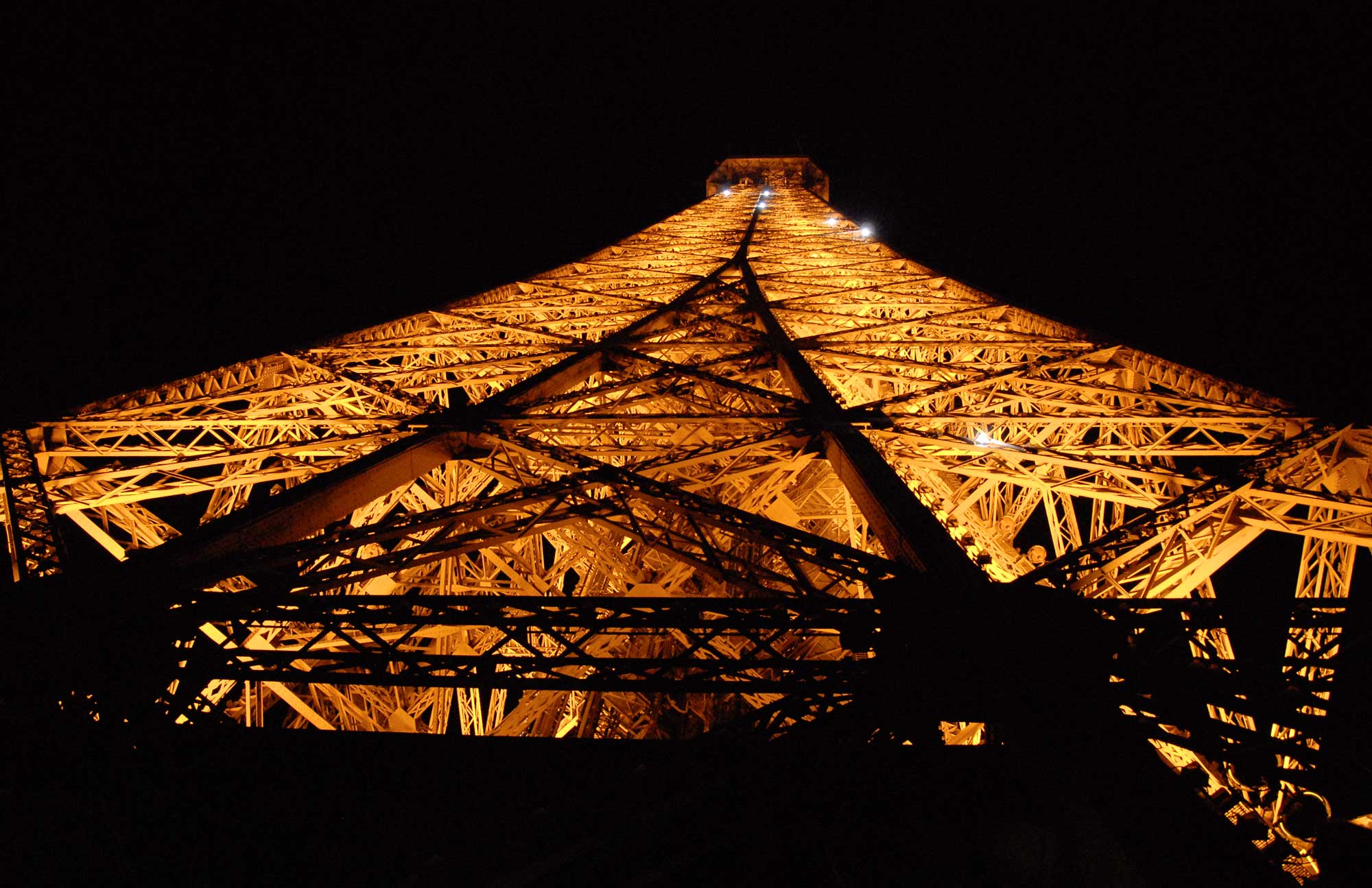
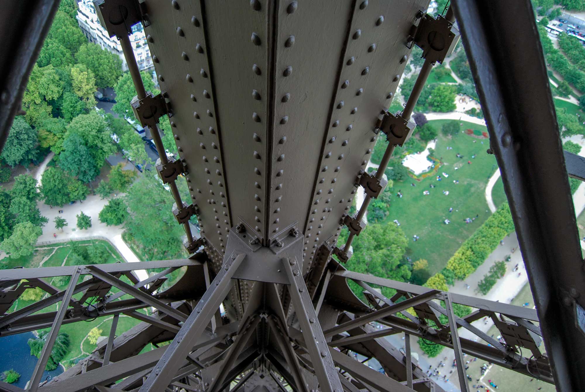
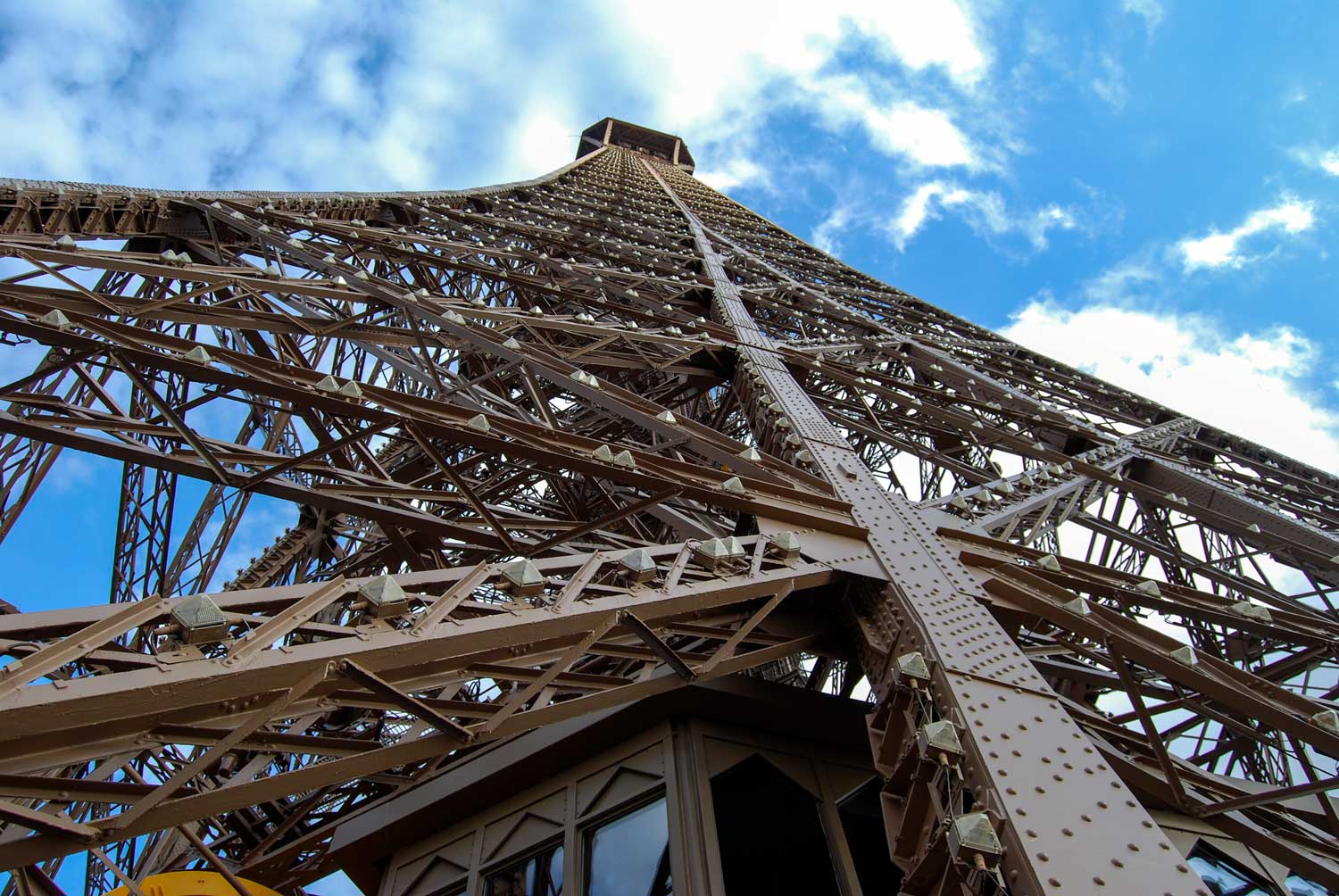
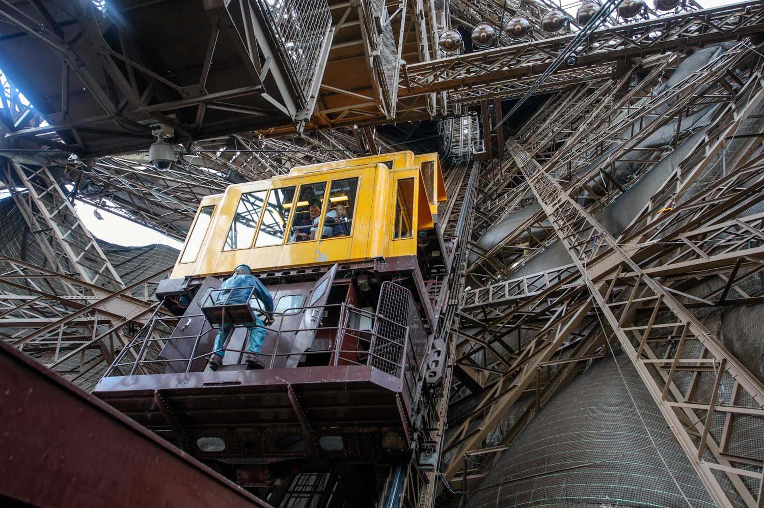

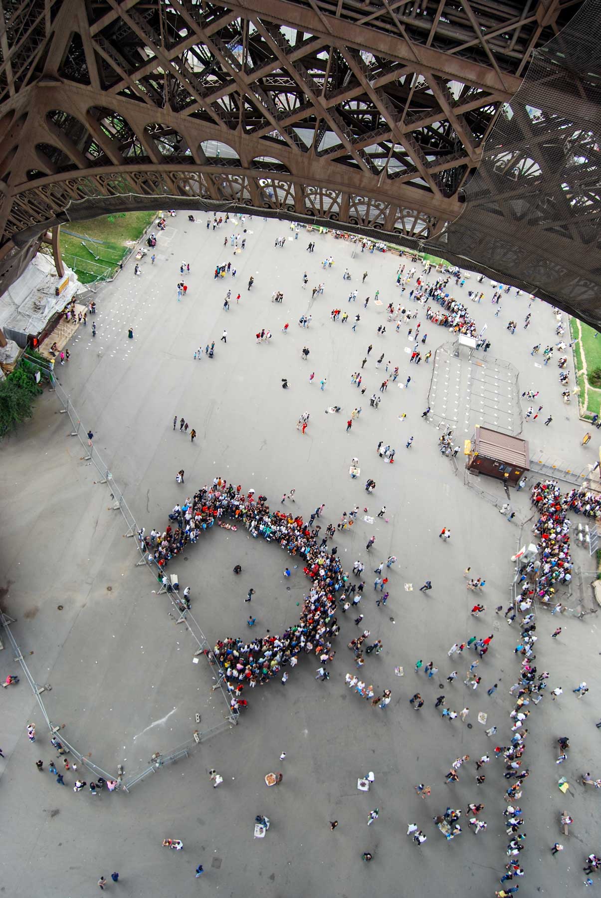
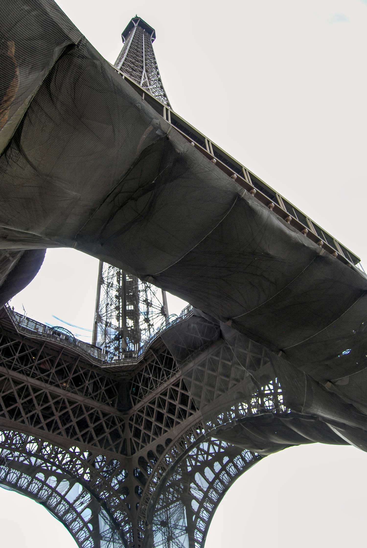


![Looking north up both the new Westlake Ave, at the center, and the old 4th Ave. still climbing Denny Hill on the left. The cross-street is Pike. Here, as in the recording that follows, the front of the Norwegian-Danish Lutheran parish can be seen to the left of the flatiron Plaza Hotel on the left. [We have visited this intersection, and Westlake too, many times and readers may wish to do a key word search for either or both.]](https://i0.wp.com/pauldorpat.com/wp-content/uploads/2013/05/x-collins-undertaker-2-westlake-mall-web1.jpg)


-ca.-1906-WEB")


--R-235--1939-WEB")


-'61WEB")


-WEB")


")
")

")
")

")

")


 View-fm-Apt-at-505-1st-Ave.-N.-Oct.-6,1959-WEB")


-4-24,-1971")


-1874'WEB")


-B-2386--April-18,-1939-WEB")
--R-235--1939-WEB")
-[Denny-Way,-7th,-Battery]-R-239--Dec 30, 1936-WEB-")
--R-248--March-14,-1940-WEB")
-Nov. 12, 1936")
 WEB")
-Sept-23,-41-WEB")
")


-")


-mr-THEN")


-Bridge-profile-when-newWEB")


WEB")


-Capitol-Hill-THEN-WEB")


-")


mr-THEN")


-by-FaberWEB-")


