THEN: Built in the early twentieth century at the northeast corner of Jefferson Street and Boren Avenue, Bertha and Frank Gardner’s residence was large but not a mansion, as were many big homes on First Hill. (Courtesy Washington State Museum, Tacoma)NOW: The Minor and James Clinic opened its new block-size brick home in 1988.
Judging from Asahel Curtis’s negative number 5479, inscribed at the bottom-right corner, this photograph of the home of Dr. and Mrs. Frank Gardner was taken on or very near 1906, the year which the King County tax records claim it was built. A more likely date for the construction is 1905. On the Society Page for The Seattle Times on March 10, 1905, Betha Gardner – then still more regularly called Mrs. Frank P. Gardner – is credited with hosting in her home, here at the northeast corner of Jefferson Street and Boren Avenue, the annual “at home” meeting for the “ladies of the Sorosis Club.” The Times added that “The subject of the afternoon will be the ‘Religion and Music of Russia.’”
[CLICK TO ENLARGE] This is NOT the 1905 Times clipping noted above, but another from nine years later in which Bertha Gardner and her Sorosis Club are noted. While enjoying a hide-and-seek for Gardner and her club you will survey a typical society page from The Seattle Times a century ago. Besides the long list of club activities there are some commonplaces, like the sensational advertisement at the bottom-left corner, and the seeming promise for a stretched figure from the adver. top-right promoting I. Isbin & Co, a ladies tailors on Third Avenue, and another fountain of youth (for your face) at the bottom-right corner. .Bertha Gardner’s portrait published in the Dec. 22, 1922 issue of The Seattle Times.
Pennsylvanians Frank and Bertha Gardner first lived on Capitol Hill in a more modest home. (Should you like to check it, you will find it surviving at 1629 13th Avenue.) By First Hill’s often sumptuous standards, their second home was neither small nor grand with ten rooms, five upstairs and five down. But the whole effect was pleasing in its symmetry, especially this west façade facing Boren Avenue, with its elegant but restrained ornamentation. There was nothing here so assertive, for instance, as the central tower on the Granville Haller home, seen peeking around the corner at the left of the Cardner home.
At the top of the hill, Granville O. Haller’s tower extended the superlatives of his big home at the northeast corner of James and Minor.A helpful detail from the 1912 Baist Real Estate Map – even without the street names. The bigger red dot marks the northeast corner of Boren and Jefferson, the site of the Gardner home, and the smaller dot rests beside the footprint for the Haller mansion at the northeast corner of Minor and James. Note, the red footprint upper-left for the Colony Apartments. It is one of the relevant Edge- links attached below. An essay – or perhaps even two – treating on the Haller home “Castlemount” will also be found in one – or perhaps more – of the links below. [courtesy, Ron Edge]
When the Haller home was built at the top of First Hill in 1883-5 at the northeast corner of Minor Avenue and James Street, some of the fir and alder forest that once covered the hill was still standing. While clearing the site, Colonel Haller’s workers uncovered the skeletons of two Native Americans, casualties, perhaps, of the 1856 U.S. Navy’s howitzer bombardments at the hill during what is popularly called the “The Battle of Seattle” in 1856. Known as the “old Indian Fighter,” Haller crassly kept the skulls in his tower for the amusement of the neighborhood’s children.
There is now a fine opportunity to study the diverse history of First Hill with Historic Seattle’s recently published book on the subject, whose title, while long, is both descriptive and pleasing to the ear: Tradition and Change on Seattle’s First Hill, Propriety, Profanity, Pills and Preservation. Both Pill and Profanity have been popular names for Seattle’s First Hill or parts of it, as have Yesler and, more recently, even Goat.
The increasingly “Pill Hill” part of First Hill photographed from Haborview Hospital in 1956, the year Bertha Gardner died. The Gardner home appears here directly below the large and dark three story (or four) apartment, upper-right. Her physician husband’s death preceded Bertha’s by twenty-six years. By 1956 she had moved to the University District. [CLICK TO ENLARGE]
Bertha and Frank shared their comely First Hill home until 1930 when the doctor died at the age of sixty-one. At some time during the 1930s, Bertha was joined by her brother Wilmer Kahle, president of the Crescent Manufacturing Company; following his death in 1943, she sold the house. We learn from her Times obituary of April 10, 1956, that at the time of her death she lived across from the UW campus in the Malloy Apartments on 15th Avenue NE, and that she had been a charter member of the Sorosis Club, and so dedicated to bringing together “representative women in art, literature, science, and kindred spirits.”
A Times clipping from Nov. 2, 1954 shows Bertha Gardner voting at the Wesley House polling station, which was one block south of her apartment in the Malloy, both directly across 15th Ave. from the U.W. campus. Bertha is fourth from the right and fifth from the left. The Churchill report on the left, may also be worth your time. CLICK TO ENLARGEThe Campbell home at the southwest corner of James and Minor. Their long front yard, which reached the block to Boren Avenue, was the Gardner’s “next door” neighbor. Across Minor Ave stands the Phinney home, far left. [Courtesy Lucy Campbell Coe]
WEB EXTRAS
Lots to add this week…eh, Paul?
Before we begin, however, I thought I would answer your request for more material with a feat of whimsical legerdemain. As you know, I teach drama and writing at Hillside Student Community. This past Friday, I took a few of my 5th and 6th graders on a field trip to the Woodland Park Zoo and through the miracle of photoshop, converted several into lion cubs.
Your students as metamorphs see wary, but not quite ready to leave the nest for the next step where it will be every cat for him or herself. We do have seven links Jean. Any reader who consults them thoroughly will find within most of the features we have done thru the years on subjects that border Boren. There are more than a dozen of them – unless I am contradicted. At the bottom we will ad a feature done first in 1985 about the Campbell home. With its park-sized front lawn it took the entire north-half of the block on which the Gardners built there home about twenty years after Campbell, a hardware merchant, built his in the mid-1880s. The youngest daughter, Lucy, was one of my earliest mentors on Seattle’s pioneer history.
And now for something completely different…
Back to our regularly scheduled program. Take it away, boys.
=======
The Campbell home at the southwest corner of James (on the left) and Minor (behind it).
[Please note that the number 24 in the header above refers to the chapter number in the book from which this text was scanned, Seattle Now and Then, Volume Two, first published in 1987 – if memory serves.]
The Minor an d James Clinic that replaced the home. I took this in 1985.
Lucy Campbell Coe in her Washington Park Home ca. 1985 – with a student.[CLICK & CLICK TO ENLARGE] Seen from Denny Hill, Seattle in 1885, the year Jesse, the Campbells oldest of three children, was born. On the right horizon stands the forest on Beacon Hill. Both the Minor and tower-topped Haller First Hill mansions appear on the left horizon – remembering that the Campbells lived kitty-corner to the Hallers. both at Minor and James. The “other tower” is Coppins Waterworks at the southeast corner of 9th and Columbia. Central School is temporarily near the center horizon. It burned to the ground in 1888. Second Ave. descends (in elevation only) from the lower-right corner.
THEN: Depression-era protestors climb Columbia Street sidewalk along-aside Seattle architect Harlan Thomas’s elegant Seattle landmark that opened in 1925 as home to the by then already forty-three year old Seattle Chamber of Commerce. (Courtesy, Museum of History and Industry)NOW: The Chamber moved from its landmark at 215 Columbia Street nearly a quarter-century ago. Among it residents presently is SEIU Healthcare NW Training Partnership.
The Seattle Chamber of Commerce building, its name signed with the luster of gold leaf lettering on each of the heftily-glassed dark doors on the left, is both physically and politically to the right of this cadre of about a dozen demonstrators marching east on Columbia Street up to Third Avenue. Seven of the patrol are wrapped in professionally produced signs that resonate with depression-era concerns and commands.
As it turned out the Seattle Chamber of Commerce’s full-page advertisement for July 25, 1937 was premature. The rise of the economy that was the trend in the beginning of July a month later began its moved in the other direction: down, which carried on for the year of what is called the “Recession of 1937-1938” in the Great Depression of 1929-1940. BLOW THIS ONE UP with some clicks to read the Boomer’s optimism that rings in-with-and-under it a a Real Presence of Commerce.
The original negative is one of the greathoard of Post-Intelligencer photos that are protected by the white-gloved hands of Museum of History and Industry archivists. It is numbered “PI22387” and, quoting MOHAI photographer Howard Giske, “It has a file date of July 15, 1937, on the old PI negative sleeve . . . good enough for me!” Alas, with the help of skilled librarians in the Seattle Room of our central public library, we did not find it in the paper itself.
While it is not unusual for a busy daily to neglect a negative, we will hope that a Pacific reader might visit the central library, and after a more dogged microfilm search than ours, find that this subject of a silent and yet telling moment of protest on Columbia Street was also published and captioned on the pulp pages of the P-I during the summer of 1937.
Meanwhile, for a better understanding of the subject, we recommend retired UW Archivist Richard Berner’s Seattle 1921-1940: From Boom to Bust, which covers local history during the bubbling 1920s up through the Great Depression of the 1930s. Berner notes (on page 409) that a recession, in the midst of the Great Depression, began in August 1937 when “Cutbacks in federal work relief funds coincided with unemployment levels that approached those of 1932-1933.” The timing is such that the event pictured in the ‘then’ photo, snapped in July by the P-I photographer, is prelude to the August recession.
The back cover with notable blurbs worth reading.
The “red-baiting” that we usually associate with the Cold War was also commonplace during the Great Depression, when communists were thought to be behind every placard. And here, far right, it seems they are. We may have a “commie” in the picture! Held like an umpire’s chest protector, a “newsboy” blandishes a copy of The Daily Worker, the Communist Party’s long-lived publication. Unfortunately, the focus is too soft to read the front page, which by 1937 could have included the latest baseball scores. Might it be that this confrontation of the two dailies, the P-I and the Daily Worker, was reason enough for the former not to print this negative? It is more likely that the bigger daily was distracted by the great mass of its own daily news. Or that we have simply missed it.
WEB EXTRAS
Anything to add, Paul? Well, yes Jean, and we struggled over selections from past features of protest or those, again, of the neighborhood. We get both in Ron Edge’s first link below. The others keep to both for the most part, although we have included some of Berangere’s recent reports from Paris. Following the eleven links attached below (and some of them will be very familiar to regular readers – like the Friends of the Market 1971 march in front of City Hall, which was the “top feature” here only two weeks past) we will continue with a few more neighborhood features. Our ending this week will show Jean’s photos of the public art fixed to the front facade of the Chamber’s building on Columbia (although they have long since moved away).
CLICK TO OPEN
======
The photograph above and the text below first appeared in Pacific May 15th, 1983 when the Times was sometimes still giving two page to this feature. (Courtesy, UW Libraries)Again, from the 5/15/1983 printing of Pacific. Imagine, now more than 30 years ago. The recommendation that the reader “(See feature 80)” refers to another now-and-then printed in the first of three Seattle Now and Then books. You can find it in the book folder on the front page of this blog.Fire Hill and Columbia Street seen from the Hoge Building at Second and Cherry. When it was completed in 1911, the Hoge was the tallest in Seattle, until it was soon surpassed by the Smith Tower. Although the Rainier Hotel is gone, leaving a block of scarred dirt, many other structures survive here from the featured Warner photo at the top of the text above.
======
If some smart readers still want a copy of “Washington Then and Now,” the address has changed. The new box is closer to home at the Wallingford Post Office. It is number 31636, Seattle, WA 98103)Looking back at Seattle from Elliot Bay in 1887-88. Yesler Wharf that elbows thru the scene will be turned to a stubble of pilings by the Great Fire of June 6, 1889. A year and a few weeks earlier Central School, the white box with tower on the left horizon at 6th and Madison, would be consumed by fire. Columbia Street runs up First Hill near the center of the panorama. CLICK TO ENLARGE!About ten years earlier, Peterson and Bros recorded this as part of a wide panorama of the city taken from the elbowed end of Yesler’s Wharf. That’s Yesler’s log pond in the foreground. First Hill has been recently logged off. Columbia Street climbs it, right-of-center. The log retaining wall holding Front Street (First Ave) above the tides was installed in 1876,
=====
If you hide-and-seek for this duplex in one of the Columbia Street revealing photos above it, you will find it.
=====
This subject appears as an extra with an essay in one of the eleven links offered near the top. We show it here to also show the little Post Office, at the alley on the right.Columbia Street, looking west thru Third Avenue during the latter’s 1907 regrade. The post office has moved on to First and University, and will soon be moving further into its headquarters at Third and Union. The next photo is earlier and shows the P.O..The Post Office is back, on the right beyond the alley. The retail brick on the left was predecessor to the Chamber building. The Boston Block just beyond it at the southeast corner of Columbia and Second Ave. , was built before the Great Fire of 1889 and after it packed with a great array of lawyers, salesmen, and the great array of desk duties involved in running a booming city.I took this repeat about a dozen years ago, which was two years or three before Jean took over the repeats. Bless him. Now we’ll take a closer looks at those two sculptured panels that adorn the Columbia Street facade of architect Harlan Thomas’ (with Thomas and Schack) Chamber of Commerce Building.Jean’s full-frontal of the Seattle Chamber of Commerce’s facade facing Columbia Street, with fragments of its neighbor, the Central Building, reflecting in its windows on a sunny autumnal afternoon in 2014. (Jean Sherrard)The up-hill relief sculpture – to the east or left of the front door – by Moran Padelford, who designed and formed it for his masters degree in art at the UW. It depicts indigenous crafts and so commerce too.Sculptor Mildred Stumer’s depiction of modern work – and so commerce. (Jean Sherrard)
THEN: Sitting on a small triangle at the odd northwest corner of Third Avenue and the Second Ave. S. Extension, the Fiesta Coffee Shop was photographed and captioned, along with all taxable structures in King County, by Works Progress Administration photographers during the lingering Great Depression of the late 1930s. (Courtesy, Washington State Archive’s Puget Sound Branch)NOW: Jean Sherrard has followed the landmark adobe hut’s move of 1938 across the Second Ave. Extension.
With this week’s “Now and Then” Jean and I have conspired, perhaps, to confuse you, although not for long. On first glimpse it is evident that in the 76 years that separate our “then” from our “now,” their shared subject, an adobe hut at the corner of Main Street and the Second Ave. S. Extension, has endured. However, on second glimpse, it is also certain that the hut’s milieu has pivoted. We explain.
Before the Second Ave. Extension, looking south from the Smith Tower on March 14, 1928. (Courtesy Municipal Archive)Fourteen months later, June 11, 1929. (Courtesy, Seattle Municipal Archive)
In 1928 the long, wide, and straight path of Seattle’s Second Avenue, between Stewart Street and Yesler Way, was cut through to Jackson Street as the Second Ave. S. Extension. Thereby, it was explained, “Seattle’s Market Street” (a little used nickname) might make a grand beeline to the railroad stations on the south side of Jackson. Of the fifteen buildings sliced into along the new route, three were entirely destroyed, including a fire station with tower that sat at the northwest corner of Main Street and Third Avenue. (Station No. 10’s own feature is attached below.) The Extension ran right through that station’s former location, except for its northeast and southwest corners, which became small triangular lots on either side of the Extension. (Here you may wish to find a map. There’s a good one on the blog listed at the bottom. We’ll make it easier and put both a detail below from the 1912 Baist Map and another from the sky: a detail of the corner and more in Seattle’s city-wide 1936 aerial.)
Someone has drawn borders for the 1928 Second Ave. Extension through this detail from the 1912 Baist Real Estate Map. Yesler Way runs along the top, and Jackson Street the bottom. Note, near the center, the Fire Department Headquarters, aka Fire Station No. 10. here at the northwest corner of Third Ave. South and Main Street. (Courtesy, Ron Edge)A detail from the 1936 aerial map-survey of Seattle. Yesler Way is at the top, Jackson St. at the bottom, and the Second Avenue Extension clearly cuts between them. The two triangles – east and west – are found just below the middle of the subject. (Courtesy, Seattle Municipal Archive)The Fiesta’s original location. Third Avenue is on the right, and Main Street behind Jean..
In our “then,” the Fiesta Coffee Shop stands on the triangle on the east side of Second. The buildings behind it are on Third Avenue. In our “now,” however, the adobe hut survives on the Extension’s west side as the Main Street Gyro, and the structures that surround it are mostly on Second Avenue and Main Street. To record his “repeat,” Jean stood just off the curb on Main.
Another of the Foster and Kleiser billboard recordings, this one dated July 8, 1929, soon after the completion of the Second Ave. Extension. The scene looks west on Main Street and across the freshly paved Extension. As the company’s caption makes clear, this negative was exposed for the billboard on the east facade of the Hotel Main. It advertises Westerman’s Lee Oversalls.A tax photo from January 1, 1938, showing the Hotel Main and, on the right in the west triangle, appears to be a hut, connected, perhaps to Schneiderman’s gas station, when it was still on this the west side of the Second Ave. Extension.
Sometime during the warmer months of 1938, the small café was moved across the Second Ave. S. Extension as Betty’s Coffee Shop, in a trade of triangles between Harry Schneiderman and Betty. The small service station Schneiderman had built on the west triangle, he rebuilt on the east side as a modern Signal station with four pumps and two bays for repairs. Under his name, which he signed below the station’s roofline, the one time center for the UW football team added, “I Ain’t Mad at Nobody.”
Harry “I ain’t mad at nobody” Schneiderman’s Signal Station snuggled in the triangle on the east side of the Second Ave. Extension, on Oct. 4, 1938. That is 3rd Ave. S. on the right. (Courtesy, Washington State Archive, Bellevue Community College branch)
With the help of Bob Masin, the hut’s owner since 1980, we have figured that since the small café’s 1938 move across the Extension, it has had six names with six cuisines. It began in 1938 as Betty’s Coffee Shop and continued so into the 1970s. Masin remembers sitting as a child with his father and grandfather at the small counter watching Betty, always in her apron, serve the policemen standing in the aisle drinking coffee. Following Betty’s came the Greek Villa, the Masada Café, the Penguin Café, the Main Street Teriyaki, and presently the Main Street Gyro.
The “east triangle” with the Boston Baked Beans log cabin in 1937. Sometime soon after this tax photo was recorded the sides were flattened with plaster and the menu changed to Mexican. The Ace Hotel at 312-318 Second Ave., was one of the buildings sliced thru with the 1928-29 Second Ave. S. extension. (Courtesy, Washington State Archive, the branch on the Bellevue Community College campus.
Returning now to the hut’s origins, the earliest tax photo (above) from 1937 shows it as a log cabin for the short-lived sale of New England Baked Beans and Brown Bread, and the tax card accompanying the photo has it built in 1934. And so we may confidently make note that without leaving the corner, the café’s earliest move was from Massachusetts to Mexico when the logs were covered with adobe and the roof with red tiles for the also short-lived Fiesta Coffee-Shop.
WEB EXTRAS
Additions galore this week, lads? Jean, Ron has put up a healthy seven links, and the first one looks north and directly through the new intersection of Third Ave. S., the Second Ave. Extension and Main Street. Look close and you will find the Fiesta in the “east triangle” before it was moved to the other (west) side of the Second Ave. Extension. [If this triangle business is not clear by now, I’m wringing my hands!] The links will be followed by three or four other features that are not so recent as The Seven Below, but still are either of the neighborhood or one of the this feature’s subjects that being fast food, and want of food fast.
======
A FIVE BALL CLUSTER at THIRD AVE. S. AND MAIN STREET, CA. 1911
(Courtesy, Seattle Municipal Archive) A corner of Fire House No. 10 shows across Main Street on the left. This appeared first in Pacific, October, 9, 1994.
======
FIREHOUSE NO. 10
Both the Great Northern (with the tower) and Union Pacific Depots, are found here on the far side of Jackson Street in this ca. 1913 look down from the new Smith Tower. A second tower, appearing on the bottom-right, is part of Firehouse No. 10 at the northwest corner of Main Street and Third Ave. South. There is, of course, as yet no Second Ave. Extension. (Courtesy, Lawton Gowey)Firehouse No.10 – and its tower – under construction in 1903. Looking northwest to the northwest corner of Third Ave. and Main Street.
Above and below, pages 32 & 33 from Jim Stevenson’s 1972 published sketchbook of Seattle firehouses with thumbnail histories. (Thanks to Jim!)
======
EAST ON MAIN FROM FIRST AVENUE
(Courtesy, Museum of History and Industry.)First appeared in Pacific, January 1, 2005.
======
======
======
Bricks, stripes and lids found on Main Street near Second Avenue and multiplied.
THEN: Friends of the Market president, architect Victor Steinbrueck, leads a cadre of Friends marching for Market preservation in front of the Seattle City Hall most likely on March 18, 1971. (Photo by Tom Brownell from the Post-Intelligencer collection at MOHAI)NOW: A new city hall was completed in 2003. Since most of the municipal departments were housed nearby in the 66-floor Seattle Municipal Tower, the new and smaller City Hall serves primarily the mayor, city council, and the city’s law department.
Friends of the Market president and UW architect Victor Steinbrueck, holding the placard asking, “Is Phyllis Lamphere a Friend of the Market?”, marches ahead of his conserving coterie past the front door of City Hall. This protest, one of several City Hall pickets staged by the Friends in February and March of 1971, was most likely performed on Thursday, March 18. Other signs keep to the message: “Urban Renewal Unfair to Pike Place Market” and “City Hall + Investment Syndicate = Urban Removal.” Fittingly, whether intended or not, the style of the signs’ calligraphy resembles the brushwork listing the prices of produce on the cards still regularly seen in the Market’s stalls .
An earlier photo of Friends marching in front of the Seattle Municipal Building – a Seattle Times clipping from Feb. 5, 1971.
On the first Saturday following this parade, its prime target, councilperson Phyllis Lamphere, protested in The Times that she was indeed “a friend of the (Pike Place) market” and then went on to suggest that, as The Times reporter put it, her “Renewal opponents may themselves be the real enemies of the public market, because without rehabilitation, ‘the market will be unable to meet conditions of Seattle’s (building) code.’” Other signs carried in front of City Hall those contesting days of 1971 advised, “Don’t subsidize luxury apartments,” “Removal is not Renewal,” and “The Pike Place Market is Seattle’s History.”
The Seattle Municipal Building looking east on Cherry Street from above 3rd Avenue. It was constructed from 1959 to 1961 using plans created by a Dallas-based firm named McCammon Associates. As at least the story goes, it was a variation on the firm’s earlier designs for a hotel. For someone who can hear the pun, the Dalles firm also worked on the plans in association with Damm, Daum and Associates. The building replacement by the new City Hall showing in detail with Jean’s “now” photos was, for many, an admired developmentA circa 1960 aerial of the Municipal Building Construction with its parking lot to the rear.A fountain that runs beside the stairway off 4th Avenue into the new city hall.
Post-Intelligencer photographer Tom Brownell took the protest photo at the top. We chose it because it also shows the Fourth Avenue façade of the City Hall (1961) that was by then widely understood to be modeled on the cheap after a Texas hotel. Among the prudent fears of the Friends was that the then expected millions from federal sources for urban renewal would be used to replace the funky charms of the Pike Place Market with modern hotel-motel reminders like City Hall. The federal funding was announced on May 15th, and the next day the Friends announced their plans to gather citizen signatures for a proposal to designate most the Market for preservation. Fifteen-thousand legal signatures were needed to get it on the November ballot. The disciplined campaigners gathered more than 25,000 in three weeks. The November 1971 election was won just as readily, with a landslide 76,369 yesses over 53,264 nos.
Seattle Times clipping from November 15, 1964 CLICK TO ENLARGE
When the Friends of the Market was first formed in 1964, it was an arts movement intent on saving the Pike Place Public Market from “sterile progress.” Mark Tobey, one of Seattle’s best-known artists, was a member. Proceeds from his then new book, The World of the Market, benefited the Friends. When the picketing began in the winter of 1971, Tobey was quoted in The Times: “I hope (the market) will only be restored, and not improved through progressive planners.”
Looking up the steps of City HallThe City Hall tower from 4th AvenueThe view NW from the plaza below City HallA view from Smith Tower
WEB EXTRAS
Anything to add, lads? Yes Jean a few links arranged by Ron and an excuse. This “Saturday-before” has been filled with other events and entertainments and so we (I) did not pull up more neighborhood links to past features that have not here-to-fore appeared in the blog. But Jean this excuse is righteous, for, as you know, the afternoon we spent in the SeaTac city hall delivering a lecture on the history of Highline and more was often enough delightful. Before passing on to Ron’s links, here is an feature that first appeared in The Times on March 6, 1983, about fourteen months after these weekly now-and-thens first appeared in Pacific.
====
THE FIRST BAPTIST FACING THE FATEFUL FOURTH AVE. REGRADE
Looking thru the upheaval of regrades on both Fourth Avenue and James Street
Lawton Gowey’s look up Fourth and over James Street on May 19, 1982, with City Hall on the right.
THEN: First designated Columbus Street in the 1890 platting of the Brooklyn Addition, and next as 14th Avenue to conform with the Seattle grid, ‘The Ave,’ still its most popular moniker, was renamed University Way by contest in 1919. This trim bungalow at 3711 University Way sat a few lots north of Lake Union’s Portage Bay. (Courtesy, Washington State Archives, Puget Sound Regional Archive)NOW: Both University Way and 15th Ave. E. were redirected for the UW’s expanding Health Sciences and Fisheries Departments. Here Jean Sherrard stands with his back to the 265,000 square William H. Foege Building, the new home of the UW’s Department of Genome Sciences.
If, for a moment, one squints the eyes and suspends disbelief, this little home on ‘The Ave’ may seem palatial, with guarding turrets, left and right, and a sunlit dome at the rear. Alas, as well arranged as they are for illusions, those accouterments belong to mills near the north shore of Portage Bay, which most likely are closed down. This is a scene from 1937, set in the unwanted languor of the Great Depression.
Page one (of two) of the W.P.A. tax card summarizing the qualities of 3711 University Way in 1937. (Courtesy, Washington State Archives CLICK TO ENLARGE)Remembering first that University Way is still named 14th Avenue in 1912, and remembering also that the W.P.A. tax card information is sometimes mistaken about any structure’s construction date, then it seems that the footprint printed here on Block 35 Lot 25 & 26 of the Brooklyn Addition may be our featured home at 3711 14th Avenue, and in 1912, still three years before the date of origin given to it by the tax card. This foot print (a half dozen narrow lots north of North Lake Ave.) has the rough shape of the house itself, and on tax cards rough is all one needs to make bold claims.
The subject is pulled from the Works Progress Administration’s photographic survey of every taxable structure in King County. With help only from these property record cards, city directories, and The Seattle Times archives, we can deduce that Clara and Ferdinand Krummel lived here in 1937 with their teenager Paul, and perhaps one or both of their daughters. Paul was among the 586 seniors graduating from Roosevelt High School in 1938, and the ceremony was nearby in the UW’s Hec Edmundson Pavilion. Four years more and the enlisted Paul would be completing a course in aviation mechanics in Texas. In the spring of 1944, the intentions of the eighteen-year-old Gertrude A Nerdig to marry the soldier were published by The Times.
This somewhat soft panorama of the University District was photographed in 1915-16 when the bungalow at 3711 University Way (then still named 14th Ave. NE) was either being constructed or the first residents were moving in. The photographer’s prospect above Portage Bay puts her or him in line with the backyard of the home, which is at least part hidden in the trees that stand about one-fourth of the way into the subject from its left border. To help out, 15th Ave., the western border of the campus climbs from the bay eventually along the left side of the campus grove, which have been considerably pruned since then. Fifteenth seems to be heaving for that single tall tree on the horizon. The “Ave.” or 14th Avenue then, is one block to the west (left) of 15th Avenue. On the far right the ditch that will be the Montlake Cut is being prepared behind the coffer dam, which was opened or severed in October of 1916 to allow the waters of Lake Union to fill the cut before Lake Washington was lowered through a dam at the east end of the cut to the level of Lake Union. CLICK TWICE to ENLARGE.
Two years later, in 1946, The Times printed a short obituary for Ferdinand, the then 76-year-old father, describing him as a German immigrant and a retired baker. In the 1930 Polk City Directory the Krummels were living in Ballard and proprietors of the American Girl Bakery at 5431 Ballard Avenue. Most likely the Krummel’s closing of their bakery and move to this modest home in the University District had something to do with both the Great Depression and their age.
An earlier view of “town and gown” – the University District and the University – from 1909 showing off part of the campus remade for the Alaska Yukon and Pacific Exposition. Continuing our brief custom of showing distant looks at our featured home hidden in the trees, in this 1909 look we might have found it behind the first tree rising here from the center, or hidden, in part, behind the smoke of the lumber mill’s burner, the same mill (but open) that features in the WPA subject as a faux sun room attached, it seems, to the rear of 3711 The Ave.This keyed map (but not by the keys of a computer) speculates on when the empty lots and worn residences (“properties obsolete or blighted”) in the University District would be developed, but with what is not indicated. Note that the purple blocks, which include our home site in the “lower district,” are expected to be “renewed” in ten years of the map’s decidedly circa 1963 drawing. The map came to me through Calmar McCune, the one-time “Mayor of the University District.” And now in a half-century later many of the black blocks are getting their working-over too.
The WPA card describes this bungalow as built on a footprint of 875 square feet and divided into five rooms. The card has University Way made of bricks, and the neighborhood’s “use” as “residential-industrial,” as this photo’s melding of mill and domicile is a clear witness. Like almost everywhere then, the neighborhood’s “status” is listed as “static.” This stasis was disrupted in the 1960s when the UW began buying up much of the “lower district.”
Five blocks up the Ave, from our featured home, and two years later on September 29, 1939, there are a few bricks to be seen here south of 42nd Avenue, those protecting the trolley rails. The intended subject is – again – the Foster and Keiser billboard on the left.
The tidy accommodations of the home at the top were built in 1915 (or so claims the tax card), but demolished in 1962 or 1963, and so did not reach their golden anniversary. Paul Krummel, however, kept on until March 3, 2014. In his obituary in The Times, one of his grandchildren describes him as “a loving husband who was often seen holding his wife’s hand.” Another adds that he “loved to dance and had a great sense of humor.”
THE KRUMMEL’S NEIGHBORS IN THE 3700 BLOCK IN 1937
Next door at 3709 University Way. Note the “sun room” on the right.3737 University Way3764 University WayReaching the corner and 3772 University Way in 1937. (Courtesy of Washington State Archive, Bellevue Puget Sound Branch – like the rest.)3731 University way in 1937, and below also 3721 but in 1955 after eighteen years of wear.3731 University Way, May 31, 1955
WEB EXTRAS
I have to comment, Paul, it’s rare to capture you in one of these photos, but there you are in this week’s ‘Now’ whistling your happy tune! Anything to add? Yes Jean, beginning with a question in return. Can you name the tune? Otherwise, as is our way, Ron Edge starts our response with several CLICKABLE links to other features from the past that treat on “The Ave,” and all of them have subjects within them that elaborate on your and my long-lived interest in, to repeat, both “Town and Gown” north of Portage Bay (and extending south of the bay to include the now razed Red Robin Tavern.) At the bottom, if time allows before our climb to “Night-Bears” (The copyright is guarded with pillows.) we will include more on The Ave.
=====
VARSITY INN
The Varsity Inn and trolley platform at the northeast corner of University Way and 42nd Avenue.First appeared in Pacific, July 30, 1995.
Circa 1994From one of those street fairs – probably in the 1980s. I’ll know later. As one of my last rites I am now organizing my 55 years of collecting: my archive. Peace to me and my dust. Good night Jean – ah but you are long gone to bed. Good night Berangere – ah but you are long up for a Sunday morning in Paris.
THEN: When it was built in 1864 Charles and Mary Terry’s home was considered the finest in Seattle. (Courtesy Museum of History and Industry)NOW: The ornate home was razed early in the twentieth century, first for more business-friendly structures, and then in the early 1950s for the city’s Public Safety Building. This too was razed, and the “Civic Square” proposed to replace it abides now as a construction pit fenced behind fanciful walls at the sidewalk. The site waits upon financing for development as a “public-private” space.
Most likely the first “now and then” treatment this charming pioneer home received was in these pages seventy years ago on Sunday, November 10, 1944. The author, Margaret Pitcairn Strachan, chose the Charles and Mary Terry home as the fifteenth weekly subject of her yearlong series on “Early Day Mansions.” Strachan’s fifty-two well-packed and illustrated essays must be counted as one our richest resources for understanding Seattle’s history. In 1944 many of the mansions built by the community’s nabobs were still standing, and sometimes the original families were still living in them and willing to talk with the reporter. (We will attach the Strachan feature below. Click TWICE to enlarge for reading.)
In the Strachan feature the Terry home faced Third Avenue near its northeast corner with James Street. We can learn something about the family’s history – especially about Charles – from the journalist’s reveries that came upon her as she stepped into the “now” after opening the door to a café near the northeast corner of Third Avenue and James Street. She writes, “The Columbian Café is probably the place which is on the exact spot where the house stood. Sitting at the maroon-colored counter, facing the huge mirror which runs the length of the room and reflects the booths in the background, I listened to the clatter coming from the kitchen and watched the waitresses in their spotless white dresses, as they hurried back and forth over the red tile floor, serving busy Seattle citizens who were unaware that this spot was once the home of the man who named Alki Point, owned its first store, was the instigator of the University of Washington, foresaw a great future for this ‘town of Seattle’ and drafted its first ordinances.” (Next, we have attached an earlier photo of the Terry home before it was pivoted off of Third Avenue to face James Street. Below the home we have added a snap of the 3rd Avenue front door to the Public Safety Building, and below that two photo that include the Columbian Cafe that Strachan visited for her research and/or edification or nutrition. The two cafe photos are public works subjects and have their own captions with dates.)
The Terry Home on Third Avenue before its pivot for facing James Street.The Public Safety Building facing Third Ave. about a dozen years ago (since destroyed) where once the Terry home revealed its lavish facade to both the village and the bay.The Columbian Cafe is signed just above the photo’s center. The view looks south on Third Avenue from near Cherry Street. (Courtesy Municipal Archive)Looking north on a closed Third Avenue from James Street also on November 13, 1928 during some road work. The Columbian Cafe is far-right. (Courtesy Municipal Archive)An early 20th Century look up Third with the Webster and Stevens Studio photographer’s back toward James Street. Note the St.Elmo Hotel at the southeast corner of Third and Cherry, on the right. It served the fire fighters and citizens during the city’s Great Fire of June 6, 1889 when the hotel was nearly new.. You can find it as well in the 1928 photo above it. [Below, Ron has included a link to the feature we did on the above W&S photograph – (Courtesy, MOHAI)JEAN’S repeat from not so long ago.
By purchases and trades with pioneers Carson Boren and Doc David Maynard, the Terrys owned most of the business district and were the wealthiest couple in town. On the sweet side of their pioneer life, they opened Seattle’s first bakery in 1864, the year they also built this jolly home, the “ornament of the town.” In 1867 the couple ran a large advertisement in the Pacific Coast Directory, which read, in part, “C. C. TERRY, Seattle, W.T. wholesale and retail dealer in Groceries, Provisions, Cigars, etc., manufacturer of crackers and cakes of all kinds. Unlimited supply of Ship Bread constantly on hand at San Francisco prices.” Tragically, Charles died of tuberculosis, a mere thirty-nine years old, in 1867. On the day of his death his third daughter was born.
A Seattle Times announcement on Feb. 4, 1906 that the C.C. Terry house with its “peculiar Gothic design” was being demolished.
Sometime between the 1878 birdseye view drawing of Seattle and the 1883 Sanborn real estate map, the Terry home was pivoted 90-degrees counter-clockwise to face James Street. At the same time the house was moved one lot east of its corner with Second Avenue, which is where we see it in the featured photo at the top. The home’s second footprint holds on in the 1904 Sanborn but not in 1908. It was demolished in 1907.
The above three-stack of Sanborn map details date from, top-to-bottom, 1884, 1888 and 1893. The Terry home sits at the bottom of block 22, to the left or west of what would have been the alley, had one been encouraged. Note how the footprint changes for the home. In 1884 the sun room attachment to the home’s south side when it still faced Third Avenue has been removed for good. By 1888 the row houses at the northwest corner of Fourth Ave. and James have been added. We can see the most westerly corner of those in the top featured photo. Also in the 1888 Sanborn the Russell Hotel has been added to block 22’s northwest corner at the southeast corner of Third Avenue and Cherry Street. In the photographs shared above, the Russell has had a name change to Elmo.On the right side of this pair, the northeast quarter of C.D. Boren’s Block 32 has been cleared of all, including the C.C. Terry home, by the time this 1908 Baist Real Estate map was assembled. The row houses survive, however, at the northwest corner of James and 4th Avenue. In the detail, on the left, from the Baist map of 1912, the row is gone and the Terry home site filled with a rectangular shaped brick structure.The Public Safety Building took the block in 1951, one of downtown Seattle’s earliest Modern Buildings. Here looking southwest thru the intersection of Fourth Ave. and Cherry Street, the City County building looks back, on the left, and the Smith Tower looks or peeks down from above, upper-right. The number “6.” scrawled on the photo is not explained. (Courtesy, Seattle Municipal Archive.)The bottom subject of this pair is the oldest surviving photograph of any part of Seattle. It is conventionally (and probably accurately too) dated 1859. It looks east towards First Hill over the Yesler home, on the left, at the northeast corner of Front Street (First Ave.) and James Street. The mid-1860s subject above it includes the ornate west facade of the Terry home at 3rd and James. Note that the timberline around Fifth Avenue is nearly the same between the two photographs. This suggests that at some point before 1859 the clearing of the forest in this earliest neighborhood stopped – for a spell.
WEB EXTRAS
Anything to add, boys? Ron Edge begins by putting down a few links – often to the neighborhood. We’ll conclude with the oft-used couples portrait of Charles and Mary, and another full-page feature on their home by Lucille McDonald, once-upon-a-time, The Seattle Times principle reporter on regional heritage. Finally we will drop in a hide-and-seek in which the reader is encouraged to find the Terry home.
=====
Lucile McDonald Sept. 15, 1963 contribution to The Seattle Times. DOUBLE CLICK to Enlarge for Reading!The Norwegian photograph Anders Wilse too this wide shot of Seattle ca. 1899 during the few years he lived in Seattle. Can you find (part of) the Terry home here-in? Clue 1: The intersection of Jefferson Street and the alley between Fifth and Sixth Avenues is near the photograph’s bottom-right corner. Clue 2: The Yesler mansion, surrounded by Third, Fourth, James and Jefferson, is far left.
THEN: A motorcycle courier for Bartell Drugs poses before the chain’s Store No. 14, located in the Seaboard Building at the northeast corner of Fourth Avenue and Pike Street, circa 1929. (Courtesy Bartell Drugs)NOW: Motorcycle historian Tom Samuelsen explains that the “END” written on the starboard side of his Suzuki is half of a discarded street sign. “DEAD,” the other half, hangs on the out-of-sight port side.
By the authority of Northwest motorcycle historian and enthusiast Tom Samuelsen – standing by his Suzuki dirt bike in the now – the cyclist in the older photograph, wrapped in leather under a billed hat, is none other than Joe Williamson, one of the founders and first president of the Puget Sound Maritime Historical Society.
Tom, a fisherman, is also a lover of maritime history, but it as a motorcyclist that his name may be familiar. Tom is one of the founders of the Pacific Northwest Museum of Motorcycling, and currently the curator of the museum’s thousands of motorcycle-related photographs, ephemera and gear. With the help of others in the nonprofit, he has organized and mounted many exhibits, including “Fastest Corner in the Northwest,” at the Museum of History and Industry in 2002. More than once I have asked for, and received, Tom’s help in historic motorcycle matters.
It was not, however, Tom Samuelsen who first shared this photograph with Jean and me. Rather, it was Marie McCaffrey, the executive director of our state’s on-line encyclopedia, Historylink. The photo appears on page forty-two of The Bartell Story (Historylink’s most recent book of now more than a dozen titles since its debut in the spring of 1998), in which local author Phil Dougherty and the Historylink staff recount Bartell’s “125 Years of Service” in 140 pages between hardcovers.
Left-to-right, historylink’s Marie McCaffrey, Priscilla Long and Paula Becker.
On the awning above Williamson and his circa 1929 Indian Scout motorcycle, the “Seattle’s OWN Drug Stores” sign is especially true here on Pike Street. In addition to this Bartell No. 14 in the Seaboard Building at Fourth Avenue, in the 1929 Polk City Directory, the drug store chain had three more stores nearby on Pike: No. 3 at First Avenue, No. 9 at Second Avenue, and No. 7 at Fifth Avenue. Bartell Drugs, to read from the book’s protective dust jacket, is “The oldest family-owned drugstore chain in the country.” It is celebrating its 125th birthday with the issuance of the Historylink book.
Also in the historylink book, Bartell Store No. 9 with the Olympic Oscillator, which may turn you into a champion, in the window at Bartell Store No. 9 nearby at Second Ave. and Pike Street.
When Joe Williamson first showed this featured (at the top) photograph to Tom Samuelsen, he explained that he used his Indian Scout to deliver prescriptions for Bartell, and that they paid very well, good enough to help support his love of photography. Tom claims that Joe could “charm your sox off.” I first met Joe in the early 1980s and was similarly taken by his generous ways. Born in 1909, Joe died in 1994, age eighty-four.
WEB EXTRAS
Let me mention what a gas it was taking Tom Samuelsen’s picture at Westlake. We couldn’t quite get to the exact prospect of the original photo because of existing street sculpture, but we got close. In the following shot, Tom waves goodbye headed east on Pike.
Tom Samuelsen rides away easy…
Anything to add, boys? Sure Jean. Ron is putting up five, I think, links. The first one begins with the American Hotel on the east side of Westlake Avenue and looks back (to the south) at Westlake’s origins at Pike Street. Again, there may be some repetition between them, but again and again we remember my Mother Eda Garena Christiansen Dorpat’s advice, “Boys (she had four sons) repetition is the mother of all learning.” Jean did you know that the first feature we put up was about the aftermath of a parade through this five-star intersection, and we have returned often with looks in most directions through it. We’ll attach that first feature from January 17, 1982 at the bottom of all this. And Jean did you also know that the last feature that touched on this corner was featured hear a mere months ago, on Dec. 6, 2014. Ron did not offer a link to it. We figured you could just scroll down to get to it. Please do.
=====
One of the most popular historical photos of Westlake Ave looking north from Pike Street.I took this “now” repeat for the “cop” picture in 2005 while on my way to a historylink staff meeting. The link’s office was then in the Joshua Green Building at the southwest corner of the intersection.This Pacific feature first appeared in The Times on August 24, 2005.
=====
THE FIRST NOW AND THEN FEATURE- FROM JAN. 17, 1982
[Note: the “103” in the title at the top of the above text refers to its position in the book from which it was scanned, Seattle Now and Then, Volume One.]
=====
THE WESTLAKE DEATH THERMOMETER: 1939-40
THE SEATTLE TIMES Dec. 31, 1940 caption for the above reads, “Grim reminder of what might happen to reckless and drunken drivers in heavy traffic tonight, the above wrecked automobile, involved in a recent collision, was parked today at the base of the death thermometer which has been used by the Seattle Traffic and Safety Council to record the city’s traffic toll. The thermometer is at Fourth and Westlake Avenues. Perched atop the car is “Safety Pete,” official mascot of the Safety Council.”Later it appears that 1940 has outdone 1939 and even borrowed a few deaths.
======
SNOWSCAPE WITH THE TRIANGULAR BARTELL DRUGS
Readers with an interest in local snow may wish to visit the front page of this blog and find there a button for calling down a history of Seattle snows. It is detailed enough that you may be able to figure out what snow this is with the help of the photograph’s dated subjects, especially the automobiles.
=====
WE STAND GUARD – DRIVERS OF THE BLACK OUT
Called-up following Pearl Harbor, Seattle’s Blackout Patrol were on call for the few nights that the lights were all turned off.
THEN: This “real photo postcard” was sold on stands throughout the city. It was what it claimed to be; that is, its gray tones were real. If you studied them with magnification the grays did not turn into little black dots of varying sizes. (Courtesy, David Chapman and otfrasch.com)NOW: After a rescue in the early 1970s, this former city hall survives as the 400 Yesler Building. Behind it rises the Fifth and Yesler Building, a recent addition to the Pioneer Square Neighborhood skyline.About thirty years ago, or more, I took the above shot of our subject for reasons I no longer remember (if I needed one.) The prospect then was close to Jean’s now, but not so colorful. And there on the far right the Grand Union Hotel still stood on the east side of Fourth Avenue.Here’s a THEN of the same intersection, which moves closer to Jean’s position, or reaches beyond it to the sidewalk for a look up Terrace Street, or rather an impression of it through the windows of the Yesler Way Cable car which in this ca. 1940 shot is handing on to its about last cable. (Courtesy Lawton Gowey)
Otto Theodore Frasch was one of boomtown Seattle’s most energetic postcard photographers in the early twentieth-century, when the public interest in sending and collecting postcards with “real” photographs on them was especially popular. Local collectors generally cherish postcards with the “O.T. Frasch Seattle” credit and caption.
In this look east on Yesler Way, where it still crosses above Fourth Avenue, Frasch also printed the names of three of Seattle’s primary civic buildings on postcard No. 173. First, left-of-center, is the triangular-shaped City Hall, the photographer’s primary subject. It was the brick replacement for the comically named Katzenjammer frame city hall, nearby at Third and Yesler, located in what is now City Hall Park. Earlier than No. 173, Frasch had made another postcard that included both municipal buildings on Yesler Way. Its number, nineteen, is early for the Seattle-based photographer.
The Katzenjammer Castle (now City Hall Park) with the new City Hall, up Yesler on the far right, Frasch’s No. Nineteen. We will add his No. Eighteen next.Apparently this is Otto Frasch’s first record of City Hall (the 400 Yesler Building) near the end of its construction.
Otto and Mary Frasch came here from Minnesota in 1906. Elsie, their first daughter, was born on the way. A charming picture of the three is included on the Otto Frasch website otfrasch.com, which is web-mastered by Elsie’s great-grandson, David Chapman. More than 500 images of Frasch’s Seattle and surrounds are featured, including the coverage of Luna Park (the family lived nearby on West Seattle’s Maryland Avenue), the Alaska Yukon and Pacific Exposition in 1909, the city’s Golden Potlatch parades from 1911 to 1913, and the 1908 visit of the Great White Fleet, all of which are worth a visit to the site. With Otto Frasch’s magnum opus of more than 1000 ascribed numbers, webmaster Chapman’s shepherding of the site continues with new discoveries.
Luna Park and Duwamish Head seen from one of its thrilling and/or amusing rides.A two-card panorama of the Alaska Yukon Pacific Exposition’s fitting on the UW campus in 1909, photographed by Otto Frasch from the Capitol Hill side of Portage Bay.
This “real photo postcard” No. 173 (the featured photo at the top) most likely dates from 1908. Although barely visible in this printing, a monumental “welcome” sign for the Fleet stands high on First Hill to the left of the King County Court House dome, which resembles a wedding cake. City Light is the third landmark noted in the caption. With its own rooftop sign and two ornate towers, the citizen-owned utility stands above the northwest corner of Seventh Avenue and Yesler Way. From Frasch’s prospect they escape the horizon behind a screen of power poles beyond, and to the right of City Hall.
City Light’s sub-station on the north side of Yesler Way at the west side of 7th Ave. (now over the freeway pit) in a photo not by Frasch but by a city photographer who has dated it Jan. 20, 1914 at the bottom right corner. In the City Light link included by Ron Edge below, you will find an attached feature with short essay on this sub-station with an earlier photo of it.Frank Shaw recorded this look across Yesler to the Grand Union Hotel on March 7, 1963, or still eighteen years before the structure was razed on a city order. To this side of hotel is the Cadillac and ironic addition or a radical juxtaposition, both once popular art-crit terms?Verily, the Grand Union Hotel’s destruction as recorded in The Seattle Times for May 15, 1983.
Otto Frasch did not include in his caption the private Grand Union Hotel, on the far right of the featured photograph on top. Opened in the fall of 1902, it survived for eighty-one years. The May 15, 1983, issue of this newspaper includes a photograph of the hotel’s destruction under the caption, “Going Going Gone.” The Grand Union “came down without a whimper, ending years of anxiety by the city over the lack of stability in the turn-of-the-century building.”
The Desert Magazine of February 1941 reveals that years after leaving his real photo postcard business in Seattle Otto Frasch was still busy dealing, only then “desert colored glass” out of Los Angeles. (Note the third miscellaneous down.)
WEB EXTRAS
Hey Paul, where’s the beef?
Jean we will answer your beef question at the bottom (the last) of the LINKS LIST that Ron Edge is putting up of subjects that are, again, mostly relevant to this week’s feature. We encourage readers to start clicking and keep at it as long as they can – at least until they reach the beef. Here we also note that our beloved mentor Richard Berner is having his 95th birthday this December 31, aka New Years Eve. May we remind readers that we have on the front page of this blog Berner’s first of three books that make up his trilogy of Seattle in the first 50 years of the 20th Century. It is included in the books button. Appropriately, at least for his birthday, that takes Vol. 1 up to 1920, the year that Rich was born – on its last day. We have also pulled the little biography we wrote about Rich a few years back and copy it to the bottom of whatever else we come up with before climbing the stairs early this morning to again join the bears. If my copy attempts fail, you will find that vital Richard (his vita) on this blog with a key word search. Good luck to all of us.
========
BERNER’S BOOMTOWN
(click to enlarge photos)
We are pleased now to introduce Seattle 1900-1920: From Boomtown, Urban Turbulence to Restoration, the first of Richard C. Berner’s three books named together Seattle in the 20th Century. When the details, stories, and insights are explored with a close reading, Berner’s accomplishment is by far our widest opening into Seattle’s twentieth century, the first half of it, from the 1900 to 1950. Those fifty years were also the second half of Seattle’s first hundred years, if we begin our counting with the footsteps of mid-western farmers settling here in the early 1850s.
Richard Berner, a recent portrait
Volume one was first published in 1991 by Charles Press, and the publisher – “Rich” Berner himself – made a modest list of its contents on the back cover. We will repeat it. “Politics of Seattle’s urbanization: dynamics of reform, public ownership movement, turbulent industrial relations, effects of wartime hysteria upon newfound civil liberties – all responding to the huge influx of aspiring recruits to the middle class & organized labor as they confronted the established elite. Includes outlines of the economy, cultural scene, public education, population characteristics & ethnic history.”
For this “printing” we have added many captioned illustrations, some of them copied from news reports of the events Berner examines, and we have almost always succeeded in placing each next to the text it illustrates. On-line illustrated editions of Volume 2: Seattle 1921-1940, From Boom to Bust and Volume 3: Seattle Transformed, World War 2 to Cold War will follow – but not at the moment.The collecting of illustrations and putting them in revealing order with the narratives for Volume 2 and 3 is still a work in progress.Readers who want to “skip ahead” of our illustrated presentations of Berner’s three books here on dorpatsherrardlomont can find the complete set of his history as originally published in local libraries or through interlibrary loans.
How Rich Berner managed it is a charmed story. He undertook what developed into his magnus opus after retiring in 1984 from his position as founder and head of the University of Washington Archives and Manuscripts Division. Between the division’s origin in 1958 and his retirement Rich not only built the collection but also studied it. Berner worked closely with Bob Burke, the U.W. History professor most associated with the study of regional history who first recommended Berner, a University of California, Berkeley graduate in history and library science, for the U.W. position. Together, the resourceful professor and the nurturing archivist shepherded scores of students in their use of the archive. Rich Berner is the first to acknowledge that he also learned from the students as they explored and measured the collection for dissertations and other publications. By now their collected publications can be imagined as its own “shelf” of Northwest History.
News clipping showing Rich C. Berner “as curator of manuscripts for the University of Washington Library.”
Rich Berner showed himself also a good explicator of his profession. His influential book, Archival Theory and Practice in the United States: A Historical Analysis was published by the University of Washington Press in 1983 and was awarded the Waldo Gifford Leland Prize by the Society of American Archivists. Composing this historical study on top of establishing and nourishing the University’s Archive and Manuscripts Division may be fairly considered a life’s achievement, but, with his 1984 retirement Berner continue to work in the archive at writing his three-volume history. He published Volume Three in 1999, and so, continuing the charm of this entire production, he completed Seattle in the 20th Century before the century (and millennium) was over.
Rich & Thelma
(Lest we imagine this scholar chained to his archive we know that with his wife Thelma, a professor of Physiology and Biophysics in the U.W. Medical School and the first woman appointed Associate Dean of the UW graduate school, this famously zestful couple managed to often take to the hills and mountains.)
Rich was born in Seattle in 1920- the last year explored in this his first volume.His father worked on the docks as a machinist, and for a time was “blacklisted” by employers because of his union advocacy.During the depression, while Rich was attending classes at Garfield High School, his mother ran a waterfront café on the Grand Trunk Pacific’s pier at the foot of Madison Street.
Rich in uniform
During the war Rich served with the Army’s 10th Mountain Division.Following it with help from the GI Bill he matriculated at Cal-Berkeley with degrees in both history and library science.It was also in Berkeley that he first met Robert Burke, then Director of the Manuscript Collection of the Bancroft Library. Rich worked part time there.
For Seattle, as for any city of size, there is a “canon” of publications that are necessary reading for anyone wanting to get a grip on local history. The first half of the Seattle Canon may be said to begin with Pioneer Arthur Denny’s Pioneer Reminiscences of 1888. The pioneer canon receives its own magnus opus with the combined works – multi-volume histories of Seattle and King County – of Clarence Bagley, himself a pioneer. That Berner was already attending Seattle’s T.T. Minor grade school in 1926 when Bagley was still three years away from publishing his History of King County is evidence of the “Boomtown” included in the title of this Berner’s first of three books on Seattle history.
With rare exceptions the books included in this first part of the Seattle Canon were published by their subjects, like Denny’s still revealing Reminiscences, or under the direction and/or support of their subjects, like Bagley’s still helpful volumes.They are generally “picturesque histories” written to make their subjects seem more appealing than they often were.The stock of motives for “doing heritage” are there generally supportive or positive, showing concern for the community, admiration for its builders, the chance to tell good stories, and often also the desire to learn about one’s forebears although primarily those truths that are not upsetting.Not surprisingly, and again with rare exceptions, these booster-historians and their heritage consumers were members of a minority of citizens defined by their wealth, race and even religion.It would be a surprise to find any poor socialists, animists or even affluent Catholics among them.
Part Two of the Seattle Canon may be said to have popularly begun with Skid Road, historian-journalist Murray Morgan’s charming and yet still raking history of Seattle. Published in 1951, the year of Seattle’s centennial, it is still in print, and has never been out of it. Richard Berner has dedicated Seattle 1900-1920: From Boomtown, Urban Turbulence to Restoration to Morgan.The post-war canon is often corrective of the sins of the pioneers.The works of Morgan and many others, certainly including Berner, are not generally clothed in the pious harmonies of their predecessors, the ordinarily stress-free narratives expected of those who were writing under the “pioneer code.”
In our opinion Rich Berner’s three-volume Seattle in the 20th Century is the greatest single achievement of our Seattle Canon – “part two.”It has the scope and details required.It is profoundly instructive and filled with the characters and turns of fate that any storyteller might admire and wisely exploit.Within Berner’s three books are the wonders of what they did, the touchstones of their devotions and deceptions, their courage and hypocrisy, meanness and compassion.Certainly, it has been our pleasure to help illustrate this the first volume and to also continue on now with volumes two and three.
Paul Dorpat 10/1/2009
Archivist-Antiquarian as Young-Equestrian posing in front of the Berner family home on Seattle’s Cherry Street.Student at Seattle’s Garfield High SchoolRich Berner’s father, top-center: machinist on the Seattle waterfront.“High school or college, I’m no longer sure.” – Rich BernerRich Berner, second row third from left, posing for a group portrait of the U.S. Army’s 10th Mountain Division at a Colorado camp during the Second World War.With Thelma on Mt. StuartThelma & RichThe Robert Gray Award from the Washington State Historical Society
==========
FOUR MORE of the 400 YESLER WAY Building
A Webster and Stevens Studio photo of City Hall from the same (or about the same) time as the Frasch photographs on top. (Courtesy, the Museum of History and Industry)Lawton Gowey dated this slide May 24, 1970.Gowey shows up on the eve of restoration with the sidewalk barriers and protection in place along the north side of Yesler Way. Gowey dates this February 7, 1977.
Frank Show and his Hasselblad look down on the broken and abandoned City Hall from the often slippery side of First Hill (the Goat Hill part of it) standing near the west side of Sixth Avenue. He dates his transparency January 31, 1973. A sign on the roof promotes Stevenson for judge. After 21 years practicing law here, Robert H. Stevenson, 47, determined to run for one of the open positions on the King County Superior Court on the Sept. 19, 1972 ballot. His campaign had a populist touch advocating a system in which individual judges could be sanctioned by the public for “bizarre or arbitrary actions.” Neither did Stevenson like it that federal judges were appointed for life-time appointments. The Bellevue citizen was of the opinion that all candidates for the bench should be tested for psychological fitness and go through a screening designed to reveal any emotional problems that would interfere with their time in the robe. The sign on the roof of the 400 Yesler Building was one of the expenses of his $3,000 campaign. Apparently, removing the sign after the election was not. From a reading of The Times archive, it does not seem that Stevenson won.
THEN: Looking south on First Avenue from its northwest corner with Madison Street, circa 1905. (Courtesy Museum of History and Industry)NOW: The entire block bordered by First and Second Avenues and Marion and Madison Streets was cleared in the late 1960s for the construction of architect Fred Bassetti’s Henry M. Jackson Federal Office Building, which opened in 1974.
Through the late 1880s this east side of First Avenue – its was still called Front Street then — was distinguished by George Frye’s Opera House (1884-85). This grand pioneer landmark filled the southern half of the block until June 6, 1889, when Seattle’s Great Fire reduced it to ashes. While these were still cooling, Frye hired John Nestor, an Irish-born architect who had designed his Opera House, to prepare drawings for the Stevens Hotel, which we see here also at the south end of the block, which is the northeast corner of First Avenue and Marion Street.
Frye’s Opera House is about to be engulfed by the Great First of June 6, 1889 in this look south on First Ave. (then still Front Street) from Spring Street. The opera house, the tallest building on First/Front, is left-of-center.The above was most likely recorded during the Northern Pacific Railroad’s official photographer, F. Jay Haynes, 1890 visit to Seattle. Hayes climbed to the trestle built across Railroad Ave. to carry coal to the waterfront bunkers built where Ivar’s Pier 3 now stands on its brand new steel pilings. Center-right in the block below the temporary tents, vestiges of the commercial needs following the fire of 1889, a single story structure at the southeast corner of First and Madison will be short-lived. The changes made there for a long life of stage performances required much higher ceilings and added floors for the show girls to robe to disrobe. Central School on the south side of Madison between Sixth and Seventh Avenues tops the horizon at the center.With the Burke Building behind it at Second and Marion, the Stevens Hotel fills half of the block on First Ave., between Marion and Madison, far-left.Like the Wesbster and Stevens studio subject above it, Lawton Gowey’s record looks thru the intersection of First and Marion and the ruins of both the Stevens Hotel and the Burke Building. Less than ten years old, the SeaFirst tower ascends above the Empire Building with its rooftop Olympic National Life neon sign. The Empire/Olympic later provided Seattle’s first great thrill of implosion.
Next door to the north, the Palace Hotel, with 125 guest rooms, opened on the Fourteenth of April, 1903. The owners announced that it was “Artistically decorated and comfortably furnished, and equipped with every modern convenience.” They listed “elevators, electric lights, call bells and rooms with baths.” The owners boasted that their hotel had the “finest commercial sample rooms in the city, which makes it an ideal hotel for commercial travelers.” In the spring of 1905, the most northerly of the hotel’s three storefronts was taken by Burt and Packard’s “Korrect Shape” shoe store. For $3.50 one could purchase a pair of what the partnering cobblers advertised as “the only patent leather shoe that’s warranted.” Also that year, the New German Bakery moved in next door beneath the Star Theatre, which had recently changed its name from Alcazar to Star.
Early construction on the Henry Jackson “Federal” Building that replaced everything on the block except for a few ornaments saved from the Burke Building. The older Federal Building appears here across First Avenue, and sits there still.(Above) The Seattle Times Feb. 26, 1905 review of the Star Theatre.
On February 21, 1905, The Seattle Times printed “Vaudeville at the Star,” a wonderfully revealing review of the Star’s opening. “Vaudeville as given at the 10-cent theatre may not be high art, but it is certainly popular art . . . The performance started exactly at the appointed time, but long before that a squad of policeman had to make passage ways through the crowd of people on Madison Street.”
The Star Theatre with the Palace Hotel beside it.
The hour-and-a-half performance consisted of nine acts, and The Times named them all. “Claude Rampf led off with some juggling on the slack wire. Richard Burton followed with illustrated songs. Third came the Margesons in a comedy sketch, a little boy proving a clever dancer. Fourth were the dwarfs, Washer Brothers, who boxed four rounds. They were followed by Daisy Vernon, who sang in Japanese costume, followed by Handsen and Draw, a comedy sketch team, followed by Wilson and Wilson, consisting of a baritone singer and a negro comedian, and then by the lead liner, Mme Ziska, the fire dancer. The performance concluded with several sets of moving pictures.”
Lawton Gowey’s recording of the end – and rear end – of the Rivoli, recorded on January 21, 1971.
Until it went dark in 1967, the venue at the southeast corner of First and Madison had many names. In addition to the Alcazar and the Star, it had been called the State Ritz, the Gaiety, the Oak, the State, the Olympic, the Tivoli, and in its last incarnation as a home for burlesque and sometimes experimental films, the Rivoli.
James Stevens standing by his tales.
WEB EXTRAS
Anything to add, Paul? Yup and again with help from Ron Edge who has attached the links below for readers’ ready clicking. The four chosen are, for the most part, from the neighborhood. Following those we will put up three or four other relevant features and conclude with a small array of other state landmarks or “icons” (and how I dislike using that by now tired term, but I’m in a hurry) including James Stevens, the wit who revived and put to good order the Paul Bunyan tales. We like him so much, we have put Stevens next above, on top of Ron’s links.
=====
Looking north on First thru Madison Street with a cable car intersecting on the right. Note the sidewalk awning of the German Bakery, far right. The Globe Building is on the left at the northwest corner. DOUBLE CLICK the text BELOWFIRST APPEARED in PACIFIC, JUNE 22, 1986. CLICK TWICE – PLEASE
=====
Clock on the southwest corner of First Ave. and Madison Street.First Appeared in PACIFIC , SEPT. 17, 1995.The Globe when nearly new.Lawton Gowey’s capture of the Globe on Sept. 16, 1981 preparing for its restoration as a swank hotel.
=====
Post Alley, looking north from Marion Street. The buildings on the right face the west side of First Avenue between Marion and Madison and so look across First Avenue at or into the featured block.CLICK to ENLARGE. First appeared in Pacific, December 6, 1987.The west side of First Avenue between Madison Street (in the foreground) and Marion. The dark-brick Rainier-Grand Hotel holds the center of the block.
==========
OTHER STEVENS
We might have begun this little photo essay with a portrait of the namesake, Washington Territory’s first governor, Isaac Stevens, but chose instead a landmark on Stevens Pass (named for the Gov), the Wayside Chapel. Lawton Gowey, again, took this slide. We do not know if the chapel has survived the wages of sin and elements.
===
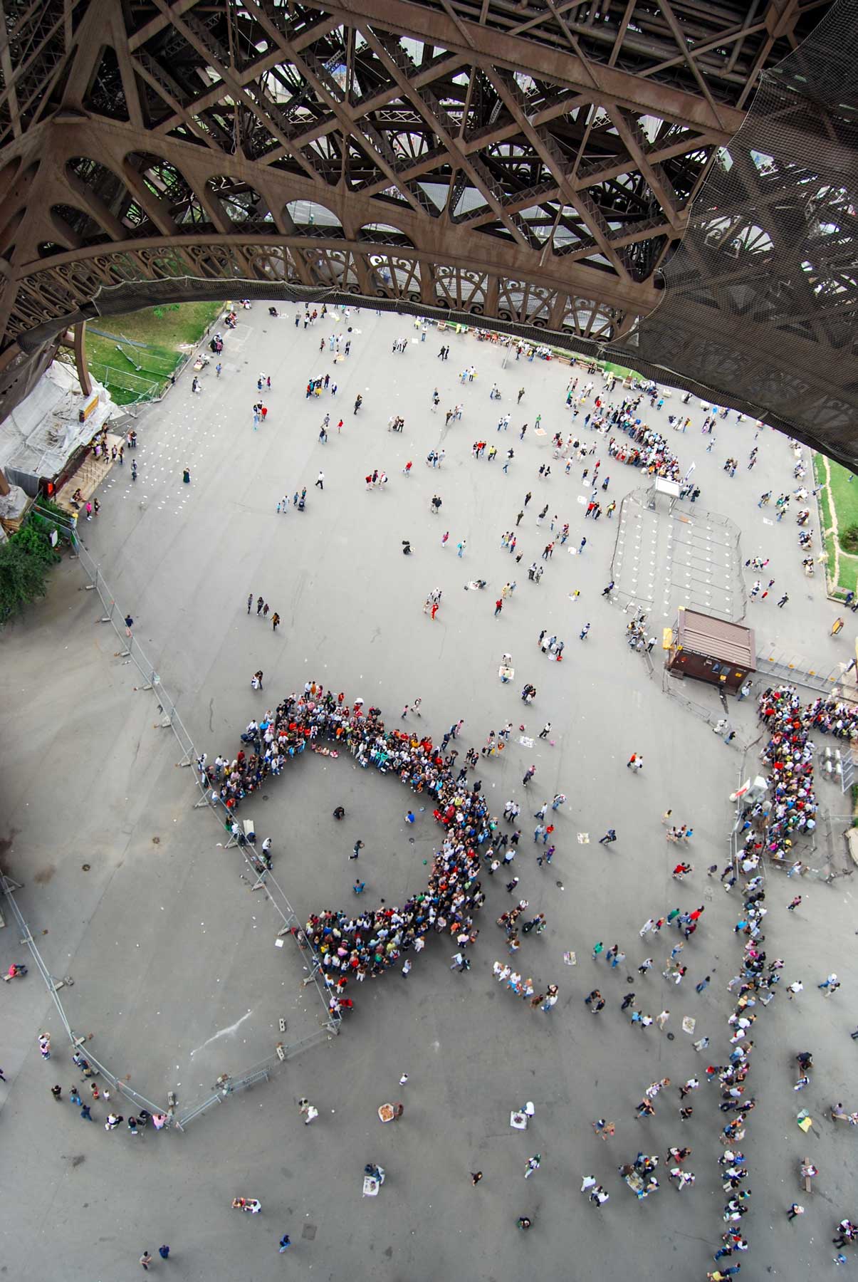
ABOVE, Pickett’s record of the Stevens Pass summit with Cowboy Mountain on the horizon, and BELOW, Jean Sherrard’s repeat, which appeared first in our book WASHINGTON THEN AND NOW.
Another Stevens Pass ski lodge. Photo by Ellis
===
===
ABOVE and BELOW: Stevens School in Wenatchee. In the “now” the school has been replaced by a federal building. (This too appears in WASHINGTON THEN and NOW)
===
On Alki Point, we’ve been told, across Stevens Street from what is now the Log Cabin Museum, a fitted tent for summer recreations at the beach, and now a street of modest homes.
===
A rail-fan’s CASEY JONES SPECIAL heading east on the future Burke Gilman Recreation trail and over the Stevens Way overpass. It was under this little bridge that those attending the 1909 Alaksa Yukon Pacific Exposition on the U.W. Campus entered the Pay Streak, the carnival side of the AYP. Pacific Street runs by here just out frame at the bottom. Photo – again – by Lawton Gowey. Lawton was one of the area’s most learned Rail Fans.
John Owen of Pineola, who gave a stellar performance at yesterday’s Rogue’s Christmas show at Town Hall, remembers the great Dawn Sears:
“On December 11, 2014 one of the greatest singers who ever set foot on this planet left us. Dawn Sears was an unassuming, humble person who you could easily walk past without even noticing…unless she was singing. If she was singing, you couldn’t notice anything else. She could make every person in the room feel like she was singing directly to them and them alone. Dawn was best known as a member of The Time Jumpers and as a backup singer for Vince Gill.
“Here is a link to a YouTube clip of her performing Sweet Memories with Time Jumpers. This clip pairs Dawn with another great who passed on not long ago – John Hughey on pedal steel. Both Dawn and John left an amazing amount of beauty behind. Live fully.”
THEN: In 1910, a circa date for this look north on First Avenue across Virginia Street, the two corners on the east side of the intersection were still undeveloped – except for signs. The Terminal Sales Building, seen far right in Jean Sherrard’s repeat, did not replace the billboards that crowd the sidewalk in the “then” until 1923. (Seattle Municipal Archive)NOW: The early-twentieth century promoters of the Denny Regrade – including this part of it in Belltown – expected that the central business district would soon move north and develop the diminished blocks with high rises. Only their timing was wrong. Now, at last, the Denny Regrade is gaining altitudes much higher than those of the lost Denny Hill.
I think it likely that this candid photo of a lone pedestrian on a bright sidewalk was snapped to show off the new streetlights. Recorded by a municipal photographer, the view looks north on First Avenue from its southeast corner with Virginia Street. The city’s first ornamental light standards, of City Light’s own design, were introduced in 1909-10, and on Seattle’s busiest streets featured five-ball clusters like these. Here the elegance of the new lights is interrupted by the somewhat comedic counterpoint of older and much taller power poles – all in the name of progress.
Above and below: First Ave. looking north from Virginia Street during the BIG SNOW of 1916 and recently. On the right, note the HOTEL PRESTON, a later name for the RIDPATH seen in the featured photo on top.
Detail from the 1912 Baist Real Estate Map. The Hotel Ridpath appears near the center with the Troy Hotel across First Ave. from it. The Livingston Hotel at the southwest corner of Virginia and First has been home for the Virginia Inn Tavern now for many years. We include directly below an interior from that bar photographed in 2006 with Jean Sherrard and Berangere Lomont, both of this blog. BB was visiting from Paris.Jean and Berangere at the Virginia Inn on Oct. 12, 2006. It was BB’s first visit to Seattle after our time with her in Paris a year earlier. Oh what joy!
This neighborhood was sometimes named North Seattle on early maps, but more popularly it was also called Belltown, for the family that first claimed and developed it. Like many of the first settlers, William and Sarah Ann Bell kept two homes, one in the platted village that was growing to the sides of Pioneer Square and Henry Yesler’s sawmill, and the other on their claim, in order to “prove” it. (Virginia Street was named for their long-lived third daughter, Mary Virginia,1847-1931).
Four pages merged from Seattle Now and Then Vol. 3. Click to enlarge, and perhaps read. The panorama looks north from the back porch of the Bell Hotel at the southeast corner of First and Battery. The still somewhat forrested Queen Anne Hill marks the horizon at the center. First Ave. (Front Street) extends north on the left, and Battery Street runs east, on the right. There also Denny School stands out at the northeast corner of 5th Avenue and Battery. The photo was taken by Morford, courtesy Kurt Jackson. (Click this you will probably be able to read it – if you wish.)
Seattle’s first major public work was the 1876 regrading of Front Street (First Avenue) between Pioneer Square and Pike Street. Soon after it continued with an improved path over the western side of Denny Hill, meant to help the Bells develop their claim. In 1884, First Avenue was lowered and improved north of Pike Street with a cut that allowed the community’s then new horse-drawn street railway to continue north to Belltown and beyond, as far as the lower Queen Anne Neighborhood. Then in 1898-99, this cut was deepened to the grade we see here, leaving a cliff along the east side of First Avenue.
The temporary bluff along the east side of First Avenue, ca. 1902. The view looks north from near Virginia Street.The cliff along the east side of Second Avenue, looking south from near Bell Street. The Moore Theatre and beyond it the New Washington Hotel are evident beyond Virginia Street.
In 1903 the earnest (and long) razing of Denny Hill began by moving that cliff to the east side of Second Avenue. By 1911 the regrading reached the east side of Fifth Avenue with another cliff, and there it rested for seventeen years.
The steel frame for the New Washington Hotel appears on the far left. The view looks west on Virginia Street with the photographer Louis Whittelsey’s back near Fourth Avenue. The structure, upper-right, is at the northwest corner of Third Ave. and Virginia Street. Small although still easily seen near the scene’s center, is the old Central School that was moved to this site in the early 1880s from its original location near the northeast corner of Third Ave. and Madison Street. (see next photo below) It sits here near the northeast corner of First and Virginia and so behind the billboards that crowd the same corner at the far right of the featured photo on top. The structures that seem to extend from the school to the New Washington’s frame, are actually on the west side of First Avenue between Virginia and Stewart Streets. The Alaskan Building breaks the horizon, right-of-center, at the northwest corner of Second and Virginia. You can find it in the 1912 Baist detail printed above, and it is also seen in the second photo below this one, which photo dates from 1908. This scene dates from ca. 1907.In this look south on Fourth Avenue from the Territorial University Building at Seneca, Central School appears right-of-center near the northeast corner of Madison and 3rd Avenue.Dated 1908 at the bottom-right corner, this view looks north from near Stewart Street through the crowds both standing on Second Avenue and sitting in the bleachers on the left. The have probably gathered to witness the parade celebrating the 1908 visit of the “Great White Fleet” to Puget Sound.The Puget Sound News Company building, at the southwest corner of Virginian and Second, “filled the bleachers” sevens years after the 1908 crowd scene above this clipping.
While construction of the brick Hotel Ridpath, center-right in the featured subject at the top, waited for the cliff to be pushed east to Second Avenue, the ornate clapboard Troy Hotel across the street, far left, was built soon after the 1898-99 regrade. The Troy survived into at least the late 1940s. The Ridpath, long since renamed the Preston, I remember almost like yesterday.
The Ridpath/Preston seen from Western Avenue about a quarter-century ago.
In the featured photograph from about 1910, First Avenue’s Belltown blocks were mostly given to hotels and shops and a few vacant lots. Some of the latter were fitted with elaborate billboards, like the one on the right, which is stacked with exotic murals promoting popular habits, like vaudeville, cigarettes and chewing gum.
(Above) An advertisement posted in the May 5, 1916 Times for the Puget Sound Marble and Granite Company, which by then had filled the northeast corner of Virginia and First with its stones.Since 1923 Seattle architect Henry W. Bittman’s Terminal Sales Building has held the southeast corner of First Avenue and Virginia Street.
WEB EXTRAS (featuring story and song!)
Paul, I know you and Ron have much to add. Please do so, but let me interject a touch of Public Relations for our annual Town Hall program ‘A Rogue’s Christmas‘.
Terrifying Santa at Seattle bus stop. Paul Dorpat, 1976
As you well know, this Sunday at 2 PM, you and I, Marianne Owen and Randy Hoffmeyer, will be reading stories and poems from E.B. White, Nabokov, Ken Kesey, and much more, including original music by Pineola, for this event – the eighth we’ve presented in collaboration with ACT Theatre. Join us for an antidotal and deliciously subversive holiday treat!
I’ll be there Jean. Remember you are picking me up. Here, repeating our by now weekly path, are a few relevant past features pulled and placed by Ron Edge. Ron might also come to the Rogue’s show. He took his then 96-year old mother last year.
THEN: This rare early record of the Fourth and Pike intersection was first found by Robert McDonald, both a state senator and history buff with a special interest in historical photography. He then donated this photograph – with the rest of his collection – to the Museum of History and Industry, whom we thank for its use. (Courtesy MOHAI)NOW: Westlake was cut through from Fourth and Pike to Denny Way in 1906-7. The Seaboard Building (1907-9) replaced the small storefronts on the northeast corner.
Through the 1890s Pike Street was developed as the first sensible grade up the ridge, east of Lake Union before the ridge was named Capitol Hill by the real estate developer, James Moore. As a sign of this public works commitment, Pike Street was favored with a vitrified brick pavement in the mid-1890s. As can be seen here, Fourth Avenue was not so blessed. The mud on Fourth borders Pike at the bottom of this anonymous look north through their intersection and continues again north of Pike beyond the pedestrians, who in this scene are keeping to the bricks and sidewalks.
(CLICK to ENLARGE) Fourth Avenue between Pine and Pike Streets begins, in this “birdseye” from Denny Hill, to the right of the Lutheran church with the steeple, far left. Fourth continues to the right, reaching the intersection with Pike, which is just right-of-center. The structures north of Pike and on the east side of Fourth Avenue seen here in the 1890s match those in the feature photo. The Methodist Protestant church, on the right, is at the southeast corner of Third Ave. and Pine Street. The larger light brick building, left of center, is named for its builders/owner, Otto Ranke. Its west facade appears upper-right in the featured photo at the top.While the northwest corner of Fourth Ave. and Pike Street is hidden in this early 20th Century look east on Pike from Second Ave, the intersection sits immediately above the subject’s center. Standing on both of the trolley tracks, a team and wagon are heading north (to the left) on Fourth. The nearly new Seattle High School (Broadway Hi) is at the center horizon. First Hill is on the right and Capitol Hill on the left. They are, of course, parts of the same ridge.
At the intersection’s far northeast corner dark doors swing beside the Double Stamp Bar’s sign, which pushes Bohemian Beer at five cents a mug. The first storefront to the right (east) of the bar and its striped awning is the Frisco Café, Oyster and Chop House, whose clam chowder can be had for a dime and “oysters in many styles” for a quarter. Far right on the sidewalk at 404 Pike, a general store sells both new and used, and advertises a willingness to barter with cash-free exchanges. Its merchandise is a mix of soft and hard: hanging buckets and baskets are seen through the windows, as well as a pile of pillows. These storefronts and two more are sheltered in five parallel, contiguous sheds, modest quarters that are given stature with the top-heavy false façade they share above the windows.
This Times clipping from 1910 suggests that the Frisco Bar found a new home near First and University. The classified also offers up its bar furniture for sale, which is not a good sign.
The bookends here are the Ranke Building, far right, and the Carpenter’s Union Hall, far left. Otto and Dora Ranke were the happy German-born and wed builders who staged plays and light operas in their home and performed in them, too. When the Ranke’s built their eponymous big brick building. it featured a hall and stage for productions of all sorts, including musicals.
The Ranke home at the northwest corner of Pike and 5th. A past feature about this Peiser photograph is attached below near the top of the string of the relevant links.
In 1906, beginning at this intersection, an extension of Westlake Avenue was cut and graded through the city grid to Denny Way, where it joined the ‘old’ Westlake that is now ‘main street’ for the south Lake Union Allen-Amazon Neighborhood. As part of this Westlake cutting, Carpenter’s Hall was razed, and a landmark, the Plaza Hotel, took its place in the new block shaped by Fourth Avenue, Pine Street and the new Westlake Avenue. The Carpenters moved one block north on Fourth Avenue where they built a new brick union hall. Then in 1907 Fourth Avenue was continued for two blocks north from Seneca Street, through the old territorial university campus, to Union Street. As a result of these two regrades, in less than two years the crossing of Pike Street and Fourth Avenue developed into one of the busiest intersections in the city.
The Plaza Hotel underconstruction during the 1906 paving of the then brank new Westlake. The view looks north from 4th and Pike. On the left, Fourth Avenue still climbs Denny Hill.On the left Fourth Avenue still climbs Denny Hill ca. 1908 – but not for long. (Courtesy, THE MUSEUM of HISTORY and INDUSTRY “also known as” MOHAI)The American Hotel at the northeast corner of the new Fourth Ave. and Pike Street configuration. Building on the future Seaboard building soon resume with many floors added above these five.
WEB EXTRAS
Anything to add, Paul? Again and again – thru ten clicks – one may proceed with Ron Edge’s pulls, this week, of appropriate links to past features at and/or near Fourth Avenue and Pike Street. Following those we may find a few more fitting ornaments at these by now late hours allow.
========
NEARBY ON PIKE
A troublesome hydrant at the corner of 6th Ave. and Pike Street on March 3, 1920.This first appeared in Pacific on Jan 19, 1997.
THREE SECURE HYDRANTS in WALLINGFORD taken during my “Wallingford Walks” between 2006 and 2010.
The Northeast corner of Meridian and 45th Avenue.Framed by “Chenical Hill” at Gas Works Park Sept. 10, 2006.
=====
ANOTHER LEAK ON PIKE
First appeared in Pacific on Jan 29, 1995
====
TWO PIKE PAGES OF SIX in PIG-TAIL DAYS
Below we have pulled Sophie Frye Bass’s description of Pike Street – the first two of six pages on pioneer Pike. The reader is encourage to find the other four, and then to read all of this well-wrought book by a daughter of the pioneers.
=====
Now up the stairs to nighty-bears. We will re-read and proof tomorrow.
THEN: Looking north-northeast from a low knoll at the southwest corner of Seneca Street and Seventh Avenue, circa 1916. By 1925, a commercial automobile garage filled the vacant lot in the foreground. [Courtesy, Ron Edge]NOW: With the historical prospect long lost, first to a garage and then to the Interstate 5, Jean Sherrard took his repeat from near the northeast corner of Sixth Avenue and Spring Street. Moving left to right from the center, crowding the right horizon are the Tudor-Gothic styled Exeter House, the nearly completed Cielo Apartments, and the terra-cotta-tile clad Town Hall, all rising from their respective corners at Eight Avenue and Seneca Street.
We may puzzle over why the unnamed photographer of this wide look through a First Hill intersection chose also to feature the trash and weeds in the foreground. As revealed in Jean’s repeat, this intersection at Seventh Avenue and Seneca Street became a small part of the concrete ditch cut for the Seattle Freeway. In the early 1960s, here at Seneca Street, Interstate 5 construction through the central business district turned due north and continued along the green-belted side of Capitol Hill.
An aerial of the future freeway route through the Central Business District, including the planned freeway’s curve to the northeast north of Spring Street. The curve that will cut through the southeast corner of Seneca and 7th Avenue was marked here near the center perhaps before the cutting began. (Courtesy, Ron Edge)A portion of the Central Business District, circa 1972
Although the freeway took this entire intersection, it needed only a slice of its southeast corner, the part shown here on the right of the “then” with the small grocery. “Homemade Bread” is signed below the corner window, and directly above it, “Sanitary Grocery” is printed on the window. In the commercial listings of the 1918 Polk’s City Directory, it was but one of more than 750 small grocery stores that the ‘invisible hand’ of capitalism had scattered through Seattle.
Often referred to as “mom and pop stores” – in part because it usually took a family to run one – the First Hill neighbors of this grocery located at 1122 7th Avenue would likely have found Katherine and Jewett Riley behind the counter. Jewett, at least, was an old hand at mercantile, having helped his brother Silvanus run a store at the Leschi Landing soon after the Yesler Cable line was completed to Lake Washington in 1888. In 1918 Katherine and Jewett conveniently lived in unit 104 of the Touraine Apartments at 711 Seneca. Directly behind the grocery, the Touraine is four stories tall.
Van Siclen Apartments facing 8th Avenue between Seneca and University Streets.Above: LaterJudkins 1887 panorama looking north from the Central School tower on the south side of Madison Street between Marion and Madison shows Seventh Avenue ,on the right, heading north towards its intersections with Spring and Seneca Streets. The little home on lots north of the northeast corner of Seneca and Seventh can be found in both Jjudkins pan and in the feature photograph at the top. CLICK TO ENLARGE – by all means.
The oldest subject here is the comely little home to the left of the big box of a boarding house at the intersection’s northeast corner. It dates from the mid-1880s. To the right of the boarding house, the concrete Van Siclen Apartments (1911), with rooftop pergola and ornate row of arched windows, faces Eighth Avenue between Seneca and University Streets. It is a block so steep that the paved Eighth cannot be seen from this prospect. In the vacant corner lot to the south (right) of the Van Siclen, the Alfaretta Apartments at 802 Seneca was built in 1918.
Jean’s 2012 portrait of the Alfaretta’s deconstruction, with the surviving Exeter House beyond it on the west side of Eighth Avenue.
The Van Siclen (later renamed the Jensonia) and the Alfaretta missed reaching their centennials. Both were razed in anticipation of the rising of the 323-unit Cielo Apartments at the northeast corner of Eighth and Seneca. As a work-in-progress, the Cielo can be readily found in Jean’s repeat, rising above the Exeter House (1928) and Town Hall (completed in 1924 as the Fourth Church of Christ Scientist).
Freeway Park waders in the summer of 1976. Photo by Frank Shaw.
WEB EXTRAS
Anything to add, Paul and Ron? Surely, starting and perhaps ending with the dozen links below. They are, again and again, well stacked with relevance – sometimes repeating it. For instance, beginning with the first link below. You can find, surely, the Christian Scientists on the left – now TOWN HALL – but also the rear of the of the Van Siclen apartments on the far right. Until only a few years ago they faced 8th Avenue mid-block between Seneca and University Street. The view to the bay over the retail district was wonderful until the Freeway overpass blocked it in the 1960s. Somewhere in the links below the fuller Van Siclen story is told.
THEN: A circa 1912 look at the Wall Street finger pier from the foot, not of Wall, but Battery Street. (Courtesy Lawton Gowey)NOW: Galbraith and Bacon built their pier between Battery and Wall Streets. From this Battery side we see the Edgewater’s south façade. From the Wall Street side one looks directly to the front of the Edgewater, and prior to the hotel, the Galbraith and Bacon pier shed. Consequently, the pier is named for Wall Street.
The Galbraith Bacon dock, like most others built on the Seattle waterfront after 1900, was positioned at a slant off Railroad Avenue (Alaskan Way) for two sensible reasons. First, such a dock allowed railroad spurs an easier angle for reaching the aprons to the sides of the wharves. Second, at such a slant the end of a long dock was closer to shore and so did not require unnecessarily long piles to support it.
Having dealt feed on the waterfront since 1891, James Galbraith was the ‘old timer’ in this partnership. Cecil Bacon, a chemical engineer with some extra capital, arrived in Seattle in 1899. Deep pockets helped Bacon persuade Galbraith to make a bigger business with him by adding building materials, like lime and concrete, to the established partner’s hay and feed. In 1900, they were the first signature tenants in the Northern Pacific Railroad’s newly constructed finger pier No. 3 (now 54) at the foot of Madison Street. The partners prospered and soon added to their enterprise this pier at the foot of Wall Street.
An early record of Pier 3 (54 since 1944) and its first tenant Galbraith and Bacon. The photo was taken in 1900, some little while before the photographer, Aders Wilse, return to Norway and the call of his wife who left Seattle first for a visit back to the homeland and then decided to stay.. Wilse then obeyed she who must be. In time he became a Norwegian national treasure, and the photographer to its King and Queen and all their little princes and princesses.The Northern Pacific Docks (mostly) between Fire Station No. 5 at the foot of Madison Street and the Milwaukee Railroad’s Pier 6/57 near the foot of Union Street.
Although I like the featured photograph at the top for how it upsets our prepossession with the picturesque – I mean, of course, the askew yards on the sailing ship and its splotched starboard side – I neither know why the square-rigged Montcalm was tied to the Wall Street pier, nor which Montcalm it was. Many ships bear the name, and probably all were named for Louis-Joseph de Montcalm, who until he was hit with an English musket ball in the Battle of Quebec, was New France’s Commander-in-Chief during its French and Indian War with the British in the 1750s.
Not the Montcalm, but another tall ship holding the same slip to the south of the Wall Street Pier. Photo by Whitelsey.The Galbraith and Bacon Wall Street Pier seen from the bluff.Frank Shaw’s record of the Wall Street Pier while being cleared of the Galbraith & Bacon pier shed. Feb. 26, 1961.Shaw returned to take this snapshot of the completed Edgewater on a gray December 9, 1962.
For some clue on the Montcalm’s condition I turned to Scott Rohrer, an old friend who is also celebrated hereabouts for his sailing and understanding of maritime history. Scott tersely answered, “She’s steel and her crew is scaling and chipping her hull for primer and repainting after a long, apparently rough voyage.”
An early ideal Edgewater when it still had a chance of being named the Camelot.What became of Camelot, Lawton Gowey’s – or perhaps Bob Bradley’s – record of the Edgewater dated May 29, 1963.Either Jean or I recorded this repeat sometime in 2005, I think.
The Wall Street pier, about the size of a football field, was replaced in the early 1960s with what the waterfront long wanted: a big hotel. First sketches of the Edgewater show it as the Camelot Inn. The Edgewater is perhaps best known for the visiting Beatles, of whom the now common fish tale is told that they followed the instructions written on the waterfront side of the hotel and fished from their window. We suspect that a trolling of the bottom might still catch some paint chips fallen a century ago from the worn sides of the Montcalm.
An early and passionate rendering of the planned Edgewater – or Camelot.
WEB EXTRAS
Anything to add, Paul? Certainly, and beginning again with Ron Edge’s selection of links to other features we have had swimming in the Pacific in the past. Ron has also put up the cover to our illustrated history of the waterfront. I suspect that if it is clicked then several chapter choices will appear. We remind the reader that this Waterfront History is always available in toto on this blog. And was also propose again that when in doubt or squinting that readers should click twice and sometimes thrice.
========
THE WATERFRONT FIRE OF 1910 – at the FOOT OF WALL STREET
Looking west down Wall Street thru the popular ruins.
CLICK TO ENLARGE – A clip from the March 23, 2003 Pacific MagazineThe ruins looking northeast from the waterfront.The 1910 fire’s remains seen west over First Avenue.
====
RAILROAD AVENUE LOOKING NORTH FROM WALL STREET
Merged from two negatives, Railroad Avenue looking north over Wall Street.Jean has a colored version of this repeat, and I shall encourage him to find it and following his discovery also erase this caption for the prospect is obvious.You should probably CLICK-TO-ENLARGE this insert.
=======
QUIZ – SELF-CONFIDENCE WILL BE REWARDED TO THE READER WHO CAN REVEAL FROM WHAT THE HISTORICAL PHOTO BELOW WAS RECORDED.
THEN: The Hotel York at the northwest corner of Pike Street and First Avenue supplied beds on the American Plan for travelers and rooms for traveling hucksters. (Courtesy Lawton Gowey)NOW: In 1912, eight years after the Hotel York was razed, the Corner Market Building took its place as part of the Pike Place Public Market.
The building’s name, Palmer, is either chiseled or cast in stone above the front door. This top-heavy brick pile began its relatively brief life in 1890, with the Ripley Hotel its main tenant. The name of the hostelry was later changed to Hotel York, as we see it here. The ever-helpful UW Press book, Shaping Seattle Architecture, names the Palmer’s architects, but not the Palmer’s owner. Perhaps it was Alfred L. Palmer, who dealt in both real estate and law in the early 1890s, the year this ornate addition to the city’s landscape opened.
Three Hotels – of note – following the Great Fire of 1889, here in 1890. First on top of Denny Hill the Denny Hotel (later renamed the Washington) is under construction. Next, at the center of this detail from a pan taken from the King Street coal wharf stands the undecorated south and west facades of the Arlington Hotel. Look closely, its tower at the northeast corner of the building but at the southwest corner of First Ave. and University Street it under construction.. It was later removed. The Arlington’s foundation helped stop the northerly advance of the 1889 fire. Next, the Ripley Hotel under late construction at the far left – falling out of frame. Also note the dark box-shaped coal wharf at the foot of Madison Street, below-center. Its place is now part of Ivar’s Pier 54, which for another 200-plus days will be busy with remodeling the Acres of Clams, while the seawall (1934-36) is being rebuild at its front door.The Gilmore, aka Arlington, Hotel foundation work following the Great Fire of June 6, 1889, looking south-southwest from the Front Street (First Ave.) west sidewalk just south of University Street. As already noted, this foundation helped stop the fire’s advance north up the waterfront. (Courtesy, Lawton Gowey)
Architects Arlen Towle and Frank Wilcox shared a brief partnership between 1889 and 1891. Perhaps they can be numbered among those opportunist professionals who hurried here after the Seattle business district burned to the ground on June 6, 1889. On its move north, the Great Fire was stopped short of University Street by the inflammable foundation of the under construction Arlington Hotel (the Bay Building). Only two blocks to the north, at the northwest corner of Pike Street and Front (First) Avenue, Palmer also got its start in 1889
Looking south from the roof (or upper floor) of the Ripley/York hotel. The Arlington Hotel and its tower at the southwest corner of First and University stands center-left. The University Street ramp to the waterfront runs left-right thru the center of the scene, crossing over Western Avenue, right of-center. Western Avenue runs on towards Union Street at the lower-right corner. The western wing of the Arthur and Mary Denny home at the southeast corner of First and Union is evident far-left. The dark mass of the coal wharf at the foot of Madison can be found right-of-center, and the longer and larger King Street coal wharf reaches into Elliott Bay, upper-right. Although the photograph is signed by Asahel Curtis, lower-right, he almost certainly did not record it, but rather copied it. It memory serves – and let Ron Edge correct me – I think Soule took this and a left-side panel that doubles it to the east.
The Hotel York and much else is seen here, center-right, from the Denny Hotel atop Denny Hill. The Arlington Hotel can also be found, but not the coal wharf at the foot of Madison. It has been replaced with Pier No. 3 (later renumber 54 in 1944), to the far south end of the many Northern Pacific finger piers that were built on the waterfront north of Madison Street in the first years of the 20th Century. So this is the Hotel York in its last years – or months. The Webster and Stevens early number 718 suggests that this was recorded in 1900 – or near it. [Click to Enlarge – maybe twice]The waterfront at the foot of Pike Street photographed from bay shows the Hotel York on the left horizon. This view dates from the 1890s before the Northern Pacific piers were constructed north of Madison. The Pike Street pier showing here was also soon replaced by the one that now nestles beside the waterfront aquarium. The Schwabacher Wharf, to the right-of-center, was the largest dock on the waterfront following the 1889 fire and was swarmed during the post-fire construction. It is also the dock where the gold rush steamer Portland docked with her “ton of gold” in 1897. The block of hotels on First Avenue between University and Seneca Streets shows its unadorned western facade, far-right. The Arlington anchors the block at its north end. [Click to Enlarge]
Second only to the hotel,the Empire Laundry was another of the Palmer’s commercial tenants. It is represented here by two horse-drawn delivery wagons and its sidewalk storefront, which is nestled between the entrance to the York Café at the corner and the door to the hotel, at far right. Inside the hotel lobby one could request a room on the American Plan, which included meals, most likely at the York Cafe, for between $1.00 and $1.50 a day. Many of the rooms – perhaps most – also provided what a classified ad for the York described as an “elegant view of the bay.”
Judging from the few city directories that I have here with me in this Wallingford basement, Thomas C. Hirsch – and not the York Hotel Cafe – controlled the corner door here in 1901. Hirsch, however, was not there in1903 (another of my directories).From a June 21, 1906 advertisement run in the Seattle Times. Dr. Sander’s Electric Belt promised potency for men in want of it, similar to the array of therapies and tools prescribed and used by some of the therapists who used the Hotel York for their consultations.
Judging from the ads, the York’s most sensational renters were health providers who promoted either magnetic healing or massage or both, as with the Chicagoan Miss LaRoy’s “magnetic scientific massage.” Most persistent were Professors Gill and Brunn. For several weeks in 1902, they provided a growing list of therapies, including osteo-manipulation, vibration, hypnotism, vital magnetism, a “new light cure,” and psychology for “bad habits.” Elsewhere in the hotel, Miss Mooreland, like Miss LaRoy, also from Chicago, provided sponge baths and massage, “a specialty.” The “well-known trance medium,” Mme. Pederson, shared “the secrets of your life” and advised “how to keep out of the pathway of despair.”
The hydrotherapy available at the Eureka Baths on territorial Seattle’s Commercial Street, was advertized here in 1877. Seattle’s Dr. Weed practiced hydrotherapy and was also our Mayor. Interbay Pioneer Henry Smith also practiced it. And honestly don’t you find that a hot bath sometimes seems to “cause thorough action of the different organs” in your body? (Courtesy, Ron Edge)
There was no cure, however, for the sudden tremors that came over, but, more importantly, under the adolescent hotel. In 1903 the Great Northern railroad began tunneling beneath the city, and from the tunnel’s north portal near Virginia Street, the boring soon shook the York’s foundations. The Hotel York was razed in November 1904, a few days after the cutting and digging from the tunnel’s two ends met at the center.
The north portal to the tunnel near the foot of Virgnia Street. The Hotel York’s northern facade appears – for the moment – at the upper-left corner.The footprint of the abandoned Hotel York appears lower-right in this detail from the 1904-5 Sanborn Real Estate Map. It is “vacant and dilapidated to be removed.” The stairs to the waterfront show bottom-right and upper right a few footprints of the sheds and shacks that held to the bluff.Top to Bottom: Sheds on the waterfront and above it on the bluff near the foot of Lenora Street. – Water cannons carving the cliff for construction of the tunnels north portal near the foot of Virginia Street, 1903. – Looking down the spur of narrow construction tracks from Railroad Avenue to the tunnel construction at the North Portal. The Hotel York and its mural for Owl Cigars can be found – easily., but for how long?
WEB EXTRAS
Anything to add, Paul? Surely Jean. Here are a dozen – or so – links fastened by Ron Edge. There will be some repeats between them, but such, we know, is the exercise of learning.
=====
Lawton Cowey’s recording of the Corner Market Building on Oct. 25, 1974, and so before its restoration.As he was often inclined to do, Lawton returned to record the Corner Market Building after its restoration, here on April 21, 1976, about half-a-life ago for some.Through out community’s history, it’s story has been adopted by businesses to help promote their products and/or services. Here in 1947 is one of Metro Fed. Savings “Seattle Facts.” This one remembers the confrontation of the railroad tunnel and the hotel.
THEN: This detail from the prolific local photographer Asahel Curtis’s photograph of the Smith/Rininger home at the northwest corner of Columbia Street and Summit Avenue dates from the early twentieth century when motorcars, rolling or parked, were still very rare on the streets of Seattle, including these on First Hill. (Courtesy, Historic Seattle)NOW: Five Swedish Hospital nurses, from the twelfth floor oncology ward, gathered here in the hospital’s lobby for Jean Sherrard’s repeat.
In Jean Sherrard’s “now,” five nurses from Swedish Hospital’s oncology ward stand at or close to what was once the southeast corner of Columbia Street and Summit Avenue. This was also the prospect for Asahel Curtis’s “then,” recorded early in the twentieth century when this First Hill neighborhood was still known for its stately homes, big incomes and good manners.
With about 110 years between them, both Sherrard and Curtis are sighting to the northwest, and both their photographs are only the center thirds of wide panoramas. Sherrard’s shows Swedish Hospital’s lobby during a renovation. Curtis’s pan at its full width is merged from three negatives. It reaches from the northeast corner of Columbia and Summit, on the right, to far west down Columbia, on the left. (The full pans of both now hang in the lobby of Town Hall, the former Fourth Church of Christian Science, another First Hill institution on the southwest corner of Eighth Avenue and Seneca Street.)
Asahel Curtis’ originalSherrard’s repeat
The big home, centered here at the northwest corner of the intersection, was built for the Seattle banker-industrialist, Charles J. Smith. He in turn sold it to the doctor-surgeon Edmund Rininger in 1905, about the time Curtis visited the corner, perhaps at Rininger’s request. With his wife Nellie and daughter Olive, Rininger moved into the house next door on Columbia, in order to set about building his Summit Avenue Hospital at the corner.
Another detail pulled from the 1912 Baist Real Estate Map. The intersection of Columbia Street and Summit Avenue is center-lower-right, or between the blocks 120, 131, 132 and 101. The Otis Hotel is at the northeast corner and the Rininger’s home west across Summit at its northwest corner with Columbia. Madison Street crosses through the upper-left corner.The Rininger home at the northwest corner of Columbia Street and Summit Ave. appears here right-of-center with its sun-lighted west facade. Across Summit is the Otis Hotel. A nearly new Providence Hospital is on the right horizon and the twin towers of Second Hill’s Immaculate Conception mark the center-horizon, directly above the Otis.. The photograph was taken from an upper floor of an apartment house at the northeast corner of Marion Street and Terry Avenue.
The surgeon’s plans were fatally upset on July 25, 1912,å when, while driving home from a house call in Kent, the forty-two year old Rininger, alone in his motorcar, collided with a Puget Sound Electric Railway train. With the death of her husband, Nellie Rininger sold the nearly completed hospital to the Swedish Hospital Association in the spring of 1913. As part of this fateful transfer, Nellie Rininger also gifted her late husband’s large medical library and his then new x-ray machine to Swedish Hospital.
A clipping from The Seattle Times for Feb. 16, 1913. CLICK TO ENLARGE
Both the china and linen monogramed SAH for Rininger’s Summit Avenue Hospital came with the sale. No doubt for reasons of economy the Swedish Hospital Association (SHA) decided to use both in spite of the reordering of the letters.
With help from the Seattle Public Library, clipped from the THE SEATTLE TIMES, April 15, 1968. CLICK TO ENLARGE
WEB EXTRAS
Anything to add, Paul? Yes Jean and again with help from Rod Edge. First, several links below, and all include features that relate to the neighborhood and sometimes just beyond it. Some will be found twice, perhaps even thrice. The most relevant feaure is probably the last one about the General Hospital. It first appeared here not so long ago. Also featured here is my “mea culpa” (I am guilty) confession concerning my flubs with the the Anderson mansion, and my humble correction.
====
SOME OTHER HOSPITALS ON THE HILL
GRACE HOSPITAL on Summit Avenue between Union and Pike Streets. Seattle’s Protestant hospital could not compete with the Catholic’s Providence, and it closed to be replaced with Summit School, below.
A new Harborview from above.Virginia MasonBefore their was a Virginia Mason Hospital there was photographer Imogen Cunningham’s home and studio. (You can find this feature FULL-SIZED in the history books button, at the top. It is the 111th feature included in SEATTLE NOW THEN Vol. One. A 1950 aerial with Marion Street climbing First Hill far left. That makes Columbia Street the next thruway up the hill Columbia. Near the upper-left corner it reaches the early Swedish Hospital campus in 1950 on the Rininger corner with Summit Ave. Sixth Avenue runs along the bottom of the subject, between James Street on the right and Marion. A little more than a decade later the blocks between Sixth and Seventh were cleared for the Seattle Freeway, as it was then called. (Courtesy, Ron Edge) CLICK TWICE TO ENLARGE
THEN: Faced, in part, with brick veneer and stucco, and opened in 191l, the Comet Apartments at 170 11th Avenue have made it nicely through their first century. (Courtesy, Lawton Gowey)NOW: Missing only a few architectural bands that once wrapped its sides, the now Star Apartments have gained a landscape that caresses the daylight basement windows.
By the estimable authority of Diana James, the Comet Apartments, this Sunday’s subject at the First Hill corner of Spruce Street and 11th Avenue, is a solid example of a building form she calls “Seattle-Centric.” In “Shared Walls,” her book history of our city’s apartment houses, James explains, “Driving or walking through Seattle neighborhoods that have concentrations of apartment buildings, one is struck by the repetition of a particular form, best described as rectangular or square in shape and featuring at least one bay on either side of a centrally located and recessed opening at each floor above the entrance. Variations on this theme exist in every Seattle neighborhood.”
The Comet Apartments are found above the center of this detail pulled – again – from the 1912 Baist Map. (Courtesy, again, Ron Edge) CLICK TO ENLARGE – PLEASE.
By another authority, King County tax records, organized in the late 1930s by the depression-era Works Progress Administration (WPA), the Comet (its original name) was built in 1910 with twenty-eight apartments. Seven of these were fit with four rooms, and the rest with three. West and Wheeler, the Comet’s real estate agent, described it in The Seattle Times “Apt Unclassified” listings for March 4, 1912, as “an unusually attractive building.” We still agree.
The Comet/Star depression-era tax card. (Courtesy, Washington State Archive, Bellevue Community College Branch)
The Comet’s 1912 classified packed a terse list of its qualities, including “large light rooms,” “very reasonable rates (twenty to thirty dollars),” and the unnamed but “usually up-to-date apt. house conveniences.” The Comet was also in a “paved district” that was conveniently in “walking distance.” Surely these First Hill apartments were within a reasonable stroll of nearly every necessity. Pacific Grade School was three blocks north on 11th at Jefferson Street, and professional baseball, a mere two blocks away at the Seattle Athletic Field. (see below) If walking was not wanted, the Comet was surrounded by common carriers, including the trollies on Broadway and 12th Avenues and the cable cars on James Street and Yesler Way. For the mostly downhill three-quarters of a mile trip to Pioneer Square, a brisk step might get there almost as quickly as a ride on the famously rattling cable cars.
Near it last day, a Yesler Way Cable Car approaches Seventh Avenue on Yesler Way, now the eastern border of the 1-5 Freeway. The photograph was taken by a trolley and cable enthusiast in 1940. (Courtesy, Lawton Gowey)
On November 21, 1938, the Comet – by then the Star, the name that stuck – was enrolled on the year’s list of victims of the nearly sixty apartments and homes visited in the night by the then best-known – as yet unnamed and uncaught – person in Seattle: a firebug. Of the four apartments – three on First Hill – ignited “by a pyromaniac” that early morning, the city’s fire Chief William Fitzgerald described the Star’s as “the most successful.” It was set in a dumb-waiter shaft, did $2,000 damage and “routed 100 persons from their beds at 3:30 in the morning.” Addressing the city – especially the residents of First Hill – the fire chief asked for “intelligent assistance” rather than “mass hysteria.” The fire chief may have also had Police Chief William Sears in mind, who earlier had let it out that he “feared a catastrophe if the firebug is not apprehended.”
(The fire bugs – two of them during the Great Depression – left an impressive paper trail in the local press. An industrious historian might consider telling this story while using the very handy and almost omnipresent tax photos of the victims, of which very few were burned to the ground.)
WEB EXTRAS
Anything to add, Paul? Rob? Diana? Sure Jean. Rob has pulled a number of past blog features that “approach” this week’s subject on the southeast corner of First Hill. Again, because these links are often packed with other features they may also approach other corners or even hills. At the bottom we will add the Pacific Mag. clipping with the story about Dugdale Park (the first one) aka the Yesler Athletic Field at 12th and Yesler. These feature local baseball historian Dan Eskenazi and are used with his courtesy and with the repeat your Nikon Jean. Turning now to you dear reader, please explore these links. The first one features the pie-shaped Sprague Hotel in the original flat-iron block nestled between Spruce and Yesler, and then reformed as part of Yesler Terrace. You may wish to also key-word “Yesler Terrace” in the search box above. As you know Jean, Diana does not have a key to this inner sanctum, only to hearts and minds, your’s and mine.,
=====
Yesler Athletic Field, 12th and Yesler. (Courtesy, David Eskenazi)
David Eskenazi on the roof.
======
MEANWHILE AND NEARBY – MORE BILLBOARD PORTRAITS FROM THE FOSTER-KLEISER COLLECTION
Looking south on 12th Avenue to the corner of Alder Street, on March 14, 1940.Twelfth Avenue looking south towards Main Street, Nov. 31, 1936Twelfth Ave. looking north thru Fir Street corner, 1939.Jackson Street looking west towards 12th Avenue – if I have “read” this correctly.
THEN: The driver, lower left, leads his team towards First Avenue up a planked incline on Madison Street. (Courtesy MOHAI)NOW: Looking west towards the waterfront on Madison Street through its intersection with Western Avenue.
I’ll venture that this look across Railroad Avenue (Alaskan Way) and Elliott Bay as far as West Seattle’s dim Duwamish Head, far-left, was photographed some few weeks after the city’s Great Fire of June 6, 1889, burned everything on the waterfront south of University Street. The fire was ignited by a volatile mix of upset boiling glue and carpenter’s shavings scattered on the floor of Margaret Pontius’s frame building at the southwest corner of Front (First Avenue) and Madison Streets, about a block behind the position the unnamed photographer took to record this rare scene of the waterfront’s revival.
This post-1889 fire claims to show its ruins at the foot of Madison Street. (Courtesy Michael Maslan)
Before the “providential fire” this part of the waterfront was covered with the Commercial Mill and its yard. Built in the mid-1880s on its own wide pier off the foot of Madison Street, this specialist in sash, doors, and blinds was nearly surrounded by stacks of lumber, great contributors to the conflagration. On the night of the ’89 fire, when seen from the safety of First Hill, burningboardsfrom the lumberyard carried high above the business district put on a rare fireworks show.
Photographed by Morford from Yesler’s Wharf in late 1887 or 1888. Madison Street lumber-bound wharf is on the far right, Denny Hill behind the tall ship.
The small warehouse in the featured photo at the top, right-of-center, was built by and/or for F.A. Buck for his business, California Wines, which he advertised with banners both at the roof crest of the shed and facing the city. It seems that the shed was also being lengthened on its bay side. Railroad Avenue is also being extended further into the bay. This work-in-progress can be seen between the vintner’s shed and the Columbia and Puget Sound Railroad’s boxcar No. 572. Far left, a pile driver reaches nearly as high as the two-mast vessel anchored, probably at low tide, behind the vintner’s warehouse. This ‘parallel parking’ was not what the city council envisioned following the fire. The city expected and eventually got finger piers that extended into the bay, where visiting vessels were tied in the slips between them.
Railroad Ave. ca. 1903 showing the then new long finger piers north of Madison Street. The shorter piers to the south (left) of Madison were built after the Great Fire of 1889. They would sooner ( or later) be either moved further into the bay on new pilings are replaced with longer piers like the Grand Trunk Dock and Colman Dock.
In the featured photo, the bales of hay stacked both beyond the horses, left-of-center, and at the scene’s lower-right corner, have come to the waterfront either over water, often aboard steamers from Skagit valley farms or over the rails of the Seattle Lake Shore and Eastern Railway, which had, only recently in 1888, reached both the agriculture hinterlands of King County and the Seattle Coal and Iron Company’s Issaquah coal mine.
The D.H. Gilman engine on the Seattle Lake Shore and Eastern Railroad line – perhaps in Gilman, later named Issaquah.
The smaller shed in the right foreground of the features photo at the top is outfitted as the waterfront office for the coal company, which in May of 1888 sent from Yesler Wharf, probably to California, its first load of coal aboard the ship Margaret. Within two years the Seattle Coal and Iron Company’s growth, disrupted the wine-sellers quarters. The long shed was removed to allow construction of an elevator and overpass for moving Issaquah coal from the SLSER coal cars above and over Railroad Avenue to the company’s new bunkers that extended into Elliott Bay. The coal bunkers stood over what is now the dining area of Ivar’s Acres of Clams on Pier 54.
This detail, pulled from the 1893 Sanborn real estate map, shows the coal bunkers on the left and the trestle (for the coal) over Railroad Avenue and to the coal facilities between Railroad Avenue and Western Ave. The next photo below looks up Madison from that trestle in 1890 or 1891. (I’ve forgotten for this “fog of blog” moment.)The Northern Pacific photographer F.J.Haynes look east up Madison Street from the coal trestle that passed over Railroad Avenue to the coal pier at the foot of Madison. (Courtesy, Tacoma Public Library)Looking north on the waterfront with the dark timbers of the Madison Street coal bunkers showing right-of-center, ca. 1898.F. J. Haynes ca. 1891 look at the waterfront from a vessel on Elliott Bay. Madison Street is just left of the bright navy vessel at the center. On the horizon above it is Central School at the southeast corner of 6th and Madison. Is it brand new, and so it the King County Court House on the horizon, far right. (Courtesy Tacoma Pubic Library)Another 1890s look down on Railroad Avenue south from the Madison Street coal trestle. The several afternoon shadows of the short pier sheds along the waterfront then appear on the right.Another early post-fire Haynes view of the waterfront, this one most likely from the Madison Street coal wharf. The competing King Street coal wharf and bunkers reaches into the bay at the scene’s center. Yesler’s post-fire wharf is marked left-of-center. (Courtesy, Tacoma Public Library)
WEB EXTRAS
Anything to add, Paul? For sure Jean. Of the five waterfront links that Ron Edge has attached, the first one especially is filled with Madison Street relevance – and more. That is there are many other features embedded for the reader to release merely by clicking on it (and the others). And may they also remember to click on the images to enlarge them for studying details. That’s why we scan them big for the blog.
========
One of Muybridge’s early motion studies, and not a Seattle subject necessarily. Like all else, CLICK to ENLARGE
THEN: With his or her back to the original Ballard business district, an unnamed photographer looks southeast on Leary Way, most likely in 1936.
NOW: On September 17th last Jean Sherrard took this “repeat” with the 2 Bit Saloon on the far left. It was the last day and night for the tavern, which timed its finale with that month’s Backfire Motorcycle Night in Ballard.
We had two “thens” to choose from, and here follows the alternative.
The alternative also looks southeast on Leary Way to its first curve of three on its way to Fremont.
This week we look south-southeast into a somewhat befuddling Ballard intersection where Leary Way, before curving to the east and ultimately heading for Fremont, meets 17th Avenue. N.W. and N.W. 48th Street. The photographer of this picture was working for the Foster and Kleiser billboard company, whose negatives we have used before, and will surely many times to come, the fates willing. So the intended subjects were the big signs on the far side of the curving Leary Way.
This snap in the billboard survey looks thru the same Leary curve but from the southeast end of it. So it looks northwest on Leary. The date, March 13, 1939 is recorded, bottom-left . [Unless you are not dyslexic, then it is properly bottom-right. Another personal reflection to share: born in the fall of 1938, I was then barely babbling when this shot was recorded, and now nearly 76 years later, I blabber on and on.
On the left of the featured photo at the top, between the Mobilgas flying horse (named Pegasus by the ancient Greeks) and the OK Texaco service station, 17th Avenue N.W. heads north. In the early 1890s, 17th was the eastern border for Gilman Park, an early name for Ballard. In 1936, the likely date of the photo, this intersection was obviously devoted to filling stations, billboards and power poles. The pavement, laid in 1930, is fairly fresh. Unlike the many brick
A Seattle Times clipping from April 17, 1930.A look northwest on the mostly brick Ballard Avenue during the 1916 Big Snow. Note the snow-capped city hall tower beyond the snow-bound trolley. The bank building on the right also had a tower, and it was from that prospect that the next photo below was recorded on a 4th the July ca. 1910. The clipping of that feature follow as well.I have for this moment – a long lapsing one – misplaced the “now” negative for this “then.” But here is the text scanned from a Times clip.First appeared in Pacific Magazine April 5, 1992.
landmarks on Ballard Avenue, one block to the west, the buildings along Leary Way were mostly one- and two-story commercial clapboards and manufacturing sheds, like the one behind the billboards at the scene’s center, again, in the featured photo on top. (Here we will insert three billboard photos taken on Leary Way in the three block run between N. W. Dock Place and Market Street. (They do not all look in the same direction.)
This is captioned in reference to the billboard, left-of-center, which sits “82 feet west of Ione Place.Leary way looking northwest to the billboards at Dock Place. In the distance, across Market Street stands the Bagdad Theatre.The Bagdad then and during a recent Ballard Stret Fair.Looking northwest on Leary Way to its intersection with Ione Place. The caption makes note of its billboard subject as “100 feet west of Ione.” The captions “P-1” and “R126” are references we have not as yet cracked – nor tried to.
Leary Way was named for Seattle capitalist John Leary, who was the first president of the West Coast Improvement Company (WCIC), which through the 1890s shaped Ballard into the “Shingle Capitol of the World.” Writing in 1900, pioneer Seattle historian Thomas Prosch called it the “most successful” real estate enterprise connected to Seattle.The town was named for Capt. William Rankin Ballard, who with Leary was one of the WCIC’s principal developers. Ballard explained that in the first three months of the township venture he made 300 percent profit on the property that he had earlier “won” as a booby price in a “heads or tails” gamble with a friend. Ballard did not live in Ballard, but recounted this from his First Hill mansion.
Not Ballard’s home on First Hill, but Leary’s on Capitol Hill, now home for Episcopalians. (1969 photo by Robert Bradley.)The Yesler Leary Building at the northwest corner of Mill Street (Yesler Way) and Front Street (First Avenue.) Leary’s partnership with Henry Yesler in the 1884 construction of this Victorian showpiece is a sign of his Seattle status then.Scanned from Clarence Bagley’s History of Seattle, Vol. 2
Behind the photographer of the featured photo at the top, the first Ballard street grid, a triangle of about a dozen blocks south of Market Street and west of 17th Avenue N.W., is aligned to the nearby Salmon Bay shoreline. Otherwise, this rapidly growing, confident and, beginning in 1890, incorporated suburb followed the American practice – often written as law – of laying streets in conformity to the compass.
The grid of eastern Ballard – or Freelard aka Ballmont – revealed from on high in this April 25, 1947 aerial, courtesy of Ron Edge. Upper right is Leary Way’s last or most southeasterly section before turning (at the top) east into Fremont “proper” on 36th Street.That last (or first) curve on Leary where from this prospect near 39th Street it turns east into Fremont on 36th Street..Queen Anne Hill neighborhood just west of Seattle Pacific College, seen across the ship canal and from a Fremont prospect near 39th Street and 2nd Ave. N.W. and so also above the curve where Leary merges with 36th Street. nd
On Leary Way, another disruption of the greater Ballard grid follows soon after Leary passes east under the north approach to the Ballard Bridge. (The bridge’s trusses appear at the far-right.) At 11th Avenue N.W., Leary Way turns to the southeast cutting the shortest
Looking northwest to the Leary Way curve between N.W. 47th Street and 11th Ave. N.W.. Again, the photograph’s own caption is preoccupied with its billboard.
possible route to Fremont through a somewhat treeless neighborhood of grid-conforming streets, snuggly lined with well-tended workers’ homes. There are cherished alternative names for this neighborhood just east of Ballard or just west of Fremont. It is sometimes called Ballmont, and other times, Freelard. Of course, both are good-natured popular names meant to calm anxieties along a border between neighbors.
WEB EXTRAS
Anything to add, Paul? Pro forma, Jean. First a few links pulled by Ron Edge from past features followed by a stand-alone but not forlorn feature from the neighborhood: its Carnegie Library. By this time some of the Edge Links will surely have been employed in this blog before, repetitions (we repeat) we are proud of and play like musical motifs in different contexts or on different staffs. Remembering my mom – again again – “Repetition is the mother of all learning.” Thank’s mom.
THEN: Looking north from Columbia Street over the construction pit for the Central Building. On the left is a rough section of the Third Avenue Regrade in the spring of 1907. (Courtesy, MOHAI)NOW: Jean Sherrard moved a few yards east up Columbia Street from the unnamed historical photographer’s prospect in order to look north down the typical sixteen-foot wide central business district alley.
Drivers and riders who continue to be confused and/or delayed by the city’s “Mercer Mess” south of Lake Union may find some consolation by reflecting on the Central Business District’s public works schedule a century ago. This look north from Columbia Street, mid-block between Third and Fourth Avenues, is dated April 15, 1907. At the far left, Third Avenue, at its intersection with Marion Street, has been cut (lowered) about fifteen feet. All traffic on Third, Columbia, and Marion has, of course, been cut off as well.
Third Ave. Regrade 1906, looking north over Marion Street. The Third Ave. Theatre, its tower half-decapitated, stands on the far side of the Madison Street Cable Railway trestle. The upper-right corner shows the west facade of the Lincoln Hotel at the northwest corner of 4th Ave. and Madison Street.
Still, pedestrians could transcend the upheaval on Third by crossing the temporary, if spindly, viaduct, left-of-center. It passes high above the mess to reach a pre-regrade sidewalk that survives below the south façade of the Second Empire-styled Stacy Mansion, with both tower and roof-top pergola. This grand residence was, however,
The Stacy Mansion at the northeast corner of 3rd Ave. and Marion Street, circa 1890.The Third Ave. regrade with the Marion Street pedestrian trestle on the left, the Stacy mansion, left of center, and the Standler Hotel, right of center. Foundation work for the Central Building has yet to begin. Note the Third Ave. Theatre with its full top, far-left.
hardly a home. It was built in 1885 by Elizabeth and Martin Van Buren Stacy, an often-warring couple who did not move in until 1887. Following the migration up First Hill of Seattle’s most affluent families, the land-rich Stacys soon built another mansion at the northeast corner of Madison Street and Boren Avenue. Martin, however, hardly moved. Preferring the acquisitive culture of the business district to the high society on the Hill, he lived mostly in hotels and clubs.
The steam shovel on the left seems to be cutting into bluff for the Trust company’s Central Building. This look south on Third Ave. was taken from the pedestrian overpass on Marion, seen three times above.
The Stacy mansion, sitting at the center of the featured photograph, at the top, might be considered the intended subject. It is not. Rather, it’s the private work of cutting and hauling for the Trustee Company’s Central Building excavation site. In the pit a steam shovel feeds a circle of horse teams waiting their turns and pulling high-centered dump-wagons. Far right, in the alley, the company’s sign stands above its construction office.
A half year earlier in The SeattleSunday Times of October 7, 1906, the Trustee Company shared its intentions with a full-page advertisement. The Central Building promised to be “the most impressive and commodious office building in the Pacific Northwest. Including the offices in the tower section, this building is to be twenty stories in height.”
With its tower centered high above Third Avenue, hand-colored postcards of the completed Central Building are still common and can be readily acquired, often cheaply, in stores selling historical ephemera. Parts of the Central’s first four floors show to the left of the alley in Jean Sherrard’s repeat at the top. The completed Central continues with four stories more to its full height of eight floors, and not twenty. While not so grand as the Trustee Company had planned, the Central is still a cherished survivor of what through the first third of the twentieth century was Seattle’s affection for elegantly clad terra-cotta buildings.
A detail from the 1908 Baist real estate map compliments of Historic Seattle and Ron Edge. (Ron scanned the complete map.) Columbia Street runs along the bottom, while Third Avenue runs bottom-to-top left-of-center.
WEB EXTRAS
Anything to add, Paul? Ron? Jean? Well . . . Ron Edge has put up five apts links directly below. There is lots more on the neighborhood, some of it seen from the waterfront. For instance, the first link below looks south on Third Avenue from near Spring Street and so through Madison Street and beyond to the Marion Street intersection, where right-of-center the Gothic Revival First Methodist Church stands with its spire at what would soon be the northwest corner of the Central Building at the southeast corner of Marion and Third. But now we confess that we are almost broken down. This computer or the program for running the blog is gummed. We will return tomorrow to find, we hope, that it has recovered some speed. Meanwhile please explore the links below.
THEN: In this 1887 look up Columbia Street from the waterfront is the bell tower of the fire station, tucked into the hill on the right. It would soon fail to halt the city’s Great Fire of June 6, 1889. The station and everything between it and Elliott Bay were reduced to ashes, smoldering bricks and offshore pilings shortened like cigars. (courtesy, Kurt Jackson)NOW: After the Great Fire, the waterfront was extended farther into Elliott Bay, first above pilings and eventually on fill packed behind a seawall.
Charles Morford, who migrated with his parents from Iowa in the spring of 1887, was 20 years old when he recorded this unique Seattle cityscape a few months later. Morford’s subject looks east up Columbia Street from the Seattle waterfront as far as the Coppin water works at Ninth Avenue. The four-story tower’s open First Hill observatory stood 300 feet above Morford’s prospect. The well below it supplied most of the neighborhood, and its bored-log pipes reached down the hill at least as far as James Colman’s mansion. Its Italianate tower also breaks the horizon, here at the southeast corner of Columbia and Fourth Avenue.
We may be confident that the Seattle Lake Shore and Eastern Railway baggage/express car, at the bottom, is new. By historian Thomas Prosch’s reckoning in his “Chronological History of Seattle” (1901), the car was delivered in September 1887. This timing is in fine coincidence with the construction scaffolding attached to the Toklas and Singerman Department Store, on the right. The rough lumber is soon to come down. The store was completed on Sept. 28, although the formal opening waited until Nov. 9.
A few days after the opening of the department store, which was then the highest building in Seattle, the railway was also celebrating. On Thanksgiving Day it gave 108 locals a free round-trip ride to its then new end-of-the-line in Bothell.
Included among Morford’s surviving glass-plate negatives are several more of the Seattle Lake Shore and Eastern. At what point Morford also became an employee of this railway is unclear. But in the fall of 1887 he would not yet have known that most of his gainful employment here would be with the retail business behind the scaffolding. Morford became a clerk, first, with MacDougal Southwick, the partnership that bought out Toklas and Singerman in 1892. Morford soon became the store’s general manager and one of its stockholders.
WEB EXTRAS
Anything to add, Paul? The solo feature that Ron Edge pulled and placed directly below includes several subjects that relate to this week’s feature. The “lead” feature, printed here below, shows the Toklas and Singerman department store completed, and so without the scaffolding that hides its north facade in the prime feature at the top. The reader may wish to search the several other features that can be found by clicking on the link. Please give special attention to one about the 1884 snow as seen looking east up the waterfront from close to the same prospect that Morford used for his shot at the top. Much has changed in these three short years that felt both the lingering effects of the 1883 recession and the general excitement of the completion of the Norther Pacific to the northwest, also in 1883. Seattle’s boom years were at the front door, which is to say, both on the waterfront and heading this way from Chicago, Portland and, resentfully from Tacoma too, across the tideflats south of King Street on rails.
======
FOLLOWS NOW (soon) A FEW MORE PHOTOS OF THE WATERFRONT AT or NEAR COLUMBIA STREET
A Peterson and Bros. photograph taken from the end of a dog-legged Yesler Wharf and looking up Columbia Street on the right in 1878. Note the tower for the “White Church” on the right, the Methodist Episcopalian congregation that was the first in Seattle. It sits there at the second lot south of Columbia on the east side of Second Avenue. Also note that for the most part First Hill has been denuded of the virgin forest that still covered this horizon as late as 1872.Seattle’s first church, the “White Church,” and the Methodist Episcopalian parsonage to this side of it on the southeast corner of Second Avenue and Columbia in the 1870s.The waterfront ca. 1885 with an early Colman Dock on the left, Columbia Street on the right, and a short feature essay below (after I search and find it tomorrow), and the contemporary repeat photographed officially – only – in the anxious glow of 9/11 by Shawn Devine, an employee of the Washington State Ferries.
COLMAN DOCK AND THE WATERFRONT ca. 1886 (text to come)
Seattle’s Great Fire of June 6, 1889 reaches the foot of Columbia and the depot for the Seattle Lake Shore and Eastern Railway, and will soon consume it and everything south of it to the tideflats.
Columbia Street looking west from the waterfront in the first year following the 1889 fire. The new Seattle Lake Shore and Eastern depot is on the right, and the rear facade of the new Toklas and Singerman Department Sore rises five stories behind it. Photo taken by the Northern Pacific Railroad’s official photographer, F. J. Haynes. (Courtesy, Tacoma Public Library and Murray Morgan)Horace Sykes’ (or possibly Robert Bradley’s) look east up Columbia Street from the top of the new – and as yet not used for traffic – Alaskan Way Viaduct aka Freeway in 1953.
Join us for an evening of entertaining yet erudite edification at Seattle’s Town Hall, 7:30 PM, this coming Friday! Historical whimsy mixed with a whiff of sulfur and a touch of elysium.
Also, come early (or stay late) to explore the redecorated North Lobby, jam packed with Now and Then comparisons hot off the presses. Reception follows the (very) illustrated lecture.
THEN: This Seattle Housing Authority photograph was recorded from the top of the Marine Hospital (now Pacific Tower) on the north head of Beacon Hill. It looks north to First Hill during the Authority’s clearing of its southern slope for the building of the Yesler Terrace Public Housing. (Courtesy, Lawton Gowey)NOW: Jean’s “repeat” from the same prospect is revealing of changes on First Hill and to its sides over nearly three-quarters of a century.
When the Marine Hospital opened in 1933 to eighty-four veteran patients, many moved from the Fed’s old hospital in Port Townsend, the new Art Deco high rise on the head of Beacon Hill looked much higherthan its sixteen stories. And from its roof it also “felt” taller, as evidenced by this panorama that looks north over both the
T.T. Minor’s Marine Hospital in Port TownsendFrom the sky looking northwest over the Marine Hospital to the International District neighborhood below it and Beacon Hill. The date is July 28, 1935. Much of the “low land” seen beyond the hospital and to either side of Dearborn Street and its billboards, is now covered and congested with the I-5 Freeway. The next illustration shows that work in progress.
Dearborn Cut (1909-1912) and the Jackson Street Regrade (1907-1909). This hospital observatory afforded this most revealing profile of First Hill. It made it actually look like a hill. Since the early 1960s the developing ditch of the Seattle Freeway, far left
Seattle Freeway construction looking northwest from Beacon Hill, August 20, 1965. (Courtesy, MOHAI)
in the “now,” made the western slopes of First Hill more apparent and gave the hill a western border. The slope of its eastern border, here far right, is occupied for the most part by the low-rise structures on the Seattle University campus, east of Broadway.
Another but narrower look into the I-5 Freeway construction from Beacon Hill. (Courtesy, The Seattle Post-Intelligencer)Dearborn looking east through 9th Avenue on Dec. 8, 1938. More billboards.Although I do not remember snapping this through the windshield while heading east on Dearborn, I will date a date for it of 1980.
In 1940, the likely year for this “then,” the skyline of First Hill was scoredwith landmarks that are still standing, although by now most are hidden behind higher structures. These include more apartment buildings and the well-packed Swedish Medical Center campus, which is right-of-center in the “now.” The grandest exception is Harborview Hospital. In the circa 1940 photo its gleaming Art Deco tower stands out, left-of-center. In Jean’s colored “repeat,” Harborview, while half-hidden, still shows its true color, which is like a pale café-latte.
Harborview during freeway construction. The work required exceptional measures to hold First Hill – aka Yesler Hill, Profanity Hill, Pill Hill – in place because of its hydraulics or fluid dynamics: the springs that the first settlers found so appealing. The most northern part of Yesler Terrace appears far-right. Photo by LaVanaway.
We know the photographer’s primary subject here. It is neither the First Hill horizon nor the man-made valley between First and Beacon Hills. Before the regrading began in 1907, the hills were two parts of the same ridge. Rather, the intended subject is the swath of
F. Jay Haynes, the Northern Pacific Railroad’s official photographer (with his own car), visited Seattle in 1890. His records include this revealing look at the waterfront from Elliott Bay a year-or-so after the city’s Great Fire of June 6, 1889. The Haynes pan also includes on its horizon the knoll, right-of-center, that interrupted the ridge between Beacon hill, on the right, and First Hill, on the left. Much of the landfill used for reclaiming the tides for the Northern Pacific’s first tracks was cut form this knoll or knob. This preceded the Jackson Street Regrade by several years. (Which is to say, I’ll find the date later. It is described in my – and City Council’s – Illustrated History of the Waterfront from 2005. You can find it all on this blog, with its own button.) – CLICK TO ENLARGE
open lots and mostly doomed residences that run west to east (left to right) through the center of the subject. Within two years of this recording, a photographer from the Seattle Housing Authority visited the Marine Hospital again and recorded another panorama
The “pretty much” completed Yesler Terrace photographed from the same Marine Hospital prospect.
with the same frame, but of the completed Yesler Terrace Public Housing. Nearly 700 housing units with their own front yards, new General Electric ranges, free utilities and low rents averaging about $17 a month replaced the former neighborhood of mostly modest Victorian residences..
A SEATTLE TIMES clip from August 13, 1941
There are two more panoramas photographed from the Marine Hospital by the Seattle Housing Authority. One shows the Yesler Terrace project completed (included here directly below), and the other, an early record of its construction (placed here directly below). Or dear reader come and see much of this on the big screen at Town Hall this coming Friday evening when Jean and I share illustrated stories on FIRST HILL & BEYOND. Again, this is next Friday evening, October 3. The Hall will also then “unveil” in its lobby our “now and then” exhibit of this and other First Hill subjects.
Again from the Marine Hospital, Seattle Housing Authority’s unnamed photographer’s look into the work-in-progress on the Yesler Terrace Housing project. The north approach to the 12th Avenue Bridge spanning the Dearborn cut is bottom-right.
WEB EXTRAS
Anything to add, Paul? Yes. We will start with seventeen links to past features from this blog. As is our way, some we will have shown earlier in support of some subject or other. Ordinarily these links, of course, hold links within. And so on and on. For the most part they are relevant to the neighborhoods of the north end of Beacon Hill and the south end of First Hill, and the ridge/regrade that shares them. The first linked feature looks familiar because it repeats, far left, the Rininger Home at the northwest corner of Columbia and Summit, although at the time we submitted this feature to Pacific Northwest Magazine, now thirteen years ago, we knew nothing about its medical motives. We concentrated then on the Otis Hotel on the right. The next link is packed with relevance, built about a rare photo of a pioneer home near the future Deaborn Street on the slop leading up to the ridge that included both First and Beacon Hill before much of it was lowered with the combined cuttings of the Jackson Street Regrade and the Dearbort Cut. The third link uses the Sprague Hotel on Yesler Way to lead into a small survey of buildings in the Yesler Terrace neighborhood that were removed because of it. Some of them were surely worth saving and/or moving. Links sixteen and seventeen, the last two, give Jean and I an opportunity to first wish you a too early Seasons Greetings and second to promote the First Hill lecture we are giving at Town Hall this coming Friday Evening – early. It is cheap – $5 – and the title is FIRST HILL & BEYOND. (The title suggests more hills.)
Thanks again and again – seventeen times – to Ron Edge for finding and putting these “associates” up.
======
THE MARINE HOSPITAL
The Feature above was pulled from Pacific Magazine for Nov. 13, 1994. Perhaps the older of you dear readers will share some sympathy with me when I confess that those twenty years went by far too fast. “It doesn’t seem possible” that I took the “now” for this – printed directly below – so long ago. I can still smell the pine cones and feel the breeze off the Bay.
This “repeat” was moved from the historical prospect of the “then” in order to see around the trees. There have, you know, been many changes here since 1994.
THEN: Seen here in 1887 through the intersection of Second Avenue and Yesler Way, the Occidental Hotel was then easily the most distinguished in Seattle. (Courtesy Museum of History and Industry)NOW: While the 1961 destruction of the landmark Seattle Hotel, successor to the Occidental Hotel following the Great Fire of 1889, was protested, it was not stopped. This loss is locally credited with having mobilized Seattle’s enduring forces for historic preservation. The hotel was replaced by the Sinking Ship Parking Garage.
Most of the surviving photographs of the short-lived (five years) Occidental Hotel record it from the front, where its narrow western façade looked back across the busy Pioneer Place, or Square. This view from the rear looks northwest across the intersection of Second Avenue and Mill Street (Yesler Way) in 1887, while the nearly final touches on the hotel’s new addition are being applied.
The Occidental Hotel from the front. James Street is on the left, and Mill Street (Yesler Way) on the right. In the foreground, Commercial Street (First Ave. South) originates out of Mill Street. At the rear of the hotel the same scaffolding, as that seen in the feature photo at the top, holds to the facade above Mill Street. First Hill is on the horizon.
The original 1884 structure is to the left of scaffolding (in the photo at the top), rising here from the sidewalk beside Mill Street. Portland architect Donald MacKay shaped the building to fit this rare, for Seattle, flatiron-shaped block. At the top, and wrapping around the 1887 addition, is architect Otto Kleemer’s (also from
The Occidental Hotel snug on its flatiron block..
Portland) well-wrought mansard roof with its many windows. If I have counted correctly, there are seventeen of them. Frankly, the imposing ornamentation of this Second Empire architecture makes me ache for Paris. Or one might settle for a Francophile menu with choices written in French, as they were for customers of the hotel’s restaurant.
Thanksgiving Day menu for the Occidental Hotel, 1887. (Courtesy, Ron Edge)
The Occidental’s dining room was located in an attached house, accessible from the street or from within the hotel. It is standing in the shadows behind the sun-lit power pole at the far right (of the featured photo at the top), on the southwest corner of Second Avenue and James Street. Historian Ron Edge, a frequent aid to this feature, recently found a printed copy of the 1887 Thanksgiving Day Menu for the Occidental. We’ve attached it here above. Included among its savory choices are Bellie of Salmon a la Hollandaise, Fillet de Boeuf a la Trianon, Petits Pois Francais. And for dessert the choices included Glace a la Vanilla, Tartelette Framboise and Lady fingers.
A detail from the 1888 Sanborn Real Estate Map for Seattle. (Courtesy, National Archives)
The booming of Seattle in the 1880s made both the building and enlargement of John Collins’ hotel nearly inevitable. Collins was an energetic Irishman who first arrived here in 1865. With these 1887 additions, the Occidental was rated, at least by locals, as “the largest and best equipped house north of San Francisco.” The hostelry’s
The Occidental Hotel ruins following the Great Fire of June 6, 1889. (Courtesy, UW Libraries, Special Collections)
success was interrupted but not stopped, by the city’s Great Fire of June 6, 1889. When the ruins of twisted cast iron, charred bricks, ash paneling and black walnut furniture were still smoldering, Collins started clearing the site preparing for a new hotel. He was then heard to famously enjoin, “Within a year we will have a city here that will surpass by far the town we had before the fire.”
After the fire of 1889 Collins raised this namesake business and hotel block. The economic crash of 1893 had him selling office spaces cheap. The building would not support a hotel until the beginning of the gold rush in 1897. Collins then changed the name to Seattle Hotel.The lobby of the Seattle Hotel. Courtesy Michael MaslanBy comparison, Klondyke’s Seattle Hotel in 1898.
Rushed to completion after the fire, the new Occidental filled the entire triangular block. With the prosperity of the gold rush beginning in 1897, Collins changed its name to the Seattle Hotel. And it was as the Seattle that this hotel was razed in 1961 for the parking garage that we have carpingly learned to refer to as “The Sinking Ship.” The maritime metaphor is more obvious from the garage’s other (west) end.
Removing the hotel sign at the southwest corner of James Street and Second Avenue, following the earthquake of 1949.Lawton Gowey’s record of the Seattle Hotel’s destruction. Without dynamite, it took several days. Lawton dated this slide June 8, 1961. Note the Frye Hotel sign on the right.From Occidental Avenue, a side view of the Sinking Ship Garage by Lawton Gowey on April 21, 1976. The “basket handle” railing on the garage’s top level may be compared to their inspiration, the arched windows in the Pioneer Building beyond the garage.Returning to the Occidental Hotel, here also photographed from Occidental Avenue, then still named Second Avenue. The date is 1884, the year for the beginning of Seattle’s horse-drawn trolley. (Courtesy, MOHAI)
WEB EXTRAS
Anything to add, Paul? Agreed upon Jean. First Ron Edge with help from MOHAI Librarian Carolyn Marr, has melded together, directly below, a two-part panorama of Seattle from Elliott Bay in 1887 – or close to it. Central School at 6th Avenue and Madison Street stands out at the subject’s center on the horizon of what we may call First Hill’s false summit. The Hill’s highest elevation is several blocks behind the school and far to the right near James Street and Broadway. We may “remind” readers here that you and I are doing a lecture we have named “First Hill and Beyond” at Town Hall on the Friday evening of Oct. 3. We included the “beyond” in the title so that we could show some other hills as well. Perhaps your hill, dear reader. The sum of this summons is cheap – a mere $5. And everyone gets to also enjoy the unveiling of our “now and then” exhibit in the lobby. Jean, what will they see in the Town Hall exhibit?
Jean: (polishing his fingernails on the lapel of his smoking jacket) Wonders, Paul, they will see wonders! We two have spent much of the summer assembling and repeating quintessential images of First Hill, chosen with care and consideration. One major panoramic view has never before been seen in its entirety – what’s more, its “now” is a marvel as well. Come join us for an evening of fun and games, dear readers, and, of course, some historical exploration and detective work.
Click to enlarge. Click it twice.
Now following the grand panorama Ron has also put up a few links, which again feature features that hang about the neighborhood of Pioneer Square – with exceptions and, as we are wont to do, also with some repeats.
Since it is once more “nighty-bears” time, I will return with some more relevant parts in the early afternoon.
======
THINGS ADDED – SUNDAY AFTERNOON
Before Collins began building his landmark with the mansard roof in 1884, he bought out his partners in the original Occidental Hotel that held to the same site but not the same shape. The then still open space between James and Mill Streets (left and right, below) was often used for public meetings, sports and celebration. The best documented of these was the 1881 memorial service for President Garfield.
The Garfield memorial with a horizon of First Hill, the forward part of it often called “Yesler Hill.” The Collins family home at the shoutheast corner of James and Second is behind the hotel.The short essay above first appears in Pacific on Nov. 25,1984, which it may occur to you too is nearly 30 years ago.By comparison and nearly a block to the west, Lawton Gowey’s look east on Yesler Way into a Pioneer Square about to lose its flat-iron Seattle Hotel. Lawton dated his slide Feb. 7, 1961.
=====
Another and earlier, ca. 1875, glimpse of the first Occidental Hotel, far right, and the row of clapboard industry, including the Wisconsin House, run by Ivar Haglund’s uncle Amund Amund, on the left. More to the highest point of the 1878 Intelligencer clipping that follows is the flag pole near the center of Pioneer Place.
Shall we add the Pioneer Square’s stolen totem pole eventually replaced the flag pole. Here the slim front face of the Seattle Hotel, and its cafe, show to the left of the surely famous and infamous totem. But the tourists, in the slide below this one, feel no such ambivalence as they begin to get up from their bench assuming that it is the totem I wish to photograph and not the two of them sitting before the totem. They are not the same pole. The one below replaced the one above, after the latter was removed with rotting and fire damage in the late 1930s. I remember that they were from Kansas, I believe, and very pleasant – in 1994 or 96. I can imagine them a quarter-century earlier in their swimming suits and Hawaiian shirts heading in their convertible for a lake near Wichita.
ANOTHER EDGE CLIPPING from 1878 (not 1887) and the MAP IT ANTICIPATES
An INTELLIGENCER clipping from May 31, 1978, Courtesy of the Edge Archive.The object of the INTELLIGENCER’s affections: Seattle’s sharp 1878 Birdseye
=======
8 LOOKS No. on OCCIDENTAL towards the OCCIDENTAL BLOCK
North on Occidental ca. 1872. In truth the avenue was then still named Second. Note the big puddle to the left. When the first settlers first arrived on this side of Ellliott Bay in 1852, this covered by the tides more often than not.Lawton Gowey’s friend, the photographer and gem polisher Robert Bradley, hand-colored a variety of pioneer Seattle subjects, this one included. This required painting directly on the 35mm slide.Looking north on Occidental thru Main Street, circa 1913. (Courtesy, Municipal Archive)The Seattle-Tacoma Interurban’s plush parlor car waiting on Occidental Ave. with the Seattle Hotel behind it and the Interurban Building on the right. (Courtesy, Lawton Gowey)Another and earlier look north on Occidental and past Interurban cars to the Seattle Hotel.Another Gowey Kodachrome, and like another Gowey contribution placed nine images up, this one was recorded on February 7, 1961. The Seattle Hotel’s cornice was a victim of the city’s 1949 earthquake. Note what I remember as the nifty Studebaker, parked on the right below the Jesus Saves sign. It was choices like that, which troubled me so as a teenager.Gowey returns to the scene again in February, the 20th, but six years later during the “winter of love” and so also six years after the Seattle Hotel was razed for the parking garage. Seattle’s first skyscraper, the Alaska Building at Second and James, rises beyond. On the right is a still unscrubbed Occidental Building, and therein both the Oasis Tavern and Jesus Saves hold their places. Parking in the lot on the right is a 30 cents for 2 hours. Whatever the cost today, it is much higher, rising with both inflation and the increasingly desperate condition of drivers in downtown traffic.This time Lawton returns on November 11, 1972 for the nearly new planter strip centered on Occidental Avenue. Jesus and the bar endure, joined now by another kind of savior, Loggers Loans.
======
NORTH on FRONT from the top of the OCCIDENTAL, ca. 1884
Another look down from the roof or upper floor of the Occidental Hotel, this was southwest toward “Ballast Island,” the dumped dirt from ships visiting the King St. Coal Wharf – seen her on the distant left beyond the City Dock – in the late 1870s and early 1880s, The City and Ocean Docks were built over and, in places, upon the “island” of imported land. On the left, the Langston stable is on Washington Street between Commercial Street (First Ave.S). and the docks.
======
RETURN TO THE RUINS
Looking south on First Avenue (still Front Street in 1889) towards James Street and the Occidental ruins.This feature first appeared in Pacific on June 6, 2004.Like above, looking south on First Avenue towards both James Street and Yesler Way, with the bow of the Sinking Ship Garage taking the front face prospect of the Occidental Hotel ruins.
THEN: 1934 was one of the worst years of the Great Depression. This look north on Third Avenue South through Main Street and the Second Avenue South Extension was recorded on Thursday, April 19th of that year. Business was generally dire, but especially here in this neighborhood south of Yesler Way where there were many storefront vacancies. (Courtesy Ron Edge)NOW: After the Second Avenue Extension was cut through the neighborhood south of Yesler Way in 1928-29, Third Ave South continued to be little used except for the increased traffic crossing it.
The primary subject here is left-of-center, the four-story high sign for Alt Heidelberg Lager Beer painted on the south wall of the Ace Hotel, squeezed between Third Avenue South, seen here, and the Second Avenue Extension. The original negative for this subject is dated April 19, 1934, one year and twelve days after legal 3.2 beer (percentage of alcohol) began flowing from bottle to glass in twelve states, including Washington.
A Blatz adver pulled from The Seattle Times for Oct, 26, 1933
In the scramble among breweries to win the taste of newly liberated drinkers, Blatz Brewery in Milwaukee, Wisconsin, began shipping trainloads of its Alt Heidelberg into the hinterlands. Ornamented with a Gothic type style, the label spoke of the German brewing traditions (including facial scars from student duels). The Milwaukee marketers sometimes used the German “Alt” in place of the English “Old” to emphasize the venerable quality of its brew. However, with the lifting of prohibition, Heidelberg, like every other beer, was rushed through brewing with such speed that it was bottled nearly “green.”
The original 5×7 inch negative for this subject (at the top) is one of several hundred photographs made in the 1930s, mostly of billboards and a few murals like this one, that were installed by roadside billboard barons Foster and Kleiser. (Here follows four others from the neighborhood, the last of which looks across the Second Avenue Extension and west along Main Street on July 8, 1929, when the Extension was nearly new.)
Looking West on Main Street and across the nearly new Second Avenue Extension. Westerman is the name of the Foster and Kleiser client who ordered the sign at the scene’s center.
Almost certainly the company photographer drove to the featured scene in the Straight 8 model 1930 Dodge (if I have pegged it right) that seems to be bearing down on him or her, but which is actually parked driverless in the southbound lane of Third Avenue, a few feet south of Main Street.
Our only evidence for dubbing this a 1930 Dodge. The restored and spiffy Dodge (in color) is identified as from 1930. (Courtesy, World Wide Web and thanks to the owner)A. Curtis’s 1930s record of the City County Building after four stories (capped with a jail) were added. (Courtesy, Lawton Gowey)Adding those stories.
Above the Dodge and three blocks to the north, Third Avenue almost reaches the City County building, right-of-center, before turning left to follow the city’s grid through the central business district north of Yesler Way. North was the preferred direction for businesses to build and/or move even before the pioneer Frye family chose to stay in this most historic district and construct its namesake hotel on the south side of Yesler Way at Third Avenue in 1909. The big block letters of its neon signs top the scene.
The interior of the Frye Hotel. (We have assumed this from context. It came with the exterior view above it.)
Minutes before the photographer snapped this (the top) shot on an unseasonably warm spring day – it reached 79 degrees – the Young Men’s Republican Club met for lunch in the Frye. That evening the Paramount Theatre opened a mixed fare of film and six vaudeville acts. The Hollywood star Frederic March was featured on the screen in “Death Takes a Holiday,” which was followed by “Beauty, Boneless and Brainless,” an on-stage acrobatic performance. Also that Thursday, The Seattle Times printed under the header “Romance on Rocks,” some scandalous news about the daughter of the local celebrity Presbyterian preacher, the Rev. Mark Matthews. Gwladys, her name, who was then living in San Francisco and teaching French, had filed for divorce.
WEB EXTRAS
Anything to add, Paul?
Yes Jean and again with Ron Edge’s help. Here or below we have found five links with more features on the neighborhood’s heritage – for the most part. We have among these additions what may be a first: a feature that includes among its own extras the primary or lead photo for this week’s feature. Inevitably some weekend we will put up a feature that includes a feature that like this one includes a repeat of the lead photo of that Sunday’s first feature but then more, a link within it that repeats the same photograph for a third time. For this we offer no apology in advance, remembering mother’s advice – again and again – that “repetition is the mother of all learning.” How many times did she advise, “Don’t leave your wet bathing suit on the bus.”
=======
STATION No. TEN
A 2-story headquarters for the Seattle Fire Department was constructed at the northwest corner of Third Avenue S. and Main Street in 1903, and so in line with today’s featured photo, had the station and its corner survived the 1928/29 extension of Second Avenue. The cutting was done in order to give Second a straight line to the train stations, which were most important then. In order below are three photographs of the fire station. The first is the earliest, before a top floor was added in 1912 – the third floor that can be found in both of the remaining photos of this trio. For the second record, a municipal photographer stands very near the prospect taken in 1934 by the Foster and Kleiser photographer. We date it from about 1911. The last of the three shows the fire station during the early preparations for the slicing work of the Extension as it cut through the neighborhood south of Yesler Way. Many of the diminished buildings were saved – in part. Not, however, the fire station.
The Central Business District recorded from the Great Northern Railroad Depot’s tower about 1930, and certainly after the Second Avenue Extension, south of Yesler Way. Third Avenue leads up from center-bottom of the photograph. The Frye Hotel, the City County Building and the Smith Tower are easily found. The billboard photographer of the featured photo at the top stood in the afternoon shadows at the bottom of this subject.Especially this month, Jean has been busy shooting repeats of the now-and-then exhibit he is preparing for the foyer of TOWN HALL. The unveiling will be this coming October Third, a Friday evening on which he and I will also be lecturing in the hall on what we have carefully (or loosely) titled, “First Hill and Beyond.” Please Come. The very-illustrated lecture starts at 7:30, and you can be confident the Jean and I will be interrupting each other throughout. Questions will follow. The Sherrard repeat printed here reveals very well the carving made by the 1928-29 Second Ave. Extension.. It is a “now” for A.Curtis’ ca. 1913 look south from the top of the Smith Tower when it was first possible to reach its imaginatively counted 42nd floor. (Remember to click – or even double-click – both shots, above and below.)The developing tideflats and the Great Northern and Union Pacific stations on Jackson Street. The tower of the fire station at the northwest corner of Main Street and Third Avenue is seen near the bottom of the photograph, right-of-center.
======
A NIGHTY-BEARS APOLOGY
Some users of this blog may have noticed that on going to bed, aka Nighty-Bears, I make promises that I do not keep in the morning. This is not because I get up at noon. Rather I do not return to conclude the feature – as I certainly intended when blowing out the candle – because I am always distracted by other duties, ordinarily joyful ones like getting our next feature off to the Times. However, I will qualify. Tomorrow after a late breakfast I hope to add a few more photos that are relevant to this feature, but failing that I’ll bring them (and the other abused codas) up with an addendum later on. I do like addendums so, in part because it makes my high school Latin seem almost worth it. Until then, Nighty Bears.
=========
RETURN TO CONTINUE SUNDAY AFTERNOON
Another look from the Tower to the former tideflats. Lawton Gowey is the likely photographer, and circa 1960 would be close. The I-5 Freeway is not yet scouring through the Beacon Hill greenbelt on the left, and the Kingdome (remember that?) is not around either.
=====
SECOND AVENUE EXTENSION 1928-29
Second Avenue South from an office floor in the Smith Tower. Most likely this is a scene from the big snow of 1916. Second is still a dozen years from being cut through the buildings on the left.From a higher floor in the Smith Tower, Second Avenue shows its first signs – with the bared wall at the center – of its being extended through the neighborhood. The Municipal Archive negative is date, bottom-left, March 14, 1928.The completed Second Ave. extension recorded by a municipal photographer from the Smith Tower on June 11, 1929.
FORTSON SQUARE AKA PIGEON SQUARE
The feature below was scanned from “Seattle Now and Then, Vol. 2,” which is long out of print. It first appeared in Pacific on Sept. 23, 1984. The book printing include the “before and after” views – above – of the Second Ave. Extension with some explanation on the second page of the feature. (Click to Enlarge)
Late work on the Extension looking east-southeast with the Union Pacific depot on the right.Although this copy of The Times clipping from Oct. 18, 1925 is too soft on focus to easily read, it still gives an inflated impression of what the Second Avenue Extension’s planners had in mind when they announced and illustrated their intentions. On the right you will find Ye Olde Curiosity Shop’s founder J.E. Standley at his West Seattle home, which was lavishly decorated with totems and grandchildren.The completed Extension looking north from the Union Station. At some point the envision pylon (or column), seen in the planner’s illustration above, was sacrificed. There are city-wide many other examples of how elegant or glorious first plans are ultimately cut back in local construction. We should make a list, but later if our funding holds out.
======
MEANWHILE
NEAR
A page two clipping from The Seattle Times for April 19, 1934 recounting the efforts of U.W. students to hold an off-campus “All-University Conference on the hot issues of war. [CLICK to Enlarge] =======
NEARBY
A soft-focus recording of a moment in the neighborhood – or near it up Main Street near 8th Avenue, and so in what is now Yesler Terrace. There is some focus in this snapshot but it is given to the distant landmarks like City Light’s station at 7th and Yesler – its ornate towers appear to the left of the right arm of the girl on top – and the crown of the King County Courthouse tower seen just left of the power pole, far right. Don’t miss the dog.
THEN: Looking west down Ewing Street (North 34th) in 1907 with the nearly new trolley tracks on the left and a drainage ditch on the right to protect both the tracks and the still barely graded street from flooding. (Courtesy, Michael Maslan)NOW: After visiting the site together, Jean and I are somewhat confident that it is Densmore Avenue that intersects with N. 34th Street in the historical scene. However, in the event a reader can convince us that it is Woodland Ave. instead, one block to the west of Densmore, Jean has in reserved another repeat to cover it.
This look west on Wallingford’s N. 34th Street was copied from an album of snapshots taken in 1906 and 1907. Most are of theSeattle Gas Company’s many early-century sites, including the building then of its new factory on the north shore of Lake Union, since 1975 our Gas Works Park. For this cityscape the unnamed photographer, almost certainly employed by the company, left its construction site beside the lake for a short climb north up what real estate agents sometimes referred to as the Wallingford Ridge, but more often the Wallingford district.
Looking east from the Fremont low bridge (one of them) to the dam at Fremont – the one that gave way in 1914. (Use the keyword search box to find our recent feature about that wipe out.) This view dates from 1906 or 1907, and appears in the same Seattle Gas album (courtesy of Mike Maslan) as the featured photo at the top, and a few more below.The Fremont low bridge (one of them) from its north side. The use of the pile driver in the foreground is not explained. The date on this one is April 27, 1907, the same day that the featured photo (at the top) was recorded.Another from the Gas Company albums. This looks east from the trolley bridge to the Wallingford peninsula with its “fresh” Gasworks still under construction in 1907.
On the featured – at the top – snapshot’s border (here cut away), a helping hand has dated the subject April 27, 1907. North 34th Street was then called Ewing Street, and the photographer stands a few yards east of its intersection with Densmore Avenue. The neighborhood in the foreground is a roughed-up construction zone, as were most of the additions then north of the lake. The mill town Fremont was an exception. The mill opened in 1888, and so was almost old in 1907. Using the trolley tracks on the left as a pointer, Fremont’s smoking lumber mill is seen across the northwest corner of Lake Union.
Click or “click click” to enlarge this melding of two pages from the 1908 Baist Real Estate Map (used often here.) Ewing and Densmore are easily found as is the Fremont Mill and, by then, the first high bridge tooOn this north shore map from the 1890s Wallingford is not yet noted. Rather, Edgewater stretches from Fremont as far east as Latona, which lies snug beside Brooklyn, an early name for the University District..
Edgewater, a name rarely used or even remembered today, was Fremont’s suburb to the east. Far right – in the feature photo at the top – the distant structures seen climbing Phinney Ridge to the left and right of the outhouse and behind the blossoming fruit trees, are a blend of Edgewater and Fremont residences. At the beginning of 1907 most locals would have considered this intersection also part of Edgewater, although, because of the rails on the left, not for long.
A Wallingford car on Wallingford Ave., I believe. At least I think it likely that the photographer’s back is to Ewing Street. If I can prove it later, we will make a celebrating addendum from it. Otherwise we will stick with the hunch or be effectively corrected. (Courtesy, Lawton Gowey)
By February trollies to and from downtown Seattle were swaying on these tracks and along this rutted road. Less than two blocks behind the photographer the tracks turned north up Wallingford Avenue, and thereafter nearly every agent who sold lots between Edgewater and the University District made a point of noting the conveniences offered by the Wallingford Car Line. It was for that gently climbing and, for the passengers, effortless trip up the spine of Wallingford Ridge that the neighborhood took its name. John Wallingford, the namesake developer, former city councilman, and Green Lake resident, was rarely remembered.
A detail of our featured neighborhood near Densmore and Ewing as recorded by Oakes (a producer and purveyor of real photo postcards) from the Queen Anne side of Lake Union. This dates from a few years later than 1907.Here in the spirit of our Mr. Wallingford forgetfulness is the Seattle City Council in 1889 – or near it – with Wallingford sitting among them. Alas I no longer remember which of these is our namesake, but I’m pretty sure that that is Mayor Moran in the middle, bottom row. Moran was mayor during the city’s Great Fire of 1889.
WEB EXTRAS
Anything to add, Paul?
I like your title for this Jean, “Wallingford Rising.” And I hope to now rise to your request and find some more photos, clips or features lying about. First, Ron Edge will put up three (only) links, which will however include within them other links, and most of these will have something to do with the neighborhood widely cast to include Wallingford and Fremont with the Edgewater valley (or slump) between them. Here’s Ron links. Click to open. Again, I hope to find more – beginning my search now at 7:35 pm Saturday the Sixth.
=====
Four blocks north on Densmore, the pioneer home of Ted Carlson . My good friend Stan James lived there for many years, and Easter Day breakfasts were a celebrated event for his family and a few friends. In a dark blue shirt, Stan stands below at the center. Stan James was one of the best loved folk singers of the region. You may have the pleasure of watching a YouTube of his singing, which was edited by Jean for this blog and posted some few days after Stan’s sudden – but ultimately expected – death by a heart attack in 2008 – and in his chair. Again, you can find the video of Stan and others by using the key word search offered above.
The story of Stan’s home as first published in Pacific on April 4, 1999.I drove by the home site at 3729 Densmore in 2010 and found the pioneer landmark replaced with this McMansion, which looks more comfortable than the James digs, which were drafty.
====
NIGHTY BEARS
It is time once again to climb the stairs to Nighty Bears, which we always do also thinking of the world traveler Bill Burden, our California friend who first shared this chummy name for going to bed and who has recently moved to a country home beside the “gold rush river” of 1849, the American River. Nighty Bears to William too. For the record, tomorrow we intend to return with an illustrated feature on the Gasworks, another neighbor.
We close for the moment with this reminder that Wallingford’s micro-climate, rising to the east and above the shades of Fremont, is a most temperate one.
THEN: The Seattle Times in its lengthy coverage of the then new Seattle Steel in the paper’s Magazine Section for Sept. 10, 1905 – the year this photograph was recorded – noted that “the plant itself is a series of strong, substantial, cavernous sheds, built for use, not for beauty.” (Courtesy, MOHAI, the Museum of History and Industry)NOW: For his repeat Jean Sherrard stood on the Youngstown neighborhood’s SW Yancy Street, a few feet east of SW Avalon Way, shooting north through an industrial park that in the 109 years separating the “then” from the “now” has grown in every available direction for the production of steel.
Here (at the top) is print number 12,920, preserved in the library of the Museum of History and Industry’s collection of historical photographs. Like many of the archive’s early prints, this factory scene is mounted with a generous border to protect it from ‘dog ears’ and other indignities. On the border of the stiff board, with the identifying number, is printed the caption: “Exterior view of Seattle Steel Company shortly after it began operation in 1905.”
The Seattle Times 1905 celebration of the city’s new manufacturer. (This printing is included for the design and not the reading – out copy is too small and smudged.)For comparison, another early look at the new Seattle Steel Mill beside Young’s Cover. This prospect looks to the northwest from near Andover Street and the outlet of Longfellow Creek into the tideflats of Young’s Cove. The tide is down. We note that his WS print is the same one used in the 1905 Times clip above. The Webster and Stevens (WS) studio was employed then to do the editorial photography for the afternoon newspaper. (Courtesy, MOHAI – an early print from their Webster Stevens Collection.)
The rising smoke and steam of the featured photo on top confirm that the superheated work of transforming the industrial scraps, piled here on the south side of the factory, into useable steel is underway. Much of it was rolled and stretched into bars used to strengthen concrete, like that used in Seattle’s first skyscraper, the then but one-year-old Alaska Building, which stands, both elegant and sturdy, at the southeast corner of Second Avenue and James Street.
A circa 1905 pan of the waterfront and business districts taken from the top of the Alaska Building when it was new. CLICK to ENLARGEThe Alaska Building at the southeast corner of Second Avenue and Cherry Street.William Pigott in his place, as rendered on page 180 of the 1906 book of sketches titled “Cartoons and Caricatures of Seattle Citizens.” Most likely this ambitious tome was not produced by a “vanity press” with its contents paid for by the book’s subjects. Pigot’s name is misspelled.
William Pigott, the factory’s founder, was variously described as a “devout Catholic” and “patriarchal capitalist.” As soon as Pigott announced his factory plans in 1903, the small neighborhood on the west side of Pigeon Point began to boom with mill workers moving into new but modest homes. Pigott first named it Humphrey after a town where he had earlier lived and worked with steel, but he soon changed the name to Youngstown, after another patriarchal company town with rolling mills in Ohio. Youngstown resisted
A clip from The Seattle Times for April 27, 1907 that elbows its way through some of the confusing complexities of injunctions and annexation in 1907. CLICK TO ENLARGE
incorporation into its much larger neighbor to the west, West Seattle. When Seattle did annex it in 1907, the unincorporated company town came along, most likely for the better sewerage and water. By then Youngstown supported four saloons and a public school, the latter built by the mill. The community also kept its eye on the frequently flooding Longfellow Creek that flowed and too often overflowed through it into Young’s Cove.
A Seattle Municipal Archive recording of the overflowing Longfellow Creek, recorded on Jan. 19, 1919. The view looks north towards W. Andover Street, which is here built atop a low trestle as is approaches the creeks outflow into Young’s Cove. [Courtesy, Seattle Municipal Archive]And early look west into Youngstown from near Avalon Way. Surely there are some bars among the businesses that line the south side of Andover Street. The Pigeon Point “heights” are on the horizon. The photograph was taken by A. Curtis, or his studio, circa 1908.Looking west from the dirt center of Andover that separates the wagon (or motorcar) planking on the left from the trolley tracks on the right. Here, about two blocks to the west, the company has built over the center-line of Andover Street a modest construction that resembles – at least – an office sited exterior to the plant proper, which here crowds Andover on the right. It is another prerogative of a “company town.” The subject is dated from “about 1920.”Like the subject directly above, this one also looks west on Andover, but also down on it form the neighborhood hotel. The view is date 1919, and by then Pacific Coast Steel’s Seattle plant was operating four open hearth furnaces. It was easily the largest steel-making facility in the Pacific Northwest. [Courtesy, MOHAI]The footprint of the yet-to-be-built steel plant copied from the 1904 Kroll map.
Drawn “from plans only,” a captioned footprint of the factory was printed in the1904 Kroll Seattle real estate map. The map names, left to right, the Stock House, the Heating House (with the smokestacks), the Rolling Mill, and running east-to-west, several attached wings named collectively the Run-out Building and Warehouse. Beyond these the Kroll map notes, “Tide flats, being filled in.” These Young’s Cove tidelands between Pigeon Point, on the east, and West Seattle, on the west, would be reclaimed and covered by the expanding factory. Longfellow Creek is now carried to Elliott Bay via a culvert beneath the fill.
Marked “1953” with a post-it at the top in Elliott Bay, here far below we find the crowded steel mill filling Young’s cove a mere half-century since Pigott devised his plans and began rounding up and purchasing permits and real estate to build Seattle Steel. The mill is below the subject’s center, and also below Spokane Street, which comes from the far right where it crosses the West Waterway before passing below Pigeon Point, wrapped in its greenbelt, lower-right, on its way to West Seattle, on the left. Note the verdant acres, bottom-center, where Longfellow Creek passes through the Youngstown neighborhood as far as Andover Street. From there the creek has been redirected to reach Elliott Bay thru covered culverts.A detail from a 1909 map of Seattle marking both Youngstown and Youngs cove. Seattle Steel is noted with its footprint. [Courtesy, Greg Lange]The plant and the neighborhood in a detail pulled from the 1912 Baist Real Estate Map. Note how the tideflats of Youngs Cove have been drawn for sale, reclamation and development – to and by the steel manufacturers.
Many years ago I first featured Seattle Steel in the Pacific Northwest Magazine. Here’s a clip of it from the Sunday Times.
Pacific Northwest readers may recall the Pacific Magazine’s recent May 25th cover story on this factory. See it online at http://bit.ly/1y2SKBF. Or click on the next image below.
WEB EXTRAS
Anything to add, Paul?
Yes Jean, and some of it is inserted above your request – or will be – illustrating this week’s text itself. As for LINKS there is but one this week, and it reaches back merely a few weeks to the feature SPOKANE STREET from WEST SEATTLE. Ron Edge will put it up next. If explored, this single link will lead the dedicated reader to many more features – more than twenty of them – that relate to the neighborhood widely considered.
=====
FOLLOWS
I found the prints below while doing research for a legal case years ago. It had to do with responsibilities following damage from the flooding of the Longfellow Creek across Andover Street and into the industrial park, lighted like the inferno and spreading harrowing noises, now run by Nucor Steel Seattle. The prints were all part of an exhibit, which, I figure, was shown at MOHAI, for it is, after all, a museum for both history and industry.
Pacific Coast Steel, about 1915 and after the large additions, left-of-center, were in place, reaching Andover Street on the far right. Youngs Cove is still visited by the tides, and the photograph was taken over the Longfellow Creek outlet, and looking west to a West Seattle skyline that still mixes tall trees with new homes. (Courtesy, MOHAI)This dark interior of the early plant’s 12-inch rolling mill dates from about 1910. We can imagine the mix of warm light from the furnaces with the cool blue light falling from the mill’s high windows.
Ingots – all in a row – are here top cased in the open hearth pit, which was first opened soon after Pacific Steel too over Seattle Steel in 1911. [Courtesy, MOHAI]An early crew at Seattle Steel takes a break from its heavy labor at the rolling mill. [Courtesy, MOHAI]An example of the scrap steel – on top – that is turned into ingots – at the bottom – with the help of great heat and the men in the middle. These, however, are not from Seattle or Pacific or Bethlehem Steel, but from a smaller Seattle competitor, Northwest Steel. [Courtesy MOHAI]Work on constructing a factory “shed” to house a new rolling mill. Dated 1920, by then Pacific Coast Steel’s Seattle branch was the largest steel making facility in the Pacific Northwest. [Courtesy MOHAI]Bethlehem Steel purchase Pacific Coast Steel late in 1929, the year, also, of William Pigott’s death and the start of the Great Depression. South (left) of Spokane Street there is nothing tidal in Youngs Cove to be found here. [Courtesy, MOHAI]Another aerial of Bethlehem Steel, this one looking to the southeast with Spokane Street on the left. It is dated tentatively ca. 1955. Avalon Way is bottom right, and the climb on Andover east up to Pigeon Point is upper-left. The building on the right, with the five mostly smoking stacks, housed the open hearth furnaces where scrap steel was transformed into “new old steel.” Soon after this aerial was recorded the plant would be closed for installation of electric steel making equipment, in 1958. [Courtesy, MOHAI]Steel framework in place during the construction of the electric furnace building in the late 1950s when two 100-ton units were installed, doubling the plant’s annual ingot capacity from 250,000 to 500,000 tons. [Courtesy MOHAI]The lid is opened on a new electric furnace to accept its first “charge of scrap” in the company of men in hardhats and, it appears, some suits. [COURTESY MOHAI]The MOHAI caption for this print expresses itself. “Always a dramatic sight . . . steel poured from an electric furnace at Bethlehem’s Seattle Plant.” [Courtesy, MOHAI]In 1972, Bethlehem built this “baghouse” air pollution control system adjacent to the electric furnace shop. [Courtesy, MOHAI]
THEN: A circa 1908 look northeast through the terminus of the Loyal Electric Street Railway line at the corner of now Northwest 85th Street, 32nd Ave. Northwest, and Loyal Way Northwest. (Courtesy, the Museum of History and Industry)NOW: The city purchased the Loyal Heights trolley line in 1918, and then in 1923 purchased Golden Gardens Park. The distinguished brick business block at the southeast corner of 32nd Ave. NW and NW 85th Street was built in 1928 and is home for both the Caffe Fiore, at the corner, and seen here across Loyal Way, since 2003 the also popular Cocina Esperanza.
With their two daughters, Priscilla and Loyal, Olive and Harry Treat arrived in Seattle in 1904 and promptly built the mansion that famously survives on Queen Anne Hill’s Highland Drive. When they arrived the Treats were rumored to be the richest couple in town. Unquestionably cosmopolitan, they had lived in New York, Chicago, Paris and London before curiously choosing this frontier boomtown.
At thirty-nine, Harry, a graduate of Cornell University and the Harvard Law School, was an energetic capitalist ready to invest, but not downtown. Treat instead purchased a mix of stump land and forest north of Ballard and named it Loyal Heights, after the younger daughter. Treat soon chose the developer’s familiar tools used to promote remote real estate additions. In 1907 he built both a trolley line through the saleable land and an alluring “pleasure park” at the end of the line.
Less than two miles after leaving downtown Ballard, the rails reached the line’s terminus here at Northwest 85th Street, then the city’s northern border, and 32nd Ave. Northwest. Through its last four blocks, the Loyal Heights Line broke through the addition’s conventional grid by way of the surviving diagonal, Loyal Way Northwest. The terminus featured a loop that enabled the trolley to turn around. This northwest corner of Seattle was 300 feet above Puget Sound, and between it and a fine beach below was the steep virgin land that Treat groomed into Golden Gardens Park.
A Times short Aug. 21, 1911 report on a planed Press Club Barn Dance at Treat’s Golden Gardens.The Time July 7, 1921 report on the Southerners – one thousand of them! – plans to picnic at Golden Gardens.Works Progress Administration (WPA) depresson-time construction of steps to the Golden Gardens beach. (Courtesy, Municipal Archive)
The park name is signed on the banner far right at the rear of the trolley in the featured illustration at the top. The children posing beside it may include one or both of the Treat daughters. And the driver of the carriage on the left may be Treat himself, an avid horseman. To these eyes, at least, the profile of the one holding whip and reins resembles that of a Treat profile found on the Queen Anne Historical Society’s Website. In the photo the developer is shaking hands with Buffalo Bill during the famous showman’s 1915 visit that included a special staging of his Wild West Show for, again, Loyal, the younger daughter.
A Times front page for July 31, 1922 report on the death of Harry Treat.
In more than one posthumous description of Harry Treat as a horseman, it is claimed that “as a tandem and four-in-hand driver he had no superior in the West.” It is a mix of tragedy and irony that he died at the wheel, not the reins. In 1922, while pursuing mining opportunities in Canada, his last interest, Treat attempted to turn his motorcar around on a narrow mountain road and wound up plunging into a precipice.
MEADOW POINT
Golden Gardens beach with Meadows Point beyond. (Courtesy, MOHAI)The beach a few years past.“Pleasure Meadows” as it appeared in The Times.
WEB EXTRAS
Anything to add, Paul? Ron Edge has put up a few of his links. Things are working fine at his home. Otherwise here we hope to attend to these gilded pleasures tomorrow. As you know Jean the computer crashed for a few hours earlier this evening. But tomorrow we expect to carry on from the Golden Rule Bazaar, now at the bottom, with a golden hodgepodge.
THEN: In 1913, or near to it, an unnamed photographer recorded this view southeast across the Lower Queen Anne corner of Denny Way and First Avenue North. Out of frame to the left, the northeast corner of this intersection was home then for the Burdett greenhouse and gardens. (We have include an advertisement for them below.) By its own claim, Burdett offered plants of all sorts, “the largest and most complete stock to choose from in the state.” Courtesy, the Museum of North Idaho.NOW: Jean discovered that the lower and larger panel of this correctly chosen window was stuck closed, so instead he extended his camera through a narrow opening to the side of the upper panel and recorded this view, which sees considerably farther south on First Avenue. Thanks to archivist Julie Keressen at Seattle Municipal Archives for discovering that the part of Denny Way seen here was considerably widened to the south in the early 1920s. A combination of that widening and Jean’s extended arm open up the view south on First Avenue and into Belltown.
While Seattle was building long piers with landmark towers on the central waterfront and first staging Golden Potlatches, the week-long summer festivals that began in 1911, on city streets, an alert and now nameless photographer produced a collection of sharp negatives enamored with schooners, steamers and Potlatch parade floats.
The window shot at the top, however, is unique for her or him. From the northwest corner of First Ave. N. and Denny Way, the subject looks southeast from a fourth floor window – perhaps the photographer’s apartment.
This detail pulled from the 1912 Baist Real Estate Map has Denny Way running along the bottom. The Regent Apartments are show – although not named – near the map’s lower-left corner at the northwest corner of Denny Way and First Ave. North. Not counting the fire station (far right, on a site now supporting the Space Needle), there are eleven brick buildings (the red ones) scattered among the wooden ones in these 21 lower Queen Anne blocks. [CLICK TO ENLARGE]
The Regent Apartments were built in 1908. From the prospect, here at the top, one got an unimpeded view of the razing of Denny Hill for the Denny Regrade until 1910, when the Raymond Apartments, whose rear wall is seen here kitty-corner and beyond the billboards, opened its 37 two-room units to renters. The Regent was considerably larger with 59 units. These two apartment houses were part of the earliest brick reconstruction of this “North Seattle” neighborhood that had been swiftly built of wood during Seattle’s first boom decades of the 1880s and 1890s.
The Raymond Apartments, here renamed the Wm. Daniels Apartments, rise above a trolley turning west onto Denny Way from First Avenue. The reader may decide if the couple, clutching their purses and packages and watching the trolley, are preparing to board it or waiting for it to pass by, allowing them then to cross Denny Way.. The Regent/Arkona Apartments are just off the photo’s border to the left, behind them.With his back to the Arkona, Lawton Gowey recorded this look down First Avenue on November 2, 1968. The date is penned on this slide’s cardboard frame, but not for another of Gowey’s Kodachrome cityscapes, the one immediately below. (It was unlike him not to write down a date.) We can tell from the distant skyline that the snap below is later than the one above.Ivars sign here still holds to the north facade of the Raymond Apartments. Included below with the Link named “Sharred Walls” is a feature on the Raymond – seen from the front.The sign to Ivar’s Fish Bar on Denny Way. The variety of menus was something he introduced in the 1950s with his first drive-in housed in a converted Capitol Hill gas station on Broadway Avenue at Thomas Street..
The Regent’s managers did not promote this view south into the business district but rather that to the west. A Dec. 15, 1912, classified ad for the Regent reads, “Commanding a view of the Sound and being within easy walking distance of the city, or excellent car service, this building is exceptionally well located. The apartments are first class and modern in every respect. Three rooms at $15 and $20. Four rooms, $27.50 and $30.”
The 15-year-old Regent was sold to California investors, and pictured in the January 28, 1923 Sunday Times. [CLICK TO ENLARGE]
In 1925, after the apartments were sold to a San Francisco investor for “a consideration of $110,000,” the name was changed to the Arkona. This was short-lived. After John and Winifred Paul purchased the Arkona Apartments in 1927 for $150,000, they whimsically changed its name to Pauleze. Winifred died there in 1932, but Paul continued living in and managing their apartment house until 1957, when he too died, but not the punning name. It remained the Pauleze until the late 1970s, when, for reasons we have not found, the name Arkona Apartments was revived.
Jack Paul’s obituary as is appeared in The Seattle Times for Dec. 6, 1957.
In the mid-1980s, with the help of Dave Osterberg, a friend who was then the development manager for Environmental Works, acting as guide for the transfer, the collection of negatives of which this subject was one, “came home” to Seattle from the Museum of North Idaho. With a donation to the museum from Ivar Haglund, the negatives were purchased for the University of Washington Libraries, Special Collections.
A page from The Seattle Times for March 10, 1910, which includes an advertisement for The Burdett Company nursery that was directly across First Ave. North from the Regent’s front door. The detail from the 1912 Baist Map printed above reveals that this verdant concern filled most of the block north to John Street. CLICK TO ENLARGEAn early 20th Century look up First North from Denny Way. My notes advise “about 1903.” If so then still five years before the construction of the Regent/Ankona. The long lot on the far right is home for the Burdett nursery.Here too we look north on First Avenue North thru Denny Way. The Ankona is on the left, and here as well Lawton has not dated his slide – unless he has and I missed it. (That seems more likely.) Here the traffic is two way, but not so in the Gowey slide directly below. Time has passed there. With the Ankona on the left and still looking north on one-way First Ave. North with traffic heading only north in 1971,
WEB EXTRAS
Anything to add, dear Paul? At first – and perhaps last – look Ron and I have found a dozen links to past features, all from within the still brief life of this blog: a few years. They are packed with Queen Anne – both upper and lower – history.
The first of these twelve includes brief illustrated essays on sever other Seattle apartment houses, including the Raymond, which is the pie-shaped brick apartment at the corner of Warren and First that partially blocks the view from our window above into both the regrade and the central business district. Following the links I’ll hang a some more images from the neighborhood, either before climbing to nighty-bears, or tomorrow. Meanwhile there is enough included in the dozen links below to keep one engaged for a long as it once upon a time took one to sit thru “Meet the Press.”
THEN: Captioned Salmon Bay, 1887, this is most likely very near the eastern end of the bay where it was fed by Ross Creek, the Lake Union outlet. (Courtesy, Michael Maslan Vintage Posters and Photographs)NOW: Beginning in 1903 and continuing even after the 1917 opening of the Lake Washington Ship Canal, both Ross Creek and the Salmon Bay shoreline were extensively reshaped for commerce and recreation.
This picturesque pioneer snapshot was copied from a family album filled with prints, interpreted with terse captions hand-written on their borders. It reads simply “Salmon Bay, 1887,” a date used on several other photographs protected within the album’s covers. If correct, then this is a rare early photographic record of Salmon Bay.
Appearing in the same Lowman album, this may be the same sail boat – named the Pauline – although this print is not dated. After knowing this image since Michael Maslan first showed it to me more than a quarter-century ago, I did not, until this afternoon, notice that it is a detail made – in part – from the print that follows. The negative for both is of course wider, at least it is wider to the right. Still no date, but the subject is identified. (Courtesy Michael Maslan)
To the inevitable “where on Salmon Bay?” there are two choices. The forested hill across the waterway must be either Queen Anne or the part of the Magnolia headland above where the Salmon Bay channel begins out of Shilshole Bay – near Ray’s boathouse. Both sites would have required James Lowman, the owner of the photo album and probably both the camera and the sailboat, to reach the bay by sailing from the Seattle waterfront around the Magnolia peninsula. The voyage may well have begun at Yesler’s Wharf, which Lowman managed for his uncle, Henry Yesler.
This boat is for rowing on – the album notes – “On the lake.” It does not tell us what lake, although it is almost certainly either Union or Washington.
Jean and I chose the Queen Anne site, largely on the evidence of the timber trestle that runs beside the distant shoreline. It was also in 1887 that the Seattle Lake Shore and Eastern Railroad completed its line from the Seattle waterfront north through Interbay to Salmon Bay, and then east to Lake Union along Ross Creek, the lake’s outlet below the north end of Queen Anne Hill. In 1887 there may have been some settlers’ docks beside Salmon Bay, but no extended trestles except this one.
Salmon Bay (although named Shilshole) – and Magnolia – as the federal surveyors first drew it in the late 1850s. Note where the bay is met by the creek near the number “13” close to the right border. In this editing the borders for the first claims in Interbay and the future Ballard have been drawn in.This helpful map drawn by the U.S. Dept of Commerce about a quarter-century ago, shows the shoreline of Salmon Bay before and after the filling of it behind the Chittenden Locks in 1916. This is a detail from the larger map that also shows the changes for all of the canal and the lakes too. CLICK IT! Note the 8th Avenue railroad bridge to the right of the shadowed crease in the map.Looking west up the canal past an unidentified vessel to the railroad’s 8th Avenue bridge, which was ordinarily open like the Great Northern bridge west of the Chittenden Locks.Looking east at the same tug-guided vessel heading for the lakes.Another look west along the completed canal with the 8th Ave. railroad bridge – here down – seen on the left and steaming Ballard beyond it. The south entrance to the Fremont Bridge is far right. (Courtesy, MOHAI)I confess to not having studied this charming waterway with the rigor required to confirm that it is what it claims to be: the outlet for Lake Union heading west to Ballard; that is Ross Creek. The mill we see on the dim horizon is then one of Ballard’s and the little bridge perhaps the first one built for the railroad (first the Seattle Lake Shore and Eastern) in 1887 before it was replaced ultimately with the 8th Ave. bascule.The first Army Corp decreed digging of the canal between Fremont and Ballard, and early, 1903. The creek was “regularized” but the funding insufficient to do much more. This scene like the one above it (we think) looks west. (Courtesy, Army Corps of Engineers)The shaped ditch, looking back at the still low Fremont Bridge with the Lake Union dam just beyond it, circa 1903. (Courtesy, Army Corps of Engineers)James Lowman in his “chamber of commerce prime.” (Courtesy, The Rainier Club)Copied from the family album, the Lowman Mansion at the southeast corner of Boren Avenue and Marion Street in 1894. (Courtesy, Michael Maslan)The album’s caption names the dogs on the Lowman’s front porch but not the women.Looking to the northeast towards the Lowman Home from the corner of Boren and Columbia in 1896. (Courtesy – like all those form the Lowman Album – of Michael Maslan)A page from the Lowman Family Album, FOLLOWED BY SIX MORE.This illuminated tableau has some classical allusion that is, at least, lost on me, although it surely pleases me and, I suspect, you too. Lowman was one of the founders of The Seattle Theatre.
In 1946, after greeting his 89th birthday with a morning visit to his barber, James Lowman returned to his First Hill mansion, The Seattle Times reported, to spend “several hours . . . reminiscing over a volume containing pictures of Seattle’s pioneer residences. In it is a picture of his home.” Somewhere between “very likely” and “highly possible,” the album that Lowman lost himself in was the one uncovered by friend Michael Maslan, a collector and dealer in vintage photographs and posters.
Lowman ritually pouring tea for his wife.
In the early 1980s Mike shared the Lowman album with me for copying and study. I have often used it in these pages. Included are pictures of Mary Emery Lowman, whom James married two years after he, we assume, photographed this Salmon Bay scene. Perhaps Mary is sitting in the sailboat and being courted. She would have been 24 years old. Married in 1889, they lived together for a half-century on First Hill, until Mary’s death in 1939. Still living in his mansion, James died eight year later at age 90.
A friend, most likely, posing in costume and in the album.The unintended effects of a double exposure – in the album. (Courtesy again of Michael Maslan)
WEB EXTRAS
Anything to add, Paul?
Jean I hear the pacing of soft pads with retracted claws signaling me to nighty-bears. It is 3am, but Ron Edge will be up soon – most likely around 5am – and put up, I believe, no less than NINE relevant links. Early Sunday afternoon I’ll return for proofreading and with two features printed now long ago in the Times, and one of them also in the second Seattle Now and Then volume. Both are short essays on two more of Lowman’s nature subjects – Lake Union shorelines – and like our feature at the top, both are dated from or in 1887.
THEN: One of a few photographs recording from different prospects the Fremont trolley car barn on Dec.11, 1936. North 35th Street, on the right, was originally named Blewett for Edward and Carrie Blewett. In 1888 the couple, fresh from Fremont, Nebraska, first named and promoted Fremont as a Seattle neighborhood. That year Fremont also got its lumber mill. (Courtesy, Lawton Gowey)NOW: For his “repeat” Jean stepped into the street to reveal, above the Fremont Fair booths at the scene’s center, the northeast corner of the surviving Fremont Car Barn. Since 2006, it has been a factory for Theo Chocolate, where the confectioner prepares “organic and fair-trade” sweets.
The negative for this scene of industrial clutter is marked “Fremont Barn – N.E. Corner, Dec. 11, 1936.” “Barn” is short for “trolley car barn,” that long and well-windowed brick structure that fills the horizon from N. 35th Street on the right to the interrupting house on the left. It was photographed without credit, although most likely by an employee of Seattle’s municipal railways. From mid-block, the prospect looks west through the long block on Fremont’s 35th Street between Evanston and Phinney Avenues.
The featured photo was one of a few taken the December day centering on “barn.” We will follow here with three more.
The car barn across the canal with B.F.Day primary school on the left horizon. (Courtesy, Lawton Gowey)
When it was completed in 1905, the ornate barn, along with the B.F. Day School nearby on Fremont Avenue, was one of the few brick structures in this mill town neighborhood. Inside the barn there were accommodations for the trainmen and also three bays for trolley car repairs. Most of the homes built in the Fremont neighborhood, after 1888 when the lumber mill opened, were modest residences for workers. In 1936 there were sixteen houses on this long block. Now, it seems, only six have endured.
Trainmen posing in the open bays.
As can be seen in the primary feature photo at the top, between the home and the barn there was room for both a yard of well-packed trollies, and closer to the photographer, an uncovered storage for stacks of what appear to me to be trolley-car-wide blocks of formed concrete. (Perhaps a reader will know and share their use.) With the help of a 1936 aerial photograph, we can see both the stacks of concrete and count a dozen rows of trollies resting on their tracks – spurs off N. 34th Street – in the yard between the barn and the stacks. The twelve tracks were all five cars long, and so this parking lot could accommodate a maximum of 60 trolley cars tightly fit like these.
A detail from the 1936 aerial coverage of Seattle. The trolley barn is far left at the corner of Phinney Ave. N. and N. 34th Street (at the bottom of the detail) with Evanston Ave. N., far right. The house, with its northwest corner showing in the feature photograph, is mid-block on the south side of N. 35th Street between Evanston and Phinney. Between it and the rows of parked trollies, the scattering of white forms – the same as those at the top – appear. (Courtesy, Ron Edge)A similar detail for comparison, this one of the 1929 aerial survey. (Courtesy, Seattle Engineering Dept. and Ron Edge)Also for comparison, the featured photograph from 1936 set beside a detail from the 1912 Baist Real Estate Map. The trolley is aglow in red.
In 1936 the municipal system ran 410 often-dilapidated electric trolleys over its worn 224 miles of tracks. Leslie Blanchard, Seattle’s trolley historian, described 1936 as “the beginning of one of the most violent and spectacular political free-for-alls ever witnessed in the city of Seattle.” The fight was over whether to keep to the tracks and fix-up the system or convert it entirely to rubber, with busses and trackless trollies. Of course, the latter won, and between 1940 and 1942 the tracks were pulled up and the trollies scrapped. The Fremont Barn was then purchased by the army for wartime storage.
The parks cars were hosed from towers.
Friday the eleventh of December 1936 is well remembered on both the sentimental and scandalous sides of world history. While the photographer for this Fremont scene was, perhaps, having breakfast, His Royal Highness, the Duke of Windsor, explained to the British Empire by radio from Windsor Castle, that the burden of being king was a “heavy responsibility too great to bear without the help and support of the woman I love.” The trouble, of course, was that “that American woman,” Mrs. Wallace Simpson, was already married.
WEB EXTRAS
Anything to add, Paul?
JEAN, as our readers may suspect, we often return to Fremont. Still this week for Ron “EDGE-LINKS” we will restrain ourselves and include only a half-dozen or so. In this conspiracy, for reasons we will make clear below, we have an eye out for the blog you did years ago recording (with whatever Nikon you had at the time) one of the Fremont Solstice Day parades. We will not fail in this. In our several years of producing dorpatsherrardlomont it has been easily the most viewed – or goggled – post we have put up. This shaking of hits has more to do with hirsute than heritage Following the links we will chain a few Fremont strays to this barn. First, the reader is encourage to click on the seven pictured links below. They all include Fremont features and more. Of the seven we have put at the bottom the recent feature on they day the Fremont Dam broke in 1914.
======
The Fremont Car Barn on Sept. 23, 1919. Over the bays the private company name has been replaced with the public name. (Courtesy, Seattle Municipal Archive)Lawton Gowey’s May 27, 1968 recording of the barn when it was still used for storage.The barn during a recent Fremont Fair. I recorded this but have lost the year – for now.The text the hung from the oldest of the three photos above with its printing in The Seattle Times Pacific Magazine for January 31, 1988.
THEN: In the first years of the twentieth century, visiting circuses most often used these future Seattle Center acres to raise their big tops. After 1911 the favored circus site was moved to the then freshly-cleared Denny Regrade neighborhood (Courtesy, Mike Cirelli)NOW: In a service “pit” west of the north bleachers of the High School Memorial Stadium, Jean stands at least near the prospect of the historical photographer
After calls for help and hours of research on line and off, this subject still puzzles me. The prospect is easy enough to describe, and I soon will. Rather it is the subject: seven women sitting on handsome horses who have been trained to stay balanced on those odd pedestals. Who are they – the women and the horses? That the riders are dressed up in the style of the time – ca. 1910 – we can corroborate by comparing them to the tiny pedestrians, far left, walking west beside Republican Street. They are draped the same.
The Roslyn Hotel, 1930, southeast corner of 5th Ave. and Republican Street. (Courtesy, Seattle Times)The first Seattle Times listed classified for the Roslyn Hotel, ;Feb. 3, 1909.Another Times classified for the Roslyn Hotel, this one from Oct. 17, 1927, indicates that in the eighteen years that separates them inflation has, it seems, had little effect. In two more years with the Great Depression, week-long lodgings at the hotel may well have depressed as well.
This prospect can be figured within a half-block. Looking east, Capitol Hill is on the horizon, and the three-story structure above the posing line of equestriennes is the Roslyn Hotel at the southeast corner of Republican and Fifth Avenue. A Roslyn classified first appeared in The Times for Feb. 3, 1909, promising “elegant furnished rooms, electric lights, steam heat, hot and cold water in every room, absolutely the best in Seattle: rates $3 to $5 dollars per week; only 50 cents extra for two persons in the same room.”
A Seattle Times clip from March 1, 1932.
The hotel’s sign is centered along its rooftop cornice, just above rider number two – from the left – one of the three riders in white and mounted on dark horses. A friend, the writer-collector Stephan Lundgren, first alerted me to the “gray scale rhythm” of this tableau. It alternates women in white on dark mounts with women in black on white ones (in black and white photography). Lundgren concludes, “That’s not random, those are costumes.” The novelist is pleased that the one dappled steed, third from the left, syncopates the otherwise regular rhythm of the line.
Getting situated, the Troy Laundry, far left, was near the northwest corner of 4th Ave. N. and Republican Street. So the unnamed circus big tops are between Republican and Mercer Streets and at least west of 4th Avenue. (Courtesy, Lawton Gowey)Looking west on Republican Street from near Hob Hill Avenue. The two story frame building top-center, sat at the northwest corner of 3rd Ave. N. and Republican. We have dated this too, circa 1912. The Photographer was Max Loudon.Looking north from what is now the northeast corner of the Seattle Center Building (aka Food Circus or Armory), so Nob Hill Ave. is on the right and Third Ave. N. on the left. This is another unidentified circus at the “old grounds” on the future Seattle Center.Years later, looking north on 3rd Ave. N. from its southeast corner with Harrison Street, and showing the commercial box, again, far left, at the northwest corner of 3rd and Republican. This public works photo was recorded on Jan. 9, 1928 as early evidence of work on the new Civic Auditorium, far-right. Some of the same homes on the north side of Mercer Street, included in the subject above this one, appear here as well. (Courtesy, Municipal Archives.)
The pedestrians, far left, in the featured photograph at the top, are almost certainly either headed for a circus or leaving one. But which circus and when? Two experts (and past subjects of this feature) might have helped, but both died years ago. Michael Sporrer knew circus history hereabouts in great detail, and it was the historian Mike Cirelli who first shared this photograph with me. At that time, without much study, Cirelli knew where it was but not yet, very well, who or what it was.
Two from The Times on the Norris and Rowe circus during their May, 1909 visit to the “old grounds.”
After studying the Seattle Times for the years 1909 thru 1913 – I used The Seattle Public Library’s access to the newspaper’s archive – I conclude that in those years there were three “big top” circuses that set up their train loads of animals, performers, canvas, and feed. The biggest, Barnum and Bailey, “The Greatest Show on Earth,” performed on this site in 1910, 1912 and 1914. The other two were the Sells-Floto Circus, last here in 1913 for its fourteenth annual Seattle engagement, and the Norris and Rowe Circus, which last performed on these grounds in 1909.
From The Seattle Times, May 29, 1910A Seattle Times clip on the June 1, 1913 visit of the Sells-Floto Circus to Seattle.The Seattle Times clip dated May 22, 1909.
Although the smallest of the three, Norris and Rowe came on two trains to these “old circus grounds at Fourth Ave. and Republican Street” with “herds of elephants, camels, and llamas, two rings and an elevated stage, one four-mile hippodrome track, acres of tents and seats for all.” In 1909 the trains also transported 600 persons and 500 ponies and horses, including, perhaps, these fourteen.
A Times feature on the Ringling Brothers Circus for their visit in 1912 . This circus survived. I remember it visiting Spokane in the 1940s with its “freak show,” “menageries of wild and exotic animals,” three rings of performance, and the clowns, certainly .
WEB EXTRAS
Anything to add, Paul? We love to answer “yes” Jean. Ron’s links to other relevant features will go up first. Since we did that Golden Anniversary reporting on Seattle Center in 2012 we are well stocked with features from ground-sixty-two, but will only feature two of the twenty-plus “Fair and Festival” offerings from 2012. One could key-word the others. We have included here four other features that relate – two of them about circuses.
[A Prompt Reminder: The next SIX photographs are LINKS TO DISCOVERIES, if you TAP THEM.]
MORE ABOUT HORSES
An encore for one of the Kodachrome slide by Horace Sykes that we ran one-a-day until we reached 498 (or near it) when we decided to stop short of 500, giving us an opportunity later to return. Here Horace is somewhere in the Palouse in the 1940s, most likely.Still in the Palouse, here for the 1909 horseshow on the main street of Waitsburg. Compliments of the local historical society, Jean and I used this in our book of a few years back, “Washington Then and Now.” Below is Jean’s repeat. For the fuller story, please consult the book itself.
A motorcar saved by horses. This, I believe (or imagine), is a popular MOHAI print and the subject is somewhere on the road to Stevens Pass still years before it reached the pass.The photo above was mailed to me in 1991 with the letter attached below.
From the Lowman Album (Courtesy of Mike Maslan) used here many times before, an evocative look into a tranquil equestrian scene, with dog, and a fitting illustration for the clipping printed below. CLICK BOTH TO ENLARGEMost like another EDGE CLIPPING, this instruction on how to handle a horse was printed first in the Puget Sound Dispatch for December 18, 1871. CLICK TO ENLARGE
In the rich bestiary of comparing individuals to animals they may resemble, I am often compared to a bear and sometimes to a Neandrethal. I look up to Jean less as an animal than as a member of the Royal Canadian Mounted Police. The Swedish artist Charlotte Hellekant is one of my favorite contraltos and also, surely, a very fine horse.A mountain that to some resembles a horse, a white one.HIS MARK & MOTO
THEN: Local candy-maker A.W. Piper was celebrated here for his crème cakes and wedding cakes and also his cartoons. This sketch is of the 1882 lynching from the Maple trees beside Henry and Sara Yesler’s home on James Street. Piper’s bakery was nearby (Courtesy, MOHAI)NOW: Jean took his repeats looking across James Street from both the open roof of the “Sinking Ship Garage” and from one of its screen-protected windows. Although somewhat high, we chose the former
If you are inclined to write a history of Seattle then you must include the three bodies hanging here between two of Henry and Sara Yesler’s maples on the early afternoon of January 18, 1882. The trees were planted in 1859; and they appear first as saplings in the earliest extant photo of Seattle, which was recorded that year. By 1882, the shade trees were stout enough to lynch James Sullivan and William Howard from a stanchion prepared for them between two of the Maples.
Yesler’s home at the center with James Street to the right of it, typically dated 1860. The forest at the top encroaches on 5th Avenue.A year and a half after the lynching Henry and Sara Yesler pose in front of their home at the northeast corner of Front (First Ave.) and James Street on July 4, 1883. The hanging trees are on the right. [Courtesy;, Northwest Collection, U.W. Libraries.)Henry liked to whittle.
As ordered by the judge, the accused couple expected to be returned to jail when their preliminary trail in Yesler’s Hall at First Ave. and Cherry Street was completed. Instead the vigilantes in attendance covered Territorial Supreme Court Judge Roger Sherman Green with a hood, bound the guards, and dragged like the devil the doomed couple up the alley to James Street. There the leafless maples suddenly exposed their terrifying landscape to Sullivan and Howard. Soon after being violently pulled from court – in a few pounding heart beats – these two prime suspects of the daylight killing the day before of a young clerk named George B. Reynolds, were lifeless and their swinging corpses played with.
A map of Seattle in 1882 idealized by it’s real estate. (CLICK to ENLARGE)Watklin’s 1882 panorama of Seattle from Beacon Hill, as it is framed and explained on a page of Prosch’s picture album of pioneer Seattle preserved in the University of Washington’s Northwest Collection. Below is a detail pulled from this pan, which includes a fat red arrow indicating the location of the 1882 lynching.
During his 1882 visit to Seattle, Watkins also used the King Street Coal Wharf to record a panorama of what was by then the largest city in Washington Territory. In this one of the panels from his pan, the location of lynching is below the top of the pile driver stationed right-of-center. The entire pan is printed next.Most – perhaps all – of Watkin’s 1882 pan of Seattle and its waterfront, taken from the King Street Coal Wharf. [CLICK TO ENLARGE]Watkins was visiting from California. Peterson, the photographer of this look up the waterfront, also from the King Street coal wharf, had a studio in Seattle. Most of its was portrait work, but his art for cityscape was hereabouts the best of the time. This is tentatively dated ca. 1882. The wharf building commotion in the Watkin’s pan has as yet not begun. (Click to ENLARGE)
In a few minutes more, the by now hungry mob pulled from jail a third suspect, a “loafer” named Benjamin Paynes, who was accused of shooting a popular policeman named David Sires weeks before. For a while the hanging bodies of the three were raised and lowered over and over and in time to the mob’s chanting, “Heave Ho! Heave Ho!” Children who had climbed the trees to cut pieces of rope from the cooling bodies tied them to their suspenders or, for the girls, to the pigtails of their braided hair. It was, we are told, for “show and tell” in school.
In July, 1886 the Yesler’s moved up James Street to their mansion facing Third Avenue. It was sided at the corner with Jefferson by an orchard large enough for lots of apple sauce and branches for crimes and punishments, although none were used so. Sara died in 1887 and Henry in 1892.
Although there were several photographers in town, none of them took the opportunity to record – or expose – a lynching. Who would want such a photograph? Judging from the local popularity of these killings of accused killers, probably plenty. A few weeks following the stringing, Henry Yesler was quoted in Harpers Weekly, “That was the first fruit them trees ever bore, but it was the finest.” It was Seattle’s first really bad nation-wide publicity.
Right to left, Yesler, Gatzert and Maddocks, made a Christmas tradition out of carrying together greeting cards to their friends in town, and probably getting their fill of seasonal snaps in return. Below is a portrait of a younger Henry – a Henry who looks fit for wrestling with Puget Sound’s first steam saw mill.
In Andrew William Piper’s cartoon of the event, the easily identified Henry stands in the foreground busy with his favorite pastime: whittling wood. The cartoonist Piper was a popular confectioner who loved dancing and singing with his wife and eleven children. He was also a practical joker and the first socialist elected to the Seattle City Council. We don’t know if Piper also joined the local chorus of acclaim for the hangings. Judge Green more than objected. Once free of his hood, he rushed to the lynching and tried to cut the ropes, but failed.
On the far right of his cartoon, the cartoonist-confectionaire Piper has included the sign of the Chronicle, a newspaper located in the alley behind the Yesler back yard. It was up this alley that the victims were rushed to their lynching. Printed next is a transcript from an 1883 issue of the Chronicle, which describes a resplendent new saloon in the basement of the new Yesler-Leary Building at the northwest corner of Front (First Ave.) and Yesler Way and so also at the foot of James Street.
An excerpt from the August 23, 1883 issue of the Chronicle.The Yesler-Leary building at the northwest corner of Yesler and Front. Like the rest of the neighborhood, including the Yesler’s hanging trees, it was destroyed during the “Great Fire” of 1889.Twenty-six years later, the lynching block on James Street, between First and Second Avenues in 1908. The photo was recorded from the Collins Building on the southeast corner of Second Ave. and James Street. The Collins survives and well too. On the left is the northeast corner of the Seattle Hotel. It was destroyed in the early 1960s for the “Sinking Ship Garage.” The side below the Pioneer Building, right-of-center, where they lynching was done in 1882, is here crowded with locals and tourists in town for the 1908 visit of the Great White Fleet. A few of the dreadnoughts can be seen in Elliott Bay.
WEB EXTRAS
Anything to add, Paul? Yes Jean, and most of it, again, links to past features related to the place and/or the subject. Most of extras – if one takes the opportunity to click and read – will be the several links that Ron Edge will be soon putting up directly below this exposition. Then, after the links, we will probably continue on with a few more features – if we can find them tomorrow (Saturday) night when we get to them. We should add that we do not encourage lynching of any sort, or for that matter capital punishment. It is all cruel, pathetic and even useless. Yes – or No! – we do not agree with the wood whittler Henry Yeslers. We have imprisoned within quote marks our title “finest fruit” borrowed from him.
======
NIGHTY-BEARS SKUFFLE
Again, we have reached that nighty-bears (copyright) moment before we are finished, this time with lynching-related extras. Until we return in the morning – or sometime tomorrow – to continue dressing our figures, here is a James Street related skirmish I photographed in the early 1980s. This, we hope, will momentarily satisfy the urges for sensational news we may have nurtured. The 1882 lynchings were a few feet behind me, a century earlier.
THEN: When it was built in 1902, this box home, with classic Ionic pillars at the porch, was set above the northwest corner of the freshly graded Brooklyn Avenue and 47th Street in the University District. (Courtesy, John Cooper)NOW: For customer parking, the grade at the corner was lowered for Carson Cleaners, which has occupied the corner since 1962, almost as long as the residence it replaced.
The original print of this “real photo postcard” is bordered with the scribbled message that I have cropped away: “Remember me to any old class mates you happen to see.” The postcard shows another message as well, one that is most helpful, while still mildly mutilating the postcard’s face. It appears in the gray sky between the two homes. Although barely readable, you may decipher “Brooklyn Ave” written there. The postcard also shows a dimly drawn line leading to the street number 4703, nailed to the top of the front porch.
A detail pulled from the 1908 Baist Real Estate map with the intersection of Brooklyn Ave. and 47th Street right-of-center.“Void” for some others but not us dear reader. This is, of course, one of the thousands of tax cards generated by the Works Progress Administration in the late 1930s for its inventory of every taxable property in King County. Many unregistered structures were found in this tax-enriching process. (Courtesy, Washington State Archive, Bellevue branch)
This then is 4703 Brooklyn Avenue in the University District, an identification I corroborated with a photograph of the same house attached to its assessor’s “tax card,” held in the Puget Sound Branch of the Washington State Archives in Bellevue. The tax records have the classic box built in 1902, a year in which the neighborhood was still as likely called Brooklyn as the University District. Brooklyn was the name given to it in 1890 by super-developer James Moore. He chose the name because his addition “looked across the water” to Seattle proper like the New York borough of the same name that looks across the East River to Manhattan. Brooklyn Avenue, its intended main street, was the first one graded in the addition, and it was at this intersection that Moore constructed a water tower.
A paid promotion for the then new Brooklyn addition placed in The Seattle Press for Dec. 1, 1890.Amos T. Winsor’s obituary for Aug. 21, 1947
The owners of this classic box were Amos and Alice Winsor. In his 1947 obituary (above) Amos is credited with having lived in the district for forty-four years and “built many of the early buildings on the University of Washington Campus, including Science (renamed Parrington) Hall.” Included among the Winsor family’s many celebrations held in their home was their daughter Olivia Rachel’s marriage to a Brooklyn neighbor, Vilas Richard Rathbun, on April 16,
April 17,1913 Wedding report for Olive Rachel Winsor and Vilas Richard Rathbun, and another below for April twentieth.
Olive and her new husband Vilas have moved in with her parents at 4703 Brooklyn Avenue. The Seattle Time’s piece appears on December, 12, 1914. Vilas’ parents live nearby on 15th Avenue.By at most ten years more, a sizable part of the Winsor home has been divided into a rented apartment.
1913. They were, The Times reported, “Surrounded by about fifty relatives and intimate friends.” The ceremony was conducted by Horace Mason, the progressive pastor of University Congregational Church. From both the congregation’s and the addition’s beginnings in 1890, the Congregationalists were effective at promoting the Brooklyn Community Club, the principal campaigner for neighborhood improvements.
University Congregational Church at the northeast corner of Brooklyn Ave. and 43rd Street.
Inside the Congregationalist sanctuary.University Congregational’s second sanctuary at the northeast corner of 43rd Street and Brooklyn Avenue appears bottom-right in this look southeast across the “Ave” (at the center) and part of the UW campus (on the left) from the Meany Hotel. The Methodists are on the left and the Post Office to this side of them.
In the “now” photograph, the by now half-century old plant of Carson Cleaners replaced the Winsor home in 1962. Bob Carson tells how his parents, Roy and Doris, were persuaded by the corner’s new owner, Helen Rickert, of Helen Rickert Gown Shop on the “Ave”, to open a cleaners at the corner. Richert was a fan, consistently pleased with how the Carsons handled her gowns and dresses in the cleaners Lake City shop. The Carsons agreed to the move and brought their modern corner sign with them. Bob half apologizes for the condition of the now also half-century old sign and reader board. “It needs to be repainted, but our lease is up in December and I’m retiring.” For Bob we add both our “congratulations” and a “whoopee.”
The property’s tax card extended to show the big changes of 1962. .
WEB EXTRAS
Anything to add, Paul? Surely Jean, with Ron’s help we have three links added that are well-appointed with University District features, although most of them stick to “The Ave.” or University Way, AKA, thru its now 124 years, as 14th Avenue and Columbus Street. But then Brooklyn was first named Broadway.
[CLICK & DISCOVER]
=====
On Oct. 18, 1925 The Seattle Times reached University Way with its series on Seattle’s neighborhood. [CLICK to ENLARGE]We have shared this north end detail from a Seattle map before. It shows that in the late 1890s the neighborhoods on the north shore of Lake Union included Fremont, Edgewater, Latona, and Brooklyn. This last was not abandoned until well into the 20th century. Now it is always University District. Latona, Edgewater and Ross, far left, are hardly heard either.
======
NOW THEN & MAYBE
NOW it has come to what we sometimes affectionately call Nighty-Bears, the wee-morning hour when we climb the stairs to what this night after a few hot days will be an warm bed. I am eager to retire, somewhat drained by a pursuit this afternoon of a few more sides for this week’s subject, the broad way of Brooklyn Ave. THEN after a late breakfast I’ll return and put up the “other sides” we, again, have prepared but for now not plopped because we are pooped. Nighty-Bears then, but with something entirely different at the temporary bottom: an unidentified “painted lady.” She is for me an exciting intimation of all the joyful work that is expected ahead while shaping MOFA: the Museum of Forsaken Art. And this place, below, if not forsaken is, at least, forgotten. I do not remember where or when I recorded it’s rhythms and tenderly abused symmetry, but almost certainly not on Brooklyn, not even MAYBE.
=======
BROOKLYN AVE. CONTINUES after breakfast, SUNDAY JULY 13, 2014, 12:45 PM
Unlike many corners, the intersection of Brooklyn and 47th has kept its gas – here at the northeast corner and next below kitty-corner too, and now with an enlarged Baptist sanctuary behind the station. Both are late 1930s tax photos, dutifully labeled. (Courtesy, Wash Start Archives)
Along with Fringies and Hippies, Urban Renewal – or studies and plans for such – came to the University District in the 1960s. This slide came to me from the district’s then acting mayor, Calmar McCune, a tall, broad-shouldered, thoughtful friend. It was part of a survey of the district concerned primarily with its parking. The view looks north on Brooklyn Ave. from the Meany Hotel and shows in the foreground the “residents” to the sides of 47th and Brooklyn, including Carson Cleaners, the two service stations and the Christ parish Episcopalians. University Heights school is above-center.University Heights, looking northwest from the intersection of 50th and University Way, then still named 14th Avenue.
=====
I snapped both the above and below records of the north facade of the Kincade Apartments and coin-op laundromat that has been there for as long as I remember the neighborhood. The bottom record I made in the heat of yesterday’s late afternoon, but I neither remember when I took the photo on top nor why. The place was important to me and my bag of soiled clothes, and I got their in the Toyoto on the right. On top Safeco and the Meany Hotel look down like like chums.
=====
Mid-block on the east side of Brooklyn Ave. between 45th and 47th streets, the Kincade Apartments, circa 1925.
=====
The Evelyn Apartments north of and across Brooklyn Ave. from the Kincade Apartments.
=====
THE OUTRAGEOUS TACO CO., THEN & NOW
Another slide from Mayor Cal’s district survey in the late 1960s.
North on Brooklyn from Carson Cleaners at 47rh.
=====
Organized in 1890 the first Church of Brooklyn, with help from its “mother” Plymouth Congregational Church, built this chapel on the west side of Brooklyn Avenue, mid-block between 41st and 42nd Streets. Thru its first years it was both a church and civic center, and much of the first neighborhood activism was conspired within it. In 1910 the congregation moved into its new sanctuary at 43rd and Brooklyn – featured above – with its new name, the University Congregational Church. Queen Anne Hill is on the left horizon.The embarrassingly plain and sensationally named – for the more impetuous and hormone-driven students? – Maverick Apartments take the place and more of the community’s first church.
=====
The Super AP Market on the east side of Brooklyn Ave. and north of the Congregationalist’s 1910 sanctuary, were not so super, but still long-lived, that is, I remember it. This view looks to the northwest and shows, top-center, the General Insurance Building – formally the Brooklyn Building, and later the Safeco Building with the big reader-board sign on the roof (see below), and since 1973 the home of its 22 story tower, a tower now embraced in the University of Washington’s neighborhood hegemony. The depression-time tax photo also gives a glimpse of the Meany Hotel, upper-right, at the northwest corner of 45th Street and Brooklyn Avenue.Work-in-progress on the district’s station for the underground rapid transit.The back of the Safeco roof-top sign seen from the Meany Hotel, ca. 1969. I remember a message on its reader-board, “Big Brother is Watching.”The Meany Hotel in 2002 with its then and short-lived new name, University Tower.Handsome, statuesque, professorial, and a good poser, the hotel’s namesake Ed Meany was often painted ad photographed. The artist here is unknown – by me, at least. Nor do I remember the painting. [Courtesy, MOHAI]Edmond Meany at the 1931 inauguration banquet for the opening of his namesake hotel. (Courtesy, U.W.Libraries)By comparison, here are two portraits of Joyce Gammel. it is the Golden Anniversary of my 1964 visit to the Meany Hotel with Joyce on our first date. After dinner at the Space Needle ($10 dollars we spent on dinner and wine!) we stopped at the Meany and improvised a photography studio with a table lamp in the lobby. That evening was encouraging. We spent the next seven months together, until Joyce’s death from a blood cancer in June of 1965. Ten years more and she may have survived with chemo. Although Joyce had some of that cocktail even in ’64 it was crude by comparison and considerably more painful too. Below is a charcoal of Joyce drawn by my painting mentor then, Herman Keys.
First appeared in Pacific, April 20, 2003.
The Safeco Tower renewed or transformed with the University’s glowing banner snapped from the car window on Roosevelt after leaving Trader Joes on Dec. 6, 2008.Forty-Fifth Street as the “Gateway to Wallingford . . . and Ballard” seen looking west from Brooklyn Avenue on Dec. 22, 1948, photographed either by Horace Sykes, or Lawton Gowey or Robert Bradley. The last’s slides are often mixed in with the Syke’s collection, which were inherited by Gowey and then given to me.
======
ANOTHER BROOKLYN
Lawton Gowey’s glowing record of the Brooklyn Building at the southeast corner of University Street ad Second Avenue on August 25, 1976.
THEN: An Emergency Relief Administration wood pile took temporary quarters on the southeast corner of S. Alaska Street and 32nd Ave. S. in 1934. (Courtesy, Northwest Collection, University of Washington Libraries.)NOW: For his “repeat” Jean found a reminder of the wood pile, a long hedge also running along the south side of S. Alaska Street.Same day, same photographer but with the loaded trucks on their deliveries.
The longest pile in this Columbia City wood yard extended about 430 feet, stretching east of 32nd Ave. South, along the south side of Alaska Street. The photograph’s caption, bottom-left, dates it Sept. 26, 1934. We may say that this wood was paid for by the charisma of the nearly new president. Franklin Delanor Roosevelt’s popularity was nearly spiritual, and under FDR’s command and the cooperation of a new congress, it was often possible to fund both relief and public works projects. Most of the federal money was managed by states. Here it was the Washington Emergency Relief Administration – the W.E.R.A.- that stacked these cords of fuel.
The August 14,1935 signing of the Social Security bill, with FDR in saintly white and smiling.FDR – and everyone – still in white for an undated White House Toga Party. Once they were popular – when Latin was still taught regularly in public schools.More togas – these standing guard for a Pax Americus..
Many relief efforts in the 1930s were started by concerned citizens. In King County the self-help and bartering group that named itself the Unemployed Citizens League (UCL) was especially effective. After the Crash of late 1929, unemployment snowballed through the cold months and then kept rolling hot and cold for years to come. The League responded. By New Years Day, 1932, the UCL’s swelling membership had harvested eight railroad carloads of surplus potatoes, pears, and apples in Eastern Washington, borrowed fishing boats to catch and preserve 120,000 barrels of fish, and cut over 10,000 cords of firewood.
A parading truck load of UCL members giving a sense of political activism fun. [Courtesy, Northwest Collection, University of Washington Libraries]
By 1931 unemployment reached 25 percent. While government at most levels still did little, the UCL opened 18 commissaries throughout King County to distribute fuel and food to those wanting in the “Republic of the Penniless.” When all was quickly consumed in a great display of public necessity and community activism, the new federals in the “other Washington” started spreading fat-cat wealth – funded by taxes – among the down-and-out with FDR’s “New Deal” of relief and public works agencies, known by their “alphabet soup” names, such as PWA, WPA, CCC and ERA.
A W.E.R.A. sewing center in Auburn, Feb.27,1934.The Auburn Sewing Center, Feb. 27, 1934The Kent W.E.R.A. sewing center, also on Feb. 27, 1934.W.E.R.A. skilled labor constructing a log cabin on Oct.2,1934 about two miles east of Renton, (which may help one find it.)A display for one of the finer accomplishments of the depression era “make work” WPA public works: Washington State’s contribution to the American Guide publishing project. We have two copies here in the office.
As the 1934 photograph’s own caption at the top of this feature explains, this was government wood headed for “delivery to (the) needy.” Jean and I figure that these four trucks are briefly posing before heading out to comfort families. And we too were comforted that Hawthorne School at 4100 39th Ave. S. appears on the right horizon. It showed us that the unnamed W.E.R.A. photographer was pointing east-northeast. We already knew that she or he was on the previously vacant southeast corner of 32nd Ave. South and South Alaska Street, for all the other corners were stocked with houses. We expect and hope that in some state archive there is a receipt that reveals that the lots on this block were temporarily loaned to W.E.R.A. for processing their cheering wood in a spirit of free assistance. The loan was a brief one. A 1936 aerial shows the block cleared of everything, including anything resembling lumber.
A detail from the 1936 aerial survey of Seattle and surrounds. The wood pile site – not the pile itself, which is gone – is the barely marked block right-of-center and east of 32nd, which is well stocked with homes on its western side. [Courtesy, Ron Edge]
WEB EXTRAS
Anything to add, Paul?
Yes Jean, with the Edge Advantage* we have four links pictured below, and each includes within features that are themselves linked to those Great Depression times and/or to the Beacon Hill neighborhood. Of course, there will be within each a greater variety than that as well. We’ll introduce one with its featured name and a list – if there is one – of the most relevant contents that you will find there.
HUCK FIN IN SODO (is how the clever Times editor named it.) Also within are features on the first pan of Seattle from Beacon Hill, Moore’s 1871/2 first pan of Seattle from Denny Hill, Piners Point and Plummers Bay as seen in the 1880s from Beacon Hill, and a feature with a fine example of Carpenter Gothic ornaments on a Beacon Hill residence.
BEACON HILL TRAFFIC, which first appeared in The Times on June 15, 2013.
Up in the morning, GOVERNOR MARTIN’S STARVATION CAMP, Appeared first in The Times on Feb. 18, 2012. This link also features another on Yesler’s Mansion, two more on City Hall Park, and “Hooverville Burning.”
NINTH AVE. & YESLER, from May 9, 2012, Pacific
HORSE MEAT IN THE PIKE PLACE PUBLIC MARKET, first appeared in Pacific on Feb. 28, 2010.
Some WOOD CUTTING & RED SCARE CLIPPINGS from The Seattle Times
Oct. 2, 1932June 4, 1932, but – we apologize – only the top 2/3rds of The Seattle Times clippingMay 30, 1935
THEN: In 1852 many of Seattle’s first pioneers removed from Alki Point by dugout canoe for the deeper and safer harbor along the east shore of Elliott Bay (our central waterfront). About a half-century later any hope or expectation that the few survivors among these pioneers could readily visit Alki Beach and Point by land were fulfilled with the timber quays and bridges along Spokane Street. (Courtesy Seattle Municipal Archive)NOW: The undulations and elevations required to lift Spokane Street high above the waterways and railways are evident in the Jeanette Williams Memorial Bridge (aka West Seattle High Bridge), barely seen just left of its west end extension with the ascending Fauntleroy Expressway on the right.
Across the tidelands of Youngs Cove, here at low tide, is Pigeon Point. From central Seattle Pigeon Point is a headland that often blends in with the greater mass of West Seattle and its pronounced Duwamish Head. On the far right, looking over part of the Seattle Steel plant, is a glimpse into the Youngstown neighborhood.
Here Pigeon Point and West Seattle have sorted themselves out with the aid of atmospheric perspective. The point is the darker headland entering the subject from the left. The featured text for this look west to Pigeon Point and beyond it to West Seattle is included in the bundle of features grouped under the first of the three links placed following this week’s feature text.
Jogging through Youngstown, trolleys from Seattle first reached the west shore of Elliott Bay in 1907, the year of West Seattle’s annexation into the city. They came by way of a new swing bridge over the Duwamish River that was roughly in line with Spokane Street. After swaying around Pigeon Point, the electric cars turned south into Youngstown. From there the tracks turned north to Duwamish Head, reaching Luna Park on June 27thin time for most of the summer play. Built on pilings below the Head, Luna Park was the grandest of the many Alki Beach attractions that extended to Alki Point, which the trollies reached in 1908.
Spokane Street with the slight obstruction of Pigeon Point on the right. The prospect looks east from near 26th S.W. on Oct. 4, 1920.A detail from the 1912 Baist Real Estate Map with Spokane Street at the top and the Youngstown neighborhood at the bottom and south of Andover Street.With trolley track on the left, Youngstown’s “main street,” West Andover, looking east to Pigeon Point (with the Point out-of-frame to the left./north.) Courtesy, Lawton Gowey
By 1914 the circuitous route to Alki Beach previously running through Youngstown was straightened. The Spokane Street trestle had been recently extended west across the head of Youngs Cove, reaching West Seattle here at Admiral Way. Captioned at its lower left corner, the feature’s “top” subject’s long look east on Spokane Street was recorded on April 16, 1916.
A Seattle Times clip from April 30, 1916 reporting on the neighborhood’s activism for more trolley service.Looking northeast from Avalon to the point where the early – Oct. 23, 1913 – Spokane Street trestle reaches West Seattle. Courtesy, Seattle Municipal Archive
As evidence of Spokane Street’s development into a West Seattle funnel, city engineers counted the traffic using it between 5 am and midnight on one day in early November 1915. The partial list recorded that two-hundred-and-ninety one street cars carried 11,699 persons, 692 passenger automobiles carried 1,501 persons, 203 jitneys (taxis) carried 744 persons, and 155 horse-drawn vehicles carried 187 persons across the West Seattle Bridge.
A Seattle Times report on the city’s study of bridge traffic, Nov. 6, 1915.
In 1916, the year of the feature’s lead photograph, the West Seattle Commercial Club began the long campaign for a “high bridge” to West Seattle, with grades lifting the traffic above the railroad tracks. In 1929 the trestle shown here was replaced and Spokane Street lifted with fill. The concrete Fauntleroy Expressway, high-flying through Jean’s “now,” was added in the mid-1960s. After another high bridge rebuff from city council, The Times for April 22, 1978, polled West Seattle citizens on secession. A majority favored it.
A pull-page from The Seattle Times on Nov. 26, 1916. Click it – perhaps more than once.
In 1929 the trestle shown here (again, with the featured photograph) was replaced and Spokane Street lifted with fill.
A detail of the neighborhood from the city’s 1929 aerial survey. The “fattening” – but not the lifting – of Spokane Street as seen from high above. The scan is used courtesy, again, of Ron Edge who scanned it all: the entire city in 1929, the first such aerial hereabouts.With a glimpse of the steel mill on the far left, here Spokane Street is being reshaped and lifted above fill. The view looks west on July 11, 1929. (Courtesy, Seattle Municipal Archive)
A month earlier on June 6, 1929 looking east over the same Spokane Street approach to West Seattle (proper) with construction about to begin on new concrete ramps for the Avalon-Spokane-Harbor-Admiral nexus. Pigeon Point is on the right. (Courtesy, Seattle Municipal Archive)At least from my print, the full date, bottom-left, for this look into the construction on the new interchange is cut off. The view looks northeast. (Courtesy, Lawton Gowey)Blue lines, upper-left, on this ca. 1931 Sandborn Real Estate Map, mark the construction site on the Spokane-Avalon-Harbor-Admiral interchange.The ornamented and almost completed intersection looking east – asking to be compared to the featured photograph at the top.Below the same ramps (as those one image above) on April 26, 1930.
The concrete Fauntleroy Expressway, high-flying through Jean’s “now,” was added in the mid-1960s. After another high bridge rebuff from city council, The Times for April 22, 1978, polled West Seattle citizens on secession. A majority favored it.
The Fauntleroy Expressway gaining altitude above our and Lawton Gowey’s – the photographer – intersection on May 10, 1`968
Less than two months later, Capt. Rolf Neslund began the rescue of these angry neighbors from their jams and closed bridges on Spokane Street when his gypsum ship Chavez rammed the West Seattle bascule bridge beyond repair. The new high bridge – and heart’s desire – was dedicated on a windy November 10, 1983.
Well, in part. Here we learn from Clay Eals, West Seattle champion and director of its Log House Museum and all that is connected with it, that we are half correct on the date of completion for the high bridge. We quote Clay.
But you may say that a 30th anniversary doesn’t square with the Nov. 10, 1983, date at the end of your column — and it doesn’t. That’s because the high bridge wasn’t fully opened on Nov. 10, 1983. Only the eastbound lanes were opened on that date. The westbound lanes were opened July 14, 1984, making the bridge fully open then, hence the 30th anniversary.
Might you be able to change the Nov. 10, 1983, date to July 14, 1984, if not on the Times page then on yours?
Here is a pertinent paragraph of info, taken from the web link above:
“The high bridge didn’t open all at once. Following the ramming of the low-level bridge by the freighter Chavez on June 11, 1978, construction on the bridge began in 1980. Eastbound lanes opened to the public on Nov. 10, 1983, and westbound lanes opened on July 14, 1984.”
Clay Eals, just before the unveiling of the West Seattle totem pole, in his natural setting
WEB EXTRAS
Anything to add, Paul? Surely Jean. In the three features that Ron Edge has posted below with picture-links there is an array of past features that touch on subjects that themselves – most of them – touch on Spokane Street. Here is a general list for what one who clicks the links will find within “Coming Home to Riverside” and the last of the three, “Luna Park Entrance.” The second link is an Addendum to the first.
COMING HOME to RIVERSIDE
* A Riverside Family
* Six Bridges to Riverside (and West Seattle)
* Riverside Junction
* Spokane Street Trestle from Beacon Hill
* West Seattle Ferry at Colman Dock
* Fukii’s Bridge (to West Seattle)
* Elevated Railway on Marginal Way
* The “Shoe Fly” on the West Seattle Bridge
* Trolley Wreck on Spokane Street, Jan 8, 1937
* The Star Foundry, (on Spokane Street)
* Pigeon Point Fire Station No. 36
* Spokane Street Substation – 1926 (on Spokane Street)
* West Seattle High School (not on Spokane Street)
RIVERSIDE ADDENDUM
LUNA PARK ENTRANCE: Sept. 10, 2011
* Luna Park
* West Seattle Harbor
* How to Get to West Seattle
* West Seattle Ferry at Colman Dock
* Sea View Hall
* Halibuts Below Duwamish Head
* Novelty Mill
* Luna Park Below Duwamish Head
========
The THREE EDGE LINKS
1. Coming Home to Riverside
2. Riverside Addendum
3. Luna Park Entrance
=======
MORE FOSTER KLEISER BILLBOARD SURVEY EXAMPLES – with once exception for comparison. All are on Spokane Street an all come with their own captions, which are coded-described in order to put the sign company’s billboards in their proper places for potential clients to imagine their own message. In many of the original negatives for this collection, the billboards have been whited-out so that when the negatives are printed the prints appear without content, the better to imagine your own.
Looking west on Spokane Street a few blocks east of the 1929/30 work on the ramps into Spokane’s intersection with Avalon, Harbor and Admiral Way. Although well-stocked with ads, this is not from the billboard company’s collection but is used courtesy of the Seattle Municipal Archive.
==========
A SOLEMN CALL FROM THE RAMPS – 1937
======
A TEST
The subject below looks west not on Spokane Street but on James. That is Trinity Episcopal on the right at 8th Avenue. I am cleaning up and clearing out old stuff and this is one of many hundreds of screened prints – prints exposed through a half-tone screen for off-set printing – I discovered on a bottom shelf in one of my archival cubbies. It was probably printed in the early 1980s for possible inclusion in “Seattle Now and Then, Volume One.” I am testing it here to determine if its like the other screen prints found might be recycled with some tweaked scanning.
Included here as a text to determine if a screened print (made of little black dots) might be scanned for on-line use without interference. Click it to see if it succeeds or flops.
THEN: For his May Day, 1900 portrait of the Seattle City Council, the photographer, Anders Wilse, planted them, like additions to the landscape, on the lawn somewhere in the upper part of Kinnear Park. (Courtesy, Seattle Municipal Archives)
NOW: Sitting among the VIPs attending the recent April 26th “Grand Opening” of Lower Kinnear Park’s restoration is HBB Landscape Architect Aaron Luoma and his son Owen. It was HBB that guided the design and work involved, including the paths, the 1947 tennis court, seen here, and the park’s new and popular Off-Leash Area for dogs. Dean Koonts, also of HBB, notes that the two trees “posing” upper-right are both included in the list of Seattle’s “Exceptional Trees.” The closer one with silver bark is a Copper Beach, and behind it stands a European Hornbeam. [ Marga Rose Hancock’s full list for Jean’s repeat reads, “Front Row: Brian Yee (FOLKpark), Acting Superintendent of Parks Christopher Williams, Deputy Mayor Andrea Riniker, Kay Knapton (FOLKpark), Deborah Frausto (FOLKpark), Jean Sundborg (Uptown Alliance), Karen O’Conner (Seattle Park staff), Ian Gerrard (with French horn), slamandir (trombone and no last name, no upper case letters) – Top Row: Matt Mulder and doggie Sam (FOLKpark), Michael Herschensohn (Queen Anne Historical Society), Seattle Councilmember Jean Godden, Seattle Councilmember Sally Bagshow, Kim Baldwin (Seattle Parks staff), State Senator Jeane Kohl-Wells, Aaron Luoma and son Owen (HBB Landscape Architects), Christa Dumpys (Dept. of Neighborhoods), Laurie Ames (Dept. of Neighborhoods), Marga Rose Hancock.)On Christmas Day 1894, a landslide dropped a 150-foot swath off the bluff between the lower and upper parts of Kinnear Park into Elliott Bay. Seattle’s third park sits on the southwest brow of Queen Anne Hill. From its northern border on West Olympic Place, it nearly plunges 250 feet in elevation to the waterfront.
For the Seattle Park Board, the slide of ’94 was encore to a swan dive taken a year earlier by the city treasury with the economic Panic of 1893. The board decreed that “the limited funds at disposal” be used only on the “upper portion of this park, which is upon the solid bluff.” When Angie and George Kinnear gave the park to the city for one dollar in the fall of 1887, the beach, backed by ancient Douglas Firs, was already a poplar retreat for those who could reach it. Its open view to the Olympics was blocked earlier that summer of ‘87 by the Seattle Lake Shore and Eastern Railroad, the first of three off-shore trestles to run between the beach and the bay.
A crude copy of Parks Dept.’s engineer-historian Don Sherwood’s map of Kinnear Park included in his magnus opus handwritten coverage of the history of all Seattle Parks. Note the “viewpoint” comfort station hand-colored in red on the map above and reflecting a sunset in Lawton Gowey’s side below. The map, above, and also outlined in red, are the tennis courts in Lower Kinnear Park that are shown, in part, in Jean’s repeat.
From the upper park the views across Puget Sound were transcendent, (still are) and it was there that the Seattle City Council relaxed on the afternoon of its May 1, 1900 “official inspection tour.” City Engineer Reginald Thomson, sitting here directly behind the councilman on the far left, led the May Day tour that was primarily of the reservoirs and standpipes being then completed for the anticipated delivery by gravity of cool and pure Cedar River water in abundance. For his “repeat” one hundred and fourteen years later, Jean Sherrard took the freshly restored but still steep path down the bluff to record the Park Department’s and FOLKpark’s Grand Opening of the restored park on Saturday, April 26, last.
We take a chance that this is part of the original park department path that linked the lower and upper parts of Kinnear. We remember reading “Kinnear Park” written on the original slide . . . we think.
FOLKpark stands for Friends of Lower Kinnear Park. For this Sunday’s feature the most important member among them is Marga Rose Hancock. A neighbor of the park, she first suggested this “now and then,” and then, out of respect to the dress code of the city council in 1900, pulled from her large collection of purple hats, covers for the heads of those posing now, including one of a FOLKpark member’s dog named Sam. Jean’s “now” is a sampler of both happy and concerned citizens. It includes the department of park’s acting superintendent, the deputy mayor, several more members of FOLKpark, two council members, a Washington State senator, the director of the Queen Anne Historical Society, and a representative of the neighborhood’s Uptown Alliance.
Also posing are two members of the Ballard Sedentary Sousa Band, which played for the dedication ceremony. Marga Rose is found, all in purple, behind the band’s trombonist named salamander. It is a moniker that by request includes no caps or first name.
Kinnear Park Playground, June 1913. (Courtesy, Seattle Municipal Archive)Five blocks east of the park, the Kinnear mansion kept its own surrounding park until replaced by the Bayview Manor.
WEB EXTRAS
Anything to add, Paul? We hope to – Ron and I. There are former features from this blog that have parts relevant to this southwest corner of Queen Anne Hill. Included are the blog features titled “The Whilhelmina / Winona;” “Smith Cover Glass Works,” published April 28, 2012; and “Testing Cedar River Water,” that appeared here on Jan 2, 2010. And there are others, as you will find if you use the KEY WORD approach offered above, and type there either “Kinnear” or “Queen Anne.” We sincerely hope to also put up actual links to some of these by the time the sun rises, illuminating the paper routes to your front doors.
========
The Kinnear Park Mushroom with the southern head of Magnolia showing through the screen of park trees on the far west side of Smith Cove. (Courtesy, Seattle Municipal Archive)
THE KINNEAR PAR MUSHROOM AKA UMBRELLA
Seattle’s earliest parks from the 1880s and 1890s were rusticated with park benches shaped from unhewn tree limbs, trestles, pergolas and gates that one might imagine were handmade by forest nymphs. Judging by the number of photographs that survive, one of the more popular examples was Kinnear Park’s romantic mushroom – or umbrella or parachute.
A “rustic parachute trellis seat” is what the Seattle Park Department’s annual report for 1892 calls it. Also that year a “rustic bluff barrier rail” was completed along the exposed edge of the upper level of Kinnear Park. Thee improvements were made two year after the Kinnear family’s gift to the city was cleared of underbrush. Beds of flowers and hrub were donated by neighbors and arranged by the park’s gardener. In 1894 a “picturesque pavilion” wa added atop a knoll and connected to the park by “rustic bridge.”
The Seattle Park Department’s archival “Sherwood Files – named for Don Sherwood and searchable on the park department’s web page – do not reveal when the umbrella was removed. Ultimately these rustic structures were too delicate – too organic — to survive the wear of admiring park visitors. And on occasions this narrow strip along the southwest slope of Queen Anne Hill was quite busy. For instance, the crowds attending the Tuesday evening concerts in the park during the summer of 1910 averaged more than 2,500.
This snow covered mushroom comes from a collection of glass negatives photographed by the Queen Anne Duffy family in the first years of the 20th Century. Consequently, this is most likely not the Big Snow of 1916.
Through the summer of 1936, Kinnear Park was used for Sunday forums on such uplifting topics as “How Cooperatives Help Our City” and “Are We Getting Better or Worse?,” and six-minute talks on “Why I am a Republican, Democrat, Socialist, Communist, Prohibitionist.” These assemblies concluded with community sing-alongs which, The Seattle Times reported, send the crowds home with their faces “wreathed in smiles.”
Another early-century snowscape in Kinnear Park.Most likely this look west from Kinnear Park and over Puget Sound is another slide by the helpful Queen Anne resident, Lawton Gowey.Another photo opportunity for the council member and by A. Wilse on the first day of May, 1900. (Courtesy Municipal Archive)
THEN: The Gatewood Craftsman Lodge was built on a road, in a neighborhood, and near a public school all named for the developer Carlisle Gatewood, who also lived in the neighborhood. The three women posing in the third floor’s open windows are the Clark sisters, Jean, Dorothy and Peggy, members of the family that moved into the home in the late 1930s.NOW: For his “repeat” Jean has posed replacements for the Clark Sisters in the top-floor open windows. House researcher Bethany Green holds her dog Lily at the center, Margaret Hayes, the lodge’s present resident, now for thirty years, is on the right, and Margaret’s niece Sarah Barton is on the left. Sarah also manages The Gatewood Bed and Breakfast. Margaret explains, “The only way to keep it is to let it sustain itself.”
This grand three-floor West Seattle lodge-size home with a rustic porch and veranda looks west from about 350 above Puget Sound and six irregular blocks west of the highest point in Seattle. (If you should wish to visit Seattle’s summit you will find it unmarked in the alley between 35th and 36th Avenues Southwest, south of the Water Dept. standpipes on Southwest Myrtle Street. At about 522 feet high, the alley transcends Queen Anne Hill by more than fifty feet.)
The address here is 7446 Gatewood Road S.W., which runs at a slant through the hill’s otherwise generally compass-conforming grid of streets and avenues. Most of these are crowded with homeowners who respect their neighbors open views of the Olympics by landscaping their lots low. Here, however, on Gatewood Road the Olympics are rarely seen, except in winter from the bedroom windows on the third floor. The home is nestled in the shade of one of the clinging greenbelts that interrupt the open sweep of the hill. Only a bird’s call away, the Orchard Street Ravine climbs the hill. It is one of the verdant West Seattle watersheds protected as a Park. By testimony of those who have lived here, the effect is like living in a park,
Surely a good sampling of the residences on this graceful western slope of West Seattle are homes with big families, but few of them also have eight bed rooms like this one had in 1910 when the English/Canadian couple, Francis John and Pontine Ellen Harper, built it for themselves, their five children, John, Frances, Macdonald, Cecil and Margaret, and more. A different Margaret, Margaret Hayes, the present owner since 1987, was told that there were sixteen living in the big house in the beginning.
Five families in all lived and paid taxes here through what the Southwest Seattle Historical Society calls The Gatewood Craftsman Lodge’s 104-year history. Representatives for all of them will be on hand next Sunday June 22 when the Society joins the present owner as interpreting hosts for another of the Society’s annual and enlightening home tours titled “If These Walls Could Talk.” The point is, of course, that next Sunday they will be talking. The public is invited to this fund-raiser. (For details call the Log House Museum at 938-5293.) We give special thanks to the “house history” done by Bethany Green and Brad Chrisman, whom Clay Eals, the Society’s director calls the “core of the home-tour committee this year.” In Jean’s repeat, Bethany is holding her dog Lily in the third floor window.
WEB EXTRAS
Anything to add, Paul? A few this evening and perhaps a few more tomorrow. First, again with the help of Ron Edge, we will grace the below with some links of other West Seattle stories pulled from features of the past. Then we will draw on some recent works of the Log House Museum and its energetic director and our by now nearly old friend, Clay Eals. After all that I’ll put up a few more of the by now many features on West Seattle subjects that we have published in Pacific since we started in the winter of 1982. There may be – again & again – some repeats. This week we will spare our readers the music analogy for these repetitions and variations. And Jean may your Hillside theatre dress rehearsal this Sunday afternoon and next weekend’s performances go well, this in your, well, what anniversary of starting these productions on Cougar Mountain?
=======
Towards the rear, Director Clay Eals with his red shirt and tie of many colors looks over the Totem Unveiling ceremony like the guardian angel he is.
The LINKS that follow come from the Southwest Seattle Historical Society, greater Seattle’s most vibrant of neighborhood-based heritage groups. HERE FOLLOWS with Links a letter we received from Clay Eals its directory this afternoon.
Dear Jean and Paul
Tomorrow’s “Now and Then” is stellar. Saw the printed bulldog edition. Thanks again. The event is not tomorrow but rather the following Sunday, June 22, and it will be helped immensely by your contribution.
[Oops! We gave the wrong address.] Don’t worry about the address. It’s only two digits off (should be 7446, not 7448), but there is no home even close to 7448. The closest one is 7228. So there will be no real confusion.
THEN: From the Fremont Bridge, this subject looks east northeast* across the torrent that followed the washout of the Fremont Dam in the early afternoon of March 13, 1914. Part of the Bryant Lumber and Shingle Mill appears left-of-center. The north end of the Stone Way Trestle appears in the upper right corner. (Courtesy, Seattle Municipal Archives)NOW: In the mid-1950s the former Bryant Mill site was converted into an industrial center, but it took until the 1990s for the site’s extensive architectural make-over to begin. On the Wallingford horizon many of the surviving homes predate the 1914 washout.The Stone Way Bridge from the Westlake Ave. and Queen Anne side. Across the bridge, above the center of the subject, the large box factory of Western Cooperage stands out.South from 34th Street on December 27, 1997 into construction for the new tenants of the old Bryant Lumber Mill site east of the Fremont Bridge
Two sensational news photographs appear on the front page of the Friday, March 13, 1914, issue of The Seattle Times. One is of the historic and deadly Missouri Athletic Club fire in St. Louis. The other from Portland, Oregon, shows a “flame-wrapped” steam schooner drifting along the docks on the Willamette River “starting a new blaze at every place she bumped.” Also sensational, standing above it all, the day’s headline reads FREMONT BRIDGE DESTROYED: Flood Threatened By Breaking Of Lake Union Dam.
Front page – top half – of The Seattle Times March 13, 1914 issue.
[CLICK to ENLARGE]
The Seattle Times next day – March 14. 1914 – report.
Soon after the Fremont dam, constructed to control the level of Lake Union, broke in the early afternoon, the bridge did too. It was a little late for The Times to get a picture in that day’s evening addition. However, over the weekend, The Times featured several pictures of the flood, including one that was very similar to the historical photo used here. Both photographers stood precariously close to the open center section of the Fremont Bridge that was swept away towards Ballard about two hours after the dam’s collapse. The Times 1914 photo was taken later than this one, for in the newspaper’s illustration the water level is lower and the dam’s surviving wing gate pilings, also seen here, stand out more. Employed by the city’s public works department, “our” photographer took several shots of the washout and its unsettling effects.
During its nearly day-long outpouring, Lake Union dropped about nine feet. Beside the bridge, at the lake’s north end the worst damage was to the railroad trestle along the north shore. At the south end of the lake the greatest casualty was the big new dock built by the then thirty-year-old Brace and Hergert lumber mill. Stacked with lumber, the exposed pilings supporting the dock gave way early Saturday morning. Nearby, on the lake’s east shore, those among the “houseboat colonists” who had dared to keep to their floating homes were awakened by the crash. By noon the houseboats tied to the shore were resting on the lake’s bottom at an angle that was good only for reading in bed. Also by noon on Saturday it was clear that Ballard would not be washed away.
[Courtesy, MOHAI]
Fortunately for the several trolley lines that served Fremont, Wallingford, and Green Lake, as well as the interurban to Everett, the long temporary trestle crossing from Westlake to Stone Way, seen here in part on the right, did not collapse. Traffic that normally crossed at Fremont was redirected there by Carl Signor, an alert neighbor with a hay, grain and flour store located near the south end of the Fremont Bridge. The bridge collapsed soon after Signor’s timely signal.
WEB EXTRAS
Much to add this week, Paul? Indeed, Jean and starting with an Edge-link to an opening day subject for the Fremont Bascule Bridge, followed by another beginning with the odd story of a crashed trolley in Fremont. And following these pulls by Ron Edge, we will string out a variety of photos of the Fremont Bridge thru time and from different prospects, beginning with a few from Queen Anne Hill. This chain will also feature a few construction shots of the bascule bridge, which is, of course, the one we still cross. We hope to be able to date them all – or nearly.
======
I have pulled this from SEATTLE NOW & THEN VOL. 1, which was first published in 1984 and then reprinted about three times. I lived off it. Hopefully the text is accurate. On rereading old features I have found a few bloopers, I confess. Usually mistakes of directions. Still, question authority. This appeared first in the Feb. 12, 1984 issue of Pacific Magazine.
[CLICK to Enlarge and make it readable – we hope.]
=========
The FREMONT BRIDGE from QUEEN ANNE HILL
Probably the earliest extant panorama of Fremont from any prospect – circa 1891. The early low bridge is hard to make out through the atmosphere of the mill.The still “low bridge” in 1903, looking north again from Queen Anne. A feature for this subject is included as the 58th “story” in Seattle Now and Then Volume Two.An Oakes “real photo” postcard of what is still the “low bridge,” from Ca. 1907. Phinney Ridge is on the horizon with the forest of Woodland Park on the right.Construction of the new “high bridge” in 1911. Directly below is a detail showing the work-in-progress on this lifting of the grade, at 34th and Fremont.
Looking north into the same wide-body construction on the Fremont Bridge and dated June 21, 1911. This is somewhat earlier than the subject above it, which shows that the bridge has been considerably widened on its east side while here the “east lane” is still at the original elevation, on the right. (Courtesy, Municipal Archives)
The clip from Pacific on Nov. 28, 2004. [Click to Enlarge]Date March 18, 1915, this is the last of the old and short-lived high bridge. The disrupting work on its bascule replacement ran from 1915 until its opening in 1917.
The upheaval of early construction, again looking from the Queen Anne end, dated May 10, 1915. [Courtesy, Municipal Archive]=====
Early Army Corps work on the canal, looking east to the low bridge, ca. 1903.Improvement on the Fremont Dam ca. 1903, looking east to the “Wallingford Peninsula” where the gas works were implanted four years later in 1907. Note also the view of the dam directly below from 1907. There the gas works can be found along the north shore of Lake Union. [Courtesy, Army Corps]The Fremont Bridge looking east from the “low bridge” circa, 1907. Western Cooperage is on the far left, but the temporary Stone Way Bridge is still four years ahead.A trolley car heading for Fremont, crosses the “low bridge” as seen from the lower bridge that crossed the channel above the here bubbling Fremont Dam. Ca. 1907.
=====
March 3, 1915, from the Fremont side looking southeast to the “high bridge” repaired after the 1914 collapse, but here soon to be razed for construction of the bascule replacement.The Fremont spillway constructed with the 1914 repair of the collapsed timber high bridge. Dec. 11, 1914 Below is the “now” of this pair that first appeared in Pacific on July 7, 2006.
A record of the spillway (not spilling) from the Queen Anne side, with lines drawn indicating the expected level of the canal once the locks are closed and the canal is flooded. Again, that is the old pre-bascule short-lived high bridge beyond. [Courtesy, Army Corps]Looking southeast through the open wings of the brand new but not yet opened to traffic Fremont Bascule Bridge.
January 10, 1917. This look was photographed some few days before the one above. [Courtesy, Army Corps]=====
Early work on the north pier being prepared for concrete, March 23, 1916.Some of the hardened results on the north pier, April 8, 1916.An “aerial” panorama (perhaps shot from the tower showing above the south pier in the photograph two above this one) looking west down the canal to a Ballardian sky of mill smoke and airborne lefse particulates on May 4, 1916.Here the daring photographer has turned around (again on May 4, 1916) to look west over the Stone Way Bridge and the smoking Gas Works to a Capitol Hill horizon. Note the generations of Westlake (25 years worth) off-shore, hugging the shore and taking it on the right. Dexter descends to the bridge, far right.Work on the south pier, July 7, 1916. The Bryant mill is on the left and the Stone Way Bridge on the right.The South Pier from the north end on Aug. 17, 1916.
======
“THE BUSIEST BASCULE IN THE U.S.A.”
Until the Aurora Bridge was completed in 1932, the bascule at Fremont was busy enough to be considered the busiest bridge of its kind in the U.S.A.. With the University Bridge, it was one of the two primary funnels into the north city and beyond. Here the “outbound traffic through Fremont” in the late afternoon of June 27, 1923, for the most part avoids the center of the street and the tracks for the several trolley lines – including the Seattle-Everett Interurban – that then used them. In the mere fifteen years between the opening of the bascule and that of the flyover Aurora Bridge, Fremont prospered as a mill town and roadside attraction.The congestion on August 15, 1923.. . . and sometime in 1924 (if memory serves) when the serious talk about building a high bridge was itself arising from warm to hot, photographs like this were produced as evidence for the state legislature. [Courtesy, Municipal Archives]The Aurora Bridge under construction seen from the Fremont Bridge.Thin traffic on the Fremont Bridge, looking north into Fremont, April 18, 1939. Within two years the trolley rails will be removed.
======
FREMONT HISTORICAL SOCIETY
If you find Fremont history alluring, as do I, you may want to join the Fremont Historical Society. I took this portrait of its first members at its first meeting in the summer of 2004. They are, left to right: Julie Pheasant-Albright, Audrey LIvermore, Roger Wheeler, Paul Fellows, Helen Divjak, Heather McAuliffe, and Carol Tobin. The second picture below it was taken within a year (or so) at another FHS meeting, that in the Fremont Library. At the bottom, the front page for the FHS web is added to help with your perhaps first search into Fremont history: finding and contacting the society.
UNDER THE BRIDGE, JUNE 15, 1917 QUIZ. Which end?
* CORRECTION: The caption to the topmost photo – the primary one for the feature – incorrectly described it as looking northwest. Actually, it looks northeast or to make a finer point of it, east-northeast. Although I knew the correct direction I wrote it wrong and the regrettable truth is that I am too often using left for right and north for south and so on and on. It might be that in this week’s blog, through its many pictures with directions, I have done this stupidly more than once. My editor at the Times has complained to me more than once about this. However, one direction I always get correct is up and down, and for that exception I am proud. When readers correct my either dyslexic or careless/spaced-out mistakes they sometimes do it with such cosmological concern that it would seem for them that the world would sit askew until my directional malaise is twisted back to health. And now once more, and something like Atlas, I have leveraged the world back it its original pose with the north pole pointing to heaven and Wallingford, where I live, northeast of Fremont and much else.
THEN: In this April morning record of the 1975 “Rain or Shine Public Market Paint-in,” above the artists, restoration work has begun with the gutting of the Corner Market Building. (Photo by Frank Shaw)NOW: Jean Sherrard captured the agreeable exterior of the restored Corner Market Building on this spring’s sunny Easter Sunday.Frank Shaw’s black and white negative of the same artists near the corner of Pike Place and Pike Street. When we discover their names we will add them.
Completed in 1912, five years after the opening of the Pike Place Market, the Corner Market Building is set like a keystone at the head of its landmark block bordered by First Avenue, Pike Street and Pike Place. The architect, Seattle’s Harlan Thomas, wrapped elegance around the corner with contrasting brickwork, generous arching windows along the top floor, and at the sidewalk, open stalls for selling mostly fresh foodstuffs.
The corner before the Corner Market Building. The view looks northeast from the “elbow” where Pike Street turns north (left) into Pike Place.
The photographer Frank Shaw dated this, his 2×2 inch slide, April 12, 1975. Joan Paulson disagrees, and in this I join her. April 12th was the Saturday when the nearly week-long “Rain or Shine Public Market Paint-in and Historic Restoration” was fulfilled and celebrated. That morning, before the awards, artists could apply their last brush strokes to their assigned 4×8 foot primed panels, which for the next seven months would serve as both an exhibit and as a construction fence to separate and protect laborers and shoppers from each other.
Another of Frank Shaw’s recordings of the Market murals. Might that be another over the shoulder shot of Victor Steinbrueck watching, far right?Moments later the same lads and the same Frank Shaw.Moments later and with some help from Pop, perhaps. (Frank Shaw)
It was Paulson who put the primed panels and about fifty painters together and, when needed, purchased the art supplies as well. Paulson recalls, “They could start painting on Monday. It rained on Tuesday. Most likely this is Wednesday or Thursday. There’s too much left to do with the panels and too few people for it to be the celebration on Saturday the twelfth.”
Frank Shaw recorded several shots of the front facade looking north across Pike Street.Another
As a chronicler of Pike Place Market History, Joan Paulson notes the unique “bottom-up” energies that made protecting the market a people’s project. connecting historic preservation with urban renewal and its federal funding. Appropriately, a force named Friends of the Market fueled the victorious 1971 citizens’ initiative to “Save the Market.” In most of this, U.W. professor of architecture Victor Steinbrueck was never out of the picture, and here (at the top) in Frank Shaw’s slide, Joan Paulson has found him as well. Far right, in the shade of his straw hat, we may detect over his right shoulder, that the “savior of the market” is working on his own contributions to the “Paint-In.” In Jean’s “now” photo, although thirty-nine years later, Joan Paulson stands at the corner holding up a rolled paperin her right hand.
Joan Paulson explains that the 4×8 mural panels made it possible to both open and move the fence when needed. This, it seems, is later in the week of painting than the colored snap at the top. (Frank Shaw)
On Saturday April 12, at the high noon lunchtime awards ceremony, Steinbrueck was one of the winners. The judges explained that to this special “paint-in artist we give the whole Market to do with as he pleases for the rest of the day, and Roger Downey (one of the judges) will wash his brushes.” With work completed on the Corner Market Building’s exterior in late November, all the “unique-to-the-market masterpieces” came down, including the surviving half of Steinbrueck’s mural, the part not punctured by a beam during construction.
Looking east from the “elbow” in 1919 with the then seven-year-old Corner Market Building on the left. (Courtesy, Municipal Archive)A typically alert Lawton Gowey recorded this portrait of a worn market on Oct. 25, 1974, and so before the restoration.Gowey returned on April 21,1976 to study the consequences. (Lawton Gowey)
WEB EXTRAS
Anything to add, Paul? Yes Jean, a protracted attention to the Pike Place Public Market in 1975 with a selection of photographs scanned from volume 2 of the 5 volumes of Frank Shaw negatives huddled in 18 inches on a shelf to the side of me in this north end crypt. We will attempt to get our choices up before climbing the steps to join the bears, but we may not. If not we will finish it off after seven or eight hours sleep and a late breakfast. The captions here will be minimal. We will elaborate with them alter, and hope some of you may help. (See above. You can comment.) Joan Paulson is also going study them and she, obviously, is the expert for such content as is in what follows. Thanks again to Mike Veitenhauns, Frank Shaw’s nephew, whom I first met forty-plus years ago at Fairhaven College, he a student and I an artist-in-residence. The Shaw snaps that follow will be arranged in no particular order – unless you notice one.
Several self-portraits by Frank Shaw explained as in the “Seattle Center Kaleidoscope, 11:45 Am, Jan. 12, 1978.”Buskers at the elbow (better than blisters on the knee)More buskers at the elbow, and the hint of some order.Looking north on Pike Place – again at the corner – with an early capture of Artis the Spoonman, in white right-of-center.More ArtisSpoonman, Wonder Bridge and She Who Stands Guard.One way to the men’s’ room in 1975.The steps to Lower Pike . . .Ye Olde General StoreRock-n-Roll – or perhaps the blues – on the roof of the Champion BuildingCoke and GoodwillMarket stairway for saving space – and the curves.The Liberty Malt Store and more . . .Drum Circle
A shop of pop shadows
A variation on “I’d rather have a paper doll that I could call my own, that other fellows could not take or steal!” Celebrating Valentines Day in a store nearby.
Mary’s corner, most likely in the basement or low-downs . . .A juggler-busker or busker-juggler, depending upon the number of balls.
A Market cafe I do not remember. I don’t think that it is the Soup and Salad, which was running then.Looking to the north end curve of what the Market calls the “Lower Post Alley” to distinguished it,as Joan Paulson explains, from the Post Alley that runs north from Pike Place.String band spread at the Elbow, again.
The ELBOW EXPOSEDStairs to the Market no longer stepped on.
===
RETURNING SUNDAY NIGHT JUNE 1, 2014, AROUND MIDNIGHT
Plumbing fixture and Ten Cent paperbacks near the market – more Frank Shaw in 1975Somewhere near the marketMarket view west across Elliott Bay, with ladderWaiting for the boxcar races on the lower Pike Alley. There may have been more than one boxcar race at the Market in 1975. Here it is raining. In another record of racing limited to gravity motivation, the sun is shining on the Market.Another busker at the Elbow.Busker searching for open tuning.Return to the Dexter GalleryCertainly Soup and Salad, a lower level nutritious dive with a view of Puget Sound, and visited often.The stools at Soup and Salad, after closing for the day or perhaps before opening.Looking north on Western Avenue and thru the old Pike Hill Climb before its big changes in 1976.Looking south on Western from near the foot of Stewart Street.Hot Bread and the Rotary Bakery
More Soapbox fans looking into the curving pit of the lower Post Alley at the first curve. Click your mouse. Do you recognize anyone?On your mark or just beyond it.Return to the roof top band on the Champions Building. Most likely it was entertainment for Soapbox day. The negatives are neighbors in Shaw’s album.Finally – for this feature although not for Frank’s photos – note the Stage One Theatre sign hanging over (lower) Pike Alley. Jean played there, a big role in his teens. He began visiting the Public Market then after school. He was already a talented thespian with a mature baritone and he was tall and so passed for someone older. Jean got an important speaking roll in Shakespeare’s Hamlet – one of Hamlet’s friends, the one who stabs him in the end – and the stories he tells of that production are wonderfully funny and deserving of their own theatre. Perhaps he will share his stories of Hamlet here. Jean is still tall and talented too.Frank Shaw was a long-time member of the Mountaineers Club, and a great part of his collection records this “Charmed Land.” Shaw’s dark self-portrait fits his pantheon and/or his pantheism. Thank you Frank. Again, these have been a few of the photographs he recorded of the Market in 1975. There are many others for other years.
=====
And Here Follows, THREE APT LINKS Found and Posted by Ron Edge
I have also added a panorama with the Hotel York, which was replaced by the Corner Market building.
Here is the area shown on the Sanborn map of 1905.
THEN: Beginning with the Reynolds, three hotels have taken tenancy in this ornate three-story brick block at the northeast corner of Boren Avenue and Pike Street. (Courtesy Lawton Gowey)NOW: The 1106 Pike Street address survives as the Villa, first during the Great Depression as a hotel, and since 1963 as the Villa Apartments.
What are now the Villa Apartments were first lifted above the busy intersection of Boren Avenue and Pike Street in 1909 for its then principal tenant, the Hotel Reynolds. That year, a Seattle Times classified promised, “Everything new and up-to-date in every respect. Rooms single or en suite, with private baths, electric lights and gas, rates reasonable.”
A Seattle Times clipping from June 20, 1909.
In addition to the hotel lobby and its namesake café, the storefronts facing Pike included, far left, a Singer Sewing Machine outlet on the corner with Boren, and on the far right at the alley, a purveyor of Paulhamus Pure Milk promised a “system of rigid cleanliness” beginning with the timely chilling of milk to fifty degrees at the dairy. Next door was the Auction House, and next to Singer was the North Western Quick Shoe Repair Shop, which proposed to fix yours while you wait. The classical entrance at the center of the Pike Street façade supported a tile frieze inscribed with the building name. Fortunately, ‘Lyre Building’ was written there and not ‘Hotel Reynolds,’ for the hotel soon moved out and on.
Another Times clip.
By 1910 Pike Street was developing into “Auto Row.” That summer the Avondale Hotel moved in and stayed until well into the Great Depression of the 1930s, when rooms rented from $2.50 to $3.00 a week. As late as 1958 rooms could be had for $7.00 a week, and for a dollar more, the by-then-renamed Villa Hotel offered room service. In 1962, taking advantage of Seattle’s Worlds Fair real estate opportunities, the Villa’s rates may well have been inflated for the six-month run of Century 21. After the fair, the hotel became an apartment house, and it is as the Villa Apartments that it survives.
Left of center, the Villa Hotel in 1939, from a negative recorded for the a billboard company. The picture’s own caption refers to the position of the billboard on the left, 60 feet west of Boren.
I thought it possible that the architect for this sturdy survivor was Walter Willcox. In 1910 the Hotel Reynolds took possession of the new Willcox-designed Crouley Building on Fourth Avenue, one block north of Yesler Way. Above the sidewalk, the hotel recycled the illuminated sign seen here on Pike. I also noticed that above the windows of both the Lyre and Crouley buildings are similar cream-colored tile keystones that stand out like bakers’ caps. I was wrong. Diana James, the author of Shared Walls, a history of Seattle apartments, nominated William P. White, a prolific designer of built apartments here between about 1902 and 1917. James then discovered that her “hunch” was supported by Michael House, State Architectural Historian, whose on-line essay on White’s career includes the Villa Apartments among his many accomplishments. Thanks again to Diana James.
West across Boren from the Villa, the Prince Rupert was built mid-block north of Pike Street. Here the hotel rest on a base of the 1912 Baist Real Estate Map
WEB EXTRAS
Anything to add, Paul? Yes Jean and again with Ron Edge’s help. Ron has found six neighborhood links and placed six photographs at the bottom to introduce them. As is our custom, they are often rich with allusions of many sorts, and as is also our way some of these may be have been used in other contexts. We continue to embrace my mother’s lesson learned from her in the late 1940s when she served a term as President of the Spokane Women’s Club, which was a few blocks from our home (actually, the church’s home: a parsonage) on 9th Avenue, one of the many verdant avenues on Spokane’s shaded but rarely shady South Hill. Mom – Cherry was her nickname – advised in all caps, “Repetition is the Mother of All Learning.” To some readers all six of these links will be familiar for they were all “top features” here within the last three years. The Plymouth Pillars printed next are, we hope and expect, treated in one of the six. They stand at the northwest corner of Boren and Pike, and so directly across Boren from our hotel. Following the pillars is a shot I snapped with with the popular and fast emulsion Tri-X 35mm film in the early 1970s. It looks south up Boren across Pike.
The enduring Plymouth Pillars at the northwest corner of Boren and Pike.The columns, 2014Camlyn through the columnsPedestrians at the corner, 1972.
THEN: Long-time Wallingford resident Victor Lygdman looks south through the work-in-progress on the Lake Washington Ship Canal Bridge during the summer of 1959. Bottom-right are the remnants of the Latona business and industrial district, including the Wayland Mill and the Northlake Apartments, replaced now with Ivar’s Salmon House and its parking. (Photo by Victor Lygdman)NOW: Standing near where the bridge’s “express lane” reaches Wallingford, Jean’s repeat includes what appears to be the color-coordinated sleeping gear and sneakers of a truly tired homeless citizen using the shelter and perhaps “white noise” of the Lake Washington Ship Canal Bridge for some slumber. [Below you will find that we are mistaken with this “now” caption. We are one block of and a few feet down. We will explain with the “anything to add” part of all this.]
In The Seattle Times classifieds for February 7, 1958, the state highway department advertised: “…men wanted…to do design work in connection with the Seattle Freeway… First project is the Lake Washington Ship Canal Bridge.” Later that summer, local contractors Scheumann and Johnson’s low bid was awarded the contract to build the seven piers required to support the steel truss portion of the bridge, and the first concrete was poured on the 24th of September.
From June 17, 1958, The Seattle Times caption for this reads in part . . . “Two State Highway Department engineers, Art Kaiser and Pat O’Reilly, examine a model of a bridge which will carry the Seattle Freeway over the Lake Washington Ship Canal. This view is looking toward Portage Bay, with the University Bridge in the center background. The bridge, 4,400 feet long with its lower deck 135 feet above the water, is estimate to cost $15,000,000.”
At least parts of six of the seven piers can be found in this construction photo by Victor Lygdman, admiringly described in his Times obituary dated March 23, 2010, as the “unofficial Mayor of Wallingford.” Born in 1927, Lygdman became an artist in several media, including watercolors, cartoons, fiction and sculpture. (When my left knee complains, I carry a Lygdman cane, skillfully carved as a snake spiraling the shaft to the handle.)
VICTOR as a teen – or nearly – ca. 1950.
Jean and I figure that Lygdman recorded the historical view from where the bridge meets the hill near 42nd Street and Pasadena Avenue. [Reminder! We are off by one block. See below, under “anything to add.”] Pasadena was a busy commercial street in the Latona neighborhood until 1919, when the Latona Bridge was replaced by the University Bridge. The freeway bridge, with its 2,294 feet of steel trusses crossing the canal, conforms to what was the north-south line of the Latona Bridge, about 125 feet above it.
The I-5 bridge opened to traffic in December 1962, with only 2.2 miles of approaches. On December 18th, Times reporter Marshall Wilson reported on his test drive. “For the time being commuters in both directions may find that it’s quicker traveling their old and accustomed routes.” Wilson added, “The view is better on the freeway route. From high atop the Lake Washington Ship Canal Bridge, the old Aurora Bridge looks almost like a miniature. Even the Space Needle appears to be at eye level.”
Courtesy, Museum of History and Industry, aka MOHAI. From their collection of Post-Intelligencer Negatives.
After the bridge was painted “Washington Green” with brushes, it sat idle for more than a year waiting for the freeway to catch up. Plans to use it for Century 21 Worlds Fair parking were first approved and then dropped. As historian Genevieve McCoy remarks in her book “Building Washington,” published in 2000, “Today, frustrated motorists crawling across the span could surely advise future fair planners that you don’t need a world’s fair to turn a bridge into a parking lot.”
With the Space Needle up and waiting, the Ship Canal Bridge is able and willing although not called to serve as a parking lot for Century 21 motorists.
WEB EXTRAS
Anything to add, Paul? Surely Jean, but first we must gathered it up.
Directly below are three picture links to other blog features that relate to our primary subject. The second of these, about the Latona Bridge in its last days, we printed in Pacific only two weeks past. It is still relevant. The third link starts with a feature of the split in the path of Lake Washington Bike Trail and its repeat looks north on the Lake Washington Ship Canal Bridge from the Roanoke Street overpass. The first link we were surprised to discover with our own “key word” search. It’s the same Victor Lygdman snapshot of the bridge supports printed on top, and it appeared first with two other relevant photos by Lygdman as an installment of a series we were running in 2011 called “Seattle Confidential.” The title is apt, for now – if you open the top link – you will find our caption from then, and may compare it to the one near the top here. But this requires another confession – now. The “then” feature this week – on top – is not given good service with its “now.” I may in the call of “team work” claim that WE – Jean and I – made a mistake. But it was really I who was “most” responsible. The “now” should have been taken one block further south where the bridge makes a big change to its center cantilever section. And it should have been taken from the top of the bridge (dangerous), and not from the lower express lane, or beside it with a sleeping bag. ( When we first reflected on this feature, Jean remarked that the Lygdman photo seemed closer and higher to the canal than the prospects I was promoting. And so once more, mea culpa.) You will find some of the evidence for this change in one of the two other Lygdman bridge photos included in the link directly below. It is a snapshot looking due east from the top of the bridge at that same time – 1959/60. Here it is again.
Looking east on N.E. 40th Street to the U.W.Campus from the top of the bridge. By Victor Lygdman
Another revealing photograph – a panorama over Wallingford to the Cascades – by our old friend, Lawton Gowey, looks west from near the south end of the Aurora Bridge. It is dated Jan. 1, 1960 and shows the “stub” of the Ship Canal Bridge when the top lane is a work-in-progress and aside from the concrete piers the cantilever work for the center span has not begun. It is from there – high and open on that south end – that Victor took the photograph that we feature at the very top and directly below. But first here is Lawton’s distant look at one high bridge from another, or near another: the Aurora Bridge. [CLICK to ENLARGE]
A detail of Lawton Gowey’s Jan. 17, 1960 look east from Queen Anne Hill over Grandmas Cookies in Wallingford and further to construction on the Lake Washington Ship Canal Bridge, the University and its district, and the Cascades on a clear winter day. (By Lawton Gowey)
MORE TO COME
We have other extras from the neighborhood to insert tomorrow Sunday Morning after a late breakfast.
Latona School, “Class, Jan. 22, 1900.”The Latona campus on Sept. 6, 2006 with a glimpse of the Lake Washington Canal Bridge.
Taken on Sept. 6, 2006, during the first year of my Wallingford Walks.The first Latona SchoolLatona School – the 1917 brick addition looking east on 42nd Street through 4th Avenue Northeast. The south end of the 1906 addition is seen far-right.
Looking across 42nd Street at the 1998 razing of the 1917 brick addition and revealing behind it the 1906 frame school house.
=====
Above: May Day festivities, like these at Latona School, were once a regular feature on the calender of many Seattle schools. Below: Latona graduates Dorothy Lunde and her youngest sister, Marcella Fetterly, far right, stand beside a moving football formation of Latona students in 1993, with a glimpse of the ship canal bridge to the east.
THE DAHLS at HOME on EASTERN
The Dahl home, on the left, under a snow of 1985.Recent verdure about the Dahl homePeruvian Lilies from the McCoy Garden in the front yard, four times.
======
Another – that is, not the one directly below – group of Latona School kids posing with their school and their report cards. Who is the child marked with an “x” we do not know. Perhaps he does not look forward to going home with his report.Clipping from The Times Pacific Magazine for Dec. 29, 1991.
Frank DeBruyn with wagon in front of the family home at 4123 Eastern Ave. N..Pacific clipping from Nov. 15, 1992.
=====
Jean’s alternative to the sleeping bag scene (Here he stands above the sleeper.), taken on the same afternoon, but still a block too far north on my misguidance.Work-in-progress on the express land access off of 42nd Street and 7th Avenue. E.. The ramp on the left passes above Pasadena Avenue, once an important commercial street in Latona. (by Victor Lygdman)
Marking the I-5 freeway route. Note that both the Wayland Mill – future site of Ivar’s Salmon House – and the Northlake Apartments – future site of the Salmon House parking – can be found above the “Lake Union” tag, bottom left. (Courtesy, Ron Edge) [CLICK TO ENLARGE]A tax photo of the Northlake Apartment at the northwest corner of Northlake and 5th Avenue N.E. [Courtesy Washington State Archive, Bellevue Branch]
The Salmon House parking, former site of the Northlake Apartments.A detail pulled from the late 1950s aerial printed above shows close-up the Wayland Mill, future Salmon House, and the Northlake Apartments at the northwest corner of Northlake and 5th Ave. N.E.. [Courtesy Ron Edge]With the help of the 1936 aerial mapping survey on the right, and a ca. 2012 Goggle Earth (courtesy of) satellite shot of the same acres, we can compare the changes to the Salmon House – and its parking – site and its neighbors. The freeway bridge is far-right in the ca.2012 view. The red dot marks the spot of the Wayland mill’s burning silo on the right, and the same spot, appropriately new the fire place, in the Salmon House bar, on the left.A Feb. 4, 1953 tax photo looking east thru the Wayland mill site from the foot of 4th Avenue n.e. on Northlake. The mill’s burning tower is obvious center-right and beyond it to the east the open bascules of the University Bridge.
THEN: In the late afternoon and evening of Seattle’s Great Fire day, June 6, 1889, Leigh and Lizzie Hunt’s home at the northwest corner of Fourth Avenue and Columbia Street was, within a few hours, arranged to accommodate the family’s business, The Seattle Post-Intelligencer newspaper. (Courtesy Lawton Gowey)NOW: The parking garage, at what was the Hunt’s corner, was built in 1923 and survives as an unheated shelter for a few dozen cars. This Central Business District corner is valued by the taxman at more than four-and-one-half thousand times the value of this reinforced concrete “improvement.” The Rainier Club, its neighbor across Fourth Avenue, can be glimpsed on the right. The figure making his way down Columbia is production tech/designer/inventor/wunderkind David Verkade.
One of the five men posing beside The Seattle Post-Intelligencer’s office may well be Leigh Hunt, who with his wife Lizzie was the owner of both the newspaper and the house. The latter became the P-I’s temporary quarters after the city’s Great Fire of June 6, 1889, destroyed the paper’s office and plant at the corner of Mill Street (Yesler Way) and Post Avenue (aka Post Alley). Before the sign was even in place, the P-I began publishing, here at the northwest corner of Columbia Street and Fourth Avenue.
The worst part of the rip in this clip reads, “Two little job presses worked by foot power.” The clip is also a LINK that will take you to the full two-page edition of Hunt’s Post-Intelligencer, the first following the June 6 “Great Fire,” and the one composed in part by foot power. [CLICK to open.]
In 1886, at age 33, Hunt had given up his presidency of the Agricultural College of Iowa at Ames for the exhilarating, if risky, enterprise of running his own newspaper, The Seattle Post-Intelligencer. The paper had begun in 1873 as the Seattle Gazette, a one-sheet weekly and Seattle’s first newspaper, and carried on with a variety of names and owners. Hunt’s stay lasted little more than six years, ended in bankruptcy triggered by the nation-wide economic panic of 1893.”
Although deep in debt, Hunt’s powers of persuasion soon moved the Great Northern Railroad to help pay his way to Korea, where he founded the Oriental Consolidated Mines and quickly made millions extracting gold. After he returned to Seattle, Hunt opened an office announcing that he was prepared to “meet all his debtors and pay in full.”
Leigh Hunt began the 20th century with a safari to Egypt’s upper Nile “for his health,” but “like the wide-awake American everywhere,” soon developed his trip into a scheme to get richer by growing cotton in the Sudan with British cooperation and the labor of American Negroes. Hunt’s characterization of his plan to give the colonizing blacks opportunities to acquire homes and skills got him no help from the black educator Booker T. Washington, who while in Paris, announced that “I am here merely to study the best known French manual training schools and have no intention of proceeding to Cairo to meet Leigh Hunt.”
In the summer of 1932 the 75-year-old Hunt’s planned visit to Seattle was cancelled when he fell from a twenty-foot ladder while examining a mine near Las Vegas, Nevada, his last hometown. His Seattle Times obituary of October 5, 1933, made claims on him. “It was here that Mr. Hunt entered his business career, which eventually took him all over the world, and it was here that he left the imprint of his genius for organization, promotion and development.” Hunt’s Times obit. is attached immediately below in a context of a few other stories that day.
[CLICK to ENLARGE]
WEB EXTRAS
Anything to add, Paul?
The best addition is from Ron Edge. It is the clipping from the P-I’s first issue following the fire. It is an extra you have already encountered – we have embedded it in the story above. We will also include a link from 2012, the feature about the Burnett Home across Fourth Avenue from Hunts, at the northeast corner of 4th and Columbia. Include within its link are other features from the neighborhood, including one on the Meydenbauer Home, which was also on Columbia and near by at its northeast corner with Third Avenue.
THEN: The historical view looks directly south into the Latona addition’s business district on Sixth Ave. NE. from the Northern Pacific’s railroad bridge, now part of the Burke Gilman Recreation Trail. (Courtesy, Lawton Gowey)NOW: The Lake Washington Ship Canal Bridge, constructed in the early 1960s, scattered whatever appeal the old strip on Sixth Ave. NE. might have still had for business.
While I have not yet found a date for this look into the Latona business district, I think it was recorded, perhaps by a municipal photographer, to show off the closely packed collection of three bridges that in their last days were fittingly called by one name, Latona.
Perhaps it is (or merely may be) likely that this record of the bridge was taken by the same Municipal photographer on the same day but here from the Paysee Hardware Store. The trio of bridges are used the same as in the featured photograph, and the line-up of motorcars behind the truck may be compared by, for instance, the size of their rooftops. The wagon also appears in the photograph at the top. (Courtesy Municipal Archive)
Out-of-frame to the left – about 150 feet east from the center of this bridge – the University Bridge also crossed the narrows into Portage Bay. With an almost obligatory speech by Edmond Meany, the University Bridge was dedicated on July 1, 1919. Meany was by then the oldest and easily most professing of the University of Washington’s history professors. With his wife Lizzie, Edmond also lived, appropriately, on 10th Ave. E. at the north end of the bridge. A living landmark, Meany was a brand name with both the University District’s art deco hotel, the Meany, (since renamed the Deco) and the University’s largest auditorium named for him. Exceptionally, both names were pinned to him before his death in 1935.
One of many renderings of the handsome history professor, the artist here is (and I am mildly speculating) Herbert P. Muehlenbeck, who was also responsible for painting portraits of other U.W. figureheads, which most likely still hang on-campus. .
The professor had also attended the dedication of the Latona Bridge, exactly twenty-eights years earlier, on July 1, 1891. A boy’s choir from nearby Fremont serenaded the ceremony. (Both Fremont and Latona, north lake neighborhoods, were incorporated into Seattle on April 3, 1891, an annexation that added about seventeen, at the time, remote square miles to Seattle but very few citizens.) Most likely Seattle Pioneer David Denny was also at the ’91 dedication, for it was Denny who built the bridge as part of an agreement with the City Council, which gave him the right of franchise to build his trolley line over the bridge to the newly annexed Latona and the future University District, then still called Brooklyn.
Here (at top) with trolley tracks leading to it, the lift-span trolley bridge is on the right. Curiously, at the subject’s center, the right southbound side of the swing bridge made for vehicles is crowded with them. Perhaps they are headed for the 1919 dedication of the new bridge that was then still variously called the 10th Avenue Bridge, the Eastlake Bridge, and sometimes even the Latona Bridge.
The Latona Bridge (or bridges) photographed from the University Bridge. Here we see that both a swinging span and a lift span were used to open the bridge to vessels. Although no date came with it, perhaps it too was photographed on the same day as the others.Found on the Municipal Archives web site, this revealing subject comes with a confident date, July 26, 1919, or 22 days after the dedication of the new University Bridge. South side access to the Latona Bride on Fuhrman Street has be barricaded. The west facade of the Diamond Tires warehouse, sat on the west side of Eastlake. With persistent inspection Diamond’s big shed can also be found in the feature’s “then” at the top. This relatively steep decent with a curve to reach the bridge was long considered a hazard, and locals like the Brooklyn Community Club lobbied for its correction. (Brooklyn was an early name for the University District.) Here’s a news report of the Community Club’s concerns, including the approach to the bridge, dated from March 25, 1902.
CLICK TO ENLARGE
The Brooklyn Community Club’s news from March 25, 1902.
WEB EXTRAS
Anything to add, Paul? Yes Jean and starting with Ron Edge’s selection of four past features from this blog that stay – for the most part – in the neighborhood. In this regard we gently remind readers that we treat our subjects and their parts as like themes in musical compositions, by which we mean that we can use then over and over again, but in different contexts. For instance is the first feature that Ron links below, we will come upon image(s) that appear again in this feature. This “The Latona Bridge” is not so old either. It was first published less than a year ago on June 29. We figure some readers will remember it still.
THEN: Looking west from First Avenue down the University Street viaduct to the waterfront, ca. 1905. Post Office teams and their drivers pose beside the Arlington Hotel, which was then also headquarters for mail delivery in Seattle. (Courtesy, Gary Gaffner)NOW: Jean notes, “The Lin family, visiting Seattle on a near-Spring day, takes in two views from the Harbor steps – one looking over my shoulder at the Seattle Art Museum and the other of a cherry blossom-framed, if blustery, Elliott Bay.”
Here we stand – about a century ago – with an unidentified photographer recording five U.S. Postal Service teams and their drivers. The year is about 1905, six years after the Post Office moved from its previous headquarters on Columbia Street here to the Arlington Hotel. Larger quarters were needed, in part for sorting mail.
The Arlington Hotel with tower, looking southwest through the intersection of First Ave. and University Street. Below: the hotel sans tower from a postcard.
On the left (of the top photo) is the hotel’s north façade extending west from the corner of University Street and First Avenue. Above the sidewalk on First, the hotel reached four ornate brick stories high with a distinguished conical tower at the corner, not seen here. To the rear there were three more stories reaching about forty feet down to Post Alley. First named the Gilmore Block, after its owner David Gilmore, for most of its eighty-four years this sturdy red brick pile was called the Arlington, but wound up as the Bay Building, and it was as the Bay that it was razed in 1974.
Frank Shaw’s record of work-in-progress on the razing of the Bay Building. The subject looks east from the viaduct on University Street to the Diller Hotel on the southeast corner of First and University.The caption that came with this look west on the trestle dates it Sept.8, 1946. It was photographed from a prospect near that used by the “more historical” photographer who recorded the subject at the top.Frank Shaw dated this August 18, 1973, which should be a sufficient clue for some curious reader to figure out what movie is being shot here. It is a quiz. Answer correctly and win the glory, or satisfaction if you prefer, of being right.
By beginning the construction of his hotel before the city’s Great Fire of June 6, 1889, Gilman performed a considerable, if unwitting, service. The south foundation of the structure was formidable enough to stop the fire from reaching University Street. Off shore, a chain of volunteer fire fighters, passing buckets of water pulled from Elliot Bay, stopped the fire’s northerly advance as well along the off-shore quays and trestles built of pilings for warehouses and railroad tracks.
A sidewalk view revealing the savior-wall at the base of the south facade following the June 6, 1889 “Great Fire” that consumed most of the Seattle waterfront – to the tides – and over 30 city blocks. The view looks south-southwest. The north facade of the ruined cracker factor at Seneca is seen in part at the top-left corner.
Free mail delivery started in Seattle on September 11, 1887, with four carriers. Remembering that booming Seattle’s population increased in a mere thirty years from 3,533 in 1880 to the 237,194 counted by the federal census in 1910, we may imagine that this quintet of carriers and their teams were a very small minority of what was needed to deliver the mail in 1905. Behind the posing carriers, University Street descends on a timber trestle above both Post Alley and Western Avenue to Railroad Avenue (Alaska Way). Most likely some of the mail was rolled along the trestle both to and from “Mosquito Fleet” steamers for waterways distribution.
[Click to ENLARGE] The swath of destruction along the waterfront seen from the northwest corner of Front Street (First Ave.) and Union Street. The rebuilding has obviously begun, and while the business district and waterfront are building, several business have temporarily taken to elaborate tents. The Gilmore/Arlington at First and University appears here at the panorama’s center where the hotel’s construction has laid a floor on its foundation. (Courtesy, Lawton Gowey)
After the post office moved three blocks to the new Federal Building at Third Avenue and Union Street in 1908, First Avenue between University and Seneca Streets continued as a block of hospitality with seven hotels.
WEB EXTRAS
Anything to add, Paul? A few variations from the neighborhood, Jean, beginning with a look south on First Avenue through University Street.
Another Gowey contribution. Lawton dated this slide May 23, 1969.
FIRST AVENUE SOUTH THRU UNIVERSITY STREET
Lawton Gowey dated this Oct. 25, 1974.
By April 19, 1976, Lawton’s date for his slide, the block is gone.
=====
Either Horace Sykes or Robert Bradley (they were friends in the Seattle Camera Club) recorded this look east on University Way in 1953 when the viaduct was opened to the club before, of course, the traffic. Here in the shadows at the bottom we see that the viaduct has been cut off at the east side of Western Avenue.Lawton Gowey’s up-close portrait of the viaduct’s stub, again looking east across Western Avenue, this time in 1982.
=======
WHERE THE UNIVERSITY STREET RAMP REACHED RAILROAD AVENUE
Looking west down the University Street ramp or viaduct in ca. 1900 towards ship impounded for and moving supplies for the Spanish American War. On the far right the Sung Harbor Saloon appears again, this time from behind. (Courtesy, University of Washington Libraries, Special Collections.)
[NOTE: The NOW describe directly above has not been found, or rather a good print or the negative for it stays hidden.]
=======
WESTERN AVENUE LOOKING SOUTH FROM THE UNIVERSITY STREET VIADUCT
Another A. Curtis record, this one looking south on Western Avenue from the University Street ramp. The south end of the rank of hotels that crowd the west side of First Avenue between University and Seneca Streets rise above the narrow block of warehouse and manufacturing sheds that fill the block between Western and Post Alley (aka Post Avenue.)
Recorded from a back window of the Arlington Hotel, the subject looks northwest across the University Street viaduct to the industry to either side of Western Avenue and Railroad Avenue, circa 1899. The Schwabacher Dock, far left, faces Railroad Avenue. Next to it is an earlier version of the Pike Street Wharf, soon to be replace by what we still have as the city’s aquarium.
[ANOTHER NOTE: The “Contemporary photo noted in the paragraph directly above may have joined the other “now” subject missing above it. ]
The hole as Frank Shaw recorded it on March 11, 1975 and as many of us still remember it. Here the SeaFirst Tower still holds the majesty it grabbed with its topping-off in 1968.March 11, 1975, Frank ShawLandscaping, Nov. 21, 1975 (Frank Shaw)Terracing the hole, also Nov. 21, 1975 by Frank Shaw.October 25, 1974. Standing now almost in memoriam, the skin like a skull and the wits within nearly removed. “Thine are these orbs of light and shade; / Thou madest Life in man and brute; / Thou madest Death; and lo, thy foot / is on the skull which thou hast made.” Alfred Lord Tennyson, In Memoriam A.H.H. (Lawton Gowey)Less than three years later, a sampling of Friends of the Rag head south on First Ave., with the landmark Myres Music at 1216 and across First Ave. from “the hole,” during the Fat Tuesday Parade on Feb. 18, 1978. (Frank Shaw)
======
Here – if Ron Edge reads his mail on awakening Sunday Morning – we may find a link for the story feature we published here on the Buzby’s Waterfront Mill, which was nearby at the foot of Seneca Street. After the story of Buzby and his pioneer flour, we follow Jean and his students off to Snoqualmie Falls for another now-then. After a few more digressions, the linked feature returns to the “hole,” above, for more of Frank Shaw’s photos of it. This may all transpire soon for Ron arises about the time I join the other bears here for another long winter’s sleep.
THEN: Thanks again and again to Lawton Gowey for another contribution to this feature, this ca. 1917 look into a fresh Denny Regrade and nearly new “office-factory” at 1921 Fifth Avenue. (Courtesy, Lawton Gowey.)NOW: Many thanks also to librarian Steve Kiesow, who as a student started with the Seattle Public Library’s Main Branch History Department in 1968 and is still behind the History Desk, on the phone and on-line helping with answers. Kiesow answered our call, and found for us much of the building’s most recent chronology.
Standing alone on a Denny Regrade lot, a reinforced concrete shoebox with a 30×109 footprint and a red brick veneer, stands at 1921 Fifth Avenue. In the 1880s a pioneer wagon road leading to Queen Anne Hill passed by here. That was long before the regrade, but with half-closed eyes we may imagine the wagon crossing this sloping northeastern corner of Denny Hill very near the roofline of this sturdy box, or a few feet above the Monorail seen in Jean’s “now.”
From the eastern slope of Denny Hill, looking south thru the future Virginia Street (near the fence) on what is close to the future Fifth Avenue ca. 1886 – long before the regrading of Denny Hill. ( You will find the feature for the above pioneer photo in one of the images used as links below. You must explore.)Denny Hill from First Hill circa 19O3, the year the Denny Hotel then renamed the Washington, first opened. The intersection below it, right-of-center, is Fourth Ave. and Stewart Street. The rear of the then future “box” on 5th would be barely out-of-frame to the far right in the dark landscape. The row of residences facing Fourth north of Stewart are featured in the subject that follows, photographed by A. Curtis looking east and north from the hotel.Wallngford is far off on the north side of Lake Union, here on the far left horizon. Stewart street is on the right, and Fourth Avenue runs left-right at the base of this A. Curtis photograph from ca. 1904. Capitol Hill covers most of the horizon.
All the signs in the second floor windows are for political publications, including the Washington Democrat, whose name is also on the front door. But by 1918 all had moved away, including the Democrats. The likely date here is 1917, or two years after 1915, the year tax records say this box was built. Peeking over the roof is a clue. It is a late construction scene for the terracotta tile-adorned Securities Building, described on line by its owner Clise Properties as completed in 1917. The Clise Investment Company was one of the building’s first occupants.
A Seattle Times advertisement for the first section of the Securities Building, dated April 30, 1915.A Seattle Times clip for Oct. 1, 1916.Another Securities Building ad, this one listing the tenants, including the Clise Investment Company. The Seattle Times date is Christmas Eve, 1916.
Besides the publishers, the early user history of the building included a furniture dealer handy with hardwood billiard tables and fumed-oak davenports. In 1928 the place was remodeled for the auto-renter Aero-U-Drive-Inc, with a wide door cut at the sidewalk to move cars in and out of the long garage inside. Upstairs on the second floor was the Colony Club, one of the many speak-easies that the State Liquor Control Board announced in the spring of 1934 that it would soon padlock. John Dore, Seattle’s brilliant and sometimes bellicose mayor, gave the prohibition police no help, announcing to the press, “We have matters of greater importance and dearer consequence to consider than closing up speakeasies.” Hizzoner was thinking of that year’s waterfront strike.
The WPA tax card, printed in 1937.Looking northwest thru the block in 1937 with the Orpheum Auto Hotel next door to the car rental in the “box.”In 1939, north from Olive thru Stewart and the block to Virginian.A remodeled 1921 Fifth Ave. with Singer the tenant. The tax photo is dated April 28,1949.
The surviving 1949 remodel with glass bricks was for a new business, Singer Sewing Machine. After the sewing, Uptown Music sold guitars and rented school band instruments in the 1970s. In 1980 the glass-adorned box was rented for the Reagan-Bush Washington State Headquarters. The Republican Party was replaced with partying. Two music clubs paid the rent, the Weather Wall and Ispy. In 2008 the latter was promoted as an “Urban Comedy Jazz Café.” And so it figures that next year the little – for the neighborhood – shoebox may, if it likes, trumpet its centennial.
Uptown Music announces that it is leaving 1921 5th with, of course, a moving sale.
WEB EXTRAS
Anything to add, Paul? Yup Jean, Ron is going to post a few past features that relate to this neighborhood with relevant subjects – many of them on 5th Ave. – and a few irrelevant subjects mixed in.
=========
Fifth Avenue looking north from the top of what remained of Denny Hill after the regraders reach Fifth and stopped in 1911. Soon after this image was recorded for Seattle Public Works on March 8, 1929, work began on razing what remained of the hill east of Fifth Avenue. (Courtesy Seattle Municipal Archive.)Frank Shaw with his back close to the “Box” looks thru the Monorail to the Orpheum Theatre on March 17, 1962Close again to the “box” here for a “Remember the Pueblo” demonstration on Dec. 7, 1968.
THEN: We have by three years or four missed the centenary for this distinguished brick pile, the Littlefield Apartments on Capitol Hill. (Courtesy Lawton Gowey)
NOW: While preparing this Sunday’s feature, Jean and I wondered aloud if our shared affection for Seattle’s stock of surviving apartment houses – or “shared walls” to quote from the title again of Diana James’ history of local apartments – may find some of our readers wishing for more sensational subjects like trolley crashes and criminals brought to justice. Please let us know. We read all comments. Use, if you will, the blog pauldorpat.com.* [We got a lot of “mail’ on responses to this polished confession and will respond at or near the bottom of this feature.]The Capitol Hill neighborhood landmark, the Littlefield Apartments at the corner of 19th Avenue East and East John Street was timed as 58 years-old in a Times story about its 1968 sale to Arthur Kneifel. For his $120,000 Kneifel got a classic brick apartment house with twenty-eight units. Less than a year later, Kneifel got his cash back and $38,000 more when he sold the Littlefield to B. A. Nuetzmann.
Through the Littlefield’s early years of enticing renters, its classifieds in The Times used many of the stock descriptions for such a distinguished residence. When West and Wheeler, one of the real estate gorillas of the time, announced in 1916 that “this pleasantly located, new brick veneer building has just been placed in our charge,” the unfurnished two-and three-room apartments rented for $18 to $27.50 a month. And in 1916 it was possible to see some light because of the neighborhood’s turn-of-the-century clear-cutting. One could then still rent a Littlefield unit with a “view of Lake Washington,” a gift from the sawyers.
Through the 1920s, West and Wheeler described this property as “quiet and homelike,” “beautifully furnished,” in “perfect condition,” “modern,” and “reasonable” to rent. In the mid-20s the realtors promoted “overstuffed furniture” with coil springs in the apartment’s furnished flats. In late 1931 a modern and “completely refinished” 3-room front corner apartment was offered for $37 a month. It was a depression-time bargain – for the still employed.
The Littlefield’s more steadfast residents aged with it, and increasingly following World War Two. their names started appearing in The Times death notices. For instance, on May 6, 1947, the Times noted that Mrs. Laura Price, 86 years old and a member of First Baptist Church, had died. Four years later Littlefield residents Mr. and Mrs. Leonard Leighton celebrated their golden wedding anniversary.
The Littlefield, of course, had its run of managers. Perhaps the most unlucky among them was Robert Milender. Twice in 1972 – in June and in July – visitors on the pretense of wanting to rent a unit, instead robbed and pummeled Milender in the manager’s, his own, apartment.
[Double Click to Enlarge] The heart of Capitol Hill looking north from on high on April 7, 1946, but without the Littlefield, which is out-of-frame to the right. (Courtesy, Ron Edge)
WEB EXTRAS
Anything to add, Paul? Yes Jean with your help and a link to our feature on Capitol Hill’s Gable Apartments, which includes several additions – of its own – that will resonate with the Littlefield Apts. as well.
Capitol Hill’s western border since the mid-1960’s. [Click]The central business district from Capitol Hill in 1968/9. The SeaFirst Tower, on the left, opened in 1968, and the Washington Plaza Hotel, here not yet completed, opened in the mid-summer of 1960. On the right, the view looks west in line with Stewart Street from the photographer Robert Bradley’s apartment high in the Lamplighter on Belmont Avenue. [Click]
Damaged snow shot of Capitol Hill from the Volunteer Park standpipe. The Parker home at the southeast corner of E. Prospect Street and 14th Ave. E. fills the foreground. With its early 20th Century creation by super-developer James Moore, 14th Ave. here south of the park was also known as “Millionaire Row.”
THEN: The Seattle Central Business District in 1962. I found this panorama mixed in with the Kodachrome slides photographed by Lawton Gowey. It was most likely taken by my helpful friend Lawton, who died in 1983, or Robert Bradley, Lawton’s friend in the then active Seattle Camera Club. (Courtesy, Lawton Gowey)NOW: Jean last visited the Space Needle in 2011. Stirred by the changes, he makes note that “There are six cranes at work in mid-ground, say north of Stewart Street. The old dip in the cityscape between the Smith Tower and the Space Needle is filling in. We are spawning towers.” For their “hide and seek,” readers may wish to visit Jean’s and my blog dorpatsherrardlomont to study enlarged copies of this week’s featured subjects and more Seattle cityscapes from the Needle.
Here is an opportunity for readers to enjoy our deeply human urge to play hide and seek. What is often made of bricks and tiles in the “then” panorama may still be discovered beside or behind the grand expanse of glass rising so high in the “now.” You may wish to start with the Smith Tower. Only a slice of that 1914 landmark can be found far down Second Avenue on the right. Both views, of course, were photographed from the Space Needle. The historical photographer exposed his or her Kodachrome slide in 1962 when the Space Needle was new. Jean Sherrard recorded his digital repeat late last February, on a perfect day for photography when that winter light with its soft shadows is so forgiving and revealing.
In the upper-right corner of Jean’s repeat, a crisp Mt. Rainier reflects the afternoon sun so that the name, “The Mountain that was God,” seems most appropriate. When Seattle and Tacoma were still arguing whether it should be named Mt. Rainier or Mt. Tacoma, this sublime substitute was used, in part, to transcend the promotional rancor bouncing back and forth between the two cities.
For the more ancient among us, the 1962 panorama may reflect The Seattle Times now long-passed columnist Emmett Watson’s campaign for a “Lesser Seattle.” Watson, with the help of rain and this modest skyline, hoped to discourage Californians from visiting, or worse, staying in Seattle. This was the Central Business District before major leagues, digital commerce, grunge, and acres of tinted glass curtains. Seek and you may still find the Seattle Tower (1928), the Medical Dental Building (1925), and the Roosevelt Hotel (1929), but not the nearly new Horizon House (1961) on First Hill, here hidden behind many newer towers.
Some of the Century 21 parking in the Denny Regrade neighborhood. Notes the fancy foot landscaping on the lower “wing” of the Grosvenor House, bottom-right.Seattle Freeway construction below Capitol Hill. Courtesy, Lawton GoweyLawton Gowey’s ecstatic portrait of the bark Nippon Maru with the new Needle off its stern on June 20, 1962.Seattle Times photographer Josef Scaylea’s contribution to the United States Information Agency’s Russian Language periodical. The original is in color and may redeem it.Ivar Haglund’s Century 21 Fish Bar as foundation for the Space Needle.For skyline supremacy, the Space Needle’s first rival, the Seattle First National Bank, begins its crawl skyward in this 1967 look south from Queen Anne Hill. Courtesy, Seattle TimesBob Hope diverted from reading about the fair and its splendid Space Needle in The Seattle Times special edition.Jean resting with his Nikon at the top of the Space Needle. This may have been taken by Berangere during her last visit to Seattle. Jean will correct me if I am wrong.
WEB EXTRAS
Anything to add, Paul? Assuredly Jean – and with your help: your’s and Ron’s. First Ron’s. Directly below are three links to landmarks that can still be found in our cityscape, and appear – in part – from the Space Needle. Next, we will put up some examples of pans from favored Seattle prospects. This will not be a surprise to you, because you have recorded repeats for most of them, and when you arise on Sunday morning – after breakfast – you may, we hope, pair these distinguish Seattle examples of panoramas with your own contemporary repeats. As time allows this evening, following those “classic” now-thens, I’ll put up some other wide-angle shots from hither and thither, reaching as far as your family’s favored summer destination: LaPush on the Washington Coast.
A FEW of SEATTLE’S HISTORICAL PROSPECTS Repeated by Jean Sherrard
(CLICK TO ENLARGE)
DENNY HILL
Frank LaRoche’s ca. 1891 look south down Third Ave. from the Denny Hotel construction site on the south summit of Denny Hill. On the left are the Methodists at the southeast corner of Pine Street and Third Avenue.Jean’s approximate repeatThe oldest pan of Seattle among the many taken from Denny Hill by Moore. The date is 1871/2. The summit of First Hill, far left, is still forested beyond the Territorial University campus. The King Street Coal Wharf is still five or six years from construction. Pike Street crosses left-right/east-west beyond the fence. Beacon Hill marks most of the horizon. Second Avenue continues south beyond the shed’s roof.Taken from the same location as the Moore pan above it, this 1878 panorama by Peterson & Bros. includes the King Street Coal Wharf, far right. Most of the old growth forest has been cleared from the summit of First Hill, far left. [Courtesy, University of Washington Libraries, Special Collections.]The title for his centerfold to a late 1880s book of Seattle scenes is evidence of Arthur Denny’s intentions them to root the state capitol away from Olympia and plant in on his hill that would, after his kidnapping failure, be named Denny Hill for him.
FIRST HILL
Webster and Stevens Studio three-part pan of First Hill from the nearly completed Smith Tower in 1913 or early 1914. Courtesy, MOHAI.A recent repeat
BEACON HILL
Frame in one of pioneer historian Prosch’s albums, Seattle in 1882 from Beacon Hill with Piner’s Point (now the Pioneer Square Historic District) extending as far south as King Street. (Courtesy University of Washington Libraries, Special Collections.)
A merging of Lawton Gowey’s two-part pan of the tideflats taken from Beacon Hill in 1968. Note the rising SeaFirst tower on the far right.
Stitched from many parts, A. Curtis’ pan of the tideflats to First Hill, concluding with a Beacon Hill cliff, far right, photographed in the mid-teens. [Keep Clicking to Enlarge]CENTRAL BUSINESS DISTRICT from the New Washington Hotel
From the Josephinum roof
GREEN LAKE, LOOKING WEST to Phinney Ridge & the Olympics
An A. Curtis 1903 pan looking west over Green Lake to Phinney Ridge with an Olympic Mountains horizon. This is but two parts of a pan that continues for another third into Wallingford, here out-of-frame to the left.
FROM WEST SEATTLE
A mock-up for Jean’s and my book Washington Then and Now. We once had and perhaps still have a webpage floating the the “cloud” that compared three early pans from the same Duwamish Head prospect that could be edifyingly compared to one of Jean’s repeats. We still do. Open http://www.washingtonthenandnow.com/Readers interested in Seattle cityscapes, especially on and from the waterfront, may wish to visit Ivar’s Acres of Clam and the gallery of historical prints hanging in the restaurant’s long hall between the seating and the kitchen. I mounted this in 1984 before Ivar’s passing in ’85. The irritating flash in this example comes, of course, from my camera, a Nikkormat then, I believe. The panorama on top of the city from West Seattle replaced my ’84 “now.”
FROM PIONEER SQUARE HISTORIC DISTRICT
SEATTLE’S FIRST PANORAMA, by Sammis. Taken from the second floor of Snoqualmie Hall at the southwest corner of Main Street and Commercial Street, long since renamed First Avenue South.Taken from the rooftop of the Bread of Life Mission
ABOVE THE ROOF OF TOWN HALL
Taken during the Christmas holidays from Mike and Donna James apartment
From The KING STREET COAL WHARF
North along the waterfront before the city’s “Great Fire of 1889,” taken from the end of the King Street Coal Wharf.
PETERSON & BROS. Pan From YESLER WHARF, 1878
Knit from three photographs of the Seattle Waterfront in 1878 taken from Yesler’s Wharf. The nearly fresh 1876 grading of Front Street (First Avenue) is evident. Denny Hill, with its two summits, is far left. The broken ship Windward is anchored at the center. Above it is the foot of Madison Street, and then on the horizon the Territorial University at 4th and Seneca. Columbia Street reaches Front Street far right. Yesler’s millpond is scattered about.
THE 1909 ALASKA YUKON PACIFIC EXPOSITION ACROSS PORTAGE BAY
“Look! Up in the Sky” the tethered balloon on the right. Several aerials of the AYP captured campus and beyond were taken from its basket – like those below.Looking south over Portage Bay to Capitol Hill. Montlake is on the left. The Latona Bridge is on the far right.The AYP’S “ARCTIC CIRCLE” with part of the University District on the left.
RETURNING TO THE NEEDLE – ANOTHER INFLATABLE.
A 200-foot long inflatable or soft sculpture commemorating a common feature in the art of several artists very loosely connected with the Shazzam Society in the late 1960s and here into the early 1970s. (For the moment, I do not remember the year. 1971 or 1973, I think.) At the time I was preparing a film, Sky River Rock Fire, most of the footage for which was taken at the several music festivals hereabouts in the late 1960s and early 1970s. Here I joined with the crafty help of the Land Truth Circus and its grandee, John Hillding, to raise this UNIVERSAL WORM (aka tiger’s tale) to the rim of the Space Needle where a gust of spring air suddenly threw it below the restaurant where it was penetrated or punctured by the concrete “ribbing” (or spokes) there and returned to earth flapping.
THEN: Looking west on Madison Street from Seventh Avenue circa 1909. (Courtesy, Washington State Museum, Tacoma)NOW: Aside from the Dover Apartments at 901 6th Avenue, that can be found above the trunk of the red sedan in the foreground, the skyline from the Seattle Tower on the left, to The Renaissance on the right, is new with high-rises that reach far above the frame of Jean’s repeat.
The Lombardy Poplars that once lined much of Madison Street from Fourth Avenue to Broadway made First Hill’s favorite arterial “the most attractive place in town.” That is on the pioneer authority of Sophie Frye Bass, found in her delightful book of reminiscences, “Pig-Tail Days in Old Seattle.” Here the photographer A. Curtis looks west-southwest, through the intersection of Madison Street and Seventh Avenue to Central School, on the left, and the Knickerbocker Hotel, on the right. Central School opened in 1889
Looking southwest from the same intersection of 7th Avenue and Madison Street with younger winter-leafless poplars.
with Seattle’s first high school installed on its third floor. Sixty years later the school’s landmark towers were prudently removed after Seattle’s 1949 earthquake.
This ordinarily busy intersection is oddly vacant in the feature subject, crossed by neither motorcar nor team. However, the pavement bricks – no doubt slippery – are layered with clues. A combined mess of auto oil, horse droppings – and what else? – marks them.
Above and below, looking east on Madison Street from Sixth Avenue. Rising high at the center, the Knickerbocher is nearly new in the ca. 1909 photograph above by Arthur Churchill Warner. The poplars are long since stripped away in Lawton Gowey’s recording from June 19, 1961. Knowing Lawton, I’d say that he was capturing a last look thru the block before it was razed for the Seattle Freeway.
A Seattle Times clipping from Jan 5, 1963 featuring a look north from the Knickerbocher roof to the advancing work of the freeway. CLICK TO ENLARGEThe Smith Tower’s prospect into the neighborhood on June 21, 1961. Near the subject’s center only the long auxiliary structure along Marion Street survives. From there to the left and beyond parked cars covering the footprint of the destroyed school, the Knickerbocker still rises. This is another Kodachrome slide by Lawton Gowey.From Madison Street, Frank Shaw’s 1963 look thru the rubble that was contributed by the hotels, including the Knickerbocker, along the north side of Madison Street. Lawton again.The third of four First Presbyterian sanctuaries, and the first one built on the east side of Seventh Avenue, between Madison and Spring streets. Lawton Gowey recorded this on Feb. 6, 1967, the year and winter season that the Seattle Freeway was dedicated. Gleaming west facade of the Christian Scientists (now Town Hall) at the southwest corner of 8th and Seneca, appears far left. Behind it is the Exeter House, at the northwest corner.
The Knickerbocker was built in time for Seattle’s first world’s fair, the 1909 Alaska-Yukon-Pacific-Exposition, held on the UW campus. Advertised as “strictly modern,” the hotel’s ninety rooms were for the most part taken as apartments. In 1911 weekly rents were three dollars and up. Included among its more sensationally newsworthy residents in the half-century before the hotel was razed for the Seattle Freeway, were a forger, a three-and-one-half year old boy deserted by his parents, and a Knickerbocker manager who – it seems – murdered his wife. And the hotel’s visitors featured more than one robber.
A dated construction scene on Presbyterian’s over-sized sanctuary, looking here at the front door facing the corner of 7th Ave. and Spring Street. (Courtesy Michael Maslan)Nearly new and presently four Corinthian columns to the intersection of Seventh Avenue and Spring Street.Lawton Gowey’s look east on Spring Street to First Presbyterian on April 19, 1966, and without its two original domes, one of which was home to the church’s radio station, another pulpit for any preacher, but most importantly its builder, Mark Matthews. Lawton was also a Presbyterian and for decades the organist at his church on Queen Anne Hill. He died of a heart attack in 1983 while preparing for another Sunday service.
On the brighter side, in a letter to the Times editor, Knickerbocker resident Carol Cornish expressed her thanks that living at 616 Madison put her “close-in” to downtown opera and concerts. In her letter from Oct. 28 1940, Ms. Cornish also included a culture-conscious complaint about concert audience behavior. “I hate to be stuffy, but the shallow, careless frivolities of the so-called smart set often fill us unaspiring social plebeians with a definite distaste.” During the Great Depression of the 1930s, the Times, awarded the Knickerbocker Hotel by including it in its “Business and Professional Ledger.” After the Second World War some hotel rooms were outfitted with dark rooms for rent to amateur photographers. And through much of the 1950s, the Knickerbocker was home to the Seattle Chess Club.
West on Madison from 9th Avenue along a line of healthy, its seems, poplars. Part of the Knickerbocker at 7th avenue appears on the far left.
Writing her little classic “Pig-Tail Days” in 1937, Sophie Frye Bass, granddaughter of Arthur and Mary Denny, mourned the loss of both the poplars and the First Hill neighborhood of her childhood. “The fine residences and stately poplars have given way protestingly to business.”
A news clipping from The Seattle Times on June 26, 1903, reports or claims that the Madison Street poplars are doomed to disease. CLICK TO READThe Northern Pacific Railroad’s photographer F. Jay Haynes recorded this look up Madison Street from the waterfront most likely in 1890. Central School at 6th and Madison is on the right, and no Poplars as yet run a line between the school and Madison. The central tower of the McNaught mansion, facing Fourth Avenue near Spring Street and the more slender tower of Providence Hospital, left of center, escape the horizon.Most likely Robert Bradley took this look east on Madison from the Alaskan Way Viaduct before it was opened to traffic in the spring of 1953. Here, as well, no poplars are showing above Madison’s distant horizon.
WEB EXTRAS
Anything to add, Paul? Sure Jean. Between the two of us, Ron Edge and I have collected seven links to earlier features that relate to this subject with Central School and the Knickerbocher. They may also include subjects in their own “Web Extras” that are far afield of Seventh and Madison, and there may be some repetitions between them. But all are placed with good will while remembering still my own mother’s encouragement that “repetition is the mother of all learning.”
THEN: The “then” photo looks southeast across Union Street to the old territorial university campus. It was recorded in the Fall of 1907, briefly before the old park-like campus was transformed into a grand commercial property, whose rents still support the running of the University of Washington. (Courtesy Museum of History and Industry)NOW: While civic leaders proposed that the abandoned territorial campus on Denny’s Knoll be converted into a central city park, the University’s regents wanted it developed into properties whose leases would support the school, which with the typically close-fisted legislature, often needed help. The regents won.
Two structures stand out in this 1907 look across Union Street into the old campus of the Territorial University. Both seem incomplete. The ornate one on top with the comely belfry is the Territorial University building itself, stripped of its columns while still awaiting its fate.
Looking southeast at the Territorial University in its original location and with it columns too, and above it without those Ionic pillars and in the place off Union Street and straddling 5th Avenue, as it is in the feature photo..An early portrait of the university with some of the old growth still to the sides.Your investigating eye may – or surely will – find the university’s pergola in this view as well. It looks west on Union Street through its intersection with Sixth Avenue.First visiting Tacoma for a round of conversions, the dynamic Hart and Magann joined a local protest against the staging of Salome at the Tacoma Theatre.Later and not here but in West Virginia, it was revealed that even fervent worship may be offensive, when the farmer E.M.Snyder was arrested for crying “Amen, Amen” with too much zeal.
The lower structure, the palatial hut facing the sidewalk, resembles the warehouse set atop Noah’s ark in a Biblical illustration I remember. In the Bible, all the “animals two by two” were given accommodations. In this shed, however, the critters were mostly Methodists, more than three-thousand could be fit inside, and apparently were. There they would sing and preach — reinvigorating the local congregations, their own faith, and also naming and chastising selected Seattle sinners.
Another Seattle Times report. This one from Sept. 20, 1907. CLICK TO ENLARGE!Evangelists Hart and Magann confess when closing down their work in the tabernacle that Seattle’s Methodists were something of a disappointment. CLICK TO ENLARGE!!!
Apparently the tabernacle was pounded together in 1907 for the fall arrival of the evangelists Hart (the preacher) and Magann (the singer), noted on its signs. By then the landmark behind it – the University Building – was serving as temporary quarters for the Seattle Public Library. Bo Kinney, the library’s new circulation services manager, shares with us that the decision to move (by skidding) the territorial university from its original foundation, near the northeast corner of Fourth Avenue and Seneca Street, and ultimately to this site near Fifth Avenue and University Street, was first announced on March 3, 1905. The building was moved to lower the height of Denny’s Knoll and thereby allow for the extending of Fourth Avenue north from Seneca Street directly through the campus at the lower grade, and soon also on Fifth Avenue as seen in Jean’s repeat.
CLICK TO ENLARGE! Spring reporting from the The Times that “Seattle’s Most Historic Building” was being prepared for removal to Seattle’s most progressive creation, the Alaska Yukon and Pacific Expo. on the newer University Campus beside the Brooklyn Addition, now known as the University District. The Times clipping is from May 17, 1908.
In early May of 1908 an appointed and, we imagine, enthused group of UW students started raising the ten-thousand dollars it was thought was needed to barge the original territorial university building to the new – since 1895 – campus north of Lake Union’s Portage Bay. There it was envisioned that Seattle’s grandest pioneer landmark would soon add its fame to the city’s first world’s fair, the 1909 Alaska Yukon Pacific Exposition. When this effort of preservation failed, some of the hardwood in the old school was turned into canes, which were sold as souvenirs, mostly to alums. It was figured that through the thirty-plus years of the school’s stay on Denny Knoll, about 5,000 young scholars had crossed beneath the Ionic columns of its main hall. The columns alone were saved and survive as the four white fluted landmarks that grace the University’s Sylvan Theatre.
What we might call the “backside” of the Columns, the side away from the Sylvan Theater, includes, up the way, U.W.’s Anderson Hall, which was donated by the lumbering Anderson family, a former subject of this blog.. . . and the front side of the landmark columns, seen here at night within the Sylvan Theater with Attic goings-on rarely seen by the light of the sun.
WEB EXTRAS
Anything to add, Paul? With Ron Edge’s help, yes. Below are some “Edge Links” and then below that some other photographs and more that relate to this old knoll – Denny’s Knoll – that after the carvings or regrades of 1906-1910 is gone. I will also insert some “extras” into the week’s primary text, above. But not much. It is already thirty minutes past midnight, and my late start is, in part, your fault, or rather the delicious detraction of the marinated chicken with mushrooms, seasoned rice and those flowery green veggies that Nixon – or Regan – deplored. Thanks again for dinner, and the time spent with you and Don, your dad, was a delight.
Three Edge Links to pasts post for the reader’s enjoyment.
========
DENNY’S KNOLL, FIFTH AVENUE and UNION STREET from DENNY HILL
The greenbelt that swipes through the center of this ca. 1885 panorama from Denny Hill is the northern end of the University of Washington’s first campus. The campus stops at Union Street, As seen here from Denny Hill, Union running left-right is at the bottom of the little forest. The most evident avenue here is Third, which nearly reaches the bottom-center of the pan, and Second Avenue nearly reaches the lower right corner. From this calibration, the reader may cautiously but confidently find here a likely approach for Fifth Avenue south to Union and the campus green. Beacon Hill is on the right horizon, and First Hill on the left. DOUBLE CLICK TO ENLARGE A close-up or detail follows below.
=====
=====
Looking west down Seneca to the “rear” of Denny’s Knoll. The rolling title “Knoll of Knowledge” was created by a Times header-specialist, who may have jumped when it first occurred to her or him.Looking north across Virginia Street on (or near) Fifth Avenue.
Copied from Seattle Now and Then Vol. 3, the 41st feature.
THEN: Built in 1887, the Minor-Collins Home at the northeast corner of Minor Avenue and Cherry Street was one of the grandest and longest surviving pioneer mansions on First Hill. (Courtesy Historic Seattle)NOW: After Bertrand Collins gave it a farewell party in 1951, the Minor-Collins home was razed, ultimately to become part of the Swedish Hospital campus.
Built in 1887 by Sarah and Dr. Thomas Minor, it was one the earliest grand homes built on First Hill. Painted a green so dark it was “almost black,” the red trim contrasted nicely. Interrupted by tragedy, the Minors’ stay there was brief. Less than three years after the family moved into their mansion, the doctor drowned off Whidbey Island while hunting with two friends, who also perished.
Minor
In 1891 when John and Angela Collins became the new residents, it was still addressed 702 12th Avenue, but the street was soon renamed Minor Avenue. Both Thomas Minor and John Collins served as Seattle mayors: Collins first in 1873 as a dedicated Democrat, and Minor in 1887, a resolute Republican. Earlier Minor had moved his family to Seattle from Port Townsend where he was also once mayor.
Overgrown – late in the life of the Minor-Collins home.
If one’s attentions were devoted to this big home’s pioneer origins, then one may still wish to call it the Minor Home. If, however, one concentrates on the roll of significant events that occurred here, then it is the Collins home, and perhaps even the Angela Collins home. Angela was the second wife of the bold Irishman John Collins. They were married in 1877, after the locally famous widower of forty-two courted and won eighteen-year-old Angela Burdett Jackling.
Above and below: A feature from the Nov. 11, 1951 Seattle Times. CLICK TWICE TO ENLARGE
Widowed in 1903, Angela Collins gave her remaining forty-four years to nourishing Seattle society, the “higher” parts of it here on the summit of First Hill. Her work was distinguished by programs and parties, some in the garden. To name a few, Angela was a leader in the Garden Club, the Music and Art Foundation, and the Sunset Club, of which she and, later, her younger daughter Catherine, served as presidents. Angela was an effective campaigner, raising funds for the Children’s Orthopedic Hospital and the Junior League. The League’s first meetings were held in the Collins home.
SEATTLE TIMES, July 28, 1929 – Double Click to ENLARGESeattle Times, July 16, 1933
John and Angela had four children and all of them excelled. For example, Bertrand, the younger son, was a popular novelist famous here for his exploring wit. In 1946, daughter Catherine was given the title “Seattle’s First Lady of the Year,” mostly for her work with charities. Within a year, her mother Angela died after eighty-eight productive years, most of them at this corner. Her obituary, which appeared in the Seattle Times for September 21,1947, concluded, “From her childhood, Mrs. Collins was a brilliant figure in the social history of the city.”
As witness to her love of gardening and landscape, during the winter of 1931 Angela Collins rescued one of the horse chestnut trees cut down for street widening on “the University Way side of the University Heights School ground.” CLICK TO ENLARGEThe MINOR-COLLINS Mansion in its last days
WEB EXTRAS
Anything to add, Paul? JEAN, First below with Ron Edge’s attentions are two links to related features that we return to again. Following that a few local reminders of the Minor and Collins names. Other extras were included above within this feature’s primary text.
ON MINOR AVENUE
Building a retraining wall along the western border of the Cascade Playfield, depression-time work by the WPA in the 1930s. The view looks north on MINOR AVE. with Thomas Street behind the municipal photographer. The view below from 1978 looks at a right angle directly east to this section of the completed wall.Paul Kerby, left, and Bill Burden, right, trucking down Minor Avenue after the snow of Nov. 19, 1978. Above them is the Cascade Playfield.With no steps to the Cascade Playfield included in the WPA public work in the 1930s, another federal employee with CETA built these in the mid 1970s. “Watch Your Step”
=====
Sandbox stories at Collins Playfield, 1909. (Courtesy, Municipal Archive)
COLLINS PLAYFIELD
The COLLINS PARK FIELD HOUSE opened in 1913 and closed in 1971. Here members of the Japanese American Association pose beside it in the 1930s. (Courtesy, Seattle’s Japanese Buddhist Temple)The COLLINS Building in the early 1890s, photographed by LaRoche. Better known as the Seattle Hotel, it has been replaced since 1962 by the “Sinking Ship Parking Garage” in the flat-iron block bordered by Second Avenue, James Street and Yesler Way. This view looks east from Pioneer Place, aka Pioneer Square.Lawton Gowey recorded this frontal portrait of the Sinking Ship Garage on March 20, 1974, about ten years after its construction. The builders explained that with the curved basket-handle-shaped pipes running along the tops of the garage walls, it would fit the neighborhood’s windows, like those facing it across Second Avenue from the top floor of the Collins building. BELOW. Lawton Gowey returns on April 21, 1976 to shoot across the bow of the Sinking Ship to the Pioneer Building whose basket-handle windows were, the garage building’s architects claimed, their inspiration.
Frank Shaw’s look across the habitat of the truncated – to two stories – Butler Hotel, to the nearly abandoned Collins Building on the southeast corner of Second Avenue and James Street. It was the former homesite of John and Angela Collins, destroyed during the city’s “Great Fire of 1889.” Note – if you will – the mid-block burlesque house between the Collins Building and the Smith Tower. Shaw dates this November 26, 1974.Looking north on Occidental Avenue to John Collins’ hand-colored Occidental Hotel in the 1870s.The OCCIDENTAL HOTEL’s Thanksgiving menu for 1887.
THEN: First dedicated in 1889 by Seattle’s Unitarians, the congregation soon needed a larger sanctuary and moved to Capitol Hill. Here on 7th Avenue, their first home was next used for a great variety of events, including a temporary home for the Christian Church, a concert hall for the Ladies Musical Club, and a venue for political events like anarchist Emma Goldman’s visit to Seattle in 1910. (Compliments Lawton Gowey)NOW: Both the church and its neighbor Dreamland were razed in 1923 for construction of the Eagle Auditorium, now home for Act Theatre and Kreielsheimer Place. Both views look east across Seventh Avenue, mid-block between Union and Pike Streets.
The first Unitarian Church of Seattle was built in 1889, only two years after Samuel Eliot, the 25-year-old son of Charles Eliot, president of Harvard University and perhaps then the most famous educator in the Western Hemisphere, arrived in Seattle to help its Unitarians get organized and build this sanctuary.
A another helpful return to the 1912 Baist real estate map.
Local architect Hermann Steinman presented the drawings as a gift to the new congregation. Soon after the construction commenced mid-May 1889, the church’s rising belfry was easily visible around the city. The construction, here on the east side of Seventh Avenue between Union and Pike streets, was not affected when most of Seattle’s business district was consumed by the Great Fire of June 6, 1889.
First Unitarian early and far right in this look down from First Hill. The intersection of 8th and Union is centered near the bottom of the subject.
The photograph by Asahel Curtis was recorded about 20 years later — most likely 1909, by which time the Unitarians had moved on and turned the building over to other users. In the Curtis photo, the church building is squeezed on the right (south) by the popular Dreamland, a large hall built as a roller rink in 1908, but then soon given to dancing and a great variety of assemblies, many of them labor-related and politically liberal. These politics also fit the activism of the AOUW (Ancient Order of United Workmen), which used the old church for its Columbia Lodge soon after the popular Unitarians had moved to Capitol Hill. The Columbia name is signed on the steeple.
With a First Hill horizon this subject looks east from a prospect near Third and Pike. The Unitarians have moved on but Fern Hall is sign on the steeple they left behind.A turn-of-the-century (19th to 20th) clipping.
The First Unitarians dedicated their new, larger church on Boylston Avenue in 1906. It had 800 seats, the better to stage the church’s productions, which included concerts of many sorts, adult Sunday schools led by University of Washington profs, classes in psychology and comparative religion, and plays by the Unitarian Dramatic Club.
The Sept. 20, 1908 Seattle Times caption for this reads in part, ‘Looking forward forty years, the play ‘Seattle in 1940,’ to be given by the Unitarian Assembly Hall, corner of Boylston Avenue and olive Street will be woman’s suffrage play in which women will occupy positions of trust and importance in business and men fill domestic positions. The play was written by Sarah Pratt Carr, a local author, who is giving her time to the rehearsal and staging of the play. The parts are taken by persons the author had in mind when she wrote the comedy. The special music was composed by Clara Carr Moore. The proceeds of the play will be used to remove the indebtedness against the new Unitarian Church organ.
Dramatic presentations continue on the original church site with ACT Theatre. Jean Sherrard used his recent benefit appearance on an ACT stage as an opportunity to pose the theater’s support staff at its Seventh Avenue side entrance for this week’s “Now.” To quote Sherrard, “I don’t know if any are Unitarians or not, but they are surely united in their vision for a transcendent theatrical experience.”
Another Seattle Times clipping. This from May 23, 1910.
WEB EXTRAS
Anything to add, Paul? Certainly Jean and we will begin again with a few relevant LINKS that Ron has pulled from past features. After all that I’ll put up some more mostly from the neighborhood.
=====
CAPITOL HILL UNITARIANS
NOV. 19, 1934, Seattle Times
=====
UNION Street From FIRST HILL
With her or his back to Terry Avenue, the photographer looks west on Union Street during the “Big Snow” of 1916. .West on Union from First Hill also in the mid-teens. Note the Unitarians (their first sanctuary on 7th) right of center.East on Union to First Hill from 7th Avenue with an awning at the front entrance to the Eagles Auditorium, and an insert of the from the same corner during the construction of the Convention Center.
=====
Eagle first home of their own at the southwest corner of 7th and Pine.
======
EAGLES at SEVENTH & UNION
The Eagles Lodge took its name from a stuffed eagle displayed in the hallway of an early meeting hall. The founders, a handful of mostly good old theater boys, got their inspiration while sitting around Robert Moran’s Seattle shipyard in 1898.
When new in 1925, their grand lodge at Seventh Avenue and Union Street was described as “a modification of Italian Renaissance, sufficiently ornamented to add to its beauty without being ostentatious.” The architect, Henry Bittman, was a primary contributor to the inventory of terra-cotta landmarks Seattle was blessed with in the teens and ’20s.
Although not dated, this view [the top view of this subject] of the auditorium/clubhouse was probably taken when the founding “Mother Aerie” hosted the 1926 convention of the by-then-sizable national lodge.
Poster for the first light show at Eagle Auditorium. The Jan 14, 1967 event was a benefit for the Free University and got “busted” (but not shut down) by the police department’s Dance Detail.
Much of the Eagles Auditorium modern history has been given to rock-n-roll, first in the 1950s with Little Richard and Fats Domino. A five-year run of light-show concerts began with a disruption in 1967. Police “busted” a concert featuring the Emergency Exit and the Union Light Company, suspecting that the film loops and liquid projections of the Union Light Company simulated psychedelic consciousness, which the visiting police Dance Detail figure was somehow in violation of a 1929 code prohibiting something called “shadow dancing.” Perhaps the reasoning was that is the lights are turned down there will be more shadows.
Frank Shaw’s unique look to the Eagle Auditorium in 1978 thru the wreckage of southeast corner of 7th and Union.
====
Now with daylight savings upon us so is nighty bears surprisingly and we must limb that stairs to a long winter’s night, but we will we return in the afternoon to finish this off with something about the Dreamland, which held the corner before the Eagles.
====
The Dreamland dance hall at the northeast corner of Seventh Ave. and Union Street with the First Unitarians behind it. Both were razed for the Eagles Auditorium.
The DREAMLAND
The northeast corner of Seattle’s Seventh Avenue and Union Street includes a history of one landmark replacing two. In the older view the Dreamland Dance Pavilion and, partially hidden behind it to the left, the First Unitarian Church of Seattle were razed for construction of the Eagles Auditorium
The Dreamland is last listed in the 1922 city directory. The following ear the Seattle Eagles’ new aerie is recorded at its corner – a place it still fills, although not so much for Eagles.
A Dreamland dress-up: the Second Annual Ball for the Washington Chauffeurs’ Club, Nov. 17, 1911.
Constructed in 1908 as a roller rink, the Dreamland was soon converted into a dance hall capable of accommodating crowds of more than 3,000, it was also a popular venue for mass meetings.
Perennial Socialist presidential candidate Eugene Debs spoke to an overflow crowd there in January 1915, and two years later Elizabeth Gurley Flynn, another celebrated socialist, packed the place. Flynn appeared to raise money for the Wobblies – Industrial Workers of the World members – wrongfully accused of instigating the Everett massacres when Wobblies and members of Everett’s Commercial Club exchanged gunfire on the Everett waterfront.
Full-page from the Feb. 9, 1908 Seattle Times, featuring some book reviews of the time, and several showplace ads including one for Paderewski at what was then still named the Dreamland Rink. [CLICK TWICE to enlarge.]
The church as built in 1889 when the corner was still in the sticks. At the sanctuary’s September dedication, Dr. Thomas l. Eliot from the Portland congregation made a spiritual point of the new church’s building materials. “Long ago the stones of its foundation were a part of an ancient glacial drift, the trees sprang up perhaps before we signed the Declaration of Independence. The iron, maybe, was from Norway. Behold them brought together for shelter that man may look to something greater than the forest, rock and iron.”
Beautiful and free, from The Seattle Times, Nov. 22, 1925
=====
A LETTER from LARRY LOWRY
Larry Lowry kindly sent me this photograph of the Dreamland with the wagons of The Seattle Bakery posing before it on Union Street. Below the photograph is its own caption and Larry’s letter introducing his grandmother Waverly Mairs who for many years operated the bakery’s ice cream machine.
THEN: Looking northwest to Seattle General Hospital at the northwest corner of Fifth Avenue and Marion Street, circa 1909. (Courtesy of Michael Maslan)NOW: In 1974, the Union Bank of California Center opened, filling the block once used in part by Seattle General Hospital. After many name changes this skyscraper is now called the 901 Fifth Avenue BuildingThe feature cornering its closest neighbors in the 1912 Baist real estate map – remembering now that the hospital was on the northwest corner of Marion and 5th.
As I remember, the first question about local history that I was ever asked was. “What became of General Hospital?” While I did not know, yet I answered, “Has it changed channels?” I was, of course, alluding to the soap opera, General Hospital. The real Seattle General Hospital had its beginnings in 1895 when a group of women rallied for a second, and protestant, hospital for the city. After two earlier locations, the building in today’s photo opened in November of 1900.
Seattle General Hospital can be found in this 1930 look northwest from Harborview Hospital. It is the darker architectural mass just above the center of the subject. Above and to the right of it is the Northern Life Tower (1928), far right the Washington Athletic Club (1930) and far left, the Exchange Building (1931). Some of most rumpled housing here on Yesler Hill (this part of First Hill) is revealed bottom-center across James Street from Trinity Episcopal. It was structures like these that soon rationalized the razing of the neighborhood for Yesler Terrace, while much of it was otherwise filled with housing stock much better than this.
In those early years of acting like a pubic historian, I was repeatedly asked questions about Seattle General. Someone in the enquirer’s family had been born there – or died there. So what became of Seattle General? Now I suspect that that commonplace curiosity was generated in part because after seventy years of serving on Fifth Avenue, directly across Marion Street from its spiritual and fiscal advisor, the First Methodist Church, this brick landmark was sold to the Bank of California for about one million dollars. After the patients were moved to the former Maynard Hospital on First Hill, demolition began on April 29, 1971. Soon the slender bank, which Jean shows in part with his repeat, took to the sky. And the old brick landmark? It was missed.
Doctors Hospital. Sculptor Dudley Pratt’s relief panels, above the hospital’s main entrance, were unveiled in 1944.
In October 1975 the governing boards of three Seattle hospitals – Doctors, Swedish and Seattle General – agreed to merge under the name Swedish Medical Center. To me, a Dane, the Scandinavian choice was a wise one, with connotations of competence, compassion and surely for some, strong broad-shouldered nurses with hair that reflected the sun. By now we know Swedish very well, but it seems, no one – or only a few – still ask about Seattle General.
It was once typical for local papers to report on the progress of patients, and through its many years, Seattle General garnered lots of news. For instance, in the Seattle Times for March 26, 1905, we learn under “Society”, that “Mrs. George B. McCulloch, who underwent a successful operation for appendicitis Tuesday, is at the Seattle General Hospital, where she will remain until convalesant.” News about celebrity appendectomies, like that on April 1, 1903, for Puget Mills owner E.G. Ames, were often headlined in bold type.
The producer asks . . .
Concluding now with the other General Hospital, by now the oldest TV soap opera that is still breathing, perhaps due to its proximity to the latest in expensive life-support devices.
WEB EXTRAS
Anything to add, Paul? Surely
When Ron Edge gets up at his usual morning hour – around 5 – he will insert a few links that relate to the above feature on Seattle General. I’ll add a few subjects now (after midnight) but this week they will, I expect, be more about hospitals than Seattle General’s historical neighbors, which, you may have noticed and/or know, included the Lincoln Hotel, the Seattle Public Library, the First Methodist Church, the Rainier Club, the Elks Club, First Presbyterian Church, and certainly many others. I’ll work an hour or so but then pause to watch the last of 26 one hour episodes of the original and captioned Swedish serial Wallander.
PERRY HOTEL as COLUMBUS HOSPITAL, Southwest corner of BOREN & MADISON: Crossroads of FIRST HILL
Columbus Hospital at the southwest corner of Madison Street and Boren Avenue. Photo by the prolific postcard photographer, Ellis.
=====
From IDAHO to WAYSIDE
A CLIP from The Times, PACIFIC MAG. , Dec. 8, 1991
The Wayside abandonedA page from the COMMONWEALTH, MAY 23, 1903 – CLICK TO ENLARGE!CLICK TO ENLARGE – to readSecond Ave. North and Republican Street – keep reading below. (courtesy, Lawton Gowey)Clip from The Times, Pacific Mag. click-clickThe USS SOLACE, another hospital ship, this time visiting Seattle ca. 1905. That seems to be “Seattle’s battleship” the Nebraska to the stern. The SOLACE was commissioned in 1898 in time for the Spanish-American War. She was 377 feet long and cruised at 15 knots (17 mph). The SOLACE was decommissioned in 1921 and sold for scrap to Boston Metals Co. in 1930 – cheap.
=====
GENERAL HOSPITAL AMBITIONS of 1925
Looking east across 5th Avenue from the First Methodist Church to the open block where the church’s medical arm indicated its intention of filling the block with a new hospital, and so kitty corner from their 1900 plant across the intersection of 5th and Marion. [Click to enlarge and read the Times report below.]The Seattle Times long report on Seattle General’s intentions in 1925 tells us that the hospital was getting a late start after postponing their own campaign for the benefit of Children Orthopedics health-wealth “hustle” then.Children’s Orthopedic on Queen Anne.Another look east over 5th Avenue to the block planned for the new and larger Seattle General Hospital. Note Central School with the towers, St. James Cathedral, also with towers, the McNaught home, top-center at the southeast corner of Sixth Avenue and Marion Street and the here brand new Central Seattle Gas Station on the east side of 6th Avenue – a key word search will reveal it featured here. (In this blog.) – and here on Fifth Avenue, on the left and watched over by the Red Cross symbol, someone with their hood up working on their motorcar. And don’t miss the two tennis courts – perhaps for nurses – one with a net and the other, it seems, abandoned. The dater her is also 1925. (Thanks to Ron Edge – again)
====
Now I’ll retreat from the blog and prepare for nighty-bears with the prelude of a Swedish mystery. Tomorrow I will return and add a few more health-related subjects. Thanks for your patience and other’s patients. (pause) Up at noon and here come the marines.
======
MARINE HOSPITAL (First)
Published in The Times, July, 28, 1935Appeared first in PACIFIC on Oct. 13, 1994 and so years before Amazon.Taken from Airport Way on August 17, 1934.Artist Myra A. Wiggins impression of the new Marine Hospital looming above the Beacon Hill greenbelt, although given artistic free expression it could be mistaken for Harborview. (Copied by Horace Sykes and courtesy of Lawton Gowey)
SEATTLE: 1921-1940 From BOOM to BUST
By RICH BERNER
Here is a link to “Boom to Bust,” Volume 2 of Rich Berner’s grand trilogy, SEATTLE IN THE 20TH CENTURY. Volume 1 covers Seattle history from 1900 to 1920, and Volume 3 treats of Seattle in the 1940s. Earlier we posted on this blog Volume 1’s second edition, enriched with many additional illustrations. A similar treatment for Volume 2 is a work-in-progress. The link below thru the books’ cover is, however, a Ron Edge scanned facsimile of Boom to Bust in its original pagination as first published by Berner’s own Charles Press in 1992. Sometime this year (2014) we hope to start opening here, page-by-page, the grand illustrated edition of Volume 2. (We will let you know, of course.) For now, here is the Charles Press version, in time for the reader to study one of its primary figures, Seattle Mayor John Dore, nor featured below with the few photos following.
The fresh Mayor John Dore at his flower bedecked desk after winning the 1932 election.
MAYOR JOHN DORE – HIGH (ABOVE) & LOW (BELOW)
The often gregarious and pugnacious Mayor John Dore was nearly always brilliant – or very smart. Mayor twice, first elected with Roosevelt in 1932, defeated by Charles L. Smith in 1934, then elected again in 1936, only to die in office in the spring of 1938, late in is term.
The sick mayor flashed thru the coach’s window by a press photographer with a self-portrait with camera reflected in the far window.1935 press collage of defense lawyer John Dore, left, facing prosecutor , right.
CITIZEN JOHN DORE: on the level.
In between his mayoral terms Dore returned to his vigorous lawyering. Here (above) he is featured in a Seattle Times collage acting as defense attorney for Margaret Waley, the 19-year old kidnap suspect, charged in the regionally sensational case of the baby Weyerhaeuser abduction. Facing him is assistant U.S. attorney Owen Hughes. To prepare for the assembly of this collage, almost certainly both lawyers were asked to pose twice, one with and once without demonstrative gestures. Hughes was given the gesture, and as it turned out won the case, to the relief of the accused, Mrs. Waley, who Dore described as tricked into the kidnapping by her husband, whom she, however, loved. The wife, however, feared that if she was found innocent, the case might be appealed by a federal prosecutor under a federal crime that might have demanded her execution. She was pleased with the guilty verdict, and also given a short sentence.
Dore takes his turn at pointing, perhaps in the court hallway. Awe but he seems to be smiling, healthy sunshine for all.The mayor takes a photo opportunity with seductive evangelist and the gospel monger who preferred to be known as Sister Aimee (McPherson). During their meeting the popular Los Angeles-based evangelist criticized the mayor for not using prayer during his campaign for reelection. The Times clip dates from Jan. 15, 1934. Dore lost.
=====
GOVERNOR MARTIN signs on for SOAP LAKE and BUERGER’S DISEASE
To the joy of WW1 veterans, Gov. Clarence D. Martin signs House Bill No.70 reserving land at Soap Lake for a hospital treating Buerger’s disease, “a mysterious malady” the Times captions reads, “that can be treated with Soap Lake water.” Martin was governor from 1932 to 1940.
A nurse – or angel – guiding a Buerger’s disease victim onto the here rocky shore of Soap Lake with a hospital on the horizon. [click to enlarge]A dummy page from Jean’s and my book “Washington Then and Now.” [click to enlarge]
The soap of Soap Lake – itself – God’s Gift to the West.Soap Lake’s salts for bathing. Geology’s gift too health hucksters.One can still bathe in these salts and behind these stones.
=====
Selected from a Times caption in 1934: Three of the most prominent women of medicine in the Pacific Northwest met yesterday at the conference of the Northwest Hospital Association in Seattle. They are, left to right, Miss Carolyn Davis, first woman elected trustee of the American Hospital Association, and now superintendent of Good Samaritan Hospital, Portland: Miss May Loomis, for many years in charge of the Seattle City Hospital and now superintendent of the emergency department at Harborview: and Miss Evelyn Hall, now serving as nurses’ counselor at Harbor view after scores of years as superintendent of Seattle General Hospital.
THEN: A float for the 1911 Potlatch parade carries piggyback a smaller 1897 version of a Polk City Directory on a much bigger 1911 copy. The fourteen years between them is meant to symbolize the growth of the city since the Alaskan/Yukon gold rush of 1897 that the Golden Potlatch of 1911 was created to commemorate. (Courtesy, Lawton Gowey)NOW: With his back close to Stewart Street, Jean Sherrard looks across Fourth Avenue to the front facade of the Thirty-story Escala Condos.
Riding its own float south on Fourth Avenue is, perhaps, the largest Polk City Directory ever assembled, although not published. It is dated 1911, the year of this “Industrial Parade” for what was Seattle’s first Golden Potlatch, a summer celebration staged intermittently until World War Two.
Fourth Ave. has been freshly flattened here for the Denny Regrade, a public work that by this year reached Fifth Avenue and then stopped, leaving on its east side a steep grade – in some places a cliff. On the far left horizon, the belfry for Sacred Heart Church still stands high above Sixth Avenue and Bell Street. Both were razed in 1929, along with what remained of Denny Hill east of Fifth Avenue.
This one is closer to 5th Avenue than to 4th, although both the Denny School, far left, and the church belfry are easily found. The cliff running across the photograph was groomed and worn through the next nearly 20 years, but still held during those years as the eastern border of the Denny Regrade until the lowering of the whole hill continued in 1929 to the east of 5th Avenue. (Courtesy Mike Maslan)
Those are not helpful monks from the neighborhood parish guiding the horse-drawn float, but volunteers dressed in cowls of the Potlatch pageant’s own design. When first delivered fresh from their Chicago factory and unveiled early in July (the Potlatch month), a Seattle Times reporter described them alternately as “insuring a brilliant or gorgeous display.”
Across Fourth Avenue, the covered VIP reviewing stand below the Welcome sign was the first of many sections of bleachers constructed to the sides of both Third and Fourth Avenues. With thousands of seats offered for week-long rent to anyone with a dollar to spare, they helped pay for Potlatch, a celebration that this paper explained would “be first, last and all the times a joy session. Seattle is going to pull the top off the town and let the folks see what it looks like when it is really going some.”
To anyone who has pursued a study of local history, Polk directories are downright endearing. First published in Seattle in 1887, they grew with the city until the company abandoned them in 1996 for “digits” – disks, that is, and on-line services. Over forty years I have managed to collect about forty Polks; most of them recycled copies bought from the Friends of the Seattle Public Library’s annual book sales. All are big, and all were worn when I first got them. A few I have bound with sturdy rubber bands. They surround my desk, because I keep using them.
WEB EXTRAS
Anything to add, Paul? Certainly Jean, and we will start with Ron’s harvest of appropriate links, this time all from the neighborhood. I’ll follow that with a few more Potlatch Parade pics. We have, you know, inserted above other 1911 Potlatch parade photos with more floats and most of them on Fourth Avenue north of Stewart. (By the way Jean, we expected that you would include this weekend some snaps from your and Karen’s trip to Southern California. Any chance for adding the same soon?)
THEN: Sometime before her first move from this brewery courtyard in 1912, Lady Rainier was moved by a freeze to these sensational effects. She did not turn her fountain off. (Courtesy of Frank & Margaret Fickeisen)NOW: Much later Lady Rainier was moved to South Seattle to the ground of what was Rainier Beer’s first brewery. Now many hear her yearning for a safe return to Georgetown.
Here is Lady Rainier, bronzed and ten-feet tall, holding her glass high while standing in the brewery courtyard. She first appeared in the Seattle Times on February 7, 1904, for this paper’s “industrial review” of The Seattle Brewing and Malting Company. Within an elaborate montage of mostly brewery interiors, the Times included the fountain. The paper explained, that it had been “made especially for the Rainier Brewery and imported from Germany (and) is a work of art and would grace any of the city’s parks. When the water is turned on, it sprays over the glass giving the effect of foam flowing from the side.” In this undated portrait of the Lady in her courtyard, the flowing foam effect has been “interpreted” with ice.
Part of the facade along Airport Way, ca. 1990
Georgetown historian Tim O’Brian, now deceased, liked to compare his early twentieth century brewery town – before prohibition – to a medieval community where crowded in the shadow of its cathedral was everyone and everything. Here in place of a narthex, nave and chancel were a line up of Malt House, Brew House, and offices extending along Georgetown’s Snohomish Way (now Airport Way). Tim boasted, “At 885 feet it was a few feet longer than St. Peter’s Basilica in Rome – although not as wide.” When completed in 1903 and fitted with its fountain, the “Georgetown Cathedral” could readily claim devotional status as “the largest brewery in the west.”
over the tracks
By 1906 Rainier brewery was producing 300,000 barrels of beer – or spirits – a year. It required twenty-five horse teams to handle deliveries consumed daily in Seattle alone. But the Golden Gate State statistics were the most impressive. In 1911 if you were drinking beer – or shampooing your hair with it – most likely it was with Rainier. On average twenty-five carloads of Rainier Beer were delivered daily by rail to California.
When the expanding brewery needed the Lady Rainier’s courtyard for a machine shop, she began her pilgrimage to several locations in and even atop the brewery. Too soon, however, Georgetown’s “only employer” was turned off as was its fountain – first for statewide prohibition in 1916, when the company moved to San Francisco. National prohibition followed in 1920.
In this week’s repeat, Lady Rainier looks down from her perch beside the “other” Rainier Brewery, also on Airport Way, but in South Seattle, less then two miles north of the remnants of the Georgetown Brewery. In recent years the Georgetown Community Council has hoped to bring the Lady home to Georgetown’s Oxbow Park to stand beside another restored and protected Georgetown landmark, the Hat ‘n’ Boots.
MOVING LADY RAINIER
Georgetown historian Tim O’Brian thought that 1959 was the likely date for this moving of Lady Rainier.
WEB EXTRAS
Anything to add, Paul? YUP! Ron Edge first. Ron will attached to images that will link to two former Features that relate. I’ll follow that with a few Georgtown photos – and Rainier Beer too.
CLICK-CLICK TO ENLARGE
HOW TO BE SICK
Last week’s stay in the University of Washington Hospital answered many years of wondering what it would be like to be put in a bed there. The irritation of being awakened thru the night for samples and tests is softened by the generally good humor of those – nurses mostly – who are poking you awake. And when my appetite returned I was hoping to stay longer, for the menu is quite good and the preparation too. Rather I was encourage to get out during my 5th day, and so with Jean and Genny’s help I left with my four drugs and a long list of appointments for more tests and a variety of acts called procedures. Now to confirm for Marc Cutler – of both the Old Fools and the Not Dead Yet societies, I am, indeed, not dead yet.
Paul, just before going home with color back in his cheeks
The most spirited of this blog’s users known that it has at last found a stable home that promises to deliver a service that will rarely be interrupted by ghosts in their or our machines. Last weekend, we fled Lunarpages for WordPress.com with ‘Roosevelt Way, 1946’ being the first feature carried by our new server.
Now, unexpectedly, and yet not so surprisingly, other ghosts have taken hold on one of the blog’s three soft machines that embrace like boxcars in the blog name DorpatSherrardLomont – the founders.
Paul Dorpat, at 75 easily the oldest among us, fell to the floor of his and Genevieve McCoy’s Wallingford kitchen after announcing, “I think I’m having a heart attack.” His more than thirty years of hygienic luck stumbled with him. First pounding his chest, McCoy then called 911, which soon arrived and sped the crumpled codger to the UW hospital’s ER, and the basement drive-in we, its neighbors, may hope to never visit. With sirens wailing, (Paul notes that from the inside of a 911 ambulance these ear-splitting heralds are effectively muted–he’d often wondered about that) Paul arrived mid-afternoon last Thursday, February 6th, in what we might imagine as the crypt at the east end of the U.W. Hospital. As of Tuesday the 11th, he was still there.
Paul’s diagnosis was wrong. While an arrhythmic flutter in his heart contributed to the winter collapse, it was the milky way of blood clots in his lungs that gave the most to dropping him. Together, his heart and his lungs were not delivering the oxygen needed to ascend even a single flight of stairs. Now after a few days of beta-blockers, anti-coagulants, and procedures like the placing – directly thru his heart – of a filter shaped like the Eiffel tower to catch more of his left leg’s contribution of clots before they reach the heart-lungs-head (you might look it up), Paul is feeling not so bad for now, considering the alternative. (We will make updates on the we hope progress of this soft machine later on.)
Jean counting Paul’s beats per minute, which at that moment on Sunday evening, Feb 9th, were 84 with an oxygen rating of 95 percent
UPDATE
Paul was discharged from the hospital on Tuesday evening and is now home again. The overall news is very good, as his heart, while overclocking a bit to keep oxygen flowing, is doing well; the hope is that the embolisms will dissipate over time. Currently, Paul is hard at work on his next Now & Then.
THEN: Roosevelt Way bustling after the war. This subject first appeared in The Seattle Times on July 7, 1946. (Courtesy, Ron Edge)NOW: Nearly 70 years later, it seems that none of the businesses in this first block of Roosevelt Way north of 64th Street survives.
This low-rise commercial avenue with diverse signs, street awnings, and poled power is Roosevelt Way looking north through 64th Street on Sunday May 7, 1946. It is a typical mid-century American hodgepodge, by now nostalgic. Similar to a few other local intersections then, this one displays one commanding eccentricity, a Van de Kamp bakery’s landmark windmill.
At this northeast corner everything within and without was, to quote the company’s promotion, “artistically decorated in delft blue and white,” except, of course, the baked goods. There were 150 of these, including the “17 kinds of old Dutch coffee cakes,” noted on the sign above the awning. All were “guaranteed fresh every day.” Inside the windmill were the “Dutch Girl” hostesses, who wore flamboyant hats that resembled the wings of a plumpish swan extended for a landing. For the formal opening on August 7, 1929, the company invited all Seattle to visit its “fifteen beautiful stores.” Less that four months later Van de Kamp’s claimed nineteen locations, with an ambitious ad that included a photograph of this Roosevelt store. The company continued to grow during the Great Depression and promoted products into the 1980s, but by then within supermarkets. That is how I remember them, with windmills limited to in-store signs and on logos for its products, many of them by then frozen.
One door north is Brehm’s, a pickle fancier’s deli that got its modest Pike Place Market start in the teens, and like its neighbor the baker, kept growing, reaching “fourteen convenient locations” in 1941. At the north end of this block is Sears, which opened at the corner of 65th street in 1929 and kept selling there for half a century, closing early in 1980. A Seattle City Light neighborhood service center at the northwest corner of Roosevelt Way and 64th Street, on the left at 6401 Roosevelt Way, also opened in 1929. The state later stocked one of its first post-prohibition liquor stores next door at 6403 Roosevelt Way.
The current occupant at the old City light and state liquor corner is the Sunlight Café. Its longevity is impressive. When it took occupancy in 1980 the Sunlight was one of merely three vegetarian restaurants in Seattle. Now there are dozens. I confess to having been routinely comforted by its menu since it first opened. Although he is no landmark windmill, Joe Noone, one of the Sunlight’s worker-owners, is mildly eccentric. Joe is a classics scholar who might be found reading ancient Latin or Greek after creating a generous vegetable tofu sauté or a Sunlight Nutburger.
WEB EXTRAS
Our extras may be sparse this week, but perhaps Ron Edge will add a few links….Ron?
THEN: Frank Shaw’s pre-preservation visit to First Avenue South on February 26, 1961. He looks north from Main Street. (photo by Frank Shaw)
NOW: Jean Sherrard’s return for his repeat gives equal exposure to the preserved landmarks lining both sides of First Avenue South.
Here, for the third week running, we belatedly thank Frank Shaw for another cityscape he chose to record with his Hasselblad camera on one of his winter walks in 1961. Standing off the curb of First Avenue South on the evidently idle Sunday of February 26, Shaw aimed north from Main Street through the two blocks that were for Seattle’s first half-century the principal commercial strip for this ambitious town. Commercial Street, not First Avenue South, was its name until the city’s “Great Fire” of June 6, 1889. Following that destruction, some of the avenues in the burned district were widened and here south of First Avenue the descriptive name “Commercial” was abandoned for the commonplace First Avenue.
On this Sunday in February, Shaw could safely step from the curb during his hometown sight seeing. For his repeat Jean Sherrard made the prudent choice of standing on the planted median strip. This landscaping was one of the charmed improvements made later on First South during the polished restoration of Seattle’s Pioneer Square Historic district – about twenty blocks of it.
Standing at the center of First Avenue South also allowed Jean to show us the sandblasted vitality of those enduring landmarks that stand to both sides of the historic street. What Shaw saw in 1961 was brick walls slathered with carbon grime and cosmetic colors and the often neon names of the street’s many taverns, single room occupancy hotels, hardware stores, loan-pawn shops, cheap-suits shops, and a few missions.
Judging from my familiarity with his many photographs, I’m confident that Frank Shaw delighted in this subject’s primary tension – that between this historic street of worn landmarks and the nearly new Norton Building (1959), which fills the center of this cityscape. Here, with its glass curtain walls, is Seattle’s first oversized demonstration of austere international modernity looming above this worn (but not worn out) old town neighborhood like a lower court judge with clean fingernails looking down from his high bench at the morning line-up of drunks, pickers and survival improvisators.
Now, a half-century later, we know the verdict. First Avenue South and many of its neighbors were saved. A mix of heroic forces for historic preservation had it over the cadre of Seattle politicians and developers who proposed razing both our Pioneer Square neighborhood and our community market at Pike Place in the name of “urban renewal.” They envisioned mostly more Nortons and convenient parking lots. And Frank Shaw would be there through it all recording many of the heartening victories for preservation.
WEB EXTRAS
This week, extras will run late, we fear. We’re engineering a switch to new servers and expect several bumps along the way.
Nevertheless, one ‘Where’s Waldo’ treat: for the eagle-eyed, spot friend of the column, John Siscoe, poised at the street corner in the ‘Now’ photo, only a few feet from the doorway of his delightful Globe Bookstore.
Back in the 80s and 90s, John and Jean worked together on the Globe Radio Repertory, producing radio theatre for NPR PlayhouseIf you have the chance to visit, be sure and ask John about the Duchy of Grand LIchtenstein
That’s it for now. But we’ll be back on a new server next week (cross our fingers).
THEN: Frank Shaw’s late winter composition of waterfront landmarks at the foot of Madison Street in 1963. (Photo by Frank Shaw)NOW: Jean Sherrard’s repeat shares a modern concrete Fire Station No 5, which although less charmed than was Shaw’s station made of brick veneer and plaster panels, is surely more functional.
This Sunday Jean and I return with another vibrant Kodachrome from Frank Shaw’s imagination – and camera. We know from Shaw’s notes that he recorded this “foot of Madison Street” at 2 on the afternoon of March 4. 1961.
The gentle backlight of a mother of pearl sky comforts both the scene’s centerpiece, the closed Fire Station No. 5, and beside it to the left, the Grand Trunk Pacific Pier. Between them, and half hidden behind an Alaska Way Viaduct Pier, is a line of red Northern Pacific boxcars parked on the railroad spur that snuggled to the apron along the north side of the wharf. Transshipment was once the primary business of this waterfront, moving materials between Railroad Avenue (Alaska Way) and the line-up of finger wharfs controlled for the most by railroads. Now it is entertainment that moves the central waterfront.
When the Grand Trunk opened in 1911 it was by several descriptions the largest wooden pier in world – North America and the West Coast. Three years later in 1914 it burned to its pilings and was then rebuilt but without its former grand tower for the Harbor Master.
Frank Shaw’s look north at Fire Station No. 5, also on March 4, 1961.Shaw’s station got this Redcoat after Ivar’s Century 21 activism, or preparations for it. This view from the Marion St. viaduct, in 1962. Ivar has also added a gaudy rooftop sign to his Acres of Clams on the far side of the station.The second plant for Station No. 5, and below it the 1916 news of its condemnation.A Seattle Times clip from March 17, 1916.Seattle Times, March 7, 1917, only a year later than the condemnation news above.
Shaw’s No.5 was the third of now four fire stations at the “foot of Madison.” Dedicated in 1917 it was described in this newspaper then as “Seattle’s New Building Novelty.” City Architect D.R. Huntington designed it to roll temporarily to one side when – if ever – it was time to replace the station’s supporting piles. The station was closed in 1959, although the attached dock continued to service the force’s fireboats.
The slip with Fire Station No. 5 between Pier 3/54, right-of-center, and the Grand Trunk dock that replaced the one destroyed by fire in 1914 (see soon below.) Dated June 24, 1935, three years before Ivar opened his Pier 3 Aquarium on the sidewalk at it the pier’s northeast corner.Ivar’s Pier 3 Aquarium was open in 1938 with Ivar’s first fish ‘n chips stand on Pier 3/54. The aquarium closed in 1956. The Acres of Clams opened in 1946.
In 1961 the fire department shared its surely dull drawings for the “modern concrete structure” it planned as a replacement. Unlike this No. 5 it featured neither brick veneer nor ornamental masses. With a sustained howl from the city’s then brand new cadres of historic preservation, a new design by local architect Robert Durham was chosen. While still concrete, it was less boxish. Its chilly 15min dedication on Dec. 27, 1963 was serenaded by Ivar Haglund, No. 5’s popular neighbor to the north since 1938. The “king of clams” wrote a special song for the ceremony; however, the lyrics seemed to have gone missing.
WEB EXTRAS
Anything to add, Paul? Sure Jean and we will begin again with some links to other and more recent features that cover the neighborhood, ones that Ron Edge will link through their subjects. I’ll follow that with a few features from long ago – or longer ago.
=====
The Snoqualmie fire boat with Pier 3/54
FIRST FIRE BOAT: The SNOQUALMIE
(First appeared in Pacific, Nov. 7, 1982)
Seattle’s Great Fire of 1889 burned 130 acres of the central business district and left the city’s fire department red-faced. There wasn’t enough pressure to conjure a flood against the flames, and there wasn’t a hose strong or long enough to reach the fire with salt water pumped from the· pay. When the ‘ smoke cleared the message was obvious. The then mayor, Robert Moran, told the inflamed citizens assembled at the armory at Union Street and Fourth Avenue that rebuilding a city should also include a professional and well-equipped fire department.
Within a year the city had five new firehouses, an electric alarm system with 31 boxes, and the first fire boat on the West Coast: the Snoqualmie. Designed by William Cowles, a New York naval architect as a 91-foot, coal burning, tug-shaped, the Snoqualmie would did 11 knots and shot 6,000 gallons of saltwater per minute. When the sealed bids were accepted the low one entered was from Mayor Moran.
The first fire boat’s trial run was a celebrated affair. On the dock for a look was T.J. Conway, assistant manager of the Pacific Insurance Association. He later announced to the press, “She did very well – splendidly! In fact. l· shall feel justified in recommending a liberal reduction in insurance rates here.” It was happy news for the businessmen on the waterfront. More than 60 wharves and warehouses with frontage of more than two miles had·been put up since the fire flattened everything south of Union Street. With the presence of the Snoqualmie, insurance rates dropped by 20 percent.
The Snoqualmie made its home in a slip next to Fire Station No.5 at the foot of Madison Street. For 37 years she partroled the waterfront looking for small fires to put out and big ones to contain. It. was also used to rescue ships in the sound and even salvage them, using its strong pumps to raise sunken vessels. ‘
The Snoqualmie fought its last fire on Elliott Bay in 1927, the year it gave up its slip to the new fireboat in tow, the Alki. For the next 47 years’ the Snoqualmie continued to helped lower insurance rates – on Lake Union. Its last service was as a small , freighter between here and Alaska. The last fire the Snoqualmie attended was its own in 1974. She burned for 36 hours off shore of the fuel dock at Kodiak, Alaska.
======
ABOVE: The stern-wheeler Capital City maneuvers at the end of Pier 3 circa 1902, her Seattle port of call. Courtesy Museum of History and Industry. BELOW: In the intervening century Pier Three has been extended considerably to the south (right) and also some to the north (left). The primary builder of this expansion was Ivar Haglund who first moved onto the Pier in 1938 with an aquarium. He later purchased the pier.
CAPITAL CITY at PIER 3
[Renumbered Pier 54 in 1944]
As the name suggests (on the stern-wheel) the “Capital City” is here either arriving from or returning to Olympia. She is at the end of Pier 3 (renumber Pier 54 during WW2) early in the 20th Century.
The Seattle-Olympia packet, with a half-way stop in Tacoma, was not the one originally envisioned for her. When the stern-wheeler was built in 1898 during the Klondike gold rush she was christened the Delton and prepared to head north for work on the Stikine River out of Wrangell, Alaska. Instead she was sold to a Puget Sound company that changed her named and kept her on these inland waters that are ordinarily hazard free – unless a vessel is carelessly steered into something that is also moving.
For the Capital City that was the Trader. In late October, 1902, the two vessels collided off of Dash Point. With a large hole torn in her hull, the stern-wheeler began to sink. Quoting from Gordon Newell’s “McCurdy Marine History of the Pacific Northwest,” the stern-wheeler’s “Capt. Mike Edward rang for full speed ahead” and aimed for the beach. The steamer’s engineer Scott “in the best tradition of the steamboat engineer, remained at the throttle, waist-deep in water, and the Capital City managed to beach herself on the last of her expiring steam.” Saved, she was repaired and returned to the Olympia run.
Lewis Wittlesey’s record of the Capitol City negotiating at the water end of Pier 3/54.
What makes the second photograph of the Capital City rare is its depiction of the passengers’ random arrangement at the stern-wheeler’s bow. Many of these sightseers are probably out for a weekend excursion to the Capital City’s regular ports of call, Tacoma and Olympia. The “Mosquito Fleet” of small steamers was still the preferred and sometimes the only way to get around Puget Sound in the early 20th Century. Most of the smaller ports had no rail connections. Although the Northern Pacific could get one to Olympia quicker than the Capital City, the ride was neither as smooth nor as exhilarating.
A carpenter remodeling a Capitol Hill home discovered the glass negative for this rare second view. The photographer, Lewis Whittelsey, was a bookkeeper for the Seattle Water Department. His identification was traced through the coincidental discovery of two more sources of Whittelsey’s work. Harold Smith belonged to the same church, Plymouth Congregational, as Whittelsey and had been given two albus of his photographs. Lawton Gowey – my greatest help through nearly 40 years of studying and publishing – also worked as an accountant for the Seattle Water Department. Lawton uncovered three more albums of Whittelsey’s work at City Hall years after his death in 1941.
A larger sign is above the steamer, fixed to the water end of Pier 3. It promotes the hay, grain and feed business of James E. Galbraith and Cecil H. Bacon. Bacon was a chemical engineer and capitalist who in 1899 partnered with Galbraith. a hay and feed merchant on the Seattle waterfront since 1891. In 1900 as principal renters, the new partners moved into this then new Northern Pacific Railroad pier at the foot of Madison Street and began selling building materials like lime, cement and plaster, as well. The partnership held until 1918 when Bacon left it. His name was then subtracted from the sign.
=====
Above: The Big Snow of early February 1916 may have been the city’s greatest photographic subject – of relatively short duration. Here Herbert R Harter who described himself as a photographer in the 1915 city directory pointed his camera north on Railroad Avenue from the Marion Street overpass. (Photo courtesy, Dan Kerlee) Below: In 1935 when motor vehicles already dominated the waterfront Railroad Avenue got its name changed to Alaskan Way.
SNOW on SNOW on SNOW
One of the marks for the community’s passage of time is our Big Snow of 1916. While still celebrated it is, of course, increasingly not remembered. A very small circle of Seattle “natives” now recalls events of 90 years ago vividly.
Not so long ago the 1916 blizzard was still remembered. Ten years ago during our latter day big snow of 1996, any born and bred local of, say, 90 would have remembered the snowfall that began in earnest on the late afternoon of Feb. 1, 1916. By 5 pm on Feb. 2 the Weather Bureau at the Hoge Building at Second Ave. and Cherry Street measured 26 inches. This is still our 24-hour record. Five hours later the depth reached 29 inches.
This view of the historic pile-up looks north up the waterfront from the Marion Street overpass. Here are the several “railroad piers” built early in the 20th Century with boom-time profits increased by the Yukon/Alaska gold rush of the late 1890s. Most survive. The smaller structure right of center is an earlier version of Fire Station No. 5.
Canada’s Grand Trunk Pacific Railroad built the ornate pier filling the left foreground in 1914. Here passengers could board the railroad’s own “mosquito fleet’ of sleek steamers for a scenic ride north to the railroads west coast terminus at Prince Rupert and there make connections for “all points east.” The railroads first pier here was built in 1911 but destroyed by fire only three years later. This replacement was built in the style of the original designed by Seattle architect James Eustace Blackwell, and survived until 1964, when it was razed for the staging of vehicles waiting to board Washington State Ferries.
The Grand Trunk Pier in 1911 during the celebration of Seattle’s staging of the Golden Potlatch Days, the city’s first multi-day summer festival. A highlight were the aeroplane antics overhead. Revived Vikings also made it to the celebration. (Courtesy Michael Maslan)
=====
Then and Now Captions Together – Perilously stuck between the Alaska Steamship pier on the right and the blazing Grand Trunk dock on the left, the smoldering tower of Colman Dock is the centerpiece of this 1914 scene shot from off shore. The contemporary repeat was recorded with the help of an Argosy waterfront tour boat. (Historical view courtesy Dan Kerlee)
FIREMAN SPARE THAT TOWER!
The destruction of the Grand Trunk Dock at the foot of Madison Street on July 30, 1914 was the most spectacular single fire in the history of the Seattle waterfront. The “single” condition is important, for the city’s “Great Fire” of June 6, 1889 consumed the entire waterfront south of University Street – about 15 blocks worth. That inferno did not discriminate. (Lest someone complain, I have not included the 1910 fire on Wall Street in this ranking because a stiff wind off Elliott Bay kept its impressive incineration to the east side of Railroad Avenue.)
On the far left – nearly out of the picture – is the 108-foot blazing skeleton of the Grand Trunk tower. This view of its destruction is unique, for the unnamed photographer has turned to shoot what then may have seemed to be the imminent destruction of Colman Dock. And the fireboats Snoqualmie and Duwamish have joined the photographer to also shoot the dock that is not yet doomed. It seems two of their three visible streams are aimed at Colman Dock, one of them reaching the clock tower that is as yet merely smoldering.
When its namesake Canadian railroad completed the Grand Trunk Pacific Dock in 1910 it was the largest wooden finger pier on the West Coast. Four years later its charred piles were recapped and topped with another long and ornate terminal of the same footprint but without the tower. (This somewhat less distinguished replacement survived until 1964 when it was cleared away for an expanded loading lot north of Colman Dock.)
With the fireboats help Colman Dock escaped its neighbor’s fate. Badly scorched, the top of the tower was rebuilt and survived until this Spanish-style home of the Black Ball fleet was replaced in the mid-1930s with an art-deco terminal in the style of the fleet’s then new flagship, the Kalakala.
The above look at the three towers in 1913 (or very late 1912) with the Smith Tower under construction and the recently rebuilt Colman Dock with its new tower on the far right. Below it the Grand Trunk fire of 1914.
=====
Looking across Railroad Avenue from the open second floor portico of the then brand new Grand Trunk pier, Phillip Hughett’s snapshot form late 1910 or early 1911 reaches from the Maritime building on the left to nearly new Marion Street overpass on the right. His intended subject at the scene’s center skyline is the just topped-off steel skeleton of the Hoge Building still at Second Avenue and Cherry Street. (Picture courtesy of Jim Westall)Jean used his 10-foot camera extension pole to reach the elevated but long since lost platform used by Hughett. The Marion Street viaduct seems further away because it is. The passenger bridge was pivoted south some during the 1951-52 construction of the Alaskan Way viaduct.
SNAPSHOT TO MARION STREET
(First appeared in Pacific during the Spring of 2008)
One of about 300 prints in a family photo album most likely glued to its black pages by Phillip Hughett, the amateur snap-shooter. Mixed with the family pictures are many Seattle scenes and some of them quite unique like this view across Railroad Avenue (Alaskan Way) to Marion Street.
The 1909 Alaska Yukon Pacific Expo, the Denny Regrade, and the startling build-up of the city skyline are Hughett’s favorite subjects, and all are given terse captions, but without dates. But judging from the internal evidence of the pictures themselves Hughett was snapping Seattle from 1909 to 1911. In 1911 he is listed as a salesman working for the Standard Furniture Company, and his grandson Jim Westall has him also living in Bellingham and California and performing as a pastor or preacher. And given Hughett’s inclination to take photographs from the rooftops I can imagine him as comfortable in a pulpit.
This view the photographer-preacher captions simply “Hoge Building, Seattle Wn.” Like many others, Hughett watched the Hoge’s steel frame ascend in a record time 30 days to its 18 stories, the tallest in town until the Smith Tower outreached it by more that 20 stories in 1913. Hughett’s album includes a half dozen snapshots of the Hoge ascension from different perspectives.
It is, however, the intimate early view of the Marion Street Trestle that makes this scene unique. With a helpful hand from city archivist Scott Cline, we learn that the viaduct to Colman Dock was agreed to in late 1908 by the city and the Great Northern Railroad, and built in time to handle the crush of tourists here in 1909 for the AYP and the many Puget Sound excursions that steamed to and fro from the dock that summer.
=====
The KITSAP at the Fire Station side (south) of Pier 3/54 ca. 1912.
The KITSAP
(First appear in Pacific, 9-10-1989)
The Kitsap was both trim and dauntless. In 20 years of rate wars, races, collisions, and switching routes, the steamer energetically participated in the wildlife of Puget Sound waterways. At 127&1/2 feet and 195 tons, the Kitsap was an average-sized steamer – about 12 feet longer than the Virginia V, the last survivor of Puget Sound’s “Mosquito fleet.” The steamer was built in Portland for the Kitsap Transportation Co., one of the two strong arms of Puget Sound navigation. For a quarter century, the KTC competed with the Puget Sound Navigation Co. Oddly, at the Kitsap’s 1906 launching, the presidents for both companies, KTC’s W.L. Gazzam and PSNC’s Joshua Green, were on board.
Four years later Gazzam and Green traded abusive language when the Kitsap was sent to compete with Green’s much plusher and larger but slower Chippewa on the Bellingham run. Green complained to Gazzam that the fleet Kitsap represented a general threat to business because it taught patrons to expect speed. Green also responded by scheduling a steamer on Gazzam’s Bainbridge Island route. This route-and-rate-war featured at least two bumps between vessels, safety hearings, suspended captains and ruinous effects on Green’s Seattle to Vancouver route. In the rate war that ensued, both companies lowered the fare to Bellingham to a quarter. Smart customers would take either of the competing cheap trips to Bellingham and catch the train from there to Canada. In above view of the Kitsap, the banner strapped to her starboard side reads, “Bellingham-Anacortes-Seattle 25 Cents.”
The steamer Indianapolis underway. (Courtesy Lawton Gowey)
On Dec 14, 1910, Green inadvertently got even when three days after the Kitsap punched and sank the launch Columbia, the PSNC’s Great Lakes steamer Indianapolis rammed the Kitsap about 400 yards off Pier 3, and sent it to the bottom of Elliott Bay. The Kitsap was raised and then towed to West Seattle where it was patched up and ready to compete by the following May.
The Kitsap in line for repairs in West Seattle.
In its remaining 15 years of service, the Kitsap steamed a variety of courses – her owners acting like coaches looking for winning match-ups with the opposition. Its packets included Poulsbo and Port Blakely, and a longer round trip from Seattle through Harper, Colby, Port Madison and back to the company’s depot at Pier 3 -now Ivar’s Acres of Clams.
The Kitsap, right-of-center, joins the 1911 flotilla celebrating the year’s Golden Potlatch celebration.
In the 1920s, cars became a factor. In 1925, 40 minutes were cut from the car ferry Washington’s run between downtown Seattle and Vashon Island when the then-new Fauntleroy ferry dock allowed it to make the crossing in 17 minutes. The Washington’s old route from the foot of Marion Street was picked up by the Kitsap, by then renamed the Bremerton. A year later, in November 1926, the Kitsap-Bellingham caught fire while laid up at the Houghton shipyards on Lake Washington, and was destroyed along with two other vessels.
A busy afternoon at Pier 3/54 (“At the Foot of Madison”) for the Kitsap Transportation Company.
=====
The Gorst Air Ferry at its dock in a slip shared with the fire department’s fire boats.
GORST AIR FERRY
On June 15, 1929, within a quarter tank of the Great Depression, Gorst Flying Service began its round trip service to Bremerton from Pier 54 “at the foot of Madison Street.” In the beginning its eight-seaters took off from the dock shown here tied to the southwest corner of Pier 3. Remarkably, the service kept on for nearly five years. In his company’s first year Verne Gorst claimed to have carried more than 25,000 passengers on 2,700 round trips across Puget Sound. The time of transit for what Gorst claimed was the “world’s first air ferry” was whimsically calculated as 51 minutes less than was needed by the best of the Black Ball’s ferries to plough the same distance. The reason for this popularity was, of course, both the thrill of the fight and the Navy Yard at Bremerton, then a popular tourist magnet. The early success of Gorst’s service allowed him to build a sizeable covered hangar that he anchored at the water end of Pier 4. It can be seen in the accompanying detail lifted from an early 1930s aerial photograph (below) of the Seattle waterfront.
A detail from the above aerial showing the Gorst hanger at the outer end of Pier 3/54, next door to the Grand Trunk wharf. When the Gorst operation moved to Lake Union it towed its hanger through the ship canal. Here, on the right, the hanger floats near the southwest corner of the lake. It seems to have been somewhat enlarged.
======
A scene from one of the Acres of Clams Clam Eating Contests stage on a barge temporarily sharing the slip on the south side of Pier 54 with the fire boats.
THEN: Constructed in 1890 as the Seattle Fire Department’s first headquarters, these substantial four floors (counting the daylight basement) survived until replaced by Interstate Five in the 1960s. (photo by Frank Shaw)NOW: To reach a proper “now” required Jean Sherrard to cross traffic and explore the underbelly of the Seattle Freeway. Columbia Street does not make it through the freeway.
For this Sunday and following it for two more, Jean and I will lean on the substantial record of Frank Shaw, the Boeing retiree who as an itinerate photographer armed with his Hasselblad sensitively helped document this city from the 1950s into the mid-80s. Many of his thousands of contributions are of landmarks, like this eleventh hour study of what began as the first “permanent” headquarters for Seattle’s first professional fire department. Well, not so permanent. In 1903 a new headquarters was opened at 3rd Ave. S. and Main Street
The top-most timbered part of the station’s tower shows at the very top of this early look. And here the grade on Columbia Street is still level or nearly so.
In the first year following Seattle’s “Great Fire of June 6, 1889” the city built five fire stations. Four were built of lumber for economy, all with impressive towers for drying hoses, bell ringing, watching the city and being watched by it. One of the five – this one at the southwest corner of Columbia Street and Seventh Ave. – was faced mostly with brick and stone by its architects, Saunders and Houghton. At a cost of $20,000, it was the fire department’s architectural plumb for that year’s bidding.
A. Wilse’s late 1890s look southeast across Columbia Street.
It may be thought that housing a horse-drawn service on the side of a hill was dim. Not so. This first station needed to reach both the city’s business district below it and Seattle’s first neighborhood of fine (expensive) homes further up First Hill. When the arched brick bays facing Columbia Street were first opened for fire fighting on Nov. 1, 1890 they faced a grade that was manageable. North of James Street the block between 6th and 7th Avenues was generally relaxed. For instance, one block south of the station at Cherry Street, Seventh even slumped – lost altitude – going east.
Another detail from the 1950 aerial shared by Ron Edge, this time for finding the fire station.
Although for fighting fires the station was closed for good in July of 1937, it continued to perform a variety of public services thereafter including, as the sign on its east (left) façade in Frank Shaw’s recording indicates, headquarters for Seattle Civil Defense. For instance, scheduled here for the evening of June 6, 1951 was a
A Seattle Times clipping from June 13, 1951 invites citizens to a free showing of films instructive in how to survive an atomic attack in, we presume, the Central Business District.More instruction on what we were told we needed in the summer of 1951. (From grade school I remember “Duck and Cover.”)
“special showing of four films on protection against the atomic bomb.” Almost certainly the sensitive Shaw was drawn to this corner ten years later on March 4, 1961 not for civil defense but for a farewell with some lamentation. Frank Shaw loved this building, and made this splendid record of it months before its majestic brick pile was razed for the freeway.
WEB EXTRAS
Our server went down overnight, preventing us from getting this post up until this Sunday morning. While we await Paul’s elaborations, let me post a few shots taken near the same location.
Another possible perspective of the firehouse, blocked by a freeway wallLooking west at the homeless encampment under the freewayLooking east, back towards last week’s ‘then’, the Zindorf Apartments. The homeless encampment has, over the last few days, been dismantled. Access is now restricted by a chain link fence.
‘Tis to ask at this late hour, anything to add, Paul?
Surely Jean. We shall fasten a few related features and more. The server has, you know by now, revived. Hopefully the homeless, dispossessed of their handy “covered parking” beneath the freeway will find a warm revival in another otherwise free corner of this district.
=======
STATION NUMBER ONE
(First appeared in Pacific January 5, 1992)
The fancy brick façade of Seattle’s first dedicated Engine house faced Columbia Street west of Second Avenue. It was built in 1883 to house the fire department’s Washington No.1 – most likely the steam fire engine posed here with its crew.
The front facade of the fire station on Columbia appears near the center of this look south into Seattle’s oldest neighborhood from the roof of the Frye Opera House at Front (First Ave) and Marion Street, ca. 1886. The ornate Occidental Hotel appears far right (now home of the Sinking Ship Garage), and Beacon Hill, much of it still forested, brushes the horizon.
Earlier, the department’s other engine, the smaller man-powered Washington No. 2, was also housed here – in a bar. In the summer of 1882, when No. 2 attempted to answer an alarm on the waterfront – without horses – the weight of the rig dragged the men holding its pole down Columbia Street and into the bay. Fortunately, both the firemen and the fire engine were pulled from the water with little injury.
By the time of the city’s “Great Fire of June 6, 1889”, the Seattle Fire Department had a half-dozen pieces of apparatus, but only one, No. 1 on Columba Street, was horse-drawn. The ornate brick station that No. 1 left on the afternoon of June 5 to fight the Great Fire would not welcome it home. Some thirty city blocks were destroyed that night, including this one and all those south of Spring Street and west of Second Avenue.
Pity the poor birdseye artist and his or her agent who prepared this detailed sketch of the Seattle existing before the Great Fire of June 6, 1889, only to have the most rendered part of it all – the Central Business District – be razed to smoldering ruins, which the artist, perhaps in an effort to salvage some of her/his efforts, represents with a rope of smoke fencing the burned district – about 30 blocks of it – like a shred from broken and soiled nimbus. We have marked the fire station’s position on Columbia Street with a red dot. [CLICK to Enlarge]The Seattle Rifles, protecting ruined property, stand on guard at the northeast corner of Columbia St. and Front or First Avenue. Had it survived the fire, the rear of the fire station would appear on the far left. Note near the subject’s center the tower of the Yesler Mansion on 3rd at Jefferson.Columbia Street, on the right, heads west to Front Street (First Ave.) and the monolith ruins of what remains of Seattle’s brick show strip in the late 1880s. The ruins of the fire station on the south side of Columbia have been cleared – it seems – and work on a platform for the raising of a temporary business tent shows bottom-right in this view looking west from the east side of Second Avenue. (Courtesy Michael Maslan)One half of a Peterson & Bros stereo card of the waterfront at the foot of Columbia Street recorded from the dogleg end of Yesler’s Wharf. The Elephant Store, at the southeast corner of Columbia and Front (First) stands in front of the future site of the first fire station. Curiously, even here in 1878 there is a tower showing its head behind the store. Yes curious. The clump of trees on the horizon is near 7th/8th Avenue. Soon we may have this estimate refined as we (Rod Edge, Greg Lange and I) are now studying the deforestation of First Hill, but not quite yet. (Courtesy Ron Edge)Another of either Robert Bradley or Horace Sykes slides taken from the Alaska Way Viaduct when it was briefly opened to strolling photographers in 1953 before the motorcars. While not directly above the former site of the dogleg in Yesler’s Wharf (see above) it is close. Here the look up Columbia surely includes some small touch (the red of bricks) of the fire station at Seventh Avenue.
=====
Arthur Churchill Warner’s look east on Columbia from Second Avenue to a First Hill horizon.The above appeared early (for this feature) in Pacific on May 15, 1983.The intersection of Third Ave. and Columbia Street is bottom-center. Above the center of this subject, the former block of the Rainier Hotel, bounded by Columbia, Marion Streets and Fifth and Sixth Avenues, has been graded with a plateau, of sorts.Much of the same neighborhood, this time from the new Smith Tower, ca. 1914. The terraced block that once held the Rainier Hotel is left-of-center. The fire station tower can be found.Lawton Gowey’s capture of First Hill in its last weeks before construction on the Seattle Freeway thru the neighborhood. The fire station and its tower are still around. The terraced block that once held the Rainier Hotel has by the time of this June21, 1961 record been entirely committed to parking with one attending service station. The grass-covered northeast corner of Columbia Street and Fourth Avenue has not yet been paved for a small VIP parking lot connected to the Rainier Club. (This corner is treated with one of the “Edge Links” put up near the bottom of this production.) .Central School, on the right, and the Rainier Hotel, on the left, photographed during an unidentified snow from the 1890s. The photographer stood on 8th Ave., south of Columbia Street. Had the camera been turned a few degrees to the left, the subject would have included some of the Fire Dept. Headquarters.Central School looking south from 7th and Madison. The stand alone smaller school structure on the left, survived the razing of the towered school. We have two late looks at it by Frank Shaw directly below.What is left of the Central School campus as of March 30, 1962. The prospect looks northwest from the corner of 7th and Marion. Photographed by Frank Shaw.The remains from the other side – looking east up Marion Street with the north tower of St. James showing, far left.Frank Shaw has captioned this “Fire Station rear, Dec. 6, 1962, from 620 Cherry Street.”Another of Frank Shaw’s freeway coverage. This from Jan. 1, 1963 looking north from Jefferson Street. The fire station ruins-in-progress show far right.Frank Shaw’s advancing concrete recorded on August 15, 1964, looking north from near 7th near Jefferson.
=====
ABOVE: In the thirty two years between Frank Shaw’s dedication picture and Jean Sherrard’s dance scene, Freeway park has gained in verdure what it has lost in human use. (Photo by Frank Shaw courtesy of his nephew, Mike Veitenhans.) BELOW: Weekly summer dances are one of the many joyful strategies for returning people to the park. (photo by Jean Sherrard)
FREEWAY PARK REVIVAL
(First appeared in Pacific, Sept. 28, 2008)
By the evidence of his negatives Frank Shaw loved to explore the city from his lower Queen Anne apartment, carrying his Hasselblad camera and economically planning the views he recorded so that he did not waste film — (a discipline that was abandoned by the rest of us with the introduction of the digital camera.) Shaw especially liked the waterfront, Pioneer Square, parks of all sorts, including Seattle Center, and if there was an important event connected with them, a record of it has a chance of being included in his meticulously organized binders.
Just so, on July 4, 1976, Shaw entered Freeway Park from its southwest corner off Seneca Street during the park’s bi-centennial dedication. Carefully, he exposed two negatives. As revealed in Shaw’s record, the architectural clarity of the landscape, in spite of the dedication day crowd, might startle readers who are familiar with the woodsy commotion that has since, perhaps, overdosed this freeway-covering retreat. From Shaw’s prospect, Jean Sherrard would have been looking into branches. Instead he moved forward about twenty yards, put his Nikon on his extension pole, and looked down on the couples, most of them “in something white,” enjoying The Ball Blanc. It was an August evening and the group KGB played selections, which Jean reviews as “marvelous subtle tangos – good good good.”
Frank Shaw, Freeway Park, 1976, above and below.
For about three years Freeway Park has been joined by a growing cadre of boosters: persons and institutions, like Town Hall, Horizon House, Home Street Bank, and other activists in the Freeway Park Neighborhood Association. They want to repair the park and return to it a daily flow of people and some of the thousand of gallons of circulating water that once splashed through its waterfalls and pools. These regular free summertime “Dancing Til Dusk” dances are an important part of this revitalization, and they each begin with an hour of instruction. The teachers, and musicians will return again next summer when the floor is again unrolled.
=====
A King County public works photo looking northwest across Columbia Street from 5th Avenue on Dec. 4, 1909.First appeared in Pacific, Oct. 1, 1995.
======
The obvious continuities between this week’s photographs, above and below, are the monumental twin towers of St. James Cathedral, upper right, at 9th and Marion and far left the unadorned rear west wall and south sidewall of the Lee Hotel that faces 8th Avenue. Judging from the cars, the older scene dates from near the end of World War Two. The weathered two-story frame building at the scene’s center also marks time. It was torn down in 1950 and replaced with the parking lot seen in the “now.”
Historical photo by Werner Lenggenhager, courtesy of Seattle PublicLibrary.
–>
NOSTALGIC RECORDER
(First appeared in Pacific, late 2004
In 1949 architects Naramore, Bain and Brady began construction on new offices for themselves at the northeast corner of 7th Avenue and Marion Street. Their new two-story building filled the vacant lot that shows here, in part, in the foreground of the older scene. Consequently if I had returned to the precise prospect from which Werner Lenggenhager (the historical photographer) recorded his view ca. 1947 I would have faced the interior wall of an office that was likely large enough to have once held several draughting tables. Instead I went to the alley between 7th and 8th and took the “now” scene about eight feet to the left of where the little boy stands near the bottom of the older view.
That little boy is still younger than many of us – myself included – and he helps me make a point about nostalgia. The less ancient is the historical photograph used here the more likely am I to receive responses (and corrections) from readers. Clearly for identifying photographs like the thousands that Lenggenhager recorded around Seattle there are many surviving “experts.” And more often than not they are familiar not only with his “middle-aged” subjects but also with the feelings that may hold tight to them like hosiery – Rayon hosiery.
Swiss by birth Lenggenhager arrived in Seattle in 1939, went to work for Boeing and soon started taking his pictures. He never stopped. Several books – including two in collaboration with long-time Seattle Times reporter Lucile McDonald – resulted and honors as well like the Seattle Historical Society’s Certificate of Merit in 1959 for building a photographic record of Seattle’s past. The greater part of his collection is held at the Seattle Public Library. For a few years more at least Lenggenhager will be Seattle’s principle recorder of nostalgia.
=====
FREEWAY LAUNDRY
Above: The grades up First Hill from the Central Business district involved a variety of uneven dips that can scarcely be imagined since the construction of the Seattle Freeway Ditch. If preserved these old clapboards would have been suspended several stories above Interstate Five. (Pix courtesy Lawton Below: Jean Sherrard’s contemporary view repeats the presentation of the Harborview Hospital tower, upper-right, while looking north from the Madison Street bridge over the freeway. Two blocks south of Jean’s prospect Columbia Street climbs First Hill. The Skyline senior retirement condominiums are under construction, upper-left. Most of the Lindorf apartments appear above the freeway far right.
Here is yet another unattributed, undated, and unidentified historical photograph from the neighborhood with yet very helpful clues – this time two of them.
First is the obvious one, the tower of Harborview Hospital upper-right, which was completed in 1931. We may compare the tower to a fingerprint, for when Jean Sherrard visited 6th Avenue, which we agreed was a likely prospect for this view of the tower, he first discovered that when he set his camera on 6th about 20 yards north of Madison Street that the basic forms in his view finder of Harborview tower and the tower in the historical photograph lined up. But it still “seemed” that he was too far from the tower to, for instance, imagine having a conversation in normal tones with the unnamed historical photographer across – I’ll estimate – about seventy years. Jean needed to move south.
The second helpful clue is the sign on the wall of the frame building right of center and above the hanging wash. It reads, “Admiral Transfer Company – Day – Night – Holiday Service.” The address for Clyde Witherspoon’s Admiral Transfer in 1938 is 622 Columbia Street, which puts it at the northwest corner with 7th Avenue and Columbia. Now we may move south from Jean’s original position on 6th Ave. to the alley a half block south of Marion Street and between 6th and 7th Avenues. If Jean could have managed to make it there he would have been suspended sixty feet or so above the center of the Interstate-5 ditch. Instead, for his second look to the tower he stood on the Madison Street overpass.
The houses on the left are in the 800 block on Seventh Avenue. Real estate maps show them set back some from the street. And whose uniformly white wash is this? Again in the 1938 city directory the laundryman Charles Cham is listed at 813 7th Avenue. Perhaps this is part of Cham’s consignment from a neighborhood restaurant.
===
EDGE LINKS
As is our happy weekly habit, here are some relevant neighborhood links found and attached by Ron Edge.
THEN: A close “read” of this concrete pile at 714 7th Ave. will reveal many lines of tiles decorating its gray facades. (Courtesy, Lawton Gowey)NOW: One of the Zindorf’s prides, its colored tiles, survive now but under colored coats of what appears to be impervious paint. The real color of the tiles survives for study and touch in the arching entrance.
Mathew Partrick Zindorf, the sturdy builder-developer of these namesake apartments, ran a classified in The Post-Intelligencer for Sept. 19, 1909 that trumpeted the qualities of his then modern four-story (with basement) creation on the east side of 7th Avenue, mid-block between Cherry and Columbia Streets. Distributed throughout were seventy-one apartments, 40 of two rooms, 28 of three, and 3 of four. Everyone of them had disappearing beds, tiled and enameled bathrooms, kitchenettes fitted with gas ranges and refrigerators, and every apartment was entered thru the elegance of doors aglow with art glass, and along floors, halls and stairs finished in Alaska marble and art tiling.
Preservationist Diana James, quoted here, recorded this peek into the Zindorf entrance while researching for “Shared Walls,” her history of Seattle apartment houses, and often shared with this blog. The three details follow, are also by James.
A Seattle Times early clip on the “new Zindorf.”The 1912 Baist map locates the concrete Zindorf and its brick neighbor the Columbia at the southeast corner of Columbia St. and 7th Avenue..
The apartment’s accompanying portrait – from about 1911 – reveals that it was lavishly decorated with art tile on the outside as well. But most importantly, these apartments were made of fireproof reinforced concrete. It was a point of such gravity to the long-lived Zindorf that the first line in his Seattle Times obituary for April 13, 1952 reads, “93. Long-time Seattle construction engineer, who built
the first reinforced concreted structure here . . .the Zindorf Apartments.” Historian Dianna James, author of “Shared Walls,” a history of Seattle’s apartment buildings, doubts it. She nominates the Waldorf apartment-hotel for that distinction. Built a few blocks north of Zindorf at the northeast corner of 7th and Pike and about three years earlier in 1906, in a Times report from 1907, the Waldorf is also described as strictly fireproof . . . built of reinforced concrete . . . There is no wood of any kind, except the flooring.”
A July 11, 1909 clip from the Times.
Zindorf seems to have had some uncertainty about his namesake apartments before they opened. In a July 11, 1909 Times classified the developer indicates a willingness “to lease for a term of years” his “strictly first-class building and very close in. . .” However, the offer did not, it seems, indicate an impasse, for the 1909 Times classified noted above promised that “the apartment house will be ready for occupancy in October.” Next in the Times classifieds for December 12, a self-acclaimed “first class dressmaker, Mrs. Amsbury, was advertising her services from Zindorf apartment 1-b.” Early in January a “professional masseur and chiropodist” was offering rheumatism massage in a Zindorf apartment.
Seattle Times, Jan. 7, 1910.
A century ago the neighborhood was distinguished by the brick Monticello Hotel, directly across 7th Ave. from the Zindorf; the Seattle Fire Department’s headquarters, at the southwest corner of
Looking southeast across Columbia Street at Seattle’s post-1889 fire headquarters at the southwest corner of 7th Ave. and Columbia Street, and so for most of its life – although not in this early Wilse shot from the 1890s – across 7th Avenue from both the Zindorf and Columbia Apartment. One of Jean’s and my Pacific Features upcoming will show this station in its last days during the building of the freeway, with another transparency by Frank Shaw. (Courtesy Lawton Gowey)
7th and Columbia; the brick Columbia Bldg. (also showing here), next door at the southeast corner of the same intersection, and nearby both St. James Cathedral and Trinity Episcopal Church. And being “very close in” to the business district was made nearly immediate by Cable Railways on both James and Madison Streets. For the second half of its life, the Zindorf has faced the freeway, and heard it too.
Zindorf’s neighbor the Columbia at the southeast corner of 7th and Columbia. This view of it was recorded by public works photographer James Lee in 1911. The Zindorf appears far right.Looking northeast towards First Hill from the top floor of the old City Hall. I no longer remember the occasion for my visiting city hall’s exterior balcony, but it was probably during the Royer administration. Here the tops of both the Zindorf and the Columbia peek above Interstate-Five aka within the city as The Seattle Freeway.
WEB EXTRAS
Anything to add, Paul? Yes Jean, but with a confession that we have, again, given most of our time to research and this show-tell (the sensational rewards of research) will suffer some because of it. We don’t have time for it all it seems, however, Ron Edge’s help is typically redeeming in this, and so below we will include a number of aerials got from Ron and from the edges of other collections. To these we will join a few past features from the neighborhood – most of them linked by Ron – and a few other features pulled from this computer. Also we will leave much of the interpretation to the readers. They may feel confident that most likely the Zindorf will figure into what we add – either directly or as a neighbor. What follows, then, is something of a challenge. To repeat, we will begin with the links, continue on then to some aerials and then find a few more neighborly features. (The last may be added later in the week, depending, this evening, on the nighty-bear* impulses.)
* Coined and used by Bill Burden to describe or indicte anything that may have to do with going to bed.
=====
FIVE LINKS
=====
1950 AERIALS
The Zindorf and much else is revealed in this 1950 aerial. Click TWICE to enlarge and explore. (Courtesy, Ron Edge) Another 1950 aerial, looking east here over Pioneer Square, up First Hill and beyond it. This is dated August 11, 1950. and it does include the Zindorf, but barely. It appears far left about one/third down from the top. Columbia Street climbs First Hill far-left. (Courtesy, Ron Edge)
=====
The TWO from 1929 CHALLANGE
Looking east over much of the business district in an aerial (and damaged print) from 1929. The reader is encouraged to try some hide-and-seek when comparing with oblique aerial with the vertical “map aerial” that follows covering much of the same neighborhood. (Courtesy, Ron Edge)This, again, is a portion of the Municipal Archive’s 1929 aerial survey of the city and its environs. Ron Edge both scanned and merged it. CLICK TWICE to EXPLORE.
=====
We hope to soon include what remains. But now we climb the stairway to nighty-bears*
THEN: Tied momentarily to the end of the Union Oil Co dock off Bay Street, Norwegian explorer Roald Amundsen’s ship Maud prepares to cast-off for the Arctic Ocean on June 3, 1922. (Courtesy, Ron Edge)NOW: Jean Sherrard took his “repeat” from the outer or western end of Pier 70. Most of the Union Oil wharf was removed for the original 1934-36 construction of the waterfront seawall. What was left of Unocal’ waterfront facilities were removed for the building of the Seattle Art Museum’s Olympic Sculpture Park, which opened on a freezing January 20, 2007.The June 4, 1922 Seattle Times report – including the featured photograph – on the MAUD’s send-off. (CLICK-CLICK to enlarge)
By June 4, 1922, the Sunday this waterfront scene first appeared in The Times under the banner “In Quest of Great Unknown,” its principal subject, Capt. Roald Amundsen, was long known to readers – from pole to pole. Twenty years earlier with provisions for four years and a crew of seven aboard a converted herring boat, the Gjoa, the “athletic Viking” set out from Oslo, Norway to locate the magnetic North Pole. While it did not reach the North Pole on this try, this Amundsen’s expedition was the first to complete the Northwest Passage by ship alone in 1906. The Norwegian’s name then rose to the top of the long list of explorers who had bundled their bodies in bear skins for sailing thru freezing seas in the service of science and self.
Thurlby, The Seattle Times political cartoonist of that day, bids fair sailing to MAUD and her crew in the June 3, 1922 Times.
Next in 1910 the fearless Viking left Oslo for Antarctica and reached the South Pole Dec. 14, 1911. Amundsen later reflected, “The area around the North Pole – devil take it – had fascinated me since childhood, and now here I was at the South Pole. Could anything be more crazy?”
The Nord Amundsen’s ironic musing (in the Times for Dec. 14, 1921) on his earlier success in reaching the South Pole first.Amundsen and his familiar profile on the right on board the MAUD.An earlier record of the Maud crew as was heading to Seattle for repairs and renewal. (9-1-1921)
Here namesake the Norwegian Queen Maud, formerly of Whales.
The explorer returned to his fixed fascination in 1918 with the Maud, a Norway- built ship meticulously designed by Amundsen to complete his arctic circumnavigation of the globe by sailing east from Norway across the top of Russia. Victorious with this Northeast Passage the Maud – named for the Norwegian Queen who had helped finance it –reached the Ballard Locks on Sept 11, 1921, and thereby made it onto the first Clemmer Graphic, the local newsreel produced for the Clemmer theatre, one of the larger motion picture houses in Seattle.
The Seattle Yacht Club moored the Maud while Amundsen went lecturing and looking for more sponsors to make another run on the North Pole. He reached but did not touch it at last on May 12, 1926, and not aboard the Maud but from the airship Norge with his American sponsor. Piloted by the Italian Umberto Nobile, on May 12, 1926, their flyover was the first undisputed sighting of the North Pole. Two years later Amundsen disappeared with a crew of five while trying to rescue Nobile who went down while returning from another flight to the North Pole.
The eventual fate of the Maud when owned by the Hudson Bay Company. For decades she rested off-shore in Cambridge Bay, aka Nunavnut, Canada. It is on the Northwest Passage. (Courtesy, the World Wide Web)A drawing of the Maud’s wrecked position.The MAUD at high tide. It is possible that she has recently been saved by a Norwegian campaign to bringer he back to Norway and rebuild her. In my own 11th hour I was not able to determine, as yet, if this had or has not been pulled off. The projected cost was huge.
WEB EXTRAS
Anything to add, Paul? Thanks for asking Jean. The overnight shutdown of this program pulled me over a timeline of deadlines and I proceeded to work on our next submissive submission to the Times, the one on Lady Rainier, the brewery’s fountain sculpture yearning now, its seems, to return to Georgetown, having some years back been sent north to South Seattle (& Tullies) to rest in the landscape by the old Rainier Brewery there (like the Georgetown brewery, it too has been long abandoned by beer), and without her hydraulics. As you know, although submitted this week it will not appear in the times for about one month. That is what is called the “lead time.”
Returning now to the north Seattle waterfront in the block between Wall and Bay but most often associated with Broad Street, we have, again, Ron Edge’s help from the sky. We will insert his polish of both the 1929 and 1936 vertical (map) aerials of the neighborhood and follow them with an elliptical aerial – also from Ron – of considerable detail, showing us the Union Oil installations in 1932, ten years after Amundsen and his Maud’s visit, and four years before the completion of the Seawall as far north as Bay Street.
The 1929 aerial with the Union Oil facilities and its Bay Street dock, left of center, and below it the Pier 70 dock (still name Pier 14 then) below it. Denny Way runs across the top of the subject. The seawall here is still seven years from completion. ( Click Twice to enlarge – Courtesy Seattle Municipal Archive)The 1936 aerial from the same sky but with a new Railroad Avenue beside a new seawall.Union Oil dock at the foot of Bay Street in 1932 and its facilities to the south side of Bay. (Courtesy again of Ron Edge)
=====
The Mattulath Barrel factory as seen from its pier off the foot of Broad Street.
MATTULATH’S BUNCO BARRELS
(First appeared in Pacific, Feb. 9, 1997)
The thought that pioneer Seattle had some sort of guardian ghost was supported by the young town’s relative prosperity in 1879, when elsewhere on Puget Sound, according to pioneer historian Thomas Prosch, “the times were exceedingly dull . . . the logging business was dead, the fisheries were unprofitable . . . and every trade was depressed or suspended. And yet the town grew right along, and seemed to flourish.”
The Mattulath barrel factory was one of Seattle’s creations that year.Built north of Belltown near where Broad Street now ends at Elliott Bay, the big factory was an impressive landmark, its pier extending a good way out form the shoreline.Here barrels of cottonwood staves were manufactured in “impressive numbers,” most sent to San Francisco and Hawaii.For two years the plant “gave employment to a hundred men and boys . . . and seemed very successful, but it suddenly collapsed.”The factory and its wharf were deserted to “decay and ruin.”
In this chronological history of Seattle, Prosch explains.“It subsequently developed that the enterprise was a stock-jobbing affair. . .made to appear highly profitable when it did not actually pay expenses, and that the projectors slipped out with considerable money obtained in the doubtful manner indicated.” In other words, a common scam.Bunco.
=====
A. Wilse’s classic of a native waterfront camp north of Broad Street. (Courtesy MOHAI)For this early look at the Waterfront Trolley, Lawton Gowey, rail fan and transportation historian, stood near where Wilse was standing to record his ca. 1899 view. Lawton was here in the early 1980s. He died soon after, and had he kept on would have been startled, as many of us still are, that the popular trolley was abandoned for – and not accommodated by – SAM’s Sculpture Garden.
NATIVE CAMP BY ANDERS WILSEca. 1899
(First appeared in Pacific, Nov. 5, 2000)
This photo of dugouts beside a temporary Indian camp on the Seattle waterfront has been published often, but not always captioned accurately.Pioneer journalist-historian Thomas Prosch’s description of this site as in the vicinity of the “west end of Vine, Cedar and B road streets” is surely correct – or nearly so.The top of Queen Hill may be glimpsed on the left horizon.
For the contemporary photograph I have chosen Broads street – near it.Before the seawall was constructed here in the mid-1930s, the waterfront had a small point at the foot of Broad Street.The little bay we see in the older picture most likely extends north from that point.
For dating this scene, Prosch is not so helpful.He describe it as a “common scene” between 1882 and1886.“The canoes were those of Indians on their way from the north to the hop fields of the White and Puyallup valleys.”Hop farming in the Puyallup and White River valleys did reach its peak in 1882, with large profits that were largely the gift of the Indians’ cheap labor.At its height, the industry employed more than 1,000 Indians and many came by dugout canoes over long distance from villages far north along the Canadian coast.The hop-louse infestation in 1899 and plunging prices stopped the boom.
We learn from MOHAI Librarian Carolyn Marr, that the Norwegian photographer Anders Wilse gave this the negative number 1,010, and it is helpful for dating the subject.All of Wilse’s negatives between Nos. 1,000 and 1,050 are of Indian-related subjects and at least two of these are copyrighted for 1899.
The description on the negative sleeve for this image – although not in Wilse’s hand – supports both Prosch’s siting and my own speculations.It reads, “Indian camp at North Seattle.” In 1899 the foot of Broad Street was still considered part of North Seattle.
========
EAGLE COVE
Then ABOVE: Photographed from a railroad trestle and not a boat this ca. 1909 scene looks southeast from near the waterfront foot of Eagle Street. The brick warehouse on the far right survives as Seattle’s link in the Old Spaghetti Factory chain. (Photo courtesy Lawton Gowey)
Now BELOW: This “repeat” was recorded soon after the Olympic Sculpture Park was opened in January last year when some of the construction fences were still in place. The wider “now” view also shows a portion of Pier 70, far right, Alexander Calder’s sculpture Eagle, far left horizon, and in the foreground sculptor-architect Roy McMakin’s “Love & Loss” a mixed media installation made of both profound sentiments and concrete.
BELOW: Frank Shaw’s snapshot of the “garden” mixed with concrete rubble along the future site of the Sculpture Park. Frank recorded this on May 23, 1975.
EAGLE COVE
(First Published, Jan. 2008)
North of Broad Street, where the waterfront turns slightly north, was once a small cove where the Duwamish often beached their dugout canoes sometimes to walk a worn path to the fresh waters of Lake Union. We might doubly call this Eagle Cove, first after Eagle Street that ends here and now also for Olympic Sculpture Park’s soaring piece of public art, Alexander Calder’s Eagle.
The beach is still exposed in the historical scene, which was photographed from the railroad trestle that first crossed in front of the cove in 1887. Here, a rough collection of modest residences, squatters’ shacks and floating homes are scattered about the two blocks between the beach and Western Avenue, to both sides of Eagle Street. But this ca. 1909 scene is doomed. The Union Oil Company purchased and cleared these blocks for the installation of its first waterfront row of tanks in 1910.
From the Union Oil “campus” and the future sculpture garden across “Eagle Cove” to the north face of Pier 70. The autos parked her are always waiting for a drive in my teen dreams. Some of them can fly.)
After the fuel facility closed in 1975 these predictably polluted acres were first scrubbed and then sold at a bargain price to the Seattle Art Museum and the city. The result is another belated fulfillment first of the Olmsted Brothers 1903 description of a Harbor View Park running in part through these blocks and later for Park Commissioner Sol G. Levy’s radical proposal of 1951 that much of the central waterfront be ridded of its wharfs and railroads and seeded for a park.
The city got its first central Waterfront Park at the foot of Union Street in 1974, but the greener visions of both the famous Boston brothers and the local Levi are better fulfilled with SAM’s new 9 acre sculpture garden especially when enjoyed in its verdant chain with the contiguous (to the north) Myrtle Edwards Park. Like Frank Shaw – but not as often – I too walked the waterfront in the 70’s and 80s with my camera. The sectioned 76 Sign across a field – perhaps a hazard with carbon pollutants – I recorded at sunset, while wandering thru the nearly abandoned Union Oil site. I consider it the first piece of sculpture in the new garden, although not one has as yet recognized it as such. The generous genre is Found Art.
First contribution to the sculpture garden – later withdrawn.
=======
Pier 14 (later renumbered 70) Courtesy, Municipal Archives>
THE BLUE FUNNEL LINE
(First appeared in Pacific, Sept. 3, 1989)
If color were available for this early 1920’s view of Pier 70 it would be dominated by the blue stacks of the Blue Funnel Line’s steamers Protesilaus andTyndareus
The steamship company was formed in 1865 by two Englishman who named all their vessels after characters of Greek mythology.The unfortunate Protesilaus was killed as he jumped ashore at Troy, fulfilling a prophesy that the first Greek to touch Trojan soil would die.Tyndareus was a Spartan king.
In 1911, the Protesilaus broke all previous records for speed in delivering raw silk from Yokohama to the Northern Pacific wharf in Tacoma.Seventeen days after the vessel left Japan the fibers were in New York.
Three years later, returning fro Asia, it was boarded by English officers at Victoria – the first steamer at a Pacific Northwest port requisitioned for war service.After delivering its cargo to Seattle, the Protesilaus was reworked into a troop carrier.Following the war it came back, posing for this picture.
Pier 70 was built in 1901 by the salmon packers Ainsworth and Dunn, and the pier’s shed served, for a time, as a cannery.It was primarily used as a shelter for the trans-shipment of cargoes like cotton, tea, rubber and soybeans.The soybeans were quickly delivered directly across Railroad Avenue (Alaskan Way) for refining into plywood glue atLauck’s Mill, now the Spaghetti Factory.
During World War 2 the odors of Eastern spices inside the pier shed were exchanged for those of Western spirites when the dock was requisitioned as a warehouse fo the state’s Liquor Control Board. Its original pier number -14 – was changed to 70 when the army gave continuous numbers to all Elliott Bay piers near the end of the war.
The construction work on Railroad Avenue in the foreground has not yet anything to do with the extending of the waterfront’s seawall north from Madison Street to Bay Street.That pubic work was done from 1934 to 1936.
The Seawall completed. (Courtesy Municipal Archives)Seawall construction looking north from Lenora in 1934, 35 and 36. (Courtesy, Municipal Archive)Seawall construction, looking north from Pier 14/70 to the turn at Bay Street in 1935. Ron Edge reminds us of walking the dogs on Railroad Avenue, lower-right. You may notice the by now familiar Union Oil plants on the upper right. Sometime in 1935, and still courtesy of the Municipal Archive.)Pier 70 with one of its many make-overs. This one photograph by Frank Shaw on March 20, 1973.
========
PIER 70 FROM THE BAY
(First published, summer of 2009)
It is very rare for this little weekly feature to get its present before its past, and yet for this comparison I photographed the “now” view of the water end of Pier 70 before I found the “then.” Aboard an Argosy tour boat I prudently recorded everything along the waterfront. That was in 2006 – about. A sign for the law firm Graham and Dunn, the pier’s principal tenant since 2003, shares the west wall with the pier number. Although it is not a perfect match with the “then,” it will do for studying the latest remodel of this big wharf at the foot of Broad Street.
Constructed in 1901-2 for the salmon packers Ainsworth and Dunn, at 570 x 175 feet it was the first large pier at the north end of the waterfront. Here nearly new, it seems still in need of paint and shows no signs of signs and few of work. On the left, Broad Street makes a steep climb to what is now Seattle Center. The northern slope of Denny Hill draws the horizon on the right. (It is still several years before that hill was razed for the regrade.)
Besides Salmon, through its first 70 years Pier 70 was the Puget Sound port for several steamship companies including the English Blue Funnel (as we know from above) and the German Hamburg American lines. Among the imports handled here were cotton, tea, rubber, liquor (It was a warehouse for the state’s Liquor Control Board during Word War 2.) and soybeans. The beans were processed across Alaska Way from Pier 70 in what is now the Old Spaghetti Works, although not for a nutritious gluten free noodle but for glue used in the making of plywood.
Joining the general central waterfront tide from work to play, Pier 70 was converted to retail in 1970. Still far from the central waterfront, it was no immediate success. There was then no waterfront trolley, no Sculpture Garden, and, next door, no new Port of Seattle. By now both the Belltown and Seattle Center neighborhoods above the pier are piling high with condo constructions and conversions and the waterfront foot of Broad is quite lively.
The same pier at the foot of Broad Street a few years after its 1999 remodel for the short-lived tenancy of Go2Net, one of the many local internet providers that faltered in the new millennium. (dorpat this time)
THEN: Looking southeast over the open acres of the Western Washington Fair Grounds following the matinee performance of Cheyenne Bill’s Wild West Show during the summer of 1909. (Courtesy, Old Seattle Paperworks)NOW: For want of a railroad connection to deliver livestock to its shows, the fair grounds were moved to Puyallup – where they survive. The Madison Park site and stadium continued to be used for professional motorcar and motocycle racing. Many of the homes developed later were built in the late 1930s and soon after World War 2. This repeat looks southeast across McGilvra Blvd. East.
Distributed like figures in a well-stocked sculpture garden, the human pillars in this open field also stir a nostalgia in me for the big shows of my youth: big top circuses, county fairs, and later music festivals improvised in farmer’s fields. Ordinarily, as here, there were no paved parking lots then, but here there are, as yet, no cars either.
This is an afternoon in July, 1909. Most of these fashionable figures arrived here either on a Madison Street cable car or by small steamer to the Madison Park waterfront. A few came for the assorted pleasures of the park, which between 1909 and 1913 added the sensations of White City. The park trees on the left are interrupted by the truly Grand Arch into the enclosed “city.” Inside and too the right of center are the merry-go-round (the conical roof) and the roller coaster. Beyond it all is Lake Washington. Most of these strollers are not heading for White City but rather leaving the grandstand of the Western Washington Fair Grounds – behind the photographer.
There between July 17 and August 1, within a white canvas fence that encircled the public, the performers, and the fair grounds new 5000 seat stadium (with 52 private boxes), Cheyenne Bill’s Wild West Show and Congress of Rough Riders put on several sensational reenactments of western stories. Included were the “Fight Over the Waterhole,” the “Attack on the Overland Stage Coach,” and the “famous Mountain Meadow Massacres and ten other events of equal interest.” Tom Mix, one of Cheyenne Bill’s rougher ropers and riders later become a great star of the silent screen. (Surely many Pacific readers know of him still?) A few of the Sioux Indians who had parts in the show’s “Wild West” reenactments had earlier as young braves “played” real parts in the Battle of Little Big Horn aka Custer’s Last Stand. Still standing in 1876 after Col. Custer had fallen, they lived to play again.
WEB EXTRAS
Anything to add, Paul? Well, Jean, we are a bit tardy this Saturday night and so will continue on the morrow. Then I will continue to put up a few related features from Pacific Mags past, although I may not finish with them until mix-week. (Sometime also later this week, or perhaps next week – or next year even – we will attempt to correct the typos, I mean if there are any.) Tomorrow Ron Edge will again assemble a few revealing aerials of the neighborhood that show its development at least between 1912 (with the Baist Real Estate Map) and mapping photos from 1929, 1936, 1949 and 1952. If I have the dates wrong I’m confident that Ron will correct them. Here follows an example of how we often “talk” with one another about the “repeats” for Seattle Now and Then – a mix of marked maps, aerials and subjects.
=======
NOW we will follow with TWO FEATURES that display two landmarks noted in the text on top although not as monumentally as in their own features now below. First, the use of the same stadium for motorcycle races, and second, some close-ups of White City.
RACING AT MADISON PARK
(First appeared in Pacific, August 4, 2002)
By my modest calculation the motorcycles on McGilvra Boulevard East in the “now” view are posing very near the spot in the “then” view where cyclists are rushing around the south corner of a fenced track that, in 1911, was part of what was called the Western Washington Fair Grounds.But this is Madison Park, not Puyallup.
Before most of the neighborhood was developed for homes adison Park was one of the primary Seattle cneters for recreation and amusement of all sorts, including professional baseball, Wild West shows, carnival booths and rides, dancing, promenading and here motorcycle racing.
McGilvra Boulevard was named for J.J. McGilvra, the pioneer federal judge who in order to settler there, first blazed a wagon road to Lake Washington at the site of the future Madison Park and its surrounds.
Motorcycle historian and collector Thomas Samuelsen, who leads the pack in the “now” scene, has identified the racer at the head of the pack in the historical scene.He is Archie Taft, one of the Northwest’s great early enthusiasts for wind in your face.The photograph was first published in a motorcycle periodical of the day.The original caption reveals that here Taft established a new state record for the distance on a two-lap dirt track.
An enlargement of this photograph and many more are included in the Museum of History & Industry’s presently (in 2002) most popular exhibit, “Fastest Corner in the Northwest: Motorcycle Racing Around Seattle 1910 to 2000.”The exhibit was mounted in collaboration with the Pacific Northwest Museum of Motorcycling, with a lot of help from its members, including Samuelsen.Besides the photos, racing memorabilia and readable interpretations, the exhibit features 12 historical motorcycles, most driven repeatedly to victory by a pantheon of Northwest winners.
A daring-do interlude – something called a ROMAN RACE performed at Madison Park. The competing riders each stand on the backs of two galloping horses. We don’t know the date.
=====
Now & THEN Captions together: Part of the roof of the Madison Park Pavilion shows bottom left in the historical photograph, and it was the Pavilion’s tower that allowed this soaring view south into the gated amusement part of White City. The contemporary photograph was a low-elevation compromise taken from a Madison Park playground slide with the camera extended on a monopod.
WHITE CITY
(First appeared in Pacific, January 28, 2005)
For all its physical aplomb – especially the grand front gate shown here – White City at Madison Park was more fizzle than dazzle.
The amusement park began with a cartooned proposal. In a 1906 advertisement that features a detailed birdseye sketch of the place, Emile Lobe, the Secretary for Borderland White City Company, announced, “Happy Days will follow the building of Seattle’s Big Amusement Park, a local enterprise that is now building on the shores of Lake Washington, south of Madison Street,”
Lobe, who was also known locally as a fine violinist, was fiddling here as well. His illustrated promotion listed a June 1 opening while it promoted “White City Bonds . . . Not a speculation, but a certain money maker . . . the best investment offered thus far in 1906.” But White City did not open any summer soon and is only listed in city directories for the years 1910 through 1912. Through a short life its most popular amusement was the miniature “Lake Shore Railway” that was frequently stuffed with adults as kids yearned for the next go-round.
Another of the mini-railroad at Madison Park
Admission to White City through its grand gate cost ten cents. The carnival also had a roller coaster, a Ferris Wheel, scheduled performances and a few sideshow oddities. Some of these were brought over from the Pay Streak, the carnival part of that grander Seattle “White City”, the Alaska Yukon and Pacific Exposition after it closed. The AYPE was held on the campus of the University of Washington during the warmer months of 1909.
THEN: The Gothic University of Washington Campus in 1946 beginning a seven-year crowding with prefabricated dormitories beside Frosh Pond. In the immediate background [on the right] is Guggenheim Hall. (Courtesy, Ron Edge)NOW: In order to reveal more of the historical subject, including Guggenheim Hall, Jean Sherrard moved his prospect to the south (left) and sites along Benton Lane into the older campus through some of the campuses more recent but equally brick additions.
This week we return to 1946 (for many of us, not so long ago) and share another example of temporary U.W. student housing rushed to order after World War Two. Unlike last week, these dorms are for singles, not marrieds. (Any notion that the two sexes could live under the same on-campus roof was then distant.)
Appearing first in The Times for Wednesday, Jan. 30, 1946, this press photo was captioned, “First of 24 new housing units, these dormitories are shown being settled on their new foundations on the UW campus between Engineering Hall and Frosh Pond.” Last Sunday’s “units” for the married vets of Lake Union Village were shipped by rail from Richland. These were readily barged from Renton, up the Cedar River and Lake Washington to the edge of campus, from where they were carefully hauled on trailers to here near the center of campus.
Frosh Pond housing from Renton reaches the U.W. campus by barge.Times Jan 30, 1946
Judging from a 1946 aerial photograph the two units seen here to the rear have found their proper footprints, while the unit in the foreground still awaits its last move. The 24 units can be easily counted in the same aerial, assembled into four parts as regular as arms at the top of a telephone pole. Squeezed as they were between the permanent brick Guggenheim, Johnson and Physics halls, they successfully disrupted the collegiate Gothic temper of the university’s churchly campus. Thankfully, the five dorms were temporary, although thru their mere seven years the prefabricated dorms were absurdly named with the grand but regionally routine tags Chelan, Rainier, Olympia, Cascade and Baker Halls.
The Guggenheim in 1959 by Robert Bradley, where once nestled many of the temporary dormitories constructed on campus in 1946.
Pacific readers are invited to explore on-line the 1946 campus with its temporary prefabricated dormitory crush. The noted aerial is generously featured near the top of the blog that is regularly listed at the base of this feature. There you will also readily find the timely narrative noted and quoted last week, Richard Berner’s “Seattle Transformed,” our city’s history through World War 2 and well into the Cold War.
WEB EXTRAS
Anything to add, Paul? Surely Jean. First, Ron Edge has put up a link to Rich Berner’s third volume “Seattle Transformed.” It, again, covers Seattle history from 1940 to 1950 and so through World War 2 and well into the Cold War. (Please be patient. This is an entire book you are about to download. And free too! Once completed – in a few minutes – save it into its own folder for future delving.)
Ron also has a sizable collection of aerials of the campus and has included a selection of those. At least two them show the “Frosh Pond Housing” from the sky. And I’ll look about for other illustrations and/or features that circle the Pond where once upon a time Freshmen were baptized.
1909 Panorama of Portage Bay and Capitol Hill shot from the AYP’s tethered balloon. Lake Washington is on the far left, the Latona Bridge, far right. Bottom right the Seattle and International Tracks (originally the Seattle Lake Shore and Eastern Railroad and now the Burke Gilman Trail) run thru the fair and north of the AYP’s carnival, the Pay Streak.
1923 is our circa date for this view to the east. The University Bridge is bottom right. Here it still leads to its old trolley and vehicular access to the campus on 40th Avenue. The Campus Parkway is a thing of the future.
1937: Note the nurseries upper right, future acres for University Village.
(This one is for you – date it!) Clues include work on the east wing of the Suzzallo Library, upper-right. The University Bridge, upper-left, shows it modern profile with the concrete piers that replaced the original wooden ones in 1932/33.
ca. 1947 with the new U.W. Hospital at the center, but still to the upper-left some of the golf course it uprooted. Frosh Pond peeks from behind the seaplane’s pontoon – it seems.
Ron Edge dates the above and below, circa 1946/47. Both include the 1946 Frosh Pond housing.
Above and below, both showing the Frosh Pond housing as well as Union Bay Village – the vets’ housing featured last week.
1958 above – and you can find the 1957 contribution to the University Village. Ron claims that you can blow this one up and find the Burgermaster.
=====
Jack Corsaw – and three others – featured in the Seattle Times for June 21, 1946, above. I knew Jack – met him in his Pike Place Market studio in 1967. A man of considerable zest, often eccentric. Among other achievements, he designed the Post-Intelligencer globe that sat on the paper’s roof throughout its residence at 6th and Wall. Jack wanted to include an apartment for himself inside the globe, but P-I management edited him out. Earlier Jack was living at the top of the Smith Tower during the big 1949 earthquake. For one of his best short stories he recounted the strange behavior of his pet canary prelude to the tremors.
=====
The CAMPUS BAPTISMAL
By campus lore the baptismal potential of the Alaska Yukon Pacific Exposition’s Geyser Basin was discovered soon after “Seattle’s first world’s fair” closed in the fall of 1909. A gang of sophisticated sophomores corralled a few naïve freshmen grazing on the lawn in front of Denny Hall and after some serious deliberation threw them into the circular pond that is now one of the very few surviving artifacts from the AYPE. Thereafter Geyser Basin became Frosh Pond.
The accompanying splash is but one of an unnumbered roll
of dunking photographs. There are, of course, many more stories. A
few are legendary – like the springtime afternoon ca. 1965 when
students launched about a dozen faculty into the pond en masse – or nearly. One of the lecturers prudently jumped in voluntarily.
Among the christened was a visiting German professor who brought with him a more deferential tradition about the behavior of students towards faculty. Another honored member of this exclusive baptism was the now Emeritus Professor of Architecture, Norman J. Johnston who told me the story with considerable delight and wrote an account of it in his book “The College of Architecture and Urban Planning 75 Years at the University of Washington, A Personal View.”
For a time following the Second World War veterans
returning as freshman reversed the tradition and threw sophomores in the pond, but this did not last. Consider the poor freshman John
Stupey, who on his birthday, a freezing Dec. 10 1960, was dragged by “friends” from his warm bed in Lander Hall at 5:30 A. M., carried to the pond and tossed on the count of three. Reaching the pond Stupey first broke through the ice and a moment later lost his pajama bottoms on the bottom.
Frosh Pond has also been used for log rolling and in the
hottest days of summer school spontaneous swimming. At about six feet the water is just deep enough for bobbing and safe shallow
plunging. But no more. In a security measure apparently not related to 9/11 the UW Police Department started citing swimmers for trespassing. In the face of tradition the assistant chief explained
profoundly, “The purpose of the fountain is decorative. The fountain itself is not a swimming pool.” What were they thinking?
=====
An early map for the Alaska Yukon Pacific Expo on the U.W. campus in 1909.
Above are six of the seven primary structures surrounding the Cascades of the Arctic Circle at the 1909 Alaska Yukon Pacific Expo., Seattle’s “first worlds fair” which also helped develop the University of Washington’s “Interlaken Campus.” Below – the left – is the seventh building, the one devoted to Agriculture. The long-time north end photographer named Price recorded this subject.
GEYSER BASIN in the ARCTIC CIRCLE
(First appeared in Pacific, June, 27, 1982)
In1907, a decade after the first rush north for gold, workers started transforming the still in many places wild University of Washington campus into a civilized stage.Seattle was ready to celebrate its success in outfitting and exploiting Alaska and the Yukon, and it hoped Asia would join the list.
When the Alaska Yukon and Pacific Exposition (AYP) opened on Jun 6,1909, the centerpiece was the Arctic Circle, shown at the top in a photograph by Frank Nowell, the AYP’s official photographer.Here a semicircle of seven structures surrounded the Cascades and Geyser Basin.The temporary buildings were designed in a variation of what was by then typical Beau Arts exposition style: neoclassical colonnades supporting great arching roofs decorated with profuse details.The seven buildings were named, from left, Agriculture, European, Alaska, U.S. Government (the domed centerpiece behind the fountain), Phillippines and Hawaii, Oriental and Manufacturing.Agriculture, the seventh building, is out of frame to the far left, but we have featured it with its own frame directly below the Nowell subject. Under this cosmopolitan cover was a cornucopia of mostly local enterprise combined with products from the trans-pacific region Seattle hoped to tap.
Another photo by Price, including the line-up, left to right, of the Hawaiian, European, and Oriental buildings.
The Hawaii Building, in Howell’s photo just to the right of the fountain, advertised the fertility of the islands with what The Times reported were “gigantic piles of fruits including a pyramid of coconuts and a pineapple 30 feet high composed of small pineapples cunningly arranged.”
The AYP’S airship – other than its tethered balloon – is here either retouched into the scene or its admirers are folded in.
The centrally placed U.S. Government Building featured at its entrance a marine hospital operating room with masked, life-size figures so real that the scene sent “shivers up the backs . . . of the bewildered visitors.” The Alaska Building, to the left of the Federal Building had a somewhat predictable display of $1 million in gold dust, nugget and bricks. Security measures for the display were advertised as much as its dollar value.
The Agriculture Building is far left. Can you now name the others?
The Agriculture Building (again, “below the above Howell”), included the first display of clams ever shown at an exposition.And across the Arctic Circle in the Manufacturing Building was a telephone switchboard and four workers handling the telephone company’s business.The building also displayed the “disappearing bed” which, the inventor asserts, will revolutionize domestic architecture by making bedrooms unnecessary.”
Many visitors preferred to simply stroll the grounds or on clear days to just sit around and watch crowds mill about the Arctic Circle, usually in their Sunday best.And some, like those relaxing in Nowell’s photo, would look across the formal gardens and down the Rainier Vista to what the AYP publicists promoted as “the only real mountain an exposition has ever had.” Did PR miss Mt Hood at the Lewis and Clark Expo in Portland?
Years later, the Drumheller Fountain (a Spokane politician enamored with the UW) with “the only real mountain an exposition has ever had.” By Robert Bradley
But the Arctic Circle was not the whole show.It was the center of elegance intended to raise the standards of popular taste.Meanwhile, the popular taste was most most likely satisfied down at the sideshow of primitives and exotic carny attractions called the “Pay Streak” where those with pop proclivities would often pay extra not to be elevated.
Looking north along the Pay Steak, another photo by Nowell. (Courtesy, UW Libraries, Special Collections.)Amusements on the Pay Streak (Another Nowell from the University of Washington Library’s Special Collections.)
Exposition visitors went back and forth between the crowded excitement of the Pay Streak and the meditative pace of the dazzling “white city”” that surrounded the Geyser Basin.At night this bright model of civilization instantly crystallized into the heavenly city on the hill when the elaborate covering of electric lights were turned on.
The AYP had its beginning in 1905 when Godfrey Chealander of Seattle returned home form Portland’s Lewis and Clark Exposition with his Alaska exhibit.With help from then Seattle Times City Editor James Wood, Chealander’s desire turned into a 108 day affair that attracted nearly four million paid visitors.
In the contemporary scene, below, the Geyser Basis in the same, but now called both the Drumheller Fountain and Frosh Pond.The temporary classical plaster of the Arctic Circle has been replaced by a more permanent brick architecture of Academic Gothic.
Guggenheim Hall in 1959, and so not long since it was abandoned by its crowding neighbors, the dorms of 1946. Robert Bradley.
THEN: On March 25, 1946, or near it, Wide World Photos recorded here what they titled “University Vet Housing.” It would soon be named the Union Bay Village and house the families of returning veterans. The first 45 bungalows shown here rented for from $35 to $45 dollars a month. It would increase to a “teeming conglomerate of 500 rental units.” With housing for both married students and faculty. The view looks north over a street that no longer exists. The homes on the right horizon face the Burke Gilman Recreation Trail on N.E. Blakeley Street near N.E. 45th Place. (Courtesy Ron Edge)NOW: After 35 years Union Bay Village was razed and replace with Laurel Village. Mary Gates Memorial Blvd is on the left, and beyond it the University Ceramic and Metal Arts buildings.
In “Seattle Transformed,” the last of his three-volume history of Seattle in the 20th Century, Richard C. Berner, gives his scholarly summary of the housing crises that greeted “the freshly discharged veterans” of World War Two. The retired University of Washington Archivist explains that Seattle’s dire straits in 1945 were built (or rather not built) upon the war’s own shortages. Many of the thousands who had earlier come to Seattle to build ships and bombers had great difficulties finding affordable beds.
In spite of those discomforts, at war’s end most of these “visitors” wanted to stay in Seattle or in the charmed land that surrounds it. Of the 5,352 families questioned by the Seattle Housing Authority, 4,841 answered that they wanted to make this their permanent home. However, the need for constructing affordable housing got little help with peace. When the War Production Board lifted restrictions on construction materials, developers quickly purchased the released bounty, directing it for the more lucrative construction of commercial structures and upscale housing, of which these uniform huts at Union Bay Village are not examples.
Here from above we see the full Union Bay Village some months later. The prospect is to the southwest with Union Bay on the left. The 12 square blocks, below the scene’s center, are the original plat for Yesler Village.
For every patriotic reason imaginable – including Apple pies in the war surplus ovens – married veterans in pursuit of an education also needed to be sheltered. Here in 1946 the solution for a least a few of them and their families came – to not avoid the pun – as fallout from Hanford and Richland where these nifty quarters were first constructed for those who built the first atom bombs without knowing what it was they were doing.
The lucky vets at Union Bay Village knew what they were doing. However, even with their $90 monthly GI-Bill, and cheap rents, they still needed extra part time work to raise their families. At night they studied – here in the “Ravenna lowlands” near the north shore of Lake Washington’s Union Bay until 1981 when the Village was razed for another designed community – Laurel Village – with spiffier quarters but also still with controlled rents, late night study and insistent children.
WEB EXTRAS
Anything to add, Paul? Sure Jean, and again more from the neighborhood. But first I will register my pleasure and admiration for the song, singing and playing by Pineola that you contributed to the blog one insertion before this. We will hope that readers who have missed it will go visit it, perhaps first. They [you] will find it below – at the bottom – the next post in space although the penultimate one in time. [I honestly learned the meaning of “penultimate” while taking a course in classic Greek at Concordia Academy in Portland Oregon, 1958.]
The map of the Union Bay and its “connections” drawn with the first federal survey from the late 1850s, but with “modern” features added like the Seattle Lakeshore and Eastern Railroad line.
=====
Plat for the Town of Yesler Addition.
TOWN of YESLER
[First appeared in Pacific March 24 1996]
In “A History of Laurelhurst,” author Christine Barrett included the above photograph of the mill town Henry Yesler founded on Lake Washington’s Union Bay in 1888.Most likely Yesler’s cousin J.D. Lowman, who was by then largely in charge of the Seattle pioneer’s business affairs, was responsible for naming the new town site after his older relative and benefactor.
Most of the Lake Washington shoreline was then still sided by old-growth timber.The building of a mill town on Union Bay was made easier the preceding fall by the completion of the Seattle Lake Shore and Eastern Railroad from the Seattle waterfront as far as the bay, and soon the new railroad continued north to Bothell and from there east into the Cascade foothills and eventually north to the Canadian border at Blaine.The SLSSE carried logs to the mill and milled timber from it. The railroad, of course, also helped build both the mill and its town.
This and practically all surviving early photographs of the area north of the then future Lake Washington Ship Canal were taken by a photographer who signed his negatives “Conn.”He also taught school in a north end that was still mostly undeveloped.This view dates from the early 1890s.Conn sights his camera to the northwest, along the tracks that led from the SLSC mainline to the mill.On the right, the earliest homes and businesses of the town of Yesler are grouped between Northeast 41st and Northwest 45th Streets to the sides of 36th Ave. Northeast, its principal avenue – its “Main Street.”The line of white smoke behind the settlement is probably drawn by a locomotive heading north on the SLSE line – now the Burke-Gilman Recreation Trail.
Yesler’s first mill on Union Bay was destroyed by fire in 1895.In 1916 this old wharf was exposed when Lake Washington was lowered nine feet for the opening of the Ship Canal.A second mill, which produced shingles, burned down in the early 1920s.The neighborhood, of course, survived, transforming from a mill town into a well kept addition of often modest homes, many of them homes for persons connected with the University of Washington.
The Town of YeslerTown of Yesler, looking south to Union BayTown of Yesler wharf and mill, looking north.Looking north from Montlake to the mill Town of Yesler on the north shore of Union Bay. (Courtesy University of Washington Libraries, Special Collections.) To the left is the entrance to the east end of the Montlake log canal.Looking north thru Union Bay from the eastern border of the parking lot that once served MOHAI. The bridge to the wet land path to Foster Island appears at the center of the scene.
The station and spur leading from the main line of the Seattle Lake Shore and Eastern RR to the Town of Yesler and its mill.First appeared in Pacific, Nov. 28, 1999Opened in the early 1890s, Yesler School was used until 1918. It stood on what is now 36th Ave. Northeast, between Northeast 47th and Northeast 48th Streets.
YESLER SCHOOL
[First appeared in Pacific, Feb. 2, 1997]
Fire stations, churches and schools were common photographic subjects when cameras were still relatively rare.Schools especially, since photograpahers, first itinerant and later resident, could hope to make as many prints from their negatives as the number of students posing in them.It was, however, a hope rarely fulfilled unless, of course, the school’s administration was somehow involved in the negotiations.
Here are the two photographs of the old Yesler School with which I am familiar. There are probably others secreted or forgotten in albums and attics.This too appears in Christine Barrett’s book, “A History of Laurelhurst.”
Yesler School opened in the early 1890s to serve, of course, the families connected with old Henry Yesler’s nearly new company town on the north shore of Lake Washington’s Union Bay.The site of Yesler’s downtown mill, the first spine in Seattle’s economic backbone (or heart in its thorax), was by then much too valuable for mere log cutting.In 1888 Yesler moved his saws to this north shore of Union Bay, under the coaxing of his nephew and business manage, J.D. Lowman.Getting to the mill town was made downright easy a year earlier with the laying of the Seattle Lake Shore and Eastern Railway, again, now the Burke-Gilman Recreation Trail.
The Yesler School did not close until 1918.By then the mill town students –most of them from working families – probably sat side-by-side with those from a nearby neighborhood its promoters promised would be “the chief aristocratic section of the city.”They called that 100-acres enclave of designer wealth Laurelhurst.
=====
The Yesler Environs from the 1912 Baist Real Estate Map (Courtesy, Ron Edge)The Town of Yesler neighborhood in the 1929 aerial photo survey. (Courtesy, Ron Edge and the Seattle Municipal Archive)1939 aerialWe have cut the borders of this detail from the 1952 aerial to conform to those drawn a half-century earlier in the 1912 Baist Map inserted three subjects up. (Courtesy, Seattle Municipal Archive with help in scanning and merging by Ron Edge.)
=====
UNIVERSITY VILLAGE
Construction of the 45th Street Viaduct between the “upper” University District and the U.W. Campus and below the many plant nurseries fated for the development of University Village. This Municipal Archive subject dates from 1939 and so it is too early to find in the distance any traces yet of Union Bay Village, although its triangle has been cleared, (turn earth) top-right. What is evident is the commercial strip of mostly gas stations on the north side of 45th Street to the east of the viaduct, and the Laurelhurst horizon.
=====
An early aerial of the University Village, looking northwest with 45th Street, bottom-left. Some of the Nursery culture survives above the Frederick and Nelson box and beside the bowling alley, top-center. (And what a loss!)A University Village adver-montage from 1975.
FOLLOWS three Village-related photographs taken by photographer Doyal Cudjel for promotion of what the sign says: a Homecoming Express every ten minutes between Greek Row and University Village. Cudjel has dated his snapshots, Oct. 7, 1959… (We suspect that these subjects are also cheerleaders.) Note the sign on the front of the bus in the last of the three shots. It promotes KVI’S “New HI-FI”
=====
Union Bay on Opening Day, by Robert Bradley, ca. 1950
We hope you made it to our Rogue’s Christmas show of short stories and music at Town Hall. If not, there’s always next year.
In the interim, however, I must share the attached live recording from the event. ‘The King of Everything’ was written by Leslie Braly to follow my reading of ‘The Birds for Christmas’ (about two boys in a charity hospital in Virginia whose only Christmas wish is to stay up late and watch Hitchcock’s ‘The Birds’) and performed by Leslie, John Owen, Josh Woods, and Collin Schulze of Pineola.
Discovering hidden treasures is mostly the unlikely provenance of pirates; but get an earful of the following song and encounter something fragile, hopeful, heartbreaking and joyful in equal measure. The real deal. Have a listen and exult. 11 – King Of Everything
THEN: Yesler Way’s corner with 17th Avenue is about three blocks west and 30 feet short of Yesler Way’s summit on Second Hill. (Courtesy Lawton Gowey.)NOW: Most likely the Amelia was razed in 1979, the last year the apartment’s owners were taxed for it.
These Amelia Apartments – 16 of them – were, it seems, first noted in a Seattle Times classified ad on Sept. 4, 1910. The agent, John Davis and Co., was one of the super real estate dealers of the time with 61 apartment buildings, “in all parts of the city. Davis advised, “simply step into our office and tell us what kind of a place you want. We will endeavor to meet your every requirement.” Seven days later on the 10th the agent admitted his first renters here into 104 17th Ave. East.
The Amelia was conveniently built beside the Yesler Way Cable Line, with its musically clanking cars reaching the corner every 3 minutes during busy hours. The Amelia offered 3 and 4 bedroom apartments; large, light rooms; modern conveniences; linoleum bathroom and kitchen floors, gas ranges, large closets, cupboards and coolers.” Agent Davis declared it “very desirable.” In 1912, depending on size, the rent ran between twenty and twenty-seven dollars a month. By 1914 the Amelia’s Apt No. 4 was used by a practitioner offering “woman-to-woman” consultations about a “dependable remedy for every married woman” that the personal “women’s ad” left unexplained. (Was it proven techniques on how to be rid of one’s husband?)
Until their internment during the Second World War, this was a neighborhood where Japanese Americans integrated with Seattle’s Jewish community and a miscellany of many others. Here on the corner is Beckerman’s Delicatessen, also a Jewish center where, for instance, in the spring of 1926 one could pick up tickets for the famous singing cantors Mordecia Hershman and Zavil Zwartin appearing in concert at the Masonic Temple at Harvard and Pine. Across Yesler Way and out of frame to the far right was the synagogue for the Bikur Cholum Congregation, now home for the Langston Hughes Performing Arts Institute.
Although I confess that the subject seems earlier to me, perhaps this scene dates from 1926, the year that the Jewish labor organization named the Workmen’s Circle, gathered with workers from throughout the city for a Labor Day Monday afternoon of music, speeches, dancing and games at Renton’s Pioneer Park. Most of this is promoted across the banner that stretches here over Yesler Way.
WEB EXTRAS
Anything to add, Paul? Yes and staying close to Yesler Way. We will go as far up the hills, First and Second, as we can before surrendering to those patient nighty bears. We will be following the route of the old Indian Path to Lake Washington, which the first settlers were please to find and follow in their exploration of the ups and downs behind their waterfront claims. I do not mean to include any additional features, unless I am surprised by one. Just pictures with short captions. But as prelude – readers who remember last Sunday’s coverage of the new book LOST SEATTLE by Rob Ketcherside, will find below these additions something put up earlier today: The longest caption in the history of this blog and written by that First Hill picker-scholar Stephen Edwin Lundgren. Stephen gave most of an afternoon to giving a decent caption to the historical photo featured last week – the one on the cover of Lost Seattle – and he has dated it sensitively and, I’m convinced, properly too.
====
Henry YeslerYesler’s Wharf during the Big Snow of 1880 (hereabouts, the very biggest ever) with damaged sheds and a West Seattle horizon. Photo by Peterson & Bros. (Courtesy, Greg Lang)Yesler Wharf ruins from the Great 1889 fire. Scene looks east from the end of the dock to Pioneer Square and the stately brick ruins on Front Street (aka First Ave.)A repeat.This look north across the water end of Yesler Wharf was shared with me long ago by Lucy Campbell Coe, who also shared her vivid recollections of the 1889 fire. Yesler’s small post-fire pier shed is on the right. The unidentified vessel’s black stack hides the work progressing on the Denny Hotel at the top of Denny Hill. The tall firs far left are Seattle’s second park, Kinnear Park on Queen Anne Hill.The Northern Pacific’s “Alaska Piers Nos. 1 and 2” (right and left) early in the 20th century. They covered the site of the original Yesler Wharf at the waterfront foot of Yesler Way.Seattle’s second biggest snow – after the 1880 one shown above – fell early in 1916. Woodrow’s postcard looks east on Yesler Way from Railroad Avenue.Nine years later.Yesler way and the Smith Tower with its tiles gleaming as advertised – or remembered. The photo was taken by either Robert Bradley or Horace Sykes. Their collections came to me mixed. The date is from some Spring afternoon before April Fools Day 1953, with the subject being one of several taken during a walk of the new Yesler Viaduct, before it was opened to traffic.An early scene from the Seafair. (Courtesy, Greater Seattle)Looking west on Mill Street (Yesler Way) from Second Ave. The Occidental Hotel is on the right and beyond it, Yesler’s Mill with the smokestack.The Olympic Block, southeast corner First S. and Yesler Way, standing – but on its last legs. (Courtesy Seattle Public Library)After the 1980s collapse. First South is on the right.At the other end of the block, the southwest corner of Yesler Way and Occidental Ave., the affected Korn Building beneath which Underground Seattle tours still excite tourists with tales of toilets and the Great Fire.A 1925 public works photo of a then recently installed Concrete Safety Island on Yesler east of Third. (Courtesy Seattle City Archive)
=====
A fresh cable
First published in Pacific May 2, 1993The fated Car 22
Late on some latter day.City Hall (Public Safety Bldg., City Hospital, etc.) when nearly new in 1908/9. Restored in the 1970s as the 400 Yesler Building.The abandoned old Public Safety Building, here on May 24, 1970, photographed by Lawton Gowey. I have fond memories of this wreck with its broken windows. Inside the lower floors were used for covered parking and, if memory serves, some minor car repair.
Looking west down Yesler from the east end of City Hall ca. 1912. The Frye Hotel, on the left, is nearly new and the most imposing structure on Yesler. Soon – with its dedication in 1914 – the Smith Tower would take those bragging rights.On February 7, 1977 Lawton Gowey returned to the 400 Yesler Building to record the beginning of its restoration.
Looking south on 5th Avenue from its Yesler Way overpass circa 1950, long before the Kingdome and SODO.SEATTLE CITY LIGHT’S Yesler Way substation on the north side of Yesler at 7th Avenue. (Courtesy Lawton Gowey)Climbing First Hill (Here AKA Profanity Hill and Yesler Hill) beside the City Light Sub-Station.With the cables open for repair running on the right up Yesler Way, this classic reveals a line-up of civic landmarks beginning with the King County Courthouse on the horizon of “Profanity Hill.” The sprawling clapboard at the subject’s center is the still celebrated Katzenjammer Kastle – Seattle’s City Hall following the Great Fire of 1889 and staying for for nearly 20 years. City Light’s transfer station can also be found, and closes to the photographer is Bohemian Beer, a brand I’m familiar with. Herman Keys, my painting instructor and friend in Spokane, married into the family and thereby operated a salon for a circle of friends in the Bohemian Manse with its upper class footprint firmly planted in Spokane’s oldest distinguished neighborhood, the Brown’s Addition west of the business district.The flatiron Sprague Hotel – mostly hidden here behind another cable car – fit the block bordered by Yesler, Spruce and 8th Ave.Another of the Sprague Hotel – one that appeared here with a feature within the last year – or nearly. The reader could find it if so desired through the blog’s own key-word search service. For the clear eye and big monitor the Sprague Hotel can also be found in the panorama, two subjects above, where it mostly hides behind the City Light Sub-Station.
=====
While we did not make it to 17th Avenue and the Amelia – or beyond it – we will return later today* with a few more looks to the sides of Yesler Way. But now we will take the steps – two flights – to the last reading of the day followed by the comforts of nighty bears, so comforting for these colder nights.
* While we surely did not “return later today with a few more looks to the sides of Yesler Way,” we will now begin to watch for and collect them and add them at some future date (perhaps a Sunday).
THEN: Between the now lost tower of the Pioneer Building, seen in part far left, and the Seattle Electric Steam Plant tower on the right, are arranged on First and Railroad Avenues the elaborate buzz of business beside and near Seattle’s Pioneer Square ca. 1904.NOW: Both views were recorded from the roof of the Alaska Building at the southeast corner of First Ave. and Cherry Street. In the about 109 intervening years most of the Seattle waterfront here of long finger piers has been flattened and fitted with cranes for containers and more room for the ferries.
On the recent afternoon of one of our inconstant autumnal days Jean Sherrard joined author Rob Ketcherside on the roof of the Alaska Building to repeat the ca. 1904 subject that Ketcherside has placed on the front cover of his first book, the new “Lost Seattle.”
What by now is lost here? Besides West Seattle, most of which is hidden behind a deep cloud bank, Jean’s look west from the top of Seattle’s first skyscraper (1904) is missing most of the long wall of brick structures that in the decade following the city’s “great fire” of 1889 were squeezed along the east side of First Avenue to both sides of Cherry Street. Surely many Pacific readers will remember when these ornate red brick beauties were replaced with the big buff parking garage, showing here on the right.
It could make you nostalgic, and those pining feelings are surely what the many titles included in the London publisher, Pavilion’s series on lost cities (Including New York, Chicago, San Francisco and many others) is, in part, counting on. And it works. Ketcherside has chosen his subjects well for this polished hard back, and orders them by decades, beginning with the effects of that “great fire” in 1889.
The new book’s subjects are a mix of local classics and the author’s favorites. For instance, Ketcherside’s sidewalk display of Seattle’s old street (aka Jeweler’s) clocks is a refined pleasure and, again, not a little nostalgic. (Surely many Pacific readers could be of some help with the author’s continuing research on the subject of these “pedestal clockworks.” Readers with pictures of street clocks and/or stories to share may contact him at roket@gwu.edu.)
Besides working full time managing programs and programmers for a computer services company, and raising a family, Rob has taken an active roll in the local heritage community. For instance, he is an appointed member of the Mayor’s Seattle Landmarks Preservation Board. Happily for us and himself, Rob Ketcherside continues his research and writing. Let’s support him and go out and find his Lost Seattle.
WEB EXTRAS
Rob Ketcherside atop the Alaska building
Anything to add, Paul? Certainly Jean, and as has become our custom we begin with Ron Edge’s help with links (pictures to tap) that will take our readers to a few other relevant features from the neighborhood.
Join Jean and Paul at Town Hall for their eighth annual ‘Rogue’s Christmas’ at Town Hall. An evening of delightfully unconventional stories read by Frank Corrado, Cheyenne Casebier, Jean and Paul, accompanied by the homegrown music of Pineola.
THEN: Part of the pond that here in 1946 filled much of the long block between Massachusetts and Holgate Streets and 8th Avenue S. and Airport Way. (Courtesy, Ron Edge)NOW: With freezing, the few captured ponds that dotted the tideflats south of King Street as late as the 1940s, were busy with skaters. Now this rolling neighborhood of settling fill that was recently named SODO is home for light industry, and lots of parking.
If one gives little attention to the homes on the hill and none to the junk dumped into this waterway then these adventurous young boys captaining their crafts might remind Pacific readers of their own youthful adventures or of those shared with them by Mark Twain. This, however, is not the Mississippi, but one of the last evidences of the mudflats south of King Street where for millennia twice every 25 hours – about – the waters of Puget Sound sloshed as far east as Beacon Hill, here on the right.
This summer subject was first printed in The Times on August 24, 1945, the day that Gen. Douglas MacArthur announced that an advanced party would land in Japan two days later to prepare the way for occupation. A half-century earlier the reclamation of these tideflats began in earnest. There is with this vestige no longer any direct connection to the tides, and so no chance that these lads will drift into the shipping lanes. Most likely this is a catching basin for run off – a big one. In a 1946 aerial photograph it can be measured reaching thru most of this 660-foot long block east of Airport way and between Holgate and Massachusetts Streets
(Click to Enlarge) Airport Way proceeds up the middle of this 1946 aerial of what was once the tidelands south of King Street and west of Beacon Hill. The hill’s greenbelt climbs up the right third of the aerial. (The Interstate-5 Freeway is here a mere 20 years distant.) Holgate Street leads to Airport Way from about mid-way up the left border of the subject. In the corner drawn by Holgate and Airport Way, appears one of the last submerged vestiges of these tideflats, a pond or catch basin for run-off. The white mass entering the big pond south of Massachusetts Street is land fill. (Courtesy, Municipal Archive with thanks also to Ron Edge for the scanning.)A 1929 aerial centered on the same pond shows its regulated sides, and not yet any of the depression-time shacks and sheds that created one the tideflats mid-sized Hoovervilles for out-of-work single (mostly) men. [The safety pin shaped path near the center of the block is puzzling – isn’t it?)A Post-Intelligence retouching editorial artist has juxtaposed the pointing figure of a Beacon Hill resident who complained to “authorities” about the build-up of the shack-town on the tidelands below her. She may have been given time to choose that lovely flower-print dress for the shooting. Her efforts were, however, in vain. Until razed with the beginning of World War Two with that advance in opportunities for employment, these “home owners” stayed put just west of the “our” pond. (Courtesy, Post-Intelligencer)
The Times headline for this subject (on top) does not celebrate youth and its summer recreations, but reads, “Where Death May Be A Playmate.” The paper shared Seattle Police Chief Herbert Kinsey’s claim that his forces were frequently called upon to rescue children who fall into this pond. A survey of tragic accidents since the first of the year named five children who had downed in backyard lily ponds or in Seattle’s wetlands like this one – although not in this one. William Norton, City Council’s chair of its public safety committee, speculated “between 50 and 60 small children have met death in such ponds in recent years.” If true, this home front statistic is at once grotesque and fantastic.
Throughout most of the Great Depression one of the lesser Hooverville communities of shacks scavengered by homeless men crowded the west shore of the pond (to the left). Roughly one hundred of them can be counted in a 1936 aerial (not reprinted here).
A FEW MORE HOOVERVILLES, without explanation
=====
“Gas Cove” ca. 1884, seen from Beacon Hill with “Piners Point” peninsula, where was huddled most of Seattle’s commerce. The Felker House is noted on the south side of Jackson Street a half-block west of First Ave. S. (then Commercial Street.)Looking east and back at Beacon Hill from Piners Point, and also from the early 1880s. Ultimately our pond of interest would be “developed” a short distance to the right of this subject’s right border. (Courtesy of Ron Edge, a photo by Peterson & Bros.)The tidelands south of King Street a few months after the Great Fire of 1889. The burned district is rebuilding although many businesses are still encamped in tents. The view looks south from near the corner of Second and Cherry Street. Beacon Hill is on the left horizon. The rows of pilings punched into the tidelands are daring and presumptive. The fate and distribution of the tidelands is still waiting on decision’s of the new state’s legislature influenced less by these “jumpers” and “squatters” than by the railroads.[DOUBLE-CLICK to Enlarge] Our neighborhood – from Beacon Hill – 1914. A. Curtis is the photographer and our pond’s location will be near the left border of his panorama. The bright street moving from the left towards the center of the pan is Dearborn a few years after it was cut through Beacon Hill.Both new buses and trackless trollies at the Muni. Bus barn. The view looks east on the garage’s parking lot somewhat in line with Atlantic Street. Railroad Ave. (aka 9th Avenue) is on the other side of the buildings, and the Marine Hospital is up on the Beacon Hill horizon. (Courtesy, MOHAI)
WEB EXTRAS
Anything to add, Paul? A few more from the neighborhood and its hydraulic puzzles, Jean.
Jean here, with a quick note on behalf of dorpatsherrardlomont. Our server has once again become somewhat unstable, preventing the addition of the usual Web Extras which accompany ‘Seattle Now & Then’. We apologize for this disruption of our regular service, but will try our best to get things back up and running smoothly as soon as possible.
(That last concerned “interruption” came from Ron Edge, but the disciplined Edge soon fixed the problem and we are back.)
Directly below is a feature from Jan. 2012 that had its own timing puzzle. The view from Denny Hill is part of the first panorama of the city recorded from there, and it also reveals in the distance the unfilled tideflats (or lands) south of King Street. Following this Feature are – as is our custom – several more that dwell on the neighborhood. Each of the subjects – and their extras as well – are reached through a single appropriate image, most likely the primary image used when the feature was first presented. Any reader aroused to study these tideland subjects should also browse the Pictorial History of Seattle’s Waterfront. Handily it is posted on this blog.
(click to enlarge photos)
We preface the unmarked historical view below with this painted one above, because we got a note from a reader (of both the smaller version that appears in Pacific and the larger one in this blog below), asking for some pointers for finding many of the landmarks noted in the text below: for instance, Second Ave., Union Street, the Denny barn, the Methodist church and the the future site of Plymouth Congregational Church’s first sanctuary. Here it is, the marked version. Have the site/server not given us so much trouble we would have added all sort of other pans and details of the neighborhood. Now that will need to come later, and there will most likely be other opportunities to add such stuff then.
THEN: The still forested First Hill, upper left, and Beacon Hill, center and right, draw the horizon above the still sparsely developed north end of Seattle’s residential neighborhood in 1872-73. Second Avenue angles across the center of the subject, and also intersects there with Union Street. (Courtesy, Seattle Public Library)
NOW: Looking south through the alleyway between Pine and Stewart Streets. The rear concrete wall of the Nordstom Rack appears center-left. It was completed in 1907 at the northwest corner of Second Ave. and Pine Street, a ten-story home for “Your Credit is Good,” Standard Furniture.
Here an unnamed pioneer photographer has chosen a prospect on the southwest slope of Denny Hill to look south through what was then Seattle’s “north end.” This may be the first look from an elevation that was understandably for years after – until it was regraded away – a favorite platform for recording the city.
The photograph was taken mid-block (block 27 of A.A. Denny’s 3rd Addition) between Pine and Stewart Streets and First and Second Avenues. Jean Sherrard’s now is adjusted to both use and relish the alleyway that runs thru the center of the block. The historical photographer stood a few feet left, behind (or embedded in) the concrete wall, and somewhat closer to Pine Street. He was also thirty or forty feet above Jean, for this part of Denny Hill was graded away between 1903 and 1905.
By a mistake of my own I’d considered 1875 a most “deserving” date for this subject, but I preferred 1876, a boom year for Seattle, and an annum that “explains itself” with Seattle’s first city directory. I was wrong by three or four years. The date here is the blooming months of either late 1872 or early 1873, and the evidence is in two churches – one showing and the other not.
Second Avenue angles through the center of the scene. On August 24, 1873 Plymouth Congregational Church dedicated its first (of now four) downtown sanctuary on Second a little ways north of Spring Street. It would – but does not – appear above the roofline of Arthur and Mary Denny’s barn, here right-of-center at the southwest corner of Second and Union.
Appearing – but barely – also above the Denny barn, but to its right, is the Methodist Protestant Church near the northeast corner of Second and Madison. In 1871 its pastor Daniel Bagley gave it a “remodel,” a second floor with mansard windows. Both additions are showing.
In “This City of Ours,” J. Willis Sayre’s 1936 school textbook of Seattle historical trivia, Sayre makes this apt point about the Second Avenue showing here. “In the seventies it had narrow wooden sidewalks which went up and down, over the ungraded surfaces, like a roller-coaster . . . The street was like a frog pond every winter.”
WEB EXTRAS
I thought I’d throw in a related picture with a short sketch. City alleys provide us with back doors, service entrances, garages – but also occasionally reveal darker aspects. Looking for this week’s ‘now’, I took several photos up and down the alley between Pine and Stewart, and snapped ( and eavesdropped on) two kids, boyfriend and girlfriend, just arrived from a small town by bus. Something heartrending here, with that little pink backpack bobbing down the alley.
Kids in the alley
Anything to add, Paul?
This time Jean’s question is rhetorical. We have had such a time with this blog and its “server” that it is ordinarily impossible to get on it. The chances are that what I am writing here will not be saved. I’ll keep it brief. It seems we must find a different server. This may take a while. Again, if any of your have suggestions in this regard please share them with us. Meanwhile please check the blog daily – if you will – but know that nothing new might appear, and you too may not be able to open it, for instance for browsing through past features. Hopefully we will escape these problems early in February, and come back with a site that is confident and stable.
Our wetland block would be on the left side of this 1988 snap I made of the Beacon Ave. S. freeway overpass, with Holgate Street on the right. The third of the links placed above by Ron Edge studies this same point-of-view (and others) during the street’s regrade in the 1920.When I started asking question about local history in the early 1970s it was not commonplace but neither was it rare to be told first-hand accounts of ice skating on what remained of the tideflats. [Courtesy MOHAI, a P-I Photo]
THEN: We are not told but perhaps it is Dora and Otto Ranke and their four children posing with their home at 5th and Pike for the pioneer photographer Theo. E. Peiser ca. 1884. In the haze behind them looms Denny Hill. (Courtesy Ron Edge)NOW: Changes on the northwest corner of Pike Street and 5th Avenue have now come to – or reached – the Loft, a women’s wear purveyor. For many years the corner was home for Nordstrom.
Both born in Germany in the early 1840s, Otto Ranke and Dora Duval, met, married early and soon immigrated first to Chicago, ca.1862, and then on to Seattle by 1881. The couple raised four children while Otto, a skilled contractor, also raised many of the then boomtown Seattle’s more imposing structures, including the Yesler-Leary Building and the Boston Block. (The former in Pioneer Place was destroyed by the city’s Great Fire of 1889, and the latter survived it, barely.)
The Yesler-Leary Building on the northwest corner of what was then Front Street (First Ave. – on the right) and Mill Street (Yesler Way – on the left) Built by Ranke in the mid-1880s, razed by the 1889 fire.Boston Block, built by Ranke (as contractor, not owner) at the southeast corner of Columbia and Second Ave. shortly before the 1889 fire, which it just “missed” – not entirely. The windows were blown out by the heat. Saved from the inferno it was stuffed with businesses following it, with companies sharing offices and desks. For a time it was also the home of the Post Office.
Otto was known for his singing, and Dora for her dancing. Together with their children and other local talents they produced theatre and light opera, often here in their big home on the northwest corner of Pike Street and Fifth Avenue. With the help of a theatre coach imported from the East, the couple staged Gilbert and Sullivan’s comic opera Patience at the Frye Opera House on Dec. 30, 1888. The place was nearly packed to witness the performance by the Seattle Juvenile Opera Company. Surely many of its members had parents in the audience.
One of our stock subjects – which is you may have been it before. The Frye Opera House at the Northeast corner of Marion and Front (First Ave.) ca. 1886).
The record of the posing Ranke family – or part of it – at the top, dates from ca. 1884. Another look at the home – down from Denny Hill – in 1885 shows it nearly doubled. By one report that enlarged pioneer clapboard had 11 rooms. In 1889 the prospering Rankes joined the by then smart move of Seattle’s “better-offs” to First Hill. They purchased there the southeast corner of Madison Street and Terry Avenue, and built a truly baronial mansion ornamented with carved panels, Oriental rugs, stained glass, and oil paintings for all the halls and eleven bedrooms.
A ca. 1885 pan of the city from Denny Hill, with the Ranke home indicated with a red dot on the left. A detail of its place near the northwest corner of 5th Ave. and Pike Street is printed below the pan, and a detail from the 1888 Sanborn Real Estate map below it. The enlarged home is fenced in red. (Double-click the pan to enlarge it.)
The home is no more in the 1904 footprint. In its place three store fronts. that three years later would face-off with the city’s plans to widen Pike Street by 10 feet. Note that Westlake has not as yet been cut thru from 4th and Pike northeast to Lake Union. That opened in 1907.A Seattle Times clip from Jan. 23, 1907, introducing the stresses between the city, with its plans to widen Pike Street, and Dora Ranke’s tardy behavior.In its edition for March 19, 1907 The Seattle Times reveals that Dora Ranke gets some support from City Council.Revealing the Ranke Building’s sidewalk commerce, the Woodhouse and Platt Furniture’s exploitation of the reader’s imagination for its big sale during the building’s 1907 commotion with the widening of Pike Street. The Times clip dates – it reads – from June 2, 1907.
An enlarged Ranke Bldg now covering the northwest corner of Pike and 5th Avenue, left-of-center. The 1912 Baist map below shows it in red – built with brick – and next door to the Northern Bank and Trust Co., a mix of brick and stone. The Westlake cut is already six/seven years old in the Baist.The 1912 Baist Real Estate Map – again.
Otto did not live long enough to enjoy the family’s new mansion for the musicales and theatrics he almost certainly had planned for it. He died of a “throat ailment” in 1892. Dora lived on until 1919 – and well off. In 1907 her vacation to Europe included a one-year stay in Paris. (This may be the first time I have truly felt envy for one of my subjects.) The four-story Ranke building that replaced this home on Pike included a venue large enough for masquerade balls. Long accompanied there by the city’s popular and long-lived Wagner’s First Regiment Orchestra, the balls at Ranke’s hall became a local tradition. The brick Ranke Building was razed in 1927 for a “higher and best use” of the corner.
News of Dora Ranke’s planned 1907 visit to Paris – for a year.(Double click it to enlarge) An early promotion for a Ranke Hall masquerade ball and Cake Walk (look it up) accompanied by the music of Wagner. The clipping also reveals what was then a popular diversion, and hysteria for some, the readings of mediums. Note the column far right filled with them. The choices are not tough for how could one miss Miss Clark, the greatest and most wonderful medium on earth, unless it was to attend the “materializing seance” called forth or produced by Mrs. Elsie Reynolds in town from California, but not forever.The “highest and best” Ranke building at the northwest corner of 5th Ave. and Pike Street. It survives, although mostly covered with new skin facing both 5th and Pike.A kitty-korner look at the Ranke Bldg with the same sidewalk businesses. Far right is a glimpse of the Coliseum Theatre, and far left the Seaboard Building, all still standing.An “aerial” from the top of the then new Washington Athletic Club at the southeast corner of 6th and Union. Please take note of both the Blue Mouse Theatre and to its side Don’s Seafood Restaurant, both on the west side of 5th between Union and Pike. Don’s was later purchase by Ivar Haglund for his first “classy” restaurant, Ivar’s Fifth Avenue. It later got a name change to the Captain’s Table before it was moved to the waterfront near the foot of Denny Way.Looking west through the intersection of 5th and Pike on Feb. 10, 1926. This is another of many negatives made for the Foster Kleiser billboard company. The centerpiece here is the smart Camel smoker.Earlier and a block east on Pike St. a hydrant is broken on the southeast corner of Pike and Sixth on March 3, 1920.
FOUR More TIMES classifieds Heralding ENTERTAINMENTS at the RANKE in the First Cold Days of the 20th CENTURY
SeattleTimes Jan 3, 1900The Seattle Times, Jan. 6, 1900The Seattle Times, Jan. 26, 1900The Seattle Times, March 10, 1900
WEB EXTRAS
Anything to add, Mistah Dorpat? Certainly Sur Sherrard! A few shots and subjects from nearby along Pike Street, and a visit (again) to the nearly royal Ranke Manse on First Hill. Here first is the 33rd installment of the often leaned-on Time series from 1944-45, EARLY-DAY MANSIONS by Margaret Pitcairn Strachan. Some of the stories will be familiar to you from my and other’s borrowing, but please do double-click here to see Strachan’s work.
No. 33 of 1944/45 series on Margaret Pitcairn Strachan’s elaborately helpful features on Seattle’s EARLY-DAY MANSIONS. [Double-Click to ENLARGE]Below a Capitol Hill horizon (along 15th Ave.), Broadway High School, the Lincoln Park Reservoir fountain, in the foreground a small circle of big First Hill homes forms to the sides of Madison Ave., on the far left, with the Ranke home bottom-left. Behind the Rankes are the Hanfords (before replace with the Perry Hotel) and at the scene’s center the northeast corner of Boren and Madison, the Stacy Mansion, soon and still the University Club and, far-right, at the southeast corner of Madison and Boren, the Carkeek Mansion.
The Ranke mansion at the southeast corner of Madison and Terry with the Perry Hotel (later the Columbus Hospital) behind it at the southwest corner of Boren and Madison.
The Ranke mansion with the Perry Hotel behind it.
======
First appeared in Pacific, Jan. 29, 1995.
(above) Looking west on Pike from had the home been preserved in the front lawn (remembering that Pike was widened) of the Ranke’s 1884 home.
THEN: On his visit to the Smith Tower around 1960, Wade Stevenson recorded the western slope of First Hill showing Harborview Hospital and part of Yesler Terrace at the top between 7th and 9th Avenue but still little development in the two blocks between 7th and 5th Avenues. Soon the Seattle Freeway would create a concrete ditch between 7th and 6th (the curving Avenue that runs left-to-right through the middle of the subject.) Much of the wild and spring fed landscape between 6th and 5th near the bottom of the revealing subject was cleared for parking. (Photo by Wade Stevenson, courtesy of Noel Holley)NOW: Center-right, the King County’s “green” Chinook Building stacks thirteen stories above the northwest corner of 5th and Terrace. Behind it and up Jefferson Street at its southwest corner with 6th Avenue is the county’s also new Goat Hill Parking Garage.
Let us now celebrate Goat Hill, the latest of the imaginative names given to First Hill or parts of it since the original settlers first climbed it in 1852. They named it then for its obvious distinction. The about 366 foot high (near Broadway and James) ridge that lifted from the central waterfront like a green curtain of firs, cedars, hemlocks and alders was the first hill to climb and cross when either trailblazing east to the “big lake” eventually named Washington, or wisely following the “Indian Path’ that reached the lake roughly in line with the present Yesler Way.
I learned of the “Goat” tag only recently when railroad historian Noel Holley shared with me the photo printed here. His friend, Wade Stevenson while visiting Seattle from Othello, recorded it from the Smith Tower. Noel figures “it was about 1960.” This, then, is a late look at First Hill’s western face before the freeway was cut across it.
Another friend, First Hill historian Stephen Edwin Lundgren, first confirmed the hill’s newest moniker and then directed me to what we may fairly call its creator: Jim Napolitano. While working on King County’s newest additions to the hill – a multi-story parking garage at 6th and Jefferson and the County’s new Chinook Office Building at 5th and Terrace – Napolitano, a Major Project Manager for King County – heard enough variations on the same amused complaint “You needed to be a goat to get up there!” that he suggested that this new public works campus be named for the goats. And so it is now a new Goat Hill garage that clings to the steep southwest corner of 6th and Jefferson. (I knew the cheap thrills of that free but challenging dirt parking lot for I often used it in the 1970s while visiting city hall for research.)
Stephen Lundgren’s look across Goat Hill from the Yesler Way I-5 Overpass with Harborview peeking above the second growth landscape stepped above the Interstate-Five ditch – here.Another of Lundgren’s recordings of Snow Falling on Goat Hill – here AKA Pill Hill, Yesler Hill, Profanity Hill and First Hill. On the right is Harborview parking.The Smith Tower Log Cabin Restaurant shares the Call of the Wild at the base of the Highest Piece of Modernity on the West Coast then – unwitting wood, perhaps, for the forest that was felled and what followed.
Through its mere 162 years of development and complaints, First Hill – or parts of it – has had many names including Yesler, Pill and Profanity. This last was a folk creation of the late 1890s when lawyers and litigants started using “bad language” during their steep climb to the King County Courthouse which sat then on the brow of the hill about 300 feet above Pioneer Square. Now we have another ascribing folk name for the part of First Hill west of the I-5 Freeway and south of James.
WEB EXTRAS
Anything to add, old goat? Surely Jean, and we will start with a few goats, beginning with a goat on goats, one of the many Kodachromes left with us by Horace Sykes, whose transparencies we shared with the “Our Daily Sykes” feature that we ran for at least 500 days – we hope without missing any. Here first is a Sykes that we did not use, waiting we were for some Call of the Goat. Following that we will introduce a Wallingford goat on Eastern Ave. and accompany it will be a pony on Eastern Ave. as well and it’s own Pacific feature. Both of these neighborhood animals came from my neighbor Frank Debruyn, now passed. While his pony made it into Pacific on Nov. 15, 1992, I assured Frank that his goat would be used as well – sometime. Now’s the time Jean – and Frank.
Following the farm animals, Ron Edge will put up more links to related stories that have appeared on this blog previously. Most of these are on First Hill subjects. As with music these features are their own motifs and so gain new resonances and harmonies when mixed with other features. That, at least, is what we hope.
A story shared by Frank DeBruyn my once energetic neighbor, now passed. This feature first appeared in Pacific on Nov. 15, 1992.
EDGE LINKS
======
WEDDED BLISS BORN ABOVE
The ordinarily battling Rev. Mathews (First Presby) and Mayor Hi Gill frame unnamed newly weds on the platform of the then (1914) new Smith Tower observatory.Singer-Songwriter Laura Weller and popular Puget Sound Disk Jockey Scott Vanderpool at their wedding party on top of the Smith Tower.
=====
Above and below INTERSTATE FIVE (aka The Seattle Freeway) building south through Goat Hill in the early-mid 1960s.
From Harborview’s tower, ca. 1955, across the northwest corner of Yesler Terrace, eventually lost to Freeway construction and the hospital’s expansion.April 11, 1950, a Pacific Aerial record of Goat Hill, nestled between the business district and Harborview Hospital.The Smith Tower casts its shadow up the rough terrain of Goat Hill. Yesler Way splits the landscape.Lawton Gowey’s juxtaposition of the squandered Seattle Hotel with the Smith Tower beyond it – June 8, 1961.All in a row, the Great Northern tower (1904/5), Smith Tower (1913/14) and SeaFirst Tower (1967/68.)
In 1976 Ivar bought what he described as his “last toy” – the (about) 42-story Smith Tower, which as a child in West Seattle he watch ascending across Elliott Bay. Ivar was born in 1905. The tower was dedicated nine years later.
====
WADE STEVENSON’S WATERFRONT
Wade Stevenson also recorded the waterfront from the Smith Tower observatory, and included prints with those he gave to his friend Noel Holley. We print them now beside Jean’s recent coverage of the same sections of the waterfront nearest the Smith Tower and Pioneer Square. We will include a few other examples, as well.
Wade Stevenson looks west-southwest to piers 45 thru 48. Bottom-left is the intersection of First Ave. South and Main Street. Ca. 1960.Nearly the same coverage, ca. 1940.Lawton Gowey’s recording from Aug. 27 1971. The Port of Seattle’s early parking for containers is far left, and an Alaskan Ferry is parked along the north side of its terminus then, Pier 48.Jean’s recent and wider look down on the same waterfront. The big shed on Pier 48 no longer holds on. I fondly remember the winter Book Fairs there, sans heat, but warmed by crowds.Wade Stevenson’s ca. 1959 record of Piers 50 thru 53 – left-to-right. The 1930s Art Deco styled Colman Dock is still holding to Pier 52, right-of-center. The Kalakala is parked between Piers 50 and 51, the Alaska Piers.The pier shed on Alaska Pier No. 1, far left, is still in place in 1961. Pier No. 2 has been striped for the Polynesia Rest. and parking in anticipation of Century 21. Gowey dated this June 21, 1961. The Kalakala has moved one slip to the north. The pan reaches as far north as the water end of Pier 56.On its last trip for scrap (to Japan) the Dominion Monarch parked at Pier 1 as a “botel” through the Century 21 summer of 1962. Lawton Gowey.
Lawton Gowey records the new Colman Dock, with the Grand Trunk Pier 53 also razed for DOT parking.Jean’s recent recording continues north to feature what has become the Dept. of Transportation’s sprawl for ferries to both sides of Colman Dock.
====
A recent look up Goat Hill to Harborview. Earlier I did not remember who recorded it. I speculated “Perhaps she or he will come forward.” He did. It is, again, Stephen Lundgren. I should have known.
THEN: Built in the mid-1880s at 1522 7th Avenue, the Anthony family home was part of a building boom developing this north end neighborhood then into a community of clapboards. Here 70 years later it is the lone survivor. (Photo by Robert O. Shaw)NOW: For his “repeat” Jean was welcomed into Blue C Sushi on 7th Avenue – of course – where he shouldered the popular sushi bar’s east wall for a revealing prospect of what was long ago the home and work site for the Anthony families home and bindery business.
On the Sunday morning of June 30, 1963, Frank Shaw loaded his Hasselblad camera with color film, and climbed a narrow driveway off 7th Ave. between Pike and Pine Street approaching the center of Block 66 of the Denny Addition. Although surrounded by hotels including the Waldorf behind him and above him the towering Art Deco landmark, the Roosevelt, (seen here across 7th Avenue), Shaw focused instead on this fading gray pioneer, for more than 70 years the clapboard home of the Anthony family. It was built ca.1887 on a 60×100 foot lot that the German immigrant Ferdinand Anthony purchased directly from Seattle’s “father-founder” Arthur Denny.
The Frye Opera House ca. 1887 looking northeast across the intersection of Front Street (First Ave.) and Marion Street.
Anthony began his pioneer book binding business in the Frye Opera House in the early 1880s. Eventually the family business was moved into a long shed built for it behind their home. (Here the bindery is out-of-frame to the right, but it is included in two of the five transparencies of the home site that Shaw exposed this Sunday. We will attach them, with captions, following the text for this feature.) As his many surviving cityscapes confess, when Frank Shaw, a Boeing quality control inspector, was not out climbing with the Mountaineers, he liked to walk the city taking pictures of what he characterized for Bob Geigle, a friend at Boeing, as the “what is.” Shaw was a “realist” with his camera, who typically found something old more embodied than something new.
The 66th Block as colorfully recorded on the old faithful 1912 Baist Real Estate Map. Lot 5 is the Anthony’s and their bindery is in the long yellow-caste shed running with the alley between Pike and Pine. The shed is between the home and the Jackson Apartments that face 8th Avenue. They were later renamed the Maxwell Apts, as we see them in Smith’s other photos of the site inserted here below the text. Capt. Jackson’s mansion is seen in footprint on parts of lots 2 & 3. We will include a feature on the Jackson Mansion below – but not directly below.A few of the “key-word” choices for the Jackson Apt. appearing in the Seattle Public Library’s web page opportunity to search The Times from 1900 to 1984. Beside it is a detail of the block from a 1925 commercial map, which consequently gives no footprint for the Anthony Home or industry .
Robert Shaw consistently dated and named his negatives and transparencies. He did not, however, keep a photographer’s diary, and so we don’t know what he knew about the Anthony family – if anything. Following their father Ferdinand’s death in 1919, Robert, age 33, and his younger sister Julia continued to run the binding business, although Julia also gave 42 years to teaching in Seattle schools. Thru their many years on 7th Ave. Robert Anthony had denied a parade of agents with cash offers for his property, explaining that it “suited” him as is. Robert died less than half a year after Robert Shaw’s visit. The Anthony “compound” was soon razed in 1964, at first for more parking. Julia passed in 1970.
WEB EXTRAS
Anything to add, Paul? As always – almost – a few more samples from the neighborhood, illustrations and, this time, also four past features.
The striped roofing of the Anthony Bindery appears here below the south rear facade of the Maxwell Apts., formerly the Jackson Apts. A glimpse of 8th Ave. is far left. (Frank Shaw)With his back nearer the sidewalk on 7th, Shaw looks northeast around the Anthony home – in its last days – to the Maxwell Apts on the left and the Waldorf Hotel on the right. (Frank Shaw)
Looking southwest over the rear of the Anthony home to the northwest corner of the Waldorf Hotel. (Frank Shaw) [My first car was a Ford like that one!]=====
Frank Shaw was an active member of the Mountaineers whose clubhouse was on Pike Street up the stairs from the sidewalk above the Caballero. The slides that follow are of the Pike Street scenes near 7th Avenue that were most likely photographed during one of his visits to the Mountaineers clubroom.West on Pike thru 7th Ave., Sunday Sept. 21, 1969. (Frank Shaw)Same date, same prospect but with a little more of the Navarre Hotel on the right. West across Sixth Avenue is Ernst Hardware (marked by its typical sterile corporate corner sign) back-to-back with the Coliseum Theatre. It is possible the Shaw has arrived to join a group early on Sunday Morning for a hike somewhere into Seattle’s surrounding “Charmed Land?” (Frank Shaw)Still looking west on Pike thru 7th Ave. early on Sunday Sept. 21, 1969. (Frank Shaw)
=====
DANIEL & MARY JACKSON’S BIG HOME
(First printed in Pacific, July 17, 1988.)
The history of Seattle’s big homes began in earnest during the 1880s boom. Moneyed families, including the Yeslers, began building oversized homes right in town next door to smaller bungalows. As the town quickly grew into a city, First Hill developed as an almost exclusive neighborhood of mansions.
Later, the dispersal of First Hill society proceeded in many directions, including Lake Washington, Capitol Hill and walled-in enclaves such as Broadmoor and the Highlands. Today, there only a few surviving big homes on First Hill.Its transformation to apartments and clinics is long since completed.
The D.B. Jackson home was an exception to the practice of the rich gathering in plutocratic enclaves. It was neither in town nor on the hill. Sited at the southwest corner of Pine Street and Eighth Avenue, its construction in 1888 placed it at the expanding northern border of the city in a neighborhood lightly settled with workers’ homes and duplexes.
Captain Jackson was a lumberman, working through the 1870s as manager of the Puget Mill Company’s fleet of tug boats. The Jackson family home at Port Gamble is preserved there.
In 1882, Jackson formed the Washington Steamboat and Transportation Co. and won the mail contract for Puget Sound ports. This enlarged the so-called “Mosquito Fleet” of small steamers buzzing about the Sound. In 1889, Jackson expanded his operations into the very successful Puget Sound and Alaska Steamship Co.
The Jackson big home a the southwest corner of 8th and Pine.
The Jackson big home was begun by Fred E. Sander, a local trolley promoter, in 1888, but it was the Jacksons that finished it.The Mansion was lavishly appointed with stained glass, hardwoods, plush carpets and frescoed ceilings.It had 14 rooms, and each with its own fireplace, but the captain had little time to enjoy it. He died in 1895. His wife, Mary, lived on in the big home for another 20 years before moving to Captiol Hill in about 1914. Nearly back-to-back, she was neighbors with the Anthony family for a quarter-century.Mary Rowell Jackson died in 1927 at the age of 92, leaving 20 grandchildren and 22 great-grandchildren, including Sen. Dan Evans.
========
The first Eagles Hall, at the southwest corner of 7th and Pine. (Courtesy MOHAI)
The FIRST AERIE – EAGLES at 7TH & PINE
(First appeared in Pacific, 8-25-2002)
In 1904, after renting space from the Masons, the burgeoning Eagles moved into their own hall at the southwest corner of Seventh Avenue and Pine Street. In the less than five years since their founding, they had added more than 1,000 members and enough cash to purchase the comely hall and crown Aerie No.1 with an eagle.
The Eagles were organized as an afterthought at a secret meeting of Seattle theater impresarios, John Considine and John Cort included. The group had met to plot ways of breaking the Musician’s Union strike against their houses. After deciding to fire their bands and use pianists alone to accompany variety acts, the founders then formed The Independent Order of Good Things and selected for a motto “Skin Em.”
At the founders’ second meeting they settled on “Eagles” for their name and dropped the bellicose motto for a merely secular maxim: “Not God, heaven, hereafter, but man, earth, now.” By one critic’s description, about a third of the original management “were the toughest crowd that could be dug up in Seattle.” At the Eagles’ 50th-anniversary celebration, William A. Fisher recalled, “When they initiated me, I almost resigned. The ceremonies were so rough I was on the shelf for three days.”
Part of the reason the Eagles grew at a record rate was because so many of them were entertainers who were always on the move. They also dropped the hazing. John Cort, the first president, explained: “We want to make life more desirable by lessening its evils and promoting peace, prosperity, gladness and hope.” Theirs was a politics of populism and patriotism. At one time or another the order promoted workers compensation, Mothers Day, old-age pensions and, briefly, a guaranteed annual income.
Twenty-two years after the Eagles in 1903 settle into their first permanent hall at Pine and Seventh, the club then moved two blocks south on Seventh to a much larger terracotta tile clad home at the northeast corner of Union and 7ths. That they sold the old hall for $231,000 was noted in a 1925 by a Seattle Times business reporter as an “outstanding example of the increase of real estate values in the district north of Pike Street.”They originally paid $11,500 for it.Another Bartells Drugs became the primary tenant of the converted hall for “man, earth, now.”
Eagles after its conversion into another Bartells.
======
The flatiron block bordered by Olive on the right, Howell on the left, 9th Ave. to the rear of the subject, and 8th to the rear of the municipal photographer. (Courtesy, Municipal Archive)
THE ‘Y’ OF HOWELL AND OLIVE LOOKING EAST FROM 8TH AVENUE.
(First printed in Pacific, June 23 1996)
Little block 28 of Sara Bell’s Second Addition is one of those pie-shaped oddities that offer relief from the predictable space of the American urban grid.The buildings on them seem to put on a show – sometimes, like here, pushing their faces into the flow of traffic.
Like the others of this flatiron class, what this three-story clapboard gives up in space it makes up in facades.Surely every room within is well-lit.Photographed here Nov. 18, 1910, this building also shows up in panorama recorded from the summit of Denny Hill 20 years earlier. (We will include it – when we find it.)
This mixed-class (retail and apartment) structure thrusts its forehead into the five-star corner of Olive Square.Here Howell Street, on the right, originates from the intersection of Eight Avenue and Olive Way.After Yesler Way running west from Broadway, Olive is the second odd tangent that enlivens the otherwise monotonous street configuration of Seattle’s central Business district.
The scene was probably recorded by the Public Works Department’s photographer, James Lee, which may explain the photograph’s enigmatic purpose as a record of something having to do with public use rather than private or architectural glory.Still this vain little clapboard is a pleasure – although it may be an idle one.The bright sign taped to the front door is a real-estate broker’s inquiry card.The only other sign showing is hung on the left over the sidewalk on Olive way.It is for the Angelo, the residential rooms upstairs.
Looking north on 8th thru Olive on March 8, 1932 (Courtesy, Municipal Archives)
=====
Appeared first in Pacific on July 8, 2001.
=====
ALL BUT 2 of the 7 SUBJECTS that FOLLOW, INCLUDE AT LEAST A GLIMPSE of the WEST FAÇADE of the ANTHONY FAMILY HOME mid-block on the East Side of Seventh Avenue Between PIKE & PINE STREETS.This is aTEST – WITHOUT THE ANSWERS. FAMILIAR as you are by now with the ANTHONY HOME, we are confident that if you SEEK YOU WILL FIND!
Paul, I’m going to post a few photos from last night – all in thumbnails. Perhaps you’d like to say a few words about this combined anniversary and our now-flourishing Museum of Forsaken Art…. (Formerly known as the Museum of Forlorn and Forsaken Art.)
Jean may I stay with MOFA? MOFA is a museum flourishing in its hopes and expectations. The donations made to MOFA this Monday last (Oct. 28th) will increase the size of our collection to what we known not what. About 30 contributions were made, a generous addition to the hundreds got already from many years of collecting, most of it from north end sales set up on lawns, in garages, basements, and sometimes throughout structures. These last, you know, are often given special status as “estate sales” and to enter these buyers may sometimes stand in lines holding numbers. We have. As pleasing as is MOFA’s new collected art, about 80 new members for the MOFA Board of Directors were also sponsored and admitted on this evening, all of them signing the MOFA Board certificate, which they kept then for themselves. (We will print an example at the bottom – one left accidentally, we are confident, at the event by FMOFA (Friend of MOFA) Clinton resident Paula Kerby. It will be seen that her signing was sponsored by her husband, Bill Kerby. Although it is not necessary for a sponsor to be either related or a member of the board, it is satisfying when they are. Soon after, Paula sponsored Billy. (At this rate the MOFA BOARD may need to rent one of Seattle’s larger venues for its tenth anniversary to arrange seats for its thousands. I expect that the show will be exciting.) The confidence of our charter members is a testimonial to our preparedness. We will be ready. Here are a few of Jean’s portraits of the newest charter members. Certainly, without exception they appear proud. Soon MOFA will have its own page linked to this one. There we may all watch the collection grown in both size and interpretation. Board members are encouraged to criticize the works of the collection. As the Board Certificate puts it, so long such criticism is given “in the spirit of our better mothers.” Members will share the compassionate good sense of one who agrees that “If you cannot say something nice then do not say anything at all.” One who will take care to “Do unto their collage as you would have them do unto your own.” We will be identifying these Board Members, as recorded by Jean late during the tail of the evening event at Ivar’s Salmon House on, again, Oct. 28, 2013. (Of the many who were not able to be there, we certainly missed MOFA’s First Curator, Berangere Lomont, who we show at the bottom – next to the BOARD CERTIFICATE – standing a the front door of the Forsaken Art House in 2010, and the future site – still – for MOFA.)
Paula Kerby’s membership card – lost or neglected?Charter Curator Berangere Lomont at the front door of the Forsaken Art House, ca. 2006, and future home of the Forsaken Art Museum ca. 2014
THEN: The two motorcars parked irregularly in the foreground at the northeast corner of Palatine Ave. and N. 85th Street, are – I think – both Model-T Fords. Behind them the nearly completed Morrow Block reaches second floor apartments. Beyond the Fords are more Fords and examples of Greenwood commerce in 1925. (Courtesy, Ron Edge)NOW: The Morrow Block survives in Jean’s repeat, with changes, although theatre is still alive in the building. In 1995 Taproot Theatre started performing on the stage of what was once the Grand Theatre and then the North End Cinema. The marquee can be seen behind the trees.
The Seattle Times special attention to Seattle neighborhoods reached Greenwood on Sunday Oct. 11, 1925. This look east on N. 85th Street from Palatine Avenue was the largest of five neighborhood scenes that the daily newspaper grouped on page 26 within a decorative montage. The generous feature included many inches of copy – about 35. The headline for the story runs above this street scene and reads, “North End District is Growing at Amazing Pace” and continues below it, “Star of Seattle Empire Goes Steadily Northward; Hundreds Demand Homes.”
The TIMES coverage on Greenwood from Oct. 11, 1925 – DOUBLE-CLICK IT!
Seattle first reached this corner officially in 1891. With an act of territorial bravado the city annexed much of the north end where stumps still far outnumbered citizens. Hardly a road then, 85th Street was agreed to by vote as the expanding city’s new northern border, but with exceptions. Ballard, the “shingle capitol of the world”, kept to itself, and the Webster Point peninsula dividing Lake Washington proper from its Union Bay was still many years from being promoted as the exclusive Laurelhurst, which was first annexed in 1910.
In 1910 Trollies first reached N. 85th Street on Greenwood Ave – one block east of the Times photographer’s position. Here 15 years later the city still stops at the centerline of 85th. Consequently, the structures on the left have only King Country addresses and taxes and would remain so until Jan 4, 1954. P.M. Morrow built the almost finished frame and brick veneer building here at the northeast corner of 85th and Palatine with plate glass storefronts, apartments upstairs, and a movie theatre – the Grand – at his building’s eastern end.
Looking west on 85th thru its intersection with Greenwood in 1939, and so near the end of its rails.
Morrow also owned a truck farm behind the Morrow Block. Earlier that summer – in 1925 – Morrow explained at an open Greenwood meeting called to consider annexation into Seattle that he was against it. “I didn’t come out to avoid high taxes . . . I came out in the spirit of the pioneer to pick up better and cheaper land and to blaze the trail.” Morrow concluded, “We on the outside have contributed largely to Seattle’s growth.”
The Greenwood page from Stetson and Post’s pattern book of typical home types to build with their lumber.
WEB EXTRAS
Anything to add, Paul? Sure Jean, in spite of the troubles we are having with this program, we may start with Ron Edge’s help. He has pulled 4 past features that are relevant to the Greenwood Neighborhood, meaning in or near it. Then as time and this machine allows I’ll add some others below the Edge Four. For those, just click the pictures.
THEN: An estimated 50 percent of the materials used in the old Husky Union Building were recycled into its recent remodel. The new HUB seems to reach for the roof like its long-ago predecessor, the AYP’s landmark Forestry building. (Courtesy Lawton Gowey)NOW: U.W. alumnae who have fond memories of the old HUB’s often cozy qualities, may find the new HUB’s brilliant openness a shake-up for their nostalgia.
As Jean’s “repeat” reveals, the recent prize-winning remodel of the HUB (the University of Washington’s Husky Union Building) is an air-conditioned delight. While its atrium of glass and limestone reaches for the roof it also extends to nearly the length of the building.
The HUB was built in 1949 on the former site of the surreal Forestry Building, which was hammered together for the 1909 Alaska Yukon Pacific Exposition (AYP). In its bigger parts that state financed oddity was built from unhewn fir logs picked from the forests of Snohomish County for their “symmetry and soundness.” Five and one-half feet thick and forty feet long, the logs required two flat cars each for delivery to the building site over a special railroad spur laid thru the AYP campus.
Ignoring the Forestry Building’s classical ambitions, a local reporter, on first seeing architects Charles W. Saunders and George Willis Lawton’s rendering, concluded, no doubt with considerable satisfaction, that it would surely be the “largest log cabin in the world.” The Fair’s directors were quick to “squelch these popular postcard notions” with their own best construction. “The Forestry Building will not be a log cabin building, but a building of architectural lines and design constructed largely of logs.”
The “Temple to Timber” opened on June 1, 1909 with the rest of the fair. Although lavishly appointed with the artifacts of forestry and a few freaks too, like a pair of dice that were six feet through, – “the kind of dice we roll in Washington” – this “Greek temple done in rustic” was an example of a museum overwhelming the exhibits inside it.
The real photo postcards above and below were recorded after the AYP when the Forestry Building lived on as the State Museum.
The “Big Stick” on the rear porch.
Predictions that “such a building should stand for a century” were disappointed by the several families of wood-eating beetles who found living under the bark nourishing, although ultimately not replenishing. In danger of collapse, the Forestry Building was razed in 1931.
WEB EXTRAS
I have a few photos I took wandering the re-invented HUB. Surely, you must remember the mural, which it seems, remains in place, although the walls surrounding it have changed. Light now streams down from windows above on a sunny day:
The UW mural nowThe University of a 1000 Years mural in its ca. 1992 setting.
The other photos reveal a more open HUB with balconies and floating staircases, some of which can be seen below (click on thumbnails to enlarge):
First impression – lots of space and light, perhaps sacrificing a certain mundane coziness. What say you, Paul?
For most of the parts we will share more looks at and into the Forestry Building. Still I will admit to having enjoyed the “mundane coziness” too of the old Hub. This surely has lots to do with the dances, and stage shows I enjoyed there in the late 1960s primarily. For instance I danced with then still the flex-of-prime to the music of Country Joe and the Fish for their first visit to Seattle. That was in the winter of 1966-67 – unless I am corrected. More recently I attended a concert of mixed-gender glee-music (I’ll call it) performed by students from Bellingham, Western Wash University including my friends Marc Cutler and Leslie Smith’s son Alexander. The windowless room were not a bother, and the low-ceiling lobby was, as you put it, quite cozy. The comforting deep chairs helped with that. Returning to the Forestry Building and a stereo of its big room we can see that it too could show lots of “space and light” somewhat like the new HUB.
A long look from the balcony thru the length of the AYP’s Forestry Bldg. The distant sign locates the exhibits for the Washington State Board of Health.
I first wrote about this “Temple of Timber” now nearly 30 years ago for the Pacific issue of Feb. 26, 1994. Ron Edge’s helpful scanning of all three of the early collections of the Pacific features – Seattle Now and Then, Vol.1, Vol.2 & Vol.3 includes the below as the 29th feature included in Volume One. [Click TWICE to enlarge the text below.]
I tried to find either the negative or a print for my portrait of the Volunteer Park Conservatory Orchestra included in the clip above, but without success – for now. After living in Seattle and making music here for more than thirty years, David Mahler moved to Pittsburgh where he continues with his teaching, composing and performing. [Click the clip please to ENLARGE it for reading.]
THEN: Before this the first shovel of the last of Denny Hill was ceremonially dropped to the conveyor belt at Battery Street, an “initial bite of 30,000 cubic yards of material” was carved from the cliff along the east side of 5th Avenue to make room for both the steam shovel and several moveable belts that extended like fingers across the hill. It was here that they met the elevated and fixed last leg of the conveyor system that ran west on Battery Street to the waterfront. (Courtesy, Seattle Municipal Archive)NOW: A double irony for the Denny Regrade is that the two largest parts of this effort began in 1907 and 1929, and only months before economic “panics” put caps to booming visions of skyscrapers. The modern “resurrection” of the Denny Regrade came first in the 1970s. Here at 5th and Battery, only now does the condominium euphoniously named Insignia Seattle prepare to lift the regrade 41-stories. Here as well the 1962 World’s Fair Monorail in Jean’s vigorous “now” may be considered a kind of elevated “repeat” for the 1929 conveyor.
First we note the photographer’s caption at the lower-left corner of the “then.” It reads, “1st Shovel at Conveyor 5th Ave. & Battery St.” And at its lower-right corner the subject is also helpfully dated May 11, 1929.
Most likely the photographer was James Lee, the skilled Dept. of Public Works employee, whose industrious recordings of Seattle’s regrades also include film. The one-reel documentary “Seattle Moves a Mountain” was constructed of Lee’s footage of this the last of the many regrades on Denny Hill. The digging went on from 1929 into 1931. (You may have seen all or parts of Lee’s footage on either Channel 9 or, even more likely, the Seattle Channel.)
Here after a seventeen year pause at the cliff it had carved along the east side of 5th Avenue, the Denny Hill Regrade began anew in 1929 using this last time a belt to convey what remained of the hill along an about 2,500 foot long ride above Battery Street to the waterfront. The George Nelson Company, the regrade’s contractors, promised that the “huge conveyor belt” would be constructed of “sound-deadening equipment . . . so that when the dirt starts moving there will be as little noise as possible.” Sure.
Every working day about 10,000 cubic yards of the dwindling hill were dumped from the belt onto barges, which in turn were towed off shore for the capsizing of their loads into Elliot Bay. In time the dumping had a comedic effect. The submerged pile-up of a reconstituted Denny Hill silently reached an elevation that was a danger to shipping. It required dredging.
WEB EXTRAS
Anything to add, Paul? Yup Jean – but most of it tomorrow. Do your remember the sand man? I hardly do, but now it is 2:30 Sunday morning and I am ready to climb the stairs once again to “Nighty Bears” and will only return to this until I have rested all my winks in the sand traps of that man.
Bless us tho, Ron Edge has put up just below a seven-combo of pans and aerials of the our primary subject: the work connected to the last of the Denny Regrades, the one from 1929 to 1931. To get the full-size value out of Ron’s images you must really click them – sometimes twice. They are linked to is own server, and what you will get is the bigger because of it!!! Tomorrow after breakfast (which for this sleeper means around noon) I’ll add some interpretations for Ron’s seven overdetermined aids and then add a few more pixs and old features from there as well. Now away.
[Not quite. After composing captions for Ron’s aerials and pans below and then “saving” then some ghost in this connected erased them. Ron, Jean and I got the same results. The lost captions went lost – without explanation. Now we will try again, but most likely not so long as first. Remembering here as well that we were not able to put up the rest of this feature including many more pictures with captions because the program declined to do what it had been doing with regularity, we will surrender and wait. Later when we are confident of the programs stability we will but up an extended Addendum for this Seattle Now & Then named “First Shovel at Fifth and Battery.” Among its many photographs will be one captioned “Last shovel at Fifth and Battery.”]
(Click these pans TWICE to enlarge.)
Both the above and below aerials were apparently commission by the real estate agent W.A. Irwin, whose name is printed on both. Perhaps Irwin specialized in Central Business District properties – many did – and north end properties as well. Note how the aerial above puts Seattle’s “center of population” in Edgewater, more familiarity on or close to the border between the Fremont and Wallingford neighborhoods, ca. 1927. Irwin has put the numbers 1-thru-12 on a few properties perhaps as a quiz. We recommend that you use it so. At the bottom of Ron’s six pixs we will include the answers. The white line reaching north from the “Regrade District,” is meant to mark – imperfectly – the new speedway, Aurora. It leads to the high bridge across the Lake Washington Ship Canal at least for years before it was dedicated in 1932.
Here, center-right, the habitat of what was then called the “Old Quarter” is dark with its old clapboard homes and tenements and Denny Park (the darkest part). Fifth Avenue runs up and left from near the center of the subject. To the right of 5th is what is captioned “1. The Regrade District” in the aerial above this one. To the left of 5th lies the still sparingly developed Denny Regrade: the first and larger part of that long effort that ran with many interruptions at least from 1883 to 1912. The longest pause came then with a cliff along the east side of 5th Avenue that held its place until 1929, the year this aerial was recorded by the Pierson Photo Co.. Near the center of this subject is the oddity of the tall brick tower of Sacret Heart Church standing naked – as it were – at the corner of 6th Avenue and Blanchard Street. ( We will interrupt Ron’s aerial with a close-ups of the church with the tower and without it.) Also showing here is the long line of the Battery Street conveyor, which runs out of the aerial on the far left.
Sacred Heart parish, 6th and Bell.
[Click the clipping below TWICE to enlarge for reading.]
A Seattle Times clip from March 30, 1929.
Above: Here Ron has “stitched” together many details from the 1929 aerial survey of Seattle. Ron explains “The fit together well enough.” This grouping gives an illusion of height which the survey did not reach. The flight lines were taken at relatively low altitudes, especially when compared to the 1936 and 1946 surveys that followed this one, which was the first of many. The aerial reveals very well that system of moveable conveyors that spread into the regrade acress from their “collector,” the man conveyor that from on Battery from the waterfront and the block between 5th and 6th Avenues. One of the imperfections of the 1929 survey were slim slices of the city missed by the flyers because of their low elevations. It is for this reason, Ron explains – and regrets, that it was not possible to show the special wharf at the foot of Battery Street where self-righting scows, built by the Seattle Public Works Dept., collected the hill’s remains from the conveyor for bumping off-shore. To make up for it we will interrupt, again, with a sea-level coverage of the wharf and scow combo. (In the addendum to come later we will print the story that originally accompanied this photo.)
One of the self-righting scows heading out from the Battery Street pier from which was poured the last of Denny Hill onto the scows.
(Below) Looking south from near 6th and Battery, late 1929. The corner of 5th Avenue and Blanchard Street is far right.
(Above) Left to right from the Chief Seattle Garage at 508 Denny Way (its north side) to a long look south on 5th Avenue towards the Central Business District. The pan was taken from the Davenport Hotel at 5th and Vine.
(Above) The best surviving clue here is the sliver of the structure showing on the far right, the northeast corner (at the alley) of what is now named the 5th Ave. Court at the southeast corner of 5th Avenue and Blanchard Street. The Battery Street conveyor – its east end between 5th and 6th Avenues – appears far left. Below the Queen Anne Hill horizon, left of center, is the temporary grade of Denny Hill north of Denny Way, the last part of the hill to be removed. The arty block lettering selected for the picture’s own superimposed caption shakes with the thrill of its “1,520,000 cubic yards of earth removed since February 1, 1929.”
ANSWERS To The IRWIN QUIZ
1. The Denny Hill Regrade acres for 1929-32
2. The Medical Dental Building
3. Times Square
4. Bon Marche
5. Frederick & Nelson
6. New Washington Hotel
7. Securities Bldg. (3rd and Stewart)
8. Yale Bldg.
9. Antlers Hotel
10. Chantecler, soon (1928) site of Northern Life Insurance
11. Telephone Bldg.
12. White-Henry-Stuart Bldg.
[click the clippings below TWICE for reading. This was pulled from Seattle Now and Then, published in 1984. All of it and Vols.2 & 3 can be explored on this blog.]
Page one of two pages on the general subject of what the title names ‘The Cliff Along Fifth Avenue.” This appears first in Pacific long ago. Here it has been scanned from Seattle Now and Then (Vol.1), which was first published in 1984. You can find the entire book scanned and searable on this blog under the button “History Books.”
THEN: We suspect that this quiet exposure of the Washington State Building was photographed before the gates of the 1909 Alaska Yukon Pacific Exposition were first opened, and certainly before a bandstand gazebo was built in the grassy circle between it and the Forestry Building. (Courtesy University of Washington Libraries, Special Collections)NOW: Charles H. Bebb, one the architects responsible for the Beau-Arts style Washington State Building of 1909 returned to campus in the mid-1920s with the Suzzallo Library. It’s Collegiate Gothic style was extended in 1990 with the Kenneth S. Allen Library wing seen here covering part of the footprint of AYP’s – and Bebb’s – Washington State Building.
An elaborate celebration of a singular historical event, like our exalted centennial in 2009 for the 1909 Alaska Yukon Pacific Exposition, once paraded may then barely wiggle. It is something of a rule for centennials. What at the age of 100 becomes an object to venerate, without attention quickly goes ho-hum at 101. But arise Seattle. Forgetting your first worlds fair is not fair.
For instance, this Beau-Arts beauty served as the state’s contribution to the 1909 fair’s often elegant flash. It may still be admired in the above photograph, which, it seems was taken some time before AYP’S lavish gates were open for the first time in the spring of 1909, or before any visitors were counted on this unmarked day. And the illuminated record of it, below, surely dazzles.
And it kept on giving. The Washington State Building – its name – served the University as its library long after the AYPE closed in the fall of 1909. After 1927 it was home to the Washington State Museum. Certainly it will be remembered even today by many of the older UW alums among Pacific’s readers.
In 1927 the Washington State Building got its last tenant, the Washington State Museum, forbear of the on-campus Burke Museum.
This was the official building for the host state, Washington, and throughout AYP it was the expo’s “VIP-magnet,” distinguished by the number of its ceremonial uses. The Times surmised, “within the walls (of this) veritable palace at a cost of $75.000 and furnished lavishly, the citizen of the Evergreen State is host and not guest. Unlike the state buildings at other expositions, it is not surrounded by an air of formality, nor are there any exhibits on display.”
The state’s Forestry Building. It shared this go-’round on the AYP campus with both the Washington State Building and the Oregon State Building (see the map.)The Oregon Building, also facing the cirque shared by the Forestry Bldg and the Washington State Building {Cross your eyes and see it in three dimensions – if you are one of those who can.)In this official map of the AYP-Expo No. 20 is the forestry building. From it the photographs for both the Oregon Bldg stereo, No. 22, and the Washington Bldg., No. 22, at the top were photographed.For comparison, another map of the AYP/UW campus.For this section a rough comparison to a contemporary aerial. (Courtesy, GoogleEarth)An early sketch of the Washington State Bldg, with a description of the architects, Bebb and Mendel, to the left of it. This is pulled from the Seattle Times for Feb. 14, 1909.In the spirit of putting up the fair, construction on the Washington State Building went forward so that this first photo of it in the Seattle Times for April 11, 1909 was published three days less than two months after the sketch (taken from plans) for the building were shown in the Times on Feb. 14.AYP construction looking east to the rear of the Washington State Building, left of center, with a part of the dark Forestry Building showing behind and to the left of it. The beau arts building on the right is the Oriental Building, one of the primary structures in the AYP’s elegant centerpiece, the Arctic Circle. The subject is not dated, but there is evidently a lot of construction work left to do – and landscaping – upon the graded dirt spread across the foreground of the scene. Check the maps, this is near the northeast facade of the main Government (or Federal) Building.
For provincial exhibits of Washington’s products there was another taxpayer construction, the AYP’S Forestry Building, which although made from often huge unhewn logs was shaped and ornamented like a classical temple – a “temple of timber.” The historical photograph of the state building used here was taken from an upper veranda of that “temple.” After the fair the Forestry Building was slowly digested by wood-chewing beetles. Since 1949 its footprint has been mostly covered by the HUB – the Husky Union Building. Jean recorded his “repeat” from an upper floor of the HUB.
WEB EXTRAS
Anything to add, Paul? Yes Jean, a few related subjects.
The AYPE Birdseye looks south from a prospect over what is now the neighborhood of fraternities and sororities, north of 45th Street. [Now we may imagine beer-sensitive drones looking down on frat-party weekends – weeks.] The Washington State Building is easily found left of the subject’s center. The still standing Parrington Hall (red brick) and Denny Hall (yellow brick) are found towards and in the lower right corner. The Latona Bridge is in the upper-right corner. Since the early 1960 the old trolley bridge path have been topped by the Interstate-5 Ship Canal Bridge many feet above Latona, once the name for the neighborhood directly west of the University District, which itself was called Brooklyn.The AYP’S oft-published dramatic aerial of its campus photographed from the Expo’s “captive balloon.”
Another but less atmospheric portrait of the Arctic Circle from the Captive Balloon.Looking south southeast, south and west from the Expo’s balloon. On the left is the temporary bridge built on 23rd for the busy trolley’s during the fair. Portage Bay nearly fills the center and part of the Expo’s amusement strip, aka The Pay Streak, shows bottom-right. Union Bay is far left – of course – and Capitol Hill spans the horizon with a little help on the right from Queen Anne Hill. [DOUBLE-CLICK this one – an many others – if your computer is like mine and needs it.]The Expo’s popular Captive Balloon in stereo.AYP also had an “airship.” Not “captured” it required some skilled piloting.Retouched to fly above the AYP’s fountain (now Frosh Pond) the attentive fair visitors, bottom-left, have also been plopped in place by Otto Oakes, the prolific “real photo” postcard producer in those years. It is a small shame that Oakes did not have the conveniences of photoshop to fly the airship easily over every AYP landmark including this one.
======
BEAUX ARTS at AYPE
Beaux Arts architecture – most readily associated with Paris – was the most prolific style used at AYPE.The Washington State Building is one example. A few others follow.
The gleaming Beau Arts structures stand out in this look to AYP from Interlaken Blvd at the north end of Capitol Hill – the old bike trail. Portage Bay is the water and the prolific A.Curtis the photographer.The Beau Arts Arctic Circle, the showy soul for the elegant side of AYP.Jean’s circa 2005 repeat of the above. He has posed me as a visiting scholar with a studied foot on the fountain’s rim.
The expo’s Music Pavilion also faced the fountain. It can be found on the maps above as No. 13.Grays Harbor County’s Greek temple kept to the classical theme. In place of the Parthenon’s muscular horses here we have a bas relief of a logging train of many horse power. This was one of the most ambitious of the several county contributions to AYPE.
=====
When the Oregon Cadets raised their tents on the Denny Hall lawn in 1909 they were almost venerable. Founded in 1873, the Cadets survive today as Oregon State University’s ROTC. Geneticist Linus C. Pauling, twice Nobel laureate, is surely the school’s most famous cadet corporal. (courtesy, University of Washington Libraries)I used old maps and current satellite photographs to determine that the historical view was photographed from Lewis Hall or very near it. Jean Sherrard was busy directing another play for his students at Hillside School in Bellevue, so in lieu of Jean and his “ten-footer” I used my four-foot monopod to hold the camera high above my head but not as high.
SEATTLE NOW & THEN – MILITARY DISCIPLINE at the AYPE
(First appeared in Pacific, July 11, 2009)
The Alaska Yukon and Pacific Exposition’s official photographer, Frank H. Nowell, was not the only commercial camera working the fair grounds and – in this week’s subject – its perimeter. Here with the useful caption “O.A.C. Cadets in camp – A.Y.P. Expo. – Seattle June 5th 9 – 09” the unidentified photographer has named the part of her or his subject that might pay for the effort of recording it: the cadets themselves.
The Oregon Agricultural College Cadets’ tents have been pitched just outside the fair grounds in the wide lawn northeast of the Administration Building, the first building raised on the new “Interlaken campus” in 1894-95. In 1909 it was still one year short of being renamed Denny Hall.
Thanks now to Jennifer Ott who helped research historylink’s new “timeline history” of the AYPE. I asked Jennifer if she had come upon any description of the part played in the Exposition by what Paula Becker, our go-between and one of the authors of the timeline, capsulated for us as “those farmin’ Oregon boys.” Ott thought it likely that the cadets participated in the “military athletic tournament” which was underway on June 5, the date in our caption. Perhaps with this camp on the Denny lawn they were also at practice, for one of the tournament’s exhibitions featured “shelter camp pitching.”
Jennifer Ott also pulled “a great quote” from the Seattle Times, for June 12. It is titled “Hostile Cadets in Adjoining Camps,” and features the Washington and Idaho cadets, but not Oregon’s. Between the Idaho and Washington camps the “strictest picket duty was maintained and no one was admitted until word was sent to the colonel in command, who was nowhere to be found. This meant that no one was admitted, except the fair sex, the guards having been instructed to admit women and girls without passes from the absent colonel.” And that is discipline!
Some few years after the 1909 AYP, looking southeast from Denny’s Hall’s cupola in line with its sidewalk to the first location that the pioneer University Columns were shown when they were first moved to the new campus from the old central campus about the time of AYP. The Forestry Building can be found to the right of the water tower, which breaks the far horizon of Cougar Mountain and so is very near Hillside School where Jean teaches drama and writing – and much else – near the summit.
=======
WOMEN OF THE FAIR
One of the many temporary plaster statues on the grounds.Probably the most viewed and best remembered women of the fair were these three, and the many “spin-offs” that followed their pose here for the “three graces” symbol of the AYPE. Here they hold objects that represent shipping, prospecting or mining and railroading.A three graces variation that replaced horses with harnessed salmon gracefully moving a shell or cornucopia and our three women dressed in a classic livery that is topless. In deshabille these ladies are leaning towards representing Venus as well.Another Arctic Circle statue with a commanding female holding a salmon in one hand and an electric wire in the other. This too was part of the Arctic Circle ensemble of hydraulics and Beau Art buildings. (Photo by Lou Hudson.)This first appeared in Pacific, Sept 22, 1996.
=====
AFTER THE FAIR
University District photographer Linkletter’s montage of 16 AYP structure that were kept for use use after the expo. Can you find the Washington State Building? About half of these are still in service.A Lesson of the FairA Lesson for Landmarks – most of them.
======
A sketch of Washington State’s contribution to St. Louis Louisiana Purchase Exposition of 1904.Appearing in The Seattle Times for March 12, 1905, a sketch of Washington State’s contribution to the 1905 Lewis and Clark Exposition in Portland, Oregon.
THEN: Sometime between early December 1906 and mid-February 1907 an unnamed photographer with her or his back about two lots north of Pike Street recorded landmarks on the east side of Third Avenue including, in part, the Washington Bar stables, on the right; the Union Stables at the center, a church converted for theatre at Pine Street, and north of Pine up a snow-dusted Denny Hill, the Washington Hotel. (Used courtesy of Dan Kerlee )
NOW: Within six years following the completion of regrading on Third Ave as far north as Pine Street and Denny Hill in the spring of 1905, the hill was removed and the avenue graded and paved as far north as Denny Way.
In an effort to pack his namesake Taylor’s Castle Garden for opening night, Charles A. Taylor, Seattle’s then popular producer of farce and melodrama, paused to boast before the local press. Taylor explained that the seven days required to transform the recent home for the Methodist Protestant Church into his “amusement resort” as well as rehearse the new acts for his show and advertise them too, “that no such time record has hitherto been made in the country.” With his claim the popular playwright-performer added theatre statistician to his by then sixteen years with the Third Ave. Theatre. Whatever, the promoter’s figures worked. The Times review of the Dec. 1, 1906 opening revealed that for Taylor’s program of “extravaganza and vaudeville, with few exceptions every seat in the big playhouse was filled.” [Although not easy to read we will attach a clipping of this review at the bottom of this feature.]
The opportunity of turning the church at the southeast corner of Pine Street and Third Avenue into a sensational stage first opened to Taylor’s company when Seattle’s second oldest congregation moved out. Facing a street regrade that would leave the Gothic-arched entrance into their sanctuary no longer at the sidewalk but rather one floor up, the Methodists moved to a new stone church – still Gothic – on Capitol Hill.
1905 Sanborn real estate map showing the footprints for structures including those then short-lived ones on the east side of Third Ave. between Pike and Pine Streets.
For opening night the opportunist Taylor staged exhibits and sideshows in the new street-level first floor, while about 12 feet up he directed the “spectacular ‘Children’s Fairyland’ with a chorus of singers and dancers numbering more than 100”, all of it supported by the “difficult dancing” of Linnie Love, a “well-known Seattle girl” with her own stage name.
Another of the Third Ave. Theatre at it original home on the northeast corner of 3rd Ave. and Madison Street.
The corner’s rapid conversion from Gothic-sacred to Castle-secular was both ironic and short-lived. First the irony: Taylor and his players had been earlier forced into their 6-block move up Third Ave from Madison to Pine, when their long-accustomed venue, the Third Avenue Theatre at the northeast corner of Madison Street, was schedule for conversion into kindling by another regrade on Third Avenue. The return to melodrama – after some managerial squabbling with one of his supporters, Taylor’s Castle at 3rd and Pine closed, and flipped to being a stage for farce and melodrama. The name it had abandoned months earlier with the splinters at the northeast corner of Madison and Third was then moved north to Pine Street and used again.
A clip addressing Taylor’s difficulties as at least in part the result of acute bad health. May be and maybe not.Somewhat late in its stay in the converted church at 3rd and Pine. The razing of Denny Hill’s front hump aka South Summit between Pine and Virginia Streets, is well underway.
For two years more, it was as the Third Ave. Theatre that shows were put up in the not-so-old church (1891), while north across Pine Street, Denny Hill came down, and another “castle,” the landmark Washington Hotel, revealed here (on top) in part far left, with it.
Later that year (1907) a remnant of the hotel, and the new Fire Station on the right.The Seattle Times review of the Castle Garden’s opening, printed in the Dec. 2, 1906 edition. This is not easy to read even in the original.
WEB EXTRAS
Anything to add, Paul?
Sure Jean 1, 2, 3.
1. I just returned from a Salmon House dinner with our blog’s distinguished anatomist, John Sundsten. (With a KEY WORD search on Sundsten the reader may visit again a few of John’s instructions in the coincidences of human anatomy, Green Lake morphology and walkers.) It is now 8 pm on Sat. Sept 28th, I’m listening to a Swedish male chorus singing all Schubert with the soprano Malena Ernman (a search for her on YouTube may surprise.) It is a mere month from another passage that may have numerological resonance for almost anyone. It will be my 75th birthday. [Here’s the proof – perhaps. Subtract 66 from 75 for 9, divide 9 by 3 for 3.] With different knees, and a new left hip, I might close my eyes and with the singing of Schubert and Marlena imagine myself 25. [Subtract 16 from 25 for 9, divide 9 by 3 and so on.]
Malena Ernman, the often comedic Swedish mezzo-soprano with shoulders as impressive as her range.
2. Ron Edge has gathered the past blog features that are most relevant to this Seattle block on 3rd Ave. between Pike and Pine streets. It turns out that it has been a popular popular with us. He has put up three links – the first three photos to follow – that will take the reader to his choices.
3. Finally below Ron’s trio, I’ll enter a few more related pieces of ephemera and their stories. [Shucks! I am up and it is Sunday, but all that I did for the blog under this “no. 3” is not there. It did not take. Before reviving or restoring it we will need to figures out what sent it packing. Later then.]
=====
First Methodist Protestant Church, southeast corner of 3rd Ave. and Pine Street.Appeared last in Pacific, Oct.20, 2002.
=====
Looking north on 3rd Ave. with his back near University Street, LaRoche captures on the center horizon the looming haze-shrouded mass of the Denny Hill Landmark, yet unopened and still named Denny Hotel, in the early 1890s. This was one of many LaRoche photographs that were gathered in an album for the developer Luther Griffith. The LaRoche that follows the attached story was another.
Luther Griffith from Argosy’s 1904 collection of caricatures of Seattle VIP men – only.LaRoche’s panorama of the city ca. 1890 taken from the still developing Denny Hill site of the Denny Hotel. (Courtesy, Special Collections, U.W. Libraries)Denny Hill was lowered about 100 feet (its southern summit) at the former footprint of the short-lived Denny Hotel. Here Jean has compromised for his “now” going as high as the parking lot on the east side of 3rd would allow – but still lower than the hill – and a few feet east of the prospect taken by LaRoche.A published stereo dated 1904 and taken nearer to Jean’s prospect when considered not for elevation but the east-west figuring of it all, and still somewhere near the front door of the by then renamed Washington Hotel. Note the one-block-long counterbalance that carried guests to the hotel up from Pine Street.Looking north on 3rd from the rear of the Denny/Washington Hotel. This pan is made from two negatives that while not perfectly fit make together a very rare and impressive look at the neighborhood established ca. 1903 on top of Denny Hill. The photograph shows the back or northern summit of the hill, but was photographed from the hotel on the slightly lower front (southern) summit. Virginia Street is out of frame below the pan.Looking south on 3rd Ave. with the photographer’s back to Lenora Street. Third is being prepared here for brick paving. At the center is the new Fire Station. This looks back thru the foreground of the 3rd Ave. subject printed directly above this one. This dates from ca. 1910.
=====
FOLLOWS NOW FOUR LOOKS to the SOUTHEAST and “Our Block” on THIRD between Pike and Pine. The first two were taken from Denny Hill. The second two from the Washington Hotel.
Part of a three-part pan of the city dated 1885, it includes, bottom-left, the Swedish Lutheran Church on the east side of 3rd Ave., second lot north from Pike Street. The territorial university is on its knoll (Denny’s Knoll). . . too. Beacon Hill makes a horizon upper-right, and First Hill, upper-left.The University campus on its knoll, upper-right, and the First Methodist Protestants are building their tower at the southeast corner of Pine and 3rd, ca. 1890. The First Hill horizon is only about 15 years cleared of its old growth forest.Perhaps the last Methodist-Protestant homily at the southeast corner of 3rd and Pine, “What goes up, must come down.” But this early? Circa 1908.The 3-story brick replacement for the church/theatre is nearly completed. In the next lot south the Union Stables are gone and with it the scent of passing street life and old farm life too.
THEN: Louis Rowe’s row of storefronts at the southwest corner of First Ave. (then still named Front Street) and Bell Street appear in both the 1884 Sanborn real estate map and the city’s 1884 birdseye sketch. Most likely this view dates from 1888-89. (Courtesy: Ron Edge)NOW: In 1910 Hotel Grace took the place of the attached storefronts furthest to the south (on the left) on the “Rowe Block.” Soon renamed the Apex Hotel it served the single men who required “cheap digs” in the often-depressed Belltown neighborhood. Later the vacant hotel’s two top floors were made over into a “limited-equity housing coop” named the Apex Belltown Co-op, which first opened in 1984 with the author one of its first residents. Rowe’s two frame buildings nearest the corner – and at it – were still in service well in the nineteen teens. They were replaced with a vacant lot, until the recent addition, front-center in Jean’s repeat.A detail from a 1917 birdseye of the “new retail district” and also of part of Belltown, includes, center-bottom, the southwest corner of First Ave. and Bell Street, showing the unique box-window on hanging at the second window above the sidewalk at the corner.
Pacific’s “now and then” is but one of many such heritage features that have appeared in this paper and others through the years. For instance, The Times first used the subject shown here on Sunday March 14, 1934 for its then popular pictorial series titled “Way Back When.” The photo was submitted by Times reader Mrs. Loretta Wakefield and was but one of ten historical scenes sharing a full page. We assume that the photo captions were also first drafted by those who first entrusted the photographs. And for this each contributor received from The Times the thankful prize of one dollar.
The caption for this subject concentrates on its line up of carriages, teams, pedestrians, employees and clapboard storefronts posing and/or standing on the far southwest corner of First Ave. and Bell Street. It reads, “A buggy show during 1875 – Louis S. Rowe was the manufacturer whose carriage display enticed Seattleites sixty years ago.” Not quite. 1875 was the year that the 40-year old Lewis (not Louis) Solomon Rowe first arrived in Seattle to stay.
The 1888 Sanborn Real Estate map reveals the industry of Rowe with his row at the southwest corner of Bell Street and First Avenue. Behind his commercial corner to the west the map show some topographical lines for the Belltown Ravine aka Gulch. It was an oddity for the Seattle waterfront that is now long since completely filled in. [Courtesy, Ron Edge]Our dear old stock map, the Baist from 1912, shows most of the corner southwest corner of Bell and First still in line with corner built-up by Rowe in the late 1880s. Hotel Grace is distinguished by a unique pink, which may be in part a gift of age. Since the yearly 1984 this hotel’s upper two floors have been home to the Apex Coop.
Rowe’s way with carriages began in 1848 when as the youngest of nine children he left the family farm at the age of fourteen and bound himself for two years to a carriage maker in Bangor Maine. He was paid $30 dollars the first year. By 1861 Rowe was in San Francisco and still employed by a carriage manufacturer. However, by also running the shop and working by the piece he made $60 to $70 a week.
With a some delving Ron Edge found Rowe’s grocery on Front Street (First Ave.), the location supplied for him by Henry Yesler. The structure on the far right horizon is Dr. Roots home and office at the southeast corner of First or Front and Lenora Ave on the western slope of Denny Hill, and so two blocks from Rowe’s next home.
Next – and last – in Seattle Rowe first turned to selling groceries from a shop built for him by Henry Yesler on First Avenue at the foot of Cherry Street. With the cash got from cauliflower and candy sales, Rowe bought land and lots of it, including this southwest corner of First and Bell. Here in the mid 1880s he built his “Rowe’s Block” and soon started both selling and caring for carriages at his corner.
By the evidence of his neighbors – his renters included a drug store; the Watson and Higgens grocery; the Burns Barber Shop; and the Saginaw House, a small hotel – this photo of Rowe’s row was recorded late in 1888 or early in 1889. On March 30, 1889 electric trollies first took the place of horse cars on these tracks running through Belltown to Lower Queen Anne. Trolley wires do not as yet seem to be in evidence.
WEB EXTRAS
Anything to add, Paul? We will begin with a few snapshots taken during the preparation of the Apex Coop in 1983-4 followed by few features from the neighbor as these late hours allow.
My room in the APEX Hotel – how I found it. I have saved some of the wallpaper – the several layers of it, torn as ready-made collage.COOP labor: we saved on our bills by helping bring the old hotel up to snuff fine enough to pass inspection and allow us to move in.
More coop labor. It has been 29 years since I took these snapshot of fellow members doing more trade-out work, and now I discover that the names I knew the last I looked at these negatives – years ago – I no longer remember. I do remember the more abiding qualities like tone of voice, sense of humor, and such.Soon a real Belltown citizen opens her window and looks down in the direction of the First and Bell intersection. The walls are sanded and ready for paint. Soon she will be one of the first APEX Coop residents. Practically every one them was an artist in one or more media. They probably still are, for although choosing the arts can be a fiscal strain, the joy of the work and work-in-play most often makes it worth it. (I’m more than told.)
=====
Up with Belltown – a map that magnifies the early and overall hopes of the Denny Regrade when it was fresh from digging.
=====
Has the residence on the left beyond the fill be set at the southwest corner of First and Bell? We collect some evidence below to say it is so, but we have our doubts as well. (Courtesy, Ron Edge)
A QUESTIONABLE CORNER
SEATTLE FROM NORTH SEATTLE, ca. 1884
(First appeared in Pacific, July 4, 1999)
For many years I puzzled over this scene’s foreground. The distant part is familiar. Beacon Hill holds the horizon; below it protrudes the darker forms of what was then the central waterfront. It extends south from Yesler’s Wharf (center) to the King Street coal wharf, which reaches farthest west into Elliott Bay. Two tall ships are tied to either side and another (far right) holds just beyond it.
The boardwalk, homes and fresh excavation are more difficult to place. The Museum of History and Industry print reads “Seattle from vicinity of First and Pine, ca. 1882.” The date is closer to circa 1884. Magnification reveals structures that were not completed until 1883 was itself completed.And this is surely not First and Pine, but more likely five blocks north at First and Bell. The 1884 birds-eye view of the city and the Sanborn real-estate map of the same year show a home at the southwest corner of Bell and Front (First Avenue) with a shape similar to the one here, far left. In both, a small extension is attached to the rear of the house.
A detail from the 1884 birdseye of Seattle gives modest expression to the verdant habitat of the Belltown Ravine. It does not extend the ravine east to First Avenue (which the Ravine on its own did manage to reach). The birdseye also shows the row of structures at the northwest corner of Front (First) and Bell, which, we hope, the artist included to depict the homes showing in the principal subject, above.The same Belltown section of the waterfront as depicted by the artist of Seattle’s 1878 Birdseye, its first.The 1884 Sanborn map – a detail showing the southwest corner of Bell and Front (First) and the Belltown Ravine too, although here its intrusion east of the waterfront is stopped at Western Avenue, when in 1883, at least, it still reach a short way east of First (Front) Avenue.
In September 1884, the territory’s first street railway began its horse-car service as far north as Battery Street (less than a block behind the photographer, if my identification is correct). Although we cannot see the street beyond the boardwalk, far left, we can speculate that the fresh dirt spread across the foreground was placed during the first regrade of First Avenue, undertaken, in part, to give horses an easier grade reaching Belltown.
Topographical maps from as early as the 1870s show a “Belltown Ravine” extending from the waterfront to just beyond First Avenue – hence the bridge, far left (again, if I am correct.) This, then, is evidence of the first fill into a ravine now covered.
Watkin’s 1882 look into Belltown from the western slope of Denny Hill. The southwest corner of First (Front) and Bell, is far left.
Finally, an 1882 view (above) by the visiting Californian Watkins, looks into Belltown from the west side of Denny Hill and shows a fence at the southwest corner of First and Bell that looks (to me with reserve) like the fence running nearly the width of this scene behind the freshly excavated dirt.
=====
Belltown, circa 1887, looking north across Blanchard and Bell Streets to the towered Bell Hotel at the southeast corner of Front (First Ave.) and Battery Street.
BELLTOWN PAN, ca. 1887 by MUMFORD
(First appears in Pacific, Feb. 27, 1983)
In 1883 the transcontinental Northern Pacific Railroad at last reached Portland and Puget Sound. Seattle, and the rest of the Northwest, had been yearning for this invasion. Arthur Denny and William Bell, two of the Midwestem farmers who years earlier had come to this wilderness to start a city, waited with subdivided real estate for the coming tide of settlers.
Only 32 years after they landed at AIki Point, their city of close to 7,000 residents was the largest In the territory, and their contiguous claims were next in line for serious development. The border between their claims ran diagonally across Denny Hill. A view from the top looked south over Denny’s land toward the center of town. Turning around one looked north toward Belltown. Here, In November 1883, William Bell completed his namesake hotel: a four-story landmark with a showy mansard roof and central tower.
The Bell family home facing Front (First Ave.) from its east side and two lots north of Bell Street.
It was the 66-year-old pioneer’s last promotion. Within the year, Bell’s depressing symptoms of fits and confusion would confine him to his home two doors south of his hotel. There, on Wednesday, Sept. 6, 1887, he died of what then was called “softening of the brain: dementia.Bell’s only son, Austin, then living In California rushed home to his father’s funeral and a Belltown inheritance that appeared much as it does in the above panorama (above the Bell home.). This 1887 (or perhaps 1888) subject looks north from near Second Avenue and Blanchard Street.That’s Blanchard at the lower right. .
William Bell’s hotel is the centerpiece of both this picture and the neighborhood, and his home is the house with the white picket fence and the cheery white smoke streaming to the east from its chimney.
The intersection of Front Street (now First Avenue) and Bell Street is seen with a posing pedestrian standing at its northeast corner, center left. Front Street is lined with a few frontier facades and down its center runs the railway for the horse-drawn trolley, which in 1884 began its somewhat leisurely 17-block service between Battery and Mill (now Yesler Way) Streets.
Belltown was first a forest into which William carved a small clearing for a garden and log cabin. There, Jan. 9, 1854, Austin Americus Bell was born. When the 1856 native attack on Seattle destroyed the first Bell home, William moved the family to California. At David Denny’s urging, he tentatively returned in the early 1860s to subdivide his claim, but not until the early 1870s did William Bell come home to stay.
In 1875 the family moved back to Belltown and into the home with the picket fence. One year later, as a member of the City Council, Bell voted with the majority for Seattle’s first public-works ordinance, which paid for the regrading of Front Street from Mill to Pike Streets. When a boardwalk was added for the additional six blocks out to Belltown, this long and relatively mud-free walk became Seattle’s favorite Sunday and sunset promenade.
For the decade preceding his father’s death, Austin Bell spent most of his time in California. Returning in 1887, he and his wife, Eva moved into their home at Second and Blanchard (Just right and out of frame of our subject.) Now Austin began to act like a promoter, and by 1889 when he moved his offices to 2222 Front St. (Just left of our scene), he had more than doubled his inheritance to an estimated quarter million.
A 1912 look northwest into Belltown from the southern summit of Denny Hill. Both the West Seattle and Magnolia peninsulas show their heads here. (Courtesy, MOHAI) DOUBLE-CLICK to Enlarge.
On the afternoon of April 23 of that year he took a nephew for a buggyride through the streets of Belltown. Stopping on Front Street between his father’s old home and namesake hotel (the Bellevue House), he enthusiastically outlined with dancing hands the five-story heights to which his own planned monumental brick building would soon reach.
That night Austin Bell slept fitfully but arose at 8 o’clock to a “hearty breakfast.'” At 9:30 he walked one block to his office, locked the door and, after writing an endearing but shaky note to his wife, shot himself through the head. He was dead at 35, his father’s age when he first carved a clearing in the forest that would be Belltown.
Among the crowd of hundreds that gathered outside the office was Arthur Denny who recalled for reporters the history of both William and Austin Bell. He indicated that “the symptoms of his father’s disease also had begun to manifest themselves in Austin . . . This he fully recognized himself and the fact played on his mind so that he finally killed himself.”
Eva Bell completed Austin ‘s decorative five-story brick monument and fittingly named and dated it, “Austin A. Bell, 1889.” However, the rebuilding of Seattle’s center after the Great Fire of that year diverted attention from Belltown and Bell’s new building, which even before the 1893 international money crash was popularly called “Bell’s folly.” After this, a series of reversals, including the early-century Denny Hill Regrade, the elections failure of the 1912 Bogue Plan, which included a
proposed new civic center in Belltown, prohibition and the Great Depression all conspired to keep Belltown more or less chronically depressed.
Today the neighborhood is inflating with high-rises all much taller than five stories, but so far none of them quite monumental. However, now one also can choose a window seat in the Belltown Cafe, order an Austin A. Bell Salad and gaze across First Avenue to the depressingly empty but still grandly standing red brick Austin Americus Bell Building.
(Reminder: this was composed 30 years ago.The Austin Americus Bell Building has since been gutted – except for its front façade.A new structure has been built behind it.The Belltown Café folded many years ago, but while it lasted this early and arty attraction was much enjoyed by many.)
=====
The LEADER BUILDING, Across First Ave. from the Austin Bell Building.
Frank Shaw’s March 13, 1976 record of the Leader Building’s front door. The Leader was built mid-block on the west side of First between Bell and Battery. It was early and made of bricks, which was rare.My own recording of the Leader – by coincidence. I date this ca. 1978. Does it seem later than Shaw’s subject? An old friend named Kathy poses at the door.
=====
The CAMERON HOTEL
The CAMERON HOTEL by Frank Shaw, on the left, and by myself. The Cameron was on the east side of First mid block between Battery and Wall Streets. Shaw’s subject is predictably dated in his notes, March 13, 1976. Mine is not, although with the windows gone and the door plastered with promotions, my color shot is certainly later, although not very much later. Someone will know how to date the posters, although that is soft-dating at best, for as you know in abandoned buildings like the Cameron pasted post-its can survive for years.Include in this montage of classifieds from Aug. 10, 1973 is an announced public auction for everything in the Cameron Hotel.
=====
The PRESTON HOTEL
The HOTEL PRESTON, on the right, promises steam heat in this scene from Seattle’s Big Show of 1916 (For more on this the second biggest of our truly big snows see the “snow button” on the blog’s front page). The photographer looks north with her or his back to Virginia Street.My repeat of the snow scene above. Again I did not make dating this easy, although ultimately – by context – I can probably date nearly everything surface I’ve exposed. The Volvo model and its plates in front are inviting too. For now I’m speculating ca. 2000, and the Preston is still up although not a hotel.I found among my negatives two more of the Preston and both photographed by me from the west. For this one I climbed the bank some up from Western Ave. probably to get a better look at the Coke mural on the north facade. With window curtains, these apartments may still be in use. I date it ca. 1978.Here I peek at the Preston and the Westin Hotel too, from Western Ave. I date this ca.1981 largely on the evidence of the Westin work-in-progress. That is its larger northern tower near 5th and Virginia going up. Here the Preston seems vacant.
=====
PRES. HARDING, JULY 27, 1923, MANITOBA HOTEL, 2124 FIRST AVE.
For reasons I have not searched, Pres. Warren Harding was paraded through Belltown during his brief – and nearly fatal – visit to Seattle on July 27, 1923. He saved the dying for his next stop: San Francisco, a city more deserving of a prexy’s passing. Here while waving his hat, he was still not feeling well. (The not very Secret Service riding beside and along could not save him. Behind him is the Manitobe Apts, a three-story Gothic frame with bay windows at the front that on cold nights – we imagine – might chatter like drunken residents drinking to keep warm. Asahel Curtis took this one – too.This Pacific feature first appears on April, 24, 1994.Earlier that parade day with Harding, Gov. Hart and Mayor Brown.Looking north on the center-line of a quiet First Ave with the Manitoba Apartments on the right, at 2124 First Ave., closer to Blanchard than Lenora. Note the landmark tower of the Austin Bell Building down the way. Rowe’s row is at the center.A Seattle Times clip on Moonshine over Manitoba during the year of Prexy Harding’s pass-by. The clip is dated Oct. 14, 1923.Nearby but later, the Federal Army & Navy Surplus at 2112 First Avenue. Surviving like the Pilot fish, hanging around sharks and the big cargo ships of the Military-Industrial Complex. I bought my rubber boots there.
=====
LOOKING NORTH From the BACK of the BELL HOTEL ca. 1887
Click Twice to Enlarge
Taken from the back of the Bell Hotel most likely in 1887 or 1888. This pan was wide enough that it required two features in Pacific to include it all. The book version is printed directly below.
Keep CLICKING to Enlarge – to read. Or find the entire book under this blog’s books-button.
The Bell Hotel, at the southeast corner of First Ave. and Battery Street, with the Austin Bell Building beyond it. This photo, by Anders Wilse, dates from circa 1898.Battery Street looking east from First Ave. Although I took this photo I now have no feeling for how long ago Perhaps the autos have their hints and the condo too.What runs beneath Battery revealed.South on First towards Battery. This I manage to date from May 1995. It was taken, I think, when I was help Walt Crowley produce his Historic Trust Guide to Seattle. The next view from 1940 looks thru the same intersection.A subject chosen by the Foster and Kleiser billboard proliferators and signed in code. The caption at the bottom refers to the billboard barely seen here one block south on the east side of First, short of Bell Street. The date is Sept. 24, 1940. This was then still part of “film row.” Note the occupant of the deco business block left-of-center at the forer site of the old Bell Hotel.
======
TWO 1926 CLIPPINGS on PUBLIC WORKS DELIBERATIONS that Eventually Led to Both the ALASKAN WAY VIADUCT and the BATTERY STREET TUNNEL
A clip from June 25, 1926. It may be the P-I.From The Seattle Times, June, 27, 1926.Before the widening and long before the viaduct and its tunnel, came the Battery Street conveyor belt which moved the last of Denny Hill to the Battery Street waterfront for dumping – by self-righting barges – into Elliott Bay.
=====
The PAUPS at the NORTH END of the BLOCK (The Northwest Corner of First and Blanchard)
The PAUPS of BELLTOWN
(First appeared in Pacific, Jan. 25, 1987.It also appears as Feature No. 35, in Seattle Now and Then Vol. 3, which can be opened on this blog – with some searching of the front page.)
There is a remarkable continuity to the northwest comer of First and Blanchard street. Martin Paup bought it in the late 1880 & when Belltown was still part of North Seattle and Martin Paup still owns it today_
Some of the character of this comer has also held. Until it closed three years ago [in 1987] the Queen City Tavern was, according to the contemporary Martin Paup, the longest continuously operating union bar in the city. Consequently, that watering hole shows up in the older view as does the historical Martin Paup posing with his wife Ellen and their three children to the right of the sign reading “General Store.” Paup is the one with the mustache, but without the hat. By the time this Martin Paup died here in 1938 he’d become a cherished pioneer. Born in 1846 to poverty and as a child indentured by his parents to an abusive farmer, he eventually escaped to the Civil War as a boy cavalryman for the Union side. Years later, as old as 86, he marched the entire route in local parades as color bearer for the remaining Civil War veterans.
The still young Paup came west after the war and soon settled on Bainbridge Island, working for many years as an engineer for the Port Blakely Mill Company on the famous pioneer steamer Politofsky. Married in 1877, Ellen and Martin began to raise a family and save their money, investing it in real estate and rental homes mostly in Belltown.
Interviewed by the Post-Intelligencer in 1888, Paup explained, “A number of years ago 1 came to the conclusion that Seattle would someday become a great city. 1 talked the matter over with my wife and we both agreed to live as economically as possible and lay by a few dollars every month to put into property. It does not take any shrewdness to get ahead in this county, barring sickness. All that is necessary is to layout a plan and then follow it . . .1 think about five years more of hard work will let me out of steam-boating and 1 will come to Seattle and settle down.”
Posing with a book on the front porch of the Paup home at the southwest corner of Western Ave. and Blanchard Street.
And so he did, moving with his family to Belltown in 1895 to a home at Western Avenue and Blanchard Street, one block west of where Ellen and he soon built this two-story commercial building with the tavern, a general store, bakery and modest hotel upstairs for “traveling men” (two of whom may be posing on the roof).
Scanned from the Times clipping, the corner now, or rather in 1987.
When this short-lived clapboard was razed in 1910 for the brick property in the “now,” [1987] its basic commercial uses as a bar downstairs and a hotel upstairs were retained. And in this there is yet another continuity, for the contemporary Martin Paup (grandson of the Civil War veteran) has, with the help of the city, renovated the old Lewiston Hotel to retain its service to low-and-fixed-income tenants. The average rent for the Lewiston’s 48 units is only $113 a month [1987]. When this good work was done in 1980 it was the nation’s first federally-supported SRO (Single Room Occupancy) project. Today the Lewiston is managed for Paup by the nonprofit Plymouth Housing, an agency of Plymouth Congregational Church, an institution with a long record of inner-city social activism.
In 1987 the comer regained its Queen City name when Peter Lamb, owner of the Pike Place Market’s popular II Bistro restaurant, opened the Queen City Grill here, next door to the Frontier restaurant and cocktail lounge.
THEN: The new sub H-3 takes her inaugural baptism at the Seattle Construction and Dry Dock Company’s ways on Independence Day, 1913. (Courtesy, Ron Edge)NOW: Here, Jean Sherrard describes the stimulating path he took to record his repeat. “On an overcast Saturday I turned off of First Avenue South, heading west toward the docks. Nothing remains of Alaskan Way, plowed under in preparation for the big tunnel dig, so I followed unmarked access roads and wound up in a parking lot separated from the docks by a barbed wire fence and a security hutch. I explained to the guard on duty that I was taking a repeat of a submarine launch from almost exactly a hundred years ago. Unimpressed, she informed me that I needed to apply for permission from her superiors, but they wouldn’t be available until Monday at nine A.M. I asked her for their names and contact information, and when she turned back to her desk, I shot my photo.”
At 5 o-clock on the afternoon of July 4, 1913, Miss Helen McEwan, the daughter of a proud and watching VIP, christened the bow of the H-3, then the Navy’s “new under water fighting machine.” The Times sensitive reporter saw it “slide gracefully into the waters of Elliot Bay.”
In the next day’s Times a hopeful editor added, “May the new vessel sink as successfully as she floats!” And the H-3 did both sink and swim but not always in order. For instance, in Dec. 1916 with three other navy vessels examining coastwise harbors, the H-3 – in a fog – ran on a sand spit at Humboldt Bay in Northern California. A year earlier in Southern California waters while “forging ahead” of another navy flotilla this time heading up the coast from San Diego for an Independence Day celebration in San Francisco, the H-3 ran on the rocks at Point Sur. First saved by a high tide and then patched at the navy year in Vallejo, on leaving the navy yard the sub managed to first graze the cruiser Cleveland and then run afoul of a dike at the Vallejo lighthouse. In 1930 the H-3 was, perhaps, mercifully decommissioned.
Two more vessels half hide here behind the H-3. Built in Ballard in 1902, the four-mast schooner Willis A Holden is held for overhaul in one of the Seattle Construction and Drydock Company’s three floating dry-docks after a punishing 63-day sail north from Iquique Chile.
Half hidden behind the flags on the sub and with its stern nearly touching the schooner, we may glimpse the sporty steam tug, the Tempest. Perhaps she waits to nudge the submarine if needed. As described in the McCurdy Maritime History of the Pacific Northwest, the tug’s productive last years in warmer waters were a gift of the Great Depression and a bottle of spirits. With the 65-foot-long tug in debt and under guard, its captain “provided a bottle for the Tempest’s watchman.” Then slipping the tug “quietly from her moorings and out to sea” she was seen “heading south down the coast under a full head of steam.” The Tempest reached San Blas, Mexico safely and ended her days as a shrimp trawler.”
Reviewing the these maritime stories, Ron Edge, who provided the historical photograph, is of the opinion that the lives of vessels may sometimes be of greater interest than our own. In the “now” caption, Jean Sherrard describes the contemporary task required to record his repeat.
WEB EXTRAS
Anything to add, Paul?
Acting under the inhibitions of the little time left now before “nighty-bears” I will plop into the feature a few related features, and then with what is left add an addendum later in the week.
First the two tips that Ron Edge sent us on what he figured was the target for your “now” or “repeat” of the 1913 sub shot. One is an early 20th Century Sanborn real estate map and the other a detail pulled from a recent Google-earth shot from space. In both instances Ron has circled the environs with a red circle.
===
NEXT, and in order, we will illustrate a few activities that have held the waterfront at or near the Sub’s launch site, and starting with a subject that looks east ca. 1885 to the ridge that before the Jackson Street Regrade (1907-09) and the Dearborn Cut (1909-1912) ran between First and Beacon Hills. The closest railroad trestles crossing the tideflats are constructions of the 1880s. The The knoll above the red arrow near the horizon right-of-center was removed in the early part of 20th Century for fill for the laying of tracks free of worm-endangered wooden trestles like those showing here. Dearborn Street crossed the knoll.
MORITZ THOMSEN’S CENTENNIAL MILL
CENTENNIAL MILL
[Click TWICE to enlarge for reading]
====
MORAN’S SHIPYARD
Looking east – again – through some of the Moran Bros. Shipyard, the ridge between First and Beacon Hill’s can be spied. Far right is a developing Beacon Hill neighborhood. The date is ca. 1903. The image comes from Hal Will. He would know the date. But Hal passed away about 5 years ago – by now. The picture is used courtesy of Hal.Looking north along the outer water edge of the Moran shipyard, ca. 1903. The Denny aka Washington Hotel on the summit of Denny Hill holds the horizon, far left. The ships showing here are named in Moran’s own caption, bottom-right. Again, used courtesy of Hal Will.Robert Moran at his desk. Courtesy: Hal WillA Moran Shipyard lockout of labor in 1903 with the one-time Seattle mayor standing beside his sign.Two of Robert Moran and his shipyard’s most valiant efforts: the construction of 12 Yukon River Steamers in 1898 for the gold rush and the 1904 launching of the Battleship Nebraska for the post-Spanish-American War mobilization – which continues.
The Skinner and Eddie shipyard used the old Moran yard site during World War One to construct a volume of ships that Moran could have only imagined. Following the war the waterfront strike – seen here – soon turned into Seattle’s celebrate General Strike of 1919: a momentary thrill for local labor.
=====
HOOVERVILLE IGNITION
This is most likely the most oft-published panorama of Seattle’s own Hooverville on the abandoned and cleared site of the Skinner and Eddy shipyard. It was photographed here from the roof of the B.F. Goodrich Rubber Company building at the southwest corner of what were then Connecticut Street and Railroad Avenue and are today Royal Brougham and East Marginal Ways. The year is mid-depression: mid-1930s. Here we see a little more than half of the 500 shanties that live-in sociologist Donald Francis Roy described as “scattered over the terrain in insane disorder . . . in this labyrinth the investigator wandered for days, pacing off length and widths and distances from this to that and achieved, after a great sacrifice of leather, a fairly accurate map.For comparison another look at Hooverville from the roof of the rubber products company. This one is dated June 10, 1937. (Courtesy Municipal Archive)Hooverville spied in the distance from First Hill. The Goodrich Rubber building can be found almost touched by the top of the Great North Union Depot tower.A resident in one of the earlier homes built on the Hooverville site. This one dates from October 27, 1931. On any day newspapers were a clean cover for a home with no easy way to wash-up surfaces. In cold weather several newspapers were also used as blankets. (Now visit your own bedroom and give thanks for the blankets and other bedding you find there. There but for the . . .)
HOOVERVILLE BURN – 1940
(First appeared in Pacific,Feb. 23, 1997)
First in the fall of 1940 at “Hooverville” and other shack communities spread along the beaches and tideflats of Elliott Bay were a squatter’s Armageddon. The residents got a posted warning.The mostly single men who lived in these well-packed, rent-free communities were told the day of the coming conflagration, so there was time for a few to arrange for the shacks to be carefully trucked away to other sites not market for wartime manufacturing.
This was very different from the old Hooverville ritual of farewell – a kind of potlatch.When a resident found a job (a rare event), he was expected to ceremoniously give his house, bed and stove to others still out of work.In 1939 this gift-giving became a commonplace; the war in Europe had begun to create jobs here, and among the residents of Hooverville were many skill hands.
Squatters’ shacks had been common in Seattle since at least the economic Panic of 1893.Miles of waterfront were dappled with minimal houses constructed mostly of whatever building materials the tides or junk heaps of nearby industries offered.For the most part, these free-landers were not bothered by officials or their more conventional neighbors.Swelling during the 1930s to communities of more than 1,000 residents, these self-policing enclaves were an obvious and creative solution to some of the worst effects of the Great Depression.
Hooverville was the biggest of them all.It sprawled along the waterfront west of East Marginal Way, roughly between Dearborn Street and Royal Brougham Way.The scene of prodigious shipbuilding during World War 1, the site had been increasingly neglected and then abandoned after the war.In 1997 when this feature was first published these acres were crowed with Port of Seattle containers.Since then the size of this service has diminished.Among the visions of what might become of this container field are residential uses: condos – perhaps stacked something like containers beside the bay and near to downtown.
The south central waterfront viewed south from the Smith Tower on July 5, 1962. The preps for the Port’s container field are underway near the foot of Dearborn Street. The photo was captures by Robert Schneider and is used compliments of him.Lawton Gowey record of much of the same south-central waterfront and also from the Smith Tower. The date is April 15, 1976 and the container field is progressing. With more cranes and containers, Harbor Island is at the scene’s center across the east waterway of the Duwamish.Lawton Gowey – again – looks south from the Exchange Building to the developed container field with cranes south of Pier 48.
=====
SUBMARINES IN NEED OF HELP
Berangere and Jean, perhaps one of another of our readers will give us some help in identifying the submarines below. They were plucked from our archive.
A sub in Elliott Bay dated from ca. 1910. The year was tentatively chosen because the subject is part of a collection that generally dates from then. The photographer was not revealed.Robert Shaw’s mid-1970 look over a unidentified sub to the American Can Co building at the north end of the Central Waterfront.Two subs on the south waterfront near Harbor Island. One of them is the BASS.The gregarious BASS again, this time to the left and with a different companion.The caption from an unidentified source reads, “Sub Carp and ferry in Elliott Bay 1945.”NOT SUBS but their chasers at port in Everett.
Naval sub No. 268, above, lying along the water end of the Naval Armory at the south end of Lake Union. The Armory, you know, was recently converted into a new home for the Museum of History and Industry. In the mid-1960s I lived for a time in one of the homes in the rows of house boats that held to the shore. My architect friend Bob lived at the far (western) end of one row of those floating homes along Fairview Ave. and at the very southern end of the house boat community. His then was the last (most westerly) floating home on the last (most southerly) dock which was still more than half a mile northwest of the armory. One morning he was awakened by a sturdy bump at his bedroom window. Sitting up in bed Bob discovered the cause. The submarine normally tied to the end of the armory had broken loose in that night’s storm and drifted across the lake in the dark in order to, it seemed, firmly but gently nudge Bob awake. Bob said that it was “startling but not upsetting.” So Bob went back to sleep expecting that once the navy determined that its missing submarine was not resting on the bottom would easily find it in the morning at his bedroom window, waiting there for a tow back to the armory.
+++++++
We will ad more subs, this time with rhymes, later in the week.
THEN: While visiting Seattle for some promoting, silent film star Wallace Reid shares the sidewalk at 4th and Olive with a borrowed Stutz Bearcat. (Courtesy, Museum of History & Industry)NOW: The Mayflower Hotel, rising here behind the stagecoach, opened in the summer of 1927. Across Olive Way, on the left, the stately Times Building was completed in 1916 and thankfully survives.
Here relaxes star Wallace Reid, “the silent screen’s most perfect lover,” in a Stutz Bearcat. The racer was borrowed – with promotional considerations – out of Jim Parson’s Stutz showroom on Broadway Ave., which with Pike Street was Seattle’s “auto row” then. We learned the date of this subject, when we found a captioned second record of the sporty car and handsome ham posing together here on the sidewalk at the pointed western end of The Times Building at 4th and Olive Way. It appeared in The Times on July 20, 1919. Reid is described there as “a Stutz admirer and a lover of automobiles.”
The editorial photo of actor Reid and his borrowed Stutz chosen by Times editors was not the one featured above, but rather the portrait of both printed at the bottom of this page from the July 20, 1919 Seattle Times.
The source for Reid’s borrowed Stutz, Jimmy Parsons, both a Stutz racer and dealer.
For his “now” Jean Sherrard considered asking the driver of the Seafair stage coach heading south on Fourth Avenue to pull on to the sidewalk and pause there for a pose, but the moving pressures of this year’s torchlight parade convinced Jean to record his “repeat” from afar – across Fourth. It is also a prospect that shows more of the architectural splendor of the Beau Arts Times Building, which was home for this newspaper from 1916, when the flatiron structure was built, until 1930 when the paper moved north a few blocks to its present plant in the Cascade neighborhood.
The Times building when nearly new. The flat-iron terra-cotta beauty is embraced by 5th Avenue to the east and Stewart and Olive, respectively to the north and south. Across Olive, far right, the Waverly Hotel is still in place.
Born in 1891 into a show business family – his dad was a playwright-actor – Wallace Reid was still in his teens when he appeared in his first film. Here in 1919 he began playing the racer-hero in a string of sports car dramas including the Roaring Road (1919), Double Speed (1920), Excuse my Dust (1920) and Too Much Speed. (1921). Roaring Road was released a few weeks before Reid and the borrowed Bearcat took this pose. In its promotional pulp, Reid is described as pursuing actress Dorothy Ward “with the same energy he applied to his other obsession in life, auto racing.” (For your invigoration Roaring Road – all of it! – can be watched on YouTube.)
Long-time “real photo postcard” artist Ellis looks east at the Times Square Building’s split between Stewart on the left and Olive on the right. Far right is the Mayflower Hotel. One may estimate the age of the undated photo with clues from its cars.
Also in 1919 while doing his own stunt work for the production of The Valley of the Giants, in Southern Oregon, Reid was seriously injured. So that the filming could continue, the star was prescribed morphine for the pain. By the time of the film’s release on August 31, Reid had developed an addiction. While attempting recovery he died of pneumonia – and perhaps a failed heart as well – in a California sanitarium, on Jan. 18, 1923. He was 31 and left his wife, two children, and many films.
WEB EXTRAS
I have a few Seafair snaps I’ll drop in to provide extra spice.
Acting chief of police Jim Pugel with a model of a beloved hydroplane in his lap. According to brother Mike, Jim intended to tow the hydro behind him, but ran into technical difficultiesSeattle police motorcycle drill teamSikhs near the CineramaLittle Saigon on parade
Anything to add, Paul? Only a sample of nearby subjects, including more parading, beginning with a Potlatch Parade scene from 1911, taken from the same corner, with the Waverly Hotel still in place and the Times offices still at the northeast corner of Second and Union.
Looking east on Olive from Fourth Avenue during a 1911 Potlatch parade. The Waverly Hotel is on the right – future home of the Mayflower Hotel. The float is promoting rugs. Next below is the same block on Olive in 1956.Looking east on Olive from 4th Avenue in 1956. The Mayflower Hotel is on the right and the Times Building on the left. By this time the newspaper had long since moved from this its 1916 plant to its 1930 plant on Fairview Ave. in the Cascade neighborhood, which is still the newspaper’s home.Looking west on Stewart from an upper floor of the Times’ Building. You may loosely hang a date – or nail it – from the automobiles and more.The flat-iron Times Building seen from an upper floor of the Securities Building at 3d and Stewart. The Mayflower Hotel is on the right, behind it the Medical Dental Building with Capitol Hill on the horizon.The Mayflower Hotel was first built fast and introduced as the Bergonian Hotel in 1927. This nearly full-page age was clipped from The Seattle Times for July 15,1927.Roughly the same prospect as that immediately above. This one, of course, is earlier, and recorded from a new Washington Hotel (Josephinum) at the northeast corner of Stewart and 2nd Ave. This the southeast corner of Denny Hill has been graded and the triangular lot that will be home a few years hence for the Times is cleared. The Waverly Hotel is at the bottom-right corner.Two early looks thru the neighborhood east from Denny Hill when it was still 110 feet above its present elevation on Third Avenue between Stewart and Virginia. The Seattle Electric car barns and power houses with tall black stacks are evident in both views. The first home for a St.Mark Episcopal – sans tower – appears with the parsonage at the bottom of the top photo, in the flat-iron block between 4th, 5th, Olive (on the right) and Stewart on the left. The steeple tops a different sanctuary, the First Swedish Baptist Church. The Pike Street dip between Capitol Hill, on the left, and First Hill, on the right, is evident on the horizon – here at its center. Graded and raised with timber supports, Terry Avenue descends one of the steeper parts of First Hill, right of center.Looking west and back at the featured block with 5th Ave. at the bottom and the Hotel Mayflower across Olive Street from the Times Building. The sectioned fire escape holding to the hotel’s east facade looks very much like the Universal Worm.You have may have seen it before, and may see it again, the Universal Work aka Tiger’s Tale, a loving inflation by Northwest Artist John Hillding, ca. 1971.Another and nearby inflatable aka Soft Sculpture from the 1955 Christmas Parade. (Thanks to Ron Edge and his holiday’s collection)The Santa Claus Parade moves south, it seems, on 4th Avenue, with a tired big elf – perhaps – resting in front of the Times Building.A few blocks east on Olive below the Music Hall’s marque showing M.G.M.s Van Johnson vehicle, Battle Ground during its winter run here in 1950. Puget Sound Power’s headquarters at the southwest corner of Olive and 7th have corporate continuity with the Seattle Electric facilities shown above. [You will find a description of the 1950 nearly Big Snow in Seattle Snows, Part Six. It can be found on the front page of this blog – as a button.One of Seattle’s hypertension centers for red meat delights, El Goucho Restaurant at 7th and Olive, ca. 1960. Imagine the abs!A more traditional parade heading south on 4th and entering its intersection with Pine Street on May 30, 1953. Both the Mayflower and the Times Bldg. appear left of center, and the sports gear store for Ben Paris, another once-upon-a-time very popular center for sportsman and beef-eaters, is right-of-center. (Courtesy again of Ron Edge)Looking north thru the same block on Nov. 29, 1927.
CLOSING WITH our featured flat-iron block in the 1890s looking northwest and thru it from the intersection of Olive and 5th Avenue. St. Marks Church has been rented to a printing company, which by now it seems has abandoned the place. The sign on the corner indicates that it is to be “Sold at Auction,” or perhaps it has been recently sold. Denny Hotel holds the summit of Denny Hill. (That is the lesser summit straddling 3rd Ave – if it was there – between Virginia and Pine Streets. This front/south summit was about five feet lower than the north or greater summit between Lenora and Blanchard and mid-block between 3rd and 4th Avenues.)
THEN: Built in 1893, West Seattle School kept teaching until ruined by the region’s 1949 earthquake. (Courtesy Michael Maslan)NOW: With the interruption of the 1949 earthquake students at Lafayette School – it’s name since 1918 – got a one week extension to their spring vacation, while the school looked for temporary classroom space, mostly in neighborhood churches. A new and surviving Lafayette with Roman brick facing, was dedicated on the same corner on Dec. 11, 1950.
Known popularly as “The Castle,” West Seattle School was built in 1893 with a bell tower but no bell, and eight classrooms for, that first year, twenty students. For so few scholars and so many bricks the price of $40,000 seemed steep, especially after the national economy tanked with the 1893 financial panic. Later Whitworth College proposed to take “The Brick School” (another popular name) off tax-payers hands for $20,000, but voters prudently determined to keep it, for West Seattle’s student population grew rapidly.
Soon after the 1902 introduction of the school district’s high school into the ornate structure, the West Seattle Improvement Club removed the bell from the neighborhood’s closed Haller School, a small fame precursor (1892) to this brick pile, and raised it to the Castle’s tower in 1903. In 1909, or two years after West Seattle was incorporated into Seattle proper, eight classrooms were attached at the school’s north end. That is the broad-shouldered landmark recorded here in 1910 by “real photo postcard” purveyor Otto Frasch. Still the facility was so packed that in January 1912 the district opened another three story brick primary, Jefferson School, one mile and a few blocks to the south.
The squeeze was also lightened in 1917 when West Seattle High School opened one long block to the south. The Castle’s name was changed then to West Seattle Elementary School and one year later changed again to Lafayette, for Gilbert du Motier, Marquis de Lafayette, a French general who helped the colonists fight the British. It is that somewhat exotic name that still holds today on the same northwest corner of California Avenue and Lander Street, although with a rambling one story plant, which when it opened in 1950 welcomed 775 pupils through the first six grades into nineteen classrooms.
Clipped from The Seattle Times, April 15, 1949.From The Seattle Times for October 12, 1949.
The collapse of the Castle came in 1949, fortunately during spring vacation. The earthquake of April 13, also damaged beyond repair, Cascade School, another of the local academies built here in 1893. The falling bricks were foreseen here at Lafayette in 1923 when the bell tower was removed and the third floor – with the school’s gymnasium – closed forever for concerns of safety.
The Seattle Times, April 25, 1949
WEB EXTRAS
Anything to add, Paul? A sampler of West Seattle features from years past, Jean, beginning with Lafayette’s neighbor, West Seattle High School.
Above and below – text from 2003:
That little has changed in its front façade facing Stevens Street in the 66 years covered in this week’s comparison is heartening evidence that the forces of preservation were standing guard during the recent renovation of West Seattle High School. Historical photo courtesy MUSEUM of HISTORY and INDUSTRY. Contemporary photo by Clay Eals.
WEST SEATTLE HIGH
(Spring of 2003)
Here, appropriately, is a Seattle Sesquicentennial puzzle for “now-then” readers. What do the initials “SSHSBSLHM” mean to the historian in you?
The answer will be revealed for those who continue (or jump) to the end of this feature on what – its graduates claim – is the high school with the largest alumni association in the country. There are about 27,000 of them, and most of the 18,000 with confirmed addresses will be attending (or wanting to) this year’s All-School Reunion next Friday, June 6th. A record turn out is expected because this is first reunion to be held since the reopening of the school.
And this week’s comparison reveals that the two-year renovation of West Seattle High School was also a restoration. Besides the landscaping there is little that is different between the 1937 scene and the “now” that West Seattle historian Clay Eals photographed 66 years later. The observant reader might notice that the cupola has changed. After a 1983 fire that burned a hole in the roof consumed the original cupola with it, renovation-restoration architect Marilyn Brockman prescribed that the new cupola be constructed to the full size – 6 feet taller — described in the original architect Edgar Blair’s blueprints but not followed in the first construction.
West Seattle High School opened in the fall of 1917 to about 400 students most of whom were coeds because many of the boys were then recently involved either as enlistees or with other jobs in the mobilization connected with America’s entry into the First World War.
The stories of the West Seattle Indians (this past April renamed the Wildcats) will continue to be told after next Friday’s All-School reunion with cherished artifacts, ephemera and photographs in the new exhibit “Rich Traditions” just mounted at the Southwest Seattle Historical Society’s Birthplace of Seattle Log House Museum. And that is that SSHSBSLHM for short. For those who have not visited the Log House as yet they may learn what those who have know that the shows put on there are worth the trip. The corner address is 3003 61st Ave. S.W. That is one long block off Alki Beach. Call 206-938-5293
=====
Above and Below:
The older Hainsworth home (of the two treated here) in West Seattle on 46th Avenue SW north of Massachusetts Street is certainly one of the oldest residents in Seattle. Although it has been added onto over the years the home is still distinguished and very fit. Richard and Holly Grambihler, the present owners, are pleased to point out how the strange variation in the number of panes in the two front second floor bedroom windows survives. On the left the pattern is four up and four wide. On the right it is four up and three wide. Such are the pleasures of preservation.
Historical photo courtesy Southwest Seattle Historical Society and Log House Museum.
HOMES of MARY and WILLIAM HAINSWORTH on the WEST SEATTLE “PLATEAU”
This week and next we’ll feature two William Hainsworth homes. Here is William Henry Hainsworth II Victorian mans on 46th Avenue Northwest overlooking Puget Sound and the Olympics. Next it will be “William the Third’s” home on S.W. Olga Street overlooking Elliott Bay and Seattle. Both distinguished residences survive up on the West Seattle plateau although their neighborhoods are separated by one of the most enchanted and yet hidden natural features of Seattle, the deep and long Fairmount Ravine.
William and Mary Hainsworth, their daughter Betsy and two sons Will III and John moved to the West Seattle plateau in 1889 when, according to the recollection of Will III’s brother in law Arthur Stretch, it was still “covered with second-growth timber and brush.” Both the Stretch and Hainsworth families lived on what the West Seattle Land and Improvement Company named Columbia Street — Arthur Stretch’s father Richard was the engineer who laid it out. The name was changed to 46th when West Seattle was annexed into Seattle in 1907. The fathers of both families – William II and Richard – were English immigrants and by Arthur’s accounting their’s were the first two families to settle there. They and their families were very close with Will III marrying Arthur’s sister Florence.
The 57-year-old Will II moved to West Seattle directly from Pittsburg where he had considerable success building a steel foundry when still in his late thirties. Family tradition, at least, has Andrew Carnegie advising him to stay in Pennsylvania but Hainsworth declined and opened a new foundry in Ballard. It might have taken a while then to get between Ballard and West Seattle but not forever. The San Francisco based developers that promoted the West Seattle plateau outfitted it with cable cars and an 8-minute ferry ride to Seattle.
This may not be the earliest photograph of that early Hainsworth home. Another appears in Chapter Three of the West Side Story (page 28) where there is much more about the two families and the early years of life on the plateau.
HAINSWORTH ENGLISH MANOR HOUSE on OLGA STREET
Apparently when the Hainsworth home on Olga Street was built in 1907 the streets were still only lines on the plat map. The contemporary view looks southwest along 37th Avenue SW. It was taken a stones throw (to the rear) from the Belvedere Viewpoint on SW Admiral Way. (Historical View Courtesy of West Seattle’s Log House Museum.)
Last week we featured an early view of William Hainsworth Senior’s West Seattle home on 46th Avenue S.W. Built in 1889 it was one of the first two residences on the West Seattle plateau and it survives. True to our promise then here is the English Manor Manse of William Jr and Florence Hainsworth. Florence’s maiden name was Stretch, and with the Hainsworths the Stretches was the other of the first two families. They also lived on 46th. When the couple’s grand home was built in 1907 at the southwest corner of SW Olga Street and 37th Ave. SW it was still a different neighborhood from that of the older homes on 46th overlooking Alki Beach. The new mansion was sited so that it could look directly over Elliott Bay to the Seattle waterfront.
The Hainsworth motorcar posing with the family and their home on Olga.
In visiting the old homes from the new the couple could not at first easily follow the crow for although there were probably plenty of crows in the deep Fairmount Ravine there was no substantial bridge over it. The Hainsworths were leaders in getting the bridge built.
When Florence’s brother Arthur returned from the Yukon Gold Rush in 1899 he and his brother-in-law William Jr. opened the Coney Island Baths, one of the first on Alki Beach. While Arthur had been digging in Alaska William had been playing it careful with real estate in West Seattle and obviously doing very well at it.
Arthur recalls their pleasant times together in the Hainsworth mansion. “Will and my sister were great ones for entertaining and my wife and I spent many happy times with them. They would have community sings, dances and card parties and their tennis court and croquet field were popular. Every year they held a fourth of July celebration for the whole community with games, picnic supper, and fireworks in the evening … It seems to me that Will Hainsworth always was involved in some civic project for the improvement of the district and he assumed that I would work with him.”
======
Above the bay, a key to comparing about 75-years of changes in the central business district is to find the Smith Tower. It appears in both views roughly a third of the way in (or left) from the right border. The northwest corner of Harbor Island protrudes into the bay directly beneath the tower.
In the foreground of the “then” but subtracted from the “now,” are the 1,150 foot long Colman Creosoting Wharf and the Nettleton Lumber Company just beyond it, both built above pilings and both long-time fixtures in this southwest corner of Elliott Bay.
THE VIEW from BELVEDERE VIEWPOINT (from June 12, 2010)
I will fudge some with this depression-time view of Seattle from West Seattle’s Belvedere Viewpoint, and date it circa 1934-35. It includes at least one small structure (too small to point out) that was completed in 1933, and it shows Pier 48 near the foot of Main Street before it was widened and lengthened in 1935-36. That’s my meager evidence.
Embracing the 1934 date may help explain why Elliott Bay is stirred here by but two spiffy white naval vessels, far left, and what I propose is the then nearly-new stern-wheeler Skagit Chief heading north, just above the scene’s center. Perhaps this is a moment in the International Longshoremen’s Association coast-wide eighty-three day long Waterfront Strike that summer. The strike inspired The Times to make this satiric account of its effects in the issue for July 8, 1934.
“Seattle exports of wheat, flour, salmon and lumber, produced by industries which give employment to many thousands in the Northwest, reached the same level in June they were when Capt. George Vancouver and his little band of explorers arrived on Puget Sound and began selecting names for mountains, bays and rivers. They were nil . . . Twenty-five deep-sea vessels with a total net tonnage of 90,007 arrived in Seattle in June compared with 150 deep-sea vessels with a total net tonnage of 503,537 for the same month last year.”
For comparison, here is a circa 1969 snap of Seattle’s skyline across Elliott Bay, representative of the few months when the SeaFirst Bank Building’s black box stood on its own. Either Bob Bradley or Lawton Gowey took this. Some of thier slides got mixed – before they got to me, honest. [double click to enlarge – although the original is somewhat soft.]Both the Federal Office Building and the Bank of California are underway although ultimately not as lofty a way as that set by the black box in 1967-9. The likely date is 1972.
Seattle Times veteran photograph Roy Scully took this aerial of the skyline in 1977 to show the additions made since the SeaFirst Tower began making an impression. Roy did a lot of the photography for Pacific Magazine in my early years of freelancing with “now and then.” Roy was known to all as a real mensch. [click twice to enlarge]Photographed from a ferry – perhaps by me or more likely by Lawton – on Feb. 28, 1984. The Columbia Tower is underway – and not yet gone away. The name, that is. The Smith Tower, far right, is flying Ivar’s Salmon Sock. [CLICK TWICE] At the time this photo was recorded Ivar had a year to live and would soon sell the tower, carrying for show a one million dollar check in his pocket – first payment. Sharing the $$$million – to hold for the moment – was almost as thrilling as opening his monthly social security check.
======
The Admiral Way totem on Oct. 13, 1960, and freshly painted, it seems. (Photo by Lawton Gowey)The Admiral Way Totem ca. 1960. Since 1939 this popular West Seattle prospect of Elliott Bay has been marked by its own Totem Pole—or two of them. The current and slightly broader pole replaced the rotting original in 1966. Now it, too, is scheduled for replacement.
Bella Coola Pole at Belvedere Viewpoint
Like the “Seattle Totem” at Pioneer Square, the West Seattle totem that overlooks Elliott Bay from the top of Admiral Way is a copy of the pole that was first placed there. (Since this writing, the pole has been replaced again, although we have as yet no “now” photo for the pole now standing.) The two poles, however, were both carved and”shipped” with different motives.
The “Stolen Totem” at its 1899 Pioneer Place dedication. A.Wilse took the photo, and the Seattle Good Will Committee while on its cruise to Alaska during the gold rush, took the totem pole off of Tongass Island on its return to Seattle.
The older and taller pole (by twice) at Pioneer Square was cut in two and “lifted” in 1899 from Tongass Island by a “goodwill committee” of local dignitaries while they were on a kind of giddy celebratory cruise of southeast Alaska during the Gold Rush. Two years later, in 1901, on the coast of British Columbia the smaller 25-foot high pole, shown here in the ca. 1958 view at Belvedere Viewpoint, was built by Bella Coola Indians to be sold, not stolen. Consequently, according to James M. Rupp in his book “Art in Seattle’s Public Places,” the West Seattle pole with its stacked figures—from the top a beaver, frog, whale and bear – does not tell an ancestral story.
“Daddy” Standley with other Totems. He had many.Standley’s Ye Olde Curiosity Shop when it was lodged at Colman Dock.The curiosities keep on coming – now on Ivar’s Pier 54.
To continue the comparison between the two poles, in 1939 when “Daddy” Standley, West Seattle resident and owner of Ye Olde Curiosity Shop, gave the original Bella Coola pole to the city, the replacement pole at Pioneer Square was being prepared for installation. The original was both rotting and torched by an arsonist in 1938. By the mid-1960s the Bella Coola pole at Belvedere View Point was only rotting, but it was replaced by a near duplicate in 1966 carved for free by Michael Morgan and Robert Fleishman, two Boeing engineers.
Celebrated photographer Mary Randlett’s portrait of historian Murray Morgan (author of Skid Road and other classics) standing with two other Pioneer Place (or Square) totems.
Now this cedar pole is being eaten at its center by carpenter ants. The Seattle Parks and Recreation Department holds funds for its replacement, although it has yet to be determined who will carve it or whether the new pole will be a copy of its two predecessors or of a different design. The pole it will replace – the one showing here in the “now” view – will most likely get a second and more protected life at West Seattle’s Log House Museum.
=====
Joseph “Daddy” Standley built this charming Japanese teahouse for his daughter Ruby in the back yard of Totem Place, the family’s West Seattle home. The posing children are not identified – a “history’s mystery.”The “now” backyard prospect at Totem Place required a slight move up the bank from the historical photographer Otto T Frasch’s position. An old friend, on the right, led me there.
THE RUBYDEAUX
(Fall of 2006)
One of the great “originals” in the history of this city was Joseph “Daddy” Standley, the founder in 1899 of Ye Olde Curiosity Shop on the Seattle Waterfront. Beginning in 1906 the curio collector became a West Seattle commuter, taking the ferry from the foot of Marion Street to its West Seattle dock on Harbor Avenue and from there the trolley directly up Ferry Avenue to the then new family home overlooking Elliott Bay at 1750 Palm Avenue. It was a quick commute.
“Daddy” Standley called the new home Totem Place and soon appointed the grounds with a great variety of artifacts, including 12 totems, mixed in an exotic landscape of fruit trees and berries of many sorts. Two other charmed parts of this Northwest Eden were a miniature log cabin chinked with moss and this teahouse made exactingly authentic with bamboo imported from Japan.
The teahouse was built for Ruby, the collector’s teenage daughter, and it was playfully named for her “The Rubydeaux.” (The rustic identifying sign can be seen hanging from the roof, left of center.) In the mid-1930’s the Rubydeaux was “inherited” by Standley’s namesake grandson, Ruby’s boy Joseph. Today Joe James recalls how the teahouse was “converted into a kind of den for me with a cowboy and Indians theme. They redid it in white pine and I had the cutest little iron stove in there.”
Joe’s play, however, was soon cut short when his mother contracted tuberculosis. Rather than being committed into the local sanitarium at Firlands the family returned Ruby to her Rubydeaux. She was kept in isolation, as was then the practice, and her meals were left at the door. After only three years of this regime Ruby was cured. Joe recalls, “Following that she kept her attachment to the little house and pretty much stayed out there. She enjoyed the fresh air.”
After “Daddy” Standley’s death in 1940 Totem Place was sold, and the teahouse survived for a few years more. Recently, Totem Place was again charmed when Erik and Katie Wallen purchased the old Standley home. Erik’s mother, Anne Barnes, was for twenty-five years a favorite employee at Ye Olde Curiosity Shop, and the shop’s recent publication “A Curious Alphabet, Amazing Oddities from A to Z!” is dedicated to her.
One more of “Daddy Standley.” This photographed by Arthur Lingenbrinck, who visited the purveyor with his friend, on the right. Art did not tell me her name.
======
The below appeared recently in Pacific. Sometime after the Alki Playfield Softball for 2012.
THEN CAPTION: The Schmitz Park arch straddled 59th Avenue Southwest facing Alki Beach from 1913 to 1953. (Courtesy Seattle Municipal Archive) NOW CAPTION: Players in the annual “Old Ball Game” at Alki Field break from the diamond to pose for Jean Sherrard at the corner now nearly 60 years without its rustic arch. (By Jean Sherrard)
SCHMITZ PARK ARCH
In a Seattle Times Classified Ad for August 1913, C.W. Latham, a dealer of West Seattle real estate, asks “Don’t you think it is a good time to come over and select that home site by the seaside?” Latham’s list of reasons for moving to Alki was its new “$200,000 bathing beach, $60,000 lighthouse, and $75,000 new school.” And it was easy to reach the beach. Direct 5-cent trolley service from Seattle began in 1908. The dealer gave no address for his office. His instruction that it was “near the Schmitz Park Arch” was good enough.
The arch may have been better named the Schmitz Boulevard Arch for it was not in the park but rather faced the beach. In 1908, one year after West Seattle was incorporated into Seattle, the 2,700 foot long boulevard was graded to the park proper, which was then first described as a 40 acre “cathedral” of old growth forest. In 1908 the German immigrant-philanthropists Emma and Henry Schmitz donated both the park and the boulevard to the city.
A stripped log spans the arch’s columns made rustic with a facing of river rocks. The construction is here still a work in progress, for the two additional posts to the sides have not yet been topped with their keg-sized stone flowerpots. The new Alki School, seen here far left across Alki Field, is partially hidden behind one of these incomplete shorter columns. The school’s primary classes opened in 1913, also the likely year for this pubic works photograph, which we first discovered in “West Side Story,” the 1987 history of West Seattle edited by author Clay Eals.
Clay, by now an old friend, along with David Eskenazi, Seattle’s baseball historian, lured Jean Sherrard and I to their annual summer softball game at Alki Field. Jean and I, in turn, lured their players off the baseball field and onto 59th Avenue West. Jean explains.
“Herding the two dozen or so cool cats that comprised Clay and David’s annual baseball game/gathering was an amiable chore. We ambled from the diamond to 59th and SW Lander during the seventh-inning stretch, following rousing choruses of “Take me out to the ballgame,” the National Anthem and unanimous sighs of regret at Ichiro’s loss. On this glorious July day, the amenable players, on command and between passing cars, spread themselves across the avenue with one caveat from the photographer: ‘If you can’t see me, I can’t see you’.” Both David and Clay can be seen.
THEN: Julia and Richard Ballinger owned a “gas-powered” rowboat to reach their summer home on their namesake Lake Ballinger. This 1911 view looks east from near the tracks of the Seattle-Everett Interurban. (Courtesy, Ron Edge)NOW: Jean recorded his repeat from McAleer Lane, named for the family who first took up a post-civil war timber claim around the lake that was then also named for them.The historical photographs original use in The Times for June 14, 1911. Curiously the surrounding text is preoccupied with other “Charmed Land” subjects. Perhaps the Lake Ballinger illustration was used to compliment the paid-for advertisement, bottom-right. It is a promotion for the Everett Interurban. Both it and Aurora appear in the 1936 aerial featured below the main text. (To read this, it is best to double-click it.)
Set on a three acre island off the west shore of the largest (160 acres) of five lakes that enchanted the Seattle to Everett Interurban Line, the photograph of this modest “summer home” for Julia and Richard Achilles Ballinger appeared first in the Seattle Times of June 14, 1911.
The photo’s caption does not peddle real estate, but simply describes the lake as “an ideal picnic and camping spot.” Printed on the same page is an advertisement for the Interurban. Promising local trains every hour, it enabled its “Lake Route” riders to get off the train and make their way “along a sun-flecked trail through the silent arches of the Forest Primeval.”
[Double-click the Clippings below.]
The Seattle Times, June 27, 1910The Seattle Times returns to the judge’s island home on April 18, 1915 and in greater detail.
The forest showing here on the lake’s far eastern shore was probably reserved by Ballenger who owned the lake and all around it. Or the fire that destroyed for good the resident Chippewa Lumber Company may have saved it. As late as 1924 this east side forest of cedars, firs and alders was distinguished with the claim of its then new owner, the Seattle’s Shriners, that “there is probably no prettier grove anywhere in the Pacific Northwest.” From this primeval start the Shriners began planning their golf course, although it took decades to shape the grove into eighteen holes.
[Click, Click to Enlarge] From the Seattle Times of Aug. 10, 1924From The Times on November 30, 1924. [& have you clicked and clicked again?]It was along this the Lake’s straight west shore that the former Judge, and Mayor of Seattle (1904-06) started selling lots in the spring of 1914.
Here is the Judge / Mayor / Secretary of the Interior / and Land & Lake Speculator himself. I believe I copied this from the Rainier Club’s Archive of its early members. Many of them were photographed by Edward Curtis – in those hours when he was free of the Indians. Curtis sometimes lodged at the club – perhaps in trade out. I did this club copy work for Walt Crowley, a club member, while he was preparing his history of the club. Near the bottom of this week’s feature we will insert a clipping from the first Helix published after the Labor Day weekend celebration named the Sky River Rock Fire Festival. The paper was printed in the first week of Sept. 1968. Walt was surely there as was I. The Weltschmerz feature Walt wrote on returning from the festival says nothing about those three days, but plenty about Walt’s mood and the tone of his temper on the day he wrote his splendid confession of Weltschmerz or “world pain.”Seattle Times, April 24, 1914. Back from Washington D.C. and on his lake in time to bivouac with the squads of Company D.Bad Publicity – Seattle Times, March 25, 1919
CLICK TWICE – to read the fine pulp print.
Front page notice of past mayor Ballinger’s death gets small mention below current Mayor Brown’s fight with “reckless autoists.” (Seattle Times, June 7, 1922)
It was a delayed beginning, for with his appointment to President Taft’s cabinet in 1909, Richard Ballinger was preoccupied as the country’s Secretary of the Interior. Still his publically expressed hopes for developing a “residence park of high character” beside his lake, gave “opportunities by association” for real estate not on the lake but close enough, like the cunningly named Lake Ballinger Garden Tracks that the palmy agents Crawford and Conover began selling in 1910.
Introducing Conover, long-time real estate dealer – beginning in the late 1880s – promoter of the “Evergreen State”, his nickname for Washington, and long-time columnist on subjects of local history for The Seattle Times. Conover is sitting with an “x” marking his hat. Next, thee example of Conover’s Lake Ballinger opportunism. (Double-Click)Seattle Times, April 24, 1910Seattle Times, May 3, 1910Seattle Times, May 18, 1910A different lake, Soap Lake – A hot note from the summer of 1945
WEB EXTRAS
Anything to add, Paul? Yup Jean. For orientation lets begin with another of Ron’s look-from-above: the aerial from 1936. Snug with that we’ll repeat our past feature about the Seattle Speed Bowl and the thrilling rides of Mel Anthony. Ron notes that you can see the Speed Bowl “vividly” in the 1936 aerial – in the upper-left quadrant. Following that I’ll put up a variety of the “and now for something completely different” sort of subjects, pulled from past shoots – most of it pickings from my walks around town – and especially Wallingford from 2006 to 2009. Finally, we will remember Walt Crowley of Historylink and long ago of Helix too, by including one of his Weltschmerz features – the one that appeared in the Helix for early Sept. 1968. We intend to put up the entire issue next week in celebration of the 45th anniversary of the 1968 Sky River Rock Fire Festival – the first one. I also found in my browsing earlier today a 2006 snapshot I took of Walt with a beard – rare indeed. And I’ll include the teen Walt at the entrance to the courthouse following some demonstration ca. 1965 or 66.
1936 aerial of Lake Ballinger with the Seattle Speed Bowl, upper-left, and again below on the ground. (Both subjects used courtesy of Ron Edge)
Midget racer Mel Anthony, inducted into the Golden Wheels Hall of Fame in 2002, stands on the pavement of Edmonds’ 82nd Ave. West, a few yards south of 230th Street Southwest, and so repeats the historical view of the Speed Bowl inserted above.
METHANOL MEL
[First appeared in Pacific not so long ago, in the summer of 2010.]
After the high bridge over Fremont was dedicated in 1932, Aurora Avenue became the centerline for a wide and long swath of car culture with auto dealers, parts stores, drive-ins for burgers, drive-ins for movies, and more than one race track. By the figuring of both collector Ron Edge, who lent us this subject, and the by now legendary racer Mel Anthony, this is the first day of racing at the Seattle Speed Bowl. It opened in 1936 and that’s the date penned on the print.
Anthony, posing in the “now” at the uncannily fit age of 87 [in 2010], first raced here as an adolescent on his big tire bicycle. He snuck onto the track – the gate was open – and boldly pumped passed a slow-moving grader only to be swallowed and upset in one of the tracks steep turns by sticky bunker oil applied moments earlier. The operators of both the grader & the oiler enjoyed his fall and laughed.
Through the years Anthony’s wit has made him many friends, and gained him a unique “Sportsman Trophy” in 1950, while his dare-do both won races and put him in hospitals. Mel always healed and, for our considerable delight, proved to be a very good narrator. His book “Smoke Sand and Rubber” is packed with stories about racing and pictures too. The book can be sampled and/or ordered through http://www.hotrodhotline.com/feature/bookreviews/07smoke/.
Before this track closed with the Second World War, Anthony competed on its oval in a 1939 Seattle Star Jalopy Race. He explains “I was 16 and in the lead and then everything fell off.”
After returning from the war in 1946, Anthony raced the regional circuit until 1955. I remember reading about his midget class exploits while I, an adolescent, was delivering Spokane’s morning paper, the Spokesman Review in the early 50s. Anthony notes “In Spokane they gave us a lot of INK.” Recently “Methanol Mel” returned to the track, and so far has remarkably won every midget race he has entered. Jean Sherrard, who posed Mel in the “now,” describes him as a “wonder of nature and great testimony for genes, very good ones.” Mel explains, “Ten or fifteen laps for me now and my tongue is hanging out. No fool like an old fool. I have to be very careful.”
======
A FEW THINGS DIFFERENT
Sunflower at Tilth Gardens, Good Shepherd Center, Wallingford Neighborhood, ca. 2009
CAUTION – southwest corner of N. 43rd Street and Eastern Ave. NorthSoutheast corner N. 43rd Street and Eastern Ave. N., Nov. 5, 2009PARKING DIRECTIONS – U.W. UndergroundPREPARATIONS for PATCH – N. 43rd Street, mid-block between Sunnyside and Corliss Avenues NorthWorn cover to King County Book of Ordinances 255 to 928. (Courtesy King County Archive)
AVAILABLE LIGHT – Intersection of N. 43rd Street & First Ave. Northeast.SEA OF JAPAN – posing in the gutter on the north side of N. 42nd Street near its northwest corner with Sunnyside Ave. on a rainy fall day.MANDALA for GREEN MEDITATION – from a Wallingord Parking StripMERIDIAN PARK PLUM (Rest in Peace]SMITH TOWER from Harborview Parking, ca. 1990.Half-broken Olympia Block from the alley, recorded by Frank Shaw, Feb. 7,1974.Tareyton Tear, on Eastlake ca. 1977Golden Arches on Rainier ca. 1985 with cheerful attendant and watchful figure in the window. (I ordered a cherry pie)UNIVERSAL WORK aka Tiger’s Tail hanging from the Space Needle on Arts Day ca. 1971. I collaborated with John Hillding and his Land Truth Circus who were frequent participants at the Bumbershoot Festival in those golden early years when the arts were more “spread out.” The worm was over 200 feet long and about 7 feet in diameter with inflated. John got it to the top of the needel, but barely. The plastic hit the concrete “blades” supporting the restaurant and punctured the worm which then flapped its way to the Seattle Center campus floor. We shot lots of film and John made many new worms, which we also often filmed as animated forms. Someday all will be revealed.Jean Sherrard (our own) reading at one of his Christmas shows.Left and right, Emmett Watson and Murray Morgan at the then new Acres of Clams preview in 1987.Priscilla Long – then Historylink editor, educator and author after a meeting with historylink historian and King County archivist Greg Lange at Tullies – now defunct – at the Wallingford corner of 45th Street and Meridian Avenue on August 9, 2008.
=====
MONSTERS AT THE ID
WALT CROWLEY’S WELTSCHMERZ from HELIX, First Week of September 1968
Bill White and I are resuming – with Ron Edge’s considerable help at the scanner – our reading and commentaries on every issue of Helix. With Volume Two No. Seven we have made it to the first issue following the first Sky River Rock Festival on Labor Day weekend, 1968. We will put that issue “up” early this week – perhaps tomorrow, Monday. Bill and I were both admiring Walt’s feature – we often do – and I decided to excerpt it in advance when I stumbled upon this photograph of Walt in his and Marie’s kitchen during their traditional Christmas season party for friends – lots of them – in 2006. It is rare to see Walt with a beard, but as Marie explains he grew one while he was undergoing chemotherapy for his throat cancer.
Walt Crowley with beard in 2006. Behind him is Dan “Tugboat” Kerege.
CLICK TWICE
A young Walt at the bottom-right attending a Viet-Nam protest at the Federal Court House, ca. 1966. The negative for this was found in a collection of police surveillance shots.
THEN: Far-left, Playland’s Acroplane, a carny flight-simulator, stands admired by future pilots in 1932. Behind them sprawls the amusement park’s fated Fun House. (Courtesy, Ron Edge)NOW: For his “repeat’ Jean Sherrard has pulled back and wide with his subjects – the Playland experts noted above holding Playland souvenirs – in order to include part of Bitter Lake.
Through this newspaper’s many years of sponsoring and promoting events, “The Trojans Big Day” for July 5, 1932 was exceedingly spectacular. It drew more than 15,000 “youngsters” – mostly – to the then but two year old Playland amusement park at the south end of Bitter Lake & west of Aurora Avenue. The kids got in free and were also given 13 rides, although the next day’s paper confessed that the event was so crowded that many could not use all their freebie tickets.
Among the attractions forming long lines were the Giant Whirl, the “Dodge ‘Em”, the “Water Scooter” a miniature railway, the mysterious “Ye Olde Mill,” and the Dipper, a sturdy roller coaster famous throughout the Northwest for its thrills. (I first yearned to ride it as a young teen in the early 50s on a visit to Seattle from Spokane.)
Another and quieter day for the Giant Whirl.All a-whirl
[To read the full-age clip above DOUBLE-CLICK it.]
Texan I.E. Dill, Director of Publicity and Booking for Playland, who rode the rides – free for him – perhaps to excess.The Miniature Train. (Courtesy Museum of History and Industry)
The Bitter Lake and Playland station on the Seattle to Everett Interurban, itself a ride
Pictured here (far above on top) is Playland’s huge Fun House with its comedic architecture. This is one of several press photos included in a next-day “Pictorial Story” the Times ran covering its picnic. The both silly and sensational attractions to ride inside, including revolving barrels, spinning disks and “Shoot the Chutes,” were more free passages for limber young Trojans. On other Depression-era days it cost 15 cents to enter the Fun House, but not for long. Near midnight, August 29, 1933, it burned to the ground.
Scenes (above and below) from the Playland fire of August 29, 1933.
Playland, however, kept having fun thru the summer of 1960. Its charms and thrills are, no doubt, still savored by many Pacific readers, including the trio in Jean’s “repeat” posing with examples of well-preserved chalk ware, they called it. These were prizes won at Playland concessions. Kay and Hal Schlegel with, far-left, Vicki Stiles, director of the Shoreline Historical Museum, are Playland experts.
The coverage of the amusement park in the Shoreline Museum is proof of Kay, Hal and Vicki’s expertise. A visit to the museum is also recommended for its repeated showing of Greg Brotherton’s hour-long documentary “Finding Playland.” The museum, which may be first sampled on its webpage www.shorelinehistoricalmuseum.org is located at 18501 Linden Ave. N.. That’s somewhat near Bitter Lake. On director Stiles authority, one folksy explanation for how Bitter Lake got its unsweetened name was that it lost a long and sour argument with its nearby neighbor Haller Lake.
A May 16, 1961 Seattle Times clip describing the state – abandoned – and foretelling the fate – cleared away – of Playland.
WEB EXTRAS
I’ll add a few close-up shots of the “chalk ware” prizes you mention above. These examples were in pristine condition and, according to Hal Schlegel, quite rare. What’s more, to my mind, each had an uncanny resemblance to its bearer.
Hal Schlegel with noble canine chalkware.Kay Shlegel with her chalkware pirate girlVicki Stiles cradles a Playland usherette
Anything to add, Paul? We inserted most of our extras into the body of the text, but may still conclude with a few more, including at the bottom another aerial study, these times over Bitter Lake in 1929, before Playland, in 1936, well after the Playland fire of 1933, and for comparison another thankful borrow from Google’s sky.
Parts of the several hundred “panels” that make up the city’s vertical aerial survey from 1929, and so before Playland was built up at the lake’s southeast corner. As I write Ron Edge, while waiting for the new paint to dry on this Lake City home is working on merging the parts – hundreds of them – into one large aerial, to which this blog will link once Ron has put it all up on his website of aerials and other regional attractions. This, can be compared, of course, with what follows: side-by-side aerials of Bitter Lake in 1936 (after the fire) and also recently, which we use courtesy of the Google sky. WHAT’S MORE: Vicki Stiles, director of the Shoreline Museum, has identified that oddity at the bottom right (southeast) corner of the 1929 aerial as a thrill that preceded Playland, the WHOOPSY RIDE. (We will check the spelling later.) For this one paid to drive ones auto onto the long loop of a roller-coaster track for a thrilling ride that resembled some of the early byways that passed thru a section of low ridges for which little grading had been done beyond grooming the road’s surface by dragging a log over it. I remember such ups-and-downs very well, always anticipated them and drove them as fast as was approximately safe. It was cheap thrills compliments of the highway department. [Click TWICE to enlarge]Bitter Lake recently from space, on the left, and on the right from high above Playland in 1936. [We suggest that to study it you click it – twice.]
Ron Edge has linked the above photo of Melby’s Echo Lake Tavern to our feature about it last Spring. Included as “extras” for it are a number of other images and stories that relate to the neighborhood. Once more thanks to Ron.
As encore, a Playland couple in their kitchen. Years ago someone shared this with me, but without interpretation. It is at least possible the they were involved in also running Playland in its last years. But wait! Are their clothes and kitchen appointments post 1960? If so these are fond memories.
THEN: The Craftsman bungalow at 1910 47th Ave. S.W., shown in the 1920s with an unknown adult on the porch and two tykes below, is now 100 years old. The house beyond it at the southeast corner with Holgate Street was for many years clubhouse to the West Seattle Community Club, and so a favorite venue for discussing neighborhood politics and playing bridge. (COURTESY OF SOUTHWEST SEATTLE HISTORICAL SOCIETY)NOW: With Sharon Nickels’ hand on Clay Eals’ shoulder and her husband Greg’s on hers, Clay, executive director of the Southwest Seattle Historical Society, kneels on the sidewalk, from which Jean Sherrard dips his camera to reveal at least some of the Nickels’ front porch near the scene’s verdant center.
As many alert readers of this periodical will know, Craftsman-style homes are wonderfully commonplace in Seattle. During the early 20th century in the many working and middle-class neighborhoods burgeoning in this boomtown, they sprouted by the hundreds. (I live in one built in Wallingford 101 years ago, and there are five more on the block.) While many Seattle Craftsmen have been surrendered to one miracle siding or another and/or fit with vinyl windows, many still hold to their intended angles, stained glass and shingles. A few, like this one at 1910 47th Ave. S.W., have been blessed with tender care.
This West Seattle Craftsman is also quite unique for the service and lessons that it is about to give. On Sunday afternoon, Aug. 18, this home two lots south of Holgate Street will celebrate its centennial with a fundraiser for one of our community’s happiest nonprofits: the Southwest Seattle Historical Society. The hosts are our penultimate (former) mayor, Greg Nickels, and his wife, Sharon. The couple has lived in this Craftsman since 1986 and added significantly to its zestful story with what Greg attests were hundreds of campaign events, drawing political luminaries such as Al Gore and countless volunteers to gatherings that included all-night mailing parties and more than 20 meetings of their “First Barbecue of the Season,” a fundraising feast each February.
The artful builder of the historical society’s benefit is Clay Eals, its executive director. The event’s name is most promising: “If These Walls Could Talk: The Centennial of Hizzoner’s Home.” With the help of Carolyn Smith, Bethany Green and Brad Chrisman, other members of the event committee, the story of this Craftsman will be interpreted with posted illustrated panels and tours led by Greg and Sharon.
Like many Craftsmen, this one is considerably larger than it appears from the street. The benefit – and there is, of course, a price for admission – is also bigger. For details, call the historical society’s Log House Museum at (206) 938-5293 or consult its website at loghousemuseum.info.
WEB EXTRAS
As you know, Paul, our friend Clay Eals has kindly provided us with some snapshots of the Nickels house, revealing more of its history.
The home stands nearly barren of shrubbery in this late 1930s photo taken for the King County Assessor’s office. (Photo from the state’s Puget Sound Regional Archives at Bellevue College)Greg Nickels hosts an early installment of one of his and Sharon’s many backyard barbecues. (Photo by Sharon Nickels)
Prior to its remodeling, Sharon and Greg gather in their kitchen in 2001 with their son, Jake, and daughter, Carey. Enlarging the kitchen, including removal of a wall, was the largest project the Nickels took on at their home. (Courtesy of Sharon and Greg Nickels)In 2007, former Vice President Al and Tipper Gore, right center, visited the Nickels home. Greg and Sharon Nickels are left center. (Courtesy of Sharon and Greg Nickels)Former Seattle Mayor Norm Rice, for whom Greg worked as an aide, and his wife, Constance Rice, Seattle Community College District vice chancellor, flank Sharon Nickels in the Nickels living room. (Courtesy of Sharon and Greg Nickels)Campaign volunteers sort a mailer in the Nickels dining room. (Courtesy of Sharon and Greg Nickels)To the strains of Hank Williams, Greg Nickels steams wallpaper in an old office area, now part of the kitchen, in 1989. (Photo by Sharon Nickels)Rust-colored shag carpet greets visitors Kelsey Creeden and father Mike shortly after the Nickels moved in. The Nickels soon peeled up the carpet to reveal wood flooring. (Courtesy of Sharon and Greg Nickels)The Nickels home in 1990. (Courtesy of Sharon and Greg Nickels)1910 47th Assessor’s record (Courtesy Puget Sound Regional Archives at Bellevue College)Assessor’s Record, back page
Anything to add, Paul?
May we leave it with the bare-kneed Nickles, above – and a few Democratic classics? It is swell to get closer to the still penultimate mayor, and appropriate too during this year’s mayoral go-around, but we will not leave it at that. Jean we carry on with more of Ron Edge’s good works, beginning with another button/link to our 1912 Baist Real Estate Map, this time, for the part of it that covers the Nickel’s neighborhood. And from the ’12 map we go one to three aerial surveys – the parts of them that also cover Duwamish Head.
Long long ago in the mid 1970s I came upon an aerial survey of Seattle that is rare indeed, from 1929. It is almost certainly the earliest. I stumbled upon it in the public works archive – or records morgue – of the city’s engineering dept in the old city hall. I saw it briefly. Then it went lost for more than a quarter century, until found again last year. Ron has scanned the hundreds of photographs that comprise the several passes over Seattle made by the aerial photographer and is now undertaking – and sizable it is! – to merge them. For this feature he has stitched the Duwamish Head aerials not only for 1929 but also for 1936 and 1946. On the 1929 “button” below (which leads you to the pdf) Ron has also marked with a red circle the position of the Nickles home long before the future mayor took residence in West Seattle or on this planet.
We all hope that you the dear reader will enjoy making the comparisons between them, and look forward to the day that Ron Edge can merge them all and share them too – after he has painted his house.
THEN: The front end damage to the white Shepard Ambulance on the right is mostly hidden behind the black silhouette of either officer Murphy or Lindberg, both of whom answered the call of this morning crash on Feb. 18, 1955.NOW: After nearly a quarter-century at the northwest corner of Broadway and Madison, Stan Sayres sold his Chrysler-Plymouth dealership. Stephen Lundgren, First Hill historian and Program Coordinator for Harborview Hospital Patient Relations, reminds us that the Sayre’s corner later became home for Harborview’s Madison Clinic and its pioneer treatments with AIDS/HIV.
The tableau of milling pedestrians, crashed cars and two cops scattered before this Moorish “temple” to the American Automobile (the name is written in tiles across the top) was roused by Mrs. Sally Jo Nelson who badly turned her ankle while decamping from a city bus at Second Ave. and Columbia Street on the Friday morning of February 18, 1955.
An earlier year at the intersection, this time looking east on Madison and thru Broadway. We don’t know the date. What you think – judging by the chassis?
Once called, Shepard Ambulance driver George Gagle sped to Nelson’s rescue, with red light flashing and siren sounding. Barreling west on Madison Avenue, Gagle had the right-of-way. More fatefully for his passenger and young assistant Abel Haddock, Gagle crossed Madison’s busy five-star intersection with Harvard and Broadway Avenues through a red light with these results. And the 21-year-old Haddock was seriously injured.
The gleaming backdrop here is Seattle Gold Cup legend Stan Sayres’ Chrysler-Plymouth dealership. In part because of his showmanship, the sportsman Stanley St. Clair Sayres’ sales career at this corner was a great success in spite of starting in 1932 during the Great Depression. Designed and built by two more legends, Ted Jones and Anchor Freeman, Stan Sayres’ Slo-mo-shun IV won the American Power Boat Association’s Gold Cup in Detroit in 1950 with Sayres in the cockpit. The victory brought the annual race to Seattle where it stayed until the year Mrs. Nelson fell from the bus.
Above and below: Staging the Slow-Mo in Sayers’ automart for publicity in many directions. Roger Dudley — an old acquaintance since passed — took both pictures.
1955 was Stan Sayres’ tough year. Days before the August race, the Gold Cup Committee upheld the decision of the race’s referee. Slow-Mo was no longer allowed to enhanced starting speed during count-down by passing directly under the Mercer Island Floating Bridge along Lake Washington’s West shore. Then during the race, Sayres’ Slo-mo-shun V flipped and his Slo-mo IV, while leading the race, conked out on the sixth lap of the final heat. Seattle lost the Gold Cup back to the Detroit River. A year later Sayres died of a heart attack in his sleep.
Strikers from the Ron Edge Collection
WEB EXTRAS
Anything to add, Paul? Yes Jean – a few pix and clips about Sayres and his hydroplanes and also a few candid shots of Broadway in the 1930s, mostly.
I know not the year, but I assume it is a scene from the Gold Cup when it was still in Seattle.
====
A classic interview by P-I’s ancient sports editor, Royal Brougham with Stan Sayres on Jan. 20, 1955, the year of more great expectations. [CLICK TWICE to Enlarge]=====
NEWS of STAN SABRES’ DEATH by HEART ATTACK, Seattle Times Sept. 17, 1956
=====
More From RON’S COLLECTION – A GENUINE MODEL SLO-MO-SHUN IV
Not a model – the real Slo-mo at MOHAI with the original Boeing Mail plane beyond hanging from the ceiling.
=====
ABOVE: Ron Edge’s glossy of the “revolutionary” Thriftway Too with its cabin at the bow’s end. The driver, Bill Muncey, and the hydro’s celebrated designer, Ted Jones, signed the print over to Ron and his brother Don.
The Gale wins the Gold Cup in 1955 by a few seconds and confounds Bill Muncey, the Thriftway driver.How times change. One year earlier, in the 1954 Gold Cup, the Gale wound up in a rose garden. (Courtesy again, Ron Edge)
THEN: Chalk-written real estate notices to the sides of Seattle’s Aurora Speedway in 1937 prelude by several decades the profession’s book and computer listings and the expectation of some that an agent will now be driving a Mercedes. (Courtesy, Washington State Archives, Bellevue Community College branch.)NOW: John LaMont, Seattle Public Library Genealogist, confirms that the house on the far left of Jean’s contemporary repeat is the same as that on the far left of the “then.” He adds that “the King County Property Report shows that it was built in 1908.”The relevant example of a Washington State Archive (Bellevue Community College Branch) tax card for King County structures 1937 and on.
Here we dip again into King County’s great archive of depression-era street photographs, with the Works Progress Administration (WPA) record of every taxable structure in the county – even sheds as modest as this one at the northeast corner of 81st Street and Aurora Avenue. The county’s “tax card” indicates that this “residential-business” zoned crib was built in 1928, that last full year of promised prosperity.
The North Side Realty was founded in 1926. Jesse M. Warren, the firms’ president, was described in the “Kind Words Club Year Book” for 1929 as one who showed “feverish efforts to transform our population into 100% landed gentry.” The “tall, medium build, hazel eyes, brown Hair, not balding” Warren’s camping and fishing trips were described as doubling as “under-cover operations for the inspection of possible townsites.” In 1930 Warren staged a role-playing theatre in the ballroom on the University District’s Wilsonian Hotel. Allowed three minutes each, salesmen from competing real estate firms attempted to sell imaginary houses to purported customers. Warren was then chairman of the Seattle Real Estate Board of Governors.
Not a CRASH of any sort! Seattle Times – Oct. 6, 1933
The sidewalk snapshot on top was recorded for the King County Tax Assessor during the summer of 1937, a year when the “Great Depression” that first crashed in 1929 was taking yet another dive. Soon Jesse Warren would return to what the graduate of Columbia University was trained for: architecture. In 1949 he led one of twelve teams designing “economy houses.”
From the Times: Jan. 31, 1937
Warren’s passion for populist home ownership, got the attention of The Seattle Times, which printed his plans on July 17, 1949. By then Jesse Milton Warren may have begun feeling out of sorts. His obituary for Sept. 5, 1953 has the architect, 65, dying after a long illness. The death notice made mention of neither his long life as a leader in local real estate salesmanship, nor of life on Seattle’s “north side.”
WEB EXTRAS
Anything to add, Paul? Yes Jean, and this time like many others before it, with the help of Ron Edge. First Ron has found a few of our former features that concentrated on Aurora. He introduces them with the three linking photographs below. These Aurora subjects will assuredly been used here before and perhaps more than once, but we are fond of repeating variations on our themes – here Aurora – even when they were used earlier in somewhat different contexts. After these three links, Ron has put up two wonderful opportunities for broad and often amusing research. I introduce the first of these – entrance to the city’s first numbered ordinances – with a introductory essay below that has several photographs of Seattle in the 1870s, the years of the ordinances found-or-linked here. Finally, Ron gives the reader a link to the large collection of newspapers/publications that can be searched through the state’s archival services. I, for one, have found reading in the Puget Sound Dispatch thru the 1870s both revealing and invigorating.
SEATTLE ORDINANCES – 1869 into 1880
Here Ron Edge has crafted from Seattle Municipal Archives sources a patchwork of Seattle’s first ordinances, beginning with incorporation in 1869 and following for 11 years thereafter. Ordinance No. 1 is dated Dec. 22, 1869 and is concerned “For the Prevention of Drunkenness, Indecent or Disorderly Conduct in the City Seattle.” Edge’s “clippings” continue on as far as Ordinance No. 207, “Appointing a Special Police Officer for the City of Seattle.” dated March 5, 1880. Some marked “obsolete” are blank.
Most of the 1878 Birdseye of Seattle. The then new King Street Coal Wharf is bottom-right. Yesler’s Wharf (above the smoking side-wheeler) dominates the more diverse waterfront commerce. [CLICK TWICE to ENLARGE]The virgin forest covering First Hill roughly east of 6th and 7th Avenues is recorded here from a backyard on Pine Street between Second and First Avenues, ca. 1872/3. The territorial university stands on its “Denny Knoll” top-center.Another look at the University on Denny Knoll, ca. 1874. Third Avenue with a fairly new sidewalk is bottom-right. The horizon shows a still forested Beacon Hill far to the south.
We consulted these ordinances to help us determine how Seattle’s First Hill neighborhood was cleared of its forest for streets and home sites – and when. The ordinances were at least helpful in this effort. For instance, Ordinance No. 140, dated July 2, 1877 records the street grade elevations from Alder to Pine Streets and from 7th Avenue to Elliott Bay. From the evidence of photographs it is our feeling that most of the clearing of First Hill between 4th and 7th Avenue occurred sometime between 1873 and 1877. Our best hunches – so far – narrow this effort to the years 1875-76. Ordinance No.140 encourages us in this editing.
Ron’s montage is a mix of documents and newspaper reports clipped from the Weekly Intelligencer and/or the Weekly Dispatch. Their printing is sometimes given color-of-the-times by other news appearing with – that is, to the side – of a few of the numbered and dated ordinances.
Another captioned pioneer photo from the albums assembled by Seattle’s journalist-historian (of the time) Thomas Prosch. Note the Dispatch office on the right. (With the others, this one is also matched beside its own hand inscribed caption, and used courtesy of the University of Washington Libraries, Special Collections.)
Included among the printed ordinances are a number of “Blue Laws,” decrees on how one may or may not behave on Sundays. The longest of the ordinances included here is No. 36, which lists the rules connected with the local cemetery. [Its dead have dominion.] No. 42 concerns “Indian Women,” and is painfully racist. In ordinance No. 43 bulls run free but shouldn’t be. In No.49 street vendors and medicine quacks are scolded and licensed and/or fined. No. 56, dating from May 7, 1874, deals with prostitutes. If you are one and get caught you may be fined from $5 to no more than $100. These penalties may be compared to those of Ord. 96, from Feb. 28, 1876. It has its eye out for those saloon merchants hiring female bartenders without a license. If one is caught the license still costs “$50 per quarter” with a fine as well “not exceeding one hundred dollars, or imprisonment not exceeding twenty days for every offense.” Ord. 96 is also hard on dancing.
Another Prosch contribution, this time looking west on Mill Street (Yesler Way) with the photographer’s back to Second Avenue. The Occidental Hotel is on the right, and Yesler’s Mill beyond the Pioneer Place flag pole. (Courtesy UW Libraries)The structures here on the right – south – side of Mill Street (Yesler Way) looking east from First Avenue, match well the structures in the photo above this one. This is perhaps the best early look east up Mill Street to First Hill where it begins its fall south to the ridge that attaches it to Beacon Hill. Here the flag pole and the Occidental Hotel are on the left. Asahel Curtis, the photographer credited bottom-left, did not take the photograph. In 1876 he was but a toddler of two. His family moved Washington Territory in 1888. One of the mature Asahel’s many projects was taking copy negatives of pioneer photographs, and then signing the results. The signature was certainly not meant to fool the consumers, but to control them.From his abiding affection for details in focused old photos, Ron pulls a detail here from aPeterson & Bros. print. It is an 1878 record of the Seattle Waterfront taken from the dogleg end of Yesler’s Wharf. Ron chose it for the cows. They are sort of posing on Front Street (First Ave.) between Madison and Spring Streets and at the subject’s center. The unchained cows are relevant to our promotion of the city’s ordinances from the 70s. Most of the larger farm animals get their own ordinances. It begins with Ordinance No. 2, which is for swine. Dogs get two – Nos. 5 and 45. Horses and mules appear together in Ordinance No. 16. Bulls appear in Ordinance 43, and very relevant to their detail in Ron’s print above, cows make it into Ordinance Nos 62, where they are titled as “Unruly Cows.” Read the ordinance itself for a description of what an unruly cow is capable and how they are punished. The date for No. 62 is Sept 3, 1874 and therefore four years before Peterson caught these cows unfenced on Front Street, and two years before Front Street was regraded from James Street to Pike Street. Also on Sept 3, 1874 the same City Council composed Ordinance No. 63, an eloquent complaint against that public nuisance cow bells. Ron notes that James Colman’s salvaged schooner the Winward is anchored at the bottom-center of the scene. The Puget Sound Dispatch was obsessed with it. If you do a key-word search of the Dispatch – and you can – you will find the paper’s stories on Colman’s drawn-out rescue of the steamer out of Useless Bay on Whidbey Island.
We have – you see – interspersed some photographs of Seattle in the 1870s between the few paragraphs of this introduction. Ron Edge has put up a link to the City Ordinances. It follows. In addition he also has a link to Washington State’s collection of online newspapers including the Weekly Dispatch, an often eloquent and sometimes muckraking newspaper publish in Seattle during the 1870s. Happy reading and sleuthing to all.
Above is the LINK to the state’s old papers archive. Above that is the LINK to the Seattle City Archives collection of the first city ordinances.
THEN: First Hill’s distinguished Old Colony Apartments at 615 Boren Avenue, 1910.NOW: After an 1990s restoration the Old Colony was made “like new.”As it was used in the Times for Jan 2, 1910. Photo-reproduction on uncoated pulp was thenstill splotchy.
When new in 1910, the Old Colony Apartments on First Hill at Boren and Cherry were touted in a Times classified as the “finest apartments in Seattle.” They were certainly the dearest. Of the 100-plus flats, apartments, cottages, and houses then listed by the agent John Davis, the $75 monthly rent for one of the Old Colony’s twenty-five 5-room apartments was tops. Inside, at 9&1/2 feet high the coved ceilings were also hovering.
A Times classified for Old Colony on Feb. 13, 1910
The view above of the Old Colony across Boren Ave. appeared in The Times for Jan. 2, 1910. It is described there as “handsome” and one month later in another classified as “the ideal home for those who know and appreciate the best.” A look into an elegantly appointed Old Colony apartment is printed on page 122 of Diana James book Shared Walls, the history of Seattle Apartment Houses that Jean and I both admire and lean on. By now we have made note of it three times or four in this column.
Hallway in the Old Colony
Preservationist James notes that Frank B. Allen, the Old Colony’s architect, was inordinately busy. Described as “the man behind the fair,” his firm was in charge of the “grouping and construction of the temporary buildings” at the 1909 Alaska Yukon & Pacific Exposition on the UW Campus. Perhaps in that administrative work the Architect first met the gregarious celebrity-politician, William Rupert Forrest. A former city auditor, city clerk and state senator, Forrest served as “special ambassador for the AYP to European countries.
William Rupert and Amelia Forrest are the first tenants of the Old Colony to make it on to the Times Society Page with Amelia’s hosting luncheons and formal dinners in their stately apartment. However, the couple’s life together at the Old Colony lasted little more than a year. William Rupert died of heart disease in their apartment on March 5, 1911. His lengthy obituary in the Times was often as playful as he, making note, for instance, of his extraordinary penmanship, a skill hardly valued now. Forrest could sign his name equally well with either hand, or using two pens with both hands at the same time – for the show of it.
[Click the Clipping below TWICE to Enlarge for Reading.]
The obituary for William Rupert Forest in The Seattle Times on March 6, 1911.
HIDE & SEEK: The OLD COLONY may be found in both the aerial above, dated Aug. 11, 1950, and the one below, with a circa date about the same. (Thanks to Ron Edge for sharing these.)
WEB EXTRAS
Anything to add, Paul?
Yes Jean – more of the same, nearly. Five pictured links below of past features (some fairly recent ones) begin with a link to local sculpture with many examples, most of them photographed by Frank Shaw. Following that are four links that cover the First Hill neighborhood principally or apartment living. Following the links we will continue with a few more appropriate features. Again and again we treat these postings something like musical scoring, that is, we don’t mind repeating some motifs in different contexts.
=====
Two views from 1937 and 1941 show big changes to the home at 609Boren. At the time asphalt siding was popular, a modern cosmetic. [Courtesy, Washington State Archive]The old First Hill residence was razed in the late 1960s for a parking lot. Next door the Old Colony Apartments at the southwest corner of Boren and Cherry endure. [Jean Sherrard]
WAR BRICK ON BOREN
Sometime between King County’s tax photographer visiting the modest Victorian at 609 Boren in 1937, and the second tax photo of the same home recorded in 1947, a siding salesman (sometimes in blue suede shoes) succeeded again in wrapping a depression-time home in “insulbrick” or Sears “Honor Built Brick Roll- Type Siding.”
Faux brick was the “aluminum siding” of the 1930s and continued to be sold in the 1950s especially in lower income neighborhoods crowded with modest workers homes whose strapped owners could not keep up with the demands of their fragile late Victorian clapboards.
The home at 609 Boren was built in 1895 on a brick foundation. In 1938 it was still a single frame residence for a Mrs. Augusta Sundell. By 1947 it had been converted into a rooming house, the Mary Ellen Annex Apartment. Probably the extreme housing shortage of the Second World War had something to do with the change. And the asphalt siding helped make it possible. Promising “no maintenance” it was a relatively cheap camouflage for the “home front.” Appropriately, it was then popularly called “War brick.”
Is it sobering to reflect that there was then a kind of siding hysteria for this imitation brick, and that, perhaps, the owner of the Mary Ellen Annex would sometimes stand at the sidewalk and compare the apartment with satisfaction to the “other brick” here on Boren, the Old Colony Apartments, next door to the south.
Above and below: another example of war brick at work, this one on
Lower Queen Anne. The repeat below was recorded by Queen Anne historian
Lawton Gowey.
=====
ASSAY OFFICE
(First appeared in Pacific, 2006)
If I have counted correctly there are here nineteen men posing before the U.S. Assay Office. Most likely they are all federal employees. Those in aprons had the direct and semi-sacred duty of testing the gold and silver brought then to this First Hill address from all directions. Of course, in 1898 the year the office opened, most of it came across the waterfront.
After the Yukon-Alaska gold rush erupted in the summer of 1897 Seattle quickly established itself as the “outfitter” of choice. Most of the “traveling men” bought their gear here before heading north aboard one or another vessel in the flotilla of steamers that went back and forth between Seattle and Alaska. The importance of the Assay Office was to make sure that when the few of these “latter-day Argonauts” who returned actually burdened with gold that they would be able to readily convert it to cash here in Seattle, for by far the biggest purchaser of these minerals was the U.S. Treasury.
Frank Shaw’s snap of the old Assay office on 9th north of James.I took this from Ron Edge’s car window on a recent visit with Rich Berner at his home nearby – also on 9th – in Skyline. I did not have Shaw’s earlier (above) shot either in hand or in mind.
In the competition with its northwest neighbors, by 1898 Seattle was getting pretty much anything it wanted it and so it also got this office and these “alchemists.” Still the anxious Seattle lobby worked especially hard on this for locals understood that having the assayers here considerably improved the chances that the lucky few might well spend their winnings here as well.
=====
Doctor/Mayor T. T. Minor
MINOR ON MINOR
(First appeared in Pacific on May 21, 1989)
Thomas T. Minor has a Seattle street named for him principally because he lived on it for such a short time. Thomas and his wife Sallie built their sturdy big home in the mid-1880s at the northeast corner of 12th Avenue and Cherry Street. The mansion was designed in a style that seems (to me) a mix of Italianate and Gothic styles then used with considerable flair by carpenters with a knack for ornament. Since there was a yet no central heating, all of the principal rooms had fireplaces. The Minors’ color choices for their home were dark green with a red trim.
Minor/Collins home facing Minor Avenue at its northeast corner with Cherry Street.Thanks to Google Earth for this street repeat.A page from the early-20th Century Beau-Arts book on Seattle’s then “finer homes”
Twice the mayor of Port Townsend, T.T. Minor was favored as an orator, and was honored with that assignment at Seattle’s 1882 Independence Day ceremony. The following year the family moved to Seattle, and four years later the eloquent Minor became the town’s mayor.
Minor was introduced to the Northwest in 1868 as a member of the Smithsonian expedition exploring the newly acquired Alaska for zoological and anthropological specimens. He soon returned to Port Townsend and quickly built a flourishing practice and fortune.
Looking across James Street and north on Minor Ave with Col. Haller’s Castlemount on the northeast corner. One block north on Minor a chimney of the Minor/Collins home finds the horizon.
His success came to a tragic end with an accident on a hunting trip in 1889 with two friends to Whidbey Island. They all drowned. 12th Avenue was renamed Minor. Sallie and their two daughters, however, soon moved, and John Collins and his family moved in. Collins had been Seattle’s mayor in 1873-74.
The shrewd Collins was the equal of Minor in enterprise. He came to Seattle from Port Gamble in 1868, purchased part interest in the then nearly new Occidental Hotel, the town’s best hostelry, and soon owned all of it. The Collins family home at the southeast corner of James and Second was destroyed in the city’s “great fire” of 1889. Collins lived in the Minor mansion until his death in 1903.
=====
The GAINSBOROUGH
(First appeared in Pacific June 22, 2008)
Built for class the high-rise apartment at 1017 Minor Avenue on First Hill was named after the English King George III’s favorite painter, Thomas Gainsborough. As a witness to the place’s status, Colin Radford, president of the Gainsborough Investment Co. that built it, was also the new apartments’ first live-in manager. And the apartments were large, four to a floor, fifty in all including Radford’s (if I have counted correctly). What the developer-manager could not see coming when his distinguished apartment house was being built and taking applications was the “Great Depression.”
The Gainsborough was completed in 1930 a few months after the economic crash of late 1929. This timing was almost commonplace and built on “works in progress” the building boom of the late 1920s continued well into the early 1930s. The quality of these apartments meant that the Gainsborough’s affluent residents were not going to wind up in any 1930s “alternative housing” like the shacks of “Hooverville” although the “up and in” residents in the new apartment’s highest floors could probably see some of those improvised homes “down and out” on the tideflats south of King Street.
Hooverville classic, looking north along the waterfront with the First Hill horizon, upper-right.The Hoge home “Sunnyscrest” in the Highlands.
Through its first 78 years the Gainsborough has been home to members of Seattle families whom might well have lived earlier in one of the many mansions on First Hill. Two examples. Ethel Hoge moved from Sunnycrest, her home in the Highlands, to the Gainsborough after her husband, the banker James Doster Hoge died in 1929. Before their marriage in 1894 Ethel lived with her parents on the hill near Terry and Marion. Ten years ago the philanthropist-activist Patsy Collins summoned Walt Crowley and I to the Gainsborough. After explaining to her our hopes for historylink.org she gave us the seed money to launch the site that year. Patsy was instrumental in preserving the Stimson-Green mansion, also on Minor Avenue, a home that her grandparents, the C.D. Stimsons, built in 1900.
The Stimson-Green mansion at the northeast corner of Minor and Seneca.The three views above all look east on Cherry Street from First Avenue. The top two are variations on the “Cherry Street Canyon” circa 1912 after the construction of the Hoge Building at the northwest corner of Second and Cherry on the left of both top two views. For a civic lesson in the growth of this Western American boom-town, the top two are compared to a scene from the 1880 Snow at the bottom. (Yesler’s pavilion is far-right, the city’s most popular venue then for public meetings and entertainment.) By the reckoning of the national census in 1880 Seattle, for the first time, showed a few more residents than were counted in Walla Walla. Both were less the 4000. By 1912, Seattle’s population was well beyond 200 thousand.
THEN: Twenty years ago the Mukai Farm and Garden on Vashon Island was designated a King County Landmark. (Courtesy, Vashon Maury Island Heritage Association)NOW: The “This Place Matters” enthusiasm of June 1, last, is wonderfully captured with Jean Sherrard’s big lens. He is not of course as close to the Mukai farm house and garden as is the “then,” because of the fence.
On the recent sunny Saturday afternoon of June 1, about 200 enthusiasts gathered beside – but not on – Vashon Island’s landmark Mukai farm and garden for a “This Place Matters” celebration and, it turned out, protest.
The enterprising Mukai family built this family home in 1926, and began then the artful labor of fitting the grounds with an elegant Japanese landscape, winding waterways about carefully set rocks, appointed with appropriate plants. The garden was supported by the success of B.D, Mukai’s strawberries, his nearby cold pressing process that packed the iced berries in barrels of his own making for shipment to distant markets. It was an enterprise that in season hired four to five hundred workers.
The builder and keeper of this traditional Japanese landscape was not so traditional. She was B.D.’s second wife, Kuni. First studying the Japanese art of landscaping, Kuni then designed the garden and continued to develop and nurture it from the late 1920s until World War Two, which on the West Coast upset the lives of nearly everyone of Japanese descent including the Mukais.
By now our Jean Sherrard may be considered something of a seasoned group photographer. On this occasion he was, however, surprised. “I arrived at the Mukai farm to find several hundred people assembling on a country road that runs in front of the farm. A black plastic fence posted with No Trespassing signs and two sheriffs’ squad cars kept preservationists off the land, squeezed onto the pavement. Mounting a 12′ ladder, I used a wide angle lens to capture both the home behind the fence and the protesters squeezed in front of it.”
Paul, I like to add in a few photos taken by my able assistant (and pupil at Hillside Student Community) Nick Anderson who, at 15, is not only a fine photographer, but an excellent actor and videographer as well. Here’s a few from Nick taken on that day:
The black plastic fence was liberally festooned with ‘No Trespassing’ signs, warning off the peaceful crowd, lest they attempt to “storm the property”. A couple of sheriffs’ squad cars were also present.
A wide selection of speakers encouraged the crowd:
Mary Matsuda Gruenewald, childhood friend of the Mukai familyDow ConstantineJean up on the ladderAnother of Jean
Nick’s shot from the Vashon ferry on that beautiful day
Anything to add, Paul? How about something on First Hill – its history. I have been asked (long ago) to write an introductory chapter for the Historic Seattle produced history of First Hill. In this line I became so fascinated with what is not known of that hill’s early life that I am woefully behind in producing my contribution. But now at last I have my motifs lined up and am writing. And so for the additions here I’ll begin with a First Hill scene, but then quickly follow with a few random Vashon snapshots.
First hill’s Coppins Water Tower and beyond it Central School taken from the highest point on the hill, Col.Haller’s Castlemount – its central tower facing Minor just north of James. This is from the 1890s.The “Mosquito Fleet” steamer Vashon parked at the Tacoma Municipal Dock. (Courtesy, Murray Morgan)The S.S. Vashon arriving at Burton.
The sternwheeler Vashon somewhere on Puget Sound. (Courtesy Jim Faber)Here we need someone from the island to identify the dock and perhaps the donkey. The banner tied to the green arch may depict strawberries.Another island scene having to do with gathering and celebrating strawberries. This one ca. 1916 by Lewis Whittelsy.We know no more than what is offered with this real photo postcard’s own caption.The Docton drydock (Courtesy, Dick Warren)Mike Cirelli posing at the stern/bow of the Vashon on the Seattle waterfront.Frank Shaw’s record of the Vashon on the waterfront, working as a hostel on May 6, 1985.
THEN: Many members of the Arthur and Mary Denny Family moved to homes on Boren Avenue, which were set back to back first on Seneca Street and then here at 1220 Boren, on University Street. (Photo by Asahel Curtis, courtesy of the Washington State Museum, Tacoma.)NOW: Barely a quarter-century old, Mary and Margaret Denny’s home at the southeast corner of University Street and Boren Avenue was replaced in 1927 by an upscale apartment house with a name – the Marlborough House – architecture and rents to sustain the neighborhood dream of refinement.
Seattle’s “mother” Mary Denny with its “father” and her husband Arthur moved from Alki Point to the forest on the east shore of Elliott Bay in 1852. There they kept close to the shoreline for nearly a half-century prospering while Seattle grew as rapidly as their many children.
When the city began its explosive growth in the 1880s and sustained it through the “great fire” of 1889 and beyond, many of the first and most fortunate settlers fled to the hills from the growing populist confusion downtown. But not the both prudent and confident Dennys who kept to their Gothic farmhouse, small barn, one milk cow and orchard on First Avenue where now the Seattle Art Museum embraces culture between Union and University streets.
Arthur and Mary Denny’s Carpenter Gothic home at the southeast corner of Union Street and Front Street (First Ave.) in which the couple raised their family and lived for more than 30 years until Arthur’s death in 1899 after which Mary moved in with her daughter Margaret on First Hill.The Denny home-site at First and Union now.
When Arthur died in 1899, Mary with her dedicated and still single daughter Margaret Lenora followed her oldest friends to First Hill, Seattle’s first somewhat exclusive neighborhood. They took to this stately Tudor mansion at the southeast corner of University St. – named earlier by Arthur for the State institution he delivered to Seattle – and Boren Ave. – named for Mary and her brother Carson’s family. Here they aged, and after a life of industry and considerable advantage their good fortune was inevitably mixed mortally with some bad.
Funeral announcement for Mary Denny in the Dec.31, 1910 issue of The Seattle Times.
By 1916 six Denny/Boren family funerals has been conducted here at 1220 Boren Ave, including Mary’s in 1911 and Margaret Lenora’s in 1915. At 88, Mary died of “natural causes.” Margaret perished extraordinarily in a wreck – a plunge into the Duwamish River from the slipper deck of the Allentown Bridge. From this home all the deceased were carried to the family’s grand tomb-site nearby at Lake View Cemetery.
Sensitive for how sexual roles have changed in the ensuing century, we may still be touched by how before his own death Arthur Denny described his Mary. “She has been kind and indulgent in all my faults, and in all cases of doubt and difficulty in the long voyager we have made together, without the least disposition to dictate, a safe and prudent adviser.”
[Click the below TWICE to enlarge.]
The Seattle Times March 31, 1915 report on the fatal for four Allentown Bridge crash.
=====
WEB EXTRAS
Anything to add, Paul? A few old related features Jean.
The line of residents of the big brick home at the northeast corner of Boren Ave. and University Street reveal how quickly changes came to First Hill. Built in 1904 for the Banker Manson Backus it became a boarding house during the Great Depression and was vacant when it was destroyed in 1956 to be ultimately replaced by the Panorama House. (historical photo courtesy of Washington State Historical Society.)The Panorama House, northeast corner University Street and Boren Avenue, in 2004.
THE BIG BRICK HOME of BANKER MANSON BACKUS
(Summer of 2003)
Thanks to a 47 year old tip from Seattle Times writer Alice Staples that may well be Carl A. Peterson at the wheel of the motorcar posing at the northeast corner of University Way and Boren Avenue. Behind the driver and his riders is the brand new over-sized home of the banker Manson Backus. Staples wrote a eulogy for the Backus home – and three others shown here – in the spring of 1956 when they were about to be torn down for a modern high rise. She interviewed Peterson.
For a half-century C.A.Peterson was a chauffeur of choice on First Hill. He drove for Backus and others and taught many of his employers to drive. He told Staples, “I watched them build this house in 1904.” Manson Backus the Second – the banker’s grandson — described for the reporter the red mahogany living room with a nearly 12 foot wide fireplace, the wide staircase that wound itself to the third floor, and his banker grandfather’s two electrically operated secret panels that he used as safety vaults.
The Mayflower descendent Backus came to Seattle from New York in 1889 with securities already in his pockets and started the (many times renamed) National Bank of Commerce. By the time the bank president moved into this big home he had lost two wives but had two children. His son LeRoy lived with his own family (including Manson the Second) next door on Boren, here to the left. As high-rise apartments first began to replace the mansions on First Hill many of its established families – Backus included – uprooted to the Highlands.
=====
At the northeast corner of Boren and Seneca, the Narcissa and Orin Denny home was to the rear – back to back – with the Margaret & Mary Denny home. It was eventually razed for a Sunset Club parking lot. The club survives across Boren Avenue from both the Denny Home sites.February 14, 1900 Funeral announcement for Narcissa Denny, who thereby barely outlived her father-in-law, Arthur Denny.
A late look at the Narcissa and Orin Denny home before its destruction for the Sunset Club parking lot. The club is picture directly below.
Postcard photographer O.Frasch’s look from a then new New Washington Hotel at 2nd and Stewart Street to the First Hill horizon north of Madison Street. For hide-and-seek (after first double-clicking the illustration) one may find the Summit School (far left), Waldorf Hotel, the stairs on Union Street from Terry Avenue to 9th Avenue, First Baptist Church (the spire), the three homes described above – for Backus, Margaret & Mary Denny and Orin and Narsissa Denny – and to the right of those the Stimson-Green Mansion; St.Pauls Apartments (at Seneca and Summit – see the detail from the 1912 Baist Map that follows), both the Unitarian Church and Dreamland on 7th Ave., Hotel Willard, the Normandie Hotel (with its three wings seen here from the rear), the Van Siclen Apartments on a steep 8th Ave. between Seneca and University Streets and, far right, the rear of the Sorrento Hotel, but not yet the Sunset Club.From Denny Hill, a similar point-of-view – shifted about one block to the right (southeast) and missing more than one block on the left (northeast). The still forested part of First Hill is the steep part between Seneca and Pike, 8th and Terry. It is so steep that is requires steps on Union and there is no thruway for vehicles on University to the east of 9th Ave.
A detail from the 1912 Baist Map that shows the impassable intersection of University Street and 9th Ave. on the far left. Blocks 116 and 117 show the footprints for Backus and the two Denny’s, and much else including the still surviving St. Paul Apartments at Summit and Seneca in the mutilated block 127 of the real estate map.The St. Paul Apartments, northeast corner of Seneca and Summit.
=====
The Ward Home at its original posture or position at 1025 Pike Street some brief time before it was moved in 1906 by 90 degrees clockwise to face Boren Avenue.The repeat on Pike for the Jan 3, 1999 feature in Pacific.
WARD HOUSE at BOREN AND PIKE
(First appeared in Pacific Jan. 3, 1999)
This view of George and Louise Ward’s over-sized home was sent to me last summer [1998] by Marianne Roulet, who came by it through her friendship with the descendants of Christine Johnson. Johnson arrived in Seattle about 1891, working as a cook until she joined fellow Swedish immigrant Sophia Anderson to open an early-century boarding house in the Ward home sometime after that family moved to new quarters. What is peculiarly delightful about this record is it shows the structure in its original attitude, facing Pike Street just west of Boren Avenue.
Frank Shaw – often appearing here – took this detail of the Ward tower on Dec. 30, 1977 when it loomed above Boren Ave. and before there were any intentions or efforts to move it.
This seems to be the best photograph (so far) of a home that has received a lot of attention – especially since attorneys David A. Leen and Bradford Moore answered Historic Seattle’s call to save this cherished landmark by moving it from harm’s way in 1985. A little more than a year later Leen and Moore were receiving clients in their new offices, the restored Ward House at Denny Way and Belmont Avenue, about seven blocks from its original comer.
A scene from the move and near its end.The Ward at the northwest corner of Denny Way and Belmont Avenue. Ron Edge snapped this on Oct. 29th 2012 from the driver’s window of his smooth Dodge wagon. We were headed for a First Hill visit with Rich Berner.
George and Louise Ward came from Illinois in 1871, settling on a farm south of town, then moving to Seattle for their daughter’s and son’s education. George used his training as a carpenter to build homes and soon also speculated with them. By 1880, he was a partner in Llw’ellyn and Ward, selling real estate and insurance and making loans. He also was active with the Seattle Cornet Band he helped found in 1877.
The Wards built their four-story landmark on the Pike Street slope to Capitol Hill in 1882. The home’s Italianate style probably fulfilled some architectural yearning for the Wards but by 1882 it was moving out of fashion.
Tabernacle Baptist, southeast corner of 15th Ave. and Republican Street on Capitol Hill.
George W. Ward’s funeral was’ held in Tabernacle Baptist church on Capitol Hill in the early fall of 1913. Ward was an active Baptist all his life, including his last 15 years as superintendent of the night school attached to the Japanese Baptist Mission here.
====
The startling differences between this week’s now and then are the results of 110 years of development. The older photograph looks northeast from a 4th Avenue prospect on Denny Hill. The contemporary scene [2003] was recorded in line with the old but from the top of the 4-story garage on the east side of Third Avenue.
FROM ONE HILL TO ANOTHER
(Spring of 2003)
When detailed panoramas like this rare look from Denny Hill to Capitol Hill are printed small we are left for the most part with describing impressions and larger features like the fresh grade of Denny Way, upper-right, where it begins to climb Capitol Hill.
The original print shares the photographer’s name, A.J.McDonald, on the border. McDonald is listed only in the 1892-93 Corbett Seattle Directory. Perhaps the economic panic of 1893 drove him back to California. The California State Library preserves a large collection of his San Francisco subjects but only a few Seattle scenes survive in local collections. Probably most of his Seattle subjects – maybe all -were taken during the photographer’s brief stay here.
The street on the right is Stewart, and its most evident part is the then still steep block between 8th and 9th Avenues. The large box-shaped building at the northwest corner of 9th and Stewart is home for Hendrick Bresee’s Grocery. He appears in the 1892-93 directory with McDonald. Ten years later it was J. M. Ryan’s Grocery. In 1910 the intersection was lowered fourteen feet. One block west at 8th Avenue Stewart was also raised with fill, thereby creating the contemporary gentle grade between 8th and 9th appropriate for the Greyhound Bus Depot built there on south side of the street in 1927.
In 1892-93 Westlake Avenue between Pike Street and Denny Way is still 15 years in the future and Virginia Street, one block north of Stewart, has not yet been developed through the two steep blocks east of 8th Avenue. Cascade School, one of the scene’s future landmarks opened in 1895. But the scene is dappled with many residents. All of them are relatively new, the creations of Seattle’s explosive growth in the early 1890s, including the Gothic steeple of the Norwegian Danish Baptist Church at the northeast corner of 6th Avenue and Virginia Street that appears at the border on the left.
Ten years before McDonald recorded this cityscape it was practically all forest. A few stragglers stand above City Park (Volunteer Park since 1901) on the rim of the ridge that in 1900 James Moore, its primary developer, named Capitol Hill. [For more on Capitol Hill history please consult historylink.org]
=====
When Norval Latimer (in the front seat) married Margaret Moore (in the back seat) in 1890 he was the manager of the pioneer Dexter Horton bank. When they posed with three of their children for this 1907 view on Terry Street with the family home behind them, Norval was still managing the bank and would soon be made both president and director as well.
Contemporary photo by Sue Champness
Historical photo courtesy of Jody Latimer Maurer
The LATIMERS of FIRST HILL
(Summer of 2006)
There are certainly two artifacts that have survived the 99 years since the historical view was recorded of the Latimer family – or part of it – posing in the family car and in front of the family home on First Hill.
The scene was almost certainly recorded in 1907 because a slightly wider version of the same photograph shows construction scaffolding still attached to the north side of St. James Cathedral’s south tower, far right. The Cathedral is the most obvious survivor. By the time of the church’s dedication on Dec. 22, 1907 the scaffolding was removed. The second artifact is the stonewall that once restrained the Latimer lawn and now separates the Blood Bank parking lot from the sidewalks that meet at the southwest corner of Terry and Columbia.
In the “now” Margaret Latimer Callahan stands about two feet into Terry Street and near where her banker father Norval sits behind the wheel in the family Locomobile. Born on July 22, 1906, Margaret is the youngest of Norval and Margaret Latimer’s children.
For a while, Margaret, it was thought, might be a third visible link between the then and now — although certainly no artifact. The evidentiary question is this. Who is sitting on papa Norval’s lap? Is it his only daughter or his youngest son Vernon? After polling about – yes – 100 discerning friends and Latimer descendents the great consensus is that this is Vernon under the white bonnet. And Margaret agrees. “I was probably inside with a nurse while three of my brothers posed with my parents.”
Margaret also notes that her father is truly a poser behind the wheel, for he was never a driver. Sitting next to him is Gus the family’s chauffeur with whom he has traded seats for the moment.
The clever reader has already concluded that Margaret Latimer Callahan will be celebrating her centennial in a few days. [2006] Happy 100th Margaret.
====
A likely year for this look north towards Lake Union and the north end is 1906. The Gas Works are being constructed on the “Wallingford Peninsula” and the Vacant Lot, near the subject’s bottom, at the northwest corner of Madison and Terry waits yet for the 1907 construction of the Sorrento Hotel. It seems possible – perhaps likely – that the photo was taken from the St. James construction site. There is certainly plenty of searchable landmarks here – so many that one could give a generous part of one’s retirement to identifying them all, and with the Seattle Times “key word” search opportunities thru the Seattle Public Library (merely with a library card) there are plenty of opportunities to learn about everything here – nearly – including what one can find by merely searching addresses, even imagined (guessed) addresses. The Backus mansion is here (looming right-of-center), as are the two Denny homes, back-to-back.
THEN: The Latona Bridge was constructed in 1891 along the future line of the Lake Washington Ship Canal Bridge. The photo was taken from the Seattle Lake Shore and Eastern Railway right-of-way, now the Burke Gilman Recreation Trail. The Northlake Apartment/Hotel on the right survived and struggled into the 1960s. (Courtesy, Ron Edge)NOW: Knowing the shared line-up of the two bridges, and the footprint of the Northlake Apartments on what is now the parking lot for Ivar’s Salmon House, it was easy for Jean to make his confident repeat from the old railroad bed at the top of the 5th Avenue N.E.steps. John Sundsten came along as beholder.
This, I believe, is the oldest surviving photograph of the Latona Bridge. For the 27 years following 1891 it was the only span where Lake Union conveniently channels into Portage Bay. The pile-driven bridge was constructed to carry David Denny’s electric trolley into the then new Latona and Brooklyn (University District) additions and to real estate as far north as Ravenna Park, the trolley terminus.
Another early look at the Latona Bridge – but not as early. This view from the cupola of Denny Hall dates from 1896 when the campus opened or soon after. Queen Anne Hill covers most of the horizon, although West Seattle takes some of it far left. The “Wallingford Peninsula” and future home of the Gas Works, holds above the bridge. The north end of Capitol Hill enters from the left to connect with the bridge. (Courtesy University of Washington Libraries, Special Collections)
The state legislature’s Feb. 23rd 1891 recommendation that this “Interlaken” neighborhood become the University of Washington’s new home was encouraging to all north end developers, Denny included. After the university’s 1895 move to the new campus most of the students rode the trolley to school. However, by then the earnest but in the end naïve younger of the pioneer Denny brothers, was bankrupt.
(Click to Enlarge) The nearly new Latona Bridge and much else can be found on this “Real Roads Map” from 1894. A rail head or spur off of the Seattle Lake Shore and Eastern RR line leads to what in 1894 was the new U.W. Interlaken Campus construction site for the Administration Building, aka Denny Hall. There is as yet no neighborhood named Wallingford, but Latona, its southeast corner, is there with its bridge. “Ross” and “Boulevard” are map names here of size – names hardly known now. And note, far right, how Foster Island is treated with bold type. The “Shingle Capitol of the World,” Ballard, is well lined and dotted.Five or six years later and the UW campus is dotted with its few first structures. The future University District is still Brooklyn, the name chosen by its developer. Latona abides, and its bridge too. And here is Edgewater claiming much of Wallingford, which is still not named. Fremont and Ross hold sides to a straightened Ross Creek, or Lake Union outlet. It is shown or imagined as a “regularized ” channel, but in 1899 that is still a few years away.
A combination of the nation’s 1893 financial panic and poor investments quickly led to what Seattle trolley historian Leslie Blanchard rates as “unquestionably the most disastrous venture of its kind in the city’s history.” Much of the route was “inhabited only by squirrels and gophers.” In 1890 David Denny, with Henry Fuhrman, opened the 160 acres of their namesake addition at the north end of Capitol Hill, here on the far south side of the Latona Bridge. But where are the homes? It is hard to find here any potential passengers or purchasers.
With meager evidence of the ambiguous captions in the Lowman family photo album, we will describe this view as looking south from north lake to the north end of Capitol Hill, which is the Denny Fuhrman addition in 1887, three years before it was opened, and four years before our “first photo” of the Latona Bridge.A kind of “now” from Ivar’s Salmon House and a few years ago.
But then where are the trolley wires on the Latona Bridge on our “first picture” of it? Perhaps the photo was taken before the poles, rails, wires and hopes were in place for the bridge’s July 1, 1891 dedication. Is that snow in the foreground or an extended spring puddle chilling enthusiasm? By 1913 the spot got hot. The Super of Public Utilities then counted an average of 23,058 passengers crossing the bridge every 24 hours, with the ironic result that in 1919 the at last bustling Latona would lose its bridge on 6th Avenue to the University District and its new and surviving cantilever span on 10th Avenue.
A Seattle Times clipping from Nov. 20, 1913. The clip’s band wagon claim that the canal is “within a twelve month of completion” exhibits industry about two years quicker than the canal’s builders.Getting more service from our oft-used Baist Real Estate Map of 1912. Note the yellow footprint for the hotel (right-of-center) on the north side of Northlake Ave. between 4th and 5th Avenues, on lots 8 and 9 of the Latona Addition’s 6th block. The north end of the Latona Bridge is illustrated, bottom-right.A detail of the Latona Hotel from an aerial of the early 1930s – it seems. 4th Ave on the left and 5th at the top enter Northlake to the sides – west and east – of the hotel. Across Westlake is the cedar mill that Ivar later purchased and razed for his Salmon House, which opened in 1969.Another aerial of the neighborhood – perhaps from the same flight as that penultimate to this. Note that the University Bridge at the bottom is two bridges. The small two lane span at the bottom was built for temporary service during the years – 1932-33 – when the wooden pilings of the original bridge’s approaches were replaced in with the concrete pilings that still support it – we believe.The Latona waterfront ca. 1952, with Green Lake on top.This for some agoraphobic look north through the construction line for the Lake Washington Ship Canal Bridge includes a late glimpse of the Latona Hotel, far-right, across Northlake from it the Wigwam Shingle Mill. This rare capture is shown again in one of the three linked photos featured below.Robert Bradley’s look over Grandma’s Cookies and the Latona waterfront on January 17, 1960, to construction on the Ship Canal aka Freeway bridge, the University District, the Laurelhurst ridge and a Cascade horizon.
WEB EXTRAS
Anything to add, Paul? Surely Jean – a few more pictures and stories from the neighborhood – my neighborhood too, now for more than 30 years. I was awakened by Mt. St. Helens in a Wallingford bed. We wlll begin again with Ron Edge’s enterprise. Ron shook this blog for past features that best fit this feature, which he introduced immediately below with three photo-links. Following those we will lay out more from North Lake.
=====
Latona Bridges, side by side, ca. 1918
BRIDGE to BRIDGE
(First appeared in Pacific, Jan. 13, 1991)
The Latona Bridge, in its 11th hour, was two bridges whose antipathetic designs were best detected when they were opened – a here – to permit passage of any vessel that required the bridge tender to plod through the steps required to one bridge(for trolleys) and swing the side (for everyone else).
The original Latona Bridge was simple, with a fixed span.The complicated mechanics shown here were required when the completion of the Ship Canal in 1916 opened Lake Washington to ocean-going ships. (The canal was dedication on July 4, 1917, but its use earlier, in the fall of 1916.)
The Latona Bridge was dedicated July 1, 1891 – 28 years to the day before the University Bridge, which replaced it, was opened with m8sic and speeches.University of Washington history professor Edmond Meany was at both dedications and was the principal speaker at the second.
The above view (with two bridges) was photographed from the University Bridge while it was under construction.(The accompanying photo directly below looks north through the line of the University Bridge during its construction.)The ridge lines of Wallingford and Queen Anne Hill are in the background.
Construction of the University Bridge, recorded on March 21, 1918 from the south – Capitol Hill – side. (Courtesy Seattle Municipal Archive)
Upper-left, Latona Bridge seen from the prospect of a steel tank at the Gas Works, ca. 1907.From Queen Anne Hill, ca. 1912, most of Wallingford with the temporary Stone Way Bridge (1911-1917) lower left, and the Latona Bridge (1891-1918) upper-right, in the distance beyond and above the Gas Works.
LATONA BRIDGE EDGE CLIPPINGS
A clipping from the very new Latona-Brooklyn news – Dec. 1, 1890.An advertisement from the 1890 Polk City Directory, page. 35
From The Seattle Times, June 11, 1901.[Click Twice to Enlarge] A clip from March 25, 1902The Seattle Times, June 10, 1902From The Seattle Times, January 17, 1914
THEN: Revelers pose on the Masonic Temple stage for “A Night in Old Alexandria,” the Seattle Fine Art Societies annual costume ball for 1921. (Pic courtesy of Arthur “Link” Lingenbrink)NOW: Built in 1914-16 to the designs of Seattle architect George Willis Lawton, the Masonic Temple was renovated as “The Egyptian” in the early 1980s. It is home for the Seattle International Film Festival. Here Jean has found some early birds waiting on a festival matinee.
Arthur “Link” Lingenbrink, Seattle’s long-lived commercial artist and show card instructor, is almost certainly posing here on the stage of the Masonic Temple – although, as yet, I have not found him among the about 200 costumed Egyptians.
At the top, Arthur “Link” Lingenbrink lectures other artists on the “high aims” of the Seattle Art Club at the club’s first exhibit in the summer of 1921.“Link” preparing to demonstrated and/or teach his show card talents.
BELOW: Art offers a lecture on “show card writing” through The Seattle Art Club School in 1921. Below that, he gives an illustrated lecture on his 1941 trip thru Mexico. He has named it, “Our Allies to the South.”
Link was one of the Seattle Fine Art Society’s more activist leaders in the 1920s. He had the knack for delivering inspirational messages about art and culture at club meetings while also organizing club events, like their popular costume balls. His illustrating hand was both fine and strong. For instance, for this Nov. 24, 1921 revelry titled A Night in Old Alexandria, Link decorated the Temple with its Egyptian figures and symbols. Arthur was also celebrated for his tableaus, a then popular art form that arranged actors and sets in recreations of famous paintings – with figures – on stage.
Arthur loaned me his cherished print of this ball during one of my many visits to the exotic environment of his Capitol Hill home in the mid 1980s. I managed then to fill up a small suitcase with cassette recordings of Links reminiscences. That the nonagenarian was an often ecstatic narrator was appreciated because Link repeated his best stories.
The Seattle Times splash on the Artist League’s A Night in Old Alexandria for Feb. 2, 1922.
It was only weeks before his death in 1987 at the age of 94 that Arthur stopped taking the bus to join his brother Paul in their storefront sign shop on the border of both Capitol and First Hills.
Brothers Paul and Arthur (left and right, ca. 1984) in front of their sign shop on the 7th Avenue side of the old Eagles Auditorium, now part of ACT Theatre and the Convention Center, and an example of their early-century work at window dressing.
For readers so interested, Jean and I will be giving an illustrated lecture on First Hill History at Town Hall at 8th & Seneca St. on Tuesday, June 25th at 7:30 pm. (There’s a $5 fee.) The Masonic Temple, aka The Egyptian, is nearby on Pine Street at Harvard Avenue and so is probably more often identified with Capitol Hill. However, for the sake of both art and culture, during our presentation we will temporarily move the Egyptian over to First Hill or the hill to it. Whatever, the lecture will still be at Town Hall and we plan to be there as well.
WEB EXTRAS
Anything to add, Paul? Yes Jean, and most of it holding on to Link, the record-setting sign painter (see the clips of his records far below) I met in the early 1980s and routinely visited until his passing in 1987. Link, aka Arthur Lingenbring, past along most of the film he shot – both films and stills – of the local arts and the “charmed land” that surrounds us. I pull a few examples, and also print a few clippings on Link and/or by him. Link wrote lots of rhyming poetry, but it was not his poems but his opinionated letters to editors that often enough got printed. First however, we will continue on with some more Alexandria and a “Miss Heywood” who judging by the attention he gave her – with his camera – was surely a good friend.
Copied from one of Art’s many arty albums.Miss Heywood supported by the “two roses.” Like many of his time, age and means, Arthur and his friends would rent beach cabins on Bainbridge Island most summers. I recall Link describing this as an island scene. Arthur is on the left in the cocky hat.Most likely another Bainbridge beach scene and certainly with Miss Heywood, although she has shed her white belt.
Link, sitting on the sidewalk, and Miss Heywood sitting on the steps, with others suited up.On the evidence of his albums, loose prints and negatives Link was well appointed with feminine friends. This one – if it is one – he captions, at the top, as merely “almost.” But almost what he does not let on.
Arthur Lingenbrink’s album readily reveal his interests not only in women but also in civic landmarks, visiting celebrities – he sometimes chased them with his movie camera – and examples of what was then advertised as the “charmed land” that surrounds Seattle. Curiously, while he enjoyed our splendors he was not so ready to share them with tourists, as is revealed in his letter to the Seattle Times editor printed four looks down – below Mt Index.
The 1925 staging of the Knights Templar convention was bound to excite Arthur. This view looks south to its grand arch spanning Second Avenue at Marion Street.Arthur was an easily excited patriot, and the visit of a battleship got his attention.Another proud page from a Lingenbrink album. How many blog readers remember that the “Emerald City” – if they are still calling it that – was once “the Queen City.” I remember it as the Queen as late as in the 1970s.From Link’s album but not apparently from his camera. The caption explains.Art’s peeved letter to the Times editor, printed on July 29, 1951. In a sour way – without the ironies or tongue-in-cheek – it is a prelude to Emmett Watson’s “Lesser Seattle” campaign.Another of Link’s more fertile subjects. I do not remember him sharing any interest in fishing.Ye Old Curiosity Shop’s Pop Stanley posing with Carinne, surely one of Link’s more intimate and mature paramours.Carinne’s hand-colored portrait, on the flip-side of which, she perhaps exaggerates her love – below.
Link owned a stereo camera. This is Carinne twice and nicely framed by the forest’s shadows, from behind.
LINK’s photography – both stills and film – features an abundance of arty figures, often with the subjects posing and acting in lavish sets. Although most of this art was done in the 1920s and perhaps early 30s, still he kept his props on display in the top floor of the Capitol Hill he shared with “ma” his mother. [He did marry – 0nce – briefly, and had a boy.] The Lingenbrink basement was outfitted both for making and showing films. This too was still in place a half-century after it was first regularly used. I visited it. Link led the tour. The subject included here three times as an example of his figure work is posed “tastefully” in front of a hanging that compliments Link’s talent for design. Some of his sets were considerably more lavish than this one. And Arthur also made films in outdoor settings, working, for instance with Cornish School dancers in Volunteer Park. Some day all will be revealed, but for now just this one fit but not named figure.
Arthur, the director.Link depicted as an auctioneer.
During the 1980s when Genny McCoy and I together regularly visited Arthur, Mrs. Perry was often there too. This witty widow was always “Mrs. Perry.” Arthur had first met her in the 1920s when she began her own career as the founder-director of a local Ballet school and company. Mrs. Perry is wrapped below in a Persian rug – on the right. Below the rug she poses with Link and I near the back porch of Link’s Capitol Hill home, ca. 1983.
Ms. McCoy took this photograph during one of our visits with Mrs. Perry, on the left, and Link at the latter’s Capitol Hill home, ca. 1985.
Below, Seattle’s OLDEST SIGN PAINTERS get pretty lavish treatment in the Times both in 1976 and in 1984.
A Seattle Times report from Jan. 18, 1976.December 1, 1984, The Seattle TimesIn his 90’s the urge to perform still often overtook Arthur – here with three costume changes.
Here – or below – thanks to RON EDGE’S snooping and engineering are links to two previous features that are relevant to this week’s Capitol Hill subject.
THEN: A speeding coupe convertible heads north on Beacon Hill’s 15th Ave. S. in 1937NOW: For his “now” Jean was careful to both align the decorative 1930s light standards along the east side of 15th Avenue S., – here right-of-center – with their similar but not duplicate contemporary “repeats,” and stand clear of the speeding cyclist
The sporty motorcar, here flying north thru Beacon Ave. on 15th Avenue S., is blurred by its speed. And so we cannot read the year on the license plate, but we don’t need to. The original negative has it “Sept. 16, 1937.” It was seven years into the Great Depression.”
That day The Seattle Times reported that the 2,000,000 W.P.A. check in Washington State had just been paid out. It was the fourth year for the “New Deal,” Pres. Roosevelt and the Democrats federal programs to spirit the economy and make work for the out-of-work. The Works Progress Administration (WPA) made the federal government by far the largest employer in the Union.
This Thursday in the late summer of ’37, the Times also reported that the fresh but already effective Congressman Warren G. Magnuson had coaxed WPA funds from Roosevelt for “beautification” of Seattle’s libraries and their grounds. The day’s issue also printed a photo of the newly elected Girls Club officers at Broadway High School. We learn in the caption that they too were committed to beautification. The new officers urged Broadway Co-eds, all 1595 of them, to wear “middy blouses and skirts to school for uniform attractiveness.”
By The SeattleTimes’ theatre listings this day we discover that the Beacon Theatre, here on the left, featured tough guy George Brent in Mountain Justice. Including the Beacon, eleven of King County’s sixteen Sterling Theatres were neighborhood venues, showing features second run.
The Piggly Wiggly, far right, was part of a market chain that flourished by promoting self-service in grocery shopping. By 1937 most of Seattle’s Piggly Wigglys had been converted into Safeway stores, a fate that soon fell on this little Beacon Hill Piggly Wiggly. Beacon Hardware, just beyond the grocery, opened in the mid 1920s, and stayed so though the Great Depression. It is last listed in this newspaper in 1965.
Proof that the towered manse seen in the feature photo survives on the east side of 15th Ave. South. (Courtesy of Google Earth)
WEB EXTRAS
Anything to add, Paul?
Yup Jean. First Ron Edge will again insert a feature – with its own additions – that we put up a few months past, which was for the most part about the Beacon Hill prospect of Seattle. Then from the Washington State Archive I’ll put up a few WPA Tax photos out of of the same Beacon Ave. intersection as our above feature. These additions will feel at home – and also in need – for our primary image has also been pulled from the shadows of the Great Depression. I’ll conclude with a key-word search for “Beacon” and see what might come forward from with tiring MAC worth mounting. No doubt, Ron will have already uncovered some of it in what follows.
====
TAX PHOTOS HIDE-&-SEEK
We hope – or imagine – that what follows might be treated by the reader as a hide-and-seek. Pull out your Google Earth or slippers and visit the north Beacon Hill intersection of Beacon Ave., 15th Ave. S. and Bayview Street. All of the tax photos that follow – from the Washington State Archive – are of structures at or near that corner, and most of them date from the late 1930s – like our primary feature at the top. And we will begin with two snippets for Beacon Ave. and 15th Ave. S. clipped from the continuous street listings of the 1938 Polk Business directory. [Click to Enlarge – Click Twice, perhaps]
1912 Baist Real Estate Map detail centered on Bayview, Beacon Ave. S. and 15th Ave. South. (15th climbs thru the center of the map detail.)As the tax caption notes this 2517-19 15th Ave. S. and so just west of Beacon Avenue, which is off-frame to the right.
Later but familiar – Petrams at 2517-19 15th Ave. S., 1958More of the west side of 15th Ave. S. and Beacon Ave. S. at 2515 Beacon Ave. Note the remodel of what appears to be a residence for incarnation as a shop, right-of-center.Same 2500 (even east side) block on Beacon Avenue, but now with the remodel work far left.1513-15 Beacon Ave. with remodeled storefront showing its years, right-of-center, in 1957. The faux stone asbestos above Petram’s 10-cent Store lends its effects as well.2502 – 2506 Beacon Ave, with early Safeway on far right – the southeast corner of 15th Ave. S. and Bayview Street.South on 15th Ave. S. thru Beacon Ave. S., 1924. [Not a tax photo]2510,-12,-14 Beacon Ave. with an early Safeway.A torn print for 1949 record of 2516-18-20 Beacon Ave.A newer Safeway at 2523 15th Ave. S. mid-block to Lander, 4-29-1938.One door south of Safeway (eventually) at 2533 15th Ave.South.2520 Beacon Ave. tax photoLater at 2524 Beacon Ave. S.And later yet – late enough for landscape at 2530 Beacon Ave S. and a distinguished City Light standard.2524 Beacon Ave. S. with Bug May 12, 1965.2538 Beacon Ave. S.
2538 Beacon Ave. S. Nov. 1, 19572538 Beacon Ave. S. Jan 12, 1960
2542 Beacon Ave. S.2544 Beacon Ave. S. with Ellis Repair Sign facing Beacon Ave. S.. There is also a shop in back facing 16th Ave. S. with the Beacon Hill Primary School (seen here in part) across 16th to the East.The 16th Ave. S. side of the Ellis Repair Shop.The Beacon Hill School Store, next door to Ellis and also on 16th Ave. S.The Shell Station at 2535 Beacon Ave. S., in the now lost triangle south of Bayview Street. The two-story brick apartment, right of center, is at the southwest corner of 15th Ave. S. and Lander Street.The station at 2531 Beacon in 1961 with a “Free Car-A-Month.” The house south of the station is still in place facing 15th Ave. South. (In this later tax print you can see the mutilations of scotch tape.)Shell no longer – but the home beyond abides.The “abiding” home at 2536 15th Ave. S.The neighbor to the south at 2538 15th Ave. S.The neighbor at the northeast corner of Lander St. and 15th Ave. N.. addressed 1502 Lander Street.2336 to 2344 Beacon Ave. S., the east side of Beacon north of alley north of Bayview.
THEN: The rear end of the derailed trolley on N. 35th Street appears right-of-center a few feet east of Albion Place N. and the curved track from which the unrestrained car jumped on the morning of August 21, 1903. (Courtesy, Fremont Historical Society)NOW: Heather McAuliffe of the Fremont Historical Society, notes that the house abutting the sidewalks on the far left corner of the “then” survives in the “now” with an added story. This, she explains, most likely came with the 1908 regrade of the intersection.
At about 10:20 on the Friday morning of August 21, 1903, a summer picnic in Woodland Park planned by the parishioners of Ballard’s Norwegian Danish Baptist Church was derailed by what that afternoon’s Seattle Time’s named “a boy’s meddlesomeness” without naming the boy.
Both of Seattle’s afternoon dailies, the Times and the Star, printed the story front page and with pictures. The Star’s two illustrations, of which this is one, were credited to the “well-known Fremont photographer, LeRoy Buck.” Buck lived on Aurora Ave, three blocks from the trolley mishap. The Star probably telephoned him. Their appellation of Buck as “well-known” is, perhaps, part of the Star’s payment to this freelancer. (I know of one other Buck photo, also from 1903, an oft-printed classic looking north through the then still low bridge into Fremont. I used it in these pages about a quarter-century ago.)
Front page for The Seattle Sun, Aug. 21, 1903 with news of the Edgewater/Fremont crash.
To “standing room only,” the special but fated trolley was packed in Ballard mostly with women, children and their picnic baskets. After crossing through downtown Fremont and climbing east up Blewett Street (now N. 35th) under full power, the car crossed thru Aurora Ave. and begin its unrestrained descent to what was ordinarily a sharp but negotiable left turn on to Albion Way. This time, however, the trolley’s “controller handle” had locked up with the brake handle, with which the “meddlesome boy” had been playing.
Our stock 1912 Baist Map is again helpful, but also 9 years later somewhat misleading. The unmarked street between Ewing (34th St.) and Kilbourne (36th St.) is the Blewett (35th St.) that figures in this feature. The Noble Hospital noted in the map between Albion and Woodland Park Ave is still a private mansion in 1903. We feature a sketch of it below, and a advertisement for it near the bottom, but with a different name: Keeley.The mansion at 3515 Woodland Park Ave., its south and east facades as seen from Woodland Park Ave.
ABOVE: Looking north up Albion from 36th in 1952. The competing power poles for Seattle City Light and Puget Power were still an ungainly feature of Seattle neighborhoods.
BELOW: The same but recent prospect on Albion north from 36th St. Note the surviving tower from the old City Light sub-station.
Well into the long block on Albion north of 36th a glimpse of Seattle City Lights substation at 3622 Albion Place.
Instead of turning at Albion, the speeding trolley then jumped the curving track seen at the center of Buck’s photo, and “plunged down an embankment” into an orchard. The about 62 passengers plunged as well to the buried front end of the car crying out like a broken accordion. Several were hurt badly. One, 80-year-old Maren Eggan, was still in the hospital in September.
The Star concluded its report with “an interesting side light on the character of the average small boy.” After the accident, they picked up the pies, sandwiches and cakes that had filled the picnic baskets and ran to and fro hawking refreshments, which they announced were “fresh from the street car accident.”
The Edgewater pharmacy and business center at 36th Street and Woodland Park Ave. then, ca. 1912.Same corner – Edgewater Hardware in 1950. Courtesy, Washington State Archive, regional branch – a Tax Photo.Edgewater business block “now” – really, recently.
Edgewater Addition map from the 1889 and signed by STONE of Stone Way.
WEB EXTRAS
Anything to add, Paul? Yes Jean, and we shall start with two Edge Links (attached by Ron Edge sometimes known here for his Edge Clippings) that are relevant to the Edgewater neighborhood and/or to trolley wrecks – lots of them. In this line I am also reminded of the Edgewater Eiffel Tour, a tragicomic episode in North End Life that naturally leads to Paris and the real thing. During our French visit you – Jean – will share some tour pictures with use and perhaps of our Blogbuddy Berangere as well. Closer to home, if I can find it I’ll attach a mid-1960s slide of parents Cherry and Ted Dorpat standing in profile with the famous French tower. I show devotion to my parents and put them up first. You follow with your own Eiffel Tour photos – and Berangere’s – and I’ll conclude the Tour part of this post with the short story – behaving like a fable – of La Tour Eiffel Edgewater. And we might find a few things more to add Jean, like other evidences of our city in 1903. But only a few for we are behind in our commitment to write an introductory essay for Historic Seattle’s up-coming book on First Hill. This Jean reminds me to remind our blog consumers that you and I will be giving a lecture on First Hill history at TOWN HALL late this month. Do you have the details, and will you share them?
I do indeed Paul. We will be lecturing at Town Hall on June 25th at 7:30 in the evening. Here’s the link!
Cherry and Ted Dorpat in Paris and in profile, ca. 1965.
Still Jean here. I’ll set and match with a photo of my own mother just a couple years prior.
Jean’s mother Edith and grandmother Marian atop the tower
I’m also reminded of our blog partner Berangere Lomont’s remarkable photo of the Eiffel Tower disappearing into the clouds, part of our MOHAI Now and Then exhibit from 2011.
Berangere’s magical mystery tour
And, just for fun, let me toss in a few thumbnails of my own views of and from that evocative edifice, each of which may be clicked to enlarge.
Un jour, l’histoire de la Tour Eiffel Edgewater sera recontee!
“Some day the story of the Edgewater Eiffel will be told.”
Introduction:
Now in a time when such muddles are often brought forward and trumpeted on television with the hope of shaming something or someone, this hidden story was also bound to rebound, and here you have it. We share it for we cannot imagine why anyone should now feel any shame. Still we can at least wonder if any members of the Fremont Historical Society may care to exploit this history.
Fremont’s own “tower” of European birth: Lenin.
The photograph below of the nearly near Aurora Bridge was sent along by a concerned person who, for reasons we will not question, wishes to be kept anonymous. They did indicate, however, that before sharing the lantern slide they had attempted to find any surviving members of the club introduced below but without success. They concluded, “Go ahead. I’m sure it will be alright.” Such confidence is comforting.
LA TOUR EIFFEL EDGEWATER
Long ago during an after school treat of cornbread and Ovaltine around the Cornbell family’s kitchen table, Fremont Chamber of Commerce Toastmaster Wally Cornbell’s mother told us, “Some day the story of the Edgewater Tower will be told.” Wally’s mother continue, “But never mind.” We were, she explained, just a few years too young to understand.
The Cornbell’s lived on Whitman Avenue in the Seattle neighborhood of Edgewater, although some now claim it all for Fremont, others divide it between Fremont and Wallingford.Like both Fremont and Wallingford the Edgewater community was never incorporated into or unto itself.
Edgewater got a lot of recognition on maps, and for a while had its own railroad station on the Seattle Lake Shore and Eastern line, still it never reached the reputation of its neighbors.By the time the Aurora Bridge was completed in 1932 any sense of a boundary between the east portion of Fremont and the west of Edgewater had blurred and the trend indicated that eventually Edgewater would either slip beneath the eastward tide of Fremont, or from the other direction, the somewhat later push of the Wallingford neighborhood west into Fremont would also overtake it.
This record of the new Aurora Bridge – with the wrought iron (really wood painted flat black) tower beyond – it is a treat. The rare lantern slide looks north from Queen Anne Hill over the nearly new Aurora Bridge to the north side neighborhoods of Edgewater on the left and Wallingford on the right. The building holding to the horizon on the right is the Good Shepherd Center. The short-lived de l’Edgewater Eiffel la Tour can be seen just breaking the horizon on the left. At some point this lantern slide was hand-colored, as was often the custom, but not with care. The blue area below the bridge while meant to depict the ship canal is actually still south of that waterway’s south shore. It should have been given an earth color. Otherwise we have been assured by our private donor that no retouching has been done to the antiquarian lantern slide. Fremont is out of frame to the left. Did you know that the Edgewater Eiffel Tour was built to one-tenth size of the original in Paris? It reached more than 106 feet high! By comparison this made it only ten feet shorter than the Sixth and Pine Building at Sixth and Pine. It was intended that from the top of la Tour Edgewater Eiffel you could see something in all directions including Ballard to the west in spite of Fremont being in the way.Berangere’s capture of these small towers plays with their shadows.
Since Stone Way, ran north and south along the trough of a small watershed that got contributions from both Wallingford and Fremont it seemed most likely that Stone Way would be eventually identified as the border between the two neighborhoods and that then Edgewater would be forgotten.The Stone Way division was, however, confused by the construction of the Pacific Coast Limited Access Speedway north from the new bridge on Aurora.It was an artificial border, but a handy one.The story of what followed had considerable effect on these questions of neighborhood identity and on the ultimate fate of Edgewater.
Another Seattle tower obscured by an atmosphere that mixed the mists of Elliott Bay with contributions from the great loads of coal warming its buildings and generating electricity. Here the First Hill tower of the King Count Courthouse is dimly seen from the roof garden of the Lincoln Hotel at the northwest corner of 4th Avenue and Madison Street. The hotel was destroyed by fire in 1920 and the court house razed by dynamite in 1930.
As you may know, in 1933, the Eiffel Tower celebrated its 50th anniversary for the 1889 Centennial of the French Revolution. It was a few years early. The early scheduling took advantage of the cheap construction costs of the Great Depression that touched the French economy as much as ours. Worldwide French Societies were encouraged to fall in line early and do something to celebrate the building of the Eiffel Tower, which was dedicated in 1889.
Here in Seattle the Edgewaterian Eiffelers were the only local group at all prepared and they were encouraged to take the lead by the local French consul. The club was originally formed and continued to take encouragement from the fact that like the Eiffel Tower in Paris rising high above fleuve de Seine, their neighborhood stood beside a great waterway, the Lake Washington Ship Canal.
The SeaFirst Tower under construction in 1967/68. Photo by Robert Bradley.
The French Clubs of the nearby Wallingford, and Green Lake neighborhoods were ready to help and happy to follow the Edgewater lead. Similarly, the French Department of the University of Washington was pleased to be included in this endeavor of mixed patriotism. They helped with translations. Only Fremont residents were cool to the idea, for they were generally not willing to recognize the legitimacy of Edgewater as a neighborhood not enfolded in their own, and with the 1933 construction of the Aurora Avenue north approach to the new bridge these anxious concerns were heightened for, as noted, the new highway effectively created a new border.
Unknown to most, Seattle has evocative rooftops that are not effecting from the street. Here two flatirons help “misshape” the Pioneer Square neighborhood. What are they?
It is safe to say that the Edgewater tower would have been celebrated from Seattle to the Seven Arrodissement were it not for an unfortunate turn in events. A combination of haste, cheap labor, and liters of drinkable free champagne contributed by the local French consulate resulted in shoddy work and la Tour started to collapse soon after it was topped off. Rather than risk dismantling its uncertain parts, de l’Edgewater Eiffel la Tour was torched after neighboring homes were first covered with wet sheets and traffic was stopped on the new Aurora Speedway for the duration. Understandably feelings for the French dipped some after the fire. It was also the end of the Edgewater club and perhaps of the identifiable neighborhood.Certainly, one did not hear much about Edgewater or Edgewaterians after this unfortunate turn of events.The fated memorial was an embarrassment and forgotten except for spontaneous although guarded references like that from Wallace’s mother, Mrs. Cornbell. But now is later and, at last, the story is told – a matter of record.
1929 – another Seattle tower willfully disposed for flat designs, here on Denny Hill – the Immaculate Catholics at 6th and Bell.
(With discipline, that is with frequent visits, one can still find an Edgewaterian Eiffelers Bowling Club shirt in a north end second-hand store.)
The north shore of Lake Union ca. 1899 with no note yet of Wallingford and the University District still named Brooklyn.
The next two photos are, again, Ron Edge links to first a variety of rail’s mayhem on Seattle’s streets, followed by a now-then tour of Edgewater’s Woodland Park Avenue, 1937/8 repeated in 1911. Both groupings, the trolleys and the homes, appeared earlier on this blog. We return then for “context.”
1903
The year of the Fremont derailing, and more.We have pulled a few photographs of events from 1903 for illustration here with short captions.
Green Lake panorama – and not complete. A third part, far left, of Wallingford is not included. This looks west across the lake to Phinney Ridge in 1903 and so a few years before the lake was lowered and this east bay largely filled in for a recreation field and field house. Today, Interstate-5 crosses directly across the front of this scene. The Olympic Mountains are on the center horizon. (Courtesy Washington State Museum, Tacoma. Photo by A. Curtis.) DOUBLE CLICK to enlarge.Pier 5 – now 56 – waits for the 1903 arrival of Theo Roosevelt on the waterfront.Not for Seattle alone, but perhaps for all their touring stops in 1903.A staged protest over street conditions at the intersection of Virginia Street and First Avenue in the spring of 1903. The imminent arrival of Pres.T. Roosevelt was part of the shaming pitch.1903 Birdseye of the Seattle Business District much of it still new after the city’s Great Fire of 1889. (Double Click to Enlarge)Eroding the waterfront bluff north of Virginia Street to begin work in 1903 on the railroad tunnel beneath the city, which was completed in 1905.Looking east across University Way on N.E. 41st Street in 1903 to a nearly new Science Hall (Parrington Hall) left-of-center, on campus. The frame building on the left was razed in memory, I mean I remember it from the late 60s as the home of a guitar shop, and not a chain but a storefront for a skilled guitar “doctor.” This is an Olmsted photo done by the firm for their visit here to design the city’s park system – and much else. This was used in Pacific, and following below is the text.The first appeared in Pacific on July 1, 2001.The Argus was a long-lived political/cultural journal that only stopped publishing “recently,” which means that I remember it and read it, although I never wrote for it.On top a panorama of Fremont and Phinney Ridge from Queen Anne, and at the bottom another looking northwest into Ballard. An advertisement for the Keeley Institute runs centered below the Fremont pan. The Instituted was on Woodland Park Avenue. The grand home it took over appears far above in the main photo – from the Star – and also in a sketch below it.
Scene from the 1903 trolley strike. The Bon Marche was then located at the southwest corner of Second Ave. and Pike Street. So this looks north on Second from near Union.Skating on Green Lake in 1903. The forest on the far shore is part of Woodland Park, the destination this year – in the summer – for the Baptists that were squeezed, and some of them mangled, in the run-away street car on 35th Street at Albion Pl.Looking north into Fremont across the Fremont “low-bridge” in 1903.A clippingThe Fremont dam broke in 1903. This view of work on the dam and flume is dated 1903, and so most likely after the break. In some chronologies 1903 is the year that work began – haltingly – on construction of the Lake Washington Ship Canal. Note there is as yet no Gasworks (1907) in the picture.A “now” for what is above it.Four years later, looking east from the Fremont (still) low bridge to the dam and flume in 1907. Here work has begun on the Gas Works, at the center.From the bridge over the dam-flume, looking west at the Fremont low bridge.A crumpled 1927 clip showing and explaining the planned-for corner-cutting bridge at the southeast corner of 34th Street and Fremont Ave., creating thereby a platform for the far future sculpture by Rich Beyers, “Waiting for the Interurban.”
The Seattle Times caption for this photo printed on Feb. 15, 1940 reads, in part “Once the pride of the Municipal Street Railway and the only one of its kind west of Chicago, the four-way street-car switch at North 34th Street and Fremont Avenue, at the north end of the Fremont Bridge, will be removed as part of the city’s change from street cars to buses and trackless trolleys. Called a “Grand Union track layout,” it coast $48,000 to build and install in 1923, a street car entering from any direction may turn either way or go straight ahead.”1996
The IVARY TOWER
& Underwater
The Tour Eiffel Edgewater reminds us of Ivar – twice.First, of course, his valiant attempts to prepare for Trans-Sound Submarine Commuting (TSSC) with underwater billboards promoting his ever-rejuvenating clam chowder, and second, of course, for his daring-do to fly a salmon-sock from the top of what he described as his “last toy,” the Smith Tower, aka the Ivary Tower.
The Foster & Kleiser billboard at the meeting of Westlake, Dexter and Fremont Avenues in August 1928, showing here art for Kristoferson’s Milk.Ivar’s – well not actually Ivar but something very much like him, Ivar Inc. – surfaced underwater billboard displayed, again, at the intersection of Fremont, Dexter and Westlake Avenues, nearly 85 years after the milk and with increased or advanced nutrition in 2012 – or was it 2011 – or 10?
Ivar and his tower, one against the other – or with the other and over or upon and sticking his foot against the Sinking Ship Garage.A fan’s insight.
THEN: Covered with cut stone the row house facing Marion Street on First Hill was intended to begin a local trend for elegant townhouse construction until such plans and much else were interrupted by the financial Panic of 1893. (Courtesy Washington State Archive, Bellevue Branch)NOW: The last Times report I could find for 1200 Marion before it joined the Swedish Hospital campus in the early 1970s, concerned a City Hall hearing set for its owner, A.M. Bernhard’s alleged violation of minimum housing codes. The announcement is dated Sept. 19, 1971.
The bold white writing on this stone-clad row house at the northeast corner of Marion Street and Minor Avenue confesses that this is a tax photo. As many Pacific readers no doubt know by now, during the Great Depression the Works Progress Administration (WPA) made work for photographers with its ambitious and ultimately completed project to strike a picture of every taxable structure in King County.
Open and voided the folder that once held – with tape – the printed inventory photo from 1937.A page (another) from the 1912 Baist Real Estate Map – this one mutilated by wear and tear – means other than the penmanship of the photographer. The Graystone’s block 121 can be found upper-right.
Even without the captioned address, 1200 Marion St., we could find these seven attached townhouses by their legal description, here also hand-written on the negative by, we presume, the unnamed photographer. Reading backwards this corner real estate is lot 8, of block 121 in A.A. Denny’s Broadway Addition. Jeffrey Karl Ochsner, U.W. professor of architecture, first shared this subject with me, hoping that I might know of an earlier intimate “portrait” of this The Stone Row, its name when Architect John Parkinson designed and developed it in the early 1890s. Alas, I didn’t.
Across Marion St. from the Graystone, another 1937 WPA snapshot, this of a residence that has been (I believe) converted into a nurses dorm. (Courtesy, Washington State Archive, Bellevue branch)A Times clip for the address 1205 Marion from April 3, 1947 suggest that the old dorm (?) is being liquidated. (True, the “lattice fence” cannot be found in the 1937 look at 1205 Marion above the clip.)
The WPA photo and the professor’s reflections on it are shared on page 243 of his and Dennis Andersen’s book, “Distant Corner, Seattle Architects and the Legacy of H.H. Richardson.” Published by the U.W. Press in 2003 it has not, of course, grown old, and deserves to be read by persons interested in those architecturally zestful years of recovery and mostly rampant growth following Seattle’s “Great Fire” of 1889.
A Seattle Times clip from Feb. 21, 1906.A Times classified from Oct. 15, 1906.The Graystone – one of its enchanted events. From the Seattle Times for Nov. 6, 1907.
In 1900 – or thereabouts – The Stone Row was named anew The Graystone, and promoted variously as a residential hotel (with waitresses and chambermaids and music room) and as an apartment house in the “choicest residence neighborhood, between the Madison and James St. car lines.” With the boisterous arrival of the Graystone Athletic Club on the scene in 1910 – the men’s club staged smokers with boxing – the name “Graystone” and its connotations fell from favor. Its elegant Tenino “bluestone” finish may have seemed tarnished, although it looks fine here in 1937.
Latter days for the Graystone.
WEB EXTRAS
Anything to add, Paul? Yes Jean, some ephemera from the Times and some photographs too.
We must, however, begin with a confessional response to Brandon and Steve, both of whom correctly instructed that I was wrong with last week’s feature on the Four Winds aka Surfside 9. Rather I should have “confused” the Golden Anchor, another and earlier dinner-boat, with both the Winds’ and the Surfside’. They are the same vessel – originally the City of Everett – although with elaborate changes for different services. Long ago I believed a much and only recently abandoned that Anchors part of it. The reason is Margaret Pitcairn Strachan’s 1946 feature that had the Golden Anchor converted out of the Lake Washington Ferry, Lincoln. I should have known better, and did. I’d written about the Lincoln often enough and knew that it’s last service continued after WW2 both on the big lake and on the Sound, and not as a restaurant. I supposed it was in part my haste but more my respect for the heritage writing of Pitcairn Strachan that fogged my watch. I’ve used the Marine Digest often enough but missed the contradicting history offered there. It is also curious that I found so little in my maritime library about the Golden Anchor. The Pitcairn Strachan history was found – you are correct to assume – with another key-word search of the Seattle Times through the Seattle Pubic Library. As many of you know the addition of this resource makes such a difference in doing/research on regional history – it is suddenly like taking a trip to Mars when earlier you were only carried to Ballard. But that comparison is misleading. I would always prefer a visit to Ballard over any of the known planets. Directly below is a cut from the Pitcairn Strachan feature of 1946. She is best known for a year-long weekly feature on Seattle’s grand homes and their families, which she researched and authored in 1944-45. That was earlier enough to involve direct contact with informants that were also pioneers – often the persons who built the homes.
Excerpt from Times feature, March 10, 1946.
Below and in order, the progression implied from the Times clips on the Anchor’s “experienced waitress” search in 1945, to attempts to sell the – get this – “Nationally known boat” early in 1947, do not bode well for the Anchor’s chances of staying golden. The crude illustration of the City of Everett aka Ferry Ballard aka diner-ship Golden Anchor tied to a bank on the Duwamish River near the old highway to SeaTac on the freezing afternoon of Jan. 15, 1950, reveal a moment in its new metamorphosis as quarters for the West Seattle Athletic Club. The Four Winds followed and the old mosquito fleet steamer turned ferry went terminal with the Surfside 9.
The converted Ferry Ballard, aka the Golden Anchor, parked on the Duwamish as home for the West Seattle Athletic Club in 1950.
========== RETURN to FIRST HILL
The PATHETIC or PITIFUL STORY of the German immigrant girl BERTHA HOPKINS
As told – nearly – by the CLIPS ALONE!
The Seattle Times April 23, 1905, Front PageSeattle Times, April 19, 1905The Seattle Times, May 23, 1905A Times clip from June 6, 1905. (Click once and then twice to enlarge)Six months for Bertha at Walla Walla. Times 12-2-1905 (Click TWICE to enlarge)Looking northwest thru the intersection of Summit and Marion. The Graystone appears, in part, on the far left, and the Adrian Court apartments (at the southwest corner of Madison and Summit) on the far right.Looking northeast from some prospect connected to the then nearly new St. James Cathedral. On the left is the Ranke home at the southeast corner of Terry and Madison. Far right is the west facade of the Adrian Court, and a high corner at the rear of the Graystone shows farther right. The horizon is Capitol Hill’s.A 1905 Aerial of much of the First Hill neighborhood south of Madison Street. Left of center is St. James Cathedral at the southeast corner of Marion and 9th Avenue. The Ranke mansion is still around, far left, a home for nurses at Cabrini/Columbia Hospital at the southwest corner of Madison and Boren. The white facades of Swedish Hospital in 1950 appear upper-left. Trinity Episcopal Church is bottom-right, at the northwest corner of 7th and James. There is, of course, much more to discover here – if you CLICK TWICE to “blow it up real good.” Can you, for instance, find the Graystone?An early 20th Century peek from, I believe, the south facade of the Hotel Stetson (see the 1912 Map) east along Marion Street to the Otis Hotel Row on Summit between Columbia and Marion. The question returns – can you find the Graystone – part of it?The Otis Hotel on the right – looking south on Summit. Dr. Rininger’s home on the left, the then future site for Rininger’s own hospital and then in 1913 Swedish Hospital. (see the clips soon below.)Part of the now-and-then feature from Pacific, March 28, 2001. For a “then” it used the photo printed above the map above.Another Tax photo, this one showing Swedish Hospital across the intersection of Summit and Columbia – looking northwest.The neighborhood, looking northwest from Harborview Hospital in 1956. James Street runs from lower left east to upper-right and Boren Ave. left-right thru the middle.
GIVE CLIPS for SWEDISH HOSPITAL
S.TIMES, March 2, 1913.The Seattle Times Feb. 16, 1913
Seattle Times clips from Nov. 1, 1937, above, and Dec. 26, 1937, below.
THEN: Photographed in the late 1950s, the floating restaurant’s huge on deck hooligan got no competition as yet from the Space Needle (1962) in breaking the horizon.NOW: With its 21st century improvements, the southwest corner of Lake Union has replaced its industrial charms with artful landscaping.
On the Friday morning of June 8 1956, the graduating seniors of Bellevue High School were served a “pirate breakfast” aboard the Four Winds floating restaurant at the southwest corner of Lake Union. By then many of the 194 seniors were surely nodding after an “All Night Party” of movies, dancing Dixieland, and a night club show at Seattle’s Town and Country Club. All was paid for by their parents who also selflessly served in two-hour relays of 25 as chaperones.
For the seniors the “pirate theme” was extended that morning with on board gifts of jewelry, aka booty. For the city the thieves’ theme was marked around the clock by what the eccentric restaurant’s management advertised as their “huge pirate atop the ship Four Winds, Headquarters for the Seattle Seafair Pirates.”
Ron Edge found a print for this subject years ago in Bernie’s antique shop on Bothell Way before Bernie closed the shop for good. Ron Jensen, the photographer, is listed in the 1956 City Directory as a City Light photographer, and this kindles an irony. On July 22, 1966, the Surfside 9 (its last name) sank at this southwest corner of Lake Union for want of paying City Light. When the bilge pumps failed the restaurant tipped and dropped to the shallow bottom while its piano floated around the cocktail lounge.
First built in Everett in 1900 as the City of Everett, the long-lived mosquito fleet steamer was later widened into the auto ferry Ballard for routine Puget Sound crossings to Port Ludlow.
The ferry Ballard leaving Ludlow for its crossing to Ballard. (Courtesy, Dan-E)Surely an early study of the City of Everett (Courtesy Michael Maslan)Courtesy, Michael Maslan
The Four Winds aka Surfside 9 will be remembered by many Pacific Readers, for the sunken vessel rested rusted and rotted until lifted ton by ton in 1972 by Mason Construction’s floating derrick, the Viking. In the environmental spirit then prevalent, Mason donated the Viking’s labor and the Army Corp contributed two haul-away barges. The pieces were buried by the Corp in a land fill near Everett, the vessel’s original home port.
Not to be mistaken with the San Mateo, the ferry that arrived to this little waterway at the southwest corner of Lake Union later and also left too soon for Canada and a slow collapse in its Fraser River slip.
ALSO – NOT TO BE MISTAKEN WITH THE GOLDEN ANCHOR
Three Seattle Times clips for the Golden Arches, another converted Mosquito Fleet steamer, and one easy to confuse with the Everett. Below, she is being towed thru the Montlake Cut on her way, most likely, to West Seattle.
WEB EXTRAS
Anything to add, Paul?
Surely Jean, beginning with links to four or five past blogs, each of which trails a variety of features with maritime subjects – including Lake Union. Ron Edge will put those up first. Later this evening I’ll add more pixs – those that I find by then.
A RANDOM SAMPLER of LAKE UNION SUBJECTS Briefly Noted
Probably the oldest photograph of any part of Lake Union, the south end a decade before the Western Mill opened there. Here locals await their inaugural day “free rides” for citizens on the railroad that ran from the here to the Pike Street dock and coal bunkers. The date is late 1871. By the end of the 70s the coal cars were rerouted on a new line from Newcastle, thru Renton and so directly around the south end of Lake Washington to a new coal wharf at the waterfront foot of King Street (seen many times in these now more than 400 pages) thereby avoiding barges altogether on both Lake Washington and here on Lake Union.
Dated 1887 it is also a very early record of the lake. (Courtesy Michael Maslan)Looking east across the south end of Lake Union to most of an early Western Mill, and perhaps the oldest photograph of it, ca. 1884. Capitol Hill is on the horizon. This most southern end of the lake has been long since filled in.These two tots in the tooleys are the Brown kids. The father was a plumber and played the clarinet in the popular Wagner’s Band. The live in the neighborhood on Dexter Ave. Western Mill is beyond and Capitol Hill on the horizon. The Westlake Trestle, before the landfill here, protected this southwest corner of the lake, which on the evidence of the Brown negatives – several – was a popular cove for summer sports. I used this image on the cover of my first “now and then” book. It has been very very good to me. (You can inspect/read it in this blog’s library or bookstore attached nearby with its own button. And you can do the same with Vols. 2 & 3 and several more books.
Jean, Berangere and I used the Brown classic for our “Repeat Photography” exhibit at Mohai in 2011. We recorded photos like this one of every framed part in the exhibit and also interpreted them all on video with a mind to making a documentary about it all. Perhaps. We got busy. If you double-click this you may be able to read the caption. Maybe.
Work in progress on the landfill that reclaimed the swimmer’s cove for commerce. The photo is from the Municipal Archive and is dated Oct. 28, 1915. Capitol hill is again on the horizon, and Western Mill may be glimpsed, far right.Before the fill and, most likely recorded from the Westlake trestle. Part of the cove is here used by Western Mill for its mill pond. The tank is on the west side of 9th Avenue near Republican Street. (Courtesy, Michael Maslan)The south end of Lake Union with a Queen Anne Hill horizon. The view dates from ca. 1902. Western Mill is, again, evident, and the Westlake Trestle with the temporary cove beyond it to the west.
Returning the above look, here from the Queen Anne side, although a few years earlier. The rough grades climbing capitol hill include Mercer, Republican, Harrison Street and Denny Way. A small glimpse of First Hill beyond Pike Street is on the far right.An early panorama of the lake most likely from the mid-late 1880s. Western Mill is there but not yet the Westlake viaduct. This was taken from near Boren Ave. and John Street.An early look to Lake Union and the milltown at its southern end, taken from Denny Hill. The view below approximates the historical photographer’s prospect. I recorded it about 30 years ago for a Pacific feature then. An approximate or circa date is 1885.A circa 1982 repeat of the woodsy scene above it.A look from above north thru the lake on March 20, 1949. The post-war lake was then mostly still a “working lake.” Courtesy Ron Edge.An early King County generated map of the first claims on the lake. The names and dates are recorded.Shoreline changes on Lake Union, from a geography project of the Fed. Commerce Dept. The project covered all the reclaimed shorelines hereabouts, and not just Lake Union’s. Note the fill to all sides of Westlake at the south end of the lake.A detail of that corner of the lake pulled from the 1912 Baist real estate map.An early 20th-century impression of the important of the neighborhood, and long before its recent and on-going “Allentown” make-over.


![A helpful detail from the 1912 Baist Real Estate Map - even without the street names. The bigger red dot marks the northeast corner of Boren and Jefferson, the site of the Gardner home, and the small dot rests beside the footprint for the Haller mansion at the northeast corner of Minor and James. [courtesy, Ron Edge]](https://i0.wp.com/pauldorpat.com/wp-content/uploads/2015/02/terrys-2nd-addition-block-97-lots-8-grab-web3.jpg?ssl=1)
 There is now a fine opportunity to study the diverse history of First Hill with Historic Seattle’s recently published book on the subject, whose title, while long, is both descriptive and pleasing to the ear: Tradition and Change on Seattle’s First Hill, Propriety, Profanity, Pills and Preservation. Both Pill and Profanity have been popular names for Seattle’s First Hill or parts of it, as have Yesler and, more recently, even Goat.


![[Please note that the number 24 in the header refers to the chapter number in the book from which this was scanned, Seattle Now and Then, Volume Two, first published in 1987 - if memory serves.]](https://i0.wp.com/pauldorpat.com/wp-content/uploads/2015/02/campbell-home-text-part-one-web.jpg?ssl=1)


![THEN: Looking north-northeast from a low knoll at the southwest corner of Seneca Street and Seventh Avenue, circa 1916. By 1925, a commercial automobile garage filled the vacant lot in the foreground. [Courtesy, Ron Edge]](https://i0.wp.com/pauldorpat.com/wp-content/uploads/2014/11/seneca-7th-mr-then.jpg?ssl=1)


![FK-[Dearborn-lk-e-to-10th]-(NE)--R-49--April-18,-1939-copyWEB](https://i0.wp.com/pauldorpat.com/wp-content/uploads/2014/09/fk-dearborn-lk-e-to-10th-ne-r-49-april-18-1939-copyweb.jpg?ssl=1)
![FK-Airport-Way-lk-se-thru-Maynard-[B-1482-8-17-1934]-WEB](https://i0.wp.com/pauldorpat.com/wp-content/uploads/2014/09/fk-airport-way-lk-se-thru-maynard-b-1482-8-17-1934-web.jpg?ssl=1)


![A Seattle Municipal Archive recording of the overflowing Longfellow Creek, recorded on Jan. 19, 1919. The view looks north towards Andover Street, which is here built atop a low trestle as is approaches the creeks outflow into Young's Cove. [Courtesy, Seattle Municipal Archive]](https://i0.wp.com/pauldorpat.com/wp-content/uploads/2014/08/x-flood-1919-jan-19-andover-flood-4.jpg?ssl=1)


![Like the subject directly above, this one also looks west on Andover, but also down on it form the neighborhood hotel. The view is date 1919, and by then Pacific Coast Steel's Seattle plant was operating four open hearth furnaces. It was easily the largest steel-making facility in the Pacific Northwest. [Courtesy, MOHAI]](https://i0.wp.com/pauldorpat.com/wp-content/uploads/2014/08/5-looking-west-over-andover-street-to-the-steel-plant-with-the-west-seattle-horizon-beyond-it-the-view-dates-from-1919-by-then-at-the-end-of-world-war-i-four-open-hearth-furnaces-w.jpg?ssl=1)


![A detail from a 1909 map of Seattle marking both Youngstown and Youngs cover. Seattle Steel is noted with its footprint. [Courtesy, Greg Lange]](https://i0.wp.com/pauldorpat.com/wp-content/uploads/2014/08/x-map-1909-youngs-cove001-copyweb.jpg?ssl=1)


![Ingots - all in a row - are here top cased in the open hearth pit, which was first opened soon after Pacific Steel too over Seattle Steel in 1911. [Courtesy, MOHAI]](https://i0.wp.com/pauldorpat.com/wp-content/uploads/2014/08/6-ingots-cased-in-the-open-hearth-pit-ca1914-web.jpg?ssl=1)
![An early crew at Seattle Steel takes a break from its heavy labor at the rolling mill. [Courtesy, MOHAI]](https://i0.wp.com/pauldorpat.com/wp-content/uploads/2014/08/7-crew-break-at-the-120inch-mill-at-seattle-steel-web.jpg?ssl=1)
![An example of the scrap still - on top - that the men with tongs - at the middle - turn into ingots - at the bottom - with the help of great heat. [Courtesy MOHAI]](https://i0.wp.com/pauldorpat.com/wp-content/uploads/2014/08/7b-northwest-steel-rolling-mill-seattle-scrap-ingots-tooweb.jpg?ssl=1)
![Work on constructing a factory "shed" to house a new rolling mill. Dated 1920, by then Pacific Coast Steel's Seattle branch was the largest steel making facility in the Pacific Northwest. [Courtesy MOHAI]](https://i0.wp.com/pauldorpat.com/wp-content/uploads/2014/08/5b-1920-construction-of-building-to-house-rollingmills-pacific-cost-steel-coompanys-seattle-plant-was-by-then-the-largest-steelmaking-facility-in-the-pac-nw-web.jpg?ssl=1)
![Bethlehem Steel purchase Pacific Coast Steel late in 1929, the year, also, of William Pigott's death and the start of the Great Depression. South (left) of Spokane Street there is nothing tidal in Youngs Cove to be found here. [Courtesy, MOHAI]](https://i0.wp.com/pauldorpat.com/wp-content/uploads/2014/08/8-aerial-k-nw-in-1930-when-bethlehem-puchased-the-pacific-coast-steel-coweb.jpg?ssl=1)
![Another aerial of Bethlehem Steel, this one looking to the southeast with Spokane Street on the left. It is dated tentatively ca. 1955. Avalon Way is bottom right, and the climb on Andover east up to Pigeon Point is upper-left. The building on the right, with the five mostly smoking stacks, housed the open hearth furnaces where scrap steel was transformed into "new old steel." Soon after this aerial was recorded the plant would be closed for installation of electric steel making equipment, in 1958. [Courtesy, MOHAI]](https://i0.wp.com/pauldorpat.com/wp-content/uploads/2014/08/4-aerial-ca1955-lk-se-over-bethlehem-stee-web.jpg?ssl=1)
![Steel framework in place during the construction of the electric furnace building in the late 1950s. [Courtesy MOHAI]](https://i0.wp.com/pauldorpat.com/wp-content/uploads/2014/08/9-steel-framwork-for-electric-furnace-building-late-50sweb.jpg?ssl=1)
![The lid is opened on a new electric furnace to accept its first "charge of scrap" in the company of men in hardhats and, it appears, some suits. [COURTESY MOHAI]](https://i0.wp.com/pauldorpat.com/wp-content/uploads/2014/08/10-first-charge-of-scrap-into-1of2-new-electric-furnaces-ca-1958-web.jpg?ssl=1)
![The MOHAI caption for this print expresses itself. "Always a dramatic sight . . . steel poured from an electric furnace at Bethlehem's Seattle Plant." [Courtesy, MOHAI]](https://i0.wp.com/pauldorpat.com/wp-content/uploads/2014/08/11-heat-of-steel-poured-form-electric-furnaceweb.jpg?ssl=1)
![In 1972, Bethlehem built this "baghouse" air pollution control system adjacent to the electric furnace shop. [Courtesy, MOHAI]](https://i0.wp.com/pauldorpat.com/wp-content/uploads/2014/08/12-bethlehems-baghouse-1972-air-polluion-control-addition-web.jpg?ssl=1)


![X-Lowman-Album-[Shoe-of-Lake-Washington]-w-2-boats-including-sailboat-WEB,-maslan](https://i0.wp.com/pauldorpat.com/wp-content/uploads/2014/08/x-lowman-album-shoe-of-lake-washington-w-2-boats-including-sailboat-web-maslan.jpg?ssl=1)


![album-[The-Three-Graces]-3-women-stand-over-painting-interiror,-maslanWEB](https://i0.wp.com/pauldorpat.com/wp-content/uploads/2014/08/album-the-three-graces-3-women-stand-over-painting-interiror-maslanweb.jpg?ssl=1)


mr-THEN")


![A parading truck load of UCL members giving a sense of gang fun. [Courtesy, Northwest Collection, University of Washington Libraries]](https://i0.wp.com/pauldorpat.com/wp-content/uploads/2014/07/a-unemployed-citz-league-web.jpg?ssl=1)


![A detail from the 1936 aerial survey of Seattle and surrounds. The wood pile site - not the pile itself, which is gone - is the barely marked block right-of-center. [Courtesy, Ron Edge]](https://i0.wp.com/pauldorpat.com/wp-content/uploads/2014/07/a-1936-aerial-of-32nd-ave-web.jpg?ssl=1)


WEB")

![8.-FK-SPOKANE-ST.-(SL-200'-E-of-26th-P-1)[Lk-e-to-Pigeon-Point]-R-176--Nov.-31,-1936-WEB](https://i0.wp.com/pauldorpat.com/wp-content/uploads/2014/06/8-fk-spokane-st-sl-200-e-of-26th-p-1lk-e-to-pigeon-point-r-176-nov-31-1936-web.jpg?ssl=1)


![[Courtesy, MOHAI]](https://i0.wp.com/pauldorpat.com/wp-content/uploads/2014/06/1-houseboats-stranded-1914-dam-break-lk-union-web.jpg?ssl=1)


![Improvement on the Fremont Dam ca. 1903, looking east to the "Wallingford Peninsula" where the gas works were implanted in 1907. Note the view of the dam directly below from 1907. The gas works can be found along the north shore of Lake Union. [Courtesy, Army Corps]](https://i0.wp.com/pauldorpat.com/wp-content/uploads/2014/06/5-1903-fremont-dam-ca03-then-web.jpg?ssl=1)


![A record of the spillway from the Queen Anne side, with lines drawn indicating the expected level of the canal once the locks are closed and the canal is flooded. [Courtesy, Army Corps]](https://i0.wp.com/pauldorpat.com/wp-content/uploads/2014/06/xx-1914-dec-11-fremont-spillway-op-side-1914-web.jpg?ssl=1)

![January 10, 1917 [Courtesy, Army Corps]](https://i0.wp.com/pauldorpat.com/wp-content/uploads/2014/06/xx-1917-jan-10-fremont-bridge-1-10-1917-lk-se-f-fremont-web.jpg?ssl=1)


![THEN: The Gothic University of Washington Campus in 1946 beginning a seven-year crowding with prefabricated dormitories beside Frosh Pond. In the immediate background [on the right] is Guggenheim Hall. (Courtesy, Ron Edge)](https://i0.wp.com/pauldorpat.com/wp-content/uploads/2013/12/frosh-pond-housing-1946-then-mr1.jpg)


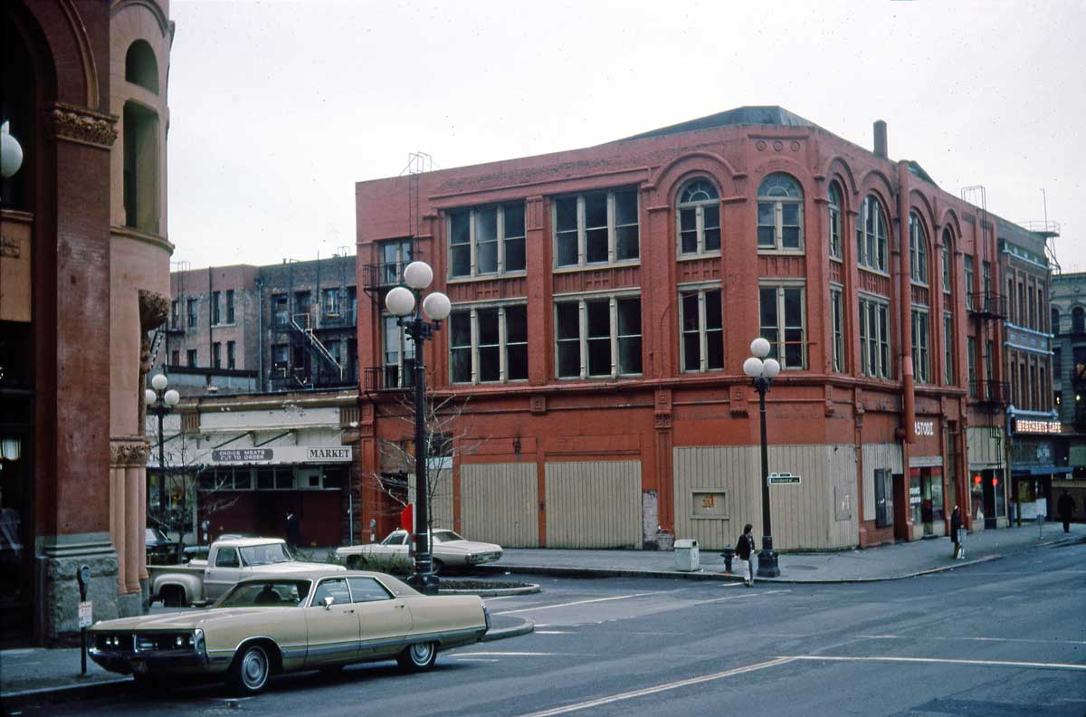


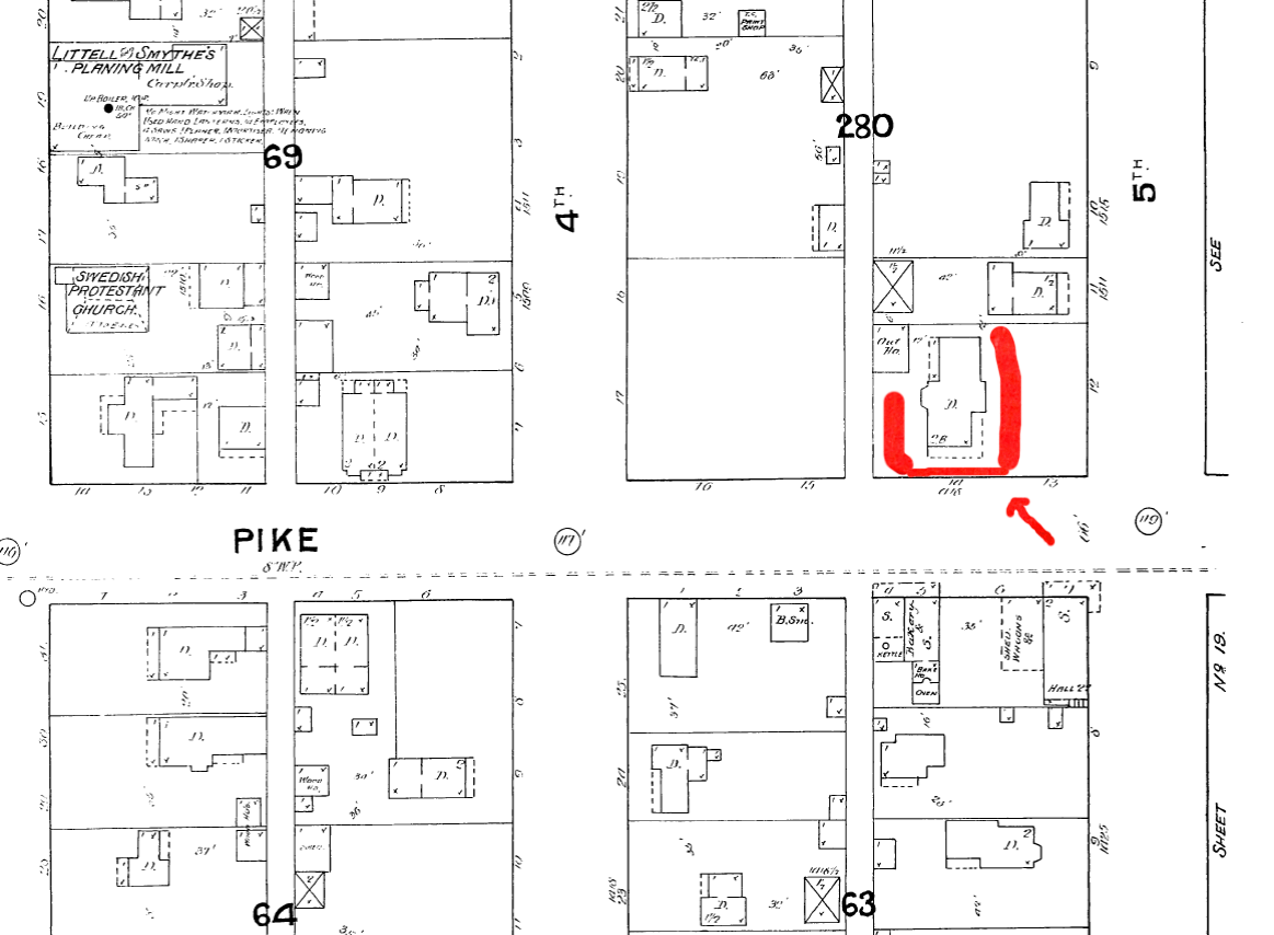


![I tried to find either the negative or a print for my portrait of the Volunteer Park Conservatory Orchestra included in the clip above, but without success - for now. [Click the clip please to ENLARGE it for reading.]](https://i0.wp.com/pauldorpat.com/wp-content/uploads/2013/10/2-wagner-mahler-may-19-1996-web1.jpg)


![This first appeared in Pacific, Sept 22, 1996.]](https://i0.wp.com/pauldorpat.com/wp-content/uploads/2013/10/8-ayp-salmon-valkerie-pacific-feature-web1.jpg)


![[Click, Click to Enlarge] From the Seattle Times of Aug. 10, 1924](https://i0.wp.com/pauldorpat.com/wp-content/uploads/2013/08/s-times-aug-10-1924-nile-country-club1.jpg)
![From The Times on November 30, 1924. [& have you clicked and clicked again?]](https://i0.wp.com/pauldorpat.com/wp-content/uploads/2013/08/s-st-11-30-24-niletemple-lk-ballinger-golf-plans-annoucned1.jpg)


![MERIDIAN PARK PLUM (Rest in Peace]](https://i0.wp.com/pauldorpat.com/wp-content/uploads/2013/08/n-goodshep-plumb-tree-fm-4-11-2009-web_1.jpg)


![Bitter Lake recently from space, on the left, and on the right from high above Playland in 1936. [We suggest that to study it you click it - twice.]](https://i0.wp.com/pauldorpat.com/wp-content/uploads/2013/08/bitterlake-aerials-goodle-1936-web1.jpg)


![Two views from 1937 and 1941 show big changes to the home at 609Boren. At the time asphalt siding was popular, a modern cosmetic. [Courtesy, Washington State Archive]](https://i0.wp.com/pauldorpat.com/wp-content/uploads/2013/07/2-609-boren-1937-1947mrthen-web1.jpg)
![The old First Hill residence was razed in the late 1960s for a parking lot. The Old Colony Apartments at the southwest corner of Boren and Cherry survive on the right. [Jean Sherrard]](https://i0.wp.com/pauldorpat.com/wp-content/uploads/2013/07/2-609-boren-now-mr3web1.jpg)


mr-THEN")