THEN: Looking east on Pike Street from Fifth Avenue early in the twentieth century. (Courtesy, Museum of History and Industry)NOW: Much of the modern Pike Street, including the Coliseum Theatre (1916) on the left, was in place before the Great Depression. The exception, of course, is the Washington State Convention Center (1988).Title page for F.J. Grant’s 1891 History of Seattle.
In 1891, a dozen years or so before the recording of our featured photo of Pike Street at Fifth Avenue, journalist-historian Frederick James Grant published his “History of Seattle,” the city’s first book-length history. Grant described Pike as “having been from the first a business street” and predicted that it “will always be crowded with retail houses and minor business establishments.” We know that it
Pike Street looking east from First Ave., ca. 1899
was not to be. Pike, the main street of early Seattle’s north end, continued its development into the city’s retail center not with “minor houses” but major multi-story retail blocks, most notably the Frederick and Nelson Department Store in 1918, although not on Pike but on Pine, one block to the north.
Pike looking east from the public market. You might pull the date by the motorcars or the construction work on the Bon Marche at the southeast corner of Pike and Second, here right of center.
Before the Denny Hill Regrade, Pike was the most northerly street to cross with ease the southern flank of the hill. Essentially, for Pike between First and Fifth Avenues, there was almost no Denny Hill. It was because of this natural kindness that both a narrow-gauged coal railroad in the 1870s and a horse-drawn trolley in the 1880s used Pike, and not Pine, to move east from the bluff above the waterfront. Heading for Lake Union from the Pike Street wharf, the coal-hauling railroad turned north toward the lake a few feet from where a Webster and Stevens photographer later set his tripod to record this week’s featured photo printed here at the top. Judging from the low studio number 679 (seen near the base of the pole far right), the subject was recorded very early in the twentieth century. In this record we also discover two electric trollies, but no motorcars, which were still rare. Of the 3,959 vehicles counted crossing through the nearby intersection of Pike and Second Avenue on December 23, 1904, only fourteen were automobiles. [We have used that statistic so often that we are blushing.]
Another Webster and Stevens look east on Pike, here from Fourth Avenue, this one numbered 26939. It is late enough for the studio to add twenty-six thousand negatives to its collection. It was a hardy labor with most of them on glass, a surface hardly comparable to our facile digits. Reaching the distant Capitol HIll horizon does not appear to be a challenge.
From this prospect we can also see Pike Street’s second topographic advantage: it easily climbed First Hill. One block to the east at Sixth Avenue, Pike begins its bearable rise to the hill. Union Street, paralleling Pike one block to the south, could not manage the climb, because it ran into one of the steeper parts of the ridge that aside from a pedestrian path, still blocks Union Street at Ninth Avenue. The paved street resumes one block east at Terry Avenue and about eighty feet higher.
The Idaho Block at the northeast corner of Pike and Fifth Avenue appears at the center of this detail from the 1904 Sanborn real estate and fire insurance map. The Idaho is just above the “Pike” printed on the street. (Click to Enlarge)
The Idaho Block, here on the left at the northeast corner of Pike and Fifth Avenue, appears in the 1890 city directory. It was considered the first business block raised in this then north end neighborhood of mostly modest homes, one-story tenements and tall stumps. The Idaho was built by and/or for Aaron and Esther Levy. The latter is still remembered as the founder of the Ladies Hebrew Benevolent Society, the first Jewish charitable organization in Seattle. The Idaho’s units were stocked with both homemakers and small businesses. For instance, a Times classified for May 28, 1897, reads
The featured photo used in a “now-then” feature about the “Bridal Row” built one block east on Sixth Avenue. (CLICK CLICK to Enlarge)
Bridal Row, northeast corner of Pike and Sixth Avenue. (Courtesy Luci Campbell Coe) CLICK TO ENLARGE
“Hats and bonnets, reshaped, dyed, cleaned or pressed; latest styles. 1504 Fifth, Idaho Block.” With the rest of the businesses facing Pike, the Idaho survived a 1906 widening of the street by being moved back. It just missed a quarter-century of service when it was razed in 1914 for construction of the Coliseum Theatre, which has been revamped as the Banana Republic clothing store in our “now”.
NAMESAKE JOHN PIKE ( a 1988 letter from his granddaughter)
Pike Street was named for John Pike by his friend Arthur Denny, the ‘city father’ who made the claim, surveyed it, and sold off its lucrative parts. A carpenter, Pike helped build the Territorial University and was paid with land and the tribute of his own street.
WEB EXTRAS
Hey, lads and lasses, it’s that time of year again. This year’s Rogue’s Christmas once again features me and Mistah Dorpat, along with special guest Kurt Beattie (artistic director-emeritus of ACT, actor, writer, and our longtime friend) and the amazing Khanh Doan, an actress who has dazzled on NW stages for the past decade. Music, as always, provided by the inimitable Pineola.
Join us tomorrow afternoon at 2PM at Seattle’s Town Hall!
Anything to add, fellahs? Ya, and relevant too. The last of the Edge links below – put up by Ron – features some news of a past Rogue’s Christmas. So there Jean. See you tomorrow with my rocking chair, and in it.
=========
GRANT’S HISTORY of SEATTLE is introduced with this panegyric by W.P. Heneage.
Grant, we assume, chose to introduce his 1891 History of Seattle with this panegyric by W. P. Heneage, which is dated five years before Walt Whitman’s 1992 death, and seems to have not been under any Whitmanesque influence.
THEN: Before it became a city park, Licton Springs was run as a health spa. The distant home, left-of-center, at the northeast corner of N. 97th Street and Densmore Avenue N., survives in Jean Sherrard’s repeat. It can be found on the left above the Y in the Licton Springs Park pathway. And the house on the hill can also be found below just above Jean’s salutations, my response and Ron’s llinks. (Courtesy, Seattle Municipal Archives)NOW: Jean Sherrard estimates that for his repeat he needed to move forty or fifty feet to the northeast to escape a planted woodland of park trees that now crowd the prospect taken by the city photographer for the 1945 photo of the Licton Mineral Springs health spa.
In The Seattle Times Sunday Magazine for September 24,,1978, the wit Tom Swint, then one of this newspaper’s humorist feature writers, confessed that while on his “daily walker around the Green Lake track, I have often wondered about the scud of beer suds that from time to time formed on the north shore.” Jean Sherrard, the ‘repeater’ for this feature, confirms Swint’s observation. In addition to walking around the lake, Jean also lives near its north shore and has seen the “suds.”
By Louise Wittelsy
The source for this froth was the mineral-rich springs that are a mere mile north of Green Lake. The Native Americans named them Liq’tid, or Licton, for the maroon mud that once it was blended at the springs, sloshed south in a small stream to Green Lake. What the Indians applied as a cosmetic, E.A. Jensen attempted to exploit as a natural panacea. In the 1930s Jensen opened a spa at the springs that as the sign in the 1945 “then” reads, “Home of Licton Mineral Springs Thermal Baths Relief for Rheumatism Neuritis Arthritis Asthma.” Jensen installed a steam plant to make these cold springs hot for soaking.
We chose this week’s subject to thank public historian Mimi Sheridan for her prolific contributions to Seattle cultural heritage. Jean has posed her right-of-center in his “now” repeat of the 1945 Seattle Municipal Archive photograph. Almost anyone who researches local history will have learned from Mimi, who has proved to be something of a renaissance woman. Her delving and delivering has become a great local resource on subjects of local heritage, big subjects and small, from the Seattle waterfront to countless local landmarks.
Mimi has also enriched our understanding of many neighborhoods, including the one that rings the restful green Licton Springs Park from the Aurora Avenue’s stuttering speedway on the west to the Northgate commercial parking lot on the east. Apropos the Springs, you may wish to take the time to read Mimi Sheridan and Carol Tobin’s historical study of the greater Licton Springs neighborhood. Here’s the link: http://www.lictonsprings.org/localin/history.html On the fate of the Springs we learn that “the City of Seattle annexed the area and sought acquisition of the property in a 1954 park bond. “ It was approved in 1960.
Twenty years ago Mimi Sheridan earned her degree in Urban Planning and Historic Preservation from the University of Washington. About a year ago a life-changing plan came to her in a flash. She calls it her “Saul on the road to Damascus” moment. Mimi, who moved to Seattle from California in 1973, has now returned to it, choosing Monterey, which she reminds us, was the “first capitol of Alta California.” While she has left much for us to learn, we will still miss Mimi.
BELOW: The House on the Hill at the northeast corner of N. 97th Street and Densmore Avenue North as seen in the featured NOW AND THEN at the top.
WEB EXTRAS
Anything to add, lads? Yup. Ron has found a few repeats that keep to the neighborhood – with one exception for you to find. Ron has also added a clue at the bottom with a 1946 aerial of the then still future park. You will find both spa and the home “as clue” at 97th and Densmore. A clue to the last clue: it is near the upper-right corner.
====
1946 AERIAL – Wherein you may find both the spa and the home-as-clue.
THEN: We give this panorama from the roof of the Washington Athletic Club a circa date of 1961, the year that Horizon House, a First Hill retirement community, first opened its doors to residents at Ninth Avenue and University Street. The high-rise L-shaped Horizon stands top-center. (Lawton Gowey) CLICK TO ENLARGENOW: From the WAC roof Interstate-5 is mostly hidden behind One and Two Union Squares and beneath the Convention Center and Freeway Park.
A few weeks ago Jean and I were invited to the Washington Athletic Club (WAC) to give an illustrated lecture on how we go about delivering these weekly “repeats.” It is Jean’s and my tenth anniversary – about. With both text and pictures, I began this weekly feature in the winter of 1982. Jean rescued me in 2005 when he started helping with the “nows.” By then we were old friends. Now he does all the repeats. I both thank and need him.
The day before our WAC lecture, Jean took the opportunity of visiting the club’s roof, thereby extending his practice of illustrating Seattle from its high-rises. This time Robert Laurent, our gracious host and the Club’s Senior Event Manager, accompanied him. This Sunday’s “then” is one of the three historical photos that Jean carried with him. (The other two – or three – are included here below this introduction.) None of them was named, dated or credited, although I suspect another old friend, Lawton Gowey did the recording. Lawton also explored the city on its sidewalks and from its roofs, and he (since deceased) and I shared at least three abiding interests: London history, the music of Johann Sebastian Bach and historical ephemera of Seattle, which we regularly exchanged.
Lawton Gowey’s municipal driver’s permit, 1976St. James tower – not from WAC but for comparison.
Like any high-rise panorama, this one is both stacked and stocked with stories, of which we can only touch a very few. First, far right in the “then,” the twin towers of St. James Cathedral (1907) transcend the First Hill horizon. In the “now,” one of the two towers peeks through the slot of First Hill that is revealed between the Park Place Building (1972) and One Union Square (1981). Left-of-center, its neighbor, the Two Union Square (1987-88) reaches fifty-six stories and is the third highest building in Seattle. Together, One and Two hide most of the horizon revealed in the “then.”
On the left, Eagles Auditorium (1924-5), home of ACT Theatre since 1993, fills the southwest corner of Seventh Avenue and Union Street, and to the east its terra cotta skin approaches the green glass of the Washington State Convention and Trade Center (1985-88). From internal evidence the historical pan barely predates the Seattle Freeway section of Interstate-5. Consequently, there is no Freeway Park, which in Jean’s “now” is knit with both the Park and the Center and the autumnal-toned landscape seen between the two Union Squares. Instead, the “then” gives us a spread of the parking lots and small hotels that once sat on a few of the thousands of parcels of Seattle properties cleared for the freeway.
With the Federal Courthouse at 5th and Madison at the bottom, this aerial looks north-northeast at a stretch of freeway construction where I-5 curves from the city’s grid as it approaches the western flank of Capitol Hill. A few of the buildings noted in the paragraph below can be found here.. These include the Exeter, Normandie, Cambridge, Van Siclen (the top of it), Fourth Church of Christ (now Town Hall), Horizon House, a touch of Virginia Mason Hospital, the Marlborough and the Panorama, and the northwest corner of the Nettleton (far-right)..
For a reader’s game of hide and seek, we will name a few more of the built landmarks that appear in either the “then” or “now” panoramas or in both: the Exeter, Normandie, Cambridge, Van Siclen, Fourth Church of Christ, Scientist, now Town Hall since 1999, Horizon House, both Virginia Mason and Swedish Hospitals, the side-by-side Marlborough and Panorama, Nettleton, and – giving these away – the new blue and salmon colored Meridian Tower, which rises behind the spreading Electra apartments on the left. The concrete Electra was built in 1949 as one of Seattle’s largest mid-century moderns and converted to condominiums in the 1990s.
WEB EXTRAS
Here’s a few more shots from the WAC rooftop:
Robert Laurent (r) with Jack (who has all the keys!)A panorama looking northwestWest, with knobsFrom the top of WAC looking northwest (Courtesy Museum of History and Industry, AKA MOHAI)Find the Camlyn, Pedro – above and below!From the top of WAC, looking north to Lake Union and Wallingford. (Courtesy, Museum of History and Industry, aka MOHAI)Looking south with Sixth Ave. on the left and Fifth on the right. Landmarks include Plymouth Congregational Church, the Y.W.C.A., the Smith Tower, far right, and Harborview Hospital on the far-left horizon. (Courtesy, Museum of History and Industry, aka MOHAI)
And the WAC from below:
The Washington Athletic Club street view
Anything to add, boys? Yes sir. First a now-then clip on WAC that we managed in 1999. That we will follow with a harsh of features Ron Edge has flavored for the neighborhood. We may conclude by reaching beyond these horizons with some pans we think classic, including at the bottom Seattle’s first, the Sammis 1865 pan of the pioneer town.
First appeared in The Times on August 22, 1999.
=====
—–
First appeared in Pacific, August 6, 1995
=====
=====
=====
=====
First appeared in Pacific, October 12, 2008
=====
First appeared in Pacific, November 2008.
=====
First appeared in Pacific, August 25, 2002
=====
First appeared in Pacific, March 8, 1992
=====
First page to a now-then treatment of the 1919 General Strike. When we find page 2 we will insert it.
=====
First appeared in Pacific, August 23, 1987
=====
=====
=====
=====
=====
A McDonald pan – one of many from the early 1890s.
=====
Another by the California photographer A. J. McDonald taken during his brief stay in Seattle in the early 1890s. [Courtesy, Museum of History and Industry.] =====
A PANORAMA SAMPLER
Perhaps or probably the most revealing photograph taken of Pioneer Seattle. The photographer, Robinson, took it 1869 from a second window in Snoqualmie Hall at the southwest corner of Main Street and Commercial Street (First Ave. South).
=====
Seattle’s first pan photographed by its first professional photographer Sammis. Dated 1865, it is interpreted below by pioneer historian Clarence Bagley.
===
Peterson and Bros pan of Seattle in 1878 from Denny Hill. Second Avenue leaves the frame at the lower-right corner. Compare with the 1884/5 pan below, also from Denny Hill.From Denny Hill 1884/5. Third Ave. leads to the bottom-center of the pan.Looking south down Third Avenue from the Washington Hotel on Denny HillLake Union from Capitol Hill, early 1890s.A circa 1912-13 recording from the Smith Tower when it was still under construction.A circa 1905 pan from the Alaska Building (1904)From First Hill to Denny Hill, ca. 1905.1956 panorama from Harborview Hospital. The contemporary repeat dates from ca. 1990. (Click Twice to Enlarge)First Hill horizon taken by Watkins from a platform he constructed on top of Denny Hill’s south summit. Seneca Street reaches eighth-ninth avenues above where the dark copes of evergreens stands out at the upper-center of the subject. [Courtesy, University of Washington Northwest Collection]
THEN: This view looking east from First Avenue South on Jackson Street in 1904, is still four years short of the Jackson Street Regrade during which the distant horizon line near 9th Avenue was lowered by more than 70 feet. (Courtesy Museum of History and Industry)NOW: Most of the structures in the “then” photo survive in the “now” after more than a century of use.
The oversized posters hanging in the first floor corner windows of the Wax and Raine Building, on the right, reveal the date for this look east on Jackson Street from First Avenue South. (Granted, you can not read them at the print size offered here, but you can trust us.) They promote the 1904 visit on August 24 and 25 of the Ringling Brothers Circus to Seattle’s exhibition grounds, located at what is now the High School Stadium in Seattle Center. The circus came with one rhinoceros, two giraffes, and forty elephants. It was also the year that the earnest and still steady Wax and Raine Building first opened.
There is as yet no Wax and Raine Building showing here at the southeast corner of First and Jackson. The view looks east on Jackson from the top level of the King Street Coal Wharf. The spire puncturing the skyline belongs to Holy Names Academy (before their move to Capitol Hill), and the large west facade below the Academy is the home for the Washington Shoe Manufacturer at the southeast corner of Jackson and Occidental. It appears in this week’s featured photo “behind” the Wax and Raine and also in the “now” photo where it has grown three more floors. South School stand on the far right horizon.A wider angle on Jackson Street looking east from the King Street Coal Wharf in the early 1890s.
In our featured photo at the top, the lonely man standing in the company of a fire hydrant on that same southeast corner of Jackson Street and First Avenue South might be adopted as a symbol or sign for this sturdy street. Aside from a few hotel lobbies, there is little sidewalk commercial bustle here. Jackson Street was then primarily stocked with wholesalers and manufacturers at home in new quarters built in the early years of the twentieth century, most of which survive. Perhaps the man on the corner is headed north for the big bar facing First Avenue inside the Jackson Building, out of picture on the left. It was the sudsy
The Tumwater Tavern facing First Ave. South from the Jackson , home of the Capitol Hotel recorded, again, by the Webster and Steven Studio. Beginning early in the 20th-Century it served as the editorial photographer for The Seattle Times for many years. (Courtesy;, Museum of History and Industry)Another look at the Tumwater Tavern, here looking north on First across Jackson Street about 1911. This is one of a few negatives struck by the Public Works Dept. to show off the city’s first decorative light standards, which used five bulbs on the primary arterials like both Jackson Street and First Avenue South.Looking north on First S. across Jackson in the late 1890s and before the 1901 construction of the Jackson Building. (Courtesy, Murray Morgan)
home for Olympia Beer, the “it’s the water” that was Rainier Beer’s principal Puget Sound competitor. The Jackson Building, construction in 1901 for the Capitol Hotel, is also distinguished by the loving attention it has since received. Architect and preservationist Ralph Anderson restored the classical landmark in 1963. It was the first renovation in what soon became a movement and a decade later the Pioneer Square Historic District.
Portland photographer Huntington’s look north on Commercial Street from Jackson ca. 1881. Hold the paper “properly” with the subject somewhat close to your eyes that hold themselves somewhat cross-eyed and you may manage to pull the third dimension from this stereo. Huntington’s caption is printed directly below. Both are – again and again – used courtesy of the Museum of History and Industry. Bless the MOHAI. [click click to ENLARGE]
An etching of Commercial Street looking north from Jackson Street ca. 1884. The Arlington Hotel, with the flag, is on the right. The University Building, a box with a cupola, is on the horizon, left-of-center.
Through its first half-century First Avenue South was easily the busiest retailing strip in Seattle and was appropriately first named Commercial Street. After its largely framed four-block-run from Yesler Way to the tide flats below King Street was consumed by the Great Fire of 1889, along with all else in Seattle’s original neighborhood, Commercial Street quickly returned to its varied enterprises. In the roaring 90s, following the fire, Jackson Street
Great Fire (June 6, 1889) ruins looking north from Jackson street with Commercial Street (First Ave. S.) on the right. McManus marketed this in 1912 and dated it and several other photos of the ruins July, 1889. By then much of the rubble was cleared away, the ruins razed, and the rebuilding begun.The Salvation Army band posing on Jackson Street in front of the Palace Theatre, possibly during or following a “battle of the bands” with the house orchestra. The subject looks east from Commercial Street (First Ave. S.).
was a generous contributor to Seattle’s skid road neighborhood of bars and cheap lodgings, especially on its south side where it nearly reached the King Street train trestles above the tide flats. During the 1890s, Salvation Army street bands trumpeted concerts that competed with house bands in the bars along Jackson Street. This sawdust row of cheap lodgings and obliging bars was razed to make way for the manufacturing and wholesalingbrick neighborhood shown at the top.
Below: THE PLUMMER HOME at the NORTHWEST CORNER of OCCIDENTAL AND JACKSON IN THE LATE 1870s.
Occidental looking north from Jackson, ca. 1899.
Within a block of this intersection in the 1904 Sanborn Real Estate Map there are five hotels, a flour and feed warehouse, a ship chandler, a second-hand store, several machine shops of various sizes, a shirt factory, a printing press, a rubber factory, three plumbers’ supplies, a candy factory, a photo engraver, a bakery (in the alley behind the Capitol Building) and a saw shop, the latter promoted by the billboard, shaped like a circular blade, that sits atop the roof, right-of-center. The blade also appears above the roof of the Luna Park bound electric trolley below, circa 1907. Note as well the Washington Shoe Manufacturer sign left-of-center and the Wax and Raine Building on the right.
WEB EXTRAS
I’m going to deviate from our usual pattern and include a few photos from the Hands Around Green Lake event that just concluded minutes ago.
Anything to add, guys? Certainly Jean. Your “Hands Around Green Lake” diversion is most caressing. Thanks much. Living near the lake you have often shared some unique moments out of its vibrant life with us. NEXT: Ron Edge has gathered an assortment of neighborhood features and strung them below.
=====
Appeared first in Pacific, June, 1, 2008
=====
First appeared, May. 9, 1999
=====
=====
=====
First appeared March 14, 1999
=====
Another Billboard negative, this one sighting west on Jackson from or thru the Second Avenue extension in 1934. (Note: The address given at the base of the photograph refers to the position of the billboard not the camera.]Six years later looking west on Jackson Street thru 4th Avenue on July 16, 1940.
=====
First appeared in Pacific, Nov. 29, 1998
=====
=====
Not yet hidden by the Was and Raine Building, the Jackson Building at the northeast corner of First Ave. S. and Jackson Street stands out on the right. The photograph was taken from the railroad overpass used by coal cars to reach the King Street Wharf bunkers. First appeared in Pacific June 29, 1997
THEN: Hugh Paradise neither named nor dated his photograph looking down from a basalt cliff onto the Yakima River. (Courtesy, Byron Coney)NOW: With some exploring, Jean Sherrard discovered that Paradise’s prospect was only a few feet off the Yakima Canyon Road, a State Scenic Highway.The panoramic view from the same spot
I imagine that among PacificNW readers many have explored this magazine’s namesake surrounds via its many adventurous roads and highways. And I’m confident that among these explorers, several will have driven to within a few feet of this week’s featured subject, but then missed it. Jean Sherrard estimates that he has made about twenty visits to this basalt bluff above the Yakima River. First, of course, he had to find it by studying the photographer-essayist Hugh Paradise’s featured photograph. At legal speed it takes about two-and-a-half hours from Seattle to reach the half-paved shoulder that Jean describes as “a little triangle squeezed between Washington State Route 821 and about a two-hundred-foot fall into the Yakima River.” Sensibly, the Washington State Department of Transportation has set no “park here” signs marking Jean’s postage-stamp sized “parking lot.” It can be by found following the ensuing instructions.
Asahel Curtis’ look south to the canyon curve and cut above the Yakima River. (Courtesy, Washington State Museum, Tacoma)A Washington Department of Highways snapshot taken somewhere along the canyon road, perhaps even of “our” cut.The cut next to the viewpoint
About four miles south of Ellensburg the now nearly century-old Yakima River Canyon Road, while keeping for the most part close to the river, follows the eroding trout stream’s serpentine cut through the Umtanum Ridge. The Ridge takes up most of the skyline in the now-and-then photos. The highway curves its way through about ten oxbows (that is twenty curves, some of them hairpins) on its way to the lower Yakima Valley. After about the eighth curve, the Canyon Highway reaches the landmark Red’s Fly Shop, which is actually a sumptuous lodge, and begins a half-mile climb to the unmarked Paradise/Sherrard petite parking place. At the top if you suddenly enter a highway regrade that cuts through the bluff you were just ascending, you have gone a few feet too far. Turn around and try again.
The artist Hugh Paradise was born in 1912 in Montana and died in Seattle in 1979. His Post-Intelligencer obituary described him as a “retired free-lance writer and photographer, who resided in the Seattle area for over 40 years.” I have studied and admired Paradise since a friend shared a few hundred of his negatives with me several years ago. His name fits. Paradise wrote short essays illustrated with his arcadian photographs for Sunset Magazine. An
Hugh Paradise posing his wife Anne Marie Van Cleve at Grand Coulee.
appreciative Sunset editor described him to me as “poetic.” He married Anne Marie Van Cleve in 1942, whom he frequently posed in the middle-distance of the northwest landscapes that attracted him. Paradise was also exceptionally smart. He belonged both to Mensa and the Triple Nine Society, gregarious and inquiring societies for people with high intelligence scores. His obituary describes his “major interest” as “the world about him.”
Scene in the Yakima River Canyon, photographed by Horace Sykes ca. 1947.
Hugh Paradise had a handicap, a breathing condition that prevented him from ranging far into the scenery he photographed. For this photo high above the Yakima, he was forced to stay near the side of the road. In the 1960s, this magazine’s predecessors, The Seattle Times “Charmed Land Magazine” and The Seattle Times “Color Rotogravure, the Sunday Pictorial Magazine,“ published several examples of Hugh Paradise’s intimate art. While I never met him, I continue to collect him.
WEB EXTRAS
Anything to add, lads?
Starting with you Jean. First dear readers, we have encouraged Jean to include some of the photos he has taken during his many visits to the Yakima Canyon. They are grouped directly below the feature text, that is, between it and this answer to Jean’s by now conventional question about “extras.”
Hey, Paul – here are a few selections of the canyon from over the years. The first set repeat Paradise’s shot in different weathers and seasons. The second are a handful that I dug up at the last minute. Enjoy.
Ah but we have very little in the way of our own Times features that cover the state’s “dry side” subjects. Choosing to pull neither text nor photos from “Building Washington,” the History of Washington State Public Works that we published years ago, which is filled with images from every corner of the state, we have played it convenient and linked first a feature on the dedication of what we popularly call the Mercer Island Floating Bridge. We do it for the sufficient reason that our featured photo looks to the east in the direction of Yakima, as do the second, third and fourth links below. For the last of these, this week, eleven links we shall pivot far north to the wet side of Alaska with the feature built on Jean’s recent visit to Juneau. Following those we will sprinkle a few of the east side (of Washington State) subjects that we pulled three years ago for the “Our Daily Sykes” feature, which printed here a few hundred photographs taken by Horace Sykes, mostly in the 1940s, of his trips around Washington – and the West too – as a sensitive fire insurance adjuster with a good camera and eye for picturesque compositions. And we will likely find a few other images that touch on Yakima, the river or the city too.
=====
HORACE SYKES NEARBY THE RIVER
First will show a few photos of Horace. His home was above the beach in Magnolia.
Horace is on the far-right of this probably timed photo of his family gathered for a Christmas of uncertain date.Horace , on the right, with a friend. Both wear Washington Athletic Club stickers.Somewhere on the Yakima River below the canyon.Somewhere on the YakimaThe Yakima Valley – farming with irrigationIn the Yakima River CanyonA Yakima Valley setting with Mt. Adams on the horizon.Thru his years of traveling the West, Horace Sykes came upon many spectacles.Somewhere on the dry side of the CascadesNearby beside the Columbia RiverWhere sheep may safely grazeAnother of the Yakima CanyonHorace visited Steptoe Butte several times.Steptoe ButteMt. Adams on the horizonHorace’s 1951 Chevy in the state’s scablands – it seems..
Red road moving thru a green landscape.
Moonlight somewhere in the valleyHorace keeping limber with his camera in a canyon, but more likely the Snake River that the Yakima.
THEN: Looking south on 10th Avenue E. to the freshly re-paved intersection where Broadway splits into itself and 10th Avenue North in 1932.NOW: The trolley tracks on Broadway and 10th Avenue North were removed in the early 1940s, and the gas stations at the intersection with Roy more recently.
Here is another Foster and Kleiserphoto of a prominent business intersection in Seattle where the famous billboard company may have been planning, or merely hoping, for a giant-sized sign. Let us imagine it on the roof above the Harrah Brothers grocery at the scene’s center. (The grocery fills the space behind the three plate glass windows shown above the motorcar moving south on 10th Avenue North.)
A Harrah ad from 1925Another from 1925An ambitious ad from either Harrah or Heaven run in The Times on Sept. 9, 1926.On the home front during the First World Ware the Harrah Bro. agree with fourteen other prospering “food dealers” to six restrictions.
The Harrah brothers opened their new store on August 25, 1931. The “then” photograph is dated 1932, so the comely light brick business block, designed by architect Earl W. Morrison for the southwest corner of Broadway and Roy Street, is about a year old. The Harrahs were not new on Broadway, having first settled on this North Broadway block about twenty years earlier. The brothers ran their first Seattle Times classified ad in June 1910, when they were looking for a “first-class bread baker.” A year later in an illustrated Times advertisement on April 14, 1911, the grocery’s new van was pictured. Below it the partners bragged in print that with their auto-delivery, “Harrah Bros. succeeded in supplying their patrons with Hot Cross Buns in time for breakfast this morning.”
From April 14, 1911 and in The Times.The Harrah’s make it to their Silver Anniversary two years into the Great Depression. [Click-Cllick to enlarge for reading!]
In 1934 this corner was disposed for a tavern by Washington State’s then new Liquor Control Board. With prohibition recently over, the Board fancied it for a bar, and somehow convinced Berlin Cleaners, which was then holding the corner next door to Harrahs, to relocate two blocks south at 619 Broadway North, where a popular baked bean merchant name McCullock was persuaded by the sturdy board to move to the nearby Haynes Candy Store on Olive Way. The confectionery had been swayed by the Liquor Board to move to a nearby and vacant storefront on E. Pine Street. Despite the Board’s Machiavellian efforts, by 1939 this southwest corner of Broadway and Roy had been temporarily reformed from alcohol to ice cream. However, in seven more years it reverted to spirits with the first of the De Luxe taverns.
A Deluxe adver. from 1978 – about. Note the Grant Wood are in the advertisement where t he farmer has been traded for the Deluxe chef, which we also share in the photo that follows. It too dates from the ’70s, my last years on the Hill. I first lived near the Deluxe in 1964, nearby on Summit Avenue.
The Deluxe on September 12, 2006 with Victoria B. and friend.Victoria, again, twenty-seven years earlier in the Harvard Exit Theatre, standing at the doorway between the lobby and the “living room.”
A page from the Century Club’s 1937 tax card. courtesy Seattle Washington Archive, the branch that is on the Bellevue Community College campus. (Click to Enlarge)
With “De” and “Luxe” joined, the Deluxe in Jean’s “now” opened in 1962 with Joe Rogel and Bernie Minsk the gregarious partners. Sixty-four years later, Rogel’s son Barry is the owner. Living nearby on Broadway while teaching film at the Cornish School in the 70s, I remember well both Joe and Bernie, and their hamburgers. In 1970, the humorist and Times restaurant reviewer John Hinterberger described how “about 200 people streamed out of the Harvard Exit,
Posing at the front steps in the mid-70s, Jim Osteen and Art Berstain, the creator-owners of the Harvard Exit conversion of the Women’s Century Club.My Broadway home in 1976-77 posing for CHAOS (Capitol Hill Arts On Show) promotion on the roof reached from our kitchen window. Our apartment at the southeast corner of Broadway and Republican had been passed along or down for many years from one Cornish student or instructor to another. It can be seen in the photo that follows, which was taken in the 1930s during the widening of Broadway. The roof on which we posed two photos above was behind the Piggly-Wiggly Market sign on the right.
turned right and many streamed into the Deluxe Tavern; adjacent buildings with a symbiotic relationship.” The still charmed and cosmopolitan neighborhood of Capitol Hill will, I figure, forever thank Joe, Bernie and Barry for their burly and buttered baked potatoes. [Long ago I drew for Joe and Bernie a bake potato adorned with butter and sour cream and imagined as a billboard on the roof of the tavern. When & if found I will attach, or introduce with an addendum.]
THE CORNER TAX CARD FROM THE LATE 1930s Followed by two other tax photos of this west side of the 600 block on Broadway.
BELOW: TWO of the MCKALE SERVICE STATION, ACROSS ROY STREET from the CORNER STOREFRONT – The FUTURE DELUXE.
WEB EXTRAS
Anything to add, fellahs? Surely Jean, more Edge Links of the neighborhood.
THEN: Variously named the Giant Cedar Stump, the Big Arlington Stump, or just The Stump, this Snohomish Country roadside attraction was killed by a fire in 1893, reduced to stump size and tunneled in 1916, given a concrete base in 1922, and moved alongside the new Highway 99 in 1939, where it is shown here in 1940, long before its last move in 1971. (Courtesy Old Seattle Paperworks)NOW: Jean Sherrard’s opportune meeting with the stump late this summer was a lucky opening for one of Boyd Ellis’s early portraits of it to appear here.
Surely some – maybe many – PacificNW readers will remember this magazine’s predecessor, The Seattle Sunday Times Rotogravure. That weekend supplement covered regional stories that were illustrated – often lavishly – with sepia-toned photographs. For instance, on June 18, 1939, the Rotogravure accompanied members of “A Seattle Camera Club … On a Picture Hunt” north on the then freshly-paved Pacific Coast Highway. Their destination was Rosario Beach and anything picturesque along the way. This full-page feature was adorned with ten rotogravure illustrations, including one of the club members posing with their auto caravan beside this week’s subject, “the ancient, picturesque stump that has been preserved beside the highway near Arlington.”
A page from The Seattle Times Rotogravure Magazine for June 16, 1939. DOUBLE CLICK TO ENLARGE
The camera club was following in the lustrous wake of Crown Prince Olav and Princess Martha of Norway, who, a few days earlier, had driven through this often sideswiped artifact without hitting it. Here, approaching the estuary of the Stillaguamish River and about mid-way on their ten-week tour of America, the attentive Royal Couple surely read the interpretive text framed in a triangle above the entrance to the tunneled trunk. It reads, “Relic of a Vanquished Forest / Western Red Cedar / (Thuja Plicata Don) /Age 1250 years / Preserved at Request of Snohomish Co. Pioneers /A.D. Arlington, Washington 1922.”
A page borrowed from the webpage for the Stillaguamish Valley Pioneer Museum in Arlington, WA. (Google it)
Soon after the royals and the clubbies visited the stump, Boyd Ellis, Arlington’s well-collected postcard purveyor, recorded the historical photo in 1940 and numbered it 51 at the print’s bottom-right corner. In his decades of exploring the northwest for marketable snapshots of landmarks and other roadside attractions, Ellis snapped at least a dozen exposures of this Giant Cedar Stump. Our featured “then” is one of at least two stump portraits he took, posing the same auto (perhaps his) and ascribing to it the same print number. Ellis’s work is so bountiful that it has spawned experts among his many collectors.
Above: Another early Ellis log of the Arlington Stump . Below: Ellis again and a while later.
Goodbye to Ellis – for a while.
Jean’s late-summer visit to the Arlington stump was not intended for a feature but for a roadside pause at Interstate-5’s Smokey Point Rest Area. The highway department has the stump at “milepost 207 about eight miles north of Marysville.” More to the point of the Big Cedar Stump’s heritage, the thousand-plus-years-old artifact has been associated with Arlington since the late 19th century when that town was abuzz with mills. The Big Arlington Stump is about three and one-half miles from Arlington as the crow flies, and there are ordinarily plenty of crows hanging around highway rest areas. Jean, of course, knew about the stump from Ellis’s photographs, which date from before the highway department moved the stump to this, its last home in 1971. I will brag some by noting that I first stumbled upon the stump, and without injury, in the late 1960s when it was still beside the highway, about one mile north of the Smokey Point Rest Area where Jean found it. I was headed for Vancouver and pulled over.
A view from space of the Smokey Point rest area along I-5 used courtesy of Google Earth.Not Boyd Ellis – but earlier and perhaps the oldest of the surviving portraits of a family car in the embrace of the Arlington Stump.
WEB EXTRAS
Anything to add, guys? Yes Jean with examples of suburban life, mostly. We chose these, again, from past features that we have scanned. Most of them are from after 2008 when we started blogging and scanning. Since the Sunday Now and Then column began in the winter of 1982 there are many features relevant for whatever generalizations might be made for any given Sunday, we have, however not found the time to scan them all. As for stumps and, for that matter, logs too, we have gathered a few, which we hope to include here with an addendum along the way (aka down the line.)
=====
Above: Joined kaleidoscopes from my Wallingford Walks of 2006-10. Below: a Wallingfordian fall setting.
THEN: Capitol Hill’s Society Theatre first opened its doors in 1911. This record of it most likely dates from 1920, the first year in which the theatre could have shown the four films promoted with sensational posters near its front doors: the comedy “Mary’s Ankle,” “The Sagebrusher,” a western, “Silk Husbands and Calico Wives,” and “Everywoman,” a feminist allegory appropriately filmed in 1919, on the eve of women’s suffrage in the United States. (Courtesy Museum of History and Industry)NOW: The lively neon brilliance at its northwest corner lends a nostalgic glow to the Capitol Hill intersection of Broadway and John Street.Clip from The Seattle Times for Dec. 6, 1911
On the eve of its dedication in late 1911, the Society Theatre at the northwest corner of Broadway and John Street was anticipated in The Seattle Times as “the most pretentious” of any of the neighborhood theatres then popping up on greater Seattle’s street corners. The Society would have accommodations for “500 people in a structure 35 x 120 feet in dimension … (it) will cost about $6,000 complete and will be finished with ever-modern convenience for its patrons. It will be a one-story building of frame and brick with an ornamental front, following the Spanish Mission style of architecture and composed of brick and stucco.”
S.Times clip from Dec. 8, 1911Seattle Times clip from Dec. 9, 1911
Built with speed, the Society opened its doors to its surely excited neighbors on Friday, December 8, 1911, with “four reels of new films and two song specialists.” For that first night, the Society’s “specialists” would “consist of a male duet and a song by a young woman soloist. There will be no attempt at vaudeville, it is said.” Most likely “it” was the Society’s manager, George W. Ring, who did the saying. Up from Portland, Ring brought with him “a large expansive smile and several years experience in the moving picture game.” Managing neighborhood theatres included promoting neighborhood values, such as chumminess and convenience. One of
The nearly new Society Theatre’s yellow foot print appears at the top (middle-right) in this detail from the 1912 Baist Real Estate map. Note how a earlier user has drawn in with pencil the future adjustment’s on John at Belmont .
the Society’s “modern conveniences” almost assured that there would be no delays for re-threading the projector. From the start, the Society had two, and both were Powers No. 6 moving picture machines. On opening night the two Powers moved pronto from “Old Billy,” a “Selig film, dealing with the comic adventures of an old fire horse belonging to a fiddler,” to “An Aeroplane Elopement, a Vitagraph comedy-drama.” Two “scenic films and two biograph comedies” and the specialists’ singing completed the inaugural bill.
From the Times in 19131935
Also in 1911, as a sign of the times, the Alhambra, one of downtown Seattle’s big stock and vaudeville theatre venues, converted to showing motion pictures exclusively. In the same year the Pantages Theatre opened as a terra cotta-clad palace for presenting whatever played well, including vaudeville, stage plays, and film. After many adjustments, in 1966 the Pantages (later renamed the Palomar) wound up as a parking garage – the big one at the northeast corner
Circa 1946Circa, 1948
of University and Third Avenue. Up on the Hill, the Society changed its name to the Broadway in the early 1920s and continued to show films at its busy intersection until the winter of 1990. Rite Aid Pharmacy, its next-door neighbor to the north on Broadway, took over its place by expanding into the corner, while keeping the “BROADWAY” part of the theatre’s vibrant neon marquee for promoting flu shots and such.
Appeared in The Seattle Times for June 5, 1917
WEB EXTRAS
Anything to add, kids? Yes Jean, and most of them from or near the neighborhood.
THEN: The first Alki Natatorium was built in 1905 at Alki Point eight years before the lighthouse. (Courtesy, Museum of History and Industry)NOW: The well-packed neighborhood of year-round beach homes has long since covered the large footprint of the Alki Natatorium.
In today’s “now” scene, West Seattle’s savvy Bob Carney poses for Jean Sherrard on Point Place Southwest, a short block that leads from Alki Avenue Southwest and dead-ends at the green campus of the Alki Point Lighthouse. Its light first penetrated the ordinarily peaceable waters of Puget Sound in 1913 after the federal lighthouse service bought much of the Point from the Hanson-Olson clan who had purchased it in 1868 from Seattle pioneer Doc Maynard.
First appeared in Pacific on May 19, 1985.
In his hands, Carney holds a copy of our “then” photo as part of bound pages of his research into the life of the first Alki Natatorium, the landmark featured in the photo. (Derived from Latin, “natatorium” denotes a building that houses a swimming pool. Aficionados abbreviate it as “nat.”)
A dimly-lit hand-held snapshot of an early lighthouse map kept at the lighthouse and showing the relationship of the light (at the top) to the natatorium (on the right)..Above: When I was first shown this postcard years ago, I wondered if it might be of he Alki Point Natatorium. Below: It was.
Here a Webster and Stevens photographer looks northeast from the natatorium to the dock use as a prospect for the photograph above this one and also delivered the first swimmers to the bouyant delights of paddling in heated salt water. The trolley first reached Alki Point in 1908. (Like the featured photo at the top and the five other early photos of and from the Alki Nat, this one is used courtesy of the Museum of History and Industry._ The Alki Point part of the 1929 aerial photography project to map Seattle. Note that the Alki Point Dock used by the Nat endures. and is just evident upper-left. The Nat., of course, is thirteen years past, replaced by the line of beach houses that begins west of the Alki Pint Dock. . (Courtesy Seattle Municipal Archive)This Laidlaw aerial also shows the enduring dock and its neighboring beach housing in the 1930s. Most – perhaps all – of the modest houses have been replaced with tax-payers. (Courtesy: MOHAI again)
Years ago, while delivering an admittedly half-baked lecture on West Seattle history to its historical society, I was asked if I had evidence of this early human aquarium. Like many others attending, I imagined that the question was about the later Alki Natatorium, built nearly a mile up Alki Beach from the Point, just east of the Alki Bathhouse, and opened in 1934 with “Seattle’s own swimming champion, Helene Madison, as permanent instructress.” Bob
Abpve and above the above. The second aquarium was opened in 1934 near the bathhouse constructed by the Parks Department a few years before the first Aquarium, the one at the point, was destroyed. (The bathhouse was just out-of=frame to the left.) From The Times for July 7, 1905.Alki Nat’s dance floor (and more) protected under the gabled roof at the east end of the natatorium.A Times clipping from Sept. 26, 1906.
Carney’s research reveals that the earlier and largely forgotten natatorium at the Point was equipped with “gymnasium paraphernalia” and featured a “bathing tank” 130 feet long, 53 feet wide and from 22 inches to 9-1/2 feet deep, filled daily with Puget Sound waters kept at 74 to 76 degrees. The east end of pavilion, the part showing here with five gables hosted a variety events, most involving dance. The structure was appointed like a Japanese
teahouse – note the hanging lanterns – and its demise was equally exotic. Like the dome atop Seattle’s St. James Cathedral on First Hill, the roof on West Seattle’s first oversized swimming pool collapsed Feb. 1-2, 1916, under what remains Seattle’s deepest (or second deepest – it is debated) 24-hour snowfall.
While the collapse of the St. James Cathedral dome got the front page in The Times coverage of the 1916 snow, the collapse of the Natatorium’s roof was given note. CLICK to ENLARGEThe last of the six Alki Natatorium related Webster and Stevens photographs. Looking west on Alki Ave. it shows part of the Natatorium east roof line. the part above the dance floor. (Lke the others this is used courtesy of The Museum of History and Industry, MOHAI for short.
Soon after Bob showed me this print, researcher Ron Edge found five others (all of them already inserted above) while visiting the Museum of History and Industry library to help make detailed scans of many of its classics. Most likely, all were recorded together in 1905 when the nat was a brand new enterprise undertaken by the Alki Point Transportation Company. Nearly a decade before the Alki Lighthouse arose, in 1904 the company had built both the natatorium and the steamer Dix to render hourly service between this, the firm’s new West Seattle attraction, and Seattle’s central waterfront. (The Dix notoriously sank in November 1906 in a collision killing more than 40 of its estimated 77 passengers.)
The tragic Dix on the Seattle Waterfront.
We conclude with a too-short nod to the many heroes of local heritage who volunteer with the dozen or so Seattle and King County societies that nurture and share our history. Using our example, Bob Carney is described by Clay Eals, executive director of the Southwest Seattle Historical Society, as “a stalwart volunteer for us over the past three decades, doing everything from serving on our collections committee (evaluating submitted artifacts for possible accession) to putting up exhibits at our Log House Museum. Behind it all is a heart of unrivaled size.”
A 1906 Promotion printed in The Times that includes but also exaggerates the size of the Alki Natatorium.As a prepared show and Alki Natatorium management paid the sudden celebrity of John Segalos, the life-saving hero on (and off) the destroyed Mosquito Fleet steamer, the Valencia. The advertisement appeared in The Times for Aug. 6, 1906.
WEB EXTRAS
Another few laps, lads? Jean, Ron and I are pleased to exersize with you. Below are a line-up of West Seattle features previously printed Pacific and so shown here, some of them recently. We will also insert a few relevant others.
=====
Bernard’s Fir Lodge – later the Homestead Restaurant (see the relevant Edge clipping above.)
THEN: Completed in 1900, the Graham mansion on First Hill at the southwest corner of 9th Avenue and Columbia Street is getting some roof repairs in this 1937 photo looking south across Columbia Street. It was razed in the 1966 for a parking lot by its last owner and neighbor, the Catholic archdiocese.NOW: Posing here in the pink, Antonette and Robert Ruppin, long-time florists for the Bon Marche department store, are the oldest residents of the First Hill block that was once home for the Sunset Board Room (seen in the “then”) and the Capri Apartments at the northeast and southeast corners, respectively. The newlyweds left the Capri in the late 1950s but recently returned to the block to take occupancy on the 19th floor of Skyline, the new nonprofit that describes itself as “Seattle’s only Life Care retirement community.”
Two mildly eccentric signs can be found on this photograph of the southwest corner of 9th Avenue and Columbia Street on Seattle’s First Hill. Hand-written on the grass, the more obvious sign is mistakenly captioned “727 – 9th Ave.” The corner is held now by a roundabout to the front door of the nearly new Skyline Retirement Community at 725 9th Avenue. The “then” is another of the many thousands of tax photos taken during the Great Depression for the King County Assessor’s office by skilled photographers working for the federal Works Progress Administration. The WPA was one of the many “alphabet soup” agencies created by President Roosevelt and his progressive cabinet to make both public works and work: works such this photographic inventory of every structure in the county, and work – with pay checks – for many including the photographers. This archive is still used by county assessors and homeowners, as well as historians.
We may always wonder if the humor of this sign was intended.
The second sign is harder to find. It is nailed to the side of this mansion that somewhat resembles a Greek Temple. The sign appears above the second floor porch near the iron ladder, which served as a fire escape. Reading “The Sunset Board Room,” this second sign was, we expect, wrapped in wit by the Sunset’s manager, the progressive Emma A. Hausman. Above her portrait that appeared in The Times for March 3, 1918, Hausman was described as “one of the most prominent club women in the city.” Also in 1918 she
From The Seattle Times for March 3, 1918.The Seattle Times, June 30, 1918.From The Times, May 15, 1921Clip from The Times for February 22, 1935.A Times clipping from March 3, 1935.
was chosen to direct the work of the local Democratic Club, and a year earlier she had been elected chairman of The Women’s Civic Improvement Club’s Auxiliary to the Seattle Red Cross. The Sunset’s classified ads in The Times were often personalized with Hausman’s name, as for the second of June, 1917: “Mrs. Hausman has one large room, suitable for man and wife, 2 business men or young ladies. First class in every particular 721 9th Ave.” Through its about sixty-six years on this corner the big home was listed at 721.
A not matching and yet similar Greek Revival was built across Columbia Street, on its northwest corner with 9th Avenue, suggesting that the two big homes may have been developed together.
Actually, manager Hausman had many more rooms than one to rent in the Sunset. According to the 1937 tax record, this neo-classical mansion included twenty-seven rooms: seven on the first floor and eight on the second, all with nine-foot ceilings. And there were seven more rooms in the attic and five more in the daylight basement. The Times reports that its first owners, the Archibald Blackburn Graham family, moved in on April 6, 1901. The Seattle Times for December 22, 1900, counted the Graham’s new home among the “handsome new residences of substantial quality completed within the year.” It cost $15,000, the same price that The Times publisher A. J. Blethen paid for his also manor-sized new home on Queen Anne Hill’s Highland Drive, also in 1900.
A Times listing of some of the grander new residences built in Seattle in 1900. The list includes the Graham home. It is fourth up from the bottom.
Archibald Graham was an arch-capitalist, described in pioneer historian Clarence Bagley’s “History of Seattle” (1916) as “a man of resourceful business ability who recognized the difficulties, the possibilities and the opportunities of a situation.” Graham was a charmed opportunist, whose lucrative successes included, to name a
Graham’s Novelty Mill on Harbor Ave. in West Seattle.
few, flour milling (including the Novelty Mill in West Seattle), mining, lumber, and printing. Graham also developed new neighborhoods in Seattle, the booming and beckoning West Coast city that the 39-year-old speculator moved to from West Virginia with his
Graham’s University Addition promoted with a Times classified for January 17, 1909.A detail pulled from an early 20th-Century Baist Real Estate map showing the Graham University Addition between E. 50th and 55th Streets. From The Times for April 6, 1901, the Grahams move in.Making good use of the big home, Miss Juliette, the Graham daughter, gives a dance,
Times clip from Nov. 20, 1912.
growing family in 1891. Jewelry was his last enterprise, and many jewels were found neatly packaged in his pockets after he fell one hundred feet to his death on May Day 1915, from the recently completed steel bridge over Ravenna Park. The police found no “foul play.” No doubt hoping to deflect suicide speculations, Archibald’s puzzled friends noted to a Times reporter that he had left his home happy that morning and had “no financial troubles.” What made him leap, they concluded, was some combination of acute insomnia and recurring agoraphobia. One friend was quoted “It was the involuntary act of a man overcome by the influences of high places.”
The Times artful approach to the causes behind Graham’s fall (or leap) attempting to write around the delicate specter of suicide. CLICK FILE TO ENLARGEFrom May 3, 1915.May 29, 1916, The Times
A year later Graham’s family moved from their First Hill mansion into the upscale Olympian Apartments at 1605 E. Madison. It is reported in The Seattle Times of July 30, 1916, “Mrs. Emma Hausman has taken Mrs. Graham’s residence on the corner of 9th and Columbia and will open … a first-class boarding house for particular people.” Emma Hausman and Jennie Graham knew each other from years of playing cards together. And so it seems that the sale of the Graham mansion to Emma Hausman may have had a sisterly side to it.
The Seattle Times report on how Wobbly Propaganda winds up in the Graham big home in 1919, the year of “The Red Scare” and search warrants. [CLICK TO ENLARGE for READING]With Emma Hausman in charge, the big home at 721 Ninth Ave. became a retreat for progressive political interests including picnics. A Seattle Times clip from June 13, 1920. Civic Club holds annual luncheon at Emma Hausman’s big home. A Times clip from May 26, 1926A Sunset Boarding classified from 1937.A wrecking house sale at the Graham/Hausman home, promoted in a Times clip for Nov. 9, 1966.One of Ravenna Park’s timber trestles.
WEB EXTRAS
Anything to add, lads? Natch, beginning with 30-plus past features from the neighborhood gathered and placed by Ron Edge. We call the Edge Links.
=====
SKYLINES
Seattle from West Seattle’s Hamilton Park, April 10, 1969.Seattle skyline photographed and captioned by the Seattle Times photographer Roy Scully in 1977.A ca. 1929 snap of the waterfront, the lower business District and the profanity hill part of First Hill. The twin towers of St. James on the upper-left will easily lead you to the Kitty-corner block now home to Skyline.Looking south from Rich Berner’s 16th floor apartment at Skyline to Harborview on the upper-left and Trinity Episcopal Church, at the center. The white masking or guarding that is part of the sanctuary’s restoration makes it look, from this distance, something like a Hindu temple. The church’s tower with the steps in the scaffolding wrapping it, adds to this allusion.The future Skyline block is upper-right in this 1893 Sanborn detail. The upper-right corner of that block is the future site for the Graham home.Another 1937 tax photo, this time supported or in counterpoint with a Google-Earth detail, both looking northeast from 8th Avenue and Cherry Street through the future Skyline Block.Looking northeast from a mid-line location on the Skyline Block and the west end of the parking lot that replaced the Graham mansion in the mid-1960s.808 8th Avenue, another mutilated 1937 tax photo.Looking down – from something – on the Skyline block. Note the northeast corner upper-left, the parking lots where once stood the mansion or subject of the day.The skyline looking north from the smaller of the two Skyline towers.Looking north on 9th Avenue from mid-block between Cherry and Columbia Streets to the Graham/Hausman’s bigger neighbor kitty-corner to the northeast across the Columbia Street and Ninth Avenue intersection. The cathedral was dedicated in 1907.
THEN: The Pike Place Market’s irregular block shapes and bluff-side topography joined to create a multi-level campus of surprising places, such as this covered curve routing Post Alley up into the Market. Here, in 1966, the “gent’s” entrance to Seattle’s first Municipal Rest Room (1908) is closed with red tape and a sign reading “Toilet room, closed temporarily for repairs.” The Market was then generally very much in need of repair. (by Frank Shaw, courtesy, Mike Veitenhans)NOW: In Merceda Yaeger-Carrabba’s Ghost Ally Espresso the “tables are open.” While the espresso shop dispenses caffeine in many concoctions it treats the entire Market as its confectionary. An exception is gum, which the Ghost espresso sells for citizen application to Post Alley’s populist gum wall.
The recently formed Pike Place Market Historical Society was born with what I suspect is an exclusive irony attached to it. While it is the youngest of enthused locals focused on Seattle heritage, it may also be the most mature. The accumulated knowledge of its membership is both stunning and accessible. The charms of the Market have also nurtured its own historians. What follows comes in part from the PPMHS and its members. Bless it and them. (Please visit the blog listed at the bottom to learn more about the Society and what it knows about this covered curve.)
“Market John” captured by Bill Burden* at a costume party (aka my 40th Birthday party, 38 years ago). John abides and is certainly one of the greatest (ever) of Market historians.
Had he lived long enough, I am confident that Frank Shaw, the photographer the of today’s featured photo, would have become a member of the Society. Shaw’s attraction to the Market is professed in the scores of large-sized negatives and transparencies he recorded there. The about-to-retire Boeing employee began visiting the Market with his Hasselblad in the early 1960s, just in time to record those politically important years when the well-funded forces campaigning for urban renewal wrestled with the citizen-volunteers fighting for the Market’s repairs and preservation.
Frank Shaw, self-portrait
On its cardboard border, Shaw dated this colored portrait of the only curve on Post Alley May 1, 1966. It was a Sunday morning a mere half-century ago. Market explorers will know that this is where Post Alley, heading for the Market, turns for its one short block climb to the intersection of First Avenue and Pike Place. Of
An early look down upon both Pike Place and the Post Alley (bottom-right corner) where they originate or conclude with First Avenue. Below is a somewhat current look at the same wall. I am not sure if Jean or I shot this, but probably Jean for the Princess Angeline feature – an alternative.
the many entrances into the Market, I expect this is the one least used, but also the most charming. It is also the most gate-like and therefore potentially ceremonial for staging events like the Tiny Freeman presided Soap Box Derbies on Post Alley in the early 1970s. Shaw’s shabby alley surely prefigures the internationally known “Gum Wall,” here with its profane patina of donated wads.
Boxcar race spectators looking down on the course, Post Alley. By Frank Shaw, 1975Tiny Freeman, March 1992, not at the Market but at the Central Tavern on First South. GLICK TO ENLARGE
Two feature films (and perhaps several smaller ones) have used the curve for art: “Mad Love” (1995), in which the film’s leads share their first date at a punk show here in the alley, and the better known “Cinderella Liberty” (1973), where the curve and its entrance to Seattle’s first municipal rest room (1908) were converted into a burlesque theatre for the James Caan vehicle. It was also just off this curve that Seattle’s well loved Empty Space Theatre got its start in 1970. It was followed by Stage One, where, we must note, in 1972 the tall but mere 15-year-old Jean Sherrard, this feature’s “now” photographer, played the part of Laertes, the brother of Ophelia, in Shakespeare’s Hamlet. Jean notes, “There were rarely more people in the audience than in the cast.”
The Stage One sign appears left-of-center in this Frank Shaw photo from 1975.BEFORE THE GUM – Bill Burden, my housemate from the mid-70s and friend since 1968, posing in Post Alley long ago and before the gum. Bill took the photo of John T. near the top.
WEB EXTRAS
I’ll toss in a couple gum wall shots for those who haven’t visited: Anything to add guys?
Surely Jean and thanks for gum blog sticking below, Jean. Ron Edge has also added a few relevant neighborhood features below the below and at the bottom.
THEN: This Webster and Stevens studio photo dates from either late 1917 or early 1918. The grand Frederick and Nelson Department store, rising above Fifth Avenue, has not yet reached its sumptuous Sept. 3. 1918 opening. In the foreground, the much smaller but also elegant flatiron building, bordered by Pine Street, in the foreground, and Westlake and Fifth Avenues to the sides, was razed and replaced also in 1918 by a three story retail block on the same flatiron footprint. Photos of that replacement will first be found two imagines down. (Courtesy, the Museum of History & Industry)NOW: The featured triangular block was ultimately covered over with the 1988 opening of Westlake Center.
In a note scribbled on the 1937 tax card for this modest block, it is named the “triangle.” Bordered by Pine Street, 5th Avenue, and Westlake Avenue, it is really one of about a dozen triangles attached to Westlake Avenue through its seven-block run between Fourth Avenue and Denny Way. The triangles, and about seven more irregularly-shaped blocks, date from 1906-07 when Westlake Avenue was cut through the original city grid. Thiseccentric
The “Triangle,” an appropriate and descriptive name for the odd block bordered here by 5th Ave. on the Left, Westlake Ave. on the right, and Pine Street at the far south end of the “Triangle.” The photo comes from one of the thousands of “tax cards” produced by a depression-time Works Progress Administration project documenting every (or almost every) taxable structure in King County and a few tax-free churches too.
regrade was meant to channel the increasing traffic to Denny Way, there to continue north through the “funnel,” as the South Lake Union retail neighborhood was then sometimes called, to the picturesque viaduct built in 1890 for pedestrians, wagons and trolleys along the west shore of Lake Union all the way to Fremont.
Looking north on Westlake by the lake in the 1890s. The viaduct continued along the west shore of Lake Union to the Fremont Bridge at Lake Union’s Ross Creek outlet.
The featured photo at the top is one of three Webster and Stevens Studio photographs of the original charmingflatiron with its waving cornice. It sights north over Pine Street along the east side of Westlake. Another of the three photos is printed directly below. It looks in the opposite direction, and shows the same single motorcar parked on Westlake (perhaps the photographer’s) and the produce stand with its fruit and customers protected by an awning opened over the sidewalk. The Pearl Oyster and Chop House is the
The second of three looks at the “Tirangle” looking south-southeast over Westalke Avenue with 5th Avenue on the left and the brand new Frederick and Nelson Department store on its far side.
next storefront south of the produce stand. Taped to it windows are more than one poster promoting the week-long visit to the Metropolitan Theatre, beginning Monday January 7, of the Shakespearean troupe led by the “eminent” Shakespearian John E. Kellerd. It is by this bit of advertising that we can easily figure that the three photos were taken sometime either in late 1917 or early 1918. Frankly, this discovery saddened me because I prefer this little triangle with its curvilinear cresting and large basket-handle windows to its several successors, the first of which is shown on the tax photo printed above, three images back or above . (The third of the three Webster and Stevens photos follows, all are used courtesy of the Museum of History and Industry, aka MOHAI.)
Another of the first of the “Triangle Buildings,” this one looking northwest through the intersection of Pine Street and Fifth Avenue. Frederick and Nelson is just out-of-frame to the right. The Seattle Times building on Westlake between Olive and Stewart is on the far right.Jean’s “repeat” from late August 2016.A 1949 tax-card look at the somewhat modernized Triangle Building.
An 1891 Birdseye and Three Maps – 1893, 1908 & 1912 – of Location
The intersection of Fifth Avenue and Pine Street may be identified in this detail in the 1891 Seattle Birdseye by the number “95” that is written below the scene’s center. The number is the birdseye’s key to the electric trolley garage or barn that crowds the northeast corner of the intersection with its red brick construction. The larger red brick building at the southwest corner of Sixth Avenue and Stewart Street also belonged to the Seattle Electric Company that ran the trolleys. The Norwegian-Danish Lutheran Church holds the northeast corner of Fourth Avenue and Pine Street, bottom-left. The church is featured in the “Extras” below. It is the second one down from the top. The birdseye was published fifteen years previous to the public work of regrading Westlake between Fourth and Pike and Denny Way, and so that cut does not show in it, nor in the 1893 Sanbord real estate (and fire insurance) map directly below. It does, however, show in both the 1908 and 1912 maps that fulfill this quartet. It was, of course, the Westlake Regarde of 1906/7 that created the triangular and other odd-shaped blocks that sided it. With a little patient searching a few of the buildings that appear in the detail above pulled from the 1891 Seattle Birdseye also show in this 1893 Sanborn Real Estate Map. The car barn is upper-right at the northeast corner of Fifth Avenue and Pine Street; the Norwegian-Danish Lutherans are upper left, and the intersection of Fourth Ave. and Pike Street, that thirteen years later was the southern point of origin for the Westlake Ave. Regrade, is at the bottom-left. This point was studies in its own feature and can be found in the Extras stacked below. It is next-to-the-last: twenty-four of twenty-five. CLICK TO ENLARGEHere in the 1908 Baist Real Estate Map, Westalke Avenue has freshly cut its way through the block and the triangle block bordered by Pine Street, at the bottom, and the new Westlake and “old” Fifth Avenues share the center of the detail. Note the electric company’s red brick constructions on the right. These may be studied as well in the 14th Extra stacked below. A detail from the 1912 Baist Real Estate Map, including the triangle block, upper-left, identified as home for the Everett Interurban Station. The Westake Market has taken most of the Seattle Electric block, top-center. Remember: CLICK to ENLARGE
In the 1908 Baist Real Estate map [two illustrations up] only a small wooden shed is foot-printed in the triangle block, bottom-center. By four years later, in the 1912 Baist Real Estate Map, the block has been tightly fitted for the little retail center captured at the top of this feature. Through its few years it was also home for the Seattle station of the Everett Interurban, which started running in 1910.
A clipping from the December 26, 1916 Seattle Times.A steady eye will find the florid roof-line of the triangle block on the far left. The corner of Third Ave. and Pine Street is bottom right. CLICK TO ENLARGEAND SEEN AGAIN in this look east on Pine Street. The curving cornice of the Triangle block is left-of-center, and seems to be crowned by the Westlake Market sign, but is not. That’s across Fifth Avenue, a new use for the old trolley car barn on the northeast corner of Fifth Avenue and Pine Street. CLICK TO ENLARGE
Sometime in 1918 this attractive triangle was razed and replaced with a three-story structure that bordered the block with a foundation sturdy enough to support a twelve-story high-rise that was never constructed. Through its more than half-century of service and two remodels (the tax card tells us in 1949 and 1959),
The Triangle block’s south facade facing Pine Street appears here on the far left with the new Frederick and Nelson beyond it. The view looks east on Pine Street with its back to Fourth Avenue. A similar photo looking east on Pine thru its intersection with Fourth Avenue is at the top of the stack for the Extras shown soon below. The 1959 tax card for the then latest removed of the Triangle aka Silverstone Building.Westlake Ave. sided in 1966 looking north across Pine Street with the Silverstone Building on the right with its Weisfield’s brick face. Westlake is interrupted by a temporary Seafair-related construction. The photo was taken on June 6, 1966 by Frank Shaw.
the three-story triangle serviced many retailers. The tax-photo (two above) illustrating the last of these changes reveals a nearly windowless brick mass impressively filling the block with “Weisfield’s Credit Jewelers” signed in big neon letters on its south façade facing Pine Street. (I remember this and I suspect many of you do as well.)
Judging by the tenants’ advertisements sample above and published in this paper through the first weeks of 1919, the quickly-built three-story replacement was completed sometime in late 1918. Among the first tenants were The Silk Shop, Violet Tatus’ New Hat Shop and the New Owl Drug Company. The building was named the Silverstone
The Triangle block appears at the center-bottom (below the Frederick and Nelson block) of this detail from the 1923 map by Kroll of Seattle’s “business section.”
after Jay C. Silverstone, a Kansas City native who moved to Seattle with his family to found the Boston Drug Company. Silverstone became a super-promoter for properties in this nearly new retail neighborhood. When he added the little flatiron to his neighborhood holdings, the headline for the Seattle Times for Sept. 2, 1917, read “New Retail /District Sets Record Price for Seattle Realty.” Silverstone and his brother Hiram, a physician practicing in Kansas City, purchased the block from Seattle architect John Graham, paying “$56 Per Square Foot for the Westlake Triangle,” which figured to $250,000, most of it in cash.
The Times Sept. 2, 1917 report on Jay C. Silverstone’s record-breaking purchase of the featured little triangle. CLICK TO ENLARGE
BELOW: TWO STRESSFUL SILVERSTONE CLIPS from the TIMES
THE SEATTLE TIMES from April 4, 1916March 27, 1920An undated look north on Westlake to Pine Street with the southwest corner of the Silverstone Building showing on the far right. The Plaza Hotel on the left holds the larger triangle at 5th and Westlake and Pine made by Westlake Regrade in 1906/7.
WEB EXTRAS
Anything to add, lads? Surely Jean. As is his way, Ron Edge has pulled up several neighborhood shots and stacked them below. Held in each are more, some of which will be repeated many times through the selection. Which is our way.
=====
ALSO NEARBY (Chapter – or feature – NO. 20 from Seattle Now and Then Volume One, which can be read from cover to cover on this blog, and it found in the front page bug ”
THEN: F. Jay Haynes recorded this ca. 1891 look up the Seattle waterfront and it’s railroad trestles most likely for a report to his employer, the Northern Pacific Railroad. (Courtesy, Murray Morgan)NOW: For his repeat, about 125 years late, Jean Sherrard looks north from what is left of the old Pier 48 to the King County Water Taxi’s loading dock at the waterfront foot of Yesler Way.
We might wonder what the photographer, F. Jay (“the Professor”) Haynes, found captivating in this long stretch of the Seattle waterfront. It reaches from a small sample of the Magnolia Peninsula on the far left to the outer end of the famous namesake wharf that the pioneer Henry Yesler rebuilt after the city’s Great Fire of June 6, 1889, which destroyed it and practically everything
else on Seattle’s central waterfront. Although difficult to read, both at this size and in the subject’s morning light, the shed/warehouse seen on the far right (of the featured photo at the top) has Yesler’s name printed on its west wall facing Elliot Bay. We will insert here another look at the water end of Yesler’s Wharf most likely photographed in 1890-1. The wharf is left-of-center, and the block-lettered name is the same and easier to read, especially if your click-to-enlarge the pan and all else.
Compare this post-fire view from both the featured photo at the top and the ca. 1887 pan that follows. All three were recorded from coal wharves at the foot of King Street.Another record of the waterfront looking north from the King Street Coal wharf, this one most likely in 1887. Denny Hill, on the far left, has been cleared of trees for development, but there is as yet no Denny Hotel on the top of this the Hill’s southern summit. Yesler’s wharf is at the scene’s center. A detail of the featured docks grabbed from the 1893 Sanborn real estate map. Yesler’s dock is at the top. King Street is just off-frame at the bottom. All is new here – except the pile of ship’s ballast on which “501” is printed. Most of the ballast was dumped there in the 1870s by ships visiting to pick up coal at King Street. With the construction of docks between the bunkers beisde King Street and Yesler Wharf the ballast-dropping was stopped here, and sizeable docks and sheds were constructed above the ballast and/or to its sides. The tuning=fork dock between Madison and Main Streets (marked again by “502”) was fitted with a warehouse at its water (west) end that tended ships, while the east end of the new (in 1882) dock was left open revealing Ballast Island and waiting for later development, both before and after the 1889 fire. Part of Ballast Island is exposed, bottom-right, in this pre-fire 1884 Seattle Birdseye. Note Mill Street at the center. Here off-shore it is part of Yesler Wharf. At the center not Mill Street where it is off-shore and part of Yeslere Wharf (or dock).
We imagine that there may have also been a sensitive side to Haynes’ choice – an aesthetic motivation. The vessel near the featured scene’s center, which atypically reveals no name on its stern, marks a striking divide between the intimate waterfront congestion of barrels and half-covered bricks on this side of Yesler’s dock, far right, and to the left of the steamship, the long and somewhat mottled urban growth that was then North Seattle. Belltown’s gray dapple on Denny Hill’s western slope, left of center, is composed almost entirely of improvised and rent-free squatters’ vernacular sheds, both on the hill and on the beach.
Another Haynes view, this one from some vessel off shore of Marion Street. (It lines up with the photographer’s prospect.) Note Denny Hill on the far left. CLICK CLICK to ENLARGE, please.
Haynes’ subject might also have been assigned. Born in Michigan in 1853, the year Seattle’s mid-western founders moved from Alki Point to this east shore of Elliott Bay, Haynes missed the Civil War but not an apprenticeship with Doctor William H. Lockwood’s Temple of Photography in Ripon (‘Birthplace of the Republican Party’), Wisconsin. In the Temple he learn his trade and met Lily Snyder, his co-worker and future wife. Together, they purchased from the Northern Pacific Railroad a Pullman car, which they fitted for a photography studio. In exchange for publicity photographs of the railroad’s expansion and rolling stock, the couple – while raising a family – traveled the greater Northwest, prospering with their own rolling dark room and sales gallery. To his status as the Northern Pacific’s official photographer, Haynes added the same distinction for Yellowstone National Park, where he has a mountain named for him.
The rising hotel on the hill is seen between the stack and mast rising from another (and unidentified) vessel on the south central waterfront following early post-’89 fire reconstruction. The warehouse rooftops above the vessel are familiar, and the Denny Hotel is still sans tower. But not below. The Haynes photo that follows shows the back of the hotel and tower looking south on Third Ave. thru the intersection with Blanchard Street.Denny Hotel from the rear. This later Haynes exposure looks south across Third Avenue’s intersection with Blanchard Street.
Dating this (at the top) visit by Haynes to Puget Sound has left me with an ‘about’ year of circa 1891, two years following the Great Fire. By obscuring the center of the Denny Hotel on Denny Hill, the steamship’s smokestack also hides the hotel’s tower, the last part of the hotel built, and thereby a perhaps helpful clue toward a more refined date. Finally, with the help of an array of historical photos, Ron Edge, a devotee of Seattle history, has determined that the resting steamship here is the City of Kingston and not, as I first thought, its younger sister, the City of Seattle. Ron discovered that there were small differences between them, especially at the stern on the railing for the lower deck. The City of Seattle had a railing.
The steamer City of Seattle on one of its many runs to Alaska. This is, the caption reads, “just below Dixon’s Entrance. (Courtesy, Cornell University Library)The steamer City of Kingston on the Seattle waterfront. [Courtesy, Michael Maslan]Two looks at the City of Kingston’s stern. Compare it to one of the City of Seattle, the stern that follows.Above: the City of Seattle’s stern.Part of a page on Lewis and Dryden’s history of Puget Sound vessels, including the “companion ships” shown above, published long ago. CLICK TO ENLARGE
WEB EXTRAS
Jean: We had help along the way on taking this photo… Thanks to Laura Newborn from the State DOT for making the connections and Marty Martin, Facilities Manager, for accompanying me onto the decaying Pier 48.
Paul: Jean, strip it, the pier, is of its clues. Do you remember – and did you attend – any of the big Book Fairs that used Pier 48 sometime in 1990s?
Jean: I did not attend, though I vaguely remember.
Marty Martin, facilities manager, DOT, on Pier 48Ravaged surface of the pier, access forbidden
Anything to add, fellow travelers? This week like the last 200 or more we’ll pile on a few more features to the Edge Links that Ron put up. But first a copy of the montage that we used to figure out and describe for Laura and Marty the prospect on Pier 48 that we calculated was the correct one for a proper repeat. The red arrow marks the spot. You may wish to notice the range of freedom Jean has used for his art.
Above Pier 48 from on high, Courtesy of GoogleFurthermore, may we help you?
THEN: The first house for Delta Gamma at N.E. 4730 University Way. (Courtesy, Museum of History and Industry)NOW: The literate developers of the recently constructed Lothlorien Apartments got their place name from fantasist J.R.R. Tolkien’s “The Lord of the Rings.”A Google Earth detail of the feature block frames with a detail from the 1905 Sanborn Map. Delta Gamma has been marked with a red frame. Click-Click to Enlarge. (Courtesy Ron Edge)
The designers and/or carpenters of this slender house may have taken care to give its front porch a stairway both wide and high enough to pose a large group portrait, perhaps of Delta Gamma Sorority’s charter membership. It was the first local sorority to receive a charter from a national organization. The lobbying, which began in 1900, was rewarded on May 15, 1903, the last day of Delta Gamma’s annual convention held that year in Wisconsin. One year later the coeds were living here at 4730 University Way.
From The Seattle Times for May 18 , 1903. BELOW, group portrait of member in 1904.
The Times Oct. 26, 1907 report on a reception given by Delta Gamma to the school faculty is a sign of the convivial role this sorority, and others, played in the social and ceremonial life of the University.
The Greek letters Delta and Gamma are signed on the tower of the featured photo at the top, which seems otherwise useless, since there is neither room enough nor light for either a crow’s nest study or a co-ed’s bed chamber. The photograph’s source, the Museum of History and Industry, gives this University District scene an annum of 1904. The neighborhood was then still more likely referred to either as Brooklyn or University Station. The latter was named after or for the trolley that carried students and faculty to the new university from their remote residences in spread-out Seattle. The former was the name first given the neighborhood by James Moore, Seattle’s super developer, in 1890, the year the future University District was first successfully platted. There was then no knowledge of the coming surprise: the University of Washington. The name Brooklyn was embraced as a cachet pointing to another suburb (Brooklyn) that also looked across water (the East River) to another metropolis (New York.)
A Post-Intelligencer clipping from December 1, 1890From The Seattle Press, Dec. 1, 1890
Columbus Avenue was the name that Moore gave to the future University Way.This was soon dropped for 14th Avenue, until 1919 when the University Commercial Club joined the neighborhood’s newspaper, the University Herald, to run a contest for a new name, which University Way easily won. Brooklyn Avenue and 14th Avenue were Seattle’s first fraternity/sorority rows. In early December of 1904, the Seattle Times reported, “The Beta Chapter of the Delta Gamma Sorority of the state university gave a dancing party at its new clubhouse on Fourteenth Ave. N.E. Friday.”
The rear facade of Delta Gamma shows on the left in another photograph taken by the Webster Stevens Studio and used here courtesy of the Museum of History and Industry. Kappa Kappa Gamma, the primary subject here is mid-block on the west side of 15th Ave. East. The montage of Secret Societies included below dates from Sept 10, 1905. It show a new home for Delta Gamma, most likely on the east side of 14th Ave. aka “The Ave.” (Courtesy, Museum of History and Industry)A page from The Times for Sept. 10, 1905. Note the new home for Delta Gamma, bottom-center of the above montage, and below on its own.. CLICK CLICK to ENLARGE
A Seattle Times clipping from August 21, 1916.
University Way, especially, was a sign of the city’s and its university’s then manic growth. Other Greeks soon joined the co-eds of Delta Gamma at addresses north of N.E. 45th Street in Moore’s then new and only two-block-wide University Heights Addition, which had been platted in 1899. Seven years later, and directly to the east of University Heights, Moore opened his much larger University Park
Looking southeast toward the Cascades and Mt. Rainier. [CLICK CLICK to ENLARGE]
Addition. In this 1904 featured look east from the Ave. we can see that University Park is still a forest. After 1906 it was increasingly stocked with homes for the University of Washington’s growing faculty and Greek community. Many of the students’ ‘secret societies’ first got their start in University Heights, often in mansion-sized houses larger than Delta Gamma’s, which were profitably let go for the developing businesses along University Way. Typically the Greek houses eventually moved to nearby University Park.
On the left, Delta Gamma’s new home in 1916, and a century later, on the right. It was this structure that was arranged for use as the Russian House years after it was moved across 21st Avenue, where it survives.News of the Russian House from The Times for August 2, 1963.
After several moves, in 1916 Delta Gamma reached its present location at the northwest corner of NE 45th Street and 21st Avenue NE in 1916. Twenty years later it ‘moved’ again while staying put. In 1936 the sorority’s house was sold and rolled across 21st Avenue from the northwest corner with NE 45th Street to the northeast corner to become the house for the Phi Sigma Kappa Fraternity. It was later named the Russian House, for its popular Russian studies and “Russian Only” rule. Across 21st Avenue, NE. at the recently vacated northwest corner, the sorority built again, this time the grand Arthur Loveless-designed 80-year-old Delta Gamma house. In sum the sorority has now held to this corner for a century.
Above: From The Times for April 16, 1937.From The Times for September 1, 1936.Pulled from The Seattle Times for November 23, 1936.The north shore of Lake Union circa 1898.
WEB EXTRAS
Anything to add, guys? Yup Jean – from the neighborhood where once we sometimes hung out, and the greater neighborhood where we still live with our lakes. First Ron Edge comes up with about twenty links (again, all of which have their own links, which inevitably include some duplicates), and I will follow Ron’s list with another string of clips – sometime after I have walked the dog. It is now 3:54 AM. And so depending on Guido’s performance, I may wait until tomorrow (Sunday) afternoon to add the promised string.
THEN: The five buildings shown here on the west side of Third Avenue south of Virginia Street have endured with few changes since the ‘then’ photo was snapped in 1936. The exception is the smallest, far-right, the Virginian Tavern now stripped for an open garage at Third’s southwest corner with Virginia Street. The six-story Hardon Hall Apartments, at the center of the five, was renovated in 2006 for low-income housing by the Plymouth Housing Group.NOW: To avoid sidewalk landscaping Jean moved to the curb for his repeat. The 3rd Avenue block between Virginia and Stewart streets has largely escaped the recent structural changes in the Denny Regrade Neighborhood.
Here is yet another billboard negative from the Foster and Kleiser collection that Jean and I have visited a few times for this Sunday feature. The anonymous photographer chose a prospect that exposed the company’s two billboards on the roof of the Virginian Tavern, the tenant of the modest brick building at the southwest corner of Virginia Street and Third Avenue. This time Jean’s ‘repeat’ shows us that in this block not much has changed in the intervening eighty years. To gain some perspective on this booming town, the negative date, December 11, 1936, roughly splits the years between when the first settler-farmers landed near Alki Point in 1851 and now.
Here (above) we are about 100 feet higher and one block further north than in the featured photographs. This is F.J. Haines ca. 1891 look south on 3rd Avenue from the north summit of Denny Hill to Denny Hotel on the front or south summit of the hill. This is remote. Most of Seattle is to the other side of the hotel and below it. (Courtesy, Murray Morgan) This looks north on Third Avenue from an upper story in the Denny (aka Washington) Hotel. The negative was shared with me by Carrie Coe, she did, however, knowo who took it, although it may have been her mother who had talent with her camera. The roof bottom-left covers the frame apartment house at the northwest corner of 3rd and Virginia, the corner taken by the building that covers most of the bottom of the photo below this one. Queen Anne Hill marks most of the horizon.I recorded this in 2003 from the roof of the parking garage at the southeast corner of Virginia and Third Avenue. The view, then, looks northwest with Virginia St/ on the left and Third Ave. on the right. In the ensuing thirteen years the Denny Regrade, aka Belltown. neighborhood has seen many changes with the high rise structures promised or envisioned for it a century ago when the regrading was done.Like the Haynes photo above it, this was taken sometime in the early 1890s and years before the hotel was opened by its fighting developers. The hotel is behind the unidentified photographer of this illustration, which we copied from a piece of stationary. (Courtesy, Michael Maslan)A warning published in The Seattle Times on the day the featured photo was dated and most likely recorded, December 11, 1936.
What were they thinking, the pedestrians and motorists here on Third Avenue? Surely of the kings of England: both of them. This is the day, a Friday, when it was at last fulfilled at 1:52 pm that the Duke of York took – or was given – the throne of his older brother Edward VIII who abdicated it for love. The Seattle Times, of course, trumpeted news about the switch, including a front page photograph of the new king’s daughter, the ten-year old Elizabeth who, an unnamed friend of the royals assured, as an “astute sharp-witted little girl” was figuring it out.
A sizeable detail from the front page of The Seattle Times for December 11, 1936.
The neighborhood was then variously called the Uptown Retail Center, Belltown, and the Denny Regrade. Only the first two names survive. It is likely that many of these motorists on Third Avenue between Virginia and Stewart Streets remembered the regrade itself, and knew that they were driving under what only thirty years earlier was the south summit of Denny Hill.
LaRoche’s early 1890s look north on Third Avenue with his back to University Street. The Denny Hotel effectively looms over the citiyi. The Washington Hotel, formerly the Denny, recorded from the southwest corner of Pike Street and Second Ave. The Pine and Second Avenue regrades encroaching on the hotel began their cuttings in 1903. (Courtesy, Washington State Museum, Tacoma)The lobby. most likely recorded briefly before the hotel opened in the Spring of 1903 to its first guest, President Theodore Roosevelt, With the hotel straddling the as yet undeveloped Third Avenue north of Stewart Street, the lobby was also stationed about 80 feet above Third’s future post-regraded elevation. Passing the mid-point in the hotel’s destruction as seen looking north on Third Avenue through Pine Street.The gone yellow White Garage’s ornamental banding at its cornice (or below it) across Third Avenue from another garage on the avenue’s east side in 2003.
Just left of center, the six-story White Garage, the tallest of the five buildings on the east side of Third Avenue, fails to reach the elevation of the historic summit. It is also short of reaching the elevation of what before the regrading was the basement of the majestic Denny Hotel, a.k.a. Washington Hotel, that sat atop the hill and advertised itself as “the scenic hotel of the West.” Both the south summit and the hotel were razed between 1906 and 1908.
Left-of-center, outfitted and signed for theatre, the Methodist church at the southeast corner of Pine Street and Third Avenue with the east wing of the hotel still holding to the hill above it.The church-as-theatre on the right at the southeast corner of Third Ave. and Pine Street, with the hotel long-gone and the south summit of Denny Hill mostly gone as well.
Given that the featured photo at the top was photographed in the midst of the Great Depression, Third Avenue seems surprisingly rife with motorcars. A review of some historical vehicular statistics may explain the motorized zest. Four blocks away at Second Avenue and Pike Street, and only thirty-two years earlier, the city’s street department counted 3,959 vehicles visiting the intersection, of which only fourteen were automobiles. One year earlier there were no motorcars – everything moved by horse orby pedal. By 1916 many Seattle cyclists had turned into motorists, and Seattle had some 16,000 cars. By 1921, with the doughboys returned from World War I, there were about 48,000 cars in Seattle. By 1929 there were 129,000 cars on the city’s streets.
Of the two billboards above the Virginian Tavern, the one on the left advertises next year’s model 1937 Buick for $1,099. Figured for inflation, the price seems surprisingly affordable. In today’s showroom, the sticker would convert to about $18.400. It seems that despite the ongoing depression, if one had a good middle class job, it was possible to own the mobility and prestige of a brand new Buick.
WEB EXTRAS
Anything to add, fellahs? Ron Edge has put forward this week’s neighborhood links below – neither less nor more than nineteen of them, except that each is also bound to be packed with other links and so on and on. I have not lifted so much. It is, Jean, now nearly 5 am Sunday morning and I’m surrendering to my heart’s beating pleading for sleep. However, should I survive the night I will return tomorrow (Sunday) afternoon to finish up this feature. Now I lay me down to sleep . . . and the rest that passes all understanding.
THEN: This post-1889 waterfront block of sheds and ships was replaced in 1911 by the Grand Trunk Pacific Dock, described at the time as “the largest wooden finger pier in North America.” The exception was Fire Station No. 5 on the left at the foot of Madison Street. A brick station replaced it in 1913. (Museum of History & Industry)NOW: The fourth Fire Station No. 5 was dedicated on a cold December 27, 1963. The chill was endured through a short ceremony that featured Ivar Haglund, the station’s neighbor to the north at Pier 54. Haglund sang a song of his own composition accompanied by the Firehouse Five Plus Two, led by Pep Perry a retired fireman.
Here is the last busy remnant of Railroad Avenue that was piece-by-piece constructed on the central waterfront following the city’s Great Fire of 1889. This Webster and Stevens portrait of it dates, most likely, from 1909. By then most of the waterfront’s new railroad docks were in place, from King Street on the south to the Pike Street Wharf. But not here. This vigorous confusion of ships and sheds is the interrupting exception.
The Grand Trunk Pacific pier, far-left, seen from the Marion Street Overpass, ca. 1911, the year it was constructed. to the south of Fire Station No. 3, which is still standing here. The Grand Trunk Dock replaced the irregular assembly of sheds and docks north of Colman Dock that mark the featured photo at the top.
The cluttered seaboard block, here at the front, begins on the left in the feature photograph with Fire Station No. 5 at Madison Street. The purpose of its tower was for more than hanging wet hoses to dry — it also served as an observatory for the Harbormaster. The station was one of four speedily built after the 1889 fire. The Snoqualmie, the city’s first fireboat, seen right-of-center in the featured photo with its dark double stacks, is parked here beside the station. Far right, reaching Railroad Avenue between Columbia and Marion Streets, is the east end of the new Colman Dock. It was built in 1908-09 for the
Ca. 1900 front facade of Colman Dock facing a rough Railroad Avenue before the bay-side of the pier was extended in 1908/09.The Snoqualmie posing beside a pier farther south of it’s Station No. 5.
prudently expected crush of tourists visiting Seattle for the 1909 Alaska Yukon Pacific Exhibition. The dock was replaced in the mid-1930s to welcome the Black Ball Line’s then new art deco ferry, the streamlined and yet generally trembling Kalakala.
The new ferry Kalakala imagined passing in front of the towered Colman Dock that was replaced with the Art Deco dock, below, to compliment the “world’s first streamlined ferry.”The Deco Colman Dock post-WW2 with a Welcome Home sign on the roof and Black Ball’s flagship, the Kalakala, on the left.Wade Stevenson’s look to the waterfront from the Smith Tower observatory circa 1959. Here the Kalakala is docked in the slip between Piers 50 and 51, the “Alaska Piers.” The Grand Trunk Pier, far right, is still in place. One of the ferries purchased out of San Francisco Bay following the construction of the suspension bridges, approaches Colman Dock.
Not trembling was the most famous resident of this block, the Flyer, the sleek mosquito fleet steamer. While its name is posted at the scene’s center, edging the horizon along the crown of a shed, the steamer is away, surely at work. Its routine itinerary was back-and-forth to Tacoma, covering between sixty- and seventy-
The Flyer steaming north on Elliott Bay passing Belltown. (Courtesy, Michael Maslan)The Flyer Dock/shed at the foot of Marion Street. (Courtesy, Waterfront Awareness)
thousand miles a year. It consumed about twenty-four cords of wood a day. In the featured photograph at the top, note the firewood below and on the dock to the right of the “…’ll Like Tacoma” sign. The physically large but rhetorically modest sign was adopted by Tacoma boosters to lure fair-goers also to visit Commencement Bay and its “City of Destiny.”
The grandest of the “You’ll Like Tacoma” signs was set along the north shore of Portage Bay for ready inspection from the AYPE grounds on the UW campus. Illuminated, its greatest effect was at night. Capitol Hill is on the horizon.
Also below the sign is the Burton, the passenger steamer nestled between the Snoqualmie fireboat and the stacks of firewood. The ninety-three-foot Burton’s raucous history gets sensational coverage in the “McCurdy Marine History of the Pacific Northwest,” edited by Gordon Newell. With the also island-tending steamer, the Vashon, the Burton ran “one of the most bitter and spirited rivalries in the history of Sound steam-boating.” Rate wars, races, pitched battles between the crews, and collisions “were the order of the day.” You may doubt with me the most soiled of these dirty tricks: “the custom of a steamboat man of helpfully picking up a baby and carrying it aboard his craft on the theory that the mother would follow it and become a paying customer.”
We have not as yet found the name for the nifty little port-holed steamer, front-and-center in the featured photo at the top. We suspect that it was a patrol boat servicing the Harbormaster, and so also handy for chasing any sea-bound kidnappers that might first be spied from the tower.
Another way to like if not reach Tacoma in 1909.
WEB EXTRAS
Anything to add, guys? Yes, Jean. The sometimes shy R. Edge has boldly brought forward some very relevant extras including more treatments or approaches to the featured spot, the waterfront slip for Fire Station No. 5 at the foot of Madison Street.
THEN: Encouraged by the rapid growth of Seattle’s business and retail districts to the north, the Waldorf, then the biggest apartment house in town, was raised on the northeast corner of Pike Street and 7th Avenue in 1906-7. (Courtesy, Museum of History and Industry)NOW: Beginning in the Great Depression of the 1930s, the “upper Pike” neighborhood of hotels and apartment buildings grew increasingly blue and seedy. The Waldorf endured until 9:05 a.m. on May 30, 1999 when it was imploded.
The impressive speed with which the Waldorf Apartments were topped-off at seven stories was explained in the Times for August 19, 1906. “The building has been put up in record time…for the past few weeks work has been carried on day and night. The carpenters who have prepared the framework for the concrete have worked in the daytime and the concrete men have done their part at night by electric light. When completed the Waldorf will be the largest apartment house in the city and the equal in all respects of any similar building in the country. It will be ready for occupancy about Nov. 1” Not quite.
The Waldorf Building Co. started soliciting reservations for its units late in October. (see above) The units had much to offer, including “first class janitor service,” night-and-day elevator service, and a laundry for tenants in the basement. The promotions warned that “satisfactory references (were) required.” Through the fall of 1906 the company almost routinely announced delays, until a few days before Christmas when it reported that the Waldorf was at last “ready for occupancy.” The formal opening, however, waited until the following March 27.
A clip from The Seattle Times for Nov. 25, 1906.
Diana James, author of Shared Walls, a history of early Seattle apartment buildings, pulled from her research a novelty connected with the Waldorf construction. “Each of the apartments is to be equipped with a peculiar device, an idea of Mr. Ryan (the Waldorf’s architect), for house cleaning, so arranged that any occupant of any apartment, by the simple attachment of a short rubber hose, can clean the apartment with compressed air in a few minutes’ time, driving all dust to the basement and eliminating the necessity of sweeping. This is a feature that so far as known has never been installed in any other similar building ever constructed.”
The Waldorf’s presentation in the booming publication “Prosperous Washington.”
Perhaps because of its bay windows, I’d always imagined that the Waldorf was an oversized frame construction. I did not look closely. Rather it was not wood but concrete, and the attentive press was pleased to report, “absolutely fireproof.” The International Fireproof Construction Company was the builder. U. Grant Fay, superintendent of the construction, was, like the hotel’s status-conscious name, yet another gift from New York City. The Times announced his spring of 1906 arrival while piling on more prestige with news that Fay had been “superintendent of construction of the Hotel St. Regis of New York City, said to be the finest hotel in the world.”
The namesake, sort of, or swank symbol made flesh with an expatriate who is branded above as a “tuft hunter,” which – if you look it up – is one “that seeks association with persons of title or high social status: snob.” In exchange William Waldorf Astor had his millions and his hotel. In 1890 with the death of his father, William Waldorf Astor became “the richest man in America.” Also that year he began construction on his namesake hotel, after which his cousin, John Jacob “Jack” Astor IV, built the adjoining Astoria Hotel in 1897. Together they made the euphonious sounding Waldorf-Astoria, and misleading. The cousins were rivals and not in harmony. Jack’s mother Lena acted as the guardian angel of New York Society, and was in part responsible for William Waldorf’s flight to the old world with his new wealth, wife and five children.
In the early stages of construction, the Waldorf was wrapped in class by the local media. As an example, on February 25, 1906, the Times included an architect’s sketch of the Waldorf among five illustrations for a full-page feature titled “Seattle, The Beautiful Metropolis.”
From the Seattle Times for Feb. 25, 1906. – CLICK CLICK to enlarge.The Waldorf remodeled its lobby in the midst of the Great Depression. This splotchy pulp print was featured in The Times for Nov. 24, 1935.The Waldorf, lower-right, with some of its neighbors in, it seems, the 193Os. The frame home, bottom-center and just left of the Waldorf, is featured in one of the now-then’s below – the second one from the top..
WEB EXTRAS
Anything to add, kids? Thru the years Jean we have touched these surrounds and with Ron Edge’s help we will follow our custom and feature a few of them. As is also, by now, our habit, there will be repeats. You may treat these as pavlovian opportunities or as annoying stumps in the road and jump beyond any of these web extras while coughing and/or grumbling.
THEN: Mark Tobey, almost certainly Seattle’s historically most celebrated artist, poses in the early 1960s with some Red Delicious apples beside the Sanitary Market in the Pike Place Market. (Courtesy, Museum of History and Industry)NOW: The public market enthusiasts posing for Jean Sherrard on a Pike Place sidewalk are, left to right, Sara Patton, Ernie Dornfeld, Paul Dorpat, Jack Mathers, Heather McAuliffe, Paul Dunn, Kate Krafft and John Turnbull.
The posers in Jean Sherrard’s “repeat” are members of a new creation: the Pike Place Market Historical Society. By studied accord the members have concluded that Mark Tobey, the celebrated artist posing beside the artfully stacked Red Delicious apples in our “then,” prefigured their position. Both are standing at the cusp of the ground floor of the Public Market’s Sanitary Market Building and the sidewalk on the east side of Pike Place. At the top of their circle, Market merchant Jack Mathers, holding a crab, joins the historians. This fishmonger-musician has been stocking and selling at his steaming Jack’s Fish Spot since 1982.
Nellie CornishCornish at Harvard and Roy under construction. Like the later record of the completed school, this on also looks west on Roy.
Mark Tobey first arrived in Seattle in the early 1920s, hired by Nellie Cornish, a respected piano teacher, to build a new visual arts department for her namesake school that was then primarily admired for its music and dance programs. In his early thirties, Tobey brought with him from New York City some success working as a magazine illustrator. It was long before he was often honored world-wide with solo shows and awards, including the Grand International Prize at the Venice Biennale of 1958.
Tobey was largely self-taught and quick to revelations. Most important of these inspirations was his “white writing,” an at once flat and floating atmosphere made from squiggles and brush strokes influenced by Oriental calligraphy and much else. By the testimony of his students, Tobey was also a volatile mass of pedagogic pizzazz, at once attracting and repelling. An early student, Viola Hansen Patterson, confessed, “He was full of tremendous energy, such energy he’d bowl you over — Almost blow you out of the room. I did take three lessons with him, and then I caved in. It was too much for me.”
Another of Tobey at the Pike Place Public Market, perhaps on the same day – perhaps not.
A Post-Intelligencer photographer snapped the Tobey in the Market portrait featured at the top, which is held at the Museum of History and Industry. MOHAI photographer Howard Giske assigns it a deliberated date. “That photograph of Mark Tobey was dated July 1961 by the PI staffers, but he seems overdressed for July…the dates recorded for the PI photos are often the file date and not creation date, so maybe just say 1961.”
Mark Tobey at 66.
Kate Krafft, second from the right in Jean Sherrard’s circle of Market historians, has written about Mark Tobey’s fondness for the Pike Place Market and the importance of his activism in its preservation. “In 1939 and 1940 he spent many of his days in the Pike Place Public Market sketching produce, architecture and particularly the people of the Market. Between 1941 and 1945, he completed a distinctive series of pictures in tempera paint that were based on the prior market sketches, combining figurative work within the abstract-like maze of daily market activity. . . In 1964 the University of Washington Press published Mark Tobey: The World of the Market, a volume that included many of his Pike Place Market sketches and studio paintings with an introduction expressing his deep affection for the Market.”
Krafft continues, “Late in the hard-fought seven-year long campaign to ‘Keep the Market,’ Friends of the Market mounted a public initiative campaign. The campaign needed to finance television spots but lacked the necessary funds.” Here the by then famous artist donated 29 lithographs to the Friends. This gift served, Krafft concludes, as collateral for “a bank loan that funded the subsequent television ad campaign. The November 1971 public initiative was approved by the citizens of Seattle, thus creating what is known today as the Pike Place Market Historic District.”
WEB EXTRAS
Anything to add, boys? Certainly Jean, and again (and again) all are probably repeats in whole and in their parts. We have put up a few features circulating about the Pike Market over the last few months and so we again follow our common pedagogy that “repetition is the mother of all learning.” Sounds like Horace, but certainly I first learned it from my own mother, Eda Garena, Christiansen-Dorpat.
Ron Edge has again plucked forward a few neighborhood features from the past, and following those we will use this week’s artsy temper as an opportunity to update our readers on the condition now of MOFA, our Museum Of Forsaken Art. It is time now to join the membership. As you will discover near the bottom all it takes is colored printer to produce an impressively official looking membership certificate and a witness for forge your name as your forge theirs.
========
One of a few thousand portraits I took from our apartment above Peters on Broadway (southeast corner of Broadway and Republican) in the mid-60s. We like the subject and her appointments, and the wear of the posters on the bus stop shelter wall behind her. Notice that we have flipped this image from the posture the subject takes below in MOFA’s CERTIFICATE OF MEMBERSHIP. Please join. It costs nothing and promises nothing. MOFA was first “announced” in late October 2013 at an Ivar’s Salmon House Banguet at which the about 75 dinners attending were obliged to pay for their own salmon (Jean tells me that some skipped out leaving Jean to pay the charge.) and bring for donation a object of forsaken art to add to the Museum’s collection. And all those attending were made members – even the freeloaders. You cannot discriminate. While we mean to catalogue this growing collection and show it both on line and off, with descriptions and criticisms author by the members, we are, like you too busy to get at it. However, we have continued to receove (and pursue) a lot of new works for the Museum, and we will sample a few o;f these below.
Now please find a colored printer and print the above, and then file it under, we suggest, MOFA. . Other Instructions may follow.
FOLLOWS NOW A FEW NEW* ADDITIONS TO MOFA (*While new to the collection, they may be otherwise old.) Details regarding their sources (the artists), medium and size will be included in the work that we are having a difficult time getting to. This, we assure you, is not because we dread it. We do not dread it. Rather, we will be thrilled to do it . . . later. (Might you be a interested in helping . . . please?) If we know a title we will use it, but rarely do we know the artist. A reminder – these are, or rather were, forsaken and for reasons not explained. Most of them were formerly objectionable objects de art, and some surely remain so.
===
=
APEX COOP in Belltown, “before.”
===
[Somewhere in Florida, we think]====
===
[Something it seems created with the help of an early copy machine.]===
Artist’s Sunday Softball at the Cascade Playfield in the late 1970s.
===
Above: The Blue Boy – Below: The Blue Boy Copy
===
Art glass made from broken pieces given to an impoverished glass class student by students endowed with broken bits of glass for which they had no use. The result, if I understand it, resembles a jig saw puzzle.]
====
Utah Rock Art – variations on prehistoric tags
===
Intentional Art Photography – Seattle Public Library front steps on Fourth Avenue, ca. 1940s – unless someone knows better..
===
======
Dr. Fulller with his mother in front of their new SAM in the early 1930.
====
A REMINDER – TWO HAPPY MEMBERS
===
[Protest on Eastlake Avemie. ca. 1978.]====
A popular prof and subject, Edmund Meany – of the hall, hotel and the publication of Washington place names.]
====
LAUGHING GNOSIS
===
“COLD ROCK FORMAL WEAR”
===
“Guardian Angel”
===
[A classic velvet]====
Guatemalan Observer
===
===
“Bouquet on Corless”
===
Maltby Halloween, ca. 1977
===
Kent Halloween, The Neely mansion, ca. 1968.
===
Patriot Nebulae
===
CONTINUING – and concluding for now – MONDAY 8/15/16
====
===
Paved Figure Study
===
War & Peace Mandala
===
===
detail: “Word Made Flesh” – Pregnancy Timelapse ca. 1972
===
Oval Office
===
===
Tacoma Window ca. 1982
===
Wallingford Flora – 4/19/10
===
Second Amendment on the Beach with Child
===
SAM – East Facade ca.1977
===
===
===
===
TWEEDY & POP – VACANT INTERIOR, 6/8/09
===
Lenin at The Finland Station
===
BELOW – ART EDUCATION
===
Victoria and Eric in Occidental Park – Art Night 1970s
===
Jean Sherrard (with camera, far left) and Friends at the Louvre, 2005
===
Sketching Class (in heels) at Eagle Falls, 1927 (Courtesy, Museum of History and Industry)
===
Johanna Went performance, Pioneer Square ca. 1977
====
Art Criticism, Halloween 2012
===
Undecided Concerning Medium
===
Frye Art Museum, 1952
===
Mrs. William D. Lovell dreamed she went to the Seattle Art Museum in her at-home wear … and by golly she will at noon Thursday, when the Seattle Art Museum Guild has its annual spring luncheon and a lingerie fashion show. Mrs. Lovell, a member of the guild board, and other guild members, will model fashions from the Pink Garter in Bellevue… The background art is by Morris Graves – three panels that are on long-time loan to the museum from the collection of Mr. And Mrs. Allen Vance Salsbury. (ca. 1952, clipping from The Seattle Times)
THEN: Plymouth Congregational Church barely reached maturity – twenty-one years – when it was torn down in 1913 for construction of the equally grand but less prayerful Pantages Theatre, also at the northeast corner of Third Avenue and University Street. (Museum of History & Industry)NOW: The locally popular Jackie Sounders band played for the Pantages Theatre’s “Last Curtain Party” in 1965. It then took a year to replace the imposing terra cotta tile clad theatre with the seven-story car cache that survives at the corner.
In 1889 the parishioners of Plymouth Congregational chose to sell their first church, a frame-construction on Second Ave. near Spring Street, for $32,000, a sum that allowed them to build nearby the bigger brick sanctuary seen here at the northeast corner of Third Avenue and University Street. The rear façade of their new
Plymouth’s first sanctuary appears far-right. it has been given here to some commercial use with a sidewalk level storefront. The congregation has long since moved the two and one-half blocks north to University Street.
landmark faced the University of Washington’s first campus, whose ten acres made a verdant back yard for the monumental sanctuary. On the right, the northwest corner of the campus climbs what was called Denny’s Knoll, until that unique hillock on the western slope of First Hill was regraded away for the creation of the Metropolitan Building Company’s “city within a city.” The Cobb Building, the most distinguished survivor of the Metro Company’s lavish commercial makeover of the campus, can be easily found right-center in Jean Sherrard’s “repeat.”
The Cobb Bldg at the northwest corner of University Street and Fourth Avenue stands taller than Plymouth’s landmark tower with the help of a steep grade on University Street. The Post Office is just north (left) of the Congregationalists.
For my taste the featured photograph is the grandest of the many photo-portraits of this hybrid Romanesque/Gothic landmark recorded during its tenure at this site. By some mystifying morning reflection, the light out of the east brightens the tracery of the church’s grandest window, which faced west over Third Avenue. After about twenty years, the rapidly growing Plymouth congregation received an offer it could not refuse. Alexander Pantages, the vaudevillian impresario, wanted the corner for a
A Seattle Times clip from April 2, 1912.
namesake terra cotta-clad theatre. On the fifth of May, 1913, The Seattle Times reported that a day earlier the “steeple was shorn from old Plymouth Church . . . to make way for the new Pantages Theatre.” Once its timber supports were sawn through, the lassoed spire was successfully guided by ropes and fell on the roof, rather than the street. The congregation then moved to their present corner of Sixth Avenue and University Street, three blocks east of this one.
A Times clipping from May 23, 1913. (Courtesy of The Seattle Times and the Seattle Public Library.)
In the featured photo, both Third and University Streets still sit at their original nearly natural grade. The later regrade that began in 1906, noted above, lowered the streets here by about ten steps. That is what it took, after the second regrade, for Plymouth parishioners to climb from the new sidewalk up to their sanctuary’s pews. Here there are no stairs, because the Webster and Stevens photograph was taken sometime before that 1906 regrade. The photographers, Ira Webster and Nelson Stevens, were migrant Midwesterners who met while working in the Seattle Photo Studio, which they soon quit to found their own photography business in 1903. They advertised their reach as “Anything, Anytime, Anywhere.”
Top – roof construction on the P.O. at about the same ca. 1907 stage shown in photo placed below this one. Bottom – the P.O. stairs fresh following the regrade.With construction of the Federal Post Office behind it, the Plymouth sanctuary, with the P.O., sits at its new grade. The steps up from the sidewalk are largely hidden behind a pedestrian and some landscaping that in this photo resembles two piles of rocks – but almost certainly is not. The Third Ave. Regrades changes on the P.O. are also revealed.South of University Street during the Third Avenue regarde ca. 1906.
We confidently speculate that the W&S partners took the featured photograph sometime in 1904. The number, 658, that they inscribed on the negative, is a relatively low one, especially for an enterprise that ultimately produced over sixty-thousand images, many of them glass, and now shared and protected in the library of the Museum of History and Industry. To the left of the number, and also on the street, the partners have written the name of their subject, “Plymouth Church.” This treatment suggests that they considered the image worthy of their general commercial stock – perhaps for distribution as a “real photo postcard,” which were then becoming popular.
An August 30, 1903 promotion for the Antlers Hotel at the northwest corner of Union Street and Fourth Avenue.
Our proposed date of around 1904 is somewhat supported by the presence, far left, of the Antlers Hotel, which opened in the summer of 1903 on the northwest corner of Union Street and Fourth Ave. More evidentiary, directly north of Plymouth Church, the big corner lot, here on the left, was purchased in 1901 by the Federal Government for Seattle’s Beaux Arts Federal Building. Construction began at that corner in 1904. Surely, many PacificNW readers will remember its pigeon-marked classical columns.
Looking southeast thru the Union Street and Third Avenue intersection at the about six-year-old Federal Post Office.Named for a pioneer, the Plummer Block held the southeast corner of Third Ave. and Union Street until the Feds purchased it for construction of the P.O. The ornate frame business block was moved two block north on Third Ave. to Pine Street, and there temporarily saved.LaRoche’s look north on Third Avenue from University Street includes, on the right, the just noted above Plummer Block in profile. .
The other side. Denny Hotel looking south from the top of Denny Hill – from near Blanchard Street and over or through Virginia. Photo by the N.P. Photographer, F. J. Haynes, ca. 1892.
First appeared in Pacific on Sept. 15, 2002.
WEB EXTRAS
Anything to add, fellahs? Certainly Jean, and beginning with Ron’s gathering of a comfortable smoking jacket’s pocket of scans from other features from nearby the congregationalists – most of them on Third Avenue. (We should note that Ron Edge does not smoke. I do not know if he ever has. He seems to have a good diet, based largely on cabbage. Me too.)
=========
ONCE MORE ON THE CORNER
=========
The Plymouth Chancel appointed for Christmas. Or are these hanging for the Fourth?
=====
We will add a few more neighborhood scene’s and some proof reading tomorrow following a night, we hope, of remembered dreams.
THEN: A circa 1920 look north along the tiled roofline of the Pike Place Market’s North Arcade, which is fitted into the slender block between Pike Place, on the right, and Western Avenue, on the left. (Courtesy, Museum of History and Industry)NOW: In the near-century since our “then,” the Arcade has added the Desimone Bridge over Western, left-center. On the right, the Belltown/Denny Regrade neighborhood is being increasingly stocked with the high-rises envisioned by the original regraders, and on the left, work-in-progress on the Municipal Market space, will blend the Public Market with the new waterfront, once it is revealed with the razing of the Alaskan Way Viaduct.
We will begin this little slice of Market history – the pie-shaped part squeezed between Western Avenue, on the left, and Pike Place, on the right – by imagining a clutter of shacks and sheds that were homes for the poor squatters who built them, beginning in the depressing years that followed the economic panic of 1893. Soon after the three-block-long Pike Place was cut through that neighborhood of cribs and shanties, the Seattle City Council chose it as home for a public market.
Another Webster and Stevens early record of the Markets North Arcade used Courtesy of the Museum of History and Industry. CLICK TWICE
That was in 1907, or roughly thirteen years before Webster and Stevens, the photographic studio that was long associated with The Times, recorded the here featured look north along the gracefully flexing line of the Market’s North Arcade. Originally Pike Place was intended and graded not to sell produce, but rather to connect Western Avenue with First Avenue at an easier grade than the shorter, but much steeper, climb that survives on Virginia Street.
(Used Courtesy of the Museum of History and Industry)
A growing battery of motivated motorists discovered this friendly grade and became so habituated to its advantages that there followed a nearly quarter-century encounter on Pike Place between produce and internal combustion. Traffic from the waterfront came this way as much to reach the new retail district beyond the Market as to make deliveries along Pike Place. And the three-hundred yards of Pike Place was also used by barreling motorists to bypass the narrow business district and its increasingly congested avenues.
( Courtesy, Museum of History and Industry)
Work on the North Arcade began beside Pike Place soon after the Market opened and was completed a few yards short of Virginia in 1911. As is obvious in both our featured “now and then,” the width of this wedge-shaped block between Western Ave. and Pike Place narrows as it approaches Virginia Street, where those intending to head south must still negotiate a hairpin turn on to Western.
A quiet Pike Place ca. 1925, either early in the morning or after closing. (Courtesy, University of Washington, Special Collections)
To the left, in its afternoon shadow, stands the turreted Seamen’s Home, which was built in 1910 and survived into the early 1970s. At the photo’s center, or just beyond the far end of the North Arcade, the Armory marks the horizon with its roofline crenellations. Dedicated in 1909, it was razed to some protests in 1968. On the right, some of the signs above the shops on the east side of Pike Place reveal how this place, originally designed for the direct meeting of farmers and home-kitchen economists, accommodates what are apparently like-minded alliances, such as the Green Lake Farmers Association, the Washington Farmers Association, and the Family Shoe Market, “A Cut Price Shoe Store for Workers.”
Beneath its roof the North Arcade’s nearly 600-foot-long run shelters the busker-serenaded day stalls filled by farmers, craftspeople and manifold merchants, who, regardless of their prices, collectively continue to make the Pike Place Market what during the Friends of the Market’s long struggle to save it, Seattle architect Fred Bassetti famously and lovingly described as “an honest place in a phony time.”
WEB EXTRAS
I’ll throw in a few shots from near the North Arcade roof.
Anything to add, lads? Jean your extras from the roof are fresh and invigorating, and not because of the fresh produce beneath you. Ron Edge has again attached a few past features from the week’s featured neighborhood, and we have paid attention to the Public Market in our now 34 years of covering the city. It has been more than a half-century since I first visited the market, but it was for a party not produce.
I have, of course, through the thirty-four years, so far, of fashioning these weekly features, made more than a few mistakes. That most have been of the dyslexic north-south, up-down, left-right, sort does not assuage the reader’s confusion. But I have also made four or more “mea-culpa” blunders, which, however, I’ll not now recount for readers. This caption hangs from a feature that is unique with an insensitivity proposed by a reader. I have printed the readers complaint side-by-side with the feature. Frankly, I had no idea! But was I still guilty of missing the KKK? And if I had not missed it, would it then be wrong to find the photo enchanting? You decide, if you can. [CLICK TWICE]
=====
ROSS CUNNINHAM’S insightful commentary on the public’s doubts about destroying landmarks for modern replacements appeared in The Times in 1963, the year in which the city’s first organized forces for preservation fought to protect the landmark Seattle Hotel in Pioneer Square. While they lost that battle they clearly did not lose the war, and, we figure, they helped to sway this influential voice for the Times, Ross Cunningham. Still, at least in this report, Cunnningham was mistaken about the fate of the Market. Read it . . . and CLICK CLICK.
=====
At least two anglers were used to make the public works political point. Perhaps there were many more, they took turns. However, upon reflection, the glass negatives typically used by the Webster and Stevens studio were both large and dear.
THEN: This panorama could have used a tower (or drone) to better survey the size of the June 1, 191l, crowd gathered in Fremont/Ross to celebrate the beginning of construction on the Lake Washington Ship Canal. (Courtesy, Museum of History & Industry)NOW: Although more than a century has passed, many of the structures showing in the 1911 panorama survive, including the front porch on the far left of both the ‘then’ and Jean Sherrard’s repeat. Blue reflections off the canal shine on the right.
I had been familiar with the right half of this panorama for nearly forty years, but beyond recognizing that Queen Anne Hill was on the right horizon, it continued to puzzle me. Recently a studious friend, Ron Edge, while reviewing the Webster and Stevens Collection of historical Seattle subjects in the library of the Museum of History and Industry, found the left half, the street scene with the loosely parked array of motorcars. After merging the two parts, Ron was able to match the historical porch of the home on the far left with the existing porch at the northwest corner of N.W. Canal Street and First Avenue N.W. It is mostly hidden behind the landscape in Jean Sherrard’s repeat, again on the far left. [Next, we will include two looks at the same neighborhood that sits, with these, across the canal’s mostly completed ditch perhaps two years or three after the featured photo was first recorded in 1911. The “existing porch,” noted above, can be found in both of the details. ]
The obscure porch is easily found on the far left of both of the above photos. To ENLARGE it will help to CLICK TWICE.] (Courtesy, Museum of History and Industry)
The site is about a half-mile west of the Fremont Bridge, on the north side of what, prior to the ship canal, was still called Ross Creek, Lake Union’s outlet to Salmon Bay. Before the Fremont lumber mill was constructed in the late 1880s, this was known as part of Ross, a community named for the truly pioneer family that first settled here in the 1850s. Ross School on Third Ave. N.W. survived until 1940.
A late 1890s map of the mostly imagined development – including Ross, far-left – along the north shore of Lake Union. Latona is long since part of Wallingford. This is true, as well, of Edgewater, although Fremont might claim part of that too. Brooklyn, far-right, was the first name that held, for a time, for the University District.Another snap from the June 1, 1911 celebration for the start at digging the ship canal. The poster on the far left includes a date that led us to also dating the celebration.
We found a clue to the date for this celebration in another Webster and Stevens photo of this event, which included a detail of a Dreamland poster promoting a dance for the 2nd of June. From the evidence of the motorcars, we began our search in late May of 1911, and we were soon rewarded. The smoke rising from the center of the pan marks the moment – or nearly – when, to quote the next day Seattle Times for June 2, 1911, the elderly Judge Roger Greene
Above and above, two more Webster and Stevens records from the June 1, 1911 canal-digging celebration. {Courtesy Museum of History and Industry)
“stood on the little platform in the midst of a throng and waving, with all the vigor of his long-past youth … gave the signal which started the steam shovels in their task of digging the canal west of Fremont … It was the most dramatic moment of the entire day, which had been dedicated to the celebration in this city of the Progress & Prosperity events taking place on June 1.” That singular day’s long list of promotions began downtown with a Second Avenue parade celebrating the completion of the 18-story Hoge building, briefly the tallest in Seattle, and the start of construction on the 42-story (more or less) Smith Tower. [For aging eyes like ours click the below twice for reading. It is the Times next day report on the June 1, 1911 celebration.]
The Seattle Times next day report on the June 1, 1911 celebration at Ross/Freemont. CLICK TWICE TO ENLARGE
The parade, led by Kavanaugh’s marching band, included a long line of motorcars and “at least 400 Ballard citizens” carrying picks and shovels. The Ballardian canal boomers led the auto-less pedestrians up Second Avenue to trolleys waiting on Pike Street to carry them to Fremont and the afternoon program featuring prosperity-succoring VIPs, speaking loudly in counterpoint with the satisfied growling of steam shovels.
Another later look across the canal to the neighborhood where the first digging was celebrated – and started – on June 1, 1911. And the house with the porch can be found here, as well. Ran Edge, and I, challenge our readers to date this pan and also elaborate-identify some of its parts and landmarks. [You are now on your own.]Friend of the canal or foe or, perhaps, an American ex-patriot in England scheming to trade some of his wealth for a title and a life of meetings and parties with Europe’s who is who?
The leader of the Progress & Prosperity Day committee was Millard Freeman, the brilliantly pugnacious publisher of the Pacific Fisherman, the Pacific Motorboat and The Town Crier. With federal money at last insuring the canal project, Freeman promoted the Progress & Prosperity Day in part to get even by expressing his political resentments toward the canal’s “lurking foes … and to flay these opponents with the lash of pubic scorn and resentment.” And at the end of the day, “to insure the steady progress of Seattle and the prosperity of all the people,” The estimated 310,00 residents of Seattle were urged to keep their porch lights burning city-wide between 9 and 10 pm.
The Army Corps 1891 map of its proposed route for the canal between salt water and fresh. Thru the ensuing quarter-century until its completion, many changes were made. CLICK CLICK
WEB EXTRAS
Additions, mes potes? Several past feature from the canal or near it, Jean. We claim no more.
=====
Looking north over the short-lived Fremont high bridge in 1911.Looking north on the Fremont high bridge, 1911.
Enjoying the noontime sun while resting or fishing perhaps with a hidden pole on the bridge that cross the Lake’s Fremont outlet. Beyond is the trolley bridge. The scene looks west towards Ross and Ballard.
====
Work on the north pier of the Fremont Bascule Bridge.
THEN: We imagine that the photographer A.J. McDonald waited for one of his subjects, the cable car to Queen Anne Hill, to reach the intersection of Second Ave. N. and Aloha Street below him before snapping this panorama in the mid-1890s.NOW: Jean Sherrard chose the revealing upper west-bound half of Ward Street to record his ‘repeat’ south into the Seattle Center.
For reasons that may in part have had something to do with nostalgia for farm life and open mid-western pastures, the young city builders David and Louisa Denny protected from development most of the swale, or naturally cleared wetland, on their pioneer claim. Much of that clearing is included in this look south from the still lightly developed southern slope of Queen Anne Hill, in the foreground, to the extensive scatter of structures on Denny Hill, crowned by its landmark Denny Hotel, at the middle distance. The far horizon extends from West Seattle, on the right, along the ridge of Beacon Hill to First Hill, the ‘Profanity Hill’ part of it, where the brandishing tower of the King County Court House makes a perpetual promotion for law and order.
A closer look to the rear of the Denny (AKA Washington) Hotel, this was recorded by the NPRR photographer F. J. Hayes on a visit to Seattle ca. 1890 or 1891. The shot looks south on Third Avenue from Lenora Street. (Courtesy, Montana Historical Society)The same hotel – Denny or Washington – looking northwest from Fourth Avenue between Pine and Steward Streets. Stewart is on the right. (Courtesy of Louise Lovely. That is what we called Louise in the early One Reel Vaudeville days when she performed at fairs and festivals from the rear of a truck rigged with a stage. )
This week’s ‘then’ is one of a dozen or more panoramas that the photographer A. J. McDonald took of Seattle from a few of its hills during his, it seems, brief stay in the early mid-1890s. (We will attached a few more below.) This is one of the more softly focused of the photographer’s recordings, but it is still outstanding. No doubt, McDonald is standing with his tri-pod on or near Ward Street and sighting south on Second Ave. N. It is about 1895, the year the Seattle Dept. of Public Works regularized and thereby restrained the often imaginative collection of Seattle’s street names.
A detail of the South Queen Anne neighborhood from the 1893 Sanborn Real Estate Map, before the regularizing of the street names. By way of example, notice there are two Thomas Streets showing here. A portion of Harrison is named Fourth, and Queen Ane Ave. is still Temperance Ave, which with Republican Street heralds the political devotions of David and Louisa Denny who set their migrant’s claim here. [Click to Enlarge]
Previously, Second Ave. N. was Poplar Avenue, and Ward was Villard Street. The last was named for the journalist-capitalist who brought the Northern Pacific Railroad to Seattle in the early 1880s and then promptly lost it.
Running left-right (east-west) above the center of the pan is Harrison Street, which now passes through the fanciful clutter of the irregularly-shaped Seattle Center. Nob Hill Avenue, which was Ash Avenue until 1895, reaches Harrison directly above the center of McDonald’s panorama. Directly below that intersection is the swale, still holding on to its green, but now transformed into part of the artificial grass end zone of the Seattle Memorial Stadium. [There is a good now-then comparison of the swale among the Edge Links that follow this brief exposition.]
The swale hosting a circus. The view looks north from near Harrison Street. Nob Hill Ave. is on the right.
The list of historical uses of this clearing begins with the Duwamish Tribe’s both ritual and practical potlatch celebrations, and their catching in nets the low-flying waterfowl passing between Elliott Bay and the then restful tulles at the south end of Lake Union. With the Dennys in the early 1850s came their extensive gardens, which helped feed both their family and Seattle’s produce needs. In the late 1890s the swale was fitted with an army corral filled with horses and mules for help with the Spanish-American War. Soon after McDonald’s visit, the swale repeatedly hosted other horses, with carnivals and traveling circuses. Part of it was also developed into a fenced field with bleachers for professional baseball. In 1927-28 the swale was appointed with the concrete core for Seattle’s arts and entertainment culture: the Civic Auditorium, Arena, and Civic Field.
Construction on Civic Field, the Civic Auditorium and Ice Arena in the late 1920s. The aerial looks northeast over Lake Union and it’s clutter of abiding ships waiting for sale, use, salvage or perhaps to be cleaned in fresh water..
In 1958, or thirty years later, the Seattle City Council allotted $7,550 for the clearing away of eighteen “dilapidated buildings” from the by then probable site of the Century 21 Exposition, Seattle World’s Fair. It is likely the McDonald’s panorama includes some of the condemned structures in the neighborhood beyond Harrison Street, on the far side of the swale.
A copy of most of Ordinance No. 86033 “providing for the condemnation of property as a site for civic center development. This is sent compliments of Scott Cline, the city’s archivist who is about to retire after thirty-plus years of organizing the municipal archive with considerable success and consistent skill. Regarding this ordinance, the retiring archivist notes “I’ve included the portion of the ordinance that lists all of the property subject to condemnation. It is listed by legal description (addition, block, and lot). The rest of the ordinance (on a different page) is boiler plate with a section that notes the costs will be paid through the Seattle Civic Center Development Bonds 1956 Fund. The ordinance was passed by Council on April 8,1957 and signed by Mayor Clinton on April 9. ” Thanks Scott, and may your plans for a retirement of writing, exercise and travel follow. We will add that on June 26, 1958 the Seattle Times reported that “Fred B. McCoy, City Building Superintendent, asked City Council to appropriate $7, 550 to raze 18 dilapidated buildings in the Civic Center area.”
WEB EXTRAS
Anything to add, kids? Sure Randall. Ron has topped his past clips from the neighborhood with another by McDonald panaorama, one that looks northwest from Terry Avenue and Union Street towards Lake Union with the northeast corner of Queen Anne Hill on the far right. But first we will “trump” Ron by showing a merge he composed of two other McDonald pans that were, like the featured photo, taken from a prospect on or very near Ward Street and looking east over Fifth Avenue. That double pan follows now. Please double click it.
Two McDonald pans from Queen Anne Hill with a sweeping Capitol Hill horizon have been merged by Ron Edge. The home on the far left is at or near the southeast corner of Ward Street and Fifth Avenue. Please Double Click.
======
The SARAH B. YESLER HOME (for working girls), AKA the NEW WAYSIDE EMERGENCY HOSPITAL, AKA the CLINTON APARTMENTS, AKA the CLARION APARTMENT HOUSE, all of them at the northwest corner of Republican Street and Second Avenue North, and found in the shadows on the far right of the featured photo at the top, and also below.
First appeared in Pacific on Sept. 30, 2001.In its last incarnation as the Clarion Apartments. This is another neighborhood photo taken by Lawton Gowey who lived up the hill for his entire life.
=====
ANOTHER MCDONALD PAN – This from DENNY HILL to CAPITOL HILL with the Cascade Neighborhood in between.
=====
THE BAGLEY MANSION, Northeast Corner of Aloha and Second Ave. N.
Clarence Bagley published the now classic three-volume history of Seattle in 1916. He worked administering the city’s public works department.From The Seattle Times for December 27, 1925. [CLICK-CLICK to ENLARGE]From the Times Dec. 7, 1933.From the Times, Jan. 16, 1944.
This McDonald pan was taken from within a short shouting distance of the Ward (Villiard) Street pan featured at the top. That pan just missed including a corner of the Bagley mansion at the northeast corner of Second Ave and Aloha Street, bottom-right. Here, Mercer School is found just above and beyond it. Again the horizon is held by Capitol Hill. (Courtesy, Museum of History and Industry.)
Last Saturday evening, we stopped in at Stu Dempster’s 80th birthday celebration at the Good Shepherd Center. It was a gas! And Stu is a force of nature…
THEN: James P. Lee, Seattle’s busy public works photographer of the early 20th century, recorded this 1922 look north from near the west end of Denny Way on the bluff above the then-forming Elliott Way. (Courtesy Museum of History and Industry)NOW: For three generations, going on four, the Andrews family has owned the two buildings bordering the “postage stamp” park, which holds to what is left of the bluff that James Lee used as a prospect for his 1922 photo. The is a mix of planting, ramps and a few parking place. It is maintained with the volunteer stewardship of the Andrews.
Here the reader will wonder, we hope, how Jean and I sought and found (we are confident) the site for his contemporary repeat. While the date, “1-4-22,” carefully hand-printed at the lower-left corner of the subject, does not, of course, name the place, the general environs and directions are familiar. The right horizon is Queen Anne Hill with the dark forehead of its Kinnear Park landscape top-center. Magnolia makes the more distant horizon, on the left, and below it the dark elevator on the Great Northern Railroad’s Smith Cove pier stands tall.
The Great Northern pier and elevator as seen from Queen Anne Hill. The Photographer Andres Wilse dates this March 21, 1899, and (if I understand his caption, bottom-left) describes this ship, Kidship Maru, as the first vessel to visit the GN’s pier.
Considerable help for our search arrived when we flipped the hard card on which the original print was glued and gratifyingly read another caption: “Streets Western Ave. W. looking N.W. from 1st Ave. W. Jan 14, 1922.” Note that the caption’s author has misread by 10 days the date printed on the print itself, which was most likely both correct and written by the photographer and city employee James P. Lee. Lee’s early 20th-century photography for public works was both prolific and in focus. Obviously, Lee liked his work, and on the fourth of January 1922 he was at it on a Saturday.
=====
MAPS AND AERIALS OF CONCERNED CORNER FROM 1904, 1912, 1929
This detail from the 1904 Sanborn real estate map shows the line-up, bottom-center, of First Avenue W. and Denny Way and the string of squatters shacks that were ultimately razed for the Elliott Ave. regrade and, if they survived into the 1920s, the continuation of Western to Elliott.Detail of the same site from the 1912 Baist Real Estate Map.A detail of our corner, and a little more, from the 1929 aerial survey of Seattle. The intersection (or meeting of concern or study here ) is left-of-center. Denny Way comes in from the upper-right. Western runs from the bottom-right corner to the upper-left. Courtesy, Municipal Archive and Ron Edge.
Lee is looking from where First Avenue North and Denny Way would have formed an intersection except for this bluff. If we draw lines (or consult Google Earth) west on Denny Way and south on First Ave West, they meet here. First West and Denny “met” by extending Western for a half block between them, while not yet cutting it through to the waterfront, which in 1904 and 1912 was still the beach. In Jean’s repeat, the sidewalk along the west side of Western Avenue West continues down and north to the waterfront. What the municipal photographer is showing his engineers is where they will be both cutting and filling to extend Western Avenue down to the also new Elliott Avenue, part of the tidelands regrade and reclamation then under way below the bluff.
Looking north on First Avenue West from where it meets the extended Western Avenue before Western was continued to the new Elliot Ave. soon after the featured photos was recorded by Lee. (Courtesy, Lawton Gowey, not from his camera but his research and collecting. This is very possibly also a Lee photo, but an earlier one by a decade or so.)This is my – and neither Jean’s nor Lawton Gowey’s – repeat of the supposed Lee photo above it. This means that I probably wrote one of the now about 1750 Pacific “now and then” features on this comparison, but have since misplaced it. Which makes me dare to ask, if there is anyone among you dear readers who would give me a hand in organizing and scanning this 34-year opera I will embrace your help and also have a better chance of batting 2000 sometime in 2021. Bless you – bless me. (CLUE: I’ve dated this “now” photo, 1995.) Here it is! Our intersection in the foreground where Western meets Denny Way, on the right, and extends it north to First Avenue West, at the curve. This too is possibly an earlier Lee recording. [Bless Lee and Gowey and the Seattle Municipal Archive.) I may have also done a now-then feature on this, but have not stumbled upon a “now” as I did for the now-then above this eureka. Note that the billboard furthers to the right appears in both the above shot and in the one above it as well.
The decision to continue Western on to the waterfront north of Denny Way was made in 1917 but prevented by the city’s preoccupations with building ships and handling transshipments during World War I. By then, Seattle had become the second busiest port in the nation (after New York), and it was hard to keep city employees from fleeing for better work in the shipyards. Here, below, the Elliott sanitary fill is taking form, lifting the old tidelands to three feet above high tide. In 1923, both Elliott Way and Western, reaching with 15th Avenue N.W. to the then new Ballard Bridge, created a new speedway to the north end for a commuting population then riding rubber wheels, not hooves.
Looking south up the completed link on Western Ave. to the also new Elliott Ave. on the right. Is it not a wonder how still it is? This is the early 1920s; O.M. Kulien’s Northwest Industrial Buildings do not as yet fill the flat-iron block center-right between Western and Elliott.
In the late 1920s, O.M. Kulien built the Northwest Industrial Buildings that still stand here on the west side of Western Avenue West. Later, the Andrews family purchased the buildings, and later still, in 2000, remodeled them with a new name: the Northwest Work Lofts. Sid Andrews explains, “The Andrews family have by now owned the buildings for three generations – with the fourth in training.”
WEB EXTRAS
I’m going to divert attention from our historical remit for just a moment to wish Stu Dempster a very happy 80th birthday!
A photo Jean took of Stu in 2008
Anything to add, lads? Surely Jean, and an joyful excuse. (You might might have included more of tonight’s photos of Stu and the crew. It was because we enjoyed tonight’s orchestral tribute to Stu at the Chapel performance space in Historic Seattle’s Wallingford venue at Good Shepherd, and preluded it with a visit to a private affair celebrating Historylink’s prexy Marie McGaffrey’s 65th Birthday that we did not get as far into this week’s blog as we might have. The neglect was worth it. We start these “adds” with more links panned-out by Ron Edge, and will turn tomorrow with more discoveries including a dozen looks along Elliott Avenue mostly in the 1930s. We will put it then to our readers to repeat any of them with their smart phones or other digital hardware and send them along to us and we will will slip them in. All of them and with much credit and thanks. What fun. I may do it too Jean. Ron? (These mildly manic proposals are probably influenced by Fats Domino to whom I am now, by coincidence. listening, “all by myself” at 3am Sunday morning.)
======
TIMELY INTERRUPTION from JAN 25, 1922 (The Times)
========
AN ELLIOTT REPEAT CHALLENGE (or Game)
We invite you dear readers to take your digital cameras and repeat the dozen or so recordings below of Elliott photographed by/for the Foster Kleiser Billboarders between 1938 and 1942. All of them have their own captions, however beware. The descriptions are of the billboards and their positions in relationship to the nearest streets that intersect with Elliott. Most of the captions also include company code. If you have the gumption to partake in this Repeato-Exploration then please send us your digits and we will insert them with credits. Include any insightful or heart-felt captions you like. Jean where do they send them? Paul, they should send them to paul@dorpat.com
Here they are in no particular order.
[BEWARE and careful with the traffic]
No. 1
====
No. 2
====
No. 3
====
No. 4
====
No. 5
====
No. 6
====
No. 7
====
No. 8 [Elliott Ave. lk. n. to 4th W., 1940]
====
No. 9 [Elliott near Roy and Prospect, Feb. 12, 1940]
====
No. 10 [Elliott lk s. fm 4th Ave. W. Sept 21, 1939]
Here are a number of remarkable photos taken by our blog partner and Paris correspondent Berangere Lomont along the Seine on June 3rd. On that gray day, the river reached its highest point.
THEN: The ‘Seattle showplace’ Rhodes mansion on Capitol Hill, ca. 1916. (Courtesy, Museum of History and Industry)NOW: Leila Gorbman, a long-time friend, stands in with her battery motivated KIA Soul EV for our ‘repeat.’
Certainly many PacificNW readers are familiar with the elegant Rhodes residence at the northwest corner of 10th Avenue E. and E. Howell Street. Although a fortress-sized hedge largely guards the house gardens from sight, the street is by now a busy arterial. It is a century since the couple moved into this Capitol Hill prospect. From plans by local architect Augustus Warren Gould, the mansion was built big but not vast. Albert and Harriet Rhodes were childless. Their ‘dependents’ were the 500 employees who worked in their Rhodes Department Store. Before the move to Capitol Hill, the
Kitty-corner to Rhodes during a Golden Potlatch parade (we figure) or soon after one.
Rhodes lived for a few weeks in the New Washington Hotel (now the Josephinum Apartments) on Second Avenue, conveniently only three blocks north of the couple’s prosperous store at Second and Union Street. Their intention to leave the hotel for the hill was announced in the Society section of The Times for December 11, 1915, where it was also reported that Hotel management had hosted a complimentary goodbye banquet for the couple and their friends. On the next day, the 12th of December, the paper’s classified section included a notice that the Rhodes were seeking “a thoroughly competent girl for general housework: references required; apply 1901 10th Av. N.”
A clip from the Times for Dec. 11, 1915, on the eve of the Rhodes moving to their new home featured here at the top.
We have learned from Carolyn Marr, librarian for the Museum of History and Industry, that this week’s featured historical photograph was recorded by the Webster and Stevens studio, for years the editorial photographer for this newspaper. If this photo was used in The Times, we have not found it. However, we do know the car. With help from Fred Cruger, our Granite Falls–based antique cars expert and collector, we know that this is a battery powered Detroit Electric. (For goodness sakes, Fred owns one.)
A Detroit Electric ad from the fall of 1915.An earlier clip from April 7, 1912A clip from August 26, 1917.
But is that Harriet Rhodes pausing at the open door to the battery-powered hardtop? Or is it, perhaps, a hired model posing for the local Detroit Electric dealer (also on Capitol Hill) promoting the dealership’s pride in front of a status-radiating mansion? Actually, we do think it is Harriet, based on the somewhat soft evidence of two later portraits of the department store owner. (You might consult the blog listed below, and there compare the ‘resemblances’ and decide for yourself.)
Here, we believe, are three of Harriet Rhodes. You can agree or disagree or remain puzzled when comparing the detail from the featured photo, at the center, with the identified portraits of older Harriets to the left and to the right.Harriet Rhodes Seattle Times obituary from July 6, 1944.The Rhodes owners honored in The Times for Feb. 28, 1932.
Albert met Harriet in the Dalles, Oregon, while he was working as a traveling salesman of household goods for a Portland firm. They married in 1893, living first in Tacoma, where Albert was joined by his three brothers who had followed him west from Wisconsin. Together they started several stores, from populist five-and-dime dispenseries to posher shops, all with the family name attached. After their move to Seattle the couple was consistently charmed with both business and social successes. What Albert lacked was longevity. The front-page banner headline of The Times for February 17, 1921, reads: “A.J. Rhodes Dies in New York.” He succumbed to the flu while visiting New York on business for the Seattle Chamber of Commerce. He was fifty-six.
The Seattle Times front page (the top of it) from February 17, 1921. Click to ENLARGE although probably not enough to read the fine print. Times front page September 26, 1926 – CLICK CLICK CLICK and hope. Times clip for the New Rhodes and its lobby organ. December 7, 1927.
Harriet began her remaining twenty-three years by expanding their department store. One of the additions was an impressively large Aeolian Duo Art organ in the lobby dedicated to the memory of Albert. Harriet also travelled often, collecting art. She returned to her Capitol Hill home with what an unnamed Times arts reporter described on August 9, 1931, as “endless treasures, yet each so complementing the other and partaking so surely in the dominating personality of the house that it is a home of rare beauty, not a museum.” Harriet Rhodes died in 1944 after visiting New York and staying in the same hotel where her Albert had died. Her obituary reads, “Close friends believe that Mrs. Rhodes knowing she was ill, made the journey out of sentiment.”
More about Rhodes and his organ. This from Times for May 8, 1960. Best to click this TWICE, although it may be too small for some eyes. (CLICK) A. J. Rhodes remembered by “Just Cogitating” Conover, the pioneer journalist/real estate promoter(he named our “Evergreen State”) who kept writing for the paper into his 90s. Click it TWICE and his feature may pop large enough for some of you dear readers to negotiate his cogitations.
WEB EXTRAS
Seeing that the high shrubbery concealed all but the top of this lovely mansion, I peeked around the leaves and grabbed a snapshot of the front of the house.
Rhodes mansion beyond the topiary and Queen Anne Hill on the horizon too.
And here Jean to compliment your innocent peek is an advertisement from April 19, 1931 that uses the Rhodes manse and its landscape to promote Babcock Sprinklers. The Rhodes big home was used by many as a handy landmark for piggy-backing prestige with directions. Following the sprinklers, we will follow with two examples.
A Times classified from July 27, 1926.June 19, 1927 – again a Time classified.The south end of Lake Union from the Rhodes lawn. It dates from the early 20s, unless we are contradicted. The City Light steam plan on Eastlake (and Fairview) appears above the photo’s center-right.
Anything to add, mes braves? Yes, again and again we discover more than we have time to scan and put in place. Again, Ron Edge has saved the day and found a dozen-or-so features to add from the neighborhood. These are all grabbed from past blog posts. There are about 50 others that have yet to be scanned, earlier features from before 2008.
===========
MORE RHODES AND ELECTRIC TRANSPORT
Harriet Rhodes gave a lot of her time, wealth and study traveling the world to collect art and artifacts for her home. She was also a frequent sponsor of local art events and programs, and hostess to groups that were similarly disposed. Included in the clips below is by any standard a wonderfully rich one describing what was inside the Rhodes home. And the author is not credited?
DEC. 9, 1928, FROM THE TIMES.An elaborate inventory of the Rhodes home supply of art and artifacts. From the times for August 9, 1931. CLICK CLICKFROM THE TIMES, APRIL 7, 1918.From THE TIMES for December 21, 1914.November 25, 1917.
Above: By Bob Bradley, 1967.Courtesy, Seattle Municipal ArchiveFROM THE TIMES, MAY 11, 1931.
THEN: A carpenter’s jewel with Victorian ornaments recorded by a tax assessor’s photographer in 1936, nestles at 615 Eastlake beside the surviving Jensen Apartments, aka the O’Donnell Building, on the left. (Courtesy Stan Unger)NOW: For a wider perspective on the now crowded address, Jean Sherrard has shot west from the east side of Eastlake, a half block north of Mercer Street.
For this week’s “then” we have picked another of the tax photos saved from the County Assessor’s wastebasket. About sixty years ago, Stan Unger, then a young King County employee with affection for the built city, salvaged about three-thousand of these prints. Like this portrait of 615 Eastlake, most were copied from 2 1/2 by 4 inch negatives, originally exposed for the late-1930s Works Progress Administration’s survey of taxable structures in King County. On the whole this ambitious study was the work of skilled WPA workers using good cameras with sharp lenses. For the most part, however, the tax cards and files that described the measurable qualities, including lot sizes, fixtures, building materials, architects, values, and much more, were destroyed, including those for this charming home yearning to be enjoyed as a Victorian landmark.
A tax card for our feature’s first neighbor to the north, the larger four unit apartment house from 617 thru 619 Eastlake. The photo was most likely taken on the same first visit to the addition in 1937. Our Gothic “cutie’ is hidden behind it, but part of the Jensen Apartments on the northwest corner of Mercer and Eastlake is showing on the far left.
Often the subject’s date of construction was hand-printed on the back of the surviving prints, but not on this one. We will need to use other sources to summon an outline of the home’s history.
This detail from the 1893 Sanborn map includes upper-center the footprints of our feature side-by-side with its twin upper. They snuggle together to the right of the block’s number “900” and left of the printed “street,” which then was still Albert and not yet Eastlake. The street running left-right nearly thru the center of the frame, is Mercer. The blocks to the right of Albert are now taken by I-5. Compare this to the next Sanborn map, from 1904/5. Mercer and Roy are named in thsi 1905 Sanborn detail, and our Gothic twins are still facing Albert/Eastlake, left-of-center, and their block is now joined but two structures to the north. The larger of these is shown on the tax card print two images up. Here, bottom left is the footprint for four storefronts at the southwest corner of Mercer and Eastlake. This corner is shown next below, circa 1909. The southwest corner of Mercer and Eastlake, ca. 1911.
From earl real estate maps and other photographs (and Ron Edge’s help in uncovering them), we learn that 615 Eastlake had a twin standing beside it from at least the early 1890s until 1906. It was removed for the construction of the three-story Jensen Apartments and storefronts (601 to 611) at the northwest corner of Eastlake Ave. and Mercer St. The Jensen, restored in the 1990s, stands on the left of our “now.” The surviving Victorian cottage, showing in our “then”, was moved west in 1905 or 1906 to create more open space between the new apartment house and the substantial frame residence (617) on the right.
Churchill Warner’s early 1890s look east across the south end of Lake Union to Capitol Hill includes the Gothic twins on Albert/Eastlake. They stand out as the two white boxes left-of-center. Note the two floors of windows. We may imagine their unobstructed views west to Puget Sound and the Olympics. The box, far right, also on Albert/Eastlake, sits at its northwest corner with Republican. This plain home would soon be remodeled (or perhaps rebuilt) with Gothis features. The Western Avenue trestle begins its run to Fremont at the bottom of the scene. (Remember to CLICK CLICK to enlarge)A detail pulled from a mid-1890s McDonald pan, also looking east across the south end of Lake Union and also showing left-of-center the Gothic twins and their not ornamented but bright western facades. Here also is the bright white home at the northwest corner of Republican and Eastlake, now beginning it second life long into the 20th century as a Gothic landmark. (We will soon – tonight or tomorrow – include a close-up of its near the bottom.) Note the several tries at grading Republican up Capitol Hill, on the far right. Here the Gothic twins are no more. Which one survives, we do not know (as yet). The Jensen Apartment, right of center has moved in from the northwest corner of Mercer and Eastlake, so perhaps it was the south twin that was razed or moved away. The surviving twin has been moved far enough to the west and away from Eastlake to make room for passages between it and both the Jensen Apartments and the smaller four-unit apartments to the north, as well as opening a front lawn. These changes are revealed in the featured photo.
Built on the lowest part of Capitol Hill’s western slope and from their many rear windows looking east over the Cascade neighborhood “flats,” these charming Gothic twins were not dainty. Their daylight basements served more like lower main floors, and were fitted with several windows each. (See them three photos up.) Still it was their well-ornamented east facades that these Victorians showed-off to Eastlake Avenue. And on the evidence of the 1893 Sanborn real estate maps, they were also originally closer to the avenue. (See five images up.) Beginning in the mid-1880s Eastlake was the railed route for horse-drawn cars carrying picnickers and others to Lake Union. With users assured, immigrant William Jensen developed Jensen Grove, a German beer-garden, boat rental, bowling green and swimming beach attraction at the southeast corner of the lake.
Jensen’s’ Grove cartooned and nostalgically recalled by a bike shop in the Times for April 27, 1919.
When built, we speculate in 1890, the Victorian twins were set at the center of the block between Mercer and Roy Streets with the property line squeezed between them. But who built the twins and who first lived in them? The 1892 Colbert Directory has German immigrant, William Koch, at home in the north twin, while living in the snuggling south twin was William Jensen, the same Jensen of the Grove. Most likely they built them too. In the 1908 Baist Real Estate Map, Jensen’s name is printed on his south side of the block. By then the south twin (most likely) has been removed to make way for the Jensen Apartments at the northwest corner of Mercer and Eastlake.
A detail from the 1908 Baist real estate map. Note the red-colored red brick footprint for the Jensen Apartments at the northwest corner of Mercer and Eastlake. The surviving Cothic twin is shown here to the right of “19,” the new number for the block. Its length is disturbing, and probably a mistake. Or was the missing twin simply attached to the west facade of the surviving one? The third illustration above, which includes it, it not detailed enough to rule this speculation in or out.By the time this tribute was published in The Times on Feb. 25, 1906, the brothers-in-law immigrants from Germany were well known hosts for food, spirits and bowling too. Jensen is top-left and Koch top-center.
The two Williams, neighbors Koch and Jensen, were partners in the Louvre, a popular café-tavern built quickly at the northeast corner of Madison St. and First Ave. following the 1889 fire. The partners were also brothers-in-law. Koch’s sister, Hulda , arrived in Seattle two weeks after its Great Fire, and soon married her brother’s business partner. In the fall of 1909, the Times reported, “Mrs. William Jensen (Hulda) was hostess at a very pretty reception given in honor of their daughter Gertrud’s eighteenth birthday.” By 1910 Jensen was sufficiently celebrated to lend, or more-likely sell, his name for use in a local advertisement for rheumatism and lumbago cures.
A suffering Jensen with his get relief testimony from Sept. 15, 1910.Another 1937 tax photo, this one looking southeast at 1317 Roy Street, but also showing parts of our three primary subjects, the north facade of the Gothic ‘miniature,’ far right, above it the rear east facade balconies of the Jensen Apartments, and far left the north facade of the 4- unit apartment on Eastlake. This is another rescued image recently uncovered by Stan Unger.
WEB EXTRAS
Anything to add, Jimmy (I say Jimmy to honor Scotland’s ‘Remain’ vote – on the streets of Glasgow, if you call out ‘Jimmy’ every male in shouting distance will turn in acknowledgement – it’s the Scots equivalent of ‘fellah’)? Yes Jean. Do you imply that Scotland gave its majority to ‘Remain?’ Yes and yes again. Ron has piled below eighteen past neighborhood features, some of which our readers will remember and then, probably remember again, for we do repeat and repeat. That’s what we do, hey Jimmy?
Seattle’s famed architects John Graham and David John Myers joined to design the Kenney Home. This view, prior to 1927 when the Seattle Streetcar Co. trestle was removed, looks north from the corner of SW Othello Street and 47th Avenue SW. (Courtesy Richard Wilkens)NOW: Descendants Stuart and Michele Kenney pose at the same intersection, sans trestle. The former Ashton Grocery building, shown in the “then” view, remains, at left.
The Kenney Home on the western slope of the southern West Seattle ridge was both proposed and first funded by an immigrant couple who never saw it, Jessie and Samuel Kenney. Samuel died in 1894 and Jessie five years later. Her will confirmed the couple’s philanthropic plans for a “home or retreat for such infirm persons of both sexes of above sixty (60) years … who, by reason of poverty, are … unable to adequately provide for themselves, and where such persons, irrespective of their religious or political views, shall be gratuitously supplied as far as may reasonably be, with the shelter, care and comforts of a home, which shall be known as ‘The Samuel and Jessie Kenney Presbyterian Home.’”
The very top is missing here because I shot this a few years ago from a moving car window. I see that the color of the tower has changed between this uncertainly dated “now” and Jean’s recent repeat. Paul
As we might confirm from the featured photo, when the Kenney Home opened its neo-colonial landmark in 1909, the nearby forest of 100-foot firs still rivaled its Independence Hall-like tower at breaking the skyline. Our “then” looks north from the intersection of West Othello Street (crossing left-right) and 47th Avenue. In this long block, 47th has been developed with a 40-foot-high trestle, which carried the Seattle Electric Company’s streetcars over a gully that reached from a spring on the Kenney Home campus to the Puget Sound waterfront. While the Kenney Home was being constructed, the streetcar line was extended from the Junction on California Avenue to the ferries at Fauntleroy and beyond to a neighborhood jovially called Endolyne (end of the line). [Here we will interrupt this feature with another of the same block. It first appeared in Pacific on April 9, 2000. ]
Along with this admired landmark’s tower, the new common carrier was a great convenience to the neighborhood and often was referenced in classified ads and other published instructions. For instance, a Seattle Times “Club Meetings” listing for June 4, 1920, advised that the “Social Service Department of the Women’s Century Club will give its annual tea and entertainment for the old women at the Kenney Home. Bring Basket Lunch. Leave Pioneer Square at 11 o’clock.” The “old women” reference reminds me that it was not so long ago that a “retirement community,” in today’s preferred parlance, was regularly called an “old folks’ home.” Whatever the label, the Samuel and Jessie Kenney Home was one of our local firsts.
This classified for a “big view lot on bluff between Lincoln Beach and Kenny home” appeared in the Times for December 19, 1915.This early Thanksgiving note from the Times for Nov. 26, 1908 may be the first news bit to treat of the “inmates” – all sixteen of the early birds – then at the Kenny Home.
This Saturday, June 25, The Kenney will be open to all of us. On hand to welcome visitors to this benefit for the Southwest Seattle Historical Society will be the founders’ great-great-great nephew and niece, siblings Stuart and Michele Kenney. Also on hand with historical photographs and memorabilia, revealing how The Kenney has been expanded and renovated over its 107 years, will be experts on the subject from the Society. John Kelly will be there, too. A West Seattle historian who moved to The Kenney in 2008, John is an old friend from whom I often take helpful instructions. He explains, “I coast along here at 95. My grandmother lived until 107, and I expect to be here for a while. So think positive, Paul.”
The historical society’s fourth annual “If These Walls Could Talk” home tour, focused on The Kenney, will run from 3 to 5 p.m. (Tickets are $10 for members, $15 for non-members.) More info: loghousemuseum.info.
This may be a bit hard to read, but click it with your mouse several times and for some it may enlarge enough to negotiate. Print in The Times on July 21, 1907, It is an early description of the Kenny Home when it was still in planning.
Although it would have been a walk, especially for some living in the Kenny, you could approach the retirement home by taking the waterfront trolley to the beach-side terminus south of Alki Point.
First appeared in Pacific, August 25, 1991 – a quarter-century ago!
WEB EXTRAS
Anything to add, boys? Yes Jean, and at the top of this week’s Edgelinks is something we did a while ago on the Seattle City Archives. Your “repeat” shows City Archivist Scott Cline and Assistant City Archivist Anne Frantilla posing in the archive. This coming Tuesday, the 21st, Cline is giving a public presentation of examples from the archives, and he will explain how they help us understand the history of Seattle. I’ll be there and I think Ron will as well. Can you get away from school Jean and join us?
=======
A FEW MORE FEATURES FROM OUR PAST & THE NEIGHBORHOOD
=====
First appeared in Pacific, May 19, 1985, Click-Click to Enlarge.
THEN: An unidentified brass band poses at the intersection of Commercial Street (First Ave S.) and Main Street during the 1883 celebration for the completion of the transcontinental Northern Pacific Railroad.NOW: The Seattle quintet Pineola (pronounced Piney-ola) also poses two blocks south of Pioneer Square at our oldest neighborhood’s intersection of First Ave. South and Main Street. L-R: John Owen, Josh Woods, Dirk Lebsack, Leslie Braly, and Ed Brooks. Their second album, Ordinary Things, was released on June 3rd.
[Jean here. As a special treat, we thought we should share a video link to one of our all time favorite Pineola songs! Produced by Trent Siegel -http://www.trentsiegel.com]
With 133 years of local music reverberating between them, this week we compare two bands posing at the intersection of Main Street and First Avenue South. For our contemporary repeat Jean and I chose Pineola, a quintet we know, admire and enjoy. But for the uniformed eighteen brass players in the historical photo, we consulted Seattle author-historian Kurt Armbruster, our mentor in diverse matters, including both the early history of Seattle’s music and railroads. Kurt first offered a complaint that the big drum held in the shadows on the left does not have the band’s name painted on it. Next Kurt dismissed our first assumption that it was Seattle’s most legendary band, Wagner’s. It seemed a reasonable choice because the stickered caption attached to the flip side of the original print reads, “Groups-musical The Town Band on 1st Ave. and Main, Sept. 14, 1883. Wagner’s Band.”
The flip side of the featured photo, No. 2495-N from MOHAI’s ‘Old McDonald’ Collection, furthers, or introduced, the mistake that the band posing is Wagner’s. As the stamp reveals the collector/contributor, Ralph B.McDonald was a local insurance salesman. Fortunately, he was also a history buff a good ways beyond the bluff. His collection is rich with the classics he collected and preserved in the early 20th Century. McDonald’s few mistakes are more than forgiven, as, we hope, ours are. McDonald did a lot of slide-show lecturing around town, and also wrote an occasional essay for publication.
Another print of Villard’s Visit used courtesy of the Museum of History & Industry, its McDonald Collection, showing the same unidentified band this time posing in front of the New Brunswick Hotel, aka the Squire Opera House. The hotel was on the east side of Commercial Street (First Ave. S.), closer to Main Street (of-frame to the right) than to Washington Street. A year earlier in 1882 it was the primary venue for welcoming and entertaining Pres. Harrison during his visit to Seattle. The Brunswick on another day, taken again from the intersection of Main Street and Commercial Avenue.A Hotel Brunswick ad from the Sept 15, 1883 issue of the Post-Intelligencer.
This, Kurt noted, was both too easy and too early, for T.H. “Dad” Wagner did not arrive in Seattle until the peculiarly smoldering day of June 7, 1889, a day after the city’s “great fire.” Instead, the author of Before Seattle Rocked offered us three possible candidates: the Queen City Band, the Seattle Cornet Band and the Carbonado Band. All are listed as playing during, and probably repeatedly for, Seattle’s grand celebration on a late-summer weekend. The city put on a big show when welcoming the Northern Pacific Railroad’s President Henry Villard and his trainload of VIP guests to the last stop on the Northern Pacific’s Inaugural transcontinental run. Because the tracks between the competing cities were not yet laid, they arrived from Tacoma not by train, but on board the steamer, Queen of the Pacific.
The University of Washington decorated for the Villard visit.The bedecked Arlington Hotel at the southeast corner of Main St. and Commercial St. during the Villard visit of 1883.
Kurt also encouraged us to confirm his own research by repeating it, that is, by reading news coverage of Villard and his entourage’s brief but boisterous visit to Seattle. The Post-Intelligencer of Sunday Sept. 16, 1883, includes a sensational day-after summary of the celebration. “If Seattle was filled with people on Friday, she fairly boiled over yesterday. Talk about Fourth of July, yesterday was Fourth of July with a vengeance.” The Saturday parade “surpassed anything of the kind ever attempted on Puget Sound.” The parade was led by the twenty-piece brass band from Carbonado, the town with Pierce County’s largest coal mine. Later, the Seattle Cornet Band came before a special carriage carrying “Angeline, daughter of old Chief Seattle . . . for whom the ‘Queen City’ was named.” The Queen City Band led the parade’s next division, which began with the fire department’s several apparatuses, followed by more horse-drawn floats, VIP carriages, and a “long line of mud wagons and dump carts, concluding with citizens on horseback and on foot.” Two-miles-long, the procession concluded at the university’s then still downtown campus for grandeloquent speeches, followed by a feast of roasted salmon and steamed clams for the thousands attending.
The campus Villiard picnic photographed from the main UW building.
The Villard visit celebration arch erected at the head of Commercial Street where it originates at Mill Street, (Yesler Way). The view looks north from mid-block between Mill and Washington. Photo by Peiser. Courtesy MOHAI. The northwest corner of the then new Yesler-Leary Building is seen above the arch and to right. We will include near the bottom (after the Edge Links) a description of buildings basement bar in 1883. It is most revealing of the ‘manly culture’ of the time. (Courtesy, Museum of History and Industry, MOHAI)
The parade route was decorated with flags, posters, lines of fir trees arranged to both sides of the parade, and three arches. One of the arches is seen in part in our featured photograph that looks north on Commercial Street (First Ave. S.) through its intersection with Main Street. The Post-Intelligencer described its construction: “For several days workmen have been engaged in putting together this bower of beauty. The arch, or rather arches, of which there are four, are in the form of a square, one facing the entrance from each street, profusely trimmed with evergreens and Chinese lanterns, and studded with bunches of red mountain ash berries.”
First appeared in Pacific May 19, 1996. Again, Wagner above, and Mahler below. Both on campus.
Above: “Before Seattle Rocked” author Kurt Armbruster sided by two of the three namesakes for this blog, wearing in proper order the colors of the Swiss national flag, while waiting for chowder at Ivar’s Salmon House. BELOW: The beating tail of Wagner’s marching band heading south on Second Ave. at Madison Street during a Potlatch parade.
WEB EXTRAS
Anything to add, guys? LOTS. Ron Edge has put up twenty-seven (27) links to past features from 2008 to now. Most have, again, something to do with the neighborhood, including the first two below that begin at this intersection of Main Street and First Avenue South. At the bottom of this Edge list, nos. 26 & 27 are about music. The first of these touches Town Hall, where Jean has produced now for many years the Rogues Christmas Show, which now regularly puts on stage the original music of Pineola, the band featured here at the top. The last, No. 27, reminds us of Kurt Armbruster and his book on the history of local music (most of it) titled, “Before Seattle Rocked.” Finally, as time allows tonight I’ll fetch more features from the many more years before the blog began (which was about eight years ago), and a few other ephemeral attractions. Please except our good intentions to edit all this tomorrow, most likely after many of you have already read it.
————–===========—————-=========== —————-
THE BAR in the BASEMENT of the YESLER-LEARY BUILDING
THEN: Built in the early twentieth century, this two-story corner block of storefronts and apartments was one of the victims of the Interstate-5 Freeway construction in the early 1960s.NOW: The construction of the Washington State Convention Center over Interstate-5 in the late 1980s included this corrugated concrete façade at the northwest corner of Union Street and Ninth Avenue.
Aside from its internal evidence, that found in the photo itself, there is no surviving caption or credit for this record of the “N.W. – Cor. of 9th & Union St.” The 4×5 inch print came to me from Stan Unger, a generous enthusiast of regional history. More than a history buff, he is a preservationist, who more than a half-century ago saved an important part of our recorded heritage. When Unger was working in the county assessor’s office in the early 1950s, he was invited to retrieve, and so also preserve from the ‘circular file,’ about 4,000 tax photos, most dating from between 1937 and 1941.
The unique intersection (right-center) of 9th Avenue and Union Street in a detail from the 1912 Baist Real Estate Map. Eighth Ave., on the left, is now a viaduct falling through the Convention Center on its drop from Seneca Street to Pike Street.
Here at its intersection with 9th Avenue, Union Street completes a 3,000-foot run from the waterfront to a grade on First Hill too steep for a street. Instead, one must climb a path – behind the photographer – that reaches Terry Avenue one block east and seventy feet higher. Well into the twentieth century the precipitous hill at this point was relatively useless for easy development. It
Looking west on Union Street from Terry Avenue before the building of the Claremont Apartments. The rooftop of the featured hotel at the northwest corner of 9th Ave. and Union Street shows in part behind the branches center-right. I (paul) recorded this about 20 years ago as a repeat of the photo above it. The freeway/convention center is near the center, and a part of the path down to Ninth Ave. is represented as a railing, lower-right.
stood out and up, covered with a remnant of virgin forest after the land around it was clear-cut in the 1880s. On the 1904-5 Sanborn Fire Insurance map, the southeast corner’s surviving verdure is marked as home for an “Old Timber Reservoir” and not an “old timber reserve”, which I first misread from the 1904 map. (Photos taken from Denny Hill of the evergreen verdure that did
Ninth Avenue runs up through the middle of this detail from the 1904-5 Sanborn Real Estate Map, which also gives an outline to the “Old Timber Reservoir – not reserve – that then still held to the southeast corner of the intersection. There is, as yet, no other construction on any of the other corners here, but soon would be. The addition of our featured hotel at the northwest corner is marked with a yellow footprint in the 1908 Baist Map, which is included below.The relevant advertisement we have put to the right of a detail from the 1908 Baist map was printed in the Times on April 28, 1907. [CLICK TO ENLARGE]
distinguished this steep section of First HIll are found in the first of the “Edge Features” lined up below this short report.) Kitty-corner to the antique reservoir, and what landscape endured near it, there was as yet nothing on this northwest corner in 1904, but soon would be. A foundation outline of the wholesale florist showing here appears on the 1908 Baist Map, above. (And so also on the 1912 Baist five photos up. A Works Progress Administration photographer almost certainly recorded the featured photo in 1937.
Florist David L. Jones appears far left in this Times photo from the 1954 Rotary International Convention held in Seattle. An earlier mention of Jones as a rising flower man included in a Times clip from March 29, 1933.
Below a second floor of steam-heated apartments, and next door to Sing Kee’s Chinese hand laundry (far-left), the Union Street addresses of 820-824 were held by the florist wholesaler David Lloyd Jones. Born in 1897 in Carbonado, WA, he was the son of a Welsh immigrant coal miner. David Jones became a Presbyterian leader, beginning in his twenties, of the church’s youth activities and continued into the 1960s as chairman of the planning committee for building the denomination’s Park Shore retirement home on Lake Washington. In 1933 Jones was named Secretary of the Northwest Florists’ Association. His flourishing sales on Union attracted other wholesale florists to the street.
David L. Jones, far-right, celebrating the dedication of Park Shore in 1963. An artist’s rendering of the then proposed Park Shore in 1960. It’s high-rise construction was out of character for the Madison Beach neighborhood, which caused a little stir at the time and may still.
In one of the cherished “Faces of the City” nostalgic features John J. Reddin wrote for the Times in the 1960s & 70s, the columnist remembered Union Street and “the many wholesale florists with their wares piled high outside on sidewalks, especially during the days prior to Easter or Mother’s Day when retail florists trucks and automobiles made repeat trips to the wholesale house for cut flowers, plants and florist supplies. But, alas, the Freeway’s ‘dog leg’ took part of upper Union Street and ‘Florist Row’ moved to a new location.” Actually, the surviving florists scattered to varied locations.
A Times clip from June 6, 1960. Note, if you will, just before the “Edge Links” below, an aerial, also shared by Ron Edge, which shows the neighborhood during the construction of the Seattle Freeway in the 1960s.Here, again, is David L. Jones as an energetic florist. Here also is a review of our laws on fortune telling in 1931 (and perhaps still) juxtaposed with the header for another report or claim that it is the dollar that “shows your future.” This is a jump for an article that started on page one. But you will need to visit the Times Archive for Nov. 15, 1931 to find the beginning of this prescient cash story.
In 1974 the 77-year-old David Jones rolled his car twice on Interstate 90 in eastern Washington, 50 miles west of Moses Lake. He may have been returning from a meeting at Whitworth College in Spokane, where he served as a trustee for forty-one years. The wholesale florist did not survive the wreck.
(Not fatally but comically, my reverend father, Theodore Erdman Dorpat, also rolled his car in the 1970s, and also on I-90 west of Moses Lake – the long relatively boring stretch before the drop to Vantage and the Columbia River. But dad rolled once, not twice, and survived as he did ten years earlier when he rolled his car into a snow-bank north of Sandpoint, Idaho while rushing to get to a scheduled Sunday service sermonizing in Bonners Ferry. We never knew if Dad’s frequent Guardian Angel explanation for his survival of mishaps like these was an expression of his sense of humor, for he was a performer, or his faith. Or some theological mix of of the two.)
CLICK-CLICK-To ENLARGE: Roger Dudley’s aerial was shot, Ron Edge proposed, from an helicopter hovering at what would be the top of the “black box” SeaFirst Tower three (or four) years later when it was completed in 1969. This prospect shows “our corner” at the center and, of course, much else, including Mt. Baker..
WEB EXTRAS
Anything to add, boys? Yes Jean including some flowers at the bottom in memory of David Jones – and my Wallingford Walks of years past. First, however, we hope that our readers will CLICK to open at least the first of the 26 Edge Links directly below. It includes a few looks at our steep and long forested corner of 9th and Union recorded long ago from Denny Hill across what is now the retail section of the Central Business District.
=========
WALLINGFORD WALKS FLOWERS in memory of DAVID JONES and GOOD KNEES
THEN: Ruins from the fire of July 26, 1879, looking west on Yesler’s dock from the waterfront. (Courtesy Museum of History and Industry)NOW: Both the historical and contemporary subjects were recorded from Yesler Way near Post Avenue.
A detail from the featured photo showing the surviving warehouses at the end of Yesler’s dock (or wharf). [Courtesy, Ron Edge]The fire started around 9:00 on the Saturday evening of July 26, 1879, in room No. 12 on the second floor of the American House. Only the day before the hotel advertised itself in the Daily Intelligencer as “The best and cheapest House in town for a poor man.” The hotel sat by the waterfront end of Mill Street (Yesler Way), near the Seattle Lumber Mill, which was reduced to rubble smoldering above a few salvageable saws.
Ad for the American House, July 27, 1879
On Sunday the newspaper opened its first report on the fire with a sensational exaggeration. “The long expected conflagration that was to destroy this wooden town has come and done its terrible work. In an hour a score of business houses were destroyed, half as many men ruined and a hundred and fifty thousand dollars worth of property swept out of existence.” In addition to the cheap hotel where it started, the fire consumed “five saloons, a seamen’s bethel, a machine shop, a marble shop, two sash and door factories, a chair factory, a grist mill, a turning shop” and various other smaller structures. All were soon rebuilt, but to stricter fire codes that were enacted after the fire. Ten years later Seattle’s business district was nearly wiped out with its “Great Fire” of June 6, 1889, which razed more than thirty city blocks, including Yesler’s wharf and most of the waterfront.
Days later the Daily Intelligencer reflected on the combustible qualities of Seattle summarizing its greater losses to fires.Yesler’s Wharf from the rear of the Peterson and Bros studio at the foot of Cherry Street, upstairs above The Intelligencer offices. Peterson -or his brother has dated this 1878.
This Peterson & Bro Studio photograph looks west from near Post Avenue through the ruins of the Seattle Lumber Mill. Volunteers, including sailors from ships in Elliott Bay, saved the several warehouses that were standing at the end of Yesler’s wharf with a great and heroic dousing of the dock. Volunteers armed with buckets and wet blankets also protected the Daily Intelligencer’s frame quarters at the foot of Cherry Street, which was also the home of the Peterson & Bro Studio.
An 1879 advertisement for Peterson and his brother. Their claims were probably true. They were the best then operating in town. We will attach next an 1878 photo that looks north up Front Street (First Ave.) to Denny Hill from the front or street-side east end of their studio, and another of the extended Peterson family posing at home as if not posing. Looking north on Front Street (First Avenue) from the front second floor window of the Peterson & Bros Studio at the foot of Cherry street. The date is 1878 and the hill on the horizon is Denny, although its principal owner, Arthur Denny called it Capitol Hilll in hopes of luring the state capitol from Olympia to this his hill.The Petersons at home with Abraham Lincoln.
The city’s nearly new Gould Steam Fire Engine performed well until its suction lining came loose. The engine had been delivered earlier that year with great fanfare. An enthused and expectant citizenry followed it and the six horses pulling it on parade from its waterfront landing – almost certainly on this dock – to Yesler’s Pavilion for a community dance and a “bounteous repast . . . prepared by the ladies of the town.”
Yesler’s hall under the 1880 “Big Snow” (hereabouts the biggest recorded) shot by Peterson either from his studio window or from the Intelligencer’s front porch on Front Street, here at the foot of Cherry Street. We will follow this with another of the 1880 snow, this one from the Peterson’s back window looking somewhat down at part of Yesler Wharf a half-year after the 1879 fire.The Big Snow of 1880, with the Peterson record centered on a collapsed roof on Yesler Wharf. The King Street Coal Wharf appears beyond the tall ships. It is a West Seattle horizon.Most likely another Peterson & Bros shot from their studio window. The mill has been rebuilt and the sheds proliferate. The subject is “conventionally” dated 1884, five years before it will all be destroyed by the Great Fire` of June 6, 1889. We will include below a look at the 1889 destruction looking east from near the end of the consumed Yesler Wharf.The first Yesler Wharf was built on pilings punched into and through fill. The subject looks east from the water end of Yesler Wharf following the 1889 fire that razed about 32 city blocks (depending upon how one defines and counts blocks.) The backs of the ruined showstrip structures on the west side of Front Street (First Avenue) reach from Yesler Way on the right to Columbia Street on the left.The 1889 ruins on Front Street (First Ave.) looking north from near where the Peterson and Bros Studio was a tenant in the late 1870s and early 80’s. Compare this to the Elephant Store – Denny Hill shot above.
The Daily Intelligencer concluded its Sunday report with a description of the frantic evacuation taken by citizens with their goods from quarters that were never reached by the fire. “Every place of business in the Yesler block, on Mill and Front Streets, [was] stripped of its contents except those in the Intelligencer building . . . Stores were wholly or partially emptied, and the streets were lined with furniture, boxes of groceries, clothing, drugs, jewelry, etc. . . Trusty men and horses and wagons were in demand at high prices. Reckless and ridiculous things without number, as is always the case on such occasions, were done on every hand.”
WEB EXTRAS
Anything to add, lads? Surely Jean, starting with nineteen Edge links and then followed by whatever we get up after lunch (your time dear reader) on Sunday (this day). It is 3am, and time for me to prepare to walk the stairs to my horseshoe-shaped pillow in time to hear the birds outside my window welcome the light while I cover my eyes with a black sock for the duration.
THEN: A King County Assessor’s tax photo from 1937 aims south on Broadway from Marion Street. (Courtesy, Stan Unger)NOW: In 1970 the block-long Broadway Parking Lot replaced the five residences and one church in the 800 block on the east side of Broadway.
This row of strapping residences on Broadway stands near the summit of the long ridge that locals first referred to as “the first hill.” By the time these roosts were constructed in the early twentieth century, the “the” was increasingly dropped, but not the “first.” Broadway, along with Denny Way and Yesler Way, was so named to mark it as a border for the Central Business District. And it was platted broad too, eighty feet wide rather than the common sixty feet of other streets and avenues on the hill.
This by now oft-used detail of a pan of First Hill taken from the Coppins Waterworks in the early 1890s looks east on Columbia Street from the tower’s home between 9th Avenue and Terry Avenue. The latter crosses the bottom of the print. The future location of the row houses featured here is close to the evangelist’s (we figure) tent appearing upper-right, which is near (again, we figure) where Marion Street, the next street north and so to the right of Columbia Street, reaches Broadway Avenue. (CLICK TWICE TO ENLARGE)
The size of the five big residences on show in this 1937 tax photo is a tribute to the late nineteenth century ambition of First Hill to distinguish itself as Seattle’s exclusive neighborhood of mansions. Usually raised above big double lots, these are exceptions, as each occupies a single lot. With the turn of the century, any exclusivity in this neighborhood was soon overwhelmed by Seattle’s muscular growth, and its needs for workers’ housing “within walking distance” or quick trolley rides to their employers beckoning. In addition to apartments, institutions such as schools, hospitals, and churches crowded First Hill in the early 1900s, so that its luxuriance was more in human stories than family wealth. The pan shown just above reveals the early diversity of housing on First Hill. It shows a mix of mansions, row-houses and apartments, but not institutions as yet.
The first page of the assessor’s tax card created for the WPA registration and photography of all taxable properties in King County. Below the feature photo is set beside a detail of the same row taken from a 1936 aerial photograph made – along with hundreds of others – to help map the city. (Courtesy, Seattle Municipal Archives and the Washington State Archive, Bellevue Branch on the Bellevue Community College campus.) CLICK TWICE TO READ The 1937 tax photo and a detail from the 1936 mapping aerial side-by-side. Including the Methodist church at the corner of Columbia (and at the bottom of the aerial detail) there were six structures on this east side of Broadway between Marion and Columbia. CLICK TO ENLARGE THE AERIAL PHOTO DETAIL!
On the featured photo of the Marion Street end of the block we have kept the tax record’s address, 832 Broadway, that has been scribbled by the assessor’s staff on the grass. It is a “family dwelling” with eight rooms built by Jennie and Frederick Hope in 1900. After her husband’s early demise, she continued to live in the home until her death in 1938. The surely zestful Jennie Hope liked to host all-French parties with no English speaking allowed. She also hosted a salon in her living room for Seattle’s Progressive Thought Club. The Times reported that for the gathering on January 23, 1910, Rev. J.D.O. Powers, a Unitarian minister, addressed the club on “The Purpose of Life.” On March 12, 1912, the Club’s question was equally big: “Why Are We On Earth?” (Regrettably, in neither instance did this newspaper publish any of the Club’s answers.) Jennie Hope also liked to take extensive trips, long enough to offer a few of her rooms for subletting during her absence.
Above: an extension of the card first used in 1937 includes this later look at the Hope Home in 1951, long after both were no longer living. Below: tax card for funeral home two lots south of the Hope home. Two doors south of the Hope home, the residence converted for a funeral home. (Courtesy, Washington State Archive, on the Bellevue Community College Campus)
Although it cannot easily be deciphered in the featured photo at the top, even in the original, there is just left of the Maple tree a neon sign attached to the roof of the porch at 824 Broadway, two doors south of the Hope home. The sign reads F. V. Rasmusson Funeral Home. The mortuary was easily the most reported and promoted of addresses on this east side of the 800 block. In 1942 John Kalin, its new owner-mortician, spread his hegemony by first purchasing the
Some first hill news including an ad for the “Catholic Funeral Director” John Kalin and his “lady assistant.” This is clipped from a January 21, 1938 issue of the Spectator, a publication allied to Seattle University.
larger residence north of his and then the Hope home a few years after Jennie’s death. Kalin advertised his funeral home as Catholic, and his final paid listing in the Times was a “last rosary” for Marcelino Ubaldo Lyco, a WWII veteran. The service was held in the John Kalin Chapel on November 22, 1965. A requiem mass was to follow the next day at St. Mary’s and finally a burial at Washelli Cemetery.
THE OTHER TAXED HOLDINGS ON THIS BROADWAY BLOCK – ONE ONE CHURCH
At 828 Broadway, next door to the Hopes. This tax photo is from 1937 and the one below it from 1951.
=====
Above: 816 Broadway from 1937. Below: from 1954.
=====
808 Broadway one lots north of the northeast corner of Broadway and Columbia.At least by 1908 the year this classified (above) was printed in The Times, the home at 808 Broadway was divided into flats. Below, in the 1959 tax photo, 808 has four front doors leading from the front porch. 808 Broadway with the northwest corner of the former home of Westminster Methodist on the right. As the clipping below reveals the church thru its pre-garage life was home to many tenants including the Jehovas Witnesses and the Seattle University Theater named Teatro Inigo.A Time clipping from April 21, 1962.
=====
THE LAST TENANT AT 808 BROADWAY – and on it.
=====
WEB EXTRAS
Anything to add, lads? A few mostly neighborhood features, which promises that some of these will repeat others of these this week and earlier and so be familiar to some readers of this blog. But let us be considerate of those for whom this is somewhat new, also remembering that for our seasoned selves “repetition is the mother of all learning.”
==========
Below: THE 800 BLOCK ON BROADWAY FOOTPRINTS in both the 1908 & 1912 BAIST REAL ESTATE MAPS. [click to enlarge]
THEN: First named Hanson Avenue, for Hans Hanson, an Alki Point settler, 63rd Ave. SW extends about a third of a mile across the Point. In 1908 an electric trolley line first crossed the Point on 63rd. The tracks can be found here in the graded dirt street. This view looks north. (Courtesy: Walt Baker Williams)NOW: Jean Sherrard recorded his “repeat” in the late summer of 2015.
In spite of its soft focus, I delight in this week’s historical subject. It is rare: a nearly pioneer look into the heart of the Alki Point neighborhood early in its development. Photos of the Point’s early beach life are nearly commonplace, but not off the waterfront shots like this one of its interior along what was then still called Hanson Avenue.
The featured print at the top and the few more above this writing were copied from a cord-bound album of by now mostly scruffy photos originally gathered to promote and revive Rose Lodge in 1913. That was a dozen often struggling years after Benjamin and Julia Baker opened the lodge and its pleasure grounds on the Puget
A Times clip from March 3, 1911. A Times clip from June 9, 1912.
Sound waterfront south of the Point. Among the dozen or so photographs included in the album, the featured one declines to promote the Lodge’s advantages or pose its recreating tenants and fifty neatly-framed tents. (The next print below includes some of those tents and playful guests.) Rather, the photographer turns her or his left shoulder away from the resort to look north-northeast on what was then, six years after West Seattle’s incorporation into Seattle and its conformity of street names, 63rd Ave. SW. Of course, some of the locals continued long after to call it by its original name, Hanson Avenue.
Rose lodge and a few of its housekeeping tents seen from the beach.
Norwegian immigrants Anna and Hans Hanson, with their brother-in-law Knud Olson, and their families, purchased Alki Point from Seattle Pioneer Doc Maynard in 1869. The extended family farm, here in the featured photo at the top off camera to the left, kept producing into the 1930s, while rentals on the Point property helped its members through the Great Depression. This Hanson-Olson “Alki-Aristocracy” included the Clam Digger, future restaurateur Ivar Haglund, whose mother Daisy was the Hanson’s youngest child, the only one born (in 1870) on the Point.
The intersection of Olson and Hanson seen here near the center of an Alki Point detail lifted from the 1908 Baist Real Estate Map. The two yellow footprints to the right of the circle “15”, bottom-left, mark – inadequately – the primary structures at Rose Lodge. Johan Haglund and his son Ivar’s first addition to the point is marked (& marketed) in blue, right-of-center. CLICK TO ENLARGE
Daisy’s uncle Knud Olson had his own namesake street that intersected Hanson Avenue where now Admiral Way does the same with 63rd SW. That intersection is a few lots north of the large white-box-of-a-home that stands above the center of this streetscape. It was for many years the family home of Asa and Irene Schutt. Irene
The Schutt home sits on lot 5 of the A.A. Smith addition to Alki Point. Lena Smith was Ivar’s aunt and helped raise him after his mother’s early death. CLICK TO ENLARGE
was an activist in the Alki Women’s Improvement Club and club meetings were often held in her home at 3226 63rd SW. The home, now painted green, survives. Across the street from the Schutt’s home were still undeveloped acres that a pair of Los Angeles showmen proposed in 1927 to develop into a twelve-acre amusement park. Its neighbors were mostly not amused and the necessary rezone failed.
The Seattle Times 1927 coverage of the Point’s ambivalence toward the proposed amusement park notes that both Ivar Haglund and Rose Lodge developer Benjamin Baker were in favor of the park. (They were, after all, both entertainers too.) Their names are noted at the bottom of the left column. The most spirited opponent was Rev. A.O. Kuhn, pastor of the Alki Congregational Church, which was a beach rock’s throw from Rose Lodge, and still is. Kuhn did some “profiling” when he remarked “We all know the kind of people that an amusement park draws.”
This featured photo and the others from the album were first shared with me in 1997 by Walter Baker Williams at the Southwest Seattle Historical Society’s then recently opened Log House Museum. We met in the courtyard paved with bricks named for and contributed by donors, Williams included. In the 1960s, the Harvard educated attorney was a member of the state senate. He was what was then called a “moderate Republican.” For a middle name, his parents handed him Baker, the name of his grandparents. Again, it was the Bakers that had opened Rose Lodge, and quite possibly grandpa Benjamin Baker who took this week’s featured historical photograph.
Electrical Storms? above and financial struggles below.
It seems that by 1918 Baker was ready to sell lots while still renting furnished tents. The struggles of running a still remote and somewhat rugged attraction may have vanquished electrical storms but not familial ones. The Bakers got a divorce. The above clip is from August 4, 1918. The one below from Sept 25, 1918.
THE WILLIAM and/or KENNETH MORRIS Rose Lodge Month of May Example for 1928 & 1929
NEARLY THE END: A Times clip from June 12, 1932. Not just another clean and reasonable large room near the beach. But single too.
WEB EXTRAS
Anything to add, les mecs? Yes Jean, yes yes. Ron begins this week with some Alki Beach wear and then with a few more West Seattle features. Following those we will tie some clippings to the tail of this week’s blog.
THEN: The Oregon and Washington Railroad Georgetown Depot was built in 1910 about two blocks north of the Seattle Lighting Company’s Gas Works, far-right. (Courtesy, Frank and Margaret Fickheisen)NOW: The short-lived O&W Depot sat on what is now the south side of the S. Albro Street Bridge that carries traffic across both Georgetown’s wide layout of seven railroad tracks and the I-5 Freeway. The Depot’s location is now a backyard for the small warehouses, equipment and blue tanks of Marine Vacuum Services Inc.
This portrait of Georgetown’s sharp but short-lived Oregon-Washington Railroad Station is the third “then” we have pulled from an album of snapshots shot and/or gathered by Henry J. Fickheisen. Henry was the son of Carl W. Fickeisen, an early Georgetown baker who started sweetening the Duwamish Valley with his cream cakes in the 1890s. Our first Ficheisen choice was a portrait of the Georgetown Volunteer Fire Brigade pausing and posing in uniform during a parade on Seattle’s Pike Street (Jan. 20, 2013. We will place it below as the second “Edgle Link” after Jean’s request for “Web Extras). Next we featured a sensational winter shot of Rainier Beer’s Venus fountain (Feb. 16, 2014). It was shown not flowing but frozen. (Venus will also appear below with the Web Extras: the fourth one. ) The depot photograph’s postcard qualities may make one wonder if Henry Fickeisen purchased it from a professional. But his album has many examples of personal snapshots of both family subjects and landmarks sensitively composed. Certainly we will feature other of Fickeisen’s early-20th-Century photos in future now-then features.
This shrouded look into Georgetown was photographed from the Seattle Lighting Co. storage tank seen on the far right of the featured photo at the top. It is dated November 30, 1910 and the new depot can be found at the center interrupted by one of the standpipe’s supports. Perhaps the featured photo was also recorded on this November day. The view from the top of the tank looks northwest towards Elliott Bay. I’ve no notion – yet – from where on the top of the gas storage tank Fickeisen shot this and survived it too. Had the tank been there now Jean would have followed.. (Double Click this to get at the details)The tank is seen here looking east from the part of the company’s trolley yards in Georgetown. This prospect is now part of Boeing Field.
On July 28, 1910, the Seattle Times noted some early work-in-progress at this station. “NEW DEPOT BUILDING foundation work has begun for the $5,000 passenger station of the Oregon and Washington Railroad at Georgetown. The new depot will be located north of Graham Street and west of Swift Street . . . The new station should be completed within a short time.”
The Times clip from July 28, 1910 noted above in the text.
Finding little else on the tidy depot, aside from the Times notice, I turned to Kurt Armbruster, Seattle’s encyclopedic rails historian, who answered with the photo below, which also includes the new depot.
Historian Kurt Armbruster helped in our sizing of the Georgetown RR Depot with this look at it on the right from the west side of the mainline tracks. Some of the towering east facade of the Rainier Brewery crowds the left border. The planks crossing the tracks to this side of the depot served as the first near-at-hand vehicular access between Georgetown and Beacon Hill. It was in line with Graham Street. The pedestrian viaduct in line with Juneau Street, which figured in an earlier now-then feature on this blog and can also be found in the “Edge Links” below, also shows here. (Courtesy Kurt Armbruster) CLICK TO ENLARGE
In this search, Kurt also reached rail archivist Dan Cozine, whom Kurt describes as “one of our region’s leading authorities on railroad facilities and owner of possibly the largest local collection of engineering drawings, official correspondence, and other historic railroad ephemera.” We learn from Dan that the Oregon-Washington Railroad & Navigation Co., regional subsidiary of the Union Pacific, built the depot in 1910. The building’s large waiting room, baggage room, and 300-foot platform indicated that it was intended as a suburban passenger station to serve the growing south Seattle area.
The railroad lines listed in the Times Clip above from July 12, 1911, all funneled through Georgetown and yet gave very little service to its depot. The locals used the regular street trolley to Seattle and the Tacoma Interurban too. As the clip below reveals, the trolley service was also later replaced – by buses.A Seattle Times clip from 1941.
These grand intentions, however, were not to be. Most Georgetown-bound passengers arrived by street trolley and not on a main line train. After the 1911 opening of the Union Pacific’s grand station at 5th Avenue and Jackson Street, few trains stopped at Georgetown. The frequent exceptions were those loading cases by the hundreds of Rainier Beer at the Seattle Brewing and Malting Company’s big brewery about two hundred feet to the north of the depot and across the tracks.
An annexation boosting clip from the Seattle Times for March 20, 1910. (CLIP TO ENLARGE)
Another reason, perhaps, that the depot received little attention was that in 1910 Georgetown was preoccupied with being encircled by Seattle. On March 20, the Times predicted “Georgetown Will Come In.” The newspaper’s list of advantages that would come with annexation into Seattle included Cedar River water, “high school privileges,” a much better police force “for the same price,” a move from “practically no street improvements” to “all she needs,” respected contracts and protected rights, her own councilmen (for the Fifteenth Ward), and something more than “a meager fire department” like the one that the Fickheisen’s volunteered for. The Times made no mention of trains or trolleys. On the 29th of March, the citizens of Georgetown decided on annexation and enhanced encirclement. They joined Seattle.
A TIMES clipping from Nov. 11, 1929 sampling news from twenty years earlier. Annexation was defeated with the first citizen vote on Nov. 11, 1909, but later won Seattle’s encirclement with the second. Here on January 3, 1926 Georgetown gets its turn in the Seattle Times coverage thru the 20’s of our neighborhoods and nearby suburbs. [CLICK TWICE to ENLARGE] This 1936 aerial, which was made for mapping, centers on the nearly new Albro Place bridge that crossed above the wide swath of railroad tracks and replaced the ground level plank-paved crossing on Graham Street. The remnants of this last can be detected as a lighter-shade of covering a little less than a block south (right) of the overpass. The disturbed ground cover on Juneau Street, which had supported the pedestrian overpass into Georgetown, can also be “sensed” to the north (left) of the Albro Bridge, about one long block distant. Half of the Seattle Electric Company’s gas tank is revealed at the photo’ s bottom-right corner. Part of the pre-prohibition Rainier brewery shows at the upper-left corner. (Courtesy: Museum of History and Industry)One of the hundreds of aerials shot by Laidlaw and kept in the Museum of History and Industry Archives. Many date from the 1930s, this one included. The gas tank looks on at the bottom-left corner. The Georgetown RR Depot is lone gone. It sat at (under) the east end of the Albro Bridge and so right-of-center here. The depot’s footprint can be found in the montage that follows. This view looks northwest and can be compared to the other northwest sighting taken from the top of the tank and include near the top of this blog. (Courtesy, Museum of History and Industry) CLICK TO ENLARGE & EXPLORE Here, again, upper-left is the planked Graham Street crossing the tracks into Georgetown. It is found at the bottom of the detail from the 1912 Baist Real Estate map, upper-right. There too can be found the promised footprint of the Georgetown Depot and its RR spur. The multifariously revealing 1936 aerial at the bottom has been “covered” above. CLICK TO ENLARGE
WEB EXTRAS
Anything to add, laddybucks? The seventeen “Edge Links” stacked below are all of the south-end subject – from “below the line” or south of Yesler Way. The second one is a kind of exception. Another Fickeisen photo – like the day’s feature – it follows the Georgetown Volunteer Fire Department to the corner of Pike Street and Seventh Avenue, most likely for a parade.
========
BELOW: NOT A LINK BUT ANOTHER AERIAL FROM MOHAI.
Another MOHAI AERIAL, this one looking south thorugh much of Georgetown (and the landmarks considered above) about a decade before the Seattle-Tacoma freeway – I-5 – pulled and pushed through here. Note the B-52s parked beside the Boeing runway. (click twice to enlarge)
THEN: Built in 1909-10 on one of First Hill’s steepest slopes, the dark brick Normandie Apartments’ three wings, when seen from the sky, resemble a bird in flight. (Lawton Gowey)NOW: Now wrapped and under repair for new windows and a more waterproof façade, Horizon House’s West Wing crosses Ninth Avenue, which was vacated west of University Street for the Wing’s addition that was completed in 1984. It extends well into the corner formerly held by the Normandie Apartments.
A moderately large heading, “Going Up or Coming Down, It’s Still Progress,” is set between two press photos on page three in the Seattle Times for Monday, Feb. 25, 1974. The illustration above the heading is an aerial of the Kingdome under construction, while below is a dramatic exposure of the Normandie Apartments being demolished by a wrecking ball. The caption noted that the “five-story 112-unit condemned building” was 65-years-old but
From The Seattle Times of February 25, 1974, an illustrated page on the building of the Kingdome over the razing of the Normandie Apartments. (click to enlarge for a chance at reading the captions.)
would be “razed by the end of the week.” The Times reporter could not have known, of course, that “progress” for King County’s sports palace would amount to less than one-half that of the worn brick apartment building at the northwest corner of University Street and Ninth Avenue. As many PacificNW readers will remember, the Kingdome was reduced to rubble and dust in an instant with its implosion of March 26, 2000.
Detail from 1926 map of significant destinations chosen to put the Normandie at the center at the northwest corner of University Street (the street name is out-of-frame) and Ninth Avenue.
The Normandie, designed by prolific local architect James A Schack, opened its unfurnished units to tenants in the spring of 1910. The agents, West and Wheeler, advertised this newest addition to First Hill’s growing abundance of apartment houses as “absolutely fireproof [with] all outside rooms, free telephone, elevator service, disappearing beds, ample closet room, roof garden, porcelain refrigerators, gas ranges, etc., in fact every convenience of an up-to-date apt. house.” In 1928, an classified ad for the Normandie promised “an ideal home for business people” with “no squeaky floors or thin partitions.”
A Times clipping from December 4, 1926
What was routine for local landlords during Seattle’s 1962 Century 21 World’s Fair was a regular practice for the Normandie as well. Prices were raised. Through the duration of the Fair, the Normandie’s managers referred to their apartment house as an “apartment hotel” and charged the higher “daily rates only.” The Normandie was promoted as only “five blocks to the Monorail terminal and department stores.” After that half-year of sometimes unfair fair accommodations, news from the aging Normandie was limited to a few funeral notices for residents, and a 1974 notice that along with its close-by neighbors, Horizon House and the Cambridge Apartments, the Normandie was included in “area 197” of the federal government’s list of bomb shelters.
ABOVE: Disregard the superimposed white circle in this 1929 aerial of the neighborhood, except that the three-winged Normandie appears directly to the right of it. BELOW: A 1946 aerial with another look down upon the roof of the Normandie. The unique overpass of the 9th and University intersection can be easily found in both aerials, or especially in the earlier one where its white surface startles like a florescent bulb lying on the floor.
In spite of Seattle’s many hills and ridges and imbricating waterways, the lay of our land is much more picturesque than precipitous. This First Hill intersection is an exception. After climbing east from 8th Avenue, the steep grade on University Street stopped here and the street took a right turn (to the left) down 9th Avenue to Union Street. The alternative, continuing east on University, was strictly for pedestrians using the stairs evident in the featured postcard. Normandie residents enjoyed the added convenience of a pedestrian bridge that accessed the apartments’ top floor from the upper and eastern half of this eccentric intersection.
ABOVE AND BELOW: POST-NORMANDIE CHANGES AT ITS CORNER: First a clipping from the January 25, 1982 Seattle Times, followed by another from the October 16, 1983 Times: (bless its archive).
WEB EXTRAS
Anything to add, gents? Jean, here’s a game. Ron reminds us that we used the featured photo at the top in a previous feature as a “supporter” or more evidence for another subject. Ron suggests that we invite the readers into a “hide-and-seek” for it, while assuring them that it is not included in the last of the dozen or so features he will next post below these salutations and explanations.
THEN: About a year after he recorded this fashionable throng on Second Avenue celebrating the visit of President Theodore Roosevelt’s Great White Fleet in the spring of 1908, Frank Nowell became the official photographer for Seattle’s six-month-long Alaska Yukon and Pacific Exhibition in 1909.NOW: As a guide, Jean Sherrard’s ‘repeat’ includes, on the far right, a glimpse of the Moore Theatre at the southeast corner of Virginia Street and Second Avenue.
Perched near, and somehow above, the sidewalk on the east side of Second Avenue, Frank Nowell, the photographer of this flood of fashionable pedestrians, is standing about a half-block north of Stewart Street. The crowd seems to spill onto Second from what the Times called the “immense viewing stand” on its west side.The pack has gathered to celebrate President Teddy Roosevelt’s ‘Great White Fleet’ during its four-day visit to Seattle. The American battleships were circumnavigating the world in a show of her military prowess.
A fuller view of the stands and the Moore Theater too. The Washington Hotel, at the northeast corner of Stewart and Second Ave., is on the far right. The subject looks north, of course. (Courtesy, Bob Royer)
Designed to support a mix of spectators paying a dollar a seat and free-loading dignitaries, the Chamber of Commerce enlarged the viewing stand from ten-to fifteen- thousand seats in hurried construction the week before the grand parade of Tuesday May 26,1908. Nowell’s camera (for the featured photo at the top) points to the northwest, so given the shadows on both the celebrants’ faces and The Harvard Hotel at the northwest corner of Virginia Street and Second Avenue, it seems likely that this was recorded after the morning parade when its route was safe to swarm.
A worn print of the Harvard at the northwest corner of Second Ave. and Virginia Street in the early 1890s. (Courtesy, Museum of History and Industry aka MOHAI)The Hotel Harvard in need, clipped from The Seattle Times for February 19, 1901.
Before the parade, the Times predicted “a sea of bright-colored summer costumes and striking hats.” Many of those bonnets included ostrich feathers, and surely some of those plumes were purchased at the Bon Marche’s May 21 sale priced from $1.50 to $6.95, depending upon the color and length. The Bon also predicted
A detail from a nearly full page adver for the Bon Marche keying on the patriotic needs for Ostrich feathers to greet the thousands of sailors parading in their uniforms. The clip was pulled from the May 21, 1908 Seattle Times. CLICK TO ENLARGEA Seattle Times cartoonist suggests that broad-brimmed hats might get in the way of fleet sight-seeing.A Seattle Times satire printed on the same May fleet-week day as the cartoon above: May 26.Asahel Curtis’ stock postcard shot of the Atlantic Fleet on Puget Sound.
that the four-day visit of fourteen battleships from Roosevelt’s Great White Fleet would be “the greatest event in Seattle history.” It may have been, in terms of condensed sensation, remembering that in 1908 there were no radio, television or smart phones to distract one from mixing with others in patriotic fervor and sartorial show.
Looking west on James St. from the Collins Building at its southeast corner with Second Avenue. Some of the Fleet-visit bunting can be seen here draping a corner of the Seattle Hotel. The feet is also seen parked in Elliott Bay. One of the most-favored decorations was the illuminated battleship hung above First Avenue between Marion and Madison Streets. Its sponsor, the Seattle Electric Company, anchored it in the Hotel Rainier Grand, see here on the left. Below: looking south on First Avenue from Madison Street, most likely after the parade.
The days of the Fleet’s visit were filled with a variety of sensations including visits to the battleships and fireworks.
It was this newspaper’s penchant to print on its editorial page the latest estimate for the city’s booming population. At the time of the fleet’s visit, it was 276,462, plus about 125,000 more who reached Seattle by all means possible. Seattle’s suburbs were abandoned, the Times reported. Full-up, the Great Northern Railroad “left 250 standing on the platform in Wenatchee.” Fifteen-thousand arrived by railroad in one afternoon, which the newspaper headlined, “Chaos Reigns in King Street Station.” In its front-page afternoon summary of the morning parade, the newspaper estimated a total of about 400,000 for those watching the parade and marching in it. The latter included 6000 men from the Fleet.
Above: The Grote Rankin department store used the Fleet’s visit to sell bedding, which the Century Furniture Co., below, use it to go out of business.
This newspaper’s weeklong coverage of the Atlantic Fleet’s sensational visit is truly wondrous and often whimsical. Readers, we are fond of reminding them, can use their Seattle Public Library cards for online explorations of the Seattle Times Archives. You will be taken away. And while delving we recommend both historylink’s essay on the fleet’s visit and Bob Royer’s astute reflections on his own blog The Cascadia Courier. Here’s the link http://www.thecascadiacourier.com/2014/07/the-arrival-of-great-white-fleet-in.html. I suspect that many readers will remember his early 1980s term as Seattle’s Deputy Mayor and brotherly advisor to Charles Royer, mayor then and for many years following. Bob Royer is presently historylink’s Chairman of the Board.
WEB EXTRAS
Anything to add, lads? Gosh Jean we spent a good part of the afternoon searching the archive here in Wallingford for a sizeable stack of glass negatives of scenes from the fleet’s 1908 visit, but failed to find them. Our club of addendums have now another member. When we find them we will print them. Otherwise we have, as is our custom, a few part features – most of them recent – from the neighborhood. Thanks to Ron Edge for helping us mount them this week again.
=========
OTHER VISITS
The Atlantic Fleet also paused at Port Angeles, and marched in both Bellingham and Tacoma. The first two views below are of the Whatcom parade and the third one shows the Tacoma Harbor -Commencement Bay – light show for the fleet (some fleet – perhaps a later one. I also seem to have misplaced my copy of Building Washington, which includes a thumbnail history of the Tacoma City Hall and clock included in the spotlighted Tacoma scene.)
The Bellingham Parade, above and below.
Tacoma light show.
OTHER FLEETS
A visit to Elliott Bay by the Navy in 1936. Pier 54 is on the far right, although it was then still number Pier 3. Next to it to the right is the fire station and then the Grand Trunk Pier and Colman Dock.Resting in Lake Union, the unique war surplus of Woodrow Wilson’s Wooden Fleet. This is the southeast “corner’ of the lake and that’s Queen Anne Hill on the left horizon. A hint of the Gas Works shows itself far right.
Thought I’d toss up a few photos of the Columbia Gorge for perusal and enjoyment. This past week, we drove down to Maryhill and explored that section of the Columbia – but it was Thursday last, when most of the following photos were taken, that thunderheads chased us east, providing some dramatic photo ops.
(Click to enlarge!)
The West. Powerlines and barbed wire.During inclement weather, the play of shadows and highlights in the GorgeHeading up Interstate 97, just above the river. Wind turbines and farms co-exist.Flowers in the box canyons of Horse Thief Butte.More from Horse Thief Butte, flowers and hieroglyphsShades of ‘Maverick’ on the Columbia – click to zoom in on this paddlewheeler.Big sky above the riverThe railroad bridge near Wishram threatened by looming dark cloudsThe Four Mountain viewpoint, where Paul’s dad, the Very Reverend Theodore Dorpat would stop the car on family trips. Just a couple miles south of GoldendaleA trail above the river leads into the lush hills – by summer the green will turn to goldRainbow seen from I-90 just west of Ellensburg, Thursday evening
THEN: A half-century after they reached the top of First Hill, electric streets cars and cable cars prepare to leave it. (Courtesy, The Museum of History and Industry)NOW: We have a right and opportunity to enjoy the irony of Jean Sherrard’s “now” repeat. With this “Seattle Street Car,” the trolleys, at least, have returned to the summit of First Hill. For no particular reason beyond ascension, I hope soon to take a ride on this “elevator service.”
A Post-Intelligencer photographer standing at the summit of First Hill snapped this photograph at the intersection of James Street and Broadway in February 1940. That was forty-nine years and a few months after the electric trolleys, on the left, and the James Street cable cars, on the right, first started meeting here beside the Union
Circa 1939 looking north on Broadway through James Street with the power house on the right. (Courtesy, Lawton Gowey)
Trunk Line’s big red brick powerhouse and car barn stationed at the northeast corner. Either on the instruction of the photographer, or motivated by a ceremonial urge, the crews of these cars are waving to each other across the short distance between them in the featured photo at the top. They are waving goodbye. This is the end – or nearly.
Lawton Gowey has described this as “last ride on the last night, James Street Cable.” That would be Feb. 17, 1940.
Carolyn Marr, the Museum of History and Industry’s (MOHAI) librarian, tells us that the “given date” for this P-I negative is February 23, 1940. This introduces a small problem, because the James Street cable cars made their last run around midnight on February the 17th. Perhaps, the date written on the negative holder
A detail from the featured photograph. We reflect on this detail a few inches lower in the main body of the feature. We have imagined that the woman sitting near the front door and above the number “73” [the record number, if you have missed it, of victories in an NBA season, for the Golden State Warriors, this year] is the conductor’s wife.
is its filing date. For some cable car enthusiasts a sorrier possibility is that the cable car is here heading for its scrapping. (This seemed unlikely to our attentive PacificNW editor, who wondered if this is headed for scrap what will become of the woman passenger? We wondered – somewhat lamely in return – that perhaps this is the conductor’s wife, on board to support here hubby on his last ride.) This junking followed in the first year after the cars stopped carrying passengers up what the Seattle Times Associate Editor, James Woods, admiringly described as its half-century “elevator service” up the hill from Pioneer Square to this its summit.
A clip of goodbye in the Times for February 18, 1940.An excerpt from Times Associated Editor James Wood’s column “Speaking for the Times” on April 4, 1940.
In the April 4th printing of his feature, “Speaking for the Times,” Woods proposed, “Why not keep that James Street cable line going? . . . This would be greatly to the convenience and comfort of many people. It would also have advertising value, as one of the only two cable lines in American cities. In that respect we would rate a James Street cable car considerably higher than a totem pole.” Editor Woods was alluding to the arson-torched and dry-rotting Pioneer Square totem that was then being replaced, near James Street, with a replica. Clearly it was a restoration that the editor compared unfavorably to bringing back the James Streets cable cars.
A clip on the travails of Ward and his Lunch from The Times for February 9, 1938. [If was, acting forward, a deception that followed my conception by about one week and 1500 miles into the midwest of Grand Forks, North Dakota.]
There’s another dating ambiguity here. Although difficult, and perhaps for some impossible, to read, a poster holding to the right-front of the cable car promotes the 47th Annual Policemen’s Ball scheduled for Thursday, February 22 at the Municipal Coliseum. [We have inserted a blow-up of the poster five prints up.] The top of the poster advises, “Ride The Street Cars.” That would be difficult on this cable car from this position on this corner. The cable cars on James stopped running, we remember, on the Saturday night of February 17, 1940.
With the power house on the right and the Haller mansion “Castlemount” on the left, a James Street Cable car approaches the end of its short run up First Hill from Pioneer Square.
=====
A detail of the intersection lifted from the 1912 Baist real estate map.The western end of James Street and its cable run at Pioneer Square.Two pioneer looks east on James Street from Pioneer Square and decades still before the trolley climbed it. The top view dates from ca. 1868 and that below it from 1859. This last is the oldest surviving photo of any part of Seattle. Note that the tree-line has not moved much in the decade between the two recordings. The 1860s were a depressed Civil War decade hereabouts.
MOHAI has consigned the decidedly low number 27,175 to our featured negative from its P-I Collection. Howard Giske, the museum’s now long-time pro-photographer, advises, “We are still numbering that collection. It is a work-in-progress that is now reaching two million negatives. We suspect that it will reach far beyond that.” And we add and hope that ultimately most of this collection will be on line for all to share and use, and that the museum’s library will be generously funded to do it.
Extreme circumstances on the James Street Cable during the Fourth Avenue Regrade in 1907. The First Baptist church, seen here above the car, did not survive the grade change, but moved to it’s present corner on First Hill.
WEB EXTRAS
Anything to add, fellahs? Lots of links from the neighborhood and or of more ‘rails’ mounted by Ron Edge. Most of them will be familiar to regulars. Following that – Jean – you have promised to share a few of the scenes you gathered his past week on your and Karen’s visit to the Columbia Gorge. Our readers I know will love them. I do. I hope you put them up first thing Sunday morning.
======
First appeared in Pacific on December 26, 1999.
=====
=====
=====
=====
=====
Merry Christmas from rail fan, author, and collector extraordinaire, Warren Wing. Printed in the Times for December 20, 1998.
Trinity Episcopal at 8th Avenue and James Street. (Courtesy, Lawton Gowey)
THEN: Looking into West Seattle’s Junction and north on California Ave. SW to its intersection with SW Alaska Street in 1941. The Hamm Building, is seen above the light-colored car, and the Campbell Building is at right, behind the G.O. Guy Drugs sign.NOW: The five leaders of the “We Love the Junction” Task Force (West Seattleites all) boldly interrupt the site of the “then” while adding homage to another crossing, that by the Beatles on London’s Abbey Road in 1969. These striders are (from left) Crystal Dean, Esther Armstrong, Cody Othoudt, Peder Nelson and Brad Chrisman.
To those who do not live in West Seattle, the “parts” that best represent it are, I imagine, a trio of large landmarks: Duwamish Head, Alki Point, and Lincoln Park. We might make it a quartet by adding Schmitz Park, although I doubt that many residents of Laurelhurst, Wallingford or Ballard have ever ventured into its virgin wilds. These four destinations are, of course, very familiar to West
The West Seattle Ferry heading into the Duwamish Horizon, seen, most likely, from near the foot of Marion Street.Tidying the founder’s pylon near Alki Point for Seattle’s centennial in 1951. (Courtesy, Museum of History & Industry) Lincoln Park beyond the Fauntleroy Ferry Landing by A. Curtis.
Seattleites, but I will further speculate that it is none of the four but rather the Junction that best represents the heart and soul of West Seattle, the grand peninsula at the southwest corner of Elliott Bay. It is the Junction, extending in every direction from the intersection of SW Alaska Street and California Ave. SW, that is the best-loved corner in that corner.
Looking west. from West Avalon Way to Fauntleroy Way SW in 1934, – approaching The Junction.
Here – in the featured photo at the top – is the Junction on September 23, 1941. With its low-rise profile and small-shop milieu, Jean Sherrard’s repeat is similar to the neighborhood recorded two months and two weeks before the United States entered the Second World War. At that time a photographer on assignment for the Foster and Kleiser billboard company was working to promote the Junction neighborhood as a fine place to advertise. Note the sign on the roof left-of-center – and in the other company signs collected here. The photographer has aimed his or her camera north on California from midway between SW Edmunds Street and SW Alaska Street. The four shining and parallel lines marking the pavement at the scene’s center are the surviving remnants of the Junction’s creation in 1907. That year the Fauntleroy and West Seattle electric streetcar lines first converged: a junction. It also was the year of West Seattle’s convergence with, or annexation into, Seattle.
Heading west for the Junction on W. Alaska St. – another Foster and Kleiser billboard photo. 1939
Because of its connections, the Junction soon grew into West Seattle’s commercial center. William (known as W.T.) Campbell, a skilled real-estate boomer, was largely responsible for the Junction’s rising above the sometimes wetland (it began, in places, as a swamp). And it was Campbell who built the two two-story brick buildings that still hold half of the intersection: the Campbell Building (1918) at the northeast corner and the Hamm Building (1926) at the northwest corner. It is these two ornate landmarks that one of the city’s most energetic heritage groups, the Southwest Seattle Historical Society, is nominating as worthy of preservation with a project it has named “We Love the Junction.”
Why? Clay Eals, the group’s executive director, explains, “We know that none of us will live forever. But landmarking the unique structures that for the past century have created an attractive and vibrant center for connection and collaboration, for friendly commerce, for appreciation of the visionaries who came before us, for the inexpressible sense of home, and for affirmation of our humanity – this is the stuff of identity, of legacy and of hope.” We will add that a visit to loghousemuseum.info, the group’s website, will reveal with moving splendor this heritage group’s good works, including those of “We Love the Junction.”
WEB EXTRAS
Anything to add, mes amis? Yes Jean, Ron has returned to the blog a few of its more recent neighborhood insertions. While was have quite a stack of ancient features that we might have lifted here, we will not for want of time, which must be given to our next contribution to the Times, also a West Seattle feature – one from Alki Point. For coda we will now slip in a poem on California Street, which seems – to me – to date from about 1940. I confess that I do not remember where I picked it up. Perhaps a reader will know and enlighten us all.
=====
For “SO SHORT A TIME” a CALIFORNIA AVENUE CLOCK – Courtesy, Southwest Seattle Historical Society
THEN: Samuel McKnight’s early 1890s panorama of Lake Union also looks north into most of Seattle’s seventeen square-mile annexation of 1891, when the city limits were pushed north from McGraw Street to 85th Street. Fremont, Edgewater, the future Wallingford, Latona, and Brooklyn (University District) were among the neighborhoods included. (Courtesy, Dan Kerlee)NOW: The atmospheric splendor of Jean Sherrard’s repeat was made with no plans but to get off the hydroplaning freeway and snap it.
This week’s ‘Now & Then’ is a rare – and perhaps the only – occasion in the thirty-four years of this weekly feature to find a ‘then’ that is a harbinger of a ‘now.’ After Jean Sherrard photographed the latter a while ago, I kept it on my desk as a challenge to find a historical scene that foretokened it, or nearly so. The omen recently reached us through the agency of Ron Edge, a frequent help to this feature. Ron let us know that a mutual friend, the public historian and collector Dan Kerlee, had earlier shared this week’s ‘then’ with him. The pioneer photographer recorded his shot within a soft shout of Jean’s storm-soaked capture. It will do nicely.
Not so revealing but still another early Lake Union by McKnight. For this shot he moved a block or two to the north.
Here’s Jean recollection. “On a spring evening, driving north on I-5 from downtown, I found myself in a torrent – a quantity and quality of rainfall that occurs in the tropics, but rarely in Seattle. Buckets, cats and dogs, and Noah’s flood were the metaphors that came to mind. The windshield wipers pushed through liquid an inch thick, and everyone in their right mind had slowed to a crawl. Then, minutes before setting behind Queen Anne, the sun broke through the downpour, slicing away a few lower-lying clouds. I exited at Lakeview Drive and splashed up to a viewpoint overlooking the freeway. Like most natives, I don’t carry an umbrella, so I held a cardboard box over my head to protect my camera while I snapped a dozen shots of the city north and south, capturing Seattle in one of its rarer incarnations, under a sun-soaked deluge.”
Taken from a nearby prospect but somehat later by Major Millis.Another early 90s look from Capitol Hill to the northwest over Lake Union. This print was found in a mid-western antique shop, and the photographer is not identified – as yet.
Samuel F. McKnight, the photographer of the fortuitous early scene (at the top) operated a studio here for a few years before and after the city’s Great Fire of 1889. His surviving work is not large. The featured print looks north-northwest across a Lake Union only recently divested of its surrounding forest.
A detail of the Eastlake park and beer garden lifted from the featured print. The detail includes a blurred record of the southbound electric trolley on the far-right.
On this southeast corner of the lake, the line of Louisa and David Denny’s electric trolley to Brooklyn (University District) and Ravenna Park passes between the homes on Eastlake Ave., bottom-left, and a park/beer garden landscaped with a swimming beach and a screen of shade trees growing beside it. This park with its windmill and tower was opened in 1886 as a lure to what was then the terminus of the horse-drawn Seattle Street Railway. The little bay beyond the trees has since been mostly filled in. The ships of NOAA, the National Oceanic and Atmospheric Administration, were long parked here, and the Lake Union Dry Docks, off-camera to the left in the featured photo at the top (but markedly shown three photos down), has been at work since 1919. Fremont and Ballard, upper-left, are mottled with smoke and steam from their mills.
Beyond our featured bay part of Woodrow Wilson’s Wooden Fleet of unused WW1 vessels parked in the fresh water of Lake Union. [Courtesy, MOHAI]Another of our featured bay, undated but sometime after the 1932 opening of the Aurora Bridge.The Lake Union Dry Dock photographed from the City Light steam plant, or construction on it. Fairview Avenue runs north over our featured bay from the far right and continues around the point, top-center.First appeared in Pacific on July 25, 1993. Photo courtesy of the Washington State Museum, Tacoma.Pivoting 90 degrees to the Southwest.
WEB EXTRAS
Anything to add, lads? Surely – another necklace of links from more recent features unfolded by Ron and pulls in the ancient majority pulled by me. Some visitors – five or ten – may noticed that we have again failed to introduce our blog with a little and somewhat improvised video on the week’s featured photo. In the midst of Jean’s play production and my organizing/editing some 1400 pages of “Keep Clam” (a bio of Ivar Haglund), we are now and for a while so busy. But at some point in this rejuvenating season we shall return with our playful – we hope – videos.
======
First printed in Pacific, March 8, 1987 Click to read.Click to Enlarge and Read, please.First appeared in Pacific, Nov. 26, 2006.
First appeared in Pacific, December 15, 1985.
Photography from on high on March 20, 1949, this aerial shows our featured bay on the right and much else. Click – maybe twice – to enlarge. [Courtesy, Ron Edge]
THEN: This look west from the West Woodland neighborhood toward Ballard comes by way of the Museum of History and Industry, with some help from both Ron Edge and West Woodland historian Susan Pierce.NOW: Susan Pierce, posing with her son Andy in front of the 1890s Jensen home, researches and shares information about her West Woodland neighborhood. Pierce lives across the street from the pioneer home.
Here’s an early mist-enveloped glimpse looking west into Ballard from the West Woodland corner of 4th Avenue NW and NW 60th Street. Turn around and the landscape rises sharply to the east, climbing Phinney Ridge to its Woodland Park summit. The homes of sawyers and other breadwinners have not as yet filled the blocks this far east from Ballard’s many lumber mills, although this West Woodland neighborhood has been nearly clear-cut and is waiting for buyers.
A detail from the Jensen home photo feature. Thanks to MOHAI for the featured print and to Susan Pierce for the the quartet of mostly tax photos below.
The modest and yet surely comfortable home, posing above with its residents at the center, dates from the 1890s. It was probably built by the carpenter-contractor Rasmus “Robert” Jensen, the man standing on the front porch with his wife Marie and most likely their daughter Anna. The lawn is fitted with a small orchard. In a later photo the fruit trees have multiplied and taken charge of the acres surrounding the home. These learned observations come by way of Susan Pierce. who is posing with her son Andy for Jean Sherrard in his recent repeat. Nine years ago Susan and her husband Blake moved into the home that stands directly east across 4th Avenue from the pioneer Jensen abode.
Flip side for the featured Museum of History and Industry (MOHAI) print.
From their kitchen window the couple look out upon the Jensen homestead. It is a prospect not far removed from that taken by, if we can believe the pencil note on the back of the original print (above), Broback Photo, an itinerate photographer from San Francisco. The original print, number 6446, is kept in the Museum of History and Industry’s “original photo file.” It is from these files that many grapevines of heritage study sprout – including mine. (I began my study of Seattle’s pictorial history with visitsto the MOHAI library forty-five years ago.)
This detail from the 1908 Baist Real Estate map reach from the west short of Green Lake on the right to the Jensen home at the northeast corner of “4th Ave. NW” and “N. 60th Street” at its bottom-left corner. It also surrounds the marked West Woodland Park Addition. Phinney Ave., the ridge’s spine or summit, runs up-down thru the center of the detail.Looking north on Phinney Avenue from 65th Street in 1937.
With her son Andy’s birth three years ago, Susan was awakened not only to nurturing her boy but the western slope of Phinney Ridge as well. These nourishing urges came together while taking Andy and her camera for perambulations around the neighborhood, and her research continued at home during Andy’s naps. By now the baby is a boy who can distinguish between a gable and a bay window. Susan opened both a Facebook page and blog on the subject of her neighborhood’s history. The results are admirable, and flourishing too, with over 600 users. With the help of her neighbors this genial grapevine keeps on growing. You may wish to review the fruits of these labors, either on the blog at https://vintagewestwoodland.wordpress.com/ or on Facebook at https://www.facebook.com/vintagewestwoodland
Front page to the latest edition of Susan Pierce’s blog, which you can enter by clicking the link above this illustration.
WEB EXTRAS
Anything to add, mates? First what we did NOT add – another video. The play is the thing. Jean has two more weeks of play production ahead and then we hope to resume the video treatments of these weekly features again. Otherwise we have more neighborhood features, some recent and some rather old. We start again with the more recent features pulled forward by Ron Edge. Click them to open them. We count “neighborhood” here as anything from Ballard to Green Lake, but still we have acted with restraint.
=======
JOHN B. ALLEN ELEMENTARY SCHOOL
=====
GRADING ON NORTHWEST 57TH AVENUE
=====
WOODLAND PARK (Northwest Corner)
First appeared in Pacific July 29, 1990
=====
SIMPSON BIBLE INSTITUTE
First appeared in Pacific July 27, 2003.
=====
First appeared in Pacific November 10, 1996.
=====
First appeared in Pacific March 4, 2001
=====
COLUMBIA LUTHERAN HOME
First appeared in Pacific on December 22, 1991.The Columbia Lutheran Home on Phinney Ridge, Courtesy of the Swedish Club
THEN: As the caption at the bottom allows, the Juneau Street footbridge opened for pedestrians on March 26,1915. It crossed the main track lines – not spurs – of three railroads and reached east from the Georgetown business district to a sprawling neighborhood of workers’ homes on the gentle slope of the Beacon Hill ridge. (Courtesy, Seattle Municipal Archives.)NOW: Had the approximately 200-foot long footbridge survived, it would have required a 300-foot extension to make it over the Interstate-5 Freeway.
In 1904 when the Seattle Brewing and Malting Company had nearly completed the construction on their oversize plant in Georgetown, the citizens there, at least 300 of them brewery employees, voted to incorporate. The citizens took to politics largely to facilitate the sale of booze and associated pleasures – to create a town free of censors, prohibitionists, and all but the least acquisitive of tax collectors. The brewery’s superintendent, John Mueller, won two of the new town’s most important positions: mayor and fire chief. The third position, chief of police, was paid well.
The pedestrian trestle still under construction, looking north along the tracks. (Courtesy, Seattle Municipal Archive)
Also in 1904, the brewery’s superintendent had a sincere talk with himself, the town’s mayor, about building, for the convenience of workers, a footbridge over the railroad tracks that separated the brewery from Beacon Hill, which is not so steep where it rises east of Georgetown. Although the footbridge was delayed for twenty years, the building of small workers’ homes to the east of the tracks was not. Many of these survive. On snuggly-fitted blocks 800 feet-long, upwards of thirty homes look at each other across streets, such as 16th and 17th Avenues South.
The Juneau Street footbridge can be found crossing the tracks just below the subject’s center. The brewery is on the left. (Courtesy, Seattle Municipal Archive and Ron Edge)A detail from the 1936 aerial. The trestle is gone, although its “scar” can be detected upper-left. (Courtesy, Seattle Municipal Archive)
When new in 1904, the 855-foot-long red brick brewery along Duwamish Avenue (Airport Way) was a few feet longer than St. Peter’s Cathedral in the Vatican. It was billed by its boosters as the largest brewery west of the Mississippi, and by 1912, after some additions were made, including greater ice production and doubling the size of the bottling works, the Georgetown brewery was listed as the sixth largest in the world.
CLICK & CLICK to ENLARGEJuneau Street Footbridge construction order, Dec. 9, 1914. (Courtesy, Seattle Municipal Archive)
Locally, Georgetown’s “cathedral to brewing” was described as the largest industrial establishment in the state in 1914, the year that plans for the Juneau Street footbridge were revived. The brewery covered the cost, about $3,300. A C.H. Stratton won the contract on Dec. 10, 1914. Expecting to complete the construction in ninety days, he ran only a little late. As the caption across the base of the featured print at the top notes, “Juneau S. footbridge Built 1914-5, Open 3-26-1915,” which may be the date, or close to it, this print was recorded. A second caption at the bottom of the negative is too faded to include here. It reads, “Secured by efforts of Dept. of P.W.” (Public Works).
This prohibition-era Sanborn Real Estate map shows the line of the foot bridge on the far right. The text, upper-right, explains that the brewery has been closed since Jan. 1, 1916, which was the start for Washington State’s dry years. CLICK CLICK to ENLARGE
It was a different sort of “public works” that caused Georgetown’s growth and increasing optimism of the mid-teens to flounder. In 1916, the anti-saloon warriors and Washington State’s effective teetotaling legislators won the war against intoxicants by imposing statewide prohibition. Rainier Beer was moved to San Francisco. After midnight on Jan 1, 1916, bars were closed and all the jobs serving the imbibing culture – including those of hundreds of brewery and bar workers in Georgetown – were over. National prohibition, beginning in 1920, prevailed for thirteen often-farcical years of abstinence, until the breweries and bars were reopened in 1933. Months earlier, on Monday, Oct. 17, 1932, the deteriorating Juneau Street footbridge was closed to pedestrians and soon dismantled.
The Lander Street footbridge was another rail-crossing the city built for pedestrians in 1915. This Municipal Archive photograph is dated April 23, 1915.
WEB EXTRAS
Anything to add, chief? Not as much as we ordinarily contribute. We will make up for it in about one month when our now-then on the Georgetown RR Station will be featured. It is a neighbor within yards of the pedestrian bridge. We will treat on both subjects – the trestle and the station – then in our video, which since late last year has introduced the blog. The truth is that Jean is also busy producing/directing another play with his students at Hillside School (in Bellevue – see the link for the school on our front page) and I am happy to give more time to wrapping up “Keep Clam,” my long work-in-progress on an Ivar Haglund bio. Meanwhile here on some neighborhood-related features, plus a few bridges, from the blog’s recent past, which Rod Edge has pulled and placed.
THEN: Of the three largest Seattle roofs – the Alki Point Natatorium, a grandstand section of the U.W.’s Denny Field, and the St. James Cathedral dome – that crashed under the weight of the “Northwest Blizzard” in February 1916, the last was the grandest and probably loudest. It fell “with a crashing roar that was heard many blocks distant.” (Courtesy Catholic Archdiocese.)NOW: Jean Sherrard looks down through St. James Cathedral’s oculus, or ‘God’s Eye,’ during the special centennial service commemorating the dome’s collapse, which fortunately occurred on a Wednesday when no one was at church. I confess to having first used this rousing photo of the snow-doomed-dome of St. James Cathedral for a Pacific feature on March 17, 1983. (We will include it at the very bottom of what follows.) It was, however, not that Sunday’s “THEN” photo, which was a portrait of the intact cathedral, but played instead a supporting although still dominating role in the feature. Had Jean Sherrard been taking our ‘nows’ in 1983, it might have been different, for he embraces exposed heights that I shunned then and now.
John McCoy, past archdiocesan spokesman and author of A Still and Quiet Conscience, a biography of Seattle Archbishop Emeritus Raymond G. Hunthausen, first alerted us to the decision of the archdiocese to create a centennial commemoration of the dome’s fall. I next called Maria Laughlin, Director of Stewardship at St. James, to ask about the possibility of repeating the hole-in-the-dome shot from the Big Snow of 1916 during the commemorative service. She asked, “How does Jean feel about heights?” After I listed some of his ascents, she agreed to introduce Jean to Brenda Bellamy who would serve as his guide. Here’s Jean’s recap of the climb.
“After reaching the rooftop, we clambered through a small exterior door leading into the ‘attic.’ To avoid interrupting the centennial service below, we crept along catwalks and ramps in near darkness. Squeezing between struts and support beams, we climbed several ladders to reach our final destination: the oculus, a twelve-foot- (I’m guessing here) wide circular opening directly above the altar of the cathedral. My guide had already hoisted a snowmaking machine up onto the opposite side of the oculus, waiting for a dramatic, if necessarily truncated, recreation of the Big Snow of 1916 during the service.
St. James Cathedral – ABOVE & BELOW the original altar, before the crash. [Mea Culpa: I made the same mistake three times – here and the two photos following – of describing them all as records of St. James before the 1916 flop. They are rather the repaired St. James that followed the dome’s collapse. We learned this from Joseph Adam, a helpful agent of St. James itself. Thanks Joseph. We [well I, Paul Dorpat] will not do it again . Jean is clean and stays so.) The main altar and Sanctuary. The main altar was dovated by Mrs. Elizabeth Foss. The ***** and Foss altar railing ***** the gift of Mr. Patrick J. Henry in memory of his mother Michael J. Henry.
“I scooted around the upper outside edge of the oculus. While below us readers, quoting from newspaper accounts of the day, told the thrilling story of the dome’s collapse, I tried out different angles for our repeat. Particular culpability was ultimately reserved for the New York City engineers or fabricators who had assembled the dome’s flawed superstructure. It was allowed that Seattle and the Good Lord were blameless. At an appropriate moment, the lights dimmed and Brenda Bellamy switched on the snow-maker, sending a small blizzard of flakes down through the oculus and over the altar below. We then returned to the cathedral floor, where young Irish dancers were entertaining the congregants to the sound of pipes.”
Raised a Protestant, the centennial show has made me consider conversion.
St. James Cathedral – The original organ loft, before the crash.The organ after the crash – looking west from the chancel.The same (or nearly) point-of-view as the photograph above this one. This was taken in 2005 by Paul mere weeks before Jean started to increasingly record the “nows” for this feature. “What an improvement – and relief.” [Paul quoted]
WEB EXTRAS
Anything to add, Fra Paul? Brother Ron? Yes, and we can promise you and the readers more twin towers. We start, again, with Ron’s pull of relevant features – including on Protestant (3rd up from the bottom of the “Ron Links”) mixed in with a few more Catholics – posted here since we began doing these weekly duties. Then we will attach a few features from the distant past – again relevant ones. (And we will surely miss a few of the many First Hill features we have managed to assemble over the past thirty-four years.*)
======
First appeared in Pacific, November 7, 2004
=====
First appeared in Pacific, November 26, 1995.
=====
St. Benedict’s Wurst for 2011. CLICK TO ENLARGE
=====
First appeared in Pacific, September 2, 2001.
======
St. Josephs when nearly new. 18th and Aloha.
First appeared in Pacific, April 18, 1999.St. Joseph’s interior
=======
1907 – 2007
Saint James 1907 dedication, looking southeast thru the intersection of 9th Avenue and Marion Street.Temporary illuminated date for the 2007 Saint James Centennial.
THEN: Extended thanks to Ron Edge and his maps and aerials for properly siting Braun’s Brewery, to collector Dan Kerlee for letting us use this company portrait, and to Gary Flynn, the Bellingham-based breweriana collector and brewery historian.NOW: Because of Boeing Field restrictions, Jean Sherrard’s “now” was taken from a prospect closer to the line-up of brewery employees and their families in the “then,” than to the unidentified historical photographer.
Albert Braun arrived from Iowa soon after Seattle’s Great Fire of 1889. Or perhaps before. I we can trust the photo published below, Braun was here on the day of the fire and enjoying come cold beers at the beer garden that was then open at Pike Street and Front Street (First Avenue). The caption to his piece of Seattle Times nostalgia from 1934 makes some spirited claims.
The man sitting far left is identified as Albert Braun in this March 8, 1934 citizen-shared clipping from The Seattle Times. The caption is worth reading in toto.
Whether before the Great First or after it, within a year-and-a-half of the young German immigrant’s arrival here, with financial help from local and mid-western investors, Albert Braun built this brewery about two miles south of Georgetown. The then still serpentine Duwamish River is hidden behind the brewery. Directly across the river, on its west side and also hidden, was the neighboring community of South Park. Braun’s name is emblazoned on the brewery’s east façade, and so it was best read from the ridge of Beacon Hill and from the trains on the mainline railway tracks below.
Well into the 20th Century when the reproduction of photographs in publications left much to be desired, it was typical for businesses of size to use litho depictions of their homes and plants. This one of Braun’s brewery is peculiar. It includes structures (far left) that are not in the photo at the top but almost surely would have been include had they been built by the time of its recording. Also the litho puts Mount Rainier – if that is what it is – to the northwest of the brewery when it was the opposite. But then (and now) who is checking? (Courtesy, Gary Flynn)
The brewing began here mid-December 1890, and the brewery’s primary brands, Braun’s Beer, Columbia Beer, and Standard Beer, reached their markets late in March of 1891. The 1893 Sanborn Fire Insurance map for Seattle includes a footprint of the plant that is faithful to this undated photograph. The map’s legend notes that the buildings were “substantial, painted in and outside” with “electric lights and lanterns” and that a “watchman lives on the premises.” It also reveals, surprisingly, that the brewery was “not in operation” since July of that year. What happened?
A detail of the 1893 Sanborn map is printed in the bottom-left corner. Running left-right through the middle of the montage is a detail from the 1912 Baist Real Estate Map, and on the top is a detail from the current GoogleEarth space shot of the old brewery site. (Thanks to Ron Edge for assembling this.) CLICK to ENLARGE
The economic panic of 1893 closed many businesses and inspired a few partnerships, too. Braun’s principle shareholders partnered his plant with two other big beer producers, the Claussen Sweeney and Bay View breweries, to form the Seattle Brewing and Malting Co. Braun’s landmark was then designated as “Albert Braun’s Branch.” Of the three partnering breweries, this was the most remote, and it was largely for that reason – combine with the year’s panic – , it seems, that it was soon closed. The upset Braun soon resigned, sold most of his interests in the partnership, and relocated in Rock Island, Illinois. There, in quick succession – or simultaneously – he started work on a new brewery and fell in love, but with tragic results. Early in 1895 (or late in 1894, depending) Albert Braun committed suicide, reportedly “over a love affair.”
Pulled from the Seattle Times for October 1, 1899.
For six years this tidy Braun brewery beside the Duwamish River stood like a museum to brewing, but without tours. Practically all the machinery was intact, from its kettles to its ice plant, until the early morning of Sept 30, 1899, when The Seattle Times reported “the nighthawks who were just making their way home and the milkmen, butchers and other early risers were certain that the City of Tacoma was surely being burned down.” They were mistaken. It was Braun’s five-story brewery that was reduced to smoldering embers. The plant’s watchman had failed that night to engage the sprinkler system that was connected to the tank at the top of the five-story brewery. The eventually flame-engulfed tank, filled with 65,000 gallons of river water, must have made a big splash.
A clip pulled from The Seattle Times for August 11, 1900.
There is at least a hint that the brewery grounds were put to good use following the fire. The Times for August 11, 1900, reports that the teachers of the South Park Methodist Episcopalian Sunday School took their classes “Out for a holiday on the banks of the beautiful Duwamish River, (and for) a pleasant ride over the river to the Albert Braun picnic grounds.”
WEB EXTRAS
Anything to add, lads? Here’s Lady Rainier to cheer you on!
Cheers, Santé, Prost, and Skål!
Yup. Ron has found a few links that prowl the territory – widely conceived – and we have reached far for four or five more.
=======
One of the Hemrich brothers
First appeared in Pacific January 17, 1988. Directly below this photo is another of the same Bayview site, but earlier.Courtesy, Museum of History and IndustryThe same Bayview site – later.The Rainier Beer brewery during its years of service to Tully’s.Rainier Brewery reclaimedFirst appeared in Pacific on August 15, 1999.
One of the millions of barrels shipped and a few of the plants hundreds of employees.Seattle Brewing and Malting Co.’s Georgetown plant seen looking southwest over main line railroad tracks.Georgetown’s spiritless cathedral looking southeast over Airport Way. (Jean Sherrard – about a dozen years ago)A short stack of saloon advertisements pulled from the Dispatch for October 15, 1877.Joseph Butterfield and Martin Schmeig opened this brewery at the watefrtont foot of Columbia Street, the southwest corner, in 1865. It was not Seattle’s earliest brewery, but nearly. And it was the largest of the early breweries – those before the Bayview Brewery.Looking east from the elbowed end of Yesler’s Wharf to the waterfront at Columbia Street in 1878. The brewery is behind the first Colman Dock, far right. Columbia Street climbs First Hill from Front Street. In the foreground some of Henry Yesler’s logs float in his mill pond.
=====
BEFORE PROHIBITION
Beer on board – beer everywhere.
JUST 45 DRINKING DAYS LEFT (A Collection of Pioneer Square neighborhood saloon life before they closed in Washington State on the first day of 1916. Jean notices that here no women are to be found. The photographer for these 5×7 glass plates has not been identified eiher.)
CLICK TO ENLARGE
PROHIBITION
Confiscated hoochThe Seattle Times registers the public ambivalence towards the prohibition with a poll and prizes on “the prohibition question.!” A clip from March 7, 1926, still seven years before the end of it.
AFTER PROHIBITION
Jean notes the absence of men.
=====
Thanks to Gary Flynn the Bellingham-based “brewerian” for his writing on Braun’s brewery and many others. In 2010 Flynn received the American Breweriana Association’s Excellence in Literature award for “Outstanding achievement in supporting the objectives of ABA and the Breweriana community.”
Jean’s caption “Either the dark Demon Rum or a member of the Anti-Saloon League rides his ass to the bar.”A Rainier Beer advertisement with a typical topographical mistake. The Bailey Peninsula (Seward Park) is repeatedly imagined and depicted as an island in its most conventional composition from the Mount Baker neighborhood ridge above Lake Washington.
THEN: Photographer Frank LaRoche arrived in Seattle a few weeks after its Great Fire of 1889. Through the 1890s he made scores of round-trips to the Klondike, including this visit to the Juneau intersection of Seward Avenue and Front Street. (Museum of History and Industry)NOW: Through the nearly 120 years that separate this week’s now and then, the Mount Juneau horizon has kept its same recognizable profile. Four-thousand feet up and about seven miles north-northeast rests the Juneau Icefield. It feeds about thirty glaciers, including the Mendenhall, which comes to within a dozen miles of this Juneau intersection. By Seattle analogy, that is roughly the distance between West Point at Discovery Park to Bellevue’s Meydenbauer Bay.Juneau with its namesake mountain above it. By LaRoche (Courtesy of Michael Maslan)Seward Street is in there somewhere.
Through our now thirty-four years of “weekly repeating,” the farthest we have strayed from Seattle’s Pioneer Square and/or the PacificNW offices has been to Spokane. But this Sunday we have stepped as far as Juneau, Alaska’s capital. Jean Sherrard, this feature’s regular “repeater” for nearly a decade, has found it exhilarating. Here’s Jean.
Dated 1916, a winter harbor scene at Juneau probably a bit colder than Jean’s and Karen’s a century later.
“Karen and I flew up to Juneau, a two-hour flight, on MLK Jr. weekend to visit our friends Robin Walz and Carol Prentice. Now we highly recommend Juneau in winter. It’s a small town of 30,000 people, nestled in the sea-level valley between impassible mountains (note: a little local ribbing at the expense of summer tourists, who stepping off the big ships and seeing snow, ask, “What’s the elevation of Juneau?”). During the chilly off-season the landscape is gorgeous and tourist-free. On Sunday morning we headed downtown to take this repeat of Frank LaRoche’s Gold Rush Seward Street. Robin and Carol, Karen, and some friendly locals crossed the street to enliven the photo, and then we adjourned to a table in the locally owned Heritage Coffee Company on the left – not too long ago a McDonald’s franchise.”
In the Video at the top, Robin locates this look across Juneau as near where the cruise ships now slip in.The same profile (in part) of Mount Juneau, upper-right, can be found in the wider LaRoche record printed above this one by “Winter and Pond.” .
Actually, the only snow we can find in Jean’s January repeat is high above where Seward Street is stopped at the steep foot of Mt. Juneau. The snow this Sunday is mostly hidden in the forest. In LaRoche’s “then,” (below the video at the top) photographed sometime in the late 1890s, the corner for Jean’s coffee retreat on the left is occupied in part by The New York Store, where any anxious argonaut heading for the gold fields was assured by a mural-sized sign that he could get “cheap . . .the best men’s heavy clothing, underwear, rubber boots, etc.”
In Juneau – once upon a time – but not a likely retreat for Jean and Karen or other tourists and pilgrims.
Other outfitters, tobacco stores, bars, chop and oyster houses, and cheap lodgings covered most of the commerce done on Seward Street during the Rush. Now jewelers, galleries, and souvenir shops waiting on what Robin Walz figures are the “up to fifteen- thousand passengers and crew who are set ashore from four-to-five cruise ships every day from April into October.” Alaskan Heritage is an alternative to pricey knick-knacks on Seward Street. The blue and pink banner hanging from the corner light standard on the right lists some of the attractions north of here at Front Street on Seward: “Governor’s House, Juneau City Museum, State Capital (and) St. Nicholas Church.”
A Juneau church, although not St. Nicholas. Now lost and Presbyterian.
WEB EXTRAS
Anything to add, pardners? Sure Jean, and please mix with what you have written just above a few of the other shots from your visit to Juneau and its surrounds, although I suspect that some of those will be in the video at the top. (What a labor it must have been to cut back Robbin and my dialogue from forty-plus minutes to twenty-something.)
Hi Paul, Jean here, with a few shots from Juneau and surrounds:
Upon arrival, Robin and Carol drove us out to catch the last rays of sun on the Mendenhall GlacierJust a bit closer…The waterfall pouring into Mendenhall Lake from the vast snowfield above…Mendenhall lake after sunset – click to zoom into the blue glacial ice circled by ice skatersThe old Russian church in JuneauA citizen of Juneau contemplates one of many stair climbs leading out of the central business districtJuneau sheet metal fabricator with a unique hobbyA retreat/shrine to St. Therese of Lisieux – nestled in a lovely islet forestA view of the islet from the shrine’s mazeSunset from the shrineflight home
Immediately below are ten Edge-Links connected by Ron Edge to former blog features that are more-or-less relevant to this week’s subject. Under these links we will attach the several Alaska photos – most of them by LaRoche, one of the gold rush photographers from Seattle – that appear in the video at the top. The bottom will round-out – so to speak – with a few more by now nearly ancient now-and-then features that relate to the allures of Alaska.
=====
ALASKA GOLD RUSH ERA PHOTOS (seen and described in the video at the top)
As explained in the video by Robin, these Alaskan’s – Eskimos – are farther north of Juneau than Seattle is south of it. AK is a big sky country larger than Texas, and much larger than Montana.As taught by Robin, Metlakahtla is the last stop in the Alaska panhandle before crossing south into British Columbia.Another glacier – the Muir in Alaska’s Glacier Bay – about thirty-plus miles north of Juneau. Like a drive to Everett.
The strange and/or unique Chilkoot Pass, the highest step in the trek from salt water of Lynn Canal to the Yukon River and its gilded dreams of 1897-8.The later and easier way over that ridge.The harbor that we noted in the video as unidentified. Now Robin has pegged it. It is Skagway, and the LaRoche that follows is of Skagway’s Broadway. Skagway, I believe, is where you caught the train but now a bus or rent a car..Skagway’s Broadway during the warmer cruising months a mad-way of Gold Rush nostalgia and boardwalk kitsch.
FOUR FROM SITKA (as described in the Video at the Top.)
THEN: Ballard photographer Fred Peterson looks south-southeast on Ballard Avenue on February 3rd or 4th, 1916. (Courtesy, Museum of History and Industry)NOW: Jean Sherrard’s hopes for some snow escaped him and Ballard Avenue. He did, however, find that many of the historical structures on this landmarked street have survived, including four of the five seen here across the historic way.
This week’s subject, a snow-bound Ballard Avenue, was chosen ceremonially: it celebrates the one-hundredth anniversary of Seattle’s – and the Northwest’s – Big Snow of 1916. (Actually, by the time this feature appears in PacificNW, our centennial commemoration will be a bit late, as this is being written in mid-January.)
Peterson’s other recording of the Big Snow looks back (northwest) over the same part of Ballard Avenue covered in the shot that is at the top. Here you can also see the snow-topped tower of the Ballard City Hall and fire station..
On the first of February the snow began an unrelenting twenty-four hour drop that added nearly two feet more to the two that had already accumulated through an exceptionally cold January. For many Ballardians, the fact that prohibition began its sixteen year run at the beginning of 1916 added to the chill, especially on Ballard Avenue, celebrated for its saloons. With its rough count of Ballard Avenue bars, the famous newspaper feature “Ripley’s Believe it or Not” figured that there was “one for every church in Ballard.”
Not at Ballard church but the Saint James Cathedral after the Big – and wet – show of 1916 crushed its dome.Here in the interests of balance is a Ballard sanctuary without snow.
The new and heavy snow of early February “put on ice,” and sometimes under, commuting, public entertainment, classroom education, railroads, and weak roofs. The grandest disaster was on First Hill, where the St. James dome collapsed into the Cathedral’s narthex. For this exceptional occasion the Bishop expressed thanks that no one was in church.
A November 1916 advertisement for photographer Fred Peterson run in The Seattle Times. This Peterson is working near the Pike Street Market. Perhaps he moved his commercial studio from Ballard.
Here (at the top) a neighborhood professional photographer, Fred P. Peterson, sights to the southeast with his back near what was until Seattle annexed Ballard in 1907, its City Hall at 22nd Ave. N.W. Peterson has stamped in red ink at the bottom of his snapshot a claim of copyright next to a caption, which records a “record snow fall of 38 inches” accumulated on the second and third of February. At least six trolleys are stalled on Ballard Avenue, and close to Peterson a motorcar straddles the avenue and its sidewalk. The sign swinging above it suggests that this might be a Studebaker stuck in its attempts to get service.
In neither Ballard nor Colorado but on First Avenue near Seneca Street and deep.A scene out of our biggest snow, that of 1880. The prospect is from the front door to another and different Peterson studio, the pioneer Peterson and Bros. whose studio was at the foot of Cherry Street. Here the snow scape of 1880 on Cherry is compared to two shots of the street from the same prospect about 30 years later. It is a lesson in what a boom town can do in three decades.
Measured principally by depth and not by winter mayhem, Seattle’s biggest big snow blanketed the village in 1880. (This feature could not commemorate that big snow with a centennial because “Now and Then” first got going in the winter of 1982. I remember that it was raining.) On Sunday January 4, 1880, the rain froze. On Monday it was all snow. Two days later the Seattle Intelligencer purposely exaggerated the depth at ten feet “in order to play it safe.” Pioneer promoters liked calling Puget Sound our “Mediterranean of the Pacific.” On Saturday, January 10, the Seattle Intelligencer advised, “If anyone has anything to say about our Italian skies . . . shoot him on the spot.”
First Avenue south of Pine Street at the first melting of the Big Snow of 1916. The Liberty Theatre is on the left, and the Corner Market Building on the far right. (Courtesy, University of Washington Libraries, Northwest Collection in the Special Collections.
Among our pioneers were many weather watchers who kept diaries. By their authority, six-and-a-half-feet of snow were measured in the first week of January 1880, and on the twelfth it began to rain.
WEB EXTRAS
Anything to add, lads? Surely Jean, and before the reader reaches the collection of links that Ron Edge has put up, we will pause together and remember the historian Murray Morgan. We may still consider him the “Dean of Northwest Historians.” His Skid Road is the most read history of Seattle, and was first published for the city’s first Centennial in 1951. Murray was born in Tacoma during the big snow of 1916. Had he lived he would have been celebrating his own centennial about now. His century will be celebrated at the Tacoma Public Library on Saturday the upcoming 27th, probably in the elegant and yet well-packed Murray and Rosa Morgan Room there. Check out the library’s web page if you like. Here’s a portrait of Murray taken by Mary Randlett and shared by her. Below it is another 1916 big snow shot. We miss both Murray and Rosa.
MURRAY MORGAN’S CENTENNIAL
========
=======
=====
=====
Appeared first in Pacific on March 11, 2001.
=====
=====
First appeared in Pacific on January 12, 2003.While the panorama put above the feature above is of the big snow, this photo of a snow-bound Volunteer Park pavilion may or may not be from the big one of 1916.Nearby at the southeast corner of 14th Ave.E. and Prospect Street.
=====
Horse logging down 15th Avenue Northeast with Science Hall (Parrington Hall) on the U.W. campus.First appeared in Pacific on Jan. 31, 1999.
THEN: James Lee, for many years an official photographer for Seattle’s public works department, looks south over Ballard’s Salmon Bay a century ago. Queen Anne Hill marks the horizon, with a glimpse of Magnolia on the far right. (Courtesy, Museum of History and Industry)NOW: Ballard’s bascule bridge opened on 15th Ave. N.W. in 1917.
We can be pretty confident about why James Lee photographed this look south across Ballard’s Salmon Bay to the Queen Anne Hill horizon. Lee has dated his negative – and presumably his visit here – June 23, 1915. That was one month before the city’s public works department opened bids for the construction of two bascule bridges, of the department’s own design, both of which are still lifting, one in Fremont and the other here in Ballard. Through his long service as a employee of public works, Lee’s efforts as a photographer of the city grew into one of the greater collections of Seattle subjects. And, like this view, nearly all had some public works purpose, and were in focus, too. Many examples of his work can be studied through on-line links with the Seattle Municipal Archives.
The Public Works Dept. call for July 23 bids on both the Fremont and Ballard bridges, announced in the Seattle Times for June 8, 1915.
The featured photograph at the top is the photographer’s record of the path that the Ballard Bridge would follow by continuing 15th Ave. N.W. from Interbay north to Ballard proper. It would replace the 14th Ave. Bridge, the clutter of contiguous spans on the left, whose first trestle was pile-driven into the shallow Salmon Bay in 1891. It was built for the West Street Electric trolley line, the first streetcar railway from the Seattle Waterfront to reach Ballard, which was then promoting itself as “the Shingle Capitol of the World.” The industrious community’s first lumber mill was built on Salmon Bay in 1888, and by 1890 there were seven more – at least.
An early look across Salmon Bay from the northwest corner of Queen Anne Hill. The curving Great Northern Railroad trestle (1892-3) easily reached the Ballard waterfront over short pilings. The railroad then snaked along the north shore of the bay and behind the several mills built along the waterfront in order to receive lumber and ship finished products like cedar shingles. The trolley and wagon bridge along 14th Avenue n.e. is out of frame to the right, but can be seen in several photos included below. .
I think it likely that it was the Phoenix Shingle Co. mill where Lee found his high prospect for shooting south through the line of 15th Ave. N.W., although some Ballard mills changed names and positions often enough to be confusing. In the 1912 Baist real estate map, included on the blog listed at the end of this feature, the Phoenix footprint is shown just east of a short wharf that extends 15th Ave. about 200 feet into Salmon Bay. The map reveals that Lee’s chosen overview is a few yards east of 15th Ave. For his “now,” Jean Sherrard has nestled above the east side railing of the Ballard Bridge. Although separated by a century, I think James and Jean are close.
The Phoenix Shingle Co. mill is foot-printed on the Baist map framed here beside another and somewhat later James Lee photograph of the site, one that looks back – and north – at early construction on the north pier for the new Ballard Bascule Bridge. This alternative photo is discussed in Jean’s video that introduces this “bascule blog.” I was also tempted to choose it for this week’s historical photo printed in The Times, but dismissed it for that primary role because we were not secure about where to put Jean and his Nikon. I imagine that Lee was aboard a boat for this shot, a few feet west of the future western margin of the 15th Ave. Bridge. . (To read the map click the mouse.) Again, this “other” look of the north end is featured with some talk in the video. Also noted there is Saint Alphonso’s tower on 15th, which here just punctures the far left horizon. (We include an Alphonso girls school sotball team feature below) The burning tower on the left and the metal warehouse, right-of-center, both appear in the later photo that follows. It was recorded looking north at the bridge’s north pier from below its south pier. (Courtesy, Lawton Gowey and the Seattle Municipal Archive.)Dated April 24, 1917, the piers, north and south, are up, but not the teeter-totter wings for the bascule. Consequently, the bridge would not be ready for the Lake Washington Ship Canal’s July 4, 1917 inaugural opening. (The Fremont Bridge was completed in time.) Again, the burning tower and chimney on the left and the metal warehouse on the right, both appear in the earlier photo above this one. This photo then was our primary clue for placing the photo above it.
The bridges at Ballard and Fremont (and soon the University District) were built for the Lake Washington Ship Canal. Ballard had long campaigned for a canal, not to reach Lake Washington but for dredging to deepen Salmon Bay in order to move more lumber off and on to its waterfront. In the spring of 1915 City Engineer A.H. Dimock calculated that once the bids were in and the contractors chosen it would take about a year to build the new bridges. Here in Ballard Dimock was half right. Work started on Sept 1., 1915. However, a Times headline, “Ballard Viaduct Thrown Open to Traffic,” did not appear until Dec. 1, 1917.
This 1908 Baist map may be compared to the 1912 map printed above. Some of the milll names are different, but the relationship between the curving Great Northern trestle and the 14th Ave wagon and trolley bridge is the same.Looking north from Interbay to the Ballard side led by familiar lines made by the Great Northern bridge, on the left, and the 14th Ave. trolley bridge on the right.First appeared in Pacific, January 29, 1987.Looking east from the 15th Avenue Ballard Bridge’s north approach to the Bolcom-Canal LumberCompany at the southeast corner of Salmon Bay in 1923. The 8th Ave. W. Railroad bridge reaches the horizon near the scene’s center. The Bolcom-Canal mill looking southwest from the Ballard side.
WEB EXTRAS
More to add, my droogs? First, Ron Edge has posted eleven other blog features that will get one somehow to Ballard and/or Magnolia – sometimes with transfers. We will also add a few more past features scanned from clippings.
=====
First appeared in Pacific, March 9, 1986,
======
A “now” from thirty-two years ago.First appeared in Pacific, July 15, 1984.
======
first appeared in Pacific, October 31, 2004.
======
The Ballard Bridge profile from the east. ABOVE, on February 24, 1917, with the piers but not the wings. BELOW, on September 14, same year, 1917, now with the completed wings.
=====
First appeared in Pacific, December 11, 1988.
======
First appeared in Pacific, October 20, 1996.
======
First appeared in Pacific, January 6, 1985.
======
First appeared in Pacific, August 19, 2001.
======
Seattle Cedar looking west from the Ballard Bridge.
First appeared in Pacific, June 24, 1984. ======
======
ECUMENICAL BALLARD
First appeared in Pacific, March 10, 1996.First appeared in Pacific, November 18, 2007
======
THE END
Measuring for the flood coming with the closing of the Chittenden Locks and the lifting of Salmon Bay “around” Nine Feet to the level of Lake Washington – and the rest.Jean’s FINI
THEN: Looking south from the Schwabacher Wharf to the Baker Dock and along the Seattle waterfront rebuilt following the city’s Great Fire of June 6, 1889. (Courtesy, Museum of History and Industry)Following its collapse during an 1892 storm, the Baker’s wharf was rebuilt longer as the Arlington Pier. This view, like the one above it, looks south from the Schwabacher Pier.NOW: Jean Sherrard also looks south, but from the Pike Street Wharf, and across the open water of Seattle’s Waterfront Park and a twilight that reaches from the container cranes on Harbor Island, on the right, to the Smith Tower on the left.
We may thank Jean Sherrard, the weekly provider of our “nows,” for finding and deciphering the name of the long ship posing here, the sizable four-masted Ecclefechan. The name is attached to the bow on the far right, where it quarter-hides behind the ship’s anchor and its shadows. (To repeat his sleuthing you will need an enlarged print
and a magnifying glass.) The Ecclefechan was named for a Scottish village about eight miles northwest of the border between Scotland and England and as close to the Irish Sea. The town modestly thrived for two-hundred-plus years as a stop for stagecoaches on the six-day, 400-mile-ride between Glasgow and London. (It now takes four hours and a few minutes by train.)
Thomas Carlyle, born and buried in Ecclefechan.
On February 5, 1881, when plans for the Ecclefechan were underway in a Port Glasgow shipyard, Thomas Carlyle, the favorite son of Ecclefechan, died. As “the first man of English letters,” Carlyle had been offered a burial at Westminster Abby, but he declined in favor of a gravesite beside his parents in the churchyard of the town where he was born in 1795. One description of the ship notes that a sculpted figurehead of Carlyle was fitted on its bow. It seems possible, or perhaps likely, that Thomas G. Guthrie, the ship’s first owner, was an admirer of the author.
The Ecclefechan was short-lived. On February 23, 1900, filled with 15,000 bales of Indian jute, the classified barque ran upon Skateraw Rocks about fifty miles short of Dundee, its port-of-call on the east coast of Scotland. Although the ship broke in half, its cargo was saved.
A mid-1890s look at the Pike (left) and Schwabacher (right) piers side-by-side, but not of the Baker/Arlington dock, which is off-frame to the right. (Courtesy, Ron Edge.)This rare record looks north on the two railroad trestles – the Seattle Lake Shore and Eastern on the left and the Ram’s Horn, on the right, that from this point north survived the city’s Great Fire of June 6, 1889, with the splashing work of bucket lines. Thereby the Schwabacher Wharf, seen here, survived to serve in the early rebuilding of Seattle’s ruined business district and waterfront, which from this point south was burned to the water-line.
Our “then,” but not our “now,” looks south from the Schwabacher Wharf at the foot of Union Street. It was the only pier on Seattle’s central waterfront to survive the Great Fire of 1889, and so was the gateway for the shipped materials needed to rebuild the some thirty city blocks flattened by the fire. The photo was recorded sometime after the fire and before the November storm of 1892, when “high and violent winds” collapsed the next dock south of the Schwabacher, Baker’s Dock at the foot of University Street. Here it is still standing on the far side of the 290-foot-long and dark green Ecclefechan, resting at what since 1974 has been the south side of Waterfront Park.
Pier 6 (since 1944 Pier 57) in a 1938 tax photo.The over-size “Mosquito Fleet” steamer Yosemite parked at the end of the Pier 6 Arllington Wharf, before the wharf’s name change to Milwaukee.
After its 1892 collapse, Baker’s Dock (it is written on photographer George H. Braas’s negative, lower-right) was rebuilt, longer and stronger, as the Arlington Dock. (Compare the pre-and-post storm piers in the two “then” photos at the top.) About a dozen years later it was replaced by the Chicago, Milwaukee and St. Paul Railway pier, which survives and now supports a Ferris wheel. Five years after Braas used it for his prospect, the Schwabacher Wharf hosted the sensational arrival of the S.S. Portland, the “ton of gold” steamer
The “ton of gold” Portland parked at low tide in the north slip of the Schwabacher Wharf, which is busy with a potentially hysterical crowd. The Pike Street Pier is on the far side of the Portland.
that in 1897 incited the hysteria surrounding the Yukon Gold Rush. Seventy years later the old wharf was torn down by its owner, the Port of Seattle, in preparation, in turned out, for the open water of Seattle’s Waterfront Park and Jean’s many-splendored view.
The Century 21 “boatel” Catala parked at the south “prong” of the tuning-fork-shaped dock: what remained of the Schwabacher Dock in 1962.Waterfront Park construction, April 11, 1974, by Frank Shaw.Waterfront Park by Frank Shaw, November 15, 1974.Waterfront Park, November 26, 1974 by Frank Shaw.
WEB EXTRAS
Anything to add, me lads? Yes Jean, Ron has committed himself to a generous embrace of past features, and all are off the waterfront, or near it.
THEN: Redmond reaped its first bank in 1911 at the pioneer corner of Cleveland Avenue and Leary Way. (Courtesy, Kirkland Historical Society)NOW: The bank building survives as part of Redmond’s historic core. Homegrown, the present tenant, is an enriched sandwich shop that uses local produce and breads for its savory creations.
With help from Tom Hitzroth, Chair of Redmond’s City Landmark Commission, I can construct a thumbnail history of the Redmond State Bank, one of that community’s designated landmarks. The comely brick structure survives at the northwest corner of Leary Way and Cleveland Street. Somewhat typical for many community banks, this one has lent its front door a grandeur by cutting the bank’s footprint at the southeast corner of the chosen lot. This allows the bank to continue with a bold angle its distinguished ways both north up Leary Way, here to the right, and west on Cleveland. Clearly from this town center in 1912, by walking or riding two blocks or three west on Cleveland, one was soon out of town.
The date I chose for this postcard snap shot is mildly arbitrary. That is, I intuit the date from experience. A half-dozen locals of some means and/or muscle incorporated the Redmond State Bank on July 28, 1911. Much of the muscle was provided by Clayton Shinstrom and Fred Roberts, who scouted the town’s surrounds for likely customers. Clayton, according to his son Dick Shinstrom, whom Hitzroth interviewed in 2009, spent a lot of time on his bicycle and row boat canvassing the area and earnestly convincing the potential, but often skeptical, customers, that putting their money in his planned bank was safer than secreting it in the attic or barn.
Given the widespread pioneer distrust of bankers, the father must have been convincing, for on September 11, 1911, less than two months since the bank’s incorporation, it guarded – and we imagine carefully invested – $10,012 in deposits. By December the sum had reached over $32,000. When Seattle Trust and Savings purchased the renamed First National Bank of Redmond in 1976, it held $13 million in deposits and certainly a sentimental corner in the hearts of many of its surviving depositors.
An early look, ca. 1888, at Redmond’s lasting railroad depot built by the Seattle Lake Shore and Eastern Railroad.Redmond’s Post Office and first brick building.
Long before Redmond got its bank, it landed a federal post office and in 1888 its own station on the Seattle Lake Shore and Eastern Railroad, the line that opened the King County hinterland to more forestry, mining and settlement. The town was named by and for, sort of, its second postmaster, Luke McRedmond. Although Luke dropped the “Mc”, his neighbor, Warren Perrigo, equally a community founder, was not pleased, and apparently the two pioneer families thereafter were at odds.
In identifying the town’s founder as Luke Redmond, the pioneer’s “Mc” was also dropped by the editors of Washington, a Guild to the Evergreen State, the now out-of-print but still popular depression-era big book of state motor tours. On page 321 Redmond was included on an alternative route to Seattle from Fall City. Nearly half of the book’s brief description of Redmond concludes with a fine example of silly human interest. “Excitement ran high in 1935, when a black bear strayed into town, was treed, and, despite efforts of townspeople and police, sheriff and deputies, remained in the tree three days.” (We will print directly below the Redmond page from the Washington, a Guide to the Evergreen State. This is a repeat from last week, because it fits best here. This big book was written in the late depression, supported by New Deal public works funding, and published in the early 1940s.)
WEB EXTRAS
Something to add, boys? Yes Jean, Ron Edge has put up a half-dozen former east side features, and below those a sample of Redmond Aerials from his collection of prints and/or scans. These will be dated with a challenge to the readers. All of aerials include-to-find the Redmond Bank (from this week), Brown’s Garage (from last week) and the two story brick Brown Building. This little hide-and-seek will be followed by another Edge addition, a verdant panorama of Willowmoor, aka Marymoor.
=======
THE REDMOND AERIALS – BEGINNING with the OLDEST from 1934
[CLICK-CLICK to ENLARGE]
A Laidlaw Aerial of Redmond from April 6, 1934. It looks south. (Courtesy, Museum of History and Industry)
===
June 14, 1939, looking northeast.
===
Also from June 14, 1939 and looking north.
===
May 26, 1946 – looking southeast
===
Redmond, 1950 – looking east.
=====
MORE WILLOWMOOR aka MARYMOOR
First appeared in Pacific Sept. 21, 1986. First appears here last week.
===
A 1921 panorama of WILLOWMOOR. Courtesy of Ron Edge and first published in The Seattle Times. CLICK to ENLARGE
THEN: From studying both aerial and tax photos, Redmond historian Tom Hitzroth figures that the bell tower on the roof of Brown’s Garage was removed between 1936 and 1938. (Most likely it was used to alert the town’s volunteer fire department.) By then Mayor Bill Brown had sold his garage while keeping his mayoral chair. (Courtesy, Redmond Historical Society)NOW: Redmond’s brick landmark that began as its mayor’s auto repair garage has been used through its first ninety-five years variously as a furniture store, a sports store, and more recently a liquor store. In his 1998 historylink history of this now ‘high technology town,’ historian Alan J. Stein concludes, “Chances are, if you own or use a computer anywhere in the world, you’ve heard of Redmond.” Microsoft began developing its Redmond campus in 1985.
I confess that I know neither who took this photo nor when, nor do I know whose fleet of trucks this is, nor the names of any of the, I presume, drivers posing with them. (Hopefully, a Times reader will know and enlighten us all with a letter to the editor.) With the combined help of Sherry Stilin, heritage activist, Tom Hitzroth, the Chair of Redmond’s City Landmark Commission, and Nancy Way, the author of Our Town, Redmond, I do know who built this sturdy brick business and when. Bill Brown was serving his first term as Redmond’s mayor when he began construction on what is now an official landmark, located in what high-tech Redmond is calling its Old Town Historic Core. Both the date, 1920, and the name, Brown’s Garage, are posted above the front door, and another sign swinging above the sidewalk, lets one know that Good Year tires are included among the motorcar services that Brown is selling.
Earlier, before building his garage here at the southwest corner of Redmond Way and 164th Ave NE., Brown had operated a popular saloon in the neighborhood. It survives as another Redmond landmark: the Brown Building. When new in 1913, the two-story brick bar was the tallest commercial structure in town. It may have also been the most companionable. There was drinking on the main floor, while upstairs there was dancing in the big room, and, it seems, some hooking in the smaller ones. With national prohibition closing the legal taps in 1919, Brown turned his saloon into a drug store. He then jumped from fixing sorrow through alcohol to mending motorcars in his garage with twenty mechanics’ stalls – plus a gas station. Sherry Stilin explains that Brown’s motto was “All Roads Lead to Redmond.”
Looking east on Cleveland Street toward Redmond’s historic crossroads of Leary Way and Cleveland. We’ll print a now-then of this – with text – below.
Conveniently, Snoqualmie Pass opened to adventurous motorists in 1915. The improved Yellowstone Trail (aka the Sunset Highway) reached the pass through Redmond, but not yet as easily through Renton or the strawberry fields of bridgeless Bellevue. Also a
The Snoqualmie pass “highway” in 1914/15.Early road work on Snoqualmie Pass.We propose or suspect that this is an early record of the Kirkland-Redmond highway. Wrong or right, we will probably know which by next week when we put up another Redmond feature.
graded road between Kirkland and Redmond had been completed in 1911. The astute Brown purchased an open omnibus to carry passengers between them. By author Way’s reckoning, Mayor Brown’s “biggest accomplishment” was the building and paving of the West Lake Sammamish Parkway between Redmond and Issaquah. That Brown then also developed commercial home sites along the way would not be considered cricket today, although he was surely industrious. This convivial and boomer mayor was widely appreciated and kept his title for three decades, until beat in the 1949 election in which 332 Redmond citizens cast their votes. Now, a mere sixty-sixty years later, Redmond employs around six-hundred workers to serve its citizens.
WEB EXTRAS
Anything to add, fellahs? Just a few relevant links from the east side. On the whole, however, for the now 34 yeasrs of this SundayTimes feature we have not ventured across the lake that much. We had a few eastern county runs when we were preparing the book “Washington Then and Now” – it was published in 2007 – but since then not so much. Next week when we feature Redmond’s pioneer bank, we will pull up a few more, including some aerials from Ron Edge’s scans.
=======
AS FROM ABOVE
First appeared in Pacific March 19, 2006.
=====
First appeared in Pacific Sept. 20, 1998.
=====
First appeared in Pacific, Sept. 21, 1986.
=====
First appeared in Pacific November 19, 1995.
=====
The Sammamish Slough steamer City of Bothell with its stack still folded having passed below the bridge showing behind it.First appeared in Pacific July 14, 1985.
=====
First appeared in Pacific, Feb. 19, 1989.
=====
First appeared in Pacific December 13, 2007. CLICK to ENLARGE
=====
LONG BEFORE THE GILDED AGE
Title page from THE NEW WASHINGTON, a guide thru highway tours of the state originally published in 1941 when, you will find below, the biggest news from Redmond was a bear stuck in a tree.Redmond slipped onto page 321, about half way down.. Tour 1 reached Seattle from Spokane via the north route through Wenatchee and from there over Blewett and Snoqaulmie passes.
=====
KNOWN AND YET UNKNOWN
The pastoral and picturesque scene below I identifies itself as on Squak – aka Sammamish – Slough. But where? The bridge on the far right is surely a clew. Again, we hope for readers’ help.
[No video this week as Jean is off visiting Juneau. He will, however, return with visual treasures for a future blog post!]
(click to enlarge photos)
THEN: Built quickly in the winter of 1906-07, the Prince Rupert Hotel faced Boren Avenue from the third lot north of Pike Street. About fifty-five years later it was razed for the I-5 Freeway. (Courtesy Lawton Gowey)NOW: With no hotel-apartment to block his view, Jean Sherrard shows us some of the new construction in the neighborhood that was first called North Seattle when the growing city reached it in the 1870s
Most likely the name for this classical structure, the Prince Rupert Hotel, was chosen as an allusion either to then proposed British Columbia port city, about six-hundred miles north of Seattle, or to that city’s namesake Prince Rupert of the Rhine (1619-1682), the first Governor of the Hudson’s Bay Company. A contest, for a prize of $250, was held to name the town. The naming match was held by
Seattle Times clip from February 25, 1906.Seattle Times clip, June 3, 1906Seattle Times clip from June 6, 1906.Seattle Times clip, October 3, 1906
the Grand Trunk Pacific, the Canadian railway that built its West Coast terminus at Prince Rupert, and, constructed the Grand Trunk Pacific Wharf on Elliott Bay as a link to Seattle’s booming commerce. When completed in 1910 on our waterfront between Madison and Marion Streets, it was the largest wooden pier on the Pacific Coast. Prince Rupert was increasingly in the news.
The Grand Trunk Pacific pier ca. 1909 looking north from the Marion Street pedestrian overpass to Colman Dock.A “now” for the above “then,” also from the Marion overpass, taken about ten years ago.The 1914 fate of the Grand Trunk pier to burn to its pilings. Note the Smith Tower on the left, which was dedication this year. Colman Dock on the right was saved by the fire boats that were normally stationed at Fire Station No. 5, directly north (to the left) of the Grand Trunk pier. The Canadian railroad got lower insurance rates because of them.
When the hotel was first noticed in this newspaper it was named the Hotel Prince Rupert. Sometimes it took new hotel builders or managers time to decide between introducing their newest gift to local hostelries with the generic ‘hotel’ at the front or the rear of their chosen name. The Prince Rupert was built during the winter of
An early Prince Rupert Seattle Times classified from May 16, 1907.Meanwhile, or about that time . . . A Seattle Times clip from April, 11, 1907.
1906-07 and opened at 1515 Boren Avenue in May of 1907. Listed in classifieds, the attractions of this five-story fireproof hotel with 115 rooms included “strictly modern, outside windows in every room, short walking distance of business center, within a half-block of four car lines, first-class dining room in connection.” In an August 4, 1907, short report on the hotel, the Seattle Times noted that it “at once became extremely popular, and although it was opened less than three months ago, it is impossible to accommodate all who apply.”
A Seattle Times clip from August 4, 1907.This Feb. 25, 1906 clip is pulled from a special Seattle Times section illustrating the splendors of Seattle in 1906. And it was then still a remarkable boom town, although the “typical” part of this page’s title is a bit self-assured. Yet, it is remarkable that all of this and much more had been constructed after the city’s Great Fire of 1889. These are the Prince Rupert’s downtown competitors, most of them with many more rooms. You might wish to count the survivors among them. [Click to Enlarge]
While exploring the former location of the Prince Rupert Hotel’s front door and its four classical columns that faced Boren Street, one will be careful not to fall into the I-5 ditch that took with its cutting this hotel and many others along the western slope of the First Hill/Capitol Hill ridge in the early 1960s. The ever-alert Jean
Climbing First Hill in 1914 with Rod Edge for a visit with Rich Berner at Skyline, I snapped this from the passenger’s side while crossing above the I-5 ditch. This is near (or at) the Prince Rupert’s front door. Note the landscaped roof of the Convention Center just above the railing. The tree on the far left is part of the landscape of Plymouth Pillars Park at the northwest corner of Pike and Boren.
Sherrard has widened the frame for this week’s ‘repeat,’ second from the top, to include the most western corner of Plymouth Pillars Park. There, although still off-frame to the left, the rescued columns of Plymouth Congregational Church, which formerly faced Sixth Avenue between Seneca and University Streets, are nicely blended within a copse of deciduous trees in their own triangular park at the northwest corner of Pike Street and Boren Avenue.
Two years earlier, again riding with Ron on one of our lunchtime visits with Rich Berner, I snapped this autumnal record of Plymouth PIllars Park from the window on Oct. 29, 2012.An early full-face frontal of the Plymouth Sanctuary at the southwest corner of 6th Avenue and University Street.First appeared in Pacific November 2, 1997. Photographed by Lawton Gowey on March 21, 1966.
It is a satisfying coincidence that both the four surviving Plymouth Pillars and those that supported the top floor portico of the Prince Rupert were of the Ionic order, although in their 1966 removal from the demolished church, the Plymouth pillars lost their scrolled capitals. Still we permit ourselves to fashion an Ionic irony that the church’s pillars were saved and moved to Boren Street to replace those of the razed hotel.
By Lawton GoweyBorrowed from wikipedia or somewhere near it in the cloud.Our week’s feature superimposed on a detail from the 1912 Baist real estate map. The lower-left corner of the photo-insert nearly touches the intersection of Pike and Boren. You will find the footprint for the Prince Rupert above the intersection on the west side (right) of Boren. Avenue, which runs here towards the upper-left corner of the map.A detail of Prince Rupert, British Columbia today, used courtesy of Google Earth.
WEB EXTRAS
Anything to add, lads? Not at this moment. It is early Saturday morning. Soon Jean and Karen will be flying to Juneau for two days with friends there, their first Alaska visit. Also sometime later today Ron will put up about fifteen links to this week’s feature about a hotel and-or apartment, and a swath of its neighborhood lost to the I-5. Late today, in the evening and on into Sunday, I’ll add a few things more that are relevant either to the subject or the neighborhood. For the lead-off video we thought or had hoped to interview Dianna James, author of “Shared Walls,” and local apartment house historian whom we have often featured here. We could not squeeze it in, but will the next time we feature some shared walls, and that’s inevitable. Bon Voyage to Jean and Karen.
++++++
Jean and Karen have arrived in Juneau and right-off visited the Mendenhall Glacier, which is practically in town. He sends this picture, which I have joined to a Google Earth detail of downtown Juneau (lower-right) and the Mendenhall (upper-middle). Jean explains his position as “South of the glacier and north of the visitor’s center. Taken on my cell phone. Sent from my iPhone.” Jean and Karen are both well-equipped and clothed for the elements. [Click to Enlarge]
===========+++++++++—–+++++++++============
======
UP THE HILL on BOREN, TWO MORE NEIGHBORS
Above: The Ward tower, Dec. 30, 1977.
The move, the last part of it, up Denny Way.The Ward home now – photographed, again, on one of Ron and my lunch excursions to visit Rich Berner.
=====
First appeared in Pacific, August 10, 2003.
======
Like the rest of us, covered by the Second Amendment, the injured history of Grace Torlicher, once a resident of the Prince Rupert, can be followed, in part, with the few Seattle Times’ clips that track her between 1917 and 1935. May we assume that Grace and her John continued to practice till death did them part for the “regulated Militia” and the security of our somewhat free state? A Times clip from Sept. 16, 1917.A Times clip from Sept. 21, 1917.A Seattle Times clip from July 8, 1921.Clip from the Seattle Times for May 28, 1935.Continued Times clip form May 28, 1935.
THEN: William O. McKay opened show rooms on Westlake in July of 1923. After fifty-seven years of selling Fords, the dealership turned to the cheaper and more efficient Subaru. Now reconstructed, the old Ford showroom awaits a new tenant.NOW: The practice of preserving cherished facades – like that which fronted McKay’s terra-cotta landmark on Western, which was saved tile-by-tile – by incorporating them into new and larger buildings is controversial: embraced by some and loathed by others. The reconstructed McKay showrooms now front the Allen Institute.
If we were to build a local pantheon to the memory of Puget Sound’s greatest pitchpersons, it would certainly include two or three car dealers, and the record-breaking Ford salesman William O. McKay would be among them. As a teen at Broadway High, the spirited McKay might have easily become a cheerleader, except that he could play. Wee Coyle, the future UW all-star quarterback, was a friend and teammate; and both were members of First Hill’s Terry Street Gang, an athletic but generally benign cadre of teen urban explorers. The 1908 graduate became a leader in Broadway High’s alumni association while still a student at the UW. Surely William O. later traded many Fords to former classmates. Overall, by 1935 he had sold 22,000 of them.
The three assertive sides of McKay – athletics, military, and Ford sales – are given parts in this caricature.
His life with cars began in the pit beneath them. Soon, however, the young McKay explained to his boss, “I’ve got my mind set on becoming the leading automobile dealer in the Northwest,” and his boss moved him up to the show room. In the March 19, 1916, issue of the Seattle Times there’s a picture of McKay, then manager of the local Saxon dealership, posing in a six-cylinder Saxon Touring Car. This was short-lived. McKay was soon off to France and the First World War. He enlisted as a private and came home a captain. One world war later, when Fords were turned into bombers and tanks, the by then Major McKay was put in charge of Marine Corp recruitment for the area. The major announced his new vocation – “for the duration” – with a banquet for 100 associates and VIPs held within the splendor of his admired Ford showroom on Westlake at Roy Street.
McKay, on the left, completes a deal.By the late 1940s, McKay was characterizing his dealing in used cars – including Fords – as guided with applications of McKayized care.
McKay had built his terra cotta-clad palace for Fords (and soon Lincolns and Mercurys) in 1922-23. Following McKay’s lead, Westlake quickly became one of Seattle’s greater auto-rows. He also kept showrooms on both Pike Street and on the ground floor of the Washington Athletic Club where he was an active member. He promoted the latter as “Seattle’s first Automobile Salon.” But it was from this gleaming Ford fort on Westlake that the Major strategized his many sales promotions, radio broadcasts, and public services, such as acting as campaign chairman for the Seattle Community Fund and prexy for the Seattle Dealers Association.
McKay Ford from a tax photo.From The Seattle Times for Feb. 10, 1952.
The light show of McKay’s Westlake showroom, printed at the top, is from 1949. By then the Ford dealer was an America Legion leader. William O’s wife Gloria was also an outgoing community leader and performer. In 1949 she had recently retired from her presidency of the Women’s University Club. When requested, she would bravely sing show tunes before the annual members-only Stunt Night.
A December 15, 1943 Seattle Times notice of a joined memorial for Lieut Theo McKay, the dealer’s son, and the christening of his son’s son.
One of the few ironies of William O. McKay’s in-line life was his death, which recalled a rare family tragedy. He died in the Fiji Islands while on cruise with his wife in 1956. Thirteen years earlier, Lt. Theodore McKay, their only son, was killed by a broken propeller while standing on the deck of an aircraft carrier, also in the South Seas. The December 1943 memorial for Theodore Sr. followed the baptism of Theodore Jr., his three-month old son whom he had never seen.
A Seattle Times homage from Dec. 19, 1956.Clip from The Seattle Times for Dec. 21, 1956.
WEB EXTRAS
Anything to add, boys? Surely Jean but first let us admire you and your reading of this week’s video at the top, of the 1923 McKay Ford contest winner’s 250-word essay on the glories of the new terracotta dealership on Westlake. Your well-wrought parody of a huckster’s tone was at once loving and almost embarrassingly baroque. I watched it four times practicing an admiring accompaniment.
Meanwhile, here’s some more of our weekly practice – more features and asides that relate to the subject or neighborhood of this week’s concern for William O. McKay, a UW letterman (in track) who sold Fords very well at the southwest corner of Lake Union.
=======
NEARBY
Sometime early in this millenium, I wrote a now-then on this look east to the Western Mill and across Westlake Avenue. Mercer Street would be on the far right and Valley on the far left, although the su subject reaches neither of them. I have lost this feature but will surely find it on some disk or pile. The “now” I took to repeat it has surfaced and it follows. It was taken from the second floor of the McKay dealership, and it does reach wide to Mercer and Valley. The third view the follows it is probably the second oldest detail of the neighborhood. It too looks east across the southern end of Lake Union, and when the lake reached a block or more south beyond Valley Street. We will included the oldest look tin the south end next – a feature on the narrow-gauged coal train that began running from here to the Pike Street Wharf in 1872.Photographed ca. 2003 from the second floor of the terracotta palace the McKay built for his Ford dealership in 1923. The view looks east across Western Avenue and very close to LaRoche’s prospect for the view above it. For the video interview at the top, Jean parked his Nissan on the sidewalk seen here across Westlake. I think to the left of the tree, which is now most likely trimmed to death.Probably the second oldest intimate look over the south end of Lake Union. The Western Mill is new and crude, and so from the early-mid 1880s. But with the Seattle boom beginning it grew quickly.This Western Mill scene is built up some but also undated. Here the mill is most likely still extending on a dock south of Valley Street but attached to it too – where MOHAI is now. The trestle in the foreground may be Westlake as it prepared to head south on a trestle along the western shore of the lake in 1890-1. To this side of the trestle, on the left beyond the stump, is a native home made of cedar planks and mats and such. On the horizon the crown of Capitol Hill has been harvested first for its best timber. (Courtesy, University of Washington, Northwest Collection part of its Special Collections.)
TWO LAIDLAW AERIAL from the 1930s. Both look east over the roof of McKay Ford. The neighborhood’s six or seven story Horluch Brewery towers a block east of McKay’s.
(Both Laidlaws are used courtesy of The Museum of History and Industry)You might consider clicking all these to enlarge them and make a proper study.The Horluck Brewery at the northeast corner of Mercer Street and Terry Avenue.
=====
First appeared in Pacific, March 32, 1996.
=====
I used this Brown family photo on the cover of Seattle Now and Then, and the Brown kids were very very good to me.Circa 1903, Mother Brown playing in the lake at its southwest corner of with the Westlake Trestle nearly reaching the shore.The protected retreat for swimmers became a landfill in the teens. Note Western Mill on the far right.. The wagons are line-up on Eighth Avenue more likely than Ninth. The photographer stands near Aloha Street and Dexter Avenue.First appeared in Pacific, April 23, 2000. This “now” has changed considerably since I took the above in 2000.
=========
That’s all for now. We climb the steps, but hope to return tomorrow afternoon for a few more subjects from the neighborhood and maybe even a proofreading. Maybe.
THEN: The northeast corner of Belltown’s intersection of Blanchard Street and Fourth Avenue was about 100 feet higher than it is now. The elegant late-Victorian clutters of the Burwell homes’ interiors are also featured on the noted blog. (Courtesy John Goff)NOW: Crossing Blanchard Street on a green light, historian David B. Williams approaches Jean Sherrard, and his Nikon, for an interview on the upsetting history of Seattle’s topography as revealed in Williams’s new book, Too High & Too Steep
In this week’s ‘repeat’ Jean Sherrard and I wait for the very fit-at-fifty David B. Williams as he crosses south on Blanchard Street from its northeast corner with Fourth Avenue. We are in Belltown, AKA the Denny Regrade. After Jean’s snap (a Nikonic click), we followed David across Fourth Avenue to its southwest corner, once the highest point on Denny Hill, and now the site of the Fourth and Blanchard Building, the black glass wedge that shims the Belltown skyline. When completed in 1979, this Darth Vader Building, its
popular name, lent its austere imagination to the then still mostly conventional posture of Seattle skyscrapers. While crossing Fourth, David pointed about one-hundred-plus-feet up to the tenth of the twenty-five floor Sedgwick James Building, its third name. Williams revealed “That is where I suggested to Martin Selig (the developer) that he do the city a service by marking there the summit of the lost Denny Hill.” He answered with something flat on good vibrations, “It does not resonate with me.”
Two watercannons, although these are at work on the Jackson Street Regarde south of the business district and about the same time.This is the run-away sensational classic of Denny Regrade shots. The photographer was the prolific A. Curtis, brother of Ed Curtis. The view looks south from near 4th and Bell, and so through our featured intersection, which once held the summit of Denny Hill oe block north of this prospect. It also show water canons – at the center. And St. James Cathedral, dim on the center-horizon.
Still you may take David’s word for it that at the level of the tenth floor was once the top of Seattle’s favorite lost hill. Some PacificNW readers may remember The Seattle Times humorist John Hinterberger’s recommendation, now thirty years ago, that Denny Hill be reconstructed with its own dirt – which had been sluiced by water canons and steam shovels to the waterfront and offshore into Elliott Bay. Hinterberger cared for neither the regrade nor the Alaskan Way Viaduct. He noted that his reverse reclamation is a “win-win situation if we ever had one. We suck up Alaskan Way and pile it up on top of the Denny Regrade.”
The Burwell Bros houses looking east across Fourth Avenue.A Burwell living room.Music RoomAbove and Below: Children’s bedrooms.
After reading David Williams’s newest book, a UW Press offering titled Too High and Too Steep, I am persuaded that he is the master of our historical topography. (In this my vanity has suffered some.) David’s book is worth all the praise it has been getting, and his energetic lecture trail of ongoing promotions keeps accruing plaudits for his book and himself. As he explains in the video interview (at the top) that Jean recorded with him while lounging in upholstered chairs in the lobby of the Fourth and Blanchard Building, Too High and Too Steep dwells on three primary Seattle subjects. They are its waterfront and tidelands reclamations, the building of the Lake Washington Ship Canal, and the remarkable topographic upheaval of our many regrades, with the grandest of those being here in Belltown.
Another fine home – a duplex – on the top of Denny Hill at 219 Lenora. The Willards lived in the apartment to the left.
Shown here (near the top and above) are the two elegant homes that the industrious Burwell brothers, Anson and Austin, built for their families at the northeast corner of Fourth and Blanchard, and so kitty-corner from the hill’s summit and now its black skyscraper. The photo appears on page 165 of Williams’s 240 page – with notes and index – book. Plenty of historical photos were taken on Denny Hill, but with rare exceptions they point south into the Central Business District. This is one of the few that looks within the lost neighborhood.
RARE LOOKS NORTH ACROSS DENNY HILL TAKEN from the REAR of the DENNY HILL & INCLUDING THE ROOFTOPS OF BOTH of the BURWELL BROTHER’S HOMES at the NORTHEAST CORNER of FOURTH Avenue & BLANCHARD Street. The two photos almost merge – but not quite. (Giveaway clue: The Burwell homes appear above the box home, left-of-center, in the bottom or right side part of the panorama. )
WEB EXTRAS
Anything to add, boys? Yes
We shall begin by pulling an about twenty page excerpt from the illustrated history of the Seattle waterfront that can be found in toto under its own button or bug on the front page of this blog. This extracted part has to do – or centers about – the Denny Regarde, and since we are pretty much keeping to that part of David’s multifarious interests, it is a good summary or second introduction to its subject. Ron Edge has inserted a link – two happy lads mucking it up in run-off water from the big water cannons that brought down much of Denny Hill. Click on it and get the excerpt. Following that we will have more Edge Links and others gritty favors, until it is time to go to bed.
THE CHILD IS FATHER OF THE MAN, Henry Wadsworth
Here are two Belltown boys playing in a pool contributed from the Denny Regrade corroding water canons. We may use them as an example of Wadsworth’s epigram that “The Child is Father of the Man,” for its seems that much of the regrade engineering was motivated by desires to play with cannons and plows and the toys of engineers. It is widely thought that the hill would have been better left where it was.
City Engineer, R.H. Thomson, the biggest player of them all.More playing on Denny Pond, or one of them.First appeared in Pacific, July 23 1989.
=====
FOLLOWS FIFTEEN EDGE CLIPS – The first of these considers the apartment house on the north side of Blanchard between Second and Third Avenue. It was noted and can be seen in the clip directly above.
=====
LOTS LEFT TO DO but not now. I’m off to bed, aka nighty-bears hereabouts, compliments of Bil Burden, my old friend and roommate in the Cascade neighborhood in the 1970s. (Tomorrow we might also proof the above.)
THEN: Unemployed men search for anything useful in land being reclaimed with city garbage used for fill on the tideflats. The date is March 6, 1937. The scene looks northwest from what was once near 7th Ave. S. and Forest Street, but is now inside the operations facilities for the Light Rail Division of Sound Transit. The Sears Department Store, now home of Starbucks Coffee Co., appears in the upper-left corner. Courtesy: The Post-Intelligencer Collection at the Museum of History and Industry.NOW: With the skillful help of Ron Edge and several aerial photographs, the ‘now’ location for this ‘then’ was found on the tideflat lots of Sound Transit’s Light Rail Division.
Mid-march of 2014 – not long ago by book publishing standards – Randal Gravelle began working on his depression-era history, Hooverville and the Unemployed. Gravelle, who has been teaching history in the Everett School District since 1989, explains, “I wanted to read something about Hooverville that was greater than the standard text book story. I made my search, but soon determined that no one had ever written a book on what I consider a natural subject. Honestly, I was floored and told my wife so. She answered, ‘Then write it yourself.’ When my brother gave me the same response, and on the same day, I started in.” The result is a new addition to our Seattle Canon of essential histories.
Eighty years earlier, in 1934, Donald Francis Roy, a UW student in sociology, bought a shack in Hooverville for fifteen dollars and proceeded to research and write his now classic study, “Hooverville: A Study of a Community of Homeless Men in Seattle.” The town’s namesake was, of course, Herbert Hoover, the U.S. president in office during the market crash of 1929. By mapping, numbering and marking (with white paint) the roughly 500 shanties in what he described as “this unblueprinted, tincanesque, architecturaloid” community, Roy, the “college boy,” got close to the residents while
This look down into the sprawling Hooverville was recorded from the roof of the B.F.Goodrich building on East Marginal Way, which, with much else, was later removed for containers. A view of the Goodrich building appears on the right in the photo that follow, which was taken from the Hooverville dock on the same June 10, 1937.Hooverville from its dock on June 10, 1937. Note the Goodrich building right-of-center. The pilings are most likely remnants from the site’s use for building ships during the First World War. (Courtesy, Seattle Municipal Archive)Four years earlier this sunlit winter pan from 1933 (and also from the Goodrich building) may be compared to community above it with a more redolent landscape. CLICK-CLICK to ENLARGE. (Courtesy Seattle Municipal Archive)
giving them addresses. For his research, Roy did approximately 650 interviews. Six years later, the 1940 Federal Census used Roy’s addresses for gathering its statistics on Hooverville residents. Gravelle, of course, put both Roy’s thesis and the census to good use in his history. Later in 1940 the residents – still almost all of them middle-aged men – were evicted from Hooverville, The former WWI ship-building site was burned to the ground and revived for arming America through another big war.
ABOVE & BELOW: The exodus – for those with “belongings” to salvage – before the conflagration.
First appeared in Pacific, February 23, 1997.
The featured ‘then’ picture at the top of Hooverites picking through tideflats garbage appears at the bottom of page 88 in Gravelle’s scholarly and yet lively 285-page history. The last 55 pages are devoted to notes and bibliography, and the greatest contributors to the latter is this newspaper and the Seattle Public Library Foundation that purchased The Seattle Times Archive for Gravelle’s and our use. With his Seattle Public Library card, the author gained access to the key word searchable archives. He notes, “If it were not for The Times it would have been a dead book.” While we sincerely doubt that, we will also join in Gravelle’s generous thanks to this newspaper.
First appeared in Pacific, October 28, 2001.First appeared in Pacific, January 3, 1988.\My first feature on Hooverville, appeared in Pacific on November 21, 1982.
Asked “What are the pickers looking for in the ‘then?’ Gravelle answered “Almost anything that could be recycled or consumed. For instance, at the time, one-hundred pounds of cardboard returned twenty cents and paper twice that.” After photographing Randal Gravelle (left) with their host Joshua Clark, Operations Superintendent for the Light Rail Division of Sound Transit, for his “repeat,” Jean Sherrard cannily took the author to one side for a brief interview. You can see it on video near the top of our blog at pauldorpat.com.
WEB EXTRAS
Anything to add, fellahs? Surely Jean, and more of the similar by places or subjects.
======
OF RECENT INTEREST – While gathering the week’s blog I noticed a generically familiar structure – an electric power transfer station – in the scene from one of our tideland Hooverville suburbs. I also notice a street sign for 6th Avenue nailed to the power pole that rises from the bottom-right of this municipal archive subject. I cannot make-out the other street sign, but imagine given the 1930s dates that this fairly vacant scene would be somewhere south the Sears Building and before Spokane Street was given its new make-over. Next I searched the 1936 aerial survey and low I did find the electric plant. The chosen detail from the ’36 aerial is printed with a detail of the scene printed directly below, but below it. It is clearly the same structure, and sits there near what is now the east side of the East Waterway and just south of Spokane Street, which does not show in the aerial, although the waterway does. It is that gray swath that runs through scene top-to-bottom. I not gone any farther on this, but with the help of more aerials and maps it should be possible to pin-point the location of this little suburb for a person like you who enjoys doing that sort of thing .
========
RARE WOMEN – Not many women lived in Hooverville, which was a community of mostly middle-age, out-of-work Euro-American males. But here are two feminine exceptions. Actually just one. The woman doing the ironing is at work in a make-shift Hooverville hut. The woman at the window – she has been clipped and posed there in a collage constructed by a Post-Intelligencer photographer and retouch artist – is looking down from her home on Beacon Hill and expressing her fear of having such neighbors so nearby. See, she is pointing at them. Perhaps if she could have met the ironing woman – they both wear flower print dresses – she would have been somewhat tranquilized.
SOMETHING ELSE JUST NOTICED – The Hooverville suburb that the home-keeper on Beacon Hill is complaining about is the same grouping of sheds and shacks that are featured with the pond story that appeared in Pacific not so long ago. It is the next-to-last of the thirteen features put of by Ron Edge a few pictures above this one. It is also the same collection of sheds that appears in the sting of primarily feature texts that spill out of – or down from – the featured photo. It is the past feature that is simply titled HOOVERVILLE, but with very large type. That feature show a “now” with some municipal bu ses parked nearby. But now it late and time to retire. Tomorrow we will make a final addition.
THEN: The 1906-07 Gas Works at the north end of Lake Union went idle in 1956 when natural gas first reached Seattle by pipeline. In this photo, taken about fifteen years later, the Wallingford Peninsula is still home to the plant’s abandoned and “hanging gardens of metal.” (Courtesy: Rich Haag)NOW: While the city’s distant skyline has risen in the ensuing 45 or so years, the redeemed industrial sculpture of the Gas Works remains in place. The wasteland of polluted puddles and rusted pipes is now a public park.
This week’s ‘then’ appears on page 151 of author Thaisa Way’s new University of Washington Press book The Landscape Architecture of Richard Haag: From Modern Space to Urban Ecological Design. Seattle’s Gas Works Park is Haag’s best-known victory for innovative urban design. Since 1964. when he founded the Department of Landscape Architecture at the University of Washington, Haag has gained a warranted admiration that Way has sharply surveyed and illustrated in her new book.
Click TWICE to widen
Haag and Way, the latter an associate professor in the department the former founded, stand together at the center of Jean’s Sherrard’s recent repeat of a slide that Haag shot long ago. Way dates it 1969. Haag was then still scouting and studying for a proposal that one year later would bring him a commission to “prepare a site analysis, program and master plan” for a park on this Wallingford peninsula of 20.5 acres and 1,900 feet of shoreline. Once he had the Seattle City Council’s unanimous approval, in 1972, Haag added the 45-feet-high green hillock we know and climb, Kite Hill.
A Kite flight from 2006
On the page facing the photograph featured at the top and under a text break titled “New Eyes for Old,” Way explains that “Haag saw the dramatic site for the first time by rowboat on an autumn night and was immediately drawn to the somber black towers of the gas plant.” She then quotes from a Haag reminiscence that reads
Gas Works at sunset and still on fire. The pencil-scrawled caption on the original slide dates it 1956. The Aurora Bridge marks the horizon.
somewhat like a revery. “When I get a new site, I always want to know, figure out, what is the most sacred thing about the site? Well, this site, without the buildings, there was nothing sacred about it … So I decided that this big tower, the one right behind me, was the most sacred, the most iconic thing on this site, and that I would go down to the wire to save that structure. Then as I got into it more, I thought, that’s kind of silly. Why wouldn’t you save the one behind it? You know, husband and wife?”
Frank Shaw titles and dates this “Stacks and Tanks (cracking towers) Feb. 5, 1974.” This is a few years after Haag’s first visit and inspirations. As other Shaw photos will reveal below, 1974-5 was a period of extensive shaping and then polishing for the new Gas Works Park.
Of course, Haag went on from there, preaching to and persuading Seattle to save almost the entire family of our “iron Stonehenge.” And the consequences have been profound. Next spring the Gas Works will be featured in a PBS documentary as one of “Ten Parks that Changed America.” Way describes it as “one of the first post-industrial landscapes to be transformed into public place.” And with the activism of the Friends of Gas Works Park, the transformation continues. The Friends expect – and hope – to at last “free the towers,” which is to “Take down that fence that surrounds them.” The Friends, including Haag, also plan to install a Camera Obscura (you might look it up) in the largest of the preserved generator towers and open an “interpretive center to bring recognition to the preserved structures as a collection of techno-artifacts unmatched in the world.”
WEB EXTRAS
I’ll drop in another photo of Richard and Thaisa, standing amongst the concrete supports for the old rails:
How ’bout you, boys? Anything to add?
How can we not but follow your lead dear Jean Randall. (Is that one “L” or two? You were using it regularly, you have told me, as a child, but now the gender ambiguous J or G word/name has long since taken over for the rugged Randal or Randall.) Ron has put up the first list of linkable features, the more recent ones that have appeared earlier as a main course for our weekend brunches since about 2008. Following that we will attach some older but still relevant – by place or subject – features and conclude with an incomplete exhibit of Frank Shaw’s many hasselblad recordings of the Gas Works in the 1970s. In 1976 he changed from naming it the Gas Plant Park to Gas Works Park.
=====
ABOVE: Still on fire in 1947, and BELOW: silent and waiting for an as yet unknown fate ca. 1960. The aerial is from the local police department. The department’s harbor patrol had its Lake Union port beside the west side of the Gas Works.
—–
Around 1980 the Webster and Stevens collection was given to the Museum of History and Industry on a grant from Pemco. The familiar “W&S” is hand written onto the corners of many thousands of negatives. I think it is something like forty thousand of them. Here’s three of them, joined for a 1910 pan of Lake Union – including the Gas Works, far left – and taken from the most northeasterly knoll on the summit of Queen Anne Hill. I used the most northerly negative for a now-then repeat in Pacific on June 12, 1983. It is featured next. Click to enlarge the above and the below.
Another from Queen Anne Hill, this time by the Ballardian photographer named Turner. Courtesy, Fairlook Antiques.This one from ca. 1960. The I-5 Freeway Bridge pylons are in place. Courtesy, Lawton Gowey.
=====
First appeared in Pacific, September 1, 1991.
—–
First appeared in Pacific November 26, 2006.
=====
First appeared in Pacific, December 15, 1985.
=====
Firs t appeared in Pacific, July 25, 1993.
=====
First appeared in Pacific December 22, 2002.
=====
First appeared in Pacific, March 25, 1990. In the years following, the “now” has changed dramatically although I believe its basic timbers are the same as those built long ago by Western Cooperage. As has the Marine Corps Reserved Center, now home for MOHAI, which follows. (I can easily correct this if I’m corrected. )
=====
First appeared in Pacific, May 19, 2002.
=====
First appeared in Pacific March 8, 1987.
======
A FEW OF FRANK SHAW’S “GAS PLANT”
Franks Shaw’s first slide of the future Gas Works Park date from Feb. 5, 1974. He has titled this one “stacks and tanks (cracking towers).
—–
Shaw’s caption reads “Brick Building & Pipes at Gasplant Park, Feb. 5, 1974.”
—–
Shaw writes “cluster of stacks at Gasplant Park, Feb. 5, 1974.”
—–
“Tanks and Buildings complex, Feb. 5, 1974.”
—–
Two days later Frank Shaw returned to his “Gasplant Park” to continue his recording with some details. This one is titled “broken windows in Gasplant park bldg. Feb. 7, 1974.”
—–
Shaw writes “counterbalance assembly in Gas Plant Bldg. Feb. 7, 1974.
—–
“Pile of pipe at Gasplant Park, Feb. 7, 1974.”
—–
“Brick building under cracking tower, Feb 7, 1974.”
—–
“Cracking tower Gasplant Park, Feb. 7, 1974.”
—–
This is the last, I believe for now, of Frank Shaw’s shots on the Wallingford Peninsula in early February, 1974. And it is a wonderful one, I think. There between the couple is another symbol of the time, the great Grandma Cookies neon roof-top sign at the northeast corner of 34th Street and Wallingford Avenue. Once-upon-time Seattle’s dada-novelist Tom Robbins considered it one of our great local landmarks, a ready-made seen from far across the lake and over the Gas Works too. (The time has come for me to nighty-bears two flights up from my basement deposit. I will return with some more and later Shaw Gas Works slides tomorrow (sunday) afternoon . . . Back at 1:30 pm Sunday the 13th. Good luck. I’ll attach some more on Grandma’s Cookies at the bottom, including a black-white photo of Shaw’s taken from the Kite Hill when a crane is removing the cherished – by some – neon letters of the sign.
—–
This Shaw surprised me. It reveals that external restoration with coloring has begun on the machinery as early as early 1974.. Shaw captions this “orange-colored machinery Gas Plat bldg, Feb. 7, 1974.”
—–
More colored machines more than two years later. Oct. 20, 1976.
—–
The ‘Heliark’ (barge AFL-767, April 30, 1978
—–
Shaw’s caption reads “Crowd at Peace Concert, Gasworks Pk. Aug. 22, 1982.” Not so long ago. This is the last of the colored Shaw’s we are putting up. There are other. The return to Grandma’s Cookies follows.
=======
GRANDMA’S COOKIES (MORE TO COME)
SHAW’S Grandma Cookies taken from Kite Hill. When I find the date I’ll add it. But note the infancy of Haag’s landscape for the parking lot, which is now a groomed forest.
—-
I took this sunset detail of the south facade of Grandma’s on September 26, 2006, probably from a moving Volvo..
—–
Asbestos removal from the south facade of Grandma’s Cookies on July 12, 2014. This was taken from the passenger window of a moving Dodge. I held my breath.
—–
—–
OTHER LOCAL GAS PRODUCERS
—– First appeared in Pacific April 7, 1996From along the future Elliott Avenue-
—–
Another from Queen Anne Hill.
—–
QUIZ – WIN A PRIZE TO BE CHOSEN BY JEAN SHERRARD, PERHAPS SOMETHING FROM THE FORSAKEN ART COLLECTION! WHERE IS THIS STANDPIPE? FIRST IDENTIFIER GAINS THE PRIZE – AND WINS IT TOO – ON A COMBINATION OF GOOD FORTUNE AND INTELLIGENCE.
The original photograph is dated November 20, 1910, and where is it?
THEN: The west side of Second Avenue between Columbia and Marion Streets was typical of the commercial district that was quick to develop after the city’s Great Fire of 1889. (Courtesy, Museum of History and Industry)NOW: The ends of the block now show Seattle’s first glass-curtain skyscraper, the Norton Building (1956-59) on the left at Columbia Street, and the Art Deco delights of the Exchange Building (1929-31) at the southwest corner with Marion Street.
A manic reconstruction of the city followed the Great Fire of June 6, 1889. With a conspiring of decree and desire, a new brick business district was built that with only momentary slackenings – in 1893 and 1907 – continued expanding for a quarter-century. Although it first centered around Pioneer Square, brick buildings soon spread north up First, Second, and Third Avenues, steadily transforming the city’s residential neighborhood there to commerce. Still, most of the new brick blocks were modest ones, from one- to four-stories, like those shown here.
Another photo of the Epler Block, but later. A motorcar enthusiast might roughly date them from those in the street. Sometime in the teens, it seems. Jean and I got to chatting about this scene in the attached video at the top.
This photograph includes all or parts of the four post-fire buildings that filled the west side of Second Avenue, from Columbia Street on the left, to Marion Street on the right. Beginning on the left, their names were the Haller Block, the McDonald Block, the Epler Block and the Poncin Block. We will concentrate on the Epler, whose owner, real estate agent William F. Epler, crowned it with his family name. He also held rooms 40 and 41 as offices for him and his son, the lawyer James M. Epler. I assume their quarters are on the fourth floor behind those crowning windows with the date of construction, 1890, centered above them.
The Epler block is found directly to the left of – and snuggling with – the power or phone pole right-of-center. The Burke building, at the northwest corner of Marion and Second, is far-right, and the Hinkley block is far-left, at the southwest corner of 2nd and Columbia. Holding the subject’s center, at the northwest corner, is the five floor Haller Block. The scene is from the early 1890s when everything showing here was nearly new.
The architect was John Parkinson, an Englishman who fortuitously arrived in Seattle in 1889, a half-year before the fire. Parkinson’s career flourished during the five years he lived and worked in Seattle designing buildings, managing the construction of many. With their U.W. Press books, Distant Corner (2003) and Shaping Seattle Architecture, second edition, (2014). Dennis Alan Andersen and Jeffrey Karl Ochsner are our usual sources for studying Seattle’s built history. Ochsner clearly admires Parkinson’s contributions, describing his work as “displaying a remarkable level of coherence and repose in contrast to the agitated work of so many of his contemporaries.”
Parkinson’s drawing for one of his early commissions, the B.F.Day school in Fremont, includes a central tower, which was somewhat typical for ambitious architects hoping to convince clients – the Seattle School Board – to show off. Parkinson’s vision was, however, humbled when the tower was dropped from the plan. (Courtesy Ron Edge)First appears in Pacific April 27, 2003. Other example of Parkinson’s surviving work will be included at the bottom of this blog.
For my somewhat more demure part in praising Parkinson, I have, in the now thirty-three years of this weekly feature, included illustrated essays on approximately nine of his creations. At least four survive: the Interurban Building at Yesler Way and Occidental Avenue, the Gerrard Building on the Seattle University Campus, Alexander Hall on the Seattle Pacific Campus, and the B. F.Day School in Fremont. This survival rate for schools is explained, in part, by Parkinson’s added role as the first official architect for Seattle’s public schools.
“Our block,” fills the center of this look north from the roof or upper floor of the then new Alaska Building – Seattle’s first scraper – still at the southeast corner of Cherry and Second Avenue. We chose the circa 1904 date long ago because the 1904 additions to the Colman Building, far left, are completed and the Denny Hotel on the still Denny Hill horizon, upper-right, is still in ts place. It was raced in 1906 for the regrade. It is stirring to reflect that this is nearly all new since the Great Fire of 1889. Seattle’s population here is easily three times that of its roughly 40,000 in 1890. The Haller Building, reaches the subject’s center. It, again, sat on the northwest corner of Columbia and Second, now the home of Seattle’s first glass-curtain scraper. Below you might check the extra that features two or three views up Second Avenue from the Smith Tower, one block south of the Alaska Building and about thirty floors higher. [Courtesy, MOHAI].
The Epler Block was a victim of success, not its own, but that of local bankers. Beginning in 1919, they began seriously foot-printing the city’s financial district with grandiose structures, such as the Bank of California building for which the Epler was razed in 1923.
A parade on Oct. 8, 1931 for the trans-Pacific pilot Clyde Pangborn. The Ionic column clad Bank of California is on the right. The Haller Building, far left, and in between them the McDonald Building. Jean’s photos of the bank’s contemporary interior are included below at the head of his salutation to Ron and I. (Gratitude, Ron Edge)
Subsequently, in the 1970s, the banking Californians moved up to Fifth Avenue. Much earlier John Parkinson had moved on to California. He was still designing landmarks into the 1930s, including, notably, the Los Angeles Coliseum and its City Hall.
This Seattle Times clip from Oct. 19, 1935 reveals that the family has flourished. Two sisters and a brother, grandchildren of W.F. Epler, the builder of the Epler Block, have returned for what has been, for the sisters, more than a year of adventure and art in Europe.To have a chance of reading this Seattle Times clip from May 13, 1923 you must click it and your heels several times. It includes news of the Epler Block’s – at the mere age of thirty-three – destruction.
WEB EXTRAS
Let me add in a few interiors of the Bank of California (now Bank of America) building. The skylight in the ceiling is kind of special.
Interior skylightLooking out onto 2ndDownstairs, the remnants of a fallout shelterAn unused basement room next to the shelter. Note the Bank of CA 1972 calendar!
Anything to add, lads? Lovely bank shots Jean. Looks pretty secure too. Yes we again have more to offer in the way of neighborhood features of which we found a flood of about forty within two blocks. So we grabbed about ten of those. The first one, attached at the top of Ron’s Edge Links, directly below, is a look from the front lawn of pioneer photographer Peiser. It’s a 4th of July parade in the late 1880s before the Great Fire of June 6, 1889 destroyed this side of Second Avenue (with Peiser’s studio) but not the other, east side of Second. Click it an the story and much else jumps out. The Epler block, this week’s feature, was built on the site of (and also south of) Peiser’s losses, and they were many: cameras and negatives.
======
FROM THE WATERFRONT
The sketch and the 1869 photograph below are very early records of our central waterfront, and, for our purposes here, of our block on Second Avenue between Columbia and Marion Streets. Here Columbia is on the right and Marion on the left. The waterfront street is Front, the first name for First Avenue. With care and kindness you can find several of the same structures shared by the sketch and photo.
—–
Nine years later and also photographed from the dog-ear turn on Yesler’s Warf. Here, again, Columbia Street is on the right and Marion on the left. Front Street (First Ave.) has been regraded, filled-in behind a timber wall. Note that First Hill is for the part cleared here in 1878 of its timber. Our block runs left-right across the center. Indeed, the over-sized white construction on the left at the southeast corner of Second and Marion can be found above in the first of the Edge Links that follow Jean’s “what’s up fellows?”
—–
First appeared in Pacific May 4, 2008.
=====
MORE ON PEISER
What follows first appeared in Pacific August 9, 1987.
Jean and I chatted about these Peiser items in the video at the top.
Peiser has persuaded five Seattle women to pose for him in this group portrait from the 1880s. This is how we read it. You may notice that the studio backdrop as the same as that, which the photographer used for his self-portrait with cameras, above.Peiser’s poetic promotion for his studio in 1887. Jean and I discuss this in the video on top, and make plans to use the poem as narration for a montage of Peiser’s work – sometime in the future. Another wall-made plan?
Above and below: a reminder to check out the first of the Edge Links above to see study or visit the extras attached to this look across Second Avenue from Peiser’s studio when it first appeared in Pacific on December 4, 2011.
=====
FIRST FIRE STATION – AROUND THE CORNER ON COLUMBIA
First appeared in Pacific, January 14, 1996.
=====
NORTH ON SECOND AVENUE THROUGH COLUMBIA STREET
First appeared in Pacific, January 17, 1999
—–
My old caption for this reads north through Columbia on Second, late in 1907. This dating has something to do with the near-completion of the ghostly Empire Building at the southeast corner of Second and Madison. The bank on the right, at the northeast corner of Second and Columbia, survives. Last I saw of it – long ago- it was an exercise gym.
—–
Second north through Columbia during a Golden Potlatch Celebration parade, 1911. [Courtesy Michael Maslan]—–
SOUTH ON SECOND AVENUE THROUGH COLUMBIA STREET
First appeared in Pacific, May 24, 1998
—–
WEST ON COLUMBIA FROM THIRD AVENUE
Looking west on Columbia during the 1907 regrade. This regrade photo has been added to the line – it is not noted in the text that follow next.
—–
HINKLEY & HALLER
—–
The Haller Building at the northwest corner of Columbia and Second decorated for the 1908 visit of the Great White Fleet.
More bunting on Second Avenue for the Fleet’s visit in 1908. Elements of both the Haller and Hinkley roofs are on the left. PLEASE CLICK to ENLARGE And for those with the knack to do it, cross your eyes for the third dimension.
——-
NORTH ON SECOND THRU MARION STREET
First appeared in Pacific January 25, 2004.
—–
First appeared in Pacific, May 18, 1997.
—–
First appeared in Pacific, March 18, 1984
======
LOOKING NORTH ON SECOND AVENUE FROM THE SMITH TOWER QUIZ – YOU DATE THEM
=====
THREE MORE ALEXANDER PARKINSON SEATTLE SURVIVORS
First appeared in Pacific, November 28, 1993
=====
First appeared in Pacific, March 20, 2005
=====
First appeared in Pacific, October 13, 1991, Seattle University’s Centennial.
A 1937 (most likely) tax photo revealing the hall’s condition (and legal description) during the Great Depression.
THEN: Darius Kinsey’s ca. 1914 panorama of the King County town of Cedar Falls (aka Moncton) set beside the unstable shore of Rattlesnake Lake. (Courtesy, Snoqualmie Valley Historical Society)NOW: Doubling a repeat of Kinsey’s pan, Jean poses a few of his students, on a recent field trip to Rattlesnake Lake from Bellevue’s Hillside Student Community School.
A decade ago, while preparing a book of “repeats” covering Washington State, Jean Sherrard and I found the panorama printed here of the little railroad town on the shore of Rattlesnake Lake. About 1100 feet above the town, the at once modest and exalted Rattlesnake Ledge faces north towards the off-camera larger and older town of North Bend. Darius Kinsey, a professional admired for his photography of lumber camps and towns, named this subject Cedar Falls, the appellation preferred by Seattle, which began building a masonry dam nearby on the Cedar River and a power plant between that new dam and the nearly-new town.
Cedar River Masonry Dam, Seattle City Light. Dated March 18, 1913. This bigger dam was completed in 1914.The “actual” or namesake Cedar Falls were upstream from City Light’s generator plant and downstream from its dam.
We have returned this week to Kinsey’s pan, largely by following the lead of Alan Berner, the Times well-versed photographer and writer who is often inspired, we have noticed, by a poetic temperament. With “Amid drought, Rattlesnake Lake Reveals its Roots,” his recent October 12 Times feature, Berner shared with readers an exhibit of oversized stumps, driftwood sculpture exposed on the bottom of Rattlesnake Lake, mostly dry after our arid year.
Moncton is printed on the postcard, so it dates most likely from before the Seattle Public Works request that the name be changed to Cedar Falls.“Cedar Falls” is signed here on the station. The town was first settled to house workers on City Lights’ nearby plant for the generators connected first with its fire dam (of timber) on the Cedar River and then its much larger “ceramic dam” of 1914. Moncton was named by railroad, and used by the SPMRR to house workers first for the construction of the man line over Snoqualmie Pass. The railroad made it thru the pass in 1909.Cedar Falls is postmarked on the flip side of this postcard.
In his caption Kinsey has used Cedar Falls, the town’s second name, but in 1907 it was still called Moncton after a railroad town in New Brunswick, Canada. The Chicago, Milwaukee and St. Paul Railroad developed this little company town to help push and tunnel its electric transcontinental line through Snoqualmie pass. In 1911 Seattle began to first build its nearby dam and then with water from Cedar Lake the city filled the reservoir behind a new masonry dam and Rattlesnake Lake as well – unwittingly.
The Masonry Dam seen from near its east end. It was seeping from the far shore that first reached and raised the water table below Rattlesnake Lake.The Masonry Dam from the ‘other’ side.Well along in the 1915 flood “from below.”
Beginning in late April 1915, seepage from the reservoir began lifting the little lake more than a foot a day. On May 13 The Times reported that “motion picture operators this afternoon began taking films at Cedar Falls to show a town drowned out by mysterious flood waters that came from the ground beneath the homes and lands of the people.” By then, with two high-ground exceptions, all the families of Cedar River had fled their homes for boxcars or other burgs.
A dooms-day clip from The Seattle Times for May 14, 1915. About this time a hole was blasted in the dam to lower the reservoir and with it Rattlesnake Lake. It was a demonstrable confession by Seattle Public Works that its dam works had flood its neighbor Cedar Falls/Moncton and its otherwise little lake.
Seattle’s first attempts to keep Moncton/Cedar Falls dry came in 1910 when the prohibitionists in city government tried to reverse King County’s decision to allow Moncton resident William Brown to open a saloon. Teetotalers, like Seattle historian Clarence Bagley, then Secretary of the Seattle Board of Public Works, feared what drunken railroad and dam workers might do at work – and to their families and souls. Brown’s portion of Seattle’s 1916 payoff to the flooded citizens of Cedar Falls was $6,086.44. Fearing pollution to their Cedar River Watershed more than feeling guilt over their seeping reservoir, Seattle bought-out the damaged little town beside the erratic Rattlesnake Lake.
A Seattle Times clip from August 26, 1915.A pan of the dam, its reservoir and surrounds to the east, north and west. Partly cut-off on the right is Mt.Washington. Mt. Si is at the center horizon, and Rattlesnake Mountain or ridge is on the right, to the west. I do not have a date for this, but I suspect that it is during the late construction on the dam and so before t he leaking. DOUBLE CLICK CLICK to ENLARGEAn aerial from December 18, 1926 with the ceramic dam near the bottom, the reservoir above it, and Cedar Lake beyond. Rattlesnake Lake is out-of-frame, lower-left. CLICK CLICK! [Courtesy, Municipal Archive]We have colored some this “Boxley Blow-out” cartoon that was printed in The Times after the weak side of the Ceramic Dam’s broke. The size of the “intended reservoir” is vastly exaggerated in the sketch as are the peaks that surround it. The event occurred a few days before Christmas 1918, and the created waterway was called “Christmas Creek.” It joined with Boxley Creek and flooded the small milltown of Edgewick. It is marked on the map.
WEB EXTRAS
Anything to add, guys? A few Jean – a few features that relate. Ron has put five or six, I believe. The bottom of the five is relevant to this week’s dam buster theme. The others stick to the regional aptness of their subjects. “Go East.” We will follow that with a few more ancient clips and so fresh scans introduced for the first time to this roller derby of eternal recurrence with heritage anecdotes – illustrated and sometimes bruised with our mistakes..
THEN: Pioneer mailman Dutch Ned poses on his horse on Cherry Street. The ca. 1880 view looks east over First Avenue when it was still named Front Street. (Courtesy: The Museum of History and Industry, aka MOHAI)NOW: As is his neighborly practice, Jean Sherrard has widened his repeat to help us get oriented with the “now.”
What to write about Dutch Ned – or what to re-write? The several short accounts of this Seattle pioneer are constructed of a few tidbits told and retold. And his surname is confusing: Ohn, Olm, Ohm and Ohmn, all appear in print. The last, Nils Jacob Ohmn, is chiseled on what remains of his tomb in Seattle’s Lake View Cemetery. His more often used nickname, Dutch Ned, suggests one of Deutsch or German (not Dutch) descent.
“Nis Jacob Ohmn” is what is chiseled on the surviving door to his collapsed monument, his “little room.” He lived to be seventy, from 1829 to 1890. (Courtesy Lake View Cemetery)Two snapshots of Dutch Ned’s mausoleum photographed in 1964. The roof is eroding, and the structure was soon destroyed or, better, dismantled. If the head stone writing is on the white door it is hard to make out, at least in these snapshots. Ohmn, of course, is still inside about as long after his death as his birth was before it. (Courtesy, Lake View Cemetery)In this perhaps best likeness, Olmn stands beside his “little house.” The stone work here can be compared – and found – to the two colored snapshots above this, perhaps, professional record.One of C.T. Conover’s “Just Cogitating” features clipped from The Seattle Times of July 1, 1957. Conover is remembered as the regional promoter who coined “The Evergreen State.” Here he interviews Mrs. M. T. Jensen who knew Dutch Ned in the 1880s, or thereabouts, when he had the contract to carry the mail from Seattle to the Auburn and nearby communities. Diana James, my editor, is most impressed with Dutch Ned’s answer “I take no notice of it.” as remembered by Mrs. Jensen. (The question is included by Conover.) Typical of the 50’s, we are not given her first name. (Courtesy The Seattle Times)The often helpful Ron Edge found this territorial-timed listing on line. It records several bids for the 1878-1882 job of carrying on horseback the mail between Seattle and Sumner. N. Jacob Olm’s low bid – although not the lowest – was favored and he got $489 a year from the federal postal service. (Courtesy, Ron Edge)
Or was he Italian? C.T. Conover, the Seattle Times long-time heritage reporter, noted in a July 1, 1957, offering of his “Just Cogitating” feature (printed here two illustrations up) that a correspondent, Mrs. M.T. Jensen, remembered “Uncle Ned Ohm, a Sicilian, who carried mail weekly. He always stopped at my home in Auburn (then Slaughter) where I was born in 1876. There he would feed and rest his horse . . . [he was] a lone old man in a new world, his only relative a sister in far-away Sicily, to whom he always sent a part of his scant earnings.” In the featured photograph, from about 1880, Nils, holding his mail pack, poses with his horse on Cherry Street for a photographer looking east across Front Street (First Avenue).
In the 1934 clip printed above, the date 1880 is confidently given by the caption-writer, who then described the setting for Dutch Ned’s portrait with his horse as “in front of the Henry Yesler residence.” This does not lend confidence for the dating claim, for the scene here is almost surely on Cherry Street, looking east from Front Street and so one block north of the Yesler home at the northeast corner of James and Front. Still the date may be right; it falls within the 1878 and 1882 run of Ned’s or Nil’s or Nis”s first contract with the postal service. Below we’ll insert some nearby photos from the 1880 Big Snow (the biggest in the city’s history) including two snow-bound shots that also look east on Cherry from Front. The reader will be able, we hope, to decide for themselves that our locating is correct. The Times feature where these images and the text first appeared was published on December 19, 1982. This column was then still in its first year.
Yesler’s pavilion is on the right. The horizon line is near 5th Avenue. The First Baptist Church tower on Fourth Ave. shows on the horizon.
1880 wet snow damage on Yesler’s Wharf as recorded from the rear of the Peterson & Bros studio at the foot of Cherry Street . (Courtesy Greg Lang)Looking north from the front of the Peterson and Bros studio at the Front Street (First Ave.) foot of Cherry Street.
However soft the focus, considering the street construction and the Seattle photographer Moore, this is Dutch Ned again in Seattle posing with his horse and now also his dog. But it is some other corner. It is too steep for Cherry Street at Front. (Courtesy, White River Historical Society.)
Dutch Ned’s weekly labor of delivering the mail on horseback between Seattle and Auburn was but one of the two full-time jobs ascribed to him. Born in 1820 (also chiseled on his tombstone), Ned reportedly arrived in Seattle in 1854 and soon landed the job of spreading sawdust from Henry Yesler’s sawmill to lift the pioneer village above its wetlands. Lucile McDonald, another of this newspaper’s most prolific history reporters, summed up the reclaiming half of Nels Olm as “a familiar figure of the period, who was kept busy filling swampy places with mill waste.” McDonald’s March 15,1953, feature in PacificNW’s predecessor, the Seattle Sunday Times Magazine, celebrated the 100th anniversary of the opening of Yesler’s mill. On the cover was one of the Times’ staff artist Parker McAllister’s popular watercolors, a rendering of Yesler’s smoking mill. Dutch Ned and his packed “big red wheelbarrow” were part of the painting. [CLICK TWICE TO SEE AND READ]
Posthumous sketches of Dutch Ned often characterize him as “soft-brained” and “dimwitted.” Some of this probably stems from his tomb and denouement. Nils or Nels Ohmn lived in a shack on the western brow of Capitol Hill overlooking the south end of Lake Union. A few years before his death in 1898, he prepaid for his funeral and bought a burial site in Lake View Cemetery. It was near his home. There on Lot 470 he built his own mausoleum and, once completed, entertained friends in or beside what he called his “little house.” Stranger still, he often visited for long hours the lobby of Bonney-Watson, the funeral home he had paid to bury him.
Above: Two pages from Bob Ferguson’s “The Stones of Lake View,” a pocket-guide t o the cemetery. I knew Bob and can testify to his zest on the top of Capitol Hill. Below: Bob poses beside the cedar tree that rises above the Maynard graves at the high point in the Lake View Cemetery.
First appeared in Pacific, May 4, 1993.
Then MOHAI director James Warren’s Oct. 11, 1982 take on Dutch Ned, with his “Looking Back’ feature in the Seattle Post-Intelligencer. (A smudged xerox copy from the Lake View Cemetery files.) The old main entrance to Lake View Cemetery off of 15th Avenue and not far from the present entrance which is a short distance to the north. The 1916 Big Snow was Seattle’s penultimate blizzard – after the 1880 one. At this time Dutch Ned has been snug in his “little house” for eighteen years.
WEB EXTRAS
Anything to add, lads? Yup and compact too. The three links that Ron Edge has attached below are packed with neighborhood subjects – some of them repeated, of course. By the direction of the clock on the wall it is falling well into Sunday morning, so we will need to wait for our innovative “Uncle Ned Invitation to a Contest” – for our readers. We’ll assemble what factoids we have on the postman with a red wheelbarrow and offer prizes for readers who will be encouraged to elaborate on the Dutchman’s life, encouraged by their own imagination. This approach, we know, is not so rare among pop historians and many pros as well. So check back mid-week for details – we hope.
======
=====
=====
=====
ABOVE: The Merchants bank before the 1889 Great Fire and, below, the rebuilt merchants – along with the Kenneth Hotel – after the fire. The photographers for both shots (especially for the one above) stood near where about six and thirteen years earlier Dutch Ned posed on his horse for the featured photo at the top.
=====
The Dream Theatre also at the foot of Cherry Street on the west side of Front. First appeared in Pacific, Jan. 22, 1984. CLICK TWICE TO ENLARGE!!
=====
Appeared first in Pacific on Oct. 14, 2001.For comparison another – and somewhat later – look up Front through Cherry Street, this one by Peterson and Bros Studio, possibly the photographer also of our featured photo at the top. CLICK TO ENLARGE
BELOW: LOOKING NORTH ON FRONT STREET FROM THE PETERSON & BROS STUDIO at the FOOT of CHERRY STREET.
First appeared in Pacific, December 31, 1984.
=====
Surely familiar to Dutch Ned during his early years of spreading sawdust for Henry and Sarah Yesler.
THEN: Midwife Alice Wood Ellis, far right, joins her mother and two children on the front lawn of their half-finished home in the East Green Lake neighborhood, ca. 1901. Courtesy Carol SolleNOW: Left to right, Susan Fleming, Carol Solle, and Fleming’s two daughters, Annika and Kristina, pose for Jean Sherrard in front of the same home at 2130 N. 62nd Street. The healthy bush on the left made it impossible for Jean Sherrard to reach the prospect of the “then.”
Alice Ellis, the pillar of this feature, stands far right in her apron. Clara Wood, her mother, sits beside her on a bike at the front steps of Alice’s Green Lake neighborhood home, then still a work-in-progress at 2130 N. 62nd Street. Both the children are Alice’s. The standing toddler with the bonnet is Myrtle, and the laughing baby on the grass is Marie. About fourteen years later the mother and two daughters posed for a studio portrait that is on the cover of the paperback book, Seattle Pioneer Midwife, Alice Ada Wood Ellis, Midwife, Nurse & Mother to All. It is, in part, a biography of Alice, written by Susan E. Fleming, the laughing baby’s granddaughter and so also Alice Ellis’ great-granddaughter.
In Jean Sherrard’s repeat, Susan Fleming stands far left holding Marie’s baby dress, while her cousin Carol Solle holds the baby’s bonnet. Early this summer Carol showed Jean and me this more than century-old snapshot. It is one of four photographs taken that happy afternoon, and it was hard to choose just one. Another includes a peek at Green Lake, which is out of frame to the left.
Same day with a glimpse of Green Lake on the right.Grandma standing at the door.A few years later with the birthing home added on the left.A grown Myrtle standing on the sidewalk to the birthing house, with the original family home behind her.The teenage daughters and, we imagine, some beaus. Behind them the first family home is posing too .
We speculate that this front lawn snapshot (and two that follow the featured photo at the top) was taken in the spring or early summer of 1901, less than a year after this quartet took a winter train ride from Milwaukee to Seattle aboard a chilly coach of the Great Northern Flyer. The relocation was to join the rest of the family: grandpa Pierson Wood and Beulah and Eddie, Alice’s older sister and brother, who had come to Seattle a half-year earlier to prepare the way. Susan Fleming’s guess that grandpa Pierson Wood was holding the camera seems at least possible. Fresh to Seattle, the fit senior was hired by the city to drive a street cleaner, a day-labor job he started at the age of sixty-nine and kept into his eighties.
A new brevity about Grandpa Wood loaded with sensational headers but tailing with a near “never mind.” Grandpa was not hurt – so bad. The clip dates from July 5, 1908. (Courtesy The Seattle Times as are most of the local clips used here.)
Fleming recounts Alice’s brief married life with her shortly-divorced husband Gideon Ellis, including their time together in Deadwood, South Dakota. It was in that infamously wild frontier town that Alice first both donated and marketed her skills in nursing and delivering babies for pregnant prostitutes. Fleming’s book is also replete with evocative birthing stories, some from her great-grandmother’s tending to the pregnant prostitutes of Seattle and from the Yukon and Alaska in their Green Lake home. Fleming’s authority in enriching these stories with midwifery practices, lore and testimonies comes not only through her family but also her research in birthing and over thirty years as a registered nurse. This descendant of a pioneer midwife received her PhD in 2011 and is presently an Assistant Professor at Seattle University College of Nursing. Her book can be found in bookstores.
A May 5, 1908 clip about the surprise visit from Naval Machinist Gideon Ellis while he was in port visiting with Theo Roosevelt’s Great White Fleet. Gideon was the father of Myrtle and Marie. We don’t know how The Times got the story nor who inspired its optimism and hope for a new beginning for the separated family.
WEB EXTRAS
Additions, lads? Yup Jean, Ron and I have harvest from the field of past features a sample of relevance. Some of these will be the “same old story.” Click to open each. There are within, we think, certain delights.
=====
NEARBY NEIGHBOR – First Appeared in PACIFIC, Oct. 7, 2001
=====
THE PATH FROM FREMONT – First Appeared in PACIFIC JAN. 27, 1991
=====
WHERE MYRTLE & MARIE WENT TO SCHOOL – First Appears in PACIFIC, AUG. 7, 1994
=====
THE EAST SHORE
The sisters somewhere on the – most likely east shore of Green Lake near their home and before the lake was lowered in 1911.Most of the east shore in a detail from the 1908 Baist Resl Estate Map. North 62nd Street, with footprints of its homes, appears near the bottom of the detail. The green footprint of Green Lake School at 65th and Sunnyside rests left-of-center at the northeast corner of N. 65th Street and Sunnyside Avenue. CLICK CLICK for the DETAILS of the DETAIL. (Courtesy, Historic Seattle.)
The Big Snow of Feb. 1916 also froze-over Green Lake. This and the “now” scene below it were photographed from the east shore five years following the lowering of the lake. The feature that studies this “repeat” is include in at least one of the attached or linked features above. CLICK CLICK
=====
THE LOST BAY
First appeared in Pacific, Jan 16, 1994.A snaking dirt platform for supporting the narrow-gauged railroad used to fill in the bay. Note both the new Green Lake Library and Bethany Lutheran Church, one block to the left of the library.First appeared in Pacific, April 25, 1999.The nearly new Green Lake Branch, Seattle Public Library.
THEN: sliver of the U.W. campus building called the Applied Physics Laboratory appears on the far right of this 1940 look east towards the U.W. campus from the N.E. 40th Street off-ramp from the University Bridge. While very little other than the enlarged laboratory survives in the fore and mid-grounds, much on the horizon of campus buildings and apartments still stand. (Courtesy, Genevieve McCoy)NOW: Since its acquisition by the University of Washington for the recent construction of student housing on its west campus, N.E. 40th Street, in these blocks between the bridge and the campus, has been renamed Lincoln Way.
Through the last three years or four we have included in this feature a few street scenes that included billboards. An unnamed photographer working for the Foster and Kleiser Billboard Company recorded all of our selections, most from the 1930s. In this billboard portrait, the centerpiece sign has been stationed perfectly to keep the message directly in the eye of any driver or passenger. The “outdoor medium” boldly plugs the low $815 cost of the latest in four-door 6-passenger 1940 Dodge Sedans.
This 1929 look east thru the same block may be compared to the 1940 shot at the top. For one difference, there’s no Evidence of the future Applied Physics Laboratory on the far right. Another difference is found with the billboards. There are more of them in 1929. Also, in ’29 the trolleys and motorcars were still using the old 1919 University Bridge with the timber approaches to its bascule center, but all that is behind the unnamed photographer. (Courtesy, again, Ron Edge.)This dyptic shows on the left a detail from the feature photo on top, and on the left a detail from the same portion (with some changes – especially in the windows) of the Applied Physics Laboratory that appears on the far right of the 1940 photo.
Our anonymous photographer is standing beside a trolley safety island on the N.E. 40th Street ramp off the University Bridge. (We have dealt with or featured these “satety islands” before.) The billboard rests on the northeast corner of 40th, where it jogs just east of 11th Ave. N.E.
Like the featured photo at the top, this is from the collection of negatives covering the properties of the Foster-Kleiser Billboard company. This one is recorded with the photographer’s back to the bascule center of the University Bridge. The negative is dated June 10, 1940. . The future home of the Applied Physics lab tops the van passing out-of-frame on the far right. The flatiron Bekins Storage warehouse is far left.
The date, March 14, 1940, is typed on a strip of paper taped to the bottom of the negative for the featured photo at the top. For this sunlit Monday afternoon the Seattle Times reported that the sun that had risen at 6:30 that morning had warmed Seattle to 45 degrees by noon with winds that quivered between “gentle and moderate.” On the front page the newspaper asked, “When and how will Roosevelt answer the Third Term Question?” That is, when will FDR reveal if he will run or not run November next? He did. The day’s headline is about the war between Russian and Finland, and whether the U.S., France and England will come to the aid of the Finns. They didn’t.
FDR’s Toga Party for the New Deal.
For local rail fans, both then and now, the two parallel trolley tracks running on N.E. 40th are reminders that most of Seattle’s half-century old trolleys would be prepared for scrap before the year was out. As already noted with this feature last Sept.12, N.E. 40th Street was improved for moving visitors from the Latona Bridge to the on-campus Alaska-Yukon-Pacific Exposition of 1909. (This Sept. 12 feature is included below at the very top of the “edge links”
The featured photo for Sept. 12, 2015. See the link below.
that follow this little essay.) The ramp came in 1918 with the completion of the University-Eastlake Bridge. (When completed the new bridge was sometimes referred to as the “Eastlake Bridge,” and it link with the primary arterial that still follows above the east shore of Lake Union. It was also, by habit, sometimes referred to as the Latona Bridge, taking the name of the bridge it replaced in 1919.)
The Latona Bridge in its last year (1919) from Latona on the north shore of Lake Union.
In the early 1940s University District boomers began their campaign for a new main entrance to the campus, one removed from this somewhat less-than-grand approach on 40th Street. The result was the nearby Campus Parkway, one small block north of 40th, completed in 1949. Critics described it as a “five-block-long $845,000 street to nowhere,” and it is true that 40th Street remained the main access to the campus. Everett O. Eastwood, a professor emeritus of mechanical engineering at the U.W., explained to The Times for March 4, 1949 “I don’t believe that anybody who contemplated the street as it is now would have deemed it advisable. It has no logical beginning and no logical end. It is utterly unnecessary. It serves no purpose and it is utterly illogical.”
Thanks to Ron Edge for his 11th hour contribution of this aerial of the parkway’s grandest plans which show it continuing onward through 15th Ave. N.E. and on to the University campus with the eastbound lane curving southeast to the south side of the old Meany Hall and the westbound lane creating some symmetry on the north side of Meany Hall. This fork, of course, was never built. Drivers approaching 15th on the new Parkway still need to take a right-turn south on 15th for the one short block drive to NE 40th Street, the entrance to campus that was improved for the 1909 Alaska Yukon Pacific Expo, and which continues to be one of the two main portals to the campus. The other is off of NE 45th Street. (as you know.)
On an inside page of the day’s Times, the paper reports that E.H. Jones, the University of Washington’s Campus Mailman, had at 9:02 this morning spotted near Parrington Hall the year’s first swallow to visit the campus. This is official. Jones had been for years the campus bird registrar for the U.W.’s annual Swallow Derby. Marjorie Shields, assistant manager of the Association of Women Students, won the $2.50 prize by guessing earlier that the bird would arrive at 9 o’clock this morning.
WEB EXTRAS
Anything to add, boys? Yes Jean, once again Ron Edge has pulled forth a number (16 I’ve counted) of fitting links from former now-ten features, and he has also added some 11th hour illustrations used in the text above. Thanks again Ron – and again. It is now fast approaching our scheduled “nighty-bears” hour and so will take a slumbering break, but hope to add a few more relevant features after a late breakfast.
============
RETURNING NOW (Sunday Nov. 8 at 4 PM) AFTER A LATE BREAKFAST
This feature on the University Bridge’s temporary span appeared first in Pacific for January 20, 1985. [click to enlarge]Planking on the temporary bridge with the 1919 University Bridge to the right. The photo was taken (I believe) from the Van de Kamp Bakery building at the northeast corner of 10th Avenue and NE. 40th Street. (See below) [Courtesy, Seattle Municipal Archives]
Lower-right, pile-driving for construction of the temporary bridge. The photo was taken from the bridge’s south tower. The nearly new Meany Hotel peeks above the bridge – top-center – and the concrete block Bekins Storage appears upper-right, the future home of the Applied Physics Laboratory for the U.W. and the U.S. Navy.Traffic detoured to the temporary bridge – seen from the south end on May 26, 1932. [Courtesy, Municipal Archive]Looking north on the University Bridge from near the bascule. Nov. 9, 1933. The address at the base of the photo’s own caption refers to the billboard at the scene’s center, and not the photographer’s prospect. This is another Foster-Kleiser photo. Might that be the photographer’s coupe on the far left, with the open door?
September 9, 1932, paving the new approaches. Bekins storage is on the right, and the Van de Kamp windmill on the left. [Courtesy, Municipal Archives]The Van de Kamp Bakery windmill watches over the laying tracks to and from NE 40th Street at the north end of the new bridge on March 9, 1933. [Courtesy, Municipal Archive]
First appeared in Pacific, Nov. 22, 1998. CLICK TO ENLARGEApril 4, 1929, the northeast corner of 10th and 40th but before the baker and the windmill and before the bridge remodel. Still, shot from a safety island and before the October market crash. The view looks north on 10th.Another billboard negative, this with the windmills, the trolley tracks heading for the bridge from NE 40th and a stack of pancakes with KARO syrup.
Pilot-photographer Laidlaw’s Arpil 17, 1933 aerial of the completed approaches to the University Bridge, with the temporary bridge still in place to this (east) side of it. The photo is dated April 19, 1933, two weeks following the new 6-lane bridge’s dedication. A DETAIL of the bridge’s north end at NE 40th and 10th NE follows. [Courtesy, MUSEUM of HISTORY and INDUSTRY aka MOHAI]A detail from the April 1933 aerial showing the north end of the newly widened and supported bridge with the future Applied Physics Laboratory at the bottom-right and part of the Van de Kamp windmill beside it and to the right. The odd intersection of NE 40th and 7th NE, our feature from Sept 12, this year, is top-center. The 1908-9 6ht Avenue underpass below the 1887 Seattle Lake Shore and Eastern RR Right-of-Way is seen, in part, upper-left corner. Also, the old route for the trolley – before the 1908-9 underpass on 6th – after it first crossed the Latona Bridge in 1891, was the curving street on the left and just above the bridge, which it passes under and still does. Finally, note the two spurs off the railroad line, which curve to bunkers, probably for coal. Finally finally, many of the homes – upper-right- survive. [Courtesy, MOHAI]
This detail from the 1908 Baist Real Estate Map show the route of the trolley as it comes north off the Latona Bridge, bottom-center, and curves to the east (right) eventually (and off-the detail) curving north to cross the railroad tracks at grade and reaching 14th Avenue NE, aka University Way when the neighborhood thereabouts was still called either Brooklyn or University Station. The map does not show, as yet, the underpass on NE 6th, the trolley’s new route to the campus and the AYPE in 1909. .Thanks, again, to Ron Edge for another aerial, this one marked with the line or path of the then planned I-5 Freeway bridge over the Portage between Lake Union (proper) and Portage Bay. Can you – by now – find the underpass on 6th NE, the underpass on Campus Parkway, the Applied Physics Laboratory, and the odd intersection of 7th Ave. NE and NE 40th Street?A circa 1961 look east from the nearly completed Freeway Bridge and down on “our” odd intersection of 7th Ave. NE and NE 40th Street – at the bottom. The still mostly barren Campus Parkway appears upper left, the Applied Physics Laboratory, right-of-center, and one of the rail spurs off the still tracked SLSERR bed is intact on the far right, with Mt. Si on the horizon.
I (paul) took this “now” shot long ago and long before the “Bridge of Death” sign was in place under this north end of the University Bridge. You can find it, however, in all of its strange splendor in Jean’s video at the top.
====
NOTE: I hope to complete, sort of, this Sunday’s blog before I retire from it – from Sunday. Now I must turn to write next week’s deadline with the Times with a feature on Rich Haad’s Gasworks Park and a kind of review of Thaisa Way’s biography of Rich. It was published recently by the University Press.
Jules JamesI like Allenville. The history of Paul Allen’s investment into the old hard-bitten Southlake neighborhood is too often ignored. He gave $20M to purchase land for a civic park. When taxpayers rejected The Commons (thank goodness!), he rightfully took possession of the land. Allenville began as local civic do-gooding and became internationally significant — good enough reason to award a place name.
Lorna JordanIf the Commons had been handled differently, I believe it would have passed and would have been a great asset to the city. Green space downtown? Heck yeah.
Jules JamesTax Increment Financing was entirely a scam. The Commons was a victim. But what we got worked out: jobs & housing well in excess of Commons proponents’ predictions plus the instant classic Southlake Park.
Peggy Durant-StoreyYoung Amazonia.. For all the 20 somethings (all with name tags showing) walking fast, on their way somewhere, anywhere..
Can’t remember the original ‘flavor’ of this district except for the feeling of run down bldgs & quiet history..
UNRECOGNIZABLE now.. Everything brand spanking new.. HATE it grumpy emoticon
THEN: This portrait of the Seattle Gas Company’s storage tank dates from the spring of 1907, which explains its somewhat steeper topography. In 1911, both Republican Street, here on the right, and 9th Avenue N. were lowered to a grade close to that of Westlake Avenue, which is behind the photographer.NOW: Building C (2008) of the University of Washington Medicine Research Center at the south end of Lake Union fills the northwest corner of Republican Street and 9th Avenue. Five buildings for the Research Center are completed, with two more planned.
Here we look northwest across the intersection of 9th Avenue N. and Republican Street to the first of two gasholders, or gas storage tanks, that were quickly built in succession on this south Lake Union block. Most likely some of PacificNW’s readers will remember them, for the tanks were still around in the 1950s, until replaced by the Seattle Gas Company’s modern building, which was popularly known as the “Blue Flame Building” after the illuminated sign that crowned it. It, too, is now gone, replaced by a new construction in what we might call “Allentown” for its primary developer Paul Allen, or perhaps “Amazopolis” for the made-over neighborhood’s primary tenant.
The foundation for the first of two tanks, with the Queen Anne Hill horizon, as yet without Queen Anne High School (1909). This snapshot like most of the others in the “Gas Album” is dated. Nearly a half year before the feature photo, this is November 10, 1906.The photographer here stands west of 9th Avenue and on Republican Street. (Like the others from the Gas Album, this is used courtesy of Michael Maslan.)Nearly two weeks later, March 23, 1907Unless I change my mind – or proven wrong – this look south on 8th Avenue from Mercer Street. It is dated April 27, 1907.
The featured photo of the gas tank on top (and above) was copied from an album of views, most of which concerned the big changes made for the Seattle Gas Company between 1906 and 1908. Most of the snapshots feature the destruction of the company’s first plant, built in 1873 at Fifth Avenue and Jackson Street, and the building of its gas works, now Gas Works Park in ‘Lower Wallingford.’ The album was loaned to me for copying by Michael Maslan, one of
A Gas Works (Wallingford peninsula) scene ca. 1971, and so before the park. The chorus is singing “Humpty Dumpty had a Great Fall” accompanied by Butterfat, a rock band from Wyoming. Until this moment of caption writing it had not occurred to me that the chorus many have been singing a precaution – about falling and taking care – to themselves.The Butterfat Chorus can also be found in this photo of the band Butterfat trusting the 65-year old construction of the gas works. They are all “accompanied” to the right by the “Universal Worm.” We also hung one of these worms from the lip of the Space Needle for eventual use (we hope) in the film/video “Sky River Rock Fire.” It, or part of it, may sound familiar to some readers: the survivors. Thanks to Marc Cutler, one among us (although in Bellingham) some of us are wearing gray T-shirts modestly imprinted with the message “Not Dead Yet.”The Gas Works at the north end of Lake Union in 1947 when it was still manufacturing.
Seattle’s busiest sellers of historical photographs and other ephemera. Michael has been sharing his often rare and exquisite ‘stock and stuff’ with me since the mid-1970s, and many of the images that have appeared in this column over the past thirty-three years came to me through Michael.
The above is text for the Gas Album photograph above it. Both appeared first in PacificNW on April 25, 1993. The photograph dates from March 24, 1907. The tanks at this firt site were off-camera and north of Jackson Street, to the left. Courtesy, again, Michael Maslan.
The featured print at the top is dated May 4, 1907. On that Saturday, The Times variously reported that railroad cars of Florida Tomatoes and Bananas had arrived, and that a “heavy shipment of strawberries (had) reached the city this morning.” Preparing, perhaps, its readers for Sunday church, on its front page, The Times explained that two clergyman with “differing schools of theology,” the Unitarian Rev. W.D. Simonds and the Baptist Rev. J. M. Dean, agreed that “men are most iniquitous,” not women. One week later, on May 11, the renamed Seattle Lighting Company ran one of its illustrated advertisements advising, “Cook With Gas and avoid worry and trouble. It is cheaper, healthier and cleaner than any other fuel in use.” This promotion was repeated on the storage tanks with large hanging signs also reading, “Cook with Gas.”
“COOK WITH GAS” signs can be found hanging on both of the Lower Queen Anne tanks in this view from upper Queen Anne aka “The Hill.” Part of the David and Louisa Denny orchard still flourishes to the west (right) of the tanks, and to the right of the fruit trees the family home is still standing on the north side of Republican Street between 8th Ave. and Dexter Street, although the Denny family has long-since move from there. Cascade School, at Pontius and Thomas is seen upper-left. It lent its name to the neighborhood, although no opportunity to see the Cascade Range came with the Seattle School Board’s gift.
It is clear from the photo album that the charming building to the right (in the featured photo and two below it) was built with the storage tank, and somehow served it. The oversized shed – or barn – on the left may be the livery stable for the company’s horses, which by 1907 were beginning to lose their horsepowers to internal combustion. A Times classified for June 30 hints at this dislocation. “Four combination ladies’ or gents’ single foot saddle or driving horses for sale at Seattle Lighting Co.’s stable, Ninth North and Republican. These horses all trot in harness.” (The barn on the left may also be part of the Denny family farm.)
The COOK WITH GAS sign is evident here too. The subject looks northeast across Republican Street in the block between Eighth Ave., on the right, and Dexter, off-camera to the left. The 1911 regrading on Republican is underway, and the Denny family is long-gone from this their home between 1871 and ca. 1890. Note the barn, far-right. It was noted in the main text with some speculation.
WEB EXTRAS
Anything to add, fellahs? Yup. Ron Edge has pulled forth a half-dozen or some former features that touch either the neighborhood or the subject. Please remember that these links are often stuffed with other links, and some of those may also be so stuffed.
=====
The Denny’s big home humiliated some with a one block moved south to the southeast corner of Republican and Queen Anne Avenue, and there suited with apartments.
=====
Looking north on 9th Avenue with the photographer’s back to Denny Way. The regraded cliff to Denny Park’s eastern border is on the left. The Gas Tanks are hidden behind the homes upper-left.First appeared in Pacific, July 20, 2003.
THEN: Looking west from the southwest corner of 6th Ave. N. and Mercer St. to the trolley barn and yards for the (renamed in 1919) Seattle Municipal Railway in 1936. (Courtesy Lawton Gowey)NOW: Because of the 1958 dipping of Mercer Street below Aurora Ave., Jean Sherrard needed his 10-foot extension pole to approach the old elevation of 6th Ave. N. Now he records part of the Bill and Melinda Gates Foundation’s embracing boomerangs, the latest footprints on what was once a Duwamish potlatch meadow.Here’s a look south over Mercer Street (in the ditch) that I took recently and casually. I did not suspect that it would be of use. But lo. There’s 6th Avenue continuing across the way and with a little figuring one can find the place spot – left of center – where Jean stood with his 10-foot pole (and camera) to take his repeat. Also the habitat in which he made the Youtube video below can be found over there as well – on the far right. And upper-right is the new sculpture hanging above the courtyard caressed within the Bill and Melinda Gates Foundation campus. In the coa of the video, Wendy Walker describes the history and qualities of the sculpture, which while grand and kinetic too also reminded me of the hanging nets in Ivar’s old Acres of Clams on Pier 54. pdThe corner of Mercer and 6th marked three times with red dots. The aerial on the left is used courtesy of Google, and the map at the center is a detail from the Baist Real Estate Map for 1912, courtesy Ron Edge. (CLICK to ENLARGE)
I imagine that many Pacific NW readers will remember this parking lot filled with municipal buses. It was not so long ago. However, few are likely to recall the earlier and regular overnight visits here of the city’s orange trolleys, scores of them packed side-by-side on parallel tracks.
One of the municipal trolleys yellow-orange trolleys in 1940, in the last weeks of the systems life. (by Lawton Gowey)
This North Seattle Storage Yard was built in 1906 by the Seattle Electric Company, the transportation “octopus” that by then had consolidated most of the city’s independent trolley lines and also kept on building new ones while Seattle grew like an adolescent. The brick car barn, upper-left, was added in 1907 for trolley repairs. By 1910 the expanding system had yards and barns in Fremont, Georgetown and at 14th Ave. and Jefferson St.
The Jefferson Yard filled with new buses. Photographed for the Seattle Transit System on Dec. 15, 1940.The Seattle Times front page for December 11, 1936. The future Queen Elizabeth has not quite yet learned of her fate, and English labor warns her dad to pump down the pomp.
As the original print reveals at its base, the subject lookling west over the parking yard was photographed on Dec. 11, 1936. The “N.E. Corner,” captioned bottom-right, is at Sixth Ave. N. and Mercer St., which is on the right. The Auditorium Apartments, the dark four-story brick construction at the northwest corner of Fifth and Mercer, is partially hidden behind the power pole on the far right. This apartment house, with two exceptions, is the only notable building (from this prospect) that has survived from the “then” into Jean Sherrard’s “now.” The two exceptions are the Civic Auditorium and its linked neighbor, the Ice Arena. And in 1936, from this point of view, the Civic Auditorium seems to be named the Ice Arena.
Much can be found in this late 1920s aerial looking northeast over the construction site of the Civic Auditorium, Ice Arena and Field. The trolley barn is the dark mass to the right of the brilliant civic center grounds. Mercer Street is the bright way that passes left-right behind the Civic Auditorium. CLICK TO ENLARGEThe Civic Center ca. 1930 from Queen Anne Hill. The trolley yard is out of frame to the left. (Courtesy, Washington State Museum, Tacoma)An early auto show inside the Civic Auditorium.
However, the sign to the left of the stubby power pole in the featured photo at the top, is not posted on the Civic Auditorium, but rather stands on the roof of the auditorium’s attached neighbor to its east, the Ice Arena.
You (not I) may judge the date for this look across Mercer Street at Civic Ice Arena by the rolling stock. The walking stock seems to be both leaving the arena and standing in line to get in. My dad used to regularly take me to the Ice Capades in Spokane. I liked the clowns.Public skating at the civic rink photographed for the Post-Intelligencer and used courtesy of the Museum of History and Industry.Some of the public skaters got special attention in fitting their equipment. {Overheard, “Will you please tie my skates?”) Another pix from MOHAI’s P-I collection.
The 1927 auditorium has gone through two elaborate make-overs: first as the Opera House for the 1962 Century 21 Worlds Fair and again in 2003 as McCaw Hall.
This is not our 1962 Opera House redo of the 1927 Civic Auditorium but the Opera House in Paris during my visit there as a teenager in 1955. It has been cleaned since then. We make this substitution to expresses our thanks and love for Berangere Lomont, the third person with hands on this blog, and Paris too, her home.McCaw Hall with its Kreielsheimer court when nearly new in 2003.
On this Friday night of Oct. 11, 1936, the Ice Arena was booked for the first night of two with the Nile Temple Shriners Ice Carnival, which mixed “the pick of Seattle’s skating talent,” which included Shriners in their “vivid costumes, freak acts and comedy performances,” sharing the ice with “some of the finest exhibition skaters in the world.” This was also the season when the Ice Arena’s offerings switched from the faked, if often bruising, melodrama of professional wresting to ice, with the city’s well-outfitted amateur skaters and a professional hockey club. Devoted Seattle sports fans will know that the professionals then were also called the Seattle Seahawks.
The Seahawks, Jack Dempsey, and much else on the Seattle Times sports page for November 12, 1933.
WEB EXTRAS
Anything to add, Paul?
Aside from what is inserted in the text “proper” above, Ron and I have chosen a few more features either from the neighborhood or the subject and attached them below.
=====
=====
Seattle Municipal Railway’s first yard of its own. First appeared in Pacific August 1, 1999.
=====
First appeared in Pacific, November 14, 1993.
=====
THREE MORE FROM THE NEIGHBORHOOD IN THE 1930s
First appeared in Pacific, May 18, 2003.Looking north on Aurora ca. 1933 thru its stop-lighted intersections with Broad and Mercer, together the busiest crossroads in Seattle and most dangerous. Both Broad and Mercer were tunneled under Aurora in the 1950s.A depression-time remodel by the state’s Emergency Relief Association (E.R.A.). Dated Nov. 18, 1934, the last time I looked the bungalow at 364 Roy Street was still there, part of a restaurant. (Courtesy, Washington State Archive)
======
The west facade of the North Seattle yard near or during the end of the 1917 trolley strike. The workers – we assume – are standing on Fifth Avenue. The structures to the left of the garage are on the north side of Mercer Street. (Courtesy, the Museum of History and Industry)
======
WATERFALL AND WATERFOWL
An exhibit in the Forestry Building for the AYPE of 1909 on the UW Campus.
======
The North Seattle Storage Yard at 5th and Mercer during the Big Snow of 1916. First appeared in Pacific April 14, 1991.
THEN: The city’s north end skyline in 1923 looking northwest from the roof of the then new Cambridge Apartments at 9th Avenue and Union Street. (Courtesy, Museum of History and Industry)NOW: Although somewhat wider than the historical photograph, Jean Sherrard’s repeat includes a fraction of the ambitious ascension of north end skyscrapers competing for variety in their facades.
This, I believe, is only the second occasion in which Jean Sherrard, the “repeater-photographer” in this partnership for nearly a decade, has managed to include himself in his “now.” Standing on the roof at the northwest corner of the ten-story Cambridge Apartments, he appears bottom-right with his head and shoulders sticking out from the building’s shadow, near its pinnacle. It is not a good likeness. While both Jean and his shadow are broad-shouldered, Jean is over 6 feet 5 inches tall. [The Golden Rule feature has been placed at the top of those collected by Ron Edge below.]
A tax photo of the Cambridge years before either the freeway or the Convention Center.
The historical photo at the top was most likely taken in 1923, the year the Cambridge started letting its convenient studio apartments to renters who often worked nearby in what was then already identified as Seattle’s new retail section. Dating the photo is helped by the dark-roofed Dreamland Pavilion, on the far left, at the northeast corner of Union St. and Seventh Ave. Dreamland was razed for the Eagle’s Lodge, which opened in 1925.
Bottom-right in the featured photo is another big new roof, with the raised architecture of either a fly loft (above a stage) or a grand hall. Like the Cambridge, Evergreen Lodge No. 2 of the Ancient Order of United Workmen opened its new hall at 1409 Ninth Ave. in 1923.
Looking kitty-corner through 7th Ave. and Union Street. First appeared in Pacific, March 8, 1992.
The Cambridge is nestled at the southeast corner of Union Street and 9th Ave., with its back to one of the two steepest grades on First Hill. (The other is near 9th and Jefferson.) Most tenants enjoyed splendid views towards the Olympic Mountains and Lake Union. These prospects were partially obstructed in the 1960s with the construction of the I-5 Freeway. They were then lost in the 1980s with the unwanted embrace of the Washington State Convention Center, which, with its neighbor, Freeway Park, was built on top of the Freeway. Still, the sprawling concrete center deserves some credit. It dampens the noise of the Freeway, and through mitigation, the Center also helped the city purchase the Cambridge in 1987 for conversion into low-income housing.
First appeared in Pacific, August 6, 1995.
When Jean first stepped onto the roof, led by Chong Han, the apartment’s live-in manager, he was instantly enchanted. It is from this prospect that the terraced architecture of the Convention Center’s south façade, a mingling of greenery and green glass, can be both enjoyed and admired. Jean tells me that he and Chong shared visions of roof gardens atop both the Cambridge and the Convention Center.
Chong Han, Cambridge’s live-in manager
Almost floating above the Center is Jean’s second subject, Seattle’s spreading skyline, heading north for Lake Union down the “Westlake Funnel.” On the subject of our current “high-rise habit,” PacificNW readers may wish to return to Lawrence W. Cheek’s thoughtful feature “Higher Seattle.” Cheek’s revealing cover article for this magazine was published on the 13th of September, 2015.
The clipped sign, upper-left, is for the Senator Apartments in the Eagles Lodge. It was popular with vaudevillians connected with the lodge. The view look east from the northeast corner of Union and 7th Ave. with the Cambridge Apts. showing against the sky. First appeared in Pacific, Aug. 23, 1987.
WEB EXTRAS
Here’s our second video featuring Mistah Dorpat…
[Allow me to interrupt here Jean. In the interview clip above, you make note of the OCS (Overall Cooperative Structure) lightshow-concerts-dances that I helped put on at the Eagles Auditorium in 1967. Here’s the poster – a flyer decidedly economically printed – for the first of those concerts: a benefit for the Free University of Seattle. As the poster “suggests” the concert date was January 14 and so still a few months short of the “Summer of Love” in 1967. The dance was billed as “Feather Ecstacy,” a title which you can find in the poster, but rendered with a kind of rectilinear variation of psychedelic style lettering, it is hardly readable. (The principle pen work seems to be a blending of St. Theresa of Avila with pillow fluff. By the way, the drug Ecstasy was not then yet known.) This graphic was included in the recently published book titled “Split Fountain Hieroglyphics – Psychedelic Concert Posters From The Seattle Area, 1966 – 1969.” I attended the book’s happy introduction in Ballard earlier this fall, and was surprised to be given a copy because one of the quick covers I did for Helix was included. Its a splendid book, wonderfully printed. Now I confess that I am also responsible for this “little rough flyer” which is also in the book although probably not on its artistic merits but for its historic position. I might have stayed mum on this for the poster is credited to another’s penpersonship. However, in the interest of fact-checking I will now forsake that handy cover and take responsibility for the flyers rude qualities. The police read it, and busted it – the concert – for what they claimed was a violation of the 1929 law against “shadow dancing.” You can read about it in Helix, and since that issue is an early one, it is included among those we have so far posted on this blog. Look for the Helix button on the front page.]
Flyer for the first Eagle Auditorium light-show dance, a January 14, 1967 benefit for the Free University of Seattle.
To boot, I’ll throw in a couple of shots of the Cambridge from different perspectives:
Street view of the Cambridge HotelJust below the roofline, looking west
Anything to add, boys? SURELY Jean, beginning with two apologies that less spring than stumble through old age. You caught my mistaken anticipation for an upcoming feature that has already been “up” and that merely two weeks past. It was and still survives on this blog as the feature that looks north from Union Street and Terry Avenue, and so just above the Cambridge Hotel. It is one of the steepest grades on the ridge that joins Capitol and First Hills, and before the Jackson Street Regrade (1909) and the Dearborn Cut (1912) Beacon Hill too. My second blunder – on the video – describes the coming of both the Convention Center and Freeway Park in the 1980s. The park dates from the 70s, and we will attach a feature below that celebrates – and records – inauguration then. Otherwise Ron and I have attached a lot of features, most of them from the neighborhood. Many will be familiar to readers to keep returning to us for both something new and some of the same old. Now we start the links with that feature notes in video, that of the Golden Rules Bazaar advertising card. As you know Jean doing unto others as you would have them do unto you is also a good survival strategy. Apropos survival, Jean how did you manage to lean down from the rooftop of the Cambridge to record your shot of its cornice printed her above this paragraph?
=====
A Frank Shaw snap of the 4th of July opening of Freeway Parkl in 1976, the country’s bi-centennial. Showing patriotic slides in a show at the Civic Auditorium, I missed this inaugural.First appeared in Pacific, Sept. 28, 2008.
Another bi-centennial capture by Frank Shaw with the venerable and yet modern senior-housing landmark, the Horizon House , upper-right.When the pumps were still flowing and the fountains still plunged, while worrying parents and city attorneys. (Photos by Frank Shaw)
Frank Shaw’s first look at the park still under construction but over the freeway. He dates this Jan 23, 1976, and so a half year before the opening.Lawton Gowey’s look north from the Madison Street overpass to the future parts of the 1-5 ditch that would gets a covering for the park and convention center. The roof of Town Hall (then still a Christian Scientist sanctuary) is on the far right, and the warm bricks across Seneca Street from the hall still clad the Exeter House. Lawton probably remember to date this Kodachrome, but I failed to record is with the scan.Freeway construction looking north through the razed swath much of which would later be given to first Freeway Park in 1976 followed by the Convention Center in the 1980s. Note, right-of-center, both town hall and the Exeter. Of course, the Cambridge is down there too. (Courtesy Ron Edge) CLICK CLICKAs yet no Convention Center in this look down from the SeaFirst Tower, but much of Freeway Park, and green with its early landscaping. (Double click to enlarge enlarge)
THEN: The original for this scene of a temporary upheaval on Mill Street (Yesler Way) was one of many historical prints given to the Museum of History and Industry many years ago by the Charles Thorndike estate. Thorndike was one of Seattle’s history buffs extraordinaire. (Courtesy, Museum of History and Industry.)NOW: For his repeat Jean Sherrard stepped off the curb into Yesler Way with the Pioneer Square Pergola behind him.
What is most revealing about this street scene may be that stack of bricks on the left. The anonymous photographer stood his or her camera near where now stands the Pioneer Square Pergola and looked southeast to the clapboard businesses on the south side of Mill Street (Yesler Way). Second Ave. (Occidental Street) is on the left and the surviving alley between Occidental and First Avenue South is on the right.
The Yesler-Leary building at the old pre-89-fire northwest corner of Front (First Ave) and Mill Street (Yesler Way.) The featured but anonymous photographer’s back would have been – by my speculation – to the construction site for this showpiece building. 1888, the date offered in its own caption, is most likely correct. The Front Street Cable Railway’s turntable, seen here as well, was constructed then for this new carrier to North Seattle.The first of two pages for the 27th feature included in the book Seattle Now and Then Volume Three. To read the second page find the history books bug on the front page of this blog and call it forth. For this look along the Front Street show strip the photographer took a balcony near Columbia Street. Most of the Yesler-Leary building’s corner tower at MIll Street is hidden here behind the power pole on the left. (Courtesy, Kurt Jackson)
The featured print at the top is not dated, but based, in part, on the small clue of those bricks piled in the street, I think it was recorded in 1883. Construction began in 1883-84 on multi-story structures of brick, stone, and ornamental cast iron, replacing many of the false fronts on Front Street (First Ave.) and at Pioneer Place (then aka Yesler’s Corner) with elegant facades. The bricks piled in the street may be designated for the 1883 construction of the elaborately ornate Yesler-Leary Building at the northwest corner of Front and Mill Streets. Or they might be waiting on the equally ornate Occidental Hotel, which was raised in 1883-4 on what was then and is still the pie-shaped block between James St. and Yesler Way. At that time bricks sold for $16.00 to $18.00 a thousand in Seattle.
Looking north across Mill Street (Yesler Way) from the frame box that once housed Kellog’s drug store on the main floor and, for a few months, the Sammis photography studio upstairs. A likely date is 1887. [Courtesy, Lawton Gowey]The post 1889-fire ruins of the city’s showstrip of ornate business structures that ran along the west side of Front Street (First Ave.) from Mill Street (Yesler Way) for the two blocks to Columbia Street.The same Front Street but earlier, about 1880. Front shows here the graded swoop of its improvement from 1876.
A local news clip from the Dispatch for Oct. 28, 1878. [Courtesy, Ron Edge Newspaper Collection]The opposite direction, looking south on Front through its intersection with Cherry Street, with the front facade of the box-shaped two story commercial building holding the Kellogg’s Drug store centered on the south side of Mill Street (Yesler Way). Note that the scrawl on the mud of Front Street just above the worn foot crossing on Cherry, dates this scene 1878. [Courtesy, Seattle Public Library]
Sammis’ recording of the box that held his upstairs studio (note the skylight for studio work) and his landlord druggist Kellogg’s shop at the sidewalk. The stairway at the alley is still intact here in 1865-66. (Courtesy, UW Libraries, Special Collections.)
First appeared in Pacific, Sept. 6, 1992. DOUBLE-CLICK TO READ!!A numbered key to Sammis’ panorama of Seattle. It was photographed from the top of the roof on Snoqualmie Hall on the southwest corner of Commercial Street (First Ave. S.) and Main Street in 1865. CLICK CLICKThe credit at the lower right corner confesses that this is not an original print, but one copied by the photographer-partners Curtis-Miler. amdl much later than 1865. I held what is surely one of the few originals surviving when I was producing a series of television magazines for channel Nine in 1987. That original is held in the U.W. Libraries Northwest Collection. As I remember it, this first panorama of Seattle was about four inches wide – or perhaps five. CLICK CLICK CLICKThe Kellogg box can be identified by its balcony in this 1874 look west on Mill Street from Second Avenue. The Occidental Hotel is on the right, now home for the Sinking Ship Garage. Yesler’s second Mill appears on the distant right beyond the civic flag pole in set in the middle of Pioneer Place.Both the flag pole and the Occidental Hotel appear in this look up Mill Street from what is now the intersection of First and Yesler Way. This is perhaps the earliest look up Yesler, which runs about as far as Sixth Avenue before being reduced to a path. Perhaps you can date the scene at least relative to the other street scenes included here. Ron Edge hopes that you will note the cow resting near the center of Mill Street. [Please keep clicking]
Most of these wooden structures were built in the 1870s and destroyed in the Great Fire of 1889. One exception is the oldest box on the block, the one with the balcony, center-right. (It is featured here five and six photos up.) In 1865, when standing alone, this was home for Kellogg’s Drug Store at the sidewalk and E. M. Sammis’ photography studio upstairs. Sammis was the first professional picture-taker to set up a temporary studio in Seattle. He recorded the first portrait of Chief Seattle and another of the chief’s friend, Doc. David Maynard.) A painted outline of the external but removed stairway to the Sammis studio is easily recognized on the building’s west façade at the alley. [Jean Sherrard points to this place in the attached video.] Most likely the carpenter G.W. Kimball, whose sign slightly overlaps with the faux stairway, had his shop south down the alley. The building’s two first floor tenants are named above the sidewalk. The Occidental Grocery sign hangs from the balcony railing and the Goodman Variety Store sign swings in the shadow of the balcony above the boarded sidewalk. These neighbors compliment more than compete.
A advertisement from the Oct 15, 1877 issue of the Dispatch.
The 1880 census counted 3,533 Seattle inhabitants, 55 fewer than Walla Walla, at the time the largest town in Washington Territory. In his Chronological History of Seattle, 1850 to 1897, Pioneer historian Thomas Prosch noted that three years after the federal census of 1880, in matters of wealth, additions, transfer of real estate and public works, “Seattle and King County unmistakably took the lead among Washington towns and counties . . . Though the figures seem small in the light of later days, they were then simply immense.” Seattle’s population at the close of 1883 was about 7,500.
NEARBY MISCELLANY
First appeared in Pacific, April 22, 2007.
=====
First appeared in Pacific, November 23, 2003.
=====
First appeared in Pacific, March 16, 2003.
=====
First appeared in Pacific, July 9, 2006
=====
First appeared in Pacific, January 24, 1999.
=====
First appeared in Pacific, February 9, 2003.
=====
First appeared in Pacific, March 22, 2002
=====
First appeared in Pacific, January 17, 1999
=====
=====
First appeared in Pacific, December 26, 1982. PACIFIC often gave this feature two pages in its first year or two. For READING this surely needs CLICKING.
=====
First appeared in Pacific, June 1, 2008.The original recording of the parade scene looking south on Commercial Street from the Yesler-Leary Building, and with a surprising (for me) date. The flip side follows – with the hand-written date, and I believe it.Note the date: May 30, 1884. Thanks to the Museum of History and Industry for use of the original print and for the probably correct date, which I shall add to my list of my mistakes.
=====
WEB EXTRAS
Let’s begin with our spanking new feature – a video interview with Paul about this week’s column:
Anything to add, boys? YES! And in order or line with remarks on the above video (10-plus mins on a bench beneath the Pioneer Square – aka Pioneer Place – Pergola) Ron Edge and I will try to pack our EXTRAS with lots of past features from the oldest neighborhood. Surely many will be familiar to our readers, and perhaps others not so. The last link in line is mostly an exception to our Pioneer Place theme, but still it is current. We’ll not name, but it is down there at the bottom.
THEN: A.J. McDonald’s panorama of Lake Union and its surrounds dates from the early 1890s. It was taken from First Hill, looking north from near the intersection of Terry Avenue and Union Street. (Courtesy, Museum of History and Industry)NOW: Terry Avenue is still a steep descent north from Union Street to Pike Street.
The easiest and so also, perhaps, the almost obvious subject here is Lake Union. The earliest panorama of the lake was recorded in 1882 by the since famous Californian Carleton Watkins while visiting Puget Sound as an itinerate photographer. He did his shooting from a platform that he built on the top of a nearly clear-cut Denny Hill.
Carleton Watkin’s 1882 look north from the top of Denny Hill with Lake Union stretching behind the clear-cut mess and a haze-shrouded future Wallingford on the horizon, reaching from Queen Anne Hill on the left and Capitol Hill on the right. (Courtesy, U.W. Libraries, Special Collections)
The pan by A.J. McDonald printed on top dates from about ten years later. McDonald’s Seattle street address in the 1892-1893 Corbett City Directory was 514 9th Avenue, on the southwest corner of First Hill.
The Ward home is shown in this detail from the 1891 Birdseye of Seattle as the three story structure with a tower upper-right at the illustrated end of Pike Street. While it is just out-of-frame to the right in the featured photo, the T-shaped home at 1011 Pike Street sits to this west side of the Ward home and dominates the right side of the McDonald Pan. The homes to the left of the T-shaped two-story clapboard also appear in this detail. While in the featured photo they may appear to be on the same side of Pike Street with the T-Shaped home, they are not. They are, rather, on the north side of Pike. The duplex on the far left also shows in the birdseye detail. It stands at the northeast corner of Terry and Pike. In 1891 Pike Street dead-ended at Boren, while Pine continued on towards Capitol Hill.
I struggled some in figuring out from what First Hill prospect McDonald took this wide view. My early intimation was that it was from near the intersection of Terry Avenue and Union Street, and this was eventually confirmed by comparing the panorama with the impressive 1891 Birdseye view of Seattle. All the homes standing in the foreground of McDonald’s subject are drawn, with considerable care given to their footprints and rooflines, into the Birdseye. I concluded that McDonald was indeed looking down a freshly graded Terry Avenue with Union Street near his back, if not at it, as was Jean Sherrard about a century and a quarter later.
On close inspection the “T-shaped” home on Pike and its neighbors, including the Ward home on Boren Avenue, can be detected in this also early 1890s pan. This prospect looks from the Denny Hotel on Denny Hill to the horizons of Capitol Hill (on the left) and First Hill (on the right). Our featured cluster of homes sits just above the heavily supported Terry Avenue on which is written “Read the Press.” This timbered wall is an impressive piece of streets public works for the time and a sign of the municipal concern given then to the city’s exploding population much of which was then moving north to all sides of Lake Union. The photographers’ position on Terry for both the “now and then” featured on top was near the top or high end of that wall-work. It was still a decade before Capitol Hill would be named and so distinguished from First Hill. As is clear here the two hills are hardly distinguishable parts of one ridge. The fairly fancy Crosby/Jackson Home at the southwest corner of 8th Avenue and Pine Street, appears here just left of the subject’s center. The church on the far right is the first sanctuary here for Unitarians, and its footprint is now covered by part of the Eagles Auditorium, aka Act Theatre, on the east side of Seventh Avenue between Union and Pike Streets.
Another panorama (directly above), taken from Denny Hill looking east to First Hill a few months before McDonald made his, reveals something about the featured pan that is not easy to discover. In the pan at the top, Pike Street, at this point still more a widened path than a street, climbs left to right (west to east) between the three sizable homes center and left of center, and the still larger white home – probably an early tenement – on the right. (It is the “T-shaped home” noted in the caption above.) We found its address, 1101 Pike Street, with help from the 1904 Sanborn real estate map. Just out-of-frame to the right was George and Louise Ward’s home,
Boren Avenue is on the right of this detail from the 1904 Sanborn Real Estate Map. The Ward home, bottom-right, is marked with a “D.” What we have described as the T-Shaped home appears here left-of-center, on the west side of the alley. It’s “T-shape” is evident but not so marked as in the photograph (it seems to me). Note that it is also inscribed as “lodgings.” The other home depicted in the feature photo from ca. 1892 appears in the upper-left quarter of this detail, and faithfully too. The dark point first tree is not included. All the other structures – other than the T-Shaped lodgings – foot-printed in the lower-left corner of the detail are new since 1892.The Ward Home at the southwest corner of Pike Street and Boren Avenue, and just of frame to the right in the featured photo at the top. (The clip for its short story is included near the bottom of this week’s feature.)
which was built in 1882 at the then ungraded southwest corner of Pike Street and Boren Avenue. Wonderfully, it survives nearby at the northwest corner of Denny Way and Belmont Avenue, moved there about thirty years ago by attorneys – and preservationists – David A. Leen and Bradford Moore. It is probably the second oldest structure in Seattle, after the Doc Maynard home in West Seattle.
A recent capture of the Ward home at the northwest corner of Denny Way and Belmont Avenue.
The wide horizon of McDonald’s pan, above the north shore of Lake Union, extends from the then young mill town Fremont on the left, through Edgewater (a name rarely used today) to Latona (now part of Wallingford) on the far right. Brooklyn, the preferred name for the University District in the 1890s, is hidden behind Capitol Hill. Pine Street runs left to right through the center of the pan. It was the first graded street to reach Capitol Hill, and the 1891 Birdseye confirms it. Pike, however, was also soon extended to the Hill and became much the busier street with trolleys and commerce.
A detail of 1001 Pike Street, its west and south facades, pulled from the featured photo at the top. Follows, next, several Seattle Times clips of classifieds for goods and/or services available at 1011 Pike.Appeared Jan. 7, 1902 in The Seattle Times.April 29, 1908, The TimesJuly 11, 1909December 6, 1910November 24, 1911December 16, 1915.
During his Seattle stay, McDonald recorded several other panoramas, including at least four from Queen Anne Hill, two from Denny Hill and two more from First Hill. I think it likely that by 1893 McDonald had returned to that other “city of hills,” San Francisco, where most of his surviving prints are found in scattered collections.
Another of the several panoramas McDonald made in Seattle during his stay here in the early 1890s. [Courtesy, Museum of History and Industry aka MOHAI] CLICK CLICK CLICK to enlarge.Appear first in Pacific Mag.
WEB EXTRAS
Anything to add, Paul and Ron? A few more past features clipped by Ron Edge and placed by Ron Too. I wrote the text for the pan, first clip below, for what occasion or publication I no longer remember. But one of the last points the text makes is a challenge to the reader to find in that pan the place where the future Roosevelt Theatre would be parked. And so we included as the second “web extra” a feature done a few years ago on that the modern Roosevelt. At the bottom of this group is a detail taken from the featured photo at top, which shows both the mansion and farm house of the Pontius Family in what is struggling to still be called the Cascade Neighborhood (if it can survive Amazopolis) after its grade school, which was a victim to the 1949 earthquake. It follows the last of the Edge grab-links, which is also about the Pontius farm house, and appeared here not so long ago – sometime this past summer.
======
THE PONTIUS HOMES as REVEALED by MCDONALD
In this detail from this week’s feature McDonald pan we find, left and right, respectively the Pontius Mansion (with the tower) and their earlier farm house, which was feature on a recent Sunday, and included above as the last of the Edge Links. Click on it please – too. The Pontius family and mansion were part of the mid-40th series on local big homes that appeared on Sundays in The Times. AFTER extended frustrating attempts to place the farm house it was McDonald’s pan that led me to it. CLICK THE PULLED CLIPPING SEVERAL TIMES TO ENLARGE.CLICK CLICK to ENLARGE
=====
The RETURN of the WARD HOME
First appeared in Pacific, January 3,1999.The Ward home at its new home since the 1980s.
=====
Don Logan’s thrill. Recently deceased, Don taught at Ballard High School for many years.
=====
First appeared in Pacific, March 7, 1999. Update. The Van Siclen is gone now for a few years and replaced by a high-rise condo with class and cost.
=====
Another Cascade Survivor
=====
=====
ANOTHER EARLY 1890S LOOK TO LAKE UNION
LAKE UNION from Capitol Hill with the still familiar curves of Eastlake laid here for trolley tracks to Brooklyn, now better known at the University District. Fremont is the established clutter between the two first on the far shore. Queen Anne Hill is on the left. [Courtesy, Rev. Dennis Andersen, yet another Lutheran]=====
TOMORROW we may proof read. But now off to Nighty-Bears. Shhhhh.
(Lantern slide Courtesy of Bob Monroe. “Nighty-Bears” courtesy of William “Bill” Burden”)
THEN: The row house at the southwest corner of 6th Avenue and Pine Street in its last months, ca. 1922-23. (Museum of History and Industry)NOW: Architect James E. Blackwell’s terra-cotta clad Shafer Building, 1923, survives as the second structure built on the corner.An early footprint for our row shows far right at the corner of 6th and Pine in this detail from the 1893s Sanborn Real Estate map.Another Sanborn map with a detail at the lower-right of what it has characterized as “Tenements.” This is from 1904-5. Note the stuffed block to the north, across Pine Street. It is the home of the local trolley company, the Seattle Electric Company. Westlake Ave. does not as yet cut through the neighborhood on the left, but soon will in 1906-7. (Courtesy, Ron Edge)Here, circa 1909, we can find both the featured Row, far right, and the Electric Company plant filling most of the mid-ground subject. Westlake Ave. is here cut through the neighborhood at the bottom. Capitol Hill is on the east horizon, with Broadway High School at the center. The car barns on the right at the northeast corner of Fifth Avenue and Pine Street have not yet been remodeled for the Westlake Market, which can be found in the photo that follows this one. [A fuller treatment of this photograph gets its own Edge Link down below.]Both the Row House (right of center) and the trolley barns (those converted to the Westlake Market (below center) to the north across Pine Street can be found in this glimpse east from the New Washington Hotel at Second and Stewart.The 1912 Baist shows our Row, the six year old Westlake Ave. cut, and the trolley yard and barns converted into the Westlake Market.Looking down from the Frederick and Nelson roof (or upper floor) to the clapboard row at the southwest corner of 6th Avenue and Pine Street. (Courtesy, Museum of History and Industry)
This waning clapboard row house with two corner towers, six bays, and twelve tenements (on the top two of its three floors) was built at the southwest corner of 6th and Pine sometime soon after the city’s great fire of 1889. It was similar to another row with towers and bays built at Third and Union (printed directly below), known since 1906 as the Post Office corner. Both were savvy responses to a
The Plummer Building, lower-right, at its last corner, the southwest one at Pine and 3rd Avenue where its row may be compared to the one we are featuring at the top. The Plummer was moved from the southeast corner of 3rd and Union to make room for the Federal Post Office, which appears here two blocks south on Third at its, again, corner with Union Street. The owners were proud of their part in the building of the new federal building, named their clapboard the Federal as well. (Several more rows are featured in the links below.)“As seen from” the northeast corner of 5th and Pine with the Frederick & Nelson south facade on the left. (Courtesy, Museum of History and Industry)
Seattle that was clearly booming north from its original center around Pioneer Square. Through its 30 years in operation, the Pine Street row house’s tenants represented a typical American mix of small businesses, including some clairvoyants and quacks.
A Seattle Times classified from March 19, 1913. The neighbor seems to be a popular one among the paranormal sellers.
Between March 1913 and May 1915, Times’ classifieds for “Spiritual Mediums” included Madame Frank, Mrs. Maywood, Prof. Quinlin, Mrs. Barnard, and Madame Delardo offering clairvoyant readings (of palms and-or cards) for typically 25 cents a session. The wide balcony that ran the length of the row above its storefronts might now seem to developers as a squandering of space, but was surely enjoyed by the upstairs tenants for many uses – spiritual included – we may imagine. (Immediately below we will print again – without cropping – the featured photo so that you may more easily follow the details named in the following paragraph.)
While the city designated five addresses here, from 525 at Sixth Avenue on the left to 515 at the alley on the right, there are more than five storefronts. Most likely our featured photo was one of the last portraits taken of that strip of shops, which begins on the left with the W.W. Pope & Co. and its selection of “sun-proof” paints, wall papers, picture framing and, noted with a sign taped to the plate glass, “we sell glass.” Continuing west along the sidewalk are shops for Hood River Apple Cider, Bowler Hat Co., a magazine and smoke shop counter open to the sidewalk, Knox Bros. Jewelers with the sidewalk clock, Lyon Optical Co., and a shoe repair store.
A revealing classified in the Seattle Times for March 13, 1923. Thanks to Rob and Ron for sharing it. (Their full names are in the body of the text below, by comparison a formality that takes more space here than there.)
Returning to Knox Bros., we learn the year of the row’s demise with research help from local historians Ron Edge and Rob Ketcherside. On March 13, 1923, the jewelers ran the above classified in this newspaper that reads, “THE building comes down. Great reductions in wrist watches from $12.75 to $2.25 . . . 519 Pine St., opposite Fredericks.” Like every business in this neighborhood, the Knox Bros. knew that their readers would have no trouble finding them since the grand department store, Frederick and Nelson, had made its move to Pine Street in 1918. In March, 1924, a year after their announced sale, we learn from an article in the Times about a Ketchikan fire that “The Knox Brothers, former Seattle Jewelers, who came here to open a new store, reported six trunks of jewelry burned in the hotel.”
Seattle Times clip from June 2, 1922.
Directly behind the row house on Pine Street, Grunbaum Bros. Furniture Co. ceremonially opened its lavish new quarters in the Decatur Building on June 2, 1922, with twos days of music and tours but no sales. The company continued to prosper with its policy of “easy terms,” signed at the top of the building’s north façade. Within a few months the sign would be lost behind the row’s replacement, the Shafer Building. It and the Decatur are among Seattle’s many surviving terra-cotta clad landmarks from the 1920s.
The Seattle Times generous coverage of work-in-progress on Grunbaums, March 5, 1922. The subject looks northwest along 6th Avenue from near Pike Street. The Times has bundled advertisements for a few of the local suppliers for the new building and its first tenant – including Bittman, the architect – in a montage at the bottom. [CLICK CLICK to ENLARGE]The Times full-page coverage of the Grunbaum Bros. new home in the Decatur Building, May 28, 1922. {CLICK CLICK CLICK to Enlarge]
WEB EXTRAS
Anything to add, guys? More links to the neighborhood around Pine Street – more than 20 of them. And near the bottom we will insert the 1909 AYP parade photo taken at the corner of 5th and Pine. By then it may have also shown in the links attached to the features above it. Remembering, again and again, repetition is the mother of both itself and memory. Another repeater below is the feature about the Lutherans moving from their pioneer northeast corner of 4th and Pine to a new neighborhood. And so on and on Jean.
=======
CLIPPINGS, MOSTLY, FROM PAST FEATURES, FOLLOW
[DOUBLE CLICK THESE TO READ THEM – at least on my mac it takes two clicks.]
First appeared in Pacific, Sept. 11, 1990.
=====
First appeared in Pacific, August 25, 2002.
=====
=====
First appeared in Pacific, Sept. 12, 1993
=====
Capt. Jackson’s home first appeared in Pacific on July 17, 1988.
====
First appeared in Pacific, Nov. 8, 1992.
=====
First appeared in Pacific, Sept 1, 1985. (Golly, 30 years ago!)
=====
Looking south on 5th Avenue thru Pine Street with Frederick and Nelson on the left. This feature appeared in Pacific on Jan 9, 1983, so the crowd of pedestrians seen here are mostly Christmas shoppers searching for cheer during the closing weeks of 1982. It takes about a month for the Times to process the features I deliver to them.Later, but through the same intersection.
=====
The Shafer Building, the terra-cotta replacement for our featured row house, rises here center-right ten stories above the southwest corner of 6th and Pine. Westlake crosses the bottom of the subject or scene. Frederick Nelson at its first five-story height is on the left. (Courtesy, Museum of History and Industry.)
BELOW: TWO VIEWS OF THE SHAFER’S CROWN FROM THE ROOF OF FREDERICK AND NELSON.
=====
Photographer Frank Shaw’s look east on Pine over the monorail station on Westlake to the Shafer’s eight floors of terra-cotta skin on the far left. March 17, 1962.
=====
Included as the 20th feature in Seattle Now and Then, Volume One, 1984.
======
A recent MOHAI scan by Ron Edge. The Shafer Building ascends from the bottom border.
=====
A Shafer Bldg top-floor tenant’s advertisement from The Seattle Times for July 3, 1928 offers for a mere dollar an early sparkle for the fireworks of the next day.
Lecture: Keep Clam and Carry On: The Ivar Haglund Story Thursday, September 24, 2015 7:00 p.m.
$5 suggested donation
Join us as historian Paul Dorpat tells the story of businessman, folksinger, showman and unique character who over a highly successful career as restaurateur and entertainer became a Puget Sound legend. Paul Dorpat has been writing the Now & Then column for Pacific NW magazine for more than three decades.
THEN: The address written on the photograph is incorrect. This is 717 E. Washington Street and not 723 Yesler Way. We, too, were surprised. (Courtesy Seattle Municipal Archive)NOW: We have decided to treat Jean’s repeat as ‘representative.’ It looks south across Yesler Way, or one block north of the “then” on Washington. Much of the old Yesler Terrace, including our two sites, is in the upheaval of its grand remodel.
At its core, this two-story box shows off some of the architectural style covered with the term Italianate, and surely this humble Italian could look quite spiffy with some fresh paint, perhaps of several colors in the ‘painted lady’ way. The low-pitch hip roof extends with wide eaves supported by large brackets. The windows are longish, and the bay that climbs nearly the entire front façade is, appropriate to the style, rectangular.
This photograph includes within its borders two captions. The short one, “43,” is either stapled to the side of the impressively thick power pole standing right-of-center, or it is supported by its own narrow pole temporarily stuck into the unkempt parking strip. The longer caption, written directly on the original negative, records some clerical necessities for this Seattle Housing Authority property. For our interests, most important are the date, the eighth of January, 1940, and the address, 723 Yesler. Except this is not
Compare this Google Earth detail to Jean’s “repeat” of the claimed location, 723 Yesler Way, or near it. The Google record was photographed sometime before the block’s recent razing.Another Google detail, this time looking northwest over 8th Avenue and through – or nearly – the location of the former 717 Washington Street “Italian.”
Yesler Way. Rather, this is E. Washington Street, the part of it that is now either directly under the outer northbound lane of Interstate-5, or in the grass lawn that borders it, one block south of Yesler Way. Whichever, its surrounds will for the next few months look much like the flattened neighborhood that Jean Sherrard recorded south across Yesler Way.
The rear or south facade of 717 Washington can be found in this detail of a panorama taken from the roof of the Marine Hospital on Beacon Hill. (Best to click this scene however many times it takes to enlarge it.) Our featured home on Washington is the half-shadowed gray box with a flatish (Italianate) roof just left of the center of the subject. There are a lot of cleared lots around it – except to the west – left. The home with the tower – mentioned soon in the text – near the northeast corner of 8th and Main, appears brilliantly to the right of center. (Courtesy, Lawton Gowey)Our featured home also appears in this detail pulled from Seattle’s 1891 birdseye view. It is mid-block near the bottom-left corner, west and left of the marked 8th Street (Later renamed 8th Avenue.) Again, the larger home with the tower near the northeast corner of 8th and Main is also there to be found.A grocery at the southwest corner of Yesler Way and 8th Avenue also dates Jan. 8, 1940, and is addressed as 725 Yesler. Sensibly, our featured 723 would be snug to the right of this 725, but , as we know, it is not.
Jean’s and my eleventh hour one-block correction (at our desks) was first abetted by the photograph’s third “caption,” the house number attached to the top of the dark front door: 717. A clue also canters from the foreground of this 1940 snapshot. There are no trolley tracks in the street. Cable cars first started climbing Mill Street, as Yesler Way was then named, in 1888. They made their final ascent here (or rather there) on Friday, August 9, 1940, six months and one day after the photographer for or from the Seattle Housing Authority made this record of 717 Washington Street, as well as many other doomed residences in the neighborhood. All, including some on Yesler Way, were tagged for destruction. We know the name neither of the prolific photographer nor of the confused scribe. Possibly they were one and the same.
The towered manse holding to the east side of 8th Avenue, one lot north of the corner and the much smaller box with the 800 Main address written on the negative. Note Harborview Hospital up the way. Again, this big home appears clearly on the far left of the featured photo at the top. (Courtesy, Lawton Gowey)
A final clue for our correction is a gift from the turreted home on the far left (of the featured photo at the top), which I recognized from another photograph (the one just above). It stood one block north of Main Street near the northeast corner of 8th Avenue. It too was razed for Yesler Terrace, the first public housing developed in Washington State, and the first federally funded low-income housing built in the U.S. that was racially integrated. The first 150 of the old houses started coming down in the fall of 1940. One year later the first 200 families were moving in, 58 of these families into the two-room flats that rented for $9.75 a month. The Seattle Times of November 7, 1941, noted that the rent would stay the same as long as “papa doesn’t get too big a raise.” The annual income limit for such affordable smaller quarters was $525.
A clip from the Times from July 32, 1940.The caption for this Seattle Times snapshot from Oct. 7, 1940 reads, “Cr-r-r-a-a-ac-ck! Smash! And down went an old frame home at Seventh Avenue and Washington Street as wreckers razed the first of 143 old buildings to be demolished to make room for the Seattle Housing Authority project on Yesler Hill, where modern buildings will replace the dwellings which have grown shoddy and bleak since the days many years ago, when they housed Seattle pioneer families.” This, in fact, is a shoddy and bleak exaggeration. Many of the 143 structures were quite comely and sturdy too, if a little blistered. CLICK to ENLARGE YESLER TERRACE taking shape, Nov. 5, 1941. Note the Smith Tower far left.As public housing, the building of Yesler Terrace was controversial as was both its politics and management. The fact that it was also not segregated was both daring and progressive.Yesler Terrace Poster Children
WEB EXTRAS
Before I ask my eternal question, I’m going to add some snaps I took last week of the bus station demolition. How many of us climbed aboard a greyhound bus at 9th and Stewart, headed for distant places?
Anything to add, boys?My oh my how my heart is skipping like a youngster boarding the bus. How many cheap adventures, beginning in my teens, started off from this corner. Here Jean and Ron is a not so old interior from the 1970s.
Seattle’s Greyhound Depot at 8th and Stewart, ca. 1974. (dorpat) And, below, an earlier, and anonymous depot exhuberance..
Yup, and again with help from Ron Edge and all his links we’ll put up some relevant past features. Here’s also our bi-weekly reminder. There will be some repeats of these repeats. That is, a peculiarly or especially relevant feature may well appear linked to several features. Here we again appeal to mom – my mom, Ida Gerina Christiansen-Dorpat – and her homily. “Paul, remember that the mother of instruction is repeitition” (She may have said “all learning” rather an instruction.) I don’t remember, which is evidence that I did not follow her advice well enough to remember the wording, although I have often kept to the spirit.
=====
NEARBY
Japanese Buddhist temple on Main Street near 10th Avenue..First appeared in Pacific, July 12, 1992.
=====
WE CLOSE WITH A QUIZ – WHERE IS THIS? I do not remember, Although I stopped my car to snap it, the negatives to either side of this one do not help place it – sometime in the 70’s, it seems. I think it nifty.
THEN: From 1909 to the mid-late 1920s, the precipitous grade separation between the upper and lower parts of NE 40th Street west of 7th Ave. NE was faced with a timber wall. When the wall was removed, the higher part of NE 40th was shunted north, cutting into the lawns of the homes beside it. (Courtesy, Lawton Gowey)NOW: The chain fence seen on the far side of the intersection, at the scene’s center, was used recently to corral the 110 goats of the “Rent-a-Ruminant” shrub-eating service. Between jobs the goats make their home on Vashon Island. The Interstate-5 Lake Washington Ship Canal Bridge was added to this scene in 1962. On the far left stands the rear red brick wall of the UW’s Benjamin Hall Interdisciplinary Research Building.Rented goats relaxing from their nutritious chewing along the grade separation on N.E. 40th Street. This labor took about eleven days, after which the goats returned to Vashon Island. Their fence, however, is still up at this writing. Neither during the goat-work nor the fence-work has it been possible for anyone to easily sleep in those bushes. And that, apparently, was part of the motivation by those who ordered the clearing and for the most part, we imagine, sleep comfortably at home in their own beds on sheets, some of them with floral designs.
This look west on NE 40th Street is not as sharp as desired, especially to reveal what the 1912 Baist Real Estate Map marks simply as the “wall” that separates the upper and lower grades of 40th in its atypical four block run between Latona and 7th Avenues NE. I’ll add great – the ‘Great Wall’ – the Great Wall of Latona. (Still this is sharper than two others of the “Wallingford Wall” lifted directly from the municipal archive, and attached below this first paragraph.) Except that “The Great Wall of Wallingford” is both appropriate and euphonic. About a century separates the historical photograph from Jean Sherrard’s repeat. Most likely the featured view, like the two immediately below, was also recorded on May 12, 1921.
Like the view printed above it, this was pulled directly from the Seattle Municipal Archives’ on-line photo collection. Exploring it can be very rewarding. (Courtesy, Seattle Municipal Archive.)Another distant glimpse of the “Wallingford Wall” on N.E. 40th Street, this time looking through Eastlake from the south end of both the Latona Bridge with the lifted spans, and the new University District Bridge, a work-in-progress out of frame to the right, ca. 1919.. (Courtesy, Seattle Municipal Archive.)
The earliest photo evidence I’ve seen of this ‘great wall’ is included in a 180-degree panorama that was recorded from a tethered balloon high above the 1909 Alaska Yukon Pacific Exposition (AYP), Seattle’s first world’s fair. The pan extends from Lake Washington’s Union Bay through all of Portage Bay and into the Latona and Wallingford neighborhoods. In the pan, the dark stained retaining wall on 40th that we use in our ‘then,’ appears to be whitewashed. It gleamed when new. The wall’s construction was part of the city’s both ambitious and anxious effort to prepare the “north end” of town for the upcoming Exposition.
Thanks to Ron Edge for merging these several shots looking over Portage Bay from a tethered balloon held above the AYPE’s Pay Streak carnival avenue in 1909. Far left is Lake Washington’s Union Bay. The north end of Capitol Hill reaches the Latona Bridge on the far right. The brilliance of the Wallingford Wall dividing 40th Street into upper and lower parts is far far right. The balloon can be found on the right of the pan attached below. The pan looks northeast across Portage Bay to the AYP fair grounds. CLICK CLICK TO ENLARGE.The AYP expo grounds on the U.W. campus seen across Portage Bay. The captured balloon appears far right. [Courtesy Monica Wooton] CLICK CLICK
During the summer of 1909 an estimated four million people crossed the Latona Bridge: most of the visitors rode the trolleys, which reached the Exposition through this intersection. Moving the multitudes from the bridge to the AYP held on the grounds of the University of Washington, the trolleys followed a new route that began with a one block run on 6th Avenue north from the bridge. The new tracks were aimed directly at the great timber wall and the Latona Knoll above it. Just before reaching the lower half of NE 40th Street, the cars first passed under the then new Northern Pacific railroad trestle and then made a right-turn east for the fairgrounds.
This was recorded late in the life of the Latona Bridge, and looks south from the railroad overpass (Burke Gilman Trail now). The circa date is 1919. The photo is treated to its own feature with the Ron Edge links added below.Sometime in the 1980s I paused on the top part of the divided N.E. 40th Street to record this look south over the Burke Gilman Trail overpass and along 6th Avenue in line with the Lk Washington Ship Canal Bridge on 1-5. Note how barren or void of trees was the grade then dividing the upper and lower 40ths. There is little there for the goats.Looking east on the lower part of the divided N.E. 40th Street from Latona Ave. N.E. on Oct. 7, 2006 while on one of my then daily Wallingford walks.. . .and looking east on the upper part of N.E. 40th Street from Latona Ave. N.E., also on Oct. 7, 2006. [I was a mere 68 at the time and so still nimble enough to walk hours at a time.]
While the lower and upper halves of the NE 40th Street grade separation are glimpsed, respectively, to the left and right of the couple walking in front Jean Sherrard’s camera, (in his repeat for the featured photo at the top) the trestle and the trail are hidden behind the landscape and signs on the left. (A later – and yet early – “repeat” or return to the corner by a public works photographer is printed directly below. A steep grade has replaced the Wallingford Wall and the upper or northern part of 40th Street has been moved farther north with some new structures on it’s north side.)
Later the wall was removed and the top “half’ of N.E. 40th Street was pushed or regraded further to the north. The last time I looked – recently – the boxish apartment building at the northeast corner of Pasadena and 40th endured on the right. (Courtesy, Lawton Gowey)
The importance of this arterial to the Expo grounds was accompanied during its construction by a flood of anxious speculations about the likelihood of its not getting done in time for the Expo’s June 1, 1909 opening day. The local press maintained its critical eye with skeptical reports. For instance, less than two months before the AYP’S opening The Seattle Times for April 11, reported, “The exposition management was promised a year and a half ago that Sixth Ave. NE would be pushed under the Northern Pacific tracks and Fortieth would be graded and paved six months before the AYPE opened . . . Even now the tunnel under the railroad tracks is incomplete; grading teams are working both on Sixth Avenue and Fortieth Street and there is not a great prospect that the street will be opened for general traffic by June 1.”
The winter of 1909 was not always kind to the AYP’S preparations. (From a Seattle Times January, 1909 clipping.)A good sign that transportation to the Expo is shaping up well is expressed in these congratulations from the Tenth Ward Club published in The Times for May 21, 1909, less than a week before the fair opened.The joyful news of July 30, 1909 that the N.E. 40th Street “main” route to the AYP’s main gate was, at last, decoratively lighted. CLICK CLICK
In spite of the anxious doubts expressed by the press, the improved trolley service was ready for the June 1 opening of the AYP, although on this stretch it had required eleventh-hour-help of a chain gang from the city jail. The Times complimented the prisoners for their “able assistance.” By mid-July the Seattle City Council was sufficiently aglow with the fair’s success and the early evening light shows that outlined the many grand – if temporary – Beaux-Arts buildings, that they found an additional $300 to extent the string of carnival lights along NE 40th Street and so through this intersection.
POSTSCRIPT: The post-expo grandeur of this promenade from the Latona Bridge to the U.W. campus and Brooklyn and 14th Avenue (University Way) the “main streets” of Brooklyn (the University District), was short-lived. Neighborhood anxiety – especially among the businesses – came with the building of the Lake Washington Ship Canal in 1911. The bridge at Latona would clearly need to be enlarged for the canal, but if the pioneer bridge was moved as well, then the Latona community, the first addition developed near the northeast corner of Lake Union, would surely also lose its commercial influence, although not yet the sole abiding significance of its primary school. (That threat came much later with the school’s conversion to the John Sanford School, which it was carefully explained was renovated and enlarged on the “Latona Campus” in the 1990s.) On June 7, 1908, a year before the AYP, The Times noted that both the road on 24th Ave. N.E. over “the portage,” and a proposed bridge via 10th Ave. N.E., might replace the bridge at Latona. Both of the proposed bridges crossed the canal at higher elevations and so allowed for more vessels to pass below them without the bridges needing to open. And so it was. The bridge on 10th took the place of the bridge at Latona in 1919, although as late the 1922 the new bridge was sometimes identified as the Latona Bridge. The Montlake bascule over the canal followed in 1925, largely on the hustle of Husky promotions to make it easier for citizens to reach sporting events on campus.
WEB EXTRAS
Anything to add, lads? Lots of Edge Links Jean, directly below.
======
=====
First appeared in Pacific, Jan 6, 2002.
=====
First appeared in Pacific, November 21, 1993.
=====
First appeared in Pacific, Oct. 6, 1996.
=====
First appeared in Pacific, 12 – 29 – 1991.Same corner, different class.The original Latona school house sat near the center of the grounds. This view of the inset school house looks southeast from near the corner of N.E. 42nd Street. and 4th Avenue N.E.., as does the “repeat” below.September 6, 2006, looking southeast thru the then newly adorned campus.
======
Boomers news about both Latona and Brooklyn (future University District) from Dec. 1, 1890.A detail from the 1894 “Real Roads Map of Seattle” centered on Latona at the north shore of Lake Union. Note the railroad spur onto the future University of Washington Campus, which opened in 1895. The spur leads to the Denny Building. There is as yet no Brooklyn noted on this map, and University District is a name still ten years from being used – sometimes. The transition from Brooklyn to University District was given to University Station, using the trolley stop at University Way and 42nd Ave. as the oft-used synecdoche for the neighborhood of town and gown.Still no Wallingford in this map of North shore communities, ca. 1899, but Brooklyn has come up and both Edgewater and Ross as well, three neighborhood names now remembered by antiquarians only.Traffic on the Latona Bridge as reported in The Times for Nov. 20, 1913, six years before being replaced by the nearby University Bridge.The comparative use of north shore bridges (and others) excerpted with a clip from the Seattle Times for July 24,1932.A detail from the 1908 Baist Real Estate Map, Latona before the railroad overpass above 6th Ave. and the trolleys rerouting for the 1909 AYP.Detail from the 1929 aerial, with the Wallingford Wall replaced by the steep grade separation on N.E. 40th Street, left-of-center.A Latona detail from a recent Google Earth cityscape.
THEN: Looking southeast from above Alki Avenue, the Schmitz Park horizon is serrated by the oldest trees in the city. The five duplexes clustered on the right were built 1919-1921 by Ernest and Alberta Conklin. Ernest died in 1924, but Alberta continued to live there until well past 1932, the year this photograph was recorded. (Seattle Municipal Archives.)NOW: With no bucket truck or bathhouse roof to help him, Jean climbed a ladder and extended his ten-foot pole to get this repeat over the roof of the now 80-year-old Spud fish and chips on Alki Avenue.
True to the Seattle Public Works Department’s archival practices, the negative for this Alki Point subject is both numbered and dated. It is not of the revered Point itself, to the west and behind the photographer, but rather of the forested ridge to the east. The photographer looks toward a horizon of view lots, but even now much of this landscape has not been developed beyond the row of sizeable homes in the scene’s mid-ground. Such is the gift and “natural monument “ of Schmitz Park.
A part of Schmitz Park recorded by that most prolific of early 20th-century postcard artists, Otto Frasch. (Courtesy Mike Maslan)The Ferdinand Schmitz chosen by The Seattle Times editors to illustrate his obituary notice of August 23, 1942. Seventeen years later Emma’s passing was noted but not illustrated by The Times. She is, however, heard in the Seattle Times clip from January 1, 1949 that follows. Pulled from The Seattle Times for Jan. 29, 1949.
The park is named for Emma and Ferdinand Schmitz who gave this old growth slope with its own stream to the city. The couple rejected the proposal that the city purchase the land for fear that their “green cathedral” might be parceled up and sold. Today, the Seattle Park and Recreation Department describes the Schmitz gift as protecting the only old growth stand surviving in the city. Most likely the city’s arborist – and the naturalists among the park’s neighbors – can identify some of those trees on the horizon.
A steady but searching eye might find some of the same Schmitz treeline standing about thirty years earlier in this ca. 1912 look east over the at play Alki Beach to the West Seattle ridge. [Click to Enlarge]
With a little study we might name many of the surviving features in this “now and then.” For instance, surely many of those elegant homes beyond the playfield climbing the ridge towards Schmitz Park survive. I stay stumped, however, on naming the elevated prospect from where this subject was recorded. The likeliest choices were a public works bucket truck, or a truck-mounted ladder, or the by then 21-year old Alki Bathhouse (1911), which was directly across Alki Avenue. (Note the attached photos of the bathhouse below and the 1936 aerial too.) And what may we make of the pole that breaks through the bottom border of the featured scene? Seattle City Archivist Scott Cline found that this negative, No. 11058, is surrounded by a white-gloved handful of others. All are dated May 24, 1932, and all are labeled simply ‘Schmitz Park.” Quoting Cline, “Most are shots of what I presume is the old bridge on Admiral Way that crossed over the Schmitz Park Boulevard where it first entered the park’s ravine.” (Note first the 1936 aerial in which the new bridge on Admiral Way is under construction, and then the Bath House photos that may help you figure if a photographer from its roof could have managed the shot at the top of this feature.)
The Admiral Way bridge is easily found right-of-center in this recent Google-Earth detail. The green Alki Playfield is upper right. It is “topped” by the lighter green of the tennis courts at the corner southwest corner of 59th Ave. SW and . Alki Primary School is directly below the play field. Schmitz Park, of course, is lower-right. [Click to Enlarge]CLICK AND CLICK TO ENLARGE! ! A comparison of the 1929 and 1936 aerials, left and right, show the work in progress on the new bridge on Admiral Way over the Schmitz Park Boulevard in the 1936 detail on the right. The dark roof of the bath house appears in the upper-left corner of the 1936 half of this diptych, which is printed alone below. [Courtesy Ron Edge and the Seattle Municipal Archive.]Even the beach shack that was home to the first SPUD cam be found in this detail from the 1936 aerial. It appears directly across Alki Avenue from the bath house that appears here right-of-center. The first SPUD does not appear in the featured photo at the top. SPUD opened in 1935. [Keep Clicking Please]The first SPUD home polished up from a 1937 King County tax photo. The home on the right and the treeline above it should look familiar. [Courtesy Washington State Archive][CLICK TO ENLARGE] In this detail from the 1912 Kroll’s map atlas, the yellow-tinted block, upper-right, is the block that appears in the foreground of the featured photo at the top. The Alki Bath House is footprinted across Alki Avenue from it. Might the small footprint below the bath house, the first south across Alki Ave. in the “yellow block,” be the future home of the first SPUD, only 23 years earlier? It is in the right spot – or nearly.=====
ALKI BATH HOUSE INTERLUDE
Beach and Bath House under storm.Alki Bath House looking northeast from the Alki Band Stand.Bath House (aka Pavilion) from the beach at a low tide. The day may be hot, but it is also windy. (Courtesy, North Idaho Historical Museum)From the Sound, the nearly new bath house with the familiar horizon. Note especially the tall pine on the left.
Looking northeast from the observation portico on the roof of the Bath House. The long dock and building, upper-right, was a short-lived whaling station. Luna Park is seen further to the right below Duwamish Head. Magnolia is on the left horizon and Queen Anne Hill (both humps of it) on the center-right horizon and behind the whalers. [CLICK CLICK]=====
Looking through the Schmitz Park arch south on Schmitz Park Boulevard (59th ave. S.W.) from its corner with S.W. Lander Street. This was used by Jean and I in a feature about three years ago, and Ron Edge has included it below among this week’s relevant links. [Courtesy, Museum of History and Industry]
On the left of the featured photo at the top stands the rustic post and lintel gatespanning 59th Ave. S.W.. The Alki Park tennis court is seen behind it. (We did a now-then feature on this gate two years ago or three. We’ll attached it below among the “Edge Links.”) The monumental gate was raised by the Schmitz family to mark the near-beach beginning of Schmitz Park Boulevard.” From this corner showing on the left, the boulevard extended to the Park proper between two rows of evenly-spaced street trees, until it was closed to traffic in 1949 after Alki Primary School took possession of the block-long part that ran in line with Stevens Street at the north end of the school and between it and the play field. The worn arch was condemned in 1953.
More help from Google Earth and from Photoshop’s red pen. [CLICK CLICK CLICK]
Albert and Ernest Conklin lived in the nearby home to the right of the arch. (It has been marked “19” in red on the accompanying diptych that compares the featured photo with a detail borrowed from Google Earth.) Beginning in 1906 the Conklins were active in West Seattle community affairs for many years. Ernest died at home in 1924, but Alberta lived on and is reported in The Seattle Times for Jan 24, 1942 as a member of “one of the busiest groups aiding the Red Cross.” It was composed of clubwomen in the Alki Point district who “sew and knit Mondays and Wednesdays from 1:30 until 4 o’clock and receive first-aid instruction Fridays from 1 until 3 o’clock in the Alki School portable. Interest in first-aid instruction has increased so greatly that additional classes for women and men are now being held Wednesday evenings in the Alki Fieldhouse. To break the tension of the day’s work, speakers discuss timely subjects, such as gardening and cookery. Travelogues also have added to the entertainment. Through Mrs. Alberta Conklin who had lived in the district for many years, the group has donated 100 knitted squares for afghans and $10 for the Red Cross war chest.”
The Akron over Seattle, photographed by Price of Price Photo on May 24, 1932, “our day.”
The subject’s date, May 24, 1932, suggests another admittedly speculative “why” for the timing of this shot and what may have been its pie in the sky hopes. On this Tuesday the navy’s grandest dirigible, the Akron, at that time the largest airship in the world, made a non-stop round-trip tour from California to Puget Sound. It entered Seattle over this ridge in the late morning. That afternoon it was top-of-the-front-page news in this newspaper: “AKRON SOARS OVER CITY.” The Times explained, “So huge is the bulk of the Akron
The Akron’s Tuesday arrival came too late for the same day edition, so The Times included it in the next day Wednesday paper. CLICK CLICK!!
that it cast a vast shadow on the streets as it passed. The sky was ideal for watchers. White fleecy clouds kept the sky from being too brilliant. Due to favorable winds she was more than an hour ahead of schedule.” Flying over the city’s business district, the Akron was greeted by a mighty noise of sirens and a great honking of horns. Here on Alki Point we don’t see the cigar-shaped airship, but we do note some of the fleecy clouds, and the shadows put this picture-taking in the morning.
A California clip on the Akron’s safe and speedy return after the round-trip to Puget Sound. Notice that the Akron outsizes the Zeppelin.Also appearing in the Tuesday May 24, 1932 Times was this advertisement full of health claims for Luck Strike. It is the kind of glib lying we have become so used to, and even more so now thru e-mail. CLICK CLICK
WEB EXTRAS
(Off topic from Jean) As you know, Paul, in July I took a group of 18 students from Hillside Student Community School on a tour of London, Paris, and environs. This is my fifth trip with students over the past 15 years; and when we visit Versailles, it has become a school tradition to jump in the air in front of the palace. Here follows this year’s photo:
Hillside at Versailles!
Anything to add, fellahs? Yes Jean but first this. Why not put up your other Versailles Jumps, aka “Hillside at Versailles!”? Also, how do they do that without power tools?
Turning to Alki. Ron Edge will put up, again and again, several past features that relate to this week’s “repeat.” And we’ll stuff into the main text some of the research materials – clips and pics – that went into writing it. And we will place here a unique 1890 pencil sketch of Alki Beach and Point drawn from Duwamish Head. The last of Edge’s contributions will be familiar: last week’s feature, which was also, some of you may remember, an Alki Point subject. So first, here’s Ron.
======
VARIATIONS ON THE SPUD
Yakima First Prize Potatoes courtesy of Michael MaslanFirst appeared in Pacific, Feb. 16, 2003.The ca. 1937 tax photo of the SPUD, again.Modern SPUD at night, ca. 1945.Post-Modern Spud, 1961,I took this for the Times now-then that is offered a few pics up. That was 2003, when we were also putting up on its walls an photo exhibit of Alki history. Below: the south wall in the upstairs dining room includes a long run on Alki Ave. featuring now and then from the tax photos of the late 1930s to the repeats I took in 2003.SPUD’S upstairs exhibit, 2003. All those repeats are on Alki Beach Ave. and in order too.
======
Dated 1890, this sketch of Alki Point from the ridge is included in an unattributed sketchbook. Some of the pages were used on both sides for its pencil sketches with the consequences show here. The graphite was shared from one page with the page it faced.A detail of Alki Point from the 1912 Baist Real Estate map, and it is notable how much of it was still available for development in 1912. The “Halgund First Addition” to the left of the “27” printed far-right, was developed by Johan Haglund on property he and his son Ivar (Keep Clam) interited after the death of his wife and Ivar’s mother, Daisy Hanson Haglund in 1907. There is presently an exhibit of IVAR and his “works” up at the Nordic Heritage Museum. I’m schedule to do a lecture there on Ivar and the exhibit this month on the evening of the 22nd. Please come if you read captions.Alki Point, circa 1950. Courtesy The Seattle Times. …………………………………………………………………………
THEN: Included among the several detailed photos taken for the Bernards of their new and yet rustic Fir Lodge, was this one of the living room with its oversized fireplace and the piano on which Marie, their older daughter, learned to play well enough to concertize. (Courtesy Doris Nelson)NOW: Southwest Seattle Historical Society supporters Annie Tigtig and Kippy Jo Alexander (seated) pose with director Clay Eals for Jean Sherrard beside the charred Homestead’s fireplace. One of the mysteries of Fir Lodge/Alki Homestead is why the original fireplace was enlarged with the rock crown added in the mid-1930s. One of the puzzles of landmark preservation, and for the new owner-restorer, is should the living room hearth be returned to its former glory or be kept with this dark rock corona?
The well-connected Gladys Barnette and William Bernard started their thirty-two years of married life in the Olympia mansion of Washington state’s first governor, Elisha Ferry. That is, they were married there in 1892. About ten years later the Seattle couple began spending part of their summers on Alki Point, when it still took a steamer or a ferry ride followed by a long walk to get there. The first Midwestern farmers had landed there fifty years earlier, with enterprising intentions of building a city, although they soon fled Alki Point for Piners Point, known now as the Pioneer Square Historic District.
While not the first Bernard communion with Alki Point, Driftwood Camp is a typical for the time creation at the Point, canvas stretch tight over a sturdy frame set on a plank foundation and facing the beach. This first appeared in Pacific on Jan. 9, 2000.The earliest clip about Fir Lodge, the Bernard home, published in The Times on Aug. 19, 1906.
When first vacationing on the Point, the Bernards rented one of the well-wrought and framed tents and furnished it first with Persian rugs spread on a carpentered frame. They soon bought the block extending south from Alki Beach along the west side of Southwest 61st Street and hired Seattle architect Fred Fehren to design for them a rustic and yet baronial log lodge. The couple who founded the Seattle Soap Company, the city’s first, was skilled at both real estate and manufacturing. The Bernards could afford their new Alki home, which they named Fir Lodge.
Something about Fred Fehren, pulled from “Shaping Seattle Architecture,” the University Press history of local architecture, which has recently been republished with a second and enlarge edition. CLICK TO ENLARGEClip from The Times for Sept. 21, 1950.The Stockade near Alki Point.
Built in 1903-04, the lodge was one of the two largest structures on the then still sparsely settled Point. The other, the nearby Stockade Hotel and chicken dinner resort, was built by their friends, Alfred and Lorena Smith. It also was constructed of logs “harvested” off the Point, and both of these Arcadian creations had oversized fireplaces built of beach stones. The Bermards bought their block from the Smiths, because Lorena’s parents, the Hansons, had purchased the entire Alki Point in the late 1860s from Doc Maynard, one of Seattle’s original pioneers. This was, and is, historic ground.
First appeared in Pacific, July 24, 1988.
For reasons that are still a mystery to Alki Point historians, the Bernards, after three years of hosting well-appointed parties on the open veranda of their log palace, sold it in 1907 to the then fledgling Seattle Auto Club. After the motorists decamped from the Point in 1911, the lodge served as a residence. In 1950 it opened as a restaurant, the Alki Homestead, which brings us to its scorching and closure in 2009. (See the Log Cabin Museum links on all that, which Jean has attached below.)
Another helpful Times clip, this one from June 30, 1907.A surviving log construction, Sea View Hall is off South Alki Beach. (First appeared in Pacific, Jan. 23, 2000)We have excerpted the part about the Bernards from Margaret Pitcairn Strachan’s feature on “Alki Point District, Seattle’s Birthplace” published in The Seattle Times on June 14, 1946.
This year Jean and I enjoyed the Southwest Seattle Historical Society’s 4th of July picnic on the patio beside the Society’s Log House Museum, a restored Carriage House that was part of the Bernards’ estate. Following the potluck, Clay Eals, the spirited executive director of the Society, led us into the damaged Homestead. He had the key and a light heart, too. After the fire the Homestead was left haunted for six-plus years by fears that the log landmark might be razed. Instead, it has been saved, and its new hands-on owner Dennis Schilling has begun the restoration. Now the Society has named its upcoming November 7th Gala, “Coming Home to Homestead.”
The West Seattle Herald’s coverage of the Alki Homestead’s opening, published on June 25, 1950. CLICK CLICK to ENLARGEFirst appeared in Pacific, May 19, 1985.By Price who was also responsible for Price Photo on Roosevelt, a film processor and server for many years. CLICK to ENLARGE.
WEB EXTRAS
Let me throw in a handful of photos that illustrate a few of our previous run-ins with Mr. Eals and his SW Seattle preservationists.
In 2010, a remarkable coalition of persevering preservationists collaborated to save the Homestead from demolitionIn June of this year, Clay assembled more than a thousand school kids to help celebrate the new beginning of the Homestead. I took this photo from atop a lift with a very wide angle lens.This past Fourth of July, we returned to mark the anniversary of ‘This Place Matters’Another interior from that same day; this one with Paul as grandeeFirst appeared in Pacific, April 10, 1994.
Anything to add, kids?
YUP and sticking to form, Ron Edge starts off with a few not-so-old features that are relevant to the Homestead and-or Alki. [Now Jean, Ron calls to explain that his home sitting high on a knoll overlooking Lake Washington has been a victim of today’s (Saturday morning) storm. So he is waiting for the electricity service to return, but has also learned that it will probably not be until 3 a.m. Sunday morning that he should hope for it. And so we will wait too on our Edge Links. WHEN THEY COME he will position them at the very bottom.
This is the third time was have touched on that landmark for a story, although the first use was long enough ago that we have scaned the clipping and attach it just above. There were five or more glossies of the Homestead from which that one was chosen. Once the Edge Links are up you will find many of the others by exploring their fea tures. Ron is also including at the bottom of this week’s eight chosen links a feature titled “Travels with Jean,” which will, we hope, inspire Jean to share some of the photographs he took on his recent visit to Europe with a cadre of about twenty of his students at HILLSIDE SCHOOL (See the “button” link above right for more on the Bellevue School where Jean teaches.) Berangere Lomont, who is, we hope you know, one of the principals behind this blog, helped out in France. And Jean has responded!!! And here, next, is BB.
Jean here. Let me hasten to add a couple of photos I took a couple weeks ago featuring our remarkable blog partner Berangere Lomont:
Berangere on the banks of the Dordogne in the town of BrantomeBeranger with her husband Denis Christophe – one of my favorite humans on the planet, incidently – perched on Beynac’s medieval castle walls high above the river
=====
FOUR TIMES CLIPPINGS of the BERNARDS’ TWO DAUGHTERS. First on with a fashionable sketch of their oldest, Marie (the concertizing pianist), followed by three of Billie, their youngest. (Billie was one of Ivar Haglund’s friends. He used to pick her up in his Ford convertible with a heated brick on the floor board to warm her feet.)
The caption identifying Marie Bernard is below the sketch. Pulled from The Seattle Times for Oct. 15, 1911. CLICK CLICKBaby Billie Bernard in The Times for Aug. 20, 1911.Billie Bernard in New York preparing to tour Europe with her mother. Appeared in The Times for Oct. 10, 1929, and so close to the market crash.Billie serving as the center base for a March 30, 1930 montage of Seattle Society women.
======
HERE FOLLOWS THOSE EDGE LINKS – WHEN THE POWER LINES ARE REPAIRED
THEN: Looking north from Yesler Way over the Fifth Avenue regrade in 1911. Note the Yesler Way Cable rails and slot at the bottom. (Courtesy, Seattle Municipal Archive)NOW: The industrial parts of sculptor John Henry’s Songbird (2011) – a kind of blue bird, perhaps – unwittingly repeat some of the concrete and timber devices used to keep the three hotels on the east side of Fifth Avenue north of Yesler Way from sliding away in the summer of 1911.
We will concentrate first on Jean Sherrard’s ‘repeat’ that looks into the face of Songbird, by sculptor John Henry. The Chattanooga artist visited Seattle twice to study this northeast corner of Fifth Avenue and Yesler Way. He determined what we, perhaps, have not considered. “The work would have to interact with the sight lines available, yield to the physical demands of the Yesler overpass and still compliment the architectural design of the building. It would be an exercise of creating a piece with enough strength to command the site yet subtle enough not to overpower its surroundings.”
Jean’s repeat from below the Yesler Way overpass.Looking northwest across Yesler Way to an earlier recording of the Francis and its entrance on Yesler Way, with part of the east facade of the new City Hall (and Jail) showing far left across 5th Avenue. Our Lady of Good Help Catholic Church at 5th and Jefferson shows her steeple upper-right. (Courtesy Lawton Gowey)Jean’s repeat looking northwest across Yesler Way.
The historical photo featured at the top, one of several taken by a public works photographer in the summer of 1911, documents the troubles the regraders were having here at Fifth Avenue and Yesler Way. The clipping directly below form the Times for February 28, 1899 reveals that the slipping here was an old worry.
A clipping from The Seattle Times for Feb. 28, 1899 introduces C. P. Dose, the owner of the building at the northeast corner of 5th Ave. and Yesler Way, and his fundamental concerns.(I Click this one TWICE to read it.) The Times report on the left for July 14, 1902, describes the elaborate public work undertaken that year to stabilize the fluid dynamics of this “Profanity Hill” (or later “Goat Hill”) part of First Hill that bulges west from it like a resting tourist.
The featured subject looks north over the regrade mess on Fifth from the work-in-progress on the Yesler Way overpass. Beginning with the Frances Hotel, seen here at the northeast corner, there are two more structures between Yesler and Terrace, the next street north. All three are in trouble. When the responsibilities were at last resolved in the courts, twenty-four structures on Yesler, Terrace, Fifth, and Sixth, were counted as damaged by slides triggered by the Fifth Avenue regrade.
One of Dose’s proposals for securing the neighborhood by making it part of his solution for the growing traffic congestion on downtown streets. Note the Dose proposals a wall as part of his plan to stabilize the hill. That The Seattle Times printed his plans is a sign of his influence. Again CLICK CLICK!!!
Real estate speculator, C.P.Dose, the owner of The Frances, described himself and his neighbors as victims of City Engineer R.H. Thomson’s “cutting off the toe off First Hill,” similar to the little Dutch boy pulling his finger from the hole in the dike. Like others, Dose understood the hill’s abundant fluid dynamics. Those dynamics were high on the list of reasons that most of the original pioneers on Alki Point soon left that dry prominence to build a city on and beside this wet hill. After the cutting off of its toe, Dose concluded that most of the “so-called First Hill” should be carefully removed; otherwise, he advised, “It will all come sliding down.”
A Times clip from Feb. 14, 1907.Times clip from Sept. 10, 1909 with radical proposals.Desperate and failed attempts to save the Allen, the Francis Hotel’s first neighbor to the north on 5th Avenue.Times clip from August 24, 1911.Times clip from August 23, 1911. The Francis is on the far right of the illustration.
If I have read the clues correctly, Dose built his Fifth Avenue Hotel, its first name, for $6,000 in the summer of 1900, soon after relocating his prospering real estate business from Chicago to Seattle. With his son, C.C. Dose, he opened his real estate office in the clapboard hotel and soon became a leader among his neighbors in plotting what to do about their slippery situation. A solution arrived on the 23rd of August, 1911, when all the windows in The Frances cracked as, The Seattle Times reported, it moved “one foot closer to the brink.” The three hotels on Fifth Avenue were abruptly abandoned and soon razed. Dose was comforted in the Mt. Baker Neighborhood. He had been holding onto ten acres there since 1870, when he purchased the lakeside land sight unseen while still in Chicago. In 1904 and 1907 he platted his “Dose’s Lake Washington Addition to the City of Seattle” and in 1912 built his home there, a colonial-style mansion with grand Corinthian columns at the front. It still stands tall at 3211 S. Dose Terrace.
Dose’s big home in his namesake addition appears here on the far left of the illustrations running below the feature’s header. It dates from August 3, 1913. [Please CLICK CLICK]The Yesler Way slide was included in The Times four page chronology of the big local events of 1911 – although not on this page, which we have chosen for the cartoon. CLICK CLICKAlas, for Dose, The Seattle Times reports on March 25, 1914, that he lost to the city in his attempt to be paid for the loses of the 1911 slide.Looking north to Terrace Street on a muddy 5th Avenue from a soft spot between the new City Hall (the 400 Yesler Building) on the left and the Francis and its neighbors off camera on the right. Note Our Lady of Good Help (and luck) two blocks north at Jefferson.
WEB EXTRAS
Anything to add, lads? A few more Edge Clips from the neighborhood and then some more old features from the same. We will get as far as we can, but then surrender at 2am for the latest climb to nighty bears. (How should we spell it? Bill.)
=====
RETURNING to OUR LADY OF GOOD HELP – Looking Southeast across the intersection of 5th and Jefferson.
Our Lady at the northeast corner of 3rd and Washington, its original location.
The Prefontaine Fountain at 3rd and Jefferson.The Prefontaine Fountain, 1993.
=====
Looking north on 5th Avenue from Terrace Street with the sidewalk face of Our Lady of Good Help on the right. 1939
=====
FOURTH AVE. REGRADE LOOKING NORTH FROM YESLER WAY
=====
YESLER WAY CABLE’S LAST DAY
“Safety Island” on Yesler Way, 1928.
=====
Looking west down Yesler Way and its overpass above 5th Avenue.
=====
First appeared in Pacific, May 5, 2002
=====
First appeared in Pacific, March 15, 1987.
=====
First appeared in Pacific, Dec. 26, 1999
=====
First appeared in Pacific Oct. 12, 2002.The first brick home is found in this look up First Hill below the towered Court House on the horizon. That is Terrace Street with the steep steps climbing to the top of “Profanity Hill.’ Jefferson Street is on the left and Yesler Way cuts through the cityscape. City Hall, aka the Katzenjammer Castle, is left of center, the bright facade with the centered tower. It faces Third Avenue.
=====
KATZENJAMMER FRONT DOOR on THIRD AVE.
First appeared in Pacific, Sept. 30, 1984
=====
First appeared in Pacific.
=====
=====
CITY HALL, 1886
=====
LATER – RETURN TO FIFTH AND YESLER WAY
On the horizon Harborview Hospital is under construction and the top of King County’s abandoned courthouse has been removed in prelude to it razing. This 1930 look from the Smith Tower also shows off the barren or cleared acres top-center behind the flat-iron shaped 400 Yesler Building at the center. These, some will remember, were roughly developed into a steep parking lot. (See what follows.) Our Lady of Good Help is on the left.March 12, 1957, looking north on Fifth Avenue from the Yesler Way overpass into part of the sprawling and steep parking lot developed on the shaky acres once home to the tenements on Fifth Avenue’s east side. Courtesy, Seattle Municipal Archive.Also from March 12, 1957 looking southeast through the parking lot to Yesler Way with Fifth Avenue at the base. (Courtesy, Municipal Archives)Two years later, grading the former lot of the Lady of Good Help. The Yesler Way overpass is on the right. (Courtesy, Seattle Municipal Archive)
=====
Reaching from Elliott Bay on the far right to First Hill on the left, this pan from the Smith Tower includes the “forsaken” or undeveloped slide area of First HIll’s “Profanity” or Goat” part directly behind and above the dark mass of the 400 Yesler Building in the flat-iron block bordered by Terrace Street, Yesler Way and Fifth Avenue (behind it) on the bottom-left, about one-fifth of the way in from the pan’s left border, CLICK TWICE to ENLARGE
THEN: An early view of Virginia Mason Hospital, which opened in the fall of 1920 at the northwest corner of Terry Avenue and Spring Street. In 1980 for its anniversary, the clinic-hospital could make the proud statement that it had “spanned sixty years and four city blocks.” Courtesy Lawton GoweyNOW: From it 80-bed capacity in 1920, the year of its founding, the Virginia Mason Hospital, now in its 95th year, has grown into a 336-bed teaching hospital, part of the Virginia Mason Hospital and Seattle Medical Center.
The rightly famous Mayo Clinic in Rochester, Minnesota, was the inspiration for an enterprising cadre of Seattle physicians who organized to build a hospital that worked cooperatively with a clinic of specialty-trained doctors, including themselves. Architects Bebb and Gould, prospering partners who garnered many architectural commissions, designed the Italianate-styled six-story Virginia Mason Hospital at the northwest corner of Terry Avenue and Spring Street. The reinforced concrete structure was constructed so that it could be easily added to if the new institution’s intentions should flourish, or converted into another fine First Hill hotel or apartment house should they flop.
A promotion for the hospital’s bonds, published in The Seattle Times, August 16, 1920.
Obviously the doctors’ plans prevailed. They managed with an issue of mortgage bonds for the $90,000 structure, and they contributed considerable self-help. The staff, including the doctors, “were on their hands and knees scrubbing and sealing bare concrete floors, and painting walls” before the autumn 1920 opening. An advertisement in The Seattle Times for the bond sale assured potential stockholders that the seven Seattle physicians involved had a “combined net worth estimated conservatively at $375,000.”
A intersection portrait of the hospital’s physicians in 1929. Founder James Tate Mason stands in the back row, second from the left. Dr. John. M. Blackford stands to the left of Mason.Virginia Mason Hospital, 1940.
Chief among them, the founder, was the surgeon James Tate Mason, who in 1907 for a salary of one-hundred dollars hired on as ship’s doctor for his passage around the horn from Philadelphia to Seattle. Mason also bought a return railroad ticket that he never used. Arriving in Seattle with only fifty dollars in his pocket, the young physician was first employed as company doctor for the Pacific Coast Coal Company mines in Black Diamond and Franklin. That job was followed by stints as physician for the King County Jail, and, beginning in 1912, four years as county coroner. Following his marriage in 1911 to Laura DeWolfe Wittlesey, the couple had two sons and one daughter. The last was named Virginia, and by that issues the at once sentimental and extraordinary naming of the hospital. John M. Blackford, one of the hospital’s original partners, also had a young daughter named Virginia, and what’s more, Mason. Virginia Blackford had been named after her aunt Virginia Mason. The name for the hospital was agreed on by the wives of Mason and Blackford and simply announced to their husbands.
A portrait of Dr. James Tate Mason painted by Neal Ordayne. The painting was given to the hospital by, its Seattle Times caption reads, “nurses of the staff and graduates of the hospital’s nursing school, was unveiled by Mrs. Virginia Mason Elliott, Dr. Mason’s daughter, for whom the hospital was named. In the picture are Dr. George A. Dowling, Mrs. Elliott and Miss Anna J. Fraser, at right, superintendent of the hospital.” ca. 1937The Seattle Times March 31, 2002 obituary for the Virginia Mason Hospital’s namesake – one of them.
In 1922 the fledgling hospital expanded its maternity department, and throughout the 1920s The Times classifieds were replete with congratulatory birth announcements that included the name of the hospital. Also in 1922 Virginia Mason added a school of nursing. In 1925 interns were accepted in the first recognized training program for doctors in the state. Many other regional firsts followed, including the first electrocardiogram, the first use of insulin for diabetes treatment, the first use of intravenous anesthesia, and the first acceptance of fathers’ participation in births. In 1934 Virginia Mason dissolved its private corporation in favor of operating on a nonprofit basis.
A Seattle Times clipping from Feb. 2, 1928.
WEB EXTRAS
Anything to add, fellas? As is our habit, Ron and I will attached a few more features. First Ron pulls from related – by neighborhood or subject – features that have shown here on the blog earlier including last week’s coverage of the nearby Sorrento Hotel. I will also look for others that have been in hiding because of their age – older.
=====
FIVE EARLY HOSPITALS & TWO FIRST HILL HOMES, ONE LARGE AND ONE SMALL.
Appeared first in Pacific for May 10, 1987
=====
===
First appeared in Pacific – long ago.
Click click CLICK to ENLARGE
=====
First appeared in Pacific, Sept. 30, 2001.
=====
First appeared in Pacific August 10, 2003
=====
Imogen Cunningham reflecting and shining on her First Hill porch – probably a self-portrait. (Courtesy, Frye Museum, U.W.)Copied here from Seattle Now and Then, Vol. 1 – 1984.
THEN: Through its now long life as a local landmark, the Sorrento Hotel, at the northwest corner of Madison Street and Terry Avenue, has been variously referred to as Seattle’s “Honeymoon Hotel,” its “Most Romantic Hotel,” a “remnant of Seattle’s original cocktail culture,” and now, more often, “Seattle’s original boutique hotel.” (Courtesy, Museum of History and Industry.)NOW: Among the Sorrento’s recent changes, a new courtyard area “for al fresco drinking and dining” has replaced the circular driveway at the entrance.
The first two listing in The Seattle Times for the Sorrento Hotel were published on February 7, 1909, soon after its opening. One was for a bridge party arranged at the hotel by a Miss Louise Langford “in honor of Miss Ethel Amana” visiting from Oakland, California. The second citation noted that Mrs. H.N. Richmond and her daughter Helen have “returned from California and are at the Hotel Sorrento for the winter.” Since none of the Sorrento’s seventy-six suitts had kitchens, most likely the Richmonds were often taking their meals in the hotel’s Dunbar Room, a name that the hotel has revived with its recent changes.
A clipping from The Seattle Times for (or on) April 5, 1908. CLICK TO ENLARGE
On April 5, 1908, the hotel printed its first illustration in The Times, an architectural drawing most likely by Harlan Thomas, the Sorrento’s architect. The caption describes the elegant Italianate landmark as a “new tourist and family hotel now in the course of erection on the northwest corner of Madison and Terry by the Samuel Rosenberg Investment Company.” In her chapter, “Apartment Living on First Hill,” included in Historic Seattle’s 40th Anniversary book history, Tradition and Change on Seattle First Hill, Jacqueline B. Williams quotes a 1940 newsletter : “The building of The Sorrento epitomized a change in the life of the city from the pioneer era, the time when men and women lived close to the soil was over and the building of a luxurious residential hotel was one of the first steps toward ‘the New York of the West.’”
Like the featured photographs at the top, this too was taken by Asahel Curtis – perhaps on the same day, as one of the two on top. As its own caption, lower-right, indicates this was taken from the hotel. It looks northwest into the city’s new and booming retail district. The big home on the far right looks down on 8th Avenue and across it to the future corner for first the Christian Scientists and then for Town Hall at Seneca. CLICK TWICEA detail from the 1912 Baist Real Estate Map showing the Sorrento at the northwest corner of Madison and Terry (in Block 76). Kitty-corner is the Ranke Mansion and behind it the Perry Hotel at the southwest corner of Boren and Madison.First appeared in Pacific.Kitty-corner from the Sorrento Hotel, the Ranke Home with the Perry Hotel converted to the Saint Frances Xavier Cabrini Hospital behind it.The modern west wing of the Cabrini Hospital seen from the Sorrento’s circus-drive near its front door, which is now a outdoor dining patio when the weather allows.
In architect Norman J. Johnson’s essay on Harlan Thomas, included in the University Press’ often-helpful Shaping Seattle Architecture, Johnson notes that the Sorrento “offered Seattle its first rooftop restaurant and brought a new sophistication in residential accommodations for locals and visitors alike.” Like his hotel, Thomas also became a local treasure, and was head of the U.W. Architecture Department between 1924 and 1940. The Sorrento has been through a few remodels during its now 108 years, but with little injury to its landmark charms. For its 1933 remodel, The Times then noted, “From top to bottom the hotel has been completely gone over, the only part of it remaining the same being the distinguished exterior, which has attracted favorable comments from tourists for a number of years.”
The top half of The Seattle Times Oct. 17, 1933 coverage of the Sorrento’s remodel and its re-opening., CLICK TWICE to READ.From the same October issue, the hotel’s own announcement of its re-opening. “Special Opening Dinners With Orchestra” are advertised within the ad. Directly below is a front door photo of the popular Carey Band, which may have also played the Sorrento in the fall of 1933.The Carey band – members all of the local musicians union – at the Sorrento front door.
Of the several reviews I have read of the Sorrento’s recent changes, I recommend one from The Seattle Times food writer, Bethany Jean Clement. It was published here on April 22nd, last. You can easily find Clement’s generous and insightful wit with your Seattle Public Library card. Ask a librarian for help; they like to give it. While visiting the archive you may also be pleased to find that in the April 13, 1909, issue, The Times reported “Mr. and Mrs. Richmond have removed from the Sorrento Hotel to their summer home at Laurelhurst.” We are not told what became of Helen. This citation and about 3400 others that name the Sorrento – most of them brief asides – are there for exploring.
WEB EXTRAS
Anything to add, guys? Naturally, but first a note to our readers. At this moment Jean and Karen and Don may flying over Greenland (the southern tip) on their return from weeks in Europe, or they may already have returned to their beds beside Puget Sound in retreat from jet lag. We have not heard. With what follows first Ron Edge will put up a fairly long list of the more recent relevant – to the neighborhood or subject – that he can pull from the blog itself. Following that, as is by now our custom, I’ll add some past relevant features that we published sometimes in the many earlier years of the feature as it appeared (since 1982) in Pacific Northwest Magazine.
=====
BLOOD BANK SOUTHWEST CORNER, TERRY & MADISON
First appeared in Pacific, Sept., 2, 2001.
=====
COXEY’S ARMY
COXEY’S ARMY encamped on what is now the St. James corner. First appeared in Pacific, Feb. 28, 1988.
=====
LINCOLN HOTEL, ROOFTOP GARDEN
A decade earlier than the Sorrento, and at Fourth Avenue six blocks west of it, the Lincoln Hotel also had a roofgarden. Frist appeared in Pacific, June 30, 1985.
===
We will return to proof the above – after a late Sunday breakfast.
THEN: Constructed in 1885, the Alice and Clarence Bagley mansion was the first big home built on the south slope of Queen Anne Hill. (Courtesy Lawton Gowey)NOW: Gus Holmberg built the first floor of his apartment house at 200 Aloha Street in 1945 and added the second floor in 1959. Since their use as a home-site in the 1993 ‘buried alive’ horror film, “The Vanishing,” the apartments have figured in local movie lore.
This is the tower in which Seattle’s most prolific pioneer historian, Clarence Bagley, may have written his many-volume histories of Seattle and King County. I assume he used it so, for why else would such a writer-publisher-printer build such a tower with a full panorama of the city, if not for inspiration? The Bagley mansion, designed by an eastern architect, was built in 1885 on the south slope of Queen Anne Hill on a block-sized lot now bordered by Second and Third Avenues North, and Aloha and Ward Streets. One of the earliest homes on the Hill, and certainly the first oversized one, the mansion’s rooms had twelve-and-a-half foot tall ceilings, and a furnace and five fireplaces to warm them. The tower was Clarence’s idea, and “he loved it.” It was decorated with Bagley’s collection of rifles and muskets.
The neighborhood in 1908 with block 24, upper-right, still reserved for Bagley’s big home.
The big home was used for collecting and entertaining, perhaps as much as for raising a family of four daughters and one son. The Bagley library included what was at one time considered the largest collection of regional history. Clarence was generous with its uses, as when this newspaper, The Seattle Times, lost much of its library to a fire in 1913, he replaced itslost editions with his own.
A clipping from The Times for Dec. 27, 1925. CLICK AND CLICK to Engarge
Clarence Bagley was sixteen-years-old when he and his parents arrived on the first wagon to roll into Seattle in 1860. With a few stops to visit friends along the way, the Bagleys’ jostled drive from Salem, Oregon, had taken fifteen days. Thomas Mercer’s wagon was the first to reach Seattle, in 1853, but he and his wagon had traveled from Steilacoom by boat. In 1852 the Bagleys and the Mercers had journeyed west together from their native Illinois. As part of a pioneer Oregon Trail wagon train, it took five months to reach Salem, Oregon.
Time’s columnist John Reddin’s feature on Cecil Clarence Bagley, hie parents and the family home, printed on March 8, 1967. The long feature continues below.
On Christmas Eve 1865, Mercer’s youngest daughter, Alice, married Clarence in Seattle’s first church wedding. Friends since their childhood in Illinois, he was twenty-two and she seventeen. The Methodist church was white and so was the town, then under two feet of snow. Their four daughters were married in the Queen Anne mansion’s front parlor with the bay window. On Christmas Day in 1925 their children and friends filled the mansion for the celebration of the couple’s 60th Anniversary.
A Seattle Times clip from Oct. 13, 1945.
Alice Mercer Bagley died in 1926, and “Pop” Clarence lived on in their mansion until 1938, when he, too, died after nearly a half-century in his tower. The big home was torn down early in 1944 to make way for apartments.
The Bagley home from nearer the top of Queen Anne Hill, looking southeast to a Capitol Hill horizon. First appeared in Pacific, Sept. 27, 1998.
=====
WEB EXTRAS
I’ll drop in a couple of alternate views of the apartment building on Aloha.
Looking south towards downtownA pleasant view into the courtyard
Anything to add, boys?
Sure Jean, while hoping your vacation south from Paris into the verdure of a Perigord summer with plenty of castles and vinyards for your pleasure and Berangere and her family and much of yours too, is being enjoyed with some prudence and sobriety at the bottom and belt line. First, before moving on to Ron Edge’s links, we will answer your “extras” on the surviving apartment there at 2nd Ave. N. and Aloha Street with two of the same taken by Lawton Gowey in 1981. Lawton, you know, lived nearby and he took his photos as repeats for the historical landmark – the Bagley Mansion – he knew and may have remembered from his adolescence living on the hill. Then after the Edge Links we will keep to the neighborhood with a few more older features we’ve accumulated through the years and finish by leaving Queen Anne for a small portfolio of snapshots taken on Bagley Avenue in Wallingford.
Lawton Gowey dated this Kodachrome and the slide that follows Nov. 2, 1981.
=====
EDGE LINKS – CLICK TO ENTER
=====
First appeared in Pacific, May 3, 1992.
===
Click Click to EnlargeLooking north up the Queen Anne Avenue Counterbalance from Mercer Street. (Courtesy, Lawton Gowey)First appeared in Pacific, January 11, 1998.
===
First appeared in Pacific, March 10, 1991.
===
First appeared in Pacific, November 26, 1995.
===
First appeared in Pacific, May 18, 2003.
===
First appeared in Pacific, January 4, 1987.
===
First appeared in Pacific, April 27, 1986.
===
First appeared in Pacific, May 21, 2000
===
First appeared in Pacific, Sept 7, 1986.CLICK CLICK CLICK to ENLARGE The still isolated Bagley home can be found in this three-part panorama taken from the back porch of the Bell Hotel at the southeast corner of Battery Street and Front Street (First Ave.). It stands alone and yet tell below what remains of the forest on the Queen Anne Hill horizon, and very near the center of the pan when measured from left (west) to right (east).
=====
BAGLEY IN WALLINGFORD ca. 2008
A high chair at the northeast corner of Bagley and 45th Street.
===
Still at the northeast corner of Bagley and 45th.
===
The family dog inspects he painting job in progress on the family home, east side of Bagley, mid-block north of 45th Street. This one is dated Sept. 27, 2006.
===
Sunset, Nov. 20, 2008, looking west from Bagley about ten yards or twelve north of 45th Street.
===
It’s the off to bed hour (aka nighty bears time), and so we will do one of our minimal proofs in the morning – late.
THEN: The Cascade neighborhood, named for its public grade school (1894), now long gone, might have been better named for the Pontius family. Immigrants from Ohio, they purchased many of the forested acres north of Denny Way and east of Fairview Avenue.NOW: The Colwell Building at the northwest corner of Denny Way and Stewart Street opened in 2000. It was named for Rev. David Colwell, the Congregational minister who is credited with starting the Plymouth Housing Group, which and builds affordable housing in Seattle for the homeless and working poor.
This is the farmhouse where Margaret and Rezin Pontius raised their five children: three boys, Frank, Albert and Lincoln, and two girls, Mary and Emma. The photographer was the prolific Theodore Peiser, whose pioneer studio was one lot south of the southeast corner of Marion Street and Second Avenue, or was until the Great Fire of 1889 destroyed it and most of his negatives. Either this print escaped the flames, or the undated subject was recorded after the fire.
The Photographer Theo Peiser’s advertisement in the 1887 Polk City Directory presents his case with wit which if somewhat stretched is still a sincere exception to the facile fun now had with our merciless huckstering. It is also a good – if implied – recommendation from his primary school teacher and the thousands of poems that were once regularly printed in the nation’s periodicals. It seems to me. CLICK CLICK TO ENLARGE
That’s Margaret posing near the front porch. By this time the three sons were all grown and working in town. Lincoln, the youngest, was a machinist, Albert a blacksmith, and Frank, the oldest, a druggist and for the years 1887-88, King County Treasurer. The year for Peiser’s visit was, I’ll speculate, about 1890. There are several homes climbing the Capitol Hill ridge on the horizon behind Margaret. All of them were built on land that she, with her sons, had sold. First settled by Rezin in the late 1860s and platted in 1880 as the Pontius Addition, north of Denny Way it extends east from Minor Avenue up Capitol Hill as far as 14th Avenue.
A detail from the 1908 Baist Real Estate Map showing some of the reach of the Pontius additions. North is at the top. CLICK-CLICK to ENLARGE.
In the 1879 Pitt’s Directory for Seattle, Margaret is listed as a “farmeress” on the “Lake Union Road.” By 1890, the Pontius farmhouse was also a real estate office, and the family’s fortune multiplied with an influx of neighbors, of which there was a growing swarm following the fire. By then, Rezin was long gone, having disappeared after an argument with Margaret. Thereafter, by Margaret’s authority, he was a forbidden subject. When needed, she listed herself as a widow. After Margaret’s death, Rezin was reunited with his children, living out his life with Frank in Bothell.
ABOVE: With some of Mother Rhyther’s children on the porch and front steps and BELOW without them.
First appeared in The Times on Feb. 5, 1995. CLICK-CLICK to ENLARGELong before the Amazon and Vulcan developments rocketed through the Westlake and Cascade neighborhoods, both the Pontius Farmhouse and the nearby mansion were on blocks thirteen and 24 of the Pontius 4th Addition just north of Denny Way. The footprint of the mansion shows in the lower-left quarter of the Baist map printed above on lots 8 & 9 of its 13th Block. By 1908 the farmhouse was long gone. The mansion was later razed for the Greyhound garage, which is now no more. When I photographed the “now” I was, I turns out, about one lot east of the proper prospect. Note the alley crossing north and south through block 13 between John and Denny Way in the map. Most likely that is the alley figuring in the above look at Greyhound across Denny Way. The “now” shot dates from the mid 1990’s when it was used in The Timesfor the feature on the big home, which is printed again immediately above this “now” shot. Immediately below this caption we’ve inserted the thirty-first of the Times feature writer Margaret Pitcairn Strachan’s well-wrought study of fifty-two Seattle mansions. Some were still standing when she produced her weekly series in 1944-45. I have covered many of these same big homes in the last 34 years and confess to having often borrowed from Strachan.Margaret Strachan’s feature on the Pontius family, their homes, enterprise and often stressed family life. CLICK CLICK CLICK THIS and there is at least a chance that you can read it.)
In 1889 Margaret built the family a Gothic mansion with a landmark tower about a hundred feet west of the farmhouse. Margaret was known for her conflicting passions of great charm and violent temper, which were conditioned by her charities. She gave much of her steadily increasing wealth to the care of children. After her death in 1902, the Pontius Mansion became the Mother Rhyther Home for Orphans in 1905 and continued so until 1919.
Above a Dec. 1, 1899 adver for Pontius lots and below it a Dec. 30, 1910 notice regarding the removal of a house in the way of extending Stewart Street to Eastlake Avenue and so at least in part through the site of the Pontius farm house and garden.
A Dec. 30, 1910 clip from The Times.An investment opportunity that leans on the salesman’s understanding that the expected “extending of Stewart Street making a boulevard from Westlake to Eastlake” will double the values of lots nearby.
If I have figured correctly, with the help of other photographs and real estate maps, the Pontius farmhouse originally rested both beneath and beside the footprint for the Colwell Building, a six-story apartment with 124 units for low-income tenants, seen in the “now.” Opened in 2000, it was named for Reverend David Griffith Colwell, the Congregational minister who helped found the Plymouth Housing Group in 1980, which now manages one thousand units of low-income housing in twelve structures. With his death in 2001, Colwell left a legacy of good works, including twenty years of helping the homeless in Seattle.
David Colwell in The Seattle Times report of September 7, 1967 on his first sermon before the Plymouth Congregational congregation.
WEB EXTRAS
Anything to add, boys? Surely Jean. Ron Edge has found a half-dozen links from the neighborhood, much of it the Pontius domain, which climbed up Capitol Hill to its summit on 14th Avenue. We used only a few of the stories we have told from that real estate kingdom. Below these links I’ll introduce a few earlier ones and three McDonald panoramas from the early 1890s that include the Cascade neighborhood – and much else. In all three the Pontius mansion can be found and in one of them their farm house as well. Their quite close to each other. Ron also appears below – in the second link- if our readers open it. It is a Peterson & Bros pioneer photo Ron found of another farm in the neighborhood. Jean posed Ron in the “now.” Together we, Ron, Jean and I, figured out the farm’s location a few blocks north of the Pontius farm.
========
THREE OLD MCDONALDS
1. From FIRST HILL
This early 1890’s McDonald pan looks north from near Union Street and Terry Avenue on First Hill. Wallingford is on the far shore of Lake Union. Above the center of the subject and a little to the left, the Pontius mansion tower is seen with the lake. About two large lots to the east you can also find the farm house that is featured at the top of all this. It was this pan that solved the long abiding and frustrating problem for me of locating the earlier Pontius home. There it is! And just below is a detail of that telling part of McDonald’s helpful pan. CLICKCLICKCLICK to enlarge.
A detail that shows the Pontius mansion, on the left, and the Pontius farm house on the right. (Courtesy, MOAHI aka The Museum of History and Industry.)
===
2. From DENNY HILL (This McDonald pan was given its own feature on June 29, 2003.)
One can fine the Pontius mansion on the far left of this detail taken from the above McDonald pan from Denny Hill. But not, I think, the farm house. The grading beyond and up Capitol Hill follows, I believe, the line of John Street.
===
3. From QUEEN ANNE HILL (It is more difficult to find the Pontius big home in this McDonald pan to the southeast from Queen Anne Hill, but it is there on the far right if you click-click-click.)
=======
FOLLOW A FEW FEATURES FROM THE NEIGHBORHOOD (Or Near It)
First appeared in Pacific, April 14, 2002.
===
First appeared in Pacific, March 21, 2002.
===
First appeared in Pacific, Sept. 11, 1988.
===
Gethsemane Lutheran, nearby at 9th and Stewart.
===
Zion Lutheran (German) at Stewart and Terry, and back-to-back with the Swedes.
===
The Greyhound depot, nearby at 8th and Stewart.
===
The WARD home at Boren and Pike. First appeared in Pacific,January 3, 1999.
===
Fini: THE WAY OF ALL FLESH – AND PROPERTY
A March 30, 1902 Times report on the Margaret Pontius funeral.Her son Albert follows in the spring of 1914, leaving his portion of the family wealth to his oldest brother Frank, who was once the city treasurer. Which may suggest to some of us that it is time to think of giving our stuff up while we can still describe it, and give much of it with love outside the family, that is philanthropically.
THEN: The 1974 fire at the Municipal Market Building on the west side of Western Avenue did not hasten the demise of the by then half-century old addition of the Pike Place Market. It had already been scheduled for demolition. (Courtesy, Seattle Municipal Archive)NOW: Jean Sherrard describes this as “about the easiest repeat I have taken.” Both views look north on Western Avenue towards Virginia Street.
For a half century, the Municipal Market Building sat at the northwest corner of the Pike Place Market. Perhaps you do not remember it, although the shoe-box shaped structure with its crenelated roof somewhat resembled a fort. Here the effect is made sensational with a fire and enveloping smoke. The alarm was rung mid-afternoon on Wednesday, September 25, 1974. The fire was started by a cutting torch used with abandon by a lone worker salvaging steel tracks in the by then condemned and abandoned building.
A Seattle Times clipping from Sept. 26, 1974.Not the same fire! And earlier one on Western Ave. – and another Times clip, this from Nov. 11, 1961.
The Municipal Market Building was constructed on the west side of Western Avenue in the 1920s as a way to keep the market in the market. We explain. Combined traffic from north and south, Elliott and Western Avenues, respectively, reached Pike Place at Virginia Street. Already crowded with farmers’ stalls, the Market’s namesake Pike Place was increasingly used as a short cut to and from the business district. In this protracted battle between farmers and motorists, the city’s traffic engineers wanted to move the market to another uptown site, but Kitsap and King County farmers and their customers protested. They wanted it to stay on the scenic bluff.
The Municipal Market building can be found in this early 1930s aerial by first finding the armory building near the lower-left corner (just above the “Wn.” in the photo’s own caption) and moving from the armory up and to the right. There’s the show-box shaped Municipal Market Building and its bridge over Western Ave. to the long row of Market stalls on the west side of Pike Place. Note the long gaps parallel to the bay in Railroad Avenue. The 1934-36 seawall construction has not started. Harborview hospital, 1930, is on the First Hill horizon. [We recommend DOUBLE-CLICKING to enlarge.]
The political balance was tipped in favor of Pike Place, in part because of the addition of the Municipal Market Building. Parking on the roof enlarged its service, and the lot was reached directly from Pike Place over Western Avenue via the Desimone Bridge, seen here (at the top) in both the ‘now’ and ‘then.’
The Armory seen from near the entrance to the RR tunnel.
This mid-20s addition to the Market was given its modest military design to compliment the fortress-like Washington State National Guard Armory (1909-1968), its neighbor to the north across Virginia Street. In a Seattle Times advertisement from October 9,
From the Oct. 9, 1923 issue of The Times.
1923, the new Municipal Market was not ‘up in arms’ but umbrellas, “a thousand or two” of them. Seattle’s street railway was holding a “Going, Going, Gone” auction for six months worth of unclaimed items left on the trolleys. Also in its first decade, visitors were lured over the Desimone Bridge with vaudeville performances staged in the Municipal Market Building. A 1946 feature in The Times noted “the eternal rummage sales in the Municipal Building.”
I took this roughly merged 360 degree pan from the Desimone Bridge ca. 1980, and so about five years after the razing of the Municipal Market Building. CLICK TWICE!! (Dorpat)The Muncipal Market Building can be found here just above the Alaskan Way Viaduct and left-of-center. A few cars are parked on the roof. Work on the First National Bank building, far-right, is approaching its topping off, ca. 1967-8. CLICK-CLICK.
What the fire of 1974 could not consume, which was most of it, demolition crews soon took. The site was then groomed for parking – steep parking. After forty years of oil-stained pavement, the Public Market is now enlivened with new visions for the old Municipal Market space. It will be joined with land freed by the razing of the Alaskan Way Viaduct. Some of Seattle’s usual progressive choices will be involved in the about three-fourths of an acre development, including a promenade or walkway to the waterfront, more market shops, more senior housing, a new public plaza on top and more covered parking below.
A Market full-page ad from the Seattle Times for Nov. 19, 1953.
WEB EXTRAS
Anything to add, boys? Jean we figure it is about time now for you to wake-up in London, perhaps in that charming little Youth Hostel two blocks of three above the north bank of the Thames and two or three blocks more to St. Paul’s – if memory serves me from 2005. Ron has put up directly below a few of our by now usual suspect, past features from the neighborhood around the Pike Place Market. For the space below those links, I’ll find a few more distant features and scan their clips.
=====
Left of center – or right of the left border – the Hotel York shows why it was advertized as a “scenic hotel.” This pan – courtesy of Ron Edge, again – was taken in the late 1890s so all of what shows in the way of waterfront docks are short-lived contributions from the 1890s. This includes the Ainsworth Pier at the foot of Pike Street. It was replace ca. 1900 with the pier we have now, the one that anchors the Waterfront Park and is home to the aquarium. [CKICK-CLICK]=====
This 1907 look north up Pike Place must be considered the market classic. The stalls are yet to be built, so most of the commerce is done from the farmer’s wagons. The Hotel York, victim of the railroad tunnel below it, has left a hole on the right – behind the billboards. (Courtesy, Oregon Historical Society)First appears in Pacific on April 25, 1982. CLICK-CLICK
=====
First appeared in Pacific, May 24, 1987. CLICK-CLICK
=====
First appeared in Pacific, June 3, 2007.The featured photo in the insertion just above was photographed from the Standard Furniture Co. building, which can be found in the accompanying 1904-5 Sanborn map on the west side of Western Avenue, second lot north of Pike Street. Some of the “cheap cabins’ sketched north of the furniture co. building match – with some imagination – the modest dwelling showing in the featured photo between Standard Furniture and the Seamen’s Institute. CLICK-CLICKIt should look familiar. Western Avenue, and the Pike Street pedestrian crossing, 1975. [Photo by Frank Shaw]Pike Place to the right and Western Ave. to the left of the parkets long shelter for its stalls. The Seamen’s Hall is in the shadows far left, and the typical armory profile is center-horizon. Compare to the 1912 Baist map directly below. CLICK-CLICKA detail of the Pike Place Market neighborhood lifted from the 1912 Baist Map. Note the furniture warehouse, bottom-center, from which the look up Western showing three (and five) photos of it was captured.A portrait of the Seamen’s Institute across Western Ave. from the Market.
=====
1903 excavation of the bluff below Virginia Street for the north rortal of the railroad tunnel.First appeared in Pacific January 30, 2000.The tunnel’s north portal ca. 1904, when still a work-in-progress.Work at the north portal, ca. 1903-4. The tunnel workers’ dormitories are lined up above the opening. Later the Municipal Market Building would nestle on that ledge.
THEN: Looking north-northeast from the corner of Main Street and Occidental Avenue two or three weeks after the city’s Great Fire of June 6, 1889. (Courtesy the Museum of History and Industry – MOHAI)NOW: The two-story brick structure that was built on the corner a few years following the Great Fire housed the Carrolton Hotel upstairs and a variety of small businesses at the street level. The building was razed first for parking in the 1960s. In 1971 the parking lot was transformed with cobble stones as a part of Occidental Park.
I am writing this on June 6, 2015, the 126th anniversary of Seattle’s Great Fire. Most likely you are reading it about one month later. That places you closer to the 126th anniversary of this subject, which in 1889 was still Seattle’s primary business district, reduced to charred rubble. The scene was photographed, I surmise, late in the month of June or perhaps even in early July.
Some of the same tents and brick piles show in this view that looks northeast across Main Street to Second Ave. (Occidental Ave.). The County Courthouse at Third and Yesler appears on the right and the Yesler Mansion on the east side of Third, high-center. Part of Central School at Madison and 6th Ave. , fills the upper-left corner. (Courtesy, MOHAI)The corner of Second (Occidental) and Main appears with tents, far-left, in this look to the southwest from the front porch of the King County Courthouse, later to known as the Katzenjammer Kastle during its long run as Seattle’s city hall. (Courtesy, MOHAI)The Post-Fire ruins and tents, this time from the Katzenjammer tower. Mill Street (Yesler Way) crosses to the right from the lower-left corner. Jefferson Street meets it from the lower-right corner. West Seattle is on the horizon. “Our corner” of Main and Second (Occidental) is upper left, below the tall ships. The temporary tent that crowds bottom-left in the photo above this one, appears here also at the bottom, right-of-center. A contemporary repeat for this would be taken high in the trees along the west border of City Hall Park.
With the help of the many surviving photographs of the ruins, it is easy to determine from what prospect this scene was recorded. The unnamed photographer stood on Main Street looking north by northeast over Main Street’s northwest corner with Second Avenue (later renamed Occidental.) It is a typical post-fire cityscape that reveals a layering of ruins, temporary tents, and some of the surviving city blocks that were not among the 35 or so destroyed by the conflagration in its seven hours of wind-driven destruction.
First Methodist at the southeast corner of Marion and Third. [CLICK to ENLARGE]
Of the ten or so landmarks with towers that break the First Hill horizon we’ll note but three. First, far left, stands the Gothic spire of First Methodist Church at the southeast corner of Third Avenue and Marion Street. Next, at the scene’s center and farther up the hill, are the two towers of Central School on the south side of Madison Street, where now passes the Seattle Freeway (I-5) ditch. Much closer to the photographer, to the left of the scorched power pole, the Yesler mansion faces Third Avenue, on the north side of Jefferson Street. It was saved with a combination of soaked blankets spread on the roof and volunteers who extinguished the flying embers. Nearby, just right of the same power pole, another battle on the shingles saved the King County Courthouse. After the murder trail then underway was adjourned by Judge Hanford, buckets of water were lifted with a rope borrowed from the flagpole to drench the roof.
Appeared first in Pacific, March 21, 2002. [CLICK to ENLARGE]
By the 10th of June, four days following the fire, over one hundred permits had been issued to erect temporary tents. Like those shown here, most of the tents were stretched on sturdy frames and anchored to heavy planks. Months later some of these canvas quarters were still standing and being used as store fronts.
Looking south to a tideflats lined with rows of pilings placed speculatively as property lines in the hopes that the first state legislature would look upon such squatters and jumpers markings as keys to owning the land below the tides. Second Avenue – now Occidental – is right-of-center. Much of the neighborhood is well along with the construction of brick business blocks, but a cluster of temporary tents endures too. [Courtesy MOHAI]
Most of the pre-fire neighborhood south of Yesler Way was built of wood. Brick structures were rare. So the orderly piles of bricks here [in the featured photo at the top] encroaching on the street, right-of-center, is – or was – an inviting mystery. Except that almost certainly these bricks were salvaged from the wreckage of the large but short-lived Squire Building, here at the northwest corner of
A circa 1888 panorama of the neighborhood south of Mill (Yesler Way) taken from near 6th and Washington before the 1889 fire. Some day we will determine if the brand new and short-lived Squire Building is among the larger business blocks showing right of center.A detail from the 1888 Sanborn Real Estate Map showing the northwest corner of Main and 2nd (Occidental), bottom-right, prepared for the construction of the three-story tall Squire Block, the source also of our piles of salvaged bricks at the corner of Main and Second (Occidental) after the Great Fire.A Pioneer Square neighborhood detail from a 1925 real estate map. We have centered the detail on the Carrolton Hotel at the northwest corner of Occidental and Main.
Main Street and Second Ave. (Occidental). In the 1888 Sanborn real estate map this corner lot is captioned “Excavation for Brick Block to be three stories.” For his research on Pioneer Square neighborhood structures, Greg Lange found in the 1889 Polk Directory more than thirty tenants renting quarters in Watson Squire’s namesake block. Once the fire, heading south, reached Yesler Way around six pm, Watson’s renters must have already started gathering what they could before scrambling up First Hill.
A hand-color look north on Second Ave. (Occidental) in the mid-1870s from near Washington Street. The Occidental Hotel, between Mill (Yesler Way) and James Street, interrupted the grid. Jeweler-photographer Bob Bradley did the coloring directly on the 35mm slide, most likely in the 1950s.
=====
MORE POST-FIRE RUINS, TENTS & RECONSTRUCTION
The serviceable ruins of the Dexter Horton Bank (Seattle First National) show bottom-center at the northwest corner of Commercial Street (First Ave. S.) and Washington Street. Some of the skyline in this West Shore magazine rendering can be found in the top featured view on top.The Dexter Horton bank before the ’89 fire, at the northwest corner of Commercial Street (First Ave. S.) and Washington Street.And after. For more on this bank, see the last of Ron’s links at the bottom.
===
Looking north on Post Alley (or Street or Avenue) from Mill Street (Yesler Way) following the Great Fire. [First appeared in Pacific on April 22, 2007.]=====
Occidental Hotel ruins looking south from Front Street, (First Ave.) north of James Street.First appeared in Pacific, June 6, 2004.
=====
Yesler Wharf ruins looking east from the end of the dock. Compare the line-up of ruined buildings with those showing in two clippings up.
WEB EXTRAS
Anything to add, fellas? Yes Jean, but first Ron and I – and now the readers too – wish you and yours a happy farewell as you fly away to Europe with twenty-five (about) Hillside students and your protective cadre of instructors to visit first London and then Paris, and surely some of the same sites that you and I explored together in 2005. I will send you – as you have instructed – some shots I took when first visiting the same cities as a teenager in 1955, for your intentions to repeat them now sixty years later – gadz. Perhaps we can sneak them into Pacific – one or two of them. It will depend, I think, on how sentimental the editors are feeling at the time of submission, and the pun is intended. Bon Voyage Jean and carry our love to Berangere, who, I know, will be helping you in Paris. Often I’d just like to move there and follow BB around those ancient blocks with a bag of bon bons and one light weight digital camera.
THEN: From boxcars and rooftops to the planks of Railroad Avenue, excitement builds for the ceremonial re-enactment of the S.S.Portland’s 1897 landing with its “ton of gold” on the Seattle waterfront, the city’s first Golden Potlatch Celebration. [Courtesy, Michael Maslan]NOW: The Maritime Building (1910) on the left survives a century later, but the Alaskan Way Viaduct (1953) “has seen better days” and prepares now for its razing.
This subject is, almost certainly, the formal opening of the Golden Potlatch on the afternoon of Wednesday July 19, 1911. To find the ceremony itself we would need to go out-of-frame, far-right, following the attentions of those packed atop the long line of boxcars on the left. This rolling stock was often used as convenient bleachers through the many years that the waterfront, where “rail meets sail,” was stage (or platform) for local celebrations. With his or
Above and below: The Marion Street viaduct over Railroad Avenue (Alaskan Way) then and now – nearly now.
Posing on the Marion Street viaduct, Mach 3, 1911. The scene looks east.
her back to Madison Street, the photographer looks south on Railroad Ave (Alaskan Way) to the also packed Marion Street overpass. It was built by the railroads to permit safe passage for the hordes of locals and visitors here in 1909 for the city’s Alaska Yukon and Pacific Exhibition (AYP). The Golden Potlatch was, in part, an attempt by local boomers to recapture some of the civic splendor and hoopla that had accompanied the summer-long AYP. And the Potlatch had its own reverberations. As the first citywide, multi-day, summer festival, the several Potlatches were precursors for the now retirement-age annual Sea Fair celebration.
Part of the armada of steamers for the 1911 Potlatch – looking back from the Bay to Railroad Avenue.
Another prospect for watching the opening day ceremonies, from both the windows and the roof of the Maritime Building, on the left, fills the block between Madison and Marion Streets and Railroad and Western Avenues and rises five stories above the boxcars. It was filled with the offices and warehouse spaces for distributing the daily needs for foodstuffs and such brought here from distant lands (like California and Mexico). Built of reinforced concrete with lots of windows for light, the big building’s architect, contractor and builder was Stone and Webster, one of the nation’s great commercial octopi, with its tentacles already active in Seattle’s trolleys, interurbans, and power plants.
The Maritime Building on the right photographed from the Marion Street viaduct to Colman Dock.An artist’s rendering of the Maritime Building appearing in the Seattle Times for June 29, 1910.Railroad Avenue from the Marion Street viaduct during the 1916 “Big Snow.” The Madison Street north end of the Maritimes Building appears on the far right.
A gust from a mid-summer breeze flaps the American flag, top-center on the featured photo, posted above the southwest corner of the Maritime Building. Every corner had one. More evidence of the wind is the woman in the dazzling white blouse heading toward the photographer and holding tight with both hands her oversized hat. However, none of the men here seem worried for their own crowns.
Looking northwest and down on the intersection of Western Ave. and Madison Street from the nearly new Rainier Grand hotel on First Avenue. Note the Madison Street Cable Car approaching the intersection. Beyond the tall ships, a trestle for moving the mud of Denny Hill reaches into the bay. The new Maritime Buildings northeast corner appears far left.A Municipal Public Works department image looking north on Western from the Marion Street viaduct. The Maritime Building is on the left.Lawton Gowey’s June 20, 1965 “repeat” of the Municipal photo above it.
What are they watching? The ceremonial mish-mash of Kings and Queens, and performers acting as Alaskans landing aboard the “ton of gold” ship, the S.S. Portland, followed by a double line of navy ships, tooting Puget Sound “mosquito-fleet” steamers, and northwest yachts. Meanwhile overhead Curtiss aviators Ely and Winter flew back and forth. At two o’clock, the Gold Rush flotilla was scheduled to reach the Grand Trunk Pacific Dock, the largest wooden pier on the coast and in 1911 brand new. With fireworks, fireboat displays, and band concerts from the pier, the rubbernecked folks on the boxcar roofs were entertained until midnight.
A Pacific clipping from July 1, 1990 showing some of the Potlatch’s Railroad Avenue action, but in 1912, not 1911. [CLICK TWICE TO ENLARGE]
WEB EXTRAS
Anything to add, lads? MOSTLY waterfront features Jean. More to come tomorrow, perhaps. Proofreading too.
THEN: An early portrait, circa 1911, of The Silvian Apartments, one of Capitol Hill’s abiding architectural jewels. (Courtesy, Bill Burden)NOW: Now the beautiful brick apartment house, at the northwest corner of Harrison Street and 10th Avenue East, is home for low-income tenants with thirty-two affordable units.Evidence for my good intention to do a now-and-then for the Silvian as early as the 1980s.
Built in 1910, the Silvian has survived with its charms intact – most of them. Sometime between ‘now and then,’ the graceful four-story apartment house lost its four projecting bays facing Harrison Street and the playful symmetry of its queenly cornice. The ‘then’ was most likely photographed in its first year when the apartment’s agent, John Davis & Co., listed it in this newspaper as “this new and strictly modern apartment building; every known convenience, rooms well arranged; select neighborhood; good car service; convenient to markets and stores.” The “car” meant here is the trolley on Broadway, a half-block from the front door. And the Silvian was also promoted as “within walking distance.”
A TIMES classified for the nearly new Silvian from May 12, 1912.A detail from the 1912 Baist Real Estate Map including here the red footprint for the brick Silvian Apartments (near the center). Note the Pilgrim Congregational Church on E. Republican, which can also be seen, in part, on the right of the featured “then” photo at the top.
The Times soon included a sizeable photograph of the Silvian as the newspaper’s forty-first example out of fifty selections of “Seattle’s Progress.” The text for this April 2, 1911, applause included a direct summary of the Silvian’s vital statistics. “Recently completed on 10th Avenue and Harrison Street at a cost of $40,000, it occupies a ground space 56 x 96 feet in size, the lot being 60 by 100 feet . . . with a basement and twenty-eight apartments of two, three, four and five rooms.”
A Times real estate promotion from April 2, 1911 featuring the Silvian as it 41st example of 50 views revealing ” Seattle’s Progress.” CLICK TO ENLARGE
Jacqueline Williams, author of “The Hill With A Future,” our best history of Capitol Hill, describes the Silvian as a “Very desirable place for people to live, with amenities that some smaller homes might lack.” As a testimony to its desirable qualities, G.W. Wallace, the building’s owner, lived there when it opened. The Silvian also had a janitor (who perhaps also ran the building’s all night elevator service), public phones (probably in the lobby), rear entrances (historian Williams points out that such were useful for ice delivery), beds in the wall, and “many other attractive features.”
A Seattle Times clipping from February 13, 1927. CLICK to ENLARGE for the text on the Silvian’s sale for $85,000.
In 1927 the Silvian Apartments sold for $85,000, a sale illustrated by The Times with another photograph. On September 8, 1929 – a few weeks before the Crash – a classified offered a “2-room attractive corner apartment; overstuffed (furniture), elevator, phone service for $40. Just off Broadway.” A decade later an “attractive” two-room apartment in the Silvian could be had for $22, a depression-era bargain.
The Silvian’s tax card for 1938. (Courtesy, Washington State Archive, Bellevue College branch) – CLICK TO ENLARGE
Today the Silvian is one of the many Seattle apartment houses owned and managed by Capitol Hill Housing, the organization that generates affordable housing, while also – and here the Silvian is an especially fine example – preserving neighborhood character.
A TIMES Clip from March 6, 1960. CLICK to ENLARGE
WEB EXTRAS
Anything to add, lads? SURELY Jean. Ron Edge has pulled and put up ELEVEN past features, and they, as we know, are almost without excepted also holding other features and those features other features and so on and on. Imagine what chains we might have in five years or ten – assuming a lot, like the blogs and our survival. Ron’s last link below, which when one opens it, has, I believe, the title “Street Photography,” begins with the snapshot of our friend Clay Eals’ mother walking on 4th Avenue a half block north of Pike Street, and ends with a few examples of the photographs I took in 1976-77 of the bus shelter at Marketime on Broadway and Republican. I lived then in the second floor apartment of the corner structure showing immediately below, far-right in the photo with Pilgrim church and the road work on widening Broadway.
THEN: Totem Place, at 1750 Palm Ave. S.W., was home for Joseph Standley proprietor of Ye Old Curiosity Shop on Colman Dock. His death notice in The Seattle Times for Oct. 25, 1940 described the 86-year-old “Daddy” Standley as “almost as much a part of Seattle’s waterfront as the waves that dash against the seaweall.”Joseph James, “Daddy” Standley’s grandson, will welcome visitors next Sunday to Totem Place for “If These Walls Could Talk” Southwest Seattle Histoircal Society’s popular yearly program of opening homes for inspection and story-telling. The homes present owners Katy and Erik Walum will do some welcoming as well.A turned alternative photographed AT the same sitting, it seems.
Here sits Joseph ”Daddy” Standley, one of the best-known self-promoters in Seattle history, relaxing in a real photo postcard beside his West Seattle home. The caption pasted to the print on the right names the home Totem Place. The name also appears on the column to the left of the stairs decorated with potted plants and two large shells.
Bill Speidel: reporter, promoter, publisher – years before the Seattle Underground Tour. (S. Times)A Presbyterian pastor and a Knights Templar too, ca. 1925Ivar Haglund, the orientalist keeping both clam and cool.Daddy Standley standing with two of his totems and never once thinking “icons.”
Standley might be compared to three other local promotional players: Bill Speidel of the Underground Tours, Mark Mathews of First Presbyterian Church, and Ivar Haglund on Pier 54. All were accomplished storytellers and created most of their own publicity, largely by making themselves the news. “Daddy” Standley’s main stage, Ye Olde Curiosity Shop, was on the waterfront, where it remains in Ivar’s Pier 54 (soon to reopen, with a remodel and new seawall.)
On Colman Dock (Courtesy Waterfront Awareness)Daddy Standley somewhat earlier, known as “Curio Joe.”
The curio merchant’s life-long passion for collecting aboriginal artifacts is testimony to the importance of children’s literature. For having the “neatest desk” in his third grade class, young Joseph won a book about Indian life, lore, and crafts. The tome enchanted him so that ultimately the youthful anthropologist, to quote his namesake grandson, Joseph James, “turned his hobby into his business.”
I found this among prints left to me by an old friend, the sign painter Arthur Link Lingenbrink. Link had other photos of his “girl friend” – some arty figure studies included. Here, accompanying Link on one of his celebrity searches, she posed with Daddy in the late 1930s outside his Shop.
In 1899, the 45-year-old curio collector arrived in Seattle from Colorado with his wife and four children. In Denver he had operated a grocery store, with as much shelf space given to collectibles as to fruits and vegetables. After a few moves and name changes, Standley’s curious collections found a home on Colman Dock. In 1906 the family built a home in West Seattle on Duwamish Head with a clear view across Elliott Bay to Colman Dock with their shop, steamers and ferries.
Daddy’s grandson, Joseph James, posing at the former site of the Shop’s first home on Madison Street, near Western Ave. (see below)The first location for Ye Old Curiosity, on Madison near Western, ca. 1899. (Courtesy, the Shop and Joe James.)
Joseph James has taken his grandfather’s place for Jean Sherrard’s repeat and also for the upkeep of Ye Old Curiosity Shop’s traditions, both commercial and cultural. Joe grew up in Totem Place and remembers fondly how the house became a second museum for Standley’s collections. Its wide lawn was a sanctuary for his second passion, gardening. A sculpture garden for about fifteen large totem poles and a “six-foot high mound built with shells from the seven seas” were an attraction for both the children of the neighborhood and sight-seeing busses.
The Rubydeaux, one of the attractions for his children and their friends, which Daddy built on the big lot of Totem Place. The contemporary repeat (from 2006) is below.
Next Sunday, June 28, Totem Place again becomes an attraction when the Southwest Seattle Historical Society assembles there its experts, exhibits – including “totems on loan” – for “Ye Olde Home of Joseph “Daddy” Standley. It is this year’s offering for the Society’s annual event, “If These Walls Could Talk.” For details, call the Log House Museum at (206) 938-5293, or visit loghousemuseum.info.
We have superimposed Sylvester, one of the Shop’s ancient stars, onto Shop stationary from about 1940. Note the list of services/attractions on the left. [CLICK to ENLARGE]A wider view of Totem Place. Although blasted by back light both Daddy Standley, near the center, and his tall sculpture made of shells, far left, are apparent. (Courtesy John Cooper)
WEB EXTRAS
Anything to add, boys (and that includes Clay Eals)? BY GOLLY YES Jean, but not so timely, except if my excuse for being behind time might be found also in our subject: history. No way that we can fill in this blog by 3AM this Sunday morning. I must write the next Pacific feature for the Times by then as well. The research notes are abundant – too abundant, but what a delight to gather them. So hopefully tomorrow I will return and add to this many neighborly features that can be manufactured with a little scanning of clips.
=====
Scanned clips to follow – sooner than later, we hope.
THEN: A mix of workers, friends and guests pose together on the front porch of Sarah Frances Baker’s hotel at the northeast corner of Third Avenue and Marion Street in 1895. Built ten years earlier by Martin and Elisabeth Stacy as their first mansion, the warring couple never lived in it. Used in the early 1890s by the Seattle Chamber of Commerce, followed by Baker and her hotel, the Second Empire styled mansion’s last tenant was the Maison Blanc Restaurant, which was closed by fire in 1960. (Courtesy, Museum of History and Industry)NOW: Employees of Northwest Bank stand in as contemporary posers for the spiffy group on the porch of the elegant hotel.
A helpful caption pasted to the back of this pioneer print describes its subject as “workers and guests at hotel run by Mrs. Baker.” Sarah Frances Baker sits near the scene’s center in a striped dress, holding a soft smile, (which is unusual for Victorian era photo posers, who were more often expressionless.) By the authority of Clara Berg, the Collections Specialist for Costumes and Textiles at the Museum of History and Industry, “with its stripes and darker colors, Baker’s outstanding dress takes its cue from formal men’s wear,” although, she adds, “not from what these men are wearing on this occasion. Rather, they are dressed informally for the warmer season.” The caption agrees; the print is dated June 25, 1895. Note that there are no stiff collars among them; they are all soft. And three of these men are topped with straw boaters, a jaunty hat fashion that was introduced about this time, and stayed popular well into the 1920s.
An early look to the northeast across the intersection of Marion and Third. The First Presbyterian Church, at Madison, is on the far left.The Stacy Mansion takes a quarter-block in this 1888 Sanborn map. The Calvinists are on the left and the Methodists across Marion Street on the far right.Looking south on Second Avenue through its intersection with Madison Street to the wooden row distinguished by the Presbyterians, the Stacy’s and, one block south at Marion, the Methodists. (Courtesy, Lawton Gowey)East along a planked Marion Street and thru its intersection with Third Avenue, with the Stacy Mansion on the left and the Methodists on the right, circa 1891.
The quoted caption is a long one. Besides the proprietor a few more of these posers are identified, some by role, like the dishwasher, far left, and a few by name, including William Talcott, the man top-center with a big moustache on a thin face. With help from Ann Ferguson, the Curator of the Seattle Collections at the Seattle Public Library, we learn that in 1891 the then twenty-eight year old Talcott came to Seattle, hired as Chief Engineer for the Seattle Lake Shore and Eastern Railroad. In 1895 the Virginian was still with the SLSE, regularly riding the route that we know and enjoy now, in part, as the Burke Gilman Recreation Trail.
The Stacy mansion, ca. 1890.
Sarah Baker rests her right hand on her married daughter Edith’s right shoulder, and the proprietor’s son-in-law, William Hickman Moore, stands on the left. That he is holding or supporting the boy in stripes is evidence of the chumminess of this group. The boy is not William and Edith’s only son. Rather, their five-year-old son Vincent Moore is sitting under his firemen’s hat bottom-center, some distance from his parents.
The West Shore magazine’s montage of four grand homes built locally in the 1880s. Clockwise from upper-left they are the homes of Stacy, Yesler, Leary and McNaught.
First appeared in Pacific, December 16, 1984. [CLICK to ENLARGE]
By 1921 Vincent would become Seattle City Light’s chief operating engineer for its Skagit River dam project. By then his father, William Hickman Moore, had already proved to be one of Seattle’s most steadfast politicians, first appointed to the King County Superior Court in 1897 and winning many elections as a state senator, city councilman, and between 1906 and 1908 as the mayor of Seattle. For this last, Moore campaigned as an advocate of the public ownership of utilities. With the split Republican Part fighting within itself, the progressive Democrat Moore won by a total of 15 votes. A few months before his sudden death in March 1946 at the age of 84, the then Deputy Prosecutor for King County credited his enduring vitality to the maxim “Don’t worry and live long.”
A TIMES clip from May 24, 1945.From The Times, Jan. 9, 1916.
[A century ago and less some news reporting was open to friendly parody and both readers and editors encouraged it. .WILLIAM HICKMAN MOORE DEATH & LECTURE NOTICES
A TIMES Clip from March 14, 1946.
A TIMES clip from Oct. 22, 1939.
THE SEATTLE CHAMBER OF COMMERCE tenant in the STACY MANSION – Before SARAH BAKER and her HOTEL.
[Please CLICK TWICE TO ENLARGE]
A clip from 1893 – CLICK CLICK to ENLARGE
WEB EXTRAS
Anything to add, lads? Certainly Jean. First within the five links that Ron Edge has pulled and placed directly below you will uncover more features from the neighborhood and or near it. For instance, in the first link below we spy the Stacy Mansion on the far side of the construction pit made for the Central Building, which took the place – and more – of the First Methodist Church that used to rise from the southeast corner of Marion and Third, directly across Marion from the Stacy home and later Sarah Baker’s hotel. The Edge link following that is another recent offering, one centering on a neighbor also form the mid-1880s, and showing a similar architectural urge. Following that we’ll put up some more features, ones from the more distant Pacific past. Those we will scan from their magazine clippings, as is our convenient way.
=====
First in Pacific, Dec. 16, 1984.
===
The Stacy mansion – as the La Maison Blanc Restaurant – after its 90 degree turn to face Marion Street.
===
First in Pacific, May 2, 2004Appeared first in The Times on May 11, 2003.
===
LA MAISON BLANC BEFORE & AFTER THE FIRST OF APRIL 30 FIRE, 1960.
THEN: Swedish Lutheran (Gethsemane) Church’s second sanctuary at the northeast corner of Ninth Avenue and Steward Street circa 1920, photo by Klaes Lindquist. (Courtesy, Swedish Club)NOW: A cross high on the west façade of Gethsemane Lutheran Church’s new home, stands atop five floors of low-income housing and three for the church, including the Rainbow Chapel, the stained-glass lighted chapel at the corner.
Now one hundred and thirty years old, the oldest Lutheran congregation in Seattle has moved only once, and that only eight blocks. It has, however, had four sanctuaries, and in Jean Sherrard’s kitty-corner recording we can see the latest of these with the first three floors serving the congregation and the top five affordable housing. Abutting to the south (right) is the surviving chancel of the third sanctuary, which was dedicated in 1954. The prospect looks east across the intersection of 9th Avenue and Stewart Street.
Near the lower- left corner the first sanctuary of Swedish Lutheran sits two lots north of the northeast corner of Third Avenue and Pike Street. The Territorial University sits on Denny Knoll, upper-left, and the extended ridge of Beacon Hill holds most of the horizon, ca. 1885.
The Swedish Lutherans dedicated their first church in 1885 on the east side of Third Avenue, one lot north of Pike Street. It was the southern slope of Denny Hill and the neighborhood was then decidedly residential. By 1901, when the congregation moved those eight blocks to this corner, their first location was rapidly turning commercial, and the sale of that property helped finance the changes.
Gethsemane Lutheran on June 4, 1933.
With its first and only move the church avoided the many years of confusion wrought by the Denny Hill Regrade. It did not, however, escape the regrading of Stewart Street. In 1910 the city instructed the church to lower their Gothic sanctuary fourteen feet. The results of that cutting are shown here (in the featured photo at the top) on both the far right, with an exposed hill, and far left, with the long steep stairway to the front door of the church’s parsonage, home of its then pastor, Martin L. Larson.
A Times clip from June 8, 1907.
The Steward Street regrade put the growing congregation more emphatically “on the map” when the improved Stewart was linked to Eastlake Avenue, making a joined arterial that was one of the city’s primary routes to the north. (On a 1916 map of the city’s auto routes, both Stewart and Eastlake are emphasized with a widened dark line and bold lettering.) The building in 1927 of the city’s Central Stage Terminal (Greyhound Depot), across 9th Avenue from the church, also emphasized the centrality of Gethsemane’s location. [See the links below and Jean’s added photos there as well for photographs and stories featuring the depot.]
Detail from a 1916 Seattle map.A Seattle Times clipping from Oct. 26, 1935 describing Gethsemane’s golden anniversary with a little pastoral counseling to the side. CLICK TWICE to ENLARGE!
The 1921 dedication of Gethsemane’s Lutheran Hospice for Girls on Capitol Hill prefigured Mary’s Place, the day shelter for women and children that are also tenants of the new sanctuary. Other “open and affirming” Gethsemane services include the meals programs of Hope Center,
From May 1, 1928The Sundsten TrioA Seattle Times clip from Nov. 13, 1932, which names the members of the family trio. (Courtesy, John Sundsten)
The featured photograph of Gethsemane’s second sanctuary at the top was copied from an album of photos taken by Klaes Lindquist, and shared with us by the Swedish Club. It dates from about 1920, a year in which the city directory lists twenty-two Lutheran churches, six of them in Ballard and five, including Gethsemane, here in the greater and then quite Scandi-Cascade Neighborhood.
Cover to the congregation’s centennial history.
WEB EXTRAS
Let me add a few snaps here which illustrate a few of the vast changes underway around 9th and Stewart:
Gethsemane Lutheran on the distant left looking down the 9th Avenue canyon.Jesus of the downtown corridorFunny story: about 10 years ago, before its newest structural incarnation, Gethsemane Lutheran’s statue of Jesus was made of crumbling concrete. My son Noel and his cousin Kalan, not numbered amongst the faithful, were clambering around the statue and accidentally broke off Jesus’s finger! After confessing to the church secretary, they glued it back on with eternal epoxy…Farewell to the Stewart Street Greyhound Station – soon to be replaced with canyon walls.The last ‘Bus’
Anything to add, boys? Certainly. More links from Ron Edge and pixs and clips from our robust archives, and all in sympathy to this week’s primary subjects: Swedes (some of them Lutherans), and this interstitial neighborhood on the fringe of downtown. First, eleven links to past features, which will include their own links and those theirs . . . [Nifty “now” Jean.]
======
FOLLOWS – A FEW PAST FEATURES SCANNED FROM CLIPPINGS
First appeared in Pacific, April 12, 1987.
===
Looking east up Stewart and Olive from the New Washington Hotel at 2nd and Steward, ca. 1909. Gethsemane Lutheran, washed in white, can be found left-of-center.First appeared in Pacific, March 24, 1985 – gosh thirty years ago! Click to Enlarge. Note that Gethsemane can be found here as well, but no Westlake as yet cutting through the grid.
===
Another of the depot. This first appeared in Pacific on July 30, 1998. Rail fans will find Warren Wing posing in the “now.”
===
CONCLUDING WITH MORE LUTHERANS– German ones.
Zion and Gethsemane, back-to-back. Appeared in Pacific on August 21, 1994.
THEN: The now century-old Norway Hall at the corner of Boren Avenue and Virginia Street opened in 1915, on May 17, Norwegian Independence Day. (Courtesy, Nordic Heritage Museum)NOW: Since the Sons and Daughters moved on to larger clubhouses, their first Norway Hall has given shelter to the Painter’s Union and dance clubs, including the City Beat Disco in the 1980s and the Timberline in the 1990s, and now as Cornish School’s Raisbeck Hall.
Courtesy, Museum of History and Industry, aka MOHAIDaughters of Norway at Norway Hall with some Sons or suitors in suits or uniforms.
Once upon a time dragons wagged their long tongues from open jaws on the roof of Norway Hall in Seattle’s Cascade Neighborhood. The hall’s sponsors, the Daughters and Sons of Norway, respectively the Valkyrien and Leif Erikson Lodges, dedicated their new hall in 1915, on May 17, Norwegian Constitution Day.
Dennis Andersen, one of our distinguished historians of Northwest architecture, and himself of Norwegian descent, notes that the hall’s architect, the native Norwegian Englehart Sonnichsen, “knew the revival modes of his country very well.” Andersen continues, “In the 1880s and 1890s, as Norway was working toward independence from Sweden, art and architecture trends lifted up traditional folk art forms — some of it rather fanciful. The dragon-shaped eaves of Sonnichsen’s Norway Hall recall this so-called ‘dragon style’ (dragestil). It was commonly used on resort hotels, pavilions, and restaurants.” (And, Andersen notes, on the Andersen family silver.)
For example, on a visit to Norway Christine Anderson photographed the traditional stave construction, above. Below, she has complimented (or repeated) the old with the “new” from 1915.Norway Hall now, a detail photographed by Christine Anderson, Historian for the Leif Erikson Lodge 2-001, Sons of Norway.
Here (at the top) on an early photograph of the hall, an unnamed retouch artist has enhanced its surrounds with lawns sown with grass in place of a clutter of other structures (aside from the roof of a modest home across Denny Way behind the trees on the far right). The national flags of Norway and the United States have been rendered to flutter artfully, lifted by a southeasterly breeze. The painted stones beside the sidewalk, far left, resemble stacks of Norwegian rye bread more than river rocks.
Although the timing for this portrait of Norway Hall may be estimated from the motorcar park in front of it – perhaps in the 1920s -, in 1915 the hall’s location was already surrounded by a developed Cascade Neighborhood, like this one.
The architect’s brother, Yngvar, adorned the interior of Norway Hall with murals depicting several sagas of Norse history, including the discovery of Vinland – North America – by the lodge’s namesake, Leif Erikson, nearly 500 years before Christopher Columbus reached The Bahamas. The U.S. Postal System agreed, issuing a six-cent stamp in 1968, commemorating the Icelandic explorer’s Newfoundland (it is thought) landing.
While we hope to include later the moved and yet enduring murals as an addendum to this blog, here is one of the “missing murals,” also on Norwegian subjects and styles. Here the artist leaned his work against the outside wall of, perhaps, his studio for a recording before delivering the art to the hall. If he did. These “missing murals” are also, it seems, mysterious.Another of the missing murals.And another with the same temporary supporting wall.We wonder, may these have been for another hall?
Today at 2015 Boren Avenue the Norwegians and their dragons are long gone. After selling their hall in the late 1940s, the growing Sons and Daughters twice moved to new quarters, first to Lower Queen Anne in 1951 and later in 1986 to Ballard, both times carrying their murals with them. In the early 1970s the old Norway Hall barely
This TIMES clipping from Nov. 12, 1972 most likely helped save the Hall. (Click to ENLARGE)
escaped being razed by a developer, who explained “there is pressure for more parking in the area.” It was saved, however, and is now Raisbeck Hall, the performing arts venue on Cornish School of the Arts’ main campus.
CLICK TO ENLARGE
ABOVE: complimenting clippings from the Oct. 19, 1975 issue of The Seattle Times. CLICK TO ENLARGE
WEB EXTRAS
Noe å legge til, gutter ? (Anything to add, boys?)
Ja Jean. Med hjelp igjen (og igjen) fra Ron Edge og mer hjelp fra Christine Anderson, historiker for Leiv Eiriksson Lodge 2-001, Sønner av Norge, og også fra Fred Poyner IV, samlinger manager på Nordic Heritage Museum. Vi har lagt ved et par linker og tidligere funksjoner som liksom er knyttet til kjennetegnet Norge Hus første dedikerte i Seattles Cascade Neighborhood 100 år siden, noe som sikkert har noe å gjøre med at vi viser det seg nå. Vi kaster også i noen dansker, men ingen svensker, med vilje. Vi lagrer dem til senere. Vi må også takke Google Translate, for selv om både du og jeg er velfylt med Scandi-gener, verken vi lese eller snakke norsk til godt. Vel, du kan bli med igjen, “Snakk for deg selv Paul.” La de som er kjent med norsk dommer kapasiteten til Googles innsats.
Yes Jean. With help again (and again) from Ron Edge and more help from Christine Anderson, historian for Leif Erikson Lodge 2-001, Sons of Norway, and also from Fred Poyner IV, Collections manager at the Nordic Heritage Museum. We have attached a few links and past features that somehow relate to the featured Norway House first dedicated in Seattle’s Cascade Neighborhood 100 years ago, which surely has something to do with why we are showing it off now. We also throw in a few Danes but no Swedes, intentionally. We are saving them for later. We also need to thank Google Translate, for although both you, Jean, and I are well-stocked with Scandi-genes, we neither read nor speak Norwegian so well. You might rejoin, “Speak for yourself Paul.” Let those familiar with Norwegian judge the capacities of Google’s efforts.
=====
First appeared in Pacific, Sept. 11, 1988. CLICK TO ENLARGE
===
FIRST appeared in Pacific on May 26, 1991.Lawton Gowey took this sometime in the 1970s – or I did. I don’t know for sure. I remember a new paint job on the nine domes and the rest when I lived in the neighborhood in 1977 to 1980.
===
CAPITOL HILL & The CASCADE PLATEAU from DENNY HILL
Courtesy, Lawton Gowey, who did not record it, but collected it.N.P.Railroad photographer, Jay Haynes looks northeast from Denny Hill to Capitol Hill with the Cascade Neighborhood plateau below it. Lenora Street descends on the left from Denny Way. A decade later Norway Hall was built near where the larger home stands to the right of the pump house.Another pan from Denny Hill to the northeast. Stewart Street is on the right and Fourth Avenue at the bottom of the frame. Lenora Street can be found in this A. Curtis shot as well. It is left of center, again heading down the hill from the Cascade Plateau to Terry Avenue. Wallingford is on the far left horizon. (Courtesy, Washington State Museum, Tacoma)The dark cedar roof of Norway Hall can be found very near the center of this ca. 1940 aerial. (We have cropped it to put it there.) Westlake is on the left and Fairview, also heading north to the north shore of Lake Union, is right-of-center. Thanks to Ron Edge and his collection of aerials for this one.
===
Finally, for now, Whitewalls somewhere in the Cascade Neighborhood, ca. 1950. (Courtesy, University of Washington Architectural Library)
THEN: Charles Louch’s grocery on First Avenue, north of Union Street, opened in the mid-1880s and soon prospered. It is possible – perhaps probable – that one of the six characters posing here is Louch – more likely one of the two suited ones on the right than the aproned workers on the left. (Courtesy RON EDGE)NOW: The sidewalk sites of Charles Louch’s storefronts are now held by tenants of the Harold Poll building, which was built in 1910 as the Hancock Building.
Englishman Charles Louch first crossed the Seattle waterfront, it seems, in 1885, and for many reasons, including the “bag of money” he reportedly carried, prospered and stayed for eighteen years. He returned to England in 1903 with enough American assets to purchase an estate near Southhampton, which he shared with his two single sisters.
A look directly across Front Street (First Ave.) and the Front Street tracks. (Courtesy, MOHAI)The Louch offerings seen from the front door. (Courtesy MOHAI)
Louch first opened a stand for “fancy fruits” on the east side of Front Street (First Avenue) but soon expanded his fare to the “cigars, tobacco, groceries and provisions” that are indicated on the sign above his front door located on the third lot north of Union Street. It is these “groceries and provisions” that are first noted in the 1885-86 Polk City Directory, where Louch is listed as one of twenty-two Seattle grocers.
In the Polk’s citizen section, Louch is recorded as living at the same address, almost surely in the back of the store. Based on the evidence provided by the 1888 Sanborn real estate map, Louch later installed both a “Sausage Room” and a “Smoke House” in his former living quarters. Louch’s ‘1888 Brand’ smoked hams were a long-time favorite and not just locally. During the Alaska Gold Rush, beginning in the late 1890s, many of the hams were shipped north.
A rare look at the waterfront ca. 1897 with the Hotel York escaping the horizon on the right, at the northwest corner of Pike and Front/First Ave. The Louch Augustine & Company waterfront warehouse is on the left. Pike Street climbs the hill as an irregular path. (Courtesy Ron Edge) CLICK TO ENLARGE
In 1888 Louch began promoting his hams by distributing to his customers a mounted photograph of his store, as seen from an upper window of a nearby building at Front and Pike. This second photo featured a panorama of Seattle rising above a roof top sign reading “Chas Louch” and running at a right angle to Front Street. Set on the crest of the roof, the corner of that sign is barely seen here above the “cigars and tobacco” sign that faces the street.
The store’s larger rooftop sign and much of the First Hill horizon from a prospect south of Pike and overlooking Front Street in 1888-9. Rolland Denny’s home is at the northeast corner of Front and Union, lower-right. This first appeared in Pacific on Oct. 4, 1987 and was later included in one of the three “Seattle Now and Then” books, all of them collections of the features.The Louch credit can be carefully read in the sign above the ham-burdened wagon. The Louch wagon is either in a local parade or making a very big delivery of 1888 hams. Someday some bright young scholar will figure out what corner this is. The original print was poorly fixed. (Courtesy, MOHAI)
The city’s great fire of 1889 was also good to Louch and his hams and sausages. As the fire moved north up the waterfront and Front Street it was stopped less than two blocks south of Louch’s grocery. About one-half of the 36 groceries listed in the year’s city directory we consumed. Also in 1889 Louch moved into a mansion-sized Beacon Hill home he had built on Othello Avenue overlooking Rainier Valley.
The Colman building at the southwest corner of Marion and Columbia with the Augustine and Kyer storefront near the middle of the block and the store’s delivery buggies posing in front. (Courtesy, MOHAI)The Colman Bldg first appear in Pacific on March 1, 1987. CLICK TO ENLARGE & READ
After partnering in 1889 with M.B. Augustine, a traveling food salesman from Nevada, the ambitious pair moved into the much grander post-fire quarters of the Colman Building, (still at First Avenue and Columbia Street.) There they became famous for their “upscale” specialty foods and the dozen wagons needed to make free deliveries throughout the city. After Louch returned to England, Augustine took on a new partner and the company was renamed Augustine and Kyer. It grew to five locations, with the last one, in the University District, holding on through the Great Depression of the 1930s.
Christmas inside Augustine & Kyer. (Courtesy MOHAI)Care for a cookie from Augustine and Kyle’s formidable display topped by a happy boy and a happy girl? (Courtesy MOHAI)
WEB EXTRAS
Anything to add, boys? Yes Jean, more of the neighborhood and also a look up Front Street from Pioneer Square, which is the second Edge-Link that Ron has put in place immediately below. After Ron’s links we’ll pull a few clips from past “now and then” features. They are also from the neighborhood. Well Jean, you know this well, for this week it was you who did the scanning of the clips having nearly completed your inventory of all 1700-plus features on the way to publishing later this year another collection – which might even be permitted the cheesy title “100 Best.”
=====
The home next door to the south, the Rolland Denny home at the northeast corner of First and Union. First appeared in Pacific December 30, 2001.
===
Across Union Street from Rolland, his parents, Arthur and Mary Denny’s home at the southeast corner of Front (First) and Union.
===
Looking north on First across Union Street, The Rolland Denny home is behind the stylish couple and the Louch storefront up the way. First appeared in Pacific, April 18, 1993.
===
===
Princess Angeline resting and/or posing on the boardwalk west of Front and Pike. First appeared in Pacific, March 13, 2005.
=====
EIGHT PAGES from the AUGUSTINE & KYER BULLETIN, from 1912. click to enlarge
THEN: In Lawton Gowey’s 1961 pairing, the Smith Tower (1914) was the tallest building in Seattle, and the Pioneer Square landmark Seattle Hotel (1890) had lost most of its top floor. (by Lawton Gowey)NOW: The mockingly named “Sinking Ship Garage” replaced the ornate brick Seattle Hotel with a concrete garage capped by a railing of bent pipes that resemble a row of basket handles.
Lawton Gowey was a regular visitor to the demolition scene of the Seattle Hotel. His collection of Kodachrome slides records nearly the entire process of the destruction of the 1890 landmark. Gowey dated this slide June 8, 1961. The demolition work began with the interior on the third of April, and here, two months later, most of the top floor is gone.
Rubble dropped from the roof of the Seattle Hotel during the 1949 earthquake. (Courtesy, Seattle Post-Intelligencer)
The removal of the ornate cornice at the top of the five and one-half story landmark got an early start with the city’s 1949 earthquake. For safety, and probably for economy too, much of it was removed following the quake. Still, the hotel stayed opened until the spring of 1960, when its closure was announced. It was widely assumed that it would soon be razed – not renovated. The same was expected for its then still on the skids Pioneer Square, the city’s most historic neighborhood.
When new in 1890 the future Occidental and finally Seattle Hotel was named the Collins Building for its owner. Here, and in the four photos below, James Street is to the left and Mill Street (Yesler Way) to the right.
Lawton Gowey’s record of the garage and a few of its neighbors on March 20, 1974.
Citizen response, however, was surprising. In an attempt to save the hotel, a local cadre of preservationists quickly formed. Although that battle was lost, the enthusiasts for local heritage won the war by saving the neighborhood. The city’s new Department of Community Development, the DCD, formed the Pioneer Square Historic District in 1970.
The Logan Building at the northeast corner of Fifth Avenue and Union Street. Seattle’s first Glass Curtain modern.A model for a National Bank of Commerce designed by Mandeville and Berge, architects for the “Sinking Ship Garage.” Pulled from the Seattle Times for Feb. 26, 1967.
By this time the four-floor parking lot that was built on the hotel’s flatiron footprint was commonly called the “Sinking Ship Garage.” It is still one of our best local jokes. The garage’s architect-engineers, Gilbert Mandeville and Gudmund Berge, were fresh off their 1959 success as local consultants for the Logan Building at Fifth Avenue and Union Street, the city’s first glass curtain box. Here, in Pioneer Square, they added what they and its owners considered a compliment to the historic neighborhood: a basket-handle shaped railing made of pipe, a kind of undulating cornice, that ran along the top of the concrete garage.
The garage’s basket handles aligned with those on the Interurban Building at the southeast corner of Yesler Way and Occidental Avenue.Two more sympathies for the bent pipes on top of the Sinking Ship: the windows in the Mutual Life Building, left-center, and the Pioneer Building, upper -right. Courtesy Lawton Gowey, April 21, 1976
Lawton Gowey loved the Smith Tower. His juxtaposition of the well-wrought tower, the injured hotel, and the wrecker’s crane is at once elegant and ambivalent.
WEB EXTRAS
Anything to add, lads? Golly Jean, yes. Ron Edge has put up two links to past features. Both are rich with references to this triangle. Following that are few more relevant clips cut from past Pacifics.
=====
Appeared first in Pacific for Sept. 26, 1982 [Click TWICE to ENLARGE]===
Appeared in Pacific first on November 20, 1983. [Click TWICE to enlarge]=====
First appeared in Pacific on July 13, 1986.
=====
Appeared first as a Historylink demonstration in Pacific on July 19, 1998. I will add that the founding of Historylink still feels novel, and the notion or evidence again that we first started all that in the late 1990s has an uncanny edge for me. And nostalgic. [Click twice to enlarge]=====
First appeared in Pacific, Oct. 31, 1999
====
First appeared in Pacific, June 6, 2004
=====
Circa 1984, looking west from near Second Ave. along the south facade of the Pioneer Square Garage, AKA the “Sinking Ship.” That’s all folks!
THEN: During the few years of the Klondike Gold Rush, the streets of Seattle’s business district were crowded with outfitters selling well-packed foods and gear to thousands of traveling men heading north to strike it rich – they imagined. (Courtesy, Museum of History and Industry)NOW: The Henry M. Jackson Federal Building filled the block in 1974
Beginning in 1897 and continuing into the twentieth century, Seattle was in the golden grip of “Klondike Fever,” a hysteria promoted by the Chamber of Commerce and its agent Erastus Brainard, perhaps the highest of hucksters in our history. Through every publication he could charm, Brainerd linked the gold fields of the North, waiting to be gathered by shovel and/or pan, with Seattle. “To speak of one is to speak of the other.”
A Rainier Club portrait of Erastus Brainerd by Ed. Curtis. (Courtesy, Rainier Club)
Here two teams and their drivers pose on the northbound tracks and cable slot of the Front Street Cable Railway. The equine posers are backed by an array of businesses with signs that are both freshly painted and ambitious. For instance, add a Thedinga Hardware to a
Clipped from The Times for Sept. 16, 1897.
Columbia Grocery and you get an Alaska Outfitters. Business district streets were lined with similar opportunists. The likely date is 1898, a year after the instantly famous steamer Portland arrived on the waterfront with its “ton of gold.”
The Portland in port in 1897, having returned with its “ton of gold” to the Schwabacker Wharf with the Pike Street dock to the far (north) side.
This plenitude of miners’ supplies filled many of the sidewalks on Front (First Avenue) and Commercial Streets (First Avenue S.): mostly bags stuffed, for example, with evaporated foods, boots, pots, picks, slabs of bacon, lentils, and several variations on corn (corn meal, pop corn and corn cob pipes at 35 cents a dozen). Some of this piling of sacks can be seen on the far left and also behind the wagons. Two blocks south at Columbia Street, the sidewalk in front of the Toklas Singerman Department Store was piled ten-feet high, eleven-feet wide, and eighty-feet long. Throughout the district many sidewalk trees were sacrificed for sacks.
TIMES clip from March 9, 1998
Next door to the south (right) of the Alaska Outfitters, the Yukon Supply Company claims to “sell only the best goods manufactured.” H.H. Peterson, the manager, explained to a Seattle Times reporter, “The city is full of strangers intending on purchasing an outfit for the North, and supplying for a long journey and longer stay is something new to them.” Ready to enable, Peterson would know that by far most of those he outfitted would return from the Yukon, or the Klondike, not enriched but exhausted.
One of the early trials of the Klondike rush was the need to build a boat on the south shore of Lake Bennett before continuing on to the Klondike River.
Far left in the featured photo at the top, a “Frederick, Nelson & Munro” sign tops the rear wall of that still fondly remembered department store, then at the northwest corner of Madison Street and Second Avenue. Silas Munro was the third partner, but not for long. Imagining that the gold fever would soon cool, Munro sold out to his partners and purchased this southeast corner of First Avenue and Madison Street. Both Thedinga Hardware and Columbia Grocery were evicted when their leases ran out at the end of June 1901, and Munro built in place of these single-story storefronts the five-story Palace Hotel.
Silas Munro confirms his ownership of the storefronts shown in the featured photo at the top. This news brevity is clipped from The Times July 4, 1901. The business news at the bottom about the Pacific Meat Co. and the Kellogg Mill Co. is a bonus.
WEB EXTRAS
Anything to add, lads? Ron Edge has two packed links to contributed directly below. Both are of the same east side of First Ave. between Madison and Marion. We encourage our readers to explore them and their own links – some which may be repeated – and so on (and on). We will also slip in some clips from past features having to do with outfitting for the “traveling men” or the neighborhood on Front Street (First Ave.) around Marion Street or near it.
=======
SOME CLIPS of OTHER FEATURES
Appeared first in Pacific, Feb. 10, 1991.
===
Fast service, and some of it light. Note the sign advertising “Portable Aluminum Houses.” . First appeared in Pacific, July 30, 2005.
===
The S.S. Ohio at the Schwabacker Wharf preparing to steam off to Nome, Alaska. (Courtesy, Jim Faber)First appeared in Pacific on August 29, 2004 and soon after in Jean’s and my book, Washington Then and Now, of which, please note, we still have a few hardbound copies.
===
First appeared in Pacific, July 1, 1990. CLICK to ENLARGE
===
There is a journalism convention embraced by larger and more professional pulps that the authors of features do not title them. The title is the most commercial part, a sensational cue for the consumer, and so requires a special marketing sensitivity, which the author cannot be trusted to have or care for. First appeared in Pacific, Jan. 22, 1989.
===
Marc Cutler poses in front of the Richards Building in Bellingham, 2004, and as he confides, 11 year later he still “aint dead yet.”
The earliest gold rush hereabouts was to the Fraser River in British Columbia. Many of the argonauts trekked thru Whatcom (Bellingham) on their way to the gold fields, which were a spectacular failure except for the merchants of Whatcom/Bellingham.
===
Frye Opera House, ca. 1887. At the northeast corner of Marion and Front (First Ave.) it was one of the grander victims of the city’s Great Fire of June 6, 1889.Lawton Gowey’s record of the same corner (at First and Marion) during the 1967/8 construction of the SeaFirst Tower and before the razing of the Hotels Stevens for construction of the Federal Building.
====
Alaskan Painter Sydney Laurence’s landscape of some unidentified part of Alaska – one of many hundreds. Born in Brooklyn in 1865, Laurence settled with his first wife in the artists’ colony of St. Ives, Cornwall form 1889 to 1898. He won an award in the Paris Salon in 1904, about the time he left his family for Alaska. He died in Anchorage in 1940. His work is still popular and dear. Sydney struck it rich in Alaska, with his smaller paintings now selling in auction for around ten thousand and the larger ones for more than two hundred thousand. This Laurence was captured on slide by Horace Sykes, without comment on its size or who owns it.
THEN: Following the city’s Great Fire of 1889, a trestle was built on University Street, between Front Street (First Avenue) and Railroad Avenue (Alaskan Way). By the time Lawton Gowey photographed what remained of the timber trestle in 1982, it had been shortened and would soon be razed for the Harbor Steps seen in Jean Sherrard’s repeat. (Courtesy Lawton Gowey)NOW: The Harbor Steps, which now join the city to its waterfront via University Street, is perhaps our best example of what might be once the Alaskan Way Viaduct is removed.
I imagine that many Pacific readers will recognize Lawton Gowey’s not so old “then.” Without comparing Jean Sherrard’s repeat, they may remember the location of this stubby trestle from the times they chose Western Avenue to escape the congestion of other downtown avenues. That was a handy avoidance strategy, which had begun already in the 1890s when Western was planked, supported then on its own offshore trestle.
A detail from the 1908 Baist Real Estate Map, showing the two blocks on University Street where the viaduct for wagons built after the Great Fire of 1889 reaches Railroad Avenue from First Avenue.
Here at University Street a timbered ramp that crossed above Western between Front Street (First Avenue) and Railroad Avenue (Alaskan Way) was built soon after the Great Fire of 1889. Plans to rebuild it in steel were never fulfilled, and so all its many repairs kept to wood. Gowey had studied the history of this bridge and many others Seattle subjects. He kept track of the changes in our cityscape. He was not a typical urban photographer; his interests were not so picturesque. These interests, I believe, explain this photo of the somewhat dilapidated trestle on University Street, and the scar where it had been cut short years earlier. Late in the 1930s the city’s engineers recommended removing the ramp’s center pier over Western Ave. That claim stopped all traffic on the ramp; only pedestrians could still reach Western Avenue by the stairway shown.
A clip from The Seattle Times on May 11, 1938.A mid-20’s aerial that is “bordered” by two viaducts, the one between the Pike Place Market and the Pike Street Pier, on the left, and, on the right, two blocks south on the right, the here still standing timber trestle between First Ave. and the Waterfront on University Street.. CLICK TO ENLARGE
I met Lawton Gowey early in 1982, the year he took this photo. By then Lawton was recognized as a local authority on the history of public transportation, and I went to him for help. He honed his interest in the 1930s, when he explored Seattle with his father and the family camera. Later, working downtown as accountant for the Seattle Water Department, he had ready access to many of the city’s archives. With his camera he continued to explore. Some of his
In his Tempus Puget for Nov. 4, 1960, Time’s columnist Lenny Anderson makes note of Lawton Gowey’s contribution to a book on the Seattle-Tacoma Interurban.The Seattle Times report on Lawton Gowey and Ted Carlson’s lecture on Seattle’s streetcar history. November, 27, 1982The SeaFirst tower seen over the wrecked of the Stevens Hotel, in the forground, and the Burke Building, still half-standing on the right, for the construction of the Federal Office Bldg (Named for Henry Jackson) in the 1970s. The Empire Building, with the Olympic National Life sign on the roof, later gave Seattle its first implosion spectacle.
subjects, such as the construction of the SeaFirst Building in the late 1960s, he tracked from his office in the City Light Building and other prospects as well. He used his lunch hours to explore and record changes in the Central Business District and on the waterfront. His collection includes the many shots he took over time and in all directions from the Smith Tower observatory. We’ll insert here two looks up a freezing Third Avenue photographed by Lawton from the Seattle City Light (and water) Building on the west side of 3rd between Madison and Spring Streets.
The fine snow of December 31, 1968. I remember it – a walk with about four others from the Helix Office north across the snowbound University Bridge to one or another coffee shop in the University District. I had an uncanny talent that day for hitting sekeced targets with my snowballs. Honest.A lighter snow (that I do not remember) about a month later on January 27, 1969, again from the City Light Building.
Lawton Gowey died of a heart attack in the spring of 1983 at the mere age of sixty-one. In the little time Lawton and I had to nurture our friendship, we shared many interests, including repeat photography, London history, and the music of Johann Sebastian Bach. This last fondness was also fortunate for both Bach and the members of Bethany Presbyterian Church. Beginning in 1954 Lawton, was both organist and choir director for that Queen Anne Hill singing congregation.
Lawton Gowey’s 1968 pan of the city from Beacon Hill. The SeaFirst building is approaching its topping-off. It is barely a year since the full-freeway’s dedication. Correction. Not quite full. Note the ramp to nowhere at the bottom. It would remain so for comedic years to come.Lawton Gowey captures the Virginia V and the Goodtime II, nearby, on Nov. 17, 1982.Lawton, on the right, with camera and joined by a friend below the Pike Street Hill Climb, and the then newly opened Waterfront Trolley, which was later mysteriously sent on vacation for, in part (or I believe) the needs of SAM’s sculpture garden at the foot of Broad Street, home then for the trolley’s parking and maintenance garage.
WEB EXTRAS
Anything to add, Paul? Yessir. Ron has put up four former features. Startlingly, or predictable for those who remember the week past, the first if last week’s feature, which was also on University Street and near the waterfront. The other three edge-links stay near the neighborhood, and predictably, as is our way, some of the images will appear again and again but in different sets or contexts. This week’s fairly recent (from 1982) photograph is another by Lawton Gowey, and I’ll introduce a portrait or two of Lawton and a clip or two too. Contrarily, I may take some of them and insert it in the above – the main or featured text. Next week we return to another touchstone – Pioneer Square.
=======
Harbor Steps construction, April 1994. Here I used my architectural “correction” lens, which I later sent off to Berangere in Paris, where by now buildings require little correction. The photo below was photographed on the same spring day at the one above.
Sometime later (I’ve lost the date) with young Italian Cypresses (I believe) potted beside the Step’s fountain.. . . and later still. The Cypresses have grown and the sculpted symbol for Pi, has arrived. For trees and art this undated record may be compared to Jean’s near the top.
THEN: The ruins left by Seattle’s Great Fire of June 6, 1889, included a large neighborhood of warehouses and factories built on timber quays over the tides. Following the fire the quays were soon restored with new capping and planking. A close look on the far-right will reveal some of this construction on the quays underway. (Courtesy, Seattle Public Library)NOW: Nearly completed before the Great Fire, the Gilmore Building’s foundation served as a firewall, stopping the spread of the Great Fire to the north. Soon renamed the Arlington Hotel, and later the Bay Building, the structure was razed in 1974 for development of Harbor Steps.
Of the few photographs taken during the city’s Great Fire of June 6, 1889, and the hundreds more recording the ruins, this one is not typical. Positioned far north of the more sensational ruins around Pioneer Square, the photographer looks south from the Front Street (First Avenue) boardwalk about sixty feet south of University Street. Although no caption accompanies the original print, the photographer would have surely known that “where the fire was stopped” would have been an appropriate description for it.
Another look at the Gilmore Block’s fire-stopping foundation, looking south from the Front Street (First Ave.) boardwalk above it. The still-smoldering ruins suggest that this is the earlier of the two scenes.
The most obvious ruin here (in the featured “then” photo but also in a smaller part in the photo directly above) is the north façade of the Northwest Cracker Company’s brick quarters, standing, somewhat, behind the leaning power pole. Johan Haglund (“keep clam” Ivar’s father) worked there. On the day of the fire, Haglund and his co-workers left before the destruction reached the cracker factory, which was located one lot south of the southwest corner of Front and Seneca. Like many others, Haglund wound up on First Hill watching through the night as more than thirty blocks of Seattle were destroyed.
Looking southeast to “front st. from docks” with the cracker factory’s brick ruin right-of-center. Left of center is a short bridge on Front Street built in 1876 over what was left of the Seneca Street ravine, which was once a native cemetery. Repair on the docks is underway, lower-right, The Stetson-Post ” terrace homes (or apartments) at the northeast corner of Marion and Second Avenue appear far right breaking the horizon.
To the north side of the cracker factory and Seneca Street, the fire’s rubble is mixed with generators of the Seattle Electric Light Company, which shared the northwest corner of Front and Seneca Streets with Puget Sound Ice Company. In the featured “then” photo at the top, the scorched tree that rises to the scene’s center is a puzzle. The leaves on its crown were, it seems, merely scorched and not consumed. Perhaps it was this defiant tree that was most appealing to the photographer. Or was it, perhaps, the new foundation for the Gilmore Block (lower-right), on which construction had recently begun. It was that foundation that stopped the fire’s northerly advance along the shoreline. Off shore bucket brigades successfully doused the fire on Railroad Avenue where (here just out of frame to the right) its two railroad trestles crossed open water.
A detail from the 1888 Sanborn real estate map, which shows the development then along the waterfront and Front Street at the foot of University Street. The footprint for the cracker factory is sketched bottom-center, and the two trestles south of the Schwabacher dock are shown off shore. It was there that the advance of the fire was stopped by a bucket brigade of more than two hundred volunteers. Work on the Gilmore foundation has not yet begun in the ’88 map.Looking south to the city from a building on the west side of Front Street between Pike and Union Streets before the fire in 1888. From this prospect, the open water and two trestles from which the off-shore fire was stopped appear on the far right. Beacon Hill is on the horizon. The dark dock reaching far into Elliott Bay is the King Street Coal Bunkers. The cluster of small warehouses grouped to the far side of Henry Yesler’s mill pond, stand on his namesake dock.The fire ruins looking south over Union Street. Arthur and Mary Denny’s home is far-left. First floor planking on the Gilmore Dock, at the southwest corner of Front and University, is underway. Both Front Street and its bay-side sidewalk have been repaired and the Front Street cable railway is again operating. Gilmore’s waterfront warehouse is also going up on the far right. Its west facade will face Railroad Avenue which is also being repaired with new pilings and planks.
On June 10th, or four days after the fire, The Post-Intelligencer reported that “slabs and sawdust are still burning and sending clouds of smoke over the town.” The following day the paper noted that “photos of the fire are already being sold on the street.”
1889 ruins along Front Street looking north from near the foot of Cherry Street. The central tower of the Stetson-Post terraced apartments appear near the photograph’s top-right corner.
WEB EXTRAS…
…Extras, read all about it! Paul?
Jean, count them, Ron Edge has put up six links with past features that for the most part relate to the Great Fire of June 6, 1889, especially the waterfront north of Columbia Street. Those are followed by a few more older features pulled as scanned Times clippings from our archive of the same.
=======
The central waterfront in 1890 photographed from the King Street coal dock. The Gilmore Block is at the center of the scene with its corner tower still under construction. The foundation for the Denny Hotel marks the horizon on Denny Hill. Yesler’s Wharf is far right. Only a few post-fire tents can found. The Hotel York at the northwest corner of Pike and Front (First Ave.) shows its south facade on the far left.
=====
First appeared in Pacific August 30, 1998.
=====
First appeared in Pacific, Nov. 12, 2000.
=====
The day after. DOUBLE-CLICK to ENLARGE
=====
The Gilmore Block, aka Arlington Hotel, aka Bay Building at the southwest corner of University Street and First Avenue.Anders Wilse’s look out of a back window in the Arlington Hotel over the University Street viaduct to the Schwabacher and Post Street wharves in the late 1890s.
=====
THE GARDEN OF ALLAH
A performance at the Garden of Allah on a lower floor of First Avenue in the Bay Building.First appeared in Pacific, February 1, 1998Frank Shaw’s record of the Bay Building ruins, not from fire by the Harbor Steps planners urge to eventually construct the so-named development that has taken its place. The last of the top (east) portion of the University Street viaduct is seen on the left. Shaw took this on March 11, 1975.A Daily Intelligencer report on the condition of Front Street in the block north of University Street, published on January, 18, 1880. (Courtesy, Ron Edge)
====
THE FIRE TRAVELS NORTH
DOUBLE-CLICK TO ENLARGE
Part of the Post-Intelligencer’s report on the June 6, 1889 fire printed the day after. These column inches described the fire’s advance north along Front Street from the site of the fire’s ignition at the foot of Madison Street.
THEN: At the northwest corner of Columbia Street and Boren Avenue, two of the more ordinary housing stock on First Hill in the 1890s. (Courtesy MOHAI)NOW: The parking lot that replaced the razed homes is linked here, in part, with the familiarly-colored red and yellow-orange busses of O’Dea, the high school on the west (out of frame to the left) side of the block.
When I first saw this pioneer print pulled from its MOHAI files, I recognized none of it and yet sensed all of it. By the qualities of its housing stock, a hilltop topography that is kind to construction, and the street work, this, I thought, is First Hill. For judging my hunch, I quickly went to the top of Coppin’s water tower where the photographer Arthur Churchill Warner recorded a few clear impressions of that then adolescent neighborhood in 1890 or 91. Of course, I did not actually climb the tower but rather studied the Warner panorama that looks east northeast from high above the intersection of Terry Avenue and Columbia Street.
A merging of two of Warner’s photos from the Coppins Water Tower. The view looks north, with good parts of northwest and northeast to the left and right, respectively. With Beranger Lomont, we used this comparison in our Repeat Photography exhibit in MOHAI for the now venerable museum’s last production in their previous Montlake home. Jean’s repeat is below. CLICK TWICE TO ENLARGE
Warner’s revealing photograph can be found on page 142 of Tradition and Change on Seattle’s First Hill, Historic Seattle’s still new book on the Propriety, Profanity, Pills and Preservation of what we think of as Seattle’s first exclusive neighborhood. However, First Hill was not really so restrictive, and these two residences are proof of its equitable side. While trim and even pleasing, they are still not fancy. In the Warner pan, they can be easily found side-by-side at the northwest corner of Columbia and Boren.
The part of the pan I first used as a Pacific Magazine feature, March 6, 1988. CLICK TWICE TO ENLARGE
On the left at 1016 Columbia Street is a typical box house of the time, with some trimmings. There were many more examples of modest residences like this in every Seattle neighborhood. Next door at 1020, the three stairways to the three front doors make this row house appear bigger than it is. Its central tower gestures at the grandeur of its neighbors, many of the city’s biggest homes. Within
The King County Tax Card for the row at 1020 Columbia with a photo of it fromt 1937. Courtesy Washington State Archive
two blocks are the Lowman, Hanford, Carkeek, Stacy, Lippy and Ranke mansions, and many more were under construction. Of these just noted, only the Stacy mansion at the northeast corner of Boren and Madison survives, as the University Club. By the authority of a King County tax card, the corner row house was razed in 1952, and probably its smaller neighbor, too. The card’s construction date for the row house, 1875 (see above), is almost certainly too early by years.
About a century ago a worker named N.G.Tormo took up the Seattle Times request that readers contributed some “creative writing” for publication in the paper, and the paper like Tormo’s impression of the “chromatic symphony” one might her on their way up First Hill after work.. Tormo lived in our – or rather his – row house at 1020 Columbia.
“Pacific Northwest” readers are encouraged to find a copy of Tradition and Change on Seattle’s First Hill. Well-wrought and well-illustrated (with Jean’s panorama from the Smith Tower on the cover), it is Historic Seattle’s admired study of the diverse history of this neighborhood, which includes among its preserved mansions the Dearborn House, home since 1997 for Historic Seattle.
WEB EXTRAS
And here’s a look just around the corner at O’Dea High School:
O’Dea on a winter’s day…
Anything to add on this beautiful Spring weekend?
Sure Jean, a sight tan on the top of my bald head, and your repeat looking north-northeast from the Coppins Water Tower, which we may decide to insert into the text “proper” above, side by side or following the historical view. And the tower ascends again near the bottom with two more Times clips from former Pacific features. But now we begin with more links pulled by Ron Edge from the archive of those now-then features which we have hither-too scanned, and often used for other of this blog’s Sunday sets.
=====
MORE OF THE COPPINS WATER TOWER
A September 14, 1986 clipping from Pacific. CLICK TWICE TO ENLARGECENTRAL SCHOOL from Coppins Water Tower – a clip from Pacific for July 28, 1996.
=====
The Coppins Water Tower seen from the tower of the Haller Mansion at the northeast corner of James Street and Terry Avenue. The also towering Central School at Sixth and Madison and the Olympic Mountains, across Puget Sound, appear beyond the water tower.The Granville Haller big home at the northeast corner of James Street and Terry Avenue as seen form the back lawn of the Campbell home.Our last look down from the Coppins tower. This looks to the southeast. The markings were made with the help of Carrie Campbell Coe, my primary informant on life on First Hill at the end of the 19th Century when she lived kitty-corner to the Haller Mansion. Included among Carrie’s marks are the Haller home on the far left and her family home nearer the center.Looking at historical photos and having some tea with Carrie Campbell Coe in her Washington Park home nearly thirty years ago.
THEN: Built in 1910, Ballard’s big brick church on the northwest corner of 20th Avenue NW and NW 63rd Street lost the top of its soaring tower following the earthquake of Nov. 12, 1939. (courtesy, Swedish Club)NOW: Serving Ballard Baptist Church since 1981, minister Don Duncan here stands near the church steps on a bright March morning.A notice for the Ballard Baptist Church from The Seattle Times for Oct. 4, 1947.
There’s a popular and abiding Ballardian legend that when still young and independent of Seattle, the “shingle capitol of the world” had as many bars as churches – or, alternately, as many churches as bars. Most of the dives were on Ballard Avenue, but churches seemed to be on every Ballard block.
For instance: one of the many Lutheran churches in Ballard early in the 20th Century, but one which block, we still do not know. Perhaps a reader will peg it.
This week’s historical photograph was shared by Kristine Leander, the Executive Director of the local Swedish Club. It is but one print of about ninety included in a large album of subjects recorded mostly in the 1920s by Klaes Nordquist, a professional photographer with studios both downtown and on Market Street in Ballard. Many of the prints are of Swedish subjects, such as the Swedish Hospital, the Swedish Business Men’s Association posing at Snoqualmie Falls Lodge – with women – and this Baptist church.
The Swedish Hosptial at Columbia (in the foreground) and Summit, ca. 1920 by Klaes Nordquist, and courtesy of the Swedish Club. (We have a feature or two treating on the Swedish Hospital, should you like to key-word it.Swedish Business Men’s Association at the Snoqualmie Falls Lodge, May 14, 1921. By K. Nordquist, courtesy of the Swedish Club.
When Director Leander and I first thumbed through the album I was startled by the size of this church and the sinking sense that in spite of having an enduring memory for churches, especially ones with soaring towers, and having bumped about Ballard for years, still I did not know it. However, the name came quickly with the help of magnification and Nordquist’s fine grain print. On the reader board to the right of the smaller door, far-right, the name, Ballard Swedish Baptist Church can be read.
The side door to Ballard Swedish Baptist on 20th Ave. NW.
When the tall church was going up (for $20,000) in 1910 on the northwest corner of 20th Avenue NW and NW 63rd Street, the “superstructure” was touted as the “second largest in the state of Washington.” While we may doubt that claim, we are still impressed. In addition to the hundred-foot tower, the sanctuary featured a 900-seat auditorium for the then 200 ambitious and hopeful members of a different congregation, the Second Baptist Church. The Swedish Baptists were meeting two blocks south in a modest timber church built in 1904 at NW 61st Street. Two years after Second Baptist’s dedication of their oversized sanctuary, the congregation was still struggling to pay the mortgage. In three years more they swapped this landmark, still with its tower intact, on 63rd with the flourishing Swedes on 61st. The Swedes , of course, also assumed the debt on the house of worship for which they traded.
An early sketch of the church on the eve of its construction, when it was still the First Baptist Church of Ballard. The Seattle Times clipping is dated August 30, 1910. CLICK TO ENLARGE
In the mid-1920s the church’s tradition of scheduling the Swedish service on Sunday mornings and the English for the evenings was reversed. Of course, by then the church families were raising kids routinely using English in the public schools, and probably at home as well. According to Don Duncan, minister at Ballard Baptist since 1981, “Swedish” was excused from the name in 1934. By the memory of Alice Anderson, the oldest member of Ballard Baptist, the ornate top of the tower was removed after it was damaged in the earthquake of Nov. 12, 1939.
A full page in The Seattle Times for Nov. 13, 1939 about the earthquake that while it did not make note of the tower nor topple it still doomed it. [By Every Means CLICK TO READ]
WEB EXTRAS
I’ll lead off by throwing down a couple of interior photos.
Rev. Duncan is justly proud of Ballard Baptist’s stained glassFlags at the back of the church represent the many nationalities of the congregation
Then I’ll up the ante with a shot of the spare church on 61st!
Swedish Baptist, earlier version
Call, raise, or fold, fellahs?
Jean and Dear Readers. While the former – Jean, for himself and his family – is off to the Islands for a vacation, the latter – Ron and I, while holding to the mainland and working for the readers, will first put up eight or nine links to past Ballard subjects – Ballard and Phinney Ridge. Surely those are not all we have, even of those cozy in our scanned library. Like those in past blog features, these nine will proliferate with their own links and so on and on. We will follow these with a few features so distant (to the rear or ago) that until now they have not made it into this useful, that is scanned, library. All of it will be concluded first with a 1919 clipping of a few church alternatives, and last with a 2006 photograph of three members of the Ballard Sedentary Marching Band, standing in Meridian Park, ca. 2008, and so not in Ballard but rather here in Wallingford, the Gateway to Ballard. And that’s it.
=======
FOUR MORE CHURCHES RELATED EITHER TO BALLARD OR SWEDES
The Finish-Evangelical Church at 1709, NW 65th Street. This too is from the Swedish Club album.The Finish sanctuary was later converted into a residence and it survives as such. I visited it in the late 1990s as part of a party for a dinner that was remarkable, and is still remembered. The party was also entertained with a performance on the couples grand piano of several Chopin piano compositions, although I can not longer name them. The “now” here was borrowed courtesy of Google Earth, Street Views.
=====
As the real photo postcard artist Oakes captions it, this is the First Presbyterian Church of Ballard at the northeast corner of Market Street and 17th Avenue Northwest.First appeared in Pacific for the May 10, 1996 issue. If you read it you may note that I used these Presbyterians the same proverbial wit about Ballard’s bars and churches that I used for today’s feature. And I also leaned again on the well-wrought and well-worn hyperbole identifying Ballard as the “Shingle Capital of the World.’ Given a chance I’d do the same for the Buddhists.
=====
Bethany Lutheran Church at the northeast corner of . This is another contribution by the Swedish Club. Note that this Nordquist print, while similar to the one in the clipping that follows is not the same.This feature first appeared in Pacific April 25, 1999.Looking across Latona to the Bethany Lutheran sanctuary. Given the vintage of the cars of the street, could these repairs on the steeple have something to do with the 1949 quake?
=====
First published in Pacific on Feb. 3, 2000.Another Nordquist print used courtesy of the Swedish Club.
=====
=====
BALLARD BRIDGE – FIRST AND LAST TRACK-BOUND TROLLEYS
=====
First appears in Pacific, Dec. 9, 1990
=====
A sampler of religious attractions published in The Timesfor Sept. 27, 1919. By Every Means – CLICK TO READ Click Twice on MACS.
=====
FRESH AND LOOSE from Ballard, this brass quartet has been pulled from the Ballard Sedentary Marching Band before – or perhaps after – a concert at the Good Shepherd’s Bandstand in Wallingford. The well decorated veteran on the left may not be a member of the quartet or marching band. I remember him better from the pubs of Pioneer Square. This dates from about 2007 and was taken during my daily Wallingford Walks then. The photo recalls the maxim “Give a man a horn and he will soon want a uniform.:
THEN: St. Vincent de Paul’s first storefront opened in 1926 in Belltown’s grand clapboard hostelry at the corner of First and Battery. Originally the Bellevue Hotel, it’s reduced here to the “house keeping and transient rooms” of the Bay State Hotel. (MOHAI)NOW: One of the four St. Vinnie’s red trucks now running picks up some donations from the proprietors of the Sarajevo Lounge, a trendy Belltown Balkan dining establishment at the corner once home to St. Vincent de Paul’s first storefront thrift store.
Here stands, and it seems also poses, the St. Vincent de Paul’s truck in front of its thrift store at the southeast corner of First Avenue and Battery Street. With help from MOHAI librarian Carolyn Marr, we know the date of this Webster and Stevens studio photo is1926. And from Jim McFarland, director of communications for the Society of St. Vincent de Paul of Seattle/King County, we learn that on the first of April of that year the Society opened its Salvage Bureau in Belltown. This first storefront was in the grand hotel that Seattle pioneer William Bell built in 1883. Aside from its busy months following the city’s Great Fire of 1889, the Bellevue Hotel, with its distinguishing central tower, never flourished, nor did the Belltown neighborhood.
The Bell Hotel at the southeast corner of First Ave. (formerly Front St.) and Battery Street in the late 1890s. The Asa Bell Building stands beside it.A panorama of three photos taken by Charles Morford in 1887-88. Someday we will narrow it down. The photos were taken from the rear of the Bell (or Bellview) hotel. If you click the pan you should be able to read the text. That’s Queen Anne Hill on most of horizon, and Battery Street leading east on the right with the Denny School (1884) at the northeast corner of 5th and Battery.
We may prefer to imagine that this delivery van is painted red, the color now long-associated with St. Vinnie’s rolling stock. The truck is packed with items we might still expect to find in a St. Vinnie’s thrift store: a bird cage or two, some furniture, and, probably for the presentation of this portrait, a man’s coat and vest hanging unbuttoned above the rear wheel. Through the windows of the Salvage Bureau we can find more of the things commonly available from this not-for-profit economy, noted for its low prices, useful employment, and array of charitable services. The china, utensils, books (on the table) and framed art (on the wall) are the first examples of what by now for eighty-eight years have been effectively transformed into the Society’s social services, often carried to families in need by the Society’s more than 1000 volunteers here in King County.
A clip – P-I, Sun or Times, I’m not sure – from April 12, 1937.
In 1931, from its location in Bell’s hotel, by then renamed the Bay State (razed in 1937), St. Vincent conducted a clearance sale here while preparing to move its Salvage Bureau, first to a warehouse at Valley Street and Taylor Avenue, then on to a home many of us still fondly remember: St. Vinnie’s sprawling market of thrift at the southeast corner of Lake Union. (The very last of the Edge Links, attache below, is of a Times now-and-feature about the Lake Union St. Vinnies.)
Here I will make something like a full disclosure by noting a ‘family resemblance’ that Jean Sherrard and I share. Both Jean’s father Don and my oldest brother Ted and sister-in-law Klarese shopped for household goods at St. Vinnie’s while attending the UW Medical School and interning at Harborview Hospital. Both families made their first homes, conveniently and inexpensively, at the nearby Yesler Terrace. That was in the early 60s for Don and the 1950s for Ted. St. Vincent de Paul now runs thrift stores in Kent, Burien and Kenmore and in Seattle at 575 Rainier Avenue North and at 13555 Aurora Avenue North. You can either carry your donations to any one of the Society’s stores or call 206 767 3835 for a visit from the bright red truck.
WEB EXTRAS
I’ll include a snapshot from our First Avenue session with the Red Truck:
Right to left: Jim McFarland with the manager of the Sarajevo and Ben the driver
Anything to add, boys? Yup. With four hands Ron and I have pulled up ten links that are filled with Belltown Neighborhood links, the last one generously considered, as noted, on the south shore of Lake Union. Ten links yes, but only on the face of it. If they are explored, they include among them more than 55 features including a few Belltown waterfront essays pulled from our illustrated history of the Seattle Waterfront, which can be explored in-toto through our books botton – somewhere on this page. After the links – if time allows – we’ll put a up a few more relevant brevities. We begin it all again with a snapshot found while searching for this and that. Just below is the famous “Dude” and I at the Belltown Cafe across First Avenue from the hotel in 1979 or perhaps 1980. Note the wonderful rendering of an business-sized stove above Jeff’s head. And my one-of-a-kind down vest designed and sewn by Kathy Hope. The Belltown Cafe is remember with great fondness by many.
A Booth in the Belltown Cafe, ca. 1979 (or 80) across First Avenue from the site of the old Bell Hotel (razed in 1937) in Belltown, of course. the celebrated ‘The Dude”Jeff Down on the left and to the side, or otherwise Paul Dorpat.
The turned investigator investigated, another side of Stephen Lundgren.
=====
BELLTOWN CA. 1887 – LOOKING NORTH From SECOND & BLANCHARD
BELLTOWN with the Bell home and the hotel too with its mansard roof and tower at the northeast corner of Front (First) and Battery, ca. 1887. CLICK THE ABOVE AND THE BELOW
WATKINS look into Belltown from Denny Hill. Compare this 1882 view with the one above it. CLICK to ENLARGE
Below: FURTHER UP THE HILL and LATER: APRIL 13, 1912 (Courtesy MOHAI) CLICK to ENLARGE
=====
The BELLTOWN P-PATCH and its COTTAGES
First published in Pacific Northwest, Nov. 30, 1997.
THEN: Like violence in a classic Greek play, the carnage suggested by this 1934 crash scene on the then new Aurora speedway was kept off stage, either behind the city’s official photographer, or in the county morgue. (Courtesy, Seattle Municipal Archive)NOW: In the mid-1970s the three- mile long “Jersey Barrier,” named for the state where it was first used, was installed down the center-line of Aurora Avenue, north of the Battery Street subway, to the southern boundary of Woodland Park. Each of the barrier’s pre-cast 20-foot long segments weighed about three tons.
Few Seattle streets – perhaps no other Seattle street – have accumulated such a record of carnage as its first “speedway,” Aurora Avenue. From Broad Street north to the then new Aurora Bridge, the speedway opened to traffic in the spring of 1933.
ABOVE: Looking north from the new speedway’s beginnings just north of Denny Way, and thru one of the city’s busiest intersections where both Broad and Mercer Streets crossed Aurora through traffic lights, years before both streets were routed below Aurora and its only stop-and-go light south of the Aurora Bridge. BELOW: The nearly new Aurora Bridge, the north end of the speedway’s first section, the one opened in 1933, although this record was made later – late enough for the speedway to be extended through Aurora Park.
A traffic expert from Chicago described this nearly two-mile long speedway as “the best express highway in the U.S.” Its exceptional qualities were the six lanes – eight counting the two outside lanes for parking or rush hour traffic – and the speed limit of 30 mph. Still, Aurora had the arterial worries of cross-streets, left turns, and head-on traffic, plus the extraordinary risk of pedestrians negotiating the ninety feet from curb to curb. For these endangered pedestrians traffic engineers built what they called “safety islands.” You see one above (at the top), looking north from the Crockett Street crosswalk in 1934. Just below is the same (if I’ve figured it correctly) island, only looking at it from the north and four years later on Sept. 21, 1938.
Looking south along the not-so-safe center-line of Aurora towards the Crockett Ave. safety island. Below, is a detail from the same 1938 negative.A detail of the subject above it.
No pedestrian was injured in the mess recorded at the top. It was made around 2:30 in the morning on January 19, 1934. Rather, it was 37-year-old Carl Scott who, heading south from the Aurora Bridge in his big Packard, crushed the north reinforced concrete pole of the safety island. The Times, then an afternoon daily, explained front page: “Autoist Dies Instantly in Terrific Crash.” Photographers from both The Times and the city’s department of public works reached the island after Scott’s body had been removed, but not the scattered parts of his sedan. In the accompanying photo at the top, the city’s photographer aimed north with his back to the intact south pole, possibly with its red light still blinking. Interested readers will find The Times photos in this newspaper’s archive for the date of the crash. (Ask your Seattle Public librarian – the archive can be accessed with a computer and a library card number.)
Some of The Seattle Time Jan. 19, 1934 coverage of Carl Scott’s crash and death.The same section of speedway recorded in the primary photo at the top.A long Seattle Times clip from Dec. 8, 1937, which seeks and finds a variety of local opinions of what to make of and do about the “safety islands.” CLICK TWICE TO ENLARGE
After a few more speedway accidents and deaths (see more clips below), The Times turned from seeking advice on how to improve and protect these imperfect pedestrian bulwarks to a campaign for getting rid of these targets for “the brotherhood of bad drivers . . . careless, reckless, defective, drunken and sleeping.” Headlines for the December 2, 1937, issue read, in part “Stop Murder On Aurora – Center-Pillars Are Death Magnets.” The following March, after another motorist lost his battle with a safety island, the newspaper’s librarian calculated that thirty-eight persons had died in Aurora Ave. traffic accidents since the highway was opened in 1932. Eighteen of these were killed hitting “safety” islands. By then, Times reporters were instructed always to put safety in quote marks when running with island, as in “safety” island.
Most of Times reporter Robert A. Barr’s Feb. 14, 1973 summary of safety island history on the eve of the installation of the “Jersey Barrier” down the center of the by then forty year old speedway. Directly below is a detail of a section of center-stripe that was meant to alert drivers with a grid of raised bumps. This subject dates from July 25, 1945.The installation of this bumpy center strip failed to stop the carnage.From The Times, May 30, 1949.
WEB EXTRAS
Anything to add, lads?
Jean as sure as something has to give, we will too. Below, Ron Edge has again put up some fertile links: eight of them, and we may add one or two more tomorrow. If you click to open the first of these, which features the Arabian Theatre, it will include (as we hope some of you will already anticipate) its own “web extras.” We will name these added features as lures to clicking. They are illustrated stories about the nearby intersection of Aurora and 84th Ave., a feature about the swath of clear-cutting that ran through Woodland Park in prelude to cutting the park in two with the paving of Aurora Avenue. Next you will find the story of the Twin T-P’s restaurant, a local landmark which was razed in the night, unannounced. Green Lake’s northwest swimming beach follows, and then also the story of Maust Transfer’s original flatiron quarters (before moving to Pier 54) at Winona and 73rd.
Continuing our promotion of links, the Signal Station story below, includes within it features about two once cherished speedway cafes: the Igloo, and the Dog House. It includes as well features on the Aurora Speed Bowl and the pedestrian overpass between Fremont and Wallingford – although some Fremont partisans will insist that it is between two Fremonts: Central and East. And as a lesson in our oft-quoted mother’s truism that “Repetition is the mother of all learning.” Ron has included down below the overpass link on its own. It will surely have other links within it. After the links we will finish with a few more Times clips and more speedway photos too. A trip to nighty-bears follows, and eight hours more some proof-reading too.
Not to click for more story – only to enlarge. The subject here is below the viaduct and on its east or Wallingford* side. * aka East Fremont.
====
Roughed at its foot but not fallen, an Aurora Safety Island on Dec. 3, 1937. (Courtesy the Seattle Times)Today’s Traffic Lesson on March 27, 1939.Looking south on Aurora thru Roy and more safety islands on Dec. 8, 1938. {Click to Enlarge]A Seattle Times clip from January 22, 1940.Aurora, looking north towards Ward Street on June 19,1940.The Seattle Times, August 18, 1941A City Light Clerk’s shunned solution.North towards Valley and Aloha, on August 26, 1940Again near Crockett, this time two injured. In The Times, August 25, 1950.I suspect but cannot prove that such a press photo as this that depicts or reveals or exposes a dying victim that has met an irresistable object, including a safety island, is rare. The photo was printed in The Times on July 28, 1950.
THEN: Named for a lumberman, and still home for the UW’s School of Environmental and Forest Sciences, the upper floor’s high-ceilinged halls, including the Forest Club Room behind Anderson Hall’s grand Gothic windows, were described for us by the department’s gregarious telephone operator as “very popular and Harry Potterish.” (Courtesy Lawton Gowey)NOW: With many new campus structures built nearby along Stevens Way, Anderson Hall holds to its elegance while waiting for its turn at restoration.
While driving West Stevens Way, the loop that nearly circles within the UW’s original interlake campus, both Jean and I were startled by the campus’s many new, and to us, seemingly instant landmarks – until we reached the familiar charms of Anderson Hall. There we settled down and Jean took this “repeat.”
With the Columns on the right holding to the southeast border of the Sylvan Grove Theatre, an unnamed photographer looks southwest on S.Stevens Way NE to the east facade of Anderson Hall.Another early view of the Columns in a ritual enactment of ecstatic dance exposed under a full moon. The flower, we don’t know.
The hall is an exquisite example of Collegiate Gothic design. It holds it pose at the most southern point in the loop, where West and East Stevens Ways merge. From Jean’s prospect, the landscape around the now 90-year-old Anderson Hall has been allowed to flourish, creating a fitting milieu for what was first called the University’s Department of Forestry but is now its School of Environmental and Forest Sciences. The Hall rests just west of Rainier Vista, that nearly 1500-foot-long green sward that opens and protects the University’s view of “The Mountain,” as seen from Drumheller Fountain.
Another Academic Gothic creation on the U.W. campus, but this time – 1928-29 – not by Bebb and Gould but by John Graham, Sr. Note the Engineering Department’s Sieg Hall on the far left. It was a modern effort to keep the on-campus Gothic going. It has not worn well, and yet survives.Sieg Hall photographed by Victor Lygdman in the early 1960s, when it was new.Sieg Hall’s Gothic variations resemble those used in the early 60’s for the construction of Seattle Center’s Science Center for the 1962 world’s fair. To one writer* the texture and coloring imply another variation, one on a Formica counter-top or ashtray. On the inside, the windows “work,” but so does the commonplace wit that students have learned to use for this building, when asked how they liked it. The answer, of course, being that inside Sieg Hall one does not have to look at it. The first use of this joke may have been, if memory serves, by some famous Parisian, when asked what he thought of the Eiffel Tower when it was new. *this writer.Robert Bradley’s ca. 1955 look southeast in line with the campus’ Rainier Vista.I snapped this record of Rainier Vista with my back to the mountain, looking back towards the center of campus from Stevens Way in 1985, I think. Or near it. I was on my way to the Hub’s parking lots for a rear approach to the Suzallo Library. On such a snow-bound day, I figured, surely the campus police would not be checking anyone for credentials for parking in that most convenient of lots. And there was room. And I got away with it. Here, if we were to to pivot to the left and look west on Stevens Way we would be looking over the prospect used in our feature this week for both the Webster and Stevens and Jean Sherrard recordings.
Anderson Hall was a gift to the UW by Agnes Anderson, a Vassar graduate, who, it seems loved both higher education and her 6’5” tall husband, the “lumber king” Alfred H. Anderson. They came west in 1886, settled first in Shelton where they helped form the Simpson Logging Company, and then moved to Seattle’s somewhat exclusive First Hill. There they erected a big home made from lumber of many sorts, including panels of Honduran mahogany, rosewood, and Siberian oak. (The Anderson home is featured in one of the Edge links below.) Perhaps most famously, although rarely seen, was a marble bathroom with a ten-foot long bathtub for Alfred. A hole was cut in the outer wall to install it.
To a trained eye – by ow your’s – Anderson Hall can be locateed in this 1937 aerial just below the subject’s center. Note also the long swath of green lawn running southeast from the campus Drumheller Fountain, aka Frosh Pond.A 1939 vertical aerial of the campus, Anderson Hall included. A golf course covers the South Campus now given to the health sciences, and the wetlands of Union Bay are still free of the east campus parking – parking not nearly as convenient as that beside the HUB.An Ellis aerial looking east over the UW campus in the 1950s. Anderson Hall shows to the right. Early conversion of the Montlake Dump for UW parking proceeds on the far left.An aerial with a splendid witness to Anderson Hall on the left and the new UW Medical School above it. Can you name the ship resting on Portage Bay? Watch for clues on local billboards.
After her Alfred died in 1914, Agnes turned to philanthropy. Among her beneficiaries is the on-going Agnes Healy Anderson Research Fellowship and, in 1925, Anderson Hall, her tribute to her husband. Anderson Hall is one of the eighteen buildings that architect Carl Gould completed on the UW campus between 1915 and 1938. Gould founded the school’s Department of Architecture in 1914.
The entrance off Red Square into the Suzzallo Library, March 1987.
Suzzallo Library (1922-27) and Anderson Hall (1924-25) are probably the most admired examples of Collegiate Gothic buildings that distinguishthe campus core. University Press recently release a ‘bigger and better’ second edition of Shaping Seattle Architecture, edited by Jeffrey Karl Ochsner. Authors T. William Booth and William H. Wilson, the book’s essayists on Gould and his partner Charles Bebb, describe Anderson Hall as the partners’ “most suavely detailed” contribution to the campus.
Album art for the Husky Cello Sextet’s live dedicatory performance of Bachianas Brasileiras in the U.W. underground parking lot below Red Square. The event featured both good acoustics and free parking for the players. And they brought their own instruments. (dedicated to Stephan Edwin Lundgren)
WEB EXTRAS
Anything to add, lads?
Yes, but first Jean congratulations on your successful stage direction this Saturday afternoon of composer and librettist Jay Hamilton’s opera “The Map” in the Cornish auditorium – the one we fondly remember and still serving in the school’s old plant on Harvard Avenue. Your good taste and stoic strengths have again proven themselves up for moving singers around the stage in, to complete its name, this “opera with moments of comedy and Epicurean philosophy.”
This week, like others, Ron Edge has put up several links to past features. Again, some of them will be repetitive, like operatic leitmotifs, but others will be new to the blog. Most will feature subjects from the U.W. campus.
As you know, in preparation for the book we hope to publish later this year, we have just completed making a list of all the weekly Pacific features we have put up since the early winter of 1982. Of the – about – 1700 features handled, roughly fifty of them were about UW campus subjects. Perhaps for a while we should slip out of that gown and keep to the town. And yet fifty in thirty-three years only amounts to about one and one-half a year. We’ll keep the robes on. The campus deserves it.
THEN: Looking west on Pike Street from Fourth Avenue, the variety in the first block of this retail district includes the Rhodes Bros. Ten Cent Store, Mendenhall’s Kodaks, Fountain Pens and Photo Supplies, Remick’s Song and Gift Shop, the Lotus Confectionary, Fahey-Brockman’s Clothiers, where, one may “buy upstairs and save $10.00”. (Courtesy, MOHAI)NOW: Still celebrating its centennial, the Joshua Green Building (1914), on the left at the southwest corner of Fourth and Pike, brightens the corner with its terra-cotta tile facade.
A good date for this Webster and Stevens Studio photo is July 20, 1925, a Saturday. The Seattle Times hadannounced (more than reported) on the preceding day: “Traffic Ruler To Mount Tower, New System In Use Tomorrow – ‘Stop’ And ‘Go’ Signals For Blocks Downtown Will Be Regulated From Fourth And Pike – Pedestrians Must Obey, Too.”
A 1924 traffic jam at the south end of the Fremont Bridge.
By 1925 motorcars had been on Seattle streets for a quarter-century, but except for frightening horses, their disruption was tolerable through the first decade of the 1900s. But then the horseless carriers got faster, heavier and multiplied at a rate that even then famously booming Seattle could not match. Especially following World War I, having one’s own car became a matter of considerable urgency for both modern mobility and personal status. Quoting from “Traffic and Related Problems,” a chapter in the 1978 book Public Works in Seattle, the citizen race for car ownership was revealed in the records for the 15-year period between 1922 and 1937, when “the number of motor vehicles increased by 211 per cent, as against a 22 per cent increase in population.” Fatal accidents became almost commonplace.
Hardly a statistic, it made it to the driveway – somewhere on First Hill, perhaps.
Consequently, on this Saturday in the summer of 1925 the nearly desperate hopes of Seattle’s traffic engineers climbed high up the city’s one and only traffic tower with the officer (unnamed in any clippings I consulted), seen standing in the open window of his comely crow’s nest. Reading deeper into the Friday Times, we learn that this ruler would have powers that reached well beyond this intersection. From high above Fourth and Pike he was assigned to operate all the traffic signals on Fourth Avenue between University and Pine Streets, and on Pike Street between First and Fifth Avenues, while watching out for disobedient pedestrians. And no left turns were allowed. Were you heading north on Fourth here and wanting to take a left on Pike to reach the Public Market? Forget it. You were first obliged to take three rights around the block bordered by Westlake, Pine, Fifth, and Pike.
It was primarily the “morning and evening clanging of the bells,” about which the pedestrians and merchants of this retail district most complained. The hotels particularly objected. The manager of the then new Olympic Hotel, two blocks south of the tower, described customers checking out early and heading for Victoria and/or Vancouver B.C. rather than endure the repeated reports of the “traffic ruler’s bells.” As Seattle’s own “grand hotel,” when measured by size, service and sumptuous lobby, the Olympic was heard. (See the Thurlby sketch, three images down.)
Olympic Hotel LobbyA Seattle Times clipping from December, 7, 1923 [Click to ENLARGE]
In early June, 1926 after a year of irritating clanging at Fourth and Pike, Seattle’s Mayor Bertha Landes summoned heads of the street, fire, and municipal trolley departments to dampen the cacophony escaping from both citizens and signals. The three executives’ combined acoustic sensibilities first recommended brass bells. These would report “a much softer tone, and more musical too, than the harsh, loud-sounding bell now in use.” J. W. Bollong, the head engineer in the city’s streets department, advised that the new bells ringing be limited to “two short bells at six-second intervals,” instead of a long continuous ball. The new bells would also be positioned directly underneath the signals to help muffle the sound. Bollong noted, that with the bells and lights so placed both pedestrians and motorists would get any signal’s visual and audible sensations simultaneously. Putting the best construction on this package of improvements, Bollong concluded, “That’s like appreciating the taste of a thing with the sense of smell.”
Time’s Bell coverage from July 13, 1926, with a sketch by the paper’s then popular political cartoonist, Thurby. [Click to ENLARGE]Bertha Landes shaking hand of Mayor (and dentist) Ed.Brown whom she defeated in the 1926 mayoral election.Nearby traffic light at Westlake and Pine.Traffic light at 5th and Olive, looking north from Westlake Ave., 1939.
Also in 1926, the city’s public works figured that the its rapidly increasing traffic had need of “stop-and-go lights” at 50 intersections. Engineer Bollong had done some traveling, and concluded that Seattle was lagging. “Los Angeles now has 232 lights, or one to every 3,000 citizens. Seattle has only 30 lights, one for every 16,000. “
Some years after this photograph was recorded looking north on 15th Ave. NW from 64th Street, the next intersection at 65th was determined by crash statistics to be the most dangerous in Seattle. It cannot be seen here if the intersection has, as yet, a stoplight in 1938.
While Seattle’s traffic lights proliferated along with its traffic, the towers did not. By 1936 there were 103 traffic signal controlled intersections in the city – none of them with towers. Much of the left-turn nuisance was ameliorated in 1955 when the city’s one-way grid system was introduced.
Not finding a 1955 example I substituted this snapshot I made in the late 1970s under the Alaskan Way Viaduct.
WEB EXTRAS
Anything to add, boys? Jean, yes. We are startled about how much attention we have given to this intersection over the years. Recently, within the last year or two, two or more features have been contributed for subjects either directly on this five-star corner or very near it. Here Ron Edge has put up links to eight of them. The top two are recent, indeed.
=======
SEATTLE, 1924 aerial looking north over business district to Lake Union and Green Lake. [Click to Enlarge]Seattle, 1925 Birds-eye [CLICK – twice maybe – to ENLARGE]Mid-20’s chorus line – or posing players – at one of Seattle’s busiest vaudeville stages then. [Courtesy, MOHAI]
THEN: Arthur Denny named both Marion and James Streets for his invalid brother, James Marion Denny, who was too ill to accompany the “Denny Party” from Oregon to Puget Sound in 1851. (Courtesy, Gary Gaffner)NOW: The Colman Annex was razed for a parking lot in the 1970s, but the Colman Building survives with the four brick stories added to its brownstone base in 1909. The year the Marion Street pedestrian viaduct to Colman Dock was also added.
While none of the names for this team and the driver of this U.S. Post wagon are known, the intersection is. The view looks east-southeast on Marion Street and across Western Avenue, in about 1903, to a three-story stone structure advertising the Seattle Hardware Company. (The business was so prosperous that it required an 1100-page hard-bound catalog to cover its inventory.) James Colman built the rustic stone structure across narrow Post Alley from his Colman Building, and named it, perhaps predictably, the Colman Annex. The Puget Sound News Company, a retailer of stationary, books and periodicals, was the Annex’s first tenant. The hardware store soon followed, the tenant until 1906 when the Imperial Candy Company moved in after Seattle Hardware moved to its own new home at First Ave. S. and King Street. With its popular Societe Chocolates, Imperial became the Colman Annex’s most well-known and abiding tenant.
A detail selected from the 1884 Birdseye of Seattle to look down at the intersections of Front Street (First Ave.) and Marion (left w. “9” written on it at the original location of Arthur and Mary Denny’s cabin and so the community’s first post office.) and Colubmia, right. In 1884 the northwest corner of Marion and Front was grandly improved with the Frye Opera House, which kitty-korner the future site for the Colman Building was a long line of commercial sheds given a sometimes unifying front facade. From the bottom of this detail to two block east at Second Avenue, the 1889 fire consumed it all.An unidentified photographer has climbed a ruin on the west side of Front Street (First Ave.) to look north along the waterfront following the Great Fire of 1889. The already filled street ends on Columbia and Marion are evident just north or beyond the still somewhat standing ruins. Columbia street cuts thru the photograph left-right just above its its center. Upper-right stands the tower of the Stetson-Post Block, a subject recently covered here.
After the city’s Great Fire of June 6, 1889, most of the streets between Yesler Way and Madison were extended east into Elliott Bay, as far as the fire’s dumped rubble would support them. Soon both Post Alley and Western Avenue were extended off-shore and between the streets on rows of pilings driven into the tideflats. More than pilings, heavy stone and/or brick structures like the Annex also needed a hard packing of earth for their foundations. Colman built his Annex from stone delivered around the Horn that was intended for a new central post office at Third and Union, but the stone was rejected as too soft for a government building. Colman got it cheap.
Central Post-Office at the southeast corner of Union Street and Third Avenue. This is the accepted Chuckanut sandstone, while the Colman Annex is made of the first stone ordered for the P.O., but then rejected by the Feds.
We’ll note that this “studio” location for a mail wagon’s portrait has a fine coincidence. Arthur Denny, the city’s first postmaster, built his family’s cabin two short blocks to the east of this intersection, at the northeast corner of First Avenue (originally Front Street) and Marion Street. It was also the first Post Office. The party of pioneers led by the Dennys, Bells and Borens had moved over from Alki Point early in 1852 to mark their claims. The first mail to arrive in Seattle came later that year by canoe from Olympia. Robert Moxlie, the mailman, may have paddled his dugout through this intersection. The future foot of Marion Street was a low point on the beach where it was easy to step ashore. When Arthur and David Denny’s parents later joined them from Oregon, they built their home at the southeast corner of Union Street and Third Avenue. In 1908 the new Post Office and Federal Building opened on that corner. It was made of nearby Chuckanut sandstone, apparently harder stuff than that salvaged by James Colman.
In this look east on Marion from Railroad Avenue, work on the Colman Annex (above the team) is still progressing. The Methodist spire stands at the southeast corner of Third Ave. and Marion Street. [CLICK TO ENLARGE]A clipping from Pacific: the Methodists at the southeast corner of Third and Marion. This Gothic head piece (for the corner) was built in the late 1880s and survived the 1889 fire, but not the regrade on Third Avenue, 1907.
The Polson Implement Hardware Company, far-right, prospered by facing the Great Northern Railroad’s tracks on Railroad Avenue, here out-of-frame. Established in 1892, Polson sent its farm machinery throughout the west by rail. By 1906, the year this rudimentary structure of corrugated iron was replaced with the brick building on the right in our “now,” Polson had moved south to another train-serviced warehouse on the tideflats.
Some of the Post-Office rolling stock that replaced the teams. (This first appeared in Pacific, Nov. 24, 2002)[Courtesy, Carol Gaffner]The mid-1880s Mail line leading into the pioneer P.O. on Mill Street (Yesler Way) between Post and Western.POST OFFICE ON COLUMBIA
[DISREGARD the video order DIRECTLY above. I’ve changed my box from the University District to Wallingford where it is Box 31636, which I must right down for I have had a hard time memorizing it. ]
WEB EXTRAS
Anything to add, history hucksters? Hubba-hubba-hubba Yes Jean, and once again Ron starts it by rolling out some relevant links. Please Click Them.
=====
To be continued sometimes on Sunday, March 8 . . .
THEN: Sometime around 1890, George Moore, one of Seattle’s most prolific early photographers, recorded this portrait of the home of the architect (and Daniel Boone descendent) William E. Boone. In the recently published second edition of Shaping Seattle Architecture, the book’s editor, UW Professor of Architecture Jeffry Karl Ochsner, sketches William E. Boone’s life and career. Ochsner adds, “Boone was virtually the only pre-1889 Fire Seattle architect who continued to practice at a significant level through the 1890s and into the twentieth-century.” (Courtesy MOHAI)NOW: During its construction of Interstate-5, the state’s Department of Highways set free the springs of First Hill, a fluid dynamics that required more pumping, concrete and time than expected.
For Jean Sherrard to record his repeat of George Moore’s historical portrait of Mercy and William Boone’s big home required both prudence and pluck. The latter took Jean to the edge of the concrete retaining wall that rises at least forty feet above the north-bound lanes of the Interstate Five Freeway. But it was prudence that kept him from leaning over the edge to reach closer to the prospect that George Moore took in the early 1890s. Both the home site and Moore’s position on Alder are now up in the air.
The Boone home is found in this early-1890s Sanborn map at the center, to the right of the block number 325, and the footprint for the King Country Court House is across Seventh Avenue in block 326. (Courtesy MOHAI) [To read the map – try CLICKING it. ]
The Boone home was constructed at the northwest corner of 7th Avenue and Alder Street in 1885. Boone was almost certainly the architect. During the summer of 1886, The Post-Intelligencer reports in its popular “Brevities” section that the fifty-four year old architect, “while working on his residence yesterday, fell from a ladder and sustained severe bruises about the legs. His injuries are not considered serious.”
The Boone home appears in this ca.1890 detail, which looks east from the King Street Wharf to the First Hill horizon and the Construction there of the King County Court House. The big home is half hidden in the trees and its own dark covering at the lower-right (northwest) corner of the Court House. The dark spreader leaning left from the mast on the right points directly at and even on the Boone home. The Terrace streets steps to the Court House seem to emerge from the smoke stack at the subject’s center. It was climbing those that in part inspired one of the most popular names for the first hill east of pioneer Seattle: Profanity Hill.Another and only somewhat later detail of the Court House also from the King Street Wharf. Here too are the wide but long wooden steps up Terrace Street, on the left, another mast (but no pointing spreader) and the Boone home, also half-hidden in the landscape.
Without committing itself to “First Hill,” the name with which we are accustomed, the January 29, 1886, issue of The Post-Intelligencer referred to the Boone residence as one of the “new buildings on the hill top.” Well into the 1890s the more popular name for this most forward edge of the first hill behind the waterfront was Yesler Hill. A name used in honor of Seattle’s pioneer industrialist – and employer – Henry Yesler. From the time he built his first steam saw mill in 1852-3, it was assumed that he would eventually clear the hill of its timber.
King County Courthouse look northeast from the corner of Seventh Ave. and Alder Street. The Boone home is out-of-frame to the left.
Sometime after the 1890-91 construction of the King County Courthouse, across 7th Avenue from the Boone home, a more playful place name, Profanity Hill, was inspired by the language used by lawyers and litigants who climbed the hill to deny and confess in the halls and chambers of the Courthouse.
The Yesler-Leary building designed by Boone when he was new to Seattle.The Toklas and Singerman Department store at the southwest corner of Front Street (First Ave.) and Columbia Street, destroyed by the 1889 fire.Henry and Sara Yesler’s new mansion was one of the first of Boone’s designs on settling in Seattle. This view looks at it southeast across James Street (and its cable car tracks), and includes the new (in 1891) King County Court House on the horizon. The Boone home is also on the First Hill horizon in the trees to the right of the Court House. (Courtesy, MOHAI)
Married in California in 1871, William, a Pennsylvanian, and Mercie, originally from New York, came to Seattle for good in 1882. That year he designed the landmark Yesler-Leary Building in Pioneer Square. Like the Toklas and Singerman Department Store (Boone’s design from 1887), it did not survive the city’s Great Fire of 1889. The mansion by Boone and partner then, the Californian George C. Meeker, was designed for Henry and Sara Yesler in the mid-80s just survived the greater fire ’89, but not its own on the morning of New Year’s Day, 1901. A few of Boone’s landmarks that are still remembered, but lost, are Central School, Broadway High School, and the New York Block.
Central School, designed by Boone, seen looking southeast across Madison Street between Sixth and Seventh Avenues. Note the Madison Street cable car tracks.Broadway High School looking northwest over the intersection of Broadway Avenue and Pine Street, from the Odd Fellows Hall.Boone’s New York Block during its destruction, Nov. 15, 1923.
William died in 1921 one year before his New York Block was razed for another and greater of the terra-cotta buildings that were then favored for the business district. Mercie died in 1923. They were both ninety-one years old. Although without children, Mercie was a leader in local charities, including the Seattle Children’s Home, whose first quarters her husband designed.
[We’ll add pictures of the first and second quarters for the Children’s Home. Most likely it it the first of these that Boone designed – and yet perhaps both. The first was built on property at the southwest corner of Harrison and 4th Ave. N., that was given and chosen by David and Louisa Denny from their donation claim. It is now part of Seattle Center. The second and grander home is on Queen Anne Hill property that is still home for the charity, although now in a newer plant. I worked there in 1966 as a house parent – the most demanding job I ever had. It soon turned me to painting canvases – and houses. ]
Seattle Children’s Home at 4th North and Harrison Street.Seattle Children’s Home on Queen Anne Hill.
WEB EXTRAS
Just paused for a bite in the I.D. and looked down King Street at our very own not-so-leaning tower with the Olympics looming behind.
And the spring rolls weren’t bad either….
I had to include a detail from the clock tower – note the support struts in the windows below (for an interior, flip down through this post from the past).
Clock tower close-up
Anything to add, lads? Sure Jean but first such a luxurious recording or our tower. It takes more than the right gear, light, atmosphere and mobility to record such a shot, it also requires meditation on that golden bar that mysteriously (we agreed) cuts through the tower and illuminates it’s golden clockworks, and so reminds us – some of us – that time is precious and we had better leave this scene and get with it. Here at my desk I have a bowl of Narcissus Daffodils for sniffing the early Spring – while writing.
Again, here are a few relevant Edge-links (named for Ron Edge who pulled and grouped them). Open these links and you will surely find other features with their own lists of relevant links and those links with theirs. The lead photo for the top link looks from the west side of 7th Avenue (like Boone’s home) north across Jefferson Street, or almost two blocks north of the Boones. The next link of the Sprague Hotel at Yesler and Spruce is about two blocks south of the Boones. And, again, so on.
======
OTHER BOONE DESIGNS
The Marshall-Walker Block (built 1890-91) on the right at the southeast corner of Main Street and First Avenue South. Long the home of the Elliott Bay Book Store, Allied Arts, and Jim Faber’s office. Jim wrote “The Irreverent Guide to Washington State,” although he was himself a saint.Plymouth Congregational Church, northeast corner of University Street and Second Avenue. You will find many stories that include it, if you key word them with this blog.The Wa-Chong Building in the old Chinatown at the northeast corner of Second Avenue and Washington Street, before the Second Ave. Extension. Part of the building survives. Here the Frye Hotel towers above and behind it.The Territorial Insane (they still called them in 1886-7 when it was bu ilt)) Asylum in Steilacoom.
=====
BEFORE THE BOONES and AFTER
A panorama of Seattle seen from First Hill and painted in the 1870s. It hangs in the New York Public Library – either from the wall or in storage. Church in the shows and near the center of the canvas is the First Baptist Church at the corner of James and 4th Avenue, now site of the Seattle City Hall. Yes that’s the Olympics and not the Cascades, but how sweet it is to be so surrounded.The First Hill Horizon in 1881 from Pioneer Place (Square) during the 1881 memorial service for the slain President Garfield. In the past decade the hill was cleared of its forest and in the following decade it was filled with homes, like the Boones, and institutions, like the Court House. (Courtesy, Lawton Gowey)The encroaching 1-5 Freeway, upper-left, and Yesler Terrace Housing, upper right. The corner of Yesler Way and 7th Avenue is bottom-right with the old City Light transfer station to the west (left) of it.Freeway Construction showing the construction of the retaining wall below what was 7th Avenue.Freeway construction, recorded by Frank Shaw on April 16, 1964. Shaw looks south thru – or nearly thru – the former site of the Boone home at the northwest corner of Alder and Seventh.
======
Now up the stairs to Nighty-bears – leaving proof-reading until tomorrow. It’s nearly 3am.
Daffodils and dessert recently on artist Julie Paschkis’s’ kitchen table. And those napkins are also of her design.
THEN: The photographer David Judkins arrived here in 1883 and recorded this portrait of “Seattle’s first apartment house” sometime soon after. (Courtesy MOHAI)NOW: The First Interstate Center, renamed the Wells Fargo Center, was completed in 1983, the centennial for Seattle’s first apartment house.
This quintet of front doors, beneath a central tower shaped like a bell and a mansard roof that billows like a skirt in a breeze, was long claimed to be Seattle’s first apartment house. (It might, however, be better to call these row houses, each with its own front door.) The group was built at the northeast corner of Second Avenue and Marion Street in 1883*, a busy year in which Seattle also acquired street numbers and fifty-nine new neighborhood additions. It was also easily the largest city in the territory, with a census count that year of 6645 over Tacoma’s 3108, Port Townsend’s 1300 and the 1169 living in Spokane.
* We have learned in the first hour of posting this blog that it also slogs. The date of construction is off. First Dennis Andersen, the regional authority on architectural history, sends from Portland this letter to me here in my Wallingford basement. Dennis writes “Great image of the Stetson-Post townhouse row! But perhaps a small edit for the date, from the Seattle PI. ‘July 30, 1881, p.3 col 1: ‘Moving in. The resident block of Stetson and Post, on Second Street, is now ready for occupancy. Mr. Post’s family have moved into the building on the south. Governor Ferry’s family have got the carpets down and are preparing to move into the one selected by them. The finishing touches are being put on the other three, and they will be occupied soon’.” Thanks again, Dennis. Next, Ron Edge (who also put up the links below, most of them on row housing ) found another PI citation in the National Archives, this one from September 29, 1880, and we attach it directly below. Thanks again, Ron.
An entrance into the construction of the Stetson-Post “town-house row” clipped from the September 29, 1880 issue of the Post-Intelligencer.The Stetson-Post row is easily distinguished in this 1882 photo by Watkins about one-fourth of the way in (to the right) of the left border. Watkins took his panorama (this is but one part of many) from the King Street Coal Wharf. The new City Dock is under construction in the foreground.1884 Sanborn map with the Stetson-Post row lower-left.
Both “Stetson & Post Block” and “French Row Dwellings” are hand-written across the structure’s footprint in the 1884 Sanborn real estate map. It is named for its builders, George W. Stetson and John J. Post. Renting a shed on Henry Yesler’s wharf in 1875, and using Yesler’s hand-me-down boiler, the partners first constructed a gristmill for grinding grain into feed and flour, but soon switched to
Early intelligence of the partners Stetson and Post published in the Post-Intelligencer for February 8, 1878.Stetson and Post Mill photographed from the King Street Coal Wharf.
making doors and window sashes. By 1883 they had the largest lumber mill over the tideflats then still south of King Street. The Stetson & Post mill was equipped for shaping wood into the well-ornamented landmark that was their then new terrace here at Third and Marion.
It seems like this view of the row was photographed from about the same time as the featured photo on top – but what year? Our approximation: 1884. Note the home far left at the northeast corner of Madison Street and Second Ave, the home first of Dr. and Mayor Weed and later of John Leary, who moved from Stetson-Post with Weed moved out – most likely to his home at the northwest corner of Union and First Ave., or Front Street as it was then still called.The Weed-Leary home at the northeast corner of Madison and Second. Compare the bay window here on the Madison Street side, with that in the same home showing on the left of the photograph printed above this one. It has been “elaborated” – extended up to enclose the top floor too.
The Seattle city directory for 1884 has the partners living in their stately building, along with Thomas Burke, perhaps the most outstanding among the city’s “second wave” of pioneers. Other tenants were the dry goods and clothing merchants Jacob and Joseph Frauenthal, who had their own business block near Pioneer Square. The lawyer and future Judge Thomas Burke had his office in the Frauenthal Block.
If memory serves, that is Caroline Burke coming down the long stairway for her ride, perhaps.Here from about 1887 (I’m growing increasingly anxious about dates) the Stetson-Post appears to the right of the grand mansard-roofed Frye Opera House. Central School at 6th and Madison, appears on the far-right horizon (it burned down in 1888), and the dome of the Territorial University appears on the far left horizon. The city’s “Great Fire” of June 6, 1889 started in the joined buildings on the left with ten windows showing on the second floor. Budlongs Boat House in the foreground was saved by being towed off-shore. [CLICK to ENLARGE]The south facade of Stetson-Post appears on the left in this late-1880s parade scene photographed from Peiser’s “Art Studio.”A Sherrard repeat of the Peiser.Looking back over Second Avenue at Peiser’s Art Studio on the second lot south of Marion Street. Note te tent roof rigged for lighting.
Following the city’s Great Fire of 1889, which the wooden row houses escaped, the city rapidly rebuilt in brick and stone, expanding in every direction, including up. The Stetson & Post Block, which started as an elegant landmark visible from Elliott Bay, was soon hiding in the shadow of a seven-story business block, which was directly across Second Avenue, and named for Thomas Burke. The
The Burke Building northwest corner of Marion and Second, with a corner of Stetson-Post at the bottom-right corner. A. Wilse photographed this most likely in the late 1890s. He returned to Norway in 1900.
row houses then added commerce. In place of the five grand stairways to the five apartments, five uniformly designed storefronts were built facing the sidewalk on Second. And the city’s first row house or apartments (you choose) also changed it’s name to the New York Kitchen Block, after the restaurant that was its principal tenant.
The Stetson-Post with the commercial conversion of its stairs to shops. This dates from 1906 when the Empire Building behind it here at the southeast corner of Madison and Second, was still under construction. [Courtesy, Michael Maslan)A look north on Second Ave. from the roof of the then new Hoge Building, with the Burke Building here on the left, and both the Stetson-Post and the Empire Building filling the block on its east side between Marion and Madison. [CLICK to ENLARGE]
As noted by now far above, the 1884 Sanborn real estate map calls these attached homes “French Row Dwellings.” The Brits called them terraced housing. The many brownstones of New York are similarly arranged, and both San Francisco and Baltimore have rows of their architectural cousins – attached or semi-detached houses that are variations on a theme or several themes. Perhaps the most distinguished of the French rows is in Paris, the Place des Vosges, a 17th century creation.
The Burke and Stetson-Post looking across Second Ave at each other, cira 1903. The Empire is still four years in the future.The Golden Potlatch Parade of 1913, the “Dad’s Day” floats are in the foreground.Two years earlier for the 1911 Golden Potlatch parade, the Afro-American float passed in front of the Stetson-Post.The Stetson-Post and the Empire Bldg made a background for Uncle Sam appearing also in the 1911 Potlatch parade. [Courtesy Michael Maslan]
In 1919 the seventy-five-year-old George Stetson succumbed, as did his and John Post’s wooden block. A dozen years earlier, the critic F. M. Foulser, writing a nearly full-page essay on “How Apartment Houses are Absorbing Seattle’s Increasing Population,” in The Seattle Times for December 8, 1907, imagined the Rainier Block (the last of Stetson & Post Block’s three names) as “some aristocratic little lady of by-gone days, who has been compelled to remain among the influx of vulgarly new associates . . . and drawing her skirts about her, remains in solitary retrospection.” Some day, the essayist mused, “when the owner of the land on which ‘The Terrace of Past Memories’ stands, decides to accept the fabulous sum which is bound to be offered him, the old building will give way to a modern skyscraper.” It took some time. While the first replacement of 1919 gleamed behind terracotta tiles, it was, even when discounting the lost tower, still shorter than the row house. The forty-seven floors of the First Interstate Center followed in 1983.
However hard to read, even with double mouse clicks perhaps, here’s the full Foulser feature from the Seattle Times for December 8, 1907.A fine if modest two-story (or three) terra cotta adorned Watson Moore Stockbrokers home succeeding the Stetson-Post aka N.Y. Kitchen Block aka Rainier, here left-of-center. The Empire Bldg is far left.The First Interstate Bank was the last occupant of the corner, serving from a modern remodel of the ornate tile cover. Lawton Gowey took this on July 26, 1981. And he recorded its wreckage below on February 2, 1982.Looking east on Marion with the barely surviving south facade of the Interstate Bank at the center. (Lawton Gowey, 2/5/1982)In the fall of 1974 Frank Shaw framed the front door of the Pacific National Bank, precursor of the Interstate Bank at the northeast corner of Second Ave. and Marion Street, with the arch saved from the front entrance of the Burke Building with the construction of the Federal Building.
A survivor, the Stetson and Post Mill Company began promoting a “new plan” of delivering a “home from the forest to you.” It was a success. The company explained, because of its “ability to furnish the materials at prices well within reach” This, they explained, was possible because “the company owns its own timber, windows, doors, frames etc., employs no solicitors and sells for cash direct from the forest.” In 1926 Stetson and Post published a pattern book to encourage locals to build a variety of homes that were named, for the most part, after Seattle’s neighborhoods. Below are two examples. None of the forty-five or more “carefully devised plans” featured row-houses.
WEB EXTRAS
Anything to add, Paul? Yes Jean Ron and I though it most appropriate to feature a few past contributions that include some row houses. The last feature picked is the first we did on subjects included in Diana James recent history of Seattle’s apartment houses. It is titled, you will remember, SHARED WALLS.
And now we are going to climb the stairs to join the bears, so we will proof this after a good – we hope – night’s sleep.
THEN: Built in the early twentieth century at the northeast corner of Jefferson Street and Boren Avenue, Bertha and Frank Gardner’s residence was large but not a mansion, as were many big homes on First Hill. (Courtesy Washington State Museum, Tacoma)NOW: The Minor and James Clinic opened its new block-size brick home in 1988.
Judging from Asahel Curtis’s negative number 5479, inscribed at the bottom-right corner, this photograph of the home of Dr. and Mrs. Frank Gardner was taken on or very near 1906, the year which the King County tax records claim it was built. A more likely date for the construction is 1905. On the Society Page for The Seattle Times on March 10, 1905, Betha Gardner – then still more regularly called Mrs. Frank P. Gardner – is credited with hosting in her home, here at the northeast corner of Jefferson Street and Boren Avenue, the annual “at home” meeting for the “ladies of the Sorosis Club.” The Times added that “The subject of the afternoon will be the ‘Religion and Music of Russia.’”
[CLICK TO ENLARGE] This is NOT the 1905 Times clipping noted above, but another from nine years later in which Bertha Gardner and her Sorosis Club are noted. While enjoying a hide-and-seek for Gardner and her club you will survey a typical society page from The Seattle Times a century ago. Besides the long list of club activities there are some commonplaces, like the sensational advertisement at the bottom-left corner, and the seeming promise for a stretched figure from the adver. top-right promoting I. Isbin & Co, a ladies tailors on Third Avenue, and another fountain of youth (for your face) at the bottom-right corner. .Bertha Gardner’s portrait published in the Dec. 22, 1922 issue of The Seattle Times.
Pennsylvanians Frank and Bertha Gardner first lived on Capitol Hill in a more modest home. (Should you like to check it, you will find it surviving at 1629 13th Avenue.) By First Hill’s often sumptuous standards, their second home was neither small nor grand with ten rooms, five upstairs and five down. But the whole effect was pleasing in its symmetry, especially this west façade facing Boren Avenue, with its elegant but restrained ornamentation. There was nothing here so assertive, for instance, as the central tower on the Granville Haller home, seen peeking around the corner at the left of the Cardner home.
At the top of the hill, Granville O. Haller’s tower extended the superlatives of his big home at the northeast corner of James and Minor.A helpful detail from the 1912 Baist Real Estate Map – even without the street names. The bigger red dot marks the northeast corner of Boren and Jefferson, the site of the Gardner home, and the smaller dot rests beside the footprint for the Haller mansion at the northeast corner of Minor and James. Note, the red footprint upper-left for the Colony Apartments. It is one of the relevant Edge- links attached below. An essay – or perhaps even two – treating on the Haller home “Castlemount” will also be found in one – or perhaps more – of the links below. [courtesy, Ron Edge]
When the Haller home was built at the top of First Hill in 1883-5 at the northeast corner of Minor Avenue and James Street, some of the fir and alder forest that once covered the hill was still standing. While clearing the site, Colonel Haller’s workers uncovered the skeletons of two Native Americans, casualties, perhaps, of the 1856 U.S. Navy’s howitzer bombardments at the hill during what is popularly called the “The Battle of Seattle” in 1856. Known as the “old Indian Fighter,” Haller crassly kept the skulls in his tower for the amusement of the neighborhood’s children.
There is now a fine opportunity to study the diverse history of First Hill with Historic Seattle’s recently published book on the subject, whose title, while long, is both descriptive and pleasing to the ear: Tradition and Change on Seattle’s First Hill, Propriety, Profanity, Pills and Preservation. Both Pill and Profanity have been popular names for Seattle’s First Hill or parts of it, as have Yesler and, more recently, even Goat.
The increasingly “Pill Hill” part of First Hill photographed from Haborview Hospital in 1956, the year Bertha Gardner died. The Gardner home appears here directly below the large and dark three story (or four) apartment, upper-right. Her physician husband’s death preceded Bertha’s by twenty-six years. By 1956 she had moved to the University District. [CLICK TO ENLARGE]
Bertha and Frank shared their comely First Hill home until 1930 when the doctor died at the age of sixty-one. At some time during the 1930s, Bertha was joined by her brother Wilmer Kahle, president of the Crescent Manufacturing Company; following his death in 1943, she sold the house. We learn from her Times obituary of April 10, 1956, that at the time of her death she lived across from the UW campus in the Malloy Apartments on 15th Avenue NE, and that she had been a charter member of the Sorosis Club, and so dedicated to bringing together “representative women in art, literature, science, and kindred spirits.”
A Times clipping from Nov. 2, 1954 shows Bertha Gardner voting at the Wesley House polling station, which was one block south of her apartment in the Malloy, both directly across 15th Ave. from the U.W. campus. Bertha is fourth from the right and fifth from the left. The Churchill report on the left, may also be worth your time. CLICK TO ENLARGEThe Campbell home at the southwest corner of James and Minor. Their long front yard, which reached the block to Boren Avenue, was the Gardner’s “next door” neighbor. Across Minor Ave stands the Phinney home, far left. [Courtesy Lucy Campbell Coe]
WEB EXTRAS
Lots to add this week…eh, Paul?
Before we begin, however, I thought I would answer your request for more material with a feat of whimsical legerdemain. As you know, I teach drama and writing at Hillside Student Community. This past Friday, I took a few of my 5th and 6th graders on a field trip to the Woodland Park Zoo and through the miracle of photoshop, converted several into lion cubs.
Your students as metamorphs see wary, but not quite ready to leave the nest for the next step where it will be every cat for him or herself. We do have seven links Jean. Any reader who consults them thoroughly will find within most of the features we have done thru the years on subjects that border Boren. There are more than a dozen of them – unless I am contradicted. At the bottom we will ad a feature done first in 1985 about the Campbell home. With its park-sized front lawn it took the entire north-half of the block on which the Gardners built there home about twenty years after Campbell, a hardware merchant, built his in the mid-1880s. The youngest daughter, Lucy, was one of my earliest mentors on Seattle’s pioneer history.
And now for something completely different…
Back to our regularly scheduled program. Take it away, boys.
=======
The Campbell home at the southwest corner of James (on the left) and Minor (behind it).
[Please note that the number 24 in the header above refers to the chapter number in the book from which this text was scanned, Seattle Now and Then, Volume Two, first published in 1987 – if memory serves.]
The Minor an d James Clinic that replaced the home. I took this in 1985.
Lucy Campbell Coe in her Washington Park Home ca. 1985 – with a student.[CLICK & CLICK TO ENLARGE] Seen from Denny Hill, Seattle in 1885, the year Jesse, the Campbells oldest of three children, was born. On the right horizon stands the forest on Beacon Hill. Both the Minor and tower-topped Haller First Hill mansions appear on the left horizon – remembering that the Campbells lived kitty-corner to the Hallers. both at Minor and James. The “other tower” is Coppins Waterworks at the southeast corner of 9th and Columbia. Central School is temporarily near the center horizon. It burned to the ground in 1888. Second Ave. descends (in elevation only) from the lower-right corner.


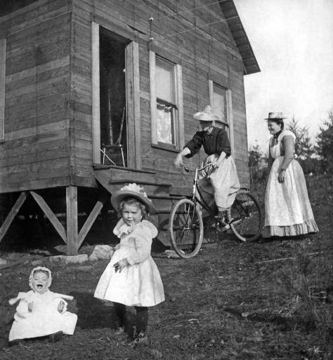


![Another by the California photographer McDonald taken during his brief stay in Seattle in the early 1890s. [Courtesy, Museum of History and Industry.]](https://i0.wp.com/pauldorpat.com/wp-content/uploads/2016/11/clip-cascade-cap-hill-fm-d-hill-ca91-web.jpg?ssl=1)


-mr-THEN")


![The Harrah's make it to their Silver Anniversary two years into the Great Depression. [Click-Cllick to enlarge for reading!]](https://i0.wp.com/pauldorpat.com/wp-content/uploads/2016/11/x-s-t-aug-24-1931-illus-fet-ure-on-harrah-bros-new-quareters-web.jpg?ssl=1)


![THEN: From boxcars and rooftops to the planks of Railroad Avenue, excitement builds for the ceremonial re-enactment of the S.S.Portland’s 1897 landing with its “ton of gold” on the Seattle waterfront, the city’s first Golden Potlatch Celebration. [Courtesy, Michael Maslan]](https://i0.wp.com/pauldorpat.com/wp-content/uploads/2015/07/potlatch-watch-above-railroad-ave-now-mr.jpg?resize=474%2C365&ssl=1)


![THEN: The Gothic University of Washington Campus in 1946 beginning a seven-year crowding with prefabricated dormitories beside Frosh Pond. In the immediate background [on the right] is Guggenheim Hall. (Courtesy, Ron Edge)](https://i0.wp.com/pauldorpat.com/wp-content/uploads/2013/12/frosh-pond-housing-1946-then-mr1.jpg?resize=474%2C365&ssl=1)


![[Somewhere in Florida, we think]](https://i0.wp.com/pauldorpat.com/wp-content/uploads/2016/08/14-art-painting-over-pianoskew-lr-copy.jpg?ssl=1)

![[Something it seems created with the help of an early copy machine.]](https://i0.wp.com/pauldorpat.com/wp-content/uploads/2016/08/arts-collage-from-early-photocopy-machine-web.jpg?ssl=1)


![Art glass made from broken pieces given to an impoverished glass class student by students endowed with glass. The result resembles a jig saw puzzle.]](https://i0.wp.com/pauldorpat.com/wp-content/uploads/2016/08/broken-glass-class-web.jpg?ssl=1)


![[Protest on Eastlake Avemie. ca. 1978.]](https://i0.wp.com/pauldorpat.com/wp-content/uploads/2016/08/eastlake-coppertone-tan-web.jpg?ssl=1)
![A popular prof and subject, Edmund Meany - of the hall, hotel and publication of Washington place names.]](https://i0.wp.com/pauldorpat.com/wp-content/uploads/2016/08/ed-meany-w-portrait-artist-web.jpg?ssl=1)


![[A classic velvet]](https://i0.wp.com/pauldorpat.com/wp-content/uploads/2016/08/fsart-no-18-web.jpg?ssl=1)


 =====
=====


![From The Seattle Times for December 27, 1925. [CLICK-CLICK to ENLARGE]](https://i0.wp.com/pauldorpat.com/wp-content/uploads/2016/07/st-12-27-25-bagley-60th-anniv-web.jpg?ssl=1)


![FK-Elliott-&-Prospect-pl.-N.E.-[lk-no.]-B-2612-Aug-13-40-web](https://i0.wp.com/pauldorpat.com/wp-content/uploads/2016/07/fk-elliott-prospect-pl-n-e-lk-no-b-2612-aug-13-40-web.jpg?ssl=1)


![FK-ELLIOTT-Ave.-[near-Roy,-Prospectd]-2-12-1940-web](https://i0.wp.com/pauldorpat.com/wp-content/uploads/2016/07/fk-elliott-ave-near-roy-prospectd-2-12-1940-web.jpg?ssl=1)


![THEN: Looking north-northeast from a low knoll at the southwest corner of Seneca Street and Seventh Avenue, circa 1916. By 1925, a commercial automobile garage filled the vacant lot in the foreground. [Courtesy, Ron Edge]](https://i0.wp.com/pauldorpat.com/wp-content/uploads/2014/11/seneca-7th-mr-then.jpg?resize=474%2C353&ssl=1)


![A detail from the featured photo showing the surviving warehouses at the end of Yesler's dock (or wharf). [Courtesy, Ron Edge]](https://i0.wp.com/pauldorpat.com/wp-content/uploads/2016/05/x-detl-fm-peterson-yesler-dock-fire-pix-web.jpg?ssl=1)


![FK-W.-Spokane-St.-lk-e-fm-near-26th--[Pigeon-Point]-R-176-Oct-1936-WEB](https://i0.wp.com/pauldorpat.com/wp-content/uploads/2016/04/fk-w-spokane-st-lk-e-fm-near-26th-pigeon-point-r-176-oct-1936-web.jpg?ssl=1)

![FK---37th-SW-&-W-Oregon-SW-P-1)-[most-likely-lk-sw-on-Fauntleroy-Way-SW]-R-262-1939-WEB](https://i0.wp.com/pauldorpat.com/wp-content/uploads/2016/04/fk-37th-sw-w-oregon-sw-p-1-most-likely-lk-sw-on-fauntleroy-way-sw-r-262-1939-web.jpg?ssl=1)


![In our featured bay part of Woodrow Wilson's Wooden Fleet of unused WW1 vessels parked in the fresh water of Lake Union. [Courtesy, MOHAI]](https://i0.wp.com/pauldorpat.com/wp-content/uploads/2016/04/woodrow-wilsons-wood-fleet-lake-union-83-10-385-web.jpg?ssl=1)


mr-THEN")


![Photography from on high on March 20, 1949, this aerial shows our featured bay on the right and much else. [Courtesy, Ron Edge]](https://i0.wp.com/pauldorpat.com/wp-content/uploads/2016/04/hi-aerial-n-lake-union-03-20-49-mr-web.jpg?ssl=1)


![AYP-House-Upside-Down---[12_28_2003]](https://i0.wp.com/pauldorpat.com/wp-content/uploads/2016/02/ayp-house-upside-down-12_28_2003.jpg?ssl=1)


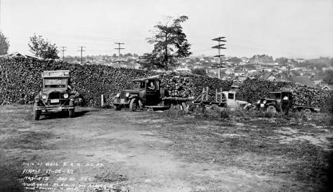


![Second north through Columbia during a Golden Potlatch Celebration parade, 1911. [Courtesy Michael Maslan]](https://i0.wp.com/pauldorpat.com/wp-content/uploads/2015/12/2nd-n-thru-columbia-potlatch-horses-web.jpg?ssl=1)


![An aerial from December 18, 1926 with the ceramic dam near the bottom, the reservoir above it, and Cedar Lake beyond. Rattlesnake Lake is out-of-frame, lower-left. [Courtesy, Municipal Archive]](https://i0.wp.com/pauldorpat.com/wp-content/uploads/2015/11/cedar-lake-12-18-1926-web.jpg?ssl=1)


![THEN: The Gothic University of Washington Campus in 1946 beginning a seven-year crowding with prefabricated dormitories beside Frosh Pond. In the immediate background [on the right] is Guggenheim Hall. (Courtesy, Ron Edge)](https://i0.wp.com/pauldorpat.com/wp-content/uploads/2013/12/frosh-pond-housing-1946-then-mr1.jpg?resize=474%2C365)

![Planking on the temporary bridge with the 1919 University Bridge to the right. The photo was taken (I believe) from the Van de Kamp Bakery building at the northeast corner of 10th Avenue and NE. 40th Street. (See below) [Courtesy, Seattle Municipal Archives]](https://i0.wp.com/pauldorpat.com/wp-content/uploads/2015/11/university-bridge-bldg-temp-bridge-fm-no-end-lk-so-muni-neg-web.jpg?ssl=1)

![Traffic detoured to the temporary bridge - seen from the south end on May 26, 1932. [Courtesy, Municipal Archive]](https://i0.wp.com/pauldorpat.com/wp-content/uploads/2015/11/university-bridge-traffic-turned-to-temp-bridge-5-26-32-web3.jpg?ssl=1)

![September 9, 1932, paving the new approaches. The Bekins storage is on the right, and the Van de Kamp windmill on the left. [Courtesy, Municipal Archives]](https://i0.wp.com/pauldorpat.com/wp-content/uploads/2015/11/clip-van-university-bridge-9-29-1932-paving-new-concrete-bridge-approaches.jpg?ssl=1)
![The Van de Kamp Bakery windmill watches over the laying tracks to and from NE 40th Street at the north end of the new bridge on March 9, 1933. [Courtesy, Municipal Archive]](https://i0.wp.com/pauldorpat.com/wp-content/uploads/2015/11/clip-van-de-kamp-ubrdg-web1.jpg?ssl=1)


![Pilot-photographer Laidlaw's Arpil 17, 1933 aerial of the completed approaches to the University Bridge, with the temporary bridge still in place to this (east) side of it. The photo is dated April 19, 1933, two weeks following the new 6-lane bridge's dedication. [Courtesy, MUSEUM of HISTORY and INDUSTRY aka MOHAI]](https://i0.wp.com/pauldorpat.com/wp-content/uploads/2015/11/a-laidlaw-aerial-april-17-1933-lk-w-over-u-bridge-web.jpg?ssl=1)
![A detail from the April 1933 aerial showing the north end of the newly widened and supported bridge with the future Applied Physics Laboratory at the bottom and part of the Van de Kamp windmill beside it, to the right. [Courtesy, MOHAI]](https://i0.wp.com/pauldorpat.com/wp-content/uploads/2015/11/a-rons-u-bridge-aerial-n-end-detail-1933-web.jpg?ssl=1)


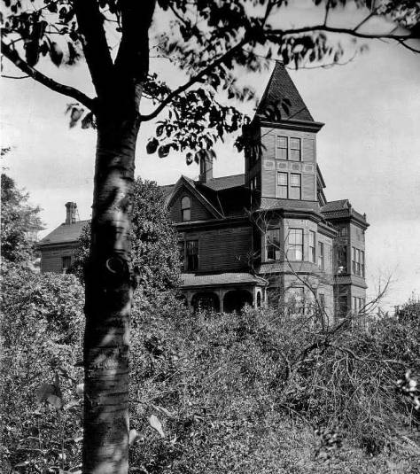


![Looking north across Mill Street (Yesler Way) from the frame box that once housed Kellog's drug store on the main floor and, for a few months, the Sammis photography studio upstairs. [Courtesy, Lawton Gowey]](https://i0.wp.com/pauldorpat.com/wp-content/uploads/2015/10/front-st-lk-n-over-yesler-ca-1887-web.jpg?ssl=1)


![A local news clip from the Dispatch for Oct. 28, 1878. [Courtesy, Ron Edge Newspaper Collection]](https://i0.wp.com/pauldorpat.com/wp-content/uploads/2015/10/x-clip-mills-clip-10-28-78-web.jpg?ssl=1)
![The opposite direction, looking south on Front through its intersection with Cherry Street, with the front facade of the box-shaped two story commercial building holding the Kellog Drug store centered on the south side of Mill Street (Yesler Way). Note that the scrawl on the mud of Front Street just above the worn foot crossing on Cherry, dates this scene 1878. [Courtesy, Seattle Public Library]](https://i0.wp.com/pauldorpat.com/wp-content/uploads/2015/10/kellog-front-st-s-fm-bwixt-columbia-cherry-74-web.jpg?ssl=1)


![Another of the several panoramas McDonald made in Seattle during his stay here in the early 1890s. [Courtesy, Museum of History and Industry aka MOHAI]](https://i0.wp.com/pauldorpat.com/wp-content/uploads/2015/10/mcdonald-denny-hlll-to-capitol-hill.jpg?ssl=1)


![LAKE UNION from Capitol Hill with the still familiar curves of Eastlake laid here for trolley tracks to Brooklyn, now better known at the University District. Fremont is the established clutter between the two first on the far shore. Queen Anne Hill is on the left. [Courtesy, Dennis Andersen]](https://i0.wp.com/pauldorpat.com/wp-content/uploads/2015/10/x-lake-unon-fm-cap-hill-ca-1890-web.jpg?ssl=1)


![Full-page coverage of the Grunbaum Bros. new home in the Decatur Building, May 28, 1922. {CLICK CLICK CLICK to Enlarge]](https://i0.wp.com/pauldorpat.com/wp-content/uploads/2015/09/x-st-may-28-1922-grunbaum-bros-move-to-new-home-web.jpg?ssl=1)


![The AYP expo grounds on the U.W. campus seen across Portage Bay. The captured balloon appears far right. [Courtesy Monica Wooton]](https://i0.wp.com/pauldorpat.com/wp-content/uploads/2015/09/x-ayp-pan-lking-ne-over-portage-bay-web.jpg?ssl=1)


![. . .and looking east on the upper part of N.E. 40th Street from Latona Ave. N.E., on Oct. 7, 2006. [I was a mere 68 at the time and so still nimble enough to walk for hours at a time.]](https://i0.wp.com/pauldorpat.com/wp-content/uploads/2015/09/x-40-ef-latona-upper-det-10_7_2006-web.jpg?ssl=1)


mr-THEN")


![A comparison of the 1929 and 1935 aerials, left and right, show the work in progress on the new bridge of Admiral Way over the Schmitz Park Boulevard in the 1936 detail on the right. The dark roof of the bath house appears in the upper-left corner of the 1936 half of t his diptych, which is printed along below. [Courtesy Ron Edge and the Seattle Municipal Archive.]](https://i0.wp.com/pauldorpat.com/wp-content/uploads/2015/09/1-aerials-1929-36-schmidt-pk-details-grab-web.jpg?ssl=1)

![The first SPUD home polished up from a 1937 King County tax photo. The home on the right and the treeline above it should look familiar. [Courtesy Washington State Archive]](https://i0.wp.com/pauldorpat.com/wp-content/uploads/2015/09/spud-alki-2666-spud-c1937-then-2-16-2003-web.jpg?ssl=1)


![Looking through the Schmitz Park arch south on Schmitz Park Boulevard (s.w. 59th ave.) from its corner with S.W. Lander Street. This was used by Jean and I in a feature about three years ago, and Ron Edge has included it below among this week's relevant links. [Courtesy, Museum of History and Industry]](https://i0.wp.com/pauldorpat.com/wp-content/uploads/2015/09/schmitz-park-arch-web.jpg?ssl=1)


![Dose's big home in his namesake addition appears here on the far left of the illustrations running below the feature's header. It dates from August 3, 1913. [Please CLICK CLICK]](https://i0.wp.com/pauldorpat.com/wp-content/uploads/2015/08/xxxx-st-aug-3-1913-dose-mansion-grab-web.jpg?ssl=1)


![It should look familiar. Western Avenue, and the Pike Street pedestrian crossing, 1975. [Photo by Frank Shaw]](https://i0.wp.com/pauldorpat.com/wp-content/uploads/2015/07/fs-western-back-of-pike-mrkt-1975-web.jpg?ssl=1)


![Looking south to a tideflats lined with rows of pilings placed speculatively as property lines in the hopes that the first state legislature would look upon them such squatters and jumpers markings as keys to owning the land below the tides. Second Avenue - now Occidental - is right-of-center. Much of the neighborhood is well along with the construction of brick business blocks, but a neighborhood cluster of temporary tents endures too. [Courtesy MOHAI]](https://i0.wp.com/pauldorpat.com/wp-content/uploads/2015/07/tideflat-post-fire-fm-near-2n-james-web.jpg?ssl=1)


![THEN: From boxcars and rooftops to the planks of Railroad Avenue, excitement builds for the ceremonial re-enactment of the S.S.Portland’s 1897 landing with its “ton of gold” on the Seattle waterfront, the city’s first Golden Potlatch Celebration. [Courtesy, Michael Maslan]](https://i0.wp.com/pauldorpat.com/wp-content/uploads/2015/07/potlatch-watch-above-railroad-ave-now-mr.jpg?ssl=1)
![NOW: From boxcars and rooftops to the planks of Railroad Avenue, excitement builds for the ceremonial re-enactment of the S.S.Portland’s 1897 landing with its “ton of gold” on the Seattle waterfront, the city’s first Golden Potlatch Celebration. [Courtesy, Michael Maslan]](https://i0.wp.com/pauldorpat.com/wp-content/uploads/2015/07/golden-potlatch-now.jpg?ssl=1)


![Mid-20's chorus line - or posing players - at one Seattle's busiest vaudeville stage. [Courtesy, MOHAI]](https://i0.wp.com/pauldorpat.com/wp-content/uploads/2015/03/palace-hip-girls-ca-1924-web.jpg?ssl=1)


![[Courtesy, Carol Gaffner]](https://i0.wp.com/pauldorpat.com/wp-content/uploads/2015/03/gn-us-post-vans-gnrr-depot-web.jpg?ssl=1)


![The Stetson-Post and the Empire Bldg made a background for Uncle Sam appearing also in the 1911 Potlatch parade. [Courtesy Michael Maslan]](https://i0.wp.com/pauldorpat.com/wp-content/uploads/2015/02/potlatch-parade-1911-uncle-sam-clown-stetson-empire-bldgsweb.jpg?ssl=1)


![A helpful detail from the 1912 Baist Real Estate Map - even without the street names. The bigger red dot marks the northeast corner of Boren and Jefferson, the site of the Gardner home, and the small dot rests beside the footprint for the Haller mansion at the northeast corner of Minor and James. [courtesy, Ron Edge]](https://i0.wp.com/pauldorpat.com/wp-content/uploads/2015/02/terrys-2nd-addition-block-97-lots-8-grab-web3.jpg?ssl=1)


![[Please note that the number 24 in the header refers to the chapter number in the book from which this was scanned, Seattle Now and Then, Volume Two, first published in 1987 - if memory serves.]](https://i0.wp.com/pauldorpat.com/wp-content/uploads/2015/02/campbell-home-text-part-one-web.jpg?ssl=1)


