THEN: Signs reading “MARINE MUSEUM” and “OPEN” beckon visitors to the St. Paul, berthed just east of the Ballard (Hiram M. Chittenden) Locks in the mid-1930s. This image appears on an exceedingly rare postcard recently acquired by photo historian Ron Edge. When under sail, the vessel’s fully rigged acre of canvas was supported by nearly 15 miles of cordage. (Ron Edge collection)NOW: Pictured in early March from the same rooftop vantage, atop a building now housing the Chittenden Locks’ administrative offices, the docks below are now home to the U.S. Army Corps of Engineers debris recovery vessel, the MV Puget. Local institutions that showcase the subjects of the former St. Paul include the Puget Sound Maritime Historical Society, pugetmaritime.org, and HistoryLink.org. (Jean Sherrard)
(Published in The Seattle Times online on April 7, 2022
and in PacificNW Magazine of the print Times on April 10, 2022)
A 1930s Seattle maritime museum was both fleeting and floating
By Jean Sherrard
For local maritime historians, there once was a Camelot. During a brief stretch in the mid-1930s, the sailing ship St. Paul served as Seattle’s first and only floating nautical museum, ideally situated on the freshwater side of the Ballard Locks.
Built in Bath, Maine, in 1874, the 228–foot-long vessel with a soaring 150-foot main mast was reasonably swift for its size. The St. Paul crossed the Atlantic in just 16 days and sailed between San Francisco and New York, rounding Chile’s Cape Horn, in a brisk 103 days.
After hauling cargo between Britain, America and the Far East for nearly three decades, the elegant square-rigged craft (identified by Bremerton maritime historian Michael Mjelde as a “down easter”) was consigned to service between Alaskan canneries and Seattle until its banishment to Lake Union in 1924 with other relics and obsolete tall ships destined for the scrap heap.
Only the timely intervention of a local band of fervent maritime and marine enthusiasts saved the St. Paul from demolition.
Founded in 1928, the Puget Sound Academy of Science dedicated itself to “the diffusion of scientific knowledge by means of … publications, expeditions and exhibits.” The brainchild of Henry Landes, dean of the University of Washington College of Science and husband of Seattle’s first female mayor, Bertha K. Landes, the academy also was the beneficiary of Arthur Foss, co-owner of Foss Launch and Tugboat Company.
A collector and history buff, Foss had purchased the St. Paul and offered it to the academy for use as a floating exhibit. Enlisting naturalist (and future peace activist) Floyd Schmoe as president, the group proposed a “marine museum,” merging maritime history and marine biology.
Schmoe’s promotional booklet asserted that the restored St. Paul would serve as the museum’s “chief exhibit. … Nothing will be placed on her deck or in her cabins which was not there when she was still in service.” Below the main deck would be “ample room for … exhibits of primitive and historical boats … and the story of man’s development of the ship.” Another lower deck would include a “salt-water aquarium (with) marine life from the waters and shores of Puget Sound.”
The Marine Museum and Aquarium opened June 16, 1934, welcoming thousands of visitors to its Ballard berth (admission: one dime) for the next two years. But the museum’s shining moment faded all too soon.
The wooden-hulled St. Paul fell victim to Northwest rain and a dearth of regular maintenance. In 1942, at age 68, the deteriorating vessel was towed to Vancouver Island’s Oyster Bay to be scuttled as a breakwater.
WEB EXTRA
For our narrated, audio-visual 360-degree version of this column, please click on through.
(Published in The Seattle Times online on March 24, 2022
and in PacificNW Magazine of the print Times on March 27, 2022)
Distortion, half-truths, outright lies – our second April Fools’ quiz
By Jean Sherrard
(click to enlarge photos)
Yoshino cherry trees on the Quad at the UW in full bloom (Jean Sherrard)
As cherry trees blossom, we at Now & Then extend the welcome mat for our second annual April Fools’ Day quiz. We trust this exercise in historical whimsy will entertain and challenge in equal measure.
Please note that each question has a single correct answer. All other choices are larded with distortion, half-truths and outright lies!
THEN1: The Blob, photographed in 1986, squatting on the northwest corner of First Avenue North and Roy Street, literally stopped traffic during its construction. (CARY TOLMAN, MUSEUM OF HISTORY & INDUSTRY, SEATTLE POST-INTELLIGENCER COLLECTION)
Question 1
A BLOB BY ANY OTHER NAME Originally Clyde’s Cleaners, built in 1946 to serve lower Queen Anne Hill, the building was refashioned in 1984 into the ferroconcrete mound popularly known as The Blob. Detested and beloved in equal measure, the structure was demolished in 1997. What was The Blob’s original purpose?
A: Microsoft co-founder Paul Allen’s nascent first draft of MoPOP (his Museum of Popular Culture), also colloquially known as The Blob.
B: The bulbous Moorish fort/Spanish villa themes were the brainchild of developer Anthony Dadvar, who intended to house a Mediterranean/Mexican restaurant, the Isla del Sol.
C: The last Queen Anne communal dwelling of the Love Family, a New Age religious group founded in the late 1960s.
D: An early and failed attempt at architectural 3D printing, engineered by noted inventor John Williams.
E: A movie set constructed for Ridley Scott’s megahit “Aliens” (1986), never used in actual filming.
THEN2: Masked men and women pose in downtown Seattle on Third near Washington in late October 1918. (Paul Dorpat Collection)
Question 2
WHO WAS THAT MASKED MAN? In early fall 1918, the misnamed “Spanish” flu raged throughout the Northwest. On Oct. 6, city health commissioner Dr. J.S. McBride and Mayor Ole Hanson ordered the closure of schools, churches and theaters to combat infection (you know the drill). On Oct. 28, they added a mandatory mask order. Seattleites largely obeyed, until tearing off and twirling their masks to celebrate what notable event?
A: Armistice Day, Nov. 11, 1918.
B: Santa’s arrival by reindeer-drawn sled in Pioneer Square on Nov. 30, 1918.
C: The conclusion of the five-day Seattle General Strike on Feb. 11, 1919.
D: The return of the 63rd Coast Artillery from World War I on March 12, 1919.
E: The mask order was never suspended.
THEN3: The ferry Elwha prepares to blow its whistle departing from Colman Dock in about 1970. A newly built and still lonely SeaFirst Tower stands sentinel at center. (Frank Shaw, Paul Dorpat Collection)
Question 3:
ALL YOU HAVE TO DO IS WHISTLE Vessels of the Black Ball Line, from which today’s Washington State Ferries are directly descended, signaled arrivals and departures with whistle blasts. To this day, each captain and vessel employs signature toots. Which is the standard whistle sequence used by Seattle ferries?
A: A single melancholy blast.
B: Three medium-long honks, translating “S” for Seattle into Morse Code.
C: One long and two short toots, known by maritime afficionados as “a warp and two woofs.”
D: All signal patterns are at the captain’s discretion, reflecting the skipper’s mood.
E: Short, repeat blasts, used solely as small-craft warnings during a pea-soup fog.
NOW: Looking west across Second Avenue, the triangular “Sinking Ship” garage illustrates the 30-degree angle between Yesler and James streets that divides the grid of downtown streets. (Jean Sherrard)
Question 4 (see “Now” photo):
THIRTY DEGREES OF SEPARATION Many readers will be familiar with the popular mnemonic: “Jesus Christ Made Seattle Under Protest,” muttered under locals’ breaths to recall the sequence of downtown streets. Yet all bets are off at Pioneer Square, where, north from Yesler, every street veers 30 degrees to the northwest, resulting in an odd tangle of angles. How did this come about?
A: The Seattle Fault runs directly under Yesler. In 1854, an earthquake caused massive seismic displacement, forever altering the shape of the young city.
B: South of Yesler, soggy tideland marshes made accurate mapping impossible.
C: Yesler was the clergy-mandated northern boundary of Seattle’s original red-light district. Its angled streets, pontificated Rev. David Blaine in 1855, supplied “ample warning of a turn to sin.”
D: Unresolved land-plat disputes between early white settlers David “Doc” Maynard, Arthur Denny and Carson Boren resulted in colliding street grids.
E: Fake news. Cartographers and geographers are complicit in promoting this fictional twist. Actual Seattle streets run straight as an arrow.
Answers
1:B
2:A
3:C
4: D
The rubric
One correct answer:
You’re a Mercer Mess.
Two correct answers:
You tore down the Viaduct!
Three correct answers:
You’re a Pike Pundit.
Four correct answers:
You’ve attained Seattle Chill.
THEN 1: Perched atop the roof of the Seattle Fish Company warehouse on then-Pier 8, Anders Wilse captures a southwest view of Seattle’s late 1890s waterfront. Schwabacher’s Wharf was eventually renamed Pier 58 in 1944, reconstructed as Waterfront Park in 1974, and collapsed into Elliott Bay in September 2020. A reimagined Waterfront Park is to open on new pilings in 2024. (courtesy MOHAI)NOW: The same view from Pier 59, now home to the Seattle Aquarium. Diamond Ice’s wooden buildings were replaced in 1912 by a concrete structure, now a Public Storage facility. Keen eyes might spot a top slice of the remaining Hotel Vendome, directly above the facility’s fire escape. (Jean Sherrard)
(Published in The Seattle Times online on March 10, 2022
and in PacificNW Magazine of the print Times on March 13, 2022)
Home was where photographer Anders Wilse’s heart ended up – after beating a successful path to Seattle
By Jean Sherrard
“You can’t go home again” was a sentiment my great-grandfather would have echoed. Ole Andreas Ringseth (“Daddy Andrew” to his extended family) was part of the Norwegian diaspora between 1860 and 1910, emigrating in 1902 from tiny Liabygda on Norway’s west coast to Tacoma, never to return.
One of his enterprising countrymen, 19-year-old Anders Beer Wilse had arrived in Minneapolis 18 years earlier. As a civil engineer with the ever-expanding railroads, he soon rolled to the Pacific Northwest.
THEN 2: A studio portrait of Anders Beer Wilse, taken soon after his 1890 arrival in Seattle.
Uniquely, Wilse began documenting his surveying and cartography with photography, at which he became increasingly skilled. In 1897, he quit his day job and opened a photo studio in Seattle, fortuitously just as Gold Rush fever infected the city. Over the next three years, he captured the booming city and its environs.
Wilse’s portrait of Seattle’s Colman Dock during the Yukon Gold Rush.
In our evocative “Then” photo, snapped from a wharf at the foot of Pike Street on a sunny afternoon, a half-dozen pedestrians belie an increasingly active waterfront. At least five train tracks run along Railroad Avenue in front of Schwabacher’s Wharf, where the USS Portland, bearing a ton of Yukon gold, docked in July 1897.
Diamond Ice and Storage, founded in 1893, advertised its product as “The Best Ice — No Core in It,” available for home delivery.
The Hotel Diller, still standing today at the southeast corner of First and University, can be seen behind the crisply whitewashed ice-plant smokestack, across the street from its northern neighbor, the Hotel Vendome. On the skyline, past an oddly tall waterfront light standard, the King County Courthouse tower peeps out.
Wilse’s Seattle Photographic Company soon became profitable, hiring three assistants, including Ira Webster and Nelson Stevens, founders of the renowned Webster and Stevens photographic studio.
In spring 1900, Wilse sent his young family back to Norway for what was intended to be a short visit. By summer’s end, however, his wife, Helen, sent word that she had no interest in returning to Seattle. With no small regret, Wilse left his adopted country — and camera equipment — behind, opening a second photography studio in Oslo in 1901. But Helen’s instincts proved sound.
On the verge of regaining independence from Sweden in 1905, Norway provided an ideal subject for a talented photographer. Wilse dedicated himself to documenting its emerging cultural identity, recording more than 200,000 photographs until his death in 1949.
THEN 3: Norway’s 500 kroner banknote, featuring Wilse’s photograph of a 1901 rescue lifeboat, the RS 14 Stavanger.
Today, his iconic images adorn Norwegian postage stamps and currency. Late in life, he expressed what might be a photographer’s credo: “I sought to capture for eternity the beauty of Norway’s landscape … something I believe can be of meaning to our descendants.”
WEB EXTRAS
For our 360 video portrait of the waterfront, featuring Wilse’s original photo and Jean’s narration, go here.
For more on the remarkable life of Anders Wilse, click through to Carolyn Marr’s 1994 essay for Columbia Magazine. Scroll down for illuminating and fascinating details of this gifted photographer’s life.
And thanks to Michael Mjelde for pointing out the identity of the vessel in our late 1890s “then” photo – the steamship Rosalee:
THEN: This northeast-facing 1912 image features 11 horse-drawn and three motor vehicles arranged with their drivers along two sides of Troy Laundry at the northeast corner of Nob Hill and Republican Streets. Drivers, who collected cash receipts, were occasional victims of hold-ups, as reported in the daily papers. Their pay averaged twice that of the “mangle girls.” (Courtesy Ron Edge)NOW: The 19-year-old Seattle Laundry company parks two of its trucks outside the gates of Memorial Stadium. From left, drivers Bonny Teran, Catalina Lopez, with founders Chris and his father Ed Tudor. Their pickup and delivery laundry customers, says Chris, are largely busy, two-income families with children. (Jean Sherrard)
(Published in The Seattle Times online on Feb. 24, 2022
and in PacificNW Magazine of the print Times on Feb. 27, 2022)
We can’t mangle women’s role in popular, early-day laundries
By Jean Sherrard
I’d never encountered mangles and yeggs until researching this week’s column, but both made an appearance at Troy Laundry, subject of our 1912 “Then” photo.
The mangle was a commercial version of my grandmother’s hand-cranked wringer, mounted in her Renton basement atop an antique washing machine, just below shelves of mason jars filled with applesauce and preserves. The wooden rollers, cracked and worn from decades of use, appeared in at least one child’s nightmares as instruments of torture.
At commercial laundries across the country, skilled mangle operators, mostly young women, were in demand. In 1912, they worked 48 hours a week for $9 pay (about $250 today).
In the first three decades of the 20th century, commercial laundries boomed. One of many, the Troy Laundry, on the northeast corner of Nob Hill and Republican — now within the footprint of Seattle Center’s Memorial Stadium bleachers — eased the drudgery of washing, drying and ironing clothes for Seattle families.
In her book, “Never Done: A History of American Housework,” historian Susan Strasser writes that doing laundry was women’s “most hated task” which they would “jettison … whenever they had any discretionary money at all.”
In 1909, laundries nationwide grossed more than $100 million, an average of $5.30 per American household. Notes Strasser, “Even the poorest people in urban slums sent out some of their wash.”
In coming decades, competition arrived with home washing machines and dryers. By the 1940s, these once-luxury appliances were standard in many households.
Troy Laundry moved from its lower Queen Anne digs (land originally platted by David and Louisa Denny) to Fairview Avenue in 1927, making room for a new Civic Field, Auditorium and Arena, planting seeds that eventually blossomed into today’s Seattle Center.
And, nope, I haven’t forgotten about the yeggs. Their name was most likely derived from John Yegg, alias of a late 19th-early 20th century bank robber. Stickup artists, dubbed Yegg-men, were tempted by easy targets, namely businesses with cash on hand.
On Oct. 9, 1926, as reported in The Seattle Times, one nefarious crew attempted to crack the Troy Laundry safe with nitroglycerin. Interrupted by a night watchman, the “thoughtless yeggs” aborted the effort, leaving an unstable “soup” behind. After consulting experts from the Diebold Safe and Lock Co., DuPont Chemicals, and the University of Washington chemistry department, police successfully defused the threat.
“Science triumphed,” the Times exulted. “Soon … (they) had the safe open, and the laundry girls, breathing sighs of relief, went to work with increased vigor.”
WEB EXTRAS
For our usual 360 degree exploration of the locale plus a reading of the column itself, mosey over in this direction.
THEN1: Fifty feet above the intersection of South Jackson Street and Alaskan Way on the viaduct’s top deck, amateur photographer Horace Sykes turned his camera toward a growing city. Cerulean blue skies augured an optimistic future. (Horace Sykes)THEN 2: A repeat of the same scene, featuring a serendipitously red car in place of the jacketed women. The Smith Tower is dwarfed by the 2017 skyline, featuring the nearly completed 660-foot F-5 Tower at center.NOW: Looking north from South Jackson Street and Alaskan Way on a rare sunny day in mid-December 2021, a viaduct-free waterfront bustles with construction amid the long process of rebuilding a divided city. (Jean Sherrard)
(Published in The Seattle Times online on Jan. 27, 2022
and in PacificNW Magazine of the print Times on Jan. 30, 2022)
Points of view less towering without divisive Alaskan Way Viaduct
By Jean Sherrard
No one on the waterfront misses the clatter and roar of cars and trucks overhead. But nearing the third anniversary of the closure of the Alaskan Way Viaduct, Seattle residents still confess to mixed emotions.
Kate Conger, state Department of Highways staffer, opined in 1953 that the elevated speedway offered “a breathtaking view of Elliott Bay, the Olympics … and of Seattle’s towering skyline.” The Seattle Post-Intelligencer joined with hosannahs, proclaiming it “a royal necklace across the bosom of the Queen City.”
Yet over the decades, equally antiphonal voices cried for demolition. Paul Dorpat, in his encyclopedic book “Building Washington,” mourned that the viaduct “stretched a permanent cataract over the eye of the city.”
Truth be told, the prized, if fleeting, million-dollar views, available to rich and poor commuters alike, came at a price: a permanent concrete edifice dividing the city from its waterfront.
The initial vision for the double-deck structure, opened to traffic on April 4, 1953, emerged in the cash-strapped 1930s, but not until after World War II — and an exponentially expanding car culture — were plans finalized for a capacious roadway skirting the increasingly busy downtown core.
In its time, the 7,600-foot-long viaduct was an engineering marvel. Its twin 40-foot-wide roadways, each with three traffic lanes, comprised the single largest use of reinforced concrete (58,847 cubic yards, bolstered by nearly 8,000 tons of steel) in Seattle public-works history.
More than a decade before Interstate 5 carved its wide swath through our hourglass-shaped city, the viaduct served as the main north-south corridor, providing relief for tens of thousands of daily commuters. Today’s State Route 99 toll tunnel, which replaced the viaduct, allows for no less traffic but deprives photographers of a favorite perch.
Case in point: on April 3, 1953, Horace Sykes, longtime Seattle Camera Club member, strolled the speedway, opened to pedestrians for a day of traffic-free exploration. From this perch, Sykes snapped two dozen Kodachrome photos, most notably of two unidentified women in vivid, red jackets below the majestic Smith Tower, then still the tallest building in the west.
Before the viaduct’s demolition, I returned to that location several times, attempting to replicate Sykes’ dramatic panorama from moon-roofed cars, most recently in 2017 for our book “Seattle Now & Then: The Historic Hundred.”
I captured the post-viaduct “Now” photo with my 22-foot extension pole at the same spot but 30 feet lower — further evidence of picturesque loss. Looking north at a tangled waterfront under seemingly endless construction reveals the immense work ahead as our city once more reinvents itself.
WEB EXTRAS
In addition to our usual 360 degree video, we encourage you to take one more tour of the Viaduct on its last day. Jean and Clay made a final commute on Friday, Feb. 1st.
THEN 3: During the official dedication of the new State Route 99 tunnel on Saturday, Feb. 2, 2019, Gov. Jay Inslee cuts a green ribbon to inaugurate the subterranean roadway. (Jean Sherrard)THEN 4: Tunnel movers and shakers pose on Feb. 2, 2019, beneath Jackson Street to celebrate before traffic arrives. From left: Tayloe Washburn, Charles Knutson, Bob Donegan, Emily Mannetti, Kimberly Farley, Jared Smith and Sally Bagshaw. (Jean Sherrard)
THEN 1: Taken from an upper story in a building owned by Daguerre, the first daguerreotype photo looks roughly south along the Boulevard du Temple into the Marais district of Paris. Abundant leaves on trees lining the boulevard suggest a summertime exposure. (LOUIS DAGUERRE)THEN 1: Taken from an upper story in a building owned by Daguerre, the first daguerreotype photo looks roughly south along the Boulevard du Temple into the Marais district of Paris. Abundant leaves on trees lining the boulevard suggest a summertime exposure. BÉRANGÈRE LOMONT)
(Published in The Seattle Times online on Jan. 13, 2022
and in PacificNW Magazine of the print Times on Jan. 16, 2022)
At 40, ‘Now & Then’ celebrates the dawn of photography
By Jean Sherrard
This Sunday, “Now & Then” blows out 40 candles, celebrating the nation’s (if not the world’s) longest-running column dedicated to repeat photography.
It began on Jan. 17, 1982, when founder Paul Dorpat published his first comparison, an exuberant parade along Fourth Avenue welcoming home World War I artillery soldiers in 1919.
After more than 2,000 columns and four decades, we think it’s apropos to express belated gratitude for a 184-year-old gift.
THEN 2: French photographer Bérangère Lomont aims her lens as “Now & Then” column founder Paul Dorpat looks on in central Paris in 2005. Together, they repeated photos of the City of Light snapped by Dorpat as a teenager in 1955. (JEAN SHERRARD)
The story begins in 1838, when artist and inventor Louis Daguerre positioned a boxy device in the window of his Paris studio to capture the dance of light and shadow on the busy street below. For at least four minutes, he exposed the plate and instantly achieved a fistful of firsts:
The first photo of a city.
The first portrayal of human beings in a cityscape.
The first shoeshine caught on camera.
At first glance, the Boulevard du Temple in central Paris seems curiously devoid of people, save for one gent standing relatively still and getting his shoes polished by a bootblack on the sidewalk. The many hundreds of passersby were assuredly moving too quickly to be snared by the long exposure.
The long row of four- and five-story buildings housed many well-attended theatres. Parisians nicknamed it the Boulevard du Crime after the immensely popular vice melodramas they presented.
Paris, however, was on the verge of one of the greatest transformations in its long history. In 1852, a nephew of Napoleon Buonaparte grandly proclaimed himself Emperor Napoleon III and envisioned a capitol suitable for a French empire.
The narrow, medieval streets and alleys, beloved by many Parisians, were to be widened and straightened. Entire neighborhoods would be leveled while parks, grand avenues, plazas and vast public-works projects would be added. Beginning in 1853 and for decades to come, the City of Light became a construction zone.
The Boulevard du Crime, along with most of its theatres, was demolished in 1862, to the dismay of dramatic audiences, replaced by the expanded plaza now known as Place de la Republique.
Today’s square is a popular gathering spot for Parisians young and old. It has hosted events from concerts to mass demonstrations. A bronze statue of Marianne, symbol of the French Republic, stands at its center, surrounded by figures representing Liberty, Equality and Fraternity.
Rights to Daguerre’s revolutionary invention, the daguerreotype process, were acquired by the French government in 1839 and offered unconditionally as a gift to humanity. Within months, daguerreotype cameras had spread throughout the world, recording images that we treasure — and, yes, repeat.
WEB EXTRAS
First, we offer boundless thanks to Berangere Lomont, whose friendship, generosity, and breathtaking photography have always provided inspiration and joy.
We also congratulate Paul Dorpat on the column he created 40 years ago. His remarkable contributions to our region’s history are unparalleled and will stand as monuments to his boundless curiosity, passion and scholarship.
We include a few photos of Paul exploring his beloved Paris in 2005 with photographers Berangere and Jean in tow. Also making an appearance is Paul’s dear pal Bill Burden, who joined us in Paris.
Let’s begin with a hilarious photo and video of Paul, meeting his twin in Paris:
Paul and his Paris twin, 2005Paul and Berangere on a bateau moucheMan with a cameraStatuesque Paul at the LouvreBerangere with husband DenisPaul and Bill Burden greet with a kissDenis, Paul and BillDinner chez BerangereAlarming cheesesDenis, Paul, MikeIn the LouvreIn dim Sainte Chapelle using Bill head as tripodBerangere snaps two old friendsNear Place des VosgesBerangere repeats photos…Last morning in Paris
[This essay is courtesy of Scott Wyatt, whose work is also featured today in a “Now & Then” Postscript that showcases his July 26, 1970, photos of Jimi Hendrix in concert at Sicks Stadium, the rock guitarist’s last Seattle show. Hendrix died less than two months later, on Sept. 18.]
By Scott Wyatt
I got my first 35mm camera in 1967 and fell in love with Henri Cartier-Bresson’s “decisive moment” street photography. I took my Nikkormat with me everywhere, including the Hendrix concert at Sicks Stadium in 1970. Not much later, I was studying Edward Weston’s work and other larger format photographers and ended up buying a Hasselblad (a larger, medium format camera). When Jenny and I joined the Peace Corps in 1973 and went to Iran, I packed the Hasselblad too.
Jenny and Scott Wyatt in Iran
Well, Iran is no Point Lobos, and photographing peppers was missing the incredible opportunity in front of me. Iran is a rugged country with beautiful people and some magnificent architecture. So, back to street photography for me …. with a slow, clumsy Hasselblad!
It turns out, I think, that the medium format was perfect for portraits of Iranians in their surroundings and their architecture.
The sidewalks of Iranian towns and cities (sometimes just a dirt extension of the roadway) were magical. So much life and interaction. The sidewalk community would have made Jane Jacobs smile ear to ear.
A typical street would have bread shops next to the shop making shoes and buckets from old rubber tires, next to a yogurt shop, next to a shop selling live turkeys, and on and on. Sidewalk sitters everywhere. Stop and have tea and chat.
Hot from the oven, best bread I ever tasted. Many of our dinners (countless) were composed of one of these flat breads and a large bowl of yogurt. In the photo was our favorite, Nan-E Barbari.
Here is a different kind of “street” photographer. He would open and close the “lens” with his hands (shutter). The “film” was a positive paper. Developed with chemicals under a blanket while-you-wait. All for 7 cents. Jenny and I still have the photo of us he took.
We took our first New Year’s vacation (Iranian New Year is the first day of spring) and traveled to Afghanistan for three weeks. Farsi is also the language in Afghanistan. We each had a small backpack. My cameras and film pretty much took up the whole pack.
We traveled by train, bus, and hitchhike. Our Iranian friends told us that we should go to Afghanistan to see what Iran was like 40 years ago (now 90 years ago). It was the trip of a lifetime: spectacular sights and amazing people. We almost died from food poisoning and came back with some nasty parasites. Worth it, I think.
I took this photo of money changers in Kandahar, a tough town even in 1973. Happy to get out alive.
The religious architecture in Iran is second to none. You can get religion just by being in one of these great mosques. Isfahan has some of the best, still standing architecture thanks to being less prone to earthquakes.
THEN: This southwest-facing photo most likely was taken Dec. 20, 1969. A local radio station, KOL-AM, set up a small broadcast stage near Santa’s chimney to entertain Christmas shoppers. The banner above the stage reads, “KOL and Craig wish you” and a peace symbol. We haven’t been able to identify Craig, but in front of the stage, a sign possibly left over from an earlier protest reads, “The truth Hurts.”NOW: The Joshua Green Building (1913) can be seen at upper left in both photos. Directly across the street, Century Square, an office/retail building, was erected in 1985, replacing the Bigelow Building (1905) and the Colonial Theater (1913). Our “Now” prospect is significantly higher than the “Then,” snapped from the fifth-floor balcony of the Fifth and Pine Building.
(Published in The Seattle Times online on Dec. 9, 2021
and in PacificNW Magazine of the print Times on Dec. 12, 2021)
In 1969 at Westlake, Santa sees when you’re protesting
By Jean Sherrard
On Santa’s watch, when you’re protesting, are you being “good for goodness’ sake”?
At four stories tall, the gargantuan Santa Claus sculpture that perched atop a brick chimney at Westlake Mall was oft proclaimed the largest in the world.
Commissioned in 1968 by John Gilmore of the Central Association of Seattle (now the Downtown Seattle Association), the jolly red giant waved an animated arm, puffed on a giant pipe and conversed with astonished children and their parents through hidden speakers. Young actors from Seattle’s Piccoli Theater, hidden behind one-way mirrors, provided Santa’s voice.
Jean and Wesley Stanley of Stanley Plastics Products Co. of Enumclaw designed and built the 30-foot-tall St. Nick, along with the 12-foot-high chimney. A steel armature covered with wire mesh. Fiberglass ensured structural stability.
Though divided into six pieces for transport, Santa’s journey from Enumclaw required wide-load permits along with a waiting crane to help hoist and assemble the 900-pound figure upon arrival.
But this version of Father Christmas was revised when he reappeared in 1969. A local PTA group lobbied the sponsoring Central Association to remove Santa’s jumbo pipe. Smoking was deemed inappropriate public behavior for the merry old elf, as per the U.S. surgeon general’s stance.
In addition, Earl Kelly, beloved Ballard High School drama teacher and founder of the Piccoli Theater, heard from church groups that actors who voiced Santa were “taking the Christ out of Christmas.” In response, Kelly advised his cast to moderate their expressions of pagan merriment (Ho ho ho?).
Childhood memories of Westlake Santa are a mixed bag. The massive, bearded, slightly bug-eyed face inspired delight and nightmares.
Westlake Mall has long served as Seattle’s unofficial town square, nestled between Pike and Pine Streets along Fourth Avenue. From the early 1960s to today, it has been a hub of protests, political events and community celebrations, often all at the same time.
The year of our “Then” photo, 1969, was marked by civil strife. More than half a million American troops were stationed in Vietnam. Although most Americans still approved of the war, huge demonstrations rocked the nation throughout the fall.
On Dec. 13, as reported in The Seattle Times, student protesters gathered beneath the colossal Kris Kringle to distribute leaflets to weekend Christmas shoppers while singing carols rewritten for the occasion. To the tune of “The First Noel,” anti-war carolers sang:
The Vietnam War
has lasted nine years
killing one million people
and brought many tears
The Westlake Santa was erected each December until 1976, after which he was decommissioned. An online researcher, however, traced the sculpture to North Pole, Alaska, 15 miles southeast of Fairbanks, which we trust is a place of peace.
WEB EXTRAS
To view the 360 degree video, narrated by Jean, please click right here.
Also, this coming Sunday at 2 P.M., join Jean for his 14th annual Rogue’s Christmas at Town Hall – with actors Kurt Beattie, Marianne Owen, and musical guests Pineola. Ken Workman, Duwamish elder and Chief Seattle descendant, will offer a Coast Salish welcome.
THEN: Taken from the hillside overlooking the estate in September 1921, this east-facing photo features 28-room Clise mansion at its center. Inspired by Dutch landscape, James Clise constructed a functional windmill along the winding Sammamish Slough. (Webster & Stevens, Courtesy Ron Edge)NOW1: An aerial view captured 100 years later displays colorful fall foliage. The windmill, partly hidden by leaves, stands above a deviated slough, glimpsed in the lower left corner. The city of Redmond peeks out below the Cascade mountains. (Jean Sherrard)NOW 2: The windmill remains a beloved Eastside landmark. The distant rear of Clise mansion can be seen to its left. (Jean Sherrard)NOW 3: The back of Clise mansion, with its Tudor-style gables, is framed by fir trees. (Jean Sherrard)NOW 4: The Sammamish Slough, connecting Lake Sammamish to Lake Washington, was lowered by nine feet in 1916 with the completion of the Ballard locks and ship canal. (Jean Sherrard)
(Published in The Seattle Times online on Nov. 25, 2021
and in PacificNW Magazine of the print Times on Nov. 28, 2021)
Model Willowmoor (later Marymoor) farm sparkled from the start
By Jean Sherrard
A crown jewel among King County parks, Marymoor Park has sparkled through several incarnations.
At the north end of Lake Sammamish, Marymoor’s 640 acres attract an estimated 3 million visitors a year, boasting sports facilities, performance venues and a 40-acre, off-leash dog park.
Our “Then” photo, taken a century ago, features a landscape carved from a verdant river valley first inhabited by the Duwamish Tribe for at least 6,000 years.
Wealthy banker and investor James W. Clise, who had arrived in Seattle one day after the great fire of June 6, 1889, was lured to the property by its abundant fish and game. In 1904, he built a hunting lodge on 78 acres along the Sammamish Slough and named the estate Willowmoor, after the trees flourishing near the water.
What began as summer retreat from city life, however, soon evolved into something more substantial. Within three years, Clise had embraced the role of a gentleman farmer. He added 350 acres, converted the lodge into a 28-room, Tudor-style mansion and proposed moving there with his family from their Queen Anne home.
In a 1961 Seattle Times interview, daughter Ruth Clise Colwell remembered her horror at the prospect: “It seemed to me that it would be like living at the end of the earth and that I would never see my friends again.”
Her fears soon eased when the estate became a bustling hive of activity. Her ambitious father imported “tough and wiry” Morgan horses from New England and filled the farm with hardy Ayrshire cattle imported from Scotland. Clise deemed the stock ideal for the Pacific Northwest’s similar climate. “Father’s great interest,” Colwell said, “was to improve the condition of the farm and better the life of the farmer.”
Willowmoor’s model dairy was considered years ahead of its time, and milk from the free-ranging cattle was roundly prized for a rich flavor and high cream content. Convinced of its health benefits, carmaker Henry Ford insisted on serving milk only from Clise cows at his hospital in Dearborn, Michigan. Visitors from around the world studied Clise’s innovative methods.
The showcase eventually expanded to 28 buildings and 40 employees. Clise traveled widely, particularly to agricultural countries, continually seeking to improve and expand upon his bold experiment.
In 1921, in failing health, Clise sold the farm. A later lessee, Walter Nettleton, changed its name to Marymoor to memorialize a daughter killed in a childhood accident. In 1963, King County voters funded Marymoor as a park. Ten years later, Clise mansion was added to the National Register of Historic Places.
THEN: In 1975, white-faced Artis the Spoonman spoon-feeds a crowd with his percussive legerdemain. He remembers several faces in the crowd, including the scowling woman at right, as regulars in “the commons.” The decrepit Corner Market Building in the background soon was restored. In the early 1990s, Artis was famously featured in Seattle-based Soundgarden’s breakout hit “Spoonman.” (Frank Shaw)NOW1: Accordion Cat, a performer in the Market for 13 years, treats passersby to a plaintive rendition of “Lucy in the Sky with Diamonds” where the Artis the Spoonman once played. Accordion Cat’s cat-head mask is worn not just for Halloween but all year round. (Jean Sherrard)NOW2: Jonny Hahn, a familiar Market presence who has played his piano on a Pike Place corner for 35 years, has a plea: Lower cell phones and hear the music. (Jean Sherrard)
(Published in The Seattle Times online on Oct. 28, 2021
and in PacificNW Magazine of the print Times on Oct. 31, 2021)
Buskers bolster the Market soundtrack, but for how long?
By Jean Sherrard
Some sights peel back your eyelids and jet right into the brain, never to be forgotten.
In my mid-teens, I acted in a 1973 production of “Hamlet” at the tiny Stage One Theater in Post Alley, just north of today’s Gum Wall. Post-rehearsal, as I climbed narrow concrete steps up to Pike Place Market, a busker dressed all in white and sporting a mime’s makeup danced and lunged through a cheering crowd.
Armed with a set of spoons, he battered them against every available surface — from his knees, teeth and cheeks to pillars, sidewalks and banisters — scooping rhythmic staccatos out of thin air. He was Artis the Spoonman, and I was spellbound.
“I’d been playing spoons since I was 10,” recalls Artis, now living in Port Townsend, “and always wanted to be a performer.” Moving to Seattle from Santa Cruz, he frequented Fremont taverns, playing jukebox duets for tips, and soon established a fanbase.
Next stop: Pike Place Market, not yet a tourist haven but a place where locals gathered to shop and stroll.
“Aside from street fairs, the Market was one of the only venues for buskers in the early 1970s,” Artis says. “We had a busking community, share and share alike, performing in the commons for the people.”
Pianist Jonny Hahn, originally from Champaign/Urbana, Illinois, still shares that sensibility. Busking since 1986, he embodies the Market’s soundtrack.
“I play a combination of lengthy improvisational instrumental pieces and songs with lefty political lyrics,” he says. “The Market has been my home because of the artistic freedom quotient.”
Wrestling his 64-key acoustic piano onto a Pike Place corner every day, he bears bittersweet witness to a particular strain of social evolution.
“It started with smartphones,” he says. “People’s attention spans were diminished by orders of magnitude. Constant texting and Googling and taking photos completely altered public space.”
Dealing a further blow was Covid. In March 2020, Market busking was prohibited. Hahn relocated, playing his piano beneath the old Green Lake Aqua Theater until the Market reopened to performers last June 25.
Public response to his return moved Hahn deeply: “It was just heart energy spilling over. People just kept saying how glad they were to have me back. The music was something they really, really missed.”
However, few other performers have returned to a place once considered a busker’s paradise. Will they come back? Hahn is wary of predictions.
“I don’t have any idea what will happen next month or next year,” he says, “but I am committed to the Pike Place Market.”
WEB EXTRAS
Click through to our 360 degree video, featuring Accordion Cat playing a soulful cover of “Lucy in the Sky with Diamonds.”
Plus a couple more photos of Artis the Spoonman in an earlier Market, along with 1983 video footage of Artis at the Winnipeg Folk Festival:
Another photo of Artis the Spoonman, taken on the same day in 1975. (Frank Shaw)Artis playing with longtime partner Jim Page in 1992.VIDEO (0:25): Click the photo to see Artis shredding the stage while Steve Goodman (right) looks on at the Winnipeg Folk Festival. This link is to the entire 57-minute “Festival of Friends” video from Twin Cities PBS, and you can find the Artis footage at time code 47:03-47:28.
THEN 1: Eagle Falls’ lower basin, to the right of our posing gent, provides a popular picnicking spot and local swimming hole. (University of Washington LIbraries, Special Collections)NOW 1: An aspiring student filmmaker captured in mid-air vaults across “Hell’s Gate,” avoiding a plunge into the glacier fed Skykomish River. Today’s gap has widened by several feet due to railroad blasting. (Jean Sherrard)THEN 2: Al Faussett tried to shoot Eagle Falls, but his cigar-shaped craft overturned halfway down. A single spectator can be seen at upper right, perched on a cliff across the river. (University of Washington LIbraries, Special Collections)NOW 2: Young videographers find their footing across a much-reduced Eagle Falls. Today’s falls might not challenge Evel Knievel, but its dangers are still significant. Icy currents and a treacherous undertow have produced many injuries and several fatalities over the years. (Jean Sherrard)
Eagle Falls near Index: ‘An easy jump, but hell if you don’t make it’
By Jean Sherrard
Lee Pickett was surely the most prolific photographer to grace Snohomish County. His 1910 move from Seattle to the tiny mountain town of Index provided Pickett with opportunities aplenty to document the burgeoning highways and railroads and the booming logging and mining industries.
In the 1920s, he was appointed official photographer of the Great Northern Railroad. His stunning images recorded construction of eight-mile Cascade Tunnel (1929) — then the longest in the western hemisphere — and quickly cemented his reputation.
His more whimsical portraits reveal Pickett’s playful side. This pair of “then” photos, snapped a decade apart, feature Eagle Falls along the Skykomish River, three miles east of Index.
The first, from 1916, features boulders at the falls’ base, a perennial picnic spot and swimming hole for locals. The gent in jacket and fedora poses stiffly while, across the bottom of the negative, Pickett has written, in the reverse script mastered by period photographers: “Hell’s Gate at Eagle Falls. An easy jump — but — hell if you don’t make it.”
In our “now” photo at the same location, the boulders have shifted position, their top halves seemingly lopped away. These changes are due not to erosion or earthquakes but to explosives intended to reduce steep grades for adjacent Great Northern track beds.
During a recent visit, a members of a videography class from Hillside Student Community watch as 15-year old Will Maltz, trained in the urban gymnastic sport of parkour, leaps the gap between boulders.
Our second “then” photo features the upturned canoe of local lumberjack (and Pickett regular) Al Faussett. In 1926, Fox Pictures offered $1,500 to anyone who would row through nearby Sunset Falls. Faussett built a sturdy craft to survive the ordeal, but Fox reneged on its offer.
Undaunted, the newly minted daredevil persisted, reveling in his growing celebrity, but cashing in proved elusive. On Sept. 6, 1926, hundreds of onlookers crowded the Eagle Falls banks to watch Faussett risk life and limb. Most declined to pay for the privilege, and the drama of his descent fizzled when his canoe stuck partway down the run. A friend soon dislodged it with a long pole.
Faussett spent the next three years shooting Northwest waterfalls, breaking bones and suffering repeated concussions until retiring on his waterlogged laurels.
The photographer Pickett (1882-1959) ended his career in the late 1940s, health ravaged by decades of exposure to developing chemicals. Today, his Index home houses the Index Historical Society’s Pickett Museum.
WEB EXTRAS
More videographer from Hillside pose near the ‘easy jump’Debris left behind by the railroad
And for a 360 degree video view of Eagle Falls, along with Jean’s narration, head in this direction.
In a late breaking addition, photo historian Ron Edge sends along the following Pickett portraits.
Al Faussett, with his original craft, the Skykomish Queen
Click twice on the following panoramas to zoom in and explore. To create these spectacular images, Pickett used the Cirkut camera manufactured by the Rochester Panoramic Camera Company. Thanks, Ron, for these remarkable photos of a vanished landscape.
A panoramic view of Scenic, Washington, just west of Stevens Pass – now the starting point for a hike to some spectacular alpine lakes.Pickett’s panoramic view of Tye (initially Wellington), Washington. After the completion of the tunnel in 1929, Tye was abandoned and now must be listed among our state’s ghost towns.
THEN: The nearly completed Clallam County Courthouse looms above the Lincoln Street ravine, whose elevated plank roadway provided temporary passage during the extensive regrading. Snow-topped Olympics suggest that this exposure is from late fall of 1914. The four-faced clock’s maker, E. Howard and Co., also supplied Seattle’s King Street Station Tower clock (1906). (Paul Dorpat collection)NOW: Today’s courthouse at 319 Lincoln St. continues to house county administrative departments, the county prosecutor and county permitting office as well as courtrooms in use today. The building was added to the National Register of Historic Places in 1987. On this late summer day, the Olympics are largely smothered in smoke. (Jean Sherrard)
(Published in The Seattle Times online on Sept. 16, 2021
and in PacificNW Magazine of the print Times on Sept. 19, 2021)
Tower lets Port Angeles hear a regular ring of promise
By Jean Sherrard
On a warm evening in mid-August, smoke from hundreds of British Columbian fires had crossed the Strait of Juan de Fuca, turning the sun an unsettling red over Port Angeles, where I’d paused for a photo and a bite to eat. Offering solace, the Clallam County courthouse bell tolled the hour as it had for over a century.
For Port Angeles, 1914 was a banner year, pregnant with promise. A gleaming hydroelectric dam had just been erected on the Elwha River, supplying the county seat’s electrical needs. The city’s first large sawmill was built on the waterfront and connected by rail to stands of virgin timber to the west. A vast regrade was well under way, raising the waterfront, filling gullies and lowering the steeper hills. And work on the new courthouse, featured in our “Then” photo, was largely complete.
Evidence of the area’s human habitation reaches back almost three millennia, with two Klallam villages sharing the harbor for at least 400 years. They called it I’e’nis (reportedly meaning “good beach”), which morphed into two names now in use: Ediz Hook (the city’s long and protective signature sand spit jutting east into the Strait) and snow-fed Ennis Creek, which empties into the bay.
Port Angeles’ natural, deep-water harbor was noted by Spanish explorer Francisco de Eliza in 1791 and dubbed Puerto de Nuestra Señora de los Ángeles (Port of Our Lady of the Angels). One year later, British Royal Navy Captain George Vancouver, a staunch Anglican, shortened the name to its current two words.
In the mid-1850s, the first permanent white settlers arrived, staking Donation Land Act claims near Native villages. Over succeeding decades, land speculators, shady political operators, a utopian colony and pulp and paper mill operations flourished while ejecting the Klallam from their ancestral homes.
Designed by early 20th century Seattle architect Francis W. Grant, the two-story neo-classical brick and terra cotta-trimmed courthouse was nothing if not aspirational. Built to replace a wooden structure destabilized by the regrade, its graceful, sturdy lines reflected bright boomtown hopes. Locals also appreciated its rock-bottom price of $64,000.
The four-faced clock/bell tower — today proudly featured on the Clallam County seal — was installed after a serendipitous discovery. Francis Grant unearthed an unclaimed, Boston-based E. Howard and Co. clock, manufactured in 1880 and shipped around Cape Horn to Seattle. It languished in storage for decades until the architect encouraged Clallam County to pick it up for a $5,115 song.
It continues to sing to this day, faithfully striking every half hour.
WEB EXTRAS
No 360 video this week due to the theft of my monopod on a beach near La Push. However, a few oceanside photos may help salve the loss.
THEN: In 1925, streetcar tracks gracefully inscribe brick-lined curves in the paved intersection before the renamed University National Bank, which anchors the northeast corner of 45th and University Way. (courtesy MOHAI)NOW: Michael Oaksmith, President of Development for Hunters Capital stands with the Beezer brothers’ creation across the street. The city-landmarked building has been lovingly remodeled, with a restoration of much of its early elegance. After 108 years as a bank, most recently a Wells Fargo branch, the structure is repurposed for shops and offices. (Jean Sherrard)
(Published in The Seattle Times online on Sept. 9, 2021
and in PacificNW Magazine of the print Times on Sept. 12, 2021)
Twin architects banked on a legacy of faith plus finance
By Jean Sherrard
Keen to serve both God and Mammon, Louis and Michael Beezer defied scriptural maxims to the contrary. Twins whose architectural firm produced edifices for faith and finance, they skillfully negotiated the two worlds.
Born on July 6, 1869, in Bellefont, Pennsylvania, the Beezers arrived in Seattle in 1907. Different from competing firms, they were hands-on designers, overseeing every step of the construction process.
In 1908, their vision for a new “mosquito fleet” terminal at Colman Dock, with its Italianate clock tower and dome, drew acclaim, Thereafter, the industrious pair enjoyed commissions from Alaska to California.
The Beezers were devout Roman Catholics whose extensive work for the Archdiocese of Seattle included the Immaculate Conception School (1909), Dominican Priory of the Blessed Sacrament (1909–25) and Edward J. O’Dea High School (1923). After the St. James Cathedral dome collapsed beneath a 1916 record snow, a trusted Louis Beezer helped rebuild the destroyed sanctuary while improving its abysmal acoustics.
Financial institutions provided bread to match the ecclesiastical butter. The Beezers’ neo-classic banks throughout the West include the focus of this week’s column.
Having relocated from downtown digs in 1895, the University of Washington was booming — in both enrollment and revenue. Its beleaguered comptroller regularly ferried cash and checks to central-city repositories, spending a half-day or more in weary commute.
Providing a sober solution was the University District’s first financial institution, Washington State Bank, founded in 1906 by professors, administrators and business leaders — and we do mean sober. By state law, the sale of alcohol was banned within two miles of campus.
By 1913, the bank, expanding with the university, commissioned the Beezers to erect a stately, two-story structure at 45th and University Way. It was such a calm, rural intersection that neighbors described choruses of frogs serenading from nearby ponds and swamps.
The establishment’s ground floor and basement offered opulence and security, while a lofty, second-floor ballroom and concert hall welcomed fraternity and community dances.
Our “Then” photo depicts a livelier U-District, packed with shops and businesses catering to students. A banner stretched across 45th Street publicizing a “University Legion Frolic” accurately dates the photo to 1925. In late September that year, the new American Legion Hall on the southwest corner of 10th Avenue and 50th Street hosted the affair, which promised dancing, “free vaudeville” and a “Young Woman’s Popularity Contest.”
We offer a fiery footnote: In 1976, the legion sold its hall to Randy Finley, who converted it to the Seven Gables Theater. Shuttered in 2017, the charming moviehouse burned down last Christmas Eve.
WEB EXTRAS
We visit 45th and University Way for a 360 degree video featuring the column. To watch, click here.
Mike Oaksmith and Noah Macia admire the downstairs vault of the University National Bank.The spacious second floor was once used as a ballroom.
THEN 1: Vessels representing several classes populate this postcard: (from left) the steamer Iroquois, the ferry Kalakala, the tug Goliah, a pair of mystery craft that stumped even our experts, the Coast Guard cutter Tallapoosa and the Army Corps of Engineers dredger Michie. Also note the painted-on (and super-sized) Mount Baker. This historical postcard is still quite popular on eBay. (Courtesy Ron Edge)THEN 2: Charles F. Laidlaw’s unretouched 1936 original bears a handful of docked ships: (from left) at Pier 6 (now Pier 57 with the Great Wheel), the British freighter M.S. Devon City; at Pier 3 (now Pier 54, home to Ivar’s), the Bureau of Indian Affairs cutter North Star; and at Pier 1 (now Ferry Piers 50-52), the freighter SS Susan V. Luckenbach. Mid-World War II, on May 1, 1944, the military renumbered all the piers. (Courtesy Ron Edge)NOW: This aerial photo was taken on Saturday, Feb. 27, 2021. The Washington State ferry arriving at Colman Dock is the genuine article. (Jean Sherrard)
(Published in The Seattle Times online on Aug. 19, 2021
and in PacificNW Magazine of the print Times on Aug. 22, 2021)
An aerial depiction of Seattle’s too-busy bay feels right for its time
By Jean Sherrard
The camera never lies, so goes the maxim. Yet photographers have stretched the truth on occasion, long before Photoshop made fakery a breeze.
Last Feb. 27, Clay Eals and I chartered a helicopter, the left door removed for photography. This week’s “Now” photo, from 800 feet above the waterfront, illustrates the potential for spectacle and perspective.
Seeing this elevated view, photo historian Ron Edge responded by sending me our serendipitous first “Then” photo — a shot I’d never seen. “Pretty close!” Ron marveled.
It was a prevalent postcard of a vibrant Elliott Bay, taken Sept. 15, 1936, by pilot/aerial photographer Charles F. Laidlaw, who apparently captured a miracle of near-misses. In it, various crisscrossing vessels provide visual bon-bons for today’s maritime historians.
Most recognizable at lower left is the beloved, streamlined ferry Kalakala, placed into service in 1935 and departing Colman Dock on the Bremerton run that she would make for 30 years. Above left, the night steamer Iroquois arrives from Victoria via Port Angeles. Puffing from Pier 3 (now Pier 54) is the sturdy oceangoing tug Goliah, built in 1882 and later converted from steam to diesel. Barreling south is the Coast Guard cutter Tallapoosa, fresh from fleet duties with the Bering Sea Patrol. At lower right, the Army Corps of Engineers dredger Michie heads due west.
Whew! Such a spectacular view of Seattle’s busy port.
Trouble is, it’s mostly fiction. Skillfully inserted, complete with brushed-in wakes and waves, none of these vessels (identified by veteran ship historians Michael Mjelke and Paul Marlow) were present in Laidlaw’s original photo, our second “Then.”
One explanation for the empty bay lies in the widening ripples of the Great Depression. Imports and exports had plummeted since the 1929 crash, threatening maritime commerce with ruin.
By the mid-1930s, widespread labor unrest sporadically shuttered ports along the West Coast. Under sympathetic President Franklin Roosevelt, unions flourished. William Randolph Hearst’s Seattle Post-Intelligencer even paused publication for the first time since its 1863 founding due to striking writers and editors.
What’s more, Puget Sound’s Mosquito Fleet, dozens of lively craft ferrying passengers and cargo bowed to grander but fewer vessels. “Suddenly, in the mid-(19)30s, people found that their Fleet was gone,” wrote marine historian Gordon Newell. “(Seeing) the quiet reaches of the Sound, they began to feel that something fine and exciting was missing.”
In that context, Laidlaw’s marine manipulations feel right for the time, a quiescent harbor being no subject for a popular postcard. With no end in sight to the Depression, maybe Seattle was ready for a boost, even one fabricated with a photographer’s fib.
WEB EXTRAS
In place of Jean Sherrard‘s usual 360-degree video of the “Now” prospect, below we have aerial video of downtown by Clay Eals.
Here is a two-and-a-half-minute video tour of downtown Seattle from the air on Feb. 27, 2021. Jean Sherrard takes stills while Clay Eals takes video.
(Published in the Seattle Times online on Aug. 5, 2021
and in PacificNW Magazine of the print Times on Aug. 8, 2021)
In wartime fear, ‘empathy is the only thing that can bind us’
By Jean Sherrard
This week we interview Frank Abe, author of the graphic novel ‘”We Hereby Refuse: Japanese American Resistance to Wartime Incarceration” (Chin Music Press and the Wing Luke Museum of the Asian Pacific American Experience, 2021), illustrated by Ross Ishikawa and Matt Sasaki, and co-authored by Tamiko Nimura.
This powerful account of courage and confrontation offers compelling lessons for us today.
THEN1: In Ishikawa’s illustration of departure from King Street Station, detained immigrant husbands and fathers clutch paper sacks they were given to replace their confiscated suitcases. At right are the outstretched arms of wives and children screaming their goodbyes in Japanese and English.NOW1: Seattle writer Frank Abe (left), also a documentarian and ex-KIRO reporter, stands beside illustrator Ross Ishikawa, cartoonist and animator, on the King Street Station platform. (Jean Sherrard)
Jean: When and where does this story begin?
Frank: It begins with the FBI arresting 150 immigrant leaders in Seattle in the hysteria following the start of World War II. The men were marched in the pre-dawn hours from the U.S. Immigration Detention Building to King Street Station, where The Seattle Times captured a photo of them on the platform boarding a train for the Department of Justice alien internment camp at Fort Missoula, Montana. When I first saw this photo, I knew it would be central to the story of Jim Akutsu, one of our three main characters.
THEN2: The Seattle Times photo of March 19, 1942, that inspired Abe and Ishikawa.
Jean: Why a graphic novel?
Frank: It matches the epic sweep of a movie at a fraction of the production cost. I asked Ross to draw Jim’s mother as clawing through the bars and screaming to her husband after reading the description in the Times of “tear-stained eyes” and the din of “staccato chatter” in the morning air.
Jean: Your book takes an uncompromising view of systemic exclusion and racism.
Frank: Many fathers were separated from their families, who were themselves incarcerated at camps like Minidoka, Idaho. Jim and his brother Gene refused to be drafted until the government restored their citizenship rights, starting with their freedom. We emphasize that the government was responsible for targeting these families based solely on their race.
A full page from ‘We Hereby Refuse’
Jean: The storytelling has a documentary feel to it but also feels intensely personal.
Frank: Everything is drawn from the historical record. Readers can immerse themselves in the personal stories of our characters in a way that generates empathy. Empathy is the only thing that can bind us when the same elements of wartime fear and ignorance of the “other” survive to this day.
Jean: So the empathy signals a warning bell along with possible remedy?
Frank: Our book opens with the FBI knocking on the door to arrest Jim’s father. It ends with ICE breaking down the door to deport unwanted immigrants. In 1941, America feared a second attack from the Pacific. Just one year ago, we had a pandemic-era president dog-whistle “China virus” and “Kung flu,” received by some as permission to kick and punch Asian Americans on the street. Some things haven’t changed.
WEB EXTRAS
This week features a special 360 degree video of Jean’s 12-minute interview with Frank Abe at King Street Station. Includes select illustrations from “We Hereby Refuse” plus Frank’s reading from the John Okada’s classic “No-No Boy.” Not to be missed. (And if you’d prefer to hear just the audio of Frank’s chat with Jean, click right here!)
Illustrator Ross Ishikawa and writer Frank Abe pose in the courtyard of King Street Station.
THEN1: Little did 16-year-old Dave DePartee, standing near the front of the centerfield stage, know that he would be snapping one of the few surviving photos of Jimi Hendrix’s final Seattle concert on July 26, 1970. Over Hendrix’s shoulder, apartments with a view into Sicks Stadium stand atop Tightwad Hill. At upper right, a corner of the stadium scoreboard advertises Chevron gas. Jimi’s orange-red outfit provides the sole splash of color on a gray day. (Courtesy Dave DePartee)THEN2: Erected in 1938 by Rainier Brewing Company owner Emil Sick for his Pacific Coast League baseball team the Seattle Rainiers, Sick’s (then Sicks’, then Sicks) Stadium stood between Rainier Avenue and today’s Martin Luther King Jr. Way. This view looks west from Tightwad Hill on June 15, 1938, when the Seattle Rainiers played their first home game in the new stadium. (Courtesy David Eskenazi)NOW: In a southeast section of Lowe’s Home Improvement on Rainier Avenue, Dave DePartee, playing air guitar with an axe, and local sports historian David Eskenazi pose near the original location of Hendrix’s stage. Eskenazi is also an artist and Hendrix fan. In 1980, while attending the University of Washington, his original pencil drawing was made into a poster by Tower Records to commemorate the 10th anniversary of Hendrix’s death. (Jean Sherrard)
(Published in the Seattle Times online on July 22, 2021
and in PacificNW Magazine of the print Times on July 25, 2021)
Jimi Hendrix makes his final home run at Sick’s Stadium
By Jean Sherrard
On Sunday, July 26, 1970, it was a typical outdoor Seattle scenario, rainy but right.
In our early teens, my friends and I hunkered on Tightwad Hill, the steep and legendary bluff across Empire Way (today’s Martin Luther King Jr. Way) from Sicks Stadium. Generations of baseball fans had preceded us there, finding catbird seats for minor-league games in Rainier Valley.
Today, however, rock was the draw. Two groups, Cactus and Cat Mother and the All Night Newsboys, opened the show. But we were there for the headliner — Seattle’s own Jimi Hendrix, playing his fourth-ever hometown concert.
Raised in the Central District, the throbbing heart of Seattle’s Black community, self-taught Hendrix had never learned to read music. Left-handed, he turned his guitar and the world upside-down. In just four years, he’d become a superstar, astounding audiences with revolutionary (sometimes incendiary) musicality. At 27, he was one of rock’s greatest instrumentalists, though the pressures of his meteoric rise were mounting.
Inside the post-Rainiers, Angels and Pilots ballpark, thousands of eager fans including today’s “Then” photographer, 16-year-old Dave DePartee, were watching from the muddy infield. This column’s founder, Paul Dorpat, then a concert promoter and underground newspaper publisher, stood backstage.
From Tightwad Hill, the stage was a postage stamp, but the loud rock pummeled us. Fans repeatedly tried to sneak over chain-link and wood-slat fences, painfully confronted by rent-a-cops spraying mace from catwalks. Barriers were breached only once, by a trio who lifted a fence and slid under to Tightwad huzzahs.
Just before Hendrix began, harder rains fell from a steel-wool sky. The mix of water and electric instruments was worrisome, but after rubber mats were installed, the show resumed.
And here’s where the narrative flips. Consider, if you will, an exhausted, moody Hendrix playing before a home audience, the backstage jammed with family, friends and obligations. What followed was a note of generosity echoing from Jimi’s youth.
On Sept. 1, 1957, Elvis Presley had played Sicks’ Stadium for an ecstatic crowd of 16,000. Short the buck-fifty admission, 14-year-old Hendrix watched the show perched atop — you guessed it — Tightwad Hill.
Thirteen years later, Hendrix instructed the stadium crew to throw gates open and let in hundreds of young cheapskates, including me, from the same bluff. Roaring approval, we scrambled down the incline and inside, thumbing our noses at the defanged rent-a-cops.
Tragically, this was Hendrix’s last concert in the continental United States. Less than two months later, on Sept. 18, he died in London of an accidental drug overdose. His sonic earthquake continues to shake and inspire to this day.
WEB EXTRAS
A handful of treats, including Jean’s 360-degree video accompanying this column, recorded on location at Lowe’s Home Improvement (not far from the stage in Sick’s centerfield). To see it, click right here.
Also, check out David Eskenazi’s artwork for the poster printed by Tower Records on the 10th anniversary of Hendrix’s death.
Tower Record sold many hundreds of these posters. Dave recounts that Jimi’s brother Leon and father Al Hendrix stopped by and added their own signatures at a signing eventA Seattle Times article about David’s poster scribed by rock critic Patrick MacDonaldMore original art by David EskenaziThere must be some kind of way outta here / Said the joker to the thief…
And if we ask nicely, Clay Eals may relate the story of his letter which appeared in Life magazine. (Happy birthday, Clay!)
= = = = =
Clay here on July 29: Thanks, Jean, and I apologize for posting this section a week later. My daughter’s six-day visit from Philly to celebrate my birth put a lot of stuff on hold, and I’m just catching up!
Indeed, as anyone who was around in fall 1970 can well remember, the overdose deaths of counterculture rock stars Jimi Hendrix and Janis Joplin hit hard and stirred a range of emotions. In particular, the essay below by Albert Goldman struck a chord, in part because it appeared in well-known and well-read Life magazine . (Click the image to enlarge it.)
Essay by Albert Goldman in the Oct. 16, 1970, edition of Life magazine.
On a whim, I decided to write a letter for Life to consider publishing. Imagine my delight to receive this hand-signed reply:
Oct. 26, 1970, letter from Life magazine’s A. Mate Scott to Clay Eals.
Imagine my further delight to receive this letter four days later:
Oct. 30, 1970, letter from “RFG” at Life magazine to Clay Eals.
Then came publication of the Nov. 6, 1970, edition of Life magazine itself. (The cover featured then-President Richard Nixon in youthful days, holding a violin.) My letter appeared at the top of page 21:
Letter by Clay Eals published in Nov. 6, 1970, edition of Life magazine.
Particularly in retrospect, my letter seems inartful. (Why did I use the word “thing”?) But I’m sure my 19-year-old self was trying to drill down to the emotions of the matter. I suspect the Life editors printed my missive because it had a more positive tone than a previous letter from someone else who slammed the Goldman essay.
Only two years later, Life magazine (which had started up in 1936) shut down. It rebounded in 1978 but shut down for good in 2000. This means that there are people in their mid-20s who have never seen a copy of Life magazine on a newsstand. In our short-attention-span society, surely many don’t even know what Life magazine was.
Much the pity. Large-format, photo-filled Life magazine was once a big deal, certainly a pace-setter. Where is today’s Life magazine? Probably in a zillion pieces spread out all over the internet.
Reminds me of a joke told from the stage by Paul Stookey of Peter, Paul & Mary. His arms spread wide, he said the most important magazine used to be Life. Narrowing his arms, he said the most important magazine became People. Narrowing his arms further, he said People had been supplanted by Us. And he predicted the future’s most important magazine would be — you guessed it — Me!
THEN1: From his lofty perch in the A-Y-P’s “captive balloon” (at least as high as the Space Needle’s 605 feet), photographer Vern Grinnold captured the central hub of the fair. Geyser Basin dominates at lower center. The UW’s Parrington Hall, built in 1902, can be seen at top, partly cropped above the U.S. Government building’s imposing dome. (courtesy MOHAI)THEN2: The “captive balloon” was tethered southeast of the main A-Y-P grounds. (courtesy Dan Kerlee)THEN3: The balloon’s basket provided tight quarters and certainly was not for the faint of heart. (courtesy Dan Kerlee)NOW: Squared off by dignified structures of academia, Drumheller Fountain today is a central feature of Rainier Vista, a long walkway of wide lawns and cherry trees. At top, just left of center, Parrington Hall still can be seen through greenery. (Jean Sherrard)
(Published in the Seattle Times online on May 27, 2021
and in PacificNW Magazine of the print Times on May 30, 2021 )
Up, up and away in our AYP Balloon
By Jean Sherrard
To mark this week’s return to the 1909 Alaska-Yukon-Pacific Exposition, held on the University of Washington campus, we must give credit where credit is due — to French ingenuity. From coq au vin to kitesurfing, movie cameras to motorcycles, France has perennially delighted the world with marriages of innovation.
The Montgolfier brothers, Joseph-Michel and Jacques-Etienne, had launched the first piloted aeronautical ascent in 1783 (to this day, hot air balloons in France are called montgolfières). Meanwhile, Louis Daguerre, creator of the daguerreotype photographic process, had captured the earliest cityscape portraits in 1838.
In 1858, an inspired Paris photographer, Gaspard-Félix Tournachon (known by the sobriquet “Nadar”), wedded the two technologies. Leveraging unwieldy equipment into a hot-air balloon basket, he singlehandedly invented aerial photography. Fifty-one years later, this came in handy at Seattle’s first world’s fair.
Our A-Y-P aerial, though not high-tech for its time, offered breathtaking spectacle, showing off the exposition’s Beaux Arts structures (merci again, France) that partially encircle Geyser Basin. Looking northwest, this view features the imposing, domed U.S. Government Building, while the ornate, curved structures on both sides of the basin focused on mining and agriculture.
The UW’s Drumheller Fountain (aka Frosh Pond, where first-year students once were dunked in ritual initiation) later was constructed on the watery footprint of the 1909 basin. But few other A-Y-P artifacts endured. Meant to be as ephemeral as a stage set or a wedding cake, the A-Y-P’s gleaming “white city” soon gave way to the more permanent and austere structures of Collegiate Gothic architecture.
A wider version of this panorama appeared Sept. 19, 1909, in The Seattle Times, filling the front page below a banner headline, “Remarkable View of Exposition Taken from Captive Balloon.” A subhead explained, “After Many Futile Attempts Camera Artists Succeed in Getting Fine Bird’s-Eye View of Exposition Grounds.”
At first, the weather had refused to cooperate, ruining hundreds of negatives. But finally, the Times reported, “the haze which has been hanging over the grounds for the last month lifted, and atmospheric conditions for aeronautical photographs were ideal.”
The balloon’s cramped basket accommodated no more than two photographers outfitted with bulky cameras (sans tripod) and must have supplied equal parts claustro- and acrophobia. Augmenting that anxious mix, “the great gas bag,” the Times said, “pulled heavily on the retaining wire and shifted about in the wind.”
A single exposure turned out “particularly fine.” Snapped just 30 minutes before rains resumed, the photo was “as distinct as if it had been taken from the ground.” Despite the difficulties, proclaimed one photographer, “we are more than satisfied with the result.”
WEB EXTRAS
To see our 360 degree video featuring Geyser Basin/Drumheller Fountain — and hear Jean narrate the column, click right here.
THEN1: On March 2, 1949, the Naval Reserve Armory anchors Lake Union. The USS Puffer, a legendary submarine, peeks out from its slip. Further north, the Seattle Gas Company’s gas plant puffs out smoke. Interstate 5 is a mere gleam in a planner’s eye. (courtesy Ron Edge)NOW1: On the morning of Feb. 27, MOHAI holds pride of place in B. Marcus Priteca’s reinforced concrete masterpiece. Next door, the Center for Wooden Boats stands where destroyers once berthed. On Lake Union’s north side, Gas Works has become one of Seattle’s favorite parks. (Jean Sherrard)THEN2: On its Sept. 29, 2012, opening day in the remodeled Armory, MOHAI sparkles. (Jean Sherrard)NOW2: Recently re-opened as pandemic prohibitions ease, the museum welcomes cautious but eager visitors. The Grand Atrium features Boeing’s original B-1 float plane, the Lincoln Toe Truck and the original neon Rainier Beer “R” that once shone at Exit 163 of Interstate 5. (Jean Sherrard)NOW3: Jasper Stewart impatiently waits his turn at the MOHAI periscope while brother Tristan scans for enemy vessels. At right, sister Kathryn absorbs waterborne history in the McCurdy Family Maritime Gallery. (Jean Sherrard)
(Published in the Seattle Times online on May 13, 2021
and in PacificNW Magazine of the print Times on May 16, 2021 )
To salute childhood memories of MOHAI, we go high
By Jean Sherrard
French novelist Marcel Proust famously described dunking madeleines — scallop-shaped cookies — in lime blossom tea, opening a sensory gateway to the lost world of childhood.
Our 69-year-old regional treasure, the Museum of History and Industry (MOHAI, pronounced by locals as if inversely greeting one of the Three Stooges) also evokes such transport.
To jog my memory, I recently posted a question on social media: “What do you recall from school field trips to MOHAI?”
The result: hundreds of citations from adults once bused as students to MOHAI’s original Montlake building. The top 10:
The fully furnished Victorian dollhouse.
The 10-by-24-foot painted mural of the Great Seattle Fire.
The actual glue pot that sparked the fire.
The hydroplanes (specifically Slo-Mo-Shun IV).
The diorama depicting the Denny Party’s arrival and Duwamish welcome at Alki.
The stuffed gorilla Bobo, formerly of Woodland Park Zoo (and an Anacortes home).
The 43-foot-long working periscope.
Suspended by wires, Boeing’s unique B-1 wooden float plane, built in 1919.
The original Rainier Beer neon “R.”
Carved figureheads from wooden ships.
Honorable mentions included a 5-inch deck gun from the USS Colorado, a J.P. Patches exhibit and ex-President Warren G. Harding’s pajamas.
Pulling back from the intimacy of memory to vertiginous spectacle, our twin aerial photographs —separated by 72 years — afford us a north-facing, bird’s-eye view of present-day MOHAI and its surroundings.
Our 1949 “Then” image, from photo historian Ron Edge, features MOHAI’s current home, the Naval Reserve Armory on Lake Union’s south shore. Designed by Seattle architects William R. Grant and B. Marcus Priteca (best known for his majestic Art Deco movie palaces),* the Armory was dedicated on July 4, 1942, during the uncertain months following the U.S. entry into World War II.
Post-war, its campus aided recruiting, training and mustering. Sometimes it served as a community dance hall. Docked in its slips might be decommissioned minesweepers, destroyers and the occasional submarine — significantly the USS Puffer, survivor of a record 38 hours of depth-charging and a perennial tour magnet until 1960, when it was sold for scrap.
MOHAI moved to the former Armory in 2012 after its original Montlake building, which opened in 1952, was shuttered to accommodate the expanding State Route 520 floating bridge.
In our aerial repeat, snapped from 1,200 feet, the museum is blooming in morning light just north of booming South Lake Union. Amid MOHAI’s imaginative redesign and relocation, many of its beloved treasures remain in rotation, fostering continued recollections for Seattleites young and old.
To revisit (and maybe add) your own MOHAI memories, join us at PaulDorpat.com.
WEB EXTRAS
To see our spectacular 360 degree video of this week’s column, click here. It includes the now and then photos as well as video of our extraordinary aerial adventure (shot by Clay). Jean narrates.
*A gentle correction from friend of the column historian Larry Kreisman: “I have to correct your mention of Priteca’s movie palace architecture because, apart from the Hollywood Pantages, his theater designs are primarily Greco-Roman classical (Coliseum and most of his work for Pantages) or Renaissance Revival (Orpheum). The Admiral and others he did in the 30s and 40s we’re streamline moderne and we’re neighborhood movie houses, not palaces.”
THEN: In May 1957, Henry “Scoop” Jackson, our state’s junior U.S. senator, receives a polio vaccine from Nurse Maria Schneider in Washington, D.C.. Observing is Dr. J. Morrison Brady, director of medical services for the National Polio Foundation. (Russ Holt, courtesy University of Washington Special Collections)NOW: In March of this year, Ken Workman is inoculated against COVID-19 by volunteer pharmacist Dr. Dana Hurley at Katterman’s Sand Point Pharmacy. His face mask bears the portrait of his ancestor, Chief Seattle. A life-sized Dr. Anthony Fauci cutout seems to approve. (Jean Sherrard)
(Published in the Seattle Times online on April 29, 2021
and in PacificNW Magazine of the print Times on May 2, 2021 )
Visualizing our victories over virus to ring out a new celebration
By Jean Sherrard
Born last summer at the height of the pandemic, my younger brother’s 9-month-old twins, Talia and Gavin, have not yet acquired what psychologist Jean Piaget termed “object permanence.” Bright toys supplied by distanced aunts and uncles are quickly forgotten — out of sight, out of mind.
Twins Gavin and Talia
Similarly, when the terrors of infectious disease recede in the rearview mirror, the collective memory may not serve. Even as countless lives have been saved, a sizeable plurality of humans worldwide remains vaccine-hesitant.
Lest we forget, it was on April 12, 1955, that church bells rang out across the nation, celebrating clinical trials proving that Jonas Salk’s poliomyelitis vaccine had defeated a scourge that had been deadly for decades.
In a front-page banner headline, The Seattle Times shouted, “Vaccine is effective, potent, safe.” Below, an article said vaccination would “smash polio’s terror and tragedies … [ending] the fear that has long gripped the hearts of parents.”
Only three years earlier, in 1952, U.S. polio had peaked. Nearly 58,000, mostly children, fell ill. Of those, polio had paralyzed 21,000 and killed 3,000. Most outbreaks took place in summer. Infections seemed random and unpredictable. A child playing with friends one afternoon might end up hospitalized by evening.
But vaccines ended polio in the Americas by 1992, largely eliminating it across the globe. It was not the only viral killer brought to heel. Smallpox, which killed more than 300 million in the 20th century, was eradicated. Inoculation vastly reduced measles, yellow fever and hepatitis.
Today, however, vaccines may fall victim to their historical success. Some who have not personally witnessed a viral catastrophe apparently deem it unreal.
Hilary Godwin, dean of the University of Washington School of Public Health, faults social media for amplifying misinformation. “We in the sciences and in public health,” she says, “need to regain the trust of the general population, in a bipartisan way.”
Godwin also addresses an understandable mistrust of the medical establishment in Black and Native American communities: “We must not only recognize historical injustices and inequities but also elevate the conversation to talk about them openly.”
Joining the conversation is Ken Workman, fourth-generation great-grandson of Chief Seattle and a Duwamish tribal elder, who received his first COVID-19 inoculation in March.
“I’m alive today because my family survived the genocide of welcoming Europeans,” he says. “We survived gifts of smallpox blankets. We survived gentrification and displacement. The world may be all up in arms over COVID, yet for me this is just another day.”
Between tides of uncertainty and hope, will we someday be able to ring out a new celebration?
WEB EXTRAS
Just another photo of Ken Workman, snaring the traditional post-jab lollipop.
Workman gets his lolly
A few weeks ago, on March 14, 2021, I met Ken down at Golden Gardens and shot a few photos of his traditional farewell extended to a Tlingit crew and canoe. The rainy weather did not dampen spirits.
THEN: This 1913 photo looks north to Pritchard Island. Three years later, Lake Washington was lowered nine feet, draining nearly 65 billion gallons of fresh water through the newly constructed Ship Canal to Puget Sound in a mere three months. Two men in a rowboat explore what is today dry land. (Courtesy Seattle Municipal Archives)NOW: Rainier Beach Action Coalition’s Clean Crew, (from left) Malcolm J Dunston, De’Shaun Valdry, Ryan Croone II, Jesiah Marks, King Nisby, and Tyree Abella, stands between the public restroom and untended blackberry brambles lining the shore. Signs designed by artist Mahogany Purpose Villars. After the lowering of the lake, Pritchard Island became a peninsula. (Jean Sherrard)
(Published in the Seattle Times online on April 22, 2021
and in PacificNW Magazine of the print Times on April 25, 2021 )
Beach magic bathes Link2Lake quest in diverse Rainier Beach
By Jean Sherrard
Tucked between a boat launch, an adjacent parking lot and a beige restroom with all the charm of a quartered Quonset hut, the scruffy Lake Washington shoreline of Be’er Sheva Park might seem an unlikely place to find magic. Neither woo-woo nor hocus pocus, it offers an unexpected alchemy of earth, water and sky, arranged like lips pursed for a kiss.
On a recent visit, I happened upon what looked like an impromptu block party. In this cherished gathering spot, Rainier Beach neighbors were listening to music, picnicking and admiring the returning geese and waterfowl.
This story, however, begins much earlier, with melting ice. More than 16,000 years ago, receding glaciers shaped the Pacific Northwest — and Rainier Beach — into its current greenscape.
The first humans to settle the area were Duwamish. Members of one tribal branch calling themselves the Lake People had wintered along the lake’s shores for millennia. European settlers arrived in the 1860s, evicting the Lake People from their ancestral homes while appropriating the land for themselves.
Annexed by Seattle in 1907, Rainier Beach today is among the city’s most racially and culturally diverse neighborhoods. Eighty percent of its residents are people of color, while, in their homes, 57% speak a language other than English. These historically underserved communities reside in one of only two Seattle neighborhoods (the other is the Duwamish River valley) without an extended public shoreline or a signature waterfront park.
“Nevertheless, our neglected little beach has always been a focal point for community-building,” says Shannon Waits, who co-chairs the steering committee of a group called Rainier Beach Link2Lake. The nonprofit’s plans for lakefront improvements are shovel-ready, pending final funding. “The neighborhood,” Waits says, “is determined to make beauty in this place despite systemic oppression.”
Buoyed by the slogan “Where’s the Beach,” Rainier Beach residents have eagerly contributed design ideas, suggesting basic improvements to the parcel’s infrastructure that most other Seattle waterfront parks take for granted.
“The community envisions a green waterfront that celebrates the pedestrian experience,” says George Lee, project manager, who enthusiastically tallies the envisioned upgrades. “We’ll add basic amenities like picnic tables, barbecue grills and a covered stage that doubles as a shelter. Add to that a boardwalk and lighted walkways, not to mention a big natural beach for families to play on.”
The abracadabra begins this summer with a mural painting project, enlisting young community artists to enliven the exterior walls of the plain-Jane restroom. For more information on the capital campaign, visit rainierbeachlinktolake.org.
WEB EXTRAS
A few more shots from the park.
The Clean Crew on the east side of the restroom, soon to be repainted with a community mural.Detail of sign designed by artist Mahogany Purpose Villars.The lone bramble-strewn path to the water.
(Published in the Seattle Times online on March 28, 2021
and in PacificNW Magazine of the print Times on March 25, 2021 )
Then you see it, now you don’t — our first April Fool’s quiz
By Jean Sherrard
(For those visiting this blog following The Seattle Times link, we offer extra tomfoolery! Perhaps you’ve discovered the editing error in the print edition of the magazine. If so, add a fourth category to our grading rubric: consider yerself a Queen City Queen/King!)
We at “Now & Then” admit that we can be lured into April folly any old day of the year. While fishing the currents of popular history, we occasionally pull in old boots and dogfish. This year, we extend the opportunity to our dear readers to troll along.
Our “Then” photo, looking north at Seattle’s downtown business district, is a revelation. Fearless photographer Frank H. Nowell arranged for an early ride up to the unfinished (and unwalled) 35th-floor observation deck of the famed, pointed Smith Tower. In 1913, one year before the tower opened, Nowell captured this early panorama from the loftiest human-made structure on the West Coast.
Following in his footsteps 108 years later, I repeated the panorama (“Now 1”) and made several telling discoveries — of alteration, misinformation and exaggeration — ideal for an April Fool’s multiple-choice challenge in which we peel back a layer or two of the Smith Tower’s terra-cotta clad onion.
(click to enlarge photos)
THEN: This 1913 view is from the Smith Tower’s unfinished 35th-floor observation deck. (Frank Nowell)NOW 1: This “Goldilocks” view (not too high or too low — just right!) from the Smith Tower’s 35th-floor observation deck has lured generations of photographers. (Jean Sherrard)
Question 1
GONE BUT NOT FORGOTTEN
In our primary pair of photos, several decades of growth have obscured the northern prospect. Which of the following can still be seen?
A: The Central Building
B: Queen Anne High School
C: Lake Union
D: The Rainier Club
E: St. James Cathedral
NOW 2: These views looking north along the Second Avenue canyon were taken in 2018 and 2021. In the earlier photo (left), the Needle’s saucer is scaffolded for renovation. (Jean Sherrard)
Question 2
NEEDLE IN A HAYSTACK
Our second pair of photos reveals a more recent switcheroo. In a view north along the Second Avenue canyon, the Space Needle has seemingly disappeared. Where has it gone?
A: Magician David Copperfield followed up his Statue of Liberty vanishing act.
B: The Space Needle was returned to the box it came in.
C: Yet another condominium joined the fray.
D: Amazon created a new pop-up Seattle headquarters.
E: Regraded Denny Hill re-emerged to assume its rightful place.
NOW3: Text of a plaque installed at the Smith Tower’s entrance in 1989 is not entirely accurate. It reads: “Seattle’s first skyscraper opened on July 4, 1914. The 42-story Smith Tower was the tallest building outside of New York City and Seattle’s tallest for nearly fifty years. It was built by Lyman Smith of Smith-Corona and Smith & Wesson fame, from Syracuse, New York. Sheathed entirely in terra cotta, the building was designed by the Syracuse firm of Gaggin & Gaggin. In a race to construct Seattle’s tallest building, Smith also hoped to anchor the “Second Avenue Canyon” area as the center of downtown. He died before the tower was completed.” (Jean Sherrard)
Question 3
FISH TALES
At the Smith Tower’s front entrance, a brass plaque has misinformed passersby since 1989. Which of the following statements are not true:
A: Lyman Cornelius Smith was from Syracuse, New York.
B: The Smith Tower is 42 stories tall.
C: Smith was a founding partner of Smith & Wesson.
D: L.C. accumulated much of his wealth manufacturing typewriters.
E: In 1914, Smith Tower was the tallest building outside of New York City.
(scroll down for the correct answers and a grading rubric)
(keep going)
(a bit further)
(Burma Shave!)
Answers
1: A, D and E
2: C
3: B (even a generous observer counts no more than 38 stories)
C (Horace Smith founded Smith & Wesson) and
E (at 495 feet, Cincinnati’s Union Central Tower was 30 feet taller).
The Rubric
One correct answer: You’re a Mercer Mess
Two correct answers: You’re a Pike Pundit
Three correct answers: You’ve attained Seattle Chill
WEB EXTRAS
For a spectacular 360 degree view from Smith Tower’s 35th floor Observation Deck (along with Jean’s dulcet narration), click on through.
THEN1: A gaggle of storefronts anchors this view, facing east, of the busy northeast corner of Second and Yesler in 1908. The businesses are (from left) Babcock’s Café and Grill, Alexander Gandolfo’s grocery featuring butter, Bartell’s Owl Drug Store (open day and night!), Nessim Alhadeff’s Palace Market, later Palace Fish and Oyster (likely an Alhadeff stands in the shop’s meat-arched entry), and Joe Dizard’s cigar store. All but the café moved to nearby locations after being demolished. (Courtesy, MOHAI 1983.10.7669.3)THEN2: (From left) George H. Bartell, Sr. (1868-1956) founded the nation’s oldest family owned drugstore until its sale to Rite-Aid last October. L.C. Smith died at the age of 60 four years before his namesake building was completed. Nessim Alhadeff (1864-1950) was patriarch to another Northwest business and racetrack dynasty, besides helping to establish the largest community of Sephardic Jews outside New York City. Future maritime restauranteur Ivar Haglund (1905-1985), in the lap of father Johan, purchased the Smith Tower for $1.8 million in 1976, famously adorning it with a fish windsock. (Courtesy, Paul Dorpat, Public Domain, and Ivar’s)NOW: L.C. Smith’s namesake building (1914) claims a dubious 42 stories on a bronze plaque besides its entrance, although the most generous observer would count 38. Originally tarred as ungainly (“a giraffe”, sniffed one critic), steel-framed and clad in white terra cotta, it stands today as a beloved Seattle landmark. (Jean Sherrard)
(Published in the Seattle Times online on March 11, 2021
and in PacificNW Magazine of the print Times on March 14, 2021 )
Commercial visionaries meet for a towering talk in 1909
By Jean Sherrard
The place: inside Bartell’s Owl Drugstore on Second Avenue, just north of Yesler Way. The milieu: a lovely evening. This vignette is imagined, but the historical details are factual!
The proprietor arranges a display in his shop window. The entry bell jingles. In walks a well-dressed customer.
Smith: George Bartell, isn’t it?
Bartell: Lyman Cornelius Smith, as I live and breathe. Let me guess. You’re here for the Alaska-Yukon-Pacific Exposition?
Smith: Indeed. All the way from Syracuse in upstate New York, and well worth the trip. Seattle has surely proven her mettle with this magnificent world’s fair.
Bartell: So what can I do you for, L.C.? Liver pills, trusses? Our new Syrup of Hypophosphates is a fine picker-upper.
Smith: I have news, George. I’ll be turning 60 next year. I’m no Carnegie, but I’ve done all right.
Bartell: Can’t hardly go wrong manufacturing shotguns and typewriters, L.C.
Smith: Truth is, I’m inclined to erect something special right here on this spot. Make my mark.
Bartell: Mighty kind of you to give me notice personally.
Smith: You’ve been here, what, 10 years?
Bartell: Eleven. After my year in the Yukon in ’98.
Smith: Didn’t “pan out,” eh? (He chuckles.) I was thinking 18 stories tall, but my son Burns wants to go higher.
Bartell: Just opened my fourth drug store, L.C. I say go big or go home.
Smith: Which is why I asked my architects — the Gaggins brothers — to up the ante. How’s 42 stories sound?
Bartell whistles appreciatively.
Smith: Tallest building west of the Mississippi. Steel-framed, white terra cotta, my initials carved on every floor.
The bell jingles again. In walks a man in a butcher’s apron. He offers a package.
Man: Two pounds of nice fresh cod for you, George. Just what the doctor ordered.
Bartell: L.C., this is Nessim Alhadeff. Runs the Palace Market next door.
Alhadeff: Sold Mr. Smith oysters a few years back when I first signed the lease. Are rumors true? You will tickle the sky?
Smith(with a laugh): Scrape the clouds, Nessim. And how’s family life?
Alhadeff: My brothers are here working for me now — all from the Isle of Rhodes. My English is still not so good, but getting better.
Yet again, the bell jingles. In walk a man and boy of 4 or 5.
Man: Got anything for an upset tummy? My boy ate too much cotton candy at the fair.
Bartell: Seltzer, maybe?
Man: Say “Thank you,” Ivar.
WEB EXTRAS
For our 360 degree video in living color (and dramatic black and white), narrated by Jean, please click on through here.
THEN: The Third Church of Christ, Scientist, at the southeast corner of Northeast 50th Street and 17th Avenue Northeast, stands just prior to its 1922 completion. An early member described the nearly $100,000 building as “majestic and yet pure and simple, as is Christian Science itself.” Architect George Foote Dunham also designed Fourth Church (today’s Town Hall). Stained glass in both structures was created by the Povey Brothers of Portland. (courtesy, Third Church of Christ, Scientist)NOW: Standing before the former Third Church, historian Cindy Safronoff holds a copy of her book, “Dedication: Building the Seattle Branches of Mary Baker Eddy’s Church.” The structure complements the adjoining Greek Row neighborhood, extending several blocks north of the University of Washington. (Jean Sherrard)
(Published in the Seattle Times online on Feb. 25, 2021
and in PacificNW Magazine of the print Times on Feb. 28, 2021 )
There’s nothing metaphysical about the fate of this once sacred space
By Jean Sherrard
Those with an ecclesiastical bent — or, thanks to Pete Seeger and the Byrds, a rock ’n’ roll penchant — know that for everything there is a season.
These structures understand it viscerally: Seattle’s Town Hall, the Rainier Arts Center in Columbia City and two each called “The Sanctuary,” an event venue in West Seattle’s Admiral District and a luxury townhome complex on Capitol Hill. Designed without overtly religious symbols, these repurposed community gems were built as in the early 20th century by Christian Scientists.
Founded by Boston-based Mary Baker Eddy (1821-1910), the Christian Science movement emerged in 1879 with a mere 26 followers. Eddy’s metaphysical teachings ignited the fastest growing religion of its time, eventually garnering nearly 270,000 members. Burgeoning congregations enthusiastically erected mostly Classical Revival style churches nationwide, including Seattle.
“With the appearance of the edifice for First Church (on Capitol Hill in 1906), Christian Science became more visible on the city skyline,” recounts church historian Cindy Peyser Safronoff, in her 2020 book “Dedication: Building the Seattle Branches of Mary Baker Eddy’s Church.”
Naturally, local mainline denominations grew wary of the competition. The Rev. Mark A. Matthews, influential pastor of Seattle’s 10,000-strong First Presbyterian Church, lobbed an early slam, labeling Eddy’s teachings “blasphemous, immoral, licentious and murderous.” Despite denunciations, however, Christian Science growth and construction flourished across the city.
Within a hundred years of its founding, Christian Science joined many other churches in turn-turn-turning to a fallow period. Dwindling congregations scarcely could afford upkeep of their “sacred spaces” while land values soared.
Case in point: the former Third Church of Christ, Scientist, shown in this week’s “Then” photo. Designed by Portland architect George Foote Dunham and completed in 1922, it was sold in 2006, the congregation trusting that the new owner – celebrity-attracting megachurch Churchome (then City Church) – would keep the structure intact.
But it is up for sale again, this time with a recently granted demolition permit, raising preservationists’ ire. “Replacing this elegant contributor to the historic Olmsted boulevard would be criminal,” says Larry Kreisman, former Historic Seattle program director. “It’s a perfect candidate for adaptive reuse as a lecture and concert hall or as a community center.”
More such spaces soon may be lost. Churches and other institutions in similar straits, suggests Kreisman, should partner with preservation organizations. “The solution,” he says purposefully, “is creative thinking, brainstorming and a willingness to explore alternative paths.”
Because there’s also a season for preservation.
WEB EXTRAS
Our narrated 360 video will arrive tomorrow! In the meantime, enjoy these interiors, courtesy of Larry Kreisman.
THEN2: The spacious well-lit interior of the Third Church was also designed with acoustics in mind. (Larry Kreisman)THEN3: The stained-glass windows in Christian Science churches contain few overtly religious symbols. These were fabricated by the Povey Brothers, whose work also adorns Town Hall. (Larry Kreisman)Stained glass detail. (Larry Kreisman)THEN4: Early Third Church historian Eileen Gormley noted the windows’ “beautifully shaded and mottled effect in amber and opal.” (Larry Kreisman)
THEN: In 1938, one of 10 trainee gardeners waters large hybrid Florist Cyclamen in the Cyclamen House (now the Seasonal Display House) at the Conservatory. Historian Brent McKee has scanned thousands of photos documenting and celebrating the history of the New Deal. Many more can be found on his blog at NDDaily.Blogspot.com and at LivingNewDeal.org. (National Archives, Courtesy Brent McKee)NOW: Gardener Emily Allsop waters poinsettias in the Conservatory’s Seasonal Display House. The future looks bright, says Friends of the Conservatory President Claire Wilburn. “We hope to reopen in 2021 and will seek to restore connection with all of Seattle’s varied communities.” (Lou Daprile)The Volunteer Park Conservatory on a rainy day this winter. (Jean Sherrard)
(To be published in the Seattle Times PacificNW Magazine on Feb. 14, 2021)
Grounded in work, hope continues to flower at Volunteer Park
By Jean Sherrard
In the hothouse of our civic life, voices and temperatures keep rising. Resonating for many today is President Ronald Reagan’s famous sentiment: “The nine most terrifying words in the English language are: ‘I’m from the government, and I’m here to help’ ”
However, the gardener watering orchids in our 1938 “Then” photo might have begged to differ.
That decade’s Great Depression, devastating the nation with a 25% unemployment rate, provided fertile ground for the landslide 1932 election victory of visionary new president, Franklin D. Roosevelt. His New Deal programs sparked a revolution, providing millions of federally subsidized jobs for desperate Americans through the Works Project Administration (WPA), the Civilian Conservation Corps (CCC) and other agencies.
“For Roosevelt,” says New Deal historian Brent McKee, “work relief was preferrable to cash relief. He believed that given the opportunity, most people would choose to work.”
As a result, the Pacific Northwest blossomed with sizeable infrastructure projects, from trails, roads and highways to dozens of schools, libraries, post offices and other public buildings. By itself, an acknowledged granddaddy of New Deal projects, the Grand Coulee Dam in Eastern Washington, ensured many thousands of construction jobs between 1933 and 1942.
But smaller efforts also eased joblessness. Innovative projects offered work to historians, artists and musicians, acknowledging their vital cultural contributions. And in 1938, with WPA sponsorship and a nod to the beauty and solace nurtured by nature, 10 unemployed women were hired by the Volunteer Park Conservatory on Capitol Hill as assistants to head gardener Jacob Umlauff.
“Among their jobs is the task of helping care for [10,000] orchids,” The Seattle Post-Intelligencer noted. The women were “light of touch and long of patience … very handy around such delicate plants.”
After four seasons of intensive training, the program offered each worker “a certificate as a Gardener, with a specialty in orchid culture.” Such a vocation could not have taken root in more fertile grounds.
Modeled after the 1851 Great Exhibition’s Crystal Palace in London, the Conservatory was a jewel in the crown provided by the Olmsted brothers-designed Volunteer Park.
London’s Crystal Palace, 1852
The Seattle Times acclaimed the $50,000 glass-paned structure as “a thing of joy and beauty” and the finest greenhouse west of Chicago.
Still operated by Seattle Parks, the Conservatory has been closed since last April due to the pandemic. But workers keep up its vast orchid collection, donated in 1921 by philanthropist Anna Clise, also founder of Children’s Orthopedic Hospital. It remains one of the nation’s finest.
Thus, while our national debate rages on, inside the steamy glass of the tropical Conservatory, hope continues to flower.
WEB EXTRAS
We are blessed with a selection of extras this week. For our 360 video featuring the Conservatory, click right about here.
Next, more of historian Brent McKee’s generous contributions, scanned at the National Archives in Washington, D.C. The following photos are all from the late 1930s and feature the WPA horticultural training program at the Conservatory.
Lou Daprile, Marketing Coordinator for Friends of the Conservatory, took the selection of lovely “now” photos below to accompany the column. Thanks, Lou!
The Cactus House of the Volunteer Park Conservatory.A holiday display in the Seasonal House of the Volunteer Park ConservatoryRed anthurium blossoms in the Fern House of the Volunteer Park Conservatory.Emily Allsop works in the Bromeliad House of the Volunteer Park Conservatory.The Seattle P-I indulged in flowery, somewhat condescending prose.
THEN: Behind the pergola, Henry Yesler’s hallmark Pioneer Building (left, 1890) and the stately flat-iron Seattle Hotel (1891) straddle James Street. The stairway to the park’s luxurious lavatory is seen beneath the pergola at front, near First Avenue. (Webster & Stevens, Paul Dorpat collection)NOW: A 21-foot extension pole allowed for the capture of a slightly lower prospect. In the 1960s, the red Pioneer Building (behind the trees) became an icon for preservationists who spearheaded creation of the Pioneer Square Historical District in 1970. The Seattle Hotel, infamously demolished in 1961, was replaced with the “sinking ship” parking garage, now squatting below Smith Tower (1914). Reportedly, the sealed-off lavatory still exists but can be accessed only via a utility hole. (Jean Sherrard)
(Published in the Seattle Times online on Jan. 21, 2021
and in PacificNW Magazine of the print Times on Jan. 24, 2021)
Underground convenience, sheltered from the storm
By Jean Sherrard
From a rooftop vantage in 1910, our “Then” photo looks east to a newly completed cast-iron and glass pergola straddling the triangular city park of Pioneer Place, now Pioneer Square. A collision of junctions charting early settlers’ land disputes, this fertile ground set the stage for Seattle’s future.
After the Great Fire of 1889, a downtown built of brick and stone rapidly rose from the ashes. Prolific architect Elmer Fisher led the charge, designing dozens of buildings in the muscular — and fireproof — Romanesque Revival style.
Taking the lead in 1890 was Henry Yesler’s Pioneer Building, the massive edifice at left. No slouch at right, on the south side of James Street, was the Seattle Hotel, built in 1891 on the flatiron footprint of its destroyed predecessor, the Occidental.
Soon, fueled by coal and gold, adolescent Seattle nearly tripled in population to 237,194 in 1910 from 80,671 in 1900. Improvements in plumbing, electricity and transportation met the expanding need while the city also eagerly planned its coming-out party, the 1909 Alaska-Yukon-Pacific Exposition.
Boosters anticipated visitors from across the globe, many of whom would arrive by train and ship, passing through Pioneer Place, Seattle’s commercial hub. But they sensed that a key convenience was missing.
Their solution — considerate but controversial — was to build a lavishly appointed public lavatory with walls of Alaskan marble, brass fixtures and terrazzo floors. To welcome the expected hordes, the vision was to bury it at Pioneer Place and cover its stairwell entrance with a graceful, Victorian-style pergola that would double as a shelter for streetcar passengers.
A flurry of letters and editorials erupted. Many lamented potential loss of the tiny greensward. Others forecast yet another promotional feather in the city’s cap. In the end, fans of the commodious “comfort station” won the debate, and excavation began.
The dig yielded an intriguing archeological find. Newspapers breathlessly reported the unearthing of Henry Yesler’s 1852 sawmill foundations, west of the Pioneer Building where his first home once stood.
The lavatory and pergola, designed by architect Julian Everett, proved late for the dance, opening Sept. 23, 1909, mere weeks before the exposition closed. But naysayers fell silent when the underground toilets proved immensely popular, averaging more than 5,000 flushes a day.
The palatial privy survived until the late 1940s, when it was abandoned and capped off forever. The pergola, however, endured. Intermittently ravaged by rust, earthquakes and errant trucks, it has been restored repeatedly over the years and continues to serve as a reservoir of history and shelter from the storm.
WEB EXTRAS
What a treat! One of those rare occasions in which Jean uses his 21′ extension pole. Its full length must be seen to be believed. Check out our 360 video for proof.
And these just in! Our longtime column partner, photo historian Ron Edge, sends along two photos, which more precisely illustrate the entrances to the palatial loo.
Also, we present a floor plan for the underground restroom, a 1970s view of its deteriorated state, and a Seattle Times photo of the excavation prior to construction of the “sinking ship” garage nearby.
The Pioneer Place pergola on a foggy day. Note the fenced stairwells leading to the underground toilets. (MOHAI)Detail of a stairwell – the west side for “women only.” (MOHAI)This floor plan for the underground restroom is from David Williams’ blog GeologyWriter.com by way of theater historian David Jeffers.This 1970s image of the vandalized restroom appeared in an Oct. 27, 1996, centennial section of the Seattle Times: https://special.seattletimes.com/o/special/centennial/october/saving.htmlExcavation prior to construction of “sinking ship” garage, Sept. 2, 1961, Seattle Times, page 3.
THEN: To accommodate fill dirt expected from the Jackson Street regrade, pre-existing structures like these hotels near the southeast corner of Sixth and Weller were lifted by their owners onto posts. After the regrade, the incline between Twelfth and Fifth avenues was reduced to less than 5% grade from the previous 15%. This photo was taken on May 20, 1908, halfway through the project. (Lewis & Wiley, courtesy Ron Edge)NOW: Shoppers line a walkway between Fifth and Sixth avenues in the Chinatown-International District in early December 2020. Photo historian Ron Edge positions the “Then” hotels just inside the walls of today’s Uwajimaya Village at right. (Jean Sherrard)
(Published in the Seattle Times online on Jan. 7, 2021
and in PacificNW Magazine of the print Times on Jan. 10, 2021)
Sluicing away Jackson Street to unclog the city’s future arteries
By Jean Sherrard
Long before becoming a student of Seattle history, I had a recurring (and oddly unsettling) dream of hiking an unbroken ridge between First Hill and Beacon Hill. Were it not for Reginald Heber Thomson (1856-1949), our city’s current topography may have matched my dreamscape.
THEN 2: Reginald H. Thomson, Seattle city engineer, in 1905. (courtesy, Seattle Municipal Archives)
When Thomson first stepped onto Seattle docks on Sept. 25, 1881, he told a friend that the city was built in a hole and he meant to dig it out. The 25-year-old’s ambition might have been attributed to youthful exuberance, but in the decades to come, his words would prove prophetic. Appointed city engineer in 1892, Thomson began by installing water and sewage infrastructures (still in use today) before attacking Seattle’s hills and valleys.
Notes David Williams in his masterful 2015 history of Seattle topography “Too High and Too Steep,” to Thomson “a functioning city was like a human body.” He insisted that “enlarging and improving what he called the city’s arteries” was vital to Seattle’s future health.
A view from lost Denny Hill, looking north to Magnolia
Picturesque piles of glacial deposit — like Denny Hill north of downtown — were, in Thomson’s view “an offense to the public,” interrupting the free flow of traffic. In 1898, the hill’s decapitation commenced, using hydraulic hoses (called “giants”) to liquify and sluice away the moraine.
One of the “giants” in action (courtesy Ron Edge)
When Rainier Valley residents complained that the Jackson Street incline’s steep 15% grade obstructed access to Seattle’s business district, Thomson lent a sympathetic ear. Intrigued by their initial suggestion to tunnel through the hill, he eventually advanced a “far cheaper and far better” solution — utter removal. “Every house and every garden and every street” in the affected areas might be lost, but he judged the sacrifice necessary to make municipal headway.
Looking east from the corner of Weller and Maynard
In May 1907, the hydraulic giants began their work. Enormous pumps fed up to 25 million gallons of salt and fresh water daily to their pressurized hoses, expelling a thousand cubic yards of dirt during each eight-hour shift.
Another view looking west from Eighth and Weller
Completed in December 1909, the Jackson Street project covered the largest surface area of all Seattle regrades: 56 blocks in total, with 29 lowered and 27 raised. More than three million cubic yards of dirt were moved, lowering Ninth and Jackson by 85 feet and raising Sixth and Weller by about 30.
My recurring dream may harbor some whiff of lost geography, yet the force of R.H. Thomson’s vision resides. While often trading natural beauty for an engineer’s expedience, his straightened, flattened, stretched Seattle provided a blank canvas for cityscapes to come.
WEB EXTRAS
To see our Now & Then featured in spectacular 360 video, along with an audio narration by Jean, click here.
A few more regrade-themed spectacles below:
A western view of the regrade, with King Street station’s clock tower just right of center
The Seven Gables Theater in flames on Christmas Eve, 2020
Was just emptying my spam filter and found this stunning photo shared by historian Kurt E. Armbruster.
Kurt comments: “We live just a couple of blocks away and Cedar saw a big puff of smoke, so I grabbed my phone and dashed over. Quite a spectacle. Sorry to see it go, but it was going anyway.”
Last Sunday, the Rogue’s Christmas irregulars performed ‘A Christmas Carol’ via Zoom in place of our annual live show at Town Hall. This evening at 7pm, KUOW will air an audio version of the show on Speaker’s Forum (where it can also be found on-line). Kurt Beattie’s Scrooge is not to be missed!
Marianne Owen, Kurt Beattie, Julie Briskman, and Jean
A quick reminder for column friends and fans: our prize-winning collection of ‘Seattle Now & Then’ columns (published in November 2018) is still available!
We’ve only got a few copies signed by Paul Dorpat and Jean Sherrard on hand, but they’re ready to be inscribed with a personal note and mailed out as last minute gifts.
Any questions, contact Jean directly at seattlenowandthen@gmail.com.
Join us for our 13th annual Rogue’s Christmas in a live reading of Dickens’s ‘A Christmas Carol’ – this year featuring Seattle’s favorite Scrooge, Kurt Beattie, as well as Marianne Owen, Julie Briskman and Jean Sherrard.
Also, through the magic of video, Paul Dorpat sings ‘The Little Birdie Song’ not to mention a special pre-recorded appearance of our house band Pineola.
THEN: The Ford Mine complex at Coal Creek churns at near peak production in 1922. The hand-colored photo was discovered near Green Lake in the Micheletti family home. Patriarch Joseph Micheletti, originally from Villa Carcina, Brescia in northern Italy, worked in the mines for years before his untimely death in 1937, possibly of mine-related lung disease. (courtesy, Joe and Tami Micheletti)NOW: Circling the now-sealed-off entrance to the Ford mine, 12 members of the Newcastle Historical Society writing team display copies of their book along with miners’ tools, having briefly lowered their masks for the photo. From left: Ray Lewis, Diane Lewis, Malcolm Lawrence, Mike Intlekofer, Tom Greggs, Harry Dursch, Margaret Laliberte, Vickie Baima Olson, Steve Baima, Eva Lundahl, Steve Williams, Barbara Williams. Team members not present: Russ Segner, Carla Trsek, Rich Crispo, Kathleen McDonald, and Dan Philpot. The mine entrance lies upper center in our “Then” photo, mostly obscured by clouds of steam. For more info on “The Coals of Newcastle: A Hundred Years of Hidden History,” visit newcastlewahistory.org.
(Published in the Seattle Times online on Dec. 10, 2020
and in PacificNW Magazine of the print Times on Dec. 13, 2020)
Danger, poverty, hope fuel ‘Coals of Newcastle’ immigrant story
By Jean Sherrard
When I teach an annual Northwest history course to middle-school students, one of my favorite pre-COVID lessons included an often-muddy field trip to Cougar Mountain in the foothills between Bellevue and Issaquah and their once-flourishing but nearly forgotten mining communities.
In the wet Pacific Northwest, as every homeowner can attest, iron rusts and wood rots with alacrity. Entire towns may disappear into the tangle of eager rainforest.
Case in point: the adjoining villages of Newcastle and Coal Creek, once home to more than 1,000 residents. For nearly a century, the hamlets fed the hungry maw of industry, power generation and home heating with vast tons of coal, besides helping to build the rails and docks that transformed Seattle into a major port city.
Local journalist and historian Lucille MacDonald and son Dick MacDonald first published their classic monograph, “The Coals of Newcastle: A Hundred Years of Hidden History,” in 1987, in collaboration with the Issaquah Alps Trails Club and the Newcastle Historical Society. Thirty-three years later, the historical society deemed it time for an update.
It took a village of 15 to tackle the mammoth task of revision. Nearly 18 months in the making and approaching 200 pages, lavishly illustrated with maps, graphs and many previously unpublished photos, the updated version is a history buff’s delight.
The story begins Jan. 9, 1864, when after “months of diligent search,” an exploratory party led by King County Surveyor Edwin Richardson made an exhilarating discovery on the banks of today’s Coal Creek. “This brook,” a weary Richardson recorded in field notes, “is remarkable for its numerous croppings of superior stone coal.”
Within weeks, Richardson and several companions staked out 160-acre claims surrounding the creek. Extraction soon began, at first haphazardly but increasing exponentially, and over the next 100 years yielded nearly 11 million tons of coal.
While the area’s vivid history is told with careful attention to detail, the book also shines with moving accounts of the lives of miners, their families and communities. Immigrants arriving in a new world found a toehold at the coal face.
Newcastle’s cemetery, now a historic landmark, provides haunting evidence of these lives lived and lost. The names on its moss-covered headstones reflect a record of migration from across the world. From China, from Europe, from the Americas they came, of many races and religions, confronting physical danger and exploitation, poverty and discrimination, and yet seeded with hope for a brighter future.
As my students have come to understand, it’s a lesson worth mining.
WEB EXTRAS
A few items, beginning with another photo of the writing team members and a map from the book itself. For more info on “The Coals of Newcastle: A Hundred Years of Hidden History,” visit newcastlewahistory.org.
Team members gather round a coal car, on display near the Ford mine’s entrance.A map from the new book depicts the extent of coal mining at Coal Creek, today mostly swallowed up by forest.
For our 360 degree video taken at the site, and to hear this column read by Jean, visit us here.
THEN: In ACT’s production of “A Christmas Carol” from 1998, the chained ghost of Jacob Marley, played by Jeff Steitzer, confronts Scrooge, played by Kurt Beattie, who says, “It’s a story told with enormous compassion, which everybody needs these days.”NOW: At the northwest corner of Seventh and Union, Jeff Steitzer (left) and Kurt Beattie gamely prepare for an upcoming recording session about to commence inside ACT across the street. For the current audio production, they will swap the roles of Scrooge and Marley.
(Published in the Seattle Times online on Nov. 26, 2020
and in PacificNW Magazine of the print Times on Nov. 29, 2020)
In our Covid crisis, ACT’s ‘Carol’ strikes a compassionate chord
By Jean Sherrard
“I will live in the Past, the Present, and the Future. The Spirits of all Three shall strive within me. I will not shut out the lessons that they teach.”
—from Charles Dickens’ “A Christmas Carol”
In a column comparing historical photos with their modern counterparts, we are particularly keen not to “shut out” still timely lessons of empathy and forbearance offered by Charles Dickens’ “A Christmas Carol,” particularly during today’s pandemic and civic crises.
Published on Dec. 19, 1843, his instantly popular novella had been written over several weeks in a white heat of exuberant creation. While the early years of Queen Victoria’s reign saw the reinvention of Christmas conventions from decorations to turkey dinners, Dickens’ ghost story etched them into routine.
A Seattle tradition for 45 years, ACT Theatre’s production of “A Christmas Carol” continues to strike a chord for generations of families.
Founded in 1965 by Gregory Falls, head of the UW School of Drama, ACT provided an alternative to the Seattle Repertory Theatre, then devoted to classical fare. The vibrant young company emphasized modern playwrights and themes, as well as adding jobs for a growing community of actors.
In 1976, Falls adapted and directed Dickens’ “Carol,” featuring acclaimed local actor John Gilbert as Scrooge. At a lean 90 minutes, the ACT version not only sold out two shows nightly, providing a sturdy income stream, but also won praise as one of the nation’s best.
To understand why, I spoke with ACT’s former artistic directors Kurt Beattie and Jeff Steitzer, as well as today’s artistic director John Langs.
Through the years, the ACT version avoids the trap of “bloated spectacle,” says Beattie who has often played Scrooge. He says it hews to Dickens’ original intent, which was to encourage “actual change in a class-bound society indifferent to the suffering of the poor.”
Dickens’ tale of redemption and transfiguration also is “the essence of great drama,” says Steitzer. “Scrooge is a man who was given a second chance and took it.”
For many Northwest theatergoers, the ACT “Carol” has become a ritual not to be missed, even during a season in which live theater is suspended.
“In a very difficult year,” says Langs, “we didn’t want to deprive people of a beloved holiday tradition, so we’ve created a kind of movie for your ears.”
This year’s audio show features music, sound effects, and a cast of 17, with Beattie and Steitzer reversing their previous roles from 1998. It will be available on-demand Nov. 27-Dec. 27 at acttheatre.org.
WEB EXTRAS
Check out Jean’s 360 video, captured across the street from ACT Theatre. Also featured, photos from previous ACT productions of ‘A Christmas Carol’:
Jeff Steitzer as Scrooge, 2011 (Chris Bennion)Timothy McCuen Piggee as Scrooge, 2017 (Dawn Schaefer)Leslie Law, Ghost of Christmas Present (Spirit #2), 2012 (Chris Bennion)Timothy McCuen Piggee as Scooge, Fawn Ledesma as Belle, Chip Sherman as Middle Scrooge, 2017 (Dawn Schaefer)Keiko Green, Ghost of Christmases Past, 2017 (Dawn Schaefer)Kurt Beattie as Scrooge, the late G. Valmont Thomas as Marley, 2015 (Chris Bennion)Piper Harden as Tiny Tim. 2019. She is reprising her role this year. (Rosemary DaiRoss)
THEN: From his perch in 1932 above the Yakima River Canyon Road, Asahel Curtis looks wistfully into the Yakima Valley, in the direction of his lost family retreat. Our auto informant Robert Carney identifies the solo car as a 1929 Buick sedan.NOW: While today’s State Highway 821 hews close to its earlier path, it was widened and regraded in the early 1960s to accommodate huge trucks loaded with produce. BNSF trains continue to roll through the canyon, although automotive traffic, moving and idle, accents this view. A very shy Mt. Adams peeps over the canyon shoulder center-right.
(Published in the Seattle Times online on Nov. 5, 2020
and in PacificNW Magazine of the print Times on Nov. 8, 2020)
Light – and a legendary photographer – carom through the canyon
By Jean Sherrard
On a recent early fall day, I once again scrambled after a hero. From La Push to the Columbia River, from Mount Rainier to the Denny Regrade, renowned photographer Asahel (pronounced “EH-shell”) Curtis (1874-1941) has led me on a decades-long, merry chase.
With boundless energy and ambition, Asahel explored every corner of our fair state with a visual imagination that, to my mind, surpasses the artfully composed photos of his more famous brother Edward (noted for his 20-volume masterwork, “The North American Indian”).
In contrast, Asahel hauled his battered camera through every environ and season to snare serendipitous scenes that crossed his lens. Eschewing fussy studio portraits, his “slice-of-life” photos document the quotidian, from Makah whalers to wheat farmers, loggers to factory workers. A founder of the Mountaineers Club, he also captured breathtaking vistas of our highest peaks.
This week’s “then” photo, taken by Asahel in 1932 at the south end of the Yakima River Canyon, is a picturesque joy. The ribbon of highway — with its single lonely car headed north, the empty railroad alongside the river, cradled by basalt hills — offers a haunting portrait of a singular landscape.
Gazing into the fertile Yakima Valley, Asahel would have conjured a lost paradise. In 1907, he had purchased a 9-acre orchard near Grandview as a family retreat from the hurly burly of Seattle city life. After the 1929 stock-market crash, Curtis forfeited his farm and deeply regretted it.
Inarguably, the 25-mile canyon is a photographer’s dream. Light plays over tawny hills around whose roots the Yakima River winds like a verdant green fuse. Driving the canyon road 20 years ago, I assumed wrongly that the water had eroded a path through the basalt.
Counterintuitively, the river came first, says Central Washington University geologist Nick Zentner, perfectly exemplifying an “entrenched meander canyon.” Twelve million years ago, the river twisted and curved across a flat plain, he says, while the basalt hills heaved into place 7 million years later, the result of tectonic pressures originating in what is now central California.
Today, tamed by road and rails — and the diversionary Roza Dam (erected in 1939) — the canyon drive supplies a series of spectacles that shapeshift dramatically with each season.
Asahel died in 1941 at age 66. Not until 1964 were his ashes interred at a Snoqualmie summit wayside memorial. Soon after its dedication, daughter Polly recalled in a 1988 Seattle Times interview, a lightning bolt destroyed the urn, scattering Curtis’ ashes to the winds. Her roving father would have keenly appreciated this fate.
Below, a number of Yakima Canyon photos I’ve taken over the years – including, at top, recent photos of the canyon blackened by late summer fires; specifically the Evans Creek complex, which burned many square miles down to the river’s edge.
More black hills line verdant fields where cattle often graze.The river has long been a fisherman’s paradise – even post-fire.On the Ellensburg end of the Yakima Canyon, fire has blackened the usually golden slopes.Howard Lev (L), founder of Mama Lil’s Peppers walks a canyon ridge just above Roza Dam. David Lee, creator of Field Roast, stands on the right. Over David’s shoulder, more fire damage.Roza Dam, seen from above
Now, a few more photos from the canyon’s caroming light and shadow, taken over the last decade or so.
Midway down the canyon, a spectacular precipitous view – and a train!A wider view of the ox-bow like effect of the Yakima RiverI can’t resist this perspective, particularly on a day with superb if glowering cloudsAnother favorite view.The same view in evening lightSpiky precise beauty near Umtanum creek – now burned in the recent firesA road runs through itGone fishing – take me there now please…A railroad bridge on the Ellensburg sideOn a winter’s day, frost covers the hillside above Roza DamOn the ridge above Roza Dam at winterThe frozen riverAnother photo I repeated for years: rock, sagebrush, and riverRock, sage, and river againAnother view of the Yakima side of the canyon in winter
On the same day I took the ‘now’ for this column, we visited Johnson Foods in Sunnyside. The cannery has been packing Mama Lil’s Peppers for many years.
We paid a visit to Johnson Foods, the Sunnyside cannery that bottles Mama Lil’s Peppers. Manager Gary Stonemetz (R) examines goathorn peppers with Howard Lev.Inside the cannery, bottles fly past after being labelledAt Johnson foods, unlabeled bottles of Mama Lil’s Peppers herd together
THEN1: Workers at C. Sidney Shepard & Co. assemble for a portrait in March 1904. The windows reflect the block-long Arcade Building directly across First Avenue, where the Seattle Art Museum stands today. (Courtesy, Ron Edge)THEN2: To mark the Lusty Lady’s last day on June 12, 2010, dancers – from left, Hexe, Wildflower, Isis, Heather and Tonya – gather at the entrance. For more of the story, visit photographer Erika Langley’s website at http://www.erikalangley.com. (Erika Langley)NOW: The Post Edwards building has been unoccupied since the 2010 closing of the Lusty Lady, though the interior has been gutted for eventual renovation. Two modern towers, the 25-story Harbor Steps Apartments and the Four Seasons Hotel, muscle in on either side. (Jean Sherrard)
(Published in the Seattle Times online on Oct. 22, 2020
and in PacificNW Magazine of the print Times on Oct. 25, 2020)
This classic masonry building met a lot of peeps along ‘Flesh Avenue’
By Jean Sherrard
This week’s “Then” photo features an amiable bunch of C. Sidney Shepard Co. employees who might have enjoyed a bit of wordplay if given a chance. Their short-lived wholesale metal shop operated between University and Union streets on the west side of First Avenue.
Mirrored reflections in the shop windows date the image. A billboard across the street promotes Denman Thompson’s touring production of “The Old Homestead” for March 17-19, 1904. Though the hit play tempted audiences for years to come, Shepard’s shop ended its run at the Post Edwards Building in 1906.
The Post Edwards (aka the Hotel Vendome) arose in the boom one year after the 1889 Great Seattle Fire. Prolific architect William E. Boone (descendant of Daniel of the legendary raccoon-skin cap) adopted the then-popular Romanesque Revival style. For torched Seattle, the fireproof masonry stonework offered a sense of security that wood could not.
The Hotel Vendome (“Commercial and Family Patronage specially solicited”) promoted itself as a respectable alternative to sketchier lodging on First Avenue, though itinerant psychics, mediums and spiritualists prowled its lower floors for decades. Madame Melbourne and Venus the Gypsy (who promised “satisfaction or no fee”) read the palms of Yukon-bound gold seekers, while the Rev. Edward Earle (“world’s greatest psychic”) foretold the fortunes of soldiers headed into what then was called the Great War.
By the mid-1940s, Anne and Lucius Avery had bought Post Edwards, rechristening it the Seven Seas Hotel and Tavern. Upon her death in 1969, “Mom” Avery was feted for her fondness for seafarers and skills as a bouncer, but the increasingly gritty street had filled with strip shows, porn and pawn shops, cementing its reputation as “Flesh Avenue.”
So when the Lusty Lady, the peep show with a famously punny marquee, arrived at the Post Edwards in 1985, it seemed to suit the neighborhood. Uniquely, however, the venue was run by women, and it was there, in 1992, that young photographer Erika Langley found a gutsy and radical project.
To tell the real story of the place, manager June Cade urged her to sign on as a dancer. Shy and terrified, Langley nevertheless agreed and never looked back. Her 1997 book “The Lusty Lady” was the celebrated result.
After publication, Langley continued dancing until 2004. “I learned so much about humans and sexuality and judgment,” she says, “and in this unlikely place, I had found my tribe.”
Since the 2010 closure of the Lusty Lady, the Post Edwards has drooped with inactivity. As the marquee might say, the building needs more than a sheet to test its metal.
WEB EXTRAS
First, most definitely visit ErikaLangley.com. She’s an amazing photographer with a genius for both image and storytelling.
To see our 360 video taken along First Avenue, and hear Jean’s accompanying narration, dance on over here.
THEN: Three years before the creation of the Pike Place Market in 1907, an unknown photographer captured savory treats. Just right of the tunnel entrance, a temporary assembly line supplied rivers of concrete to line the tunnel walls. Meanwhile, at upper left, an intrepid gent peers over the precipitous edge of the retaining wall at the laborers below.NOW: A northbound Burlington Northern train emerges from the still-vital north portal onto a waterfront under construction. Concrete pillars and beams are being poured to support a new road connecting the waterfront to Belltown, the four-lane Elliott Way.
(Published in the Seattle Times online on Oct. 8, 2020
and in PacificNW Magazine of the print Times on Oct. 11, 2020)
The tunnel that reshaped the waterfront (no, not THAT one) by Jean Sherrard
Just over a year and half has passed since the ribbon-cutting ceremony opening the 1.7-mile Highway 99 tunnel that replaced the geriatric Alaskan Way Viaduct. Four years of burrowing with Bertha, one of the world’s largest tunnel borers, followed by two years of construction and months of viaduct demolition, left behind a wide-open waterfront, ripe for re-imagining.
That most ambitious of Seattle tunnels invites comparison with another one completed 115 years ago. It, too, was an attempt to solve a waterfront problem. Alaskan Way, originally Railroad Avenue, was ribbed with a wide swath of eight sets of parallel train tracks. The dangerous clatter and din of passing trains separated the upland city from its vigorous bay.
Seattle’s transformational city engineer, Reginald H. Thomson, devised the re-routing of some of that traffic, convincing James J. Hill, the Great Northern railroad magnate, to send his trains through a 5,141.5-foot tunnel from the waterfront to the proposed King Street train station (built in 1906 as a marble temple of transport suitable for the aspiring young city).
On April Fools Day 1903, construction commenced at the tunnel’s northern portal, employing pressure hoses to wash away vast tons of dirt and expose the face of the hillside. Within two months, work began a mile away on the south portal.
Hundreds of men at both ends dug day and night for two years in a fiercely competitive race to the middle. In a marvel of precision engineering, the two boreholes were only a fraction of an inch off when in October 1904 they met. Wags among the workers joked that they had built the longest tunnel in the world: from Virginia to Washington — streets, that is. And for its time, the tunnel did break records. When completed, it was the highest (25.8 feet) and widest (30 feet) tunnel in the world.
The tube was lined with 3-1/2 to 4-1/2 feet of concrete, reaching its deepest point 111 feet below Fourth and Spring. Curiously, it also delved through remains of an anaerobically preserved primeval forest at Fourth and Marion. (Soon after exposure to air, the trees reportedly turned to mulch.)
Though overhead property owners worried about their buildings’ foundations, the only actual casualty of construction was the Hotel York at the northwest corner of First and Pike (in our “Then” photo sporting an enormous mural puffing up Owl cigars). Its underpinning undermined, it was razed in November 1904. In 1912, it was replaced by the Corner Market Building, which to this day anchors the Pike Place Market.
WEB EXTRAS
To watch our 360 degree video, which includes two passing trains and Jean’s narration, click here.
Plus a bit of a backstory here. I found a lovely ‘then’ and tried to repeat it, only to discover that the quality was subpar. The original is not lost, but included in the many thousands that Paul donated to the SPL; so for the time being, unavailable. Here, then, is my first attempt at repeating the shot from below:
Alternate THEN: North portal under construction from belowMy alternate NOWMore from below. Girders lined up for the new Elliott Way. Victor Steinbrueck Park above…
And, in no particular order, shots of construction and trains!
Construction, double decker train cars and a receding ferry. Who could ask for anything more?
THEN: Looking northeast, Harvey Bernard’s cloud-strewn portrait of the incomplete Ship Canal Bridge in October 1960 captures Seattle mid-transformation. The Interstate 5 freeway through Seattle opened in December 1962, and the entire Washington state portion was completed in 1969. (Courtesy, Harvey & Leo Bernard)NOW: Having helped triangulate Harvey Bernard’s original prospect on a hot, late summer day, Keenan Ingram (left) and Elijah Lev of Seattle anticipate diving into Lake Union to cool off. Seconds later, they did just that. (Jean Sherrard)
(Published in the Seattle Times online on Sept. 24, 2020
and in PacificNW Magazine of the print Times on Sept. 27, 2020)
A soaring salute to post-World War II car culture
By Jean Sherrard
World War II didn’t just beget a population boom. It also produced the throaty roar of automobile engines. Along with the proverbial chicken in every pot, a growing middle class aspired to afford a car in every garage.
To accommodate the soaring increase in traffic, the Federal Aid Highway Act of 1956 provided 90 percent funding for a nationwide network of controlled-access interstate highways. The proposed Interstate 5, crossing 1,381 miles between the Canadian and Mexican borders, became one of the jewels in its crown.
This week’s “Then” photo comes from Leo Bernard, whose father, Harvey, moved his young family to Seattle from Minnesota in 1954 to take a job with Boeing. “Photography and mountain climbing became his twin passions,” Leo says, “and we rarely saw him without a camera.”
From a boat deck near the north end of Lake Union, Harvey Bernard captured his Ektachrome transparency of the Lake Washington Ship Canal Bridge under construction in October 1960.
From his vantage, three of seven concrete piers tower above Lake Union, along with a diagonal hash of equilateral steel trusses, providing support for the imposing double-deck bridge. Within a year, its eight-lane wide upper deck and reversible four-lane lower deck would span the 4,429-foot gap between the University District and Capitol Hill. At the time, it was the longest bridge of its kind erected in the Pacific Northwest.
Just west of the piers, the Wayland Mill silo burner squats like an abandoned potbelly stove. The mill produced Bungalow brand cedar shingles for decades before closing after the war. Restaurateur Ivar Haglund purchased the property in 1966 and installed his Salmon House, which still stands today.
To the mill’s right, the nondescript, grey warehouse, built in 1954, was purchased in 1963 by George and Stan Pocock to construct their legendary racing shells. Pocock supplied shells for “The Boys in the Boat,” who rowed them to gold in the 1936 Berlin Olympics, a story featured last March in this column.
In 1989, Seattle-based glass artist Dale Chihuly bought the 11,352 square-foot building, converting it to a combined living space and glass-blowing studio.
For months, the span, when completed, was a bridge to nowhere. The southern reach of the Seattle freeway had become temporarily mired in controversies over labor and design. Thus, according to the encyclopedic tome “Building Washington” by Paul Dorpat and Genevieve McCoy, planners of the 1962 Seattle World’s Fair proposed using the bridge’s empty decks for overflow parking.
The scheme never materialized. But modern motorists are all too familiar with I-5 as a parking lot.
WEB EXTRAS
Check out Jean’s 360 degree video including a late summer boat ride – and featuring young Keenan and Elijah. To be posted soon.
Also, here are a few more lovely photos from Harvey Bernard, contributed by his son Leo.
Harvey Bernard with an early but beloved camera in the 1930s.Harvey Bernard in 1965.
Taken in 1970, says Leo – looks like the Salmon House is still under construction.From a West Seattle viewpoint, the Seafirst Tower (aka the box the Space Needle came in) under construction, 1968.Seafirst Tower under construction, 1968.Seattle skyline from North Beacon Hill.
Union Station after the 1965 earthquake.
More earthquake damage on Alki.Richard Nixon visited Seattle during his 1968 campaign.Washington state’s Gov. Dan Evans shaking Nixon’s hand.Harvey Bernard loved Mount Rainier.He visited the the mountain many times, says son Leo, who shared a favorite family photo on Rainier. Leo is second from the left, next to mom, with his two sisters and younger brother.
THEN 1: The spire of Gethsemane Lutheran Church peeks out above the new Central Terminal’s tiled roof. On the far right of Asahel Curtis’s 1928 photo, a sliver of a Seattle-Everett Interurban train car can be seen. (Paul Dorpat collection)THEN 2: Jean’s 2010 repeat featured a still-thriving transit hub, surrounded by new construction.NOW: The 45-story Hyatt Regency looms over a nearly deserted Eighth Avenue. Around the corner but unseen, the Lutherans remain faithful. For more of Jean’s photos of the Greyhound station, including its 2015 demolition, see below. (Jean Sherrard)
(Published in the Seattle Times online on Sept. 10, 2020
and in PacificNW Magazine of the print Times on Sept. 13, 2020)
Greetings, goodbyes, and the growl of Greyhounds no more
By Jean Sherrard
I left home for the first time in the mid-1970s, bound for college on a cross-state bus. My parents stood together at the gates of the bustling Greyhound depot at Eighth and Stewart, but only my mom waved goodbye as if wiping a fogged window.
Just another emotional departure – to be followed a few months later by a joyful reunion – enacted in the charmless station, witness to decades of greetings, farewells and brimming buckets of tears.
Known for the slender, mid-stride canine in its visual brand, Greyhound began with a single 7-seat bus in 1915. The ubiquitous fleet rolled across America’s heartland and into its hearts, mythologized in popular culture as the buzzing locus of accessible romance and adventure.
From the Oscar-bedecked Frank Capra comedy “It Happened One Night” to Paul Simon’s aural anthem “America,” boarding a bus suggested the promise of open roads, unknown vistas and cute meets. But we’re getting ahead of ourselves.
Twenty years before Greyhound acquired it, Seattle’s Central Terminal was erected in 1927 by the Stone and Webster Management Company, a nationwide utilities cartel with fingers in many pies. (Its complex genealogy can be traced directly to today’s Puget Sound Energy.)
While anti-monopoly laws eventually divided the pies into smaller slices, its three-story, brick-clad Seattle structure was an innovation, accommodating motorized cross-country buses and intercity electric trains within a single station.
Its lively inauguration on Sept. 12, 1927, included a parade of progress along Stewart Street, led by a primitive, hand-drawn sled and concluding with “the most modern motor coach.” Bertha Landes, Seattle’s first female mayor and the honorary conductor, rang a trolley bell to herald the Seattle-Everett Interurban car’s virgin trip from the sparkling station.
This confident investment in the future of mixed-use travel had a shelf life of only 11 years. By 1939, buses shouldered out trains and tracks were torn up and smelted down, replaced by gasoline engines and rubber tires.
In 2015, the terminal was demolished, giving way to high-rise development. I have visited the site several times to capture a photographic whiff of those heartfelt arrivals and departures where Greyhounds once growled. That aroma, however, has been dispelled by the winds of change.
The newly completed Hyatt Regency monolith – at 45 stories and 1,260 rooms, Seattle’s largest hotel – surely boasts luxurious interiors and spectacular views of the city. But its glossy, street-level exterior seems uninviting.
A passing mail carrier offers a trenchant critique: “Five years ago, Eighth Avenue was filled with little shops and businesses. Now it’s all glass walls. Did you know that over there was once a bus depot?”
WEB EXTRAS
As promised, a few photos from 2010, when the depot was still operating at 8th and Stewart:
Signage along Stewart, looking west.The shit-colored floors were a distinctive featureDepartures and arrivals…A bus departs from beneath the steel canopy
Then a melancholy few from 2015, nearing the end of demolition:
THEN: Heading southwest along City Hall Park is a city ambulance that our auto informant Bob Carney identifies as a White Motor Company 1-ton truck from the early 1920s. In the background on Fourth Avenue is the Beaux Arts-style King County Courthouse, which topped out in 1916 at a modest five stories. A slice of Smith Tower peeks out upper left. (Courtesy Bert and Elizabeth Prescott)NOW: Another groundbreaking innovation in Seattle began with the creation of Medic One in 1970. Firefighter/EMT Casey Stockwell stations his truck in precisely the same spot as the city ambulance. Oak trees conceal the 10 additional floors added to the courthouse by 1931. A ball-capped concrete gatepost stands behind the front bumpers in both images. (Jean Sherrard)
(Published in the Seattle Times online on Aug. 27, 2020
and in PacificNW Magazine of the print Times on Aug. 30, 2020)
A hearse is a hearse, except when it was an ambulance
By Jean Sherrard
As our pandemic-proscribed summer wanes, we may mourn canceled vacations and neighborhood barbecues, but another singularly American institution, beloved by scavengers, collectors and photo-historians, also has bit the dust – the garage sale.
This week’s “Then” is from an album discovered in West Seattle by Bert Prescott at just such a sale in the 1970s. The collection, dating between 1921 and 1923 and shot by an anonymous photographer, features more than 60 images of commercial and official vehicles, ranging from milk and grocery delivery vans to buses and construction and fire trucks.
This ambulance of “The City of Seattle,” captured on Fourth Avenue near City Hall Park, is both lovely and rare. Serving the City Emergency Hospital, literally a stone’s throw away, the vehicle provides insight into a transitional moment in Seattle medical history.
Along with police headquarters, the city jail and the health and sanitation department, the hospital was crammed into the flatiron Public Safety building (now 400 Yesler), and space was at a premium. A city-owned ambulance was an extravagance soon to be replaced with a more economical solution.
Typically, hospitals of the time contracted with funeral homes for emergency transport, providing a profitable second use for hearses. And it passed muster. Whether injured or deceased, prone human bodies require similar dimensions for delivery.
Jason Engler, an Austin, Texas, funeral director and historian for the National Museum of Funeral History, provides a related piece of undertaker lore. “A hearse would get to the cemetery,” he says, “and no sooner had pallbearers removed the casket than they’d head back out on an ambulance call.”
In trade lingo, they were exchanging their black coats for white ones. What’s more, went a morbid joke, if a patient’s survival seemed dubious, an undertaker might dawdle round the block before reaching the hospital, perhaps instead ending up at the funeral home.
In forward-thinking Seattle, Engler suggests, some citizens seemed to treat the joke seriously. To change the status quo, a mayoral delegation traveled in 1922 to Portland, where an enterprising Frank Shepard ran a successful ambulance service unaffiliated with funeral homes. Might he be persuaded to move north?
Shepard agreed, with conditions. Relocating to Seattle in 1923, he purchased ambulances from Butterworth Funeral Home and negotiated a non-compete agreement: Area funeral homes would stop providing emergency transport if Shepard agreed to stay out of the funeral business.
By 1924, the city of Seattle contracted with Shepard Ambulance to serve its hospitals. Over the decades, the company steadily expanded until 1995, when it merged with American Medical Response (AMR).
WEB EXTRAS
Check back soon for our 360 degree video featuring this location.
THEN1: A family photo of rootin’-tootin’ 4-year old Paul in his parents’ backyard in Grand Forks, North Dakota. Snapped by his dad in 1942, this portrait is what Paul calls in retrospect, “Saving the World for Democracy.”THEN2: Promoting and producing the Sky River Rock Festival and Lighter Than Air Fair near Sultan in 1968, the world’s first multi-day, outdoor rock festivals held on a farm, Paul (right) pauses in his duties for a photo with long-time pal novelist Tom Robbins.THEN3: Around the time Paul’s “Now & Then” column began in The Seattle Times in 1982, Paul pays a visit to his friend and mentor Murray Morgan, writer of “Skid Road,” at Morgan’s cabin on Harstine Island in the South Sound. (Courtesy, Genevieve McCoy)NOW: Pre-pandemic on the waterfront, Paul Dorpat lobs French fries over his shoulder to an admiring trio of seagulls, while also, perhaps, blessing his beloved city. (Jean Sherrard)
(Published in the Seattle Times online on Aug. 13, 2020
and in PacificNW Magazine of the print Times on Aug. 16, 2020)
A colossal contribution, and a blast from Paul Dorpat’s present
By Jean Sherrard
This week we drop in on our “Now & Then” column founder, Paul Dorpat.
For 37 years, his witty wisdom (and wise wit), drawn from deep wells of history – and a vast collection of old photos – provided a weekly fount of delight for thousands of fans. Clay Eals and I take ongoing inspiration from Paul’s legacy, but Dorpat ain’t done yet.
Having recently moved from Wallingford into senior housing near the Pike Place Market, he has overseen the contribution of his extensive archive of historical books and manuscripts, as well as more than 300,000 images, to Seattle Public Library.
“I hope my donation will inspire others to do the same,” Paul says. “When we protect and share our history, we can give our community a depth that’s truly resounding.”
Andrew Harbison, the library’s assistant director of Collections and Access Services, concurs: “We’re thrilled to receive this incredible gift and look forward to making the collection available for the public to see and enjoy.”
But that’s not all.
Along with the rest of us, chafing at the isolation imposed by COVID-19, Dorpat continues to collate his many thousands of hours of documentary film and video, dedicated to making this treasure trove available for future generations of historians and documentarians.
“For me, revisiting the past,” Paul says, “has always been a blast.”
WEB EXTRAS
A few more bonbons for friends and fans alike.
Here’s one of my favorites. When Paul and I took a 2005 trip to London and Paris together, we met up with our dear friend and colleague Berangere Lomont (a professional photographer who has through the years served this column as our Paris correspondent). While strolling in the 5th Arr., we did a double take. Paul’s doppelgänger was sitting at a street-side cafe table! The photo op was too good to be missed. Paul sauntered over to the adjoining table and sat down, pretending to examine a menu.
Paul sitting next to his twin in Paris, 2005 (Berangere Lomont)
Berangere took the still and, trying unsuccessfully not to laugh, I pointed the video camera.
More recently, Clay Eals managed to capture a video of Paul feeding gulls on the waterfront (the perfect accompaniment to my still photo used in the column).
Click on photo to see Clay’s video on YouTube.
And in no particular order, a clutch of Paul pix throughout the years.
Paul, baby of the family, accompanied by brothers Dave, Norm and Ted (clockwise from Paul).Paul with his dad, Rev. Theodore Dorpat, and mom Cherry Dorpat (inset)Paul in London, 2005Paul with former roommate Bill Burden and Berangere, Paris 2005.Paul and Berangere on the Champs Elysees, 2005Paul with long-time friends Mike and Donna James, 2007. Paul, a registered potentate of the Universal Life church, officiated at Mike and Donna’s wedding.Paul at Bumbershoot with One Reel’s Norm Langill (plus mime)Paul and Jean in the Good Shepherd Center’s grotto, posing for ‘Rogue’s Christmas’ PRPaul with pal Marc Cutler in Bellingham, 2005Paul signs our book ‘Washington Then and Now’ at Costco, 2007Paul with historian Alan Stein at the Lakeview CemeteryPaul at his 70th birthday poses with the late Jef Jaisun, who took photos of Paul at his 40th birthday, on which occasion Dorpat’s beard was removed.Paul at his 70th stands between Jean’s mom and dad. Howard Lev looms over Paul’s right shoulderPaul at his 70th, with Ann Folke and Sally Anderson. Eric Lacitis towers upper right.Paul in Pioneer Square with UW archivist and historian Rich Berner in 2011Paul at his 75th birthday with this column’s Clay EalsPaul with Ivar’s President Bob DoneganPaul performs a pre-prandial prayer at the Lake Union Ivar’s
THEN: An estimated 1,000 silent protesters head west on East Pine Street near 11th Avenue on June 15, 1963, bound for what is now Westlake Park. Photographer John Vallentyne captured the mid-march moment. The Congress on Racial Equality (CORE) and the NAACP sponsored the protest. (Courtesy MOHAI)NOW: Framed by bouquets of lilies at the same intersection, a lone Black Lives Matter protester, hands up, walks toward police lines on Thursday, June 4. The soon-to-be-abandoned East Precinct Station peeks out at top right. (Jean Sherrard)
(Published in the Seattle Times online on July 30, 2020
and in the PacificNW Magazine print edition on August 2, 2020)
In civil rights, what has – and hasn’t – changed in 57 years?
By Jean Sherrard
1963, the year of our “Then,” and today, arguably much has changed:
The Civil Rights Act of 1964.
The Voting Rights Act of 1965.
The Fair Housing Act of 1968.
School desegregation.
So why do we often feel stuck in quicksand? Protest signs spaced 57 years apart could have been written by the same hand.
Nationally, amid a vision of hope, the summer of 1963 produced profound turmoil:
On June 11, Gov. George Wallace stood on the University of Alabama steps, blocking entry to two Black students until the National Guard cleared their path.
On June 12, NAACP leader Medgar Evers was assassinated outside his Jackson, Miss., home.
On Aug 28, the March on Washington for Jobs and Freedom took place at the Lincoln Memorial, culminating with Dr. Martin Luther King, Jr.’s indelible “I Have a Dream” speech.
On Sept. 15, four young Black girls were killed in a church bombing in Birmingham, Ala.
In Seattle, 1,000 marchers gathered on the hot morning of Saturday, June 15, at Mount Zion Baptist Church at 19th Avenue and East Madison Street and were inspired by the words of Rev. Mance Jackson, pastor of Bethel Christian Methodist Episcopal Church (today’s Curry Temple CME Church at 172 23rd Ave.).
Jackson called for “a plan of action,” demanding fair housing and employment practices for Black citizens, whose 10% jobless rate tripled that of the city overall.
“The time is now or never,” he said. “We declare war on … America’s greatest enemies: discrimination, segregation and racial bigotry. … We will have to sacrifice and suffer. Somebody may even have to go to jail.”
Our “Now” is from Thursday, June 4, 2020, 10 days after the death of George Floyd in Minneapolis police custody convulsed the nation. After days of angry protest, police erected a temporary barricade at 11th Avenue and East Pine Street, separating them from Black Lives Matter demonstrators.
Late in the afternoon, a small group carrying bouquets of lilies and helium balloons pushed to the front of the crowd. A Black protester shouted an obscenity, stripped to his shorts and hopped the barricade, hands aloft. Alone, he advanced toward a line of squad cars.
Behind him, the crowd seemed to catch its breath. Some pleaded for him to turn back and avoid arrest. Others took up a chant: “Hands up, don’t shoot.” Shortly, the protester was arrested and taken into police custody.
In 1963, King challenged us to envision a world in which we can “hew out of the mountain of despair a stone of hope.” Then and now, accomplishing that arduous task is our civic duty.
WEB EXTRAS
THEN 2: The original caption of this P-I photo, also shot by John Vallentyne, read, “Police Sgt. C.R. Connery chats with Rev. Mance Jackson, urging marchers to tighten ranks to avoid traffic problems.” (courtesy MOHAI)
Also, check out our 360 degree video, narrated by Jean, shot on location at 11th and East Pine.
(Published in the PacificNW Magazine of the Seattle Times on July 19, 2020)
THE BACKSTORY: Chronicling the bright art of a dark, coronaviral time
By Jean Sherrard
(click to enlarge photos)
In the last week of March, witnessing the suddenly quiescent streets of Seattle, I assigned myself the task of documenting the changes that were sure to follow. All but “essential” businesses and services had been closed, and my near-deserted hometown carried more than a whiff of post-apocalyptic sulfur.
A boarded-up, unpainted First Avenue block between Main and Washington Streets days after Gov. Jay Inslee’s March 23 stay-at-home proclamation.
In the Pike Place Market, owners of restaurants and many dozens of shops had closed until further notice, leaving behind lonely, “essential” islands of grocers, produce and fish shops. Usually chockablock with artisanal crafts and flowers, the market’s long tables were abandoned. A place that for me represents the beating heart of Seattle had suffered near-cardiac arrest.
On March 17, a deserted Pike Place Market.The empty crafts market
Yet this was not my first pandemic rodeo. In August 1976, I took a gap year from college and volunteered halfway around the world as an aid worker in South Sudan during the world’s first recorded encounter with the Ebola virus. After months of quarantine, the outbreak abated, and I could travel home to immensely relieved parents.
Jean in South Sudan just outside Wau in 1976
By comparison, while it bears a lower mortality rate, COVID-19 nevertheless has proven significantly more infectious, casting a planet-wide shadow for the foreseeable future.
The same block of First Avenue was festooned with murals by the end of April.
In these uniquely dark times, however, my daily contact with works of art-in-progress provided me a palpable sense of hope, and I wasn’t alone. Many artists noted the warm reception from passersby as they worked. “So much gratitude,” marveled Katlyn Hubner, whose “Pup Pack” can be found just below. What’s more, the murals, interactive by nature, encouraged the recording of thousands of selfies.
“The Pup Pack” Katlyn Hubner Doghouse Leathers, 715 E. Pike St. Choosing “caution-cone orange” as her primary color, Hubner also meant to express welcome “for people who have been so depressed in their houses and are just trying to make the lonely walk to the grocery store. Going from blank plywood to full color,” she says, “gives a sense of hope to a neighborhood.”
No sooner had pandemic restrictions begun to ease than Black Lives Matter protests began, resulting in a vibrant new crop of political art, wielding its own set of fiery messages that demanded change. While this magazine’s deadlines limited me to chronicling art of the pandemic, the bare plywood installed more recently on the streets of downtown and Capitol Hill has opened up new vistas.
For those who seek an encyclopedic overview of the murals, local press Chatwin Books plans to publish a full-color book featuring more than 140 artworks from all over town, for which artists supplied their own photos. For more info, visit www.chatwinbooks.com.
THE MAIN STORY: Artists fill the bleak streets of our locked-down city with color and life
In many ways, it looked to be a spartan spring.
Throughout Seattle’s now-deserted commercial districts – including Capitol Hill, Pioneer Square, Belltown and Ballard – shop and restaurant owners shuttered their plate-glass windows and doors with protective plywood panels following Gov. Jay Inslee’s March 23 “Stay Home Stay Healthy” order to slow the coronavirus.
There was no telling how long the panels would remain during the pandemic, but once colorful and vibrant streets were left hollowed out and drained of purpose. Raw wood surfaces offered tempting targets for graffiti and taggers. Yet where some saw bleakness, others saw opportunity.
Muralist and sign painter VK recalls the shock of seeing First Avenue south of Yesler after the governor’s order. Within hours, graffiti had materialized haphazardly on the raw wood surfaces. “My first thought,” he says, “was we’ve got to get down there and paint some murals.”
“Wish You Were Here” VK and Leo Shallat Central Saloon, 207 First Ave S. Sign painter and muralist VK watched the first plywood panels going up in Pioneer Square and immediately felt the urge to paint. “Guy Curtis, who owns the Central Saloon, is my godfather, and I’ve done art and signage for him for years. He asked us to put up a hopeful sign, and we did it out of love.” VK’s mural was among the earliest to appear in Pioneer Square.
All across Seattle, great minds were thinking alike. Kathleen Warren, artist and director of Overall Creative, working alongside the Alliance for Pioneer Square, the Ballard Alliance, the Broadway Business Improvement Area and the Downtown Seattle Association, put out a call for artists to submit proposals for mural art. The response was huge.
Belltown Pizza owner Doug Lee made a similar plea on Facebook and almost overnight was inundated with offers from more than 200 artists.
Adding to the mix, several business owners independently contracted with muralists to cover plywood with color.
In the weeks to come, murals reimagined and reinvigorated the empty streets. Some works were by established artists, others by street artists who cut their teeth on graffiti.
The response proved as myriad as might be expected from random humans facing times of turmoil. “Art is not about providing answers,” says Wakuda, another muralist, “but asking the right questions.”
“Regeneration” Wakuda 200 First Ave. S. The mural wrapping the southeast corner of First Avenue and Washington Street oddly complements its historic, somewhat decrepit surroundings. These are not flowers or coral but fungi writ large. “I have this weird thing about mushrooms,” Wakuda says. “They re-colonize the dead and the disused, bringing beauty and meaning to a lifeless place, which is exactly what art does.” While painting on the street, Wakuda wears a jumpsuit and aerosol can holster of his own design. “It signals that I’m someone at work with reason to be there.”
Anne Siems, a prominent Northwest artist whose gallery show had just ended in February, had never painted a mural. The large format both intrigued and unnerved her. “Covering an entire wall with art is kind of like a cave painting,” she says. “It has an inherent power that can draw us in with beauty.”
“Beauty & Terror” Anne Siems Harvard Avenue East, north of Pike Street Soon after her gallery show closed, Siems negotiated an emotional tightrope. For her first mural and largest painting ever, she explored her rising tensions. “In my art, I try to find incredible beauty, and yet there’s a sort of splinter under the skin. It tells us everything is ephemeral. … Yet this sense of beauty is something our souls really need.”
From comfort and comedy to biting commentary and remonstration, the new murals recalled the past, reflected the present and affirmed the future.
As Inslee’s restrictions lift, the murals’ fate is up for grabs. Entering the next phase of pandemic response, many businesses have removed the painted plywood and put the art into storage. Some have postponed removal or incorporated the panels into their businesses. Other murals already have been sold to private collectors.
But the muralists continue to paint the town.
A new wave of political art is on the rise, embracing and illustrating this summer’s Black Lives Matter protests. As our city confronts the canvas of an uncertain future, both art and artists will be on hand to help us ask the right questions.
“Charleena Lyles” Mari Shibuya & VK Sephora, 415 Pine St. While pandemic art is taken down, political art is rising. Near Westlake Park, site of many protests, Shibuya’s mural features Charleena Lyles, a Seattle woman shot and killed by police in 2017.
THE ART
“Waiting with Paco” Jay Mason 240 Second Ave. S. For his first mural in 20 years, Mason portrayed one of his favorite views of Seattle. “As a dog owner, I spend a lot of time at the Jose P. Rizal dog park. I wanted to illustrate my own experience with quarantine, so I included my wife, Brandy, and our dog, Paco, looking out the window, waiting to return to a deserted city.”Jay Mason joins his wife Brandy King-Mason and dog Paco at the painted window.“Take Your Time” Casey Weldon, assisted by Alexander Halliday and Ego Shoreclay Bon Voyage Vintage, 110 S. Washington St. His typical canvases are 18-by-24 inches, but Weldon eagerly scaled up to murals without a hitch. “Why sloths?” he asked. “We were all sitting around feeling down on ourselves – isolated and feeling guilty for not being more productive. But during a pandemic, slothfulness is kind of all right.” And sloths are pretty in pink.Casey Weldon painting ‘Take Your Time’ in mid-April.“Hello” Casey Weldon, assisted by Crystal Barbre and Zach Takasawa Life on Mars, 722 E. Pike St. “When everyone’s confused and unsure of what’s going to happen,” Weldon says, “an artist’s role is to provide visual comfort or at least something that eases the general depression. It’s about envisioning the future we want to see.”“Untitled” by Zaeos across from Neumos outside CES Studio, 1428 10th Ave. A 6-foot-tall crow keenly watches over a vibrant neighborhood. Now a graphic designer, Zaeos began doing street art and graffiti in Portland. “The purpose of these murals,” he says, “is to cover a dystopian or desolate façade with a thing of beauty.”“Be Sure to Wash Your Flippers!” Sydney M. Pertl, assisted by SeaPertl Productions, Miles Pertl, Leah Terada Agate Design, 120 First Ave. S. “This is art that speaks to a very specific time and place,” Pertl says, “and shows a community uniting in the face of so many uncertainties.”“Writers at Play” Sam Day The Globe Bookstore, 218 First Ave. S. Globe owner John Siscoe stands before plywood panels populated with writers. On the front door’s interior surface, Tin Tin cavorts with his dog Snowy, while the right panel is shared by (clockwise from upper left) Sherman Alexie, Maya Angelou, Samuel Beckett and Jamie Ford. Yorick’s skull, from “Hamlet,” peeks out at left.“Untitled” Dozfy Amber Lounge, 2214 First Ave. A giant squid wrestles a whale, etched in this artist’s unmistakable style. Having carved out a niche in the restaurant and hospitality industry, Dozfy has “put everything on pause due to the coronavirus” and during the hiatus is dedicated to “creating a positive effect in which everyone is involved in the story.”“Untitled” Dozfy Ballard Annex Oyster House, 5410 Ballard Ave. N.W. A sea serpent swims along five windows on a side wall.“Until Next Time” Glynn Rosenberg 5136 Ballard Ave. N.W. “Street art pops up during times of economic and social unrest,” Rosenberg says. After completing her mural, the building’s bemused owner informed her that her painted doorway and steps recreated lost elements of the original interior. “Somehow,” she says, “I was visited by the ghosts of architecture.”“Traffic Cone” Dom Nieri 103 Yesler Way A creative producer in the visual arts, Nieri works to facilitate mural projects around the world but usually doesn’t participate in what he calls “solo acts of creation.” Returning to Seattle in the midst of the pandemic, however, he was inspired to paint a subject he finds compelling. The crumpled traffic cone represents a failure of avoidance. “It has a human quality,” Nieri says, “but whether of defeat or resilience I’ll leave open to interpretation.” The former Subway shop was closed months before COVID-19 after it was damaged by a runaway dump truck.“Come on Home” Zachary Rockstad Harvard Avenue East, just north of Pike Street Commissioned to commemorate musician John Prine, a casualty of COVID-19, Rockstad found himself deeply moved by Prine’s songs. “When everything is just chaos and going to hell, it’s an artist’s job to express how we’re feeling,” he says. Whether out of grief or joy, “art can provide a visual garden.”“Puppies” Ariel Parrow The Hart & The Hunter restaurant, 111 Pine St. “I love painting dogs,” Parrow says, “and puppies are a universal love language.” To relieve tension during finals week at the University of Montana, she says, “The faculty would bring in therapy dogs, and stressed-out students would wait in line for a chance to pet a golden retriever. … I can’t give everybody an actual puppy, but I can share a painting of a puppy, and that’s pretty close.”“Puppies” Ariel Parrow The Hart & The Hunter restaurant, 111 Pine St. Ariel Parrow spent a day painting each golden retriever puppy in this mural.“Safety is Sexy” Kreau 1631 E. Olive Way Several years of a booming economy convinced Kreau that gentrification and displacement had diminished the local arts scene. Recently, however, he has seen “art appearing everywhere, helping people cope with turmoil. It was waiting in the wings all along.”“House Party of One” Sean David Williams Comet Tavern, 922 E Pike St. For years, Williams has been a regular customer of the Comet, one of Seattle’s great dive bars. When offered the plywood panel on front, he jumped at the chance. “I showed my love for this place with a kind of dreamy surrealism – a sort of celebration of the selfless act of staying inside during a pandemic.”“Down the Rabbit Hole” Debora Spencer 2222 Second Ave. Having recently returned to Seattle from New York, Spencer felt beset by anxiety and sadness as the pandemic loomed. Painting plywood panels in her Belltown neighborhood provided purpose. “Alice’s predicament really spoke to how I felt,” she says. “I’m a social person, but I’m also high-risk, so I worry how to talk to people again without fear of physically getting too close to them. Everything was changing and it was so scary.” Spencer, dressed as Alice, peeks warily out of the doorway of ‘The Rabbit Hole’, a Belltown bar.Detail from ‘Down the Rabbit Hole’“Assemblage” Joey Nix Good Bar, 240 Second Ave S. This mural illustrates “different elements of the inner workings of certain machines and devices collaged together as a whole,” Nix says. “This suggests that even if you are trained your whole life to be a certain way, you do not necessarily have to fit that mold to be beautiful.”“Stay Home” Carlos Giovanni and KSRA southeast corner of Broadway and Pike Street Creating one of Seattle’s earliest post-shutdown murals, completed April 4, Giovanni and his wife KSRA (pronounced Que Sera) labored on near-deserted streets. “It seems insane to me that it took a pandemic to bring all that beauty to Seattle,” Giovanni says, “but you walk around now, and it’s like a street art gallery.”“Creativity Regenerates” Mari Shibuya 220 First Ave. S. Creativity, Shibuya contends, is what makes us human, and especially during turmoil, artists anchor human culture. “Our role is to encourage lateral thinking,” she says, “to uplift the spirits, and to envision a future that we can actually live in.”“Confined Momentum/Established Parameters” Japhy Witte Good Bar, 240 Second Ave. S. Within these vibrant double murals, Witte illustrates a darker vision. With undulations of shape and color, “titans are crammed into a tight space,” he says, “so that you really feel the confinement of it. The momentum of everything is being stripped down, liberties taken away. … Who knows what storm is coming?”Muralist Japhy Witte at work.“Quarantine Cutie” Cady Bogart corner of 10th Avenue and Pike Street This is the first of two murals painted by Bogart. Her gentle admonition here has been widely shared and admired since it appeared in early April. These days, for Bogart, these words of novelist Toni Morrison ring especially true: “This is precisely the time when artists go to work. There is no time for despair, no place for self-pity, no need for silence, no room for fear.”“Enjoy the Flowers” Josephine Rice Venue, 5408 22nd Ave. NW After losing her day job designing wedding floral arrangements due to the coronavirus, Rice quickly found work painting murals. Venue owner Diane Macrae offered her a commission in early April and since then Rice has never looked back. She now works full time as a muralist.
WEB EXTRAS
So much remarkable art, so little space. First, heartfelt apologies to those artists whose stunning murals did not appear in the print version of the column. I include a portion of the remarkable artwork spread across town below, divided roughly by location.
(click to enlarge photos — Clay and Paul advise, ‘Click again’)
(Published in the Seattle Times online on June 24, 2020
and in the PacificNW Magazine print edition on June 28, 2020)
In challenging times, the Post Office delivers human connection
By Jean Sherrard
THEN: On the northeast corner of Yesler Way and Post Avenue, Seattle’s main post office was erected in 1880. Historian Greg Lange suggests that it may have been Seattle’s first federal government building. The stately Post Building (right) housed the Seattle Post-Intelligencer, after which Post Avenue was named. The boxy post office seems drab by comparison. The Seattle fire consumed both in 1889. (courtesy Tim Boardman)NOW1: Mail carrier Azuma Ohta looks west as she stands at Yesler and Post in front of post-fire buildings constructed of less-flammable brick and mortar. (Jean Sherrard)
When it opened in October 1852, Seattle’s first postal station was little more than a mahogany desk in Arthur Denny’s log cabin at what is now First and Marion.
It had been 11 months since the Denny Party landed at Alki Beach. The urge to connect with the outside world was strong. Even a pocket-sized post office offered settlers a sense of stability.
For The Seattle Times, Arthur’s daughter, Louisa, wryly recalled perching on her dad’s desk as he sorted mail when a boat came in: “It was not a monumental task, as there was very little mail coming and going.”
Decades later, however, our “Then” displays a hive of activity at Seattle’s downtown post office at the northeast corner of what is now Yesler Way and Post Avenue. The scrawled inscription, “Waiting for mail at Seattle’s Post Office,” explains the long lines, adding cryptically, “Mostly strangers.”
The note may offer a calendar clue. By late 1886, with an economy recovering from three years of recession, hundreds of “strangers” arrived seeking jobs. The newly employed no doubt eagerly queued for mail from families they had left behind. By fall 1887, crowds abated when the post office hired four mail carriers and began the tradition of free delivery.
To document today’s version of this practice, with permission from Seattle’s postmaster I recently joined 12-year postal veteran Azuma Ohta on her appointed rounds, starting at the Seattle Carrier Annex at Fourth and Lander, where days begin with sorting letters and packages.
Beyond snow, rain, heat and gloom of night, every carrier bears scars from being chomped by dogs, clawed by cats and stung by bees and wasps. Azuma is no exception. Twice-bitten, with one attack by a canine whose owner left a door ajar, she still identifies as a “dog person.”
During the pandemic, postal workers older than 60 and otherwise at high risk have been allowed to take several months off. Younger carriers have filled in, so Azuma has been working 75 hours a week, more than during the hectic holiday season.
Another unexpected effect of the coronavirus has been to boost the contents of carriers’ mailbags. “People are hungry for physical connection beyond Zoom and email,” she says. “They’re sending more cards and letters than I’ve ever seen before.”
Tagging along on her Capitol Hill route, I can see that Azuma is a beloved fixture. Passersby sing out cheerful greetings. She has watched babies become adolescents and witnessed love and loss, marriage and divorce.
Tim King often meets her at his door for a chat. “We adore Azuma,” he says. “She brightens our days, and these days can use some brightening.” By any measure, that’s a monumental task.
WEB EXTRAS
Be sure to visit our Seattle Now & Then 360 channel, where you can listen to and view this column in glorious 360 degree color! Jean narrates.
Every day starting at 7 AM, Ohta sorts mail for delivery at the Seattle Carrier Annex at Fourth and Lander.Postal vehicles all in a row at Fourth and LanderAzuma in the driver’s seat. She covers five routes per day.Delivering mail upstairs and downAzuma greets Capitol Hill resident Tim King.Azuma, next to her mail truck on Capitol Hill, pauses for a chat with King.In an average day, Ohta estimates she walks 5 to 10 milesA Seattle postal van from 100 years ago, parked in front of King Street Station
THEN: With its distinctive pillars, Plymouth’s third church building, completed in 1912, stood facing east on Sixth Avenue between Seneca and University Streets (ca. 1939). After structural damage from the 1965 Puget Sound earthquake, it was demolished and replaced by the current building. (Museum of History and Industry)NOW1: The Rev. Dr. Kelle Brown, lead pastor since 2017, stands in Plymouth Pillars Park overlooking downtown to the west. The columns, original to Plymouth’s third church building, were purchased by John and Anne Gould Hauberg and donated to the city. They were installed in October 1967 on the tiny, triangular parcel at the corner of Boren Avenue and Pike Street. (Jean Sherrard)NOW2: Today’s Plymouth is one of the last of what Brown calls “big steeple churches” in downtown Seattle. On a recent Sunday morning, the building was empty as she delivered her sermon online. (Jean Sherrard)
(Published in the Seattle Times online on June 4, 2020
and in the PacificNW Magazine print edition on June 7, 2020)
Historic downtown church confronts Seattle’s ‘original sin’
By Jean Sherrard
This past Jan. 25, during an evening lecture at Plymouth Congregational Church, historian David Buerge spoke of the city’s “original sin”: 54,000 acres taken from the Duwamish Tribe without recompense, leaving Chief Seattle’s people, who had so warmly welcomed early settlers, landless and homeless.
In response, the Rev. Dr. Kelle Brown, Plymouth’s lead pastor, had a forward-looking suggestion. “We have been squatting on First People’s land for nearly 170 years,” she said. “We’ve been blessed with the beautiful asset of this property. It’s time for the church to begin paying down our debt.”
Only a week past the 150th anniversary of the church’s first Sunday service, her audience voiced strong support for initiating discussions with the tribe. Those familiar with Plymouth and its long history of civic engagement were not surprised. From women’s suffrage and civil rights to immigration and homelessness, the church has wrestled with thorny issues of every era.
Before the church’s founding in 1870, Mayflower descendants John and Carolyn Sanderson determined that Seattle, with a population of nearly 1,000 mostly single men, lacked ecclesiastical choice. Methodists and Episcopalians had established solid toeholds here, but Congregationalism (with direct links to the Pilgrims) might add the tempting solidity of Plymouth Rock.
Their choice of pastor, charismatic John F. Damon – also a prominent Mason – was propitious. Church historian Mildred Andrews notes that Damon was “skilled at playing upon the emotions of his hearers” and in high demand for both weddings and funerals (at which there was “never a dry eye”).
Becoming known throughout the region as the “marrying parson,” Damon soon drew crowds of 100 for both morning and evening Sunday services, a staggering 20% of the town’s population. Pioneer Arthur Denny, lured from the Methodists, was inspired to donate a lot at Second Avenue and Spring Street for Plymouth’s first church.
Church membership soared. Besides the Denny family, notable congregants included James Colman (builder of the original Colman Dock), engineer Hiram M. Chittenden, developer James Moore (whose Moore Theater still stands at Fourth and Stewart) and Seattle’s first female mayor, Bertha Landes.
This year also marks the 40th anniversary of the church’s most ambitious offshoot. In 1980, after witnessing men sleeping rough on the church’s doorstep, the Rev. David Colwell braced his congregation: “One homeless person is one too many.” Today, Plymouth Housing provides supportive dwellings for more than 1,200 people in 14 buildings across the city.
For her part, Brown envisions a vital role for the church in years to come: “We must never lose sight of the most vulnerable, the most disenfranchised, and make sure that as a church, the lens we use is one of justice.” Plymouth’s proposal to enfranchise the Duwamish people will take a pioneering step toward atonement.
Jean here. As many of you know, I’ve spent the last few weeks wandering the city, attempting to portray Seattle’s response to this pandemic. And it’s been nothing short of inspiring, particularly on the artistic front. Artists and muralists from across the region have gathered in Ballard, on Capitol Hill, in Pioneer Square, and Belltown, to bring color and form to otherwise dormant, plywood-covered streets. Here’s a selection of my faves (double-click to enlarge):
THEN: In a photo likely snapped by manager James B. Pond, Mark Twain pauses in August 1895 on the deck of the Flyer, a 170-foot steamboat making daily trips between Seattle and Tacoma. It sported a full restaurant that served, among other delicacies, mock turtle soup — a pottage of calf brains and organ meat with onions. With a cruising speed of 16 knots, the trim steamer could outrun almost anything else on the Sound. In service between 1891 and 1929, she finally was displaced by car ferries. (Ron Edge collection)NOW: Two-time Pulitzer Prize-winning editorial cartoonist David Horsey approximates Twain’s waterfront location in a visit to a Colman Dock construction site. “I dressed to catch echoes of that not-so-distant age of horse-drawn wagons, steamships and Klondike gold,” Horsey says. “My great-grandparents already lived in Seattle then. Who knows? They might have been in the audience when Mark Twain took the stage to share his wit.” (Jean Sherrard)
(Published in the Seattle Times online on March 19, 2020
and in the PacificNW Magazine print edition on March 22, 2020)
Roughing It on the waterfront with Mark Twain, 1895
By Jean Sherrard
In the hot, dry summer of 1895, virgin timber burned throughout the Pacific Northwest. For locals who only seven years before had witnessed the Great Seattle Fire that reduced 30 downtown blocks into piles of ash, the suffocating, brown pall must have evoked unpleasant memories.
On Aug. 13, when a 59-year old Mark Twain (given name: Samuel Clemens) stepped onto Colman Dock, his eyes and throat were irritated by not only the smoke but also the ill effects of a rare cold.
Earlier, the chair of a reception committee had tendered profuse apologies: “I’m sorry the smoke is so dense that you cannot see our mountains and our forests.”
“I regret that your magnificent forests are being destroyed by fire,” replied Twain. “As for the smoke … I am accustomed to that. I am a perpetual smoker myself.”
Nevertheless, he may have considered delaying or canceling his sold-out performance that evening at the Seattle Theater, Third and Cherry — a 90-minute comedic lecture with an unlikely subject: “Morals” — were it not for his recent bankruptcy and pressing need for cash.
Internationally celebrated for “The Adventures of Tom Sawyer” and its sequel “The Adventures of Huckleberry Finn” (widely considered the greatest American novel) as well as humorous short stories and travelogues such as “Roughing It,” Twain was less fortunate when it came to money. An ill-advised publishing venture, compounded by the crash of 1893, had left him more than $80,000 in debt, which he felt honor-bound to repay.
“I do not enjoy the hard travel and broken rest inseparable from lecturing,” he said, “but writing is too slow for the demands that I have to meet. Therefore I have begun to lecture my way around the world.”
Entreated by Australian promoter Carlyle Smythe, who long had sought his participation in a tour abroad, Twain committed to a packed set of performances across the northern United States, then to Australia, New Zealand, South Africa and India.
His friend and manager, Major James B. Pond, who accompanied him on the U.S. portion of the tour, described Twain’s reception here: “A great audience in Seattle … The sign ‘Standing Room Only’ was out again. He was hoarse, but the hoarseness seemed to augment the volume of his voice.”
Critics concurred. “A great literary improvisation,” gushed the Seattle Post-Intelligencer. “To tell the story of such a lecture is like trying to narrate a laugh.”
In Victoria 10 days later, accompanied by beloved wife Olivia and daughter Clara, Twain boarded the Warimoo, bound for Australia. Before departure, Pond recalled, the perpetual smoker bought 3,000 “Manila cheroots” (cigars) and four pounds of Durham tobacco, calculated to be just enough for the month-long voyage.
WEB EXTRAS
A special thanks to David Horsey and Colleen Chartier for the assist. For Jean’s narrated 360 degree video, click here.
The helpful line up. Washington State Dept. of Transportation helped us with access to the dock construction site. From left, Alan Johnson, Sharon Gavin (Communications Manager), David Horsey, and Colleen Chartier.
THEN: This 1880 scene, recorded by the Peterson Brothers from their photography studio at the foot of Cherry Street, looks east across Front Street (now First Avenue). Henry Yesler’s Hall, having narrowly avoided collapse, stands at right. Up the hill, on Fourth Avenue, stands First Baptist Church. The 64 inches of snow that fell is still a local record. (Paul Dorpat collection)NOW: In a view up Cherry Street through swirling snow on recent January afternoon, Jean’s red umbrella caps the scene, protecting his camera. As typical for modern times, the snow did not stick around. (Jean Sherrard)
(Published in the Seattle Times online on Feb. 20, 2020
and in the PacificNW Magazine print edition on Feb. 23, 2020)
Seattle’s Deepest Snow, at First & Cherry, 1880
By Jean Sherrard
Since 2005, when I began contributing photos to this column, whenever flakes of snow begin to fall, I pack a camera bag and hit the slippery Seattle streets, clutching a sheaf of old photos to repeat. However, in those 15 years I’ve repeatedly failed to capture snow blanketing First and Cherry, as shown in this week’s classic “Then” photo from 1880. The Captain Ahab in me calls it my “white whale.”
Longtime Seattleites may recall wistfully the rare blizzards of 2018, 1996, 1969 and 1950 (whose 20-inch blitz set the latter-day record for greatest one-day snowfall).
Their effects were dwarfed by Seattle’s second biggest snow, beginning Feb. 1, 1916, when 21.5 inches nearly KO’d the young city. On Groundhog Day afternoon at 3:13, the dome of St. James Cathedral collapsed under the extra load, only hours after a morning Mass attended by a group of schoolgirls from Holy Names Academy.
The dome of St. James Cathedral litters the sanctuary floor on Feb. 2, 1916
My grandmother Dorothy later recalled that as a girl of 10 she joined thousands of skaters on frozen Green Lake in the cold snap preceding the snow.
The immensely popular Green Lake Ice Rink of late January, 1916
But the king of snows in the Queen City was crowned the same year that Seattle, its population having grown to 3,500, overtook Walla Walla as the region’s largest town.
In a “state of the territory” address published Sunday, Jan. 4, 1880, in the Seattle Intelligencer, territorial Gov. Elisha P. Ferry warmly promoted our region’s temperate, near-Mediterranean climate. “Ice and snow,” he wrote, “are of rare occurrence and almost unknown in Western Washington.”
That same evening, the weather gods replied with a vengeance. Bitterly cold winds invaded homes “through cracks not before known to exist,” the paper reported. The next day, snow began to fall and continued through the week, collapsing awnings and threatening buildings across town.
Yesler’s Hall, used for dances, concerts and theatricals, was “in danger of wrecking; the walls cracking and opening from the enormous weight upon [its] roof.” Only the quick action of men paid an exorbitant $1 an hour to shovel off the snow averted disaster.
At week’s end, the Intelligencer projected the snow “would average a depth of six feet on the townsite of Seattle.” In a petulant potshot (take cover, Elisha), it continued, “If any one has anything to say of our Italian skies and climate, shoot him on the spot.”
On Jan. 12, the Seattle Fin-Back, a free weekly rag, polled elderly natives on “the snow question.” Chief Seattle’s daughter Kikisoblu, known as Princess Angeline, said she “had never seen so much snow at any one time.” Old Ned, however, who lived at the foot of Battery Street, was less impressed. He boasted that he had “seen snow 50 years ago over seven feet deep” when Angeline was a mere child.
A studio portrait of Kikisoblu, Chief Seattle’s daughter
WEB EXTRAS
Check out Jean’s visit to First and Cherry in our delightful 360 video.
THEN: This 1927 vantage looks northwest along Third Avenue toward the full block between Wall and Fir streets, where, the just-completed Trianon Ballroom would prove an anchor in the emerging Denny Regrade business district, attracting thousands of dancers each night. (Museum of History and Industry)THEN 2: The Trianon’s opening night booklet, recently tracked down by collector Ron Edge. For a link to the pdf, please see below.NOW: The Trianon interior was entirely remodeled in 1985, with stores on the ground floor and offices on the second floor. Preserved was the original, Moorish-style brick façade with arched windows. Lining a Third Avenue crosswalk, a group of accommodating couples celebrates this upcoming Valentine’s Day with waltzes and Lindy Hop. The dancers are (from left): Monique and Charlie Catino, Jamie with daughter Frances Alls, Maria Mackay and Joe Breskin, Casey Engstrom, Leslie Howells, Liz Wentzien, Ethan Sherrard, Gary Sandberg (hidden), Anne Kiemle, Kael Sherrard, Lynn McGlocklin (face hidden, with raised arm), Solika O’Neill and Riley Miller
(Published in the Seattle Times online on Feb. 6, 2020
and in the PacificNW Magazine print edition on Feb. 9, 2020)
Tripping the light fantastic at Seattle’s Trianon Ballroom, ‘Cupid’s Headquarters’
By Jean Sherrard
Advertising that patrons would “trip the light fantastic,” the legendary Trianon Ballroom, designed by architect Warren H. Milner, opened its doors on May 20th, 1927, at Third Avenue and Wall Street. With its springy, white-maple floors, overseen by a giant, silver, clam-shaped bandshell, the Trianon quickly became Seattle’s premier dance palace.
Held the same day Charles Lindbergh flew solo across the Atlantic, the Trianon’s inaugural drew the city council, chamber of commerce and Bertha Landes, Seattle’s first female mayor. Four-thousand dancers foxtrotted to the sounds of Herb Wiedoft and his Brunswick Recording Orchestra. Between sets, dancers were entertained by vaudeville acts and a dancing exhibition by Priscilla Pharis and George Blanford, a couple who had triumphed at a recent dance marathon in Los Angeles.
The Mediterranean-style dance palace showcased the nation’s biggest of big bands, including Benny Goodman, Duke Ellington, Guy Lombardo and Louis Armstrong, along with the local Max Pilar and Vic Meyers bands. (In 1932, Meyers, swapping bandstand for grandstand, would be elected Washington state’s lieutenant governor, serving 20 years.)
The Trianon became “Cupid’s headquarters,” contended Ted Harris, its longtime manager, in a 1975 Seattle Times interview, “because so many guys and gals met their future mates there.” Couples, he said, gathered on the long, open balcony, with its 17 arched windows facing Third Avenue, for “a little romantic action.” For late-night swing shifts and visiting servicemen during World War II, the Trianon remained open till 5 a.m.
Despite condemnation from some Seattle pulpits, couples continued dancing cheek to cheek at the Trianon until its closing in 1956. By then, ballroom dancing was declining in popularity as youths of America fell under the spell of the less formal dance moves of rock ’n’ roll.
Here we must sound a particularly sour note.
Through much of its tenure, the Trianon’s owner, John E. Savage, insisted upon a segregated dance floor, claiming repeatedly (and falsely) that a city ordinance prohibited “mixed [race] dancing.” The result: hugely popular African American musicians were welcome to perform, while African American dancers were turned away. For Seattle’s growing black community, this irony was painfully bitter, scarcely remedied by management’s “compromise” of selected Monday night shows set aside for “Colored Folks.”
After the ballroom’s closure, the building was converted for use as a Gov-Mart department store, then into an exhibition warehouse for a business selling pool tables, shuffleboards and jukeboxes.
Before partitioned office spaces took over the vast Trianon interior, the maple floor was cleared one last time. On May 18, 1985, two days shy of the 58th anniversary of its original opening, the Trianon held its last dance in the ballroom. All were welcome.
THEN: Between Maple Valley and Renton, the Seattle Water Department’s Lake Youngs Supply Lines No. 4 and No. 5 gleam on May 27, 1930. The parallel, wooden stave pipes carrying Cedar River water reach their intersection with steel-riveted bypasses and connectors. A system-control works had just been built next to the 500-acre lake to screen debris and chlorinate water before delivery. The lake is directly behind the photographer, who points his camera east toward Robertson’s Pond, which, for a time, was connected to the lake. Since drained, it has been returned to its original wetland status.NOW: The last of the 78-inch wooden stave pipes were replaced with rerouted steel pipes in the early 1990s, says Dave Muto, manager of water system operations, standing atop an obsolete connector (“I don’t know why they never removed that last little stub,” he says). The Cedar River continues to supply most Seattle water, traveling as far north as the Maple Leaf reservoir. For more photos of the Lake Youngs facilities, check out our Web Extras below.
(Published in the Seattle Times online on Jan. 23, 2020
and in the PacificNW Magazine print edition on Jan. 26, 2020)
Connecting thirsty Seattleites with the life blood of water
By Jean Sherrard
Begin with a taste test. Fill a glass with water straight from the tap. Take a sip. Before swallowing, swish it between your teeth and over your tongue. If you’re in or around Seattle, the water you’re savoring likely flows directly from the Cascades, filtered from snowpack down through mountain streams and rivers that have supplied the city and environs for more than a century.
This week’s photos reveal obscure vestiges of the infrastructure that has made it all possible.
Arguably, our earliest water-supply system began with Henry Yesler, who in 1854 ran a suspended V-flume from a spring near Eighth Avenue and Madison Street just past his original homestead (near the heart of today’s Pioneer Square) to his waterfront sawmill.
Other settlers followed suit, tapping the abundant streams and springs of First Hill, then still crowded with virgin timber, improvising a creaky patchwork of wooden pipes and flumes.
As the young city grew, need for a less Balkanized water supply became apparent. The privately owned Spring Hill Water Company, incorporated in 1881, initially fit the bill, integrating sources and expanding to meet the needs of a thirsty population. In a substantial upgrade, the company studded First Hill with large wooden tanks, and a newly built, steam-powered pumping station on Lake Washington kept a 4-million-gallon reservoir on Beacon Hill brim full.
But on June 6, 1889, nearly 30 blocks of downtown Seattle burned to the ground, largely due to the failure of the Spring Hill water supply system. Tanks and reservoirs alike ran dry before the fire could be doused. Out of those flames a public utility was born.
Within months of the fire, the City of Seattle purchased Spring Hill Water Company and planned for expansion. All eyes
turned to the Cedar River, long recognized as a potential source of abundant, pure water, flowing from Cedar (now Chester Morse) Lake, some 35 miles southeast. The proposed gravity-fed water-supply system would be the one of the largest engineering projects yet undertaken by the rapidly rebuilding city.
Politics and economics might have shelved the project were it not for the vision and leadership of a newly appointed city engineer, Reginald H. Thomson, known for a formidable drive and intelligence.
Throughout the 1890s, Thomson lobbied tirelessly for Cedar River water, identifying the liquid as “the life blood of a city.” At last, on Jan. 10, 1900, from the Landsburg timber-crib dam (elevation: 536.4 feet), water coursed through 28 miles of wooden stave pipes around the south end of Lake Washington and north to two city reservoirs on Capitol Hill.
The expansion was just in the nick of time. Over the next decade, Seattle’s population exploded to nearly 240,000 from 80,000, tripling its thirst for pure mountain water.
WEB EXTRAS
First, a huge thanks to Dave Muto of the Seattle Public Utilities, a veritable fount of information and my generous tour guide at Lake Youngs.
I’ll add in a few photos of the water works at Lake Youngs. Dave kindly provided several of the captions.
The water department’s Dave Muto examines a section of the old 78″ wooden pipe.Pipes like this one remained in service until the early 1990s.From Dave Muto: “The pipes out of the ground are known as the doglegs. They are the inlet pipes to Lake Youngs. The building in the background is called the Cascade Valve House, and it allows us to bypass the lake.”Another shot of the doglegs emerging from Lake Youngs“The interior of the Cascade Valve House.”“The raw water pump station and discharge pipes. Water is pumped out of the lake here and into the start of the treatment process.”
THEN: In 2009, this 50-foot tall sea stack stood just south of Hole-in-the-Wall at the northern end of Rialto Beach – originally, and accurately, called “Cold Water” by the Quileute people. The aptly named Cake Rock crests the waves at far right. (JEAN SHERRARD)NOW: During a hike to monitor the outer coastline, physical scientist Bill Baccus snapped this photo. James Island peeks out just left of the fallen sea stack, sheltering the tribal town of La Push. For those who wish to witness the Pacific spectacle for themselves, the Quileute tribe-owned Oceanside Resort offers dramatic ocean views in every season. (BILL BACCUS)
(Published in the Seattle Times online on Jan. 9, 2020
and in the PacificNW Magazine print edition on Jan. 12, 2020)
Just as Seattle’s viaduct tumbled, so did a coastal sea stack
By Jean Sherrard
In our rapidly changing cityscape – where viaducts may crumble, buildings may tumble and residents surely grumble – we depend on increasingly fewer fixed points to ground us (the Pike Place Market is here to stay). Out on the coast, however, even the points of reference that we perceive as immutable can give way in our lifetimes.
Today’s example is one of the tough rock spires whittled from coastal bluffs and headlands, surely noted by sea captains Cook, Bodega y Quadra, Gray and Vancouver and other meticulous 18th century mapmakers who sought an elusive Northwest passage and maritime shortcut between Europe and China.
The spires are known as sea stacks. In a landscape slashed and walloped by wind and tide, they generally stand as unyielding sentinels of things past.
Our “Then” photo is one of many I’ve taken at Rialto Beach north of the mouth of the Quillayute River near La Push. It features an intact sea stack, one of many that my extended family have appreciated as we combed the coasts of the Olympic Peninsula for more than 50 years.
Late last summer, however, we initially were oblivious as we passed the jumbled slabs of rock captured in our “Now” photo. Negative space, we discovered, can be hard to comprehend – in particular, the loss of structures of such seeming permanence.
But after a momentary loss of bearings and a literal double take, we noted that one of our reference points – a singular pillar emerging from eroded, softer soils over hundreds of years – had toppled into rubble. Just when did this happen? And was it a rare event?
For answers, I turned to Bill Baccus, the Olympic National Park’s physical scientist. After nearly 35 years, he works in the “vital signs” program, which monitors the parks’ ecosystems over time. His patrols range from remote mountain lakes and glaciers (nearly half of which were lost to global warming during his tenure) to the outer coast’s intertidal zones.
“The coast is a constantly changing landscape, especially in terms of morphology,” he said. “One month, the beach will be totally scoured. You’ll see exposed rocks you haven’t seen for months or years. The next thing you know, the sand or gravel has returned. In contrast, the sea stacks are some of the few static features that don’t really change over time. This is the first time I’ve ever seen one entirely collapse.”
Baccus first noted this stack’s demise in June 2016. He surmises that it must have occurred during an especially violent series of storms the previous winter. The precise date, however, is unknown. We invite readers who regularly visit Rialto Beach to submit an earlier photo of our tumbled spire.
WEB EXTRAS
As promised, here are a few photos snapped over the years, summer and winter, at LaPush.
Another perspective of the fallen stack, with humans. My nephew Kalan is in the foreground, taking a cell phone photo.Looking north towards Hole-in-the-Wall, seen here peeking through sea stacks.On First Beach, looking north to James Island on a bright winter dayThe mouth of the Quillayute RiverSecond Beach in February, 2019Second Beach looking north – First Beach (and LaPush) are beyond the headlandA northerly view at low tide from an temporarily-accessible island off of 2nd Beach. James Island rides the waves top-center.A detail of a crowded rock at low tideDriftwood on First Beach just after a stormSame storm, a few minutes laterWinter calm on First BeachFirst Beach wave actionThe Sherrards on First Beach, 2013Sunset on First BeachOur sea stack in black and white
[A reminder from Paul, Jean and Clay: Signed and personally inscribed copies of our award-winning book, Seattle Now & Then: The Historic Hundred, are available for immediate delivery. Order now to receive your copy in time for the holidays!]
(click and click again to enlarge photos)
THEN 1: Of the dozens of photos of Chief Seattle’s daughter, few are as candid as this one. It was taken probably around 1890, by an unknown photographer, on the boardwalk beside Pike Street and a half block west of Front Street, now First Avenue. The Pike Place Market would not be established for another 17 years. (courtesy Paul Dorpat)THEN 2: A studio portrait of an elderly Chief Seattle, taken in 1864 by pioneer photographer E.L. Sammis. Thirty years earlier, William Fraser Tolmie, a young Hudson’s Bay Company doctor, wrote in his journals that Seattle was “a brawny Soquamish with a roman countenance & black curley hair, the handsomest Indian I have seen.” (Paul Dorpat)NOW: Chief Seattle descendants Mary Lou Slaughter and Ken Workman pose in today’s Post Alley at Pike Place Market, just west of First Avenue, sporting Mary Lou’s woven cedar garments. Her exquisite design work can also be found in the intricate, inlaid cedar floor of the Duwamish Longhouse in West Seattle. (Jean Sherrard)
(Published in the Seattle Times online on Dec. 12, 2019 and in the PacificNW Magazine print edition on Dec. 15, 2019)
From 12,000 years ago comes the nudge of native history
By Jean Sherrard
“For at least 12,000 years, the Duwamish people have been living here. They are buried under the streets and the sidewalks and houses of Seattle. Their DNA rises from the roots of the trees and when the wind blows through the leaves, those are the sounds of our ancestors.” – Ken Workman, descendant of Chief Seattle
For our recently published book, “Seattle Now & Then: The Historic Hundred,” we chose 100 subjects from more than 1,800 columns that Paul Dorpat has contributed since he began in 1982. This week’s subject is one of our favorites. Originally appearing in March 2005, we present it afresh and updated with an amended cast of characters.
It features Kikisoblu (c. 1820-1896), eldest daughter of Chief Seattle, leader of the Duwamish and Suquamish tribes. Catherine Maynard, the second wife of Doc Maynard, renamed her Angeline, and in time she became known as Princess Angeline because of her father’s status and her inherent dignity.
Refusing to be transported across Puget Sound to the Suquamish reservation, she lived for many years in a shack on Seattle’s waterfront. To survive, she worked hard, taking in laundry and selling her handmade baskets to settlers who displaced her people.
She lived in destitution but had her protectors. Late in her life, the Board of King County Commissioners instructed a grocer to give her whatever she needed and to send bills to the county.
For our “Now” photo, we enlisted the aid of two direct descendants of Chief Seattle. Mary Lou Slaughter, the great-great-great-granddaughter of Kikisoblu, is a master cedar weaver whose baskets and traditional clothing are prized for their artistry. Ken Workman, whose great-great-great-great-grandmother was Seattle’s second wife, is a Duwamish tribal council member and eloquent spokesman for his people – in both English and Coast Salish Lushootseed.
Mary Lou brought along several of her creations, including a cape for herself and a vest for Ken. During the 10 minutes we spent shooting the photo, both Clay Eals (column partner and our book’s editor) and I noted that Ken seemed uncomfortable, glancing over his shoulder several times.
Ken recalls: “I felt a couple little pushes on my elbow, as if someone was urging me to get out of the way – I said to myself, ‘Jean, take the picture’ — but when I looked around there was no one there.”
Skeptics may be wary, but Ken regards this insistent prod on his arm as yet another reminder of ancestors present, even in the oxygen we breathe. The nudge of history, I would accede (after pursuing many hundreds of photo repetitions), is strong in these parts and now and then gently urges that we step aside and pause to remember what came before.
WEB EXTRAS
To see Jean Sherrard’s 360-degree video of the “Now” prospect and compare it with the “Then” photo, and to hear this column read aloud by Jean, check out our Seattle Now & Then 360 version of the column!
Below is a link to a video interview of Ken Workman.
VIDEO: Ken Workman is interviewed by Clay Eals on Aug. 21, 2016, for the SouthWest Stories series of the Southwest Seattle Historical Society. 1:15:39.
VIDEO: Mary Lou Slaughter speaks of her life and work at her South Kitsap home in November 2019 to students of Hillside School Community. 14:17. (screen shot, Jean Sherrard)
THEN: More than 100 workers pose for an Oct. 2, 1929, company portrait on the tracks south of the King Street Station. Casey McNerthney’s great-grandfather, Matt McAlerney, stands just left of center, arms folded, directly above the “S” of “ST.” Emil Martin’s dad, Petar Martincevic, with mustache and suspenders, stands above the “2” in “Oct. 2.” Women posing in the observation cars were cleaners, says Emil, but their “most disagreeable” job was emptying the oft overflowing spittoons. (Courtesy, Casey McNerthney & Emil Martin)NOW: Most of Matt and Lily’s descendants remain in Seattle, and more than two dozen assemble on the Edgar Martinez overpass looking south above the old coach yards. Casey stands center rear in a blue shirt surrounded by14 grandchildren, three great-grandchildren, and two great-great-grandchildren, as well as spouses and cousins. In an Irish family, he asserts, “You can always count on four things in no particular order: singing, dancing, crying and drinking.” Plus, he adds, “always great stories.” (Jean Sherrard)
(Published in the Seattle Times online on Nov. 21, 2019
and in the PacificNW Magazine print edition on Nov. 24, 2019)
What are the odds? Descendants of 2 Seattle immigrants find family members in the same 1929 photo
By Jean Sherrard
More than 30 years ago, my wife and I disastrously hosted our first Thanksgiving feast meant to introduce Vietnamese neighbors to an American immigrant ritual and roasted our first turkey. Benjamin Franklin’s favored bird, bane of chefs and home cooks alike, often emerges from the oven raw or overdone, but our perfectly basted 14-pounder seemed to achieve a happy medium. As I transferred it from pan to platter, however, a previously unnoticed bag of giblets exploded from the neck cavity. We assured our slightly unnerved friends that this was not part of the traditional fare.
In this week’s “Then” portrait of King Street Station coach yard workers and trains, taken 22 days before the Oct. 24, 1929, stock-market crash that launched the Great Depression, we encounter another particularly American story of arrival, immigration and citizenship. Ninety years later and by coincidence, two Seattle descendants of men portrayed here separately presented us with this rare image.
It began when Casey McNerthney, visiting a postcard and photo exhibition in Portland in April, spotted a panoramic print in a dealer’s booth. Its inscription tallied with his great-grandfather Matt McAlerney’s time at the coach yard. Leaning in to examine the photo more closely, Casey delighted in finding Matt’s face in the crowd. “No way,” he thought. “What are the odds of that?” Casey purchased it on the spot.
Having immigrated to Seattle from County Down in Northern Ireland in 1911, Matt McAlerney soon found work with the Great Northern Railroad. In October 1916, he met Lily Kempson, a young fugitive who had fled Dublin after playing a significant role in the failed Easter Uprising. After a whirlwind courtship, the couple married and had seven children. Matt continued his rail work through two world wars, retiring in the mid-1950s.
Our second serendipitous contributor, 96-year old Emil Martin (originally Martincevic), at an October book event in West Seattle, presented us with the identical photo and pointed out his father, Petar Martincevic. Petar arrived in Seattle in 1910 from Yugoslavia and began work as an air-brake mechanic in the coach yards. He died in 1964 at age 86.
As a boy, Emil came to know his father’s co-workers well. He says they were of “many nationalities including Irish, Yugoslavian, Scandinavian, Italian, Belgian” along with “an unusually large number of White Russians” who fled across Siberia following the 1917 Russian Revolution.
In the proud faces of these immigrant men (and a handful of women), many who left behind strife, political oppression and poverty, this Thanksgiving we salute their hope for better lives in a new world.
WEB EXTRAS
For our 360-degree video of the “Now” photo shoot with Jean’s narration, click here!
Also, head over to Casey’s fascinating biography of his great-grandmother Lily Kempson (and a bit about Matt, as well).
Casey thoughtfully sent along photo ID’s of each and every participant:
1. Will Murray 2. Tim McAlerney, grandson 3. Mike McCullough, grandson 4. Connor Bronkema, great-great-grandson 5. Pat McCullough, grandson 6. Alicia Hartnett, great-granddaughter 7. Libby McCullough, grandaughter 8. Shawn Bennett, granddaughter 9. Martin McAlerney, grandson 10. Helen McCullough, granddaughter 11. Sheila Linggi, granddaughter 12. Al Linggi 13. Nicole Russeff 14. Shannon Russeff 15. Casey McNerthney, great-grandson 16. Wendy McNerthney 17. Laird Nelson 18. Pat McNerthney, grandson 19. Adam McAlerney, great-grandson 20. Jennie Bruner, great-granddaughter 21. Trish Edenfield, granddaughter 22. Jacob Bruner, great-great-grandson 23. Jim McAlerney Jr., grandson 24. Reiko McCullough 25. Jim McCullough, grandson 26. Margaret McCullough, granddaughter 27. Joe McNerthney, grandson 28. Vince Murray
Clay Eals visited Emil Martin, the serendipitous provider of the second copy of our “Then” photo, and snapped this portrait:
Emil Martin, holding his own copy of our panoramic photo. (Clay Eals)
To read Emil Martin’s short memoir of his own work at the King Street Station coach yards, click on the embedded page just below. For a much more detailed and fascinating handwritten account of Emil’s life and times, check out this remarkable document he provided. Thanks, Emil!
Emil adds on Nov. 25, 2019: “I would like to make one correction in my reminiscence article. I said the 5 and 10-cent stores were Kress and Rhodes. Rhodes had a department store at the SW corner of 2nd Ave and Pike St. It should have been Kress and Woolworth. Kress was on the SE corner of 3rd and Pike. Woolworth was on the SW corner of 3rd and Pike and was the one with the soda counter, piano music and live birds.”
THEN: The Seattle World’s Fair’s Flight to Mars, in a photo taken from the Skyride terminal ramp in 1962. After its deconstruction in 1996, versions of the ride could be found at the Burning Man festival in Black Rock City, Nevada, in the early 2000s and, most recently, in Dallas in 2009.NOW: We return to “the scene of the crime” with Neal Kosaly-Meyer, who works in visitor services for the Museum of Pop Culture. As a 10-year old, he was an eager repeat rider of the Flight to Mars. “It was absolutely terrifying,” he recalls with relish.
(Published in the Seattle Times online on Oct. 24, 2019
and in the PacificNW Magazine print edition on Oct. 27, 2019)
At Fun Forest, we rode the chill-filled Flight to Mars
By Jean Sherrard
“From ghoulies and ghosties And long-leggedy beasties And things that go bump in the night, Good Lord, deliver us!”
Inspired last summer by that traditional Scottish poem, I asked archivist Ron Edge to send me his scariest photo for a Halloween column. What he forwarded triggered a small avalanche of memories.
In the late 1960s, I and thousands of other student volunteer crossing guards were bused to Seattle Center’s Fun Forest, the then-flourishing amusement park, for a day of unlimited free rides as a reward for our service to local school districts. Arriving on a typically gray morning, my friends and I made a beeline for what we agreed was the best — and most chill-filled — ride: the Flight to Mars.
Leering, gaptoothed gargoyles from space covered the exterior walls, portending further spine tingles and terrors within. As 11-year olds, we were in the Goldilocks zone: too old for trauma, too young to scoff. The beetle-shaped cars were two-seaters — my best friend Alan and I could scarcely conceive of their future romantic uses — and we clutched the restraining bar as the car lurched forward and clattered through swinging doors into darkness visible.
Lit by black light, sudden, lurid tableaux flared up. Enacted by jerkily primitive animatronics, scenes of murder and mayhem scattered retinal imprints ’round every twist and turn in the tracks. Echoing along the dark corridors, the delighted shouts and screams of otherwise-sober members of the junior safety patrol were punctuated with expletives that would have appalled our elders in broad daylight. Mere minutes later, we emerged, pulses still pounding with adrenal fizz.
The Flight to Mars that we experienced was a second installment of the ride in this week’s “Then” photo, from the Seattle World’s Fair in 1962. When the fair ended, the ride was put into storage for several years, until it was rebuilt on the same spot, where it remained a Fun Forest staple for nearly three decades.
Today, the campus of Paul Allen’s Museum of Pop Culture (originally the EMP Museum, designed by Frank Gehry and completed in 2000) encompasses the entire footprint of the Flight to Mars.
In spooky synchronicity, the spirit of the ride might be said to haunt the lower levels of MoPOP. Its current dungeonesque exhibition, “Scared to Death: The Thrill of Horror Film,” sports a labyrinth of scenes that echo and amplify the anxieties of the season.
Happy Halloween!
WEB EXTRAS
A few photos snapped in the dungeon. Neal Kosaly-Meyer kindly volunteered to pose amidst the horrifying tableaux. For our narrated 360-degree video of the occasion, click here.
THEN: This photo first appeared in The Seattle Times on Aug. 6, 1916. A workman perched outside the second-floor window adds finishing touches to the newly completed building. At sidewalk level, a makeshift sign importunes passersby with an offer of “Free Wood.” (Ron Edge collection)NOW: Snapped on a balmy Saturday evening during the 2019 Seattle International Film Festival, our “Now” photo features an eager crowd lining up at SIFF Cinema Egyptian. This year, SIFF marked its 45th anniversary in a 44- year history. Triskaidekaphobic staffers banished year 13, skipping directly from the 12th to the 14th anniversary. (Jean Sherrard)
(Published in Seattle Times online on Oct. 3rd, 2019,
and in print on Oct. 6th, 2019)
A ‘monument to Masonry’ — and the movies
By Jean Sherrard
Inspiration always has bolstered the brickwork at the southeast corner of Harvard and Pine.
From its construction in 1916 as a Masonic Temple, the brick-and-terra-cotta building was the collaborative effort of 18 Masonic lodges. Designed by legendary Seattle architect Charles W. Saunders (whose many credits include the Alaska Building, the Terry-Denny Building in Pioneer Square and the University of Washington’s Denny Hall), the 63,000- square-foot structure was built for $250,000.
“When the last touch is finished,” claimed lodge president Frederick Johnstone, in an August 1916 Seattle Times interview, “it will be one of the finest temples west of Chicago.”
Marking the occasion, a week-long “housewarming and carnival” was planned for early October, during which the 8,000 members of Seattle Masonic lodges, their families and friends and the general public would be invited to visit this “monument to Masonry.” Festivities would include “all sorts of ‘dignified stunts’ and dancing, accompanied by splendid music.” The addition of the celebrated “Captain, the horse with the human brain,” who could answer “with nods and hoof beats a great variety of questions,” would cap the week of celebration.
Indeed, the crowds were wowed by the Masonic masonry. The temple boasted a full stage with dressing rooms and the latest in “indirect lighting and … independent ventilation,” plus an 1,800-seat auditorium, not to mention “one of the finest dance floors on the Pacific Coast.”
Flash-forward several decades. Long after Captain’s hoof beats had faded away, the temple accommodated local Masonic lodges, besides serving as a venue for community ceremonies, celebrations and performances, ranging from cellist Pablo Casals to our own Paul Dorpat, who recalls attending a summer rock concert in 1967, “when this then-inhibited 30-year-old Lutheran first unzipped his knees with hours of free-form hippie-dancing.”
By the late 1970s, big changes loomed. “Capitol Hill was becoming a tough neighborhood,” says Jim Russell, current secretary of St. John’s Lodge in Greenwood. “It was hard just finding a safe place to park. The temple also needed extensive restoration, and our membership numbers were declining.” In 1992, nearby Seattle Central College purchased the building to expand its growing campus.
Down the hill, a young but burgeoning Seattle International Film Festival had lost its primary venue, the Moore Egyptian, and was seeking a suitable replacement. Visionary founders Dan Ireland and Darryl MacDonald leased the temple’s massive auditorium, remodeling and rechristening it the Egyptian Theatre.
Since those early days, SIFF has grown exponentially. With more than a dozen venues, this year’s festival showcased 400-plus films from nearly 90 countries for some 140,000 attendees. Known since 2014 as SIFF Cinema Egyptian, the theater also screens films year-round and is celebrated as Seattle’s premiere single-screen historic theater, even without an educated horse.
WEB EXTRAS
Check out Jean’s narrated 360-degree video, shot on the penultimate weekend of this year’s Seattle International Film Festival.
THEN: Looking west from the top of the tramway under construction, an unknown photographer snapped our “Then” photo in the summer of 1874. In October of that year, trams loaded with coal began their round trips to the Seattle waterfront. An almost invisible ghost of Mercer Island hovers in the upper distance. (courtesy, Eastside Heritage Center)THEN2: Shot on the same day as our primary “then,” this east-facing prospect looks up the tramway toward the mines of Newcastle. (courtesy, Eastside Heritage Center)NOW: These historical detectives, mostly members of the Newcastle Historical Society, line up across the gully they discovered, just above the midpoint of the “then” photo. Mercer Island still hovers through the trees behind them while I-405 roars directly below. Before this “now” photo was taken, the group spent a day clearing out brush and bear scat. From left: Kent Sullivan; Matt McCauley; Russ Segner, NHS president; Cameron McCauley; Kathleen Voelbel, property owner; Gary Dutt; Harry Dursh; Ryan Kauzlarich; and Mike Intlekofer, NHS collections manager. (Jean Sherrard)
(Published in Seattle Times online on Sept. 19, 2019,
and in print on Sept. 22, 2019)
A suburban Eastside gully emerges as elusive 1874 coal tramway
By Jean Sherrard
Let’s begin with dispelling some myths. X rarely marks the spot. Most “Eureka!” moments occur after long and exacting endeavor. And there is no free lunch. Actually solving a mystery demands insight; hard work; and, occasionally, dumb luck.
Our intrepid crew of historical treasure hunters did just that, combining resources to defy odds and, with two extraordinary images pointing the way (one is this week’s “Then” photo), rediscover a slice of a forgotten world.
Inour July 21 column, we featured Kurt E. Armbruster’s book, “Pacific Coast: Seattle’s Own Railroad,” which relates a blockbuster story of trains and coal. Here’s the prequel.
Four years before the first steam engine rounded the southern bend of Lake Washington, the Seattle Coal and Transportation Company built a 1,200-foot tramway descending precipitously from a collection point in the Newcastle hills to docks on the lake.
For 39 months, between October 1874 and January 1878, the counterbalanced trams — each hauling three tons of coal — made more than 85,000 trips. In 1874, 9,027 tons of coal were delivered by Seattle Coal and Transportation to Seattle docks. In 1875, the first full year after the tramway’s completion, the company delivered 70,157 tons.
Muscling the trams onto barges docked at the tramway’s foot was only the first stage of a complicated, gargantuan journey. Towed 10 miles north, the trams were offloaded onto tracks crossing the quarter-mile-wide Montlake Portage and rolled onto barges traversing Lake Union. More tracks led to bunkers at the foot of Pike Street, whence waiting freighters delivered coal to energy-hungry San Francisco.
Although this history was thoroughly documented, one nagging question persisted: Exactly where was that first inclined tramway? The missing link emerged when a unique pair of 145-year-old photos arrived out of the blue at theEastside Heritage Center. Tantalizing clues beckoned.
Rising to the occasion was a crack team of investigators, from railroad and maritime buffs to Newcastle coal-mine authorities — even a scuba diver. For several years, armed with metal detectors, diving equipment and hiking boots, they combed possible locations. Our “Then” photo supplied talismanic authority, but could its unique view ever be rediscovered amid a clutter of suburban roads and houses?
Their final answer: a resounding yes. Months of toil culminated in their discovery of an untouched, ivy-choked gully, originally carved out by the tramway, between Lake Washington Boulevard and Interstate 405. Celebrating this “Eureka” moment, they marked the spot with an enthusiastic (but figurative) X.
Eastside historian Kent Sullivan offers the following coda: “We’re just people who are willing to pick at threads. We pull on them without a clue as to whether they lead to an end. And what’s even more exciting,” he confesses, “is if there isn’t any end.”
Please join theNewcastle Historical Societyat 7 p.m. Sept. 26, at Bellevue Library’s Room 1, for a presentation on this discovery and other rare images.
WEB EXTRAS
You can also check out our narrated 360-degree video, shot on location below Newcastle.
(Click and click again on any image to enlarge it)
THEN: The spiny, orange, gazebo-like terminus of the Union 76 Sky Ride now can be found at the Washington State Fair in Puyallup, where it was moved in 1980. Today’s Sky Ride trip runs $5, 10 times the 1962 fare. By comparison, a ride to the top of the Space Needle, $1 in 1962, today starts at $32.50. The Monorail offers the best deal of all, a mere $2.50 per ride, only five times the 1962 rate.NOW: A scene from the crowded 2019 Northwest Folklife Festival features the graduated colors of the Rep’s mainstage 842-seat Bagley Wright Theatre (peeping through trees, right-center) and its 282-seat Leo Kreielsheimer Theatre (the “Leo K”, left-center, added in 1996). The unusual green and maroon facade is said to refer to Granny Smith apples and the bark of our indigenous madrona trees.
(Published in Seattle Times online on Aug. 22, 2019,
and in print on Aug. 25,, 2019)
A willing suspension – from sky-high to high drama
By Jean Sherrard
Since 1972, Seattle summers have opened and closed with multiday festivals: Northwest Folklife on Memorial Day weekend, and Bumbershoot on Labor Day weekend. Hosted at Seattle Center, both events signal a change of seasons. They also inherit the legacies of the Century 21 Exposition (aka the 1962 Seattle World’s Fair), whose revitalizing alterations “Now & Then” has oft explored.
Our “Then” photo, looking northwest during the fair, features one station of the Union 76 Skyride, located at the former corner of Second Avenue and Republican Street. Traversing 1,400 feet and reaching the height of a six-floor building, its bucket-shaped orange and blue cars provided a bird’s-eye view as their overhead wheels rolled above the grounds. When I experienced the still-operating ride two years later, the three-passenger limit meant my father stayed behind while my mom, little brother and I floated and gloated.
Built by Von Roll Iron Works of Switzerland, then the world’s largest producer of aerial tramways, the Skyride became one of the fair’s most popular and — for only 50 cents — affordable excursions. (Union 76 gas stations offered buy-two/get-one-free tickets with every fill-up, recalls historian Alan Stein.) The Skyride’s southern station also stood only steps from the Monorail.
THEN: A Kodachrome slide of the Skyride’s southern station, just steps from the Monorail. (Courtesy Tony Case)
Visible from the Skyride, the Seattle Playhouse — built for the fair in only 34 days — beckoned from Mercer Street. The venue showcased national and international acts, from the Julliard String Quartet and Japan’s Bunraku Theatre to the Pacific Ballet and Hal Holbrook’s one-man show “Mark Twain Tonight!” Reportedly, Holbrook suggested it as the perfect location for a repertory theater.
The newly formed Seattle Repertory Theatre took up Holbrook’s challenge in November 1963, fronting inaugural productions of “King Lear” and Max Frisch’s “The Firebugs.” Original troupe members included Marjorie Nelson and a young John Gilbert, later stalwarts of the local acting community. (Nelson married prominent architect and preservationist Victor Steinbrueck, neatly squaring the circle.)
In the early 1980s, the Skyride’s northern station bowed to what we might call a theatrical suspension of disbelief, when the Rep departed the aging Playhouse to create state-of-the-art digs on a nearby corner lot. As an aspiring actor, I witnessed this vision beginning to assume reality when I was fortunate to be cast in two plays in the inaugural season.
The result has, like the World’s Fair, become a gift to Seattle. Through the decades, by showcasing a steady diet of star-studded, groundbreaking and world-class theater, the Rep has, like the Skyride, become a high-wire act.
To hear a snippet of our Globe Radio Repertory adaptation of “Don Quixote”, featuring Marjorie Nelson and John Gilbert, click here. Marjorie delivers a lovely performance as Quixote’s concerned housekeeper Maria and John portrays Father Pero Perez, a long-time friend, with all the mastery you might expect. In this introductory scene, Maria approaches Father Perez to inform him that her master has returned from another delusional adventure and plead for his help. Both actors knock it out of the park.
The back story here might also be of some interest. In 1984, after being injured (a torn hamstring) at the Rep while playing Charles the Wrestler in “As You Like It”, I decided to move into radio production.
With partner John Siscoe (owner/operator of the Globe Bookstore in Pioneer Square), I wrote an adaptation of “Don Quixote” and together we pitched it to NPR Playhouse. Our subsequent productions appeared through the early 1990s, and were largely funded by the National Endowment for the Humanities and the National Endowment for the Arts. We were fortunate to work with some of the finest actors in the country, most of whom were based in Seattle.
THEN: We invite readers to search for the legendary suffragists among the delegates depicted on May 2, 1916. These include Lucy Burns, Harriot Stanton Blatch, Florence Bayard Hilles and Elizabeth Selden Rogers. The keen-eyed might discover University of Washington president Henry Suzzallo in the crowd. We will post photos of these notables below in our Web Extras.NOW: The sidewalk directly across Stewart Street from our “Then” photo (a spot with better visibility today) teems with celebrants of suffrage. Along with a sizable contingent representing the League of Women Voters, we were joined by luminaries including U.S. Rep. Pramila Jayapal; Seattle mayor Jenny Durkan; Seattle City Council members Sally Bagshaw, M. Lorena González, Lisa Herbold, Debora Juarez, Teresa Mosqueda and Kshama Sawant; former Gov. Christine Gregoire; Port of Seattle Commissioner Courtney Gregoire; King County sheriff Mitzi Johanknecht; Seattle Central College president Sheila Edwards Lange; Northwest African American Museum executive director LaNesha DeBardelaben; Marie McCaffrey, founder/director of HistoryLink; and activist and civic volunteer Constance Rice. For a more complete list of participants, see below.
(Published in the Seattle Times online on Aug. 8, 2020
and in PacificNW Magazine of the print Times on Aug. 11, 2019)
Suffragists provide ‘proof of life’ for the good fight
By Jean Sherrard
In real life and in the movies, “proof of life” is an oft-used trope in which kidnappers pose a hostage grimly holding up a newspaper’s front page. This week’s astonishing panorama of suffragists, unearthed by researcher Ron Edge, uses a publication to provide proof of a different sort: the life of a movement.
Nearly 70 women and a handful of men lined up a century ago, with mostly stern faces that might reflect not merely the conventions of unsmiling portraiture, but also their years of struggle to secure a fundamental right of democracy. In a note on the back of the photo, they are identified only as “Women suffragists circa 1915.” Two clues, however, provide more precision.
At far right, a partially obscured sign for Wilson’s Modern Business College places us at Second Avenue and Stewart Street (the terra-cotta-clad two-story building from 1914 is being replaced this year by a high-rise). The other pointer is that women are holding up four copies of the March 18, 1916, edition of “The Suffragist,” the weekly newspaper of the Congressional Union for Women’s Suffrage, founded in 1913 by activist Alice Paul and published in Washington, D.C.
The paper’s cover depicts the suffrage opera “Melinda and her Sisters,” staged as a benefit for Paul’s Union at New York’s Waldorf Astoria Hotel. None other than Broadway headliner and movie actress Marie Dressler — who, 17 years later, played the title role in “Tugboat Annie,” a film made in Seattle and loosely based on the life of Thea Foss, founder of Foss Maritime — played the operatic lead.
The long campaign for women’s suffrage, however, had not been merely an Eastern affair. By 1896, four Western states — Wyoming, Utah, Colorado and Idaho — had voted to authorize the franchise. Efforts in Washington languished until Nov. 8, 1910, when the state’s male voters overwhelmingly approved an amendment to our state constitution, giving women the right to vote here, and reinvigorating the national debate.
California followed suit in 1911, with Arizona, Kansas, the Alaskan Territory, Nevada and Montana soon to follow. But hidebound Eastern and Southern states proved resistant, so Paul rallied her members to travel the pro-suffrage West for six weeks and whip up enthusiasm.
Luminaries of the tour included Harriot Stanton Blatch (daughter of Elizabeth Cady Stanton), Florence Bayard Hilles and Elizabeth Selden Rogers, “speakers known throughout the country for their personality and power.”
In Seattle, the “Suffrage Special” tour took flight. “Visiting Suffragist Joyrides in Aeroplane … Scatters Tracts,” bubbled a front-page Seattle Times headline. The story explained: “The doctrine of ‘Votes for Women’ reached its apex 1,400 feet above Seattle when Miss Lucy Burns … flew over [the city] in [Terah] Maroney’s beautiful flying yacht … and scattered handbills.”
(A prescient side note: One year earlier, Mahoney had taken William Boeing on his first flight, after which Boeing told his partner George Westervelt: “There isn’t much to that machine of Maroney’s. I think we could build a better one.”)
The women’s Seattle tour stop did not disappoint. A crowd of 1,500 packed the Moore Theatre on May 1 for rousing female oratory. Proclaimed Selden Rogers, “The force of women is needed in the land for peace, strength and righteousness.”
The next morning, the envoys gathered for a boisterous pep rally at the University of Washington, where they were welcomed to Meany Hall by Henry Suzzallo, UW president. (Today, the microform collection of the UW library named for him houses the entire seven-year run of “The Suffragist.”)
In the afternoon, a downtown luncheon took place at the New Washington Hotel, now the Josephinum Apartments. Our “Now” group photo was staged just around the corner.
By 1920, requisite states had ratified the 19th Amendment, granting women the right to vote (though many women of color remained disenfranchised even after the passage, legally or because of discriminatory practices). In 1923, Alice Paul became the first drafter of the Equal Rights Amendment. The fate of the latter might well lie in the wisdom and spirit embodied in our “Now” photo.
WEB EXTRAS
To see Jean Sherrard’s 360-degree video of the “now” prospect and compare it with the “then” photo, and to hear this column read aloud by Jean, check out our Seattle Now & Then 360 version of the column!
Thanks to Clay Eals for painstaking identification of the participants in our “now” photo (from left). We have included only the names we know. Please help us fill in the gaps!
Allison Feher; Alyssa Weed; Leah Litwak; Assunta Ng, founder, Northwest Asian Weekly; Michelle Merriweather, president and CEO, Urban League of Metropolitan Seattle; Sheila Edwards Lange, president, Seattle Central College; Sadiqa Sakin; Marie McCaffrey, co-founder and executive director, HistoryLink; Jessica Forsythe; Lily Wilson-Codega, director, Seattle Office of Intergovernmental Relations; Lisa Herbold, Seattle City Council member; Teresa Mosqueda, Seattle City Council member; Lorena González, Seattle City Council member; Courtney Gregoire, Port of Seattle commissioner; Sally Bagshaw, Seattle City Council member; Debora Juarez, Seattle City Council member; Jenny Durkan, Seattle mayor; Pramila Jayapal, U.S. representative, Seventh District; Debra Smith, CEO, Seattle City Light; Christine Gregoire, former Washington governor; Michelle Gregoire; Mitzi Johanknecht, King County sheriff; Kshama Sawant, Seattle City Council member; Claudia Balducci, King County Council member; Constance Rice, former vice chancellor and senior chancellor, the Seattle Colleges; Emily Pinckney; Karishama Vahora; Maqsud Nur; McKenna Lux; Nura Abdi; Jessica Finn-Coven, director, Seattle Office of Sustainability and Environment; Pat Griffith; Kathryn Tyson; LaNesha DeBardelaben, executive director, Northwest African American Museum; Mariko Lockhart, director, Seattle Office for Civil Rights; Ann Murphy; Linnea Hirst; Kiku Hayashi; Julie Sarkissian; Dianne Ramsey; Amy Peloff; Connie Hellyer; Dave Griffith; Joanna Cullen.
We continue this week’s Extras with a slight mea culpa. Two photos were taken on July 2nd – the first just prior to some delayed arrivals. We reassembled for a second portrait, but lost a few participants in the process. Here’s a version of that earlier photo:
THEN: A Seattle-bound train boards passengers at the Black Diamond depot in 1910. While these rails were mainly dedicated to transporting coal, in its heyday, three passenger trains a day made the trip to the big city. (Courtesy, Black Diamond Historical Society)NOW: Kurt E. Armbruster, at center with his new book, “Pacific Coast: Seattle’s Own Railroad,” poses with rail fans following his lecture at the remarkable Black Diamond Museum, opened in 1982 after years of loving restoration. Many in the audience were the descendants of coal miners.
By Jean Sherrard
My great-grandfather, Arthur Manvel Dailey, arriving in Seattle in 1888, soon found work in the coal mines northeast of Renton. His sweetie (my future great-grandmother Agnes Johnson) was a schoolteacher in distant Ballard. Family lore tells of the arduous round trip from Newcastle to Ballard each Sunday, but for an ardent young suitor a few hours of travel were fair exchange for the weekly allotment of kisses.
And yet, were it not for a 40-mile stretch of “small, grimy, seemingly insignificant” pioneer railway, asserts historian Kurt E. Armbruster in his colorful latest book, “Pacific Coast: Seattle’s Own Railroad”, my ancestors’ romance – not to mention a growing young city’s fortunes – may have been much dampened.
Kurt E. Armbruster on the platform of the former Black Diamond depot, with a copy of his latest book.
From their arrival in 1851, early settlers knew that hopes for a profitable future rode an iron horse. Arthur Denny said he located on Puget Sound believing “that a railroad would be built across the continent to some point on the northern coast within … 15 or 20 years.”
Over the next two decades, however, those expectations were dashed by a number of obstacles, including conflict with native peoples, slumps of the economy, and the U.S. Civil War. In 1873 came more bad news. To Seattle’s dismay, the Northern Pacific Railroad sited the terminus of its cross-country line in Tacoma, leaving the Queen City isolated on her Elliott Bay throne.
But as railroads languished in King County, another economic engine built up steam. Immense seams of coal, pushed up by the Seattle Fault, had been discovered by the mid-1850s, and the foothills east of Lake Washington soon became teeming hives of activity. “In the nineteenth century,” says Armbruster, “coal was king … and Seattle had coal” – indeed, one of the largest coalfields on the west coast.
Coal miners proudly mark Labor Day, 1907, with a group portrait spread across Railroad Avenue. The old depot stands on the right. (courtesy, Black Diamond Historical Society)
Vast shipments of “black gold” were readily snapped up by energy-hungry San Francisco to support its industry and transportation. But the convoluted, Herculean transport from coalface to waiting sailing ships in Elliott Bay took long days and cut deeply into profits.
Seattle’s citizens, stung by the rebuff of big rail, conjured an ingenious solution: build a railway that incidentally provided King Coal with a profitable route to market. And on May 1, 1874, thousands of eager Seattleites assembled to do just that. On that single day, a mile-long stretch of rail bed was cleared along the base of Beacon Hill for the somewhat presumptuously named Seattle & Walla Walla Railroad, eventually renamed the Pacific Coast Railroad.
In the end? Rails that, although never extending much further east than Black Diamond, shortened the mine-to-dock transport from days to mere hours. As a result, Seattle – and Grandpa Dailey – realized benefits that endured for decades to come.
WEB EXTRAS
Click through for a narrated 360-degree video of our Black Diamond ‘then’ photo, shot from the ‘now’ location.
THEN: Built in 1883, the luxurious Occidental Hotel covered the flatiron block bounded by Second, Yesler and James. In our “then,” its three-story stone monolith looms over a crew of weary firemen. Locals rated the Occidental “the largest and best equipped house north of San Francisco.” Destroyed in the Great Fire, it was succeeded by the Seattle Hotel, which held court for 70 years.NOW: Erected in 1961, the “sinking ship” garage proves a dismal replacement. Dismay at the loss of the Seattle Hotel incited a passionate preservationist movement in Seattle. It might be said that it was the “sinking ship” that launched a thousand faces.
(Published in Seattle Times online on June 6, 2019,
and in print on June 9, 2019)
From ‘the hideous remains’ of the Great Fire, a new and improved Seattle rises
By Jean Sherrard
Thirty eight years after its founding, Seattle catapulted to worldwide attention via reports of catastrophic destruction.
The June 6, 1889, fire that incinerated more than 120 acres and nearly 30 blocks of downtown occurred on what might be called a slow news day. Only one week earlier, a burst dam in Johnstown, Pennsylvania, had swept away more than 2,200 lives, shocking the nation (in response, generous Seattleites pledged $576 for flood relief). The fire that leveled the wooden business district of our pioneer town – although it caused no fatalities aside from a Panglossian “million rats” – was also featured in newspapers across the country.
Within days, a New York Times headline read: ‘The Great Seattle Fire … It May Be a Blessing in Disguise.” Seattle land tycoon Henry Dearborn, visiting the East Coast, predicted: “The fire has cleaned out all these [tinder boxes] which were a constant menace to the city” but soon would be replaced “by fine, fire-proof structures.” Seattle residents enthusiastically agreed.
At first, however, hometown papers adopted a gloomier tone. The morning after the fire, the Seattle Daily Press succumbed to purple prose: “Besides the smoking, tomblike ruins of a few standing walls … people are left living to endure with sheer despair … blackness, gloom, bereavement, suffering, poverty, the hideous remains of a feast of fire.”
A spectacular Ron Edge find and stitch. The brick foundations on the right are the remains of the Frye Opera House, pictured in last week’s ‘Then’ photo just before it burned to the ground.
Yet the same morning, 600 citizens gathered at the surviving Armory on Union Street between Third and Fourth avenues in a display of civic gratitude and confidence. The crowd cheered the news that arch-rival Tacoma had offered aid and succor, as had San Francisco and other cities and towns. When some suggested that aid pledged to the Johnstown homeless be diverted for Seattle use, the crowd shouted, “To Johnstown! Let it go to Johnstown!”
Echoing through the Armory was a commitment to “pull all together” and “rise like a phoenix” while constructing a new city of brick and stone. Streets would be widened and leveled, while a fervent appeal was made to “Seattle Spirit.” On Saturday, June 8, Post-Intelligencer headlines affirmed: “A New Seattle Will Arise … Sweet are the Uses of Adversity.”
Another Ron Edge special. In this panoramic view, Front Street (1st Avenue) is being rebuilt. The Pioneer Building foundation is being lain on the left. The corner of the same building appears on the left in our ‘Now’ photo above.
Operating from tents, local businesses prepared to rebuild. Impresario John Cort, having reopened his burned-out Standard Theater under a canvas big top, featured a joke that brought down the house: “How’s business?” asked the straight man. The comic replied, “Intense!”
The pun proved prophetic. In less than two years, Seattle’s population nearly doubled to almost 45,000, and 3,500 new buildings arose, mostly in the devastated core. Voters authorized a more dependable city water system, and a municipal fire department formed. Thus, just in time for the 1897 Gold Rush, a small pioneer town reintroduced itself as an ambitious young city.
THEN: Only a handful of images exists of the actual fire — taken by professional photographer William Boyd, whose studio was lost to the flames. Shot from the corner of Spring and Front streets, our “Then” photo looks south to smoke billowing up from Madison Street, where the fire began. The grand pioneer landmark Frye’s Opera House looms large (upper left), just after catching fire. None of the visible structures survived. (courtesy, Wayne Pazina)NOW: Every building in our current prospect manifests Seattle’s postfire (and oft-voiced) cri de coeur: “We want a city of brick and stone!”
(Published in Seattle Times online on May 30,, 2019,
and in print on June 2, 2019)
130 years ago, poor planning added fuel to Seattle’s Great Fire
By Jean Sherrard
Great cities often have burned to the ground, some over and over again until they got it right. New York, Boston, Chicago and London were reduced to cinders yet repeatedly rebuilt. The cruel lesson: Invest in incombustible masonry and stone, or pay the fiery piper.
One of the few shots of the fire in progress (courtesy, MOHAI)
Young, aspiring Seattle learned that lesson at 2:30 p.m. June 6, 1889, when Swedish immigrant John Back, 24, overheated a glue pot in a cabinet shop in the basement of the wooden Pontius building at Front Street (now First Avenue) and Madison Street.
From the Post-Intelligencer: “I was about 40 feet away,” said Mr. Kittermaster, a fellow employee, “and I saw Back seize a pail of water to throw upon it. I shouted for him not to do it, but [he] seemed excited and danced about with the pail before he dashed the water.” The hapless Back recounted, “I run and took the pot of water … and poured it over the pot of glue, which was blazing up high. When I throw the water on, the glue flew all over the shop into the shavings, and everything take fire.”
Firefighters battle on with rapidly diminishing resources! (courtesy, MOHAI)
In minutes, Seattle’s first steam fire engine arrived but had trouble finding the source of the flames through the billowing smoke. In a miscalculation of planning, downtown hydrants had been planted at two-block intervals, with hoses a block too short. Led by Mayor Robert Moran, crews fought a valiant but losing battle. Overburdened city water mains lost pressure. Streams from the abbreviated hoses eased to a trickle.
At First and Marion, in the basement of the Dietz and Mayer Liquor Store, whiskey barrels exploded, fueling the flames, which spread quickly to nearby saloons. By late afternoon on this hot, blustery day, the entire Denny block was a raging inferno.
Against a cacophony of steam whistles and pealing church and fire bells, homeowners and business owners raced frantically to save possessions, loading up wagons and retreating up to First Hill, south to the tidelands and even out onto the doomed docks.
Post-Intelligencer editor Thomas Prosch wrote, “For a couple of hours after the fire crossed Yesler, the spectacle was a magnificent one, the flames rising high in the air … while the noise of falling walls, the crackling, the occasional explosions, the shouts, added to the flare and heat in making the scene a memorable one.”
Seattleites watched that scene with horror and fascination as their firetrap of a city burned. In 12 hours, the downtown business district — 29 blocks and nearly a square mile — had gone up in smoke.
Amazingly, no one died, though it’s estimated the fire did $20 million worth of damage, in 1889 dollars.
Next week: the aftermath, and the phoenix arising from its ashes — a Seattle that rapidly learned the lessons of brick, sandstone and an abundant water supply.
WEB EXTRAS
Please click on through to our 360 video of the current location plus a spoken word version of the column.
Anything to add, les pompiers?
As usual dear captain – a jumble or a farrago of fire – a few more repeats from the time and/or the event.
======
======
======
======
======
======
======
======
======
======
======
======
======
======
WE RETURN NEXT WEEL WITH MORE FIRES (scattered) & RUINS
Occasionally, in our travels, we have the opportunity to visit the waterfront. Like any spectacle of demolition, it provides boundless entertainment at no cost. Here’s a few photos from yesterday, featuring a prominent survivor at Marion.
Looking north from MadisonSouth view to Marion, where a chunk of the viaduct stands alone, shadowing the pedestrian walkwayLooking north from UniversityA Seattle tradition…another on-ramp to nowhere (at Seneca)Much of this prospect has not been seen since the early 50s. The Viaduct still stands south of Columbia StreetIvar observes with (one might assume) wry approbationThe Marion street pedestrian overpass guards a remaining portion of the Viaduct, or is the other way round?
THEN: What may appear to be a mast atop the foreground boat is actually a sort of crane, says Jim Wheat, president of Ballard-based Captain’s Nautical Supplies. Our thanks also go to Ron Edge for finding this panorama and pinpointing key buildings. (Museum of History and Industry)NOW: In our rooftop repeat, the 1962 Space Needle, downtown skyline, Port of Seattle cranes and Spokane Street Viaduct add present-day context. Even CenturyLink Field and T-Mobile Park peek out beneath the Smith Tower. In the foreground, instead of bereft docks and scattered pools is the warehouse work of Compton Lumber and Rainier Cold Storage.
(Published in Seattle Times online on May 9, 2019,
and in print on May 12, 2019)
Bolstering a booming city by transforming its landscape
By Clay Eals
For those who may doubt the potential for documentary photography to enter the realm of art, we submit this stunning panorama, looking north toward downtown Seattle in 1916.
Elements of this are expressive, ephemeral, even ethereal. This is in part because two beloved and glowing touchstones of our past – the Smith Tower (far right, completed in 1914 and for decades fondly known as the tallest building west of the Mississippi) and Sears Roebuck Tower (second from right, completed in 1915, becoming the Starbucks Center in 1997) – take a backseat to Seattle’s rapidly evolving industrial backbone on the splayed flats of the lower Duwamish River. It’s a plain that we now call SoDo.
We see no people, but evidence of their existence abounds. The chief subject, barely afloat in the foreground, is a small, sturdy freight boat, which the Webster & Stevens photographer may have showcased to symbolize an even earlier time when seafaring was the primary mode of commerce and connection for a city defined by its water.
Today maritime remains a robust force, competing and collaborating with cars and trucks, trains and planes. But here the lonely vessel stands nearly marooned by the ebbing of the tides and the flow of profiteering that sought to bolster the booming city by transforming its landscape.
What was once a mass of muddy marsh from West Seattle to Beacon Hill was being relentlessly filled in, starting 20 years prior, with the remains of the downtown regrades as well as from the straightening, widening and deepening of Seattle’s only river (named for its native Duwamish tribe) and the creation of Harbor Island. Thus was the city’s typical cloud cover increasingly mixed with plumes of pollution.
Affirmation of this industrial bustle is embodied here by Northern Pacific tracks – one full of cars, the other full of weeds – entering from the southeast, with some tracks curving right (north) to the Stetson & Post lumber mill, marked by sprays of white smoke. The mill had its beginnings in 1874 and relocated from Dearborn Street in 1915 to its East Waterway site. Moving left (west), we also see two massive freight-storage terminals at Hanford and Lander streets.
Moving farther west in this spectacular vista, we see the busy Barton & Company, packer and distributor of “Circle W” mutton, lamb, ham, bacon and byproducts (slogan: “Eat Less, but Eat the Best”).
So why is this ex-swamp called SoDo? The contentious origin, hilariously detailed in Dan Raley’s fine 2010 history book “Tideflats to Tomorrow,” boiled down to geography. It means South of the Dome. What dome? The short-lived Kingdome (1976-2000), on the site of today’s CenturyLink Field. Did we say ephemeral?
WEB EXTRAS
For even more great history, check out our Seattle Now & Then 360 version of the column!
Anything to add, salty dogs?
Absolutely! Here, in chronological order, are seven clippings from the Seattle Times online archive (available via Seattle Public Library) that were helpful in the preparation of this column. Click on any clipping to enlarge it. –Clay
THEN: Looking north on Fourth Avenue from its intersection with Union Street in 1942. Our thanks to Bob Carney, automobile historian, who indicates that the second car on the right is a 1942 Chrysler, and to Ron Edge, our resident photo maven, for confirming the year. (Paul Dorpat collection)NOW: Remarkably, most of the generally elegant structures from 1940 survive on both sides of Fourth Avenue between Union and Pike streets in 2019.
In the year 2000, Kodak announced that consumers around the world had shot more than 80 billion photos, setting a record. Yet that record has been exponentially broken. Last year alone, nearly 1.5 trillion photos were taken (some 4 billion per day), mostly on smartphones to share on social media. Our yearly total comprises more than all of the photos taken in the 150 years before this millennium.
As a result, entire categories of photography are disappearing. Itinerant street photographers no longer offer portraits for pennies, wedding shoots are in steep decline, and postcard photographers are few and far between.
Among the photographers featured in this column over the years, J. Boyd Ellis looms large. A former high school principal in Marysville, he bought the Photo Art Studio in 1921 in Arlington, his hometown. For more than 50 years, he and his son Clifford traveled the state, capturing photos of stunning vistas and local curiosities (such as hollowed-out stumps large enough to squeeze through in a Model T) to sell as postcards to tourists and locals. Prolific collector John Cooper, with a stock of more than 5,000 Ellis cards, explains, “No one covered the state like Ellis, because he was no specialist. He went everywhere.”
This week’s “Then” photo, taken in 1942, soon after the United States entered World War II, boasts some of Seattle’s finest mid- to high-rise commercial structures from the city’s boom years of the 1920s. The four-story Great Northern Railway Building (right foreground) and its across-the-street neighbor, the 15-story 1411 Fourth Avenue Building, are Art Deco masterpieces, completed in 1929. Designed by brilliant, eclectic architect Robert Reamer (who also created Lake Quinault Lodge and Yellowstone National Park’s Old Faithful Inn), they gracefully anchor the Central Business District. The often-glazed terra-cotta-clad buildings include the 10-story Gothic Revival Fourth and Pike Building (1927) at the far end of the block, and the landmarked Joshua Green Building (1913), peeping out just opposite. Keen-eyed readers also will note the “US 99” sign affixed to the lamppost at lower right, evidence that before the Alaskan Way Viaduct, Highway 99 poked along Fourth Avenue.
Standing recently at this vantage, I happily rediscovered this Seattle treasure: a downtown block that had hardly changed over the past 80 years, increasingly rare in our rapidly morphing city. Emphasizing the point, just over my right shoulder (and out-of-frame), at the southeast corner of Fourth and Union, the uniquely “sloping” 58-story Rainier Square Tower is under construction. Upon completion in 2020, it will be the second-tallest building in Seattle. No doubt its visage will be shared many thousands of times in the coming months — and perhaps in a postcard!
WEB EXTRAS
To explore our 360 video view of the same location, click here!
Anything to add, compadres?
Jean, your’s is a splendid essay revealing this elegant block on Fourth Avenue, and Clays’ attentions to last Sunday’s Eastside landmark was sweet as well. Add to these expository lessons in fine journalism your arching optics at the corners we feature and who can resist? I confess that the Eals and Sherrard additions to these weekly explorations are welcomed by this ancient mariner who is now more often resting at the dock by the bay. Thanks for this new vigor. There is still so much to cover and uncover and our citizens are everadding to it. Thank-goodness for the two of you. May you continue your explorations for at least another 37 years. Sincerely, Paul Lewis Charles Dorpat
THEN: In the shadow of likely fire-damaged Rattlesnake Ridge stands the McGrath Café in 1948, in a postcard image likely taken by roving Canadian photographer Tom Johnston. Forty-one years later, Twede’s Café, at the far right (west) end of this block, became one of several local filming sites for the cult TV show “Twin Peaks.” (Paul Dorpat collection)NOW: Sans neon sign but retaining its Spanish Eclectic design, the McGrath building underwent several ownership changes in recent years, including a notable stint as Boxley’s jazz club. It operates today as the Iron Duck Public House. The Snoqualmie Valley Historical Museum has extensive files on the McGrath building and 16 others that make up the North Bend Historic Commercial District, registered by King County in 2000. (Clay Eals)
(Published in Seattle Times online on April 25, 2019,
and in print on April 28, 2019)
‘North Bend’s Famous McGrath’s Cafe’ stopped traffic — or maybe that was the stoplight
By Clay Eals
One way to make yourself famous is to declare yourself to be. That’s not merely a modern maxim. A case in point is this 1948 view looking west toward “North Bend’s Famous McGrath’s Café” along what used to be U.S. Highway 10 through downtown North Bend, 30 miles east of Seattle. This 20-foot-tall neon sign was so massive that it required a rooftop superstructure to keep it in place.
Jack McGrath, an entrepreneur from the Southwest, built his eponymous eatery in 1922, expanding it in 1926 to a second floor with a 45-room hotel that was conceived by the same architects, Bertram Stuart and Arthur Wheatley, who designed the Bergonian (later Mayflower Park) Hotel and Marlborough and Exeter House apartments in Seattle.
McGrath sought both to enthrall locals and captivate the curious who passed through the upper Snoqualmie Valley lumber berg on their way to and from the Cascades.
The canny promoter used ads in the North Bend Post to reassure parents: “Proud to say we have 16 feet of soda fountain with lots of hot water for glass washing … If your daughter or son is dancing at McGrath’s in the evening, we want to assure you that they are in as good environment as when at home.” To reach motorists reading the more regional Seattle Times, McGrath touted delights east of the mountains (“It’s apple blossom time in Wenatchee … Nature puts on its annual show!”) as well as his town (“The Gateway to the Winter Playgrounds”).
The lure of cross-state travel took off, of course, with the early-century advent of the motorcar and the development of an automotive route over Snoqualmie Pass, which had been graded and graveled by 1915, straightened and widened in the 1920s and 1930s and, by 1942, following the 1940 opening of the Mercer Island floating bridge, paved and opened as a four-lane highway.
At the behest of locals insisting on a safe way to cross what became Interstate 90 to get from one side of the town to the other, a traffic signal was installed on July 1, 1965, just to the right of our “then” image, one of only a handful of such vehicle-stoppers along the length of I-90 from Seattle to Boston. Cars regularly jammed up at the light (on one Memorial Day, they stretched 13 miles east of North Bend and endured a two-hour delay) until a bypass opened in 1978 one-half mile southwest of this scene.
The thought of such bottlenecks likely doesn’t occur to most of the tens of thousands of motorists and truck drivers zipping along Interstate 90 and bypassing North Bend today. But it might have put a smile on the face of Jack McGrath.
WEB EXTRAS
Anything to add, boys?
Sure. Below are some of the source materials for this column. It’s fun to see what newspaper ads looked like so long ago. –Clay
Ad from June 29, 1923, North Bend PostAd from Sept. 7, 1923, North Bend Post
Ad from Dec. 8, 1935, Seattle TimesAd from April 17, 1941, Seattle Times
Ad from Dec. 22, 1943, Seattle Times
=======
The illustrations we looked for are among the thousands that as yet have not made it over from the old Mac to the NEW. Instead, and with some confessed regrets, we will have to restrain our extras to a few clips that did make it over, ones that brush the sides of the east side on the old Yellowstone Highway that could lead you to Key West and Trinidad and even Moscow.
=====
=====
=====
=====
=====
WE INTERUIPT to feature some of MOFA’S Forsaken Art. These are also samples from our Wallingford Carpets Collection. All our looms are home made.
THEN: Soon after this photo was taken in 1962, a section of the Seattle Armory’s western wall collapsed onto the Alaskan Way Viaduct, punching two holes in the northbound lanes and cracking a support beam. Repairs took several days.NOW: Immediately north of the view in this photo, the viaduct has been completely demolished.
The Seattle Armory was built in 1908-09 at the north end of the then-nearly new Pike Place Public Market. It was designed to resemble a fort, but like most of America’s community armories after 1900, it battled nothing but the ghosts of the Spanish-American War and the costs of maintaining its many routine community services with meeting halls, public concerts, grand expositions (such as for new cars) and indoor marching drills.
THEN: The Seattle Armory, just after its completion in 1909.
Here, however, the Seattle Armory was in a war for its very survival, partnered with the Alaskan Way Viaduct where the arterial passed a few feet from the armory’s west wall. The faux-fort caught on fire during the early morning of Jan. 7, 1962, when the viaduct was just a child of nine years. The emergency was signaled with an alarm that likely was triggered by a concerned citizen or an excited firebug. (Two months earlier, in similar circumstances, another northwest Market building mysteriously caught fire. Predictably, the neighborhood’s truck farmers and merchants were thinking arson.)
For this week’s 1962 “Then” photo, brave Seattle Times staff photographer Larry Dion looks to the southeast from the then still-admired viaduct. Obviously shaken by the fire and its falling debris, the armory would not recover. It was eventually demolished in 1968, after attempts to preserve it failed. The bricks were sold for salvage to a company that fenced the ruins for their picking. After the fence was removed, an old friend, John Cooper, a local banker who also was a spare-time collector of abandoned or forsaken items such as salvaged bottles, discovered that several rows of dirt-covered bricks had been missed along the building’s south wall. Cooper rescued and employed them for a rustic facade on a home he owned in Shoreline.
Demolition of the Old Armory at Western Avenue and Lenora Street was begun yesterday. The structure has been one of the city’s eyesores since in was damaged heavily by fire January 7, 1962. The cit plans to purchase the site for $206,000 and later sell it for inclusion in the Pike Plaza project. (Courtesy, The Seattle Times)
Jean Sherrard reveals his tactful tactics for finding the prospect of the fire photographer in 1962: “In late March of this year, the Alaskan Way Viaduct was torn down almost to Lenora Street, and the crash and roar of demolition raged behind barriers and chain-link fences. Trying to repeat the ‘Then’ photo of the burning armory, taken from a now-disappearing section of the viaduct, sent me to the waterfront, looking for a comparable vantage point. A colorful lineup of five-story condos and hotels begins at Pine Street and continues north until Bell.
“Perhaps understandably, building managers are reluctant to allow access to their rooftops, but after some shimmy and jive and an appeal to history, I was allowed to clamber freely and snap away. The ‘Now’ photo approximates the same prospect as the ‘Then’ (back 100 feet), with a view of the soon-to-be demolished viaduct just below Market Place One and Two, the commercial structures that stand on the footprint of the old armory. The original steep hillside that confronted Seattle’s earliest settlers still looms above the waterfront.”
WEB EXTRAS
This week, we’re inaugurating a spanking new feature: Seattle Now & Then 360, which includes a 360 degree video of the ‘now’ location, along with a reading of the pertinent column. Enjoy!
Anything to add, lads? Nahh just a little. You have already added so much JEAN. I hope the readers are thrilled by your new – sort of – Deux Ex Machine. I am.
=====
The Viaduct behind an Acres of Clams Clam Eating Bowl (contest)
THEN: The hillside of the International District looking northeast from Fourth Avenue and Washington Street. (MOHAI)NOW: Jean Sherrard and I both like exploring spatial relations that mark the modern intersection to its sides. The colors and masses distributed in Fire Station No. 10 are gratifying.
Many of the landmarks included in our “Now & Then” stories have appeared in these pages more than once, with instructive changes. This feature is a fine example.
Looking West on Washington from near 4th Avenue. Some of the constructions included here have been featured earlier, often approached from different prospects.
This week’s “Then” photo, which looks northeast from the intersection of Fourth Avenue and Washington Street, is a fine example of themes with variations. In our decades of recording “performances” here, the stage of this intersection has brought along five such encores. There are six repeaters, if we include the Yesler Way viaduct over Fourth Avenue in the count. And we should.
Above: Looking west on Yesler Way from the fifth Avenue overpass.Here the Prefontaine building is interrupted by the last of the Yesler Way cable cars . The view looks east from Prefontaine’s intersection with Yesler Way. (Courtesy, Lawton Gowey)
Seen here on the far left of the featured photo at the top, Yesler Way is a landmark that keeps on giving. The first pioneers soon discovered and followed it as a native path between Lake Washington (near and before the big lake’s Leschi Beach was named) and Elliott Bay (near Pioneer Square or, if you prefer, Pioneer Place).
Frank Shaw’s capture of the Cannon & McCinnley Building at 4th and Yesler on March 7 1965.
Many of us have long memories of this feature’s centerpiece, the Grand Union Hotel. We noticed it first with our young eyes as a dilapidated and then-deserted landmark built across Yesler Way from Seattle City Hall at 400 Yesler Way. Mayor Wes Ullman was the municipal hall’s savior around 1970. Here (in the week’s featured photo) it is mostly hidden behind the old hotel, although parts of the hall’s ornate corners reach above the hotel. Staying with the featured photo, that’s the top-heavy tower of the old King County Courthouse, upper right.
Looking south on Fourth Avenue from above Yesler Way.
WEB EXTRAS
Anything to add, Jimmy? Yes Jean, we have Jimmy yet to add, but cannot find him. Ron and I will be none too pleased if we discover that you have again been hiding Jimmy with another of your practical jokes. And this prank of your’s is much too practical for it is Jimmys parents whom we have to pay off with no-charge Jimmy-sitting sessions every time you sequester Jimmy who by now loves this hide and seek far too much. Remember his parents want him home by 5pm. But now we give up and prepare to climb the stairs to Nighty-Bears (copyright: Bill Burden. Bill was last seen living near the hip Nevada City, California and running a small business there leaning on one of Bill’s long loves, Coffee. Ask him sometime about its history.) . We hope to return later today with more relevant clips for this week’s blog, but now, again, we walk the stairs.
Not Jimmy and his friends but five poster children used by Seattle Housing to promote its mixed-race housing plan with the opening of Yesler Terrace. EXTRAS RESUMED
Pergola and Pioneer Building by Lawton Gowey, Feb. 20, 1967. “”The Winter of Love.”
=====
=====
=====
Prefontaine Fountain, Third and Jefferson, 1926
=====
Prefontaine Park, Feb. 1993
=====
Yesler Cable concrete safety island, 3rd Ave. and Yesler Way, 1928,
=====
Yesler Cable climbing in front of electrical transformers on Yesler Way between Sixth and Seventh Avenues.
=====
=====
=====
5thi Ave. south from Yesler Way, ca. 1953.
=====
=====
1953, Smith stower taken from new and not ye opened Alaskan Way Viaduct, photographed by either Bradley or his friend Gowey, not sure which. Some of their collections got mixed-up long ago.
THEN: Looking north on Second Avenue thru its intersection with James Street in circa 1911, the year the Hoge Building’s steel frame at the northwest corner of James Street and Second Avenue was completed.NOW: The Butler hotel, far left, at the southwest corner of James and Second Avenue was for several years in the 20th century treated at the city’s best hostelry. It is now a comely and large parking garage. Jean’s look up Second Ave. looks north thru its intersection with James Street.
In 1909, Seattle’s first World’s Fair, the Alaska-Yukon-Pacific Exposition, attracted to the University of Washington campus (home to the exposition) many of the citizen types for which local pioneers had long yearned.
The eastern investor-developers – if they would just listen to the siren about ‘manifest destiny’ – were constantly coaxed to the far Northwest with deals such as cheap land and natural resources waiting to be dug. The selling worked. Increasingly, the eastern bankers — and their suburban officers in San Francisco — gained a developing appreciation of the proven Northwest advantages. If they could be persuaded, the well-heeled visitors would lay down big cash. With Seattle’s booming population, it was not merely lumber, fish and minerals that locals hoped to sell, but the land itself, and the human touches that adorn it — including, eventually and inevitably, skyscrapers.
Looking aourtheast from the top – or near it – of the Hoge Building. The The Smith Tower (1914) is on the right and the Alaska Building, (1904) Seattle’s first steel frame scraper, is on the left at the southeast corner of Cherry Street and Second Avenue. The King County Court House stands on the First Hill horizon.
This old story of high-rise vanity, often repeated, features armaments and typewriter manufacturer Lyman Cornelius Smith and banker-developer James Hoge. The two paused to chat and interrogate each other while visiting the fair. Both had acquired a good amount of Seattle real estate, and each was coyly itching to raise a namesake cap to his credit: Seattle’s tallest tower.
In preparation for their private excesses, the happy hucksters wondered what might be a proper height limit for such a building. Both agreed that Seattle’s first tower, the 1904 Alaska Building, was perhaps for something like eternity a passionate-enough expression of raw loft, an example set above its own corner at Second Avenue and James Street that did not need to be exceeded.
Looking north up Second from the Hoge Buildingv, with the Thomas Burke’s back pile, bottom-left, at the Northwest corner of Marion and Second, and one block north of the Burke at the southeast corner of Second and Madison stands he Empire Building, which many years later was distinguished by it destruction – the city’s first imploded high-rise.
Of course, we now know who won this trickster’s vanity game for fat wallets. Because the two landmarks ascended only two blocks apart, we still can count the sum of their floors from the corner of James Street and Second Avenue. It wasn’t the banker named Hoge who did the excessive reaching. Rather, it was Smith, with our gleaming terra-cotta-tiled Smith Tower, professed when it opened in 1914 to be 42 stories high. To this count, we prudently will add: “more or less.”
Hoge started the competitive lifting first, and he built fast. The Hoge building’s steel frame, shown in our “Then” photo, was completed to its top 18th story in 1911. It took a mere 30 days to raise the frame, which at the time was claimed a record. This speed gave Smith plenty of time to assemble his own frame, to “something like” 42 floors. (It has always been a local question: “How do you count the floors in the Smith Tower’s pyramid top?”)
Work on the Hoge’s steel frame appears here far right and far down Second Ave. in this pan from the New Washington Hotel’s roof at the northeast corner (still, as the Josephenum) ot Stewart and Second. in this 1911 panorama of the city from an elevation that approximated that of the front (south) summit of the then recently razed Denny Hill.. Beacon Hill stretches across the distant horizon,First Hill from the roof of the Hoge. The Central Building, bottom-left, is one of the survivors.The look west on Cherry in 1932.An earlier now-then treatment of the Hoge and also it’s competitive nativity.Slunnyside, banker Hoge’s home in the Highlands Seattle’s early gated neighborhood for its “one percent”.
WEB EXTRAS
Anything to add, lads? Not quite. I’m going nighty-bears (copywrite Bill Burden) first. Perhaps some clips later today. Ron’s already long asleep. Or is he up and giving the bears a bath?
THEN: In mid-1904 or shortly thereafter, the Lumber Exchange stands at the southwest corner of Second Avenue and Seneca Street. It was demolished in 1990. (Webster & Stevens photo courtesy the Museum of History and Industry)NOW: At the same site rises the 22-floor Second and Seneca Building, which upon its opening in September 1991 was one of four towers within a year’s time to provide a total of 4 million square feet of new, high-rise office space downtown.
(Published in Seattle Times online on March 25, 2019,
and in print on March 28, 2019)
Signs of commerce in an earlier Seattle boom
By Clay Eals
When the Lumber Exchange building appeared here last September, it stood as a mere backdrop as we focused on a panoply of political signs hoisted by labor protesters parading on Second Avenue.
In today’s view (at the top) looking southwest at the intersection of Second and Seneca Street, and taken in mid-1904 or soon thereafter, one year after its completion, the appeal is different. Instead of the street, we are drawn to the collection of commercial signs above storefronts and in the windows of this stately, seven-floor sentinel.
Each name evidences the bustle of business in the midst of a population boom in the first decade of the century that solidified Seattle’s status as the Northwest’s dominant city. Enterprises inside included lumber sales, reflecting the name of the edifice, and ranged from the trades of apparel, insurance and steel to the practices of law, dentistry and government.
=====
=====
Builder J.A. Moore took pride that inside the alluring entry arch could be found a vestibule and hallways finished in white onyx and marble quarried in northeastern Washington. This stonework, the Seattle Daily Times reported, “is not excelled in beauty by the marbles from the most famous quarries in the Old World.”
Two ground-floor shops competed by contrasting cut-rate with couture. From its coveted corner spot, Singerman & Sons – descended from venerable Toklas, Singerman & Sons, later morphing into MacDougall’s department store – promoted the high life. In advertising “top-notch” men’s spring and summer suits for $15 to $25, the firm proclaimed, “The fabrics are of the purest wool, in grays, browns, stylish plaids and fancy mixtures. The tailoring is of the highest class, insuring faultless fit.”
=====
South of the arch, under awnings, and accompanied in our “then” by a horse-drawn wagon and newfangled motorcar, The Leader dry-goods store promoted periodic “fire sales” of damaged goods as low as 10 cents on the dollar. Its slogan: “Seattle’s Great Price Fighter / The Great Cheap for Cash Store.”
Sauntering down Seneca to the building’s below-grade floor, we find the prow-shaped sign of Max Kuner, “Nautical Optician,” a beguiling name for an esteemed watch and chronometer maker who dealt in items and services related to the sea. Five years later, in 1909, Kuner joined a covey of experts accusing explorer Frederick Cook of fabricating that he had reached the North Pole. As Kuner told the Times, “I think it’s a fake.”
A further allusion to today’s headlines came on Nov. 13, 1903, when the Timesreported that federal inspectors, based in the Lumber Exchange, had intercepted a train to take into custody 30 people from Japan who had “surreptitiously” bypassed immigration law to enter the country from British Columbia. The inspectors interrogated their captives in a two-room office on the building’s second floor. The Times ended its story: “It is not yet been determined what will be done with the Japanese.”
======
=====
WEB EXTRAS
Anything to add, lumberjacks? Mostly more lumber Jean.
THEN: A pair of Seattle’s municipal trollies brave the drifts of the city’s 1937 snow.NOW: For his repeat the patient Jean Sherrard waited for his contemporary flurries and was rewarded with big flakes on the ‘Upper Ave.’ of University Way.
Our February snow, like the October 1937 deposit photographed here on University Way, was something greater than one of our more-typical winter teases that rush to mush. In these two years — 1937 and 2019 — a white blanket packed a few inches above our chilled cityscape and stuck around.
Portland, 170 scenic miles to the south, received its heaviest snowstorm in 31 years in 1937. Hundreds of autos were stalled, truck farmers were unable to reach Portland’s markets, and all the city’s schools were closed. It was called a “child memory event.” Here in Seattle that year, at the northwest corner of University Way and 55th Street, University Heights School (built in 1903) also was closed, but only for one day.
The photographer’s preferred subject here is surely the two husky trolleys busting north through the half-foot-deep drifts on “The Ave.” These municipal carriers had a mere three years left for rolling on rails before being scrapped when the city’s street railways were replaced with buses and trackless trolleys, most of them in 1940.
Portland’s greater 1937 storm taught its transit team an unrequested lesson: It was neither streetcars nor gas-powered buses that worked best in the 1.-foot drifts that fell there. It was the trackless trolleys and rolling rubber.
Many of our readers, I suspect and hope, can identify the high-rise immediately to the right of the charging trolleys at the Seattle scene’s center. The modern 15 stories (some sources claim 16) of Art Deco design were dedicated in 1931. The hotel was built and financed with a community bond drive during the early years of the Great Depression.
There was then plenty of time for Edmond Meany, the hotel’s namesake professor, to prepare one of his speeches for the dedication. Meany’s sententious offerings were typically well-stocked with school and neighborhood history.
Meany lived with his wife near the north end of the University Bridge and so also near the hotel. He died in 1935 in his campus office while getting ready for a class. Eventually, and perhaps inevitably, his name was removed from the front door of the hotel. It is now called the Hotel Deca — not for Meany and his stories, but for the landmark’s modern design. Meany also had a campus hall named for him.
THEN: Some 180 idling vehicles simulate the worst possible traffic in the northbound Battery Street Tunnel in a successful test of the ventilation system (courtesy Ron Edge).NOW: Crowds pass southbound through the tunnel, pausing to view Vanishing Seattle’s video projection, collected and assembled by artist/activists Cynthia Brothers, Jill Freidberg, and Rachel Kessler. Several times throughout the day, Brothers recounts, the vestigial ventilation fans powered up, flushing cold, clean air over the nostalgic walkers.
This week we conclude our final walkabout on the Alaskan Way Viaduct with a stroll through the Battery Street Tunnel, which was completed in July, 1954, a little more than a year after the viaduct’s opening ceremony. The tunnel connected the Viaduct to Aurora Avenue, fulfilling the promise of an efficient, new Highway 99 to divert and reduce the snarl of downtown traffic.
Our historical photo records a City Engineering Department test of the tunnel’s ventilation system. Lined up in two northbound lanes are 180 cars and trucks of city and state employees, simulating the worst of traffic jams, idling their motors for 30 minutes. (Modern eyes might also note the pipes and cigarettes adding to the haze.) Within minutes, 36 big fans were blowing enough fresh air into the tunnel that “the amount of carbon monoxide in the air … would not be dangerous to a person after eight hours of exposure,” claimed city engineers.
THEN 2: Battery Street tunnel under construction in 1953, looking west. The Hull Building, upper right, still guards the northwest corner of First and Battery. (courtesy, Ron Edge)
This past Feb. 2, 2019, I joined a line of ticket holders stretching round the block to enter the Viaduct via the Seneca Street off-ramp. Tens of thousands paid their last respects and bid a fond farewell – for some, a hearty good riddance – to the double-decked edifice admired for its spectacular, egalitarian views of Seattle and its waterfront. Gray skies clearing, the Hello/Goodbye Viaduct Arts Festival lined the upper deck with art exhibits, performers and food trucks.
Over the next few months, the half-mile of the Battery Street Tunnel will be filled to about seven feet from its ceiling with rubble from the Viaduct, then topped with low-density cellular concrete poured in through surface vents along Battery Street.
For our modern repeat, we look north along the southbound lanes of the tunnel, on whose walls the group Vanishing Seattle projected an evocative 15-minute video of collected photos, movie clips, and written memories of the viaduct. For more, visit www.vanishingseattle.org or #vanishingseattle on Instagram or Facebook. To experience the last commute on the viaduct in 360-degree video, click on through.
WEB EXTRAS
Just a quick shout out to Clay Eals, the editor of our new book Seattle Now & Then: The Historic Hundred. (Incidentally, good news about the book. Out of an initial 5,000 copies, we are down to several hundred. And most of those sales were made, due to the book’s tardy arrival from China, in the month before Christmas!)
Together, Clay and I took that final commute along the Viaduct and recorded it for posterity; we also walked the Viaduct on its last pedestrian weekend, and among the photos I shot was this special portrait of Clay. Above his left shoulder (riding a Market pig) is the Terminal Sales Building on the corner of First and Virginia where his parents first met and courted. According to Clay, were it not for that structure, he would not exist!
Clay Eals poses below his parent’s “meet cute” building.
And below, a few more Viaduct snaps to round things out….
At the tunnel’s entranceThis view many will recall as the Needle appeared as if by magic just before entering the tunnelA kinetic sculpture, installed for this final weekendThe band played on….
Chalk art perspective
Long shadows at sunset along the Pike Street hillclimbAnother lost perspective…Ivar’s with ferryLast view up Western from the Seneca ramp
Anything to add, spelunkers?
Alas my old MAC has at last failed me. Ron has gone to bed long ago, as is his steadfast habit of health, and so we have no Mac-machine to take Old Mac’s place. Perhaps next week we will get MAC going again, or more likely replaced with the new MAC purchased for me and given to me at my 80th birthday last Oct. 28, 2018. And so meanwhile Ron and I are not in this run. — Paul
THEN: Probable members of the Seattle Photography Club, most likely taken by fellow member Horace Sykes in 1953, although we don’t know for sure. (courtesy, Lawton Gowey)NOW: Denizens of the waterfront: from left, Kevin Clark, owner of Argosy Cruises and Tillicum Excursions; Ryan Smith, 3rd generation manager of Martin Smith, Inc., who own 15 historic buildings throughout downtown Seattle, including Piers 55 and 56; and the ubiquitous Bob Donegan, who helps manage Ivar’s from Pier 54.
Dear Pacific readers, both this week and next Jean Sherrard, our ‘repeater’ will also serve as our writer-researcher. Jean has been both climbing and covering the last days of our Alaskan Way Viaduct with his reaching pole and, as you will discover, his ready prose. Me? Because of something I ate, at my fresh age of eighty I’ll be ‘busy’ on the couch exploring my first vacation at The Times since I began this weekly service in the winter of 1982. Appropriately, perhaps, it is snowing. Paul.
Jean here, fresh from wandering an Alaskan Way Viaduct making its final curtain call, equal parts Irish wake and a celebration of new beginnings. A couple of minor mishaps at two major ribbon cutting ceremonies, separated by nearly 66 years, provide wry bookends to examine the nearly 66-year-long lifespan of the Alaskan Way Viaduct. The first, on April 4th, 1953, marked its triumphal opening. Built for $8,000,000 (yes, you read that right!), the new double-decker highway was expected to funnel 25,000 vehicles daily above the confused tangle of downtown city streets, alleviating Seattle’s increasingly snarled traffic, and providing ample room for an expanding population.
On a lovely afternoon in April, one day before Easter Sunday, Seafair Queen Iris Adams handed a Paul Bunyan-sized four-foot long pair of silver scissors to Mayor Allan Pomeroy, who attempted to cut the ribbon. It creased but would not cut. “Aw, come on!” the mayor exclaimed. D.K. MacDonald, the director of the Automobile Club whipped out his pen knife and adroitly sliced the ribbon in half to the cheers of the crowd.
This February 2nd, dignitaries gathered again to celebrate the opening of the viaduct’s replacement, the double-decker Highway 99 tunnel bored out beneath the waterfront – a huge project of civil and civic engineering, dividing residents into conjectural camps: of views lost and gained, congestion abated or increased, a cityscape invigorated. Celebrants included past mayors, city and county council members, and Governor Jay Inslee, reputedly running for president. When the governor stood to address the crowd, however, his mic cut out. He improvised gamely, shouting at the top of his lungs, but his unamplified speech could scarcely be heard; nevertheless, minutes later, his smaller, sharper scissors separated the ceremonial green ribbon quite handily.
Ribbon cutting at the tunnel’s south entrance
This week’s “then” photo was taken a day or two before the opening ceremonies in 1953. Amongst the three photographers pictured here, comparing their gear, are unidentified enthusiasts, snapping shots from an exciting new vantage. Behind them stands Smith Tower, then 40 years old, and still the tallest building on the West Coast (unsurpassed until the Space Needle in ‘62). At its base, the gleaming flat-iron Seattle Hotel, built after the Seattle fire of 1889 (70-plus years will pass before it is replaced by the infamous “sinking ship” garage in the early 1960s). And on the left, the Mutual Life Building, whose signage remains intact, still anchors a corner of Pioneer Square.
Next week, we spelunk into the Battery Street tunnel, soon to be filled with viaduct rubble.
WEB EXTRAS
Just for fun, I’m including several photos below from that last crowded walk along the Viaduct.
Historylink staff gather on the viaductPointing the way into an uncertain future?Hello, Waterfront!Splitting the difference…Bob Donegan of Ivar’s (3rd from left) with fellow movers and shakers, illustrating the escape routes…Last shadows at sunset (attention, Cynthia and Steve!)…A final stroll and goodbye
Anything to add, lads? Here’s some modest relevances to your splendid captures on our esemplastic (momentarily) arterials.
postscript
Now at 4am on the Sunday (March 10) that your paper is delivered and so also our blog that dances with it, something is sprained. The company from which we rent the software and the platform for the blog has made some changes since last I used it a week ago. I missed the warnings and instructions in changes, which they, no doubt, consider improvements and most likely are. I, however, abide in my pre-digital fog and will need to take some instructions for an oxtogenarian’s (spelling? – please correct the spelling on your own.) fumbling. And while you are at it look up the latest definition of esemplastic.) I suppose it is a fortunate coincidence that next week’s feature is a continuation of our viaduct reflections. And so we’ll move what we have missed and messed this weekend to a long and playful time of it all next weekend.
THEN: Dated Jan. 17, 1905, this photo looks south from the southern slope of Denny Hill. (courtesy, Ron Edge)NOW: Brickwork of the landmark Colonnade Hotel building, far right, and the delicate ornamentation of the J.S. Graham Building, at the southwest corner of Second Avenue and Pine Street, survive.
Here, side-by-side in one photograph, stands a three-part lesson in the changes at the southern slope of Denny Hill between about 1890 and Jan. 17, 1905 — the date consistently inscribed on this and a dozen other photographs uncovered by persistent explorer Ron Edge.
Most were recorded within two blocks of this unidentified photographer’s prospect on the north side of Pine Street between First and Second avenues. Many of the subjects are readily identified, especially the Denny Hotel, standing at the top of the hill’s north summit. Both grand and picturesque, the hotel is the centered landmark in six of the 13 photographs, self-evident even in the midst of the smoking regrade’s unfiltered commotion.
===
Closed to the featured photo’s prospect – about a half-block to the east – the corner of Second Avenue and Pine Street in 1884. Beacon Hill is on the horizon. (click to enlarge)
Many more intimate subjects — like polluting steam shovels and spraying water cannons — are also readily found in several of the photographs. In our “Then” photo, there is a wagon on the left and a cadre of regrade watchers gathered far left at the southwest corner of Second and Pine.
You would, of course, be correct to treat the Ice Age remnant standing like a wedge of chocolate cake at the center of the scene as its oldest part. This monolith is part of the pioneer claim marked by Arthur Denny, one of the city’s first founders, as his Third Addition to Seattle. During its regrading years, standing remnants of the hill were sometimes described as “spite mounds” that were kept free of development — including cutting — by owners objecting to the special taxes levied for the regrade’s public works improvements.
We are left with the bookends of our “trinity” on Pine Street. The Griffith Hotel, far left, was an early and impressive addition to what would become the city’s retail district. It is depicted lifting its four stories at the southern base of Denny Hill in the 1891 bird’s-eye view of Seattle. The four floors of the landmark brick Colonnade Hotel, showing far right, were first built in 1900. They survive, reaching west of Jean Sherrard’s “Now” photo to the corner of Pine Street and First Avenue.
Should you care to play hide and seek with all 13 of Edge’s Denny Regrade prints dated Jan. 17, 1905, you will find them below, along with additional captions and other photos from the same “corner” of the Denny Regrade that have reached us through other collections.
WEB EXTRAS
Anything to add, lads? JEAN this Ron Edge and I now hope – still hope – late in the morning. Check back – perhaps.
======
=====
=====
=====
=====
=====
=====
=====
=====
=====
(A reminder from above.) 1884 SECOND AVE. LOOKIN SOUTH from Pine Street, and so a few feet (half-a-block) east of the featured photographer’s prospect.
=====
=====
=====
=====
=====
Parade looking north from Fourth and Pine on May 30, 1953.
=====
=====
LOOKING SOUTH on Second Ave. OVER THE HILL from Bell Street.
=====
below; PARISIAN DOPPERLGANGER by B. LOMONT (please indicated number and size and what you are willing to pay.)
THEN: Looking north on Railroad Avenue in 1920 from a new municipal trolley trestle at Washington Street. (Courtesy Museum of History and Industry)NOW: Photographed one week after the January 11th closing of the Alaska Way Viaduct.
Here we agree, again, with the caption composers for the Museum of History & Industry’s archive. Using a variety of sources, including city directories, tax records, and company signs, the MOHAI investigative staff dates this waterfront “Then” print to 1920 and so nearly a century ago.
As I remember it, the Museum’s need for skilled interpreters of the mostly donated holdings in their photographic archives was multiplied a few thousand times in the early 1980s (1983) when Pemco Insurance purchased the Webster and Stevens Studio (WS) negatives – most of them glass – for a philanthropic gift to the museum. Its nearly 44,000 images are a fine record of Seattle’s growth, primarily thru the first half of the 20th Century. This week’s “Then” feature is included among those thousands.
From Washington Street the studio photographer looks north on Railroad Avenue — even above it. To his or her advantage the sensitive recorder reached this elevated position by climbing the city’s then nearly-new trestle for carrying municipal trollies south along the waterfront. The riders were mostly headed to the many wartime manufacturers built above the tideflats and beside the man-made Harbor Island and its waterways. Or like many of those who were using the Alaska Way Viaduct until it closed for good on January 11, they were heading for their West Seattle homes. A reminder: here we cannot see the 1919 trestle because the camera is looking north thru the widest part of Railroad Avenue, which was north of Yesler Way. The viaduct was already closed for a week when Jean Sherrard snapped this “Now” photo with his 21-foot monopod on January 18. Clay Eals, the West Seattle resident-activist who served as the driver for Jean’s repeating was in mourning. Clay remains a faithful promoter of the viaduct’s elevated views, but now only in nostalgia and shared pictures and stories. (You can follow Jean and Clay’s last day trip along the trestle on YouTube and on our blog listed below. They used a 360-degree video camera.) I am especially fond of the triangular three story red brick building that stands out upper-right in Jean’s repeat as a Pioneer Square survivor. In 1920, it was the home for the Truck Tire Company. The sign shows far-right in the shadows of the building’s east façade. This odd and curving cut was first drawn in the 1880s for a right-of-way along what was then still a mostly imagined waterfront litigated by competing railroads. It was then cutely called the “Ram’s Horn.”
WEB EXTRAS
Anything to add, lads? Yes Jean an explanation or even perhaps an apology for not being able to fully ‘assemble’ the extra helpful photos for this exploration of an earlier viaduct than the one we are tearing down now. Like the latter-day viaduct, THIS dear old MAC is exhausted and so we are about to replace it not with a tunnel or tube but with a new MAC that was paid for in part by donations of friends celebrating and ‘in service” at my 80th birthday party held on October 28 last (truly my birthday, indeed) at Pioneer Hall on the shore of Lake Washington. We hope to return to this feature and stock it with what we planned for it, unless we have moved on to another preoccupation. That is typical, perhaps, for you dear reader as well.
Ron Edge, on his super-machine (not a mac) will here put up a few relevant past features as it his helpful custom.
======
Below: looking east on Washington Street from the curve on the Railroad Ave. elevated (for trollies) from which the featured photo at the top was recorded looking north.
======
Here we say good bye to MAXINE my mac who did well for the last decade, but now, it seems no more, or too little to carry on. We hope to be back back NEXT weekend with MAXINE’S youngest brother MAX.
======
The YESLER HOTEL from the west. I seen in both the featured photos from the south.
THEN: The Pink House at 2130 Alki Avenue is the tiny West Seattle landmark deemed to be the oldest surviving beach house on Alki Avenue S.W. that has not been radically modified.NOW: Set about halfway between Duwamish Head and Alki Point the “small is beautiful” Pink House is most adventurously found by Seattle’s neighborhood explorers by approaching the west end of Massachusetts Street and dropping from there down Duwamish Head on the steep and narrow Bonair Place S.W. to the Alki waterfront. Take a right turn on to Alki Avenue S.W.. The Pink House is the fifth structure beyond the turn. It can be identified by its color.
Here is the “Pink House” beach landmark for which Alki Beach locals – especially those near the sand – feel protective. In our “then” photo the Pink House is only nearly pink. Our “then” is another “tax photo” from the Depression-era’s WPA (Works Progress Administration) photographic inventory of every taxable structure in King County. Many properties were exposed as tax-dodgers by the preliminary 1936 aerial survey of King County.
This dappled construction site could not escape attention in 1938, the date inscribed on the tax photo. (The scribble, center-left, reads like May 6 “1936”, however, from other evidences, it is certainly 1938.) The cottage is getting its conversion from a beachside Cash and Carry store into a wind-shakened residence. In 1927 it was called “The People’s Grocery.” Somewhat mysteriously “GRO,” the first three letters of “grocery,” have been cut in half and separated for the home’s new six window exposure to the northwest on Alki Beach. The sign’s shipboard remnants have been, it seems, salvaged by the carpenters for the new façade. Clay Eals, West Seattle neighborhood activist wonders if the shuffled letters survive under the home’s namesake pink paint? (Its pop name was vox populi – inevitable.)
King County tax card dated May 6, 1938. CLICK to ENLARGEPINK (perhaps) HOUSE in tax photo from Oct. 15, 1944.
Who painted it pink? Most likely Susan B. Griffin, a lead gardener at the University of Washington arboretum who lived in The Pink House at 2130 Alki Avenue for nearly 40 years. Her niece Katy Griffin remembers that the master gardener “kept a beautifully maintained home and garden. It has been painted pink ever since I can remember. . . It was decorated with carefully chosen antiques, with beautiful glassware on the window sills that trembled every time the metro bus would go by. My aunt delighted in entertaining, and hosted many gatherings.” Griffen was also an exceptional landlord for her other properties in the Alki area and “treated her tenants like family…She kept a vegetable garden for all of her neighbors to plant and harvest.” It was an inspiration for the community’s P-Patch Program.
Grace McAdams, far right, with two friends on Alki Beach in the Teens, running southwest from Luna Park, which was built in 1907 below Duwamish Head.
Luna Park below Duwamish Head by early 20th Century postcard photogerapher Otto Frasch.Luna Park from Duwamish Heaad. The two summits of Queen Anne Hill hold the horizon..LUNA PARK looking northwest towards Bainbridge Island.Another Frasch postcard of Luna Park.Luna Park and Duwamish Head from Elliott Bay.
The Pink House’s tax card (far above) dates its construction in 1909. According to West Seattle’s committed community of historians this waterfront bungalow was built for Granville and Henrietta Haller’s family, pioneers who in 1883 completed Seattle’s first and largest mansion, Castlemount, on First Hill’s summit near James Street and Broadway. In ironic hindsight, the footprints for both Castlemount and what became the Pink house were chosen in part for their proximity to the sporting life (fishing and hunting) of Seattle’s pioneer “Indian-fighter” Granville and Henrietta Haller’s family.
Castlemount, the Haller Family home at James Street and Summit Avenue on Seattle’s Capitol Hill.
Thanks to West Seattle researchers Greg Lange, Clay Eals and Matt Vaughan for their help in following the history of the Pink House. Vaughan the long-time proprietor of West Seattle’s Easy Street Records was also the Pink House owner for a dozen years until 2010.
WEB EXTRAS
Anything to add, fellas? For you and your’s we shall try.
THEN:Two English elms stand at the corner of 42nd Street and Eastern Avenue in good health on Aug. 15, 2007.NOW: Dutch elm disease and subsequent chain saws brought down these natural Wallingford landmarks two years ago.
Carrying a camera during the summer of 2006, I started my daily Wallingford Walks, two to three hour circle treks thru the neighborhood from our front door on Eastern Avenue. I carried with me both tested intentions and temptations to lose some weight while walking within intimate odiferous range of Dick’s Drive-In on NE 45th Street. After four years of walking in the increasingly familiar circle I’d chosen I lost only a few pounds but gained hundreds of thousands of digital snapshots. With studied care I repeated –over and over – about 300 of my subjects, animating them through four years, 2006 to 2010, of their four seasons.
This is the map we used to chart the Wallingford Stop taken during my afternoon walks. The map was made for the MUSEUM of HISTORY & INDUSTRY’S show “Repeat Photography” work at he Museum’s last exhibit before its move to the naval armory at the south end of Lake Union. (Jean will know the date and may add it here.)
Here from several prospects near Eastern Avenue and 42nd Street, we share one of our Wallingford Walks subjects: two landmark English Elms recently lost to the voracious Dutch Elm disease that first reached North America aboard a timber-hauling steamer in the 1920s. (They are named “Dutch” for the nationality of the scientist who first described them.). Here in King County the elm bark beetles which spread the disease apparently first arrived in Seattle by wing from the east shore of Lake Washington– they can fly over 15 miles between rests. The root-hungry cousins that consumed Seattle’s elms came it is figured from Clyde Hill .
Seattle’s first public sponsored aerial swept back-and-forth across the city resulting a record of the city’s taxable objects as well as its landscaping. In this Wallingford detail 42nd streets makes it surviving curve at the bottom of the photo between Eastern Ave. n. on the left and First Ave. n.e. on the right, about one-third of the way above the photo’s right border.. The Elms at the northeast corner of 42nd Street and Eastern Avenue are not be be found on the parking strip bordering 42nd Street. The were plant sometime around 1950, The three houses facing the sidewalk at this south end of the block all survive. The rarely considered or visited Museum of Forsaken Art (MOFA) is on the east side of First Ave. N.E., about a third of the way up the right side of the print. They all appear in the featured NOW photo included here near the top,. The home of Wallingford’s Honorary Mayor his honor Douglas Wilson is the second structure on the east side First Av.e N.E.. It rests above the end of the block at 42nd Avenue.
The elms were long prized far and wide for their service as street trees. Tall and tough, if given care in resisting the beetles, elms can endure. We used several aerial photo-surveys in figuring the approximate age of these two at their demise two years ago. The earliest Seattle aerial from 1929 shows no trees on this parking strip. Six years later they appear but then by surprise disappear sometime between the 1946 and 1952 aerials. Not knowing the age of these two when first planted, we accept the early 1950s.
Neighbor Philip Wells counted that the hard-to-calculate exposed rings in the felled trunk reach into the seventies. Wells notes that we do not know how long their first years were cared for in a nursery. For comparison, it is estimated by expert arborists that of the 15,000 elms still standing in England’s Brighton, and Hove and East Sussex several are over 400 years old.
Looking north on Eastern Avenue from 42nd Street.
A memorial was made with a slab cut from the trunk of the most easterly of the two elms. It rests on the parking strip with a print attached of the tree streaked by the blizzard of January 4, 2009.
This picture was taken by me at night during the brief blizzard of January 4, 2009, ten winters ago.
BELOW: THREE GLIMPSES OF THE LOST ELMS
The crown of the elm closest to the corner reaches above the Japanese Maple om Eastern Avenue.Leaves of the corner Elms, far-right, touch the corner’s full rainbow of August 9, 2008.Autumnal colors embrace the elm, above, and an apple tree below.
WEB EXTRAS
Just for fun, I’m including a few snowy shots of Green Lake from this evening. Enjoy the snow!
Anything to add, tree lovers? I feel I can promote Ron’s love of healthy trees. He was a student of landscaping at the U.W. I am a liberal tree hugger who once but briefly lived in a carefully joined treehouse where doughnuts were regularly enjoyed with green tea.
IN CONCLUSION
RON EDGE and I bring forward again more evidence of the Wallingford Walks I took most days from 2006 into 2010 when my lower knees – I call them my shins – were getting increasingly sore as my rich diet meanwhile advanced arthrightous in my knees. (I am thankful for my knees. It is something we seniors talk over with sympathy and tea.. One of the goals of all my walking was animation. I carried no tripod but still managed to repeatedly record certain favored subjects – about 200 of them – during my years of nearly daily walks. A few years back for the MOHAI’S LAST SHOW at their Union Bay location, Ron Edge helped me with making the first animations of about 25 of them. Twenty-two are featured directly below. And they include two sequences that concentrated on the neighborhood’s elms that then still stood at the southeast corner of Eastern Avenue and 42nd Street. (If you want to skip to the elms they begin on numbers 25:09 and 28:00. It is a not so long animation of about 40 mins so they appear beyond the half-way mark.) Trust me the jiggle in these animations can be improved later with the application of new aps meant to stabilize chosen subjects without correcting the animator’s spelling.
Example: Seven of several undred pans taken of the Meritian play field, which I referred to a Hyde Park, I studying London History at the time..Nine examples of using photoshop to play with subjects found on my Wallingford Walks.lt was this front lawn wonderfully filled with dandylions that persuaded me walk for five years repeating digitally several hundred neighborhood subjects.
Yesterday was a day of mourning and celebration, often both at the same time. Thanks to Clay Eals and Buddy Foley – who strolled along with me as the light just got better and better….
Amid the media covering the opening ceremony, Jean steadies his camera atop his 21-foot pole, allowing him to capture an overhead view that no one else did. (Photo by Clay Eals)
For terrific coverage of this spectacular day, click these images to see two KING-TV stories, the latter featuring Jean Sherrard:
KING-TV story: “Thousands walk Alaskan Way Viaduct to say goodbye”KING-TV’s story: “Hundreds celebrate Seattle tunnel opening with weekend festivities”
THEN: Looking north on Second Avenue, ca. 1940The same view in 2019THEN #2: Looking south through the same intersection, ca 1902 – this photograph first appeared in ‘Seattle Now & Then’ in 1984, and is now featured in our just-published book
For this week’s “repeat” Jean and I are including for somewhat sentimental reasons a third visit to the same Belltown (or North Seattle) intersection of Second Avenue and Bell Street. The oldest of these three looks south thru the intersection when the neighborhood was shaped by Denny Hill.
(BELOW: As this feature first appeared as the 52nd Chapter of Seattle Now and Then, Volume One, first published in 1984.)
This is WAS the northwest “corner” of the hill since razed: Denny Hill. The difference in the elevations recorded here sometime in 1902 or 1903 and now was a mere one foot. This part of the Denny Hill regrade along Second Avenue began in 1903. It is a rare look into the neighborhood when it was still a hill.
A detail of the “North Seattle Neighborhood pulled from Seattle’s 1891 birdseye evocation. The red arrow we inserted to-right points at the Wayne Row Apartments, southeast corner of Second Avenue and Bell Street.
John Hannawalt of Old Seattle Paperworks (still in the Pike Place Market) first showed it to me in the late 1970s. I was quickened. While I knew nothing about it I wanted it to be at least part of Denny Hill, the Seattle hill had been episodically removed between 1876 and 1931. And it was. These two-plus blocks between Bell and Lenora streets were razed to their present elevations between 1903 and 1908. With the photo in hand, finding the intersection came
The southeast corner of Second Ave. and Bell Street ca 1980.
quickly, largely because I liked the bowls of beans, rice and cheese served at Mama’s Mexican Kitchen, still here at the southeast corner of this intersection. Of course Mama was not in the Webster and Stevens Studio photo ca. 1902, but it was on my diet in 1978.
The southeast corner of the intersection copped to help one find the street sign nailed to the power pole.
With the help of a jeweler’s hand-held magnifying glass I soon found the street name “Bell” on the telephone pole at the corner. Standing above the corner, both in the photo and on my visits to Mama’s, were the three gables of the Wayne Apartments, a row built in 1890 and wonderfully still standing. I first published my “findings” in the Seattle Sun and it was on the evidence of that discovery that this newspaper first engaged me to write this feature in 1982.
A typical tax-card from the late 1930s, this one concentrating on the row-house that is still standing at the southeast corner of Bell and Second.. CLICK TO ENLARGE
The “then” in this week’s “repeat” pair probably dates from the late 1930s or even 1940, the year that, city-wide, many of the street cars were replaced with buses or trackless trollies.
WEB EXTRAS
Anything to add, boys? Some visits with a few friends from the neighborhood – extended.
THEN: The energetic northeast corner of Spring Street and Second Avenue, circa 1902. (Courtesy Paul Dorpat)NOW: This terra-cotta building at the corner was completed and dedicated in 1908 as the Baillargeon Building, named for the pioneer merchant who built it but then soon sold it. It survives today as the Security Pacific building, a name that does not suggest the street urchins that Jean Sherrard caught crossing the intersection in the foreground, perhaps after making a deposit.A look south thru the same block on Second Avenue between University Street (on the left) and Seneca Street offers another look (far right) at the Congregationalists..
We are giving this wonderfully cluttered northeast corner of Second Avenue and Spring Street a confident photography date of 1902. A look at the corner from 1901 does not include the two-story brick building with its five basket-handle windows irregularly arranged on the second floor. Both photos, though — from 1901 and 1902 — show the Singer Sewing Machine building, seen here at far left.
Isaac Merritt Singer patented his foot-pedaled sewing machine in
Plymouth Congregawtional’s second home, at the northeast corner of Third Avenue and University Street.
1851, the year that Seattle’s pioneer party landed at Alki Point, unfortunately with neither a sewing machine nor a camera. I remember well from my mom’s home the Singer brand’s red “S” trademark. (It is seen here printed several times on the storefront.)
Now I am wondering whether the Gothic ornamental parts topping those second-floor windows might have been chosen by the building’s owner or architect to act as variations on the stained-glass window standing tall in the facade of Olympic Hall, behind the Singer building.
The Hall’s stock name is printed above the window. Without color, it is almost impossible to decipher from the sun and rain-bleached sanctuary first dedicated on Aug. 24, 1873, by Plymouth Congregational Church.
1899 S. Times large classified for Olympic Hall event.
Like many other Seattle churches, the crowded Plymouth Congregational moved after the city’s Great Fire of 1889. It was a mere three-block move to a new and monumental redbrick sanctuary at the northeast corner of University Street and Third Avenue. After its abandonment, the clapboard church here at Spring and Second soon lost its tall spire. However, the old church was not neglected. Rather, it was well-used through its remaining 15 years as Olympic Hall by a variety of rent-paying educators and entertainers: both secularists and spiritualists.
The new Baillargeon Bldg’s steel frame recorded in The Seattle Times for June 20, 1907.
We will conclude by noting which post-pioneer human needs were met in these storefronts in the early 1900s, before they were flattened in 1907 for the first four stories of the Baillargeon Building. (On June 9, 1907, its owners tooted in The Seattle Times: “We are asserting a claim to having completed a structure in the retail business section of Seattle, the superior of which cannot be found on the North Pacific Coast.”) To the right of the sewing machines, the row continues with a hat blocker and cleaner; a tailor; a watch maker with an optician; and, at the corner, what is probably a cafe.
The corner renewed with a skin of terra-cotta tiles.
WEB EXTRAS
Anything to add, lads?
Selections from the blog that are now fitting touches on some of the subjects above.
THEN: Looking north on First Hill’s 9th Avenue on a snowbound day in early February 1916. (Courtesy, Nancy Johnson)NOW: Both our “now” and “then” include the south and west walls of German House the two-story brick landmark left-of- center. Constructed in 1886 by Seattle editor-historian Thomas Prosch as Prosch Hall, it serve as the Seattle Assay Office during the Yukon Gold Rush.
This winter week we share another snap from The Big Snow of February 1916. Except for Puget Sound’s prolonged pioneer blizzard in 1880, the 1916 snow bounding was the deepest in our city’s history. For any media, including the thousands of box Kodak’s in the hands of Seattle citizens, the four-day blizzard of 1916 was a sensational although slippery subject. Like motorcars at the curb, cameras were by then nearly commonplace on Seattle mantles. The absence of cars here on First Hill’s Ninth Avenue is best understood as related to the drifts and the absence of any snowplowing in these blocks by the understandably unprepared municipal streets department. A team of horses pulling a covered wagon can be found at the scene’s center heading west on Columbia Street from its intersection with Ninth Avenue. For snow like this teams were favored.
For this snap an unaccredited photographer looks north on 9th Avenue with her or his back to James Street. This First Hill prospect may have been reached from Pioneer Square aboard a James Street Cable car – assuming that the Puget Sound Traction, Light & Power Co. cable cars were then still plowing through the drifts. Or the photographer might have lived nearby. First Hill was Seattle’s first neighborhood of accumulated wealth, which by 1907 would have often included cameras in the libraries.
Since 1907 the grandest interruption of Seattle’s skyline has been the Roman Catholic St. James Cathedral at Marion Street and 9th Avenue. Before February 3, 1916, St. James had three landmark elevations including the two Renaissance Towers and the cathedral’s centered dome. On February 2nd, it lost the dome. The architects who examined the crashed dome lying on the chancel floor concluded that the sanctuary’s roof was five times stronger than needed to hold even the heavy wet snow left by the blizzard. The engineering culprit was a weakness in one of the dome’ steel supports.
St. James before February, 1916, dome intact.
For comparison we have also included a print of the Cathedral dome before its collapse and crash. The damaged roof showing with the featured photo can be compared with the intact one, which although splendid in its soaring outline was, we learn from Maria Laughlin, the current director of stewardship and development for the cathedral, a handicap to the cathedral’s acoustics. What the crash took from the church’s eye it gave back – miraculously? – to its ear. After the crash of its sound-swallowing dome, St. James has become a revealing space for concerts and much kinder to its organ and choir.
Today, I spent part of the afternoon in West Seattle, shooting for the column. Water, mountains, boats, and a long lens. Who could ask for anything more?
THEN: Most of the Gatzert home and its many towering gables are hidden here behind the corner’s bower of maples, which we learn from Seattle Times writer Peg Strachan were popular for romantic trysts. The twelve-story Alaska Building, Seattle’s first iron strengthened skyscrsaper (1904) rises above it.NOW: The Lyon Hotel replaced Gatzert’s corner in 1911.
During the last year of World War Two, Margaret Pitcairn Strachan, a Seattle Times contributor, made a wise choice for a weekly serial subject. She named it “Seattle’s Pioneer Mansions and some of the events they saw.” It was an illustrated weekly feature with copy inches about five times longer than this one. The author interviewed many of the surviving pioneers – most often their children – and the families often held cherishes photographs, which they shared with Strachan.
One of my earliest mentors; Lawton Gowey, the Seattle organist, historian, and collector of Seattle historical ephemera, first introduced me to Strachan’s series letting me take his perfectly preserved collection home to my copy stand. Thru my now 37 years of writing this feature for PacificNW Magazine, I have used many of the 52 features Strachan researched, wrote, and illustrated for The Times. The series began on September 3, 1944. The Times’ front-page headline that Sunday was encouraging. It reads “Germans In Disorderly Retreat as 2 Yank Forces Enter Belgium.”
Strachan’s last feature on mansions appeared on August 26, 1945. By her study of the then surviving array of Seattle’s historic homes – and their stories – Margaret Pitcairn Strachan (“Peg”) has made a profound and lasting contribution to our understanding of Seattle History. Our readers would be correct to conclude that both Jean and I strongly urge them to seek-out the Strachan originals (all 52 of them) with the help of the Seattle Public Library’s copy of The Seattle Times Archives. (If you have a library card, a Seattle Public Librarian can lead you in its use both on line and over the phone. If you have no card now is a good time to get one.)
The small mansion nestled here in a copse of its own maples was built in the early 1870s at the northwest corner of James Street and Third Avenue by one of Seattle’s truly powerful pioneer couples: Bailey and Barbetta Gatzert. The couple’s plan to follow the move of Seattle’s more affluent citizens up First Hill to newer and larger mansions was abandoned. By the year this photograph was taken shortly before the Third Avenue regrade in 1906 Bailey had died in1893. Babetta then built a retreat on the east shore of Lake Washington and called it Lucerne after the Swiss lake that she and Bailey admired (In this Alpine line they also raised Seattle’s first Saint Bernard). At the turn of the century the Gatzert home was converted into shops. A row of them running north on Third Avenue from the corner with James Street is easily seen here. (The print has a metropolitan French name “Bloc de Lyon,” lower-left corner, because the major investors in the Gatzert block were French citizens.)
The accomplishments, businesses and charities, of the Gatzerts were so extensive that we will list a share of them here over the next day or so.
Greetings, travelers! As no doubt most of you are aware, the Alaskan Way Viaduct closed to traffic forever this past Friday at 10PM. We at DorpatSherrardLomont were determined to mark the occasion. While the city remains divided – and perhaps always will be – over the fate of the viaduct and its replacement by the tunnel, there is no disputing the spectacular views it has provided over the past 65 years.
On its final day of operation, we hoisted a 3D camera above our moonroof and took a 360 degree video of the commute. Enjoy!
THEN: Pioneer Photographer Theodore Peiser’s look south-south-east from the Occidental Hotel probably in 1884 to the tidelands south of King Street and the still forested Beacon Hill horizon. (Courtesy, Seattle Public Library)NOW: For his repeat, Jean Sherrard used his dependable extension pole to lift his Nikon about 21 feet above the Sinking Ship Garage’s (a popular name) top and exposed parking lot. The ever-stuck ship was built in 1961-2 after the destruction of the landmark Seattle Hotel.
When Ron Edge, one of Seattle’s busy and insatiable heritage explorers, first shared this panorama with me I was both excited and thankful. I have remained so. Ron found it among about a dozen other pioneer Theodore Peiser photos from the 1880s that were recently added to the Seattle Public Library’s growing collection of free on-line photographs. This is a nearly panoramic glimpse into the Seattle neighborhood that was then a mix of our Chinatown and Skid Road.
Ron corrected my first hunch that this was photographed from the southwest corner of Occidental Avenue (when it was still named Second Avenue) and Mill Street in the mid-1880s – probably late 1884. However, while my date was at least close to being correct, my place was too low. Rather, this Peiser contribution was recorded from the top floor, or perhaps roof, of the showpiece Occidental Hotel, which by the time it was enlarged to fill the flatiron block between Second Avenue, James Street and Yesler Way in 1887-8, was only months short of being reduced to rubble during the city’s Great Fire of June 6, 1889. All else showing here (this side of the bay) was also destroyed. For more temporal confidence another clue rides on Seattle’s street railway, which started running its horse-drawn cars on Occidental Avenue north from Washington Street in 1888. We can see neither the rails here nor their horse power.
As might be expected, there is an abundance of surviving stories that were “written” to the sides of these streets, including the 1885 expulsion of the Chinese living here. They were pushed out of town by that day’s anti-immigrant populists (we might call them). The intersection of Second Avenue (Occidental) and Washington Street, seen here on the right, was the well-sauced center of Seattle’s Skid Road. In the 1884-85 city directory I counted nine saloons busy above the tidelands between Yesler Way (Mill Street) and Commercial Street (First Ave. S.). A few names include the Arion Beer hall, the Elite, the Flynn, the Idaho, the Sazare, and the United States – all of them wetting their appetites beside Washington Street. (Please note, Murray Morgan’s engaging classic, Skid Road, An Informal Portrait of Seattle, is again in print, and now with an introduction by The Seattle Times’ own and also historic book critic, Mary Ann Guinn.)
We will begin another short story with a question. Does the two-story structure, right-of-center, at the southeast corner of Occidental and Washington (and also the next structure standing beyond it to the south), seem to be leaning to the right (west)? We think so. This was the soggiest part of the pioneer peninsula named Piner’s Point after Thomas Piner, a quartermaster on the U.S. Navy’s exploring and surveying Wilke’s expedition of 1841. Mrs. Frances Guye’s a-kilter (if we are straight) boarding house was photographed in 1872 when it sat about two feet higher than it does here ca. 1884.
THEN: When University Street was first cut through the original University of Washington Campus in 1907-8 it was graded wider between Fourth and Fifth Avenues with the intention of giving that block greater potential as a public place. This it received especially well during World War Two when the street’s plaza temporarily became Victory Square. (Courtesy, the Museum of History and Industry.)NOW: The elegant brick and tile faces of the several Metropolitan landmarks that once covered the four corners of Fourth Avenue and University Street have been modernized by half in the half-century plus since the Webster and Stevens Studio “then” was recorded in 1959. Jean Sherrard, this feature’s “repeater,” is especially pleased with how the construction crane on the right in his “then” may remind one of the surviving skyscraper that resembles a golf-T but is here out-of-frame.
PERHAPS the same exhibit Thor but not the same place. Does anyone recognize the location of this Alamy Stock photo – from the Fifties?Another mysterious Thor visit. Surely some encyclopedia reader will know this ?capitol? building.
On September 24, 1959, City Hall’s busy Board of Public Works easily approved a temporary display of Thor, the Air Force’s Intermediate Range Ballistic missile named for a Nordic deity with a not always righteous reputation and a rather ignitable temper. The faithful to scale public relations copy of the Air Force’s Intermediate Range Ballistic missile was lifted above University Plaza, still one of the central business district’s rare public places.
About two stories of stairs led a line of curious visitors up one side of the shiny Thor to an open door and on to a platform that eight feet later reached another open door leading to the stairway designated “down.” It was a command that some of the visitors were no doubt pleased to obey, And yet while walking that plank the explorers were, of course, safe, and kept free of the BM’s liquid fuel (aka gas), stabilizing gyros, and “pay package” of merely one nuclear bomb.
A Seattle Times clip from August 31, 1957.
By the fall of 1959 Thor had been running through nearly three years of flight tests that included several crashes. Meanwhile both the Navy and Army were working with their own Cold War responses to Russia’s surprising success two years earlier with the three weeks of world circling by Sputnik, a shining metal sphere with antennas. I recall the “Sputnik Surprise” of October 1957 very well and I suspect that many readers will also remember that the satellite that began the space age was about the diameter of the two basketballs that were famously dribbled side-by-side by one member of the Globe Trotters.
Boeing’s briefd embrace of an Atomic Plane. Seattle Times clip from March 13, 1952
More than for its citizens, the Seattle appearance of Thor was engineered for the about one thousand delegates to the 14th Annual Convention of the National Defense Transportation Association, a happy group of munitions dealers and military brass that represented well what former President – and general – Dwight D. Eisenhower named “the military industrial complex.” Unfortunately the primary show-time for Thor before the three-day convention was foiled by a forgetful air force sergeant who had the keys to the missile’s two doors, but was off-duty. Besides the disappointed military brass, among those invited to walk the eight foot plank thru the full width of the Missile that special day was Donald Douglas, of Douglas Aircraft, the builder of the Thor.
A Times clip on Victory Square “reopening”, April 16,1944.A late mention of Victory Square pulled from a post-war Times published on April 16, 1944.
WEB EXTRAS
Anything to add, compatriots! Welcome home to Green Lake Jean following your applauded performance on the morning KING TV show.
=====
=====
=====
=====
=====
=====
=====
=====
=====
=====
Victory Square during WW2, looking east from Fourth Avenue.
Over the years, I’ve had a number of queries asking, Who were you, Jean, before Paul came a-knockin’?
Well, for the better part of a decade, ending in 1992, I was the artistic director of a radio theatre called Globe Radio Repertory. My longtime friend and collaborator, John Siscoe, served as literary director; together, we wrote more than 60 scripts for adaptations of classics of Western literature like Don Quixote, Dead Souls, Madame Bovary, selected stories of Anton Chekhov, and Kafka’s The Castle. I had the privilege of directing a number of Seattle’s great actors, amongst them Glen Mazen, John Aylward, John Gilbert, Ted D’Arms, Frank Corrado, Marjorie Nelson, Marianne Owen, and many others.
Our dramas were supported by the National Endowment for the Arts, the National Endowment for the Humanities, plus a handful of other local and national corporations and foundations. We aired nationally on NPR Playhouse on more than 150 stations around the country, and internationally in Canada, the UK, and Australia.
For your listening pleasure, here’s the first episode of our 13-part adaptation of Don Quixote, starring Ted D’Arms as Quixote, John Aylward as Sancho Panza, Marjorie Nelson as the housekeeper, John Gilbert as Father Pero Perez, and Glen Mazen narrating.
THEN: A 1917 pan towards First Hill looking northeast from the roof of the King County Courthouse. Courtesy: Museum of History and IndustryNOW: Because of the 1929-1931 topping of the Courthouse with eight added floors, Jean Sherrard had to use his long pole instead above southwest corner of Fourth Avenue and James Street.
This roof-top prospect taken by a Webster and Steven Studio photographer is rare. Never have I come upon another First Hill portrait recorded from the King County Court House roof, with the exception of a few snapshots that look south over Jefferson Street and onto the public building’s adjoining Court House Park. The original roof of the King County Courthouse was a mere Five stories although its footprint filled the block bordered by James and Jefferson Streets and Third and Fourth Avenues, and still does.
We may treat this as a panorama of First Hill’s mid-section extending from James Street, with its slots for the street’s namesake cable railway on the far right, to the surviving dome of the Methodist-Protestant church at the southwest corner of Fifth Avenue and Marion Street, on the far left. A missing dome or cupola is St James. The Cathedral’s twin-towers at Marion Street and 9th Avenue are on the far right horizon. The dome crashed to the floor from the weight of the snow collected on the church’s roof in during the Big Snow of 1916. Central School with its own two towers breaking the First hill horizon above Sixth Avenue and Madison Street was removed for the building of the Interstate-5 Freeway in the mid-1960s.
The first five floors of the Court House took five years to complete, between 1914 and 1917. By 1917 here were plenty of high-rise structures in the neighborhood including the then still highest building west of the Mississippi River: the Smith Tower holding 42 stories above the northeast corner of Jefferson Street and Yesler Way. Other surviving towers include the Alaska Building at the southeast corner of Second Ave. and Cherry Street and kitty-corner to it the 18-story Hoge building. There are others.
We found a year for the pan in the Ringling Bros Barnum and Bailey billboard advertising facing James Street. It is second-from-the-right in the broken line-up of Foster and Kleiser signs seen here directly above the crown molding of the Court House.. We found the year, 1917, on-line, and it fits. The circus was in town on Monday, August 20, time enough after the Big Snow of 1916 to patch the roof.
Photographer Frank Shaw -sometimes a regular here- on the freeway bridge on a day in 1984 when the speed lanes were open to pedestrians and bikers only.
The clutter of clapboard flats on the right of the featured photo is the gift of the relatively cheap lumber sold to the city’s many developers and the booms in its population and so also its housing in the late 1890s and after. The rough edges cut by assorted street regrades leave some scars around the center of the pan, which is also well-lined with parked cars. By 1917 family cars were nearly affordable.
WEB EXTRAS
Anything to add, paisans? More of the same Jean, meaning pixs that fit to some extent the who-what-where-when and even the why (sometimes) of the featured photograph.
The cover of “Seattle Now & Then: The Historic Hundred.”
Jean here. It’s been a bit of a wild ride getting our books in from China – not to mention the nearly two weeks they spent languishing in US Customs! But they have arrived and we’ve just filled all our standing pre-orders (nearly 200!).
If you’d like us to pop a signed, inscribed copy in the mail tomorrow morning – or early next week – please order now. Media mail seems to be fairly efficient in and around King County, but I’d be worried about sending anything through the mail after this coming Tuesday. So if you’ve been waiting for the right time to order, and want a signed book to arrive before Christmas, here’s your chance.
THEN: From the Hotel Rainbow at the northwest corner of Steward Street and Fifth Avenue, a Times photographer records a crowd of Husky fans following their team on The Times Automatic Football Player during the team’s visit – most likely in 1925 – to Berkeley, California for a game with the league-leading Bears. (Courtesy, Museum of History and Industry)NOW: The Times Building, far right, and the Times Square Garage, far left, survive, as does the landmark Medical Dental Building, right-of-center, and its contiguous neighbor to the south, the five floor northwest corner of what was built in 1916-1919 as the Frederick and Nelson Department Store.
With a longing for television, a medium they did not yet know, or a train ticket to California, the thousands of Husky fans squeezed here within the limits of Seattle’s Times Square, settled instead for the The Times Automatic Football Player. Displayed to the masses from a hut attached to the northeast corner of the Times Building, the Player was a creation of this newspaper’s Sports Section. It showed the vital statistics of a game on a gridiron – somehow. Variations of the player were also used for baseball, prizefights and elections.
This photo is dated 1927. ;Note that construction on he Orpheum Theatre on the right is nearly completed. The Automatic Football Player is holding to the Times building on the left.
On the far-right of this week’s featured Webster and Stevens Studio photograph (at the top), you can see a cross-section of the Player’s “projection booth” (we will call it) attached to the elegant terra-cotta tiles of The Times Building, The year is either1923 or 1925. We are not yet sure. Both the candidate games were with the California Bears, and played on the University of California’s Berkeley campus. The Seattle Times for November 16, 1923 promised with a banner headline across the paper’s front page that witnessing the “big game reproduced play by play on the Times Automatic Football Player” would be “the next best thing to going to Berkeley.”
For the November 14, 1925 game with the Bears, The Times estimated that “an estimated 80,000 Seattle fans crowded to listen as the key plays were shouted from an upper window of the Seattle Times Building.” With this report the newspaper also provided a photograph of “a young woman using a megaphone to describe the game to the Seattle fans.” That doesn’t seem so “automatic.” The detail of a panorama of Times Square under the crush of Husky fans seems similar enough to the pan featured here that we will now choose 1925 with something resembling confidence. (Just now in media res our dancing diplomatic advisor Gavin MacDougal advises us, “Further evidence that today’s ‘then’ is from 1925, not 1923, would be in this column: Nov. 20, 2010. There the first line says that the Medical Dental Building (which dominates the “then”) was completed in 1925.)
Cliff Harrison, the Sports Page Editor, did not see the game from a newspaper window, but rather from the Bear’s stadium. When the Huskies won Harrison was more than excited. He concluded his report, “Tears roll down my check, but I can’t help it.” In the next day Sunday Times Harrison rejoiced, “The Golden Bear is no longer the champion of the West, the uncrowned king of football. On top of the world tonight sits a silver-tipped husky, the grandest of all dog kind, the symbol of a football leadership for the University of Washington, which today defeated California 7 to 0.” The editor played with the purple part of the team’s colors. “They are supreme in the West, great, big-hearted strong-muscled men of the Northwest, men who broke the heart of what was once the champion, men who knew no defeat, who knew no fear as a great hostile crowd booed them for deeds they never did.” The Times recommended that it would soon be time for Eastern Teams – like Dartmouth and Harvard – to “BOW DOWN TO WASHINGTON.”
Please join Paul and me for our 12th annual gathering of the rogues! Also in the mix are Kurt Beattie, Julie Briskman, Bill Radke, and our house band Pineola!
A slight change up this year: we’re asking our audience for stories of mishap, mayhem, and mistletoe mischief. Please submit your holiday tales of woe – 500 words or less – for consideration. If selected, it will be performed live at the show by Bill Radke or Julie Briskman, and later be aired on the KUOW ‘Speaker’s Forum’ Christmas edition! Submit your stories to holidaydisasters@townhallseattle.org.
THEN: Looking north on Northgate’s “Miracle Mile” in 1950 the year the Mall first opened. Courtesy: Museum of History and IndustryNOW: The open avenue between Northgate’s first retailers was partially covered with “skyshields” in 1962, and fully enclosed in the 1970s.
Perhaps the date, May 16, 1950, scribbled on the unsigned note accompanying this early portrait of Northgate’s “Miracle Mile”, may be slightly off. The view looks north from the center of Seattle’s first shopping mall during its, it seems. late work-in-progress. On the far left a temporary footprint map of the center is propped up to face east across the center’s ‘Main Street’ to the Bon Marche, largest and most polished of the malls structures. Built for three million dollars, the Bon was the new shopping center’s ‘anchor’ retailer. Most of the Mall’s lesser, but still large, parts kept to Quonsets, one of World War 2’s architectural preferences. Pre-fabricated Quonsets that could be easily assembled as pre-fabricated huts or expanded to the size of warehouses like the future Nordstrom Shoes, here on the left. Northgate’s superlative Bon was never a Quonset.
Historylink, Washington State’s non-profit webpage encyclopedia of our state’s history, has the retail magnet opening on April 21, nearly a month before the photograph’s date claim. “Designed by John Graham Jr., Northgate was the country’s first regional shopping center to be defined as a mall.” The opening was shown on KING TV, then on the air for less than a year. A Cadillac was given as a prize. Some of the stores startled their shoppers with electric-eye doors. A Christmas tree of world’s record size – it was claimed – was raised above this Bon-fronting part of the mall. It’s 212 feet were featured in Life Magazine. The tree was captured with both day and night recordings for the Ellis studio’s state-wide distribution of “real photo” postcards. Ellis’s other Northgate Christmas card was captioned “World Largest Santa Claus – North Gate Shopping Center – Seattle Washington.” This Santa’s glorification does not seem to have been so truthful as that of the tree. Ron Edge, a frequent aid to this feature’s repeating, remembers, “Kids are still probably having nightmares from Northgate’s oversized Santa. With its menacing eyes it looked like a maniac.”
The Seattle Times for February 22, 1948 first reported that the “curtain of secrecy which has enveloped the mammoth project was pulled aside” revealing “the biggest suburban development of its type in the U.S.” The term “mall” was most often used for the north-and-south center-line of the development. In the early 1980s when I first began delivering freshly published now-then books to Seattle bookstores, I was thrilled to learn that running below the mall – the north-south center line of the by then lavish development – was an austere tunnel designed for speedy deliveries to Northgate’s many retailers, which then still included both chain and independent book stores.
From its start in 1950 Northgate showed an often wild popularity that stuffed its surrounding parking lots with thousands of visitors. It was a retail flood that would soon pain the established shops in the University District, Northgate’s competing retail neighborhood to the south. Northgate’s many remodels created a covered and heated expanse of attractions. Besides the shoppers its comforts were used by seniors for winter walks, and exploring groups of teenagers practicing consumer – and human – development.
THEN: From mid-block between Washington Street and Yesler Way, looking north on Occidental Avenue to the south façade of the Seattle Hotel. Courtesy, The Museum of History and IndustryNOW: Jean Sherrard and I have embraced this opportunity to also feature Parisian photographer Berangere Lomont in the contemporary repeat. I have known “BB” since the 1970s when she first visited Seattle. Jean used Berangere’s contributions both inside and on the back cover or our new book, Seattle Now and Then, The Historic Hundred. Many thanks to and for BB.
There’s some arterial tension in this “then.” Is the open and yet covered pick-up van on Occidental Avenue pausing with a full stop or advancing toward Yesler Way? Is the driver trying to encourage the clutter of pedestrians to “move it” onto the Seattle Tacoma Interurban cars parked at their Seattle terminus?
LOOKING south thru the same block on Occidental between Yesler Way (behind the photographer) and Washington Street.
This is nearly the center of Seattle’s skid road district. It was a manly neighborhood and here in the fetured photo at the top it seems that it is all men who are boarding the parked common carriers about to head for Tacoma or some suburban stop on the way.
A Skid Road labor protest on Octobert 6, 1930. The view looks northwest thru the intersection of Wasington Streete and Occidental Avenue.Later – “Sixty’s” demo in Occidental Park.
Skid Road was originally named for the greased logs that were laid to shoot timber off First Hill to Seattle’s waterfront mills. There survives remarkably – or distressingly – little pioneer evidence on where Seattle’s first skid road was constructed. A convivial scholars’ debate endures between those choosing Washington Street and the more popular Mill Street, aka Yesler Way. Whichever, the sliding log delivery most likely came close to crossing over this part of Occidental, a popular name for European immigrants who immigrated west to America from somewhere between Moscow and
Hand-colored and in repose, here’s an early catch of Occidental – from the late 70s or so – looking north from near King Street.
Galway. Originating at Yesler Way, Occidental Street ran south into the then not yet reclaimed tidelands beyond King Street. By the time this busy street scene was shot, the neighborhood was long free of its slippery salmon oil and log deliveries. (Again, we confess to not knowing the date for the featured snapshot from the circa 1920s,)
Members of the Communist Party demonstrate for a Six-Hour Day. The view looks northwest from Occidental.
Many Asian merchants serviced the Skid Road district. Seattle’s first Chinatown was just around the corner, east on Washington Street. There were loan shops, barbers, oyster bars, and plenty of bar-bars where a free lunch might come with whatever drink one ordered – usually beer – and many of them. Here professional bar bands competed for audio space and “keep the faith” souls with parading ensembles of Salvation Army brass players and drummers. Adding to the percussion, the corner to the left rear (southwest) of the photographer was Seattle’s “Hyde Park” platform for protest, polemics and the occasional police riot.
Besides the Interurban cars, this cityscape is limited to two pioneer landmarks. The one that obviously survived on the right side of Jean Sherrard’s repeat, is the Interurban Building, the 1892 creation of the English-born architect John Parkinson who arrived fortuitously in Seattle six months before its Great Fire of June 6, 1889. This red brick and sandstone Romanesque landmark was built for the Seattle National Bank, but after the Interurban’s completion from Tacoma to Seattle in 1901-02 it became the ticket office and waiting room for the Puget Sound Interurban Railway.
The Seattle Hotel facing south on Occidental from the north side of Yesler Way on February 7, 1961, recorded by Lawton Gowey. (Whom we hope to ever remember and thank.) Gowey returns on February 20, 1967.
The wide façade facing south to Occidental Ave. from across Yesler Way is, of course, the still-mourned Seattle Hotel. Like Parkinson’s bank it too was built soon after the city’s great fire of 1889. Seventy years later it was lost to the modern urges that preluded the Seattle Century 21 World’s Fair. By comparison the strikingly puny “Sinking Ship Garage”, that replaced, it survives.
THEN: The Metropolitan Theatre was among the many structures designed by Howells and Stokes, the New York architectural firm for the Metropolitan Tract.NOW: For his repeat Jean needed to move to the sidewalk on the north side of University Street.
For forty-three years – 1911 into 1954 – this elegant box of bricks and tiles, the Metropolitan Theatre, was among Seattle’s favorite attractions, a venue for many sorts of shows. It was named for the Metropolitan Building Company, which held the lease on the University of Washington’s original campus. Pioneers first referred to the property as “Denny’s Knoll” for Arthur Denny, their founder-merchant-politician, that helped organize the giving of the knoll to Washington Territory for its first campus, and the state still owns its ten-plus acres.
Denny Knoll with Territorial University, looking southeast from Denny Hill ca. 1878.Denny Knoll topped by the Territorial University, photo taken from Denny Hill (looking south) ca. 1885. Beacon Hill is on the right horizon.
Many of you are familiar, by photographs, with another ‘box’, the university’s first school building built in 1861 on this site. It was adorned with a bell-fitted cupola for the waking of students and calling of classes. The façade was fronted with four classical ionic columns that looked west to Elliott Bay from its elevated knoll. You can still visit the original columns, which are preserved in the present UW campus’ outdoor Sylvan Theatre. (Some may also wish to carry a flute, light incense and dance around them.)
After the University moved to its new and present Interlake Campus in 1895, the knoll waited another decade for the state to begin sharing its old campus with the expansion of the business district – for rents. Many activist students joined nostalgic alums then pushing to save the school’s first multifarious hall, aka, the box. The schoolhouse might have been saved with a move to the new campus or preserved at its original place on the old campus, If the latter, it would have hindered Stone and Webster’s 1911 construction of the Metropolitan Theatre. The northeast corner of the school’s first “box” overlapped the plans southwest corner of the Metropolitan Theater. The fact is that in 1909, with a little moving of the theater’s footprint by its New York architects, Howells and Stokes, there was still enough room on the campus for both the elegant brick box and the cherished clapboard one.
Members of a troupe playing at the Met. pose for Max Loudon in the alley at the rear of the theater before what Olympic Hotel was built round it in 1924.
This Webster and Stevens Studio portrait of the theatre at the top of this week’s feature is easy to date – within four days. The clues, of course, are the posters pasted to the front of the theatre for promoting “Spring Maid,” a Viennese-inspired operetta on its west coast tour. Of course, It first stopped in San Francisco. While it was a light opera, the “Maid” was not a light haul, with a company of 94 and an orchestra of 35. Tickets ran from 50 cents to $2.00. The “Spring Maid” opened its four-day Metropolitan run on October 19, 1911. While it was the largest early performance to touch the Met stage, it was not the first event held there. On October 12, a Columbus Day show was staged by the local Knights of Columbus, and aided by history professor Edmond S. Meany, surely the most prolific public speaker in the history of the UW.
History Prof. Edmund Meany poses for a most appropriate portrait As yet the artist is not identified.Swedish film, The Girl and the Devil.
Any sample of the international talents that took to the Met’s stage would include many plays and foreign films. The Swedish movie “The Girl and the Devil” was projected at the Met in 1946. Tennessee Williams’ play “Summer and Smoke” was produced in 1950. Also that year, the Society for the Preservation and Encouragement of Barber Shop Quartet Singing in America performed at the Metropolitan. Many members ate and slumbered at the Olympic Hotel that since its construction in 1924 had a grip on the theater (as shown in last week’s “Now and Then.”) Byron Fish, the Times screwball humorist and reviewer, instructed the newspaper’s readers that “The S.P.E.B.S.Q.S.” was founded thirteen years before the bomb. Its members are “pioneers in the nostalgic wish to return to pre-atom bomb days.”
Humorist Byron Fish when still a Ballard Boy.
The Met was torn down in the fall of 1955 to enlarge the Olympic Hotel’s ballroom and build a better front entrance on the hotel’s University Street side. After its demise, the Metropolitan began receiving a long line of nostalgic citizen press coverage.
Victory Square on University Way, between 4th and 5th Avenue. The pylon lifted behind the small temple lists the local losses during WW2.Byron Fish’s signature used during his years as a columnist for The Seettle Times and also when he was Ivar Haglund’s first companion huckster. Between them, they originated “Keep Clam” Ivar’s identifying command.
WEB EXTRAS
Anything to add, lads? Sure Jean. While we are on the edge of exhaustion we know – at least by your reports – that you work even harder. And here’s more of the same. (We may proof-read later.)
THEN: An instance in the 1924 construction of the Olympia Hotel recorded from the roof of the Cobb Building. Included, upper-left, among the First Hill landmarks are, on the horizon at Madison St. and Terry Ave., the Sorrento Hotel, and, far left, the brilliant terra-cotta clad Fourth Christian Science Church, now Town Hall, at 8th and Seneca. (Courtesy Museum of History and Industry)NOW: Jean Sherrard advises “I couldn’t move closer to the original prospect because the southeast portion of the roof is now the Cobb Building’s penthouse garden.”
Here is another offering from the Webster and Stevens collection, held in the library of the Museum of History and Industry. Early in the twentieth century Webster and Stevens moved their studio into the Seattle Times Building and handled the newspaper’s editorial photography. Consequently, I had some hope that I’d be able to date this contribution by finding it printed in The Times. (As I have noted before, The Times can be searched online through the Seattle Public Library.) Nevertheless, while enjoying the pleasures of looking, I failed to find this photograph. Perhaps Webster and Sevens recorded it for the Community Hotel Corporation, which successfully hustled the Olympic’s 1924 construction with bonds
invested by more than 3,000 citizens. This local enthusiasm reminded some genuine old-timers of the ‘Seattle Spirit’ they had known in the late 1870s that supported Seattle’s struggles with what locals considered the neglect of the Northern Pacific Railroad and the competition with its company town, Tacoma.
The Olympic Hotel photographed by Lawton Gowey from the front lawn of the Federal Courthouse on 6th Avenue, March 13, 1963.
Once the bonds started selling, the Italian Renaissance landmark went up with remarkable speed on acres that had been the first home for the University of Washington. The Times enjoyed its coverage on what it called “the hotel of Seattle’s dreams.” The construction began in earnest on April 1, 1923, on the 450-guest-room “hotel of its dreams.” The Olympic Hotel was built around the city’s by then cherished theatre The Metropolitan, seen at the top in the featured photograph.
Clearing the old university grounds around the Metropolitan Theatre for the construction of the hotel. First Hill is on the right horizon. On right Sprint Street is momentarily blocked by a sizeable building moved off of the impending hotel’s footprint, the part of it at the northwest corner of Spring Street and Fifth Avenue.The Olympic Hotel’s wing along 5th Avenue was completed in 1929. It shows here on the left with the hotel-surrounded Metropolitan Theatre on the right, and the new Northwest Insurance tower upper-right, Now renamed the Seattle Tower, it was completed in 1928..
The theatre was constructed in 1911 and closed in 1954 for the Olympic’s enlargement between its two wings. With its hurried construction, the hotel took on the elegant “dress of terra cotta tiles” near the end of February 1924, and by December 6, 1924, a dinner dance celebrated the opening of the Olympic, the city’s ‘grand hotel.’
The Olympic Hotel’s lobby – when new.The Olympic’s spiral staircase inside the hotel’s Fourth Avenue entrance.
I ordinarily travel with a sleeping bag and frankly know little of hotels. For an informed opinion on the now Fairmont Olympic Hotel’s status among local hostelries, I asked Tamara Anne Wilson, a friend who is also widely experienced in the professional virtues of local hospitality. From 1997 to 2003 Tamara kept several offices of her PR firm on the hotel’s twelfth floor. After naming and complimenting several other Seattle hotels, she concluded “there will never be anything like Seattle’s Olympic Hotel again. Valet, doormen and concierge that understand discretion, perfect classic martinis, comfortable seating areas that aren’t ‘trying too hard to be hip’.”
The Olympic Hotel’s Georgian Dining Room (when new).
Finally, in the interest of ‘full disclosure,’ Tamara continues and concludes that in January 1960 when her father Lieutenant William Critch was preparing to ship to Okinawa with his bride of three months, Marlene Prosser, they got the order to leave instead for a preferred station in Hawaii. The couple celebrated with dinner at Rosellini Four-10 and a night at “the” hotel. The appropriate months later Tamara was born in Honolulu. “The Olympic was conceived for the carriage trade. I’m grateful I was conceived there.”
The Olympic’s Venetian Room used here for classes in the preparation of meats.
WEB EXTRAS
The creation of this column was documented by KOMO-TV’s Eric Johnson in an installment of his long running series, Eric’s Heroes. Thanks, Eric!
Anything to add, compadres? Yes heroic Jean for you and your admiring platoon of fellow recorders (aka shutterbugs) we will pull free from the archive a few more features from the neighborhood often on the key subjects (hotels and theaters.)
A note to readers: just a reminder that our new book, Seattle Now & Then: The Historic Hundred, is available for pre-order now. Just click here, or tap the pre-order button on the right! Now back to our scheduled program…
(click to enlarge photos)
THEN: The prolific Seattle pioneer photographer Frank LaRoche recorded this panorama of Lake Union from near the summit of Denny Hill in the early 1890s. LaRoche looks north across Fourth Avenue mid-block between Stewart and Virginia Streets. (Courtesy: University of Washington Libraries, Special Collections)NOW: The south summit of Denny Hill, which was less than a block behind LaRoche’s prospect in the “then” photograph, was lowered by nearly 100 feet during the Denny Regrade of the early twentieth century.
The first photograph of Lake Union recorded from Denny Hill was one of the many shots the famous itinerant Californian photographer Carlton Watkins made during his visit to Puget Sound in 1882. In spite of building an elevated platform on top of the hill to help him see and shoot the lake, only a glimpse of it is seen through a forest both selectively cut for the best lumber but also ravaged by a wind storm that flattened many of the trees on Denny Hill in 1879.
The better known Watkins pan from his 1882 visit was recorded from Beacon Hill.
This Sunday’s feature (at the top) , was photographed in the early 1890s, looks north from Denny Hill to a Lake Union landscape dappled by a mix of virgin timber and pioneer construction. The Western Lumber Mill, the lake’s largest development, can be seen smoking at the south end of the lake. Built in the early 1880s, the mill escaped Seattle’s Great Fire of 1889 and overnight became the city’s principal supplier of the lumber that rebuilt what was already the largest town in Washington Territory.
In his caption on top at lower-left, photographer Frank LaRoche includes the name of his intended subject where he positioned his camera, and the address of his studio. With the help of other photographs, maps, and directories, it is possible to determine within a shout where LaRoche set up. The best clue to LaRoche’s location is the Gothic one, right-of-center: the Norwegian Danish Baptist Church
Looking east on Virginia from near 5th Avenue, before the regrade. The Gothic Norwegian Baptist sanctuary at the northeast corner of Virginia Street and Sixth Avenue is on the left.
at the northeast corner of Virginia Street and 6th Ave. The city’s Sanborn Real Estate Map for 1893 gives footprints for the city’s structures, including the church and the homes to this side of the Baptists. From these footprints we may deduce that LaRoche was overlooking Fourth Avenue to the east. While behind him, gleaned from other sources, early construction proceeds on the 400-room grand Victorian hotel, The Denny named for the city’s principle pioneer founder Arthur Denny.
On the evidence of another photograph, taken about 1904 by Asahel Curtis from nearly the same spot, but higher, possibly from a ledge or window in the Denny Hotel looking east over Fourth Avenue, the considerably more developed neighborhood sits in a late afternoon shadow cast by the hotel. In three years the hotel
On the right the Westlake Ave. regrade looking north from Pike St. and 4th Avenue, 1906. Fourth Avenue, on the left, still climbs Denny Hill. Some of the structures up the hill can also be found in the A.Curtis photo above this one. Taken from the Denny Hotel it shows its shadow.
would be razed, along with much of Denny Hill. By the result of another regrade that straightened Westlake Avenue between the intersection of Fourth Avenue and Pike Street as far as Denny Way in 1906-7, the Baptist’s tidy sanctuary, threatened by public works pruning, was sold to George J. Hodge, a developer who razed the Gothic landmark. Hodge paid the congregation more than $7,000 for their exposed corner. Some of the largesse was used to build a new sanctuary near Denny Way and Yale Avenue, which I remember from the 1960s, in its last incarnation, as the BFD a pop music palace that sometimes featured psychedelic rock and roll.
The home of the Baptist Norwegian Danish Church with its red roof and white walls shows below and to the left of the panorama’s center. The photo was most likely taken by Robert Bradley from Capitol Hill. Denny Way is lower-right.
THEN: Harlan Thomas, architect for the Rhodes Building, is remembered with his surviving local landmarks including the Sorrento Hotel, with its own grand entrance, the Chelsea Hotel, the Corner Market Building, Harborview Hospital and the Chamber of Commerce building. Thomas we also head of the U.W.’s Department of Architecture from 1926 to 1940. (Museum of History and Industry)NOW: Now the high-rise Century Square fills the northwest corner of Pike St. and Fourth Avenue.
Surely among those who take time to shape their opinions on architecture this façade of the Rhodes Store will excite some and alienate others. For the latter, the building’s five-floor front may be too congested with ornaments. I like them and have felt an enduring affection –- for a long as I’ve had a copy of the photograph — for the playful front of this 10 Cent Store. From 1924 to 1931 it faced east from the west side of Fourth Avenue where it sat two lots north of Pike Street. The store was named for four Rhodes brothers: Albert, Henry, William and Charles, mid-western farmers who moved to Puget Sound around 1890 to quickly become sibling-entrepreneurs in both Tacoma and Seattle. By 1900 they were flaunted as Seattle’s “leading tea and coffee house,” a success which should feature the Rhodes family in any history of Seattle’s preferred tastes.
The brothers’ first little Seattle storefront at 1325 Second Avenue, took a small part of the block-big Arcade Building. William was the manager of its bargain department although he was quick to explain, “We brothers have always worked together, pulled together financially and in business managements. Of course, we all look upon (up to) the big store Seattle knows as ‘Albert’s Store.’” The oldest brother Albert and his wife Harriet managed the “big store” which with its organ in the lobby will certainly still be remembered by many locals. The big department store was built in the late 1920s with an enlargement of the Arcade Buildings’ north half, the part facing Union Street, between First and Second Avenue
Earlier while dreaming of dimes, and preparing to open the family’s economy bazaar, William promised “We will even sell a good brand of tea and coffee for ten cents a pound on our opening day.” The door on Second Avenue first opened to the store’s10 cent assortment of dry goods, notions, furnishings, confectionary, china, glasses, kitchen needs and thousands of knickknacks on the morning of June 6, 1903. Twenty-one years later the second Rhodes 10 Cent Store, pictured here, opened on the fifteenth of December, 1924. The Times liked it, reporting “The building presents some new ideas in the design of Seattle retail establishments . . . The exterior of the building is of Italian Renaissance Style, and is faced in glazed terra cotta. One of the most striking features is the 24-foot arch recessed above the Fourth Avenue entrance, for scenic displays.”
The fair-weather mural framed here is one of only two photographs I’ve found of this ironically sumptuous 10 Cent store. The other appears in this newspaper and shows the arch fitted not with a beach scene but a Christmas tree. The Rhodes brothers second 10-cent store was short-lived perhaps from a combination of changing retail tastes, the sudden slam of the Great Depression in 1929 and an offer the brothers could not refuse. In the late fall of 1931 the Seattle Gas Company signed a one million dollar twenty year lease to turn this ornate show box into the Gasco Building. The ensuing remodel stripped the Rhodes building of its ornamental pleasures (for some) to become the gas company’s center for billing and exhibiting modern appliances. It first opened to the public in the spring of 1932. The official housewarming party started at noon with KOL radio’s Kiddies’ Hour and the then “well-known Negro entertainers, the Deacon Jones Quartet.”
Much of this Sunday’s Seattle Times Pacific magazine is devoted to our new book. You may notice our pre-order button just to the right, upon which all readers are welcome to click! Or our many events, to which all are, of course, invited! Also, check out our many illustrious blurbers, who seem to like us very much!
Paul and Jean discuss Seattle’s past, present, and future at the old MOHAI (Photo: Berangere Lomont)
To celebrate its upcoming launch – next Sunday, October 28th, which is also Paul’s 80th birthday! – we’re reprinting our senior editor Clay Eals’ lovely introduction and, as always, click to enlarge photos:
Photo by Berangere Lomont
The Seattle Now & Then story:
from simple pleasures to the truth
By Clay Eals
The late Seattle newspaper pundit and historian Emmett Watson once said it is fitting for a flourishing city to have a “sense of itself.”
“I’m not even sure what I mean,” he wrote in 1984, “but it has something to do with a feeling for its past, a curiosity about its origins, a pride in its present.”
Emmett’s sage advisory resounds today amid our city’s tangle of construction cranes, pricey digs and teeming tech jobs — a veritable frenzy of future-focused development.
So, what is Seattle’s “sense of itself”? People of all stripes likely would agree that it derives from the city’s unique lay of the land — the lyrical, physical contours that created a natural stage for urban beauty and demanded ingenuity for the shaping of a prosperous port.
A 2018 view from Smith Tower
In the bustling “now” days of our city, hordes of newcomers may give these enduring qualities only fleeting thought. But longtimers, with visions of “then” dancing through their experience, have a more deep-seated grasp.
They summon formative years when the post-World War II maxim was the glory of growth. A prominent case in point: the 1962 Seattle World’s Fair — drawing nearly 10 million to a gleaming Jetsons view of the future — trumpeted the trend. “Take a way-ahead look at tomorrow, just as if you were there,” crooned its catchy theme song.
“We Come In Peace”
But it didn’t take long, as baby boomers reached their 30s and 40s, for a generation clamoring for peace, equality and the environment to reach back in time to embrace and protect local icons and characteristics targeted by the business bulldozer.
Evidence in the 1970s and 1980s was undeniable. Seattle voters saved the Pike Place Market. The city council crafted a tough landmarks law. Grassroots heritage groups sprouted like spawning salmon. The past was becoming palpable.
Enter Paul Dorpat.
Paul after a public shave at his 40th birthday party in 1978
Today he is known as the indefatigable purveyor of what has become, over the past nearly 37 years, a beloved citywide optical institution entitled “Seattle Now and Then.”
Back in 1966, however, the 28-year-old was a newcomer to our city. Raised in Spokane by a father who commanded a preacher’s pulpit and a mother who devoted herself to public service, Paul was anything but resolute about his future.
Paul, 37, poses with his father, the Rev. Theodore E. Dorpat, in about 1975Paul’s mother, Cherry Dorpat
He had considered the cloth while bouncing around Northwest colleges, but once here he applied his insistent conscience to the counterculture, founding the Helix underground newspaper near the University of Washington and launching the (pre-Woodstock) Sky River Rock Festival and Lighter Than Air Fair in rural Sultan.
Paul, 30, talks with Seattle author Tom Robbins in 1968 at the Sky River Rock Festival and Lighter Than Air Fair in Sultan
A freelancer throughout the 1970s, he was gravitating toward a life of painting and film when, as he puts it, a “serendipitous spin” gave him an immersive entrée into local history. As is typical in the tracing of Paul’s trajectory, this biographical juncture owed to the bidding and support of a friend.
College buddy Dick Moultrie was seeking to reopen the Merchants Café, reputed to be Seattle’s oldest bar, in downtown’s oldest and most fabled district, Pioneer Square. He asked Paul to investigate the backstory of the business. Unwittingly, a die was cast.
Paul found himself diving into classic Seattle history tomes by Murray Morgan, Bill Speidel and others. Soon, projects that pointed to the past and piqued his native intelligence and inquisitiveness began to spiral.
Paul poses with Seattle’s Murray Morgan, author of Skid Road, mid-80s
While assisting the groundwork of a sculptor, Paul became intrigued by the lowered hills of the Belltown district north of downtown, and he prepared a detailed article for the alternative weekly Seattle Sun on the city’s massive, early 20th-century regrades.
After learning of the thesis of a UW graduate student in architecture who was digging into Seattle projects that were never pulled off, Paul assembled a “Then, Now and Maybe” exhibit of photos and visionary sketches for a June 1980 event called CityFair at the Seattle Center Exhibition Hall.
The true turning point, however, came in fall 1981. Drawing from his budding collection of old images, Paul produced for the Mayor’s Small Business Task Force a sepia-toned booklet that displayed photographic collages of Seattle’s past. The charmingly titled publication, 294 Glimpses of Historic Seattle, sold for a clever $2.94, one penny per “glimpse.”
The response in that pre-internet era was phenomenal. Spotlighted in a column by the Seattle Times’ Erik Lacitis, the initial printing of 3,000 copies sold out in a flash. Eventually, 40,000 were snapped up, with proceeds going to charity.
It was the tangible beginning of an endearing pattern for Paul: He was simultaneously fueling and riding the wave of local interest in heritage.
There was no secret to his strategy. It was the photos — the city’s visual “sense of itself” coming alive.
“Each of these images is in some way quite precious, precious because of what it tells about the city,” Paul told Erik in 1981. “When I show this little book … to people who’ve never experienced the pictorial history of Seattle, … they are completely amazed. There is a sense of wonder that creeps across their faces. It spurs their imaginations, and they smile. … There are always new discoveries. Sometimes you see values that have been lost. But, happily, you see examples of things improved. It makes you respect the human effort that went into this city.”
With Erik’s help, Paul pitched a continuation of this concept to the Seattle Times. The paper’s Sunday magazine editor, Kathy Andrisevic, agreed, and the inaugural “Seattle Now and Then” appeared on Jan. 17, 1982.
A screenshot of Paul’s first column – updated for the book
That first weekly column showcased a formula that persevered through more than 1,800 installments and continues to this day:
Find a long-ago, well-composed “then” photo taken in the Seattle area.
Juxtapose it with a “now” image taken from an angle close to the original — a venerable art form known as repeat photography.
Add a brief, well-researched essay telling a story about the visual pair.
A key word in this recipe, a journalistic one, is “story.” In Paul’s lexicography, the story invariably centers on the common man and everyday life — and, not insignificantly, is leavened with gentle humor and layered with irony.
Presentation of the weekly feature has waxed and waned over the decades. Several dozen times, the magazine deferred the column for other priorities. In early years, “Seattle Now and Then” covered a generous two full pages but later shrank to one page and occasionally to two-thirds of a page. Thankfully, in recent years it has rebounded to a full page, sometimes more,. It consistently graces the magazine’s inside back cover, and all of the “nows” appear in brilliant color.
Through all the variations, the heartening constant is that those reading the 300,000 copies of the Sunday Seattle Times count “Seattle Now and Then” among its most popular features.
The column also maintains a fortified online presence transcending the Seattle Timessite to Paul’s own blog, pauldorpat.com, which allows magnified views of the “nows,” “thens” and countless other related images.
The launch of the blog 10 years ago also marked the full bloom of Paul’s partnership with Seattle teacher, actor and photographer Jean Sherrard, who has taken nearly all of Paul’s recent “now” photos and is the “now” photographer (and editor and production manager) for this commemorative tome.
Jean and Paul pose in 2011 at the entrance to a Now and Then compilation of their work, the final exhibit of the Museum of History & Industry at its former location in Montlake. (photo: Berangere Lomont)
Jean’s formidable skills, imagination, artistry, tenacity and equipment (not to mention a tall frame) have let him create captivating present-tense pictures. But his greatest asset may be the dedication and joie de vivre that he brings to his friendship with Paul. Recognizing this, Paul altered the voice of many of his later columns from “I” to “we.”
Jean atop the Space Needle (photo: Berangere Lomont)
The dynamic of the Paul/Jean relationship is noteworthy yet typical. Though Paul jokes that his friends are few and “long suffering,” his basso-voiced personality is nothing if not mesmerizing and magnetic. This results in ties with many that reflect uncommon loyalty and affection.
Jean takes a “now” photo of native descendants Mary Lou Slaughter and Ken Workman in May 2018 atop Post Alley. (Clay Eals)
Such bonds contributed to the persistence and appeal of “Seattle Now and Then.” Paul’s resulting stature led him into myriad offshoots, including countless regional talks and installations, three book-length column compilations (1984, 1986 and 1989) and other publications both slim (on First Avenue and the University Bookstore) and behemoth (the public-works epic Building Washington, 1998, with his wife, Genny McCoy, and Washington Then and Now, 2007, with Jean). He also produced a panoramic, two-hour video tour of 90 years of city history (“Seattle Chronicle,” 1992) and a one-hour KCTS-9 documentary on the first 30 years of the Bumbershoot Festival (“Bumberchronicles,” 2001, with Catherine Wadley and Jean).
Paul with his Building Washington collaborator, Genny McCoy, in 2011 on their porch in the Wallingford neighborhood.
At the core of Paul’s persona, however, is “Seattle Now and Then.” The “best of” volume that you hold in your hands is a culmination — a subjective selection and updating of the most compelling and essential of the 1,800 columns. By definition, it celebrates Paul’s lifetime contribution to inspiring all of us to both enjoy and champion the history of our city.
The occasion of this anthology is also personally momentous. It salutes a prolific track record that has required of Paul considerable initiative and fortitude.
Yet today, well into his 80th year, he doesn’t see it all as profound. He describes himself as merely “a sentimental guy” who long ago stumbled upon a vehicle to provide the “simple pleasure” of allowing people to imagine a visit to the past.
“It’s like hide and seek,” he says. “That’s a really deep motive in all of us, to figure out how things are hidden, where things have changed, what things are revealed.”
Next to Pioneer Square’s Pergola in May 2018, Paul ponders downtown Seattle’s oldest neighborhood. (Photo: Clay Eals)
Of course, Paul is grateful for the popularity of “Seattle Now and Then” and the many doors it has opened for him. He also comprehends and revels in the societally therapeutic virtues of comparative history. How could he not?
“History is delightful,” he says. “It’s understanding. It’s actually the truth if you do it right, and the truth is progressive. It always is.” To that end, he cautions that elevating an old scene does not always make it more treasured than its more recent counterpart: “I don’t mind some things being knocked down.”
But lifting up the city’s heritage, Paul allows, is inherently altruistic. It also feeds his “pretty radical” personal politics, which he knows he can’t tout every week to a mainstream readership. “To some extent, I toe the line,” he says. “I don’t express what I really feel about the usury and avarice and stinginess of the 1 percent.”
Paul keeps other avocations in his sights, including his younger pursuits of painting and film editing. A hope he holds dear is to complete a mammoth online biography of the beloved Seattle folksinger, restaurateur and self-promoter Ivar Haglund.
His most substantial aim, however, is to secure the professional storage and cataloging of his enormous archive, so that citizens one day will be able to access everything in it, including all of the “Seattle Now and Then” columns, free of charge.
Underlying this archival quest is Paul’s yearning to inspire others throughout the region to likewise share their own local photos, films and ephemera — his version of vox populi (the voice of the people).
Through it all, “Seattle Now and Then” abides. Though Paul laments his flagging energy (“It doesn’t cook as quickly — my cuisine is always resting on simmer”), he has no plan to pull back from his weekly dispatch.
That’s fortunate for all of us navigating the seemingly relentless change of the city’s latest boomtown ethos, a time when each “now” threatens to become a “then.” We need Paul “now” for as long as humanly possible.
“I love Seattle,” he says. “It’s the multifarious topography, it’s all my friends I’ve made over the decades, it’s my knowledge of it — they’re the kinds of reasons we do all these things. This is my home.”
What better guide could we have to discover, and rediscover, Seattle’s “sense of itself”?
West Seattle journalist and author Clay Eals has been active with the Southwest Seattle Historical Society in West Seattle since its founding in the mid-1980s, when he was fortunate to begin his own collaborations and friendship with Paul Dorpat.
THEN: Looking east across Front Street (renamed First Avenue) at its northeast corner with Cherry Street, most likely in the early 1880s. (Courtesy: Wayne Pazina)NOW: Standing beside the First Avenue façade of the Scheuereman Building, Laurie Mycon Pazina and Wayne Pazina repeat the ca. 1884 pose of hardware store owners Frederick Wald and James Campbell.
Standing side-by-side in the “now” for Jean Sherrard’s Nikon “repeater” are Laurie and Wayne Pazina, a couple that has been married and working together for nearly forty years. Laurie and Wayne met on a blind date arranged and given vision by a friend with good judgment. Wayne Pazina is a graduate of the UW’s School of Dentistry, the class of 1977. The couple renders its dentistry in a North Seattle clinic.
As anyone who has needed a dentist will know or suspect the DDS profession is fraught with stress. Understandably dentists may be affected by the trembling nerves in the chair beside them. But Docter Pazina has developed a unique assuaging way that helps him settle himself while also soothing the patients’ anxious hand-wringing ways. He tells them stories. Not always, of course, but when it seems called for. By now some of his returning patients make requests.
The frequent subject in the Doctor’s repertoire is Northwest history, the early part of it that runs from 1853 the year that Washington Territory was founded to the declaration of Washington’s statehood in 1889. An avid reader of northwest history, Dr. Pazina also pulls many of his narratives from the territorial ephemera that he collects: the newspapers, correspondences, photographs and art. With the art, for instance, he has a collection of paintings by Mark Richard Meyers, a Californian whose skilled paintings of Puget Sound pioneer schooners and maritime events are collected world-wide. Meyers long ago moved to England to help build a replica of Francis Drake’s Golden Hinde and stayed. He married a consulting historian’s daughter and became president of the Royal Society of Marine Artists. Appropriately, Prince Philip has one of Meyers paintings while our dentist from King County has several. That in brief is one of Pazina’s shared stories.
This week’s territorial “then” is another. It was scanned by Ron Edge from the collection that Dr. Pazina has been assembling – and narrating – nearly as long as he has been tending to teeth. He explains that Seattle’s first hardware store had several owners before it was razed in the city’s Great Fire of 1889. Most likely this vested pair posing alt the front door were owners, but which ones? Pazina found his answer signed on the board propped on the sidewalk to the right of the front door. With magnification the
Sitting on the boardwalk, a revealing detail.
observant doctor discovered that the hardware store’s initials, “W & C” for the owners Wald and Campbell, were written there. Pazina concluded that the photo was most likely taken between 1880 and 1886, the years that Frederick Wald and James Campbell owned and ran the store together.
WEB EXTRAS
Anything to add, blokes? The blokes, neither of whom either smokes or uses snuff, did poke about their stuff and found some things that are old and not sold and yet could have a price.
Then: Looking north from Pioneer Place (square) into the uptown of what was easily the largest town in Washington Territory. This is judged by the 3218 votes cast in the November election of 1884, about one fourth of them by the newly but temporarily enfranchised women.Tacoma, in spite of being then into its second year as the terminus for the transcontinental Northern Pacific Railroad, cast 1663 votes, which took third place behind Walla Walla’s 1950 registered votes.THEN:In late 1855 the citizens of Seattle with help from the crew of the Navy sloop-of-war Decatur built a blockhouse on the knoll that was then still at the waterfront foot of Cherry Street. The sloop’s physician John Y. Taylor drew this earliest rendering of the log construction. (Courtesy, Yale University, Beinecke Library)
=====
=====
A FEW OTHER HARDWARES
Early Seattle Hardware at the northeast corner of Second Avenue and Pike Street.Show window for Seattle Hardware in the Colman Building at the southwest corner of First Avenue and Marion Street, with the post-fire landmarks at the facing corners reflecting in the plate glass window. (Can you identify the reflections. None are yet standing.)
=====
=====
=====
Woodlawn Hardware in East Green Lake.
=====
=====
=====
=====
=====
=====
=====
=====
=====
=====
=====
=====
=====
=====
=====
Here is hardware man Campbell’s home at the southeast corner of James Street and Boren Avenue. The photograph was given to me in the early 1980s by Carrie Campbell Coe the girl sitting on the far right and, perhaps, recoiling from the family dog Lee Hung Chang. I visited with Lucy several times in her Washington Park home in the early 1980s. Below is a photo of this couple sitting for tea in her home.
THEN: Either starting or about to start at the Pike Place Market’s 1975 Soap-box derby. Photo by Frank ShawNOW: Hillside students in Jean’s video editing class pose here at the Pike Place Market.
Especially on weekends, Frank Shaw, a retired Boeing employee with a Hasselblad camera, would often be pulled from his Lower Queen Anne apartment to the attractions of Seattle’s waterfront and its neighbor the Pike Place Market. Other popular subjects for Shaw were high school soccer matches at Seattle Center, public art works-in-progress, and community festivals, both in Seattle and its suburbs.
Here on May 25th or 26th Shaw found a place along the crowded railing above the landmark block where Pike Alley reaches its intersection with First Avenue, Pike Street and Pike place. In 1975, Shaw was not yet attracted by the colorful lava-looking montage of posters and the Alley’s gum-splattered sides some of which Jean shows in his “now”. A weekend earlier Shaw recorded a bongo jam at the University District Street Fair. Mid-week he snapped the sternwheeler W.T. Preston Leaving Colman Dock, and Shaw also visited Westlake Mall where sculptor Rita Kepner was busy chipping away at her 3600 pound objet d’art commissioned by the city for its “The Artist in The City” program.
Having temporarily lost the UDistSt.Fair bongos I’ve substitute another mix of Shaw and drums wit this Pike Market jam.Meanwhile the leader, we presume, in another heat, The sign attached to the “box” names its sponsor the Duchess Tavern, we assume.
In the mid-1970s, Kepner and many fortunate others – myself included – were supported by the Seattle Arts Commission in the making of public art. I consider it one of the nicest things to ever happen to me. Much of the art survives delicately scattered about the city. Ultimately the art was funded by the Nixon Administration, in the year following Watergate and his 1974 resignation. Those of us who were funded continue to enjoy the irony of Nixon’s part in making the daily stresses of life easier for us. Now nearly a half-century later I can still confess that “Nixon was very very good to me.”
Unidentified contestant No. 69 after the race and perhaps injured. But never mind there’s a can of refreshing Rainier Beer resting beside him on the hood of the car he uses for support.
1975 was year – or one of them – for bell bottom pants. How many pairs can you count in the horse show of race spectators standing near the starting line? I figure about nine. One or more of them may have been purchased at Block’s Menswear, signed here “Block’s Bell Bottoms” on the north side of Pike Street mid-block between First and Second Avenues. I had three pairs which I bought not from Block but at the Wise Penny, the Junior League’s thrift store on Capitol Hill’s Broadway Avenue.
Market Mayor Billy King gets a grooming from artist Gertrude Pacific on Pike Place. (P. Dorpat sometime in the early 80s, perhaps)
On the authority of the artist/promoter Bill King, the Pike Place Market Mayor into the 1980s, the Markets soap box races began with perhaps two boxes in the 1970s, but it rapidly expanded. Billy got the idea for a derby from Doug Payson, an architect who lived near the market in the basement of the Bay Building. Next King carried the idea to the owners of the Market’s taverns – three of them. With their support began thus a bacchanalian affair but with good manners protected by the prudent friends of the market and also somewhat by a complicit police department. For his role as mayor master of ceremonies, Billy wore a tuxedo and a PA system. The race needed a caller at its single dangerous corner, a short block west of First Avenue. Distinguished in his tux, King stood on a chair at the corner describing the progress of the several races to their two collections of spectators, those east of the corner and those south of the corner, on the longer part between the corner and Union Street. (We share a map on the dorpatsherrardlomont blog.)
This Seattle Times clip from May 27, 1976 makes note of the upcoming “fifth annual Pike Place Market Street Fair, and the running again of the “annual soapbox derby.”
When I asked Bill King if he could identify either of the two racers about to let gravity have its way, or, for that matter, anyone in the crowd, he answered, “Nope, all the regulars were in the taverns!” Billy had been elected by the regulars sitting on Victrola Tavern stools.
WEB EXTRAS
Anything to add, lads? Features galore instructor Sherrard.
THEN: The surviving home at 1306 N. 48th Street was constructed in 1911 by an Austrian immigrant named John Perko, who, with the help of his wife ran the Seattle Cabinet Works. The couple had two daughters. (Courtesy Renee and Jeff Lindstrom.)THEN: In 2014 Renee and Jeff Lindstrom purchased the property, which has been reconfigured through the years into three units. Rhonda Bush, president of Historic Wallingford, notes that “the reconstruction of this home is a fine example of good stewardship in regards to a historic building, while teaching their daughters (posing here on the sidewalk) how to live simply in a small space, and providing affordable housing for others.”
Beginning with its first Sunday in the winter of 1982, this weekly feature has always been written in Wallingford – in the basement of a vintage Wallingford bungalow. Surely there are bungalows on every Seattle hill, but hereabouts this often modest architecture with shingle sidings, broad gables, tapered porch posts, wide windows, exterior chimneys, sun porches and more are surely associated with the neighborhood that was – after clear cutting and the persuasion of stretching it some for real estate sales – first called Wallingford Hill.
A prize for the first reader who can identify the Wallingford location of this snapshot. Clue – I do not know the answer. Jean? Ron? Most likely these bungalows survive.
Since Jean Sherrard took on the often enough joyful responsibility of repeating the historical photographs with his own artful “nows” for this feature, we have needed to identify our productive platform as “Greater Wallingford,” for Jean lives in what we will now risk calling “Upper Wallingford.” PacificNW students of Seattle history should know that there is a long and vigorous struggle over the names and boundaries of several of our city’s – what shall we call them? – “parts.” The Sherrard home where Jean and Karen raised their two tall boys, Ethan at 6’4” and Noel at 6’3”, the shorter and younger, who is now 30 years old – is only a brisk three minute walk from the northeast corner of Green Lake.
Noel and I long ago selling books on The Ave at a University District Street Fair.The closed gas works, with Wallingford and Green Lake in the background, as they appeared before construction of the Gas Works Park in 1971. Follow the light reflecting from Green Lake as far to the right as it reaches and you will be close to Jean and Karen’s home. This is our defense for claiming an “Upper Wallingford” status to his neighborhood. In this innocent regard we follow below the above aerial with a rabbit carried and protected by a Wallingford child about ten years ago. It was one of the thousands – yea – of neighborhood snaps I took during my Wallingford Walks between 2006 and 2010.A Wallingford rabbit dated May 13, 2008.At the southeast corner of Meridian and 44th Avenue another comely Wallingford box fitted here for a plantation
The generous Jean also understands that from its beginning Wallingford’s north border has always been shaky. It was named for John N. Wallingford, who, like Jean, also lived and plotted his productions at a home near the northeast corner of Green Lake. And now, I confess that I feel quite at home beside the lake. Many of my earliest now-and-then features were outlined first in my head while walking briskly around the lake. In 1982 that took me about 45 minutes, the time now often needed to get out of bed.
Two shows of cherry blossoms at the southeast corner of 46th Street and Corliss Avenue.Wallingford’s Meridian Playfield through its seasons. CLICK TO ENLARGEMembers of Sustainable Wallingford posing in the neighborhood’s pergola on August 9, 2008. Writing now ten years later we can confidently note that Wallingford has been on the whole sustained. Sustainable Wallingford may be thought of as prefiguring Historic Wallingford.
Today, and most likely forever, we can leave questions regarding Wallingford’s borders to the new core of enthused historiographers who have appropriately named themselves Historic Wallingford. And this coming Saturday morning, October 6th, they will be calling out from their sun porches primarily to home-owners – and renters – to gather together at the Good Shepherd Center on Sunnyside Avenue from 9:30am to 4pm for Wallingford’s Historic Homes Fair. The Fair features exhibitors with tips, experts sharing information about the styles of vintage residential architecture (there are more than bungalows in Wallingford), a showing of the film “Bungalow Heaven,” which is about an honored part of Pasadena, California, that may be uncannily compared to Wallingford, without the intrusion of film stars. The Fair’s Historic Preservation Discussion starts at 10am.
before the Swanson family began fixing shoes at 2305 N. 45th St., Peanuts By Heck were to be had there. Thie is another tax photo from the 1930s. Below: I interrupted the shoe leather from the sidewalk on one of my Wallingford Walks. This one is dated September27, 2006.
The older montage dates from a Seattle Times feature on the neighborhood published on October 25, 1925. The repeat is not so recent. You might want to Google a date for the movie Singles. You may remember that it featured Seattle’s Grunge scene. (click to enlarge)
WEB EXTRAS
Anything to add, mes frères? JEAN – WATCH THE BOOKS, WATCH THE BOOKS.
THEN: Looking south on Second Avenue through its intersection with Seneca Street, ca. 1945. (Courtesy, Museum of History and Industry)NOW: Built in 1902-3 the Lumber Exchange Building on the southwest corner, was replaced by the Second & Seneca Building in 1991.
While the lead sign at the center exhorts one to follow it to the Civic Field, I have not, I confess, as yet figured out when these spry workers were marching. The carefully dressed cadre of men – and they are all men it seems – are heading north on Second Avenue. It is mostly women watching from the curb. In the historical photo you can see the street signs for the intersecting Seneca Street holding to the comely light standards on the far left. A Seneca sign is also gripped to the less ornate pole in the now.
Civic Field under construction beside Civic Auditorium and Ice Arena. ca. 1930 (click to enlarge)Lake Union Dry Dock (an example)
It is the other parading signs that give us some clues to the year they were shown here. Somewhat hiding behind the “follow the parade” sign is another to “Increase Dry Dock Facilities For Seattle.” This was a popular call following WW2. The combination of ships injured in battle and the thousand of military men returning jobless in 1945-46 to the states made labor’s promotion of dry docks beside the famously calm inland sea of Puget Sound both an easy and sensible call.
Hooverville (Click to Enlarge)
The next professionally inscribed sign reads “No More Hoovervilles!” As many readers will know Hoovervilles were the ordinarily waterfront communities of rigged shacks politically named for the reflective Republican Herbert Hoover, the first president born west of the Mississippi (in Iowa). The life-long Quaker was inclined to peace but ineffective in battling the first months of the Great Depression that fell during his first year in office, 1929. His successor Franklin Roosevelt’s New Deal programs for public works and employment were followed by the employment opportunities connected with WW2 and the Puget Sound’s ship building revival. The grandest of the Seattle Hoovervilles sat beside East Marginal Way West of Seattle’s current sports palaces. It was intentionally burned to the ground in 1941.
Progressive Seattle City Councilman Hugh De Lacy with Henry Wallace
Above the “No More Hoovervilles” poster is an illustrated sign showing uniformed men carrying a war-time coffin captioned with the popular war-time truism that soldiers had died “for our right to vote.” For labor that referred to Vice President Henry Wallace’s “full employment” proposal that Roosevelt took to and promoted before his sudden death while on vacation in the spring of 1945. The bill was meant to “link management, labor and government into an effort to guarantee as many jobs as necessary for full employment following the war. The new president Harry Truman’s tag along was ineffective, sand a long menu of post-war progressive bills, including national health and minimum wage rules were not to be.
On his own after the sudden death of F.D.R., Harry Truman campaigns in Seattle, riding an open Cadillac north on Fourth Avenue.
Our last time clue for this photograph falls from the fate of the Civic Field itself. Built in the late 1920s with the city’s new Civic Auditorium and Ice Arena, by 1946 the field’s roof and timber bleachers were failing. On Jan 13, 1946 the city and its school agreed to cooperated in building a new covered concrete stadium on the same site. Ground breaking for the Memorial High School Stadium began in late June, 1946. It seems possible (perhaps likely) that our photograph was taken sometime in 1945 after Roosevelt’s death when labor was still invigorated with the hopeful heat of the Full Employment Bill.
One of many routine Memorial Day patriotic events held beside the names of the WW2 casualties displayed in the Seattle High School Memorial Stadium Plaza. Here the speaker Gen. Joseph Murray , R., Army Reserve, explains to representatives form 14 public high schools that “war has always been hellish, but we must be willing to stand up and be counted and to take the hard road if necessary.” Taken from another Seattle Times clip.


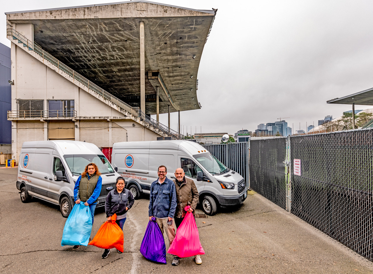


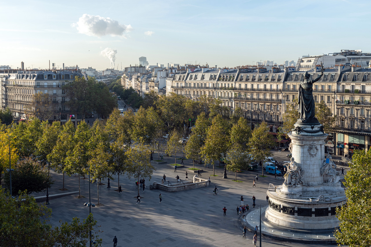
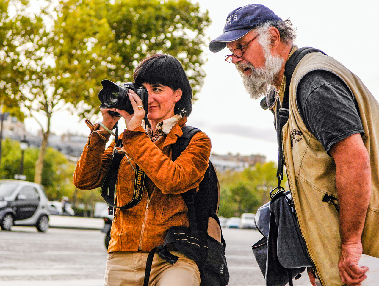


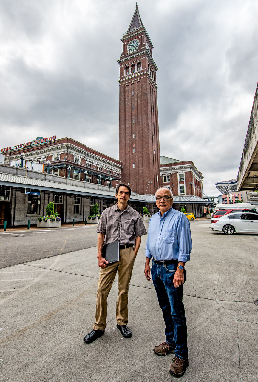


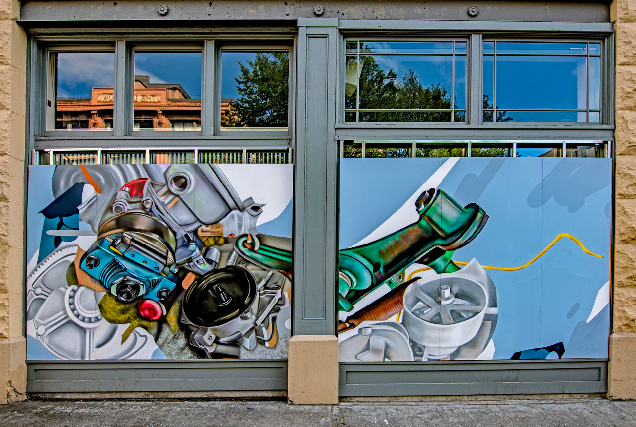


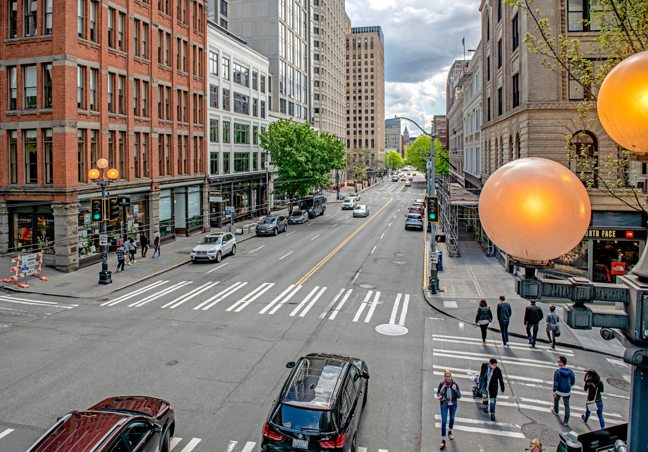


 =====
=====


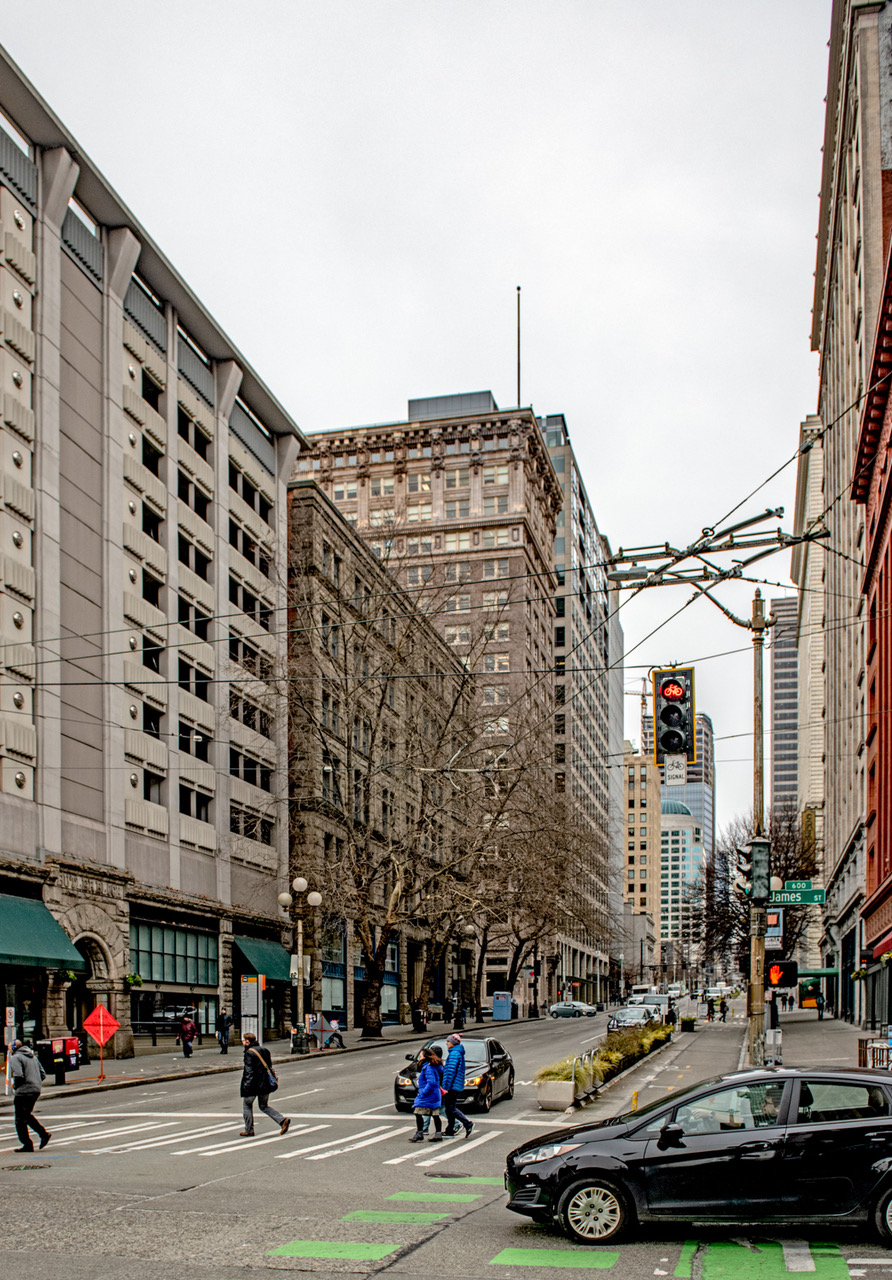


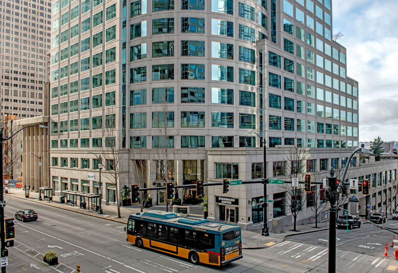


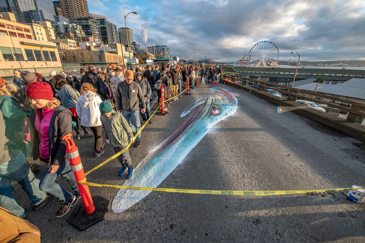


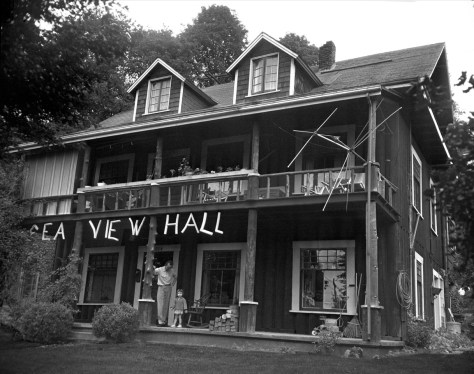


-mr-THEN")


 ======


![THEN: From boxcars and rooftops to the planks of Railroad Avenue, excitement builds for the ceremonial re-enactment of the S.S.Portland’s 1897 landing with its “ton of gold” on the Seattle waterfront, the city’s first Golden Potlatch Celebration. [Courtesy, Michael Maslan]](https://i1.wp.com/pauldorpat.com/wp-content/uploads/2015/07/potlatch-watch-above-railroad-ave-now-mr.jpg?resize=474%2C365&ssl=1)


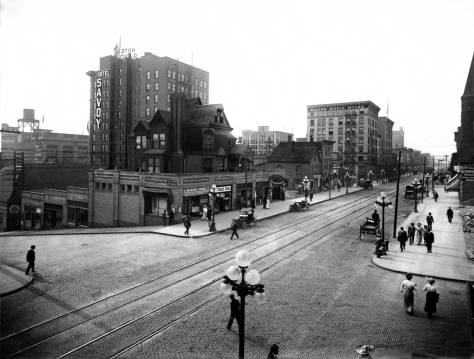


![THEN: Looking north-northeast from a low knoll at the southwest corner of Seneca Street and Seventh Avenue, circa 1916. By 1925, a commercial automobile garage filled the vacant lot in the foreground. [Courtesy, Ron Edge]](https://i2.wp.com/pauldorpat.com/wp-content/uploads/2014/11/seneca-7th-mr-then.jpg?resize=474%2C353&ssl=1)


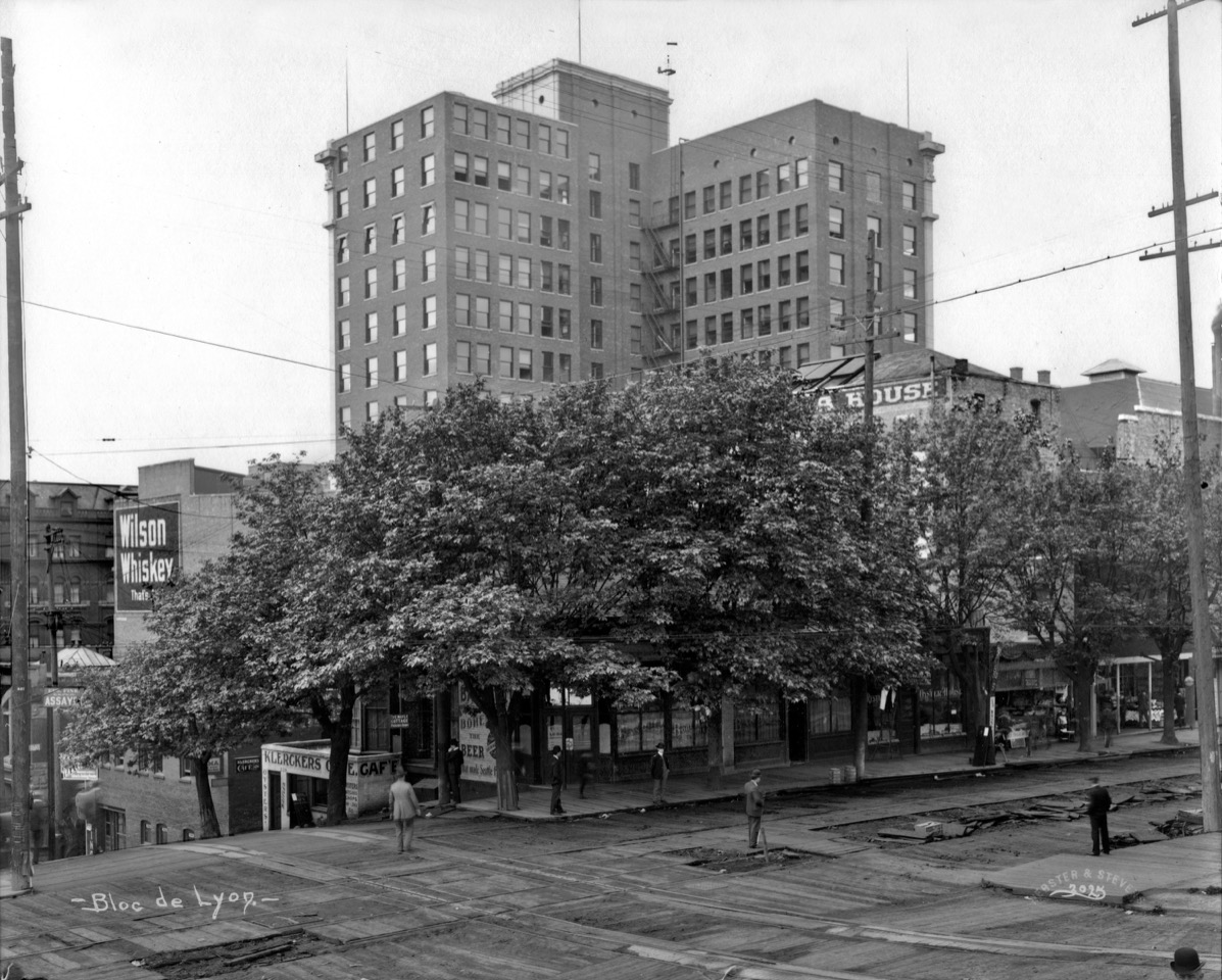


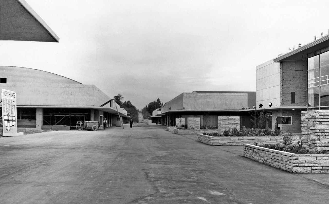


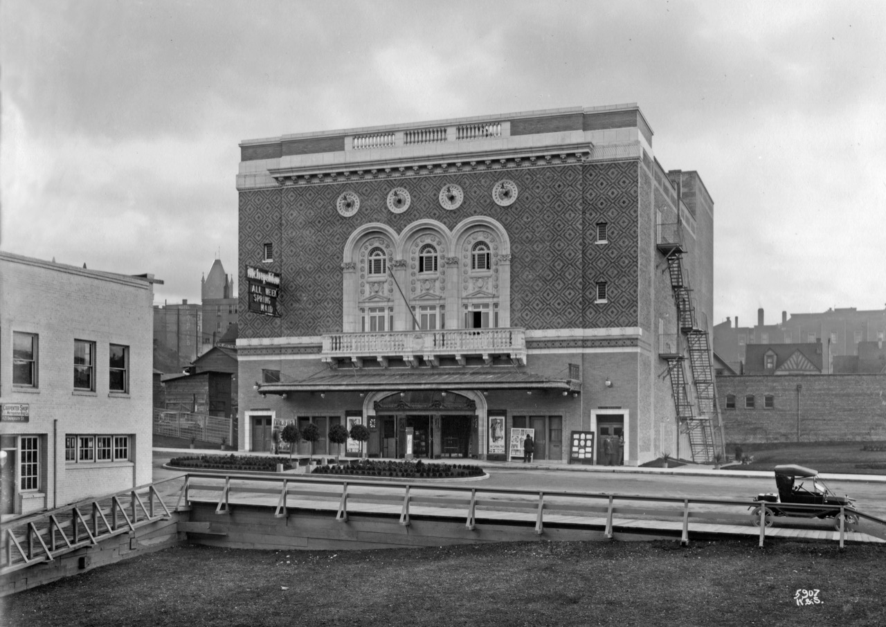


