THEN: Either starting or about to start at the Pike Place Market’s 1975 Soap-box derby. Photo by Frank ShawNOW: Hillside students in Jean’s video editing class pose here at the Pike Place Market.
Especially on weekends, Frank Shaw, a retired Boeing employee with a Hasselblad camera, would often be pulled from his Lower Queen Anne apartment to the attractions of Seattle’s waterfront and its neighbor the Pike Place Market. Other popular subjects for Shaw were high school soccer matches at Seattle Center, public art works-in-progress, and community festivals, both in Seattle and its suburbs.
Here on May 25th or 26th Shaw found a place along the crowded railing above the landmark block where Pike Alley reaches its intersection with First Avenue, Pike Street and Pike place. In 1975, Shaw was not yet attracted by the colorful lava-looking montage of posters and the Alley’s gum-splattered sides some of which Jean shows in his “now”. A weekend earlier Shaw recorded a bongo jam at the University District Street Fair. Mid-week he snapped the sternwheeler W.T. Preston Leaving Colman Dock, and Shaw also visited Westlake Mall where sculptor Rita Kepner was busy chipping away at her 3600 pound objet d’art commissioned by the city for its “The Artist in The City” program.
Having temporarily lost the UDistSt.Fair bongos I’ve substitute another mix of Shaw and drums wit this Pike Market jam.Meanwhile the leader, we presume, in another heat, The sign attached to the “box” names its sponsor the Duchess Tavern, we assume.
In the mid-1970s, Kepner and many fortunate others – myself included – were supported by the Seattle Arts Commission in the making of public art. I consider it one of the nicest things to ever happen to me. Much of the art survives delicately scattered about the city. Ultimately the art was funded by the Nixon Administration, in the year following Watergate and his 1974 resignation. Those of us who were funded continue to enjoy the irony of Nixon’s part in making the daily stresses of life easier for us. Now nearly a half-century later I can still confess that “Nixon was very very good to me.”
Unidentified contestant No. 69 after the race and perhaps injured. But never mind there’s a can of refreshing Rainier Beer resting beside him on the hood of the car he uses for support.
1975 was year – or one of them – for bell bottom pants. How many pairs can you count in the horse show of race spectators standing near the starting line? I figure about nine. One or more of them may have been purchased at Block’s Menswear, signed here “Block’s Bell Bottoms” on the north side of Pike Street mid-block between First and Second Avenues. I had three pairs which I bought not from Block but at the Wise Penny, the Junior League’s thrift store on Capitol Hill’s Broadway Avenue.
Market Mayor Billy King gets a grooming from artist Gertrude Pacific on Pike Place. (P. Dorpat sometime in the early 80s, perhaps)
On the authority of the artist/promoter Bill King, the Pike Place Market Mayor into the 1980s, the Markets soap box races began with perhaps two boxes in the 1970s, but it rapidly expanded. Billy got the idea for a derby from Doug Payson, an architect who lived near the market in the basement of the Bay Building. Next King carried the idea to the owners of the Market’s taverns – three of them. With their support began thus a bacchanalian affair but with good manners protected by the prudent friends of the market and also somewhat by a complicit police department. For his role as mayor master of ceremonies, Billy wore a tuxedo and a PA system. The race needed a caller at its single dangerous corner, a short block west of First Avenue. Distinguished in his tux, King stood on a chair at the corner describing the progress of the several races to their two collections of spectators, those east of the corner and those south of the corner, on the longer part between the corner and Union Street. (We share a map on the dorpatsherrardlomont blog.)
This Seattle Times clip from May 27, 1976 makes note of the upcoming “fifth annual Pike Place Market Street Fair, and the running again of the “annual soapbox derby.”
When I asked Bill King if he could identify either of the two racers about to let gravity have its way, or, for that matter, anyone in the crowd, he answered, “Nope, all the regulars were in the taverns!” Billy had been elected by the regulars sitting on Victrola Tavern stools.
WEB EXTRAS
Anything to add, lads? Features galore instructor Sherrard.
THEN: The surviving home at 1306 N. 48th Street was constructed in 1911 by an Austrian immigrant named John Perko, who, with the help of his wife ran the Seattle Cabinet Works. The couple had two daughters. (Courtesy Renee and Jeff Lindstrom.)THEN: In 2014 Renee and Jeff Lindstrom purchased the property, which has been reconfigured through the years into three units. Rhonda Bush, president of Historic Wallingford, notes that “the reconstruction of this home is a fine example of good stewardship in regards to a historic building, while teaching their daughters (posing here on the sidewalk) how to live simply in a small space, and providing affordable housing for others.”
Beginning with its first Sunday in the winter of 1982, this weekly feature has always been written in Wallingford – in the basement of a vintage Wallingford bungalow. Surely there are bungalows on every Seattle hill, but hereabouts this often modest architecture with shingle sidings, broad gables, tapered porch posts, wide windows, exterior chimneys, sun porches and more are surely associated with the neighborhood that was – after clear cutting and the persuasion of stretching it some for real estate sales – first called Wallingford Hill.
A prize for the first reader who can identify the Wallingford location of this snapshot. Clue – I do not know the answer. Jean? Ron? Most likely these bungalows survive.
Since Jean Sherrard took on the often enough joyful responsibility of repeating the historical photographs with his own artful “nows” for this feature, we have needed to identify our productive platform as “Greater Wallingford,” for Jean lives in what we will now risk calling “Upper Wallingford.” PacificNW students of Seattle history should know that there is a long and vigorous struggle over the names and boundaries of several of our city’s – what shall we call them? – “parts.” The Sherrard home where Jean and Karen raised their two tall boys, Ethan at 6’4” and Noel at 6’3”, the shorter and younger, who is now 30 years old – is only a brisk three minute walk from the northeast corner of Green Lake.
Noel and I long ago selling books on The Ave at a University District Street Fair.The closed gas works, with Wallingford and Green Lake in the background, as they appeared before construction of the Gas Works Park in 1971. Follow the light reflecting from Green Lake as far to the right as it reaches and you will be close to Jean and Karen’s home. This is our defense for claiming an “Upper Wallingford” status to his neighborhood. In this innocent regard we follow below the above aerial with a rabbit carried and protected by a Wallingford child about ten years ago. It was one of the thousands – yea – of neighborhood snaps I took during my Wallingford Walks between 2006 and 2010.A Wallingford rabbit dated May 13, 2008.At the southeast corner of Meridian and 44th Avenue another comely Wallingford box fitted here for a plantation
The generous Jean also understands that from its beginning Wallingford’s north border has always been shaky. It was named for John N. Wallingford, who, like Jean, also lived and plotted his productions at a home near the northeast corner of Green Lake. And now, I confess that I feel quite at home beside the lake. Many of my earliest now-and-then features were outlined first in my head while walking briskly around the lake. In 1982 that took me about 45 minutes, the time now often needed to get out of bed.
Two shows of cherry blossoms at the southeast corner of 46th Street and Corliss Avenue.Wallingford’s Meridian Playfield through its seasons. CLICK TO ENLARGEMembers of Sustainable Wallingford posing in the neighborhood’s pergola on August 9, 2008. Writing now ten years later we can confidently note that Wallingford has been on the whole sustained. Sustainable Wallingford may be thought of as prefiguring Historic Wallingford.
Today, and most likely forever, we can leave questions regarding Wallingford’s borders to the new core of enthused historiographers who have appropriately named themselves Historic Wallingford. And this coming Saturday morning, October 6th, they will be calling out from their sun porches primarily to home-owners – and renters – to gather together at the Good Shepherd Center on Sunnyside Avenue from 9:30am to 4pm for Wallingford’s Historic Homes Fair. The Fair features exhibitors with tips, experts sharing information about the styles of vintage residential architecture (there are more than bungalows in Wallingford), a showing of the film “Bungalow Heaven,” which is about an honored part of Pasadena, California, that may be uncannily compared to Wallingford, without the intrusion of film stars. The Fair’s Historic Preservation Discussion starts at 10am.
before the Swanson family began fixing shoes at 2305 N. 45th St., Peanuts By Heck were to be had there. Thie is another tax photo from the 1930s. Below: I interrupted the shoe leather from the sidewalk on one of my Wallingford Walks. This one is dated September27, 2006.
The older montage dates from a Seattle Times feature on the neighborhood published on October 25, 1925. The repeat is not so recent. You might want to Google a date for the movie Singles. You may remember that it featured Seattle’s Grunge scene. (click to enlarge)
WEB EXTRAS
Anything to add, mes frères? JEAN – WATCH THE BOOKS, WATCH THE BOOKS.
THEN: Looking south on Second Avenue through its intersection with Seneca Street, ca. 1945. (Courtesy, Museum of History and Industry)NOW: Built in 1902-3 the Lumber Exchange Building on the southwest corner, was replaced by the Second & Seneca Building in 1991.
While the lead sign at the center exhorts one to follow it to the Civic Field, I have not, I confess, as yet figured out when these spry workers were marching. The carefully dressed cadre of men – and they are all men it seems – are heading north on Second Avenue. It is mostly women watching from the curb. In the historical photo you can see the street signs for the intersecting Seneca Street holding to the comely light standards on the far left. A Seneca sign is also gripped to the less ornate pole in the now.
Civic Field under construction beside Civic Auditorium and Ice Arena. ca. 1930 (click to enlarge)Lake Union Dry Dock (an example)
It is the other parading signs that give us some clues to the year they were shown here. Somewhat hiding behind the “follow the parade” sign is another to “Increase Dry Dock Facilities For Seattle.” This was a popular call following WW2. The combination of ships injured in battle and the thousand of military men returning jobless in 1945-46 to the states made labor’s promotion of dry docks beside the famously calm inland sea of Puget Sound both an easy and sensible call.
Hooverville (Click to Enlarge)
The next professionally inscribed sign reads “No More Hoovervilles!” As many readers will know Hoovervilles were the ordinarily waterfront communities of rigged shacks politically named for the reflective Republican Herbert Hoover, the first president born west of the Mississippi (in Iowa). The life-long Quaker was inclined to peace but ineffective in battling the first months of the Great Depression that fell during his first year in office, 1929. His successor Franklin Roosevelt’s New Deal programs for public works and employment were followed by the employment opportunities connected with WW2 and the Puget Sound’s ship building revival. The grandest of the Seattle Hoovervilles sat beside East Marginal Way West of Seattle’s current sports palaces. It was intentionally burned to the ground in 1941.
Progressive Seattle City Councilman Hugh De Lacy with Henry Wallace
Above the “No More Hoovervilles” poster is an illustrated sign showing uniformed men carrying a war-time coffin captioned with the popular war-time truism that soldiers had died “for our right to vote.” For labor that referred to Vice President Henry Wallace’s “full employment” proposal that Roosevelt took to and promoted before his sudden death while on vacation in the spring of 1945. The bill was meant to “link management, labor and government into an effort to guarantee as many jobs as necessary for full employment following the war. The new president Harry Truman’s tag along was ineffective, sand a long menu of post-war progressive bills, including national health and minimum wage rules were not to be.
On his own after the sudden death of F.D.R., Harry Truman campaigns in Seattle, riding an open Cadillac north on Fourth Avenue.
Our last time clue for this photograph falls from the fate of the Civic Field itself. Built in the late 1920s with the city’s new Civic Auditorium and Ice Arena, by 1946 the field’s roof and timber bleachers were failing. On Jan 13, 1946 the city and its school agreed to cooperated in building a new covered concrete stadium on the same site. Ground breaking for the Memorial High School Stadium began in late June, 1946. It seems possible (perhaps likely) that our photograph was taken sometime in 1945 after Roosevelt’s death when labor was still invigorated with the hopeful heat of the Full Employment Bill.
One of many routine Memorial Day patriotic events held beside the names of the WW2 casualties displayed in the Seattle High School Memorial Stadium Plaza. Here the speaker Gen. Joseph Murray , R., Army Reserve, explains to representatives form 14 public high schools that “war has always been hellish, but we must be willing to stand up and be counted and to take the hard road if necessary.” Taken from another Seattle Times clip.
THEN: In 1937 the Silver Inn stood alone on the dirt left by the Denny Hill regrade.NOW: The Denny Building’s parking garage now holds the corner.
The address “S.E. Cor. 6th & Bell St.” scrawled on the driveway might alert the reader that this is yet another King County tax photo, one of the few-thousand rescued by Stan Unger from the assessor’s office trash nearly a half-century ago. When Jean and I are through scanning and using a selection among them, usually for this column, we will put them in an archival box tied with blue ribbons and guide them to the Washington State Archives, a more responsible home for the greater Works Progresses Administration (WPA) collection.
[ABOVE, 1938 & BELOW, 1946 – The rectangular roof of the SILVER INN at the southeast corner of Bell Street and Sixth Avenue can be found near the center of both the 1938 detail above and the 1946 detail, below. The nearly vacant blocks to the north of Blanchard Street – it starts in the upper-right corners – is the result of the Great Depression and the little development that followed the market’s bust in late 1929, the years in which the last of the Denny Regrades proceeded east of Fifth Avenue. The Silver Inn was an exception, although not without its owners struggle. The developed neighborhood west of Fifth Avenue, which crosses the lower-left corner, was built up after the Denny Regrade of 1908-1911.]
The likely date for the steady snapshot of the Silver Inn is 1937, the year that the federally funded WPA began its photo inventory of, it was hoped, all taxable structures in King County. These first tax photos generally showed acuity and sometimes, as here, great acuity. That sharpness is the better to read the Silver Inn’s greasy spoon credits: chicken, steaks, and hamburger at depression-time prices that were themselves delicious: “Lunch 35 cents” and “Dinner 50 cents.”
The Twin-T-P’s were not in the Silver Inn’s South Lake Union neighborhood but rather at the northwest corner of Green Lake. The T-P’s also pushed steaks above their front door – eccentric front door. And they shurely sold hamburgers, lots of them., here in 1937, the year claimed by this photograph.
If a reader wishes, he or she will find in the Archive’s tax photos hundreds of hamburger signs hanging high, on or above, the windows of many of Seattle’s more than 800 restaurants listed in the 1938 Polk City Directory. One may visit the Archives on the Bellevue Community College campus. Plan for at least a week of afternoons looking through the many thousands of prints. (We will continue to hope that some happy day they will all be online.)
A clipping from The Seattle Times dated March 13, 1943.
Born in 1938, I was quickly indoctrinated into hamburger hysteria. With the need for cheap food the “National Hamburger Diet” got off the grill during the Depression, and it kept frying during World War II when many families used their food coupons almost entirely for hamburger. Standing in the kitchen before our mother, my older brother David and I were a devoted duet pleading for hamburgers, but not for their weak substitute mere ground beef. We very much also wanted the sandwich with the buns.
A Seattle Times clipping for December 23, 1938. Although I was not yet two months old, I could smell the hamburger popping and frying in the parsonage kitchen in Grand Forks, North Dakota. Surely.
When the Silver Inn was built and first opened by Joe and Minnie Barmon in the early 1930sl, the neighborhood was freshly scraped free of what remained of Denny Hill – eighteen years after its regrade had stalled in 1911 at Fifth Avenue. The new digging in 1929 was inadvertently synchronized with the Great Depression. The Barmon’s nifty box-like cafe was one of the few structures built above the many blocks of graded dirt left by the regrade. Soon after opening the Silver Inn was shaken by an unclaimed bomb that exploded on Bell Street. Thereafter the couple endured several overnight robberies, and then gave up in the spring of 1939 when a beer and wine violation moved the state liquor board to cancel their license.
===============
Another clip from The Times, this one from March 8, 1928. The public works photographer looks north from the “Old Quarter” cliff that lifted above the east of Fifth Avenue from 1911 to 1929.Yet another Times Clip, this first appears on June 25, 2000.
=======
The Times clipping from June 14, 1942.A Times adver. from October 22, 1944.Barracks news in The Times from March 13, 1943
During most of World War II, the Silver Inn was rented by the dancer Mary Ann Wells, who was for decades Seattle’s most celebrated dance producer. Converted for dance classes, Wells described the transformed Silver Inn to the public and her hundreds of pupils as her “beautiful new school.” Wells was not thrilled when in 1943 the Army Corps of Engineers surrounded the school with barracks for homeless workers, newly arrived in Seattle from the Midwest. All were looking for work, expecting it, and finding it at Boeing and in the shipyards. My second oldest brother Norman was among them. Ted, the eldest, was far away aboard a destroyer in the Pacific.
A Times clip from May 15, 1943.Compliments of the Municipal Archive, here’s a Wells’ letter asking for some relief. With the war freshly over It dates from Oct. 19, 1945. Well’s got no relief, it seems, from the military.
[A REMINDER: Comparing the two aerial details above – nearer the top of this feature – will reveal the character of the Silver Inn’s immediate neighborhood before and after the building of military housing. Ron Edge distinguishes between the narrow men’s dorms immediately behind the Silver Inn, and the larger women’s housing above the men.]
WEB EXTRAS
On a personal note, I took the ‘now’ for this column on a day when Seattle’s air was rated worst in the world. While shooting the corner, I witnessed one asthma sufferer, bent over, trying to recover his breath before shakily crossing the street. Within a day or so of that photo, I shot another at Lapush’s First Beach, probably one of the most discombobulating sunsets I’ve ever witnessed.
Smoke-darkened sunset at Lapush
In contrast, let me add in a Lapush sunset from a previous year, smoke free:
Lapush sunset, August 2011
Anything to add, lads? Alas, nothing to compare with you stirring filtered sunsets Jean. Gosh, we do have more stuff on the neighborhood, beginning first below with with the Dog House and its Hamburgers on Denny Way near Dexter and Aurora and so not far from the Silver Inn at 6th and Bell.
======
======
======
======
======
======
======
======
======
======
======
======
MORE TO COME LATE SUNDAY
[Now once again, we climb the stairway to the kind of Nighty-Bears we commemorate to Bill Burden, who we have heard is about to open a coffee shop in Nevada City, California and so closer to Reno than to Oakland.]
CLICK TO ENLARGE A. Curtis’s panorama looking east-north-east from the Denny Hotel in the very early 20th century. Denny looks over the hotel’s gorunds to the housing stock on east side of Fourth Avenue. Olive is far ;;right and Stewart joins it (or vice-versa) out-of-frame at the pan’s bottom-right corner. There’s part of Wallingford upper-left on the distant north side of Lake Union.
THEN: In 1936 the brickwork on 15th Ave. NW still looked intact from curb to curb, both to the side of its two trolley tracks and between them. (Courtesy of Paula Zanter-Stout)NOW: The newest Ballard High School is evident here on the center-horizon. Since its construction from 1997 to 1999 and return to the neighborhood, the enlarged school has filled the northeast corner of NW 65th Street and 15th Avenue Northwest.
We hope that it obvious to readers familiar with this weekly feature that this Sunday we offer another scene pulled from a collection of billboard subjects recorded between the late 1920s and the early 1940s. The snapping by Foster and Kleiser of its Seattle-based billboards began near the start of the Great Depression and ended when everyone’s preoccupation with World War II was both fresh and alarming.
Another FK billboard shot of the same corner but years later. It is dated at the bottom with its own caption: September 1, 1942. By then the U.S.A> is frantically involved in fighting WW2 on two fronts. Here looking north from from the west side of 15h Avenue near 64th Street we can see some changes and revelations. The largest of the latter if Ballard High School on the right. The northeast corner of 15th and 65th is still plastered with billboards standing next to a Safeway Store.
In the featured photo at the top, the company’s photographer has included three billboards in her or his negative taken from the east curb of 15th Avenue NW and about twenty yards south of NW 64th Street. The billboard at the center on the north side of the arterial NW 65th Street tempts every motorist heading north on 15th Ave. NW with a dream of conspicuous consumption. In spite of the
A detail from the featured photo at the top. Tire War anyone?
Depression, the billboard flaunts a luxurious Lincoln Zephyr V-12. That 1937 Lincoln reminds me how as a youngster, I was puzzled that car companies were permitted to sell automobiles, which were newer than new. (The cars they sold were often dated for the coming year.) Now I also wonder if it is possible that Seattle’s Lincoln dealers did some “spot advertising” and paid extra for this head-on location since a good fraction of Seattle’s most wealthy one percent commuted via 15th Avenue NW to their homes in the gated Highlands.
The Hoge garden, part of the family’s Highlands estate. We now keep the name with the Hoge Building at the northwest corner of Second Avenue and Cherry Street. For about two years it was the tallest structure in Seattle. In 1913 its neighbor the Smith Tower surmounted it.
The featured (at the top) billboard negative was exposed on November 1, 1936. The Seattle Times noted, “Thousands of hunters are swarming into Eastern Washington for the opening of the deer season.” Even more affecting, it was two days before the country would extend Franklin Delano Roosevelt into his second term as president. He won 60.8 percent of the popular vote and 98.49 percent of the electoral votes, the highest percentage of any candidate since 1820 when James Monroe, the last candidate of the Revolutionary generation, had no major opponent.
The Roosevelt Family gathered together by the fireplace of their Hyde Park retreat. We will assume that this is fireplace next to which FDR gave his regular fireside radio broadcasts – but we could be wrong.
During the 1936 campaign Roosevelt sometimes exuded the populist economics embraced by Bernie Sanders. At Madison Square Garden, on this first of November night, Roosevelt gave his last broadcasted speech before the votes were cast. Responding to the oft-repeated theme of his Republican opponent, he “welcomed the hatred of ‘organized money’.” Roosevelt promised that in his second administration “those forces would meet their master.”
With the “kink” at the center, this 1936 aerial shows the intersection of 65 Ave. N.E. and N.E. 15th Street. Ballard High School is upper-right from the odd furn in the arterial. (Click to Enlarge)
Returning to the pavement – the odd kink in the grid at 15th Ave. NW and NW 65th street was the gift of Ballard’s early development with different additions. I remember while visiting friends in Ballard during the early 1980s, that the city’s Department of Transportation, after tabulating the crashes, promoted this intersection as Seattle’s “most dangerous intersection.” Slow down and take care.
Days before the market crash of 1929 the Seattle City Council agreed with the Whittier Heights Improvement Club that NE 15th Avenue was destined to developed into a major arterial, and decided to change “the new paving project on 15th Avenue Northwest between West 65lkth and West 85th Streets and holds that the present offers the best opportunity for building the pavement to the full width [106 feet] which will ultimately be needed.”
WEB EXTRAS
Anything to add, pardners? Jean I think it likely that Ron went to bed early his evening but when he does that he also gets up early in the morning, and so we expect that he will add several more old and relevant features below. However, he will do it after feeding the wild pets that are well accustomed to his nutritious gifts offered on his deck.
Novelist Tom Robbins, left, and Paul Dorpat, in 1968 sartorial splendor, hang out at the first Sky River Rock Festival in a field near Sultan. Says Dorpat: “I must ask: Does any reader know who took this photo and/or where I might recover the saffron robe to more carefully stash it? One matter more. That is Inger Anne Hage, her Scandinavian physiognomy barely contained, in the bottom-right corner of the photo. At that time, she and I, with her two young children, were housemates on Boston Street in the Eastlake neighborhood. We met at the Blue Moon.”Inger in the Helixhaul also in 1968.
Without a crashing piano, there would have been no Sky River Rock Festival over Labor Day weekend 1968 on Betty Nelson’s raspberry farm. Or was it strawberries? Certainly, there were no oranges.
Fruit farmer Betty Nelson confers with Smokey on how to turn her acres into an inviting grounds for a rock festival without burning it down.Weighing about 500 lbs the dropped piano’s harp crashed through the instrument’s frame and furniture and except for the loss of its bass strings survived the drop. It is imagined and planned to invite local composers to study the remains and write music for this historic instrument. The Jack Straw Foundation, being both involved in the founding of KRAB RADIO – with Helix the original sponsor of the Piano Drop in the Spring of 1968 – and regularly serving as a venue for new music (and some old) wo;uld be a most fitting place to make this music. (Thanks to Ron Edge for both keeping and moving – in his truck – the dropped piano when needed.
Four months before that weekend, about 2,000 people paid to enjoy the surreal thrill of watching an old, tightly strung piano fall from a rented helicopter scarcely powerful enough to lift it. The exceedingly hip Berkeley, Calif., band, Country Joe and the Fish, provided the music. They had played at the Eagles Auditorium the two nights before, and donated their services for The Drop.
About twenty years ago or so I gifted Paul Heald’s poster for the Piano Drop to Joe McDonald during his visit to Seattle for a performance and but also to Wallingford for the poster. Joe survives. I corresponded with him last week. Paul Heald does not. He passed about three years ago. Paul stands far right in the photograph below this one. Tom Robbins holds the center, and sculptor Larry Beck is far left. Larry died about twenty years ago. His wake at Golden Gardens was a spectacle. (Note that Paul has marked with an arrow the spot in the sky where he expected the piano to be released.)
By our request, the pilot aimed to release the 500-pound, swaying instrument from an altitude of more than 100 feet above a large woodpile. A mix of antsy and artsy celebrants had packed into a grand horseshoe around the pile. Using Country Joe’s microphone, I pleaded with them (but with little faith) to step back.
More than any of the Sky River Rock Festival’s rain-spattered performers, this recording of its mud players was the most-often-printed photograph taken during the festival’s three days. During the afternoon of the last day, the sun made a brief visit, confirming, as Tom Robbins recalls, that everyone was already happy.Here the mud dancers were used on a Helix cover to promote yet another benefit. We survived with the sales of record album ads, on the street sales of the paper, and benefits.
As the piano fell, my heart took hold of my stomach, and both leapt to my throat. Fortunately, the renta-pilot missed. The piano plopped onto mud that pop doctrine ever-after believed was earlier divinely tamped between the woodpile and the half-built Duvall home of our host and fellow conspirator, Larry Van Over. All flesh was saved from woodpile shrapnel, and only a few piano strings were broken with the crash.
Country Joe and the Fish play for both the Piano Drop and the MEDIA BASH that preceeded it – by one day. It was another benefit, this time for KRAB too.
A half-century later, the salvaged piano was given to me by the wife of the recently passed strong man who, on the afternoon of The Piano Drop, had lifted the piano into his pickup and driven away. Now, the still-sturdy relic is silently and secretly kept in a locked garage.
A glimpse of the stage at the 1969 Sky River. The sun has here made one of its rare appearances that Labor Day Weekend. The Seattle Times captioned this “Bedraggled Hippies took shelter in tents and under plastic near Sultan. The grounds of the Sky River Rock Festival and Lighter Than Air Fair were hazy with smoke from stubborn camp fires.
The resounding but mud-muted success of The Piano Drop inspired us to do something bigger, longer and sometimes louder. A notice in the weekly tabloid Helix (we were the editors) searched for a farm or field on which to stage a three-day music festival.
This is a centerfold spread in The Helix, Seattle’s underground newspaper (founded and edited by Dorpat), advertising the first Sky River event. Dorpat and a few friends created the festival, inspired by another event they hosted: the dropping of a piano from a helicopter four months earlier.John Chambless relaxing at his desk in the Helix Office, where much of the festival work was also handled. John joined the production after finishing his directing of the Berkeley Folk Festival. I first met John in 1965 when he was teaching philosophy at the University of Washington and I was using the philosophy library as a quiet station for writing a thesis. I dropped out of these to manage the Free University and then start the Helix.
Betty Nelson promptly answered with an invitation to use her fruit farm. We thought that appropriate. Betty’s available acres were suitably inclined on a sloping open grade next to the Skykomish River, about 3 miles south of Sultan. That summer on Betty’s farm, we rapidly squeezed out a campground facing a grand stage with light towers. Skilled volunteers prepared lighted rows for porta-potties, a food circus, space for arts and crafts, and a light-show projection booth.
For a moment on first finding this snapshot in a stack of other prints we wondered if Stormy Daniels might have made it to the festival but then thought better of it for while our profession has somehow endured without much trouble thru the half century since the festival was put forward thru that time Stormy’s labors would have certainly required more flex. (Search top-center)
We gathered four months later with about two dozen bands, including Country Joe and the Fish; Santana; The Cleanliness and Godliness Skiffle Band; and, for the last act, the Grateful Dead. The benefactors — aka ticket-buyers — gave “for American Indians and Black People.”
Attendance reached many thousands more than for The Piano Drop. However, we have no ticket count, for the long farm fence between the festival and the highway soon gave way to freeloaders who, no doubt, thought they were entitled to hear “their music” while also helping us lift the sky at the Sky River Rock Festival and Lighter Than Air Fair.
A Sky River ticket, 1968
The price was $6 for three days of round-the-clock music, theater and comedy. (My stage contribution included setting the microphone for comedian Richard Pryor, about whom I then knew nothing.)
The Sultan-based Sky River Festival, the first of three annual events, all on different pastures, has often been extolled as the first multiday outdoor music festival on a rural site, ordinarily on a converted farm, that was prepared for it.
The first Sky River was staged and played a year before Woodstock. Within three years, there were about a dozen more multiday rock-jazz-folk festivals in the Northwest alone. Worldwide, wherever hippies hitchhiked, there were probably hundreds more.
I remember well the evening meeting in a Wallingford home when we easily chose the nearly self-evident name, “Sky River Rock,” for the historical festival. The Lighter Than Air part was a kind of a payoff to Van Over, The Piano Drop host, who hoped to fill the sky with tethered balloons lifting riders above the festival. As one of the larger riders in his hopeful balloon, I easily demonstrated its failings. I was too heavy to lift.
The photographs collected here are all from that first festival, the first Sky River. In the shot with the two fashion plates, the uncombed fellow in the saffron Buddhist robe is me. I remember thinking that the first Sky River would be an appropriate opportunity to abdicate my ordinarily nondescript dress for something eccentric. By the end of the day I had somehow lost the robe — probably intentionally.
An early contribution to the Helix motivated in response to the city’s attempts to stop our light-show dances at Eagles Auditorium. It was a struggle we won.
Standing with me is my friend — now for more than half a century — novelist Tom Robbins. In 1968, we were both in our prime, already beginning our slide into somatic decline. I first met Tom in 1966, five years before the publication of his first novel, “Another Roadside Attraction.” (I suspect and/or hope that most of our readers have followed its whimsical search of the historical Jesus.)
We first met during a Free University course in experimental drama for which Tom staged a “happening” with the help of George, a nearly retired high school art instructor, who carefully covered a spotlighted dining table with a white tablecloth pressed flat for an elaborate setting of dinnerware for six. The happening’s climax came with Tom’s attempt to pull the tablecloth free from the table without upsetting the china. Of course, he failed. However, with Tom’s North Carolinian splash, it was an elegant crash. Above the scattered glass on the floor there stood a comic genius.
CLICK TO ENLARGE – Here’ Seattle in 1968 shot from Beacon Hill. The SeaFirst tower, far right, is under construction but will soon be topped-off. Not so, however the idle freeway parts.
Tom remembers the morning this portrait of the two of us was recorded. After spending most of that summer night writing at the Post-Intelligencer, he visited the Dog House, then the newspaper neighborhood’s most popular all-night greasy spoon, before driving to the Sky River encampment for its second day.
While wearing my saffron Buddhist smock, it was easy to be both found and avoided. Obviously, Tom found me, although I do not know whether he was looking for me.
A Times photo taken after the deconstruction of the site had commenced. I cannot decide if the bus stop poster is thorough farce or if it has been moved from a sensible spot beside the highway which bordered Betty’s farm.
WEB EXTRAS
Anything to add, Paul?
Yes Jean. Here’s another of Tom, and Inger and I and several other friends taken by the same (now a half-century later) forgotten photographer. May he or she will come forward – if they can still walk. Gary Eagle, far lefdt, was one of the most productive and gifted on the artists that helped illustrated Helix. Far right is Stretch. We lived together first during my Artist in Residency at Fairhaven College in 1969 and then in a fisherman’s cottage on the west shore of Lummi Island. I am embarrassed that I no longer remember the name of the woman sitting to Randy’s right, although I SAW her as recently as my 70th Birthday party. As you can see I am still in my buddhist robe in the photo below, but I am also reaching for what might be a shirt or light coat. The person standing to my left was Randy’s “girl friend” at the time. She later moved to Colorado to study Buddhism and changed her name because of it. (And so I have not named her here.) Only now It occurs to me that she may have taken my robe for which she will have long ago asked forgiveness of the Buddha and I grant it as well.
.
Finally, I think, here’s Mt. Baring, only a few miles up the Skykomish Valley, east of Sultan.
THEN: Paul photographed this look north across Paris’ Place de la Concorde in the late summer of 1955. He was soon on his way as a senior at Portland’s Concordia Academy and bragging about his summer trip to Europe.NOW: The core of this sidewalk scene on Paris’ Pont de la Concorde is composed of students and teachers from Bellevue’s Hillside Student Community photographed by their arts and drama teacher Jean Sherrard.
Like our recent visit to London’s Big Ben, this look north into Paris’ Place de la Concord is one of the rare photos snapped by me for the historical half of this weekly feature. Both were recorded on a Leica I borrowed during the adventurous summer of 1955. I was an exhilarated sixteen-year-old snapping my way through Europe, heading with about thirty other Northwest teenagers for a conference at the Cite Universitaire de Paris. (It was hot that summer, too.)
The Cite Universitaire stop in southeast Paris. 1955
Most of the ten ‘older students’ posing this summer for their combined teacher-tour guide, Jean Sherrard, are also fifteen and sixteen. But not Kael Sherrard, Jean’s smiling brother in the checkered blue shirt on the right. Kael is the school’s principal. Probably every one of these Hillside students carries her or his own camera (in their phones) and are regularly sending pictures home to their parents, siblings and friends. In 1955 we were not equipped to be that smart.
Sixty-five years later I no longer remember the name of the Texan with whom I explored Paris. Here we parody something with our discovery of a box filled with some USA standards. My taste for coffee was awakened with this trip to Europe and a cup of coffee in an Amsterdam basement cafe. It was so wonderfully rich compared to, well, Maxwell House.
Place de la Concord is as elegantly packed with landmarks as those surrounding London’s Parliament Square. Posing at the north end of the Pont de la Concorde, the Hillside students are standing above the River Seine. Centered above them, the most distant classical structure with its tall columns, is the eglise de la Madeleine. It was conceived as a pantheon in honor of Napoleon’s armies. The two long and nearly twin classics on the distant side of Place de la
Looking south from Madeleine to Place de la Concord. The women climbing the stairs on the left were part of our northwest delegation.
Concord were completed in the 1770s. Through their two centuries-plus served many purposes including serving as a warehouse for the King’s extra furniture. The Hotel de la Marine, on the right, with the temporary gray blanket, reminds me how soot-shrouded were the landmarks of Europe when we visited them in the 1950s.
Notre Dame, 1955 in need of a bath and apparently getting it and more on top.
The Luxor Obelisk that stands tall above the Hillside students, was not stolen from the Egyptians but rather given to the French in the nineteenth century. Removed from its place at the entrance to the Luxor Temple on the Nile, it arrived in Paris on December 21, 1833. Three years later the 75-ft column was set at the center of Place de la Concord, near where in the 1790s the execution ‘theatre’ of the French Revolution excited the hordes with its efficient guillotine. Renamed the Place de la Revolution, its blades cut off the heads of hundreds of aristocrats, along with the people’s terrorist Maximilien Robespierre, the King Louis XVI and his queen Marie Antoinette. By 1795 the square had settled down and was renamed the Place de la Concorde.
WEB EXTRAS
Berangere sent us these spectacular repeats just this morning:
Berangere notes: A month after Jean’s photo, the peristyle of the Hôtel de la Marine appears. The restoration of the historical monument will be finished in 2019, the less glorious parts of the monuments will be rented for offices, at the ground floor there will be a café, restaurant and bookstores, also exhibitions of French Art de vivre; on the first floor, visitors could discover « l’enfilade des salons d’apparat » the following of ceremonial salons and the charming Marie-Antoinette’s cabinet… In summertime the place de la Concorde is free of cars…
And a special series, thanks to BB, her repeats of a number of Paul’s 1955 photos.
The Paris Opera, in need of a cleaning, 1955Berangere’s remarkable repeat of a gloriously restored Opera…The Pantheon, 1955BB’s photo of a recently restored Pantheon with its brand new dome – and on the façade, Simone Veil’s photo ( the ex-minister and survivor of the Shoah ) and her husband who were just buried in Pantheon.Today, on the north side of the Pantheon, open space and benches have replaced parking…The Carrousel of the Louvre, 1955Today’s Carrousel
Anything to add, mes compères? More Paris from 1955 Jean.
Looking west up the Champs Elysees to the Arc de Triumph.The SeineVersailles palace, the entranceThe Bastille memorial columnAnother of the Opera House, 1955Looking northwest from the Eiffel tower, 1955.Carrousel looking west to the Arc de Triumph.Under the Arc Triumph with a parade at sunset.After nearly three months of travel completed with ten days exploring Paris (and sometimes sitting in on conference meetings) we board our bus to the airport and a DC6 still propeller-driven flight back to the U.S.A.. Now I climb the stairs to nighty-bears. I’ll return late this afternoon with some proofreading for proper Fench spellings unless BB gets to it first.
THEN: From the Smith Tower (1914), far left, to the Frye Hotel (1911) and its ranks of American flags, far right, this 1925 recording looking east from the corner of Second Avenue and Yesler Way is filled with mid-summer commotion sponsored by the Masonic Knights Templar. (Courtesy Museum of History and Industry)NOW: Both terra-cotta landmarks, the Frye Hotel and the Smith Tower, survived the ninety-three years that have passed between our “now” and our “then” and promise to serve well for some time to come.
Through Seattle’s so far brief history (when compared to Jerusalem), one of the most flamboyant invasions of this well-defended city of about seventy-seven hills came in late July 1925 when 30,000 “members and families” of – and the name is long – “The United Religious, Military and Masonic Orders of the Temple and of St John of Jerusalem, Palestine, Rhodes and Malta of England and Wales and Its Provinces Overseas.“
Two frames lifted from a clip of Pathe Newsreel photographer Will Hudson’s 16m film of the Knights Templar parade marching south on Second Avenue in 1925. The cross-topped arch straddled Marion Street. (More of this below.)
Appeared first in The Times on March 18, 1984.
These Masons were better known as the Knights Templar, named for the medieval crusading Christians who attempted to break the Moslem grip on Jerusalem and most of the eastern Mediterranean. These twentieth-century marching Protestants –mostly – reached Seattle by land and sea (but not quite yet by sky) for the “conclave of the grand encampment of the United States of America for the 36th Triennial of the Knights Templar.”
Some of the bleachers constructed to either side of Fifth Avenue north of Virginia Street when much of Fifth was still free for “adjustments” during the years of pause (1911-1928) in the Denny Regrade.
Surely the most enduring vestiges of these warriors –preachers, super-salesmen, educators, disciplined clerks, meat-packers, and other ambitious protestants – were their uniforms, which they took care to keep brushed. Make a quick on-line visit with “Masonic Knights Templar” and you will be treated with a polished flood of fraternal regalia, most of it for sale. The on-line show includes, but is not limited to, shoulder boards, sleeve and collar crosses, swords, pins of many sorts, stars centered with crosses, and chapeaux.
These chapeaux are the fancy plumed caps we see here heading east up Yesler Way from Second Avenue like a disciplined flock of low-flying ostriches. Here the marching is in order, and you will not find any mason out of line or step. They are moving up First Hill to their fort. I imagine them singing the still popular, uniquely militant, hymn that goes, in part “Onward Christian soldiers marching as to war, with the cross of Jesus going on before.”
A clip from The Times for May 3, 1929. (Enlarge to read = of course.)
A cross is hanging over Yesler Way center-right, nearly lost in the shadows of First Hill. It is but one of scores of crosses the Templars raised in Seattle during their July visit. The largest sat atop the grand-sized welcome arch that covered the intersection of Second Avenue and Marion Street. (See above) The cross mounted on the roof of the then brand new Olympic Hotel competed with the cross on the welcome arch for dominance on the cityscape.
Not able for now to find the Olympic topped with a cross, here’s an early record of its sumptuous lobby. CLICK TO ENLARGE
It is likely that the warriors in our featured photo are headed to their faux fort and headquarters constructed for their visit on City Hall Park, seen at the center of the photograph below. The fort’s drawbridge on Terrace Street was “manned” by Boy Scouts, some of them, most likely, future knights.
WEB EXTRAS
Anything to add, lodge members?
Jean, do you remember when we lectured to a Masonic group at its home in Greenwood and had a good time? With the new NOW-THEN book scheduled for release in late October we should start calling the lodges and clubs and schools and churches about putting on our show and selling books – books which we both will sign. Of course the value of the book is thereby increased by our estimate – and we have noted this often when lecturing and signing – 20 Cents. We could reconsider this. Normally the value of one of our books inflates a dime when we sign it. With two signatures it seems to me that the value is doubled. What do you think – if you have read this far?
(Howz about putting up an inquiry of interests (for illustrated lectures) and such on this BLOG? Show our interested readers some of the pages.)
THEN: Built between 1843 and 1858, London’s landmark Great Clock, aka Big Ben, being dressed in 1955 for its restoration.NOW: Jean Sherrard has taught writing and drama at Bellevue’s Hillside Student Community School for many years. Since 1998 he has also guided cadres of its older students on summer tours of London and Paris – in that order. Frances Alls, one of the ten students in this group, reflects, “It’s magical. You feel like you’re in a story.”
Through its thirty-seven years, this is surely the furthest from First and Yesler that our weekly feature, ordinarily about regional heritage, has ventured. Reaching 443-feet above the River Thames is the Elizabeth Tower. On both our “now and then” occasions this neo-Gothic landmark has been exceptionally dressed for make-overs. Two of the four faces for its tenants, the Great Clock and Big Ben, perhaps the world’s most famous chiming and yet cracked bell, can be seen through the restoration scaffolding of 1955. That was one year before the creation of London’s Clean Air Act.
I remember well pointing my borrowed Leica to record this London landmark sixty-three years ago. I was touring Europe with sixteen rolls of Kodachrome slide film, donated by a Spokane drugstore merchant, and about thirty-five other Northwest teens, “donated” by their parents. We were all delegates headed for a ten-day YMCA-YWCA conference in Paris. We were selected by discerning adults who were especially encouraged by other adults: those who could afford to send us, our parents. The conference responsibilities were preluded by a five-week tour of Europe that began here in London.
For our London visit in 1955 we lodged at the Croydon YMCA. The windows are open for the heat I remember and yet we for the most part are wearing our light cotton jackets as testimony to our entourage. The walking group on the sidewalk represents about half of our excited force.
Jean Sherrard sent me his Westminster/London repeat a mere two days after he served for family and friends one or two of his exceptionally tender rotisserie chickens at teh Sherrard family home near the north shore of Green Lake. Dodging some overhanging foliage Jean recorded his splendid portrait of Great Britain’s Big Ben from nearly the same spot where I also photographed that chiming clock sixty-three years earlier.
A century ago a popular guide to London. I started collecting books on London about 30 years ago. Do you have any? She we trade?
If memory serves, in 1955 it took us twenty-one days aboard the Orsova, flagship for the Orient Lines, to reach London from Vancouver B.C. via the Panama Canal. I remember well the two on-deck swimming pools. Also, any passenger could enjoy both teatime tables slathered with pastries and the sometimes splashing tables of the captain’s cocktail hours. The freedom and frivolity of this drinking was entirely new to us Northwest innocents, who were more likely to find our guarding chaperones in attendance than the Orsova’s smiling Captain.
Here far left on the distant Horizon photographed from St. Paul’s Cathedral are Westminster Cathedral with its twin towers, the Parliament Building, farthest to the left, and the restoration-construction-clad Big Ben.
The Paris Conference itself was often neglected by an inexpensive attraction: walking the streets of Paris. Jean will be carrying with him one or more of my Paris pictures from 1955 for possible repetition. (Assuredly these other “thens” will not be of conference subjects.) However, Jean’s Paris “now” will, no doubt, include the same entourage of the Hillside Students he has posed in this London “now.”
BELOW: A Few of the Stock LONDON subjects I took in 1955.
The TOWER of LONDONST. PAUL’SBUCKINGHAM PALACE 1955WESTMINSTER CATHEDRAL 1955
I am thinking of their luggage. I remember what a limited wardrobe we carried with and on us in 1955. By the time we reached Paris, many of us were committed to the Lederhosen, or leather shorts we had purchased in Germany. In Paris Jean’s Hillside students may use a Parisian runway for a showing of their Northwest wardrobe.
WEB EXTRAS
A few things to add, I’m thinking. Some more shots from Paul’s 1955 trip (above), and I’ll include a few photos taken on our school trip.
We discovered upon our arrival in London that Rodin’s magnificent ‘Burghers of Calais’ sculpture, usually in Victoria Tower Park next to Westminster, had been temporarily moved for a special Rodin exhibition. Hillside students attempted a repeat on the empty plinth:
The original Rodin sculpture in situ…Our student repeat…‘Burghers’ detail
And now a selection from the rest of our trip…
Ice cream along the Serpentine with ChristoAnother view of the Big Ben repair job, just before visiting parliamentA look at Big Ben from the London EyeThe view from atop St. Paul’s Cathedral, looking south. The reconstruction of the Globe Theatre can be found just to the left of the Millennium BridgeLooking west from the top of St. Paul’sTrafalgar Square this JulySt. Martin-in-the-Fields, a shrine to great musicPosing before, adjacent and upon a Trafalgar Square lion
=====
======
I found this in my computer, but I’m sure that I did not record it. I suspect that Genevieve McCoy did. She visited London in 2007, and as a sometimes helpful friend and student-collector of London subjects I surely wanted to preserve it for occasions or opportunities like this. Now I wonder is the man in the lower-right corner singing a hymn or leading a tour. Perhaps he is yawning or sees the mouse. I’ll have to ask. .
THEN: In February 1938, the fabled “REI house” stands next to a 1937 Ford Standard slant-back sedan. (Courtesy Puget Sound Regional Branch, Washington State Archives)Topped by a Seattle Rainiers hat, 51-year-old Bobby Whittaker, who was named for his dad’s mountain-climbing friend Robert F. Kennedy, poses with his terrier mix Abby in the driveway of the barn-red former home of REI founders Lloyd and Mary Anderson. The prospect is slightly southwest of our “then” to elude greenery and reveal the original porch and its overhang. (Clay Eals)
It may be fitting that a bluff on Gatewood Hill in West Seattle, close to Seattle’s highest point, gave birth to a mountainous retail giant that helped put our city on the map – the co-op we all know as REI. The firm took shape on the west face of that bluff inside a modest, wood-frame home erected at the beginning of the Depression, perhaps teaching us that good things (or successful businesses) can sprout from small packages.
The Tax card for 4326 S.W. Southern St. , Feb. 24, 1938 (Click to ENLARGE)SEATTLE TIMES clipping from May 17, 1925 extolling Gatewood Gardens.
The dwelling, at 4326 S.W. Southern St., just west of California Avenue, was the only “improvement” on its otherwise forested block when built by just-married transit worker Lloyd Anderson and teacher Mary Anderson in 1932.
That decade, as thousands fell into relief or took government jobs and others unionized and leaned left, the thrifty Lloyd, a “pocket socialist,” avid climber and leader of the 30-year organization called the Mountaineers, took a seemingly inconsequential step. Aided by Mary’s knowledge of German and frustrated by middleman-inflated stateside prices of up to $20, he ordered an ice axe directly from Austria. By mail from the other hemisphere, the storied tool cost a mere $3.50.
Frank Shaw, the photographer of this Sept. 21, 1969 recording of the southwest corner of 6th Avenue and Pine Street, was an avid member of the Mountaineers and an early customer for REI gear. Surely Shaw took this as much for the second floor headquarters for Recreational Equipment Cooperative as for the more famous, at the time, Green Apple Pie Cafe below it far-right..
“The news spread like wildfire through the rebel ranks,” according to Harvey Manning’s detailed 1988 history REI: 50 Years of Climbing Together. Purchases of crampons, pitons, carabiners and hiking foods snowballed. The Anderson cottage took on the persona of a warehouse, leading the couple to found the mail-order Recreational Equipment Cooperative in 1938, the same year as our “then” view.
While REI later anchored storefronts downtown and on Capitol Hill, many in Seattle’s climbing community passed through the Andersons’ unassuming doors, including Jim Whittaker, who grew up nearby and in 1955 signed on as REI’s first full-time employee and ascended to CEO. As the first American to summit Mount Everest, in 1963, he became – and remains – REI’s most famous face.
Another Frank Shaw photo of his climbing friends. Here the often elevated Mountaineers begin gathering at 608 First Avenue for a basement exploration of Bill Speidel’s Underground Tour on February 17, 1973. The hardy group is prepared for mid-winter temperature’s but are they also ready for Speidel’s heated history of Seattle-Under-Seattle?
After Lloyd died in 2000 at age 98, Mary sold their home to a developer who intended to raze it but pulled out after 9/11. Neighbors purchased the parcel in 2002, colorfully restoring the residence’s front end, floorboards and basement while adding reverse shed dormers and a cupola, eventually adorning the property with three more houses and a shared garden. (Mary, who died last year at age 107, spent her sunset years in a Green Lake retirement home.)
The compound that is now dubbed Anderson Gardens will host the Southwest Seattle Historical Society’s annual fundraising “If These Walls Could Talk” tour this afternoon – at noon (for VIPs) and 2 p.m. The insights to be shared by Jim Whittaker’s son, Bobby, promise a peak experience.
Anything to add, lads? Certainly Jean more features mostly from the West Seattle neighborhood, and Ron Edge and I welcome you home after your three weeks in Europe with students of Hillside.
======
======
======
PLEASE CLICK TWICE to enlarge for reading
======
======
======
======
======
======
======
======
======
======
======
======
======
Priscilla Long and Greg Lange at the northeast corner of Meridian Street North and North 45th Avenue on August 9, 2008. These Historylink stalwarts are both Wallingford residents often given to doing their editing and writing in cafes on 45th Street.
THEN: Between 1919 and 1929 this open section of Railroad Avenue (South Alaskan Way) was interrupted with a viaduct for electric trollies carrying workers to the shipyards on Harbor Island. In 1953 an Alaskan Way viaduct returned again, a concrete elevated, which, again, hid Elliott Bay from the Pioneer Square Historic District. Now the waterfront is about to be freed again from its largest polluting obstruction. (Courtesy, Paul Dorpat and Jean Sherrard)NOW: While trying to hide his early evening shadow behind the red traffic cone on the left, Jean waited for a car to come along. His point is well taken. The northbound traffic behind the cones is recently opened again for moving vehicles to Colman Dock for ferry loading.
The unnamed photographer of this week’s snapshot had a target – the two billboards standing center-left. With about seven hundred other 5×7 inch negatives, this exquisite record is preserved in a collection of subjects made for Foster and Kleiser, once the west coast’s biggest billboard company. The collection includes billboards raised to rented roofs, built on leased lots, and attached to buildings with sides sturdy enough to support them. Of course most of these well-watched and exposed sites stand beside busy arterials. The handwritten caption for this negative, not printed here, locates the two billboards, one for “Best Bet’s Buick,” and the other for Coca Cola, as standing on South Alaskan Way, “75 feet s. of Washington.”
The viaduct for trucks and motorcars that we are about to lose for fresher air was preceded by a trestle for trolleys. It ran from the foot Washington Street to Spokane Street where it turned west for West Seattle. Here we see if from its curve at the foot of Washington Street. (Courtesy, Municipal Archive)
The featured company evidence (aka billboard) was recorded on the sunny afternoon of September 26, 1939, when South Alaskan Way was one of the favored arterials for avoiding the Central Business District. By 1939 most of Alaskan Way (aka Railroad Avenue) had been filled behind a seawall and paved with bricks or blacktop.
The well-windowed buildings along the east side of Alaskan Way have made it difficult for billboards to cover the buildings constructed there in the decade after the city’s Great Fire of 1889. The 30-plus block conflagration destroyed the waterfront as far north as University Street and so all of this neighborhood included. Here the fire claimed the City Dock and Ocean Dock, both of them built in the early 1880 when Seattle first took hold of its status as Washington Territory’s metropolis. The Great Fire also took the King Street Trestle (1878) that served the coal colliers from San Francisco, which preferred Seattle’s coal to California’s, and it
While most of the billboard collection shows them in their wide-angle environs, some of the negatives were direct records of the framed boards.
consumed Yesler’s Wharf which had been the pioneer pivot for Seattle commerce and its diverse fleet of small “Mosquito Fleet” steamers. The Coastwise dock on the far right was one of the two
Alaskan Way Viaduct under construction looking north from near Washington Street on Nov. 5, 1951. (Courtesy, Municipal Archive)Looking south from near Washington Street. (by Lawton Gowey)
long finger piers built near the foot of Yesler Way that flaunted Seattle’s prosperity following the Yukon Gold Rush in the late 1890s, The city first outfitted the “argonaut” panhandlers with the stuff needed get the gold and then on their return happily helped them get rid of it.
We expect – and hope – that Pacific readers will remember that with this weekly feature we have already made good use of the billboard collection. I confess, that it is unlike me to purchase anything, largely because there are many free resources, but also because I rarely make anything. This collection, however, was worth it. The cost was $700 or about a dollar a negative. Like this one on Alaskan Way, most date from the Great Depression, the 1930s. With a few exceptions that were shot in Everett and Bellingham, all were recorded to the sides of Seattle’s busy streets. You may expect more.
Before the viaduct was opened to motorcars in the Spring of 1953, the Department of Transportation invited photographers and others to hike the length of it. This was photographed either by Lawton Gowey or Robert Bradley. On this subject their slides were mixed. The photographers (and more) were friends in the Seattle Camera Club.
WEB EXTRAS
Anything to add, boys? Yes Jean as is our usual stunt we will pile on past scans from The Sunday Times “now and then” feature that appears usually on the back cover of its weekly ‘zine, PacificNW. This week the pile reaches 66 aka SIXTY-SIX features. (That is – so far – 66 out of about 1800.) And just now! With a phone call from Paris sent by Jean we have learned that he took a video of the historic hail storm that he and his students just ducked in Paris on one of its unseasonably hot days last week. We will continue to encourage him to include it on the blog as our first striking weather review.
THEN: A 1937-38 tax photo looking east across Boren Avenue and showing, shows three diverse constructions, all of them in 1600 block. (Courtesy, Stan Unger)NOW: Of the three, only the Olive Tower, on the left, survived the building of the Seattle Freeway in the mid-1960s.
The date inscribed by hand at the bottom of this subject indicates that this is another tax photo. It is one of a few thousand prints rescued from the “circular file” of the tax assessor’s office more that a half-century ago. The savior was Stan Unger, then a young municipal employee with an interest in local history and its architecture. Mostly dating from 1937-38, we have used several of them with this feature. Any Unger saving of tax photos that record lost apartment houses will interest and even excite Diana James, our historian of “Shared Walls,” the title for her book history of Seattle apartment houses. A hoped-for photo of the Rozellna was on her list.
The Olive Tower appears here center-top with the featured apartment next door. This is one of several aerial photos taken of the neighborhood tarnished with the building of the Seattle Freeway. (CLICK TO ENLARGE ADVISES Ron Edge and also Courtesy of Ron Edge)
The address here, 1622 Boren Avenue, shows the scene’s centerpiece, the Rozellna, on the east side of one of Seattle’s busiest north-south arterials. In recording his “repeat” Jean took special care (looked both ways) to quickly pose Diana at Boren’s center stripe and then get the preservationist back on the curb, where she shared some of her research with us. We learned that the Rozellna was named for one of its original owners, Rozellna O. Johnson and A.J. Johnson. Although not tall, the Rozellna (the apartment) was long aka deep. Sixteen units were claimed when the Johnsons sold their young brick-veneer apartment house in 1926, only two years after they built it. In their “for sale” notice, the units were described as “completely furnished with overstuffed furniture, floor lamps, dressing rooms, Murphy beds, and breakfast nooks.”
A detail from a 1946 vertical aerial survey of Seattle. The detail was chosen to fit the Olive Tower top-center with our features apartment next door – below it. [CLICK TO ENLARGE] This well-wrought Rozellna might easily inspire nostalgia, or memories of other missing old buildings, or even surviving modern ones, like the Olive Tower, its high-rise neighbor to the north. Built in 1928, the Olive Tower just missed being razed with the Rozellna in the early 1960s for the building of the Seattle Freeway/I-5. James notes, “The last newspaper mention I have of the Rozellna is 1961.” She pointed out – but not while standing in the street – that the bottom three floors of the Olive Tower, where it once snuggled against the Rozellna, show no windows.
Not a Jean shot but one used courtesy of Google’s street photography. Here from the sidewalk is the lot graded for the I-5 ditch where the Rozelina stood. And to the left we may not look into the windowless absent on the east wall of the Olive Tower thru its first three stories.
The two apartments – the tall and the short – shared one tragic moment. On August 24, 1942, Maxine Hart fell from her eleventh-story unit in the Olive Tower to the roof of the Rozellna. The Times reported “Woman’s Tumble to Death Probed; Husband is Held.” Ray Jeffrey Hart did act strangely when questioned in the couple’s apartment. Three hours after his wife’s jump he dashed to the window, The Times reported, but his “apparent suicide attempt” was thwarted by Coroner Otto H. Mittelstadt who “tackled Hart around the knees.” Apparently Hart was let go for no follow-up stories were found.
Researcher Ron Edge notes one last newsworthy interaction between the two apartment houses when in the forenoon of February 2, 1960, “high winds peeled a 10-by-30 foot section of brick facing off the Rozellna Apartments.” The illustrated report revealed that the peeled bricks fell to the rear of the Olive Tower. The greater length of the Rozellna helps us imagine room for its sixteen units.
WEB EXTRAS
Anything to add, mates? Yes Jean and begging a church on the same block – at its northwest corner, first below. After the church comes the hotel on the west side of the next block up the hill, and so on Boren between PIke and Pine Streets. Below that hotel and across Boren Ave. in the next block so the south, comes another tax photo this time with the Boren Ave. Garage and two hotels. The smaller one with the classical columns gets its own tax photo at the next PWA snapshot below the garage. Following that and after crossing Boren to its east side comes another hotel, another brick block this time at the the northwest corner of Boren and Pike.
THEN: Six youths stand in the doorway of Colman School, at 1515 24th Ave. S., about 60 years ago. (Photo courtesy Seattle Public Schools Archives)NOW: A cadre from Northwest African American Museum, now at 2300 S. Massachusetts. St., poses on the grand lawn seeded where streets once crossed: (from left) Peggy Allen Jackson, director of development; Olivia Littles, grant writer; Nekya Young, development assistant intern; Anis Robinson, program assistant; Freda Burns, volunteer; Janet Baker, finance manager; Matt Rivera, development assistant intern, and LaNesha DeBardelaben, executive director since January.
I have lost the adolescent expertise in the names and models of Detroit-born post-war cars. Our “then” displays a Jacobean-style brick, terra-cotta tile and concrete beauty rising above five somewhat gaudy motorcars, most of them “bodies by Fisher,” the latest of which I am told is a 1958 Plymouth, parked near the now-vanished intersection of Atlantic Street and 24th Avenue South.
Not ;the parked Plymouth in the “then” but a 1960 Plymouth for sale in 1959 at the Savidge Dodge-Plymouth dealership. (Courtesy Dan Eskenazi)
This is – or rather was – the Charles Colman School. (Last year we featured a Marion Street scene showing another family namesake, the Colman Building (below), soon after its completion in 1905.)
This is one of the surviving schools designed and built by James Stephen, the official and prolific architect for Seattle Public Schools in the early 20th century. The Canadian arrived in Seattle at its most opportunistic time for an architect-builder, after the city’s Great Fire of June 6, 1889, had destroyed more than 30 city blocks.
The Colman family home on the southeast corner of Fourth Avenue and Columbia Street after the yards have been given to commerce.Looking north on Fourth with the Colman home on the right at the southeast corner with Columbia Street.
Authorized in 1909, the 17-room, three-story Colman Primary School opened in 1910. There were, on average, 500 pupils and 15 teachers. The second principal, Miss Anna B. Kane, served from 1912 to 1940. Enrollment swelled during World War II when the feds built a large housing project nearby. With peace, enrollment dropped. Still, in the late 1940s the city bought the entire block for the school. Eventually, Atlantic and 24th were vacated to extend the school’s lawn.
Architect James Stephen’s Queen Anne High School as seen looking east from the hill’s standpipe.
Like Queen Anne High School, another Stephen creation, Colman is a fine example of how Seattle can recycle its landmarks largely intact. Though its primary program ended in 1979 and an alternative school there closed in 1985, the building survived a long-planned but scuttled north-south freeway, the ravages of a fire and next-door construction of the Mount Baker lid and tunnel for Interstate 90. This year, inside Colman, the Northwest African American Museum – with its upper floors’ 36 lower-income apartments – is experiencing a 10th anniversary.
Clearly the boys of at least part of the Class of 1938 are more dapper than the girls and so take the front row on the school’s steps to arrange their sartorial splendor on a display case ordinarily taken by the coeds.Twenty-one years later the class of 1959 fill the school’s front steps.
This means, and many of us remember it, that the powers that be took a long time to support conversion of the abandoned school to a cultural center for groups that best represent the diverse community reaching from Beacon Hill to Lake Washington. This is where Seattle best shows its “unity in diversity.”
The museum is open Wednesday through Sunday from 11 a.m. to 5 p.m. (till 7 p.m. Thursdays). While visiting and celebrating its birthday, you also may wish to give attention to the Jacobean brick.
The Afro-Americans float parading at Second Avenue and Marion Street for the 1911 Golden Potlatch Celebration. (Courtesy Michael Maslan)First printed in The Seattle Times fro October, 21, 1984.
WEB EXTRAS
I’ve added in a lovely shot taken on the schoolhouse steps:
This photo was taken within a couple years of the “Then” photo above. It shows 56 students facing the future in June 1956.
Anything to add, fellahs? Surely Jean. First a hide-and-seek quiz. Can you find the Colman School on the first photo below? (More than a clue: it is on the far right horizon about a quarter of the way in from the right border. )
=====
While walking the streets and sidewalks of Central Wallingford a few year back I found and recorded many natural maps of Africa including the one here, which I have surrounded with other gifts of the neighborhood.
=====
Finally for now I recalled that Jean had shared sometime ago a few snapshots of his adventurous late teens. Here’s our partner in this Seattle repeating posing with a Dinka police officer in South Sudan in 1976. Jean is 19, he claims, and wearing his Bumbershoot Festival T-Shirt. About a quarter-century later he would join Cathy Wadley and me in producing the BumberChronicles, an hour-long history of the arts festival. (I think you can find it on Youtube.) Jean stands somewhere between 6-5 and 6-6 and so perhaps his statuesque Dinka poser might reach 6’7″.
THEN: Looking east on a Marion Street showing several delivery wagons with their often affectionately matched teams of horse power. (Courtesy, Museum of History and Industry)NOW: The red brick tile-trimmed Federal Building, left-of-center, dates from the early depression. That its design was awarded to James A. Wetmore, a resident of the “other Washington,” did not please the many Seattle architects who were increasingly in need of work at the beginning of the Great Depression.
It took the greater part of Jean Sherrard’s 20-plus-foot extension pole to lift his camera pointing east on Marion Street from the prospect the Webster and Stevens Studio photographer used to record this week’s featured “then.” We figure that it dates from 1905 or 1906. The top four floors of the Colman Building, the six-story brick block, right-of-center, were completed in 1905. Facing First Avenue, the Colman survives, extending the full block between Marion and Columbia Streets.
CLICK to ENLARGE
It was James Colman, one of Seattle best-known pioneers not named Denny, who built his namesake landmark. The brilliant engineer and Scottish immigrant is also honored with a park on Lake Washington Boulevard and Colman Dock, the long wharf that has been the center for Puget Sound transportation since the late nineteenth century. The Dock is directly behind and over the right shoulder of the photographer of the featured photo at the top. Here the nine tracks of Railroad Avenue separated the Colman Dock and the West Seattle Ferry Dock from the photographer and the bustling business of Marion Street.
The many tracks on Railroad Avenue in 1912 during that year’s Golden Potlatch celebration. Fire Station No. 5 at the foot of Madison Street, is left of center (with the tower).CLICK TO ENLARGE (This montage was pulled from the Illustrated History of the Seattle Waterfront, which can be viewed on this blog. But you must search the “buttons” to find it.)
The four-story stone building on the right (of the featured photo at the top) , the Colman Annex, is separated from the Colman Building by Post Avenue, which on some old city maps is called a street and on others an alley. This “Colman Annex” was constructed of east coast stone. It was a lucky break for Colman: when the federal postmaster rejected its delivery – the stone was decreed as too soft for the construction of Seattle’s main post office at Third Avenue
The Collman Bldg is far left and the darker mass left-of-center is the Colman Annex. The photo looks west from First Avenue. CLICK TO ENLARGE
and Union Street – Colman purchased the lot for pennies on the dollar. Many locals will best remember it as the long-time home for Society Candies. More recently a parking lot, the Colman Annex block is now filled by a glass curtain high-rise that celebrates its location as The Post Building. It can be glimpsed through the leaves, upper-right, in Jean’s repeat.
The COLMAN ANNEX is on the left. View looks west from Post Alley.
The wagons, above and in the featured photo at the top, most likely have something to do with the delivery of produce. This is the Commission District developed near both the railroads and the “mosquito fleet” steamers that carried fresh fruits and vegetables to the district’s large and generally homely warehouses. They were run by middle-men who were best known as “the sharks” by both the farmers who sold to them and grocers who bought from them. This was the gouging “Western Avenue combine” that truck farmers, home-owners and a progressive city council soon opposed in 1907 with a go-around, the Pike Place Public Market.
CLIP to ENLARGE
WEB EXTRAS
I was shooting on the waterfront for the column yesterday and came across a couple of scenes I can never get enough of. For your enjoyment, here they are:
(Thanks for your spontaneous/impetuous caress of this city Jean – in the right places.)
Anything to add, guys? Surely Jean.
=====
=====
=====
=====
=====
=====
=====
=====
=====
=====
=====
=====
=====
You can find this steeple in the featured photo at the top.
THEN: The 1937/8 tax assessor’s photo of 4013 Maryland Place, precariously built on the east slope of West Seattle’s Duwamish Head. (Courtesy Stan Unger)NOW: Jean Sherrard’s “repeat” uses a wider angle in order to also reveal the landmark stone house facing Harbor Avenue. The footprint of the red home in the background is near the featured frame residence on Maryland Place.
Although certainly not obvious, the setting of the slender two-story home standing at the base of West Seattle’s Duwamish Head in our “then” is repeated in Jean Sherrard’s “now.” It is the red and gray modern residence held in a verdant caress just this side (to the east) of California Boulevard S.W. The home and the trees hide the Boulevard, which is the long arterial connection between the top of Duwamish Head and the shoreline parks and mostly condominiums, respectively, to the east and west sides of Harbor Avenue.
The Duwamish Head neighborhood in a detail from the 1908 Bsist map. Maryland Place appears on the right between Ferry (California Blvd. S.W. ) and Railroad (Harbor) Avenues.At some point on the left (east) side of this look south down California Blvd S.W., Mayland approaches but does not reach it as the 1908 Baist map, above, has it. This and the photo below it show work-in-progress on improving the former cable car route for motorcars and trucks.Looking back and north from Harbor Avenue to the early work-in-progress on improving the arterial qualities of California Blvd. S.W.Another Baist detail, four years later in 1912.
With Clay Eals, one of the most confident modern boosters of West Seattle, at his side, Jean Sherrard aimed his Nikon southwest across Harbor Avenue to one of the Head’s best known and most sentimental landmarks, Eva’s Stone Cottage. The framing of the beachside home with a marine view of Seattle was finished in the late 1920s. Asked by a granddaughter how she would like the house finished, Eva answered, “Well, what about putting little rocks from the beach on it?” With her family’s help, this prolific collecting we suspect continued into the Great Depression. Now Eva’s Stone Cottage is one of the few beachside homes surviving in the increasing crush of modern condominiums.
An only a few years earlier recording of the stone home on Harbor Avenue.
After crossing Harbor Avenue, Jean and Clay continued around the corner of Eva’s home and climbed the length of what must be one of Seattle’s shortest streets, the half-block-long Maryland Place. In order to save room for Eva’s Stone Cottage at the corner, we have not included Jean’s more precisely recorded repeat of our feature at 4013 Maryland Place S.W. When completed at the cusp of the Great Depression, the cottage was topped with a waving cornice made from the darker rocks that the family carried home in their wheelbarrow.
CLICK TO ENLARGE
There are a few implied ‘stories’ about the featured house found in public records. First, from its 1938 tax card, the date for construction, 1920, is years late. In a Seattle Streets Department photo that is convincingly dated November 1916, the home is shown standing. The tax photo attached to the card used here was recorded in 1937-38 during the Works Progress Administration’s photographic inventory of every taxable structure in King County. The assessed value for these two lots were thirty dollars for the land and $230 for the home. Two years later the home was visited by tragedy when resident nineteen-year-old John R. Lofstad was listed in The Times “Vital Statistics” feature as having died from an automobile accident.
A public works photographer looks down (east) on Maryland Lane from California Blvd. S.W.. The featured home survives having withstood a winter storm recorded here on February 11, 1916. The message attached at the top is part of a communication between Jean and I. CLICK T O ENLARGE.
WEB EXTRAS
This photo is a more precise repeat of the ‘Then’ shot above. Strolling down the walk are (from left) Clay Eals and John Siscoe
Anything to add, kids? Yes Jean. Ron and I send along more features from the neighborhood – widely cast.
=====
GOOD VIEW LOTS
=====
=====
=====
CA. 18[90 sketch of Alki Point from Sunset bluff.=====
THEN: Members of the Love Israel Family performing beside the Flag Plaza Pavilion (note the sign upper-left) at the Folklife Festival on May 30, 1976. (photo by Frank Shaw)NOW: Members of the Mad Robins posing for Jean Sherrard in front of Seattle Center’s Fisher Pavilion, which replaced the Flag Pavilion in 2002. From left: Michael Karcher (caller), Brandon Ananias Martin-Anderson, Amy Hanson Wimmer, Diana Herbst, Isaac Sarek Banner, Abigail Hobart, Anita Anderson, Melissa Coffey, David Kessler
Both groups posing her performed at Seattle’s by now venerable Northwest Folklife festival. The earlier pleased posers are all members of the Love Israel religious community, living then near each other in several homes on Queen Anne hill. They are performing from the Seattle Center stairway, between the Flag Plaza Pavilion built for Century 21 (our World’s Fair of 1962) and the Folklife visitors seated on the plaza behind photographer Frank Shaw. (You cannot see them.) Shaw was a skilled amateur who filled several binders with his 2×2 negatives and transparencies (slides) recorded on his camera, a Hasselblad I envied then and still do.
Another Shaw photograph, this of the family’s booth at the same 1976 Folklife Festival at Seattle Center.
Posing for Jean, the contemporary players have named themselves the Mad Robins, and dress appropriately. Earlier singing a cappella (without instruments), they accompanied contra dancers at this year’s Folklife Festival. By Jean’s accounting they sang very well. To prove it, Jean both recorded their performance and edited it into a youtube video that you will also find with a link below under WEB EXTRAS.. The Mad Robins’ own description of themselves is packed with joyful influences. ”We are a group of eight contra dancers who also sing in a variety of traditions: sea shanties, barbershop quartet, Sacred Harp, pub carols from the British Isles, folk songs, Broadway show tunes, and choruses.”
Later than Love Israel, a quartet of “old music” players perform on Seattle Center steps that seem to be under repair. I, Dorpat, took this about 30 years ago. Perhaps someone will write us with all the names and we will insert them for old time posterity.
Thanks to Red Robin Melissa Coffey for help with the Red Robins and to both Rachel Israel and Charles LeWarne for their help with Love Israel history. Historian LaWarne’s book, published by the University of Washington Press and sensibly named “The Love Israel Family,” is in print.
An early Folklife scene by Frank Shaw, which he carefully dated on the slide’s holder, May 28, 1973,Probably the only one-man band at the 1986 Folklife Festival.Folklife 1986, lead member of the popular band then, the Dynamic Logs, takes an opportunity to rest his guitar between acts.Seattle Folk legend, Stan James, at Folklife in 2003, or possibly 2004, as a member of the Halibuts, a trio; of friends who performed songs written by local Clam King, Ivar Haglund.Tired dogs at the unseasonably warm 2009 Folklife. These dogs were also employed to sell a chow that was purely for pets and by some generous appreciation of our best friend was promoted at the folk festival.A portion of the landscaping at the east end of the Flag Plaza Pavilion in the 1970s photographed by Fred Bauer.Hucksters/Hustlers at the 2012 Folklife Festival. I gave them five dollars with the promise that they would heal their pipe for as I explained I doubted that they could get a new one out of my philanthropy. .
WEB EXTRAS
Jean here. I’ve added a photo of The Mad Robins in performance at this year’s Folklife:
And here’s a short video of their performance provided by member Melissa Coffey:
Anything to add, compañeros? First, congratulations to Jean on completing the staging and directing what I’ll estimate was your 75th play with the good student-thespians of Hillside Academy. Will you please estimate the number of productions that comprise your total Hillside opera, so far? Hillside is featured with a link at the top of the blog’s front page, in the column directly to the right.)
Here follows a small spray of weekly links pulled from the last 37 years. CLICK to open and CLICK to enlarge.
========
=====
=====
=====
=====
=====
=====
=====
=====
=====
=====
=====
=====
=====
=====
BELOW: A REMINDER TO VOTE THIS NOVEMBER
FRANK SHAW, the photographer lived next door to Seattle Center. He recorded this photograph of circus elephants on July 22, 1965 . We use it here as a reminder to vote this November.
THEN: Sighting northwest through the intersection of Madison Street and Third Avenue, circa 1916. (Courtesy, Museum of History and Industry)NOW: SeaFirst Bank began buying up the block in the late 1950s and opened its fifty-floor tower in 1968.
May we note first a happy coincidence –instructive too – between this week’s “then” and “now?” Jean Sherrard has lifted his Nikon to a prospect above the southwest corner of Third Avenue and Madison Street that seems to resemble the elevation reached about a century ago by the more historical, although unnamed, photographer. Jean has extended his pole-mounted camera into a zone of overhead wires that may resemble – for you too? – that surreal moment when the spacecraft Cassini passed through the Rings of Saturn.
The Third Avenue Theatre at the northeast corner of Madison Street and Third Avenue.
In fact, Jean’s camera has paused here for his “click” within a few inches of where the sidewalk sat 110 years ago. That was before the Third Avenue regrade cut seventeen feet from the intersection. Before the cutting, cable cars on Madison Street climbed the third steepest grade in the cable car industry here between Second and Third Avenues.
The rough half-block displayed in the feature photo at the top, survives in this 1913 detail from a photo taken from the Smith Tower in the last months of its construction. Enlarge this illustration and you will better find the signs holding to the half-block in the “Then.” The Lincoln Hotel is there as well, but not the Elks Lodge. Years later (less than six) the half block facing Third Avenue’s east side between Madison and Spring Streets is being fitted for “Real Estate Row”, the one-story brick addition that ran the length of the block.An advertisement generated from “Real Estate Row” on Sept. 1, 1920. It appeared the The Times, which we can now sample from its digital archives shared by The Seattle Public Library. If your have a SPL card you will enjoy exploring with it, this we promise. If not get a card and call the library for instructions on how to link to it.
The intersection’s rough northeast kitty-korner still shows the scars left by the deep grading along both Third and Madison about ten years before the “then” was recorded ca. 1916. From 1890 until its destruction in 1906 by regrades, this northeast corner was the home of “polite vaudeville,” with a “family formula” featuring acts “without booze, peanuts or catcalls.” Here the scarred corner has been terraced for and signed by the Hopkins Nursery, perhaps the British-born Thomas Hopkins who with his sons later ran an award-winning and long-lived nursery in Bothell. To this side of the terraced nursery, sits a nifty two door shed at the corner. It promotes itself as a “union shop” that from toe to top cleans, shines, and dyes “ladies and gents shoes,” and also sells, cleans, presses and reblocks men’s hats.
CLICK TO ENLARGE
The largest sign stuck in the dirt above the corner shed reads, in part, “For Lease or Owners Will Build.” Soon the east side of Third Avenue between Madison and Spring Streets was fitted with an array of single story brick storefronts, and was popularly called “Real Estate Row.” All the sidewalk shops were fitted with skylights of the same sort and size – at least ten of them. Behind the retail “row” was another of cars, parked west of an alley running the block. East of the alley and up the hill were the two landmark buildings filling much of the frame. On the right is the Lincoln Hotel built in 1899 and destroyed by fire in 1920. Left-of-center stands the Elks Club, dedicated in 1914 and sold to Jewish Group in 1958 that sold it to the bank in 1964 for the building of their dark glass-curtain tower, dedicated in 1968. (Greg Dziekonski, a helpful fact-checking reader, tells us that “The Seattle Youth Symphony rehearsed in this building from 1958 to 1961 when it was the Jewish Community Center.”)
The SeaFirst Tower was completed in 1968.Lawton Gowey’s record of the nearly new SeaFirst Tower photographed from the Smith Tower in 1971.
Far left in the featured photo – printed at the top – and facing Fourth Avenue a half-block north, the Independent Telephone Co. completed the photo’s frame on the left. It joined the hot early twentieth century competition to wire, mostly from competing poles, the city with telephone lines. Erected in 1902, the building’s “most interesting part,” the Times reported, was its concrete floors and partitions. It was “a feature never before employed in the construction of any other building in Seattle.”
A Times clip from August 24, 1902 revealing the redundant rush and opportunism of competing telephone companies early in the 20th Century..
WEB EXTRAS
Anything to add, mes braves? Surely. Ron may add some to what below when he arises from his late Spring-Sunday-Morning Sleep.
Meanwhile . . .
:Looking east from the roof of the hotel. The towers on the right belong to Central School facing ‘Marion and Madison streets between Sixth and Seventh Avenues, and behind those the two towers of Saint James Cathedral can be glimpsed at the southeast corner of 9th Avenue and Marion Street.
Looking northwest over the intersection of Fourth Avenue and Monroe Street, and the poplars that once bordered the latter.CLICK TO ENLARGE: Lincoln Hotel before the poplars on Madison. The Seattle Public Library is on the right, and the harbor is exceptionally busy with the illustrator’s fleet. (Courtesy, Michael Maslan)On of the many parades produced for the 1911 (or possible ’12) Potlatch Parade passed through the intersection of Fourth Avenue and Spring Street. Together the Lincoln, on the left, and the Elks Lodge, on the right, press against their neighbor, a frame house larege enough to hold lodgers.
=====
======
=====
=====
=====
=====
=====
=====
=====
=====
=====
LINCOLN’S FATE BY FIRE
Larry Hamilton gave me a witness’s account of the 1920 fire that destroyed the Lincoln Hotel. Larry and I became friends through our common interest in local history and more, our study of it as well. Larry did the darkroom work for the Museum of History and Industry, although by the time I met him he had moved on from that charitable work to others, like accompanying me to lectures and shows and such. I drove. This photo of the ruins comes from Larry and it was accompanied with his story of the fire. If memory serves he arrived in Seattle on the day of the fire or the day before it. Whatever he could give it a sensational refiring. We kept it up – our explorations and friendship – until his death in his 90’s. Would that you (dear reader) and I could bank that vitality. Perhaps his greatest virtue was his sense of humor. He was good a promotion for life everlasting. Hamilton would never run from or out of wit. See you later Hamilton. Just kidding Larry. “Nor can joy be long sustained.” George Santayana. (1863 – 1952). From this southeast prospect here is surely a building in trouble. It requires an inspection from the west to dampen – with the fire fighters’ shower – any thought of restoring the Lincoln.Looking down we find some of the Real Estate Row facing the sidewalk on the east side of Third Avenue.
THEN: Built in 1869 by Seattle pioneer Carson Boren at the southeast corner of Third Avenue and Union Street, the charming structure was home for Carson’s mother Sarah Denny and her second husband John Denny, the father of Seattle founders Arthur and David Denny. (Courtesy, Museum of History and Industry)NOW: The city’s main branch of the federal post office was built on the corner in the first years of the 20th Century. Its sandstone beaux-arts architecture was replaced in the late 1950s by a modern glass curtain.
On the flipside of the scuffed original print, the caption reads “Built in 1869 by Carson D. Boren for his mother Sarah Latimer Boren Denny – it is now the present site of main post office at Third and Union.” Actually this tidy home was built for both Sarah and her husband John Denny, the father of Seattle founders, Arthur and David Denny. She was John’s second Sarah, who, in 1851, with her grown son Carson, joined David and his sons for the seven-month trek on the Oregon Trail to the Willamette Valley. (John’s first Sarah, his wife for 27 years, died in 1841 at the age of 44.)
The early work of construction on the city’s grand P.O. at the southeast corner of Third Avenue and Union Street was confounded by the city’s decision to regrade Third Avenue the distance from James Street to Pine Street where Third was interrupted by Denny Hill. The lowering of Third Avenue resulted in the addition of new ground floors (and basements) for many of the businesses and homes facing Third Ave. Here at Union the new P.O.’s planned front doors facing Third were accommodated with steps that reached well into the sidewalk. This extension can be found above the trolley approaching Union Street in the bottom-right corner of in this photograph. Similarly, at the corner, new steps are spread across the sidewalk. Both proved popular, and became oft-used places for arranged meetings among workers and shoppers. “I’ll be waiting at the Steps.”
The Dennys had been a successful farming family of exceptional industry, building successful farms in both Indiana and Illinois before together catching the “Oregon Itch” for the warmer and more lugubrious winters promised in the Willamette Valley. There they built a third farm, while their grown children continued on to Puget Sound’s Elliott Bay to found a town they named after the helpful Duwamish headman, Seattle. In 1858 the parents joined their pioneering children in Washington Territory.
While still in Illinois John Denny had served in the state’s legislature with his friend Abraham Lincoln. Both were admired – and elected – as Whig wits with the gift for telling good stories. Gordon Newell, one of Washington State’s author-solons, described John Denny as an “American pioneer and frontiersman, citizen soldier and homespun politician.” As John’s sense of humor provoked mirth he was often chosen as speaker, or master of ceremonies for community events such as a Fourth of July celebration. In 1868, as a member of the fledgling Seattle Library Association, Denny gave what pioneer historian Thomas Prosch described as a “series of lectures on the progress of science and art,” which Prosch attended.
In her still enjoyed book “Pig-tail Days in Old Seattle,” Sophie Frye Bass remembers her great-great-grandmother Sarah and the atmosphere of her home. (John had died in 1875, the year that Sophie started primary school.) She writes, “Great Gramma’s place was a little white gabled house with wide porches. It had tiny panes of glass on either side of the front paneled door and a funny bell which I loved to ring. I recall the hit-or-miss rag carpet, the marble-topped table with the knitted cover that held the family album and stereoscope. If I were a good girl, I was allowed to peek through the stereoscope, which seldom happened. … On the dresser in the tiny bedroom were bottles of hartshorn and camphor. The little house had the sweetest odor – indescribable – an odor of spices and old mahogany furniture and a whiff of some delicious cake backing in the oven.”
A detail pulled from the panorama below it by G. Moore in the early 1870s. Here the Territorial University stands top-center on Denny’s Knoll with a still forested First Hill horizon behind it. The clear-cutting was on its way. The John and Sarah Denny Home is at the southeast corner of Third Ave. and Union Street, directly below the school on its knoll. A portion of the coal railroad’s narrow-gauge track runs along Pike Street just beyond the undeveloped lots above the fence at the bottom. In the 1870s the coal was carried by rail from the south endof Lake Union to bunkers at the end of the Pike Street Wharf. The operation was moved in 1878 to the new coal wharf and bunkers off of King Street.. These CANNOT be seen in the panorama below, nor can the tracks that would be extended across the tideflats from the King Street Wharf to Renton and Newcastle for more coal. G. Moore’s pan looking south from the southern slop of the southern summit of Denny Hill. (Courtesy, MUSEUM of HISTORY and INDUSTRY) CORRECTION: Would like to change the last sentence of the feature above from March 5, 1995 to read “two or three years before this view was recorded.” We continue to learn – and make mistakes.
”Before the southeast corner of Third Avenue and Union Streets was chosen by the feds for Seattle’s new and grand beau arts P.O., the corner was home to the Plummer Block. (We have written about this with a feature but cannot for the moment find the clipping to scan – for you.
WEB EXTRAS
Just for beauty’s sake, I’ll toss in an early morning shot of Rainier, taken from the 80th St. overpass over I-5 last week:
Anything to add, ducks? Jean, proud are Ron and I with our quackery are inserting more features from the neighborhood. However, and frankly, we wonder if in choosing to insert this “The Mountain That Was God” testimony, had you taken note of what we think is an eagle soaring there and not a duck. While we do not blame you, we wonder if you could have been more careful.
=========
=========
Looking south on Third and thru Union Street to work-in-progress on the city’s new Post-Office. The tower of Plymouth Congregational Church stands at the end of the block facing University Street. Ca. 1904Showing beneath the slightly older photo printed above are the new front steps of the new P.O. facing the lowered grade on the new Third Avenue. And take note, perhaps, of the people meeting on the steps.
=====
=====
=====
=====
=====
Like the two “shots” that follow, this was recorded in the mid-1980s. The glass-curtain modern facade from the 1950s has since been remodeled for other tastes.
=====
=====
=====
A pioneer Seattle baby photographed by the same Moore who recorded the panorama near the top.
THEN: The Leland Hotel survives – although with many changes – as a market corner stone where Pike Place begins at the foot of Pike Street. One of the earliest adjustments cut away its east façade with and for the 1906-7 development – at an angle – of Pike Place. . (Courtesy, University of Washington Library’s Northwest Collection.)NOW: In a “tug-of-peace” between repeating the “then” outside with some of the Pike Place pavement, Jean Sherrard, after attending a meeting in HistoryLink’s newest home inside the Market, wisely chose this interior recording, which includes a mother and son, we assume, reaching for Rachel, the Market’s mascot and its bronze piggy bank. The five posers at the center are, left to right, Marie McCaffrey, a HistoryLink founder, publisher Petyr Beck, and HistoryLink staff members David Koch, Jennifer Ott and Antonia Kelleher.Here’s a coupling of the featured photo with a detail from the 1904 real estate and fire map published by Sanborn, The Leland is foot-printed in the map, although not named. (Click and blow it UP now) . The Leland is titled or named simply “Lodgings” and on the map as in life it is at the foot of Pike Street, bottom-left. The front door is there, a little off-center, as it is in the photograph. Post Alley is in both and well before the east facade or wall of the hotel was moved in order to make way for the making of Pike Place in 1906-7. Note the shacks and sheds north of the hotel on the edge of the of the bluff. First Avenue is on the right bordering the row of clapboards standing there. Finally, note the stairway leading to the waterfront, bottom-left. It was not the first PIke Street Hill Climb, but nearly. The first was the narrow-gauged railroad viaduct on which the coal gondolas were lowered to the Pike Street Pier or wharf that led to the bunkers. From 1871 to 1878 this was Seattle’s primary arterial of wealth: coal from the east side of Lake Washington carried to coal colliers from California. Our coal was, it seems, better than theirs. From the back porch or window of their studio at the foot of Cherry Street, Peterson and Bros, pioneer photographers, looked north up the waterfront to the distant Pike Street Coal Wharf in 1876. The steep viaduct that slowly let the coal cars down from the narrow-gauge railroad tracks on Pike to the Pike wharf can be seen in the forest climbing the Pike Street hill-climb on the far right.The Main Market Building, ca.1915, extended north of the Leland along the bluff and above Western Avenue on the increasingly narrowing wedge-shaped block north of Pike Street, between Western and Pike Place. Please note the temporary boardwalk built around the southwest corner of the Leland. On its way to Wester Avenue, it switchbacks around the construction sheds showing near the center of the photo. This was an early short-lived variation on the Pike Street Hill-climb.
Of the roughly 150 thousand citizens living in Seattle in 1907, nine answered to Olds – their last name – and six of these lived in the Hotel Leland. And surely all of them knew by heart the 1904 pop hit “In my Merry Oldsmobile“. (My dad taught it to me in the 1940s. He drove one.)
Here, in the featured photo at the top, stands the Hotel Leland at the northwest corner of Pike Street and the Post Alley, circa 1904. There was then, as yet, neither a Pike Place nor a Public Market, nor any intimation of either. The alley-wide arterial on the right is not a Place but an alley, Post Alley. The building of Pike Place, between this intersection and the foot of Virginia Street at Western Avenue, came suddenly, as did the founding of its namesake public market.
A rare early look west on Pike from First Avenue into the building of Pike Place. The Post Alley descends on the left, and the Hotel Leland stands upper right with its remodel including a bay window over the hotel’s front door, still on the south wall. The hotel’s bay window can also be seen in the photograph above this one, which also shows the added two floors – at the base – which came with the blocks’ new grade between Pike Place and Western Avenue.
Pike Place was cut thru in 1906-7 on the incentive of activist engineers and not by budget-conscious homemakers conspiring with truck-gardeners to exchange cash for produce in a public place like Pike Place. ( With the coming of the Market the farmers could get around the wholesale grocers’ gouging on Western Avenue.) It was the transportation planners at city hall who successfully connived to cut through the neighborhood. In this public work of creating the eccentric Pike Place, they completed City Engineer Reginald Thomson’s Route No. 15, an arterial from northwest Seattle directed into the city’s new retail center to the sides of Pike Street.
A detail from the 1908 Baist real estate map includes the Leland Hotel at its new sharpened corner at Pike and Pike Place. Note the stairway to Market Street. As described above it was for a brief period replaced with a switchback sidewalk-ramp built around the south west corner of the hotel. In 1908. Here there is, of course, as yet no sign of the Market. Rather this is the Pike Place designed for drivers and not farmers parking their wagons packed with produce. (Keep Clicking to Enlarge these Illustrations.)In the Goodwin Real Estate Co. adver from May 7, 1907 there is no hint of Pike Place’s fated Market, but rather a recognition that “Pike Place will be the main channel through which the North Seattle water front travel will pass.”
Perhaps we would be right to imagine that the suited man with the watch chain standing above, and perhaps posing, at the Leland’s front door is its owner Gamaliel T. Olds. The helpful Kate Krafft, one of Seattle’s most effective activists for historic preservation, dates the construction of the Hotel Leland in 1902-3. In the Aug. 11, 1907 classifieds for The Seattle Times – a mere week before the Pike Place Market’s grand opening – the Olds hotel was offered for sale and described as a “Lodging House, eighteen rooms; good furniture, good location.”
While the Olds were building their Leland on Pike they were running another Leland on First Avenue, north of Pioneer Square. There Gertrude Myren “inspirational psychic clairvoyant” was one their tenants. The capacities she claimed are impressive. She could diagnose and cure diseases, restore lost affection, locate mines, and “tell you all from cradle to grave.” (But why must she bring up the graves!)Nervous about the effects of the planned Pike Place Market approaching opening, the “commission men” speculate among themselves and for a Times Reporter on Aug. 7, 1907, a long week before the Market’s first sales between farmers and families, that Pike Place will be busy with “more hucksters” who first purchase their produce from the commission houses, than farmers who picked them from their own gardens. In its August 18, 1907 advertisement printed in The Times, the Goodwin brothers played on the crowded success of the public market on its first day while announcing the sale of three of their properties “south of Pine Street.” On easy terms.A Clip from the Seattle Times for Sept. 4, 1907.
It was the Goodwin brothers, the market neighborhood’s first spirited developers, who purchased the hotel while keeping one of the Olds on as its manager. Surprisingly, the democratically stressful part of the Market’s popularity soon upset M. Olds. The Times for Nov. 10, 1907 reported that he had complained that the police should “do something to prevent Socialists from attempting to hold street meetings on Pike Place . . . He complains particularly about the crowds, which he says congregate in front of his hotel much to his annoyance.” Now after the Pike Place Public Market’s first 111 years of clamoring activism, M. Olds complaining comes across as partially prescient and partially pathetic.
A clip from The Times for Nov. 10, 1907.Lots of besuited bother at the Socialist State Convention in Seattle, 1914.
WEB EXTRAS
Anything to add, mates? Surely captain. More from the neighborhood.
THEN: Seattle pioneer photographer Theo E. Peiser’s mid-1880s panorama of pioneer Seattle when it was still awash in the tidelands south of King Street. One prominent landmark that our “then” and “now” share is the Magnolia Peninsula. (Courtesy, Museum of History and Industry)NOW: I last visited this picnic prospect in Dr. Jose Rizal Park at the north end of Beacon Hill nearly a quarter-century ago. It was not this flora that impressed me then but the impressive tangle of the concrete trestles where Seattle’s freeways meet and mingle. Now much of the concrete is hidden behind the park’s orchard of apple and crabapple (genus Malus) trees. We are told by the Parks Department that the latter are the reddish ones.
Given its generous prospect, we might have expected that Seattle’s earliest photographers would have made many climbs up Beacon Hill for recording panoramas of the city. If I have counted correctly, there were a mere half-dozen pans taken from the hill before the city’s Great Fire of 1889. Carlton Watkins, the itinerant California photographer best known for his early records of the Yosemite Valley, shot the earliest one in 1882. We featured it in this column a century later on October 3, 1982.
Watkin’s 1882 pan from a location some yards north of the prospect chosen later by Peiser. Note the changes. You can find the Watkins pan and its featured essay in Seattle Now and Then Volume One, which is featured on this blog. CLICK TO ENLARGEMoore’s 1872 panorama of Seattle (combined from three prints) looking south from Denny Hill. Second Avenue cuts thru the center of the photograph, and Pike Street crosses it left to right until its path is interrupted by the roof of the shed in the foreground. The Beacon Hill horizon is at the pan’s center. Yesler Wharf juts into Elliott BAy on the right. The UW campus is upper-left on Denny’s Knoll. CLICK TO ENLARGE
By comparison, local recorder George Moore made his first pan of the city aiming south from Denny Hill in 1872. That was thirteen years after E.A. Clark, almost certainly the city’s first resident with a camera, recorded the city’s first extant photograph, a daguerreotype of Sarah and Henry Yesler’s home at the northeast corner of James Street and Front Street (First Avenue).
E.A. Clark’s portrait, probably from his own camera, the first one (again probably) resident in Seattle.E.A. Clark’s recording of the Yesler home, with Sarah Yesler on the porch, is conventionally dated 1859, and so the earliest extant photo of any part of Seattle. And not surprisingly this is Pioneer Place or Square with the rough grade of James Street climbing First Hill with the water flume standing on its south side and extending from a tank of fresh water collected near what is now City Hall Park. The tree line is near Fifth Avenue. CLICK TO ENLARGE
To repeat this week we return to Beacon Hill’s desirable prospect with Theo E. Peiser’s 1884-85 pan of the city and its tideflats. Peiser’s pan shows four rail-supporting trestles heading across Plummer’s Bay to the Beacon Hill shoreline. The parallel quays on the left were new in 1884, and the space between them was soon filled with oversized warehouses. This was Puget Sound’s most prosperous trans-shipment harbor, “where rails meets sails.” (And soon steamers, as well.) This is Seattle, the “Seaport of Success,” and the booming beginning of its now 137 years as Washington State’s principal metropolis.
First published in 2005 in a limited edition for Seattle Libraries and its City Council. A copy is also included on this blog.
Seattle historian Kurt E. Armbruster is the most helpful unraveler of the sometimes snarl of Seattle’s railroading history. The Washington State University Press recently reprinted his book “Orphan Road”. We highly recommend it to PacificNW readers who especially want to research the “rails meet sails” part of our pioneer history. Our readers might also wish to consult my “Illustrated History of the Seattle Waterfront,” available for free use on our blog dorpatsherrardlomont, in which I often quote from Armbruster’s book.
WEB EXTRAS
Anything to add, compadres? We have rummaged our files for you Jean. May your and your student’s play go well – the one you are producing soon at Hillside School which rests in its own forest wonderland near the top of Bellevue’s Cougar Mountain. (Which means if there is a heavy snow, the students generally stay home.) Interested, dear reader, in Hillside’s offerings for your children or the children of others?
You will find near the top of this blog a bug or icon to click, which will take you to the school’s web page. A good advertisement for a Hillside education is Jean himself. Now 60 years old (oh my!) Jean was its first student, and now teaches drama and writing there, and produces the plays his students perform. [Sincerely Signed, Paul Dorpat]
THEN: The 1906-7 regrades on Seattle’s Second and Third Avenues required grade changes on the streets that crossed them as well. Here Spring Street is being lowered to fit the new grades at its intersections with the avenues. (Courtesy: Museum of History and Industry)NOW: The northwest corner of the Seattle Public Library’s post-modern block is partially hidden here behind the One-Way sign at the intersection of Second Avenue and Spring Street.
Penned across the bottom-right corner of this week’s featured photo, is its location: Second and Spring Streets. The caption is easily confirmed by both landmarks and signs. For instance, the street name, ”Second,” is nailed to the power pole on the left. This view looks east up Spring Street from Second Avenue. (We have also posted below Jean’s “now” the flip-side of the featured subject,) which is kept in the Museum of History and Industry’s collection of historical photographs.)
Spring Street regrade looking west from the alley between Third and Fourth Avenues. (Courtesy, Lawton Gowey)Looking north on Third Avenue from Spring Street, following the regrade of both Third Avenue and the front hump or summit of Denny Hill. It cannot be found here. Circa 1909.Lawton Gowey’s look south on Second Avenue and over its intersection with Spring Street, on April 16, 1967, and so not quite the “summer of love.”
Most historical photographs taken in the central business district record the relatively long avenues that run north and south along the western slope of First Hill. The streets climbing the hill are wonderfully revealed from Elliott Bay but not up close. With Seattle streets, pioneer photographers gave some interest to Mill Street (Yesler Way), Madison Street, and Pike Street. The others were given less regard.
Detail from the 1912 Baist Real Estate map with Seneca on the top, Madison at the bottom and Spring between them. The detail extends west to east from Second Avenue on the left to Sixth Avenue on the right. You will find here the Seattle Public Library, Providence Hospital, Lincoln Hotel, the Elks Club Bldg, and upper-left all the structures facing Spring Street – most of them brick (red) – between Second and Third Avenues.The Lincoln Hotel as seen looking northwest over the intersection of Fourth Avenue and Madison Street. The latter is bordered (still) by its poplars. (Courtesy, MOHAI)
The featured photograph’s look up and through the regrade upheaval on Spring Street includes small parts of structures that in their time were proudly considered landmarks. Also unsparingly revealed here, upper-right, is one big landmark: the Lincoln Hotel, Covered with white bricks and stone, it stood for twenty years at the northwest corner of Fourth Avenue and Madison Street. Opened in 1900, its inaugural name, the Knickenbacher, was later dropped for
reasons not explained in the boasting advertisements and press releases that described it as “Seattle’s first apartment hotel.” For the generally upscale tenants it came with a lavish pleasure garden on the roof. For its last tenants the Lincoln left with tragedy: a sudden fire that killed four including a father and daughter who jumped together from their sixth floor apartment to the alley.
The west facade of the Lincoln Hotel ruins with the Elks Club on the left and the Carnegie Library’s south side facing Madison Street beyond the right side of the ruins.
We will use the hotel to find parts to three more landmarks. First Seattle’s central library, the largest of the Seattle libraries built with a Andrew Carnegie endowment. We can find most of its roofline, but not much else, to the left of the Lincoln. Like today’s library it faces west from the east side of Fourth Avenue, between Madison and Spring Street. The Carnegie library was dedicated on December 19, 1906, where that public guardian of the vox populi still stands two plants later. Its northwest corner shines near the center of Jean’s repeat.
The Carnegie Library during its late construction and so without the elaborate stairway that came with the Fourth Avenue Regrades. The view looks east from the southwest corner of Fourth Avenue and Spring Street. (Courtesy, Seattle Public Library)The Seattle Public Library fronting Fourth Avenue with its grand stairway.
After a half-century of wear the beau-arts structure was razed in the last 1950s for a modern one of mostly glass.Providence Hospital on the east side of Fifthi Avenue as seen from (apparently from the roof or upper window of the new library. Madison Street, lined with its poplars, is on the far right.
The cross rising here (in the featured photo) seemingly from the roof of the library, topped Providence Hospital, another pioneer landmark. The construction began in 1882 on the east side of Fifth Avenue. Fifty-seven years later the site was fitted with the surviving Federal Court House.
The Federal Court-house on the east side of Fifth Avenue, between Spring and Madison Streets.
With some help from the what remains of the Third Avenue Theatre at the northeast corner of Third Avenue and Madison Street, we have pulled circa dates of late 1906 or early 1907 for the featured photograph. The barn-like rear of the theatre partially hides the west façade of the Lincoln Hotel. The regrade’s deep cuts at Third and Madison left the theatre’s front door stranded high above the new grade. Russel and Drew, the theatre’s managers explained in a caption to another photo of the threatened theatre that “The work (of razing the theatre) will be started at once, and in a few days a vacant lot will greet the eye where once stood one of the most popular and successful playhouses in all the West.”
THE THIRD AVENUE THEATER looking northeast thru the intersection of Third Avenue (on the left) and Madison Street, with the Lincoln HIotel still standing upper-right.First published in The Times on December 12, 2004.
WEB EXTRAS
Anything to add, goslings?
=====
First appeared in The Times long ago – on December 12, 1984 with Ronald Regan in the high chair and the promise of an Orwellian Christmas for all faiths. (CLICK TO ENLARGE)
THEN: A stately side of Georgetown’s business district, ca. 1920. (Museum of History and Industry)NOW: Only the brick Hamilton Building survives, centered on the west side of 12th Avenue South between S. Vale (on the right) and S. Harney Streets
This week PacificNW readers are asked to figure on their own the date of this Georgetown street scene, perhaps from the motorcars that are parked on it. Whatever the year, and I’m speculating ca. 1920, the spread of businesses in the three contiguous business blocks snugly grouped here on the west side of 12th Avenue South, south of Vale Street (on the far right) is downright inviting.
We have (as yet) not a date search for this Frasch real photo postcard, but he was very active between (about) 1907 and 1914. Somewhere on the Web a descendant has followed his career. Perhaps you can find it. (For me, it is now 4am.)
Starting at the sidewalk on the left, at the corner with S. Harney Street, are “Roma Imported,” mostly hiding behind the open delivery van, and a market of fresh produce sharing the first floor of the smallest of the three two-story buildings grouped here. One can imagine vegetables in the boxes shining through the plate glass window. Most likely there are a few rented apartments upstairs.
Here on Jan 3, 1926 Georgetown got its coverage from The Times series on local neighborhood in the 1920s. CLICK TO ENLARGE
The bigger building at the center is “The Hamilton.” It is prominently and appropriately signed in relief with more bricks carefully set on its all-brick façade. We have learned from John Bennett, one of Georgetown’s contemporary freeholders, that it is actually a concrete box covered on the street side with a layer of decorative brick. More than a century of rains have seeped between the box and its covering, staining some of the latter. The construction date, 1907, has been artfully split to either side of the hotel’s name.
A Times clip from July 12, 1908. (click to enlarge)
The structure’s three sidewalk shops are, left-to-right, first a shoe repair, neighbor next to the Working Man’s Store, which features both clothes and shoes. (Perhaps one could purchase both new and used shoes here, although we will note that this glass negative was recorded by the Webster and Stevens Photography Studio years before the Great Depression when used shoes were in greater demand.) The third of the merchants busy at the sidewalk is the White Front Restaurant. It is neatly signed on the window.
The Seattle Times for January 3, 1908, reports that “The Georgetown post office and the Georgetown pharmacy have been moved into new quarters in The Hamilton Building, a brick structure.” These are nearly the building’s first tenants for the Hamilton was then barely a year old. Also in 1908, The Hamilton welcomed as a tenant John Mueller, the manager of Georgetown’s new and huge Rainier Brewery. Mueller opened an office in The Hamilton for his mayoral campaign, which he easily won. The Times explained that George Brown, his opponent, “is not making an active fight.”
Marcus and Martha Hamilton and their family lived behind their namesake hotel and hall. They owned the block. Marcus served many mostly uncontroversial years as a King County Commissioner. When the first five floors of the City-County Building at 4th and Jefferson were dedicated on May 4, 1916, Marcus was the keynote speaker along with Hi Gill, Seattle’s exceedingly controversial mayor.
With its big room and high ceiling on the second floor, Hamilton Hall served a wealth of patrons for campaign rallies, dances, secret society meetings and such and such. Its rooftop sign radiates like the sunrises it faced over Beacon Hill between 1903, the year of its construction, and 1972, the year of its tear-down.
WEB EXTRAS
Anything to add, lads? Sure Jean, sometimes we aim to please. Other times we need to sneeze. It is one still step after another. Keep on trucking. Tragedy/Comedy. Here’s more from the neighborhood widely conceived
=====
=====
=====
=====
Tim O’Brian, Georgetown historian, on his stairway.
THEN: At the Federal Courthouse on February 17, 1970. By and Courtesy of Doyal Gudgel Sr. and Jr.THEN: Still at the Courthouse, on April 17, 1970. By and Courtesy of Gudgel Sr. and Jr.NOW: Some combination of Jean’s quick wit and good fortune allow us to repeat the ecstatic protester with his arms raised with a pigeon preparing to either land or take off from the Courthouse’s top step. Jean’s and my friend, the author Clay Eals, reminds us that “The pigeon is the dove of the street.”A few Freeway protest shapshots by Doyal Gudgel Sr. mixed in with Federal Courthouse scenex, also by Gudgel, looking east across 5th Avenue from the rear of the Seattle Public Library. CLICK TO ENLARGEA Times clipping from April 18, 1970.
I first read Kit Bakke’s ‘Protest on Trial’ as a work-in-progress. The book’s publisher, Washington State University Press, shared a copy of the manuscript with me for comment, and as I read through it I increasingly responded with recommendations. This week’s edited excerpt of the book’s brilliant late chapter on courtroom mayhem should, I hope, inspire many PacificNW readers to read it all.
Doyal Gudgel Sr. snapped the two “more” historical photographs printed here in 1970 at the front door of the Federal Court House, directly across Fifth Avenue from the Seattle Public Library. The oldest one, with the phalanx of helmeted Seattle police guarding the courthouse’s broken front door, was photographed on Feb. 17, 1970. That was TDA or “The Day After”, a one Winter day of protest. (Again, I’m confident that readers will be enlivened to learn more about the TDA and the many political shenanigans surrounding it by reading the book.) Besides smashing the front door, angrier TDA protesters also threw paint, and some of it can be seen in long drippings above the front door.
The caption for this Times clipping of April 18, 1970 reads, “S.L.F. in COURTHOUSE PROTEST, Members of the Seattle Liberation Front gathered on the steps of the United States Courthouse yesterday to denounce the Justice Department for wht they called an attempt ‘to crush our organization.’ The accusation was made after eight S.L.F. leaders were indicted by a federal grand jury for inciting violence in a demonstration at the courthouse February 17. – Times staff photo by Pete Liddell.”
It seems (at least) that in the second Gudgel snapshot (at the top) the running paint survives as a smear above the same door on April 17, 1970 when it was time for another organized protest. (Read the book, OK?) As a “stringer” providing both still shots like these and 16mm film for media clients and law enforcement investigations, Gudgel responded to opportunities he first discovered on the police radio reports he listened to while tending his store, Burien Radio and Television.
A 5th Avenue sit-in related to the TDA of 1970. The Federal Courthouse it off-camera to the right and the public library to the left, both out-of-frame.
The photographer most likely arrived somewhat late for the April recording at the Courthouse. The day started with a protest march in morning rain, while here the afternoon sun casts long afternoon shadows. To these eyes Gudgel’s April recording resembles a designed tableau. The man on the far left seems to be drawn, at least in profile, from a central casting for tough investigators.
A comparison with the righ half a detail clipped from the second photo from the top and the left half also showing Seattle Seven member Jeff Down on the far left. That the two Doyal Gudgel photos were shot on the same day can be figured from some of the clothes shared between them.
The sunlit April photograph is aiming at one of the Seattle Seven: Jeffrey Alan Dowd, who at 20-years-old carried a mop of curly hair above a still cherubic face. Now decades later Dowd, living in Southern California, is better known as “The Dude” an eccentric pop creation from Hollywood. Here the pre-dude Dowd is cradled by admirers of his political courage, some of them showing fists and one of them slim arms reaching, it seems, in reverence.
WEB EXTRAS
Anything to add, troublemakers? Yes Jean we will stir a few more column inches below with more features.
THEN: Both of this week’s featured photographs were recorded from the same elevated prospect, but by different professional photographers: T. E. Peiser and D.R. Judkins. The latter’s can be identified by the studio sign that rises high, far left on a post at the southwest corner of Second Avenue and Columbia Street. Both photos date from 1886, and include different cues: the one of uniformed Knights of Pythias member-musicians marching south on Second and the other for the most part of primary students posing on the boardwalk. Both photographs also include, right-of-center, the home built by J.T. Jordon, Seattle’s second mayor, at the northeast corner of Second and Columbia, and left-of-center at the northeast corner of Second and Marion, the Stetson-Post Terrace, Seattle’s first swank apartments designed for its first ‘1 percent.’NOW: Jean Sherrard has used his extension pole to approach the elevation exploited by the two pioneer photographers on the second floor of a neighbor’s home on the west side of Second Avenue.
Pioneer photographs of any Seattle street other than Mill Street (Yesler Way), Commercial Street (First Ave. S.), and Front Street (First Ave. north of Mill Street) are rare. Here are two exceptions. Both are on Second Avenue and both were recorded from the same prospect – within inches of one another.
In the 1880s pioneer photographers Theodore E. Peiser and David Judkins set up studios a block apart on the west side of Second Avenue. They were competitors and almost certainly did not plan this propinquity. Peiser’s studio was on the second lot south of Marion Street and Judkins’ on the southwest corner with Columbia Street. The two professionals photographed parades of different sorts near their studios on Second Avenue, and only about six weeks apart.
I am long familiar with Peiser’s May 13, 1886 record of parading members of the secret society Knights of Pythias pausing for his professional snap. As a pioneer classic it has appeared often in publications and exhibits. We used it for its own “now and then” in PacificNW on January 17, 1999. (see above) Judkin’s photo, (2nd from the top) however, I had never seen before last week. I was thrilled.
Nearly the same prospect looking north on Second from between Cherry and Columbia Streets, although recorded a quarter-century later during the 1912 Golden Potlatch Celebraton.
The alert Ron Edge discovered it while helping the Museum of History and Industry scan some of its oldest prints. The print of Judkins’ line-up of primary school children – about 200 of them on the east side of Second Avenue filling the block between Columbia and Marion Streets, and more – is dated June 23, 1886.
Handwriting on the back makes a claim for Emma Blocksom. It is her “school picture” and Emma is probably one of the posing 200 or so. The Blocksoms are listed once in the 1886 city directory, below, living on Washington Street. The promising family lead stops there. (And for us, now, as well.)
Seattle opened Central School in 1883 four blocks up First Hill from here. Central School was big enough to handle as many scholars, and more, as those lined up. Perhaps this late June day is the last before summer vacation for these students, and taking one school picture is certainly more efficient than several. (In 1886 Seattle’s population of school-age citizens between four and twenty-one years old was 2,591.)
Central School, the impressive white box with a tower seen here, sat on the south side of Madison Street, between Sixth and Seventh avenues. This view of it was recorded ca. 1886 from near the corner of Ninth Avenue and Columbia Street. It shows how to the east of 6th Avenue First Hill nearly leveled off, pausing in its climb. Later in the 1960s this interruption became a more convenient topography for building the Seattle Freeway [Interstate-5).Central School looking north from near Mill Street (Yesler Way) in the mid-1880s. Apparent here, again, is the pause in First Hill’s climb east of Sixth Avenue. Seventh Avenue is on the right.
What is not explained for either of these pros is how did they lift or carry their heavy cameras so high above the boardwalk? Here I am again thankful for help from Ron Edge. In the MOHAI collection off older prints, Ron found an 1887 panoramic look from Denny Hill that includes an unobstructed sighting down Second Avenue. While it is soft on focus, it still shows many of the landmarks included here. Most importantly, the leafy tree near the northwest corner of Second and Columbia, on the left in both of the featured photos, is standing in the panorama, a welcomed help for our ‘hide-and-seek’ after the photographer’s prospect. About a third-of-a-block south of Columbia Street a two-story residence stands at the curb and over the sidewalk that uniquely runs below it. The residence, we suspect, was constructed before Second Avenue was developed from a path into a street. Most likely both photographers were invited by this neighbor to shoot their parades from the this second floor veranda.
BEST IF YOU ENLARGE THIS NOW. Putting our heads and pictures together, Ron Edge and I have found what we think – but cannot yet prove — is the likely perch for the two photographers. It is, as noted in the text, a few yards south of Columbia Street on the west side of Second Avenue. The young tree that stands here above the center of the photograph is on the west side of Second Avenue and to the left of the two story clapboard that shines brilliantly in the late afternoon sun sometime in 1886. It is the same tree that shows next to the sidewalk at the left border of the Judkins photograph, second down from the top. Now you best pay attention. Under the tree and a few yards beyond it up the west side of Second Avenue is a shadow caste by a structure which is not seen except for two well-lighted (by the same sun) posts. We hope to determine later if these support a balcony over the sidewalk or an enclosed second floor in the here otherwise hidden structure. It is from there, we suggest and nearly believe, that the two photographers took their two similarly elevated recordings of Second Avenue north of Columbia Street. This detail was pulled from a panorama taken from Denny Hill and reveals much else including the Plymouth Congregation Church steeple, which appears in both of the neighbors’ photographs on the east (left) side of Second Avenue. The large ornamented structure beyond and to the right of our intersection is the Occidental Hotel before its 1887 additions. When destroyed by the city’s Great Fire of 1889 the hotel (its rubble) filled the flatiron block of Mill Street (Yesler Way), James Street, Second Avenue and Pioneer Place.
THEN: The southwest end of the University of Washington’s Savery Hall, still under construction, on the left, was completed in 1920, also a likely year for the photograph. (Courtesy, Museum of History and Industry)NOW: The dependable March blooming of the Quad’s Yoshino cherry trees, is compliments of the University’s Arboretum and the Washington State Department of Transportation. The trees were moved from the Arboretum and transplanted in the Quad during construction of the Evergreen Point Bridge and SR-520. Thereafter, as revealed by Jean’s repeat from his 21-foot pole, the Quad has become a favored setting for wedding photos.
When classes first began Sept. 4, 1895, on the University of Washington’s new Interlaken campus, the students were greeted by the school bell, carried from the old campus to the new, but hanging in the Denny Hall belfry. Denny Hall is out-of-frame up the paved path that runs through the columns to the right. The bell soon became annoyingly familiar after sunrise when the bell ringer took, it seemed, cruel pleasures in waking not only students but also the citizens of Brooklyn. (Brooklyn was the University District’s first popular name.) If the weather were right, the bell could be heard in Renton.
The twenty-foot tall hand-carved columns were examples of the Greek Ionic order. Inevitably, perhaps, they also became iconic, and for some the University’s most representative symbol. Each weighing about one-thousand pounds, they were originally grouped along the façade of the school’s first structure on the original 1861 campus, near what is long since the northeast corner of Seneca
Here, in 1907, the first campus main hall has been pivoted 90 degrees clockwise from its original footprint near the northwest corner of Fourth Ave. and Seneca Street and moved north to face Union Street, while its fate was still not decided. The four columns have been kidnapped to the new campus. The view looks southeast from near Union Street and Fifth Avenue, before the latter was cut through the campus soon after this photo was recorded.
Street and Fourth Avenue. When the classic quartet was detached and moved to the new campus, student preservation activists continued to hope that the entire building would follow them to be reunited in time for the 1909 Alaska Yukon Pacific Exposition. It was not to be. Instead, selected remains of the University’s first home were carved into commemorative canes. The four surviving columns were consigned to this position in the then still future Quad. They were named, “Loyalty”, “Industry”, “Faith”, and “Efficiency.” Neither Jean nor I know which is which.
The blooming Quad in the Spring of 1996 with members of the Volunteer Park Conservatory Orchestra posing with David Mahler, their director, far left.
In 1915 the school’s Board of Regents embraced architect Carl F. Gould’s “Revised General Plan of the University of Washington,” which included the Quad and prescribed that the architectural style to be used in its several buildings should be Collegiate Gothic. Commerce Hall, the brick and tile example on the right of the featured photo at the top, was completed in 1917. Work on Philosophy Hall, on the left, was delayed by the material needs of the First World War, and completed late in the fall of 1920. By 1972 the names of both halls were changed to Savery, in honor of William Savery, the head of the University’s Department of Philosophy for more than forty years.
Icon inspects icon: history professor Edmund Meany in a Feb. 21, 1930 clipping from The Seattle Times.Loyalty, Industry, Faith and Efficiency get a cleaning, from a Seattle Times clipping for May 12m 1942,
The columns see from the rear of the Sylvan Theatre with Anderson Hall around the corner.The Sylvan Theatre in late November, 1993.
With the completion of Commerce and Philosophy Halls, the quartet of columns was moved in 1921 to the Sylvan Theatre, which had been prepared for them. The Seattle Times noted that “It was the first time that the traditional pillars have been tampered with without some sort of ceremony.” Since then the “ancient pillars” have witnessed a good share of pomp and circumstance during school’s graduation exercises.
“Postcard Artist Ellis”” colored record of the Quad before the Cherries.The Quad with Cherry trees but not their blossoms in the 1960s during the “winter of our discontent” and a student demonstration in favor of “getting the war machine off campus.”
WEB EXTRAS
As per your request, Paul, I’ll toss in a few just for fun: They make us better Jean.
Anything to add, blossoms?
=====
=====
=====
=====
=====
=====
=====
=====
=====
=====
=====
=====
=====
ANOTHER IONICICONIC – MOVED&SAVED
PLYMOUTH CONGREGATIONAL COLUMNS, March 21, 1966.
=====
=====
MORE of MAHLER AND WAGNER
More of Mahler – and with Wagner – posing on campus in 1996.
THEN: By 1931, the likely year for this photo looking east on Pike Street from the Pike Place Market, this intersection had been loved for a quarter-century as the market’s front door. (Photo courtesy Museum of History & Industry)NOW: In the market’s 111th year, the four modest corners of this brick-lined, walk-all-ways intersection welcome the footsteps of about 35,000 people every day.
Four weeks ago, Jean Sherrard stood at what is known as the front door to the Pike Place Market, the intersection of First Avenue and Pike Street. Hoisting a pole that extended as tall as the base of the market’s clock, he pointed his heavy Nikon eastward, up the center of Pike Street. From a similar perch about 88 years earlier, a Webster and Stevens Studio photographer also looked east on Pike and recorded this week’s “then.” We are dating this photo as circa 1931, based not on the automotive license plates, which are hard to read, but rather the five-story construction under way for the J.C. Penney department store at the southwest corner of Second Avenue and Pike Street, here right-of-center and still without windows.
Before the five-floors of Penney’s there was the three of the Bon Marche at the southwest corner of Pike Street and Second Avenue, and so across the alley from Hahn’s building at the southeast corner of Pike and First Avenue. Hegg’s view looks east from First Avenue.Looking east on Pike from Front Street (First Avenue) in the mid-1890s. Here the future Bon and then Penney’s corner holds a one-story brick retail building about the same size as the Hahn Building.With the Elliott Hotel, the Hahn Building on the right at its full 3-stories on April 2, 1963. The photo was taken by Lawton Gowey as was the one that follows after the Penney’s adds below and thirteen years later.
Clipped from The Seattle Times for August 18, 1931.Lawton Gowey – again – looking east on Pike from First Avenue, here on April 21, 1976.
Later branded as JCPenney but known by one and all as Penney’s, the store opened Thursday, Aug. 13, 1931. In contrast to the uncertainties and outright failures of the Great Depression, Penney’s placed an advertisement in this daily five days later claiming that a “staggering” and “conservative” estimate of 125,000 had visited since the store’s opening. Some were “curious,” others “skeptical,” but many left with “arms loaded, satisfied that regardless of business conditions, people will buy when prices are right.”
Clipped from The Seattle Times for June 14, 1904 where Robert Hahn has struck a deal with the Copeland Medical Hustlers Institute to reveal (for local fame and perhaps more) that he had been cured of “his long years of suffering form catarrhal disease” with “his final cure” got from Copeland. The testimony lets us look into the revived full-face of Hahn with a sketch at a time in periodical publishing when half-tone rendering were still often undependable. .
Ten years later, Seattle traded financial troubles for the anxieties and orders of World War II. By then, the Hahn family had been associated with the intersection of First and Pike for more than 60 years. Robert Ernest Hahn, a German immigrant from Saxony, arrived in Seattle in the late 1860s and soon purchased the southeast corner when First Avenue (then named Front Street) and Pike Street were mere paths. Their neighbors included Seattle pioneers Arthur and Mary Denny and the lesser-known C. B. Shattuck.
Part of the scaffolding for the trestle that restrained coal cars on thru their final feet to the Pike Street Coal Wharf, where at its far western end were attached the company’s coal bunkers. This detail from a 1878 panorama recorded from the King Street Coal Wharf that replaced the service of the Pike wharf and bunkers that year. Perhaps C.B. Shattuck’s home or even office was made in one these few unidentified structures. Mary and Arthur Denny’s home was behind Peterson and off-camera to the right at the southeast corner of Front (First Ave) and Union Street.
Shattuck managed the Seattle Coal and Transportation Company that from 1871 to 1878 moved coal from their mine at Newcastle by a route that required both barges on the lakes and trains including one that crossed back-and-forth through this intersection from the company’s bunkers and wharf at the foot of Pike Street to their wharf at the south end of Lake Union. We imagine that Hahn chose not to get soiled by working for his neighbor. Instead, he thrived as a painter and interior decorator, continuing to buy property and, with his wife, Amelia, raise a family of five children including Ernie who gained some local celebrity as a sportsman. A Salmon Derby trophy was named for him.
Ernie Hahn and his friend Eddie Bauer show their catches for The Seattle Times of June 4, 1928.The “Summer Garden” on the Hahn corner in the early 1890s. It was replaced by the first floor of the Hahn Building. This view of the Garden looks east from the south side of Pike Street and near its southeast corner with Front Street, aka First Avenue.
By the time of Seattle’s Great Fire of 1889, the Hahn corner was a popular summer retreat from the heat with a beer garden, which real-estate maps indicate was approached from Pike Street. In 1909, the Hahns completed what survives as First and Pike’s southeast corner post, the three-story brick Hahn Building, also long known as the Elliott Hotel and seen above in our “now” as the Green Tortoise Hostel. The recent proposal that it be razed for a high-rise is rousing the market’s many friends to protect this “humble hundred-year old guardian structure” from the wages of plastic and glass.
A clip from The Times for Nov. 29, 1981 on the proposed renovation of the “historic Hahn Building.” CLICK TO ENLARGEWork-in-progress on the Hahn Building at the southeast corner of First Avenue and Pike Street. Lawton Gowey dated his slide May 2, 1982, and named it the Endicott Building. The hangout International Donut House at the corner is shuttered. The restored corner (and Donut feeder) ca. 1962, as seen by a linked couple waiting to head south on First Avenue from its northeast corner with Pike Street.
WEB EXTRAS
Anything to add, lads? Another mix from the neighborhood considered, which also reveals our love for it.
THEN: A pre-1889 Great Fire look east on Mill Street (Yesler Way) from the west side of Commercial Street (First Ave. South). (Courtesy Museum of History and Industry)NOW: Jean Sherrard’s arresting look east on Yesler Way, on the east side of First Avenue, in Pioneer Square.
This week I wish to lead with Jean Sherrard’s “now.” It is a noon-hour streetscape graced by a morning downpour. The clean puddle on Yesler Way reflects the dappled clouds that fringe the 40-plus story Smith Tower, which is mirrored in this small flood nearly as brilliantly as the landmark’s terra-cotta tiles shine in the noon-hour sky. Sunlight escaping across Yesler Way from the alley between First Avenue and Occidental Street draws a warm path through the scene’s center.
Looking east on Mill Street (Yesler Way) a few months earlier than the featured photo. Note that the distant east end of the Occidental Hotel (right-of-center) is in an earlier stage of construction than is t he featured photo.
The featured “then” at the top we have picked to ponder with Jean’s now is not “on spot.” Rather, it was recorded a half-block west on Yesler Way. I chose this “then” for a list of reasons, including repeat photography. At the photograph’s center stand two of the landmarks that Seattle rapidly raised in 1883-84, early boom years for the growing town that in 1881 first took the prize for numbered citizens in Washington Territory. This developing strip of Victorian landmarks on Mill Street (Yesler Way) continues south from this intersection on Commercial Street (First Ave. S.) and especially north on Front Street (First Ave.) (If you wish to explore the blog dorpatsherrardlomont you will find many opportunities to keyword-explore all with the help of past now-and-then features and books compiled from them.)
Lawton Gowey looks east from a spot close to that taken by the photographer of the featured photo. Lawton visited the site on February 7, 1961.
This look into Pioneer Square, or Pioneer Place as it was first named, shows the photographer W.F. Boyd’s stamp on its flip side. Boyd arrived in Seattle not long before he recorded this view. Beside his centered stamp there are additional messages written by other hands on the back, including “Photo taken day before fire,” meaning the Great Fire of June 6 1889. But it cannot be. Instead we have chosen to date this circa 1887, largely on a lead from Ron Edge, who pointed out the work-in-progress extending the Occidental Hotel (with the flagpole and mansard roof) to fill the entire flatiron block bordered by Mill Street, James Street and Second Avenue.
Looking northwest thru Pioneer Place at the Yesler-Leary Building when it was new, ca. 1884.
An item copied by Michael Cirelli from an 1883 feature in the Seattle Weekly Chronicle on August 23, 1883. . It is one of the many discoveries he shared from his enthused study of Seattle’s pioneer history. [CLICK TO ENLARGE] Another grand construction stands center-left: the Yesler-Leary Building, with its showplace tower topped by a weather vane, at the northwest corner of Front and Mill Streets. One of our “other reasons” for picking this “then” on Mill Street is the brick building in the shadows on the scene’s far right. We ask readers smarter than we to name this three-story pre-fire landmark. [Soon after we made this request, Ron Edge, a frequent contributor to this blog, came forward – or up – with the answer. Continue on for both his correct identification and his evidence.]
While I have never seen any face-on photograph of this south side of Mill Street, west of First Ave., it does appear in a Seattle1884 birdseye map and in that year’s Sanborn map as well. But neither of these early sources give it a name or address. Perhaps it is the Villard House*, listed in the 1884 city directory at 15 Mill Street and “near the Steamboat Wharf,” aka Yesler’s Wharf. C.S. Plough, the proprietor, dauntlessly advertised it with a mondo boast, “The Villard is the best and cheapest hotel in the city.”
RON EDGE’S 11TH HOUR DISCOVERY: NOPE – NOT THE VILLARD HOUSE, BUT RATHER THE SCHWABACHER BUILDING.
Here the “mystery” structure is revealed in a detail pulled by Ron Edge from a 1887 panorama taken of the city from Denny Hill. The SCHWABACHER BUILDING, not the Villard Hotel, is circled by Ron. Compare this facade to the one depicted in the 1884 etching above it. Note here, far left, the slender spire of the Yesler-Leary Building at the northwest corner of Front Street (First Ave.) and Mill Street (Yesler Way.)RON EDGE also found this new report in the July,8,1883 Post-Intelligencer (its forebear) on the construction of the Schwabacher Building. As the frame for this clipping reveals, Ron copied this from a scan open to the public on-line in the Library of Congress.
==========
JEAN ASKS – ANYTHING TO ADD LADS.
Anything to add, lads? Beyond what is revealed just above, Ron Edge’s 11th hour identification of the three-story brick building on the far of the week’s feature, we have more of our weekly same, which is more past feature’s from the neighborhood.
THEN: Thanks to Larry Lowry who long ago shared with me this grand photograph of Dreamland. He noted, “My grandfather, Waverly Mairs, was the ice cream maker at the old Seattle Dairy.” Perhaps, Waverly is also in the photograph.NOW: The Eagles Auditorium replaced Dreamland in 1925. In 1983 the Auditorium was placed on the National Register of Historic Places. It became the home of ACT Theatre in 1996
Once cameras could be used comfortably out-of-doors, one of the sustaining services promoted by commercial photographers was portraits for families posing on the porch or front yard and businesses that grouped owners with their employees in front of the shop or factory that supported them. This week’s feature has both, with a variation.
Pulled from The Seattle Times for August 20, 1934
The man in the dark suit nearest the camera is probably Syvert Stray, proprietor of the Seattle Dairy. He is standing beside, we assume, his wife Lillian, while holding onto the high wagon chair where his daughter poses for the professional photographer. Down the line are the horses and drivers for Stray’s five milk wagons. The twist in this group portrait is that the subjects here are not posing beside the
Shot from the roof of the Cambridge Apartment-Hotel, the Seattle Dairy is boldly signed – right-of-center – at the front of the dairy’s factory on the south side of 8th Avenue. The dairy is one of the exceptions – it was built of bricks. (The accompanying details from the 1908 and 1912 Baist maps show the dairy only in the later one at 1415 Eighth Avenue. Most of the Dreamland roof shows upper left and beside it, to the right, the Unitarian Church with its clipped tower. (By the time of the above photo the Unitarians had moved up to Capitol Hill.) Surely one of the two gas stations are a McKales, and under the management of the milkman Stray and his son. Details of Baist Maps, 1908 on the left beside 1912. {CLICK to ENLARGE]For comparison with the two Baist maps above here is a detail from the ever-helpful 1925 Kroll map of the Seattle Business Section. University Street is on the far right, followed by Union, Pike, Pine Streets leading to the split where Howell Street begins off of OLive Street (or Way). Eagles Hall is marked at its corner of Union and Seventh one block to the left from the details’ east border (far-(right) with University Street. Seattle Dairy can also be bound on Eighth Ave. “behind” the Eagles.
company’s office and/or livery on Eighth Avenue. Rather they are around the corner from it on Union Street. The reason is obvious. They are sharing the splendor of a new and magnificent neighbor. This is the showy south façade of Dreamland, a hall that filled the northeast corner of Seventh Avenue and Union Street.
DREAMLAND at the northeast corner of 7th Avenue and Union Street.The Dreamland interior on November 17, 1911..
This ornate landmark could have held a hundred horses but never did. Rather, it was made for entertainments and engagements. From its arching roof to the hardwood floor this big room was made for dancing, skating, conventions, banquets and shows of many sorts. It was often decorated with streamers hanging from the ceiling. Dreamland was also the political platform of choice for progressives, labor unions, and political campaigning. The dances thrown here were big ones. And the sweating populist spectator sports of boxing and wrestling could fill the place.
Dreamland’s adver. for its opening in 1906.
From its beginning, Dreamland was promoted primarily as a roller skating rink. The opening was “by invitation” on October 14, 1906, for the Monday Night Skating Club. The following night it was promoted in The Times as “the ideal rink for discriminating skaters… with Prof. Chas L. Franks and his daughter Lillian “performing as Champion Fancy Skaters.” Stray, Dreamland’s dairyman neighbor, was also into roller skating, sponsoring a competitive team in the Seattle Roller Hockey League.
“Give a little, Take a little,” Stray gets a deal on a new Rothweiler
In 1915, after Stray bought a Rothweiler truck, an illustrated advertisement of the purchase appeared in The Times. Like the milk wagons Stray was replacing, his new truck was partially covered with a sign naming his dairy. Stray’s spirit for internal combustion developed into his second entrepreneurial passion, as director of McKale’s Inc., a small chain of stylish service stations. The number one McKale’s was on the northwest corner of Union Street and Eighth Avenue, two doors from Stray’s Seattle Dairy.
A McKales on Broadway, ca. 1937. This is the intersection with Roy Street where Broadway “splits” to either side of McKales. From here going north it is still Broadway on the west and 10th Avenue East on the east.
Born in Christiansun, Norway, in 1871, the seventeen-year-old Syvert reached the U.S. in 1888 and Seattle in 1902. Prior to his death in 1934 Stray was a life member in The Fraternal Order of Eagles, whose elegant aerie replaced Dreamland at Seventh Avenue and Union Street in 1925. Since 1997, it is a corner where the play has continued with ACT Theatre.
A flyer for the first Eagles light-show concert, a benefit for FUS, the Free University of Seattle on January 14, 1967. We were “busted” by the police department’s dance squad, a good-cop bad-cop combo, for violating a “shadow dancing” ordinance from 1929. We convinced the team to let the show go on if we turned the lights up, which we did – sort of.
WEB EXTRAS
Anything to add, dreamers? Yup Jean, Ron Edge is now laying upon us a few recent and relevant features and I’ll follow them with some older ones
THEN: An unidentified photographer looks southeast through the intersection of Third Avenue and Union Street during Seattle’s first-ever multi-day summer festival, the Elks 1902 Seattle Street Fair and Carnival. (Courtesy, Lawton Gowey)NOW: In 1903, a year following the Elks’ fair, the southeast corner of Third Avenue and Union Street was given to the Beaux-Arts construction of Seattle’s Central Post Office. It was demolished in 1958 and replaced with the glass-curtain facility still used today.
The arch standing here at the southeast corner of Union Street and Third Avenue was short-lived, like every other ceremonial ornament contrived for the Seattle Street Fair and Carnival, assembled and produced by the Seattle Elks Lodge for thirteen sunny days in August 1902. This arch, the only rustic one, was the odd one of four built for the fair. It was a vernacular showpiece with a somewhat exotic shape, covered overall with cedar shakes, making it regional, while wrapping it with electric lights made it modern.
Elks Carnival ticket booth on Union Street, west of 3rd Avenue.
The other three arches, by contrast, were all-white, reminders of the also temporary Beaux Arts architecture of Chicago’s 1893 Columbia Exposition. The two largest spanned First and Second Avenues widely enough to permit electric trolleys to pass through. With their ornamental splendor, the three classical arches were also unwitting
1902 Elks arch at the intersection James Street and Second Avenue – looking north on Second. Seattle Hotel is on the left and the Collins Building (still standing) is on the right.
premonitions of Seattle’s own World’s Fair, its 1909 Alaska-Yukon-Pacific Exposition. One of the three crossed Union Street about a half-block behind – west – of the unnamed photographer. With two booths asking for the ten-cent admission, it served the fair as the main ticket gate to the fenced celebration.
Elks arch on First Avenue looking south on First..1902 Elks carnival arch at First Avenue and Columbia, looking east on Columbia.
The dime paid for everything that was spread about on the acres selected from the former University of Washington campus. The off-campus Third Avenue block between Union and University Streets was also lined with booths, and Union Street as well, from
1902 Elks on Third too – looking south on Third Ave. with Union to the back.
the ticket booth east into the old campus that was covered with tents such as the one seen on the far right of this week’s ‘then’ photograph. And nearly everything was enveloped in strings of electric lights. The Elks promised that the grounds at night would be “almost as light as day.” Some of the exotic thrills inside the fenced tents were an “Arabian trainer in a den of lions,” a “cage of leopards,” “Jabour’s Oriental Carnival and Menageries Company,” and “a troupe of 160 Orientals, Turks, Assyrians, Egyptians, East Indians, Japanese,” in addition to “dozens of unusual things.” The Elks fair was also distinguished and promoted by daily parades through the city streets. One of the attractions was a “ladies band with eighteen pieces.”
Looking east on Union from Third Avenue during the 1902 Elks fair. The Armory stands mid-block, left-of-center.
Although exceptionally civic-minded, the Plymouth Congregational Church, on the far right at University Street, was not inside the fenced fair grounds. The Armory, the structure with the long roof half-hidden behind the arch, was. Among its many well-promoted events was a contest in the “pretty booth” with prizes for the prettiest girl and the handsomest boy and also “the largest and fattest baby 16 months old.” The judge was a local doctor who prudently fled the Armory following the contests.
This particular chubby baby is a laughing hoax and not the prize-winner noted in the text. We known nothing at all about this baby but that we hope its parents fed him both well and less.
WEB EXTRAS
Anything to add, lodge members? Yes Jean, and we remain faithful to your designs. Before putting forward Ron’s links we will add three more illustrations of the southeast corner of Third Ave. and Union Street: from top-to-bottom, the corner cleared, building the Post Office, the modern class-curtain post office proposed by its architects. Their rendering looks considerably better than the thing itself, however, we recall the Latin aphorism on taste (that we may have misspelled). “De gustibus non desputandum est. ” or “taste is not debatable” except that is surely is debated.
THEN: The prospect looks east on Yesler Way through its intersection with First Avenue. James Street enters the five-star corner left-of-center.NOW: The post-1889 Great Fire Pioneer Building, far left, still holds to its landmark northeast corner of First Avenue and James Street. At least five of the brick landmarks showing in the 1908 photo are still in their place in 2018.
Jean and I first used this Pioneer Square classic years ago on the back cover of our now long out-of-print book, Washington State Then and Now (2007). We described the crowded scene as a celebration connected with Seattle’s summer-long 1909 Alaska-Yukon-Pacific Exposition (AYP). It seemed like a reasonable claim at the time, but it was wrong. We missed both the subject’s evidence and lack of it. There are no AYP signs or flags anywhere to be found. But there is lots of patriotic bunting, especially American flags.
Fleet Week 1908 looking south on First Avenue from Madison Street.
The best clue for identifying the occasion is spelled out in the line of pennants hanging near the top, showing the last five letters for “WELCOME.” The location is Pioneer Square, when it was still more popularly called Pioneer Place, during the four-day visit of Pres. Teddy Roosevelt’s Great White Fleet. Leaving the east coast in December 1907, it required fourteen months to circumnavigate the world with its military parade. Most likely the scene was photographed on May 26, 1908, following the completion of the Grand Parade for the welcomed visitors, It started that morning, but in the photo the pedestrian celebrants cast afternoon shadows.
Fleet Week bunting adorning the Frederick Nelson Department Store, which was then at the northwest corner of Madison Street and Second Avenue. (Courtesy, Michael Maslan)
The popularity of what Seattle called its “Fleet Week” was both overflowing and depleting. Crowd counters estimated that 400,000 watched the parade. Downtown businesses were more than willing to decorate their facades with flags and patriotic festoons; many of the decorations were stunning. Five days before the parade The Seattle Times announced “Seattle Has A Bunting Famine. Merchants were unable to supply another yard of acceptable decorating material to patriotic customers (and) Tacoma and Portland were unable to help.”
Another business block on the parade route, the Haller Building at the norhwest corner of Columbia and Second Avenue. (Courtesy, Michael Maslan)
Most of the fleet’s admirers came from Puget Sound, and extra Mosquito Fleet steamers and passenger trains were enlisted to bring the eager hordes to witness “the largest sea-fighting machines in the world.” The trains were often stuffed beyond standing room, and many seekers from distant communities were left standing on depot platforms. Visitors who managed to reach Seattle often had to camp in the parks. The temporary tent, showing left-of-center in the photograph, tries to help. Its sign reads: “Free Information Bureau, Strangers Directed to Furnished Rooms.”
On Monday, May 25, The Times headlined “Thousands Visit Ships … With every detail outlined by the bright sunshine which followed the dreary rain of yesterday, the eleven huge, white fighting machines now at anchor in the harbor lay in stately majesty in a wide crescent that stretched from Smith’s Cove to the south end of the harbor.” Earlier, when the fleet headed north from their California visits, they inspired thousands of Oregon citizens to sortie to their coast expecting to see the dozen dreadnaughts steam by. However as brilliant as the big ships could be reflecting the fleet’s “peacetime color, white,” the Oregonians saw nothing of the distant White Fleet, except its smoke darkening the horizon.
Another lavish bunting hirty-five years earlie. The Arlington Hotel at the southeast corner of Main Street and Commercial Street (First Ave. S.) celebrates the 1883 visit to Seattle of the Northern Pacific (NPRR) entourage following rr-magnate Henry Villard cross-country with the completion of the NP to Tacoma, which while a point of profound disappointment for Seattle was transcended by the end of the 1890s when the NP began giving full service to Seattle.
We’ve attached a direct closing here for the Fleet Week feature above with another below, a scene on Second Avenue , or beside it showing some of the crowd that paid for their bleachers seats here at the southwest corner of Second Avenue and Virginia Street. (The prospect looks to the northwest.) This added feature includes an array of Fleet Week images including photos of the fleet itself both on the way and in the bay.
WEB EXTRAS
Just for fun, on this lovely near-Spring day, let’s jump across town for a few cherry blossoms, seen from on high with my 21-foot pole. ‘Tis the season for Asian wedding photos – there were five or six sessions going on with tuxedoed grooms and blushing brides through the cherry trees! Enjoy! (A version of one of these shots will appear in a future column):
Anything to add, lads? Fall to the Bottom for Seasonal Salubrious advice Jean.
=======
=====
=====
First appeared in Pacific, March 16, 2003
=====
=====
=====
=====
=====
HOSPITAL ZONE – QUIET PLEASE
====
PAIN IN YOUR STOMACH
=====
=====
EXTRA: SSS A SPRING SKIN WARNING for ERUPTIONS OF EVERY CONCEIVABLE KIND
PULLED forward for the coming season from the Times of June 20, 1904. THIS WILL COST YOU NOTHING.
THEN: On University Way, ca 1939, when the 4300 block on The Ave was the busiest book block in Seattle. (Courtesy, Lawton Gowey)NOW: The Ave lost its rails in 1940 but kept its common carriers; this one is heading south to the Central Business District from the Maple Leaf neighborhood.
Heading south on The Ave (University Way N.E.), Seattle Municipal Railway car no. 511 was recorded mid-block between N.E. 43rd and N.E. 45th, very possibly by a rail fan, perhaps James Turner or Lawton Gowey. Both started waiting for and/or chasing trains and trolleys with cameras before World War II. They knew and admired each other and shared their well-wrought snapshots. (Much later Lawton and I did the same.)
Friend Lawton Gowey’s ID card with the city’s Water Department. Lawton was a collector, sharer and student of Seattle history, he also played the organ and led the choir of his church on Queen Anne Hill.By comparison, and for color, Lawton Gowey’s transparency (slide) of car No. 678 in West Seattle and on one of its last runs. Knowing Lawton, it may well have been its last. The car may be posing.
Running on route 15, car no. 511 is heading for Capitol Hill’s commercial arterial, Broadway, as seen printed on the reader board above the center window. The “double-ender” was one of twenty-five trolleys (500 – 524) manufactured in 1906 in St. Louis for use on the already roaring streets of this then (and now) booming city. All were one inch longer than forty feet, and all were scrapped in either 1940 or 1941.
Heading north on a congested University Way, cars 261 and 267 were also built in St. Louis although they are three years newer than the car featured, they too were scrapped in the early 1940s. This was a long exposure. Note the parallel light streams on the south-bound lane. They were “written” by a car that was apparently parked in from of Nordstom Shoes. The trolleys here, and the car between them, are waiting.
The Varsity Theatre opened across the street from the University Book Store in 1940. Perhaps the theatre is hidden behind the cars on the left, or, perhaps, is not there. We prefer to think this photograph was recorded a year earlier, sometime in 1939. Note the American flags flapping above the southbound rails. They could be in celebration for that year’s Independence Day, but not for the 1940 Fourth of July, by which time the Broadway trolley line had been abandoned. The tracks were soon pulled, and The Ave’s pavement then resembled the wartime rubble often printed in the city’s then three dailies: The Times, The P-I and The Star.
On the right of the featured photo at the top, the popular Lun Ting Café opened sometime in 1938. It did not make it into that year’s Polk City Directory. The chop suey and chow mein provider appears here adorned with roof tiles. Roy Nielsen, the author of UniverCity, the Story of the University District, fondly reflects that Ray Chinn, the café’s manager and, like Nielsen, a long-time member of the neighborhood Rotary Club, “was very popular in the District.” In 1970 when the University Book Store expanded into his café, the Rotarians held a mock wake in the café on its closing night. They called it a “Chinese Smorgasbord Inside Picnic”. Chinn reopened nearby on 12th Avenue as a Chinese drive-in.
The worn cover to my copy of Roy Nielsen’s 1986 book UNIVERCITY. Roy was a University District Banker whom I first met not for a loan but when we were both doing research in the University’s Northwest Collection. Once I accompanied Roy to a meeting of the University District’s Lions Club at speak in support of his attempt to get the club’s support (not a loan) for the publishing of his book. He got it.
In 1925 the Associated Students’ University Book Store (UBS) moved to The Ave from its campus home in the basement of Meany Hall. The 1970 expansion was one of its many remodels. In the featured photo, ca. 1939, the Book Store is the gorilla on The Ave’s 4300 hundred block, which was then Seattle’s busiest book block. Nestled near it were also the Washington Book Store, Dearle’s Book Store, and the Bookery and Lending Library. The UBS celebrated its centennial in 2000. A year earlier, I had a fine time in the store’s employ writing and illustrating its centennial history.
First appeared in Pacific on January 22, 1995.
WEB EXTRAS
Anything to add, boys? Sure Jean – lots more features. As friend Gavin MacDougall works his and his scanner’s way through the opera of features we will have a growing horde of stories to share.
THEN: Sarah Sophia Frye Bass, a pioneer Denny family granddaughter grew up on Pike Street in the 1870s. In her oft-read book Pigtail Days In Old Seattle, published in 1938, she noted “it is today the busiest street in town by actual traffic counts.”NOW: In this contemporary look east on Pike Street from Third Avenue, little of the turn-of-the-century street survives.
With the number 677 inked, lower-right, on the original glass negative, this is an early exposure from the Webster and Stevens Studio. Loomis Miller was the last owner of this magnum opus (about 40,000 mostly glass negatives) which PEMCO purchased for the Museum of History and Industry in 1983. The low number of this subject in MOHAI’S “PEMCO Collection” dates it very early in the twentieth century. (I’m choosing a circa 1903 date until corrected.)
Pike Street runs left-right (west-east) in this detail pulled from the 1904-5 Sanborn real estate map. Third Avenue is on the left and Fourth on the right. Both the Heussy Building and the Abbott Hotel can be found in both the map and the featured photo. They face each other across Pike Street at its intersection with Third Avenue..A circa 1904 look south down Third Avenue from the south summit of Denny Hill, the site of the Denny Hotel, aka the Washington Hotel. CLICK TO ENLARGEThird Avenue looking north from Third Avenue with the Denny Hotel on the horizon but still closed. The photo dates from the early 1890s. The hotel opened to its first guest, Theo Roosevelt, in 1903. The Heussy Building, at the northeast corner of Third and Pike, is on the far right.Heussy and his partner Filz advertise two locations for their Parlor Pharmacy, one in “old town,” on Commercial Street south of Pioneer Place, (aka Square), and the other on booming city’s new north end retail strip, on Pike Street and to its sides. Parlor adver appeared in The Times for June 30, 1896. With a little searching you will find optician Elliott’s fairly typical in the “then” hanging from the Heussy Buildgins above the sidewalk.
The photographer – perhaps one of the partners, either Ira Webster or Nelson Stevens – focuses east on Pike Street through its intersection with Third Avenue. While I have just speculated with some confidence on the date, I have no idea what the purpose of the triangular contraption (a kind of designed street clutter on the left) is for. (You will need to enlarge the scan to see this detail. ) With the aid of magnification one discovers that the wood frame holds two gears that may be connected to the large coil of rope partially hidden behind the second man from the left. He is looking in the direction of the “SIGNS” sign attached to the corner of the ornate Heussy Building. Meanwhile, directly below him, another man, smoking his pipe, has improvised the coil as a chair, a modern-looking one.
Pike Street looking east from the northwest corner of Second Avenue to the nearly new Seattle High School on the Capitol Hill horizon in the early 1900s. One block north at Pike’s intersection with Third Avenue, both the Abbot and the Heussy can be found. CLICK TO ENLARGELike the subject above it, this Robert Bradley photo was taken from an upper floor of the Eitel building at the northwest corner of Second Avenue and Pike Street. A Woolworth has taken the old Abbott Hotel corner.Looking south on Third Across Pike Street between two of the business district’s more affordable retailers, Woolworth’s and Kress. The next photo below nearly the same point of view as the above, but from circa 1909. The Addott Hotel is still on the left. South on Third from Pike ca. 1909.Yet another look south on Third Ave. and through its intersection with Pike Street. The long work of building the main post office at the southeast corner of Third and Union has not yet begun. The completed P.O. appears in the photo above this one.
Looking east on Pike (not in the photo directly above, which looks south on Third Ave, but in the featured photo at the top) we can make out, in the half-haze, the Capitol Hill horizon about a mile away. The tracks in the foreground were a feeder to three Capitol Hill trolley lines: one that did not reach the summit, another that did on 15th Avenue and a third that went over it. In the early 1900s tracks were not new on Pike Street. In 1872, there was the narrow-gauge railroad that ran between the Pike
The citizens of Seattle got a free ridge on the first run of the coal railroad between, here, Lake Union and the Pike Street Coal Wharf and bunkers. This the first of Seattle’s coal railroads ran between 1872 and 1878.The coal railroad’s tracks on Pike Street can be found – with a searching eye – in this detail from Peterson and Bro’s. panorama of Seattle taken from Denny Hill in 1878. The nifty home sits here at the southeast corner of Pike and Second Avenue. The rails run through the hand written “Pike St.” left-of-center in the detail. In 1878 the coal company abandoned the PIke Street-Lake Union route to Lake Washington with its new King Street Pier and a largely unimpeded run to the east side coal mines through Renton and around the south end of Lake Washington.
Street coal wharf and the south end of Lake Union. There coal from the east side of Lake Washington reached its last leg on prosperous trips to the fleet of coal-schooners that kept California stoked with our own Newcastle nuggets. The coal was transferred from barges on Lake Union to the coal hoppers waiting at the railroad’s lake terminus, about a block east of where Westlake now crosses Mercer Street. In 1884 the horse cars from the Pioneer Square
Two of the rolling stock for Seattle’s first street railway pose in from of their livery at the northeast corner of Second Avenue and Pike Street sometime in the mid-1880s. The horses were replaced with cable railways and electric trolleys in the late 1880s.
neighborhood on Second Avenue first turned on to Pike on their zig-zag route to Lake Union. In 1889 the four-legged horsepower was forsaken for electric trollies, which were scrapped in the early 1940s when replaced with gas and rubber.
Trolleys on Pike Street delayed by a break in a watermain. A feature for this from January 29, 1995 is included with the Links gathered by Ron and Paul that follow next.
Both the Heussy Block on the left and the Hotel Abbott on the right of the featured photograph were prestigious three-story brick additions to Pike Street in the early 1890s. The timing of their construction was one part fortuitous and the rest self-evident. The booming of Seattle in the 1880s continued into the teens, and the city’s Great Fire of 1889, which was blocks away in the oldest neighborhoods and on the central waterfront, helped quicken the development of this the North End.
Detail from the 1884 Sanborn map ‘our’ corner of Third and Pike upper-left center. The Lutherans showing in the pan that follows are not yet in place.A circa 1885 look south from Denny Hill into what was then still a residential neighborhood with a few institutions like the Territorial University on Denny Knoll, upper-left, and the Swedish Lutheran Church on Third Avenue, on the left. It rests on the second lot north of Pike Street. Here both the southeast and northwest corners of Third and Pike are still only barely developed. Comparing this to the subject that follows, another look into the neighborhood, circa 1909, and a a quarter-century of boom-development is revealed, spread across what was a spread of residences. I’ve timed this ca.1909 because my knees ache, that is, I’m not getting up to find out if it is 1908. There are many clues including the deconstruction of the Methodist church at the southeast corner of Pine Street and Third Avenue, the work of adding floors to the Seaboard Building at Fourth and Pike, on the left, and the development of the Metropolitan Tract top-center. Let us know and we will fix this caption.
We find no motor vehicles on Pike in the featured photo because they were still rare. On December 23, 1904;, the city’s Public Works Department counted the vehicular visits through Pike Street’s intersection with Second Avenue. Nearly lost in the total count of 3,959, a mere fourteen were not pulled by horses.
WEB EXTRAS
Here’s a serendipitous, if unrelated, treat of local restoration. As I was strolling down 1st Avenue and Washington Street this afternoon, I caught a glimpse of an old friend, the harbor pergola back in its rightful spot.
THEN: The harbor pergola, built in 1918.NOW: The pergola re-installed, after years of absence.A King County tax photo from the 30s with detailed information about the structure
Anything to add, fellahs? It is a swell surprise, your pergola. I did not know that it was saved and probably restored for its next century – even. I wrote more about this in The Illustrated History of the Seattle Waterfront – I think we named it. You will find that – or can find it – among the list of books we have published and then also scanned for this blog.
The flood on Pike first appeared in Pacific on January 29, 1995.
=====
The Denny Hotel, the landmark that waiting a dozen years for Teddy Roosevelt’s visit in the Spring of 1903 when it first opened as the Washington Hotel. . Before that it loomed down on the growing city a testimony to the stresses of business partnerships.
=====
Hear Ye, Jean has picked this as one of the about 100 features that will be included in our next volumn of now-and-thens. We are planning for you to purchase it for yourself and loved ones in the months before Christmas, some will call it and/or sing it. (Blessed Bach). Please anticipate Jean’s “repeat” for now until then, and all else that will be included in this Fourth Volume, for which Jean and Clay Eales have conjured a new name, which they promise, will reveal their considerable talens for promotion.
=====
=====
=====
=====
=====
=====
=====
=====
=====
=====
BELOW:
THIRD AVE ON THE OTHER – NORTH – SIDE OF THE DENNY AKA WASHINGTON HOTEL – Looking south across Blanchard Street.
=====
ANOTHER and probablyDIFFERENT HEUSSY and ABBOTT looking across this feature column at each other. One of the primary delights got with doing these Sunday features is the odd matter picked up with research, especially reading old newspapers. Here are TWO EXAMPLES both pulled or picked from The Seattle Times archive. The first is dated Feb 19, 1897 and reveals with the reflections of Dr. Lyman Abbott how far forward Darwin and his “truth of evolution” have ‘evolved’ through the then still lingering 19th Century. The second celebrates the decision of Dr. C.W. Heussy, a young medical doctor, to locate his practice in Seattle.
In 2001, Paul Dorpat, Catherine Wadley and I worked for many months creating a 1-hour documentary history of Bumbershoot. We called it BumberChronicles. Commissioned by One Reel, it aired on KCTS-9 and for several years on The Seattle Channel. Click through to remember (and mourn) the extraordinary arts festival that once was….
THEN: From 1891 to 1909, the St. Francis Hall faced Spring Street on the second lot west of Sixth Avenue. The Hall was photographed by the Norwegian immigrant Anders Wilse in 1900 only weeks before he returned to Norway for photographic work that made him a Norwegian national treasure. (Courtesy, Museum of History and Industry)NOW: The Women’s University Club was built in 1922 with arched windows and its own ornamented side entrance on Spring Street.
When portraits of classes or entire student bodies became increasingly commonplace in the 1880s, a variation arose that required more work in the darkroom. Some professionals offered a montage presentation in which the group portrait included, most often in a corner of the photograph or at other times stretched across the sky, a portrait of the school as well. (An example of such a montage with a pan is attached at the bottom of the blog.) Our corner example in the week’s featured photo was recorded by one of the best photographers to have ever worked in Seattle, Anders Beer Wilse.
An Anders Wilse portrait of the city council accompanying City Engineer Regi Thomson (secdon from the left) on a tour of the Cedar River gravity system water facilities in Seattle, this one in Kinnear Park. (Photo by Wilse, courtesy MOHAI.)
The nineteen-year-old Norwegian emigrated to the U.S. in 1884, first working with the United States Geological Survey, much of it in the mountains of the Northwest. In 1897, the first year of the Yukon Gold Rush, Wilse did not ship north but instead opened his studio in Seattle. He was soon garnering prestigious jobs, such as photographing the construction of Seattle’s community water system that delivered fresh water to the city from the Cedar River.
The 1908 BAIST MAP detail above shows St. Francis Hall in purple-red, upper-right, with its last name “Woodman Hall.” Across Spring Street from Providence Hospital it was also one block east of the then new Seattle Public Library. In the 1912 BAIST MAP detail below the hall is gone, a victim of upheaval connected with street regrades on Spring Street and 6th Avenue.
Francis Hall appears here across Spring Street to the left of Providence Hospital. The photograph was shot most likely from the then new Seattle Public Library and looks east across its back yard to Fifth Avenue. Note the verdant row of poplars bordering Madison Street on the right. CLILCK TO ENLARGE
For this week’s feature, Wilse’s Seattle contacts took him to Rev. F.X. Prefontaine’s St. Francis Hall. For the group shot, the photographer stood on the unpaved Spring Street a half-block west of Sixth Avenue. That the students are generally divided by gender may be by Wilse’s or the teacher’s direction, or by the students’ own proclivity for herding. The portrait is inscribed “class St. Francis School Seattle, Jan. 11, 1900.” The adult on the porch may be Elsie, which the 1901 Polk City Directory names the school’s teacher.
Regrading Spring Street between Fifth and Sixth Avenue. St. Francis Hall is far-right. We wrote a feature on this and it may be found below at the top of WEB EXTRAS waiting as one of the ‘Ron Clips’ of recent blog features.
Francis Prefontaine was Seattle’s first Roman Catholic priest. With aid of both parishioners and protestants, in 1870 he built Our Lady of Good Help, the city’s first Catholic Church. (In 2017 we featured Our Lady twice in PacificNW, on March 12 and 19.) The gregarious priest built St. Francis Hall in 1890-91 and named it for the Italian saint known for his loving sermons to ‘all creatures great and small.’ That the original Seattle priest’s first name was also Francis may be considered a cheerful coincidence.
For Eleventh hour uses of St. Francis aka Woodman Hall a long wood stairway was built up from the new Spring Street grade to the Hall’s porch.
As a secular priest, Prefontaine was not required to make a vow of poverty. His uses of St. Francis Hall were diverse, and for a time in the late 1890s he lived there with his niece Maria Rose Pauze, who both edified and entertained her uncle with her piano playing. She described him as “one to acquire property, clean it up and make a go of it.” Other groups who rented the Hall from the priest were the Knights of Columbus, Professor Ourat (from Florence) with his dancing academy, dancing parties sponsored by the Adante Non Troppo Club, and late in the Hall’s life a fraternity, Woodmen of the World, who arranged to attach their name to the brick landmark. One of the Hall’s last engagements is reviewed in The Times for March 10, 1908: “Knights of Columbus Make Merry at Woodmen of the World Hall . . . The crowd that attended taxed the capacity of the place.” St. Francis Hall did not survive the nearly twenty-foot cuts that came with the 1909 Spring Street Regrade.
The penultimate-new Seattle Public Library, on the right, is under construction in this October 16, 1957 look east on Spring Street from Fourth Avenue. Two blocks up Spring on the left side beyond the Emel Motor Hotel (formerly the Spring Apartment Hotel) the Women’s University Club (site formerly for St. Francis Hall) rises in noon-hour shadows. The Emel was renamed the Kennedy Hotel during the summer of 1969.
WEB EXTRAS
Anything to add, mortals? We welcome Jean back from his adventures in South California so near the variously scorned, beloved and broken border.
======
=====
=====
=====
=====
=====
=====
=====
=====
=====
=====
=====
=====
=====
=====
=====
=====
=====
DENNY SCHOOL CLASS (one of them) POSING IN PORTRAIT ON SCHOOL STEPS IN MONTAGE WITH SCHOOLS FRONT NORTH FACADE on the northeast corner of BATTERY and FIFTH AVENUE.
Notice printed in The Seattle Times for January 7, 1929
WE INTERRUPT Here at the TOP, but BELATEDLY – with something we promised in The Times PacificNW printing of this feature but failed to fulfill – until now. It is a look up Fourth Avenue before its and Denny Hill’s regrade. We insert this photo (shot from the southwest corner of Fourth and Pike) for a comparison between it and this Sunday’s featured photo of the parade scene, now the second photo below. The tardy and intruding photo at the top looks north on Fourth Avenue, on the left, and the nearly new Westlake shortcut to Lake Union, on the right. Pine Street passed left-right behind the triangular HOTEL PLAZA that was wedged between Fourth and Westlake. Therefore, the first block showing in the parade shot is the same block as the first hillside block that ascends Denny Hill behind and to the left of the Hotel. Get it? It once got steep north of Pine but no more since the hill was flushed away.
THEN: Fewer than fifty years before this 1953 parade was photographed on Fourth Avenue, the block between Pine and Stewart Streets negotiated, barely, one of the steepest streets on Denny Hill.NOW: On Saturday January 20, last, the second annual women’s march made its turn here from Pine Street north on to Fourth Avenue for its last leg to Seattle Center.
Here we compare Jean Sherrard’s confident and colorful farrago of the recent Women’s March with a manly marching band heading south on Fourth Avenue sixty-five years ago. Its baton-wielding leader is entering the crosswalk of Fourth’s intersection with Pine Street. We have not found the name for this marching band, but hope that the uniforms might be clue enough for an astute PacificNW reader to let us all know. We do know the occasion. It is the Memorial Day parade of May 30, 1953.
The same east side of Fourth Avenue only fifty-two years earlier during the 1911 Potlatch Parade. The Carpenters Hall was built by the local for the carpenters union and was also home for the Hotel Ritz.
The block-long line of businesses on the east side of Fourth includes, right-to-left, the Ben Paris, Raff’s Shoes, the Hotel Ritz, the Up & Up Tavern, Sherman Clay Co. music store, and last, at the southeast corner of Fourth and Olive Way, the still floating Mayflower Hotel. On the out-of-frame west side of Fourth, the Bon Marche Department Store was a block-long point of prestige for its neighbors.
Years later the Mayflower Hotel at the southeast corner of Fourth Avenue and Olive Way and next to it the modernized front of the Sherman Clay Music Store.
Raff’s Shoes was, I think, an economy chain. I remember purchasing a pair of Raff loafers at its Spokane branch, also in the early 1950s. (I may still have them in storage.) Carpenters Local No. 131 built the Hotel Ritz in 1906. It continued to serve as a parody of the Parisian Ritz until well after WWII. Next door to the north, the Sherman Clay Company was Seattle’s music mecca, selling not only instruments but concerts and tickets to them. The coast-wide chain began in San Francisco around 1870. In 1929, when the ornate home on Fourth was about to open, its Seattle manager ironically boasted – just before the Great Depression – “It will be more than a store. It will be a very real Cathedral of Music.” Here on its marquee in 1953, more neon flash is given to radios than to pianos. The Seattle store closed in the fall of 2013. It was the last of the chain.
A Seattle Times clipping for Sherman Clay from July 25, 1920.
We’ll conclude this little cityscape sketch with the once very popular Ben Paris, the combo sporting goods store/restaurant on the far right. We’ll quote from notes Seattle Time’s humorist Emmett Watson shared before his passing in 2001. Emmett interviewed his friend Guy Williams, a wit and legend among local promoters and publicists. Emmett asked Guy and Ivar Haglund, the fish restaurateur who sat next to him, “Where did you guys hang out in the 1930s?” Guy answered, “Ben Paris. Everyone was going there. You could cash your check – if you had one. Get your shoes shined. Shoot snooker. Play cards. Get a roast beef sandwich with plenty of gravy. I mean that was one great place . . . There’s been nothing quite like it. There wasn’t a phony thing about it. There were fighters in there, newspaper guys, politicians Ivar answered “Oh, that was wonderful!”
The Whittelsys caught by a candid camera on April 17, 1937. Through the years of this feature we have used a few Whittelsy cityscape snapshots. The public works department employee and his poet wife lived on the north end of Capitol Hill.
WEB EXTRAS
My contribution this week, a few random shots from the Women’s March.
Coming down PineCellphone photos aboundWonder Woman marches too, impervious to cold and rain
============
Anything more to add, kids? Sure PaPa Jean, and more of the same or similar. By now many of these should be familiar to our readers, recalling now that “repetition is the mother of all learning. (Our mothers taught us that.” We will include at the bottom (or near it) MORE PARADES with terse captions. First, Ron’s pulls of nearby and recent features.
======
=====
First appeared in Pacific, June 1, 2008This ca. 1882 look south on Commercial Street (First Ave. S.).was photographed from the Occidental Hotel and like it everything in photograph was destroyed during the 1889 Great Fire, except, of course, for the ruins.
=====
First appeared in Pacific May 11, 1986. Hence the NOW above it thirty-one years old. I shot is from a window in my friend and mentor CLICK CLICK to ENLARGE
=====
A circus parade looking north on Second Avenue from near Spring Street. The Denny aka Washington Hotel is on the horizon. We have long ago written a feature about this photograph but it is not yet scanned in toto, i.e. with text and the “now.”.
=====
POTLATCH PARADES SAMPLER
1912, First Ave. S. and Washington Street.Potlatch Dad’s Day parade, looking north on 2nd Ave. to Marion Street.1912 Potlatch parade totems, looking north on Fourth Avenue from near Virginia Street, the parade’s review stand is on the right and Denny School at the northeast corner of 5th and Battery on the horizon.
=====
=====
1911 Potlatch parade with nearly new Central Building. Courtesy Michael MaslanFruit Harvest Float on Fourth Avenue, 1911 Potlatch Parade.
=====
PREPAREDNESS DAY PARADE, JUNE 10, 1916 (Warming for WWI)
DOUBLE-CLICK to ENLARGE. The Seattle Union Record’s take on preparations for the 1916 Preparedness Day Parade. This may remind you of Trump’s proposed military parade.Looking north on First Ave. fro Seneca Street. We did a feature on this too, but like many others it is not yet scanned in toto.
A rare example of a pre-Jean NOW. I shot this for the Sept 17, 2006 feature. By then Jean and I were momentarily mixing the responsibility of the “nows.” Soon after this he would “take it over.”
The 1916 Preparedness Parade in Pioneer Square aka Place.
INDEPENDENCE DAY ON PIONEER PLACE (aks Square) ca 1900
=====
MORE MILITARY PARADING
Looking south on 4th Avenue over Stewart Street and Olive Way beyond it. The Time Square building – once the home of this newspaper – enters, barely, on the far right. I once knew the occasion for this marching and hope to sometime know again.A Word War I hoopla to recruit investors more than soldiers – it seems, at least, from the banner on the side of the parading tank. This was among a handful of Wesbster and Stevens prints that Old Seattle Paperworks proprietor John Hanawalt shared with me early on in my search for regional historical photos. Thanks again John. His shot is still busy on the Public Market’s lower level.
FAUX MILITARY PARADING
Looking south on Second Avenue through the Knights Templar arch built at the intersection with Marion Street, 1925..
=====
TWO PRESIDENTS OF THESE UNITED STATES
President Harding in Belltown.More of Harding on July 27, 1923. Not feeling well he died in San Francisco a week later on August 2, 1923. (Courtesy, U.W.Northwest Collection aka Special Collections. )Pres. Harry Truman in Seattle for his 1948 campaign.
=====
And NOW FOR SOMETHING COMPLETELY DIFFERENT – A PIONEER PARADE IN RITZVILLE, WA. Jean recorded the “now” for our book (now long out of print) of “Washington State Then and Nows”. Jean is currently at work on a fourth volume of SEATTLE NOW AND THENs, except it wont be titled so. Here’s Ritzville on our visit a few years back. To catch the red-suited marching band, Jean’s NOW is a bit wider than the THEN.
Ritzville’s Pioneer Tower and Modern Art at Washington and Main.
THEN: Cornish School under construction in 1921 at its new campus at Harvard Avenue and E. Roy Street. (Courtesy, Museum of History and Industry)NOW: The arts academy’s “purpose-built” home is named Kerry Hall for the philanthropist Mrs. A.S. Kerry, who co-founded the Music and Art Foundation that ran Cornish School as a non-profit.
Cornish, a few years later aka “in the 1920s.”
11th Hour investing in Cornish construction. An adver clip from The Times for March 14, 1921.Advers from June 30, 1921 include the announcement that the Cornish move off Broadway to Harvard would be delayed but for only a few days.A clip from The Times for July 10, 1921Another Times clip from July 10, 1921.The Times summary of some of the events connected with the school’s dedication. A Times clip from July 24,1921.Nellie Cornish
Construction for the new campus of ‘The Cornish School for Drama, Music, Dance’ began on the first day of 1921. The work was rushed forward so that the school could open early in September, on time for the still young institution’s eighth season. Perhaps predictably, in late summer agents with homes to sell or apartments to rent in the neighborhood enhanced with this new landmark, began running classifieds for their properties with the message “near Cornish School” in both The Times and The Post-Intelligencer. That enticing landmark is under construction in this week’s “then,” although its bricks are not yet adorned with the ornamental tiles and stucco skin that still define its Spanish Colonial lines.
Cornish was founded in 1914 on Capitol Hill in the Booth Building at the SE corner of E. Pine and Broadway, less than a mile south of its new campus. (see below) After a year, in the summer of 1915, it featured two studios, five teachers and eighty pupils. The growth was impressive. Five years later when the enlarged and relocated academy was being planned and the cash to build it first pursued, the school held twenty-seven studios serving 1,154 pupils, led by twenty-six teachers. These halls of ivy then sometimes surely resonated with the reflecting sounds of rehearsing students. (I remember well that joyful, on the whole, noise in the early 1970s when I taught filmmaking to Cornish students, most of whom, like myself, could not afford to make films.)
This school of “allied arts” was founded by its namesake, the confident pedagogue-pianist Nellie Cornish. As late as the 1970s the often-convivial tone of her directions were still remembered by some as sometimes comedic. For instance, at one of the Sunset Club’s Masquerades Nellie proved her sense of humor when she won the “funniest costume” award. Cornish also frequently gave lectures, many of them before the city’s applauded Ladies Musical Club. (Would that there then had been smart phones with digital recorders.)
The Roy Street entrance to the Women’s Century Club served for about a quarter century as the popular door into Jim Osteen and Art Bernsstein’s (respectively, left and right), Harvard Exit Theatre.
For the featured photographs at the top both photographers aimed northwest from the fortunately irregular Capitol Hill intersection of E. Roy Street and Harvard Avenue. Following the Cornish example, this part of the Capitol Hill neighborhood became sophisticatedly snug when joined by the Woman’s Century Club and the Rainier Chapter of the D.A.R. (both built in 1925), and architect Arthur Loveless’s charming Studio Building. Historylink’s principal founder, Walter Crowley, describes the last in his National Trust Guide to Seattle (1998), as a “delightful mimic” of England’s Cotswold villages. Crowley notes that to the north and west of this prospect are the admired homes that make this Seattle’s only residential preserve, the Harvard-Belmont Landmark District.
WEB EXTRAS
Anything to add, boys? For sure Jean, and Ron will start again with some recent* features and I’ll follow with some scans from older clippings. (*Since we started the blog about ten years ago. Jean will know, but he sleeps.)
============
=====
=====
=====
=====
First appeared in Pacific on March 31, 2002
=====
=====
First printed in The Times on March 3, 2002
=====
=====
=====
=====
=====
======
======
======
======
======
First appeared in Pacific on Sunday January 21, 1990.
THEN: The bank’s namesake president, Dexter Horton, somehow missed this 1882 portrait of bank employees and officers. Horton may have been enjoying a president’s leisure – perhaps duck-hunting. Surely he was not golfing, the sport that first reached Seattle in the mid 1890s on a converted Wallingford cow pasture. [CLICK to ENLARGE] NOW: In the early twentieth century the bank’s rebuilt and enlarge Dexter Horton Building at First South and Washington Street was renamed the Maynard, after another pioneer, David (Doc) Maynard. Later the Dexter Horton Bank moved north to greater financial glories in Seattle’s first financial district. [CLICK TO ENLARGE GREG LANGE]
THEN AGAIN: The sturdy frame – but not the roof – of the Dexter Horton Bank at the northwest corner of Washington and Commercial Streets was one of the few survivors following the city’s Great Fire of June 6, 1889. Details of the bank’s vault, shown in tact in this week’s featured photograph, can be seen on the back wall through the bank’s missing but still guarded front door.The back of Peiser’s print, beside celebrating his talents (those you must read upside-down), has pasted to the back three labels explaining who has the original, the name of the subject, its date, and the blue pen revelation of the five men in the photograph, and the name and date (1953) of the person who donated it to the Museum.
Theodore Peiser, one of pioneer Seattle’s most gifted photographers, is recorded as arriving here in “the early 1880s.” The various accounts run from 1880 to 1883. Part of the problem of tracking his arrival is that much of his earliest work was destroyed in the city’s Great Fire of June 6, 1889. But not this print. For this 1882 recording, Peiser has pressed his back against the front wall of Seattle’s first bank, the Dexter Horton at the northwest corner of Commercial (First Avenue South) and Washington Streets.
Roland Denny was a baby in his mother Mary’s arms when the “Denny Party” landed at Alki Point in the fall of 1851. Roland survived into the late 1930s and his last years were by habit celebrated with news stories and photographs on Founders Day.
On the back of the photo, the names of the five suited men are listed, four within the counter and one without. Not surprisingly, the formally attired two on the left were members of Seattle’s advantaged ‘One-Percent.’ Norval Latimer, far left, ultimately became the director of the bank. Arthur Denny, often referred to as “the city’s founder,” stands at the center, his graying hair contrasting with the dark interior of the bank’s vault, seen through its steel-framed open door. Denny’s position as vice-president lent the bank some status and no doubt allowed him to stay busy managing the sale of the hundreds of parcels or lots carved from his and his wife Mary’s 1852 donation claim, which included most of what is now the city’s Central Business District.
With his family Norval Latimer poses in the family car in front of the family mansion on the southwest corner of Terry Avenue and Columbia Street. The south tower of St. James Cathedral tops the photo on the right. Latimer’s driver sits beside him in the front seat. Norval didn’t drive. Motorcars first arrived – barely – on Seattle Streets in 1900, eighteen years after Peiser photographed Latimer posing like a banker in his bank. (Click to Enlarge)
To the right of the attentive Arthur is his dark-haired son Rolland, who was the bank’s teller. He was a mere baby when his parents and their entourage of settlers, the Denny Party, first landed at Alki Point in 1851. Behind Rolland is B. J. Biggs, the bank’s clerk. Busy with Biggs, and facing him from this side of the bank’s impressive counter is Captain Norman Penfield. Although posed here as a customer, Penfield was a partner with Arthur Denny and Dexter Horton in the Seattle Gas Light Company, and served as its builder and superintendent. In the “now” photo, King County Archives Reference Specialist Greg Lange sits at the Sovereign bar comfortably close to Penfield’s position at the bank’s counter.
Greg Lange, earlier on First Ave. S., behind the counter of what was the Taylor Bowie Book Store. [Click to ENLARGE GREG LANGE] Archivist Lange is a popular lecturer on how to do house history. He is also an expert on Pioneer Square history. While in the featured photo he sits at the bar facing bartender Nat Mooter, Lange explained that following the city’s Great Fire of June 6, 1889, Commercial Street was both lifted – about eight-feet at this corner – and widened from sixty-six feet to eighty-four. Therefore, Lange is sitting at a basement elevation that is about the same as the street’s pre-fire elevation, while because of the street’s widening, his chair should be more properly moved east, somewhere under the sidewalk.
Lawton Gowey kept good track of the changes around Pioneer Square. Here he records the grand entrance to the Maynard Building. It has been freshly clean during the building’s restoration. The small “buttons” attached to the bricks between the open windows on the second and third floors are part of the retrofitting for earthquakes. Lawton dates this slide, June 14, 1974.
WEB EXTRAS
Anything to add, kids? Have we failed you yet Jean? Or the readers – our readers Jean?
THEN: The gated ticket booths, posing here ca. 1950 at the Bainbridge Island Ferry Terminal, stand much closer to the landing ferries than now. (Courtesy John Cooper)NOW: The long, covered passenger trestle from the end of the dock was prudently elevated for higher-tide ferry landings. Its roof was appreciated by both locals and day tourists headed for the shops of Winslow on a rainy day such as is pictured in our ‘Now’ photograph. Later the trestle-passing pedestrians were further protected from the winds off Eagle Harbor with the enclosing of the walkway.
Judging merely from the motorcars parked below the hanging Shell sign in J. Boyd Ellis’ real photo postcard, this is the Winslow ferry terminal about 1950. By then, the Arlington photographer had given a quarter-century to touring the state snapping whatever it had to offer to stock his inventory of Washington landmarks and picturesque landscapes that were found in gift shops, news stands and drug stores across the state. His son was still at it in the 1970s.
The ferry San Mateo arriving at Winslow during the summer of the World’s Fair, 1962. Photo by Lawton Gowey. [CLICK to ENLARGE]the San Mateo approaching the Seattle waterfront, June 13, 1965.
I do not wonder that passing through ferry docks make me feel downright nostalgic. In 1950 it was still three years or four before I first came ashore at Winslow, on a trip from Seattle with my oldest brother Ted and his best friend Fred for my first hiking trip into the Olympics. From here we drove up the island to its north end where the then new Agate Pass Bridge reached the Kitsap mainland. After a protracted campaign, the 1,229-foot span opened in 1950. With this new short-cut up the island. the motor traffic on State Highway No. 305 swelled. Today 305 can remind one of traffic on Seattle’s arterials, rather than an escape from them.
A clipping from the Seattle Times in 1900 promoting another Winslow, a schooner, sailing for Capt Nome that spring.Not Bainbridge Isl. but nearby, the Whidbey Island switchboard, May 1916. CLICK TO ENLARGE
Also in 1950, the Leschi, the first car ferry on Lake Washington, made its last cross-lake steam from Seattle. (Look below for a clipping on the Leschi at her Yesler Leschi terminal.) A decade earlier when the ribbon was cut for the opening of the popularly named Mercer Island Floating Bridge on July 2, 1940, it was increasingly believed that the ferries on Puget Sound – by then most of them purchased from California after the 1937 opening of the Golden Gate Bridge – would be replaced with bridges such as another floating between West Seattle’s Lincoln Park and Vashon Island. It was, of course, not to be.
A Seattle Times clip from June 27, 1951
We continue to wait through long line-ups for tickets at Puget Sound’s many terminals, including this one at Winslow, for what can be comforting cruises across Puget Sound. Winslow’s most devoted cruiser was surely E. L. Franks, one of three partners who started in 1902 the Eagle Harbor Transportation Co., running “mosquito fleet” steamers to Seattle and other Puget Sound ports. Forty-nine years later at age 88, he was still on the Winslow dock explaining to a Times reporter “Ferry riders are easy to get along with.”
We know neither which Bainbridge Isl. beach nor the date for the real photo postcard. First camping and then building on the islands beaches was already popular in the 1890s.
WEB EXTRAS
Anything to add, lads? Surely Jean. Ron Edge has aligned his contribution of recent and relevant features in an order that recommends a tour. The order goes like this ….. It begins at the West Point lighthouse, an exposed prospect from which one can easily see – for the sake of relevance – much of Bainbridge Island, From there the attentive reader will find him or her self on the southeast shore of Lake Union where deals can be had at the St. Vinnie, which is built low for a reason never explained. Watch you head, which is exceedingly difficult to do. Near by at the truest of southeast corners for Lake Union the reader will look back at the lake from an upper floor of what was once a Ford Manufacturing
Plant and then the home of a big printer. (My first Seattle Now and Then book was printed therein.) Next, the reader – if they follow our plan – will climb Capitol Hill by way of the Lakeview overpass pausing first to admire the charms of a little Gothic home on Eastlake. Then on to Aloha and 15th pausing with a posing trolley, followed by a short walk to the nearby Volunteer Park and a climb up the curving stairway to the top of the Water Department’s brick standpipe and a look east over the neighborhood of oversized homes that are yet squeezed onto their lots. Here’s a jump from the top of Capitol Hill to the widening of Broadway followed by a walk south to the home Seattle’s baseball team in the early 20th Century, near the top of First Hill.
Another of the many many hundreds of bus stop shots taken in 1976-7 looking west across Broadway above its intersection with Republican Street.
And that is surely enough. There are fifteen more links to add to the seven just noted. When the reader comes to the end, aka Number Twenty-Three, titled “Gothic Row on Western” she or he will have had some intimate brushings with retired cultures and landmarks through a swath that for the most runs back and forth from the north-central waterfront to the tops of Capitol and First Hills.
THEN: Poulsbo’s Front Street in the 1920s.NOW: Today’s Front Street shows off some of Poulsbo’s post-war Scandinavian embellishments.
One of our first now-then features for 2018 begins with a book and a town. The chosen book is for lovers of our state and good writing. Once in your hands or waiting in a library, you may want to open Washington: A Guide to the Evergreen State for one or more of those wonderfully absorbed little reads that visit us before slumber. The 1941 classic state guide is filled with more than 650 pages of skillfully interpreted visits to our state’s communities. Alas, it is also long out of print, but like many other cherished tomes, you may find it in a used bookstore. Poulsbo, our town of choice, has a few.
Today, to quote from the guide, this “picturesque fishing village on Liberty Bay” has a population of about 9,000. In the 1950 reissue (its last revision) of the WPA – funded guide, Poulsbo’s population is set at 639, an accounting done probably with the help of the 1950 federal census. Federal depression-time funds were also paying salaries to the book’s many out-of-work skilled authors. Using well-calibrated distances traveled on state and federal highways, Poulsbo, part of Tour 9A, is first reached on page 572.
Poulsbo is introduced as stretching “along the sinuous shoreline of Liberty Bay. Substantial frame and brick buildings line the main street.” Poulsbo’s main street is named Front, and is seen here in the 1920s looking into the long curve from its intersection with Jensen Way N.E. (This refers to the featured photo at the top, and not the one that follows, below.)
Jean and I have lost our notes for the date and booster’s name of this community sprucing, but we imagine on hints from the printed dress and other sartorial clues that this is from the 1950s when the locals were feeling some fervor for painting the town. And now we expect letters.
For his repeat from the same prospect, Jean Sherrard had to settle for an early winter mist. He missed last year’s white Christmas by one day. A comparison of the “now” with the “then” reveals why the well-preserved Poulsbo attracts visitors to admire the old world charms of its towers, gables, rustic murals, half-timbered decorations, well-wrought balconies and flower baskets like those, we imagine hanging in Valhalla. As Washington: A Guide to the Evergreen State continues, it surely presages some changes: “Farms crowd the town from the hillsides.” Now there are also developments. The Guide’s demographic claim of 1950 no longer apply. It reads, “Approximately 90 percent of the persons living at present along the bayshore are Norwegians.” Today, visitors to Poulsbo may wish to study its residents and calculate their own statistic.
An earlier look down Poulsbo’s Front Street that comes with its own caption. “Front Street on a busy day at the intersection of Jensen Way. Note the oil lamp on the post at left. The bridge in the foreground was replaced by a culvert, thus dating the picture as 1912.” [Yes, the sentence just completed requires some evidence that “supplies” its “thus” with its conclusive certainty about the date, 1912. We probably misplaced it years ago when we published our book “Washington Then and Now.” ]
=====
Here we will interrupt our Poulsbo anecdotes of yore with Jean’s breaking news: his part in today’s parade from Capitol Hill to Seattle Center. Along the way Jean managed to repeat a 1950s parade shot showing a uniformed band reaching the intersection of Fourth Avenue and Pine Street where today’s parade made its 90 degree turn to the north on its last happy leg to Seattle Center. We will feature that repeat in an upcoming now-then.
WEB EXTRAS
Again, we strolled amongst the marchers today to capture another Now & Then classic. We’ll drop in a few photos here from a drizzly but energized day:
Coming down Pine Street into townThe first several thousand marchers approach 4th and PineA clever rebus…Many wonderful women, one Wonder Woman!As always, cell phones capture the moment
Anything to add, fellahs? Alas not much on Poulsbo. Although we do have several kitsap-related clippings among our about 1800 features those have not yet been scanned. (Any volunteers are welcome.) Instead we will visit some suburbs (including distant ones like Oregon and Dakota) and wander along the waterfront hinting at our yearning to cross the Sound. We will also favor a Scandi tone to much of it.
====================
=====
=====
=====
=====
=====
=====
=====
=====
=====
=====
=====
POSTSCRIPT:
“One Hot Hotel,” the last title above, is a reminder that in newspapers of size, like The Seattle Times, there are title specialists who are thought to be especially clever in dragging readers into the copy. Sometimes these specialists are, indeed, very clever. However, often they are mildly pathetic victims of the restraints in humor that come with any publication that runs on advertising.
THEN: The Alaskan Way Viaduct side of the Polson Building on Columbia Street during its 1974 fire. Photographed by Frank ShawNOW: The sturdy concrete and timber Polson Building on the south side of Columbia Street between Alaskan Way and Western Avenue has survived big fires in both 1974 and 1996.
The Alaskan Way Viaduct was shut-down on the afternoon of June 14, 1974 when the still standing six floor Polson Building beside it at Columbia Street, was first ignited by an arsonist (apparently) and then bathed by the heavy streams seen here shooting above Alaskan Way. There were other spouting hoses aimed at the Paulson, those from its east façade facing Western Avenue. The first single alarm was made at 1:32 pm and fire fighting continued until 5:50 pm.
Later that afternoon, Photo by Frank Shaw from the Western Avenue side of the Polson and Western buildings. The Poulson is on the right. The Columbia Street access to the Alaskan Way Viaduct covers the top of Shaw’s shot. The buildings in the haze far left are on the south side of Yesler Way between First Avenue and Alaskan Way.
The Fire Department keeps good records. Galen Thomaier, the department’s historian as well as the curator of the Last Resort Fire Department, an interpretive museum for retired fire-fighting artifacts, was there in 1974. (Ron Edge has inserted at the bottom of this blog a button to Thomaier’s museum web page.) Although that day not on duty he was there and surprised by the “four throbbing three-and-one-half inch lines (hoses) that were laid across Alaskan Way. They led to a manifold that distributed both the salt water from the bay and municipal water from the hydrants. Thomaier followed the hoses to their source, and found the Duwamish, then still “the world’s most powerful fire boat afloat.”
Photo by Ellis, Courtesy John Cooper ( We do not mean to suggest with this postcard that the Duwaumish shot at the Polson fire with its canons. It contributed through hoses laid across Alaskan Way and under the viaduct.)
Frank Shaw, one of our favorite historic photo sources, recorded these well-composed tableaux. Near its center, uniformed fire fighters wrestle with a 55-foot long ground extension ladder while other fighters are implied by the bright silhouette that includes three steams shooting at the smoking building. The atmosphere of spray gives back a shower on what Thomaier describes as a “six person crew assigned to the six person ladder.” They wear helmets. Sixteen of the day’s crew temporarily wound up in the hospital from smoke inhalation. There is also some falling debris in this mix. Flying embers burned two of the Polson fire’s many uncovered pedestrian gawkers. The single man in the sports coat with a camera dashing across the puddle in the featured photo at the top was, according to Thomaier, “probably media and should not have been there.” Shaw stands as close as allowed.
Surveying the damage, the top two floors of the Polson suffered the most fire damage. The bottom four floors were soaked. . (photo by Frank Shaw)Some of the coverage appearing in The Times four days later on June 18, 1974.
Years after the 1974 Polson fire, an investigative reporter with whom internal fire department records were shared, concluded a “most plausible theory…that the blaze had been set by pull-tab manufacturers from Chicago who were fighting the Polson Buildings owner, Benjamin Mayers (of Ace Novelty) for control of the Seattle-area pull-tab gambling market.” In 1996 another un-caught arsonist torched the Polson, again taking the top two floors: the only two by then not guarded with sprinklers. The principle victims of the 1996 fire were artists. The Polson had become what local art pundits described as one of the largest artists’ colonies on the West Coast. When the renters were at first not allowed into the ruins to inventory loses, they joined a protest by painting on the street.
A ca. 1948 aerial of the Colman Dock with four of Black Balls fleet, including the Kalakala, in her slips. The Alaska Way viaduct was completed in 1953 (for the most part) and so is here not yet in place. The “Welcome Home” banner on the dock’s west facade is, we assume, for both citizens and returning vets. (Courtesy, Michael Maslan)
WEB EXTRAS
Anything to add, lads? Yes Jean, Ron has supplied a rugged sampler of our more recent features that apply – somehow – to this one, and I following Ron have come home from fishing for some of the older of the roughly 1800 examples of repeat photography, hereabouts, that we have stocked in our now thirty-six year old pond.
============
=====
=====
=====
Front Street (First Ave.) showstrip ca. 1887 lookng south from Columbia Street. (Courtesy, Kurt Jackson)
THEN: A Golden Potlatch parade from 1911 (Courtesy, Dan Kerlee)NOW: The Waverly Apartments, razed in 1926, were replaced by the still-standing Mayflower Park Hotel. Since 1916 the terra-cotta clad Times Square Building has filled the flatiron block bordered by Olive Way, Stewart Street, on the left, and Fourth Avenue, in the foreground.
After Seattle’s summer-long 1909 Alaska Yukon Pacific Exposition, many of its VIP citizens, those who could “make things happen,” longed for more of its multifarious fun. For new excitement they got the “joyous week of July 17 through 22,” the Golden Potlatch of 1911. It was the first of several Potlatches produced sporadically by community impresarios up until World War II when public demonstrations became limited to fairwells and welcome-home celebrations for veterans.
Most likely this featured scene on top is from the first Potlatch’s Industrial Parade. Judging from the printed banner attached to the roof of the float at the scene’s center, this well-knit wagon carried a loom backed on both sides by women costumed with its knitted dry goods. Both the rug stretched for a roof and the rug on the floor are examples of this “industry on parade.” Surely it was very colorful,
more at least than the costumes worn by those watching here (in the featured photo at the top) as the southbound horse-powered parade takes a turn off Fourth Avenue to Olive Way. The seemingly idle electric trolley on the left of the featured photo with “express” written on its signboard is probably parked for the duration. It was here on Stewart Street that streetcars that used Fourth Avenue turned around by moving forward-backward-forward through a t-shaped terminus.
Courtesy: Museum of History and Industry, AKA MOHAIDetails of 4th, Stewart and Olive Way from the 1912 (left) and 1908 (right) Baist Real Estate Maps.Before: Pan looking east from the Denny (aka Washington) Hotel on Denny Hill (see its shadow at the bottom) to the Capitol Hill horizon, with Fourth Avenue at the bottom and the triangle block of Steward, 4th, 5th and Olive Way, split at the bottom-right corner. The block is home for the first sanctuary of St. Marks Episcopal. Lake Union is far left. (And Wallingford too!) CLICK TO ENLARGEAfter: Lower-right corner, the triangular block bordered by 5th, 4th, Stewart, and Olive Way, taken from the New Washington Hotel, looking east to the Capitol Hill horizon.Same flatiron block,, here with The Seattle Times Building. This taken from the Securities Building.
You will be correct to discern a vacant city block behind the rug float (in the fatured photo). It is shaped like a flatiron or triangle. The grade is a new creation of the then work-in-progress, the Denny Regrade, before which this was the steep southeast corner of this eponymous hill. In 1906 the intersection of Fourth and Stewart was still several stories higher. That year Westlake Avenue was cut through from Fourth and Pike to Denny Way making the intersections along Westlake considerably more imaginative. Here in 1911 Westlake barely touches the southeast corner of itself, Fifth
The same triangular block seen here looking west from Fifth Avenue with the Denny aka Washington Hotel behind it on the south summit of Denny Hill, and so before the regrade.
Avenue and Olive Way. In 1890, well before the regrade, St Mark’s Episcopal built it first sanctuary on the hillside triangle. When they relocated to a larger First Hill sanctuary in 1897, the abandoned church was first converted into a livery stable and then the “We Print Everything” Cooperative Printing Company. In 1916 the long vacant flatiron block was filled with the well-loved and still-standing Time’s Square Building, the terra-cotta confection that Jean Sherrard shows off in his repeat.
The well-fitted clerk above is not Diana James, author of Shared Walls and expert on Seattle’s Apartment Houses history. We do not know his name. Below are “Season’s Greetings” in a Times photo of itself from the 1920s, This, of course (by now) is the eastern border of the triangle block on 5th Avenue and so looking west.
Finally, we turn right to the four-story apartment house on the south side of Olive Way. It was the Waverly and is now a studied object of interest for preservationist and historian Diana James. (The northwest corner of the Waverly appears in the first photo beyond this point. It is the southeast corner of Fourth Ave. and Olive Way, and so the origin of Olive Way at its west end.) What I know of these apartments – and many others – I learned directly from Diana. Jean and I have, in the past, featured a number of her discoveries, which PacificNW readers may also know from her book “Shared Walls”, a history of Seattle’s early apartments. Thankfully, her research continues.
WEB EXTRAS
Anything to add, boyos? Surely Jean, and starting, again, with the appropriate or relevant features (usually from the neighborhood) grabbed from recent features, followed by older ones presented, with few exceptions, merely as clips scanned from older Sunday Times. So please click away.
THEN: Looking east through Wallingford’s central intersection of N. 45th Street and Wallingford Avenue in 1925. (Courtesy, Museum of History and Industry)NOW: The “repeat” was recorded earlier this fall.
This week we hope to encourage our readers, and especially the Wallingfordians among them, to join our welcoming cadre at the Good Shepherd Center, 4649 Sunnyside Ave. N., on Saturday, January 6, 2:30-4:00 o-clock for a lively introduction to the newly formed Historic Wallingford. It’s about time.
Portland Poet Claire Sykes visits Wallingford
We embrace Wallingford, the Seattle neighborhood that looks south to the Seattle skyline while sitting comfortably with its feet in the foot-bath of Lake Union. It is a neighborhood of mostly modest homes and always has been. It’s a stable place to tenderly raise a family while still being close to almost everything. Did you know that “surveys show” that Wallingford residents are often considered learned by reason of their proximity to “higher education.” Having lived in Wallingford for more than thirty years, I’m counting on it. I hope to have picked up on some of the smarts regularly pushing west over Interstate-5 from the atmosphere circulating above the University of Washington. (Note: one does not move into Wallingford from that direction without also battling the air and audio pollutants contributed by the freeway.)
QFC, formerly the Food Giant, adding a story and safer parking in 2009.
The neighborhood’s first homebuilders promoted it as Wallingford Hill, and north of N. 45th Street, it surely does rise high above its eastern border, the freeway. But Wallingford is uncertain about its northern limits. By now, after waves of planners, promoters and Green Lake advocates have massaged the neighborhood’s shoulders, its north end is generally set at N. 50th Avenue. This is mildly embarrassing, because the Wallingford Addition was first platted north of N. 50th in the southeast Green Lake neighborhood, although Wallingford Avenue does run the entire inter-lake journey north-south from Green Lake to Lake Union.
Above the Times sampler on Wallingford’s 45th Street in 1925. Below repeats of the same properties about a dozen years ago. (Well, I forget when the Blue Star on Stone Way opened, and these were part of the neighborhood exhibit I mounted for its walls. The film “Singles” is running at the Guild 45. It was released in the early 1990s, but this showing at the neighborhood’s theatre was probably not its first run, especially given that the film was shot in Seattle. You remember. Note that this week’s featured photo appears top-left in the top montage from 1925.) CLICK TO ENLARGE
First printed in The Times Rotogravure Pictorial Section on October 25, 1925, this week’s featured photo looks east on N. 45th Street to Wallingford Avenue. The still-standing apartment house at the northwest corner was blessed with tenants James and Carrie Straker. The steadfast Strakers lived in one of the eight apartments and ran their mixed hardware store and auto supply (see signs) for 45 years at the same address, 1720 N. 45th Street. Note, that while N. 45th is busy, the namesake arterial that crosses it is at rest, at least when compared to Stone Way, Wallingford’s next north-south arterial to the west. Stone Way is still considered by some Fremont folk as Wallingford’s western border. It largely lost this distinction to Aurora Avenue in the 1930s with the building of both the Aurora high bridge and its speedway cut through Woodland Park.
Wallingfordians planting extra produce for the hungry, and with these women behind it, the hungry got the harvest.Good Shepherd seen from the Tilth garden in January and May 2007.Lincoln High School enlarged to the north (left) but still without paved streets.A Gasworks sunset with Capitol Hill glowing behind it above the east shore of Lake Union., ca. 2000. CLICK TO ENLARGELatona School. The salvaged front door to the otherwise razed brick wing on 42nd Street. . It was moved to the corner. The school’s restored clapboard part appears in part through the terracotta passage. The photograph dates from September 6, 2006. I videotaped much of the changes on this campus with interviews for one of the several films-videos for which there may well be too little time left to fulfill. Such as it is.The restored Latona School with the next addition attached to its south side, center-right. This photo was taken from near the arch shown above.
With the Good Shepherd Center, Lincoln High School, the Gas Works, and, maybe your home – perhaps a bungalow – Wallingford is landmark-rich. There will be plenty of parking at the Good Shepherd Center on the afternoon of Saturday, January 6.
Back-lit and posing in the Good Shepherd’s pergola on August 9, 2008..The Pergola’s surrounds on November 2, 2008 still dappled with fallen plums.Foodland at the northeast corner of 45th Steet and Wallingford Avenue. {Click to Enlarge)
WEB EXTRAS
Anything to add, lads? Again and again from Ron Edge and myself – Ron First with the more recently published links picked from the blog. Some, we hope, will be familiar to you.
======
======
======
======
It is now a quarter century since I joined Frank before the home in which he was raised on Wallingford’s Eastern Avenue.
======
======
CLICK TO ENLARGE
GASWORKS from Queen Anne Hill, 1959.ca. 1912Grandmas Cookies look over the closed gas plant near the beginning of its dismantling. Note the rising hill on the left of this Wallingford Peninsula.For one of the Gasworks last post-gas but pre-park uses, the Butterfat Band performs a rock version of Humpty Dumpty, with the “lesser” cloth rendering of a “Universal Worm” hanging beside them from the tank, all of it done for a scene in the film SKY RIVER ROCK FIRE, a movie still in production forty years later! (Frankly, it needs funding.)The Butterfat Volunteer ChorusFirst appeared in The Times on the Sunday of November 26, 2006.
======
A multiplied detail of a Wallingford Landscape incision built from a digital slice of its ground cover.
======
A Wallingford detail. And a quiz. Can you identify its corner?
THEN: The Husky Stadium’s basic horseshoe bleachers were barely completed in time for the transcontinental visit of the Dartmouth College team on Nov. 27, 1920. (Courtesy, Lawton Gowey)NOW: Half time at this years Husky Utah Utes game on Nov. 18.
Ninety-seven years have passed between these two games? The game played “then” was the first in Husky Stadium, brand new in 1920 when the Dartmouth College Indians from Hanover New Hampshire beat the Huskies 28 to 7.
UW football team of 1920. Courtesy Museum of History and Industry, aka MOHAI
Besides a few points, the most important thing missing in 1920 was a bridge, a way for fans to readily get to the new stadium from the more populated south side of its intimate neighbor, the Lake Washington Ship Canal (1916). For the Dartmouth game the Huskies graduate manager, Dar Meisnest improvised a row of barges that would only temporarily block shipping. Meisnest was also a leading promoter for the Gothic Montlake Bridge first opened in 1925. It is the last of the bascules to span the canal.
Montlake Bridge construction, February 6, 1925. Courtesy Loomis Miller
Husky Stadium has also hosted a few performances without footballs. In 1923 hundreds of local pastor-led Christian thespians staged a passion play before forty thousand on a stage that filled the
Preparing for the Wayfarer at the east end of the stadium. Photo by Louis Whittelsy.Wayfarer program
west end zone. In 1927 Charles Lindbergh buzzed the stadium in his Spirit of St. Louis, and after landing at Sandpoint took the short ride to the stadium in a yacht for a “visit” with about 30,000 admirers.
Seattle Mayor Bertha Landes with Charles Lindbergh during his 1927 tour.
For lifting spirits on the home front, civilian-defense workers produced a mock “Bombing of Seattle” by a squadron of P-38 fighters firing blanks on faux but flammable homes and businesses built and ignited on the playing field (not by the fighters) for the spectacle of destruction. The fake but fiery bombing of June 13, 1943 was well attended.
My photographs of the WWII stunt bombing having escaped me, I include above a wartime aerial of the stadium, upper-left, and the temporary student housing, center. For the faux fighting and also in 1943, or nearly, I include below a photograph of myself [p,d,] saving the world for democracy far from the front in the back yard of the Dorpat family home on Reeves Drive in Grand Forks, North Dakota. [CLICK TO ENLARGE]
For his repeat Jean chose the Husky’s game with the Utah Utes on the Saturday night of November 18 last. With the last minute victory of 33 to 30, Husky quarterback Jake Browning broke the UW career record for touchdown passes (now with seventy-seven.) We wonder how many football games have been played on this gridiron since its 1920 loss to the Ivy League, and how many of those were won by the Pacific Northwest lads. Given the ripening now of another Husky centennial we expect that the athletic department’s public relations statisticians will to come forth with answers by 2020.
WEB EXTRAS
I took a few panoramic shots of the stadium in 2013 – back when there were day games! Here’s my fave:
Further back, wider angle, 2013
Anything to add, fellahs? Yup – more of the same: neighborhood shots of yore pulled for your Horatian pleasures by Ron Edge and myself.
=====
First appeared in Pacific, July 7, 2002]By Robert Bradley
=====
Union Bay repose, easly 20th Century and years before the 1916 lowering of Lake Union for the ship canal. Note, between the trees, the ASUW boat house along the distant shore. It is shown again, below.
=====
First printed in The Seattle Times on February 2, 2003
=====
=====
Part of the text pulled or copied from Chap. 89, Seattle Now and Then Volume Two. You can find it all on this blog – elsewhere – with a little searching. CLICK TO ENLARGE
=====
First appeared in Pacific, June, 6, 2002.
=====
First published in The Sunday Times on February 7, 1993.
=====
=====
=====
=====
Appeared first in The Times on January 6, 2002.
=====
=====
First appeared in Pacific on November 6, 2002.
=====
Martha Owens, wife of long-time UW football coach Jim Owens, watches from the press box at half-time. A caption for the Seattle Times glossy continues, “Mrs. Owens keeps it simple. Although she is married to the coach and has been watching games for more than 20-years, Mrs. Jim (Martha) Owens isn’t sure she can tall an “I formation” form a single-wing.”
=====
HIS MARK BY FISHREMARKS ON UW FOOTBALL SUBSTITUTIONS IN 1947 [October 12, 1947]
I first talked with Seattle Times humorist Byron Fish a few weeks before his death. I knew and admired his wit largely from his features with The Times. Since then I’ve learned more about Byron from his family and from his work as Ivar Haglund’s first press agent, for the most part in the 1940s. Look for THE ILLUSTRATED IVAR later next year (2018 – or the year following) for a greater display of Fish’s fine fish humor. CLICK TO ENLARGE
The head of a terrifying 30-foot tall Santa – Northgate Mall, 1952
A note from Jean: Before continuing on to this week’s column, please excuse Paul and me for a shameless plug of our upcoming event. Sunday evening, we will return with our annual celebration of literature and music ‘A Rogues’ Christmas’, a part of ACT Theatre’s Short Stories Live series (usually held at Town Hall, but moved this year to the Taproot Theatre during reconstruction).
(Now, as always, please click to enlarge photos)
THEN: Looking West circa 1911 from Fremont’s bridge to the improved Northern Pacific Railroad’s double-track line on the left, and work-in-progress on raising Ewing Avenue twenty feet with fill behind a new concrete retaining wall. (Courtesy, Museum of History and Industry)NOW: Sculptor Mark Stevens’ 65-foot-high brushed-stainless steel sculpture named Monsruang aka Jewels of Heaven, is held to the six story corner tower of the Epi Building.Artist Mark Stevens perched high on his sculpture Jewels of Heaven.The base of Steven’s work above a Fremont Street Fair.
For his contemporary repeat Jean Sherrard has moved a few feet north of this week’s featured “then.” The brick Google Building at the southwest corner of Fremont Avenue and 43rd Street, got in his way. While both views look west from the north end of the Fremont Bridge, the historical photographer stood a few feet south of Jean’s prospect to include, on the left, the then new double trackage of the Northern Pacific Railroad. The construction confusion on the right hides the work-in-progress on the grade separation between the railroad tracks and the line of false-front businesses on the north side of Ewing Street.
Looking east on the Northern Pacific Railroad’s double tracks through Fremont on June 25, 1917, a year following the dedication of the Lake Washington Ship Canal. Ewing Street, aka 34th Avenue, is atop the concrete retaining wall on the left.At its west end the start of the 34th Street concrete wall less than a block east of the trolley car barn (on the left) dated December 11, 1936 with Phinney Ridge on the horizon.Ewing Street (34th) west from Fremont. Note the we presume dangerous door on the second floor facade of Star Plumbing, left-of-center. Seen from Queen Anne Hill, concluding work on the Fremont “High Bridge” in 1911. Compare the line of store fronts on Ewing Street just left of its intersection with the north end of the new bridge at the center of the subject..Also from Queen Anne, but about five years earlier with the low bridge still serving and many of the same storefronts on Ewing (left-of-center) at their original elevation. A copy made from one of real photo artist Q. A. Oakes’ many postcards of Seattle subjects snapped in the first years of the 20th Century. You might expect to find this look into Fremont for sale in a drug store or at a tobacco stand.
The businesses showing in this first block west of Fremont Avenue as far north as Evanston Street are from left-to-right, a dye works, a pool hall, a café, a real estate, loans and insurance office, the New York Laundry (which in a 1910 Times classified was looking for an “experienced ladies’ clothes ironer”), and the Star Plumbing and Sheet Metal Works. The plumbing store shows two small windows on its second floor with a door between them that oddly or imprudently opens to neither steps nor a balcony. This is surely a vestige of this business row when Ewing Street was at its original elevation, nearly twenty-feet lower than it stands here. Continuing to the right (east) the business lineup is stocked with more community necessities: a bar, an undertaker, a store for shoes and another for home furnishings.
The Lake Union Outlet marked on an 1893 Map. The canal to Salmon Bay still serpentines like a creek – Ross Creek it is, named for a family with a claim on booth sides of their waterway to the west of Fremont. Note that here Fremont Avenue is still named Lake. Ewing Street is marked with tracks for the Seattle and Northern Railway, which first reached Fremont in 1887 as the Seattle Lake Shore and Eastern. A dozen years later – or so – in the 1904-5 Sanborn Real Estate Map, Ewing still has its tracks, Fremont has replaced the name of Lake Avenue with its own, and the storefronts on the north side of Ewing are snug (mostly) and in line with their footprints. With both Ewing and Fremont Ave. the businesses are still at their original elevation.Side-by-side details of the outlet from both the 1908 (on the left) and 1912 Baist Real Estate Maps. In the interim the concrete retaining ball along the south side of Ewing has been built and holds the street to its new elevation. CLICK TO ENLARGEA Goggle-Earth look at the outlet and yellow-line markings for Ewing/34th Street, to the left (west) and right (east) of the Lake Washington Ship Canal. CLICK TO ENLARGE
Ewing Street was named for Henry Clark Ewing, a precocious real estate agent who came to Seattle with his parents as a fourteen-year-old in 1886 and was building his own real estate office within ten years. In the biographical section of Seattle and Environs, judge and pioneer historian Clarence Hanford describes Ewing as one who “has acquired a wonderfully intimate knowledge of realty values and his judgment of such carries as much significance as that of any other man’s in Seattle.” Ewing’s significance reached Fremont in the late 1880s with his own street name. However, beginning in 1923 the street remembered Ewing only south of the canal where it was kept in the mostly residential Lower Queen neighborhoods. On the industrious Fremont side of the canal Ewing and its historical connotations were surrendered for another street-grid number, North 34th Street.
Looking north into Fremont from the Queen Anne side along the line of the new but still temporary timber bridge on Fremont Avenue.
I feel safe in ascribing the date for the featured view as sometime between 1910-1912. On Sept. 2, 1910, The Seattle Times reported “work was begun this morning on the new Fremont Avenue viaduct across the Lake Washington Canal site just below Lake Union.” We note that the bridge is called a viaduct in The Times report and the canal merely a site. Committed canal cutting between Lake Union and Shilshole Bay began in 1911 and continued into 1916. (Remember, we celebrated its centennial last year.) Although about two stories taller than the first bridge at Fremont, the new “viaduct” was much longer and so actually resembled a viaduct while reaching new and higher grades at both ends. Also in 1911, the north shore of Lake Union received a second temporary bridge – a lower
A Seattle Times clipping from April 1, 1911, construction work on the Stone Way Bridge seen from the Queen Anne side with the Westlake Trestle at the bottom.
pile-driven viaduct that reached across the northwest corner of the lake from Westlake to the foot of Stone Way. The Stone Way Bridge was razed in 1917, soon after the viaduct on Fremont was replaced by “the busiest bridge in America”, the bascule span on Fremont Ave. that we still cross and/or wait to cross. (Note the second Edge Link below on the opening of the Fremont Bridge.)
WEB EXTRAS
Anything to add, blokes? Yes Jean – more older neighborhood/vicinity features.
======
=====
First appeared in Pacific on May 28, 2000
=====
=====
=====
=====
=====
REPUNZEL at the FRONT DOOR of the WEST TOWER
I snapped this while crossing the Fremont Bridge many years ago when the orange primer on the bridge was turning pink. It was several years before Fremont glass artist Rodman Hiller convinced the powers that then were both downtown in City Hall and in Fremont, ( perhaps then already “the center of the universe”) to help him brighten the north facade of the west tower with shining neon tubes giving shape to a glowing likeness of Rapunzel the Teutonic beauty with blonde (or golden) hair that grew so fast and unrelenting that “before the tower” she wrapped it around herself. She had no need for clothes, although with adolescence wore them for fear of arousing the loggers who worked for a very bad witch who owned the forest that Rapunzel and her parents lived beside. And much else. The hag paid well enough to keep the men chopping. The forest surrounded a tower that was fated to move Rapunzel’s tale into it and toward tragedy if not into it. As with most enduring tales there are versions. With this one we need to both learn more and get some sleep. We pause noting that at the age of about thirteen (about development one cannot be sure with fairy tales) Rapunzel was locked in a tower without doors and but one high window by a very very bad witch named Gothel who was easily one of the one percent of Bavaria and who was owed something – Rapunzel – by Rapunzel’s parents, who were also her renters. Rapunzel was named for the plant her mother craved when she was pregnant. Her father stole it at night from the only source, the witches garden, and was caught. I have read that one does not censure the diet of a pregnant woman. I’ll pause here back on bridge. My capture of the blonde on the door to the north tower predates artist Hiller’s portrait installed and captured there by many years. I’ll count them later following more study of the fable.
THEN: Frank Shaw’s 1960’s stern-end exposure of the Kalakala, “the world’s first streamlined ferry.”NOW: In spite of the heroic efforts of the Kalakala Foundation, the banged-up and bandaged beauty could not be saved, or Jean would have surely posed it in his “now.” The scrapping of the banged-up “Silver Slug” was completed in Tacoma during the cold first week of February 2015.
For occupying the attention of his two youngest sons, David and me, during long family road trips Dad devised and repeatedly replenished what we called “Pop’s Pop quizzes.” On one such trip from Spokane to Seattle, I was able to easily answer Pop’s query, “What is the name of the world’s first streamlined ferry.” That this then ten or eleven-year-old’s answer was correct is testimony to the widespread popularity of the feted Kalakala.
The Black Ball Line’s flagship ferry was the most popular man-made creation on Puget Sound until the raising of the Space Needle in 1962. We have, perhaps inevitably, featured this ferry for “Now and Then” more than once. For instance, on the Sunday of November 3, 1991, we showed her passing through the Chittenden Locks in 1947 for one of the ferry’s few visits into our fresh waterways. Ordinarily, busy carrying both tourists and Naval shipyard workers back and forth to Bremerton, the Kalakala did not need our lakes.
We repeat this portrait of the “Flying Bird” in the clip with that title included below in the stream of features pulled from past Pacifics.
Of the many photographs or illustrations of this ferry that I have collected and/or copied, the over-the-shoulder portrait by Frank Shaw that we have chosen for our feature this week is one of my favorites for several reasons. We put it at the top. By contrast, the clouded sky brightens the ferry’s silver shine. The colored slide’s stern end view improves the ferry’s streamlined claim. Still, the Kalakala’s less kind nickname, “The Silver Slug,” may have been inspired as much by this tapered stern as by the ferry’s bowl-shaped bow where two doors opened wide enough to admit the big trucks of its years, 1935 to 1967.
Perhaps the photographer’s most effective assistant for embellishing the streamlined qualities of the ferry was the low tide. It drops some of the ferry’s vertical chunkiness, hiding it below Shaw’s prospect, the exposed deck of one of the two Northern Pacific piers are the foot of Yesler Way. The N.P. was Colman Dock’s neighbor to the south. (In the PacificNW’s printing I mistakenly – and foolishly – named this pier, which served as stand for the photographer, the Grand Trunk Pier. That, of course, was on the north side of Colman Dock. My dyslexia seems to be increasingly settling into an early dementia. Stay tuned. I’m trying to remember my cane. It has no name that I can share.)
In Wade Stevenso’s ca. 1959 recording from the Smith Tower, the Kalakala is resting in the slip between the two N.P. docks. Yesler Way reaches Alaskan Way (or leaves it) at the bottom left-center. The Art Deco styled Colman Dock is right-center and to the left (north) of it is the Grand Trunk Pacific pier. The nothern end of Duwamish Head pushed into the frame upper-left.
With the sensational introduction of its modern service in the mid-1930s, the streamlined ferry was promoted with a modern makeover of its Colman Dock terminal with Art Deco touches. You will know, perhaps, that the Kalakala had been transformed from the burned shell of the Peralta, a fire-gutted San Francisco Bay ferry that was sold cheap to the Puget Sound Navigation Company. Rebuilt here as the PSNC’s flagship it is also a moving monument to Deco design.
The Exchange Building on the left photographed by either Horace Sykes or Robert Bradley while walking the Alaskan Way viaduct in 1953 before it was opened to cars. Note that the 1959 glass-curtain Norton Building is as yet not behind it. Typical of both Gowey’s and Bradley’s cityscapes the human who appear are not named. These most likely are like both Breadley and Sykes members of the Seattle Camera Club.
At its center, Frank Shaw’s (or Robert Bradley’s ) waterfront glimpse also includes a second Art Deco landmark, the Securities Building. (sic. And here falls a second mistake of fact put forth in this trending-pitiful feature. Thanks to my friend Gavin MacDougall for catching that the Art Deco landmark on Marion St. is the Exchange Building and not the Securities, which is on the northwest corner of Fourth Avenue and Pike Street. I have confused the names for these before – and may again.) The Exchange Building still faces Marion Street from the full block between First and Second Avenues. In his contribution to the University Press’s book “Shaping Seattle Architecture,” Seattle architect-historian Grant Hilderbrand considers this 1929-31 landmark as “perhaps architect John Graham, Sr.’s finest work.” The reader will surely enjoy a visit to the building’s lobby. The Exchange Building still stands back-to-back and in contrast with the seventeen stories of International Style aluminum and glass curtain-wall construction of the Norton Building. Built in 1959 it is considered by some to be Seattle’s first modern skyscraper. The tops of both the Securities and Norton Buildings can be found in Jean’s repeat — just barely.
At the bay end of the slip between Ivar’s Pier 54 and the Grand Trunk Pier, on the right, the San Mateo ferry’s stack obscures the Smith Tower. Both the Exchange and Norton Buildings rise back-to-back on the left. Ye Olde Fire Station at the foot of Madison Street is behind the ferries. The year is 1962. Ivar successfully lobbied to have the brick station painted for the world’s fair – although he wanted fire engine red, which the design commission considered to bold. They chose a sort-of-red with a Spanish – or perhaps Italian – name. Another Fair-Year photo – from 1962 and a high deck of the passenger steamer Dominion Republic, which served as a “Botel” during the Century 21 Worlds Fair. From this prospect the Norton and Exchange buildings are on the far right. The freshly painted, although still wearing Colman Dock, is across the slip from what is left of the northerly N.P. Dock: a parking lot,Friend Lawton Gowey snapped this while either coming or going from Colman Dock on an unnamed ferry. The Elwha Ferry fills the center of his subject with the nearly new and still lonely SeaFirst tower holding the center. Here, again on on the right are the Norton and Exchange BuildingsThe Nortron Building late in its 1958-59 construction shot by Lawton Gowey from the southeast corner of Yesler Way and First Avenue South.The Seattle Times September 28, 1958 clip on the awarding of the glass curtain-wall contract for the Norton Building’s construction.
LAYING THE CORNERSTONE – SEPTEMBER 30, 1959
Much thanks to Dan Eskenazi for the use of these Roger Dudley photographs of the Norton Building’s cornerstone laying.Fitting the cornerstone with blue collars at hand just in case.
ONE MONTH LATER THE NORTON GARAGE OPENS
=====
Later, LAWTON GOWEY LOOKS NORTH OVER THE SHOULDERS OF BOTH THE NORTON & EXCHANGE Buildings from the SMITH TOWER.
=======
WEB EXTRAS
Our good friend Clay Eals contributes the following:
“I understand that the focus of tomorrow’s “Now and Then” is on the “Then” of the Kalakala, not its “Now,” because, of course, the Kalakala no longer exists with integrity. But its large wheelhouse and drive train exist in the south parking lot of Salty’s on Alki, courtesy of the restaurant’s owner, Gerry Kingen, who salvaged them in Tacoma on the day in February 2015 that they were to be wholly scrapped. I’m attaching a fun photo I took on Feb. 23, 2015, of the downtown skyline as seen through the portholes of the wheelhouse as it sits at Salty’s on Alki. On one hand, it’s quite sad that the Kalakala is no longer intact, but on the other hand, it’s nice to have a couple of (large) remnants.
A shot of Seattle’s skyline through the extant Kalakala wheelhouse…
Anything to add, lads? For sure slim Jean, more old features and most of them from the Seattle waterfront. The first example will be the other Kalakala feature noted above. It is scanned out of the paper. After that the first seventeen of these are recent features pulled forth by Ron Edge from the blog, which has been around now for a decade or more. They need to be clicked to open. The rest are older features that were scanned as clippings. They also need to be clicked for enlargements – to read them.
========
Kalakala on an excursion through the Chittenden locks on April 24, 1947. The war is over and it is now possible to move about freely. CLICK to ENLARGE
ANOTHER look at Colman Dock and the Kalakala early in 1955 from the upper deck of the Alaska Way Viaduct. Here the ferry is nestled at the southwest corner of the ferry terminal.
=====
This aerial, taken before the building of the viaduct, whose the Kalakala moored at the northwest corner of Colman Dock and the slip between the ferry terminal and the Alaska Pier, on the right, well-packed.Ivar Haglund posing with his “gullfriend” in his Acres of Clams office at the southwest corner of Pier 54 with the Kalakala behind him in the slip beside the Grand Trunk Wharf.The Kalakala in for service at the Lake Union Dry Dock. CLICK TO ENLARGETHE KALAKALA during its sad return to Lake Union for the few years it waited on its fate. Close to home and friends I attended three good parties on its decks here. CLICK TO ENLARGE
THEN: This wide-angled panorama sights south on Queen Anne Hill from the corner of Conkling Place West and West Bertona Street. On the far left the Fremont bascule bridge is up and open. (Courtesy Museum of History and Industry)NOW: Among the variety of home styles featured among the residences of the Queen Anne Park Addition are both the Spanish Colonial, and the Dutch Colonial, English Tudor and elegant small homes with towers that resemble miniature French castles.
Is it obvious that here is a work-in-progress? Evidences of a new city addition in the throes of creation include the rough ground cover on the far right. It is in need of a home. A meandering clue is the fresh and hardly-stained concrete ribbon that has laid its eccentric path both beyond and behind the line of unfinished homes that cross thru the scene’s center. That the last two or three of the eight or nine homes built here all in a row are the least finished, at least suggests that most of the motorcars parked here belong to carpenters, realtors perhaps more than to prospective buyers.
The nearly new Queen Anne Park Addition revealed in a detail from the city’s 1929 aerial survey. The curving street that extends at the top from a then still patchy West Bertona Street thru the middle of the addition and detail from upper-left is the featured Conkling Place. You are encouraged to compare these curves to the angles used in the earlier addition and shown in the 1912 Baist Real Estate Map below.
This is Conkling Place, named for the family of pioneer historian Thomas Prosch’s mother, Susan Conkling Prosch. In the late 1890s Thomas Prosch wrote the Chronological History of Seattle that a century later historylink, the popular on-line encyclopedia of Washington history and heritage, used for the first factoid construction of its webpage. Although the Prosch mansion was on the south slope of Queen Anne Hill, in the early 20th century the family purchased these acres near the northwest corner of the Hill. They submitted the plans for their Queen Anne Addition to the city on September 27, 1909.
This detail from the 1912 Baist Real Estate map shows the street and plot configurations for the Prosch’s Queen Anne Addition, and not yet the Queen Anne Park Addition with its fine curving lines. (CLICK to ENLARGE)
The Conklin Place Jean Sherrard recently visited to repeat our featured “then”, begins at the corner of W. Bertona Street and 10TH Avenue West. Prosch’s Conklin was different, it was cut to the southwest with one long straight block to the center of the addition drawn but never developed. Had it been fulfilled with homes they would have crossed through the footprints of first four or five residences standing here since 1926, the year this concrete was first given its serpentine pour.
A series of display ads for the Queen Anne Park Addition were placed in The Seattle Times in 1927 .This one dates from May Day.
It seems that the new developers were aesthetes allured by the poetic platting and curvilinear inclinations of the City Beautiful Movement. They named their sensitive acreage the Queen Anne Hill Addition and started building along romantic lines diversely styled residences fit for their curving streets. The developer’s model home, built in a Spanish style at 3042 10th Avenue West, survives well kept on the avenues pointed corner with West Etruria Street. It stands one long block and a few feet south of Jean’s prospect above Conklin Place. Should you decide to explore this unique addition you will discover that most of the homes showing here on Conklin Place in 1927 or 1928 still hold to their uniquely foot-printed lots.
The F.W. Keen Co. classified promotion for a home on Conkling Place. The ad was placed on March 8, 1936 in The Seattle Times. It was one of the pits of the Great Depression. Note that Keen still has “other homes and vacant building lots” in the Queen Anne Park addition.
On February 21, 1926 the F.W. Keen and Company announced in that the building of their new forty-acres residence addition on Queen Anne Hill was underway. “The plat was filed last week. This is one of the last large close-in tracts suitable for platting. It will contain 235 lots, with the streets laid out to take advantage of the natural contour of the ground. The addition has been designated Queen Anne Park.”
For those enchanted by this lovely prospect, please know that the ‘Now’ view was accomplished with aid of my 21-foot extension pole. A blown-up detail reveals a portion of I-5 and Gasworks Park through the trees:
Conkling photo detail, upper left
Anything to add, kids?
Yes Jean but a little late. I fell to sleep twice at my desk while preparing this and so was not able to coordinate with Ron Edge for more attractions before he he climbed his own stairs to his own nighty-bears. (I think he embraces our bears although I do not remember asking him about the same.) It is now 6am. Ron is usually up by now. I suspect that he will get the features he gathers into the blog before most of you (dear readers) have left your Sunday Times and visited this blog. [These uninvited naps of mine are the “gift” of my increasingly ancient metabolism, I figure. ] I do know that Ron also climbs stairs to reach his bed, unlike you who sleep on the same floor as your gas oven.
=====
THE BELOW IS RESERVED FOR RON ONCE HE RISES.
=====
VIRETTA PARK, another City Beautiful addition for Seattle.
=====
Developer James Moore’s intended curve for his Capitol Hill Addition.
=====
A Queen Anne Hill curve made not for beauty but convenience with the joining of Phinney and and Greenwood Avenues at North 67th Street. (Courtesy, Gordon Miley)
=====
Not far from Queen Anne Park Addition and up the northern side of the hill, McGraw Street, with its picturesque bridge is laid more on a slant than a curve.
=====
Near the Queen Anne Park Addition, although long before it, Annie Craig’s front lawn on Florentia Street. (I too lived on Florentia – in 1966, a half-century ago.)
=====
The municipal trolley car barn at the north Queen Anne foot of 3rd Avenue west and now part of the Seattle Pacific University Campus and so contiguous to the east with the Queen Anne Park Addition.
=====
=====
Not so far away, the George Washington – aka Aurora – Bridge nearing completion with the tall ship Monongahela below it escaping entrapment in Lake Union.
=====
=====
=====
With the Fremont bridge up, a mid-late 1920s traffic jam on both Dexter Avenue and Westlake Avenue. This photograph was recorded by the municipal public works dept while building evidence for a new “high” bridge: the Aurora Bridge.
=====
=====
=====
=====
=====
=====
First appeared in Pacific on January 11, 1998.
=====
The south slope of Queen Anne Hill photographed from Phinney Ridge and so over the outlet to Lake Union. The acres developed for the Queen Anne Park addition are just out of frame to the right and not yet conceived as a “city beautiful” addition. Note the top floor of the Queen Anne High School above the horizon, center-left. CLICK TO ENLARGE
THEN: The first “permanent home for the Swedish Club at 1627 Eighth Avenue – between Pine and Olive Streets – was built in 1901-2. After a half-century in Seattle’s greater-retail neighborhood, the Club moved to its abiding home on Dexter Avenue overlooking Lake Union from Queen Anne Hill. (Courtesy, Stan Unger)NOW: First replaced by another of the neighborhood’s many parking lots, the old home site of the Swedish Club is now reflecting the neighborhood from the glass curtain sides of a Hyatt Hotel.
Swedish Club, west side of 8th Avenue near Olive Street,
I’m pulled into this clutter of storefront commerce and small hotels that extend through about half of the west side of 8th Avenue between Pine and Olive Streets. Photographed in 1938, the year of my nativity, it offers attractions that I remember from my youth first in Grand Forks, North Dakota and then – beginning in 1946 – in Spokane. Following Locksmith Snyder’s many keys and services, far left, are the 35 cent haircuts available from the Eighth Avenue Barber at 1619 8th Avenue, and Jackson C. Clifford’s Red Front Cigar Store, at 1621. After that comes the modest front door to the Olive Court Apartments. There Mrs. Sigrid Fales is in charge, equipped with a telephone. Most likely, Sigrid was originally from Northern Europe, and as Scandinavian as her nearby neighbors directly across 8th Avenue, the Viking Tavern and Krono Coffee Shop, both at 1622 Eighth Ave. And next door to Sigrid is her grandest neighbor, The Swedish Club.
The rear of the Swedish Club on July 6, 1924. Broadway High School is on the Capitol Hill horizon, far right. The rear of the Swedish Baptist Church at the northwest corner of Pine and 9th is also on the right but only two blocks distant. (CLICK to ENLARGE)Looking south down the alley with the Swedish Club and one modern Ford from the 1950s. A comparison with the earlier photo of the rear – the one sitting on top of this one – will confirm that they are the same although divided by about a quarter-century. I once owned a Ford like this one – a used one. The front of the “old club” approaching its end on Eighth Avenue. This too has its Ford.
“The Club,” as its many members called it, was the best evidence that downtown Seattle had its own “Snooze Junction” or corner, a variation on Ballard. From the beginning the Swedish Club was an institutional reminder of the left homeland. It was a profound and shared nostalgia that ran through its many banquets for fondly remembered traditional gatherings, and its choral concerts, dances, and opportunities for mixing and courting. Also in a less secular line, neighborhood’s Gethsemane Lutheran, Swedish Baptist, First Covenant, Reformer Presbyterian, and others churches, were all Scandinavian sourced congregations.
Looking north across Pine Street’s intersection with 8th Avenue. The Swedish Club is down the block and hidden behind hotel on the left. We feature this photo in an earlier Pacific and will interrupted this feature with the clipping.
This detail from a 1925 map includes the Swedish Club on 8th Avenue and a number of other structures that have appears in past features. East is on the top. CLICK TO ENLARGE
The club was first organized on August 12, 1892 by recently arrived Swedes. They were young and living in Belltown’s Stockholm Hotel. It was a name chosen to attract them. In spite of the economic crash or panic of 1893 and following, the club flourished, largely because there were so many migrating Swedes. (Migrating Norwegian’s and Danes had their own clubs.) Using the often generous contributions from members of the burgeoning Swedish community, the Club built its home here on 8th Avenue on its own terms. Andrew Chilberg, the Seattle-based vice consul for both Sweden and Norway was a charter member and the Club’s first president. He was also founder of the Scandinavian-American Bank: Seattle’s Scandinavian godfather. Chilberg bought the property for the Club’s construction and half-century of use. N.D. Nelson the partner in Frederick and Nelson Department Store, also helped with the club’s financing and first construction, as did Otto Roselead, the contractor for both the Swedish Club and the Swedish Hospital. The dark brick façade with its ornamental banding and spiral scrolls or volutes, both seen in the feature photo, were soon added to the original frame structure when the neighborhood was regraded.
The Swedish Club in the 1950s.Looking north on Eighth Avenue through its intersection with Olive Way. A municipal photographer standing on a roof directly across 8th Avenue from the Club recorded this in 1932 for some official reason.
The diverse flips in needs and interests that have understandably followed through the club’s now century and a quarter of service are typical for cultural institutions that have their origins in other hemisphere’s. It has been long since members were more likely to join classes to learn Swedish than English. Now sponsored group flights to the homeland are fast and for many affordable. (Thanks to Club president Christine Leander for lots of help with this.)
The Swedish Club’s new home on Dexter Avenue in 1961. With the lights on and overlooking Lake Union it was designed to perform like a glowing ornament for those across the lake on Capitol Hill.
WEB EXTRAS
In the Hyatt’s glass curtains, from a slightly less oblique angle, we find a reflection of the lovely Camlin Hotel, recently featured in this column:
Camlin cubist reflection
Anything to add, fellahs? Lots of past but not lost features Jean – all but two are from the neighborhood or near it but one of the two is named Anderson. Let us hope that our readers CLICK TO ENLARGE.
=====
=====
=====
Around the corner from the club, a flatiron where Howell Street originates out of Olive just east of 8th Avenue. (We did a feature on this long ago but have misplaced the clip. It happens.)
=====
=====
=====
=====
=====
=====
=====
CLICK CLICK o ENLARGE
=====
=====
=====
=====
=====
=====
=====
======
=====
=====
=====
=====
=====
=====
Nearby El Goucho in 1961 in preparation, flexing its beef for Century 21.
THEN: Nearly new, the Holden Warehouse on the left, and the bottling plant for Olympia Beer each take half of the block on the east side of Railroad Avenue between Virginia and Pine Streets.NOW: The fence here is meant to temporarily keep traffic and pedestrians out of the seawall reconstruction zone at the shared waterfront foot of both Pine and Stewart.
The ambiguity of this waterfront corner is revealed by its signage. In Jean Sherrard’s “now” the city’s green Pine Street sign only seems to rest on the wire fence in the foreground above the cyclist peddling the red bicycle. Rather, it stands at the northeast corner of Alaskan way and – what? This is the point where both Pine Street and the linked Stewart Street, Olive Way and E. Olive Street, begin their forty-plus block course or two-plus miles east from the central waterfront (soon interrupted by the Pike Place Public Market) through Seattle’s slim waistline to Lake Washington
Here are parts of two Sanborn real estate maps showing the point where Stewart Street reaches the waterfront – or nearly. The larger detail on the left is from 1905. The smaller one to the right dates from 1893 when there were still a good selection of sheds and shacks between First (or Front Street) and the tides. The 1905 detail shows the north portal of the Great Northern Railroad tunnel. I names the footprint of the concrete plant that was used for the construction of the tunnel’s thick walls and curved ceiling. The 1905 detail includes the footprint of Holden’s Warehouse that shows in the featured photograph and what it describes as a “platform, partially burned.,” That is the half-block where soon the Olympia Brewery’s bottling plant would be built. Below: three years later – a detail from the 1908 Baist Real Estate Map.Detail from the 1908 Baist Real Estate Map.
Although hard to read in this printing, there is also a sign for Stewart Street fixed to the southwest corner façades of the Olympia Brewery Bottling Works in the featured “then” photograph at the top. The sign is just above the last wagon on the right, which puts it at the northeast corner of Stewart Street and Railroad Avenue. Perhaps for excitement or distraction during the Great Depression the last street name was changed from Railroad Avenue to Alaskan Way. Some contending choices were Cosmos Quay, Sea Portal Avenue, Commerce Way, and one that came close to winning the contest, Seatlaska Way.
The north portal then (about 1904) and now (about 1984), The concrete mixing plan is evident in the lower photo to the right of the tunnel. The HOTEL YORK is still standing on the left horizon. [The York is described and pictured in or with the 13th clip that follows the feature’s lead text.] Because of the shaking that accompanied the building of the tunnel and later its use, the York was condemned and razed sometime soon after this photograph was snapped by some member of the Duffy family. Hidden behind the Bottling Works was the north portal to the Great Northern Railroad’s tunnel beneath the city. The carving of the hole and blasting of about a dozen squatter’s shacks that were in the way began on April Fools Day 1903. [See the clip below for a photo and description of this opening.] The about mile-long tunnel was completed on January 2, 1905. The building of the Holden Warehouse on the left of the feature photo at Virginia Street soon followed and in the spring of 1906 the Virginia Street Dock across Railroad Avenue was built as a near twin to the Gaffney Dock its neighbor to the south. (They are out of frame to the left.) As piers 62 and 63, both were ultimately cleared of their warehouses for creation of the concert pier that is now being improved for the new Waterfront Park.
The Gaffney and Virginia Street Piers, side-by-side.
Olympia brewer Leopold Schmidt’s bottling plant for his Olympia Beer was also built soon after the clearing of the tunnel’s north portal site of its buildings for mixing concrete and the narrow-gauged railroad used for moving the glacial till and other diggings extracted during the construction of the tunnel. Throughout the month of August 1908 Olympia Beer inserted display ads in the local papers offering added meaning to its slogan, “it’s the water.” This water, however, was not from the brewery’s vaunted artesian wells but from Seattle’s Green River watershed. The ads are headed, “About Bottles” and continue “First we soak the bottle in a cleaning solution, then it is rinsed, next it is washed three times inside, twice outside and again rinsed. Then it is examined before being filled and if not absolutely clean it is rejected.”
A small display adver. pulled from The Times for December 10, 1907.Appeared in The Times for August 21, 1912.
The work of cleaning bottles for beer was short-lived here. Prohibition began in Washington State on January 1, 1916. The delivery horse teams were sold and their teamsters laid off. By the time Olympia Beer was again filling its bottles in 1934 with more spirited waters, the brewery’s building at the mouth of the tunnel had been home to other businesses, most notably Belknap Glass, one of the city’s larger manufacturers of plate glass.
A 1934 – 1936 comparison of this part of the waterfront looking south from the Lenora Street overpass before and after the construction of the seawell between Mansion and Borad Streets. .Looking north from the Pike Street viaduct that used to cross here. By consulting the parked cars you might judge the accuracy of the caption that dates this Ca. 1945. Note the armory on Western Avenue between Virginia and Lenora, upper-right.
WEB EXTRAS
Anything to add, lads? Yes Jean, more of more from the waterfront side of the neighborhood.
===============================================
=====
=====
=====
=====
=====
=====
=====
=====
=====
=====
=====
=====
=====
=====
=====
Listed from The Seattle Times, March 3, 1912.
=====
FULL DISCLOSURE
Below we insert a copy of the original print from which this Sunday’s featured photo was cropped and retouched (i.e. polished). [Courtesy, Museum of History and Industry, aka MOHAI]
THEN: In 1938, the likely year of this tax photo, the First Swedish Methodist Church at the north east corner of Boren Avenue and Pine Street was one of several Protestant congregations in the greater Cascade Neighborhood that were built around Scandenavian immigrant communities. (Courtesy Stan Unger)NOW: Of the ten overpasses between downtown and the First Hill-Capitol Hill area this is the only site where two streets, Boren and Pine, intersect directly above the I-5 freeway.A Times clip from May 5, 1961
On May 6, 1961, the Central Church of Christ was awarded $61,500 for their sanctuary and its lot at the northeast corner of Boren Avenue and Pine Street. The jury’s award was $11,000 more than the $50,000 offered by the state’s highway department and $6,500 less than the church’s lawyers requested.
The Swedish Methodist’s frame church at the northeast corner of Boren Avenue and Pine Street survives in this pre-freeway aerial of the neighborhood. It appears right-of-center near the top.
Earlier, on October 20, 1960, another jury had awarded $67,500 for the three lots on the northwest corner of the same intersection. The decision was only a little more than half of the $112,000 that owner Roy De Grief’s appraisers claimed they were worth. A review of a few of the hundreds of other properties litigated for their involuntary conversions from home, business or institutional real estate into pavement and freeway landscape reveals that divergent evaluations between what was requested and what was given were commonplace during the construction of the Seattle Freeway, as it was first named.
A Seattle Times clipping from Nov. 6, 1952
The Church of Christ moved into the church with the truncated tower on the corner of Boren and Pine late in 1952. Its members could not have known than that in eight years they would lose their sanctuary when the entire intersection was bought out by the state’s highway department for what the courts agreed was a public works necessity: a north-south Seattle freeway. It was the Seattle Swedish Methodists – aka Calvary Methodist – who built the church
Times clipping: April 14, 1906
in 1905. Their long-serving pastor, Francis Ahnlund, was born in Norland, Sweden, in 1880, and immigrated to America in 1901. He answered the church’s call in 1919, moving from San Francisco to the Seattle congregation and preaching on this corner until 1951 when his health forced him to retire after 32 years of service. That longevity was a record for the Methodist-Protestant denomination. A year later Ahnlund died at home.
A Times clip from July 5, 1924A Times clip from ca. 1935.
As was the practice of many congregations built by and around immigrant communities, Ahnlund regularly led services in both English and the language of the ‘old country,’ which the older parishioners understandably found both more comforting and inspiring. The two were often split between the morning and vesper services.
Seattle Times clipping from October 9, 1937
Francis and Elizabeth Ahnlund cultivated a family of both faith and finesse. They had three daughters, two of whom, Sylvia and Norma, were adept organists who helped keep Calvary a “singing church.” Perhaps as something of a tribute to their father, two of the daughters also married preachers.
Seattle Times – Sept. 17, 1938Times Obituary for Francis Ahnlund, March 12, 1952
The Church on the corner was built in 1905-06 at a cost of $12,000, seated more than 500 persons, and was originally topped by a steeple that extended high above the box tower. By the likely year of this tax photo, 1938, the steeple was gone. It was, of course, not removed by the earthquake of November 12, 1939. The early 1960s cutting of the Freeway here was deep. The difference in elevation between the sidewalk shown in the “now” and the freeway pavement below it is fifty feet. The original street grade was somewhere in between the bridge and the ditch.
Aerial of the I-5 construction by Roger Dudley.Lawton GoweyA clip from The Seattle Times, August 5, 1962.A detail from the Dudley aerial (shown above) with the intersection of Pine St and Boren Avenue standing above the freeway about one-fourth of the way down from the top of the subject. The church, of course, is long gone, but its neighbor west on Boren, the Olive Tower, stands upper-left. The long 8th Avenue overpass between Seneca and Pike Streets appears, in part, near the bottom. It is on my once-upon-a-time oft-used shortcut thru downtown.
WEB EXTRAS
Anything to add, guys? More neighborhood features Jean. As our Web Master, Ron and I are hoping you do not tire of our weekly clutters.
THEN: Following the Alaska Yukon Pacific Exposition on the U.W. Campus, the AYP’S Tokio Café was converted into a crew house for the University’s already popular rowing crews. (Courtesy: Museum of History and Industry)NOW: For his “repeat” Jean moved about three-hundred feet west from our more precise repeat, the U.W.’s now landscape-enshrouded Oceanography Building (aka the Old Ocean Building, 1931), to the same department’s newer but by now middle-age Oceanography Teaching Building (1969) on the right and its similarly-designed Marine Sciences Building, on the left. We wish to thank University School of Medicine cardiologist Douglas Stewart and his rowboat for delivering Jean to the north side of Portage Bay. The doctor also made note of the department’s historic research vessel docked there, the Clifford A. Barnes, named for the distinguished professor of oceanography from 1947 to 1973. Our friend the cardiologist knows his vessels.A Japanese art auction from the fall of 1909 and the fading of the Fair, or Expo.
This week we visit the University of Washington’s South Campus. The “then” photo looks north from Portage Bay to the south façade of what was built as the Tokio Café for Seattle’s first world’s fair, the 1909 Alaska Yukon Pacific Exposition (AYP). The Tokio was the most southerly of the attractions that opened on the Exposition’s carnival named the Pay Streak, which reached as far as the bay. Practically all the Streak’s approximately fifty attractions were either exotic, like the Tokio, or eccentric, like the Upside Down House.
The Upside-Down-House at the AYP – one the Pay Streak.
[above: Looking west over the Pay Streak landing with Portage Bay on the left and the Cafe Tokio at the middle-distance center. The Pay Streak extends out-of-frame to the right. This was photographed on the expos’ New England Day. ] (Courtesy, U.W. Libraries, Northwest Collection)
With the conclusion of the AYP the Pay Streak attractions were either razed or recycled. The result was the barren corner of the campus shown here in the featured photo at the top to either side of the seemingly stranded café. The Tokio, however, was saved. The University’s athletics department was in need of a new crew house, for what was decreed
A distant detail of the Tokio Cafe turned into Crew House photographed from Capitol Hill. The similarly-sized structure to the left (west) of the crew house may be more crew quarters. The rows of distant tents stand on campus for a World War One related camp.A 1909 Times clip on coed hopes for “Aquatics.”The UIW Campus from Capitol Hill with Portage Bay between them. The saved Tokio Cafe stands at the north shoreline on the far right. CKICK TO ENLARGEA Seattle Times clip from Nov. 28, 1909 – Click to EnlargeThe popularity of rowing is expressed in the intention (or hope or plan) to give every student a chance at it. From the Seattle Times for March 25, 1910.
in the press as “now the leading sport at state university.” Actually, rowing took football’s place at the top only after the latter’s playing season was over in November. In any season, rowing coach Hiram Conibear and football coach Gil Dobie contended for the athletic department’s resources and the presses’ attentions. To the delight of Conibear and his crews, the Japanese eatery was remodeled for both storing the shells and building the spartan, we imagine, living quarters for the elite students who were selected to train and repeat the smooth and powerful paddling that would ultimately propel them to victory on the waters of the world.
Forty years after the U.W. Crew’s victory in Berlin for the 1936 Olympics. Coxswain Bob Moch, crouches center-front. Behind him, left to right, are Don Hume, stroke; Joe Rantz, 7; George Hunt, 6; Jim McMillan, 5; John White, 4; Gordon Adam, 3, and Roger Morris, bow. Empty between Adam and Morris is an open space for the late Charles Day who pulled No.2 oar.UW crew practicing on Lake Union before the Olympics of 1936
Before the opening of the Montlake Cut in 1916, the crew’s stroking was for the most part restricted to the smaller Lake Union. On January 28, 1917, The Seattle Times reported, “The Washington crew will row on Lake Union until March 1, when it will row through the canal each afternoon and practice on Lake Washington. Coach Conibear has issued a standing invitation to all who are interested in watching the boys work to go out in the coaching launch…” The Times report concludes with the last evidence that I could find of Conibear’s oaring kingdom abiding here in the converted cafe: “The boathouse is at the foot of the Pay Streak of the Exposition.”
First appeared in Pacific on July 7, 2002 -CLICK to ENLARGE
Conibear and his crews soon abandoned the Tokio for another useful oddity. This time a larger shell house was made from a seaplane hangar built by the navy to help with waterways surveillance during World War I. Set at the eastern end of the Montlake Cut, it never accommodated planes, only shells. In 1931 the Tokio’s footprint was covered by the University’s first
A Times clip from October 6, 1931 illustrating the laying of the cornerstone for the UW’s Oceanography Building on the former site of the Tokio Cafe at the Portage Bay foot of the AYP’S Pay Streak.The aerial photographer Laidlaw recorded lots of revealing photos of the U.W. Campus, mostly in the 1930s. Here at the bottom-center, between Portage Bay and the U.W. golf course, stands the school’s new Oceanographic Building. Courtesy, [MUSEUM OF HISTORY & INDUSTRY]Another of MOHAI’s aerials by Laidlaw showing the South Campus when it was still a golf course. The new Oceanographic Building shows on the far left.
oceanographic laboratories built in the then popular Collegiate Gothic style with a grant from the Rockefeller Foundation. Until 1947 the oceanographers shared the future south campus with grass and sand traps. The 1947 ground-breaking for the University’s new School of Medicine began the ‘cultivation’ of the University Golf Club’s nine-hole course into a South Campus overflowing with doctors, nurses, oceanographers and other scientists.
WEB EXTRAS
Another heartfelt thanks to the good doctor, Doug Stewart! He rowed me around Portage Bay and we visited some faves…
The rowing cardiologist – talk about heart health!Jensen’s Motor Boat Company – a family business devoted to restoration of classic boatsHard at work on a Saturday morningA pause at the yacht club to check out a classic tug; gorgeous lines, but given its condition, in need of a major restoration…
Anything to add, boys? Surely more from the neighborhood Jean, and one analogy from Portland, Oregon. Also, the bottom two links, those on the north end of the University Bridge and at Gasworks Park, include two of the video’s we managed to produce early last year (2016).
First appeared in Pacific Feb. 18, 2001. CLICK TO ENLARGE
=====
CLUES FOR FINDING THE TOKIO FOOTPRINT
On the far right of the Google-Earth aerial shot a red line has been placed in line with the former AYP Pay Streak’s commercial promenade and now – for part of the away – the drive that circles inside the campus. CLICK CLICK TO ENLARGEA detail of the Tokio Cafe’s roofline showing some of the south facade of the Architecture Building that still stands and serves near the 40th Street entrance to the campus..Click the image to download a pdf of an article by Lee Corbin on the Gun Shed built for World War I naval training on the south UW campus. (Lee Corbin)
THEN: Pioneer Seattle photographer Frank LaRoche’s revealing record of Princess Angeline’s last home is also stocked with clues for finding its location. We have put helpful aids – like a map – in the blog pauldorpat.com. [Courtesy, the Museum of History and Industry]NOW: Ron Edge shows his back to the spot where Princess Angeline posed on the porch of her new home in the early 1890s. By Ron’s figuring the princess’ home, had it been preserved as a monument with all else the same, would now be protected inside the Market’s new covered parking lot, but not her porch. It would be taking the weather with the small copse of bamboo that has found a break in the built neighborhood about 130 feet north of the Pike Street Hill Climb.
The Northern Pacific Railroad’s photographer F. Jay Haynes included Princess Angeline’s home site during his 1890 visit to Seattle. Soon after his visit Angeline’s new cabin was built for her directly north of this her older one. The shed was removed but not, apparently, the stump that here crowds it on the right. (Courtesy, Murray Morgan)A “Rosetta Stone” snapshot framed in a circle that shows the remnants of Angeline’s First Cabin and behind it the front facade of her Second cabin, which was also her last.
This Sunday we, Jean Sherrard, myself, and especially Ron Edge, our collector-cartographer with a devotion to details, hope to convince you that we have discovered the correct location for the footprint of Princess Angeline’s home. Angeline, many of our readers will know, was the daughter of our city’s namesake Chief Seattle. Born around 1820, she was in her prime by the time Euro-American settler-interlopers first arrived here to stay in the early 1850s. The princess got on well with the city’s founders, and it was one of them, Catherine Maynard, who gave her the royal name. Catherine, a nurse and wife of the village physician, Doc Maynard, explained that her new name better fit her elevated status. (Although surely the princess’s native name, Kikisoblu, was as euphonious as Angeline.)
Angeline supported herself washing clothes and weaving baskets, which she sold. She also posed for pictures, both candid street shots and prepared portraits. The latter, like the Edwin J. Bailey portrait shown here, were snapped in studios where the native princess was sometimes – although not here – posed with a mix of props and backdrops that promoted her authenticity. Through Seattle’s first half-century, the princess was easily the most popular subject hereabouts, and when she could, she charged a fee for posing.
The princess also accepted help and may have expected it. She enjoyed a free grocery tab at Louch’s Market on First Avenue, which was not far from her home, whose true footprint we will now reveal with the help of photographs. In 1890 the N.P. Railroad photographer, F. Jay Haynes, took what may be the earliest surviving photo of Angeline’s home. I first used and misused it for this feature on May 13, 1984. While Haynes did not peg his portrait of the Princess sitting near the front door of her seemingly windowless shed, I embraced the commonplace belief that her home was somewhere near the waterfront, between Pine and Pike Avenues, and probably closer to the latter. My mistake was in making it a beach shack by interpreting Haynes’ prospect largely on the basis of the patch of horizon that shows to the left of Angeline’s shed. That is not the beach and Haynes was not looking west but nearly northwest through the neighborhood of small warehouses and squatters’ sheds that climbed the western slope of the now long gone Denny Hill.
We must thank Ron for this correction and also for introducing photographer Frank LaRoche’s setting of the Princess and her dog posing on the front porch of her new home, built for her in 1891 by the local lumberman Amos Brown. Printed to its full width, the LaRoche photograph reveals a wide swath of Belltown landmarks that lead us with the help of Ron’s triangulation to within a few feet of Angeline’s last home. Although the princess died in 1895, her Amos Brown-made home survived and served at least as evidence until the printing of its footprint in Vol.2. page 127 of the 1905 Sanborn Insurance Map. To follow Ron Edge’s revealing lines and to explore more photographic evidence of Angeline’s home and the neighborhood, please visit the web page pauldorpat.com. It is so noted every Sunday, including this one, at the bottom of the feature’s text.
WEB EXTRAS
Just a few special treats to sweeten the (already sweet) pot. First off, a big thanks to David Peugh, through whose condo we were given access to the site; his son Jeff (pictured below) graciously escorted us.
An alternate NOW: Ron Edge with Jeff Peugh (r)A bamboo thicket grows in the shadows above Ron’s shouldersThe ‘now’ view from Kikisoblu’s front porch; the Fix/Madore building (originally the Standard Furniture Co. Warehouse) on the left, the concrete walls of the Pike Place parking garage on the right, and the soon-to-disappear viaduct to the west.Looking back east at the green cut from just in front of the viaduct with Ron Edge at the bottom of the steps…
Below, Paul presents the evidence which led Ron Edge to his discovery.
With this portrait I will imagine Angeline laughing at my clumsy mistake.
This is meant to be – or will be – a feature about our victory in locating the home site of the daughter of Chief Seattle for whom the pioneer settlers adopted the name Princess (and sometimes Queen) Angeline. We have known with considerable confidence that her cabins – at least two of them for which we have photographs – were set somewhere near Pike Street, below what has been since 1907 the Pike Place Public Market. But we wanted the footprint – or close to it.
Here from the rear is Angeline’s last home. The Miner Hotel, one of our landmarks that helped Ron Edge put Angeline’s home in its proper place shows its corner tower, upper right. The view looks south. The tree on the left and the cabins there are clues as well.
After assembling perhaps all available clues – maps and photos – Ron managed to find the home, or proper footprint, for this home, and Jean posed him, as it were, on the front porch of Angeline’s home for the NOW, where she posed with her dog more than once, for she for the boom years before her death in 1896 probably the most popular photographic subject in Seattle.
Here highlighted in yellow is a sign of Princess Angeline’s enduring draw. The adver is from The Times of December 12, 1904, eight years after her death. [click to enlarge]One year later developer C.D. Hillman, is proud to imagine that the cabin in which Princess Angeline was born is on property he is offering for sale and and so is free for him to show in the neighborhood with his “Greasy Pole Climbing” for the year’s Independence Day Picnic on Mercer Island.
As if reflecting on the claims of the boomtown that surround her, she, it seems, needs no introduction, ca. 1903. [click click to read]MORE ANGELINE INTERLUDE –
Included within the frame of this week’s featured photo are the helpful clues for locating the footprint of Angeline’s cabin. They are listed in yellow upper-left. Click to Enlarge.
=====
Both the number and inserted thumbnails should help you orient some of these parts/clues to those notes in the featured photo. CLICK CLICK CLICK TO ENLARGE
=====
=====
An unidentified photographer looks north thru (and above) the ruins of Angeline’s older home to the front south facade of her new home. This photo was obviously of great help in finding the footprint.
=====
Looking north from the roof of the Standard Furniture Co. Warehouse with Western Avenue on the right. The landmark tree is number two. By this WW1 era shot Angeline’s home is gone. Most of it – perhaps all – would have been out-of-frame to the bottom.
=====
The red line is drawn down from the tenement on Front Street at Pine into Angeline’s last home.
=====
The neighborhood looking north along the waterfront from the King Street coal wharf in 1890. Construction is nearly the as yet not built central tower of the Denny Hotel, upper-right, on the front hump of Denny Hill. It straddles Third Avenue between Second and Fourth Avenues a few feet more than 100 feet above the regrades.
=====
Angeline’s back yard – again.
=====
Helpful details from both the 1893 and 1904 Sanborn Insurance Maps. The red circle marks Angeline’s cabin.
=====
A Google Earth space shot superimposed on the 1904 Sanborn Insurance Map.
The Standard Furniture Co. Warehouse c1905 (now the Fix/Madore building)
THEN: When it was new in the 1920s, the Camlin Hotel was described as “Seattle’s aristocrat among residential hotels.”NOW: From its prospect on Ninth Avenue, between Pine and Olive Streets, the Camlin still shows its elegant head on high.The Camlin lobby ca. 1931 when nearly new.
A 1930 panorama featuring a few of the Camlin’s hostelry neighbors. The Camlin here shines bright (its painted back side) right of center and behind the dark brick of Swedish Baptist Church at the northwest corner of 9th Avenue and Pine Street.
I have been charmed by this landmark since my first visit more than a half-century ago. It was my oldest brother Ted and sister-in-law Klarese, both now deceased but then recent graduates of the nearly-new University of Washington Medical School, who treated me to a repast served by the Camlin Hotel’s Cloud Room, a “dinner in the sky”. Although at about the same time, with the ascension of the Space Needle in 1962, the Camlin by comparison was not so
A Seattle Times glossy with Klarise Dorpat on the left.Ted Dorpat from a Seattle Times glossy.
elevated. The Cloud Room had by then nourished its reputation for both food and service. For instance, for two years running, 1953 and 1954, the Cloud Room won awards from the then prestigious magazine Holiday. The Camlin was one of but seventy-five restaurants on the American Continent selected by the magazine for its Annual Restaurant Award.
A clip from The Times for June 15, 1954.
A feeling for the Camlin’s size still depends upon where you stand. Go to Ninth Avenue between Pine and Olive Streets and stand in front of the hotel’s entrance at 1619 9th Avenue. Look up like Jean has done with his “repeat.” The ninety-one-year-old hotel, with its façade of patterned red bricks laced and banded with terra-cotta tile refinements, stands with its enduring charms before a spreading cluster of new nearby high-rises, which seem busy in a competition for a unique design. From its upper floors the Camlin Hotel is still in unimpeded contact with the Capitol Hill horizon, Lake Union and the several neighborhoods of the North End.
A Murphy Bed adver for the nearly new Camlin in 1927.
More about the hotel and its Murphy comfort and convenience. [CLICK TO ENLARGE]
When the Camlin first opened in 1926 there was as yet no plush restaurant on the top floor, rather there was a penthouse. The Cloud Room first ventured on high in 1946. The conversion showed good post-war timing for a city that felt somewhat impoverished by its paucity of plush eateries. This was especially true when Seattle was compared – as it still constantly is – with San Francisco. From its elevated beginning, the Cloud Room was famous for special meetings and events, an ideal setting for a “bridge tea”, or the Quarterbacks Club, or a celebrity luncheon in 1948 for author Betty MacDonald and her then new book, The Plague and I.
A Times clip from July 7, 1948. Note that Ivar Haglund’s name has been spelled to better represent how his family and friends pronounced his name at the time or “then still.” James Stevens, the author best known for his Paul Bunyan stories, was a good fiend of Ivar Haglund. They got tipped on Ivar’s red wine and/or Steven’s whiskey and sang folk songs together, some of their own composition.
Edmund Campbell and Adolph Linden, locally noteworthy roaring-twenties entrepreneurs who developed the Camlin Hotel, chose the English Renaissance style for their ornate hotel designed by the well-known Portland, Oregon, architect Carl L. Linde. The ornamentation of the Lind-designed Ambassador Apartments (1922) on 6th Avenue in Portland can be readily compared to the Camlin.
The entrance on 6th Avenue to Architect Carl L. Linde’s Ambassador Apartments (now Condos) in Portland, Oregon.Alphone Linden, ca. 1929A Seattle Times clip from August 12, 1936
The hotel’s name (have you figured?) is a neologism made by joining the first syllables in the partners’ last names. Five years more and the partners would share something nearly as intimate: incarceration in Walla Walla. By running and juggling the finances of not only the hotel, but also a bank, a network of radio stations and more, their 1920s ambitions eventually landed them behind bars for fraud. After a few years of “paying their debt” they returned to their families and generally sturdy home lives in the mid-1930s.
WEB EXTRAS
Lots to add, I know, compadres! More will appear this evening… Here are a random few from The Camlin’s storied past. We’ll begin with a handful from the 1984 remodel:
And continue with several shots from the Cloud Room, including a couple from ‘The Fabulous Baker Boys’:
And a few more, including the infamous boat in the pool! One could rent it for the night.
And now, take it away, Ron!
=====
==========
=====
=====
=====
=====
=====
CLICK TO ENLARGE
A TIMES clip from November 7, 1926.
=======
WE DO NOT KNOW. Once upon a time we believed that this was a scene from the Cloud Room. Now we doubt it. It is too early. And where are the windows – for that mater where are the clouds? These walls are dappled with other spirits, signed celebrities we think and there are almost surely some of the same in the room too, for instance working the microphones on the table. Does the animated woman on the right come with or chosen for sound effects. Is she laughing or singing? Why does she stand when place is crowded with sofas. To us the room is wonderfully comfortable. But what room is it and who is using it for what, we ask as happy humanists always with our eyes out for places packed with persons like these.
THEN: Looking north on Lake Union from some unidentified off-shore prospect near where Galer Street reached the Westlake Trestle. (Courtesy, Museum of History and Industry)NOW: Logs have long since been replaced with marinas, house boats, and small maritime-based businesses along Westlake Avenue North.
Surely the subjects here are the logs, although their likely destination, the Western Mill at the south end of lake Union, is also visible. A water tower, two stacks, and a few long factory sheds are bunched there. Scattered about to all sides are the mill workers’ generally small homes in the community that was started in 1882 by David Denny and his partners.
Above: The Western Mill photographed by LaRouche looking east over Westlake. Below: My “repeat” of it about a dozen years ago taken from the second floor of the McKay Ford retailer.
The silhouette of the hotel named for his brother Arthur Denny (last week’s feature) rises on the horizon far right of the featured photo at the top, where it is considerably dimmed by the industrial haze contributed by a city rebuilding after its Great Fire of June 6, 1889. The greatest teeming of timber for remaking the city were these logs temporarily parked below Queen Anne Hill.
Paving Weslake on landfill regraded along the base of Queen Anne Hill.Westlake on August 14, 1933 looking north towards a billboard set near Crockett Street. (Do you remember what beer made Milwaukee famous? CLICK FOR YOUR ANSWER)Also looking north on Westlake to a Foster and Kleiser billboard near Crockett Street, six years later on September 29, 1939.
The featured print at the top is part of a small collection contributed a few years back to the Museum of History and Industry. The selection is distinguished by panoramas and other subjects wide enough to reveal a variety of landmarks. The fifteen prints of this collection also expose the elaborate changes in the cityscape that quickly followed the fire. The economic crash of 1893 slowed the growth, but beginning in 1897 inhibitions were effectively scattered by the Yukon Gold Rush.
Houseboat mailboxes on Westlake, 1970sA few of the 1889 Seattle Great Fire ruins printed by John P. Soule, the probable photographer of the week’s featured photo of the logs off Westlake.
The year here is most likely 1890 or 1891. By photo-historian Ron Edge’s studied speculation, the photographer may well have been John P. Soule. One of the small collection’s three-part panoramas of the Seattle waterfront was taken from the King Street wharf, which, with its coal bunkers, was then one the largest structures in Seattle. Ron identified the same pan from the same spot recorded with only a few changes among the vessels. It was, it seems, also recorded on the same day and this time, signed by Soule, who is best known for his many photographs of the ruins left by the Great Fire. (CLICK WHAT FOLLOWS TO ENLARGE IT!!!)
For the photographer, my first hunch was Frank LaRoche, another skilled local with a proven lens and a penchant for recording panoramas. In 1890 LaRoche was hired by a tireless young developer named Luther Griffith to assemble an album of prints showing off his two-mile-long trestle to Fremont. Not by coincidence, Fremont was the name of the Kansas township where Griffith was born. The LaRoch album also features a few new landmarks, like the rebuilt central waterfront and Arthur Denny’s hotel.
The photograph above of stringing trolley wire above Luther Griffith’s Westlake Avenue Trestle was taken by LaRoche and is copied from the album the photographer made of the project for the developer. (CLICK TO ENLARGE)Approaching the penultimate turn on Westlake’s approach to the Fremont Bridge, and before the completion of the Aurorea (aka George Washington) Bridge ).The last turn on Westlake befor crossing the Fremont Bridge. This “high bridge” was built in 1911-12, and served until the 1915-17 construction of the Fremont Bascule Bridge. Fremont and Phinney Ridge are on the far north side of the bridge.
The Stone Way bridge was built in 1911 to help handle north-end traffic during the construction of a new Fremont Bridge. This view looks north over both the Westlake Trestle and the Stone Way Bridge. It was dismantled in 1917 after the opening of the Fremont Bascule Bridge.
Construction on the north pier of the Fremont Bascule Bridge.
The trestle to Fremont was built wide enough to handle promenading pedestrians, wagons, and most importantly, electric trolleys. After they began running here in the fall of 1890, the trolleys pretty much put a stop to the “mosquito fleet” of small steamers that had delivered settlers and their goods to the growing neighborhoods on the north shore of the lake. These included, west-to-east, Fremont, Ross, Edgewater, Latona (not yet Wallingford), Brooklyn (not yet the University District), Ravenna and Yesler. The northeast corner of Lake Union – and so Portage Bay as well – got its own trolley service along the east side of Lake Union in 1891. Some of this east side line was built on piles, and some on land. Railroad ties were easier to lay beside the kinder grades of the future Eastlake and Fairview Avenues.
Mrs Brown playing at the enclosed beach behind (to the west) of the Westlake Trestle at the Southwest corner of Lake Union ca. 1902. CLICK WHAT’S BELOW TO ENLARGE IT
First appeared in Pacific on March 21, 1999.A ca. 1928 late-afternoon rush hour traffic jam at the south end the Fremont Bridge, and effective evidence for the need of another bridge – a high one, the Aurora Bridge.Useful Junk Dance in Fremont June 19, 1979.
WEB EXTRAS
Anything to add, fellahs? We shall not disappoint professor, and we may well repeat. CLICK ON THE BELOW.
Another Foster and Kleiser billboard portrait. This looks north on Westlake to Pine Street. {This stands on its own – nothing to click.]
THEN: The Denny aka Washington Hotel on the double-block of Denny Hill’s southern summit. The view looks southwest over the intersection of Virginia Street and Fourth Avenue. (Courtesy, Museum of History and Industry)NOW: Once lowered about 100 feet, the blocks between Stewart and Virginia Streets and Second and Fourth Avenues were developed with a variety of post-Victorian structures, including the New Washington Hotel (now the Josephenum Apartments) at the northeast corner of Steward Street and Second Avenue. It is the brick early 14-story high-rise at 1902 2nd Ave. here right-of-center.
Gather round. It’s is time to repeat an old story about the commanding Arthur Denny, who, as the older of the two brothers who in 1851 first settled on Alki Point, has been generally considered the city’s founder and sometimes father. Denny first named the hill he owned at the north end of his claim, Capitol Hill. When his Seattle began both to fill in and out, the ‘papa pioneer’ expected that Washington Territory’s legislators, of which he was one, would ultimately flee Olympia and relocate their capitol on his hill and high above Seattle’s expanding commercial district. The move seemed a sensible expectation, but proved, however, to be more hunch than hit. Still, beginning in 1881, Seattle became the Territory’s largest community and stayed so. That was a mere thirty years after Denny and his party of mostly mid-western farmers with urban ambitions landed on Alki Point.
Looking south on Third Avenue from the front (south) summit of Denny Hill during the construction there of the Denny Hotel, later renamed the Washington Hotel. (Courtesy, Dan Kerlee)
Denny’s friends and fellow champions were just as pleased to name his hill for him. He was famously sober, steadfast, and demonstrably modest with the exception of his name, which he enjoyed having attached to real estate. Consequently, in 1888 ambitious friends convinced him to trade his political hopes for his hill into proprietary ones, while changing the hill’s name from Capitol to Denny.
Main lobby of the Denny Hotel. The grand entrance was to the left (south) and the registry desk to the right beside the steps that led to four flours of accommodations. (Courtesy, University of Washington, Northwest Collection)
On March 20, 1889, less than three months before the city’s Great Fire of June 6, Arthur announced his plan to build a grand namesake hotel on his hill. In place of a capitol building he would settle for a Victorian landmark with 400 beds, one-hundred more than Tacoma’s Tacoma Hotel. Here (in the featured photo at the top) the Denny Hotel is recorded by a Webster and Stevens Studio photographer who is looking southwest from the northeast corner of Virginia Street and Fourth Avenue. Printed from a large glass negative, it is in the keep of MOHAI (Museum of History and Industry.) The year is 1903, or fourteen years after construction began, and the hotel was not yet finished.* A combination of infighting among the investors, the size and expense of the place, and the 1893 economic crash with the doldrums that followed, turned the grand hotel into a “ghost palace”, “white elephant” or “unsightly mass”, all names attributed to it in the local press.
Above and below: Looking north over the Steward Avenue “ditch” to the decorated hotel at the time of its opening in 1903. (Courtesy, University of Washington Libraries, Northwest Collection)
The May 23, 1903 issue of the weekly The Seattle Mail and Herald. (Click to Enlarge)The Denny Hotel from Second Avenue looking north. (Courtesy Dan Kerlee)Looking south of Third Avenue from Blanchard Street (near the northern summit of Denny Hill) at the rear of the as yet unopened or renamed Denny Hotel. The Northern Pacific photographer F. Jay Haynes, most likely recorded this in in 1892, and so still eleven years before the hotel was first opened to Theodore Roosevelt and his entourage as the Washington Hotel.Looking north on Third Avenue from the rear of the Denny Hotel. Queen Anne Hill is on the horizon. (Courtesy, Lucy Campbell Coe) CLICK to ENLARGE
Still empty, the hotel was being polished and prepared for its first guest, President Theodore Roosevelt. Sometime not long after Roosevelt anointed the landmark, Arthur Lingenbrink, my long-since deceased friend, visited the hotel with his parents and younger brother Paul, all of whom had moved to Seattle in 1903. When the family first approached the city from the south above the Union Pacific’s tidelands trestle, the gregarious ten-year-old Arthur, better
Arthur Lingenbrink in his basement studio on Capitol Hill.
known as Link, was dazzled by the hotel on the hill. Link kept his eye on the hotel, which by then was renamed the Washington Hotel by its new owner, James Moore, at the time Seattle’s super developer. The name change did not bother the founder. Arthur Denny died in 1899. The short-lived hotel’s demise followed in 1906, when this double-block was razed to its present elevations, early in the regrade of Denny Hill.
James Moore, the local super-developer who first opened the Denny Hotel in 1903 and renamed it the Washington Hotel.First printed in The Times on May 14, 2000.
WEB EXTRAS
I’ve clambered around atop the Hotel Andra several times to repeat old prospects and my invaluable guide and pal Chief Engineer Brian Cunningham has always been along for the ride. Thanks, Brian!
Brian Cunningham on the Hotel Andra roof
Anything to add, my dears? Edge Clips from the neighborhood below and a few more to follow with their dangling texts.
=====
=====
The right (south) half of this pan is interpreted below. CLICK TO ENLARGE (Courtesy, Washington State Museum, Tacoma. The pan (of three parts) was photographed from the Washington Hotel by A. Curtis.)
=====
Denny Hill from First Hill
=====
=====
I photographed this “now” while on my way to a HISTORYLINK meeting, then in the Joshua Green Building at the southwest corner of Pike and 4th Avenue.
=====
First printed in The Times on February, 6, 2000.
=====
CLICK TO ENLARGE – Assemble out of Seattle Now and Then, Vol. 1.
=====
Denny Hill and its hotel recorded from the King Street Coal Wharf. CLICK TO ENLARGE
=====
Looking north on Third Avenue from near Spring Street with the Plymouth Congregational Church on the right at University Street. (Courtesy, Lawton Gowey)
THEN: The two apartments houses rising on the east side of 8th Avenue and above the parking lot office are the Van Siclen Apartments (1911) on the left, and the Alfaretta Aparments (1918) beside it on the northeast corner with Seneca Street. (Courtesy, Stan Unger)NOW: The Cielo, a residential tower, is a recent replacement for both the Van Siclen and Alfaretta Apartments. Their combined 120 apartments was less than half the 335 units built into the 31 story high rise.
Calculating the rate posted on the roof of this “office” shed at 725 University Street, any motorist leaving their car in this lot for longer than half a day would pay thirty cents, not fifteen. Seventy-nine years later this seems comical – and very fair. The subject was recorded on January 24, 1938, not quite a decade after the 1929 economic crash that briefly shook the order of things before strapping it in the Great Depression.
Here on June 4, 1961 photographer Frank Shaw looks west on University Street from 9th Avenue and reveals the same parking lot office shed that appears in the featured photo at the top from 1938. Here is sits below the center of Shaw’s photo at the southwest corner of 8th Avenue and University Street. On the left the north facades of both the Exeter House and the Van Siclen apartments appear, the latter superimposed on the former. The first of the Edge Links below treats on this Shaw subject and the coming of the I-5 Freeway. (by Frank Shaw, 1961)Looking east up the same block on University Street featured above it, this time looking east from 8th Avenue. This view is also featured with its own essay and “now.” It is the third down of the Edge Links below.
Like last week’s photo this one (at the top) was also rescued a half-century ago from a tax accessor’s waste basket. 1938 was an especially busy year for the Works Progress Administration (WPA) photographers. While these researcher-recorders were busy making a photographic inventory of every taxable structure in King County, they discovered that many were not listed. The result was two communities: the supportive one in daylight mixed with an untaxed black one. The shed? We do not know on which side of that ragged line it sits.
A detail from a 1925 Seattle map that names the city’s more prominent structures. The featured half-block appears here featureless below the center of detail. There is as yet no Exeter Apartments at the northwest corner of Seneca Street and 8th Avenue. Some other landmarks are noted including the 4th Church of Christ Scientist, the Van Siclen apartments and the Normandie Apartments. These are featured with their own essays in the links below.Detail from a 1946 mapping-aerial includes the Exeter (at the center) and the Forth Church of Christ Scientist below it. You can also count the cars through the parking lot that fills the remaining three-quarters of the Exeter’s block between 7th and 8th Avenues, Seneca and University Streets.
The earliest of the aerial surveys recorded for mapping Seattle dates from 1929. Kept in the City Archive, it shows that this block, bordered by Seneca and University streets and Eighth (climbing First HIll behind the shed) and Seventh Avenues, was mostly crowded with small structures built to the north and west sides of one large one: the Exeter House, which still fills the quarter-block at the northwest corner of Seneca Street and Eighth Avenue. (In this week’s featured photo, the Exeter is just off frame to the right.) The 1936, and 1946 aerials both show the block filled with cars, the Exeter and this shed. Counting the cars we can figure that the three parked here are joined with about 250 others. Together they – the parked cars, the shed and the Exeter – fill the block.
A detail from the 1952 mapping aerial includes much the same clutter of cars and apartment houses.
With its last residential listing in The Times, 725 University Street was still a boarding house and not this parking lot office. The news, printed on October 13, 1936, tells how George L. Swanson, and A.T. Entwisle, a resident at 725, on hearing the screams of a “Miss Collins, walking at Eight Ave. and Seneca Street” responded by tackling a purse-snatcher named Bisbee. The heroes held him there for the Police. The pathetic young Bisbee explained that he did it “because he was broke.”
The Ohaveth Sholem synagogue mid-block (somewhat closer to 8th than to 7th) on the north side of Seneca. Its footprint and much more was later taken by the Exeter House Apartments. (You will find a clip on the sanctuary immediately below.) Note half of the facade of the Denny Hotel (aka Washington Hotel) on Denny Hill peeking around the left side of the synagogue. The prospect looks to the northwest from what is now Town Hall’s southwest corner of 8th Avenue and Seneca Street.
At the time, depressed Seattle was also broke, or nearly. In the year of Bisbee’s felony, the Seattle City Council, accompanied over five years by three mayors and dozens of parking meter salesmen, began its earnest debate on parking meters. With meters the council hoped to inhibit double-parking while counting the nickels and dimes pouring into the city’s general fund. One meter machine salesman offered contributions to Councilman Hugh De Lacy to help erase the debt left by his most recent campaign. An ardent clean government socialist, DeLacy reported the proposed perk,
A James A. Wood editorial concerning the enduring parking meter mystery or mess as of Jan. 15, 1941,
On November 8, 1941 The Times announced that the City had set December 15 as a deadline for completion of the parking meter installation. The writer waggishly added “Having heard much about parking meters in the abstract, we look forward to seeing them in concrete.”
WEB EXTRAS
Anything to add, les mecs?
======
=====
First appeared in The Times for November 29, 1992.
=====
=====
=====
=====
=====
=====
=====
=====
=====
=====
=====
=====
=====
=====
=====
=====
=====
=====
The two apartments houses rising on the east side of 8th Avenue and above the parking lot office are the Van Siclen Apartments (1911) on the left, and the Alfaretta Aparments (1918) beside it on the northeast corner with Seneca Street. (Courtesy, Stan Unger)
THEN: This week’s “then” features another tax assessor’s photo rescued a half-century ago from the department’s rubbish by Stan Unger, then a preservation-sensitive young employee. The flats here face Seventh Avenue between Spring and Seneca streets.NOW: The cutting connected with the building of the Seattle Freeway in the early 1960s included a curving and widening of Seventh Avenue north of Spring Street and the razing of the several frame apartments, including he Onarga, that bordered it.
The Onarga, the mid-sized flats filling the center of this modest row of rentals, was most likely named for the small town founded in 1854 about 90 miles south of Chicago, Illinois. That was three years after Seattle’s founder-pioneers first settled both on Alki Point and in the Duwamish River Valley. (Some of them came from Illinois, if not Onarga.)
WELCOME to ORNARGA , ILLINOIS
The street number 1108 for this apartment house on Seventh Avenue is tacked to the front door beneath a sign that reads “Housekeeping Rooms for Rent.” If I have figured the evidence correctly, these apartments were first opened to renters in late 1903 or 1904; newspaper listings for the Onarga began in 1904. I am especially fond of a classified ad placed in The Times on September 18, 1904, which reads “$200 CASH and eight monthly
payments $25 each buys the furniture of a six-room well furnished flat. Large, light rooms, pantry closets, porcelain bath, coal and gas ranges, sideboard, golden oak furniture, French bevel plate dressers, folding and iron beds, Brussels carpets, Bigelow Axminster art squares. Rent $30. 1108 7th Avenue, first door.” One would then – if I have read this correctly – have found these offered items in an apartment on the first floor. The Times classified was listed under “FOR SALE FURNITURE – 109.” To my reading the ad’s creators seem to be selling the flat’s furnishings while also offering for rent the large apartment itself.
A detail from the 1912 Baist Real Estate Map numbers “our” block “52”. This can be compared with a details of the same block (and more) from the 1888 and 1904 Sanborn Real Estate Maps.A detail from the 1888 Sanborn Real Estate Map. The Onarga Apartments would replace (or remodel and enlarge?) the four units in the largest structure showing the block 294. It faced – as expected – Seventh Avenue from its east side, two blocks north of Spring Street.Sixteen years later in the 1904 Sanborn map, the Onarga footprint appears facing Seventh Avenue from its east side, and the second lot north of Spring Street. Now four-row of houses begins to fill the remaining north half of the west half of block 294.
One of this flat’s best qualities is not noted in the 1904 Times classified. The Onarga apartments, like its neighbors, were “within walking distance” of practically every urban need and/or opportunity. They are “close in.” By 1904, after more than two decades of the Queen City’s booming growth, the western slope of First Hill was increasingly filling up with rentals at the expanse of single-family homes. There was a mix of brick and frame construction among these apartment houses, and, of course, the former were ordinarily larger and classier. As the map detail shows direclty above, in this block bordered by Seventh and Eighth Avenues and Spring and Seneca Streets, it was all frame, while in
Looking northwest from the roof or upper-floor of the Sorrento Hotel at the northwest corner of Terry Ave. and Madison, to the new and gleaming Christian Scientist sanctuary that crowds ‘our’ block bordered by Spring and Seneca Streets, Seventh and Eighth Avenues, from its northeast corner. The Onarga’s’ rooftop is left-of-center. CLICK TO ENLARGE
neighboring blocks many of the addresses were grander, some of them high-rises. Two examples of these are on show in our featured 1938 tax photo, and both are still standing. To the left of the parking strip tree is a sample of the Exeter House Seneca Street façade, with its Tudor Gothic style. And to the right is the well-ornamented Gothic crown of the high-rise Virginia Mason Hospital, which nearly fills the photo’s upper-right corner. [WARNING!!! WRONG!!!. An alert early reader of the Time’s saturday delivery for this week’s PacificNW, made a kind (not unkind) correction. This is not the hospital but rather the Lowell Apartments at and near the northeast corner of 8th Avenue and Spring Street, and so just south up 8th Avenue and across 8th from Town Hall. This is embarrassing for me, and rates
Lowell Apartments
in the top ten of the many mistakes I have made since I started this feature now 35 years ago on a wet sunday in January, 1982. Had my many flubs been then preluded before me I might have run to the Main Branch of the Seattle Public Library for penance and so correction. The portrait of the Lowell Apts above come’s from SPL’S prolific Werner Lenggenhager Collection. Lenggenhager has it captioned that the Lowell Apartments were built in 1928 and designed by Harry E. Hudson. I did not find this in Shaping Seattle Architecture, where Hudson is not noted. I’ll surely ask Diana James, author of Shared Walls, our history of Seattle’s apartment houses, about Hudson. At this hour – 3am – she is almost certainly not awake. The Virginia Mason is behind the Lowell, a short ways up Spring Street from ‘our block’. It is also somewhat above the Lowell, but not high enough to alert me, and that’s working on an excuse. Asking now for forgiveness, I’ll share a preferred excuse for this mistake once I think it up, and/or learn of a good escape thru Diana.)
The Fourth Church of Christ Scientist and now TOWN HALL at the southwest corner of 8th Avenue and Seneca Street.
The first heavy poured construction came to the featured block with the dedication of the Fourth Church of Christ Scientist. Prior its construction in 1923, the northeast corner of the block was undeveloped. Since 1999 the church building has splendidly served (in my opinion) as one of Seattle’s greatest non-profits: its Town Hall, a kind secular church with little dogma. And here in the partnership that authors “Seattle Now and Then” you have a close-to-home example of that somewhat spiritual zest: Jean Sherrard, this feature’s photographer-repeater of well-wrought “nows.” For a dozen years now, Jean has been producing, hosting and performing in Town Hall’s Christmas edition of Act Theatre’s series, “Short Stories Live.” After a few years he began calling it “A Rogue’s Christmas.” Every year now someone from Central Casting call’s Jean and asks him to prepare another season’s greetings for Town Hall. Now that the Hall is getting it elaborate restoration, I do not know where the Rogue will show his tricks.
Continuing: here in anticipation of the webmaster Jean’s question, “Anything to add, buys?” here a few somethings.
First, A kind of spiritual sampler of Seattle in 1916 includes an example from the Onarga Apartments. It is sublimely marked in yellow with a blue border. Please note that this printed list does not include any of the “regular” churches in town. They have their own section in the paper, which in 1916 could still feature printed sermons by the more celebrity preachers in town like Mark Matthews whose First Presbyterian Church was directly south across Spring Street from “our block.”
Second, the story of the precocious Walter Fogh who lived in the Onarga Apartments in 1922. The Times clipping is dated November 25, 1922.
Third, using a neighborhood detail from a business map dated 1925 we find the Onarga Apartments among the four structures identified on “our block.” The others are the Morningside Apartments next door on 8th Avenue to the east of the “4th C S Church,” which is also named., and the Toraine Apartments facing Seneca Street west across the alley from the C. Scientist. The Toraine will appear in four of the remaining illustrations that follow before Jean’s query about “anything.”
Detail from a 1925 map of the Business District.
Fourth
A like of mostly protesting women march west on Spring Street with the Lowell Apts behind them and the Christian Scientists over their right shoulders. They were trying to stop the ditch, and/or have a lid put on it. By this time, ca. 1961, the block is for parking, except for the C.Scientists and the Toraine apartments – not showing here – which survived to the end. Post-IntelligencerBefore the marching and razing. Madison Street crosses the photograph near the bottom, and Spring Street one block above it. Note the south facade of the nearly doomed Onarga Apartments above the domes of First Presbyterian. Below: same aerial although marked by someone long ago with the projected path of the I-5 Freeway. You may note how it curving eastern border just misses both the Toraine Apartments on the south side of Spring Street and also the more majestic Exeter Apartments on the north side of Spring Street where the freeway turns northeast to the steeper western side of Capitol HIll.. (Also: see the Third Edge Link below for more on the preparation for this part of the curving I-5.)
A Google-Earth detail to show us how much the freeway turned west when it moved north from Spring Street. Here the Toraine Apartments are long gone, but not in the Lawton Gowey slide that follows. It looks north through the remnants of the mess made when the structures north of Madison Street were razed. Note the west facade of First Presbyterian on the far right. And note the surviving Toraine with its green skin. North from Madison Street through the litter and before the digging of the ditch. Photo by Lawton Gowey. Surely you can find the Toraine – still. Beginning the ditch. Here, as well, are the survivors including, for a time, the Toraine Apartments nearly snuggling up to the Christian Scientists and Seneca Street. CLICK TO ENLARGERobert Bradley’s* look north from Madison Street on I-5, circa 1969. (* A Seattle Camera Club friend of Lawton Gowey’s.)
WEB EXTRAS
Anything to add, guys? Yes Jean and starting with the first of the featured Edge Links below, the one looking northeast across the intersection of 7th Avenue and Seneca Street. While our featured tax photo at the top concentrates on the Onarga near the center of the east side of 7th Avenue between Seneca and Spring, the first feature below reveals, far-right, the north end of this same east side of 7th. It also shows the northwest corner of the Toraine Apartments facing Seneca Street from its south side and from this prospect above the corner grocery store, right-of-center. So please open the link and read the rest.
THEN: Posing for a Post-Intelligencer photographer, Martin Johanson pauses from his daily chores of keeping the Millionair Club he founded fit and clean ca. 1925. (Courtesy, The Museum of History Industry, the Post-Intelligencer Collection.)NOW: Holding a surviving copy of the original Real Change newspaper from 1995, its founder, Tim Harris poses on Main Street a few feet from the newspaper’s office.
While pursuing his “repeat” for this week’s feature, Jean Sherrard discovered what he described as a “coincidence of good works” on this pioneer corner. Its location can be figured and so found twice in the older photo, which dates from the mid-1920s. First, the address is scribbled on the wall, top-center, with chalk or perhaps whitewash. It reads “98 Main St.” The second clue is the rusticated block of granite that sits on the sidewalk, bottom-left. It has been part of the footprint of the New England Hotel since 1890, when its frame hostelry was rebuilt with brick, concrete, and stone following the incineration of thirty-plus city blocks, including this one, during Seattle’s Great Fire of June 6, 1889.
The Pre-1889 Fire New England Hotel at the northwest corner of Commercial Street (First Ave. S.), first printed in the Pacific Mag. for May 11, 1986. CLICK TO ENLARGE
In the featured “repeat” on top, the two men posing above the building’s sidewalk well are both smiling. They are, first, Martin Johanson, holding the broom in the “then,” and about ninety-two years later the also friendly Tim Harris, who has unfolded the first issue of Real Change, the newspaper he founded. The paper’s web page describes itself as a “weekly progressive street newspaper written by a pro staff and sold by self-employed vendors, many of whom are homeless. The paper provides them with an alternative to panhandling.” When first printed as a monthly in 1994, Harris described it as published by the “Real Change Homeless Empowerment Project.” (We both strongly suspect that many PacificNW readers have patronized Real Change, and hope so.)
Martin Johanson, the man with the sweeper’s broom, was also a founder, and the Millionair Club that he first opened on this corner in 1921 continues to find work – and much else – for the unemployed who seek its services. The Club has long since moved north into Belltown, and so up and away from the basement of the New England Hotel. If you use the Club and/or support it with a donation
From The Seattle Times for March 4, 1923.Clip from The Times for March 31, 1924.From The Times for April 19, 1926.From The Times for February 25, 1927.The The Times fro April 24, 1928.
or, perhaps, a bid at one of its auctions, you are a member. You can figure some of its services on the signage held above the well. Reading from the top “Free Supper here each Sunday 6;00 p.m. This Place Open From 7 a.m. to 7 p.m. Daily, 8 a.m. to 7p.m. on Sunday.” The Club’s basement also served as a performance space for speakers, readers, and performers. Nearby at 112 Main Street the Club also ran a restaurant with a nutritious menu that was both cheap and/or free to those with tickets gained from working. The Club’s first quarters were also fitted with beds.
By using the internet there are, as one might expect for two such well-known and respected services, many sources to learn more about the work of these zestful contributors to our local culture. With both you would do well to begin with their own web-pages, https://www.millionairclub.org for the Millionair Club and www.realchangenews.org/ for the magazine or tabloid with what it describes as a “compact format.” Real Change is admirably forthright with its statistics. Its weekly circulation is about 16,000. I know from experience, having edited hereabouts a weekly tabloid a half-century ago, that what is printed on the cover can make a surprising difference in how many copies are sold on the street.
Some good intentions from a Times clip published on November 12, 1967.
=====
The post-fire New England Hotel’s turn during the Pioneer Square Historic District restoration. This Times clip from December 15, 1974. CLICK TO ENLARGE.
WEB EXTRAS
Anything to add, lads? Certainly Jean, starting first with another offering of Real Change followed by a variety of past features pulled by Ron and I from our stock of scanned examples. (And now Jean we will ALSO plead – please – once again – for some dear reader to help us in this. We ask help in scanning the remaining weekly features. As you know well Jean we are disastrously non-profit and so must plead aka beg. But we have all the clips from The Times collected and in proper order, about 1800 of them since Seattle Now and Thenstarted appearing in Pacific on a rainy mid-winter morning in 1982. We have the scanner too to deliver for use with the clips. One (or two) boxes will hold it all. So please have a little mercy for your dutiful history hacks and help us complete this opera. So far we have roughly 500 of the about 1800 features scanned. Please help fulfill this blog with the growing sum of its abiding features. The clips, scanner and grateful instructions are standing by.
========
=====
=====
=====
=====
=====
=====
=====
=====
=====
=====
=====
=====
=====
BACK ON THE CORNER
====
THE ILLUSTRATED IVAR
IVAR AND JIM
IVAR crowned ‘KING OF THE WATERFRONT” by his friend JIM FABER in 1984.Jim Faber on his own in the Salmon House, 1987. Ivar passed two years earlier. Jim and I often met for lunch to plan the interior for the new Acres of Clams. Ivar started it and we “finished” it. Recently it was remodeled once more. Some of what Jim and I arranged for the 1985 remodel were used with the latest changes, which are quite splendid. In 1999 (or perhaps ’98) I returned to writing a biography of Ivar. It was inevitably titled “Keep Clam.” But now the name has changed. It is THE ILLUSTRATED IVAR. I’ll be ashamed if I don’t complete it by next summer – if I survive as a cogent octogenarian.. Paul D.
=====
1967 – 1977 – 2017 The Golden Anniversary for the founding of HELIX
ODD FELLOWS Hall on Capitol Hill, site of many benefit concerts in the 1970s including a 10th anniversary celebration of the 1967 founding of HELIX, the weekly tabloid hinted about near the end of this week’s feature.
Odd Fellows Fountain
HELIX Originals above and below – 25th Anniversary at BLUE MOON TAVERN by Jeff Jaisun
The LAST ISSUE art mostly by Larry Heald one of the three Heald brothers who helped with Helix thru its three years .The collective poster made for the 10th Anniversary dance in the Odd Fellows Ballroom on Capitol Hill. It was packed. We projected a light show of footage from past Rock-Jazz festivals, mostly from SKY RIVER ROCK FIRE – all three of them in 1968, 69 and 70.
THEN: A city dump at the southwest corner of Lake Union in 1915. (Museum of History and Industry)NOW: With 361 accommodations arranged through seven floors, the new Juxt Apartments, renting for from $2,000 to $5,200 a month, now cover a city block that a century ago was a mix of lake waters and solid waste.
When the featured historical photo is enlarged there is a surprise waiting in this wetland dump. All the men, I count eighteen teamsters grouped with their trash wagons across the pond, are looking directly at the photographer, most likely James Lee. For many years Lee was the official photographer for the city’s Public
A detail pulled from the featured photograph.Looking northeast from near Dexter and Valley, and again on Thursday the 28th. Far right, two stacks rise above the lumber mill at the south end of Lake Union.
If you are familiar with the brother and sister posing on the cover of Seattle Now and Then Vol. 1 (1984) here is their mother, Abba Brown, also splashing at the southwest corner of Lake Union, between the Westlake Trestle and the lake’s meander line. This paddling was exposed circa 1903, a few years before the swimming “hole” was filled with city trash. CLICK THE CLIPPING TO ENLARGE IT.
Works Department: our own municipal photographer. (Beginning in 1983, we have used many of Lee’s records in this weekly feature.) In the week’s featured photo, Lee – we are confidently assuming – looks northwest through the block bordered by Valley and Aloha Streets, and Eighth and Dexter Avenues. That solitary motorcar parked at the southeast corner of Dexter and Aloha (upper-left) may well be Lee’s.
Lee enlarges his solid waste narrative by following a collector pausing for a pick-up on First Hill’s Belmont Avenue.
James Lee had other shots to take this October 29, 1915, a Thursday with light rain. All had something to do with the city’s solid waste services. This week’s feature is a record of a civic dump and numbered, we assume by Lee, 3147. Two numbers back, 3145, is the by now often published close-up of a refuse wagon (like the ones grouped here across the water) picking up trash from residences on Capitol Hill’s Belmont Avenue. With 3141, Lee looks into this same littered pit, but from Dexter Avenue and near to what we have imagined is his car. Upon reflection, it seems that these three print numbers do not indicate the likely order of Lee’s snap-shooting that Thursday. Why? It would been wasted effort to expose a negative here at the southwest corner of Lake Union 3147, then climb the hill for an appointment with a dray on Belmont 3145, only to return again to the dump for 3141. Reverse the order and it is still slipshod. The photograph numbers were, we propose, given in the dark room without much clerical concern beyond the day’s date.
The Northlake Garbage Incinerator No. 2 was relatively long-lived. This record of its home beside the gas works on the Wallingford Peninsula is dated ca. 1933.
These years were a stressful time for garbage in booming Seattle. The city, which had only recently started collecting solid waste for delivery to its nine managed dumps, also built five garbage incinerators between 1907 and 1914. These “refuse destructors” were disappointing. Meanwhile, the tide-stirred dump named Puget Sound was ever inviting.
The Municipal Railway’s brand new trolley posing on (or near) Dexter Avenue on October 1, 1914.
The concrete box in the Featured photograph, behind and to the right of the eight posing wagons, is the Municipal Transfer Station. It was built for Seattle’s first public-owned trollies, which started running in 1914 on Dexter Avenue between the business district and Ballard’s Salmon Bay. (We featured it with a now-then on April 23, 2000, and have attached it directly above.) The station, delicately designed with arched windows and an ornamental banding of colored tiles at the cornice, is probably the work of Daniel Huntington, then the City Architect. The transfer station bears a small resemblance to Huntington’s much larger Seattle City Light Steam Plant, near the southeast corner of Lake Union.
Municipal Architect Huntington’s steam plant for Seattle City Light.
Moving up Queen Anne Hill in the featured photo at the top, note the steep grade separation to the left of the transfer station at the northwest corner of Aloha and Dexter. The first lines of residences beyond this cut and up the hill were short-lived. They were sacrificed for the Aurora Speed Way in the early 1930s. But on the horizon, left-of-center, stands the enduring outline of one of Seattle’s more majestic landmarks, the former Queen Anne High School.
Probably of greater interest to Seattle children on this Thursday were Van Camp’s Trained Pigs performances at the Grand Theatre. After dancing, boxing and drinking milk from nursing bottles, these trained baby pigs were “passed through the audience for the children to pet.” The Grand was packed for all the little pig shows on both Thursday and Friday.
The Browns lived on Dexter Avenue near Denny Park and so also near the swimming hole behind the Westlake Viaduct. Here they are, the entire family, cuddling at home. The father, William LeRoy Brown, was a clarinetist with the “Dad” Wagner Band and a plumber too. He was a resourceful photographer and we have use many of his negatives in this weekly feature over the past 35 years.
In 1904 it was still safe for the Brown kids, Leon and Margaret, to play in the middle of Dexter Avenue. The view looks north from near their front yard.
WEB EXTRAS
Anything to add, guys? Plenty from the surrounds Jean. Many of them have been seen hear earlier, but we now have cheerful news of our intentions to scan the rest of the 1800-plus features produced with the now-and-then parade over the last 35 years. Gosh it would go forward with greater speed and merciful grace if we could find a volunteer or two among our readers to help with the scanning. And we have an extra scanner on loan from Ron Edge.
=====
Here’s Chapter 64 of the first repeat collection, Seattle Now and Then Vol. 1, as scanned from the book. CLICK TO ENLARGE
=====
=====
=====
=====
Another – and confident – recording by the municipal photographer James Lee.
=====
One of the many stations that architect Daniel Huntington designed for the Seattle Fire Department.
=====
A BRIEF RETURN TO DEXTER AVENUE
Grocery near the northwest corner of Harrison and Dexter, ca. 1910.
A neighbor of the Browns on Dexter. Queen Anne Hill is on the distant left, and Lake Union on the right.
=====
First printed in Pacific on Nov. 14, 1993.
=====
The 9th Avenue Regrade was one of several spin-offs from the Denny Hill Regrade. First published in The Times for July 20, 2003.
=====
=====
=====
=====
=====
WHILE MUCH OF THE ABOVE, the regrades, construction, swimming, was going on, everyone was also preoccupied with the First World War. Here is a parodic clip from The Times for October 28, 1915. Give note, for instance, to poor Texas and neglected Nevada.
THEN: Situated first at the center of the Alaska Yukon Pacific’s Klondike Circle, James J. Hill’s monumental likeness was backed by the Exposition’s Sweden Building. The view looks to the West. (Courtesy, University of Washington Libraries, Special Collections, Frank H. Nowell, photographer, Nowell Negative No. 3212)NOW: Author-museologist Fred F Poyner IV poses for Jean Sherrard before Finn Haakon Frolich’s bust of James Hill at its current location since 1953 in front of More Hall, the University School of Civil and Environmental Engineering.
This week a monumental bust of James J. Hill, aka “The Empire Builder”, has been pulled from a new book titled Seattle Public Sculptors. The author, the Nordic Heritage Museum’s museologist and collections manager, Fred F. Poyner IV, has written with clarity and considerable detail about twelve artists who created “Seattle’s first ‘Golden Age’ of public monuments, memorials and statuary.” Many of these works, including Finn Haakon Frolich’s baronial bust of James Hill, date from 1909, the year of the Alaska Yukon and Pacific Exposition, Seattle’s first worlds fair.
FORLICH contemplating his bust of his friend, the author Jack London. (Courtesy, Huntington Library, California)
Frolich was born in Oslo, Norway, in 1868 “to a family of means.” We may readily imagine him as a fearless – or impetuous – adolescent, for by Poyner’s well-footnoted recounting, the young Finn Haakon took to the sea at the age of nine and kept to it until 1886 when he jumped ship in Brooklyn. After answering a classified ad in a daily pulp, Frolich began his education in sculpting, working for several years in studios, including those of the sculptor Daniel Chester French in New York and Augustus Saint-Gaudens in Paris.
Frolich
The thirty-year-old artist first visited Seattle in 1898. He failed in his first attempt to found a school of design here, but ten years later he returned to many successes. These included establishing his Beaux-Arts Workshop studio in the old Territorial University Building, which still stood on Denny’s Knoll in downtown Seattle, and taking on students, including those who attended his “live modeling in clay” demonstrations performed for audiences on stage at the Alhambra Theatre.
Territorial University, somewhat late in its life and so near to its llth hour use by Frolich. The view looks southeast from near what is now 4th Avenue and University Street. (Gourtesy Lawton Gowey)Another example of Frolich’s work for the AYPE.
Frolich’s grandest success’, which occurred in 1908, made him the Director for Sculpture for the 1909 Alaska Yukon Pacific Exposition, held on the new campus of the University of Washington. The responsibilities included many works of art, including the sculpted likeness that James Hill’s friends described as “so faithful a likeness, down to the minutest detail of resemblance and personality, as to be startling.” Six-feet-high, Hill’s statue was caste in bronze in New York, and placed on the twelve-foot-high granite pedestal displayed in the featured photo at the center of the fair’s Klondike Circle. Its ceremonial unveiling was handled by John A. Johnson, the governor of Minnesota, Hill’s home, and it was the Minnesota Club that had gathered the last support needed to pay for it.
Prelude to the unveiling of the James Hill bust. The still veiled bust on its pedestral stands here above the crowd right-of-center. The Battle of Gettysburg was one of the Expo’s more popular attractions. The Pay Streak of novelties, rides and other carnival attractions extends south on the avenue beyond the status.Looking north from the Pay Streak with the Battle of Gettysburg on the right and the James Hill pedestal just visible above the pedestrians left-of-center.
In 1953 Frolich’s James J. Hill was moved about a quarter-of-a mile from Northeast Sevens Way to East Stevens Way, where its back faces More Hall (1948), the University’s School of Civil and Environmental engineering. In the interest of function as much as form, More Hall was given large windows by its architect, John Paul Jones. It is from these windows that Frolich’s otherwise hidden bronze plaque of James Hill’s steamer The Minnesota (once the
The Great Northern’s Pacific steamer, the Minnesota (James home state) sequestered at the hardly accessible rear of Frolich’s bust of the “Empire Builder.”Frolich’s base plague mounted on the front the granite base holding his James HIll bust high above the sidewalk and East Stevens Way on the U.W. Campus.
largest vessel on the Pacific Ocean) can be seen with pleasure and for the few who discover it also some surprise. Attached about hip-high to the rear of the granite pedestal, the plaque is obscured by hefty shrubs. However, at the front of Frolich’s Hill, another of his bas-relief bronzes honoring the “Empire Builder”, a rendering of a “GNRR” steam engine, can be easily seen exiting a tunnel in the Cascades.
WEB EXTRAS
Let me add the photo we intended to run with the column – that of Fred Poyner standing at the statue’s original location.
The original location on the AYP grounds as seen today
Anything to add, lads? Yes and the usual support from past features and perhaps more, although this bounty will need to wait for tomorrow (Sunday) or Monday, for we are tired early at 4:30 am and hanker to climb the stairs to bed and nighty bears.
For the first feature we will slip in one with another of Frolich’s AYP women.
In his book Fred Poyner gives the story for Frolich’s monumental women.Another AYP exposure of women and fish was featured on a postcard that explains the meanings of its allegorical parts including the “dominant figures” that “stand for Alaska, Yukon and the Pacific. The caption advises that “the salmon portray the fishing industries” that, we suggest, never caught a salmon either that big or playful.
=====
=====
=====
=====
An early enough map of the AYP to be wrong in several locations, but not so bad that it cannot be learned from or embraced for its confident composition.The UW campus and its AYP Beau Arts temporaries seen across Portage Bay looking north from the Capitol Hill side. University Way is on the far left. CLICK TO ENLARGE
First published in Pacific on Feb. 11, 2001, taken by the blog as an opportunist as Historylinks Alan Stein flew away with camera to the San Juan Islands for some early ‘link promotional event, if memory serves. Alan?
=====
=====
=====
=====
Igorrets on their Pay Streak stage with several come-ons hanging above them.
=====
Gas Works from Queen Anne Hill (click to enlarge)The Pacific Magazine editor’s header for this “Stonehenge In Seattle” was chosen thru the by now ancient expectation that the paper’s reporters or free lance essayists should not be expected to know the special qualities expected of an effective working title.
=====
DEAR READER – We have more to share, which we will return with tomorrow late evening. Now we are going to bed. We may deserve it.
======
An AYP family captured on Stereo invites you to enlarge it and cross your eyes.
THEN: Looking southwest from Marion Street along Summit Avenue into the campus of the Swedish Hospital in the late 1920s. (Courtesy, The Swedish Club).NOW: The well-packed central cluster of Swedish Hospital’s additions as recorded looking southwest from the fifth floor of the Nordstrom Medical Tower near the northeast corner of Marion Street and Summit Avenue.
I sparked when first shown the left half of this ca. 1929 panorama of the Swedish Hospital campus. Although not placed side-by-side, both parts are included in an album of about 100 photographs taken by Seattle/Ballard professional Klaes Nordquist. Most of the photos are from the 1920s and have Swedish subjects. Kristine Leander, the current Executive Director of the thriving Swedish Club, introduced me to the album. She has recently donated the collection to the stewardship of the Museum of History and Industry both for safe-keeping and public access.
Swedish Hospital looking northwest across Columbia Street towards its intersection with Summit Avenue.
It was only recently that I recognized that the Nordquist album also held the right half of the panorama printed here. The combined view looks south-southwest from Nordquist’s prospect near the northeast corner of Summit Avenue and Marion Street. The original three-story hospital sits one block south at the northwest corner of Summit and Columbia. Both in the featured panorama and in the photograph printed directly above, it is the ornate structure below the water tank, which is half-hiding behind the chimney at the pan’s center. (Jean and I first featured this “Summit Avenue Hospital” in PacificNW’s November 8, 2014, issue. It is repeated below as the first link among those placed by Ron Edge for the week’s’ feature.) Far right in the panorama stands the hospital’s first over-sized addition, planned in 1925 and completed to seven floors in 1929.
ABOVE: The drawing above, first published in the June 28, 1925 issue of The Seattle Times, includes a planned addition on the right that was changed before construction. To the left, the original hospital holds on. The changes for the new addition are revealed in The Seattle Times rotogravure page below that groups eight new Seattle structures. The built hospital addition appears at the bottom-left corner of the montage and can be compared to the featured panorama. The rotogravure dates from August 7, 1927. (Quiz – What is Seattle’s Chief Coal Supply? Or was, in 1927.)A Seattle Times rotogravure photomontage from 1927 includes Swedish Hospital and its new addition as built. (CLICK to ENLARGE)
A Seattle Times clip from March 12, 1929. [Question/Quiz: What makes “one of the latest achievements in the cinema field” (in 1929) possible?)When compared to Nordquist’s pan, the formidable jumble of walls stacked in Jean Sherrard’s recent “repeat” is a concrete metaphor for the relentless adjustments needed by Swedish Hospital through its first-century-plus of often manic growth. One can easily ponder the extent of that growth by visiting the hospital’s own webpage. While sometimes slippery with public-relations prose, it is packed with this grand health service’s accomplishments. For an independent narrative of the Swedes on First Hill, Jean and I recommend Historylink, the on-line encyclopedia of Washington State history. (One can link to it at http://www.historylink.org/File/9572. The essay was authored by Jennifer Ott, Historylink’s Assistant Director. With David B. Williams, Ott is also co-author of Historylink’s timely new book Waterway, the Story of Seattle’s Locks and Ship Canal.)
First published in Pacific on March 28, 2001 (CLICK to ENLARGE)The Otis hotel line of additions fills the right half of this joined panorama taken from the southeast corner of Summit and Columbia. This pan is described in the first of the Edge Links added below. (You cannot miss it.)Looking east to the Otis Hotel row from a prospect near Boren Ave. and Marion Street. Second Hill is on the horizon.
Finally, we will note two nearby landmarks in Nordquist’s pan that in the late 1920s had not yet removed for expansion of the Swedish Hospital campus. The north façade of the nearly block-long Otis Hotel, far left in the featured panorama is described in a Times classified for June 24, 1928: “This popular residential hotel, 804 Summit, opposite Swedish Hospital is being thoroughly renovated … private phones, excellent meals, splendid location.” Across Summit Avenue, at its southwest corner with Marion, nestles the
Swedish Hospital’s graduate nurses in the spring of 1928. A Times clip form May 14.
professional home for six eye, ear, nose and throat specialists. W. Marbury Somervell, at the time one of Seattle’s best-known architects, designed this two-story red brick jewel that opened in 1906. Thirty years later, the clinic was moved on rollers down Marion Street to make room for the expanding Swedish Hospital. For this discovery I wish to thank Ron Edge, already noted above, a friend with both zest and talent for eleventh hour research.
From The Seattle Times for January 27, 1936
WEB EXTRAS
Here’s a little mystery I found just after snapping the ‘Now’ shot for this feature. Just below the Nordstrom Tower, there is an obstructed view from the sidewalk of a trio of old Corinthian (so they appear to me) pillars, just below the skyway. There are no plaques identifying them and no indication of their former use and location. Dear readers, we invite you to solve the mystery…
Hidden pillars – note the skyway above right…Close up…
Anything to add, boys? Yes Jean, and most relevant is the first link, our earlier feature on Swedish Hospital.. May the dear readers open it first.
======
======
======
======
======
======
=====
=====
=====
=====
=====
=====
======
=====
=====
=====
=====
======
The city from Harborview Hosp. on May 7, 1956. (This was scanned – with a struggle 0 from one of the three Seattle Now and Then books. (We will look it up later.)
======
=====
First Hill skyline from Front St. (First Ave.) and Cherry Street in mid-to-late 1870s.
THEN: Most likely many readers will remember – and some can also stand on their proof – when the Market paved its Arcade with new “name tiles” funded by the thousands of preservationist that purchased them. Note the banner promoting the $35 tiles. Stamets recorded this on May 25, 1986 during the Market Street Fair. (Courtesy, University of Washington Libraries, Special Collections, John Stamets Collection, UW38733)NOW: The larger high-rise changes are to the east, to the far side of First Avenue.
This coming Thursday August 17th, John Stamets’ 1986 panorama looking east on Pike Street from the Pike Place Market, printed here, will be exhibited in the Market from 6:30-8:30 PM near where Jean Sherrard took his contemporary parallel earlier this summer. A mere thirty-one years separate John’s and Jean’s subjects where Pike Street elbows north into Pike Place. We have chosen this subject in part to honor our brilliant old friend whose civic record of photographic achievements was well chosen and utterly unique. John Stamets died suddenly on the weekend of June 7-8 2014, near his office and basement laboratory in the University of Washington’s Gould Hall where he had been teaching architectural photography for many years.
The featured photo at the top – looking east from the market’s philanthropic pig – appears on page sixty-five of John’s 1987 book “Portrait Of A Market.” Although now out of print, you may find a used copy with a little web exploring. All of the book’s seventy-three subjects are pans recorded with his Widelux camera, and each takes its own page. This leaves room for the often evocative captions authored by Steve Dunnington, whom the book’s publisher, Cathy Hillenbrand of The Real Comet Press, explains is a “journalist and co-owner of the Pike Place Market newsstand.” Thirty years ago or so,
Four-fifths of the creative star that revealed the wide-angle market in 1987. They are, left-to-right, Ed Marquand, Suzanne Kotz, the publisher Cathy Hillenbrans, and Steve Dunnington, the author and market newsman who wrote the book’s captions. . John Stamets is shown directly below in a market portrait recorded by his friend Skip Kerr. In the photo, John is pointing with his right toe to his name tile in the market arcade. It dates from 1986, the time of the book’s production. John’s Widelux hangs from his neck.John Stamets by Skip Kerr
you may have bought a publication from him here at the southwest corner of what remains one of Seattle’s most cherished landmarks: the intersection of First Avenue and Pike Street. On the Thursday afternoon of August 17, both Dunnington and Hillenbrand will be on hand to share in what is also the Market’s 110th Anniversary Celebration.
I first met John Stamets in the 1970s on Capitol Hill, we then both rented apartments on 13th Avenue. John, a Yale graduate, was then the progressive tabloid Seattle Sun’s last editor and also its last photographer. Among his many projects that followed were an elaborate colored survey of “Flesh Avenue,” the name sometimes used for First Avenue south of the Market before its gentrification, a masterful collection of portraits of his riders when he was driving a cab, and the oversized record of the business district through its changes in the 1980s and after. John was also famous for his serendipitous knack for recording the unannounced 1987 collapse of the new construction on the Husky Stadium (he was biking by) and the fall of the Hammering Man at the somewhat new Seattle Art Museum’s entrance in 1991.
John Stamet’s Widelux Negatives as boxed and marked in the UW Library Special Collections.
This coming Thursday’s unique tour begins at 6:30 pm in in the Market Arcade. (Here is a link, www.pikeplacemarket.org/stametsexhibit hashtag: #StametsExhibit.) Each of the twenty featured subjects will be attended and interpreted by a member of the sponsoring organizations, including Friends of the Market, the Pike Place Market Preservation and Development Authority, and the King Conservation District. Later this year, the selected Stamets Market panoramas will be put on permanent exhibit in the Market Commons, part of the new addition on the west side of Western Avenue.
John Stamets by Davis Freeman
WEB EXTRAS
Anything to add, lads? Yup Jean and more of the similar, although Ron Edge’s excavations from recent blog contributions (about the market and such) will need to wait on his rising to, we hope, a wet Sunday the 13th. Meanwhile here follows some old features from the neighborhood. (Thanks for your stirring Meridian Street block party this Sat. the 12th.. Did you have time to also take some snaps of that joyful congregating of North Green Lake familiars and visiting friends Berangere, our fellow blogger, and her family?)
[Ron is awake, while I am off again to nighty-bears. The champion of that aka good-night, Bill Burden, is also in town this weekend for visits with Berangere and her family, and tasting Jean’s roasted duck at the Sherrard’s welcoming banquet on the elegant roof of their garage on Friday last. So here follows, and just in time, Ron’s links to recent posts.]
THEN: Opened in 1910 to 268 students in grades 1 to 8, school architect Edgar Blair’s Gatewood Elementary School was awarded landmark status by the city in 1988. (Courtesy, Museum of History and Industry)NOW: Looking south over Myrtle Street and down 44th Ave. S.W., the school’s Tudor-styled face survives with very few changes.
Set five-or-so blocks east of Puget Sound and 200 feet above it, Gatewood Elementary School is also only a half mile west of – and about 320 feet below – the highest point in Seattle. At 522 feet above the tides this elevated area is appropriately called Highpoint, and like the school below it, its two water towers face Myrtle Street.
A borrow from the generous Google Earth looking north over the nighest part of Seattle – somewhere on the alley that drops down the middle of the subject from Myrtle Street and the two municipal water tanks.A detail of the neighborhood pulled from the 1912 Baist Real Estate Map. Both Gatewood School and the Kenny Home are colored red to indicate or celebrate their brick construction. The namesake additions are both directly north of the school.
In Jean Sherrard’s “now” Myrtle interrupts the northward extension of 44th Avenue SW, bottom-left. In the historical photo we can detect the rails and timber ties of the trolley line that spurred the building of both homes and families in this part of West Seattle. The streetcars began running south from The Junction at Alaska Street
Looking north though the Junction on Sept. 23, 1941.California Avenue and Myrtle Street looking north on the former and thru the latter where tracks turn west (or left).Looking north on 47th Avenue SW thru its intersection with Othello Street. We did a now-then on this recently and will include it below with at the second of our “Edge-Links.” We also published a now-then long ago on the same intersection and will interrupt with it here above a temporary Vashon Welcome Archi that follows it.. Here – in the photo above – the Kenny Home is on the right.
and California Avenue in 1907. The tracks turned west on Myrtle and soon after passing the school turned south past the Kenney Home (treated in this column for June 19, 2016) to reach the nearby Fauntleroy neighborhood and its pier for ferry and mosquito fleet connections with all of Puget Sound, most importantly with Vashon Island.
First appeared in PACIFIC on April 9, 2000, and honestly it shakes me so to understand that that is now seventeen years ago. (I need a match to light some incense.)
In spite of the school’s name, no great gate was built to open for admission into these woods. Rather, the school is named for Carlisle Gatewood, a developer who platted two residential additions nearby: Gatewood Acres and Gatewood Gardens. (You can find them in the Baist Map detail printed above.) Liking, perhaps, the picturesque qualities of the name, the Seattle School Board kept it for its neighborhood school, which opened in 1910 on the campus’ original 1.67 acres. The first year’s attendance of 268 students indicates that the school was needed – perhaps desperately. While the 1922 addition by architect Floyd A. Naramore was later demolished, the original schoolhouse was saved and designated a city landmark in 1988.
Franklin High School another of architect Edgar Blair’s creations.
Certainly, by many tastes, the Tudor-styled Gatewood School is beautiful. The architect Edgar Blair was 35 when he moved here in 1906. Three years later he succeeded the prolific James Stephen as the official Seattle school architect. Blair also kept busy. As we learn from the repeatedly helpful UW Press tome Shaping Seattle Architecture, he drew the plans for many other schools with which the reader may well be familiar. His more than 35 school designs (originals and additions) include three Seattle high schools, Franklin (1910-11, above), Ballard (since replaced) and West Seattle.
Horace Sykes late 1940s panorama of the Olympic Mountains lighted by a winter sunset. We confess that Horace lived in Magnolia not West Seattle. He was a member of the Seattle Camera Club and a sensitive adjuster of fire insurance claims who also lectured on subjects related to fire safety. A few years back we shared a daily feature on this blog that we titled “Our Daily Sykes.” You may search for it and perhaps rediscover Horace Sykes’ splendid embrace of the picturesque during his travels with camera around the American West…
Gatewood is but one part of the undulating neighborhood that looks west across Puget Sound from the long and laid back western side of West Seattle. The five miles from Duwamish Head to Fauntleroy is worth an unplanned exploration. Across Puget Sound the string of Olympic Mountains summits with their sunsets are the benchmarks for what is also alluring about the western side of West Seattle. In 1924 the enduring gift of this panorama inspired a sentimental majority of the West Seattle Commercial Club to profess “We feel that the term West Seattle covering the west side is confusing.” In its place the business boosters proposed a new “blanket term to cover the entire west side.” The term, elegiac but short-lived, was “Olympic Hills.”
WEB EXTRAS
Anything to add, les mecs? Yes Jean more wallowing by Ron and I mostly in West Seattle or on the way to and from it. But something is new. When we select an appropriate feature that was first published in Pacific before we started our weekly printing of this blog, me will now feel free to mix it with any more recent blog feature with which it mixes well. For instance four inches below we have snuggled the first illustrated writing we did on Sea View Hall, not so long ago on January 23, 2000, hand-in-hand with our recent treatment of the same structure. We hope you will find that not too much it lifted from the old narrative into the new. We decided to do it twice because of our love for Clay Eals, our old friend who until recently was the executive director (or some such status-saturated power-title) for the West Seattle Historical Society. Start clicking.
The above first appeared in Pacific on April 10, 1994.
=====
=====
=====
=====
=====
=====
=====
First printed in Pacific on July 24, 1988, the then 7th year for “Seattle Now and Then.”
THEN: Looking north over Squak Slough (aka the Sammamish River) and the Blyth farm ca. 1900. The barn stood near what is now the tee for the 18th hole of the Wayne Golf Course.NOW: Left-to-right, knowledgeable Squak Slough historians Dean Jowers, Margaret Turcott, and Sue Kienast, pose for Jean with their backs to the narrowed waterway. Pilings for the Waynita Way bridge appear on the right.
When first glimpsed, this week’s “then” charmed me with a classical restraint that is softly repeated, upside down, in Squak Slough. Especially satisfying are the comely barn, the blooming fruit tree and the saw-tooth horizon strung with surviving fir trees that for reasons only known to sawyers were earlier rejected by the clear-cutting lumber jacks. We are also puzzled why the unnamed photographer chose to have the farmhouse roof rise above and seemingly out of the barn. They seem to be attached, but, of course, are not.
Although minimal, the caption penned on the negative is, of course, most helpful. It gives the indigenous name for the waterway we are now more likely to call the Sammamish River. Wondering where on the slough/river and by whom this farm was built, Jean and I sought expert help by first printing this Sunday’s photo in our blog dorpatsherrardlomont. Dean Jowers, a Redmond Historical Society volunteer, read the posting and took the challenge. With a print-out of this farm-scape in hand the retired operations manager, with a talent for details and spatial relations, hiked the fourteen miles that the slough courses between the two big lakes: Sammamish and Washington. In the beginning of his search, Jowers confesses, “I started at the wrong end of the river and was first wrong three times.” But then with the help of a 1919 topographical map, he found the horizon line. It registered the slight dent – or slump – above the farmhouse seen in the featured photograph at the top.
The Acme, one of the shallow steamers that moved passengers and goods on Slough. Note the familiar barn just above the two men on the steamer’s bow, and the familiar farmhouse on the left.
In Jean’s repeat, Dean Jowers poses for the “now” with, left-to-right, Margret Turcott and Sue Kienast, both energetic members of the Bothell Historical Society. They confirm Jowers’ research. This a little more than two miles above the Slough’s outflow into Lake Washington. The “then” photo was taken years before Lake Washington was lowered nine feet in 1916 with the building of the ship canal. In spite of the drop, the slough is still slow moving.
This is John & Christina Blyth’s Farm. At the urging of her brother Mattias Bargquist, the thirty-three year old Christina emigrated from Sweden in 1884. She soon met her future husband John Blyth, who was her brother’s friend and “next door” neighbor across the Slough. Perhaps there was some romantic maneuvering and conjugal conspiring involved in this meeting, for John accompanied Mattias on the lake steamer that first delivered Christina from Seattle to their farms facing across the Slough. John soon married Christina in their family home on March 11, 1885. Margaret Turcott tells this and other Blyth and Bothell stories well in her new book titled “Bothell” to be published this coming August. Dean Jowers suggests that the bridge showing on the right was built by these intertwined families for their friendly visits.
WEB EXTRAS
Anything to add, fellahs? Yes Jean, we will not disappoint you. Like candidates in a voters guide or totem figures on a pole we will stack below some features, old and older, that might lead one directly or eventually to the little river that runs between Bothell and Redmond.
THEN: Ballard dairy farmer Jess Jensen poses with four of his milch cows on 8th Avenue Northwest, near its intersection with NW 58th Street. The subject looks north.NOW: Holding his book “The City Is More Than Human,” historian Frederick L. Brown, poses for Jean Sherrard in the traffic on 8th Avenue NW. Brown only seems to be in danger. The cars behind him have been stopped by the traffic light at NW 58th Street.
Here stands historian Fred Brown holding his new book and farmer Jess Jensen holding the roped reins attached to his four cows. The two-legged animals pose near one another and the intersection of NW 58th Street and 8th Avenue NW, although across about a century of time. Before Ballard’s 1907 annexation into Seattle, 58th was named Times Street (not knowing other or better, I propose that it was named for this newspaper). Resting comfortably at the base of Phinney ridge, Eighth Avenue, then called Division Street, served as Ballard’s eastern border.
Jesse and Kjerstine Jensen were Danish immigrants who built their home in Ballard in the 1890s. Like most of Ballard’s first flood of citizens, Jesse easily found hard but sustaining work with a lumber mill on Salmon Bay. He signed on with one of the largest, the Ballard Stimson Mill. Soon, however, the couple built their Ballard farm, raising primarily chickens, pigs and cows. Kjerstine handled the business of the farm. The milk was both sterile and popular, selling at a nickel a quart. Anna, the couple’s daughter, recalled “My mother sold quite a lots of chickens, young fryers. They’d come and get them and she’d kill them (the chickens) right while they (the customers) were there (waiting).”
If Fred and Jesse could have bridged the century here at the corner, the historian might have first asked the farmer for the names of his cows. Surely they all had them. While paging through his book and pausing at page 58 where this snapshot of Jensen and his bovine quartet is printed, the historian Brown would not have missed the chance for asking the builder-farmer for the photo’s date. Perhaps it was 1907 or soon after. One of the first freedoms lost that year with Ballard’s annexation into Seattle was a cow’s liberty to wander the neighborhood. Here Jesse has his milch cows roped. Perhaps they are regulated, posing together not in Ballard but in Seattle. Whichever. Brown notes that the Eighth Avenue in the snapshot is still more an inviting pasture for the couple’s cows than a paved arterial.
While I do not know where this familiar cow was being milked, I have used the photo in another blog story about a Moclips mystery (One can probably keyword it.) And here we use it again for a “familiar scene” in Ballard.
Brown clarifies the telling title of his book, The City is More Than Human, with a subtitle, An Animal History of Seattle. For now, I cannot think of a good analogy for his history except to note that once you have read The City Is More Than Human, you may feel that you have been talking with its subjects: beavers, cougars, cattle, cows, horses, dogs, cats, pigs, chickens and salmon.
The Auckland Dairy, not in Ballard but across Salmon Bay up the ridge in Magnolia. (Courtesy, the Magnolia Historical Society)Julia Zaunder with the family cow on the side lawn of their Belltown Home on First Ave. North.Several pets on the front steps of the Lowman Home at the southeast corner of Marion Street and Boren Avenue ca. 1890. (Courtesy, Michael Maslan)Caged poultry on a ride.
If you have pets, children with pets, back yard chickens (properly cared for, they are allowed), or an active good will for animals, you may well want to read this book. Author Brown suggests that it may both help you “see how animals fit into history” and also spur you to “consider how to live amongst animals today.” (To note its own pedigree, Brown’s book is published by the University of Washington Press with the assistance of a grant from the Weyerhaeuser Environmental Books Endowment.)
You will find this portrait of Morris the Cat on the facing page to Fred Brown’s Fourth Chapter, titled “Dogs and Cats Loving Pets in Urban Homes.” Morris, of course, was also a publicist, which reminds us to credit his portrait to The Gary Tolam Collection at the Museum of History and Industry, aka MOHAI.
WEB EXTRAS
Anything to add, dawgs? YUP JEAN links galore or more of the same, we mean features, old and not-so-old that touch on this week’s subject and its Ballard home.
========
=====
=====
=====
=====
=====
=====
=====
=====
=====
=====
=====
=====
=====
=====
=====
MISC-INTERSPECIES ILLUSTRATED
Another (see above) from the Loman Album: a scene from First Hill, ca. 1890.Looking East on John Street from near Aurora (before the speedway), from the Brown Family collection, ca. 1905. .One of the many Pike Market pigs, photographed by Jean Sherrard.Another “Moclips Cow“In its time the hip confectionaire Pig-N-Whistle at 1009 2nd Avenue.
Mercer School, Lower Queen-Anne, can you find the cow?Another Belltown CowAnother Moclips, it seems, milkerWallingford Watch Dog, 4500 block on Bagley, Sept. 27, 2006Ballard fish trapBallard fish preparation
THEN: The Margaret and Mary Ann Denny home spent its waning years, first in 1925 as The Chateau with rentable “accommodations for particular people in the most beautiful residence on First Hill,” followed in 1926-27 as The Hospitality Club, advertised as “for young business girls and students.”NOW: Architect Earl W. Morrison’s Marlborough House assumed the corner in 1928. In an advertisement from January 24, the hotel’s management was already confident that “To live at Marlborough House is a mark of social distinction.” They were right.
While I do not know the exact date for this portrait of Margaret Denny’s First Hill home, it can be compared to another and similar photograph that appeared in the “Real Estate and Business News” section of The Seattle Times for July 1, 1901. The newspaper’s caption reads, in part, “The accompanying halftone is a representation of the new Denny Home … one of the most sightly spots in the city.” I think in this instance “sightly” means both “good to look at” and “good to see from.” Understandably, the latter connotation was used repeatedly for promoting the Marlborough House Apartments, seen in Jean Sherrard’s repeat, which succeeded the Denny home in 1928. From the Marlborough’s ten stories one could take in panoramas of both the Cascade and Olympic Mountains and the continued proliferation of other First Hill apartments as they more often than not replaced single-family homes, some of them near-mansions similar to the Denny Home.
A clip from The Times for July 7, 1901
The Times’ caption for its 1901 halftone continues, “The building was erected according to designs prepared by architects Charles Herbert Bebb and Louis Leonard Mendel … It is of brick and is of the Elizabethan Gothic style of architecture.” In their essay on Bebb and Mendel in “Shaping Seattle Architecture,” a UW Press book, architectural historians David A. Rash and Dennis A. Andersen credit Bebb and Mendel with building “the most prominent architectural practice in Seattle during the first decade and a half of the 20th Century.” First Hill was increasingly dappled with their creations. In the spring of 1900 The Times credited Bebb with drawing Margaret Denny’s new home, adding that it was “perhaps the handsomest dwelling commenced this year.”
The footprint for Margaret Lenora Denny’s home appears near the center of this detail from the 1912 Baist Real Estate Map. It sits on lots 1 and 4 of block 116 of her parents, Arthur and Mary Denny’s Broadway Addition at the Northeast corner of Boren Avenue and University Street. For some unknown reason it has been marked by an earlier hand with a penciled “X” as has the kitty-corner kit at the northwest corner. On lots 5 and 8, sits Margaret’s brother Orion Denny’s home, another Tudor. Immediately below we join an illustrated clip on this neighbor. North across University Street on Lot 9 of Block 115 rests the banker Backus’ brick home that we feature at the bottom of this little history. Like Margaret Denny’s home, her brother Orion Denny’s residence at 1204 Boren was designed by the architects Bebb and Mendel. They sat back-to-back on the east side of Boren Avenue between Seneca and University streets.
Both the featured photograph at the top and The Times halftone look to the northwest corner of Margaret Denny’s home. Addressed at 1220 Boren Avenue, it rests on Lots 1 and 4 of Block 116 in Denny’s Broadway Addition – the southeast corner of University Street and Boren Avenue. Arthur Denny, Margaret’s father and a Seattle patriarch, named the former street in the 1850s. He hoped to build a university – and did – in the early 1860s: the University of Washington. Boren Street was named for the family name of Mary Ann Denny and her brother Carson. Arthur and Mary Ann Denny are most often described as the “Founders of Seattle” and their six children – younger daughter Margaret Lenora included – helped promote them as such. In 1901, two years after Arthur’s death, Mary Ann accompanied Margaret to their new First Hill home. The industrious daughter, an astute business woman, at the time was collecting rent then from several renters, including The Seattle Times for the new plant it was building on Denny property downtown at Second Avenue and Union Street.
Margaret Lenora* Denny *namesake for the Seattle street.A Times report from Nov. 2, 1930 on a tea scheduled for apartments in the Marlborough House.
Mother Mary Ann Denny died late in 1910. The funeral was held on the first day of January 1911, here in their First Hill home. Four years later the 68-year-old `Margaret Lenora Denny drowned in the Duwamish River with three others, after the chauffeured car they were riding in plunged into the river from the bridge at Allentown.
At the southwest corner of Boren and University, the Sunset Club was across Boren from Margaret Denny’s home.
WEB EXTRAS
Anything to add, amigos? Si For his Edge Links we conspired to include 25 links that related to the neighborhood. Twenty-sixth concludes the list not for any relevant to the Denny Home but for the sad stroke that recently closes Wallingford’s Guild 45 Theatre.
The northeast corner of University Street and Boren Avenue, across University from the Denny Home on the southeast corner. Note that this subject is a rough continuation of the one above it.
THEN: Beginning in 1876, Seattle’s downtown streets were all regraded, starting on First Avenue (aka Front Street). Here, thirty-five years later in 1911, the cutting has reached Fifth Avenue at Cherry Street. (Courtesy, Museum of History and Industry)NOW: For his “repeat” Jean Sherrard had two choices: to use his twenty-five foot extender pole to lift his camera closer to the elevation of the historical photographer, or to record Fifth Avenue looking north through its intersection with Cherry Street from the new grade made in 1911. He chose the latter.
This public works photograph looks into a regrade trench marked on its sides by the claws of the two steam shovels shaping the pit. The teams with their wagons wait patiently to be rattled while being filled with Ice Age droppings. From another photo, also recorded on February 20, 1911, we know that at least two more wagons are here out-of-frame to the right. All are pointed north down the center of
The highest assigned number, “20128” – of the three surviving shots (either taken on February 20, 1911 or less likely developed then) of work on the 5th Avenue Regrade as it enters the intersection with Cherry Street. A sign for the Crawford House is posted above the sidewalk, upper-right. We will attach below The Times Classified section on “Spirit Mediuims” below. Marked with yellow, we find Professor Ali Baba (hmm sounds familiar) from Bombay India, available for readings at the Crawford House, aka Bombay West. (Courtesy MOHAI)A Classified for an impressive handful of “spirit mediums” including Ali Baba and his readings in the Crawford House at the southeast corner of Fifth Avenue and Cherry Street in 1911.
Fifth Avenue at its new grade. Ultimately, of course, Fifth Avenue will be hard-paved – it is in the contract – but not for the comfort of horses. They prefer the mud. After a wagon’s turn comes up and it is filled, its team will turn left (west) down the freshly dug cut on Cherry Street to the paved avenues below, proceeding to make its assigned delivery, perhaps on the tideflats. The teams will try not to slip.
The same corner a little later and still looking north thru Cherry on 5th. Note that the residence on top has been lifted to blocks for moving to a new but not indicated location. Copies from The Times for March 30, 1911.
We can estimate the speed of this digging with a photograph published in The Seattle Times on March 30, 1911, “printed” above. It aims in the same angle as the featured photo from the west side of Fifth Avenue, but The Times photographer has moved on and followed the shovels’ work to the north side of Cherry Street. The stately home, near Columbia Street, seen in the featured photo at the top in the clear light just to the left of the shovel’s exhaust also appears in The Times published photo, where it is, however, set on blocks preparing for removal to some friendlier lot. The helpful Times caption also offers some context and statistics for this regrade. The Fifth Avenue Regrade reached from Washington Street to Madison Street and moved 190,00 cubic yards of earth at 49 cents a yard. (We may, again, sympathize with the horses.) The contracts for grading, sewerage, water mains, walks, lights and (to the horses potential distress) paving, came to $270,000.
The third surviving shot of the regrading at Fifth Avenue and Cherry Street. This looks south on Fifth and over Cherry.
Later in November, 1911, the work was stalled when the contractors Marks, Russell and Gallagher (their name is signed on each steam-shovel below the operator’s window) stopped digging until the city agreed to indemnify them from any further slides that might damage buildings along what was left of the Fifth Avenue Regrade. By then seven structures had been wrecked, most of them near Yesler Way. (The THIRD of the Edge Links that follow this little essay will open another feature that concentrates on the Fifth Avenue slides at Yesler that accompanied the regrading of Fifth Avenue nearer its start.)
Public works watching was a popular pastime during the early 20th-century regrading years. A line of regrade watchers seen in the featured photo on the right stand on or near Cherry Street. Soon, however, these spectators will have their platform upset when the shovels continue their clawing to the east (right) as far as Sixth Avenue where Cherry Street reaches a natural steppe, or plateau, that paused First Hill’s climbing for one block, as far as Seventh Avenue.
Above: A Times clip reporting on two renters fall into the regrade ditch while trying to move furniture from the Leland Hotel at 511 Cherry Street. The Leland Hotel’s footprint appears in red far left on the south side of Cherry Street, east of Fifth Avenue and next to the alley. This detail is from the 1912 Baist Real Estate Map. CLICK TO ENLARGE.
In this block between Fifth and Sixth Avenues the regraders exposed but did not upset the Kneeland House (aka the Leland Hotel), a red brick hostelry at 511 Cherry Street. It was three-stories high with thirty-six rooms and set on the south side of the street just west of the alley. The cutting on Cherry left the hotel about thirty feet higher, and with this difference came a tragedy. On the fifteenth of November, renter Ella Johnson, with her helper Nettie Herserma, when lowering furniture from the hotel into the new cut, the hotel’s railing gave way. The women were delivered to the Wayside Hospital in the Bonney Watson hearse, which doubled as an ambulance when not busy with “loved ones.” Struggling with a broken back, Johnson died, while Herserma recovered.
[from The Times for Sept. 21, 1912. ASK HEAVY DAMAGES – Judgment for $100,000 for the death of Mrs. Ella J. Johnston was asked in the superior court yesterday afternoon against George Nicholls, owner of a building at 511 Cherry Street, which Mrs. Johnston rented. On November 15 last a porch rail gave way beneath her weight and she was precipitated thirty feet to the ground, sustaining a broken back, from which injury she died later. James T. Lawler, administrator of the estate, brought one suit for $50,000, and the three minor children of Mrs. Johnston joined in another for a similar amount.]
WEB EXTRAS
Anything to add, mates? Many relevant links Jean – most either from the neighborhood or of other street regrades. Note, again, there is more on the Fifth Avenue regrade in the third of the twenty-seven “Edge Links” stacked immediately below.
THEN: On December 6, 1962, Frank Shaw recorded this look north from Cherry Street. The doomed structures that remained for only a few more weeks were in the chosen path for the Seattle Freeway. The block-wide line between Sixth and Seventh Avenues was chosen in the 1950s for the construction of Interstate-5’s concrete landscape through the business district.NOW: A notable surviving landmark, a large apartment building, is repeated upper-left at the northwest corner of Marion and Sixth Avenue. Embellished with bay windows, it has changed its color at least once, from red brick to a painted beige or buff. As historic preservationist Diana James discovered while writing Shared Walls, a history of Seattle’s apartments built between 1900 and 1939, it has also changed its name at least four times, beginning as the Laveta Flats in 1904, followed by the Highland, the Amon, and since the mid-1930s, the Dover. The early snapshot from the Smith Tower, below, includes the Laveta Flats (now the Dover) on the far left without its bottom two floors, and so before the regrade of Marion Street between Fifth and Seventh Avenue. The regrade is described in the fifth feature include in this weeks Edge Features below. In the photograph below most of the block featured this week can be found on the far right. This detail from from the Smith Tower (dedicated in 1914) shows St. James Cathedral, upper-right corner, with its cupola still intact, uncrushed by the heavy snow of February 1916. Far left, across Seventh Avenue from the formidable brick pile of Central School, the Laveta Flats aka Highland aka Amon and now Dover Apartments stands at the northwest corner of Seventh Avenue and Marion Street, as yet without the two floors added with the Marion Street Regrade between Fifth and Seventh Avenues. A feature treating on that regrade is included below as the fifth illustration in the “pile” of EDGE EXTRAS that follow below. Most of this week’s featured block appears far right. The record of I-5 clearing on the right looks north over James, Cherry, Columbia, and Marion Streets to the temporarily surviving wall on the north side of Marion, which was built to support a Central School brick annex.Frank Shaw’s August 15, 1964 record of the Seattle Freeway creeping south, reaching as far as Jefferson Street.
This Sunday’s feature is another witness to photographer Frank Shaw’s interest in the changes to our cityscape that came with the building of the Seattle Freeway on the western slope of First Hill. Through its construction in the 1960s, this part of the I-5 Freeway kept to a block-wide swath between Sixth and Seventh Avenues. Shaw dated this example of his Hasselblad’s work December 6, 1962, a mere fifty-seven years ago.
Fire Dept headquarters at the southwest corner of Columbia and 7th Avenue photographed by A. Wilse in the 1890s. (Courtesy Museum of History and Industry)
PacificNW first visited this block with another now-and-then feature pulled from the Shaw collection that showed the sunlit façade of the same brick and stone building whose back fills most of this week’s feature. Located at the southwest corner of Columbia Street and Seventh Avenue, it was the Seattle Fire Department’s new headquarters built soon after the city’s Great Fire of June 6, 1889. We may speculate that the preservationist in Shaw took his earlier photo in admiration of his subject’s substantial architecture, as well as it distinguished past. Dated August 6, 1960, it was first printed in Pacific on Sunday, January 19, 2014. (Shaw’s colored shot of the fire station and the 2014 feature that interpreted it, are included below as the first of the many Edge Extras that follow Jean’s question below “Anything to add, blokes?)
A detail from the 1888 Sanborn real estate map showing block 304 bordered by Columbia Street at the top and 7th Avenue on the right. The first two parts of the row built along the west side of 7th Avenue take lots 11 & 12. The back-porch is included with a dashed line. Lots 5-thru-8 would be taken by the fire station. The house on lot 15, facing Cherry Street, would survive 70-plus years of changes in the block.The featured block in this detail from the 1912 Baist Real Estate map is No. 47. Here the row at the northwest corner of Cherry Street and Seventh Avenue has grown to include five residences. The brick Monticello Hotel is just north of the row and the fire department headquarters north of the hotel.
The more “in your face” subject in the feature at the top is the collapsing rear stairway of the three-story apartment row that in time strung five addresses together on the west side of Seventh Avenue, north from its corner with Cherry Street to the Monticello Hotel. Construction of the row began in the late 1880s, but not at the corner. Footprints of its first two flats, the most westerly units of the row, are drawn in the 1888 Sanborn Fire Insurance map. (Included here two illustration up.) These two were built on the largest of the row’s five lots, and their roofs distinguished them from the addresses beginning at Cherry Street. It seems fitting that the
This detail pulled from a c.1913-14 panorama taken from the then new Smith Tower includes most of the block. The five-part row begins on the far right with a pointed tower above the northwest corner of Cherry and Seventh Avenue. The rows fourth part, near the center of the detail, has its unique – for the row – roof. The back-porches here are the same as those failing in the featured photo at the top. The fire station and its tower are on the left with the brick Monticello Hotel sitting snug between the row and the fire station. (CLICK to ENLARGE)Lawton Gowey (again) took this look at First Hill east from the Smith Tower on June 6, 1921. The featured block appears on the far left. It is still intact, but not for long. James Street climbs the hill at the center of Lawton’s snap. Fifth Avenue is at the bottom. CLICK TO ENLARGEThe featured block’s northern half selected here from a 1950 aerial. Some of the Coo Coo Row appears on the above-center right. The Yale Apartments fill the block’s northwest corner at Columbia and Sixth Avenue. (Courtesy MOHAI)
often generous flow from the First Hill springs that supplied pioneer Seattle are shown rushing across the intersection of Seventh Avenue and Cherry Street in the 1878 birdseye view of the city. Perhaps the centuries-old fluid dynamics at this corner had something to do with the eleventh-hour settling of the Coo Coo’s back porch.
The featured block bordered by Sixth and Seventh Avenues and Cherry and Columbia Streets. A detail is first selected here from Seattle’s 1878 birdseye, and followed by the entire lithograph. (Click Click to Enlarge.) Note the route of the creek (with bridges) cutting across the upper-right corner of the detail and hence through the featured block.
The recent revelation of the row’s last name, Coo Coo, seems to us both appropriate and surely silly. The name of the apartments and the tavern at the corner appear in my copies of the Polk City Directory for 1938 and 1950. In the 1938 edition the Coo Coo’s proprietor, George H. Thomas, lives at 701 1/2 Seventh Avenue, and so perhaps above the Tavern listed at 701 Seventh Avenue. We learn from a Times clipping for May 12, 1944, that both George and his wife Ethel had their tavern license suspended for twenty days for their “purchase of improperly stamped beer from an unlicensed wholesaler.” This, I’m guessing, was a profitable racket learned during Prohibition and continued afterwards.
WEB EXTRAS
Anything to add, blokes? Yup Jean, and its again more features (relevant or appropriate) that we unload on your digity-dock.
THEN: For some unrecorded reason in the late 1920s, I figure, an unnamed photographer was attracted to the diverse urban clutter to the sides of this intersection of Olive Street (upper-left) and Terry Avenue (lower-left.) [Courtesy, Lawton Gowey]NOW: The building boom that continues to punctuate both the Denny Regrade and Denny Triangle neighborhoods with high-rises has so far missed the small flatiron shaped block on which the Church of the Covenanters in 1894 first built their sanctuary facing Olive Street.
Long ago, years before The Times first encouraged me in late 1981 to submit these “now and then” features to Pacific, I came upon this street scene while gently thumbing through a stack of vintage Seattle photographs. I was stirred by the unnamed photographer’s composition. Was it the church on the left, or the classy Schoenfeld Standard Furniture billboard beside it that was first intended for recording until, that is, four motorcars reached the intersection and put a lock on it. Did the photographer then sacrifice the church’s steeple and dip her or his camera to record the roofs of the two parked cars and the Detroit square dance that has formed in the intersection of Olive Way and Terry Avenue?
CLICK-CLICK to enlarge. A detail, far right, taken from an early-20th Century real estate map, shows the location that of the Reformed Presbyterian church at northwest corner of Olive and Terry, joined with a thankful snatch of the corner from a Google Earth street shot, and a repeat of the featured photo, also looking northwest through the Olive/Terry intersection.
Perhaps this is less a dance than a tableau of vehicles pausing for something or someone to unclog the jam they have created. The man in the dark overcoat at the photo’s center is standing very near the right front fender of the small coupe that is clearly prevented from continuing east on Terry by the classy sedan on the left. We suspect that the latter is waiting to turn north – and left – on to Terry. Meanwhile another sedan at the far right, heading west on Olive Way, waits for the coupe to get out of the way. The man in the overcoat may believe that he has the right-of-way. We know the drivers’ rights. Note the two stop signs: the one, bottom-right and the other standing across the intersection in the narrow parking strip. Clearly, the right to cross here belongs to the vehicles, the sedan on the left and the sedan entering the intersection far right, on Olive Way
For comparison: Two views, above a circa 1892 look east on Street before the Denny Regrade and below it another from ca. 1912, taken after the south summit of Denny Hill was raced and replace with modern office buildings and the New Washington Hotel, the prospect for the second photograph. the below.
FOR COMPARISON, ABOVE AND BELOW – TWO LOOKS EAST ON OLIVE STREET FROM THE ELEVATED PROSPECTS OF DENNY HOTEL on top of Denny Hill (FIRST) AND THE NEW WASHINGTON HOTEL, built as Second Avenue and Stewart Street following the regrade. With a careful search the south facade and steeple of the Reformed Presbyterian can be found in the second photo (below) but not in the older look (above) east on Olive. Olive begins at the recently regraded bottom of the photo below where it separates from Stewart Street at Fourth Avenue. Again, Gethsemane Lutheran with its shining white facade can be spied five blocks east on Stewart Street at Ninth Avenue. The Volunteer Park standpipe breaks the Capitol Hill horizon on the left.
Both the man in the overcoat and the driver in the coupe (with his elbow hanging out of his rolled-down window) have, it seems, their eyes on the driver of the big sedan. Perhaps the two pedestrians crossing Terry Street, on the left, are walking briskly to escape any developing collision. Everyone involved might have been comforted by what is written on the door of the coupe, which, although hard to decipher in this printing, reads “Seattle Health Dept.”
When I first saw this packed subject, I knew that I could easily return to the intersection with my own camera because of a clue on the horizon at the top-center: the Gethsemane Lutheran steeple on the southeast corner on Boren Street and Ninth Avenue. For decades it was across Ninth from the bus depot.
After enlarging this aerial with a pair of CLICKS you will be able to find both the Presbyterians and the Lutheran – and a few other denominations as well. The southern end of the recently completed Denny Regrade shows with its naked blocks on the far left. Both the Bon Marche and Frederick and Nelson department stores hold their grand footprints at the bottom, but still without their added stories. To find the Presbyterians find Olive Street on the far right.
By the 1920s this was a neighborhood of churches, some new, and others decamped from their original and fiscally more valuable pioneer locations, in what became the central business district. The Reformed Presbyterians dedicated their church on Olive Street in 1894. They had also purchased the corner lot at Terry Avenue and probably collected rent from the billboard company. The church was later lifted and fitted with a basement for a kitchen and Bible School classes. Eventually most of the neighborhood churches either closed or relocated to more distant residential neighborhoods where the land was, again, cheaper. The Reformed Presbyterians, also known as the Church of the Covenanters, moved in the 1940s to the Ravenna neighborhood, where they to continue to worship.
Long before there were scanners and personal computers, a hand-held snapshot of a clipping from The Seattle Post-Intelligencer for May 26, 1947,
WEB EXTRAS
Anything to add, bubba? Jean this bubba-blog business is by now routine. How many years have we been at it? Only you carry the keys to these mysteries. So we start again with a few Edge Links – 25 if them – pulled from past blogs by Ron Edge for the Horatian instruction of our readers, and follow it with a few more distant (in time of publishing) features scanned from clips. We proceed, we keep hinting, hoping that some happy reader will help us scan the rest – about 1200 of them – perhaps for a break from your surfing or injurious habit. By now we know that for many of you these added layers and metalayers within them are becoming increasingly familiar to the attentive readers we imagine among you – bless you. Finally, please search for the Gethsemane Lutheran Church steeple repeated in the first three of Ron’s links. It also appears in the featured photo at the top.
========
=====
=====
=====
=====
=====
=====
=====
=====
=====
=====
=====
=====
=====
=====
=====
BELOW: Later – note the Washington State license plate from 1938, the nativity year for one of us.
THEN: Everything here is terminal. When Werner Lenggenhager recorded this section of Melrose Place N. in the mid-1950s he understood that soon after – in five years or ten – it would be transformed into the Seattle Freeway. It was especially revealing to find the tall hillside home, here on the left, in an aerial photograph, also from the mid-1950s.
NOW: Jean Sherrard’s repeat was recorded from the Denny Way overpass above Interstate Five, or nearly two blocks south of the muddy prospect from which Werner Lenggenharger recorded his spattered Melrose Lane North. Readers wishing to look upon Lenggenhager’s spot should head north on Melrose Avenue North to the point from which they can look directly west across the freeway to the letter Q in the Recreational Equipment Coop’s sign on the west side of Eastlake Avenue. That’s just north of John Street. Werner’s muddy alley was close to the freeway’s existing green center-stripe.
==========
180 DEGREE VARIATION
Here gain is Werner Lenggenhager on Melrose Place North, but this time looking in the opposite direction to the north and in the summer with the Place now dry and looking like it has been so for a while. We do not known which of the two Werner shot first. We used this one a few years back in our book Washington Then and Now, and the summer comparison also appeared in Pacific, but before they added color to our pages – and many others – in the magazine.
========
Again, for this Sunday “repeat” (at the top) Jean respects the historical prospect of the featured photograph and returns to it – barely. To really repeat the prospect of the featured photographer, Werner Lenggenhager, would require a hovering drone or the guiding and guarding of a phalanx of the Washington State Patrol Troopers accompanying Jean north of Denny Way to the narrow green belt of shrubbery between the Seattle Freeway’s lower south bound lane and its higher north bound lane.
While I cannot prove it, I’m pretty confident that Werner Lenggenhager knew Lawton Gowey, the photographer of this look north through the grading work on I-5 where Denny Way temporarily crossed over with a wooden trestle.
What Jean did instead was take to the closest prudent prospect: a position above interstate-5 on the Denny Way overpass. From there, looking south, his “now” reveals an electric cityscape of high-rises and cumulous clouds standing above the north-bound late-morning traffic. It is an eye-popping contrast. Within a few seconds of an I-5 driver heading north under Denny Way they will pass by Lenggenhager’s “alley-scape” position in the mid 1950s. It is about a block and a half north of Denny Way. (We found it with the help of aerial photographs.) The sensitive perambulator was then exploring what he knew was the doomed block-wide strip between Eastlake and Melrose Avenues, then recently condemned for cutting the Seattle Freeway.
Frank Shaw dates this snap of his May 30, 1962. He looks south on the nearly cleared construction swatch between Melrose Ave. (proper) and Eastlake Avenue. The site is near where the comely stairway on Republican Street climbed the hill east from Eastlake. The trees here would soon be felled. The Pontius Court Apartment House that was built just north of the steps (see the photo below this one) has been razed. It was one of the greater victims of or losses to the freeway construction.. The Pontius Court, looking east from Eastlake up the Republican Hill Climb.The Republican Street Hill Climb looking east from Eastlake ca. 1910, before the Court. We have written features earlier for both the Hill Climb and Pontius Court subjects. The latter is included at the top of the Edge Links below.
The Austrian Werner Lenggenhager moved to Seattle in 1939 and was soon working at Boeing. He lived on nearby Olive Street just up the hill. As already not above, this is not the first time we have followed Lenggenhager to this alley. On July 28, 2001 “now and then” featured him looking north at it in the summer when the mud had turned to dust. Next Spring (2018) when Jean and I hope to publish a book featuring an idealized “best of” collection of one hundred picks from the by now nearly 1800 “now and thens” printed in Pacific since the feature started early in 1982, we will want to include one or the other (mud or dust) of Lenggenhager’s nostalgic preludes to the Seattle Freeway.
A slide-prone section of the I-5 construction near the Lakeview overpass. Note the City Light steam plan with its stacks on the left.
Werner Lenggenhager retired from Boeing in 1966, giving him more time to explore both Seattle and Washington State with his camera. Parts of the many thousands of prints that make up his oeuvre are kept in public collections, including those at the University of Washington Library, the Museum of History and Industry and the Seattle Public Library.
WEB EXTRAS
Anything to add, boys? Yes Jean more faithfully ours and the readers’ Edge Links that will click us about the neighborhood and beyond, followed by a few more from more ancient features. For those you’d best click-and-enlarge to read them – sometimes twice.
====
======
CLICK CLICK the ABOVE to Read Read
======
======
======
======
======
======
======
======
Freeway Park Cannonball. Are you allowed to do this?
======
With the Federal Bldg at the center-bottom, and looking north-northeast through the razing and wreckage when I-5 begins its building through the Central Business District. What else can you identify? The Exeter appears in both this aerial, near its center, and upper-right in the sculpture photo above it. The week’s featured site is just out-of-sight off the top of the aerial. CLICK CLICK TO ENLARGE by all means.
THEN: Looking south – we propose – from near the corner of Ballard’s NW 58th Street and 22nd Avenue NW, circa 1889. (Courtesy Vera Pells Christianson)NOW:“Public Plaza” is sometimes added to the name Ballard Commons Park. It is one of Ballard’s few parks, and like the community it too is meager on trees. However, for warmer days it features a “Spraypark,” which is a well-wrought fountain for kids to run through.
This week’s feature may be the earliest surviving look into Ballard. Beyond that we know little about the photo’s intimate parts. We wonder who lived in any of the about thirty minimal structures that can be barely distinguished through the soft focus and smoke. The white vapors are most likely from stump fires. The photo’s focus may be the responsibility of the age of the print, the camera, or the person who held it. We don’t know the photographer’s name, nor are we certain of what the community was called at the time of the recording. However, “Farmdale” is scribbled on the flip side of the worn print I first studied.
This captioned photo recorded near the passage where Shilshole Bay narrows into Salmon Bay (later the site of the Chittenden Locks) is dated 1887 and so snapped at about the time that the future Ballard was being first developed as Farmdale with lots for sale and so more than as a homestead. It was also the year when the Seattle Lakeshore and Eastern Railroad first reached Salmon Bay from the Seattle Waterfront. This photo was used in the now-then feature for August 10, 2014 and is included below as the fifth Edge Link. (Courtesy Michael Maslan)
Farmdale was Ballard’s first and short-lived name. In 1889 Ballard got its second name, Gilman Park, and the once forested acres that gently sloped south to the north shore of Salmon Bay were divided into hundreds of residential lots and a few larger ones for the factories that were soon strung along the Salmon Bay shoreline. Daniel Hunt Gilman was one of a quartet of robust capitalists who organized the ambitiously named West Coast Improvement Company to develop the site. The place was extraordinary fit for building a community for sawyers not farmers. Judge Thomas Burke,
Three Swedish knittters in Ballard (Courtesy, Ballard Historical Society)
another of the ruling quartet, was happy to give up his bucolic visions of gardens in Farmdale for factories. In four or five chop-chop years the mill town became “The Shingle Capitol of the World,” and more often than not it smelled like Cedar. With its 1890 incorporation, came the third try at naming, and the citizens chose Ballard. It was given in thanks for William Rankin Ballard the steamboat captain who before the railroad made it to Salmon Bay regularly delivered settlers and their needed supplies to its shores. Capt. Ballard was another of the company’s quartet.
Early Ballard waterfront as seen from northwest end of Queen Anne.
Of the two waterways shining in the featured panorama at the (very) top, Salmon Bay is, of course, the nearer one. The other is Elliott Bay. The wide headland on the horizon is West Seattle. Right-of-center, its highest elevation is “High Point,” the top of Seattle. (The high point tanks were included last week in a Bradley snapshot taken from South Alki Beach. They appear on the horizon.) High Point is about 9 miles south of the Ballard waterfront and about 510 feet above it. Magnolia is on the right, and Queen Anne Hill on the left, with the lowland, Interbay, between them. Left-of-center, at the southwest corner of Queen Anne Hill, the old growth trees of Kinnear Park stand out – and up. For a formality of one dollar, its namesake sold Kinnear Park to Seattle in the fall of 1887, about the time of the featured photo.
An early color-processed slide (and hand-painted) of Kinnear Park, but not as seen from colorful Ballard.
Our featured photo is also printed on page 24 of the illustrated history “Passport To Ballard, The Centennial Story.” The caption there reads, “The Gilman Park community on Salmon Bay, on the eve of incorporation. This is one of the earliest known photographs of the community. Old notes identify the street as 22nd Avenue NW.” Jean and I think this likely. We choose NW 57th Street as the repeat for the graded path and planked boardwalk that runs – ca. 1889 – behind the surviving fir tree on the left.
Ballard ambassadors aboard the friendly TillicumSalmon in the window for counting and tourists entering the Lock’s fish ladder and heading east to fresh water.The Terily Tug leaving the locks and heading west into Puget Sound accompanied by two paddle boards. Magnolia is on the left, across the Shilshole Bay. (Jean took this one evening when we lectured to a traveling group of Yale University graduates at a restaurant near the locks on a warm summer evening.)
WEB EXTRAS
Anything to add, lads? TaTa Jean the same routine. We start with a few recent relevant links that Ron has pulled from the blog itself, and then add a few more that we have scanned for some reason or other from our old clippings. Some day soon we hope to find a phalanx of well-armed volunteers who will scan them all.
EDGE LINKS BELOW
======
=====
First appeared in Pacific, May 6, 2001
=====
=====
=====
First printed in Pacific, June 14, 2001
=====
=====
=====
Fist appeared in Pacific, December 11, 1988
=====
Seattle Cedar looking north across Salmon Bay from the Fishermen’s Terminal, or near it.
=====
First appeared in Pacific June 24, 1984
====
First appeared in Pacific, July 15, 1984
=====
First appeared in Pacific, August 1, 1999
=====
=====
Top: Digging the large lock. Middle: Filling the large lock during the Big Snow of 1916 as an emergency measure to moved water taxis and other vessels off the lakes and around Magnolia to Elliott Bay. The trollies between downtown and then north end were all snowed-in. Bottom: The Big Lock with the Army Corps’ stern-wheeler Preston heading for the lakes. (CLICK TWICE TO ENLARGE)Nearly “dewatered” large lock separated from the passing temporary channel for chipping by a coffer wall. The view look east.
=====
First appeared in Pacific November 18, 2007Appeared in Pacific first on October 31, 2004Ballard from 14th Ave. nw at the northwest corner of Queen Anne Hill. Note the old Ballard trolley and wagon bridge on the far right, and the Great Norther Railroad’s curving trestle to the waterfront. CLICK CLICK TO ENLARGE
THEN: In 1954, the then 50-year-old Sea View Hall featured swinging, wooden “logoglyph”-style letters to proclaim its name, next to a large television antenna. (Photo from MOHAI, Seattle Post-Intelligencer Collection, 1986.5.9199.1.)NOW: Terry Mann, proprietor (with partner Glen Poor) of Sea View Hall, now an online short-term rental, displays a welcome sign made from beach wood by her daughter, Margie Almario, at West Seattle High School five years ago. (Photo by Clay Eals)
Back when the beaches of West Seattle offered a remote respite from the raucous rebuilding of downtown Seattle, an outpouring of tents, shacks, camps and cottages welcomed visitors for a salty stay. One of the sturdiest of these was in the neighborhood called South Alki, now more plainly Beach Drive. This unique structure was – and still is — called Sea View Hall. It was not really a hall and didn’t sport a view of the sea. But the no-less compelling vision from this 1904 vertical-log home was of Puget Sound, a vista that remains today from the second and third floors over the rooftops of houses that sit closer to the water’s edge.
First appears in The Times on January 23, 2000.
One year after its 1904 construction in then-unincorporated King County, it hosted “one of the dainty weddings of the season,” the bride being Marguerite Rose Maurer, daughter of the builder, John Mauer. as reported in the Nov. 5, 1905, Seattle Sunday Times, “The house, which is one of the prettiest on the point, was elaborately decorated and lighted only by candles.” With its “Adirondike styled logs set vertical rather than horizontal like the “Birthplace of Seattle” Log House museum. The Lodge and the Museum, with the rustic Bernard Mansion (long the Homestead Restaurant), are Alki Point’s three surviving log houses.
The South Alki trolley stop. See its feature below.The beach south of Alki Point photographed by Robert Bradley on May 4, 1964. Bradley also recorded the time of day on his slide. It was two in the afternoon. Search, if you like, the highest elevation in Seattle, marked by the two water tanks on the left horizon. (CLICK to ENLARGE)A ca. 1930 Laidlaw Aerial of Alki Point looking southeast to the South Alki neighborhood on the far right. (Courtesy, the Museum of History and Industry) CLICK TO ENLARGE
The Sea View Lodge soon became a cherished landmark on South Alki warranting its own colored postcard. One example kept in the archive of the Log House Museum and dated June 17, 1911, reads invitingly “This is a good town having parties here every week. Big time here on the 4th, firing up the street already.”
The Stockade Hotel at Alki Beach Drive and 63rd Ave. SW, stood where the trolley along Alki Beach first made its turn south to South Alki in 1908. By then the hotel and “chicken dinner house” was seven years old. It seems possible, perhaps even likely, that the Stockade’s vertical log construction help inspired John Maurer to choose the Adirondike style for his family’s South Alki Log landmark.
Our featured “then” photo dates from 1954, five years before Benny Goltz with her two sisters moved into the Hall when their mother, Margaret, acquired it. Benny recalls, the place was then nearly “falling down” so much that banks wouldn’t loan her mother money to purchase it. But “Mom fell in love with it,” tapped her savings and hired a carpenter to return again and again to “straighten it up.” Benny was married at Sea View Hall in February 1968.
Somewhere on Alki, ca. 1910.
This week’s feature is our return to Sea View Hall, having first marked it with the postcard photo for a “now and then” on Jan. 23, 2000. (Its is printed here three or more illustrations up.) We revived our interest because after years of careful restoration and renovation of the Hall and its colorful grounds, it is ready for its starring role in the annual “If These Walls Could Talk” home tour of the Southwest Seattle Historical Society. The tour will be both a wonderfully unique exploration of Sea View Lodge and a fundraiser for the 33-year-old organization that promotes the heritage of the West Seattle peninsula and operates from aforementioned log house-turned-museum. Runs from 3 to 5 p.m. next Sunday, June 4, rain or shine. The South Alki address for Sea View Lodge, 4004 Chilberg Avenue, is fittingly one block off the beach and Weather Watch Park.
Porch Hanging on Alki Point, this one site across Stevens Street from the Log Cabin front door.
Those attending (by $10 donation for members, $15 non-members) will be welcomed by proprietors Terry Mann and Glen Poor, as well as volunteer researchers and greeters including Ann McClary, Sandie Wilkinson, Dora-Faye Hendricks, Bobbie Meehan, Molly McNees, Brad Chrisman, Bethany Green, Mary Beth Hatfield. Displays will detail the history of the home and its once-quaint tourist surroundings. For those wanting the benefit of a full presentation on Sea View Hall, plus refreshments and old-time ukulele music, a VIP session is on tap earlier in the afternoon. You can learn more at loghousemuseum.info.
=====
Climbing on Othello up from South Alki.
=====
WEB EXTRAS
Just shot a gathering of West Seattle High School alums on the 100th anniversary of its opening. Another in a long series of Clay Eals extravaganzas he calls “group hugs.”
Here’s a pretty high resolution version for your enjoyment:
Anything to add, fellahs? Yes Jean and we will begin with a question. How do you reach these heights? I know you purchased a new extender pole of 22&1/2-plus feet for you heavy Nikon, Add to that your about nine-foot reach and perhaps a ladder too, with a wide-angle lens – was that the piggybacking that did it? Or did Clay deliver a cherry-picker to you?
[JEAN ANSWERS HERE: ]
Somewhere in the bunch of related features below, most of them from West Seattle, you will find one that looks at the same front facade of West Seattle Hi. It was graciously shot by Clay Eals years ago – when the story was first published. It was not the first time that Clay helped out with his camera – or more – for this feature. Surely there cannot be many others through the history of West Seattle who have given as much exuberant help to its culture as has this director of the West Seattle Historical Society. I first met Clay thirty-plus years ago when he was the editor of the West Seattle Herald. I gave him minor help with preparing Westside Story, his and the newspaper’s illustrated history of the peninsula. I’ve been fond of him every since.
=====
FIRST a bundle of EDGE CLIPS followed by a few more from ancient features with a reminder from Eda Garena, my mother (also called Cherry) “Repetition is the Mother of All Learning.” (Note: she may have shared it with Horace.)
MOTHER DORPAT SOMEWHERE IN MONTANA
=====
RON’S LINKS FIRST, followed by a few OLDER LINKS
=======
First appeared in Pacific on October 10, 2004.
=====
First appears in Pacific, May 10, 1994
=====
First appeared in Pacific, October 17, 2004
=====
Fist appeared in Pacific, May 19, 1985 CLICK TO ENLARGE
THEN: The Mercer Arts Arena’s last hurrah was the exposure of the building’s four original front door Gargoyles. Two were saved and removed. (Courtesy: Museum of History and Industry, and its Post-Intelligencer Collection)NOW: With its new building on the Ice Arena’s old site, the Seattle Opera will have room for offices, storage, scene assembly, practice and whatever else beckons.This would probably be from the 1950s with considerable confidence if I had retained the “expert” status I had in high school on the names and years for all American-made autos. Surely some smart reader who has not let this aptitude slip will be able to name the year here from such a crowd of cars.
Jean Sherrard’s and my plans to photographically repeat the inside of Seattle Center’s Mercer Arts Arena (originally the Ice Arena) were interrupted by the recent decision to tear it down. The arena would seat about 5000 – when not flooded for skating. It was dedicated in 1928, and so by antiquarian standards did not qualify as “antique.” And yet in its mere 89 years, the Arena did manage to live within two skins.
This 1927 aerial shows the Civic Auditorium and Arena completed (more or less) and the Civic Field a work-in-early-progress. (Courtesy Ron Edge) CLICK CLICK to ENLARGE
The birthday suit of concrete dated from 1927 and showed some “Minimal Romanesque” ornaments like arched windows, decorative trim, and four gargoyles that faced Mercer Street above the Arena’s entrance. These adornments were subdued with Century 21’s architect Paul Thiry’s 1961-2 wrapping (also minimal) with bricks. They were laid for a modern polish thought more fitting for the “forward thrusting” Fair. The changes of course were not necessary for the Fair’s performers using the arena like Lawrence Welk, the Century 21 Horse Show, the Mormon Pageant, the Ringling Bros and Shrine Circuses, and the Ice Follies, to name a few.
David and Louisa Denny with their first two daughters.
The immigrant history for the future Seattle Center began in the 1850s with pioneers David & Louisa Denny. By the 1870s the young couple had nurtured a garden to feed their growing family and also much of Seattle. Beginning in the late 1920s Seattle’s Civic Center grew atop this garden. Its three largest structures, a sports field with covered bleachers, the Arena and the Auditorium – all of them labeled as civic – were bunched south of Mercer Street in what were formerly the Denny’s garden acres.
The Ice Arena on the right, the Civic Auditorium at the center, and Civic Field mostly hidden in the athletic pit beyond the wall on the north side of Harrison Street. (Note the man on the far right who appears to be looking at the lack of action on the field through a hole in the wall. Fourth Avenue is in the foreground. The PACIFIC published text for the above photo (the clip) is included below, just above Jean’s question “Anything to ad lads?” We put it there in anticipation of his question. (Courtesy, Municipal Archive)
The Center’s larger parts had all been nurtured from a modest grant bequeathed in the early 1880s when the Denny’s were still tending their gardens. The gift to the city was made by a gregarious bar owner named James Osborne. Over nearly a half-century this spirits’-borne endowment gathered a cash pile high enough to raise what the public house owner had wished for, a public hall owned by the public. The bonus legacy of the Arena was fitted with a floor for the center’s many “Ice Events.” These included amateur and professional hockey, gala ice shows, and extended hours of public skating like that recorded in this week’s featured photograph. Of course, there were skates to rent, instruction to be had, and organ music to accompany nearly a half-year of public gliding. At the start the floor was frozen five months a year.
The Arena offered skates for rental and expert help for the fitting. Courtesy The Times
The recent razing of the Arena did not raise much commotion. In his KIRO radio commentary, Feliks Banel, the station’s zestful historian, quote’s Seattle historian David Rash characterization of the Arena as something of an “orphan.” Rash points out what many others have sensed since Century 21, that the mix of the Arena’s uses – for the most part pop concerts and for the Seattle Opera convenient practice space – with storage – the Arena has had “no built-in constituency of regular users or devoted fans to speak up for it.” Banel notes, “It’s been offline for so many years.”
The Seattle Times caption for this reads, “Civic Arena, Skating for Charity – Verna Miles, left, of the Connaught Club, Vancouver, B.C., and Gloria Patrick, daughter of Frank Patrick, president of Pacific Coast Hockey League, in a skating number at the ice carnival given at Civic Arena last night for benefit of Children’s Orthopedic Hospital.
WEB EXTRAS
Let me provide a close-up detail from the ‘Now’ photo – above the arm of the yellow tractor, a last glimpse of the original seating:
Last view of the last arena seats
Anything to add, lads? Coitenly and silly too, Jean.
First published in The Times on November 14, 1993.
=====
MORE AREA ICE
When Ivar Haglund closed his aquarium on Pier 54 in 1956 he consoled those who wish it were not so with the reminder that one could always visit the Port of Seattle’s Frozen Fish Museum on the Port’s Spokane Street wharf.
=====
Ice skating on what remained of the captive pools on the tideflats.
=====
New skating rink for the Coliseum – minus the ice.
=====
Bitter Lake skating, January 15, 1930.
=====
Green Lake skating in 1903. South end with Woodland Park on the far shore.
=====
Masthead for Diamond Ice and storage at the waterfront foot of Union Street.
=====
Hopefully some of you will remember “Our Daily Sykes” the daily series of picturesque west coast Kodachromes snapped by Horace Sykes, a fire insurance claims adjuster and lecturer on fire safety. This subject, which he titled “Ice left after Columbia Cold Storage Fire, April 5, 1944.” is a rare instance of a work-related subject to be found among the thousands of mostly picturesque slides he left of the American West. You might, we hope, wish to find Sykes here again or for the first time. The daily series ran for 499 days. We stopped there so that we could later fulfill our promise for 500.
=====
On the church towers clue, far right, this ice house was once somewhere in the Rainier Valley.
=====
Union Ice Wagons (which, we suspect, means run exclusively by union teamsters, lined-up on Pike Street’s 200 block early in the 20th-Century. The numbers at the bottom may key to the drivers names, which, we assume (without seeing them) are written on the back of the original stiff-card professional photograph.
=====
=====While Puget Sound and much of the Pacific Northwest prepared for its Big Snow of 1916, these visitors to Juneau aboard the steamer North Western, were already ice-wrapped in Alaska. The date, January 25, 1916, is captioned on the face of the “real photo” postcard.
====
Another Frank Shaw 2&1/4 slide, this of the Pacific Science Center when it was ice-arrayed sometime in the 1960s.
=====
Back in Wallingford. Ice at QFC aka the old Food Giant. Ice Doors Open and . . .
=====
CLOSED
=====
Lighting ICE in my American Meter Machine studio in the late 1970s. It was a COOP with about a dozen artists with spaces on the top floor – at the southwest corner of Lake Union, across Westlake from the seaplanes. CLICK TO ENLARGE
THEN: The Japanese barque, Nippon Maru, visited Seattle during the summer of 1965. Here it shares the slip on the south side of Pier 56 with vessels of the Seattle Harbor Tours. (Photo by Lawton Gowey)NOW: The waterway between Piers 55 and 56 has been elaborately arranged to accommodate the growing fleet of Argosy Cruises (meaning “fleets of ships”), Harbor Tours’ name since 1994.
Intermittently, Kodachrome slides by Lawton Gowey may be expected with this weekly feature. Lawton was a good friend with whom I often compared and shared photographs. He began his clicking with his father before the second World War and continued exploring Seattle with his camera until his death in the mid-1980s. Lawton was both a creator and a collector, and Jean’s and my illustrated lectures – what we used to call “slide shows” – are elaborately enriched due to Lawton’s many interests, including this one of Seattle’s waterfront and its diverse navy.
ABOVE AND BELOW: Lawton Gowey’s enterprising records of an earlier visit of the Nippon Maru to Elliott Bay. In the top photo the sky seems to have sorted itself, a cloud for every sail. This and the front-lit exposure of the Nippon Maru that follows, Lawton dates June 20, 1962. Note the colors of the infant Space Needle to the right in the expansive portrait of the bark above.
Lawton Gowey has captioned this “bark Nippon Maru forward deck, June 28, 1965.” So the bark is about to leave the port.A clipping from The Times for June 22, 1965.The Times clipping showing directly above of this Alaskan Way subject makes note of four Nippon-Maru visits to Seattle, but dates only the Worlds Fair visit of 1962 in addition to the featured portrait from 1965. Here, it seems at least, is one more of the four. The top of the barque’s masts are seen reaching high above Pike Street Pier No.59 (now home for the Waterfront Aquarium), in 1957.
Lawton worked as an auditor for Seattle City Light, at the northwest corner of Third Avenue and Madison Street, about five blocks east up First Hill from this Elliott Bay slip between Piers 55 and 56 at the foot of Seneca Street. His office was an excellent prospect from which to keep an eye on the waterfront. It was Lawton’s helpful practice to consistently and clearly name and date his subjects on the borders of his slides; for the featured photo at the top the caption reads “The Nippon Maru, Pier 56, June 29, 1965.” It was the last full day of the Japanese training barque’s visit to Puget Sound before it returned to Tokyo by way of Honolulu. Capt. Isao Kieda, the ship’s master, thanked the 29,849 persons (by his count) who had boarded his ship during its stay. “My young cadets have been deeply impressed by your good will and kindness.”
The welcome-spouting fireboat Duwamish, can be seen out in the Bay here above the bow of the Harbor Tourist, Lynn Campbell’s waterfront tour boat. To of left the fireboat the Nippon Maru heads straight for Pier 56, the likely prospect for Lawton Gowey. Lawton dates this Kodachrome, June 22, 1965.A clip from The Times for June 30, 1965.The Harbor Tourist navy has here added The first (I think) of the Lynn Cambell’s Goodtime boats. Note the Seattle Aquarium sign (with the neon whale) at the end of Pier 56, and at the side of the warehouse the then very popular import shop, Trident. Take some time to read here below Trident’s curious promotion of its exotic service to the kitsch consumer.An intimate Greeting from Trident and October 9, 1962,
Parked to the reader’s side of the Nippon Maru in the featured photo at the top are two vessels belonging to Lynn Campbell’s Harbor Tours, long since renamed Argosy. Campbell was stocked with zest, and long-lived. Self-taught, he lectured his passengers on waterfront history or anything else that came up. Following WWII, he started a tugboat business hauling logs across Puget Sound that soon developed into the popular showman’s affordable and interpreted floating tours, most of them around Elliott Bay and/or between it and Lake Washington. Campbell’s daughter Charlotte, a wharf rat, was often aboard. She recalled that in the early 1950s, “This was a working waterfront. Train cars backed into docks. The bows of great ships loomed over our heads.” That soon changed.
The Seattle Times introduction of Campbell’s Harbor Tourist, from a 1953 clip, June the fourteenth. [CLICK CLICK ot ENLARGE]The bay-side end of Pier 56 showing the Marine Aquarium’s optimistic identification with the whale – any whale – before the 1965 capture of Namu.An early look to Pier 56 access to the Marine Aquarium and the waterfront’s helicopter pad.
By 1965, the year of the Nippon Maru’s visit, Seattle’s waterfront was well into its metamorphosis from traditional maritime work into a midway of cafes like the Cove and import curio shops like Trident – both seen here on the south side of Pier 56. Ted Griffin’s Waterfront Aquarium had opened on the bay-end of Pier 56 for the 1962 Century 21 World’s Fair. The general scramble hereabouts to fill the entertainment holes left by the Fair when it closed in the fall of 1962, included the ambitious Griffin’s aquarium followed in 1965 by his Namu. Griffin’s well-reported convoy pulled Namu, a net-caged killer whale captured in Alaska, down the inside passage to a new pen at the water end of Pier 56. Griffin paid for the prized critter out of a gunnysack filled with $8,000 in loose change he had gathered from friends and businesses on the Seattle waterfront. Along the way, news of Namu spread rapidly (and professionally), and an excited flotilla of naturalists, reporters, and happy hour celebrities formed, with nothing more pressing on their schedules than to follow a killer whale to Seattle.
Namu tanked at the water end of Pier 56.With Namu (and others) caged at the water end of Pier 56, the sidewalk beside Alaskan way became a promenade for protests, here against both the exploiting of whales and the indictment of the Seattle 7. (If you have forgotten the Seattle 7 you may wish to take it with you for keyword visit to Historylink, our state’s on-line encyclopedia of its history. Also the Washington State Press is on the verge of publishing a history of the Seattle 7. I read and loved a prep-copy of the book and learn much.
WEB EXTRAS
Anything to add, guys? Dearest Jean Randal Sherrard, and hoping I have got the spelling for you middle name correct. Ron Edge, I, and our readers – I’m confident – wish you a happy 60th Birthday – so Young! And so fit. Here we will insert a late photo of Elvis Presley that dates surely from before his death at the age of 42 in 1977. We will also hang from (or below) Elvis a photo of you about seven years ago (so around age 54) we’ve pulled from a promotional card for one of the many Rogue’s Christmases you have produced at Town Hall. And let the reader know that you look even better now, having lost many pounds at the hands of no one or nothing but your own diet that includes some nearly magic low-cal jello. And now you exersize as well – exploring the city for …
The late ElvisJean ca. 2010
… pictures at an exuberant and often enough joyful pace as you repeat – and re-repeat – 100 locations for the “Seattle Now and Then, Best Of” book that we hope to have completed and delivered to its readers sometime this coming October. And yet Dear Jean feel confident that should some other concern press upon you at school or somewhere else off the Cougar Mountain Campus of Hillside (dear reader, the school is described in a bug near the top) we can always postpone for a season or even a year. For now, though, we pause at the waterfront. Stay happy , healthy and salty – enough.
Here’s the topper – another happy mass of Edge Clippings of apt and old features.
NOW: An uncredited photographer looks north on Fremont Street from its original intersection with Ewing Street (N. Northlake Way).NOW: Members of the Fremont Historical Society pose on the Fremont Bridge, prudently to the side of the busier northbound lane and also well ahead of the traffic advancing south from the 34th Street intersection behind them. Member Judie Clarridge, who helped arrange the “shoot,” stands on the far left side. She also advises that Valarie Bunn, far right, “does a good job about finding things” and was especially helpful in researching the featured photo. We should also note that Heather McAuliffe, the Society’s founder in 2004, is present and dressed in yellow and blue on the left. The Fremont Historical Society’s website is http://www.fremonthistory.org.
In line and alert, members of the Fremont Historical Society stand for Jean Sherrard’s “repeat” on the southbound lanes of the Fremont Bascule Bridge. The FHS members have just adjourned from their April meeting (the second Saturday) in the nearby conference room of the Fremont Public Library. The historians met in part to consider where to stand for the “repeat” of this week’s featured “then” and together study the inviting jumble of meanings included in the older photograph. The leading goals are, of course, to discover or uncover the “where” and “when” of the photograph, which, judging from the shadows, was recorded around noon. Although it came with no caption, the members easily knew, and in unison, that his was Fremont Avenue. They were less secure regarding its uncertain elevation. That will take more time.
Early during the members joint research someone noticed the sign exhibited, upper-left, in the second floor corner window of the clapboard business block. It reads “Mabel Canney, Piano”. Searches of city directories revealed that Mabel, and probably her piano, were located here in 1908 and 1909 but were then followed in 1910 by her younger sister Ella Mae. This, of course, strongly suggests that the Canneys were a musical family, but also that this subject looking north on Fremont Avenue was photographed sometime when one, or both, of the sisters was in residence there.
Details of downtown Fremont in details from the 1908 and 1914 (left and right) real estate maps of Seattle. (Courtesy, Ron Edge)The low Fremont Bridge looking north from the Queen Anne side in 1903A “real photo postcard” by Oakes looks north from the south slope of Queen Anne Hill (on 4th Ave.) to the Fremont Bridge at its old “low” level. Compete the retail storefronts lower-right to those in the later and first “high bridge” print that follows.An look across the temporary Fremont “high” Bridge on March 18, 1915. The attentive and/or clever eye will find here the top of the brick retaining wall that was built along the south side of 34th Street, It can be found between the two poles and one mill smokestack on the right and the bright white puff of steam right-of-center. There is also a larger and brighter part of the wall to be found on the left. Also the keen reader might wish to compare the grade of the businesses right-of-center with those in the earlier “low” bridge photo placed above this one. This is the “high” bridge repaired after the the center of its predecessor was swept away in 1914 when the dam at the Lake Union outlet broke, and lowered the lake by seven feet. The site of the broken dam seen from the temporary “high” Fremont Bridge in 1914. The pilings supporting the Stone Way bridge in the distance are awkwardly exposed by the sudden lowering of the lake.The low Fremont Bridge seen from the pedestrian bridge that crossed the Lake Union outlet at its dam ca. 1908.The Fremont dam and pedestrian bridge seen from the Fremont Low Bridge, probably in 1907. Note the distant standpipe, top-center, (near the subject’s center) of the Seattle Gas Company. It was brand new in 1907 and i\s now the site (of course) of Gas Works Park.The Fremont Bridge, looking southeast from the Fremont side in 1907. A pile-driver stands at the center.Looking southeast from the Fremont end of the “high” bridge repaired after the 1914 gush. The photo is dated March 3, 1915.The 1903 reconstruction of the outlet dam. Note that there is a yet no gas works on the Wallingford Peninsula. Dredging a Ross Creek Lake Union Outlet in 1903. Fremont’s lumber mill in on the left and Capitol Hill on the horizon. On might play hide-and-seek with the mill’s landmark stack. It can be easily found in several of the photographs above this one.
With the help and confirmation of other photographs, plus city maps – especially the real estate maps of 1908 and 1912 (as seen for inspection eleven photographs above) – and directories, the deliberating FHS membership could eventually calm the uncanny feeling that something was a kilter here. Through the years of building the Lake Washington Ship Canal, 1911-1917, there were big grade changes here.
A now-then feature looking north from the south side of Fremont Bridge in 1911. CLICK TO ENLARGE!!!First appeared in Pacific on June 22, 2003
In the featured photograph at the top in this first block south of the intersection of Fremont Avenue and Ewing Street, now 34th Street, Fremont Avenue was cut off and dropped below a retaining wall. In the process, both the mercantile building with the Canney piano on the left, and the mill warehouse on the far right, were settled to rest below the deck of the new but short-lived Fremont Bridge constructed in 1911-12. That was not the bascule bridge, which opened in 1917, but its penultimate span that reached N. 34th Street and the Fremont Business district at the new and still holding elevation. The investigating Society also discovered that the railroad track, which curves across the bottom of the subject, was kept to pass below the new Fremont Bridge. It was the Seattle and International Railroad spur that reached Fremont’s main employer, the Bryant Lumber Mill, to the right and behind the unnamed photographer.
Looking north along the north wing of Fremont’s bascule bridge on April 18, 1939.
WEB EXTRAS
Anything to add, lads? Yes Jean, those directly below that Ron Edge put up earlier this evening, and eventually a few more relevant features that I’ll pull from the archive after breakfast. It is 5:19 AM Saturday morning now, and I’m going to bed. Remembering now and in honor of Bill Burden its parent the kind good night “Nighty-Bears.” I climb the stairs.
THEN: A few of the landmarks revealed in this mid-twenties look north from the roof of the Medical Dental Building include Queen Anne High School, “Wilson’s Wood Row” of unused WW1 freighters camped in Lake Union, the Seattle Gas Company’s big holder at 9th and Republican, the Ford Assembly Plant and Denny Park. Can you find them? (Courtesy: MOHAI)NOW: The fenestration (window arrangement) of the glass curtain on the nearly new skyscraper at the northwest corner of Westlake and Virginia Street (to the left), is a fine expression of the growing revolt from the more minimal modern, like that used decades ago for the Plaza 600 Building at the center of this “repeat.” By comparison the new post modern – or post-post-modern – façade is psychedelic.
From his climb to the cornice of the eighteen-story Medical Dental Building, Jean Sherrard has thoughtfully returned with some frosting, one of the building’s crowning terra-cotta ornaments. Peeking at the bottom-right corner of Jean’s repeat, resembling a lampshade, it is one small part of the building’s elegant skin.
A 1925 clip from The Times
First imagined by its mix of professional (physicians and dentists) developers as a “real medical center in Seattle,” the polished and ornate Medical Dental Building was dedicated in 1925. With its ceramic tile cladding and more, the tower would be interpreted as an example of the late Gothic Revival, which, as it turned out, was a style about to lose its popularity.
In 1962, the Medical Dental Building rises behind the then new Monorail. The view looks north of 5th Ave. from mid-block between Virginia and Steward Streets. Photo by Frank Shaw
Looking north, from its tower, Westlake Avenue can be followed to Denny Way, where it elbows slightly to the northeast to complete its arterial duty to both Westlake and eventually Eastlake at the south shore of Lake Union. Westlake was sided by the triangular blocks and buildings fashioned in 1906-7 when it was cut through from Pike Street to Denny Way. Its landlords briefly named this new and direct approach to the north “The Big Funnel”.
North on Fifth Avenue from near Virginia Street and the front or south summit of Denny Hill, ca. 1886. The towered structured on the horizon is Central School (the largest in Washington Territory when it was built in 1884) facing Madison Street from its south side.
Jean’s thoughtful inclusion of the decorative ornament encourages us to extend our short review of the architectural history of this retail neighborhood at the north end of Seattle’s central business district. It began in earnest in the early 1880s with a few retailers scattered about the slopes of the by then clear-cut Denny Hill. The businesses were mixed with modest residences – some in rows – and tenements, all made from lumber milled on the shores of Elliott Bay and Lake Union. Aside from the built-for-show blocks around Pioneer Square and on Front Street (First Avenue N.) the fancier construction of this metropolis began only after its cinder-scrubbing by the Great Fire of 1889. Seattle began then to earnestly boom and build, often with bricks and the encouragement of better insurance rates for those who embraced both the new ordnances and bricks.
Capitol Hill from Denny Hill ca. 1893 about fourteen years before Westlake Avenue was cut through the grid here on its way from 4th and Pike to South Lake Union.
As for grace and style, terra-cotta tiles became nearly a necessity for any proud developer in the new twentieth century, until the expense of it became forbidding in the thirties with the Great Depression and/or too fussy for the more functional modernist tastes. One sizeable resister to modernity, “the Old Quarter,” appears here in the featured photo on left of Westlake and to this side of Denny Park’s greenbelt, also on the left. This is the last of the Denny Hill neighborhood. In 1911 it was left to molder when the Denny Hill Regrade reached Fifth Avenue and stopped. It remained dormant until 1929 when everything in this triangle was razed, including the low rents, just in time for the Great Depression.
A circa 1928 aerial of “old quarter – right-of-center – and the nearly new Medical Dental Building standing bright at the bottom-center with its own terra cotta tiled skin and Frederick and Nelson’s beside it to the south. Note the Civic Center’s construction scar upper right between Harrison and Mercer Streets and west of Fifth Avenue. (Courtesy, Ron Edge}
South on Fifth through Virginia Street. We don’t promise that the above now-and-then are perfect for repeating, but they are close.
Click to ENLARGE for Reading.The Medical Dental building endures on December 7, 1968 with protestors marching below it and the Monorail for citizens to “Remember the Pueblo.” Do you?
WEB EXTRAS
Anything to add, boyos? Sure Jean and by now we know the march. Ron Edge and I put up a sturdy parade of part features that relate to the week’s primary subject or concern or thereabouts. (Here I had hoped to include the original latin for “Repetition if the Mother of All Learning” but my computer has lost my “Google Translate” capacities. For the moment.)
THEN: Roosevelt Way in 1940, looking north from E. 41st Street. (The named direction was later changed to N.E. 41st. Street)NOW: The fire-prevention hydraulics seem to have kept their same tie to the corner, although with a newer hydrant.
Lower Roosevelt Way is an arterial that aside from the bascule bridge it is attached to, was, it seems, developed without distinguished landmarks. For the fetured photograph above, it was recorded on the afternoon of March 14, 1940, a year remembered, perhaps, by many of us, myself included. I was born in 1938 – late ’38.
The featured intersection of Roosevelt Way and NE 41st Street is near but not exactly at the north end of the University Bridge, seen here on the right of an aerial indicating the intended path of the Seattle Freeway. We will included some other photos of the close-in neighborhood around E. (or Northeast) 40s and 41st and 10th Ave. (Roosevelt Way) at the end of the feature’s primary text or before the attached Edge Clippings – about 40 of them, some also revealing of the immediate neighborhood.From near the University Bridge’s bascule spans, looking north to the were arterial make a gentle curve through N.E. 40th Street, photographed on June 10, 1940.The photo’s original caption refers to the business to the sides of the Krao Syrup billboard at the northeast corner of 10th Ave. N.E. and Roosevelt Way in 1931. If you check back a week or two or three you’ll find another Kato Syrup billboard on Roosevelt Way. Immediately below (aka next) we’ll insert an old feature that gives more space to the Van de Kamp bakery’s windmill seen here on the far right. A municipal pubic works photo from March 9, 1933 following the rebuilding of the originally wooden University Bridge with concrete pilings. Below is another Van de Camp windmill on Roosevelt at 64th Avenue. It was featured here about three years ago and can be found again below among the crowd of linked features.Another bakery, another windmill, this one in 1946 and the northeast corner of Roosevelt and NE 64th Avenue. (See the links below for the story featured with the same photograph.)
The featured view at the top looks north on Roosevelt Way (10th Avenue N.E.) from its northeast corner with NE 41st Street. Seventy-seven years later, hardly anything survives for Jean Sherrard to repeat except the nearby utility pole and the fire hydrant at the bottom-right corner. They are, at least, nearly the same. A temporary seven feet-or-so of whitewash has been applied below the street sign on the 1940 pole. The sign reads “E. 41st St.” but not yet “Northeast.” Actually, transcending our prejudice, we notice a string of landmarks here in 1940: the syncopated clutter of the long line of tall power poles competing and/or cooperating for our attention above the narrow parking strip on the east side of Roosevelt Way.
Portage Bay from the future north end of the Eastlake aka Brooklyn aka University Bridge. (This was first featured in Pacific on February 7, 1993.)First printed in Pacific on July 18, 1999.The last days of the Latona Bridge, photographed in the “then” from the construction site of the new bridge, circa 1919 – we here confidently speculate but directly propose in the feature’s attached caption/text. Who can you trust? Not always yourself?)
When the bascule bridge that crossed the narrow passage between Lake Union and Portage Bay was first opened in 1919, it briefly held to its forebear’s name, The Latona Birdge, but was also called the Eastlake Bridge after its south end tie, and other times the Brooklyn Bridge for the name of its north end Brooklyn Addition, but most often, and perhaps inevitably, the University Bridge for its nearby and dominant campus landmark. By the time its north feed, Tenth Avenue Northeast, was renamed in 1933 for two popular presidents, one passed and one brand new, Roosevelt Way was well along with its development into one of Seattle’s auto rows, with several dealerships, garages, used car lots and full-service filling stations.
A De Soto adver. in The Times for March 25, 1934.Miss Roosevelt District helps apply or install the one way sign for 11th Ave. N.E in early 1960. She shares the page with Bridget Bardot, her new baby, and flamboyant permanent.
Here follows a few more Roosevelts.
Gathering signatures for the renaming of 10th Avenue to Roosevelt Way. Another Times clip. This one from May 24, 1933.
Another tax photo, this one showing part of Roosevelt Way’s car culture circa 1937.Liberal City Council streets committee from 1933 gives Roosevelt Way its OK.Five blocks north looking south through NE 45th on May 8, 1933.
Checking The Seattle Times archive for March 14, 1940, (the day for the featured photo at the top) we find that while celebrating his 61st birthday in Princeton with the press, Albert Einstein was asked if he had any plans in the “immediate future” to go public with any new discoveries for his “unified theory.” The cosmologist answered “No, no. I’m having difficulty there.” Meanwhile that afternoon with a
Albert Einstein watches over (or under) me throughout the days from beneath my transparent desk mask.
less cosmic attitude, the deliberating Seattle City Council voted to revoke the license of the Rialto Theatre after sampling the theatre’s rum-flavored toffee and peeking into its “view-boxes.” For the politicians’ edification and distraction, the Rialto’s manager projected into its ordinarily bawdy boxes lush transparencies of Far
Without sampled evidence from the Rialto’s test before City Council we substitute this riotous piece of bas relief from a ancient Cambodian temple.
East pagodas and exotic stone monuments, and not “nudes in a variety of poses,” or other First Amendment-testing titillations that the theater’s late night customers – mostly older men – paid tens cents to watch and/or sleep the night through from the comforts of the heated theatre’s cushioned seats.
Failing for the moment to find an interior look at the Rialto Theatre with its early morning clients, we substitute another exhibition, the rugged Supreme Court Justice William Douglas’ way out in front leading a group hike along Rialto Beach.
Upon reflection, I must correct the introductory point about a lack of landmarks on lower Roosevelt Way. There is, at least, one grand exception. At the northeast corner of NE 42nd Street and Roosevelt Way, which is one long block north of the historical photographer’s prospect, spreads the creative clutter of Hardwick’s Swapshot, “Seattle’s coolest emporium since 1932.” It is hidden here behind the clutter of the parking strip. This helpful stockpile of long aisles is packed with both new and used hardware that can be enjoyed, studied and procured. On top of it all, original framed art is arranged salon-style in the spaces that climb the walls above the tools. Much of it is “forsaken art” found in estate sales and the rummage market. Forsaken, and yet precious, it is NOT for sale.
Above and Below: Not examples of Hardwick’s exhibit but something to take its place until we can get around to snap the evidence. Still these are nearby in Wallingford, parts of a recent Halloween exhibit on Northeast 42nd Avenue.
The Roosevelts at Hyde Park
=====
ON THE SAME DAY – MILDRED DODGE – MARCH 15, 1940
A Times late Depression-time cip from March 14, 1940, same day as our featured photo at the top.A Seattle Times clip, March 15, 1940.
WEB EXTRAS
Anything to add, fellahs?
=====
The Gasworks and beyond it the University District in 1910, photographed from Queen Anne Hill. CLICK CLICK CLICK to read. (Courtesy of Museum of History and Industry, from their Webster Stevens Collection.)
=====
First appeared in Pacific, July 7, 2002Appear in Pacific, April 6, 2003First appeared in Pacific, December 28, 2003
=====
First appear in Pacific on May 11, 2008
THREE MORE BILLBOARD SHOTS FROM THE FEATURED CORNER – ALL LOOKING NORTH
The approaches of the original University Bridge from the late teens were built of wood. The planKs and pilings were replaced with concrete in 1932. Here’s the Temporary two lane bridge used by traffic during the main spans reconstruction. CLICK TWICE to READ
THEN: Looking east up Yesler Way with the Seattle Police Department during the city’s celebrations for the 1899 Independence Day.NOW: The construction disruption at Third Avenue and Yesler Way includes City Hall Park, once home for the Seattle City Hall with the nickname “Katzenjammer Kastle.”
With both muncipal landmarks – the one on the hill and the other at the southeast corner of Jefferson Street and Third Avenue – aka the Katzenjammer Kastle – one may compare the photograph above with the Baist map detail above it.
WE INTERRUPT THIS FEATURE WITH A LOOK AROUND THE CORNER & NORTHEAST TO THE INTERSECTION OF JEFFERSON STREET & THIRD AVENUE. THE CITY HALL – AKA KATTZENJAMMBER CASTLE – IS ON THE RIGHT, AND THE YESLER HOME – (a domestic castle with 27 rooms) – ON THE LEFT.
The reader will easily note that with few exceptions the featured photo’s line-up of Seattle Police on the north side (left) of Yesler Way, between Second and Third Avenues, are looking east at the long parade float that is either crossing Yesler Way or standing in its intersection with Third Avenue. The rooftop banner that runs the length of the float names the sponsor, the “National Brotherhood of Electrical Workers.” The flip side for at least one of the four MOHAI prints covering this Independence Day scene, holds a type-written sticker that reads “taken July 4, 1898, before the Spanish American War veterans returned. Picture made in front of police headquarters.” A hand-written addition to the sticker reads “3rd and Yesler,” and the gray-blue back of the print itself concludes the captioning with “Called ‘Electric Float’ Taken by W.T. Milholland.”
Another record of the Electricians float (Courtesy, MOHAI)
The inscribed date, 1898, is very inviting. The Independence Day weekend that year included the sensational news that America’s revenge for the February 15th unexplained sinking of the USS Battleship Main – “Remember the Maine!!!” – in the Havana harbor was at hand. On the third of July, with the American navy in pursuit, the Spanish Caribbean fleet fled the Santiago, Cuba harbor. In the days that followed the Spanish dreadnaughts that were not destroyed, surrendered. Certainly this waxing war news was on the minds of nearly every one among the estimated 75,000 citizens and visitors that crowded downtown Seattle on the 4th for 1898. One year later this patriotic party was remembered by The Times reporter covering the 1899 Independence Day festivities as “the biggest celebration that the city ever had.” However, and almost certainly, this Yesler Way scene was not part of that record-setting event. The caption was incorrect by one year. The float named “Electric” won second place in the 1899 – not 1898 – parade competition.
Read the left column for a partial description of the 1899 Independence Day parade. Pulled from the Times for July 5,1899. CLICK to ENLARGE
In The Times 3 O’clock Edition for July 5, 1899, [SEE ABOVE] the float is described as a “dynamo in full operation.” The electricity was generated by steam from a boiler flaunted on the float. It powered a “call system of the Postal Telegraph Company, a phonograph and a telephone” and was also wired to a printing press carried on the Metropolitan Printing and Binding Company float was next in line. On the far-right end of the float a tower of steam shoots from its roof. Most likely the hissing noise of escaping steam also attracted the attentive white-gloved police.
Standing beside the sidewalk on the east side of Third Avenue, the photographer looks northeast at the Seattle Police Department’s first motorized paddy wagon in 1907. posed beside the entrance to the garage it still shared with horses and at the front steps to City Hall, aka the Katzenjammer Kastle.
Independence Day for 1899 was a wet one, and many outdoor events were either canceled or avoided. The fireworks, however, were not expunged but rather admired for their reflections off the low clouds. In the featured historical photo, the gray sky offers little contrast with the scene’s two famous towers, both of them serving for part of their careers, as King County Court Houses. In 1890, the top-heady tower on the First Hill horizon, replaced the frame one rising far left on Third Avenue. With King County moved up the hill, its abandoned home at Third Avenue and Jefferson Street served as Seattle’s City Hall from 1890 to 1909, and was famously nicknamed the Katzenjammer Kastle for its Rube Goldberg collection of additions, which included the police department.
From July 30, 1898, the first clip was could find covering news about Union No. 77 of the National Brotherhood of Electrical Workers of Seattle.
Below: ANOTHER TIMELY INTERRUPTION with PALMISTRY from in-with-and-under the Late-19th Century (the clip is from July 5, 1898) and its claim to have broken or penetrated the barriers between the PAST, PRESENT and FUTURE and so ALSO of or between NOW and THEN, or if your prefer THEN and NOW. (Note that scheduled sittings with a “reader” are required.)
A Clip from The Seattle Times for July 5, 1898.
WEB EXTRAS
A Yesler mess…
Anything to add, boyos? Yes Jean the kids on the block have a few past features to adjoin. Some of these will be like growing chestnuts to some of the reders. (Note: a careful or curious eye will find blog contributor Ron Edge posing in one of them, but only after clicking) May we ask that the mother of all learning is what? May our mothers answer, “REPETITION.”)
=======
First appeared in Pacific on June 1, 2008.
=====
=====
=====
=====
=====
=====
=====
=====
=====
=====
=====
=====
=====
=====
=====
THEN AND NOW : LOWER YESLER WAY
KNIGHTS TEMPLAR parade up Yesler Way during national convention or something similar.THEN: Looking east up Yesler Way with the Seattle Police Department during the city’s celebrations for the 1899 Independence Day.
THEN: I speculate that in order to lift the photographer for this elevated look south over Union Street and the nearly new Queen City Floral Co.’s nursery, the photograph was recorded from the top of a Madison Street Cable Car. In the mid 1890s, the German-born John Holze got his Seattle start as a florist-gardener for the Madison Street Cable Railway Company. His residence then was at Madison Park. (Courtesy, Dan Eskenazi)NOW: With a fortunate fate for Jean’s repeat photography, the southwest corner of 13th Ave. East and Union Street was recently cleared revealing most of the row of seven frame houses north of Spring Street that in 1900 were squeezed together on four lots on the east side of Thirteenth Avenue. The large green home survives in the ‘now’ although without its pointed tower that was “remodeled” away. The green home can be discovered in the “then” above the florist’s home.
Here’s looking south and a little east to the Queen City Florist Co.’s verdant nursery at the southwest corner of Union Street and 13th Avenue. The Florist’s names were John and Sophia Holze. Most likely they are standing at the gate, bottom-center, posing for the unnamed photographer. (We speculate on whom the photographer might be in the “then” caption.)
John and Sophia’s marriage certificat, June 22, 1898.
The couple – John, 36 and Sophia, 21 – had a June 22 wedding in Seattle 1898. John was thirty-six and Sophia twenty, which was John’s age when he first immigrated to the U.S.A. in 1883. It is, I think, probable that the German couple’s nuptials were conducted in German. Sophia’s parents emigrated from Germany, although she was born and raised in Wilson, Kansas, a railroad town with its own enclave of Pennsylvania Dutch, and so also a German-speaking community. The mid-west was then well stocked with them. (Leaning on the analogy and evidence of the Dorpats and my mother’s family, the Christiansens, all my mid-western grandparents spoke German and/or Danish more comfortably than English.)
In this detail from the 1908 Baist Real Estate Map, Union Street is at the top and 13th Avenue runs up-down the middle of the detail. Madison Street cuts through the upper-left (northwest) corner. The Floral enterprise fills lots 8,9 and 10 of Block 9. The row of four lots holding seven structures on the east side 13th Ave. appears in the featured photos above the florists home on Union Street. Most of these homes survive.A detail of blocks 9 and 16 from the 1912 Baist Real Estate Map.Block 9 and 16 from the 1929 aerial survey of Seattle. Again, note the endurance of the seven homes running north on the east side of 13th Avenue from Spring Street. Can you find it in the greater or larger detail included below?A larger detail of our blocks from the 1929 aerial survey. CLICK TWICE to ENLARGE – (Courtesy, Municipal Archive)]Blocks 9 and 16 between 12th Ave. on the left, 14th on the right, Union at the top and Spring at the bottom. (Courtesy, Goggle Earth)
In 1909, about seven years after they opened their nursery, the Holze’s ran a classified in The Times seeking “Girl for General Housework; two in family; German preferred, 1223 E. Union.” In the 1910 federal census, Emily L. Taylor is listed as living with the Holze’s, but at age 57, the “cook and servant” Emily was hardly a girl. Herman Andrews, the 63-year-od “laborer, gardener,” also living with them, was also born in Germany. Keeping track of the Germans on Union Street, the “wage worker” Ernestine Mohr, age 62, and listed in the 1920 federal census, was born in Germany and naturalized here. Like the widower Andrews, Mohr was a widow.
The Seattle Florist Association’s ad for its 1905 Chrysanthemum Show in Christensen’s Hall in the Arcade Bldg., on Second Avenue.
In 1912 the Holze’s added a store to their nursery: a “nicely fitted glass structure.” The Florist’s Review for Nov. 14, 1912 reported, “The company has the satisfaction of knowing that the place is now thoroughly up-to-date. The stock is all looking first-class … and everything is in condition for a large business.” And as it grew the couple and their flora did well. In 1905, soon after they moved into their Union Street quarters, John served as assistant secretary for the Seattle Florist Association’s flower show, which, the Times reported, was not only an artistic success, but paid for itself.” It was Seattle’s first big flower show, and The Times concluded that it went a long ways towards proving something “not to be so … the flippant saying that the men and women of Seattle are so busy making money that they have no time for the finer things.” Meanwhile Sophia did the accounting.
Longer open hours for munitions workers during World War One. A clip from the Seattle Times for January 18, 1918.“Respectable” florists promoting softer sales “in the time of bereavement.” A Times clip from October 20, 1914.
For their first adventure after retiring the Union Street enterprise in 1927, the German-American couple vacationed in Germany. Sophia was 49 and John an appropriate 65. They stayed involved. From the 1929 Northwest Florist Association Show they won first prize for Maroon Carnations.
ACROSS THIRTEENTH AVENUE
A detail from the 1904-5 Sanborn Real Estate Map showing our two featured blocks between 12th Avenue, on the left, and 14th Avenue, on the right, and with E. Union Street on the top and E. Spring Street at the bottom.
At the northeast corner of Spring and Thirteenth the first of seven 1900 homes built on the east side of Thirteen on the first four lots north of Spring Street. [CLICK TO ENLARGE] (Courtesy, Washington State Archive, kept at the branch on the Bellevue Community College Campus.)WEB EXTRASAnother of the seven, this at 1118 13th Avenue.The most northerly of the seven, and resting beside the Zelma Apartments, on the left and below.Jean’s featured NOW repeated. The Zelma Apartments are across Thirteenth Avenue on the far leftOne of hundreds of apartment house snapshots taken by The Seattle Times for its Real Estate Pages in the 1930s. This is the same Zelma Apts that appears on the far left of the photograph above this one. The Times explains this photo so. “The Zelma Apartments, located at 1128 13th Ave., are among the most popular on First Hill. According to Mrs. Pearl Jensen, owner, the apartment rental situation [in the great depression] is much in favor of tenants. Although operating costs, she says, have advanced, rentals have remained the same.” Reports and advertisements for the Zelma begin in the 1920s and with a different name, the Solana Apartments. The name change came soon after the “Great Crash” of 1929 that began the shattering of the economy. A pre-crash Times classified for May 25, 1928 reads “Under New Management Solana Apts., 1128 13th Ave. near Union. Overstuffed furniture, free ice, gas, light, phone service, linen, dishes, silver. Large sunny rooms, shower bath. Outside dress-room, corner apartment , accommodate 3, $50 to $65.”
WEB EXTRAS – Anything to add, lads? Yup Jean. Thirty-four featured links from the neighborhood loosely conceived, and whatever they hold of other links. Surely many of these will be familiar to our most dedicated readers, who I imagine accept my mother’s wisdom – which we repeat again and again – that “Repetition is the Mother of All Learning.”
THEN: The Chicago packer’s J. Ogden Armour’s namesake building at the northeast corner of Third avenue and Jackson Street, ca. 1912.NOW: A glass-enclosed stairway now leads from the Second Avenue Extension down to the track level of King Street Station.
While surely formidable, the Armour and Co. building at the northeast corner of Third Avenue and Jackson Street was not designed to be admired on the merits of its east façade, as seen here looking west from the sidewalk on the west side of Fourth Avenue South. Instead the building’s show-front looked south over Jackson Street to the railroad depots. The railroad tracks showing here connect the Great Northern Depot with the tunnel that still passes north under the business district to the foot of Belltown’s Virginia Street. The tunnel, first opened in 1905, was the best reason why J. Ogden Armour, the “millionaire Chicago packer,” chose this location for his refrigerated distribution center for the Pacific Northwest, as well as Alaska, which was then still paying for some of its meat with nuggets. Seattle was also nearer than either California or Portland to the hoped-for meat eaters of the Far East.
Detail from a mid-1920’s Seattle map showing the footprint for the Armour Building and many of its neighbors.
Among Armour’s nationally distributed offerings were Star, “The Ham What Am,” and “Simon Pure” leaf lard. Billboards for those once popular brands stand on the roof built over the reinforced concrete delivery apron that was for the ready use of trucks and teams off Jackson Street, where the Armour Building climbed to its crown without interruption. The height of this building was six -, or seven -, or even eight – stories, depending upon one’s prospect and also upon how one counts floors.
The Armour building as it preferred to be seen from the GN Depot. The photo also displays a variety of U.S. Postal Service vehicles. The top floors of the Richmond Hotel on the southeast corner of Main and 4th Avenue rise above the Jackson Street level approach to the GN Depot. [CLICK TO ENLARGE]
In the Armour’s featured photo put at the top of this little essay and above the tracks, the building’s cornice reveals a shortage of symmetry. Above the sidewalk on Jackson Street the building’s crown is larger [see the photo directly above] than that turned out atop the windowless brick wall on the north, or right, side. The east side also makes another construction confession, of sorts. In 1908 the company lost in its efforts to convince the Seattle City Council that it be permitted to eliminate an exterior fire escape and standpipe on the grounds that its sturdy new northwest headquarters would have both inside. And, besides, the owners reasoned, the building was fire proof. Instead, the two unwanted fire apparatus climb the east façade together. Given the short life of the Armour Building, they were most likely never used.
Taken from the Smith Tower, this real photo postcard reveals the neighborhood southeast of the tower a few years before the 1928-29 Second Avenue extension razed the Armour Building and much else. This ca. 1919 panorama shows the relative size of the Armour building (just below the subject’s center) and the Richmond Hotel, far left. You may wish to compare this pan with the two that are placed below near the end of this exposition – the written part – which were also taken from the Smith Tower a few years later. [Click to enlarge]A Seattle Times clipping from November 1, 1909The Times review of the opening in a clip from Nov. 4, 1909.
On November 2, 1909, Armour’s Northwest manager Thomas Kleinogle introduced the plant to 20,000 visitors. Kleinogle also served sandwiches, pickles and coffee throughout the day, accompanied by an orchestra. The Times faint review (above) had the musicians playing an “interesting program.” The engine room in the basement was a steady draw. It ran the plant’s refrigerating machines, coolers, and a steam-heating plant. It also controlled the atmosphere for six smokehouses, the sweet pickling of meats, and the churning room for the company’s butter (ultimately two-thousand pounds a day). And the Armour Building soon had tenants, including the first home for Seattle’s Sears and Roebuck, electrical equipment manufacturers NePage McKenny, Waak-Killen Piano Co. and the Seattle Branch for the Pennsylvania Oilproof Vacuum Cup Tires, which were understandably popular on Seattle’s perilously slippery hills.
From the Times for April 22, 1915.
A decade more and the doors were again opened, on May 4, 1919, to the public for inspection, including what The Times complimented as a “splendid new beef cooling room.” Armour had spent $100,000 on its newest improvements. Just eight years later the company was paid, by court order, $400,000 for the building, the most valuable property razed during the course of the 1928-29 Second Avenue Extension.
Construction on the Second Ave. Extension through the block that previously held the Armour Building. The view looks southeast with the Union Depot on the Right.Second Avenue Extension looking north from the RR Station for a variety of railroads, i.e. a “union station” for the Milwaulkee RR, the Union Pacific, the Oregon and Washington RR, and others.Detail from the 1912 Baist Map through which someone has drawn the thruway for the Second Avenue Extension. Note the Armour Building at the bottom-right and the Fire Department Headquarters, near the center of the subject. Of these working landmarks were razed for the 1928-29 Extension.Before the extension – nearly. The photograph from the Smith Tower is dated March 14, 1928. The southeast corner of Second Avenue and Washington Street has just been razed. [Courtesy, Seattle Municipal Archive]After the extension (just) with neither the Fire Station nor the Armour. Photographed on June 11, 1920.
WEB EXTRAS
A couple more shots in the vicinity:
Looking north into the railroad tunnelOld graffitied columns support Fourth Avenue’s west side
And in answer to Eric Adman’s query – here’s a detail from the historic photo:
Graffiti on the boxcar?
Anything to add, amigos? Yes, and germane Jean: Edge Links and a few more relevant and more ancient features.
======
=====
=====
=====
=====
=====
=====
=====
=====
=====
=====
=====
=====
==========
FOUR OR FIVE YEARS BEFORE THE ARMOUR
An early view north from the Great Northern Tower a few years before the construction of both the Armour Building and the Richmond Hotel [CLICK to ENLARGE]
THEN: The billboard for Karo Syrup is the intended subject in this early 1930s cityscape at the Capitol Hill intersection of Broadway and Republican Street.NOW: The early twentieth-century frame box at the corner was razed in 1977 for a brick commercial block.The county tax photo, probably from 1937 when the first WPA illustrated inventory of taxable structures reached Capitol Hill. (Courtesy Washington State Archive)We were kicked out of the corner box in 1977 when it was razed for this brick retail corner. This is the first tax photo of the change and “must” date from the late 1970s. If memory serves it was Winchell’s that first took the corner. A quarter-century later and it would have been Starbucks, and is.
It was a delightful surprise to come – but not stumble –upon this week’s “then.” In the mid-1970s I lived on the second floor of this big box at the southeast corner of Broadway and Republican Street. I shared the space with other instructors and students connected with the nearby Cornish School of the Arts. (Seattle’s by now celebrated empresario Norm Langill [of both One Real and Teatro ZinZanni] had the attic – and the steep stairway to it.)
Norm Langill at my 40th birthday party in the fall of 1978. By then we had both moved off Broadway. Bill Burden, then my new roommate, but in the Cascade Neighborhood and not on Broadway, tried to take a portrait of everyone attending the party in the third floor artists’ lofts on the top and Third floor of the American Meter Machine building on Westlake Ave. Bill Burden is known to some of you as the propagandist-promoter for the good night salutations “Nighty-Bears.” Bless him.
The featured photo at the top is another of the several 5×7 inch negatives included in a study of billboards and their settings photographed during the years of the Great Depression, from 1929 into the early 1940s. Many of the billboard negatives come with a full day-month-year date, but not our featured photo. For guidance we turned next to the property record cards from the 1937 W.P.A. photo-survey.
Another Billboard negative, this one looking south on Broadway from Harrison and especially interested in the billboard on the south side of Thomas. This one is dated Augurst 26, 1940. Fifteen year later Ivar Haglund would remodel the service station on the right into his first Capitol Hill eatery. It featured a mix of Puget Sound seafood, Mexican, Chinese and hamburger menus.The hamburger grill at Ivar’s on Broadway. The camera looks south across Thomas Street.
The cards show that the narrow vacant lot seen here to the south of our corner lot was developed in 1935 by a jeweler named William Cobb. So our “then” dates from before 1935. (See the right side of t he ca. 1937 tax photo five cards up.) Coming with his own sidewalk clock, Cobb lent some class to the block-long collection of often-typical retailers on this east side of Broadway between Harrison and Republican Streets. The strip included a G.O. Guy Drugs, a Diamond 5c to $1.00 Store, a Brehms Delicatessen, the Yoshihard Laundry, Sam Tanneff’s Shoe Repair, John Jone’s Meats and three greengrocers, including the long-time tenant Queen City Grocery here at 434 Broadway. Whatever their age, there is something fresh about the retailers here, both brick and frame. Between Harrison and Roy Streets they were all – including the big box – dragged east in 1930-31 for the widening and somewhat fussy straightening of Broadway.
Looking north on Broadway from Harrison St street with the 1931 widening of Broadway a work-in-progress. Note the Broadway Market on the left, and the Pilgrim Congregational Church on the right with its tower topping the northeast corner of Broadway and Republican. That puts our “box rental” at the southeast corner to this side of the church. As a service in this hide-and-seek we’ll include a detail of it below.(See the caption above.)The city’s public works photograph took this photo of the work on Broadway on August 25,1931. Again, the subject looks north thru Harrison’s intersection with Broadway. The Pilgrim tower is also showing.Both our featured box-rental and Pilgrim church appear at the top (center) to either side of Republican Street in a detail from the 1908 Baist Real Estate Map. At that time there was not much else on Block 30 of the Pontius Supplement Addition. It is centered in the map detail.
This week’s featured “then” was probably photographed soon after the move. Behind the signed windows upstairs are the offices of a chiropractor and the dentist Dr. J. Marvin Brown. A mention about Brown from The Times in 1931 is not an advertisement for painless extractions, but news that he was part of the Reception Committee for a Capitol Club Banquet at Pilgrim Congregational Church, located across Republican Street from his office. The impressive line-up of speakers included the governor, the mayor and the president of the Seattle Chamber of Commerce.
The dentist was probably as well known for his trigger-finger as for his drill. Brown’s hunting and fishing feats often made the news. He appeared on the front cover of the Seattle Sunday Times color rotogravure Pictorial for November 7, 1954. (Check out the Times archive, if you will.) In that precursor of this magazine, Brown cuddles in a still life, with his Springer Spaniel, shotgun and bagged pheasant, beside a rustic barn near the Whitman County village of Hay.
At early ad for Karo Syrup pulled from a Seattle Times for 1917.
But, of course, at least for the “then” photographer, the intended celebrity here is the billboard for the corn product Karo, a table syrup introduced in 1902 and soon advertised nation-wide as “The Great Spread for Daily Bread.”
From The Seattle Times for Sept. 6, 1928 one of the rare mentions of the Queen City Grocery as the main tenant at the southeast corner of Republican and Broadway during its long stay. CLICK TWIC TO ENLARGE
WEB EXTRAS
Anything to add, les mecs? Yes Jean, Ron has gathered a sweet collection of relevant features and will attached them below. I’m quitting, however, off to nighty-bears. It’s 5:15am. I’ll add a few more features and bon-bons after my mid-afternoon breakfast later today. And if time encourages me I’ll put up a few of the thousands of Broadway Bus Stop portraits I snapped in 1976-77 from the Kitchen Window on the second floor of our rental-box above Peters on Broadway. I am fond of them.
======
[below] BROADWAY & REPUBLICAN BUS STOP AS SEEN LOOKING WEST ACROSS BROADWAY FROM OUR KITCHEN WINDOW IN 1976-77 (at the the bottom of these few examples pulled from hundred of snaps we have put a link to a past feature that also included a few of these Broadway candors.)
A look at the Bus Stop at the southwest corner of Republican and Broadway from the north, looking south across Republican, ca. 1976-77.
THEN: The busy apartment house development on Capitol Hill in the early 20th Century included the Belvedere Vista Apartment, on the left of this 1938 look northeast on East Olive Way. Filling its flatiron block, the Belvedere Vista is also bordered by E. Olive Place and Melrose Ave. East. While the Belvedere Vista does not appear on the 1912 Baist Real Estate Map, it is listed in the 1915 Polk City Directory.NOW: Seventy-eight years later many of the structures from 1938 survive in Jean Sherrard’s repeat from late winter of 2017.Later – May 10, 1940 – and a block west on a part of Olive Way that is now the I-5 Freeway overpass, This is,, perhaps obviously, another Foster and Kleiser billlboard photo.Olive Way on its ascent to and joining with John Street, August 13, 1942. The view looks southwest thru the block between Howell Street and Bellevue Avenue. CLICK TO ENLARGEThe intersection of Broadway – another “way” and with the Broadway Theatre on the right – looking west on John Street. In the first proposal for the Olive way this two block extension east from Harvard Avenue was planned as an underpass meant to avoid the inevitable jams at Broadway – this intersection.
Without shadows or a sidewalk clock we cannot tell the time of day in our feat ured photo at the top, but we do know the date. It is printed on the negative: September 21, 1938. We may easily imagine what the drivers and passengers in these vehicles feel as they percuss across the red brick paving of East Olive Way as it intersects with Melrose Avenue on the west slope of Capitol Hill. Seattle’s first ‘ways’ – Broadway, Yesler Way, Denny Way – were distinguished for acting as borders between the city’s large sections: i.e., northeast, north, northwest and so on. The sections also eased the sorting and delivery of mail. ‘Way’ was later used for roads requiring more eccentric work, such as for cutting a diagonal through a neighborhood. (I’ve counted about 25 of them north of Denny Way.) The diagonals Olive Way and Bothell Way were both supported by ordinances in 1920, followed by bulldozers
A Times report from September 3, 1920 treating on new “ways.” [CLICK to ENLARGE]
A TIMES report from March 23, 1922. CLICK-click to ENLARGE
in 1922-23. The Olive cut was first proposed in 1907 by what the press –The Times included – identified as a few “real estate boomers.” The speculators were stopped by a neighborhood protest of over one-hundred “prominent men and women (living in) the Harvard Avenue and Broadway districts.”
From The Times for February 6, 1907CLICK-CLICK TO ENLARGE – from February 16, 1907
The later slicing for Olive Way began at Bellevue Avenue, where we see it make its turn to the left at the center of the featured photograph, below the Edwards Coffee billboard. From there, it swoops through five blocks to where it joins with a widened John Street at Harvard Avenue. The original 1920 proposal to speed the traffic with an arterial underpass beneath both Harvard Avenue and Broadway was dropped. And so was a new name proposed.
CLICK CLICK to ENLARGE – This detail from the 1912 Baist Real Estate Map shows that some later hand has drawn in the proposed Olive Way extension Joining Olive Way with East John Street.
Originating in Belltown, Olive Street was first named for Olive Julia Bell (1846-1921), daughter of pioneers Sarah and William Bell. President Warren G. Harding’s death, which followed soon after his 1923 visit to Seattle, inspired a variety of panegyric proposals, including one to City Council for a name change of Olive Way to Harding Way. The sentiment was, however, denied when the local forces of heritage beat it back. One City Councilman rationalized the defeat by observing that Olive Way was not really long enough for a president.
From The Times, October 5, 1923A clip from The Seattle Times for October 26, 1923.
By reading The Seattle Times archives for September 21, 1938, we can also speculate about what many – probably most – drivers and passengers would be thinking before the day was out. This was the day when Czechoslovakia accepted the British-French plan of a compromise capitulation (aka the Munich Agreement) for restraining the Czech’s maniacal neighbor, Adolf Hitler, from inciting greater chaos. The Germans were allowed to annex much of the Sudetenland, the Czech borderlands with Germany inhabited primarily by ethnic German speakers. A summary of this World War II kindling began on the front page of this issue of the Wednesday afternoon Times. (We will remind you that The Times archive can be accessed with a library card, computer, and some help from a Seattle Public Library librarian.)
From The Times, September 23, 1938. CLICK TO ENLARGE
WEB EXTRAS
Anything to add, boys? SURELY Jean, with Ron’s relevant neighborhood and thematic past blog features first introduced with a full-page clipping from The Seattle Times for January 6, 1907, which puts Olive Way within the border of what some North End Optimists professed was fast developing into “The Heart of Greater Seattle” in – or by – 1910. (You may have a chance of also reading the presentations prophetic rationale if you click this scan and then click it again.)
THEN: Our Lady of Good Help at the southeast corner of Jefferson Street and Fifth Avenue, its second home from 1905 to 1949, was abandoned following a shifting of its foundation after a heavy rain. (Courtesy Museum of History and Industry)NOW: Originally commissioned in 1978 as a mural for the then nearly new Kingdome, “Tumbling Figure – Five Stages,” is artist Michael Spafford’s interpretation of the classical tale of Icarus falling from the sky. Following the stadium’s destruction in 2000, it was placed in storage. Five years later it found an appropriate home on the exposed east façade of the King County parking garage at 6th Avenue and Jefferson Street. Former Seattle Times Art Critic Sheila Farr recently reflected, “Spafford’s work is timeless. His references to Greek mythology are often about hubris and power. What could be more appropriate to our current political climate?”
Another early look at Our Lady of Good Help in its new position at the southeast corner of Jefferson Street and Fifth Avenue, this time with a glimpse of the King County Court House on First Hill behind it. This first appeared in Pacific on December 12, 1986, – gosh three decades ago.. We will attach the clip below. I remember well the precariously steep parking lot which visitors to city hall and the county exec building used when the meager lots attached to them were full. The intention here is to show the parking lot and apparently not to reprint the full flow of the 1986 text. This was scanned out of one of the Seattle Now and Then books, and all three of those can be found on this blog.
We continue last week’s feature about the friendly pioneer priest Father Francis Xavier Prefontaine and his Our Lady of Good Help parish. On October 12, 1904, The Times published what was most likely the last contemporary photograph of the first Our Lady, although the caption, “Old Catholic Church is Being Torn Down” was premature. Nearly one month later, the ladies of Our Lady held a one-day bazaar on November 22 in the “parlors of the church,” where beside serving a “hot home cooked dinner, ” they sold their own “fancy (needle) work … at moderate prices.”
The bazaar was a benefit for Our Lady, but which one? Certainly not for the little Lady first built by Prefontaine’s own hands at the northeast corner of Third Avenue and Washington Street in the late 1860s. It was enlarged in 1882 for the growing congregation. (Shown directly above.) The archdiocese, anxious to build its new cathedral, sold the Our Lady corner lot to the Great Northern Railroad for construction of the south portal of its railroad tunnel beneath the city. At that time a new and nearby Our Lady was in the planning for the southwest corner of Main Street and Fifth Avenue. However, a month before the benefit bazaar, the city’s building department discovered that James Stevens, architect of the new Our Lady, had drawn outside walls for the church that were higher than the thirty-six feet allowed by the fire code. Following the process of what the city’s inspector termed “wrestling with the problem,” the new Our Lady of Good Help wound up not on Main Street but here where it is photographed at the southeast corner of Fifth Avenue and Jefferson Street. It was close to the old corner, but not as close.
The The Seattle Times for September 25, 1904, the architects sketch illustrates some parish news – and more. [CLICK to ENLARGE]A March 19, 1905 clipping from The Seattle Times CLICK to ENLARGE
A more comely version of the featured photo first appeared in The Times May 13, 1905, with the header “New Church of Our Lady of Good Help Completed.” (The sizeable power standard on the right was cropped.) The article also noted that “The new edifice will be opened tomorrow with a grand sacred concert … Right Rev. Bishop O’Dea will deliver an address of welcome. The church will be ready for service on Sunday May 21.” By then the two painters in the featured photo at the top working at the corner beside the small gothic window with the curvilinear wooden tracery would surely have completed their brushwork. Weeks later, June 16, 1905, The Times reported that Prefontaine was present for the silver anniversary of Holy Names Academy, noting that he “made a brief address,” for he had “aided in founding the school in 1880.”
A Times clip from June 6, 1905 notes Prefontaine’s part in Silver Jubilee for the Holy Names Academy.I copied these three (or four) pages out of the Seattle Public Library’s card catalogue about forty years ago. I can still fee the thrills of flipping those cards in their sturdy drawers, and the smell too.
Most of his remaining years were spent with his niece Miss Marie Pauze and her piano in their home overlooking Volunteer Park. She later recalled that when the archdiocese moved from Vancouver, WA to Seattle in 1903, the original Our Lady of Good Help at Third and Washington was used for three years as a procathedral while St. James was being built on First Hill. “My uncle didn’t want to leave, but he was the little dog, as we say. He wouldn’t fight, he simply quit.”
Father Prefontaine died in the spring of 1909 of “heart trouble,” a few months after Pope Pius X made him a Monsignor and five years after Seattle’s mayor R.A. Ballinger named Prefontaine Place for him on Christmas Day 1904.
An early rendering for Prefontaine’s fountain, above, may be compared to the fountain that was built, below.The fountain as built. CLICK to ENLARGE
WEB EXTRAS
Anything to add, fellahs? Certainly Jean but dawdling. Following Ron’s faithful clip collecting just below, we will not just now add more of our discovering until tomorrow (Sunday) afternoon. It is 5am and time to climb the stairs in remembrance of Bill Burden’s nighty-bears. Thanks Ron and thanks bill.
THEN: On the left, most likely the first photograph of Father Prefontaine’s Our Lade of Good Help at the northeast corner of Washington Street and Third Avenue, and, on the right, a late and perhaps last record of the enlarged sanctuary.NOW: The Tashiro Kaplan Artist Lofts now fill the triangular block bordered by Third Ave, seen here, Washington Street and Prefontaine Place, which was named for the founding priest of Our Lady of Good Help.
Judging by the scrapbook* of collected stories told about him, Roman Catholic Priest Father Francis X. Prefontaine was one of Seattle’s more beloved pioneers. C.T. Conover, himself a pioneer as well as long-time and often-quoted Times correspondent, described Prefontaine as “large, ruddy, genial and jovial with a liking for his fellowman.” His relaxed candor included a taste for expensive cigars, whiskey, and real estate. His reputation as a fine cook mixed well with his conviviality.
Not Prefontaine, but rather the office staff of Crawford and Conover. The partners are close on the left, with Conover, then still a future Seattle Times columnist, sitting.
There were about ten Roman Catholics living in Seattle in 1868 when the thirty-year-old priest relocated here from Port Townsend to make a try at building Seattle’s first Catholic Church, largely with his own hands. It is mildly ironic that he named it Our Lady of Good Help, for Prefontaine was from the start a skilled persuader of Puget Sound’s volunteering distaffs – some of them Protestants – who were, in turn, persuasive in their own communities. Prefontaine the impresario scheduled fairs and entertainments from Port Townsend to Olympia to raise funds. Beyond permission from the bishop to build a church, as a secular priest he received no direct help from either the archdiocese or any religious order.
A detail from the 1878 Birdseye of Seattle shows Our Lady of Good Help at the top-center eight years after the church’s dedication in 1870.. The map-maker has given it the number “7” in the intersection of Washington and Third and both streets are also named on the map. The creek off of First Hill is also seen passing behind the church where it heads south for “Gas Cove” (named for the gas plant showing in the upper-right corner) outlet onto the tideflats of EllIott Bay. The railroad tracks that cut across the bottom-right corner lead to the King Street Coal Wharf and Bunkers out-of-frame, bottom-right. . The coal came around the south end of Lake Washington from the east side mines. CLICK to ENLARGE
Prefontaine, architect, painter and decorator, set the foundation for his parish at the northeast corner of Third Avenue and Washington Street. He recalled, “Every foot of it was covered with monster trees and dense undergrowth.” An eight-foot thick fir that measured 230 feet was cut and planed for, at least, the sills of the church’s windows. Behind the church the priest also built a rockery beside a stream that ran off First Hill. He kept a garden there for vegetables and flowers. When dedicated in 1870, the little church – thirty by sixty feet – seated one-hundred. Time’s columnist Conover adjusted this, “It would hold about 200 people if the majority were children, and most of them were.”
Looking northeast through the intersection of Third Ave. S. and Washington Street to a Our Lady enlarged with wings to both the north and south. (You may find other views of it in the clips below.)Walla Walla, the largest town in Washington Territory, 1876. CLICK-CLICK TO ENLARGE
A decade later, by the evidence of the 1880 national census, Seattle had surpassed Walla Walla as the official boomtown of Washington Territory. In 1882 Our Lady of Good Help was enlarged with new wings and a spreading shingle roof that, the story goes, was somewhat miraculously saved from destruction during the city’s Great Fire of 1889. Conover, again, “reveals” that in the midst of sparks and falling embers, an “old lady came and sprinkled some water on the front around the entrance. A workman explained, ‘The church is safe, she is sprinkling it with holy water’.” (A local weather watcher credited a change in the wind.) In the Spring of 1903, on the urging of Prefontaine and others, Bishop Edward J. O’Dea moved his territorial see from Vancouver to Seattle and claimed Our Lady of Good Help as his pro-cathedral. The Bishop, however, soon changed his mind about building the archdiocese cathedral in the place of Prefontaine’s Our Lady of Good Help. The parish’s surrounds had become home to too many sinners: a skid road mix of both parlor and box houses. O’Dea wrote to the Vatican, “the Church of Our Lady of Good Help is located in the most disreputable section of the city of Seattle, and is almost surrounded by houses of ill fame. A great number of Catholics object to attend it on that account.” The Bishop sold the church and looked to First Hill.
As the number listed suggests this was taken from a collection – Seattle Now and Then Volume Two. (It is long out-of-print, although it can be read in toto with this blog. Find it under the books button.) CLICK CLICK TO ENLARGE. BELOW – Inside the Graham building at the southwest corner of Washington and Third Ave. S.
CLICK CLICK TO ENLARGE: A clip from The Times for October 12, 1904. Compare the wood pile here on the far right with the one in the featured real photo postcard repeated below.
Next week we will conclude with a few more of the barely turned the pages of the Prefontaine scrapbook.* (*THIS MAY WELL be misleading. There is no “Prefontaine scrapbook” so far as we known. We mean the entire opera of his work as revealed in often scattered articles and photos and such.)
Click Click to ENLARGE. This ca. 1900 rare look at the east facade of Our Lady looks west on Washington from 5th Avenue. CLICK CLICK to ENLARGE for at least some help with reading.
WEB EXTRAS
Anything to add, guys? Surely jean. Ron has once again put up an Edge Attachment of many features that related by subject, spirit or neighborhood. They have all appeared in past blogs. By now you will be familiar with many of them. Remember please my mother’s admonition. “Repetition is the mother of all learning.” These will be followed by a berry basket full of other features. Which reminds us to once again appeal to some zestful reader to help us scan the remaining features for use here and elsewhere. There are about 1400 of them. Ron has also come up with a portable scanner to help.
=====
=====
=====
=====
=====
=====
=====
=====
=====
=====
=====
Our Lady of Good Help with its two near wings can be found in this pan that looks south from the Frye Opera House across Marion Street in the late 1880s – before the Great Fire of ’89.
=====
NEXT WEEK WE WILL VISIT THE “NEW” OUR LADY THAT WAS BUILT AT THE SOUTHEAST CORNER OF FIFTH AVENUE and JEFFERSON Street.
=====
You will find Our Lady in this pioneer photo from the 80s. You will not find the Kingdome anywhere – except in the chunks of concrete both given away and sold following its implosion.
THEN: The Big Snow of 1916 trims two jewelers’ clocks on the west side of Second Avenue, north of Marion Street. (Courtesy, Lawton Gowey)NOW: The landmark entryway to the otherwise razed Burke Building abides on the far left.
Along with Jean Sherrard, photographer for these weekly “now-and-thens,” I would like to have another BIG SNOW. The kids would love it. In the 165 years since the pioneer Denny Party stepped ashore on Alki Beach, in the rain, our temperate city has been capped with only two snows big enough to print in upper-case. The first and deepest was the Big Snow of 1880, with four-foot drifts dumped
With much of its big blanket dwindled, the Great Snow of 1880 covers Yesler’s Wharf and the King Street Coal Wharf beyond it, with the West Seattle ridge on the horizon. The photo was taken from the back 2nd floor window or porch of the Peterson & Bros studio at the foot of Cherry Street. Note that at least one of the sheds have collapsed.
from above. The second was heaven’s dish-out, the Big Snow of 1916, sampled in the featured photo. Aside from their depths, the difference between the two Big Snows was cameras. There survive, perhaps, a dozen photos from the 1880 winter-tide. But there are hundreds, possibly thousands, of amateur snapshots and professional “real photo” postcards that in 1916 were witnesses to its eccentric Big Snow. By then cameras were commonplace, and the piling snow, in spite of the chill, was an enticing subject.
Feb. 2, 1916, looking south on Fourth Avenue from near Pike Street.1916 Big Snow looking west on Pike towards Fourth Avenue.1916 Big Snow, First Ave. looking south toward Pike Street with the Liberty Theatre on the left.Scene from the 1916 Big Snow, looking south on Second Avenue from Pike Street.
Certainly for the featured photograph’s look north on Second Avenue, it is the 1916 Big Snow’s alluring banking on the Hardy and Co. Jeweler’s big clock that attracted the photographer. A second sidewalk clock, for the Burnett Brothers’ Jewelry Store, stands behind it. According to Seattle historian Rob Ketcherside, both of them survive in communities south of Seattle: the Hardy Clock in
A Hardy adver from The Times for December 26, 1915.The Burnet Bros clock surviving at 9400 Gravelly Lake Drive S.W. in Lakewood. (Courtesy, Google Earth)
East Olympia and the Burnett Brothers in Lakewood. Ketcherside’s study of Seattle’s clock history began about five years ago, and the origin of his scholarship seems ordained with a revelation. Falling asleep on a bus while returning from the Eastside, he awoke wondering what time it was, while the bus was momentarily parked beside a street clock. The historian also woke up to a new passion for research: the history of Seattle’s sidewalk clocks. Ketcherside makes note that a jeweler’s unique opportunity to advertise with a sidewalk clock required that his clock ran on time. Three times in the 1920s the street clocks were checked by the City, inspired at least in part by complaints about incorrect times. Ketcherside notes that “at their peak around 1930, there were about fifty street clocks in Seattle. From the intersection of Pike and Fourth Avenue you could see sixteen of them.”
One of the few survivors: the clock on Fourth Avenue south of Pike Street. I remember taking the photo but not when, so I contritely contribute a circa 1999 date.The Stetson Post Building (1883) at the northeast corner of Marion Street and Second Avenue.The Stetson Post Building at the northeast corner of Marion and Second Ave. with the Empire Building behind it and under construction, ca. 1907.
Leaving the clocks, on the far right we can catch a glimpse of the Stetson Post Building. This snow-capped Victorian at the northeast corner of Marion and Second was constructed in 1883. Through its thirty-five years of existence it was also known as the New York Kitchen Block, the French Row Dwellings, and the Rainier Block. Next to it, in the featured photo, stands one of Seattle’s first steel skyscrapers, the American Savings Bank (1904-6), also known as the Empire Building and the Olympic National Life Building. You may remember its sensational destruction on February 28, 1982, with Seattle’s first implosion. To its left and across Madison Street stands the Leary Building (1909), named for the last family to live in the pioneer Weed home, which was razed to make way for its construction. (Both John Leary and Gideon Weed served terms as Seattle’s mayor.)
The Leary/Weed home with a large front lawn at the Northeast corner of Madison Street and Second Avenue. Mayor aka Dr. Weed poses behind the fence. CLICK TO ENLARGECa. 1903, with the pioneer endurer, the Stetson Post Building on the right, and the post-1889 fire red brick landmark, the Burke Building, on the left. Of course the view looks north on Second Avenue through its intersection with Marion Street. (Courtesy, Lawton Gowey)First appeared in Pacific, January 25, 2004.
Far left in the featured photo and in the photo directly above is a slice of the Romanesque Revival Burke Building, which was planned but not built before the city’s Great Fire of 1889 by Thomas Burke (of the avenue, monument and museum). Burke also developed the Empire Building noted above. Finally, we will point out, upper left, optician Charles Holcomb’s oversized spectacles attached outside the window to his second floor office. Like the sidewalk clocks and the five-globe street standards, the spectacles also make an exquisite ledge for the fallen Big Snow.
A Times ad for Chas. Holcomb and his iconic opticals. (And that may be one of the better if many uses of “iconic” you will trip over this week.)Optician Holcomb’s Obituary from The Seattle Times for October 5, 1921. He was a mere 55 years old.Click-Click to enlarge and find the glasses hanging outside the second floor window above-left of the arched entrance to the Burke Building. Also note the Hardy and Co. Jewelers storefront to the right of the corner entrance into the Burke Building. There is here as yet not sidewalk clock for the jeweler.First appeared in Pacific March 3, 1996.Lawton Gowey’s Sept 14, 1967 portrait of the Burke Building. Perhaps Lawton knew it was doomed.Lawton Gowey’s record of the Burke’s deconstruction as of February 5, 1971.Following the Great Fire of June 6, 1889 cleared and available lots were fitted with tents for temporary use of the local businesses dispossessed if not ruined. This prospect looks north on Second from Marion Street. The photographer most likely climbed the first stairway to the upper floors of the Stetson Post Building. The Burke Building would soon fill much of this block on its western side north of Marion Street. The Burke was in planning before the fire. (click click)Mid-block on the east side of Second Avenue between Marion Street and Madison Street in the early 1890s. Appears first in Pacific, May 7, 2000
WEB EXTRAS
Greetings, lads! Before I ask my perennial question, let me add a shot of the same scene from the 6th of February – riddled with a few flakes; pathetic compared to any of our Big Snows, but rare enough to intrigue, I’m thinking… Darn sure Jean, and directly below the first of you snowflake additions we will insert a rear view of the Burke Building arch that appears as stand along artifact on the far left of you photo. The one we join with it was taken by Frank Shaw in November 1974 and therefore soon after the Federal Building was completed with the Burke’s keepsake gateway retained in memento.
NOW 2: Same location as ‘Then’ with a dusting of snowThe salvaged arch front door arch to the Burke Building, recorded by Frank Shaw in November 1974.
And here’s a few more shot that same morning…
Looking up First toward Pioneer SquarePortraits in snow of Henry Yesler and family, not far from their early home (Jean, more likely this is Henry, Sarah and their dog.)The Chief looks especially somber with a mantle of whiteHere Jean in another counterpoint with the leitmotif of your flurries is Mary Randlett’s portrait of Murray Morgan, the “The Dean of Northwest Historians” posing with the Chief.Looking north from the Marion Street pedestrian overpass – and Jean, keeping our rhythm going, we will follow your snow-traced Marion with a look north from its during the 1916 Big Snow. This was fun Jean. May we duet again sometime soon?Looking north on Railroad Avenue while it is a work-in-progress clearing the 196 snow, and simply on the waterfront. Wagon’s carried the contributions from other business district streets as well.
Anything to add, fellahs? Jean we will start again with a few Edge-Links that Ron has pulled from recent features. Tomorrow, following a late breakfast (it is 5a.m. now) of oatmeal and maple syrup we will search for a few more features of greater antiquity, scan ’em and put ’em up. We wonder now and out loud if there is any retired lover of local history who will help us to in scanning the bulk of the nearly 1800 features we have written and illustrated in the last 34 years, then please step forward and be embraced. We will supply the scanner and plenty of packets of instant oatmeal.
Just a little bonbon for naval gazers. This morning, Bremerton museum/ decommissioned destroyer USS Turner Joy passed through the Chittenden Locks after a few weeks of being spiffed up in Lake Union. According to museum director Frank Portello, she’s one of the largest ships to pass through the locks. Here’s a series of shots that show her progression:
THEN: Lawton Gowey looks north through the tail of the 1957 Independence Day Parade on Fourth Avenue as it proceeds south through the intersection with Pike Street. (Courtesy, Lawton Gowey)NOW: For his repeat Jean Sherrard, of course, chose Seattle’s contribution to the nation-wide “Women’s March” on January 21st last. Jean explains, “I trotted along a few yards in front of the main body of the marchers, who were greeted by a crowd of thousands lining the streets. The event had an air of celebration and togetherness. The police escort, both on motorcycles (shown in the now photo) and on bicycles, were greeted with warm applause and cheers as they cleared a path for the protesters.”
Lawton Gowey, once the Director of Finance for the Seattle Water Department, recorded this week’s “then” subject. This old friend, now three decades deceased (1921-1983), was a public worker who studied and extensively photographed the built city. He carried a 35mm camera loaded with Kodachrome transparency (slide) film. Gowey’s subject is a relatively recent one, dated July 4, 1957. It is still easy to place. For this Independence Day Parade portrait, Lawton took his photographer’s crouch on the east side of Fourth Avenue, standing just off the curb and a little less than a half-block south of Pike Street.
The Mayflower Hotel at the southeast corner of Olive Way and Fourth Avenue.
Most of the structures, but not the businesses, in Gowey’s photo survive, including the Seaboard Building (1906-9) at the northeast corner of Fourth and Pike, to the right of the light standard. Behind the same standard, but two blocks north on Fourth, the Mayflower Hotel stands at its southeast corner with Olive way. Nearby, the Great Northern Railroad’s long popular symbol of a mountain goat looks from its monumental neon circle up the center of Fourth Avenue. Its rooftop perch was at the northeast corner with Stewart Street. Surely, many PacificNW readers remember it.
Horace Sykes December 1956 record of the enlarged Bon Marche’s corner Christmas TreeThe Colonial Theatre and the Bon Marche, on the right, at its old height, ca. 1947.
The block-sized Bon Marche, opened in 1929 and remodeled in 1955 as the “largest department store west of Chicago,” holds the center of the subject. To this side of The Bon, the two three-story-tall gaudy signs for Gasco (1932) and the Colonial Theatre (1913) rise side-by-side above the busy sidewalk where street photographers vended to pedestrians their candid portraits. Many
Clay Eal’s mom caught on Fourth with the Mannings sign behind her and Jerry Johnson, I believe, beside her, ca. 1945.The Gasco Building’s invitation to a housewarming for April 29, 1932.
of these unwitting but generally willing subjects were on their way either to or from Manning’s Coffee at 1533 Fourth Avenue. Manning’s, a small chain, were the “Acknowledged Quality Coffee Stores of the Pacific Coast,” and so perhaps, the too-often forgotten fountainhead of Seattle’s rich coffee reputation.
A Manning’s ad pulled from The Times for April 1, 1925.Click This To Read It. The Bigelow business building that held the northwest corner of Pike and Fourth Ave., until replaced in 1923. Elizabeth Leonard’s beauty and charm school was a long-time tenant of the Bigelow Building. This adver. was clipped from The Times for May 14, 1957.A Times clip from Jan 2, 1955, promoting the many services of Elizabeth Leonard at her School of Charm in the Bigelow Building.
Left of center at the northwest corner of Fourth and Pike stands the seven-story Bigelow Building. It was named for the pioneer couple Harry and Emma Bigelow, who after purchasing the water-logged corner from Arthur and Mary Denny in the 1870s left it to its croaking. It was soon named “Harry’s Frog Pond.” They replaced the wetland with their big home in 1883. The Bigelow Building in the “then” was built in 1923 and replaced in the 1980s by the grander Century Square retail and office complex.
A Lunquist-Lilly ad inviting you to save money by climbing their steps to the second floor of the Empress Theatre Building, an earlier location for them..
When the Joshua Green Building, far-left in the featured photo at the top, opened in 1913, the men’s clothier Lundquist – Lilly occupied the second floor, a higher level but with a lower rent. The partners promised to share the savings with their customers. (See their sign.) Lundquist and Lilly hoped that their clientele would be impressed by “The big saving we make in side-stepping the tremendous operative expense which all street-level clothiers are up against . . . Our furniture and fixtures are very plain; you pay only for clothes. That’s why we give you a $25.00 suit for $15.00.”
Like the featured photo at the top this too is dated July 4th, 1957
The July 4, 1957 parade of mostly marching military units that celebrated the nation’s 181st anniversary of America’s assertion of independence from King George III was a modest display. By police estimates the parade attracted a crowd of about 25,000. This was pint-sized parading when compared, for instance, to the 150,000 who lined Fourth Avenue to greet President Harry Truman during his 1948 visit to Seattle.
Harry Truman waving from the open convertible Cadillac at the center of the photograph. PLEASE CLICK TO ENLARGE. I remember the excitement attendant on Truman’s visit to Spokane during the same campaign. I felt charmed by being in the same city with the President of the United States. Now, I confess to finding the same imagined coincidence a confused mix of wonder and repulsion.Pres. Warren Harding’s parade thru Belltown during his 1923 visit to Seattle. He was not feeling well, and died soon after in San Francisco – probably of a heart attack – while continuing what he called his Voyage of Understanding. At the time Harding became the sixth of eight presidents to die in office. His tour had included a visit to Alaska. His widfe would not allow an autopsy.
WEB EXTRAS
Hi guys. Before inviting your contributions, I’ll post a few faces from the 2017 march as clickable thumbnails. YOUR parade shots are embraceable Jean. Give us more if you have them. By those that find them they will be often returned to – I expect.
Anything to add, gentles? We will search about for a few more parades, and similar sensations. Ron has put up – I’m counting – 23 Edge links to former features, and the last of those is a return to the 1883 celebrations connected with the completion of the transcontinental Northern Pacific Railroad. And the last part of the 23rd feature shows off the song writing and playing skills of the local band Pineola. We often return to Pineola and listen too. Enjoy.
=====
BELOW: A FEW OLDER FEATURES and then tomorrow after a few hours slumber some more Seattle parades.
=====
=====
=====
=====
=====
=====
=====
=====
=====
====
MORE ELEPHANTS on PARADE
Most likely near 5th and Thomas. Queen Anne Hill is seen on the horizon. The future Seattle Center campus was the favorite circus venue in the early 20th Century. The circus animals were often paraded from the circus grounds thru the business district to help promote the show. Photo by Max Loudon.
=====
=====
Memorial Day Parade, Seattle – 1936.
=====
=====
=====
Sept. 20, 1932: Like Conqueror – While thousands of persons lined the sidewalks of Second Avenue for the Roosevelt parade yesterday, other throngs his automobile up the street, crowding so closely about the car that watchers had difficulty in getting a glimpse of the governor. Here is how the procession looked.
=====
The Santa Parade in Times Square
SANTA CLAUS PARADES
The SANTA CLAUS PARADE tradition began in 1949. The first parade was held on November 12 and it brought out what The Seattle Times – one of its sponsors – reported that afternoon “The biggest parade crowd in Seattle’s history turned out this afternoon despite rainy weather to view the gigantic Santa Clause parade.” Seattle Police Chief George D. Eastman estimates the crowd surpassed the Seattle record then of 150,000, which greeted President Truman in 1948. (See the Truman Parade press photo above, the last illustration here before Jean’s question about “Web Extras.” )
The Santa parade heading south on Fifth Avenue towards the Pine Street intersection.
The Santa Claus parades ran at least through the 1940s. We will include at the bottom of our Santa parade photos a colored record of the parade by Frank Shaw from Nov. 19, 1960. The rest are press shots from The Seattle Times. The Santa parades typically featured the region’s best high school marching bands and the parade’s stars, giants balloons representing classic cartoon characters and monsters – the shapes most likely to thrill the kids, many of whom were also dressed in costumes. (We imagine, only, that the balloons were recycled from one of the east coast department store parades, like Macy’s in New York City.)
(pause) Please compare the below photo from an AYP-related parade down Fifth Avenue in 1909, with the above photo. They were recorded from nearly the same prospect.
Compare this 1909 parade looking south on Fifth towards Pine Street with the one above it – if you like.The Santa Parade (one of them) passing thru Times Square. The terra-cotta clad Times Building is the flat-iron shaped beauty on the upper-right. The aerial looks south along and over Fifth Avenue.The parade heading south on Third Ave., reaches Union Street and a line-up of the then popular Turf Club & Grill, the Embassy Theatre and Talls Cameras. The Evergreen High School band follows. The Times caption reads, “Mythical Monster: A crew of Boy Scouts struggled valiantly to control a 110-foot griffin balloon, which wound its way along Third Avenue near Union Street in yesterday’s parade. It took 50 Scouts, working in 25-member teams, to guide the griffin.”Near the start, a Santa Parade heads south on Third Avenue approaching Virginia Street.
The mid-November PARADE was popular enough to sell out downtown lodgings for the night before. The Times reported that “one hotel on the parade route reportedly turned down at least 300 requests for reservations.” In 1949 the Santa Claus parade route went south of Second Avenue from Virginia Street to Yesler Way and returned north on Third Avenue with a reviewing stand at Third and Virginia. In 1950 the route changed to Third (going south) and Fifth Avenues. Two years more and the directions were switched, south on Fifth and north on Third. The 1956 parade features a dozen bands and forty balloons or “Novelty Units.” This year the route was again first heading south on Third Avenue from Virginia Street and then returning from Yesler Way by way of Fifth Avenue.
At least for one of its several years running, the Santa Claus parade came west on Union Street to turn south on Third Avenue. The Post Office is upper-right.Frank Shaw’s record of the Santa Claus parade for November 19, 1960.
=====
POTLATCH PARADES – A Few Examples from the first Golden Potlatch Parade in 1911, followed by a Dad’s Day promotion from the 1913 Potlatch Parade.
The Afro-American Float at the intersection of Second Avenue and Marion Street, with the Stetson Post Building (1883) behind it.Above and below: two glimpses of the review stand in the recently cleared Denny Regrade neighborhood, 1911.
A 1911 parade poser at the intersection of Marion Street and Third Avenue. The southeast corner with the nearly new Central Building rises behind it.A line-up of electric cars passing the Central Building in the 1911 Potlatch parade. (Courtesy, Michael Maslan)
First appeared in Pacific, June 15, 1986.Motorcars still made for a thrilling parade during the early years of the Golden Potlatch Days. The subject looks north on Second Avenue towards its intersection with Madison Street.
=====
MILITARY-INDUSTRIAL PREPAREDNESS PARADES
On First Avenue south of University Street. Here the Diller Hotel is bedecked – not so in the photo that is two above it.A Force marches south on Fourth Avenue in front of the Rainier Club.
Draft Parade on Second Avenue north from Stewart Street, 1917.
Playing Soldiers, a band marches south on Second Ave. though the welcoming arch at Marion Street for the Knights Templar conference here in 1925.
=====
FAT TUESDAY PARADE: During the 1970s it seemed like every February includes a few unseasonably warm days. Once of these natural lapses was used to stage a Fat Tuesday parade from the Pike Place Market to the drinking reservoirs of Pioneer Square. The size of the downhill entourage was huge. Here are two shots featuring the Friends of the Rag. Both were snapped by Frank Shaw.
WALLINGFORD KIDDIE PARADE from the early 1950s and its DISTINGUISHED QUINTET of Hoary Parade Marshalls from 2008, I believe.
Wallingford Seafair kid’s parade from early 1950s.
=====
POSTSCRIPT
Another record of the 1883 Villard visit with his entourage. The territorial university is on the horizon of Denny’s Knoll, and the photo was taken from 3rd Avenue near Union Street.
THEN: This 1939 glimpse east from Ninth Avenue follows Pike Street to the end of the about three-quarter mile straight climb it makes on its run from the Pike Place Market to its first turn on Capitol Hill. [CLICK to ENLARGE and so on]NOW: A swath of landscaped concrete first poured and planted in the 1960s has replaced the row of former hotels and shops that once lined Pike Street in its ascent of Capitol Hill. Jean Sherrard has put his back to the window-arched tunnel that distinguishes Pike Street where it passes beside the Washington State Convention Center.
The featured look east on Pike Street from Ninth Avenue is dated May 21, 1939. In about two decades more this neighborhood would be cut, crushed, and cleared for the construction of the Seattle Freeway. Through these two blocks between NinthAvenue and Boren Street, Pike’s mixed neighborhood of cafes, hotels, barbershops, and furniture upholsterers would be revamped into a concrete ramp over a concrete ditch. That this part of Pike was once an “upholstery row” surprised me. In 1938 (I have a city directory for 1938 but not 1939) there were five furniture upholsterers listed in the few blocks between Eighth and Melrose Avenues. It is at Melrose that Pike begins its turn east to conform to the more recently platted street grid on the ridge. The jog’s directional change is indicated with an adjustment in the name to East Pike Street, which in 1939 was one of Seattle’s principal “auto rows.” East Pike also marks the subjective – and by now traditional – border between the First and Capitol Hill neighborhoods.
Another same day snap by the billboard rangers, Foster and Kleiser, on Pike Street, but here one block east at Terry Street. The hotels here on the south side of Pike include the William Penn, far right, Hotel Crest, left of the power pole, and the Wintonia, which I remember for its wild tavern in the 1970 with bad manners contesting with good music. Across Pike and a block east is the Villa Hotel at the northeast corner of Boren and Pike..
Also with the help of the Polk City Directory for 1938 I have counted four hotels in these two blocks between Ninth Avenue and Boren that were lost to the Seattle Freeway (Interstate Five): the Stanley, here at Ninth Avenue, the William Penn and the Crest near Terry Avenue, and the five-floor Hotel Alvord, on the left. (Jean Sherrard’s repeat also reveals a survivor. The Villa Hotel at the northwest corner of Pike and Boren can stands out in the photo above. It cal also be glimpsed directly above the trolley in this Sunday’s “then.” It is more difficult but not impossible to find in the “now.”)
A Times clip from December 8, 1924A Seattle Times clip from March 3, 1933A Seattle Times clip: Oct. 23, 1936.Sprinkled throughout most hotel and apartment house histories are true crime stories of many sorts. This one for the Alvord was published in The Times for July 23, 1930.
The Alvord’s publicity stream begins in 1924, the year of its construction, and reaches its most sensational height around midnight on March 1, 1933. Mildred Russell, the 24-year-old bride of violinist and orchestra leader Jan Russell, opened a window in search of fresh air and used all five of the hotel’s floors to fall to the ground below. The Times qualified the ground as “soft earth.” From her merciful bounce, Mildred received only a few bruises and a cracked skull. “I had just lit a cigarette,” she said. Only three years later, Margaret Thaanum fell from the Alvord’s third floor to her death. The trained nurse was trying to walk the three-inch ledge outside her window.
The single and double fees for the Alvord Hotel a few weeks before the economic crash of 1929. And below: a few weeks more than one year following the crash.From The Times classifieds for Feb. 21, 1931.
Returning now to the trolley heading east on Pike Street, on this spring day there was a growing sense that these often rattling common carriers were about to lose out to the busses and trackless trollies promoted by internal combustion and “big rubber.” Two years more and most trolley tracks in Seattle were pulled up and the disrupted brickwork patched with asphalt and/or concrete.
COMING UP – This Spring the 50th ANNIVERSARY of the FOUNDING of HELIX. We hope to completed the scanning of every page – by then. Keep watch. The above was printed on a back cover of one of the (very roughly) 130 weekly (for the most part) tabloids.
On this Sunday, May 21, 1939, we learn from The Times that while Hitler and Mussolini were preparing a military alliance with their Rome-Berlin pact, Seattleites were anticipating in the week the grand Potlatch Pageant and its big parade. (Hitler and Mussolinivented that “Germany and Italy have no intention of using any country as a tool for egotistical plans, which is happening only too clearly on the other side.”) Two days later Boeing’s Yankee Clipper inaugurated the first commercial airway service between the Unites States and Europe. Perhaps playing it safe at the start, other than the crew of fifteen, the clipper carried only mail, four tons of it.
The Boeing Clipper at Matthews Beach, its testing harbor on Lake Washington.
WEB EXTRAS
Anything to add, blokes? Blokes but not bullies we will find some links and other decorations and put the UP.
=====
A detail from the 1912 Real Estate Map. Note the two brick structures (including Seattle Taxi) in block 108 on the right. CLICK TO ENLARGE
Seattle Taxi is on the left in this look south 9th Ave. from Pike Street.
=====
The buildings on Ninth Avenue south of Pike Street, including the Seattle Taxi, are still standing in this aerial of the neighborhood photographed sometime before it was cut through by Interstate-5. Compare to the photo below.
Courtesy, Ron Edge
=====
=====
=====
=====
=====
=====
=====
=====
=====
=====
=====
=====
=====
=====
=====
=====
=====
=====
RETURN to a detail of the neighborhood pulled from the 1912 Baist Real Estate map
THEN: The Phoenix Hotel on Second Avenue, for the most part to the left of the darker power pole, and the Chin Gee Hee Building, behind it and facing Washington Street to the right, were both built quickly after Seattle’s Great Fire of June 6, 1889. (Courtesy: Museum of History and Industry.)NOW: The Phoenix Hotel was destroyed with the 1928-29 Second Avenue Extension. The hotel was replaced with the new street’s intersection, while the surviving Chin Gee Hee Building, originally behind it, was reshaped for the new northeast corner of Washington Street and Second Avenue.
Public historian Kurt E. Armbruster, one of our sensitive explorers of Seattle’s cityscapes, recently sent me his snapshot of the Chin Gee Hee Building at the northeast corner of Washington Street and the Second Avenue Extension. Kurt regards it as “a little gem” and, it seems, it is the last remaining piece of architecture to survive from Seattle’s First Chinatown, in the neighborhood of Washington Street and Second Avenue. It was a community of the mostly single men who help build the region’s earliest railroads, labored as domestics and on the pick and shovel gangs that helped dig, for example, the canal between Puget Sound and Lake Washington.
Kurt Armbruster’s snapshot of the “little gem.” Thanks Kurt.
Chin Gee Hee arrived in Seattle in the mid-1870s and soon prospered as a labor contractor, a merchant and a builder. Partnering with Chin Chun Hock, another and even earlier Chinese contractor-merchant, Hee and Hock hired Seattle’s earliest resident architect, William E. Boone, to design two commercial buildings for them in Chinatown. Although both were consumed by the city’s Great Fire of June 6, 1889, they were quickly replaced by the two
Chinese labor contractor at his desk.Chin Gee HeeSeattle Times clip from Feb. 15, 1927 comparing Chin Gee Hee to the Great Northern Railroad’s Jim Hill.
grander three-story hotels featured in the featured photo at the top. The greater part of Chin Chun Hock’s Phoenix Hotel is to the left of the darker power pole in the photo’s foreground, and the full front façade of the Chin Gee Hee Building, facing Washington Street, is to the right of the pole. Boone styled both as orthodox Victorians. It is claimed that Chin Gee Hee’s hotel was the first brick building completed following the ’89 fire, however, we may be permitted to show some reservation about this claim as we do many other “firsts” in local history. The thirty-plus blocks of the business district was a cacophony of construction following the fire with the builders’ general racing urge to open first.
The Phoenix Hotel on the right with the Chin Gee Hee building out-of-frame to the right., ca. 1912. Long ago we did a now-then feature using the above and blow photos. When we find it we will insert it.
A clip from The Seattle Times for August 25, 1897.
Judging from news coverage, the Phoenix was the seedier of the two hotels. On August 11, 1905, the hotel’s manager W.A. Morris was charged with robbing one of its drunken guests of $45.00. While the manager confessed his innocence, the police told the Seattle Times that “Morris conducts one of the worst dives in the city.” Earlier that summer the police had made an opium raid on the Phoenix, noting that the hotel had “developed into a full-fledge opium den and in the last month a half-dozen smokers have been caught there.” Meanwhile, also in 1905, the Phoenix’s neighbor, Chin Gee Hee, left Seattle to build a railroad in China. He was subsequently awarded by the last emperor with the honor of a peacock feather and a retinue of servants and soldiers, presumably to help him guard the rails.
THE SECOND AVENUE EXTENSION as seen from the SMITH TOWER. Above before: March 14, 1928. Below after: June 11, 1929.The Phoenix Hotel at the former northeast corner of Second Avenue and Washington Street can still be seen (below the center) near the bottom of the 1928 photograph. The Chin Gee Hee Building is behind it, to the left. In the 1929 photo below, the Phoenix has been sliced away and the southwest corner of the Chin Gee Hee clipped.
A detail from the 1908 Baist Real Estate Map, still twenty years prior to work on the Second Avenue Extension. Our choice intends to feature at its top the intersection of Washington Street and Second Avenue with the Phoenix Hotel named at its northeast corner. And please not the green marked park at the top. We will show more of it below. A detail of the same intersection (upper-left) from 1912. Later an owner of the bound Baist map drew through the detail the borders of the Second Avenue Extension, which cuts through the Fire Department Headquarters at the northwest corner of Main and Third Avenue. In the photograph that follows directly below the extension work is underway with a remodel of the building at the southwest corner of Main Street and Third Avenue. The doomed fire station is directly across Main Street, and behind and above it the transcendent Smith Tower inspects it all like an adolescent hall proctor. It’s fifteen years old. Looking south on Second Avenue S. over Yesler Way and the Fortson Square park and trolley stop. The Phoenix Hotel can be found on the left. A feature clip about Fortson Square is include with the line of features placed at the bottom of this feature. [CLICK TO ENLARGE]Looking south on Second Ave. S. during an early Potlatch Parade. Note the Phoenix Hotel upper-left.
Most likely too hard to read but still revealing of the early hopes for the Second Avenue Extension. The Seattle Times clip dates from Oct. 18, 1925. And far right is part of a clip on Ye Old Curiosity Shop founder Pop Standley’s curio-congested West Seattle home.The completed extension.A detail from the city’s 1936 mapping aerial. The completed Second Ave extension leaves several sliced structures including the Chin Gee Hee Building. Can you find it? Note the Smith Tower, upper-left, and across Yesler Way from it the triangular park named for Fortson, a Spanish American War volunteer – a heroic one.
The Phoenix’s transgressions were fixed forever in 1928 when it was razed with the “improvement” of the Second Avenue Extension, a 1,413-foot cut through the neighborhood between Yesler Way and Jackson Street. It was hoped that the extension would make Second Avenue a ceremonial promenade leading to and from the train depots. The Chin Gee Hee Building was saved with only its west end sliced away. This eccentric reduction, combined with the recessed gallery cut into the third floor above Washington Street, surely heightened the building’s gem-like charms. Martin Denny, the proprietor of the Assemblage, the Chin Gee Hee’s principal commercial tenant, shared the greater neighborhood’s underground mystery that the Phoenix Hotel’s basement may well survive under the intersection.
THREE OTHER GLIMPSES OF THE CHIN GEE HEE BUILDING
A 1963 tax photo looking north over Main Street and the Second Ave. Extension to the shining southwest facade of the Chin Gee Hee Building.The Central Business District with Chin Gee Hee near the center of this record from the Great Northern tower., ca. 1930. [CLICK TO ENLARGE]Rubble from the 1949 earthquake. The subject looks south on the Second Avenue Extension from its southwest corner with Yesler Way. The southwest facade of the Chin Gee Hee Building rises with its six windows above the damaged swept-back auto parked on the right.
WEB EXTRAS
Here’s detail of the Chin Gee Hee Building, which Kurt adores:
The abbreviated Chin Gee Hee building
Anything to add, les mecs? Certainly Jean, first a long list of features pulled by Ron Edge from the last eight years or so of Now-and-Then, and then a few more and earlier features.
======
First appeared in Pacific, Feb. 9, 2003
=====
First appeared in the Times, Feb. 28, 1999.
=====
=====
=====
First appeared in The Times, March 14, 1999
=====
=====
=====
=====
=====
=====
Evidence that Jean visited Pioneer Square and the Chief during our recent flurry.
=====
Above, and continued below, a July 2, 1929 clip from The Seattle Times.
THEN 1: Recorded on April 14, 1928, about sixth months before the Denny Hill Regrade No. 2 began, the last of the scarred Denny Hill rises to the right of Fifth Avenue. Denny School (1884) tops the hill at the northeast corner of Battery Street and Fifth Avenue. On the horizon, at center, Queen Anne Hill is topped by its namesake high school, and on the right of the panorama, the distant Wallingford neighborhood rises from the north shore of Lake Union. (Courtesy, Seattle Municipal Archives) DOUBLE-CLICK TO ENLARGETHEN 2: The pre-Regrade No.2 brick business buildings on Fifth Avenue survived the cutting, which otherwise turned the last of Denny Hill into undeveloped land that resembled a sprawling parking lot. The photo was taken on September 22, 1931. Like the 1928 panorama and Jean Sherrard’s late 2016 repeat, the “after” shot was taken from the roof of Hotel Andra, formerly the Claremont Hotel (1926), at the northeast corner of Virginia Street and 4th Avenue. (Courtesy, Seattle Municipal Archives)A modern crop roughly matching the borders of the two ‘Thens’NOW: Jean Sherrard’s repeat unfolds a lifting of the neighborhood with high-rises that far reverse the 110 feet of glacial dirt cut and dumped in Elliott Bay during the combined Denny Regrades.
I came upon this week’s revealing pair of historical photos in the mid-1970’s during my initial visit to the Seattle Engineering Department’s photo-lab at City Hall. Both were given curt captions at their bottom-left corners, identifying this public work as Denny Hill No.2 Regrade. The diptych reveals with “before” and “after” panoramas the final humbling of Denny Hill between 1928 and 1931. (Last week’s feature gave another point of view on that last regrade.) The digging for Denny Hill Regrade No. 1 began in 1903. In 1911 the cutting paused for seventeen years before resuming in 1928 with Denny Hill Regrade No. 2. By pulling a lever, Seattle Mayor Frank E. Edwards scooped the last electric shovelful in the forenoon of December 9, 1930. Both the 1928 and 1931 pans include the south facade of the Windham Apartments at the northwest corner of Fifth Ave. and Blanchard Street. With its 1925 brick facade intact, the Windham still serves but is now, from the Claremont’s roof, for the most part hidden behind the chisel-shaped glass curtain at the southwest corner of Fifth and Blanchard.
WEB EXTRAS
Thanks to Hotel Andra (nee Claremont) for hosting our trip to their rooftop. Also, big thanks to Brian Cunningham, Chief Engineer, for his assistance on high.
Chief Engineer Brian Cunningham on the roof
He related a Hotel Andra secret, which can only now be revealed! If you examine the photo below, note the twin architectural details high above the hotel’s Fourth Avenue entrance. The grenade-shaped protuberances at the top of each feature seem to be intact…but, no! The one on the right went missing at least a decade ago.
Twin architectural features (or are they?)
Brian discovered that a Nerf football, scribed to approximate the lines of the original, painted gray and glued into place would suffice, certainly from a distance. I think it looks pretty fine close up as well (click to enlarge to see for yourself).
Not concrete but Nerf!Gull looking west
Finally, a shot of the Space Needle from the rooftop:
The only remaining view of the Needle from the old Claremont. For French film buffs, I dedicate this photo to the film Jacques Tati’s ‘Playtime’ (not ‘Holiday’)
Anything to add, lads?
Yes Jean, but first thanks for the roof architecture atop the old Claremont. I too love “Hulot’s Holiday” and saw it first at the Harvard Exit in the early 1970s. But you have me puzzled how that trip from Paris for a holiday on the Normandy Coast (I assume) with a stay in a waterfront hotel filled with eccentric guests relates to your textured reflection of the Needle off Garth Vader’s glass skin. Will you explicate, please?
Yes, Paul, my mistake – I meant to say ‘Playtime’ – the 1967 film which featured Monsieur Hulot wandering through glass and steel skyscrapers, unable to find the Eiffel Tower or the Arch de Triomphe, except in the glass reflections. A marvel of the cinema (which, was unappreciated at the time, and bankrupted Hulot creator Jacques Tati).
Second, we hope our dear readers will key word our blog for “Denny Regrade” or any other key. For instance, our Illustrated History of the Seattle Waterfront (found here under the “books bug”) has a thumbnail history of the Denny Regrade.
I snapped this look west through an upper-floor window in the Muni-Building (City Hall aka a Texas Hotel) sometime in the 1970s when I was editing through the nitrate negative collection in the Engineering Department’s photo laboratory. Some of it was cooking-bubbling and needed to be tossed. All of its was illegal, but protected, so to speak, inside city hall and decades of neglect.A comedic interruption of The Times serious news flow for March 15, 1930, about the time of this week’s regrade pans.Can the still serving Windham Apts (1925) at the northwest corner of Fifth and Blanchard be glimpsed in any of Jean’s shots from the roof?
=====
MY FIRST INTIMATE GLIMPSE OF THE PRE-REGRADE DENNY HILL NEIGHBORHOOD. The text here is copied from Seattle Now and ThenVolume One, the Fifty-Second story. An earlier version was first printed in The Seattle Sun. It was that tabloid exposure that, I believe, persuaded The Seattle Times to take me on as a suffering free-lance contributor in the winter of 1981-82. I discovered the historical photo, which looks south on Second Avenue from its intersection with Bell Street, in a stack of prints that John Hannawalt – still of the Seattle Paperworks in the Pike Place Market (lower level)- purchased from Loomis Miller, the last keeper of the Webster and Stevens Studio. It was an exciting moment for me. I had by then plenty of exposure to regrade pictures, and distant portraits of Denny Hill long before the lowering began, but none of the intimate neighborhood. They are still rare. One of the best was featured recently in “Too High and Too Steep”, David B. Williams historical study of the several natural upheavals that have come with making Seattle. Our review of David’s well-illustrated study of the “reshaping of Seattle topography” is included here below illustrated with the Anson Burwell House at Denny Hill’s high point the intersection of Fourth Avenue and Blanchard Street. You will find it below, second from the top with the Edge Clippings,
CLICK TWICE TO ENLARGE FOR READINGYou may recognize the three-gabled row house, on the left, that survives at the southeast corner of Second and Bell. Note please the detail of the Blanchard Apartments above it, and find it again twice in the triptych printed below.The Blanchard Apts appear here to the left of the power pole. Cutting on the east side of Second Ave. begins to take its temporary shape as a cliff.We first published this in The Times sometime after the popularity of the movie with “Pond” in the title. It escapes me for the moment.A minimal Potlatch parade floats poses on the south side of Blanchard across from the Blanchard Apartments after its lowering. The intersection with Second Ave. is on the left. (Courtesy, Michael Maslan)The Blanchard Apartments appear to be occupied during their lowering to the north side of Blanchard Street, between Second and Third Avenues.
Third Avenue, looking north from near Virginia Street. The Blanchard Apartments, left-of-center, may be approaching their regrade – or may not. What do you think?
THEN: Looking west (not east) on Battery Street from Seventh Avenue, approaching the end of the last of Denny Hill’s six regrade reductions. The dirt was carried to Elliott Bay on conveyor belts like the two shown here. (courtesy Seattle Municipal Archives)NOW: The two forty-one story Insignia Towers now dominate the skyline and help fulfill the long stalled expectation of the original Denny regraders that when the hill was removed, it would be replaced with skyscrapers.
One of the Nevada Construction Company’s four “great electric power shovels” is at work on the right digging away to the north on what little is left of Denny Hill by March 15, 1930. Both the date and prospect are captioned bottom-left in the featured photo, most likely by James Lee, a photographer for the Seattle Engineering Department who by 1930 had been capturing our public works with both negatives and 16mm film for about two decades.
Battery Street looking east from the rear balcony of the Bell Hotel (shown in the next photo below) at the southeast corner of Front Street (First Ave.) and Battery Street ca. 1887-88. Denny School (1884) stands in the distance at the northeast corner of Fifth Avenue and Battery. Photo by Mumford.The Bell (aka Bellview) Hotel at the southeast corner of Battery Street and Front Street (First Ave.). The look up Battery street, ( the photo above this one), was photographed from the back of the hotel. The Austin A. Bell building stands beside it.This detail from the 1929 aerial survey of Seattle shows, bottom-right, the line-up or fan-shaped spread of the regrade’s moveable conveyors and how they meet at the main Battery Street conveyor about one block northeast of the intersection of Fifth Avenue and Battery Street. (Courtesy, Seattle Municipal Archive and Ron Edge) CLICK TO ENLARGELooking south to the Central Business District from the cliff left in 1911 when the regrading stopped at Fifth Avenue. This public works shot is date March 8, 1929. Battery Street is behind the city photographer. C LICK TO ENLARGEFifth Avenue, the border between the regrade completed to 1911 and then resumed in 1929 can be found by studying the building stock in the low-rise neighborhood the runs over the top-half oF this aerial from 1928-29. It seems to rise at a slant from the roof of the medical-dental building near the center of the subject. Frederick and Nelson is at the bottom-center. CLICK TO ENLARGE – MAYBE CLICK TWICE!
James Lee, it seems, was occasionally compass-challenged, as am I. (Jean is generally without flaw.) Both Lee and Jean are here looking west on Battery Street in the featured photographs at the top, and not east as is mistakenly hand-printed at the lower left corner of Lee’s print No. 8297. Seventh Avenue, however, is confident. It is a two-block walk – or ride on the regrade conveyor belts – to reach the low-rise business district that begins on the west side of Fifth Avenue. It was at Fifth that the Denny Regrade stalled
The same scrape-scape as that in the featured photo at the top only here seen earlier (Nov. 6, 1929) and looking south from a prospect near Fifth Avenue and Battery Street. Note St. James Cathedrals twin towers on the horizon, far right.Fifth Avenue where the main conveyor belt began its run west on Battery Street to Elliot Bay, both of which are out of frame to the right. The photo is dated May 17, 1929. . (Courtesy, Municipal Archive)The main conveyor running the length of Battery Street from Fifth Avenue to the waterfront. (Courtesy, Municipal Archive)
in 1911 for seventeen years. To the east of Fifth, a cliff was exposed – or created – that rose to a pie-shaped remnant of the hill, referred to as the “Old Quarter.” It was generally filled with homes – some of them large – that received few repairs and probably no restorations. The effect was that it got older, cozier and cheaper: a mix of rentals and family-owned homes, a neighborhood inclined to bohemian pastimes and street games. Regrading was expected to be completed eventually, but not so far-fetched as seventeen years later.
The “Old Quarter” is easily distinguished from the Denny Regrade in this ca. 1917 promotional rendering of what it calls the “apartment house district.” CLICK to ENLARGEOn the left, the “Old Quarter” looking north on Westlake from the Medical-Dental Building. The green acres of Denny Park are at the top, on the north side of Denny Way. Compare this with the cleared neighborhood showing two photos down.Fifth Avenue, the north-south dividing line between the regrade and the “Old Quarter” runs to this side of the temporary bluff. The view looks north toward Lake Union. The corner of Third Avenue and Virginia Street is at the bottom of the subject. Queen Anne High School stands up from the hill’s horizon, upper-left. CLICK-CLICK to ENLARGEIn preparation for the last of the Denny Regrades the “Old Quarter” east of Fifth Avenue has been mostly cleared away. Fifth Avenue – of course – is on the left. The Immaculate Heart tower topples at the corner of Sixth Avenue and Bell Street – with the help of explosives.
This was the last of the six regrades humbling Denny Hill. For the first two, in the mid-1880s and late 1890s, First Avenue was regraded initially for the horse cars, and later for the electric trolleys heading to and fro between Seattle and North Seattle, which was then Belltown and Lower Queen Anne. The remaining four regrades were all serious about eliminating Denny Hill as an obstruction to what the forces of regrade promoted as the “natural northern growth” of the city. Beginning in 1903, Second Avenue was brought to the grade we now know. In 1906 there followed the lowering of the south, or front, summit of the Hill between Pine and Virginia Streets and the razing of the grand Denny Hotel perched upon it. The lowering of the slightly higher north summit followed until 1911
The Denny Hotel with its last developer, James Moore (of the theatre too) scrambling to save it from the regraders. (See the same photo with the “extras” below and the short essay that accompanied it in Pacific for May 15, 2000.)Circa 1910, cliff formation to the east side of Fifth Avenue. The surviving center-section of Denny School appears to the right of the couple working at the cliff-top. The view looks north.The Klean-Rite Auto Laundry Co. garage at the southwest corner of Fifth Avenue and Battery in 1929 with the first section of the main regrade conveyor crossing 5th Ave. near the start of its journey to the waterfront.
when, as noted, all cutting stopped, leaving a cliff on the east side of Fifth Avenue. The cliff was just to this side of the white-faced one-story building at the center of the featured photo, at the southwest corner of Battery and Fifth Avenue. It is signed the “Klean-Rite Auto Laundry Co.” Spread out behind the laundry is the grand 1920-21 fire station No. 2 at the southeast corner of Fourth Avenue and Battery Street. (See next clip below.) On the afternoon that Public Works recorded this scene, more than two-hundred-and-fifty fire chiefs and municipal fire officials from around the state were meeting in No. 2’s big auditorium (on the left) for a three-day “fire-prevention convention.”
Appeared first in The Times, Aril 2, 1995.A clip from The Times for December 9, 1930.
Most of Denny Hill was eroded with water cannons, but not this last of the regrades. The “Old Quarter” was lowered with steam shovels that dumped their catches on to several moveable conveyor belts. The multiple belts led to a master conveyor that carried the last of Denny Hill west on Battery Street to be dumped into Elliott Bay. As it turned out, the deposits created an underwater Denny Hill, which for the safety of shipping ultimately required dredging.
A topped-off barge heading into the bay from the terminus for the Denny Regrade’s main conveyor Belt.
WEB EXTRAS
Anything to add, boys? Of course we do Jean, although we will need a second day to completed the laying in of more clips. Again and again it will be more past features from the neighborhood and now as well la recommendation for how to use this blog to find more about the Denny Regrade. First in the Illustrated History of the Seattle Waterfront included in our books “file” we have illustrated a history of the regrade. Key word it. And under the same file there will be more features about the regrade shared out of Seattle Now and Then, Volumes One, Two and Three. You could spend the rest of this Sunday on it. We suggest, however, the the reader begin with the first link below, “The First Shovel.”
=======
Courtesy of Louise Lovely, star of the One Reel Vaudeville Show.First appeared in The Times May 14, 2000.
=====
(Above: Looking south on the Wagon Road near Fifth and Virginia, ca. 1886. )
THEN: Adding a sixth floor to its first five in 1903, the Hotel Butler entered a thirty-year run as “the place” for dancing in the Rose Room, dining at the Butler Grill, and celebrity-mixing in the lobby. (Courtesy Museum of History and Industry)NOW: Never lost, the Butler Hotel’s first floor of brick and stone from 1890 survives under eight floors of parking.
There are few artifacts from Seattle history so well fitted with worthy stories as the Hotel Butler. This five-or six-story brick and stone block was built on the northwest corner of James Street and Second Avenue almost immediately following the Great Fire of 1889. The first of its worthy stories describes rotund developer Guy Phinney (of the Ridge) meeting with the slender young English architect John Parkinson in the cooling ashes at the James and
Early adver for the Butler. The art was completed before the building, which was finished without a tower.
Second corner property, which Phinney had purchased earlier from pioneers Hiram and Catherine Butler. Phinney challenged Parkinson with a big order: a business block plan to be delivered in twenty-four hours. The architect managed to answer the call with a rendering for a structure that survives, at least in its first floor, 125 years later.
Guy Phinney’s real estate tent stands far right on a scaffold near the northwest corner of Second Ave. and James Street, about where the future front door to the Butler Hotel will face Second Avenue.. The view of early construction following the Great Fire of June 6, 1889 looks east from Pioneer Square, near the center of the block between James and Cherry Streets. The featured text that accompanied the above photo for its 2002 Pacific printing follows. First appeared in Pacific, Sept. 29, 2002
The widespread economic panic of 1893 transformed Phinney’s business block into a hotel with new owners, Dietrich Hamm and Ferdinand Schmitz. Through the tough times of the depression that followed, the new partners still hired “the highest priced chef in town,” and sometimes made special arrangements with paying guests of many sorts, such as the grandiose “Christ-like power” of Herrman the Healer. The Times on June 15, 1896, played along, surely for a fee, with Herrman’s promotions. “Nearly all chronic diseases quickly yield to animal magnetism in the hands of this wonderful magnetist.” The Butler’s “private parlors” 19 thru 26 were set aside for Herrman’s laying on of hands, but with the warning that “Those unable to pay must not come to the hotel, but to the theatre, where free tickets, free seats and free treatment on the stage will be given. Consultation, with full diagnosis of your disease, in all cases, is $1.00.”
Anders Wilse’s early kitty-corner record of the Butler Hotel on the northwest corner of Second Avenue and James Street.The photographer and Norwegian immigrant Anders Wilse recorded this look north on Second Avenue from Yesler Way in the mid 1890s. The Butler Hotel appears in the light left-of-center. It is still at its original height. The Seattle Hotel is submerged in the shadows on the left.Two Seattle Times clips – above and below – from May 3, 1903.
Above and Below: Ross Cunnngham’s feature on the Butler published in The Times for July 15, 1977 (click to enlarge)
The Yukon gold rush of 1897 and after gave the Butler and every other hotel in Seattle its own rush. It was with this affluence that the Hotel Butler became “the place.” A short list of its famous guests included Buffalo Bill, Presidents Cleveland, McKinley and Theodore Roosevelt (not together), Gen. John Pershing, Lillian Russell, and the Great Northern Railroad’s James Hill. In an effort to lead good-time-yearning guests through the Jazz Age,the bands playing in the hotel’s popular Rose Room included Jackie Sounders, the smooth clarinetist Nicholas Oeconomacos, and during five of the prohibition years, Vic Meyers and his Brunswick Recording Orchestra, which parodied failed police raids with playings of “How Dry I Am.”
[The next clip – with 2 parts – is Don Duncan’s take on the Butler’s mostly happy life. Don wrote for the Times for decades. CLICK TO ENLARGE]
[DUNCAN’S feature on the Butler appeared in The Times on March 14, 1971. It continues and concludes below.)
QUIZ: Part of the BUTLER’S Second Avenue facade can be found in this ca. 1910 look from the front lawn of the King Country Courthouse on First Hill’s Seventh Avenue. Hints: The skyscraper is Seattle’s first – the Alaska Building (1904) at the southeast corner of James and Second Avenue. The steeple on the right tops Our Mother of Good Help Catholic Church at the southeast corner of Jefferson and Fifth Avenue. CLICK TO ENLARGE
During the depths of the Great Depression, the Hotel Butler closed in 1933, the year prohibition was reversed. The following year the Phinney-Parkinson creation was reduced to two stories for parking above and shops at the sidewalk. Now with added stories it has parking for 427 vehicles so long (or short) as they are not over 6 feet 8 inches tall.
The Butler in February 1993.
The Times report on the Butler’s bust with a cartoon vision of its illustrious past. Appeared Sept. 10, 1933.Frank Shaw’s capture of the Smith Tower reflected in a pool on the moss-covered roof of the Butler Hotel.
The Seattle Times has done well in cherishing the hotel’s stories, both when they were being ‘written,’ and also later as told by the hotel’s staff and guests. Four of The Times still appreciatedcolumnists, John Reddin(Face of the City), Emmett Watson (This Our City), Byron Fish (By Fish, His Mark), and Don Duncan (Driftwood Diary), have dedicated a feature or more to the Hotel Butler. Most recently, in 1971, Duncan described it as “the most famous hostelry and nightspot in our city’s history . . . Under its roof were quartered prima donnas and Presidents, gold-rush promoters and railroad magnates, cigar-puffing politicians and the glittering stars of touring vaudeville shows.” For much of its life it was “the place” – Seattle’s ‘Grand Hotel.’
Mayor Brown welcoming theatrical ensemble on tour here to city hall.
BELOW: A November 20, 1924 printing of a letter to The Times from Seattle’s then somewhat Thrumplike mayor, the showboat Dentist Edwin J. Brown, complaining about the behavior of the Seattle police during a raid made on the BUTLER HOTEL on August 10, 1924. [click to enlarge]
WEB EXTRAS
Anything to add, compadres? Ron Edge has put down a few links from the neighborhood, and as time permits I’ll pull a few more from old files. I remember buying some Butler Hotel ephemera long long ago. I’ll scan of it what I can find. I’m hoping that the hotel postcard will surface. It includes a message from a customer that is the opposite of what is expected – deriding rather than swooning over its celebrated cuisine.
THEN: Built in 1900 the Corgiat Building lost its cornice and identifying sign to the 1949 earthquake. (Courtesy, Museum of History and Industry)NOW: When it was sold in 1953, the building was still in the hands of the Corgiat family. The purchaser was its neighbor, the distinguished furniture dealers, the Masin family.
It would be a mistake to tack to the Hotel Main the setback tower rising from its roof. Rather, the Italianate tower is set next door atop Firehouse No. 10. It was used to connote the firemen’s high calling to smoke out hot spots in the Pioneer Square neighborhood
Firehouse No. 10 at the northwest corner of Third Ave. S. and Main Street briefly before the 1928-29 Second Avenue Extension razed it. The work on the left reveals the new corner cut for the same intersection’s southwest corner. (Courtesy, Municipal Archive)Looking north on Third Ave. So. ca. 1911 with a glimpse of the fire house on the left across Main Street at the northwest corner.
and also to dry hoses. The hotel was constructed in 1900 to the plans of Architect R. L. Robertson and the Firehouse with its tower was lifted above the northwest corner of Third Avenue and Main Street three years later. The station was stopped at two stories – plus the tower – but a third floor was added in 1912 for the department’s new Fire Alarm Office. A mere sixteen years later the public works 1928-29 Second Avenue Extension – a straightening between Yesler Way and Jackson Street – cut directly through No.10 and just missed the hotel.
A 1900 ad for Hambach Co.
In 1900 architect Robertson was fresh from completing the nearby Hambach Co.’s similarly sized business block (now the parking lot on First Ave. S., one lot south of Main Street) when early in the summer of 1900 he submitted plans for this three-story brick structure, but somehow with walls of “insufficient thickness.” It was W.N.G. Place, a city building inspector with a fitting name, who spotted Robertson’s code cutting trim and arrested him. Perhaps John Corgiat, the architect’s client, paid the fine as part of the $9,500 it took to complete his namesake building. Once expanded to code, the walls soon reached their decorative cornice where centered above the Main Street façade both Corgiat’s name and the date, 1900, could be easily read from the street.
J. Corgiat’s 1935 obituary in The Seattle Times. [Cllick to Enlarge for Reading] (Courtesy, Seattle Public Library, Seattle Room)
Corgiat arrived in Seattle from California before the Great Fire of 1889, to which he lost his restaurant, the Louvre, Seattle’s first Italian-French eatery. The garrulous Corgiat founded Italian Lodge No. 1 of Seattle. Not surprisingly, his 1935 obituary described him as having been “much in demand as a public speaker.” The obit for the 78-year-old Italian immigrant also shared the irony that he had once sold forty acres near Green Lake to Seattle’s founders, the Dennys. Sometimes the glad-handering Corgiat could turn bellicose. After the Great Fire, he helped form a vigilante committee to help protect Seattle from the expected infusion onto its ruins of opportunist pickers and “bad egg bums.” While paying and collecting his accounts then, Corgiat had the habit of walking the streets of the business district with a bag of cash in one hand and a revolver in the other.
A Seattle Times reported example of Corgiat’s sometimes disputive temper.
John Corgiat’s name held to the top of his business block until it was severally rattled by the earthquake of April 13, 1949. The removal of the cornice was then ordered by one of Building Inspector Place’s many successors. Through its years as a hostelry, the tenants of the Main Hotel were largely fixed-income single-room occupants. One of these, John E. Clark, was also a victim of the ’49 quake. Clark, a napping tenant, was awakened when part of the Main Hotel’s roof fell on him. It injured his head. The tenants of the two sidewalk storefronts to either side of the hotel’s keyhole front door included the Millionair Club in the late 1920s, and John Danz, Seattle’s long-lived motion picture scion who started as a clothier and haberdasher, perhaps here on the left at “The One Price Store.” In
1909 the Saloon on the right, then like the hotel still named for the street it faced, was ticketed for selling spirits on Sunday. Thirty-Four years later in 1944 the Main Hotel was accused of violating war-time rent regulations. In ten years more the hotel was sold by the Corgiat family estate to its neighbor, the Masin Realty Company.
The Main Hotel’s manager caught and fined for charging excessive rentals. A Times clipping from January 28, 1946.A clip from The Seattle Times on Nov. 21, 1954.From The Times for December 18, 1934.
We wonder, are the bricks stacked on the sidewalk, on the right, in front of The Loop Saloon, headed for Firehouse No. 10’s 1912 third-floor addition? A circa 1911 date is, we figure, ‘about right.’
WEB EXTRAS
To answer curious readers definitively, here is a blow up of the signage on the right side of the modern photo:
Click to enlarge
Happy New Year, lads! Let’s add a couple of photos from the Woodland Park Zoo, which I visited yesterday with my fifth/six graders from Hillside Student Community:
Hillside students fascinated by a playful otterOtter at playHSC kids suggest – you really otter visitAnd if you’d rather notter, check out the Komodo dragon – this one near 8 feet long and representative of the largest lizard species on earth
Anything to add, lads? Nothing Jean so singularly impressive as your playful otter or our hulking Komado dragon, but with sheer numbers we may make an impression. Ron Edge has put up a flock of relevant (from the neighborhood) features. Open each and discover many more links within – some inevitably repeated. We add bless Ron, redundancy, and our dogged decades of hunting and gathering. Damn, that is a fine dragon Jean!
=======
======
First appeared in Pacific, June 1, 2008
======
=====
=====
First appeared in Pacific, June 29, 1997CLICK TO ENLARGE
THEN: Ballard’s short-lived fire station at the southwest corner of Broadway (NW Market Street) and Burke Avenue (Russell Ave. NW) circa 1903. Looking northwest the view includes, above the horses, a glimpse of Sypher’s Hall, a rentable venue for playful and/or political events. (Courtesy, Museum of History and Industry)NOW: In addition to his photo of the 1911 Ballard Fire Station No. 18, Jean Sherrard has widened his repeat to include Ballard’s Carnegie Public Library (1904) across NW Market Street. Other snaps of these front doors are featured with gear near the bottom of this short essay.
On the back [above] of the original print of this Ballard subject, preserved in the Museum of History and Industry’s Sophie Bass Frye Library, is written the MOHAI print number “1042.” It continues with a sparse description of the subject: “Ballard Fire Dept. 1903, Market St. wooden bldg.” Ballard, then commonly tagged the “Shingle Capitol of the World,” was still its own city with its own fire department in ca. 1903.
Detail from te 1904 Sanborn map of Ballard showing the fire station on Burke Street. Market St. is on the left, although not market in this detail. Above: Judge on a walk downtown and not in Ballard. Below: A year’s worth of recording looking north on Burke Street from N. 44th Street, shot during my Wallingford Walks of 2006 to 2010, or about as long as my knees lasted.A year at Burke and 44th, looking north.
The caption writer’s claims for “Market St.” are slightly off, for the address of the station, with the hose and chemical wagon posing here, was set on Burke Street. Admittedly, that is a bit fussy, for while looking northeast from the station’s footprint on its flatiron block’s irregular southwest corner, the station faced both Burke and Market Streets. Before annexation Market was named Broadway and was truly as broad then as it is now. The street fronting the station was also trespassed. It had been named in honor of Thomas Burke, one of the Pioneer bounders who first developed Ballard in the late 1880s. With annexation the founder’s name was changed toRussell, another Ballard pioneer, on the principle of “First come first serve.” In 1907 Seattle already had a Burke Ave., running north from Lake Union through Wallingford.
[CLICK to ENLARGE] A clipped (at the top) clipping from the Seattle Times for October 1, 1905 posing and naming the members of the Ballard Fire Department, with Chief H. Roberts third from the right. We have placed below this a letter from Roberts to Ballard’s mayor and council requesting that they fire Assistant Chief L. Roberts (no relation) for violating the “rules and regulations,” of the department we assume. The letter is dated Nov. 10, 1903, and we can find no posing L. Roberts in the 1905 crew portrait, nor his recommended successor M.G. Mabbuth (spelling?)
The original photo offers nothing in the way of names for the firemen, or for the horses or the station’s mascot, who. we assume, is a Dalmation, the traditional fire station breed. When I suggested this to Galen Thomaier, the director of Seattle’s Last Resort Fire Department, in Ballard, and its Museum in Pioneer Square, he smarty replied, “Where’s the spots!” I answered that the want of them was no fault of the dog, but of the print’s highlights, which after about 111 years are washed out. (Thomaier added that fire stations in Seattle rarely chose Dalmations.) As for the uniformed men in the featured photo, posing in a line as straight as their buttons, we can feel confident that their names survive in “Archival Ballard,” the many boxes of letters, minutes, ordinances, proposals, plans, ledgers that, following the 1907 annexation, were carted to Seattle’s City Hall, then popularly named “Katzenjammer Kastle” for its battery of odd clapboard additions. The Ballard archive remains in the caring hands of what has become Seattle’s Municipal Archives, now overseen by Seattle’s newest City Archivist, Anne Frantilla.
City Hall, aka the “Katzenjammer Kastle,” at the southeast corner of Third Ave. and Jefferson Street, ca. 1897, with the Yesler Mansion beyond it at the northeast corner.
Last Resort’s Director Galen Thomaier served twenty-six years as a fireman for the Seattle Fire Department. For eight of those he was stationed in Station No. 18, the brick Ballard landmark that in 1911 replaced the “wooden bldg.” featured here. Thomaier and his colleagues have many more photographs of both stations, brick and board, preserved in the Last Resort Fire Department’s collections.
ABOVE and BELOW two looks at the “new” brick Ballard station No. 18 and its rolling stock from horses to horsepower.
The Last Resort Fire Department also cares for eighteen antique fire engines, sixteen of them road-worthy. The Department’s collections are kept and shown in two locations: the Pioneer Square Museum at 301 2nd Ave. S., and the Ballard site at 1433 MW 51st Street. Call first at 206 783-4474 and/or consult lastresortfd.org.
Before building its own quarters on Ballard’s Burke Avenue, the Shingle Capitol’s fire department was lodged in its brick City Hall., where volunteers (mostly) here pose with two of the department’s hose reals. On August 25, 1902 the Ballard hose team won an invitational race and $124 on Firemen’s Day. Performing on Seattle’s Union Street between fourth and Seventh Avenues they made a run of 300 yards, laid a line (of hose), and had water spurting in forty-one seconds. The Columbia City team was second in forty-nine seconds. At two extremes, the Seattle Team did not run, while the Hoquiam team ran too well. It easily made the best run, but went too far, passing the first fire plug entirely. Hence no record of their run could be taken. The Firemen’s Day contests and parade stirred some civic interest months later. A clip from The Seattle Times for January 30, 1903 reads, “INFO as to where the Ballard Fire Department can secure photographs taken of the Firemen’s parade and race, August 25, 1902.. Address W. Baker, Secretary, Ballard.Ballard Avenue fire alarm perhaps showing off for a crowd already in place or near it for a parade on Ballard Avenue – unless they heard the alarm. The pointed tower of Ballard’s city hall is seen in the distance, just to the left of the racing apparatus.Looking northwest on Ballard Ave thru the slight jog at its intersection with 22nd Ave. N.W., with what was City Hall (before the 1907 annexation into Seattle proper) standing above the corner. The cornerstone had been laid on May 17, 1899. A detail from the 1904 Sanborn map of Ballard before its 1907 annexation into Seattle. Here the future 22nd Ave. N.W. is still numbered Third Avenue. The City Hall footprint holds the pointed corner.
===============
WEB EXTRAS
We interrupt our usually scheduled program on behalf of the public interest. Today, a short memorial was held on the steps of Blanchet High School for our neighbor Donelle “Nellie” Yelli, who died a few days ago in a hit-and-run.
Donelle “Nellie” Yelli (Courtesy of Michael McIntosh)
Nellie was a pretty extraordinary woman, ‘mother hen’ at Greenwood House, a shelter for women in need – a fierce advocate and gentle supporter. I snapped a few photos of the event.
In memorium at BlanchetL-R Lee Bruch, organizer; Gordon Padelford, policy director, Seattle Neighborhood Greenways; Pastor Nick Steinloski, Bethany Community Church“Remember Nellie” – and make our street saferLynn DeMarco,Low Income Housing Institute area manager, spoke tearfully and with great affection for Nellie
Cathy Tuttle, Executive Director of Seattle Neighborhood Greenways, passionately addressed the need to strictly enforce impaired driving laws and save livesFlowers and a tribute at the corner of 82nd and WallingfordA memorial silhouette posted above the flowers honoring Nellie; one of twenty recently placed around the city by Seattle Neighborhood Greenways at sites where pedestrians have died.
Anything to add, gents? Sure Jean. We will start with a few relevant clips placed by Ron Edge. We call them, you know, Edge Clips. Then we’ll string along a few old clips with Ballard subjects, and conclude with some photos of a few friendly and brawny Ballardians.
=====
=====
First appeared in Pacific, July 15, 1984.
=====
Appeared first in Pacific, June 24, 1984.
=====
Ballard’s bascule bridge on 15th Ave. n.w. seen over the masts & stacks of Fishermen’s Terminal.
=====
First appeared in Pacific, January 29, 1987
=====
First appeared in Pacific, August 19, 2001.
=====
First appeared in Pacific, June 26, 1992.
=====
First appeared in Pacific, May 6, 2001
=====
First appeared in Pacific, March 9, 1986.
=====
First appeared in Pacific, October, 10, 2004.
=====
First appeared in Pacific, March 10, 1996.
=====
======
Ballard preparing, it seems, to make American great again.
=====
The Ballard Marching Band following a performance in Wallingford’s* Meridian Park. *Wallingford, “The Gateway to Ballard.”
=====
Friends of Ballard and/or Ballardian friends at sea, or near it.
THEN: An electric trolley heading north for Green Lake completes its crossing of Seneca Street, continuing its passage beside a diverse cluster of one small tailor shop – at the center – and four hotels named right-to-left, the Hotel Ramona, the Yates, the Yellowstone, and at the corner with University Street, the Hotel Diller. (Courtesy, MUSEUM of HISTORY & INDUSTRY)NOW: Only the 126 year-old red brick Hotel Diller, at the southeast corner of First Avenue and University Street, survives in what a 110 ago was a block of seven hotels and one tailor.
This week’s feature on First Avenue, like last week’s on Third, looks north from Seneca Street, here a few yards south of Seneca. Imagine, if you will, in place of Seneca, a ravine. Following the 1852-3 pioneer settlement on the east side of Elliott Bay, a bridge was eventually needed to cross this gully that broke through the waterfront bluff. The Native Americans had favored the eroded cut as suitable for burials, and during pioneer days bodies were still exposed during heavy rains.In 1876 the bridge over the ravine was reinforced with a log retaining wall during the regrading of Front Street (First Avenue) from Mill Street (Yesler Way) to Pike Street. It was Seattle’s first oversized public work.
The bridge over the Seneca Street ravine is marked in this detail from the Peterson & Bros. 1878 panorama of the nearly new Front Street Regrade (1876). The green coloring clumsily “enhances” the green growth that is attached to the log-constructed retaining wall on the west side of Front Street. The vegetation was encourage or fed by the drainage on Seneca. The intersection is shown again below in a detail from the 1888 Sanborn Map and in post 1889 Great Fire photo.The intersection of Seneca and Front Street (no.5) photographed from a waterfront rebuilding after the Great Fire of June 6, 1889. The 1888 map shows a few fire-destroyed subjects including the Cracker factory (3) and the electric generating plant (4) to either side of Seneca and just west of Front/First.
First appeared in Pacific Nov. 12, 2000.
I speculate that this energetic featured subject – at the top – was photographed in 1906. A clue is found at the far end of this block of crowded hotels between Seneca and University Streets. There across University Street parts of the first two floors of structural steel point skyward above the Arcade Annex construction site. In The Times for Jan. 10, 1907, the building is shown incomplete but well along. (In 1991 the Arcade Annex was replaced with the Seattle Art Museum.)
A screen photo of the Arcade Annex from The Seattle Times for January 10, 1907.A scene from the Preparedness Parade of June 10, 1916 that shows both the Diller Hotel on the right and the Aracde Annex at the center. (Courtesy Everett Library)Lawton Gowey’s record of what remains of the Arcade Building at the northeast corner of Univeristy St. and First Ave. on March 4, 1982. At some point two floors have been added and its north half razed for a larger Rhodes Department Store.
Let’s imagine the cluster of five brick structures that comprise the centerpiece of the featured subject as a sampling of how Seattle might have developed without the interruption (and inspiration) of its Great Fire of 1889. Built in the 1890s just beyond the fire zone, the five are not architecturally current as were the more commonly larger structures that were built on the ashes. Here is a lingering devotion to the French curve, chimney caps, arching window lintels and rectangular bays.
Side-by-side the Yates and Ramona hotels in another Webster and Stevens Studio photograph, courtesy of the Museum of History and Industry, AKA MOHAI.
The best survivor here is the most distant one, the Diller Hotel at the southeast corner of University and First. A heavy cornice, since removed as an earthquake precaution, tops its four floors. The Diller developed into a popular hangout for political and fraternal huddling. Named for its builder’s family – the family home had been on the corner – the Diller was conceived before the Great Fire and built soon after of Japanese bricks. Understandably, bricks were then hard to come by.
The Diller Hotel at the southeast corner of University Street and First Avenue.First appeared in Pacific, March 20, 1994.A 1992 record of the Seattle Art Museum and the Diller Hotel, on the, respectively, north and south sides of University Street, facing First Avenue. The Hammering Man is as yet not in his place.
Jumping now to the south end of the block and the Hotel Ramona, we may hazard a suspicion that some of its 100 rooms were used for unlicensed therapies. Given the boisterous growth of Seattle that began even before its Great Fire, and kept building during the Yukon gold rush of the late 1890s, there was a general over-building of hotels, including the larger and finer ones two-to-five blocks up the hill. Consequently, the seven hotels on this block (counting both west and east sides) offered relatively cheap stays. In 1907 a room could be had at the Hotel Ramona for fifty cents a night or $2.50 a week. Such prices encouraged the steady transformation of First Avenue into the Flesh Avenue that some may still remember from the 1970s. For instance, in a Feb 12, 1904, Seattle Times classified, May Donally in room no. 9 offered massages and vapor baths, while in room 10 Miss Harrison did the same. Miss Ellsworth, “accomplished masseuse,” offered a “famous Assyrian treatment,” and in room no. 3 of the Ramona, the “experienced masseuse” Miss Las Riu offered both new treatments and “real luxury.”
A clip from The Times for April 17, 1908.
WEB EXTRAS
Anything to add, ye wise men? Because you treat us so swell, surely we will. Before browsing through this week’s relevant Edge Clips, we will top them with Ron’s seasonal card to all our readers. Typically, it is an old card created a little while before the Great Fire of 1889 when the jeweler Nichols was still at 709 Front Street, and so a tenant in the fanciest address then town, the show-strip of pre-fire well-ornamented structures built on the west side of First Avenue between Yesler Way and Columbia Street, and all of them doomed. Following the clips we will allow the remaining neighborhood relevant subjects we have gathered to remain wrapped and left beneath this tree, in order to open or show a few more seasonal subjects at the bottom.
Seasons Greetings from the Festive Ron EdgeThe Jeweler Nichols’ shop was shaded by the awning on the far left at 709 Front Street (First Ave.) and so closer to the Foot of Cherry Street than Columbia, which is below the knees of the photographer.
===============
THREE EARLY 20TH CENTURY LIVING ROOM “STUDIES” AT THE BROWN FAMILY HOME ON DEXTER AVENUE, NEAR DENNY PARK.
The Brown children, a girl and a boy, are, it seems, enjoying their presents and younger than in the family snapshot above this one. .Another family tree and a few opened presents. Note the painting of Snoqualmie Falls on the wall behind the tree.Christmas on The Ave.More Xmas-Ave, north of 43rd Street.Ivar playing – and singing – his Christmas contribution, “The Sixteen Days of Christmas” for radio host Don McCune. (see the story below)From the Seattle Times for December 22, 1963. [Click it to Read it]A younger Ivar takes his Aquarium star Patsy to visit Santa at Frederick and Nelson’s department store.Frederick and Nelson’s – closed. Shot by Lawton Gowey through the front door.
Waiting for the saint’s visit at the Duffy family home on Queen Anne’s Highland Drive, ca. 1900.First appeared in The Times for December 20, 1998.
THEN: Seattle’s new – in 1910-11 – cluster-ball street lighting standards stand tall in this ca. 1911 look north on Third Avenue from Seneca Street. (Courtesy, Museum of History and Industry.)NOW: After the Savoy Hotel was imploded in 1986, the popular 1201 Third Avenue Building (1988), formerly the Washington Mutual Tower. reached its locally “second highest” status at fifty-five stories and 772 feet.
The pedestrians ‘posing’ here seem selected for their silhouettes and artful stepping. The view looks northwest from the southeast corner of Seneca Street and Third Avenue. If I have correctly figured the snuggled clues, this was recorded in 1910 or perhaps 1911. Why the Webster and Stevens Studio photographer snapped this street scene, I don’t know. But the brickwork itself is impressive enough to warrant a portrait. The new pavement came with the 1906-07 Third Avenue Regrade, which lowered Third Avenue a full story here at Seneca. Because of the city’s manic growth, the regrading was easily boosted by Seattle’s Public Works Department.
The Third Avenue Regrade looking northwest thru the southeast corner of Third’s intersection with University Street. Plymouth Congregational Church at the northeast corner gets more attention below.
The Post-Intelligencer for June 24, 1906, explained it. “The Third and Fourth Avenue regrades are the outgrowth of the wonderful expansion of Seattle’s retail business. With First and Second Avenue congested the retail trade must spread, and it was the judgment of property owners along those streets that the leveling of them with the accompanying reduction for the approaching grades for First and Second would make them desirable for business purposes.” We may say the same for the purposes of spiritual economics.
To ENLARGE for READING click twice!! And keep clicking below.
Another feature showing the line-up of Presbyterians and Methodists interrupted by the Stacy Mansion at the northeast corner of Third and Marion. This second but similar approach also includes, far-left, the corner facade of the Third Avenue Theatre at the northeast corner of Third and Madison. This feature is a confession, as well, of how we have sometimes returned to subjects through the now 34 years (and hopefully still counting) life of the now-and-then feature.Appeared first in The Times for December 16, 1984. (CLICK CLICK)
Before the regrade, Third Avenue had developed into a “Church Row,” with sanctuaries tended by Methodists, Catholics, Presbyterians, Lutherans, and biggest of them all, the Congregationalists. The landmark tower of Plymouth Congregational Church (1891) is seen in part in the featured photo at the top. far-right at the northeast corner of Third Avenue and University Street. Although less than twenty years old, it is waiting to be razed for an even larger secular sanctuary, the terra-cotta clad Pantages Theatre. [The next-to-last of the Edge Links, no. 17 – although we have not numbered them, as such – included here below the main feature, concentrates on the Pantages.] With the gaining commercial status of Third Avenue, Lutherans, Methodists, Catholics and Presbyterians sold their sacred footprints and moved away to cheaper corners, most of them nearby.
The week’s featured photo set beside a detail from the 1912 Baist real estate and fire insurance map. (CLICK CLICK to ENLARGE)Both the earlier Pantages at the northeast corner of Seneca and Second Avenue and construction work on the new one at the northeast corner of University and Third Avenue are on show here – along with the Hotel Savoy on the east side of Second Avenue mid-block between Seneca and University streets. Note, far-right, that the Reeves home at the northwest corner of Third and Seneca has been razed and replaced with a two story brick business block. Like the featured photo, this is another from MOHAI and its Webster and Stevens Studio collection.
The ascending skyline here is the most obvious concretion of the city’s growth. Hotel Savoy, midblock on the east side of Second Avenue, was built in 1905-06 to a height of eight floors but then soon pushed higher to the dozen seen here. The seven-floor Eilers Music House, on the right at the northwest corner of Third and University, was first named the D.S. Johnston Bldg. for its founder, a piano salesman extraordinaire. For its summer opening in 1907 Johnston stocked the building with what he promised “is the largest shipment of high-grade pianos ever made west of Chicago. We unhesitatingly predict that this … will mean the greatest sale of pianos ever witnessed in the United States.” The full-page ad below includes an etching of Johnston’s “Magnificent New” building at the northwest corner of University and Third, the building showing left-of-center in the featured photo at the top. The caption reads “The magnificent new D.S.Johnston Co. Building, at Third Avenue and University Street, will not only be the largest but also the finest music emporium in the West – arranged and equipped with every modern facility for the up-to-date and economical retailing of high-grade Pianos and Musical Instruments.”
From The Seattle Times for August 11, 1907. CLICK TWICE to Read.
The big frame house left-of-center, with the address 1203 Third Avenue, William H. Reeves family probably in the early 1880s. Here it is enterprisingly fronted with brick storefronts, an enriching practice that was typical of many other big homes in Seattle’s developing business strips during the booming growth years of the Yukon Gold Rush and after. At the time of the photo, the Reeves are
A detail from the 1890 Polk Directory identifying the Reeves as the residents at 1203 Third.A clip from The Times for June 2, 1900 with news of the Reeves home’s sale.In 1897, the year this ad was run in The Times of Dec. 7 for the Christmas toy trade, William Reeves, the prexy of the Seattle Doll Manufacturing Company, was still living at the northwest corner of Seneca and Third. The company’s veep and Reeves neighbor, the banker Dexter Horton, lived on the northeast corner of the same intersection.
no longer living at the corner. This cosmopolitan retail row includes a French dry cleaners, a shop selling post cards, and at the corner, the Beautiful Orient Store where an ad in The Times (below) advises “all the latest styles of silk and crepe Kimonos” can be had and on sale. As witness to neighborhood’s cosmopolitan touches, in the featured photo at the top, a sign at the corner points down Seneca Street to the San Francisco Kosher Restaurant.
WEB EXTRAS
Anything to add, boys? Surely Jean, Ron starts his Edge Links with a look north of Third Avenue with the “biggest brick church in town” filling the northeast corner of University Street and Third Avenue, and so one block north of Seneca. We will prelude Ron’s contribution with three other photos that show the Plymouth Congregational sanctuary in times before, during and after the Third Avenue Regrade of 1906-7.
THE THIRD AVENUE REGRADE, BEFORE – DURING – AFTER: Looking north from near the corner of Third and Spring
Third Ave. at its old grade moving north towards Denny Hill and its namesake Hotel in the 1890s.
==========================
follows, EIGHTEEN EDGE LINKS, all for unfolding with a click!
THEN: Looking east on Pike Street from Fifth Avenue early in the twentieth century. (Courtesy, Museum of History and Industry)NOW: Much of the modern Pike Street, including the Coliseum Theatre (1916) on the left, was in place before the Great Depression. The exception, of course, is the Washington State Convention Center (1988).Title page for F.J. Grant’s 1891 History of Seattle.
In 1891, a dozen years or so before the recording of our featured photo of Pike Street at Fifth Avenue, journalist-historian Frederick James Grant published his “History of Seattle,” the city’s first book-length history. Grant described Pike as “having been from the first a business street” and predicted that it “will always be crowded with retail houses and minor business establishments.” We know that it
Pike Street looking east from First Ave., ca. 1899
was not to be. Pike, the main street of early Seattle’s north end, continued its development into the city’s retail center not with “minor houses” but major multi-story retail blocks, most notably the Frederick and Nelson Department Store in 1918, although not on Pike but on Pine, one block to the north.
Pike looking east from the public market. You might pull the date by the motorcars or the construction work on the Bon Marche at the southeast corner of Pike and Second, here right of center.
Before the Denny Hill Regrade, Pike was the most northerly street to cross with ease the southern flank of the hill. Essentially, for Pike between First and Fifth Avenues, there was almost no Denny Hill. It was because of this natural kindness that both a narrow-gauged coal railroad in the 1870s and a horse-drawn trolley in the 1880s used Pike, and not Pine, to move east from the bluff above the waterfront. Heading for Lake Union from the Pike Street wharf, the coal-hauling railroad turned north toward the lake a few feet from where a Webster and Stevens photographer later set his tripod to record this week’s featured photo printed here at the top. Judging from the low studio number 679 (seen near the base of the pole far right), the subject was recorded very early in the twentieth century. In this record we also discover two electric trollies, but no motorcars, which were still rare. Of the 3,959 vehicles counted crossing through the nearby intersection of Pike and Second Avenue on December 23, 1904, only fourteen were automobiles. [We have used that statistic so often that we are blushing.]
Another Webster and Stevens look east on Pike, here from Fourth Avenue, this one numbered 26939. It is late enough for the studio to add twenty-six thousand negatives to its collection. It was a hardy labor with most of them on glass, a surface hardly comparable to our facile digits. Reaching the distant Capitol HIll horizon does not appear to be a challenge.
From this prospect we can also see Pike Street’s second topographic advantage: it easily climbed First Hill. One block to the east at Sixth Avenue, Pike begins its bearable rise to the hill. Union Street, paralleling Pike one block to the south, could not manage the climb, because it ran into one of the steeper parts of the ridge that aside from a pedestrian path, still blocks Union Street at Ninth Avenue. The paved street resumes one block east at Terry Avenue and about eighty feet higher.
The Idaho Block at the northeast corner of Pike and Fifth Avenue appears at the center of this detail from the 1904 Sanborn real estate and fire insurance map. The Idaho is just above the “Pike” printed on the street. (Click to Enlarge)
The Idaho Block, here on the left at the northeast corner of Pike and Fifth Avenue, appears in the 1890 city directory. It was considered the first business block raised in this then north end neighborhood of mostly modest homes, one-story tenements and tall stumps. The Idaho was built by and/or for Aaron and Esther Levy. The latter is still remembered as the founder of the Ladies Hebrew Benevolent Society, the first Jewish charitable organization in Seattle. The Idaho’s units were stocked with both homemakers and small businesses. For instance, a Times classified for May 28, 1897, reads
The featured photo used in a “now-then” feature about the “Bridal Row” built one block east on Sixth Avenue. (CLICK CLICK to Enlarge)
Bridal Row, northeast corner of Pike and Sixth Avenue. (Courtesy Luci Campbell Coe) CLICK TO ENLARGE
“Hats and bonnets, reshaped, dyed, cleaned or pressed; latest styles. 1504 Fifth, Idaho Block.” With the rest of the businesses facing Pike, the Idaho survived a 1906 widening of the street by being moved back. It just missed a quarter-century of service when it was razed in 1914 for construction of the Coliseum Theatre, which has been revamped as the Banana Republic clothing store in our “now”.
NAMESAKE JOHN PIKE ( a 1988 letter from his granddaughter)
Pike Street was named for John Pike by his friend Arthur Denny, the ‘city father’ who made the claim, surveyed it, and sold off its lucrative parts. A carpenter, Pike helped build the Territorial University and was paid with land and the tribute of his own street.
WEB EXTRAS
Hey, lads and lasses, it’s that time of year again. This year’s Rogue’s Christmas once again features me and Mistah Dorpat, along with special guest Kurt Beattie (artistic director-emeritus of ACT, actor, writer, and our longtime friend) and the amazing Khanh Doan, an actress who has dazzled on NW stages for the past decade. Music, as always, provided by the inimitable Pineola.
Join us tomorrow afternoon at 2PM at Seattle’s Town Hall!
Anything to add, fellahs? Ya, and relevant too. The last of the Edge links below – put up by Ron – features some news of a past Rogue’s Christmas. So there Jean. See you tomorrow with my rocking chair, and in it.
=========
GRANT’S HISTORY of SEATTLE is introduced with this panegyric by W.P. Heneage.
Grant, we assume, chose to introduce his 1891 History of Seattle with this panegyric by W. P. Heneage, which is dated five years before Walt Whitman’s 1992 death, and seems to have not been under any Whitmanesque influence.
THEN: Before it became a city park, Licton Springs was run as a health spa. The distant home, left-of-center, at the northeast corner of N. 97th Street and Densmore Avenue N., survives in Jean Sherrard’s repeat. It can be found on the left above the Y in the Licton Springs Park pathway. And the house on the hill can also be found below just above Jean’s salutations, my response and Ron’s llinks. (Courtesy, Seattle Municipal Archives)NOW: Jean Sherrard estimates that for his repeat he needed to move forty or fifty feet to the northeast to escape a planted woodland of park trees that now crowd the prospect taken by the city photographer for the 1945 photo of the Licton Mineral Springs health spa.
In The Seattle Times Sunday Magazine for September 24,,1978, the wit Tom Swint, then one of this newspaper’s humorist feature writers, confessed that while on his “daily walker around the Green Lake track, I have often wondered about the scud of beer suds that from time to time formed on the north shore.” Jean Sherrard, the ‘repeater’ for this feature, confirms Swint’s observation. In addition to walking around the lake, Jean also lives near its north shore and has seen the “suds.”
By Louise Wittelsy
The source for this froth was the mineral-rich springs that are a mere mile north of Green Lake. The Native Americans named them Liq’tid, or Licton, for the maroon mud that once it was blended at the springs, sloshed south in a small stream to Green Lake. What the Indians applied as a cosmetic, E.A. Jensen attempted to exploit as a natural panacea. In the 1930s Jensen opened a spa at the springs that as the sign in the 1945 “then” reads, “Home of Licton Mineral Springs Thermal Baths Relief for Rheumatism Neuritis Arthritis Asthma.” Jensen installed a steam plant to make these cold springs hot for soaking.
We chose this week’s subject to thank public historian Mimi Sheridan for her prolific contributions to Seattle cultural heritage. Jean has posed her right-of-center in his “now” repeat of the 1945 Seattle Municipal Archive photograph. Almost anyone who researches local history will have learned from Mimi, who has proved to be something of a renaissance woman. Her delving and delivering has become a great local resource on subjects of local heritage, big subjects and small, from the Seattle waterfront to countless local landmarks.
Mimi has also enriched our understanding of many neighborhoods, including the one that rings the restful green Licton Springs Park from the Aurora Avenue’s stuttering speedway on the west to the Northgate commercial parking lot on the east. Apropos the Springs, you may wish to take the time to read Mimi Sheridan and Carol Tobin’s historical study of the greater Licton Springs neighborhood. Here’s the link: http://www.lictonsprings.org/localin/history.html On the fate of the Springs we learn that “the City of Seattle annexed the area and sought acquisition of the property in a 1954 park bond. “ It was approved in 1960.
Twenty years ago Mimi Sheridan earned her degree in Urban Planning and Historic Preservation from the University of Washington. About a year ago a life-changing plan came to her in a flash. She calls it her “Saul on the road to Damascus” moment. Mimi, who moved to Seattle from California in 1973, has now returned to it, choosing Monterey, which she reminds us, was the “first capitol of Alta California.” While she has left much for us to learn, we will still miss Mimi.
BELOW: The House on the Hill at the northeast corner of N. 97th Street and Densmore Avenue North as seen in the featured NOW AND THEN at the top.
WEB EXTRAS
Anything to add, lads? Yup. Ron has found a few repeats that keep to the neighborhood – with one exception for you to find. Ron has also added a clue at the bottom with a 1946 aerial of the then still future park. You will find both spa and the home “as clue” at 97th and Densmore. A clue to the last clue: it is near the upper-right corner.
====
1946 AERIAL – Wherein you may find both the spa and the home-as-clue.
THEN: We give this panorama from the roof of the Washington Athletic Club a circa date of 1961, the year that Horizon House, a First Hill retirement community, first opened its doors to residents at Ninth Avenue and University Street. The high-rise L-shaped Horizon stands top-center. (Lawton Gowey) CLICK TO ENLARGENOW: From the WAC roof Interstate-5 is mostly hidden behind One and Two Union Squares and beneath the Convention Center and Freeway Park.
A few weeks ago Jean and I were invited to the Washington Athletic Club (WAC) to give an illustrated lecture on how we go about delivering these weekly “repeats.” It is Jean’s and my tenth anniversary – about. With both text and pictures, I began this weekly feature in the winter of 1982. Jean rescued me in 2005 when he started helping with the “nows.” By then we were old friends. Now he does all the repeats. I both thank and need him.
The day before our WAC lecture, Jean took the opportunity of visiting the club’s roof, thereby extending his practice of illustrating Seattle from its high-rises. This time Robert Laurent, our gracious host and the Club’s Senior Event Manager, accompanied him. This Sunday’s “then” is one of the three historical photos that Jean carried with him. (The other two – or three – are included here below this introduction.) None of them was named, dated or credited, although I suspect another old friend, Lawton Gowey did the recording. Lawton also explored the city on its sidewalks and from its roofs, and he (since deceased) and I shared at least three abiding interests: London history, the music of Johann Sebastian Bach and historical ephemera of Seattle, which we regularly exchanged.
Lawton Gowey’s municipal driver’s permit, 1976St. James tower – not from WAC but for comparison.
Like any high-rise panorama, this one is both stacked and stocked with stories, of which we can only touch a very few. First, far right in the “then,” the twin towers of St. James Cathedral (1907) transcend the First Hill horizon. In the “now,” one of the two towers peeks through the slot of First Hill that is revealed between the Park Place Building (1972) and One Union Square (1981). Left-of-center, its neighbor, the Two Union Square (1987-88) reaches fifty-six stories and is the third highest building in Seattle. Together, One and Two hide most of the horizon revealed in the “then.”
On the left, Eagles Auditorium (1924-5), home of ACT Theatre since 1993, fills the southwest corner of Seventh Avenue and Union Street, and to the east its terra cotta skin approaches the green glass of the Washington State Convention and Trade Center (1985-88). From internal evidence the historical pan barely predates the Seattle Freeway section of Interstate-5. Consequently, there is no Freeway Park, which in Jean’s “now” is knit with both the Park and the Center and the autumnal-toned landscape seen between the two Union Squares. Instead, the “then” gives us a spread of the parking lots and small hotels that once sat on a few of the thousands of parcels of Seattle properties cleared for the freeway.
With the Federal Courthouse at 5th and Madison at the bottom, this aerial looks north-northeast at a stretch of freeway construction where I-5 curves from the city’s grid as it approaches the western flank of Capitol Hill. A few of the buildings noted in the paragraph below can be found here.. These include the Exeter, Normandie, Cambridge, Van Siclen (the top of it), Fourth Church of Christ (now Town Hall), Horizon House, a touch of Virginia Mason Hospital, the Marlborough and the Panorama, and the northwest corner of the Nettleton (far-right)..
For a reader’s game of hide and seek, we will name a few more of the built landmarks that appear in either the “then” or “now” panoramas or in both: the Exeter, Normandie, Cambridge, Van Siclen, Fourth Church of Christ, Scientist, now Town Hall since 1999, Horizon House, both Virginia Mason and Swedish Hospitals, the side-by-side Marlborough and Panorama, Nettleton, and – giving these away – the new blue and salmon colored Meridian Tower, which rises behind the spreading Electra apartments on the left. The concrete Electra was built in 1949 as one of Seattle’s largest mid-century moderns and converted to condominiums in the 1990s.
WEB EXTRAS
Here’s a few more shots from the WAC rooftop:
Robert Laurent (r) with Jack (who has all the keys!)A panorama looking northwestWest, with knobsFrom the top of WAC looking northwest (Courtesy Museum of History and Industry, AKA MOHAI)Find the Camlyn, Pedro – above and below!From the top of WAC, looking north to Lake Union and Wallingford. (Courtesy, Museum of History and Industry, aka MOHAI)Looking south with Sixth Ave. on the left and Fifth on the right. Landmarks include Plymouth Congregational Church, the Y.W.C.A., the Smith Tower, far right, and Harborview Hospital on the far-left horizon. (Courtesy, Museum of History and Industry, aka MOHAI)
And the WAC from below:
The Washington Athletic Club street view
Anything to add, boys? Yes sir. First a now-then clip on WAC that we managed in 1999. That we will follow with a harsh of features Ron Edge has flavored for the neighborhood. We may conclude by reaching beyond these horizons with some pans we think classic, including at the bottom Seattle’s first, the Sammis 1865 pan of the pioneer town.
First appeared in The Times on August 22, 1999.
=====
—–
First appeared in Pacific, August 6, 1995
=====
=====
=====
=====
First appeared in Pacific, October 12, 2008
=====
First appeared in Pacific, November 2008.
=====
First appeared in Pacific, August 25, 2002
=====
First appeared in Pacific, March 8, 1992
=====
First page to a now-then treatment of the 1919 General Strike. When we find page 2 we will insert it.
=====
First appeared in Pacific, August 23, 1987
=====
=====
=====
=====
=====
A McDonald pan – one of many from the early 1890s.
=====
Another by the California photographer A. J. McDonald taken during his brief stay in Seattle in the early 1890s. [Courtesy, Museum of History and Industry.] =====
A PANORAMA SAMPLER
Perhaps or probably the most revealing photograph taken of Pioneer Seattle. The photographer, Robinson, took it 1869 from a second window in Snoqualmie Hall at the southwest corner of Main Street and Commercial Street (First Ave. South).
=====
Seattle’s first pan photographed by its first professional photographer Sammis. Dated 1865, it is interpreted below by pioneer historian Clarence Bagley.
===
Peterson and Bros pan of Seattle in 1878 from Denny Hill. Second Avenue leaves the frame at the lower-right corner. Compare with the 1884/5 pan below, also from Denny Hill.From Denny Hill 1884/5. Third Ave. leads to the bottom-center of the pan.Looking south down Third Avenue from the Washington Hotel on Denny HillLake Union from Capitol Hill, early 1890s.A circa 1912-13 recording from the Smith Tower when it was still under construction.A circa 1905 pan from the Alaska Building (1904)From First Hill to Denny Hill, ca. 1905.1956 panorama from Harborview Hospital. The contemporary repeat dates from ca. 1990. (Click Twice to Enlarge)First Hill horizon taken by Watkins from a platform he constructed on top of Denny Hill’s south summit. Seneca Street reaches eighth-ninth avenues above where the dark copes of evergreens stands out at the upper-center of the subject. [Courtesy, University of Washington Northwest Collection]
THEN: This view looking east from First Avenue South on Jackson Street in 1904, is still four years short of the Jackson Street Regrade during which the distant horizon line near 9th Avenue was lowered by more than 70 feet. (Courtesy Museum of History and Industry)NOW: Most of the structures in the “then” photo survive in the “now” after more than a century of use.
The oversized posters hanging in the first floor corner windows of the Wax and Raine Building, on the right, reveal the date for this look east on Jackson Street from First Avenue South. (Granted, you can not read them at the print size offered here, but you can trust us.) They promote the 1904 visit on August 24 and 25 of the Ringling Brothers Circus to Seattle’s exhibition grounds, located at what is now the High School Stadium in Seattle Center. The circus came with one rhinoceros, two giraffes, and forty elephants. It was also the year that the earnest and still steady Wax and Raine Building first opened.
There is as yet no Wax and Raine Building showing here at the southeast corner of First and Jackson. The view looks east on Jackson from the top level of the King Street Coal Wharf. The spire puncturing the skyline belongs to Holy Names Academy (before their move to Capitol Hill), and the large west facade below the Academy is the home for the Washington Shoe Manufacturer at the southeast corner of Jackson and Occidental. It appears in this week’s featured photo “behind” the Wax and Raine and also in the “now” photo where it has grown three more floors. South School stand on the far right horizon.A wider angle on Jackson Street looking east from the King Street Coal Wharf in the early 1890s.
In our featured photo at the top, the lonely man standing in the company of a fire hydrant on that same southeast corner of Jackson Street and First Avenue South might be adopted as a symbol or sign for this sturdy street. Aside from a few hotel lobbies, there is little sidewalk commercial bustle here. Jackson Street was then primarily stocked with wholesalers and manufacturers at home in new quarters built in the early years of the twentieth century, most of which survive. Perhaps the man on the corner is headed north for the big bar facing First Avenue inside the Jackson Building, out of picture on the left. It was the sudsy
The Tumwater Tavern facing First Ave. South from the Jackson , home of the Capitol Hotel recorded, again, by the Webster and Steven Studio. Beginning early in the 20th-Century it served as the editorial photographer for The Seattle Times for many years. (Courtesy;, Museum of History and Industry)Another look at the Tumwater Tavern, here looking north on First across Jackson Street about 1911. This is one of a few negatives struck by the Public Works Dept. to show off the city’s first decorative light standards, which used five bulbs on the primary arterials like both Jackson Street and First Avenue South.Looking north on First S. across Jackson in the late 1890s and before the 1901 construction of the Jackson Building. (Courtesy, Murray Morgan)
home for Olympia Beer, the “it’s the water” that was Rainier Beer’s principal Puget Sound competitor. The Jackson Building, construction in 1901 for the Capitol Hotel, is also distinguished by the loving attention it has since received. Architect and preservationist Ralph Anderson restored the classical landmark in 1963. It was the first renovation in what soon became a movement and a decade later the Pioneer Square Historic District.
Portland photographer Huntington’s look north on Commercial Street from Jackson ca. 1881. Hold the paper “properly” with the subject somewhat close to your eyes that hold themselves somewhat cross-eyed and you may manage to pull the third dimension from this stereo. Huntington’s caption is printed directly below. Both are – again and again – used courtesy of the Museum of History and Industry. Bless the MOHAI. [click click to ENLARGE]
An etching of Commercial Street looking north from Jackson Street ca. 1884. The Arlington Hotel, with the flag, is on the right. The University Building, a box with a cupola, is on the horizon, left-of-center.
Through its first half-century First Avenue South was easily the busiest retailing strip in Seattle and was appropriately first named Commercial Street. After its largely framed four-block-run from Yesler Way to the tide flats below King Street was consumed by the Great Fire of 1889, along with all else in Seattle’s original neighborhood, Commercial Street quickly returned to its varied enterprises. In the roaring 90s, following the fire, Jackson Street
Great Fire (June 6, 1889) ruins looking north from Jackson street with Commercial Street (First Ave. S.) on the right. McManus marketed this in 1912 and dated it and several other photos of the ruins July, 1889. By then much of the rubble was cleared away, the ruins razed, and the rebuilding begun.The Salvation Army band posing on Jackson Street in front of the Palace Theatre, possibly during or following a “battle of the bands” with the house orchestra. The subject looks east from Commercial Street (First Ave. S.).
was a generous contributor to Seattle’s skid road neighborhood of bars and cheap lodgings, especially on its south side where it nearly reached the King Street train trestles above the tide flats. During the 1890s, Salvation Army street bands trumpeted concerts that competed with house bands in the bars along Jackson Street. This sawdust row of cheap lodgings and obliging bars was razed to make way for the manufacturing and wholesalingbrick neighborhood shown at the top.
Below: THE PLUMMER HOME at the NORTHWEST CORNER of OCCIDENTAL AND JACKSON IN THE LATE 1870s.
Occidental looking north from Jackson, ca. 1899.
Within a block of this intersection in the 1904 Sanborn Real Estate Map there are five hotels, a flour and feed warehouse, a ship chandler, a second-hand store, several machine shops of various sizes, a shirt factory, a printing press, a rubber factory, three plumbers’ supplies, a candy factory, a photo engraver, a bakery (in the alley behind the Capitol Building) and a saw shop, the latter promoted by the billboard, shaped like a circular blade, that sits atop the roof, right-of-center. The blade also appears above the roof of the Luna Park bound electric trolley below, circa 1907. Note as well the Washington Shoe Manufacturer sign left-of-center and the Wax and Raine Building on the right.
WEB EXTRAS
I’m going to deviate from our usual pattern and include a few photos from the Hands Around Green Lake event that just concluded minutes ago.
Anything to add, guys? Certainly Jean. Your “Hands Around Green Lake” diversion is most caressing. Thanks much. Living near the lake you have often shared some unique moments out of its vibrant life with us. NEXT: Ron Edge has gathered an assortment of neighborhood features and strung them below.
=====
Appeared first in Pacific, June, 1, 2008
=====
First appeared, May. 9, 1999
=====
=====
=====
First appeared March 14, 1999
=====
Another Billboard negative, this one sighting west on Jackson from or thru the Second Avenue extension in 1934. (Note: The address given at the base of the photograph refers to the position of the billboard not the camera.]Six years later looking west on Jackson Street thru 4th Avenue on July 16, 1940.
=====
First appeared in Pacific, Nov. 29, 1998
=====
=====
Not yet hidden by the Was and Raine Building, the Jackson Building at the northeast corner of First Ave. S. and Jackson Street stands out on the right. The photograph was taken from the railroad overpass used by coal cars to reach the King Street Wharf bunkers. First appeared in Pacific June 29, 1997



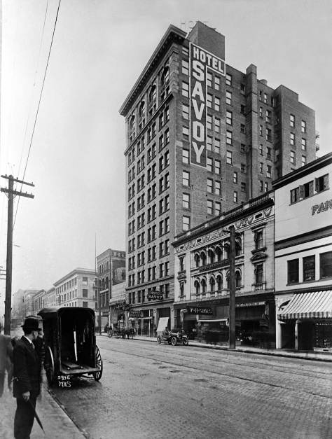


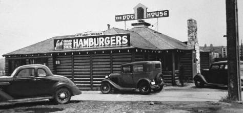


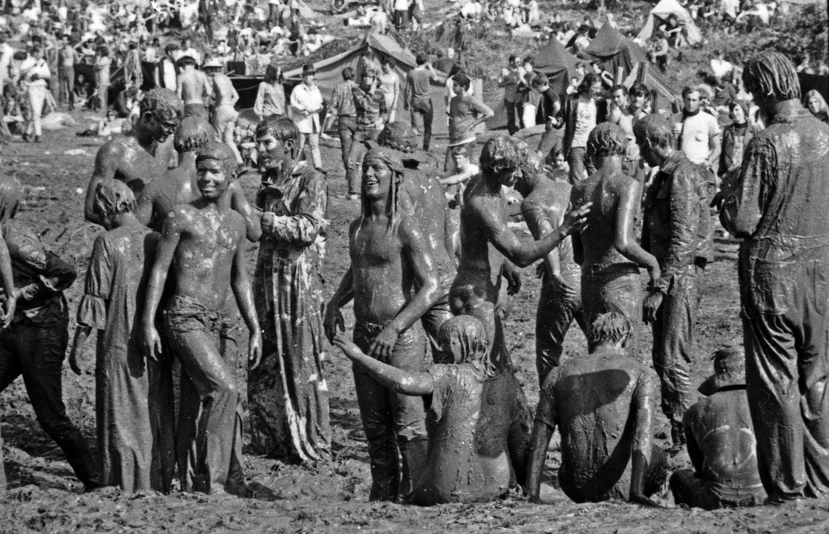


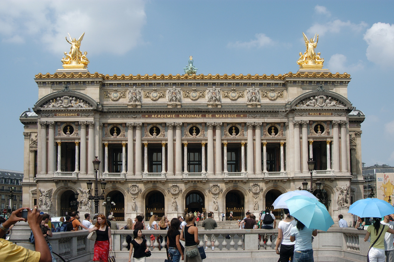


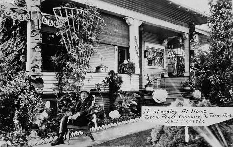


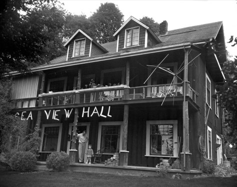


![THEN: From boxcars and rooftops to the planks of Railroad Avenue, excitement builds for the ceremonial re-enactment of the S.S.Portland’s 1897 landing with its “ton of gold” on the Seattle waterfront, the city’s first Golden Potlatch Celebration. [Courtesy, Michael Maslan]](https://i1.wp.com/pauldorpat.com/wp-content/uploads/2015/07/potlatch-watch-above-railroad-ave-now-mr.jpg?resize=474%2C365&ssl=1)


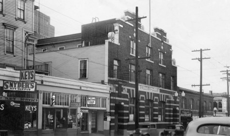


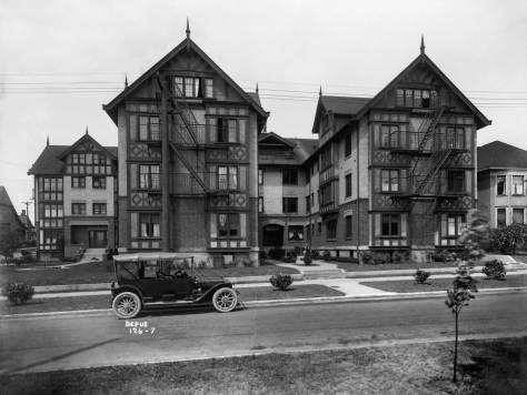


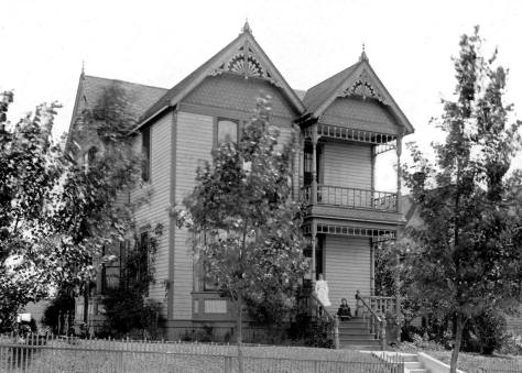


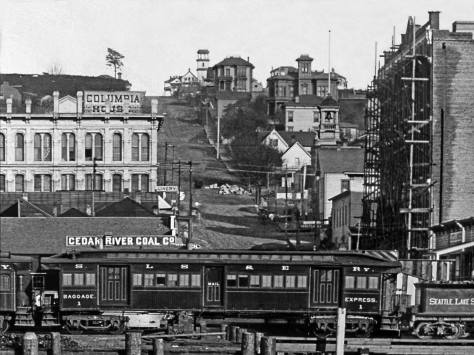
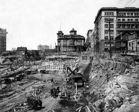


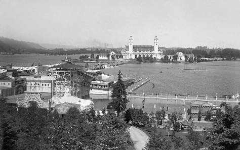


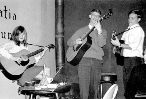


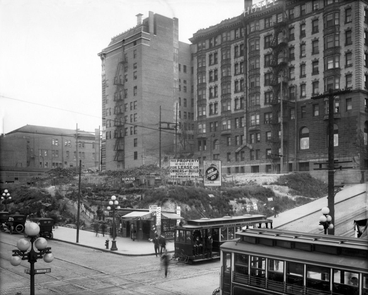
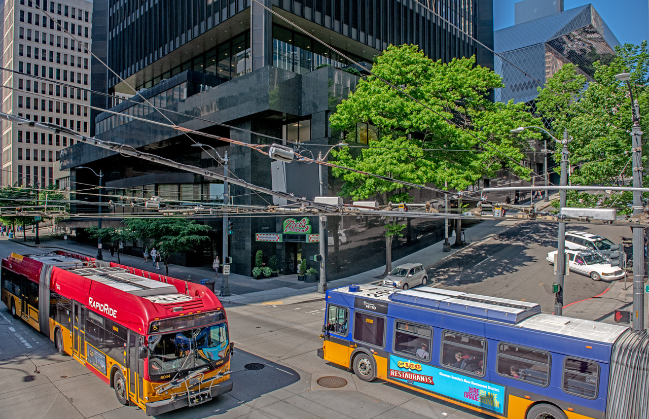


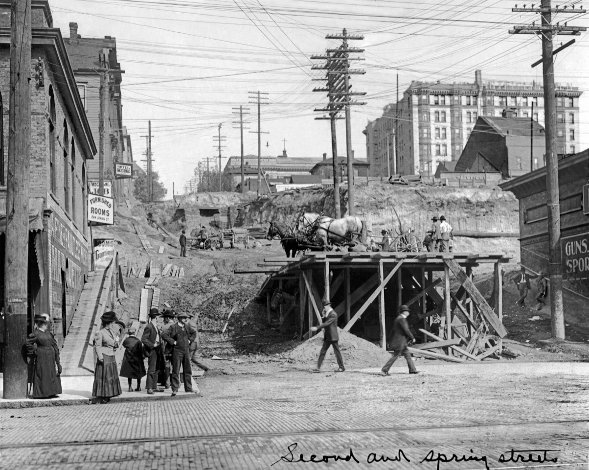


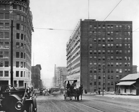
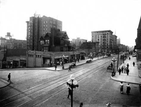
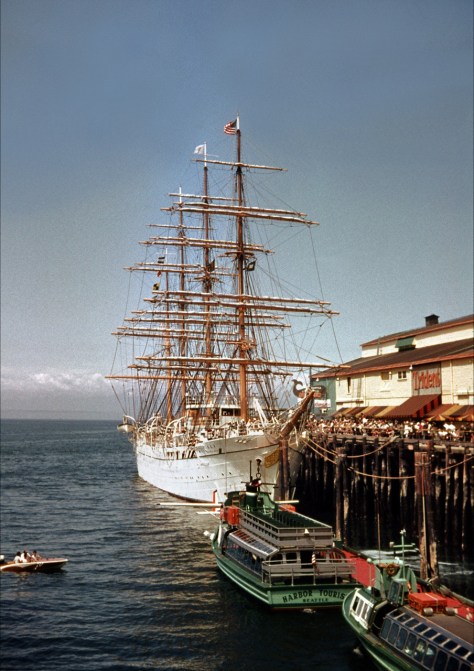


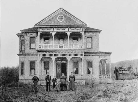


![THEN: The Gothic University of Washington Campus in 1946 beginning a seven-year crowding with prefabricated dormitories beside Frosh Pond. In the immediate background [on the right] is Guggenheim Hall. (Courtesy, Ron Edge)](https://i2.wp.com/pauldorpat.com/wp-content/uploads/2013/12/frosh-pond-housing-1946-then-mr1.jpg?resize=474%2C365)


![THEN: Looking north-northeast from a low knoll at the southwest corner of Seneca Street and Seventh Avenue, circa 1916. By 1925, a commercial automobile garage filled the vacant lot in the foreground. [Courtesy, Ron Edge]](https://i2.wp.com/pauldorpat.com/wp-content/uploads/2014/11/seneca-7th-mr-then.jpg?resize=474%2C353&ssl=1)


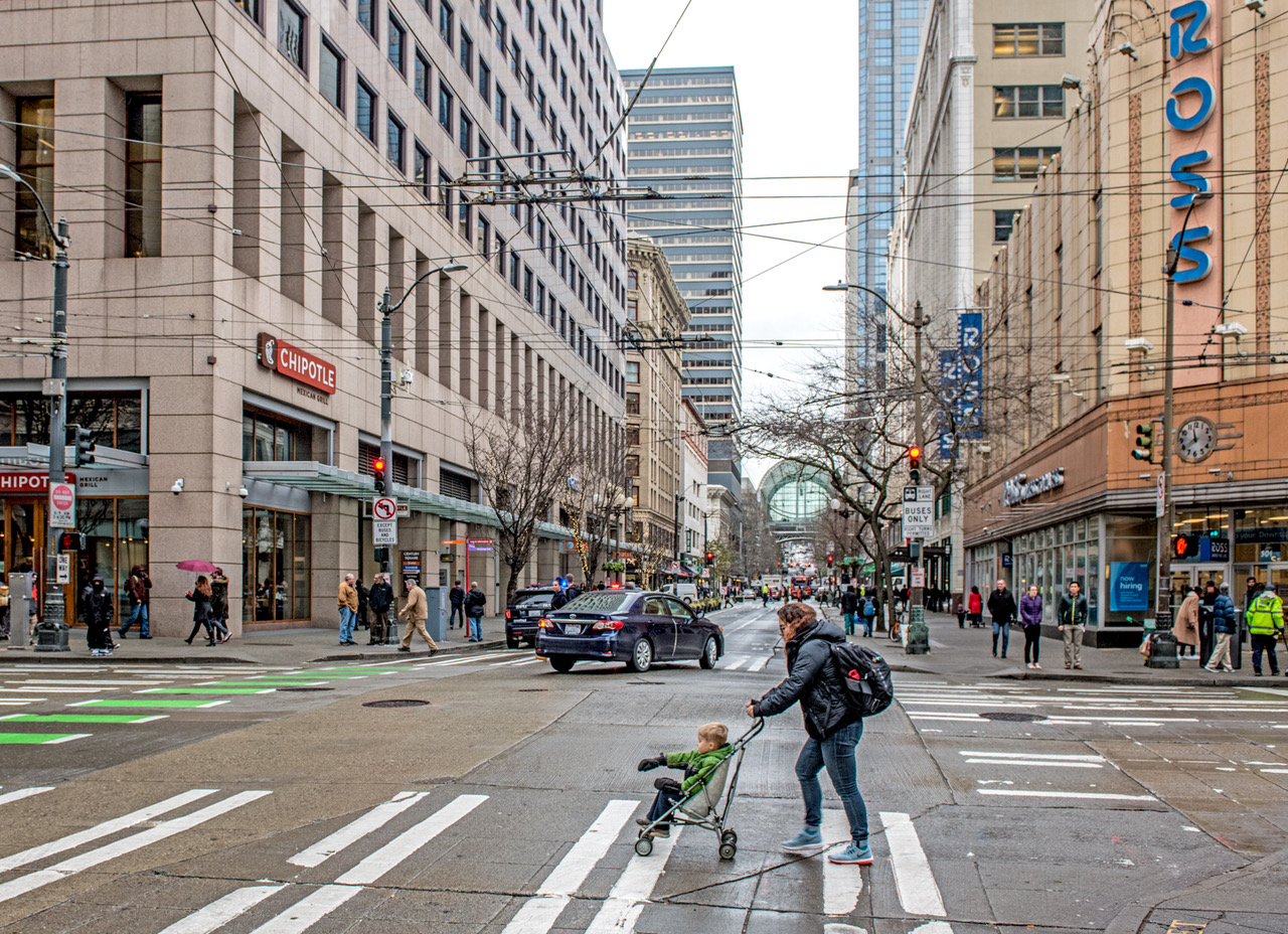


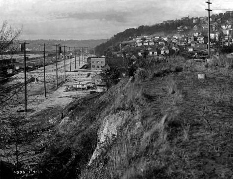





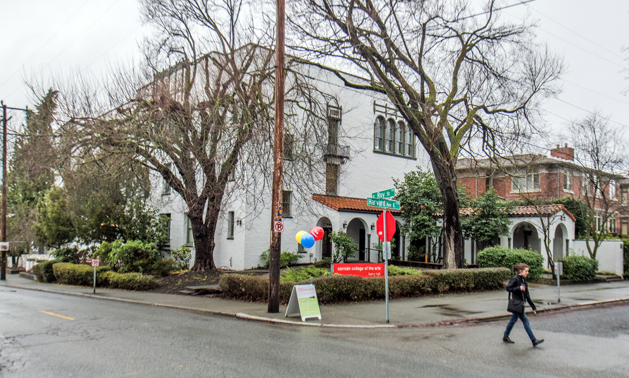


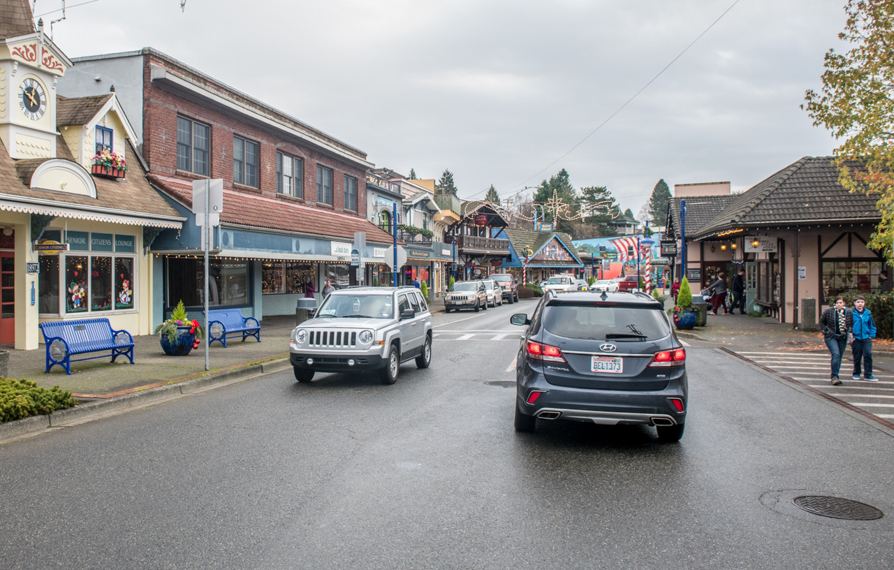


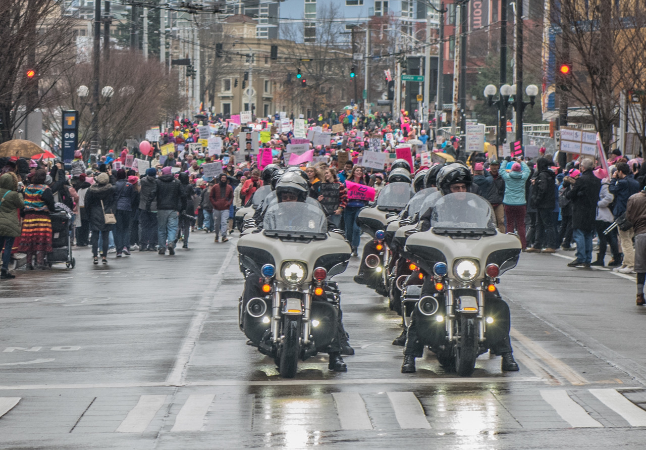
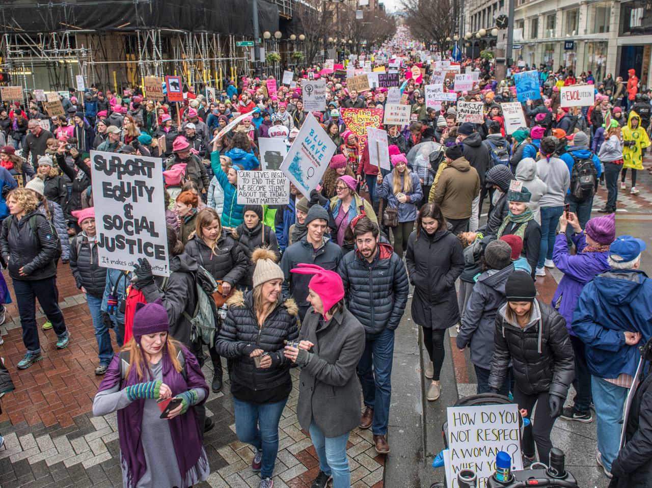


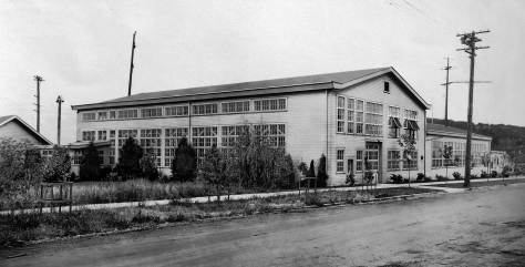


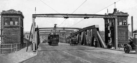


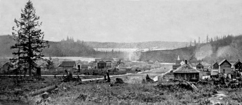




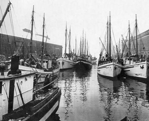


![THEN: From boxcars and rooftops to the planks of Railroad Avenue, excitement builds for the ceremonial re-enactment of the S.S.Portland’s 1897 landing with its “ton of gold” on the Seattle waterfront, the city’s first Golden Potlatch Celebration. [Courtesy, Michael Maslan]](https://i0.wp.com/pauldorpat.com/wp-content/uploads/2015/07/potlatch-watch-above-railroad-ave-now-mr.jpg?resize=474%2C365&ssl=1)


![THEN: The Gothic University of Washington Campus in 1946 beginning a seven-year crowding with prefabricated dormitories beside Frosh Pond. In the immediate background [on the right] is Guggenheim Hall. (Courtesy, Ron Edge)](https://i0.wp.com/pauldorpat.com/wp-content/uploads/2013/12/frosh-pond-housing-1946-then-mr1.jpg?resize=474%2C365&ssl=1)


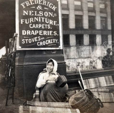


![THEN: Looking north-northeast from a low knoll at the southwest corner of Seneca Street and Seventh Avenue, circa 1916. By 1925, a commercial automobile garage filled the vacant lot in the foreground. [Courtesy, Ron Edge]](https://i0.wp.com/pauldorpat.com/wp-content/uploads/2014/11/seneca-7th-mr-then.jpg?resize=474%2C353&ssl=1)


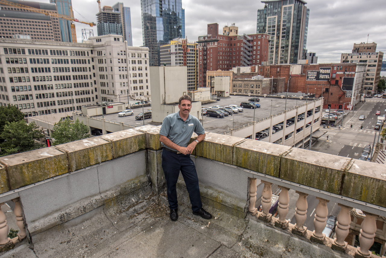


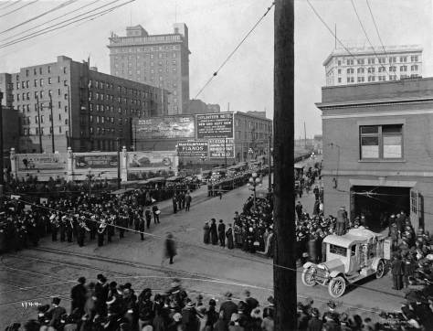


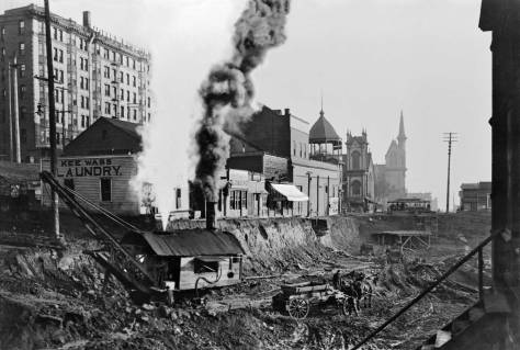


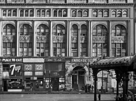


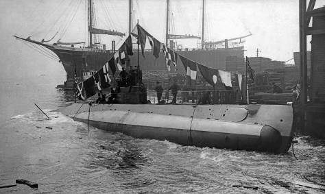


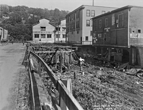


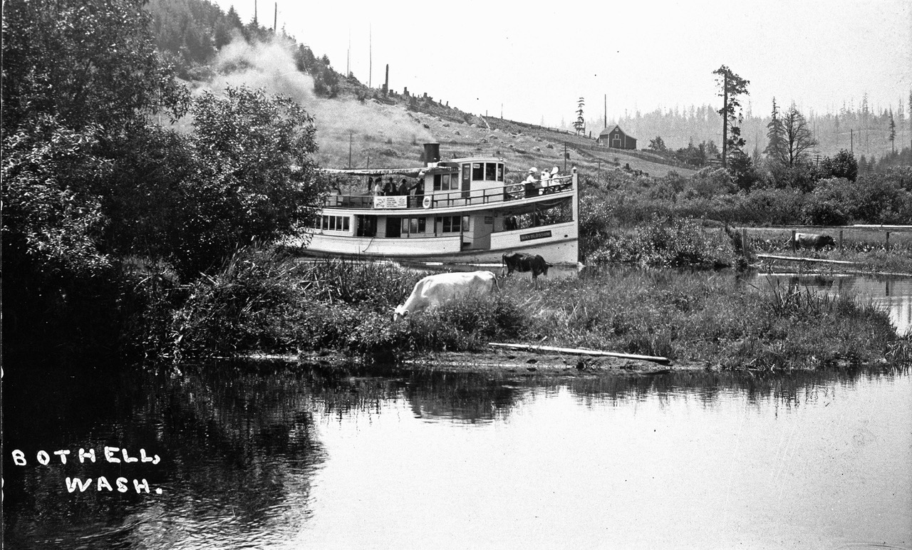


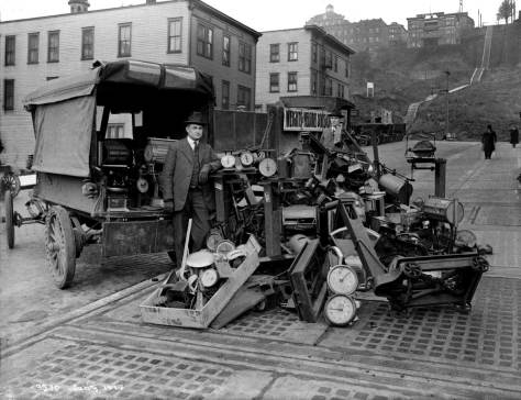


 ========
 =======


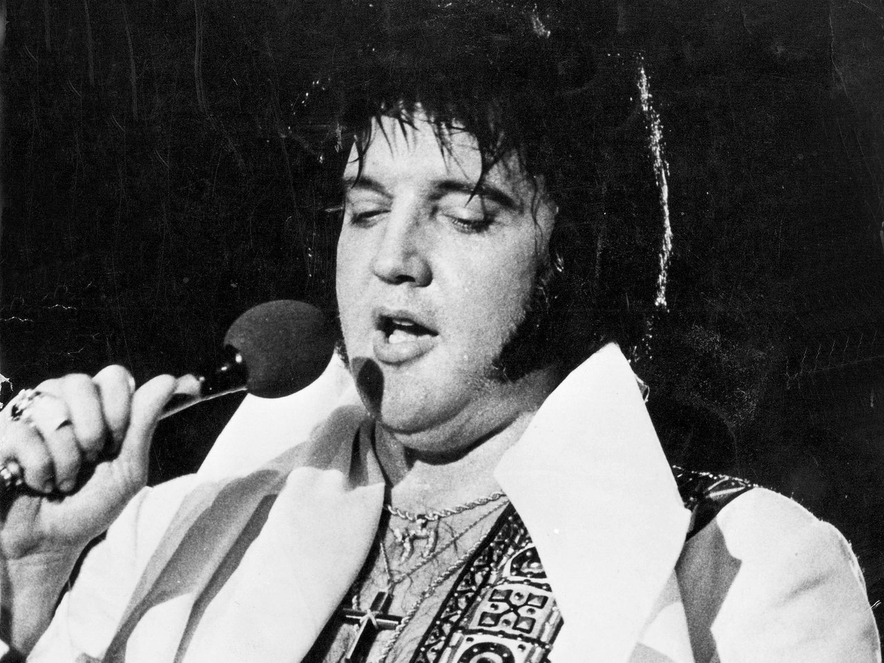


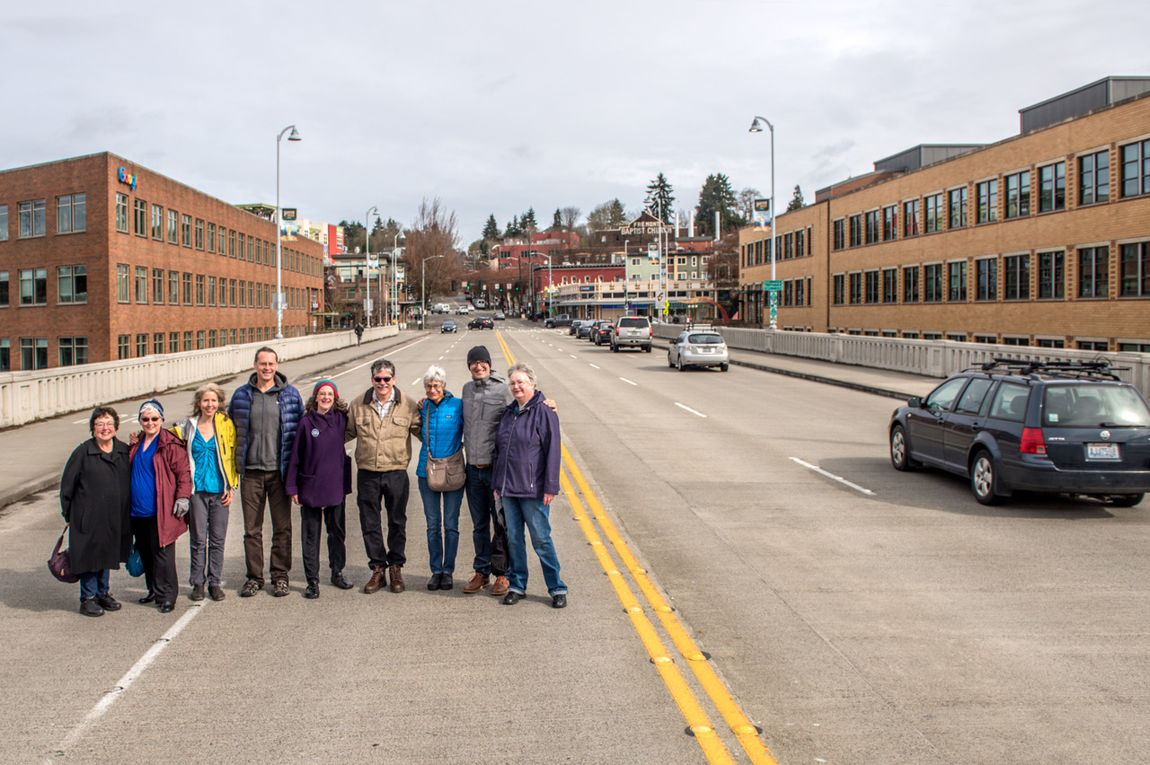




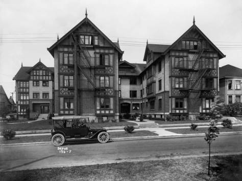


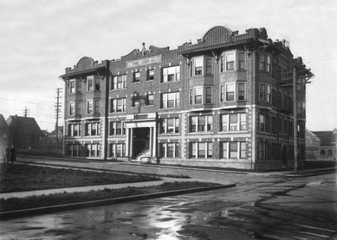


![From the Seattle Times for December 22, 1963. [Click it to Read it]](https://i0.wp.com/pauldorpat.com/wp-content/uploads/2016/12/z-ivar-don-stimes-12-22-63-ivar-mccune-8-days-of-xmas-web.jpg?ssl=1)


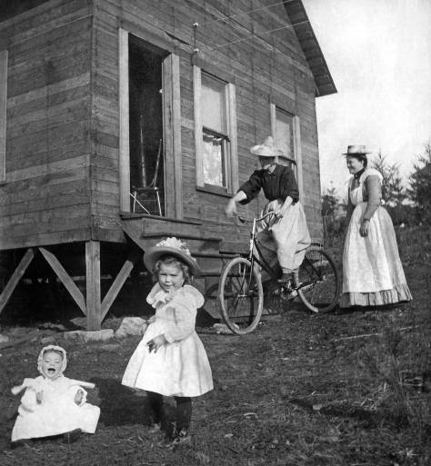


![Another by the California photographer McDonald taken during his brief stay in Seattle in the early 1890s. [Courtesy, Museum of History and Industry.]](https://i0.wp.com/pauldorpat.com/wp-content/uploads/2016/11/clip-cascade-cap-hill-fm-d-hill-ca91-web.jpg?ssl=1)


