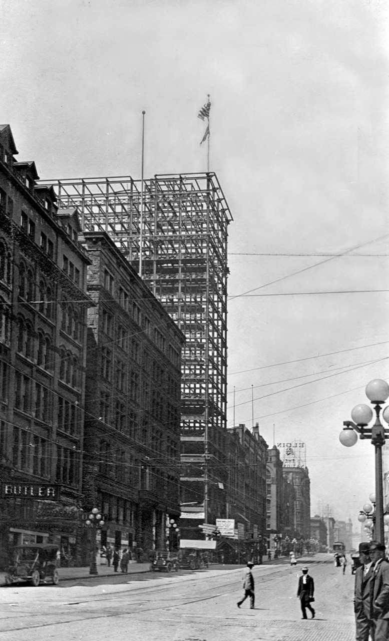
THEN1: Dating between 1938 and the mid-1940s, this postcard is a pre-Photoshop consolidation of two photos of Mack’s Totem Curio Shop, elevated above street level at 71 Marion Street Viaduct. In its first few years, Mack’s was a few doors west at 63-1/2. Be sure to click this photo twice to see the mismatch at bottom center. (Courtesy Dan Kerlee)THEN2: Albert Angus “Mack” McKillop stands at the entry to his shop, which bears a slightly different name, likely at 63-1/2 Marion Street Viaduct in the mid-1930s. (Courtesy Victoria McKillop)NOW: Wearing an ivory pendant made by her grandfather, Victoria McKillop of Ballard stands on the Marion Street Viaduct where her grandfather operated Mack’s Totem Curio Shop from 1933 to 1971. The viaduct was truncated during the 2019 demolition of the Alaskan Way Viaduct. Pedestrians now walk between First Avenue and Colman Dock along a new elevated walkway that doglegs via Columbia Street. (Clay Eals)
(Published in the Seattle Times online on Oct. 29, 2020
and in PacificNW Magazine of the print Times on Nov. 1, 2020)
Totem-shop postcard turns the corner on a curious puzzle
By Clay Eals
With this week’s “Then” photo, we present a visual puzzle whose clue is quite difficult to detect.
The subject is Mack’s Totem Curio Shop. Most Seattleites today associate the word “curio” with Ye Olde Curiosity Shop, for 121 years a tourist fixture with ghoulish attractions at several spots near or along the downtown waterfront, now at Pier 54.
But not much farther than a mummy’s throw away, Albert Angus “Mack” McKillop competed with Ye Olde for 38 years, from his store’s inception in 1933 to his death in 1971. His wares ranged from Native American carvings and Belfast cord (used in macramé) to fossils and walrus ivory (whose sale came under federal regulation in 1972).
Mack’s operated from the Marion Street Viaduct, a second-story bridge guiding countless pedestrians from First Avenue across Alaskan Way to the Colman Dock ferries and vice versa. Talk about storefront visibility.
That’s where the puzzle comes in. With carved panels, totem poles and bauble-filled windows, the shop stood near the middle of the elevated block. So why does this postcard depict Mack’s on a corner?
A detail of the mismatch in our “Then.” (Courtesy Ron Edge)
Our sleuths strained for clues by studying old maps, aerial photos and window reflections. Finally, Ron Edge enlarged the card to reveal that the lower bricks of the depicted corner do not exactly line up. Thus, discounting potentially poor masonry, we assume the card is a mash-up of two images, one facing east and the other facing south, to create a faux angle.
The postcard is among artifacts preserved by the family. Did McKillop create and sell the fabricated portrayal for his shop to be perceived as more conspicuous and prosperous? Did he assume newcomers, conned by the card, would forgive the deception upon their arrival? The answers remain … a curiosity.
Born in Manitoba in 1896, McKillop spent early adult years as a schooner seaman near Point Barrow, Alaska, before heading south at age 37 to start his Seattle business. His carved ivory gavels, earrings and belt buckles became a specialty.
His most celebrated showpiece, glaring from high on an interior wall, was a walrus head with four tusks. In 1956, McKillop told The Seattle Times he had found the rare remnant in a local tavern. His research indicated the animal was shot in 1915 in Siberia, and he claimed it was the world’s only known four-tusker.
McKillop was both craftsman and salesman. So one can wonder at the monogram — a mix of his A and M initials — visible at the base of the totem poles appearing at each end of the postcard. Did Mack commission or acquire the poles or carve them himself? Another unsolved puzzle!
WEB EXTRAS
To see Jean Sherrard‘s 360-degree video of the “Now” prospect and compare it with the “Then” photo, and to hear this column read aloud by Clay Eals, check out our Seattle Now & Then 360 version of the column!
Big thanks to Dan Kerlee, Ron Edge, Barbara Manning and especially Victoria McKillop for their invaluable help in assembling the elements and thrust of this column!
Below are 55 supplemental photos, a map, an email message, four certificates and, in chronological order, 43 historical clippings from The Seattle Times online archive (available via Seattle Public Library) and other online newspaper sources that relate to Mack’s Totem Curio Shop, A.A. McKillop and the Marion Street Viaduct and that were helpful in the preparation of this column.
A detail of the mismatch in our “Then.” (Courtesy Ron Edge)1905, site of future Marion Street Viaduct, looking west on Marion Street. (Courtesy Ron Edge)Pre-1930s Marion Street Viaduct, looking west. (Courtesy Ron Edge)Nov. 29, 1951, Mack’s Totem Curio Shop along the Marion Street Viaduct, looking west. (Seattle Municipal Archives)1950 Sanborn map address numbers for Marion Street Viaduct (north is up). (Courtesy Ron Edge)A.A. McKillop and son John (Courtesy Victoria McKillop)April 1, 1931, A.A. McKillop seaman’s application. (Courtesy Barbara Manning)Undated A.A. McKillop registration. (Courtesy Victoria McKillop)April 2, 1931, A.A. McKillop seaman’s protection certificate. (Courtesy Victoria McKillop)July 27, 1939, A.A. McKillop marriage registration, Victoria, B.C. (Courtesy Barbara Manning)1934 McKillop listing in city directory. (Courtesy Barbara Manning, Ron Edge)Undated, Albert Angus McKillop at his counter. (Courtesy Victoria McKillop)Undated, Albert Angus McKillop at desk with ivory. (Courtesy Victoria McKillop)Undated, Albert Angus McKillop outside shop with bird totem. (Courtesy Victoria McKillop)Undated, A.A. McKillop at shop entry. (Courtesy Victoria McKillop)1954 Mack’s Totem Curio Shop looking east. (Courtesy Seattle Public Library)Undated, Mack’s Totem Curio Shop looking east. (Courtesy Victoria McKillop)Undated, Mack’s Totem Curio Shop looking east. (Courtesy Victoria McKillop)Undated, Mack’s Totem Curio Shop looking east. (Courtesy Victoria McKillop)Undated, Mack’s Totem Curio Shop looking east. (Courtesy Victoria McKillop)Undated, Mack’s Totem Curio Shop looking south. (Courtesy Victoria McKillop)Undated, Mack’s Totem Curio Shop looking south. (Courtesy Victoria McKillop)Undated, Mack’s Totem Curio Shop looking south. (Courtesy Victoria McKillop)Undated, seven masks at Mack’s exterior. (Courtesy Victoria McKillop)Undated, totem outside Mack’s. (Courtesy Victoria McKillop)Undated, totem outside Mack’s. (Courtesy Victoria McKillop)Undated, totem outside Mack’s. (Courtesy Victoria McKillop)Undated, totem outside Mack’s. (Courtesy Victoria McKillop)Undated, totem outside Mack’s. (Courtesy Victoria McKillop)Undated, totem outside Mack’s. (Courtesy Victoria McKillop)Undated, totem outside Mack’s. (Courtesy Victoria McKillop)Undated, totem outside Mack’s. (Courtesy Victoria McKillop)Undated, totem outside Mack’s. (Courtesy Victoria McKillop)Undated, totem outside Mack’s. (Courtesy Victoria McKillop)Undated, totem outside Mack’s. (Courtesy Victoria McKillop)Undated, totem outside Mack’s. (Courtesy Victoria McKillop)Undated, totem outside Mack’s. (Courtesy Victoria McKillop)Undated, totem outside Mack’s. (Courtesy Victoria McKillop)Undated, masks outside Mack’s. (Courtesy Victoria McKillop)Undated, inside Mack’s. (Courtesy Victoria McKillop)Undated, inside Mack’s. (Courtesy Victoria McKillop)Undated, inside Mack’s. (Courtesy Victoria McKillop)Undated, four-tusk walrus inside Mack’s. (Courtesy Victoria McKillop)Undated, four-tusk walrus postcard. (Courtesy Victoria McKillop)Undated, Mack’s panel detail. (Clay Eals)Undated, Mack’s panel detail. (Clay Eals)Undated, Mack’s panel detail. (Clay Eals)Undated, Mack’s panel detail. (Clay Eals)Undated, Victoria McKillop with Mack’s panel. (Clay Eals)Undated, Mack’s panel. (Clay Eals)Undated, Mack’s panel detail. (Clay Eals)Undated, Mack’s panel detail. (Clay Eals)Undated, Mack’s panel detail. (Clay Eals)Undated, Mack’s panel. (Clay Eals)Undated, Mack’s panel. (Clay Eals)Undated, Mack’s panel. (Clay Eals)Mack’s two-tusk walrus head. (Clay Eals)Andrew Angus “Mack” McKillop signature on letter to wife. (Courtesy Victoria McKillop)Email message, Nov. 9, 2020, by Selene Higgins, niece of A.A. “Mack” McKillop.“Mack” McKillop’s wife Carmen as a child. (Courtesy Selene Higgins)The McKillop house on Bainbridge Island. (Courtesy Selene Higgins)March 10, 1909, Seattle Post-Intelligencer, page 13.March 11, 1909, Seattle Post-Intelligencer, page 6.July 3, 1909, Seattle Post-Intelligencer, page 12.Oct. 17, 1909, Seattle Post-Intelligencer, page 25.Dec. 18, 1910, Seattle Post-Intelligencer, page 22.Oct. 27, 1910, Seattle Times, page 76.Oct. 18, 1911, Seattle Post-Intelligencer, page 7.April 10, 1914, Seattle Post-Intelligencer, page 14.Nov. 17, 1914, Seattle Times, page 17.July 20, 1916, Seattle Post-Intelligencer, page 2.Oct. 7, 1916, Seattle Post-Intelligencer, page 4.March 4, 1917, Seattle Post-Intelligencer, page 10.Sept. 30, 1917, Seattle Post-Intelligencer, page 30.Oct. 6, 1918, Seattle Post-Intelligencer, page 9.Nov. 3, 1918, Seattle Post-Intelligencer, page 30.Dec. 8, 1918, Seattle Post-Intelligencer, page 39.Jan. 1, 1920, Seattle Post-Intelligencer, page 17.April 24, 1920, Seattle Post-Intelligencer, page 22.June 9, 1921, Seattle Times, page 20.Dec. 5, 1923, Seattle Post-Intelligencer, page 5.Sept. 10, 1939, Seattle Times, page 25.Aug. 7, 1940, Seattle Post-Intelligencer, page 19.June 7, 1942, Seattle Times, page 24.Sept. 6, 1943, Seattle Times, page 17.Nov. 24, 1947, Seattle Post-Intelligencer, page 16.Oct. 30, 1949, Seattle Times, page 23.June 22, 1955, Seattle Times, page 31.Dec. 30, 1955, Seattle Post-Intelligencer, page 23.March 6, 1956, Seattle Times, page 26.May 6, 1956, Seattle Times, page 115.Oct. 20, 1959, Seattle Times, page 23.
THEN1: Workers at C. Sidney Shepard & Co. assemble for a portrait in March 1904. The windows reflect the block-long Arcade Building directly across First Avenue, where the Seattle Art Museum stands today. (Courtesy, Ron Edge)THEN2: To mark the Lusty Lady’s last day on June 12, 2010, dancers – from left, Hexe, Wildflower, Isis, Heather and Tonya – gather at the entrance. For more of the story, visit photographer Erika Langley’s website at http://www.erikalangley.com. (Erika Langley)NOW: The Post Edwards building has been unoccupied since the 2010 closing of the Lusty Lady, though the interior has been gutted for eventual renovation. Two modern towers, the 25-story Harbor Steps Apartments and the Four Seasons Hotel, muscle in on either side. (Jean Sherrard)
(Published in the Seattle Times online on Oct. 22, 2020
and in PacificNW Magazine of the print Times on Oct. 25, 2020)
This classic masonry building met a lot of peeps along ‘Flesh Avenue’
By Jean Sherrard
This week’s “Then” photo features an amiable bunch of C. Sidney Shepard Co. employees who might have enjoyed a bit of wordplay if given a chance. Their short-lived wholesale metal shop operated between University and Union streets on the west side of First Avenue.
Mirrored reflections in the shop windows date the image. A billboard across the street promotes Denman Thompson’s touring production of “The Old Homestead” for March 17-19, 1904. Though the hit play tempted audiences for years to come, Shepard’s shop ended its run at the Post Edwards Building in 1906.
The Post Edwards (aka the Hotel Vendome) arose in the boom one year after the 1889 Great Seattle Fire. Prolific architect William E. Boone (descendant of Daniel of the legendary raccoon-skin cap) adopted the then-popular Romanesque Revival style. For torched Seattle, the fireproof masonry stonework offered a sense of security that wood could not.
The Hotel Vendome (“Commercial and Family Patronage specially solicited”) promoted itself as a respectable alternative to sketchier lodging on First Avenue, though itinerant psychics, mediums and spiritualists prowled its lower floors for decades. Madame Melbourne and Venus the Gypsy (who promised “satisfaction or no fee”) read the palms of Yukon-bound gold seekers, while the Rev. Edward Earle (“world’s greatest psychic”) foretold the fortunes of soldiers headed into what then was called the Great War.
By the mid-1940s, Anne and Lucius Avery had bought Post Edwards, rechristening it the Seven Seas Hotel and Tavern. Upon her death in 1969, “Mom” Avery was feted for her fondness for seafarers and skills as a bouncer, but the increasingly gritty street had filled with strip shows, porn and pawn shops, cementing its reputation as “Flesh Avenue.”
So when the Lusty Lady, the peep show with a famously punny marquee, arrived at the Post Edwards in 1985, it seemed to suit the neighborhood. Uniquely, however, the venue was run by women, and it was there, in 1992, that young photographer Erika Langley found a gutsy and radical project.
To tell the real story of the place, manager June Cade urged her to sign on as a dancer. Shy and terrified, Langley nevertheless agreed and never looked back. Her 1997 book “The Lusty Lady” was the celebrated result.
After publication, Langley continued dancing until 2004. “I learned so much about humans and sexuality and judgment,” she says, “and in this unlikely place, I had found my tribe.”
Since the 2010 closure of the Lusty Lady, the Post Edwards has drooped with inactivity. As the marquee might say, the building needs more than a sheet to test its metal.
WEB EXTRAS
First, most definitely visit ErikaLangley.com. She’s an amazing photographer with a genius for both image and storytelling.
To see our 360 video taken along First Avenue, and hear Jean’s accompanying narration, dance on over here.
THEN: This property-value assessor’s photo, looking west and slightly north from the intersection of Seventh Avenue and Lenora Street north of downtown, was taken Dec. 18, 1957. Car details from our automotive informant Bob Carney: (from left) on street 1953 Chevrolet, 1956 Buick Special and 1953 Chevrolet 210 sedan. To left of Lee Moran building: 1953 Chevrolet. To right of building: 1955 Mercury. The lineup of used cars facing the street: 1956 Lincoln, 1956 Mercury, 1954 Mercury, 1956 Mercury, 1955 Oldsmobile 88, 1955 Studebaker coupe, 1950 Buick (can barely see the portholes) and, at far right, 1957 Ford. (Puget Sound Regional Branch, Washington State Archives)NOW: Opened Jan. 30, 2018, the Amazon Spheres complex serves as the signature structure for the internet-based colossus. Standing three to four stories tall, the spheres mix 40,000 plants with meeting spaces and stores, but the orbs are closed during the coronavirus pandemic. (Jean Sherrard)
(Published in the Seattle Times online on Oct. 15, 2020
and in PacificNW Magazine of the print Times on Oct. 18, 2020)
Who could have predicted what these car lots would become?
By Clay Eals
Will Ferrell is mortally worried. Using the phrase “little did he know,” a stranger’s voice in his head is foretelling his death. He consults a literature professor, Dustin Hoffman, who warms to the puzzle by saying that he “once gave an entire seminar on ‘little did he know’ .”
Dustin Hoffman (left) and Will Ferrell in the 2006 film “Stranger Than Fiction.”
We jump from that scene in the 2006 film “Stranger than Fiction” (left) to our “Then” photo from Dec. 18, 1957. It captures a gent in a fedora driving a 1956 Buick Special and in momentary contemplation while stopped on Seventh Avenue at Lenora Street. Little did he know — or could anyone conceive — of the transformation 60 years later of this down-to-earth commercial tableau.
A stone’s throw from post-World War II downtown, this block is a typical 1950s tribute to the internal combustion engine, featuring the Lee Moran, W.R. Smith and ABC Fair-Way businesses and their symphony of signs: from “Cash for Cars” and “Cars under Cover” to “Highest Price for Used Cars” and “All Makes All Prices.” Car dealers had covered the block since the early 1940s, preceded by rental housing back to the century’s turn.
On the day this photo was taken (for use by the county to aid in assessing property tax), the weather forecast was familiar: “mostly cloudy with a few showers, occasional sun,” with a high of 45 to 50 degrees.
Gov. Albert Rosellini was inviting Seattle and King County to lead construction of a controversial second bridge across Lake Washington. Nationally, the first Atlas intercontinental missile was launched at Cape Canaveral, Alabama voters allowed the state to abolish a county in which Blacks outnumbered whites by more than 7 to 1, and actress Elizabeth Taylor underwent an appendectomy. Internationally, NATO delegates pushed Russia to resume disarmament talks.
Dec. 18, 1957, Frederick & Nelson ad, Seattle Post-Intelligencer, page 16. (Illustration by Bob Cram.) The “ultra-chrome dome home” resembles, among other things, the legendary Kalakala ferry.
Among newspaper ads this day was one for the classy Frederick & Nelson department store (right). The pitched product was women’s stockings, but the accompanying Bob Cram illustration was a huge, pre-Jetsons cartoon featuring a “man of tomorrow” having landed in a space vehicle and his wife dashing to greet him — in “Round-the-Clock superb sheers” — at the front door of their “ultra-chrome dome home.”
One might say that the many round-topped sedans in our “Then” photo serve as figurative domes, each one a sphere to represent the life of a driver or family.
Today we find the block dominated by the triple-orb greenhouse of Seattle-based Amazon. The online giant is doing everything it can — including, most recently, dabbling in drone delivery — to encompass all of us in its shopping sphere.
Where will that lead? Little do we know.
WEB EXTRAS
To see Jean Sherrard‘s 360-degree video of the “Now” prospect and compare it with the “Then” photo, and to hear this column read aloud by Clay Eals, check out our Seattle Now & Then 360 version of the column!
Below are three supplemental photos and, in chronological order, 21 historical clippings from The Seattle Times online archive (available via Seattle Public Library) and other online newspaper sources that were helpful in the preparation of this column.
Sept. 29, 1943, tax assessor’s photo of the same site as our “then” but taken from Sixth Avenue at the address 2016 Sixth Ave. Car details from our automotive informant Bob Carney: (from left) 1934 Studebaker, 1940 Plymouth, 1939 Ford Standard, and 1930 Studebaker Dictator. (Puget Sound Regional Branch, Washington State Archives)Dec. 18, 1957, tax assessor’s photo of the same site as our “then” but taken from Sixth Avenue at the address 2016 Sixth Ave. Car details from our automotive informant Bob Carney: (from left) 1956 Ford Fairlane, 1954 Chevrolet 210 station wagon, 1951 Nash and 1956 Chevrolet Bel Air. (Puget Sound Regional Branch, Washington State Archives)Sept. 8, 2020, Amazon Spheres, facing east from Sixth Avenue. (Jean Sherrard)May 31, 1903, Seattle Times, page 26.June 12, 1904, Seattle Times, page 13.June 3, 1910, Seattle Times, page 23.April 30, 1911, Seattle Times, page 39.July 9, 1911, Seattle Times, page 22.Oct. 5, 1913, Seattle Times, page 43.Dec. 14, 1913, Seattle Times, page 38.March 1, 1914, Seattle Times, page 43.Sept. 2, 1926, Seattle Times, page 27.Sept. 3, 1926, Seattle Times, page 29.Feb. 1, 1944, Seattle Times, page 19.Sept. 3, 1948, Seattle Times, page 35.May 19, 1954, Seattle Times, page 48.Feb. 25, 1955, Seattle Times, page 39.May 19, 1957, Seattle Times, page 56.Dec. 17, 1957, Seattle Post-Intelligencer, page 28.Dec. 18, 1957, Seattle Post-Intelligencer, page 11.Dec. 18, 1957, Frederick & Nelson ad, Seattle Post-Intelligencer, page 16. (Illustration by Bob Cram.)Dec. 18, 1957, Seattle Post-Intelligencer, page 17. (Illustration by Bob Cram.)Dec. 18, 1957, Seattle Post-Intelligencer, page 27.Dec. 19, 1957, Seattle Post-Intelligencer, page 40.
THEN: Three years before the creation of the Pike Place Market in 1907, an unknown photographer captured savory treats. Just right of the tunnel entrance, a temporary assembly line supplied rivers of concrete to line the tunnel walls. Meanwhile, at upper left, an intrepid gent peers over the precipitous edge of the retaining wall at the laborers below.NOW: A northbound Burlington Northern train emerges from the still-vital north portal onto a waterfront under construction. Concrete pillars and beams are being poured to support a new road connecting the waterfront to Belltown, the four-lane Elliott Way.
(Published in the Seattle Times online on Oct. 8, 2020
and in PacificNW Magazine of the print Times on Oct. 11, 2020)
The tunnel that reshaped the waterfront (no, not THAT one) by Jean Sherrard
Just over a year and half has passed since the ribbon-cutting ceremony opening the 1.7-mile Highway 99 tunnel that replaced the geriatric Alaskan Way Viaduct. Four years of burrowing with Bertha, one of the world’s largest tunnel borers, followed by two years of construction and months of viaduct demolition, left behind a wide-open waterfront, ripe for re-imagining.
That most ambitious of Seattle tunnels invites comparison with another one completed 115 years ago. It, too, was an attempt to solve a waterfront problem. Alaskan Way, originally Railroad Avenue, was ribbed with a wide swath of eight sets of parallel train tracks. The dangerous clatter and din of passing trains separated the upland city from its vigorous bay.
Seattle’s transformational city engineer, Reginald H. Thomson, devised the re-routing of some of that traffic, convincing James J. Hill, the Great Northern railroad magnate, to send his trains through a 5,141.5-foot tunnel from the waterfront to the proposed King Street train station (built in 1906 as a marble temple of transport suitable for the aspiring young city).
On April Fools Day 1903, construction commenced at the tunnel’s northern portal, employing pressure hoses to wash away vast tons of dirt and expose the face of the hillside. Within two months, work began a mile away on the south portal.
Hundreds of men at both ends dug day and night for two years in a fiercely competitive race to the middle. In a marvel of precision engineering, the two boreholes were only a fraction of an inch off when in October 1904 they met. Wags among the workers joked that they had built the longest tunnel in the world: from Virginia to Washington — streets, that is. And for its time, the tunnel did break records. When completed, it was the highest (25.8 feet) and widest (30 feet) tunnel in the world.
The tube was lined with 3-1/2 to 4-1/2 feet of concrete, reaching its deepest point 111 feet below Fourth and Spring. Curiously, it also delved through remains of an anaerobically preserved primeval forest at Fourth and Marion. (Soon after exposure to air, the trees reportedly turned to mulch.)
Though overhead property owners worried about their buildings’ foundations, the only actual casualty of construction was the Hotel York at the northwest corner of First and Pike (in our “Then” photo sporting an enormous mural puffing up Owl cigars). Its underpinning undermined, it was razed in November 1904. In 1912, it was replaced by the Corner Market Building, which to this day anchors the Pike Place Market.
WEB EXTRAS
To watch our 360 degree video, which includes two passing trains and Jean’s narration, click here.
Plus a bit of a backstory here. I found a lovely ‘then’ and tried to repeat it, only to discover that the quality was subpar. The original is not lost, but included in the many thousands that Paul donated to the SPL; so for the time being, unavailable. Here, then, is my first attempt at repeating the shot from below:
Alternate THEN: North portal under construction from belowMy alternate NOWMore from below. Girders lined up for the new Elliott Way. Victor Steinbrueck Park above…
And, in no particular order, shots of construction and trains!
Construction, double decker train cars and a receding ferry. Who could ask for anything more?
THEN: This nighttime view of the eastbound Mount Baker tunnel shows that the original twin tubes had two lanes apiece. The photo was taken at least a few weeks after the tunnel’s July 2, 1940, opening because the 3-foot wide interior sidewalks, with high curbs and pipe guardrail, were not installed until later that month. (University of Washington Libraries, Special Collections, TRA1001)NOW: Repeating the original path of our “Then,” this daytime view shows only two of the Mount Baker tunnel’s four present-day eastbound lanes for auto traffic. The other two, not pictured, emerge from the formerly westbound tunnel immediately to the north. (Jean Sherrard)
(Published in the Seattle Times online on Oct. 1, 2020
and in PacificNW Magazine of the print Times on Oct. 4, 2020)
In 1940, tunnel vision created a connection to the Eastside
By Clay Eals
As spooky as it is ethereal, our “Then” photo suggests Seattle barreling through a spacey cylinder to meet the future. The scene typifies our city’s bent for transforming its topography to satisfy urban dreams.
Eighty years ago, on July 2, 1940, an audacious dream — twin tunnels drilled through Mount Baker Ridge to connect Seattle to Mercer Island and the greater Eastside via an innovative bridge with floating concrete pontoons that crossed Lake Washington — became a reality that countless motorists take for granted today.
From the outset, the inextricably linked tunnels and bridge personified popularity, drawing 11,611 vehicles in the first 10-1/2 hours alone. To sustain this full-to-bursting stretch of what became an interstate artery, a companion tunnel and span were added a half-century later while, astonishingly, the original bridge sank and was quickly rebuilt.
Time was, Seattleites traveled east only by ferrying across or circumnavigating the elongated next-door lake. Some, including James Wood, Seattle Times associate editor, wanted to keep it that way.
“Just about the wildest dream ever to afflict an engineering mind is the proposed 8,000-foot concrete fence,” he wrote on Aug. 13, 1937. He called the tunnel-bridge project “a gross and wholly unnecessary obstruction.”
Prevailing, however, were campaigners for commerce. “The future prosperity of Seattle depends upon removing the barrier of the lake in order to gain easier access to the hinterland,” wrote Medina mogul Miller Freeman in the Jan. 9, 1938, Times. “It will providentially afford Seattle room for expansion in the only direction it can grow successfully.”
Thus the bridge and tunnels joined Seattle’s indelible identity. We of a certain age recall holding our breath through all 1,465 feet when parents drove us through one of the tunnels. Sometimes our elders humored us, generating a riotous echo by honking the car horn. But all was not childish fun.
As the neon indicates in our “Then,” when crossing the bridge to Mercer Island, drivers faced a variable toll of 25 to 45 cents, which ended in 1949. The curved arrow pointed to an abrupt “Lake Shore” entrance/exit opportunity tucked between the tunnels and bridge both east- and westbound at 35th Avenue South. A treacherous invitation to high-speed fender-benders and worse, it was curtailed in 1989.
Other tunnel-bridge idiosyncrasies, inconceivable today, triggered repeated fatalities. An awkward mid-bridge bulge to allow boat crossings was mercifully removed in 1981. Unprotected reversible lanes, instituted in 1960 to ease commuting, finally were eliminated in 1984.
Momentarily inattentive to the latter, as a fledgling 16-year-old driver in 1967 I barely avoided a head-on crash one afternoon.
The prospect still spooks me.
WEB EXTRAS
To see Jean Sherrard‘s 360-degree video of the “Now” prospect and compare it with the “Then” photo, and to hear this column read aloud by Clay Eals, check out our Seattle Now & Then 360 version of the column!
Below are seven present-day photos and, in chronological order, 62 historical clippings from The Seattle Times online archive (available via Seattle Public Library) and other online newspaper sources that were helpful in the preparation of this column. As a bonus, we’ve added a full-color cartoon map from 1940.
Traffic heads eastbound out of the two original Mount Baker tunnels on Aug. 28, 2020. Westbound traffic uses newer tunnels out of view at far right. (Clay Eals)A car emerges from the southernmost original Mount Baker tunnel, Aug. 28, 2020. The original “Portal of the North Pacific” concrete artwork is barely discernible at upper middle. (Clay Eals)Traffic crosses the Mercer Island Floating Bridge in this eastbound view from atop the Mount Baker tunnels, Aug. 28, 2020. (Clay Eals)Now a mere side street, 35th Avenue South dead-ends on the south side of the original Mount Baker tunnels, on Aug. 28, 2020. Here is where, for decades, eastbound drivers could enter the highway bridge or exit immediately after driving through the tunnel. Such access to the tunnel and bridge today is blocked and restricted to emergency vehicles. (Clay Eals)A plaque dedicating the bridge to designer Homer Hadley, Aug. 28, 2020. (Clay Eals)A plaque designating the bridge and tunnel a National Historic Civil Engineering Landmark, Aug. 28, 2020. (Clay Eals)With bridge traffic roaring in the distance, this plaque dedicates the bridge to state highway director Lacey V. Murrow, Aug. 28, 2020. (Clay Eals)Aug. 13, 1937, Seattle Times, page 6.Jan. 9, 1938, Seattle Times, page 8.May 15, 1938, Seattle Times, page 1.May 15, 1938, Seattle Times, page 4.June 26, 1938, Seattle Times, page 11.April 1, 1939, Seattle Times, page 27.Aug. 13, 1939, Seattle Times, page 42.Sept. 3, 1939, Seattle Times, page 35.Oct. 13, 1939, Seattle Times, page 16.Oct. 21, 1939, Seattle Times, page 1.Oct. 21, 1939, Seattle Times, page 2.Jan. 26, 1940, Seattle Post-Intelligencer, page 17.Feb. 5, 1940, Seattle Post-Intelligencer, page 11.Feb. 26, 1940, Seattle Post-Intelligencer, page 9.April 12, 1940, Seattle Post-Intelligencer, page 6.April 13, 1940, Seattle Post-Intelligencer, page 3.April 13, 1940, Seattle Post-Intelligencer, pages 1 and 3.May 19, 1940, Seattle Post-Intelligencer, page 27.May 31, 1940, Seattle Post-Intelligencer, page 17.June 8, 1940, Seattle Post-Intelligencer, page 9.June 14, 1940, Seattle Post-Intelligencer, page 1.June 14, 1940, Seattle Post-Intelligencer, page 3.June 14, 1940, Seattle Post-Intelligencer, page 5.June 30, 1940, Seattle Post-Intelligencer, page 1.June 30, 1940, Seattle Post-Intelligencer, page 16.June 30, 1940, Seattle Times, page 17.June 30, 1940, Seattle Times, page 19.July 3, 1940, Seattle Post-Intelligencer, page 1.July 3, 1940, Seattle Post-Intelligencer, page 6.July 3, 1940, Seattle Post-Intelligencer, page 6.July 3, 1940, Seattle Post-Intelligencer, page 7.July 4, 1940, Seattle Post-Intelligencer, page 6.July 10, 1940, Seattle Post-Intelligencer, page 10.July 21, 1940, Seattle Post-Intelligencer, page 66.Sept. 2, 1940, Seattle Post-Intelligencer, page 3.Sept. 19, 1940, Seattle Post-Intelligencer, page 9.Oct. 11, 1940, Seattle Post-Intelligencer, page 31.Cartoon map of the new floating bridge, 1940. (Randi Gustavson, Seattle Vintage)Oct. 13, 1940, Seattle Post-Intelligencer, page 58.Dec. 17, 1947, Seattle Post-Intelligencer, page 28.July 19, 1949, Southeast Missourian.Aug. 24, 1954, Seattle Times, page 4.Jan. 7, 1955, Seattle Times, page 8.May 31, 1955, Seattle Times, page 8.Feb. 3, 1957, Seattle Times, page 2.May 31, 1957, Seattle Times, page 21.Dec. 30, 1959, Seattle Times, page 17.March 16, 1960, Seattle Times, page 13.Feb. 22, 1961, Mercer Island Reporter.March 25, 1963, Seattle Times, page 5.Dec. 17, 1963, Seattle Times, page 10.Dec. 25, 1963, Seattle Times, page 67.Dec. 26, 1963, Seattle Times, page 10.Jan. 3, 1964, Seattle Times, page 10.Sept. 23, 1970, Seattle Post-Intelligencer, page 3.Jan. 17, 1974, Seattle Times, page 4.May 20, 1974, Seattle Times, page 11.Feb. 27, 1979, Seattle Times, page 12.Jan. 30, 1980, Seattle Times, page 10.Sept. 4, 1981, Seattle Times, page 98.Sept. 7, 1981, Seattle Times, page 1.April 13, 1984, Seattle Times, page 10.Aug. 16, 1984, Seattle Times, page 56.
THEN: Looking northeast, Harvey Bernard’s cloud-strewn portrait of the incomplete Ship Canal Bridge in October 1960 captures Seattle mid-transformation. The Interstate 5 freeway through Seattle opened in December 1962, and the entire Washington state portion was completed in 1969. (Courtesy, Harvey & Leo Bernard)NOW: Having helped triangulate Harvey Bernard’s original prospect on a hot, late summer day, Keenan Ingram (left) and Elijah Lev of Seattle anticipate diving into Lake Union to cool off. Seconds later, they did just that. (Jean Sherrard)
(Published in the Seattle Times online on Sept. 24, 2020
and in PacificNW Magazine of the print Times on Sept. 27, 2020)
A soaring salute to post-World War II car culture
By Jean Sherrard
World War II didn’t just beget a population boom. It also produced the throaty roar of automobile engines. Along with the proverbial chicken in every pot, a growing middle class aspired to afford a car in every garage.
To accommodate the soaring increase in traffic, the Federal Aid Highway Act of 1956 provided 90 percent funding for a nationwide network of controlled-access interstate highways. The proposed Interstate 5, crossing 1,381 miles between the Canadian and Mexican borders, became one of the jewels in its crown.
This week’s “Then” photo comes from Leo Bernard, whose father, Harvey, moved his young family to Seattle from Minnesota in 1954 to take a job with Boeing. “Photography and mountain climbing became his twin passions,” Leo says, “and we rarely saw him without a camera.”
From a boat deck near the north end of Lake Union, Harvey Bernard captured his Ektachrome transparency of the Lake Washington Ship Canal Bridge under construction in October 1960.
From his vantage, three of seven concrete piers tower above Lake Union, along with a diagonal hash of equilateral steel trusses, providing support for the imposing double-deck bridge. Within a year, its eight-lane wide upper deck and reversible four-lane lower deck would span the 4,429-foot gap between the University District and Capitol Hill. At the time, it was the longest bridge of its kind erected in the Pacific Northwest.
Just west of the piers, the Wayland Mill silo burner squats like an abandoned potbelly stove. The mill produced Bungalow brand cedar shingles for decades before closing after the war. Restaurateur Ivar Haglund purchased the property in 1966 and installed his Salmon House, which still stands today.
To the mill’s right, the nondescript, grey warehouse, built in 1954, was purchased in 1963 by George and Stan Pocock to construct their legendary racing shells. Pocock supplied shells for “The Boys in the Boat,” who rowed them to gold in the 1936 Berlin Olympics, a story featured last March in this column.
In 1989, Seattle-based glass artist Dale Chihuly bought the 11,352 square-foot building, converting it to a combined living space and glass-blowing studio.
For months, the span, when completed, was a bridge to nowhere. The southern reach of the Seattle freeway had become temporarily mired in controversies over labor and design. Thus, according to the encyclopedic tome “Building Washington” by Paul Dorpat and Genevieve McCoy, planners of the 1962 Seattle World’s Fair proposed using the bridge’s empty decks for overflow parking.
The scheme never materialized. But modern motorists are all too familiar with I-5 as a parking lot.
WEB EXTRAS
Check out Jean’s 360 degree video including a late summer boat ride – and featuring young Keenan and Elijah. To be posted soon.
Also, here are a few more lovely photos from Harvey Bernard, contributed by his son Leo.
Harvey Bernard with an early but beloved camera in the 1930s.Harvey Bernard in 1965.
Taken in 1970, says Leo – looks like the Salmon House is still under construction.From a West Seattle viewpoint, the Seafirst Tower (aka the box the Space Needle came in) under construction, 1968.Seafirst Tower under construction, 1968.Seattle skyline from North Beacon Hill.
Union Station after the 1965 earthquake.
More earthquake damage on Alki.Richard Nixon visited Seattle during his 1968 campaign.Washington state’s Gov. Dan Evans shaking Nixon’s hand.Harvey Bernard loved Mount Rainier.He visited the the mountain many times, says son Leo, who shared a favorite family photo on Rainier. Leo is second from the left, next to mom, with his two sisters and younger brother.
THEN: This May 2, 1955, view, looking west from 21st Avenue East along the East John/Thomas street arterial, shows clearing to the right (north) for the expansion of Miller Playfield. A 1949 Buick anchors the left foreground. In the distance at center are the Coryell Court Apartments, featured in the 1992 film “Singles.” (Courtesy Seattle Municipal Archives)NOW: Andrew Taylor, the informal Mayor of Miller Park for two decades, stands at the same intersection. (jean Sherrard)
(Published in the Seattle Times online on Sept. 17, 2020
and in PacificNW Magazine of the print Times on Sept. 20, 2020)
For an ever-changing neighborhood, we ‘single’ out Miller Park
By Clay Eals
These coronaviral days, when distant travel is discouraged, the elements defining our neighborhoods assume extra meaning. We more deeply value our collective, super-local identity even as it undergoes constant, if incremental change.
No exception is Miller Park.
The name may be unfamiliar to some. On the eastern side of Capitol Hill, the neighborhood embodies a trapezoid, bounded north-to-south by East Aloha and Madison streets and west-to-east by 19th and 23rd avenues. Its outskirts include business strips and high-profile hubs of health care (Kaiser Permanente, formerly Group Health), religion and education (St. Joseph Catholic Church and School, Holy Names Academy).
In the glen at its core lies a playground, the initial acreage for which came to the city in 1906 from namesake Mary M. Miller (see clarification below), whose descendants became major local landowners and conservation philanthropists. Next door is Edmund Meany Middle School, named for the University of Washington historian.
In our “Then,” taken May 2, 1955, looking west to the Capitol Hill crest, at right we see land recently cleared to augment the park prior to construction of a nearby community center. Sparse trees punctuate clusters of homes. In the distant center, the John/Thomas street arterial rises to pass a two-story brick building on 19th Avenue that nearly four decades later gained national fame.
Fronted by a communal courtyard, the Coryell Court Apartments, built in 1928, hosted Matt Dillon, Bridget Fonda and other actors playing 20-something love-seekers in Cameron Crowe’s 1992 film “Singles.” While the film widened Seattle’s reputation for grunge music, it also is known for a breathtaking visual finale. Shot from a helicopter, it starts tight on the Coryell building and pulls up to reveal the neighborhood and city.
Nearly 30 years hence, encased by the heavy foliage of mature trees, Miller Park is a mix of single- and multi-family housing. Its residents have reckoned with drug dealing, broadcast towers, affordable housing and today’s influx of transient tents in the park.
Such topics drew Andrew Taylor into the role of nerve center. The now-retired Fred Hutch scientist has lived in the house at the left edge of our “Then” since 1983. Known as the neighborhood’s informal mayor, he launched its newsletter (later a blog) in 1990.
For family reasons, he will move five miles north this fall, but despite the challenges of his “eclectic” soon-to-be former neighborhood, he cheerfully salutes it.
“It’s a quiet, modest oasis,” he says. “It’s ethnically and economically diverse, close to everything, with much activity but still peaceful enough for quiet contemplation.”
In other words, an apt model for our time.
WEB EXTRAS
To see Jean Sherrard‘s 360-degree video of the “Now” prospect and compare it with the “Then” photo, and to hear this column read aloud by Clay Eals, check out our Seattle Now & Then 360 version of the column!
Clarification: Jim Rupp of Seattle points out that while Mary Miller donated the initial land for Miller Playfield, the donation was made the family in the name of her son, Pendleton.
Below are two photos, a video link and a Seattle Parks historical illustration, as well as a clipping from The Seattle Times online archive (available via Seattle Public Library) or other online newspaper sources that were helpful in the preparation of this column.
For those interested in more details about Miller Park, the neighborhood association has a current website and a former website.
Here is an uncropped version of our “Then.” (Courtesy Seattle Municipal Archives)Here is a reverse angle of our “Then” photo, looking east along the John/Thomas arterial. (Courtesy Seattle Municipal Archives)CLICK PHOTO FOR VIDEO: Andrew Taylor, the informal mayor of Seattle’s Miller Park neighborhood, talks about its characteristics and issues. (14:50, Clay Eals)The Miller Park page of Seattle Parks’ Don Sherwood illustrated historical files. (Seattle Municipal Archives)Dec. 9, 1967, Seattle Post-Intelligencer, page 2.
THEN 1: The spire of Gethsemane Lutheran Church peeks out above the new Central Terminal’s tiled roof. On the far right of Asahel Curtis’s 1928 photo, a sliver of a Seattle-Everett Interurban train car can be seen. (Paul Dorpat collection)THEN 2: Jean’s 2010 repeat featured a still-thriving transit hub, surrounded by new construction.NOW: The 45-story Hyatt Regency looms over a nearly deserted Eighth Avenue. Around the corner but unseen, the Lutherans remain faithful. For more of Jean’s photos of the Greyhound station, including its 2015 demolition, see below. (Jean Sherrard)
(Published in the Seattle Times online on Sept. 10, 2020
and in PacificNW Magazine of the print Times on Sept. 13, 2020)
Greetings, goodbyes, and the growl of Greyhounds no more
By Jean Sherrard
I left home for the first time in the mid-1970s, bound for college on a cross-state bus. My parents stood together at the gates of the bustling Greyhound depot at Eighth and Stewart, but only my mom waved goodbye as if wiping a fogged window.
Just another emotional departure – to be followed a few months later by a joyful reunion – enacted in the charmless station, witness to decades of greetings, farewells and brimming buckets of tears.
Known for the slender, mid-stride canine in its visual brand, Greyhound began with a single 7-seat bus in 1915. The ubiquitous fleet rolled across America’s heartland and into its hearts, mythologized in popular culture as the buzzing locus of accessible romance and adventure.
From the Oscar-bedecked Frank Capra comedy “It Happened One Night” to Paul Simon’s aural anthem “America,” boarding a bus suggested the promise of open roads, unknown vistas and cute meets. But we’re getting ahead of ourselves.
Twenty years before Greyhound acquired it, Seattle’s Central Terminal was erected in 1927 by the Stone and Webster Management Company, a nationwide utilities cartel with fingers in many pies. (Its complex genealogy can be traced directly to today’s Puget Sound Energy.)
While anti-monopoly laws eventually divided the pies into smaller slices, its three-story, brick-clad Seattle structure was an innovation, accommodating motorized cross-country buses and intercity electric trains within a single station.
Its lively inauguration on Sept. 12, 1927, included a parade of progress along Stewart Street, led by a primitive, hand-drawn sled and concluding with “the most modern motor coach.” Bertha Landes, Seattle’s first female mayor and the honorary conductor, rang a trolley bell to herald the Seattle-Everett Interurban car’s virgin trip from the sparkling station.
This confident investment in the future of mixed-use travel had a shelf life of only 11 years. By 1939, buses shouldered out trains and tracks were torn up and smelted down, replaced by gasoline engines and rubber tires.
In 2015, the terminal was demolished, giving way to high-rise development. I have visited the site several times to capture a photographic whiff of those heartfelt arrivals and departures where Greyhounds once growled. That aroma, however, has been dispelled by the winds of change.
The newly completed Hyatt Regency monolith – at 45 stories and 1,260 rooms, Seattle’s largest hotel – surely boasts luxurious interiors and spectacular views of the city. But its glossy, street-level exterior seems uninviting.
A passing mail carrier offers a trenchant critique: “Five years ago, Eighth Avenue was filled with little shops and businesses. Now it’s all glass walls. Did you know that over there was once a bus depot?”
WEB EXTRAS
As promised, a few photos from 2010, when the depot was still operating at 8th and Stewart:
Signage along Stewart, looking west.The shit-colored floors were a distinctive featureDepartures and arrivals…A bus departs from beneath the steel canopy
Then a melancholy few from 2015, nearing the end of demolition:
THEN1: Pictured just north of today’s Broad Street on the Seattle waterfront by Norwegian photographer Anders Wilse in the late 1890s, Native Americans prepare dugout canoes for their waterborne trek to hop fields in the White and Puyallup river valleys. Queen Anne Hill peeks out at upper left. (Courtesy Museum of History & Industry)THEN2: One of five George Benson Waterfront Streetcars leaves the Broad Street Station in 2005, just prior to the line’s demise. The 1962 Space Needle anchors the scene at top. (Eric Bell)NOW: Straddling the two “Then” vantages, our contemporary view shows West Seattle bicyclist and photographer Eric Bell on Pier 70, before the seawall that fronts Seattle Art Museum’s Olympic Sculpture Park. To the right of the outsized human head of “Echo” by Jaume Plensa and below the vertical Pier 70 banner is the site of the former Broad Street station of the Benson streetcars. (Jean Sherrard)
(Published in the Seattle Times online on Sept. 3, 2020
and in PacificNW Magazine of the print Times on Sept. 6, 2020)
Waves of waterfront change: canoes to streetcars to sculpture
By Clay Eals
It’s natural to mourn the loss of things from younger days – old homes, favored stores – as if they had “always” been there. Self-centered sentiment can steal our sense that something else existed before we entered the arena.
Case in point: today’s pair of “Thens.”
If you lived here from 15 to 38 years ago, you may gravitate to the “Then” depicting the green-and-yellow glow of a George Benson Waterfront Streetcar leaving its Broad Street station and motoring south (right) to Pioneer Square and the Chinatown-International District.
The rickety streetcars – five total – were themselves nostalgia pieces, built in 1925-1930 in Australia and first operated there. Here, tourists loved them, and locals were proud, none more so than Benson, the pharmacist-turned-city councilman for whom they were named and who championed their transition to Seattle as an attraction for the masses. They were a direct nod to our city’s own streetcar heritage, which screeched to a halt by 1941, eventually overrun by petroleum-powered transit.
But what preceded the Benson streetcars? One answer lies in our earlier “Then,” from the late 1890s, angled more directly north and revealing a temporary Native American camp north of Broad (then Lake) Street, long before the city built a seawall there in the mid-1930s.
Pioneer journalist-historian Thomas Prosch labeled this a “common scene.” Via dugout canoes, Prosch said, Native Americans headed from Canada to the White and Puyallup river valleys, where up to 1,000 received low wages to pick hops, fueling a booming industry.
One century later, this waterfront stretch had evolved into pier-based offices and eateries and a breathtaking park named in 1976 for Myrtle Edwards, another city council member, fronting the northern terminus for the Benson streetcars and their maintenance barn when they commenced in 1982.
Having died in 2004, Benson didn’t witness the 2005 demise of his streetcars, whose barn was razed when Seattle Art Museum built its Olympic Sculpture Park, shown in our “Now.”
Some have strategized to revive the streetcars. But trackage and stations fell victim to the 2019 teardown of the nearby Alaskan Way Viaduct for its replacement by a tunnel. Today, a modern, light-rail connector to parallel the waterfront along First Avenue – which some would like to include two retrofitted Benson cars – is stalled by money woes.
Just as those who remembered the Native American canoes are gone, those of us who recall the Benson streetcars will vanish, and the collective memory of the area will default to Olympic Sculpture Park. For the attractive and lucrative waterfront, however, we surely can forecast relentless waves of change.
WEB EXTRAS
To see Jean Sherrard‘s 360-degree video of the “Now” prospect and compare it with the “Then” photo, and to hear this column read aloud by Clay Eals, check out our Seattle Now & Then 360 version of the column!
Below are eight clippings from The Seattle Times online archive (available via Seattle Public Library) and other online newspaper sources that were helpful in the preparation of this column.
Also, check out 18 additional photos, including 13 by West Seattle’s Eric Bell, that were helpful in the preparation of this column. Bell, who worked on the waterfront in 2005, says the failure to retain and incorporate the Benson streetcars was a huge missed opportunity for the city.
May 18, 1980, Seattle Times, page 124.July 18, 1980, Seattle Times, page 16.March 13, 1981, Seattle Post-Intelligencer, page 56.April 4, 1981, The Oregonian, page 1.June 16, 1981, Seattle Post-Intelligencer, page 1.May 18, 1982, Seattle Times, page 67.May 30, 1982, Seattle Post-Intelligencer, page 3.June 24, 1982, Seattle Times, page 72.Sanborn plate #62 from 1893, showing the location of our first “Then.” (Courtesy Ron Edge)A 1935 aerial view of the waterfront from Laidlaw and the Museum of History & Industry. (Courtesy Ron Edge)A 1935 view of the waterfront seawall under construction. (Courtesy Ron Edge)Elliott Couden (left), further real-estate agent and civil-rights and heritage activist, stands in 1939 with George Benson, future Seattle City Council member, in front of their rooming house in the Green Lake neighborhood. (Elliott Couden collection)An anachronistic George Benson Waterfront Streetcar crossing sign remains today along Alaskan Way. (Clay Eals)A 2005 view of a northbound George Benson Waterfront Streetcar, W2-class car 512 leaving Vine Street. (Eric Bell)A 2005 view of a southbound George Benson Waterfront Streetcar. “The writing is on the wall,” says Eric Bell. “The background beckons the end of the line for the streetcars.” (Eric Bell)A 2005 view of a southbound George Benson Waterfront Streetcar and the maintenance barn. Seattle Art Museum’s Olympic Sculpture Park now sits on this site. (Eric Bell)A 2005 view of a northbound George Benson Waterfront Streetcar. Eric Bell says, “The timber and windows of car 482 complement the glazing of the former Seattle Trade Center.” (Eric Bell)A 2005 view of the interior of a George Benson Waterfront Streetcar. “It’s a non-seasonal day,” says Eric Bell. “Gone are the lunch crowd and tourists.” (Eric Bell)A 2005 view of a southbound George Benson Waterfront Streetcar, W2-class car 512 in Pioneer Square, with the Alaskan Way Viaduct in the background. “To this day,” says Eric Bell, “I can still feel the car rumble by me.” (Eric Bell)A 2005 view of a George Benson Waterfront Streetcar at Jackson Street, the southern terminus in the Chinatown-International District. (Eric Bell)A November 2005 view of two disengaged George Benson Waterfront Streetcars ready for transport. “The advertising,” says Eric Bell, “mocks instead of entices.” (Eric Bell)A 2005 view of a George Benson Waterfront Streetcar, W2-class car 605, zooming along at 25 mph along the waterfront. (Eric Bell)A 2005 view inside a George Benson Waterfront Streetcar, indicating that the W2-class cars, produced in 1927 in Australia, largely retained their decor until service ended. (Eric Bell)A 2005 view of the car number of a George Benson Waterfront Streetcar. The cars retained their original numbers and 1920s headlight design. (Eric Bell)A 2005 view of a George Benson Waterfront Streetcar logo, originally from the Melbourne and Metropolitan Tramways Board. (Eric Bell)
THEN: Heading southwest along City Hall Park is a city ambulance that our auto informant Bob Carney identifies as a White Motor Company 1-ton truck from the early 1920s. In the background on Fourth Avenue is the Beaux Arts-style King County Courthouse, which topped out in 1916 at a modest five stories. A slice of Smith Tower peeks out upper left. (Courtesy Bert and Elizabeth Prescott)NOW: Another groundbreaking innovation in Seattle began with the creation of Medic One in 1970. Firefighter/EMT Casey Stockwell stations his truck in precisely the same spot as the city ambulance. Oak trees conceal the 10 additional floors added to the courthouse by 1931. A ball-capped concrete gatepost stands behind the front bumpers in both images. (Jean Sherrard)
(Published in the Seattle Times online on Aug. 27, 2020
and in PacificNW Magazine of the print Times on Aug. 30, 2020)
A hearse is a hearse, except when it was an ambulance
By Jean Sherrard
As our pandemic-proscribed summer wanes, we may mourn canceled vacations and neighborhood barbecues, but another singularly American institution, beloved by scavengers, collectors and photo-historians, also has bit the dust – the garage sale.
This week’s “Then” is from an album discovered in West Seattle by Bert Prescott at just such a sale in the 1970s. The collection, dating between 1921 and 1923 and shot by an anonymous photographer, features more than 60 images of commercial and official vehicles, ranging from milk and grocery delivery vans to buses and construction and fire trucks.
This ambulance of “The City of Seattle,” captured on Fourth Avenue near City Hall Park, is both lovely and rare. Serving the City Emergency Hospital, literally a stone’s throw away, the vehicle provides insight into a transitional moment in Seattle medical history.
Along with police headquarters, the city jail and the health and sanitation department, the hospital was crammed into the flatiron Public Safety building (now 400 Yesler), and space was at a premium. A city-owned ambulance was an extravagance soon to be replaced with a more economical solution.
Typically, hospitals of the time contracted with funeral homes for emergency transport, providing a profitable second use for hearses. And it passed muster. Whether injured or deceased, prone human bodies require similar dimensions for delivery.
Jason Engler, an Austin, Texas, funeral director and historian for the National Museum of Funeral History, provides a related piece of undertaker lore. “A hearse would get to the cemetery,” he says, “and no sooner had pallbearers removed the casket than they’d head back out on an ambulance call.”
In trade lingo, they were exchanging their black coats for white ones. What’s more, went a morbid joke, if a patient’s survival seemed dubious, an undertaker might dawdle round the block before reaching the hospital, perhaps instead ending up at the funeral home.
In forward-thinking Seattle, Engler suggests, some citizens seemed to treat the joke seriously. To change the status quo, a mayoral delegation traveled in 1922 to Portland, where an enterprising Frank Shepard ran a successful ambulance service unaffiliated with funeral homes. Might he be persuaded to move north?
Shepard agreed, with conditions. Relocating to Seattle in 1923, he purchased ambulances from Butterworth Funeral Home and negotiated a non-compete agreement: Area funeral homes would stop providing emergency transport if Shepard agreed to stay out of the funeral business.
By 1924, the city of Seattle contracted with Shepard Ambulance to serve its hospitals. Over the decades, the company steadily expanded until 1995, when it merged with American Medical Response (AMR).
WEB EXTRAS
Check back soon for our 360 degree video featuring this location.
On April 28, 2021, the Association of King County Historical Organizations ( AKCHO) announced its selection of Magnolia: Midcentury Memories as winner of the group’s annual Long-Term Project award. The award ceremony, to be held via Zoom, is scheduled for 5:30 p.m. Tuesday, May 25, 2021. Congratulations to Monica Wooton and all others associated with this project!
=====
(click and click again to enlarge photos)
THEN: A house sits mid-move on 34th Avenue West just north of the Magnolia Theatre between June 11 and June 17, 1963, when “It Happened at the World’s Fair” and the Connie Francis vehicle “Follow the Boys” played the second-run house. The theater hit a peak in 1969 as the only place in Seattle to see “Oliver!” in first run, but it closed in 1974 and was razed in 1977. (Ken Baxter / Courtesy Magnolia Historical Society)NOW: Socially distanced and most with masks down, (from left) Jeff Graham, Tab Melton, Brian Hogan, Gene Willard, Dan Kerlee, Kathy Cunningham, Sherrie Quinton, Mike Musslewhite and editor Monica Wooton from the nearly 70-member team that produced “Magnolia: Midcentury Memories” look southwest in front of Chase Bank, whose previous incarnation, Washington Mutual Savings Bank, opened a branch on the Magnolia Theatre site in 1978. For info on the book’s launch, visit magnoliahistoricalsociety.org. (Jean Sherrard)
(Published in the Seattle Times online on Aug. 20, 2020
and in PacificNW Magazine of the print Times on Aug. 23, 2020)
For Magnolia baby boomers, it happened at the midcentury
By Clay Eals
Grab a giant popcorn. This week’s “Then” premieres a triple feature.
The photo comes from a project that enlisted 60 writers to document baby boomers’ youthful years in the Magnolia neighborhood. Just-released Magnolia: Midcentury Memories is the third coffee-table book assembled this century by volunteers and represented by the Magnolia Historical Society.
With 448 pages and 450-plus photos, the volume dives into everything from military family life at Fort Lawton (now Discovery Park) to peninsula-wide immigrant roots and racist redlining, from mudslides along the Perkins Lane cliffs to the demise of the Interbay garbage dump.
In our “Then,” the marquee points to the photo’s date (mid-June 1963) and our first feature, the Seattle World’s Fair. The book notes that Fort Lawton was considered for the 1962 exposition site and that from the Magnolia Bridge locals could see the eventual fairgrounds take shape.
Among memories of the fair from then-upper-grade students – most who attended Queen Anne High School, which peered over what is now Seattle Center – is that of Cheryl Peterson Bower. In the book, she tells of securing two autographs, for her and her sister, from Elvis Presley, who was at the fair to star in the marquee movie. But the crooner “signed both sides of the paper dead in the middle, making it impossible to share.”
Parked near the marquee is our second feature, a midcentury house mid-move. This symbolizes a time 14 years prior when Magnolians vigorously debated whether 20 homes to the north should be condemned to make way for a combined junior high school and fieldhouse. What The Seattle Times labeled “Seattle’s most explosive community controversy in many years” ended with a go-ahead. Some houses made dramatic treks in 1950-1951 to vacant lots nearby.
“It was quite a sight for a 5-year-old to see her house being driven down the street,” Karin Barter Fielding says in the book. “It was such a big event for the family. I still talk about it.”
Our third feature is the Magnolia Theatre itself. Opening Nov. 25, 1948, with Cary Grant in “Mr. Blandings Builds His Dream House,” it was the largest commercial building in the shopping district, dubbed “the Village.” Seating 985 people, it became a true community center.
Michael Musselwhite, who worked there 1959-1963 as a teen, writes that a tavern was barred from buying on-screen advertising “because children were usually in attendance” and that changing the marquee each Monday evening took two students, a tall ladder and 2-1/2 hours.
A Magnolia blockbuster, the book uses only the right half of our “Then.” So consider this photo the widescreen version!
WEB EXTRAS
To see Jean Sherrard‘s 360-degree video of the “Now” prospect and compare it with the “Then” photo, and to hear this column read aloud by Clay Eals, check out our Seattle Now & Then 360 version of the column!
Below are three additional photos, as well as nine clippings from The Seattle Times online archive (available via Seattle Public Library) that were helpful in the preparation of this column. As a bonus, right at the top you will find a nearly five-minute video featuring Monica Wooton, editor of “Magnolia: Midcentury Memories.” Enjoy!
VIDEO: Click photo to see video of Monica Wooton, editor of “Magnolia: Midcentury Memories,” describing the book’s process and product. (Clay Eals)Cover of “Magnolia: Midcentury Memories”The Magnolia Theatre marquee shines in 1949. (Courtesy Magnolia Historical Society)June 11, 1963, Seattle Times, page 17, listing for movies on the marquee in our “Then.”June 11-17, 1963, an alternate to our “Then” photo, showing the same house being moved. (Courtesy Magnolia Historical Society)Jan. 12, 1969, Seattle Times, locator graphic from Magnolia Theatre ad.Jan. 28, 1969, Seattle Times, page 10, ad for exclusive Seattle engagement of “Oliver!”Jan. 30, 1969, Seattle Times, page 10.July 20, 1969, Seattle Times, Magnolia Theatre ad after “Oliver!” had won Best Picture at the Oscars.Nov. 7, 1974, Seattle Times, page 545, announcement of closure.Dec. 3, 1974, Seattle Times, page 38, closing night for the Magnolia.July 17, 1977, Seattle Times, page 51, building demolition.Sept. 8, 1979, Seattle Times, page 17.
THEN1: A family photo of rootin’-tootin’ 4-year old Paul in his parents’ backyard in Grand Forks, North Dakota. Snapped by his dad in 1942, this portrait is what Paul calls in retrospect, “Saving the World for Democracy.”THEN2: Promoting and producing the Sky River Rock Festival and Lighter Than Air Fair near Sultan in 1968, the world’s first multi-day, outdoor rock festivals held on a farm, Paul (right) pauses in his duties for a photo with long-time pal novelist Tom Robbins.THEN3: Around the time Paul’s “Now & Then” column began in The Seattle Times in 1982, Paul pays a visit to his friend and mentor Murray Morgan, writer of “Skid Road,” at Morgan’s cabin on Harstine Island in the South Sound. (Courtesy, Genevieve McCoy)NOW: Pre-pandemic on the waterfront, Paul Dorpat lobs French fries over his shoulder to an admiring trio of seagulls, while also, perhaps, blessing his beloved city. (Jean Sherrard)
(Published in the Seattle Times online on Aug. 13, 2020
and in PacificNW Magazine of the print Times on Aug. 16, 2020)
A colossal contribution, and a blast from Paul Dorpat’s present
By Jean Sherrard
This week we drop in on our “Now & Then” column founder, Paul Dorpat.
For 37 years, his witty wisdom (and wise wit), drawn from deep wells of history – and a vast collection of old photos – provided a weekly fount of delight for thousands of fans. Clay Eals and I take ongoing inspiration from Paul’s legacy, but Dorpat ain’t done yet.
Having recently moved from Wallingford into senior housing near the Pike Place Market, he has overseen the contribution of his extensive archive of historical books and manuscripts, as well as more than 300,000 images, to Seattle Public Library.
“I hope my donation will inspire others to do the same,” Paul says. “When we protect and share our history, we can give our community a depth that’s truly resounding.”
Andrew Harbison, the library’s assistant director of Collections and Access Services, concurs: “We’re thrilled to receive this incredible gift and look forward to making the collection available for the public to see and enjoy.”
But that’s not all.
Along with the rest of us, chafing at the isolation imposed by COVID-19, Dorpat continues to collate his many thousands of hours of documentary film and video, dedicated to making this treasure trove available for future generations of historians and documentarians.
“For me, revisiting the past,” Paul says, “has always been a blast.”
WEB EXTRAS
A few more bonbons for friends and fans alike.
Here’s one of my favorites. When Paul and I took a 2005 trip to London and Paris together, we met up with our dear friend and colleague Berangere Lomont (a professional photographer who has through the years served this column as our Paris correspondent). While strolling in the 5th Arr., we did a double take. Paul’s doppelgänger was sitting at a street-side cafe table! The photo op was too good to be missed. Paul sauntered over to the adjoining table and sat down, pretending to examine a menu.
Paul sitting next to his twin in Paris, 2005 (Berangere Lomont)
Berangere took the still and, trying unsuccessfully not to laugh, I pointed the video camera.
More recently, Clay Eals managed to capture a video of Paul feeding gulls on the waterfront (the perfect accompaniment to my still photo used in the column).
Click on photo to see Clay’s video on YouTube.
And in no particular order, a clutch of Paul pix throughout the years.
Paul, baby of the family, accompanied by brothers Dave, Norm and Ted (clockwise from Paul).Paul with his dad, Rev. Theodore Dorpat, and mom Cherry Dorpat (inset)Paul in London, 2005Paul with former roommate Bill Burden and Berangere, Paris 2005.Paul and Berangere on the Champs Elysees, 2005Paul with long-time friends Mike and Donna James, 2007. Paul, a registered potentate of the Universal Life church, officiated at Mike and Donna’s wedding.Paul at Bumbershoot with One Reel’s Norm Langill (plus mime)Paul and Jean in the Good Shepherd Center’s grotto, posing for ‘Rogue’s Christmas’ PRPaul with pal Marc Cutler in Bellingham, 2005Paul signs our book ‘Washington Then and Now’ at Costco, 2007Paul with historian Alan Stein at the Lakeview CemeteryPaul at his 70th birthday poses with the late Jef Jaisun, who took photos of Paul at his 40th birthday, on which occasion Dorpat’s beard was removed.Paul at his 70th stands between Jean’s mom and dad. Howard Lev looms over Paul’s right shoulderPaul at his 70th, with Ann Folke and Sally Anderson. Eric Lacitis towers upper right.Paul in Pioneer Square with UW archivist and historian Rich Berner in 2011Paul at his 75th birthday with this column’s Clay EalsPaul with Ivar’s President Bob DoneganPaul performs a pre-prandial prayer at the Lake Union Ivar’s
THEN: “Doc” Maynard’s home at 3045 64th Ave. S.W., the oldest structure still standing in Seattle, replaced an earlier Maynard farmhouse that burned in February 1858. This photo, taken after 1905, when the home was moved a block south from Alki Beach, shows later owners, the Hanson and Olson families, ancestors of the late restaurateur Ivar Haglund, who gave the print to this column’s originator, Paul Dorpat. (Paul Dorpat Collection)NOW: Ken Workman (left), board member and great-great-great-great grandson of Chief Seattle, and other representatives of the Southwest Seattle Historical Society (left) join Maynard descendants (right), including Chris Braaten (second from right), last February in front of the Maynard home, renovated in 2019 by owner Mardy Toepke (center, light shirt). The home will be the focus Aug. 15 of the historical society’s “If These Walls Could Talk” tour, online because of the coronavirus. For details, visit loghousemuseum.org. Here are all the IDs: (from left) from the Southwest Seattle Historical Society: Ken Workman, board member and great-great-great-great grandson of Chief Seattle; Phil Hoffman, Alki researcher; Nancy Sorensen, board member; Patty Ahonen, wife of Phil; Judy Bentley, Advisory Council; Rachel Regelein, collection manager and registrar; Marcy Johnsen, Advisory Council; Tasia Williams, curator; Dora-Faye Hendricks, board member; Michael King, executive director; Jen Shaughnessy, Gala Committee; Kerry Korsgaard, board member; Mike Shaughnessy, board member; Kathy Blackwell, board president; (center) Mardy Toepke, building owner and B&B proprietor; Justin O’Dell, Toepke’s friend and Berkshire Hathaway Real Estate agent; (right) Maynard descendants Mike Watson, Karen Watson, Erik Bjodstrup, Victoria Bjodstrup, Brian Bjodstrup, Ann Stenzel, Adam Bjodstrup, John Bjodstrup, Joanne Beyer, David Frost, Mary Braaten, Kai Braaten, Chris Braaten and Jana Hindman. (Jean Sherrard)
(Published in the Seattle Times online on Aug. 6, 2020
and in PacificNW Magazine of the print Times on Aug. 9, 2020)
The unseen letters of ‘Doc’ Maynard reveal poignancy and pride
By Clay Eals
Talk about destiny.
Chris Braaten entered this world Aug. 14, 1950, inside Maynard Hospital, a long-gone First Hill facility named for Chris’ great-great-great grandfather – the storied Seattle physician and promoter David “Doc” Maynard, who befriended and named our city for Seattle, the Duwamish and Suquamish chief.
The birth merited a Seattle Times blurb quoting Chris’ mother, Margret. “We have a lot of Dr. Maynard’s letters and papers at home,” she said. “I think Chris will get a thrill out of looking them over a few years from now.”
(April 29, 1945, Seattle Times)
Today, Chris has delivered on his mom’s hunch, donating to the Southwest Seattle Historical Society 35 handwritten letters unseen by the public, including 25 by Maynard from 1850 to 1873, the year he died at age 64, and five by his second wife, Catherine.
It’s a priceless, scholarly gift to a fitting repository. The historical society’s Log House Museum stands just east of Maynard’s late-1850s farmsite near Alki Beach.
The letters total 112 pages that once had been slipped between magazine pages in a damp family shed at Seola Beach at the south end of West Seattle.
Chris, of Tucson, began to “look them over” 30 years ago. With a typewriter, he transcribed the earliest 17 of the faint missives. (A niece later transcribed two others. A brother-in-law digitized them all.)
Maynard’s letters addressed his grown children, Henry and Frances, whom he had left and failed to lure to Seattle from the Midwest. In 53 transcribed pages, the gregarious tippler whom “Skid Road” author Murray Morgan said “preached the gospel of Seattle’s certain greatness” waxes at length, with misspellings, about everything from coal mines to Catherine’s motherly instinct.
Throughout are poignant fatherly yearnings. “In you two,” he writes Feb. 26, 1854, “are wraped (sic) my troubles and anxieties & my bitter in these my latter days.”
Maynard also touts his territorial appointment as “agent” for local Native Americans, for whom he sought inter-tribal peace during their wars with settlers on Puget Sound.
There can be no avoiding his privileged promotion of white settlers at Native Americans’ expense. “They will fight,” he writes on Nov. 4, 1855. “There is no reason why they (sho)uld not, but we must conquer them.”
Still, on March 30, 1856, based on business and medical transactions with them, Maynard takes pride in building a “friendly feeling.” On Nov. 28, 1858, he says he must close because “the old Indian chief after whom I named the town of Seattle is here to talk with me.”
The museum will preserve and finish transcribing these unique letters and use them in exhibits and a possible book. As Chris’ mom foretold in 1950, this prospect will give students of Seattle “a thrill.”
WEB EXTRAS
To see Jean Sherrard‘s 360-degree video of the “Now” prospect and compare it with the “Then” photo, and to hear this column read aloud by Clay Eals, check out our Seattle Now & Then 360 version of the column!
A follow-up Zoom session on the Maynard house, featuring Phil Hoffman, historian, and Mardy Topeke, owner of the house, is set for 7 p.m. Thursday, Nov. 12, 2020, sponsored by the Mukilteo Historical Society.
The Southwest Seattle Historical Society panel was composed of three experts (see the next three photos):
Ken Workman, great-great-great-great grandson of Chief Seattle and member of the Southwest Seattle Historical Society board. (Clay Eals)Phil Hoffman, Alki historian and Southwest Seattle Historical Society volunteer, https://alkihistoryproject.com/. (Clay Eals)King County archivist and Alki historian Greg Lange. (Clay Eals)
Below are seven additional photos, as well as six clippings from The Seattle Times online archive (available via Seattle Public Library) and other online newspaper sources that were helpful in the preparation of this column. As a bonus, you will find a 40-minute video of the Maynard letter-donation ceremony. Enjoy!
Aug. 17, 1950, Seattle Times, page 23.Chris and wife Pamela Braaten in front of the Maynard house, Dec. 13, 2019 (Clay Eals)The Maynard descendants (back, from left) Adam Bjodstrup, Chris Braaten, Kai Braaten, Erik Bjodstrup, Brian Bjodstrup, (the rest, from left) Victoria Bjodstrup, Mary Braaten, Ann Stenzel, John Bjodstrup, Joanne Beyer, Karen Watson and Mike Watson on the porch of the Maynard home, Feb. 8, 2020. (Jean Sherrard)The Maynard descendants (from left) Chris Braaten, Mary Braaten, David Frost, Kai Braaten, Erik Bjodstrup, Mike Watson, Karen Watson, John Bjodstrup and Joanne Beyer on front steps of the Log House Museum of the Southwest Seattle Historical Society, Feb. 8, 2020. (Clay Eals)Chris Braaten (left), great-great-great grandson of “Doc” Maynard, speaks at the Feb. 8, 2020, ceremony about his donation of original, handwritten letters by “Doc” and his second wife, Catherine. The ceremony was held at the Log House Museum of the Southwest Seattle Historical Society. (Clay Eals)VIDEO: Click above to see video of the complete ceremony on Feb. 8, 2020, regarding the donation to the Southwest Seattle Historical Society of handwritten letters by “Doc” Maynard and his second wife, Catherine. Run time: 40:55. (Clay Eals)A “Doc” Maynard family tree assembled by the Maynard descendants. Click twice to enlarge.A plaque embedded in the sidewalk at 64th Avenue Southwest and Alki Avenue Southwest denoting the Maynard house, the oldest structure still standing in Seattle.The Maynard house before it was moved one block south in 1905. (Caption by Phil Hoffman)Nov. 4, 1908, Seattle Post-Intelligencer, page 67.Dec. 5, 1908, Seattle Post-Intelligencer, page 11.April 27, 1937, Seattle Post-Intelligencer, page 13.The Maynard house as it stood in April 1945. (Seattle Times, courtesy of Bob Carney)April 29, 1945, Seattle Times, page 32.
THEN: An estimated 1,000 silent protesters head west on East Pine Street near 11th Avenue on June 15, 1963, bound for what is now Westlake Park. Photographer John Vallentyne captured the mid-march moment. The Congress on Racial Equality (CORE) and the NAACP sponsored the protest. (Courtesy MOHAI)NOW: Framed by bouquets of lilies at the same intersection, a lone Black Lives Matter protester, hands up, walks toward police lines on Thursday, June 4. The soon-to-be-abandoned East Precinct Station peeks out at top right. (Jean Sherrard)
(Published in the Seattle Times online on July 30, 2020
and in the PacificNW Magazine print edition on August 2, 2020)
In civil rights, what has – and hasn’t – changed in 57 years?
By Jean Sherrard
1963, the year of our “Then,” and today, arguably much has changed:
The Civil Rights Act of 1964.
The Voting Rights Act of 1965.
The Fair Housing Act of 1968.
School desegregation.
So why do we often feel stuck in quicksand? Protest signs spaced 57 years apart could have been written by the same hand.
Nationally, amid a vision of hope, the summer of 1963 produced profound turmoil:
On June 11, Gov. George Wallace stood on the University of Alabama steps, blocking entry to two Black students until the National Guard cleared their path.
On June 12, NAACP leader Medgar Evers was assassinated outside his Jackson, Miss., home.
On Aug 28, the March on Washington for Jobs and Freedom took place at the Lincoln Memorial, culminating with Dr. Martin Luther King, Jr.’s indelible “I Have a Dream” speech.
On Sept. 15, four young Black girls were killed in a church bombing in Birmingham, Ala.
In Seattle, 1,000 marchers gathered on the hot morning of Saturday, June 15, at Mount Zion Baptist Church at 19th Avenue and East Madison Street and were inspired by the words of Rev. Mance Jackson, pastor of Bethel Christian Methodist Episcopal Church (today’s Curry Temple CME Church at 172 23rd Ave.).
Jackson called for “a plan of action,” demanding fair housing and employment practices for Black citizens, whose 10% jobless rate tripled that of the city overall.
“The time is now or never,” he said. “We declare war on … America’s greatest enemies: discrimination, segregation and racial bigotry. … We will have to sacrifice and suffer. Somebody may even have to go to jail.”
Our “Now” is from Thursday, June 4, 2020, 10 days after the death of George Floyd in Minneapolis police custody convulsed the nation. After days of angry protest, police erected a temporary barricade at 11th Avenue and East Pine Street, separating them from Black Lives Matter demonstrators.
Late in the afternoon, a small group carrying bouquets of lilies and helium balloons pushed to the front of the crowd. A Black protester shouted an obscenity, stripped to his shorts and hopped the barricade, hands aloft. Alone, he advanced toward a line of squad cars.
Behind him, the crowd seemed to catch its breath. Some pleaded for him to turn back and avoid arrest. Others took up a chant: “Hands up, don’t shoot.” Shortly, the protester was arrested and taken into police custody.
In 1963, King challenged us to envision a world in which we can “hew out of the mountain of despair a stone of hope.” Then and now, accomplishing that arduous task is our civic duty.
WEB EXTRAS
THEN 2: The original caption of this P-I photo, also shot by John Vallentyne, read, “Police Sgt. C.R. Connery chats with Rev. Mance Jackson, urging marchers to tighten ranks to avoid traffic problems.” (courtesy MOHAI)
Also, check out our 360 degree video, narrated by Jean, shot on location at 11th and East Pine.
THEN: Joe DiMaggio stands along the first-base line in a Fort Lawton uniform in late May 1944, at what is believed to be the original baseball field at the south end of the fort’s Parade Grounds. The photo was first published in The Seattle Times Dec. 13, 1951, after DiMaggio announced his major-league retirement. (Seattle Times, courtesy Mike Bandli)NOW: Fort Lawton researcher and Magnolia resident Mike Bandli chokes up on a DiMaggio bat (loaned by Dave Eskenazi) while donning a Yankees cap. A meteorite hunter and dealer, Bandli pinpointed what he feels certain is the precise repeat location based on shadows, topography, GPS and a 3D laser (LIDAR) image of the park grounds. In back, Mark Lucas and daughter Stella play kickball. (Jean Sherrard)
(Published in the Seattle Times online on July 23, 2020
and in PacificNW Magazine of the print Times on July 26, 2020)
Joltin’ G.I. Joe DiMiaggio was once on Fort Lawton’s side
By Clay Eals
Where have you gone, big-league baseball stars? Our nation turns pandemic eyes to you. Woo-woo-woo.
This lyric update of Paul Simon’s “Mrs. Robinson” may capture the mood of diamond fans who, because of a season stalled by the coronavirus, have been left with visions of the past.
One such apparition is Joe DiMaggio. Some call him baseball’s best. He also could be the most fabled, not just because Simon enshrined him in song. Joe’s troubled marriage and poignant devotion to second wife Marilyn Monroe, post-divorce, is the stuff of legend.
DiMaggio’s 13-year big-league career – topped by a 56-game hitting streak in 1941, never equaled in the majors – came in New York Yankees pinstripes, after three stellar seasons with the Pacific Coast League San Francisco Seals.
So why, in our “Then,” is Joe in uniform for Fort Lawton, the longtime Army post on Magnolia Bluff that Seattle transformed in 1973 into Discovery Park?
The answer lies in World War II patriotism. Like other stars facing a new draft, DiMaggio enlisted instead. He played in Army Air Forces exhibition games in 1943-1945 to entertain troops in California, Hawaii and New Jersey.
En route to Honolulu in early June 1944, the elegant outfielder played at least two games at Fort Lawton. He arrived May 16, four days after finalization of a divorce from his first wife, movie actress Dorothy Arnold, and soon suited up for the fort.
Coverage of his Seattle stint was cryptic. “A team of soldiers which could probably win the World Series played a baseball game here yesterday, civilians barred,” stated a May 25 blurb by Royal Brougham, Seattle Post-Intelligencer sports editor. “Price of admission to the diamond performance by Joe DiMaggio, … etc., was an Army or Navy uniform. There are times when being a G.I. isn’t so bad.”
The wartime games were not Joe’s sole Seattle stops.
For the PCL Seals in 1933-1935, says historian Dave Eskenazi, he hit .411 (30 for 73) against the Seattle Indians at grassless Civic Field, site of today’s Seattle Center. In 1933, at just 18, he played there in eight games while compiling a 61-game hitting streak, still the second longest such feat in pro baseball history. (The longest: 69 games by Joe Wilhoit of the Western League’s Wichita Jobbers in 1919.)
In retirement, the Yankee Clipper often revisited our city. He lunched with Seattle baseball legend Fred Hutchinson in 1959, coached for the Oakland A’s against the Seattle Pilots in 1969, dedicated the “Hutch” cancer center in 1975, golfed in a 1980 tourney and tossed out first pitches for the Seattle Mariners at the Kingdome in 1978 and 1985.
What’s that you say, local baseball fans? Joltin’ Joe was never far away. Hey-hey-hey.
WEB EXTRAS
To see Jean Sherrard‘s 360-degree video of the “Now” prospect and compare it with the “Then” photo, and to hear this column read aloud by Clay Eals, check out our Seattle Now & Then 360 version of the column!
Below are five additional photos, as well as 35 clippings from The Seattle Times online archive (available via Seattle Public Library) and other online newspaper sources that were helpful in the preparation of this column. Also, as a bonus, see the four images at bottom of a signed Fort Lawton ball from 1943-1944!
LIDAR (Light Detection and Ranging) image of Fort Lawton shows the location of the baseball field in the fort’s south parade grounds. (Courtesy Mike Bandli)A 1936 aerial photo of Fort Lawton shows the location of the baseball field in the fort’s south parade grounds. (Courtesy Mike Bandli)A 1946 aerial of the Magnolia peninsula, including the ballfield. (Courtesy Ron Edge)May 5, 1959, Joe DiMaggio has lunch in Seattle with local baseball legend Fred Hutchinson. (George Carkonen, courtesy Dave Eskenazi)April 1969, prior to an Oakland A’s/Seattle Pilots game at Sicks’ Seattle Stadium are (from left) A’s hitting coach Joe DiMaggio, former Cleveland Indians slugger Jeff Heath, Hall-of-Famer Earl Averill Sr. and Pilots coach and former New York Yankees legend Frank Crosetti. (Dr. Bill Hutchinson, courtesy Dave Eskenazi)These games took place at Sicks’ Stadium between the Oakland A’s and the Seattle Pilots in 1969, when Joe DiMaggio served as the A’s hitting coach. (BaseballReference.com)April 26, 1969: Joe DiMaggio receives the Fred Hutchinson Major League Award at Sicks’ Stadium from Seattle restaurateur Bill Gasperetti. See stories below. (Courtesy Dave Eskenazi)May 13, 1944, Seattle Times, page 12.May 17, 1944, Seattle Times, page 16.May 20, 1944, Seattle Times, page 8.May 21, 1944, Seattle Times, page 24.May 23, 1944, Seattle Post-Intelligencer, Royal Brougham column.June 8, 1944, Seattle Times, page 11.June 10, 1944, Wilmington Morning Star.July 16, 1944, Seattle Times, page 14.July 24, 1944, Seattle Post-Intelligencer, Royal Brougham column.Sept. 9, 1944, Jackson Advocate.Nov. 12, 1944, Evening Star, Bob Hope column.Nov. 30, 1944, Seattle Post-Intelligencer, page 16.Dec. 6, 1944, Seattle Post-Intelligencer, page 167.Dec. 23, 1944, Wilmington Morning Star.Dec. 29, 1944, Wilmington Morning Star.Dec. 31, 1944, Wilmington Morning Star.Dec. 13, 1951, Seattle Times, page 35.May 5, 1959, Seattle Times, page 26.May 8, 1959, Seattle Post-Intelligencer, page 2.April 23, 1969, Seattle Times, page 72.April 27, 1969, Seattle Post-Intelligencer, page 24.April 27, 1969, Seattle Post-Intelligencer, page 25.April 27, 1969, Seattle Post-Intelligencer, page 28.April 27, Seattle Times, page 37.April 28, 1969, Seattle Post-Intelligencer, page 42.July 10, 1969, Seattle Post-Intelligencer, page 51.March 5, 1970, Seattle Post-Intelligencer, page 54.Sept. 6, 1975, Seattle Post-Intelligencer, page 1.Sept. 6, 1975, Seattle Post-Intelligencer, page 3.March 30, 1978, Seattle Post-Intelligencer, page 28.April 5, 1978, Seattle Post-Intelligencer, page 47.April 6, 1978, Seattle Post-Intelligencer, page 49.April 6, 1978, Seattle Times, page 18.July 1, 1980, Seattle Times, page 14, Walter Evans column.May 11, 1985, Seattle Times, page 17.May 22, 1985, Seattle Post-Intelligencer, page 50.Signed baseball used in 1943 or 1944 at Fort Lawton. See red lettering in middle. (Courtesy Dave Eskenazi)Signed baseball used in 1943 or 1944 at Fort Lawton. (Courtesy Dave Eskenazi)Signed baseball used in 1943 or 1944 at Fort Lawton. Note signature of local favorite Earl Torgeson. (Courtesy Dave Eskenazi)Signed baseball used in 1943 or 1944 at Fort Lawton. (Courtesy Dave Eskenazi)
(Published in the PacificNW Magazine of the Seattle Times on July 19, 2020)
THE BACKSTORY: Chronicling the bright art of a dark, coronaviral time
By Jean Sherrard
(click to enlarge photos)
In the last week of March, witnessing the suddenly quiescent streets of Seattle, I assigned myself the task of documenting the changes that were sure to follow. All but “essential” businesses and services had been closed, and my near-deserted hometown carried more than a whiff of post-apocalyptic sulfur.
A boarded-up, unpainted First Avenue block between Main and Washington Streets days after Gov. Jay Inslee’s March 23 stay-at-home proclamation.
In the Pike Place Market, owners of restaurants and many dozens of shops had closed until further notice, leaving behind lonely, “essential” islands of grocers, produce and fish shops. Usually chockablock with artisanal crafts and flowers, the market’s long tables were abandoned. A place that for me represents the beating heart of Seattle had suffered near-cardiac arrest.
On March 17, a deserted Pike Place Market.The empty crafts market
Yet this was not my first pandemic rodeo. In August 1976, I took a gap year from college and volunteered halfway around the world as an aid worker in South Sudan during the world’s first recorded encounter with the Ebola virus. After months of quarantine, the outbreak abated, and I could travel home to immensely relieved parents.
Jean in South Sudan just outside Wau in 1976
By comparison, while it bears a lower mortality rate, COVID-19 nevertheless has proven significantly more infectious, casting a planet-wide shadow for the foreseeable future.
The same block of First Avenue was festooned with murals by the end of April.
In these uniquely dark times, however, my daily contact with works of art-in-progress provided me a palpable sense of hope, and I wasn’t alone. Many artists noted the warm reception from passersby as they worked. “So much gratitude,” marveled Katlyn Hubner, whose “Pup Pack” can be found just below. What’s more, the murals, interactive by nature, encouraged the recording of thousands of selfies.
“The Pup Pack” Katlyn Hubner Doghouse Leathers, 715 E. Pike St. Choosing “caution-cone orange” as her primary color, Hubner also meant to express welcome “for people who have been so depressed in their houses and are just trying to make the lonely walk to the grocery store. Going from blank plywood to full color,” she says, “gives a sense of hope to a neighborhood.”
No sooner had pandemic restrictions begun to ease than Black Lives Matter protests began, resulting in a vibrant new crop of political art, wielding its own set of fiery messages that demanded change. While this magazine’s deadlines limited me to chronicling art of the pandemic, the bare plywood installed more recently on the streets of downtown and Capitol Hill has opened up new vistas.
For those who seek an encyclopedic overview of the murals, local press Chatwin Books plans to publish a full-color book featuring more than 140 artworks from all over town, for which artists supplied their own photos. For more info, visit www.chatwinbooks.com.
THE MAIN STORY: Artists fill the bleak streets of our locked-down city with color and life
In many ways, it looked to be a spartan spring.
Throughout Seattle’s now-deserted commercial districts – including Capitol Hill, Pioneer Square, Belltown and Ballard – shop and restaurant owners shuttered their plate-glass windows and doors with protective plywood panels following Gov. Jay Inslee’s March 23 “Stay Home Stay Healthy” order to slow the coronavirus.
There was no telling how long the panels would remain during the pandemic, but once colorful and vibrant streets were left hollowed out and drained of purpose. Raw wood surfaces offered tempting targets for graffiti and taggers. Yet where some saw bleakness, others saw opportunity.
Muralist and sign painter VK recalls the shock of seeing First Avenue south of Yesler after the governor’s order. Within hours, graffiti had materialized haphazardly on the raw wood surfaces. “My first thought,” he says, “was we’ve got to get down there and paint some murals.”
“Wish You Were Here” VK and Leo Shallat Central Saloon, 207 First Ave S. Sign painter and muralist VK watched the first plywood panels going up in Pioneer Square and immediately felt the urge to paint. “Guy Curtis, who owns the Central Saloon, is my godfather, and I’ve done art and signage for him for years. He asked us to put up a hopeful sign, and we did it out of love.” VK’s mural was among the earliest to appear in Pioneer Square.
All across Seattle, great minds were thinking alike. Kathleen Warren, artist and director of Overall Creative, working alongside the Alliance for Pioneer Square, the Ballard Alliance, the Broadway Business Improvement Area and the Downtown Seattle Association, put out a call for artists to submit proposals for mural art. The response was huge.
Belltown Pizza owner Doug Lee made a similar plea on Facebook and almost overnight was inundated with offers from more than 200 artists.
Adding to the mix, several business owners independently contracted with muralists to cover plywood with color.
In the weeks to come, murals reimagined and reinvigorated the empty streets. Some works were by established artists, others by street artists who cut their teeth on graffiti.
The response proved as myriad as might be expected from random humans facing times of turmoil. “Art is not about providing answers,” says Wakuda, another muralist, “but asking the right questions.”
“Regeneration” Wakuda 200 First Ave. S. The mural wrapping the southeast corner of First Avenue and Washington Street oddly complements its historic, somewhat decrepit surroundings. These are not flowers or coral but fungi writ large. “I have this weird thing about mushrooms,” Wakuda says. “They re-colonize the dead and the disused, bringing beauty and meaning to a lifeless place, which is exactly what art does.” While painting on the street, Wakuda wears a jumpsuit and aerosol can holster of his own design. “It signals that I’m someone at work with reason to be there.”
Anne Siems, a prominent Northwest artist whose gallery show had just ended in February, had never painted a mural. The large format both intrigued and unnerved her. “Covering an entire wall with art is kind of like a cave painting,” she says. “It has an inherent power that can draw us in with beauty.”
“Beauty & Terror” Anne Siems Harvard Avenue East, north of Pike Street Soon after her gallery show closed, Siems negotiated an emotional tightrope. For her first mural and largest painting ever, she explored her rising tensions. “In my art, I try to find incredible beauty, and yet there’s a sort of splinter under the skin. It tells us everything is ephemeral. … Yet this sense of beauty is something our souls really need.”
From comfort and comedy to biting commentary and remonstration, the new murals recalled the past, reflected the present and affirmed the future.
As Inslee’s restrictions lift, the murals’ fate is up for grabs. Entering the next phase of pandemic response, many businesses have removed the painted plywood and put the art into storage. Some have postponed removal or incorporated the panels into their businesses. Other murals already have been sold to private collectors.
But the muralists continue to paint the town.
A new wave of political art is on the rise, embracing and illustrating this summer’s Black Lives Matter protests. As our city confronts the canvas of an uncertain future, both art and artists will be on hand to help us ask the right questions.
“Charleena Lyles” Mari Shibuya & VK Sephora, 415 Pine St. While pandemic art is taken down, political art is rising. Near Westlake Park, site of many protests, Shibuya’s mural features Charleena Lyles, a Seattle woman shot and killed by police in 2017.
THE ART
“Waiting with Paco” Jay Mason 240 Second Ave. S. For his first mural in 20 years, Mason portrayed one of his favorite views of Seattle. “As a dog owner, I spend a lot of time at the Jose P. Rizal dog park. I wanted to illustrate my own experience with quarantine, so I included my wife, Brandy, and our dog, Paco, looking out the window, waiting to return to a deserted city.”Jay Mason joins his wife Brandy King-Mason and dog Paco at the painted window.“Take Your Time” Casey Weldon, assisted by Alexander Halliday and Ego Shoreclay Bon Voyage Vintage, 110 S. Washington St. His typical canvases are 18-by-24 inches, but Weldon eagerly scaled up to murals without a hitch. “Why sloths?” he asked. “We were all sitting around feeling down on ourselves – isolated and feeling guilty for not being more productive. But during a pandemic, slothfulness is kind of all right.” And sloths are pretty in pink.Casey Weldon painting ‘Take Your Time’ in mid-April.“Hello” Casey Weldon, assisted by Crystal Barbre and Zach Takasawa Life on Mars, 722 E. Pike St. “When everyone’s confused and unsure of what’s going to happen,” Weldon says, “an artist’s role is to provide visual comfort or at least something that eases the general depression. It’s about envisioning the future we want to see.”“Untitled” by Zaeos across from Neumos outside CES Studio, 1428 10th Ave. A 6-foot-tall crow keenly watches over a vibrant neighborhood. Now a graphic designer, Zaeos began doing street art and graffiti in Portland. “The purpose of these murals,” he says, “is to cover a dystopian or desolate façade with a thing of beauty.”“Be Sure to Wash Your Flippers!” Sydney M. Pertl, assisted by SeaPertl Productions, Miles Pertl, Leah Terada Agate Design, 120 First Ave. S. “This is art that speaks to a very specific time and place,” Pertl says, “and shows a community uniting in the face of so many uncertainties.”“Writers at Play” Sam Day The Globe Bookstore, 218 First Ave. S. Globe owner John Siscoe stands before plywood panels populated with writers. On the front door’s interior surface, Tin Tin cavorts with his dog Snowy, while the right panel is shared by (clockwise from upper left) Sherman Alexie, Maya Angelou, Samuel Beckett and Jamie Ford. Yorick’s skull, from “Hamlet,” peeks out at left.“Untitled” Dozfy Amber Lounge, 2214 First Ave. A giant squid wrestles a whale, etched in this artist’s unmistakable style. Having carved out a niche in the restaurant and hospitality industry, Dozfy has “put everything on pause due to the coronavirus” and during the hiatus is dedicated to “creating a positive effect in which everyone is involved in the story.”“Untitled” Dozfy Ballard Annex Oyster House, 5410 Ballard Ave. N.W. A sea serpent swims along five windows on a side wall.“Until Next Time” Glynn Rosenberg 5136 Ballard Ave. N.W. “Street art pops up during times of economic and social unrest,” Rosenberg says. After completing her mural, the building’s bemused owner informed her that her painted doorway and steps recreated lost elements of the original interior. “Somehow,” she says, “I was visited by the ghosts of architecture.”“Traffic Cone” Dom Nieri 103 Yesler Way A creative producer in the visual arts, Nieri works to facilitate mural projects around the world but usually doesn’t participate in what he calls “solo acts of creation.” Returning to Seattle in the midst of the pandemic, however, he was inspired to paint a subject he finds compelling. The crumpled traffic cone represents a failure of avoidance. “It has a human quality,” Nieri says, “but whether of defeat or resilience I’ll leave open to interpretation.” The former Subway shop was closed months before COVID-19 after it was damaged by a runaway dump truck.“Come on Home” Zachary Rockstad Harvard Avenue East, just north of Pike Street Commissioned to commemorate musician John Prine, a casualty of COVID-19, Rockstad found himself deeply moved by Prine’s songs. “When everything is just chaos and going to hell, it’s an artist’s job to express how we’re feeling,” he says. Whether out of grief or joy, “art can provide a visual garden.”“Puppies” Ariel Parrow The Hart & The Hunter restaurant, 111 Pine St. “I love painting dogs,” Parrow says, “and puppies are a universal love language.” To relieve tension during finals week at the University of Montana, she says, “The faculty would bring in therapy dogs, and stressed-out students would wait in line for a chance to pet a golden retriever. … I can’t give everybody an actual puppy, but I can share a painting of a puppy, and that’s pretty close.”“Puppies” Ariel Parrow The Hart & The Hunter restaurant, 111 Pine St. Ariel Parrow spent a day painting each golden retriever puppy in this mural.“Safety is Sexy” Kreau 1631 E. Olive Way Several years of a booming economy convinced Kreau that gentrification and displacement had diminished the local arts scene. Recently, however, he has seen “art appearing everywhere, helping people cope with turmoil. It was waiting in the wings all along.”“House Party of One” Sean David Williams Comet Tavern, 922 E Pike St. For years, Williams has been a regular customer of the Comet, one of Seattle’s great dive bars. When offered the plywood panel on front, he jumped at the chance. “I showed my love for this place with a kind of dreamy surrealism – a sort of celebration of the selfless act of staying inside during a pandemic.”“Down the Rabbit Hole” Debora Spencer 2222 Second Ave. Having recently returned to Seattle from New York, Spencer felt beset by anxiety and sadness as the pandemic loomed. Painting plywood panels in her Belltown neighborhood provided purpose. “Alice’s predicament really spoke to how I felt,” she says. “I’m a social person, but I’m also high-risk, so I worry how to talk to people again without fear of physically getting too close to them. Everything was changing and it was so scary.” Spencer, dressed as Alice, peeks warily out of the doorway of ‘The Rabbit Hole’, a Belltown bar.Detail from ‘Down the Rabbit Hole’“Assemblage” Joey Nix Good Bar, 240 Second Ave S. This mural illustrates “different elements of the inner workings of certain machines and devices collaged together as a whole,” Nix says. “This suggests that even if you are trained your whole life to be a certain way, you do not necessarily have to fit that mold to be beautiful.”“Stay Home” Carlos Giovanni and KSRA southeast corner of Broadway and Pike Street Creating one of Seattle’s earliest post-shutdown murals, completed April 4, Giovanni and his wife KSRA (pronounced Que Sera) labored on near-deserted streets. “It seems insane to me that it took a pandemic to bring all that beauty to Seattle,” Giovanni says, “but you walk around now, and it’s like a street art gallery.”“Creativity Regenerates” Mari Shibuya 220 First Ave. S. Creativity, Shibuya contends, is what makes us human, and especially during turmoil, artists anchor human culture. “Our role is to encourage lateral thinking,” she says, “to uplift the spirits, and to envision a future that we can actually live in.”“Confined Momentum/Established Parameters” Japhy Witte Good Bar, 240 Second Ave. S. Within these vibrant double murals, Witte illustrates a darker vision. With undulations of shape and color, “titans are crammed into a tight space,” he says, “so that you really feel the confinement of it. The momentum of everything is being stripped down, liberties taken away. … Who knows what storm is coming?”Muralist Japhy Witte at work.“Quarantine Cutie” Cady Bogart corner of 10th Avenue and Pike Street This is the first of two murals painted by Bogart. Her gentle admonition here has been widely shared and admired since it appeared in early April. These days, for Bogart, these words of novelist Toni Morrison ring especially true: “This is precisely the time when artists go to work. There is no time for despair, no place for self-pity, no need for silence, no room for fear.”“Enjoy the Flowers” Josephine Rice Venue, 5408 22nd Ave. NW After losing her day job designing wedding floral arrangements due to the coronavirus, Rice quickly found work painting murals. Venue owner Diane Macrae offered her a commission in early April and since then Rice has never looked back. She now works full time as a muralist.
WEB EXTRAS
So much remarkable art, so little space. First, heartfelt apologies to those artists whose stunning murals did not appear in the print version of the column. I include a portion of the remarkable artwork spread across town below, divided roughly by location.
THEN: A masked newsboy looks west outside the closed Pantages Theatre box office during the influenza pandemic of nearly 102 years ago. Likely, the photo was taken between Oct. 5 and Nov. 11, 1918. Seattle theater historians helped us identify the Pantages by matching the marble pattern in its box-office base with that in a later photo. (Courtesy Museum of History & Industry)NOW: A masked Raquel “Rocky” Harmon-Sellers of Seattle holds a sign for a different cause at the site of the Pantages, built in 1915 at the former home of Plymouth Congregational Church. The theater was renamed the Palomar in 1936, razed in 1965 and replaced in 1966 by the parking garage behind Harmon-Sellers. (Jean Sherrard)
(Published in the Seattle Times online on July 9, 2020
and in PacificNW Magazine of the print Times on July 12, 2020)
There’s no covering up the message of this masked boy
By Clay Eals
When we weigh how to respond to big issues, we often ponder the effect on children, who represent the future. That’s what makes this week’s “Then” so potent.
Standing alone, staring at the camera (and seemingly at us) is a nameless preteen, labeled only as a newsboy. Behind him is the box office of the vaudevillian Pantages Theatre, on the east side of Third Avenue near University Street. The stark sign reflects an order on Saturday, Oct. 5, 1918, by Seattle Mayor Ole Hanson to close theaters, churches and schools and cancel public gatherings to slow the flu pandemic.
We don’t know who posed the masked boy or why, and we can’t find evidence that a Seattle newspaper published the photo. But the boy’s example bears a plea: What will we do today for the sake of tomorrow?
Curiously, public policy on masks that autumn was halting. Masks were absent from initially publicized anti-flu tips, which included using handkerchiefs for sneezes and avoiding crowds. Kissing, too, was disfavored. With a straight face, The Seattle Times reported, “This practice should be stopped except in cases where it is absolutely indispensable to happiness.”
But momentum was building for masks. Their first mention in The Times (other than gas masks for overseas combat) came Oct. 10, when the Red Cross was said to be making them by the thousands. An “urgent appeal” bid women to assist in their manufacture. On the lighter side, a fashion article Oct. 18 proclaimed flu masks, especially chiffon veils, “a necessity in milady’s wardrobe.”
Finally came official action. On Oct. 24, the city ordered barbers to mask up. By Oct. 26, the order covered restaurant workers and counter clerks and, by Oct. 27, messengers, bank tellers and elevator operators. On Oct. 28, masks became mandatory on streetcars.
Noncompliance arrests began Oct. 29 (punishment: $5 bail). Stores capitalized on the cause. The Criterion millinery at Second and Seneca advertised, “You are as safe in this store as you are on the street.”
Some officials grumbled. Thomas Murphine, utility superintendent: “I know now how a mule feels when its head is shoved into a nosebag.”
Newspapers beseeched cooperation. “It is easy to be cynical and skeptical,” the Seattle Star said in a front-page banner on Oct. 30, “but knocking and scoffing aren’t going to keep down the toll of deaths.”
One day after the Nov. 11 armistice, in tune with jubilation over the Great War’s end, Seattle’s mask orders and theater closures were rescinded.
In today’s pandemic, who knows when or why masking will cease, but the century-old plea remains: What will we do for the sake of tomorrow?
WEB EXTRAS
To see Jean Sherrard‘s 360-degree video of the “Now” prospect and compare it with the “Then” photo, and to hear this column read aloud by Clay Eals, check out our Seattle Now & Then 360 version of the column!
We extend special thanks to Tom Blackwell, Ron Edge, Ann Ferguson, Eric Flom, David Jeffers, Lisa Oberg, Karen Spiel and Marian Thrasher as well as Jenn of Seattle Area Archivists and Joe at Seattle Public Library Quick Info for their invaluable help in digging up info to pin down the location of our “Then” photo.
Below are three additional photos along with 90 clippings from The Seattle Times online archive (available via Seattle Public Library) and other online newspaper sources that were helpful in the preparation of this column. As a bonus, at the very bottom is a 2007 “Now & Then” column on masks by Paul Dorpat!
This photo of the Palomar (formerly Pantages) Theatre at Third and University, contributed by Tom Blackwell of the Puget Sound Theatre Organ Society, and taken Oct. 3-9, 1949, provided the key clue allowing identification of the theater in our “Then.” The clue lay in the marble pattern at the base of the box office. (Courtesy Tom Blackwell)Oct. 3, 1949, Seattle Times, page 27.Here is another photo that verifies the location of our “Then.” From a distance, it shows the street-level Pantages Theatre at the middle of the frame in 1921. Also see next photo. (Courtesy Ron Edge)Here is a detail of the preceding photo, clearly indicating the sidewalk decoration and box-office pattern that match both elements of our “Then.” (Courtesy Ron Edge)
THEN: Eight men, women and children, perhaps on a family outing, gather in 1891 at Cassell’s Point along the not-yet-industrial west bank of the Duwamish River. Beyond the group, to the southeast, is the Eighth Avenue bridge, which, starting in January 1892, carried a Grant Street Electric Railway streetcar connecting unincorporated South Park and Georgetown a half mile north of today’s South Park Bridge. (University of Washington Special Collections, LaRoche 159)NOW: On the future site of a Seattle Public Utilities flood-reduction pump station and public open space along Riverside Drive in South Park, barges and docks cramp the view of the Duwamish. Socially distanced are (from left) author BJ Cummings; Paulina López, executive director of the Duwamish River Cleanup Coalition; and James Rasmussen, Duwamish tribal leader. Cummings’ book, “The River That Made Seattle” (University of Washington Press) will be launched online July 11 from the Duwamish Longhouse. (Jean Sherrard)
(Published in the Seattle Times online on July 2, 2020
and in the PacificNW Magazine print edition on July 5, 2020)
Seattle arose from a tortuously transformed Duwamish River
By Clay Eals
When we think of waters that define Seattle, which ones come to mind? Puget Sound and Elliott Bay, with Lake Washington and Lake Union close behind. Perhaps Green Lake. Don’t forget the Lake Washington Ship Canal.
But what about the seemingly invisible Duwamish River, harnessed (some say ravaged) beyond original recognition and poisoned beyond palatability? Shouldn’t it rise to the top?
That’s the question behind a new social and environmental history book with a provocative title: “The River That Made Seattle.” Is it really true that the Duwamish “made” our city?
Author BJ Cummings – serving for 25 years in leading roles for Puget Soundkeeper, the Duwamish River Cleanup Coalition, Sustainable Seattle and the University of Washington Department of Environmental and Occupational Health Sciences’ Superfund Research Program – “makes” a potent case.
For starters, she says, most of the waterways that surrounded and fed Seattle once drained through the Duwamish. Also, and not incidentally, the river is named for the tribe whose chief’s bowdlerized name became that of the city.
Cummings further points out that, contrary to commonly told history, the city’s first white settlers (she calls them “immigrants”) were not those who alighted Nov. 13, 1851, at Alki Beach but rather those bearing the names of Maple, van Asselt and Collins, who roosted two months earlier along the Duwamish.
In time, city-builders’ projects diverted or dried up feeder rivers so that by 1920, a watershed of more than 2,000 square miles had shrunk to fewer than 500. The spaghetti-like course of the Duwamish itself also had been straightened and the channel widened and deepened to make way for enormous ships and an industrial identity that nearly erased a tribal homeland.
Even so, portions of the original riverbed survive – some barely. One is shown in our “Then,” taken in 1891 from a bend in the Duwamish west bank (present-day South Park) called Cassell’s Point, named for longtime Seattle railroad engineer John Cassell, who may be the gent pointing the umbrella. This spot also lies across from where Chief Seattle paid his final visit to the river.
Though we strain today to imagine the river before unwieldy industry and its persistent pollutants transformed it, Cummings bears a bottomless affinity for its past via her long ties to the tribe and others who care about the Duwamish.
“This trashed river made its way into my heart,” she says. “There have been seven generations of immigrant history and 10,000 years of native history here. The city was built on the back of the river. The river gave the city the riches and the infrastructure it needed to grow, and it’s time for us to give back a little of that love.”
WEB EXTRAS
To see Jean Sherrard‘s 360-degree video of the “Now” prospect and compare it with the “Then” photo, and to hear this column read aloud by Clay Eals, check out our Seattle Now & Then 360 version of the column!
Below are two additional photos, a video link and a clipping from The Seattle Times online archive (available via Seattle Public Library) that were helpful in the preparation of this column.
Also, scroll to the bottom to see a 1945 report on sources of pollution on the Duwamish River.
The cover of BJ Cummings’ new book, “The River That Made Seattle.” (Courtesy BJ Cummings)On May 13, 2020, Jean Sherrard (far right) shoots the 360-degree video for this column. Socially distanced are (from left) author BJ Cummings; Paulina López, executive director of the Duwamish River Cleanup Coalition; and James Rasmussen, Duwamish tribal leader. (Clay Eals)VIDEO: Click this photo to view a four-minute video of BJ Cummings talking about her new book. (Clay Eals)Dec. 19, 1924, Seattle Times obituary for railroad engineer John Cassell.This 34-page report on sources of pollution in the Duwamish-Green River drainage area was published Dec. 6, 1945. Click on the front page to read the full pdf. (courtesy Judy Bentley)
(click to enlarge photos — Clay and Paul advise, ‘Click again’)
(Published in the Seattle Times online on June 24, 2020
and in the PacificNW Magazine print edition on June 28, 2020)
In challenging times, the Post Office delivers human connection
By Jean Sherrard
THEN: On the northeast corner of Yesler Way and Post Avenue, Seattle’s main post office was erected in 1880. Historian Greg Lange suggests that it may have been Seattle’s first federal government building. The stately Post Building (right) housed the Seattle Post-Intelligencer, after which Post Avenue was named. The boxy post office seems drab by comparison. The Seattle fire consumed both in 1889. (courtesy Tim Boardman)NOW1: Mail carrier Azuma Ohta looks west as she stands at Yesler and Post in front of post-fire buildings constructed of less-flammable brick and mortar. (Jean Sherrard)
When it opened in October 1852, Seattle’s first postal station was little more than a mahogany desk in Arthur Denny’s log cabin at what is now First and Marion.
It had been 11 months since the Denny Party landed at Alki Beach. The urge to connect with the outside world was strong. Even a pocket-sized post office offered settlers a sense of stability.
For The Seattle Times, Arthur’s daughter, Louisa, wryly recalled perching on her dad’s desk as he sorted mail when a boat came in: “It was not a monumental task, as there was very little mail coming and going.”
Decades later, however, our “Then” displays a hive of activity at Seattle’s downtown post office at the northeast corner of what is now Yesler Way and Post Avenue. The scrawled inscription, “Waiting for mail at Seattle’s Post Office,” explains the long lines, adding cryptically, “Mostly strangers.”
The note may offer a calendar clue. By late 1886, with an economy recovering from three years of recession, hundreds of “strangers” arrived seeking jobs. The newly employed no doubt eagerly queued for mail from families they had left behind. By fall 1887, crowds abated when the post office hired four mail carriers and began the tradition of free delivery.
To document today’s version of this practice, with permission from Seattle’s postmaster I recently joined 12-year postal veteran Azuma Ohta on her appointed rounds, starting at the Seattle Carrier Annex at Fourth and Lander, where days begin with sorting letters and packages.
Beyond snow, rain, heat and gloom of night, every carrier bears scars from being chomped by dogs, clawed by cats and stung by bees and wasps. Azuma is no exception. Twice-bitten, with one attack by a canine whose owner left a door ajar, she still identifies as a “dog person.”
During the pandemic, postal workers older than 60 and otherwise at high risk have been allowed to take several months off. Younger carriers have filled in, so Azuma has been working 75 hours a week, more than during the hectic holiday season.
Another unexpected effect of the coronavirus has been to boost the contents of carriers’ mailbags. “People are hungry for physical connection beyond Zoom and email,” she says. “They’re sending more cards and letters than I’ve ever seen before.”
Tagging along on her Capitol Hill route, I can see that Azuma is a beloved fixture. Passersby sing out cheerful greetings. She has watched babies become adolescents and witnessed love and loss, marriage and divorce.
Tim King often meets her at his door for a chat. “We adore Azuma,” he says. “She brightens our days, and these days can use some brightening.” By any measure, that’s a monumental task.
WEB EXTRAS
Be sure to visit our Seattle Now & Then 360 channel, where you can listen to and view this column in glorious 360 degree color! Jean narrates.
Every day starting at 7 AM, Ohta sorts mail for delivery at the Seattle Carrier Annex at Fourth and Lander.Postal vehicles all in a row at Fourth and LanderAzuma in the driver’s seat. She covers five routes per day.Delivering mail upstairs and downAzuma greets Capitol Hill resident Tim King.Azuma, next to her mail truck on Capitol Hill, pauses for a chat with King.In an average day, Ohta estimates she walks 5 to 10 milesA Seattle postal van from 100 years ago, parked in front of King Street Station
THEN1: Facing southwest, Otto A. Kuehnoel poses in 1936 with five female staff in front of his Triple XXX Drive-In Lunch Station at 2822 Rainier Ave. S. Two years later, Sick’s Stadium opened behind the eatery. Parked at right, says automotive informant Bob Carney, is a 1930 or 1931 Ford Model A roadster. (Courtesy Bob Kuehnoel)NOW: Standing at the Kuehnoel’s site, now the Mount Baker Transit Center for King County Metro, are (left) Bainbridge Island’s Chuck Flood, author of “Lost Restaurants of Seattle,” pnwhighwayhistory.com, and North Bend’s Greg Kuehnoel, grandson of Otto Kuehnoel. Greg holds a colorized 1940 photo of another Triple XXX stand on Fourth Avenue South, in which his grandpa was partnered. (Jean Sherrard)
(Published in the Seattle Times online on June 18, 2020
and in the PacificNW Magazine print edition on June 21, 2020)
Five-cent Triple XXX took root here as a popular 1930s brew
By Clay Eals
Before Google, there was “Brewer’s Dictionary of Phrase and Fable.” My aunt Dorothy Johnson, sensing my pending writing career, presented 17-year-old me with the red-covered, 970-page reference treasury for Christmas in 1969.
Today I reach for Brewer’s to seek the origin of the term “XXX.” The sober tome has a coherent answer:
“X on beer casks formerly indicated beer which had paid the old 10s (shilling) duty, and hence it came to mean beer of a given quality. Two or three crosses are mere trademarks intended to convey the impression that the beer so marked was twice or thrice as strong as that which paid this duty.”
Thus, in 1920, when Prohibition took effect nationally, a Texas firm took note, appropriating the term by marketing a new, non-alcoholic beverage by the name of Triple XXX root beer. Soon, capitalizing on the automotive craze, the soft drink spread throughout the South via sales at barrel-shaped drive-ins.
The brand expanded west in the late 1920s, and the first of more than a dozen stands in our state took root along busy arterials. A Seattle Times ad called such franchises “a gold mine.”
The Triple XXX in our “Then” image opened in 1931. Owner Otto A. Kuehnoel (pronounced “KEE-no,” with a silent “L”) claimed a fortuitous site across McClellan Street from the Seattle Indians’ Dugdale Park and two blocks northwest of stately Franklin High School. The double-barreled drive-in drew droves of minor-league baseball fans and local teens to quaff 5-cent mugs of innocent brew.
Bob Kuehnoel in his late 50s in the early 1980s. (Courtesy Greg Kuehnoel)
Dugdale burned in 1932, but from its ashes Sick’s Stadium (later renamed Sicks’ Stadium) and the Seattle Rainiers arose in 1938, when Franklin phenom and future major-leaguer Fred Hutchinson became a draw. The late Bob Kuehnoel (Otto’s son) told me in a 2000 interview that “Hutch” and other players were mainstays at Triple XXX.
“That’s where all the action was,” said Kuehnoel, who washed dishes and swept the parking lot after school. “So many of these ballplayers practically adopted my mom and dad. It was like home to them.”
Intriguingly, the twin barrels were not a mere advertising shell. “One barrel was my parents’ bedroom, the other was mine, and my brother slept in the middle,” Bob said. “My bedroom was right over the pinball machines and the jukebox, so I learned at an early age to sleep through anything.”
Triple XXX barrels faded from the local scene by the 1960s. (A former barrel still operates as a Chinese restaurant on Lake City Way, and a Triple XXX thrives in Issaquah, though its barrel is flat, not three-dimensional.)
In these coronavirus days, all manner of take-out – and root beer – endure, and a fun mystery remains. Why the redundancy in “Triple XXX”? Not even the aptly named Brewer’s can say.
WEB EXTRAS
To see Jean Sherrard‘s 360-degree video of the “Now” prospect and compare it with the “Then” photo, and to hear this column read aloud by Clay Eals, check out our Seattle Now & Then 360 version of the column!
Below are three additional photos, four vintage Triple XXX menus (including two from Kuehnoel’s Triple XXX) and one Kuehnoel’s Triple XXX calendar, as well as 14 clippings from The Seattle Times online archive (available via Seattle Public Library) that were helpful in the preparation of this column.
The 1969 edition of “Brewer’s Dictionary of Phrase and Fable” given to Clay Eals by his aunt, Dorothy Johnson, in 1969. (Clay Eals)The cover of Chuck Flood’s book “Lost Restaurants of Seattle,” available at pnwhighwayhistory.com. Five pages of the book are devoted to local Triple XXX Barrels.AUDIO INTERVIEW: Click the photo to hear Clay Eals’ interview of Bob Kuehnoel on Sept. 30, 2000, at his Bainbridge Island home. The early part of the 54-minute interview covers the Triple XXX restaurant, and the rest focuses on Fred Hutchinson. (Photo courtesy Greg Kuehnoel)1941 Kuehnoel’s Triple XXX menu, outside, orange. (Courtesy Charles Kapner)1941 Kuehnoel’s Triple XXX menu, inside, orange. (Courtesy Charles Kapner)1941 Kuehnoel’s Triple XXX menu, back, orange. (Courtesy Charles Kapner)1953 Kuehnoel’s Triple XXX calendar, outside. (Courtesy Charles Kapner)1953 Kuehnoel’s Triple XXX calendar, inside, with Seattle Rainiers schedule. (Courtesy Charles Kapner)Undated Kuehnoel’s Triple XXX menu, outside, tan. (Courtesy Charles Kapner)Undated Kuehnoel’s Triple XXX menu, inside, tan. (Courtesy Charles Kapner)One side of a 1941 menu from the Triple XXX Barrel in Ballard. (Courtesy Ron Edge)The other side of a 1941 menu from the Triple XXX Barrel in Ballard. (Courtesy Ron Edge)One side of the 1951 menu of the Triple XXX Barrel on Fourth Avenue South. (Ron Edge)The other side of the 1951 menu from the Triple XXX Barrel on Fourth Avenue South. (Courtesy Ron Edge)An insert of specials from the 1951 menu of the Triple XXX Barrell on Fourth Avenue South. (Courtesy Ron Edge)July 21, 1955, Kuehnoel’s Triple XXX. (Puget Sound Regional Archives, courtesy Rainier Valley Historical Society)Feb. 14, 1958, Kuehnoel’s Triple XXX. (Puget Sound Regional Archives, courtesy Rainier Valley Historical Society)The Triple XXX Barrell at Fourth Avenue South. (Courtesy Chuck Flood and Ron Edge)June 20, 1930, Seattle Times, page 39.July 13, 1934, Seattle Times, page 26.April 17, 1940, Seattle Times, page 19.May 1, 1940, Seattle Times, page 11.May 1, 1940, Seattle Times, page 30.Aug. 21, 1940, Seattle Times, page 15.Sept. 29, 1940, Seattle Times, page 32.Oct. 15, 1940, Seattle Times, page 12.Sept. 27, 1942, Seattle Times, page 25.June 18, 1945, Seattle Times, page 11.Sept. 14, 1949, Seattle Times, page 27.Feb. 13, 1955, Seattle Times, page 24.April 28, 1955, Seattle Times, page 19.Feb. 5, 1958, Seattle Times, page 14.
THEN1: “Armed” with a cap gun, Jerry Calnan, 5, guards a depleted pile of castoff metal near his Beacon Hill home for a regional, wartime scrap-metal drive in October 1942. (Seattle Times, courtesy Bob Carney)THEN2: A billboard for the October 1942 scrap drive anchors an empty parcel that served as a drop-off site for metal between Denny Way and Broad Street between Second and Third avenues. Historian Bob Carney, who scooped up our “Then” photos, says the campaign reflected a time “when everyone pulled together for a common purpose.” (Courtesy Bob Carney)NOW: Looking east at the billboard site is Dave Swaintek of nearby JDog Junk Removal and Hauling. (Jean Sherrard)
(Published in the Seattle Times online on June 11, 2020
and in the PacificNW Magazine print edition on June 14, 2020)
Keen-eyed kid embodies Seattle’s zeal for 1942 scrap drive
By Clay Eals
You might call Jerry Calnan a scrappy little sheriff.
The 5-year-old leveled an intense glare when photographed in October 1942 sitting on an old water heater and guarding other castoff metal near his Beacon Hill home in South Seattle.
With zeal similar to today’s quest to slow the coronavirus, Jerry spent two days protecting items amassed by his neighborhood for a massive regional scrap-metal drive to support the U.S. military during World War II. Overnight, however, before Army vehicles could arrive to pick up the load, metal rustlers made off with nearly half the heap.
“He had placed several of his toys – old automobiles and trucks – in the pile,” reported The Seattle Times on Oct. 15. “A neighbor boy took some of them, and Jerry, with his sister, Mary Ellen, marched right down and put them back.” A photo caption added, “That was when Jerry decided to buckle on his toy pistol and holster.”
Theft was a challenge addressed by the Oct. 4-18 volunteer drive, which matched efforts nationwide. Ads in Seattle’s three sponsoring dailies – Times, Post-Intelligencer and Star – urged “every boy and girl” to “appoint yourselves guardians of the scrap metal piles in your block.”
Stories, editorials, photos and cartoons displayed boundless fervor. Full-page ads cited scores of items to contribute toward recycling and military-equipment building, from vacuum cleaners and garden tools to golf clubs and washing machines. Visiting First Lady Eleanor Roosevelt even cited the Seattle campaign in her national “My Day” column.
The word “scrap” blanketed headlines, sometimes rhyming with the racist pejorative for the war’s overseas enemy. Others declared: “If you want to keep these fighters ‘in the scrap,’ then you must get busy and ‘get out the scrap.’ ”
Humor also held sway. Sports columnist Sandy McDonald wrote, “One unhappy baseball fan telephones to point out that in his opinion there is a lot of old junk on the Rainiers squad that well might be scrapped.”
Oct. 25, 1942, Seattle Times
The total haul, divvied among West Seattle’s Bethlehem Steel, Ballard’s Northwest Steel Rolling Mills and other processors, was enormous: 67.4 million pounds, “or about 133 pounds for every person in King County,” said Leo Weisfield, salvage chair for the Civilian War Commission.
“Beyond any question, this unselfish, patriotic effort was the greatest promotion or drive ever held in Seattle,” he claimed. “The campaign not only made highly significant contributions to the nation’s war effort, but it developed a unified spirit among our citizens.”
Surely the success pleased young Jerry Calnan. He died far too soon, of cancer at age 17 in 1954, but today relatives recall an intelligent, adventurous, inventive lad with dark eyes and eyebrows – and that glare.
WEB EXTRAS
To see Jean Sherrard‘s 360-degree video of the “Now” prospect and compare it with the “Then” photo, and to hear this column read aloud by Clay Eals, check out our Seattle Now & Then 360 version of the column!
We extend special thanks to Bob Carney and Michelle Weinhardt (niece of the late Jerry Calnan) for their assistance in the preparation of this column.
Below are 16 additional photos as well as 64 clippings from The Seattle Times online archive (available via Seattle Public Library) that were helpful in the preparation of this column. The initial extras relate to Jerry Calnan, and the rest address the scrap drive.
THEN: With its distinctive pillars, Plymouth’s third church building, completed in 1912, stood facing east on Sixth Avenue between Seneca and University Streets (ca. 1939). After structural damage from the 1965 Puget Sound earthquake, it was demolished and replaced by the current building. (Museum of History and Industry)NOW1: The Rev. Dr. Kelle Brown, lead pastor since 2017, stands in Plymouth Pillars Park overlooking downtown to the west. The columns, original to Plymouth’s third church building, were purchased by John and Anne Gould Hauberg and donated to the city. They were installed in October 1967 on the tiny, triangular parcel at the corner of Boren Avenue and Pike Street. (Jean Sherrard)NOW2: Today’s Plymouth is one of the last of what Brown calls “big steeple churches” in downtown Seattle. On a recent Sunday morning, the building was empty as she delivered her sermon online. (Jean Sherrard)
(Published in the Seattle Times online on June 4, 2020
and in the PacificNW Magazine print edition on June 7, 2020)
Historic downtown church confronts Seattle’s ‘original sin’
By Jean Sherrard
This past Jan. 25, during an evening lecture at Plymouth Congregational Church, historian David Buerge spoke of the city’s “original sin”: 54,000 acres taken from the Duwamish Tribe without recompense, leaving Chief Seattle’s people, who had so warmly welcomed early settlers, landless and homeless.
In response, the Rev. Dr. Kelle Brown, Plymouth’s lead pastor, had a forward-looking suggestion. “We have been squatting on First People’s land for nearly 170 years,” she said. “We’ve been blessed with the beautiful asset of this property. It’s time for the church to begin paying down our debt.”
Only a week past the 150th anniversary of the church’s first Sunday service, her audience voiced strong support for initiating discussions with the tribe. Those familiar with Plymouth and its long history of civic engagement were not surprised. From women’s suffrage and civil rights to immigration and homelessness, the church has wrestled with thorny issues of every era.
Before the church’s founding in 1870, Mayflower descendants John and Carolyn Sanderson determined that Seattle, with a population of nearly 1,000 mostly single men, lacked ecclesiastical choice. Methodists and Episcopalians had established solid toeholds here, but Congregationalism (with direct links to the Pilgrims) might add the tempting solidity of Plymouth Rock.
Their choice of pastor, charismatic John F. Damon – also a prominent Mason – was propitious. Church historian Mildred Andrews notes that Damon was “skilled at playing upon the emotions of his hearers” and in high demand for both weddings and funerals (at which there was “never a dry eye”).
Becoming known throughout the region as the “marrying parson,” Damon soon drew crowds of 100 for both morning and evening Sunday services, a staggering 20% of the town’s population. Pioneer Arthur Denny, lured from the Methodists, was inspired to donate a lot at Second Avenue and Spring Street for Plymouth’s first church.
Church membership soared. Besides the Denny family, notable congregants included James Colman (builder of the original Colman Dock), engineer Hiram M. Chittenden, developer James Moore (whose Moore Theater still stands at Fourth and Stewart) and Seattle’s first female mayor, Bertha Landes.
This year also marks the 40th anniversary of the church’s most ambitious offshoot. In 1980, after witnessing men sleeping rough on the church’s doorstep, the Rev. David Colwell braced his congregation: “One homeless person is one too many.” Today, Plymouth Housing provides supportive dwellings for more than 1,200 people in 14 buildings across the city.
For her part, Brown envisions a vital role for the church in years to come: “We must never lose sight of the most vulnerable, the most disenfranchised, and make sure that as a church, the lens we use is one of justice.” Plymouth’s proposal to enfranchise the Duwamish people will take a pioneering step toward atonement.
THEN: With inscrutable countenances typical in photos from the era, 15 men look southeast along Front Street (now First Avenue) while surrounding the #6 grip car and #2 trailer car of the Front Street Cable Railway in June 1889 following the Great Seattle Fire. Framing them is the gloomy façade of Merchants National Bank. (Courtesy Dan Kerlee and Orv Mallott)NOW: In place of the 1889 cable-car posers and on the cusp of the 131st anniversary of the Great Seattle Fire, historical photo-collecting friends Dan Kerlee (left) of Magnolia and Orv Mallott of Federal Way stand at First and Cherry. The 10-story parking garage behind them was built in 1968. (Jean Sherrard)
(Published in the Seattle Times online on May 28, 2020
and in the PacificNW Magazine print edition on May 31, 2020)
Cable-car bells signaled ‘back to normal’ after Great Seattle Fire
By Clay Eals
Have you ever unearthed an old family photo you’ve never seen before? Instantly, it’s a treasure.
Seattle has its own family album, with familiar images of legendary events. To the many photos depicting the aftermath of the devastating June 6, 1889, Great Seattle Fire, this week we add a rare stunner.
Its focus is crisp, its vertical orientation unusual and its composition arresting. The torn corner even contributes charm. Best of all, in spotlighting the fledgling Front Street Cable Railway, it symbolizes the Seattle’s resilience and determination to rebuild after the fire destroyed the city’s 30-block core.
Backed by the peaked façade of burned-out Merchants National Bank, this view looks northwest along Front Street (today’s First Avenue) just north of its intersection with Cherry Street, along what had been Seattle’s showpiece commercial strip. Behind the photographer was what would become the resurrected Pioneer Square.
Contrary to a handwritten caption that denotes the fire date, the photo likely was taken days afterward, perhaps on Tuesday, June 18. That’s when the Seattle Post-Intelligencer reported that the private cable line, which had opened three months prior to the fire, was resuming service after repairing its heat-warped underground guide-irons.
Jacob Furth, president, Front Street Cable Railway (Seattle Times)
The firm’s nattily dressed executives seem to have been among the posers, including what appears to be Jacob Furth, president, the only bareheaded gent.
Echoing our present-day desires during coronaviral times, local street-rail historian Mike Bergman says the photo’s message is clear: “Hey, folks, things are getting back to normal.”
More efficient electric streetcars were to prevail in the coming century, but in 1889 cable cars were the height of urban transit. Rides cost 5 cents, and cars traveled up to 10 mph. This line ran to and from the terminus depicted here, north along Front Street, jogging to Second Street (now avenue) and over then-Denny Hill (now the regraded Belltown) to a car barn at Depot Street (Denny Way).
For this line, cars traveled in pairs. An open “grip car” generated movement when a gripman pulled a handle to grasp a moving underground cable, while an unpowered, closed trailer car tagged along. Shown here are #6 of the firm’s six grip cars and #2 of its six trailers. The gripman stands, center, in dark uniform. Above his right arm is a cord he would pull to ring a bell alerting the conductor, in striped hat, and pedestrians of a change in speed.
Today, the only such manually operated cable railway in the world is, of course, in San Francisco, where 27 single cars propel no trailers. In times when we’re not social distancing, it is the only way to come close to experiencing the cable-car page of Seattle’s family album.
WEB EXTRAS
To see Jean Sherrard‘s 360-degree video of the “Now” prospect and compare it with the “Then” photo, and to hear this column read aloud by Clay Eals, check out our Seattle Now & Then 360 version of the column!
We extend special thanks to Mike Bergman and Ron Edge for their assistance in the preparation of this column.
THEN: Rerouted westbound traffic clogs the 1930 West Seattle drawbridge during the afternoon rush hour of Monday, June 12, 1978, some 36 hours after the freighter Antonio Chavez rammed its companion 1924 span (right) and stuck it upward and beyond repair. (Greg Carter, West Seattle Herald, courtesy Robinson Newspapers)NOW: The West Seattle Bridge dwarfs the approach (right) to the low-level West Seattle swing bridge, which opened in 1991, replacing the 1930 drawbridge that had remained after the ramming of its companion. When closing the high bridge, the city reserved the low bridge for transit, freight, bicycles and emergency vehicles. The electronic sign on the bus reads, “Essential trips only.” (Jean Sherrard)
(Published in the Seattle Times online on May 21, 2020
and in the PacificNW Magazine print edition on May 24, 2020)
For West Seattle’s bridge, if at first you don’t succeed, secede!
By Clay Eals
Sounds screwy, but having reported on it when it was built, I still call it the new bridge:
The busy West Seattle Bridge, until recently second in city traffic only to Interstate 5.
The span swooping 157 feet over the Duwamish Waterway that linked a massive peninsula with the rest of Seattle.
The arch that elevated West Seattle to hipness from relative obscurity, ensnaring the district in a citywide development boom.
The towering roadway that opened not that long ago – can it really be 36 years?
And now, to protect the public, it’s been closed since March 23 for incalculable, indeterminate repairs. Not to reopen until 2022, if at all.
Coping with the coronavirus and now possessing only a circuitous way out, West Seattle could be said to be on double lockdown. It’s a fine time to reflect on a dramatic juncture from 1978 that makes today’s bridge turmoil seem like Yogi Berra’s “déjà vu all over again.”
After years of scandals and broken city promises to build a high bridge to replace two run-down but frequently opening, traffic-clogging drawbridges built in 1924 and 1930, the peninsula’s civic leaders were fed up. On March 29, 1978, a who’s who of West Seattle launched a campaign to secede from Seattle.
Though some thought it a joke, it had a straight-faced rationale: A separate West Seattle would become the state’s fourth largest city, with stronger status to secure money for a high bridge to connect with top dog Seattle. Secession required citywide balloting, including by those outside of West Seattle not anxious to shed a hefty tax base. But the secession campaign, said chair Dick Kennedy, was “deadly serious.”
Quickly, petitions filled with signatures approaching half the number to force a secession vote, when at 2:58 a.m. Sunday, June 11, an enormous freighter rammed the east end of the opened 1924 drawbridge, freezing it upward and beyond repair. The culprit was the now-legendary three-minute “lack of concentration” of 80-year-old pilot Rolf Neslund, who, bizarrely, later was murdered by his wife.
The ramming produced the best pun in West Seattle history: “the night the ship hit the span.” The immediate result – eight lanes of traffic squashed into four on the remaining, functioning 1930 low bridge – is depicted in our “Then” photo.
Officials leapt into action. Warren Magnuson, our longtime U.S. senator, secured $110 million for a freeway-like high bridge. Other jurisdictions chipped in lesser amounts. Secession fizzled. Construction began in November 1980. Eastbound lanes opened in November 1983, westbound lanes in July 1984.
Fast living, however, takes a toll. The high span was to last 75 years but hasn’t made it halfway. How long before the city builds another new bridge?
WEB EXTRAS
To see Jean Sherrard‘s 360-degree video of the “Now” prospect and compare it with the “Then” photo, and to hear this column read aloud by Clay Eals, check out our Seattle Now & Then 360 version of the column!
Below are two video links and four additional photos as well as 14 clippings, mostly from The Seattle Times online archive (available via Seattle Public Library) that were helpful in the preparation of this column.
VIDEO: West Seattle Bridge history, 15:19. (Seattle Municipal Archives)VIDEO: “Bridging the Gap” panel discussion featuring former Mayor Charles Royer, Seattle City Council member Tom Rasmussen and others, July 14, 2014, celebrating the 30th anniversary of the opening of the high-level West Seattle Bridge, moderated by Clay Eals, 1:41:18. (Southwest Seattle Historical Society)The first pour on footings for the new, high-level West Seattle Bridge, early 1980s. (Greg Carter, West Seattle Herald)An ironworker climbs a pier of the high-level West Seattle Bridge under construction in the early 1980s. (Greg Carter, West Seattle Herald)A fisheye view of removal of the the rammed, stuck-open 1924 span of the low-level Spokane Street Bridge, early 1980s. (Greg Carter, West Seattle Herald)The 1924 span of the Spokane Street Bridge soon after the June 11, 1978, ramming stuck it open. The recently opened Kingdome is seen in the background. (Greg Carter, West Seattle Herald)July 11, 1936, Seattle Times, page 21March 29, 1978, Seattle Times, page 1April 5, 1978, Seattle Times, page 14April 16, 1978, Seattle Times, page 27April 18, 1978, Seattle Times, page 18April 19, 1978, Seattle Times, page 51April 22, 1978, Seattle Times, page 1April 27, 1978, Seattle Times, page 14June 12, 1978, Seattle Times, page 1June 12, 1978, Seattle Times, page 3June 24, 1978, Seattle Times, page 13July 6, 1978, Seattle Times, page 14Sept. 4, 1978, Seattle Times, page 15Dec. 17, 1978, Seattle Times, page 14April 20, 1983, West Seattle Herald/White Center News, photos by Peggy Peattie, story by Clay Eals, page 3Clay Eals (left), reporting for West Seattle Herald and White Center News, and Bob Rudman, U.S. Army Corps of Engineers resident engineer, stand inside the east end of the under-construction, high-level West Seattle Bridge on April 7, 1983. The gap shown in the photo is 65 feet. It was joined on July 13, 1983. (Peggy Peattie, West Seattle Herald)With reporting clipboard stuffed in his jacket, Clay Eals (right), then editor of the West Seattle Herald and White Center News, looks south with his dad, Henry Eals, in the gusty winds atop the high-level West Seattle Bridge on Nov. 10, 1983, the day its eastbound lanes opened. (Peggy Peattie, West Seattle Herald/White Center News)
The cover of the May 17, 2020, PacificNW magazine of The Seattle Times
We are fortunate that the editors of PacificNW magazine of The Seattle Times asked us to prepare a cover-story package for the magazine’s print edition scheduled for Sunday, May 17, 2020, one day prior to the 40th anniversary of the mountain’s May 18, 1980, eruption.
Below are links to what we came up with. We hope you enjoy it all.
We also invite you to use the comment section to send us your own St. Helens stories and photos!
Most of these stories originated via the Mount St. Helens Visitor Center, thanks to interpretive specialist Alysa Adams. They are edited by us and are presented in alphabetical order.
THEN1: Smith descendant Curt Green photographed this immense Suess & Smith three-panel window in about 1980 when it hung at the Frye Hotel. Its whereabouts are elusive. When was it made? Does it depict a real-life scene? If you have clues, please enter them below! (Curt Green)THEN2: Workers at Suess & Smith look eastward outside their storefront at 2421 Western Ave. in about 1906. The firm’s move to Virginia Street near Westlake Avenue in 1909 came none too soon, as an eight-block fire on June 10, 1910, destroyed this building, including next-door Wall Street House, causing a total of $500,000 in damage. No one died. (Courtesy Curt Green)NOW: Grouped across Western Avenue from the Belltown Apartments, where Suess & Smith Co. once stood, are (from left) Suess descendants Gloria Elda Suess Abbenhouse, Martin Suess Abbenhouse, Susan Marks and Keetje Abbenhuis, and Smith descendants Sebastian Schaad, Barbara Schaad-Lamphere, Theo Schaad, Deborah Riedesel, Paula Green, Curt Green, Jessica Murphy and David Green. (Jean Sherrard)
(Published in the Seattle Times online on May 7, 2020
and in the PacificNW Magazine print edition on May 10, 2020)
Help us solve the mystery of this Suess & Smith masterwork
By Clay Eals
This week, we present a puzzle. It centers on a national innovator in aesthetic glass that brightened downtown Seattle more than a century ago.
The glitter of the Gold Rush lured members of two German families, named Suess and Smith, to Seattle from Chicago in the late 1890s. But physical gold was not their destiny. Their Klondike expedition produced meager earnings, so in boomtown Seattle they marched to a different shimmer.
During the height of the international Art Nouveau movement, Suess & Smith Co. opened in 1901 on Western Avenue near Wall Street (in today’s Belltown), specializing in leaded, cut and stained glass. Soon it branched into plate and window glass for major buildings as well as memorial windows, lampshades, mirrors and “glass of all descriptions.” The business morphed in October 1906 to Suess Art Glass Co. and moved to Virginia Street near Westlake Avenue in fall 1909.
The firm’s display at that year’s Alaska-Yukon-Pacific Exposition on the University of Washington campus drew acclaim from The Coast magazine as “one of the most attractive and interesting art exhibits upon the grounds, appealing to the truly artistic and demonstrating the high grade and excellence of the home product of a Seattle industry.”
Three years later, for the city’s second Golden Potlatch industrial parade, the company mounted an all-glass, award-winning float with an impact “never before seen in this country,” reported The Seattle Times. “Had the sun been shining as brilliantly as it did a few days before, it would have been almost impossible for anyone standing in the direct rays to withstand the brilliancy of the different prismatic effects from the reflection of lights on this float.”
Inspirational commissions abounded, from a triple window depicting recently slain President William McKinley for a Bremerton church in 1902 to the gleaming cupola for The Coliseum theater (today’s Banana Republic store) in 1916. The enterprise continued until at least 1951.
Cover of “Suess Ornamental Glass” by Deborah Suess Weaver, 2019.
Today, descendants have dug into the genealogical and commercial history of both families. This work produced a book, “Suess Ornamental Glass: Chicago~Seattle,” by Deborah Suess Weaver of Tonasket. On the Smith side, Theo Schaad of West Seattle also has written a lengthy narrative.
Here’s the puzzle: The families seek details about a Suess & Smith stained-glass masterwork they feel deserves public display. It’s a gold-hued, 7-by-10-foot, three-panel piece (see top of page) depicting a couple in what might be a Bavarian courtyard. It once hung at the Frye Hotel at Second and Yesler. Clues to its whereabouts lead to Skagway, Alaska, “Gateway to the Klondike,” but the coronavirus might limit access there for now.
Might you, kind readers, have information or insight to keep this inquiry aglow?
WEB EXTRAS
To see Jean Sherrard‘s 360-degree video of the “Now” prospect and compare it with the “Then” photo, and to hear this column read aloud by Clay Eals, check out our Seattle Now & Then 360 version of the column, when it is posted Thursday afternoon!
As a special treat courtesy of the Fall City Historical Society, we present a complete scan, in three parts, of the 80-page sales book “Ornamental Glass: Suess Ornamental Glass Company, Chicago, Illinois” (1904). You can access the three parts here:
Also, see this link to a Fall City Historical Society brief on that town’s Neighbor-Bennett House, which features Suess glasswork.
Below are 10 additional photos as well as 31 clippings, mostly from The Seattle Times online archive (available via Seattle Public Library) that were helpful in the preparation of this column.
To read more about Suess & Smith, click here. And to order Deborah Weaver’s, “Suess Ornamental Glass: Chicago~Seattle,” click here.
Jan. 18, 1911, Seattle Times, page 19Aug. 2, 1911, Seattle Times, page 9July 1, 1912, Seattle Times, page 11July 21, 1912, Seattle Times, page 20Sept. 19, 1915, Seattle Times, page 11Sept. 26, 1915, Seattle Times, page 9Jan. 2, 1916, Seattle Times, page 23May 6, 1917, Seattle Times, page 11July 1, 1917, Seattle Times, page 10Dec. 9, 1917, Seattle Times, page 59Dec. 16, 1917, Seattle Times, page 63October 1909, The Coast magazine, describing Suess & Smith exhibit at Alaska-Yukon-Pacific Exposition. (Courtesy Deborah Suess Weaver)From 1910 onward, Suess Art Glass (Courtesy Deborah Suess Weaver and Ron Edge)1915, Suess Art Glass (Seattle Municipal Archives, courtesy Deborah Suess Weaver)November 2015, Fall City Historical Society newsletter (Courtesy Fall City Historical Society, Deborah Suess Weaver)Suess Art Glass (Courtesy Deborah Suess Weaver)Suess Art Glass (Courtesy Deborah Suess Weaver)Suess Art Glass (Courtesy Deborah Suess Weaver)This etched glass pane by Max Suess was purchased in mid-2022 for $10 at a Goodwill store in Norman, Oklahoma. It appears to match item 757 in the Art Sand Blast section of part 1 of the 1916 catalog whose links appear above. The pane is 19 inches square. Anyone with more information about it can email Laney Laws or call 405-615-0393. (Laney Laws)
THEN: The pre-demolition photo event on June 1, 1985, at Jefferson Elementary School drew 175 students, three teachers and a secretary. After separate photos were taken for each decade of the school’s 1911-1979 existence, 130 former Jeffersonians – including Lisa McCandless Bernardez, Karen Arthur White and Myra Bowen Skubitz – stayed to assemble for this final image. (Brad Garrison, West Seattle Herald / Courtesy Robinson Newspapers)NOW: Vehicles and shoppers clog the entry parking lot for Jefferson Square, opened in August 1987 on the former school site. Retail anchors are Safeway (right) and Bartell Drug. From Seattle Public Schools, the complex holds a 99-year lease that began in December 1982. (Clay Eals)
(Published in the Seattle Times online on April 30, 2020
and in the PacificNW Magazine print edition on May 3, 2020)
Jefferson school days echo in the May memories of its students
By Clay Eals
In our coronaviral days of school closures and social distancing and with May Day here, this week’s “Then” image might be poignant. It depicts 130 people posing for a group photo at West Seattle’s Jefferson Elementary School on Saturday, June 1, 1985, just 17 days before it fell victim to the wrecking ball.
As editor of the West Seattle Herald, I organized the gathering to document the passing of a building in which thousands of students spent formative years, from its opening in 1911 until 1979, when plummeting enrollment and soaring renovation costs sealed its fate.
The former Jefferson students and staff who turned out faced 42nd Avenue while our fearless photographer, Brad Garrison, perched atop an 8-foot wooden stepladder to capture the scene. The print’s upper edge is irregular because, for effect, the photo ran large on the front page, extending up into the newspaper’s nameplate.
The school, named for our third president, designed by Edgar Blair and built one block east of West Seattle’s Junction business district, had an enduring effect of its own – on its students.
“We bleed Jefferson,” says Lisa McCandless Bernardez, who attended in the mid-1970s. Every five years since, she has reunited with her best friend, Jefferson classmate Sue Haynie Craig, at the salad bar inside the Safeway anchoring the full-block complex that replaced the school and opened in August 1987.
“It was a great, mysterious, humongous school,” Bernardez says. “When they tore it down, it broke our hearts.”
Some recall the edifice’s crowded baby-boom classrooms (nearly 1,000 students in 1953-1954), wooden desks and worn stairs, along with the “old smell you never forget.” Others cite civil defense (atomic bomb) drills and sneaking into the basement to discover long-abandoned rations and body tags.
Students also exploited the neighborhood’s business milieu to create meandering walking routes. Wayne Hagler, who attended in the late 1960s, says, “We’d go through the showroom of Gene Fiedler Chevrolet, then Lucky’s grocery, then the auto-parts store to get STP stickers, so a 20-minute walk home took 45 minutes.”
Most wish Jefferson could have been preserved and repurposed as were schools in Queen Anne, Wallingford and elsewhere. But the latter-day impact of its 33-year-old substitute, Jefferson Square, is undeniable. The five-level structure serves thousands of customers, workers and residents via retail storefronts (80,000 square feet), offices (67,000 square feet) and residential space (78 apartments).
Nevertheless, lingering today in the memories of Myra Bowen Skubitz, who attended in the mid-1940s, and Karen Arthur White who attended 10 years later, is Jefferson’s annual spring jamboree. It brought every student in the school to its enormous asphalt playground for dancing with streamers around a maypole and other fun. One can still imagine.
WEB EXTRAS
Below are two more memories of former Jefferson Elementary School students, 11 Jefferson-related photos and 16 clippings from The Seattle Times online archive (available via Seattle Public Library) that, among others, were helpful in the preparation of this column.
Robert Terrana. uncle of Lisa McCandless Bernardez who attended in the 1940s during World War II, recalls air-raid drills. ” We had to go down to the basement floor under the first floor. We had to stay there until they rang the bells when it was safe to go upstairs.” He also recalls the “nice, big, wide playground.” He recalls walking to school in the snow. “We had some big snowstorms, more than we have now. Winter used to be winter.” A lifelong West Seattleite, he will be 85 in August. “I used to be in some of the little skits they used to put on for the children in the auditorium. … When they had the March of Dimes campaign in January, they had those tables at California Avenue and Alaska, and I used to volunteer with that, helping with the announcing: ‘Give to March of Dimes. Put your dimes on the table.’ That was probably in sixth grade.”
John Carlson, longtime talk-show host for KVI, attended kindergarten and first grade in the 1960s. “I brought my copy of the album ‘A Hard Day’s Night’ to Show and Tell, but (kindergarten teacher) Mrs. Price said it was inappropriate. The following week I brought my collection of troll-sized Beatles dolls, pointing out that they were dolls, not Beatles toys. Mrs. Price was not impressed with my logic and said that if I brought any more Beatles memorabilia to class, it would be confiscated. Loved those days.”
April 24, 1949, Seattle Times, page 94During the 1951-1952 school year, Jefferson students gather, looking south, with Gene Fiedler Chevrolet in the background. (Courtesy Les Bretthauer)May 18, 1955, Seattle Times, page 36An aerial photo from 1957 showing Jefferson Elementary School in the foreground. (Seattle Municipal Archives)Feb. 22, 1961, Seattle Times, page 2, John J. Reddin columnOct. 23, 1964, Seattle Times, page 14June 11, 1969, Seattle Times, page 79, ad for Lucky’s across from Jefferson Elementary SchoolDec. 31, 1969, Seattle Times, page 28, ad for Gene Fiedler Chevrolet across from Jefferson Elementary School1971-1972 Jefferson Elementary School yearbook, page 1 (Courtesy Wayne Hagler)1971-1972 Jefferson Elementary School yearbook, page 2 (Courtesy Wayne Hagler)1971-1972 Jefferson Elementary School yearbook, page 3 (Courtesy Wayne Hagler)1971-1972 Jefferson Elementary School yearbook, page 4 (Courtesy Wayne Hagler)June 6, 1972, Jefferson Elementary School audio-visual certificate for Wayne Hagler (Courtesy Wayne Hagler)June 12, 1972, Jefferson Elementary School crossing-guard certificate for Wayne Hagler (Courtesy Wayne Hagler)Aug. 10, 1972, Seattle Times, page 28Oct. 1, 1972, Seattle Times, page 4Feb. 15, 1973, Seattle Times, page 59march 10, 1973, Seattle Times, page 5March 22, 1973, Seattle Times, page 52Sept. 6, 1978, Seattle Times, page 3March 9, 1979, Seattle Times, page 9March 22, 1979, Seattle Times, page 14Aug. 14, 1979, Seattle Times, page 13June 6, 1985, West Seattle Herald, listing of participants in final group photos (Photos by Brad Garrison)In June 1985, when demolition of Jefferson Elementary School began. (Grace Fredeen)From 1974-1975, the Jefferson School third-grade class of Mrs. Everson. Pigtailed Sue Haymie Craig is back row, fifth from left. Similarly pigtailed Lisa McCandless Bernardez is front row, far right. (Courtesy Lisa McCandless Bernardez)In 1985, Lisa McCandless (left) and Sue Haynie stand in front of Jefferson School’s front doors before it was demolished. (Courtesy Lisa McCandless Bernardez)In 1985, Lisa McCandless (left) and Sue Haynie stand in front of partially demolished Jefferson Elementary School. (Courtesy Lisa McCandless Bernardez)In 1990, Lisa McCandless (left) and Sue Haynie reunite at Safeway on the site of former Jefferson Elementary School. (Courtesy Lisa McCandless Bernardez)On May 2, 2020, former Jefferson students Lisa McCandless Bernardez(left) and Sue Haynie Craig display artifacts from Jefferson school while visiting Jefferson Square. (Courtesy Lisa McCandless Bernardez)On June 27, 2020, former Jefferson students Lisa McCandless Bernardez (left) and Sue Haynie Craig, socially distanced, once again display their artifacts from Jefferson school while visiting Jefferson Square. (Courtesy Lisa McCandless Bernardez)On June 30, 2025, former Jefferson students Lisa McCandless Bernardez (left) and Sue Haynie Craig once again display their artifacts from Jefferson School while visiting Jefferson Square. The two have a tradition of meeting at the school every five years. Bernardez lives in Fort Mohave, Arizona, and Craig lives in Sumter, Oregon. (Courtesy Lisa McCandless Bernardez)On June 30, 2025, former Jefferson students Lisa McCandless Bernardez (left) and Sue Haynie Craig once again display their artifacts from Jefferson School while visiting Jefferson Square. The two have a tradition of meeting at the school every five years. Bernardez lives in Fort Mohave, Arizona, and Craig lives in Sumter, Oregon. (Courtesy Lisa McCandless Bernardez)Jefferson Elementary School chapter of “Building for Learning / Seattle Public School Histories, 1862-2000, page 1 (Courtesy Seattle Public Schools Archives)Jefferson Elementary School chapter of “Building for Learning / Seattle Public School Histories, 1862-2000, page 2 (Courtesy Seattle Public Schools Archives)Jefferson Elementary School chapter of “Building for Learning / Seattle Public School Histories, 1862-2000, page 3 (Courtesy Seattle Public Schools Archives)
Under lockdown, Paris is deserted by Parisians and tourists, its metamorphosis impresses me with its monuments and its streets empty of life, here of the right bank.
Only the closed parks and gardens show a fabulous spring without pollution, flourishing trees and animals in freedom …
Avec le confinement, Paris est déserté par les parisiens et les touristes, sa métamorphose m’impressionne avec ses monuments et ses rues vides de vie, ici sur la rive droite.
Seuls les parcs et jardins fermés témoignent d’un printemps fabuleux sans pollution, des arbres florissants et des animaux en liberté…
The arch of the Carrousel du Louvre
l ’Arc de triomphe du Carrousel du Louvre
The Arch of the Carrousel du Louvre, the Place de la Concorde with its obelisk, the Arch of the Place de l’Étoile and the Great Arch form the Royal Axis on the same perspective. The Tuileries Garden is the oldest « jardin à la française », which was designed by the gardener of Versailles, André le Nôtre at the request of Louis XIV.
L’arc de triomphe du Carrousel du Louvre, la place de la Concorde avec son obélisque, l’arc de Triomphe de l’Étoile et la Grande Arche forment l’Axe royal sur la même perspective.
Le jardin des Tuileries est le plus ancien jardin à la française, il a été dessiné par André le Nôtre sur la demande du roi Louis XIV.
Jean here. As many of you know, I’ve spent the last few weeks wandering the city, attempting to portray Seattle’s response to this pandemic. And it’s been nothing short of inspiring, particularly on the artistic front. Artists and muralists from across the region have gathered in Ballard, on Capitol Hill, in Pioneer Square, and Belltown, to bring color and form to otherwise dormant, plywood-covered streets. Here’s a selection of my faves (double-click to enlarge):
THEN: Sixty women and three children, dressed in finery to greet Queen Marie of Romania, pose Nov. 4, 1926, along the west side of the then-six-year-old clubhouse of the Seattle Yacht Club. The hunch of our auto informant, Bob Carney, is that at left, the touring car in front is a 1924 or 1925 Cadillac, and the car behind it is a 1925 or 1926 Lincoln. For more info on the clubhouse and its centennial, visit the website of Seattle Yacht Club. (Museum of History & Industry, courtesy Seattle Yacht Club)NOW: The Seattle Yacht Club high-school sailing team, representing the club of the future (and backed by staff who keep the club humming), approximate the pose of their 1926 predecessors. Major changes since 1920 to the clubhouse and grounds, officially landmarked by the city in 2006, include enlarged windows (1946) and an expanded dining room (1967) at right. The photo looks more directly east than the “Then” image because the tree at left would obscure a more accurate repeat. Here’s who is in the photo: The high-school sailing team (front, from left): Matteo Horvat, Alex Shemwell, Ryan Milne, Anna Lindberg, Blake Weld, Taylor Burck, Aurora Kreyche, Isabel Souza, Caroline Schmale, Andy Roedel, Filippa Cable, Alvaro De Lucas and Alden Arnold. Staff (back, from left): Jose Cadena, Devon Cannon, sailing coach Cameron Hoard, Lynn Lawrence, Jorge Vallejo, Annee King, Carlos Sagastume, Jody Tapsak, Chef Alex Garcia, Mason Pollock, Natalia Ruiz-Jiminez, Kevin Martinez-Jara, Coner Hannum, Jenne Lawrence, Alicia Kern, Geoffrey Moore, Quang-Ngoc Tran, Shyheem Mitchell, Ellen Beardsley, Anthony Navarro, Juan Abrego-Hernandez, D’Andre Miller, Tiffiney Jones, Benjamin St. Clair, Jade Lennstrom, Jeremy Witham, general manager Amy Shaftel, Josie Weiss, Mike Young and Penny Slade.
(Published in the Seattle Times online on April 23, 2020
and in the PacificNW Magazine print edition on April 26, 2020)
Yacht club’s 1926 Montlake reception had a crowning touch
By Clay Eals
Royalty fueled the roar of the 1920s in Seattle on Nov. 4, 1926. That day, the city welcomed a woman whom The Seattle Times called the “most beautiful and gracious of all Europe’s feminine monarchs,” Queen Marie.
For the 51-year-old regal representative of Romania (then spelled Rumania), Seattle was but one destination on a cross-country tour. Accompanied in an open touring car by our first female mayor, Bertha Landes, the queen zipped through an afternoon of stops initially intended for a full day.
Queen Marie in 1926. (British Pathe)
She drew record crowds, and the city delighted her: “In all the towns I have visited, I have found none so beautiful as your Seattle. In each corner today, I have found a place where I should like to live.”
The fitting finale was the home of the Seattle Yacht Club. Its clubhouse, perched on Portage Bay, south of the University of Washington and north of today’s Highway 520, had opened six years earlier, on May 1, 1920. For a reception put on by “club women of the city” to honor the queen, the building burst with autumn blooms, its veranda rails draped in dahlias.
Only 200 of the 1,500 assembled women could greet Marie, however, because what was to be a one-hour stay lasted “scarcely more than 15 minutes.” This did not prevent 60 women – bonneted, like the queen – from posing outside with three youngsters, as our “Then” photo shows.
It’s no accident that a lighthouse-shaped cupola topped the clubhouse, which The Times called “the finest on the Coast and one of the finest in the United States.” Famed architect John Graham, Sr., certainly intended for the Colonial Revival/Shingle Style structure to complement the recently opened Lake Washington Ship Canal, including nearby Montlake Cut, which connected Portage Bay to the lake.
The parcel, formerly marshland and a landfill for the 1909 Alaska-Yukon-Pacific Exposition at the UW campus, became available for the club’s purchase after a casino proposed for the site fizzled. The club deemed the calm, freshwater setting a buoyant change from the rough weather, railroad noise, oil dumping and swells of passing steamboats that its boaters and craft had endured at saltwater bases on Elliott Bay and along the West Seattle shore since its founding in 1892.
Today, with 2,800 member families and myriad programs for all ages, Seattle Yacht Club is the oldest and largest such local organization.
The coronavirus scuttled its traditionally sponsored early-May merriment for Opening Day, but the club optimistically has rescheduled an elaborate celebration of its clubhouse centennial for Sept. 26. Sailing and motor vessels from the 1920s are to be on display, including one that participated on Opening Day in 1920.
One might envision the pending party as fit for a queen.
WEB EXTRAS
To see Jean Sherrard‘s 360-degree video of the “Now” prospect and compare it with the “Then” photo, and to hear this column read aloud by Clay Eals, check out our Seattle Now & Then 360 version of the column, when it is posted!
Below are a “Now” identifier photo and two other photos as well as 11 clippings from The Seattle Times online archive (available via Seattle Public Library) that, among others, were helpful in the preparation of this column.
And at the bottom, see a book excerpt relating to Queen Marie’s visit to the Seattle Yacht Club clubhouse on Nov. 4, 1926, plus a 1954 club menu!
Here is an identifier photo for the “Now” photo above.Early clubhouse of Seattle Yacht Club at Duwamish Head in West Seattle, built in 1892. (Courtesy Seattle Yacht Club)Early clubhouse of Seattle Yacht Club and Elliott Bay Yacht Club in West Seattle, 1909. (Courtesy Seattle Yacht Club)April 25, 1920, Seattle Times, page 62May 3, 1920, Seattle Times, page 13Oct. 12, 1926, Seattle Times, page 13Nov. 2, 1926, Seattle Times, page 1Nov. 2, 1926, Seattle Times, page 7Nov. 4, 1926, Seattle Times, page 1Nov. 5, 1926, Seattle Times, page 11Nov. 5, 1926, Seattle Times, page 12, mainbar excerptNov. 5, 1926, Seattle Times, page 12, sidebarNov. 5, 1926, Seattle Times, page 12Nov. 5, 1926, Seattle Times, page 13Nov. 6, 1926, Seattle Times, page 5Excerpt from “On Tour with Queen Marie” (Robert M. McBride & Co, New York, March 1927), by Constance Lily Rothschild Morris, who accompanied Queen Marie on her tour of the United States and Canada in 1926. It is not known if the tree referenced here is the tree shown at left in our “Now” photo above. (Courtesy Mike Young)1954 Seattle Yacht Club menu
THEN: In this view looking northwest in Fujitaro Kubota’s garden in the 1930s, Kubota stands at far left as four visitors are reflected in a pond while posing at the Heart Bridge. This is one of 175 vintage and contemporary images in the new book “Spirited Stone,” sponsored by the Kubota Garden Foundation. (Courtesy Kubota Garden Foundation)NOW: Assembling on the Heart Bridge of Kubota Garden, for 33 years a city park, are (from left) Aubrey Unemori, book publisher Bruce Rutledge, Anna Carragee, Marjorie Lamarre and Jason Wirth, all representing the Kubota Garden Foundation, along with Renton’s Michelle Risinger and children Mari, Rylan and Charleston. To stay current on book and film events, visit the website of the Kubota Garden Foundation. (Jean Sherrard)
Discovering a healing heart for nature at Kubota Garden
By Clay Eals
With Earth Day now seemingly every day, symbolism abounds in Kubota Garden. This 20-acre park near Seattle’s southern city limits showcases a calming mix of greenery, stone and water, all buoyed by an early enhancement, the Heart Bridge. And in this uncertain era, more than ever we need heart.
Soon after officials invoked social distancing to slow the coronavirus, I wandered the garden’s vast and meandering paths. Beckoning with bright red railings was the diminutive bridge.
The garden’s founder, Fujitaro Kubota (1880-1973), who left Japan for America in 1907, installed the span a few years after acquiring the tract’s first five acres in 1927. It bolsters the entire park’s role as a refuge for contemplation, healing and renewal.
Its range of trees, pools and meadows is complemented by a bronze entry gate, ornamental wall, hanging bell, stone lantern and interlaced waterfalls, blending Japanese and American styles of landscaping. One can instantly internalize the careful combination of art and nature.
The peace it engenders was no effortless ethos to create, given that Kubota, with thousands of other stateside Japanese during World War II, was shunted into three years of incarceration at Minidoka, Idaho. There, the headstrong horticulturalist coped by leading the camp’s beautification. Post-war, he wept for hours when encountering his overgrown Seattle garden and struggled with back taxes, but he pushed on.
Naturalized in 1955, Kubota shaped public spaces of the Rainier Club, Seattle University and Bainbridge Island’s Bloedel Preserve as well as the grounds of countless residences.
The garden in South Seattle, however, was Kubota’s magnum opus. He didn’t live to see its splendor triumph over a 480-unit condo development scheme to become an official city landmark (1980) and city park (1987). But he maintained vision and a desire to share.
“Every rock and every key plant have a meaning,” he told The Seattle Times in imperfect English at age 82 in 1962. “I wish to leave in this ‘beautiful’ and ‘artistic.’ ”
That’s evident in a new, 230-page coffee-table book, “Spirited Stone: Lessons from Kubota’s Garden,” with evocative essays and photos from 20 contributors. Infused with earthly humanity, the book is a stirring backgrounder for experienced visitors. For the uninitiated, it’s a lavish entree to Kubota’s story.
As expressed by Linda Kubota Byrd in a companion documentary, her grandfather embodied “an overarching spirit and a testament to the power of holding an intention.” In the same film, Bellevue landscape architect Don Shimono says Kubota devoted himself to working with nature, not against it.
“It seems like this whole planet is man trying to conquer nature,” Shimono adds, “and there’s no way nature is going to be conquered. Nature is going to have the last word.”
WEB EXTRAS
Seattle’s Jim Rupp, of the Pacific Northwest Historians Guild, observes that in our “Then” photo, “The fellow standing next to the seated woman (presumably his wife) is Dr. Henry Gowen, longtime UW professor for whom Gowen Hall is named.” That this is Gowen is bolstered by a photo of Gowen from the Museum of History and Industry, Rupp says.
To see Jean Sherrard‘s 360-degree video of the “Now” prospect and compare it with the “Then” photo, and to hear this column read aloud by Clay Eals, check out our Seattle Now & Then 360 version of the column!
Below are the cover of “Spirited Stone,” a map of Kubota Garden and 18 clippings from The Seattle Times online archive (available via Seattle Public Library) that, among others, were helpful in the preparation of this column.
THEN: With the northern end of West Seattle and just a hint of downtown as a backdrop on a cloudy day, workers busily construct the High Point Defense Housing Project in March 1942. Visible at upper left are the Holy Rosary Church bell tower and Charlestown Street water tank. Be sure to double-click this photo to reveal a constellation of details. And see below for the makes and years of 15 vehicles depicted. (Museum of History and Industry)NOW: From a vantage about a block north of our “Then” photo, the downtown skyline shines as the colorful dwellings of redeveloped High Point anchor this panorama. The fine details of both images can be best appreciated when enlarged online at seattletimes.com. For info on Tom Phillips’ book, click here. And same as with the “Then” photo, double-clicking this one will reveal incredible details. (Jean Sherrard)
(Published in the Seattle Times online on April 9, 2020
and in the PacificNW Magazine print edition on April 12, 2020)
Creating a new neighborhood with an old name: High Point
By Clay Eals
Seattle’s most elevated vista is not well-known Queen Anne, Magnolia or Capitol Hill. At 512 feet, it’s West Seattle’s High Point. The name bespeaks lofty aspirations.
It surfaced in the April 11, 1926, Seattle Times: “High Point, so named because of the commanding position it occupies, will be the next fine residence addition to go on the market here … and will be one of the most sightly subdivisions in that part of West Seattle.”
Indeed, the potential was high for the mid-peninsula plats just north of the “summit.” But ravages of the Great Depression soon intervened.
Prompted by late-1930s New Deal money, the state created the Seattle Housing Authority, which snapped up big parcels, including High Point, to aid the downtrodden. It wasn’t easy, as the agency’s charge drew flak from those viewing public housing and integration as “socialism.”
With war looming, however, the feds redirected funds to bolster defense, so the barracks-style housing built in 1942 at High Point became home to a surge of Boeing and shipyard workers.
High Point reverted to the original mission in 1953 and for the next 50 years served 15,000 racially diverse low-income families.
By the 1990s, wracked by civic inattention and growing crime, the deteriorated units merited federal help aimed at “severely distressed” areas, and in 2004 razing began on the High Point of old.
Rising in its place over the last 15 years has been a novel neighborhood. Its kaleidoscope of green features includes an unusual park, a bee garden and a large pond to go with a new library branch, health clinic, senior complex and community center. Moreover, the project intersperses 854 market-rate dwellings with 675 low-income rentals.
Tom Phillips, author of “High Point: The Inside Story of Seattle’s First Green Mixed-Income Neighborhood” To reach Tom, you can email him at tomjphillips@msn.com. (Clay Eals)
The transformation was so profound that Tom Phillips wrote a book. Phillips, who spent his childhood in Mount Baker, shepherded the redevelopment for the housing authority – a “dream job” after Peace Corps and VISTA stints and work in urban planning and community organizing,
“I was given 120 acres – to plan it and build it,” he says. “It’s a lifetime opportunity that nobody ever gets, and it’s not out in the suburbs. It’s in the city I grew up in.”
His book, “High Point: The Inside Story of Seattle’s First Green, Mixed-Income Neighborhood,” reveals the project’s sometimes bumpy ride to fruition, including missteps that cost the “food desert” of nearby 35th Avenue a supermarket. But it also celebrates renewed life and an invigorated reputation for a district whose name has proclaimed optimism for the past century.
WEB EXTRAS
Our automotive informant Bob Carney identifies 15 of the 21 vehicles in our “Then” photo: (from left) 1940 GMC panel truck, 1933-34 Plymouth, 1930-31 Ford Model A, 1937 Ford sedan, unknown, 1939 Chevrolet; in cluster of five: in back on right 1928-29 Ford Model A, in foreground 1941 Dodge sedan, the other three unknown; 1938-39 Ford pickup, 1936 Hudson, 1941 light-colored Ford coupe, 1928 Chevrolet, 1939 light-colored Plymouth sedan, the next three unknown, in foreground 1936-37 Hudson sedan.
Below are a book cover, an additional photo and two vintage maps, all relating to this week’s column.
Also, you will find 18 clippings from The Seattle Times online archive (available via Seattle Public Library) that, among others, were helpful in the preparation of this column.
The cover of Tom Phillips’ new book. Click here for more info.Another view of High Point shortly after 1942. (Courtesy Tom Phillips)A plat of the High Point housing development on Feb. 29, 1928, before it became a federally funded housing project. (Courtesy Ron Edge)A fire-alarm plan for the High Point project from June 28, 1944. (Courtesy Ron Edge)April 11, 1926, Seattle Times, page 77Oct. 16, 1941, Seattle Times, page 37Dec. 23, 1941, Seattle Times, page 16Jan. 18, 1942, Seattle Times, page 9Jan. 18, 1942, Seattle Times, page 20March 20, 1942, Seattle Times, page 32April 9, 1942, Seattle Times, page 2May 28, 1942, Seattle Times, page 8July 19, 1942, Seattle Times, page 10Nov. 24, 1942, Seattle Times, page 4May 11, 1943, Seattle Times, page 9May 11, 1943, Seattle Times, page 16Aug. 17, 1943, Seattle Times, page 4Nov. 24, 1943, Seattle Times, page 7Jan. 2, 1944, Seattle Times, page 9Jan. 2, 1944, Seattle Times, page 10June 14, 1944, Seattle Times, page 13May 11, 1950, Seattle Times, page 15March 25, 1979, Seattle Times, page 155May 4, 1982, Seattle Times, page 56
THEN: Seattle bon vivant and amateur photographer Max Loudon took this photo featuring his beloved Indian Motorcycle during the 1918 pandemic. His sister Grace Loudon McAdams, second from the right, perches side saddle amidst masked friends on a Third Avenue sidewalk half a block south of Washington Street. (Paul Dorpat collection)NOW: A lone Seattleite walks her dog along a nearly-deserted Third Avenue. (Jean Sherrard)
(Published in the Seattle Times online on April 2, 2020
and in the PacificNW Magazine print edition on April 5, 2020)
A deadly flu kept Seattle indoors and in masks in 1918
By Jean Sherrard
“I had a little bird and its name was Enza.
I opened the window and in-flew-Enza.”
In the fall of 1918, this was not just a nursery rhyme. The worldwide influenza pandemic was quite real – and lethal.
It blew into Washington state on a perfect storm. Percolating in the wet, filthy trenches of World War 1, this mutated H1N1 strain infected weary soldiers, and in the war’s waning months, it circled the globe. At U.S. military bases, deaths from pneumonia multiplied, alarmingly within days, even hours, of the onset of symptoms. Unlike past flus, the most vulnerable were young and healthy.
In mid-September, Camp (now Fort) Lewis and Bremerton’s naval facilities reported their first cases of flu. So on Oct. 5, Seattle’s mayor, Ole Hanson, and commissioner of health, Dr. J. S. McBride, ordered the immediate closure of schools, churches, theaters, dance halls and “every place of indoor public assemblage … to check the spread of disease.”
Frank Cooper, school superintendent, pronounced the closures “hysterical” and “senseless,” while children applauded the unexpected vacation. Outside City Hall, a young boy demanded of Hanson, “Are you the guy that closed the schools?” Hanson admitted that he was. “Well,” said the lad, “I’m for you!”
To many, the closures seemed draconian. Deprived of entertainment, recreation and indoor religion (although St. James Cathedral and First Presbyterian Church held open-air services throughout rainy October), Seattleites derided the closures. “An awful day for husbands and wives,” the Post-Intelligencer huffed. “Both had to either remain at home or walk the streets.”
Druggists peddled a plethora of snake-oil cures, from Coronoleum and Septol Spray to Bark-la’s Gargle and Gude’s Pepto-Mangan (“the Red Blood Builder”).
The Red Cross distributed 250,000 six-ply linen masks, and public transit became off-limits to the open-faced. (“Wear the mask or walk,” proclaimed Hanson.) Taking advantage of the anonymity, a few masked crooks staged stickups and burglaries.
As contagion swelled, public complaints evaporated as newspapers listed sobering daily death tolls of men and women in their 20s, 30s and 40s.
On Nov. 11, Armistice Day, “perfectly sunny weather” was forecast. After five weeks of gloom and isolation, Seattle was primed for a celebration. “In [an] ecstasy of joy at ending the world’s worst war,” reported The Seattle Times, “it grew from nothing into cheering thousands.” Masks were shucked and “instead of handkerchiefs … waved from windows and doorways by cheering spectators.”
The next day, the closures were revoked. “All places of public assembly” reopened, though masks were still de rigueur.
Before the virus ran its course in 1919, a third of the world’s population had been infected, resulting in 50-100 million deaths, including nearly 5,000 Washingtonians.
By springtime, it could be said, out flew Enza.
WEB EXTRAS
To see Jean Sherrard‘s 360-degree video of the “Now” prospect and compare it with the “Then” photo, and to hear this column read aloud by Jean, check out our Seattle Now & Then 360 version of the column!
And there’s more!
THEN: Max Loudon’s 2nd photo of his motorcycle posers unmasked!
Also below is an alternate “Now & Then” photo pair on the same topic. Enjoy!
THEN: On Oct 29, 1918, the noon shift of Police Chief J.F. Warren’s “Influenza Squad” emerges from police headquarters in the Public Safety Building (now the Yesler Building), in this easterly view up Terrace Street. The force was charged with cracking down on public spitting (a $5 fine), enforcing the wearing of masks and dispersing crowds. Warren himself was infected early on but recovered. (Paul Dorpat collection)NOW: Two mask-free Seattleites bravely cross the intersection of Terrace Street and Yesler Way. (Jean Sherrard)
March 25, 2007, Seattle Times, Paul Dorpat’s “Now & Then” column about the 1918 flu.
UPDATE: Click here or on the screen grab above to see a 25-minute live interview of “The Boys in the Boat” author Daniel James Brown, along with Nicole Klein, ASUW Shell House capital campaign manager, on Jan. 29, 2021, as part of the all-online 2021 Seattle Boat Show. Start with time code 1:21:40. It ends at 1:47:00.
= = = = = = = = = =
(click and click again to enlarge photos)
THEN: Posing in front of the Shell House doors are “The Boys in the Boat” (from left): Don Hume, Joe Rantz, George “Shorty” Hunt, Jim “Stub” McMillin, John White, Gordy Adam, Chuck Day and Roger Morris, with (front) coxswain Bobby Moch. This image may become more iconic if, as forecast by MGM, a Hollywood film directed by George Clooney commemorates the “Boys” story. (University of Washington Libraries Special Collections, UW2234)NOW: (Also see identifier photo below.) Family of “The Boys in the Boat” and of famed shell-maker George Pocock and coach Al Ulbrickson pose Feb. 25, 2020, outside the ASUW Shell House. The ramp from the Shell House to Lake Washington extends only a handful of yards, so with the hardiness of an oarsman, Jean Sherrard shed his socks and shoes, rolled his pants to his knees and waded into near-freezing water to secure this wide shot depicting the full girth of the building. Descendants posing between the oars, approximating the positions of their ancestors in the “Then” photo, are (from left) Jennifer Huffman, Judy Willman and Fred Rantz, granddaughter, daughter and son, respectively, of rower Joe Rantz; Nicci Burrell, granddaughter of rower George Hunt; Colby White, John White, Loren White and Colby White Jr., son, great-grandson, great-grandson and grandson, respectively, of rower John White; Jeff Day, Kris Day, John Day, children of rower Chuck Day; Joseph and Susan Hanshaw, son-in-law and daughter of rower Roger Morris; (front, from left) Marilynn Moch, Maya Sackett and BJ Cummings, daughter, great-grandchild and granddaughter, respectively, of coxswain Bobby Moch. Other descendants are (far left) Lindsay and A.K. Ulbrickson, great-grandchildren of coach Al Ulbrickson; (right rear, from left) Alvin Ulbrickson III and Rinda Ulbrickson, grandchildren of coach Al Ulbrickson; Ray Willman, son-in-law of rower Joe Rantz; (right front, from left) Nathan Pocock, Jim and Beth Pocock, Sue Pocock-Saul, Dave and Katie Kusske, great-grand nephew, grand nephew and grand niece-in-law, granddaughter, grandson-in-law and granddaughter, respectively, of famed shell-builder George Pocock; and Chris Eckmann, grandson of athletic director Ray Eckmann. (Jean Sherrard)
(Published in the Seattle Times online on March 26, 2020
and in the PacificNW Magazine print edition on March 29, 2020)
The rowing ‘home’ that launched a repudiation of pre-war Hitler
By Clay Eals
Imposing outside, cavernous inside, yet somehow out of sight – that’s the ASUW Shell House.
Tucked behind tall trees near Husky Stadium at the end of a secluded hairpin lane, it anchors a bucolic scene that faces Lake Washington’s shore. Bordering State Route 520, pell-mell traffic and frequent construction near the intersection of Montlake and Pacific, the Shell House is mainly hidden. The most likely way to notice it has been from the water.
That’s changing, given the publishing phenomenon of “The Boys in the Boat.” Since Daniel James Brown’s bestselling book burst on the national scene in 2013, the now-102-year-old barn-shaped structure, named for the University of Washington student government, has garnered acclaim for having launched a breathtakingly implausible feat.
From this ex-World War I naval seaplane hangar, an unassuming nine-member UW men’s crew from then-backwoods Seattle trained in 1936 on Montlake Cut, won a berth in the Summer Olympics in Berlin, overcame illness and intimidation and snared a gold medal, embarrassing an overconfident Adolf Hitler and uplifting a Depression-saddled, pre-war America.
In an era when speedy, synchronized rowers roused wide fascination, this true-life David and Goliath story became a race against the concept of a master race, providing potent symbolism for the ages.
Today, the Shell House is redolent with a legacy as intense as the swelter of its famous “Boys.” They’re all gone, but the senses of their descendants swell as they enter this local and national landmark.
Jeff Day, son of oarsman Chuck Day (in position #2 on the 1936 team), gets wide-eyed as he surveys the rafters: “I imagine these guys yelling and shouting and carrying the boats out with all the energy that they had. This building was hearing all of that energy. This is the building.”
Likewise, the Shell House makes the hair on Judy Willman’s neck stand on end. For her father, Joe Rantz (#7 in 1936), “this was a home, a place to come to, a place he could be, a place to be safe and a place where he could trust again.” Abandoned as a child in Sequim, her father found crew at the UW “and got the trust back.”
UW rowers now toil from newer headquarters to the north, so the Shell House is largely empty. But the university, represented by buoyant Nicole Klein, is mounting a drive to preserve and restore it as an inspiring waterfront venue to last, as the slogan goes, “the next 100 years.” The campaign is $2 million toward its $13 million goal.
Because of the descendants’ passion, not to mention Seattle’s affection for all things connected to the water, the Shell House soon may, so to speak, come out of its shell.
WEB EXTRAS
To see Jean Sherrard‘s 360-degree video of the “Now” prospect and compare it with the “Then” photo, and to hear this column read aloud by Clay Eals, check out our Seattle Now & Then 360 version of the column!
Below are several clippings from The Seattle Times online archive (available via Seattle Public Library) that, among others, were helpful in the preparation of this column.
Also below is an identifier photo for our “Now” image plus other “Then” images, some with “Now” counterparts. There also is a trio of bonuses at the bottom — a photo of barefoot Jean Sherrard taking the “Now” photo, a 2002 Paul Dorpat column featuring the Shell House, and a link to a recent story indicating that George Clooney will direct a film version of “The Boys in the Boat” for MGM.
(10:30 p.m. Thursday, March 26, 2020: I’ve added one more “extra,” a photo collage courtesy of a good friend from my Mercer Island High School class of 1969, Bob Ewing, plus a related clipping mentioning Bob’s dad’s name. They’re at the very bottom. Enjoy! –Clay)
April 5, 1936, Seattle Times, page 20July 26, 1936, Seattle Times, page 12Aug. 13, 1936, Seattle Times, page 8Aug. 14, 1936, Seattle Times, page 1Aug. 14, 1936, Seattle Times, page 14Identifier photo for the “Now” image at the top of the column. (Jean Sherrard)Early planes are parked in late 1918 or early 1919 in the Shell House during the short time it served as a hangar. (Courtesy University of Washington)Female rowers at the University of Washington pose with oars in the 1920s. (Courtesy of University of Washington)Legendary shell maker George Pocock works in 1922 or 1923 in his upstairs shop in the Shell House. (Courtesy of University of Washington)An unfinished shell rests in upstairs shop at the Shell House in 1924. (Courtesy University of Washington)Shell maker George Pocock works on May 15, 1938, in his upstairs shop at the Shell House. (Seattle Times archives, courtesy of University of Washington)Family of George Pocock pose Feb. 25, 2020, inside the Shell House (from left): Katie Kusske, grandaughter; Dave Kusske, grandson-in-law; Sue Pocock-Saul, granddaughter; Nathan Pocock, great-grandnephew; Beth Pocock, grandniece-in-law; and Jim Pocock, grandnephew. (Jean Sherrard)Family of George Pocock pose Feb. 25, 2020, in Pocock’s upstairs shop at the Shell House (from left): Dave Kusske, grandson-in-law; Katie Kusske, grandaughter; Nathan Pocock, great-grandnephew; Beth Pocock, grandniece-in-law; and Jim Pocock, grandnephew. (Jean Sherrard)Children of rower Chuck Day — (from left) Jeff Day, Kris Day and John Day — pose before a standee that shows 1936 rowers Chuck Day (left) and Roger Morris. (Jean Sherrard)Sportswriter George Varnell walks the ribbed apron of the Shell House in the 1920s. (Courtesy University of Washington)Katherine Varnell Dunn, great-granddaughter of George Varnell, approximates the pose and position of her sportswriter ancestor. (Jean Sherrard)Aug. 20, 1936, Seattle Times, page 22The Montlake Cut in 1936, the year the University of Washington crew won a gold medal at the Summer Olympic Games. (Seattle Municipal Archives, courtesy University of Washington)Future coach Al Ulbrickson as a University of Washington student rower, 1924. Notice his name, “Al,” on the oar handle.(Courtesy University of Washington)A.K. Ulbrickson, great-grandson of coach Al Ulbrickson, repeats his ancestor’s pose on Feb. 25, 2020. (Jean Sherrard)A.K. Ulbrickson adds a smile to his pose. (Jean Sherrard)Coach Al Ulbrickson on Feb. 19, 1941. (Courtesy University of Washington)Lindsay Ulbrickson, great-granddaughter of coach Al Ulbrickson approximates the pose of her ancestor outside the Shell House on Montlake Cut on Feb. 25, 2020. (Jean Sherrard)Lindsay Ulbrickson speaks into the megaphone toward Montlake Cut on Feb. 25, 2020. (Jean Sherrard)Card commemorating the football career of Ray Eckmann, later University of Washington athletic director. (Courtesy University of Washington)Plaque at ASUW Shell House (Clay Eals)Shell House campaign poster. For more info, contact Nicole Klein. (Courtesy University of Washington)Aug. 15, 1971, Seattle Times, when the Shell House was endangered.Standing in near-freezing water on the ramp of the Shell House, barefoot Jean Sherrard photographs family of rowers and associates on Feb. 25, 2020. (Clay Eals)July 7, 2002, “Now & Then” column by Paul Dorpat features the Shell House.Click the photo of George Clooney to read about his plan to direct a film version of “The Boys in the Boat” for MGM.
In 2011, when Paul Dorpat showed me the photo he took of the bookseller in Paris in 1955, I thought there were few people in Paris at this time.
In 2020 with the confinement imposed by the pandemic, the city appears supernatural.
Here are some photos I took this morning ...
En 2011, quand Paul Dorpat m’a montré la photo qu’il avait prise de la bouquiniste à Paris en 1955, j’ai pensé qu’il y avait alors peu de personnes à Paris.
En 2020, avec le confinement imposé par la pandémie, la ville apparait surnaturelle.
Voici quelques photos que j’ai prises prises dans mon quartier ce matin …
THEN: In a photo likely snapped by manager James B. Pond, Mark Twain pauses in August 1895 on the deck of the Flyer, a 170-foot steamboat making daily trips between Seattle and Tacoma. It sported a full restaurant that served, among other delicacies, mock turtle soup — a pottage of calf brains and organ meat with onions. With a cruising speed of 16 knots, the trim steamer could outrun almost anything else on the Sound. In service between 1891 and 1929, she finally was displaced by car ferries. (Ron Edge collection)NOW: Two-time Pulitzer Prize-winning editorial cartoonist David Horsey approximates Twain’s waterfront location in a visit to a Colman Dock construction site. “I dressed to catch echoes of that not-so-distant age of horse-drawn wagons, steamships and Klondike gold,” Horsey says. “My great-grandparents already lived in Seattle then. Who knows? They might have been in the audience when Mark Twain took the stage to share his wit.” (Jean Sherrard)
(Published in the Seattle Times online on March 19, 2020
and in the PacificNW Magazine print edition on March 22, 2020)
Roughing It on the waterfront with Mark Twain, 1895
By Jean Sherrard
In the hot, dry summer of 1895, virgin timber burned throughout the Pacific Northwest. For locals who only seven years before had witnessed the Great Seattle Fire that reduced 30 downtown blocks into piles of ash, the suffocating, brown pall must have evoked unpleasant memories.
On Aug. 13, when a 59-year old Mark Twain (given name: Samuel Clemens) stepped onto Colman Dock, his eyes and throat were irritated by not only the smoke but also the ill effects of a rare cold.
Earlier, the chair of a reception committee had tendered profuse apologies: “I’m sorry the smoke is so dense that you cannot see our mountains and our forests.”
“I regret that your magnificent forests are being destroyed by fire,” replied Twain. “As for the smoke … I am accustomed to that. I am a perpetual smoker myself.”
Nevertheless, he may have considered delaying or canceling his sold-out performance that evening at the Seattle Theater, Third and Cherry — a 90-minute comedic lecture with an unlikely subject: “Morals” — were it not for his recent bankruptcy and pressing need for cash.
Internationally celebrated for “The Adventures of Tom Sawyer” and its sequel “The Adventures of Huckleberry Finn” (widely considered the greatest American novel) as well as humorous short stories and travelogues such as “Roughing It,” Twain was less fortunate when it came to money. An ill-advised publishing venture, compounded by the crash of 1893, had left him more than $80,000 in debt, which he felt honor-bound to repay.
“I do not enjoy the hard travel and broken rest inseparable from lecturing,” he said, “but writing is too slow for the demands that I have to meet. Therefore I have begun to lecture my way around the world.”
Entreated by Australian promoter Carlyle Smythe, who long had sought his participation in a tour abroad, Twain committed to a packed set of performances across the northern United States, then to Australia, New Zealand, South Africa and India.
His friend and manager, Major James B. Pond, who accompanied him on the U.S. portion of the tour, described Twain’s reception here: “A great audience in Seattle … The sign ‘Standing Room Only’ was out again. He was hoarse, but the hoarseness seemed to augment the volume of his voice.”
Critics concurred. “A great literary improvisation,” gushed the Seattle Post-Intelligencer. “To tell the story of such a lecture is like trying to narrate a laugh.”
In Victoria 10 days later, accompanied by beloved wife Olivia and daughter Clara, Twain boarded the Warimoo, bound for Australia. Before departure, Pond recalled, the perpetual smoker bought 3,000 “Manila cheroots” (cigars) and four pounds of Durham tobacco, calculated to be just enough for the month-long voyage.
WEB EXTRAS
A special thanks to David Horsey and Colleen Chartier for the assist. For Jean’s narrated 360 degree video, click here.
The helpful line up. Washington State Dept. of Transportation helped us with access to the dock construction site. From left, Alan Johnson, Sharon Gavin (Communications Manager), David Horsey, and Colleen Chartier.
GREAT news update, April 8, 2021, the “happy coda” that Peter Jackson hoped for below: The federal government has decided not to sell the NARA building after all. For more, from Feliks Banel, the man who broke the story in early 2020, visit here.
= = = = =
(click and click again to enlarge photos)
THEN: Behind chain-link fence and west of Sand Point Way from an undeveloped bluff at Northeast 61st Street stands the National Archives and Records Administration (NARA) building circa 1960, three years before its dedication. It was built in 1946 as an airplane-parts hangar for nearby Sand Point Naval Air Station. Rising above the structure is the Hawthorne Hills neighborhood. (Courtesy National Archives and Records Administration)NOW: Standing on a deck across Sand Point Way from NARA Seattle are Peter Jackson (left), son of the late U.S. Sen. Henry Jackson, and KIRO Radio journalist and Columbia magazine editor Feliks Banel, who broke the news about the proposed property sale on Jan. 15. Jackson says, “Let’s hope there’s a happy coda to this story.” (Jean Sherrard)
(Published in the Seattle Times online on March 12, 2020
and in the PacificNW Magazine print edition on March 15, 2020)
If our historical records aren’t here anymore, do they still exist?
“Public access to government records strengthens democracy by allowing Americans to claim their rights of citizenship, hold their government accountable and understand their history.” – from the mission statement of the National Archives and Records Administration (NARA)
By Clay Eals
If we can’t readily put our hands on something, does it have a purpose?
The question fits the proposed demise of the 1946 federal warehouse that for 57 years has had a sole and distinguished use, as the NARA repository for the Northwest states of Washington, Oregon, Idaho, Hawaii and (starting in 2014) Alaska. Our revered former U.S. senators, Warren “Maggie” Magnuson and Henry “Scoop” Jackson, helped dedicate it in 1963.
With a rectangular footprint on 10 acres, the former airplane-parts hangar stands on the farmland of Japanese who were relocated and incarcerated during World War II. It’s tucked along abandoned rail track, now Burke-Gilman Trail, west of Sand Point Way, north of Children’s Hospital and south of the ex-naval air station that is Magnuson Park.
Executing a 2016 law enabling speedy land disposal, the Public Buildings Reform Board last fall targeted the Seattle archive (which is operated by the National Archives and Records Administration) and 11 other sites nationwide to sell off. Why? The parcels are high-value and “underutilized.” Nearly 1,000 people visited NARA Seattle to dig up info last year, which might belie such jargon.
The building is hardly charming, and its deferred maintenance is estimated in the millions of dollars.
What counts is inside – some 800,000 cubic feet of boxed records, 17% of which are permanent and stored in secured, climate-controlled chambers. More significant is what public and agency access to the records would look like if, as proposed, these boxes are shipped at no small expense to federal records centers in Kansas City or Riverside, California (near Los Angeles).
No wonder many historians, news outlets, genealogists, plus eight U.S. senators from four Northwest states, eight of our state’s House members and our state’s attorney general are aghast. Particularly egregious would be the effect on 272 native tribes as well as other non-white groups whose stories are captured in Bureau of Indian Affairs documents and immigration interrogation and photo files.
Notice of the plan was scant at best. It came to light nine days before a supposedly final decision on Jan. 24, but opposition is intensifying. Tellingly, none of the other 11 targeted sale sites is a NARA archive, and none, says Adam Bodner of the Public Buildings Reform Board, is generating dissent.
The situation triggers questions both practical and rhetorical: How many could travel 1,200 or 1,900 miles from Seattle to research their past? Would the NARA sale have gained traction in the days of Scoop and Maggie? Will protests alter the outcome? Is there a question that history cannot answer?
WEB EXTRAS
To see Jean Sherrard‘s 360-degree video of the “Now” prospect and compare it with the “Then” photo, and to hear this column read aloud by Clay Eals, check out our Seattle Now & Then 360 version of the column!
Our automotive informant Bob Carney provides us with the years and makes of the cars in our “Then” photo: In the foreground is a 1956 Ford Fairlane. In the background are (from left) a 1956 Chevrolet, a 1949-1952 Chevrolet sedan delivery, a 1959 Ford station wagon and a 1948-1953 Chevrolet pickup.
Below are 10 links to related articles, an additional photo plus seven clippings from The Seattle Times online archive (available via Seattle Public Library) that, among others, were helpful in the preparation of this column. There’s also a bonus as the bottom. Enjoy!
Here’s an alternate “Now”: Peter Jackson (left), son of the late U.S. Sen. Henry Jackson, and KIRO Radio journalist and Columbia magazine editor Feliks Banel, stand at the entrance to NARA Seattle. (Jean Sherrard)Protesters at a Feb. 11, 2020, demonstration at NARA Seattle sought retention of Native American records at the Sand Point facility. (Jean Sherrard)Protesters at a Feb. 11, 2020, demonstration at NARA Seattle sought retention of Native American records at the Sand Point facility. (Jean Sherrard)Covering the Feb. 11, 2020, demonstration at NARA Seattle was Feliks Banel (extending microphone) of KIRO Radio, who broke the story about the proposed sale of the facility. (Jean Sherrard)Also covering the Feb. 11, 2020, demonstration at NARA Seattle was (right) historian Knute Berger of Crosscut. (Jean Sherrard)Aug. 26, 1945, Seattle Times, page 8May 25, 1958, Seattle Times, page 137Aug. 24, 1958, Seattle Times, page 78Sept. 1, 1963, Seattle Times, page 72Nov. 17, 1963, Seattle Times, page 17Aug. 31, 1969, Seattle Times, page 89Aug. 31, 1969, Seattle Times, page 90Feb. 26, 1980, Seattle Times, page 1A quote from former President Thomas Jefferson that hangs inside NARA Seattle. (Clay Eals)
THEN: With Bailey Peninsula (later Seward Park) behind them, a trio looks west from the dock of the summer cottage of Tekla Nelson, widow of Nels Nelson (co-founder of downtown’s Frederick & Nelson department store, now Nordstrom), circa 1903, some 13 years before the water level dropped nine feet with the opening of the Lake Washington Ship Canal. On the far side of the dock and house, the water sometimes rose high enough to make the peninsula an island. (Courtesy Marilyn DeWitte and Rainier Valley Historical Society)NOW: A cyclist skirts two leaders of the Wild Isle in the City project, author-researcher Paul Talbert (book in hand), president of Friends of Seward Park; and photographer-archivist Karen O’Brien (with dog, Buddy, hidden), president of the Rainier Valley Historical Society, as they pose on South Orcas Street near the park entrance. They will present an illustrated talk at 7 p.m. March 10 at Third Place Books, 5041 Wilson Ave. S. (Jean Sherrard)
(Published in the Seattle Times online on Feb. 27, 2020
and in the PacificNW Magazine print edition on March 1, 2020)
The future of a pristine peninsula through the eyes of the city
By Clay Eals
Playing outlaw Butch Cassidy in 1969, Paul Newman nonchalantly expressed one of my favorite movie maxims: “Boy, I got vision, and the rest of the world wears bifocals.”
Of course, vision pertains as we struggle with today’s urban development maelstrom. But go back more than a century to when much of Seattle’s destiny was uncertain. Take South Seattle’s Bailey Peninsula, not yet known as city-owned Seward Park.
Many, indeed, wanted to take it – city government picturing it as a park in 1892, as did the famed Olmsted Brothers landscape consultants a decade later. Other interests touted it as a golf course, a stockade and a scout camp. It even was pronounced by a nearby land agent to be the “logical” site for our first world’s fair, the 1909 Alaska-Yukon-Pacific Exposition. “The majority of the people of Seattle would like this location,” Columbia Realty claimed June 17, 1906, in an ad in The Seattle Times.
The fledgling fair quickly opted for the University of Washington, rejecting “beautiful” Bailey Peninsula as “badly isolated, and there is no positive assurance that the grounds can be had from the private owners.” The Pennsylvania-based Bailey family and owners of other smaller portions of the peninsula held out for a high price, and in 1911, four years after the land was annexed to Seattle, the city stuck to its vision. Leveraging condemnation and court proceedings, the city bought the parcel for a whopping $322,000.
Crucial to the pristine peninsula’s appeal was its size, nearly 200 acres. Instantly it became the city’s largest park. Boosters called it “a wonder of the West.” No surprise, then, that the city named it for statesman William H. Seward.
In 1867, as President Andrew Johnson’s secretary of state, Seward had purchased for the United States (from Russia) the enormous Alaska territory. A white expansionist, Seward drew native criticism near Ketchikan, but his endearment to Seattle grew after the late 1890s when the city exploded as the jumping-off point for the Gold Rush, which lured 100,000 prospectors through Alaskan ports.
Like a thumb penetrating Lake Washington, Seward Park always has embodied unusual geography. In early days during spring runoff, water covered its isthmus, and the peninsula became an island. But when the new Lake Washington Ship Canal dropped the lake level by nine feet in 1916, any future island status evaporated.
From planning to politics, from geology to greenery, emphasizing the beloved park’s diversity of uses and users, its story is told precisely and pictorially in the 336-page coffee-table book Wild Isle in the City: Tales from Seward Park’s First 100 Years, published last fall by Friends of Seward Park. Even read with bifocals, it’s clearly a validation of vision.
WEB EXTRAS
To see Jean Sherrard‘s 360-degree video of the “Now” prospect and compare it with the “Then” photo, and to hear this column read aloud by Clay Eals, check out our Seattle Now & Then 360 version of the column.
Below are three additional photos plus 27 clippings from The Seattle Times online archive (available via Seattle Public Library) that, among others, were helpful in the preparation of this column. There’s also a bonus at the end. Enjoy!
The cover of Wild Isle in the City, which will be the subject of an illustrated talk at 7 p.m. Tuesday, March 10, at Third Place Books Seward Park, 5041 Wilson Ave. S.A 1913 south-facing view of the Nelson cottage, far in the distance. (Seattle Municipal Archives)A portion of the 1908 Baist Map of Seattle showing then-privately owned Bailey Peninsula. (Courtesy Karen O’Brien)Sept. 24, 1905, Seattle Times, page 20May 27, 1906, Seattle Times, page 28June 5, 1906, Seattle Times, page 4June 17, 1906, Seattle Times, page 29June 23, 1906, Seattle Times, page 2Sept. 28, 1906, Seattle Times, page 10Feb. 10, 1907, Seattle Times, page 8April 8, 1909, Seattle Times, page 8May 2, 1909, Seattle Times, page 14May 15, 1910, Seattle Times, page 28June 3, 1911, Seattle Times, page 16June 4, 1911, Seattle Times, page 6June 11, 1911, Seattle Times, page 6Feb. 10, 1912, Seattle Times, page 5March 3, 1912, Seattle Times, page 72April 6, 1912, Seattle Times, page 3Nov. 5, 1912, Seattle Times, page 7July 13, 1913, Seattle Times, page 11Aug. 12, 1913, Seattle Times, page 6Aug. 15, 1915, Seattle Times, page 4Aug. 22, 1915, Seattle Times, page 4Sept. 23, 1915, Seattle Times, page 5Jan. 14, 1917, Seattle Times, page 30Jan. 28, 1917, Seattle Times, page 32Oct. 27, 1917, Seattle Times, page 2Jan. 5, 1919, Seattle Times, page 16Jan. 5, 1919, Seattle Times, page 21
=====
Nels and Tekla Nelson’s residence was in the Capitol Hill neighborhood best known by its “granite pile,” Broadway High School, seen here behind and to the right of the Nelson home. Most of the residences in this part of Capitol Hill have been replaced by apartments, and Broadway High (most of it) was razed for Seattle Community College.
(This column first appeared in Pacific magazine
of The Seattle Times on March 15, 1992.)
Nelson home on Boylston
By Paul Dorpat
Standing on his front lawn, Charles Whittelsey aimed his camera across Boylston Avenue toward Nels and Tekla Nelson’s home at the northeast comer of Olive and Boylston. The Nelsons’ was the most lavish residence on the block. Nels was C.D. Frederick’s partner in what was one of the Northwest’s largest mercantile establishments: Frederick and Nelson. Whittelsey, an accountant for the city’s water department, photographed this view in 1906.
The city directory lists the Nelsons at their new home at 1704 Boylston in 1901, the year construction began on Seattle High School (Broadway High). Whittelsey’s snapshot includes, behind and right of the Nelson home, a good glimpse of Broadway High’s western stone facade.
Born in Sweden in 1856, Nels Nelson crossed the Atlantic as a teenager. In the years before his arrival in Seattle, he farmed in Illinois, mined for gold and raised livestock in Colorado, and there met C.D. Frederick. In 1891 Nelson visited Frederick in Seattle and stayed as his partner. The following year Nelson helped found the local Swedish Club and in 1895 he married Tekla, another Swedish immigrant.
Nelson was C.D. Frederick’s second partner. J.G. Mecham, his first, left their then still-mostly-used-furniture store soon after Nelson arrived with his $5,000 raised in Colorado on cattle. The three, however, remained friends. After Nelson died in 1907 on the Atlantic while returning from an unsuccessful attempt to renew his health at a Bavarian spa, Mecham remembered him as “truly one of God’s noblemen. With his passing I lost a valued friend.”
The Nelsons had three sons, but no grandchildren by them. In 1913 Tekla married Daniel Johanson, another Swedish immigrant, a mining engineer, fish wholesaler and ship builder. They lived in the Boylston home until Daniel died in 1919. Daniel and Tekla had two children of their own, Sylvia and Tekla Linnea, and ultimately one grandchild, Marilyn DeWitte, a Kirkland resident.
THEN: This 1880 scene, recorded by the Peterson Brothers from their photography studio at the foot of Cherry Street, looks east across Front Street (now First Avenue). Henry Yesler’s Hall, having narrowly avoided collapse, stands at right. Up the hill, on Fourth Avenue, stands First Baptist Church. The 64 inches of snow that fell is still a local record. (Paul Dorpat collection)NOW: In a view up Cherry Street through swirling snow on recent January afternoon, Jean’s red umbrella caps the scene, protecting his camera. As typical for modern times, the snow did not stick around. (Jean Sherrard)
(Published in the Seattle Times online on Feb. 20, 2020
and in the PacificNW Magazine print edition on Feb. 23, 2020)
Seattle’s Deepest Snow, at First & Cherry, 1880
By Jean Sherrard
Since 2005, when I began contributing photos to this column, whenever flakes of snow begin to fall, I pack a camera bag and hit the slippery Seattle streets, clutching a sheaf of old photos to repeat. However, in those 15 years I’ve repeatedly failed to capture snow blanketing First and Cherry, as shown in this week’s classic “Then” photo from 1880. The Captain Ahab in me calls it my “white whale.”
Longtime Seattleites may recall wistfully the rare blizzards of 2018, 1996, 1969 and 1950 (whose 20-inch blitz set the latter-day record for greatest one-day snowfall).
Their effects were dwarfed by Seattle’s second biggest snow, beginning Feb. 1, 1916, when 21.5 inches nearly KO’d the young city. On Groundhog Day afternoon at 3:13, the dome of St. James Cathedral collapsed under the extra load, only hours after a morning Mass attended by a group of schoolgirls from Holy Names Academy.
The dome of St. James Cathedral litters the sanctuary floor on Feb. 2, 1916
My grandmother Dorothy later recalled that as a girl of 10 she joined thousands of skaters on frozen Green Lake in the cold snap preceding the snow.
The immensely popular Green Lake Ice Rink of late January, 1916
But the king of snows in the Queen City was crowned the same year that Seattle, its population having grown to 3,500, overtook Walla Walla as the region’s largest town.
In a “state of the territory” address published Sunday, Jan. 4, 1880, in the Seattle Intelligencer, territorial Gov. Elisha P. Ferry warmly promoted our region’s temperate, near-Mediterranean climate. “Ice and snow,” he wrote, “are of rare occurrence and almost unknown in Western Washington.”
That same evening, the weather gods replied with a vengeance. Bitterly cold winds invaded homes “through cracks not before known to exist,” the paper reported. The next day, snow began to fall and continued through the week, collapsing awnings and threatening buildings across town.
Yesler’s Hall, used for dances, concerts and theatricals, was “in danger of wrecking; the walls cracking and opening from the enormous weight upon [its] roof.” Only the quick action of men paid an exorbitant $1 an hour to shovel off the snow averted disaster.
At week’s end, the Intelligencer projected the snow “would average a depth of six feet on the townsite of Seattle.” In a petulant potshot (take cover, Elisha), it continued, “If any one has anything to say of our Italian skies and climate, shoot him on the spot.”
On Jan. 12, the Seattle Fin-Back, a free weekly rag, polled elderly natives on “the snow question.” Chief Seattle’s daughter Kikisoblu, known as Princess Angeline, said she “had never seen so much snow at any one time.” Old Ned, however, who lived at the foot of Battery Street, was less impressed. He boasted that he had “seen snow 50 years ago over seven feet deep” when Angeline was a mere child.
A studio portrait of Kikisoblu, Chief Seattle’s daughter
WEB EXTRAS
Check out Jean’s visit to First and Cherry in our delightful 360 video.
THEN1: About to cross the Snoqualmie River and cruising northbound on U.S. Highway 10 past the Riverside Tavern is a 1934 Ford Model 40 Deluxe Tudor Sedan, according to our auto informant, Bob Carney. An eye-catching corner sign advertises Alpine Ice Cream, produced by Alpine Dairy, formerly Northwestern Milk Condensing Co. and Issaquah Creamery and later part of the Darigold Cooperative. (Fall City Historical Society)THEN2: A multi-pointed sign depicts mileage to various locales from Fall City, adjacent to the two-floor Riverside Inn, in this photo published July 23, 1950, in The Seattle Times. Room prices at the Riverside started at $1.25, and meals at 50 cents.NOW: Braving the snowy chill of mid-January are (from left) Donna Driver-Kummen and Sheryl Gibler of the Fall City Historical Society, with Cynthia Heyamoto and John Manning, owners of The Roadhouse Restaurant and Inn. The two worked there a half-dozen years before partnering to buy the business. Says John: “We’re passionate about food, we’re people persons, it’s a historic building, and out here you’re really not that far from anything. It was a no-brainer.” (Clay Eals)
(Published in the Seattle Times online on Feb. 13, 2020
and in the PacificNW Magazine print edition on Feb. 16, 2020)
In riverside Fall City, all roads lead to The Roadhouse
By Clay Eals
What comes to mind with the word “roadhouse”? For me, the answer is cinematic – the scenes of Madonna and others in the 1992 film “A League of Their Own” dancing raucously to a big band in a World War II-era saloon called the Suds Bucket. For others, the term may summon the 1990-1991 and 2017 episodes of TV’s mystery/horror series “Twin Peaks,” set partly at a seedy rural outpost known as The Roadhouse.
In either incarnation, a roadhouse bore a smear of the unsavory, given that an isolated establishment along a country highway could produce experiences as fleeting as the travelers it served.
Such may have been true at times for the business depicted in our 1930s “Then,” the Riverside Tavern, built between 1916 and 1920 (accounts vary). It perched in Fall City along the Snoqualmie River and U.S. Highway 10, better known as the cross-state Sunset Highway in the decades before Interstate 90 bypassed the burg 2 miles south.
But as ownerships changed and the Riverside gained a second floor (mid-1930s), morphed to the Colonial Inn (1966) and evolved with an extensive renovation (2008) to the name it bears today, The Roadhouse Restaurant and Inn, it became a community hub. Known for fine food and likeable lodging, it primarily serves locals and the surrounding, increasingly suburban cities fueled by our region’s tech boom. (It doesn’t hurt that the “Twin Peaks” producers filmed exteriors at this very spot.)
It stands near a unique crossroads, what might be called a double-Y intersection that straddles the river and leads motorists to nearby Preston, Redmond, Carnation and Snoqualmie. A 1950 Seattle Times photo depicts a multi-pointed sign outside the building denoting mileage to those Eastside destinations as well as to Seattle (25), Ellensburg (87) and Spokane (270).
Fall City itself possesses a curious nomenclature. The hamlet of 2,000 never formally incorporated, and while it sits less than 3 miles downstream from Snoqualmie Falls, its name may have nothing to do with that spectacular cascade. Robert Hitchman, writing for the Washington State Historical Society in 1985, asserts that the name derived from a fellow named Fall who started a ferry nearby in the 1870s.
Ruth Pickering
The 14-year-old Fall City Historical Society, led by the indefatigable Ruth Pickering, keeps track of this ambiguity while shepherding a searchable online collection and producing a stuffed slate of events and projects, including 520-page and 350-page history books and an annual calendar.
Though the historical society operates from the second floor of Fall City United Methodist Church, fittingly its most prominent display of photos and artifacts can be found inside – you guessed it – The Roadhouse.
WEB EXTRAS
To see Jean Sherrard‘s 360-degree video of the “Now” prospect and compare it with the “Then” photo, and to hear this column read aloud by Clay Eals, check out our Seattle Now & Then 360 version of the column.
VIDEO: John Manning and (briefly) Cynthia Heyamoto, co-owners of The Roadhouse Restaurant and Inn in Fall City, tell the story of their business. (8:32)
Below are two additional photos plus two clippings from The Seattle Times online archive (available via Seattle Public Library) that, among others, were helpful in the preparation of this column. Enjoy!
Riverside Tavern, circa 1930. (Fall City Historical Society)Colonial Inn, post-1966. (Fall City Historical Society)Feb. 11, 1950, Seattle Times, page 2July 23, 1950, Seattle Times, page 77
THEN: This 1927 vantage looks northwest along Third Avenue toward the full block between Wall and Fir streets, where, the just-completed Trianon Ballroom would prove an anchor in the emerging Denny Regrade business district, attracting thousands of dancers each night. (Museum of History and Industry)THEN 2: The Trianon’s opening night booklet, recently tracked down by collector Ron Edge. For a link to the pdf, please see below.NOW: The Trianon interior was entirely remodeled in 1985, with stores on the ground floor and offices on the second floor. Preserved was the original, Moorish-style brick façade with arched windows. Lining a Third Avenue crosswalk, a group of accommodating couples celebrates this upcoming Valentine’s Day with waltzes and Lindy Hop. The dancers are (from left): Monique and Charlie Catino, Jamie with daughter Frances Alls, Maria Mackay and Joe Breskin, Casey Engstrom, Leslie Howells, Liz Wentzien, Ethan Sherrard, Gary Sandberg (hidden), Anne Kiemle, Kael Sherrard, Lynn McGlocklin (face hidden, with raised arm), Solika O’Neill and Riley Miller
(Published in the Seattle Times online on Feb. 6, 2020
and in the PacificNW Magazine print edition on Feb. 9, 2020)
Tripping the light fantastic at Seattle’s Trianon Ballroom, ‘Cupid’s Headquarters’
By Jean Sherrard
Advertising that patrons would “trip the light fantastic,” the legendary Trianon Ballroom, designed by architect Warren H. Milner, opened its doors on May 20th, 1927, at Third Avenue and Wall Street. With its springy, white-maple floors, overseen by a giant, silver, clam-shaped bandshell, the Trianon quickly became Seattle’s premier dance palace.
Held the same day Charles Lindbergh flew solo across the Atlantic, the Trianon’s inaugural drew the city council, chamber of commerce and Bertha Landes, Seattle’s first female mayor. Four-thousand dancers foxtrotted to the sounds of Herb Wiedoft and his Brunswick Recording Orchestra. Between sets, dancers were entertained by vaudeville acts and a dancing exhibition by Priscilla Pharis and George Blanford, a couple who had triumphed at a recent dance marathon in Los Angeles.
The Mediterranean-style dance palace showcased the nation’s biggest of big bands, including Benny Goodman, Duke Ellington, Guy Lombardo and Louis Armstrong, along with the local Max Pilar and Vic Meyers bands. (In 1932, Meyers, swapping bandstand for grandstand, would be elected Washington state’s lieutenant governor, serving 20 years.)
The Trianon became “Cupid’s headquarters,” contended Ted Harris, its longtime manager, in a 1975 Seattle Times interview, “because so many guys and gals met their future mates there.” Couples, he said, gathered on the long, open balcony, with its 17 arched windows facing Third Avenue, for “a little romantic action.” For late-night swing shifts and visiting servicemen during World War II, the Trianon remained open till 5 a.m.
Despite condemnation from some Seattle pulpits, couples continued dancing cheek to cheek at the Trianon until its closing in 1956. By then, ballroom dancing was declining in popularity as youths of America fell under the spell of the less formal dance moves of rock ’n’ roll.
Here we must sound a particularly sour note.
Through much of its tenure, the Trianon’s owner, John E. Savage, insisted upon a segregated dance floor, claiming repeatedly (and falsely) that a city ordinance prohibited “mixed [race] dancing.” The result: hugely popular African American musicians were welcome to perform, while African American dancers were turned away. For Seattle’s growing black community, this irony was painfully bitter, scarcely remedied by management’s “compromise” of selected Monday night shows set aside for “Colored Folks.”
After the ballroom’s closure, the building was converted for use as a Gov-Mart department store, then into an exhibition warehouse for a business selling pool tables, shuffleboards and jukeboxes.
Before partitioned office spaces took over the vast Trianon interior, the maple floor was cleared one last time. On May 18, 1985, two days shy of the 58th anniversary of its original opening, the Trianon held its last dance in the ballroom. All were welcome.
Tom Reese identifies this as Portland, Oregon. See the caption for his waterfront detail below. (Courtesy Tom Reese)
Bonus round — three more glass-neg images
By Clay Eals
Remember last week’s post with 15 unidentified glass-negative images submitted by Tom Reese, former longtime photographer for The Seattle Times, who bought the negatives from the Antique Mall of West Seattle?
Many of you commented with clues to when and where the photos were taken.
To further the discussion Tom has scanned three more glass negs from the same batch, and they appear here, with captions supplied by Tom. Please add further comments. It’s possible that one or more of these could become the basis of a future “Now & Then” column!
This is a detail of the Portland, Oregon, waterfront depicted in the uncropped scan at top. Says Tom, “The side-wheel paddle steamboat T. J. Potter looks to be in its original state, before remodeling in 1910, and since it’s still in Portland that probably means it’s in its first years after going into service, 1888 or so. Wikipedia says it moved to Puget Sound after running the Columbia River. Looks like the remains are on a beach near Astoria.” (Courtesy Tom Reese)Says Tom: “Another Northwest-looking town.” (Courtesy Tom Reese)Says Tom: “Absolutely no idea. What an immense building. European? The figure at the top looks like a soldier hoisting a rifle.” (Courtesy Tom Reese)
I love to explore the off-beat perspectives that are revealed from the rooftops of Paris. Traditional spacial perception no longer has relevance from these lofty vantage points and, from a bird’s eyeview, trafffic regulations appear arbitrary and self-important pedestrians are reduced to the size of tiny insects. The atmosphere is at once calm and infinitely cool.!! Here we are in Quartier Saint-Merry in the center of Paris with the old houses covered with tiles, flamboyant gothic belltower of the church Saint Merry built at the XVIth century with chimeras and angels on the right further on Tour Saint Jacques built at he same time and in the center the top of Notre-Dame…
THEN: In this photo, likely taken between 1918 and 1922, August Engel’s Grocery operates at 110 W. Republican St. (now 503 First Ave. W.). In the foreground is track originally built for the West Street & North End Railway Co. streetcar running from downtown to Ballard. To learn more about Queen Anne mom-and-pops, visit the Queen Anne Historical Society website and search for “grocery.” (Courtesy Hugh Engelhoff)NOW: A cyclist rides where a streetcar used to run, as the all-brick Grex Apartments, built in 1930 according to the property record card held by the Puget Sound Regional Branch of Washington State Archives, take the place of August Engel’s Grocery. (Clay Eals)
(Published in the Seattle Times online on Jan. 30, 2020
and in the PacificNW Magazine print edition on Feb. 2, 2020)
Every Seattle mom-and-pop store stocked its own story
By Clay Eals
Do you recall a mom-and-pop grocery from your younger years, perhaps a favorite where you actually shopped?
For my grade-school friends and me on Mercer Island, that store was Bill Muncey’s Roostertail, owned by the hydroplane hero and nestled in the Shorewood apartments. The store provided no sustenance for our family dinner table. Rather, it was a measure of our maturity when our moms let us ride our bikes that far from home. Our bounty was five-cent packs of baseball cards. (I threw away the cardboard-tasting gum.)
The point is that a mom-and-pop evokes stories, and such stores – and stories – once dotted our cityscape. At the dawn of the Roaring Twenties, when our “Then” image was taken, Polk directories indicate that Seattle had nearly 1,000 identifiable grocers – one for every 315 residents.
This store, August Engel’s Grocery, specializing in dry goods, fronted on a private streetcar line running from downtown to Ballard, at the northwest corner of First Avenue West and West Republican Street in Lower Queen Anne.
Bellingham paralegal Hugh Engelhoff is Engel’s great-great grandson. When he submitted this photo for “Now & Then” consideration, a century-old story came along for the ride.
As family lore has it, August, a German immigrant who operated the store until his death in 1921 at age 73, also ran a grocery “down the street.”
“Whenever he had dissatisfied customers,” Hugh says, “he would tell them, ‘If you don’t like it, you can take your business elsewhere,’ and would direct them to his other store down the street.”
The photo hints at other aspects of the enterprise. A sign facing Republican promotes Olympic flour, cereal and feed from Northwest mills. Window lettering (“MJB Coffee WHY?”) reflects the coffeemaker’s intriguing national slogan. Sears & Roebuck Co. touts itself on the front bench, while banners announce a temporary move to precede a building project.
Keen insights on mom-and-pops fill detailed articles written by archivist Alicia Arter and Jan Hadley, board members of the Queen Anne Historical Society. Their interviews with store-owner families and ex-delivery boys affirm that neighbors patronized a store because of its mix of products, gossip and the grocer’s personality. Also popular were stores that offered credit and were near a butcher or bakery.
Mom-and-pops began to dissipate in the 1930s. The culprits? Depression-induced business failures, plus the onset of electric refrigeration, which brought larger stores with lower prices and longer open hours. Another factor – no surprise – was society’s deepening love affair with the convenience of cars, diminishing proximity as a top reason for where to shop.
Scattered mom-and-pop grocery stores still survive in Seattle. But reflecting our bigger-is-better modern mentality, across the street from the former Engel’s Grocery now stands a mega-Safeway.
WEB EXTRAS
To see Jean Sherrard‘s 360-degree video of the “Now” prospect and compare it with the “Then” photo, and to hear this column read aloud by Clay Eals, check out our Seattle Now & Then 360 version of the column.
The car in our “Then” is from 1915 or 1916, according to automotive informant Bob Carney. Our thanks to other helpers Mike Bergman and Rob Ketcherside.
Below are two additional photos plus nine clippings from The Seattle Times online archive (available via Seattle Public Library) and other newspapers that, among others, were helpful in the preparation of this column. Enjoy!
An undated photo of August Engel (Courtesy Hugh Engelhoff)Here is an alternate, wider “Now,” which takes in the Safeway at right. (Clay Eals)Sept. 21, 1886, Evening TelegraphJuly 17, 1897, Pullman HeraldJune 25, 1903, Evening StatesmanApril 7, 1904, Evening StatesmanMay 7, 1921, Seattle Times, page 3May 11, 1921, Spokane Spokesman-ReviewJuly 18, 1922, Seattle TimesSept. 28, 1958, Seattle TimesSept. 6, 1971, Seattle Times
Where are these horses lined up? Near what waterway? In what year? (Courtesy Tom Reese)
Unidentified history – in glass!
By Clay Eals
Tom Reese, former longtime photographer for The Seattle Times and the photographer for the 2016 book Once and Future River: Reclaiming the Duwamish, has a mystery that he would like help solving.
Actually, he has 15 mysteries. They are the stunning scans of 15 glass negatives that he recently purchased at the Antique Mall of West Seattle.
When and where were they taken? The clues are few. Perhaps one of you reading this blog can help.
The Antique Mall had no information about the negatives other than they came by way of an estate sale, perhaps from a family in Magnolia.
Most are of exteriors – showing horses, logs, sailboats, falls and settlements. (A “Jonks Bros” sign peeks out from one. The image with tents shows men in uniform waiting in line. A left hand protrudes in another image.)
Two show interiors – a kitchen and some dishware. (A blow-up of the hanging phone book is little help. In the dish photo, two boxes in the background say “Specially manufactured for Case, Gravelle & Ervin Co, Butte, Mont. by William Liddell Co, Belfast, Ireland.”)
A scrap of a 1901 newspaper clipping (below) was slipped between two of the negatives — a clue?
Are these from the Northwest? Is there a thread among them? Even if only one image were identifiable, it might make for a great “Now & Then” column!
We ask ye of endless curiosity and skill to help us piece together this story – or stories. To do so, please reply below. The first person to reply with at least a partial and substantive solution to these mystery photos will receive an inscribed copy of Seattle Now & Then: The Historic Hundred!
(Courtesy Tom Reese)(Courtesy Tom Reese)A detail from the kitchen photo. (Courtesy Tom Reese)(Courtesy Tom Reese)(Courtesy Tom Reese)A detail from the previous photo. (Courtesy Tom Reese)(Courtesy Tom Reese)(Courtesy Tom Reese)(Courtesy Tom Reese)(Courtesy Tom Reese)(Courtesy Tom Reese)(Courtesy Tom Reese)(Courtesy Tom Reese)(Courtesy Tom Reese)A detail of the previous photo. (Courtesy Tom Reese)(Courtesy Tom Reese)(Courtesy Tom Reese)A newspaper scrap that was tucked between two of the glass negatives. (Courtesy Tom Reese)
THEN: Between Maple Valley and Renton, the Seattle Water Department’s Lake Youngs Supply Lines No. 4 and No. 5 gleam on May 27, 1930. The parallel, wooden stave pipes carrying Cedar River water reach their intersection with steel-riveted bypasses and connectors. A system-control works had just been built next to the 500-acre lake to screen debris and chlorinate water before delivery. The lake is directly behind the photographer, who points his camera east toward Robertson’s Pond, which, for a time, was connected to the lake. Since drained, it has been returned to its original wetland status.NOW: The last of the 78-inch wooden stave pipes were replaced with rerouted steel pipes in the early 1990s, says Dave Muto, manager of water system operations, standing atop an obsolete connector (“I don’t know why they never removed that last little stub,” he says). The Cedar River continues to supply most Seattle water, traveling as far north as the Maple Leaf reservoir. For more photos of the Lake Youngs facilities, check out our Web Extras below.
(Published in the Seattle Times online on Jan. 23, 2020
and in the PacificNW Magazine print edition on Jan. 26, 2020)
Connecting thirsty Seattleites with the life blood of water
By Jean Sherrard
Begin with a taste test. Fill a glass with water straight from the tap. Take a sip. Before swallowing, swish it between your teeth and over your tongue. If you’re in or around Seattle, the water you’re savoring likely flows directly from the Cascades, filtered from snowpack down through mountain streams and rivers that have supplied the city and environs for more than a century.
This week’s photos reveal obscure vestiges of the infrastructure that has made it all possible.
Arguably, our earliest water-supply system began with Henry Yesler, who in 1854 ran a suspended V-flume from a spring near Eighth Avenue and Madison Street just past his original homestead (near the heart of today’s Pioneer Square) to his waterfront sawmill.
Other settlers followed suit, tapping the abundant streams and springs of First Hill, then still crowded with virgin timber, improvising a creaky patchwork of wooden pipes and flumes.
As the young city grew, need for a less Balkanized water supply became apparent. The privately owned Spring Hill Water Company, incorporated in 1881, initially fit the bill, integrating sources and expanding to meet the needs of a thirsty population. In a substantial upgrade, the company studded First Hill with large wooden tanks, and a newly built, steam-powered pumping station on Lake Washington kept a 4-million-gallon reservoir on Beacon Hill brim full.
But on June 6, 1889, nearly 30 blocks of downtown Seattle burned to the ground, largely due to the failure of the Spring Hill water supply system. Tanks and reservoirs alike ran dry before the fire could be doused. Out of those flames a public utility was born.
Within months of the fire, the City of Seattle purchased Spring Hill Water Company and planned for expansion. All eyes
turned to the Cedar River, long recognized as a potential source of abundant, pure water, flowing from Cedar (now Chester Morse) Lake, some 35 miles southeast. The proposed gravity-fed water-supply system would be the one of the largest engineering projects yet undertaken by the rapidly rebuilding city.
Politics and economics might have shelved the project were it not for the vision and leadership of a newly appointed city engineer, Reginald H. Thomson, known for a formidable drive and intelligence.
Throughout the 1890s, Thomson lobbied tirelessly for Cedar River water, identifying the liquid as “the life blood of a city.” At last, on Jan. 10, 1900, from the Landsburg timber-crib dam (elevation: 536.4 feet), water coursed through 28 miles of wooden stave pipes around the south end of Lake Washington and north to two city reservoirs on Capitol Hill.
The expansion was just in the nick of time. Over the next decade, Seattle’s population exploded to nearly 240,000 from 80,000, tripling its thirst for pure mountain water.
WEB EXTRAS
First, a huge thanks to Dave Muto of the Seattle Public Utilities, a veritable fount of information and my generous tour guide at Lake Youngs.
I’ll add in a few photos of the water works at Lake Youngs. Dave kindly provided several of the captions.
The water department’s Dave Muto examines a section of the old 78″ wooden pipe.Pipes like this one remained in service until the early 1990s.From Dave Muto: “The pipes out of the ground are known as the doglegs. They are the inlet pipes to Lake Youngs. The building in the background is called the Cascade Valve House, and it allows us to bypass the lake.”Another shot of the doglegs emerging from Lake Youngs“The interior of the Cascade Valve House.”“The raw water pump station and discharge pipes. Water is pumped out of the lake here and into the start of the treatment process.”
Two tykes on foot at left eye the unusual gathering on Oct. 10, 1908, of 17 open-air autos loaded with 99 students and others in front of just-opened Holy Names Academy and Normal (teaching) School. In the distance at upper left is the fledgling Aloha Street. (Romans Photographic Company, Courtesy Holy Names Academy)Holy Names students and staff pose before the building’s landscaped entry, where in 1908 cars had assembled in the dust. Tom Heuser, president of the Capitol Hill Historical Society, stands at right, and Christie Sheehan Spielman, the school’s archivist, peeks out atop the stairs. (Jean Sherrard)
(Published in the Seattle Times online on Jan. 16, 2020
and in the PacificNW Magazine print edition on Jan. 19, 2020)
Driving to the future – with a box of candy – from Holy Names
By Clay Eals
Even amid today’s existential climate change, like others I often find the need to hop in my car to drive across town. But on Oct. 10, 1908, when our “Then” was taken, only eight years had elapsed since a car first traveled Seattle streets.
The unpaved street at left is 21st Avenue East, near the eastern edge of Capitol Hill. The setting is majestic, brand-new Holy Names Academy and Normal School, whose first classes for its female Catholic students had begun just one month prior.
There, a rare sight awaited a photographer from William Romans’ studio, possibly the famed Asahel Curtis, who worked for Romans from 1907 to 1911. Facing the elevated lens were 17 buggies ready to escort senior students and chaperones on a Saturday afternoon ride. The Seattle Times reported the next day, “The most interesting parts of the city were visited.”
Organizing the two-hour trek was Dr. Harry Shaw, a Seattle physician and surgeon who, according to the Holy Names Chronicles, provided “a box of candy for the occupants of each machine.”
The outing fit the outgoing personality of Shaw, a courtroom testifier who was hardly shy. When a Chicago professor, Albert P. Matthews, claimed in 1905 that a diet serving “the exact chemical needs of the body” could produce everlasting life, Shaw delivered a blistering indictment to The Times.
“The term ‘chemical need’ is meaningless,” Shaw said. “We understand the chemical construction of the human organism, but the chemical needs differ in each individual and are formed largely by climatic conditions, altitude and a hundred other conditions of environment. … No person is entirely well.”
Shaw’s automotive contingent of 99 people might have looked at things more spiritually, though many are adorned with the earthly attire of fancy hats and other finery. Some wear mortarboards with tassels. One carries a 1910 pennant, perhaps a hoped-for graduation year.
This engaging image is among 100 photos appearing in the definitive book by Jackie Williams, “The Hill With a Future: Seattle’s Capitol Hill 1900-1946,” recently reprinted by the Capitol Hill Historical Society.
It also is among thousands of items carefully catalogued by archivist and former student Christie Sheehan Spielman at Holy Names Academy’s Heritage Center. Opened last June, the center’s spacious exhibit is open to the public by request.
The Baroque Revival entry of Holy Names, designed by Breitung & Buchinger, remains intact, though missing its northern tower, earthquake-damaged in 1965. More than 10,000 female students have walked its halls since 1880, including at two earlier edifices: downtown and in the Chinatown-International District (the latter razed for the Jackson Street Regrade).
And unlike 1908, we might say that many of today’s Holy Names girls are in the driver’s seat.
WEB EXTRAS
To see Jean Sherrard’s 360-degree video of the “Now” prospect and compare it with the “Then” photo, and to hear this column read aloud by Clay Eals, check out our Seattle Now & Then 360 version of the column!
Here, from our automotive informant Bob Carney, is an annotation of the vehicles in our “Then” photo:
As a reference point, we will use the car in the foreground (unidentified).
Behind and to the left of it are 2 1907 or 1908 Pierce Great Arrows.
To the left of the Pierces is a 1909 Packard (must have been available early).
In the center, in the middle of the pack is a barrel hooded air-cooled 1907 or 1908 Franklin (you can read the name if you enlarge it enough).
To the immediate right of the foreground car is a 1908 Pope-Hartford, and there is another one straight down the middle all the way in back by the corner of the building.
That was all I was able to identify — and I am only 100 percent sure about the Franklin and the Packard.
Below are two additional photos and 11 clippings from The Seattle Times online archive (available via Seattle Public Library) that, among others, were helpful in the preparation of this column. Enjoy!
Construction workers pose at Holy Names in 1908 or shortly before. They include bricklayer Andrew Schwarz, great uncle of Karen O’Brien, president of the Rainier Valley Historical Society. Dressed in overalls, he stands at lower right with his arm on the scaffolding. The brick contractor, not pictured, was O’Brien’s great-grandfather Joseph Wittman of Austria. O’Brien is a graduate of Holy Names, as was her mother, Mary O’Brien, class of 1942. (Karen O’Brien)Holy Names archivist Christie Sheehan Spielman and Tom Heuser, president of the Capitol Hill Historical Society, pose inside the Holy Names Academy Heritage Center, which opened in June 2019. (Clay Eals)July 2, 1905, Seattle Times, page 10Feb. 10, 1907, Seattle Times, page 93Feb. 23, 1907, Seattle Times, page 2Feb. 24, 1907, Seattle Times, page 56May 12, 1907, Seattle Times, page 41May 19, 1907, Seattle Times, page 2May 20, 1907, Seattle Times, page 7July 5, 1908, Seattle Times, page 22Sept. 6, 1908, Seattle Times, page 29Oct. 11, 1908, Seattle Times, page 15Nov. 7, 1908, Seattle Times, page 4
THEN: In 2009, this 50-foot tall sea stack stood just south of Hole-in-the-Wall at the northern end of Rialto Beach – originally, and accurately, called “Cold Water” by the Quileute people. The aptly named Cake Rock crests the waves at far right. (JEAN SHERRARD)NOW: During a hike to monitor the outer coastline, physical scientist Bill Baccus snapped this photo. James Island peeks out just left of the fallen sea stack, sheltering the tribal town of La Push. For those who wish to witness the Pacific spectacle for themselves, the Quileute tribe-owned Oceanside Resort offers dramatic ocean views in every season. (BILL BACCUS)
(Published in the Seattle Times online on Jan. 9, 2020
and in the PacificNW Magazine print edition on Jan. 12, 2020)
Just as Seattle’s viaduct tumbled, so did a coastal sea stack
By Jean Sherrard
In our rapidly changing cityscape – where viaducts may crumble, buildings may tumble and residents surely grumble – we depend on increasingly fewer fixed points to ground us (the Pike Place Market is here to stay). Out on the coast, however, even the points of reference that we perceive as immutable can give way in our lifetimes.
Today’s example is one of the tough rock spires whittled from coastal bluffs and headlands, surely noted by sea captains Cook, Bodega y Quadra, Gray and Vancouver and other meticulous 18th century mapmakers who sought an elusive Northwest passage and maritime shortcut between Europe and China.
The spires are known as sea stacks. In a landscape slashed and walloped by wind and tide, they generally stand as unyielding sentinels of things past.
Our “Then” photo is one of many I’ve taken at Rialto Beach north of the mouth of the Quillayute River near La Push. It features an intact sea stack, one of many that my extended family have appreciated as we combed the coasts of the Olympic Peninsula for more than 50 years.
Late last summer, however, we initially were oblivious as we passed the jumbled slabs of rock captured in our “Now” photo. Negative space, we discovered, can be hard to comprehend – in particular, the loss of structures of such seeming permanence.
But after a momentary loss of bearings and a literal double take, we noted that one of our reference points – a singular pillar emerging from eroded, softer soils over hundreds of years – had toppled into rubble. Just when did this happen? And was it a rare event?
For answers, I turned to Bill Baccus, the Olympic National Park’s physical scientist. After nearly 35 years, he works in the “vital signs” program, which monitors the parks’ ecosystems over time. His patrols range from remote mountain lakes and glaciers (nearly half of which were lost to global warming during his tenure) to the outer coast’s intertidal zones.
“The coast is a constantly changing landscape, especially in terms of morphology,” he said. “One month, the beach will be totally scoured. You’ll see exposed rocks you haven’t seen for months or years. The next thing you know, the sand or gravel has returned. In contrast, the sea stacks are some of the few static features that don’t really change over time. This is the first time I’ve ever seen one entirely collapse.”
Baccus first noted this stack’s demise in June 2016. He surmises that it must have occurred during an especially violent series of storms the previous winter. The precise date, however, is unknown. We invite readers who regularly visit Rialto Beach to submit an earlier photo of our tumbled spire.
WEB EXTRAS
As promised, here are a few photos snapped over the years, summer and winter, at LaPush.
Another perspective of the fallen stack, with humans. My nephew Kalan is in the foreground, taking a cell phone photo.Looking north towards Hole-in-the-Wall, seen here peeking through sea stacks.On First Beach, looking north to James Island on a bright winter dayThe mouth of the Quillayute RiverSecond Beach in February, 2019Second Beach looking north – First Beach (and LaPush) are beyond the headlandA northerly view at low tide from an temporarily-accessible island off of 2nd Beach. James Island rides the waves top-center.A detail of a crowded rock at low tideDriftwood on First Beach just after a stormSame storm, a few minutes laterWinter calm on First BeachFirst Beach wave actionThe Sherrards on First Beach, 2013Sunset on First BeachOur sea stack in black and white
THEN: Taken during — or not long after — the 1962 Seattle World’s Fair, this postcard view depicts a calmer waterfront and a downtown skyline of mostly midrise buildings. (Union Pacific Railroad, Clay Eals Collection)NOW: Afternoon “magic light” illuminates the Seattle skyline, shown from Ursula Judkins Viewpoint Park near the top of the Magnolia Bridge. Dominating the foreground are the Port of Seattle’s Terminal 86 Grain Facility, completed in 1970, and the northern waterfront greenery of Centennial and Myrtle Edwards parks. The new Expedia headquarters peeks out at left, below the Space Needle. (Jean Sherrard)
(Published in the Seattle Times online on Jan. 2, 2020
and in the PacificNW Magazine print edition on Jan. 5, 2020)
What shines and what’s hidden? It’s all in the game
By Clay Eals
It’s a game I play with others while on a Bainbridge or Bremerton ferry or at West Seattle’s Hamilton Viewpoint Park down the street from my home: “Do you have a favorite building in the downtown skyline?”
I have my own answer at the ready. “It’s easy,” I say with a smile. “It’s the building without which I would not be possible.”
And it figures near the center of our “Then,” a pastel-tinged postcard image that looks southeast from Magnolia on a bright afternoon during the 1962 Seattle World’s Fair or shortly thereafter.
It’s the Terminal Sales Building, the stately, large-windowed, 11-floor Seattle landmark at First and Virginia, seen here mostly from its north side, left of the shaded Seattle Tower.
Designed by Henry Bittman and built in 1923, the Terminal Sales Building is where my dad, Henry Eals, arrived in 1947, from Kentucky by way of Los Angeles, to work as a clothing salesman. His office was on the 10th floor. Soon he met Virginia Slate, a West Seattle lass who worked in a dishware shop on the first floor. The two married in 1950, and a year later I was … made possible.
Also possible is a different game essential to “Now & Then” that Paul Dorpat, originator of this column, likens to “hide and seek.” It’s to discern what in the “Then” appears in the “Now” and what is hidden.
Still in full salute are both skylines’ famous bookends – the Space Needle, in original colors, and the Smith Tower, the pointed sentinel that stood as the tallest building on the West Coast from its completion in 1914 until erection of the Needle in 1962.
Among many hidden edifices in our “Now” are the Terminal Sales Building and Seattle Tower, plus most of the snow-bare Cascade Range. Scores of skyscrapers take their place.
Of course, the angle of a photo and the lens with which it is taken can affect what is visible. For example, in our “Now,” with a slightly different vantage and focal length from our “Then,” the brown Pacific Medical Center (Amazon’s early home) at the northern tip of Beacon Hill at far right is tucked closer to the Smith Tower. Yet it’s also a tad south in relation to its Cascade backdrop.
The top edge of our “Now” is a little higher to accommodate – what else, these days? – a crane atop the under-construction Rainier Square Tower, now Seattle’s second tallest building, fewer than 100 feet shy of the crowning, 937-foot Columbia Center to its right.
Providing solace for our game is a “Then” seaplane cruising north for an eventual landing at Lake Union – a charming reminder that a few things never seem to change.
WEB EXTRAS
P.S. We are grateful that Seattle Times reader Charles Gundersen identifies the ship in the foreground of this “Then” image, thus providing a clue that the photo was taken in 1965 or shortly thereafter:
“The ship looks like a C4-S-1sa Mariner Class cargo ship. It could be either SS Canada Mail or SS Oregon Mail. These ships were laid down in 1963 and delivered to the American Mail Line in 1965. So the ‘Then’ picture was probably taken in or shortly after 1965. You can clearly see the American Mail Line stack insignia. My father shipped out on SS Canada Mail as Second Mate (the ship’s navigator) in 1965 and 1966. I have several photos (taken off the
internet) of SS Canada Mail that show the superstructure, stack and upper mast works that look very similar to those features shown in your ‘Now & Then’ picture.”
Below are four recent photos related to the Terminal Sales Building and the Seattle Tower.
The majestic entry of the Terminal Sales Building, Sept. 16, 2018. (Clay Eals)Clay Eals poses below the Terminal Sales Building (upper left) on Feb. 2, 2019, when the public was allowed to walk on the closed (and later demolished) Alaskan Way Viaduct. (Jean Sherrard)
An added note from Clay on the Terminal Sales Building:
“As a child, I accompanied my dad on weekends to the Terminal Sales Building when he had moved his office to the sixth floor, then to a larger one on the fourth floor. I had the run of the building (racing him downstairs, he riding the elevator and I running the stairs) and of downtown (favorite spots included the Security Market, the basement bookstore next to the Town movie theater and the Trick & Puzzle shop on First Avenue).”
Clay Eals and daughter Karey Bacon, visiting from Philadelphia, in front of Terminal Sales Building at First and Virginia, Nov. 22, 2019. (Meg Eals)The majestic entry of the Seattle Tower, Sept. 13, 2018. (Clay Eals)BONUS: Inspired by the panorama above, Harold Musolf Jr. of Bothell contacted us to share a colorized panorama postcard created by famed Alaska-Yukon-Pacific Exposition photographer Frank Nowell shortly after the 1914 completion of construction of the Smith Tower. (Harold Musolf Jr.)
Note: While this installment, as printed in PacificNW magazine of The Seattle Times, is labeled as a farewell, this blog will continue to house Paul’s vast contributions to local history, from his columns to his many books. We hope and trust that he will continue making contributions to the blog whenever he has the time and inclination.
———
(click and click again to enlarge photos)
NOW: After 38 years, Paul Dorpat returns to the corner of Pike Street and Fourth Avenue, where “Now & Then” began. Dorpat is stepping away to pursue other interests, but “Now & Then” will carry on. (Jean Sherrard)THEN: Paul Dorpat’s first “Now” photo has become his final “Then” photo, taken at the southeast corner of Pike Street and Fourth Avenue in late fall 1981. A coffee server at far right holds a “Then” print of the intersection. (Paul Dorpat collection)
(Published in the Seattle Times online on Dec. 20, 2019
and in the PacificNW Magazine print edition on Dec. 22, 2019)
Farewell: Looking back on nearly 38 years of Now & Then
By Paul Dorpat
What a fortunate fellow.
Beginning in the winter of 1982, my byline here was first delivered with the Sunday Seattle Times to the breakfast tables of the city. Now here comes the handle to turn this faucet off with my valedictory feature, the last one for me. (Don’t worry, though. “Now & Then” isn’t going away.)
Frankly, at the age of 81, I am tired, but only somewhat. Increasingly, my head is turning. I yearn again to paint and make music, pleasures I had more time for a half-century ago.
Certainly, my best fortune has been the frequent one of meeting many readers and being introduced by them to subjects often pulled from their own collections. Thanks largely to them, I have gathered a sizable archive, which I am now beginning to file and interpret for transfer to two scholarly institutions that I have used repeatedly.
My negatives and slides are headed for the Seattle Public Library, the voice of the people (or vox populi). My film and video (shot and collected) will get an appropriate new home in the University of Washington Library’s Northwest Collection. I once lived in their halls and am now returning with a plethora of cared-for subjects, often attached with carefully devised captions. I’ll continue to encourage others to place their archives with mine in the hands of skilled librarians for sharing with the community.
For this week’s “Then” photo, Jean Sherrard has chosen what was this Sunday feature’s first “Now.” I snapped this shot at the southeast corner of Pike Street and Fourth Avenue on what I remember as an unseasonably warm late fall day in 1981.
It appeared in the Seattle Times’ Pacific magazine (a predecessor of today’s PacificNW magazine) the following January, the first of about 1,800 “Now” photos, most of which made it onto the inside of the magazine’s back cover. It is still a cherished location. I learned the name of this coffee server who posed for me, although I doubt that I then knew anything as yet about the name of her profession: barista.
As late as 1984, I was still delivering my features to the Times by car, not the internet, and I was still writing them on a typewriter that sounded already nostalgic. Within three years, I was no longer delivering my stories in person, which meant I had practically no contact with other Times writers.
I was a freelancer and sometimes lonely. I occasionally hung around The Times’ wonderfully stuffed library in its old building at Fairview and John.
I’m now heading for the piano. Now I ask you, my dear old (at least potential) friends, to imagine your own sounds and send them to me. And please also imagine me motioning in your direction with this, my valedictory wave. Many thanks for your years of help.
And let us all thank this newspaper for continuing the “Now & Then” feature with the vigorous contributions of Jean Sherrard, clearly as fine a writer as he is a photographer, and Clay Eals, a master editor and superb storyteller who has helped me since this weekly feature began in 1982. Many thanks to all old friends and new.
WEB EXTRAS
Check out Jean Sherrard’s 360-degree video of the “Now” prospect with this column read aloud by Paul Dorpat.
Meanwhile, below, in chronological order, are 17 photos of Paul Dorpat and six clippings from The Seattle Times online archive (available via Seattle Public Library) that provide a look back on Paul’s life and “Now & Then” career. Enjoy!
A young Paul (left) with his three brothers, mother Cherry and father Theodore. (courtesy Paul Dorpat)Paul, 37, poses with his father, the Rev. Theodore E. Dorpat, in about 1975. At right is his mother, Cherry Dorpat. (courtesy Paul Dorpat)Jan. 5, 1969, Seattle Times, page 45July 15, 1972, Seattle Times, page 10April 29, 1977, Seattle Times, page 10Sept. 17, 1977, Seattle Times, page 13Paul after a public shave at his 40th birthday party in 1978. (courtesy Paul Dorpat)Sept. 24, 1981, Seattle Times, Erik Lacitis columnOct. 1, 1981, Seattle Times, Erik Lacitis columnPaul (left) poses with Seattle’s Murray Morgan, author of “Skid Road,” mid-1980s. (courtesy Paul Dorpat)Paul makes a self-portrait, mid-1980s. (courtesy Paul Dorpat)Footprints newsletter, Southwest Seattle Historical Society, 1992.The Aug. 26, 2001, cover of the Seattle Times’ Sunday magazine, “Pacific Northwest.”Paul speaks in December 2004 at the Alki Homestead restaurant in West Seattle. (Joey Allman)Paul pitches July 26, 2009, at the annual Eals Eskenazi Extravaganza birthday softball game at Alki Playfield. (Jean Sherrard)Paul and Jean Sherrard flank Berangere Lamont, their Paris-based photographer and partner in PaulDorpat.com, 2011.Paul in Ivar’s baseball hat, Jan. 6, 2016. (screen grab, Jean Sherrard)Paul presents a talk Feb. 7, 2016, at West Seattle Library on the Alki roots of Ivar Haglund, subject of a future biography by Paul. (screen grab, Clay Eals)Paul speaks at a history presentation May 31, 2018, at Pike Place Market. (Clay Eals)Paul speaks at a history presentation May 31, 2018, at Pike Place Market. (Clay Eals)(From left) Clay Eals, Paul and Jean Sherrard pose before a history presentation Sept. 23, 2018, at Salty’s on Alki restaurant. (Patrick Sand, West Seattle Blog)Paul displays the 2018 “best of” book he co-authored with Jean Sherrard, Oct. 14, 2018. (Clay Eals)With the Pioneer Square Pergola as a backdrop, Paul poses May 31, 2018. (Clay Eals)
Here are two of what The Seattle Times calls “postscripts” — items that follow up stories (including “Now & Then” columns) printed in 2019 in its PacificNW magazine.
———
(click and click again to enlarge photos)
THEN: Seattle Mariners star outfielders Ken Griffey Jr. (center) and Jay Buhner hoist 5-year-old Joey Hutchinson, grandson of Fred Hutchinson, after Joey’s rounding of the bases before the first M’s game at brand new Safeco Field on July 15, 1999. Watching proudly at left is Joey’s dad and Fred’s son Joe Hutchinson of Anna Maria Island, Florida. (Clay Eals, courtesy Fred Hutchinson Cancer Research Center)NOW1: Joey Hutchinson, 25, and girlfriend, Sandra Ordonez, pose in commemorative T-shirts prior to the celebration of the 100th anniversary of the birth of Joey’s grandfather, Fred Hutchinson, on July 7, 2019, at T-Mobile Park, formerly Safeco Field. At rear, Seattle baseball historian Dave Eskenazi (left) chats with Joey’s dad and Fred’s son, Joe Hutchinson. (Clay Eals)
(Published in the Seattle Times online on Dec. 20, 2019
and in the PacificNW Magazine print edition on Dec. 22, 2019)
Grown-up Joey Hutchinson’s fire is ‘all part of the legacy’
By Clay Eals
Joey Hutchinson, it turns out, is a chip off the old Fred.
Last June 30, we at “Now & Then” previewed a tribute to Fred Hutchinson held July 7 at T-Mobile Park, home of the Seattle Mariners. The occasion was the 100th anniversary of Fred’s Aug. 12, 1919, birth. We saluted his baseball acclaim and namesake role for the world-renowned Fred Hutchinson Cancer Research Center.
Fred Hutchinson in 1955 Rainiers uniform. (Josef Scaylea, courtesy Dave Eskenazi))
Fred’s grandson Joey, a real-estate agent from Anna Maria Island, Florida, flew to Seattle with his dad, Joe (Fred’s son), for the tribute. Because of their presence, the tribute also was a 20th anniversary.
On July 15, 1999, when the ballpark (then named Safeco Field) opened, the pre-game ceremony featured Joey, then just 5. His tiny body nearly swimming inside a replica uniform and hat of the 1955 Seattle Rainiers, whom his gramps piloted to the Pacific Coast League title, Joey ran the bases to be greeted at home by his dad and M’s stars Ken Griffey Jr. and Jay Buhner. I was fortunate to be on the field to capture this emotional moment for the Hutch center.
Last July, I reconnected with now-25-year-old Joey, who sported long, curly locks in contrast to the closely shorn, mid-20th century Fred. Joey disclosed later that while he likes baseball, “soccer is my go-to sport.” But the differences end there. Fred’s famed fiery spirit has taken root in Joey’s heart.
“My whole family has a strong athletic background, and we play to win,” he says. “Even playing Monopoly when I was 12 or 13, once I had most of the board filled up with properties, I would take advantage of people, not cutting them any slack. … It can translate to a lot of things in life. It’s good to have that competitive nature.”
What about Fred’s well-known wall-busting at a loss? Joey allows for some Fred-like downsides. “For me, there’s been a few broken benches, a few drywall holes, car doors and doors slammed in the house,” he says. “It’s a little bit more than we want, but that’s all a part of the legacy, good or bad.”
A rock-star moment bolstered the legacy at this year’s Hutch Award luncheon July 18, which raised $575,000 for cancer research. The keynote speaker, retired one-handed pitcher Jim Abbott, asked for a “kid” in the audience to help him display his patented mitt transfer. The “kid” became West Seattle’s Eddie Vedder, of Pearl Jam. (Next year’s Hutch Award luncheon will take place Wednesday, May 6, 2020.)
Joey’s appraisal of the year’s tributes reflects his grandfather’s gentlemanly side and civic stature that offset the fire. “We’re just thankful for the tradition that the Mariners and Fred Hutch keep alive,” he says. “It’s a great thing for us to come back to.”
WEB EXTRAS
Here is an additional “Now” photo.
NOW2: Against a T-Mobile Park backdrop of retired Mariners star Ichiro Suzuki, 25 Hutchinson family members wear commemorative T-shirts while posing for a group photo prior to the celebration of the 100th anniversary of the birth of Seattle-born baseball great Fred Hutchinson. In the front row, Fred’s son, Joe, in 1955 Seattle Rainiers replica jersey, is second from left. Grandson Joey is third from left. (Clay Eals)
And here is a link to video of the July 7, 2019, opening ceremony at T-Mobile Park.
Video: The opening ceremony of Hutch 100 Day on July 7, 2019, at T-Mobile Park, including a bio of Fred Hutchinson, a field gathering of Hutch supporters and a first-pitch ceremony. 4:35.
———
(click and click again to enlarge photos)
THEN: Looking north on Railroad Avenue in 1920 from a new municipal trolley trestle at Washington Street — some 30 years before the Alaskan Way Viaduct was constructed in this corridor. (Courtesy Museum of History and Industry)NOW1: Photographed one week after the Jan. 11 closing of the Alaska Way Viaduct, the pie-shaped 1 Yesler Way is visible at right. (Jean Sherrard)NOW2: The three-story former Bedford Hotel shines in afternoon sun that never made its way to the building in viaduct days. (Jean Sherrard)
(Published in the Seattle Times online on Dec. 20, 2019
and in the PacificNW Magazine print edition on Dec. 22, 2019)
The Alaskan Way Viaduct – gone with a golden legacy
By Jean Sherrard
In 2019, Seattle underwent a public facelift as startling and momentous as any in recent memory.
With the demolition of the Alaskan Way Viaduct, the waterfront, after 66 years, is no longer unhitched from the city’s downtown. After a long (and noisy) separation, there are high hopes for the new marriage.
Four of our columns this year commemorated this extended event. At the end of this creative destruction, we revisit two of them (and reference the third and fourth in our Web extras below).
In our Feb. 24 installment, we looked north on Railroad Avenue (now Alaskan Way), wide and busy in 1920. Our “Now,” taken one week after the viaduct closed permanently, was dominated by the grey, elevated structure.
The new “Now” seen here, taken in late November, has the same vantage. Looking north up Alaskan Way from Washington Street, my camera atop a 21-foot extension pole, I drew the admiration of an onlooker leaning from a second-story window in the Washington Park Building (far right, built in 1890, mere months after the Seattle Fire).
I asked him what he felt was the most dramatic effect of removing the viaduct.
“Silence and sunlight,” he crisply replied. “This conversation wouldn’t be possible because of the roar of traffic. And no more concrete shade.”
Further north, we see the three-story, pie-shaped building at 1 Yesler Way (originally the 1911 Bedford Hotel) emerging in golden sunlight from nearly seven decades in the shadows.
The entire waterfront is celebrating the same destiny, says Greg Nickels, Seattle’s mayor from 2002 to 2010, who offers sage advice: “For 66 years, the viaduct served as a placeholder, giving us a unique chance to re-imagine our city’s waterfront. Let’s not waste it.”
Part of that advice applies to chunks of the viaduct itself.
THEN: In 1953, some 180 idling vehicles simulate the worst possible traffic in the northbound Battery Street Tunnel in a successful test of the ventilation system (courtesy Ron Edge).NOW1: Crowds pass southbound through the tunnel, pausing to view Vanishing Seattle’s video projection, collected and assembled by artist/activists Cynthia Brothers, Jill Freidberg and Rachel Kessler. (Jean Sherrard)NOW2: Jimmy Vukelich of Kiewit, onsite tunnel superintendent, stands upon gravel-topped fill, just a few feet shy of the ceiling of the Battery Street Tunnel. (Jean Sherrard)
In our March 17 installment, we showcased a 1953 interior view of the Battery Street Tunnel, which served as the northern entry to the viaduct. Our “Now” was taken Feb. 2, when we joined tens of thousands of pedestrians walking through the tunnel while visiting the viaduct for the last time.
Today the tunnel, brimful with viaduct debris in the new “Now” seen here, offers a final view before being sealed forever. Bits of the rubble were offered to the public gratis in late November, allowing viaduct supporters one last concrete chance to preserve their nostalgia.
“Nothing about this job was easy,” concludes Secretary of Transportation Roger Millar. “The viaduct stood perilously close to buildings and utilities and a critical rail corridor. We appreciate our contractor, Kiewit Infrastructure West, which finished the job with no injuries and no significant damage. And we’re proud to have cleared the way for Seattle’s new waterfront.”
THEN: Probable members of the Seattle Photography Club, most likely taken by fellow member Horace Sykes in 1953, although we don’t know for sure. (courtesy, Lawton Gowey)NOW1: Denizens of the waterfront on the final day of public access to the Viaduct, Feb. 2, 2019: (from left) Kevin Clark, owner of Argosy Cruises and Tillicum Excursions; Ryan Smith, third generation manager of Martin Smith, Inc., who own 15 historic buildings throughout downtown Seattle, including Piers 55 and 56; and the ubiquitous Bob Donegan, who helps manage Ivar’s from Pier 54. (Jean Sherrard)NOW2: Firmly planted on the ground where the Viaduct formerly stood are (from left) Kevin Clark, Ryan Smith and Bob Donegan. (Jean Sherrard)
THEN: Soon after this photo was taken in 1962, a section of the Seattle Armory’s western wall collapsed onto the Alaskan Way Viaduct, punching two holes in the northbound lanes and cracking a support beam. Repairs took several days. (Larry Dion, Seattle Times)NOW1: Immediately north of the view in this March 2019 photo, the viaduct has been completely demolished. (Jean Sherrard)NOW2: The Murray family enjoys the newly clear view. On Nov. 21, 2019, at the foot of Lenora, a stone’s throw north of the Great Northern Tunnel, the last remaining columns of the viaduct were removed, for good reason. To accommodate the dozens of trains passing through each day, the current owner, BNSF Railway, mandated that demolition near the tunnel be limited to only six hours per week beginning at 11 PM each Saturday, concluding early Sunday morning. (Jean Sherrard)
[A reminder from Paul, Jean and Clay: Signed and personally inscribed copies of our award-winning book, Seattle Now & Then: The Historic Hundred, are available for immediate delivery. Order now to receive your copy in time for the holidays!]
(click and click again to enlarge photos)
THEN 1: Of the dozens of photos of Chief Seattle’s daughter, few are as candid as this one. It was taken probably around 1890, by an unknown photographer, on the boardwalk beside Pike Street and a half block west of Front Street, now First Avenue. The Pike Place Market would not be established for another 17 years. (courtesy Paul Dorpat)THEN 2: A studio portrait of an elderly Chief Seattle, taken in 1864 by pioneer photographer E.L. Sammis. Thirty years earlier, William Fraser Tolmie, a young Hudson’s Bay Company doctor, wrote in his journals that Seattle was “a brawny Soquamish with a roman countenance & black curley hair, the handsomest Indian I have seen.” (Paul Dorpat)NOW: Chief Seattle descendants Mary Lou Slaughter and Ken Workman pose in today’s Post Alley at Pike Place Market, just west of First Avenue, sporting Mary Lou’s woven cedar garments. Her exquisite design work can also be found in the intricate, inlaid cedar floor of the Duwamish Longhouse in West Seattle. (Jean Sherrard)
(Published in the Seattle Times online on Dec. 12, 2019 and in the PacificNW Magazine print edition on Dec. 15, 2019)
From 12,000 years ago comes the nudge of native history
By Jean Sherrard
“For at least 12,000 years, the Duwamish people have been living here. They are buried under the streets and the sidewalks and houses of Seattle. Their DNA rises from the roots of the trees and when the wind blows through the leaves, those are the sounds of our ancestors.” – Ken Workman, descendant of Chief Seattle
For our recently published book, “Seattle Now & Then: The Historic Hundred,” we chose 100 subjects from more than 1,800 columns that Paul Dorpat has contributed since he began in 1982. This week’s subject is one of our favorites. Originally appearing in March 2005, we present it afresh and updated with an amended cast of characters.
It features Kikisoblu (c. 1820-1896), eldest daughter of Chief Seattle, leader of the Duwamish and Suquamish tribes. Catherine Maynard, the second wife of Doc Maynard, renamed her Angeline, and in time she became known as Princess Angeline because of her father’s status and her inherent dignity.
Refusing to be transported across Puget Sound to the Suquamish reservation, she lived for many years in a shack on Seattle’s waterfront. To survive, she worked hard, taking in laundry and selling her handmade baskets to settlers who displaced her people.
She lived in destitution but had her protectors. Late in her life, the Board of King County Commissioners instructed a grocer to give her whatever she needed and to send bills to the county.
For our “Now” photo, we enlisted the aid of two direct descendants of Chief Seattle. Mary Lou Slaughter, the great-great-great-granddaughter of Kikisoblu, is a master cedar weaver whose baskets and traditional clothing are prized for their artistry. Ken Workman, whose great-great-great-great-grandmother was Seattle’s second wife, is a Duwamish tribal council member and eloquent spokesman for his people – in both English and Coast Salish Lushootseed.
Mary Lou brought along several of her creations, including a cape for herself and a vest for Ken. During the 10 minutes we spent shooting the photo, both Clay Eals (column partner and our book’s editor) and I noted that Ken seemed uncomfortable, glancing over his shoulder several times.
Ken recalls: “I felt a couple little pushes on my elbow, as if someone was urging me to get out of the way – I said to myself, ‘Jean, take the picture’ — but when I looked around there was no one there.”
Skeptics may be wary, but Ken regards this insistent prod on his arm as yet another reminder of ancestors present, even in the oxygen we breathe. The nudge of history, I would accede (after pursuing many hundreds of photo repetitions), is strong in these parts and now and then gently urges that we step aside and pause to remember what came before.
WEB EXTRAS
To see Jean Sherrard’s 360-degree video of the “Now” prospect and compare it with the “Then” photo, and to hear this column read aloud by Jean, check out our Seattle Now & Then 360 version of the column!
Below is a link to a video interview of Ken Workman.
VIDEO: Ken Workman is interviewed by Clay Eals on Aug. 21, 2016, for the SouthWest Stories series of the Southwest Seattle Historical Society. 1:15:39.
VIDEO: Mary Lou Slaughter speaks of her life and work at her South Kitsap home in November 2019 to students of Hillside School Community. 14:17. (screen shot, Jean Sherrard)
THEN: In addition to a windmill in the distance, this weathered photograph of the rather solitary Allan house at 1421 E. Valley St., taken not long after it was built in 1902, shows cows lounging in the next-door vacant lot, according to Jackie Williams’ book “The Hill With a Future: Seattle’s Capitol Hill 1900-1946,” originally published in 2001 and out of print until this month. (Courtesy Jackie Williams and Capitol Hill Historical Society)NOW: Standing before the Allan house are (from left) author Jackie Williams, Tom Heuser and Marissa Hiller of the Capitol Hill Historical Society, which has reprinted Williams’ book, and homeowners Jennifer and Andrew Ting. The book, the first and only one focused solely on Capitol Hill history, gets a (re)launch party at 5 p.m. Sunday, Dec. 8, 2019, at Vermillion Art Gallery and Bar, 1508 11th Ave. The event is free, with no cover charge. (Jean Sherrard)
(Published in the Seattle Times online on Dec. 5, 2019
and in the PacificNW Magazine print edition on Dec. 8, 2019)
From parties to puns to pies, a Capitol Hill home’s story emerges
By Clay Eals
When I broke into professional newspapering in 1973, the time had long passed when dailies printed details of every party, dance and wedding submitted by high society. Such notices were deemed a frivolous use of precious space needed to cover serious issues.
However, digging today into The Seattle Times’ online archive, I find that social squibs often help reveal the story of a vintage edifice. Case in point: the three-story 1902 Queen Anne that stands at 1421 E. Valley St., one of hundreds of houses anchoring what many consider residential nirvana on the north end of Seattle’s Capitol Hill neighborhood.
It’s clear the abode of Harding and Emma Allan hosted grand gatherings for family and friends. “Miss Mabel Allen entertained at bridge yesterday afternoon,” intoned one item on July 6, 1911. “Six tables were arranged in rooms decorated with a profusion of summer flowers.” The affair was “complimentary to” Mrs. Joseph Hamilton Hillsman, visiting from Atlanta. Eight years later, 40 attended a dance there to honor Miss Ruth Dovell of Berkeley.
From the same address, the Allans made news for other reasons, consequential and otherwise. They lost a son, age 10, in 1909. Helen Allan won 25 cents in 1911 by sending the Times a “Daffydill” pun: “If Lem-on Friday beet tomato’s head lettuce squash his cocoanut.” Five years later, Robert Allan joined 59 others on a grand jury, “the first sitting of an inquisitorial body” since Seattle’s passage of liquor prohibition.
Harding Allan, a contractor for 26 years, died at age 70 in 1928 while erecting the Exeter Apartments at Eighth and Seneca. His widow, Emma, who won third prize in the Times’ 1931 one-crust pie contest, died in 1948 at age 87.
Meanwhile, grandson John Fenton, a naval aviation cadet, merited six blurbs during World War II, including taking “a course in England designed to bridge the gap between training in the States and soldiering in an active theatre of war.” Later residents of the house were involved in a motorcycle wreck in 1952 and a car-bicycle crash in 1956.
These pieces depict a puzzle that is far from complete, but they summon a time when physical addresses were part of public identity. Many such episodes surface in the present day only on Facebook, sans addresses.
Today, the Allan home remains largely the same, which relieves Jackie Williams, author of The Hill With a Future: Seattle’s Capitol Hill 1900-1946. Her engaging book includes our “Then” image among its 100 photos and keen insights.
“Capitol Hill has not torn down these lovely old houses and built new, modern buildings,” she says. “It’s retained the integrity. It looks just like it would have looked 50 years ago.”
WEB EXTRAS
Besides the Dec. 8, 2019, (re)launch party for Jackie Williams’ book (see “Now” caption above), the Capitol Hill Historical Society also invites the public to its third annual Holiday Party at 7 p.m. Saturday, Dec. 14, 2019, at Monique Lofts, 1505 11th Ave. The event is free with $10 suggested donation. To RSVP and learn more details, visit here.
At this event, Tom Heuser and Rob Ketcherside, the organization’s president and vice-president, respectively, will present “Wind of Change: A Photo at the Edge and Beginning of Capitol Hill,” featuring the history of the Allan house at 1421 E. Valley St. with a focus on the structures in the background, particularly the windmill and water tower.
To see Jean Sherrard’s 360-degree video of the “Now” prospect and compare it with the “Then” photo, and to hear this column read aloud by Clay Eals, check out our Seattle Now & Then 360 version of the column!
Below are three photos of the Allan family from the Capitol Hill Historical Society, two videos and 43 clippings from The Seattle Times online archive (available via Seattle Public Library) that, among others, were helpful in the preparation of this column. Enjoy!
THEN: Eyed by office workers in upper windows, Washington National Guardsmen fitfully use tear gas to ease lumber strikers and spectators back across Pacific Avenue and up the streetcar-tracked 11th Street hill in the late afternoon of July 12, 1935, in downtown Tacoma. The People’s (foreground) and Fisher’s (background) department stores stand prominently on the south (left) side of 11th. (Washington National Guard State Historical Society)NOW: Backed by banks instead of department stores and posing in the footsteps of their guard predecessors are (from left) Rick Patterson of Dupont, Andy Leneweaver of Tacoma and Bill Woodward of Seattle, authors of “Washington National Guard.” The public can hear their free book presentation to the Pacific Northwest Historians Guild at 7 p.m. Thursday, Dec. 5, at the Seattle Pacific University library. For more info, visit here, (Clay Eals)
(Published in the Seattle Times online on Nov. 28, 2019
and in the PacificNW Magazine print edition on Dec. 1, 2019)
Keeping their (National) Guard up in downtown Tacoma
By Clay Eals
Those who, like me, are charmed by the hillsides of downtown Tacoma may easily place the setting of our “Then” photo. But the activity bespeaks chaos, not charm.
The image looks west up 11th Street across Pacific Avenue in the late afternoon of Friday, July 12, 1935. Non-union men, desperate for Depression-era work and returning from tideflat lumber mills across the 11th Street Bridge, were confronted by angry hundreds who fueled the famed, summer-long Great Lumber Strike of 1935, a fractious, voluminously documented chapter in state labor history.
To preserve order, Gov. Clarence Martin called in part-time citizen soldiers of the Washington National Guard, who traveled 13 miles north from their Camp Murray headquarters, outfitted with rifles and bayonets and wearing World War I uniforms. Strikers jeered them as “tin hats.”
The photo captures guardsmen deploying tear gas. As thousands watched, a few from behind upper windows, some strikers hurled smoking canisters back at the guardsmen, who wore no masks and faced a stiff easterly wind that blew the acrid chemicals into their eyes. Despite the turmoil, the four-hour uproar produced only a few injuries. No shots were fired. No one died.
The 1935 scene evokes memories of my own – and, I suspect, many others – of a vastly different time and circumstance, when an ill-trained and ill-led Ohio National Guard used tear gas and opened fire during a 1970 anti-war protest at Kent State University, killing four students.
Such infamy, however, does not reside in the track record of this state’s guard, one of 54 such organizations in U.S. states and territories, say authors of a new book. The three – Andy Leneweaver, Rick Patterson and Bill Woodward — embody a combined 96 years of local guard service.
In their plain-titled Washington National Guard, the trio uses 200 photos to spin stories spanning a century and a half. They cover a wide swath of guard service, from protecting Chinese citizens during Seattle’s anti-Chinese riots in 1886 to providing police backup – without using tear gas – during the 1999 World Trade Organization protests, again in Seattle. The photos also depict deeply appreciated disaster relief, such when the fabled 1980 Mount St. Helens eruption enfolded guard soldiers in air and road patrols, search-and-rescue and ash cleanup.
The book does not overlook the guard’s many international military missions, and the authors and their 8,000 peers around the state remain fighters. Their slogan – “always ready, always there” – fits.
“We’re trained to go to war and support the national emergencies,” Patterson says, “but we’re also Washingtonians who care real deeply about our communities. When there’s floods and fires and quakes and volcanoes, we’re ready to jump on board, and we really feel proud about that.”
WEB EXTRAS
To see Jean Sherrard’s 360-degree video of the NOW prospect and compare it with the THEN photo, and to hear this column read aloud by Clay Eals, check out our Seattle Now & Then 360 version of the column!
For hundreds of Seattle, Tacoma and labor newspaper stories about the Great Lumber Strike of 1935, including the incident described above, visit this page of the University of Washington site: “Strikes! Labor History Encyclopedia for the Pacific Northwest.”
Also, below are a 1976 column about the incident, a promotional postcard for the Washington National Guard book and a link to a 27-minute video interview of the book’s authors.
1976 “Labor Pains” columnPromotional postcard for “Washington National Guard” bookVideo: Authors (from left) Rick Patterson, Andy Leneweaver and Bill Woodward discuss their new book “Washington National Guard.” (Clay Eals)
THEN: More than 100 workers pose for an Oct. 2, 1929, company portrait on the tracks south of the King Street Station. Casey McNerthney’s great-grandfather, Matt McAlerney, stands just left of center, arms folded, directly above the “S” of “ST.” Emil Martin’s dad, Petar Martincevic, with mustache and suspenders, stands above the “2” in “Oct. 2.” Women posing in the observation cars were cleaners, says Emil, but their “most disagreeable” job was emptying the oft overflowing spittoons. (Courtesy, Casey McNerthney & Emil Martin)NOW: Most of Matt and Lily’s descendants remain in Seattle, and more than two dozen assemble on the Edgar Martinez overpass looking south above the old coach yards. Casey stands center rear in a blue shirt surrounded by14 grandchildren, three great-grandchildren, and two great-great-grandchildren, as well as spouses and cousins. In an Irish family, he asserts, “You can always count on four things in no particular order: singing, dancing, crying and drinking.” Plus, he adds, “always great stories.” (Jean Sherrard)
(Published in the Seattle Times online on Nov. 21, 2019
and in the PacificNW Magazine print edition on Nov. 24, 2019)
What are the odds? Descendants of 2 Seattle immigrants find family members in the same 1929 photo
By Jean Sherrard
More than 30 years ago, my wife and I disastrously hosted our first Thanksgiving feast meant to introduce Vietnamese neighbors to an American immigrant ritual and roasted our first turkey. Benjamin Franklin’s favored bird, bane of chefs and home cooks alike, often emerges from the oven raw or overdone, but our perfectly basted 14-pounder seemed to achieve a happy medium. As I transferred it from pan to platter, however, a previously unnoticed bag of giblets exploded from the neck cavity. We assured our slightly unnerved friends that this was not part of the traditional fare.
In this week’s “Then” portrait of King Street Station coach yard workers and trains, taken 22 days before the Oct. 24, 1929, stock-market crash that launched the Great Depression, we encounter another particularly American story of arrival, immigration and citizenship. Ninety years later and by coincidence, two Seattle descendants of men portrayed here separately presented us with this rare image.
It began when Casey McNerthney, visiting a postcard and photo exhibition in Portland in April, spotted a panoramic print in a dealer’s booth. Its inscription tallied with his great-grandfather Matt McAlerney’s time at the coach yard. Leaning in to examine the photo more closely, Casey delighted in finding Matt’s face in the crowd. “No way,” he thought. “What are the odds of that?” Casey purchased it on the spot.
Having immigrated to Seattle from County Down in Northern Ireland in 1911, Matt McAlerney soon found work with the Great Northern Railroad. In October 1916, he met Lily Kempson, a young fugitive who had fled Dublin after playing a significant role in the failed Easter Uprising. After a whirlwind courtship, the couple married and had seven children. Matt continued his rail work through two world wars, retiring in the mid-1950s.
Our second serendipitous contributor, 96-year old Emil Martin (originally Martincevic), at an October book event in West Seattle, presented us with the identical photo and pointed out his father, Petar Martincevic. Petar arrived in Seattle in 1910 from Yugoslavia and began work as an air-brake mechanic in the coach yards. He died in 1964 at age 86.
As a boy, Emil came to know his father’s co-workers well. He says they were of “many nationalities including Irish, Yugoslavian, Scandinavian, Italian, Belgian” along with “an unusually large number of White Russians” who fled across Siberia following the 1917 Russian Revolution.
In the proud faces of these immigrant men (and a handful of women), many who left behind strife, political oppression and poverty, this Thanksgiving we salute their hope for better lives in a new world.
WEB EXTRAS
For our 360-degree video of the “Now” photo shoot with Jean’s narration, click here!
Also, head over to Casey’s fascinating biography of his great-grandmother Lily Kempson (and a bit about Matt, as well).
Casey thoughtfully sent along photo ID’s of each and every participant:
1. Will Murray 2. Tim McAlerney, grandson 3. Mike McCullough, grandson 4. Connor Bronkema, great-great-grandson 5. Pat McCullough, grandson 6. Alicia Hartnett, great-granddaughter 7. Libby McCullough, grandaughter 8. Shawn Bennett, granddaughter 9. Martin McAlerney, grandson 10. Helen McCullough, granddaughter 11. Sheila Linggi, granddaughter 12. Al Linggi 13. Nicole Russeff 14. Shannon Russeff 15. Casey McNerthney, great-grandson 16. Wendy McNerthney 17. Laird Nelson 18. Pat McNerthney, grandson 19. Adam McAlerney, great-grandson 20. Jennie Bruner, great-granddaughter 21. Trish Edenfield, granddaughter 22. Jacob Bruner, great-great-grandson 23. Jim McAlerney Jr., grandson 24. Reiko McCullough 25. Jim McCullough, grandson 26. Margaret McCullough, granddaughter 27. Joe McNerthney, grandson 28. Vince Murray
Clay Eals visited Emil Martin, the serendipitous provider of the second copy of our “Then” photo, and snapped this portrait:
Emil Martin, holding his own copy of our panoramic photo. (Clay Eals)
To read Emil Martin’s short memoir of his own work at the King Street Station coach yards, click on the embedded page just below. For a much more detailed and fascinating handwritten account of Emil’s life and times, check out this remarkable document he provided. Thanks, Emil!
Emil adds on Nov. 25, 2019: “I would like to make one correction in my reminiscence article. I said the 5 and 10-cent stores were Kress and Rhodes. Rhodes had a department store at the SW corner of 2nd Ave and Pike St. It should have been Kress and Woolworth. Kress was on the SE corner of 3rd and Pike. Woolworth was on the SW corner of 3rd and Pike and was the one with the soda counter, piano music and live birds.”
THEN: Missing its lower left corner, this undated photo looks west at the Alki-Manchester ferry dock. As determined by Southwest Seattle Historical Society volunteer researchers Phil Hoffman and Bob Carney, it likely was taken in the late 1930s, after ferry service at the dock ended. (Courtesy Southwest Seattle Historical Society)NOW: Phil Hoffman stands just east of the site of the former Alki-Manchester ferry dock, whose pilings peek out of the low-tide surf behind him to his right. You can see Hoffman’s prolific research articles on all topics Alki, including the Alki-to-Manchester ferry, online at Alki History Project. (Clay Eals)
(Published in the Seattle Times online on Nov. 14, 2019
and in the PacificNW Magazine print edition on Nov. 17, 2019)
A ferry tale with a happy ending for Alki
By Clay Eals
To the dogged and detailed volunteer researcher Phil Hoffman, the idyllic calm of our sunset scene, which looks west from Alki Beach, may be deceptive. Waves ready to roil in the foreground could be a more potent symbol. This, he says, is because while history usually records what happened, “Sometimes what didn’t happen is more important.”
Our “Then” depicts a ferry dock extending into Puget Sound from Alki Avenue north of 64th Avenue Southwest in West Seattle. From there, entrepreneur Harry Crosby’s Direct Line Ferries opened 65-car service to tiny Manchester, east of Port Orchard in south Kitsap County, on April 20, 1925. Thirteen months later, Crosby sold it to Puget Sound Navigation Company, parent of the famed Black Ball Line, whose network represented the last vestiges of the Sound’s fabled “Mosquito Fleet” before it gave way in 1951 to our state ferry system.
Alki to Manchester was the shortest distance between Seattle and the Kitsap mainland, so the new terminal in 1925 exploited the soaring popularity of automobiles by launching countless excursions (85 cents one way for cars) to the tantalizing Olympic Peninsula.
Ads featured exotic illustrations and cartoon maps that likened the waterborne route to a suspension bridge. One even invoked an irresistible pun. “There’s a fairy-land across the blue waters of Puget Sound,” it proclaimed in the May 23, 1930, Seattle Times. “A vacation land unrivaled anywhere in the world. Unspoiled – primitive yet livable and very accessible.”
It was no accident that the Alki-Manchester route, inaugurated in the Roaring Twenties, died amid the Great Depression, on Jan. 13, 1936. The cause was not just a national economic collapse. The line also fell victim to ongoing disputes with marine unions, as well as initiation by the consolidation-minded Black Ball of a new ferry between downtown Seattle and Manchester the previous July.
The West Seattle Commercial Club scurried to promulgate a scheme to convert to a state highway the arterial that circumnavigated Duwamish Head to the closed ferry dock, to no avail. The dock operated as a boathouse for several years and briefly hosted an eatery, Sea Foods First Mate Grill, in 1941. But by 1946, all that remained was its pilings.
Which is fine with Hoffman, who lives 500 feet from the dock site. Though flooded with partyers in the summer, present-day Alki is sleepy, even bucolic most of the year.
“It would be a very different place if that ferry had continued through today,” Hoffman says. “It would be a parking lot. The car would have consumed the land, the natural resources of the beach and the desirable residential aspects of the area.”
Today’s waves of Alki might be murmuring a sigh of relief.
WEB EXTRAS
To see Jean Sherrard’s (waterborne) 360-degree video of the NOW prospect and compare it with the THEN photo, and to hear this column read aloud by Clay Eals, check out our Seattle Now & Then 360 version of the column!
Also we provide news clippings (scroll down) and present four photos courtesy of Phil Hoffman, who provides this addendum to go with the next three photos:
“Elta and Ernest Weiss operated the First Mate Seafood Grill on the Alki-Manchester ferry dock beginning in 1941. They married in 1940. Elta frequently purchased seafood, at Alki dockside, from local fishers. It is unknown when the restaurant closed, but it is suspected to have closed before 1943.
“Ernest was originally from Michigan and was a machinist. He retired from the machinist position he held at Ederer Engineering Company. Ernest had a reputation as an avid hunter and fisherman.
“Elta was the daughter of a Baptist minister and originally hailed from Gas City, Kansas. She was a member of her high-school championship basketball team. In the years following the Seafood Grill venture, she was a cook for the Seattle School District at Magnolia’s Briarcliff Elementary School. Following her retirement from the School District she took employment, in a similar capacity, with Seattle’s Ballard Hospital.
“The couple was childless and lived in Seattle’s Interbay neighborhood. Ernest died in 1981, at age 76, followed by Elta, a year later, at age 73.
“After the above column was published, I was contacted by David Rubbelke with information about Elta and Ernest Weiss. David Rubbelke is the Weisses’ nephew. I deeply appreciate David providing the information and photos that appear here.”
Ernest and Elta Weiss, April 5, 1942, possibly taken at the Sea Foods First Mate Grill at the former Alki-Manchester ferry dock. Elta and Ernest owned the restaurant. (Photo courtesy of Dave Rubbelke, nephew of Ernest and Elta, forwarded via Phil Hoffman)(From left) Elta Weiss’ father, Elta Weiss and Ernest Weiss, April 5, 1942, possibly taken at the Sea Foods First Mate Grill at the former Alki-Manchester ferry dock. Elta and Ernest owned the restaurant. (Photo courtesy of Dave Rubbelke, nephew of Ernest and Elta, forwarded via Phil Hoffman)(From left) Elta Weiss’ father, Vince Rubbelke, Jent Dennis (Elta Weiss’ mother), 10-year-old Don Rubbelke, Ernest Weiss and Elta’s sister, April 5, 1942, possibly taken at the Sea Foods First Mate Grill at the former Alki-Manchester ferry dock. Elta and Ernest owned the restaurant. (Photo courtesy of Dave Rubbelke, nephew of Ernest and Elta, forwarded via Phil Hoffman)
Phil also provides this photo of Harry Crosby:
Harry W. Crosby, 1916, in his mid- to late 30s (Phil Hoffman)
Below, in chronological order, are 56 clippings from The Seattle Times online archive (available via Seattle Public Library) and West Seattle Herald that, among others, were helpful in the preparation of this column.
THEN: Here the square jaw of labor activist Terry Pettus holds steady like a confident variation of Smith Tower rising behind him. Our best guess on the year the photo was taken is 1952. (Paul Dorpat Collection)NOW: For his “repeat,” Jean reached what was once Seattle’s speakers’ corner before a recent Seahawks game, where a well-plumed bird offered assurance that it was not a demonstrator but rather a dedicated fan. Indeed. (Jean Sherrard)
(Published in the Seattle Times online on Nov. 7, 2019
and in the PacificNW Magazine print edition on Nov. 10, 2019)
Terry Pettus faces second Red Scare at Seattle’s speakers’ corner
By Paul Dorpat
Here — perhaps on a soapbox — stands Terry Pettus.
For a time, after moving to Seattle from Indiana in 1927, Pettus lived in the home of artist Kenneth Callahan. (A Callahan drawing hangs above my desk.)
Pettus was a reporter at newspapers around the state and was Washington’s first member of The Newspaper Guild. He was a member of the Washington Commonwealth Federation, a more “leftist” faction of the Democratic Party energized to end poverty. He joined the Communist Party, but after World War II, such idealism increasingly succumbed to the paranoid preaching of McCarthyism during the nation’s second Red Scare (the first followed World War I).
In our “Then” photo, Pettus and other party members promote a “six-hour day and 30-hour week” (a nice job, if you can get it). Another sign protests the “frame-up [of] Communist Party Leaders.”
This is one of a half-dozen photos snapped of this organized protest held in what for decades served as Seattle’s own speakers’ corner, at Occidental Avenue and Washington Street. I was given these small prints about 40 years ago. One has been dated, perhaps by me, “1952.” The year might be correct. But who took the photos, and who gave the gift?
This photo, and the rest of its cadre, might soon await identification in its new home at Seattle Public Library. The photos will be joined by a few hundred thousand other images I accumulated through a half-century of collecting and studying. (My original Callahan also will find a new home among the ephemera.)
Seattle Mayor Charles Royer declared March 7, 1982, Terry Pettus Day, and in 1985, a year after Pettus died, a small park was named for him on the east side of Lake Union. (There, in the late 1980s, I sometimes wrote outlines for this series of Sunday features.)
WEB EXTRAS
Below, in chronological order, are 13 clippings from The Seattle Times online archive (available via Seattle Public Library) that, among others, relate to this column. Enjoy!
THEN: Our auto informant Bob Carney identifies a 1942 Nash awaiting a fill-up in this photo looking southeast from Northeast 88th Street and Roosevelt Way. Likely taken shortly after 1949, the image features the recently erected Maple Leaf water tank and, to its right, a sliver of the open-air reservoir. (Courtesy the Maple Pub and Seattle Municipal Archives)NOW: Standing next to popular Cloud City Coffee and in front of the yellowing deciduous leaves of early fall is Donna Hartmann-Miller, who led input of the Maple Leaf Community Council for the design of Maple Leaf Reservoir Park. Pointing to the park’s icon – its illustrated and now-empty water tank – she says, “I like getting the community involved in things. That’s what it’s all about, isn’t it?” (Jean Sherrard)
(Published in the Seattle Times online on Oct. 31, 2019
and in the PacificNW Magazine print edition on Nov. 3, 2019)
Empty tank holds a reservoir of affection in Maple Leaf
By Clay Eals
Who doesn’t love a maple tree?
One stood tall and lush in our front yard when I was a child. Its leaves grew to be enormous and green, then yellow and brilliant autumn orange, their sturdy stems becoming curled handles to pick up and twirl. Combing the woods across the street for trees to climb, we kids gravitated to maples. Big branches. No sticky pitch.
Such notably Northwest nuances underlie the fondness bred in residents of Seattle’s Maple Leaf neighborhood, especially for its sizeable symbol: the water tower and now-empty (!) tank at the southeast corner of Northeast 88th Street and Roosevelt Way.
Erected in 1949 to replace two smaller ones built in about 1915, the tank was painted by the city in 1986 with a pleasing pattern of interlocking white maple leaves on a sky-blue background. The adornment followed a national distinction secured by then-Mayor Charles Royer, the naming of Maple Leaf as Neighborhood of the Year over 2,000 other contestants by Nashville-based Neighborhoods USA.
The Seattle Times editorially saluted the honor, appropriating the melody of “Seattle,” the Perry Como hit, with substitute lyrics that included “full of houses, full of trees / full of homespun families / and an absence of yuppies …”
Certainly “yuppies,” a term emerging in the 1980s, were scarce when our “Then” photo was taken, not long after 1949 and looking southeast toward the tank as it presided over an enormous, open-air, ground-level reservoir completed in 1910. The image evinces a nearly rural air, with scattered structures and byway businesses offering garden supplies and gasoline, supplemented by a low billboard for General Tire downtown.
In fact, one could – and still can – stand near the foot of the tank and see downtown, for Maple Leaf, at 446 feet above sea level, is essentially tied with Queen Anne as the third highest hill in Seattle.
The neighborhood’s boundaries, distinct on the sides (Interstate 5 and Lake City Way), are fuzzier south to north (roughly from Northeast 80th to Northgate). But its soul is singular, says Donna Hartmann-Miller, who worked at legendarily friendly Maple Leaf Hardware and for 10 years led the local community council’s shaping of the modern, 16-acre Maple Leaf Reservoir Park, a $55 million project dedicated in 2013 that included covering the reservoir.
Meanwhile, worried that the tank – which held eight million pounds of water 100 feet aloft – would falter in an earthquake, Seattle drained it in 2009. Today, a nearby antenna tower generates city revenue.
Anything but empty is the tank’s imposing civic appeal. “It’s balanced and symmetrical – it’s Americana,” Hartmann-Miller says. “Everybody talks about it with affection.”
Just like, perhaps, a maple leaf.
WEB EXTRAS
The $55 million figure above is a correction. In the column printed in the Nov. 3, 2019, Seattle Times, the incorrect figure of $6 million was used. The park development itself cost $6 million, but the entire project, including covering of the reservoir, cost $55 million.
To see Jean Sherrard’s 360-degree video of the NOW prospect and compare it with the THEN photo, and to hear this column read aloud by Clay Eals, check out our Seattle Now & Then 360 version of the column!
Below are two photos of Maple Leaf Reservoir Park and two clippings from The Seattle Times online archive (available via Seattle Public Library) that, among others, were helpful in the preparation of this column. Enjoy!
The sculpture at Maple Leaf Reservoir Park, symbolizing the use of water from both the Cedar River and Tolt River watersheds. (Clay Eals)The title and credits for the sculpture at Maple Leaf Reservoir Park, symbolizing the use of water from both the Cedar River and Tolt River watersheds. (Clay Eals)Jan. 11, 1949, Seattle Times, page 4Nov. 6, 1964, Seattle Times, page 9
THEN: The Seattle World’s Fair’s Flight to Mars, in a photo taken from the Skyride terminal ramp in 1962. After its deconstruction in 1996, versions of the ride could be found at the Burning Man festival in Black Rock City, Nevada, in the early 2000s and, most recently, in Dallas in 2009.NOW: We return to “the scene of the crime” with Neal Kosaly-Meyer, who works in visitor services for the Museum of Pop Culture. As a 10-year old, he was an eager repeat rider of the Flight to Mars. “It was absolutely terrifying,” he recalls with relish.
(Published in the Seattle Times online on Oct. 24, 2019
and in the PacificNW Magazine print edition on Oct. 27, 2019)
At Fun Forest, we rode the chill-filled Flight to Mars
By Jean Sherrard
“From ghoulies and ghosties And long-leggedy beasties And things that go bump in the night, Good Lord, deliver us!”
Inspired last summer by that traditional Scottish poem, I asked archivist Ron Edge to send me his scariest photo for a Halloween column. What he forwarded triggered a small avalanche of memories.
In the late 1960s, I and thousands of other student volunteer crossing guards were bused to Seattle Center’s Fun Forest, the then-flourishing amusement park, for a day of unlimited free rides as a reward for our service to local school districts. Arriving on a typically gray morning, my friends and I made a beeline for what we agreed was the best — and most chill-filled — ride: the Flight to Mars.
Leering, gaptoothed gargoyles from space covered the exterior walls, portending further spine tingles and terrors within. As 11-year olds, we were in the Goldilocks zone: too old for trauma, too young to scoff. The beetle-shaped cars were two-seaters — my best friend Alan and I could scarcely conceive of their future romantic uses — and we clutched the restraining bar as the car lurched forward and clattered through swinging doors into darkness visible.
Lit by black light, sudden, lurid tableaux flared up. Enacted by jerkily primitive animatronics, scenes of murder and mayhem scattered retinal imprints ’round every twist and turn in the tracks. Echoing along the dark corridors, the delighted shouts and screams of otherwise-sober members of the junior safety patrol were punctuated with expletives that would have appalled our elders in broad daylight. Mere minutes later, we emerged, pulses still pounding with adrenal fizz.
The Flight to Mars that we experienced was a second installment of the ride in this week’s “Then” photo, from the Seattle World’s Fair in 1962. When the fair ended, the ride was put into storage for several years, until it was rebuilt on the same spot, where it remained a Fun Forest staple for nearly three decades.
Today, the campus of Paul Allen’s Museum of Pop Culture (originally the EMP Museum, designed by Frank Gehry and completed in 2000) encompasses the entire footprint of the Flight to Mars.
In spooky synchronicity, the spirit of the ride might be said to haunt the lower levels of MoPOP. Its current dungeonesque exhibition, “Scared to Death: The Thrill of Horror Film,” sports a labyrinth of scenes that echo and amplify the anxieties of the season.
Happy Halloween!
WEB EXTRAS
A few photos snapped in the dungeon. Neal Kosaly-Meyer kindly volunteered to pose amidst the horrifying tableaux. For our narrated 360-degree video of the occasion, click here.
THEN: Roger Dudley Jr. photographed the Norton Building in 1959 looking northwest from the Dexter Horton Building roof. Built in 1924 at Second Avenue and Cherry Street, the Dexter Horton’s 15 stories were not so alluring to panoramists as the Smith Tower, dedicated in 1914, a block-and-a-half south on Second Avenue at Jefferson Street and about 40 spectacular stories high. (Photo by Roger Dudley, courtesy Dan Eskenazi)NOW: The Norton Building peeks out today from the same vantage. (Photo by Jean Sherrard)
(Published in Seattle Times online on Oct. 17, 2019,
and in print in PacificNW magazine
of the Seattle Times on Oct. 20, 2019)
Seattle’s first tall curtain wall conveys egalitarian modernity
By Paul Dorpat
Seattle’s first “glass box” of size, the Norton Building, opened on Oct. 30, 1959, at Second Avenue and Columbia Street, with its principal tenant, Canadian Bank of Commerce, holding the ground floor. Named for pioneer lumberman Matthew G. Norton, the edifice was then easily Seattle’s grandest display of modernity.
I was there – nearly. Living and studying in Spokane, I made yearly trips to visit Ted, my psychiatrist oldest brother in Seattle, not for therapy but for brotherly love, lunch on the waterfront and, in 1959, an inspection of the Norton and its glass curtains.
Not counting the four-story stone base, the Norton’s unadorned sides climb 17 stories wrapped in tempered grey glass and anodized aluminum. Ballard-based Fentron Industries proudly pointed out in the opening hoopla that Fentron “had been given Total Responsibility for detailing, extruding, fabricating, alumiliting and erecting the curtain walls of the Norton Building.”
The skin’s aluminum bound the Norton so tightly that its floors were mostly free of interrupting posts. This interior decorating freedom is anticipated and exposed in photographer Roger A. Dudley Jr.’s portrait of construction in 1959. The west end of the building, on the left, is aglow in the afternoon sun.
I knew Dudley, a past president of the Photographers Association of Washington, and benefited from his generous sharing of historical photographs – not, however, this one. Another friend and vintage collector, Dan Eskenazi, introduced me to a collection of Dudley’s 1950s work that Dan acquired long after Dudley’s death in 2003. Included is his Norton coverage, 4-by-5-inch negatives of the building’s attended parking off First Avenue, its cornerstone dedication with members of the Norton family, the building’s long escalators, examples of its big open floors and the sculpture plaza at its Second Avenue entrance.
Seattle architect Susan Boyle, with her encyclopedic sensitivity to modern architecture, provides more insight. Another old friend, she belongs to Docomomo WEWA, short for the International Committee for Documentation and Conservation of Buildings, Sites and Neighborhoods of the Modern Movement. (WEWA is for Western Washington). The organization provides tours of the Norton.
“The Norton Building,” Boyle writes, “embodies all that was progressive in mid-century post-war architectural design: functionality combined with beauty, a faith in technology and new materials, use of efficient construction systems and an optimism about the future of Seattle as an urbane urban place.
“The escalator from the First Avenue-level parking garage was a modern way to arrive to work. The original building provided a publicly accessible sculpture garden on a west terrace off the main lobby, and open-plan upper floors that allowed office tenants maximum flexibility. The resulting space was consistent throughout, with ample daylight from perimeter windows, and it offered an egalitarian work environment.”
WEB EXTRAS
Below are seven clippings from The Seattle Times online archive (available via Seattle Public Library) that, among others, were helpful in the preparation of this column. Enjoy!
Jean Sherrard and Paul Dorpat hold forth at Oct. 7, 2019, event for “Seattle Now & Then: The Historic Hundred” at Redmond Library, sponsored by the Redmond Historical Society.
The next event is 3:30 PM this Saturday, Oct. 19, 2019, at a brand new bookstore, Paper Boat Booksellers, 6040 California Ave SW in West Seattle. The presentation will showcase a slide show of “then” and “now” images from the book.
If you haven’t had a chance to pick up a personally inscribed copy of the book ($49.95 plus $5 sales tax), or just want to see authors Paul Dorpat and Jean Sherrard in action again, this is your chance!
Books on display. (Photo by Gavin MacDougall)
You can re-live an event or experience it anew! Videos of 29 of the book’s 33 events are posted on the events page of our website.
Clay Eals, the editor of Seattle Now & Then: The Historic Hundred, who also wrote the book’s introduction, will be the guest of former Seattle City Council members Jean Godden and Sue Donaldson on “The Bridge” radio show at 3-4 p.m. this Thursday, Oct. 17, 2019, on SPACE 101.1 FM.
Want to place an order for Seattle Now & Then: The Historic Hundred? It’s easy. Just visit our “How to order” page. You can specify how you want Paul and Jean to personalize your copy. Mailed orders will reach mailboxes in about a week.
As Jean looks on, Paul signs a book for Nancy Guppy of The Seattle Channel’s “Art Zone.”
Big thanks to everyone who has helped make this book a successful tribute to the public historian who has popularized Seattle history via more than 1,800 columns for more than 37 years, Paul Dorpat!
THEN: This May 29, 1913, print, looking west along Main Street and damaged as if run over by one of the parading flivvers, comes from the scrapbook of Bothell pioneer Carlton Ericksen. The three most prominent cars are likely (from left) a 1908 or 1909 International Harvester Auto Buggy, a 1911 Stoddard-Dayton and a 1912 Studebaker Everitt-Metzger-Flanders, as identified by West Seattle’s Robert Carney. The 1908 Hannan Building, Bothell’s first brick structure, to the left of the white banner, is the only depicted edifice that still survives. The closest building later became the site of Meredith’s 5 & 10, managed by Dave Johns, father of U.S. Sen. Patty Murray. For more on Bothell’s Main Street, see the photo-filled book “Bothell Washington Then & Now” (2008, Bothell Landmark Preservation Board). BOTHELL HISTORICAL MUSEUMNOW: Redeveloped after a massive 2016 fire, Bothell’s Main Street features an expansive crosswalk and recessed parking. With Alexa’s Café (red umbrellas, formerly Meredith’s 5 & 10) behind them and a booming Bothell in the distance, (from left) passersby Alistair and Hopi Shull of Kettle Falls and Renewal Israel of Bothell join Pat Pierce and Jim and Margaret Turcott of the Bothell Historical Museum and King County librarian Kirstie Cameron to echo the 1913 scene. In its 50th year, the museum will host a free, illustrated talk on local roads and cars at 7 p.m. Thursday, Oct. 17, at the Bothell Library. JEAN SHERRARD
(Published in Seattle Times online on Oct. 10, 2019,
and in print in PacificNW magazine
of the Seattle Times on Oct. 13, 2019)
The Good Roads cause cruises through Bothell’s Main Street
By Clay Eals
We all imagine Main Street as a hospitable hub for shopping and schmoozing. But sometimes it is a thoroughfare as much as a destination.
This applies to a burg like Bothell, which – perched along the Sammamish River near the northern tip of Lake Washington – served for most of a century not as somewhere to go but mostly as “on the way to.”
In the late 1880s, a railroad carried coal circuitously from Issaquah north around the lake and through Bothell to Seattle. Likewise, the nearby Sammamish River (before its water level plummeted with the 1917 opening of the Lake Washington Ship Canal) carried logs and passenger steamers along a similar route. In little time, newfangled automobiles followed suit.
Thus, in concert with the statewide Good Roads movement, led by Seattle’s Sam Hill (later known for building the U.S./Canada Peace Arch and Stonehenge replica at Maryhill), this coterie of cars bustles east on Bothell’s Main Street on May 29, 1913.
Gov. Ernest Lister joined locals to salute the completion of a four-mile highway between Bothell and Lake Forest Park to the west, which helped connect Bothell with Seattle (today’s Highway 522) and Everett (Highway 527).
The celebrated segment, left in the dust by our “Then” motorists, was made of red brick, an upgrade from muddy, rutted terrain. The brick soon proved slippery, so eventually it was repaved – all but a 1,000-foot stretch that survives in a landmark park southwest of downtown Bothell.
Bothell Mayor Sidney F. Woody, from Dec. 5, 1915, Seattle Times
Boosting Bothell’s roads in that decade was a colorful land agent-turned-mayor, Sidney F. Woody, who pushed for a 10-mph speed limit through town and in 1912 became the first to be cited for breaking it. The Bothell Sentinel said Woody, a “high-class, single-minded talker,” prevailed in court by challenging four eyewitnesses, including one who insisted the errant speed was at least 12 mph “but had no instrument by which he could prove it beyond a peradventure of a doubt.”
Perhaps Woody’s constituents acquitted him two years later when he created the Chuckhole Club. His scheme, which the Seattle Times termed “clever,” asked motorists to carry spades and interrupt their automotive errands to fill in one rut every month, aiming to eradicate 12,000 craters a year.
Participants were to swear to a Woody-written pledge, vowing that non-compliance would mean “no less a penalty than that of having my axles broken in twain, my springs smashed to smithereens, my wheels torn off at the hubs, my tires blown out, my carburetor filled with water and my gasoline tank emptied 10 miles from a station, so help me Sam Hill and keep me busy.”
Spoken like a politician on – where else? – Main Street.
WEB EXTRAS
To see Jean Sherrard’s 360-degree video of the NOW prospect and compare it with the THEN photo, and to hear this column read aloud by Clay Eals, check out our Seattle Now & Then 360 version of the column!
Below are (1) 13 photos of Bothell’s Red Brick Road Park and in chronological order, (2) two additional photos from the Bothell Historical Museum, (3) two additional photos from the Museum of History & Industry, (4) a four-minute video about the park and (5) eight clippings from The Seattle Times online archive (available via Seattle Public Library) and two from the Bothell Sentinel that, among others, were helpful in the preparation of this column. Enjoy!
Red Brick Road Park. CLAY EALSRed Brick Road Park. CLAY EALSRed Brick Road Park. CLAY EALSRed Brick Road Park. CLAY EALSRed Brick Road Park. CLAY EALSRed Brick Road Park. CLAY EALSRed Brick Road Park. CLAY EALSRed Brick Road Park. CLAY EALSRed Brick Road Park. CLAY EALSRed Brick Road Park. CLAY EALSRed Brick Road Park. CLAY EALSRed Brick Road Park. CLAY EALSRed Brick Road Park. CLAY EALSBothell Mayor Sidney F. Woody (center left) presents Gov. Ernest Lister a key to the city during May 29, 1913, ceremony feting completion of Bothell’s red brick highway. BOTHELL HISTORICAL MUSEUMThis northbound view of Bothell’s Second Street Bridge indicates the 10 mph speed limit, which Mayor Sidney F. Woody, who promulgated it, was the first to break in 1912. BOTHELL HISTORICAL MUSEUMA car traveling eastbound, “Seattle to Bothell” on Feb. 9, 1915. MUSEUM OF HISTORY & INDUSTRYA car stuck in the mud on the way to Bothell, Feb. 9, 1915. MUSEUM OF HISTORY & INDUSTRYVIDEO: “Bothell History … The Red Brick Road.” (3:47) CITY OF BOTHELLMay 12, 1912, Bothell Sentinel, page 9, BOTHELL HISTORICAL MUSEUMMay 13, 1913, Seattle Times, page 2May 15, 1913, Seattle Times editorial, page 6May 24, 1913, Seattle Times, page 8Dec. 28, 1913, Seattle Times, page 16June 21, 1914, Seattle Times, page 4Oct. 18, 1914, Seattle Times, page 45Oct. 29, 1912, Seattle Times editorial, page 6Dec. 5, 1915, Seattle Times, page 24Sept. 12, 1931, Bothell Sentinel, page 8, BOTHELL HISTORICAL MUSEUM
THEN: This photo first appeared in The Seattle Times on Aug. 6, 1916. A workman perched outside the second-floor window adds finishing touches to the newly completed building. At sidewalk level, a makeshift sign importunes passersby with an offer of “Free Wood.” (Ron Edge collection)NOW: Snapped on a balmy Saturday evening during the 2019 Seattle International Film Festival, our “Now” photo features an eager crowd lining up at SIFF Cinema Egyptian. This year, SIFF marked its 45th anniversary in a 44- year history. Triskaidekaphobic staffers banished year 13, skipping directly from the 12th to the 14th anniversary. (Jean Sherrard)
(Published in Seattle Times online on Oct. 3rd, 2019,
and in print on Oct. 6th, 2019)
A ‘monument to Masonry’ — and the movies
By Jean Sherrard
Inspiration always has bolstered the brickwork at the southeast corner of Harvard and Pine.
From its construction in 1916 as a Masonic Temple, the brick-and-terra-cotta building was the collaborative effort of 18 Masonic lodges. Designed by legendary Seattle architect Charles W. Saunders (whose many credits include the Alaska Building, the Terry-Denny Building in Pioneer Square and the University of Washington’s Denny Hall), the 63,000- square-foot structure was built for $250,000.
“When the last touch is finished,” claimed lodge president Frederick Johnstone, in an August 1916 Seattle Times interview, “it will be one of the finest temples west of Chicago.”
Marking the occasion, a week-long “housewarming and carnival” was planned for early October, during which the 8,000 members of Seattle Masonic lodges, their families and friends and the general public would be invited to visit this “monument to Masonry.” Festivities would include “all sorts of ‘dignified stunts’ and dancing, accompanied by splendid music.” The addition of the celebrated “Captain, the horse with the human brain,” who could answer “with nods and hoof beats a great variety of questions,” would cap the week of celebration.
Indeed, the crowds were wowed by the Masonic masonry. The temple boasted a full stage with dressing rooms and the latest in “indirect lighting and … independent ventilation,” plus an 1,800-seat auditorium, not to mention “one of the finest dance floors on the Pacific Coast.”
Flash-forward several decades. Long after Captain’s hoof beats had faded away, the temple accommodated local Masonic lodges, besides serving as a venue for community ceremonies, celebrations and performances, ranging from cellist Pablo Casals to our own Paul Dorpat, who recalls attending a summer rock concert in 1967, “when this then-inhibited 30-year-old Lutheran first unzipped his knees with hours of free-form hippie-dancing.”
By the late 1970s, big changes loomed. “Capitol Hill was becoming a tough neighborhood,” says Jim Russell, current secretary of St. John’s Lodge in Greenwood. “It was hard just finding a safe place to park. The temple also needed extensive restoration, and our membership numbers were declining.” In 1992, nearby Seattle Central College purchased the building to expand its growing campus.
Down the hill, a young but burgeoning Seattle International Film Festival had lost its primary venue, the Moore Egyptian, and was seeking a suitable replacement. Visionary founders Dan Ireland and Darryl MacDonald leased the temple’s massive auditorium, remodeling and rechristening it the Egyptian Theatre.
Since those early days, SIFF has grown exponentially. With more than a dozen venues, this year’s festival showcased 400-plus films from nearly 90 countries for some 140,000 attendees. Known since 2014 as SIFF Cinema Egyptian, the theater also screens films year-round and is celebrated as Seattle’s premiere single-screen historic theater, even without an educated horse.
WEB EXTRAS
Check out Jean’s narrated 360-degree video, shot on the penultimate weekend of this year’s Seattle International Film Festival.
THEN: This rare historical exterior image of Bikur Cholim synagogue, undated but likely from the mid-20th century, conveys its commanding, theatrical presence, evident since the building’s dedication in 1915. Details can be found in the 2013 book “Family of Strangers: Building a Jewish Community in Washington State” and the digital Washington Jewish Museum at wsjhs.org. (University of Washington Special Collections, negative #40180, Sam Prottas photograph collection, PH Coll 883.7, courtesy Washington State Jewish Historical Society)NOW: The Jewish Star of David no longer tops today’s Langston Hughes Performing Arts Institute. Here it showcases 60 teenage stars (and staff) during a rehearsal for August productions of “Uncle Willy’s Chocolate Factory.” They are joined on the sidewalk by two-dozen Jewish family members, including several whose bar mitzvahs were held inside when the building was Bikur Cholim synagogue. (Jean Sherrard)
(Published in Seattle Times online on Sept. 26, 2019,
and in print on Sept. 29, 2019)
A Central District landmark with a legacy of cultivating community
By Clay Eals
Given the theatrical aspect of religious rituals, I was not surprised to learn that the primary architect of one of Seattle’s more stately spiritual edifices – originally the home for the Bikur Cholim orthodox Jewish congregation – was America’s foremost theater designer, Bernard Marcus Priteca.
The architect of the famed West Coast playhouses built for Alexander Pantages, along with Seattle’s long-gone Orpheum and long-closed Coliseum theaters and still-surviving Admiral Theatre, Priteca was Scotland-born into a family of eastern European Jewish heritage. He arrived in Seattle in 1909, and his architectural contributions to the Bikur Cholim synagogue came, astonishingly, when he was not yet 24. Most of his theater work lay soon ahead.
Bikur Cholim (bee-KURR hole-EEM, with a rough “h”) means to visit and aid the sick, with a focus on providing burial care. Organizing in the 1890s, Seattle’s Bikur Cholim congregation alighted at several sites before purchasing land at the southeast corner of 17th Avenue South and Yesler Way, the location of our “Then” image. After a lower floor took shape in 1910, Priteca designed the rest, and the structure was dedicated in 1915. The Seattle Times termed it “the largest and most magnificent temple of worship of the Jewish faith in the West.”
Steeped in Byzantine architectural style, with tan brick and white terra-cotta details, this commanding visual landmark still looks westward from Seattle’s Central District, illustrating the power of community and how it can change.
In its initial incarnation, it hosted Bikur Cholim for some 55 years until congregants migrated south to Seward Park. For decades, it was a key destination along Seattle’s “kosher canyon” during the “Shabbat stroll” undertaken Saturdays by Jewish families, says Lisa Kranseler, director of the Washington State Jewish Historical Society.
“Everything stemmed from here,” adds Mel Genauer, who recalls first walking to the synagogue as an 8-year-old in 1950. “It was great unity here. We always stuck by each other.” (See video below.)
For the past nearly 50 years, however, the building has been under city ownership, providing a largely African American constituency with a variety of programs, including theater. Known briefly as Yesler-Atlantic Community Center, it took on a succession of names (most recently Langston Hughes Performing Arts Institute), all of which have saluted the prolific New York writer and activist Langston Hughes (1902-1967).
The print date for this “Now & Then” installment coincides with the onset of Rosh Hashanah, the celebration of the Jewish New Year. The hope and introspection of the holiday may be reinforced by lyrics from an opera by Hughes that he shared during a 1946 lecture in Seattle:
I dream a world where men No other man will scorn. Where love will bless the earth And peace its paths adorn.
WEB EXTRAS
To see Jean Sherrard’s 360-degree video of the NOW prospect and compare it with the THEN photo, and to hear this column read aloud by Clay Eals, check out our Seattle Now & Then 360 version of the column!
Below are (1) two photos of a wedding inside Bikur Cholim synagogue (2) a video reflection by Mel Genauer and (3) in chronological order, 13 clippings from The Seattle Times online archive (available via Seattle Public Library) that, among others, were helpful in the preparation of this column. Enjoy!
A mid-20th century wedding at Bikur Cholim synagogue (Courtesy Washington State Jewish Historical Society)A mid-20th century wedding at Bikur Cholim synagogue (Courtesy Washington State Jewish Historical Society)VIDEO: Mel Genauer, longtime member of Bikur Cholim synagogue in Seattle, reflects Aug. 15, 2019, on the role of the building in his lifetime. It is now Langston Hughes Performing Arts Institute. (Clay Eals)April 19, 1905, Seattle Times, page 7Sept. 20, 1906, Seattle Times, page 4Jan. 18, 1914, Seattle Times, page 15June 7, 1916, Seattle Times, page 16Sept. 7, 1919, Seattle Times, page 15Sept. 28, 1924, Seattle Times, page 5Oct. 17, 1945, Seattle Times, page 15Feb. 11, 1969, Seattle Times, page 29July 15, 1970, Seattle Times, page 19March 23, 1972, Seattle Times, page 59June 18, 1972, Seattle Times, page 14July 9, 1972, Seattle Times, page 184July 14, 1972, Seattle Times, page 16
THEN: Looking west from the top of the tramway under construction, an unknown photographer snapped our “Then” photo in the summer of 1874. In October of that year, trams loaded with coal began their round trips to the Seattle waterfront. An almost invisible ghost of Mercer Island hovers in the upper distance. (courtesy, Eastside Heritage Center)THEN2: Shot on the same day as our primary “then,” this east-facing prospect looks up the tramway toward the mines of Newcastle. (courtesy, Eastside Heritage Center)NOW: These historical detectives, mostly members of the Newcastle Historical Society, line up across the gully they discovered, just above the midpoint of the “then” photo. Mercer Island still hovers through the trees behind them while I-405 roars directly below. Before this “now” photo was taken, the group spent a day clearing out brush and bear scat. From left: Kent Sullivan; Matt McCauley; Russ Segner, NHS president; Cameron McCauley; Kathleen Voelbel, property owner; Gary Dutt; Harry Dursh; Ryan Kauzlarich; and Mike Intlekofer, NHS collections manager. (Jean Sherrard)
(Published in Seattle Times online on Sept. 19, 2019,
and in print on Sept. 22, 2019)
A suburban Eastside gully emerges as elusive 1874 coal tramway
By Jean Sherrard
Let’s begin with dispelling some myths. X rarely marks the spot. Most “Eureka!” moments occur after long and exacting endeavor. And there is no free lunch. Actually solving a mystery demands insight; hard work; and, occasionally, dumb luck.
Our intrepid crew of historical treasure hunters did just that, combining resources to defy odds and, with two extraordinary images pointing the way (one is this week’s “Then” photo), rediscover a slice of a forgotten world.
Inour July 21 column, we featured Kurt E. Armbruster’s book, “Pacific Coast: Seattle’s Own Railroad,” which relates a blockbuster story of trains and coal. Here’s the prequel.
Four years before the first steam engine rounded the southern bend of Lake Washington, the Seattle Coal and Transportation Company built a 1,200-foot tramway descending precipitously from a collection point in the Newcastle hills to docks on the lake.
For 39 months, between October 1874 and January 1878, the counterbalanced trams — each hauling three tons of coal — made more than 85,000 trips. In 1874, 9,027 tons of coal were delivered by Seattle Coal and Transportation to Seattle docks. In 1875, the first full year after the tramway’s completion, the company delivered 70,157 tons.
Muscling the trams onto barges docked at the tramway’s foot was only the first stage of a complicated, gargantuan journey. Towed 10 miles north, the trams were offloaded onto tracks crossing the quarter-mile-wide Montlake Portage and rolled onto barges traversing Lake Union. More tracks led to bunkers at the foot of Pike Street, whence waiting freighters delivered coal to energy-hungry San Francisco.
Although this history was thoroughly documented, one nagging question persisted: Exactly where was that first inclined tramway? The missing link emerged when a unique pair of 145-year-old photos arrived out of the blue at theEastside Heritage Center. Tantalizing clues beckoned.
Rising to the occasion was a crack team of investigators, from railroad and maritime buffs to Newcastle coal-mine authorities — even a scuba diver. For several years, armed with metal detectors, diving equipment and hiking boots, they combed possible locations. Our “Then” photo supplied talismanic authority, but could its unique view ever be rediscovered amid a clutter of suburban roads and houses?
Their final answer: a resounding yes. Months of toil culminated in their discovery of an untouched, ivy-choked gully, originally carved out by the tramway, between Lake Washington Boulevard and Interstate 405. Celebrating this “Eureka” moment, they marked the spot with an enthusiastic (but figurative) X.
Eastside historian Kent Sullivan offers the following coda: “We’re just people who are willing to pick at threads. We pull on them without a clue as to whether they lead to an end. And what’s even more exciting,” he confesses, “is if there isn’t any end.”
Please join theNewcastle Historical Societyat 7 p.m. Sept. 26, at Bellevue Library’s Room 1, for a presentation on this discovery and other rare images.
WEB EXTRAS
You can also check out our narrated 360-degree video, shot on location below Newcastle.
(Click and click again on any image to enlarge it.)
THEN: This 1908 postcard, a gift to the Fremont Historical Society from Susan Connole of Friends of the Ballard Locks, shows logs of the Bryant Lumber and Shingle Mill beneath the card’s printed inscription. The all-volunteer Fremont organization recently launched its improved website, fremonthistory.org, in part to better display its photo collection. (Judie Clarridge)NOW: Through the security cords of the Aurora Bridge, glimpses of the 1908 landscape can be found, along with high-rises of the downtown skyline. This vantage is at least three blocks south of – and higher than – M.L. Oakes’ photographic position. (Jean Sherrard)
(Published in Seattle Times online on Sept. 12, 2019,
and in print on Sept. 15, 2019)
Postcard news: landing in a ‘great city’ poised for change
By Clay Eals
In leading local history tours, I often say that all of us, akin to the Alki settlers in 1851, have a “landing story” to tell. More than a century ago, in the days of penny postage, clues to such stories often emerged in handwritten news on the backs of postcards.
A gent with the initials F.T.S. mailed such a story to Chas. R. Fitch of San Francisco. On the back of a round-cornered card postmarked Aug. 20, 1908, the buoyant F.T.S. voiced a voyage of destiny:
“Dear Cousin: This is a great city, my home from now on. Best opportunity for young man. Am assured of position and will go to work Monday. Very warm here. Rough and foggy coming up, was not in the least seasick, and never missed a meal at mess.”
F.T.S. also noted how to reach him: “Address me #700 Oriental Block, Seattle, Wash.” This was the 1903 Corona building, still standing today in Pioneer Square.
But the impressive M.L. Oakes postcard view that F.T.S. shared with his relative was far from downtown. Its label proclaimed “Seattle and Mt. Rainier from Fremont Hill.” While the cityscape was photographic, the faint but enormous image of the peak amounted to overblown fantasy, a skillful cut-and-paste trick common long before Photoshop.
Below the mythic mountain lies a tidy mix of touchstones from three Seattle neighborhoods. We look southeast from Fremont, across the Lake Washington Canal (not yet built through to Puget Sound) to northeast Queen Anne, Lake Union and, in the distance, a swath of Capitol Hill. So many landmarks of later years are missing as to boggle the mind.
To orient ourselves, we can survey the upper left, below faux Rainier, to find massive Seattle High School, built in 1902 and in short order renamed Broadway High, as rapid growth soon prompted construction of two new high schools, Franklin and Lincoln. Today, most of Broadway High is gone, replaced by the slick brick of Seattle Central College, but its auditorium remains at the corner of Broadway and Pine.
To the far right, we can peek at months-old St. James Cathedral, with one spire barely visible along the edge. In the middle ground are Seattle Electric Railway streetcar tracks along what today is Westlake Avenue North.
In the foreground, with no hint of the Aurora Bridge (1932), and with a low trestle precursor to the Fremont Bridge (1917) out of frame at right, we can locate, at lower left, part of the 1901 wooden version of what became the brick Fremont Baptist Church (1924).
To F.T.S., Seattle already may have seemed a “great city” in 1908, but assuming he remained a few decades, just imagine the changes he witnessed. Shades of today.
To see Jean Sherrard’s 360-degree video of the NOW prospect and compare it with the THEN photo, and to hear this column read aloud by Clay Eals, check out our Seattle Now & Then 360 version of the column!
Below are (1) the back of the “Then” postcard, (2) an alternate “Now” view, (3) in chronological order, nine clippings from The Seattle Times online archive (available via Seattle Public Library) that, among others, were helpful in the preparation of this column, and (4) eight links to previous columns related to the Fremont neighborhood. Enjoy!
The back of the 1908 postcard shows the handwritten message of F.T.S. (Judie Clarridge)Finding a location today to accurately repeat our “Then” photo is a challenge, owing to the natural growth of trees and rampant construction. This “Now” image, atop the Data1 Building in downtown Fremont, is at least three blocks south of the original vantage and dominated by the 1932 Aurora Bridge. (Jean Sherrard)Sept. 7, 1903, Seattle Times, page 7Dec. 23, 1903, Seattle Times, page 12March 31, 1907, Seattle Times, p42Sept. 1, 1907, Seattle Times, page 11May 11, 1908, Seattle Times, page 7April 6, 1909, Seattle Times, page 3April 9, 1909, Seattle Times, page 1Dec. 2, 1924, Seattle Times, page 13Dec. 6, 1924, Seattle Times, page 8
RELATED COLUMNS
Here are links to “Now & Then” columns focusing on Fremont (dates are publication dates in the Seattle Times):
(Click and click again on any image to enlarge it.)
THEN: Flanking the then-new wooden West Seattle Chamber of Commerce welcome sign in September 1986 are officers (from left) Don Olson, Aurlo Bonney (executive vice president), Earl Cruzen, Carl Hossman Jr., King County Council member R.R. “Bob” Greive, Victor Lebel and Dr. Stuart Stevenson. The sign was designed by Elizabeth Kincaid. (Brad Garrison, West Seattle Herald, courtesy Robinson Newspapers)NOW: Enjoying the unveiling of the new steel sign on May 8 is Adah Cruzen, whose major gifts to several nonprofits on behalf of her late husband, Earl Cruzen, earned her the 2019 Orville Rummel Community Service Award. Behind her are chamber officers (from left) Lauren Burgon, Hamilton Gardiner, Pete Spalding, Lynn Dennis (orange jacket, former CEO), Julia Jordan (CEO), Paul Prentice (sign designer) and Gary Potter. (Clay Eals)
(Published in Seattle Times online on Aug. 29, 2019,
and in print on Sept. 1, 2019)
A West Seattle sign that won’t wear out its welcome
By Clay Eals
Long ago I learned a simple yet profound way to help newcomers grasp the mystique of West Seattle, where I live. You can practice it as you read this text.
Raise your right hand, palm out, as if waving to a friend. The bulk of your hand is the rest of Seattle. Your partly extended thumb is the West Seattle peninsula. (Some call this the “reverse Michigan.”) Arguably, the story of West Seattle is about getting from the thumb to the hand, and vice versa.
This maxim ran deep in the hearts of local business leaders who in 1986 celebrated, in our “then” photo, the installation of a wooden welcome sign to be seen by westbound traffic on the Fauntleroy Expressway where it curves toward the peninsula’s business hub, the Junction.
The West Seattle Chamber of Commerce worked with the city for three years on the sign project before its fruition, and the context was potent. The high-level West Seattle Bridge had just opened — eastbound in November 1983 and westbound in July 1984 — and even appeared on the sign.
For decades, motorists had suffered delays caused by frequent openings of two low bridges (similar to the Ballard, Fremont, University and Montlake spans) built in 1924 and 1930 over the busy industrial Duwamish Waterway. Relief followed the fabled 1978 ramming of the northern span by the freighter Chavez, which rendered the span inoperable, triggered a flow of federal funds to build an elevated bridge and snuffed a bridge-related secession campaign. During construction, drivers braved four years of dizzying detours. All of this reinforced a citywide sense that West Seattle was a hassle to visit.
Of course, the new high bridge made it easier to get to West Seattle, but the reverse also was true. The bridge aided locals’ trips to suburban malls.
For the Junction core, 1986 generated other rumblings:
The pullout of JCPenney after 60 years as an anchor.
Declining public-school enrollment, due in part to desegregation busing, which led to the razing of a nearby elementary school to make way for a competing retail center.
An impending tax on merchants to support a Business Improvement Area.
A prolonged zoning debate over maximum building height (85 feet bested 65 feet, in a 5-4 city council vote).
In this milieu, the welcome sign was more than … welcome.
It stood sentinel for nearly 33 years, but the elements took their toll. In 2018, Adah Cruzen, widow of local business pioneer Earl Cruzen, contributed to the chamber some of the “extra zeroes” he’d bequeathed her for a steel replacement, installed last spring.
To some, West Seattle still may seem remote, but the new sign’s greeting promises to endure.
WEB EXTRAS
To see Jean Sherrard’s 360-degree video of the “Now” prospect and compare it with the “Then” photo, and to hear this column read aloud by Clay Eals, check out our Seattle Now & Then 360 version of the column!
Below are a video of the May 8, 2019, unveiling of the new sign, an extra image from 1948, plus, in chronological order, two clippings from The Seattle Times online archive (available via Seattle Public Library) and one from the West Seattle Herald that, among others, were helpful in the preparation of this column.
Link to video of May 8, 2019, unveiling of new “Welcome to West Seattle” sign (Clay Eals)An intriguing “Welcome to West Seattle” sign from 1948, depicting where the sign stood on the peninsula! (West Side Story)July 8, 1984, Seattle Times, page B1July 22, 1984, Seattle Times, page D1Sept. 10, 1986, West Seattle Herald front page, announcing installation of the sign
(Click and click again on any image to enlarge it)
THEN: The spiny, orange, gazebo-like terminus of the Union 76 Sky Ride now can be found at the Washington State Fair in Puyallup, where it was moved in 1980. Today’s Sky Ride trip runs $5, 10 times the 1962 fare. By comparison, a ride to the top of the Space Needle, $1 in 1962, today starts at $32.50. The Monorail offers the best deal of all, a mere $2.50 per ride, only five times the 1962 rate.NOW: A scene from the crowded 2019 Northwest Folklife Festival features the graduated colors of the Rep’s mainstage 842-seat Bagley Wright Theatre (peeping through trees, right-center) and its 282-seat Leo Kreielsheimer Theatre (the “Leo K”, left-center, added in 1996). The unusual green and maroon facade is said to refer to Granny Smith apples and the bark of our indigenous madrona trees.
(Published in Seattle Times online on Aug. 22, 2019,
and in print on Aug. 25,, 2019)
A willing suspension – from sky-high to high drama
By Jean Sherrard
Since 1972, Seattle summers have opened and closed with multiday festivals: Northwest Folklife on Memorial Day weekend, and Bumbershoot on Labor Day weekend. Hosted at Seattle Center, both events signal a change of seasons. They also inherit the legacies of the Century 21 Exposition (aka the 1962 Seattle World’s Fair), whose revitalizing alterations “Now & Then” has oft explored.
Our “Then” photo, looking northwest during the fair, features one station of the Union 76 Skyride, located at the former corner of Second Avenue and Republican Street. Traversing 1,400 feet and reaching the height of a six-floor building, its bucket-shaped orange and blue cars provided a bird’s-eye view as their overhead wheels rolled above the grounds. When I experienced the still-operating ride two years later, the three-passenger limit meant my father stayed behind while my mom, little brother and I floated and gloated.
Built by Von Roll Iron Works of Switzerland, then the world’s largest producer of aerial tramways, the Skyride became one of the fair’s most popular and — for only 50 cents — affordable excursions. (Union 76 gas stations offered buy-two/get-one-free tickets with every fill-up, recalls historian Alan Stein.) The Skyride’s southern station also stood only steps from the Monorail.
THEN: A Kodachrome slide of the Skyride’s southern station, just steps from the Monorail. (Courtesy Tony Case)
Visible from the Skyride, the Seattle Playhouse — built for the fair in only 34 days — beckoned from Mercer Street. The venue showcased national and international acts, from the Julliard String Quartet and Japan’s Bunraku Theatre to the Pacific Ballet and Hal Holbrook’s one-man show “Mark Twain Tonight!” Reportedly, Holbrook suggested it as the perfect location for a repertory theater.
The newly formed Seattle Repertory Theatre took up Holbrook’s challenge in November 1963, fronting inaugural productions of “King Lear” and Max Frisch’s “The Firebugs.” Original troupe members included Marjorie Nelson and a young John Gilbert, later stalwarts of the local acting community. (Nelson married prominent architect and preservationist Victor Steinbrueck, neatly squaring the circle.)
In the early 1980s, the Skyride’s northern station bowed to what we might call a theatrical suspension of disbelief, when the Rep departed the aging Playhouse to create state-of-the-art digs on a nearby corner lot. As an aspiring actor, I witnessed this vision beginning to assume reality when I was fortunate to be cast in two plays in the inaugural season.
The result has, like the World’s Fair, become a gift to Seattle. Through the decades, by showcasing a steady diet of star-studded, groundbreaking and world-class theater, the Rep has, like the Skyride, become a high-wire act.
To hear a snippet of our Globe Radio Repertory adaptation of “Don Quixote”, featuring Marjorie Nelson and John Gilbert, click here. Marjorie delivers a lovely performance as Quixote’s concerned housekeeper Maria and John portrays Father Pero Perez, a long-time friend, with all the mastery you might expect. In this introductory scene, Maria approaches Father Perez to inform him that her master has returned from another delusional adventure and plead for his help. Both actors knock it out of the park.
The back story here might also be of some interest. In 1984, after being injured (a torn hamstring) at the Rep while playing Charles the Wrestler in “As You Like It”, I decided to move into radio production.
With partner John Siscoe (owner/operator of the Globe Bookstore in Pioneer Square), I wrote an adaptation of “Don Quixote” and together we pitched it to NPR Playhouse. Our subsequent productions appeared through the early 1990s, and were largely funded by the National Endowment for the Humanities and the National Endowment for the Arts. We were fortunate to work with some of the finest actors in the country, most of whom were based in Seattle.
(Click and click again on any image to enlarge it.)
THEN: The Kingdome crown tops a crowd of 71,000, including Dow Constantine (near left, in close-cropped hair, mustache, striped shirt, looking to his left) during the Oct. 14, 1981, Rolling Stones show at the Kingdome. (Mike Siegel, The Seattle Times)NOW: Dow Constantine stands in roughly the same position among 50,000 people at the Stones show Aug. 14, 2019, at CenturyLink Field. Partly obscured at his left is his wife, Shirley Carlson, whom he first met when she was music director at KCMU. Constantine had no qualms asking a nearby fan to snap the photo. The photo credit he supplied reflects his drollery. (“Some guy”)
(Published in Seattle Times online on Aug. 16, 2019,
and in print on Sept. 8, 2019)
Stones roll from the covered Kingdome to the open air
By Clay Eals
So much was it a city symbol and massive gathering place for sports and spectacle that it is difficult to believe we are going on 20 years since the Kingdome departed — in a planned implosion, no less. Even harder to fathom may be that relative newcomers are unaware of the shortcomings (and, yes, charms) of what resembled, from afar, a giant, concrete hamburger.
Memorialized on a pin. (Clay Eals)
Long before retractable roofs came into fashion, the Kingdome satisfied our drenched desire for a commoners’ cathedral we could swarm to and revel in, comforted that our “Seattle sunshine” could not cancel or interfere with our fun. In other words, there were no rainouts.
Dow Constantine remembers it well. Our King County executive was a 19-year-old University of Washington sophomore when he saw the Rolling Stones’ sixth show in Seattle, on Oct. 14, 1981, the first night of back-to-back concerts. Among 71,000 packing the Kingdome, he was down front in what was crudely called “the pit.” The Greg Kihn Band opened, followed by the J. Geils Band. The Stones took the stage at 10:55 p.m. and finished about 1 a.m.
This milieu radiates from our atmospheric “Then” image, captured by Mike Siegel, in one of his first photos for The Seattle Times. Constantine stands near left, eying the wilder youths to his side. His subdued expression speaks volumes.
“Near the stage, the crowd was pretty aggressive,” he recalls. “You had to stand your ground against the force of thousands pushing to get closer.” He adds, with no little irony, “We thought it was the last time we would get a chance to see the Stones because they were so old.”
The Oct. 14 and 15, 1981, shows also hosted scores of overdose cases, along with a deeper tragedy. A 16-year-old girl died when she lost her balance and fell backward 50 feet from the outside 200-level ramp onto a landing. Most fans, and probably the Stones, didn’t learn of the death until after the Oct. 15 show. It was the first fatality in the Kingdome’s then-five-year history.
While no one inside felt moisture from the sky, as always there was — beyond the haze and the substitution of rumbling echo for sound — the disquieting feeling, in spite of the stadium’s enormity, of being trapped by the absence of sky.
That was no deterrent for Constantine, a lifelong music fanatic who graduated from grade-school trombonist to arts and music champion as an adult. He nurtured his obsession by volunteering in 1981 at the campus radio station, KCMU (now KEXP), eventually snagging plum DJ shifts.
Fast-forward nearly 38 years, and we find Constantine once more in the front row at a Stones show, their 12th in Seattle, this time on the Kingdome’s footprint at open-air CenturyLink Field. “No pushing and shoving,” he says. “Very much an all-ages, good-vibe, bring-the-grandkids crowd.”
The Kingdome may have lasted only 24 years, but the Stones — and Constantine —roll on.
WEB EXTRAS
Here is a bonus, extended interview with Dow Constantine, conducted Aug. 15, 2019, one day after the Stones’ Aug. 14, 2019, show he attended at CenturyLink Field.
=====
You seemed to be in the front row last night. Were you on the left (west) side of the center runway or the right (east) side?
If I’m going to take the time to go to a show, I’m going to do my best to be in the front. Yesterday I was down front, on the left (so, stage right). In 1981, I was down front, on the right (so, stage left.)
What were the similarities and differences between the 1981 show and last night’s show?
The 1981 tour was in support of the album “Tattoo You,” and the singles “Start Me Up,” “Waiting on a Friend” and, I think, “Hang Fire” were receiving heavy airplay on MTV. They ran through those and a lot of the all-time hits, but also a bunch of less familiar songs from that new album.
The crowd near the stage was tightly packed and pretty aggressive, and you had to set your feet and stand your ground against the force of thousands on the floor pushing to get closer to the band. And we thought it was the last time we would get a chance to see them, because they were so old.
Last night, there was no new album to promote. They just played the hits, plus a couple of deeper cuts from the early 1970s albums, and the crowd loved it. And no pushing and shoving. Very much an all-ages, good vibe, bring-the-grandkids crowd.
How many times have you seen the Stones in Seattle, and which shows?
Not many. I really respect the remarkable accomplishments of the Stones, including their longevity, influence and astonishing number of hit songs they’ve recorded. But my first love among the behemoths of old-time arena rock is The Who.
In music, all of us have our church. And often it just comes down to which band you fell for first. Compared to all those hardcore fans I heard talking about traveling the world with the Stones, seeing them in the 1960s and 1970s, seeing them dozens or hundreds of times, I’m just a tourist, a guest in their sanctuary.
In your King County Council days, you displayed a guitar in your office. Do you still? Was it yours? If not, whose was it?
That was an autographed Cat Power guitar! And I never played it, at least not well enough for public consumption. It came from a Vera Project auction, and after many years I donated it to charity.
Do you play guitar? If so, how long have you done so? Do you play any Rolling Stones songs?
Nope. Hacked my way through the chords (and vocals) of a few songs (Kinks, Clash, Neil Young, etc.) over the years, but there is no earthly way I could be called a guitarist. I’m a fan.
What Rolling Stones song or songs are your favorite, and why?
I love the melancholy charts like “Angie,” “Wild Horses” or “You Can’t Always Get What You Want.” But it is hard to argue with “soundtrack of a generation” rockers like “Sympathy for the Devil,” “Jumpin’ Jack Flash” or “Satisfaction.” If you wrote any one of those, you’d do best to set down your pen for good and declare victory.
=====
Below is an alternate “Now” image, plus a fanciful one from the summer of 2018, plus links to a one-hour Dow podcast and a Dow summer playlist, plus, in chronological order, five clippings from The Seattle Times online archive (available via Seattle Public Library) that, among others, were helpful in the preparation of this column.
Showered by reddish light from the stage, a more dour Dow Constantine stands among 50,000 people at the Stones show Aug. 15, 2019, at CenturyLink Field. This the alternate photo to our official “Now” image, taken at Constantine’s request by the same anonymous fan. (“Some guy”)In a reflection of his music mania, on Aug. 11, 2018 (almost exactly one year before the Aug. 15, 2019 Stones show), Dow Constantine kiddingly prepares to thrash a custom SupPop guitar in the grass of Alki Playfield during the one-day, free SPF30 festival celebrating the 30th anniversary of the record company. The guitar was auctioned by the Southwest Seattle Historical Society for a winning bid of $2,225. (Clay Eals)Click the above image to hear a one-hour “My Ten Songs” podcast, hosted by Megan Hanna, in which Dow Constantine provides the backstory for his top-10 favorite songs.Click on the above image to see and hear Dow Constantine’s 2019 summer playlist.Oct. 15, 1981, Seattle Times, full-page coverage of the Oct. 14, 1981, Stones show, including a cropped version of our “Then” image.Oct. 16, 1981, Seattle Times editorialOct. 16, 1981, Seattle Times, page oneOct. 16, 1981, Seattle Times, page C5Oct. 16, 1981, Seattle Times, page C1
THEN: This undated view of Fourth Church of Christ, Scientist, looks southwest from the corner of Eighth and Seneca, sometime prior to the 1968 demolition and reconstruction of neighboring First Presbyterian Church, whose own dome peeks out at left. (Paul Dorpat collection)Walking toward the “now” camera at Eighth and Seneca, poised for a green “go” light for Town Hall’s post-renovation festival in September are (from left) Candace Wilkinson-Davis, event manager; Anthony Canape, development coordinator; Dana Feder, production director; Jini Palmer, digital media producer; Grant Barber, individual giving manager; Jonathan Shipley, associate director of communications; Kate Weiland, AIA, project architect, BuildingWork; Matt Aalfs, AIA, design principal, BuildingWork; Wier Harman, executive director; Zac Eckstein, digital marketing manager; Megan Castillo, community engagement manager; Shane Unger, event manager; Shirley Bossier, rental and booking director; Missy Miller, communications and marketing director; Alexander Eby, staff writer; Renate Child, bookkeeper; Mary Cutler, general manager; Kate Nagle-Caraluzzo, development director; and Haley Fenton, donor relations and membership manager. (Not pictured: Amanda Winterhalter, institutional giving manager; Ashley Toia, director of programming; Bruno L’Ecuyer, technical lead; Edward Wolcher, curator of lectures; Laurel Taylor, senior database administrator; plus event staff and sound engineers.) Visible at top are stalwarts of our skyline: the Seattle Municipal Tower (1990, left), the Columbia Center (1985, center), Safeco Plaza, “the box the Space Needle came in” (1969, right) and, yes, a construction crane. (Jean Sherrard)
(Published in Seattle Times online on Aug. 15, 2019,
and in print on Aug. 18, 2019)
Encircling the quest to share ‘music and the music of ideas’
By Clay Eals
It bears a square shape, but to me Town Hall Seattle has always felt round. This derives from its dome, but also from the sensation of sitting in its Great Hall. Scores of pews angled in a giant half-circle envelop the stage, bringing performer and audience together as one.
Coming to mind are people I’ve enjoyed there, both nationally known (folk legend U. Utah Phillips and a non-singing Linda Ronstadt) and home-grown (speakers at a memorial for newspaperman Emmett Watson, as well as this column’s own Paul Dorpat and Jean Sherrard in their annual “A Rogue’s Christmas” show).
A focus on people bolstered the vision of Town Hall’s founder, David Brewster, when it opened in 1999. In cultivating investors, the civic and journalistic entrepreneur conceptualized it as a gathering place for citizens to share “music and the music of ideas.”
To house his idea, Brewster chose the three-floor Roman Revival edifice at Eighth and Seneca, the former Fourth Church of Christ, Scientist. Built in two stages, in 1916 and 1922, more than 40 years before Interstate 5 sliced the site away from downtown proper, it offered an auditorium with room for 1,000, befitting a faith that once drew crowds to its message that prayer can triumph over sickness. It also was among several local Christian Science churches yielding to new owners and uses as congregations declined.
Initially, Brewster wanted to rename the building Landmark Hall, but it was not yet an official city landmark (that happened in 2012). Having grown up near New York City and familiar with its Town Hall, he decided to adapt the more down-to-earth moniker for Seattle.
His vision took flight. In the ensuing two decades, Town Hall lured more than 1.5 million attendees to nearly 7,000 events featuring artists and scholars, musicians and presidential candidates — as the saying goes, “thinkers and doers.”
To remain viable and withstand earthquakes for decades to come, Town Hall just finished a two-year, $35.5 million interior renovation, improving its underpinnings in ways that are largely and intentionally invisible while also enhancing sound and upgrading ancillary rooms. Matt Aalfs, principal architect, sums up: “We wanted to keep the building’s soul.”
That soul returns to full bloom this September during a 40-event Homecoming Festival. Wier Harmon, executive director since 2005, says it exemplifies an ongoing mission to provide low- or no-cost tickets to a kaleidoscope of events dreamed up by hundreds of local producers and organizations. It’s a quest that touches him personally.
“Town Hall truly speaks to the highest aspirations of this community because it inspires creativity, activism and civic engagement,” he says. “The chance to help a place that’s founded on preserving and celebrating those values has been irresistible.”
WEB EXTRAS
To see Jean Sherrard’s 360-degree video of the NOW prospect and compare it with the THEN photo, and to hear this column read aloud by Clay Eals, check out our Seattle Now & Then 360 version of the column!
Below, in chronological order, are 11 clippings from The Seattle Times online archive (available via Seattle Public Library) that, among others, were helpful in the preparation of this column.
THEN: We invite readers to search for the legendary suffragists among the delegates depicted on May 2, 1916. These include Lucy Burns, Harriot Stanton Blatch, Florence Bayard Hilles and Elizabeth Selden Rogers. The keen-eyed might discover University of Washington president Henry Suzzallo in the crowd. We will post photos of these notables below in our Web Extras.NOW: The sidewalk directly across Stewart Street from our “Then” photo (a spot with better visibility today) teems with celebrants of suffrage. Along with a sizable contingent representing the League of Women Voters, we were joined by luminaries including U.S. Rep. Pramila Jayapal; Seattle mayor Jenny Durkan; Seattle City Council members Sally Bagshaw, M. Lorena González, Lisa Herbold, Debora Juarez, Teresa Mosqueda and Kshama Sawant; former Gov. Christine Gregoire; Port of Seattle Commissioner Courtney Gregoire; King County sheriff Mitzi Johanknecht; Seattle Central College president Sheila Edwards Lange; Northwest African American Museum executive director LaNesha DeBardelaben; Marie McCaffrey, founder/director of HistoryLink; and activist and civic volunteer Constance Rice. For a more complete list of participants, see below.
(Published in the Seattle Times online on Aug. 8, 2020
and in PacificNW Magazine of the print Times on Aug. 11, 2019)
Suffragists provide ‘proof of life’ for the good fight
By Jean Sherrard
In real life and in the movies, “proof of life” is an oft-used trope in which kidnappers pose a hostage grimly holding up a newspaper’s front page. This week’s astonishing panorama of suffragists, unearthed by researcher Ron Edge, uses a publication to provide proof of a different sort: the life of a movement.
Nearly 70 women and a handful of men lined up a century ago, with mostly stern faces that might reflect not merely the conventions of unsmiling portraiture, but also their years of struggle to secure a fundamental right of democracy. In a note on the back of the photo, they are identified only as “Women suffragists circa 1915.” Two clues, however, provide more precision.
At far right, a partially obscured sign for Wilson’s Modern Business College places us at Second Avenue and Stewart Street (the terra-cotta-clad two-story building from 1914 is being replaced this year by a high-rise). The other pointer is that women are holding up four copies of the March 18, 1916, edition of “The Suffragist,” the weekly newspaper of the Congressional Union for Women’s Suffrage, founded in 1913 by activist Alice Paul and published in Washington, D.C.
The paper’s cover depicts the suffrage opera “Melinda and her Sisters,” staged as a benefit for Paul’s Union at New York’s Waldorf Astoria Hotel. None other than Broadway headliner and movie actress Marie Dressler — who, 17 years later, played the title role in “Tugboat Annie,” a film made in Seattle and loosely based on the life of Thea Foss, founder of Foss Maritime — played the operatic lead.
The long campaign for women’s suffrage, however, had not been merely an Eastern affair. By 1896, four Western states — Wyoming, Utah, Colorado and Idaho — had voted to authorize the franchise. Efforts in Washington languished until Nov. 8, 1910, when the state’s male voters overwhelmingly approved an amendment to our state constitution, giving women the right to vote here, and reinvigorating the national debate.
California followed suit in 1911, with Arizona, Kansas, the Alaskan Territory, Nevada and Montana soon to follow. But hidebound Eastern and Southern states proved resistant, so Paul rallied her members to travel the pro-suffrage West for six weeks and whip up enthusiasm.
Luminaries of the tour included Harriot Stanton Blatch (daughter of Elizabeth Cady Stanton), Florence Bayard Hilles and Elizabeth Selden Rogers, “speakers known throughout the country for their personality and power.”
In Seattle, the “Suffrage Special” tour took flight. “Visiting Suffragist Joyrides in Aeroplane … Scatters Tracts,” bubbled a front-page Seattle Times headline. The story explained: “The doctrine of ‘Votes for Women’ reached its apex 1,400 feet above Seattle when Miss Lucy Burns … flew over [the city] in [Terah] Maroney’s beautiful flying yacht … and scattered handbills.”
(A prescient side note: One year earlier, Mahoney had taken William Boeing on his first flight, after which Boeing told his partner George Westervelt: “There isn’t much to that machine of Maroney’s. I think we could build a better one.”)
The women’s Seattle tour stop did not disappoint. A crowd of 1,500 packed the Moore Theatre on May 1 for rousing female oratory. Proclaimed Selden Rogers, “The force of women is needed in the land for peace, strength and righteousness.”
The next morning, the envoys gathered for a boisterous pep rally at the University of Washington, where they were welcomed to Meany Hall by Henry Suzzallo, UW president. (Today, the microform collection of the UW library named for him houses the entire seven-year run of “The Suffragist.”)
In the afternoon, a downtown luncheon took place at the New Washington Hotel, now the Josephinum Apartments. Our “Now” group photo was staged just around the corner.
By 1920, requisite states had ratified the 19th Amendment, granting women the right to vote (though many women of color remained disenfranchised even after the passage, legally or because of discriminatory practices). In 1923, Alice Paul became the first drafter of the Equal Rights Amendment. The fate of the latter might well lie in the wisdom and spirit embodied in our “Now” photo.
WEB EXTRAS
To see Jean Sherrard’s 360-degree video of the “now” prospect and compare it with the “then” photo, and to hear this column read aloud by Jean, check out our Seattle Now & Then 360 version of the column!
Thanks to Clay Eals for painstaking identification of the participants in our “now” photo (from left). We have included only the names we know. Please help us fill in the gaps!
Allison Feher; Alyssa Weed; Leah Litwak; Assunta Ng, founder, Northwest Asian Weekly; Michelle Merriweather, president and CEO, Urban League of Metropolitan Seattle; Sheila Edwards Lange, president, Seattle Central College; Sadiqa Sakin; Marie McCaffrey, co-founder and executive director, HistoryLink; Jessica Forsythe; Lily Wilson-Codega, director, Seattle Office of Intergovernmental Relations; Lisa Herbold, Seattle City Council member; Teresa Mosqueda, Seattle City Council member; Lorena González, Seattle City Council member; Courtney Gregoire, Port of Seattle commissioner; Sally Bagshaw, Seattle City Council member; Debora Juarez, Seattle City Council member; Jenny Durkan, Seattle mayor; Pramila Jayapal, U.S. representative, Seventh District; Debra Smith, CEO, Seattle City Light; Christine Gregoire, former Washington governor; Michelle Gregoire; Mitzi Johanknecht, King County sheriff; Kshama Sawant, Seattle City Council member; Claudia Balducci, King County Council member; Constance Rice, former vice chancellor and senior chancellor, the Seattle Colleges; Emily Pinckney; Karishama Vahora; Maqsud Nur; McKenna Lux; Nura Abdi; Jessica Finn-Coven, director, Seattle Office of Sustainability and Environment; Pat Griffith; Kathryn Tyson; LaNesha DeBardelaben, executive director, Northwest African American Museum; Mariko Lockhart, director, Seattle Office for Civil Rights; Ann Murphy; Linnea Hirst; Kiku Hayashi; Julie Sarkissian; Dianne Ramsey; Amy Peloff; Connie Hellyer; Dave Griffith; Joanna Cullen.
We continue this week’s Extras with a slight mea culpa. Two photos were taken on July 2nd – the first just prior to some delayed arrivals. We reassembled for a second portrait, but lost a few participants in the process. Here’s a version of that earlier photo:
THEN1: In 1925, more than 60 students at then-11-year-old East Seattle School, some in dresses, ties or knickerbockers, take their exercise outside the school’s east-facing backside. (See THEN2 below to see the building outside its west-facing entry.) For a complete history of the school and its environs, see the 2013 book “Mercer Island: From Haunted Wilderness to Coveted Community” by Jane Meyer Brahm. (Webster & Stevens, Museum of History and Industry, 1983.10.3016)NOW1: Organized by East Seattle School graduate Kit Malmfeldt (lower left), 80 grads and supporters emulate their predecessors on June 8, 2019. Margaret Vik, who attended East Seattle from 1933 to 1941, poses in a wheelchair, front center. See NOW2 below to see the group posing (Jean Sherrard)
Days may be numbered for piece of ‘heaven’ in East Seattle
By Clay Eals
Quick quiz: Where is East Seattle? If you’re thinking Madison Park, Leschi or other places east of Broadway where the street names begin with “East,” you may be forgiven.
The correct answer is that, unlike the directional designations of North, South and West Seattle, East Seattle isn’t in Seattle at all. You have to head one mile east on Interstate 90 and across Lake Washington to find it at the northwestern edge of Mercer Island.
Nestled just south of where I-90 begins tunneling beneath the Mercer Island lid, the neighborhood of East Seattle is the island’s oldest, serving as the then-unincorporated community’s business and residential hub for decades before the floating bridge opened in 1940. It boasted a hotel, store, church, post office and the only civic vestige still standing from that era – 105-year-old East Seattle School.
The school may not stand much longer.
Built in 1914, operating as a public school (and sporting views of the lake and the majestic Olympics) until 1982 and as a Boys & Girls Club until 2008, the two-floor, Mission-style concrete structure has sat vacant in recent years and looks rather bedraggled. Its owner, auto magnate Michael O’Brien, who lives nearby, is seeking city permits to demolish it and fill its 2.9-acre trapezoidal parcel with 14 single-family homes.
This fate troubles some longtime islanders and graduates of the school. For Margaret Vik, 92, who attended East Seattle in the 1930s when Seattleites reached the island by boat, the school summons memories of simpler times – from echoing ferry foghorns to a steady corps of teachers, led by longtime principal Ethel Johnson, “who just required you to do your best,” she says. “I learned how to accept things the way they were. We were real country kids and lived country-style. Everybody knew everybody. Now you don’t. To me, it was heaven.”
The school’s demise, however, would be no surprise to those who have witnessed the island’s boom-bust school-age population cycles and relentless development pressure. No viable proposal to retain East Seattle School is surfacing, and, depending on how island city officials rule this fall, all that may survive its razing is an entrance archway or an interpretive plaque. But hope remains.
“There needs to be a creative reuse of this building,” says Jane Meyer Brahm, co-president of the local historical society and former city council member and newspaper editor, speaking in a video for the Washington Trust for Historic Preservation, which listed East Seattle School on its Most Endangered Places list.
“This is the oldest public building on the island. For a community like Mercer Island with such a short history, we need to do a better job of preserving those historic buildings we do have.”
THEN2: This undated photo, likely from the early or mid-20th century, certainly prior to 1965, shows East Seattle School’s original, west-facing entry. (Mercer Island Historical Society)NOW2: Organized by East Seattle School graduate Kit Malmfeldt (front row, sixth from left), 80 grads and supporters gather in front of East Seattle School’s west face on June 8, 2019. Margaret Vik, who attended East Seattle from 1933 to 1941, poses in a wheelchair (front row, seventh from right).
WEB EXTRAS
To see Jean Sherrard’s 360-degree video of the NOW1 prospect and compare it with the THEN1 photo, and to hear this column read aloud by Clay Eals, check out our Seattle Now & Then 360 version of the column!
This 2018 video produced by the Washington Trust for Historic Preservation explains why the organization placed East Seattle School on its Most Endangered Places list.
Below are three photos from Grant Spearman, East Seattle School graduate, along with, in chronological order, 16 clippings from The Seattle Times online archive (available via Seattle Public Library) and the Mercer Island Reporter (available at Mercer Island Library) that, among many others, were helpful in the preparation of this column.
Grant Spearman, a graduate of East Seattle School, displays a vintage crossing-guard sign during a tour of the school in 2014. (Grant Spearman)This stairway leads to what was the principal’s office at East Seattle School. The photo was taken during a 2014 tour of the school (Grant Spearman)The late Phil Flash (left), who headed the Mercer Island Historical Society, poses with Grant Spearman, East Seattle School graduate, in 2014. (Grant Spearman)April 18, 1914, Seattle Times, page 8May 30, 1914, Seattle Times, page 3June 9, 1915, Seattle Times, page 11April 2, 1921, Seattle Times, page 4May 29, 1939, Seattle Times, page 8May 2, 1940, Seattle Times, page 40Sept. 6, 1946, Seattle Times, page 17Sept. 23, 1954, Seattle Times, page 25Feb. 21, 1960, Seattle Times, page 1April 27, 1960, Seattle Times, page 29February 11, 1965, Mercer Island Reporter, part oneFeb. 11, 1965, Mercer Island Reporter, part twoFeb. 21, 1965, Seattle Times, page 84Sept. 7, 1965, Seattle Times, page 35Nov. 21, 1968, Mercer Island ReporterJan. 28, 1981, Seattle Times, page 77
THEN: A Seattle-bound train boards passengers at the Black Diamond depot in 1910. While these rails were mainly dedicated to transporting coal, in its heyday, three passenger trains a day made the trip to the big city. (Courtesy, Black Diamond Historical Society)NOW: Kurt E. Armbruster, at center with his new book, “Pacific Coast: Seattle’s Own Railroad,” poses with rail fans following his lecture at the remarkable Black Diamond Museum, opened in 1982 after years of loving restoration. Many in the audience were the descendants of coal miners.
By Jean Sherrard
My great-grandfather, Arthur Manvel Dailey, arriving in Seattle in 1888, soon found work in the coal mines northeast of Renton. His sweetie (my future great-grandmother Agnes Johnson) was a schoolteacher in distant Ballard. Family lore tells of the arduous round trip from Newcastle to Ballard each Sunday, but for an ardent young suitor a few hours of travel were fair exchange for the weekly allotment of kisses.
And yet, were it not for a 40-mile stretch of “small, grimy, seemingly insignificant” pioneer railway, asserts historian Kurt E. Armbruster in his colorful latest book, “Pacific Coast: Seattle’s Own Railroad”, my ancestors’ romance – not to mention a growing young city’s fortunes – may have been much dampened.
Kurt E. Armbruster on the platform of the former Black Diamond depot, with a copy of his latest book.
From their arrival in 1851, early settlers knew that hopes for a profitable future rode an iron horse. Arthur Denny said he located on Puget Sound believing “that a railroad would be built across the continent to some point on the northern coast within … 15 or 20 years.”
Over the next two decades, however, those expectations were dashed by a number of obstacles, including conflict with native peoples, slumps of the economy, and the U.S. Civil War. In 1873 came more bad news. To Seattle’s dismay, the Northern Pacific Railroad sited the terminus of its cross-country line in Tacoma, leaving the Queen City isolated on her Elliott Bay throne.
But as railroads languished in King County, another economic engine built up steam. Immense seams of coal, pushed up by the Seattle Fault, had been discovered by the mid-1850s, and the foothills east of Lake Washington soon became teeming hives of activity. “In the nineteenth century,” says Armbruster, “coal was king … and Seattle had coal” – indeed, one of the largest coalfields on the west coast.
Coal miners proudly mark Labor Day, 1907, with a group portrait spread across Railroad Avenue. The old depot stands on the right. (courtesy, Black Diamond Historical Society)
Vast shipments of “black gold” were readily snapped up by energy-hungry San Francisco to support its industry and transportation. But the convoluted, Herculean transport from coalface to waiting sailing ships in Elliott Bay took long days and cut deeply into profits.
Seattle’s citizens, stung by the rebuff of big rail, conjured an ingenious solution: build a railway that incidentally provided King Coal with a profitable route to market. And on May 1, 1874, thousands of eager Seattleites assembled to do just that. On that single day, a mile-long stretch of rail bed was cleared along the base of Beacon Hill for the somewhat presumptuously named Seattle & Walla Walla Railroad, eventually renamed the Pacific Coast Railroad.
In the end? Rails that, although never extending much further east than Black Diamond, shortened the mine-to-dock transport from days to mere hours. As a result, Seattle – and Grandpa Dailey – realized benefits that endured for decades to come.
WEB EXTRAS
Click through for a narrated 360-degree video of our Black Diamond ‘then’ photo, shot from the ‘now’ location.
THEN1: Held by his mom, Patricia, and eyed by his masked dad, Dallas, the hours-old Neil Armstrong Dial poses July 20, 1969, in a Northwest Hospital room. Décor included a model lunar module made from an inverted Styrofoam cup, with Q-tips for legs. (Bruce McKim, Seattle Times)THEN2: Nearly 18, Neil Dial visits the Kennedy Space Center in Florida, 1988. (Courtesy Neil Dial)THEN3: Dial (left) meets his namesake at the Washington Athletic Club, 2007. (Courtesy Neil Dahl)NOW1: Neil Dial stands beside the Apollo 11 command module Columbia at the “Destination Moon” exhibit on display through Sept. 2, 2019, at Seattle’s Museum of Flight. (Jean Sherrard)NOW2: Neal Dial stands in front of a “Destination Moon” display at Seattle’s Museum of Flight. (Jean Sherrard)NOW3: Neil Dial stands at the entrance of Northwest Hospital & Medical Center, now operated by University of Washington Medicine. (Jean Sherrard)
‘Living with honor’ in the shadow of his hero
By Clay Eals
Where were you and what were you doing when Neil Armstrong set foot on the moon?
For many, the moment is etched deeply in memory.
My own recollection of July 20, 1969, is indelible. On the eve of my 18th birthday, my girlfriend took us to see “Oliver!” at the Magnolia Theater (now razed), but the auditorium was empty. Instead, we all crowded together in the lobby, craning our necks to peer at Armstrong’s “giant leap,” broadcast on a tiny black-and-white TV set perched on a chair next to the popcorn counter.
An Auburn attorney also knows where he was that day but has no memory of it. The very minute the lunar module Eagle touched the moon, he emerged on Earth, feet first, from his mother’s womb.
His birth, at Northwest Hospital near Northgate, became a media sensation because of his given name. Among many options, his parents considered Buzz, for Armstrong’s fellow astronaut Aldrin, and Apollo, for the space program. What stuck was the ultimate personal salute: Neil Armstrong Dial.
Turning 50 this month, Dial enjoys pondering how a quirk of timing gave him a guiding shadow he has always embraced.
While growing up in Richmond Beach, in seventh grade he gravitated to wrestling, which, he reflects, “taught me a lot about discipline and hard work.” Inspired by his namesake, he became an Eagle Scout and toyed with entering flight school to become an astronaut. Instead, he was drawn to the law. A husband and father of three, he works in the Tacoma firm founded by Ed Eisenhower, older brother of former president Dwight.
Wrestling remains a touchstone. He is head coach for about 20 wrestlers at Thomas Jefferson High School in Federal Way, where he advises against “showboating or doing things in a way that would make you more important than the team. That’s kind of how I am. Doing things right and living with honor have been important to me.”
A dozen years ago, Dial encountered those qualities first-hand when Armstrong, passing through Seattle, met with him for 15 minutes at the Washington Athletic Club. Dial found him humble, unassuming. “He really didn’t want to talk about himself. He wanted to know about me.”
Five years later, Armstrong died. Today, Dial, with gentle lawyerly humor, perceives in his hero some universality amid the uniqueness:
“He had an opportunity that came to him. It could have been many people in the program, and it fell that way for him. In some respects, that’s how it’s worked out for me. Anybody could have been born at that moment. It’s nothing I did. I don’t even remember the event, so everything I could tell you is hearsay.”
WEB EXTRAS
To see Jean Sherrard’s 360-degree video of the “now” prospect and compare it with the “then” photos, and to hear this column read aloud by Clay Eals, check out our Seattle Now & Then 360 version of the column!
Below is a 14-minute interview of Neal Armstrong Dial from July 9, 2019, in which he reflects on how he was given his name, meeting his famous namesake and how the Neil Armstrong legacy has affected his life. To see the video, click the photo or here.
Video, July 9, 2019, Neil Armstrong Dial interview
Below are two photos and, in chronological order, four clippings from The Seattle Times online archive (available via Seattle Public Library) that among many others were helpful in the preparation of this column.
Seattle Post-Intelligencer front page, July 21, 1969Seattle Times front page, July 21, 1969This is the July 20, 1969, Seattle Times article that documented the birth of Neil Armstrong Dial.Magnolia Theatre ad, July 20, 1969, Seattle TimesNov. 7, 1974, Seattle TimesJuly 17, 1977, Seattle Times
THEN: This view, probably looking southeast at five streetcars heading north, dates from 1890, 17 years before Ballard annexed to Seattle. (Boyd and Brass photo, Ron Edge Collection)NOW1: In this southeast-looking view, Ron Edge stands in Belltown near the intersection of Cedar and Western Avenue, one of two possible locations of our “then.” (Jean Sherrard)NOW2: Also looking southeast, this view shows Ron warily dodging traffic in Interbay near the busy intersection of West Boston Street and 15th Avenue West, the other possible location of our “then.” (Jean Sherrard)
(Published in Seattle Times online on July 4, 2019,
and in print on July 7, 2019)
Somewhere on the line between Ballard and Seattle
By Paul Dorpat
We begin our installment with indecision – is it Interbay, or is it Belltown? – and hope that one or more of Seattle’s rail fans eventually will expose which of our two “now” images comes closer to repeating this week’s featured historical photograph.
Ron Edge appears in both of our “nows” because he first introduced the “then” to us. He acquired this slumbering classic of five early Seattle streetcars from an internet dealer in Austin, Texas. It would be interesting to know the travels of this cabinet card over the last 129 years and how many hands it passed through before returning home.
You may know by now that Ron frequently contributes to this weekly feature. An impassioned collector-cartographer, he has become familiar with Seattle’s history through clues found in its artifacts and ephemera. These may include artists’ panoramas and the calculations, sketches and maps held in private hands throughout the world – all of them awaiting researchers.
Such efforts often are revealed to us with the uncovering of an old photograph like this one. Although this is clearly a Seattle classic, after a half-century of looking I had never seen it. Surely many more unknown historic images of Seattle have been distributed to the four winds and are slowly reappearing for sale on the internet.
For our two “now” images, Ron put his safety in the clicking hands of Jean Sherrard, who posed him near the centerlines of two Seattle arterials, Western Avenue in Belltown and 15th Avenue West in Interbay.
In 1890, the likely year for our “then,” both streets were sections of then-new West Street and served by North End Electric Railway Company’s fresh franchise between its suburban terminus in the new and burgeoning Ballard and the Seattle waterfront near West (now Western Avenue) and Madison Street. For evidence of the line’s Ballard origin, note the “Salmon Bay” sign painted on the front car.
A MILDLY ANXIOUS CALL FOR READERS’ REPORTS
So which “now” is it, dear reader? Eventually, Ron persuaded Jean and me that these trolleys, along with two-dozen hatted motormen and gentleman passengers, are posing on Western Avenue, somewhere near Cedar Street in Belltown. To make this claim, Ron compared the relative inclines of Denny Hill (then still standing) above Western Avenue and the still-steep Queen Anne Hill ridge above 15th Avenue West.
There are, however, other “considerations.” For the curious among you, we might have elaborated them in our blog, listed below. But we shall not. The last word here (in the printed feature) is the liberal suggestion from Ron. He advises, “Perhaps we are all wrong.” Riding this reluctance, we will wait on your our readers’ calculation. It this Western Avenue or 15th Avenue West? Jean assures Clay and me that you readers know how to respond, and so we will expect your selections — Western or 15th — and in a week or three share the accounting with our first “readers’ report.”
WEB EXTRAS
To see Jean Sherrard’s 360-degree video of the “now” prospect and compare it with the “then,” and to hear this column read aloud by Paul Dorpat, check out our Seattle Now & Then 360 version of the column!
Anything to add, fellas? Sure, and easy, too — a few past links that touch on Ballard or approach it.
THEN1: Mayor Allan Pomeroy is at the microphone, and Seafair Queen Carol Christensen stands center stage at this April 18, 1955, rally. Left of center, behind team owner Emil Sick and his trademark bowler, Fred Hutchinson peeks out. For IDs of others onstage, see “extra” photo below. (David Eskenazi collection)THEN2: Fred poses in the 1955 Seattle Rainiers uniform, from the cover of the April 17, 1955, edition of the Seattle Times Pictorial magazine. To salute the 100th anniversary of Fred’s Aug. 12, 1919, birth, the Seattle Mariners will present Hutch bobble heads to the first 10,000 fans on Sunday, July 7, at T-Mobile Park. For the bobblehead itself, see “extra” photo below. (Josef Scaylea, Seattle Times)NOW: Family and fans of “Hutch” –- (from left) Clay Eals, Jason Barber, David Eskenazi, Fred’s grand-nephew Brock Reed, Connor O’Shaughnessy, George La Torre, Fred’s niece Charlee Hutchinson Reed, Josh Belzman, Charlee’s husband Paul Reed, Jill Christensen, Tom Kim, Tara Palumbo-Egan, Dan Kerlee, Dave Kolk and Olin Gutierrez –- cross University Street between Fourth and Fifth avenues at the Metropolitan Theatre rally site, now the drive-through entrance of the Fairmount Olympic Hotel. (Jean Sherrard)
(Published in Seattle Times online on June 27, 2019,
and in print on June 30, 2019)
Where’s Fred? 100th anniversary for birth of baseball hero ‘Hutch’
By Clay Eals
Time was, the name Fred Hutchinson stood for baseball excellence. You couldn’t grow up here and escape the “Hutch” legend. Often as a child, long pre-Mariners, I stood in the cavernous foyer of Sicks’ Seattle Stadium (now a Lowe’s Home Improvement store in the south end), looked up and admired Fred’s photographic portrait high on the wall in the Seattle Rainiers Roll of Honor.
Today, “Hutch” signifies cancer research and the pioneering Seattle center, founded by his surgeon brother Bill, that has borne Fred’s name for 44 years. Employing 2,700 scientists and staff, “the Hutch” memorializes Seattle’s first baseball star of national stature. If he were alive, this hometown hero would turn 100 on Aug. 12.
In late 1999, the Seattle Post-Intelligencer named him Seattle’s Athlete of the 20th Century. The Seattle Times rated him second only to a recent phenom, Ken Griffey Jr.
Fred’s deep local significance is disproportionate to his short stints here in professional uniform, and minor league at that. One year was as a pitcher (his Cinderella season of 1938, post-Franklin High, when he went 25-7 for the new Rainiers), and one year plus half of another as a manager (again for the Rainiers, in 1955 and early 1959).
Still, he was the classic local boy made good. His big-league success (notching 95 wins as a pitcher, managing Cincinnati to the 1961 World Series), plus the respect accorded his alternately gentlemanly and fiery persona, gave him a lasting impression. The perseverant Fred also could turn a phrase. “Sweat is your only salvation,” he once told columnist Emmett Watson.
After his lung-cancer death in 1964, sportswriters created the Hutch Award. It didn’t hurt that the namesake’s nickname felt both informal and virile. (One original criterion for recipients, long ago discarded, was “manliness.”) The award grew into one of the Seattle center’s biggest fundraisers.
Our first “then” captures Fred at a peak of popularity, the day before the Rainiers’ 1955 home opener. This 1:30 p.m. rally at World War II-themed Victory Square – in front of soon-to-be-razed Metropolitan Theatre (circa 1911) on University Street – celebrated Fred’s return after 11 years in Detroit. Even the most hopeful fans could not have forecast his craftiness in shepherding a team with no .300 hitter in the regular lineup for the full season or 20-game-winning pitcher to the 1955 Pacific Coast League crown.
In this photo, before a sea of adoring fans (mostly male, mostly fedoraed) and on a stage crowded with business-suited players, the Barclay Girls can-can troupe and the Jackie Souders Orchestra, Fred is a “Where’s Waldo” figure. Try to find him. If you give up, we’ll help you in the first “then” caption and in the “extra” photos below.
WEB EXTRAS
To see Jean Sherrard’s 360-degree video of the “now” prospect and compare it with the “then,” and to hear this column read aloud by Clay Eals, check out our Seattle Now & Then 360 version of the column!
Below are three additional photos, plus, in chronological order, seven clippings from The Seattle Times online archive (available via Seattle Public Library) that among many others were helpful in the preparation of this column.
In the interest of public disclosure, I should note that I worked at Fred Hutchinson Cancer Research Center as a curriculum writer and publications editor from 1990 to 2003. From 1999 to 2001, I conducted more than 100 interviews with family, friends and professional baseball figures, with the intent of writing a biography of Fred Hutchinson. I still nurture that intention. –Clay
This photo is a crop of the first “then” above, with a more complete accounting of those who are onstage (names are in maroon). The IDs are courtesy of David Eskenazi, from whose collection the photo originates. Double-click on the photo to make the names legible.Here is a closer-in photo of the same scene depicted in our first “then.” Fred Hutchinson (center right) is waving. Looking on are (from left) pitcher Elmer Singleton, catcher Bob Swift, infielder Gene Verble, catcher Joe Ginsberg, coach Alan Strange, owner Emil Sick, pitcher Bill Kennedy and one of the Barclay Girls. (David Eskenazi collection)This is the Fred Hutchinson bobblehead that will be given to the first 10,000 fans attending the Seattle Mariners game on Sunday, July 7, 2019, at T-Mobile Park. It depicts Fred in 1938, when he went 25-7 in his only season as a pitcher for the Seattle Rainiers. Note that the photographer, Ben VanHouten, positioned the oval on the stanchion to create the illusion that the ball that Fred has just thrown is heading toward you. As the photo depicts, Fred also appears in mid-pitch on the end of each 100-level seat stanchion at the ballpark. (Ben VanHouten)Feb. 23, 1911, Seattle Times, page 19Nov. 7, 1911, Seattle Times, page 22Dec. 26, 1915, Seattle Times, page 18April 28, 1942, Seattle Times, page 26Dec. 6, 1954, Seattle Times, page 25Dec. 7, 1954, Seattle Times, page 25April 10, 1955, Seattle Times, page 55April 17, 1955, Seattle Times, page 36
Count the flags, big and small, strewn throughout this glimmering 1909 “then.” We calculate at least 75. For detailed maps, engaging narrative and stunning photos on the A-Y-P, check out a centennial book by Alan J. Stein, Paula Becker and the staff of HistoryLink. (MOHAI Panorama Collection)This vantage, slightly higher than the A-Y-P Ferris wheel, looks north from atop the Unversity of Washington Physics-Astronomy Building. Rising in the foreground is the new UW Population Health Facility, set to open in late 2020. Peeking to its right is a portion of the UW Architecture Building, formerly Fine Arts Building. It, along with the UW Cunningham Building – formerly the Washington Woman’s Building, which was moved north in 2009 to a spot just left of the construction crane in this view – are the only remaining public structures on the A-Y-P fairgrounds. (Jean Sherrard)
(Published in Seattle Times online on June 20, 2019,
and in print on June 23, 2019)
A fairly wide view of the A-Y-P from 110 years ago
By Clay Eals
Back in 1962, the glitz of the Seattle World’s Fair filled my 11-year-old eyes with wonder. I still treasure its curios, including a souvenir tabloid with a custom banner headline, printed on the spot, employing the six-month show’s crowning landmark to convey whimsy: “Clay Eals Jumps Off Space Needle.”
At no time, in visits that summer, did my child’s mind grasp that this was the city’s second world’s fair. But a nod to its precursor lay in the final word of its alternate name: the Century 21 Exposition.
Fifty-three years before, in 1909, Seattle’s –- indeed, Washington state’s –- first world’s fair embraced the sprawling title of Alaska-Yukon-Pacific Exposition to salute the 1897 Gold Rush and what today we call the Pacific Rim. The A-Y-P opened 110 years ago this month at the University of Washington, which had relocated from downtown 14 years prior, in 1895.
The fair transformed the campus. With attractions from fine art to lowbrow amusements, it also instigated neoclassical (if largely temporary) architecture, Olmsted Brothers gardens, a new statue of the UW’s namesake and a stately promenade and fountain pointing to Mount Rainier.
The sweep was as wide as our “then,” taken atop the A-Y-P Ferris wheel by official photographer F.H. Nowell. It looks north and east, the western border of 15th Avenue slicing by at far left. But this panorama holds irony. While it conveys the fair’s grandeur, it covers only a fraction of its grounds.
Visible are the main entrance at 40th Street, off 15th. A short walk east reveals the George Washington statue (today one block north) and an array of gleaming structures: the Fine Arts Building (center-left), the domed U.S. Government Building, the Alaska Building (center), the smaller Washington Woman’s Building, the Klondike Circle, the Agriculture Building (behind a foreground spire of the Swedish Building) and an unintended presage of World War I, the Battle of Gettysburg cyclorama (“War! War! War! Replete with the Rush, Roar and Rumble of Battle”).
“It’s the greatest cultural event that has ever taken place in the city’s history,” asserts Magnolia’s Dan Kerlee, A-Y-P researcher and collector who runs aype.com, an educational website. He says the 3,740,551 people who attended over 138 days enjoyed a uniquely inspiring, even elegant experience. “If people could walk the A-Y-P today, they would be beside themselves.”
World’s fairs, a prolific phenomenon of the late 19th and early-to-mid 20th centuries, have fallen out of fashion here, the most recent U.S. fairs being 45 years ago in Spokane (Expo ’74) and in Knoxville and New Orleans in the early 1980s. A few hours north, Vancouver, B.C., put on Expo ’86, the last world’s fair in North America. Still, we can smile that Seattle hosted a spectacular pair.
WEB EXTRAS
To see Jean Sherrard’s 360-degree video of the “now” prospect and compare it with the “then,” and to hear this column read aloud by Clay Eals, check out our Seattle Now & Then 360 version of the column!
Below, in chronological order, are clippings from The Seattle Times online archive (available via Seattle Public Library) that among many others were helpful in the preparation of this column.
These are just five of the 54 stories in the Seattle Times that mentioned the A-Y-P during the six-month 1962 fair. Of course, I wish I had paid more attention to these stories back then! Click on any clipping to enlarge it. –Clay
Careful readers may spot clothes hanging on two backyard lines at lower center of this 1885 or 1886 cityscape. This could narrow the time of year Judkins made his recording, but I remember my mother hanging clothes in the backyard during the winter in Spokane. (Paul Dorpat collection)This prospect looks south from above the entrance to the alley on the south side of Stewart Street between Second and Third Avenues. (Jean Sherrard)
(Published in Seattle Times online on June 13, 2019,
and in print on June 16, 2019)
Stacking up evidence of Seattle’s growth in the 1880s
By Paul Dorpat
This week’s “then” photo looks south toward early downtown Seattle from halfway up the southern slope of then-Denny Hill. With his extension pole, Jean Sherrard lifted his “now” camera to approximate the prospect used by pioneer photographer David Judkins for his panorama – close but, Jean and I agree, still a few feet below Judkins’ roost.
After studying the crowd of clues showing in Judkins’ prospect, Ron Edge, our feature’s frequent sleuth, agrees that Judkins’ photo was recorded in 1885 or 1886. That was three or four years before the Great Seattle Fire of June 6, 1889, destroyed about 30 city blocks, including almost everything shrouded here behind the industrial smoke ascending from the right (west).
In early photographic cityscapes, stacks were frequently embraced as the most obvious signs of a community’s industrial success. They stood as booming pillars of pride, and a study of Seattle’s demographics from that time – city directories, tax records and such – confirms it.
In his typewritten “Chronological History of Seattle from 1850 to 1897,” Thomas Prosch, the owner/editor of the Seattle Post-Intelligencer and the city’s busiest booster, included a panegyric to the growth of his city, which since the 1880 national census was the largest town in Washington Territory, surpassing Walla Walla by a few hundred citizens.
“The boom that began in 1886 and grew in volume and force in 1887 continued with unabated activity and vigor in 1888,” Prosch wrote. “It was manifested in a thousand ways, but particularly with real estate speculation, in the platting of additions to the city, hundreds of new buildings, scores of graded streets, the new railways, banks, hotels, stores, factories, shops and people.
“The inhabitants of Seattle, who numbered 3,533 in 1880 and 9,786 in 1885, increased in number to 12,167 in 1887 and to 19,116 in 1888. Much as this great increase signified, it was dwarfed by that of the next two years, for the census of 1889 showed Seattle to have 26,740 inhabitants and that of 1890, 42,837.”
(Such rapid growth some 130 years ago should excite a “Wow!” from some of our readers. Want more? Our blog features a complete copy of Prosch’s thick chronology from the mid-1890s.)
The most striking aspect of this “then” photo may be the two hand-drawn Mount Rainiers, the result of merging the panorama’s two halves, each of which sported a peak. Did Judkins believe anyone would fall for his manufactured substitutes? In 1885, it was still difficult to photographically record bright, snow-covered icons such as “The Mountain That Was God” (title of a 1910 guidebook self-published by John H. Williams).
WEB EXTRAS
To see Jean Sherrard’s 360-degree video of the “now” prospect and compare it with the “then,” and to hear this column read aloud by Paul Dorpat, check out our Seattle Now & Then 360 version of the column!
Anything to add, fellas?
This morning Jean it will be alas and good night, aka nighty-bears (copy write: Bill Burden). That is we will soon again climb the stairs to our small bed resting beside a full-wall reflection – a ballet practice mirror. (The sometimes frightening effect some early mornings is to awaken with sunrise and face myself. At eighty it is not a flattering confrontation.) Now Jean reminds me that this week we promised something more about the Thomas Prosch’s sustained contribution to recording Seattle history. That will need to wait for later this week. Now, I’ll be climbing the stairs, again to nighty-bears. At eighty I use two canes. Below, as a consoling custom we will again attach some relevant clips.
THEN: Built in 1883, the luxurious Occidental Hotel covered the flatiron block bounded by Second, Yesler and James. In our “then,” its three-story stone monolith looms over a crew of weary firemen. Locals rated the Occidental “the largest and best equipped house north of San Francisco.” Destroyed in the Great Fire, it was succeeded by the Seattle Hotel, which held court for 70 years.NOW: Erected in 1961, the “sinking ship” garage proves a dismal replacement. Dismay at the loss of the Seattle Hotel incited a passionate preservationist movement in Seattle. It might be said that it was the “sinking ship” that launched a thousand faces.
(Published in Seattle Times online on June 6, 2019,
and in print on June 9, 2019)
From ‘the hideous remains’ of the Great Fire, a new and improved Seattle rises
By Jean Sherrard
Thirty eight years after its founding, Seattle catapulted to worldwide attention via reports of catastrophic destruction.
The June 6, 1889, fire that incinerated more than 120 acres and nearly 30 blocks of downtown occurred on what might be called a slow news day. Only one week earlier, a burst dam in Johnstown, Pennsylvania, had swept away more than 2,200 lives, shocking the nation (in response, generous Seattleites pledged $576 for flood relief). The fire that leveled the wooden business district of our pioneer town – although it caused no fatalities aside from a Panglossian “million rats” – was also featured in newspapers across the country.
Within days, a New York Times headline read: ‘The Great Seattle Fire … It May Be a Blessing in Disguise.” Seattle land tycoon Henry Dearborn, visiting the East Coast, predicted: “The fire has cleaned out all these [tinder boxes] which were a constant menace to the city” but soon would be replaced “by fine, fire-proof structures.” Seattle residents enthusiastically agreed.
At first, however, hometown papers adopted a gloomier tone. The morning after the fire, the Seattle Daily Press succumbed to purple prose: “Besides the smoking, tomblike ruins of a few standing walls … people are left living to endure with sheer despair … blackness, gloom, bereavement, suffering, poverty, the hideous remains of a feast of fire.”
A spectacular Ron Edge find and stitch. The brick foundations on the right are the remains of the Frye Opera House, pictured in last week’s ‘Then’ photo just before it burned to the ground.
Yet the same morning, 600 citizens gathered at the surviving Armory on Union Street between Third and Fourth avenues in a display of civic gratitude and confidence. The crowd cheered the news that arch-rival Tacoma had offered aid and succor, as had San Francisco and other cities and towns. When some suggested that aid pledged to the Johnstown homeless be diverted for Seattle use, the crowd shouted, “To Johnstown! Let it go to Johnstown!”
Echoing through the Armory was a commitment to “pull all together” and “rise like a phoenix” while constructing a new city of brick and stone. Streets would be widened and leveled, while a fervent appeal was made to “Seattle Spirit.” On Saturday, June 8, Post-Intelligencer headlines affirmed: “A New Seattle Will Arise … Sweet are the Uses of Adversity.”
Another Ron Edge special. In this panoramic view, Front Street (1st Avenue) is being rebuilt. The Pioneer Building foundation is being lain on the left. The corner of the same building appears on the left in our ‘Now’ photo above.
Operating from tents, local businesses prepared to rebuild. Impresario John Cort, having reopened his burned-out Standard Theater under a canvas big top, featured a joke that brought down the house: “How’s business?” asked the straight man. The comic replied, “Intense!”
The pun proved prophetic. In less than two years, Seattle’s population nearly doubled to almost 45,000, and 3,500 new buildings arose, mostly in the devastated core. Voters authorized a more dependable city water system, and a municipal fire department formed. Thus, just in time for the 1897 Gold Rush, a small pioneer town reintroduced itself as an ambitious young city.
THEN: Only a handful of images exists of the actual fire — taken by professional photographer William Boyd, whose studio was lost to the flames. Shot from the corner of Spring and Front streets, our “Then” photo looks south to smoke billowing up from Madison Street, where the fire began. The grand pioneer landmark Frye’s Opera House looms large (upper left), just after catching fire. None of the visible structures survived. (courtesy, Wayne Pazina)NOW: Every building in our current prospect manifests Seattle’s postfire (and oft-voiced) cri de coeur: “We want a city of brick and stone!”
(Published in Seattle Times online on May 30,, 2019,
and in print on June 2, 2019)
130 years ago, poor planning added fuel to Seattle’s Great Fire
By Jean Sherrard
Great cities often have burned to the ground, some over and over again until they got it right. New York, Boston, Chicago and London were reduced to cinders yet repeatedly rebuilt. The cruel lesson: Invest in incombustible masonry and stone, or pay the fiery piper.
One of the few shots of the fire in progress (courtesy, MOHAI)
Young, aspiring Seattle learned that lesson at 2:30 p.m. June 6, 1889, when Swedish immigrant John Back, 24, overheated a glue pot in a cabinet shop in the basement of the wooden Pontius building at Front Street (now First Avenue) and Madison Street.
From the Post-Intelligencer: “I was about 40 feet away,” said Mr. Kittermaster, a fellow employee, “and I saw Back seize a pail of water to throw upon it. I shouted for him not to do it, but [he] seemed excited and danced about with the pail before he dashed the water.” The hapless Back recounted, “I run and took the pot of water … and poured it over the pot of glue, which was blazing up high. When I throw the water on, the glue flew all over the shop into the shavings, and everything take fire.”
Firefighters battle on with rapidly diminishing resources! (courtesy, MOHAI)
In minutes, Seattle’s first steam fire engine arrived but had trouble finding the source of the flames through the billowing smoke. In a miscalculation of planning, downtown hydrants had been planted at two-block intervals, with hoses a block too short. Led by Mayor Robert Moran, crews fought a valiant but losing battle. Overburdened city water mains lost pressure. Streams from the abbreviated hoses eased to a trickle.
At First and Marion, in the basement of the Dietz and Mayer Liquor Store, whiskey barrels exploded, fueling the flames, which spread quickly to nearby saloons. By late afternoon on this hot, blustery day, the entire Denny block was a raging inferno.
Against a cacophony of steam whistles and pealing church and fire bells, homeowners and business owners raced frantically to save possessions, loading up wagons and retreating up to First Hill, south to the tidelands and even out onto the doomed docks.
Post-Intelligencer editor Thomas Prosch wrote, “For a couple of hours after the fire crossed Yesler, the spectacle was a magnificent one, the flames rising high in the air … while the noise of falling walls, the crackling, the occasional explosions, the shouts, added to the flare and heat in making the scene a memorable one.”
Seattleites watched that scene with horror and fascination as their firetrap of a city burned. In 12 hours, the downtown business district — 29 blocks and nearly a square mile — had gone up in smoke.
Amazingly, no one died, though it’s estimated the fire did $20 million worth of damage, in 1889 dollars.
Next week: the aftermath, and the phoenix arising from its ashes — a Seattle that rapidly learned the lessons of brick, sandstone and an abundant water supply.
WEB EXTRAS
Please click on through to our 360 video of the current location plus a spoken word version of the column.
Anything to add, les pompiers?
As usual dear captain – a jumble or a farrago of fire – a few more repeats from the time and/or the event.
======
======
======
======
======
======
======
======
======
======
======
======
======
======
WE RETURN NEXT WEEL WITH MORE FIRES (scattered) & RUINS
CENTENNIAL UPDATE: The Rainier Chapter House will celebrate its 100th anniversary from 3 to 5 p.m. Saturday, March 29, 2025. It will include a short program on the history of the house and the chapter’s impact on the community as well as “gilded tours.” For more information, email regent.rainier@gmail.com.
UPDATE: Here is an invitation to the online 125th anniversary of the Rainier Chapter of the National Society of the Daughters of the American Revolution. The celebration begins at noon Tuesday, Dec. 8, 2020, and the public is invited. To join the Zoom call, visit here.
===============THEN: Five years after the Rainier Chapter House was built, nearly 90 women pose on its portico, illustrating the age-old photographer’s challenge of getting everyone to face the same direction. In the middle, can you also spot a costumed George Washington? (Rainier Chapter House)NOW: Beneath the cupola (unfortunately sliced from the top of our “then”), 34 chapter members attending their annual spring brunch emulate the pose of their ancestors. (Jean Sherrard)
(Published in Seattle Times online on May 23, 2019,
and in print on May 26, 2019)
Registering a replica in honor of George and Martha
By Clay Eals
If you have flown to America’s Other Washington and taken the popular tourist trip 10 miles south to Mount Vernon, your mind’s eye can see the mansion of our first president and first lady, George and Martha Washington. Though its construction and expansion coincided with the beginnings of our egalitarian democracy, the manor overlooking the Potomac River was, and remains, majestic – 10 times the size of the average home in mid-1700s colonial Virginia.
We needn’t trek 2,800 miles to get an in-person approximation of the experience. Here we have what the Seattle Times once called “Seattle’s Own Mount Vernon,” embodied in the 94-year-old Rainier Chapter House of the Daughters of the American Revolution. A faithful reproduction of George and Martha’s famed residence, it simultaneously salutes its eastern counterpart and our state’s namesake.
When this replica was dedicated on April 11, 1925, in a ceremony attended by Gov. Roland Hartley, the Seattle Times favorably compared it to the original, “lacking only its water border and great expanse of grounds.” Today it retains a striking stature while surrounded by a city streetscape bearing three other treasures: the Loveless Building, the Cornish School and the Women’s Century Club (site of the former Harvard Exit moviehouse), all part of the Harvard-Belmont Landmark District atop Capitol Hill.
It also recently scored a coveted countrywide standing. On March 20, the Rainier Chapter House became listed on the National Register of Historic Places. This is not merely a promotable honor. It also paves the way for valuable tax credits and grants. To celebrate, the 167 chapter members are inviting the public to a plaque unveiling on Sunday afternoon, June 2.
These women, all descendants of Revolutionary warriors who struggled for independence from Britain, embrace an inspiring legacy. Their ancestors formed the chapter in 1895 and raised money after World War I to build their elegant local headquarters. They even scoured attics to find items to sell at Pike Place Market. As a result, Seattle’s DAR chapter was the only one in the nation, at the time, to own the ground for its building.
Daniel Huntington, coming off nine years as Seattle’s municipal architect, infused a classical design, with wood siding grooved to resemble stonework. The edifice was erected in just four months, after which chapter members filled it with period furniture, dishes, art and historical objects. They also began an enduring tradition – renting the facility, including its second-floor ballroom, to groups that seek immersion in a sumptuous past.
If George and Martha themselves were to appear on its doorstep today, they might momentarily mistake Rainier Chapter House for their home. Their clue otherwise would be our urban milieu.
WEB EXTRAS
For even more great history, check out our Seattle Now & Then 360 version of the column!
Here, in chronological order, are a flier for the June 2, 2019, public celebration, plus three clippings from The Seattle Times online archive (available via Seattle Public Library) that were helpful in the preparation of this column. Click on any clipping to enlarge it. –Clay
Flier for June 2, 2019, public celebration of National Register of Historic Places recognitionApril 5, 1925, Seattle Times, page 52April 12, 1925, Seattle Times, page 19April 12, 1925, Seattle Times, page 48
Occasionally, in our travels, we have the opportunity to visit the waterfront. Like any spectacle of demolition, it provides boundless entertainment at no cost. Here’s a few photos from yesterday, featuring a prominent survivor at Marion.
Looking north from MadisonSouth view to Marion, where a chunk of the viaduct stands alone, shadowing the pedestrian walkwayLooking north from UniversityA Seattle tradition…another on-ramp to nowhere (at Seneca)Much of this prospect has not been seen since the early 50s. The Viaduct still stands south of Columbia StreetIvar observes with (one might assume) wry approbationThe Marion street pedestrian overpass guards a remaining portion of the Viaduct, or is the other way round?
This caricature of the legendary Seattle newspaper columnist Emmett Watson by the equally legendary former Seattle Post-Intelligencer cartoonist Bob McCausland appeared in Watson’s 1988 Lesser Seattle wall calendar.
The following story, an interview of longtime Seattle newspaper columnist Emmett Watson, appeared Dec. 16, 1987, in the West Seattle Herald/White Center News. More than 30 years later, Watson’s comments have a lot of resonance given today’s development boom. The interviewer, Clay Eals, was editor of the papers at the time. The story is reprinted here by permission of Robinson Newspapers. To see the story as printed, click here or scroll to the bottom.
For Watson, ‘Lesser’ is more
Columnist comes home Saturday to sign calendars
By Clay Eals
One of the West Side’s more famous/notorious native sons returns to his home turf this weekend.
He comes hat in hand, however, looking for holiday shoppers who are having trouble finding just the right item for those remaining on their lists.
It helps if the toughies on the list are from Seattle – now or sometime in the past.
That’s because Watson is pushing his new Lesser Seattle wall calendar for 1988. It’s a fanciful look at the not-so-attractive aspects of the Queen/Emerald City as detailed by Seattle’s consummate newspaper columnist. The $9.95 calendars also feature more than a dozen caricatures of Watson by ex-Seattle Post-Intelligencer cartoonist Bob McCausland.
Watson will sign copies of the calendar at Pioneer West Book Shop, 4510 California Ave. S.W. in the Junction, from 10 a.m. to noon Saturday.
Those who miss him there can find him scribbling his signature Saturday afternoon from 1 to 4 at Frederick and Nelson downtown.
Watson, who spent his youth in West Seattle, was one of the dignitaries featured in the West Side Story history book published this year by the West Seattle Herald and White Center News.
The history book is on sale at the News-Herald office, 3500 S.W. Alaska St., during the holiday season. It also is on sale at Pioneer West Book Shop, along with Watson’s calendar, and Watson will sign both on Saturday for those who are interested.
Watson, who lives next to the Pike Place Market, sat down for an hour to reflect on the mythical Lesser Seattle organization and on West Seattle earlier this month, over a cup of coffee at his favorite haunt, Lowell’s cafeteria in the market. Here is an edited transcript of the interview:
You’ve had Lesser Seattle around for quite a while.
Yeah, and a couple of times guys have come to me and said they wanted to market it, and I said no. But Fred Brack, a freelance writer, he does those cookbooks with Tina Bell, Taste of Washington, he’s a hell of a reporter and writer, worked for Sports Illustrated and the Washington Post, in fact he even had a hand in hiring Carl Bernstein. Anyway, he was trying to figure out a way to make some dough.
So we talked about it, and I had to go to the (Seattle) Times to get the OK, and I did, and we began to fool around with it. We already had those T-shirts out, sweatshirts and stuff, so we knew the designer, a guy named Tim Girvan, and Tim is one of the hot young designers in the country. Nice guy. I don’t know why Tim fooled with us. I think he just liked the concept of it.
So he went to working on it, then we got Bob McCausland out of retirement. (The caricatures) are all new. Some of them look like the old ones, but he did ’em all new. He really outdid himself.
Then I sat and wrote the stuff and took about two months or so to get it out.
With the flood of calendars on the market, what is this one’s appeal?
It’s a novelty calendar. We tried to get some tongue-in-check fun into it. That’s all Lesser Seattle is anyway, a tongue-in-cheek spoof.
There’s a serious message in it, too. A lot of people feel that way about the city. They don’t want it to balloon up. See, at the rate they’re going, why, they’re going to really make the streets deserted around here with all those high-rises. High-rises just wipe out a whole block of shops. And now we’re getting these elaborate plazas and a bunch of upscale shops that the ordinary person can’t afford. See, Third Avenue’s going to be wiped out.
Do you have any answers for the situation?
It’s too late now. Hell, they got so many new high-rises going in. They’ve got about four going up right now, and to some people that’s OK. I don’t like it that way. I like it the way it was on Third Avenue with the cigar store and the pool hall right around the corner. That’s all being moved out.
Does the character of a city stem from its downtown?
All you have to do is imagine what Seattle would be like if we didn’t have the Pike Place Market. Really.
Do you get into painting outlying areas with the Lesser Seattle swath?
Oh, yeah, we talk about Lesser Poulsbo, Lesser Winslow.
How about Lesser West Seattle?
Oh, I don’t know. Is it growing over there? It’s very much of a mix over there. I don’t know how dramatic the bridge has been, but it looks like it would have an impact. What I’d say there probably is, “Tear down the bridge.”
So far, how is the Lesser Seattle sentiment appealing to people through the calendar?
We were hoping that people would get carried away and buy four or five of them and send them to their relatives as sort of a tongue-in-cheek joke. And that’s happened. They give ’em to friends who have moved away. I always sign ’em, “Come back soon. Lesser Seattle welcomes you back.”
I was signing at Union Station the other night, and a lot of younger people bought ’em for their parents. There is that feeling. People don’t like to see Seattle get big.
Memories are funny things. We all think back on what it was like in the ’50s and the ’40s and ’30s, and I guess it’s kind of a growing-up process. We look back with nostalgia and fondness. I suppose it was just as hard to find a parking place in those days as it is now, but it doesn’t seem like it, y’know? People don’t like to have their lives disrupted.
Has Lesser Seattle had any tangible effect on the way things develop?
No, if anything, it’s probably counterproductive. I don’t think it has that much influence anyway. But people enjoy it because it’s a vehicle for saying a lot of things, like denouncing the high-rises.
And why do we want a Super Bowl here? All we’re going to do is get a bunch of drunken football fans in here for a week, and we’re going to subsidize them with free rent and parties. God, I really hate to see that. You just fall on your face in front of ’em and say, “Please come.” It’s just one big bash.
Anyway, you can always take off on it and use it that way.
Coming to West Seattle for a calendar signing, do you look forward to seeing people you know?
I was amazed when I did the book over there (five years ago) at how many people showed up who I’d forgotten, people I’d gone to school with.
West Seattle always was sort of a city in itself. See, when I grew up, we had the streetcar like everybody remembers, and it was a fair task to go downtown or to the U district. You had to ride that thing on those trestles, and it would take you 45 minutes to get downtown, and another 40 minutes to get to the U district.
I used to do that when I went to college. It was a bit of an isolation, and I’m convinced there are many, many families who grew up in West Seattle and never left, never went to any other part of the city.
West Seattle was also semi-country, really, and that wasn’t all that long ago. In the ’30s, there were an awful lot of wooded areas. In those days, as kids, we just ran loose. Back behind (James) Madison Junior High, there were little paths and trails, and you could walk almost clear to the Junction that way.
You once wrote, “I have never known anyone who moved to West Seattle for the sheer status of it, only because they liked it.”
I think that’s true. I really. You never got the feeling that there was any Highlands or Broodmoor mentality in it. At least I never did.
The people who had enough money would get beach property in those days. West Seattle always struck me as a mix, because you had people with real money down on the beach: the Schmitz family, the Colman family down along Fauntleroy. But then not very far away from that, very close, would be a middle-class and blue-collar neighborhood.
About Admiral Way and 45th, 46th, a lot of that is still with us. Once in a while, when I was recovering from my heart attack, I’d go over and go for walks around there, and it’s amazing how little of it has changed. A lot of rehabs everywhere. But the same kinds of people were there.
What do you remember best about West Seattle?
Well, I was born on Duwamish Head, and in college I lived with my brother and sister up on 35th. You could see down, and it was always kind of industrial, but I don’t think as kids we appreciated a lot of that. We didn’t think too much in terms of views. We thought too much of our own little problems.
Several years later, you get away from it, you go back over there, and Holy Toledo, the views.
In this 1893 image showcasing Seattle Transfer Company, a few steeds are blurry, oblivious to the need to stand still for the exposure. (Ron Edge collection)South of the Chinatown International District, cars replace horses in this westerly view along South Charles Street from Seventh Avenue South. Rising from where tideflats used to wash are the tan Inscape building (formerly U.S. immigration) and, behind it, CenturyLink Field. (Jean Sherrard)
(Published in Seattle Times online on May 16, 2019,
and in print on May 19, 2019)
How to haul goods in the 1800s? By horse, of course
By Clay Eals
Today, we think nothing of hauling boxes, baggage and all manner of business and household goods with motor vehicles. But 130 years ago, a mere blink of an eye in the world’s history, vehicle power was of the four-legged variety.
One firm providing equine infrastructure, founded in 1888, was the Seattle Transfer Company. Its barn and warehouse stood at the edge of southern tideflats that soon would be filled by the city’s massive regrades and dredging, a process that took decades.
To burnish its reputation, Seattle Transfer probably could have fared no better than to pose its fleet, staff and stock for the camera of Frank La Roche. In 1893, the year of our “then,” the city was four years on either side of arguably the two most momentous events of its early days – the Great Seattle Fire of 1889 and the 1897 onset of the northern Gold Rush, for which Seattle served as the jumping-off point. La Roche, arriving in Seattle after the fire, would earn fame by traveling more than 100 times to Alaska and the Yukon to capture 3,000 images of Klondike fever.
Here, in La Roche’s warm sepia, we look west to find 57 gents (and five tykes) with an equal number of top hats, bowlers and other chapeaux, even a straw skimmer. Most of the men sit on 27 lanterned rigs pulled by at least 33 horses.
By 1900 and fueled by the Gold Rush, Seattle Transfer employed 79 men and 85 horses. In Seattle and the Orient/Souvenir Edition, a 184-page book published by The Seattle Times and sold for 25 cents, the firm elicited praise: “The company has the right – in fact, are the only people in Seattle who have it – of boarding all incoming vessels and trains and soliciting baggage.” With no intended distaste, the book also noted how the firm dispatched the waste of its charges: “All the refuse is carried to the rear of the building and from there dumped into the Sound, the waters of which rise with each succeeding tide.”
Seattle Transfer did garner attention for more savory, constructive deeds. In 1898, when New York Evening Telegram readers balloted with nearly 300,000 coupons to proclaim firefighter F.A. Louis and rail conductor R.C. Dodge “the most popular men in the American metropolis,” their prize was a celebrated trip through Seattle to the Klondike. Seattle Transfer handled their 16 pieces of excess baggage.
One year later, in what The Seattle Times termed “a most peculiar accident,” two horses fell into and were imprisoned for nearly 10 hours inside a sewer excavation at Pike Street and Broadway. Who rode to the rescue with a block and tackle to extricate the steeds? Hi ho, Seattle Transfer!
WEB EXTRAS
For even more great history, check out our Seattle Now & Then 360 version of the column!
Here, in chronological order, are eight clippings from The Seattle Times online archive (available via Seattle Public Library) and Seattle and the Orient/Souvenir Edition that were helpful in the preparation of this column. Click on any clipping to enlarge it. –Clay
Here’s a few more from the general neighborhood. Oh have so many more to pull and share – after we complete our first vacation in 38 years. It is a vacation we hope to survive.
THEN: What may appear to be a mast atop the foreground boat is actually a sort of crane, says Jim Wheat, president of Ballard-based Captain’s Nautical Supplies. Our thanks also go to Ron Edge for finding this panorama and pinpointing key buildings. (Museum of History and Industry)NOW: In our rooftop repeat, the 1962 Space Needle, downtown skyline, Port of Seattle cranes and Spokane Street Viaduct add present-day context. Even CenturyLink Field and T-Mobile Park peek out beneath the Smith Tower. In the foreground, instead of bereft docks and scattered pools is the warehouse work of Compton Lumber and Rainier Cold Storage.
(Published in Seattle Times online on May 9, 2019,
and in print on May 12, 2019)
Bolstering a booming city by transforming its landscape
By Clay Eals
For those who may doubt the potential for documentary photography to enter the realm of art, we submit this stunning panorama, looking north toward downtown Seattle in 1916.
Elements of this are expressive, ephemeral, even ethereal. This is in part because two beloved and glowing touchstones of our past – the Smith Tower (far right, completed in 1914 and for decades fondly known as the tallest building west of the Mississippi) and Sears Roebuck Tower (second from right, completed in 1915, becoming the Starbucks Center in 1997) – take a backseat to Seattle’s rapidly evolving industrial backbone on the splayed flats of the lower Duwamish River. It’s a plain that we now call SoDo.
We see no people, but evidence of their existence abounds. The chief subject, barely afloat in the foreground, is a small, sturdy freight boat, which the Webster & Stevens photographer may have showcased to symbolize an even earlier time when seafaring was the primary mode of commerce and connection for a city defined by its water.
Today maritime remains a robust force, competing and collaborating with cars and trucks, trains and planes. But here the lonely vessel stands nearly marooned by the ebbing of the tides and the flow of profiteering that sought to bolster the booming city by transforming its landscape.
What was once a mass of muddy marsh from West Seattle to Beacon Hill was being relentlessly filled in, starting 20 years prior, with the remains of the downtown regrades as well as from the straightening, widening and deepening of Seattle’s only river (named for its native Duwamish tribe) and the creation of Harbor Island. Thus was the city’s typical cloud cover increasingly mixed with plumes of pollution.
Affirmation of this industrial bustle is embodied here by Northern Pacific tracks – one full of cars, the other full of weeds – entering from the southeast, with some tracks curving right (north) to the Stetson & Post lumber mill, marked by sprays of white smoke. The mill had its beginnings in 1874 and relocated from Dearborn Street in 1915 to its East Waterway site. Moving left (west), we also see two massive freight-storage terminals at Hanford and Lander streets.
Moving farther west in this spectacular vista, we see the busy Barton & Company, packer and distributor of “Circle W” mutton, lamb, ham, bacon and byproducts (slogan: “Eat Less, but Eat the Best”).
So why is this ex-swamp called SoDo? The contentious origin, hilariously detailed in Dan Raley’s fine 2010 history book “Tideflats to Tomorrow,” boiled down to geography. It means South of the Dome. What dome? The short-lived Kingdome (1976-2000), on the site of today’s CenturyLink Field. Did we say ephemeral?
WEB EXTRAS
For even more great history, check out our Seattle Now & Then 360 version of the column!
Anything to add, salty dogs?
Absolutely! Here, in chronological order, are seven clippings from the Seattle Times online archive (available via Seattle Public Library) that were helpful in the preparation of this column. Click on any clipping to enlarge it. –Clay
THEN: Looking north on Fourth Avenue from its intersection with Union Street in 1942. Our thanks to Bob Carney, automobile historian, who indicates that the second car on the right is a 1942 Chrysler, and to Ron Edge, our resident photo maven, for confirming the year. (Paul Dorpat collection)NOW: Remarkably, most of the generally elegant structures from 1940 survive on both sides of Fourth Avenue between Union and Pike streets in 2019.
In the year 2000, Kodak announced that consumers around the world had shot more than 80 billion photos, setting a record. Yet that record has been exponentially broken. Last year alone, nearly 1.5 trillion photos were taken (some 4 billion per day), mostly on smartphones to share on social media. Our yearly total comprises more than all of the photos taken in the 150 years before this millennium.
As a result, entire categories of photography are disappearing. Itinerant street photographers no longer offer portraits for pennies, wedding shoots are in steep decline, and postcard photographers are few and far between.
Among the photographers featured in this column over the years, J. Boyd Ellis looms large. A former high school principal in Marysville, he bought the Photo Art Studio in 1921 in Arlington, his hometown. For more than 50 years, he and his son Clifford traveled the state, capturing photos of stunning vistas and local curiosities (such as hollowed-out stumps large enough to squeeze through in a Model T) to sell as postcards to tourists and locals. Prolific collector John Cooper, with a stock of more than 5,000 Ellis cards, explains, “No one covered the state like Ellis, because he was no specialist. He went everywhere.”
This week’s “Then” photo, taken in 1942, soon after the United States entered World War II, boasts some of Seattle’s finest mid- to high-rise commercial structures from the city’s boom years of the 1920s. The four-story Great Northern Railway Building (right foreground) and its across-the-street neighbor, the 15-story 1411 Fourth Avenue Building, are Art Deco masterpieces, completed in 1929. Designed by brilliant, eclectic architect Robert Reamer (who also created Lake Quinault Lodge and Yellowstone National Park’s Old Faithful Inn), they gracefully anchor the Central Business District. The often-glazed terra-cotta-clad buildings include the 10-story Gothic Revival Fourth and Pike Building (1927) at the far end of the block, and the landmarked Joshua Green Building (1913), peeping out just opposite. Keen-eyed readers also will note the “US 99” sign affixed to the lamppost at lower right, evidence that before the Alaskan Way Viaduct, Highway 99 poked along Fourth Avenue.
Standing recently at this vantage, I happily rediscovered this Seattle treasure: a downtown block that had hardly changed over the past 80 years, increasingly rare in our rapidly morphing city. Emphasizing the point, just over my right shoulder (and out-of-frame), at the southeast corner of Fourth and Union, the uniquely “sloping” 58-story Rainier Square Tower is under construction. Upon completion in 2020, it will be the second-tallest building in Seattle. No doubt its visage will be shared many thousands of times in the coming months — and perhaps in a postcard!
WEB EXTRAS
To explore our 360 video view of the same location, click here!
Anything to add, compadres?
Jean, your’s is a splendid essay revealing this elegant block on Fourth Avenue, and Clays’ attentions to last Sunday’s Eastside landmark was sweet as well. Add to these expository lessons in fine journalism your arching optics at the corners we feature and who can resist? I confess that the Eals and Sherrard additions to these weekly explorations are welcomed by this ancient mariner who is now more often resting at the dock by the bay. Thanks for this new vigor. There is still so much to cover and uncover and our citizens are everadding to it. Thank-goodness for the two of you. May you continue your explorations for at least another 37 years. Sincerely, Paul Lewis Charles Dorpat
THEN: In the shadow of likely fire-damaged Rattlesnake Ridge stands the McGrath Café in 1948, in a postcard image likely taken by roving Canadian photographer Tom Johnston. Forty-one years later, Twede’s Café, at the far right (west) end of this block, became one of several local filming sites for the cult TV show “Twin Peaks.” (Paul Dorpat collection)NOW: Sans neon sign but retaining its Spanish Eclectic design, the McGrath building underwent several ownership changes in recent years, including a notable stint as Boxley’s jazz club. It operates today as the Iron Duck Public House. The Snoqualmie Valley Historical Museum has extensive files on the McGrath building and 16 others that make up the North Bend Historic Commercial District, registered by King County in 2000. (Clay Eals)
(Published in Seattle Times online on April 25, 2019,
and in print on April 28, 2019)
‘North Bend’s Famous McGrath’s Cafe’ stopped traffic — or maybe that was the stoplight
By Clay Eals
One way to make yourself famous is to declare yourself to be. That’s not merely a modern maxim. A case in point is this 1948 view looking west toward “North Bend’s Famous McGrath’s Café” along what used to be U.S. Highway 10 through downtown North Bend, 30 miles east of Seattle. This 20-foot-tall neon sign was so massive that it required a rooftop superstructure to keep it in place.
Jack McGrath, an entrepreneur from the Southwest, built his eponymous eatery in 1922, expanding it in 1926 to a second floor with a 45-room hotel that was conceived by the same architects, Bertram Stuart and Arthur Wheatley, who designed the Bergonian (later Mayflower Park) Hotel and Marlborough and Exeter House apartments in Seattle.
McGrath sought both to enthrall locals and captivate the curious who passed through the upper Snoqualmie Valley lumber berg on their way to and from the Cascades.
The canny promoter used ads in the North Bend Post to reassure parents: “Proud to say we have 16 feet of soda fountain with lots of hot water for glass washing … If your daughter or son is dancing at McGrath’s in the evening, we want to assure you that they are in as good environment as when at home.” To reach motorists reading the more regional Seattle Times, McGrath touted delights east of the mountains (“It’s apple blossom time in Wenatchee … Nature puts on its annual show!”) as well as his town (“The Gateway to the Winter Playgrounds”).
The lure of cross-state travel took off, of course, with the early-century advent of the motorcar and the development of an automotive route over Snoqualmie Pass, which had been graded and graveled by 1915, straightened and widened in the 1920s and 1930s and, by 1942, following the 1940 opening of the Mercer Island floating bridge, paved and opened as a four-lane highway.
At the behest of locals insisting on a safe way to cross what became Interstate 90 to get from one side of the town to the other, a traffic signal was installed on July 1, 1965, just to the right of our “then” image, one of only a handful of such vehicle-stoppers along the length of I-90 from Seattle to Boston. Cars regularly jammed up at the light (on one Memorial Day, they stretched 13 miles east of North Bend and endured a two-hour delay) until a bypass opened in 1978 one-half mile southwest of this scene.
The thought of such bottlenecks likely doesn’t occur to most of the tens of thousands of motorists and truck drivers zipping along Interstate 90 and bypassing North Bend today. But it might have put a smile on the face of Jack McGrath.
WEB EXTRAS
Anything to add, boys?
Sure. Below are some of the source materials for this column. It’s fun to see what newspaper ads looked like so long ago. –Clay
Ad from June 29, 1923, North Bend PostAd from Sept. 7, 1923, North Bend Post
Ad from Dec. 8, 1935, Seattle TimesAd from April 17, 1941, Seattle Times
Ad from Dec. 22, 1943, Seattle Times
=======
The illustrations we looked for are among the thousands that as yet have not made it over from the old Mac to the NEW. Instead, and with some confessed regrets, we will have to restrain our extras to a few clips that did make it over, ones that brush the sides of the east side on the old Yellowstone Highway that could lead you to Key West and Trinidad and even Moscow.
=====
=====
=====
=====
=====
WE INTERUIPT to feature some of MOFA’S Forsaken Art. These are also samples from our Wallingford Carpets Collection. All our looms are home made.
Tuesday, April 30, 2019
AKCHO Virginia Marie Folkins Award
The Association of King County Historical Associations (AKCHO) has awarded Seattle Now & Then: The Historic Hundred its Virginia Marie Folkins Award for 2019. The award is presented to authors and/or sponsoring organizations of an outstanding historical publication.
The award is to be presented from 6:30 to 8 p.m. Tuesday, April 30, 2019, at the annual AKCHO awards ceremony at the Northwest African American Museum, 2300 S Massachusetts St, Seattle. Doors open at 5 p.m. and galleries will be open for viewing. Light refreshments will be served from 5:15 to 6:30 p.m.
Please RSVP to jromeo@cwb.org or call Judie at 206-465-1798 by Wednesday, April 24, 2019, to attend this free event. See event details, including driving instructions, at our Awards page. We hope to see you there!
Wednesday, April 10, 2019
Independent Publisher Book Awards
Bronze for West-Pacific / Best Regional Non-Fiction
The Independent Publisher Book Awards (known as the IPPYs) has announced that Seattle Now & Then: The Historic Hundred won a 2019 bronze award for the West-Pacific region in the category of Best Regional Non-Fiction. The award was announced at the annual awards ceremony in Chicago.
———
Events
So far, as you can see from our Events page, we have completed 30 events since the book’s launch last October, including one on March 27, 2019, at the Washington Athletic Club:
Paul Dorpat chats with Washington Athletic Club members at March 27, 2019, presentation.
All but four of the presentations were videotaped, so if you want to see or re-live any of them, just go to the Events page and click away.
Please know that more events are forthcoming. Presentations are set for Tuesday, May 7, and Tuesday, May 14. For details, see the Events page!
———
Thanks!
Thanks to everyone who has helped make Seattle Now & Then: The Historic Hundred such a successful tribute to the public historian who has popularized Seattle history via more than 1,800 columns over 37 years, Paul Dorpat!
I never thought I would ever see Notre-Dame on fire, because for me, like many French, she is immortal, built since 1163 until the end of XIV th century. It represents beauty, spirituality, time, hope. Notre- Dame is our soul.
When I saw the huge smoke from the rue Sainte-Geneviève, I thought it was screwed up. “The forest” (the 1300 trees forming the frame) was ravaged by fire in his heart.
On the Quai de la Seine, we were gathered in front of the drama, stunned, desperate for so much powerlessness, silent most of the time, and suddenly shouting as the flames grew, that immense yellow clouds rose from the melting lead, watching the actions of firemen who seemed vain facing the violence of the fire. Late, firemen managed to get into the gallery and started watering from all sides.
A vision of apocalypse and punishment, it also reminded us of the great catastrophes, the 11th of September and the horror of the first attacks. What emotion, we were crying!
At 22:45 we had the impression that the fire was under control, that the north tower would be saved thanks to the valiant firemen! We left, greeting each other. There were so many people everywhere in the neighborhood, rue Saint Julien Le Pauvre, people sang hymns, it was reassuring this communion, I sang too.
Notre-Dame, 15 avril 2019
Je n’aurais jamais pensé que je verrais un jour Notre-Dame en feu, car pour moi, comme beaucoup de Français, elle est immortelle, édifiée dès 1163 jusqu’à la fin du XIVe siècle. Elle représente la beauté, la spiritualité, le temps, l’espoir. Notre-Dame est notre âme.
Lorsque j’ai vu l’énorme fumée de la rue de la Montagne Sainte-Geneviève, j’ai pensé que c’était foutu. « La forêt « (les 1300 arbres constituant la charpente) était ravagée par le feu en son cœur.
Sur le quai de la Seine, nous assistions réassemblés au drame, sidérés, désespérés de tant d’impuissance, silencieux le plus souvent et criant soudain en même temps que les flammes grandissaient, que d’immenses nuages jaunes s’élevaient dus à la fonte du plomb, guettant les actions des pompiers qui nous paraissaient vaines face à la violence du brasier. Tard, les pompiers ont réussi à monter dans la galerie et ont commencé à arroser de toute part. Quelle émotion, nous pleurions !
Vision d’apocalypse et de châtiment, cela nous rappelait aussi les grandes catastrophes, le 11septembre et l’horreur des premiers attentats. Quelle émotion, nous pleurions !
A 22h45 nous avons eu pourtant l’impression que le feu était maitrisé, que la tour nord serait sauvée grâce aux vaillants pompiers ! Nous nous sommes quittés en nous saluant. Il y avait alors beaucoup de monde partout dans le quartier, rue Saint Julien le pauvre, les gens chantaient des cantiques, c’était rassurant cette communion, j’ai chanté aussi.
THEN: Soon after this photo was taken in 1962, a section of the Seattle Armory’s western wall collapsed onto the Alaskan Way Viaduct, punching two holes in the northbound lanes and cracking a support beam. Repairs took several days.NOW: Immediately north of the view in this photo, the viaduct has been completely demolished.
The Seattle Armory was built in 1908-09 at the north end of the then-nearly new Pike Place Public Market. It was designed to resemble a fort, but like most of America’s community armories after 1900, it battled nothing but the ghosts of the Spanish-American War and the costs of maintaining its many routine community services with meeting halls, public concerts, grand expositions (such as for new cars) and indoor marching drills.
THEN: The Seattle Armory, just after its completion in 1909.
Here, however, the Seattle Armory was in a war for its very survival, partnered with the Alaskan Way Viaduct where the arterial passed a few feet from the armory’s west wall. The faux-fort caught on fire during the early morning of Jan. 7, 1962, when the viaduct was just a child of nine years. The emergency was signaled with an alarm that likely was triggered by a concerned citizen or an excited firebug. (Two months earlier, in similar circumstances, another northwest Market building mysteriously caught fire. Predictably, the neighborhood’s truck farmers and merchants were thinking arson.)
For this week’s 1962 “Then” photo, brave Seattle Times staff photographer Larry Dion looks to the southeast from the then still-admired viaduct. Obviously shaken by the fire and its falling debris, the armory would not recover. It was eventually demolished in 1968, after attempts to preserve it failed. The bricks were sold for salvage to a company that fenced the ruins for their picking. After the fence was removed, an old friend, John Cooper, a local banker who also was a spare-time collector of abandoned or forsaken items such as salvaged bottles, discovered that several rows of dirt-covered bricks had been missed along the building’s south wall. Cooper rescued and employed them for a rustic facade on a home he owned in Shoreline.
Demolition of the Old Armory at Western Avenue and Lenora Street was begun yesterday. The structure has been one of the city’s eyesores since in was damaged heavily by fire January 7, 1962. The cit plans to purchase the site for $206,000 and later sell it for inclusion in the Pike Plaza project. (Courtesy, The Seattle Times)
Jean Sherrard reveals his tactful tactics for finding the prospect of the fire photographer in 1962: “In late March of this year, the Alaskan Way Viaduct was torn down almost to Lenora Street, and the crash and roar of demolition raged behind barriers and chain-link fences. Trying to repeat the ‘Then’ photo of the burning armory, taken from a now-disappearing section of the viaduct, sent me to the waterfront, looking for a comparable vantage point. A colorful lineup of five-story condos and hotels begins at Pine Street and continues north until Bell.
“Perhaps understandably, building managers are reluctant to allow access to their rooftops, but after some shimmy and jive and an appeal to history, I was allowed to clamber freely and snap away. The ‘Now’ photo approximates the same prospect as the ‘Then’ (back 100 feet), with a view of the soon-to-be demolished viaduct just below Market Place One and Two, the commercial structures that stand on the footprint of the old armory. The original steep hillside that confronted Seattle’s earliest settlers still looms above the waterfront.”
WEB EXTRAS
This week, we’re inaugurating a spanking new feature: Seattle Now & Then 360, which includes a 360 degree video of the ‘now’ location, along with a reading of the pertinent column. Enjoy!
Anything to add, lads? Nahh just a little. You have already added so much JEAN. I hope the readers are thrilled by your new – sort of – Deux Ex Machine. I am.
=====
The Viaduct behind an Acres of Clams Clam Eating Bowl (contest)
THEN: The hillside of the International District looking northeast from Fourth Avenue and Washington Street. (MOHAI)NOW: Jean Sherrard and I both like exploring spatial relations that mark the modern intersection to its sides. The colors and masses distributed in Fire Station No. 10 are gratifying.
Many of the landmarks included in our “Now & Then” stories have appeared in these pages more than once, with instructive changes. This feature is a fine example.
Looking West on Washington from near 4th Avenue. Some of the constructions included here have been featured earlier, often approached from different prospects.
This week’s “Then” photo, which looks northeast from the intersection of Fourth Avenue and Washington Street, is a fine example of themes with variations. In our decades of recording “performances” here, the stage of this intersection has brought along five such encores. There are six repeaters, if we include the Yesler Way viaduct over Fourth Avenue in the count. And we should.
Above: Looking west on Yesler Way from the fifth Avenue overpass.Here the Prefontaine building is interrupted by the last of the Yesler Way cable cars . The view looks east from Prefontaine’s intersection with Yesler Way. (Courtesy, Lawton Gowey)
Seen here on the far left of the featured photo at the top, Yesler Way is a landmark that keeps on giving. The first pioneers soon discovered and followed it as a native path between Lake Washington (near and before the big lake’s Leschi Beach was named) and Elliott Bay (near Pioneer Square or, if you prefer, Pioneer Place).
Frank Shaw’s capture of the Cannon & McCinnley Building at 4th and Yesler on March 7 1965.
Many of us have long memories of this feature’s centerpiece, the Grand Union Hotel. We noticed it first with our young eyes as a dilapidated and then-deserted landmark built across Yesler Way from Seattle City Hall at 400 Yesler Way. Mayor Wes Ullman was the municipal hall’s savior around 1970. Here (in the week’s featured photo) it is mostly hidden behind the old hotel, although parts of the hall’s ornate corners reach above the hotel. Staying with the featured photo, that’s the top-heavy tower of the old King County Courthouse, upper right.
Looking south on Fourth Avenue from above Yesler Way.
WEB EXTRAS
Anything to add, Jimmy? Yes Jean, we have Jimmy yet to add, but cannot find him. Ron and I will be none too pleased if we discover that you have again been hiding Jimmy with another of your practical jokes. And this prank of your’s is much too practical for it is Jimmys parents whom we have to pay off with no-charge Jimmy-sitting sessions every time you sequester Jimmy who by now loves this hide and seek far too much. Remember his parents want him home by 5pm. But now we give up and prepare to climb the stairs to Nighty-Bears (copyright: Bill Burden. Bill was last seen living near the hip Nevada City, California and running a small business there leaning on one of Bill’s long loves, Coffee. Ask him sometime about its history.) . We hope to return later today with more relevant clips for this week’s blog, but now, again, we walk the stairs.
Not Jimmy and his friends but five poster children used by Seattle Housing to promote its mixed-race housing plan with the opening of Yesler Terrace. EXTRAS RESUMED
Pergola and Pioneer Building by Lawton Gowey, Feb. 20, 1967. “”The Winter of Love.”
=====
=====
=====
Prefontaine Fountain, Third and Jefferson, 1926
=====
Prefontaine Park, Feb. 1993
=====
Yesler Cable concrete safety island, 3rd Ave. and Yesler Way, 1928,
=====
Yesler Cable climbing in front of electrical transformers on Yesler Way between Sixth and Seventh Avenues.
=====
=====
=====
5thi Ave. south from Yesler Way, ca. 1953.
=====
=====
1953, Smith stower taken from new and not ye opened Alaskan Way Viaduct, photographed by either Bradley or his friend Gowey, not sure which. Some of their collections got mixed-up long ago.
THEN: Looking north on Second Avenue thru its intersection with James Street in circa 1911, the year the Hoge Building’s steel frame at the northwest corner of James Street and Second Avenue was completed.NOW: The Butler hotel, far left, at the southwest corner of James and Second Avenue was for several years in the 20th century treated at the city’s best hostelry. It is now a comely and large parking garage. Jean’s look up Second Ave. looks north thru its intersection with James Street.
In 1909, Seattle’s first World’s Fair, the Alaska-Yukon-Pacific Exposition, attracted to the University of Washington campus (home to the exposition) many of the citizen types for which local pioneers had long yearned.
The eastern investor-developers – if they would just listen to the siren about ‘manifest destiny’ – were constantly coaxed to the far Northwest with deals such as cheap land and natural resources waiting to be dug. The selling worked. Increasingly, the eastern bankers — and their suburban officers in San Francisco — gained a developing appreciation of the proven Northwest advantages. If they could be persuaded, the well-heeled visitors would lay down big cash. With Seattle’s booming population, it was not merely lumber, fish and minerals that locals hoped to sell, but the land itself, and the human touches that adorn it — including, eventually and inevitably, skyscrapers.
Looking aourtheast from the top – or near it – of the Hoge Building. The The Smith Tower (1914) is on the right and the Alaska Building, (1904) Seattle’s first steel frame scraper, is on the left at the southeast corner of Cherry Street and Second Avenue. The King County Court House stands on the First Hill horizon.
This old story of high-rise vanity, often repeated, features armaments and typewriter manufacturer Lyman Cornelius Smith and banker-developer James Hoge. The two paused to chat and interrogate each other while visiting the fair. Both had acquired a good amount of Seattle real estate, and each was coyly itching to raise a namesake cap to his credit: Seattle’s tallest tower.
In preparation for their private excesses, the happy hucksters wondered what might be a proper height limit for such a building. Both agreed that Seattle’s first tower, the 1904 Alaska Building, was perhaps for something like eternity a passionate-enough expression of raw loft, an example set above its own corner at Second Avenue and James Street that did not need to be exceeded.
Looking north up Second from the Hoge Buildingv, with the Thomas Burke’s back pile, bottom-left, at the Northwest corner of Marion and Second, and one block north of the Burke at the southeast corner of Second and Madison stands he Empire Building, which many years later was distinguished by it destruction – the city’s first imploded high-rise.
Of course, we now know who won this trickster’s vanity game for fat wallets. Because the two landmarks ascended only two blocks apart, we still can count the sum of their floors from the corner of James Street and Second Avenue. It wasn’t the banker named Hoge who did the excessive reaching. Rather, it was Smith, with our gleaming terra-cotta-tiled Smith Tower, professed when it opened in 1914 to be 42 stories high. To this count, we prudently will add: “more or less.”
Hoge started the competitive lifting first, and he built fast. The Hoge building’s steel frame, shown in our “Then” photo, was completed to its top 18th story in 1911. It took a mere 30 days to raise the frame, which at the time was claimed a record. This speed gave Smith plenty of time to assemble his own frame, to “something like” 42 floors. (It has always been a local question: “How do you count the floors in the Smith Tower’s pyramid top?”)
Work on the Hoge’s steel frame appears here far right and far down Second Ave. in this pan from the New Washington Hotel’s roof at the northeast corner (still, as the Josephenum) ot Stewart and Second. in this 1911 panorama of the city from an elevation that approximated that of the front (south) summit of the then recently razed Denny Hill.. Beacon Hill stretches across the distant horizon,First Hill from the roof of the Hoge. The Central Building, bottom-left, is one of the survivors.The look west on Cherry in 1932.An earlier now-then treatment of the Hoge and also it’s competitive nativity.Slunnyside, banker Hoge’s home in the Highlands Seattle’s early gated neighborhood for its “one percent”.
WEB EXTRAS
Anything to add, lads? Not quite. I’m going nighty-bears (copywrite Bill Burden) first. Perhaps some clips later today. Ron’s already long asleep. Or is he up and giving the bears a bath?
THEN: In mid-1904 or shortly thereafter, the Lumber Exchange stands at the southwest corner of Second Avenue and Seneca Street. It was demolished in 1990. (Webster & Stevens photo courtesy the Museum of History and Industry)NOW: At the same site rises the 22-floor Second and Seneca Building, which upon its opening in September 1991 was one of four towers within a year’s time to provide a total of 4 million square feet of new, high-rise office space downtown.
(Published in Seattle Times online on March 25, 2019,
and in print on March 28, 2019)
Signs of commerce in an earlier Seattle boom
By Clay Eals
When the Lumber Exchange building appeared here last September, it stood as a mere backdrop as we focused on a panoply of political signs hoisted by labor protesters parading on Second Avenue.
In today’s view (at the top) looking southwest at the intersection of Second and Seneca Street, and taken in mid-1904 or soon thereafter, one year after its completion, the appeal is different. Instead of the street, we are drawn to the collection of commercial signs above storefronts and in the windows of this stately, seven-floor sentinel.
Each name evidences the bustle of business in the midst of a population boom in the first decade of the century that solidified Seattle’s status as the Northwest’s dominant city. Enterprises inside included lumber sales, reflecting the name of the edifice, and ranged from the trades of apparel, insurance and steel to the practices of law, dentistry and government.
=====
=====
Builder J.A. Moore took pride that inside the alluring entry arch could be found a vestibule and hallways finished in white onyx and marble quarried in northeastern Washington. This stonework, the Seattle Daily Times reported, “is not excelled in beauty by the marbles from the most famous quarries in the Old World.”
Two ground-floor shops competed by contrasting cut-rate with couture. From its coveted corner spot, Singerman & Sons – descended from venerable Toklas, Singerman & Sons, later morphing into MacDougall’s department store – promoted the high life. In advertising “top-notch” men’s spring and summer suits for $15 to $25, the firm proclaimed, “The fabrics are of the purest wool, in grays, browns, stylish plaids and fancy mixtures. The tailoring is of the highest class, insuring faultless fit.”
=====
South of the arch, under awnings, and accompanied in our “then” by a horse-drawn wagon and newfangled motorcar, The Leader dry-goods store promoted periodic “fire sales” of damaged goods as low as 10 cents on the dollar. Its slogan: “Seattle’s Great Price Fighter / The Great Cheap for Cash Store.”
Sauntering down Seneca to the building’s below-grade floor, we find the prow-shaped sign of Max Kuner, “Nautical Optician,” a beguiling name for an esteemed watch and chronometer maker who dealt in items and services related to the sea. Five years later, in 1909, Kuner joined a covey of experts accusing explorer Frederick Cook of fabricating that he had reached the North Pole. As Kuner told the Times, “I think it’s a fake.”
A further allusion to today’s headlines came on Nov. 13, 1903, when the Timesreported that federal inspectors, based in the Lumber Exchange, had intercepted a train to take into custody 30 people from Japan who had “surreptitiously” bypassed immigration law to enter the country from British Columbia. The inspectors interrogated their captives in a two-room office on the building’s second floor. The Times ended its story: “It is not yet been determined what will be done with the Japanese.”
======
=====
WEB EXTRAS
Anything to add, lumberjacks? Mostly more lumber Jean.
THEN: A pair of Seattle’s municipal trollies brave the drifts of the city’s 1937 snow.NOW: For his repeat the patient Jean Sherrard waited for his contemporary flurries and was rewarded with big flakes on the ‘Upper Ave.’ of University Way.
Our February snow, like the October 1937 deposit photographed here on University Way, was something greater than one of our more-typical winter teases that rush to mush. In these two years — 1937 and 2019 — a white blanket packed a few inches above our chilled cityscape and stuck around.
Portland, 170 scenic miles to the south, received its heaviest snowstorm in 31 years in 1937. Hundreds of autos were stalled, truck farmers were unable to reach Portland’s markets, and all the city’s schools were closed. It was called a “child memory event.” Here in Seattle that year, at the northwest corner of University Way and 55th Street, University Heights School (built in 1903) also was closed, but only for one day.
The photographer’s preferred subject here is surely the two husky trolleys busting north through the half-foot-deep drifts on “The Ave.” These municipal carriers had a mere three years left for rolling on rails before being scrapped when the city’s street railways were replaced with buses and trackless trolleys, most of them in 1940.
Portland’s greater 1937 storm taught its transit team an unrequested lesson: It was neither streetcars nor gas-powered buses that worked best in the 1.-foot drifts that fell there. It was the trackless trolleys and rolling rubber.
Many of our readers, I suspect and hope, can identify the high-rise immediately to the right of the charging trolleys at the Seattle scene’s center. The modern 15 stories (some sources claim 16) of Art Deco design were dedicated in 1931. The hotel was built and financed with a community bond drive during the early years of the Great Depression.
There was then plenty of time for Edmond Meany, the hotel’s namesake professor, to prepare one of his speeches for the dedication. Meany’s sententious offerings were typically well-stocked with school and neighborhood history.
Meany lived with his wife near the north end of the University Bridge and so also near the hotel. He died in 1935 in his campus office while getting ready for a class. Eventually, and perhaps inevitably, his name was removed from the front door of the hotel. It is now called the Hotel Deca — not for Meany and his stories, but for the landmark’s modern design. Meany also had a campus hall named for him.
THEN: Some 180 idling vehicles simulate the worst possible traffic in the northbound Battery Street Tunnel in a successful test of the ventilation system (courtesy Ron Edge).NOW: Crowds pass southbound through the tunnel, pausing to view Vanishing Seattle’s video projection, collected and assembled by artist/activists Cynthia Brothers, Jill Freidberg, and Rachel Kessler. Several times throughout the day, Brothers recounts, the vestigial ventilation fans powered up, flushing cold, clean air over the nostalgic walkers.
This week we conclude our final walkabout on the Alaskan Way Viaduct with a stroll through the Battery Street Tunnel, which was completed in July, 1954, a little more than a year after the viaduct’s opening ceremony. The tunnel connected the Viaduct to Aurora Avenue, fulfilling the promise of an efficient, new Highway 99 to divert and reduce the snarl of downtown traffic.
Our historical photo records a City Engineering Department test of the tunnel’s ventilation system. Lined up in two northbound lanes are 180 cars and trucks of city and state employees, simulating the worst of traffic jams, idling their motors for 30 minutes. (Modern eyes might also note the pipes and cigarettes adding to the haze.) Within minutes, 36 big fans were blowing enough fresh air into the tunnel that “the amount of carbon monoxide in the air … would not be dangerous to a person after eight hours of exposure,” claimed city engineers.
THEN 2: Battery Street tunnel under construction in 1953, looking west. The Hull Building, upper right, still guards the northwest corner of First and Battery. (courtesy, Ron Edge)
This past Feb. 2, 2019, I joined a line of ticket holders stretching round the block to enter the Viaduct via the Seneca Street off-ramp. Tens of thousands paid their last respects and bid a fond farewell – for some, a hearty good riddance – to the double-decked edifice admired for its spectacular, egalitarian views of Seattle and its waterfront. Gray skies clearing, the Hello/Goodbye Viaduct Arts Festival lined the upper deck with art exhibits, performers and food trucks.
Over the next few months, the half-mile of the Battery Street Tunnel will be filled to about seven feet from its ceiling with rubble from the Viaduct, then topped with low-density cellular concrete poured in through surface vents along Battery Street.
For our modern repeat, we look north along the southbound lanes of the tunnel, on whose walls the group Vanishing Seattle projected an evocative 15-minute video of collected photos, movie clips, and written memories of the viaduct. For more, visit www.vanishingseattle.org or #vanishingseattle on Instagram or Facebook. To experience the last commute on the viaduct in 360-degree video, click on through.
WEB EXTRAS
Just a quick shout out to Clay Eals, the editor of our new book Seattle Now & Then: The Historic Hundred. (Incidentally, good news about the book. Out of an initial 5,000 copies, we are down to several hundred. And most of those sales were made, due to the book’s tardy arrival from China, in the month before Christmas!)
Together, Clay and I took that final commute along the Viaduct and recorded it for posterity; we also walked the Viaduct on its last pedestrian weekend, and among the photos I shot was this special portrait of Clay. Above his left shoulder (riding a Market pig) is the Terminal Sales Building on the corner of First and Virginia where his parents first met and courted. According to Clay, were it not for that structure, he would not exist!
Clay Eals poses below his parent’s “meet cute” building.
And below, a few more Viaduct snaps to round things out….
At the tunnel’s entranceThis view many will recall as the Needle appeared as if by magic just before entering the tunnelA kinetic sculpture, installed for this final weekendThe band played on….
Chalk art perspective
Long shadows at sunset along the Pike Street hillclimbAnother lost perspective…Ivar’s with ferryLast view up Western from the Seneca ramp
Anything to add, spelunkers?
Alas my old MAC has at last failed me. Ron has gone to bed long ago, as is his steadfast habit of health, and so we have no Mac-machine to take Old Mac’s place. Perhaps next week we will get MAC going again, or more likely replaced with the new MAC purchased for me and given to me at my 80th birthday last Oct. 28, 2018. And so meanwhile Ron and I are not in this run. — Paul
We’ll soon have the chance to rediscover the denizens of the Val de Grâce dome in all their (almost) glory !
Anne d’Autriche commissioned the Val de Grâce church in the XVIIth century to express her thanks for the birth of her son, the future Louis XIV.
The original statues of angels and genius decorating the church’s dome, badly damaged by time and pollution, have been removed and will be exhibited in the crypt and the Nuns’s Choir.
Exact copies of these statues, created with the aid of a 3D printer and hand-carved to scale (118 inches) in 3-ton blocks of stone, are due to be installed at the site in April 2019.
We’ll keep you posted on the progress.
This represents the largest restoration project of Parisian statues directed by OPPIC (Opérateur du patrimoine et des projets immobiliers de la culture), Ministère des Armées, Bureau MANCIULESCU ACMH, l’Entreprise LEFEVRE, SOCRA, Groupement LOUIS GENESTE,TOLLIS, Atelier BOUVIER, Groupement SNBR.
Rencontre des génies
Quelle chance de découvrir les habitants du dôme du Val de Grâce : les anges du chevet et les génies du tambour du dôme sont parmi nous !!
La magnifique Eglise du Val de Grâce construite au XVIIème siècle, sur le vœu d’Anne d’Autriche pour remercier Dieu de la naissance de son fils Louis XIV, est en restauration.
Les statues des anges et génies ornant l’extérieur du dôme, très dégradées par le temps et la pollution, ont été déposées et seront placées dans la crypte ou dans le chœur des religieuses de l’Eglise.
Les nouvelles copies des génies réalisées en impression 3D, à l’échelle 1 (3mètres) et en taille directe selon des procédés traditionnels sur des blocs de pierre de 3 tonnes, seront installées en avril prochain.
Rendez-vous au prochain envol.
C’est le plus grand chantier de restauration de statues à Paris mené par l’OPPIC (Opérateur du patrimoine et des projets immobiliers de la culture), Ministère des Armées, Bureau MANCIULESCU ACMH, l’Entreprise LEFEVRE, SOCRA, Groupement LOUIS GENESTE, TOLLIS, Atelier BOUVIER, Groupement SNBR.
THEN: Probable members of the Seattle Photography Club, most likely taken by fellow member Horace Sykes in 1953, although we don’t know for sure. (courtesy, Lawton Gowey)NOW: Denizens of the waterfront: from left, Kevin Clark, owner of Argosy Cruises and Tillicum Excursions; Ryan Smith, 3rd generation manager of Martin Smith, Inc., who own 15 historic buildings throughout downtown Seattle, including Piers 55 and 56; and the ubiquitous Bob Donegan, who helps manage Ivar’s from Pier 54.
Dear Pacific readers, both this week and next Jean Sherrard, our ‘repeater’ will also serve as our writer-researcher. Jean has been both climbing and covering the last days of our Alaskan Way Viaduct with his reaching pole and, as you will discover, his ready prose. Me? Because of something I ate, at my fresh age of eighty I’ll be ‘busy’ on the couch exploring my first vacation at The Times since I began this weekly service in the winter of 1982. Appropriately, perhaps, it is snowing. Paul.
Jean here, fresh from wandering an Alaskan Way Viaduct making its final curtain call, equal parts Irish wake and a celebration of new beginnings. A couple of minor mishaps at two major ribbon cutting ceremonies, separated by nearly 66 years, provide wry bookends to examine the nearly 66-year-long lifespan of the Alaskan Way Viaduct. The first, on April 4th, 1953, marked its triumphal opening. Built for $8,000,000 (yes, you read that right!), the new double-decker highway was expected to funnel 25,000 vehicles daily above the confused tangle of downtown city streets, alleviating Seattle’s increasingly snarled traffic, and providing ample room for an expanding population.
On a lovely afternoon in April, one day before Easter Sunday, Seafair Queen Iris Adams handed a Paul Bunyan-sized four-foot long pair of silver scissors to Mayor Allan Pomeroy, who attempted to cut the ribbon. It creased but would not cut. “Aw, come on!” the mayor exclaimed. D.K. MacDonald, the director of the Automobile Club whipped out his pen knife and adroitly sliced the ribbon in half to the cheers of the crowd.
This February 2nd, dignitaries gathered again to celebrate the opening of the viaduct’s replacement, the double-decker Highway 99 tunnel bored out beneath the waterfront – a huge project of civil and civic engineering, dividing residents into conjectural camps: of views lost and gained, congestion abated or increased, a cityscape invigorated. Celebrants included past mayors, city and county council members, and Governor Jay Inslee, reputedly running for president. When the governor stood to address the crowd, however, his mic cut out. He improvised gamely, shouting at the top of his lungs, but his unamplified speech could scarcely be heard; nevertheless, minutes later, his smaller, sharper scissors separated the ceremonial green ribbon quite handily.
Ribbon cutting at the tunnel’s south entrance
This week’s “then” photo was taken a day or two before the opening ceremonies in 1953. Amongst the three photographers pictured here, comparing their gear, are unidentified enthusiasts, snapping shots from an exciting new vantage. Behind them stands Smith Tower, then 40 years old, and still the tallest building on the West Coast (unsurpassed until the Space Needle in ‘62). At its base, the gleaming flat-iron Seattle Hotel, built after the Seattle fire of 1889 (70-plus years will pass before it is replaced by the infamous “sinking ship” garage in the early 1960s). And on the left, the Mutual Life Building, whose signage remains intact, still anchors a corner of Pioneer Square.
Next week, we spelunk into the Battery Street tunnel, soon to be filled with viaduct rubble.
WEB EXTRAS
Just for fun, I’m including several photos below from that last crowded walk along the Viaduct.
Historylink staff gather on the viaductPointing the way into an uncertain future?Hello, Waterfront!Splitting the difference…Bob Donegan of Ivar’s (3rd from left) with fellow movers and shakers, illustrating the escape routes…Last shadows at sunset (attention, Cynthia and Steve!)…A final stroll and goodbye
Anything to add, lads? Here’s some modest relevances to your splendid captures on our esemplastic (momentarily) arterials.
postscript
Now at 4am on the Sunday (March 10) that your paper is delivered and so also our blog that dances with it, something is sprained. The company from which we rent the software and the platform for the blog has made some changes since last I used it a week ago. I missed the warnings and instructions in changes, which they, no doubt, consider improvements and most likely are. I, however, abide in my pre-digital fog and will need to take some instructions for an oxtogenarian’s (spelling? – please correct the spelling on your own.) fumbling. And while you are at it look up the latest definition of esemplastic.) I suppose it is a fortunate coincidence that next week’s feature is a continuation of our viaduct reflections. And so we’ll move what we have missed and messed this weekend to a long and playful time of it all next weekend.
THEN: Dated Jan. 17, 1905, this photo looks south from the southern slope of Denny Hill. (courtesy, Ron Edge)NOW: Brickwork of the landmark Colonnade Hotel building, far right, and the delicate ornamentation of the J.S. Graham Building, at the southwest corner of Second Avenue and Pine Street, survive.
Here, side-by-side in one photograph, stands a three-part lesson in the changes at the southern slope of Denny Hill between about 1890 and Jan. 17, 1905 — the date consistently inscribed on this and a dozen other photographs uncovered by persistent explorer Ron Edge.
Most were recorded within two blocks of this unidentified photographer’s prospect on the north side of Pine Street between First and Second avenues. Many of the subjects are readily identified, especially the Denny Hotel, standing at the top of the hill’s north summit. Both grand and picturesque, the hotel is the centered landmark in six of the 13 photographs, self-evident even in the midst of the smoking regrade’s unfiltered commotion.
===
Closed to the featured photo’s prospect – about a half-block to the east – the corner of Second Avenue and Pine Street in 1884. Beacon Hill is on the horizon. (click to enlarge)
Many more intimate subjects — like polluting steam shovels and spraying water cannons — are also readily found in several of the photographs. In our “Then” photo, there is a wagon on the left and a cadre of regrade watchers gathered far left at the southwest corner of Second and Pine.
You would, of course, be correct to treat the Ice Age remnant standing like a wedge of chocolate cake at the center of the scene as its oldest part. This monolith is part of the pioneer claim marked by Arthur Denny, one of the city’s first founders, as his Third Addition to Seattle. During its regrading years, standing remnants of the hill were sometimes described as “spite mounds” that were kept free of development — including cutting — by owners objecting to the special taxes levied for the regrade’s public works improvements.
We are left with the bookends of our “trinity” on Pine Street. The Griffith Hotel, far left, was an early and impressive addition to what would become the city’s retail district. It is depicted lifting its four stories at the southern base of Denny Hill in the 1891 bird’s-eye view of Seattle. The four floors of the landmark brick Colonnade Hotel, showing far right, were first built in 1900. They survive, reaching west of Jean Sherrard’s “Now” photo to the corner of Pine Street and First Avenue.
Should you care to play hide and seek with all 13 of Edge’s Denny Regrade prints dated Jan. 17, 1905, you will find them below, along with additional captions and other photos from the same “corner” of the Denny Regrade that have reached us through other collections.
WEB EXTRAS
Anything to add, lads? JEAN this Ron Edge and I now hope – still hope – late in the morning. Check back – perhaps.
======
=====
=====
=====
=====
=====
=====
=====
=====
=====
(A reminder from above.) 1884 SECOND AVE. LOOKIN SOUTH from Pine Street, and so a few feet (half-a-block) east of the featured photographer’s prospect.
=====
=====
=====
=====
=====
Parade looking north from Fourth and Pine on May 30, 1953.
=====
=====
LOOKING SOUTH on Second Ave. OVER THE HILL from Bell Street.
=====
below; PARISIAN DOPPERLGANGER by B. LOMONT (please indicated number and size and what you are willing to pay.)


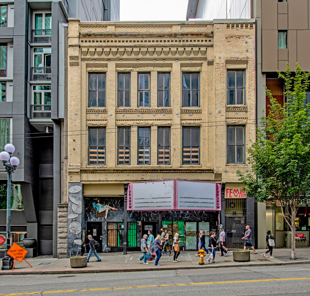


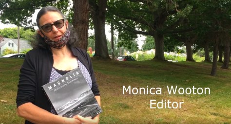


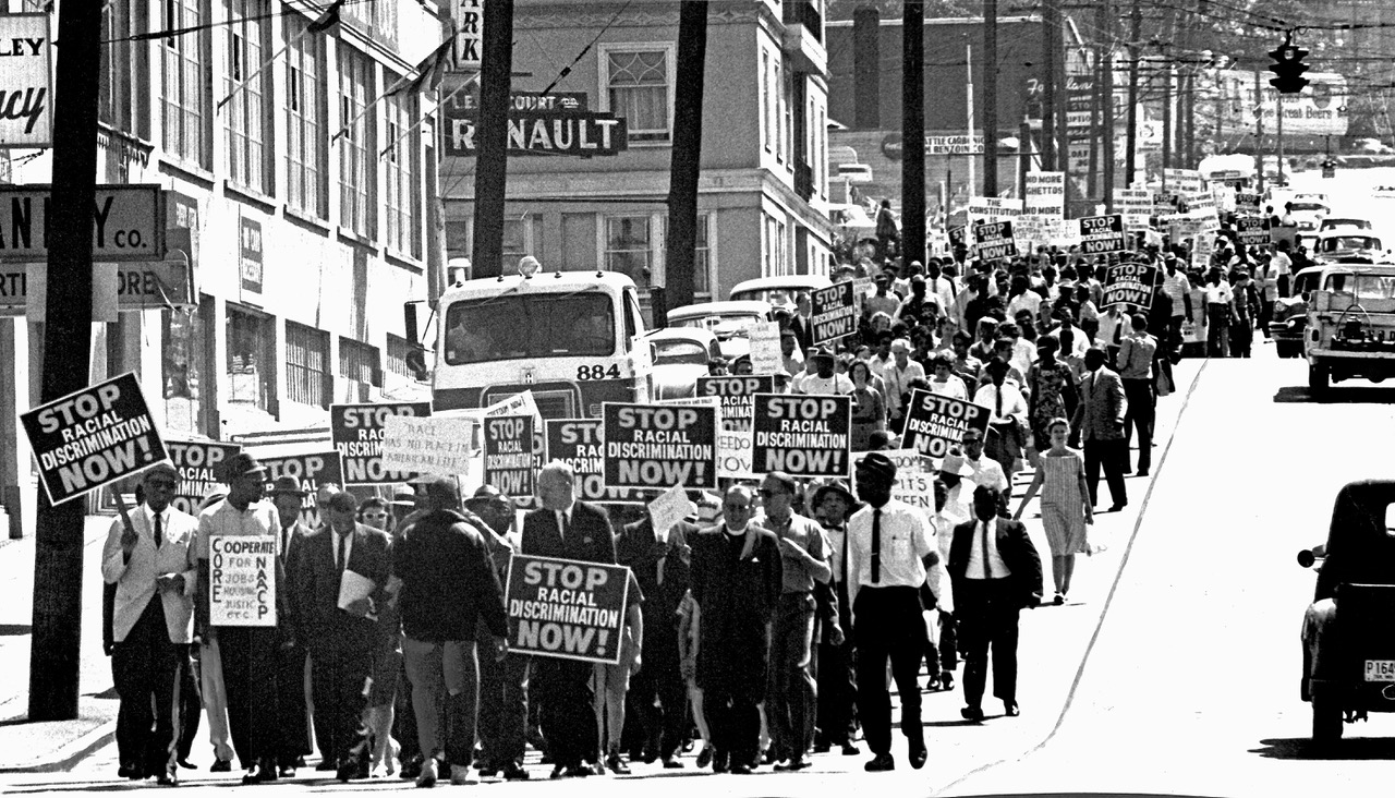

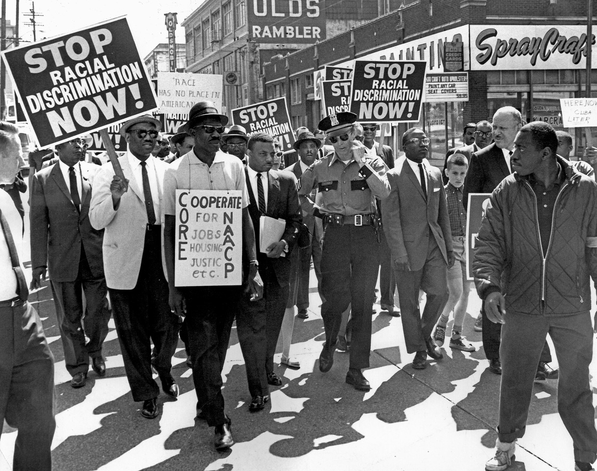


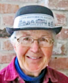


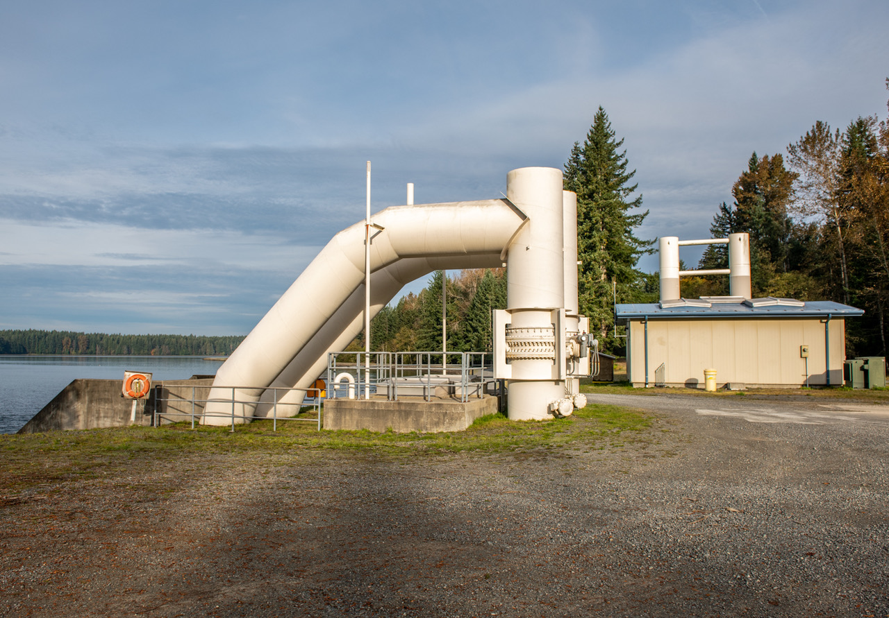

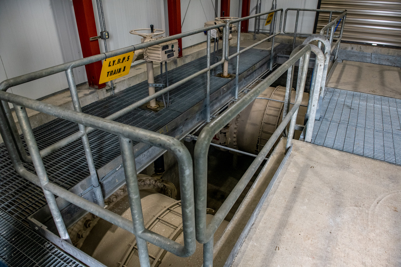
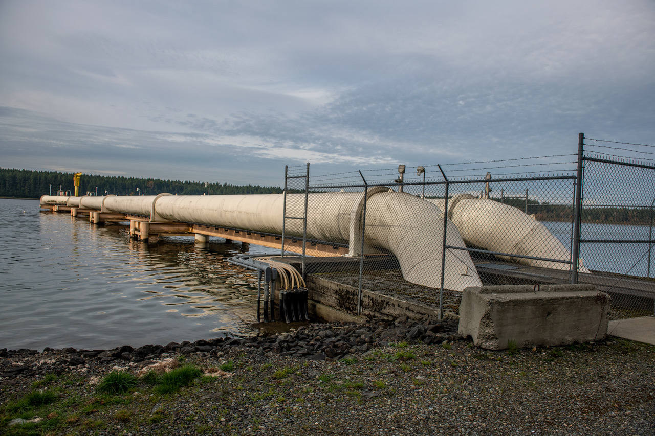


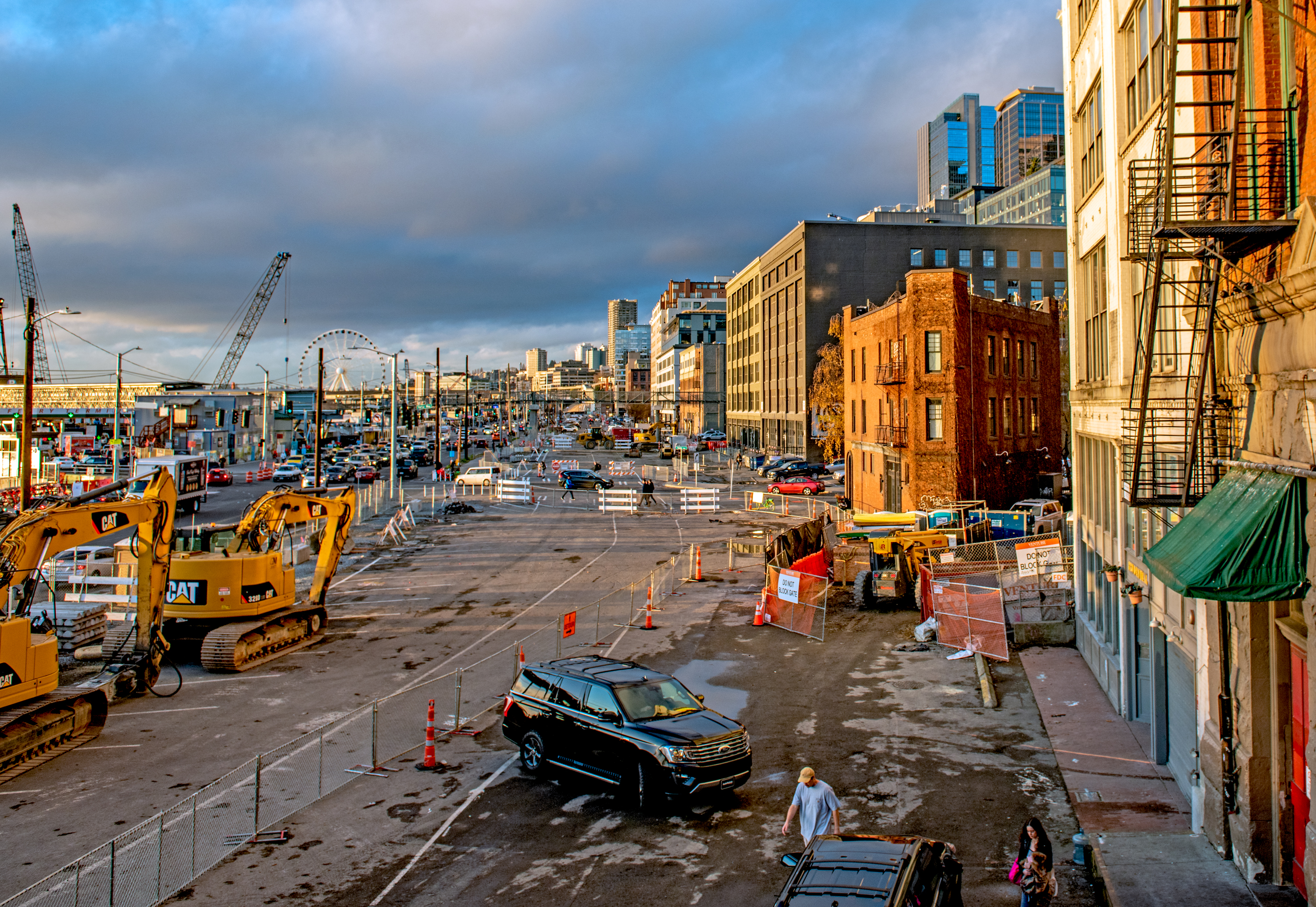


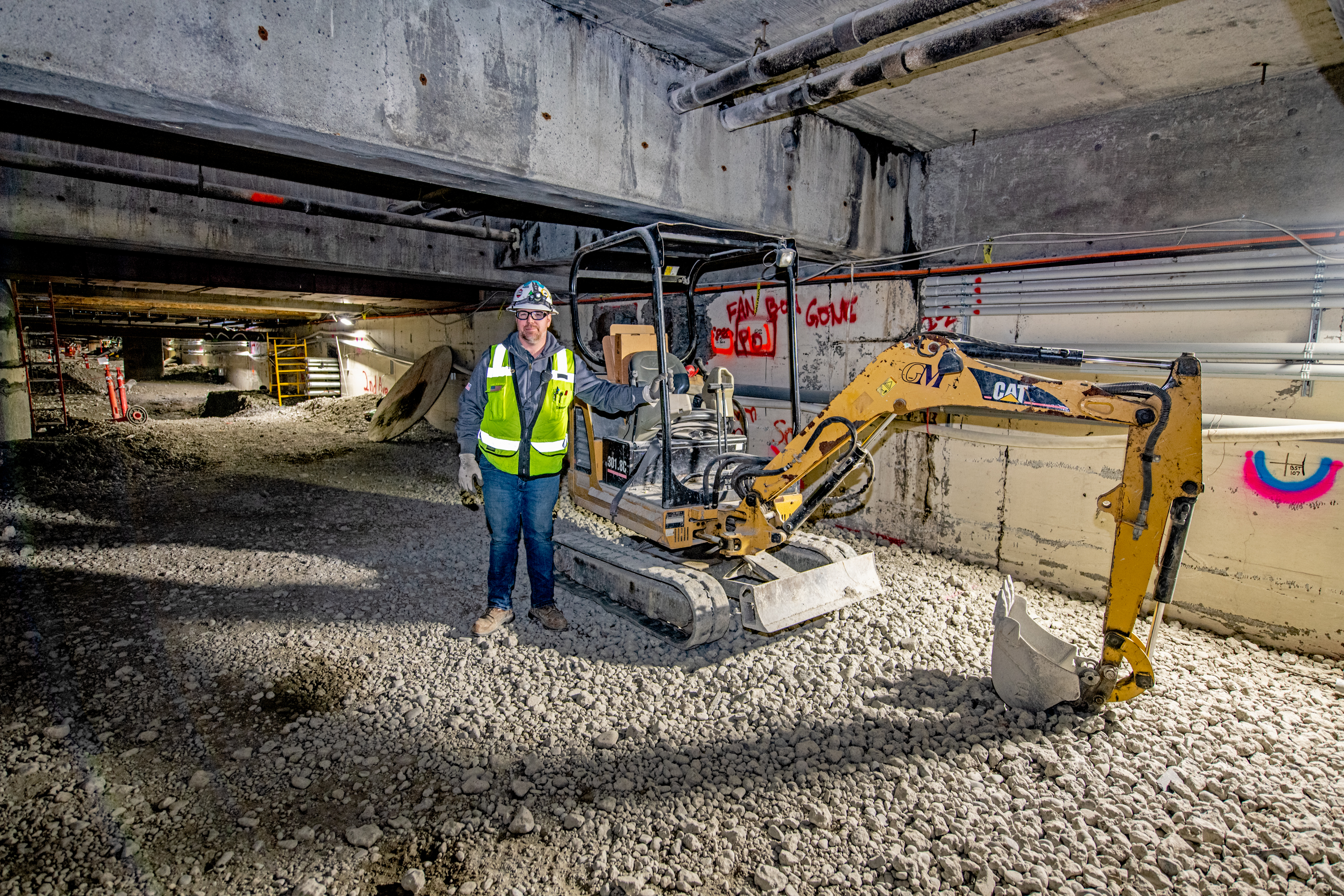


 =====
=====