THEN: With their windows open, joyful Seattle University co-eds greet Spring and a Seattle Times photographer from their First Hill mansion-dormitory in April 1959. (Picture courtesy, Lois Crow)NOW: 53 years later co-eds Frances Farrell and Lois Crow, left and right, return to 718 Minor Avenue and different steps. Jean Sherrard has also posed me “hiding my shame” – for past mistakes - in the tree behind them.
Looking up the front steps of Seattle University’s McHugh Hall (the name and address are painted on the steps) we count nine coeds waving to a Seattle Times photographer. The subject was first published in this paper on April 12, 1959, along side a second photo of the dorm’s oversized bathtub, both used to illustrate a feature written by Frances “Fran” Farrell and titled “It’s HOME to Seattle U. Co Ed’s” Fran’s SU instructor in journalism advised her to write something for publication and the Times liked her story on McHugh Hall – her school dorm converted from the Anderson Mansion on First Hill – so well that they gave it a full page.
In Jean Sherrard’s “repeat,” Fran, on the left, stands on newer Swedish Hospital steps beside Lois Crow. With two others they shared a dorm room on the top floor – here upper right in the “then.” Barbara Owen, one their upper-class quartet, waves from the open window. Fran Farrell chose her subject with enthusiasm. “Living in McHugh was a complete delight! As upper classmen we wanted someplace with more independence and camaraderie and we got it at McHugh.” Freshmen and sophomores were housed in Marycrest, a new six-story dormitory. It held none of the ornate charms of a lumber baron’s mansion.
Jean suggests that I ask readers if this week’s “now” is familiar. He knows that it is. As the “repeat” for a different story, we used this location recently – last May 19th. And there I – but not Jean – made a big mistake. What I had learned years earlier – and earnestly believed until the Saturday before the Sunday publication – was that our May subject was Mrs. Anderson posing in her celebrated coach in front of her mansion here near the southeast corner of Minor and Columbia. But – and alas – it was instead Mrs. Burke posing in her coach in front of her First Hill Manse, but three blocks away. (If it helps, they remain short blocks.) When Lois Crow, already an acquaintance of mine, discovered my mistake and shared it with me that Sunday morning, I was at least able to tell her that I too had discovered it a day earlier, but that it was too late to stop the presses.
We encourage you to read Fran Farrell Vitulli’s Times feature on the Anderson manse. You can access it readily through the Time’s older archive (1900 to 1984) serviced on the Seattle Public Library web page. It is a service that also offers what we may call the “joys of the key word search.” You can also find a facsimile of Fran’s feature printed in Jean and my blog noted at the base of this writing. And there, if you will, you may study my full confession, at once contrite and illustrated.
WEB EXTRAS
Anything to add to this moving mea culpa, Paul?
Yes indeed, Jean!
As explained in this week’s feature, but more elaborately last May in this blog’s 11th hour anticipation or “catch” for the mistaken feature published in Pacific then – the one proposing to be about Mrs. Anderson and her famous First Hill carriage but actually showing Mrs. Burke and her’s, also on First Hill – here is the link to that May 17th feature. It repeats, again, my full confession. It also includes – perhaps as compensation Ron Edge suggests – a long list of other features having to do with First Hill and a few other large Seattle homes. Thanks for your compassion. To get to this replete repeat either CLICK THIS LINK or the picture below. The picture is of another Anderson: Anderson Hall on the U.W. Campus. After her lumberman husband’s death, Mrs. Anderson paid for its construction as a warm and useful tribute to him. It was appropriately built for the school’s Dept of Forestry.
In proper order and again below is the next issue of Helix, and the commentary by Bill White and myself. In this issue John Bixler makes his first appearance – on a motorcycle stopped by some plainclothes police ready to slap on him the tough charge of not having paid off a parking ticket. In that reportorial snap, the Helix office can be seen across Harvard Ave. E. (beneath the freeway). Hereafter John will be an enduring participant in our productions, except when he was away doing road work for the band The Youngbloods. In Jef Jaisun’s 1992 shot taken for the 25th anniversary of the founding of Helix – Not So Strait John Bixler appears far right with those posers who made it out of the Blue Moon and onto the sidewalk in front it. They are, right to left, John Bixler, Jacque Moitoret, Tom Robbins, Walt Crowley, Alan Lande, Paul Heald, myself, and standing in front with his own row, Maury Heald. We have printed this earlier and will probably print it again later. (Thanks again to Ron Edge in Lake City for steadfast wrestling all this Helix matter on the blog that ends with the last name of our editor in Paris.)
THEN: Photographed on April 30th, 1921, the Palace Hip at the southeast corner of Spring Street and Second Avenue mostly prospered until it closed in the Spring of 1929, still months before the crashing start of the Great Depression. The Seattle Times explained, “The heyday of vaudeville is over and with it into history fades one of its former strongholds.” (Courtesy Museum of History and Industry. A Webster and Stevens studio photo.)NOW: In 1930 the Palace Hip was converted into a parking garage and remained so until an office building in 1986 replaced it.
Dazzled – we hope – last week by a musical pig dancing above the sidewalk on Second Avenue north of Madison Street, we made promises to visit this week another attraction on that block. By the time the Pig ‘N Whistle opened in 1919, its neighbor the Palace Hip Theatre, across Second at its southeast corner with Spring, had been showing animal acts and much more on stage for ten years.
The name blazoned here on and above the theatre’s boisterous corner marquee was its third. The theatre opened as the Majestic on August 30, 1909, changed to Empress less than two years later and in 1916 with a remodel turned over again into the Palace Hip (short for Hippodrome.)
Soon after the summer opening this newspaper surveyed its wonderful construction. “The entire designing and constructing of the Majestic Theatre in somewhat over five months from the date of John W. Considine’s order is an apt illustration of the Seattle Spirit.” Considine was the super-impresario and Edwin W. Houghton the happy if frantic architect, who proudly revealed to the Times reporter, “I was fortunate enough to have a client that had good enough judgment to select an architect whom he thought was capable and then leave him to do it.”
While the theatre’s dog acts were often splendid, they were but one of ordinarily six or seven acts that took the stage twice a day. By some accounts it was Seattle’s “greatest house of vaudeville.” Of the hundreds upon hundreds of acts – comedy, song & dance, animal – that landed here for a run of a week or two, Charlie Chaplin and Stan Laurel (later of Laurel and Hardy) are the most abiding names. David Jeffers, Seattle’s historian of silent film, confesses, “I dream about this place. A Greco-Byzantine interior of ivory and gold and 1500 seats!”
Thru its two decades the Palace Hip ran vaudeville, showed films, and staged plays. For all of these a theatre-goer’s visit to the confectionary across Second was often a capper to any show.
WEB EXTRAS
Anything to add, Paul?
Yes Jean – a few past features from the neighborhood, some of which has already appeared here, still we put them forward again following thereby a kind of Wagnerian formula of motifs repeated in new settings. Since five of these features include theatres we have a second motif. We’ll begin though with BUCK JONES in the BIG PUNCH, the Fox film advertized on the marquee and in broadsides pasted to the Palace Hip’s exposed walls at the corner and near the ticket window.
From mid-block between Seneca and Spring looking south on Second Ave. ca. 1908. Frederick and Nelson Department Store is still in the Rialto Building right of center, and Considine will soon take the southeast corner across Spring Street on the left and replace it with his and architect Houghton's Majestic. By some agency when the Palace Hip was still the Majestic the name and even the style of its signage was repeated for the second floor cavity carver name the Majestic Dentists. The corner's oddly consistent promotions were topped by a tooth outlined with electric lights. From a similar point-of-view as that above, Lawton Gowey recorded this look south on Second and thru Spring Street on April 6, 1967. Another Gowey recording of the block, this time on July 26, 1972 when the theatre's corner was taken by a Donut shop. Back again with Lawton and the donuts on July 26, 1981. Here on May 23, 1981 Lawton Gowey concentrated on the old theatre's Spring Street facade. The August 22, 1930 Times clipping that follows announces the plans to convert the old vaudevillian into a parking garage that would endure decades longer than the theatre..The Seattle Times, August 22, 1930.Showing the neighborhood, grabbed from the 1912 Baist Seattle map of footprints.
Still on Second Ave. at Spring Street but this time looking north thru the latter to the Lois and Pantages Theatres one block along and to either side of Seneca Street on the east side of Second. (Courtesy, Museum of History and Industry)
The Pantages Theatre at the northeast corner of Second Ave. and Seneca Street.
PANTAGES VAUDEVILLE
(First appeared in Pacific, May 20, 1990)
Alexander Pantages built his namesake vaudeville house at the northeast corner of Second Avenue and Seneca Street in 1904. It was “the little Greek’s” second theater. The first, “The Crystal,” also on Second Avenue, was a converted storefront that Pantages opened when he landed in Seattle with a small fortune finagled in the Alaska gold rush. As Murray Morgan describes Pantages’ gold-field strategy in his Seattle history “Skid Road”: “He abandoned his dream of finding gold in the creek beds and concentrated on removing it from the men who had already found it.”
Pantages sold the sourdoughs vaudeville, at $25 a seat in his Orpheum theater in Nome. The price of admission to his first Seattle shows was a dime for a mixture of stage acts and short, jerky films. Pantages (or his legend) was illiterate, but having roamed the world before landing here he could converse in several languages. His English, it was said, was as bad as any. But he knew what the public wanted.
Pantages built a vaudeville empire that ultimately surpassed all others. Somewhat like royalty, his daughter Carmen married John Considine Jr., son of his chief competitor. At its peak the Pantages circuit included 30 playhouses he owned outright and 42 others he controlled. To an act he liked, he could offer more than a year of steady employment. Pantages sold his kingdom for $24 million in 1929 – before the crash.
Considine and Pantages, left and right.
To Pantages the best act he ever booked was the violinist he married. Lois Pantages always played the first act whenever her husband opened a new house. The first of these was across Seneca Street from the Pantages. He named it after his wife, and until it was destroyed by fire in 1911, the Lois was a successful theater. Also in 1911 Pantages purchased Plymouth Congregational’s old church grounds at the northeast corner of Third Avenue and University Street, and built his New Pantages Theatre, designed by architect B. Marcus Priteca, between 1915 and 1918. Later renamed the Palomar, it was a showplace many Seattleites will remember. (This Pantages/Palomar is a subject that has been treated on this blog. Please try the search box for it – if you will.)
Another Webster and Stevens Studio look up Second Across Spring Street with both the Lois and Pantages theatres up-the-block and the Savoy Hotel too.And more with the Baillargeon Building on the right at the northeast corner of Spring and Second. This enchanting tableau looks across Spring Street to the early construction scene for the Baillargeon Building at the northeast corner of Spring with Second. Note at the top the Savoy Hotel is getting some added stories. The date, 1907, is evident at the bottom-right corner. This is pulled from an album having mostly to do with the construction of the Seattle Gas Company’s facilities at what is now Gas Works Park. (Courtesy Michael Maslan)
NEXT a look west on Seneca across Second Ave. to a pioneer home.
Above: The scene looks west on Seneca to its northwest corner with Second Avenue, where, depending upon the date stands either the Suffern residence or Holy Names Academy, the city’s first sectarian school. (Pix courtesy of Michael Cirelli). Below: With the economic confidence gained by the Yukon and Alaska gold rushes of the late 1890s, most of Seattle pioneer residences then still surviving in the central business district were replaced with brick commercial blocks.
The SUFFERN HOME
(First appeared in Pacific, June 17, 2007)
Sometime in the 1870s John Suffern built a sizeable home at the northwest corner of Second Avenue and Seneca Street. We see it here but not knowing the date of the photograph cannot say if the Sufferns are still living there or if it is in the learned hands of the Roman Catholic Sisterhood of the Holy Names.
Suffern is first known hereabouts for his iron works and second for both building and captaining steamboats on Puget Sound. After Issaquah pioneer Lyman Andrews stumbled upon some exposed coal on his claim in 1863 he carried a few lumps of it in a sack to Seattle where Sufferen tested it in his kiln and found the Issaquah coal excellent for firing. In another ten years east side coal became Seattle’s principal export – most of it to California railroads. By 1879 Suffern had turned to drugs. That year’s directory adds an “e” to him name and lists him simply, “Sufferen, J. A. druggist, cor. Second and Seneca.”
The following year, 1880, the Sisters of Holy Names bought his property for $6,800 and arranged the home for their first Seattle school. The Holy Names official history explains, “The building consists of two stories and a basement. In the latter are the kitchen, cellar and pantry. The parlor, music room, office and Sister’s refectory are on the first floor, the chapel, community room and a small apartment for the Superioress are on the second floor.”
Also in 1880 the Sisters of Holy Names built a second and larger structure on their property to the north of this white (we assume) house. The addition included two large classrooms and a second floor dormitory for the city’s first sectarian school. It opened in January 1881 with 25 pupils, and grew so rapidly with the community that in 1884 the sisters built another and grander plant with a landmark spire at 7th and Jackson Street. The not so old Suffern home survived the city’s “great fire” of 1889, but was replaced in the late 1890s with the surviving brick structure, now (in 2007) the comely home for a Washington Liquor Store, and a custom tailor.
=====
Above: Looking north on an unpaved Second Avenue in July 1889. The nearly new tracks on the left served the first electric trolley on the Pacific Coast when the conversion was made from horses to dynamos earlier in March. Second was paved in the mid-1890s and thereafter quickly became Seattle’s “Bicycle Row” with many brands to choose from sold mostly out of small one story storefronts, especially in this block between Spring and Seneca Streets. (Pix courtesy of Michael Maslan) Below: The widened Second north of Spring Street was half quiet when photographed on a late Sunday afternoon.
THE CANVAS RECOVERY
(First appeared in Pacific, Oct. 7, 2007)
The city’s “great fire” of June 6, 1889 consumed most of the business district – more than 30 blocks – but not this block, the first part of Second Avenue that was not in some part scorched. After the disaster it quickly served in the rebuilding that turned practically every available lot and lawn on Second into a sewn strip of temporary tents. The Times for June 10 reported that while “the slabs and sawdust piles are still burning and sending clouds of smoke back over the town” over 100 permits had been issued to put up tents.
Judging by the canvas signs, the large tent on the far left, at the southwest corner of Second and Seneca Street, is shared by two firms: Doheny and Marum Dry Goods and the “manufacturers agents”, Avery, Kirk and Lansing. Before they were for the most part wiped out by the fire the two businesses were already neighbors at the northwest corner of Columbia and Front (First Avenue).
Around two o’clock on the afternoon of June 6, or bout a half-hour before the fire started, Avery and his partners were suddenly $2,500 richer, when W.A. Gordon, a young man recently arrived from Maine, invested that amount, “everything he had” the papers reported, in the business. The sudden cash most likely helped with the construction of the big tent. Still we do not see Gordon’s name stitched to it.
We know from a Times article of August 2, titled “A Tent Occupant’s News” that a firm doing business on Second just north of Seneca had paid $2 a month per running foot for space to construct the framework for a tent and cover it with canvas “at the expense of several hundred dollars.” Now less than two months later the landlord was asking the city to remove the tent for the construction of a building. The threatened residents appealed, “We do not want to be thrown into the street.”
A few tents did business for a year before the city council decided there were “buildings enough for all” and ordered the last of them removed.
=====
Above: The post-1889-fire story directly above this one looked north on Second Avenue from Spring Street through a block of temporary tents and small frame structures in the summer of the city’s June 6,1889 fire. This view reveals part of the same block 32 years later in 1921. Below: A part of the Baillargeon/Pacific Security Building, far right, survives into the “now” scene. Built in 1907, it is, for Seattle, an early example of a steel-frame structure covered with terra-cotta tiles and ornaments.
THE ELEGANT STRAND THEATRE
(First appeared in Pacific, Oct. 14, 2007)
Here the gleaming symmetry of the Strand Theatre rises above the confused queue of a sidewalk crowd jostling for tickets to Wet Gold. The elegant Strand opened as the Alaska Theatre in 1914. Two years later this then overworked name was dropped for the London sophistication implied in the new name “Strand.”
Most likely this is a first run showing of J. Ernest Williamson’s 1921 hit Wet Gold, the story of a sunken ship, its gilded treasure and the passions released in finding it. Resting nicely on the theatre’s terra-cotta skin, the film’s sensational banners are nestled between the Strand’s classical stain glass windows. Williamson became a pioneer of undersea photoplays by attaching an observation chamber to an expandable deep-sea tube invented by his sea captain father. The younger Williamson called it his “Photosphere”.
I’ve learned from Eric Flom’s historylink.org essay on the Alaska/Strand that Frederick & Nelson Department Store was contracted to furnish and decorate the interior and that the elegance begun on the street was continued in the theatre’s lobby with onyx and marble. Before the 1927 introduction of synchronized sound the silent films shown at the Strand were generally accompanied by its Skinner Opus No. 217 pipe organ, which later wound up in St. Paul’s Episcopal Church in Bellingham.
Flom also notes that this 1114 address on 2nd Avenue (the east side between Spring and Seneca Streets) was showing films years before it’s terra-cotta makeover. The Ideal Theatre opened there in 1909 and in 1911 it too was renamed The Black Cat, which, as noted, was elegantly overhauled three years later into the Alaska/Strand. Flom has tracked the 1,110-seat Strand “well into the 1930s.”
=====
Above: Publisher William Randolph Hearst paid $200,000 for exclusive reporting rights of the Graf Zeppelin’s 21-day trip around the world in Sept. 1929. The big blimp neither stopped in nor flew over Seattle; still a world map (without poles) was painted by the Foley Sign Company and attached to the front of the Coliseum Theatre as part of the promotion. So that the pedestrians at 5th Avenue and Pike Street might be reminded of their place in the world, the lettering for “Seattle” was made larger than for any other city on the map. (Photo courtesy G. Sales) Below: Jean took the “now” from the third floor of the Washington Federal Savings Bank, kitty-corner to the Banana Republic, which in a local example of “adaptive reuse” arranged the landmark Coliseum Theatre for selling clothes and such in 1994, four years after the theatre went dark.
COLISEUM THEATRE – ADAPTIVE REUSE
(First appeared in Pacific – and here too – Aug 17, 2008)
Seattle architect B. Marcus Priteca designed the Coliseum Theatre, Fifth Avenue and Pike Street, for owners C. D. Stimson and Joe Gottstein. The theater opened on January 8, 1916 under the management of John von Herberg and Claude Jensen. The Coliseum was one of the first large theaters in the country to be designed specifically for showing motion pictures. That the stage was a bit small for the largest of vaudeville acts did not matter for it was claimed to be the largest and most lavish of theatres built not for stage acts but for films. As the legend matured it was also the first.
Pantages concocted a neo-classical temple of such flash that the facets of its glazed white terra cotta façade were designed with the help of sciography: the study of sun angles. At night inset electric bulbs threw their own shadows. The lavish appointments continued inside with, by one report, “a symphony of upholstering,” which did not, however, dampen acoustics that were considered the best in Seattle – perhaps in the world! The theatre orchestra of eight players – plus a “giant Moller Pipe Organ”- were all Russians, again, the “highest paid in the U.S.” Fountains framed the orchestra pit and songbirds in wicker cages accompanied the players. By one count there were thirty canaries — probably the best fed in the nation. High above, the Big Dipper twinkled from the ceiling.
Released in 1929, “Tide of Empire” is the western melodrama advertised on the marquee. By the close of 1930, the star, Renee Adoree (meaning “reborn and adored”) had appeared in 45 films, the last four talkies, but not “Tide of Empire.” It was produced in the transition to sound and had only a sound tract for effects and music. Adoree’s role is reborn with a Google search for “youtube tide of empire, 1929.” From the Coliseum’s big screen it’s a bittersweet reincarnation as a low-resolution postcard-sized rendering on a computer screen, but the French-born star still dazzles.
=====
Above: The Metropolitan Track’s Hippodrome was nearly new when it hosted the A.F. of L. annual convention in 1913. (Courtesy Old Seattle Paperworks) Below: Without a phalanx of posing delegates to protect him Jean wisely stayed away from the center of the intersection at 5th Avenue and University Street for his repeat.
POSING Beside The HIPPODROME – AFL CONVENTION, 1913
(First appeared in Pacific, Dec. 7, 2008)
The by then venerable American Federation of Labor, the A.F. of L., held its 33rd annual convention in Seattle in the fall of 1913. Some of the convention’s grander events, like it’s Nov. 11 opening ceremonies, were held in the then nearly new Hippodrome at the northeast corner of 5th Avenue and University Street. About 3000 attended to hear the region’s star politicians, like Seattle’s progressive (although sometimes also puritanical) Mayor George Cotterill and the state’s governor Earnest Lister, shout their speech across the great new hall.
The Hippodrome’s promised construction may have been one reason that the union felt it could meet in Seattle. And yet the new hall was kept to only one story and designed as a temporary structure. The build-up of the ambitious Metropolitan Tract, the “city within the city” on the leased land of the original University of Washington campus, would take time and so was in need of some inexpensive fillers like the Hippodrome until grander structures could replace them. The Skinner Building (seen in the “now”) took the corner – and the rest of the block to Union Street – in 1925-26.
At some point during the convention its 327 delegates poured out of the Hippodrome to pose for a panoramic camera. We have cropped the picture. When tightly packed, the posers extended from the southeast to the northwest corners of the intersection in an arch that centered at the entrance to the hall, as seen here.
Readers who know their Greek will have figured that the name “Hippodrome” was chosen by the Metropolitan Building Company not in reference to its original use for an open Greek racecourse. Rather, it was for association with the name-familiar Hippodrome Theatre in New York, which when it was built in 1905 was called “the world’s largest theatre.” Houdini made a 10,000-pound elephant named Jennie disappear from its stage with the mere firing of one blank from a pistol. Would that it had been a hippopotamus.
=====
Above: Looking south across Spring Street and into the pit along Third Avenue for its 1906-7 regrade. Courtesy Lawton Gowey Below: Jean used his ten-foot extension pole again to reach an altitude more in line with the old grade of Third Avenue before its reduction.
THIRD Ave. REGRADE south from SPRING STREET
(First appeared in Pacific, Sept. 18, 2011)
The steam shovel at the intersection of Third Avenue and Spring Street works on making one of the deepest cuts during the Third Avenue Regrade, which extended the eight blocks between Cherry and Pike Streets. Like Biblical signs, the shovel spews the good and the bad – steam and smoke – from its roof. An empty wagon waits for the shovel to pivot with its first contribution.
Behind the rising effluvium are a row first of storefronts holding a laundry, a plumber and an undertaker. Beyond them is the popular Third Avenue Theatre with the open tower at the northeast corner of Third and Madison. Its 16-year run is about to end a victim of grade changes on Third. Across Madison are two more towers, both churches. First, the First Presbyterians at the southeast corner with Madison and one block south the second sanctuary for the first congregation organized in Seattle, the Methodist Episcopal Church at Marion Street. Both parishes moved to new sites because of the regrade.
Upper left is the west façade of the Lincoln Hotel at the northwest corner of Madison Street and 4th Avenue. The regrading on both Fourth Avenue and here on Third were temporarily stopped in the summer of 1906 by an injunction brought by the hotel charging “damaged property” – indeed. More than damaged the hotel was destroyed by fire in 1920. The regrading of both Third and Fourth Avenues was necessary, it was explained, if the retail district was to spread east. First and Second were both filled and the steep climb to Third and Fourth needed to be eased.
Frank Carpenter, a visiting journalist featured in the Post-Intelligencer under the head “Ourselves As Others See Us,” described 1906 Seattle as a “city of ups and downs. It has more hills than Rome . . . The climate here gives the women cheeks like roses . . . I am told that men measure more around the calf and chest than anywhere outside the Swiss Mountains. The perpetual climbing develops the muscles and at the same time fills the lungs with the pure ozone from the Pacific.”
=====
NEXT a few items pertaining to the regrading on Spring Street, most of it east of Second Avenue as Spring it brought down to the new and lower grades on Third, Fourth and Fifth Avenues. We’ll get oriented, again, with the detail from the 1912 Baist map.
Note please the position of the Lincoln Hotel at the northwest corner of 4th Avenue and Madison Street, here far right in the second block up from the Marion Streete bottom of the detail. The Lincoln was used as a prospect for the early-century look - below - over our neighborhood before the regrading of Spring and, for that matter, Second and Third as well.Circa 1900-01, looking northwest from the Lincoln Hotel - at 4th and Madison - over Third Avenue to Spring Street where it drops steeply still to Second Avenue. Note the small and ornate Boaz Hotel mid-block on the north side of Spring between Third and Fourth. (The waterfront is in transition, with the long Northern Pacific finger pier No. 4/55 on the far left built at an angle and still at a right-angle to the waterfront the smaller post '89 Fire Arlington Docks to the right - north - of the new pier. You may wish to consult the blog's pictorial history of the Seattle waterfront for more on these changes.)Using Google Earth, the Baist Map and a free hand to mark that frame the Boaz Hotel - or its place - in both the Google view and the historical view printed just above. The Spring Street regrade east of Third Avenue. The grade at Third was hardly changed but that extended climb between it and Sixth Avenue was "significantly lowered." Note that some of the Boaz Hotel can be seen on the left, mid-block between Third and Fourth. The west and north facades of the Lincoln Hotel show above-right.During the regrade west on Spring from the alley between 3rd and 4th Avenues. Note that the Boaz Hotel is almost hiding one block distant on the right.
CONTRIBUTIONS from 2 ANDERSONS – Rick & Lenny – at the TIMES
The July 23, 1981 dating of this feature by Rick Anderson helps explain historian Lawton Gowey's visit (see above) to the corner three days later on July 26. Lawton was reading Anderson, and his office in the City Light Building was nearby.
NEXT & LAST – 1960 NOSTALGIA
(double-click to enlarge)
HUGH PARADISE's sort-of-familiar Seattle skyline recorded from Latona (Wallingford) in 1960. There is here as yet no Space Needle and no SeaFirst tower, but the pyramid top of the Smith Tower breaks the horizon. There is as yet no Ivar's Salmon House promoting a view in 1969 that includes the modern additions. At the very bottom is Lawton Gowey's June 1, 1960 portrait of the then new modern Seattle Public Library on the same block where the post-modern library now unfolds. What a lovely gilded bug is that heading north on 4th! Can you still hear it? In between is Lenny Anderson's Feb. 1, 1960 Times feature on a by-gone Seattle inspired in part by a faded sign on the Palace Hip, which then still had more than two decades left for service to mostly Central Business District workers with cars. How man of these commuters could manage a confident definition of "Vaudeville?" How many could spell it?
(Double Click to Enlarge)
Quiz: How many of Anderson's choices do you recall?North on 4th from Madison, June 1, 1960. Lawton Gowey
We searched for the date, but found none, although surely a finer search of the text may stumble on one. Sometime in March of 1968 – perhaps the First of March given that the last issue was dated Feb. 15, 1968. By this time our publishing was routine, but not for long. Soon – perhaps next week? – with the optimism of Spring HELIX will become a weekly.
A few days ago, I went to the bell tower of the church Saint-Etienne du Mont to photograph the dome of Pantheon, which will soon be restored.
The ascention in the dark and narrow tower was difficult, because though a broken window, pigeons had entered and had set up their nests on the steps, and for the first time I could check the expression « to walk on eggs »
I was very curious about seeing my neighborhood very familiar to Paul and Jean .
At the top, there was a lot of wind, the area under the bell was unprotected, and I was cautious, but which was amazing was the sight of Clovis Tower of Lycée Henri IV.
Clovis tower is all that remains of the abbey church of Saint Genevieve built during the Middle Age, now integrated to the Lycée.
We can see the different style between the bottom of the tower built in the eleventh century and the upper part dating from the fourteenth century. Too antiquated the spire was destroyed in 1764.
Far away, there are the contemporary towers built in the 80 thirteenth arrondissement…
Je suis allée dans le clocher de l’église Saint-Etienne-du-Mont il y a quelques jours pour photographier le dôme du Panthéon qui va être bientôt restauré.
L’ascension dans la tour étroite obscure de l’église était délicate, d’autant plus qu’à travers une vitre brisée des pigeons étaient entrés et avaient installé leur nids sur les marches, d’ou l’expression « marcher sur des œufs »…
J’étais très curieuse de découvrir la vue de mon quartier que Paul et Jean connaissent bien.
Au sommet, il y a avait beaucoup de vent, l’espace sous la cloche était sans protection, j’étais prudente, ce qui était prodigieux était la vue de la Tour Clovis du Lycée Henri IV.
La tour est le dernier vestige de l’église abbatiale de Sainte Geneviève édifiée au Moyen Age.
On peut distinguer la différence de style entre le bas de la tour construit au XI ème siècle et la partie supérieure datant du XIV ème siècle. La flèche du clocher très vétuste a été détruite en 1764.
Au loin on distingue les tours contemporaines des années 80 du XIII ème arrondissement.
THEN: Perhaps as much as any tower, the Pig’N Whistles moving sign beside Second Avenue was one of Seattle’s more alluring landmarks in the 1920s. This view looks south towards Madison Street and beyond it the Smith Tower. (Courtesy: the Pemco Collection, Museum of History and Industry)
NOW: The Rialto Building, the Pig's home from 1919 to 1932, was razed in 1949 for the building of the Federal Reserve Bank.
In 1919, the California candy maker Pig’N Whistle opened in Seattle what it advertised in the Times as “the largest investment in a confectionary business which has ever been made anywhere in the world.” A year after Frederick and Nelson moved out, the block-long Rialto Building was ready for its new tenants, and the Pig got what had been the department store’s grand entrance on the west side of Second Avenue, centered between Madison and Spring Streets.
Pig' n Whistle's hurrah after a week of work, Seattle Times Aug. 24, 1919.
The elegant pig above the sidewalk was surely both big and dear. And it moved. Outlined in lights, two of its three hind legs were alternately lit to keep the animated leg kicking to the whistling flute the musical swine held to its snout with its hoofs. For thirteen years, and through the full length of Seattle’s “urban canyon” from the Smith Tower to the Washington Hotel, the dancing pig could be seen kicking time to its music.
A Times report on the revived Rialto. Aug. 31, 1919
The Pig N’ Whistle was packed from the start. Many of the stores nearby, like Meves Cafeteria, Rochester’s Men’s store, and Millers Luggage, promoted the pig as the landmark to find for their own services as well. Repeated society and club reports of lunch and dinner meetings at the Pig’N Whistle gave this maker of Viennese candies and “dainty sandwiches” frequent and free promotions in the local dailies.
Days after the California confectionary opened, King Bros. Co., another men’s store nearby, described the pig as “a thing of beauty, and we trust will be a joy forever to the people of our growing city.” Many years after it closed, Margaret Young, in a 1966 Times feature on the nostalgic lure of old Post Cards, professed to loving neon and wishing there were more of it, “but even more we miss something we never saw.” She meant this dancing pig. A victim of the Great Depression, the last listings for the Pig’N Whistle are from 1932.
Next week we will cross Second Avenue to the Palace Hip Theatre a half block north at Spring Street. The theatre, of course, treated the pig well, with many among it’s audiences consuming the Pig’N Whistle’s confections and dancing to its live music before and after the Hip’s shows.
Evidence of some Candy Wars around Christmas 1920. Pulled from the Dec. 22, Times.By the Pig's own recommendation, "Seattle's ideal place to dance and dine." Times, Nov. 5, 1922Purchased in Vienna, Nov. 9, 1922Too hot to dance beside HITT's deals on fireworks packages for the 4th. The Times, June 30, 1923Dancing and free deliveries within the city, Times Nov.10, 1928.
WEB EXTRAS
Anything to add, Paul?
Merely two related features Jean – one from long ago, 1986, and the other nearly new from 2009 and so here its encore.
Looking northwest through the intersection of Madison Street (left to right) and Second Avenue to the Frederick and Nelson Department Store filling the half block on the west side of Second between Madison and Spring. Note above the cable car heading for the waterfront on the far left.
Worn with wear - or mascara-stained around its windows from crying - the Federal Trust Bank Building that replaced the Rialto.
FREDERICK & NELSON DEPARTMENT STORE
(First appeared in Pacific, Oct. 28, 1986)
D. E. Frederick and Nels Nelson opened a second-hand store in Seattle in 1890. Soon they found it easier to buy unused merchandise than ferret out the old. So they discarded the nearly new trade, and in time their store became the largest and finest department store west of the Mississippi and north of San Francisco.
The Rialto facade draped with bunting for the 1908 visit of Teddy Roosevelt's Pacific Fleet. (Courtesy, Michael Maslan)
In 1897, in the first flush of the Klondike gold rush, the store was moved into the two center storefronts of the new Rialto building at Second Avenue and Madison streets. In 1906 the partners bought out the block, and Frederick & Nelson stretched their name the length of an entire city block – the Rialto block. This week’s historical scene shows Seattle’s first grand emporium during, or some time after, 1906.
Another Oakes real photo postcard, this one looking north on Second Ave. with the Rialto on the left.
Shopping at Frederick & Nelson was a different experience from today’s sometimes mad-rush shopping. At Frederick’s, you were invited to take classes, visit an art gallery, chat with friends over tea or just ride the hydraulic elevator. A big center room with a high ceiling for hanging tapestries and Persian rugs was a kind of sanctuary for consumption. Years later, you might not remember what was purchased but you would recall the experience of having really bought something significant – its aura.
Above and below, scenes from a Golden Potlatch summer celebration (1911-1914).
This touch of class also was found in the elaborately decorated show windows along Second Avenue, and even in the street itself. Every morning, Frederick and Nelson’s 16 heavy teams of horses paraded from their stables down the length of Second Avenue.
A Times clipping from Jan. 31, 1943 recalls the Pig'n Whistle but gets it timed wrong in "the last war" while also noting the Rialto Building's partial use during the Second World War as a volunteer-run book repository for war-time reading.
Nelson died in 1906, but Frederick continued to make the right moves, including the one in 1918 that took him “out of town” – all the way north to Sixth Avenue and Pine Street. In 1929, Frederick retired to his home in the Highlands and sold his grand emporium to Marshall Field & Co. of Chicago. After his death 20 years later, his old golfing crony, 95-year-old Seattle Times columnist C.T. Conover, recalled Frederick as a kind of heroic capitalist saint who “left a record of straight shooting, fair play, honorable dealing, enlightened vision, common sense, civic enterprise, noble spirit and generous support of every worthy cause.”
From the Times picture bank the "future bank" imagined in the wreckage of the Rialto Building, May 30, 1949. Lawton Gowey's look up Second Avenue from a window of the Exchange Building at the southwest corner of Second and Marion. Lawton dates this Jan.14, 1982. The off-set reserve bank is across Madison Street, on the left.
=====
Above: A century ago – roughly – Engineer Leo Snow took this candid photograph of a single Native vendor set up at the northwest corner of Second Avenue and Madison Street. Thanks much to Dale and Eric Cooley for sharing this view. Below: Appropriately, for the contemporary repeat Jean Sherrard recorded Cassie Phillips, a Real Change salesperson, showing her fare at the same corner.
SIDEWALK SALES
(First appeared in Pacific, June 21, 2009)
Clearly the northwest corner of Second Avenue and Madison Street was good for sales both inside an out. In 1906 Frederick and Nelson’s expanded from its mid-block quarters in the block-long Rialto building to both corners, at Madison and Spring Streets. While the corner sign does not promote baskets it does list carpets and its sidewalk “competitor,” the basket vendor recorded here by amateur Leo Snow, also offers mats. Snow’s snapshot is wonderfully unique for its bright-eyed candor.
As confirmed by many other less lively photographs, including a 1911 postcard printed in “Native Seattle,” historian Col Thrush’s nearly new book from U.W. Press, this was a popular corner for both selling Native crafts and recording them doing it. Thrush’s postcard shows not one but three of what the postcard’s printed caption calls “Indian Basket Sellers” huddled at this corner.
When I began giving illustrated talks on Seattle history long ago I often included a native vendor slide in my show. Many were the times seniors in the audience would recall having been with their mother while buying a basket from Chief Seattle’s daughter, and often off this very sidewalk. Since the 86 year-old Princess Angeline died in 1896, this “princess claim” was more than unlikely, it was impossible – I gently explained. Still, however slanted, the memory of sidewalk meetings with Native Americans was still cherished in 1975. Do any readers still retain such memories in 2009?
Sometime after the farm boy Leo Snow got an engineering degree from Ohio University in 1902, he carefully folded a 3-piece suit in his duffle bag and hopped a freight train to Seattle. Scrubbed, adorned and qualified he was soon on the streets of this city looking for a job. In 1945 Leo D. Snow retired after working 37 years for Puget Power, and along the way took many more sparkling snapshots with his foldout Kodak.
The audio commentary attached is a continuous confession of my ignorance as I did not prepare for the recording but by arrangement with Bill White entered blind into that tabloid pulp as we looked at it together – I for the first time in 44 years. Bill, however, was prepared to ask me startlingly informed questions from his fresh reading of the entire issue. While not entirely fair it was fun.
THEN: After 40 years at the busy center of Granite Falls in Snohomish County, the Cascade Hotel was cut down by fire in1933 but not razed. (Courtesy, Granite Falls Historical Society)NOW: Although a story shorter the pioneer building survives. In Jean’s repeat the corner is being fitted for a new front door.
Surely we know what every one is up to in this Granite Falls tableau. They are thinking about the fire and what to do. Four men have carried a glass showcase from the drugstore to East Stanley Street and while the other men at the corner seem to be standing idle most likely they are not. The commotion inside the drug store’s open door must be both frantic and dreadful – grabbing and hauling the drugs and sundries while knowing that the roof overhead is on fire. As yet there seems to be no relief although we see that the volunteer fire brigade has unrolled a hose along S. Granite Avenue and may soon be shooting it’s April shower at the roof.
Another look at the hotel ablaze and this too used courtesy of the Granite Falls Museum
Judging by the shadows and the smoke the fire started in the morning and in the roof of the Cascade Hotel. The hotel sign on the crest is engulfed. Fred Cruger of the Granite Falls Historical Museum suggests that the town’s weekly, the Snohomish County Forum for April 27, 1933, most likely gave detailed front page coverage of the fire. Unfortunately what was probably the report has long since been clipped away from the otherwise surviving issue. You can examine this unfortunate “mutilation” in the Granite Falls Historical Society’s Newspaper archive at http://gfp.stparchive.com. You can also explore the society’s thousands of pictures and documents online at www.gfhistory.org . This society is a recognized model of effective heritage care and activism.
The Granite Falls Snohomish County Forum for April 27, 1932 (sic) with its missing clip.May 4, 1933 news - marked here with "X" - on plans for the half-burned hotel.
Granite Falls was first platted in 1891 in anticipation of the 1892 arrival of the Everett to Monte Cristo Railroad. One year more, in 1893, this 22-room hostelry over a restaurant opened as the Mountain View Hotel. The name kept to mountaineering when it was later changed to Cascade by a new owner. By 1933 Granite Falls was an important destination in what was promoted especially during “the touring season” as our “Charmed land.” The Big Four Inn and the Canyon Creek Lodge were both nearby, the latter with a six hole golf course that featured flowing water hazards. [This coming week we hope to enter here a short addendum on the both the Big Four Inn and the Canyon Creek Lodge.]
An early view of the hotel when it was still the Mountain View.
A week after the fire we are heartened to learn from the Forum’s May 4th issue that the destruction was kept to the hotel. “The second story will be cut off and the lower floor will be repaired.” Depression-time concerns were also addressed. “Only Granite Falls labor is being used on the repair work, and all materials are being purchased locally.” Cascade Drugs survived, and this sturdy pioneer of 1893 continues to serve mixed uses and hold to its footprint on the northeast corner of Granite and Stanley.
On the evidence of the traditional interpretation of the photo that follows - another scene crowded with men - Fred Cruger thinks it perhaps likely that the men milling here are waiting for the baseball game to begin.The other record of a hotel decorate with men, this time described directly as waiting for baseball. (Courtesy, Granite Falls Historical Museum)
WEB EXTRAS
Anything to add, Paul?
Yes Jean beginning with the several other photographs of the fated hotel that we have inserted in the text above. These too are among the special gifts we give to the text as originally composed and illustrated for Pacific – bless them.
Below we will add this time as “straight” extras (not half-hidden behind a link) the few more now-then comparisons that you visited and recorded recently with the guidance of Fred Cruger, a Granite Fall historian/archivist who often appears in this blog as our primary vintage auto expert. Fred has also composed several interpretations/captions for the photo you repeated while in Granite Falls as well as short descriptions of the several records you made of the Grant Falls Historical Museum, for whose appointments, and interpretations he is also an admirable steward. So here follows you and Fred.
The earliest photo, taken in the 1911-12 Winter, shows a large one-cylinder engine being hauled into town to provide electricity in place of the washed-out Pilchuck River dam. The warning tower that once held the fire bell is still in place, since the building itself had just been moved 2 1/2 blocks from its original location (as the first downtown school, built in 1893) to the location still occupied by CIty Hall today. The photo taken in Mar 1941 shows the building with significant deterioration. The picture with the fire truck shows Fire Chief Hiram Jewell (also the local photographer) at the front of the engine, just a month before the combination City Hall & Firehouse was razed, preparing for the City Hall still standing today (erected by the WPA in 1941-2).
=====
The Granite Falls Cooperative Union was built in 1905 by Fred Anderson, but it operated for many years as the Granite Falls Creamery under John Curtis, who also happened to be the back president. It was only three years ago that the original 1904 bank safe was recovered from the Creamery building and placed in the Granite Falls Historical Museum. The building is owned by the local Masonic Lodge, which has an impressive meeting area upstairs, and the lower floor has always housed a grocery or retail merchandise business. The building just beyond the creamery building in the modern photo was built in the 1920s by Oscar Wicklund, a local blacksmith, and served in that role through the 1950s. The two-story Mountain View Hotel (later the Cascade Hotel) can be seen just a short distance past the Co-op Union in the original photo, and also in the modern photo (albeit as a one-story building, having lost its top story to fire in 1933).
=====
Taken prior to 1910, the old photo shows the bell tower of the first downtown school on the left, 3 blocks distant. The local fire warning tower is on the right just 1/2 block from the photographer, and marks the soon-to-be place to which the school would be moved to become City Hall. The warning tower was located about 30 feet beyond (south) of where today’s town clock sits in front of City Hall. The old school served as combination CIty Hall & Firehouse for 30 years, until it was razed in 1941 and replaced by the current building (built by the WPA). The dark building at the far right was the photo studio of Hiram Jewell, Granite Falls’ local photographer for decades. The large two story building on the left in the original photo was built as Woodmen’s Hall, and continues to serve today as the American Legion Hall, although the trees block it from view.
=====
If you look carefully, you can see the top of a barber pole just above the Model T Ford (car at left) and a “BATHS” sign, which was present at both Granite Falls barber shops (the other shop was directly across the street). The large building at the right started life ca. 1900 as The Lumberman (purveyor of fine wine and cigars), but by 1918, when this picture was taken, had become Klaus Bros. market. Unfortunately, it burned down in 1920, but Henry and William Klaus rebuilt it as the brick Klaus Bldg that still stands today on the southwest corner of Stanley St, and Granite Ave.
=====
This looks east on Stanley St., and Granite Ave is the next cross street. You can see the Cascade Hotel sign at its rooftop, which – as the reader will know by now – the hotel lost along with its second floor to the 1933 fire featured at the top.
=====
The Falls at GRANITE FALLS
FRED sends, as well, several photographs of the falls, which Jean also visited and repeated.
Here follows two by Jean
====
GRANITE FALL HISTORICAL MUSEUM
Here we join Jean as he visits the museum with Fred. It is Fred who supplies the terse captions for each of the nine subjects.
Jean here. Spending the afternoon with Fred Cruger as my guide to Granite Falls and the many wonders of his museum was a real kick. Fred has an artist’s passion and inspiration, a historian’s curiosity, and the meticulous nature of an engineer – in short, he’s a force of nature. His focus and energy have brought the Granite Falls community together to create one of the finest small town historical museums in the country.
The shot of the front of the museum shows the porch of the 1905 house originally owned by Hugh and Mina Sharp. He owned the Depot Bar, while she was the first milliner in Granite Falls. The Granite Falls Historical Society had only the house for display space, until building the new building in 2007, adding over 3200 sq ft of display space, with enough vertical space to include a fully-rigged spar tree.The log cabin was actually built for the Carpenter kids ca 1941, but is used for storage at the Museum. Sitting outside are some recent acquisitions, including a horse-drawn potato digger, a saw sharpening machine (with virtually every mechanical motion know to Man), a railcar wheelset, some rail signal lights, and large hauling block.The garage display includes a lot of vintage automotive equipment, not the least of which is a 1904 Curved Dash Oldsmobile, used as Frank Ashe's advertising vehicle (he sold Olds in Granite Falls) and donated to the Museum by his daughter, Lois Jorgenson. The signs were copied from the original Granite Falls Cyclery opened by Frank ca. 1910.Displays also include the typical contents of a hardware store (everything from wallpaper, to washing machines, hand tools, and kitchen utensils) and a combination doctor's office/ drug store. Some of the early medical equipment may make a visitor a little queasy, and the labels on some of the old medicines makes you wonder how anyone survived!Close up of the hardware store shows a great collection of hand tools, an early all-copper electric washing machine, a very early electric radio and beneath it a hand-cranked food processor with rotating cutting board and lethal guillotine blade, a large book press, and assorted items.Hair art was a turn of the century hobby. The older lady in the picture was the caretaker at Outlook School (now the Granite Falls Grange Hall), and a male friend of hers created the art from the hair of her daughter and son-in-law (also shown in the picture).The original Granite Falls State Bank safe had dual combinations and dual time locks that could be set for up to 72 hours - in 1904!Granite Falls was large enough to support two blacksmith shops, and the collection of tools comes from both. The Ashe brothers opened the first blacksmith shop on the northwest corner of Granite Ave and Stanley St, while the second one was opened ca 1922 by Oscar Wicklund (a big man famous for his big white bulldog).Dr. Chappell's original medical diploma was indeed a "sheepskin"! Dated 1881, University of Michigan was Latinized to "Universitatis Michiganensium" and Frank Chappell's name scrolled as "Franciscum Chappell". No matter how much it's flattened, the wrinkle patterns it had on the sheep return over time. But he was a true Renaissance man - a medical doctor, he opened the first medical practice, first drug store, first hardware store in Granite Falls, was partners in a shingle mill, a published poet, and never learned to drive a car before his death in the late 1920s.
=====
We will conclude – for now – with another Granite Falls feature that appeared in Pacific last year, and for which Fred Cruger took the “repeat” besides providing the historical subject, again out of the Granite Falls Historical Museum’s store of local heritage.
The stately Granite Falls Railroad Station was built for both the Everett & Monte Cristo Railway Line, and a political payoff. (Courtesy, Granite Falls Historical Society.) From the prospect of the unnamed historical photographer, the site of the now long gone Granite Falls station has been returned to nature. (Now photo by Fred Cruger)
THE GRANITE FALLS RAILROAD STATION
For itinerants and pioneer town photographers there were perhaps two subjects most often used to represent an entire community: “Main Street” and the local railroad station. Here, as an example, the Granite Falls station is part of a prosperous tableau that includes Northern Pacific engine #366, and the sweetener of a pressing crowd on the station platform.
Fred Cruger, the current vice-president of the Granite Falls Historical Society, dates this real photo postcard 1909. Fred adds, “there was quite a political battle going on between Snohomish (the County Seat) and Everett (increasingly the County economic center), about where the County seat should actually be. Granite Falls was told that if they voted for Everett, they’d get a really nice railroad depot. It may be difficult now to find the actual vote count, but we did get a great railroad depot!”
This political maneuvering dates from the mid-1890s when the original use of this railroad was to carry minerals from the mountains around Monte Cristo to smelters in Everett. This enterprise was floated by J.D. Rockefeller and eventually so was the railroad by the autumn floods of 1896 and 1897, which damaged or destroyed tunnels and large sections of track. Ten years more and most of the mining activity was over. Hauling lumber and later tourists kept the line going until the early 1930s when tearing out the tracks was among the few new jobs open in Snohomish County during the Great Depression. The Mountain Loop Highway – for which Granite Falls is the “gateway” – was graded in places over the abandoned railroad bed.
Fred Cruger, also an antique car collector, has often helped us in this column with the naming and dating of old motorcars. Now we wish to make note that he and the Granite Falls Historical Society have created “then and now” cyber tours for both their community and the Mountain Loop tour. They are, respectively, http://www.myoncell.mobi/13606544362 and http://www.myoncell.mobi/13603553170.
Two timely opportunities to try the tours and visit Granite Falls are for Show N’ Shine, the town’s classic and antique car show and parade, held this year on Sat. August 6, and for the Railroad Days Festival and Parade, this year on Oct. 1, another Saturday. Not surprisingly the Granite Falls Historical Museum will also be open.
(The CM railroad’s logo below is used courtesy – again – of the Granite Falls Historical Society and Museum)
I took this photo from the bell tower of Saint Etienne Du Mont church , located on the top of the hill of Montagne Sainte Genevieve in Paris 5th arrondissement. The urban grace seen by the birds…
(An eariier version of this first appeared in Pacific, March 26, 2001.)
Looking north on Summit Avenue, the towered Otis Hotel on the right holds much of the block between Columbia Street, in the foreground, and Marion Street. By now this historical intersection of Columbia and Summit has been vacated and covered by the Swedish Medical Center.
A 2001 "repeat" pulled with the Pacific clipping.
One might notice while driving through the First Hill neighborhood from Yesler Way to Pike Street that the hill can be divided roughly into three parts. The first section visited, south of James Street, was once known as Profanity Hill for a variety of reasons, including that it was a damn steep climb from Pioneer Square. This first third is, in places, still a little rough.
Skipping to the third area, that north of Madison Street, a few of the old mansions – like the Dearborn manse, now home for Historic Seattle; and the Stimson-Green Mansion; and the Stacy Mansion, long the University Club – from the 1890s still mingle with distinguished high-rise apartment houses from the teens and ’20s. Parts of this First Hill third are still a little rich.
In the middle third between James and Madison, a driver must be careful not to get lost in the maze of Swedish Medical Center. Which brings us again to this intersection, and to repeat again that it cannot be found, except in this “mirror of memory,” the historical photograph. Again, on the right, at 804 Summit Ave., the Otis Hotel stands up and out of the view north across Columbia Street. Further north on Summit, at is southwest corner with Madison Street, is the Adrian Court, a three-story apartment made in part of stone.
CLICK to ENLARGE and find the OTIS HOTEL, the Adrian Court, the Perry Hotel, the James Street Powerhouse (at James and Broadway), St. James Cathedral, and the footprints of a few of the hill's big homes. Use this detail to also explore the pan below that was taken from the south wall of the Perry Hotel.
The accompanying First Hill detail from the 1912 Baist real estate map shows the Otis, and the Adrian Court, and much else. The panorama printed below was recorded from the south wall of the Perry Hotel. It too can be found on the Baist Map detail, just above and left of the detail’s center, which is somewhat mutilated in the original by long regular use – good and bad.
The Perry Hotel as seen looking southwest on Madison Street and thru its intersection with Boren Avenue.
For all its grand asymmetrical solidity the Otis also symbolizes the volatile history of First Hill development. It has two parts. The closer part, with the frame tower, is designed like an over-sized mansion. But the smaller brick section beyond it seems ready to forsake the neighborhood of mansions for a more modest but sturdy First Hill future of resident hotels and apartment houses. And the Otis did survive into the late 1950s before Swedish, the biggest swell in the “third wave” of First Hill institutions – hospitals -swallowed both it and this intersection.
Asahel Curtis photographed this (the pan at the top) look north on Summit from Columbia. It is two recordings merged in Photoshop. As for the residents in the homes seen in the left panel, I confess that I have not taken time to identify them. Does any reader know?
(Click to Enlarge) Looking east from an upper-floor in the Perry Hotel at the southwest corner of Boren Ave. and Madison Street. The Otis appears above the subject's center, and above the Otis the Immaculate Conception sanctuary is easily identified by its twin towers. Two other Second Hill landmarks are also evident: Providence Hospital, far right, and Minor School, far left. Marion Street cuts through the scene. The Lowman Mansion, at the southeast corner of Marion and Boren is just out of frame, lower-right.
Bill White liked this issue and read it from cover-to-cover: page one to twenty. We review it below with an audio link – or two, and an “intermission.”
(click to enlarge photos. At least on this MAC I click TWICE to enlarge the enlargement.)
THEN: Eight blocks up Second Hill the twin towers of Immaculate Conception Parish at 18th Avenue and E. Marion Street own the horizon in 1905 and still do. (Courtesy Ron Edge)NOW: To avoid trees on the Seattle University’s Campus Walk that was once 10th Avenue east, Jean went forward (east) with his ten-foot pole into the campus Green to a position that is about ten yards beyond the young tree that decorates the center of the “then” photograph.
This look east to Second Hill from the eastern slope of First Hill is both rare and puzzling. The original was shared with us by Ron Edge, a frequent help to this feature, who acquired it as part of a small collection of early 20th Century Seattle subjects originally recorded or collected by a company that produced Magic Lantern shows. We reckon, however, that the status of Second Hill development in 1905 – our speculated year for this cityscape – is an unlikely lantern subject, except, perhaps, by special order from either the Immaculate Conception parish, or Seattle College (Seattle University since 1948), for this view looks east from the campus of the latter to the new sanctuary of the former on the horizon at the southeast corner of E. Marion St. and 18th Avenue.
Forgetting for the moment the leaves on the trees, we may imagine here the Dec. 4, 1904 procession of parishioners and priests that climbed from First Hill up Second for the dedication of those two cross-topped towers and the nearly 1000 seats beneath them. That’s enough pews for everyone that followed Wagner’s marching band.
For ten years previous to their joyful procession these Catholics had been teaching and worshiping in what still survives as the original building on the Seattle University Campus, the Garrant Building, named for the school’s founder. It was built in 1894 by the Jesuit order for its ministry at Immaculate Conception.
If, like our study of the cleared but scarcely developed foreground, yours counts two blocks between the boardwalk near the bottom and the first street developed with houses, then this is 10th Avenue East at our toes. We know that those homes face 12th Avenue. We figured that out with help from eight houses on Second Hill, easily tracing them from Ron’s “then.” In Jean’s repeat they are hidden behind the imaginative mass of the campus’ somewhat new Chapel of St. Ignatius. For our survivors we only looked on 13th and 14th Avenues between Spring Street on the far left and Marion, but there are, no doubt, many others on the hill.
Some time near its dedication on April 6, 1997, I visited the new Chapel of St. Ignatius with other members then of Allied Arts. I recorded then the two exterior views below, but the interior record – a merge from two subjects – I took when Jean and I visited the campus recently to search and repeat the “then” at the top. Hopefully Jean will add some of his own extras in the morning, then refreshed after his own nightybears – the soft coven to which I will soon reach at the top of my own steps. There is, you know, much more on the neighborhood reached below with a click.
In this issue Helix gains four pages for twenty in all, although the tabloid is still published every other week. As Bill White notes in our discussion that is attached as an audio file, this Helix it very unlike last week’s. This one is stuffed with counter culture concerns and reports. Volume Tow Number Nine pulls Five R. Cobb cartoons from the Underground Press Syndicate, some representative Alan Watts, and five years after still more about the Kennedy assassination.
THEN: The ocean liner Dominion Monarch arrived in Seattle from Southampton, England on May 29, 1962 to a noisy Worlds’ Fair public relations greeting while it was carefully slipped between pilings especially driven beside Pier 50, where it was moored as a “botel” for the duration of its service thru the duration of Century 21. It was a brief reprieve for following the fair the liner sailed for Japan where she was broken up. (Photo by Lawton Gowey) NOW: Thanks to the Seattle Police Department for including Jean Sherrard in their waterfront patrol last June 29. Jean got a wake-up call at 6:30 a.m. from patrol vessel No. 9 as it passed through the Chittenden Locks. Told he had 30 minutes to make it to the pergola at the foot of Washington Street for his “repeat,” Jean made a big exception. He skipped his home-roasted morning coffee.
Lawton Gowey, a friend now long departed, is still a frequent contributor to this feature. Ordinarily it has been with historical photographs from his collection but this time it is with one of his own Kodachromes, and as was his considerate habit, it is dated. On the late morning of June 20, 1962, with his back to the landmark steel pergola (1920) at the waterfront foot of Washington Street, Lawton recorded a harbor patrol boat carefully jockeying between its float and the 27,000 tons of the Dominion Monarch.
The 682-foot-long Dominion M. was the largest of three ships parked on the Seattle waterfront during Century 21 to serve as hotel ships, aka “botels,” during the worlds fair. With the hindsight of the “Marine History of the Pacific Northwest,” which he authored, Port Commissioner and maritime historian Gordon Newell admitted that the fair’s “predicted major housing shortage failed to develop.” The botels were not much needed, and yet the shapely English vessel was for many a sensational attraction and during the fair Newell won the concession for leading tours aboard it. Standing on its flying bridge, ten stories high, one looked down on the Alaskan Way Viaduct.
It is possible that Gowey also toured this big botel on the day he photographed it, for on that same June 6 Wednesday morning The Seattle Times humorist John Reddin wrote about taking the tour. Reddin imagined or mistook his guide, Commissioner Newell, in his “white, tropical uniform,” as “Noel Coward playing the lead role in ‘In Which We Serve’” Reddin concluded that Newell “easily could play Lieut. Pinkerton in ‘Madame Butterfly’.”
Almost certainly it was another waterfront regular E. A. “Eddie” Black who favored Newell with his tour leader’s role, for it was Black who intercepted the Dominion Monarch, then on its way to Japan for scrapping, to come to the fair first. Black was a seasoned and savvy operator on the waterfront who escaped official leans on vessels tied to docks by making his rented cruiser a “permanent installation.” He simply drove pilings to both the port and starboard sides of the Dominion Monarch. This made the gangway to the ship’s lodgings and/or Newel’s dapper tours somewhat longer than if the Dominion Monarch had been tied snuggly to Pier 50.
One correction, Paul, to your otherwise excellent column – I was up before 6 AM to meet the SPD boat at the foot of Washington Street at 6:30 – a real sign of dedication on an early but lovely summer’s morning.
The audio attached to this issue is “new and improved.” Bill White, the editor of both the weekly audio and the Helix page on Facebook, interviews me about the issue, to more energetic effect.
Click to Enlarge
On the back cover of this odd issue – 12 pages with neither advertisements nor news – I discover that part of its art involves a snapshot line-up of the Helix staff – or a small part of it. It was printed there in negative, so I “captured” it and inverted it to positive. Still I cannot identify – yet – the three faces on the right. Otherwise the row goes so: far left Joe Caine, I think. Following Joe are Pat Churchill, Tim Harvey and either Billy Ward or Walter Crowley. Bill thinks that it is more likely himself, for he thinks that Walt would not be inclined to lay his cheek against Tim’s shoulder. Continuing: me (Dorpat), Inger Anne Hage – we lived together then – George Geise (George worked at the P-I – like Ray Collins – and was a great and steadfast help in many ways,) Scott White, and Jack Delay. And then, as just noted, I don’t know – although the middle figure could be Bill Ward “again.” Bill agrees that it could be him, although he thinks that the Billy far left – snuggling with Tim – is a more likely Bill. Insights and/or corrections welcomed.
THEN: Built in about 1907, the Wilhemina if not the first apartment house on Queen Anne Hill was surely one of the earliest. (Courtesy, Ron Edge)NOW: The worn clapboards of the by then nameless old apartment at 1413 Queen Anne Ave. were redressed with stucco in the early 1980s.
This shapely subject was uncovered long ago in a collection of unidentified negatives. Only recently I discovered that finding its place was easy for the name of this apartment house is signed on the glass front door. This is – or was in this early 20th century record of it – the Wilhemina Apartments at 1413 Queen Anne Avenue. It was then the tallest structure this high on the avenue with views to the city and the bay. And it was conveniently set at the top of the “Queen Anne Counterbalance,” that exceptional tunnel machinery that helped pull trollies up the steep avenue and also safely govern their descent.
Historic preservationist Diana James, with her recent book “Shared Walls” our local authority on apartment houses, thinks it likely that the Wilhemina first took in renters in 1908, the first year classified ads appear in The Times describing its attractions. “Very choice 2-room apartment, nice, view, modern, high class, no children.” In a dozen years or so more the name was changed to Winona. Rhyming with Wilhemina it was equally euphonious. Able by now to intuit the origins of place names, the scholar James jests, “Perhaps it was renamed for the wife of a new owner.”
The Winona first indicates “no objection to children” in the 1920s. A Times classified for 1928 reads “Clean and cozy 2-room completely furnished apartments, situated in good district at the very low rental of $37.50.” Following the market crash of 1929, the monthly rate was soon lowered to $25. By 1955 it had doubled to a mere $52, but by then it had no musical name, only an address.
While Diana James doubts one published claim for the Wilhemina/Winona, that it was the first apartment on the hill, she admits that she has as yet found no older flat that has kept its footprint on the hill. She adds, “I like it because it is what it is – its elegant symmetry with bay windows for light and centered balconies for fresh air visits. I could tell you that it is 12 units, with four to a floor, and probably two more in the daylight basement.” What James could not surmise from the street, the present owner – since the mid 1970s – reveals. There’s a detached 15th unit in the rear. Most likely, it was once a garage.
Another flip-flop issue with pages numbered in order and forward to the center within both covers. The color on the covers is unique and the paper too. Most likely Ken Monson printed the covers on his Heidelburg flat-sheet press and then farmed out the inside to a web press. Perhaps it is our first employ of the Mount Vernon Herald and its press to print the innards of this issue.
THEN: Between 1919 and 1934 the northwest corner of Phinney Avenue and N.E. 55th Street was home to an amusement center that was a city-wide attraction. (Courtesy, Museum of History and Industry, from the Pemco Webster and Stevens Collection)NOW: Lora Hansen moved in 1936 with her parents to a home on Greenwood Ave., across the street from where the Ferris Wheel had stood. She recalls that a children’s playground merry-go-round was set on the concrete slab that once supported the amusement center, until St. John United Lutheran church built their new sanctuary there in 1954-5.
Recently while retired U.W. Archivist Rich Berner and I sat side-by-side looking at old photos together in the now old Museum of History and Industry Library, Rich pulled from an archival box this week’s subject and turned it to me. Instantly I felt that happy “Eureka” rush, for here, I was confident, was the Phinney Ridge Ferris wheel described to me long ago by a ridge partisan, who claimed that the big wheel stood across Phinney Ave. from the entrance to Woodland Park.
While thanking my informant for her memory, I continued to wonder if she wasn’t remembering instead the kiddie Ferris wheel and merry-go-round that were both once in the park, and not out of it. How, I thought, could I have missed a Ferris wheel on top of that familiar ridge? But I had, and so with Rich’s discovery I silently confessed – or thought, “Oh you of little faith.”
In the spring and early summer of 1925 George and Lucy Vincent installed first the “New Carousselle,” here generously signed above patriotic bunting at the front of their amusement center, and then “the Aristocrat,” which they described as “one of six giant Ferris Wheels on the North American Continent.” Both were, apparently, replacements for the smaller wheels they opened with in 1919 over considerable neighborhood resistance. George’s father Robert C. Vincent, age 76, died after a short illness early in 1920, not knowing if his top of the ridge amusements would survive.
The son and executor, George, using then a mix of licenses and zoning, the sympathy of friendly neighbors who liked living near these revolving excitements, the clout of free enterprise, the favors of club life, and one restraining order kept the Vincent business in place until the night of August 26-27, 1934 when it caught fire. Consumed was the Carousselle, the 62 hand-carved animals, the one thousand electric lights and the reflecting mirrors. Gone were the skating rink, two lunch rooms, and the transcendent Aristocrat. A few of the neighbors nearest to the ashes of the Carousselle’s mighty Wurlitzer Organ may have given thanks.
Leaning into our first winter we wonder how the street sellers will do. We help by giving them – and our own hawking too – this surely lovely cover by Jacques Thornton Moitoret, a dashing figure who grew up, in part, on an oversized Lake Union houseboat. On the inside cover – another not coated surface of common newsprint – you will find an essay that reviews the life and success of HELIX in this its seventeenth expression. Returning to Jacques, I am not sure if the date for this is issue is Dec. 1 or Dec. 2 as rendered by his hand. Check the cover. I think it more likely the former, that is, the first.
THEN: “Scientific muralist” Ruddy Zallinger works on his depiction of the Great Seattle Fire of June 6, 1889 from a prospect that looks east on Yesler Way (Mill Street then) to its old pre-fire intersection with First Avenue (Front Street then). (Courtesy Ron Edge)NOW: Jean Sherrard made a slight adjustment for his “repeat” of Zallinger’s art to better show the musical accompaniment to the Museum of History and Industry’s “last day” party last June 6, which was also the 123rd anniversary of Seattle’s Great Fire. MOHAI will open again later this year at its new Museum in its new old home - the reconfigured armory at the south end of Lake Union.
Imagine asking the famous – and stuffed – gorilla named Bobo what were the two most popular artifacts on show at what since early June of this year has been the old Museum of History and Industry in Montlake. Bobo – being a modest gorilla who thru many years kept a steady eye on the museum’s exhibits from his own glass case – would, I think, choose the “Founding of Seattle” diorama with its puppet pioneers and the Great Seattle Fire mural. I would agree with the western lowland primate.
The mural is shown here with its artist, Ruddy Zallinger, in a press photo that was first published in this newspaper on Dec. 5, 1952. The then 34-year old Zallinger explained that he’d been working on the 10-by-24-foot mural for four months and hoped to complete it by Christmas. For rendering the pioneer buildings the “scientific muralist” studied old photographs kept by the Seattle Historical Society. For the flames he studied fires nearby at the Montlake landfill.
Raised in Seattle and taught at Cornish School, Zallinger was still fresh from winning a 1949 Pulitzer Prize for a much larger mural “The Age of Reptiles” that took five years to complete for the Peabody Museum of Natural History on the Yale University Campus, where Zalinger was also an instructor.
Zallinger’s Great Seattle Fire mural was dedicated on Feb. 15, 1953, the first anniversary of the museum’s opening. A band playing “There’ll be a hot time in the old town tonight” accompanied the unveiling. Those attending included at least fifty persons who were surviving eye-witnesses of the Great Fire of June 6, 1889, and some of their stories were told in a recorded program that followed the unveiling. For the occasion of the mural’s 50th anniversary rededication on Feb. 15, 2003, there were, of course, no first hand witnesses attending. Bobo, however, was there.
Thanks again to Bill White for editing my rambling remarks attached as a audio file below, and thanks to Ron Edge for delivering them to post. And, just now, I notice a letter from drummer Jim Zinn (of Southern Oregon and making music), who put a classified in an early Helix looking for other musicians to form a bind. He found them. Read on . . .
Hi Paul,
I am the Jim Zinn that placed that unclassified in the Helix way back when(1967).
Thanks to the paper, I hooked up with some great guys within 2 weeks of the posting.
We never did amount to much as a band, but had a great time and formed some lasting friendships.
As a side note, One month we even sold the Helix to make rent on the band house on Capitol Hill. We made it.
Thanks again,
Jim Zinn
THEN: Pioneer photographer Theodore Peiser’s record of the U.S. Army corral in the future Seattle Center dates from the summer of 1900. The tower of the old Mercer School at Valley Street and 4th Avenue can be found above the hat of the cowboy nearest the scene’s center. (Photo courtesy University of Washington Libraries, Special Collections.)NOW: On the Memorial Day afternoon of this year’s Folklife Festival, Jean Sherrard looks north and a little east with his back to Seattle Center’s International Fountain. It is a prospect close to the one Peiser took 112 years earlier.
The lawn just north of Seattle Center’s International Fountain has a sundry history that is unlike your own neighborhood. David and Louisa Denny, the youngest of Seattle’s first pioneers who were not children, picked their claim here in the early 1850s, and “proved” it, in part, with a “North Seattle” garden that became an important source of produce for Seattle.
The Denny farmhouse was at 3rd and Republican which is about one long horseshoe’s throw to the north from where respectively in this “then” and “now” government horses are corralled and youth mingle. The land east from here to the south end of Lake Union was mostly open, and so helpful for farming. It was also dotted by willows, had some swampy edges and thereby provided both water for cabbages and beets and attracted ducks for hunting.
After the growing family built a larger home, also on Republican but nearer Lake Union, their farm was tended by Chinese immigrants and was then popularly known as China Gardens. The army took possession in 1898 with a short-lived corral meant to supply horses and mules to the then glorified wars with Spain first and then the Philippine Insurrection.
In 1903 the Denny claim was outfitted with Recreation Park, the first stadium for the Pacific Coast Baseball League’s Seattle Siwashes, a name meaning Indians that was lifted from the Chinook trade jargon. Most likely the Siwashes did not know that they were playing ball on grounds that long before bats swung at balls were used by the local Duwamish Indians for potlatches, their gregarious ritual for gaining prestige by giving gifts.
Somewhat similarly, Civic Auditorium, the first modern addition to the Potlatch Meadows and the Denny garden, was born of Pioneer Square saloon-keeper James Osborne’s $20,000 gift to the city in 1881. Osborne stipulated a “civic hall” and with 50 years interest, his bequest both gave him posthumous prestige and Seattle its Civic Auditorium. It was Seattle’s 1930 start on both Century 21 and a City Center on a unique neighborhood now long given to planting, performing and play.
John Ullman, one of the founders in 1966 of the Seattle Folklore Society, often introduces his correspondence with a quote from Charles Seeger. We use it here as a fitting caption to a picture of the then 19-year-old Reed College sophomore John playing his guitar a few years past with New Mexico’s Candy Cane Cliffs a backdrop. John, I know, is very fond of the Southwest but he has lived most of his post-doctorate (yet another in genetics) here in the Northwest – for the most part in Portland and Seattle.
"To make music is the essential thing - to listen to it is accessory." Charles Seeger
There is a vibrant connection between the above photo of John Ullman and the Lightning Hopkins concert that he helped bring off with aplomb, as you will conclude from the interview. John’s guitar is the same kind of guitar – a Gibson J-50 – that Lightning Hopkins played at his concert here in 1967 and no doubt many others. John has reviewed the interview below and was somewhat surprised by the smoothness of its flow. We were not. He is well-spoken and so is is also well-constructed for more interviews, which down the line we hope to do on subjects like the Folklore Society, the University District folk clubs in the 1960s, the Piano Drop and Sky River Festivals (there he will share a stage with many) and the molecular geneticist’s take on sex, drugs and rock and roll. With his review John noted one regret. He wished that he had explained that the reason he and others drove to Portland for folk concerts was because of his alma mater. Reed College was producing them in the early 1960s – an inspiration to do the same here with Seattle’s own folk society. This will come up again in one or another interview with John.
After our visit last Monday July 9, John found the poster for the concert he described.
A day later with the help of Phil and Vivian Williams, also founders of the Seattle Folklore Society and producers of its concerts including this one with Lighting Hopkins, these two snapshots of Hopkins were found. Portland player Mike Russo is at the piano. John explained that Russo, who began the concert with his own set, came up to play piano for Lightning near the end of the Texan’s set. Another photo showing the elated condition of the ethnically mixed, sold-out crowd will be found – hopefully – later and brought on as addendum.
To conclude, here’s a before and recent after or “now” (by Jean Sherrard) of the venue where Lightning played in 1967: Washington Hall.
Postscript: The above interview is in “fulfillment” for it was promised in one of our earlier weekly blog postings of HELIX. Thanks to Bill White for editing the John Ullman tape (digits rather), although it did not require much cutting. Soon I hope to interview John about something he has written about recently as a reporter; which is the fate of all those writers who once, like he, were published in the Seattle Post-Intelligencer.
Last week we noted our intentions of finding and interviewing John Ullman about the Lightning Hopkins concert he and others in the Seattle Folklore Society produced in Oct. 1967. And we did, but are holding back offering it here until John attempts to resurrect a photograph taken during the concert, which he described as wonderfully expressive of it. So we wait. We had hoped that a review of the concert might have been found in the HELIX Vol.2 No. 4, attached below, but we found no blues reviews there, only Ed Varney’s review of SAM’s annual Northwest exhibit.
NOTE PLEASE: You may wish to check the comments (at the very bottom) for the growing list of names and ruminations connected with this picture. Some others were sent to me directly, and I have encouraged those correspondents to also return to the blog and post them here. I hope that is easy to do.
THEN: I have held this subject back for probably twenty years waiting for KRAB radio’s golden anniversary. I confess that I can no longer remember where I got it, but hope that with the wide circulation of the Times the photographer will come forward and be thanked again.THEN: KRAB had four studios before it close down somewhat “accidentally’ in 1984. With the sale of its valued position at the commercial end of the FM dial (to the right), KRAB hoped to find another spot on the dial’s educational end (to the left.) And it did – but in Everett and with the new call letters KSER. Now you can stream it worldwide, which, of course, includes Seattle – still.
In the spring of 1962 Lorenzo Milam first visited this 32×20 foot hut at the southwest corner of 91st Street and Roosevelt Way. When the real estate agent asked $7,500 for what, he explained, was suitable for a barbershop but formerly a donut shop, Milam, envisioning a broadcasting tower, bought the corner for KRAB. By late December his shed was a FM radio station with a studio, which I remember – perhaps too ideally – was fitted with a single microphone at the center of a round table.
The listener-supported station’s creatively improvised transmitter both heated the place and excited listeners with diverse and “freeform” programing. Some of those tuned in were quite young, like this feature’s weekly “repeater” Jean Sherrard. Jean recalls, “I was nine or ten when I first listened to KRAB and it opened to me a world of art and music that I was eager to join. KRAB was programed with great storytellers, and what was then called ethnic music but now more often world music. KRAB was a marvel, an education in and of itself.”
Of the mix of twenty-three KRAB engineers, programmers and volunteers draping the station here, I recognize six including two one-time candidates for state offices as Republicans. While both Tiny Freeman with the bowler hat and waving behind the fence, far right, and Richard Green also behind the fence, far left, and standing on an unseen dumpster, made it on the ballot, both were caricatural candidates running for the laughs. And both were wonderfully funny.
The giant Tiny, with his weekly show of Bluegrass music, also refined the art of “pledge night” so well that many listeners looked forward to those chances to support Tiny and the station. With Bluegrass musicians crowding the KRAB table Tiny auctioned tunes to be played live for the highest bidders.
From the seed Lorenzo Milam planted with KRAB he ultimately earned the rubric “Johnny Appleseed for freeform radio.” Milam had a prolific part in starting about forty noncommercial community radio stations across America.
WEB EXTRAS
Anything to add, Paul?
[Here’s an addendum received on May Day, 1914. Virginia Magboo writes, “I was an announcer on KRAB in the summer of 1968. It was great. I was allowed to do anything I wanted, including stories that I especially liked. . . .And in the photo, I can identify the man on the right behind the fence – busy hair, a beard and glasses. His name is Andras Furesz. I don’t know what he did at KRAB since I was there briefly.” Thanks Virginia, and now I remember Adras too, although I would not have without your help. I wonder if you have the correct spelling. I did a Google-search but found nothing. Paul]
This issue is the first to use two front covers and the internal flip-flop required to have both act like the “beginning.” Why did we do it? Perhaps, because we could.
THEN: Through the late 1870s the Starr Mill at the waterfront foot of Seneca Street was the primary provider of flour and feed to locals. The unnamed photographer’s back is to a log seawall (1876) that held Front Street (First Avenue) above the waterfront. The mill was supported on some combination of rubble and pilings. (Photo courtesy of Ron Edge)NOW: On a field trip, Jean Sherrard poses his Hillside School 5th and 6th graders at the intersection of Seneca Street and Post Ave. aka Alley.
In 1875 Isaac and James Buzby opened the Starr Mills at the waterfront foot of Seneca Street. The city’s 1876 directory compliments the mill for supplying a “need long felt.” Here we see – we presume – five employees posing for a typical business portrait. Four are neatly posed in the mill’s two stories of open doorways and the fifth one is riding the wagon with the team on the left.
The 1879 directory notes the Starr Mills “Extra Family Flour” – a surely comforting brand name – and describes the mill as also offering “constantly for sale, and at liberal rates, feed, cracked wheat, corn meal bran, shorts, middlings and chicken feed.” In a 1950 feature from his long-lived “Just Cogitating” column, C.T. Conover, the Times pioneer reporter with the “heritage beat,” notes that “after a few years” of trying the Buzbys dropped their Family Flour and kept to milling “only feed for stock as Puget Sound wheat was too soft for successful flour making.”
Page 34, The Seattle Sunday Times, March 11, 1934
This subject was grouped with several other historical Seattle scenes in a March 11, 1934 Times feature titled “WAY BACK – When Seattle Was But Youngster.” The caption identified C. M. McComb as the man riding the wagon. He was also the Times reader who loaned the paper the original photograph for inclusion in its popular “Way Back” series. Along with all else on the waterfront south of University Street, the Starr Mill was consumed by the city’s Great Fire of June 6, 1889.
Jean Sherrard used the occasion of his contemporary “repeat” to explore Seattle history with his class of 5th and 6th graders from Hillside School. Jean recalls, “Pouring over the old photographs, and maps, we walked the footprint of the mill and imagined the waters of Elliott Bay lapping at our feet. After posing for a “now” photo beneath the viaduct’s looming exit ramp at Seneca we climbed the steps to First Ave., a site where a ravine once harbored a scatter of graves – a native cemetery. When one of the students was convinced he could sense unhappy spirits, we headed for the Pike Place Market where we divvied up a pound of Turkish delight in Victor Steinbrueck Park.”
WEB EXTRAS
Anything to add, Paul?
Jean, when you arise on Sunday morning will you iunsert the first addition by returning and repeating your “now and then” that features another Hillside class, the one visiting Snoqualmie Falls with you two or three years past? Following that I’ll find a few more features and photos touching on Busby’s Mill and the neighborhood near Seneca at the waterfront, or near it.
Here it is, Paul:
SNOQUALMIE FALLS – Seattle Now & Then, July 13th, 2008
Whidbey Island resident Teresa Pate sent this abundant view of Snoqualmie Falls to Jean Sherrard in response to Jean’s handling of other photos of this 270-foot cataract that appear in Sherrard’s and my book, “Washington Then and Now.” Pate explains, “The picture has probably been in the family 75 to 100 years.” Embossed directly on the photograph is the name “Evans,” perhaps the studio signature of David and Francis Evans who, in the early 20th century, ran Evans Photo and Art Shop in downtown Seattle.
Of the falls’ many thousand recordings this view is wonderfully appealing for putting the cascade “in full force” behind the delicate profiles of a fallen forest snag and two men, we imagine, in the grip of the sublime. To repeat this mildly telescopic effect, Jean used his 80mm lens for the “now.”
Above the roar of the falls Jean got the attention of his subjects by waving his arms. (His subjects, by the way, are also his students at Bellevue’s Hillside Student Community, a private school founded by Sherrard’s parents in 1969.
Readers will note that on the right of both views the same rock shows in the pool below the falls. Sherrard explains: “After triangulating the iron-shaped boulder evident in both photos, I surmised that the original photographer was standing well out into the river, probably on a log, as there’s no structure today that would bring me near that perspective. Usually the rocks below the falls are slick from the misting water, but on this day the wind blew up the canyon toward the falls, leaving the approach safe and dry.”
THEN: Snoqualmie Falls appears in full force, probably during a spring runoff.NOW: From the north side of the river it takes about 15 minutes to reach the pool below the falls. With this year's late runoff, Snoqualmie Falls was still in full force in early June.
Several more remarkable older photos from the archive:
An early view of the falls with "Seattle Rock" at the top between the falls and the fallen tree caught behind the rock. The rock was blasted away in order to create the pool behind the falls for development of the power plant above and beneath it. Photo by Davidson from the 1890s.An example of the signature side of F. La Roche's typical commercial print has him promoting his studio as "Rainier Photographic and Art Studios." On the flip side is what was then considered the other principal natural wonder of Puget Sound: Snoqualmie Falls. One of Seattle's more active photographers in the late 1880s and early 1890s, LaRoche records the Falls with Seattle Rock still in place. Photo dates from ca. 1889.Hand-colored print of Snoqualmie Falls by Price.
And a few more NOW pix to illustrate our trip down to the river:
Students peer down from the platform at the raging fallsThe view from the platformAfter taking the photo, a bit of a clamber up from the beachAt the river end of the trail. What a great bunch of kids!
Four years ago – how time flies….
=====
The Times clipping and the credit for the person, C. M. McComb, who "owns" the picture and answered the citizen call for historical pictures to share with their readers.The Buzby Mill is partially showing left-of-center in this detail from a 1878 Peterson & Bros photo looking north from the outer end of Yesler's Wharf. The west (waterside) end of its distinguished roof is evident. Denny Hill is on the horizon. About three years later Peterson looks north again this time from near King Street. This detail is helpfully marked (or scrawled). A red X points at Buzby's Mill. Before vehicles were admitted to the viaduct camera club members were given an afernoon in early 1953 to stroll the distance of both decks. This Horace Sykes (or Bob Bradley) slide looks east on Seneca before the off-ramp to First Avenue was built here.Looking north from the Marion Street overpass on June 30, 1965. The Seneca Street off-ramp is seen three blocks beyond. (Lawton Gowey)Looking north thru First Avenue's intersection with Seneca. The off-ramp is on the left. Recorded on Oct. 25, 1974 by Lawton Gowey, the three hotels on the west side of First between Seneca and University streets are still intact, although barely.Less than two years later - April 19, 1976 - the three hotels are replaced by a pit to the west of First Avenue. The Seneca off-ramp is still on the left, and Lawton Gowey is responsible for this as well.Another vehicle-free view from the viaduct, this time looking south along the lower deck and near Seneca Street. Photographed by Horace Sykes, or perhaps Bob Bradely. (Their slides are mixed.)
=====
Above: Looking north in the mid-1880s from the Frye Opera House (1885) at First and Marion. From an upper story the view looks over Madison Street. (Courtesy Lawton Gowey.) Below; With the help of a long (but not long enough) pole the “now” scene was recorded from an exterior stairway at the northwest corner of the Jackson Federal Building.
FRONT STREET NORTH OVER MADISON, ca. 1886
(First appeared in Pacific, Sept. 30, 2007)
More than a few publishers and local historians have silently thanked Fred Dorsaz and/or Edward Schwerin for carrying their studio’s camera to the top floor of the nearly new Frye Opera House to record this local classic, a birdseye into North Seattle. The scene looks over Madison Street, up Front Street (First Avenue), across the distant rooftops of Belltown and far beyond to the still hardly marked Magnolia Peninsula.
There was a touch of opportunism and pride in the partner’s climb and recording. The original photo card has “Souvenir Art Studio” printed across the bottom, and if one looks hard, their business name is written again on the banner, which stands-out against the dark trees near the center of their photograph.
The Souvenir banner is strung over Front Street between the Pacific Drug Store building, bottom right, and the Kenyon Block, bottom left. The Souvenir Art Studio rent quarters in “capitalist J. Gardner Kenyon’s” namesake commercial building. Taking clues from the few signs attached to its sides so was the Globe Printing Company (one of the then only four job printers listed in the 1885-86 City Directory), William P. Stanley’s books, stationary, and wall paper store, and Robert Aberenethy’s “boots and shoes” store. Like its owner Kenyon, Abernethy, it seems, also conveniently lived in the Kenyon Block.
On page 431 of the first volume of the three volume King County History by Clarence Bagley, the pioneer historian dates this view “about 1887.” Given the absence in this scene of important 1887 additions and the presence of structures not around in 1885, the likely date is 1886 — although I’ll hedge with my own “about 1886.” The small flags and bunting strung across Front Street, and the temporary fir trees decorating the sidewalks hint that this may be Independence Day, 1886.
The western end of the Buzby Mill appears here left of the two-story white commercial structure near the subject's center. At Spring Street the building on Front (First) shows it balcony above the sidewalk from where several photos were taken of the advancing 1889 Fire. One of these was printed in last weeks "now-and-then" feature's additions. Directly above the Buzby Mill detail are two Pike Street docks on the waterside of the "Ram's Horn" railroad, which curves towards it. When the Seattle Lake Shore and Eastern Railroad and its trestle were built here in 1887, the Pike Street docks (used variously for Salmon canning and furniture manufacture) were cut in two allowing the new track to pass thru. This separation is evident in the photo that follows, which looks north along the trestle sometime soon after it was completed in 1887. Let of center where the tracks turn slightly to the northwest but cut through the old Pike Street docks. Denny Hill is on the right, and so is the "Ram's Horn" Railroad almost touching the SLSER tracks this side of University Street. It was on the trestle there where the northern advance of the 1889 fire was stopped by a bucket brigade.
=====
NORTH WATERFRONT 1889 FIRE RUINS
(First appeared in Pacific, 8-30-1998)
In this comparison the historical photographer’s back is to University Street, a little more than one week after Seattle’s Great Fire of June 6, 1889. A contemporary repeat would have put my back to the Alaskan Way Viaduct for an blocked view against the northwest corner of the Immunex headquarters. (By now in 2012 they may have moved away or mutated.)
The larger ruin here is the dark brick skeleton of the Northwestern Cracker factory, center-right, one lot south of the southwest corner of Front (First Avenue) and Seneca streets. To its left and across First Avenue is the pointed facade of Annie and Amos Brown’s Carpenter Gothic home. It was one of the fire’s “heroic structures,” for the bucket brigade that saved it from all but blistered paint and burst windows also saved the neighborhood behind it, including the big-roofed skating rink, top center, and Plymouth Congregational Church, facing Second Avenue above the temporary white tents at far right.
On this west side of First Avenue the fire destroyed some of the 1876 retaining wall that held this bluff. Below the church and the tents, First Avenue is suspended above a ravine that once cut through the bluff at Seneca Street.
The wall below the bluff at far left is another savior. The brickwork on the foundation of the Arlington Hotel (Bay Building), begun before the fire, stopped the fire’s advance north. Behind the historical photographer was another impediment: a section of open water not covered with the timber trestle work we see in the foreground. Only the tracks of the Lake Shore and Eastern Railroad crossed this waterfront gap. There, at about 8:30 in the evening, another bucket line stopped the advance of a fire that had begun three blocks south around 3 p.m. that day.
The question mark in the photo above sows the southwest corner of the Arlington Hotel's foundation, the foundation that helped stop the northerly advance of the 1889 "great fire" along the waterfront. The ruins of the electric plant are marked with a "4." The cracker factory, the second lot south of Seneca, is marked with a "3." A peek of what is left of the trestle on Front Street that was built across the Seneca Street Ravine is marked with "5." Number "2" marks the Amos Brown home. Much of the same wreckage seen from First Avenue. Lower right is the Arlington Hotel foundation, which was, again, responsible in larger part for stopping the northerly advance of the '89 fire. The wreckage of the electric plant is to the other side of the foundation and the north brick wall of the biscuit bakery stands left-of-center. The Buzby Mill location was very near the center of this scene to this side of the cracker wall and somewhat to the right of it too.Looking south from an elevated prospect between Pike and Union Streets, the pre-fire Buzby Mill - its peaked roof - it evident here near the scene's center. Both the SLSER and "Ram's Horne" tracks can be found far right at they approach the point where they nearly touch out of frame. The King Street Coal Wharf is far right, and on the horizon is Beacon Hill. The brick mass of the cracker factory is mostly hidden behind the frame structure this side of University Street. The date for this cityscape is certainly close to the moment of most of its destruction in 1889.
Some of the structures on the left of the top of the two scenes above can be found also on the right of the scene directly above it. The subject just above this caption shows, far left, the Arlington Hotel foundation at the southwest corner of First Ave. and University Street. The full pan of this destruction is next – below. There Beacon Hill spans much of the horizon and part of the Arthur and Mary Denny home at the southeast corner of Union Street and First Avenue is on the far left. Note how the lines of both the “Rams Horne” track and the Seattle Lake Shore and Eastern Track move across the rubble and rebuilding efforts on the off-shore “trestle-town.” Here, however, it is obvious that they will not longer “nearly” meet – as they do in photos shown above – because a new warehouse (far right) has been built directly over the “Rams Horne” right-of-way or, rather, lack of right-of-way. That waterfront railroad was exceedingly resented by the locals and once destroyed by the fire had little chance of being fully restored.
=====
Above: The scene looks west on Seneca to its northwest corner with Second Avenue, where, depending upon the date stands either the Suffern residence or Holy Names Academy, the city’s first sectarian school. (Pix courtesy of Michael Cirelli) Below: With the economic confidence gained by the Yukon and Alaska gold rushes of the late 1890s, most of Seattle pioneer residences then still surviving in the central business district were replaced with brick commercial blocks.
HOLY NAMES ACADEMY – FIRST HOME
(First appeared in Pacific, June 17, 2007)
Sometime in the 1870s John Suffern built a sizeable home at the northwest corner of Second Avenue and Seneca Street. We see it here but not knowing the date of the photograph cannot say if the Sufferens are still living there or if it is in the learned hands of the Roman Catholic Sisterhood of the Holy Names.
Suffern is first known hereabouts for his iron works and second for both building and captaining steamboats on Puget Sound. After Issaquah pioneer Lyman Andrews stumbled upon some exposed coal on his claim in 1863 he carried a few lumps of it in a sack to Seattle where Sufferen tested it in his kiln and found the Issaquah coal excellent for firing. In another ten years east side coal became Seattle’s principal export – most of it to California railroads. By 1879 Suffern had turned to drugs. That year’s directory adds an “e” to him name and lists him simply, “Sufferen, J. A. druggist, cor. Second and Seneca.”
The following year, 1880, the Sisters of Holy Names bought his property for $6,800 and arranged the home for their first Seattle school. The Holy Names official history explains, “The building consists of two stories and a basement. In the latter are the kitchen, cellar and pantry. The parlor, music room, office and Sister’s refectory are on the first floor, the chapel, community room and a small apartment for the Superioress are on the second floor.”
Also in 1880 the Sisters of Holy Names built a second and larger structure on their property to the north of this white (we assume) house. The addition included two large classrooms and a second floor dormitory for the city’s first sectarian school. It opened in January 1881 with 25 pupils, and grew so rapidly with the community that in 1884 the sisters built another and grander plant with a landmark spire at 7th and Jackson Street. The not so old Suffern home survived the city’s “great fire” of 1889, but was replaced in the late 1890s with the surviving brick structure, now the comely home for a Washington Liquor Store, and a custom tailor.
=====
This Colonial Block at the southwest corner of Seneca and First Ave. should not be confused with "that" Colonial Block built at the northeast corner of 2nd Ave. and Columbia before the "Great Fire of 1889" and featured on this blog in more than one past "now-and-then."
The COLONIAL BLOCK
(First appeared in Pacific, Feb. 21, 1999)
The COLONIAL BLOCK, or building, at the southwest comer of First Avenue and Seneca Street is a local gem whose architectural shine saved it from destruction. “Colonial” is written in stone relief at the center of the building’s balustrade. It’s just below the colonial ornament of facing scrolls that hold between them the platform for a ball that crests the building.
The Colonial was designed in 1901-02 by the New York architect Max Umbrecht soon after he was transplanted to Seattle by the industrialist Lyman C. Smith of Syracuse – the Smith of typewriters, guns and, later, Seattle’s Smith Tower. With the commercial street level given to glass for light and window display, Umbrecht was left to arrange his restrained art through the upper three floors. A few of its pleasures are the second-floor doors, which open to wrought-iron mini-balconies, and the central arched window, with bas-relief of garlands, torches and horns that fall from the windowsill like a banner.
The Colonial was one of several structures restored in the early 1980s for Waterfront Place, a mixed-use development directed by Mayor Paul Schell [Remembering here that Schell was still His Honor in 1999.] It was Schell’s rebound from losing his first mayoral race against television pundit Charles Royer in 1978. As past dean of the University of Washington’s School of Architecture, Hizzoner knows his architecture.
When pioneer Arthur Denny and friends first extended First Avenue north from Pioneer Square, they were stopped at Seneca Street by a ravine too deep to fill, so they bridged it here at this intersection. Later, Denny’s granddaughter, Sophie Frye Bass, identified the “high bluff on the south side” of this ravine – later the site of the Colonial -as “an Indian burial ground.”
Sept. 24, 1981, looking east from below the viaduct to the rear facades of the buildings facing First Avenue from its west side between Spring (right) and Seneca (left) streets. The rear of the Colonial Building is far left. (photo by Lawton Gowey)The Cornerstone project as inspected from the SeaFirst tower on December, 10, 1982. The Colonial building is far right at Seneca, where the viaduct off ramp is also evident. Colman dock is upper-left and Pier 56, upper-right. Madison Street, right and Spring Street, right-of-center. (Photo by Lawton Gowey)Across Seneca Street from the Colonial a block of hotels (the Seneca, Victoria and Arlington) reaching to University Street, all part of the future Harbor Steps project, but here preparing for destruction on Oct. 25, 1974. This is another Kodachrome from Lawton Gowey who worked nearby as the auditor for Seattle City Light.We repeat this view - from above - to make a point - or several. A sliver of the Colonial Block appears far left in this look north up First thru Seneca to the block of hotels south of University Street. Lawton Gowey dates this Oct. 25,1974.Still with a Colonial slice on the far left, and also another Gowey recording, this one looks north thru its intersection with Seneca on April 19, 1976. The hole left by the destruction of the three hotels became a increasingly arcane space through its extended life with no use except a patch of willows planted between the exposed foundation - with strange windows and closets - below First Avenue and Post Alley (or Street or Avenue). At the bottom of this insertion the abiding pit is revealed three times from below with images recorded by Frank Shaw on March 11, 1975, when the pit was still fresh.Two days later on April 21 1976 Lawton Gowey returned to record the swept avenue again.From mid-block between University and Union streets looking south to the same group of three hotels shown in the Gowey slide above this one, which dates from Oct.25, 1974, which must have been about the time I was invited to haul away some barn-door studio lights from an abandoned warehouse in the basement of what was then called the Bay Building, and which started in 1889 as the Gilmore Building (name for its builder-owner) but soon after the Arlington Hotel. It is - to be sure - the same building whose foundation work helped stopped the northerly advance of the 1889 fire. (But what, I now wonder, became of those barn doors?) The Arlington Hotel still with its tower circa 1902. The University Street ramp to the waterfront began on the far right. The Colonial Block can be seen far left.The still fresh pit surmounted by the then eight year old SeaFirst tower. By Frank Shaw, March 11, 1975. The sidewalk on the west side of First Avenue between Seneca Street on the right, and University Street, out of frame on the left, runs at the top of the ruined basement or foundation walls of the, left to right, Arlington (Bay), Victoria and Seneca Hotels. Note the steps and ramp on Seneca, far right. The ramp to the A-Viaduct would, of course, survive, but not those steps. Same day, March 11, 1975 and same photographer, Frank Shaw, this time looking north from Seneca - or below the ramp. Excavation of the rubble and direct would continue.Another March 11, 1975 look north from below the Seneca ramp and into the pit. This Frank Shaw recording also reveals more of the University Street trestle, and some of Post Alley on the left.
Frank Shaw continues – Nine months later, and a few days, Shaw returns to the pit and records the work-in-progress of filling it with trees. The date for the first two photos below is Nov. 21, 1975.
The cut-off University Street ramp looking east from Western Ave., 1982. The greenery at the north margin of the "pit park" is seen on the right two short blocks to the east. Photo by Lawton Gowey.
Not flummoxed and yet not certain, I ask an old friend, Bill Burden, for his take on a full-page “proposal” that appears on page 10 of this HELIX Vol. 2 No. 2. His recorded response is included in the audio commentary below. Below is a police surveillance photo of Bill taken during his testimony regarding police behavior on the Ave. He had been gassed while at the time – or nearly – working for the mayor’s office promoting a summer youth program.
A couple of night ago, I was walking around the lake and saw a young eagle (I’m assuming it was an eagle) perched in a tree just east of the Bathhouse.
I shot the following at high speed, and have blown them up considerably to give a sense of what happened next. Click to enlarge the thumbnails for greater detail.
Here the eagle disappeared behind the trees, but dove directly into the lake and emerged with a fish.
It flew off, fish in talons, half circling the lake – then returned to its original perch for a leisurely meal.
THEN: After Seattle's Great Fire of June 6, 1889, temporary lodgings for burned-out businesses were hastily assembled, some above the ashes and others, like these sheds facing Third Avenue south of James Street, nearby.NOW: After the Yesler mansion burned down on New Year's Day 1901, the block was fitted with the 2,600-seat Coliseum Theatre, which in turn was razed for the first four floors of the new King County Courthouse, dedicated on May 4, 1916.
As far as I can figure from studying many photographs of Seattle’s Great Fire of June 6, 1889, this line of commercial sheds was a unique response to the conflagration. Tents, not sheds, were the primary answer to the needs of a community that lost practically its entire business district.
The inferno ignited about 2 p.m. at the southwest corner of Madison Street and Front Street (First Avenue) and by sunrise the next morning, the flames had consumed about 32 blocks — but not this one.
In 1883, Seattle’s first pioneer industrialists, Henry and Sara Yesler, began building their mansion on this block. Here, they had nurtured an orchard, the village’s largest. Even with the new big home (part of it shows upper-left) the couple kept a few fruit trees on the side lawns. However, if there were any trees left on the mansion’s front lawn, they were removed after the big fire.
Along the Third Avenue side of the Yesler block, between James and Jefferson streets, Yesler and James Lowman, his manager and relative, nailed together temporary quarters for a few of the businesses that were flattened. For his burned-out stationary and printing company, the venerable Lowman and Hanford, Lowman picked the corner shed here at James and Third.
King County’s courthouse (its tower appears here far right at Third and Jefferson) is now City Hall Park. The 1882 courthouse was saved when soaked blankets were applied to the roof, and bureaucrats, litigants, judges and prisoners repeatedly splashed buckets of water against its clapboard walls.
Sara Yesler had died in 1887. Henry and his second cousin, Minnie Gagle, were living in the mansion at the time of the fire. Five months later they were married; she was 54 years his junior.
WEB EXTRAS
Anything to add, Paul? Yes Jean – more features related to the “Great Fire” and in the neighborhood. We should note that some of the stories may have been used previously in other equally apt contexts. They perform like leitmotifs in this 0n-going Seattle Symph0ny.
FIRST, the ill-fated Seattle birdseye prepared shortly before the June 6 fire and then made mostly irrelevant except as a detailed memory of a business district that was lost to the fire. I know of no other copy than this one – sometimes hand-colored – in which the burned area has been given a border crude enough, perhaps, to suggest destruction or even a struggling sign for smoke.
Best to CLICK TWICE. With careful inspection you can find both the Yesler mansion and the Katzenjammer Kastle. (For a description of this birdseye read the text above it.)
NEXT black and white and color variations of the periodical Western Shore’s Sept. 21, 1889 coverage of the rebuilding underway following the June 6 fire. (Click TWICE to enlarge)
The West Shore birdseyes look northeast from an imagined position mid-block between First Avenue (It reaches the lower-right corner), the waterfront (off-frame to the left), Washington Street (it runs across the bottom of the sketch) and Main Street (behind the artist). The structure left of center on the north side of Washington is the Dexter Horton bank. With some mending it managed to reuse the burned-out shell of its quarters for a few months following the fire. On the center-horizon are the Central School at 6th and Madison (with the t0wers) and to the right of the school the Rainier Hotel on 5th between Marion and Columbia. This big hotel was rushed together – of timber – to serve a city that lost most of its hostelries to the fire. On the far right City Hall – aka the Katzenjammer Kastle – here still the County Courthouse – with its central tower faces the artist over Third Avenue between Jefferson and Terrace Streets. The Katzenjammer appears in the principal feature (on top) one block south of the photographer. To the left of the City Hall/ Court House we discover the Yesler Mansion and even a few of the temporary units built on its front lawn. In the second photograph below the colored rendering of the West Shore birdseye we get a look back through this scene from the front porch of the Katzenjammer, but at an earlier date, sometime perhaps in July, or a few weeks after the fire.
A similar point of view - although lower and earlier - to that taken by the birdseye artist. The bank holds the center at the northwest corner of Main and Commercial (First Ave. South.)Looking back and west-southwest across Third Avenue from the front porch or steps of the City Hall (Katzenjammer Kastle) at the southeast corner of Jefferson and Third. The tents, of course, are temporary. The King Street Coal Wharf, left-of-center, seems to be restored. The Dexter Horton bank can be found right of center with a banner hanging from it. Workers on the left are preparing another temporary structure facing Yesler Way from its south side. Duwamish head it across the bay, on the far right. A few of the fire's survivors take the opportunity to advertise togetherThe day following the fire the Seattle Morning Journal managed to report on it. (Click TWICE to hopefully read.)
=====
The Yesler Mansion between Jefferson and James Streets seen from Third Avenue. That's a library sign hanging above the front steps. Photo by Wilse. Courtesy Lawton Gowey
YESLER MANSION & PUBLIC LIBRARY
(First appeared in Pacific, August 22, 1982)
In 1882, Seattle pioneer Henry Yesler made the national news. The Harper’s Weekly story was about the mob lynching of three accused but untried murderers. The hanging was done from a stanchion braced between the forks of two maple trees on the James Street side of Yesler’s backyard. The Harper’s reporter either interviewed Henry or overheard him say, “that was the first fruit them trees ever bore, but it was the finest.” The artist’s sketch accompanying the article shows the outlaws hanging between Yesler’s maples, and beneath them in the crowd stands Henry Yesler busy at his favorite avocation: whittling.
Henry Yesler is found whittling at the bottom margin right-of-center. His home at the northeast corner of James and First (Front St.) is behind and to the left of the hanging maples. Henry and Sarah Yesler standing in front of their home at the northeast corner of James Street (on the right) and Front Street (First Ave.) on the left. The decorative fir trees and Chinese lanterns (seen full record below) appoint Pioneer Square for the Fourth of July, 1883.
Yesler continues to whittle in this week’s smaller historical photograph (above). His wife Sara poses with him in front of their home at First Avenue and James Street, the present site of the Pioneer Building. To their left (our right) are the hanging maples. Although hidden by the leaves, the stanchion is still in the picture, left as a morbid warning to visiting hoodlums. The year is 1883, and the street is decked out in lanterns, bunting and bordered with evergreens. Whatever the festive occasion, the Yeslers were also celebrating their good fortune of being the largest taxpayers in King County, and having survived in prosperity nearly 30 years in their little home in the center of town. The $92,000 assessment of Yesler’s King County properties in 1881, had risen to $318,000 by 1883.
So Henry and Sara Yesler decided on a larger extravagance, and hired an architect named Bowman to design it. In place of their modest one-story, five-room corner home they would have a three story, 40-room mansion which with its surrounding grounds would fill an entire city block between Third Avenue and Fourth Avenue at James Street.
Construction began on the Yesler Mansion in 1883, but later that year so did the Depression. Both Henry’s prosperity and his home building faltered. By 1885 the Yeslers were nearly bankrupt. When, at last, in July 1886 they moved into their showpiece, it was still not finished. The planned ornate white oak, ash and redwood paneling was missing. Most of the rooms were-empty, so Henry promptly leased many of them as unfurnished office spaces.
By accounts Sara and Henry were a robust couple, with an exuberant habit of dancing into the late hours at public balls. When Sara died suddenly on Aug. 28, 1887, of a “gastric fever” she was only 65. Flags in the city and on ships in the sound were hung at half-mast, many businesses closed and the great house could not hold all the mourners. When the funeral services were over Henry was alone in his home with 40 rooms and a few renters.
Soon, and wisely, Henry decided to leave town. Ten days after his wife’s death, in company with James Lowman, his nephew who since 1886 had been managing Yesler’s business affairs, Henry headed east on the Northern Pacific. He carried two lists: one of friends and relatives to visit, and the other a shopping list of furnishings for his mansion. The 77-year-old Yesler was an intrepid traveler, and soon exhausted his 33-year-old nephew who returned home in October. Yesler kept going until Nov. 26 when he returned to his mansion with the flu and a badly sprained ankle. The injury, illness and memory of his whirlwind tour were, perhaps, enough stimulation to fill the void in his big house left by Sara.
It is also possible that Henry’s mourning was diverted by his second cousin, Minnie Gagle, a “good-looking girl with expressive gray eyes” and 56 years Henry’s junior. Minnie lived in Leitersburg, Maryland, Henry’s birthplace and one of the spots on his tour. In 1888 the Gagles moved to Seattle, by 1889 Minnie was living in the Yesler mansion, and on Sept. 29, 1889 she and Henry were married in Philadelphia, while on another trip east. Returning home, Henry now more than ever stayed in his mansion. But, his marriage seemed either so scandalous or bizarre to his old cronies “that many were alienated and stayed away.”
In 1892, at the age of 82, Henry Yesler, accompanied by Minnie, left his mansion for the last time on a tour to both Alaska and Yellowstone Park. Soon after his return his robust health slipped away. In the early Friday morning of Dec. 16, in the company of two doctors, two nurses, his nephew, his wife and the entire family, the bedridden Yesler wondered aloud if he was about to die. Millie answered, “Are you afraid of dying?” He replied, “No, I don’t care anything about it. The mere dying I don’t like, but the rest I don’t care anything about.” Then, after some nourishment, he added, “That’s all I care for.”
More than 3,000 mourners crowded the Yesler mansion and its grounds for the largest funeral the city had ever been part of. A scandal as big as his estate ensued. Henry’s young nephew accused his young wife of destroying the will. And the city was involved because it was claimed that this “father of Seattle,” who had built the Puget Sound’s first steam sawmill, been mayor twice, paid the most taxes, had left the bulk of his estate, including the $100,000 mansion, to his city. Now the citizen’s repressed resentment for the scandalously young interloping Minnie broke loose. However, neither this prejudice nor the charges were supported by evidence sufficient to convict her.
In seclusion and guarded by her family, Minnie continued to live in the mansion until 1899 when the Seattle Public Library moved in. Sara Yesler, as the library’s first librarian in 1868, would have approved the change. Now it was librarian Smith who had his office in one of the bedrooms, the bindery in the kitchen, another room for periodicals, which left more than 30 rooms for stacks and storage. Our view of the Yesler Mansion as Public Library was taken in either 1899 or 1900. On New Year’s Day, 1901, it burned down taking 25,000 volumes with it.
In 1903, the Coliseum, a barn-sized theater “the largest west of Chicago seating 2,600” was built on the ruins. Then on May 4, 1916, an “immense pile of granite and terra cotta” was dedicated. Our view of the King County Courthouse, as of the library, is from Third Avenue. A plaque honoring Henry Vesler is at the entrance.
Looking north across City Hall park to the south facade of the Coliseum Theatre during an unidentified event that features, no doubt, some entertainment or instruction (or both) from the platform on the right.
=====
In 1883 the city’s first industrialists Henry and Sarah Yesler rewarded themselves by building a 40-room mansion in their orchard facing Third Avenue between Jefferson and James Streets. After its destruction by fire in 1901, the site was temporarily filled with the Coliseum Theatre (“The largest west of Chicago, seating 2600.”) until the first floors of the King County Courthouse – aka the City-County Building – replaced it in 1916. This comparison looks east across Third Avenue. Historical photo courtesy Plymouth Congregational Church.
UNRED RUINS
(Most of this feature is a reworking of what appears in the earlier feature directly above this one. The clever “Unred Ruins” title is courtesy of a Times editor. As a rule none of the titles we submit with our stories are used by the Times. This is an old pulp tradition – there are headline specialists. Sometimes – like this one – they come forward with pretty good headers.)
Henry and Sarah Yesler’s mansion was not yet twenty when it burned down early in the morning of New Years Day, 1901. Actually, from this view of the ruins it is clear that while the big home was gutted by fire neither the corner tower (facing 3rd and Jefferson) nor the front porch – including the library sign over the front stairs – were more than blistered by it.
The Yesler landmark had a somewhat smoky history. Although completed in 1883 Sara and Henry did not move in, and instead continued to live in their little home facing Pioneer Place for three years more. When Sarah died in the late summer of 1887 it was in the mansion, which was then opened for the viewing of both Sarah – she was “resting” in its north parlor – and the big home too.
Soon after Sarah’s death Henry and James Lowman, Yesler’s younger nephew who was by then managing his affairs, took a long trip east to visit relatives, buy furnishings for the still largely empty mansion and, as it turned out, find a second wife for Henry. It was a local sensation when next the not-long-for-this-world octogenarian married in his 20-year-old (she may have been 19) cousin Minnie Gagler. (I have neither found nor made any special search for a portrait of Minnie.)
After Henry died in the master bedroom in1892 no will could be found. While Minnie was suspected of having destroyed it this could not be proved. Consequently, the home was not — as Lowman and others expected — given to the city for use as a city hall. Instead Minnie stayed on secluded in it until 1899 when she moved out and the Seattle Public Library moved in.
Instead of partying on New Years Eve 1900 Librarian Charles Wesley Smith worked until midnight completing the annual inventory of books that only hours later would make an impressive fire. Except for the books that were checked out, the Seattle Public Library lost about 25 thousand volumes to the pyre. (The charge that Smith had started the fire was never proven.)
=====
Facing Third Avenue, the Yesler Mansion and City Hall were photographed together in 1900, the last year they would stand side by side. In 1903, the over-sized but short-lived Coliseum Theater was built in the place o/the mansion. In 1916, the lower floors o/the surviving City County Building were dedicated there. Across Jefferson Street, the site 0/the rambling clapboard City Hall that was destroyed in 1909 was ultimately developed into City Hall Park.
This "repeat" from the street may also serve the feature that follows this one.
PIONEER PAIR
(First appeared in Pacific, March 24, 2002)
So far as I can recall, this is the only photograph that shows, side by side, two of the more significant structures in our pioneer history. On the left facing Third Avenue is the Yesler Mansion; on the right, Seattle City Hall. From this look at City Hall you cannot tell it, but in its lifetime the hall grew into such a heterodox structure that it was popularly called “the Katzenjammer Castle.” (We will include a wider and later shot below that makes the point.) The nickname was drawn from a comic strip featuring the two mischievous Katzenjammer Kids, whose adventures took place in a cityscape stuffed with clumsy structures resembling Rube Goldberg inventions.
In its own, ornate way, the 40-room Yesler Mansion was also clumsy. In “Shaping Seattle Architecture,” Jeffrey Karl Ochsner of the University of Washington Department of Architecture notes its “highly agitated forms . . . irregular bays, picturesque profile and varied details . . . are typical of American High Victorian architecture.” I, for one, fall for this kind of clumsiness.
When construction began on the mansion in 1883 in time for the depression or “Panic of 1883,” its municipal neighbor was already standing for two years as the King County Courthouse. When, in 1886, Henry and Sara Yesler moved two blocks from their home in Pioneer Place (Square) to their big home, it was barely furnished. After Sara died the following year, Henry and his nephew James Lowman went east to visit relatives and buy furniture. Henry died in late 1892.
Seven years later, the Seattle Public Library moved in. The stay was short. On New Year’s Day 1901, fire destroyed the Yesler Mansion and 25,000 books. Twelve years earlier both buildings just escaped the city’s “Great Fire.”
=====
What we now refer to as the King County Courthouse was first known as the City-County Building when Seattle’s mayor George Cotterill and the King County Commissioners agreed to build and share the new building both needed. Construction began in June 1914. This view looks east across 3rd Avenue to where the building’s south side faces what is now called City Hall Park.
CITY-COUNTY BUILDING
(First appeared in Pacific, Sept. 2006)
For fifteen tiring years litigants negotiated First Hill to meet with bureaucrats at the King County Courthouse at 7th Avenue and Alder Street. Consequently, that part of the hill overlooking Pioneer Square was often called “Profanity Hill.” But on May 4, 1916 the new courthouse was dedicated, and it suited the Central Business District well, for it looked more like an office building than a courthouse.
The architect of its first five floors, the commandingly named Augustus Warren Gould, was censured by his peers and kicked out of the American Institute of Architects. In the book “Shaping Seattle Architect,” Dennis Anderson explains with his essay on Gould that the architect “violated professional ethics to secure this commission siding with Pioneer Square property holders who fought relocation of city-county offices to the [Denny] regrade area.” Still Gould kept the commission and this is the result.
Six more sympathetic stories were added in 1929-31. Unfortunately in the early 1960s, as Lawrence Kreisman (a familiar name to Pacific Northwest readers) notes in “Made to Last” his book on historic preservation, “A major remodeling [that] was intended to capture the spirit of urban renewal and cosmetically disguise the building’s true age destroyed many original features of the elegant marble-clad lobbies, windows and entrance portals.”
The U.S. Food Administration’s sign “Food Will Win the War” certainly dates this view from sometime during the First World War. In addition to soldiers and munitions the nation was also sending food to Europe and homemakers were signed up as “kitchen soldiers.” School children recited this rhyming pledge. “At table I’ll not leave a scrap of food upon my plate. And I’ll not eat between meals but for supper time I’ll wait.” These were the years when horse steaks were sold at the Pike Place Market, President Wilson turned the white house law into a pasture for sheep, and the country’s 20th century long march to obesity was temporarily impeded.
=====
Both the unattributed historical recording, above, and Jean Sherrard's repeat, below, look south on First over Spring Street - the former from a balcony above the sidewalk and the latter from Jean's ten-foot pole.
The “GREAT FIRE” of JUNE 6, 1889
(First appeared in Pacific, March 14, 1982)
The Wednesday, June 5, edition of The Times ran beneath its masthead an enthusiastic advertisement for a sale on summer parasols. It had been an unseasonably hot spring and the sun that lay on the city also fanned forest fires in the Cascades. Burning unchecked, they glowed by night and sprinkled ash on Seattle by day. The Times also reported front page that across the continent wetter weather continued on the ruins of Johnstown, Pa., where cold and heavy rains helped spread diphtheria. Six days earlier, May 31, a dam that spanned the Conemaugh River burst and in the time it takes a wall of water to rush 12 miles downstream devastated Johnstown, killing 2,200.
The Wednesday Times also printed an ad for Frye’s Opera House, and its “coming Friday night only appearance of the Cecilian Opera Co. . . .” also would feature “. . . new scenery and magnificent stage effects.”
The Frye Opera House ca. 1887, at the northeast corner of Marion (on the right) and Front (First Ave.).
A story inside continued the compliments. “Theater-goers during the past few weeks have observed a wonderful change in the stage settings at Frye’s Opera House . . . Since the first of the year Frye has put in ten new sets, including one fancy Gothic city, one chamber, a very elegant garden setting, a woods scene.” Frye’s theater (at the present site of the Federal Building) was when built in 1883 the grandest local landmark with its mansard roof, 1,400 seats and a stage with seven trapdoors. The feature article concluded with assurances that “there are five large exits which provide against any danger of a panic in case of fire or an accident.”
Soon enough the fire came. There would be no Thursday Tunes, no summer parasols, no “elegant garden setting,” no “fancy Gothic city” and no Seattle business district.
The principal photograph looks south down Front Street (First Avenue) from Spring St. towards Madison and the intersection where the “Great Fire of June 6, 1889,” first ignited in a basement wood shop across the street from the Opera House. The crowd stands well back from the heat. There was no defending the theater, which although brick, is still ablaze and would soon be consumed. The scene was shot around 3 o’clock in the afternoon shortly after the fire began. It is one of the few images of the fire itself. Most local photographers were busy saving their equipment. We may imagine that many thousands of prints and negatives of the pre-fire city were lost to the flames. Within two hours the fire reached Pioneer Place (or Square) and by 7 o’clock the fire had eaten ‘its way to Main Street and would continue on through the evening past King Street to a wet death in the tideftats where the Kingdome now stands (once stood).
Near the fire's origins at the southwest corner of Madison Street and Front (First Ave) this view was recorded from another balcony above a Front Street sidewalk, this time closer to the fire on the east side of Front about 100 feet north of Madison. With perhaps an hour and a half all this wood would be ablaze.
The Great Fire moved north as well. By sunset the spot from which the photograph was taken, near Spring, and all of the picture’s subjects, including the Minneapolis Art Studio, would be consumed. And in that direction another casualty is noted in Murray Morgan’s classic of local history, Skid Road.
“It climbed east up the hill toward Second Avenue from the Opera House. So great was the heat that the fire pushed backward against the wind across Madison Street and into the Kenyon block which housed, in addition to stores, the press of The Seattle Times.”
And The Times was stunned until Monday, the 10th, when its first post-fire edition would announce: “The Times is still on earth. It is slightly disfigured but still in the ring . . .The Times office went up in flames . . . nothing being saved except the reporters, the files and a few other implements of the trade.” This dauntless report was preceded by a rhyming headline which read: “SEATTLE DISFIGURED, but still in the ring” this is the song Seattle will sing, New buildings, New hopes, New streets, New town, there’s nothing that can throw Seattle down. She goes thru adversity, fire and flame but the Queen City gets there just the same.”
The Frye Opera House ruins at the center, looking north across Marion Street.
This Queen City – named so earlier by a Portland developer – also got a lot of press attention nationally. But it wasn’t the leveling of 30 central city blocks that was news as much as the human interest it discovered in this frontier town’s steadfast generosity. Before the fire, citizens had pledged $576 in relief to the Johnstown disaster. After their own catastrophe, they decided still to keep the faith and send that pledge along to the flood Victims_
The Monday Times reported: “Everywhere confidence in the future of this city is maintained . . . The heaviest losers are the most cheerful.” This booming optimism was encouraged in the eventual finding that no human lives were lost. However, thousands of rats and at least one horse died that day. As the Monday Times reported: “The men who left a head horse in a vacant lot off Madison near Broadway on the day of the Fire: If they do not removed the carcass, they will be reported to the police as the stench arising from the animal is sickening.”
=====
The off-shore reach of Yesler’s Wharf is impressive even after it was destroyed during the city’s “Great Fire” of June 6, 1889. The contemporary scene steps back perhaps two hundred feet to catch the ramps that serve the passenger ferries at the foot of Yesler Way.
YESLER WHARF RUINS – 1889
(First appeared in Pacific, Nov. 2003)
By a contemporary’s description Yesler’s Wharf and the rest of the waterfront was “transformed to charcoal” by the city’s Great Fire of June 6, 1889. The fire began around 2:45 in the afternoon at Front Street (First Avenue) and Madison Street. Pushed by an unseasonably hot wind out of the north it skittered south along the waterfront reaching and engulfing Yesler Wharf by 5:30.
Stripped by the fire of its structures and planking the wharf revealed a substantial foundation of fill and debris gathered through nearly a half-century of serving as the community’s industrial center at the foot of Mill Street (Yesler Way). This view looks east from near the wharf’s outer end to the still standing ruins of the ornate brick buildings that formed a show-strip along the west side of First Avenue for the two blocks between Columbia Street, on the far left and Yesler Way, on the far right.
Here perhaps three or four days after the fire (parts of the rubble are still smoldering) the wharf is already being rebuilt. The new beams at the bottom of the scene have been attached to what is left of the pilings at the southern edge of the fill. The fire obviously could not burn below the water line, and at low tide the best of the surviving stubs were capped and extended. The fire has surely contributed to some of the fill showing between the beams. The size of this scene can be gauged by the single worker standing on a beam right of center.
Barely visible left of center is a Lilliputian party of citizens in suits and dresses visiting the site. They are probably carrying the passes that were required until the eleventh of June. That day a local daily reported that the “district was opened to the public and immediately invaded by a heterogeneous crowd of the curious, relic hunters, vagrants and thieves . . . Riff raff and land pirates set about digging . . . All articles of value that could be found in the ruins were seized upon and many disgraceful scenes enacted . . . The military returned and drove the vagrants out.”
Seattle Rifles show a line of disciplined force and present a chance to use them again this week - as we did last. Here they stand - still - on Front Street (First Ave.) near the foot of Columbia Street with the photographer looking south along the west side of Front thru what was the city's 1880's show-strip of elegant brick structures - until June 6, 1889.
By the end of June nearly all the ruins had been razed, the debris removed and the fire district dappled with temporary tents for businesses. At summer’s end the waterfront was almost entirely planked over, extended, and rebuilt with many more piers and warehouses larger than those destroyed by the fire.
=====
When its first ornate section was built in 1883 the Occidental hotel was perhaps the principal architectural sign of Seattle’s then recent ascendancy as the most populated community in Washington Territory. With its 1887 additions the hotel covered the entire flatiron block between Second, Yesler and James. Destroyed by the “Great Fire” of June 5,1889, the Occidental was replaced by the Seattle Hotel whose unfortunate destruction in 1961 by many reckonings mobilized Seattle’s “forces of preservation.” A small section of its dismal replacement, the “Sinking Ship Garage,” appears in the contemporary photograph right of center between the Pioneer Building and the trees of Pioneer Square.
A portion of the "Sinking Ship" appears right-of-center. The photograph that follows looks east from this position after the fire and before any of the burned out block between Cherry, James, First and Second was rebuilt. Looking east from Pioneer Square (or place) mid-block to the surviving structures on the east side of Second Avenue between James, on the right, and Cherry, on the left. The Yesler mansion peeks above the surviving tree on the right, and to the right of the tree is the Normandie Hotel at the southwest corner of Third and James. It is now the only pre-fire structure that survives in the business district. On the far left horizon is the home with its central tower of James Colman at the southeast corner of Fourth and Columbia. On the right, Guy Phinney's real estate sales tent is the only structure seen on the block. He would build the Butler hotel at that corner. Some of these structures on Second can be seen in the next scene below, from the perspective of the Boston Block at the southeast corner of Second and Columbia. It was the largest surviving structure in town suitable for mostly displaced merchants and professionals - including the post office - and was soon stuffed with them.As just noted above, looking south from the Boston Block across Cherry Street into part of the burned district. Note - and compared with the photograph above this one - the Phinney tent on the right near the northwest corner of James and Second. Upper-left is the rear of the Normandie, also found and described in the photo caption above this one.
“HIDEOUS REMAINS”
(First appeared in Pacific, June 6, 2004)
One hundred and sixteen years ago this morning on June 6, 1889 that part of Seattle’s excited population that tired of watching the flames through the night and had surviving beds to drop into awoke to these ruins and thirty-plus blocks of more ruins and ashes. The Occidental Hotel’s three-story monoliths — perhaps the grandest wreckage — held above the still smoking district like illustrations for the purple and red prose of that morning’s Seattle Daily Press. (It is printed above.)
“The forked tongues of a pierce pitiless holocaust have licked up with greedy rapacity the business portion of Seattle . . . It was a catastrophe sudden and terrific. Besides the smoking tomb-like ruins of a few standing walls . . . people are left living to endure with sheer despair . . . blackness, gloom, bereavement, suffering, poverty, the hideous remains of a feast of fire.”
More temporary tents to the sides of Yesler Way. The ruins of the Occidental Hotel appear here on the right across Second Ave, which is unseen below the bottom border. Duwamish Head is across the Bay and the King Street Coal Wharf, far left, is still not serving any vessels.
Predictably, the reporter’s hideous remains were also fantastic and the city’s photographers were soon making sidewalk sales of scenes like this one. If the best of these ruins had been allowed to stand it would have become both romantic and revered, but it was not. The Occidental’s “towers” were blown up on the evening of the eighth. (Most likely it was either late on the 7th or 8th that this record of their silhouette was captured for the district was still generally ablaze on the sixth.)
Above and below, an Occidental Hotel menu from 1887.
The fire started at about 2:30 in the afternoon of June 5 at the southwest corner of Front Street (First Ave.) and Madison. It took a little less than four hours for it to reach and jump James Street and ignite the north wall of the hotel. In another dozen minutes the fire passed through the distinguished landmark and jumped Yesler Way to spread through the firetrap frame structures between Yesler and the tideflats that were then still south of King Street.
The Occidental Hotel looking east on Mill Street (Yesler Way) from Commercial Street (First Ave. S.). The date is most likely sometime in 1887 for that year's extension of the hotel to the east is underway. Note the scaffolding. James Street is on the left. The tracks are for the horse-hauled "bob tail" common carrier that ran up Second Avenue to Pike and from there west to First (Front) where it continued north in the Belltown and eventually to the foot of Queen Anne Hill. Another look at the Occidental ruins, this time with a few of the manly fireman posing below them. (Courtesy, University of Washington Libraries, Special Collections)
=====
Then caption: Looking north on an unpaved Second Avenue in July 1889. The nearly new tracks on the left served the first electric trolley on the Pacific Coast when the conversion was made from horses to dynamos earlier in March. Second was paved in the mid-1890s and thereafter quickly became Seattle’s “Bicycle Row” with many brands to choose from sold mostly out of small one story storefronts, especially in this block between Spring and Seneca Streets. (Pix courtesy of Michael Maslan) Now caption: The widened Second north of Spring Street was half quiet when photographed on a late Sunday afternoon.
THE CANVAS RECOVERY
The city’s “great fire” of June 6, 1889 consumed most of the business district – more than 30 blocks – but not this block, the first part of Second Avenue that was not in some part scorched. After the disaster it quickly served in the rebuilding that turned practically every available lot and lawn on Second into a sewn strip of temporary tents. The Times for June 10 reported that while “the slabs and sawdust piles are still burning and sending clouds of smoke back over the town” over 100 permits had been issued to put up tents.
Judging by the canvas signs, the large tent on the far left, at the southwest corner of Second and Seneca Street, is shared by two firms: Doheny and Marum Dry Goods and the “manufacturers agents”, Avery, Kirk and Lansing. Before they were for the most part wiped out by the fire the two businesses were already neighbors at the northwest corner of Columbia and Front (First Avenue).
Around two o’clock on the afternoon of June 6, or bout a half-hour before the fire started, Avery and his partners were suddenly $2,500 richer, when W.A. Gordon, a young man recently arrived from Maine, invested that amount, “everything he had” the papers reported, in the business. The sudden cash most likely helped with the construction of the big tent. Still we do not see Gordon’s name stitched to it.
We know from a Times article of August 2, titled “A Tent Occupant’s News” that a firm doing business on Second just north of Seneca had paid $2 a month per running foot for space to construct the framework for a tent and cover it with canvas “at the expense of several hundred dollars.” Now less than two months later the landlord was asking the city to remove the tent for the construction of a building. The threatened residents appealed, “We do not want to be thrown into the street.”
A few tents did business for a year before the city council decided there were “buildings enough for all” and ordered the last of them removed.
=====
Then Caption: Looking west on Cherry Street from Third Avenue into part of the “brand new” Seattle built after the “Great Fire” of 1889. (photo courtesy Lawton Gowey) Now Caption: Within twenty years of the ’89 fire much of the new city was being rebuilt bigger. Here the Dexter Horton Building on the right, the Hoge building, left-of-center and across 2nd Ave, and the Alaska Building, at the southeast corner also of Second and Cherry are surviving landmarks of that enlargement. (by Jean Sherrard)
A STURDY CHERRY
(First published in Pacific March, 2008)
In 1890 the photographers William Boyd and George Braas formed a partnership seeing, perhaps, in the new city being built above the ashes of the old one destroyed in the “great fire’ of 1889 an opportunity to put their “mirror” to the great changes and prosper with them. The partnership lasted barely two years and this example of their work most likely dates from 1892, although without a blade or leaf of landscaping we get no hints of the season.
The partners have titled it, lower-left, “Cherry St. Seattle” and given it the number “141.” The view looks west on Cherry through its intersection with Third Avenue, and everything within their frame, excepting the old clapboards on the far left, is nearly new. One can sense in this sturdy cityscape of brick, sandstone, and fine lines what an elegant city Seattle was after the fire — and almost instantly.
Right of center are the New York Block at Second Avenue and, far right, the Occidental Building, then home for the Albemarle Hotel. Both structures were designed by the by then already venerable Seattle architect William E. Boone who sometimes topped his sensitive posture with a skull cap. On the smoldering heels of the fire the Occidental Building was built quickly in three months and a few days. The New York block was the opposite. First designs were ready in 1889 but the building was not completed until 1892. Both structures were later sacrificed for the grand terra cotta tiled Dexter Horton building, which occupies most of the “now” scene.
The Bailey Block at the southwest corner of Second and Cherry, far left, survives although most of its stone clad skin is hidden in the “now” behind the Alaska Building, which when it was added in 1904 was the Seattle’s first “absolutely fireproof all steel frame” skyscraper.
=====
Then Caption: Looking west down a planked Columbia Street to the waterfront from Third Avenue, circa 1900. [Photo courtesy Larry Hamilton] Now Caption: The Colman Building is the only survivor from the “then” but it can barely be detected, right-of-center, with added stories at the northwest corner of First Ave. and Columbia Street. It is directly across First from the Norton Building, in 1959 one of Seattle’s first glass curtain wall skyscrapers. [Now by Jean Sherrard]
COLUMBIA STREET WEST of THIRD AVE. Ca. 1900
Last week we looked west on Cherry Street from Third Ave. in 1892 and here a few years later we move one block north and look west again on Columbia to Elliot Bay. In the foreground worn planking gives a texture to Columbia but at Second Avenue it runs into brick.
Behind the pole on the right, stands the stately little classic that was Seattle’s post office for most of the 1890s. When it moved to new quarters in 1899, the sidewalk news depot and stationary store survived. A few of the periodicals offered are hung in display beneath the large sidewalk awning.
At the corner with 2nd Avenue, the ornate two story Colonial Building was built by Harvard graduate Herman Chapin who also raised the plain four-story brick Boston Block directly across Columbia at its southeast corner with Second. Constructed in 1887-88, their timing and locations were most fortunate for both buildings just escaped the city’s Great Fire of 1889 (although it cracked their windows) and following the fire they were temporarily stuffed with businesses displaced by it.
The broad-shoulder Haller Building holds the northwest corner of Second and Columbia, right of center. Built directly after the fire from a design by the prolific architect Elmer Fisher, its principal tenant here is the Seattle National Bank, one of whose directors was the “capitalist” Theodore Haller.
Just by the signs evident here in this first block on Columbia one can buy a sewing machine, photograph supplies, a haircut, a Turkish bath, a newspaper, and a meal at the Alley Restaurant, sensibly in the alley north of Columbia. At the waterfront it is still a tall ship with two masts that rests in the slip between the Yesler and Colman docks.
=====
Historical Caption: In the shadow of the Haller Building at Columbia Street an unnamed photographer looks south on Second and into what was then still the city’s primary financial district. (Courtesy Michael Cirelli.) Now Caption; Second Avenue has been elaborately altered in the century between this now and then. Still the Alaska building can be detected in both. (Jean Sherrard)
FINANCIAL DISTRICT CA. 1908
This is the third week in a row that we have featured looks into Second Avenue’s financial district or here down it during Seattle’s greatest boom years, the two decades following the “Great Fire” of 1889 when the City grew from about 40 thousand to almost that many more than 200 thousand.
Two weeks ago we looked west on Cherry toward Second from Third, ca. 1892. Last week Columbia Street was the subject, again looking west from Third to Second, ca. 1900. And here about another eight years later an unnamed photographer records Second Avenue looking south from mid-block between Marion and Columbia, which is being crossed by a lonely motorcar and an electric trolley on the Lake Union line.
What stands out and up in this view is at is center: the Alaska Building (1904) at the southeast corner of Cherry, Seattle’s first skyscraper.
The banner strung across Second Avenue mid-block above the trolley reads, in part, “Old Time 4th at Pleasant Beach (on Bainbridge Island), Boats Leave on the Hour, 50 cents. Including Dancing and Sports.” So the photograph was recorded early in the summer. Since there is no evidence of the citywide promotions connected with the 1909 Alaska Yukon Pacific Expo, we choose 1908 – a century ago – as a likely date.
The Hinkley Block, far right, dates from 1892 and here it is filled with lawyers, dentists, and even some artists. The brick paving on Second is about 12 years old. The oldest structures in this scene are the two on the left: the Colonial or Chapin Block on the northeast corner of Columbia and the Boston Block south across Columbia. As noted last week both were built before the fire of 1889 and provided great service to businesses following it. Post-fire photographs from 1889 show these two buildings standing along above the burned-out business district.
The surviving Boston Block, center, and the smaller Chapin Block across Columbia Street, to the left, seen over the smoldering rubble of the Great Fire of June 6, 1889.
=====
The three blocks between Cherry and Madison Street have almost completely changed in the century since the historical photo was recorded looking north on First Avenue from Cherry Street. The Colman Building (beyond the trees in the “now”) is the big exception. If the year of the historical scene is not 1907, it is close to it. HISTORICAL PHOTO courtesy of Greg Lange
FIRST AVENUE NORTH of CHERRY STREET
(First appeared in Pacific Sept. 2006)
Somehow the historical photographer managed to carry his or her camera to a temporary perch and look north on First Avenue and above the Kenneth Hotel sign at the foot of Cherry Street. With a bustling sidewalk and street scene – including seven trolleys – this elevated portrait of First was favored with its own colorized post card.
In the 1850s this was still the site of a knoll on which the locals built the North Block House that protected them during the one-day “Battle of Seattle’ of Jan 26. 1856. The Indians small arms fire from the woods beyond Third Avenue barely penetrated the logs of the fort although one local was hit and killed while peeking out the temporarily open door. That casualty stood close to our photographer’s mysterious prospect.
James Clemmer, a young theatre man from Spokane, first managed the Kenneth Hotel in 1907, and lived there too. Within a year he converted the hotel lobby into the Dream Theatre, the first Seattle theatre to treat films “seriously” by regularly mixing “one-reelers” with vaudeville acts. The theatre was deep but narrow, for although seven stories high the Kenneth was built on one lot. As such it was Seattle’s best reminder of Amsterdam. From this prospect we cannot tell if the theatre is as yet below the hotel sign.
I raised my camera with a pole (or monopod). Directly behind me is Pioneer Square and its official historic district most of which was built soon after the city’s “Great Fire” of 1889. Of course, most of the buildings showing north of Cherry Street in the older view were also built in the first decade following the fire but with few exceptions that they have been razed and replaced – in a few instances (like across First at its southeast corner with Columbia Street) with stock parking lots.
Looking north through Front Street's (First Ave.) show-strip block and from nearly the same prospect as the above now-then comparison. Again this view was recorded with a camera that was elevated most likely on a ladder leaning against one of the ruined brick monoliths. Denny Hill is on the horizon.
=====
Above, pioneer photographer LaRoche’s circa 1892 panorama of the restored business district looks down from the front lawn of the then new King County Courthouse over 7th Avenue. The Yesler mansion appears far left. Jean’s approximate repeat was taken recently from the roof of Harborview Hospital. (Click these TWICE – please)
It seems that for this moment at least the BLOG has been restored, and we will go forward with adding the rest of the Issaquah-related subjects with this addendum. We begin where the fidgeting first treatment (last Sunday’s) left off, with a full frame version of Tacoma photographer U.P. Hadley’s of militia posing in 1891 in line before their tents on what is now Issaquah’s Sunset Way.
All these Hadley photographs come courtesy of Mike Cirelli.
=====
For the contemporary “repeat” photographer-thespian Jean Sherrard returned to a scene of his former teen “triumph” when Issaquah Historical Society Museum Director Erica Maniez suggested that the best roost from which to take a ‘now’ approximation of the 1888 photograph was from the roof of the Village Theatre. In 1973, the senior at Bellevue’s Hillside School took the stage there as the too endearing and dimwitted giant Lennie in Steinbeck’s play “Of Mice and Men.” Persons familiar with the play, the novel or any of the five movies will remember the last moment as Lenny’s pathetic execution with a bullet to the back of the head administered by his best friend and benefactor George. In Sherrard’s performance the gun refused to fire and the play ended not with gasps and groans but laughter when Sherrard – as Lennie – fell dead after George was forced to say “bang.” Historical view courtesy Michael Maslan
NAME IT GILMAN (for eleven years)
(First appeared in Pacific, March 12, 2006)
When a capitalist laid a railroad to their front door, opened a coal mine nearby and built a home in town as well the citizens of Squak agreed to change the name of their hometown. In 1887 Daniel Gilman’s (with Thomas Burke) Seattle Lake Shore and Easter Railroad began laying track from the waterfront foot of Seattle’s Columbia Street into the King County hinterland with the heroic explanation that it was heading for Spokane (over Snoqualmie Pass) but the modest expectation that it would soon reach Gilman’s coal mine in – yes – Gilman.
And here is Gilman, as captioned for us at the lower-right corner of the photo. With the help of Erica Maniez, Museum Director for the Issaquah Historical Society, we can date it from the spring of 1888. Maniez notes that Mary and Tom Francis’s Bellevue Hotel, with the sign on the far left, opened in May. In this scene a scaffold is still attached to the east (left) side of the hotel and the second floor windows are not yet in place.
The hotel faces Mill Street (Now Sunset Street) and the raised railroad spur that runs to Gilman’s mill. Kitty-corner and across the spur is Isaac Cooper’s saloon (or Cooper’s Roost) and its flagpole facing what is still Front Street. Maniez notes that after her husband Tom died Mary Francis married Isaac Cooper — a kind of cross-intersection embrace at Sunset and Front.
On the far right is another bar on Front, the Scandinavian Saloon. According to the short history of Issaquah on the historical society’s website (http://issaquahhistory.org/historyarticles.htm) the patrons there were most likely lumberjacks, for Northern Europeans generally liked to work above ground, while the English, Italians, Yugoslavians and Czechs were just as inclined to be down in the mines.
By 1899 the citizens of Gilman were generally more alienated than admiring of their absentee namesake and changed the town’s name to a more mellifluous version of the Squak they once intoned. They named it Issaquah.
=====
Ron Edge returns with two of his EDGE CLIPPINGS, both related to pioneer Issaquah.
Front page of the Daily Intelligencer from Sept. 20, 1878 (click twice)Also from Sept 20, 1878. After reading of Tibbet's discovery we are left wondering where it is. If by Squak Creek he means the connector between Lake Washington and Lake Sammamish then these fertile bottom land would be in or near the business district of today's Redmond, at least so it seems to us. Perhaps a reader will refine our guess or discard it in favor of the "facts." Ron - of this clipping and others - points out that the Honorable George Tibbets was not so honorable during the race-riots and killings of the mid-1880s when Chinese laborers were driven (as in whipped) out of Issaquah (and Tacoma and for the most part Seattle too.)The Seattle Lake Shore and Eastern engine Gilman posing in front of the Gilman (Issaquah) station. (Courtesy Michael Maslan)Another relevant Edge Clipping. Dates from Aug. 5, 1888.
=====
Until the original negative is uncovered this copy from Seattle Now and Then Vol. 2 page 220 will have to do.The Issaquah Depot now - pulled from the Issaquah Historical Society's web page.
ISSAQUAH DEPOT
(First appeared in Pacific, Aug. 17, 1986)
[Please note – this text is now a quarter-century old. The Issaquah depot is now home to the Issaquah Historical Society.]
There’s a restoration going on in Issaquah that will make the past a little more real. A group of enthusiastic fixers wants to renovate the old depot in time for the town’s and the state’s centennial celebration in 1989. The Northern Pacific station became the town’s lifeline to the world in 1888 with the arrival of what was called the Seattle Lake Shore and Eastern Railway. It provided Squak (Issaquah’s first name) with a way to ship the locally-mined coal.
The Issaquah depot some time after the name was changed from Gilman to Issaquah.Burke and Gilman, left and right
Seattle railroad promoters Thomas Burke and Daniel Gilman were behind the move to transport the coal and even renamed the town after Gilman. In fact, the town was called Gilman until 1899 when Issaquah (a version of the native word Squak) was adopted. Sixty years later, long after the railroad’s departure, Northern Pacific was considering demolition of the sad old depot. But nothing came of it and it was left alone, serving for a long time as a warehouse.
Enter Greg Spranger, an air conditioner salesman from California who became so intrigued with the old building he moved to Issaquah and became the energetic member and driving force of the Issaquah Historical Society, the group behind the building’s renovation. The next project for the society members – bring back the train.
Above: The S.L.S.E.R engine McDonald posed in front of the Gilman depot.
Below: The McDonald posing on the off-shore trestle at the north end of Lake Union, circa 1887-88, off Northlake Way near Interlaken Ave.
=====
NORTH BEND – 1909
(First appeared in Pacific July 3, 1988 – Jean’s “now” repeat dates from ca. 2005. He recorded it for our book Washington Then and Now)
E.J. Siegrist left no explanation for why he shot a 1909 photograph of his native North Bend’s main intersection, but it may be the first recorded version of a traffic jam there. Although the first automobile had worked its way through the area four years earlier, Siegrist’s subjects were the more conventional means of transportation of the time. It wasn’t till the era of the automobile was firmly entrenched that North Bend’s traffic tie-ups became legendary.
North Bend was platted in 1889, the year Washington became a state. The town’s “father,” Will Taylor, did the planning and named many of the streets, like Bendego, after Australian towns he found in an atlas.
Siegrist records his own North Bend storefront, right of center, in 1907.
In 1915 the Sunset Highway tied the east side of Lake Washington to North Bend and Snoqualmie Pass. After the Lake Washington Floating Bridge made the link to Seattle in 1940, it was only a matter of time before weekend traffic began piling up. When the Highway Department announced plans to reroute around North Bend, townspeople compromised by moving 28 structures back from the roadway and widening it by 30 feet.
North Bend in the mid-1940s.
By the mid-’50s, though, traffic was so heavy that a red light had to be installed to permit residents to walk from one side of the street to the other. For years the fabled intersection had the only stoplight on I-90 between Seattle and Wallace, Idaho.
In 1979 the interstate was routed around the town. Although uncongested, the intersection still has a signal, in part to allow locals time to pause and reflect on its storied past.
Mt. Si, upper left corner, peeking over the North Bend hospital.An unidentified North Bend cabin with Mt. Si.The Milwaukee Railroad (the C.M.St.Paul & Pacific) made it over Snoqualmie pass in 1909. This, the caption indicated, is the first of its passenger trains to call at North Bend.To all side of these timber towns with their backs against the verdant and wet Cascade curtain, narrow-gauged logging railroad spurs snaked about for harvesting the virgin firs and cedars.
=====
Looking east on Cleveland Street towards Redmond’s historic crossroads of Leary Way and Cleveland. Soon after this photograph was taken by the Redmond photographer Winfred Wallace many of these structures were replaced with more substantial ones – like the surviving brick bank building at the northwest corner (hidden here behind the trees in the contemporary photo) of Leary and Cleveland.
HISTORIC REDMOND
(First appeared in Pacific, March 19, 2006)
“What a great picture!” is Nao Hardy’s confident description of this week’s “then.” But then as one of Redmond’s enthusiasts for community heritage Nao is well stocked with articulate affection for her hometown – especially this part of it. “And I can date it accurately. It is 1910 and the photographer, Winfred Wallace, was a local fellow with a keen eye and a good camera who never married and died young.” The view looks east on Cleveland Street one half block to its intersection with Leary Way NE, historically “the community’s main crossroads.”
In 1910 the two two-story frame livery stables far left and right in the historic scene still have a few years of service in them before a horse power not fed by oats marks the dirt of Cleveland Street with the wider ruts of motorcars and trucks.
At the center of Wallace’s record another two-story frame structure appears at the southeast corner of Leary Way. It is half hidden by the big tree. Two signs are attached: “Restaurant and Chop House” and “Olympia Beer.” Historian Hardy explains that this is, or was, Bill Brown’s place and that Brown would soon “replace his popular wooden saloon with a two-story brick building that bears his name today, as much for the handsome public buildings he erected as for his having served as Redmond’s mayor for an amazing 30 years.”
And Brown has a street named for him as well. It is one block long and intersects with Cleveland one-half block to the rear of the contemporary photographer Jean Sherrard who took his “repeat” obviously in a warmer month than this one.
We will wrap this glimpse into Redmond’s historic district with another Hardy observation. “Some hundred years later, Cleveland and Brown streets are witnessing a gentrification with mixed use upscale buildings of condos and new businesses . . . As none of the historical significant buildings with structural integrity in this district have been destroyed, the changes occurring now are seen as improvements by locals.”
The Redmond S.L.S.E.R. depot
=====
Looking north across Pacific St. into the University of Washington Campus to Stevens Way, one small city block east of 15th Avenue, and during the 1909 Alaskan Yukon Pacific Expo, part of the Pay Streak of carni' amusements. (Shown two and three images down.)The S.L.S.E.R viaduct appears here lower-right in Sept. 1994. The following two photographs from the 1909 AYP look north and south from the top of that viaduct.The AYP Pay Streak looking south towards Portage Bay from the top of the SLSER viaduct.The 1909 AYPE Pay Streak looking north from the SLSER trestle.
THE CASEY JONES SPECIAL
(First appear in Pacific, August 30, 1987)
In a summer morning in 1957, Lawton Gowey got up early to do some train chasing. The occasion was the running of the Casey Jones Special. Heading out from the downtown station at 6:45 a.m., Northern Pacific engine No. 1372 rolled north over the old Seattle Lake Shore and Eastern R.R. route (now in part the Burke-Gilman Trail) and around the north end of Lake Washington.
Gowey and other train chasers dogged along the city streets and country roads trying to stay near the steam all the way to its North Bend destination. The train cooperated, taking a scheduled 3 hours and 50 minutes to steam-power its 12 cars to North Bend and a decidedly ironic celebration for train lovers: the dedication of Washington State’s first 3-mile section of a 4-lane freeway from North Bend to Snoqualmie Pass.
On his chase, Gowey took several photos. This one looks across Northeast Pacific Street to the University of Washington campus.
The first Casey Jones Special pulled its rail fans to North Bend in December 1956. The rail excursions were the brain-child of Carol Cornish. Retired herself, she figured these rides would be an enjoyable exercise in fond memories for senior citizens. In fact, the excursions attracted rail fans of all ages. There were 470 passengers aboard this special.
Diesel engines were first introduced into this area in 1952, making steam-powered trains obsolete. So when the steaming Casey Jones Special puffed and hooted into North Bend that June morning in 1957, it was a nostalgic occasion.
This Casey Jones run was one of Gowey’s last opportunities to chase a steam locomotive. Soon after, even Cornish had to give in to having the stronger diesel engines pull her popular excursions to depots in every direction – Cle Elum, South Bend, Sumas, Centralia, Hoquiam, Buckley, Lake Whatcom. According to Tom Baker, Cornish’s assistant, the excursions went on for a decade. Toward the end, the elderly Cornish was ailing and unable to make the trips. The last run on June 9,1968 was, again, to North Bend. It was also the day Carol Cornish died.
A Casey Jones Special pauses for passengers to step off for beside the west shore of Lake Washington. This is now part of the Burke-Gilman Recreation Trail.
=====
We shall finish up with a few more rifles and some tents too.
Then Caption: When the Oregon Cadets raised their tents on the Denny Hall lawn in 1909 they were almost venerable. Founded in 1873, the Cadets survive today as Oregon State University’s ROTC. Geneticist Linus C. Pauling, twice Nobel laureate, is surely the school’s most famous cadet corporal. (courtesy, University of Washington Libraries.) Now Caption: I used old maps and current satellite photographs to determine that the historical view was photographed from Lewis Hall or very near it. Jean Sherrard was busy directing a play with his students at Hillside School in Bellevue, so in lieu of Jean and his “ten-footer” I used my four-foot monopod to hold the camera high above my head but not as high.
DISCIPLINE at AYPE
The Alaska Yukon and Pacific Exposition’s official photographer, Frank H. Nowell, was not the only commercial camera working the fair grounds and – in this week’s subject – its perimeter. Here with the useful caption “O.A.C. Cadets in camp – A.Y.P. Expo. – Seattle June 5th 9 – 09” the unidentified photographer has named the part of her or his subject that might pay for the effort of recording it: the cadets themselves.
The Oregon Agricultural College Cadets’ tents have been pitched just outside the fair grounds in the wide lawn northeast of the Administration Building, the first building raised on the new “Interlaken campus” in 1894-95. In 1909 it was still one year short of being renamed Denny Hall.
Thanks now to Jennifer Ott who helped research historylink’s new “timeline history” of the AYPE. I asked Jennifer if she had come upon any description of the part played in the Exposition by what Paula Becker, our go-between and one of the authors of the timeline, capsulated for us as “those farmin’ Oregon boys.” Ott thought it likely that the cadets participated in the “military athletic tournament” which was underway on June 5, the date in our caption. Perhaps with this camp on the Denny lawn they were also at practice, for one of the tournament’s exhibitions featured “shelter camp pitching.”
Jennifer Ott also pulled “a great quote” from this paper, the Times, for June 12. It is titled “Hostile Cadets in Adjoining Camps,” and features the Washington and Idaho cadets, but not Oregon’s. Between the Idaho and Washington camps the “strictest picket duty was maintained and no one was admitted until word was sent to the colonel in command, who was nowhere to be found. This meant that no one was admitted, except the fair sex, the guards having been instructed to admit women and girls without passes from the absent colonel.” Nowthat is discipline!
=====
Seattle rifles standing guard beside the ruins of Seattle's June 6, 1889 "Great Fire." This was Seattle's "show strip" of elegant Victorian business blocks on the west side of Front Street (First Ave.) between Yesler Way and Columbia Street. This view looks south with the photographer's back near Columbia.The other side of Front Street (First Ave.) looking southeast from near Columbia. More in line with disciplining the coal miners in 1891 here are deputies posing their force during the non-violent General Strike of 1919. Terrace Street is to the left. Off camera to the left is City Hall, now the 400 Yesler Building. The Hotel Reynolds, upper-right, looked west across 4th Avenue to City Hall Park.
Finally, wrapping this package with one more Hadley from his visit to Issaquah with the troops from his hometown, Tacoma.
This HELIX – Vol. 2, No. 1 – comes with a small surprise. We are evicted – or were. I was expecting this, but not so soon. Also within- Robbie Stern, Alan Watts, Black candidates for City Council 1967, Yakima’s “Bitter Harvest,” Don Scott . . .
THEN: A company of state militia pose on what is now Issaquah’s E. Sunset Way. The Bellevue Hotel is in the background of what was then still called Gilman after Daniel Gilman, one of the promoters who opened King County’s resource-rich hinterlands to industrial development in the late 1880s with the construction of the Seattle Lake Shore and Eastern Railroad. Courtesy, Issaquah Historical Museum.NOW: To repeat the U.P. Hadley’s historical record, Jean Sherrard has “leaned” his look west on Sunset Way a little to the southwest.
During the summer of 1891, a Tacoma photographer name U.P. Hadley, boarded a fast train there with a company of state militia mustered to secure peace in Gilman (Issaquah), a coal town then on strike – or trying to be. The Oregon Improvement Company (OIC), undermined by strikes in Franklin, Newcastle and Black Diamond as well, described the miners – many of then members of the early union, Knights of Labor – as “unreasonable in their demands, unruly and above discipline.”
A few weeks earlier the OIC had devised a kind of “southern strategy” when it sent an agent named T.B. Corey to Missouri with ten railroad cars. Corey filled them with Negro miners he lured with the promise of assured opportunity in the West. The company kept the move so under wraps that both the striking miners and their unwitting “scabs” were surprised when the train arrived. The black southerners discovered that they had been tricked into breaking a strike. It was a strategy so successful that the organized miners either picked up and left town or answered the company’s racism with some of their own. As expected by the OIC, with the import of black replacements, the miners’ actions addressing working conditions were overwhelmed by a single – that of race.
In his “Chronological History of Seattle” Thomas Prosch, a publishing historian at the time, noted for 1891 that “The coming of the negroes caused a tremendous sensation all over the county, was hotly discussed in every quarter, and was approved by some people but disapproved by more.” Erica Maniez, director of the Issaquah Historical Museum, adds that the militia was called, in part, because “Issaquah was considered then to be very pro labor.”
Director Maniez also has a date – July 18, 1891 – for the Hadley portrait of the riflemen presenting before their canvas billets. Most of the 29 photographs that Hadley took during his days in Gilman are of the troops hanging out, doing canteen, playing cards and visiting Snoqualmie Falls. After about two weeks the Tacomans went home.
=====
Here ordinarily Jean asks “Anything to add, Paul?” I answer with some variation on “Yes.” This time, however, the Word Press program that runs the blog is not allowing me to go forward with more photos. We are stopped, and just when we had so much to give – including a few more of Hadley’s photos of the Tacoma rifles at Issaquah, and also other past features covering Issaquah, and North Bend and much else. When this injury is healed we will put it up as an addendum.
At ease with, it seems, a table borrowed from the hotel for playing cards.
I conducted this interview with Jon Gallant in the late afternoon of June 7, 2012 with a tiny Olympus recorder yet run on digits and cushioned in a small box of rubber bands and set in a cat mattress propped on my lap. We used no other devices, no prompters and no baton. Jon and I sat side-by-side on a Wallingford sofa. Following the interview Genevieve McCoy snapped the accompanying photograph. (I don’t remember feeling as stunned as we seem.) The interview runs about 30 minutes. I suspect that once negotiated you will want more of Dr. Phage, and we give it to you. Below are five links to other essays written by the Doctor – or doctors, really, because Phage is also an Emeritus Prof of the U.W. Dept. of Genetics. Also down there is a printing of his contributions to the then still bi-weekly Helix for May 16, 1967. It is titled “A Few Modest Proposals.” Surely Jon’s inspiration for his proposals was, at least in part, Jonathon Swift’s own “A Modest Proposal” of 1729 for solving another of those Irish famines. The interview itself reveals the origins of Dr. Phage, his part in the founding and early programing of KRAB (listener-supported) RADIO, and his role in the 1968 Richard Green candidacy for Washington State Land Commissioner, and much else that is at once Swiftian and devouringly screwball.
A FEW MODEST PROPOSALS
By John Gallant / first published in Helix Vol.1 No. 4, May 16, 1967
A number of months ago, I offered the City of Seattle a few modest proposals, including the idea of establishing a professional garbage team. That proposal would have neatly solved two urgent problems in one blow, but I received no call from the mayor’s office, even though I stayed glued to the phone for minutes at a time awaiting the summons. I suppose that some jealous functionary prevented my brilliant suggestions from being relayed to the upper echelons. So, tonight I will give the city another chance. Here are a few modest proposals for a progressive, up-to-the-minute Seattle.
1. The R. H. Thompson Expressway, which has for years been only a gleam in the highway commission’s eye, has reached a terminal planning stage and may start under construction later this year. Let us remember, however, that long-range planning is the essence of progress, so Seattle’s long-range planners should bear in mind that the expressway is only a temporary stage. The next step in the foreseeable future is clearly the removal of expressways, as the proposed removal of San Francisco’s Embarcadero Freeway demonstrates. So Seattle’s planners should immediately embark on a study of the removal of the R.H. Thompson Expressway. Seattle would certainly move into the forefront of progressive city management if it were studying simultaneously the construction and the removal of the same expressway. Perhaps the master plan could coordinate the two activities, so that the demolition crew moved closely behind the construction crew, tearing down each section of the expressway as soon as it was built. That would be progress with a capital P.
2. The planners are already considering the location of the fifth Lake Washington Floating Bridge, or it is the fifteenth? In either case, this approach is lamentably backward. What they should be considering is the economics of covering up the lake entirely with floating concrete pontoons. Floating bridges are, after all, old hat as tourist attractions; but the world’s first floating parking lot would attract people from all over the country in droves, if only to find a parking space. Real estate developers could throw up instant suburban communities right on top of the lake, which six-inch gaps between pontoons to afford each and every home-owner a view of authentic Lake Washington water. Apartment houses would follow, with names like “The Pontoon Arms”, and, “Concrete Vista”. The hundreds of acres of Lake Washington, formerly squandered on sheer, undeveloped, profitless water, would at last yield up revenue. Free enterprise with a capital F.
3. The city government has been alert to the menace of simulated psychedelic experiences such as light shows, but the authorities must reckon with a host of other psychedelic substitutes. Polaroid sunglasses, for example. People wearing polaroid shades can see a twinkling deep indigo effect when bright sunlight is plane polarized by reflection from the surface of Lake Union. And sunlight passing through glass or plastic – motorcycle windshields are especially fine – produces marvelous spectral patterns along lines of stress, which are visible only through Polaroid shades. Shocking report, these private light shows can be enjoyed, without license from the police department, by anyone wearing Polaroids. Meanwhile, drug substitutes are cropping up like mushrooms; mushrooms, in particular, have been cropping up like mushrooms. And researchers working under filtered banana peels report that copies of HELIX, ground up very fine, produced remarkable effects when smoked. Underground laboratories, staffed by hippies with the proverbial high school dropout’s knowledge of chemistry, have been trying to modify the chemical structure of peanut butter so that it can be mainlined without its sticking to the veins.
4. Effective thought-control has been limited by a certain other-worldliness in city government. For example, city officials at first agreed to rent the Opera House to Timothy Leary because they had no idea who he was (he was using the assumed name of Timothy Leary.) Although Leary’s nefarious doings have been reported all over Time, Life, and Newsweek, the press of public affairs evidently keep the City Fathers from keeping up with recent developments, which go unreported in the funny papers. Accordingly, I propose that a special commission be established to keep abreast of the great outside world and filter information about it into the minds of the city council members. The commission could present the city council with concise reports. In very simple language, on such recent developments as the end of the Pleistocene Ice Age, the deposition of King Louis XVI of France, and the advent of talking moving pictures . . .
Gracious, we have completed the first Volume of Helix and are heading for its first winter. Sometime this week we also expect to put up a new Helix feature we are titling HELIX REDUX. It will be numbered as well, and feature interviews, photographs, reminiscences, confessions, links, etc. We hope to encourage you and yours to participate in this, by recording your own reflections and memories and interviews (too) about subjects related to Helix and its times. In this we will – in some way – be making together another journal filled with oddly related features. Bill White – Seattle critic, musician, novelist, poet, pundit of everything – will be the principal editor. Bill was a mere teen with a hammer in the late 60s. He helped construct the stage at the first Sky River Rock Festival and Lighter Than Air Fair in 1968. That is certainly a qualification.
THEN: This right half of a Carleton Watkins’ Stereopticon card titled “suburban residence, Seattle W.T.” includes several clues for its location. NOW: While looking south on 10th Avenue South to Dearborn Street and it’s egress to the Seattle Freeway, Jean Sherrard had no 80-foot long pole to make up for the drop in his position from the Beacon Hill position where Watkins stood 130 years ago. One of Seattle’s grander regrades, the Dearborn Cut, had intervened.The Dearborn Cut when fresh, circa 1913, looking east from Rainier Avenue.
California’s intrepid and prolific pioneer photographer, Carleton Watkins, titled this subject “Suburban Residence, Seattle W.T.” Watkins visited Seattle late in the summer of 1882 while adding Puget Sound subjects to his eponymous “New Series” of marketable views he recorded from Alaska to Mexico. He numbered this one 5230. It was Ron Edge, a frequent help in this feature, who first directed me to Watkins’ suburban home posing with its unidentified family. We wondered together “But where near Seattle?”
The answer came quickly when intuition led us to another Seattle view from 1882, one that I used for this column on Oct. 3rd 1982. An exquisite and revealing panorama of Seattle from Beacon Hill, it too was photographed by Watkins during his ’82 visit, although I did not know it a century later when I used it during my first year between Pacific’s covers.
My intuition, I speculated with Ron, put the home “somewhere on Beacon Hill” because of the site’s slope to a waterway crossed by a line of pilings (above the roof far right), and a distant horizon suggestive of West Seattle across Elliott Bay. Ron soon answered with Watkins’ panorama revealing that our suburban home was in it as well – and the abandoned pilings too. We figured that it may have taken Watkins three minutes to get from one prospect to the other. *
Finally, nearly, Ron remembered journalist-historian Thomas Prosch’s early caption for the Watkins’ pan, which the pioneer included in one of his helpful albums about Seattle history. Prosch writes, in part, “Seattle in 1882 from Dearborn Street and 12th Avenue south looking northwest.” His siting is supported by other recordings of the home and its neighborhood, included in photographs that look back from the waterfront and First Hill to Beacon Hill in the 1880s and 90s.
The relevant page from Prosch's album - Courtesy U.W. Libraries, Special Collections
We have placed the home near what was once the elevated intersection of 10th Avenue South and Dearborn Street, but now – since the Dearborn Cut of 1909-1912 – a paved ditch through Beacon Hill. So far we have not determined who lives in this tidy home, but we have hope.
WEB EXTRAS
Anything to add, Paul?
Yup, including more on the labors – joyful ones – of identifying and locating the Watkins views, a selection of a few other looks into “Gas Cove” and the city from Beacon Hill, and a few looks back at it and up the waterfront from the King Street Wharf, which Watkins also visited during his 1882 tour of Puget Sound.
(Double Click this to enlarge)
If one - you - were to study the shadows of this Watkins with the one taken the same afternoon in Sept. 1882 of the "suburban home" above, one - you - might figure out from the shadows which view was photographed first. Then one might also imagine a conversation with the families appearing in the top photo especially. Did the Californian, for instance, ask them if they would like to be in the picture(s). Don't know, but I think he probably did.
Thanks again to Ron Edge for helping search out the answers for the “suburban” Seattle subject on the top and to Jean for reflecting on our reflections and testing them again our evidences. We will continue with another Edge discovery, one of the first that he introduced to us, now already years ago. This panorama, and the detail from it above it, were photographed from the King Street Coal Wharf looking east towards Beacon Hill. The original print has been dated Oct. 15, 1880 – almost two years before Watkins’ visit. Note the ragged condition of the forest in the vicinity of the “Suburban” home (marked with the red arrow in the detail). The panorama – below the detail – shows two curving trestles heading east and south from the King Street Wharf. The one that heads more-or-less directly for the shore is the newer one, built to replace the one that heads out on its curve across the tideflats. Soon after it was built the wood-boring worms – about which Ivar Haglund sung so eloquently – began to ruin it. (We will include the lyrics at the bottom.) So the trestle on the left was constructed to replace it and at least some of its difficulties with worms and their appetite for wood by reaching land above the tides sooner. The curving and abandoned trestle on the right is already beginning to lose sections. Can you find the gap(s)? It is that broken trestle that was our first clue for where the “suburban” photo was taken. The trestle appears in that view on its right side. (Click to Enlarge)
The suburban home - Oct. 15, 1880 - is indicated with a red arrow.
Dated July 4, 1887, this subject looks east towards Beacon Hill over a log train probably headed for the Stetson Post Mill. The suburban home and its neighbors can be found just below the low butte that once adorned the north "end" of Beacon Hill, which before the Jackson Street Regrade (1907-09) and the Dearborn Cut (1912) was part of a continuous rolling ridge that ran from Portage Bay to Renton. The home is right-of-center. This view can be compared for its deforestation with the 1880 subject above. The position of the "suburban" home is also indicated in a marked detail below. Courtesy, Ron EdgeLooking east, again, from the Moran factory - mostly for building ships - to the ridge line of Beacon Hill and a glimpse, center-left, of the "suburban" home. This view and the one above it can be compared in the marked detail printed next. Courtesy, Hal Will.The promised detail, which marks - with "1." and "A." - the "suburban" home in both the Moran scene ca. 1898 and the log train subject. The other structures mark have not been "identified" by their owners or renters - yet. Another glimpse of the "suburban" homes, this time from the south. But can you find them dear reader? The date for this is 1884 on the evidence that construction work is still underway on the Holy Names steeple at 7th and Jackson and here half way between the subject's center and the far right border. (Have you found the homes yet?) The ID for Holy Names, and the homes plus two more towers is included in the detail directly below. (Courtesy Lawton Gowey)Holy Names on the east side of 7th Ave. between King and Jackson Streets is marked "1." Central School on the south side of Madison Street between 6th and 7th Avenues is marked "2." The Haller Mansion aka "Castlemount" on James Street with its back to Broadway is marked "3." The suburban homes - a mere glimpse - is indicated with the red arrow, far right. An early but still pretty close approximation of the streets super'd on a ca.1884 view of "Gas Cove" from Beacon Hill. (Jackson and King Streets with trestles are certainties.) A few of the piles of the old and abandoned (to the worms) trestle noted above can still be detected curving left-of-center. The other rectilinear pilings are most likely put there by speculators, hoping that this precedent will give them rights to these tidelands later when the state takes them from the feds with statehood. It was in many places a good hunch, for ultimately precedent - whether by squatters or jumpers - paid off when the land was preferentially sold or leased - and very favorably - with statehood.
Here follows a few more aids – constructions – used by Ron, Jean and I for identifying the location of Watkin’s “suburbs.”
This construction includes a glimpse of the California State Libraries website offerings for Watkins' views of which they have many, although not all. Ours of "suburbia" came from them. In a photograph taken from First Hill we have circles the homes in red. A section of Holy Names appears far right. Here, on the right, we have circled what, we believe, is close to the proper street location for the homes, which are also identified by "1." in the photographs accompanying the map. The other numbers - 7 thru 10 - are the names of the avenues. Note the location of South School - if you will.South SchoolWhat every researcher of unidentified fields of subjects hopes for, universal knowledge revealed by some more ancient wit. Looks promising, except that the key to identifying the numbers on the photograph did not come with this page of introduction, we presume. Might "106" and/or "107" be our suburbia? I think that Washington State Archivist Greg Lange first showed this to me. I'll need to find Greg! If we can find the list we may learn the name of our suburbanites. There are others ways, but none so easy as this failed - so far - ready-made. The photo is credited to Asahel Curtis, but he did not take it, only copied it. It dates from the early-mid-1880s, but was not taken by Watkins.
Here we return to Watkins more familiar view – the one from Beacon Hill over “suburbia” to the city, and also from his visit in Sept. 1882. The feature that follows it was first printed in Pacific Magazine now thirty years ago! It makes not of several landmarks that appear in the pan, and we will insert close-ups of a few of them, although for the most part from later years and so not 1882. (Please Click TWICE to ENLARGE)
1882 VIEW FROM BEACON HILL
(First appeared in Pacific, Oct 3, 1982)
Early in the 20th Century, Thomas Prosch, a retired newspaper publisher, assembled and captioned three photo albums now preserved in the University of Washington Special Collections. The Prosch volumes are, of course, helpful for identifying the earliest pictorial records of Seattle. For instance, Prosch’s caption for the accompanying panorama from Beacon Hill reads, “Seattle in 1882 from Dearborn Street and Twelfth Avenue South looking northwest. Among the buildings are the Stetson and Post Sawmill, County Courthouse, Catholic, Episcopal and Methodist churches, Squire’s Opera House, Post Building and Yesler’s Mill Co.”
The city’s “Great Fire” of 1889 destroyed almost all the landmarks included in this panorama. And since Prosch’s caption means little to all but a few 21st Century viewers – you perhaps included – readers will need to take a careful look to see what is there to see.
Easiest to locate is the Stetson and Post Sawmill – the daring intrusion onto the tideflats at the far left. The mill was built in 1882 at the present location of First Ave. South, between King and Weller Streets. During the next year its crew of 117 men would cut some 14 million feet of lumber. The city’s pioneer Yesler Mill was left in its scattered chips.
Stetson and Post mill with Beacon Hill beyond it seen from the King Street wharf. This may date from the 1880s snow, but more likely the 1884 snow, given the want of forest on Beacon Hill.The Stetson and Post Mill, again from the King Street wharf, and earlier. The mill is smaller here and Beacon Hill is greener. This is also by Watkins and can be compared to the panorama assembled of several of his shots from the King St. Pier. It is the same and yet also different. The tides have moved the floating log booms shown here just above and below the trestle. In the pan they have drifted south and closer to the logs corralled on the north side of the mill.A rapidiograph outline for several landmarks included in the Watkins pan, which are noted next in the text.
Next, look for the Catholic Church, Our Lady of Good Help. It’s the large white Gothic structure on the right. Like the mill the church was also new in 1882. Its new pipe organ was the second in town. The first pipe organ was installed in Trinity Episcopal Church in July of the same year. A visiting organist from New York christened it with a well-attended grand opening. Trinity is the white sanctuary with tower just to the right and a little above the Catholics. Dedicated in 1871, Trinity stood at the northwest corner of Third Ave. and Jefferson Street, and was the only major structure on Third Avenue north of Yesler Way (Mill Street then) destroyed by the 1889 fire.
Our Lady of Good Help's first location at the northeast corner of 3rd ave. and Washington Street. This view looks to the southeast.
To the right of Trinity Church is the County Courthouse Prosch noted. Also new in 1882, the large white and boxish structure (with a box-tower too), shows seven windows on its south façade at the southeast corner of Jefferson and Third Ave., now the site of City Hall Park. Unlike the nearby church, the Courthouse survived the fire as jurors and witnesses anxiously adjourned from a murder trail to spread wet blankets across the roof. In 1891 after the county moved to a new home on top of First Hill, the city moved in and through its seventeen-year residency kept enlarging the frame structure in a floundering attempt to keep up with the growing boomtown it tried to govern. The odd additions soon gave city hall a new name in allusion to a then popular screw-ball comic strip. It was called Seattle’s Katzenjammer Kastle.
The "Katzenjammer" County Court House (first) and then the Seattle City Hall looking east across Third Avenue. Jefferson Street is on the left. Courtesy, Seattle Public Library.
The slender pointed spire of the Methodist Church is just to the left of the Courthouse. When it was built in 1855 at Second Ave. and Columbia Street, it was the town’s first church.
Squire's Opera House is on the right, mid-block, and the New England Hotel on the left, at the northwest corner of Commercial Street (First Ave. S.) and Main Street. This too is taken from one of the Prosch albums and he dates it 1881. (Courtesy University of Washington Libraries, Special Collections.)
Squire’s Opera House is the dominant dark structure near the center of the photograph. It stood on the east side of Commercial Street (First Ave. S.) closer to Main Street than to Washington Street. In 1882 it was still the largest auditorium in town.
The Brunswick Hotel - aka Squire's Opera House - left-of-center and somewhat later.
In 1880 the view from Beacon Hill was still obscured by old growth forest in places. But by 1882 it had been clear-cut and at night the city glowed (in places) with 30 gas lamps lining the busiest streets. The Gas Company building can be seen in the crook of the bay, which may also be called “Gas Cove.”
The Gas Plant at the southwest corner of Jackson (on a trestle still) and Fifth Avenue, ca. 1883.
1882 was a boom years for Seattle. In the Nov. election 1,274 votes were cast, the most for any community in the territory, and for the first time more than were counted in Walla Walla – sixty more. New buildings with stone and iron facades were on the drawing boards, many modeled after the Post Building on Mill Street between Pioneer Place and Yesler’s Wharf and mill.
The Post Building on Mill Street (Yesler Way) mid block between First Ave. and the waterfront. T. Prosch stands - with his beard - at the base of the steps.
In the photo directly above Prosch is the bearded figure standing at the base of the steps of the Post Building at Yesler Way and Post Street. In 1882 he was editor and part owner of the Post-Intelligencer, which had been formed the year before by merging his Daily Intelligencer with the Daily Post. Thomas Prosch died on March 30, 1915, while crossing the Duwamish River in a chauffer-driven motorcar. He was returning from a meeting of the Tacoma Historical Society. (For now 97-years – in 2012 – the industrious editor has been resting in peace, and if memory serves within a few headstones from Walt Crowley’s place in Capitol Hill’s Lakeview Cemetery. Walt, along with his wife Marie McCaffrey, and myself, helped found historylink.org. where more can be read about Thomas Prosch and much else.)
Certainly one of the earliest records of the King Street Coal Wharf taken, perhaps, in 1878 the year it was completed. Here four years or so before Watkins visited Seattle, Beacon Hill, beyond, is still crowded with first growth timber. Watkin's stereo of the King Street Coal Wharf most likely taken from the Stetson and Post Mill, seen a few shots earlier. (Courtesy, Dan Kerlee)
=====
Although both the “now and then” views look east at the waterfront towards King Street the historical scene was photographed many yards further to the west from the top of the King Street Coal Wharf. The adjustment allows the “now” to avoid the obstruction of a building and get closer to the site of the “native land” that still shows in the “then” scene. The site of that historic shoreline with the little bluff is now a few feet east of the Alaska Way Viaduct on the north side of King. Historical photo courtesy Seattle Public Library.
NATIVE LAND & URBAN LEGENDS
(First appeared in Pacific, May 29, 2005)
Between 1877 and 1903 the King Street Coal wharf was probably the most popular platform from which to study the city. Fortunately a few photographers took the opportunity to record panoramas stitched from several shots. This view is one of several stitched together (below). It was photographed in Sept. 1882 by the itinerant Californian named Carleton Watkins.
The featured subject two pixs up is taken from this panorama. It's joining is crude because some of its parts came from different sources. And it is still not the full Watkins pan - but nearly. It seems that he had perhaps two cameras out on the King Street Wharf, for the Watkins shot printed next below is obviously taken the same day but from a slightly different position. The difference may be inches. Also for the shot below he has framed his subject differently. The uneven alignment above of the floating logs on the right, which are cut off while joining the far right part of this pan to the next part (including those logs) to the left of it here and so to the north, can be compared to the stereo of the shot of the Stetson Post mill featured a dozen subjects above this one. That view would have splice cleanly with its neighbor to the left (north) in this pan. (Click this TWICE to enlarge)Again, this Watkins stereo may be compared with the shots above it. Those are also from Watkins walk far out on the King Street pier. Incidentally, the Arlington Hotel - once the largest in Washington Territory - at the southeast corner of Commercial (First Ave. S.) and Main Street is far left. (Courtesy, Dan Kerleee)
The scene (two and three subjects above) looks east towards the block between Jackson Street on the far left and King Street on the right. King was then still a railroad trestle built above the tides and all the structures that appear on the right side of this view – the railroad shops and a lumber mill – are also set above the tideflats. The white hotel on the far left with the wrapping porch, shutters, and shade trees is the Felker House, the first Seattle structure built of finished lumber. (In the stereo above, the Felker House is on the far right.)
An earlier look at the Felker House looking southwest across Jackson Street from Commercial Street (First Ave. S.).
Two of what we may kindly call the hotel’s “urban legends” survive its destruction in the “Great Fire” of 1889. First, that it was the town’s first whorehouse. Second, that its overseer Mary Ann Conklin — aka “Mother Damnable” — turned to solid stone sometimes between her death in 1873 and difficult resurrection in 1884 when her body was hauled to a second grave. Believe it or not, her features we in tact.
The rear of the Felker House appears right-of-center, and the south side of the Arlington House to the right of it. The Squire Opera House appears between them. The view was taken by Peterson & Bros from the King Street wharf and shows that not much else escapes the waterfront between it and Yesler Wharf. This view dates from ca. 1881 and can be compared with the broad multi-part panorama that Watkins made and is printed here above. In Watkins view(s) work is well along in filling the waterfront with new piers for the Oregon Improvement Company between the King St and Yesler docks. (Click TWICE to enlarge)
Two more solid points – both about the “native land” shown here (“Here” and in the photos now a few above.) First, it is still a quarter-century before the ridge on the horizon would be lowered 90 feet with the Jackson Street regrade. Second, the tide is out and the small bluff above the beach is the same on which the Duwamish built their longhouse. There from its comfort they looked out on the bay probably for centuries before Captain Felker substituted whitewashed clapboard for cedar slabs.
A "missing link" to the Watkins pan printed above. This "attaches" to it but is again degraded in its sharpness. Somewhere an original almost surely survives. That's Denny Hill on the far left, a summit to which Watkins also took his camera(s) for panoramic shots during his Sept. 1882 visit here. We will save those for later - coincident with another story about the hill or regrade.
For linking to the pix above we will provide-print again the Watkins pan already offered five images up. There may well be another Watkins part to this pan – one that looks left to the northwest. The stereo of Jackson Street, four photos up, identifies it as “No. 7.” Watkins recorded many more than seven images in Seattle, so does the “7” refer to his sequence from the King Street pier? Counting all we have here (but not that the stereo is framed differently) we have, it seems, five parts to the pan.
Later, about 1888, another photographer, perhaps Moore, went nearly to the end of the King Street Wharf and took this view of the waterfront.
Follows several looks down upon the city from Beacon Hill from different – slightly – prospects.
From about 1887. Note, again, the pilings sectioning the tideflats. Jackson Street is still on a trestle between Occidental Ave. and Fifth Avenue. A forested Magnolia is top center.Circa 1891. "Suburbia" is getting crowded. Courtesy Washington State University Library.Ca. 1900. Gas Cove is a mess of flotsam and fill. The gas plant at 5th and Jackson is far right.Ca. 1945.Ca. 1963, Freeway construction, and the Space Needle is on the horizon - literally. Another look at I-5 construction, here across the viaducts many of which would remain unused until the 1-90 hook-up was made many years later. Only now have I noticed that this shot was taken on the same day as the one above it, although with its "snarling" serpentine ramps this one is the more gratifying. Also this one was used in the book "Building Washington." It appears on page 94 in the chapter on Roads and Highways. The entire book - did you know? - can be consultant on this blog. Just visit the front page bug for history books. (Courtesy, Museum of History and Industry, the P-I Collection)Joined slides by Lawton Gowey, 1968. Note that the First National Bank building is under construction, far right.Also by Lawton Gowey and also in '68. 1996 - taken - if memory serves - while helping illustrate Walt Crowley's National Trust guide book to Seattle.
We will conclude this week’s now-then contribution – nearly – with a visit to a later Beacon Hill home up on the hill that is – or was – no longer part of suburbia.
The Spencer Home on Beacon Hill - a W.P.A. tax inventory photo from the late 1930s. Courtesy Washington State Archive, Bellevue branch.
BEACON HILL VICTORIAN
(First appeared in Pacific, Feb. 19, 1995)
The Beacon Hill home that Gertrude and George Spencer built soon after their wedding in 1901 is one of those Victorian fancies that divide tastes. Some love these ornate testaments to the woodworking arts; others regard all this craft as functionless clutter. I like it.
George Spencer was a Pennsylvania-trained teacher who arrived in Washington in 1890 and was hired by Lewis County to teach and later serve as superintendent of its public schools. With his marriage, George moved to Gertrude’s hometown and, after a stint as deputy superintendent of King County schools, became principal of lower Queen Anne’s Mercer School. In 1907 Spencer left teaching for real estate but remained active in education as a member of the Seattle School Board.
In the mid-’20s George was chairman of the Seattle Real Estate Association. Gertrude kept up the business after his death, and for the 1946-’47 term was president of the Women’s Council of the Seattle Real Estate Board. For seven years she also chaired the Seattle Federation of Women’s Clubs.
Both Spencers were members of the Beacon Hill and Jefferson Park Improvement Clubs. They had one office downtown and another on Beacon Avenue, just two blocks from their home. The Spencers could look across their backyard fence to the rear door of the Beacon Hill Bakery on Beacon Avenue. Soon after their post-World War II arrival in Seattle from Anchorage, Eugene and Theresa Odermat bought the bakery and then the Spencer home.
Their son · Victor Odermat (later “king” of Seattle’s car washes) has warm memories of the home’s large rooms, high ceilings, ornate staircase, elegant hardwood wainscoting and clawfoot cast-iron tub. But soon after the widowed Theresa moved out in 1966, the Spencer-Odermat home was razed and replaced by the modern apartment house showing here in the “now.”
======
As advised, we conclude with a printing of one of the waterfront shanties that Ivar Haglund, the aquarist, wrote in order to serenade his customers at the front door to his Pier 3 (later Pier 54 after the WW2 renumbering) Aquarium from 1938 to 1956. His book of ballads was first published in 1953. So far as I know Ivar never lived on Beacon Hill nor below it.
FOOTNOTES:
*(Judging from the shadows Watkins took the panorama first.)
Finding the date for this issue was easy; it is printed on the cover: August 16, 1967, the hottest part of the “summer of love” and a Wednesday. No. 9 continues the 12-page bi-weekly size and schedule, and by now (or then) a kind of Helix style is evident. (You will “know it when you see it.”) Tap the cover below to reach the pdf presentation of the entire issue and if you like there is also a link to an audio review of the issue, which, you can follow while moving through the issue. (Thanks to Ron Edge, again, for scanning and “putting up” this issue and the rest of them too, and thanks again and as well to Bill White for editing away some of the stumbles in the audio commentary.)
THEN: In January of 1902, the probable year for this cityscape on Westlake, City Council decided to connect this oldest part of Westlake between Lake Union and Denny Way with the central business district by extending it directly through and upsetting the city grid as far south as 4th and Pike. A Seattle Times clipping from the time and describing this decision is printed below. (Courtesy Ron Edge)NOW: An early arm of the Denny Regrade reached this corner of Thomas Street and Westlake in 1911 when north of Denny Way 9th Avenue was lowered to nearly conform to the grade of Westlake. The change can easily be detected by comparing the grades of Thomas west of Westlake (to the right) between this week’s “now and then.” (Included below is a feature on the 9th Ave. Regrade of 1911.)Seattle Times clip from April 9, 1934
This look south on Westlake through its intersection with Thomas Street first appeared in The Seattle Times on Monday April 9th, 1934. It was used by the paper for it’s then popular feature based on historical photographs and titled “Way Back.”
Except for the location and the date – 1902 – the photo was apparently not “explained” by Roy Chambers, the reader who loaned it to the Times. So the newspaper’s caption writer gave it some text, which we pass along. “. . . no motor cars, please note that fine span o’ grays hitched to a load of lumber in front of the drug store. Across the street was the W.D. Graves grocery store.”
I knew Nellie and William Graves daughter Katherine Graves Carlson, and wrote about her family’s grocery in Pacific in 1988, now nearly a quarter of century ago. Her parents opened the store in 1902 and lived conveniently in the apartment above their groceries. The frame storefront was then nearly new, built late in 1901 by F. Haydlauff who lived on Thomas in a home behind the grocery.
In the 1902 photograph there is so much of Westlake’s planked pavement showing that we may wonder if it was not the street itself that motivated the unnamed photographer. On Jan. 17, 1902 the street department’s crew of seventeen men and eight teams began scraping an “average of 150 loads” of mud a day off of Westlake’s planks. This, I think, is newer mud. Later that fall City Council committed to replanking Westlake as far north as Lake Union. We learn from a Times report of Sept. 3, 1902 that “new planking would only last about two years.”
WEB EXTRAS
Anything to add, Paul? Yes – a selection of past features and photos from the neighborhood as time allows, beginning with the earlier feature showing the Graves grocery at the southwest corner of Thomas and Westlake.
.
GRAVES GROCERY – SOUTHWEST CORNER, WESTLAKE & THOMAS
(First appeared in Pacific March 23, 1988)
Often the subject for this column is the result of readers sharing a picture from their past. This week Katherine Graves Carlson, daughter of the late grocer William Dwight Graves, loaned us a view of her parents’ store at Westlake Avenue North and Thomas Street. The year is 1903 and shows Carlson’s parents, William and Nellie Graves, standing just to the left of the grocery’s front door. The family lived in an apartment above the store but in 1905 moved to a new home on Minor Avenue.
Owning a grocery store in this working-class Cascade neighborhood was a struggle. Credited home deliveries were a common feature of the competitive retail-grocery business then, and Carlson remembers the family giving up the store because her father “was too generous” to those unable to pay for groceries. (It seems that “Cascade” is a name now rarely used for this strip along Westlake, although one still hears and uses it two blocks east on the plateau or bench of higher land that once was home to the Cascade Primary School – at Pontius and Thomas – that gave its name to the neighborhood.)
Cascade School looking northeast from Pontius and Thomas.
The Graves family lived in the neighborhood until young Katherine reached the sixth grade in Cascade School. They moved to the Green Lake area, where her father went to work for another grocer, Charles Gerrish.
One's shopping list
In the “now” photo (when we find it), Carlson stands to the left of the telephone pole in what she believes is her first visit to the site since the family left the neighborhood in 1914. The clapboard store with its wood-frame windows, sun awning and second-floor front bays, has been replaced by a nondescript commercial property, typical of today’s Cascade neighborhood. A comparison of the two views also shows the radical effects of the Ninth Avenue Regrade project. In 1903, the grade on Thomas Street between Westlake and Ninth Avenue North (to the right of the store) was quite steep. Now the climb is barely an incline.
Not as satisfying a finding the original photograph of Katherina and Lois posing at the corner.
=====
Before laying out a few more past Pacific features, we will put up a potpourri of maps, photos, and such with captions. (For these maps and clippings it is best to CLICK them TWICE.)
This may be the earliest map of pioneer claims stacking from about Yesler Way (Mill Street) at the bottom nearly to the north end of Lake Union. The stack goes so: Boren, Arthur Denny, William Bell, David Denny and Mercer. In the early 1980s I had a studio in the ABC Coop at the southwest corner of Bell Street and First Ave. Consulting a claims map then I remember that the line dividing A.Denny's claim on the south from William Bell's on the north ran through that corner. I'll be safe if I date this hand-drawn artifact from the 1850s. It was "found" and copied in the Map Department (or division) of the U.W library. In the mid-1850's - before the mostly anxious war between some of the settlers and some of the Indians ignited late in 1854 and inhibited bushwhacking surveys in the forests hereabouts - it was our earliest turn for federal surveys to start measuring the natural features hereabouts. This map dating from about 1855 is typical. It is accompanied by journals or field books which include detailed descriptions of what the surveys came upon while dragging their chains along their chosen meridian lines. (Including Meridian Ave. north of Lake Union.) The known claims are marked - this aspect can be compared to the map above it - and features like platted blocks, Indian trails, including those between Portage Bay and Union Bay, upper-right, and the revealing road that leads from the village to the south end of Lake Union by keeping to the waterfront - or just above it - and circling around the north end of Denny Hill rather than heading directly to the lake through the forest and to the east side of Denny Hill. We suspect that the road kept to the beach and turned from it at what we call the Belltown Ravine*, a break in the bluff that allowed one to reach Bell's claim above the waterfront. This was also just north of Denny Hill. These maps can be found at the Federal Archives out on Sandpoint Way. (Call first.) *Beginning in 1883 and continuing slowly into the teens, this ravine was filled in so thoroughly that there is no longer any sense of it. I discovered it while doing research for the Port of Seattle. The problem then was some bones that were discovered during the construction of the Port's new facilities at the foot of Bell Street. Searching old maps first - including topo maps - and photographs too I found the ravine that reached all the way from the beach to First Avenue. By some variation of the right of discovery, I named it.
An early 20th Century adver promoting investment in Graves Grocery neighborhood. The "Big Funnel" to Lake Union seen from the eastern slop of Denny Hill and recorded by Arthur Churchill Warner in 1888, the year he also climbed another "hill" - Mt. Rainier - and was the first one to carry a camera to the top and expose it. I think that is Seventh Ave. in the foreground, although it might be Sixth. Beginning in 1882 with the Californian Watkins, there are a dozen or so photographs taken from the hill to the lake through what remained of the 19th Century. It would be a swell adventure for someone to compare them all for precise calls on the several photographer's prospects or positions. The big factory shed marks Western Mill. Westlake passes through the greater collection of structures on the right. The intersection with Thomas is right-of-center - somewhere.
We look next into the Big Funnel from the side and about forty years later – in the late 1920s. A photographer – probably James Lee – from the Seattle Department of Public Works took this panorama of the Westlake Valley with his back to Boren Avenue near John Street. The pan was taken in preparation for the last of the Denny Regrades, the excavation between 1929 and 1931 that continued razing the hill to the east of 5th Avenue and also at lower grades to the north of Denny Way. In that last effort, for instance, it lowered Denny Park, which appears on the far side of Westlake and 9th Avenues at its original grade. (click this pan twice.)
Terry Avenue reaches Denny Way far right. A cliff on the far (west) side of 9th Avenue separates it from Denny Park. The southern slope of Queen Anne Hill is far right. The street, right-of-center, reaching 9th Avenue from Westlake is John Street. The west side of the 200 block on Westlake extends to the right (north) but does not quite reach Thomas Street and so misses including the structure at its southwest corner, the old Graves Grocery, once-upon-a-time. Here we will introduced a now-then feature about the earlier 9th Avenue regrade but without the "now" photo until, again, it is found. By now the truth of these missing "nows" makes a nearly obvious point that after 40-plus years of shooting local streets, structures and some of the people that have used them I have taken little time to organize my own recordings, and concentrated instead on understanding and finding older ones.The 9th Avenue Regrade looking north from near Denny Way. Denny Park is on the left. Note the structure with the fanciful tower on the right. It is near Thomas Street.
NINTH AVENUE REGRADE
(First appeared in Pacific, July 20, 2003)
This is a rare look into the regrade upheaval at the northeast corner of the by now long lost Denny Hill. To either side of the digging on 9th Avenue the slope of the doomed hill can be followed as it descends to Westlake Avenue off the photograph on the right. Denny Park is at the top of the bluff on the left.
Part of the technique for this street work is revealed in the picture itself. While the workers, bottom-right, extend the rails for the narrow gauged train on a new bed, the dark steam shovel is removing dirt from the elevated old rail bed. The old line of railroad ties runs up from near the center of the bottom border of the photograph where seven or eight of the timbers have not yet been moved to the new bed.
This circa 1911 public work was done for territory and from momentum. First the momentum. One of a few odd jobs done in the general neighborhood of the hill, this 9th Avenue Regrade was separated by several blocks from the Denny Regrade’s grander reductions. In 1911 a dozen years of cutting away Denny Hill came to a stop on the east side of 5th Avenue, and left a cliff there that was considerably higher than the one seen forming here on the left or west side of 9th Avenue. The territorial motive here was to widen the Westlake Business Strip to a width of at least two relatively flat blocks between 9th and Terry Avenues.
Like the cliff along 5th Avenue this one survived until the rest of hill was scraped away between 1929 and 1931 when the Denny Hill neighborhood from Pine Street north past Thomas Street was at last set at the present elevations of the extended Denny Regrade. But for twenty years between 1911 and 1931 the cliff on the left separated 9th Avenue from the grass of Denny Park above it and closed off Denny Way at 9th Avenue as well.
Looking north over the 9th Ave. Regrade from Denny Park at its original grade. Note, again, the fanciful tower.
Short of hiring a cherry picker or climbing a light pole there was no way to faithfully repeat this historical scene with the contemporary photograph (as will be evident after we find and attached it.) Although both views looks south on 9th Avenue from Denny Way – or near it — the “now” shot looks north across Denny Way while the historical photographer is either standing on Denny Way or has his or her back to it. (Historical Photo courtesy Municipal Archives.)
Looking north on Westlake and thru John Street and rather early. The tower is on the left and still near - very - Thomas Street. Its position is "refined" in the panorama three images up. It sits oddly somewhat near the center of the block bounded by Westlake, 9th, John and Thomas. The commercial structures on the west side of the 200 block on Westlake begin with the billboards and end, again, with what was not so long before this image was recorded still the home of the Graves Grocery at the southwest corner of Thomas and Westlake. Not counting now the Graves corner, the two two-story structures showing here on the two hundred block's west side can be found as well in the panorama - three pixs up - from the late 1920s. This street study may have been captured as evidence for good public works. We will next put up two Seattle Times early 20th Century clippings that concern public works on Westlake, including the big project that in 1906 would link this part of it north of Denny Way with a new cut south of Denny leading directly to 4th Ave. and Pike Street. A Seattle Times clip from Jan. 12, 1900.Another Westlake-relevant Times clip, this one from March 6, 1901.
Next, for the most part in the interests of street work, we will take a few looks into the three Westlake Blocks south from Denny Way thru John and Thomas to Harrison Street.
This looks north to and thru the intersection of Westlake and Thomas. The Graves Grocery structure - but no longer the grocery - would be just out of frame on the left. The top of the gas company's tanks on Republican Street peek above the center of the scene. The gaudily-framed billboard right-of-center is one of a few such that were put up in the late teens, a safe and speculative date for this scene as well. (Courtesy Lawton Gowey)Looking north from Thomas Street, circa 1936 with the pavement looking rough. The old Graves structure would be just out of frame to the left. The style of the car approaching Thomas reminds me, at least, of Bat Man. Does any reader know its name? (click to enlarge)Looking north thru Westlake's intersection with Denny Way a few years following the last of the Denny Hill regrades and so also the lowering of Denny Park to its surviving grade. The park is just out of frame to the left.Westlake looking south from Harrison St. in 1932. The date is figured by the adver on the rear bumper of the car on the right. It recommends voting for Vic Meyers, the Jazz Orchestra leader, for Mayor. Meyer's highjink-soaked political career is nicely summarized by Historylink.org. The former Graves Grocery can be found left-of-center. Ernst Hardware is far right, and next to the Washington State Patrol. The pavement looks good here and so the street may have been, again, recorded as a show-off. Not the arrangement of traffic bumps near the bottom-center marking the space "reserved" for passengers boarding trolleys. (Courtesy Lawton Gowey)Westlake looking south, again, from Harrison, this time showing off the east side of the avenue. Here Vic Meyers is still standing for mayor on the bummer of the car parked on the right in front of Ernst Hardware.A WPA tax photo from the late 1930s shows 225 Westlake - mid-block between Thomas and Harrison - playing a part in the avenue's service as one of Seattle's auto rows. Another tax photo, this one from 1958 with 225 now the home for Scientology and covered with a new siding - perhaps asbestos. Another late-30s tax photo this down (south) the block a few lots to 215 Westlake and more services for motorists.
=====
A nearby Graves competitor on Dexter.
HOME BAKING at DEXTER & HARRISON, 1911
(First appeared in Pacific, 3-16, 1986)
In the early part of the 20th-century, city government hired free-lance photographers to document local streets. From 1909 to 1911, a professional named Lee shot an impressive series on small businesses including pharmacies, car dealers, grocers and bakers. All of Lee’s storefronts had one thing in common: He shot them from across the street, revealing the sorry state of repairs of early roadways as well as detail of the storefronts. In the above early photo, for example, he turned his camera on its side so that he could include the full height of this clapboard grocery at the northwest corner of Dexter Avenue and Harrison Street. This was dated April 12, 1911.
The store went through a series of owners. At the time the photo was taken, Charles and Martha Snyder owned the store and lived upstairs. Martha continued to live there even after her husband died, and the store was operated by a brother-in-law.
The store might have stayed in business had the highly publicized Plan of Seattle been approved by voters. It called for Dexter to become a widened, tree-lined boulevard anchored on the south by a new Civic Center and on the north by a monumental train depot at the southwest shore of Lake Union. The plan failed at the polls, but one legacy was left. Dexter is still one of the wider streets in Seattle.
=====
The two Seattle Gas tanks behind the Pioneer Denny home were constructed in 1907 when some of the Denny’s fruit trees were still producing. Built in 1871, the here, in 1911, abandoned and soon to be razed home faced Republican Street, on its north side between Dexter and Eighth Avenues. Courtesy, Lawton Gowey. Now Caption: Looking northeast across to a Republican Street between Dexter and 8th Avenues that was lowered considerably during the 1911 regrade.
A DRY REPUBLICAN HOME
(First appeared in Pacific, early 2007)
I first stumbled upon the accompanying photograph of David and Louisa Denny’s home in a Seattle Times clipping dated Sept 7, 1911. The typical stack of headlines to the story is instructive but also melodramatic, and their bark is mildly silly. They read . . . “Pioneer Home Makes Way to Onward Rush of Busy Metropolis. Ruthless Steam Shovel Encroaches on Site of Old House Built by Late David T. Denny in 1871. Dwelling was pride of Little Village. Landmark, Which Falls Latest Victim to Progress, Was Scene of Many Social Gatherings in Days Long Past.”
Louise and David Denny’s home faced Republican Street at the north end of Denny Hill. The pioneer couple, of course, named it “Republican” for obvious reasons. Here the street is being lowered about twenty feet below its old grade. This was their first big home and with its extensive garden both were typically described as “overlooking Lake Union.” The front door, however, looks south in the direction of the city, although in 1871 it was still far from town and nearly surrounded by a forest that this original pioneer family continued to harvest for many years more. After 1882 the family could see the largest lumber mill in King County at the south end of Lake Union, and they owned it.
The Denny’s lived here until 1890 when they moved a few blocks west to an ornate pattern-book mansion at Mercer Street and Temperance Street, another Denny street name. The Republican Denny was also a tea-totaler and by the time of his death in 1903 his political preoccupations were better served, he explained, by the Prohibition Party. Certainly, the “many social gatherings” in all their homes – beginning with the log cabin near the waterfront foot of the Denny Way – were consistently dry. (click the below – twice)
=====
CLUB STABLES on BOREN
(First appeared in Pacific, Feb. 17, 2002)
In 1909, when Alfred W. Clark moved his Club Stables from 2109 Western Ave. to this brick building at 415 Boren Ave. N., he brought his best client with him: Frederick & Nelson. The now failed department store’s own history, “More Than A Store,” describes “a fleet of 28 shiny delivery wagons and 61 prize-wining horses” needed in the early 1900s. Here are most of them.
When it was built, the Club Stables was one of the very few brick buildings north of Denny Way. The Seattle Times reported in a large headline over a picture, “Club Stables Now In Finest Quarters in West.” The Sept. 26,1909, article describes it as standing “in the very heart of the city . . .These up-to-date stables contain ample accommodations for 250 horses, with every safeguard and comfort in the way of ventilation, cleanliness etc. that modern sanitary science can provide . . . An elaborate sprinkler system of the most approved and efficient type . . . is practically an absolute guarantee against serious-damage by fire. The management solicits an inspection at any time.”
I answered the solicitation 93 years later and found the sturdy brick shell tightly closed except for the many broken windows at the rear. A faded sign on the front of the building reads “C.B. Van Vorst Co.” The name has been associated with the structure since at least the late 1930s. Actually, the building’s role as a livery stable cannot have lasted very long after it was built. By 1909 trucks were beginning to take the place of wagons, especially on the increasingly paved city streets. For a time, teams were left to the tougher deliveries over rutted dirt streets and outlying roads.
The Club Stables earlier home on Western Ave. north of Lenora Street.
= = = = =
Western Mill, early 1890s, at the south end of Lake Union and the principal employer for the greater Cascade neighborhood. (Courtesy University of Washington Libraries, Special Collections. Photo by LaRoche.)Another LaRoche of Western Mill and another courtesy to the U.W. Library. The picture dates from the early 1890s -probably the same occasion as the LaRoche above it - but the map below it is from 1912. It is the same map you can consult for the entire city (in 1912) thru its button on the front page of this blog. We pulled this part to show the point-of-view of the photographer some 20 years earlier.
Finally – for it closing fast again on “Nightybears Time,” – a 1944 full-page printing by The Seattle Times of Seattle’s annexation history, and some good intentions to proof this tomorrow. (Click TWICE to enlarge)
From the Sunday Times, Oct. 15, 1944.
LATER IN THE EARLY AFTERNOON of SUNDAY JUNE 3, 2012
Follows four Kodachrome slides that search the “Big Funnel” aka Great Cascade neighborhood over Aurora from the Tropics Motel balcony, May 1967. The likely photographer was Robert Bradley.
The neighborhood (of our concern) from the Space Needle on May 17, 1968. Photo by Lawton Gowey.
The dates we have attached to both No. 7 and No. 8 may be skewered by a day or two or three. We have yet to crack their dates, for neither issue confesses such. The audio below – by Dorpat – is another revelation – for Dorpat – as he reads this issue No. 8, like the rest, for the first time in 45 years, and confesses his own inadequacies in remembering in detail its subjects. To read thru the issue either with the commentary or without it just click the cover.
THEN: Photographed in 1921 by the Webster and Stevens Studio for a Seattle Times report on the Wilkes Theatre’s imminent change from stage shows to motion pictures. (Courtesy of MOHAI)NOW: Jean Sherrard’s repeat is part of a collection of other contemporary views of historical theatre sites he has recently recorded for what will be the first temporary exhibit of the new MOHAI when it opens later this year.
I first learned of the Wilkes Theatre from Seattle’s silent film expert David Jeffers. Typical of David, his research on the Wilkes is thorough, and I was tempted to simply quote extensively from his recent letter. I will, however, dwell instead on some implications of this Webster and Stevens studio photograph that looks south over Pine Street at the Wilkes’ full-facade at the southwest corner with 5th Avenue. It was Jean Sherrard, my cohort in this feature, who first showed it to me.
This photograph is one of about forty of historic movie theatre locations that Jean has repeated this Spring for what will be the Museum of History and Industry’s first “temporary exhibit” when it opens later this year in the museum’s new home, the Naval Armory that is still being converted for MOHAI at the south end of Lake Union. The exhibit’s title will be “Celluloid Seattle – A City at the Movies.”
Let us remember that another collection of Jean’s photography of contemporary Seattle is still up as part of the last “temporary exhibit” at the now soon to be old MOHAI. In case you have forgotten – or not visited it yet – its name is “Repeat Photography” and it was first curated early last year by Jean, Beranger Lomont and myself. It will be waiting for your visit until the fifth of June.
Returning to the Wilkes, for such a grand presentation, it was relatively short-lived. Built of concrete as the Alhambra in 1909 with 1600 fireproof seats, it tried vaudeville, musical comedy, melodrama, and photoplays (films) sometimes mixed and other times as committed specialties. This view of it appeared in The Seattle Times on April 10, 1921 with an explanation that it was soon “to become a motion picture house.” That week was its last for scheduling still live acting on stage with the Wilkes Stock Company in a romantic comedy named “That Girl Patsy.”
In the summer of 1922 the Wilkes became a venue not for film or theater but for political rallies and other temporary uses like worship for the Fourth Church of Christ Scientist. Next, in 1923 the corner began its long history of selling women’s finery.
WEB EXTRAS
Anything to add, Paul?
Yes Jean and most of it nearby, beginning with a feature on Westlake’s 5-star corner that was the first now-then feature I wrote – and assembled – for Pacific. It appeared first on January 17, 1982. Frankly, it seems like that long ago too.
Looking north from the southeast corner of 4th Avenue and Pike Street. (Courtesy, U.W. Libraries, Special Collections)
WESTLAKE & FOURTH – March 12 1919
(First appeared in Pacific, Jan. 17, 1982)
The day is Wednesday, March 12, 1919. The silent film “The Forbidden Room” is in the last day of a four-day run at the Colonial Theater on Fourth Avenue between Pike and Pine Streets. The film stars Gladys Brockwell who plays a “girl stenographer saving a big city from looters and plotters.” Brockwell’s performance, however, probably will be missed and the theater empty for tonight the city itself will be the show as it celebrates the homecoming of “Seattle’s own regiment, the 63rd Coast Artillery.”
The photograph was taken in mid-afternoon and the parade of local heroes through downtown has just ended. Uniformed men and celebrating citizens are mingling in the streets and rehearsing, perhaps, for the night’s street dance in Times Square. At 8 p.m. fireworks will be set off from the roof of the Times Building and the newspaper’s next-day reporting of the celebration will continue these pyrotechnics: “Nothing in the successions of explosions that made the day the 63rd came home a day to be remembered with such historical red letter days as Armistice Day (and night), the Great Fire, the first Klondike gold ship, and the opening of the Exposition was more characteristic of the atmosphere of benevolent and jubilant dynamite than the merry street carnival and pavement dance last night that made Times Square a mass of swaying, noisemaking, exuberant humanity . . . ”
Fireworks at the Times Building represented literally the figurative fireworks that found expression in every other event of the dizzy program which piled sensation on sensation until the city’s homecoming soldier sons admitted they scarcely knew whether they were coming or going . . . “From the roof of the Times Building rockets soared screamingly upward and flared out in fantastic shapes and lights and showers of fire . . . Meanwhile bands – four of them – were making the night melodious with war tunes and the jazziest of jazz music – and throngs were dancing, looking skyward as they danced, and not bothering to apologize for bumps.” It is doubtful that even Gladys Brockwell’s melodramatic heroics could soar so high.
The Spring Festival of Fun was designed to bring shoppers into the central business district.. Frank Shaw snapped this on May 14, 1964 at the Westlake end of the Monorail.Two springs later Frank Shaw returns to record a Vietnam protest on May 16, 1966, also near the Westlake terminus for the monorail.
=====
WESTLAKE HISTORY
(First appeared in Pacific, Nov. 13, 1983)
Both this “now” and “then” look north up Westlake Ave. from the southwest corner of Fourth Ave. and Pike Street. Great things have been expected of this five-star hub since its creation in 1906 when the odd but bold intrusion of Westlake Ave. was at last cut through from Denny Way. (As of this writing [1983] the city is still waiting.)
Our historical setting dates from 1909. All of the larger structures are new and seem to elegantly promise that this unique hub will develop into Seattle’s 20th-century civic center. On the right is the Seaboard Building, which now, with another five stories added, still fills that comer. Just beyond it is the American Hotel, and across Westlake, the Hotel Plaza. The flatiron Plaza stood there until 1931 when it was razed to the first floor level and rebuilt more modestly for Bartell Drugs, which remained a tenant for over 50 years. During the prohibition years a cabaret in the Plaza’s basement was one of the town’s more popular speakeasys.
In our 1909 scene (on top) only a few horses, hacks, and three or four automobiles are at play. The streetcars and people actually own the street, and the former are outfitted with cowcatchers to mercifully ensnare the latter. In 1909 if you stayed off the tracks (and stepped about what the horses left) you were usually free to safely jaywalk or even stand about and converse in the street – like the two men on the right of our scene.
To contemporary eyes the oddest feature of this cityscape is surely Fourth Ave.’s ascent up the southeast flank of Denny Hill. There is a grade difference of 85 feet between our “now” and “then” at Fourth’s intersection with Virginia St. – point we almost see on the photograph’s far left. Within a year and a half this hill would be leveled to the non-descript elevation we are now used to.
But it is Westlake that is the centerpiece of this scene. If its sweeping line were continued on south through the central business district (behind the photographer), it would at last meet First Ave. at Marion St. And that was the route for a Lake Union-bound boulevard proposed in 1876 by Seattle doctor and Mayor Gideon Weed. Although the citizens disagreed with Weed’s proposal, they were familiar with this part of the route north of Pike Street for in 1872 a narrow-gauge railroad was cut through the forest here to carry coal from scows on Lake Union to bunkers at the foot of Pike St. The coal cars ran up this draw until 1878 when the route was abandoned for a new coal road to Newcastle that went around the south end of Lake Washington. Then this old railway line, and future Westlake Ave., grew into a shrub-sided path popularly travelled for family picnics at Lake Union. It was called “Down the Grade.”
The Pike Street part of the narrow-gauged coal railroad runs, left-right, thru the center of this ca. 1873 look from Denny Hill towards the territorial university on Denny's Knoll and First Hill beyond it. The intersection of Third Ave. and Pike Street is far left - some of it.
In 1882 a narrow boardwalk to the lake was built along the old line and David Denny’s Western Mill first started Lake Union “working.” By the late 1880s the sides of this little valley between Denny and Capitol hills were cleared; however, the streets which were cut across this gentle ravine did not conform to the lay of the land. The district of clapboard apartments and working men’s homes which developed here was one of Seattle’s more obvious examples of the tendency of promoters’ town plats to disregard the real topography. In 1890 Luther Griffith, Seattle’s young wizard of electric trolleys, realized this mistake in city planning. After buying up 53 lots along the old coal road’s grade, he proposed to cut a multi-use boulevard through to Lake Union. The city council disagreed.
March 6, 1901 Seattle Times report on the plans for cutting Westlake directly thru from Pike Street to Denny Way.
By the early 1900s the city’s businesses had begun to move north out of Pioneer Square. A new city center was desired, and the city engineers went back to the old Westlake proposals. The old route was surveyed in January 1905, and by November of the next year the 90-ft-wide street was paved and completed. This was 30 years since Mayor Weed’s original 1876 proposal.
An early imagined monorail at Westlake. The monorail terminus to the side of Bartells.
If this Westlake precedent holds true, then the Westlake Mall, which was first proposed in 1958 and has since been a frustration for five mayors – Clinton, Braman, Miller, Uhlman, and Royer – should be completed in 1988 to the glory of the reelected fifth.
(As it developed Royer was reelected but the more splendid visions for this five-star corner and its “run” to the north were compromised to contingencies of the usual sort, like traffic on Pine Street and commercial urges.)
=====
A "found" (unintended) near "repeat" from 1995.
PIKE & FOURTH – JULY 25, 1938
(First appeared in Pacific, 1-8-1989)
Although the date for this Fourth and Pike scene is recorded on neither the original negative nor on its protective envelope, uncovering it was not difficult. The newsstand at the center of this view includes face-out copies of both The Seattle Times and The Post-Intelligencer. Although we can’t read the date, we can, with the aid of magnification, make out a few of the headlines in the original negative. With those generous clues and a little fast-forward searching through the Seattle Public Library’s microfilms, the date for this scene is soon discovered. It is Monday, July 25, 1938.
The P.I., just above the dealer’s head, announces “A New Forest Fire Rages at Sol Duc.” A week-and-a-half of record heat had not only encouraged fires but also filled the beaches. And this Monday, Seattle was even hotter with the anticipation of a Tuesday night fight. Jack Dempsy’s photograph is on the front page of the P.I. The “Mighty Manassa Mauler” was in town to referee one of the great sporting events in the history of the city: the Freddie Steele vs. Al Hostak fight for the middle-weight title.
About 30 hours after this photograph was taken, hometown-tough Hostak, in front of 35,000 sweating fans at Civic Field (now site of the Seattle Center stadium), made quick work of the champion Steele. The P.I.’s purple-penned sports reporter, Royal Brougham, reported “Four times the twenty-two-year-old Seattle boy’s steel-tempered knuckles sent the champion reeling into the rosin.” Hostak brought the belt to Seattle by a knockout in the first minute of the first round.
The day ‘s super-heated condition was also encouraged at the Colonial Theatre (one-half block up Fourth) where the Times reported that “an eternal triangle’ in the heart of the African jungle brings added thrills in “Tarzan’s Revenge.” The apeman’s affection for a Miss Holms, on safari with her father, fires the resentment of her jealous fiancee, George Meeker. However, we will not reveal the ending to this hot affair, although by Wednesday the 27, Seattle had cooled off.
=====
Both views look north on Westlake from its origin at the corner of Fourth Avenue and Pike Street. The Seaboard building, on the far right, has survived the about 95 years between them.
THIS PUZZLING MALL
I confess to having featured this intersection four times – that I remember – in the last 23 years. So here’s the fifth, and I wonder what took me so long. There are so many delightful photographs taken from this five-star corner looking north on Westlake from Forth and Pike. But this scene with the officer probably counts as a “classic” for it has been published a number of times and he has not tired.
It is only recently that I looked closely at the policeman, and I think I have figured out what he is doing. He is scratching his head. Since this is a sign of deep thought – or at least puzzlement – I suggest that the officer here is wondering about the great changes have occurred in the only three years before he was sent this afternoon to help with the traffic. (I’m figuring that this is 1909 or very near it.) Heading north for Fremont, trolley car number 578 – to the left of the officer – is only two years old and so is the Plaza Hotel to the left of it. If the officer returns to this beat in a few years more he’ll probably know that there is a speak-easy running it the hotel basement.
Westlake Avenue was cut through the neighborhood in 1906 along what its planners described as “a low-lying valley, fairly level, with just enough pitch to give it satisfactory drainage.” The plan was to connect it with “a magnificent driveway around the lake.”
But then some readers will remember that there have been many magnificent plans for this part of Westlake as well. Beginning in 1960 with the opening of the Westlake Summer Mall — that quickly had its name changed to Seafair Mall — the blocks between Pike and Stewart streets were talked and dreamed over for a quarter century as the best available site for developing a civic center with a wide broad public place for a central business district that somehow wound up without one.
In 1960 one concerned person described the Seafair Mall as “This sorry little bit of pavement with a few planter boxes.” Forty-five years later there are many more planter boxes.
=====
A part of the Baillaergeon-Pacific Security Building, far right, survives into the “now” scene. Built in 1907, it is, for Seattle, an early example of a steel-frame structure covered with terra-cotta tiles and ornaments.
THE ELEGANT STRAND THEATRE
(First appeared in Pacific Oct. 14, 2007)
Here the gleaming symmetry of the Strand Theatre rises above the confused queue of a sidewalk crowd jostling for tickets to Wet Gold. The elegant Strand opened as the Alaska Theatre in 1914. Two years later this then overworked name was dropped for the London sophistication implied in the new name “Strand.”
Most likely this is a first run showing of J. Ernest Williamson’s 1921 hit Wet Gold, the story of a sunken ship, its gilded treasure and the passions released in finding it. Resting nicely on the theatre’s terra-cotta skin, the film’s sensational banners are nestled between the Strand’s classical stain glass windows. Williamson became a pioneer of undersea photoplays by attaching an observation chamber to an expandable deep-sea tube invented by his sea captain father. The younger Williamson called it his “Photosphere”.
I’ve learned from Eric Flom’s historylink.org essay on the Alaska/Strand that Frederick & Nelson Department Store was contracted to furnish and decorate the interior and that the elegance begun on the street was continued in the theatre’s lobby with onyx and marble. Before the 1927 introduction of synchronized sound the silent films shown at the Strand were generally accompanied by its Skinner Opus No. 217 pipe organ, which later wound up in St. Paul’s Episcopal Church in Bellingham.
Flom also notes that this 1114 address on 2nd Avenue (the east side between Spring and Seneca Streets) was showing films years before it’s terra-cotta makeover. The Ideal Theatre opened there in 1909 and in 1911 it too was renamed The Black Cat, which, as noted, was elegantly overhauled three years later into the Alaska/Strand. Flom has tracked the 1,110-seat Strand “well into the 1930s.”
=====
More than a century separates these two looks east up Pike and across First Avenue. In the first block before Second Avenue among the shops on the left are a tobacconist, a beer hall, a tailor, and two restaurants, the Boston Kitchen and the Junction Restaurant. On a sidewalk sign the latter offers “Mocha Java Coffee.” Historical photo courtesy Lawton Gowey.
THE RUMBLE ON PIKE
Standing at the entrance to the public market in the crosswalk on the west side of First Avenue and looking east up the centerline of Pike Street – like in this week’s “now and then” — you may imagine trains rolling directly through you and also under you. And while you may no longer see them they can still be felt.
The once popular Seattle historian-journalist J. Willis Sayre explains why in “This City of Ours” his entertaining book of Seattle trivia that was published for Seattle Schools in 1936. Describing a tour on First Avenue he writes, “Now lets go down to Pike Street. Here you are directly above the Great Northern tunnel built under the city in 1904.” Today, if you are sensitive and wear wooden shoes (preferably) you can still feel the rumble below. The choo-choo-coming-at-you through most of the 1870s was Seattle’s first railroad, the narrow gauged train that carried coal cars transferred from scows on Lake Union to bunkers at the waterfront foot of Pike Street.
This historical view east on Pike was recorded a few years before the tunnel was built beneath it – sometime between 1897 and 1900. One block away the trolley turning west off of Second Avenue onto Pike carries a roof banner advertising the sale of Gold Rush outfits at Cooper and Levi’s in Pioneer Square. That national hysteria began in ’97, and in 1901 the rails for the Front Street (First Ave.) Cable Cars were removed. Here on the right they still take a right turn to Pike from First Avenue.
In “Pig-Tail Days in Old Seattle,” another 1930’s classic of local history, pioneer Sophie Frye Bass recalls jumping upon the coal cars as they rumble along Pike in the ‘70s. The Bass family home was on Pike. She also remembers Pike before the train when it was “a blazed trail that became a road which dodged between stumps as best it could.” Much later when Pike was planked Bass recalls how “when the street sweeper . . . came rumbling along, all would rush frantically to close the windows.”
But here in the late 1890s a momentarily silent Pike is paved with bricks, although First Avenue is still planked. One block away when the tunnel was being built the public works department made it’s by now oft-sited traffic count at Second Avenue. Of the 3,959 vehicles that used that intersection at Pike on Friday Dec. 23, 1904 only 14 were automobiles and 178 buggies. More than three thirds were one or two horse express wagons. Walking and public transportation – trolleys — were the way to get around.
April 21, 1976. Photo by Lawton Gowey.
=====
SEATTLE SYMPHONY’S GOLDEN ANNIVERSARY
(First published in Pacific, Dec. 5, 1993)
In the late summer of 1953 the officers of the Seattle Symphony began the promotion of the orchestra’s golden anniversary with a public campaign to discover “Where were you on the night of December 28, 1903?” The night Harvey West directed the Seattle Symphony’s first concert in the ballroom of the Arcade Building at Second and Seneca.
West got his start playing second violin in pit orchestras for local theaters. His widow was invited to the 50th anniversary concert but could not attend because of illness. But others who were there in 1903 either as players or payers did answer the call, and were delivered beside the neon lit marquees of the Orpheum Theatre aboard the vintage autos of the local Horseless Carraige Club. Boston Pops’ Arthur Fiedler guest conducted the Seattle Symphony for this November 3rd concert, and local virtuoso violinist Byrd Elliott was featured with Prokofieff’s Second Violin Concerto. Fiedler’s program also included Beethoven’s First Symphony, Handel’s Royal Fireworks Music and an encore of The Stars and Stripes Forever. Fiedler explained that he rode this old horse “for fun” because of the 50th-anniversary celebration. Of course the Orpheum was filled to its 2600 seat capacity.
Earlier, in January of 1953, Arturo Tosconini’s assistant, the violist Milton Katims, made his first appearance as guest conductor here. The Seattle symphony was then still playing in the Civic Auditorium, an acoustic hole which violinist Jasha Heifetz called the “barn”. Heifetz opinion was shared by Sir Thomas Beecham — and extended. The already famous English maestro conducted the Seattle Symphony during most of World War Two, and before leaving dropped his own bomb here remarking that Seattle was a “cultural dustbin.”
The caption for the trio above is printed below.
As an antidote, perhaps, the Symphony’s first post-war conductor Carl Bricken found cultural encouragement in the doomsday peace that followed Hiroshima. Perhaps, he mused, “a new era is beginning…that people the world over…dazed by the known element of complete annihilation, are ready for a millenium of the peaceful pursuit of the sciences, arts, literatures and music.” However, after Bricken resigned in 1948 the Symphony’s musicians soon abandoned its officers, formed their own Washington Symphony League and scheduled a season of 16 concerts at the Moore Theater with a conductor of their own choosing, Eugene Linden of the Tacoma Symphony. This rebellion was short-lived and the following year the organization was peacefully reunited under Milton Katims the Seattle Symphony Orchestra’s new resident conductor, a position he held for twenty two years.
It requires no money to love a symphony, some money to hear one live, and lots of money to make one. In its 90th season the Seattle Symphony is quietly campaigning for a new auditorium. You do not have to be Heifetz to figure out that a culture which although it may resent paying athletes millions to play minutes in a big barn like the Kingdome will still do it and even scream for it, may not want to pay for a new concert hall where they will be expected to shut up and listen to a sound more profound than an electric organ. This symphony may have to resort to a technique used here during the Great Depression. Symphony Sunday: a fund raising technique used nearly 60 years ago, was proclaimed from the pulpits of the cathedrals, synagogues and chapel city-wide. The recording successes of the 1993 Seattle Symphony under Gerard Schwartz should also help.
=====
Between 1914 and 1955 the Liberty Theatre held the center of the First Avenue block between Pike and Pine Streets. Replaced by a parking lot in 1955 its neighbors survive. To the north (left) is the Gatewood, one of the 11 downtown buildings improved by the non-profit Plymouth Housing Group for low- income housing. To the right is one of the few survivors of the old “Flesh Avenue” that was once First Avenue. (Historical photo courtesy Lawton Gowey)
LIBERTY THEATRE
How many Times readers can still remember the ornamental Liberty Theatre on First Avenue across from the Market? On bright afternoons the light bounced off its terra-cotta façade illuminating the street.
It is now fifty-one years since Theatres Incorporated sent a letter to Ralph Stacy, then the King County Assessor, that the company had “demolished and removed the Liberty Theatre and accordingly request that you remove the building from your assessment rolls.” Their intention to open a parking lot to “relieve the congestion around the Pike Place Market” was a sudden one. Only months earlier the theatre’s managers had briefly closed the Liberty for a CinemaScope and stereophonic fitting – but for naught.
The Liberty first opened on Oct. 27, 1914, and it was built for movies. There were only two dressing rooms, and both were in the mezzanine. The theatre — with no pillars — was built around a 1500-pipe Wurlitzer organ that was famous in its time for special effects like birds cooing, crows cawing, and the surf pounding — an effect made within the organ by a rasping together of sandpaper blocks. The organist also kept ready in his pocket a pistol loaded with blanks for William S. Hart shoot-em-ups. The Organ’s largest part, a 32-foot bass pipe was removed when its soundings continued to knock plaster from the ceiling. Throughout its 41 years the Liberty was known for splendid acoustics.
In “Household Magazine’s” review of “The Winning of Barbara Worth,” the 1926 silent film showing here at the Liberty, Gary Cooper is described as “the handsome young chap who stole the picture from Ronald Colman.” And that’s something. The movie was a hit and still being reviewed when the Liberty closed in December for new management and a new name. When it opened again on Jan 7, 1927 as the United Artists Theatre, Seattle Mayor Bertha Landes did the opening-honors standing beside a battery of U.S. Navy searchlights operated by uniformed sailors. They were recruiters, it was explained. Appropriately, the Wallace Beary vehicle “We’re in the Navy Now” was the film shown.
Two years and some bad debts later the theatre was again the Liberty and stayed so until replaced by the parking lot in 1955.
It seems that Tuesday – not Monday – will become the more likely day of the week these Helix Redux offerings will appear here. (But don’t necessarily count on it. We will still aim for “Wash Day” to hang these sheets.) Here’s another 12-pager. It includes many delights, and I took the opportunity of the attached audio to read one of them: an early Dump Truck Baby feature by John Cunnick in which he reflects on the meanings surrounding having ones own newspaper in its eighth week and still learning. Inside is also an adver for the OCS concert with The Grateful Dead at Eagle Auditorium, and in that line we will attach several snapshots from that bright blue Sunday afternoon picnic with power at the north end of the Golden Gardens parking lot. You will recognize the Dead faces, surely, but also some others I suspect in the rapt listeners. There are a few snaps of other musicians performing as well including one of Larry “Jug” Vanover who will be delighted to see his own slim self in 1967 with jug in hand – I expect.
I’ll not caption any of these Dead photos. There are nine of them and they come from the remnants of the Helix darkroom. I’ve not determined as yet who recorded them. At the bottom of this line-up are four or five shots of other players, include – at the very bottom – one of Larry Vanover with jug in hand.
THEN: Mason County “lumberpersons” Agnes and Alfred Anderson built this big home at the southeast corner of Minor Avenue and Columbia Street, appropriately in the First Hill neighborhood of mansions. Here’s Agnes poses in her carriage, before taking her daily ride. (Courtesy Lawton Gowey)NOW: The Anderson mansion was purchased by Seattle University and used first as a residence hall for men and then women. In 1968 Swedish Hospital bought and converted it into a clinic, which was more recently replaced by the high-rise escaping Jean Sherrard’s repeat.
It was around 1906 that Agnes Healy Anderson started taking a carriage ride every morning around 10 o’clock and kept at it for nearly thirty years. As motorcars took over she remained faithful to her covered brougham in the cooler months and her open carriage in the warmer ones, and also to her coachman who in full livery drove her horses.
All grew old together in their routine – with side trips for shopping downtown – until 1935 when the last of the teams – by then their names, Lord and Lady, were known in the community – was retired, and Agnes switched to a chauffeur-driven limousine. William Gyldenfeldt, the coachman, had been given his own home next door, and in ’35 a pension, and the retired brougham too.
Agnes’ husband, Alfred H. Anderson, was a lumber baron of such size that in 1897 he raised this home with seven bedrooms lined in Honduran mahogany, rosewood and Siberian Oak, 4 onyx fireplaces and five marble toilets. One of the five thrones was fitted with a copy of the oversized President William Howard Tafts’ bathtub, eight feet long and 40 inches wide. A hole was cut in the side of their mansion to install the tub. Alfred needed it; he was six feet six inches tall and weight many stones. The couple had left Shelton, Washington and their mills there in the mid 1890s to invest in the opportunities of many sorts found then in booming Seattle.
When Alfred died in 1914 in the Waldorf hotel while visiting New York, Agnes was left with one of the great fortunes of the city. At her own passing in 1940 she was described as “the largest individual stockholder of the Seattle First National Bank.” She gave generously to many charities, and always had. Anderson Hall, home for the U.W.’s Department of Forestry, was a gift from her in 1925. Still it is for her eccentric rides and her husband’s bathtub that journalists, like me, still primarily exploit the couple. (In that line, the Kaiser of Germany ordered a second copy of Taft’s tub.)
WEB EXTRAS
Anything to add, Paul, heh heh?
MRS. ANDERSON MEET MRS BURKE
Yes Jean, and additions of such radical reach that I have renamed it all “Mrs. Anderson Please Meet Mrs. Burke.” Before joining older features to this week’s new one – as is our custom – I need to make both a correction and confession. I was wrong! But you know that, for earlier this day you have returned to the soiled spot of my sins of omission and recorded it as Payday Loans – Indeed!
That is not Mrs. Anderson posing in her open carriage before her First Hill Home, although I first believed it was she and her famous team well back into the last millennium. I have had this photograph in the wide pool of possible subjects to treat with an extended caption and your repeat Jean. Then six weeks ago (our lead time) I was thumbing thru a file of “candidates” and came upon her again. I then embraced the patient Mrs. Anderson with my foolish confidence born of habit and some success that I knew something that I, in fact, did not know.
(Click to Enlarge)
My ignorance was first suggested when I went searching yesterday for other looks at the Anderson home to share today. The big home behind the posing carriage and its rider were otherwise not familiar to me, but I was confident that I could probably find some distant look at it for, as indicated in the feature above, the Anderson home was both large and long-lived. Then Ron Edge came forward with his 1950 aerial (above to the right) and it was unsettling. Although its detail is not as sharp as desired, it is clear enough to show that the home it shows at the southeast corner of Minor and Columbia is not the same home as that one in the picture with the posing carriage. It is, however, the same home that appears in the 1957 Seattle Times clipping from a story about the old home’s use as a women’s dormitory for Seattle University. We have put them together side-by-side. (Click to Enlarge)
The Anderson footprint appears her right of center and a short ways down; that is the first lot of block 101.
Next, with these unsettling doubts I rushed to find a solution – to save face. First I checked the 1912 Baist Real Estate map’s footprint for the Anderson home, and it remained faithful to me, showing an overall shape that feature symmetrical swelling at both the northwest and southwest corners of the structure. But this was small consolation, for both homes – the one in the photo with the carriage and the one from space – had such extended corner features.
Agnes Anderson portrait in her short obit, Seattle Times April 6, 1940.
I next compared a newsprint portrait of Agnes Anderson copied from her obituary (above) with a magnification of the Agnes – I still hoped – in the carriage. Although the age difference was a generation – or even two – that boxish anatomy they shared – in the face – meant that they still might be the same Agnes.
Agnes or Not Agnes and still in the carriage.
Following that slight encouragement I made a mostly fruitless try at finding the three other photographs of Mrs. Anderson and/or her carriage that I knew were in my collection. I found only one of the three. In that one Agnes was out shopping with her livery at Frederick and Nelson Dept. Store. Here there was some encouragement because although as Agnes begins to step into her coach she is seen mostly from the rear and in shadows the features of her driver seem similar to those in the featured photo with the posing mansion.
Agnes and her Livery preparing to leave Frederick and Nelson Dept. Store.Popular Times humorist John Reddin's treatment of Agnes and her habits - Times 9-21-1969 (Click to Enlarge - to read.)1927 Times coverage of Agnes Anderson and her by then nearly singular routines.Another nostalgic carriage clipping, this one also from the Times, August 6, 1961.
Still I knew my chances for redemption were slim and figured that it was time to imagine that the home with the carriage was not Mrs. Anderson’s, but another home, most likely also on First Hill, perhaps with Agnes posing during a visit. But I was clueless as to where such a big home with towers and a metal roof might be found in the neighborhood – a neighborhood I had visited for stories many times in the past. As is sometimes my habit, I then contrived to daydream, this time about First Hill and its appointments as I imagined floating above it. It was when so “transcended” that I remembered that the Thomas and Caroline Burke home had a tower at last at one of its corners although not one that was, I thought, so impressive as the one with my younger Agnes and her Carriage. After fumbling – again – this time to successfully find the photograph of the Burke’s home at the northeast corner of Madison and Boylston, all – or nearly all – was revealed. This, indeed, was the Burke’s home and much more majestic than I remembered it from having written about it years ago. (I include that feature below.)
[The original feature that interpreted the above now-then is printed directly below the conclusion of this confession-correction and the several poses by Caroline Burke.]
Even after this discovery I still had two strings to my old belief. This, I put it with whatever remaining salt of self-deception I could muster, was Agnes Anderson visiting Carolyn Burke; after all they lived only four short blocks apart. This hope was abused by comparing my Agnes in the carriage with several photographs of Carolyn. With this I was sentenced. The person in the carriage was surely Mrs. Carolyn Burke, wife of “He Built Seattle” Judge Thomas Burke. But still I sputtered. Was it possible that Agnes had brought her carriage around to take Carolyn for a ride and to also pose for her Tom in it? Whichever – Mrs. Anderson please meet Mrs. Burke.
One consolation – it is, I think, the first such resolute mistake I have made – if we don’t count errors of direction like left-right – in the now 30 years that I have pulled these repeats from a wonderful variety of sources.
And once more MRS. ANDERSON Please Meet MRS BURKE
THE BURKES AT HOME
In the half century – from 1875 to 1925 -that Thomas Burke made Seattle his home, he managed to so insert himself into its politics and development that the historian Robert Nesbit would stretch the truth of Burke’s effects only a little when he titled his biography of the attorney and judge, “He Built Seattle.”
The judge and his world-hopping wife Caroline moved into their First Hill home at the northeast comer of Boylston and Madison Street in 1903, a year after he retired from his legal practice. The Burkes were childless and since his wife was as fond of Paris as she was of First Hill society, he was often left alone in this big home with his library. He was an avid reader and was generally considered the town’s chief orator.
The young Thomas Burke
The Burkes purchased an Italianate mansion built about 10 years earlier by another judge, Julius A. Stratton. They made one substantial addition: While on an around-the-world tour their “Indian Room” was attached to the north wall.
(The south and west facades appear here.) Designed by Spokane’s society architect, Kirtland K. Cutter, and completed in 1908, the new addition was 25 feet high with a surrounding interior balcony. The addition was really an exhibition hall for the Burkes’ collection of Native American artifacts, a collection that later became the ethnographic foundation for the University of Washington’s Burke Museum.
The "exhibition hall" attached to the Burke home's north side.
Besides the museum, a monument in Volunteer Park and a street in Wallingford, Burke is also remembered in the Burke Gilman bike trail, which follows the line of one of the judge’s industrial efforts, The Seattle Lake Shore and Eastern Railroad. The S.L.S.E.R.R., financed largely by Easterners, was also an example of what Nesbit so thoroughly elaborates as Burke’s principal historical role in the building of Seattle; that is, as “representative for ‘pioneer’ absentee capital.”
(Click TWICE to Enlarge)
=====
The Carkeek home at the southeast corner of Boren and Madison.
Early members of the Seattle Historical Society pose on the front stairway to the Carkeek mansion at the southwest corner of Boren Avenue and Madison Street. The group portrait reminds us that it was once the practice for almost any group interested in culture – the arts, heritage, and philanthropy – to have been founded, attended, and run by women. Historical photo courtesy Lawton Gowey.
A more satisfying "repeat" than the Bartell plastic is this reunion of the Morningtown Coop, but not at the site of the Carkeek manse, but at Carkeek Park. Morningtown was a chummy small restaurant built into a two car garage near the north end of the University Bridge. I ate there often in the 1970s and sometimes tossed pizza too.
CARKEEK COSTUME PARTY
(First appeared in Pacific, Aug/Sept 2005)
Except for one man – and can you find him? (click to enlarge) – none of the costumed members of the Seattle Historical Society posing here (above) is wearing pants. (That little man in the upper-right corner seems to have snuck into the scene.) The front porch of the Emily and Morgan Carkeek First Hill home at Boren and Madison was used more than once for such a group portrait.
Another costume occasion for the founder's of the Seattle Historical Society on the front steps of the Carkeek home.
The Carkeeks where English immigrants and their children Guendolen and Vivian kept the family’s Anglo-Saxon flame lit. More than a student of the King Arthur legend, the lawyer Vivian Carkeek was a true believer and for years the national president of the Knights of the Round Table. The daughter Guendolen was packed off to England as a teenager for an English education, although she wound up living in Paris and marrying a Russian count. Later she returned to Seattle to help revive the historical society that her mother founded in 1911.
A Carkeek family exhibit inside the commercial building that replaced the service station that replaced the mansion. A cut-out of Guendolen stands on the floor.
A few of these period costumes are very likely still part of the Society’s collection at the Museum of History and Industry. Although early, this is not the first costume party. That was held on Founders Day, Nov. 13, 1914 and there survives a different group portrait from that occasion. This is probably soon after.
But who are these early leaders in the celebration and study of local heritage? The only face familiar to me here (from other photographs) is that of Emily Carkeek herself. She looks straight into the camera at the center of the fourth row down from the top. Two rows behind her and also at the center, the woman with the large while plume in her hat resembles the artist Harriet Foster Beecher, but it is almost certainly not she.
An early panorama of part of the First Hill neighborhood seen from the Coppins water tower on Columbia Street east of 9th Ave. The Carkeek home is seen above the scene's center and to the left. On the far left is the Ranke home, which is visited in detail below. (Courtesy Special Collections, University of Washington Libraries)
On March 30, 1915, Harriet Beecher along with the historian-journalist Thomas W. Prosch, pioneer Margaret Lenora (Lenora Street) Denny and Virginia McCarver Prosch all drowned when the Carkeek’s Pierce-Arrow touring car crashed off the Riverton Bridge into the Duwamish River. Only the chauffeur and Emily Carkeek survived.
Both Virginia Prosch and Margaret Denny were involved either as officers or trustees of the historical society and neither of them appears in the cheerful group portrait at the top.
Emily Carkeek, the hostess, is second from the right.
=====
Built in 1883, the Haller Mansion filled the block on the north side of James Street between Minor and Broadway Avenues. The homes was replaced with federally leased housing during the Second World War, and was later developed with the modest glass curtain Swedish Hospital Annex showing in the “now.”
A WARRIOR’S REWARD – Castlemount
(First appeared in Pacific, Oct. 2005)
To a retirement of writing memories about his battles, Col. Granville O. Haller blazed his last trail. With wife Henrietta and their four children the five Hallers built the first mansion on First Hill. There were as yet no streets so the home, at the future northeast corner of Minor and James, was approached by path.
“Castlemount” – their name for it – stood so high that at night the light in its tower could be seen from the end of Yesler’s wharf. It helped that by then Yesler had clear-cut First Hill and also that no exotic urban landscape had yet taken its place to shroud the new mansion’s singularity on the Seattle horizon. Still Henrietta soon went to work draping this naked landscape with flowers. Known for her gardening she was also generous with her bulbs helping neighbors – all of them, of course, new – plant their own flower beds. Behind the home – although not seen here – was a barn and on the far (north) side an orchard.
Henrietta’s talents were also applied inside. At night by candle light she made the hooked rugs that helped warm the high-ceilinged rooms that were often in the cold months penetrated by drafts. Some, no doubt, came from the crawl space below the first floor where in shallow ground Indian sculls had been found when the foundation for the big home was being prepared.
These bleached body parts were on permanent exhibition at Castlemount beside the oil portraits of several of Henrietta’s distinguished 17th century English ancestors. The Colonel who had fought in several Indian wars — besides the war with Mexico, the Civil War and the exceptionally bloodless “Pig War” in the San Juans – may have found inspiration in them for his writing.
Lifted from the Beau Arts book on Seattle big homes published in the early 20th Century.
(Most of these tidbits of Haller history were recycled from Margaret Pitcairn Strachan’s always-helpful series on Seattle Mansions published weekly in the Seattle Times in 1944-45.)
=====
When Norval Latimer (in the front seat) married Margaret Moore (in the back seat) in 1890 he was the manager of the pioneer Dexter Horton bank. When they posed with three of their children for this 1907 view on Terry Street with the family home behind them, Norval was still managing the bank and would soon be made both president and director as well.
THE LATIMERS of First Hill
(First appeared in Pacific, 2006)
There are certainly two artifacts that have survived the 99 years since the historical view was recorded of the Latimer family – or part of it – posing in the family car and in front of the family home on First Hill.
The scene was almost certainly recorded in 1907 because a slightly wider version of the same photograph shows construction scaffolding still attached to the north side of St. James Cathedral’s south tower, far right. The Cathedral is the most obvious survivor. By the time of the church’s dedication on Dec. 22, 1907 the scaffolding was removed. The second artifact is the stonewall that once restrained the Latimer lawn and now separates the Blood Bank parking lot from the sidewalks that meet at the southwest corner of Terry and Columbia.
In the “now” Margaret Latimer Callahan stands about two feet into Terry Street and near where her banker father Norval sits behind the wheel in the family Locomobile. Born on July 22, 1906, Margaret is the youngest of Norval and Margaret Latimer’s children.
For a while, Margaret, it was thought, might be a third visible link between the then and now — although certainly no artifact. The evidentiary question is this. Who is sitting on papa Norval’s lap? Is it his only daughter or his youngest son Vernon? After polling about – yes – 100 discerning friends and Latimer descendents the great consensus is that this is Vernon under the white bonnet. And Margaret agrees. “I was probably inside with a nurse while three of my brothers posed with my parents.”
Margaret also notes that her father is truly a poser behind the wheel, for he was never a driver. Sitting next to him is Gus the family’s chauffeur with whom he has traded seats for the moment. (See Margaret’s explanation at the bottom of this feature.)
The clever reader has already concluded that Margaret Latimer Callahan will be celebrating her centennial in a few days. Happy 100th Margaret. [This, of course, was first published in 2006.]
A ca. 1930 look north from the then brand new Harborview Hospital. The south facade and roofline of the Latimer can be searched for - and much else.
[Margaret suggests, “The Locomobile used the English configuration for the driver’s position (to the right) until about 1912. Gus (I think his name was Gus.) the normal driver or (that French word) Chauffeur is closest to the camera. He is a big guy with either a lantern jaw or a weak jaw as I remember. On the other side of Gus is Norval. He is all suited up with gloves and riding gear and behind the wheel with his child on his lap. Yes this is Norval and so father is further from the camera than is the big-guy-gus-that-is-not-behind-the-wheel but would normally be because Norval was not a driver and he is only posing like one here.”]
=====
The Ranke home at the southeast corner of Terry Avenue and Madison Street was once one of the great mansions of First Hill. Built in 1890-91 it was razed in 1957 for an extension of the Columbus Hospital. Presently [in 2004] the home and hospital site are owned by the Cabrini Sisters and are being prepared by the Low Income Housing Institute in two stages for a mix-use development that will feature for the most part low income housing. (Historical view courtesy Lawton Gowey)
RANKE HOME
(First appeared in Pacific, 2004)
When new in 1891 Dora and Otto Ranke’s First Hill home was appropriately baronial for a family of six and one of the Seattle’s most prosperous pioneer contractors. The mansion was lavishly appointed with carved hardwoods, painted tiles, stained glass, and deep Persian rugs. On the first landing of the grand stairway was a conservatory of exotic plants including oversize palms that grew to envelope the place.
Also inside were the family’s famous traditions of performance and fun. The Rankes were married in Germany and immigrated together. Dora was a dancer and Otto a tenor. Together they supported and performed in the local productions of Gilbert and Sullivan’s comic operas. The couple also helped found the Seattle Juvenile Opera Company giving it rehearsal space in their home and instructions from an imported coach.
Perhaps the most surprising moment of Ranke family theatre was the informal one noted by Margaret Pitcairn Strachan in her 1944-45 Seattle Times series on Seattle Mansions. After Dora confounded Otto by declining to accompany him to a masquerade ball at Yesler’s Hall, she sneaked down in a baby costume with baby mask, and baby bottle. Dora danced with many men and sat on the laps of many more – including her husband’s although he did not know it was she – offering them a drink. Near the end of the evening with the judging of the costumes, Otto, who was one of the judges, “was chagrined to find he had awarded a prize to his wife.”
Most of the Ranke’s playful life was centered in their home at Fifth and Pike. Otto had little time to enjoy this their third Seattle home. He died in 1892. The family stayed on until1901 when the house was sold to Moritz Thomsen. The last occupants were student nurses training at Columbus Hospital that much earlier had been converted from what was originally the Perry Apartments, the large structure seen here directly behind the Ranke Mansion.
=====
The Furth family followed the procession of the Seattle’s movers and shakers to First Hill in the late 1880s and built this mansion at the northeast corner of 9th Avenue and Terrace Street. By the early 1900s they had move again, a few blocks to Summit Avenue, and for a few years thereafter their first mansion was home for the Seattle Boys Club. With the building of Harborview Hospital in 1930 Terrace at Ninth was vacated and bricked over as part of the hospital campus. (Historical View courtesy Museum of History and Industry.)
CITIZEN FURTH
(First appeared in Pacific, 2006)
When the Furths moved to Seattle in 1882 their new hometown was enjoying its first buoyant year as the largest community in Washington Territory. (It stepped ahead of Walla Walla in 1881.) In the next 30 years Seattle would roar, its population expanding from about five thousand to nearly 240 thousand, and much of this prosperous noise was Furth’s contribution, the ringing of his wealth and the rattle of his trolleys.
Born in Bohemia in 1840 – the eighth of twelve children – at the age of 16 Jacob immigrated to San Francisco, and managed during his quarter-century in California to express his turns as both a brilliant manager and caring citizen. In 1865 Jacob married Lucy Dunton, a Californian, and with her had three daughters. Once in Seattle with the help of San Francisco friends he founded the Puget Sound National Bank, and was in the beginning its only employee. After Furth built this substantial family home on First Hill he continued to list himself as the “cashier” for the bank. But he was effectively the bank’s president long before he was named such in 1893.
After the city’s “Great Fire” of 1889 Furth is quoted as cautioning his own board of directors to restrain their urge to take advantage of the ruined by calling in their loans. “Gentleman . . . what you propose may be good banking, but it is not human.”
When the 74-year-old capitalist died in 1914 he was probably Seattle’s most influential citizen, president of its big bank, its private power and streetcar company, a large iron works – fittingly named Vulcan – and much else. But it was his thoughtful kindnesses that were memorialized. His First Hill neighbor Thomas Burke noted how Jacob Furth’s “faculty for placing himself in another’s situation gave him insight . . . [and] he always found time to express understanding of and sympathy for the motives of even those who were against him.” (Click to Enlarge)
(Jacob Furth would have surely have had his life story told in detail had Seattle historian Bill Speidel managed to live a year to two more than his seventy-six. With his death in 1988 the creator of the Seattle Underground Tours was not able to complete the biography of Furth he was then preparing.)
=====
The obvious continuities between this week’s photographs are the monumental twin towers of St. James Cathedral, upper right, at 9th and Marion and far left the unadorned rear west wall and south sidewall of the Lee Hotel that faces 8th Avenue. Judging from the cars, the older scene dates from near the end of World War Two. The weathered two-story frame building at the scene’s center also marks time. It was torn down in 1950 and replaced with the parking lot seen in the “now.” (Historical photo by Werner Lenggenhager, courtesy of Seattle Public Library.)
LENGGENHAGER – NOSTALGIC RECORDER
(First appeared in Pacific, 2004)
In 1949 architects Naramore, Bain and Brady began construction on new offices for themselves at the northeast corner of 7th Avenue and Marion Street. Their new two-story building filled the vacant lot that shows here, in part, in the foreground of the older scene. Consequently if I had returned to the precise prospect from which Werner Lenggenhager (the historical photographer) recorded his view ca. 1947 I would have faced the interior wall of an office that was likely large enough to have once held several draughting tables. Instead I went to the alley between 7th and 8th and took the “now” scene about eight feet to the left of where the little boy stands near the bottom of the older view.
That little boy is still younger than many of us – myself included – and he helps me make a point about nostalgia. The less ancient is the historical photograph used here the more likely am I to receive responses (and corrections) from readers. Clearly for identifying photographs like the thousands that Lenggenhager recorded around Seattle there are many surviving “experts.” And more often than not they are familiar not only with his “middle-aged” subjects but also with the feelings that may hold tight to them like hosiery – Rayon hosiery.
Swiss by birth Lenggenhager arrived in Seattle in 1939, went to work for Boeing and soon started taking his pictures. He never stopped. Several books – including two in collaboration with long-time Seattle Times reporter Lucile McDonald – resulted and honors as well like the Seattle Historical Society’s Certificate of Merit in 1959 for building a photographic record of Seattle’s past. The greater part of his collection is held at the Seattle Public Library. For a few years more at least Lenggenhager will be Seattle’s principle recorder of nostalgia.
=====
From 1894 to their deaths in 1928 Henry and Kate Holmes raised their family in the ornate Victorian mansion seen here in part at the center of the historical scene. The residence in the foreground that survives in the “now” view was for many years the home of one of the Holmes daughters; Ruth Huntoon and her lawyer husband Richard. The historical photo is used courtesy of their grandson, also an attorney, Peter Buck.
THE HOLMES HOMES
(First appeared in Pacific, 2005)
In 1894 the retail-wholesale druggist Henry and his wife Kate Holmes followed the increasingly fashionable move to the ridge overlooking Lake Washington. Their grand home was three houses north of Jackson Street on 30th Avenue S and consequently conveniently close to the Yesler Way Cable Railway. When the Holmes moved in the Leschi neighborhood was already clear-cut and the view east unimpeded. Now the lofty greenbelt of Frink Park partially obscures it.
From whomever the couple bought the well detailed and mansion-sized Victorian – (the tower rises here at the center of the scene) they may have got it at a good price from an owner injured by the nation-wide financial crash of the year before. And the purchase may have also been speculative for it was expected by many of their neighbors that one day the ridge would be lined with hotels and apartments.
But the Holmes stayed put and raised a family of daughters. As each grew to maturity they stayed on the block building homes beside their parents and creating thereby a kind of Holmes family compound. The larger modern bungalow in the foreground was built in 1910 (if you believe the tax records) for Ruth Holmes Huntoon and her lawyer husband Richard W. Huntoon, and they lived there for many decades. After the druggist and his wife both died in 1928 none of their children wanted to live in the ornate mansion of high ceilings and winter drafts. So it was razed in 1929.
A stand alone showing of the old Holmes home is featured on page 116 of “Leschi Snaps”, the third of Wade Vaughn’s books on the neighborhood. Of the three, this photo essay is the best evocation of Vaughn’s sensitive eye for his surrounds and like the first two it can only be purchased at the Leschi Food Mart. The proceeds all go to the Leschi Public Grade School Children’s Choir.
=====
This two-story office building with the First Hill address, 613 Ninth Avenue, is one of the oldest and also distinguished structures in Seattle. The “Victorian” was built in 1886 by the hard-working historian-journalist Thomas Prosch with an inclination here also for dalliance. He included a ballroom. In 1898 the feds took control of it for the U.S. Assay Office and stayed until they moved in 1932 to a government building. The landmark next returned to play when it became the German House in 1935. The building is still owned by the German Heritage Society.
ASSAY OFFICE
(First appeared in Pacific, 2006)
If I have counted correctly there are here nineteen men posing before the U.S. Assay Office. Most likely they are all federal employees. Those in aprons had the direct and semi-sacred duty of testing the gold and silver brought then to this First Hill address from all directions. Of course, in 1898 the year the office opened, most of it came across the waterfront.
After the Yukon-Alaska gold rush erupted in the summer of 1897 Seattle quickly established itself as the “outfitter” of choice. Most of the “traveling men” bought their gear here before heading north aboard one or another vessel in the flotilla of steamers that went back and forth between Seattle and Alaska. The importance of the Assay Office was to make sure that when the few of these “latter-day Argonauts” who returned actually burdened with gold that they would be able to readily convert it to cash here in Seattle, for by far the biggest purchaser of these minerals was the U.S. Treasury.
In the competition with its northwest neighbors by 1898 Seattle was getting pretty much anything it wanted it and so it also got this office and these “alchemists.” Still the anxious Seattle lobby worked especially hard on this for locals understood that having the assayers here considerably improved the chances that the lucky few might well spend their winnings here as well.
=====
In 1883 the city’s first industrialists Henry and Sarah Yesler rewarded themselves by building a 40-room mansion in their orchard facing Third Avenue between Jefferson and James Streets. After its destruction by fire in 1901, the site was temporarily filled with the Coliseum Theatre (“The largest west of Chicago, seating 2600.”) until the first floors of the King County Courthouse – aka the City-County Building – replaced it in 1916. This comparison looks east across Third Avenue. (Historical photo courtesy Plymouth Congregational Church.)
Henry and Sarah Yesler’s mansion was not yet twenty when it burned down early in the morning of New Years Day, 1901. Actually, from this view of the ruins it is clear that while the big home was gutted by fire neither the corner tower (facing 3rd and Jefferson) nor the front porch – including the library sign over the front stairs – were more than blistered by it.
The Yesler landmark had a somewhat smoky history. Although completed in 1883 Sara and Henry did not move in, and instead continued to live in their little home facing Pioneer Place for three years more. When Sarah died in the late summer of 1887 it was in the mansion, which was then opened for the viewing of both Sarah – she was “resting” in its north parlor – and the big home too.
Soon after Sarah’s death Henry and James Lowman, Yesler’s younger nephew who was by then managing his affairs, took a long trip east to visit relatives, buy furnishings for the still largely empty mansion and, as it turned out, find a second wife for Henry. It was a local sensation when next the not-long-for-this-world octogenarian married in his 20-year-old (she may have been 19) cousin Minnie Gagler.
After Henry died in the master bedroom in1892 no will could be found. While Minnie was suspected of having destroyed it this could not be proved. Consequently, the home was not — as Lowman and others expected — given to the city for use as a city hall. Instead Minnie stayed on secluded in it until 1899 when she moved out and the Seattle Public Library moved in.
Instead of partying on New Years Eve 1900 Librarian Charles Wesley Smith worked until midnight completing the annual inventory of books that only hours later would make an impressive fire. Except for the books that were checked out, the Seattle Public Library lost about 25 thousand volumes to the pyre. (The charge that Smith had started the fire was never proven.)
While preparing the audio – below – first Bill White showed – coming down the steps – and then Jean Sherrard – calling on the phone. Both had intimate memories of one of the subjects included in this Vol. 1 No.6, and so I interview them. The subject is the Last Exit on Brooklyn, a popular cafe that opened in 1967 on Brooklyn Ave. two doors south of 40th Street on the east side. The result of these interviews is a longish (relative to the first five & 1/2 iterations) but invigorated commentary, which begins with what is by now my typical approach to this extemporaneous blabbering – beginning at the front cover and reading along as long as I last – followed by the two interviews: Bill first and Jean second. This has also given me an idea – this idea. To do more interviews on future subjects that are revealed in these issues and to post those too. This is also a lot of fun for me and an extraction from my bunker of writing – even for those interviews I might do by phone.
THEN: One hundred and seventy-seven feet long, and twenty-nine feet wide, the Emma Hayward had a hold seven feet deep. It rests here on the Seattle Waterfront ca. 1885 at the foot of Main Street. (Courtesy Michael Maslan)NOW: After Seattle’s “Great Fire of 1889” consumed all the waterfront south of University Street, this part of it south of Yesler Way was reconfigured with larger docks and warehouses including Pier 48, which covered the waterway at Main Street. With the recent razing of Pier 48 the site has added more sprawling paving.
Launched in Portland in 1871, the slender sternwheeler Emma Hayward gave her first eleven years on the lower Columbia River dashing between Portland and Astoria. She was, the McCurdy Marine history claims, the favorite passenger boat on that packet.
Anticipating the 1883 completion of the Northern Pacific Railroad’s transcontinental to Puget Sound, the sternwheeler’s owner, the Oregon Railroad and Navigation Company, sent her across the Columbia Bar en route to her new Puget Sound service. She reached Seattle on Oct. 24, 1882, and soon after began her daily round trips between Seattle and Olympia, with the most important stop at Tacoma for connecting passengers with the Puget Sound terminus there of the Northern Pacific.
Here she rests in the slip between Seattle’s Ocean dock on the right, for the larger ocean-going vessels, and its City Dock on the left, for the Puget Sound “mosquito fleet” of buzzing smaller steamers. Most of the latter were home ported in Seattle in spite of Tacoma’s alluring railroad.
These Oregon Improvement Co. docks were added to the waterfront in 1882-83. Taking notice of the dainty tower on the Ocean Dock, here to the far right, the Seattle Post-Intelligencer, for Dec. 9, 1883, included it in its list of then recent waterfront improvements. “Not the least of these is the placing of the fog bell above the Ocean Dock warehouse. The neat little cupola erected for this bell enhances the fine appearance of the building considerably.
The Emma Hayward returned to the Columbia in 1891 where she was repaired a year later to serve as a river towboat until 1900 when – quoting McCurdy once more – she was abandoned.
WEB EXTRAS
Anything to add, Paul?
Certainly Jean. Anyone who is especially keen on this subject of waterfront history might like to browse our Illustrated History of the Seattle Waterfront. It can be found with its own cover (for clicking) here on the far right. Next we will include a few waterfront features from past printings in Pacific-plus. But first we will begin with another recording of the Emma Haywood, this time after the 1889 fire destroyed most of the waterfront, and now bobbinh between the post-fire Pier A and the much larger side-wheeler, the T.J. Potter.
Looking north from the King Street wharf. LaRoche has dated this June 6, 1891, the second anniversary of Seattle's "great fire." The Emma Haywood bobs at the center. Note the as yet unopened Denny Hotel on the horizon. It straddled 3rd Ave. between Stewart and Virginian Streets on the southern summit of Denny Hill. The North Pacific, on the left, and the T.J. Potter, again looking north from the King Street wharf.
NORTH PACIFIC & The T.J. POTTER
(First appeared in Pacific, April 23, 1989)
If Puget Sound organized a maritime hall of fame, the sidewheelers North Pacific and T.J. Potter would be promptly included. They won most of their races and made their fortunes. In today’s historical photo they are moored beside the Oregon Improvement Company’s “B” dock at the foot of Main/Jackson Street.
The North Pacific resting in Elliott Bay.
The smaller North Pacific was built in San Francisco in 1871 to battle the steamer Olympia for supremacy on Puget Sound. Beating the Olympia by three minutes in a mightily wagered and still famous race from Victoria to Port Townsend, the North Pacific effectively kicked its competitor off the Sound – but only after Olympia’s owners received an $18,OOO-a-year subsidy to stay away. For 32 years, the North Pacific worked Puget Sound until striking a rock in a summer fog off Marrowstone Point and sinking in the deep waters of Admiralty Inlet.
T.J.Potter underway - most likely on the Columbia River.
The lush sidewheeler T.J. Potter arrived on Puget Sound in 1890, and during her short time here was probably the classiest and fastest ship on these waters. But it had competition. In her first race from Tacoma with the Ballard-built Bailey Gatzert, the T.J. Potter reached Seattle first but only after the Gatzert blew the nozzle from her
Stack. Soon after, on April 27, 1891, the Bailey Gatzert returned the favor, and after victory, flaunted it with a whistle-tooting trip around Elliott Bay. Two months later, the T.J. Potter set a record on the Tacoma run of 82&1/2 minutes.
T.J. Potter at Ilwaco near the mouth of the Columbia River.
The 230-foot T.J. Potter was built on the Columbia River in 1888. Designed for the relatively smooth waters of the Columbia, she was also good on Puget Sound when it was calm. But when the waves kicked up, the rocking Potter’s sidewheels would alternately flap in the air and dig into the saltwater, and her passengers – sometimes even her crew – would get seasick. Consequently, the Potter was sent back to the river, where she worked the Portland-Ilwaco and Astoria runs with distinction until being abandoned on the beach near Astoria 10 1921, where the remnants of her stout timbers rest still (Or at least did in 1989.)
A different photo studio, Boyd and Braas, but still the early-1890s, and also recorded from the King Street Coal Wharf - its outer end. The sidewheeler here is the Olympia, and the steel-hulled steamer on the left, the Queen of the Pacific and the Walla Walla. A Similar point-of-view by Frank Shaw on Nov 9, 1968, and during late construction of the Seafirst tower.
====
KING STREET TRESTLE
(First appeared in Pacific, May 29, 2005)
Between 1877 and 1903 the King Street coal wharf was probably the most popular prospect from which to study the city. Fortunately, a few photographers took the opportunity to record panoramas stitched from several shots. This view is the most southerly of four photographs that probably date from the spring or early summer of 1882. The photographer was the prolific “anonymous.”
The scene looks east toward the block between Jackson Street on the far left and King Street on the right. King was then still a railroad trestle built above the tides, and all the structures that appear on the right side of this view – the railroad shops and a lumber mill – are also set above the tideflats. The white hotel on the far left with the wrapping porch, shutters and shade trees is the Felker House, the first Seattle structure built of finished lumber.
Two of what we may kindly call the hotel’s “urban legends” survive its destruction in the “Great Fire” of 1889: First, that it was the town’s original whorehouse. Second, that its overseer – Mary Ann Conklin, aka “Mother Damnable” – turned to solid stone sometime between her death in 1873 and difficult resurrection in 1884 when her body was hauled to a second grave. Believe it or not, her features were intact.
Two more semi-solid points – both about the “native land” shown here: First, it is still a quarter-century before the ridge on the horizon would be lowered 90 feet with the Jackson Street regrade. Second, the tide is out and the small bluff above the beach is the same on which the Duwamish tribe built its longhouse. There, the Indians looked out on the bay probably for centuries before Captain Felker substituted whitewashed clapboard for cedar slabs.
A montage of scenes photographed by LaRoche in the early 1890s, with the exception of the Chief Seattle portrait, which he copied from the Sammis photo of 1864 or '65. Princess Angeline - the Chief's daughter - is at the center. At the bottom is another example of a waterfront panorama taken from the King Street dock.
=====
(Courtesy Seattle Public Library)
The S.S. DAKOTA
(First appeared in Pacific, Oct. 15, 1989)
If the present Washington Street Public Boat Landing were plopped down into this week’s historical scene, the ornate shelter would straddle the Crawford & Harrington Wharf just beyond the pile of stacked planks – about halfway between the shore and the shed at the end of the pier. This view was copied from the best of the few surviving prints of what is one of the city’s photographic classics. On a different and inferior print, photographer Theodore Peiser has inscribed his name and this caption, “Crawford & Harrington and Yesler’s Wharves with S.S. Dakota 1881.” (The absence of Peiser’s signature and caption on this clearer print suggests that he might have later added his mark to a scene left behind by another photographer, for which he had a poorer copy -a common practice among pioneer photographers.)
One year earlier when the side-wheeler Dakota was awarded the mail contract between San Francisco and Victoria, it added Seattle, Tacoma and Olympia to a West Coast packet it’d been running since 1875. Here the side-wheeler pauses at the end of Yesler’s Wharf which, until the fire of 1889 destroyed it and every other dock south of Union Street, was the principal pier on the waterfront.
Just right of center arid also tied to Yesler’s Wharf is a smaller side-wheeler, the J.B. Libby. The Libby was launched at Utsaladdy on Camano Island in 1862, and in its quarter-century of working Puget Sound, became the best known small steamer on these waterways. In November 1889 while en route from Roche Harbor to Port Townsend carrying 500 barrels of lime, the Libby lost its rudder in a storm and caught fire. It carried seven crew and seven passengers, the latter escaping on the steamer’s lifeboat and the former on rafts. All survived.
At the outer end of the Crawford & Harrington Wharf sits the pier shed for the Talbot Coal Yard, named for a San Francisco capitalist who bankrolled early mining of the Renton coal fields. The greatest coal exporter from this waterfront was the Oregon Improvement Company’s big coal wharf and bunkers at the foot of King Street. The company’s coal exports then to San Francisco were many times greater than its imports to Puget Sound. Especially from 1878 to 1881 the OIC’s greatest import was ballast that it would dump in the bay before loading up on coal. These contributions constructed our “Ballast Island” off of Washington and Main Streets.
=====
Recorded at the end of Yesler’s Wharf in 1875 by an unnamed photographer, this is one of the earliest photographs of any part of Seattle. It may also be the last surviving record of the side-wheeler Pacific, on the left. Now the historic site of Yesler’s Wharf is part of the staging grounds for Washington State Ferries. (Historical Photo courtesy Puget Sound Maritime Society.)
FATED VESSELS at YESLER WHARF – 1875
(First appeared in Pacific, May 15, 2005)
On what is perhaps the earliest (and only) surviving print of this maritime scene an inked caption is scribble along the right border. It reads, “Steamships Salvador [middle] and Pacific [left] and bark Harvest Home [right] at Yesler Wharf in 1875.” The bible on the subject, “Lewis and Dryden’s marine History of the Pacific Northwest” (published in 1895) describes 1875 as “The Disastrous Year.” And of all the ill-fated vessels of that year the Pacific’s ending was by far the worst .
Here the side-wheeler leans against the outer end of a Yesler Wharf that had been lengthened considerably in the preceding year with a dogleg. Perhaps this is her last visit. The Pacific was then involved in a rate war and the passengers who boarded her considered themselves extremely lucky to be paying a fraction of the normal thirty dollar fair to San Francisco.
After steaming from Victoria at 9:30 A. M. November 4th, and rounding Tatoosh at about 4:00 P.M. the Pacific then met stiff winds and hard going but would have easily survived the weather except that when fifteen miles off-shore she improbably collided around 10:00 P.M. with the collier Orpheus that was headed north to Nanaimo for coal. Of the about 240 passengers on the Pacific only one survived by clinging to some wreckage. It is still a grim regional record.
Seven years later the Harvest Home was wrecked about eight miles north of Cape Disappointment but with different results. With its chronometer broken the barkentine went aground, to quote again from Lewis and Dryden, “in thick weather . . . and the first intimation the man on watch had of danger was when he heard a rooster crowing in an adjoining barnyard . . . When day dawned all hands walked ashore without dampening their feet.” The wreck was for years after a Long Beach attraction.
=====
BALLAST ISLAND by Arthur Warner
(First appeared in Pacific, April 24, 1983)
On Jan. 5,1865, the Territorial Legislature granted Seattle incorporation, and the small town of about 300 responded by quickly electing a board of trustees. The new council answered its citizens’ urge for municipal order by giving them 12 laws. The first, of course, was for taxation. There followed ordinances for promoting the public peace by prohibiting drunks, restraining swine (the 4-legged kind) and setting a speed limit against reckless horse racing on the city’s stumpy streets.
The fifth ordinance was titled, “The Removal of Indians,” and read in part: “Be it ordained that no Indian or Indians shall be permitted to reside or locate their residence on any street, highway, lane or alley or any vacant lot in the town of Seattle.” For the Indians’ hospitality and help in teaching the settlers the ancient techniques of nurturing the abundant life on Puget Sound they were given reservations, smallpox, firewater, blankets, a kind of Christian education for their segregated young and the ” security” of the white man’s laws. In Seattle of 1865, this included that ordinance to keep them out of town.
Actually, the citizens both wanted the natives out of town and in it, and often both at the same time. For many years a kind of solution for this ambivalence was a rocky man-made peninsula called Ballast Island. At the foot of Washington Street the natives would set up camp in their canvas and mat-covered dugout canoes and sell clams and curios. From there they would venture into town to sell baskets and other artifacts on street comers, and meet employers offering odd jobs. (The locals ambivalence towards and treatment of the natives may be compared to the contemporary treatment of Mexicans.)
A detail from the city's 1884 birdseye shows the "captive" condition of Ballast Island set behind the pier, bottom-right. Compare this to the 1888 real estate footprint of the same site that follows.A waterfront footprint at the foot or feet of Washington and Main Streets in 1888. This, of course, was all flattened by the '89 fire, excepting Ballast Island.A post-fire 1893 footprint of the same neighborhood with the surviving ballast.
Ironically, Ballast Island was made from the hills of Australia, the Sandwich Islands (Hawaii) and, in largest bulk, San Francisco. Ballast was the stabilizing deadweight of rocks and rubble that the many-masted ships would carry here and simply dump into the bay. They then would fill their empty holds with coal or lumber.
Sometime in the late1870s the captains were persuaded to unload ballast in one place: alongside the short wharf at the foot of Washington Street. The site was good, for it was between the city’s two busiest piers: Yesler’s wharf (1853) and the Oregon Improvement Co’s King Street coal bunkers (1877). The site was also bad – at least it was so decreed by the Seattle City Council on May 7, 1880, as revealed in the accompanying clipping from the Intelligencer. By then, however, the ballast at the foot of Madison was formidable enough to be serve as the foundation for the island, and most likely the dumping was eventually resumed for the purpose not of giving refuge and accommodations to visiting Indians, but rather to give more secure foundations to the network of wharfs that would be built there in the early 1880s.
(click TWICE to enlarge – and thanks to Ron Edge for the “Edge Clipping”)
Our look into of Ballast Island was photographed by Arthur Warner sometime in the early 1890s. After the 1889 fire destroyed the entire waterfront south of Union Street, property owners usually rebuilt, three and . four times grander than before the destruction.
The Oregon Improvement Co. filled the waterfront between its coal docks off King Street and Yesler’s wharf with two large pier sheds it designated simply as A and .B. The area between these sheds and the business district along First Avenue was neither entirely filled with ballast and rubble nor was it in every place covered with piers. Thus until the mid-1890s it still was possible for native dugouts to make their way between the Oregon piers and up under the overhead quay to Ballast Island.
Another June 6, 1891 recording by LaRoche from the King Street Wharf. In the foreground is the waterfront neighborhood whose footprint of 1893 was include above. A glimpse of Ballast Island can be found above the stern of the Sehome, the larger side-wheeler resting in the slip between Piers A and B. I have not as yet identified the side-wheeler seen in part far right on the outside of Pier B. Central School is the largest building on the horizon. It set in the block between Madison and Marion Streets and Sixth and Seventh Avenues - now part of the Seattle Freeway trench.
During the winter of 1891 the Oregon Improvement Co., seeking to improve itself, pressured local officials to remove the “some 40 clam-selling, garbage-raking remnants of a great people” who then were living on the island. But the eviction was only temporary, and especially ineffective every fall when the island was the jumping-off spot for natives from as far north as Upper British Columbia who gathered to pick hops in the White and Snoqualmie River Valleys.
In 1895, the Oregon Improvement Co. went bankrupt. By then the native encampment had moved south toward Utah Avenue and Massachusetts Street. The ambiguous area between the waterfront and the wharves was increasingly filled in not with ballast but the city’s construction waste and Railroad Avenue was planked over all these contributions to Ballast Island.
=====
Dugouts at the foot of Washington Street.
DUGOUT FLEET at the FOOT of WASHINGTON STREET
(First appeared in Pacific, May 20 1984)
Today is Waterfront Day in Seattle. (To clarify: on May 20, 1984) At Pier #55, the Virginia V will toot its steam whistle at one o’clock to begin the festivities, including rowboat races, a parade of working boats off shore and a casual procession of waterfront walkers on shore. Many of the vessels in the slips between piers will be open for tours. And on the Virginia V, the last of Seattle’s century old Mosquito Fleet, there will be a photography exhibit of maritime Seattle.
Today’s historical photo is one included in the show. The view is east from the foot of Washington Street to a scene from the early 1890s. But the occasion is not known. Why should the wooden quay on the right be topped with a row of gawkers? It seems to big a line for that popular post-pioneer pastime of Indian watching.
Below them are a dozen dugout canoes. Behind’ them, and out of the picture to the other side of the pile trestle, is Ballast Island, then a frequent camping ground for natives on their way to hop picking in the fall or canoe races in the summer.
Only on the left are the races mixing. Judging from the postures (the natives are sitting) and the costumes (the suits are standing) it is possible that some bartering for curios or clams is transpiring there.
My hunch is that this scene is somewhere on the beach below Denny Way - before the regrading - or north from there, although I have not been able to confirm it - as yet. This speculation makes the horizon line part of Queen Anne Hill.Another Elliott Bay waterfront, again with the most likely part of it that is north of Denny Way.Another unidentified camp.
By the 1890s, the Indians were mass-producing the items of their ritual culture – masks, totems, baskets – for sale to the white man. The Indians themselves often preferred the manufactured products of the white man’s world, with one notable exception – the ·dugouts. Myron Eels, a missionary/anthropologist, explained the enduring success of the cedar canoes. “The canoe is light, and one person often travels as fast in one with one paddle, as the white man does with two oars. He looks forward and sees where he is going . . . True we think the boat is safer, but the Indian, accustomed to his canoe from infancy, meets with far less accidents than the white man.”
Work on a dugout on some Alaska waterfront.
Today at 2 p.m., folks will be racing – backwards – in rowboats with two oars here at the foot of Washington Street. There may be some accidents.
Races off the Belltown waterfront. The highrise left-of-center is the New Washington Hotel at the northeast corner of Second Ave. and Stewart Street - since renamed the Josephinum.
=====
While the contemporary “repeat” photograph was recorded from within feet of where the historical photographer’s site, it pivots about 45 degrees to the left (or north). The change was made to show both the historical plaque for Ballast Island and beyond it the Pergola at the foot of Washington Street in the “now.” The “then” scene shows part of “Ballast Island”, a pile of rubble built for the most part during the early 1880s from the contributions of ships’ ballast. (Historical PHOTO courtesy: Lawton Gowey)
BALLAST ISLAND (again)
(First appeared in Pacific, Jan. 16 2005)
The historical view looks to the northeast from a timber trestle that following the “Great Fire of 1889”was built into the bay along the south margin of Washington Street. The site is identified by the line of minimal white posts in upper left corner of the photograph. They are supports for the short-lived Harrington and Smith warehouse that was constructed to the west of the railroad track (upper-right) that linked this south end of the central waterfront with the Yesler’s wharf (one pier to the north) and beyond it the great swath of tracks and piers along Railroad Avenue that was then under construction following the fire. The Great Fire had destroyed everything on the waterfront south of University Street to the waterline. Everything, of course, except Ballast Island.
The neighborhood in 1893 looking north from the then recently elevated King Street trestle. Note the white pillars or posts of the Harrington and Smith warehouse - identified above - on the north side of Washington Street. A glimpse of Ballast Island evident this side of the warehouse and to the other side of the little steamer Mabel, which rests in the hidden slip to the other side of the sheds that are prominent near the center of the scene.
There are conflicting stories of the “island’s” origins. By one telling captains were ordered to unload here the broken rocks and bricks they carried to give stability to otherwise empty ships. By another friendlier account pioneer wharf owners John Webster and Robert Knipe asked that the ballast be dropped to the side of their Washington Street pier to protect the piles from wood-eating worms. Whichever, a modern core sample taken near the plaque would bring up a cosmopolitan mix of rubble from San Francisco, Hawaii Islands, Australia and many other far-flung ports.
Another post-89' fire Ballast Island scene near the boot of Main Street.
The “foreign land” of Ballast Island, of course, is most famous as the strange terra infirma on which the region’s displaced indigene camped during hop-picking time in September. This “foreign-native” irony seems to have been totally missed by the “Indian-watchers” of the time. They crowded the perimeter of the imported dirt pile in the early 1890s for close-up looks (like this one) of the “exotic” Indians who came prepared to skillfully barter to the locals the baskets and other curious with which they loaded extra dugouts to the brim.
Some of the construction work in this scene can be found in the subject directly above it.
=====
Pre-'89 fire Langston Stables on the south side of Washington Street mid-block between Commercial Street (First Ave. S.) and the waterfront. (Courtesy, MOHAI)
The Langston’s Livery Stable was a busy waterfront enterprise through most of the 1880s, Seattle’s first booming decade. After it was destroyed during the Seattle fire of 1889, the St. Charles Hotel, seen in the “now,” was quickly erected in its place facing Washington Street, and was one of the first “fireproof” brick buildings built after the “Great Fire.”
LANGSTON’S LIVERY
(First published in Pacific, July 9, 2006)
Helen and John Langston moved to Seattle from Kent in 1882 and soon opened their namesake livery stables on the waterfront at Washington Street. Like all else in the neighborhood it was, of course, destroyed in the city’s Great Fire of 1889. Sometime in the few years it served those who wished to park or rent a horse or buggy downtown a photographer recorded this portrait of a busy Langston’s Livery from the back of the roof of the Dexter Horton Bank at the northwest corner of Washington and Commercial Street (First Ave. S.).
In Helen’s 1937 obituary we learn from her daughter Nellie that Helen was “known for her pen and ink sketches of horses and other animals and scenic views.” Perhaps the livery stable sign, far right, showing the dashing horse with buggy and rider is also her work. It was Helen who saved the family’s business records from the fire and was for this heroic effort, again as recalled by her daughters, “severely burned before she left the livery stable.” After the fire the couple quickly put up the St. Charles hotel, seen in the “now.”
Helen married the 38-year-old John in 1870, the same year he began providing ferry service across the White River at Kent and three years after he is credited with opening also in Kent “the first store in King County outside Seattle.” During these pre-livery years in the valley the Langstons also managed to carve a model farm out of the “deep forest.” Before they sold it in 1882 their farm was known county-wide for dairy products produced by its “75 excellent milch cows.”
The Langston Livery appears far left in this birdseye prospect, probably taken from the top floor or roof of the Occidental Hotel on Mill Street (Yesler Way). Note how Ballast Island is here nestled within the trestles and warehouses of the Oregon Improvement Co. This scene may also be compared to the first one on top - the one showing the Emma Haywood resting in that slip at the top. Here we also see the King Street Coal Wharf (top-left), from which so many photographers took panoramic views of the city.
After the fire the Langston’s soon opened another Livery Stable uptown beside their home at 8th and Union. In the 1903 collection of biographies titled “Representative Citizens of Seattle and King County” John Langston is described both as “now living practically retired” and also busy “in the operation of his magnificent funeral coach, which is one of the finest in the northwest and which is drawn by a team of the best horses.” Three local undertakers kept him busy. For the moment we may wonder – only – if when he died in 1910 the then 68-year-old pioneer took his last ride in his own coach.
=====
WINDJAMMERS
(First appeared in Pacific, Feb. 13, 2005)
Frank LaRoche was born in Philadelphia in 1853, the year that Henry Yesler got the first steam sawmill on Puget Sound operating at the foot of Mill Street (Yesler Way) in Seattle. Thirty-seven years later LaRoche made this record of Yesler’s Wharf when the city was still rebuilding from its “Great Fire” of 1889.
Even before the fire Yesler moved his mill to Union Bay on Lake Washington. The wharf was too valuable a commercial space to be wasted on processing logs. The corralled timber floating here in the foreground may be logs picked for piles in the rebuilding of the waterfront. Or this may be merely the log pond for the Stetson and Post mill that was then just off the tideflats south of King Street.
LaRoche had worked as a professional since his late teens, taking assignments from railroads and publishers (Harpers’s Bros sent him to Australia) opening studios in Salt Lake and Des Moines and teaching photography in New Orleans. As might be expected after he arrived on Puget Sound in 1889 his work hereabouts is some of the best extant. The University of Washington Northwest Collection has about 400 Puget Sound examples but he shot many more including several thousand as he followed the Alaska gold rush of the late 1890s.
The professional has numbered this view1080, and thankfully also dated it December 1890. Here the LaRoche oeuvre included many of what were then our “obligatory” subjects like Chief Seattle’s daughter Princess Angeline and Mt. Rainier from several prospects. But he also left us cityscapes of every sort – buildings, parks, streets, mills, trolleys and scenes along the waterfront like this one.
After he moved to Arlington a popular trick was cramming Snohomish County lumberjacks together atop huge cedar stumps for company portraits. LaRoche continue to act the pro until the mid-1920s and lived until 1936.
Perhaps some member in good standing with the Puget Sound Maritime Historic Society can come up with the names of those windjammers.
=====
Steamer CITY OF SEATTLE
(First appeared in Pacific, Nov. 2, 1986)
During the thick of the Alaska gold rush, Seattle controlled more than 90 percent of shipping to and from the territory. In 1890, there were 40 steamships commuting, the fastest of which was the ship shown here, the City of Seattle. It was 244 feet long, and plush. Built in Philadelphia in 1890, it sailed through the Strait of Magellan to Puget Sound in time for its most prestigious moment. On May 6,1891, leading an armada of the Puget Sound “Mosquito fleet” of small steamers, the City of Seattle carried President Benjamin Harrison from Tacoma to Seattle.
The City of Seattle, with Pres. Harrison aboard, reaches Yesler Wharf (left-of-center) with a flotilla of Puget Sound steamers following and tooting.
The steamer was so well-appointed that when the crash of 1893 hit, she was too expensive to run and was laid up until the gold rush of 1897 got the economy under way again. In 1900 the fast and reliable City of Seattle returned from Alaska with real booty -three tons of gold, two tons more than the steamer Portland’s sensational 1897 haul that – at least in mind of a hysterical public – started the gold rush.
A first class passenger enjoys the elevated view of Alaska from the top deck.
The steamer lost its crown for speed in 1902 when it raced the steamer Dolphin the 800 miles from Vancouver, B.C., to Skagway. The two were often abreast and seldom out of sight of each other. In the end the Dolphin won by a half-mile.
The City of Seattle pausing for a stretch at a small Alaskan port in 1919.
Seattle’s namesake worked Northwestern waters until 1921, when it returned to the East coast, this time through the Panama Canal, for a new career of hauling passengers for the Miami Steamship Co. In 1937, it was sold for scrap. But the steamer is still in fine form in the accompanying photo, which was taken about 1897. The City of Seattle leans slightly to her port side loading or unloading in a slip alongside old Pier near the foot of Washington Street.
Happy Passenger types aboard the City of Seattle.
=====
Then Caption: The Victoria pulls away from the slip between Pier 2 (51) and Colman Dock sometime in the early teens. (Courtesy, Lawton Gowey) Now Caption: The modern Colman Dock from the 1960s is without tower – except for the advertising spire near the sidewalk – and the open water slip along its south side has long since been covered for vehicular access to the Washington State Ferries.
The VENERABLE VICTORIA
(First published in Pacific, March 18, 2007)
With “clues” from the tower, upper-right, and a scribbled negative number, lower-left, it is possible to, at least, compose a general description of this crowded scene. The clock turret, here partially shrouded in the exhaust of the disembarking steamer S. S. Victoria, replaced the Colman Dock’s original tower in late 1912. That spring the first tower was knocked into Elliott Bay by the steel-hulled steamship Alameda during a very bad landing. The second clue, the number “30339” penned on the original negative by the Curtis and Miller studio, dates the scene – still roughly – from 1914 or 1915.
In 1908 the by then already venerable Victoria was put to work on the Alaska Steamship Company’s San Francisco-Seattle-Nome route. Considering how packed are both the ship and the north apron of the Northern Pacific’s Pier 2 (at the foot of Yesler way) it is more likely that the Victoria is heading out for the golden shores of Nome rather than the Golden Gate.
The 360-foot-long Victoria was built in England as the Parthia in 1870 and made her maiden voyage that year to New York as the finest ship of the British Cunnard Line, for many years the dominant North Atlantic shipper. With compound engines she required half the coal of her sister ships, and with the gained room was the first Cunnard ship to have, among other niceties, bathrooms. Eighty-six years later the Victoria (She was renamed with a 1892 overhaul, again in England.) was sold to Japanese shipbreakers and in 1956 her still sturdy hand-wrought iron hull was salvaged for scrap in Osaka, Japan.
Most likely a few Pacific readers will still remember the Victoria from the depression years of 1936 to 1939 when she was laid up in Lake Union unable to meet the cost of U.S. fire and safety regulations. A least a few eastside readers will recall the steamer from the summer of 1952 and following. On Aug. 23rd of that year the then oldest steamer in the U.S.A. was tied to the old shipyard dock at Houghton (Kirkland) on Lake Washington where she waited first for an ignoble 1955 conversion into a log-carrying barge, and briefly renamed the Straits, before taking the last of her many trans-Pacific trips. That most fateful of journeys was her first trip under tow.
=====
BALLAST – Yet Again
(First appeared in Pacific, Oct. 25, 1992)
Identifying the landmarks – including a few churches – in this 1880 view of Seattle requires a print considerably larger than that provided here. (Originally, that is, in the relatively small Pacific printing from 1992.) So, like the print, we are reduced to making some generalities regarding the scene’s features.
First, this record is but one section of a five-part panorama of the city. It was recorded from the railroad coal wharf that, beginning in 1878, extended into the bay from the foot of King Street. The panorama extended north from Beacon Hill along the waterfront to Queen Anne Hill.
This is the third section of that wide-angle cityscape and extends from Washington Street on the right to Columbia Street on the far left. On the far right, Jefferson Street climbs First Hill. To the left of Jefferson, the fruit trees in Henry and Sarah Yesler’s orchard darken the block between Third and Fourth avenues and Jefferson and James streets, since 1914 the site of the King County courthouse. The Yeslers’ orchard also silhouettes the white facade and tower of Trinity Episcopal Church at Third and Jefferson.
Pioneer Square (or Place), in the scene’s center, is as-yet undistinguished by the three-story brick-and-cast-iron landmarks that in 1883 began to surmount this cityscape.
Asserting a kind of independence from the scene is the pile of rubble in the foreground. This, I believe, is the beginning of Ballast Island, (or nearly) the mound of imported earth that was dropped here by coal colliers visiting the King Street bunkers for coal in exchange for the ballast rubble contributed here between Washington and Main streets. The ballast was need to steady the otherwise mostly empty ships as they sailed north from San Francisco – mostly – to pick up Seattle’s coal, and/or sometimes lumber too. This “foreign” pile developed into a favorite camping ground for Native Americans – as already noted twice earlier or above.
A brief (sort of) audio commentary is attached directly below. The disciplined listener might want to illustrate the “sound track” by opening the pdf to the paper itself – first – giving HELIX time to materialize before punching the audio button.
François Hollande was elected french President yesterday on May 6th with 51,7%. He is the first socialist to win since 1981.
A huge crowd gathered at Place de la Bastille to celebrate the victory. It reminded me of the Mondial Soccer 1998 World Cup. People were so happy, friendly and filled with hope. François Hollande arrived at Place de la Bastille around midnight and declared “I am the president of Youth of France.” At the end of his humanist speech, all the people began to sing the french hymn : la Marseillaise, it had been a very long time that I had neither heard it nor sang it!
François Hollande a été élu Président hier le 6 mai à 51,7%, il est le premier socialiste a gagner depuis 1981. Une immence foule était rassemblée Place de la Bastille pour célébrer la victoire. Cela me rappelait le Mondial en 1998, les gens étaient si heureux, proches et plein d’espoir. François Hollande est arrivé Place de la Bastille vers minuit et à déclaré aussi qu’il était le président des Jeunes. A la fin de son discours humaniste, tous les gens ont commencé à chanté la Marseillaise, il y avait bien longtemps que je ne l’avait entendue ni même chantée !
THEN: On the hot and quiet Sunday afternoon of June 4, 1961 Frank Shaw stepped onto the short pedestrian bridge that once extended from the Normandie Apartments, here far right, over the lower intersection of 9th and University. The intersection was divided in half - a high part and a low part - because this was one of the very few precipitous parts of First Hill. (Historical photo by Frank Shaw)NOW: Jean used his long pole to reach an elevation approaching that of the lost bridge. His “repeat” is also wider in order to include more of Freeway Park and the Horizon House’s North Tower on the far right. The Exeter, the Tudor-Gothic hotel-apartments on the left of Shaw’s view, can also be glimpsed just above the park trees in Jean’s repeat.
An active member of the Mountaineers, the photographer Frank Shaw also liked to hike Seattle with his Hasselblad camera, especially in pursuit of cityscapes and public art. Building the Seattle Freeway was one of the subjects he followed, and at the center of this elevated look west from University Street and 9th Ave. into the Central Business District he has recorded a surreal swath of cleared lots prepared for digging the I-5 ditch.
A closer look at what Plymouth Church faced - a parking lot to the east - before the freeway construction. University Street is on the right.Looking south from the Washington Athletic Club sometimes soon after its completion in 1930. Sixth Avenue is on the right, with Plymouth Congregational Church at the center with the neighborhood that surrounded it not yet interrupted by parking lots. (Courtesy Ron Edge.)
Almost certainly Shaw followed the freeway news, which this June of 1961 was enlivened by protests against the freeway’s design. They were led by the First Hill Improvement Club and Century 21 architect Paul Thiry. Shaw recorded this on Sunday June 4, 1961, one day before the club’s Monday protest march thru these same blocks. With practically every public official against them, the club’s proposal to cap or lid the ditch with a green parkway was doomed. In a city then ambitiously building a world’s fair, the political and technical tasks required to study the lid proposal were described as annoying by those charged to do them.
The April 11, 1961 Seattle Times coverage of the proposed covered freeway plan.
Once the ditch was dedicated in 1967 the artful urge to cap it was revived with some of the same public officials in line to, perhaps, atone. The results were Freeway Park dedicated on July 4, 1976, and seen, in part, in the “now.” The sprawling Washington State Convention Center followed in the eighties.
Most likely Frank Shaw read his Sunday Times that June morning. Front page was news of Soviet Premier Khrushchev’s enchantment “like a smitten schoolboy when the ice thaws along the Volga in the springtime” with Jacqueline Kennedy at a Vienna banquet. There was also news of “freedom riders” in the Jackson Miss. Jail, the decision to also name Century 21 as the Seattle World’s Fair, and arguments over Castro’s proposal to exchange 500 American tractors for 1,200 Cubans captured in that April’s failed invasion of the biggest island in the Caribbean.
More June 4, 1961 Seattle Times coverage on Jacqueline and Nikita's affair.
WEB EXTRAS
Anything to add, Paul?
A few more features past from the neighborhood, and other to some sides of University Street Jean, and beginning with a repeat of the feature we put up in 2009, which looks back up the steep University Street clime from eighth Avenue.
FIRST HILL EXCEPTIONS
(First appeared in this blog on Aug. 15,2009)
There were only two precipitous places along the west side of what the pioneers soon learned to call First Hill where an imprudent trailblazer might have fallen to injury or worse. These steep exceptions would be obvious once the forest was reduced to stumps. But when the old growth was intact it was best to stay on native paths or stray with caution, especially to two future prospects on 9th Avenue – the one near Jefferson St. and the other here on University Street.
Exploring the hillside behind Jefferson Terrace at 8th one can still intimate the cliff, which Seattle Housing’s largest and probably also highest low-income facility nestles. Eighth Ave. stops just south of James Street at that high-rise, because the cliff behind it never would allow the avenue to continue south.
The other steep exception was here on University Street where it climbed – or tried to climb – east up First Hill between 8th and 9th Avenues. The goal is half made. On University, 9th has two levels and only pedestrians – like the gent here descending the steps – could and can still climb between them. All others had to approach the lower of the two intersections from below. They could throttle their motorcar into the photographer’s point-of-view west up University from 8th Avenue, or they could make another steep climb from the north, up from Hubble Place.
The bridge is another exception. It reached from the upper intersection of 9th and University to the top floor of the Normandie Apartments, whose south façade we see here covered in Ivy. Thanks to Jacqueline Williams and Diana James for a helpful peek into their work-in-progress “Shared Walls: Seattle Apartments 1900-1939.” We learn that when it was built a century ago James Schack, the Normandie’s architect, included the bridge as a convenience to the big apartment’s residents who rented 84 units, and all of them with disappearing beds.
For another view of the same location prior to Freeway Park, check out this post at Vintage Seattle.
The view looks northwest from the upper level of the “intersection” of University Street and 9th Avenue, ca. 1912, to the Normandie Apartments when the ivy that covers the south facade (on the left) has reached the band between the first and second floors, went counted up from 9th Avenue. In the principal photograph used above, that south wall is covered with that creeper, and probably the east wall too. Here we may note the planters on the roof and on the far left the canvas shelter open for studying the skyline in any weather without high winds.
Perhaps the earliest look at the creeper-free south facade of the Normandie.Another early view and from a position near that taken by the photograph directly above. This one, however, looks northwest to the intersection of 8th Avenue and University Street, bottom-left, where one of the city's solid waste wagons is beginning to climb University Street to the east - it seems.
====
Plymouth dressed in green for Lawton Gowey's recording from Aug. 5, 1964.Plymouth's contribution to the small park at the northwest corner of Pike and Boren. The view looks to the northwest, and was recorded for the 1997 feature below.
PLYMOUTH COLUMNS
(First appears in Pacific, Nov. 2, 1997)
One of our more curious local landmarks is the arrangement of four fluted columns and their surrounding screen of trees that look over Interstate 5 from a triangular patch of park at the northwest corner of Boren Avenue and Pike Street. This week’s “repeat” has followed these now-headless shafts from their original location near the northwest corner of Sixth Avenue and Seneca Street, where they were formerly united for 44 years with their classical capitals above the grand front door to Plymouth Congregational Church.
The mother church of local Congregationalists had its cornerstone laid at this location in July 1911 (the next feature below), and 10 months later opened all 136 doors of its new sanctuary to the admiring community. The architecture was sober and demure and, except for the classical portico and belfry, showed little ornament. As explained in “The Congregational Washington,” it was a “plain, chaste example of classic architecture . . . peculiarly characteristic of New England.” As noted by Mildred Tanner Andrews in “Seeking To Serve,” her history of Plymouth, plans for this church were influenced by the “practical reformist and democratic positions of many of its members.” The architect was John Graham Sr.
The sanctuary ca. 1963 during the construction of the IBM building, here behind it.March 21, 1966, the chancel exposed. Photo by Lawton Gowey.Robert Bradley's record of the pillars to be saved.
Demolition began the first week of March 1966. By the 20th, all that remained were the columns, and on the 29th, these were pushed and pulled down by a tractor and crane. Meanwhile, the congregation worshiped nearby at the 5th Avenue Theatre.
The four stone columns were reconstituted largely by local builder and art collector John Hauberg, influenced, perhaps, by the example of his wife, art activist Anne Gould Hauberg, and the then relatively new enthusiasm for preservation.
Plymouth’s pillars – each of their seven four-ton segments in place – were dedicated at their new location on Oct. 24, 1967. Thirty years later, their austere formation has been considerably softened by the park’s trees.
At the column’s “new” site overlooking Interstate 5, the common misconception endures that these classical pillars were saved not from Plymouth Church but from the University of Washington’s first building on the original campus in downtown Seattle.
The Territorial University's main hall stripped of its columns, the only substantial part of the U.W.'s first home for the state's own higher education that was saved and moved to the new Interlake campus.The Columns on campus, 1993.
=====
Above: Mark Matthews, the pastor for First Presbyterian Church, welcomes the parishioners of Plymouth Congregational Church to the neighborhood during the 1911 cornerstone laying ceremonies. Both views look from University Street south to the block between 5th and 6th Avenues; also the contemporary repeat has been adjusted to show both the street and a portion of the neighboring IBM Building on the far right. (Historical view courtesy of Plymouth Congregational Church.)
PLYMOUTH CORNERSTONE
(First appeared in Pacific, Spring of 2005)
Here on the Sunday afternoon of July 30, 1911 at the southwest corner of University Street and Sixth Avenue the members of Plymouth Congregational Church are laying the cornerstone for their third sanctuary. A mere three blocks from their second home at the northeast corner of Third and University, Plymouth picked up after Alexander Pantages, the great theatre impresario, made them an offer that the congregation could not refuse.
In a passage from the 1937 parish history “The Path We Came By” this scene is described. “The shabby old frame tenements of the neighborhood, gray with dust from regrade steam shovels, must have looked down in amazement at the crowd gathered there that Sunday afternoon, women in silks and enormous beflowered hats, men in their sober best.” From the scene’s evidence, bottom-center, we may add one barefoot boy with his pants rolled up.
While the surrounding tenements were really not so old they were certainly dusty for the lots and streets of this Denny Knoll (not hill) neighborhood were still being scraped and reshaped with regrades. Less than ten months following this ceremony the completed church was dedicated on Sunday May 12,1912. On Monday an open house featured “music, refreshments and athletics” and also “130 doors – all open.”
Fifty years later Plymouth’s interim senior minister, Dr. Vere Loper, described another dusty scene. “Wrecking equipment has leveled off buildings by the wholesale around us. The new freeway under construction is tearing up the earth in front of us, and the half bock behind us is being cleared for the beautiful IBM Building.” Plymouth’s answer was to stay put and rebuild. Opened in 1967, the new sanctuary was white and gleaming like its neighbor the IBM tower and seemed like a set with it, in part, because the same architectural firm, NBBJ, was involved in the design of both.
=====
RAILROAD AVE., 1908: LOOKING EAST to UNIVERSITY STREET
(First appeared in Pacific, Feb. 28,1982)
With his back against Elliott Bay the photographer shoots across the entire width of Railroad Avenue. The view looks east to the ramp that extended University Street from First Ave. to what was then still the extended timber quay of the waterfront. A seawall with a fill behind it was still several years in the future in this scene from 1908. This is one of about 60,000 subjects in the Asahel Curtis collection preserved, but
rarely seen, in the photo archives of the Washington State Historical Society in Tacoma. The subject is oddly empty of the carriages, wagons, cautiously crossing pedestrians and plethora of boxcars that ordinarily congested Railroad Avenue.
While his older brother Edward was roaming the west and photographically chronicling the vestiges of native America, Asahel, “the Curtis brother with the hard-to-pronounce first name,” after a gold rush reconnoitering to Alaska, kept closer to his many favored subjects hereabouts, including the Cascades.
Born in Minnesota in 1874 but reared in Port Orchard, Asahel moved to Seattle in his late teens. His photographic career ‘began in 1894, and after a few years of his wanderings first about Alaska and the Yukon and then testing his ambitions in San Francisco, tie returned to Seattle and, by the century’s turn, was owner of one of the city’s largest commercial studios.
Unlike his brother Edward, whose steadfast urge to record the “noble savage” required the patronage of Theodore Roosevelt and J. Pierpont Morgan, Asahel paid his own way. Always the businessman and only incidentally the artist – with the exception of his cherished mountainscapes – Asahel would photograph most anything as long as it paid. Like this oddly sedate View of the normally hazardous Railroad Avenue. It was surely a job done for hire or on speculation for future sale, but for or to whom?
Asahel sitting at the cluttered table most likely in his own studio, and cutting cake for the happy fellows behind him. Note the vertically lodged negative holders in the protected shelves behind those celebrants on the right. Most of these negatives wound up in the keep of the Washington Historical Society (and Museum and Research Library) in Tacoma. (Courtesy Bob Monroe)
Perhaps It was the city that hired Asahel to take a photograph showing that waterfront conditions were not as filthy, congested and dangerous as the local press kept harping they were. A weekly, The Commonwealth, summarized these charges this way: “That name, ‘Railroad Avenue,’ is a grim and ghastly joke. Four counts, four charges of negligence have been established – negligence in the matter of policing, lighting, maintenance of sanitary conditions and the enforcement of municipal ordinances regulating the blockade of streets by railway cars.” This picture is virtually clean of everything except for that lone boxcar, a few pedestrians, and that silhouetted figure at the left. That figure’s presence seems to suggest two contradicting readings of this photograph. Either the photographer did not care what moved in the way of his shot or this was the one brief instance that was free of the crowded intrusion of railroad cars and carriages that were coming in fast from all sides and would soon fill the photographic frame and so confirm popular opinions toward this boardwalk – that it was too congested to travel and too dangerous to cross.
Or was this rarely peaceful instance used to reveal the dangerously rough condition of the sea of planking over which boxcars and crowds would normally be jockeying for right-of-way? These boards were forever corning undone, stubbing the toes of commerce and revealing the rat-infested mess of refuse, driftwood and broken concrete below that put up a flimsy wall against a tide range of 16 feet. Here, in an unguarded stumble, one could run a splinter through the foot, and catch the plague to boot! (Or through it.) But it always was routinely claimed that the planking was only temporary – temporary in some places for a half a century.
Looking west down the University Street trestle ca. 1899 with the Snug Harbor Saloon on the right. (Courtesy, U.W. Libraries Special Collections.)
Perhaps it was the proprietor of the Snug Harbor Saloon who called on Curtis to photograph his cozy drinking establishment. The flags and bunting suggest, perhaps, that the grand opening is in progress and the beer and Polish sausages are cheap. What remained of the Snug’s picturesque life on the waterfront was, however, brief. By 1910 the saloon had moved on up to First and Union, where it was not so snug with the harbor.
In 1911 the Port of Seattle was formed in part as a response to the mess on Railroad Avenue. But it was not until 1934 that an impervious seawall was constructed and that Railroad Avenue – now Alaskan Way – was given relief from the tides in this section north of Madison Street. The older part, south of Madison, got its own and earlier seawall in the teens.
By 1934, Asahel Curtis was a celebrated 60-year-old, and he was still photographing this city and the “charmed land” that surrounded it. Ever the promoter of local development, he died in 1941 and left thousands of images which still are testimony to the making of this modem American city.
East on University Street from the Alaskan Way viaduct before it was opened to traffic in 1953. Photo by Horace Sykes.Lawton Gowey's recording of the Cornerstone project looking south from the University Street Trestle on Sept 22, 1982. Lawton looks through the block that was filled with hotels - including the Arlington - in the 1890s. The excavation sat undeveloped for many years before Harbor Steps started to fill it.Construction of Harbor Steps, photographed in the spring of 1994.A circa 1980 before to the above construction scene's 1994 after. This stub of the viaduct had been long-lived.Some changes including the building on the left and the symbol for Pi. The date may be guessed on the evidence of the cars and the price of parking.
=====
Looking south above and on Western from the University Street timber trestle to the waterfront. Asahel Curtis is, again, the photographer, and the picture is used courtesy of Clarence Brannman.
WESTERN AVE. South From the UNIVERSITY STREET TRESTLE
(First appeared in Pacific, April 28, 1996)
From above the center line of Western Avenue, this week’s historical scene looks south into the Commission District. The photograph was taken from the University Street timber trestle, which once spanned from First Avenue to Railroad Avenue (Alaskan Way). Judging from its number, this view from the studio of Asahel Curtis was photographed near April Fools’ Day 1904, days before the planks were pulled up and the pilings below them buried in fill.
These street planks are five years old, about as long as they could be expected to survive the pounding of loaded wagons. In 1899 Western had been repaved when the rotting parts of the supporting piles were cut away and recapped.
The 1904 filling of Western represented the public-works commitment to solidify a waterfront that had been quickly rebuilt above the lapping tides after the Great Fire of 1889, which destroyed everything along the waterfront as far north as University Street. The row of makeshift tin shacks on the left was another post-fire commercial improvisation, meant to get the offshore neighborhood quickly back to work. Three horse stables separate the two-story hotel at the far (Seneca) end of the block from Compton Lumber Co. at this end. This last is still in business, although not at this corner. These shacks survived for five more years before they were removed, their tideland basements filled to grade and new brick warehouses eventually built in their place.
Looking back and north on Western - here on the left - from the roof of the steam plant south of Columbia Street ca. 1903. The Denny Hotel is evident on the Denny Hill horizon, on the right. The name was changed to Washington Hotel in 1903 for the visit of its first guest, Theo. Roosevelt that spring. The University Street trestle cuts through, right-left, near the center of the scene.
The contemporary photo steps back to show off Harbor Steps Park and its monumental staircase, which repeats with ornamental relish the funky old timber trestle along University Street. The park is part of the Harbor Steps project, a work in progress (in 1996), the 17-story residential-commercial building glimpsed here on the right takes the place of the old tin shacks and more.
The red brick Diller Hotel shows here left-of-center across First Avenue at the top of the steps.
=====
THE DILLER HOTEL
(First appeared in Pacific, March 20, 1994)
Edward Diller opened his hotel on the southeast comer of Front Street (First Avenue) and University on June 6,1890. As the first anniversary of Seattle’s “Great Fire” of 1889, the day was a celebration of renewal – and a good way to get attention.
Scores of new buildings were being built side by side above the ashes of the fire district, more than 30 blocks of the city’s business center. The demand for brick was so great after the fire that Puget Sound brick yards could not keep up with it. A number of local commercial buildings, including Diller’s, were built with brick imported from Japan.
Diller built his new hotel in front of the family home and later extended it to alley lots originally saved for the family. This is that full hotel as it was photographed about 1909. The differences between the two bricks is quite obvious if you stand below the hotel’s facade on University Street. These views look cater-cornered across First and University. .
With the 1897 beginning of the Klondike gold rush, the Diller Hotel got busy. The following spring Diller was elected to the City Council. Especially in those years, First Avenue north of Yesler Way was crowded with hotels, mostly for men working on or near the waterfront or traveling to or from the gold fields. No block was as packed as this one, with seven hostelries between Seneca and University.
SAM, on the left, and the Diller on the right in April 1992 and with no Hammering Man.
The Diller is one of the last landmarks surviving from those energetic years. The hotel’s decorative cornice was judiciously removed after the area’s 1949 earthquake. Now (in 1994, that is) within the old hotel’s walls are Asian importers and galleries, professional fashion designers and photographers, a shop specializing in fine papers, the antique store on the comer and several artists in the upper floors. The building, which is still owned by the Diller family, stands directly across University Street from the new art museum. [Perhaps someone who knows the Diller’s recent past will help us learn of it with a written comment.]
=====
South on First through its intersection with University Street. The Arlington Hotel - last known as the Bay Building - in on the right and part of the Diller, far left. Photo courtesy Lawton Gowey.Lawton Gowey's early "now " from May 23, 1969. Four or five loans sharks on the left and one music store, Myers. I bought a used keyboard there long ago. Far right is the Diller hotel during its "white period." Far right is the Arlington Hotel by then long since known as the Bay Building.
MAIL CAR A
(First appeared in Pacific, May 1, 1997)
The centerpiece of this early-century look down First Avenue from University Street is the bright white trolley on the southbound tracks. That is Mail Car A, the first of the Seattle Electric Company’s 400-series freight cars, signed on its side, “United States Railway Post Office.”
Standing mail cars were commonplace at First and University; the city’s main post office was in the Arlington Hotel, far right, for a few years while the new Federal Building was completed at Third and Union. After sorting, the mail was distributed by the white cars to several branch post offices.
The Arlington, still with its tower, at the southwest corner of First Ave. and University Street. The work-in-progress on its concrete foundation in 1889 helped stop the northward movement of the city's "Great Fire of 1889."
The opening of the new post office in 1908 – a short while after this photograph was made – was no doubt a relief to the seven hotels that crowded First Avenue between University and Seneca streets. The Diller Hotel, far left, is the only one that survives (in 1997, at least). Built in the first year after the “Great Fire” of June 6, 1889, in this view it is only the second-oldest building on the block. Construction on the Arlington Hotel began before the fire, and the brick work of its foundation is credited with stopping the fire’s northerly advance.
With the Arlington Hotel on the left - home then for the Fed. Post Office - looking west on the University Street Trestle from First Ave.
Among the Arlington’s other occupants were the city’s first tour service, “Seeing Seattle” (far right), and United Parcel Service, which in 1918 moved into the post office’s old sorting room.
Looking back - north - through the same block on First, this time with the photographers back to Seneca Street. The Diller hotel is on the right and across University Street is the Arcade Building, now the site of the Seattle Art Museum. The name and date of this parade are marked upon it.My repeat from about 12 years ago. The feature essay that accompanied this has not reveal itself as yet, but will. plcdAnother parade on First into the first block south of University Street.
By the depressed ’30s, First Avenue had become a relatively low-rent strip for people on fixed or no income. The 1974 razing of the Arlington was seen by some as a kickoff for the avenue’s gentrification. Only now (1997), however, is that hole being topped with the 31 stories of Harbor Steps East. When completed, the entire Harbor Steps project will have added 750 new apartments (plus a 20-unit bed and breakfast) to the harbor side of First Avenue, a development that cannot help but swell the old avenue’s street life.
This fourth issue is a maturing cache of our typical subjects, which did include, yes, war, drugs, sex and rock-and-roll. Many of its parts are not signed – a frustration now – but within it appears new names that would become stalwarts of HELIX production, names we will recognize and thank, no doubt, down this 2&1/2 year line of putting up every issue and in order. And I have found a few more negatives of that first Flower Potlatch Isness-In at Volunteer Park. Once scanned I’ll attach them below.
An audio commentary is attached directly below. The disciplined listener might want to illustrate the “sound track” by opening the pdf to the paper itself – first – giving HELIX time to materialize before punching the audio button. The audio runs about ten minutes and then prudently adjourns until next week.
As noted above, we have scanned a few more scenes from the first Be-In at Volunteer Park, named, in part, the Potlatch Isness-In.
(Click to Enlarge – sometimes twice)
The grass on the big sloping lawn was just barely dry enough to sit on. Most people stood.Buttons, beads, and God's-Eyes (she holds one in her hands) make us happy.Several dancing snakes wound through the crowds.Hoping, perhaps, for a jam.A jamUnder the spread of the biggest tree on the lawn became - and perhaps already was - a traditonal spot for drum circles to jam. Youth dress with care Drum circle including beat with bongo and pipe.Late that afternoon looking west toward the stage.A band approaching the stage - most likely. The Blues Interchange, on stage.The Blues Interchange still on stage, and Gary Eagle and myself too (holding a flower) far left. I remember well that button-down sweater.Back to the circle with an example of the hip mountain man style with strong chin - or rustic viking.This big haired fellow was a mystery to me even then.
THEN: Like Smith Cove’s own slim version of the Colossus of Rhodes, a yellow brick chimney – the remains of a glass factory - stood for about forty years at the “gate” to the mud flats of Interbay. (Courtesy Florence Drummond)NOW: Most likely the chimney was destroyed in the early 1940s when “Finntown” and all else near it was removed by the navy for its Smith Cove supply base. The Admiral’s House, seen here perched on the graded bluff, was built in 1944. Jean Sherrard has kept his “repeat” wide enough to include the west end of the Garfield Street Bridge, better known as the Magnolia Bridge.
PIONEER GLASS at SMITH COVE
Long ago a Californian named Florence Drummond, once a “child of Finntown”, sent a friend a handful of small captioned snapshots of that “Mud Bay” community on the shores of Smith Cove, and her friend shared them with me. Many of its floating homes, and beach cottages were concentrated below the Magnolia and Queen Anne bluffs that marked, respectively, the west and east openings to what were once the tideflats of Interbay.
This 1922 Drummond print is also the most intimate record I’ve seen of the glass works impressive landmark chimney, which here rises high above the squatting neighborhood clinging with it close to the then still exposed cliff at the southeast corner of Magnolia. The wood frame factory once attached to the tower is gone, unless it hung around reconstituted in these salvaged quarters.
The glass works had a fitful history. Researcher Ron Edge found perhaps its earliest footprint on an 1899 U.S. Coast and Geodetic Survey map, where for the benefit of surveyors and navigators is it captioned “yellow chimney.” Edge notes, “At least we know its color.”
The 1899 NOAA map shared by Ron Edge. The sand bar steaming from the Magnolia point can be found in several Smith Cove maps including the one that follows directly below: the 1894 "real roads" map, which Ron expresses a special affection for, as do I. McKee's "Real Roads" map shuns real estate boasting and features only what he found on the ground. Here there is as yet no glass factory. The map does include the sand bar, the Seattle Lake Shore and Eastern spur to the point and a sample of the land around, reaching from Salmon Bay, top center, to Fremont top right, and Mercer Street on the bottom. "Boulevard" was then the name for the neighborhood build around Dravus Street. Here the Seattle Lake Shore and Eastern spur is shown concluding at the railroad's coal bunkers, which probably did not amount to as much as the map suggests. There is as yet no glass factory. Later the factory's builders no doubt chose the site not only for the sand they believe was suitable for making glass but also for the railroad spur that made building the plant much easier and also promised to be ready to help deliver their dreamed of bottles and such. This early-to-mid 1890s map shows a delicate rendering of the sand spit, no glass factory, no coal bunkers, but does show the S.L.S.E. spur.While concentrating on real estate this 1899 Polk Map includes the by now Seattle and International spur and marks the glass factory - identified on the full map with a legend - as No. 16. Thanks to Ron Edge for all of them.
The works may have had more names – including Northwest, Puget Sound, and Pioneer – than glassware. Whatever the moniker, the factory rarely appeared in the press, except for litigation among a string of owners, and one sizable 1903 story in which Seattle’s then super-developer James Moore (of the theatre) trumpeted his plans to get it going with new equipment. It seems that the works were one of Moore’s few fizzle s, but still the yellow chimney survived as a helpful marker.
(Click to Enlarge)
Trouble at the Glass Factory. A clip from the Seattle Times.
In her letter Florence Drummond makes note of a Finnish necessity: the sauna or steam bath. John Reddin, the Seattle Times humorist from the 50s and 60s, remembered several of them in Finntown, frequented mostly by Finnish bachelors, whom he described as thereby “neat and clean.” He also lists “boisterous speakeasies” and “bootleg joints all around the Smith Cove area . . .That’s where the action was.” By a curious contrast, included among Drummonds snapshots is one of her posing grandmother, another of a line-up of no less than thirty-one children attending five-year-old Wanda Corbett’s birthday party on a Finntown boardwalk, and a helpfully captioned snap of courting Elma Jakkaneu and Charles Ivana on a Mud Bay footbridge. She explains, “later they married.”
PAGE ONE of Drummond's letter
WEB EXTRAS
I’ve included a few other glimpses of Smith Cove – from further south, looking towards the yacht club, and through the chain link fence of the Port of Seattle storage yard.
Anything to add, Paul?
Certainly Jean. We will start by continuing with some other examples of Florence Drummond’s snapshots in Finn Town’s 1920s. A string of 10 related features will follow concluding with another look into Finn Town – the part of it on the Queen Anne side of Smith Cove.
This is an example of how Jean and I sometimes communicate in searching for the proper prospect for his "repeats." It is a combination of our subject - the glass factory - and in this example a space shot captured from Google Earth, and a detail from the 1912 Baist Real Estate Map which we feature in toto on this site.1912 Baist
=====
This detail pulled from the A. Curtis Smith Cove "classic" discussed below shows - and fairly clearly - the glass factory at the point, but no smoke is rolling from its landmark chimney like the white puffings trailing a Great Northern Railway passenger train heading south to its waterfront Seattle terminus. Having momentarily lost the black-&-white original for the A. Curtis subject we substitute this colored postcard.The "now" I found - sort of. The print is not marked for a date, and I have visited that Kinnear Park prospect more than twice. I will speculate and propose a mid-1990s date for this, which would make it latter-day for me.
SMITH COVE & HILL’S TOO
(First appeared in Pacific 4-17-1983)
Photograph number 6577 is one of the some 30,000 negatives included in the Asahel Curtis collection at the Washington State Museum and/or Historical Society in Tacoma. Asahel was the younger brother of the celebrated Edward Curtis whose romantic posed photographs of American natives will currently cost you a pretty sum. However, number 6577 cost me only a little more than four dollars (in the early 1980s) paid to the Washington Historical Society, and it is easily one of the most popular images in the history of local photography.
Asahel’s photograph, actually, has its own variety of staged romance. Besides its pleasing composition, this scene resonates with a local industrial drama, which was staged here on Smith’s Cove in 1905, the year the younger Curtis recorded this view from Queen Anne Hill. In the foreground is the Oriental Limited rushing its passengers from St. Paul and all points west over the last few miles of trestle into Seattle. In a few months it will be trailing its white ribbon of steam under Seattle while passing through the Great Northern’s new tunnel. And soon it will exhale its last transcontinental gasps alongside the new King Street Station, which in 1905 was still under construction.
Another detail from the Asahel Curtis subject.
Beyond are the Great Northern docks and between them the largest steamers in the world, the railroad’s Minnesota and Dakota. They are being prepared for their trans-Pacific routine of delivering raw cotton to the orient and returning with raw silk.
The director for this industrial drama was James Jerome Hill, the Great Northern’s “empire builder.” Years before, Hill discovered that “one acre of Washington timber will furnish as many carloads of freight as 120 years of wheat from a Dakota farm.” So when the first Great Northern freight train rolled into Seattle in 1893, Hill was anxious to tum it right around and head east with carloads of lumber. This was a turn-around from the old notion that railroads to the West were built to carry people and cargo in that direction and then return east almost empty.
Another prospect on the Great Northern pier and its oversize Pacific steamers.
In 1905 J. J. Hill was moving his show onto the biggest stage. Acting like Atlas, Hill developed his double docks at Smith Cove to be the shoulders upon which the world would turn. Having moved the country around, Hill was here attempting to revolutionize international trade. For 300 years most trade with the orient had passed India and Africa. Now with the encouragement of Great Northern steam on both land and sea, the empire builder taught some of it to follow the shorter great circle route past Alaska. Here the perishable silk was unloaded from the jumbo steamers Minnesota and Dakota and sent rushing east on trains that had priority over all other service including mail, passenger, and that mainstay, lumber.
James Hill
In 1853 Dr. Henry A. Smith built a log cabin at his namesake cove. Smith’s arrival was less mighty than the Minnesota’s but he stayed longer. For 63 years, Smith was easily one of the most remarkable characters on Puget Sound. Most of that time he spent at Smith Cove. Today he is best remembered as an ethnologist and linguist who “composed” Chief Seattle’s prophetic treaty speech. But Smith was also a surgeon who successfully used hypnotism as anesthesia, a psychotherapist who encouraged dream analysis for solving personal problems, a poet who published in Sunset Magazine under the pen name Paul Garland, a botanist who grafted the area’s first fruit trees, and a universally-loved gentleman farmer of whom one of his seven daughters, lone, wrote: “Papa had a passionate love for the beauties of nature, was kind to all the farm animals and they, in turn, seemed to understand and love him.”
Henry Smith
Henry Smith was King County’s first school superintendent and a very rare statesman who seemed to inspire absolutely no resentment. As a territorial legislator for several terms, he still “never sought office, never asked for a vote and was never defeated in an election.”
When the 22-year-old Smith first arrived at Smith Cove, the highest tides filled potholes for sun-warmed swimming farther north than today’s Galer Street. When he died here at his Interbay home in 1915 at the age of 85, it was from a chill caught while setting out tomato plants in his garden. At that time the tide flats of Smith Cove were being filled in by the cove’s new owner, the Port of Seattle. The consequences were the half-mile long piers 90 and 91 which were the longest earth-filled piers in the world. The lucrative silk trade, which J. J. Hill had originally channeled through Smith Cove, was severely torn in 1940 by a filament made from coal with characteristics of strength and elasticity called nylon.
Years later the Navy took Smith Cove from the Port of Seattle for a condemnation fee of 3 million dollars. The Port bought it back in the mid-1970s for about 15 million and added another four million in improvements, including Smith Cove Park. There in the spring of 1978 a plaque was placed honoring the remarkable Dr. Henry A. Smith.
=====
The DAKOTA and the OREGON
(First appeared in Pacific June 4, 2000)
This maritime scene is both delicate – afternoon light shapes the vessels and scatters upon the water – and monumental by reason of its largest subject, the steamship Dakota.
On the heels of its sister ship, the Minnesota, the Dakota was built in 1903 in Connecticut for the steamship arm of the Great Northern Railway and brought around the horn to its home port between the railroad’s long piers at Smith Cove in Elliott Bay. It began its first trip to Yokohama, Japan, in September 1905.
The steel-hulled cargo-passenger steamers were by far the largest vessels on the Pacific Ocean. Eleven decks high, they could hold the equivalent of 107 freight trains of 35 cars each. In fact, on its first voyage, the Dakota delivered more than one locomotive to Japan.
Clarence R. Langstaff, a carpenter and longtime resident of Magnolia, recorded this exquisite view in late 1905 or 1906. On the right is the 283-footsteel-hulled Oregon, oldest passenger vessel on the West Coast, built in Chester, Pa., in 1878.
Something beside this Smith Cove slip and the trail of smoke ties thes vessels. At midnight on Sept. 13,1906, while heading for Nome, Capt. Horace E. Soule ran the Oregon onto an uncharted rock near the entrance to Prince William Sound. On the clear afternoon of March 3 the next year, Capt. Emil Francke drove the Dakota onto a well-charted reef about 40 miles south Yokohama. Although the big ship was running at only 14 knots, its inertia was considerable, and the reef sliced through about a third of the Dakota’s 622 feet.
All the passengers were saved – but not the ships, most of their cargo and Francke’s job. While Soule was not held at fault, Francke lost his license and wound up working as a watchman on the San Francisco waterfront.
(Click to Enlarge)
Smith Cove Fill Quartet from the 1960s. Reading left-to-right top row first, the years are 1962, 1964, 1967, and 1969. (All photographed by Lawton Gowey)
=====
Ascending from Citizens Light & Power and beyond the Great Northern dock a glimpse may be had of the glass factory below the Magnolia bluff.
CITIZENS LIGHT & POWER CO.
(First appeared in Pacific, April 7, 1996)
The quality of life for the hill folk living along the sides and summit of Queen Anne Hill has periodically been threatened from below. The recent hubbub over unloading acres of foreign automobiles onto Interbay’s parking lots was preceded by more than a century of railroad racket climbing the western slope of the hill. The Great Northern laid its Seattle yard down below in 1903.
The peace, quiet and clean air were peculiarly threatened at the beginning of this century, when the Citizens Light and Power Company began to drive piles for a gas plant just offshore in Smith Cove. Since the manufacture of gas from burning coal was a notoriously foul process, the residents of Queen Anne Hill had a right to be wary. They also had the political clout to win.
The gas plant was eventually built – it appears in the “then” view – but only after the company installed the first downdraft smokeless boiler furnaces used on the West Coast. With this innovation the plant spewed neither smoke nor smell, and since its height didn’t intrude on Queen Anne’s view of the Olympics, the gas plant was a good neighbor. (Nearby, years later, the Port of Seattle’s much taller grain elevator did screen this view in spite of objections by Queen Anne residents.)
Looking north along the trolley trestle paralleling Elliott Avenue.
The plant’s innovations were cited by Citizens’ business rival, the Seattle Gas and Electric Company, in its attempt to stop its new competitors from laying pipe into the older company’s preserve: the Central Business District. The SGEC claimed that the new gas from Smith Cove was more lethal and thus responsible for the slew of gas suicides reported in the newspapers. In fact, investigators determined that the victims did not discriminate in their choice of gas and were taking it from both pipes.
=====
The Magnolia Bridge, brand new and still rising above the wreckage of the timber trestle is replaced. The Glass Factory chimney can be found. (Courtesy of the Seattle Municipal Archive.)
MAGNOLIA BRIDGE aka GARFIELD
(First appeared in Pacific, March 24, 1991)
When it was completed in 1930, the. sweep of the Magnolia Bridge as it ascends west of Pier 91 was considered a modern engineering wonder: At nearly 4,000 feet, it was the largest of only three reinforced concrete spans built anywhere. .
The big bridge was first proposed six years earlier when the West Wheeler Street Bridge was set on fire by a spark from a Great Northern locomotive passing beneath it. At first, the Seattle city council refused to build a high ridge to the bluff, since, it reasoned, only 4,000 people lived west of Interbay and south of Ballard. The city chose a humbler alternative by extending the West Garfield Street Bridge with a timber trestle that reached Magnolia at an elevation just a few feet above high tide.
Recorded in 1929 - its last year - the Garfield Street bridge, seen here from Queen Anne Hill, headed west from 15th Ave. N.W. across the Smith Cove entrance to Interbay before turning abruptly north to reach upland Magnolia at a low elevation.Looking northeast from Magnolia into the snarl of trestles that negotiated the threshold between Smith Cove and Interbay before the 1930 concrete span surmounted it. Bottom-right are vestiges of Finn Town, aka Finntown, aka Mudtown. Dedication Day freedomsSeattle Times clip from Oct. 20, 1925.
Magnolians, however, organized the Garfield Bridge Club and eventually persuaded the city to replace the trestle with the soaring trusses shown here. The strewn timbers of the temporary low bridge, cluttering the base of the new span, are also evident.
The topmost view of the bridge was photographed Dec. 22, 1930, two weeks after the high bridge was dedicated with band music, the usual speeches and a procession of motorists and pedestrians. Then the tidelands of Interbay still reached far north of Garfield Street, requiring the bridge to be built above piles driven 20 to 40 feet into the ground. Now the tide basin has been reclaimed and blacktopped as a parking lot – most often for Japanese imports.
[Note: The public works destroyer earthquake of a few years back damaged the Magnolia Bridge so that it was closed for repairs, and locals had to abide the long detour over the Dravus Street viaduct several blocks to the north.]
Looking over Finn Town to the Port of Seattle piers and beyond. This was recorded from the nearly-new Magnolia Bridge. The dark outline of the Glass Factory appears far-right, and part of the new bridge, far-left. Courtesy Ron Edge.The new bridge seen from Queen Anne Hill. (Courtesy, Municipal Archive)Frank Shaw's Dec. 22, 1979 record of the Port of Seattle's parking for imports.
=====
In the Lowman family album of Victorian-era snapshots from which this subject was copied it is captioned "1887, Interbay."The Interbay P-Patch a few years past.
(click to enlarge)
=====
The Henry Smith home at Interbay
(Click to Enlarge)
Emily Inez Denny's painting of the Smith home and its setting on Interbay. Magnolia is on the right, Elliott Bay beyond, and the Seattle Lake Shore and Eastern Railroad is heading north before he turns east for Lake Washington and reaching what is now the Burke Gilman Recreation Trail. Note the sand spit seen in the maps near the top. (Courtesy of MOHAI)
=====
Looking south toward Smith Cove from the long-since destroyed Wheeler Street trestle for motorcars, the old Garfield Street trestle can be faintly detected on the horizon. Left of center is the sign of the Portland Cordage Company written on the west side of the long factory designed to make rope from hemp. (Historical picture courtesy of John Cox) With neither bridge nor tower to lift him as high as the plank floor of the timber trestle that once ran in line with Wheeler Street, Jean Sherrard substituted a stepladder and a ten-foot extension pole held by him high above his 6’7” frame. He nearly made it while looking directly into the sun.
INTERBAY RAILROAD
In “Magnolia, Making More Memories,” the second volume on Magnolia history published recently by that neighborhood’s historical society, Hal Will returns to the rich story of transportation along and across the Interbay valley that separates the hills of Magnolia from those of Queen Anne. (Note the clay cliffs on the left.) In the first volume, “Magnolia, Memories and Milestones” Will wrote about “Magnolia’s Wooden Trestles.” Now in the second volume he goes after its “early railroad days.”
The first railroad here was the Seattle Lake Shore and Eastern whose rails first crossed the soggy length of this valley in 1887 heading north on the bed that here supports a coupled string of tank cars. The SLSER originated on the Seattle waterfront and hoped to continue as far as both Spokane and British Columbia. Railroad history is well stocked with ironies, and here’s one. The SLSER was Seattle’s robust answer to the neglect of the Tacoma-oriented Northern Pacific Railroad. According to Will’s caption, “at the time of this photo, the track [with the posing train] was owned and used by Northern Pacific Railroad.” The Great Northern used the tracks on the right.
At first I imagined that this photo was recorded looking south from a water tower. The truth I discovered in Hal Will’s essay on trestles noted above. Here the unnamed photographer stood on the Wheeler Street timber trestle that ran the width of the valley, east-west from 15th Ave. west to Thorndyke Ave. West. The trestles one big span crossed the tracks here. Will gives this picture a ca. 1918 date. The trestle was a total loss to fire in 1924.
A photographer from the city's public works department took this view on May 17, 1914 and labeled it for the Wheeler Street bridge that was planned for the Interbay tidelands that then still reached far north of Smith Cove. This view looks northeast from Magnolia.An early 1920s aerial of the developing Port of Seattle facilities at Smith Cove also shows, at the top, the Wheeler Street trestle. The Wheeler Street Bridge from the Magnolia side.
=====
Looking south on Elliott with West Mercer Place on the left and tidelands still on the right.Jean and I used this subject in our - and Berangere's - "Repeat Photography" exhibit that is now entering its last month at MOHAI. We did not use this "now" but rather one that Jean took recently. This I have dated 1996 and I recorded it with my arm out the window of whatever car I was driving then. Jean, I think, actually got out of his car..
WEST MERCER PLACE
(First appeared in Pacific, Jan. 6, 1985)
It was a Wednesday afternoon late in the summer of 1921 when a photographer from the Seattle Engineering Department drove out to where West Mercer Place descends from Queen Anne Hill’s Kinnear Park to the waterfront and shot this week’s historical scene.
The Mercer Place opening to the waterfront was cut through in 1890 when Thomas Burke and Daniel Gilman (remembered now in the Burke-Gilman Trail) started their ambitious service on the West Street and North End Electric Railway. It was built to move workers and settlers between downtown Seattle and their new manufacturing town, Ballard. It was one of the first interurban trolley lines in America.
The historical photograph looks south from where the timber trestle, called Water Street, turned with the municipal trolley lines for its climb to the Lower Queen Anne neighborhood. For more than 30 years the six-mile trolley line ran from downtown Seattle through Belltown and Lower Queen Anne, returned to the waterfront at this Mercer Place intersection and continued on to Ballard. For much of its two mile run between this Mercer Place intersection and Salmon Bay – part of it thru the Interbay wetland – the trolleys ran atop a low trestle from 20 to 60 feet off shore. For the entire distance between Interbay and Pike Street the waterfront was often home to squatters shacks and a scatter of sawmills and boat builders. In places, like that seen here, the waterfront was separated from the city by a dense greenbelt.
The BURKE BLDG northwest corner of Marion St. and Second Ave.
The trolley cars were powered by electricity generated in the basement of Burke’s namesake building at Second Avenue and Marion Street (now the site of the Federal Building). But the power was insufficient, and as the cars approached Ballard, their speed would decrease steadily, the lights in the Burke Building would dim and its elevators would slow to a crawl. One account of this slow ride to Ballard claims that the passengers took to carrying guns for protection against muggers who would crash from the forest along Queen Anne Hill to jump aboard the poking trolley for a stickup.
A different kind of danger and speed characterized the one hilly part of this nickel trip to Ballard. At West Mercer Place, after a speedy descent, cars occasionally would jump the track at the curve onto Water Street and, at high tide, take a bath in the bay.
By 1940, the rails had been pulled up and trackless trolleys were gliding on pneumatic tires along a concrete paved Elliott Avenue and a long way from sand, sawmills and shacks. Now only the greenbelt remains.
Looking north (towards Ballard) along the Elliott Ave. trestle. The streetcar trestle is to the left, and Magnolia on the horizon. The glass works tower is there. (Courtesy, Municipal Archive)
=====
Another tax photo from the WPA survey of the late 1930s of all taxable structures in King County. (Courtesy, Washington State Archive, Bellelvue Branch - for all of these.)Jessica Dodge washing dishes in her studio home at the Full Circle Artists Coop in 1998.
FULL CIRCLE ARTISTS COOP
(First appeared in Pacific, Oct. 4, 1998)
You may recall writer David Berger’s feature “Site as Folk Art,” which appeared Dec. 7 in this magazine. As fate would have it, two days after we first followed Berger’s reconnoiter through the charmed land of the Full Circle Artists Coop, his subjects got their eviction notice.
The city of Seattle plans to route Elliott Avenue traffic destined for the proposed Immunex plant at Interbay up and over Elliott and the Burlington Northern railroad tracks that run between that thoroughfare and the Smith Cove piers. This overpass – called a “flyover” in the plans – would cut directly through the artists’ homes, studios and gardens now nestled against the Queen Anne Hill greenbelt.
Another Tax photo from the 1930s.
The cottage in the foreground (on the top) of this week’s comparison is the most northerly of the structures at the site. Its materials and houseboat design suggest it may have been dragged ashore during the reclamation of Smith Cove. The legal description defacing the older view was scrawled by a Works Progress Administration photographer during the WPA’s late-1930s inventory of every taxable structure in King County. “Little Finland” was then a popular name for this tidelands neighborhood. The larger structure on the right is still home to a sauna that for many pre-Full Circle years was a commercial operation.
Jessica Dodge - a friend of mine since the 1970s - in her studio when it was still in Finn Town.
The real splendor of this site – the folk art – is on the far, hidden side of this scene. Gardens for flowers , vegetables, sculpture and found objects meander between studios and greenbelt. This growing collage of plants and artifacts was included last spring in the Pacific Northwest Art Council’s Artist Garden Tour.
This site has also been reviewed favorably by a number of City Council members, nourishing a hope that at least part of this charmed land will be saved by turning the flyover into a “fly-nearby.”
Jessica with two other members of the Full Circle Artists Coop - one of them named Walt - when it was still below the Queen Anne Hill greenbelt.
=====
FOUNDRY on ELLIOTT
(First appeared in Pacific Jan 12, 1992)
The brick shell of the N & S Foundry is one of the few early-century constructions that survives on the waterfront at the base of Queen Anne Hill. The two-story brick construction that appears on the left of the “then” scene, although similar, is not the foundry but the N ‘& S Machine Works, built in 1902. The foundry was added in 1906 on the lot to the south, or to the right and behind the construction site for the wooden boat. That means this picture was made between 1902 and 1906. (Remembering that this was all composed first 20 years ago, I now imagine that none of this survives, but would be pleased to learn otherwise.)
The Machine Works, left, and the Foundry side by side ca. 1910.
After 12 years of manufacturing bricks in New Zealand, the German immigrant Robert Niedergesaess moved to Seattle in 1887 to continue making bricks at his Seattle Brick and Tile Co. His three sons, Otto, Wilhelm and Wilson, soon moved up the industrial ladder to electrical engineering. With financial help from their father, they formed the Niedergesaess and Sons Electric Co.
The Niedergesaess boys took advantage of their waterfront site to build boats. There was, as yet, no off-shore landfill – Elliott Avenue -separating them from Elliott Bay. (The historical photographer is on the Niedergesaess dock with his back to the bay,)
The sons separated their business in the early 1920s, with Otto moving to New York to manufacture propellers, Wilhelm staying put with the dynamos, and Wilson moving two blocks south on Elliott to open the Wilson Machine Works, a business now run by Wilson’s grandson, Robert D. Wilson. (Much earlier, Wilson Robert John Niedergesaess, tired of pronouncing and spelling out his last name for the tongue-tied, dropped the Niedergesaess and swung his first name, Wilson, to last.)
=====
A last glimpse of the Glass Factory chimney and the saltwater flood into Interbay as seen from Queen Anne Hill circa 1914. Smith Cove aerial Oct. 14, 1970 (Courtesy Port of Seattle)
1917 Soap Lake Wash. Feby 5, 1917: Sister Am very sorry I did not get to say Good By the morning I left but I was late getting up. Milo C To Mrs. Frank Townsend, Burlington, RFD No. 1 Wash. [Postmark Feb. 6, 1917 Soap Lake WASH]
=====
1937 Dearl Harold, I am enjoying soap lake fine. I like the lake to Swimin too. Mary To Master Harold Wieland, Pinehurst, Washington Box 122 [Postmark Jul 20, 1937 Everett WASH]
=====
1950 Soap Lake Mon. May 29 Dear Phene (?), We will be Home next week – having perfect weather that I ____ let you know that I shall plan to be at the banquet. I hope you can get out a big crowd “the more the merrier” Give my love to John and keep a lot for yourself – Anna Rolleen Johnson To Mrs. Phine (?) Buckley Lowell, Washington [Postmark May 29, 1950 Soap Lake WASH]
Usually, during their restoration, buildings are covered with a tarpaulin, to print them, or using giant adhesives has become a new dynamic communication, and like this Paris walls are transformed in a gallery of images.
Recently I photographed during a weekend the event of laying giant adhesive 1160m2 on a building 62 meters high.
Artif, a rope construction company achieved this feat in one day for the company Amundi announcing its next installation in the building Pasteur near the Gare Montparnasse.
En général, pendant leur restauration, les immeubles sont recouverts d’une bâche de protection. L’utilisation de bâches imprimées, d’adhésifs géants est devenu un moyen dynamique de communication, ainsi les murs de Paris sont transformés en une galerie d’images.
Récemment j’ai photographié pendant un week-end la pose évènementielle d’un adhésif géant de 1160m2 sur un immeuble d’une hauteur 62 m .
ARTIF, société de travaux à corde a réalisé cet exploit en une journée pour la société Amundi qui annonçait sa prochaine installation dans l’immeuble Pasteur près de la Gare Montparnasse.
Don Edge, once again, did the coloring of our symbolizing bug or representive logo – the masthead.
We continue to turn the screw – of Helix – reaching now the fourth issue, which is curiously numbered “3&1/2.” This will be explained in the audio link. At the bottom of it all are several snapshots scanned from Helix negatives that I wound up with after the paper folded. We will try to identify the photographer – later. Perhaps it was Gary Finholt. Gary? A few of these are also printed in the gnarly centerfold of Issue Three and One/half.
Artists Gertrude Pacific aka Trudi and Ted Jonsson. Note the issue of Helix that Ted is holding with his left hand. And Trudi is barefoot. One of a few circle dances that was launched. Our Norwegian angle-protector, perhaps, under the park's big spreading tree. Imagine bongo drums here for this was a most p0pular place - under this tree - for drum jams.Flower Isness FashionsI believe that Tim Harvey is far right, with the rolled up white sleeves. Tim was one of the stalwart-editors for Helix.Seattle Magazine - and sometimes Helix too - photographer Frank Denman is aiming on the right. Oh the paisley! bottom-right.While I remember two faces here I cannot name them.On stageThe flutist's name eludes me, but - unless I am mistaken - I once threw his cat across a set in a duplication of the Dada Moment titled "The Dali Atomicus" and photographed by Philippe Haisman in 1948, which includes several flying cats and furniture too. The cat ran up a tree and was not noticed, I believe, until later when "our subject" returned home looking for his pet. By then his somewhat abusive friends, myself included, had left unwitting and so innocent but only sort of.
And LAST for now, JOHN REYNOLDS!
This I pleasantly discovered while scanning the few Be-in negatives I could find includes John Reynolds with beads, bells, Spanish hat, thongs and comfortable clothes, the Far East scholar who named Helix "Helix." I remember the woman that's with him, but not her name.
THEN: The Beaumont, upper-left at 1512 Summit Ave. in 1920, was one of hundreds of apartment houses built on First and Capitol Hills in the early 20th Century. Typical of many were two bays that like these on the Beaumont climbed to the roof. The Beaumont’s bays are also given ornamental crowns beyond the roof. Between the bays and framed at the center, open balconies lead to the hallways on the apartment’s top four floors, offering breezeways in the summer. (Courtesy University of Washington Libraries, Special Collections, SMR 149)NOW: In the 1950s the Beaumont was renamed the Summit Arms. While in Jean Sherrard’s repeat a street sign, upper right, conveniently orients us, most of the Beaumont/Summit Arms is hidden behind the non-descript structure that takes the place of the elegant Union Gasoline Service Station that once held the northwest corner of Summit and Pike.
This week’s Capitol Hill subject is an apt example of how Diana James in choosing the one hundred local apartment buildings to feature in her book “Shared Walls” could sometimes be influenced by an illustration. James explains,
“Everything has a context but you cannot always find it in a photograph. Here you can. My choice, the Beaumont Apartments hovers above the appealing Pike Street Gas Station and, in the photo’s composition, between the Ford Dealer on the northeast corner of Summit and Pike and the porch of the large dark home on the left. I was intrigued that the building has stood there forever preserved.”
In her essay on the Beaumont Apartments she reveals that after the contractor F.G. Winquist built it in 1909 he moved in with his wife, five children and three servants. Of their apartment building’s twenty-seven three- and four-room units, the Winquists may have needed several.
The Beaumont’s architects, Elmer Ellsworth Green and William C. Aiken, are mentioned in the book “Shaping Seattle Architecture.” Aiken later helped with the design of the Yesler Terrace Housing Project, while “Green designed dozens of houses and apartment houses in Seattle neighborhoods including Capitol Hill, the Central Area, and Mount Baker.”
Two weeks ago we featured the Hermosa Apartments in Belltown (on the edge of it), another of Diana James’ 100 choices. Overlooking Tilikum Place it also had “context.” The Beaumont is part of the city’s most generous swath of apartments that were built conveniently along the western slopes of First and Capitol Hills, a quick trolley ride to downtown. The Beaumont was advertised in The Seattle Times for July 28, 1913 as featuring “Close-in choice apartments, 10 minutes walk to 4th and Pike . . . strictly modern, rent reasonable.”
WEB EXTRAS
Seeing that so much of the Beaumont was obscured in the ‘Now’ photo, I walked around the corner and snapped a couple extra shots.
Looking at the Beaumont from Pike. The eagle-eyed (click to enhance vision) may note that Theater Schmeater is just next door to the south.The Full Beaumont(y)
Anything to add, Paul?
Yes Jean.
First four links – the four next photos below – to other past blog features on related subjects, most having to do with First and Capitol Hills. For instance, the first of these – directly below – was featured Feb. 11 this year. It begins with a description of the First Church Christ Scientist and strings below it several other features. Here’s the list, and in order.
– Queen Anne 7th Church Christian Science
– Methodists at 16th and John
– Tabernacle Baptist 15th N.E. and Harrison
– Unitarians on Capitol Hill at Boylston
– Nels & Tekla Nelson’s home on Boylston & Olive
– Broadway H.S.
– Fire station NO. 7 15th and Harrison
– Broadway Coach Madison and Harvard 1887
– Burke Mansion
– Cornish & Buses at Broadway and Pine
– Fire Hill Fire house No. 3 at Alder St. and Terry Ave.
– Roycroft Theatre 9th Ave E. and Roy St.
– Garbage Collection 1918 at Belmont Ave.
– Bagley Family promenade on 12th at Thomas, 1905
– Pike Apartments, Pike and 12th
(Again, the four photos below may be moused or clicked as links to their stories – and others.)
Jean has learned that Phil Smart’s Mercedes Dealership has been sold, and will be moved to an Airport Way location. And so the last stalwart of the car culture on Seattle’s Auto Row (The Pike Street part of it) will be gone.
=====
Looking west on Pike through its intersection with Summit. This view can be compared to the primary feature look (above) into the same intersection but from its southwest side.A repeat of the scene above it and not so old – about six or seven years.
AUTO ROW West on PIKE Thru SUMMIT
Looking west on Pike Street through its intersection with Summit Avenue we get a glimpse of what this street became once the motorcar began to reshape just about every part of our culture. On the far right is a small sign attached to a corner brick column that reads “The Ford Corner,” and across the street is a Union brand service station. The red tile roof of this fanciful Spanish-styled gas station is a sign of the prestige connected with owning a car in 1919 – the likely date of this photograph – although automobiles were then quickly becoming commonplace, especially the Model T Ford. (Note the black sedan on the right.)
In 1915, automobile licenses were issued to 6,979 people in Seattle. Five years later the number had multiplied more than six times to 44,046. By then the greatest variety of servers and sellers that supported the auto trade chose to park themselves on Seattle’s “Auto Row” along Pike Street and the connecting Broadway Avenue.
This photograph, however, was most likely recorded not to advertise Fords but to show off the Romanesque stone mass of First Covenant Church that was dedicated in 1911 at the northeast corner of Pike and Bellevue. The congregation first built a frame sanctuary there in 1901 that was soon jacked up when Pike Street was regraded in 1905 and squeezed when the street was widened two years later.
The ornate home between the church and the gas station was the residence of William and lona Maud, and their daughters, Ann and Vales. The English-born Maud moved to Seattle in 1885 and did well here in real estate. For instance, he built the surviving Maud Building at 311 First Ave. S. in 1889 over the ashes of the city’s “Great Fire” of that year.
Not long after this photograph was recorded, the Mauds moved to Los Angeles. After William’s death there in 1931, his body was shipped back to Seattle for burial. By then his distinguished Victorian home at 416 E. Pike St. had been replaced by Mill Motors, the used-car lot that grabbed motorists’ attention with a fanciful windmill tower facing Pike Street.
Mills Motor Co. with the Covenant Church on the left, ca. 1938 – a tax photo courtesy of the Washington State Archive.
Lewis Whittelsey took this photo of his wife Delia in the back seat of an unidentified motorcar posing on Pike Street and looking east to the Covenant Church at Pike and Bellevue. The photograph, from a family album, is date June 15, 1916. For comparison – or lack of it – with the next subject note the structures facing Pike here on the left or north side of the street. The grocery subject below is also sited on Pike at its northwest corner with Bellevue, and yet it is quite a different construction than those seen above, unless it can be squeezed in but not seen behind the motorcar.The McRae and Branigan Grocery at the northwest corner of Pike and Bellevue – or is it?
=====
TWO LANDMARKS ON SUMMIT
(First appeared in Pacific, May 10, 1987)
It was the Episcopalians of Trinity Parish who started Grace Hospital and first administered it, but most of the established Protestant power in town gathered October 18, 1885, at a stumpy slope on the edge of town, at the present comer of Summit Avenue and Union Street, for the ceremonial laying of the cornerstone.
Grace was Seattle’s second dedicated hospital (not counting a variety of doctor’s backrooms that preceded it). By comparison, Seattle’s first, the Catholic Providence, was less lavishly appointed, without the comforts that can come with capital. Actually, in this business Grace was in direct competition with Providence for local bodies more than souls. Grace Hospital was built with Protestant lumber, on Protestant ground, and endowed with Protestant beds. When it opened February 21, 1887 over 300 persons attended and were entertained with music, card playing and dancing.
This church hospital, however, did not survive the crash of 1893. The operation of Grace was then passed on to a group of doctors, but in 1899 they too abandoned it. The building stood vacant for a time, and then operated as a boarding house and hotel. In 1905 the 20-year-old Grace was demolished to make room for the site’s second landmark, Summit School.
Built in 1905 the still-standing Summit School at first served a neighborhood of large families, many of them living in homes that were nearly mansions. When the grade school closed in the mid-1960s the community around it had been transformed into a neighborhood of apartment buildings, small businesses, and – once again – hospitals.
For a brief while Summit School served as a satellite to Seattle Community College until an alternative high school took over the building and the name as well.
When Summit Alternative High School moved on in 1977 the building was sold to developers who planned to refurbish the old landmark with offices. The plan failed, and in the fall of 1980 the present occupant, Northwest School, moved in. With a faculty of nearly 40 full-and part-time instructors serving a student body of about 200, Northwest School is truly an alternative. (Remembering that this was written a quarter-century ago, Northwest School still thrives and at the same location.)
=====
For the contemporary repeat I could not resist moving a bit closer to the two landmark brick apartments at Summit Ave. and Republican Street on the right. When constructed in 1909 and 1910, from right to left respectively, they were given the romantic names the Menlo and the El Mondo. The latter has kept its original moniker but the former (the one nearest the camera) has a new name: the Bernkastle. Between them they added 31 units to a neighborhood that was then only beginning its conversion from single-family residences to low-rise apartments like these. (Historical Photo courtesy, Museum of History and Industry.)
THE WATER FAMINE of 1911
After seven inches of rain in two days the pipeline that supplied Seattle its Cedar River water was undermined and broke near Renton on November 19, 1911. The week-long water famine that followed closed the schools for want of steam heat, sent whole families packing to downtown hotels where the water service was rationed but not cut off, and featured daily front page warnings to “Boil Your Water” – meaning the water one caught in a downspout or carted from one of the lakes.
There were alternatives. One could purchase water for 5 cents a gallon or wait in line to fill a bucket from one of the 24 water wagons – like this one — that the city dispatched to residential streets. Pioneer springs on the slopes of First Hill were also uncapped. Pioneer historian Thomas Prosch who lived near the spring at 7th Avenue and James Street told a Seattle Times reporter, “I went down and got a pail of it myself. I have drunk it for years and no better water exists.”
Finding the unidentified site of the historical scene with the city water wagon was mildly intuitive for I lived on Capitol Hill’s Summit Ave. for five years in the early 1970s. I quickly drove to the spot just south of the intersection of Summit and Republican Street.
In 1911 – the date of the photograph – brick apartments like those on the right were still rare in a neighborhood of mostly single-family homes. Eventually, however, much of this part of Capitol Hill was converted to higher densities because of its proximity to downtown and the convenient rail service. (Note the northbound rail on the right for the trolley loop that returned to downtown southbound on Bellevue Avenue one block to the west.)
The 1911 break in the Cedar River line and the resulting flooding in Renton.
NOVEMBER 19, 1911 – FLOOD & FAMINE
At 8:30 on the Sunday morning of November 19, 1911, the church bells of Renton began to peal too early for a call to worship. Earlier that morning church services had been called off, for during the night the Cedar River that normally ran through the town began to run over it.
The bells were joined by the Renton coal mine’s siren whose shriek, as one old Rentonite remembered, “could run up and down five octaves and raise the hair on the back of your neck.” This was the signal that 28 miles upstream the Cedar River dam had burst, releasing eleven square miles of fresh mountain water impounded behind it in the City of Seattle’s reservoir.
Cedar River Dam
The Monday morning Post-Intelligencer reported that “extraordinary sights ensued” as Renton “fled pell mell to the hills . . .Stampeding horses galloped along the streets, barely held in control by their struggling drivers . . . Sons carrying their old mothers on their shoulders . . . Women with bundles on their heads, dragging their children behind . . . while baggage-laden fathers followed.”
From the Renton Hills they looked back at their deserted town and waited for the disaster to suddenly drown it. It was a false alarm. The dam had not burst, and there was no wall of water. By noon many of those who fled in the morning waded back to their homes to peer into flooded basements or to gather floating woodpiles – until 3:30 that afternoon when the siren wailed again and the scene of flight was repeated.
This time the dam did break, but those who felt its main effects were in Seattle not Renton. Only the dam’s top timbers gave way but the ensuing erosion undermined the bridge at Landsburg, a short way down stream from the dam, and with it the pipelines that fed Seattle its water. Thus, the Renton flood was followed by the Seattle water famine. Soon the warm Chinook winds that had brought seven inches of rain in two days and melted the early snows turned cold. The waters receded; but while Renton was shoveling mud from its basements, Seattle was filling its bathtubs with lake, spring and rain water-or any kind of water it could get. Private water merchants sold it for 5 cents a gallon. The mayor encouraged citizens to put washtubs under their downspouts, and when the city dispatched 24 water wagons into the streets, “they were besieged by hundreds of men and women armed with receptacles of every sort.”
It took a week to repair the pipes, and every dry day the warnings of the city’s health commissioner were quoted on front pages, “BOIL YOUR WATER!” Seattle’s schools were closed for want of steam heat, and on Wednesday 2,000 bundles of Seattle’s dirty laundry were shipped to Tacoma.
The limited supply of fresh water in the city’s reservoirs on Beacon and Capitol hills was directed to the business district. The P.I. reported, “Entire families in the dry districts have deserted their homes.” Seattle’s hotels were filled with visitors from Seattle. “Downtown cafes are feeding capacity crowds.”
At week’s end the Saturday P.I. reported, “Cedar River Pipe Ready To Shoot Water to City.” It was the last front-page story on the event. By then Renton’s flood was almost dried up, and on Sunday its citizens could, if they wanted, respond to a regular call to worship without running for the hills.
=====
Looking east from 8th Ave. with Howell on the Left and Olive on the right.
FLATIRON at OLIVE & EIGHTH
(First appeared in Pacific, JUNE 23, 1996)
Block 28 of Sara Bell’s Second Addition is one of those pie-shaped lots that are a relief from the predictable space of the American urban grid. The buildings on them seem to put on a show – pushing their faces into the flow of traffic.
Like others of this flatiron class, what this three-story clapboard gives up in space it makes up in facades. Surely every room within is well-lit. Photographed here Nov. 18, 1910, this building also shows up in a panorama recorded from the summit of Denny Hill 20 years earlier.
This mixed-class (retail and apartment) structure sticks its forehead into the five-star comer of Olive Square. Here Howell Street, on the right, originates from the intersection of Eighth Avenue and Olive Way. After Yesler Way west of Broadway, Olive is the second odd tangent that enlivens the otherwise monotonous street configuration of Seattle’s central business district.
The scene was probably recorded by the Public Works Department’s photographer, James Lee, which may explain the photograph’s enigmatic purpose: It is a record of something having to do with public use rather than private glory or mere architectural pleasure.
Still, this vain little clapboard is a pleasure – although it may be an idle one. The bright sign taped to the front door is a real-estate broker’s inquiry card. The only other sign showing is on the left. It is for the Angelo, the residential rooms upstairs.
The flatiron block (circa 1908) is marked upper-left with a red arrow. The subject looks east over 5th Avenue with Pine Street on the right and Olive on the left. (Courtesy Lawton Gowey)The pie-shaped block is marked again with a red arrow. The subject from the early 1890s, I believe, looks east up Olive Street from Denny Hill before its regrade.Looking north and west towards Queen Anne Hill from First Hill. The photographer stands somewhere between Terry, Boren, Union and University. Pine street crosses the scene – some of its built on a trestle. Pike street is the next paralleling street beyond it. 9th Avenue is on the left and Terry far right. The triangular subject is marked with another red arrow. Although I have charted the grid and am confident that it is properly placed it is yet troubling. The windows on the south facade bear some resemblance in their order to those seen in the top photo of this subject, but there are not enough of them. Nor does the cornice of his earlier record – from the early 1890s – have the gravitas of that in the top photo, but here there seems to be but two stories whereas above there are three. I am assuming that the building was at some point enlarged above and to the rear – but I may be wrong.Meanwhile and nearby, El Goucho at 7th and Oliver in 1961. Red meat anyone? (Courtesy, Seattle Public Library)
Collector Drew Miller left three shoe boxes filled with “real photo postcards” of Washington State subjects long enough so that when he recently picked them up we hardly recognized each other. It occurred to me – unfortunately late in the routine of scanning his cards – that when there are messages attached I should ordinarily scan those as well. For instance, notice how sweet is the message for the top card below – a salmon pie left for Tressy and a cream colored casserole too. Surely, these personal greetings and reflections are often revealing, or at least suggestive, of both the subjects and the writer. And I imagined that if a large enough sample could be collected of both cards and their messages that an entertaining and often funny short film could be made of them. (Share them if you have them and if you will. Or make your own films.) Here are three without comment from Miller’s cards.
===
How are the babies? Salmon pie for Tressy in the refrigerator cream colored casserole We are here just for a few minutes just 20 miles from Moses rather nice little town. Love Frank & Merle xoxox – Mr. and Mrs. Ned Hill, 10015 – 17th S.W. Seattle, WN – Postmark Ephrata Wash Oct. 12, 1943
===
Dear. W.A. – This is the H.S. of which my brother in law is principal. Si was borne and raised on the Sequim prarie and is a wonderful person. I have yet to hear anyone say an unkind word about him he’s one in a million. Sequim is noted for its nice people most of Jane’s and Si’s friends are farmers and nearly all of them have had some college education, they aren’t at all like I’ve always that farmers should be, their houses are modern and they dress so much like city folk you’d never know they difference. Love J.C. – To Sgt. D.A. Peterson McClosky Gen Hosp Ward 31 A Temple Texas / Postmark: Sequim Wash, Jan 12, 1943
===
Pinkie – Just a line from Seattle to a pal. Having a swell time. Hate to go home but all good things must come to an end. The weather is swell and not too hot. Will be seeing you soon. Mabel – Mr. W.E. Lomax, 508 W. 9th St. c/o Acme Typewriter Co., Los Angeles 15, Calif. / Postmark Seattle Wash July 2, 1945
This week we have made it to the third issue of Helix. (It shows a date – April 27, 1967. A few did not.) Above is Ron Edge’s coloring of the Helix masthead we have chosen to represent this two-plus year project of putting up all the issues. (Last week it was Ron’s brother Don who started this coloring. We are looking for colorists – Photoshop artists to have a go with it. Below is a link to download a blank Helix masthead for those who would like to try their hand at coloring one for use in future post.
Below is another commentary of my first reading of this issue – as with all the others – in 45 years. So far in these rough and recorded remarks my time runs out – about ten minutes – before I get to the centerfold. Let it be.
THEN: Construction work begins on the top three floors of the Hermosa Apartments, on the left, at the northeast corner of 4th Avenue and Cedar Street. The view looks over Denny Way to Tilikum Place and west on Cedar Street. (Courtesy Seattle Municipal Archives, negative 30409.)NOW: In Jean Sherrard’s “repeat,” Seattle sculptor James Wren’s statue of Chief Seattle stands atop its pedestal. On this year’s Founders Day, Nov. 13, the statue and a few others will celebrate the centennial of its 1912 unveiling at the place named for the Chinook trade talk expression that translates “greetings.”
Diana James’ new history of Seattle apartment houses has a confident clarity that shares the author’s delight in her subject. Her scholarly results also create a template for following the developing patterns of apartment house choices – for both builders and renters – that may be applied, we suspect, everywhere.
“Shared Walls,” the inspired title for James’ book, was the gift from her friend, the Capitol Hill historian, Jacqueline Williams, who like James lives on the hill, which is well appointed with landmark apartments. (I too lived with shared walls for several years in the 1970s on the Summit Ave. trackless trolley line.)
As one of the American West’s greatest boomtowns, Seattle was soon in need of shared walls. Not yet thirty years old in 1880, the federal census confirmed that the Queen City – its nickname then – was the largest community in the territory and still with only 3553 counted citizens. Twenty years later, at the turn of the century when the enumeration had swelled to 80,871, James found the first listings for apartments in the city’s 1900 Polk Directory. There were four of them. Forty years more and the number reached about 1400, and nearly one-fifth of all Seattle households lived in them.
A nearly new Hermosa Apartments before both adding stories and Tilikum Place.
From these hundreds of apartments, the trained preservationist chose 100 – including the Hermosa Apartments shown here – to explore both by records and on foot. The choices are illustrated with a mix of archival photos and the author’s own. Dated 1911, the historical photo shows the Hermosa beginning to add three stories.
Too prudently, perhaps, the McFarland Publisher chose to print only a few hundred copies of Shared Walls, which they were confident would appeal to libraries. You have the choice of checking Seattle libraries for shared copies of Shared Walls or calling bookstores first. Yes, it is an enduring delight to visit a bookstore.
WEB EXTRAS
Of course, I had to grab a shot of Chief Seattle, framed by naked branches on a late winter day.
Anything to add, Paul?
Yes Jean – a few more Apartment Houses – following or heading a feature on Tilikum Place done a few years past – when I find it.
=====
ANHALT APARTMENTS – 750 Bellmont Ave.
(First appeared in Pacific March 3, 1991)
Beginning in 1926, Frederick William Anhalt spent three years building apartment buildings in Seattle – nearly 30 of them. A half-century later, many remain among Seattle’s most cherished architectural treasures.
The building at 750 Belmont Ave., shown here, was Anhalt’s first luxury apartment. How he chose its agreeable style is a story told in “Built by Anhalt,” a biography by Steve Lambert.
When a young bookseller, whom Anhalt had hired to search for books on beautiful apartments, returned instead with one on English castles, Anhalt recalled, “Well, I took one look at that book and I knew I’d found my style of building. I went through that book and picked a window I liked here, a door there, and something else over there.”
With 750 Belmont, Anhalt created a unity diverse enough to give its residents “the feeling that they were living in a house of their own.” Built on a triangular lot, the structure also showed Anhalt’s knack for using leftover building lots.
In 1929 Anhalt was planning a 150-unit luxury construction across the street from 750 Belmont when the October crash bankrupted him. It was a temporary reversal, and he was soon back constructing affordable Depression-era housing and manufacturing cedar siding .
After World War II, Anhalt went into the nursery business and prospered by raising more rhododendron varieties than anyone else west of the Mississippi. When he sold his property to the University of Washington, it made him a millionaire.
=====
HARDING’S LATE PARADE
(First appeared in Pacific, April 24, 1994)
In retrospect, Warren Harding’s late arrival in Seattle was ominous. The president’s naval transport, Henderson, returning from Harding’s visit to Alaska, rammed and nearly sank the destroyer Zeilin at the entrance to Puget Sound. The slowed Henderson came around West Point at 12:40 on the afternoon of July 27, 1923. Let off at the Port of Seattle’s Bell Street Terminal, the president’s motorcade took a right tum off Bell at First Avenue and promenaded south on First.
Here waving his bowler, Harding salutes the crowd a half-block south of Blanchard Street. Counting the crowds lining the motorcade, the students packed into’ Volunteer and Woodland parks to hear his brief patriotic homilies and the 40,000 enduring his nearly hour-long address about Alaska at the UW Stadium, Harding, 58, performed for more than 100,000 witnesses in his six hours here.
Yet Harding left Seattle sick. His train sped to San Francisco, where he died six days later of what his physician first diagnosed as poisoning from tainted crab and later as apoplexy (bleeding/stroke) of the brain .
In Seattle, the Harding motorcade was solemnly repeated with the same presidential vehicle, this second time empty. Proposals to rename Rainier to Mount Harding were dropped in favor of erecting a monumental speakers platform at Woodland Park. (The monument was later lost to the zoo’s African Savanna.)
Soon after Harding’s demise the rumored aspersions – including the Teapot Dome scandal – of his administration unfolded. Four years after his death, so did the confessions of Nan Britton. Her book on her long affair with Harding was convincing enough to inspire a national rumor that Harding had been poisoned not by crab but by a jealous Mrs. Harding, perhaps, it was rumored, in a sympathy twisted with apoplectic rage..
=====
In the roughly 93 years (dated back from 2006) that divide this now and then look up First Avenue north from Wall Street not much survives of the old “North Seattle” AKA Belltown. The trees on the right of the contemporary view hide the New Pacific Apartments, a rare survivor. (Historical photo compliments of Seattle Municipal Archive.)
FIRST NORTH – Loose Bricks and Billboards
(First appeared in Pacific, Jan. 29, 2006)
For those among you who imagine that the bending bricklayer is the intended subject in this look north on First Avenue from Wall Street, bravo. The chronically deteriorating condition of the special paving that bordered the trolley tracks at the center of Seattle’s arterials was an enduring sore point between the city and the Seattle Electric Company. For their franchise the trolley company was obliged to maintain both the tracks and the paving. So a photographer from Seattle Public Works recorded this photo — probably as damning evidence.
A second civic sore point is also exposed here – the billboards. Protests against street advertising were part of the same early 20th Century liberal temper that pushed for parks, clean water (and milk), and beautiful streets. A 1906 campaign against the many billboards in Belltown described them as “glaring and unsightly structures” that “lift their flaming fronts and tell their own story of aggressive insolence.” A stacking of boards at 2nd and Cedar was described as “three tiers of commercialism gone mad.”
Here, on the right behind an example of City Light Director James Delmage Ross’s nearly new (and ornate) five-ball light standard is a two-tier board. There is coffee “upstairs” and Fatima Cigarettes at the sidewalk. At this time – about 1913 – Fatima smokers found wrapped in their packs in addition to the rewards of their sin tax sports cards of popular players and teams.
Among the products using the line of boards on the west side of First are Sunny Monday “Washday Soap”, Budweiser Beer and Adams Black Jack Chewing Gum. By some accounts Black Jack was the first flavored gum. (I once loved both it and the gift of a black tongue.)
Selz Chicago Shoes and Seattle’s own Burnside hats must be prospering for they are promoted with oversize murals on the first building north of Vince Street on the west side of First. Although probably not discernible in this printing, Con Collier’s “Saloon and Family Liquor Store” is also promoted. Perhaps the “family” part of Constant Collier’s sign is warranted because with his family he lives just above his liquor store.
Finally on the right at the northeast corner of Vine and First are the New Pacific Apartments. Built in 1903 this neighborhood survivor is curiously marked in the 1912 real estate map as the Pacific Hospital.
=====
Then Caption. “While the picture isn’t too clear” Fred Cruger, Granite Falls historian and vintage auto expert, gives his “best guess” that that is a “new Dodge coming around the corner . . . ca. 1915.” The corner is where Warren Place, on the right, begins its one short block between First Avenue, which crosses the bottom of the photograph, and Denny Way. (Historical Photo courtesy Lawton Gowey) Now Caption: The substantial apartment house behind the Dodge opened in March of 1910. Built as the Raymond Apartments of brick and concrete is survives as the Daniel Apartments, an “icon” of this Belltown neighborhood.
A BELLTOWN APARTMENT
(First appeared in Pacific, July 29, 2007)
When it first opened its 37 two-room units to renters in 1910 the Raymond Apartments were touted as “the only apartment house in the cluster light district.” The historical scene printed here includes an example of Seattle’s first ornamental street lights, the six-globe “cluster light standard” to the left of the pie-shaped Raymond’s arching front door at the corner of First Avenue and Warren Place.
The cluster lights were installed in 1909-10 and for its 1911 annual report City Light counted 1116 of them lighting 13.5 miles of the city’s busiest streets, most of them downtown. If the new Raymond was the only apartment house on these same streets that distinction could not have lasted but a few weeks or even days. It was this boom town’s boom time for apartment house construction.
Workers increasingly wanted their own baths, which meant for many a move from a lodging house into a private apartment. The 1903 city directory for a Seattle of about 100,000 citizens lists only 8 apartment buildings, but more than 150 lodging houses. Eight year later in a city of about 230,000 citizens, the 1911 directory lists over 300 apartment buildings and a mere 23 lodging houses.
Designed by the architects Thompson and Thompson, a father-son partnership, for the Monmouth Building Company, J.H. Raymond secretary, The Raymond Apartments were later sold and renamed for their new owner the William Daniels Apartments. The name has held. When the city’s Department of Planning and Development published its 2004 “Design Guidelines for the Belltown Urban Center Village” it listed the Daniels as one of the district’s 61 “Icon Buildings” and complimented it for its flatiron shape, and “unified design” featuring “active” and not “blank facades.”
=====
When it was brand new in 1910 the Ben Lomond Apartments looked down on Lake Union from the steep and clear-cut western side of Capitol Hill. A “second growth” urban landscape now often hides the apartment so the “now” view was photographed from the closest available opening. (Historical view courtesy of Lawton Gowey)
BEN LOMOND – A Fertile Prospect
(First appeared in Pacific April 11, 2004)
From its clinging prospect on the western slope of Capitol Hill the Ben Lomond Apartments look down on what its first residents may have comfortably called Lock Union for their new home was named after a 3,330 ft mountain in Scotland. While the name does not fit the five-story brick block’s architecture, which is more Mediterranean, it does resonate with the names of the nearby streets. For that matter it might have been named Ben Belmont or Ben Bellevue.
As built in 1910 the high west wall of the Ben Lomond faced Lakeview Ave (seen here at the bottom left corner). During the winter of 1961-62 the 1-5 Freeway replaced that eccentric street with an overpass and a ditch leaving the apartment house propped so precariously over the Interstate that a special cylinder retaining wall of concrete and steel was required to hold up the hill beneath it. (In the fall of 1962 a slide cracked several structures a short ways north of the Ben Lomond, so the special wall was extended.)
Slide precautions on the freeway near the Ben Lomond. Note the steam plant on the left.
The Ben Lomond was distinguished enough to get its own announcement in the real estate section of the Aug 22, 1909 edition of The Seattle Times. Architect Elmer Ellsworth Green’s rendering of the structure was headlined, “Ben Lomond Apartments to Be Built for Benefit of Families With Children.” A subhead explained, “None but couples with children may enter this $75,000 New Apartment House.” The attached story made the 21 apartments with “disappearing beds” sound like a play land. One of the residents, it was announced, would be a matron employed to care for the children who would be encouraged to play on the roof and enjoy its covered sun rooms.
There was, however, a eugenics hysteria attached to this utopia. Remembering Roosevelt’s famous remarks of 1903 regarding “racial suicide”, the “couples with children only” rule was code to encourage Anglo-Saxon protestants to have more children as an answer to the greater fertility of catholic immigrants from the warm and prolific bottom of Europe.
=====
Werner Lenggenhager, the Swiss-born photographer of this rare look to Capitol Hill along Melrose Place, moved to Seattle in 1939 and soon got a job at Boeing. He continued his decades-long photographic quest of a great variety of subjects all over Washington State even after he retired from Boeing in 1966. With the construction of the Seattle Freeway in the 1960s practically everything in Lenggenhager’s 1959 photograph was erased.
A LOST PLACE
(First appeared in Pacific, Dec. 31, 2006)
In 1953 Byron Fish, one of my all-time favorite Seattle Times columnists, wrote a feature on Werner Lenggenhager, then still a Boeing employee who spent his weekends combining, as Fish summarized it, a “hobby of photography and an interest in history.” Many Times readers will still remember “By Fish” and how he signed his contributions with a primitive cartoon of a smiling fish placed directly above the phrase “his mark.” Fish’s angle was often about the extraordinary in the ordinary, and Lenggenhager fit that.
Through many years of long walks with his camera – he did not drive – Lenggenhager photographed landmarks, many of them doomed, but also “ordinary” scenes like this one. That is Melrose Place cutting through the city grid on its climb from Howell Street, in the foreground, to both Melrose Avenue proper (on the far side of apartment buildings showing top-center) and further on to Olive Street. Like Olive, Melrose Place allowed a motorist, or walker like Werner, to avoid the steeper grade of Denny Way while climbing Capitol Hill.
Of course, practically everything here was “terminal” when Lenggenhager recorded it in 1959. Perhaps, the coming construction of the Seattle Freeway moved him to take this photograph as an act of, at least, pictorial preservation. He might have also been going home or coming from it for the photographer lived at the corner of Belmont Avenue and E. Olive Street, or three short blocks beyond those apartments, top-center. (With the building of the freeway the assessor’s tax records – including the photographs – for these structures were foolishly purged. Some readers, surely, will remember Melrose Place and/or have known Werner Lenggenhager. If either, I would surely like to hear about it.)
In the roughly 40 years he was exploring with his camera Werner Lenggenhager gave prints to the University of Washington, the Museum of History and Industry and the Seattle Public Library. This scene was copied from the library’s collection where it is but one of more than 23,000 examples of the Swiss immigrant’s contribution to our community’s memory.
=====
Above: Perry Apartments is nearly new in “postcard artist” M. L. Oakes look at them south on Boren to where it intersects with Madison Street. (Courtesy John Cooper) Below: In a humble irony, the southeast corner of Madison Street and Boren Avenue which was first developed as a lordly home site for Federal Judge Cornelius Hanford, his wife Clara and their eight children is since 2006 home for 50 units of affordable senior housing developed by the Cabrini Sisters. The Perry/Cabini structure was torn down in 1996. (now pix by Jean Sherrard)
PERRY APARTMENTS – BOREN & MADISON
(First appears in Pacific May 31, 2009)
While supervising the construction of the prestigious St. James Cathedral, architects Marbury Somervell and Joseph S. Cote, both new to Seattle, became inevitably known to new clients. Their two largest “spin-off” commissions were for Providence Hospital and these Perry Apartments. The Perry was built on the old Judge Hanford family home site while the Cathedral was still a work-in-progress two blocks away. St. James was dedicated in 1907 and the ornate seven-story apartment was also completed that year for its “first life” at the southwest corner of Madison and Boren.
What the partners could not have known was that they were actually building two hospitals. The Perry was purchased in 1916/17 by Sister Frances Xavier Cabrini – not then yet a saint – and converted into the Columbus Sanatorium and later the Cabrini Hospital, and thereby became the Catholic contributor to the make-over of First Hill – or much of it – into Seattle’s preferred “Pill Hill.”
In this view the new Perry is still eight floors of distinguished flats for high-end renters who expect to be part of the more-or-less exclusive neighborhood. Neighbors close enough to ask for a cup of sugar include many second generation Dennys, the Lowmans, Hallers, Minors, Dearborns, Burkes, Stimsons, Rankes, and many more of Seattle’s nabobs.
Most importantly class-wise were the Carkeeks. In the mid 1880s the English couple, Morgan and Emily Carkeek, built their mansion directly across Boren Avenue from the future Perry when the neighborhood was still fresh stumps and a few paths winding between them. The Carkeek home became the clubhouse for First Hill culture and no doubt a few Perry residents were welcomed to its card and masquerade parties.
=====
Above: The Gainsborough at 1017 Minor Avenue was one of large handful of distinguished apartment buildings built or planned in the late 1920s. (Courtesy, Michael Maslan) Below: Well preserved the elegant Gainsborough continues to distinguish the First Hill neighborhood. (photo by Jean Sherrard)
The GAINSBOROUGH
(First appeared in Pacific June 22, 2008)
Built for class the high-rise apartment at 1017 Minor Avenue on First Hill was named after the English King George III’s favorite painter, Thomas Gainsborough. As a witness to the place’s status, Colin Radford, president of the Gainsborough Investment Co. that built it, was also the new apartments’ first live-in manager. And the apartments were large, four to a floor, fifty in all including Radford’s (if I have counted correctly). What the developer-manager could not see coming when his distinguished apartment house was being built and taking applications was the “Great Depression.”
The Gainsborough was completed in 1930 a few months after the economic crash of late 1929. This timing was almost commonplace for the building boom of the late 1920s continued well into the early 1930s. The quality of these apartments meant that the Gainsborough’s affluent residents were not going to wind up in any 1930s “alternative housing” like the shacks of “Hooverville” although the “up and in” residents in the new apartment’s highest floors could probably see some of those improvised homes “down and out” on the tideflats south of King Street.
For comparison a look into Hooverville. The First Hill skyline is on the far right, its most apparent part the two towers of St. James Cathedral.
Through its first 78 years the Gainsborough has been home to members of Seattle families whom might well have lived earlier in one of the many mansions on First Hill. Two examples. Ethel Hoge moved from Sunnycrest, her home in the Highlands, to the Gainsborough after her husband, the banker James Doster Hoge died in 1929. Before their marriage in 1894 Ethel lived with her parents on the hill near Terry and Marion. Ten years ago the philanthropist-activist Patsy Collins summoned Walt Crowley and I to the Gainsborough. After explaining to her our hopes for historylink.org she gave us the seed money to launch the site that year. Patsy was instrumental in preserving the Stimson-Green mansion, also on Minor Avenue, a home that her grandparents, the C.D. Stimsons, built in 1900.
=====
The CAMBRIDGE
(First appeared in Pacific, August 6, 1995)
Union Street is interrupted at the front door of The Cambridge, the first of the soaring brick apartment houses built along the steep bank of First Hill. When the 10-story Cambridge opened in 1923, its restrained brick facade dominated the northwest corner of the hill, and the majority of its more than 150 studio-apartments looked down on the city or Lake Union. The rear units shared a backyard grotto set between the apartment building and the greenbelt behind it. Residents still wake to bird songs.
The Cambridge is glimpsed in this look east on Union Street from Seventh Avenue. Off-camera to the right is the Eagles Auditorium, which survives. All else in this scene is now either filled with or blocked by the Convention Center.First Hill seen from Denny Hill (before the regrade) with the dark green belt on the far left marking the steep acre where the Cambridge Apts. were constructed about 15 years later.
The Cambridge was a model of practical living, with a mix of modern space-savers (such as Murphy beds and breakfast nooks) and elegant touches (hardwood and tiled floors, a lavish lobby, full laundry, 24-hour switchboard). The Cambridge also had neighborhood identity. Three nearby businesses – a grocery, a garage and a cleaners -borrowed the name. Many of its residents walked to work downtown.
A tax photo ca. 1937 catches a glimpse, far-right, of the stairway to First Hill.Looking west on Union and down its stairway from First Hill, most likely during the 1916 snow, and so seven years before the Cambridge was constructed in the copse at the bottom of the steps to the left.Another look west from First Hill along Union Street before the Cambridge's construction.
In the early 1960s Interstate 5 cut off the Cambridge -and much else. Buffeted by. the roar of the freeway, the popular apartment was neglected but not dilapidated.
The Cambridge was saved indirectly by the institution that now threatens it. Part of the $2.3 million used by the City of Seattle for the apartment’s purchase in 1987 allowed for its recent renovation into affordable housing. The resources were drawn from mitigating funds paid by the Washington State Convention Center for its effects on the neighborhood. Built atop the freeway, the landscaped convention center also dampens its noise.
Now (in the Spring of 1995) however, this big neighbor wants to expand to the north or east. If the former, it will build primarily on parking lots; if the latter, it will destroy four buildings – including the Cambridge – and nearly 400 apartments. (It seems to have done the latter.)
=====
Above: Photographed when the building was new, the Hotel Pennington Apartments, facing Marion Street west of 4th Avenue, promoted itself as “a home away from home. (Courtesy Lawton Gowey) Below: Little has changed on the south side of Marion Street between 3rd and 4th Avenues in the about 80 years between this “now and then.” (Remembering that this first appears in Pacific on Nov. 29, 2006 – not so long ago.)
LANDMARK ROW on MARION STREET
(First appeared in Pacific, Nov. 29, 2006)
Set aside for the moment the looming skyscrapers and note how little has changed between this “then” and “now.” For ambitious Seattle this is rare, especially outside the city’s designated historic districts, like Pioneer Square.
The centerpiece here is the Pacific hotel, facing Marion Street between the alley and east to 4th Avenue. The work of architect W. R. B. Willcox, it was completed in 1916 – or may have been. Both the county tax records and U.W. architect Norman J. Johnston’s chapter on Willcox in the UW Press’ ever revealing book “Shaping Seattle Architecture” give the 1916 date.
However, in the 1918 Polk City Directory a full-page advertisement (facing Page 2004) for the “Hotel Pennington Apartments” as it was then called, includes an etching of the same front façade seen here but with the terra cotta tile work of the right (south) half continued to the corner of 4th Avenue as one consistent presentation. Was the less ornate half of mostly burlap bricks at the corner a late compromise for time and/or economy? Or was the “half-truth” of the elegant etching too appealing to either correct or leave out of the advertisement?
The other surviving landmarks here include, far right, a corner of the Central Building (1907) and far left, the familiar Jacobean grace of the Rainier Club (1904) across 4th Avenue. And above the club is the current celebrity among landmarks – or the dome of it: the First Methodist Church at 5th and Marion (1907) which now seems saved for its second century.
When the non-profit Plymouth group purchased the Pacific Hotel – its name since the 1930s – for low-income housing it took care to preserve the building’s heritage and in 1996 was awarded the state’s Annual Award for Outstanding Achievement in Historic Rehabilitation. Tom English, Plymouth’s facilities director, is fond of revealing that although hidden from Marion Street the hotel is U-shaped, and so embraces its own “beautifully landscaped courtyard and Kol-Pond.” The 1918 advertisement also makes note of it as the hotel’s “spacious court garden.”
The “now-then” recent feature about the “row house” at the southeast corner of 5th Avenue and Madison Street (now the home of the College Club) triggered this response from Mary and Leslie Norton, descendents of the Reinig family that built it. Read on . . .
As explained in the letter printed below, when this row of Reinig Apartments at the southeast corner of Madison Street and Fifth Avenue was built by the Reinig family ca. 1889 the family home that had taken the corner was moved one lot east up Madison Street, where it can also be seen in its new position here on the far left.
THE LETTER
Hi, Paul,
My sister and I were pleased to see the photo of the houses at 5th and Madison in this week’s Times magazine section.
The Reinig Apartments were built by our great-grandparents, Margarethe and Leonard Reinig; we believe the 1889 date is accurate.
Leonard Reinig came to America in his 20’s from Diedesfeld, Germany, and learned the bakery business in St Louis, and The Dalles, Oregon, where he also learned Chinook. He came to Seattle in 1869 to start his own Seattle Bakery, in a building rented from Henry Yesler on Mill Street (now Yesler Way). This included a delicatessen and he would deliver baked beans and brown bread to customers on Saturday mornings. It is said he produced Seattle’s first bakery cookies, and in 1872, made and sold the city’s first ice cream. Later he and a partner built a two story brick building at 1st and Marion, the Reinig-Voss building, where he ran a grocery in front, a bakery in the rear, and upstairs had a large hall for meetings, concerts and performances.
Our great-grandmother, Margarethe Schafer Reinig, was the daughter of German immigrants from Witterschlicht, Germany, who settled first in Wisconsin, then took up a large farm on the Satsop River, in Grays Harbor county. She met Leonard Reinig when she came to Seattle as a young woman, to work for family friends, the Bailey Gatzert family. After their marriage, they built a home at 5th and Madison, where they raised their three sons, Otto, Dionis (Dio) and Eddie. The family owned this property until surviving sons Dio and Otto sold the land to the College Club in the 1960’s.
In the photo in the paper, the family home (house on the left) has been moved uphill from it’s original site at 5th and Madison, facing Madison, and turned to face 5th Avenue. At this time, the family had already purchased their new home farm in Snoqualmie, and were preparing for a move there in 1890. We are told that in the photo, sons Dio and Eddie are in the buggy, and Otto is on the porch. The horse is Nellie, a fine driving horse that they shipped to Snoqualmie by rail when they moved.
The property where the house was moved was an extra lot that Leonard purchased so that Margarethe could have a small garden and raspberries close at hand. The family also owned land at 12th and Spring, where they had a large garden and kept pasture for the horses. My grandfather (Dio) told us that from the house, they could see the ships coming into the docks; if their father was expecting an order, they could run down to the store to tell him, then up the hill to get the horses, and have the wagon at the pier by the time the ship was docked.
In Snoqualmie, Leonard Reinig opened a grocery store, and ran a farm, while the family kept up business and social interests in Seattle. Later Otto took over the Snoqualmie grocery store, Dio managed the farm, and Eddie, an electrical engineer trained at the California School of Mechanical Arts, worked for Seattle City Light until his tragic death.
Several years ago, our late mother, Leslie Reinig Norton, gave the original plan drawings of the apartment building, and the Reinig-Voss building to the Seattle archives at the University of Washington.
Sue Schafer, our “cousin”, has written an interesting book, “Voices of the Past”, an annotated collection of early letters of Margarethe Schafer Reinig’s family, including correspondence between Margarethe and Leonard and from them to her parents on the farm in Satsop. We are also fortunate to have some written recollections from our grandfather, Dio Reinig.
Thank you for your interest in this photo.
Mary Norton
Leslie J. Norton
The 1884 Sanborn Real Estate Map identifying the building at the southwest corner of Marion and Front (First Ave.) as the Reinig-Voss block with it primary occupant then the Odd Fellows Hall (upstairs)The Reinig-Voss block with its principal tenant, the Golden Rule Bazaar ca. 1887. Note the Odd Fellows symbol - the linked chain - decorating the building's facade, centered above the second floor.A detail pulled from the 1884 Seattle Birdseye with red arrows marking the Reinig home at the southeast corner of Fifth and Madison, upper-right, and their nearly new brick building with a corner tower at the southeast corner of Front (First Ave.) and Marion Street, lower-left.A detail of the detail showing the Reinig-Voss building at the center and across Marion Street the Fry Opera House. Courtesy Ron EdgePre-'89 fire etching of the Fry Opera House at the northeast corner of Marion and Front (First Ave.).The Reinig-Voss building here identified after its primary tenant before the "Great Fire of June 6, 1889," the Golden Rule Bazaar.
It was wonderful to discover Seattle during springtime, the fields of tulips, all style of houses and to share the opening of the show “Now and Then” at the MOHAI with Paul and Jean. Thousand of thanks and my best memories…
Raymond and Zia Hachiya and Jean in front of the victorian house
This is mildly complicated. Above is Don Edge’s coloring of Jacques Thornton Moitoret’s logo for Helix Vol. 1 No. 2 – or part of it: the top part of it. All of Jacques first contribution to Helix is directly below where it wraps page one of that April 13 issue of the then still bi-weekly tabloid. We put up the first issue last week and we will continue to reveal them here for as many weeks as it takes to run through them all. Sometime in late 2014 this will end – or perhaps early 2015. (I have not done the math, nor do I need to until at least late in 2013. I am keeping clam.)
Thanks to Ron Edge for doing all the scanning of the 120-some Helixes, and thanks to both of the Edge’s for their playful recommendation for coloring Jacques’ logo. Somewhere near here a not-yet-colored version will be included that you may wish to color and return to us for posting. This is very much in the tradition of Helix. Not as coloring book, but as parody. Think of it as a loving parody of the Google logo, which changes so splendidly from day to day.
Like this week and last, through the weeks ahead I intend to read each issue from cover-to-cover and record a rough – rather – commentary of first impressions after having not seen any of them – except to glimpse – for forty-five years. (The button for playing this commentary is just below.) I hope that other readers will take moments to respond to what they also may – or may not – find in Helix after so many years. All this may result in some publishing effort near the end – m0re likely after it.
THEN: With her sister Nancy and her dad Harold standing behind her and her mom Laura, here on the left, Paula Dahl (Jones) has just learned that she alone is Century 21’s “goal marker,” the world fair’s 9 millionth visitor. She recalls, “Once I realized I hadn’t done anything wrong I started to feel pretty excited.” (Museum of History and Industry)NOW: Holding the sign that was suddenly hung around her neck in 1962, a half-century later the teacher at Issaquah’s Sunset Elementary, poses with her 5th grade class.
Six-year-old Paula Dahl was rather ready and very lucky for the excitement attendant on her second visit to Century 21. It was in October, the last month of the 1962 world fair’s sixth month run, and the fair’s publicists had managed to inspire locals with the likelihood that the goal of having 9 million visitors would almost certainly be reached. Paula remembers her parents making this point after the Dahl family’s most exciting day at the fair.
While her 9-year old sister Nancy waited at the turnstile with their mom, Paula stayed with her dad to buy the tickets, including the fated one. Soon after the family was reunited at the turnstile surprises wondrously “fell” upon Paula. First a bouquet of roses, an oversized stuffed dog and the glowing yellow sign that numbered her distinction. City councilman, fair booster, and gregarious Democratic pol, Al Rochester, hung the sign around her neck, a neck that was no doubt smaller than expected.
For the rest of their lucky day the Dahl family rode the fair’s rides without fee, and toured the grounds like royalty always going to the head of the line. Their guide, a European named Erika, made such an impression on Paula that she named her stuffed purple dog after her. At the fair’s Plaza of States, Paula was asked to give a speech. She recalls, “I really was very unsure about what I should say to this very large crowd of people; but somehow I managed the courage to say very meekly, ‘Hello.’ The crowd followed my ‘mini’ speech with the song, ‘For she’s a jolly good fellow!’”
While Paula wore out her purple Erika – “I rode it pretty hard.” – she saved her necklace sign with such care that it seems brand new in Jean Sherrard’s repeat. There, Paula Dahl Jones, a fifth grade teacher at Sunset Elementary in Issaquah, poses with her class. Also appearing behind her students are two special teachers for the day. One is another Paula, Paula Becker, and the other Alan J. Stein, both lecturers on all things Century 21, and authors for the Seattle Center Foundation’s illustrated history of the fair, aptly named “The Future Remembered, the 1962 Worlds’ Fair & it’s Legacy.”
Authors Becker and Stein will be on hand this coming Saturday, April 21, for the beginning of the Center’s six month Golden Anniversary celebration of Century 21. The opening ceremony begins at 10:30 am on the Center House Stage.
WEB EXTRAS
Anything to add, Paul?
Certainly Jean, and I may I also hope that you will reflect some on your visit to Paula’s classroom at Sunset Elementary in Issaquah? Here we will start with Ron Edge’s attachment of two links to former blog features that deal with Seattle Center and also to some extent with Century 21. Following that we will attached three or four fresh – if retreaded – features as well as an ensemble of other appropriate subjects, most of the photos with short captions.
===
Frank Shaw captured the fireworks of April 21, 1961, which began a year-long countdown to the Century 21 opening. The Coliseum is certainly roofless. Frank Shaw returns for the 10th anniversary on April 21, 1972. It was not a long walk for Frank, who lived four blocks from the Needle.
”]====
One month separates the subject above, dated Dec. 8, 1927, and the one below, dated Jan. 9, 1928. Construction of the Civic Auditorium is progressing on the right.
CIVIC CONSTRUCTION
(First appeared – in part – in Pacific on Nov. 7, 1993)
In its transformation from swale to Seattle Center, David and Louisa Denny’s donation claim never developed into a typical residential neighborhood. Rather, its uses were mixed – from the Dennys’ large garden (one of the principal sources of Seattle’s produce through the 1870s) to circuses, auto races, baseball, opera and Bumbershoots. The contemporary photo (which I have as yet not uncovered) was recorded on Labor Day during Bumbershoot 1993. (I’ll substitute another Bumbershoot – a later one – and described within it the spot – once the intersection of Third Ave. and Harrison Street – from which this “then” was taken in 1928.)
On the right of the historical scene the city’s new auditorium is a work in progress. Built in great haste, it was dedicated Nov. 12, 1928, less than a year after this scene was photographed. The auditorium (which was later given
a new Opera House skin for the Century 21 fair in 1962) was part of a civic complex designed, as promotional material of the time put it, as the “most multipurpose auditorium group in the world,” lifting Seattle to the status of “Convention City of the Charmed Land.” Also included on the eleven-acre site were the surviving Ice Arena and Civic Field, which was replaced in the late 1950s by the Memorial Stadium.
In the distance, north of Mercer Street, Queen Anne Hill climbs to a 400-foot-plus horizon. Straight up Third, the roof line of Queen Anne High School is detectable at the center of the subject’s horizon. Many of these residences survive in part because of the successful zoning struggle this community waged in the early 1970s to restrict the proliferation of high rises on the south slope of the hill.
The historical views were taken from positions a few yards to the right of these Bumbershoot visitors in 2007. This view also looks north from the east side of the International Fountain. Bumbershoot 2006 seen from the roof of the Fisher Pavilion. The Civic Auditorium construction photos were taken in line with the trees on the right - just to the far (right) side of them. Queen Anne Hill is on the horizon. The next subject below looks south from Queen Anne Hill to the David and Louisa Denny claim in 1899 when it was used as a corral for mules headed for the Spanish-American war and any island insurrections that might spring from it. Trading mules for Bumbershooters - or vice versa - and looking south in 1899 from near Warren Ave. and Aloha Street. (Courtesy University of Washington Libraries, Special Collections.)
=====
CIVIC CENTER
(First appeared in Pacific, Nov. 14, 1993)
This rear view of Seattle’s Civic Auditorium was photographed two short blocks from the scene shared directly above it. In the earlier scene, construction was beginning; here, nine or 10 months later, it is complete. At the time such speed was heralded as record-breaking.
The photographer looks across the freshly paved intersection of Fourth Avenue North and Harrison Street to the principal components of the new civic center: the Ice Arena, center right; the Civic Auditorium, center, and the Civic Field. The east end of its covered grandstand shows on the left. The sign above the Arena’s wide back door reads “Ice Skating Opens November 7th.” The 1928 dedication ceremonies featured an ice carnival presented by the Seattle Ice Skating and Hockey Association in benefit for Children’s Orthopedic Hospital.
The 6,500-seat auditorium had opened earlier for a Kiwanis convention. On June 20 the Kiwanis witnessed the auditorium’s first musical event, “Oriental,” with exotic dances, sets, soloists and a 50-piece orchestra. Civic Field was used for professional, amateur and high school sports. Seats (9,000) were covered, and the low “peekaboo fence” along Fourth and Harrison opened the contests to freeloaders – the “knothole gang on Deadbeat Hill.”
Included among the complex’s 655 events in 1935 were auto and dog shows, dances, operas, wrestling and boxing smokers, banquets, lectures, donkey baseball, soccer, hockey and lacrosse. But not Rita Rio and her all-girl orchestra. They were banned in 1939 by Mayor Arthur Langlie for “activities objectionable to a substantial portion of our citizens.” The Communist Party and the Jehovah Witnesses also were banned repeatedly by officials anxious to protect the public from controversial or eccentric ideas – material and spiritual.
If I have read this correctly, here Frank Shaw looks east from near the same corner on Harrison where the municipal photographer took the 1928 photo above Shaw's.
=====
Seattle in 1896 from Queen Anne Hill. This view can be compared with the 1899 look at mules printed above. From his apartment near by Frank Shaw walked up the southern slope of Queen Anne Hill to photograph Century 21 on its April 21, 1962. Space Needle construction on Nov. 5, 1961 - only five months-plus left to get the revolving restaurant attached. Another photo by Frank Shaw.The scale of things on Sept. 16, 1961. By Frank ShawA leg of the Coliseum, the west facade of the Flag Plaza Pavilion, and beyond it a stub of a needle.An aerial of the future Seattle Center grounds, ca. 1959. Some of the clearing has already begun, for instance the Warren Ave. School - future site of the Coliseum - cannot be found. The view look east and a little north.
=====
The memorial aka Seattle High School stadium became a destination for the floats of Seafair's parades years before Century 21. Warren Ave. School shows far right, and the armory on peeks around the cover of the stadium.During the fair the stadium's tight running track was converted for a motorboat and water skiing show. Another Shaw subject.Walking a rope high above the stadium floor and without - it seems - a net.Long before a stadium was built the site of David and Louisa's pioneer garden was sometimes carpeted with sawdust and canvas for circuses.And more mules - actually the same heroic ones of 1899 as those above. This view looks northeast. Fifth Avenue borders the scene to the east, crossing the wet acres on a very short trestle.A Century 21 faux bush that prefigures artist Fred Bauer's Seattle Center landscape below, ca. 1970.
===
SEATTLE WORLD’S FAIR – 1942
First a draining and enduring Great Depression and then a world war broke the gears of these civic dreams that were first proposed in 1937.
The pamphlet above is used courtesy of Michael Maslan, and the “grabbed” Seattle Times clipping below compliments of the Times and the Seattle Public Library, and its subscription to the “key word search” service of the Times. [Click the clip twice for reading. Titled “Realtor Scoffs at ‘Long Faces'” it is an invigorating read.] By good luck the March 6, 1938 clipping also includes most of C.T. Conover’s first feature for the Times that he wound up writing for the paper well into the 1950s.
This Friday afternoon (April 6, 2012) while visiting the MOHAI library with Ron Edge to process illustrations for the second volume of Rich Berner’s “Seattle in the 20th Century” series, I took a break and revisited the “Repeat Photography” exhibit that Jean, Berangere and I curated. The exhibit opened last April, and so it is now up nearly a year. For it and much else at MOHAI we recommend visiting the museum before the doors are closed mid-June next. I took from the hip snapshots of all the exhibit’s parts and include a very few here to make the point.
Our exhibit is made from four parts: the world (represented by Paris, France), Washington State, Seattle and its Wallingford neighborhood.
The Paris part of the show begins inside the front door. It includes the oldest example of cityscape, a 1838 look down on Boulevard du Temple from Daguerre's Diorama Magic Theatre. Louis Daguerre, the photographer, is considered the parent of photography, sharing his techniques with the French Academy for the honor and a worthy stipend. Click this twice, and you should be able to read the exhibit's own caption on the right. Jean's repeat of the historical view that looks west on the Columbia to Mt Hood from Maryhill shows the same curving grades for the experimental paved road that climbed from the river to the farm plateau above it. Again, the caption - with a few clicks - can be read.The southwest corner of Lake Union before it was filled early in the 20th Century.The map above indicates the route I walked most days for three years beginning in the summer of 2006. In the process I took photographs of about 450 subjects with the same camera and, as best I could, the same composition and position. Some day - I hope - this magnus opus will result in an elaborate presentation of its time photography. At MOHAI about 25 of the subjects are sampled. This sidewalk patch at the southeast corner of Corliss Avenue and 46th Street is one of the 450-plus subjects. A neighbor decorated the patch with small ceramic tiles. The warm lights on top are reflections on the video screen from the exhibit lighting.
Today I also visited many of the museum’s regular exhibits including the “Great Fire of June 6, 1889” mural and a revealing (of age) cross-section of a fallen Douglas Fir.
While Ron continued to do his research in the MOHAI library I took a walk across the MOHAI parking lot to the trail that leads to Foster Island. Below are the bridge to the island and two details taken from very near its west, or MOHAI, end.
At least from the parking lot the best sign that MOHAI is moving is the impressive red van that is parked there. It is marked or signed by the Hansen Bros. movers that started in the University District long ago.
Place Saint Germain des Prés with the mythic Café Les Deux Magots, which was founded in 1891, is where James Joyce , Stefan Zweig used to go during interwar. Later Jean-Paul Sartre and Simone de Beauvoir came to the cafe to work. Now it has another mood.
Place Saint Germain des Prés avec le mythique café Les Deux Magots fondé en 1891, repaire de James Joyce et Stefan Zweig pendant l’entre deux-guerre et plus tard où Jean-Paul Sartre et Simone de Beauvoir venaient travailler, maintenant c’est une autre ambiance…
While searching The Seattle Times for something completely different, we came upon this revealing link between the principal cities we often blog about. This appeared first in the Times for Oct. 26, 1930. It can be read if you click it – probably twice. The sculpted illuminations of the page include a novelty that suggest that the art for it may have been arranged far away. Seattle’s skyline is flipped.
HELIX VOL. 1, NO. 1 – Introduction to Posting on April 2, 2012
As I croakingly describe it in the accompanying audio (linked above) my best plans to comment on the entire first issue of Helix were upset by the time I reached page three of twelve. (It was a small first issue.) Still I did browse the entire tabloid, and was charmed with pleasant and often vivid memories. But the audio commentary is keyed entirely to subjects on those first two pages.
A similar restraint will follow next Monday with the second issue. And so on and on for nearly three years more with a new old issue appearing each week on Wash Day. For this first issue, and the rest of them too, I’ll choose only a few ripe subjects to comment on. (The alternative would resemble biblical commentary piled on by medieval scholastics, a volume many times greater than scripture itself.)
Perhaps I will get to comment later on pages three to twelve, especially if asked about its parts by readers. And it may be that at some point I will return to add something to any page in any of the issues, thereby compiling a Summa Helixa – although not so systematic as Doctor Universalis’ Summa.
Besides the recorded but ragged weekly commentaries, I might also attach more captioned photographs – relevant but not necessarily directly to that week’s issue. I’ll include a few examples at the bottom.
While preparing this first issue I noticed a little hoax on the front cover. It was given the page number 35. It was new to me, but Ron Edge, who is scanning (Blessings to the Scanner) all the issues, was aware of the wild number and thought it was a prankish gift of first issue enthusiasm. Surely that is so, and I suspect Meryl Clemens, one of the paper’s founders and also one of the artists who contributed to the front cover. Ron scanned his own copy, which is better than mine, but still his ink has also faded in 45 years.
Entering the first Helix office at 4526 Roosevelt Way, one was met by an oversize American flag draped along the north wall. Here we see Tim Harvey, the tall short-haired figure with his back to the door. Tim was with the paper from the start. Scott White - facing the camera - and others at the layout table. Geneticist Henry Erlich's "Making the Revolution" board game.
As it developed Henry was certainly the most distinguished among us – a brilliant man of great kindness and charm. With the freedom of blogging I have found his fairliy recent vita and print it here.
AMERICAN MOLECULAR BIOLOGIST
Since the early 1980s, Henry A. Erlich has been well-known in the forensic and medical communities for helping to pioneer the research and development of a polymerase chain reaction (PCR) technique that ultimately lead to a number of important forensic and clinical applications. As a result of the pioneering efforts of Erlich and his team of scientists, the first commercial PCR typing kit was developed specifically for forensic use. Currently, Erlich is the director of the Department of Human Genetics and vice-president of Discovery Research, both for Roche Molecular Systems, Inc.; and the co-director (and co-founder) of the HLA Laboratory at the Children’s Hospital Oakland Research Institutell three located in the San Francisco Bay Area of California.
Erlich grew up in Seattle, Washington. He began his bachelor’s of art degree in 1961 at Harvard University in Cambridge, Massachusetts, where he completed his degree in 1965 with a major in biochemical sciences. That same year, Erlich was a research assistant at Yale University in New Haven, Connecticut. Erlich then began his advanced degree, completing his doctor’s of philosophy (Ph.D.) degree in 1972 from the University of Washington (Seattle) with a genetics concentration. While working on his degree in 1967, Erlich also worked with street gangs as a Vista volunteer in New Mexico. Erlich did his postdoctoral work in microbial genetics (1972975) at Princeton University in New Jersey, where he was employed as a postdoctoral fellow at Princeton’s Department of Biology. Erlich did further postdoctoral work in immunogenetics (1975979) at Stanford University (California), where he was employed as a postdoctoral fellow at Stanford’s Department of Medicine, Division of Immunology.
After completing his postdoctoral studies, Erlich became a scientist at Cetus Corporation, an Oakland-area biopharmaceutical/biotechnology company located in Emeryville, California, where he held various teaching positions and served on the editorial boards of such industry publications as Human Immunology, PCR Methods and Applications, and Technique. Erlich was later promoted to senior scientist and director of the Human Genetics Department, both positions that he held until 1991.
During his early-1980s work with Cetus, Erlich led the human genetics group in the research of PCR techniques. He was especially interested in developing technology for the study of human genetic variation, and with it the applications in forensics and clinical medicine. In 1986, Erlich’s research resulted in development of a PCR technique that ultimately produced a number of clinical and forensic applications. Also in 1986, in what is generally considered the first use of PCR-based forensic DNA (deoxyribonucleic acid) analysis in a U.S. court case, Erlich carried out the confirmation that two autopsy samples came from the same person in the case Pennsylvania v. Pestinikas. About two years later, Erlich and his scientific team saw the development of a commercial PCR typing kit as the first forensic application within the United States of DNA typing of HLA-DQA (human leukocyte antigen with a DQ alpha PCR test) locus.
Erlich transferred to Roche Molecular Systems, Inc., located in Alameda, California, in 1991 when the company acquired the rights of PCR technology from Cetus. Today, Erlich holds three important positions with Roche: director of Roche’s Human Genetics Department, since 1992; co-director of the HLA Laboratory at the Children’s Hospital Oakland Research Institute (CHORI), in Oakland, California, since 1996; and vice president of Roche’s Discovery Research, since 2000. Erich’s work at CHORI puts into clinical practice the technologies that he had developed for PCR-based HLA typing.
The primary research performed by Erlich in concert with Roche involves the analysis of molecular evolution and population genetics of HLA genes along with human genetic variation and genetic susceptibility to diseases, especially on autoimmune diseases such as type 1 diabetes. He also researches the analysis of polymorphism in HLA genes and the development of HLA typing for class I and class II loci within tissue typing and transplantation, anthropological genetics, and individual identification.
Erlich maintains an academic affiliation with the Stanford School of Medicines, where he is an adjunct professor of medical microbiology and immunology. In addition, he also sits on several editorial boards (such as Human Mutation and Tissue Antigens); participates on numerous human genetics committees (such as the International Histocompatibility Council and the National Commission on the Future of DNA Evidence-Research and Development Working Group); and is a member of the American Society for Histocompatibility and Immunogenetics and the American Society for Human Genetics. Erlich has authored several books, with one of the latest titled PCR Technology: Principles and Applications for DNA Amplification.
Erlich has also been bestowed with many honors within genetic research and writing including such awards as the Gideon Goldstein Award (Walter and Eliza Institutes, 1989), the Biochemical Analysis Award (German Society of Clinical Chemistry, 1990), the Brown-Hazen Award (Wadsworth Center for Laboratories and Research, 1990), The Rose Payne Award (American Society of Histocompatibility Immunogenetics, 1990), the Advanced Technology in Biotechnology Milano Award (International Federation of Clinical Chemistry, 1991), the Award for Excellence (Association for Molecular Pathology, 2000), the Profiles in DNA Courage Award (National Institute of Justice, 2000), and the Colonel Harland Sanders Award (March of Dimes Clinical Genetics Conference, 2000).
Phew!
Following geneticist E. Henry (above) we appropriately pick a page from Double Helix, a one-time tabloid published ca. 1972 by Michael Wiater and myself.
THEN: It was surely a bright idea to use Golden Rule, the name for the central moral maxim of humankind “Do unto others as you would have them do unto you.” as also the banner for one’s emporium of often bargain-priced housewares. (Courtesy Michael Maslan)NOW: In the “mirror” of his repeat recording of what once was the 713 3rd Avenue address of the Imperial Studio, Jean Sherrard has without trying included himself.
For posing before the decorative backdrop in Rasmus Rothi’s Imperial Studio, why, we wonder, did this sturdy woman hang dolls low on her theatrical dress? We will call it our April’s Fool question for we have no bright answer on this first day of April. What’s more with Jean Sherrard’s repeat we were at first fooled and confused – until he explained it.
“Shooting west, I stood with my back to the bus stop near the southwest corner of Third Ave. and Columbia Street. While I was photographing the reflecting face on the Third Ave. side of the elegant Chamber of Commerce Building, a pedestrian crossed in front of me either mumbling to himself, I thought, or grumbling at me. The photograph, however, reveals that while thoughtfully stooping to avoid interrupting my shoot he was talking on his cel. Still I got the top of his head.”
Arriving from San Francisco in 1881, Julius and Louisa Bornstein, with help from sons and brothers, opened the Golden Rule Bazaar in 1882, and with good timing. One year more and the Northern Pacific Railroad reached Tacoma, the first transcontinental to Puget Sound. Both Tacoma and Seattle boomed, accompanied by an industrious symphony of dynamite, hammers, saws and cash registers. The Bornstein’s registers were especially musical for their prices were often low. They claimed to be the first store on the Pacific Coast to have 10, 15 & 25-cent counters.
Through its more than 20 years selling the essential stuff of home economics – like crockery, chambers, spectacles, nutmeg grinders, trunks, lamp chimneys, dollar watches, potato mashers, glassware, enamelware, and willow ware – the Golden Rule Bazaar prospered. It should be noted, apropos the hanging dolls, they also sold toys.
WEB EXTRAS
Considering that the actual location of 713 3rd Ave. was one of two bays in the side of a building, I shot, as you know, Paul, two possible ‘Nows’. The first was the mirrored window we chose to use. The second was the next bay south. Here it is:
Another interpretation. The closed door...
Anything to add, Paul?
We will not disappoint you Jean – yes we do! But not so much this time,
In part it is because of the April Fool’s “theme” – we are habitually so wise, seemingly, that this foolishness does stump us some. “I thank the lord for my humility.” said Richard III. The other part player in our paucity is Helix. We spent most of the day putting up the “Helix Returns” feature – with lots of help from Ron Edge – which starting tomorrow, will follow Seattle Now and Then as surely as Monday follows Sunday West of the Mississippi and, for that matter, as surely as Sunday comes before Monday East of the Mississippi. They are easy confused.
Now we will add three – only – more features that appeared first in Pacific, and the first of these is another on the Golden Rule, consequently, we do repeat some from the one to the other. Then we will go across the street – First Ave. aka Front Street – to the Southwest corner with Marion Street and study Seattle Hardware’s window decorations for some Christmas in the 1890s. We will also study the window, for the reflections are also revealing. And then, but not finally, we will reprint a feature from the last time April Fools sat hard on a Sunday, with a story about that one who was so talented in making us feel – ordinarily – happily fooled by his hoaxes. Ivar. We have one.
After a few foolish interludes we will conclude with an art quiz, which is, in its “art is anything you can get away with” way, quite appropriate for April Fools, like you and I and the readers, Jean. We will ask “How was this art made?” It is a question about artistic technique – sort of. We will wait first for readers to offer their conclusions on these aesthetics, and then next Sunday we will describe the technique in detail in case anyone would like to use it.
=====
Golden Rule Bazaar at the southeast corner of Front St. (First Ave.) and Marion Street in the late 1880s and before it was destroyed in the city's "great fire" of June 6, 1889.
THE GOLDEN RULE BAZAAR
( First appeared in Pacific, Aug. 11, 1991)
One of Seattle’s first department stores, the Golden Rule Bazaar, was founded by a man who failed in the gold fields. Down and out in Comstock, Nev., Julius Bornstein chose Seattle over Portland and Walla Walla to begin again. He brought his family here in 1882, and within three years the Bornsteins had their own storefront on First Avenue, at Marion Street. Eighty years later Julius and Louisa’s son, Sam, recited for Seattle Times writer Lucille McDonald some of the pioneer staples the Bornsteins sold here: “Lamp chimneys and wicks, dollar watches, chamber pots, spectacles, clothes hampers, market baskets, wooden potato smashers, . nutmeg grinders, luggage … telescopes and toys at Christmas.”
Sam Bornstein recalled a brisk business in baskets that his father purchased from the natives in exchange for cooking utensils. Sam also claimed that the Golden Rule Bazaar was the first store on the Pacific Coast to have counters devoted exclusively to cut-rate items priced at a nickel, a dime, 15 cents and a quarter.
The Golden Rule Bazaar - its sign - appears here just left of center. The Frye Opera House with its mansard roof is on the left, and below it, far left, is the dark rear facade of the Pontius row on Front's (First) west side south of Madison. It is there that the city's Great Fire of 1889 started. Top-center and on the horizon is Central School on the south side of Madison Street, between Sixth and Seventh Avenues, and now part of the I-5 freeway trench, or ditch, or drawn-out pit or concrete canyon. Columbia Street is on the right. A likely date is 1886.
Seattle’s “Great Fire” of June 6, 1889 was made considerably less spectacular by the 12-year-old Sam. News of the fire reached his school soon after it started about one block north of the family business. Sam bolted, commandeered an idle wagon and two horses, and hauled away three truckloads of fireworks that his father had recently purchased for a Fourth of July promotion. The fireworks and a few blackened pieces of china were all the Bornsteins saved from the flames, which soon overran’ the entire business district. They did, however, hold their Independence Day sale in a tent.
The family’s business prospered again. During the gold rush Sam recalled that “the miners were nuts. They just took the stuff away from us. We didn’t have to do any selling.” By 1910 the firm of J. Bornstein and Sons was operating exclusively wholesale, a business that in 1927 was favorably sold to the Dohrman Hotel Supply Company.
This feature, Seattle Now and Then, is now in its thirty-first year. This is, I believe a poor second place to the record for free lance publishing longevity set by C.T. Conover for his feature "Just Cogitating." Conover kept at it and at it - he is best remembered as the promoter to named Washington the "Evergreen State," and near the end frequently repeated himself. Perhaps no one would tell him, or perhaps no one was paying attention. Here Conover treats on a subject the includes the Golden Rule. Click to Enlarge
=====
The reader may wonder – with the writer – if the molding just above the sidewalk in the ca. 1900 record of the Seattle Hardware storefront at 823 First Avenue is – in spite of the obvious changes here – the same as that in front of Starbucks – this Starbucks – in the Colman Building at the southwest corner of Marion Street and First Avenue. (History photo courtesy of Lawton Gowey)
MERRY CHRISTMAS
(First appears in Pacific for Christmas, 2005)
Considering the mix of reflections and fancy stuff emitting from this elegant window the reader may miss the “Merry Christmas” that is written with fur sprigs. The letters are attached to a wide white ribbon that arches from two posts of presents, left and right. And in the center is a third pile of gifts including a few dolls and a cluster of oil lanterns just below the banner bearing the company name, Seattle Hardware Co.
Once a stalwart of local home improvements Seattle Hardware tempted shoppers through these plate glass windows at First and Marion beginning in 1890 when the Colman Building was new. Like the clapboard structure John Colman lost here to the “Great Fire” of 1889, he prudently kept his post-fire brick replacement at two stories until it proved itself. Eventually with both Seattle Hardware and the popular grocer Louch and Augustine (predecessor to Augustine and Kyer) at the street level this was one of the busiest sidewalks in town.
When Colman was preparing to crown the success of his two floors by adding four more to his namesake building Seattle Hardware built and moved to its own brick pile at King Street and First Ave. South in the fall of 1905. The elegant post-fire neighborhood you see reflected in Seattle Hardware’s big sidewalk windows, of course, stayed put. The Burke Building at Second and Marion and the Stevens Hotel – seen here back-to-back on the right – were razed in the early 1970s for the lifting of the Henry M. Jackson Federal Office Building. (The reader can get a correct reading of these reflections just below. We have flipped the picture.)
In the century since Seattle Hardware moved out and the building grew to six floors this storefront has been home for a parade of purveyors beginning with Wells Fargo. More recently Bartells Drugs, and Dalton Books held the corner and now Starbucks. In the “now” photograph a second promoter stands near the door to the coffee magnet and holds a sign that reads, “Disabled. Will Work. Navy Vet 78/82 Thanks.” This thankful modeling cost the photographer five dollars. Merry Christmas.
=====
Photo by Ivar Haglund, Courtesy of Ivar's Inc.
THE MADRONA SEA MONSTER
(A smaller version of this appeared in Pacific the last time April Fools fell on a Sunday – surely within the last ten years. This is a longer version – a rough draft for the part this story will play in “Keep Clam,” the book I am still writing about Ivar and Ivar’s. I certainly do hope to finish it this year!)
It was a late February afternoon, 1947, and Ivar was still riding the tail of international excitement over the spilled syrup. A gardener named Thomas (no first name given) saw it first. While trimming a hedge beside the A.B. Barrie home above Madrona Beach, Thomas looked out over a placid Lake Washington and saw “the hump.” Almost immediately his employer, Mrs. Barrie, saw it too, the “large crinkly-backed object” swimming south towards Leschi. “It was about 100 feet long but I could only see the middle which was about 25 feet . . . I thought its tail and head were submerged.” In the excitement both still reasonably assumed that the tale was probably forked and that the head resembled the face of a dragon. The experience shook Mrs. Barrie’s gardener. “He paled and left. I haven’t seen him since.”
The four-year-old Ivar already keeping an eye out over troubled waters.
What was needed to corroborate this first sighting of the Madrona Sea Monster was someone who could both get a picture of it and keep clam while doing it. Enter the historic opportunist Ivar Haglund, the steady owner then of two aquariums, one on Pier 54 beside his nearly new Acres of Clam seafood café and the other in Vancouver B.C. beside Lost Lagoon in Stanley Park.
To speed the capture Ivar offered a $5000 reward. “While the cost of building a tank for a hundred-foot long ferocious monster would be considerable I was willing to make the sacrifice.” Next Ivar got the picture, or a picture, which he claimed, “clearly shows an uncommon creature,” but also hid its forked tail and ferocious face. Ivar conceded that this first evidence of the Madrona Sea Monster might be interpreted as the rumps of several ducks swimming in a line. “Still I took a picture anyway. Five minutes later the thing submerged and didn’t come up again.”
Other sightings soon followed including confirmation from another landmark restaurateur, Ray Lichtenberger of Ray’s Boathouse in Ballard. Ray claimed to have seen it “heading out to sea.” A.T. Goodman, assistant lockmaster, agreed that a clever monster could have made it through the Chittenden locks by hiding beneath a vessel. Goodman also hinted that should the monster be caught in foreign waters it may be extradited to face charges on not paying for its flight through the locks at Ballard. Another authority confirmed that “sea monsters can survive on salt water, fresh water, or bourbon and water.”
In a relaxed interval from chasing monsters, Ivar Haglund keeps clam with something bigger than a clam but smaller than a monster.
While Ivar felt the monster hysteria rising around him he kept his wits. For instance, he instantly caught the failure of army barge skipper Sam Wiks’ report of seeing a snake-necked creature browsing on Kelp south of Dutch Harbor. “Sea monsters are carnivorous! What was this one doing munching on kelp?” Ivar was certain that they favored fresh tuna.”
With every failure to catch the monster Ivar’s confidence grew. “Madrona will probably be caught soon. It’s getting careless.” Confident that Madrona was headed for Vancouver, he equipped every aquarium attendant there with gill nets and sliced Tuna. The Vancouver Sun reported that Ivar had also parked purse seiners behind his aquarium “preparing to net Madrona, the Sea Monster, which he intends to place in the aquarium for the rest of eternity. ‘Sea monsters never die’ Ivar explained.”
In early March the United Press reported that Madrona had been sited heading for the open ocean. Dismayed that the monster might escape, Ivar exclaimed, “I’ve spent the past 24 hours scanning the waters of Puget Sound along with every fisherman I know. All we’ve seen is debris. I don’t know which I saw the most of — flotsam or jetsam.” In the end Haglund found consolation in philosophy. “Who are we to say that from the boundless depths of the ocean all the mysteries have been uncovered and brought to the surface?”
Ron Edge contributes this rendering of a certain serpent heading west past the Ediz Hook lighthouse at Port Angeles as encouraging evidence that, as the United Press noted above, that when feeling chased other Puget Sound monsters have headed for the open ocean years before Ivar's Madronna Monster made his or her run. There may well be other examples.
=====
The oldest and best known bazaar on the waterfront - here at Colman Dock.Ye Old Curiosity Shop founder Pop Stanley at the front door with one of his many admirers. (photo boy Link.)A curio competitor on the Marion Street overpass. And another - this time Ivar's own Trader Sravi (yes Ivar's spelled backward) at the front of Pier 54 in the early 1960, and designed, in part, to take advantage of Century 21 tourist trade.Carrying our theme from the top, more ladies on strange foundations.These dancers at Sunrise seem to have missed the mountain.Another EDGE CLIPPING from Ron Edge, and good advice as well. Here's a puzzle of motives. Was the figure cut from the group out of resentment or special admiration? Most likely the former, for both pictures here were taken from Stanwood native Mamie Staton's photo album. From the evidence of that album Mamie was a real player in Stanwood High Schools athletics. And there as a premonition in the juxtaposition we, alone, have wrought. Here she stands on the right with her own caption - not ours - "Missing Link." Mamie's standout quality was her height. She was tall and must have been a good rebounder, at least.
=====
A Blog Exclusive!!!
MORE EVIDENCE That DEMOCRATS HAVE MORE FUN – A WHITE HOUSE TOGA PARTY with Eleanor and Franklin.
=====
BLOG AESTHETICS – 4 PAINTINGS
It required three years – or more – to complete these four paintings and several others, if they are completed. But I like this quartet, and so will decide now to let them go. They are, again, part of a group that is distinguished by the technique I used to paint them. The medium was, fortunately, not expensive or I would not have developed its techniques. As noted above I’d like to “game” it, and ask readers – those who have got this far – to suggest what they imagine or know that the technique and media might be or are. I’ll report on the reports next week, and then reveal all, which will either confirm what is offered from others or prove to be unique. Frankly, it takes perhaps more than I have got to develop a new medium and/or technique, or are their new things under the sun that also continue into the dark and through it?
Edgar Allen Poe in ProfileLeda and the SwanStill Life by my WindowSunrise thru my Window
The HELIX cover printed just below appeared first on the 1st of December, 1967, which was still in the first year of the tabloid’s three year – and a few weeks – run. The cover was one of artist Jacques Moitoret’s many contributions to Helix. With age the pulp it was printed on has nurtured its color. Starting tomorrow, Monday April 2, 2012, we will feature it again on the front page of this blog as the front door – or button – to eventually all issues of Helix. We mean to put them up in the order they first appeared. Directly below Jacques’ butterfly is another and longer introduction to this project. You can read it and/or listen to it. The audio, which I recorded at my desk in one take!, runs about eight minutes. (When, in the context of revealing how Helix was conceived, I mention looking “down on 42nd Avenue,” please hear instead, “42nd Street.” It is correct in the copy, but wrong in the audio.)
By those who remember it, Helix may be described as “Seattle’s First Underground” newspaper. This, I think, is too romantic or glamorous. Rather, it was Helix candor – above ground – that was apt. It could be either disturbing or compelling – of course, depending.
Helix was conceived in a conversation with Paul Sawyer, a friend and Unitarian preacher, now deceased. I can recall the moment in color. We were alone in the Free University office (beige walls and gray ceiling), on the second floor above the Coffee Corral on University Way, aka “The Ave.” Under a blue winter sky and from the window I followed a couple walking hand in hand below me on 42nd St., when over my left shoulder Paul suggested, “What we need here is something like the Berkeley Barb.”
Paul Sawyer standing on the beach beside the park on the north shore of Lake Union, just west of Ivar's Salmon House. The photo is dated April 25, 2010. I took it during Paul's last visit to Seattle, a wind up, because he knew that he would not live out the year. He brought with him two boxes of his then new book "Untold Story," the cover's of which we will insert directly below this subject. Below the covers we include a page from Helix that features a poem of Paul's from the paper's first year, 1967.The covers of Paul Sawyers "Untold Story," 2010.
The Barb was one of the many weekly tabloids associated with the 1960s “counter culture” that were blooming then from Boston to L.A. and soon from Atlanta to – with Helix – Seattle. Most of these were loosely connected with university communities and the talents they offered. Here, for instance, Helix bundled Seattle’s University District and the University of Washington as part of a town and gown experiment. That was in the winter of 1966-67.
An early contribution of Walt Crowley's, an allegorical illustration of our struggle with City Council to hold light show dances. We won. Bitter Harvest, another example of the many covers Walt Crowley did for Helix.
Now thru the next nearly three years we will hang from this blog all manner of HELIX, which is every issue from Vol.1 No.1 to Vol. 11 No. 21. By posting one a week, and in the order they first appeared on the street, we expect, or hope, that the paper’s often illuminated pages will stimulate some responses and recollections – some current alternatives for drop out, turn on and tune in. Perhaps remember, reflect and rejoin.
A cover by Alaskan artist, Mary Hendrickson
The first issue of Helix is dated March 23, 1967, although it “hit the streets” a few days later. And then it popped! Pastor Paul was right – it was what we needed. It was our own news and opinion, often otherwise not reported. And it also yielded the small economics of street sales, which helped many get by. At 20-cents a copy our little pulp was enthusiastically consumed, sold by vendors whose enterprise was only limited by the number of copies they could carry and the charms at their corner. (The seller kept half the cover price.)
(Cartoons by Skagit Valley artist Larry Heald above, and below. All three of the artistic Heald brothers, Maury, Paul and Larry, were part of Helix.)
The first issue was late because Grange Press, the scheduled printer, on seeing the flats we delivered to their high-speed photo-offset webs, found the content somehow offensive. At the time this rejection mystified us, but if you choose to browse that same first issue – and it appears here first tomorrow – you may find something in it that hollers for more than editing, perhaps for censorship on the grounds of decency or national security. (And please point it out with a blog response.)
A back cover designed - and layout - by Paul Heald.
With help from some civil libertarians we found another printer, Ken Munson, a union man. Ken pulled good fortunes from the combination of our Grange rejection, and his Heidelberg flatbed press. This meant higher quality pressings and split-font color for the covers and centerfold on an array of colored newsprint. On the day of publication the flatbed also obliged a ritual for the staff that was at once bonding and blabbering. Every issue printed on Ken’s flatbed required hand folding and collating on the big tables in the Helix office.
Helping in the folding and collating line, Scott White turns to the camera. Scott was one of the younger staff members, and with the paper throughout. He was the first person I met in the University District, when we arrived at the same moment at the front door of the then still proposed Free University. He was then still in high school - a brilliant teen. The younger folder this side of Scott I recognize, although I cannot recall his name.Helix was part of the Underground Press Syndicate. We shared each others papers and could reprint content from them. This brought desirable contributions from great sources like cartoonist Art Crumb.
For the first few months Helix was published only every two weeks, but here from the start we intend to bring it back every week, ordinarily on those Mondays that aren’t busy with washing. We may treat Sunday’s Seattle Now & Then as a civic service, and Monday’s Helix as a humanist’s hippodrome. On the distinction of having first heard the voice of Pastor Paul over my shoulder in 1966, and having edited the paper for most of its life, I will introduced each issue with a commentary. Much of it will be new to me too, for although I was the editor through most of its life, I did not read it all. Editing the Helix was sometimes like being a coach, making certain that there were enough players were on the field.
Helix took part in the struggle to save the Pike Place Public Market. Here one of the paper's contributing photographers, Paul Temple, took the cover and centerfold for his study of "market faces."
For much of the staff, myself included, preparing and publishing a paper was like attending school, and many of us stayed involved in community life – even journalism – beyond owning a home and paying taxes. Throughout the weekly routine of publishing a newspaper we were more reporters than hippies, and much of the super sincerity often associated with those we primarily served – “the hips and the rads” – was wrapped by us in irony and the rules of evidence. Ours was a sort of liberal conspiracy of both self-taught and schooled intellectuals who might join a demonstration but when the nightsticks came out we might also think “My how ironic!” while running away.
The 1968 Sky River mud dance before being treated with color and the split-font feature of Ken Monson's flatbed Heidelberg press.The newspaper was the source or center for a variety of efforts off its pages, including be-ins in the parks, concerts at Eagles Auditorium, the Piano Drop and the multi-day music festivals that dropping a piano from the sky inspired - the Sky River Rock Festival in the late summer of 1968 and two more following. It rained that late summer weekend in '68 except for this moment when the sun splattered with the rain. From the stage, Sky River NO. 3, outside of Washougal, Washington.The paper's barely readable report on the Piano Drop, for which the Berkeley band County Joe and the Fish volunteered to play.Years later Country Joe admiring Paul Heald's poster for the Piano Drop. I remember Paul laying it out in the office, and I remember Joe taking it from me for his concert collection. For all the help he gave, Joe deserved a hundred posters.
After the next nearly three years of weekly postings, if we are then still able – I mean standing – with the readers’ help a book might be fashioned from all these reflections and reprints. Then certainly we would also have to edit. Thankfully, already one of our staff, Walt Crowley, wrote his book Rites of Passage which treats on the Helix and the events of that time and it can still be easily found in public libraries and perhaps your own. Add two years more to these about three of weekly offerings and we will be spot on for the paper’s Golden Anniversary. And then surely a few from the original staff will be lingering to lift a toast at the Blue Moon.
An example of an "illuminated page" in the paper. This one with part of a poem by Tom Parsons and a rapidiographed frame by Zac Reisner, another regular. The early romantic artist William Blake was an inspiration for such pages.
Above and below, two political cartoons by artist Mike Lawson.
Springtime is a good time to reminisce about our youthful enthusiasms, while also reflecting on some of our abiding concerns. We hope you respond. We will check for posts for one thousand days, should we survive them what with springtime allergies and day-in and day-out mortality.
Another illumination - this one with poet Gary Snyder and novelist Tom Robbins.The Great Clock was one of the "hoax reports" I created for the paper. It was believable enough to influence friend Tom Robbins' characters in his second novel, "Even Cowgirls Get the Blues." Another Larry Heald sketch, bottom-right, fits the story well. The cover - by Walt Crowley - for our issue closest to the 1969 moon landing.
*There was little that was “underground” about Helix. When the Yakima Eagle printed that they were determined to find out who was printing our paper and lead a boycott against them and us we published the details for them in Helix. Our only underground certainty we discovered after the paper passed away when we surveyed our stripped quarters on Harvard Ave. East. We found that our phone had been elaborately tapped, but then again almost certainly in the interests of decency and national security.
For may years after the paper folded in 1970, the front of our office on Harvard Ave. - just around the corner from what was then still a funky Red Robin Tavern - was plastered with concert fliers. Not so long ago - in 2008 - while driving by the old Helix office site, Jean Sherrard pulled over and posed me in its now tagged ruins for a panorama. The wire tap was far right.Renaissance Blues Man and Photographer Jeff Jaisun's capture of the eight who made it to the sidewalk from the party inside the Blue Moon Tavern celebrating the silver anniversary of the founding of Helix. Left to right are myself (Paul Dorpat), Maury Heald (with the great white beard), Paul Heald (with the lesser white beard), Alan Lande (shaved), Walt Crowley (having a good time), Tom Robbins (shaded), Jacques Moitoret (maybe stunned) and "Not So Straight" John Bixler, looking sort of straight. Except for Maury and Walt, we survive and hope to see each other and you as late as 2017.
This photo is taken from the terrace of the big store Galeries Lafayette located 40 boulevard Haussmann Paris 9th arrondissement, I enjoy the proximity of the Opéra Garnier, the viewers and the panorama of Paris…
Cette photo est prise de la terrasse des Galeries Lafayette situé 40 boulevard Haussmann Paris 9ème, j’aime beaucoup l’énorme présence de l’Opéra Garnier, les spectateurs et le panorama de Paris…
“Looking north from a railroad grade on Washington Street to Simmer's named subject, the corner of Third Ave. and Washington in Vancouver Washington on July 20, 1942. This apparently is Vancouver's auto row during the busy war years when that city was crowded with home front manufacturing, mostly of ships. Through his career Simmer did a lot of shooting for the Washington State Department of Highways. This is one of the subjects that Jean and I chose for our book "Washington Then and Now." We did not, however, use it. - Click TWICE to EnlargeOn a hot day in the summer of 2005 Jean lifted his camera with his 10-foot pole to a grade that approximated that of Simmer's shot from the elevated railroad grade. Jean, however, has moved directly into the once busy corner of 3rd and Washington to show its moribund condition in '05. The 1955 completion of the I-5 freeway thru Vancouver used these blocks for interchanges. They are hidden behind the screen of trees on the right.While visiting Portland to perform in a music and stage production there, Jean stopped by 3rd and Washington in Vancouver on March 16 to study the changes - whatever - that had come down in the nearly seven years since his first visit. The trees have been busy.
THEN: With his or her back to the then still future site of the Seattle Public Library, an unnamed photographer looks south on 5th Avenue thru its intersection with Madison Street. The piles of dirt and temporary small construction in the street may have something to do with building the Madison Street cable railway, which begin giving service in the summer of 1890. (Courtesy Lawton Gowey)NOW: The row houses at the southeast corner survived until replaced in 1934 by a Gilmore service station, which was razed for the 1966 construction of the College Club. The club had lost its old home on 7th Avenue to freeway construction in 1961.
I confess an attraction to “row houses,” and these at the southeast corner of 5th Avenue and Madison Street were one – or six – of Seattle’s best examples. While they depart from that domestic ideal (often put to rhyme) of a “stand alone home of one’s own,” together they share a cozy community, and show some architectural rhythm as well.
The likely date for this subject is sometime in the fall of 1889. The leaves have fallen from the tree on the far left but not on the saplings protected along the south side of Madison Street. Those young poplars survived to grow tall and once lined Madison thru its climb up First Hill. The year is chosen because the oversized Rainier Hotel, which here rises above the roof of the row, was quickly hammered together following the city’s “great fire” of June 6, 1889. It was meant to service a city that had lost most of its hostelries to the fire. Here, some of the Rainier’s construction scaffolding is still in place.
The row itself is nearly new. While the six homes do not appear in a city birdseye that was prepared in 1888 they do receive a careful rendering in one of the glories of Seattle cityscape, a 1891 colored lithograph birdseye. Also, with six addresses – 912 through 922 Fifth Avenue – it was easy enough to find some renters in this row with a little finger-browsing thru a city directory from 1892. For instance, insurance agent Frank Beach, his wife (not named) and two daughters, Annie and Nellie (both listed as artists) lived then at 916 Fifth, here the next to last flat at the far south end of the row.
On March 21, 1941 Nellie Beach was interviewed by this paper in anticipation of a performance by Polish piano virtuoso Artur Rubinstein for the Ladies Musical Club’s 50th anniversary celebration. We learn that Nellie Beach was not only one of the founders of this locally acclaimed club, but performed the first number in its first performance fifty years earlier when she was still living with her family here on 5th Avenue. Her mother was pleased, explaining in 1891, “I hope it will spur you on to keep practicing.” Nellie Beach taught piano in Seattle for forty years.
WEB EXTRAS
Anything to add, Paul?
Yes Jean – more Rows, Duplexes and other habitats. With the help of Ron Edge we will first link six previous front pages from our blog. We chose them because the are relevant, at least at the front or near it. Other associations will creep in that were apt for the story when it first ran, but may not be for these Rows, and Duplexes and such. We will also give a brief introduction to each of the six.
We begin with a feature that first appeared here on Dec. 4, 2010. It shares another boom-time example of a Seattle row house, one on Western Avenue in Belltown. I remember building this one around row houses – a few more of them.
The next link gets going with a wreck on the Madison Street cable railway. Its immediate relevance is the street.
The third link brings back – as introduction – a story done here about the view from Harborview Hospital to the Central Business District. It first appeared here (on the blog) on Jan 15, 2011.
The fourth link begins with the Sprague Hotel on Yesler Way, and appeared here first on Nov. 28, 2009.
Number Five – counting Links – takes a look into Belltown from Denny Hill, and was first published in the blog on May 3, 2009..
Finally – for this elaboration – our sixth link takes us again to the top of Queen Anne Hill for a feature that first appeared here on Oct. 9, 2010.
====
DUPLEX on COLUMBIA
(First appear in Pacific, Oct. 1, 1995)
Between Seattle’s “great fire” of 1889 and the First World War, the sparsely developed neighborhood between downtown and the top of First Hill was rapidly filled in. Rental homes, duplexes and wooden terraces or row houses accommodated the migration that swelled the city’s population sevenfold in 25 years.
As with these duplexes on Columbia Street just west of Fifth Avenue, there was great variety among them. Strip the Victorian rooming house in the center of this scene of its ornaments – the balusters, posts, extended eaves, trusses and the decorated terra-cotta tiles at the peak of its roofline – and a large shed would remain. But their owners seemed required to give their renters, however transitory, some touches of architectural grace. Here these concerns end at the roof, which is covered minimally with what appears to be unrolled tar-paper. To the right of the telephone pole a front porch sign reads “The Home Light Housekeeping Furnished Rooms.” The two white dots below it are milk bottles.
The duplex on the left is upscale from its neighbor, with a roof of cedar shingles and a brick foundation. (The center structure is most likely built on posts hidden behind wooden skirts.) All these residences use horizontal clapboards, but the house on the left frames its siding at other angles below and above the windows in the building’s front bays. The popular Victorian ornament of fish-scale shingles appears where the bay window swells between the first and second floors.
A glimpse of the brick south wall of the new First United Methodist Church is evident just above the gable, upper right, of the center duplex. The congregation still worships there. In 1951, they dedicated their new Parish House on the site of these old duplexes.
With a little searching the row on Columbia can be found in both the above photo from circa 1891-2 and the view below taken from the Hoge building at Second and Cherry when it was topped-off in 1911 or soon after. The landmarks on the horizon above are, to the left, the Central School on the south side of Madison between Sixth and Seventh Aves. (now the freeway) and, center, the Rainier Hotel between Columbia, the street that runs up through the scene, and Marion, 5th and 6th Avenue. It is seen also in the “featured” photo for today – the row on 5th and Madison. In the view below the hotel has been scraped away in preparation for a mess of smaller buildings. St. James has been added to the horizon (1907) and still with its dome, which it lost to the “Big Snow” of 1916. Also filling the bottom-left quarter of the format is the Central Building on the east side of Third between Columbia and Madison. If you are still searching for the row on Columbia’s north side and west of 5th Ave. you will find them in both images some distance above and to the right of the scene’s centers.
=====
The triplex at Spring and Boren is an example of the distinguished and yet affordable Victorian housing that was typical of Seattle during its boom decades between 1880 and 1910. Although both sturdy and stately many of these structures were short-lived, replaced with larger brick structures like the apartment house that took the place of 1017, 1019 and 1021 Spring Street. Historical photo courtesy of John E. Kelly III.
STAR-CROSSED ON SPRING STREET
Barely detectable, John E. Kelly Jr., the youngest of the then nine Kelly kids, here sits on the lowest of the steps that lead up to 1019 Spring Street, the center address for this triplex of Victorian row houses. It is a short row and compared to some it displays only a modest face of ornaments, latticework, shingle styles and recessed balconies. (However, it may have been quite colorful – a “painted lady.”)
Taking the Northern Pacific Route in only its tenth year as a transcontinental, the Kellys moved here from Waterford, New York in 1893 — just in time for the national depression beginning that year. Still the Kelly’s continued to prosper and multiply with John Senior opening a popular dry goods store downtown. And John Jr. soon rose from these steps on Spring Street to nurture a Seattle career as an architect.
Next the architect’s son John E. Kelly III continued the family’s talent for professional handiwork with a long career as a naval architect, and a valued activist for heritage with the Sea Scouts, the Puget Sound Maritime Historical Society, the Southwest Seattle Historical Society and, thankfully, Kelly-Gailey family history as well.
John “the third’s” mother Eileen, was the daughter of another First Hill household, the David and Elisabeth Gailey family. While Eileen was attending Broadway High School the Gailey’s bought a hotel, the Knickerbocker at 7th and Madison, and moved in. The maturing Eileen’s creative calendar included piano lessons with Nellie Cornish and courtship with John E. Kelly Jr. the lad on the steps.
It was during their dating that the couple shared a moment of unforeseen amusement – a brush of domestic kismet — when they determined that four years after the Kelly family moved out of 1019 Spring Street in 1896 the Gaileys moved in and kept it for eleven years before they left to care for their big hotel.
=====
“Bridal Row” at the northeast corner of Pike and 6th.
BRIDAL ROW, 6TH and PIKE
(Appeared first in Pacific, Feb. 23, 1983)
In 1888 young Dr. Frantz Coe came west from Michigan looking for a practice and found one in Seattle when ex-mayor Gideon Weed, who was also one of the oldest and most respected physicians in town, invited Coe to share his offices. So the 32-year-old doctor sent for his wife, Carrie, and soon they were settled into 606 Pike Street – one of the six newly built and joined abodes that together were called “Bridal Row.”
The Coes, however, were not on an extended honeymoon, for Carrie had brought with her their three children, Frantzel, Harry and their first-born Herbert. Within a year the Great Fire of 1889 would destroy the Weed and Coe medical offices but not the domestic peace along Bridal Row, which was described by Sophie Fry Bass in her book Pigtail Days in Old Seattle as “an attractive place with flowers in the garden and birds singing in the windows.”
Sophie also lived on Pike Street with her pioneer parents, George and Louisa Frye, just across Sixth Avenue from the Coes. The Fryes had moved there many years before when Pike was a path and their back door opened to the forest. In 1890 the corner of Sixth and Pike was no longer at the edge of town, but it was still largely residential. While the central city was loud with the noises escaping from its booming efforts to rebuild itself after the fire, the residents along Pike were still listening to birds sing, sniffing flowers, and some of them like the Fryes were even milking their own cows and gathering eggs.
Around 9:30 on the Saturday morning of September 20, this settled peace was interrupted by what the next day’s Post-Intelligencer called the “Panic on Pike Street.” Both Sophie Fry and young Herbert Coe were witnesses to a wild event that had “passers-by scattering in terror and women relieving themselves with piercing screams.” Sophie Fry Bass recalled how “I heard the chickens cackle loudly and . . . I shuddered when I saw the cougar cross Sixth A venue; I could hardly believe my eyes.” The cat had killed a chicken in the Kentucky stables a short distance from the Frye home. There it was also shot in its behind and, quoting the newspaper’s account, “enraged and uttering a terrific yell, it bounded the sidewalk and rushed down Sixth Avenue.” It turned up Pike Street and as “the panic spread to the thronged thoroughfare and all pedestrians made a rush for safety, with two great bounds the cougar landed in the yard of Dr. E.H. Coe’s residence.” Nine-year-old Herbert, who was playing on the porch, heard the warning shots and fled inside behind the fragile safety of the front room window. The big cat went to the window and looked back at him with his claws upon the pane. For one long transfixed moment they stared at one another until a man with a 44-caliber revolver emptied it into the cougar. Eight feet and 160 pounds of wild cat lay still in the flowers along Bridal Row.
In this view of the “Row,” Herbert sits atop the fence post. Behind him is the window that kept the cat from him. In front of him is the wooden planking across Pike Street, which Sophie Frye Bass remembered as at times “mighty smelly like a stable, owing to the horses . . . In summer the water wagon went down the dusty planks each day. There was a street sweeper too, and when it came, all would rush frantically to close the windows.”
By 1895 with the encouragement of a very good practice and the steady conversion of Pike Street into a commercial thoroughfare, Frantz Coe and his wife Carrie left Bridal Row and took their children up to a bigger home on First Hill. There an older Herbert recalled he no longer needed to check under his bed each night for the lurking cougar. By 1902 they moved again to Washington Park and into a new home with a view out over the lake.
Another row, this one at the southwest corner of Pine and Sixth. The rears of the Bridal Row parts are showing above left at the northeast corner of Sixth and Pike. They have been lifted above storefronts.
In 1903 Pike Street was regraded all the way to Broadway Avenue, and Bridal Row was put up on stilts and a new story of storefronts moved in beneath.
Dr. Frantz Coe died suddenly in 1904, two years before his son Herbert graduated from his father’s alma mater, the University of Michigan Medical School. On July 15, 1962 the Seattle Times published a feature article titled “Seattle’s Four Grand Old Men.” One of these was the “beloved” Dr. Herbert Coe who by then had for 54 years been an essential part of the Children’s Orthopedic Hospital, including 30 years as its chief of surgical services and ten years as chief of staff.
Herbert Coe died in 1968 at the age of 87. He is survived by his two sons and widow Lucy Campbell Coe, daughter of pioneer hardware man James Campbell. Mrs. Coe recalled for us the details of young Herbert’s confrontation with the cougar and supplied the photograph of Bridal Row. She was born here in 1887 or one year before her future husband’s family settled into Bridal Row. (Remembering that it is now nearly 30 years since this feature first appeared in Pacific.)
Lucy Campbell Coe at home in Washington Park. I am meeting with her here about 1983. I propped the camera on the fireplace mantle, if I remember correctly. This is one of those wonderfully frequent examples of a subject that is remembered so well - in spite of the camera's position - that it seems much more recent.
=====
Also at 6th and Pike, this time looking south on 6th from the Bridal Row corner and about 30 years later.
BROKEN HYDRANT AT PIKE AND SIXTH!
(First appeared in Pacific, Jan. 19 1997)
The occasion for this small disaster on Sixth Avenue has eluded me. Neither the records of the city’s engineering department (the photo is theirs), nor those of the fire or water department’s (a hydrant has been broken), nor a search of the daily papers for March 3, 1920 (the date captioned on the negative), has offered the slightest hint. Still, the event was significant enough to call out the city’s photographer to record it.
One flood at Sixth and Pike, however, gives me an excuse to refer to another.
In her delightful book “Pig-tail Days in Old Seattle” – a treasure of local pioneer reminiscences – Sophie Frye Bass, who grew up beside this intersection when Pike was still an ungraded wagon road, recalls how after a rain the streams that once ran across Pike “became torrents.” One stormy Christmas, Sophie took a “pretty mug” she had found in her stocking outside “to play in the water when the swift current caught it out of my hand and carried it away. Evidently it was not meant for me, for it said on it, in nice gold letters, ‘For a good girl.’ ”
Also in her book, Bass, granddaughter of Mary and Arthur Denny, recalls how on a Saturday morning in the late summer of 1890 the peace of this place was suddenly interrupted when a cougar raided a chicken coop and bounded through the intersection, scattering pedestrians along Pike. (The incident described in the feature directly above this one.) The puma’s Pike was already a mix of residences and storefronts, and Sophie Fry Bass’ streams had by then been diverted. Still, the difference between that Sixth and Pike and this one in 1920, 30 years later, is nearly as radical as that between 1920 and 1997. (This feature, of course, first appeared in 1997.)
=====
Looking east on Pike towards its intersection with 5th Avenue.
PIKE STREET “FRESHET”
(First appeared in Pacific, Jan 29, 1995)
This flash flood along Pike Street did not come from above, but from below. On the morning of May 3, 1911, a contractor’s steam shovel cutting a grade for Fifth Avenue through the old University of Washington campus sunk its steel teeth into a sizable city water main. In moments the pressure within tore the pipe like a cooked noodle, releasing a geyser at Fifth Avenue’s intersection with University Street. There the flood divided, one channel moving west along University toward First Avenue and the other north on Fifth Avenue, where it split twice more, first at Union and then Pike streets.
This view – complete with wading dog – looks east on Pike toward its intersection with Fifth Avenue. “For half an hour the district between Pike and Madison streets from Third to First avenue was flooded,” reported the next morning’s Post-Intelligencer. “Improvised bridges of planks served to carry pedestrians across the rivers, horses floundered along hock-deep in the yellow waters, street cars left a swell like motor boats and the appearance of things was generally demoralized.”
Damage from this man-made freshet was minimal – a few basements were puddled. The water rarely leaped the curbs, although this sidewalk along Pike seems an exception. At the alley behind the former Seattle Times plant on Union Street, a dike was quickly constructed from bundles of news•papers, preventing the tide from spilling onto the presses. The reporter for The Times was amused by the many “funny situations” created, including the scene “where a hurrying couple avoided delay and kept the feet of a least one dry by the man picking up his companion and carrying her across the small river.”
=====
The diverse row above was ultimately razed for the building of the Yesler Terrace Housing. The example of the new housing below is not, however, from the same corner at Jefferson and Eighth but from some distance to the south in the main body of the project. But it was recorded with the project was brand new and a national model..
FIRST HILL NEIGHBORS
(First appeared in Pacific, Aug. 5, 1990)
Working for the Seattle Housing Authority, the photographer of this historical view was gathering evidence of an aging neighborhood that soon would be razed for the modern public housing planned by the agency. Harborview Hospital’s bright Art Deco facade offers a contrast to the weathered clapboards of the old homes, and it was the houses, not the hospital, that interested the photographer of the older scene. The professional even has decapitated the hospital’s tower at the top of the view’s original 5-by-7 -inch negative.
The house with the hanging laundry was at the southwest corner of Eighth Avenue and Jefferson Street. The scene was recorded around 1939, the year the city directory lists Florence Pinkerton and Herbert Curtis living in the corner house. Rinosuke Hiroshige lived next door – the home in the middle – and Bernard Brereton lived in the house on the right.
In the window on the far left the afternoon sun reflects from the back of a chair and an elbow it supports. Perhaps either Herbert Curtis or Florence Pinkerton are keeping a watch on the photographer whose big camera is another indication that they will soon be moving.
Homes nearby between Jefferson and James, looking east. Another (un-joined) row with a glimpse of the Harborview tower upper-left. (Somewhere I have a wide shot from a central business district elevation that puts these in their place, and when I find it I will add it IN THIS SPACE. This view comes from a collection left with me by Lawton Gowey.
=====
BELLTOWN BEACH TOWN –
Two kinds of row / Above the bluff and down below.
(First appears in Pacific, July 12, 1998)
In the 1890s, the waterfront from Pike Street north to Broad Street was developed into a community of shacks made from scrounged materials, including those deposited by the tides. There was only one break in the bluff separating this squatters’ strip from the Denny Hill neighbors above them. The north entrance to this “Belltown ravine” shows at far left in this scene recorded from the Great Northern Railroad trestle in 1898 or ’99 by Norwegian photographer Anders Wilse. North of Bell Street, a lower bluff resumed and petered away by Broad Street.
Same row of improvised quarters and also taken from the railroad trestle although looking here to the north, and recorded three or four years after the Wilse shot at the top.A mid-1890s topo-map of the Belltown Ravine. East is at the top, with the row at the bottom.
Photographs of this same section of waterfront recorded in the late 1880s show a native camp of tents and lean-tos. Pioneer and Native American accounts tell of the Duwamish tribe using this spring-fed site as a traditional campground. Here (referring to the top picture of this small beach group) the entrance to the ravine is crowded with the waterfront’s most ambitious grouping of shacks, appointed with their own seawall and flagpole.
The earliest subject in this group, circa 1890. The Seattle Lake Shore and Eastern Trestle (1887) is on the left. The view looks north from near Bell Street.This "repeat" I took in the early 1980s for the subject directly above this one. Much has changed here since.
A Seattle Post-Intelligencer reporter who visited this “strange beachcombers’ village” in 1891 noted that “you can hear a dozen languages and dialects. Heavy-faced Indians, black-eyed Greeks, swarthy Italians, red-haired Irishmen and Danes, Swedes and Norwegians with flaxen locks are mingled in this cosmopolitan settlement. The men fish, do longshore jobs, pick up driftwood and lounge in the sun, while the women stand at their doors and gossip, and the children, too young to know social or race distinctions, dig holes in the cliff and the beach, make houses of pebbles and launch boats in the waves.” ,
Beginning in 1903, construction of the north approach to the Great Northern tunnel beneath the city uprooted this beach community, replacing it with more tracks and fill. Soon the ravine was also filled with Denny Hill dirt, which, included at least one native skeleton, discovered last February at this site during foundation work on the Port of Seattle’s World Trade Center. (This, as noted, was written in 1998.)
{Best to click this TWICE) Several "rows" below and on the Belltown bluff, as seen from Elliott Bay. The green Belltown Ravine is on the right, and above it the Belltown skyline with the Bell Hotel (with the central tower at the southeast corner of First and Battery) and the Austin Bell building next to it, to the right. The front facade of the A.Bell survives in a condo remake of the landmark about a dozen years ago. A glimpse of the "Belltown Row" feature far above with the first pdf link can be seen directly below the Austin Bell facade. And there are other rows to find in this panorama. The "skyline" of the beach community appears just above the railroad trestle. Elliott Ave. curves on a trestle into Bell Street at the scene's center. The Queen Anne horizon is on the left.
====
ODDS & END for OTHER ROWS & SUCH
Looking north on Third Ave. from Columbia Street. Here are at least two evidences of boomtown stresses, the regrade itself, and the juxtaposition – nearly – of the row houses facing Marion on the right and the new Stander Hotel across Marion, and the Martin Van Buren Stacy mansion at the northeast corner of Marion and Third. Eventually, the mansion would also be “stressed” by change, and turned 90 degrees to face Marion Street, where it served for decades as the home of one of Seattle’s better restaurants, the Maison Blanc.
Looking north on First Ave. from Pike Street, circa 1909.
=====
One of the grander early rows appears on the left of this snow scene from the 1890s with the familiar landmarks of Central School, on the right, and the Rainier Hotel, on the left. The row faces Columbia Street from its north side between Seventh and Sixth Avenues, now part of the I-5 trench. The same row appears below – its back side. This subject is shot from Sixth Avenue looking to the southeast. The age of it may be estimated by the models of the cars. It is a Standard station.
=====
Two unidentified rows – above and below – printed from nitrate negatives gone bad and long ago extracted from the Municipal Archive.
===
A mystery row - to me - but seems or feels like the Martin Luther King Jr. incline. It may also be Tacoma. Someone will know and share.
====
Fort Lawton Row - officers also need housing.A modern sort of row - this one near North Seattle Community College (on the byway - rather than the freeway - to Costco.)Early 1960s candidates for Urban Renewal. Here one of the facing houses has been "treated" earlier to a "war brick" facade, but both were later shaken by that blue-green trim.
=====
Somewhere on First Hill and from the Whittlesey collection of family snapshots.
THEN: With his or her back to the Elegant Seattle Hotel an unnamed photographer looks south across Yesler Way to the busy terminus of the Seattle Tacoma Interurban Railway. (Pix courtesy of Lawton Gowey)NOW: The contemporary “repeat” is printed somewhat wider in order to show off the red Colorado stand stone that architect John Parkinson imported to adorn the base of his 1890 creation, here on the left.
The intended Seattle terminus for the Tacoma Interurban was at Pike Street but that required a climb on First Avenue too steep for the line’s heavy three-car trains. Consequently, for the duration – the twenty-six years it served between 1902 and 1928 – the principal common carrier to Tacoma and thru the Green River valley paused here instead, on Occidental Ave. between Yesler Way and Washington Street. Soon the block was proliferated by “Interurbans” – a hotel, a grocer, a café, and perhaps inevitably the grandest structure on the block, the bank building on the left, became known as the Interurban Building, and still is.
It is a trailing dark green Parlor Car that is parked here just south of Yesler Way. One paid an extra quarter over the 60 cent fair to ride in it, but you got pillowed seats, a white-coated porter fussing after your comfort, and status. At one of the more vibrant corners in town, this terminus sidewalk was often crowded. Clearly hats were required – everyone seems to wear one. The man far left under the conductor’s hat has at his feet another commonplace of the time, packages bound with string sensibly in plain paper. At the center is another stock specialist for a busy corner – the newspaper “boy.”
We will figure the date here as sometime between or around the fall of 1906 and Nov. 28, 1908, when the Globe Medical Institute ran their first and last ads in the Seattle Times promising “quick cures, honest dealing, small fees, easy terms” from “Seattle’s most reliable specialists for all diseases of men.” There’s a Globe sign in the Korn Building window upper-right. Among other cheats, Dr. Lukens, the proprietor, gave perfunctory five-minute physicals for five dollars to unemployed men collard on the Skid Road sidewalks by “employment agents.” The men were always in perfect health. After directing the eager laborer’s to Lukens office for the required “exams”, the agent quickly and conveniently disappeared with the professed jobs, to return later, of course, for his cut.
A clipping from The Seattle Times, August 23, 1907. (click to enlarge)Seattle Times clip from Nov. 2, 1947 - A review of "Four White Horses." (click to enlarge - still)
At the Washington Street end of the block, in the Interurban Hotel, the teenage hustler Violet McNeal got rich working another health hoax, this one selling magic potions concocted of Oriental herbs and beeswax. She later confessed all in her book “Four White Horses and a Brass Band.”
It is often noted that it was in this block that Pioneer Square turned into Skid Road, a neighborhood attractive to quacks, hucksters, hustlers, suckers, and for a quarter-century passengers to Tacoma.
WEB EXTRAS
Anything to add, Paul?
Certainly but with some restraint compared to some of the previous hordes. These five or six or seven (depending upon finding the images) features are all pulled from past Pacifics. Mixed with them will be the supporting illustration that, of course, never made it into the newspaper where the space is a fraction of what this free media allows. We will begin with the first attention that the Tacoma Interurban got in this now thirty year series of repeats. It was first published on Nov. 6, 1983 and some of its “points” were used again, above.
=====
A PLUSH COMMUTE TO TACOMA & BACK
(First appeared in Pacific, Nov. 6, 1983)
Two commuters recline at the observation end of the plush parlor car, using the ornamental brass railing as a prop. Another passenger to the right exhales a puff of cigar smoke; yet another looks back into the mahogany interior of the car. Inside are 58 pillowy seats where the Seattle and Tacoma Interurban’s more affluent or exuberant riders are attended by a porter. Although these parlor cars were painted the same dark green color as the rest of the Puget Sound Electric Railway’s rolling stock, they were obviously something special. For the classy ride, complete with an enclosed view from the observation deck, passengers paid an extra quarter over the regular 60-cent fare. Using its corporate initials, the PSER advertised a ride resplendent with “Pleasure, Safety, Economy and Reliability.” The electrically propelled trip was free of cinders and smoke, smooth and fast: the trip included the thrill of “going like sixty. ”
Underway in the Green River Valley (Courtesy Lawton Gowey)
When the Interurban started service in 1902, the automobile was still a sporting novelty for a few of the well-to-do. The practical and preferred way of getting to and from Tacoma was via the Mosquito Fleet steamers that buzzed about Puget Sound. The second choice was via rail.
Heading either south or north, lnterurban passengers could glimpse the mountain Tacoma passengers called ” Tacoma” and Seattle riders called “Rainier.” The route passed through hop fields, dairy farms, truck gardens, coal fields, orchards, forests, one tunnel and an Indian reservation. It took an hour and 40 minutes to cover the line’s 32.2 miles. Some stops like Burts, Floraville and Mortimer are now as abandoned as the rail itself. Others like Georgetown, Allentown, Renton, Kent and Auburn are still familiar.
With the "Third Rail" on the right.
Within the city limits the Interurban ran over municipal rails and attached its trolley poles to electric lines overhead. But as soon as it crossed the city limits, a motorman would lower his pole and hook up with the mysterious third rail, or contact rail, that ran parallel to the other two.
This third rail was alive with electricity. School children were regularly warned not to touch it. Chickens, however, were sometimes encouraged to peck at the grain strategically sprinkled along its side. Interurban electrocution was a new way of preparing a fowl for plucking.
Running in Seattle with overhead electric power (Courtesy Lawton Gowey)
The Interurban hit its heyday in 1919 when more than 3 million passengers used the line. But within nine years the line’s haul dropped to less than a million. By 1917 highway 99 was finished and the Model T was commonplace. Service along the third rail was threatened.
The Tacoma Interurban heading north on First Ave. S. and approaching Yesler Way where it turned one block east to its terminus on Occidental.
At 11:30 Sunday evening on Dec. 30, 1928, the last Interurban cars pulled out from Tacoma and Seattle. The Tacoma bound car left from the intersection of Occidental Avenue and Yesler Way, for 26 years the location of the Interurban Depot.
Four interurbans parked at their Tacoma terminus (Courtesy Lawton Gowey)Tacoma City Hall on the left with the Northern Pacific Headquarters Building, bottom-center, and a neon sign, lower-right, advertising the way to the Interurban during a visit by the fleet.
=====
North on Occidental through its intersection with Washington Street. The southern facade of the Seattle Hotel on Yesler Way fills the center of this scene, which is included, in part, to show the original facade for the building in which the Star Theatre was fitted, and with a slicker modern facade. The building is the second from the left with the "J and H" sign. The one on the far left is the Interurban Hotel at its full height. The hotel was noted at the top. Not to confuse you but the Interurban Building (for the terminus) is on the far right. The Hoge and Alaska buildings peek over the top of the Seattle Hotel, left and right, respectively.
At 115 Occidental South Tats Deli now (2006) sells steaks and subs where the Star Theatre once offered “2 Big Features” for a dime. The theatre photo dates from 1937.
STAR THEATRE on OCCIDENTAL AVE.
(First appeared in Pacific, early 2006)
In 1937 John Danz was fifty years old and already in his 21st year of running the Star Theatre on Occidental Avenue a half block south of Yesler Way. Dance immigrated from Russian with his parents. Later he also migrated from running his Sterling Men’s Wear on 2nd Avenue South to building the largest independent theatre circuit in the Pacific Northwest. And he kept the name Sterling, ultimately calling it the Sterling Recreation Organization or SRO for short.
It was with his purchase of the Star in 1916 that Danz made the fateful switch from running – with his brothers – a haberdashery with the lure of a nickelodeon at the front door to building a chain of dedicated theatres. Since Danz was an independent he did not get first runs films, – at first – but drew his customers with low admission prices and double features. Here the Star is open during the Great Depression – the photograph dates from 1937 – and a small crowd of men is reading the theatre’s broadsides at the sidewalk. Above and behind them the cheap ten-cent admission is advertised famously in a big sign extending from the second floor over the sidewalk. Another sign of the depression-time economy of the Skid Road is posted one door south of the Star (to the left) where S. Miyato, the proprietor of the Interurban Hotel, is renting rooms for 25 cents a night.
A year earlier in 1936 Danz purchased the Pantages Theatre at Third Ave and University Street. Renaming it the Palomar the terra-cotta landmark added class to his chain of by then seven theatres. The Palomar was also a long-time home for his operations. By the 1950s SRO owned 25 theatres in or near Seattle.
In a 1922 Seattle Times nostalgia piece on “Old Time Buildings [that] Hold Realms (perhaps “reams” was meant) of Forgotten Stories, a Star Theatre is recalled. “The Star Theatre of today, [is] a two-story building whose exterior plainly speaks of better days. In 1897 it bore the same name but ‘Flaky’ Barnett ran there also a dance hall [where] in a railed-off center space, gaily dressed girls danced with their partners, earning besides their salary, a share of each drink purchased by their partner.” In that Star a dime might have got you a dance.
Another look north on Occidental from Washington Street with part of the future home for the Star Theatre, far left. Courtesy, Lawton Gowey
====
The print above of the by now familiar Interurban block on Occidental between Washington Street and Yesler Way is used as introduction to three Kodachrome slide taken by Lawton Gowey, an old friend whom I first met in the 1970s because we were both interested in local history, and especially in its illustrative side. Lawton was then still auditing the books for Seattle utilities with his office in the City Light Building on Third at Madison. We shared a lot of images, and he was especially astute in matters of transportation, the real authority with Leslie Blanchard, whom he helped with Blanchard's book on local trolley history. Lawton died of a heart attach not long after his retirement. He hoped to have a long one for pursuing his several zests for history, travel and making music. He was the organist for a Presbyterian church in the Queen Anne neighborhood. The following three repeats all look north on Occidental from Washington, and show the changes that followed the destruction of the Seattle Hotel (which is still intact in the first photo, but not for long) and the formation of the preservation movement and it neighborhood victories with the official forming of the Pioneer Square Historic District. Lawton Gowey recorded this on Feb. 7, 1961, in expectation of the destruction of the Seattle Hotel at the subject's center.Lawton Gowey dates this Fe. 20, 1967. Note that "Jesus Save" and so is the cost of parking in 1967.Gowey's slide from Nov. 14, 1972 shows some of the early appointments of the then nearly new Pioneer Square Historical District. Jesus still saves.Return to the Interurban. Courtesy Lawton Gowey - as was all the Kodachrome above it.
======
Occidental Ave. ca. 1972, looking north from near Main Street to the Occidental Hotel on the north side of Mill Street (Yesler Way).
OCCIDENTAL AVENUE, Ca. 1872
(First appeared in Pacific, Aug. 3, 1986)
The first thing to note about this early Occidental Avenue view is that it is one of a kind. For it was a rare moment when a photographer took the time to step one block away from all the commercial bustle on Commercial Street (First Avenue South) and shoot the idle irregularity of this tiny side street.
Both the original negative and prints for this scene are now long sing gone missing. However, the flip side of the second-generation copy print in the University of Washington’s Historical Photography Collection still carries a caption, which adds three details to this scene. The caption claims that the photo was taken in 1872, that the prominent white clapboard on the right is Mrs. Frances Guye’s boardinghouse and that the shed on the left is A. Slorak’s saloon. That’s it.
A Hand-colored slide ca.1950s by photographer and Jeweler Robert Bradley, a friend of Lawton Gowey's.
Photos, of course, also speak for themselves and this one tells us how in 1872 Occidental Avenue still dipped a bit at Washington Street – or halfway between the photographer and the Occidental hotel two blocks to the north. Actually, not too many years before this scene was shot, that intersection was part of a tide marsh. As Sophie Frye Bass recalls in her Pigtail Days in Old Seattle, “Occidental Avenue was almost Occidental waterway, a way of tides and logs and drift from Yesler’s Mill, a way where Indians beached their canoes and where crows dropped clams on the rocks to break the shells and swooped down in a rush before watchful gulls could gobble them.” So what we see here in 1872 is Seattle’s first reclamation project – a relatively dry and tide-free Occidental Avenue.
The people-less view of the street was somewhat prophetic: In 1872 Seattle had its first bank failure and, oddly, the deaths in town outnumbered the births 21 to 18. But there was a luster in the gray clouds. The little city also got its first brick building and there were 25 marriages, suggesting both a sturdier and statistically brighter future.
Another circa 1872 view, this time looking west on Mill Street (Yesler Way) with the Occidental Hotel on the right and the interruption of the boardwalk by Occidental Avenue on the left. The Wisconsin House, also on the left, was a hostelry favored by Scandinavian bachelors, and run by Amund Amunds, an uncle of Ivar "Keep Clam" Haglund. Twelve years later - 1884 - with the then new horse-drawn streetcar posing at Occidental and Mill (Yesler Way) with the new Occidental Hotel filling most of the frame behind it. An earlier look at the Sinking Ship Garage - it took the place of the Seattle Hotel - photographed by Robert Bradley, and from close to the prospect used in 1884 for the horse car photo.
=====
Courtesy Seattle Municipal Archive
OCCIDENTAL NORTH of MAIN STREET, 1911
(First appeared in Pacific, Aug. 9, 1992)
Even from two blocks to the south and looking north over Main Street the elegant conclusion of Occidental Avenue at Yesler Way is well-lit with the ornate facade of the Seattle Hotel. Behind it, the top floors of the Alaska Building top off the scene and the city. When it was built at Second Avenue and Cherry Street in 1904, the Alaska Building was Seattle’s first skyscraper, an elevation it maintained until the Hoge Building was put up in 1911, the likely year this scene was photographed. The primary subject is most likely the first ornamental street-lighting system by the Seattle Lighting Department (precursor to City Light). Designed by the department’s head, J.D. Ross, the five-ball clusters on ornamental iron poles were described in the department’s 1911 report as “generally admired by tourists and visitors from all parts of the country . . . This design gives a beautiful effect of festoons of decorative lights along the sidewalks, and at the same time secures a uniform illumination on all parts of the street.”
=====
Built in 1890 the often-notorious three-story brick block at the northwest corner of Second Avenue S. and Washington Street was prudently reduced to a single story following the 1949 earthquake. (Courtesy, Lawton Gowey.)
SIN SUDS & A FREE LUNCH
(Appeared in Pacific early in 2003)
In the mid-1990s frustrated by the chronic confusion over both the names and historic uses of the buildings of the Pioneer Square Historic District, Greg Lange and Tim O’Brian joined their years of research on the neighborhood and came up with an inventory. For most of District’s landmark structures they agreed — but not on this 3-story brick at the northwest corner of Second Avenue S. and Washington Street.
Tim O’Brian called it “The Schlesinger-Brodek Block.” John Schlesinger and Gustave Brodek built it in 1890 upon the ashes of the city’s “Great Fire” of 1889. Greg Lange chose the name Consodine as a kind of landmark reward for its most famous tenant, the impresario John Considine. The contrite and tea-totaling Considine operated the notoriously lewd and looped People’s Theater in the basement. His career there and elsewhere is skillfully portrayed in Murray Morgan’s classic of Seattle history: “Skid Road” with his own chapter, “John Considine and the Box-Houses, 1893-1910.”
In this view the open stairway to the basement theater is behind the horses and beneath the sign that reads “Free Lunch Down Stairs.” The two uniformed policemen standing in front of the mural-sized Rainier Beer sign mostly hide at knee-level the name “People’s Café.” By this time – early 20th Century – Considine has likely moved on and up to run his national vaudeville circuit and left his basement box-house to sell beer with the lure of free nuts and sandwiches sans sin.
Billy’s Mug was this building’s second famous tenant. His signs hang over the sidewalk both on the left and over the corner. In his book “Early Seattle Profiles” Henry Broderick, local real estate tycoon, remembers William “Billy” Belond’s tavern “where on a fifty foot long bar skillful bartenders would slide a filled beer mug along the sudsy bar ten or fifteen feet so it would come to stop in front of the customer.”
By the Lang-O’Brian inventory here are some other historic tenants. The Apollo Café, the Oregon Hotel (see the sign upper-left), Barney’s Jewelry and Loan, the Iron Kettle, the Union Gospel Mission Bargain House, and since the late 1930s the Double Header. The ambitiously named State Medical Institute, whose banner runs the length the building between its second and third floors, was a short-term tenant. Most likely this “institute” was a collection of doctor’s offices more than a school operated by a learned association of physicians.
=====
Besides the street trees and the historic three-ball light standard on the right the obvious difference in the “now” is the parking lot that in 1969 replaced the storefronts that held the northeast corner of Occidental Avenue and Washington Street when, toting his camera, Werner Langenhager visited the block now fifty-six years ago.
SKID ROAD IVAR – 1956
We may celebrate the photographer Werner Langenhager’s sizeable and sensitive record of Seattle with this “golden anniversary” example of his work. [2006] With his back to Second Avenue Langenhager looks west on Washington Street to its intersection with Occidental Avenue where, most obviously, the big block letters for Ivar’s fish bar hold the northwest corner.
Ivar was sentimental about these pioneer haunts. During his college years in the 1920s he wrote a paper on the Skid Road for his class in sociology. To get it right Ivar spend a week living in a neighborhood hotel, visiting the missions, and betting in the Chinese lotteries.
For his first try at returning to the neighborhood as a restaurateur Ivar bought the old popcorn wagon in Pioneer Place (then the more popular name than Pioneer Square) in the early 1950s. He planned to convert it into a chowder dispensary. And he proposed building a replica of Seattle’s original log cabin also, of course, for selling chowder. For different reasons both plots plopped and instead in 1954 he opened this corner fish house. He called it his “chowder corner.”
Consulting the Polk City Directory for 1956 we can easily build a statistical profile for Ivar’s neighbors through the four “running blocks” of Occidental between Yesler Way and Main and Washington between First and Second. Fifteen taverns are listed including the Lucky, the Loggers, the Oasis and the Silver Star. But there were also ten cafes (including Ivar’s), six hotels, four each of barbers and cobblers, three second-hand shops, two drug stores, one loan shop, one “Loggers Labor Agency” and five charities, including the Light House.
The 1956 statistic for these four blocks that best hints at how this historic neighborhood was then in peril of being razed for parking is the vacancies. There were twelve of them.
Photographed from Main Street with a telephoto setting looking north thru Occidental Park to a congregation of fraternal pedestrians standing across Washington Street from the former home of Ivar's Chowder House at the northwest corner with Occidental.At the same southwest corner of Washington and Occidental a demonstration from the late 40s or early 50s on several issues, including a "Six Hour Day" that "Frame-Up of the Communist Party" and the existence of Spain's dictatorship with Franco. The Community Party went underground in 1948. Perhaps this is before that. It is surely something to yet research. A Viet Nam War demo in Occidental Park - looking northeast thru the park to the northwest. I recognize a few of these folk.The fire fighters sculpture in Occidental ParkVictoria B. and Eric R. demonstrate some kind of joy as they scamper across Occidental Park, circa 1972, holding what appears to be a painting by the Irish-British artist, Francis Bacon - but probably isn't. (The truth is I no longer remember why I set up this shot. I don't recall doing fashions.) These two friends are in a space now occupied by the several serene totems shown below.
=====
After the Seattle National Bank Building at the southeast corner of Occidental Avenue and Yesler Way became the depot for the Seattle-Tacoma Interurban railway in 1903 it became popularly known as the Interurban Building. It is the name that is now preferred, although it has also been called both the Pacific block and the Smith Tower Annex.
THE INTERURBAN BUILDING
(Appeared in Pacific, March 2006)
Not yet 30 the English-born architect John Parkinson moved to Seattle with fateful good timing. He arrived in January 1889, a little less than a half-year before the business district was kindling for the “Great Fire” of June 6, 1889. In the post-fire reconstruction Parkinson’s talent for design was soon patronized and his surviving Seattle National Bank Building displays, to quote the modern expert Jeffrey Karl Ochsner, “a remarkable level of coherence and repose in contrast to the agitated work of so many of his contemporaries.”
The most striking feature of this Romanesque landmark is either the Lyon over the bank’s corner front door or the building’s color: a coherent red from sidewalk to cornice. At its base Parkinson used red sandstone shipped from Colorado rather than the commonplace gray stone quarried in the Northwest and used by most of the bank’s neighbors.
While Ochsner has the bank completed in 1892, that might have been the year for finishing touches. This view may date from the spring of 1891 when the Pioneer Place (Square) neighborhood was decorated with fir trees – like those on the right — for the May 6 visit of Benjamin Harrison. (The President rode a Yesler Way Cable Car – like Car #13 on the left – out to Leschi, boarded the lake steamer “Kirkland” to Madison Park, and returned to town on the Madison Cable Railway.)
In this view a book and stationary store, Union Hardware, and the Wilcox Grocery all face Occidental Ave. The Queen City Business College is on the second floor, while the Washington Temperance Magazine, and several lawyers have offices upstairs.
After a stint as the first official architect for Seattle schools, Parkinson left for Los Angeles where he had more than considerable success. Through his L.A. career the young architect grew old and counted both the city’s famed coliseum and city hall among his accomplishments.
A detail of the Interurban Building as seen over the top and open floor of the parking facility in the triangular block bordered by James Street, Second Avenue and Yesler Way, and popularly titled the "The Sinking Ship Garage." This juxtaposition was arranged to demonstrate the point made by the developers of the garage to soften those objecting to the destruction of the Seattle Hotel. The owners explained that the architectural details of the garage would repeat the fenestration (window design) of the historic buildings that surround it. They were, of course, referring to the arches in the bent pipe guardrail - a basket handle design - at the top of the sinking structure.Not the ruins of the Seattle Hotel but of its predecessor the Occidental Hotel gutted by Seattle's "Great Fire" of June 6, 1889. The point of view here is the same as that above it, the one of the sinking ship, although this one is taken from a few yards further north on First Avenue.
When its first ornate section was built in 1883 the Occidental hotel was perhaps the principal architectural sign of Seattle’s then recent ascendancy as the most populated community in Washington Territory. With its 1887 additions the hotel covered the entire flatiron block between Second, Yesler and James. Destroyed by the “Great Fire” of June 5,1889, the Occidental was replaced by the Seattle Hotel whose unfortunate destruction in 1961 by many reckonings mobilized Seattle’s “forces of preservation.” A small section of its dismal replacement, the “Sinking Ship Garage,” appears in the contemporary photograph right of center between the Pioneer Building and the trees of Pioneer Square.
‘HIDEOUS REMAINS”
(Appeared first in the Pacific, June 2004)
One hundred and sixteen years ago this morning on June 6, 1889 that part of Seattle’s excited population that tired of watching the flames through the night and had surviving beds to drop into awoke to these ruins and thirty-plus blocks of more ruins and ashes. The Occidental Hotel’s three-story monoliths — perhaps the grandest wreckage — held above the still smoking district like illustrations for the purple and red prose of that morning’s Seattle Daily Press.
“The forked tongues of a pierce pitiless holocaust have licked up with greedy rapacity the business portion of Seattle . . . It was a catastrophe sudden and terrific. Besides the smoking tomb like ruins of a few standing walls . . . people are left living to endure with sheer despair . . . blackness, gloom, bereavement, suffering, poverty, the hideous remains of a feast of fire.”
Predictably, the reporter’s hideous remains were also fantastic and the city’s photographers were soon making sidewalk sales of scenes like this one. If the best of these ruins had been allowed to stand it would have become both romantic and revered, but it was not. The Occidental’s “towers” were blown up on the evening of the eighth. (Most likely it was either on the 7th or 8th that this record of their silhouette was captured for the district was still generally hot and smoldering on the sixth.)
The fire started at about 2:30 in the afternoon of June 5 at the southwest corner of Front Street (First Ave.) and Madison. It took a little less than four hours for it to reach and jump James Street and ignite the north wall of the hotel. In another dozen minutes the fire passed through the distinguished landmark and jumped Yesler Way to spread through the firetrap frame structures between Yesler and the tideflats that were then still south of King Street.
=====
[If I have some luck in finding one or more other related features and soon, I’ll attach them later today – Sunday. If not they will show up later and fit somewhere then as well.]
THEN: Designed by the famous New York architect Stanford White, the Tacoma Hotel opened in 1884 one year after the transcontinental Northern Pacific Railroad first reached Tacoma, its Puget Sound terminus. The Mason Building on the right at the southeast corner of S. 10th St. and A St. was built in 1887 with its own namesake hotel. (Courtesy Tacoma Public Library)NOW: After the Tacoma Hotel was destroyed by fire in 1935 the site was paved for parking and served so until 1988 when the Frank Russell Co, then one of Tacoma’s biggest private employers, moved into its new building, shown here, with “a Mount Rainier view from every floor.” Twenty-one years later the company moved to Seattle.
In 1891 when Tacoma photographer Thomas Rutter recorded this sun-lighted portrait of it, the Tacoma Hotel was already six years old. Historian Murray Morgan, Tacoma’s favorite son, described the hotel as Tacoma’s “focal point of pride.” Morgan added, “Let a visitor question the likelihood of the city’s ascendancy and he was likely to be lectured on the grandeur of the hostelry under construction . . . on the edge of the downtown bluff.”
From its prospect on A Street the hotel looked over Commencement Bay and its tideflats to Mt. Tacoma, sometimes “mistakenly named” Mt. Rainier by visitors from out of town – like from Seattle. The battle over what to call “The Mountain that was God” was a long and recurring one between the two cities.
Seattle had its own grand hotel with turrets, overlooking its own Mt. Rainier and the city from Denny Hill. However, its career as an elegant hostelry was pathetic when compared to the Tacoma. Constructed as the Denny Hotel in 1890 the builders quarreled so that it didn’t open until 1903 when it was renamed the Washington. Three years later during the Denny Regrade it was razed with the hill.
With many additions and much polishing the Tacoma Hotel kept its place until 1935 when after 51 years of hosting it was destroyed by fire. Built in a variation of the Tudor style, the Tacoma Hotel was constructed of red brick, white stucco and white stone trim. Following the fire, bricks and stones salvaged from the ruins were prized and used in the building of new homes or proudly extending old ones.
During its half-century the Tacoma Hotel welcomed seven presidents and most famously one 800 lb. bear name Jack. Raised in the hotel since he was a cub, Jack was admired for drinking beer from a mug without spilling a drop on the hardwood floor of the hotel’s 80-foot long bar and billiards room. One afternoon after having his beer, and deciding to tour Tacoma, the friendly beast slipped his collar. Jack was soon shot twice on Tacoma’s “main street” Pacific Avenue by a policeman named Kenna. Carried back to the hotel Jack was attended by friends and doctors but could not be saved. For many days after, Officer Kenna was the most unpopular man in Tacoma. The newspapers called him “stupid.”
WEB EXTRAS
Anything to add, Paul?
Yup Jean, and in SIX parts.
First, Ron Edge in his crusade to find birdseyes, early aerials and early maps, will put up four birdseye views of Tacoma. The first one dates from 1878 and the last from 1890. One can find the hotel in all but the ’78 rendering. The 1884 sketch includes the hotel but without the turreted extension to the southeast – the addition seen in the “then” photo above. There are no doubt other evidences of the out-of-date qualities of all the birdseyes because throughout the 1880s Tacoma was growing with a frenzy about equal to that of Seattle. It was, after all, the company town for the Northern Pacific Railroad, an alliance that gave it frequent advantages until the financial panic of 1893, when Seattle’s more diverse wealth was better able to make it thru the depression that followed and even grow during it.
(Click TWICE to ENLARGE)
=====
Second, we will insert a few more photos of the Tacoma Hotel, including one (and possibly two) taken by F.J.Haynes the Northern Pacific photographer that shows it before the 1890 addition.
As just noted above, F.J.Haynes, the Northern Pacific Railroad's official photographer, recorded this portrait of the Tacoma Hotel before its 1890 extension. (Courtesy, Tacoma Public Library)
The Tacoma Hotel with the business district's fire station to the right.An 1894 look from the Tacoma City Hall tower to Mount Tacoma (aka Rainier) over the fire station and the hotel.Looking nearly in line with the abandoned main line N.P. trestle seen still in use in the 1884 and 1885 Tacoma Birdseyes printed above. The Tacoma Hotel is top-center and breaks the horizon. The photograph was recorded before the 1890 enlargement of the hotel, and may be another by Haynes.
=====
Third: Ron Edge will insert several “buttons” that when clicked will take the reader to previous features from this blog that have touched on Tacoma subjects, one of them as recent as Nov. 12, 2011 when we visited the Tacoma Public Library for the dedication of the Murray and Rosa Morgan Room.
[Click the above to call forth the recent feature from Nov. 12, 2011 that includes a variety of Tacoma subjects we have connected to the dedication of the Murray and Rosa Morgan Room in the Seattle Public Library.]
[Click the above for the Dec. 5, 2008 feature on Mt. Rainier – aka Mt. Tacoma – Five Times]
=====
F0urth: more buttons. These will take the reader to several illustrated texts on subjects out of Tacoma history that appeared first in the book, “Building Washington,” which can also be explored on this blog through its library. PLEASE note that all of these excerpts are dated no further than 1998 when the book was published.
The PORT of TACOMA
[Click to Enlarge — to read]
The TACOMA NARROWS BRIDGE
[Click to Enlarge – to read]
A CURVILINEAR TACOMA
TACOMA STREETS and BRIDGES
TACOMA’S BELT LINE
TACOMA CITY WATER
TACOMA CITY LIGHT
FIRE STATIONS
MUSEUMS
PARK STRUCTURES
AIRWAYS
Fifth: Next we hang a small gallery of Tacoma photographs, which we title “Seeing Tacoma” or alternatively “You’ll Like Tacoma.” We will explain those hanging, but only with mere captions, and only when we know something.
If memory services me, this is the oldest extant photograph of Tacoma - old Tacoma in 1871 and so before the Northern Pacific Railroad announced that it was going to build its own New Tacoma just north and west of the old one.Not as old as the Old Tacoma above it but still old. This may be compared to the birdseyes included above - especially the 1878 one.The 1913 lift bridge on 11th Street that replaced the 1893 swing bridge also on 11th. The lift survives as the Murray Morgan bridge, named for Tacoma's favorite son, and the dean of Northwest historians. If you wish visit the button a ways above that takes you to the blog's report on the dedication last summer of the Murray and Rosa Morgan Room in the Tacoma Public Library. The Tacoma Hotel as seen from the 11th Street Bridge and below it Tacoma's Municipal Dock with the steady "Mosquito Fleet" steamer The Flyer beneath it. The Flyer broke all records for number of trips between Seattle and Tacoma, and although I no longer remember how many I do recall that it was enough to steam to the moon. Also note the towers for the Fire Station and City Hall, both on the right.The Vashon at the Municipal Dock. Part of the 11th Street Bridge shows far left.The Northern Pacific's long line of pier sheds busy with freighters. The photo was taken, again, from the 11th Street bridge, and note, again, the City Hall tower, upper-left.The Northern Pacific Railroad wharf in, I believe, its company town, New Tacoma. Someone may correct me on this - or confirm. I copied this from an original that Murray Morgan (of the bridge) loaned to me many years ago. A copy - it seems - of the fateful 1873 telegraph received in Seattle by Arthur Denny informing him that the Northern Pacific had made up its mind to make its Puget Sound terminus on Commencement Bay rather than in Seattle, or Port Townsend or Olympia or Steilacoom or whatever else had hoped for it. An early Northern Pacific Depot in Tacoma.The Northern Pacific headquarters building near the northwest end of Pacific Street and across Pacific from the site of the then still future city hall. Another look at the Northern Pacific headquarters and before City Hall. The date and creator are written within the frame and directly above this jotting.Tacoman Paul Richards 1910 recording of both the N.P. headquarters and, upper-right, the Tacoma City Hall. The later was built in 1893. The other landmark, upper-left, was once regularly called Mt. Tacoma by those who saw it repeatedly from this prospect. Note the sign swinging above the roadway. It reads "You'll Like Tacoma," the slogan used repeatedly for a community promotion aimed at visitors to the 1909 Alaska Yukon and Pacific Exposition in Seattle, but kept warm at least into 1910. Jean and I included this view in our book "Washington Then and Now." (Courtesy, Tacoma Public Library)For - or in - its company town the Northern Pacific had is own eponymous hospital. Tacoma Masons - one way.. . . and the other.Tacoma Walkathon couple - 1936This Walkathon votary, the peppy Scotty Reed, looks like he could walk all the way to Vegas, or the construction then on Boulder Dam, if he could not find the town in 1936. The Tacoma Chamber of Commerce on its grandest commercial strip, Pacific Street in 1888. Parades on Pacific were almost routine.Construction work beside Pacific, circa 1890. Without motorcars as yet it was easier to gain use of the street for staging a construction beside it.Pacific from Ninth Ave., 1892.Pacific circa 1910 with City Hall down the way. Note the sign pointing to the Municipal Dock.Pacific by real photo postcard purveyor Ellis.Not Pacific, rather 9th and Broadway at St. Helens. The Tacoma Theatre is on the right.Somewhere in Tacoma McNulty is either delivering or picking up a piano and, eventually, a hernia. Tacoma's "Top of the Ocean" never docked at the Municipal Wharf nor buzzed to Seattle. It was, however, claimed to be the vessel that inspired Acres of Clams restaurateur Ivar Haglund to prepare for "Bottom of the Ocean" steamers serving clam chowder to passengers (commuters and tourists) crossing under Puget Sound in - actually - atomic-powered submarines equipped with windows for the study of what he called the "denizens of the deep," which he, personally, found very instructive and lucrative.Another of Tacoma's roadside attractions.Once Discovery Bay's latest discovery - the popular Harmony Girls.Industrial Tacoma, 1927, from the local photo studio of Chapin Bowen. Perhaps Chapin himself stepped to the roof the the nearly new 18-story Washington Building to record this pan. It includes, far left, our primary subject of the day, the Tacoma Hotel. The 11th Street lift bridge, now named the Murray Morgan Bridge, is near the center of the pan. Far right the dome top of the Northern Pacific Depot appears above the slender chimney and beyond the "Your Credit is Good" sign. Jean and I used this pan in our book "Washington Then and Now", where it and its repeat are spread across pages 54 and 55.
=====
Sixth: At last the last button and another return – this one for a “travels with Jean” feature I did in 2008 that describes what fun it is to, well, travel with Jean.
For nearly 30 years, Jean has taught drama at Hillside Student Community, a small private middle-through-high school on the Eastside.
Here are a few photos from his most recent production of ‘Twelfth Night’ performed by a cast of ten 5th and 6th graders. Jean set the play 400 years in the future – a future in which Viola and her brother Sebastian are shipwrecked on the planet, rather than the island, of Illyria. The use of video screens allowed several of these astonishing young actors to double their roles, and they would occasionally find themselves acting opposite….themselves!
(all of the following were taken by the amazing photog/designer Leslie Howells)
Toby, Feste, & Andrew Aguecheek in full cryDuke Orsino and Viola watch Feste perform 'Come away, Death' in triplicateIn her garden, Olivia declares her love for Viola, disguised as a manMalvolio in the madhouse, visited by Feste in disguiseThe video priest, played by the same actor who played SebastianDuke Orsino confronts Antonio, a pirate
For more about Hillside, please visit the website.
THEN: In 1916, the year of this “big snow,” the Bon Marche Department Store, on the right, was already 20 years at the southwest corner of Second Avenue and Pike Street. (Courtesy, Lawton Gowey)NOW: Last January's “nearly big snow” was, perhaps, as disruptive as our last sizeable snowfall – the one of 2008. But it was surely a kinder blizzard, one that did not upset the career of a two-term mayor.
On the third day of the four-day snowstorm that visited us last January – the one that kept schools closed, and had auto body shops polishing their tools for the expected parade of clanking fenders – Jean drove downtown, carefully.
His repeat of the historical snow scene that looks south on Second Avenue from Pike Street is relatively lean on snow but seems just as cold as the earlier snow – or colder. The psychological warmth of the older snow might have something to do with the glow reflecting from the 5-ball cluster light standards, Jeweler Benjamin Gates sidewalk clock and the many snuggling store fronts that once made this stretch of Second Avenue one of the city’s most sparkling commercial strips.
The Big Snow of 1916 still holds as the second deepest blizzard in the city’s history. “On Tuesday, the first of February, when the commuters began leaving work around 5pm the snow became devoted to falling. Twenty-four hours later 21.5 new inches were measured . . . This is still a record – our largest 24-hour pile.” There I have quoted from my own “History of Seattle Snow” which can be found in the blog Jean and I share with Beranger Lomont – the blog referenced every Sunday at the bottom of “now and then.”
We will start with the Clemmer Theatre for a short review of three of the well-lit businesses on the east – left – side of this block. Built in 1912 exclusively for photoplays, aka movies, with its 1200 seats the Clemmer won the distinction in 1915 to show “Birth of the Nation,” described at the time as “the most tremendous dramatic spectacle that the brain of man has yet produced.” Meanwhile, and nearby, Boston Dentists were already ten years into half-a-century on this corner promoting themselves as “The originator of low prices for first class dentistry.”
As for “shoes,” fourteen of the 34 Seattle shoe retailers listed in 1915 were located on 2nd or within a half block of it. Of the 34 one – or half of the Wallin and Nordstrom, far left – is still boosting shoes in Seattle, although not at this corner.
WEB EXTRAS
As you know, Paul, I wandered around downtown for a couple of hours. Here are a couple repeats and a playful angle for your amusement.
THEN: Carnegie Library, 1916NOW: An approximate repeat THEN: Trollies on 4th, 1916NOW: Metro bus on 4thMoore above the fray
Anything to add, Paul?
YES Jean, and with Ron Edge’s help we will first put up the fountainhead of Chief Seattle in Pioneer Place (square) under a frosting of the 1916 snow as a button to click, which will take the reader to that part of our History of Seattle Snows that treats on 1916. Following that there will certainly be some repetition in the few stories we include below. We may have even run one or more of them in a previous contribution (we don’t keep count), but we are always reminded and comforted then by my mother’s advise “Repetition is the mother of all learning.” When I asked her, “What then is the father of all learning.” She answered, “Memory does not need them.”
=====
Eight-seven Februaries separate these two views of First Avenue looking south from Virginia Street into Belltown. (2003) On the right side of both scenes the Hotel Preston, it seems, is the only survivor — at least in the foreground blocks and in 2003. (Historical view courtesy Seattle Municipal Archive)
BELLTOWN BLIZZARD
(First appeared in 2004)
The “Big Snow” of 1916 was a weeklong spectacle that may be the single most photographed event in the history of the city. (I’m referring to “unplanned events” here; world fairs and summer festivals don’t count in this calculation.) Probably everyone who owned a camera got it out between Sunday, Jan 30 when the snow began to fall and the following Sunday Feb. 6, when the first snow-stalled trains – 19 of them – reached Seattle. On Monday the 7th, city streets were sufficiently cleared so that all the streetcars lines were again in operation.
This view looks south on First Avenue from Virginia Street. In 1916 the street was lined mostly by one to three story structures – a mix of frame and brick – that would typically have “rooms” upstairs and businesses at the street level. Between Pine and Bell streets the structures on the west side of First Avenue (like those on the left side of this scene) were generally a few years older than those on the east side of First. The reason was regrades.
Between 1900 and 1903 the east side of First north of Pine Street was effectively a cliff until the Second Avenue Regrade of 1903-06 moved this steep bank one block east to the east side of Second. With its modern grade the buildings on the right of this scene, like the Hotel Preston, could be quickly built to prosper, it was hoped, in a brave, new and nearly level Belltown. Instead, the commonplace urban legend that attaches itself to many small old hotels that at some point they operated also as “harlot hotels” may actually be true here on First Avenue. Belltown never really recovered from the depression of 1907 until the 1970s when it began its transformation into a Seattle mini-version of Vancouver’s West End; a neighborhood of high-rises.
No enthused amateur recorded this snapshot. Rather, James Lee, for many years the official photographer for the city’s Department of Public Works, made it. Lee’s work has been shown many times in this weekly feature. I am thankful both to him and the 1916 Snow, which has also frequently fallen here.
=====
The Big Snow of early February 1916 may have been the city’s greatest photographic subject – of relatively short duration. Here Herbert R Harter who described himself as a photographer in the 1915 city directory pointed his camera north on Railroad Avenue from the Marion Street overpass. Photo courtesy, Dan Kerlee
In 1935 when motor vehicles already dominated the waterfront Railroad Avenue got its name changed to Alaskan Way.
SNOW on SNOW on SNOW
One of the marks for the community’s passage of time is our Big Snow of 1916. While still celebrated it is, of course, increasingly not remembered. A very small circle of Seattle “natives” now recalls events of 90 years ago vividly.
Not so long ago the 1916 blizzard was still remembered. Ten years ago during our latter day big snow of 1996, any born and bred local of, say, 90 would have remembered the snowfall that began in earnest on the late afternoon of Feb. 1, 1916. By 5 pm on Feb. 2 the Weather Bureau at the Hoge Building at Second Ave. and Cherry Street measured 26 inches. This is still our 24-hour record. Five hours later the depth reached 29 inches.
This view of the historic pile-up looks north up the waterfront from the Marion Street overpass. Here are the several “railroad piers” built early in the 20th Century with boom-time profits increased by the Yukon/Alaska gold rush of the late 1890s. Most survive. The smaller structure right of center is an earlier version of Fire Station No. 5
Canada’s Grand Trunk Pacific Railroad built the ornate pier filling the left foreground in 1914. Here passengers could board the railroad’s own “mosquito fleet’ of sleek steamers for a scenic ride north to the railroads west coast terminus at Prince Rupert and there make connections for “all points east.” The railroads first pier here was built in 1911 but destroyed by fire only three years later. This replacement was built in the style of the original designed by Seattle architect James Eustace Blackwell, and survived until 1964, when it was razed for the staging of vehicles waiting to board Washington State Ferries.
Another look north on Railroad Avenue from the Marion Street overpass. Fire Station No. 5 on the left, at the foot of Madison Street - still. East on Yesler Way from Railroad Ave. during the 1916 snow.
=====
A contemporary photograph of the Chittenden Locks taken from the same prospect as the historical would have required a roost in one of the upper limbs of the trees that landscape the terraced hill that ascends from the locks to the English Gardens. (Historical photo courtesy of the Army Corps of Engineers)
THE LOCKS “DEWATERED”
In the descriptive and yet homely parlance of hydraulics the historical photograph reveals what Army Corp of Engineers called the “dewatered pit” of the ship canal locks at Ballard. In the six years required to build the locks – from breaking the ground in 1911 to the dedication in 1917 – this photograph was taken near the end of the first year, in the fall of 1912.
That the historical photographer from the Curtis and Miller studio stood on higher ground than I did for the “now” is evident from the elevation of the Magnolia side on the right. The “then” looks both across and down on the locks, the “now” merely across it. Why?
The dry pit is considerably wider than the combined big and small locks because the excavation cut well into the bank on the north side of the locks. Much of the mechanicals for opening the big lock’s gates are hidden in the hill that was reconstituted and shaped with terraces in the summer of 1915 once the concrete forms for the locks took their now familiar shape at what is by someone’s calculation the second most popular tourist destination in Seattle. (What then is first?)
Most of the temporary dirt cofferdam, upper-right, that separated the construction site from the temporary channel was removed in the fall of 1915 after the greats gates to the locks were closed.
Earlier, the dredge, preparing the pit before the dewatering, sucked the floor of the channel for mud to both distribute by pipeline to the campus built on the north side of the locks and also to build the cofferdam, which is outlined here by the row of pilings positioned on the far side of the dredge. Again, this view looks east-southeast from the Ballard side of the locks.
Next, on the second of February 1916 the locks were deliberately flooded and the doors opened to permit commuters to make emergency commutes to downtown Seattle by boat when the “Big Snow” (the second deepest in the history of the city) shut down the trolleys.
The first flooding of the large lock during the Big Snow of 1916. (Courtesy, Army Corp)
The locks were left open for tides and traffic while the damn was constructed to join the locks to the Magnolia side. With the link completed the doors were again shut and Salmon Bay was allowed to fill with fresh water to the level of Lake Union in July 1916. The small lock began working later in the month and on Aug 3, 1916 the first vessels (both from the Army Corp fleet) were lifted in the big lock. The formal opening followed months later on July 4, 1917.
Dedication day, July 4, 1917A repeat of the "dewatered" shot from above and below it an early look at the canal from the Great Northern's Salmon Bay bridge. The smoking mill, top-center, is the Seattle Cedar Mill, which burned spectacularly to the ground in May 1958. Below is a record of some salmon heading for the lakes through the dam's fish-ladder, at its southern or Magnolia end.
=====
A team poses on 15th Avenue N. at the entrance to Lake View Cemetery. We wonder if white horses were gracefully picked for this 1916 snow portrait. (Courtesy: Lake View Cemetery)
CEMETERY SNOW – 1916
When the Big Snow of 1916 decorated the granite and iron gate at Lake View Cemetery, it was already forty-three years since the first graves were dug there. After pioneer Doc Maynard died in the spring of 1873 he cooled for a month while a road was built from the village to what was first called the Seattle Masonic Cemetery. By the early 20th Century when this ridge got its surviving name — Capitol Hill — the original Lake View was so crowded with headstones that the cemetery was doubled to the east as far as 15th Avenue E.
This snow-bound gate is on Fifteenth. But where? Entrances to the cemetery have moved about. Following the lead of a map a few years older than this scene (both map and photograph are in the Lake View archive) I recorded the “now” scene a half block north of the contemporary entrance near E. Garfield Street. (When I can uncover it, this “now” will also show Jean Sherrard across the way, a rare treat.) But I confess that the lay of the land behind this gate looks more like that inside the present gate than it does the steeper incline in my speculative “now” setting.
This snow scene is one of more than 100 illustrations in Jacqueline B. Williams’s new 200-page history of Capitol Hill. She lives a short walk from the gate. Williams has titled her well-wrought history “The Hill With A Future, Seattle’s Capitol Hill, 1900-1946.” Last spring we reported on it as a work-in-progress and invited readers to help the author with leads. Now they may help her and themselves with purchases. This is the energetic author’s tenth book. Among her other subjects are books on pioneer kitchens and cooking.
=====
OLMSTED CENTENNIAL
(2003)
Through the coming year (2003) we will have many reminders — attached to opportunities — that 2003 is the centennial for the arrival of the Olmsted Brothers. To celebrate the contributions of this pioneer landscape firm, the Seattle Parks Foundation will feature monthly walking tours consecutively through twelve Seattle Parks that were shaped by the Olmsteds, the most celebrated of national activists in the progressive “city beautiful” movement of the late 19th and early 20th centuries. The first tour begins here at Volunteer Park next Saturday, Jan 18 (2003) at 10am.
The Olmsted Bros. are still very much with us. In the more than 30 years that followed the 1903 introduction of their comprehensive plan for Seattle parks the Olmsteds were involved in 37 park projects. Their near omnipresence is increased if we add our boulevards, the firm’s designs for many private local gardens, and their master plans for the University of Washington campus as well as the 1909 Alaska Yukon Pacific Exposition.
Volunteer Park at the summit of Capitol Hill was included in the Olmsted’s 1903 report and these recommendations were elaborated the following year with a Preliminary Plan for the park. This view looks north through the park from the entrance to the water tower – another Olmsted proposal – during the snow of January 3, 1916 – a mere prelude to the “Big Snow” that began falling on the last day of what was then “the coldest month in Seattle history.”
The walkway that appears just above the three figures left of center runs between two lily pools that are planned for restoration during the Olmsted Centennial. In 1916 both the glass plant Conservatory (top center) and the charming lattice pavilion (right of center) were but four years old. The latter was replaced in 1932 by the Seattle Art Museum. The covered bandstand on the far side of the reservoir is the newest structure in this winter scene. It was completed in 1915 for Volunteer Park’s then frequent and popular concerts.
A Volunteer Park snow without a date.
[This may still work.] For more information on the Olmsted Centennial including a list of the other parks scheduled for tours you may contact the Friends of Seattle’s Olmsted Parks through their web page, http://www.seattle.gov/friendsofolmstedparks.
Looking back at the tower. An undated photo by Turner and so circa 1930 (or earlier). Courtesy Michael Fairley
=====
With its dome collapsed under the “Big Snow” of 1916 because of a flaw in its construction, St. James Cathedral has gone through four renovations and/or restorations, the most recent in 1994. Built in 1907 the cathedral is fast approaching its centennial.
“NOT A WORD OF THIS TO THE PRESS”
At 3:15 on the afternoon of February 2, the skylight dome of St. James Cathedral neatly folded like a house of cards and carrying the cross behind it fell to the transept floor 120 feet below. It was the most spectacular collapse of the several local roofs that were crushed under the wet snow dumped during the historic blizzard of the winter of 1916.
In the accompanying photo most of the ruins are hidden beyond and below the partially crushed altar rail that crosses the scene from the right just beyond the steps to the bishop’s chair. The sancturary was then still elevated four feet above the nave, and the high altar sheltered below its baldachin – a canopy supported by four ornate columns one of which shows in the foreground the historical view. The repaired cathedral was built at one level and the altar now rests directly below the “oculus Dei.” This “eye of God” first returned unfiltered light to the sanctuary a part of the cathedral’s most recent restoration in 1994.
The best way to compare the original sanctuary with its present setting is to examine the part that has changed the least — the nave that is capped at its western end with an organ that when it was installed was considered by many as “the best in the west.” Because of the length of the cathedral and the accompanying acoustic delay a second organ was installed at its eastern end, and the two can be played from one keyboard.
Thinking of the music, architect Lewis Beezer who helped plan the sanctuary’s reconstruction put the best construction the dome’s collapse when he predicted that the cathedral’s notoriously bad acoustics would be greatly benefited by the much lower and closed dome that was part of the new plans. And the new roof would also leave no anxious doubts among parishioners that it might fall in again. Still on the chance that a new, great and open dome might be installed four oversized piers were built at the corners of the transept. One of these shows left of center in the “now.”
We conclude by briefly recounting two clerical responses to the dome’s collapse as shared with us by the present Director of Cathedral Liturgy, Corinna Laughlin. When Father Noonan, the church’s pastor, first gazed upon the damage he instructed the editor of the Catholic Progress who was at his side, “Not a word of this to the press.” By contrast, Bishop O’Dea almost as quickly went to the press with promises that a ‘new and substantial temple will replace the old.”
The somewhat neat clutter of the dome following its collapse - seen from the open roof. St. James still with its dome, upper-left, and the original interior, upper-right. Bottom left, the interior after its latest changes. Still in the First Hill neighborhood, and during the 1916 snow, Trinity Episcopal at James Street and 8th Avenue, northwest corner.
=====
Resting as it does besides the “Mediterranean of the Pacific” Seattle, in its now 154 years, has had only six “big snows”—1861-62, 1880 (the deepest), 1893, 1916, 1950 and 1969. If we join snow-to-mud 1996 may also be added. (This was written before the 2008 snow – but was it big?) This campus scene is from 1916 – the second deepest of the seven. Historical photo by Werner Gaerisch courtesy of Doreen Delano. Contemporary photo by Jean Sherrard.
CHILLED CHIMES
Almost certainly Werner Gaerisch snapped this campus scene during the “Big Snow of 1916” – a February blanket that still measures as the second deepest in Seattle history. At the time the German immigrant was a 24-year old baker with – judging by about 200 negatives preserved by his granddaughter Doreen Delano – an extraordinarily sensitive eye.
While the snow itself is perhaps the general subject the Campus Chimes is its centerpiece. Built originally as a water tower for the new campus in the mid-1890s it was clothed and converted into a Gothic belfry in 1912 when Seattle Times publisher Colonel Alden Blethen donated the bells for it.
From 1917 to the tower’s destruction by fire in 1949 it was associated with George Bailey, the blind musician who three times a day played the 12 bells with heavy handles that required two seconds of delay in the keys mechanics between Bailey’s action and the bell’s peeling. Occasionally prankish students who required little ingenuity to break and enter the aging wooded structure also played the bells in the wee hours. Bailey made a practice of composing or arranging a new piece every week and by 1935 remembered many hundreds of them.
=====
BAILEY ON THE CHIMES
(First appeared in Pacific, July 31, 1988)
Almost all University of Washington alumni will recognize the observatory. Built from stone left over in the construction of Denny Hall, it is one of the two oldest structures on campus.
Those who remember the Campus Chimes will recall more the sound than the sight of them. Seattle Times publisher Col. Alden Blethen donated them to the university in 1912.
For 32 years, George Bailey made his way 10 blocks from his home to campus, and three times a day he would play the 12 bells. Bailey was blind, but he used neither cane nor guide dog. Rather, he whistled, bouncing his own sonar off the many shapes of the University District.
Bailey began playing the bells in 1917, the year he graduated from the University’s School of Music. His repertoire was alternately witty, sentimental and classical. He played love songs the week he got married and the day his child was born. Bailey’s celebrated wit included numbers that fit the school calendar. Freshman~ orientation day he would introduce, with “Fools rush in where angels fear to tread” and the conclusion of finals with “There’s going to be a hot time on the old town tonight.”
Another George Bailey tradition was sounding the football scores on Saturday afternoons. Using the biggest bell he would play the UW alma mater before peeling forth its points. For the opposition, he used the small bell.
Twice on Sundays, Bailey withdrew his playful wit for the more sublime repertoire of hymns and appropriate classics like the “Bells of St. Mary’s” and the “Lullabye of Bells.”
Aside from campus hooligans, who would sometimes work the bells at night, Bailey was the last to make music with them. On May 23, 1949, he played “Summertime.” At 7 o’clock the next morning, the tower caught fire. Within 10 minutes, the flames reached 200 feet, dropping burning embers on the roofs of fraternity row.
George Bailey was making ready for his walk to campus when he was told of the fire. As the tower burned, Bailey wondered what he would do.
He eventually took care of the new carillon chimes which he played from a keyboard in the music building sending the sounds amplified to speakers in the Denny Hall belfry. With 37 notes, Bailey made new arrangements for his old repertoire. He continued to take requests until his death in 1960.
The Blethen Chimes parodied by U.W. Students.
=====
Looking north on 4th from Madison Street during the 1916 blizzard. The McNaught mansion appears on the far side of Spring Street at the northeast corner of Spring and 4th, where it was moved from the library site for the latter's construction.
CARNEGIE SNOWBOUND
Nothing like a big snow to break the generally gray monotone of winters on Puget Sound. And dramatic winter storms offer meteorologists thankful relief from the need to devise new descriptions for a weather which ordinarily rolls from drizzle to drizzle. But most importantly photographers have a field day.
This view of the snowbound Carnegie library was photographed during the first week of February, 1916. Probably no other natural event has been so embraced by local photographers as the Big Snow of 1916. Of course in a city it is the artificial effects of a blizzard that make it such an entertainment. Here with three feet of snow in two days the town’s electric and cable railways were shut down for a week, the schools closed, and a number of roofs collapsed one of them a landmark — the octagonal copper-skinned dome of St. James Cathedral.
But here on Fourth Avenue the big snow’s effects are decorative not disastrous. The snow’s frosting, especially on the library’s grand front entry, is quite appealing. This stairway was not part of the library’s original design. Almost immediately after it opened in 1907 Fourth Avenue was regraded, lowering it here nearly to the level of the central libraries basement.
Both views look north across Madison Street. One block north, across Spring Street, the blizzard continues its display on the overhangs, reliefs and faceting of the McNaught mansion . Built in 1883 on the future site of the Library, James McNaught’s big home was moved across Spring Street in 1904 to make way for construction of the neo-classical granite and sandstone pile bankrolled with the help of steel capitalist Andrew Carnegie’s $220,000 donation.
The two landmarks stood across from one another on Spring Street until the late 1920s when the McNaught mansion was razed for the Kennedy Hotel. The library held on until 1956 when it was knocked down for the modern library recorded in the “now” view (not included here).
The Big Snow of 1916 melted quicker than it fell and with considerably more disastrous effects. The unseasonably warm and wet whether that followed loosened the many exposed home sites on Seattle’s hills crashing dozens of them to smithereens below and taking two lives.
Third, looking south thru MadisonThe alley sides and contrasting skins of the Burke Building, on the right, and the Hotel Stevens, on the left, looking north across Madison Street between Second and First Avenues.
=====
FOLLOWS NOW A 1916 SNOW MISCELLANY with SHORT CAPTIONS
THIRD AVE. north from Cherry Street, with the Central Building (still standing) on the right.
Looking north on Fremont Ave. thru 35th Street.The QUEEN ANNE COUNTERBALANCE looking north from Mercer Street.Green Lake from the east shore. Long ago we included a feature on this subject in this blog.The WALLINGFORD NEIGHBORHOOD looking from an upper floor - or roof - of Lincoln High School.Second Avenue looking north with the Savoy Hotel on the right.The 1400 block on 3rd Avenue, looking north. The brand new Coliseum Theatre at the northeast corner of 5th and Pike.Union Street, 300 block.Kinnear Park - somewhereUNION STREET STEPS, looking west from First HillWest Seattle Ferry Dock on the West Seattle side.Pantages Theatre looking south on Third from near Union St. The stained flip-side of this postcard and its personal message is printed directly below.Hard to read but not impossible. The message here is flip-side to the card above it.Leavenworth, and next its flip-side message.
The Parker Home, southeast corner of 14th Ave. (aka Millionaire's Row) and Prospect Street.Second Ave. from the Smith Tower, before Second was extended south to the railroad stations and directly in line with its path north of Yesler.Ballard Avenue, looking north towards the Ballard City Hall, with the tower.First Ave. south from Pine Street with the Liberty Theatre on the left and the Corner Market Building on the right.Cle ElumPort Townsend
Well, despite our best efforts, it was too little too late for this little gem of a restaurant.
Tonight’s the final night for Cioppino, about which we wrote a glowing review a few weeks ago. Last night, a small group of friends blissed out one last time, and afterwards Riccardo and his staff joined us for a photo.
L-R, 2 wait staff members, then Riccardo, Jean, Mary Hubbard, & Michael DeCourcey. Frank Corrado took the photo
I’ll be dreaming of that short rib gnocchi for years to come….
Ron Edge visited Sand Point Magnuson Park Sunday last and returned with this panorama of the largest Dog Off-Leash area in the city – nine acres of “let dogs run free” (within in the fence) with its own dog-leg to Lake Washington where the happy canines can take a swim too. The far-flung view is framed by the parking lot which, I suspect, runs continuous and without the 90 degree bend it seems to get in this panorama merged from several snaps. It seems to be a peaceable kingdom on this sunny Sunday.
These two aerials from June 14, 1939 spot a Boeing Clipper resting at dock in the residential cove between what is now Matthews Beach Park and Discovery Park. They are copied from a collection owned by the courteous Dan Eskenazi thru the help of citizen Ron Edge. [Click TWICE to enlarge]
I enjoyed your article on the Jolly Roger restaurant and remember it well. I read your column every weekend on your web site. In fact I prefer it over the much shorter version in the Times. The Item that really caught my attention was the one about the Boeing Flying Boat.
I came to Seattle in January of 1938 at the age of 6 weeks old. My father had been transferred here by the J.C.Penny C.. He was the head of the advertising and display department of the downtown Penny’s store. In early 1940 we moved into a new house in the NE part of Seattle, just North of the city limits, on 48 Ave NE just off NE 97th. It was just 3 blocks north of “old man” Mathews lake front home (which was later to become the start of Mathews Beach Park). I lived all of my life until 2005 in Seattle and found it a wonderful place to grow up and live. I now live in Snohomish.
My folks told stories about the Jolly Roger and of the Boeing Flying boats taking off from Lake Washington. At the South end of what is now Mathews Beach Park was the staging area for the Boeing Flying boats. It contained work sheds, a reception facility, parking lot, and a very substantial dock running out into the lake past the shoreline sand bar. The dock was so substantial that trucks could be driven out to the plane tied up there. The reception facility had a fireplace, a full kitchen and large open spaces. I don’t know who actually owned the property but after the war it was turned into a water ski club with lots of activities, Bar-B Q’s, beer drinking, and parties on the weekends. We had neighbors that would take us kids down there to water ski and watch the boats.
During the fifties it was turned into community supported swimming and social club. There were no public beaches for swimming and lots of new post war homes in this area at that time. Teenage dances, potlucks, and adult square dancing were the mainstay activates. The area around the facility at that time was mainly small family homes and “old Man” Mathews farm, barn, out buildings, and home. Diagonally across from the entrance to the social club was the home of the Edson’s ( not sure of the spelling). Oren Edson and his brother spent much of their time at the water ski and social club and would later put there boating interest to work. They became the founders of the Bayliner boat company. They honed their entrepreneurial skills by buying mail order fireworks and then retailing them to the neighborhood kids at highly inflated prices. They were the only game in the neighborhood.
This entire neighborhood would eventually be bought up piece by piece, by the city of Seattle, to become what is now Mathews Beach and its parking lots.
I hope I haven’t bored you with my remembrances. Cheers Fred Rowe
Cheers in Return Fred. I read – and published – the whole thing with kind regards.
THEN: Included in a box of Chinese Castle and Jolly Roger ephemera – menus, fliers, ledgers, and photographs – that collector Ron Edge uncovered were three photos of the roadhouse bedded in snow – three different snows. We chose “the middle one” from the 1940s. (Courtesy: Ron Edge)NOW: Jean Sherrard lives in the Jolly Roger neighborhood and so without too much sliding he found the site during a recent snow. Although the Jolly Roger was given Seattle landmark status in 1979, it burned to the ground ten years later.
The Jolly Roger will still be remembered by many Pacific readers either for its landmark qualities – a pink stucco Art Deco tower set neatly at 8720 Lake City Way, the southern gateway to “Victory Way” – or for its rumored reputation: shady. However, in spite of the skull and cross-bones flag “flying’ from the tower, this “pure as fresh snow” setting for the café is almost certainly closer to the truth for these pirates.
Jolly Roger routines were generally happy ones thru the more than forty years of serving specials and often with live music beside its dance floor. In its Great Depression beginnings, this roadhouse served full-course meals for as little as 50 cents from soup to nuts, thru meat and potatoes.
On the well-wrought authority of Vicki Stiles, Executive Director of the Shoreline Historical Museum, the plans for the Jolly Roger were first shared by Seattle architect, Gerald Field, with its builder Ernest B. Fromm on Dec. 15, 1933 – just 10 days after the repeal of prohibition. Fromm, who signed his name “doctor,” apparently liked to practice a procedure called Electro-Hydro Blood Wash more than run a roadhouse, and so he soon welcomed Huey Wong to transform the café into the “dine and dance in Chinese atmosphere” Chinese Castle. On May 28, 1935 Wong had his liquor license suspended for forty-five days. With no spirits it was death to the Castle. Within a year Nellie and Oroville Cleveland purchased the roadhouse and kept it open for 40 years.
Next, but probably not finally, we expose the persistent rumor – an urban legend – that a secret tunnel for escaping prohibition agents extended from the Jolly Roger basement under Lake City Way. I first heard it in the early 1980s, and almost believed it, or hoped for it. Vicki Styles research into Victory Way history puts it to rest. Or does it? With sensationally good stories, hope springs eternal. Perhaps some Pacific reader has some scoop on this tunneling and will share the dirt.
WEB EXTRAS
Anything to add, Paul?
YES JEAN – quite a few EDGE CLIPPINGS . As you know our JOLLY ROGER snow shot came from RON EDGE, who is sometimes featured here with his “Edge Clippings.” Years ago Ron took into his collection of ephemera, and artifacts a good selection of images revealing the run of the Jolly Roger, and for a brief stint at the same Bothell Highway address the Chinese Castle. Included are at least two more snow shots equally not dated. Some showtime scenes – perhaps in the basement and very family oriented. Some looks at the bar, and in the kitchen. Following Ron’s contributions I’ll insert a dozen features that appeared years past in Pacific and that hold hands in a penumbra of relevance to the Jolly Rogers location, its style or its service. We start then with Ron’s EDGE CLIPPINGS.
The only evidence that Ron Edge has found – so far – of the exterior appointments during the Chinese Castle’s brief stay at the address. The ink marks are easily explained. The original – in Ron’s hands – is an ink blotter.The original Jolly Rogers menu from the first months its was open and before the Chinese Castle briefly moved in and out.The Jolly Roger returns for this Dec. 20, 1935 “formal opening.”
Before the remodel.
Two more snows.
Family entertainment, probably in the basement.The Cleveland’s daughter and a friend performing in front of a pirate painting.Meanwhile in the bar above. with Nellie Cleveland tending.
Nellie mixingNellie Cleveland at the porthole in the swinging door that leads to the kitchen from the bar. The waitperson in the foreground is not named.Oroville and Nellie in the kitchen
Neon inside, above, and out, below.
Nellie and Oroville’s reward, their yacht, the Jolly Roger.A clipping from the Seattle Times for August 21, 1950 reports the Cleveland’s Jolly Roger winning second place in the category of “original entry” for “decorated cruisers” (if I have read the clip properly) in that year’s Seafair Marine Parade.
HERE Ron extends the reach of EDGE CLIPPINGS with a link – touch it here – to the collection from which the images above were selected.
====
PACIFIC HIGHWAY to LAKE FOREST PARK
(First appeared in Pacific, July 21, 1985)
The contemporary scene – from 1985 and when we can uncover it – was photographed from the southern corner of the Lake Forest Park Shopping Center. The “now” view looks across Bothell Way to the north entrance of Sheridan Beach. Bicycles along the Burke Gilman Trail may outnumber the autos that cross this intersection. The historical photo was taken just south and up the hill. In the distance are the still-wild ridges of Sheridan Heights, Cedar Park, Chelsea and View Ridge, and the Sandpoint flats. On the left, the poles closest to the water mark the right of way of the Seattle Lake -Snore & Eastern Railroad, now the line of the bike trail. The railroad was cut through here in late 1887.
The historic photo is but one of a set taken by the photographers Webster & Stevens in late 1912 or early 1913 to show off the improved “highway.” Called the Pacific Highway, it was the project of Gerhard Ericksen, the “good roads politician” from Bothell. He persuaded the state to pay for such roads.
For those who could afford an auto, the weekend excursion to Bothell was a favorite recreation, though tire blowouts often slowed travelers.
The photos were probably used by future Seattle Mayor Ole Hanson who in 1912 was just beginning to promote his Lake Forest Park addition. Hanson proclaimed that his new community was the “only large subdivision in the Northwest that has been platted entirely to contour.” Unlike Seattle, which Hanson said “was never built, it just grew,” Lake Forest Park was laid out with boulevards that followed the contour of the ground before a home was built. “No straight lines are tolerated,” said his promotion ads, “knolls and hills will not be ruthlessly destroyed by the Seattle leveling madness.”
Developments like Lake Forest Park, and the roads to them like the Bothell Highway, were more than the escapes to suburbia. They were advertised as returns to nature.
A look into early Kenmore along the “Pacific Highway” to Bothell.Home here to Kenmore Realty in the 1930s this charming office survived on Bothell Way two lots north of 63rd Ave. NE until it was recently replaced by the Chinese cuisine restaurant. Photo Courtesy of Doris Clements
KENMORE VIEW LOTS
The photograph of Kenmore Reality Company cabin office is one of about 130 illustrations included in “Kenmore by the Lake” the appealing community history published recently by the Kenmore Heritage Society and its principal historian Priscilla Droge. The scene was recorded in 1934 and not long after the cabin was moved to the north side of Bothell Way as it was being widened on its south side to four lanes.
John McMaster, its first mill owner, named Kenmore 1901 for his former home in Kenmore Ontario, but the ultimate source was the picturesque Scottish village of Kenmore on Lock Tay. Each year our Kenmore embraces this nominal Scottish connection on its January 10th Founder’s Day and also in the summer during the “Good Ol’ Days Festival.” In 2002 the Kenmore District Pipe Band played for the festival parade and, fittingly, historian Droge was Grand Marshall.
Although incorporated as recently as 1998 Kenmore first really opened-up in 1913 when the famously slippery red brick road was laid through it from Lake Forest Park to Bothell. More recent motorists from the 30s and 40s will remember roadside attractions like Henry’s Hamburgers, My Old Southern Home, the Cat’s Whiskers and Bob’s Place. All are pictured in the book. After Kenmore real estate move away this cabin was home to its own parade of Bothell Way enterprise including the Violet Shop, Kikuya a Japanese gift shop, the Aquarium and Tai Ho the Chinese Restaurant that recently replaced the cabin with the modern facility shown in the “now’ view.
When Priscilla and Leonard Droge built their home in Kenmore’s Uplake Neighborhood in 1956 they paid $5,500 for a lot with a view of Lake Washington. This may be compared to the 200 dollars “and Up” prices registered on the sign to the far left of the historical photo. As the sign claims those were also upland “lake view lots” but at Depression-time prices.
This coming Sunday Nov. 30 2003 [the year it was first published] at 5pm Priscilla Droge will be signing her book nearby at Third Place Books in Lake Forest Park. “Kenmore by the Lake” has been so well received that the Heritage Society is thinking about a second tome – one principally of photographs.
======
The older view is one of many panoramas of Bothell photographed from Norway Hill after the trees were cleared away. The contemporary “repeat” also looks north into Bothell along the line of the 102 Avenue Bridge, however, a second deciduous forest at Sammamish River Park has long ago interrupted any clear-cut view into Bothell. (Add this if you like) In the foreground of the “now” scene newly weds Leslie Strickland and Michael Dorpat pose in their elegant and respective white and plaid wedding dresses. The reception was held – coincidentally – in the retirement center just off camera to the right. (Historical photo courtesy of Pat Kelsey)
CLEARCUT BOTHELL
(First published in Pacific in 2003)
As stump farms (note the cows in the foreground) replaced the forests that once elbowed Squak (AKA Sammamish) Slough the towns along it, like Kenmore, Woodinville and Bothell, gave up their lumber and shingle mills. The meandering waterway was widely useful for the settlers – first for exploration but soon after for moving coal, lumber, produce and people between Lakes Sammamish and Washington.
This view looks due north into Bothell nearly in line with the timber bridge that was built to link the town to its railroad depot seen here lower right. The Seattle Lake and Eastern Railroad arrived from the Seattle waterfront early in 1888 a year before David Bothell filed a plat for his namesake town and twenty-one years before his son George Bothell became its first mayor in 1909, about the time this scene was recorded.
David Bothell was a logger, and so was Alfred Pearson his neighbor across the slough. Bothell first cut timber to the sides of Lake Union in 1883 before purchasing the land that is now Bothell. Pearson had already settled here in 1883 after a year of working at Yesler’s Mill in Seattle. Eventually he built the big box of a home center-left. Henning Pearson, his stepson, was for many years stationmaster at the train depot that was kitty-corner across the tracks from the Pearson family home. In 1905 the elder Pearson tapped the springs on Norway Hill for a gravity water system that eventually served more than 200 families. The pipeline crossed the slough beneath the wooden bridge that was replaced by the surviving 102nd Avenue bridge built in its place in 1949.
[The following news is now nearly eight years old.] This look into Bothell – or one similar – will almost certainly be part of “Bothell Then and Now” the Bothell Landmarks Preservation Board’s new book project. Readers with historical photographs of Bothell – or leads to them – can help by calling Rob Garwood, the enthused and learned city official who is helping with the project. He’d love to scan a copy. His number at city hall is 425 486 2768 ext. 4474
=====
=====
MARINES ON BEACON HILL
(First appeared in Pacific, Nov. 13, 1994)
No Seattle tower commands its setting with such singularity as the hospital at the head of Beacon Hill. The hill, its greenbelt and the Dearborn Cut in effect magnify the Pacific Medical Center’s tower far beyond its 16 floors. Although the hospital seems to lord it over the central business district, the prospect local architects Bebb and Gould emphasized was away from the city where, for most of the day, the sun could throw vitamins to the patients through the southern windows.
It was first called the Marine Hospital. On Feb. 1, 1933, the first 84 patients were ferried here by Coast Guard cutter from the old Marine Hospital in Port Townsend. Eventually patients were admitted from all over the Northwest, including Alaska, and in the beginning most of them had something to do with the federal government’s variety of marine services.
This view looks from the west to the hospital’s southern face and its main entrance. The “now” is offset some to look through the landscape. A Seattle Times reporter made a visit before patients were yet admitted, and the resulting headline announced that “Illness Would Be Almost A Joy In Marine Hospital.” The warm-toned deco tower is an exquisite construction.
The Marine Hospital had private radio sets for every one of its 300-plus beds, solariums furnished like “a piazza of a summer hotel with wicker and gaily striped deck chairs,” a motion-picture theater, a library and electric dishwashers “polished to blinding brilliance. “
[Note, like the above what follows was first written nearly 18 years ago.] Having survived the efforts of several U.S. presidents (Nixon, Ford, Reagan) to close it, the Pacific Medical Center prospers, in part because of its symbiosis with the University of Washington Medical School, which still uses the facility for research and training. It has even expanded, with a new northern wing built in harmony with the structure’s already well-wrought bricks, stone, glass and terra cotta. [I believe that the tower has more recently been used by a growing on-line retail monopoly.]
=====
ROYAL CROWN COLA MODERNE
(First appeared in Pacific, May 18, 2003)
Put a thumb over the tower of this building and it may look faintly familiar. For many years, beginning around 1950, the structure, sans tower, was the home of Moose Lodge No. 21L Here, however, in 1939 it is new and showing the superstructure that would soon announce the new home of Par-T-Pack beverages.
In the eternal competition for even a small sip of the giant cola drink that is Coke and Pepsi, Royal Crowne hired Seattle architect William J. Bain Sr. to design this “Streamline Moderne”-style bottling plant at 222 Mercer St., kitty-corner from the Civic Auditorium. When the plant opened, management lined its new fleet of GMC trucks along Mercer for the photograph reprinted here.
Perhaps most spectacular was the state-of-the-art bottling line that was exposed to pedestrians and traffic on Mercer through the corner windows. When the levered windows were opened the clatter of the bottles moving along the assembly line added to the effect of industry on parade. The Mooses replaced the bottling line with a lounge and dance floor.
In the mid-1980s the Kreielsheimer Foundation began buying up this “K-Block” with the intention of giving it to the city for a new art museum. When the Seattle Art Museum moved downtown instead, a new home here was proposed for the Seattle Symphony. But the symphony, too, relocated downtown.
For 14 months, including all of 2001, this corner was the first home for One Reel’s still popular dinner tent show Teatro Zinzanni. Permission to use the comer came from Kreielsheimer trustee Don Johnson nearly at the moment the charitable foundation completed its quarter-century run of giving $100 million, mostly to regional arts groups. [Later One Reel moved its dinner show off of the corner to a Belltown site, but then moved back again to the K-Block]
=====
In the historical scene, above, a photographer from the Asahel Curtis studio takes a picture of the new Seattle Armory in 1939. His shadow, bottom right, reveals that he was using a large box camera on a tall tripod. In the contemporary view, below, photographed from one of the food-concession rows at the 2003 Bumbershoot Festival, the old Armory/Center House is effectively hidden behind the landscaping of Seattle Center. Both views look north on Third Avenue North toward its intersection with Thomas Street.
ARMORY aka FOOD CIRCUS aka CENTER HOUSE – SEATTLE CENTER
For anyone whose physical impressions of the city were first etched in the 1960s (Having moved here from Spokane in 1966, I include myself.) the big Moderne structure shown here is the Food Circus at Seattle Center. That was the name given to the 146th Field Artillery Armory when it was surrendered to Century 21 for the World’s Fair in 1962.
When the armory was built on the future Seattle Center site in 1939 it had, of course, military functions such as a firing range and a garage for tanks. But like the two other armories Seattle has had, it ultimately was used more by citizens than soldiers. The first armory was built in 1888 on Union Street between Third and Fourth avenues. When much of the city, including City Hall, burned down in 1889, the National Guard Armory was headquarters for city government. The old brick battlement at Virginia Street and Western Avenue that replaced it (1909-1968) was used for dances, car shows and conventions. During the Great Depression it became a food-distribution center. This, the last of our three community-defense centers (built before the atom bomb), was used regularly for events driven more by the pleasure principle. Duke Ellington, for instance, played in this armory for the 1941 University of Washington Junior Prom.
The name Food Circus was pronounced stale in the early 1970s when the big building got a low-budget makeover and was renamed the Center House. A greater renovation came in the mid-1990s when the Children’s Museum, a primary resident since 1985, built its own space. In 2000, the Center House Stage became only the fifth place to be designated an Imagination Celebration National Site by the Kennedy Center. Now the old armory is busy with more than 3,000 free public performances each year.
=====
This is Ellis scene No. 1011; Cooper has more than 3,000 Ellis cards. For the collector Ellis is a great confounder, for he used some numbers more than once. Ellis’ son Clifford carried on his father’s recording into the 1970s. Cooper suggests that their most popular card shows a young Clifford riding a geoduck. While that card is still for sale, still we do not have a copy. (photo courtesy of John Cooper)
ELLIS ON THIRD AVENUE
Perhaps Washington State’s most prolific postcard photographer was a Marysville schoolteacher who was persuaded in 1926 to stop preparing for classes and instead purchase a photography studio in Arlington. J. Boyd Ellis might have dedicated himself to wedding work were he not convinced by an itinerate stationery salesman to make real photo postcards of streets, landmarks and picturesque scenes that the salesman would peddle statewide. Postcard collectors such as John Cooper, from whom this’ week’s scene was borrowed, have been thankful ever since.
It’s fairly easy to date this home front street scene, which looks south on Seattle’s Third Avenue from Pine Street. Across the street and just beyond the very swank Grayson women’s apparel is Telenews, a World War II entertainment oddity that showed only newsreels. The marquee promises “50 World Events.” We can figure the date from the headline emblazoned there: “YANKS TAKE BIZERTE!” On May 7, 1943, the North Africa campaign was all but over when Allied forces marched into Bizerte on the north coast of Tunisia. Five days later about a quarter million Axis soldiers capitulated.
Across Third Avenue at the Winter Garden – most of the marquee is visible at far right – James Cagney’s “Yankee Doodle Dandy” is playing. The vaudevillian George M. Cohan’s life story was one of the period’s great patriotic hits. It is likely that both the newsreels and the song-and-dance biography were well-attended. With war work running around the clock, many theaters, including the W-inter Garden, never closed.
=====
In 1979 the 59-year-old Winter Garden theater on the west side of Third Avenue mid-block between Pike and Pine Streets was closed and remodeled for a Lerner’s store. A downtown branch of Aaron Bros., an arts supply chain, is the most recent proprietor. [First published in 2003 – Historical photo courtesy of Museum of History and Industry.]
WINTER GARDEN
In the summer of 1920 one of last remaining pioneer homes on Third Avenue was razed for construction of The Winter Garden. This mid-sided theater of 749 cushioned seats was made exclusively for movies – not vaudeville. It opened early in December and the proprietor, James Q. Clemmer, was Seattle’s first big purveyor of Motion Pictures. Clemmer got his start in 1907 with the Dream Theater where he mixed one-reelers with stage acts. Eventually he either owned or managed many if not most of the big motion picture theaters downtown.
Except for a few weeks in 1973 when the IRS closed it for non-payment of payroll taxes the Winter Garden stayed opened at 1515 Third Avenue until 1979. In the end it was known simply as the Garden, a home for x-rated films where the house lights were never turned up. Here it is in 1932 showing the remake of The Miracle Man. The original silent version of 1919 was a huge hit that earned $3 million on an investment of $120,000. The movie was taken from a play by George M. Cohan and starred Long Chaney as Frog, a contortionist who was partner in a religious con game. No print of the 1919 film survives.
In the late 1950s when television cut into theater attendance many of the downtown theaters, the Garden included, played B-movies in double and triple features. In 1962 an eleven year old Bill White would walk downtown from his home on Queen Anne Hill and spend the quarter his mother gave him for bus fair to watch movies in what he describes as “the dark comfort” of the Embassy, the Colonial and the Garden. White, whose mom thought he was at the Y.M.C.A., grew up to be an expert on films and a movie reviewer.
The name “Winter Garden” was taken from a famous New York theater of the same name on Broadway. In 1864 Abraham Lincoln’s assassin John Wilkes Booth performed there as Anthony in a performance of Shakespeare’s Julius Caesar when the play was interrupted by a fire set by confederate saboteurs in the LaFarge House hotel next door. A second Winter Garden on Broadway opened in 1910 as a venue for musical comedies. In 1982 the musical Cats began its record 18-year run there.
=====
The northeast corner of Madison Street and 42nd Avenue has been held by at least one curiosity: a castle. The Castle Dye Works is featured in “Madison Park Remembered.” The author Jane Powell Thomas’ grandparents move to Madison Park in 1900. In her turn Thomas raised three children in the neighborhood and dedicated her history of it to her seven grandchildren. (Historical photo courtesy of Washington State Archive – Puget Sound Regional Branch.)
MADISON PARK ECCENTRIC – REMEMBERED
(First published in Pacific, in 2005)
It is pleasure to have stumbled upon another neighborhood eccentric. This one appears on page 99 of “Madison Park Remembered”, the new and good natured history of this neighborhood by one of it residents, Jane Powell Thomas.
Much of the author’s narrative is built on the reminiscences of her neighbors. For instance, George Powell is quoted as recalling that the popular name for this dye works when it still showed its turrets was the “Katzenjammer Castle.” Seattle’s city hall between 1890 and 1909 was also named for the fanciful structures in the popular comic strip “The Katzenjammer Kids” and George Wiseman, the Castle Dye Works proprietor in 1938 (when this tax photo of it was recorded) may have also traded on this association.
The vitality of this business district was then still tied to the Kirkland Ferry. Wiseman’s castle introduced the last full block before the ferry dock. Besides his castle there was a drug store, two bakeries, a thrift store, a meat market, two restaurants, a tavern, a gas station, a combined barber and beauty shop, and a Safeway. And all of them were on Wiseman’s side of the street for across Madison was, and still is, the park itself.
Studying local history is an often serendipitous undertaking charmed by surprises like Dorothy P. Frick’s photo album filled with her candid snapshots of district regulars and merchants standing besides their storefronts in the 1960s. Introduced to this visual catalogue of neighborhood characters by Lola McKee, the “Mayor of Madison Park” and long-time manager of Madison Park Hardware, Thomas has made good use of Frick’s photos.
“Madison Park Remembered” is now in its second printing, and although it can be found almost anywhere Jane Thomas was recently [2005] told that her book had set a record by outselling Harry Potter — at Madison Park Books.
=====
Werner Leggenhager took his photograph of the Moscow Restaurant at 7365 Lakeview Blvd. E. in the mid-1950s. He looks to the west. With the construction of the Seattle Freeway (I-5) here in the early 1960s, Lakeview Blvd was routed on a high bridge that crosses above I-5 and offers one of the few accesses to Capitol Hill. Across Lake Union part of Queen Anne Hill appears far left.
MOSCOW RESTAURANT
For more than 35 years the Moscow Restaurant was a fixture for the Russian-American community that settled in the Cascade and Eastlake corridor on the western slope of Capitol Hill. In 1923 it opened to the aromas of borsht, beef stroganoff, jellied pigs’ feet, Turkish coffee and Russian pancakes.
In 1923 and 1924 a tide of White Russians who had fought the Bolsheviks after the 1917 Russian revolution landed on the West Coast of the United States. Among them was Prince Riza Kuli Mirza, who painted a fresco of a Russian winter on a wall in the restaurant. Jacob Elshin, another soldier artist connected with the Imperial Russian Guard, designed the fanciful exterior as a candy house from a popular Russian fairy tale. Elshin soon opened a studio by producing hand-painted greeting cards, stage scenery, religious icons and an occasional oil painting. In the late 1930s while Elshin was painting murals commissioned by the Works Progress Administration for libraries in Renton and the University District, the original owners of the restaurant sold it to Nicholas and Marie Gorn.
In 1958 Seattle Times columnist John Reddin visited the restaurant to share in the Gorns’ plight: the coming Seattle freeway. Nicholas Gorn asked, “How can we ever replace this atmosphere which is so vital to our business?” Of course, they could not. By the time Gorn and Elshin lost their candy house to the freeway, the artist was one of the better known painters in Seattle.
=====
Above: In 1940, two years after the “tax man” photographed this Bellevue barn, the federal census counted only 1,114 citizens living in a Bellevue that was then best known for its strawberries. (Photo courtesy, Washington State Archive, Bellevue Branch) Below: Jean Sherrard’s wide panorama (from late 2007) looks north at the modern Bellevue skyline and over the parking lot of the bank that now holds the northwest corner of NE 4th Street and 106th Avenue NE.
BELLEVUE BARN – 1938
(First appeared in Pacific, Jan 20, 2008)
When the Works Progress Administration (WPA) photographers reach Bellevue in 1938 for their countywide inventory of taxable structures they found this barn at the northwest corner of NE 4th Street and 106th Avenue NE. Par for the Great Depression the barn was then in the hands of a lender, the Home Owners Loan Corporation. Previous owners included Hugh Martin, Bellevue’s first mail carrier, and Joseph Kardong, fruit farmer, land-clearer, and feed store manager.
While the July 4, 1940 opening of the Lacey V. Murrow (AKA Mercer Island) Floating Bridge insured that Bellevue would be citified and turn from what another WPA functionary described in 1941 as “a trading center for the berry farmers and vineyardists in the rich lowlands” these changes were stalled by World War Two.
By a vote of 885 to 461 Bellevue incorporated in 1953 as a conservative car-oriented community with a decidedly low-rise profile. Building heights were generally restricted to forty feet. In less than 30 years following incorporation Bellevue added more than sixty separate annexations. A fateful rezoning of 1981 broke the forty-foot ceiling and Bellevue got muscular, pumping itself into “Bellevue big and tall.” It is now the third largest business district in the northwest United States, after Seattle and Portland.
Jean Sherrard’s contemporary repeat looks north from the former site of the barn. His panoramic lens reveals part of the “Bellevue Miracle” that has the former low-rise car town now reaching for the sky On the left is the Lincoln Tower. At 42 stories it is Bellevue’s new skyline topper, towering high above what were not so long ago strawberry fields.
On Minor Ave. beside Cascade Playfield and CETA Mural, ca.1978Unidentified Wreck circa dated 1912, by evidence of its photo album.Unidentified, 1916Unidentified, 1938Unidentified, 1940
THEN: Up for less than one week in the Spring of 1939, the jobless and hungry protest signed “Gov. Martin’s Starvation Camp No. 2” was one of City Hall Park’s many depression-time uses for public protests and mass meetings during the Great Depression. (Courtesy, Lawton Gowey)NOW: Fabric artist Suzanne Tidwell prefers to call them Tree Wraps, although she good-naturedly agrees that Tree Socks is their popular name. And popular they are, appearing not only here but also in Occidental Park and Westlake Mall. Made from water-resistant and durable acrylic yarn, the park’s biggest tree required, she estimates, about 40 hours of knitting and wrapping to install. Next stop for these “wraps” or “socks” will be Redmond. Jean, who again took the repeat photograph, loves them.
On Tuesday afternoon April 4, 1939 in Olympia Washington State Governor Martin inaugurated his “economy program.” Also that afternoon in Seattle about 400 jobless persons were assembled in the County-City Building to promote their own “program” for jobs and food. From these a few volunteers adjourned to the nearby City Hall Park to help construct “Starvation Camp No. 2” in a canvas parody of Martin’s “austerity plan.” (Camp No.1 was already up on the Spokane County Courthouse lawn.)
In 1939 the Great Depression was grinding on thru its eleventh year. On Thursday April 6, Seattle Mayor Arthur B. Langlie ordered the protestors to remove their tent from the city-owned park by nightfall. It wound up only a few feet away pitched on an asphalt courthouse courtyard. County commissioners were more sympathetic than the mayor or the governor. That day the county’s Welfare Department, which had its funding reduced by 45 percent in March, released the latest figures on the number of King County citizens dropped from relief rolls because of the cut backs in state funding. It was 13,214.
The grim irony was that the grand solution to the loss of jobs and lack of food was being prepared far off in Europe. That April the Pope was testing a Vatican bomb shelter, the Nazis were marching into Czechoslovakia, and soon after into Poland. It was World War Two that brought jobs to Seattle (and nearly everywhere) and food too – rationed – while also killing millions and flattening cities.
A very good – and perhaps best – guide to studying Seattle during these years is Rich Berner’s book “Seattle 1921-1940 From Boom to Bust.” In his concluding chapter Berner elaborates on the parallels between then and now. “In the 1930s, a permanent underclass was in the making. Now it has been made and its being extended internally within the United States, though its composition differs from the one taking shape before the second war threw it a lifeline.”
WEB EXTRAS
I thought I’d include a couple of pix of those wrapped trees, Paul. Welcome splashes of color to offset the dreary days to come.
Anything to add, Paul?
Certainly, Jean – but first bon voyage on your week off to southern California, and if you get into the desert we will be watching the blog back here in the gray and green Northwest hope you will send along some warming burnt umber pictures. And blue too. I’ve picked a few features from past Pacifics – mostly – that have to do with the neighborhood, and one that shows something of Hooverville, also during the Great Depression. We will start with a detail from the 1878 Birdseye of Seattle, and note there the clutter of small buildings that are depicted as holding the small triangular block (now City Hall Park) south across Jefferson Street from, in 1878, the Yesler’s orchard.
The block with Yesler's orchard appears far-left in this detail from the city's 1878 birdseye. The street marked "Mill" was renamed Yesler Way. Our Lady of Good Help Catholic church is low in the subject and a little left. It sat at the northeast corner of Washington (which is named) and 3rd Ave.. To the left of the church (with a steeple) and across Mill Street is the triangular block, the site now of City Hall Park. And, again, to the left of that flatiron block and across Jefferson is the Yesler orchard, and in another six years after this sketch was published the construction site for the Yesler Mansion. Next we will include a late 1890s look across Jefferson to both the orchard - what is left of it - and the mansion. Yesler Mansion and Orchard as seen from City Hall across Jefferson Street, ca. 1897.City Hall (aka the Katzenjammer Kastle), right, and the Yesler Mansion, to either side of Jefferson Street and facing Third Avenue, ca. 1899.
=====
Late construction work on architect Augustus Warren Gould's King County Courthouse. These first four floors were constructed between 1914 and 1917, you may estimate the year from that. City Hall Park is between Fourth Avenue, bottom-right, and Third.
CITY HALL PARK
(First appeared in Pacific, March 6, 1994)
The odd-shaped block of grass shown here was called City Hall Park. The Seattle City Council’s first recommended name, Oratory Park, was rejected by progressives who claimed it was a political ploy to limit free speech to this open plot between Yesler Way (on the left), Jefferson Street, Fourth Avenue (bottom) and Third Avenue. The year the park opened was 1913, when radicals – ”Wobblies” among them – used much of the business district, especially the Skid Road section south of Yesler Way, for soap-box oratory.
This top view was photographed around 1916, the year the ·first six stories of the City-County Building, far right, were completed across Jefferson Street from the park. Somewhat hidden in this view, Jefferson street may still be block by tunnel construction. The tunnel, from its entrance off Fourth Avenue just north of Yesler Way, curved beneath the street and park en route to parking in the new building’s basement. The entrance to the tunnel can be seen in the contemporary view photographed from the roof of the 400 Yesler Building, itself once a Seattle City Hall. The contemporary view is paired with another early look at the park and County-City building also from the roof of the 1908-09 flatiron construction, between Terrace and Yesler and east of 4th. It was renamed for its address, the 400 Yesler Building with its restoration in the 1970s.
City Hall Park fro the roof of the 400 Yesler Building, Jan. 1994. The tunnel entrance is bottom-left.Same January '94 shoot, but from the ground.Back on the roof of City Hall - the 1908-09 Municipal Building taken by city offices, police, and health with the abandonment of the "Katzenjamer City Hall" name after the comic strip drawn with eccentric architecture.. City Hall Park is here first called Court House Square.Photographer Asahel Curtis' 1930s record of the enlarged City-County Bldg beyond City Hall Park.Mayor Dore addressing a depression-time protest in City Hall Park. The photo was taken from an upper floor of the County Court House. The banner lifted over the crowd reads, "National Unemployment Council."
City Hall Park was used during the Depression for mass meetings of the unemployed and during World War II as drill grounds for the Seattle Air Defense Wing (housed across Yesler Way in the Frye Hotel, far left). In the mid-1950s it was redesigned with new walkways, trees and plastic game tables. In the late ’60s the City-County Building was remodeled and its entrance moved to Third Avenue. Now (in 1994) the county is studying plans to return a restored grand entrance to Jefferson Street.
City Hall Park itself was closed, landscaped and rededicated in 1993, in part as an attempt to retard its common-use then as a “Muscatel Meadows” by the down-and-out.
Above: For a few years after the 1909 razing of the old Katzenjammer City Hall, the future City Hall Park was used for a variety of public gatherings and carnivals. Here a crowd is – or may be – listening to a speech delivered from the covered platform on the right. It sits at the southwest corner of Jefferson and Fourth Ave. The super-sized Coliseum Theatre took the place of the Yesler Mansion and orchard until it too was razed for the building of the City-County Building, aka the County Court House.
=========
Following the "Great Fire" of June 6, 1889, the front lawn of Yesler's Mansion was given over to temporary quarters for a few of the businesses that loss their quarters to the fire. This view looks south on Third Ave. from James Street. The Katzenjammer City Hall appears, with its tower, on the right.Another County Court House was built on First Hill soon after the 1889 fire. It is seen here on the horizon. Below it is, again, the Katzenjammer Kastle - of a City Hall. Yesler way is on the right. The subject was recorded late in the life of the Kastle. The Katzenjammer face-to-face, across Third Ave. Jefferson St. is on the left.Before City Hall began to extend to Yesler Way, the northeast corner of 3rd and Yesler was taken by a real estate agency pushing the York Addition, which was on the Rainier Valley trolley line to Columbia City. The Kastle is on the left.
Municipal surveyors posing on 3rd at the front stairs to city hall.
SEATTLE’S FIRST HORSELESS BLACK MARIA
(First appears in Pacific, Sept. 30, 1984)
Seattle’s first horseless carriage came to town in 1900. Four years later, the city took an offical count. For one day in December 1904, the Seattle Street Department counted and typed every vehicle that passed through the busy intersection of Second Avenue and Pike Street. The tally came to 3,959, but only 14 of them were automobiles. But by 1907 America and Seattle were automobile crazy. Every issue of the daily newspapers featured something about them. And although most American families could not afford to “get the motorcar habit,” there were, in Seattle at least, three chances to ride in one.
The favored choice was to take the Seeing Seattle tour bus. Or, for a little more trouble, an early Seattleite could get a ride in the Seattle Police Patrol’s brand new Black Maria. The last choice was indeed a final option: a ride in Seattle’s first motorized hearse. But it was the city’s patrolling Black Maria that seemed to get the most attention. In today’s historical photo, the new paddy wagon was being shown off in front of the old Katzenjamer city hall and had no problem luring a crowd. The year was almost certainly 1907. On May 13 of that year the Post -Intelligencer ran another photo of the police wagon with a caption that read, “The new automobile police patrol is ready to be formally delivered to the police department, provided it measures up . . . Chief Wappenstein and others made several trips in the wagon. On level streets, the machine moves along at the rate of 15 mph. It was built by the Knox Company of Springfield, Mass., and is for durability rather than speed.”
And it measured up. The earliest record that contemporary police historian Capt. Mike Brasfield could find for the paddy wagon’s performance is from 1909. That year it made 7,637 calls, an average of almost 21 calls a day. But since it traveled an inner-city beat, its seemingly low 8,547-mile total included a lot of short trips to the jail.
Pictured in today’s contemporary photo is one of the department’s four modem vans. [In 1984] This one’s radio call name is David-Ten. It’s parked in the same spot as old Black Maria (actually about 20 feet to the north of the “then”, but today the site of the old City Hall is called City Hall Park.
======
The LONDON GHOST SHOW
(First appeared in Pacific, July 6, 1986)
This rare circus scene was copied from an old family album compiled early in the century by a Capitol Hill couple, Delia and Lewis Whittelsey. Though the couple had no children, they left plenty of photographs. This scene was pasted into the album without a caption, but its location and approximate time are easy to track. The circus was set up on what was called the “old Yesler site,” a full city block between Third and Fourth avenues and Jefferson and James streets, often used for such occasions after 1901 when the Yesler Mansion was destroyed by fire.
The camera was aimed to the northeast across the block where Sara and Henry Yesler began to build their 40-room mansion in 1883. The block is now completely filled with the bulk of the King County Courthouse. The landmark that gives the site away is the old First Baptist Church on Fourth Avenue, a short distance south of Cherry Street. Here its steep roof rises above the big top. Between the destruction by fire of Yes!er’s mansion and the 1906 construction of the Coliseum Theater in its place, the old Yesler site was used for mass meetings or amusements like the London Ghost Show. In the second subject above the vortex ramp has nearly been surmounted by the climbing ball man.
According to Michael Sporrer, Seattle’s resident circus expert, the London attraction was one of many sideshows attached to the La Fiesta and Alfresco Society Circus that performed here for two weeks in July 1904. It was the main attraction for the Seattle Mardi Gras’ and Midsummer Festival. Sporrer describes this production as an outstandingly unusual mix of circus and carnival acts. It included Fraviola, “the only woman in the world who loops the loop twice,” but who apparently missed a loop in Seattle and was badly injured. In the “now” photo, Sporrer stands well below the circus elevation but just a few feet from where the London Ghost Show once haunted the old Yesler site.
=====
HOOVERVILLE BURNING
(First appeared in Pacific, 2-23-1997)
The fires in the fall of 1940 at “Hooverville” and other shack communities spread along the beaches and tideflats of Elliott Bay were a squatters’ Armageddon – with a posted warning. The mostly single men who lived in these well-packed, rent-free communities were told the day of the coming conflagration, so there was time for some of the shacks to be carefully trucked away to other sites not marked for wartime manufacturing.
Packing it up before the immolation.
This was quite different from the old Hooverville ritual of farewell. That was a kind of potlatch. When a resident found a job (a rare event), he was expected to ceremoniously give his house, bed and stove to others still out of work. In 1939 this gift-giving became commonplace; the war in Europe had begun to create jobs here, and among the residents of Hooverville were many skilled hands.
Squatters’ shacks had been common in Seattle since at least the Panic of 1893. Miles of waterfront were dappled with minimal houses constructed mostly of whatever building materials the tides or junk heaps of nearby industries offered. For the most part, these free-landers were not bothered by officials or their more conventional neighbors. Swelling during the ’30s into communities sometimes of 1,000 or more residents, these self-policing enclaves were an obvious and creative solution to some of the worst effects of the Great Depression.
Winter in Hooverville. (Courtesy, Special Collection, University of Washington Libraries.)
In Seattle Hooverville was the biggest of them. It sprawled along the waterfront west of Marginal Way South, roughly between Dearborn Street and Royal Brougham Way. The scene of prodigious shipbuilding during World War I, the site had been increasingly neglected and then abandoned after the war. Now these acres are crowded with Port of Seattle containers – or were, at least, in 1997.)
Looking north over Hooverville from the B.F. Goodrich building on East Marginal Way. The coal bunkers at the waterfront foot of Dearborn Street appear on the left, and the Smith Tower on the right. A "now" (from, perhaps, fifteen years ago) below was taken from near the roof of the weighing station, a prospect that was close to the historical point-of-view.
=====
Like a medieval theme park or a child’s castle fantasy the City of Seattle allowed the Masonic Knights Templar to build their headquarters in City Hall Park for the order’s Grand Encampment of 1925. The City-County Building (1914) behind it had not yet reached its full height with the addition of five more stories in 1930 including the “penthouse prison”– the kind of castle designed to keep knights-in-error within.
SIR KNIGHTS’ CASTLE
With more than thirty thousand Sir Knights and many of their dependents expected in Seattle for — to give the full title — the Conclave of the Grand Encampment of the United States of America for the Thirty-Sixth Triennial of the Knights Templar, a headquarters was needed which was both central and symbolic. This ersatz castle is it.
Filling most of Seattle’s City Hall Park the Knights Templar headquarters was designed for the conclave by local Sir Knight architects including the Headquarters Committee’s Vice-Chairman Henry Bittman. But it was the Chair, John C. Slater, who envisioned the feudal castle.
A castle-headquarters was appropriate, for this rite of Free Masonry was named for the medieval crusaders who, with Pope Honorius III’s imprimatur, were warriors for the faith, battling the Moors and protecting pilgrims in the Holy Land. So for the last five days of July, 1925 Seattle was overrun by plumed “Soldiers of the Cross Carrying the Banner of Christ” and erecting crosses everywhere, on light poles and roof tops. It was also projected by local Sir Knights that the visiting Christian Soldiers would drop between eight and ten million dollars into the Seattle economy.
Each morning the castle’s drawbridge was lowered in ceremonies led by Boy Scouts. The walls of the interior courtyard were decorated with the seals of the Northwest states. Also inside were accommodations for the Conclave’s many committees including that which arranged the more than 2000 volunteer automobile tours of Seattle for the visiting Sir Knights and Ye Ladies. In a sign of the times, however, the Horse Committee could find only 210 good saddle horses — some shipped from Eastern Washington — for the event’s Grand Parade, not the 500 promised.
The Knights Templar castle-headquarters was another quixotic fit for a site with a history of warriors and even one other “castle.” Here during the Jan. 26, 1856 battle of Seattle the Navy’s howitzer balls splintered the forest hiding the Indians firing their small arms at the village. The Daughters of the American Revolution (DAR) commemorating that battle erected here in 1914 a surviving monument holding three canon balls. And it was here that King County built a frame courthouse in 1882 which was later enlarged as Seattle’s City Hall with such a topsy-turvy of additions that it was popularly called the Katzenjammer Castle: an allusion to the architecture included in a then poplar comic strip, the Katzenjammer Kids. More recently, it was here during World War Two that Seattle’s Air Defense Wing, housed in the Frye Hotel across Yesler Way, practiced its daily drills.
The Knights parading on Second Avenue. The two recordings looking north on Second to the temporary cross-topped arch built at Marion Street, are copied from Pathe news photographer Will Hudson's 16mm footage of the parade.
=====
YESLER WAY LOOKING WEST from 5TH AVENUE
(First appeared in Pacific, March 17, 1991)
Photographed in 1911 or 1912, this view down Yesler Way from the Fifth Avenue overpass is dominated by two land-marks that still grace the neighborhood: the Public Safety Building, nearby on the right, and the ornate Frye Hotel, left of center. When it was completed in 1912, the Frye’s 11-story lift was second only to the 18 floors of the Hoge Building. (One year later, across Yesler Way, the city’s skyscraping ambitions reached further toward the heavens with the 40-plus stories of the Smith Tower.) In 1972 the 375-room hotel was converted into 234 apartments.
Nearly new and nestled between Yesler Way on the right and Terrace Street on the left.The old city hall and the new - the Katzenjammer, on the left, in its last days, and the new Pubic Safety Building, far right, that replaced it.
The Public Safety Building was nearly lost. The City Council’s 1970 ordinance to destroy what was then an eyesore parking garage was stopped in the courts by local preservationists. Built in 1909, the Public Safety Building was the first substantial structure planned exclusively for city use since Seattle’s clapboard central business district was destroyed in the fire of 1889. After its last municipal user, the Police Department, moved out in 1951 the city had difficulty finding a buyer until an auto body shop moved in and stayed 19 years.
In 1977 the structure was beautifully restored as one of Seattle’s first renovation projects motivated by tax breaks for the owners. Then its newest occupant was its oldest, only the city was renting.
=====
The Louisa C. Frye Hotel at the southwest corner of Third Avenue and Yesler Way was the last – and highest – joint production of Seattle pioneers George and Louisa Frye. Now retrofitted and restored the Frye Hotel is home for 234 low-income renters. It is (in 2000) the largest structure owned by the charitable non-profit Low Income Housing Institute that owns about 1500 affordable units countywide. The Archdiocesan Housing Authority manages the hotel.
FRYE HOTEL
(First appeared in Pacific, July 2, 2000.)
When it was new in1911 the Frye Hotel was described by consensus as simply the finest hotel in Seattle. It was also one of the highest of the city’s new steel-frame brick and terra-cotta tile skyscrapers. Here the construction continues at the retail level facing the sidewalk on Yesler Way. Eleven stories up the grandly ornamented cornice nearly overflows like a fountain at the cap of this elegant Italian Renaissance landmark.
The Frye Hotel was the last of Seattle pioneer George F. Frye’s many accomplishments. Arriving in Seattle in 1853, the twenty-year-old German immigrant helped Henry Yesler assemble his steam sawmill and quickly became a favorite of Arthur and Mary Denny and later also of their daughter. Louisa just turned 17 when George married her in 1860. Together they had six children and many businesses, and Louisa was very much a partner in both. The children recalled how their father would never make a major business decision without the review and approval of their mother.
These partners ran the first meat market in Seattle, opened a bakery, raised the city’s first distinguished stage, the Frye Opera House (Frye also organized the community’s first brass band.), built and managed at least three hotels, and invested in real estate with great success. For four years beginning in 1870 George Frye was also first purser and then captain of the Puget Sound steamer J.B. Libby when it had the federal contract to deliver mail to Whidbey Island and other points north.
Typically, the Fryes formed their own contracting company to build their grandest hotel and George, entering his late 70s managed the construction. A little more than a year after the hotel’s grand spring opening in 1911, George F. Frye died. His widow, of course, continued to manage the Louisa C. Frye Hotel. George had named it for her.
The Frye's lobbyAlthough built near the train depots to the south the commercial heart of the city was already moving north from Pioneer Square when the Frye Hotel was opened. In the early seventies the hotel was converted into low-income apartments. Most recently the Low Income Housing Institute (LIHI) has purchased the hotel, restored the marble grandeur of its main floor, strengthened it against earthquakes, and repainted and appointed its 234 units.
The Frye Hotel from City Hall Park
=====
KLONDIKE OUTFITS
(First appeared in Pacific, Jan. 22, 1989)
This Klondike Gold Rush-era view was uncovered by Mary Marx from a miscellany of family mementos. Her father, William Michel, is second from the left below the Frasch’s Cigars sign. Born in 1873, he is in his mid-20s here. The photograph is the conventional one of a proprietor and his store – assuming the owner is at the door or perhaps on the right. The man on the left, clutching the sack, is possibly a customer.
Determining the exact corner of this photo was easy because of landmark steps to Our Lady Of Good Help on the far left. Seattle’s first Catholic Church was at the northeast corner of Third Avenue and Washington Street. Thus, this store is at the southwest corner of Third Avenue and Yesler Way, the present site of the Frye Hotel.
And what kind of a store is this? During the late 1890s the sign “Klondike Outfits” was almost as common as the sign “Lotto” today. And the buyer’s odds were about the same. Some of the items on sale here are homemade bread, slabs of bacon, blood sausages, imported Swiss cheese, all sorts of fruits and vegetables, and inside the paraphernalia for traveling men on their way to the Klondike gold fields.
=====
This 1870s record of Trinity Episcopal Parish’s first home at Third Avenue and Jefferson Street is also one of Seattle’s earliest photographic records. After the destruction of their clapboard sanctuary in the city’s Great Fire of 1889, Trinity built the stone church they still worship in on the James Street climb to First Hill. In 1910 the old church site was taken for the home of the Arctic Club, since converted to the Morrison Hotel. Beside it to the south is the Third Avenue and Yesler Way entrance to the bus tunnel.
TRINITY PARISH – FIRST HOME
(First appeared in Pacific, April 26, 1998)
When measured by its seating, Trinity Parish’s church — with a footprint of only 24 by 48 feet – was, when new in 1870, the largest sanctuary in Seattle. Still its simple unadorned style made it seem smaller than its neighbors, the Roman Catholic and two Methodist churches. They had towers.
This scene may well date from the early 1870s when the building still faced north and south at the northwest corner of Third Avenue and Jefferson Street. The view looks west toward Elliott Bay where the masts of a tall ship moored beside Yesler Wharf can be seen faintly on the far left. In 1880 the building was turned 90 degrees and a tower added for what was then claimed to be the largest bell in Washington Territory. The church was also lengthened for a chancel and the territory’s first pipe organ.
Much of Trinity’s materials were donated, but not the Gothic windows which were purchased in San Francisco. Typically with pioneer congregations it was the women who were most responsible for raising the funds to build, adorn and run their churches. In a recollection on church history pioneer Trinity parishioner Mrs. E.E. Heg recalled how the town’s industrialist Henry Yesler also once helped spank some coin for the building fund.
At a benefit held in his namesake hall, Yesler announced to the women “Now, I will help you make some money. I will go and get a crowd of the boys and get sticks for them to whittle, and bring them in here, and we will whittle all over the floor, and you must make them all pay something for the muss they make.” Yesler soon returned with an entourage of the village’s leading capitalists. In order, he made them buy and put on the women’s aprons, whittle on the floor, and pay to have it cleaned up.
While the popular standing room only parish was raising funds to build a bigger sanctuary on First Hill it lost its original sanctuary to the city’s “Great Fire” of 1889. It was the only structure destroyed on Third Avenue north of Yesler Way.
=====
Teetering above the James Street regrade, the old Normandy Hotel, center right, will soon have the exposed earth beneath it removed for the construction of a new ground floor. The scene dates from 1906. (Courtesy, Museum of History and Industry)
THE OLDEST
(First appeared in Pacific, Nov. 14, 1999)
Neither commonplace nor rare, all early-century views of the James Street regrade also show tampering with its cable railway. The regrading on James Street was episodic, contingent on the north-south upheavals of Seattle avenues, first on Third in 1906, next on Fourth in 1908 and so on to Fifth and Sixth. This view looks east up James from Second Avenue. The temporary holding of the cable railway on blocks at its original grade continues as far as Fourth Avenue. The date is early in 1906. In an October view from the same year, the structure with the tower, upper left has been removed and a block-long vaudeville theater is under construction at the southeast corner of Third and James, just to the right of the cable car.
The considerably rarer subject here is the old frame structure, center right, at the southwest corner of Third Avenue and James. The sign protruding from its west wall reads “Normandy Furnished Rooms,” but not for long. The name was soon changed to The Drexel, and a brick floor added to the hotel with the lowering of both James and Third. The ladder leaning beneath the Normandy is a kind of caliber of both the cut and the space available for the eventual excavation of a new ground floor.
What is totally unique about this building is that it survives as the oldest structure in the Central Business District. Built as the Ingels Block shortly before the city’s “Great Fire” of June 6, 1889 it barely escaped it. The Collins family home to this side of it on Second Avenue (a portion of the replacement Collins Building appears far right) as well as Trinity Episcopalian Church, south of the Ingels on Third Avenue, were both destroyed. Soon after the fire the name of the hotel was changed to Normandy. Surviving with it were the homes of Henry Yesler and Bailey Gatzert, neighbors across Third Avenue and James Street respectively.
The Ingels-Normandy-Drexel was already treated as “historic and old” in 1944 when Seattle Times reporter Bob Burandt noted that “the upper two stories are now getting a ‘beauty treatment’ rather than be torn down, and workmen have been at the ‘covering up’ process for some time.” The new cement-asbestos board covering was required by a then new fire code. Beneath it is the clapboard of the original Ingels as well as the ground floor Drexel brick addition.
A Drexel montage found in a turn-of-the-century vanity publication filled with pictures and short captions about local businesses. (Click to Enlarge)
In 2000, or thereabouts, this oldest of structures downtown got a facial by the Samis Land Company, its present owner. There were plans, at least, to steam-clean the exterior, and the original Drexel first floor facing Third Avenue was to be restored. In 200 when this was first written, a corner tenant to replace the half-century old Spin Tavern had not been identified.
Another regrade - on Third - and another look at the Drexel, (at the center, below the Opera House sign), at the southwest corner of Third Ave. and James Street. This look was recorded from the old Katzenjammer Kastle City Hall in 1906. The back walls of the Alaska Building surmount the scene left-of-center at Second and Cherry.
=====
=====
What we now refer to as the King County Courthouse was first known as the City-County Building when Seattle’s mayor George Cotterill and the King County Commissioners agreed to build and share the new building both needed. Construction began in June 1914. This view looks east across 3rd Avenue to where the building’s south side faces what is now called City Hall Park.
CITY-COUNTY BUILDING
For fifteen tiring years litigants negotiated First Hill to meet with bureaucrats at the King County Courthouse at 7th Avenue and Alder Street. Consequently, that part of the hill overlooking Pioneer Square was often called “Profanity Hill.” But on May 4, 1916 the new courthouse was dedicated, and it suited the Central Business District well, for it looked more like an office building than a courthouse.
The architect of its first five floors, the commandingly named Augustus Warren Gould, was censured by his peers and kicked out of the American Institute of Architects. In the book “Shaping Seattle Architect,” Dennis Anderson explains with his essay on Gould that the architect “violated professional ethics to secure this commission siding with Pioneer Square property holders who fought relocation of city-county offices to the [Denny] regrade area.” Still Gould kept the commission and this is the result.
Six more sympathetic stories were added in 1929-31. Unfortunately in the early 1960s, as Lawrence Kreisman (a familiar name to Pacific Northwest readers) notes in “Made to Last” his book on historic preservation, “A major remodeling [that] was intended to capture the spirit of urban renewal and cosmetically disguise the building’s true age destroyed many original features of the elegant marble-clad lobbies, windows and entrance portals.”
The U.S. Food Administration’s sign “Food Will Win the War” certainly dates this view from sometime during the First World War. In addition to soldiers and munitions the nation was also sending food to Europe and homemakers were signed up as “kitchen soldiers.” School children recited this rhyming pledge. “At table I’ll not leave a scrap of food upon my plate. And I’ll not eat between meals but for supper time I’ll wait.” These were the years when horse steaks were sold at the Pike Place Market, President Wilson turned the white house law into a pasture for sheep, and the country’s 20th century long march to obesity was temporarily impeded.
Gould's first and grander plans for developing the neighborhood into a civic campus..
Oct. 1, 1958, by Robert BradleyAnother by Robert BradleyCity Hill Park from the Smith Tower. On the left horizon, construction work is progressing on Harborview Hospital. The condemned Court House to this side of it will soon be razed, 1930.
=====
BATTLE OF SEATTLE
(First appeared in Pacific, Dec. 6, 1992)
In the first 11 years of “now and then” this was the first painting selected. It is a bird’s eye view of the village of Seattle on Jan. 26, 1856, the day of the Battle of Seattle. The painting is long familiar to me but in photographic copies only. If the original oil survives, I’ve not found it. Until now, all the copies I’d come upon had part of their center obliterated by the reflecting glare of the photographer’s lights (see below). Now Michael Maslan, a local dealer of historical ephemera, has uncovered this print without the glare. It was part of a montage of early 1890s scenes photographed then by local professional William Boyd.
Participants’ reminiscences of this battle are varied and often conflicting. Estimates of how many Native Americans were in the woods vary from a few hundred to several thousand. Many, perhaps most, were Klickitats and Yakimas who had come across Snoqualmie Pass. The range of their trade rifles was generally too limited to rain accurate mayhem on the village. So, by some reports, they had planned to storm the community while the sailors breakfasted aboard the sloop-of-war Decatur. Their intentions (or, possibly, merely their presence) was betrayed by an informer, and the battle was begun not by the natives but by the Decatur’s cannon.
The howitzer’s report was so loud it could be heard across Puget Sound. The Native Americans answered with small-arms fire; the startled settlers rushed in a general panic from their cabins to the blockhouse they had built weeks earlier on a knoll at the foot of Cherry Street.
The battle began at 8 in the morning and continued with some lulls until dark, when the Native Americans burned many of the pioneers’ homes before retreating to Lake Washington. Two settlers and, most likely, many more Native Americans were killed.
The painting depicts the Decatur firing from offshore, a shell exploding in the air, the puffs from the settlers’ and sailors’ rifles. But in the painting the Indians are too far from the blockhouse. Most reminiscences of the battle put them in the thick forest that still bordered the community at Third and Fourth avenues. So the painter’s imagined prospect is too high above the Methodist Church included at lower right. The White Church, as it was called, was at Second and Columbia.
Most likely the painter put the Indians high on First Hill because he or she wanted to look down on Seattle, not across to it. And his birdseye view not only adds to the event’s drama but also shows well how in 1856 most of Seattle was set upon a peninsula – named Piners Point by the Wilkes Expedition in 1841 – which extended into the tide flats south of YeslerWay.
[It is time to climb the steps – and not to proof. That in the morning – late morning.]
Hugh and Anne Paradise did a lot of blue highway exploring – most of it in the Northwest. They lived in West Seattle at 1920 SW Graham Street beside a green and shallow dip that runs in line and near the center of the north-south ridge that begins at its north end with Pigeon Point. For many years Paradise wrote what his editor described to me years ago as “poetic descriptions of the places he and Anne visited.” Many of these were printed in Sunset magazine with photos also by Hugh. I’ve not looked in the boxes of negatives for many years – and thank Byron Coney for sharing them now long ago – but, if memory serves and I remember the Paradise cars correctly, their adventures began after World War Two with a Chevrolet and years later they moved to a VW bus. Some of the negatives are accompanied by contact prints and some of these have identifications written on the flip side, but ordinarily they are not dated. These three are identified simply as, top to bottom, “Moses Coulee,” “Moses Coulee school,” and “Moses Coulee Farm.” The farm looks quite lively and the school is apparently one for ghosts. [Click TWICE to Enlarge]
I have a vivid memory of dropping into Moses Coulee with my dad in the family Plymouth in the late 1940s. After crossing the Grand Coulee and heading west, it was unexpected and so more exciting and memorable. It was wonderfully lonely – like the top photo above. I saw no farms. The W.P.A. 1941 state guide “The New Washington, A Guide to the Evergreen State” described Highway 2 there so . . . “MOSES COULEE – Named for Chief Moses, like Grand Coulee it was also formed by glacial floods. Going west, the highway at first descends gently along the coulee’s eroded upper walls, serpentines along a man-made shelf blasted from solid cliffs then levels off across the coulee floor. Nearly every color in the spectrum appears with the change in seasons and the play of light. Leaving the coulee, the highway dips up and down through waving fields of wheat to the Waterville plateau.”
Don Scott on the dish line at the Copacabana, Pike Place Market. Behind Don, Celeste (aka Estelle) Franklin waiting tables. ca. 1980King County Administration Building, detail ca.1980One Way, ca. 1979, near the waterfront foot of Seneca Street. HEADLINES: Gusts up to 89 mph Two-year Sentence Bombing Suspect Obscenity Ban wins Stolen Jewels Found A Night of Terror 3-Missing Halt Porn Ban U.S.Russ set talks to Curb Arms Sales Tough Exercise is Good for the Heart State Population Rebound Arrive from Mexican Jails Mondale Seattle to Desegregate Metro Drivers Reject Offer Promised Land Framed Window as Frame, Tacoma ca. 19801550 - Street address, SeattleClick to Enlarge
“We add this in response to a letter from Sandy* I'd forgotten. It seems to be an antique dealer's loading platform but mixed with sales. *By Sandy's Demand - CLICK to ENLARGE
DON SCOTT IS or was one of the Seattle artists, with Rolon Bert Garner and Ken Leback, responsible for EQUALITY, a piece – or several pieces – of sculpture dedicated in 1996 in Sturgus Park at the north end of Beacon Hill in the early afternoon shadow of the Art Deco Marine Hospital, more recently home to an internet distribution company. I photographed this detail from the piece sometime soon after the ceremony.
THEN: Made of Bedford Limestone, the First Church of Christ Scientist at the southwest corner of 16th Avenue and E.Denny Way on Capitol Hill, took five years to complete. (Courtesy John Cooper)NOW: The landmarks exterior has been protected during its conversion inside into living spaces. While it cannot be seen from the street, the sanctuary’s stained glass atrium with its 40-foot ceiling has also been save as a public space.
First Church of Christ Scientist on Seattle’s Capitol Hill needed three services to celebration the completion of their sanctuary on Sunday June 7, 1914. The Seattle Times reported that “following the unostentatious custom of the Scientists, there will be no joy-making.” There would, however, be music from the church’s new three rank organ, but it would not, the Times assured, be “blaring music” nor would there be any “speech-making.” (Still, we suspect that often it was joyful.)
The services featured the regular Christian Science practice of two readings, one from the Bible – ordinarily the King James version – followed by “correlative passages” from “Science and Health with Key to the Scriptures,” the denomination’s “textbook on Christian healing” written by its founder Mary Baker Eddy. Christian Science was so popular in the early 20th Century that within a few years several Seattle congregations were formed, all of them in distinguished sanctuaries, many of which survive. There are local examples in the University District, on Queen Anne Hill, and downtown.
Many of these sanctuaries have been saved by conversion to other uses. A vibrant example is the Fourth Church of Christ Scientist, at 8th Ave. and Seneca Street, which has since 1999 been home for Town Hall, a local cultural venue that I have often heard blare joyfully. (A very good example was the trombone choir playing in 2006 during Town Hall’s 70th birthday celebration for U.W. professor trombonist Stewart Dempster.)
The Fourth Church of Christ Scientist, now the home to Town Hall, gleaming with its creme-colored tiles on the left, in the mid 1920s. Above it construction on the Olympic Hotel is in progress. (Courtesy of Ron Edge)
Architects Charles Bebb and L.L. Mendel designed the First Church sanctuary when they were probably the paramount architectural firm in Seattle, busy with a great variety of building types. Surviving examples of their diverse designs include the Hogue Building (1911), the Ballard Fire Station No. 18 (1911), University Heights School (1902) and the Walker-Ames house (1907), home for the president of the University of Washington.
First Church (1914) also survives by dint of conversion. It has been artfully adapted into a dozen condominiums. The congregation continues to meet at its Christian Science Reading Room quarters on Thomas Street near Denny Park.
WEB EXTRAS
Anything to add, Paul?
Yes Jean, and all from the neighborhood, except for the first feature, which is another Christian Scientist sanctuary that has been saved for other uses: the one on Queen Anne Hill.
Above: Dedicated in 1926 the Seventh Church of Christ Scientists has survived on the roof of Queen Anne Hill as one of Seattle’s finest creations. Below: Sturdy, intact and wrapped in its own landscape the landmark is yet threatened with destruction for the building of three or four more homes in a neighborhood primarily of homes. Many of the sanctuary’s neighbors are fighting alongside the Queen Anne Historical Society to keep their unique landmark. (Historic photo Courtesy Special Collections Division, U. W. Libraries. Negative no: 26935)
SEVENTH CHURCH of CHRIST SCIENTIST
Secreted and Saved Landmark
On the late morning of Tuesday, May 22nd last (2007), the Washington Trust for Historic Preservation held a press conference intended to turn the fate of one of Seattle’s most exquisite landmarks away from its planned destruction and towards something else – something “adaptive” like another church, a community center or even a home – a big home.
The Trust not only included the Seventh Church of Christ Scientist on its 2007 list of the Washington State’s “most endangered historic properties.” It then also used the front steps of this Queen Anne landmark as the place to circle the wagons for statewide preservation. It was an especially strong sign by the Trust and for its extended family of historians, architects, citizens – including sensitive neighbors of the church – of how cherished is the Seventh Church.
Seattle architect and painter Harlan Thomas (1870 – 1953) created the unique sanctuary for the then energetic congregation of Christ Scientists on Seattle’ Queen Ann Hill in 1926. It was the year he was also made head of the Architecture Department at the University of Washington, a position he held until 1940.
Although a local architectural marvel this sanctuary is not well know because of its almost secreted location. The address is 2555 8th Ave. W. — at the Avenue’s northwest corner with West Halladay Street. Except to live near it or to visit someone living near it there are few extraordinary reasons to visit this peaceful neighborhood, except to enjoy this fine melding of architectural features from the Byzantine, Mission, Spanish Colonial and other traditions.
Since the Trust created it in 1992 the “Endangered List” has not been an immoderate tool in the service of state heritage. Less than 100 sites have made this register, which is really the Trust’s emergency broadside for historic preservation. [This campaign from 2007 was successful. The sanctuary was saved.]
=====
Through eighty-six years (in 1993) of dramatic changes on Capitol Hill and Methodist sanctuary at Sixteenth Avenue and John Street has kept its Gothic character intact. (Historical view courtesy of Museum of History and Industry)
CAPITOL HILL METHODISTS
(First appeared in Pacific, 8-23-1993)
That there is very little to distinguish Capitol Hill Methodist church from its dedication in 1907 to its recent [1993] re-dedication as the offices of the architectural partnership Arai/Jackson is evidence of this landmark’s power to escape the crowbars and vinyl sidings of outrageous progress.
When we think church many of us — perhaps most — think Gothic. Since the Victorian revival of medieval style the popularity of this type of English Parish sanctuary spread speedily throughout Christendom including the southeast corner of 16th Avenue and John. The architect John Charles Fulton, a Pennsylvanian, was so good in designing popular parishes that in 30 years he sold the plans to nearly 600 of them.
This is the third sanctuary — all of them Gothic variations — built by the city’s second oldest congregation, the members of First Methodist Protestant Church. The first, the “Brown Church” at Second and Madison, was raised by Daniel Bagley the congregation’s founder and first minister. It was the second sanctuary built in Seattle and the first to be destroyed by the city’s Great Fire of 1889. The congregation fled its second edifice at Third and Pine when the 1906 regrade of Third Avenue put its front door more than ten feet above Third’s new grade.
When new, the Methodist’s Capitol Hill address was nearly in the suburbs, but briefly so. The neighborhood quickly grew and changed replacing its single-family residences with the culture of mixed uses that still distinguishes Capitol Hill. But with the steady loss of its families the congregation dwindled. The church’s successful application in 1976 for official landmark status for its sanctuary was done as much to help preserve the congregation as its building. But by 1991 when the costs of maintaining the old Gothic sandstone pile accelerated well beyond the small congregations powers they moved nearby to share the quarters of Capitol Hill Lutheran Church on 11th Avenue.
The church’s new residents have neither fiddled with its exterior nor made changes within which cannot be readily reversed should the church ever return to being a church. Actually Arai-Jackson’s work on the structure’s interior is nearly religious. Their conversion of the sanctuary’s dome room is uplifting. Its worth a visit.
And these particularly sensitive architects have other responsibilities besides caring for their office’s landmark status. It is essential that sanctuaries — especially Gothic ones — so evocative of the preternatural as this should have had at least one ghost sighting. For the Methodists on Capitol Hill, however, it required one of the building’s latter day users, a new age divine, to claim to have seen none other than old Daniel Bagley anxiously pacing the sacristy. Now partners Steve and Jerry Arai, Cliff Jackson and Tom Ryan must expect that not only architectural tourists will want to occasionally eavesdrop on their quarters but also an ancient cleric in a “diaphanous bluish light.”
=====
Tabernacle Baptist held its last service in their old 1903 Capitol Hill sanctuary in 1974. This view of it looks east on Harrison Street across 15th Avenue N.E. The modern structures that replaced the church include a bagel shop where Thomas Ruhlman, the TAB’s pastor since 1980, often meets with parishioners who retain connection with Capitol Hill. (Historical photo courtesy Lawton Gowey)
CAPITOL HILL TABERNACLE
(First appeared in Pacific, June 9, 2002)
For its 1996 centennial celebration Tabernacle Baptist Church – or “TAB” as its member call it – published a church history replete with pictures, the line of pastoral succession, the statistics of worship service and Sunday School attendance, descriptions of its several moves, and the dramatic story of its origins.
The TAB began in conflict. A protesting minority of members left First Baptist Church after the freshly ordained young Bostonian Pastor S.C. Ohrum failed by a few votes to win 3/4ths approval to keep him beyond a six months trail at the central “mother” church. The dissenters formed Tabernacle Baptist in 1896 and hired Ohrum as its first pastor. Their formidable leader was a Ulysses Grant appointee who for many years was the chief judicial officer of Washington Territory. Judge Roger Sherman Green carried a pedigree to his protests; he was the grandson of Roger Sherman, a signer of the Declaration of Independence.
For a short while the new church hoped to challenge the old as Seattle’s, to quote Green, “but one central Baptist Church” however, the lure of affordable land on the top of the then booming residential Capitol Hill proved more attractive than old protests. On Sept 21, 1902 Sunday school children paraded from the TAB’s temporary barn-like hall at 11th Avenue and Jefferson Street to the southeast corner of 15th Avenue N.E. and Harrison Street where the congregation would stay for three-quarters of a century. Soon after the TAB’s present senior pastor Thomas Ruhlman answered the call in 1980 his congregation moved from temporary quarters at 15th N.E. and 92nd Street to join with North Seattle Baptist in Lake City.
This view of the Capitol Hill sanctuary was photographed about 1914 when the parishioners briefly entertain relocating their church downtown. But they stayed on 15th and spread — adding first seating and then an educational wing to the 1903 sanctuary. Through its years on Capitol Hill the Tab called eleven pastors. Forest Johnson, the eighth of these, stayed the longest, from March 1944 to June 1969 when he resigned to become director of the church’s Camp Gilead on the Snoqualmie River.
=====
UNITARIANS on CAPITOL HILL
(First appeared in Pacific, March 29, 1992.)
Seattle’s first Unitarians dedicated their second sanctuary March 11,1906. The Boylston Church, as it was called, seated 800 and had a hand-pumped pipe organ. It also had excellent acoustics.
At the time of the church’s move to Capitol Hill, the liberal Dr. William Simonds was its minister. Defending Socialists’ right to hold public street meetings in 1906, Simonds told the local press, “The Salvation Army is allowed to preach hell and fire, which no one believes in. I am not a Socialist, but I believe in freedom of speech and will protect its rights.”
Also an advocate of women’s suffrage, Simonds held a public debate on the subject with First Presbyterian’s charismatic Mark Mathews, a suffrage opponent. The press declared Simonds the winner. Simonds’ successor, Dr. Jesse Daniel Orlando Powers, gave monthly book reviews to his congregation. Classes in drama and psychology were also popular, and the church’s adult Sunday school was led by University of Washington professors. However, Powers’ drift toward “psychic science and self-expression” eventually led to his resignation in 1919. Thereafter First Unitarian’s fortunes floundered. The sanctuary was sold to Seventh Day Adventists in 1920, and the Adventists worshiped there until the structure was ruined by fire in 1963.
Without a sanctuary, several attempts to unite First Unitarian with University Unitarian failed. For years the small congregation met in homes and rented halls. In 1945 the church’s surviving assets, $11,500 from the sale of the Boylston property a quarter-century earlier, was sent to the American Unitarian Association in trust. Twelve years later the sum was returned – with interest – when First Unitarian Church of Seattle re-formed in Des Moines where it still thrives and you will see – if you click this Youtube link – dances. [We will propose that the Unitarian-Universalist community in Des Moines, Washington feels some unity with the same in Des Moines, Iowa. In finding the above Youtube link, we missed the mid-western point of it. That fellowship of dancers is dancing in Iowa. The locals – here in Washington – do, however, also dance. as Saltwater Church at 2507 14th Place S., Des Moines, Washington. The sanctuary is nestled in a greenbelt, and describes itself as “a Unitarian Universalist congregation serving South King County since 1954. Our members come from Burien, Normandy Park, Des Moines, Federal Way, SeaTac, Tukwila, Renton, Kent, Auburn and other South King County communities.” (For our accidental purposes only we will add Des Moines, Iowa.) ” Join us for services at 9:30 a.m. or 11 a.m. on any Sunday morning. Programming for children and youth as well as childcare for crawlers and toddlers is also available at this time.”
=====
Nels and Tekla Nelson’s residence was in the Capitol Hill neighborhood best known by its “granite pile,” Broadway High School, seen here behind and to the right of the Nelson home. Most of the residences in this part of Capitol Hill have been replaced by apartments, and Broadway High (most of it) was razed for Seattle Community College.
NELSON HOME on BOYLSTON
(First appeared in Pacific, March 15, 1992)
Standing on his front lawn, Charles Whittelsey aimed his camera across Boylston Avenue toward Nels and Tekla Nelson’s home at the northeast comer of Olive and Boylston. The Nelsons’ was the most lavish residence on the block. Nels was C.D. Frederick’s partner in what was one of the Northwest’s largest mercantile establishments: Frederick and Nelson. Whittelsey, an accountant for the city’s water department, photographed this view in 1906.
The city directory lists the Nelsons at their new home at 1704 Boylston in 1901, the year construction began on Seattle High School (Broadway High). Whittelsey’s snapshot includes, behind and right of the Nelson home, a good glimpse of Broadway High’s western stone facade.
Born in’ Sweden in 1856, Nels Nelson crossed the Atlantic as a teenager. In the years before his arrival in Seattle, he farmed in Illinois, mined for gold and raised livestock in Colorado, and there met C.D. Frederick. In 1891 Nelson visited Frederick in Seattle and stayed as his partner. The following year Nelson helped found the local Swedish Club and in 1895 he married Tekla, another Swedish immigrant.
Nelson was C.D. Frederick’s second partner. J.G. Mecham, his first, left their then still-mostly-used-furniture store soon after Nelson arrived with his $5,000 raised in Colorado on cattle. The three, however, remained friends. After Nelson died in 1907 on the Atlantic returning from an unsuccessful attempt to renew his health at a Bavarian spa, Mecham remembered him as “Truly one of God’s noblemen. With his passing I lost a valued friend.”
The Nelsons had three sons, but no grandchildren by them. In 1913 Tekla married Daniel Johanson, another Swedish immigrant, a mining engineer, fish wholesaler and ship builder. They lived in the Boylston home until Daniel died in 1919. Daniel and Tekla had two children of their own, Sylvia and Tekla Linnea, and ultimately one grandchild, Marilyn DeWitte, a Kirkland resident.
[Note, if you like, how the Nelson home above appears in part in the feature above it, the one on the Unitarians, also at Olive and Boylston.]
=====
BROADWAY HIGH SCHOOL
(First appeared in Pacific, April 17, 1994)
Only seven years after it opened in 1902, Seattle High School, the city’s first structure dedicated exclusively to secondary classes, was renamed Broadway High for the busy street that passed its front door. It was also in 1909 that Asahel Curtis took this view of Broadway High from the rear of the Oddfellows Hall on Pine Street.
At first, students came from everywhere – from Bothell to Broadway – and the mix of races and classes received not only a progressive education but a fund of loving memories to cherish as alumni. It was a remarkably busy place. The addition of night classes in 1907 swelled enrollment by nearly a thousand. During the 1930s the school became a self-help center for learning skills to negotiate the depression. During World War II, Broadway High and its neighbor, Edison Technical School, instituted classes to help run the home front.
In the fall of 1946 students were directed to other secondary schools and Broadway High was rededicated to completing the education of returning veterans. In the Broadway-Edison Evening School anyone – in 1945 the oldest student was 66 – could follow a hobby, take a class in making clothes, painting or cooking, or complete high-school credits. Adult education enrollment in 1949 was 9,645.
Seattle Community College acquired the plant in 1966 for its central branch and in the summer of 1974 wreckers razed most of Broadway High School. The school’s auditorium was saved and given a new facade made from large stones salvaged from the school’s front entrance.
(When this was first written in 1994, the school’s large and energetic alumni association was anticipating the 1996 golden anniversary of Broadway High’s closure.)
Earliest record of the Broadway High Schools shown here.
The merging of Capitol Hill and First Hill (and Second Hill), on the right, seen from the roof of Broadway High School. The view looks east over the Broadway Playfield. The Oddfellows Hall is right-of-center facing Pine Street.
=====
FIRESTATION NO. 7 at 15TH Ave. & HARRSON Street.
(First appeared in Pacific, May 4, 1989)
In 1924 the Seattle Fire Department got rid of the last of its horses. At the beginning of that year the city bought motorized fire apparatus #66 and at the end of year rig #82. Showing here is one of the city’s earliest fire engines, #7. According to fireman Galen Thomaier, the department’s official historian and also the proprietor of the Last Resort Fire Department, a fire fighting museum in Ballard, it is a coincidence that this rig was also assigned to Firestation #7 at 15th Ave. E. and E. Harrison Street on Capitol Hill.
The red brick Station #7 opened in 1920, sans the poop-shoots and hayloft of the 27 year-old frame firehouse it replaced. The jewel-like station served for fifty years more, closing March 23, 1970. Apparatus #7, however, worked out of Firestation #7 only until 1924 when it was moved to Station #16 near Green Lake. It survived in the system until 1937 when it was sold. The department’s first motorized apparatae were displayed at the 1909 Alaska Yukon and Pacific Exposition before they were commissioned in 1910. Numbered consecutively the department’s most recent 1988 addition is apparatus #386. It cost $328,000 or $319,000 more than rig #7 (not figured for inflation).
Station 7’s survival was briefly threatened when the city surplused it in 1970. QFC, its neighbor to the north, petitioned to purchase and raze the structure for parking; however, as many readers will remember, 1970 was a watershed year for preservation. On Earth Day of that year a number of community design activist at the UW School of Architecture formed Environmental Works. Then with the health clinic Country Doctor and a number of other then new social services they leased the old station from the city and so saved it. They also renamed it, Earthstation # 7. In its now [1989] nearly two decades of community service, the interior of the old station has been rennovated four times.
=====
Jessie Parker remembered taking her 1887 snapshot of the Broadway Coach near the present intersection of Madison St. and Harvard Avenue. Judging from the horizon line, the likely position was one block west of Harvard, where Madison begins its short descent to Broadway at its intersection with Boylston Avenue: the subject of the “now” photo that accompanies the next feature – the one about the Burke residence.
BROADWAY COACH
(First appeared in Pacific, June 1, 1997)
Recently, Pacific reader Linda Hand shared this print of the Broadway Coach – although difficult to make out, the name is written along the side of the stage, above the windows. A typewritten caption on the back of the snapshot reads in part, “Stagecoach line operating on Madison from First Avenue to about Harvard . . . taken in 1886 by Mrs. Jessie Parker.” If the reporter who interviewed Jessie Parker on March 18, 1940, got it right, the year she made this rare snapshot of the coach to First Hill was 1887, not 1886, two years before the cable street railways on Yesler Way and on Madison.
Jessie and her husband, Charles, were reportedly the city’s first amateur photographers, exploring the pioneer community with their bull’s-eye camera. In the late 1880s Charles worked as a clerk for First Hill druggist W.A. Hasbrouch, possibly there learning about the latest photographic devices while selling chemicals to photographers. By 1892 Parker was a professional, opening a photographic supply business in the Scheuerman Building at the First Avenue foot of Cherry Street.
Jessie long outlived Charles, and at the time of her interview – 50 years to the day after the opening of a Madison Street cable line that was to be dismantled only days later – she still lived on First Hill. Jessie described Madison Street as a wagon road that “wound crookedly through stumps and clumps of trees. It was dusty in summer, and the mud was almost bottomless in winter. But no one complained. Even when the stagecoach had an unexpected spurt of business … the men gallantly took seats on the careening roof, attempting to look as dignified as possible.”
How Hand’s grandmother, Marcia Helthorpe, came by this photograph she has yet to discover, but the possibility of other Parker snapshots has encouraged her to explore further the boxes of photographs and ephemera collected by her grandparents.
=====
The Burke Mansion, above, at Boylston Avenue and Madison Street (northeast corner) survived for a half century until razed for the Opticians Building, below, another part of the conversion of First Hill to “Pill Hill.” This “now” will also do for the Broadway Coach feature, the subject which preceded this feature. [In fact, I put it in there to make the point twice.]
The BURKES on BOYLSTON (First appeared in Pacific, Oct. 8, 1995)
In the half century – from 1875 to 1925 – that Thomas Burke made Seattle his home, he managed to so insert himself into its politics and development that the historian Robert Nesbit would stretch the truth of Burke’s effects only a little when he titled his biography of the attorney and judge, “He Built Seattle.”
The judge and his world-hopping wife Caroline moved into their First Hill home at the northeast comer of Boylston and Madison Street in 1903, a year after he retired from his legal practice. The Burkes were childless and since his wife was as fond of Paris as she was of First Hill society, he was often left alone in this big home with his library. He was an avid reader and was generally considered the town’s chief orator.
The Burkes purchased an Italianate mansion built about 10 years earlier by another judge, Julius A. Stratton. They made one substantial addition: While on an around-the-world tour their “Indian Room” was attached to the north wall.
(The south wall shows here.) Designed by Spokane’s society architect, Kirtland K. Cutter, and completed in 1908, it was 25 feet high with a surrounding interior balcony. It was really an exhibition hall for the Burkes’ collection of Native American artifacts, a collection that later became the ethnographic foundation for the University of Washington’s Burke Museum.
Besides the museum, a monument in Volunteer Park and a street in Wallingford, Burke is also remembered in the Burke Gilman bike trail, which follows the line of one of the judge’s industrial efforts, The Seattle Lake Shore and Eastern Railroad. The S.L.S.E.R.R., financed largely by Easterners, was also an example of what Nesbit so thoroughly elaborates as Burke’s principal historical role in the building of Seattle; that is, as “representative for ‘pioneer’ absentee capital.”
=====
Two new Seattle Municipal Railway buses are posed for photographer Asahel Curtis along the west curb of Broadway Avenue between Pike (behind the photographer) and Pine Streets in 1919. The Booth Building appears above the buses in both the “now” and “then” views, although in the intervening years some of the ornate Spanish roofline has been removed. (historical view courtesy Lawton Gowey)
THE ART OF BUSES
While the subject here is evidently the two new White Motor Company (WMC) buses in the foreground we also catch above them, center left, a glimpse of Cornish School. Below the eaves the sign “Cornish School of the Arts” is blazoned and to either side of it are printed in block letters the skills that one can expect to learn in its studios: “Art, Dancing Expression, Language.” From its beginning in 1914 Cornish meant to teach all the arts and the whole artist.
The official Curtis number (38871) for this image indicates that it was probably photographed late in 1919, or two years before Cornish moved from the Booth Building here at the southeast corner of Broadway Avenue and Pine Street north a few blocks on Capitol Hill to another Spanish-styled structure, the school’s then new and still used home at Roy Street and Harvard Avenue.
When the city took public control of all the streetcars in the spring of 1919 they purchased a dangerously dilapidated system at a price so dear it precluded most improvements. The few exceptions included these buses that were purchased to reach parts of the city that the old private trolley system did not service. These buses are signed for Magnolia where most of the developing neighborhoods were not reached by the street railway line that ran to the front gate of Fort Lawton.
Thomas White began making sewing machines in Massachusettes in 1859. He was still around in 1901 when his company made its first steam-powered automobile in Cleveland. Gas powered trucks were added in 1910; buses followed. Vancouver B.C. also purchased WMC buses to service the Grandview area to the east of that city. The best-known and longest-lived White buses were the red ones used for narrated tours at Glacier National Park. They were a park fixture (moving ones) until retired with “metal fatique” in 1999 after 64 years of continuous service.
=====
Built in 1903 to serve the generally oversized homes in its First Hill neighborhood Firehouse No. 3 survives nearly a century later. Since 1932 Harborview hospital has been the big non-residential neighbor for No. 3, and the firehouse has for many years been used by the hospital. It is now home for the departments of Engineering, Environmental Services and Planning. (Historical photo courtesy of Peter Rackers. Contemporary photo by Tobi Solvang.)
FIRST HILL FIREHOUSE No. 3
(First appeared in Pacific, June 23, 2002)
The most gilded of curiosities connected with this fire station is a combination of its age and style. Built in 1903 it is the oldest surviving firehouse in the city although it has long since left the service of extinguishing blazes. The Seattle Fire Department abandoned this three-bay Tudor jewel in 1921.
Except for the loss of its hose drying tower it looks much the same today as it did the day that Engine Company # 3 moved over in April 1904 from the old Station #3 on Main Street between 7th and 8th Avenues. A ladder company was soon added to the services kept in this First Hill firehouse, and both the engine and ladder companies were horse-drawn. In fact this station at the Northwest corner of Alder Street and Terry Avenue was never motorized.
Jim Stevenson’s book “Seattle Firehouses of the Horse Drawn and Early Motor Era” published in 1972 seems to be the first printed source for the commonplaces of Firehouse No. 3: it status as oldest survivor, brief in service and only for horses. Practically every description since Stevenson published his sketchbook in 1972 repeats them, as have I.
On pages facing ink sketches drawn by his own hand Stevenson has written lovingly detailed captions to his subjects. About Firehouse No. 3 he writes in part “Today, one can go inside and see the old stall doors and stables where the horses were kept. Also remaining are the steel rails embedded in the brick floor of each bay on which the apparatus were parked. The firemen kept these rails well greased, allowing the horse an easier and faster start when the bell hit. When the firemen returned to the house the rails acted as guides for backing in the apparatus.”
The artist-author Stevenson concludes his description by noting that No. 3 “was recently placed on the National Register of Historic sites.” Larry Kreisman, Pacific Northwest’s – and Historic Seattle’s – own preservationist, concludes his description of Firehouse No. 3 in his book “Made to Last” by noting how well it originally fit First Hill. “Set back from the street and with its landscaped lawn, the building respected it residential neighbors with an appropriately residential character.”
=====
The ROYCROFT CORNER
Almost certainly 1935 was the year this photograph of the Roycroft corner was recorded. The names of these businesses at the southeast corner of Roy Street and 19th Avenue E. all appear in the 1935 business directory, and business life expectancy at the hard heart of the Great Depression was poor.
We may note that neighborhood movie houses were one exception to this general attrition. At little palaces like the Roycroft for 15 cents – a price made more or less permanent here with neon – one could waste a shiftless afternoon sitting through three B movies. The “Great Hotel Murder”, listed here at the center of this triple feature, is described in the often grouchy Halliwell’s Film Guide as a “lively program filler of its day.”
“Air Hawks” the last film listed is good corroborating evidence for choosing 1935. Released that year by Columbia pictures this story of two aviation firms fighting over a U.S. airmail contract starred the pioneer pilot Wiley Post playing himself. It was one of the aviator’s last roles. Later that year Post visited Seattle with the comedian Will Rogers before the two flew off for Alaska and the crash that took both their lives.
The Roycroft was one of the many neighborhood theaters that was built around Seattle in the late 1920s to feature the then new pop culture miracle of talkies. Watson Ackles managed the Roycroft Theater in 1935, a year in which three other Ackles are listed in the city directory as working in some capacity with motion pictures.
By 1935 this largely Roman Catholic neighborhood was already quite seasoned. The 19th Avenue trolley line was laid through here as far north as Galer Street in 1907 – the same year that St. Joseph Parish was dedicated nearby at 18th and Aloha and that Bishop O’Dea laid the cornerstone of Holy Names Academy.
In the historical view the cross-topped Holy Names dome stands out. In the contemporary scene [if I could have found it] the recently restored cupola is hardly visible because the Capitol Hill urban landscape has grown up in the intervening 66 years. Although all of the structures here at the northeast corner of Roy Street and 19th Avenue survive the Roycroft Theater stopped showing films in 1959. Later it became the Russian Community Center (courtesy Museum of History and Industry.)
=====
GARBAGE
(First appeared in Pacific, August 7, 1988.)
Like most other booming young cities in the American West, garbage took Seattle by surprise. In the habit of distributing the waste in ravines or dropping it from timber trestles onto tideflats the stuff seemed to take care of itself. Until, that is, the ravines filled up and the great waste bucket of Elliott Bay returned some of this rubbish to the beaches.
By the time a city photographer recorded this scene of garbage men at work in the early afternoon of October 28th, l915, Capitol Hill, the scene, was crowding with apartments filled with materialists ready to buy their way through the coming century of consumption and waste. And here wagon number 71 of the city’s Health and Sanitation Garbage Department is gathering the early consequences.
1915 is the year the Health Department took control of garbage collection and disposal from the Street Department. Whereas the latter had contracted private haulers, the former used its own equipment, and introduced the technique of sanitary fill by daily covering some of its dumps with dirt. This waste from Capitol Hill’s Belmont Avenue might have wound up in the landfill on Smith Cove, or Union Bay, or East Green Lake, or at the foot of Wallingford Ave. at the north end of Lake Union. All were active dumps in 1915.
One year later the nine-foot lowering of Lake Washington for the ship canal opened a volume of potential new landfills in the exposed sloughs.
One of the reasons for the transfer of waste duties from the street people to the health experts was the steadily diminishing mass of street dirt that accompanied the retirement of horses from the scene. Animal droppings were for centuries one of the more substantial facts of street life, a fading reality the Health Department’s horse-drawn rigs helped keep alive for a few years more. Notice the scoop attached to the wagon’s side.
Another development that changed the quality of a wagon’s average load was the introduction of oil burners. Homes with this modern convenience no longer had coal clinkers to put out with the garbage. (As a child “working for the family” I was pulling clinkers from the basement furnace in the late 1940s.) The health department kept tabs on the city’s solid waste until 1939, when it was transferred to the engineering department.
=====
Unable to find the “now” or repeat of the “then,” I have scanned the clip and include it below. The story mentions Mary Randlett, who shares the family with those in the “then,” but not the father and son walking on the sidewalk behind her. They are Dan (the father) and Dylan (the son) Patterson. As noted above, the clipping dates from 1993. The son is by now a man. A question comes forward. Can he shoot baskets as well as his dad once did?
=====
THE PIKE APARTMENTS
(First appeared in Pacific, March 19, 1995)
When first constructed – the tax records indicate 1898 – this frame apartment house featured many endearing architectural touches: gables, bay windows, balconies, a tower and its row of brick chimneys. Although now deprived of some character, it is a survivor at the northeast corner of 12th Avenue and Pike Street.
Photographed in 1908 for the city’s engineering department, the intended subject of this view may have been the intersection, not the building, since the photographer has cut away the tower. The condition of Pike Street, on the right, is quite rough; the year was on the cusp of street transportation, between a past dominated by horses and a future given to internal combustion. Eventually Pike Avenue became “Auto Row” and this apartment house was jacked up and moved back to accommodate a new first floor of storefronts.
The corner restaurant is easily its oldest occupant. Agnes Hansen and Bonnie McBride opened their café in 1929. The A&B – from their first names – survived until 1968, when purchased by Norm Brekke and renamed the Emile for his uncle, the building’s owner. Emile Gaupholm was a Norwegian immigrant who, after studying engineering at the University of Washington, ran a service station with his wife on the old road between Renton and Bellevue. The station was sold in 1945 soon after the Gaupholms bought this building.
The building’s present owner and resident [in 1995], Frederick Braymer, can survey the intersection from the bench of his grand piano. The antique décor of Braymer’s corner apartment (above Emile, which is still open although under new management) includes a large blow-up of the subject featured here.
=====
Concludng with another Christian Science sanctuary with classic features – this one in Tacoma.
Here is one of the famous flower pots of the artist Jean-Pierre Raynaud who had a degree in horticulture in his youth, on the terrace, only smokers contemplate the landscape; indoors, this sleeping woman has seen the exhibition “dancing your life,” magnificent exploration of the dialogue between the modern and contemporary dance and visual arts.
Voici l’un des fameux pots de fleur de l’artiste Jean-Pierre Raynaud qui eut un diplôme d’horticulture dans sa jeunesse, sur la terrasse, seuls les fumeurs contemplent le paysage, à l’intérieur, cette femme endormie a vu l’exposition « Danser sa vie », magnifique exploration du dialogue entre la danse moderne et contemporaine et les arts visuels.
At the time of the Ice Age, there are even people in tee-shirt …
A l’époque de l’âge de glace, il y a même des gens en tee-shirt…
By a photo editor's decision the unidentified man on the right is to be given one-half of a column for some news story. The photograph is used compliments from Seafair, and was copied from their archives long ago. Like the Bob Hope snaps printed earlier this one dates from 1962 . . . I assume. Does the queen look the same? For what may be most readers born since 1960, say, the man in the middle is the Tacoma-Spokane baritone, Bing Crosby. "If I could be like Bing forever I would sing, ba-ba-ba-boom . . .ba-ba-ba-boom."
Driving to Tacoma on old 99 you may miss Secoma, except for the signs, and of the two showing here the bowling alley survives although with mix reviews. (They may have a new sign.) In 1982, the approximate date, there was no exposing media like YELP to broadcast the range of criticisms about almost anything that amounts to another roadside attraction. The complimentary ones seem written to form. The critical reviews make the reviewers seem insulted by the place – their foolishness for paying six dollars for a beer in a place that takes only cash. You wonder if either or both were written by the lane’s owners or its competitors. The winter day we drove to Tacoma was too cold for the feeble heater in the VW Karmen Ghia. Secoma was new to me and the signs big enough to read from a distance that allowed a quick stop. If it is the motel that is having the grand opening then it may be new owners that are celebrating, for the big sign is weathered, although still somewhat grand. There survives a listing for a pubic phone in Secoma, which I imagine is the one set here near the base of the motel sign. It must take enough calls for the tel. company to keep it around. I remember trying the alternative, “Tattle” or perhaps Taatle.” (Click to Enlarge)
From July 9 thru 15 Bob Hope delivered his $100,000 show at the Aqua Theatre on Green Lake before near capacity crowds – first night 5,478 seats of the 5600 capacity. The Crosby brothers had to cancel (we can imagine the skit) but the show moved along fine (the reviewers noted) with the dancer Juliet Prowse doing “Legs” a dance of hers only through holes in a curtain, folk singer Jimmy Rodgers and the Fairmont Singers, and more than an hour of monologue by Hope. Almost as popular were the monkeys – the Marquis Chimpanzees, which “could do anything except recite poetry.” For one song Hope took to a row boat oared by Carol Christensen Hall, a former Seafair Queen. Earlier, of course, he received the obligatory queen kiss from Linda Juel, Seafair Queen for 1962, the year of Century 21. And next year Hope was back again for another encounter with the local queen, who in 1963 was Arelene Hinderlie. Both Juel and Hinderlie are pictured next. All the images, excepting that from 1963, which comes from the Post-Intelligencer, are used compliments of Seafair.
1962 Seafair Queen, Linda Juel, missing the famous ski-nose.1963 Seafair Queen, Arelene HinderlieSeafair Pirates, the 1962 installmentHope browsing The Seattle Times Century 21 Special Edition
THEN: Seattle’s Fire Station #9 in Fremont replaced a volunteer force in 1901 with this stately box. Built on the west side of Linden Ave. N. just south of N. 39th Street, the wood frame station was replaced by a new station in the early 1950s. NOW: With no need to house horses, the new station, at the same address, was kept to one-story and so in this “now” it is mostly hidden behind Station No.9’s new red rig. North of N. 39th Street the roofline of the B.F.Day school appears in both the “then” and “now,” as does the home directly north of the station.:
Apparatus No. 63, a White City Service Ladder, was delivered to Fremont’s Fire Station No. 9 in 1923. In his “Seattle Firehouses,” Jim Stevenson’s 1972 sketchbook of about 40 Seattle stations, the author considers station No. 9 (1901) as “standing out from many other wood frame stations built after the turn of the century because of its excellent treatment of detail along the eaves and above the doors.”
Most of Stevenson’s chosen stations were designed for horses. Here at 3829 Linden Ave. N. the five or six horses got the main floor, while above them the firemen shared the second floor with the horses’ hayloft. An early alarm for this station came in the spring of 1902 when the nearby Fremont home of R.G. Kilbourne caught fire. The firemen and their horse-drawn rig failed to reach the fire because the streets were impassable. On August 16, 1904 the “timely and efficient work” of the Fremont station was haled for speeding in twenty-two minutes to the home of the Gamma Phi Beta sorority in University Heights and thereby saving “what remained of the building.”
The heroic age of galloping horse-drawn hose wagons answering fire calls ended for good in 1924 when the department retired its remaining horses, citywide. At the Fremont station, as it developed, the replacement, Apparatus #63, was not so terrific. At a mere 29.8 horse-power, department historian Galen Thomaier described it as “one of those rigs that kids used run after and keep up with when it was climbing a hill.” In 1930 No.63 was withdrawn into “reserve status” until sold in 1955 for $75. Thomaier “stumbled” upon it in 1994, while visiting his daughter at Washington State University in Pullman. He found old No.63 parked on the front lawn of a fraternity house. House members had replaced the original gas tank with a beer keg.
Galen Thomaier collects retired fire engines, and has several of them in his Ballard “workplace” also known as the Last Resort Fire Department. You can visit it thru www.lastresortfd.org. And on Wednesdays from 11-to-3, you can also visit the Last Resort’s exhibit at the Seattle Fire Dept. Headquarters, at Second Ave. S. and Main Street. Until his recent passing, the artist Jim Stevenson was a steadfast volunteer there. Now you will often find Thomaier doing the tending.
WEB EXTRAS
Just a few shots of the lads at No. 9.
The crew of Station No. 9Their mascot: the Eveready Cat, borrowed with permission from the battery maker. The '9' through which the cat is jumping represents the Eveready nine-volt battery; nine (long) lives; and for Station No. 9, preparedness, courage, and endurance.Eveready insignia
Anything to add, Paul?
As time permits a few more related features and circling illustrations, beginning with another look at the same station and engine and shoot. Here again, B.F. Day school appears upper-right. Like the other this comes on a string of “courtesies,” which goes like this. Elizabeth Prescott showed these engines to Mike Shaughnessy who shared them with Ron Edge. It is Ron that put them here.
Next we will insert a few “Edge Clippings” from the Seattle Times that help construct our short history of the station – and much more for which there was no room in the paper. I’ll intersperse that with other early or general illustrations of Fremont.
An early clip from the Times for June 14, 1902, describes the first false alarm.The oldest extant pan of Fremont, taken from Queen Anne Hill sometime in the 1890s.Two early clips - 1902 and 1904 - with new about Fremont fire prevention.Fremont sometime in the 1890s as seen far across Lake Union from Capitol Hill (before it was named that.) Queen Anne Hill is far left.This Edge Clipping described the heroic efforts of the Fremont Station apparatus to reach the University District and help extinguish a Greek fire.Side-by-side a detail from the 1912 Baist Real Estate map and another from Google Earth showing the location of the Fremont Station. Top-center the location of the Fremont station is indicated with an arrow. The aerial dates from some few years after the new station was built in the 1950s.
Two more clips – both from the 1950s and having to do with the construction of the new station.
======
B.F.DAY PRIMARY
While the north end annexations of 1891 nearly doubled the size of Seattle, the increase in population was paltry. Since Ballard was not yet included in this expansion, the barely 4-year-old mill town of Fremont was the most populated neighborhood added.
B.F. and Francis Day treated the enlargement as an opportunity. The couple offered the Seattle School District 20 lots of the·Fremont farmland they had recently platted into city blocks and streets. Their one condition was that a brick schoolhouse be built there at a cost of not less than $25,000. The district obliged and indicated its gratitude by naming the new school after the developer-farmer.
The school stood out on the clear-cut ridge above Fremont, and in the quarter century needed to complete its campus, B.F. Day performed as a barometer of the explosive growth in Seattle population. In 1892 it opened with only four of its first eight classrooms ready. English-born architect John Parkinson designed the brick box so a second eight-room section could be added later. The accompanying “then” view is an early•20th-century record of the H -shaped fulfillment of the Parkinson plan. The north wing was added in 1901.
When the Ballard Locks were completed in 1916, it was generally expected that Fremont would continue to multiply its number of both families and board feet produced at the mill. Nearly 700 students were then attending B.F. Day, some in temporary structures. School district architect Edgar Blair extended Parkinson’s symmetry with four-room wings, added in 1916. While massive, the results were elegant and restrained. The restoration of the school in the 1990s is a testimony in red brick to the virtues of preservation.
======
Greenwood Firehouse No 21 at Greenwood Ave. N. and N. 73rd Street is an example of the several box facilities that were built for the fire department in the early 1900s. While the modern facility that replaced it in the early 1950s was more efficient it lent the Phinney neighborhood none of the elegant gravitas of the old wooden box. Historical photo courtesy Phinney Neighborhood Association.
GREENWOOD BOX
(First Appeared in Pacific, Oct. 14, 2005)
After the Seattle Fire Department’s unfortunate response to the city’s “Great Fire” of 1889 the city learned a lesson and immediately set about building a handful of new firehouses. The first of these were up already in 1890 and all of them showed considerable architectural flare, with curving towers, grand gables and meandering rooflines, fanciful doors and several different sidings in the same structure.
Then in the early 20th century came what Jim Stevenson in his book “Seattle Firehouses” describes as the “standard style.” With an ever-growing need for fire protection in a booming city the additions were “plain, boxy houses . . . uniform in size, materials and plan and usually without decoration.” Greenwood’s Firehouse No. 21 is an example in which the standard big box has had a wing – one the right – added to it. There is also considerable variation in the windows, and siding with this box.
Firehouse No. 21 opened here at the northeast corner of 73rd Street and Greenwood Avenue in 1908 and for 14 years bedded six horses until a tractorized steamer and a motor hose wagon replaced them in 1922. While the new apparatus could respond more quickly to neighborhood emergencies the old ways were not without their ingenuity. When the horses were still galloping from these big doors they were first speedily hooked to their wagons with harnesses hung from pulleys on the ceiling.
This view appears in this year’s Greenwood-Piney Calendar, a production of the ever-vital Phinney Neighborhood Center. Purchase a calendar (at $10 each they are available at several Greenwood neighborhood businesses, as well at the Center itself at 6532 Phinney Ave. N.) and see the other eleven photos plus a 1912 map of the Greenwood-Phinney neighborhood. Some people roll them up and put them in sox. (PERHAPS, only, the Center is still making a fresh calendar every year. The above was first written in 2005.)
======
PROTECTING HOMES & HERITAGE
(First appeared in Pacific, Oct. 8, 2003)
Like road work and jury duty fire fighting was a community obligation for every able bodied male before professional skills and standards were embraced often after a large portion of a firetrap pioneer city burned down – like thirty-plus blocks of Seattle in 1889. In Renton the prudent reason for opening its Moderne fire station and staffing it with professionals was the wartime boom that accompanied the manufacture there of Boeing’s B-29 bomber.
The population of Renton in 1942, the year the station opened, was roughly 4000. In three years more it quadrupled to 16,000. This view of the station at 235 Mill Avenue South dates from about 1945. The station was a late project of the depression-time Works Progress Administration (WPA) and the Russian-born architect Ivan Palmaw, had already both St. Nicholas and St Spiridon parishes in Seattle to his credit before he took it on.
Boeing's B-29 factory in Renton. The aerial looks south, with the channeled Cedar River diverted to Lake Washington since the Black River, which it once joined in a flow to Elliott Bay, went dry with the 1916 nine-foot lowering of Lake Washington for the construction of the Lake Washington Ship Canal.
In 1978 the firemen moved out and soon the historians moved in, converting the 6000 square feet for the uses of heritage. One save in this shift from machines to artifacts is the smallest of the three engines posing in the bays. The 1927 Howard-Cooper pumper on the far left is now parked permanently within the museum – directly behind where it is seen here.
The first of the Renton Museum’s many blessing was the political and fund raising work of fireman Ernie Tonda who began his career in this station when it opened in 1942 and retired as a captain from here as well before guiding the building through its conversion. And the blessings continue with the City of Renton’s commitment. Steve Anderson the museum’s director is a city employee and the city also owns the building and the grounds and pays for the utilities.
Museum archivist Stan Green has lived in and studied Renton since the 1950s when he recalls the siren at the top of the timber tower that surmounts the roof of the station sounded its Cold War test every Wednesday at noon. The combination bell and siren tower was removed from the Renton Fire Station for its 1979 conversion into the city’s museum. The oak tree on the right, however, has both stayed rooted and flourished behind the station/museum through the roughly 58 years between this week’s then and now.
=====
The 1903 record of the Fremont Dam was photographed from the old low bridge to Fremont. It, like the contemporary bascule bridge, was in line with Fremont Avenue. The contemporary view looks at the old dam site framed by the Fremont Bridge. Historical view courtesy Army Corps of Engineers.
DAM PUZZLE
Here’s a dam puzzle for the recently revived Fremont Historical Society. The original photograph for this scene comes from an Army Corps collection and is dated 1903. That year the Fremont dam broke in October lowering Lake Union about two feet and sending a torrent of fresh water into Salmon Bay.
The question is this; is this that dam before the break or after it? Another way of putting it is this. Was this photo taken in connection with the 1903 break or as evidence of the work the Army Corp had done on the outlet the year before?
This is, at least, conventionally dated 1903 as well. The subject looks east to the bridge in line with Fremont Ave. and the mill to the east of it The old Ross Creek has got a lot of "regularization" in the first steps toward making a canal. (Pix courtesy Army Corps) .
1902 was an ambivalent year for both Lake Washington Ship Canal advocates and those who opposed the canal. The Army Corp that year straightened and widened the outlet between Fremont and Salmon Bay enlarging the capacity of the old meandering stream by three times. But while seeming with this work to encourage construction of the canal the Corps that year also dampened those hopes with its 1903 report that while favoring the route through Shilshole Bay over all others still concluded that there was no urgency to build the canal – that the locals had exaggerated the need for a fresh water harbor.
Another early look at the Fremont Dam. The Gasworks are up on the Wallingford Peninsula so this will date from between 1907 and 1911 when the first "High Bridge" was built across the outlet and into Fremont - as will be shown with the next feature to follow.
In the accompanying dam scene (at the top of this feature), the stone-lined outlet directly below it would be bone dry except for what appears to be a leak – or two of them. The dam is spouting a small stream from the left (north side) and another, perhaps, from the right side although lower down. Perhaps then this photograph is evidence both of the Corps 1902 work on the canal and also of a dam that is about to break. Perhaps.
Looking west from the bridge connected to the dam to the low bridge in line with Fremont Ave. that carried Trolleys and all else into and out of Fremont. This view dates from about 1907.
At the close of 1903, or about two months after the break in the dam, the Corps appropriated funds for “enlarging the gates of the Lake Union outlet.” This new and bigger Fremont dam lasted ten years until it too broke with bigger results. The rupture lowered Lake Union seven feet. Two years later when the new locks at Ballard were first closed and the Lake Union outlet allowed to fill Salmon Bay with fresh water the old Fremont dam site was inundated.
1914 High Bridge washout with the Fremont dam break. A peek at the Stone Way Bridge is available below the two counter-phobic fellows standing on the bridge.
======
The historical view looks north into Fremont on June 21, 1911 from a new grade on Westlake Avenue set to ultimately serve the steel bascule bridge shown in the “now” view. The timber trestle bridge under construction in the historical scene was a temporary structure until work began on the bascule bridge in 1915. Then all traffic was diverted to the Stone Way Bridge, which was used until 1917 when the bascule of opened to traffic. The contemporary view shows only part of a long line of cars waiting for what is one of the busiest bascule bridges in the world. The Fremont Bridge is scheduled for upgrade in 2005. The lines will be longer. (Historical view compliments of Seattle Municipal Archive)
The HIGH BRIDGE to FREMONT
(First appeared in Pacific, Nov. 28, 1002)
This 1911 record of the construction on Fremont’s first “high bridge” looks north from the Queen Anne side. The old grade is below to the right – a grade picked in 1890 when the first trolley line was constructed to Fremont along the eastern shore of Lake Union.
Two years earlier in 1888 Isaac Burlingame, whose lumber mill at Fremont was then new, built the first dam between the Lake and its outlet Ross Creek, named for a pioneer family that settled beside it. Burlingame’s dam controlled the level of the lake and so secured his millpond behind it. Twice the dam broke. First in 1903, when the lake lowered about three feet, and in 1914 when it suddenly dropped nearly 10 feet, stranding houseboats on the lake bed and washing out the center supports of this trestle.
On June 23rd, two days after this photograph was snapped, the supporters of the Lake Washington Ship Canal learned from the “Other Washington” that their nearly 15 year struggle was about over. Construction was about to begin. Many of the improvements along the route of the canal, including the building of this high bridge and the new grades approaching it, were done in faith that the canal would ultimately be dug.
This high wooden trestle was meant to be temporary. In the late summer of 1915 it was scrapped and the building of the steel bascule bridge begun. Traffic was then shunted to the temporary trestle that crossed the lake between Westlake Avenue and Stone Way. It too was a temporary structure built in 1911 in preparation for the canal and razed in 1917 following the opening of the bascule.
Another look at the "high" bridge, this one in 1915 before the bridge was closed for construction of the bascule bridge. Unless my eyes deceive me, part of the south facade of Fire Station #9 appears below B.F. Day school, seen center-right on the horizon, and just above and to the right of the top of the Fremont Baptist church steeple on 36th Street. (Click TWICE)1911 construction - it seems - on the "High" bridge seen from further up Queen Anne Hill.The busy postcard real photo "artist" Oakes look due north across the Fremont Bridge from Queen Anne Hill. This is the "Low" bridge before the 1911 changes. Note B.F. Day school near the horizon center-right. And there also just below it and wee bit to the right is Station #9 with three second story windows showing on its south facade. (click TWICE)
=====
The “then” photo from Dec. 11, 1914 shows Fremont canal under construction and still at a narrower channel than it would soon be in late 1917 when it was opened to ships. The “High” bridge is still in use. The unnamed photographer of the “then” view was standing on the bank at a spot that is somewhere to the right of the man rowing his kayak west along the north bank of the canal in the “now” photo. The similar photo that follows the “repeat” was photographed by the same hand on the same day. It retains the superimposed white line that indicates how high the waters of the canal will reach. Historical Photo: Courtesy Army Corps of Engineers.
FREMONT SPILLWAY – 1914
(First appeared in Pacific, July 16, 2006)
By its own caption (neatly hand-printed at the bottom left corner) this is the “Lake Washington Canal Dam and Spillway at Fremont Avenue looking east.” The scene is one of many captioned photographs produced for or by the Army Corps of Engineers during the construction of the ship canal.
This caption, however, is mildly misleading. More properly this is the dam and spillway not “at Fremont Ave.” but rather as seen roughly from the line of Evanston Avenue N., or one block west of Fremont Ave. The distant trestle, left of center, is the Fremont Bridge as it was rebuilt after the center support collapsed and was washed away when the Fremont Dam broke open earlier in 1914.
This Corp’s study is dated Dec. 11, 1914. The dam broke on the previous March 13. It was, perhaps, a not-so-unlucky 13th because the damage and the scouring allowed the Army Corps to build a new dam to this side, the west side, of the reassembled Fremont Bridge, and to also construct this spillway. With the new dam and spillway the government engineers could prepare the Fremont site for the construction of the bascule bridge that is now being renovated.
In this view the spillway looks as if it is about to overflow. Perhaps that is the point of the photograph – to show it stressed. In fact it was effective and essential to building the bridge. The bridges two concrete piers were kept dry by this wide flume during their construction in 1915-16. The flume was then extended east between the two sides – north and south – of the bridge work. When the piers were completed the flume was removed and the channel dredged. In the late summer and early fall of 1916 the canal from Lake Washington to the Ballard Locks slowly settled to its navigable level. The dedication waited until the following Independence Day, July 4, 1917.
Testing the new bridge in 1917. Part of the Stone Way bridge appears beyond the opening. The view looks east toward Capitol Hill, similar to the point of view of the first photos of this feature on the spillway.
=====
The nearly two year construction on the Fremont Bridge began in the late summer of 1915. It first opened to traffic on June 15 1917 in time for the July 4th dedication of the Lake Washington Ship Canal. This construction scene was photographed in the summer of 1916 soon after the canal was flooded behind Chittenden Locks to the level of Lake Union. Both views look east across the canal to the north pier of the bridge. (Historical view courtesy of Margaret Wilhemi)
FREMONT BRIDGE CONSTRUCTION or Busy Bascule
This record in the construction on the north pier of the Fremont Bascule (French for teeter-totter) Bridge was taken soon after the Lake Union outlet was transformed into one of the more picturesque sections of the slack water Lake Washington Ship Canal. It required 13 days to fill the waterway between Fremont and Ballard to the level of Lake Union. The flooding began at low tide on July 12, 1916 when the gates of the big and small locks at Ballard were closed.
Here, probably in late July or August 1916 a dredger scoops up submerged pieces dropped during the construction while it carves the channel to the fairly deep standard required for the regular visit of over-sized ocean-going ships. Soon, however, it became apparent that it was not dreadnaughts but mostly recreational vessels, both sail and power, which were answering the call to this new fresh-water harbor.
In 1991 after embracing a rough estimate of a half a million openings, the Fremont Chamber of Commerce proclaimed its bridge the “busiest bascule on planet earth.” The Chamber ran a boat parade through its open bridge for their celebration. While they expected the lights they had strung across the bridge to be permanent they were not.
Although it may have yet to register to motorist who regularly use it, the incidence of the ordinarily three minute long openings at Fremont has begun to slack. In 1998 the bridge opened about 7200 times. Last year there were about 900 fewer interruptions. The explanation for the decline is probably some combination of the recession and an increase in moorings at salt-water marinas. It is also possible in this muscular age powerboats are gaining in popularity over sail boats. Even big crafts without sails, like the Goodtime III seen cruising under the bridge in the “now” scene, are still in no danger of scraping the bottom of the bridge which at only 30 feet above the channel makes it the lowest bascule on the canal.
Looking north in line with Fremont and across the old "High" bridge on May 10, 1915, and so near the beginning of work on the Bascule Bridge. Note B.F. Day school on the horizon.
If the most ambitious projections of the Seattle Engineering Department are realized starting early in 2005 openings at the Fremont Bridge will take a sudden – although temporary – drop when the long expected work of reviving the old bascule is begun. With much urging and thanks from the Fremont community the bridge most likely will not be closed down completely for a year and a half while the approaches are rebuilt and the mechanicals restored. Instead traffic will be limited to single lanes either way except for a half dozen or so week ends when all traffic on the bridge will be stopped through an extended construction project of approximately two years.
=====
The Fremont Draw Bridge – or bascule bridge – opened in 1917, and this “then” scene is from its first day, June 15. The cozy traffic in the “now” is exceptional. Although with about 35 openings each day the Fremont Bridge is one of the busiest bascules in the world it is now also under repair, and it lanes reduced from four to two. Both views look north toward Fremont.
FIRST DAY (or) PREPARE TO BE DELAYED
(First appeared in Pacific, August 13, 2006)
Judging from the lean shadows it was about lunchtime when a photographer from the city’s department of streets recorded this look north towards Fremont and thru the new Fremont Bridge. It may be the by now venerable draw bridge’s first portrait – formal or informal – for the beautiful bascule opened that day, July 15, 1917, at a little after midnight.
At first it was only the “Owl Cars” or last street cars of the night that were permitted to cross the span, and City Engineer A.H. Dimock stayed up to catch the excitement. But at five in the morning of its first day, a little after sunrise, the bridge was opened also to pedestrians and vehicles of all sorts. No doubt the drivers and riders of all those shown here – including the Seattle-Everett Interurban car – understood the significance of this day’s passage. Mayor Hi Gill also showed up in the afternoon for a little ceremony.
The truth is that the bridge inaugural – like practically anything else that did not have something to do with the First World War – got less attention than deserved. Woodrow Wilson – formerly the president who “kept us out of war” – spent much of the first half of 1917 promoting entering it. At last on May 6th Wilson declared war against the “Huns” and suddenly Americans of German decent were either suspicious or downright suspect.
In the days to either side of the bridge’s opening the Red Cross drive to raise 300 thousand dollars in Seattle was given several front pages in the local dailies while the Fremont Bridge got only a few inches of copy.
At a construction price of about $400,000 the bridge cost only a hundred thousand more than the Red Cross kitty, which was promoted as needed for “ministering” to the potential front-line needs of Seattle recruits.
(If I have followed the inflation charts correctly the bridge’s cost would be about $5 million today. Curiously that is only about one-eighth of the projected $41.9 million that it will be expended to complete the current [in 2006] bridge repair. Go ye and figure.)
=====
Both views look east on North 34th Street through its intersection with Fremont Avenue at the north end of the Fremont Bridge. Both scenes are exceptional. In one the intersection is being replenished with a new brick paving between the trolley tracks and in the other N. 34th Street is temporarily give over to this year’s [2006] Fremont Fair.
The GRAND UNION
(First appeared in Pacific, July 23, 2006)
Barely hidden below the intersection of 34th St. and Fremont Avenue – at the north end of the Fremont Bridge – rests an iron cross of intersecting rails appropriately called the Grand Union. We see here the most western part of this steel matrix on June 29, 1923 at 6:30 in the morning. This is number ten in a series of thirty photographs that record the steps of replacing the plank paving framing the rails with bricks.
The artful work of laying the original Grand Union was guided by plans drawn in 1916 by Seattle Electric Company. It was timed of necessity with the building of Fremont’s bascule bridge that opened in 1917. Although this Fremont route was the major trolley feed to the north end the elaborate rail crossing at 34th would not have been needed except that it was also the way for trolleys to reach the Fremont Car Barn a few blocks west. (In 1905 when the barn was completed 34th St. was still called Ewing Street.)
The last photograph – number thirty – of this repaving dates from the third of March the following year. Titled “Completed Layout” it looks west on 34th St. from the east side of the intersection and reveals a very spiffy Grand Union indeed. It was then as much a piece of public art as a public work. And as noted above this landmark survives below the veneer of blacktop that was first applied during the Second World War after locals complained about the slipper bricks on Fremont Avenue. One day, perhaps, the Grand Union will be revealed again, but beneath a transparent street surface – one that is not slipper – that we can now but imagine.
Times readers in the “groove” or romance of rails have an opportunity this coming Thursday July 27 to join a Fremont Historical Society sponsored, guided, and illustrated walking tour of a street car line that once passed through this junction. The tour begins promptly at 7:00 p.m. at the South side of the Fremont Car Bar (at N. 34th and Phinney Avenue) and winds up at N. 45th Street and Woodland Park Ave. N. an estimated one and one-half hours later. It will be a good exercise for body and soul.
Seattle sculptor Mark Stevens hovers in his work above the northwest corner of Fremont Ave. and 34th Street.
=====
A circa 1937 W.P.A. survey photo of the Fremont Library.
After years of meeting in “reading rooms” the Fremont Public Library moved into its new “Italian farmhouse” at 731 N. 35th Street in 1921. From the street the landmark structure is deceptively small. Inside are 6,840 useful square-feet that were recently [2005] reopened after renovation. Historical View Courtesy of Seattle Public Library.
“ITALIAN FARMHOUSE”
(First appeared in Pacific, May 5, 2005)
In the late 1970s – surprisingly long ago – I spent many delightful afternoons in the basement of the Fremont Library paging through the dry and often chipped pages of The Seattle Times. The Seattle Public Library’s early bound copies were then stored in that Fremont sanctum when it had a musty charm that complimented the venerable ink that was inevitably transferred to my fingers.
Now this still charming place is so fresh and clean that I feel that I must wash my hands before visiting it, for in recent years the Fremont Library has been scrubbed and scrubbed again. In 1987 it got an eight-month makeover after a bond issue to renovate the city’s Carnegie branch libraries succeeded. And as witness that we are still a “reading city” the Fremont Library reopened at noon this past April 16th after another upgrade. This one a gift from voters in the 1998 “Libraries for All” bond issue.
Although Fremont got Seattle’s first branch library in1903 it did not move into this “Italian Farmhouse” – as Donald Huntington, its architect, liked to call it — until it opened in the summer of 1921. Since Huntington was then the city’s official architect they saved money using him, and it’s a good thing for this national landmark is admired by practically everyone – even other architects and they easily classify Huntington’s farmhouse as in the “Mission Style.”
As most of Seattle has learned Fremont is the unique “center of the universe.” Inevitably, it is Fremont history that has brought it this distinction, and this coming Saturday May 7 from 2 to 5 p.m. [2005] the clean and fresh Fremont Library will celebrate it. At 3 o’clock the newly formed Fremont Historical Society, will give a mildly eccentric slide show on Fremont History interpreted by a panel comprised of three kernels (nuts, that is) of the Fremont cognoscenti, Carol Tobin, Roger Wheeler, and Heather McAuliffe and one outsider – although only five minutes away – yours truly.
McAuliffe, the new society’s founder, encourages anyone with Fremontian interests – even if they live in Wallingford – to attend, tour the Library and join the show and or the Society.
Some of those attending the "kickoff" of the Fremont Historical Society in the auditorium of the Fremont Public Library on May 7, 2005.
=====
With this week’s comparison many may be reminded of how the skies above Seattle were once considerably more confused with poles and wires than they are now. Both views look north on Albion Place North from North 36th Street. (Historical photo courtesy City of Seattle Municipal Archives.)
ALBION TOWERS
(First appeared in Pacific, 9-11-2005)
As the photographer from Seattle City Light intended the principal subject here is the power pole. Unusually thick, tall, and well-stocked with its own “limbs” the pole is both curious and grotesque, qualities that result from its proximity to the electric substation behind it, a half block north on Albion Place North. The station is also topped by its own tower.
Seattle Electric Co., Puget Power’s predecessor, built the substation in 1902, for the several lines of electric trolleys it was then laying into the north end. This was the company’s first north end substation. More than a century later it may be the oldest surviving industrial structure in Fremont. Also in 1902 voters approved the founding of Seattle City Light with many effects including the lowering of Seattle Electric’s rates and the growth of an overhead mess with “duplication.” Much of the city was wired twice when City Light strung its own wires from its own poles beside Puget Power’s.
In 1919 Seattle purchased Seattle Electric’s dilapidated trolleys and five years later the city also bought the substation on Albion. A wing was added and both the red brick tower and front brick façade along Albion were given a fresh stucco skin. The city continued to transform power here for the north end.
While the parked cars on Albion suggest an earlier date, the original photographic print is captioned on its flip side “Before duplication lines were removed . . . April 1952.” So the photograph is only 53 years old, and the given date is already two years after the citizens of Seattle, by a mere majority of 754 votes, agreed to push Puget Power into the suburbs and give City Light exclusive Seattle coverage. The vote, of course, also meant fewer poles and wires overhead.
In 1955 the city surplused the substation and then soon sold it. Although the unique landmark is now marked for destruction and the site for redevelopment a group of concerned citizens has banded in an attempt to save this Fremont survivor.
=====
The AURORA BRIDGE – IT’S DEDICATION
( First appeared in Pacific, June 1l, 2000)
The dedication of the George Washington Memorial Bridge (aka the Aurora Bridge) was surely one of the great spectacles staged hereabouts. February 22, 1932, the 200th anniversary of the first president’s birthday was chosen for the dedication. It was a sunlit winter afternoon.
The dedication is still remembered by a few locals for what is shown here: a throng of 20,000 crowding what one speaker described as “another link in the Pacific Coast Highway; the concrete chain between Canada and Mexico.” The dedication program included a few surprises. There were, of course, bands, choruses, booming cannons, speakers and, as if on cue, a roaring crowd.
That the day’s final speaker was the state’s governor, Roland H. Hartley, was doubly ironic. First, Hartley had never been an advocate of the bridge and had once described paved highways as “hard-surfaced joy rides.” The second irony occurred when the long-winded governor was interrupted midsentence by President Hoover. The interruption seemed fitting, since Hartley was then heralding George Washington’s “avoidance of foreign entanglements,” even though the new bridge was designed in part to promote better “entanglement” of Canada, Mexico and the U.S..
In the other Washington, however, Herbert Hoover was motivated not by political nicety, but by a strict schedule that called for him to dedicate the bridge at 2:57 p.m. – which is exactly when he pressed a golden telegraph key in his White House office. Almost instantly, field artillery on Queen Anne Hill roared, trumpets blared, the fireboat Alki in the canal directly below the bridge shot water high into the bridge arch, an oversized American flag unfurled at the south end of the bridge, and the governor regrouped to shout into his microphone, “The president has just pressed the key!” Then thousands rushed from both ends of the bridge to its center.
The new bridge at dusk, again looking north from the Queen Anne side.
=====
This clip is reprinted from Pacific for May 28, 2000. It is a revealing witness to the depth of some of the cuts in "ordinary" street regrading - looking southwest across the intersection of Fremont Ave. and 39th Street, and nearby Fremont's Station #9. A typical corner in Fremont, and about one block west of "the center of the universe." Note George Dude in black with real cool hat.
We are, you see, back with the blog. A brief history of our collapse: it began about two weeks ago soon after the Riverside feature got posted Jan 22. After that it sputtered and then died. It complaints might have reminded you of an original VW bug engine wanting more power. And without understanding why – except for relief – we gave it . . . more power. So now we are up and running more expensively.
It has been explained to us that for blogs dorpatsherrardlomont is an unusually “rich” example. Blogs are ordinarily terse and modestly illustrated. That has always been Jean’s instruction, and Ron thinks that we should still start linking a lot of what we offer into folders that are kept in other places and accessed with other programs, but without much loss of speed. So we will probably do that – eventually. But for now it seems like with new speed and capacities we will make it up our seven hills (in Seattle) sans sputter. We will start again making more memories.
Yesterday, Paul and I had the pleasure of attending the celebration/dedication featured in last week’s Seattle Now & Then.
Here, for your enjoyment are a selection of photos from the event. The top two photos are quite large, allowing visitors to blow them up for greater detail.
Click twice to see full photoFormer Riverside neighbors find their place on the grid
Jean here, with a quick note on behalf of dorpatsherrardlomont. Our server has once again become somewhat unstable, preventing the addition of the usual Web Extras which accompany ‘Seattle Now & Then’. We apologize for this disruption of our regular service, but will try our best to get things back up and running smoothly as soon as possible.
(click to enlarge photos)
We preface the unmarked historical view below with this painted one above, because we got a note from a reader (of both the smaller version that appears in Pacific and the larger one in this blog below), asking for some pointers for finding many of the landmarks noted in the text below: for instance, Second Ave., Union Street, the Denny barn, the Methodist church and the the future site of Plymouth Congregational Church’s first sanctuary. Here it is, the marked version. Have the site/server not given us so much trouble we would have added all sort of other pans and details of the neighborhood. Now that will need to come later, and there will most likely be other opportunities to add such stuff then.THEN: The still forested First Hill, upper left, and Beacon Hill, center and right, draw the horizon above the still sparsely developed north end of Seattle’s residential neighborhood in 1872-73. Second Avenue angles across the center of the subject, and also intersects there with Union Street. (Courtesy, Seattle Public Library)NOW: Looking south through the alleyway between Pine and Stewart Streets. The rear concrete wall of the Nordstom Rack appears center-left. It was completed in 1907 at the northwest corner of Second Ave. and Pine Street, a ten-story home for “Your Credit is Good,” Standard Furniture.
Here an unnamed pioneer photographer has chosen a prospect on the southwest slope of Denny Hill to look south through what was then Seattle’s “north end.” This may be the first look from an elevation that was understandably for years after – until it was regraded away – a favorite platform for recording the city.
The photograph was taken mid-block (block 27 of A.A. Denny’s 3rd Addition) between Pine and Stewart Streets and First and Second Avenues. Jean Sherrard’s now is adjusted to both use and relish the alleyway that runs thru the center of the block. The historical photographer stood a few feet left, behind (or embedded in) the concrete wall, and somewhat closer to Pine Street. He was also thirty or forty feet above Jean, for this part of Denny Hill was graded away between 1903 and 1905.
By a mistake of my own I’d considered 1875 a most “deserving” date for this subject, but I preferred 1876, a boom year for Seattle, and an annum that “explains itself” with Seattle’s first city directory. I was wrong by three or four years. The date here is the blooming months of either late 1872 or early 1873, and the evidence is in two churches – one showing and the other not.
Second Avenue angles through the center of the scene. On August 24, 1873 Plymouth Congregational Church dedicated its first (of now four) downtown sanctuary on Second a little ways north of Spring Street. It would – but does not – appear above the roofline of Arthur and Mary Denny’s barn, here right-of-center at the southwest corner of Second and Union.
Appearing – but barely – also above the Denny barn, but to its right, is the Methodist Protestant Church near the northeast corner of Second and Madison. In 1871 its pastor Daniel Bagley gave it a “remodel,” a second floor with mansard windows. Both additions are showing.
In “This City of Ours,” J. Willis Sayre’s 1936 school textbook of Seattle historical trivia, Sayre makes this apt point about the Second Avenue showing here. “In the seventies it had narrow wooden sidewalks which went up and down, over the ungraded surfaces, like a roller-coaster . . . The street was like a frog pond every winter.”
WEB EXTRAS
I thought I’d throw in a related picture with a short sketch. City alleys provide us with back doors, service entrances, garages – but also occasionally reveal darker aspects. Looking for this week’s ‘now’, I took several photos up and down the alley between Pine and Stewart, and snapped ( and eavesdropped on) two kids, boyfriend and girlfriend, just arrived from a small town by bus. Something heartrending here, with that little pink backpack bobbing down the alley.
Kids in the alley
Anything to add, Paul?
This time Jean’s question is rhetorical. We have had such a time with this blog and its “server” that it is ordinarily impossible to get on it. The chances are that what I am writing here will not be saved. I’ll keep it brief. It seems we must find a different server. This may take a while. Again, if any of your have suggestions in this regard please share them with us. Meanwhile please check the blog daily – if you will – but know that nothing new might appear, and you too may not be able to open it, for instance for browsing through past features. Hopefully we will escape these problems early in February, and come back with a site that is confident and stable.


-")


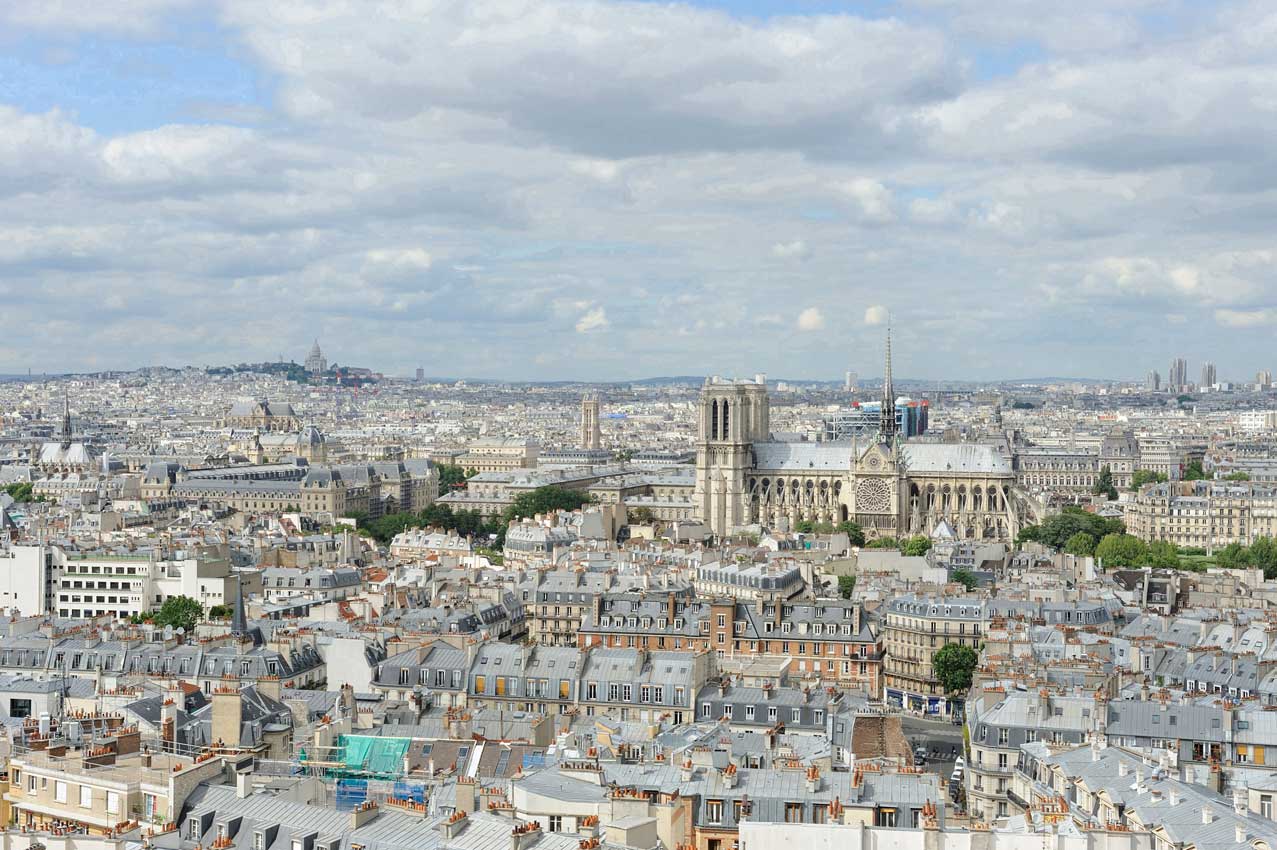


-mr-THEN")


WEB")


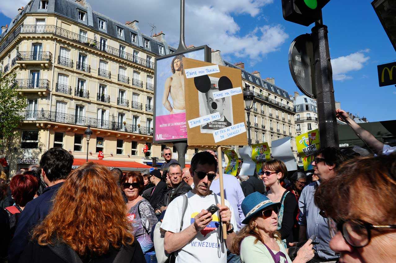


-Bridge-profile-when-newWEB")


WEB")


-Capitol-Hill-THEN-WEB")


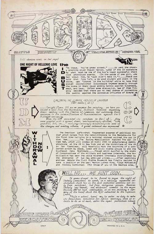